Embed Size (px)
Citation preview
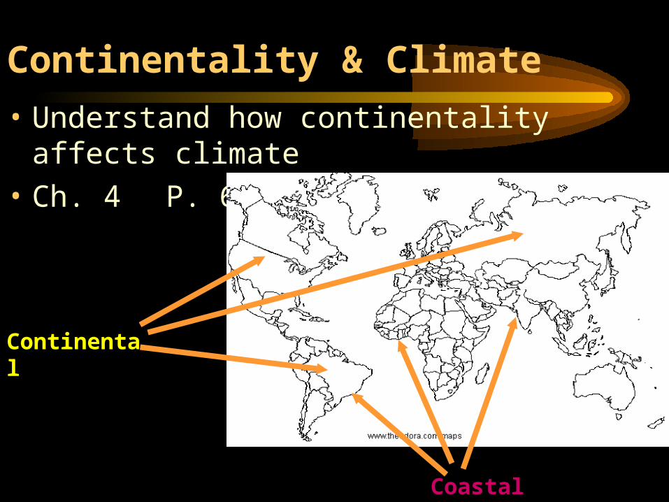
Continentality & Climate
• Understand how continentality affects climate
• Ch. 4P. 69-73
Continental
Coastal
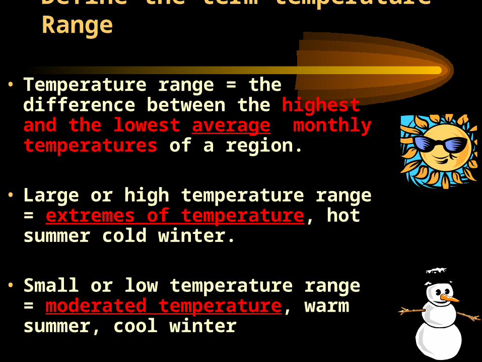
Define the term temperature Range
• Temperature range = the difference between the highest and the lowest average monthly temperatures of a region.
• Large or high temperature range = extremes of temperature, hot summer cold winter.
• Small or low temperature range = moderated temperature, warm summer, cool winter
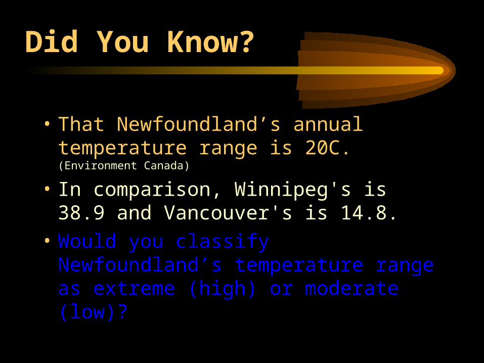
Did You Know?
• That Newfoundland’s annual temperature range is 20C. (Environment Canada)
• In comparison, Winnipeg's is 38.9 and Vancouver's is 14.8.
• Would you classify Newfoundland’s temperature range as extreme (high) or moderate (low)?
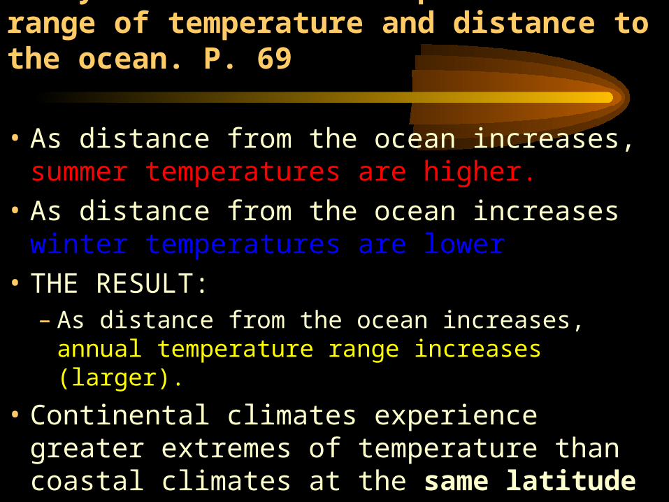
Analyze the relationship between range of temperature and distance to the ocean. P. 69
• As distance from the ocean increases, summer temperatures are higher.
• As distance from the ocean increases winter temperatures are lower
• THE RESULT:– As distance from the ocean increases, annual
temperature range increases (larger).
• Continental climates experience greater extremes of temperature than coastal climates at the same latitude
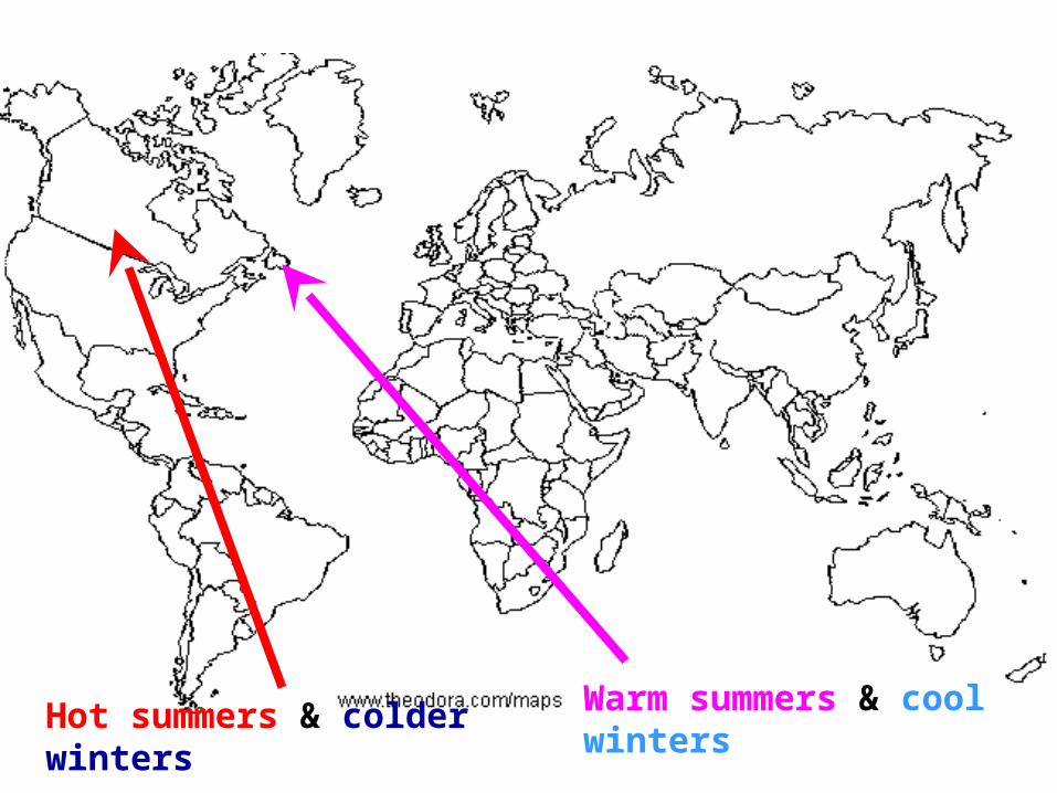
Hot summers & colder winters
Warm summers & cool winters
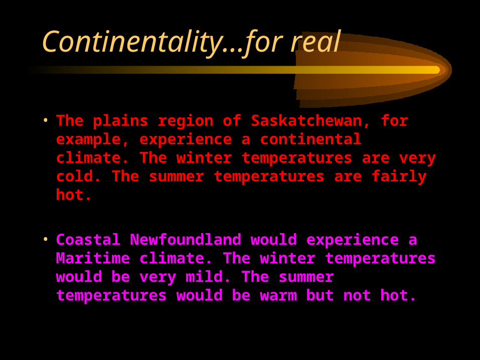
Continentality…for real
• The plains region of Saskatchewan, for example, experience a continental climate. The winter temperatures are very cold. The summer temperatures are fairly hot.
• Coastal Newfoundland would experience a Maritime climate. The winter temperatures would be very mild. The summer temperatures would be warm but not hot.
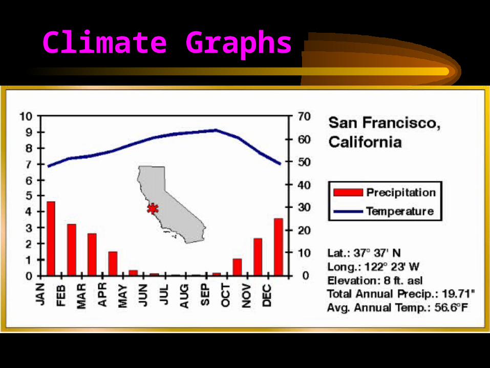
Climate Graphs
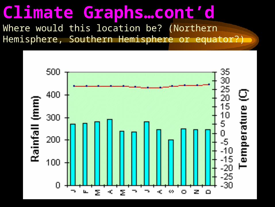
Climate Graphs…cont’dWhere would this location be? (Northern Hemisphere, Southern Hemisphere or equator?)
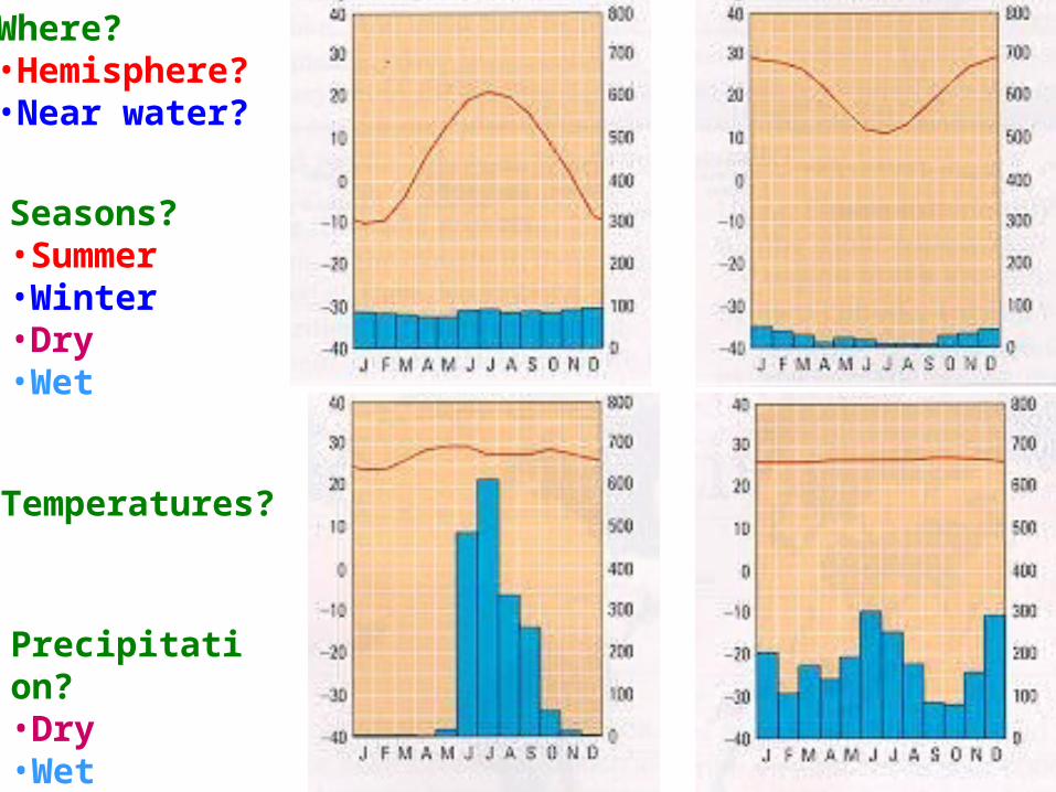
Where?•Hemisphere? •Near water?
Seasons?•Summer•Winter•Dry•Wet
Temperatures?
Precipitation?•Dry•Wet
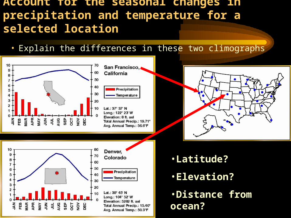
Account for the seasonal changes in precipitation and temperature for a selected location
• Explain the differences in these two climographs
•Latitude?
•Elevation?
•Distance from ocean?
•Type of rainfall?
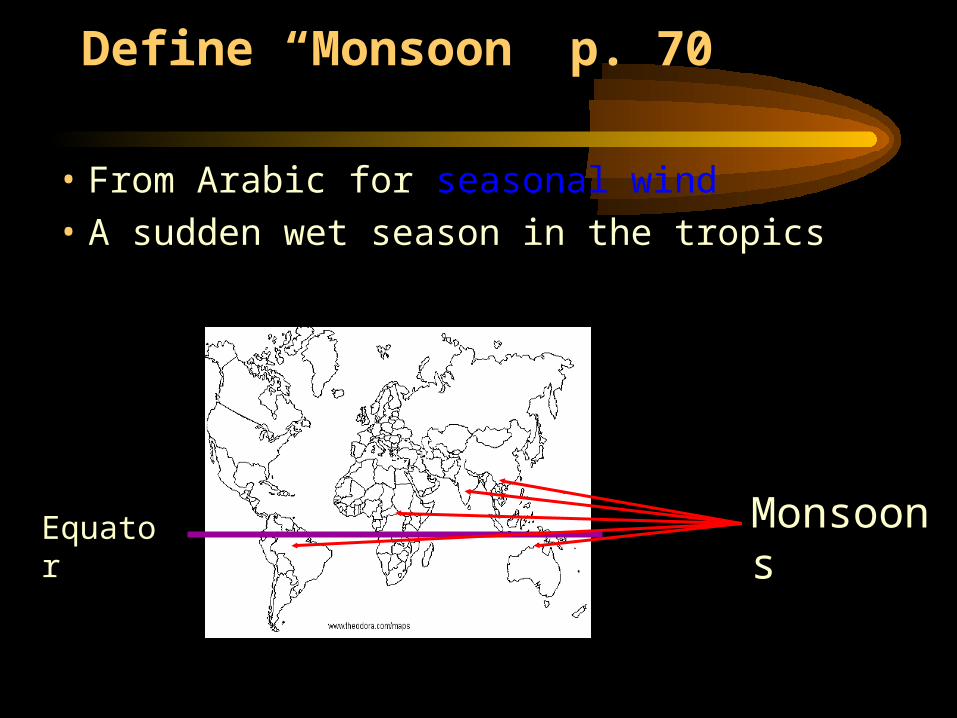
Define “Monsoon” p. 70
• From Arabic for seasonal wind
• A sudden wet season in the tropics
Equator Monsoons
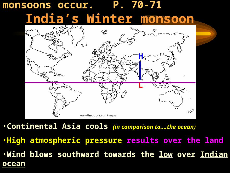
Know why winter and summer monsoons occur.
P. 70-71 India’s Winter monsoon
•Continental Asia cools (in comparison to….the ocean)
•High atmospheric pressure results over the land
•Wind blows southward towards the low over Indian ocean
•Very little rain; dry wind blowing from the land
L
H
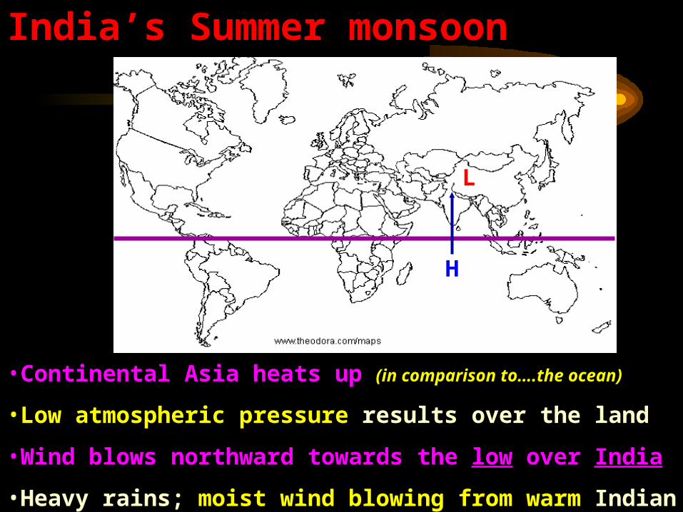
India’s Summer monsoon
L
H
•Continental Asia heats up (in comparison to….the ocean)
•Low atmospheric pressure results over the land
•Wind blows northward towards the low over India
•Heavy rains; moist wind blowing from warm Indian ocean
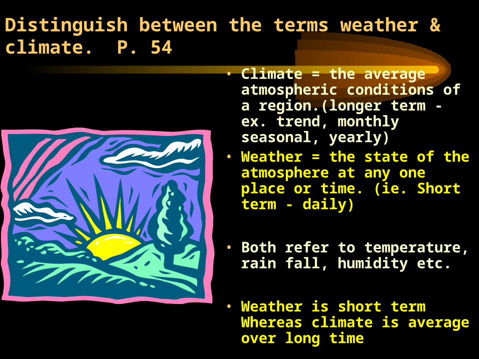
Distinguish between the terms weather & climate. P. 54
• Climate = the average atmospheric conditions of a region.(longer term - ex. trend, monthly seasonal, yearly)
• Weather = the state of the atmosphere at any one place or time. (ie. Short term - daily)
• Both refer to temperature, rain fall, humidity etc.
• Weather is short term Whereas climate is average over long time
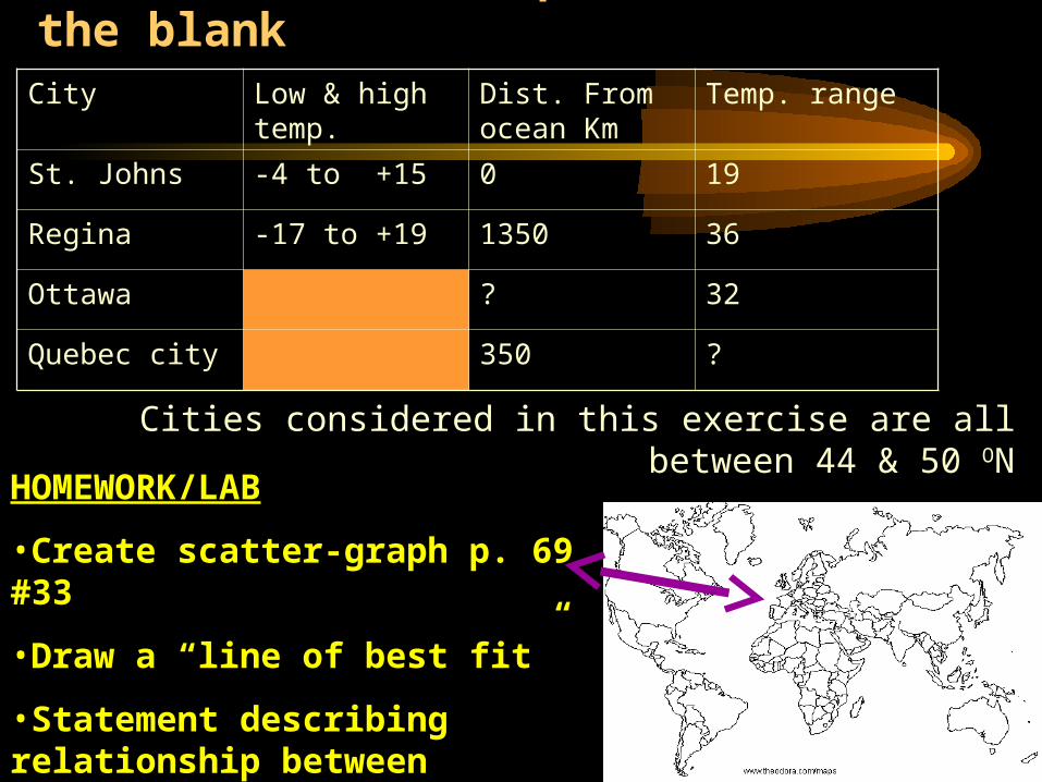
Practice See the pattern & fill in the blank City Low & high
temp.Dist. From ocean Km
Temp. range
St. Johns -4 to +15 0 19
Regina -17 to +19 1350 36
Ottawa ? 32
Quebec city 350 ?
Cities considered in this exercise are all between 44 & 50 ON
HOMEWORK/LAB
•Create scatter-graph p. 69 #33
•Draw a “line of best fit”
•Statement describing relationship between distance from the ocean and temperature range