Embed Size (px)
Citation preview
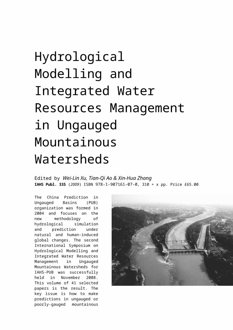
Hydrological Modelling and Integrated Water Resources Management in Ungauged Mountainous Watersheds Edited by Wei-Lin Xu, Tian-Qi Ao & Xin-Hua Zhang IAHS Publ. 335 (2009) ISBN 978-1-907161-07-0, 310 + x pp. Price £65.00
The China Prediction in Ungauged Basins (PUB) organization was formed in 2004 and focuses on the new methodology of hydrological simula-tion and prediction under natural and human-induced global changes. The second International Symposium on Hydrological Modelling and Integrated Water Resources Management in Ungauged Mountainous Watersheds for IAHS-PUB was successfully held in November 2008. This volume of 41 selected papers is the result. The key issue is how to make predictions in ungauged or poorly-gauged mountain-ous basins with a major reduction in predictive uncertainties.

Contents
Preface by Wei-lin Xu, Tian-qi Ao & Xin-hua Zhang v
1 Hydrological Modelling and Predictive Uncertainty
A study on calibration of the Nash model parameters in no-data or scarce-data regions Yingna Sun, Xiaofang Rui, Qiang Fu & Ning Jiang
3
An NDVI-based precipitation interpolation to improve hydrology simulation in the Upper Reaches of the Yangtze River Xuan Yu, Hao Wang, Denghua Yan, Yangwen Jia & Cunwen Niu
9
The Bayesian probabilistic flood forecasting model based on AM-MCMC and BP Zheng-xiang Xing, Xiao-fang Rui, Fang-gui Liu & Jie Feng
18
Impacts of climate change on water resources in the Weihe River basin Xiangyi Ding, Yangwen Jia, Yaqin Qiu, Zuhao Zhou, Cunwen Niu & Ge Gao
24
Improvement of the distributed hydrological AFFDEF model for runoff simulation Xianghu Li, Liliang Ren & Guizuo Wang
33
Predicting inflows to barrier lakes formed in the Wenchuan earthquake using the WEP model and TRMM-based rain data Yangwen Jia, Zhixuan Zhao, Denghua Yan, Hui Peng, Chunfeng Hao & Hui Gao
42
A modified generalized likelihood uncertainty estimation method by using Copula function Kairong Lin, Xiaohong Chen, Qiang Zhang & Zhihe Chen
51
Distributed hydrologic modelling in Huai River basin with a high density of dams and floodgates Yongyong Zhang, Jun Xia, Zhonggen Wang & Xuesong Zhang
57
Impacts of climate variation and land use change on river discharge in the upstream of the Miyun Reservoir Bing Gao & Dawen Yang
64
A comparative study of simulation results between IHMS-VSWSC and hybrid runoff model in Dianzi Watershed Liliang Ren, Guizuo Wang, Fang Lu & Tianfang Fang
72
A hybrid model based on set pair analysis and NNB for annual runoff prediction Juliang Jin, Wensheng Wang, Chengguo Wu & Yuliang Zhou
80
Analysing inter-annual variability of the water-energy balance in the upstream watershed of the Panjiakou Reservoir Xiangyu Xu & Dawen Yang
87
Hydrological modelling for the Zhangweinan River basin with intensive human activities Xitian Cai, Baolin Su & Zongxue Xu
97
Estimating parameter uncertainty in hydrological models using the bootstrap method Zhanling Li , Quanxi Shao, Zongxue Xu & Chong-Yu Xu
105
Analysis of the dominant climatic factors of evaporation change over the main basins in mainland China based on Budyko and Bouchet hypotheses Hanbo Yang, Dawen Yang, Zhentao Cong & Zhidong Lei
111
A unit hydrograph model with spatial variations of rainfall based on an artificial neural network Xiang Zhang, Jun Xia, Xi Chen, Wenhua Zhang & Liping Zhang
116
Real-time flood forecasting with the use of corresponding rising difference model Guanghua Qin, Shunjiu Wang & Ren Miu
122
Study on the effect of DEM spatial resolution and sampling algorithms on runoff simulation by BTOPMC Yu-An Wan, Fang Yin, Zhan-Zhou Liu, Wei-Cai Cui & Tian-Qi Ao
130
Evaluating the hydrological responses to climate change over a large basin with a hydrological–vegetation coupling model Xingguo Mo, Suxia Liu & Zhonghui Lin
137
Hydrological trends during the past 50 years in the Yangtze River basin Zhentao Cong, Jingjing Zhao, Zhenning Shang & Dawen Yang
143
2 Hydrological Processes based on the New Observation Techniques
Daily process retrieval model for sensible heat flux using geostationary satellite data Changsen Zhao, Changlei Sun, Yongping Dang, Guangfeng Li, Xuyong Li & Zhaoliang Li
151
GIS assisted flash flood risk zonation for small ungauged basins in Urumchi, western China Ping Xie, Guangcai Chen & De Li
157
Study of the energy and water cycle over the heterogeneous landscape of the northern Tibetan Plateau Yaoming Ma, Weiqiang Ma, Yongjie Wang,Lei Zhong, Maoshan Li & Hirohiko Ishikawa
168
Quantitative remote sensing of information indices for eco-water (layer): a case study at Maoergai area in the upper Minjiang River Wu-Nian Yang, Ji Jian, Yu-Xia Li, Li Peng, Xin-Nan Wan, Han-Hu Liu, Huai-Yong Shao, Xiao-Ai Dai, Tao Zeng & Xue-Ming Wu
177
3 Integrated Water Resources Management
Sediment simulation at Upper Sangamon River basin using the THREW model Dengfeng Liu, Fuqiang Tian & Heping Hu
187
Evolving characteristics of groundwater resources in the North-east Vast Plain of China Chang-Lei Dai, Bao-Ming Chi, Yong Ye & Zhi-Gang Wang
196
A type of the retrospective difference scheme for Richards equa-tion Xiangdong Chen, Jun Xia & Yonggang Ge
205
Flood resources utilization based on flood control forecast opera-tion Gaihong Zhang, KuI Zhang & Fan Zhao
213
The proportion of water usable distribution for sustainable devel-opment in Haihe River basins Yonghua Zhu, Liliang Ren, Jun Xia, Haishen Lü, Zhongbo Yu & Huali Feng
219
Watershed hydro-ecological zoning in the Upper Reaches of Yangtze River Chuan Liang & Yu-Bang Liu
224
Numerical experiment on water and soil losses for the applica-tion in ungauged basins Xin-Hua Zhang, Yu-Cheng Xiao, Rui-Ping Yan, Neng-Chuan Li & Xiao-Rong Huang
231
Rational allocation of water resources for the economy and eco-system in Ningxia Xiao-Rong Huang, Xin-Hua Zhang, Wen-Jiang Zhang & Tian-Qi Ao
238
4 Eco-environmental Protection
Water chemistry and nitrate pollution in the Liangtan River basin in the Three Gorges Area Xiangchao Liu, Changyuan Tang, Jun Xia, Xianfang Song & Yizhang Zhang
247
Field observation of total dissolved gas supersaturation down-stream of Ertan high dam Ran Li, Jia Li, Kefeng Li, Lu Qu & Jingjie Feng
254
Study on ecological treatment of sewage at Xinzhen River Hongbing Luo, Xiaoming Wu, Gu Huang, Xiaoxue Huang & Rui Xu
259
Water environmental capacity at watershed scale: a case study in the Yong River system Baolin Su, Chengwen Wang & Sheng-tong Cheng
266
The potential of a hydraulic method to estimate minimum ecolo-gical instream flow for data scarce basins Suxia Liu, Xingguo Mo, Zhonghui Lin & Lina Ji
276
Preliminary study on estuarine ecosystem health evaluation in Zhangweixin River Zhi-He Chen, Xiao-Hong Chen, Tao Peng & Kai-Rong Lin
282
Analysis of climate change impact on precipitation in Danji-angkou reservoir basin by using statistical downscaling method Hua Chen, Jing Guo, Sheng-Lian Guo, C-Y Xu & Vijay P. Singh
291
Impacts of industrial wastes on regional groundwater Xin-Hua Zhang, Rui-Ping Yan, Yu-Cheng Xiao, Neng-Chuan Li & Hua Wang
300
Key word index
Preface
In recent years, China has been increasingly exposed to water-related problems such as flood, drought, water shortage, water pollution and soil loss. These problems have already become a major constraint to China’s economic development and a big challenge for the protection of natural ecosystems and environments, especially in western China, centred on Sichuan, Yunnan and Guizhou provinces, where high mountains and plateaus are located and many rivers originate. Water resources and hydro-power in these regions are therefore very rich and many hydraulic projects have been developed. During the implementation of the National Strategies of China Western Development in recent years, and also under the pressure of the increasing population, water-related problems have become even worse due to complex natural changes and human activities in these mountainous watersheds, where ground observations are almost unavailable. In addition, China is now changing from traditional water resources development to water resources management for sustainable development. It is against such a background that hydrological modelling and integrated water resources management strongly call for new innovations in approaches, techniques and theories. The key issue is how to make predictions in ungauged or poorly-gauged mountainous basins with a major reduction in predictive uncertainties.
The China PUB organization was formed in 2004 and focuses on the new methodology of hydrological simulation and prediction under natural and human-induced global changes. To promote exchanges between China and IAHS, and with help from the international IAHS-PUB Scientific Steering Group (SSG), the China PUB National Steering Committee organized the first International Symposium on Flood Forecasting and Water Resources Assessment for IAHS-PUB in September 2006. The second International Symposium on Hydrological Modelling and Integrated Water Resources Management in Ungauged Mountainous Watersheds for IAHS-PUB was successfully held in November 2008. The Symposium organizers would like to express their heartfelt thanks to Prof. Pierre Hubert, the Secretary General of IAHS, Prof. Kuniyoshi Takeuchi (ICHARM, Japan), Prof. Jeffrey McDonnell (Oregon State University, USA), and Prof. E. Foufoula-Georgiou (University of Minnesota, USA) for their enthusiastic and valuable assistance.
We received a huge response to the second Symposium; more than 170 abstracts were submitted. After an initial review, we Selected papers from the event were published in 2008 in Hydrological Research in China (edited by D. Yang et al.). IAHS Publ. 322.
accepted 125 papers and invited the authors to attend the Symposium. After the Symposium and a further peer-review process, we accepted 101 papers in total, of which 41 papers are published in this IAHS volume and 60 papers were published in a special issue of the Journal of Sichuan University (Engineering Science Edition).
The editors gratefully acknowledge the assistance of the reviewers who made valuable contributions to this volume. We also thank Penny Perrins and Cate Gardner of IAHS Press for their professional approach and help with the processing of the manuscripts.
Wei-lin Xu, Tian-qi Ao & Xin-hua ZhangState Key Laboratory of Hydraulics & Mountain River Engineering
Sichuan University, Chengdu, China
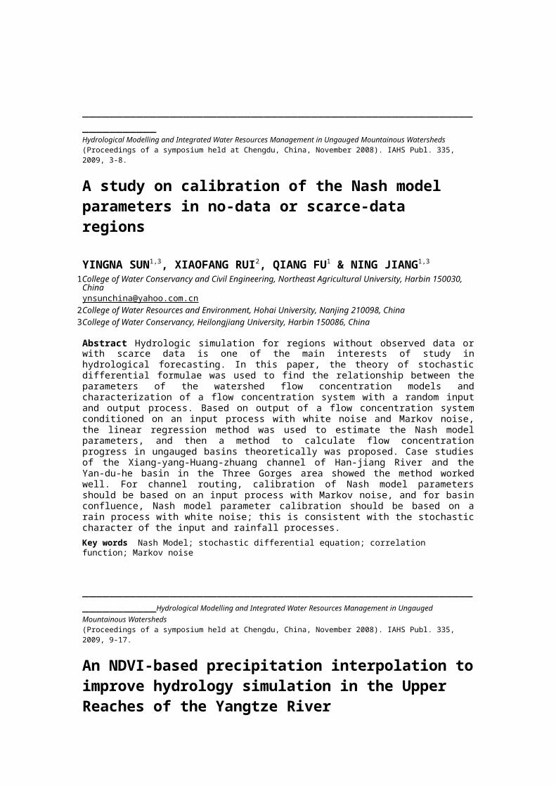
_____________________________________________________________________Hydrological Modelling and Integrated Water Resources Management in Ungauged Mountainous Watersheds (Proceedings of a symposium held at Chengdu, China, November 2008). IAHS Publ. 335, 2009, 3-8.
A study on calibration of the Nash model parameters in no-data or scarce-data regions
YINGNA SUN1,3, XIAOFANG RUI2, QIANG FU1 & NING JIANG1,3
1College of Water Conservancy and Civil Engineering, Northeast Agricultural University, Harbin 150030, [email protected]
2College of Water Resources and Environment, Hohai University, Nanjing 210098, China3College of Water Conservancy, Heilongjiang University, Harbin 150086, China
Abstract Hydrologic simulation for regions without observed data or with scarce data is one of the main interests of study in hydrological forecasting. In this paper, the theory of stochastic differential formulae was used to find the relationship between the parameters of the watershed flow concentration models and characterization of a flow concentration system with a random input and output process. Based on output of a flow concentration system conditioned on an input process with white noise and Markov noise, the linear regression method was used to estimate the Nash model parameters, and then a method to calculate flow concentration progress in ungauged basins theoretically was proposed. Case studies of the Xiang-yang-Huang-zhuang channel of Han-jiang River and the Yan-du-he basin in the Three Gorges area showed the method worked well. For channel routing, calibration of Nash model parameters should be based on an input process with Markov noise, and for basin confluence, Nash model parameter calibration should be based on a rain process with white noise; this is consistent with the stochastic character of the input and rainfall processes.Key words Nash Model; stochastic differential equation; correlation function; Markov noise
_____________________________________________________________________Hydrological Modelling and Integrated Water Resources Management in Ungauged Mountainous Watersheds (Proceedings of a symposium held at Chengdu, China, November 2008). IAHS Publ. 335, 2009, 9-17.
An NDVI-based precipitation interpolation to improve hydrology simulation in the Upper Reaches of the Yangtze River
XUAN YU1,2, HAO WANG1, DENGHUA YAN1, YANGWEN JIA1 & CUNWEN NIU1
1Department of Water Resources China Institution of Water Resources and Hydropower Research, Beijing 100038, China [email protected]
2Department of Civil and Environmental Engineering, Pennsylvania State University, University Park, Pennsylvania 16802, USA
Abstract Spatially interpolated rainfall estimates from raingauges are widely used as input to hydrological models, but there is no universally suitable interpolation method. In southwest China there are very few rain-gauges. Therefore, geographical information related to rainfall needs to be used in spatial interpolation methods. Among elevation, longitude, latitude, slope, and the normalized difference vegetation index (NDVI), NDVI is found to be the most optimum geographical information indicator for precipitation in the upper reaches of the Yangtze River in China, after carefully analysis. Accordingly, a gradient plus reverse distance squared method based on NDVI was developed and applied in the upper reaches of the Yangtze River from 1956 to 2000. The interpolation result was compared with the result of Countrywide Water Resources Planning. The difference was not too much and the result of the interpolation showed a reasonable precipitation distribution in the mountainous areas, which was greatly improved compared to the direct use of the inverse-distance weighted method (IDW). And then the interpolation result was input to the Water and Energy transfer Process (WEP) model to simulate the hydrological cycle of the basin. The simulation of the hydrological processes show that water quantity balance errors are less than 5% and the Nash-Sutcliffe efficiency coefficient is above 0.7, which prove that the interpolation method presented in this paper is credible.

Key words precipitation; spatial interpolation; NDVI
_____________________________________________________________________Hydrological Modelling and Integrated Water Resources Management in Ungauged Mountainous Watersheds (Proceedings of a symposium held at Chengdu, China, November 2008). IAHS Publ. 335, 2009, 18-23.
The Bayesian probabilistic flood forecasting model based on AM-MCMC and BP
ZHENG-XIANG XING1,2, XIAO-FANG RUI3, FANG-GUI LIU4 & JIE FENG3
1College of Water Conservancy and Civil Engineering, Northeast Agriculture University, Harbin 150030, [email protected]
2Center for Postdoctoral Studies in Agricultural Engineering, Northeast Agriculture University, Harbin 150030, China
3College of Hydrology and Water Resources, Hohai University, Nanjing 210098, China4College of Civil Engineering and Architecture, Guangxi University, Nanning 530004, China
Abstract Under the general theoretical framework of the Bayesian Forecasting System (BFS), models of the prior density and likelihood function based on the Back Propagation of error Artificial Neural Net (BP ANN) were built in the paper. The posterior density of flood discharge was obtained by the Markov Chain Monte Carlo simulation method based on the Adaptive Metropolis algorithm (AM-MCMC), and then probabilistic forecasting of flood discharge was made. A Genetic Algorithm (GA) was used to optimise the weights and bias of BP ANN and the initial samples in AM. The results of a case study show that the accuracy of BFS was higher than that of the Xin’anjiang model. Not only the mean of forecast discharge, but also the variance of forecast discharge was given by the BFS based on the AM-MCMC and BP ANN model. The variance of the predictand qualified the uncertainty of forecast, and the uncertainty of the predictand could be considered in the decision-making for prevention of floods.Key words BFS; adaptive metropolis algorithm; MCMC; BP; probabilistic forecasting
_____________________________________________________________________Hydrological Modelling and Integrated Water Resources Management in Ungauged Mountainous Watersheds (Proceedings of a symposium held at Chengdu, China, November 2008). IAHS Publ. 335, 2009, 24-32.
Impacts of climate change on water resources in the Weihe River basin
XIANGYI DING1, YANGWEN JIA1, YAQIN QIU1, ZUHAO ZHOU1, CUNWEN NIU1 & GE GAO2
1Department of Water Resources, China Institute of Water Resources and Hydropower Research, Beijing, China [email protected]
2National Climate Center, China Meteorological Administration (CMA), Beijing, China
Abstract The Weihe River is the largest tributary of the Yellow River (with an area of 135 000 km2), and both water resources shortage and flood problems exist in the basin. On the basis of analysing relevant domestic and international research on impacts of climate change on hydrology and water resources, this paper simulates the impacts of climate change in the next 30 years (2021–2050) in the Weihe River basin using the multi-model average dataset provided by National Climate Center (NCC) based on the World Climate Research Programme’s (WCRP’s) Coupled Model Intercomparison Project phase 3 (CMIP3) multi-model dataset under the A1B,A2 and B1 scenarios according to the Special Report on Emissions Scenarios (SRES) provided by the Intergovernmental Panel on Climate Change (IPCC) in 2000. Furthermore, after data scale conversion using the spatial interpolation method combining RDS (distance square inverse method) with the Theissen Polygon Method, by applying a distributed hydrological model – Water and Energy transfer Processes model in Large river basins (WEP-L), the change processes of hydrological components both under historical conditions in 1961–
1990 and under future scenarios in 2021–2050 in the Weihe River basin are simulated, and the impacts of climate change on water resources are analysed. The research results illustrate: (1) from the view of average annual variation, comparing with the historical average (1961–1990), although the precipitation in the next 30 years (2021–2050) will appreciably increase, due to the temperature increase, the evapotranspiration will generally increase to a larger extent than the precipitation, resulting in a decrease in runoff, and it is unlikely that floods exceeding the maximum historical scale will occur, while it is possible that extreme drought may occur; (2) from the view of average monthly variation, compared with the historical average (1961–1990), the evapotranspiration in every month will increase, the precipitation and runoff will appreciably decrease in flood seasons, while in the remaining seasons, although the precipitation will appreciably increase, the runoff will decrease.Key words climate change; CMIP3 data; WEP-L; spatial interpolation; water resources
_____________________________________________________________________Hydrological Modelling and Integrated Water Resources Management in Ungauged Mountainous Watersheds (Proceedings of a symposium held at Chengdu, China, November 2008). IAHS Publ. 335, 2009, 33-41.
Improvement of the distributed hydrological AFFDEF model for runoff simulation
XIANGHU LI1,2, LILIANG REN2 & GUIZUO WANG2
1 State Key Laboratory of Lake Science and Environment, Nanjing Institute of Geography and Limnology, Chinese Academy of Sciences, Nanjing 210008, [email protected]
2State Key Laboratory of Hydrology Water Resources and Hydraulic Engineering, Hohai University, Nanjing 210098, China
Abstract The distributed hydrological model AFFDEF represents physical processes with little detail, but still gives a spatial distributed representation of the watershed. In order to improve the model scheme more closely to the practical processes and integrate more remote sensing data, an exponential equation replaces the original linear function to divide surface and sub-surface flow, moreover, the leaf area index (LAI) based canopy interception model and the Shuttleworth-Wallace two source evapotranspiration model, are incorporated into the model structure. The improved model was tested in the Huangnizhuang watershed from 1 January 1982 to 31 December 1987. The results show that the Nash efficiency in calibration period was 0.75–0.845, the relative runoff depth error was –4.94 to 8.28% and the correlation coefficient was 0.872–0.925. In the validation period the Nash efficiency was 0.826 and 0.792, the relative runoff depth error was 4.13% and –6.92%, and the correlation coefficient was 0.913 and 0.903. The simulated stream flow hydrographs, except for flood peak periods, are in good agreement with the observed ones. Every evaluation criteria was better than their counterparts in the original model. In a word, the modification can be validated to be efficient for the improvement of the original model’s performances.Key words distributed hydrological model; LAI; soil storage capacity; two source evapotranspiration model°
_____________________________________________________________________Hydrological Modelling and Integrated Water Resources Management in Ungauged Mountainous Watersheds (Proceedings of a symposium held at Chengdu, China, November 2008). IAHS Publ. 335, 2009, 42-50.
Predicting inflows to barrier lakes formed in the Wenchuan earthquake using the WEP model and TRMM-based rain data
YANGWEN JIA1, ZHIXUAN ZHAO1,2, DENGHUA YAN1, HUI PENG1, CHUNFENG HAO1 & HUI GAO1

1Water Resources Department, China Institute of Water Resources & Hydropower Research (IWHR), Beijing 100038, [email protected] ; [email protected]
2Civil Engineering College, Tianjin University. Tianjin 300072, China
Abstract Inflow prediction to barrier lakes formed in earthquakes is important to flood disaster warning and prevention, but it is difficult because barrier lakes are usually in mountainous regions and lack gauge data. This study tries to predict inflows to the Tangjiashan barrier lake in the Upper Fujiang River of Mianyang municipality formed during the Wenchuan earthquake on 12 May 2008 by combining the WEP distributed hydrological Model and the TRMM-based precipitation estimates. At first, the DEM data with a scale of 1:250 000 are utilized to generate the digital river system in the study area (12032.25 km2), and related land cover, soil and historical hydro-meteorological data are collected. Then, five-year daily data of four meteorological stations (one inside and three neighbouring the study area) and four flow gauge stations are applied to validate the WEP model. Lastly, the TRMM three-hourly data from 1 January to 1 July is downloaded to run the model for the prediction of inflow to the barrier lake and lake storage. The application results show an acceptable accuracy, illustrating that the combination of distributed hydrological model and spatial observation and analysis technology are useful for flood disaster warning purposes in the poorly gauged basin.Key words barrier lake; inflow prediction; WEP model; TRMM; earthquake
_____________________________________________________________________Hydrological Modelling and Integrated Water Resources Management in Ungauged Mountainous Watersheds (Proceedings of a symposium held at Chengdu, China, November 2008). IAHS Publ. 335, 2009, 51-56.
A modified generalized likelihood uncertainty estimation method by using Copula function
KAIRONG LIN, XIAOHONG CHEN, QIANG ZHANG & ZHIHE CHENSchool of Geographical Science and Planning, Sun Yat-sen University, no. 135 Xingangxi Road, Guangzhou 510275, [email protected]
Abstract In this study, we propose a modified Generalized Likelihood Uncertainty Estimation method (GLUE) by using Copula function (CGLUE) with the aim of describing the correlation of parameters. Six scenarios are adopted by taking the sampling size as 10 000, 50 000, and 100 000, with threshold values of 0.5, 0.6, and 0.7. With these six scenarios, we compared the CGLUE and the GLUE methods in terms of strength and weakness of these two techniques in the evaluation of the parameter uncertainty in hydrological modelling results. The results show that, when compared to the GLUE method, the CGLUE method performs better in reflecting the correlation of the parameters by replacing the two one-variable probability distributions with a joint probability distribution. Therefore, the uncertainty of parameter within the hydrological model can be fully evaluated with more behavioral parameter sets.Key words Copula functions; Generalized Likelihood Uncertainty Estimation; hydrological model; uncertainty evaluation
_____________________________________________________________________Hydrological Modelling and Integrated Water Resources Management in Ungauged Mountainous Watersheds (Proceedings of a symposium held at Chengdu, China, November 2008). IAHS Publ. 335, 2009, 57-63.
Distributed hydrologic modelling in Huai River basin with a high density of dams and floodgates
YONGYONG ZHANG1, JUN XIA1,2, ZHONGGEN WANG1 & XUESONG
ZHANG3
1Key Laboratory of Water Cycle and Related land Surface Processes, CAS, Beijing, 100101, China z [email protected]
2State Key Laboratory of Water Resources and Hydropower Engineering Science, Wuhan University, Wuhan 430072, China
3Joint Global Change Research Institute, Pacific Northwest National Laboratory, College Park, Maryland 20740, USA
Abstract In Huai River basin, China, the construction of dams and floodgates has substantially changed the basin’s natural hydrological cycle. In this study, the dams and floodgates discharge simulation module of the Soil and Water Assessment Tool (SWAT) was extended to incorporate the dams and floodgates’ dispatch rules. This upgraded version of SWAT model was applied to simulate the monthly flow at 23 dams and floodgates and 4 hydrological stations for 1991–2000. The evaluation coefficients (i.e. relative volume error, correlation coefficient, and efficiency coefficient) are used to elevate the modelling performance. In the calibration period, the volume errors at 18 monitoring stations are within ±0.15. The average correlation coefficient and efficiency coefficient are 0.75 and 0.41, respectively. In the verification period, there are 13 stations with volume error within ±0.15. The average correlation coefficient and efficiency coefficient are 0.82 and 0.53, respectively. These results show that the modified model can be used as the hydrological modelling tool to provide technical support for the integrated management of Huai River basin.Key words water projects; hydrological simulation; SWAT; Huaihe River basin
_____________________________________________________________________Hydrological Modelling and Integrated Water Resources Management in Ungauged Mountainous Watersheds (Proceedings of a symposium held at Chengdu, China, November 2008). IAHS Publ. 335, 2009, 64-71.
Impacts of climate variation and land-use change on river discharge in the upstream of the Miyun Reservoir
BING GAO & DAWEN YANG State Key Laboratory of Hydro-Science and Engineering & Department of Hydraulic Engineering, Tsinghua University, Beijing 100084, [email protected]
Abstract Both climate variation and change in land-use and cover caused by human activities influence river discharge. It is necessary to distinguish the impacts of climate variation and land-use and cover change in the analysis of the variation of river discharge and water resources. The study area is the upstream of the Miyun Reservoir, which consists of the Chao and the Bai rivers, in northern China. In the present study, a distributed hydrological model, GBHM, is used to simulate the natural runoff without artificial water control and intake. Corresponding to different land-use types in two different periods, the 1980s and 1990s, land surface parameters are used in the model for characterizing land-use and cover changes. We use the fixing-changing method to run the model, firstly the climate variation factor is fixed, and the land-use is changed; then the land-use factor is fixed and the climate is changed. The results of model simulation show the quantitative effects of climate variation and land-use change on river discharge. It is found that without climate variation the land-use/cover change reduces the river discharge in the Chao River, but in the Bai River basin the impact of land-use change is the opposite. The spatial distribution of the evaporation is highly influenced by land-use/cover change, and the climate variation contributes the majority of the river flow change from the 1980s to the 1990s.Key words river discharge; impact of land-use and cover change; distributed hydrological model; the Miyun Reservoir
_____________________________________________________________________Hydrological Modelling and Integrated Water Resources Management in Ungauged Mountainous Watersheds (Proceedings of a symposium held at Chengdu, China, November 2008). IAHS Publ. 335, 2009, 72-79.
A comparative study of simulation results between IHMS-VSWSC and hybrid runoff model in Dianzi Watershed
LILIANG REN1,GUIZUO WANG1, FANG LU2 & TIANFANG FANG3
1 State Key Laboratory of Hydrology-Water Resources and Hydraulic Engineering, Hohai University, Nanjing 210098, China [email protected]
2 YRCC Shandong Bureau, Shandong Province, China3 Department of Geography, Texas State University, San Marcos, Texas 78666, USA
Abstract For the purpose of hydrological process simulation in arid and semi-arid areas, the authors developed the Integrated Hydrological Modelling System based on Various Spatial Water Storage Capacity (IHMS-VSWSC), based on the spatial distributed model of water storage capacity. IHMS-VSWSC included a canopy interception module, snow accumulation and melt module, evapotranspiration module and runoff generation and routing module. To verify the simulation result of IHMS-VSWSC, both IHMS-VSWSC and a hybrid runoff model were applied to the Dianzi watershed to simulate the daily runoff process in the period 1973–1979. After simulations, the authors found that the annual average Nash-Sutcliffe coefficient of IHMS-VSWSC reached 0.80; and the annual average Nash-Sutcliffe coefficient of the hybrid runoff model was only 0.67. Simulated results indicate that the annual Nash-Sutcliffe coefficient is acceptable, and this integrated hydrological modelling system is reasonable for arid and semi-arid area daily runoff simulation.Key words IHMS-VSWSC; hybrid runoff model; various spatial water storage capacity; Dianzi watershed
_____________________________________________________________________Hydrological Modelling and Integrated Water Resources Management in Ungauged Mountainous Watersheds (Proceedings of a symposium held at Chengdu, China, November 2008). IAHS Publ. 335, 2009, 80-86.
A hybrid model based on set pair analysis and NNB for annual runoff prediction
JULIANG JIN1,2, WENSHENG WANG3, CHENGGUO WU4 & YULIANG ZHOU2
1Chengdu Institute of Plateau Meteorology, CMA, Chengdu 610072, [email protected]
2School of Civil Engineering, Hefei University of Technology, Hefei 230009, China3 School of Hydraulic Engineering, Sichuan University, Chengdu 610065, China4 Key Lab of Northwest Water Resources and Environment Ecology of MOE, Xi’an University of Technology,
Xi’an 710048, China
Abstract As an important part of watershed water security management, prediction of watershed annual runoff can be used to offer a scientific basis of reasonably developing and utilizing watershed water resources and preferably programming of the sustainable development of watershed society and economy. In order to deal with a weak dependence of the watershed annual runoff process and the complex relationship between annual runoff process and its influencing factors, and to avoid the uncertainty problems during the process of selecting and resolving explicit mathematics functions with parametric statistics prediction methods: (1) autocorrelation technology can be used to determine the characteristic vectors of the nearest neighbour bootstrap method (NNB); (2) set pair analysis (SPA) method can be used to quantitatively compute the comparability between the present and historical annual runoff characteristic vectors from the view of identicalness, discrepancy and contrast; (3) the weighted average of the subsequent annual runoff of the nearest neighbour characteristic vectors can be regarded as the predicted value of the present annual runoff; and (4) the hybrid model of SPA-NNB based on set pair analysis and nearest neighbour bootstrap was suggested. The application results of
SPA-NNB show that the physical concepts of SPA-NNB are distinct, its computation method is visual, its prediction precision is high, the scheme of modelling SPA-NNB is simple, effective and ideal, so SPA-NNB can be applied to different prediction of hydrological time series with plenty of representative historical samples.Key words annual runoff; nearest neighbour bootstrap method; set pair analysis; similarity prediction; SPA-NNB hybrid model
_____________________________________________________________________Hydrological Modelling and Integrated Water Resources Management in Ungauged Mountainous Watersheds (Proceedings of a symposium held at Chengdu, China, November 2008). IAHS Publ. 335, 2009, 87-96.
Analysing inter-annual variability of the water-energy balance in the upstream watershed of the Panjiakou Reservoir
XIANGYU XU & DAWEN YANGState Key Laboratory of Hydro-Science and Engineering & Department of Hydraulic Engineering, Tsinghua University, Beijing 100084, [email protected]
Abstract The Panjiakou Reservoir is the largest reservoir on the Luan River, which is a major surface water source, but reservoir inflow has decreased significantly in recent decades. The physical aspect of the hydrological cycle in the upstream of the reservoir is studied to understand the hydrological changes and provide a sound scientific basis of water resources management. In the present research, a distributed hydrological model (i.e. GBHM) and a simple water-energy balance model based on the Budyko hypothesis were used. Using the climate and discharge data of 1980–1991, the present study analyses the inter-annual variability of water balance. The daily discharges at different locations are simulated by the GBHM model, and the actual evapotranspiration is estimated using both the GBHM and water-energy balance model. Comparing the results, both models give similar results that show the same complementary relationship between actual and potential evapotranspiration on an annual time scale. Key words water-energy balance; distributed hydrological model; Budyko hypothesis; the Panjiakou Reservoir
_____________________________________________________________________Hydrological Modelling and Integrated Water Resources Management in Ungauged Mountainous Watersheds (Proceedings of a symposium held at Chengdu, China, November 2008). IAHS Publ. 335, 2009, 97-104.
Hydrological modelling for the Zhangweinan River basin with intensive human activities
XITIAN CAI, BAOLIN SU & ZONGXUE XUKey Laboratory of Water and Sediment Sciences, Ministry of Education, College of Water Sciences, Beijing Normal University, Beijing 100875, [email protected]
Abstract One of the basins with most intensive human activities in China and even in the world, the Zhangweinan River basin was selected as the study area to apply SWAT2000 for hydrological modelling. Measured releases from six main reservoirs, actual irrigation schedules in different sub-basins, and major water uses withdrawn from rivers and groundwater were collected and investigated. Simulated ET was calibrated by using RS-based ET at a regional scale, and simulated monthly runoff was calibrated and validated. Results indicate that hydrological modelling in such a complex river basin is possible, with R2 and ENS (Nash–Sutcliffe efficiency coefficient) of around 0.75 for the calibration

period, and around 0.65 for the validation period in monthly simulations, and RS-based ET is helpful for calibrating the simulated ET and for runoff simulation. Data collection is most important, and a good understanding on basin characteristics, human activities and model structure are strongly required.Key words hydrological model; SWAT; Zhangweinan River; human activity; water use
_____________________________________________________________________Hydrological Modelling and Integrated Water Resources Management in Ungauged Mountainous Watersheds (Proceedings of a symposium held at Chengdu, China, November 2008). IAHS Publ. 335, 2009, 105-110.
Estimating parameter uncertainty in hydrological models using the bootstrap method
ZHANLING LI1,2, QUANXI SHAO2, ZONGXUE XU1 & CHONG-YU XU3
1Key Laboratory of Water and Sediment Sciences, Ministry of Education, College of Water Sciences, Beijing Normal University, Beijing 100875, [email protected]
2CSIRO Mathematical and Information Sciences, Private Bag 5, Wembley, Western Australia 6913, Australia3Department of Geosciences, University of Oslo, PO Box 1022 Blindern, N-0315 Oslo, Norway
Abstract Uncertainty issues in hydrological modelling have been given much attention due to their great impact on model prediction. This study mainly investigates parameter uncertainty in two hydrological models. One is the conceptual WASMOD model with five parameters, and the other is the semi-distributed SWAT model in which nine sensitive parameters are identified for model calibration. A non-parametric technique, the bootstrap method, is employed for the assessment of parameter uncertainty in two models. The upper reaches of the Heihe River basin is chosen as the study area. Results show that, comparatively, the normality assumption is basically satisfied for parameters in the simple WASMOD model, although they are still a little skewed, while in the more complex SWAT model the normality assumption is violated in most cases (six out of nine parameters are proved not to be normally distributed). A 95% confidence interval for each parameter is obtained for the purpose of quantifying its uncertainty. These results cannot be popularized directly to other cases since the ranges of model parameters might change as scale or resolution changes and may still be dependent on model implementation and boundary conditions.Key words parameter uncertainty; WASMOD; SWAT; Heihe River; bootstrap
_____________________________________________________________________Hydrological Modelling and Integrated Water Resources Management in Ungauged Mountainous Watersheds (Proceedings of a symposium held at Chengdu, China, November 2008). IAHS Publ. 335, 2009, 111-115.
Analysis of the dominant climatic factors of evaporation change over the main basins in mainland China based on Budyko and Bouchet hypotheses
HANBO YANG, DAWEN YANG, ZHENTAO CONG & ZHIDONG LEIState key Laboratory of Hydro-Science and Engineering & Department of Hydraulic Engineering, Tsinghua University, Beijing 100084, [email protected]
Abstract Actual evaporation (E) has different change trends over various regions. It is important to understand why actual evaporation changes and what the dominant climatic factors are. Based on the
Budyko and Bouchet hypotheses, we established a water-energy coupled balance model that can quantify the effects of radiation, precipitation and temperature on regional actual evaporation. Furthermore, the analysis, according to this model and meteorological data from about 700 stations across mainland China during 1961–2005, revealed the regional change of actual evaporation and its dominant climatic factors. The results show that temperature is the key factor in the Song-Liao River basin; while precipitation is the major factor in the Northwest River basin, the Hai River basin, the Yellow River basin, and the Southwest Rivers basin. In addition, net radiation controls E in the Huai River basin, the Yangtze River basin, the Southeast Rivers basin, the Pearl River basin, and Hainan province. Key words climate change; evaporation; dominant factors; Budyko hypothesis; Bouchet hypothesis
_____________________________________________________________________Hydrological Modelling and Integrated Water Resources Management in Ungauged Mountainous Watersheds (Proceedings of a symposium held at Chengdu, China, November 2008). IAHS Publ. 335, 2009, 116-121.
A unit hydrograph model with spatial variations of rainfall based on an artificial neural network
XIANG ZHANG1,3, JUN XIA2, XI CHEN3, WENHUA ZHANG1 & LIPING ZHANG1
1State key Laboratory of Water Resources and Hydropower Engineering Science, Wuhan University, Wuhan 430072, [email protected]
2Key Laboratory of Water Cycle and Related land Surface Processes, IGSNRR, CAS, Beijing 100101, China3State key Laboratory of Hydrology-Water Resources and Hydraulic Engineering, Hohai University, Nanjing
210098, China
Abstract Impacts of watershed morphologic and topographic structures, and spatial-temporal variations of rainfall on the unit hydrograph (UH) have been a key issue for investigation of watershed flow routing. In this paper we developed a new method to derive UH by considering the spatial-temporal variations of rainfall. The new method is based on the S-curve approach from a cumulative curve of UH. A nonlinear function with two parameters was used to fit the S-curve. These two parameters were found to be related to the barycentre of storm and the intensity of rainfall in the basin which describe the spatial-temporal variations of rainfall. The nonlinear relationship between two parameters of the S-curve function and the barycentre of storm and the intensity of rainfall is established by using an artificial neural network (ANN). Therefore, the unit hydrograph derived from the new method integrates with changing positions of storm barycentre and intensity of rainfall, and thus has characteristics of the Sherman unit hydrograph and a function of the description of the temporal-spatial variations of rainfall. This method is successfully applied in the Juhe catchment of the Yangtze basin, China. The simulation results show that this method is effective in watershed flow routing.Key words unit hydrograph; S-curve; Barycentre of storm; artificial neural network
_____________________________________________________________________Hydrological Modelling and Integrated Water Resources Management in Ungauged Mountainous Watersheds (Proceedings of a symposium held at Chengdu, China, November 2008). IAHS Publ. 335, 2009, 122-129.
Real-time flood forecasting with the use of corresponding rising difference model
GUANGHUA QIN1, SHUNJIU WANG2 & REN MIU1
1State Key Laboratory of Hydraulics and Mountain River Engineering,
School of hydraulic Engineering of Sichuan University, Chengdu 610065, [email protected]
2 Institute of Plateau Meteorology, China Meteorological Administration, Chengdu 610071, China
Abstract According to the Saint-Venant continuity equation, this paper presents a corresponding rising difference (CRD) model for river flow and water level prediction. The proposed model has only one parameter, which is estimated by the recursive least square method with a variable factor, compared to several parameters in other models. Two case studies from the middle reach of the Yangtse River are prepared and compared with the auto-regressive (AR) model. Based on the results, this paper suggests a better alternative for predicting river flow and water level.Key words corresponding rising difference model; flood forecasting; recursive least square
_____________________________________________________________________Hydrological Modelling and Integrated Water Resources Management in Ungauged Mountainous Watersheds (Proceedings of a symposium held at Chengdu, China, November 2008). IAHS Publ. 335, 2009, 130-136.
Study on the effect of DEM spatial resolution and sampling algorithms on runoff simulation by BTOPMC
YU-AN WAN1,3, FANG YIN1, ZHAN-ZHOU LIU1, WEI-CAI CUI1
& TIAN-QI AO1,2
1College of Water Resources and Hydropower, Sichuan University, Chengdu 610065, China2State Key Lab of Hydraulic and Mountain River Engineering, Sichuan University, Chengdu 610065, China
[email protected] Survey and Design Institute of Water Resources and Hydropower Co., Ltd, Jiangmen, Guangdong
529000, China
Abstract The DEM spatial resolution and sampling algorithms have a great effect on the parameters of watershed characteristics, which perhaps can result in uncertainty in hydrological modelling. In this paper, ZB algorithms, grid-minimum algorithms and grid-average algorithms are first used to obtain four different spatial resolutions DEM of Fuji-kawa basin in Japan from SRTM, and then a physically-based distributed hydrological model BTOPMC (block-wise use of TOPMODEL with Muskingum-Cunge method) is used to simulate a flood event using these data. The results show that DEM spatial resolution has a great effect on the grid-minimum algorithm and ZB algorithm. Compared to the other two algorithms, the grid-average algorithm can achieve better simulated results.Key words DEM spatial resolution; sampling algorithms; Fuji-kawa basin; BTOPMC
_____________________________________________________________________Hydrological Modelling and Integrated Water Resources Management in Ungauged Mountainous Watersheds (Proceedings of a symposium held at Chengdu, China, November 2008). IAHS Publ. 335, 2009, 137-142.
Evaluating the hydrological responses to climate change over a large basin with a hydrological–vegetation coupling model
XINGGUO MO, SUXIA LIU & ZHONGHUI LINKey Laboratory of Water Cycle & Related Land Surface Processes, Institute of Geographical Sciences and Natural Resources Research, Chinese Academy of Sciences, Beijing 100101, Chinamoxg @igsnrr.ac.cn
Abstract A physically-based distributed hydrological–vegetation coupling model, VIP, is developed to predict the responses, i.e. the relative changes, of hydrological processes to climate change in the Wuding River basin, one of the largest tributaries to the middle Yellow River, located in the Loess Plateau. It is found that the discharge is sensitive to climate change scenarios, and the response amplitudes are quite different at sub-basins. The response of discharge ranges from 11% to 25% under the scenarios of 10% precipitation variations and 1°C temperature increment, showing that precipitation amplifies stream runoff change, but the warming mitigates the responses of runoff. Regressive analysis shows that better correlation exists between the responses of runoff and the annual runoff (basin area), with the Pearson coefficient (r) being from 0.35 to 0.61, than the correlation between the response of runoff and annual precipitation with r being from 0.29 to 0.43. It is illustrated that considering precipitation processes other than just the annual precipitation, and running the ecohydrological model at as small as a daily scale and coupling with vegetation dynamics, are crucial in exploring the responses of hydrological processes to climate change. Key words distributed ecohydrological model; streamflow; evapotranspiration; climate change; Loess Plateau
_____________________________________________________________________Hydrological Modelling and Integrated Water Resources Management in Ungauged Mountainous Watersheds (Proceedings of a symposium held at Chengdu, China, November 2008). IAHS Publ. 335, 2009, 143-148.
Hydrological trends during the past 50 years in the Yangtze River basin
ZHENTAO CONG, JINGJING ZHAO, ZHENNING SHANG & DAWEN YANGState Key Laboratory of Hydroscience and Engineering, Department of Hydraulic Engineering, Tsinghua University, Beijing 100084, [email protected]
Abstract The hydrological cycle has been highly influenced by climate changes and human activities, and it is significant to analyse the hydrological trends that occurred in past decades in order to understand past changes and predict future trends. Water resources in the Yangtze River basin have been paid more attention, especially for the Three Gorges Dam and the South-to-North water diversion project. Based on the climate data from 180 stations in the Yangtze River basin, it was found that pan evaporation showed a decreasing trend as a whole during the past 50 years with the increasing in air temperature, indicating that the evaporation paradox existed in this basin. At the same time, actual evaporation estimated by water balance decreased with increasing precipitation. Based on the Budyko curve, it can be concluded that the decrease in actual evaporation was caused by the decrease in energy.Key words hydrological trend; Yangtze River; evaporation paradox; evaporation
_____________________________________________________________________Hydrological Modelling and Integrated Water Resources Management in Ungauged Mountainous Watersheds (Proceedings of a symposium held at Chengdu, China, November 2008). IAHS Publ. 335, 2009, 151-156.
Daily process retrieval model for sensible heat flux using geostationary satellite data
CHANGSEN ZHAO1,2,3, CHANGLEI SUN4, YONGPING DANG5, GUANGFENG LI6, XUYONG LI7 & ZHAOLIANG LI3
1Shandong University, Jinan, Shandong Province, 250013, [email protected]
2Department of Water Resources and Environment, Sun Yat-sen University, Guangzhou 510275, China3 Institute of Geographical Sciences and Natural Resources Research, CAS, Beijing 100101, China4Shandong Design Institute of Water Resources, Jinan, Shandong Province, 250013, China
5 Shandong Survey Bureau of Hydrology and Water Resources, Jinan, Shandong Province, 250013, China6 Dezhou Survey Bureau of Hydrology and Water Resources, Dezhou, Shandong Province, 253000, China7Yanggu Water Authority, Yanggu, Shandong Province, 252300, China
Abstract Sensible heat flux is an important element in regional evapotranspiration estimation, which is of significant importance to the agriculture, hydrological cycle and regional climate, which greatly influence people’s daily life. This paper presents a diurnal model to compute daily sensible heat flux processes on the basis of Fourier analysis of the daily surface temperature process. Its main advantages are in requiring no in situ ground meteorological data and having few unknowns to be calibrated. Calibration and validation of the model was conducted in a Spanish site of FLUXNET with data from the European geostationary satellite – Meteosat the Second Generation (MSG). Results show there is a higher correlation (R2 = 0.97) and a better agreement (Nash-Sutcliffe efficiency coefficient = 0.97) between simulated and ground-measured sensible heat flux. Additionally, it has a root mean square error of 17.91 W m-2 in predicting sensible heat flux (H). After having obtained H, the energy balance equation can be employed to compute evapotranspiration. Key words sensible heat flux; diurnal model; MSG; Fourier analysis
_____________________________________________________________________Hydrological Modelling and Integrated Water Resources Management in Ungauged Mountainous Watersheds (Proceedings of a symposium held at Chengdu, China, November 2008). IAHS Publ. 335, 2009, 157-167.
GIS assisted flash flood risk zonation for small ungauged basins in Urumchi, western China
PING XIE1, GUANGCAI CHEN2 & DE LI3
1 State Key Laboratory of Water Resources and Hydropower Engineering Science, Wuhan University, Wuhan, Hubei Province 430072, [email protected]
2 Water Resources Department of Changjiang River Scientific Research Institute, Wuhan 430010, China3 Department of Hydropower and Hydrology planning, Guangxi Electric Power industry Investigation Design and
Research Institute, Nanning 530023, China
Abstract Flash floods create hazardous situations for people and extensive damage to property. It is critical to warn of flash flood conditions in a timely manner to minimize impacts, especially in arid ungauged areas like Urumchi. Of a total of 18 small basins, there are only six gauged with more than 30 years of hydrological data. In this paper, flash flood risk zonation was studied for flash flood risk warning and control. The critical rainfall method was used to make flash flood warnings. In order to carry out flash flood zoning, the modified rational formula method was adopted to calculate the design flash flood of ungauged basins first. The Genetic Algorithm approach was used to search for the parameters (n1, n2, u, m) in gauged basins. The geostatistical analysis module in ArcGIS was used to map storm parameters n1/n2. Regression analysis was used to obtain the empirical relationship between u and θ, and that between m and θ. Finally, in ungauged basins, by using the map to confirm n1/n2, and by using the empirical formula to get m and u, the design flash flood can be calculated with the rational formula. With the Manning formula and GIS, the risk map can be prepared. The predicted 24-h critical rainfall in Urumchi varies in the range 13–25 mm. The empirical relationship between u and θ and that between m and θ are: m = 0.1486lnθ + 0.4952; u = –23.3425ln(lnθ) + 43.7455.Key words Urumchi; flash flood; critical rainfall; rational formula method; GIS
_____________________________________________________________________Hydrological Modelling and Integrated Water Resources Management in Ungauged Mountainous Watersheds (Proceedings of a symposium held at Chengdu, China, November 2008). IAHS Publ. 335, 2009, 168-176.
Study of the energy and water cycle over the heterogeneous landscape of the northern
Tibetan Plateau
YAOMING MA1, WEIQIANG MA2, YONGJIE WANG1, LEI ZHONG1, MAOSHAN LI2 & HIROHIKO ISHIKAWA3
1 Key Laboratory of Tibetan Environment Changes and Land Surface Processes, Institute of Tibetan Plateau Research, Chinese Academy of Sciences, Beijing 100085, China [email protected]
2 Cold and Arid Regions Environmental and Engineering Research Institute, Chinese Academy of Sciences, Lanzhou 730000, China
3 Disaster Prevention Research Institute, Kyoto University, Kyoto 611-0011, Japan
Abstract The exchange of heat between the land surface and atmosphere over the Tibetan Plateau area plays an important role in the Asian monsoon system, which in turn is a major component of both the energy and water cycles of the global climate system. Its study is also regarded as the main task in the CEOP (Coordinated Enhanced Observing Period) Asia-Australia Monsoon Project (CAMP) on the Tibetan Plateau (CAMP/Tibet, 2001–2005). Firstly, the field experiments of the CAMP/Tibet are introduced and some results on the local energy partitioning (the diurnal variations and inter-monthly variations of radiation energy budget, land surface energy budget and land surface heating field) are presented in this study. The study of the regional distribution of land surface heat fluxes is of paramount importance over the heterogeneous landscape of the Tibetan Plateau and is also one of the main scientific objectives of the CAMP/Tibet. Therefore, the regional distributions and their inter-monthly variations of surface heat fluxes (net radiation flux, soil heat flux, sensible heat flux and latent heat flux) are also presented here by combining five Landsat-7 ETM images and one NOAA/AVHRR image with the field observations. The derived results were validated by using the “ground truth”, and it shows that the regional distributions and their inter-monthly variations of land surface heat fluxes derived using the method in this study are reasonable. Further improvement of the method and its field of application are also discussed.Key words observation platform; satellite data; land surface heat fluxes; heterogeneous landscape; northern Tibetan Plateau
_____________________________________________________________________Hydrological Modelling and Integrated Water Resources Management in Ungauged Mountainous Watersheds (Proceedings of a symposium held at Chengdu, China, November 2008). IAHS Publ. 335, 2009, 177-184.
Quantitative remote sensing of information indices for eco-water (layer): a case study at Maoergai area in the upper Minjiang River
WU-NIAN YANG, JI JIAN, YU-XIA LI, LI PENG, XIN-NAN WAN, HAN-HU LIU, HUAI-YONG SHAO, XIAO-AI DAI, TAO ZENG & XUE-MING WUState Key Laboratory of Geo-hazard Prevention and Geo-environment Protection /Key Lab of Earth Exploration & Information Techniques of Ministry of Education/ Institute of RS & GIS, Chengdu University of Technology, Chengdu, Sichuan, 610059, [email protected]
Abstract Eco-water is defined as the water body closely related to the ground vegetation, including water conserved in the vegetation layer, the vegetation humus layer and the root soil layer. It is capable of precipitation interception and rivers or groundwater supplementation. This paper applies quantitative remote sensing method to experiments performed in the Maoergai area in the upper Minjiang River in China to examine properties, functions, spatial distribution patterns and transformation rules of the eco-water (layer). Based on the features of the eco-water and their reflection in the remotely sensed data, the information indices for the eco-water (layer) were identified, including the Modulus of Eco-water Conservation (MEC), the Modulus of Eco-water Runoff (MER), the Vegetation Moisture Content
(VMC), the Soil Moisture Saturation (SMS) and the Soil Moisture Content (SMC). Limited by time, cost and available data, this paper mainly presents the methods for remote sensing information extraction, inversion model construction and quantitative estimation for the eco-water (layer). The consistency between the inverted resource quantity of the eco-water layer and the measured data suggest a valid vegetation-centred quantitative approach to study the eco-water (layer). Key words eco-water (layer); SMC; SMS; VMC; MEC; quantitative remote sensing
_____________________________________________________________________Hydrological Modelling and Integrated Water Resources Management in Ungauged Mountainous Watersheds (Proceedings of a symposium held at Chengdu, China, November 2008). IAHS Publ. 335, 2009, 187-195.
Sediment simulation at Upper Sangamon River basin using the THREW model
DENGFENG LIU, FUQIANG TIAN & HEPING HUState Key Laboratory of Hydroscience and Engineering, Department of Hydraulic Engineering, Tsinghua University, Beijing 100084, [email protected]
Abstract The soil erosion and sediment transportation processes are incorporated into the THREW model which is based on the Representative Elementary Watershed (REW) approach, and designed to be flexible enough to incorporate more hydrological and biogeochemical processes and adopt different closure relationships as part of the multi-process coupling framework of the watershed system. The scientific purpose of this study is to explore the spatial and temporal pattern of sediment processes at the catchment scale. The current model includes hydrological processes, soil erosion and sediment transportation. The hydrological processes include ground surface depression, canopy interception, saturation and infiltration excess runoff, overland and channel routing as described in the THREW model. The sediment processes include sediment erosion from the hillslope, deposition, re-entrainment and bed degradation in the main channel. The sediment simulation model is applied to the Upper Sangamon River basin, which is 3150 km2 in central Illinois, USA, and intensively altered by agricultural expansion and artificial drainage. The coupling of ecological processes is our future work.Key words hydrological model; sediment; catchment scale; representative elementary watershed
_____________________________________________________________________Hydrological Modelling and Integrated Water Resources Management in Ungauged Mountainous Watersheds (Proceedings of a symposium held at Chengdu, China, November 2008). IAHS Publ. 335, 2009, 196-204.
Evolving characteristics of groundwater resources in the Northeast Vast Plain of China
CHANG-LEI DAI1,2,3, BAO-MING CHI4, YONG YE5 & ZHI-GANG WANG6
1School of Water Conservancy and Electric Power, Heilongjiang University, Heilongjiang Harbin, 150080, China [email protected]
2 Institute of Frigid Zone Groundwater, Heilongjiang University, Heilongjiang Harbin 150080, China3Postdoctoral Scientific Research Station of Civil Engineering, Harbin Institute of Technology 150080, China4 Institute of Disaster Prevention Science and Technology, Beijing 101601, China5 Institute of Water Resources, IWHR, Beijing 100044, China6Songliao Water Resources Commission, Ministry of Water Resources, Jilin Changchun 130026, China
Abstract With the influence of monsoon climate, precipitation in northeast China occasionally varies significantly. Therefore, a huge amount of groundwater is exploited every year, and aquifers have to supply 45% of the total water demands in northeast China. One of the most famous large plains in China, the Northeast Vast Plain, is located in an area that crosses the Liaoning Province, Jilin Province,
Heilongjiang Province, and the Inner Mongolian Autonomous Region, and consists of the Liaohe Plain, the Songnen Plain and the Sanjiang Plain. With a total area of 33.70 104 km2, the Northeast Vast Plain has become a famous area of industrialization, energy supply and grain production. Based on research from China and worldwide on the large-scale phreatic cycle and the result of the Second National Water Resource Integrated Evaluation by the Ministry of Water Resources, this paper gathers the statistics of groundwater recharge of every subarea in the Northeast Vast Plain during 1956–2000 (a total of 45 years). Then, groundwater resources and environment problems, especially the effect of humans against nature, is construed. The evolving characteristics of groundwater in those 45 years are pointed out. By choosing different elements to represent the natural evolution and the effect of human activities, and discussing the groundwater resources evolving process and its related degree, this paper finds out the coupling mechanism of groundwater resources in the Northeast Vast Plain of China, and illustrates the principles that the groundwater system responds to exterior factors such as natural changes and especially human activities. The paper also forecasts the evolving direction of groundwater resources in the Northeast Vast Plain, and brings forward some countermeasures and tactics to redress and control groundwater resources by humans. This paper provides a certain reference value to sustainable utilization of groundwater resources and sustainable social economic development in northeast China.Key words Northeast Vast Plain; groundwater resources; evolution; natural evolvement; human activity
_____________________________________________________________________Hydrological Modelling and Integrated Water Resources Management in Ungauged Mountainous Watersheds (Proceedings of a symposium held at Chengdu, China, November 2008). IAHS Publ. 335, 2009, 205-212.
A type of the retrospective difference scheme for Richards equation
XIANGDONG CHEN1, JUN XIA1 & YONGGANG GE2
1Key Laboratory of Water Cycle and Related Land Surface Processes, Institute of Geographic Sciences and Natural Resources Research, Chinese Academy of Sciences, Beijing 100101, China [email protected]
2Yellow River Engineering Consulting Company (YREC), Zhengzhou 450000, China
Abstract Numerical simulation is the effective method for solving Richards equation, which has a highly-nonlinear character. Most numerical solutions methods improved the spatial discretization, or were designed on the basis of physical conservation. Those methods are solved when an initial value is given. Combining the self-memory principle, the retrospective difference scheme for Richards equation is proposed. It is a new kind of time integration scheme which could include multiple time levels and absorb the character of uncertainty method, which forecasts by making use of several historical data before the initial time. This scheme is applied to simulate the fixed head vertical infiltration. The results of a single order retrospective scheme are calculated with given memory coefficients. The stable region of the memory coefficients is also given. The results show that h-based formulation using the retrospective scheme can give higher accuracy than that using the implicit scheme.Key words soil water movement; numerical simulation; self-memory principle; retrospective difference scheme
_____________________________________________________________________Hydrological Modelling and Integrated Water Resources Management in Ungauged Mountainous Watersheds (Proceedings of a symposium held at Chengdu, China, November 2008). IAHS Publ. 335, 2009, 213-218.
Flood resources utilization based on flood control forecast operation
GAIHONG ZHANG, KUI ZHANG & FAN ZHAODepartment of Environmental and Municipal Engineering, Henan University of Urban Construction, Henan 467044, China

Abstract As a key parameter of coordinating flood control and impounding, the limited level of reservoirs during the flood season is a crucial factor of flood resources utilization. With an example of the limited level analysis of Yuqiao reservoir during the flood season, a method of forecast operation judging the flood frequency by accumulated runoff is proposed to elevate the limited level of reservoirs during the flood season. Meanwhile, to utilize flood resources in security, a comprehensive evaluation system is presented to obtain an optimum limited level of reservoirs during the flood season including risk rate, damaged degree, renew degree and impounding benefit. It is shown that different flood frequency judgment indexes variously influence the impounding capacity of reservoirs, and the forecast operation mode and comprehensive evaluation system are important for the safe utilization of flood resources during the flood period. Key words accumulated runoff; comprehensive evaluation; flood control forecast operation; flood resources; limited level of reservoirs during the flood season
_____________________________________________________________________Hydrological Modelling and Integrated Water Resources Management in Ungauged Mountainous Watersheds (Proceedings of a symposium held at Chengdu, China, November 2008). IAHS Publ. 335, 2009, 219-223.
The proportion of water usable distribution for sustainable development in Haihe River basins
YONGHUA ZHU1, LILIANG REN1, JUN XIA3, HAISHEN LÜ1,2, ZHONGBO YU1,4 & HUALI FENG5
1State Key Laboratory of Hydrology-Water Resources and Hydraulic Engineering, Hohai University, Nanjing 210098, China [email protected]
2Department of Applied Mathematics, Hohai University, Naijing 210098, China3 Institute of Geographical Sciences and Natural Resources Research, CAS, Beijing 100101, China.4 Department of Geoscience, University of Nevada, Las Vegas, Nevada 89154, USA5 Nanjing Hydraulic Research Institute, Naijing 210029, China
Abstract Rational distribution of usable water resources is the key to resolving the contradiction between water use of ecology and that of agriculture, industry and life, especially to reach the aim of eco-environments restoration around 2040. Multi-objectives optimization and time series analysis was used to calculate the optimized proportion of water usable distribution (PWUD) in Haihe River basins under the conditions of sustainable development, the plan of society and economy normal development, the water supply of “South-to-North Water Transfer Project” and eco-environments gradually being meliorated in the river basins. We concluded that if the river basins sustainably develop from 1998 to 2040 under the appointed scheme, the water usage in life will not greatly change, that in ecology will gradually increase, that in agriculture will show a trend of first decreasing and after 2030 maintaining a steady value, while that in industry shows a trend of first increasing and then decreasing.Key words Haihe River basins; multi-objectives optimization; optimized PWUD; sustainable development; time series
_____________________________________________________________________Hydrological Modelling and Integrated Water Resources Management in Ungauged Mountainous Watersheds (Proceedings of a symposium held at Chengdu, China, November 2008). IAHS Publ. 335, 2009, 224-230.
Watershed hydro-ecological zoning in the Upper Reaches of Yangtze River
CHUAN LIANG & YU-BANG LIUCollege of Water Resources and Hydropower, Sichuan University, Chengdu, Sichuan 610065, [email protected]
Abstract Defining functional water resource zones and hydro-environmental zones play a critical role in water resources utilization, water environment improvement, and hydro-ecological preservation. Further studies are necessary when making a reference to advanced international ideology of contemporary water environment management, e.g. zoning based on the integrity evaluation, full consideration of regional differentiations, and suitability for local circumstances. This paper, employing relevant theories, takes into full account the natural and ecological features of the water system in the Upper Reaches of Yangtze River, develops the concept of the watershed hydro-ecosystem, and elaborates the preliminary idea of watershed hydro-ecosystem zoning. The definition and basic principles of watershed hydro-ecosystem zoning are proposed as the integrity evaluation and the comprehensive assessment index system are established, and a practical zoning scheme of the hydro-ecosystem in the Upper Reaches of Yangtze River is presented, which to a great extent embodies international advances and domestic management trends, with holistic consideration of watersheds, coordination conception, suitability for local circumstances, and dynamic property. The study provides fundamental ground work for making scientific hydro-environment management strategies and constructing a basic platform for applied studies in the upper Yangtze River basin.Key words the Upper Reaches of Yangtze River; watershed hydro-ecosystem zoning; zoning principles
_____________________________________________________________________Hydrological Modelling and Integrated Water Resources Management in Ungauged Mountainous Watersheds (Proceedings of a symposium held at Chengdu, China, November 2008). IAHS Publ. 335, 2009, 231-237.
Numerical experiment on water and soil losses for the application in ungauged basins
XIN-HUA ZHANG, YU-CHENG XIAO, RUI-PING YAN, NENG-CHUAN LI & XIAO-RONG HUANGState Key Laboratory of Hydraulics & Mountain River Engineering, Sichuan University, Chengdu 610065, [email protected]; [email protected]
Abstract Water and soil losses are dominated by the conditions of regional geomorphologics, land-uses, and landcovers, in addition to strong influences of rainfall characteristics in the region. An ideal approach to deal with the problem of water and soil losses in the study should consider all conditions together. Therefore, a coupled 2-D numerical model of water, sediments, and morphological change based on the governing equations of 2-D shallow water, 2-D unbalanced sediment transportation, and ground surface variation in elevations was proposed in this study. Considering the general complexities of regional land covers and land-uses, the coupled 2-D numerical model was developed by an unstructured FVM method based on irregular polygonal mesh systems. Throughout its application the experimental station of water and soil losses in Suining Prefecture, Sichuan Province, the coupled 2-D numerical model was validated. Results indicate that the model can perform stably and reliably with satisfactory accuracy for the evaluation of the distribution of water and soil losses, both in temporal and spatial domains. Furthermore, the results also imply that the model can be applied to ungauged basins for the evaluation of the sources of water and soil losses coming from within a basin so that adequate and practical methods for treatment can be adopted.Key words water and soil conservation; shallow water equations; sediment; erosion
_____________________________________________________________________Hydrological Modelling and Integrated Water Resources Management in Ungauged Mountainous Watersheds (Proceedings of a symposium held at Chengdu, China, November 2008). IAHS Publ. 335, 2009, 238-244.
Rational allocation of water resources for
economy and ecosystem in Ningxia
XIAO-RONG HUANG1,2, XIN-HUA ZHANG1, WEN-JIANG ZHANG1,2 & TIAN-QI AO1,2
1State Key Laboratory of Hydraulics and Mountain River Engineering, Sichuan University, Chengdu 610065, [email protected]; [email protected]
2College of Hydraulic & Hydroelectric Engineering, Sichuan University, Chengdu 610065, China
Abstract Water is one of the most sensitive and restricted factors in natural social systems. In arid and semi-arid zones water resources are a major factor in economic development and ecosystem conservation. The aim of advanced water resources planning is that the virtuous circle of ecosystem should be kept in the process of supporting economic and social development by water resource development. The rational allocation of water resources between the economy and ecosystem is investigated in Ningxia Autonomous Region through systematically analysing the inter-relationship between economic-social-eco-environmental system and water resources with the help of an integrated multiple objective optimization and simulation model.Key words Ningxia; rational allocation of water resources
_____________________________________________________________________Hydrological Modelling and Integrated Water Resources Management in Ungauged Mountainous Watersheds (Proceedings of a symposium held at Chengdu, China, November 2008). IAHS Publ. 335, 2009, 247-253.
Water chemistry and nitrate pollution in the Liangtan River basin in the Three Gorges Area
XIANGCHAO LIU1,2, CHANGYUAN TANG2,3, JUN XIA2, XIANFANG SONG2 & YIZHANG ZHANG2
1Key Laboratory for Hydraulic and Water Transport Engineering of Chongqing City, Chongqing Jiaotong University, Chongqing 400074, [email protected]
2Faculty of Horticulture, Chiba University, Chiba 271-8510, Japan3Key Laboratory of Water Cycle and Related Land Surface Processes, Institute of Geographical Sciences and
Natural Resources Research, Chinese Academy of Sciences, Beijing 100101, China
Abstract Water chemistry and nitrate pollution loadings in the surface water and groundwater bodies in the Liangtan River basin influenced by human activities in the Three Gorges Area were analysed by water chemistry analysis technology. The results show that: the surface water bodies from the middle-upper reaches of the basin were polluted by nitrate nitrogen, and an increasing tendency is shown in the lower reaches; serious nitrate nitrogen pollution exceeding the standard of 10 mg/L is present in the groundwater bodies in the area between the upper and middle reaches because of the influence of stream water, and decreases downstream towards the outlet.Key words Liangtan River; water chemistry; nitrate
_____________________________________________________________________Hydrological Modelling and Integrated Water Resources Management in Ungauged Mountainous Watersheds (Proceedings of a symposium held at Chengdu, China, November 2008). IAHS Publ. 335, 2009, 254-258.
Field observation of total dissolved gas supersaturation downstream of Ertan high dam
RAN LI, JIA LI, KEFENG LI, LU QU & JINGJIE FENGThe State Key Laboratory of Hydraulics and Mountain River Engineering, Sichuan University, Chengdu 610065, [email protected]
Abstract The problem of total dissolved gas (TDG) supersaturation downstream of high dams and its effects on aquatic life has been recognized and has been paid much attention in China. Field observations were carried out in July 2007, when the Ertan high dam discharge flooded. It shows that TDG supersaturation occurs downstream of the Ertan high dam at the large flood rates. The TDG levels relate closely to the discharge mode. The TDG dissipation rate is slow in Yalongjiang River. The convergence with other branches can speed up the TDG dissipation rate, but deep water depth offers less-effective gas dissipation. The study is of great help for the understanding of the TDG supersaturation problem downstream of high dams, and can also provide the basis and references for further theoretical study.Key words high dam; total dissolved gas; supersaturation; field observation
_____________________________________________________________________Hydrological Modelling and Integrated Water Resources Management in Ungauged Mountainous Watersheds (Proceedings of a symposium held at Chengdu, China, November 2008). IAHS Publ. 335, 2009, 259-265.
Study on ecological treatment of sewage at Xinzhen River
HONGBING LUO1,4, XIAOMING WU2, GU HUANG3, XIAOXUE HUANG4 & RUI XU4
1College of Urban and Rural Construction, Sichuan Agricultural University, Du Jiangyan 611830, [email protected]
2Pearl River Water Resources Committee of Water Resources Institute of Science, Guangzhou 510611, China3Shenzhen Branch of the Northwest Municipal Engineering Design and Research Institute Co. Ltd. Shenzhen
518048, China4 College of Architecture and Environment, Sichuan University, Chengdu 610065, China
Abstract Due to a serious lack of freshwater and serious river water pollution in Shenzhen city, China, studies on sewage treatment for the Xinzhen River in Shenzhen city were conducted. A 1-dimensional model (MIKE-11) was used to simulate the tidewater trace in order to find the furthest tidewater trace distance in Xinzhen River. A new connected channel and wide water gates should be built between Xinzhen River and Bi-boundary River so that tide hydrodynamics can be exploited. According to appropriate operating programs, the tidal energy can effectively cause the exchange of water body and improve water quality of Xinzhen River. The calculated result of ecological water requirement was 11 × 104 m3/day at Xinzhen River and 12.5 × 10⁴ m3/day at XiXiang River. The total conducted pipe line is 11.17 km and the highest pump head is 23.99 m at Xinzhen River. The perfect aquatic plant system made up of emerging plants, floating leaf plants, submerged plants and floating plants such as Lotus, Calamus, Water Chestnut, Hydrilla verticillata, etc. can be used in water purification in Xinzhen River. Configuration of ecological landscape engineering must give prominence to indigenous plants and appropriately introduced outside plant species. In coastal cities some plants of constructed wetland such as Canna indica, Cyperus, Vetiveria zizanioide, etc., especially the mangrove, can improve the river water environment.Key words water scarcity; hydrodynamic control; ecological treatment; countermeasures
_____________________________________________________________________Hydrological Modelling and Integrated Water Resources Management in Ungauged Mountainous Watersheds (Proceedings of a symposium held at Chengdu, China, November 2008). IAHS Publ. 335, 2009, 266-275.
Water environmental capacity at watershed scale: a case study in the Yong River system
BAOLIN SU1, CHENGWEN WANG2 & SHENGTONG CHENG2
1College of Water Sciences, Beijing Normal University, Beijing 100875, Chinas u bl@ bnu .edu.cn
2Department of Environmental Science and Engineering, Tsinghua University, Beijing 100084, China
Abstract Water environmental capacity (WEC) is important to environmental protection and management of a river system. Many relevant studies were mainly focused on point source pollution, such as effluents from industrial sites and centralized wastewater treatment plants (WTPs), and non-point source (NPS) pollution was usually not taken into account while calculating WECs. In this study, a new modelling approach was proposed which considered NPS pollutant losses and different hydrological conditions, such as dry, normal and wet seasons. The results showed that WECs varied with hydrological conditions and NPS pollutant losses into the river system. During the dry season, WECs of chemical oxygen demand (COD) and ammonium nitrogen (NH3-N) are small owing to low streamflow and low dilution capacity, and only a small part of NPS pollutant losses into the river. However, the WECs of COD and NH3-N increased with increase of streamflow during the wet season, and the NPS pollutant losses into the river also increased. This study also showed that water resources development level in the upstream area, such as reservoir construction and water diversion from upstream directly to urban area in the downstream area, had a great influence on the streamflow and subsequent WECs of the river reaches in the downstream. A reasonable development level of water resources in a watershed is very important to sustainable utilization of water resources, not only in quantity, but also in quality.Key words water environmental capacity (WEC); water resources development; non-point source (NPS); watershed; river
_____________________________________________________________________Hydrological Modelling and Integrated Water Resources Management in Ungauged Mountainous Watersheds (Proceedings of a symposium held at Chengdu, China, November 2008). IAHS Publ. 335, 2009, 276-281.
The potential of a hydraulic method to estimate minimum ecological instream flow for data scarce basins
SUXIA LIU1, XINGGUO MO1, ZHONGHUI LIN1 & LINA JI1,2
1Key Laboratory of Water Cycle & Related Land Surface Processes, Institute of Geographical Sciences and Natural Resources Research, Chinese Academy of Sciences, Beijing 100101, [email protected]
2 Beijing Management Division of North Grand Canal, Beijing 101100, China
Abstract By deducing a general expression between discharge and each of such hydraulic variables as wetted perimeter, mean cross-sectional depth of flow, mean cross-sectional flow velocity, cross-sectional area, channel width, and hydraulic radius for a channel, a simple hydraulic method to analytically estimate minimum ecological instream flow requirements (MEIFR) is proposed. The method can quickly give an estimate of MEIFR based only on observed data of mean cross-sectional depth of flow and channel width, so has potential for applications in ungauged basins. By applying the method to the rivers in Western Route South-to-North Water Transfer project in China, where data for MEIFR are scarce, the MEIFR values derived by the new method are shown to be in agreement with those by popular, conventional and well-developed MEIFR techniques, such as the Tennant method and wetted perimeter method, with small gaps in between.Key words ecological instream flow requirements; hydraulic variable, ungauged basins; Western Route South-to-North Water Transfer Project in China
_____________________________________________________________________Hydrological Modelling and Integrated Water Resources Management in Ungauged Mountainous Watersheds (Proceedings of a symposium held at Chengdu, China, November 2008). IAHS Publ. 335, 2009, 282-290.
Preliminary study on estuarine ecosystem health evaluation in Zhangweixin River
ZHI-HE CHEN, XIAO-HONG CHEN, TAO PENG & KAI-RONG LINDepartment of Water Resources and Environment, Sun Yat-sen University, Guangzhou 510275, [email protected]
Abstract Evaluation study on the estuarine ecosystem is the foundation and basis for ecological studies in the estuary area. In this paper an index system for estuarine eco-health evaluation of Zhangweixin River is established, with 15 indexes in three major types of indicators: such as environmental, ecological and socio-economic, by using the analytic hierarchy process (AHP). Multi-criterion analysis is used to evaluate the estuarine eco-health of Zhanweixin River. The results indicated that the period of river flow cut-off and phytoplankton diversity were important indexes for evaluating estuarine eco-health of Zhangweixin River. The main cause of the “unhealthy” status of the estuarine ecosystem of Zhangweixin River is related to the significant reduction of water flowing into the sea. As the basis of study on estuarine eco-environmental water demand, evaluation results provide basic support for the research on improving the estuarine eco-environment by utilizing flood resources. Key words estuarine ecosystem; ecosystem health; analytic hierarchy process (AHP); Zhangweixin River
_____________________________________________________________________Hydrological Modelling and Integrated Water Resources Management in Ungauged Mountainous Watersheds (Proceedings of a symposium held at Chengdu, China, November 2008). IAHS Publ. 335, 2009, 291-299.
Analysis of climate change impact on precipitation in Danjiangkou reservoir basin by using statistical downscaling method
HUA CHEN1, JING GUO1, SHENG-LIAN GUO1, C-Y XU2 & VIJAY P. SINGH3
1State Key Laboratory of Water Resources and Hydropower Engineering Science, Wuhan University 430072, [email protected]
2Department of Geosciences, University of Oslo, NO-0316 Oslo, Norway 3Department of Biological and Agricultural Engineering, Texas A & M University, Scoates Hall, 2117 TAMU,
College Station, Texas 77843-2117, USA
Abstract General circulation models (GCMs) are often used to assess the impact of climate change. As they operate on coarse scales, the simulation results obtained from GCMs are not particularly in accordance with comparatively smaller river basin scales. A statistical downscaling method based on a least square support vector machine (LS-SVM) is proposed for downscaling daily total precipitation series from GCMs outputs for the Danjiangkou reservoir basin in China. The downscaling method is developed and validated using large-scale predictor variables derived from the National Center for Environmental Prediction – National Center for Atmospheric Research (NCEP/NCAR) reanalysis data set. The performance of the LS-SVM downscaling method is also compared to a well-known statistical downscaling model (SDSM). The downscaling results suggest that the LS-SVM is an efficient method for downscaling daily precipitation series in the study region. The statistical relationship obtained is used to project future precipitation from CGCM2 for IPCC SRES A2 and B2 scenarios. The downscaling results, corresponding to both scenarios, show that there is an increase in the average annual precipitation downscaled from CGCM2 by about 277.51 mm for the IPCC SRES A2 scenario and by about 157.65 mm for the IPCC SRES B2 scenario, by the 2080s.
Key words climate change; statistical downscaling; least square support vector machine (LS-SVM); Danjiangkou reservoir basin; SDSM
_____________________________________________________________________Hydrological Modelling and Integrated Water Resources Management in Ungauged Mountainous Watersheds (Proceedings of a symposium held at Chengdu, China, November 2008). IAHS Publ. 335, 2009, 300-306.
Impacts of industrial wastes on regional groundwater XIN-HUA ZHANG1, RUI-PING YAN1, YU-CHENG XIAO1, NENG-CHUAN LI1 & HUA WANG2
1State Key Lab. of Hydraulics & Mountain River Engineering, Sichuan University, Chengdu 610065, [email protected]
2Sichuan Provincial Irrigation & Water Conservancy Bureau, Chengdu 610015, China
Abstract The wastes left after mineral-resource development usually have a high concentration of chemical compounds. Environmental problems such as groundwater pollution will result from leakages of the waste-deposition-site if the site was not treated adequately during its early stage of construction. Due to the complicated hydro-geological conditions within the impact area of the waste site, it is difficult to reflect these complexities into a simulation model. Therefore, in this paper an unstructured finite volume model (FVM) is proposed. To overcome the difficulty in the selection of time step, a completely implicit numerical scheme of FVM was developed. A case study was conducted at a waste deposition site located in Qian-nan Prefecture, Guizhou Province and a satisfactory result has been achieved. Key words groundwater; unstructured grid; pollution; simulation


![48282]NEW_HI… · Web viewHydrological cycle within a drainage ... the impact and management of rural land degradation related to a ... in a developed and in a developing world](https://img.pdfslide.us/doc/110x75/5b155e1e7f8b9a382f8bd939/48282newhi-web-viewhydrological-cycle-within-a-drainage-the-impact-and-management.jpg)