Embed Size (px)
Citation preview
Urbanismo. Modelos Ambientales y Sistemas de Información Geográficos94
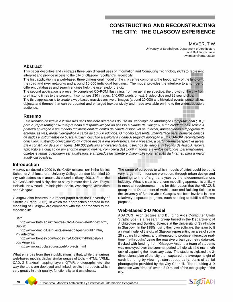
CONSTRUCTING AND RECONSTRUCTINGTHE CITY: THE GLASGOW EXPERIENCE
MAVER, T WUniversity of Strathclyde, Department of Architecture
and Building [email protected]
AbstractThis paper describes and illustrates three very different uses of Information and Computing Technology (ICT) to represent,interpret and provide access to the city of Glasgow, Scotland’s largest city.The first application is a web-based three dimensional model of the city centre comprising the topography of the landform,the road and river networks and around 10,000 individual buildings. The model provides the interface to a number ofdifferent databases and search engines help the user explor the city.The second application is a recently completed CD-ROM illustrating, from an aerial perspective, the growth of the city frompre-historic times to the present. It comprises 230 images, 140,000 words of text, 5 video clips and 35 sound clips.The third application is to create a web-based massive archive of images (around 10,000) and historical events, personalities,objects and themes that can be updated and enlarged inexpensively and made available on-line to the widest possibleaudience.
ResumoEste trabalho descreve e ilustra três usos bastante diferentes do uso daTecnologia da Informação Computacional (TIC):para a „representação‰,interpretação e disponibilização do acesso à cidade de Glasgow, a maiorcidade da Escócia.Aprimeira aplicação é um modelo tridimensional do centro da cidade,disponível na Internet, apresentando a topografia doentorno, as vias, arede hidrográfica e cerca de 10.000 edifícios. O modelo apresenta umainterface para inúmeros bancosde dados e instrumentos de busca auxiliam ousuário a explorar a cidade.A segunda aplicação é um CD-ROM, recentementeconcluído, ilustrando ocrescimento da cidade desde a era pré-histórica até o presente, a partir deuma perspectiva aérea.Ele é constituído de 230 imagens, 140.000 palavras emdiversos textos, 5 trechos de vídeo e 35 trechos de áudio.A terceiraaplicação é a criação de um enorme arquivo on-line, com cerca de15.000 imagens e eventos históricos, personalidades,objetos e temas quepodem ser atualizados e ampliados facilmente e disponibilizados, através da Internet, para a maioraudiência possível.
IntroductionA survey conducted in 2000 by the CASA research unit in the BartlettSchool of Architecture at Univerity College London identified 60city web addresses in around 30 countries (Batty, 2001). From the60, CASA selected 8 city sites to study in more detail, viz: Tokyo,Helsinki, New Yourk, Philadelphia, Berlin, Washington, Jerusalemand Glasgow.
Glasgow also features in a recent paper from the University ofSheffield (Peng, 2002), in which the approaches adopted in themodeling of Glasgow are compared with the approaches to themodeling in:
Bathhttp://www.bath.ac.uk/Centres/CASA/completed/index.html,
Dublin:http://www.dmc.dit.ie/guests/eirenet/pages/vrdublin.htm,
Philadelphia:http://www.bentley.com/modelcity/ModelCityPhiladelphia,
Los Angeles:http://www.ust.ucla.edu/ustweb/projects.html
What emerges from these publications is that, while the variousweb-based models deploy similar ranges of tools – HTML, VRML,CAD, GIS textual mapping, layers, QTVR, photographs, etc - theway the tools are deployed and linked results in products whichvary greatly in their quality, functionality and usefulness.
The range of purposes to which models of cities could be put isvery large – from tourism promotion, through urban design andplanning, to line-of-sight analyses by the telecommunicationsindustry. What is clear is that one modelling approach is unlikelyto meet all requirements. It is for this reason that the ABACUSgroup in the Department of Architecture and Building Science atthe University of Strathclyde in Glasgow has been involved in threerelatively disparate projects, each seeking to fulfill a differentpurpose.
Web-Based 3-D ModelABACUS (Architecture and Building Aids Computer UnitsStrathclyde) is a research group based in the Department ofArchitecture and Building Science at the University of Strathclydein Glasgow. In the 1980s, using their own software, the team builta virtual model of the city of Glasgow representing an area of some25 square kilometers, and attempted to produce interactive real-time ‘fly-throughs’ using the massive urban geometry data-set.Backed with funding from ‘Glasgow Action’, a team of studentswas employed over the summer period to help with the mammothtask of capturing the necessary data. The students digitized the 2-dimensional plan of the city then captured the average height ofeach building by viewing, stereoscopically, pairs of aerialphotographs provided by the City Council. The resulting 3-Ddatabase was “draped” over a 3-D model of the topography of thecity.

Urbanismo. Modelos Ambientales y Sistemas de Información Geográficos 95
The 1980’s Model of Glasgow – little more than a massive 3-Dmap – lay fallow until:the emergence of the world-wide-web and VRML.the honour bestowed on Glasgow as UK City of Architecture in1999.The City of Architecture award opened up funding for theestablishment of The Lighthouse (http://www.thelighthouse.co.uk),the most ambitious architectural centre in Europe, housed in awonderfully refurbished building by Charles Rennie Mackintosh,and for the development of its electronic content. ABACUS wascommissioned to provide a wide range of IT applications, from digitaljigsaws to interactive guides to the building itself. Most importantlyThe Lighthouse invested in the development of an interactive web-based model of the city based upon the pioneering work ofABACUS. Fortuitously, the 3-D geometric granularity of the 1980’smodel of Glasgow – the topography, the road networks and the10,000 buildings – was just right to allow downloading of some 28neighbouring city “chunks” which could then be interactivelyexplored on the internet. (http://www.vrglasgow.co.uk)VR Glasgow allows visitors, individually or together, to explore thecity virtually in much the same way that they would in reality. Itachieves this by linking to a number of information sources,accessible through conventional Internet techniques such as lists,tables and search engines, as well as indirectly through the VRML.Unlike many Internet systems, there is no pre-set route to follow,or list of useful links. Information is accessed through intuitiveexploration of the site, and therefore varies depending on both theuser, and the chosen route. In this manner, the user becomesfamiliar with the virtual city, in much the same way as they wouldbecome familiar with the physical city. He or she may identifyparticular areas of interest, which can be revisited using familiarroutes, or accessed via browsing. Figure 1 shows a typical framefrom vrglasgow and Figure 2 shows the multi-user inferface.
Fig 1 - Typical interactive frame from vrglasgow.
Current information sources include:• Multimedia database of General Tourist Information.• Multimedia database of Glasgow Architecture.• Alphanumeric database of property addresses and street
names.• External Web-sites.
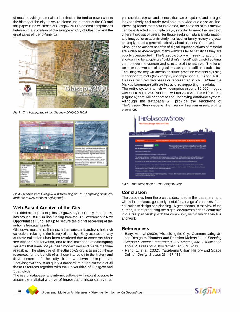
Historic Document on CD-ROMThe central issue in the design of the CD-ROM – named “Glasgow2000 : the Story of the City” – was to give a distinctive sense of“place” and to link all of the information regarding the city’s history
to specific geographical locations. An artist was commissioned toproduce a series of water-colour aerial perspective views of theClyde Valley, all from the same eye-point, onto which the evolvingvillage/town/city form could be superimposed. The artist wasprovided with a computer-generated 3-D wireline topographicalmodel of the area as seen from the chosen view-point and with aseries of early maps of the city; his task was then to interpret howthe city would have looked from above as it grew and developed.For the most recent period of the city’s development, actual aerialphotographs were “draped” over the computer generatedtopography. By manipulating a cross-wire cursor, it is possible forthe user, in a close-up window, to visit the sites of significance –from the early battles or archaeological sites of yesteryear to today’sfootball stadia.The highest level menu relates to the historical periods in the city’sdevelopment. The menu items are:
Prehistory (8000BC – 500AD)Christian (500 – 1560)Reformation (1560 – 1707)Commerce (1707 – 1830)Manufacturing (1830 – 1920)Social Revolution (1920 – 2000)
Within each of these time periods, the user can investigate issuesof interest specified by choices from one or other of two menus:Landscape. The menu items are different depending on thehistorical period. For example, in the pre-history period the itemsare: ancient sites, canoes, incidents, fords, Romans. For themanufacturing period the items are: country mansions, city views,distilleries, docks, engine works, landmarks, potteries, public parks,railway stations, shipyards.Concepts. The menu items are broadly similar for most historicalperiods and include items such as: people, land owners, the Clyde,government, wealth, work, taxes, technical advances, housing/building, food/agriculture, beliefs, services, communication,education and social/cultural life.Figure 3 illustrates the home page of the CD and in Figure 4, thesix railway stations are highlighted on a stunning 1861 engravingof the city. Note the huge number of sailing and steam ships onthe river.Work on the development of the CD-ROM is now complete. 2500copies have been produced and will be distributed to schools andacademic institutions. It is anticipated that it will become the focus
Fig 2 - Multi-user interface to vrglasgow
Urbanismo. Modelos Ambientales y Sistemas de Información Geográficos96
of much teaching material and a stimulus for further research intothe history of the city. It would please the authors of the CD andthis paper if the existence of Glasgow 2000 promoted comparisonsbetween the evolution of the European City of Glasgow and thegreat cities of Iberio-America.
Fig 3 - The home page of the Glasgow 2000 CD-ROM
Fig 4 - A frame from Glasgow 2000 featuring an 1861 engraving of the city(with the railway stations highlighted).
Web-Based Archive of the CityThe third major project (TheGlasgowStory), currently in progress,has around US$ 1 million funding from the Uk Government’s NewOpportunities Fund, set up to secure the digital recording of thenation’s heritage assets.Glasgow’s museums, libraries, art galleries and archives hold richcollections relating to the history of the city. Easy access to manyof these collections has been restricted due to concerns aboutsecurity and conservation, and to the limitations of cataloguingsystems that have not yet been modernised and made machinereadable. The objective of TheGlasgowStory is to unlock theseresources for the benefit of all those interested in the history anddevelopment of the city from whatever perspective.TheGlasgowStory is uniquely a consortium of the curators of allthese resources together with the Universities of Glasgow andStrathclyde.The use of databases and internet software will make it possible toassemble a digital archive of images and historical events,
personalities, objects and themes, that can be updated and enlargedinexpensively and made available to a wide audience on-line.Providing robust metadata is created, the contents of this archivecan be extracted in multiple ways, in order to meet the needs ofdifferent groups of users; for those seeking historical informationand images for academic study; for local or family history projects;or simply out of a general curiosity about aspects of the past.Although the access benefits of digital representations of materialare widely acknowledged, many websites fail to satisfy as they arepoorly constructed. TheGlasgowStory will seek to avoid thisshortcoming by adopting a “publisher’s model” with careful editorialcontrol over the content and structure of the archive. The long-term preservation of digital materials is still in doubt, butTheGlasgowStory will attempt to future proof the contents by usingrecognised formats (for example, uncompressed TIFF) and ASCIIfiles in structured databases or represented in XML (eXtensibleMarkup Language) with well-structured supporting metadata.The entire system, which will comprise around 10,000 imageswoven into some 300 “stories”, will run via a web-based front-end(Figure 5) that will connect to the underlying database system.Although the database will provide the backbone ofTheGlasgowStory website, the users will remain unaware of itspresence.
Fig 5 - The home page of TheGlasgowStory
ConclusionThe outcomes from the projects described in this paper are, andwill be in the future, genuinely useful for a range of purposes, fromeducation to design and planning. A great bonus, in the view of theauthor, is that producing the digital documents brings academicinto a real partnership with the community within which they liveand work.
Referencess- Batty, M. et al (2000). “Visualising the City: Communicating Ur-
ban Design to Planners and Decision-Makers,” . In PlanningSupport Systems: Integrating GIS, Models, and VisualisationTools, R. Brail and R. Klosterman (ed.), 405-443.
- Peng, C. et al (2002). “Exploring Urban History and SpaceOnline”, Design Studies 23, 437-453