Embed Size (px)
Citation preview

Conservation and Maintenance plan for Residential buildings within the
Main Dutch Fort of Matara Matara, Sri Lanka
Presented at
SIDA' s International training Programme Conservation and Management of Historic Buildings
Phnom Penn, 20th February 2006
By Ms. Shanthini Balasubhramaniam
University Of Moartuwa, Sri Lanka

Acknowledgements This study would not have been possible with out the help rendered by the following persons and institutions. I take this opportunity to sincerely thank all of them.
• Prof. Mats Endstrom, Prof. Kerstin Barup and Ms. Annette Wong Jere, of The University of Lund, Sweden for the guidance and encouragement.
• Prof. Nimal De Silva, Prof S. Manawadu and Archt. Chandrasekera of the University of Moratuwa, Sri Lanka for their encouragement and comments.
• Mr. Weerasuriya and Staff at the Center for Heritage Studies, University of Moratuwa for helping with my research.
• The non academic staff and students of the University of Moartuwa. • Archt. Palli Wijeratne, Prisident ICOMMOS Sri lanka • Archt. Anuska Wass for lending her thesis • The librarians of the University of Moratuwa and SLIA for search rendered
in finding out the sources. • US Ambassadors Fund for cultural preservation for the funding • The Residence of Main Fort for the invaluable time spent and help
rendered. • SIDA for giving this wonderful opportunity • Fellow participants of the SIDA programme, my friends and family for the
encouragement.

Contains 1) Chapter one - Matara History of Matara Social Development 2) Chapter two - Main Dutch Fort of Matara 3) Chapter three- Conservation and Maintenance plan for Residential buildings Conclusion Appendix Referances

Chapter one Matara Located in the southern province between the districts of Galle and Hambantota is Matara. Matara is 160 Km south of Colombo. The original town was established as a port on the mouth of the Nilwala Ganga. Today Matara has grown with a geographical area of 481.2 sq. miles or 1246.3 sq. km to become the largest town on Sri Lanka’s popular south cost and is an important transportation and administrative hub. Matara is scenically attractive, surrounded by paddy fields and tea estates on the fertile river floodplain. The cost line stretching 48 km and has the most beautiful sandy and safe beaches. These assets together with its historic Dutch and British monuments have ensured that the town a popular tourist destination.
Fig. 1. Location of Matara
Matara was once called "Mhathota". The name "Mhathota" meaning "The great ferry" said to have originated after the ferry which was used to cross the wide 'Nilwala Ganga’. The Portuguese Priest Quarese's also has reasoned out the name "Matara" as referring to Nilwala River. Portuguese had called this place as “Maturai ", and which means a great fortress. Portuguese called as Matara "Maturai" in 1672. In 1744 Hide Matheren called it as "Madarai". One thing that is clear here is that the Portuguese mis-pronounced the word. According to the old books it is clear that the Portuguese called it as "Maturai". "Thurai" which is a Tamil word means "Ferry". The present name "Matara" has been in used for the last three centuries.
Fig.2. Nilwala Ganga
History of Matara One can trace back the history of human settlements in Matara to pre historic times. Ven. Dr. Kamburupitiye Vanarathana Thero, in his book on the ‘History of Matara’ describes the existence of a powerful settlement in Matara during the ‘Nag’ Period. However no evidence of these early settlements is available. Portuguese, who captured Colombo in 1505, are said to have realized the strategic importance of Matara and built their fortification in 1595. However some historians such as Riberyo have described Matara being a camp for the Portuguese infantry.
Fig.3. The state flag of Matara

W A Nelson, in his book on ‘The Dutch Forts of Ceylon’ describes Matara as the chief town of the south since it was the centre of local affairs and trade. Matara was renowned for its cinnamon and elephant trade. At the same time the descendents of the Arab traders the Muslims were involved in gem cutting and trading. The Dutch VOC company wanted to gain control over the lucrative cinnamon and the elephant trade of the southern region used Matara for this purpose. Matara remained the second most important settlement in
ntil the Star Fort was built, the Dutch fortifications were
he British administration in Matara lasted till the
Fig.4. Drawing of Elephant Karral- 1747 the south for the Dutch. They strengthened their position by
building the Main Dutch Fort of Matara on the left bank near the mouth of the Nilwala Ganga. Governor I.A Rumpf in his diary in July 1717 calls the Main Dutch Fort of Matara, ‘the indefensible little place of Matara’. However this indefensible Main Dutch Fort has the unique distinction of being the only Dutch Fort to have been captured by the Sinhalese. Grievances over land ownership, taxes and poverty led to a general revolt in 1760. The uprising against the Dutch forced them to evacuate to sea. However within two years Dutch recaptured Matara and strengthened their defenses by building the Star Fort. Baron van Eck built the Star Fort in 1762. This was also the last major defense work built by the Dutch East India Company in Sri Lanka.
Fig.5. Drawing of the cinnamon plantation- 1747
Ulimited to the Main Dutch Fort. The Dutch troops were barracked inside these with the living quarters of their officials. Subsequently, the Star Fort was used as barracks with the residential accommodation for the Commanding Officer. The Main Dutch Fort was also utilizing as the commanding base for the inland Forts at Kauwana, Akuressa and Hakmana. TIndependence in 1948. They administered the Matara from 1796 to 1948. The British had the practice of the re-use any buildings of the yesteryear and replace only those that they could not use. This enabled many Dutch buildings to survive during the British occupancy. Matara was also in the forefront of the National Independence Movement of the 20th Century. With the formation of the National Congress Movement in 1917, Matara joined in the fight for freedom with the formation of its own branch affiliated to the main association. Therefore, Matara has a unique place in the history of Sri Lanka.
Fig. 6 Main entrance and Plan- Star Fort

Social Development Improvement in trading practices a new wealthy community of Singhalese immerged. They were either the cinnamon traders or holders of high offices under the colonial masters. They communicated the newly found status through architecture, fashion and jewellery.
Fig. 7 . The Walawwa
They built ‘Walawwas’ spacious residences admit large gardens and plantation. The development of this rich community continued and the Walawwas improved even with the British occupation.

Chapter two The Main Dutch Fort of Matara The Main Dutch Fort is located on the left bank of the Nilwala Ganga and has served as a military outpost and an administrative center since its origins. A fortress has been designed and constructed by building of a small rampart which cuts off a tract of land between the river and the sea. The fortification is very modest when compared to other fortress in Sri Lanka such as The Galle Fort, Kalpitiya Fort or The Jaffna Fort where the ramparts wrap around the fort. Here it consists only of a simple breastwork rampart erected on a straight line. The other barriers which help protect Fort are the natural barriers the sea and the river. Therefore making the Main Dutch Fort a piece of ingenious military architecture Fig. 8. Location of Main Fort The architectural fabric of this Main Dutch Fort can be divided into the following categories.
1) Rampart 2) Open public spaces and roads 3) Administrative, Commercial and Religious Buildings 4) Residential Buildings
Fig. 9. The Internal layout of buildings within the Main fort.

Rampart The rampart and its moat are the two vital visual elements that help one identify a Fortress. They stand majestically and aloof providing the impermeable defensive barrier. Whilst they form the physical and physiological barrier for the enemy it becomes a secure protective element for the residence of the Fort. The rampart has two half bastion projections at each end with a large full bastion projection at the center. Close to this projection is the gate. The rampart faced in coral is about 240 meters long 13m thick and 5 meters high with two side lengths of 80 meters each.
Fig. 10. The Rampart
The rampart with its north bastion, central projection and gun embrasures remains same to date. They are in a fair state of preservation. However the half bastion in the south adjoining the sea has been demolished and a costal road built. Also it has been mentioned that there had been a ditch in front of the rampart and a draw bridge across the ditch at the gate. These had been dismounted in the early 19th century hence they no longer exist.
Fig. 11. The Clock Tower A clock tower was constructed by the British on the rampart. Today this has become an important landmark. The Gate close to the central projection shows a classical façade. The date 1789 above the gate probably indicates completion of renovation or strengthening.
Fig. 12 The south bastion demolished.
Fig. 12. The Entrance

The Map dating 20th July 1698 on Matara Fort and its environment indicates of a rear rampart. However this diagram does not indicate the existence of a moat. At present no evidence could be traced indicating the existence of a moat or the rampart.
Fig. 11. A Map showing a rear Rampart
The rampart was declared a protected monument under the Antiquities Ordinance No 9 of 1940 section 33. This protects the rampart and a band of land of 400mters in width to either side of the rampart. Therefore making most of the fort unprotected and venerable. The northern edge of the rampart is within the present army camp. They maintain the rampart from the gate archway to the Northern edge the river. Though the armed forces have maintained the section of the rampart well the new residential buildings built may have destroyed valuable archeological data. This together with the erection of the security post on top of the entrance arch indicates the lack understanding on the archeological value of this rampart and its vulnerability. These need to be taken into account.
Fig. 12. The security post
The rest of the rampart is maintained by the Department of Archeology. The rampart also has parasite plants growing on its walls. These need to be eradicated. Due to the location direction and construction Tsunami has made little impact on the rampart.

Open spaces and Roads
Fig. 14. The open spaces
Open spaces are strategically located in military architecture not only to ensure security but also act as social spaces. They may be placed in front of and behind the rampart. Some may be placed in the residential areas or as courtyards in between buildings. The Main Dutch Fort has many open spaces .The two important spaces are the space in front of the rampart and the one behind. These not only help strengthen the defensive barrier but also help in visually strengthening the rampart and the Fort.
Fig. 15. The esplanade
Historically in front of the rampart the Dutch company is said to have had an oblong vegetable garden and a guard hut of the lascars, native soldiers. Today the vegetable garden and the open area in front have been turned into a sports stadium and a bus terminal. These functions and building scales of the bus stand and stadium grandstand have disturbed the visual landscape.
Fig. 16. The Bus terminal
Behind the rampart within the protective sanctuary of the rampart, sea and the river was a large open space a garden with tress and the church yard. Though most of the garden still remains it has been fenced to create a playground. Closer to the southern rampart and the rest house the garden has been turned into a bus parking area. These parking encroachments need to be curtailed and the fencing around the playground needs to be removed.
Fig.17. The Church in the past and now

The open spaces within the residential areas are few. One interesting space with is the large space in front of the first lane. But the large tress near the rest house, court complex and first lane needs to be protected. Another feature that has been mentioned and drawn on maps is the elephant pond. According to the description in RK de Silva & WGM Beumer’s illustration and views of Dutch Ceylon 80 elephants stabled in the fort could be bathed in this pond. These locations could be excavated. The sea front and the river front have been totally neglected. They have become garbage dumps. These need to be cleaned and revitalized to enhance the natural beauty. A well kept beach and river front would not only enhance the visual landscape but also help in income generation. Hence these open space needs to be maintained at all cost. A landscape design for the sea and river fronts, open spaces and roads needs to be implemented and maintained.
Fig.18. The underutilized river frontage
The grid iron street pattern a characteristic of Dutch street layout is not strongly visible in the Main Dutch Fort. They follow the natural topography of the land. The streets are narrow and catered to the pedestrians and an occasional horse carriages or bullock cart. However today the motorized vehicles have taken over these roads. Add to the vehicles the services such as telephone and electricity cables and post take up further space making the road feel small and non pedestrian friendly. These are also visible polluters of the environment. The parking of in administrative buildings
and the residential vehicles too has become an issue. Fig.19. The visual polluters.

Administrative, Commercial and Religious Buildings The Fort was a key institution in the Dutch administrative system. The key administrative officials who were Dutch such as Matara Dissava lived within the fort and administered the region from the Fort. Hence the Fort became a liaison point between the Dutch officers and the locals. Located to the right of the main gate are these administrative buildings which where occupied by the Commander, the garrison and the building which housed the Dutch Dissava’s office. Today many of these buildings have modern alterations and have been transformed into administrative institutional buildings such as the kachcheri, post office and land registry. For example in the present land registry building the front verandah with the massive columns have been covered for security purposes. However with careful intervention this building could be brought back its former glory.
Fig. 20. The Dutch administrative buildings
The British who took the administrative system a step further built the district court and the Courts view hotel. The Court a two storied building is well maintained and the original characters remain as they are. The hotel building used to be the Lodging & Lawyer’s Offices is not as well maintained as the court building. The religious buildings within the fort are the church and church yard opposite the full bastion and Methodist church along Wilfred Gunasekera Mawatha. The Dutch church is said to have been built around 1767 and is still maintained in its original Dutch character.
Fig.21. The British Buildings – The courts
Fig.22. The Dutch reformed church
The Rest house and commercial cooperative shop are the oldest commercial buildings within the fort. The original Dutch characteristics are visible to some extent. Tsunami has destroyed some parts of the buildings.
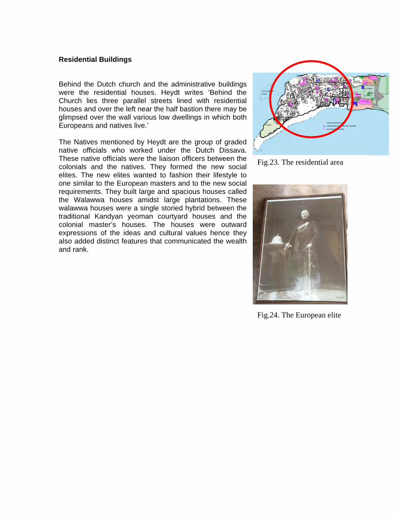
Residential Buildings Behind the Dutch church and the administrative buildings were the residential houses. Heydt writes ‘Behind the Church lies three parallel streets lined with residential houses and over the left near the half bastion there may be glimpsed over the wall various low dwellings in which both Europeans and natives live.’ The Natives mentioned by Heydt are the group of graded native officials who worked under the Dutch Dissava. These native officials were the liaison officers between the colonials and the natives. They formed the new social elites. The new elites wanted to fashion their lifestyle to one similar to the European masters and to the new social requirements. They built large and spacious houses called the Walawwa houses amidst large plantations. These walawwa houses were a single storied hybrid between the traditional Kandyan yeoman courtyard houses and the colonial master’s houses. The houses were outward expressions of the ideas and cultural values hence they also added distinct features that communicated the wealth and rank.
Fig.23. The residential area
Fig.24. The European elite

Chapter three Conservation and Maintenance plan for Residential buildings within the Main Dutch Fort of Matara Architecture is a language of a culture. Buildings through its architectural language communicate meaningful information which leads to deep and profound understanding of a culture, its traditions, values and attitudes of people at that moment of time. This understanding of the past helps one to exist at present and build upon a future. The understanding of ones culture also helps link people and places creating a sense of belonging. The sense of belonging is a vital ingredient for the existence of humankind. Hence it is vital to conserve these vital buildings, past and present for the existence of mankind. However conservation is not merely preventing old historic buildings from decaying. Conservation must seek out not only to preserve old buildings but contribute to the future growth of the society whilst revealing social, physical and economic development of the past. At this juncture let’s discuss the need for the conservation of the Main Dutch Fort. Why Conserve a colonial monument.? In a country which has monuments that needs to be conserved and which have been in existence since or before 5th century it has been questioned and argued the need for conservation of these Colonial monuments.
Fig.25. The Entrance of the Dutch Reformed church
First the Fort and its environment has great architectural value as one can learn much about the Dutch and military architecture. Secondly it has historical value as it encapsulates a time in the historic evolution of Sri Lanka. It has played a crucial role in the formation of the Nation during pre and post independence. Thirdly it has great locational value due to its strategic location at the city center between the sea and river and presently it is a landmark. Hence is creating an urban identity which one can identify easily. The main fort also places an important role as a monument of dual parentage. The term dual parentage is due to its creation by the colonial and new native elites as masters and the constructors being local and foreign craftsmen. Hence it is a intermingling
of ideas of the Europeans and the Natives that has created this objects hence the term dual parentage. This gives this monument a cultural value. The monument has great Economic value due to its location,
istoric and natural settings and being a tourist attraction. h

However today neglect, destruction, neo colonialization, modernization, patina has made conservation and revitalization a necessity if this link is to be passed on to further generations of Sri Lankan. The recent tsunami has caused colossal damage to the fort, its buildings and other physical elements.
Fig. 26. The modern façade to a dutch street houses.
Fig. 27. Water marks indicating the water level s.
The Fort consists of predominantly of residential buildings with administrative, religious and recreational buildings. Though building owners or occupants are aware of the historical and heritage significance of this site due to economic and socio cultural reasons, human interventions and natural calamities are causing destruction to buildings, other physical elements and the environment. Hence immediate intervention is required to help reduce destruction to the buildings and its environment.

The Concept The Main Dutch Fort of Matara is a living monument. Hence the conservation of such a living monument should permit the residence to live a contemporary lifestyle whilst preserving the atmosphere, the scale and the streetscape of the original monument. The Dutch and British buildings are to be retained and conserved whilst the modern constructions through time will be transformed into a building with Dutch or British characteristics. The environment with details such as street furniture too would be enhanced to create this environment of a Colonial Fort. This transformation could be not carried out over night. A gradual transformation is envisaged lasting a minimum of 15 years. In this context, the main aim of this study is to provide a directional thought through which a meaningful environment in terms of people concerned and palace could be achieved. The expected outcome of this study would be a set of propositions which would focus on a conservation and maintenance plan which would help the residential owners, occupants and stakeholders to create a meaningful environment. The strategy for conservation will have two approaches. One would be general and would cover the Fort and its environment such as the rampart, open spaces and administrative, commercial, religious and residential Buildings. Another to be specific and would cover the specific architectural categories. Due to limitations in time and resources this study would focus on the conservation and maintenance plan for residential buildings with in the Fort. Methodology A detailed study of the residential buildings within the fort was the initial step undertaken. Interviews, survey which looked into the architectural, historical and cultural values of the residences were carried out. (Refer Appendix – Annexure one) A typology study was undertaken based on the form, shape and style of the dwellings. They can be typified as follows 1) Street House
Closely knit houses abutting each other with large spacious verandah facing the street were termed Street houses. The verandahs were raised platforms called “steop” stretched the whole length of the house and gave access to the house. These steops were deep verandahs with slender timber columns a space which filtered the activities of the street whilst not disturbing the social interactions. This spaces enabled the Dutch to not only to gain privacy and
Fig. 28. The Street house in the past

help entertain but also help build up a social relationship in a selective manner. The people whom were chosen to associate with were entertained in the living room whilst others were entertained in the verandah. From the verandah one is led to the zaal or the lobby and then into a spacious hall the living area. The hall opens out into the rear verandah and the courtyard. The bed room and service units were placed to one side of the courtyard. Most residences had a rear service entrance. Fig. 28. The Street house today
2) Town Houses
The town houses were modified version of the walawwa houses. Whilst retaining some features of the walawwa houses such as the courtyard, verandah these houses were modified to suit the small plot size. These houses were not in spacious plantations but in smaller plots with small gardens around. 2.1) Verandah Type Similar to the street houses some houses had deep verandah in front though which one gains access to the house. These houses with verandahs were termed Town house verandah type.
Fig. 29. The Verandah Type
Fig. 30. The Porch Type
2.2) Porch Type With the advent of carts the porch was added on to the verandah. Such houses were termed Porch Type Town House. This addition was during the later Dutch or early British period.

3) British oofed houses with projected
) American style roof houses ost independence era is
) Modern houses facades with curves dominating
he survey led the research team to identify 31 dwellings which were selected as case
1) Year of origin
hitectural value
r conservation
hese case studies were then well documented with measured drawings and
style house Compact high hipped rporch with round or square masonry columns were termed British style. The porches had gable ends. The projected porch in the later days had a flat slab roof.
Fig. 31. British style
4
Mostly constructed in the pcharacterized by the single slope lean to roof which avoids the ridge line. The name American style roof houses is said to be derived from American factory construction.
Fig. 32. American style 5
Dwelllings with fancy the facades and build in the recent times were termed Modern houses.
Fig. 33. The Modern house at the rear.
Tstudies. The selection was based on the following factors.
2) Style. 3) The Arc4) Accessibility 5) The urgency fo
Tphotographic surveys. The selected case studies would also be used to formulate the conservation plan and maintenance plans.

Conservation plan for Residential Building
oday a year after the Tsunami we see families are laying concrete blocks and bricks as
he houses within Matara fort have fared less well than those with in Galle Fort due to
hough the residential buildings within the fort have increased and vary in architectural
he aim of the conservation is to establish the desired environment and help in the
he conservation plan should respect history, the aspirations of the owner’s
he conservation plan would be considered under emergency, long term and short term
owever conservation of these residential buildings has the following issues.
1) Legal issues -The Main fort is protected under the Antiquities Ordinance.
2) unding - The dwellings are being owned by individuals. Funding and Fund
Tthey start afresh. Everyone seems busy rebuilding their lives and their futures. One can only marvel at their strength and fortitude. To these people we need to lend a hand. Tbeen caught without the protection of an all surrounding wall and caught in between the beach and a lagoon. Hence the homes were brutally destroyed by the seawater. Tstyles and represent 50% of the total area of the Fort, 75% of these residential building have been damaged due to tsunami. Teconomic growth of Matara. Tstakeholders and the environment whilst preserving the atmosphere, the scale and the streetscape of the original monument. Tconservation plans but should run concurrently. H
However the residential buildings are not protected under this law. Hence making unauthorized demolition, additions and alterations possible. A new legal frame work which declares the Main fort and its environment as a protected monument needs to be implemented. This should not only protect the building fabric but empower the stakeholders to act upon when necessary. Fraising for conservation of individual dwellings could be difficult. A consortium of the owners and stake holders need to be formed and this could look at all aspects of sustainability, conservation, maintenance and management of the Fort.

Emergency plan
- Should bring back normalcy to the life of the
- erty or
- unity and stakeholders through
- materials at a
- ftsmen on specialized building
hort term plan plete survey on land use to be undertaken
- for
- rehabilitation plan for
- proposal with street elevations
- nservations
- n association with all
Fig. 34. Then. Days after the Tsunami
residents/ occupants as soon as possible. Should help rectify the damages to propstabiles structure. Advise the commworkshops on rebuilding process Make available historic buildingreasonable cost Train local cratechnology
S
Fig. 35. Now
- A comto include the landownership within the fort. Identification of residential buildings conservation/ restoration Draw up a consolidation/ each residence. A urban design and guide lines need to be created. Stage1 - Advice on modifications/ corequired for residents to live a contemporary life with a historic city. Formation of a
Fig. 36. Survey being carried out.
stakeholders to ensure the upliftment and to maintain the environment.

Long term plan
- Declaration of the Fort and its environment, including all categories as
- periodically reviewed and
- ns/ conservations required for residents to live a
- akeholders to ensure the maintenance
- of conservation/ restoration to identified buildings. The
- the best maintained residential building and
- n of a booklet, to include Overall conservation plan for the fort,
- and provide training in areas
protected monument under the UDA regulations. The urban design proposal needs to be modifications undertaken. Free advice on modificatiocontemporary life with a historic city. Formation of an association with all stof the atmosphere. The Implementationinteriors should also be refurbished in an authentic manner incorporating furniture of the same period whilst fulfilling inspirations of occupants. Provide tax relief or subsidies
- Award an annual award for interior. Productiodetails of methodology, resource personals etc. Create awareness to residents on future visions such as tour guiding, public relations, craft and entrepreneurship to create a sustainable community.

Maintenance plan for selected residential buildings
onservation alone is not sufficient to achieve our objectives. These
o be effective the maintenance needs to be carried out in a regular and
he maintenance plan for residential buildings consists of three parts.
aintenance plan
mergency Maintenance
1) Clear all debris, mud and make environment suitable for
2) s to property or stabiles structure.
uch
walls. These were
lidated with an infill. ged. They were cleaned with
- ged doors and windows with temporary rectified with
- uch as water proof sheets were used to
r filed. ecked if any major
Cconserved buildings need to be maintained. Maintenance is the routine work which helps protect the fabric of a building, monument or even the landscape in a cost effective manner. Tin a planned cycle. The plan should extend the life of the building and retain the spirit of the place as far as possible. A good maintenance plan needs regular investments in small amounts and the maintenance work is the responsibility of all the owners and occupants of the residents. This would not only enable to minimize disruptive and extensive repairs but also will help plan future financial commitments and fundraising needs.
Fig. 37. Timber propos are used to stabiles the roof.
TNamely Emergency, Short and Long term Plans. However all maintenance or rectification works should be reversible if and when needed and easily distinguishable to the experts eye and not to the laymen’s eyes. M
Fig. 38. Cracks infilled.
Fig. 39. Damaged plaster.
Fig. 40. Secured door.
E
immediate human occupation. Should help rectify the damageThe rectification should be reversible if and when needed. - Unstable walls and roofs were propped with materials s as bamboo, rubber timber or steel propos. - Cracks were visible on the floors and
checked and conso
- Most of the plaster was damawater and accessed for the extent of damage. If minimal lime plaster or cement plaster was used according to the existing plaster. All damaMaterials such as damaged timber pieces or plywood andsecured the dwelling. Temporary materials s
secure roof from water leakage. - Damaged foundations were unde- Services systems were Inspected and ch damage has incurred. If incurred they were rectified before reconnect.

Short te e
1) Short term is consolidation. Helping occupants to get back
2) checked and an evaluation form
round
- still indicates salinity as the plaster is
- -wire mesh and use infill. ber work is
- und tiles.
rm Maintenanc
on the feet. Each residence is (Annexure two) is filled. According to the evaluations damages are rectified. Most common damages were - Extensive damage is noticeable on floor. Relay g
Fig. 41. Damaged floor.
Fig. 42. Dutch lime plaster is peeling off due to salt.
floor with cement rendering or the tiles with similar characteristics. Water proofing and termite treatment is to be carried out. Wall after washingpeeling off. Hence depending on the severity re plaster with traditional Dutch plaster or consolidation of plaster with adhesives. Rectify wall cracks
- Timber work such as upper floor balcony timto be rechecked for cracks and damages. New additions to be installed with timber of the same period and characteristics with a simplified workmanship. Roofs are of exposed rafter system with half ro
Major timber members are to be replaced or fiber jointed. Most owners have requested for ceilings. Hence a fiber bonded light weight ceiling has been recommended to certain areas.
Fig. 43. A timber balcony with loose floor boards and
missing elements.
Fig. 44. Present conditions of most roofs.

Long term Maintenance
) Long term maintenance is to work towards
2) treet house, Town House with Dutch/
tinized and owner’s
- design guidelines. 3)
1
conservation and creation of the desired environment. Creation of SBritish characteristics, form and shape whilst helping the occupants move with time. - Each house is to be scru
needs and wants are to be accessed. Accordingly long term modification plans are to be drawn and implemented. Issues such as parking, underground cabling are to be considered when modification plans are drawn. These need to follow the urban
Fig. 45. Wijetunga walawwa Before the tsunami . Note the building at the side.
Each dwelling will follow a long term maintenance programe. Where responsibilities , task, frequency of maintenance is detailed out in accordance to the building element.
Fig. 46. Wijetunga walawwa after the tsunami . Note the building at the side has been destroyed.
Fig. 47. The old destroyed unit to be rebuilt as a garage for cars.
Conclusion
sunami was unprecedented disaster in an international scale. It destroyed the physical
conservation and maintenance plan would not be successful if not for an effective
owever these efforts would not be fruitful if the stakeholders and public are not
conclusion all these plans need to be backed by a disaster management plan to
Tsocial and economic fabric of the community. However it has also presented an opportunity to rectify many mistakes that mankind has made. One such is the adulteration and destruction of the architectural fabric of the Main Dutch Fort of Matara. Tsunami has presented Sri Lanka with an ideal opportunity to undo these mistakes and help in economic development. This conservation and maintains plan if carried out successfully would help in not only in creating the desired environment and be gain economical but also help make a disaster into appositive development. Amanagement plan. Hence a management plan consisting of the management of the conservation and maintenance plans, funding, quality of work, the team and the stakeholders need to be worked out. The legal frame work needs to be implemented and amalgamated into the national system with not only the stakeholder’s participation but also empowerment. Hmotivated and focused. Hence a strong urge for conservation and awareness needs to be created. The tsunami has created this to some extent but this spirit needs to be built upon and nourished. Inneeds to be created to help mitigate further disasters of this nature.

Appendix
nnexure One E FOR HERITAGE AND CULTURAL STUDIES
PROJECT: Survey of the Cultural Properties affected by Tsunami, 26th
LIENT: Sri Lanka National Committee of the ICOMOS (International
PONSOR: US Ambassador’s Fund for Cultural Preservation.
ECORDED BY: 1. D. Opatha
EASUREMENTS TAKEN: 1. D A A Wickramasinghe
ATE (S) OF SURVEY:
ATE (S) OF CHECKING:
OCATION OF THE BUILDING (S)
ATALOGU
A
CENTRUNIVERSITY OF MORATUWA
December 2004 Matara fort and Kumaratunga Mawatha.
CCouncil on Monuments and Sites).
S
R M 2. D A Withana D D L C
E / REFERENCE NUMBERN

01 Name of the Building House
( Wijethunga Walawwa )
02 ddress / Location Mr. A H Benat De Silva, No.78, Dharmarama A Mawatha, Kotuwa , Matara
03 Historical Significance
150 years old
04 ocio – Cultural background An upper middle income dwelling at present. S
05 Architectural Value Dutch Town House – Verandah type
06 ate / Period of Construction 150 years D
07 ate / Period (s) of subsequent 2005 D interventions
08 ator of the Architect / Creproject
09 Usage House Original
10 Present usage House
11 Original owner Ms. Wilment P Wijethunga
12 Name Mr. A H Benat De Silva 13 Address atha, Kotuwa , Matara
No.78, Dharmarama Maw
14 Telephone No. 22 27548 15 Email 16
Present owner
imate 5 perches Approxsite Extent.
4
17 Roof 20% 18 Walls 20% 19 Doors and
Windows 10%
20 Floor 25% 21 Foundations 22
Present of
es. g %. Part of the house has been totally destroyed.
conditionthe Building. Damages in terms of percentag
Other BuildinElements
5
23 Recommended Uns
se / Conservation Actio
24 under 12 Identification of buildingreference on the Map
25 ilding 05° 56.629 N, 80° 32.473 E GPS Reading of the Bu

Front view of the house showing the open verandah, wooden balcony with timber iling and pillar and the tiled gable roof
ra\

Interior roof structure
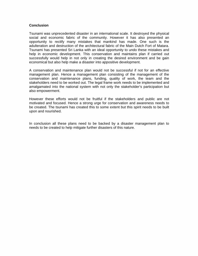
Detail of a window

CENTRE FOR HERITAGE AND CULTURAL STUDIES
UNIVERSITY OF MORATUWA
PROJECT: Survey of the Cultural Properties affected by Tsunami, 26th December 2004 Matara fort and Kumaratunga Mawatha.
CLIENT: Sri Lanka National Committee of the ICOMOS (International
Council on Monuments and Sites). SPONSOR: US Ambassador’s Fund for Cultural Preservation.
RECORDED BY: 1. Kavshal Jayathilake 2. Chethila Gunawardhana
MEASUREMENTS TAKEN: 1. Suranga Prasanna 2. Thisara Sharada DATE (S) OF SURVEY: 08.10.2005 DATE (S) OF CHECKING: LOCATION OF THE BUILDING (S)
Segment from Matara Fort area Nilwala River N CATALOGUE / REFERENCE NUMBER

01 Name of the Building
Residence of Mr. M.M.S. Priyantha
02 Address / Location
No 48, Wilfred Gunasekera Mawatha, Fort, Matara
03 Historical Significance
Dutch Residence
04 Socio – Cultural background
A middle income dwelling.
05 Architectural Value
Street house
06 Date / Period of Construction
19th century
07 Date / Period (s) of subsequent interventions
08 Architect / Creator of the project
09 Original Usage
Residential
10 Present usage
Residential
11 Original owner
12 Name Ms. Lasika Thushari Abedeera Weerarathna 13 Address
14 Telephone No. 041 2230224 15 Email 16
Present owner
Approximate site Extent.
10 perches
17 Roof Half round clay tiles 18 Walls Lime stones, Cracked 19 Doors and
Windows Timber
20 Floor Originally clay tiles. Now a cement rendered floor 21 Foundations Lime stones 22
Present condition of the Building. Damages in terms of percentages.
Other Building Elements
23 Recommended Use / Conservation Actions
24 Identification of building under reference on the Map
20
25 GPS Reading of the Building 05° 56.711 N, 80° 32.627 E

Façade of the building demarcating street line
Front view of the building
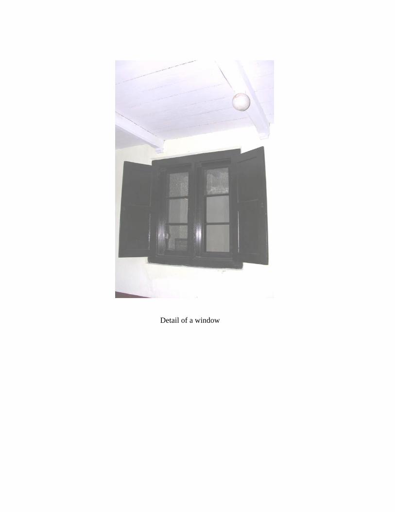
Decorative valence boards, trellis work and the half-round tiled roof emphasize the colonial character

Annexure Two.
Plans, sections and elevations of Wijetunga Walawwa


Annexure Three.
Building Evaluation Form Name Wijetunga Walawwa Address 48 Dharmarama Rd, Fort Ref. No
Building element
Construction Material
Condition
Remarks
External elements 1.1 Roof 1.1.1 Roof area
Generally Half round tiles on exposed rafters
Poor – 20%
Urgent attention to roof leaking areas.
1.1.2 Tiles Terracotta half round tiles -
35% needs to be replaced
Damaged tiles to be replaced and whole roof to be relayed.
1.1.3 Eves – valance boards
None
1.2 Rain water disposal 1.2.1 Roof drainage -
gutters and down pipes
None - Not used.
1.2.2 Perimeter drainage channel
None - Not used
1.2.3 Below ground drainage
None -
1.3 External walls 1.3.1 External walls
Generally Lime plaster Ground floor -
poor The plaster is peeling off due to salinity. Needs urgent attention.
1.3.2 Boundary walls Cabook wall Totally damaged
Temporary alternative - at The present hedge looks attractive
1.3.3 Ventilation grills, louvers
Cement lovers Okay Later additions
1.3.4 Balcony - rails , floor boards
Timber 25% replacement
1.4 Internal structure 1.4.1 Internal spaces
generally Termite treatment a
must. 1.4.2 Foundations Rubble
foundation To be checked by a
struct. eng. 1.4.3 Floor Cement rendered
floors Crack are visible – BR1, K T- re tiling
Re flooring is recommended.

1.4.4 Walls 22” tk cabook walls
Cracks are visible – BR1, BR2, K, L
To be checked by a structural eng.
1.4.5 Roof Timber Timber Truss with exposed
2”x 1”
45% of timber needs to be replaced. Some trusses are sagging - K
Provide structural 2” x4” rafters withreepers.
stability to sagging trusses.
1.4.6 eiling ” x 4” Asbestos
me work
ound in BR1,
replacement
pper floor BR3 iling.
C 4panels with timber fra
FBR2 – 15%
Uneeds a ce
1.5 Doors and windows 1.5.1 Doors Timber framed
timber paneledoors
d oors have been damaged
05% of the d
1.5.2 Windows w
Timber framed paneled windo
05% damaged
1.5.3 Fanlight Cement grills Okay 1.6Building services 1.6.1 Water 1.6.2 Electricity Exposed ducts o be checked by a
Telect.Engin.
1.6.3 Communication 1.6.4 Lightning
None available
Protection 1.6.5 None available None available Fire protection 1.7 Furn gs iture and fittin 1.7.1 Need to replace all. Furniture 1.7.2 Sanitary fittings Ceramic eed to replace all. N1.7.3 Electrical fittings e all. Need to replac1.8 Pain ting 1.8.1 External walls Needs repainting1.8.2 Internal walls Repaint 1.8.3 Doors and
windows Repaint
re: Signatu Evaulatio
by :
Date : n carried out
Name

Annexu
Long term maintenance programme fo ga walawwa
Ref. No
Building element T Frequency
Annual cost
re Four
r Wijetun
Maintenance ask
Responsibility
Externa en l elem ts 1.1 Roof 1.1.1 Roof area Generally of are
round and accessible high points and access
lient/ Twice a year. After the monsoon rains.
- Inspect rog
a form C
damage 1.1.2 Tiles rac
mage tiles. Td ne
Roof base Twice a year. After the monsoon rains.
- Inspect for cda
ked or iles that
have slipperelayed
eds to be
1.1.3 Ev ce boards r crac se joints, decay
Annually - es – valan Inspect fo ks, loo
1.2 Rain r d wate isposal 1.2.1 Roof drainage - gutters
and down pipes Inspect and cle ear.
monsoon rains
- ar debris Twice a yAfter the
1.2.2 Perimeter e Inspect and clear of debris. r the
- drainagannel ch
Twice a year. Aftemonsoon rains
1.2.3 Be ag k manhole , gullies etc.
Specia - low ground drain e Chec s list Annually
1.3 Exte rnal walls 1.3.1 Ex era Inspect from ground and
accessible high points. Check for cracks, damage and water seepage
lly ternal walls Gen lly Annua
1.3.2 Remove veget Annually Boundary walls ation 1.3.3 Ventilation grills, louvers Annually 1.3.4 lcony - rails , floor
boards Check for cracks, sagging, loose nails and screws
Annually Ba
1.4 Internal structure 1.4.1 Internal spaces generally Inspect on any roof
leaks, water seepage Annually
1.4.2 Foundations Inspect for cracks and movements
Annually 1.4.3 Floor Inspect for cracks and Annually

movements 1.4.4 Walls Inspect for cracks and Annually
movements 1.4.5
agging Annually Roof Timber Inspect for termites,
s1.4.6 Ceiling If timber inspect for
insects and rodents Annually
1.5 Doors and windows 1.5.1 Doors In
ospect doors, Check
perations & damages in nnually
ironmongery. Check locks
A
1.5.2 Windows in glazing,
Inspect windows, Checkdamagesironmongery
Annually
1.6 Building services 1.6.1 Water Check for leakages and
pressure Annually
1.6.2 Electricity Inspect the systems. heck if compC
cuetent with
rrent standards
ears Every 5 Y
1.6.3 Communication Inspect the systems Every 5 Years 1.6.4 ion Inspect the systems ars Lightning Protect Every 5 Ye1.6.5 Fire protection Inspect the systems and 5 Years
reinstall/ update in accordance to systems.
Every
1.7 Furniture and fittings 1.7.1 Furniture Make temporary repairs
and repaint 4 Years
1.7.2 Sanitary fittings nnually A 1.7.3 Electrical fittings Annually 1.8 Painting 1.8.1 External walls 7 Years Repaint 1.8.2 Internal walls 4 Years Repaint 1.8.3 Doors and windows Repaint 7 Years
Referances
1. Ceylon, by Lord Holden, 12. lon, first publi ated w notes by R.Rav
Colombo 1952. 3. ription of Ceylon b rdiner, AM. London 180
Volume I, page 192. r James Emerson Tennent, K.C.S.LL’d, Second edition, Lon n
olume III, Page 115. lections of Ceylon by the Rev. James Selkirk, London 1844. 6. Illustrations and views of D Serandib publications,
London , 1988
939. Heydt’s Cey shed 1744, and transl ith en Hart,
A desc y the Rev. James Co M 7,
4. Ceylon by si do1859, v Recol
3.
utch Ceylon 1602 – 1796,