Embed Size (px)
Citation preview
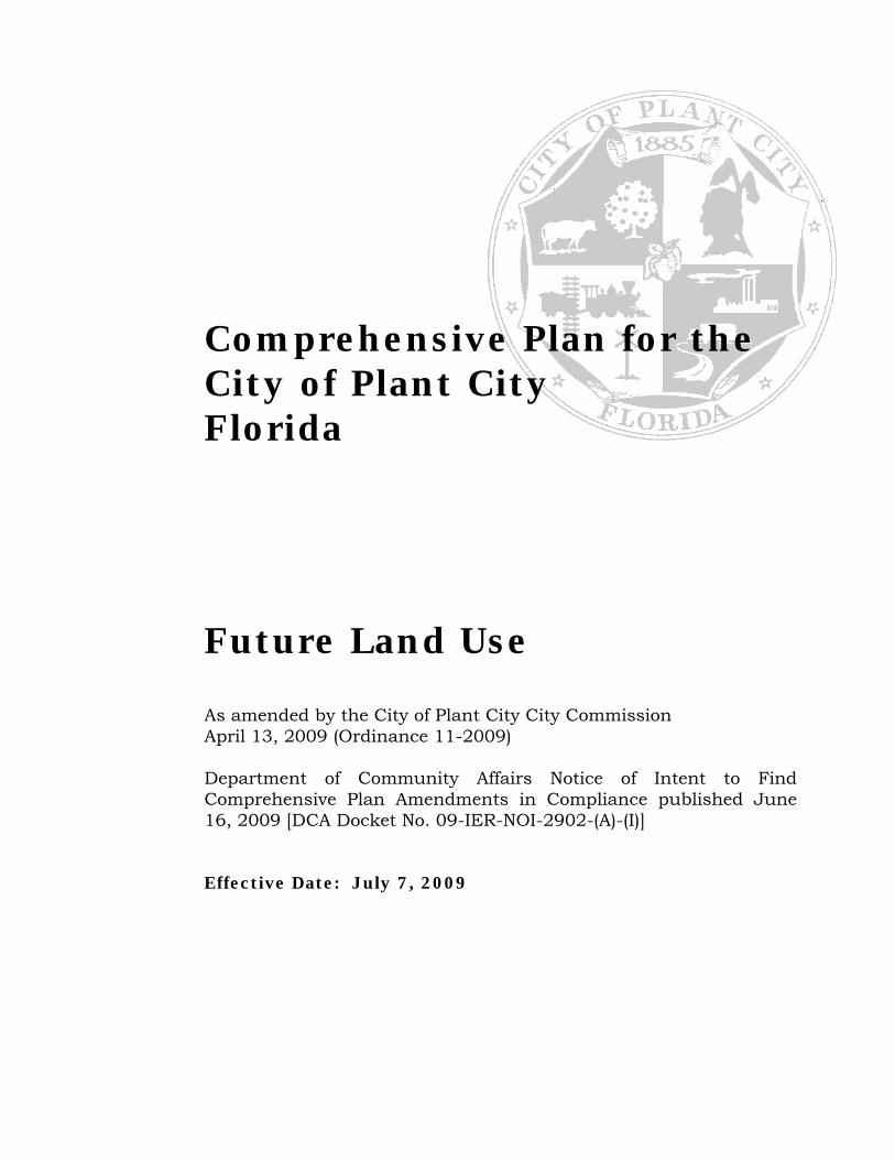
Comprehensive Plan for the City of Plant City Florida
Future Land Use As amended by the City of Plant City City Commission April 13, 2009 (Ordinance 11-2009) Department of Community Affairs Notice of Intent to Find Comprehensive Plan Amendments in Compliance published June 16, 2009 [DCA Docket No. 09-IER-NOI-2902-(A)-(I)] Effective Date: July 7, 2009

Comprehensive Plan for the City of Plant City, Future Land Use Page 1
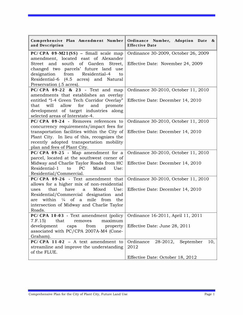
Comprehensive Plan Amendment Number and Description
Ordinance Number, Adoption Date & Effective Date
PC/CPA 09-M21(SS) – Small scale map amendment, located east of Alexander Street and south of Garden Street, changed two parcels’ future land use designation from Residential–4 to Residential–6 (4.5 acres) and Natural Preservation (.5 acres).
Ordinance 30-2009, October 26, 2009 Effective Date: November 24, 2009
PC/CPA 09-22 & 23 - Text and map amendments that establishes an overlay entitled “I-4 Green Tech Corridor Overlay” that will allow for and promote development of target industries along selected areas of Interstate-4.
Ordinance 30-2010, October 11, 2010 Effective Date: December 14, 2010
PC/CPA 09-24 - Removes references to concurrency requirements/impact fees for transportation facilities within the City of Plant City. In lieu of this, recognizes the recently adopted transportation mobility plan and fees of Plant City.
Ordinance 30-2010, October 11, 2010 Effective Date: December 14, 2010
PC/CPA 09-25 - Map amendment for a parcel, located at the southwest corner of Midway and Charlie Taylor Roads from HC Residential-1 to PC Mixed Use: Residential/Commercial.
Ordinance 30-2010, October 11, 2010 Effective Date: December 14, 2010
PC/CPA 09-26 - Text amendment that allows for a higher mix of non-residential uses that have a Mixed Use: Residential/Commercial designation and are within ¼ of a mile from the intersection of Midway and Charlie Taylor Roads.
Ordinance 30-2010, October 11, 2010 Effective Date: December 14, 2010
PC/CPA 10-03 - Text amendment (policy 7.F.15) that removes maximum development caps from property associated with PC/CPA 2007A-M4 (Cone-Graham).
Ordinance 16-2011, April 11, 2011 Effective Date: June 28, 2011
PC/CPA 11-02 – A text amendment to streamline and improve the understanding of the FLUE.
Ordinance 28-2012, September 10, 2012 Effective Date: October 18, 2012
2 Comprehensive Plan for the City of Plant City, Future Land Use
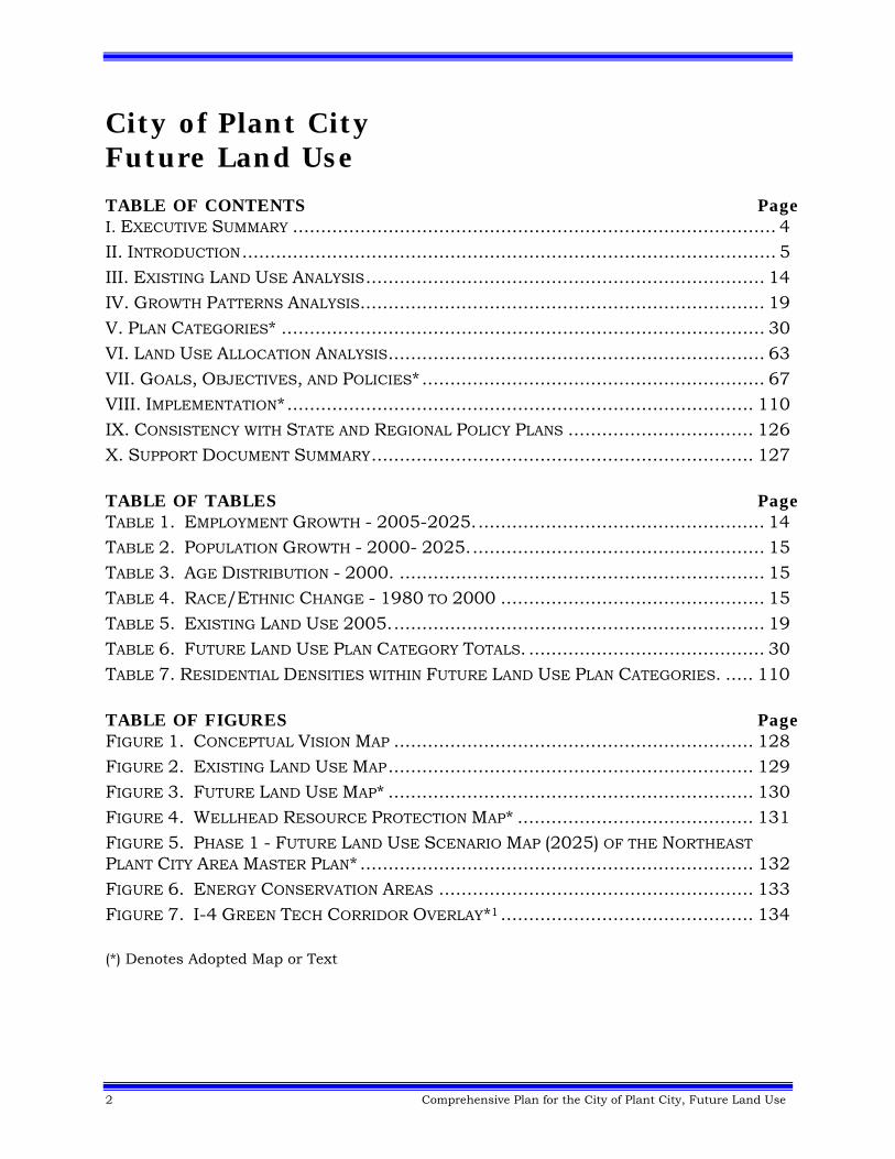
City of Plant City Future Land Use TABLE OF CONTENTS Page I. EXECUTIVE SUMMARY ...................................................................................... 4 II. INTRODUCTION ............................................................................................... 5 III. EXISTING LAND USE ANALYSIS ....................................................................... 14 IV. GROWTH PATTERNS ANALYSIS ........................................................................ 19 V. PLAN CATEGORIES* ...................................................................................... 30 VI. LAND USE ALLOCATION ANALYSIS ................................................................... 63 VII. GOALS, OBJECTIVES, AND POLICIES* ............................................................. 67 VIII. IMPLEMENTATION* ................................................................................... 110 IX. CONSISTENCY WITH STATE AND REGIONAL POLICY PLANS ................................. 126 X. SUPPORT DOCUMENT SUMMARY .................................................................... 127 TABLE OF TABLES Page TABLE 1. EMPLOYMENT GROWTH - 2005-2025. ................................................... 14 TABLE 2. POPULATION GROWTH - 2000- 2025. .................................................... 15 TABLE 3. AGE DISTRIBUTION - 2000. ................................................................. 15 TABLE 4. RACE/ETHNIC CHANGE - 1980 TO 2000 ............................................... 15 TABLE 5. EXISTING LAND USE 2005. .................................................................. 19 TABLE 6. FUTURE LAND USE PLAN CATEGORY TOTALS. .......................................... 30 TABLE 7. RESIDENTIAL DENSITIES WITHIN FUTURE LAND USE PLAN CATEGORIES. ..... 110 TABLE OF FIGURES Page FIGURE 1. CONCEPTUAL VISION MAP ................................................................ 128 FIGURE 2. EXISTING LAND USE MAP ................................................................. 129 FIGURE 3. FUTURE LAND USE MAP* ................................................................. 130 FIGURE 4. WELLHEAD RESOURCE PROTECTION MAP* .......................................... 131 FIGURE 5. PHASE 1 - FUTURE LAND USE SCENARIO MAP (2025) OF THE NORTHEAST
PLANT CITY AREA MASTER PLAN* ...................................................................... 132 FIGURE 6. ENERGY CONSERVATION AREAS ........................................................ 133 FIGURE 7. I-4 GREEN TECH CORRIDOR OVERLAY*1 ............................................. 134 (*) Denotes Adopted Map or Text
Comprehensive Plan for the City of Plant City, Future Land Use 3
(Page Intentionally Left Blank)

4 Comprehensive Plan for the City of Plant City, Future Land Use
I. EXECUTIVE SUMMARY Cities, like people, have life cycles with unique stories, which is especially true of the City of Plant City. One of the ways municipalities can capture and express their uniqueness is through their long-range comprehensive plans. These plans explain a lot about who a city is, where it’s going, and how it’s trying to get there. Smart cities, like people, actively use their plans to shape their unique identity in ways that make them better – leveraging the opportunities presented by change, minimizing the difficulties, and overcoming any inherent weaknesses that change may expose. Plans afford cities the means of taking charge and determining their own unique destiny, in our case the future of the City of Plant City.
Success lies in crafting plans well, reviewing and assessing them periodically, and modifying them as changed circumstances may warrant. In doing so, plans allow municipalities to build on the story that is its past, and then to script that story to ensure it achieves the future that is wanted by its residents. Success also lies in making plans that are realistic and accurately reflective of the citizenry for whom city government is the collective repository of their shared present and future. So, in many ways, a city’s comprehensive plan is the story its citizenry write for themselves, based on a past shared history and experiences, tempered by present realities, appreciative of the context and constraints of their physical and social environment, and expressive of a mutual vision for their future. The City of Plant City has such a plan, entitled the Comprehensive Plan for the City of Plant City. Also, it has an expressed “vision” or “strategic guide” of its future, which was completed in 2008. The story that follows explains the current context, and the more focused “vision”, which will be guided to fruition by the Comprehensive Plan for the City of Plant City.
Comprehensive Plan for the City of Plant City, Future Land Use 5
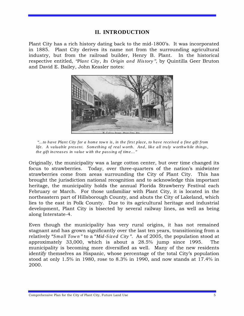
II. INTRODUCTION Plant City has a rich history dating back to the mid-1800’s. It was incorporated in 1885. Plant City derives its name not from the surrounding agricultural industry, but from the railroad builder, Henry B. Plant. In the historical respective entitled, “Plant City, Its Origin and History”, by Quintilla Geer Bruton and David E. Bailey, John Keasler notes:
“…to have Plant City for a home town is, in the first place, to have received a fine gift from life. A valuable present. Something of real worth. And, like all truly worthwhile things, the gift increases in value with the passing of time…”
Originally, the municipality was a large cotton center, but over time changed its focus to strawberries. Today, over three-quarters of the nation’s midwinter strawberries come from areas surrounding the City of Plant City. This has brought the jurisdiction national recognition and to acknowledge this important heritage, the municipality holds the annual Florida Strawberry Festival each February or March. For those unfamiliar with Plant City, it is located in the northeastern part of Hillsborough County, and abuts the City of Lakeland, which lies to the east in Polk County. Due to its agricultural heritage and industrial development, Plant City is bisected by several railway lines, as well as being along Interstate-4. Even though the municipality has very rural origins, it has not remained stagnant and has grown significantly over the last ten years, transitioning from a relatively “Small Town” to a “Mid-Sized City”. As of 2005, the population stood at approximately 33,000, which is about a 28.5% jump since 1995. The municipality is becoming more diversified as well. Many of the new residents identify themselves as Hispanic, whose percentage of the total City’s population stood at only 1.5% in 1980, rose to 8.3% in 1990, and now stands at 17.4% in 2000.
6 Comprehensive Plan for the City of Plant City, Future Land Use
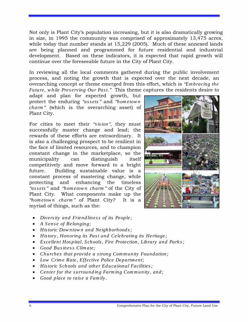
Not only is Plant City’s population increasing, but it is also dramatically growing in size, in 1995 the community was comprised of approximately 13,475 acres, while today that number stands at 15,229 (2005). Much of these annexed lands are being planned and programmed for future residential and industrial development. Based on these indicators, it is expected that rapid growth will continue over the foreseeable future in the City of Plant City. In reviewing all the local comments gathered during the public involvement process, and noting the growth that is expected over the next decade, an overarching concept or theme emerged from this effort, which is “Embracing the Future, while Preserving Our Past.” This theme captures the residents desire to adapt and plan for expected growth, but protect the enduring “assets” and “hometown charm” (which is the overarching asset) of Plant City. For cities to meet their “vision”, they must successfully master change and lead; the rewards of these efforts are extraordinary. It is also a challenging prospect to be resilient in the face of limited resources, and to champion constant change in the marketplace, so the municipality can distinguish itself competitively and move forward to a bright future. Building sustainable value is a constant process of mastering change, while protecting and enhancing the timeless “assets” and “hometown charm” of the City of Plant City. What components make up the “hometown charm” of Plant City? It is a myriad of things, such as the: Diversity and Friendliness of its People; A Sense of Belonging; Historic Downtown and Neighborhoods; History, Honoring its Past and Celebrating its Heritage; Excellent Hospital, Schools, Fire Protection, Library and Parks; Good Business Climate; Churches that provide a strong Community Foundation; Low Crime Rate, Effective Police Department; Historic Schools and other Educational Facilities; Center for the surrounding Farming Community, and; Good place to raise a Family.
Comprehensive Plan for the City of Plant City, Future Land Use 7
Why is “hometown charm” so important to Plant City. It is the collective image that the citizens of the municipality see themselves as being, its their identity. The desire is to maintain and build upon this image and this can be accomplished by addressing each of these topical areas and acknowledging this as an important issue in the decision making processes of Plant City. Another important issue that has been addressed in the Comprehensive Plan for the City of Plant City ‐ Embracing the Future, while Preserving our Past focuses on measures to promote energy conservation and reduce greenhouse gases in the City of Plant City. In this regard, the municipality is guided by numerous objectives and policies that address these issues, as noted below (FLUE = Future Land Use Element, HE = Housing Element, CARE = Conservation and Aquifer Recharge Element and TE = Transportation Element):
Discouraging Urban Sprawl (FLUE: 1.A.1, 2.B, 2.B.2, 2.I, 2.I.1 to 2.I.6, 7.A, 7.A.1 to 7.A.3, 7.A.4, 7.B, 7.B.3, 7.D, 7.D.1, 7.E.1, 7.E.4, 7.E.8, 7.E.9, HE: A.1 and CARE: J.6);
Advancing Energy-Efficient Land Use Patterns (FLUE: 1.C.1, 2.A.2, 2.B.1, 7.B.2, 7.C, 7.C.1, 7.D.3, 7.E.2 to 7.E.3, 7.E.5);
Reducing Greenhouse Gases (CARE: A, A.5 to A.7, A.9 to A.12); Promoting Mixed Land Uses (FLUE: 2.F, 2.G, 4.B.6); Encouraging Housing Opportunities and Choices (FLUE: 1.A.3, 1.A.4,
1.B.1 and HE: F); Creating Walkable Neighborhoods (FLUE: 2.D.1, 4.B.3 and TE: 1.H.6); Establishing Compact Building Design (FLUE: 3.B.1, 3.B.2); Directing Development to Existing Communities (FLUE: 4.B, 7.D.6, 7.D.7
and TE 1.E, 1.E.1); Providing a Variety of Transportation Choices (FLUE: 7.F.1, 7.F.7, CARE:
A.1, A.3 to A.4 and TE: 1.C.8, 1.C.9, 1.D.3, 1.D.5, 1.D.6, 1.E.2, 1.E.4, 1.E.6, 1.F, 1.F.5, 1.G.4 to 1.G.6, 1.H.2, 1.H.5, 1.I, 1.I.1 to 1.I.6, 1.J.2);
Preserving Open Space and Environmentally Sensitive Areas (FLUE: 1.E.1, 4.B.4, 6.A.5, 6.A.6, 6.A.12, 6.B, 6.B.2, 7.H.1, 7.L.1 and CARE: C.3, C.7, C.11, C.12, C.14, C.15, F, F.4, F.5, F.7, F.8, G.4, H, H.4, I, I.1 to I.4, I.6 to I.9, J.2, J.8, K);
Fostering Energy Conservation (CARE: A.8, O, O.1 to O.4, P, P.1 to P.4, Q, Q.1 to Q4), and;
Supporting Energy Efficient New Housing (HE: D.5, D.6, D.7). The Comprehensive Plan for the City of Plant City takes a variety of proactive steps to reduce overall carbon emissions and promote the conservation of energy resources within the City of Plant City. As this is a complex and multifaceted issue, the objectives and policies noted above are not exhaustive and additional policy direction has been integrated into other elements, such
8 Comprehensive Plan for the City of Plant City, Future Land Use
as Public Facilities, Intergovernmental Coordination and Capital Improvements. Through policy direction and planning techniques, the municipality will promote compact mixed-use and infill development that encourages walking and biking, establish higher intensity and density activity nodes to reduce the number and length of vehicular trips and foster the use of “green” building techniques in the construction of new homes, to name but a few of the ways this issue will be addressed as Plant City strives to live by the motto of “Embracing the Future, while Preserving our Past”. Also in this regard, energy conservation areas have been mapped and will be a primary focus of the municipality’s energy conservation efforts (see Future Land Use Element - Map Series). Through the application of mixed uses, access management and other provisions, the municipality will encourage the reduction of vehicular trips, the conservation of energy resources and the reduction of greenhouse gases in Plant City. The Future Land Use Element (and Comprehensive Plan) can be seen as the blueprint for the continued enhancement of this “hometown charm” and the future development of the City of Plant City. Definition of land use categories and distribution of those categories on the land use map will result in a development pattern that reflects the goals, objectives and policies of the Comprehensive Plan for the City of Plant City. A. Strategic Guide or Vision for the City of Plant City Further guidance was provided by the “strategic guide” or “vision” developed and adopted by the Plant City City Commission in 2004 and later updated in 2008, which states: “Plant City is a diverse and vibrant “hometown” community. People work together to solve problems and ensure a better future for their children. Local businesses grow and prosper through innovation and hard work. Local government makes prudent investments in infrastructure and services. The safety and wellbeing of our citizens is a priority.” Goals to implement this “strategic guide” or “vision” cover such topics as:
Unique Sense of Place Thriving Local Economy Superior Education/Skills Quality Services & Infrastructure Citizen Involvement
Comprehensive Plan for the City of Plant City, Future Land Use 9
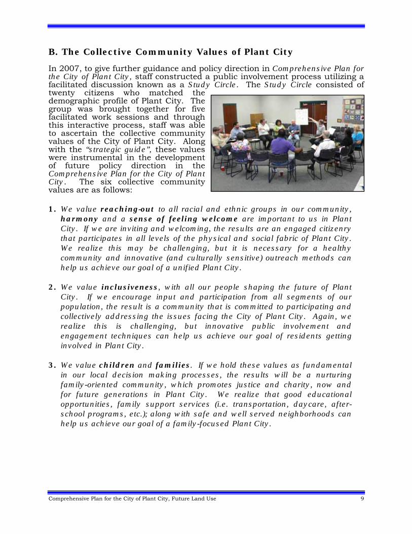
B. The Collective Community Values of Plant City In 2007, to give further guidance and policy direction in Comprehensive Plan for the City of Plant City, staff constructed a public involvement process utilizing a facilitated discussion known as a Study Circle. The Study Circle consisted of twenty citizens who matched the demographic profile of Plant City. The group was brought together for five facilitated work sessions and through this interactive process, staff was able to ascertain the collective community values of the City of Plant City. Along with the “strategic guide”, these values were instrumental in the development of future policy direction in the Comprehensive Plan for the City of Plant City. The six collective community values are as follows:
1. We value reaching-out to all racial and ethnic groups in our community,
harmony and a sense of feeling welcome are important to us in Plant City. If we are inviting and welcoming, the results are an engaged citizenry that participates in all levels of the physical and social fabric of Plant City. We realize this may be challenging, but it is necessary for a healthy community and innovative (and culturally sensitive) outreach methods can help us achieve our goal of a unified Plant City.
2. We value inclusiveness, with all our people shaping the future of Plant City. If we encourage input and participation from all segments of our population, the result is a community that is committed to participating and collectively addressing the issues facing the City of Plant City. Again, we realize this is challenging, but innovative public involvement and engagement techniques can help us achieve our goal of residents getting involved in Plant City.
3. We value children and families. If we hold these values as fundamental in our local decision making processes, the results will be a nurturing family-oriented community, which promotes justice and charity, now and for future generations in Plant City. We realize that good educational opportunities, family support services (i.e. transportation, daycare, after-school programs, etc.); along with safe and well served neighborhoods can help us achieve our goal of a family-focused Plant City.
10 Comprehensive Plan for the City of Plant City, Future Land Use
4. We value our potential for families to build deep, multi-generational roots in Plant City. If we can find the means that will allow our children to stay in our community once grown, this will allow us to sustain our neighborhoods, build our economic base and expand our social capital in Plant City. We realize that affordable housing, employment opportunities (particularly for our youth) and excellent schools can help us achieve our goal of all age groups having the opportunity to live and work in Plant City.
5. We value our entrepreneurial spirit. If we can cultivate the creativity of our people and promote it inside and outside of our community, this will enable us to build a stronger, more diverse local economy with good paying jobs. We realize that we have to leverage our local assets, increase our educational attainment levels, and provide for local vocational training opportunities to help us achieve our goal of a strong stand-alone economy in Plant City.
6. We value our unique identity, which is based in part on the cultural
heritage(s) of our residents and the historical character of our self-governing community. If we foster and advance these values in our downtown, as well as our neighborhoods, this will enable us to create a “hometown charm” that not only recognizes our history, but grows to meet the changing make-up of our residents in Plant City. We realize that neighborhood planning and managed growth will be two of the major components that can help us achieve our goal of a “hometown charm” that reflects the values and aspirations of the citizens of Plant City.
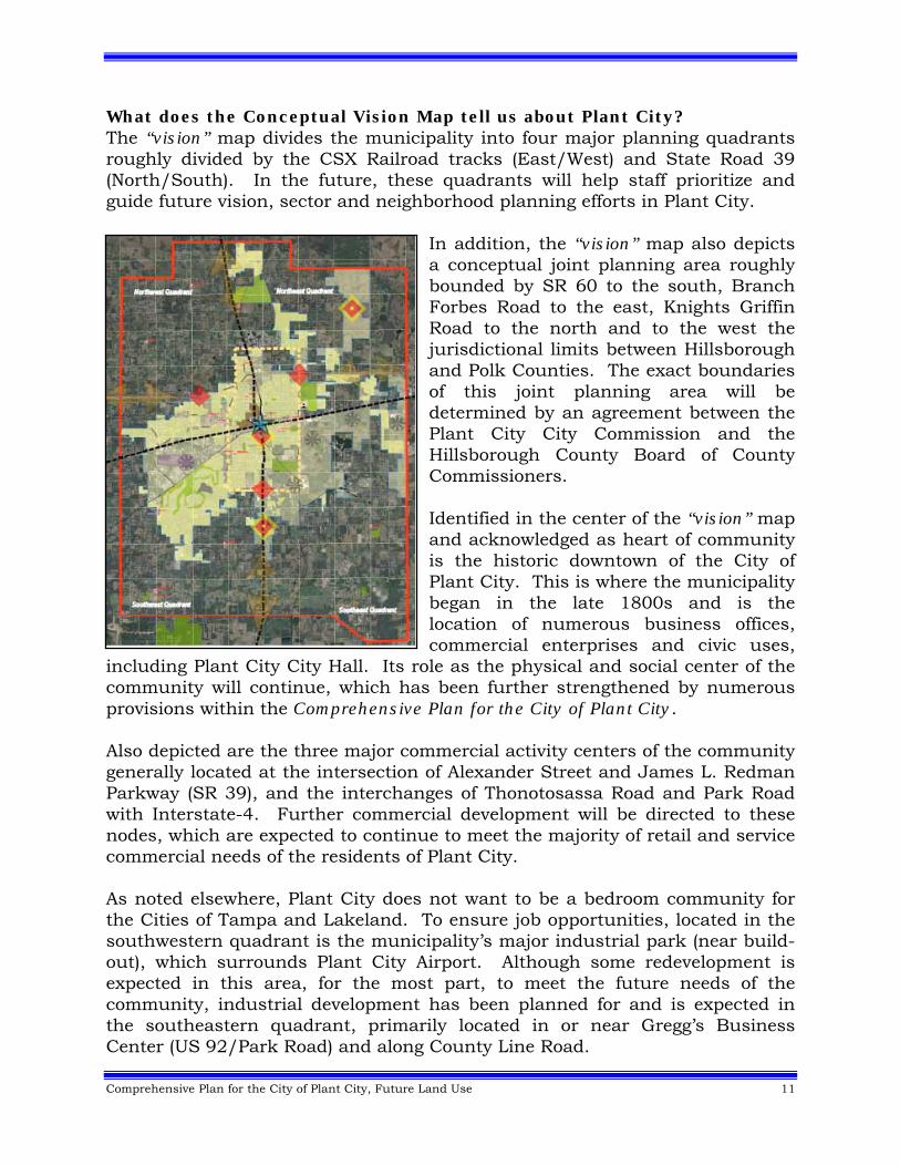
C. Conceptual Vision Map Purpose of a Conceptual Vision Map “The ‘Big Picture” Based on the “strategic guide” adopted by the Plant City City Commission, along with interviews with elected and appointed officials, the business community, staff and local residents a “vision” map (see Figure 1) was developed for the City of Plant City. The purpose of this “vision” map is to in a very simple way graphically show “the big picture” of the future of the City of Plant City. It is not intended to be detailed, but rather to give general guidance and to further support the policy direction contained within the Comprehensive Plan for the City of Plant City. The map is not an adopted part of the Plan, so it can remain flexible and react to the ever changing conditions that may impact the City of Plant City.
Comprehensive Plan for the City of Plant City, Future Land Use 11
What does the Conceptual Vision Map tell us about Plant City? The “vision” map divides the municipality into four major planning quadrants roughly divided by the CSX Railroad tracks (East/West) and State Road 39 (North/South). In the future, these quadrants will help staff prioritize and guide future vision, sector and neighborhood planning efforts in Plant City.
In addition, the “vision” map also depicts a conceptual joint planning area roughly bounded by SR 60 to the south, Branch Forbes Road to the east, Knights Griffin Road to the north and to the west the jurisdictional limits between Hillsborough and Polk Counties. The exact boundaries of this joint planning area will be determined by an agreement between the Plant City City Commission and the Hillsborough County Board of County Commissioners. Identified in the center of the “vision” map and acknowledged as heart of community is the historic downtown of the City of Plant City. This is where the municipality began in the late 1800s and is the location of numerous business offices, commercial enterprises and civic uses,
including Plant City City Hall. Its role as the physical and social center of the community will continue, which has been further strengthened by numerous provisions within the Comprehensive Plan for the City of Plant City. Also depicted are the three major commercial activity centers of the community generally located at the intersection of Alexander Street and James L. Redman Parkway (SR 39), and the interchanges of Thonotosassa Road and Park Road with Interstate-4. Further commercial development will be directed to these nodes, which are expected to continue to meet the majority of retail and service commercial needs of the residents of Plant City. As noted elsewhere, Plant City does not want to be a bedroom community for the Cities of Tampa and Lakeland. To ensure job opportunities, located in the southwestern quadrant is the municipality’s major industrial park (near build-out), which surrounds Plant City Airport. Although some redevelopment is expected in this area, for the most part, to meet the future needs of the community, industrial development has been planned for and is expected in the southeastern quadrant, primarily located in or near Gregg’s Business Center (US 92/Park Road) and along County Line Road.
12 Comprehensive Plan for the City of Plant City, Future Land Use
To offer a greater variety of living and working environments, major mixed use developments have been planned for and are expected in three locations in Plant City. The first, as you enter the municipality from the south, along James L. Redman Parkway from the existing municipal limits to Charlie Griffin Road. Known as the Mixed Use Gateway District it encompasses more than 250 acres. Also, mixed use development is expected in the Midtown Redevelopment District (85 acres) south of the historic downtown of Plant City. Finally, a new village center is envisioned in the northeastern quadrant, located near the intersection of Midway and Charlie Taylor Roads. This location was identified as part of the adopted Northeast Plant City Area Master Plan (2008). Each of these mixed use districts are supported by policy direction and the future land use map contained in the Comprehensive Plan for the City of Plant City. The whole heart of the municipality is connected by a looped transportation system, which is composed of Alexander Street, Sam Allen Road and Park Road. Additional major transportation corridors include: James L. Redman Parkway/Collins Street/Wheeler Street/Paul Buchman Highway (SR 39), Baker Street/US 92, Reynolds Street/SR 574 and Interstate-4. Means to make needed improvements and preserve the exiting capacity of each of these roadways is detailed in the Transportation Element. Residential neighborhoods have developed in all quadrants of the municipality and those of historical significance are generally located north and west of the Downtown. Most of the existing neighborhoods are at or near build-out; therefore the vast majority of future residential growth is expected in the northeastern quadrant, predominantly located north of Interstate-4. As neighborhoods are the fundamental building block and backbone of Plant City, policy direction has been included to ensure these areas are enhanced and protected from intrusion by non-residential activities. In support of these neighborhoods, parks, schools and other important public facilities are well distributed and conveniently located around the City of Plant City.
Comprehensive Plan for the City of Plant City, Future Land Use 13
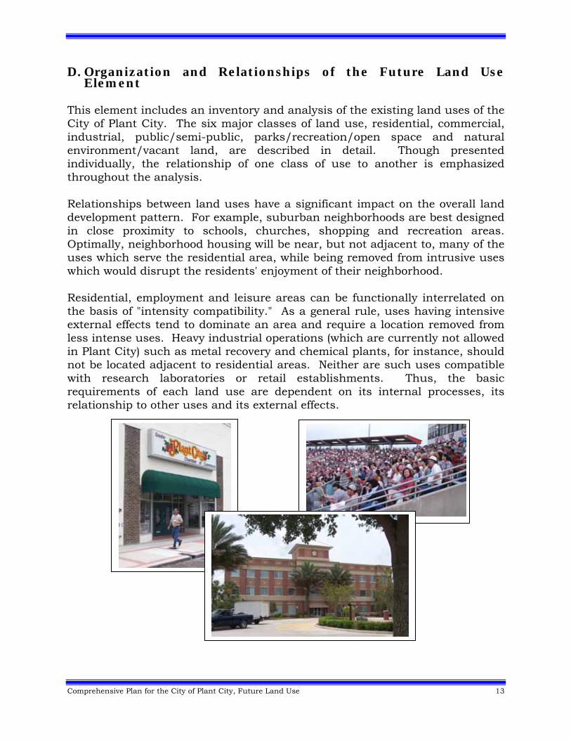
D. Organization and Relationships of the Future Land Use Element
This element includes an inventory and analysis of the existing land uses of the City of Plant City. The six major classes of land use, residential, commercial, industrial, public/semi-public, parks/recreation/open space and natural environment/vacant land, are described in detail. Though presented individually, the relationship of one class of use to another is emphasized throughout the analysis. Relationships between land uses have a significant impact on the overall land development pattern. For example, suburban neighborhoods are best designed in close proximity to schools, churches, shopping and recreation areas. Optimally, neighborhood housing will be near, but not adjacent to, many of the uses which serve the residential area, while being removed from intrusive uses which would disrupt the residents' enjoyment of their neighborhood. Residential, employment and leisure areas can be functionally interrelated on the basis of "intensity compatibility." As a general rule, uses having intensive external effects tend to dominate an area and require a location removed from less intense uses. Heavy industrial operations (which are currently not allowed in Plant City) such as metal recovery and chemical plants, for instance, should not be located adjacent to residential areas. Neither are such uses compatible with research laboratories or retail establishments. Thus, the basic requirements of each land use are dependent on its internal processes, its relationship to other uses and its external effects.
14 Comprehensive Plan for the City of Plant City, Future Land Use
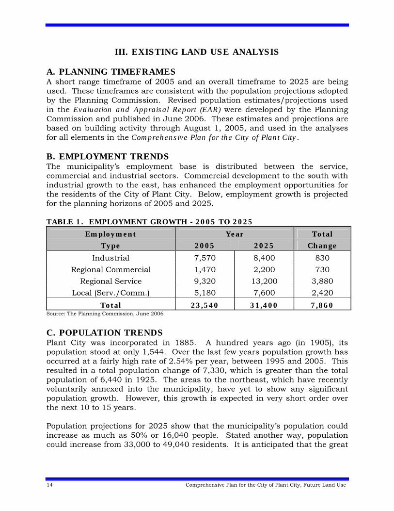
III. EXISTING LAND USE ANALYSIS A. PLANNING TIMEFRAMES A short range timeframe of 2005 and an overall timeframe to 2025 are being used. These timeframes are consistent with the population projections adopted by the Planning Commission. Revised population estimates/projections used in the Evaluation and Appraisal Report (EAR) were developed by the Planning Commission and published in June 2006. These estimates and projections are based on building activity through August 1, 2005, and used in the analyses for all elements in the Comprehensive Plan for the City of Plant City. B. EMPLOYMENT TRENDS The municipality’s employment base is distributed between the service, commercial and industrial sectors. Commercial development to the south with industrial growth to the east, has enhanced the employment opportunities for the residents of the City of Plant City. Below, employment growth is projected for the planning horizons of 2005 and 2025. TABLE 1. EMPLOYMENT GROWTH - 2005 TO 2025
Employment Year Total
Type 2005 2025 Change
Industrial 7,570 8,400 830
Regional Commercial 1,470 2,200 730
Regional Service 9,320 13,200 3,880
Local (Serv./Comm.) 5,180 7,600 2,420
Total 23,540 31,400 7,860 Source: The Planning Commission, June 2006
C. POPULATION TRENDS Plant City was incorporated in 1885. A hundred years ago (in 1905), its population stood at only 1,544. Over the last few years population growth has occurred at a fairly high rate of 2.54% per year, between 1995 and 2005. This resulted in a total population change of 7,330, which is greater than the total population of 6,440 in 1925. The areas to the northeast, which have recently voluntarily annexed into the municipality, have yet to show any significant population growth. However, this growth is expected in very short order over the next 10 to 15 years. Population projections for 2025 show that the municipality’s population could increase as much as 50% or 16,040 people. Stated another way, population could increase from 33,000 to 49,040 residents. It is anticipated that the great

Comprehensive Plan for the City of Plant City, Future Land Use 15
majority of this growth will take place over the near term or the next ten to fifteen years. Population growth is summarized as follows: TABLE 2. POPULATION GROWTH – 2000 TO 2025 Total Absolute
Year Population Change 2000 Census 29,915 N/A 2005 Estimate 33,000 3,085 2025 Projection 49,040 16,040
Source: The Planning Commission, June 2006
In addition, the municipality is a very young community, with almost 30% of its population being under 18 years of age. This is a higher percentage than any of the other jurisdiction in Hillsborough County. TABLE 3. AGE DISTRIBUTION - 2000
Age Plant City Hillsborough County Florida Under 18 29.4% 25.3% 22.8% 18 to 24 8.9% 9.3% 8.3% 25 to 44 29.1% 31.7% 28.6% 45 to 64 20.2% 21.7% 22.7% Over 65 12.3% 12.0% 17.6%
Source: U.S. Census Bureau Profile of General Demographic Characteristics 2000
Also, the City of Plant City is becoming more diversified. Many new residents identify themselves as Hispanic, whose percentage of the total population stood at only 1.5% in 1980, rose to 8.3% in 1990 and now stands at 17.4% in 2000. TABLE 4. RACE/ETHNIC CHANGE – 1980 TO 2000
Race/ Ethnicity
Plant City 1980
Plant City 2000
White Non-Hispanic 72.2% 64.3% Black Non-Hispanic 25.9% 15.9%
Other Races Non-Hispanic 0.5% 2.3% Total Hispanic (All Races) 1.5% 17.4%
Source: SOCDS Database U.S. Census Data
D. RESIDENTIAL USES Plant City is predominantly developed with single family homes, in all quadrants of the municipality, which began with the now historic neighborhoods to the north and west of downtown Plant City. In 2005, single family residential uses comprised 17.9 percent of the total land area of Plant City, while, multi-family development comprised only 2.9 percent. However due to rising land and construction costs, several areas of the municipality are now planned for multi-family development. Therefore it is expected that the
16 Comprehensive Plan for the City of Plant City, Future Land Use
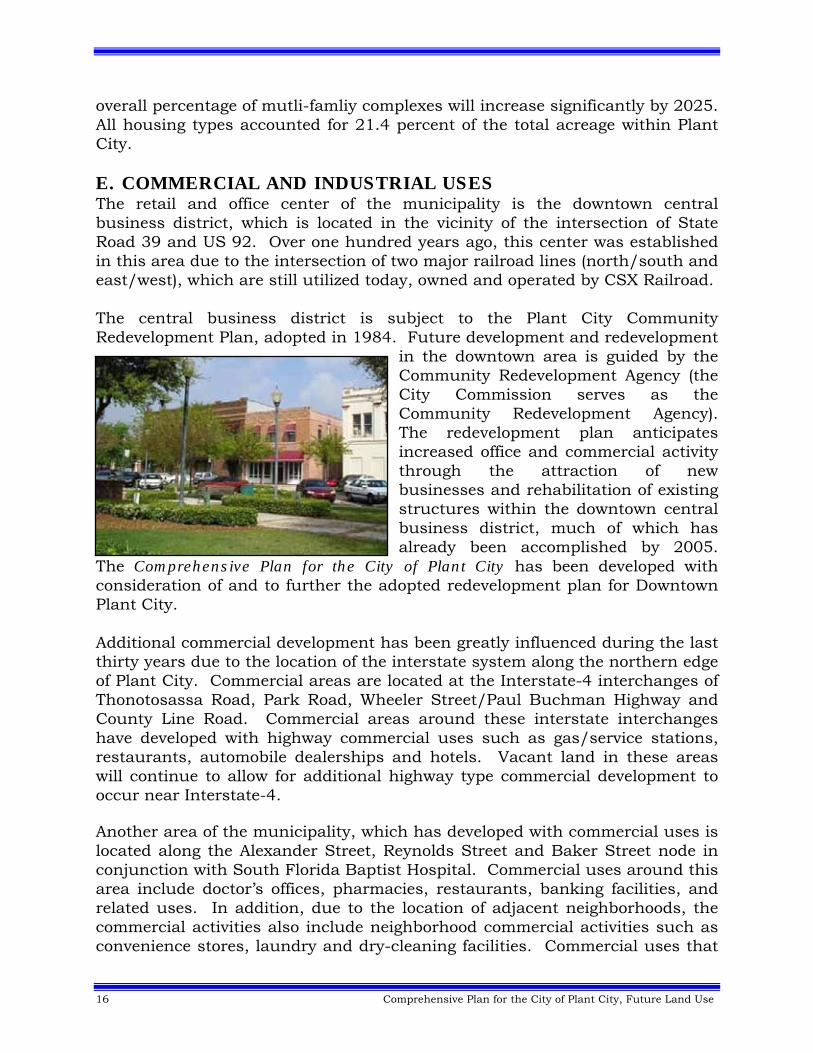
overall percentage of mutli-famliy complexes will increase significantly by 2025. All housing types accounted for 21.4 percent of the total acreage within Plant City. E. COMMERCIAL AND INDUSTRIAL USES The retail and office center of the municipality is the downtown central business district, which is located in the vicinity of the intersection of State Road 39 and US 92. Over one hundred years ago, this center was established in this area due to the intersection of two major railroad lines (north/south and east/west), which are still utilized today, owned and operated by CSX Railroad. The central business district is subject to the Plant City Community Redevelopment Plan, adopted in 1984. Future development and redevelopment
in the downtown area is guided by the Community Redevelopment Agency (the City Commission serves as the Community Redevelopment Agency). The redevelopment plan anticipates increased office and commercial activity through the attraction of new businesses and rehabilitation of existing structures within the downtown central business district, much of which has already been accomplished by 2005.
The Comprehensive Plan for the City of Plant City has been developed with consideration of and to further the adopted redevelopment plan for Downtown Plant City. Additional commercial development has been greatly influenced during the last thirty years due to the location of the interstate system along the northern edge of Plant City. Commercial areas are located at the Interstate-4 interchanges of Thonotosassa Road, Park Road, Wheeler Street/Paul Buchman Highway and County Line Road. Commercial areas around these interstate interchanges have developed with highway commercial uses such as gas/service stations, restaurants, automobile dealerships and hotels. Vacant land in these areas will continue to allow for additional highway type commercial development to occur near Interstate-4. Another area of the municipality, which has developed with commercial uses is located along the Alexander Street, Reynolds Street and Baker Street node in conjunction with South Florida Baptist Hospital. Commercial uses around this area include doctor’s offices, pharmacies, restaurants, banking facilities, and related uses. In addition, due to the location of adjacent neighborhoods, the commercial activities also include neighborhood commercial activities such as convenience stores, laundry and dry-cleaning facilities. Commercial uses that
Comprehensive Plan for the City of Plant City, Future Land Use 17
support the hospital are encouraged in this area through the South Florida Baptist Hospital Overlay District. During the late 1960’s and early 1970's, the City annexed lands in the southwest area of the municipality for a mixed use residential planned unit development known as Walden Lake. This development proved to be very successful, incorporating over 2,000 homes, which was completely built-out around 2002. In the early 1980's, the City approved a commercial node at the intersection of State Road 39 and Alexander Street to provide for general and community commercial activities for Walden Lake and other existing and future neighborhoods on the southside of Plant City. Industrial land uses are found primarily in the western portion of the municipality, north of Sydney Road, south SR 574, east of Alexander Street. Much of this land area was annexed in the early 1970's for the specific purpose of allowing development for industrial uses in proximity to Plant City Airport. As this industrial park is near build-out, the municipality in conjunction with the Chamber of Commerce began looking for additional lands to provide opportunities for industrial development to continue within Plant City. Trends indicate a shift to the east along Park (i.e. Gregg’s Business Center) and County Line Roads as the industrial lands on the west side of the municipality are developed. Industrial uses developed within the City include light manufacturing and warehouses, while heavy or obnoxious industrial uses are not allowed by ordinance and municipal facilities are required by Plant City. Commercial development comprises approximately 4.3 percent and industrial development comprises approximately 5.6 percent of the total land area of Plant City. F. PUBLIC AND SEMI-PUBLIC USES Semi-public uses include privately-owned establishments generally for public use, such as churches, day care centers, private schools, nursing homes, clinics, hospitals, clubs, utilities, communication and transportation facilities. Public facilities are those facilities, except for recreational facilities, owned and/or operated by a public entity for a public purpose such as public schools, the community college and governmental buildings. Over 23 percent of all land uses in the municipality can be classified as public/semi-public, which includes public building and facilities, utilities, and right-of-ways for transmission lines and roadways within Plant City. In these areas the maximum Floor Area Ratio (FAR) shall not exceed .35.
18 Comprehensive Plan for the City of Plant City, Future Land Use
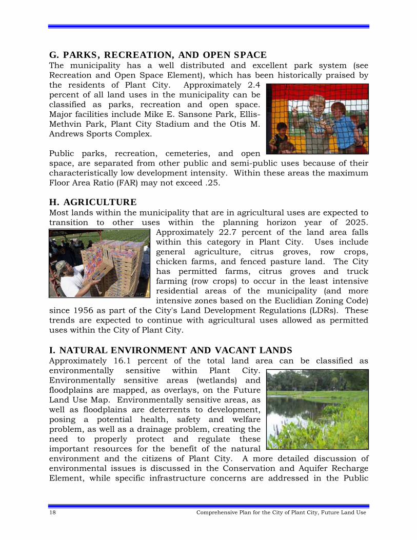
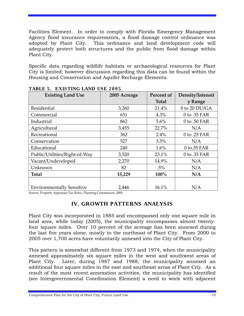
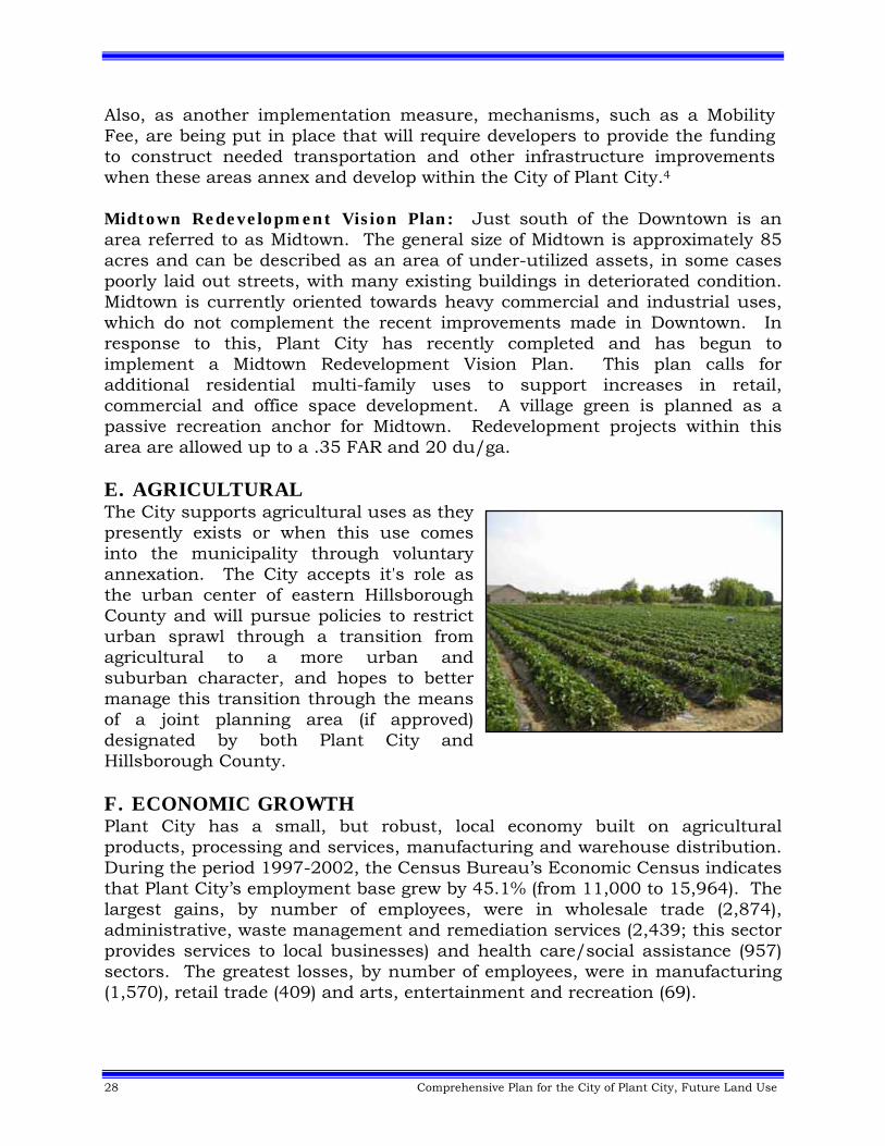
G. PARKS, RECREATION, AND OPEN SPACE The municipality has a well distributed and excellent park system (see Recreation and Open Space Element), which has been historically praised by the residents of Plant City. Approximately 2.4 percent of all land uses in the municipality can be classified as parks, recreation and open space. Major facilities include Mike E. Sansone Park, Ellis-Methvin Park, Plant City Stadium and the Otis M. Andrews Sports Complex. Public parks, recreation, cemeteries, and open space, are separated from other public and semi-public uses because of their characteristically low development intensity. Within these areas the maximum Floor Area Ratio (FAR) may not exceed .25. H. AGRICULTURE Most lands within the municipality that are in agricultural uses are expected to transition to other uses within the planning horizon year of 2025.
Approximately 22.7 percent of the land area falls within this category in Plant City. Uses include general agriculture, citrus groves, row crops, chicken farms, and fenced pasture land. The City has permitted farms, citrus groves and truck farming (row crops) to occur in the least intensive residential areas of the municipality (and more intensive zones based on the Euclidian Zoning Code)
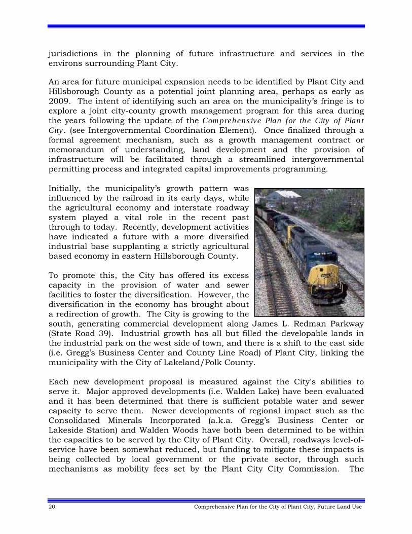
since 1956 as part of the City's Land Development Regulations (LDRs). These trends are expected to continue with agricultural uses allowed as permitted uses within the City of Plant City. I. NATURAL ENVIRONMENT AND VACANT LANDS Approximately 16.1 percent of the total land area can be classified as environmentally sensitive within Plant City. Environmentally sensitive areas (wetlands) and floodplains are mapped, as overlays, on the Future Land Use Map. Environmentally sensitive areas, as well as floodplains are deterrents to development, posing a potential health, safety and welfare problem, as well as a drainage problem, creating the need to properly protect and regulate these important resources for the benefit of the natural environment and the citizens of Plant City. A more detailed discussion of environmental issues is discussed in the Conservation and Aquifer Recharge Element, while specific infrastructure concerns are addressed in the Public
Comprehensive Plan for the City of Plant City, Future Land Use 19
Facilities Element. In order to comply with Florida Emergency Management Agency flood insurance requirements, a flood damage control ordinance was adopted by Plant City. This ordinance and land development code will adequately protect both structures and the public from flood damage within Plant City. Specific data regarding wildlife habitats or archaeological resources for Plant City is limited; however discussion regarding this data can be found within the Housing and Conservation and Aquifer Recharge Elements. TABLE 5. EXISTING LAND USE 2005
Existing Land Use 2005 Acreage Percent of
Total
Density/Intensit
y Range
Residential 3,260 21.4% 0 to 20 DU/GA
Commercial 651 4.3% 0 to .35 FAR
Industrial 862 5.6% 0 to .50 FAR
Agricultural 3,455 22.7% N/A
Recreational 362 2.4% 0 to .25 FAR
Conservation 527 3.5% N/A
Educational 240 1.6% 0 to.35 FAR
Public/Utilities/Right‐of‐Way 3,520 23.1% 0 to .35 FAR
Vacant/Undeveloped 2,270 14.9% N/A
Unknown 82 .5% N/A
Total 15,229 100% N/A
Environmentally Sensitive
2,446
16.1%
N/A Source: Property Appraiser Tax Roles, Planning Commission, 2005
IV. GROWTH PATTERNS ANALYSIS
Plant City was incorporated in 1885 and encompassed only one square mile in land area, while today (2005), the municipality encompasses almost twenty-four square miles. Over 10 percent of the acreage has been annexed during the last five years alone, mostly to the northeast of Plant City. From 2000 to 2005 over 1,700 acres have voluntarily annexed into the City of Plant City. This pattern is somewhat different from 1973 and 1974, when the municipality annexed approximately six square miles in the west and southwest areas of Plant City. Later, during 1987 and 1988, the municipality annexed an additional four square miles in the east and southeast areas of Plant City. As a result of the most recent annexation activities, the municipality has identified (see Intergovernmental Coordination Element) a need to work with adjacent
20 Comprehensive Plan for the City of Plant City, Future Land Use
jurisdictions in the planning of future infrastructure and services in the environs surrounding Plant City. An area for future municipal expansion needs to be identified by Plant City and Hillsborough County as a potential joint planning area, perhaps as early as 2009. The intent of identifying such an area on the municipality’s fringe is to explore a joint city-county growth management program for this area during the years following the update of the Comprehensive Plan for the City of Plant City. (see Intergovernmental Coordination Element). Once finalized through a formal agreement mechanism, such as a growth management contract or memorandum of understanding, land development and the provision of infrastructure will be facilitated through a streamlined intergovernmental permitting process and integrated capital improvements programming. Initially, the municipality’s growth pattern was influenced by the railroad in its early days, while the agricultural economy and interstate roadway system played a vital role in the recent past through to today. Recently, development activities have indicated a future with a more diversified industrial base supplanting a strictly agricultural based economy in eastern Hillsborough County. To promote this, the City has offered its excess capacity in the provision of water and sewer facilities to foster the diversification. However, the diversification in the economy has brought about a redirection of growth. The City is growing to the south, generating commercial development along James L. Redman Parkway (State Road 39). Industrial growth has all but filled the developable lands in the industrial park on the west side of town, and there is a shift to the east side (i.e. Gregg’s Business Center and County Line Road) of Plant City, linking the municipality with the City of Lakeland/Polk County. Each new development proposal is measured against the City's abilities to serve it. Major approved developments (i.e. Walden Lake) have been evaluated and it has been determined that there is sufficient potable water and sewer capacity to serve them. Newer developments of regional impact such as the Consolidated Minerals Incorporated (a.k.a. Gregg’s Business Center or Lakeside Station) and Walden Woods have both been determined to be within the capacities to be served by the City of Plant City. Overall, roadways level-of-service have been somewhat reduced, but funding to mitigate these impacts is being collected by local government or the private sector, through such mechanisms as mobility fees set by the Plant City City Commission. The
Comprehensive Plan for the City of Plant City, Future Land Use 21
levels-of-service planning standards established for this plan are found in the Transportation and Capital Improvements Elements.2 Where once the central business district held command over the retail market, now the shopping centers, located on the periphery of the City, are attracting the customers in eastern Hillsborough County. Today, the downtown remains the office and finance center, promoted through several efforts initiated by local elected officials, designed to ignite the spark in commercial activity through the Community Redevelopment Agency and the Main Street Program. Residentially, the City of Plant City has seen a diversification in its housing types. The traditional detached single family centrally-located dwelling has been augmented by a variety of housing styles that provide for townhomes, cluster developments, zero lot line and patio homes. The single family detached dwelling is still the preferred housing type within Plant City (see Housing Element). Throughout the City there is a significant amount of vacant and urbanizable land, predominately east of SR 39. A good portion of that vacant land is unusable due to its environmental constraints. The useable vacant lands are found mostly in the northeast and southeast quadrants of Plant City. Those lands that are environmentally sensitive will be evaluated on an individual basis to determine their suitability for development. A. RESIDENTIAL GROWTH Plant City continues to experience a high demand for single family building types. This residential character is reflected in the 2000 Census, which reported that a clear majority (67%) of all dwelling units in the City were single family units. The dominance of single family building types is expected to continue through the planning period, although the ratio of single family to multi-family units will decrease somewhat. This is due to rising land and construction costs, as well as the differentials in density between the two dwelling unit types, which allows more multi-family than single family units to be built per acre of available land. The municipality’s neighborhoods have a predominant single family character. The existing development pattern will be maintained in these areas with some infill encouraged in selected areas. Vacant lands northeast of the municipality can be expected to continue developing with single family uses though higher intensity residential development is expected near the envisioned village center, noted in the Northeast Plant City Area Master Plan.
22 Comprehensive Plan for the City of Plant City, Future Land Use
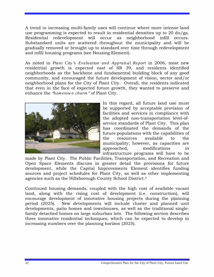
A trend to increasing multi-family uses will continue where more intense land use programming is expected to result in residential densities up to 20 du/ga. Residential redevelopment will occur as neighborhood infill occurs. Substandard units are scattered throughout the municipality and will be gradually removed or brought up to standard over time through redevelopment and infill housing programs (see Housing Element). As noted in Plant City’s Evaluation and Appraisal Report in 2006, most new residential growth is expected east of SR 39, and residents identified neighborhoods as the backbone and fundamental building block of any good community, and encouraged the future development of vision, sector and/or neighborhood plans for the City of Plant City. Overall, the residents indicated that even in the face of expected future growth, they wanted to preserve and enhance the “hometown charm” of Plant City.
In this regard, all future land use must be supported by acceptable provision of facilities and services in compliance with the adopted non-transportation level-of-service standards of Plant City. This plan has coordinated the demands of the future populations with the capabilities of the resources available to the municipality; however, as capacities are approached, modifications in infrastructure programs will have to be
made by Plant City. The Public Facilities, Transportation, and Recreation and Open Space Elements discuss in greater detail the provisions for future development, while the Capital Improvements Element identifies funding sources and project schedules for Plant City, as well as other implementing agencies such as the Hillsborough County School District.3 Continued housing demands, coupled with the high cost of available vacant land, along with the rising cost of development (i.e. construction), will encourage development of innovative housing projects during the planning period (2025). New developments will include cluster and planned unit developments, patio homes and townhouses, as well as the traditional single-family detached homes on large suburban lots. The following section describes three innovative residential techniques, which can be expected to develop in increasing numbers over the planning horizon (2025).
Comprehensive Plan for the City of Plant City, Future Land Use 23
Cluster Developments: The cluster pattern of development groups housing sites close together around an access court or cul-de-sac, while the remainder of the tract is left in its natural state as common open space. Introduced with the Radburn plan in 1928, cluster development allows for increased densities on a portion of a site, while providing greater traffic safety, privacy and many amenities not found in traditional subdivisions. Cluster developments are possible on parcels of land as small as one acre and would be compatible with most existing residential areas. Cluster developments can be particularly suitable for sites with environmental constraints and have many advantages, including: • Providing a way to preserve open space and create park and play areas; • Encouraging community cohesiveness; • Protecting neighborhoods from through traffic; • Allowing greater economy in design by concentrating utilities; and • Encouraging innovation in site and building design within the general
density constraints of the land use plan. Townhouses and Patio Homes: Increasing development costs in single family subdivisions have sparked renewed interest in townhouses and patio homes as an acceptable compromise between detached homes and apartments. The major age groups likely to purchase this type of housing are young couples and the elderly who are seeking suburban amenities at a moderate cost. Architectural and design innovations can, and have, transformed these types of dwelling units from drab, monotonous row houses into attractive homes for rent or ownership. The chief advantages of townhouses and patio homes include the following: • Lower cost per unit than single-family detached dwellings; • More efficient use of land through higher densities without loss of privacy
to the residents; and • Opportunities for innovative design, which can preserve natural features
and open space. Planned Unit Developments: The planned unit development can be used very successfully to "master plan" large tracts of land for a mixture of housing types and non-residential uses. The planned unit development was an outgrowth of the cluster development concept and retains many of its advantages. The technique has become popular in recent years not only because of the flexibility it allows the development community in responding to changing market conditions, but also because of its requirement for local government involvement in development of the site plan. Planned unit development site plans can only be developed as approved by the local government and require criteria for overall density, open space, subdivision standards, water supply and sewage disposal.
24 Comprehensive Plan for the City of Plant City, Future Land Use
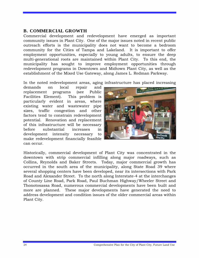
B. COMMERCIAL GROWTH Commercial development and redevelopment have emerged as important community issues in Plant City. One of the major issues noted in recent public outreach efforts is the municipality does not want to become a bedroom community for the Cities of Tampa and Lakeland. It is important to offer employment opportunities, especially to young adults, to ensure the deep multi-generational roots are maintained within Plant City. To this end, the municipality has sought to improve employment opportunities through redevelopment programs in Downtown and Midtown Plant City, as well as the establishment of the Mixed Use Gateway, along James L. Redman Parkway. In the noted redevelopment areas, aging infrastructure has placed increasing demands on local repair and replacement programs (see Public Facilities Element). This problem is particularly evident in areas, where existing water and wastewater pipe sizes, traffic congestion and other factors tend to constrain redevelopment potential. Renovation and replacement of this infrastructure will be necessary before substantial increases in development intensity necessary to make redevelopment financially feasible can occur. Historically, commercial development of Plant City was concentrated in the downtown with strip commercial infilling along major roadways, such as Collins, Reynolds and Baker Streets. Today, major commercial growth has occurred in the south area of the municipality, along State Road 39 where several shopping centers have been developed, near its intersections with Park Road and Alexander Street. To the north along Interstate-4 at the interchanges of County Line Road, Park Road, Paul Buchman Highway/Wheeler Street and Thonotosassa Road, numerous commercial developments have been built and more are planned. These major developments have generated the need to address development and condition issues of the older commercial areas within Plant City.
Comprehensive Plan for the City of Plant City, Future Land Use 25
Plant City has an active downtown revitalization organization in the Community Redevelopment Agency (CRA), which is composed of the members of the Plant City City Commission. The agency was brought into existence to help provide a coordinated direction to maintain the downtown as an active business center of Plant City. The CRA receives its operational and project funding from Plant City and through the monies generated through the tax increment process for Downtown. In addition to the CRA, the City participates in the Main Street Program, which provided direction and programs for the maintenance and revitalization of Downtown. In addition, as noted earlier significant development and redevelopment of commercial projects is expected in the Midtown and Mixed Use Gateway Districts.
C. INDUSTRIAL GROWTH Plant City has experienced steady industrial growth over the past years with almost total utilization of its industrial park (around Plant City Airport), as well as perimeter development on the west side of the Plant City. Vacant and urbanizable lands in the eastern side of the municipality will allow for the development of additional industrial uses in Gregg’s Business Center (a.k.a. Lakeside Station) and along County Line Road, south of Interstate-4. The municipality encourages industrial uses, which are smokeless, odorless, non-toxic and generally not a health hazard or a nuisance to adjacent properties in Plant City, Hillsborough County, Lakeland or Polk County. To date, the City and the Chamber of Commerce have been successful in recruiting that type of industry for Plant City. Recent events have indicated a significant expansion in the economic base of the municipality through the future location of several major industrial employers to the east of Park Road, providing new job opportunities and revenue sources to Plant City. There is adequate potable water and sanitary sewer capacity to maintain the current adopted levels of service of Plant City. The municipality is expected to maintain a suburban, commuter and local job market through the planning period of 2025.
D. MIXED-USE GROWTH Gregg’s Business Center (a.k.a. Lakeside Station): Plant City’s first large scale mixed use development is Gregg’s Business Center (a.k.a. Lakeside Station), which is approximately 1,370 acres and located south of US 92 and east of Park Road. In 2002, a Mixed Use: Residential/Commercial/Industrial Land Use Plan Category was developed and applied to this site, which currently requires the following mixture of land uses:
Residential: 10% minimum and 50% maximum; Commercial: 5% minimum and 35% maximum, and Light-Industrial: 45% minimum and 85% maximum.
26 Comprehensive Plan for the City of Plant City, Future Land Use
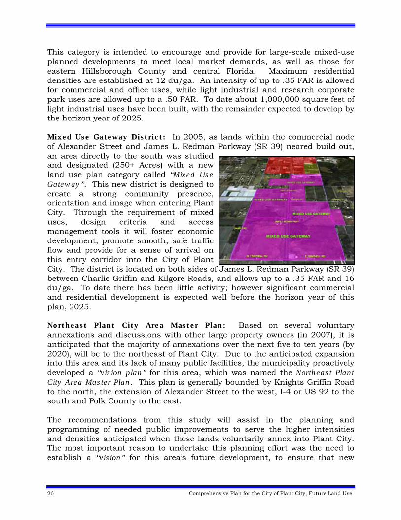
This category is intended to encourage and provide for large-scale mixed-use planned developments to meet local market demands, as well as those for eastern Hillsborough County and central Florida. Maximum residential densities are established at 12 du/ga. An intensity of up to .35 FAR is allowed for commercial and office uses, while light industrial and research corporate park uses are allowed up to a .50 FAR. To date about 1,000,000 square feet of light industrial uses have been built, with the remainder expected to develop by the horizon year of 2025. Mixed Use Gateway District: In 2005, as lands within the commercial node of Alexander Street and James L. Redman Parkway (SR 39) neared build-out, an area directly to the south was studied and designated (250+ Acres) with a new land use plan category called “Mixed Use Gateway”. This new district is designed to create a strong community presence, orientation and image when entering Plant City. Through the requirement of mixed uses, design criteria and access management tools it will foster economic development, promote smooth, safe traffic flow and provide for a sense of arrival on this entry corridor into the City of Plant City. The district is located on both sides of James L. Redman Parkway (SR 39) between Charlie Griffin and Kilgore Roads, and allows up to a .35 FAR and 16 du/ga. To date there has been little activity; however significant commercial and residential development is expected well before the horizon year of this plan, 2025. Northeast Plant City Area Master Plan: Based on several voluntary annexations and discussions with other large property owners (in 2007), it is anticipated that the majority of annexations over the next five to ten years (by 2020), will be to the northeast of Plant City. Due to the anticipated expansion into this area and its lack of many public facilities, the municipality proactively developed a “vision plan” for this area, which was named the Northeast Plant City Area Master Plan. This plan is generally bounded by Knights Griffin Road to the north, the extension of Alexander Street to the west, I-4 or US 92 to the south and Polk County to the east. The recommendations from this study will assist in the planning and programming of needed public improvements to serve the higher intensities and densities anticipated when these lands voluntarily annex into Plant City. The most important reason to undertake this planning effort was the need to establish a “vision” for this area’s future development, to ensure that new
Comprehensive Plan for the City of Plant City, Future Land Use 27
residents are well integrated into the social fabric of the City of Plant City. The guiding principals of this study included: Preserving Hometown Charm of Plant City; Promoting Economic Diversity; Providing Adequate Infrastructure, and; Ensuring Sustainable Natural and Built Environments.
The preferred land use scenario of this study promotes a village center concept, with higher intensity and density mixed uses at its core, while leaving areas in the periphery in a more rural lifestyle in unincorporated Hillsborough County. Another interesting feature includes a large passive park just south of Knights Griffin Road and east of Paul Buchman Highway (SR 39). Rural areas will remain generally north of Knights Griffin Road and in those areas just west of County Line Road, north of Swindell Road. Non-residential uses (industrial and commercial) are envisioned at the three interchanges with Interstate-4, at Paul Buchman Highway (SR 39), Park Road and County Line Road. Environmentally sensitive areas will be protected with a land use designation of Natural Preservation. In addition, this land use scenario promotes:
• A balanced mix of Housing, Employment and Civic Uses; • The clustering of Residential Uses; • Greenways that provide alternatives to Vehicular Trips and Recreational
Opportunities; • In the rural areas, the recognition of continued Agricultural Uses, and; • The development of a roadway network that creates parallel facilities to I‐4.
This preferred land use scenario, which covers some twenty square miles, has been adopted into the Comprehensive Plan for the City of Plant City (Reference: Future Land Use Element – Map Series). Another key component is the map depicting the recommended roadway network (Phase 1 – 2025) of the Northeast Plant City Area Master Plan, which is part of the adopted map series (Figure 17) of the Transportation Element. Major east-west roadways recommended to be improved include Knights Griffin, Midway and Sam Allen Roads. Along with more in-depth site analysis at the time of annexation, the information contained in both of these maps will be used to generally guide development within northeast Plant City. To implement this plan and to better administer this area, the municipality is in the process of developing a Joint Planning Agreement (JPA) with Hillsborough County (Reference: Intergovernmental Coordination Element).
28 Comprehensive Plan for the City of Plant City, Future Land Use
Also, as another implementation measure, mechanisms, such as a Mobility Fee, are being put in place that will require developers to provide the funding to construct needed transportation and other infrastructure improvements when these areas annex and develop within the City of Plant City.4 Midtown Redevelopment Vision Plan: Just south of the Downtown is an area referred to as Midtown. The general size of Midtown is approximately 85 acres and can be described as an area of under-utilized assets, in some cases poorly laid out streets, with many existing buildings in deteriorated condition. Midtown is currently oriented towards heavy commercial and industrial uses, which do not complement the recent improvements made in Downtown. In response to this, Plant City has recently completed and has begun to implement a Midtown Redevelopment Vision Plan. This plan calls for additional residential multi-family uses to support increases in retail, commercial and office space development. A village green is planned as a passive recreation anchor for Midtown. Redevelopment projects within this area are allowed up to a .35 FAR and 20 du/ga. E. AGRICULTURAL The City supports agricultural uses as they presently exists or when this use comes into the municipality through voluntary annexation. The City accepts it's role as the urban center of eastern Hillsborough County and will pursue policies to restrict urban sprawl through a transition from agricultural to a more urban and suburban character, and hopes to better manage this transition through the means of a joint planning area (if approved) designated by both Plant City and Hillsborough County. F. ECONOMIC GROWTH Plant City has a small, but robust, local economy built on agricultural products, processing and services, manufacturing and warehouse distribution. During the period 1997-2002, the Census Bureau’s Economic Census indicates that Plant City’s employment base grew by 45.1% (from 11,000 to 15,964). The largest gains, by number of employees, were in wholesale trade (2,874), administrative, waste management and remediation services (2,439; this sector provides services to local businesses) and health care/social assistance (957) sectors. The greatest losses, by number of employees, were in manufacturing (1,570), retail trade (409) and arts, entertainment and recreation (69).
Comprehensive Plan for the City of Plant City, Future Land Use 29
Location quotient analysis shows that Plant City has concentrations in the manufacturing (2.46-Plant City; 1.09-Hillsborough County; 2.20-Polk County), wholesale trade (5.45-Plant City; 1.66-Hillsborough County; 1.40-Polk County) and other services (except public administration; 1.29-Plant City; 0.94-Hillsborough County; 1.23-Polk County) that are greater than Hillsborough County and Polk County. Shift share analysis indicates that the employment growth in one sector, in particular, wholesale trade, is overwhelming due to its regional share component (2854.47 regional share of 2874 total change). The reasons for this may be related to the City’s role as an agricultural service center (wholesale of food products) and the growth in warehouse distribution in the City of Plant City. There is plenty of available, developable land for economic growth. Based on 2007 Plant City comprehensive plan future land use map data, there is 923 developable acres of industrial land and 337 developable acres of commercial land. This represents 23.5% of the total amount of developable land acreage (1260 industrial + commercial/5351 total developable acreage). Labor force participation is 60%, which is consistent with the county and nation. The population lags behind in educational attainment levels with the county and the nation. (High School Graduate: 71.3% Plant City; 80.8% Hillsborough County; 80.4% US; Bachelors Degree or Higher: 16.6% Plant City; 25.1% Hillsborough County; 24.4% US). This may pull down Plant City’s ability to attract certain types of businesses. There are two higher educational institutions that are important to Plant City – Hillsborough Community College (HCC), Plant City Campus and the Gulf Coast Research and Education Center (housed at HCC Plant City and part of the University of Florida Institute of Food and Agricultural Sciences Program). Overall the city has good infrastructure with capacity available in most facilities. One notable exception – Interstate-4 is at, or near, capacity with no plans to be widened. Plant City is often viewed as a small southern city. “Hometown charm” was described by many people in the public involvement process as something they liked about Plant City. Images of friendly people (southern hospitality), quaint old buildings and a slower pace of life are all part of “hometown charm”. This could be used for the economic advantage of Plant City.
30 Comprehensive Plan for the City of Plant City, Future Land Use
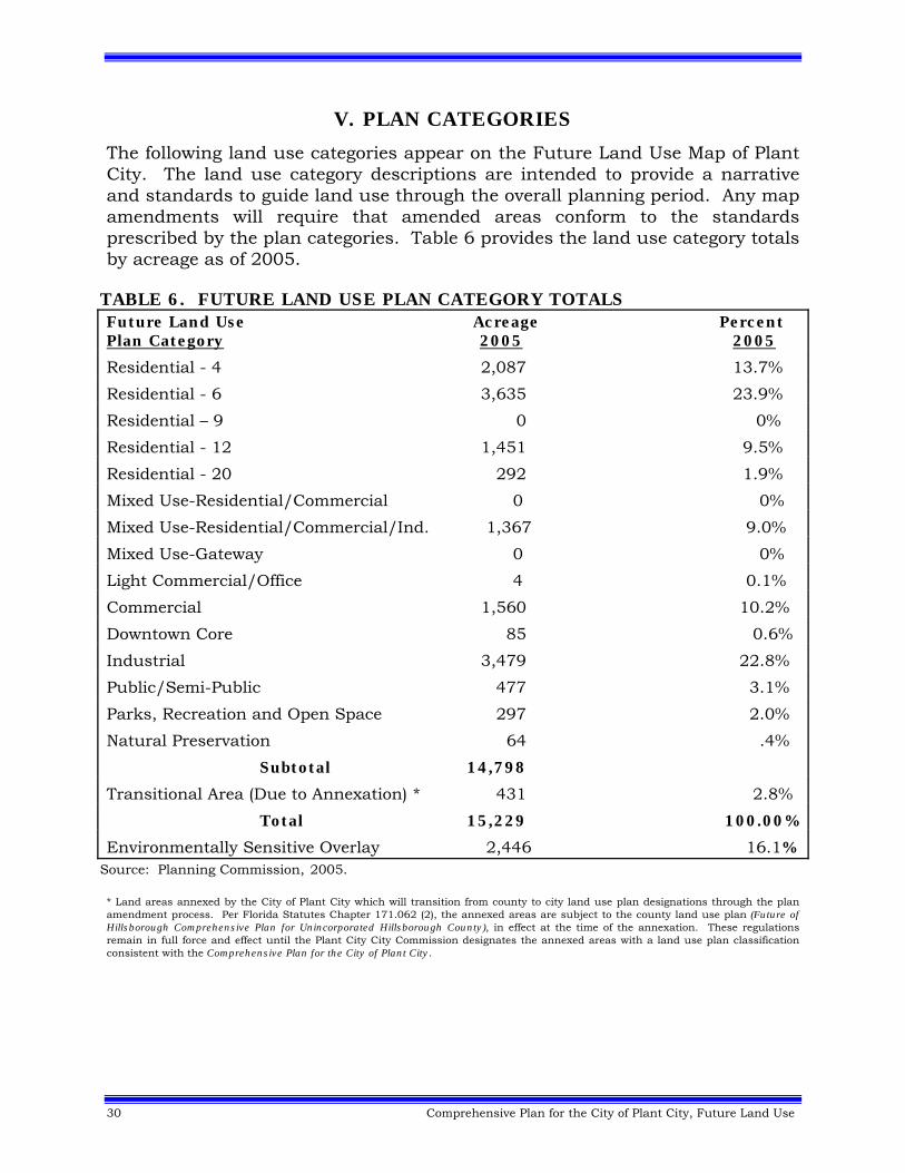
V. PLAN CATEGORIES
The following land use categories appear on the Future Land Use Map of Plant City. The land use category descriptions are intended to provide a narrative and standards to guide land use through the overall planning period. Any map amendments will require that amended areas conform to the standards prescribed by the plan categories. Table 6 provides the land use category totals by acreage as of 2005.
TABLE 6. FUTURE LAND USE PLAN CATEGORY TOTALS Future Land Use Acreage Percent Plan Category 2005 2005
Residential - 4 2,087 13.7%
Residential - 6 3,635 23.9%
Residential – 9 0 0%
Residential - 12 1,451 9.5%
Residential - 20 292 1.9%
Mixed Use-Residential/Commercial 0 0%
Mixed Use-Residential/Commercial/Ind. 1,367 9.0%
Mixed Use-Gateway 0 0%
Light Commercial/Office 4 0.1%
Commercial 1,560 10.2%
Downtown Core 85 0.6%
Industrial 3,479 22.8%
Public/Semi-Public 477 3.1%
Parks, Recreation and Open Space 297 2.0%
Natural Preservation 64 .4%
Subtotal 14,798
Transitional Area (Due to Annexation) * 431 2.8%
Total 15,229 100.00%
Environmentally Sensitive Overlay 2,446 16.1% Source: Planning Commission, 2005. * Land areas annexed by the City of Plant City which will transition from county to city land use plan designations through the plan amendment process. Per Florida Statutes Chapter 171.062 (2), the annexed areas are subject to the county land use plan (Future of Hillsborough Comprehensive Plan for Unincorporated Hillsborough County), in effect at the time of the annexation. These regulations remain in full force and effect until the Plant City City Commission designates the annexed areas with a land use plan classification consistent with the Comprehensive Plan for the City of Plant City.
Comprehensive Plan for the City of Plant City, Future Land Use 31
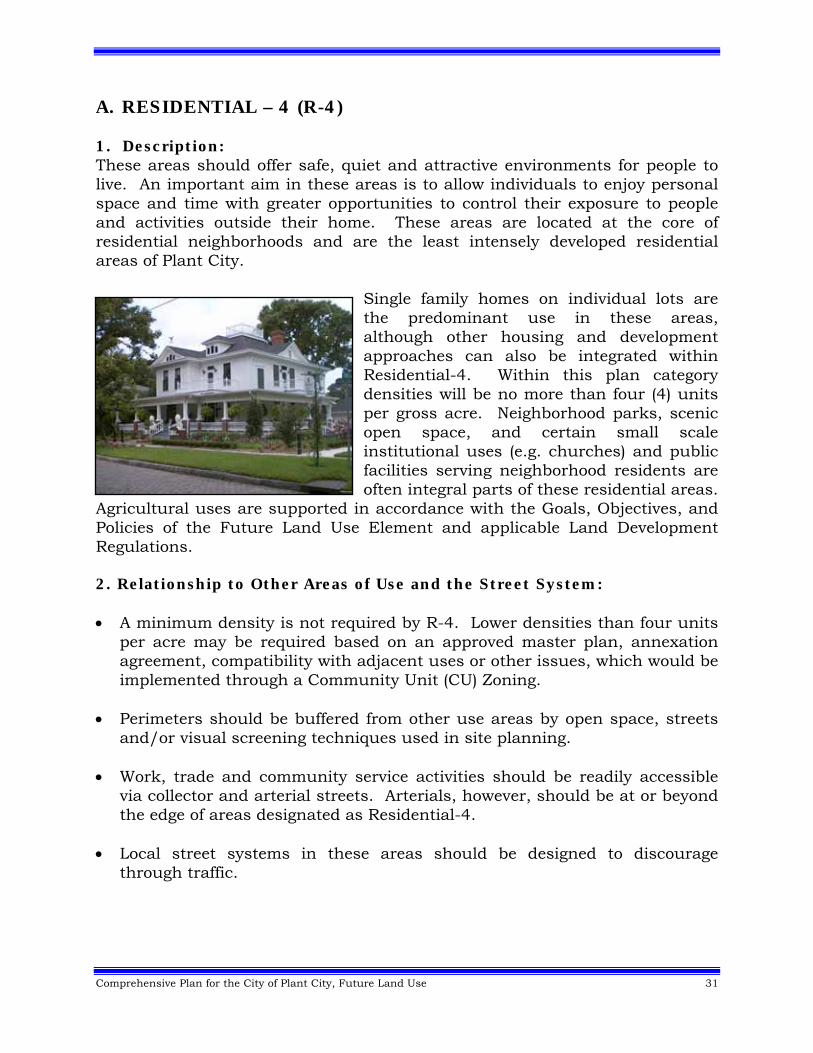
A. RESIDENTIAL – 4 (R-4) 1. Description: These areas should offer safe, quiet and attractive environments for people to live. An important aim in these areas is to allow individuals to enjoy personal space and time with greater opportunities to control their exposure to people and activities outside their home. These areas are located at the core of residential neighborhoods and are the least intensely developed residential areas of Plant City.
Single family homes on individual lots are the predominant use in these areas, although other housing and development approaches can also be integrated within Residential-4. Within this plan category densities will be no more than four (4) units per gross acre. Neighborhood parks, scenic open space, and certain small scale institutional uses (e.g. churches) and public facilities serving neighborhood residents are often integral parts of these residential areas.
Agricultural uses are supported in accordance with the Goals, Objectives, and Policies of the Future Land Use Element and applicable Land Development Regulations. 2. Relationship to Other Areas of Use and the Street System: A minimum density is not required by R-4. Lower densities than four units
per acre may be required based on an approved master plan, annexation agreement, compatibility with adjacent uses or other issues, which would be implemented through a Community Unit (CU) Zoning.
Perimeters should be buffered from other use areas by open space, streets
and/or visual screening techniques used in site planning. Work, trade and community service activities should be readily accessible
via collector and arterial streets. Arterials, however, should be at or beyond the edge of areas designated as Residential-4.
Local street systems in these areas should be designed to discourage
through traffic.
32 Comprehensive Plan for the City of Plant City, Future Land Use
3. Relationship to Facilities and Services: Public water and sewer service available or programmed for the area. In fire protection, police and EMS service areas. Schools, neighborhood recreation, and small scale semi-public uses such as
churches and associated daycare facilities integrated into area and accessible via collector streets.
Public, semi-public and civic uses (e.g. municipal buildings, schools,
churches) may be considered with a maximum intensity of 0.25 FAR in accordance with the development standards of the Future Land Use Element and applicable Land Development Regulations.5
4. Relationship to Natural Resources and Features: Areas where most land is not subject to flooding and where soil conditions
are suitable for bearing structures, streets, etc. Areas where land contour, tree cover and views can be used in site design to
add scenic amenity and diversity to the residential neighborhood. B. RESIDENTIAL – 6 (R-6) 1. Description: These areas should offer safe, quiet and attractive environments for people to live. An important aim in Residential-6 areas is to allow individuals to enjoy personal space and time with greater opportunities to control their exposure to people and activities outside their home. Single-family homes on individual lots are the predominant use in these areas, although other housing and development approaches can also be integrated at lower densities. Residential development within Residential-6 will be no more than six (6) units per gross acre. Neighborhood parks, scenic open space, institutional uses (e.g. churches) and public facilities serving neighborhood residents are often integral parts of these residential areas. Convenience commercial establishments can also be accommodated under controlled conditions that protect the basic quality of the residential environment. Mixed use residential developments that are planned projects designed to serve the local residents may be considered in accordance with the Goals, Objectives, and Policies of the Future Land Use Element and applicable Land Development Regulations. Agricultural uses are supported in accordance with the Goals, Objectives, and Policies of the Future Land Use Element and applicable Land Development Regulations.
Comprehensive Plan for the City of Plant City, Future Land Use 33
2. Relationship to Other Areas of Use and the Street System: Perimeters should be buffered from other use areas by open space, streets
and/or visual screening techniques used in site planning. Work, trade and community service activities should be readily accessible
via collector and arterial streets. Arterials, however, should be at or beyond the edge of areas designated as Residential-6.
Local street systems in these areas should be designed to discourage
through traffic. Neighborhood office/commercial uses shall be located only at intersections
of arterials, arterials with collectors or collectors and developed at a maximum intensity of 0.25 FAR in accordance with locational criteria and development standards of the Future Land Use Element and applicable Land Development Regulations.
3. Relationship to Facilities and Services: Public water and sewer service available or programmed for the area. In fire, police and EMS service areas. Schools, neighborhood recreation, and small scale semi-public uses such as
churches and home daycare facilities integrated into area and accessible via collector streets.
4. Relationship to Natural Resources and Features: Areas where most land is not subject to flooding and where soil conditions
are suitable for bearing structures, streets, etc. Areas where land contour, tree cover and views can be used in site design to
add scenic amenity and diversity to the residential neighborhood.
34 Comprehensive Plan for the City of Plant City, Future Land Use
C. RESIDENTIAL – 9 (R-9) 1. Description: These areas should offer safe, quiet and attractive environments for people to live. An important aim in Residential-9 areas is to allow individuals to enjoy personal space and time in a cohesive neighborhood setting. Single family attached and detached homes on individual lots and multi-family (duplexes, townhouses, patio homes, and garden apartments) dwellings are the predominant uses in these areas, although other housing and development approaches can also be integrated. Residential-9 will allow no more than nine (9) units per gross acre. Neighborhood parks, scenic open space, and certain institutional uses serving neighborhood residents are often integral parts of these residential areas. Limited neighborhood commercial uses and public facilities (e.g., assisted living facilities and day care centers integrated into the character of the neighborhood) can also be accommodated under controlled conditions that protect the basic quality of the residential environment. Mixed use residential developments that are planned projects designed to serve the local residents may be considered in accordance with the Goals, Objectives, and Policies of the Future Land Use Element and applicable Land Development Regulations. Existing agricultural uses are supported in accordance with the Goals, Objectives, and Policies of the Future Land Use Element and applicable Land Development Regulations. 2. Relationship to Other Areas of Use and the Street System: Perimeters should be buffered from other use areas by open space, streets
and/or visual screening techniques used in site planning. Major work, trade and community service activities should be readily
accessible via collector and arterial streets. Local street systems in these areas should be designed to discourage
through traffic. Neighborhood office/commercial and semi-public uses may be developed at
intensities up to 0.35 FAR in appropriate locations in accordance with locational criteria and development standards of the Future Land Use Element and applicable Land Development Regulations.
Comprehensive Plan for the City of Plant City, Future Land Use 35
3. Relationship to Facilities and Services: Public water and sewer service available or programmed for the area. In fire, police and EMS service areas. Schools, neighborhood recreation, and small scale semi-public uses such as
churches and home daycare facilities integrated into area and accessible via collector streets.
4. Relationship to Natural Resources and Features: Areas where most land is not subject to flooding and where soil conditions
are suitable for bearing structures, streets, etc. Areas where land contour, tree cover and views can be used in site design to
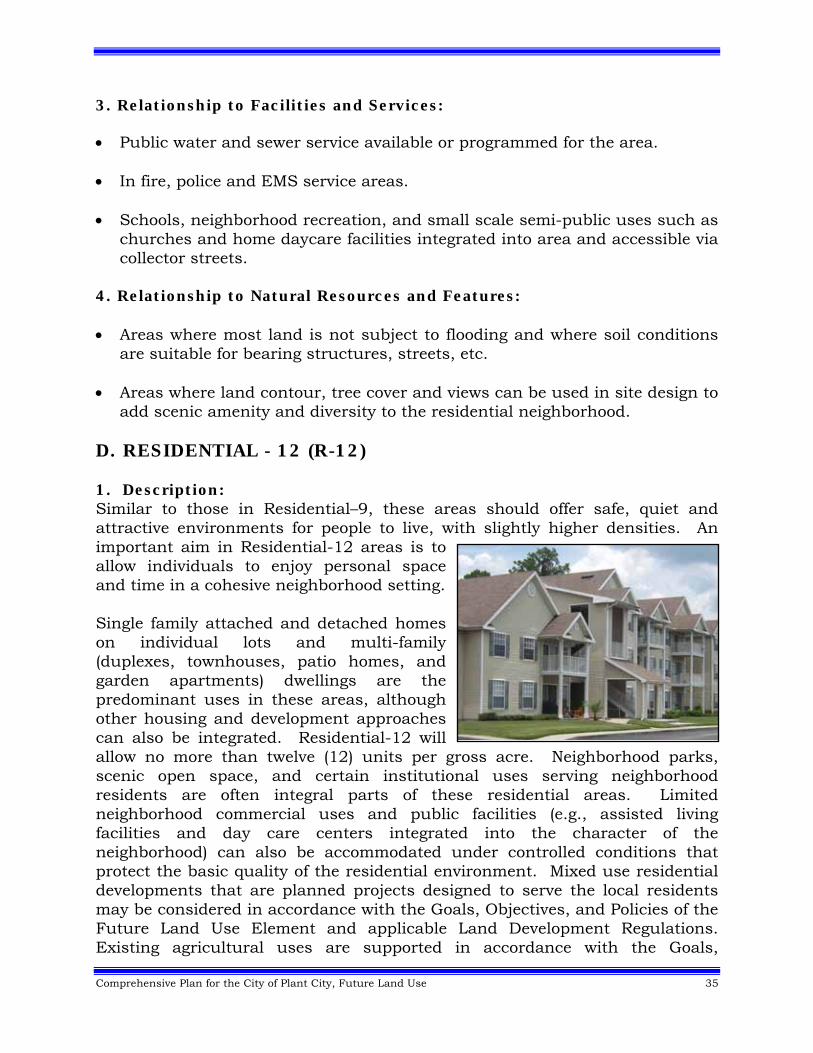
add scenic amenity and diversity to the residential neighborhood. D. RESIDENTIAL - 12 (R-12) 1. Description: Similar to those in Residential–9, these areas should offer safe, quiet and attractive environments for people to live, with slightly higher densities. An important aim in Residential-12 areas is to allow individuals to enjoy personal space and time in a cohesive neighborhood setting. Single family attached and detached homes on individual lots and multi-family (duplexes, townhouses, patio homes, and garden apartments) dwellings are the predominant uses in these areas, although other housing and development approaches can also be integrated. Residential-12 will allow no more than twelve (12) units per gross acre. Neighborhood parks, scenic open space, and certain institutional uses serving neighborhood residents are often integral parts of these residential areas. Limited neighborhood commercial uses and public facilities (e.g., assisted living facilities and day care centers integrated into the character of the neighborhood) can also be accommodated under controlled conditions that protect the basic quality of the residential environment. Mixed use residential developments that are planned projects designed to serve the local residents may be considered in accordance with the Goals, Objectives, and Policies of the Future Land Use Element and applicable Land Development Regulations. Existing agricultural uses are supported in accordance with the Goals,
36 Comprehensive Plan for the City of Plant City, Future Land Use
Objectives, and Policies of the Future Land Use Element and applicable Land Development Regulations. 2. Relationship to Other Areas of Use and the Street System: Perimeters should be buffered from other use areas by open space, streets
and/or visual screening techniques used in site planning. Major work, trade and community service activities should be readily
accessible via collector and arterial streets. Local street systems in these areas should be designed to discourage
through traffic. Neighborhood office/commercial and semi-public uses may be developed at
intensities up to 0.35 FAR in appropriate locations in accordance with locational criteria and development standards of the Future Land Use Element and applicable Land Development Regulations.
3. Relationship to Facilities and Services: Public water and sewer service available or programmed for the area. In fire, police and EMS service areas. Schools, neighborhood recreation, and small scale semi-public uses such as
churches and home daycare facilities integrated into area and accessible via collector streets.
4. Relationship to Natural Resources and Features: Areas where most land is not subject to flooding and where soil conditions
are suitable for bearing structures, streets, etc. Areas where land contour, tree cover and views can be used in site design to
add scenic amenity and diversity to the residential neighborhood.
Comprehensive Plan for the City of Plant City, Future Land Use 37
E. RESIDENTIAL – 20 (R-20) 1. Description: These areas should offer safe, quiet and attractive environments for people to live. In exchange for less personal space, the area should offer benefits such as more immediate accessibility to work and shopping areas, more common recreational facilities and open space, and housing cost savings. Housing types are typically townhouses or multi-family dwellings although single family dwellings can also be permitted or may require lesser densities. Residential-20 will allow no more than twenty (20) units per gross acre. Some types of neighborhood commercial, institutional and public uses, (e.g., assisted living facilities and day care centers), when limited so as not to distract from the area's primary function and use for residences, can also be accommodated. Mixed use residential developments that are planned projects designed to serve the local residents may be considered in accordance with the Goals, Objectives, and Policies of the Future Land Use Element and applicable Land Development Regulations. Existing agricultural uses are supported in accordance with the Goals, Objectives, and Policies of the Future Land Use Element and applicable Land Development Regulations. 2. Relationship to Other Areas of Use and the Street System: Perimeters should be buffered from other use areas by open space, streets
and/or visual screening techniques used in site planning. These areas should border on or be near arterial streets and should be in
close proximity to major community trade and service activities. They should not be located where their traffic would flow along collectors that pass through low density areas leading to trade and service activities.
Local street systems in these areas should be designed to discourage
through traffic. Points of access from the area's local street system to collectors or arterials should be limited.
Neighborhood office/commercial and semi-public uses developed at
intensities up to 0.35 F.A.R. may be allowed in appropriate locations in accordance with locational criteria and development standards of the Future Land Use Element and applicable Land Development Regulations.
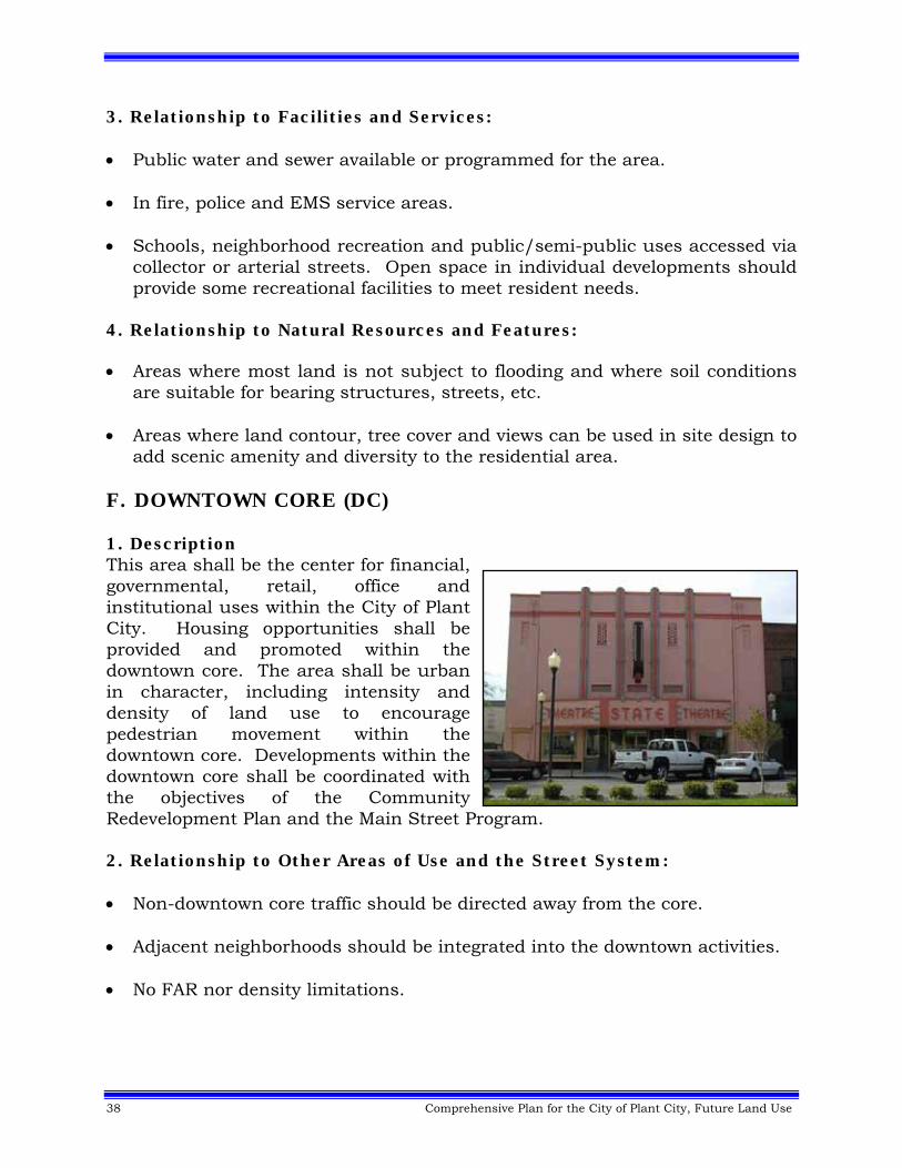
38 Comprehensive Plan for the City of Plant City, Future Land Use
3. Relationship to Facilities and Services: Public water and sewer available or programmed for the area. In fire, police and EMS service areas. Schools, neighborhood recreation and public/semi-public uses accessed via
collector or arterial streets. Open space in individual developments should provide some recreational facilities to meet resident needs.
4. Relationship to Natural Resources and Features: Areas where most land is not subject to flooding and where soil conditions
are suitable for bearing structures, streets, etc. Areas where land contour, tree cover and views can be used in site design to
add scenic amenity and diversity to the residential area. F. DOWNTOWN CORE (DC) 1. Description This area shall be the center for financial, governmental, retail, office and institutional uses within the City of Plant City. Housing opportunities shall be provided and promoted within the downtown core. The area shall be urban in character, including intensity and density of land use to encourage pedestrian movement within the downtown core. Developments within the downtown core shall be coordinated with the objectives of the Community Redevelopment Plan and the Main Street Program. 2. Relationship to Other Areas of Use and the Street System: Non-downtown core traffic should be directed away from the core. Adjacent neighborhoods should be integrated into the downtown activities. No FAR nor density limitations.
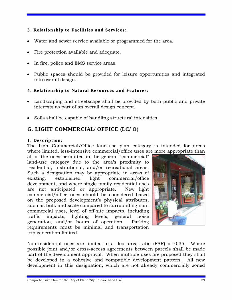
Comprehensive Plan for the City of Plant City, Future Land Use 39
3. Relationship to Facilities and Services: Water and sewer service available or programmed for the area. Fire protection available and adequate. In fire, police and EMS service areas. Public spaces should be provided for leisure opportunities and integrated
into overall design. 4. Relationship to Natural Resources and Features: Landscaping and streetscape shall be provided by both public and private
interests as part of an overall design concept. Soils shall be capable of handling structural intensities. G. LIGHT COMMERCIAL/OFFICE (LC/O) 1. Description: The Light-Commercial/Office land-use plan category is intended for areas where limited, less-intensive commercial/office uses are more appropriate than all of the uses permitted in the general “commercial” land-use category due to the area’s proximity to residential, institutional, and/or recreational areas. Such a designation may be appropriate in areas of existing, established light commercial/office development, and where single-family residential uses are not anticipated or appropriate. New light commercial/office uses should be considered based on the proposed development’s physical attributes, such as bulk and scale compared to surrounding non-commercial uses, level of off-site impacts, including traffic impacts, lighting levels, general noise generation, and/or hours of operation. Parking requirements must be minimal and transportation trip generation limited. Non-residential uses are limited to a floor-area ratio (FAR) of 0.35. Where possible joint and/or cross-access agreements between parcels shall be made part of the development approval. When multiple uses are proposed they shall be developed in a cohesive and compatible development pattern. All new development in this designation, which are not already commercially zoned
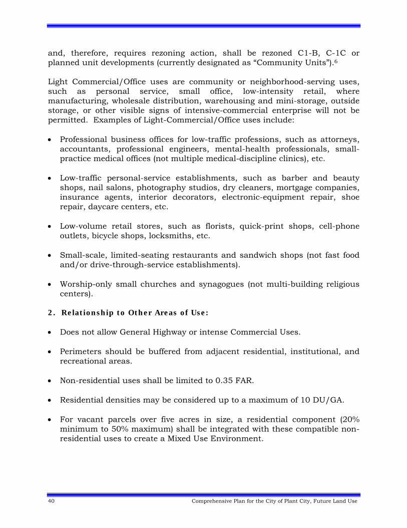
40 Comprehensive Plan for the City of Plant City, Future Land Use
and, therefore, requires rezoning action, shall be rezoned C1-B, C-1C or planned unit developments (currently designated as “Community Units”).6 Light Commercial/Office uses are community or neighborhood-serving uses, such as personal service, small office, low-intensity retail, where manufacturing, wholesale distribution, warehousing and mini-storage, outside storage, or other visible signs of intensive-commercial enterprise will not be permitted. Examples of Light-Commercial/Office uses include: Professional business offices for low-traffic professions, such as attorneys,
accountants, professional engineers, mental-health professionals, small-practice medical offices (not multiple medical-discipline clinics), etc.
Low-traffic personal-service establishments, such as barber and beauty
shops, nail salons, photography studios, dry cleaners, mortgage companies, insurance agents, interior decorators, electronic-equipment repair, shoe repair, daycare centers, etc.
Low-volume retail stores, such as florists, quick-print shops, cell-phone outlets, bicycle shops, locksmiths, etc.
Small-scale, limited-seating restaurants and sandwich shops (not fast food and/or drive-through-service establishments).
Worship-only small churches and synagogues (not multi-building religious centers).
2. Relationship to Other Areas of Use: Does not allow General Highway or intense Commercial Uses. Perimeters should be buffered from adjacent residential, institutional, and
recreational areas. Non-residential uses shall be limited to 0.35 FAR. Residential densities may be considered up to a maximum of 10 DU/GA. For vacant parcels over five acres in size, a residential component (20%
minimum to 50% maximum) shall be integrated with these compatible non-residential uses to create a Mixed Use Environment.
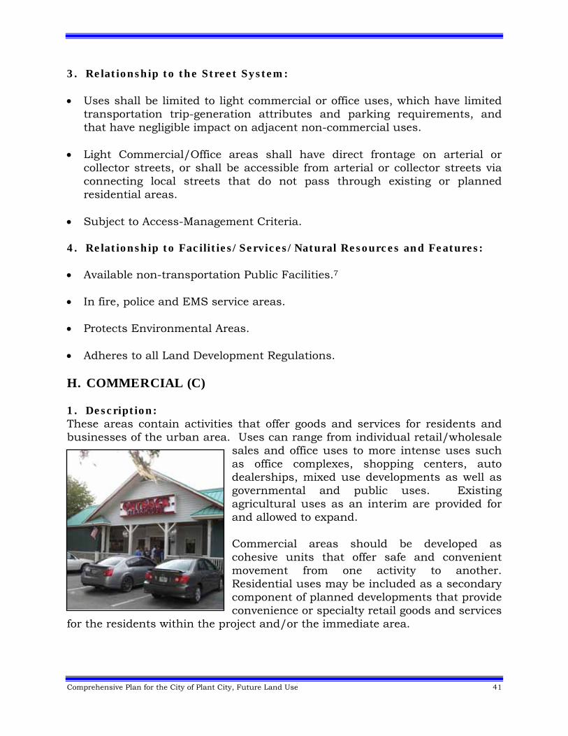
Comprehensive Plan for the City of Plant City, Future Land Use 41
3. Relationship to the Street System: Uses shall be limited to light commercial or office uses, which have limited
transportation trip-generation attributes and parking requirements, and that have negligible impact on adjacent non-commercial uses.
Light Commercial/Office areas shall have direct frontage on arterial or
collector streets, or shall be accessible from arterial or collector streets via connecting local streets that do not pass through existing or planned residential areas.
Subject to Access-Management Criteria.
4. Relationship to Facilities/Services/Natural Resources and Features: Available non-transportation Public Facilities.7 In fire, police and EMS service areas. Protects Environmental Areas. Adheres to all Land Development Regulations. H. COMMERCIAL (C) 1. Description: These areas contain activities that offer goods and services for residents and businesses of the urban area. Uses can range from individual retail/wholesale
sales and office uses to more intense uses such as office complexes, shopping centers, auto dealerships, mixed use developments as well as governmental and public uses. Existing agricultural uses as an interim are provided for and allowed to expand. Commercial areas should be developed as cohesive units that offer safe and convenient movement from one activity to another. Residential uses may be included as a secondary component of planned developments that provide convenience or specialty retail goods and services
for the residents within the project and/or the immediate area.

42 Comprehensive Plan for the City of Plant City, Future Land Use
2. Relationship to Other Areas of Use and the Street System: Perimeters should be buffered from residential and institutional areas by
open space, streets and/or visual screening techniques used in site planning.
Commercial areas shall be accessed from collectors and/or arterials. Larger commercial centers offering goods and services for the daily needs of
the residents should be in close proximity to medium and high density residential areas to facilitate direct access.
General commercial uses at intensities up to 0.35 FAR may be allowed in
appropriate locations in accordance with locational criteria and development standards of the Future Land Use Element and applicable Land Development Regulations.
General commercial and highway commercial uses at intensities up to 1.0
FAR may be allowed in appropriate locations (intersections of Interstate 4 with arterials) in accordance with locational criteria and development standards of the Future Land Use Element and applicable Land Development Regulations.
Residential densities up to a maximum of 16 du/ga are allowed, except for
those commercial areas located within the Midtown Redevelopment District, where up to a overall maximum of 20 du/ga may be allowed through the use of a Community Unit (CU) Zoning. The Midtown Redevelopment District is shown below.
Midtown Redevelopment District
Comprehensive Plan for the City of Plant City, Future Land Use 43
A proposed development cannot be exclusively residential, but must contain
predominantly commercial uses (except within the Midtown Redevelopment District). Non-residential uses must comprise at least 80% of the overall development. (Parcels that don’t meet this criterion, but were developed or permitted prior to the adoption of this provision (April 25, 2007) will be considered in compliance with the Comprehensive Plan for the City of Plant City.)8
Projects that incorporate a residential component must be developed under a Community Unit (CU) Zoning.
If residential uses are proposed, a detailed site plan shall be developed that promotes their integration into the overall project, not separation. Compatibility shall be addressed by providing effective alternatives to buffering, such as (but not limited to) building scale and orientation, street alignment, screening, pedestrian connectivity, building articulation, building heights at the edge of the project and controlled window views.
Residential uses may be incorporated vertically on the second or third floors without impacting the project’s overall floor area ratio (FAR) or affecting the overall calculations for meeting the mix of commercial (80%) to residential (20%).
3. Relationship to Facilities and Services: Public water and sewer available or programmed for the area. In fire, EMS and police service area. Separated from schools and recreation areas by other uses or extensive
open space. 4. Relationship to Natural Resources and Features: Well drained areas where soils are suitable for structures, streets and
parking. Urban runoff must be adequately handled by development. Tree cover and scenic views must be considered in commercial areas and
maximum retention of these features must be considered.
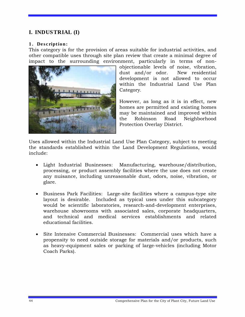
44 Comprehensive Plan for the City of Plant City, Future Land Use
I. INDUSTRIAL (I) 1. Description: This category is for the provision of areas suitable for industrial activities, and other compatible uses through site plan review that create a minimal degree of impact to the surrounding environment, particularly in terms of non-
objectionable levels of noise, vibration, dust and/or odor. New residential development is not allowed to occur within the Industrial Land Use Plan Category. However, as long as it is in effect, new homes are permitted and existing homes may be maintained and improved within the Robinson Road Neighborhood Protection Overlay District.
Uses allowed within the Industrial Land Use Plan Category, subject to meeting the standards established within the Land Development Regulations, would include:
Light Industrial Businesses: Manufacturing, warehouse/distribution, processing, or product assembly facilities where the use does not create any nuisance, including unreasonable dust, odors, noise, vibration, or glare.
Business Park Facilities: Large-site facilities where a campus-type site
layout is desirable. Included as typical uses under this subcategory would be scientific laboratories, research-and-development enterprises, warehouse showrooms with associated sales, corporate headquarters, and technical and medical services establishments and related educational facilities.
Site Intensive Commercial Businesses: Commercial uses which have a
propensity to need outside storage for materials and/or products, such as heavy-equipment sales or parking of large-vehicles (including Motor Coach Parks).
Comprehensive Plan for the City of Plant City, Future Land Use 45
Service Oriented Non-On-Site Customer Businesses: Businesses whose
main activity is to provide a service at a site other than where the business is located, and which do not have any, or very few, customers or clients coming to the business site. Such businesses include construction and product-servicing businesses, and product-delivery services.
Support Commercial Uses: Limited amounts of convenience commercial
uses and business-service commercial uses can be incorporated into these areas when they are developed as an integrated, internalized and accessory portion of a large-scale project.
Agricultural Uses: Existing agricultural uses are supported in
accordance with the Goals, Objectives, and Policies of the Future Land Use Element and applicable Land Development Regulations.
Industrially Related Support Uses: Educational facilities, union halls,
and other industrial support-businesses and facilities that provide support and services to industrial businesses.
2. Relationship to Other Areas of Use and the Street System:
Industrial areas should be located in proximity to residential areas to provide close proximity to workforce and to provide employment opportunities.
Perimeters should be buffered from residential and commercial areas by open space, streets, visual screening, or other effective techniques.
Located on or have direct access to arterials or collector roadways. Access to industrial areas shall not be through existing or planned residential areas.
Maximum FAR of .5 for industrial uses; convenience commercial uses are limited to a maximum 10% of planned development square footage in accordance with locational criteria and development standards of the Future Land Use Element and applicable Land Development Regulations.
46 Comprehensive Plan for the City of Plant City, Future Land Use
3. Relationship to Facilities and Services:
Public water and sewer must be available or programmed for the area.
Must be in Fire, EMS and Police Service Areas.
Separated from schools and recreation areas by other uses or an extensive open space buffer.
4. Relationship to Natural Resources and Features:
Well drained areas where soils are suitable for structures, streets and parking.
Runoff must be adequately handled by development.
Tree cover and scenic views must be considered and maximum retention of these features must be considered.
5. Relationship to the Robinson Road Neighborhood Protection Overlay
District a. Description: The Robinson Road Neighborhood Protection Overlay District is established and delineated on the Future Land Use Map for the purpose of protecting an existing, viable neighborhood, and allowing it to continue to thrive and prosper, until such time as the entire area is someday acquired and redeveloped in accordance to the underlying Industrial Land Use Plan Category. Therefore, until such time as Plant City City Commission takes legislative action to remove the overlay district, the following shall apply: b. Development Criteria: Development shall be in accordance with the existing land use pattern of one home per existing parcel (approximately one dwelling unit per acre [1 du/ac]. This overlay district provision is intended to allow for the expansion of existing dwelling units, and for the placement of new dwelling units on existing vacant parcels, so long as any and all new development complies with the requirements of one home per existing parcel (approximately 1 du/ac) and applicable Land Development Regulations (LDRs). New industrial development is prohibited and Robinson Road is to be considered a “residential” local street, and non-residential traffic shall not be allowed to access neighboring non-residential parcels via this street.
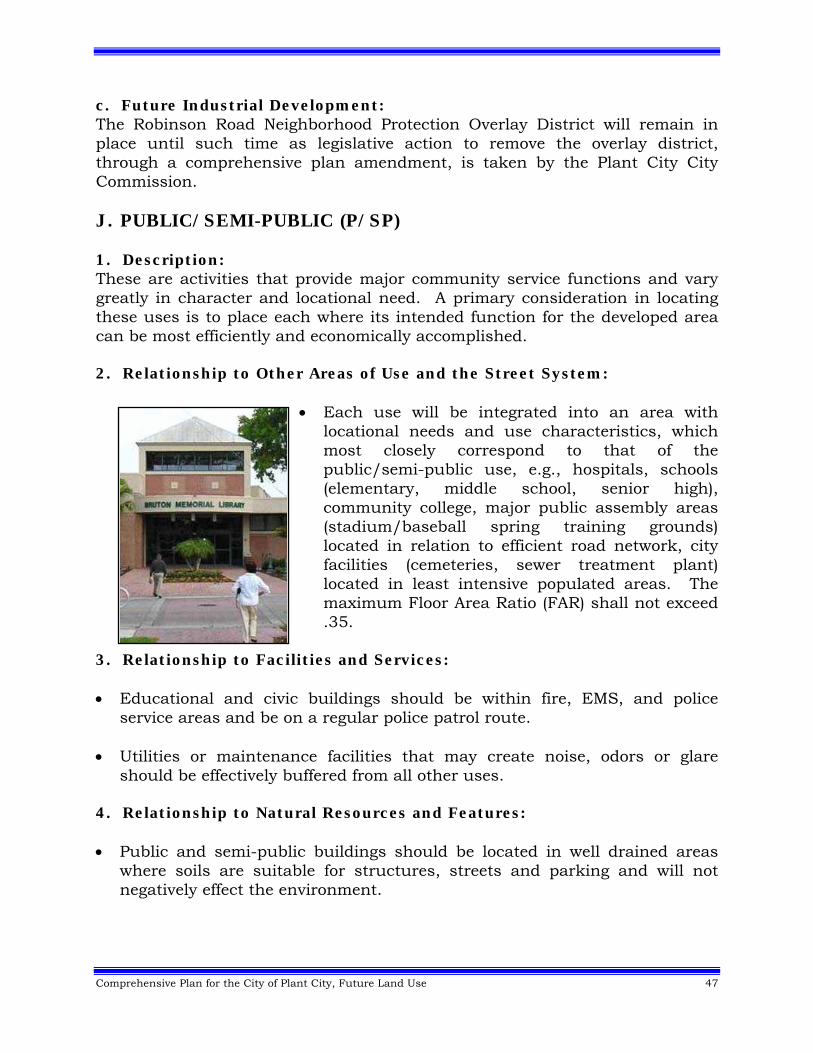
Comprehensive Plan for the City of Plant City, Future Land Use 47
c. Future Industrial Development: The Robinson Road Neighborhood Protection Overlay District will remain in place until such time as legislative action to remove the overlay district, through a comprehensive plan amendment, is taken by the Plant City City Commission. J. PUBLIC/SEMI-PUBLIC (P/SP) 1. Description: These are activities that provide major community service functions and vary greatly in character and locational need. A primary consideration in locating these uses is to place each where its intended function for the developed area can be most efficiently and economically accomplished. 2. Relationship to Other Areas of Use and the Street System:
Each use will be integrated into an area with locational needs and use characteristics, which most closely correspond to that of the public/semi-public use, e.g., hospitals, schools (elementary, middle school, senior high), community college, major public assembly areas (stadium/baseball spring training grounds) located in relation to efficient road network, city facilities (cemeteries, sewer treatment plant) located in least intensive populated areas. The maximum Floor Area Ratio (FAR) shall not exceed .35.
3. Relationship to Facilities and Services: Educational and civic buildings should be within fire, EMS, and police
service areas and be on a regular police patrol route. Utilities or maintenance facilities that may create noise, odors or glare
should be effectively buffered from all other uses. 4. Relationship to Natural Resources and Features: Public and semi-public buildings should be located in well drained areas
where soils are suitable for structures, streets and parking and will not negatively effect the environment.
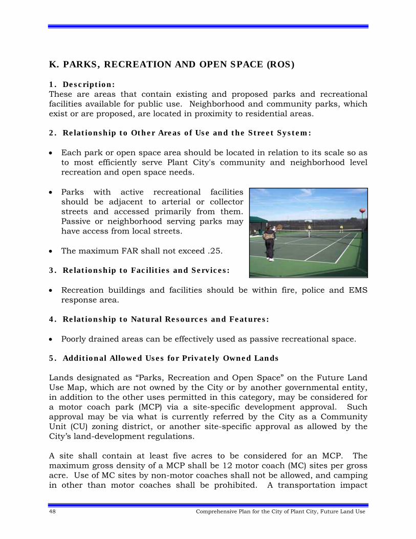
48 Comprehensive Plan for the City of Plant City, Future Land Use
K. PARKS, RECREATION AND OPEN SPACE (ROS) 1. Description: These are areas that contain existing and proposed parks and recreational facilities available for public use. Neighborhood and community parks, which exist or are proposed, are located in proximity to residential areas. 2. Relationship to Other Areas of Use and the Street System: Each park or open space area should be located in relation to its scale so as
to most efficiently serve Plant City's community and neighborhood level recreation and open space needs.
Parks with active recreational facilities
should be adjacent to arterial or collector streets and accessed primarily from them. Passive or neighborhood serving parks may have access from local streets.
The maximum FAR shall not exceed .25. 3. Relationship to Facilities and Services: Recreation buildings and facilities should be within fire, police and EMS
response area. 4. Relationship to Natural Resources and Features: Poorly drained areas can be effectively used as passive recreational space. 5. Additional Allowed Uses for Privately Owned Lands Lands designated as “Parks, Recreation and Open Space” on the Future Land Use Map, which are not owned by the City or by another governmental entity, in addition to the other uses permitted in this category, may be considered for a motor coach park (MCP) via a site-specific development approval. Such approval may be via what is currently referred by the City as a Community Unit (CU) zoning district, or another site-specific approval as allowed by the City’s land-development regulations. A site shall contain at least five acres to be considered for an MCP. The maximum gross density of a MCP shall be 12 motor coach (MC) sites per gross acre. Use of MC sites by non-motor coaches shall not be allowed, and camping in other than motor coaches shall be prohibited. A transportation impact
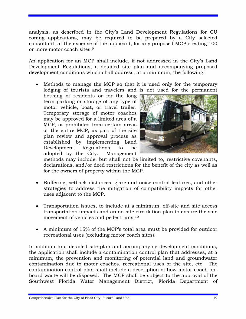
Comprehensive Plan for the City of Plant City, Future Land Use 49
analysis, as described in the City’s Land Development Regulations for CU zoning applications, may be required to be prepared by a City selected consultant, at the expense of the applicant, for any proposed MCP creating 100 or more motor coach sites.9 An application for an MCP shall include, if not addressed in the City’s Land Development Regulations, a detailed site plan and accompanying proposed development conditions which shall address, at a minimum, the following:
Methods to manage the MCP so that it is used only for the temporary lodging of tourists and travelers and is not used for the permanent housing of residents or for the long term parking or storage of any type of motor vehicle, boat, or travel trailer. Temporary storage of motor coaches may be approved for a limited area of a MCP, or prohibited from certain areas or the entire MCP, as part of the site plan review and approval process as established by implementing Land Development Regulations to be adopted by the City. Management methods may include, but shall not be limited to, restrictive covenants, declarations, and/or deed restrictions for the benefit of the city as well as for the owners of property within the MCP.
Buffering, setback distances, glare-and-noise control features, and other
strategies to address the mitigation of compatibility impacts for other uses adjacent to the MCP.
Transportation issues, to include at a minimum, off-site and site access
transportation impacts and an on-site circulation plan to ensure the safe movement of vehicles and pedestrians.10
A minimum of 15% of the MCP’s total area must be provided for outdoor
recreational uses (excluding motor coach sites). In addition to a detailed site plan and accompanying development conditions, the application shall include a contamination control plan that addresses, at a minimum, the prevention and monitoring of potential land and groundwater contamination due to motor coaches, recreational uses of the site, etc. The contamination control plan shall include a description of how motor coach on-board waste will be disposed. The MCP shall be subject to the approval of the Southwest Florida Water Management District, Florida Department of
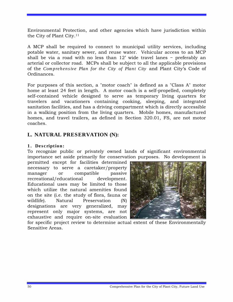
50 Comprehensive Plan for the City of Plant City, Future Land Use
Environmental Protection, and other agencies which have jurisdiction within the City of Plant City.11 A MCP shall be required to connect to municipal utility services, including potable water, sanitary sewer, and reuse water. Vehicular access to an MCP shall be via a road with no less than 12’ wide travel lanes − preferably an arterial or collector road. MCPs shall be subject to all the applicable provisions of the Comprehensive Plan for the City of Plant City and Plant City’s Code of Ordinances. For purposes of this section, a "motor coach" is defined as a "Class A" motor home at least 24 feet in length. A motor coach is a self-propelled, completely self-contained vehicle designed to serve as temporary living quarters for travelers and vacationers containing cooking, sleeping, and integrated sanitation facilities, and has a driving compartment which is directly accessible in a walking position from the living quarters. Mobile homes, manufactured homes, and travel trailers, as defined in Section 320.01, FS, are not motor coaches. L. NATURAL PRESERVATION (N): 1. Description: To recognize public or privately owned lands of significant environmental importance set aside primarily for conservation purposes. No development is permitted except for facilities determined necessary to serve a caretaker/property manager or compatible passive recreational/educational development. Educational uses may be limited to those which utilize the natural amenities found on the site (i.e. the study of flora, fauna or wildlife). Natural Preservation (N) designations are very generalized, may represent only major systems, are not exhaustive and require on-site evaluation for specific project review to determine actual extent of these Environmentally Sensitive Areas.
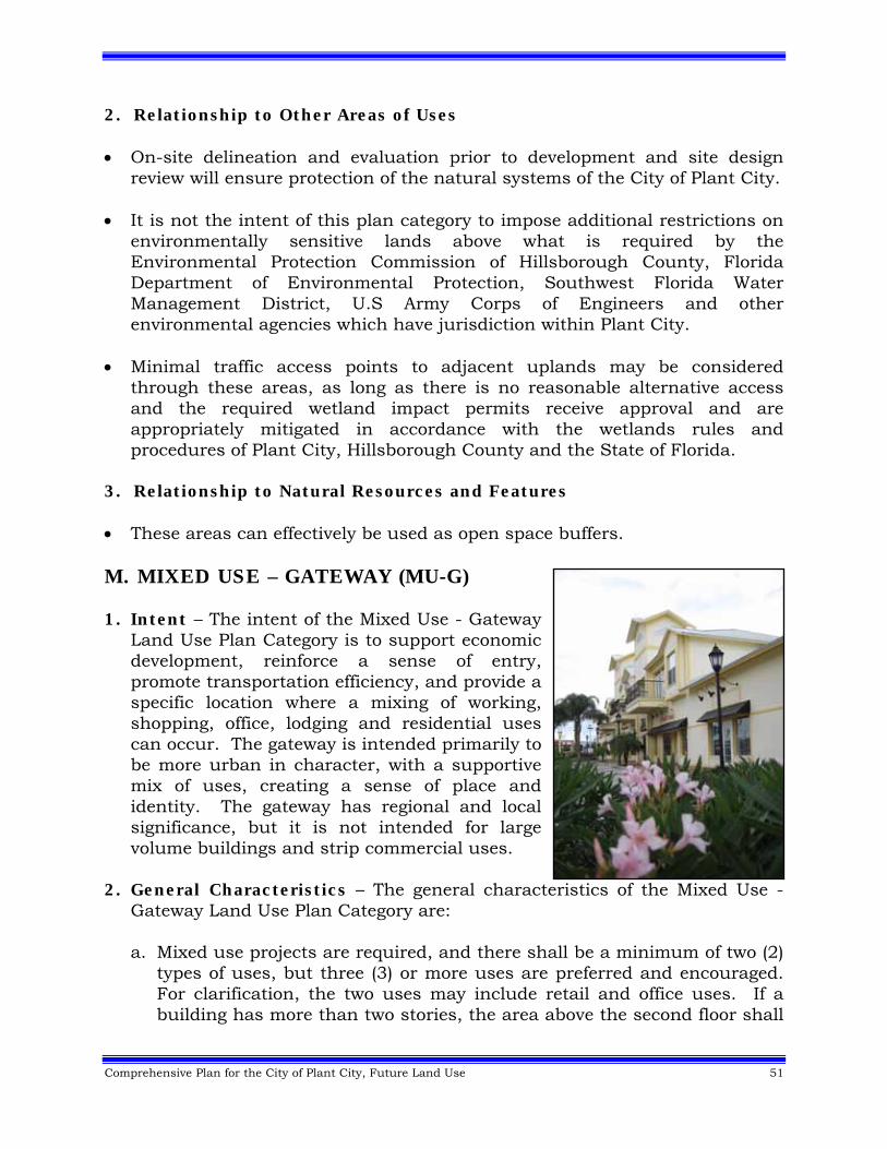
Comprehensive Plan for the City of Plant City, Future Land Use 51
2. Relationship to Other Areas of Uses On-site delineation and evaluation prior to development and site design
review will ensure protection of the natural systems of the City of Plant City. It is not the intent of this plan category to impose additional restrictions on
environmentally sensitive lands above what is required by the Environmental Protection Commission of Hillsborough County, Florida Department of Environmental Protection, Southwest Florida Water Management District, U.S Army Corps of Engineers and other environmental agencies which have jurisdiction within Plant City.
Minimal traffic access points to adjacent uplands may be considered
through these areas, as long as there is no reasonable alternative access and the required wetland impact permits receive approval and are appropriately mitigated in accordance with the wetlands rules and procedures of Plant City, Hillsborough County and the State of Florida.
3. Relationship to Natural Resources and Features
These areas can effectively be used as open space buffers. M. MIXED USE – GATEWAY (MU-G) 1. Intent – The intent of the Mixed Use - Gateway
Land Use Plan Category is to support economic development, reinforce a sense of entry, promote transportation efficiency, and provide a specific location where a mixing of working, shopping, office, lodging and residential uses can occur. The gateway is intended primarily to be more urban in character, with a supportive mix of uses, creating a sense of place and identity. The gateway has regional and local significance, but it is not intended for large volume buildings and strip commercial uses.
2. General Characteristics – The general characteristics of the Mixed Use -
Gateway Land Use Plan Category are:
a. Mixed use projects are required, and there shall be a minimum of two (2) types of uses, but three (3) or more uses are preferred and encouraged. For clarification, the two uses may include retail and office uses. If a building has more than two stories, the area above the second floor shall
52 Comprehensive Plan for the City of Plant City, Future Land Use
be designated for residential or office use, but residential uses may occur on any floor. No single use shall exceed 80% of the total project. For example a site could develop at 80% commercial and 20% residential or 80% residential and 20% commercial; however the total of these percentages cannot exceed 100%.
b. Further, it is the intent of this land use plan category to promote a sense of
community quality and character.
c. Compatibility shall be established between uses in a mixed use development. The intent of mixed use is to promote an integration of land uses, not to require separation. Compatibility shall be addressed by providing effective alternatives to buffering, such as building/street alignment and orientation, screening, pedestrian continuity, building articulation, building heights at the edge of the project and controlled window views.
d. Mixed use projects shall be developed using the Community Unit (CU) Zoning, and applicants shall submit a detailed site plan to demonstrate the design concept in response to the intent of the Mixed Use Gateway - Land Use Plan Category.
3. Primary Uses – The following uses are allowed within this land use plan
category:
a. Civic Uses - Meeting halls, libraries, post offices, parks, schools, playgrounds, child care centers, clubhouses, religious buildings, higher education, museums, cultural societies, visual and performance arts buildings, and municipal buildings.
b. Commercial – Retail, services, restaurants, clubs and limited lodging. All
commercial uses shall be encouraged to be built on a neighborhood scale and character.
c. Multi-Family Housing – Triplexes, townhouses and small apartment
buildings. Heights are limited to three (3) stories for townhouses and small apartments. Buildings for residential use may have limited office and retail use, cafes, limited lodging and live-work uses. All building area above the second floor shall be designated for residential use, but residential uses may occur on any floor.
Comprehensive Plan for the City of Plant City, Future Land Use 53
d. Workplace – Offices, live-work, household and business services as part
of mixed use buildings. Such uses shall have no outdoor storage or off-site impacts.
4. General Development Standards – The general development standards for
uses within the Mixed Use - Gateway are:
a. The maximum density for the land use plan category is sixteen (16) units per acre. The residential units shall be integrated with compatible non-residential uses to create a mixed use environment.
b. Maximum height for buildings shall be three (3) stories or forty-five (45)
feet. Architectural features (such as Church Steeples) are allowed to be higher than forty-five feet, based on the approval of the Plant City City Commission.
c. The maximum floor area ratio for non-residential uses is 0.35, but as a bonus residential uses may be incorporated vertically on the second or third floors without impacting the project’s overall FAR. The maximum impervious surface ratio is .85.
d. To create an urban edge, projects shall be constructed to a 20-foot build-
to line when right-of-way beyond the edge of pavement is available. When right-of-way beyond the edge of pavement is not available, the build-to line shall be negotiated during the Community Unit zoning process.
e. The scale, height and uses of projects shall be compatible with abutting
neighborhood uses. Building heights at a project’s edge shall be limited to two (2) stories or thirty (30) feet when abutting single family residential areas.
f. Limited lodging means an inn or bed and breakfast of no more than fifty
(50) rooms and can include full services, such as a supporting restaurant use. The building shall be of residential character, unless the use is integrated as part of a larger, mixed use complex.
g. Properties or projects within the Mixed Use - Gateway shall, whenever practicable and feasible, be interconnected with abutting uses and streets to promote automotive and pedestrian linkages.
54 Comprehensive Plan for the City of Plant City, Future Land Use
h. Strip commercial development shall be prohibited. 5. Ingress, Egress and Parking – Coordinated access, parking and on-site circulation are essential to the success of the mixed use land use plan category. Elements are:
a. Ingress and Egress shall be consistent with Access Management requirements of the Zoning Code, Florida Statutes, and the Florida Administrative Code.
b. Shared Parking is allowed and encouraged. The most current edition of the Urban Land Institute’s shared parking methodology shall be utilized in calculating the total shared parking supply.
c. Off-street parking shall be to the side and/or rear of the structures, which front onto major public thoroughfares, such as James L. Redman Parkway (SR 39). Off-street parking may be considered in the front of buildings that are internal to the development, which do not directly front onto a public roadway. If 50% of the parking is in the rear, there shall be a 20% reduction in the overall parking requirements, but the total number of spaces shall not be less than the total required, per 5b, above. If requested, very limited off-street parking may be allowed adjacent to recognized major thoroughfares; however, the request must be reviewed by the Plant City Planning Board and require the approval of the Plant City City Commission.
a. If parking structures are used, 65% of the ground level facing the front street shall be non-residential uses. To the extent possible, ingress and egress to parking structures is from side streets or the rear.
6. Access Management Plan For Mixed Use -
Gateway –The following shall assist in maintaining the operational and safety aspects of the adjacent roadways of a Mixed Use – Gateway District.
a. Traffic Signals – New traffic signal installations shall concur with
Florida Administrative Code (FAC) Rule Chapter 14-97, and shall meet warrants for traffic signal installation published in the Manual of Uniform Traffic Control Devices (MUTCD) by the Federal Highway Administration (FHWA). All traffic signal installations and modification on state roads shall be approved by FDOT District 7, Traffic Operations.
Comprehensive Plan for the City of Plant City, Future Land Use 55
b. Median Openings New median openings to serve large developments (over 20 acres)
should be directional, only allowing left turns into a development parcel.
Each new directional median opening shall be constructed concurrent with the closure of the closest adjacent full median opening in this segment. This provision means that the median spacing shall continue to comply with FDOT Rule Chapter 14-97, and on state roads shall be subject to individual approval by the Median Committee of FDOT, District 7 Access Management.
c. Parcel Access New access driveways should be right-in/right-out only, eliminating
the need for new median openings. New developments shall only be permitted to construct one (1)
driveway connection per ownership, except for corner parcels. Corner parcels shall have two access points, one on each street or roadway in Plant City.
Access to state roads shall require FDOT permitting and shall meet the requirements of FAC Rule Chapters 14-96 and 14-97.
d. Road Widening – Property owners shall be allowed the option of widening roadways and improving intersections to meet the mobility requirements of Plant City. Easements or right-of-way may be donated for widening and/or provision of infrastructures delivery, due to constrained right-of-way widths.12
e. Supporting Network – As development occurs, the City shall encourage the provision of a local supporting roadway network, to carry regional traffic and fostering land uses changes. Development agreements may be utilized to assist in creating this network. By enhancing the local roadway network, the City can minimize the number of local trips forced to use adjacent roadways, thereby eliminating unnecessary traffic. This also maximizes the flexibility of the emerging urban fabric by adapting to changing market conditions.
7. Coordinated Implementation – Intergovernmental coordination and infrastructure provision issues need to be addressed; therefore coordination of compatible land use policies between the City and County is required. Sometimes restricted right-of-way inhibits delivery of infrastructure to the area. These factors reinforce the need to:
56 Comprehensive Plan for the City of Plant City, Future Land Use
a. Jointly work with the County to evaluate Future Land Use Map compatibility, in terms of density, intensity, and mix of uses, for the abutting unincorporated areas.
b. Jointly work with the County to identify unfunded capital improvement needs.
c. Seek alternative funding sources to advance implementation of infrastructure delivery.
d. Encourage development agreements between the City and private
property owners or between property owners to provide for infrastructure delivery and supporting local road networks through the use of:
Easements Donations Special Districts/Benefit Units Mobility Fees13 Shared Funding Formulas Other Non-Traditional Funding Sources
b. Lawful uses, lots, structures, characteristics of land densities in existence at the time of the application of the Mixed Use - Gateway Land Use Plan Category shall not be required to be removed or modified to conform to these requirements, except if the site is being proposed for an expansion or redevelopment of more than 75%. Existing or proposed single-family homes (on recognized individual lots at the time of the plan amendment) are exempt from the provisions of the Mixed Use - Gateway Land Use Plan Category.
c. Jointly work with the FDOT in the development review process for those
developments on the State Road System. N. MIXED USE – RESIDENTIAL/COMMERCIAL (MU-RC) 1. Description: This category is intended to encourage and provide for mixed-use planned developments within areas determined to be appropriate for a suitable mix of uses due to existing development patterns, the availability of adequate public facilities, and market demands. The MU-RC area is generally urban in intensity and density of uses, with development concurring with the provision and timing of non-transportation public facility services necessary to support these intensities and densities.14
Comprehensive Plan for the City of Plant City, Future Land Use 57
a. Permitted Uses:
Uses permitted within this district are residential, retail commercial, office uses, research and corporate park uses, and agriculture. Non-residential land uses must be compatible with residential uses through established techniques of transitioning, buffering, and/or separation of incompatible uses.
b. Residential Density:
A density of up to 12 dwelling units per acre (12 du/ac) is permitted. Clustering of dwelling units may be considered for approval to achieve a mixture of housing types and to preserve open spaces left in a natural state. Density bonuses and credits may be considered in this category as described elsewhere in the Comprehensive Plan for the City of Plant City. The residential density allowed is limited further by Goals, Objectives, and Policies and applicable development regulations being complied with, especially those regarding compatibility of the proposed development with both internal and surrounding land uses, existing and/or approved, and with regard to the adequacy and availability of public facilities.
c. Non-Residential Intensity:
An intensity of up to 0.35 Floor Area Ratio (FAR) shall be allowed for any single or mixed use. All FAR calculations shall be on the basis of gross acreage as calculated in applicable portions of the Land Use Element and applicable Land Development Regulations.
d. Requirements for the MU-RC plan category: The minimum size for the MU-RC category is 20 acres. The MU-RC category must have direct access to a collector or arterial
roadway. Public water and sewer service must be available or available concurrent
with development. The MU-RC category must be located within fire, police, and EMS service
areas.
58 Comprehensive Plan for the City of Plant City, Future Land Use
e. Rezoning and Site Plan Requirements: Development shall be considered for approval through a planned unit development rezoning process (currently referred to as Community Unit), which requires, at a minimum, an integrated site plan controlled through site-specific design features and specified development conditions to achieve developments that are compatible with surrounding, and internal, land uses and consistent with the Goals, Objectives, and Policies of the Comprehensive Plan for the City of Plant City. Retail commercial uses must be clustered at intersections with at least
one collector street.
Strip development with separate driveway access for non-residential uses to arterial streets shall be prohibited.
Governmental uses, schools, neighborhood recreation, and small-scale semi-public uses, such as churches, must be integrated into the site plan and be accessible to residential neighborhoods being served via pedestrian, as well as vehicular, means.
Perimeters should be buffered from other incompatible use areas by open space, visual screening, and other similar professional planning techniques used in site planning.
There shall be integrated, multi-modal (vehicular, pedestrian, and bicycle) transportation systems between non-residential and residential areas, and between separated residential areas, to provide internal access between these uses.
f. Minimum Required and Maximum Allowable Percentages of Land:
Residential: 65% minimum and 85% maximum.
Commercial, including office development and research corporate park uses: 15% minimum and 35% maximum.
The Urban Mixed Use Village Center area of the Northeast Plant City Area Master Plan (Master Plan) is intended to be a mixed use activity center. The extent of the activity center shall include lands within one-quarter mile (except for the northeast quadrant) of the intersection of Midway Road and Charlie Taylor Road. Implementing the objectives of the Master Plan, the activity center is envisioned to reduce vehicle trips on I-4. General retail/residential mixed-use development within the
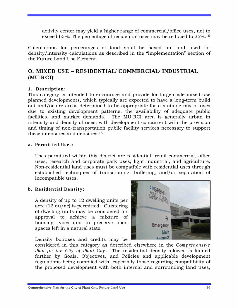
Comprehensive Plan for the City of Plant City, Future Land Use 59
activity center may yield a higher range of commercial/office uses, not to exceed 65%. The percentage of residential uses may be reduced to 35%.15
Calculations for percentages of land shall be based on land used for density/intensity calculations as described in the “Implementation” section of the Future Land Use Element. O. MIXED USE – RESIDENTIAL/COMMERCIAL/INDUSTRIAL (MU-RCI) 1. Description: This category is intended to encourage and provide for large-scale mixed-use planned developments, which typically are expected to have a long-term build out and/or are areas determined to be appropriate for a suitable mix of uses due to existing development patterns, the availability of adequate public facilities, and market demands. The MU-RCI area is generally urban in intensity and density of uses, with development concurrent with the provision and timing of non-transportation public facility services necessary to support these intensities and densities.16 a. Permitted Uses:
Uses permitted within this district are residential, retail commercial, office uses, research and corporate park uses, light industrial, and agriculture. Non-residential land uses must be compatible with residential uses through established techniques of transitioning, buffering, and/or separation of incompatible uses.
b. Residential Density: A density of up to 12 dwelling units per acre (12 du/ac) is permitted. Clustering of dwelling units may be considered for approval to achieve a mixture of housing types and to preserve open spaces left in a natural state. Density bonuses and credits may be considered in this category as described elsewhere in the Comprehensive Plan for the City of Plant City. The residential density allowed is limited further by Goals, Objectives, and Policies and applicable development regulations being complied with, especially those regarding compatibility of the proposed development with both internal and surrounding land uses,
60 Comprehensive Plan for the City of Plant City, Future Land Use
existing and/or approved, and with regard to the adequacy and availability of public facilities.
c. Non-Residential Intensity:
An intensity of up to 0.35 Floor Area Ratio (FAR) shall be allowed for commercial and office uses, and up to 0.50 for light industrial and research and corporate park uses. All FAR calculations shall be on the basis of gross acreage as calculated in applicable portions of the Land Use Element and applicable Land Development Regulations.
d. Requirements for the MU-RCI Plan Category: 1. The minimum size for the MU-RCI category is 1000 acres.
2. The MU-RCI category must have direct access to an arterial roadway.
3. Public water and sewer service must be available or available concurrent
with development.
4. The MU-RCI category must be located within fire, police, and EMS service areas.
5. The MU-RCI category must be located in an area where it can be
demonstrated that environmental damage will not occur. e. Rezoning and Site Plan Requirements: Development shall be considered
for approval through a planned unit development rezoning process [currently referred to as Community Unit] which requires, at a minimum, an integrated site plan controlled through site-specific design features and specified development conditions to achieve developments that are compatible with surrounding, and internal, land uses and consistent with the Goals, Objectives, and Policies of the Comprehensive Plan for the City of Plant City.
1. Retail commercial uses must be clustered at intersections with at least
one collector street. Strip commercial development shall be prohibited.
2. Strip development with separate driveway access for non-residential uses to arterial streets shall be prohibited.
Comprehensive Plan for the City of Plant City, Future Land Use 61
3. Industrial uses within the mixed-use project must be made compatible with existing and proposed surrounding development. Perimeters should be buffered from other incompatible use areas by open space, visual screening, and other similar professional planning techniques used in site planning.
4. Governmental uses, schools, neighborhood recreation, and small-scale
semi-public uses, such as churches, must be integrated into the site plan and be accessible to residential neighborhoods being served via pedestrian, as well as vehicular, means.
5. There shall be integrated, multi-modal (vehicular, pedestrian, and
bicycle) transportation systems between non-residential and residential areas, and between separated residential areas, to provide internal access between these uses.
f. Minimum Required and Maximum Allowable Percentages of Land:
Residential: 10% minimum and 50% maximum Commercial, including office development and research corporate park
uses: 5% minimum and 35% maximum Light-industrial: 45% minimum and 85% maximum
Calculations for percentages of land shall be based on land used for density/intensity calculations as described in the “Implementation” section of the Future Land Use Element. P. ENVIRONMENTALLY SENSITIVE AREAS OVERLAY (ESA) 1. Description: These are environmentally sensitive lands which are classified as conservation or preservation areas by the Environmental Protection Commission of Hillsborough County, Southwest Florida Water Management District and/or Florida Department of Environmental Protection. In Plant City, these lands generally include those areas that are wetlands and/or within the 100 year flood occurrence. Development in these areas is restricted by federal, state, and/or local environmental regulations.
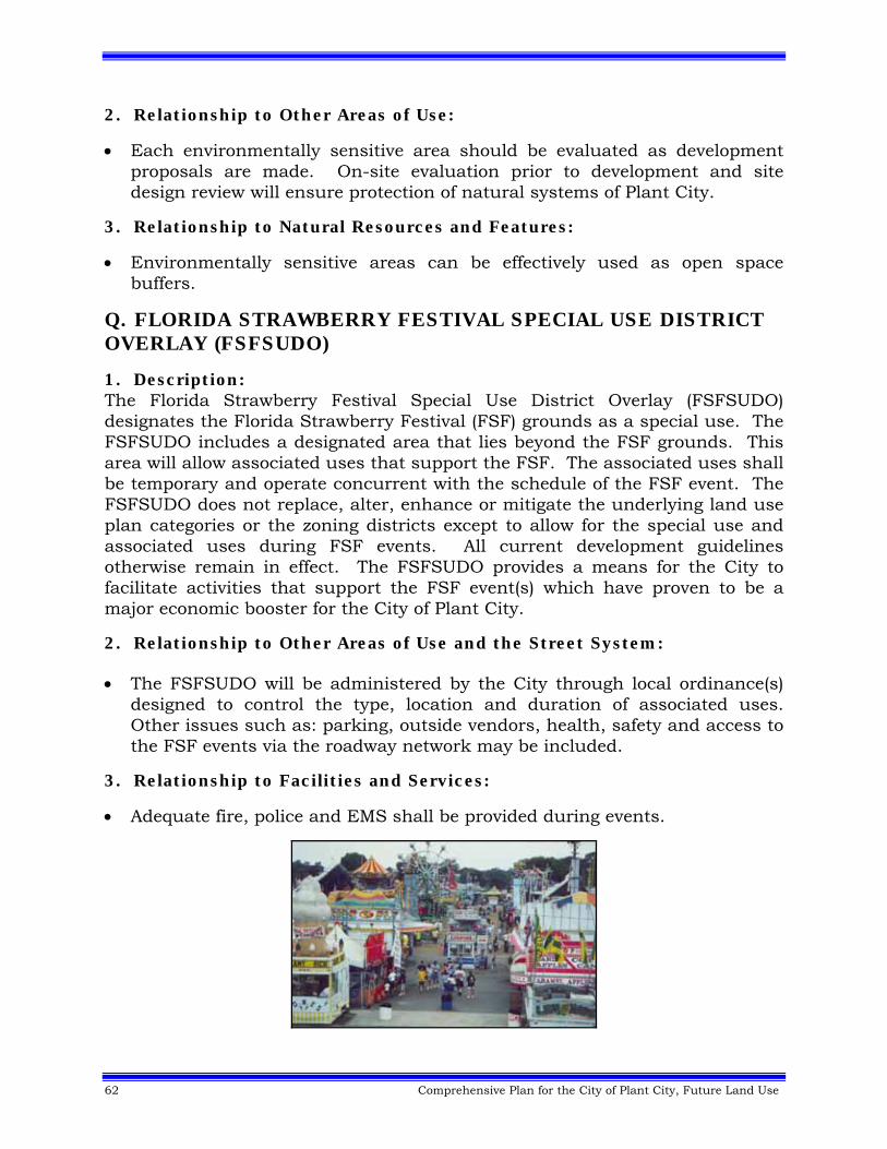
62 Comprehensive Plan for the City of Plant City, Future Land Use
2. Relationship to Other Areas of Use:
Each environmentally sensitive area should be evaluated as development proposals are made. On-site evaluation prior to development and site design review will ensure protection of natural systems of Plant City.
3. Relationship to Natural Resources and Features:
Environmentally sensitive areas can be effectively used as open space buffers.
Q. FLORIDA STRAWBERRY FESTIVAL SPECIAL USE DISTRICT OVERLAY (FSFSUDO)
1. Description: The Florida Strawberry Festival Special Use District Overlay (FSFSUDO) designates the Florida Strawberry Festival (FSF) grounds as a special use. The FSFSUDO includes a designated area that lies beyond the FSF grounds. This area will allow associated uses that support the FSF. The associated uses shall be temporary and operate concurrent with the schedule of the FSF event. The FSFSUDO does not replace, alter, enhance or mitigate the underlying land use plan categories or the zoning districts except to allow for the special use and associated uses during FSF events. All current development guidelines otherwise remain in effect. The FSFSUDO provides a means for the City to facilitate activities that support the FSF event(s) which have proven to be a major economic booster for the City of Plant City.
2. Relationship to Other Areas of Use and the Street System: The FSFSUDO will be administered by the City through local ordinance(s)
designed to control the type, location and duration of associated uses. Other issues such as: parking, outside vendors, health, safety and access to the FSF events via the roadway network may be included.
3. Relationship to Facilities and Services:
Adequate fire, police and EMS shall be provided during events.
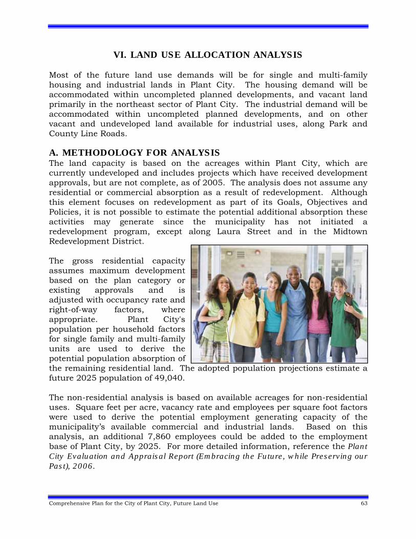
Comprehensive Plan for the City of Plant City, Future Land Use 63
VI. LAND USE ALLOCATION ANALYSIS Most of the future land use demands will be for single and multi-family housing and industrial lands in Plant City. The housing demand will be accommodated within uncompleted planned developments, and vacant land primarily in the northeast sector of Plant City. The industrial demand will be accommodated within uncompleted planned developments, and on other vacant and undeveloped land available for industrial uses, along Park and County Line Roads. A. METHODOLOGY FOR ANALYSIS The land capacity is based on the acreages within Plant City, which are currently undeveloped and includes projects which have received development approvals, but are not complete, as of 2005. The analysis does not assume any residential or commercial absorption as a result of redevelopment. Although this element focuses on redevelopment as part of its Goals, Objectives and Policies, it is not possible to estimate the potential additional absorption these activities may generate since the municipality has not initiated a redevelopment program, except along Laura Street and in the Midtown Redevelopment District. The gross residential capacity assumes maximum development based on the plan category or existing approvals and is adjusted with occupancy rate and right-of-way factors, where appropriate. Plant City's population per household factors for single family and multi-family units are used to derive the potential population absorption of the remaining residential land. The adopted population projections estimate a future 2025 population of 49,040. The non-residential analysis is based on available acreages for non-residential uses. Square feet per acre, vacancy rate and employees per square foot factors were used to derive the potential employment generating capacity of the municipality’s available commercial and industrial lands. Based on this analysis, an additional 7,860 employees could be added to the employment base of Plant City, by 2025. For more detailed information, reference the Plant City Evaluation and Appraisal Report (Embracing the Future, while Preserving our Past), 2006.
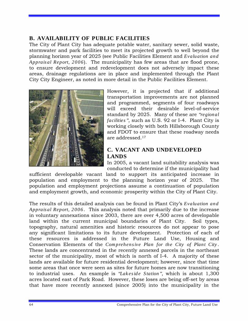
64 Comprehensive Plan for the City of Plant City, Future Land Use
B. AVAILABILITY OF PUBLIC FACILITIES The City of Plant City has adequate potable water, sanitary sewer, solid waste, stormwater and park facilities to meet its projected growth to well beyond the planning horizon year of 2025 (see Public Facilities Element and Evaluation and Appraisal Report, 2006). The municipality has few areas that are flood prone, to ensure development and redevelopment does not adversely impact these areas, drainage regulations are in place and implemented through the Plant City City Engineer, as noted in more detail in the Public Facilities Element.
However, it is projected that if additional transportation improvements are not planned and programmed, segments of four roadways will exceed their desirable level-of-service standard by 2025. Many of these are “regional facilities”, such as U.S. 92 or I-4. Plant City is working closely with both Hillsborough County and FDOT to ensure that these roadway needs are addressed.17 C. VACANT AND UNDEVELOPED LANDS In 2005, a vacant land suitability analysis was conducted to determine if the municipality had
sufficient developable vacant land to support its anticipated increase in population and employment to the planning horizon year of 2025. The population and employment projections assume a continuation of population and employment growth, and economic prosperity within the City of Plant City. The results of this detailed analysis can be found in Plant City’s Evaluation and Appraisal Report, 2006. This analysis noted that primarily due to the increase in voluntary annexations since 2003, there are over 4,500 acres of developable land within the current municipal boundaries of Plant City. Soil types, topography, natural amenities and historic resources do not appear to pose any significant limitations to its future development. Protection of each of these resources is addressed in the Future Land Use, Housing and Conservation Elements of the Comprehensive Plan for the City of Plant City. These lands are concentrated in the recently annexed parcels in the northeast sector of the municipality, most of which is north of I-4. A majority of these lands are available for future residential development; however, since that time some areas that once were seen as sites for future homes are now transitioning to industrial uses. An example is “Lakeside Station”, which is about 1,300 acres located east of Park Road. However, these loses are being off-set by areas that have more recently annexed (since 2005) into the municipality in the
Comprehensive Plan for the City of Plant City, Future Land Use 65
northeast sector of Plant City. To proactively and better plan (i.e. maintain “hometown charm” and provide public facilities) for this new residential and mixed use development, the municipality has recently adopted the Northeast Plant City Area Master Plan. Determining the amount of land necessary to accommodate non-residential growth is a complex matter. Plant City's economy cannot be separated from the larger markets of Hillsborough County/Polk County/City of Lakeland. Local shopping centers in the municipality serve non-city residents and vice versa. Local employment includes commuter employees, as well as persons residing in Plant City. Local market conditions provide the clearest guide to non-residential demand. Currently, the population is adequately served by a wide variety of commercial uses located at key activity nodes in all quadrants of Plant City. In 2005, there were over 1,700 acres available for non-residential development and of that, almost 900 acres were earmarked for industrial uses in Plant City. In part, to avoid becoming a bedroom community (a major issue identified by its citizens), the municipality is in the process of developing an economic vision or strategy. A component of which is to increase the amount of available vacant industrial lands within the City of Plant City. Lands that are projected to transition from residential and mixed use development to industrial uses are south of Interstate-4, along Park and County Line Roads. There appears to be a pent-up demand for this type of development at this locale, along I-4. For example, next door in the City of Lakeland the industrial/warehouse market is second in the nation, only behind Los Angeles, with the lowest average vacancy rate of 3.7%. Plant City has adequate residential and non-residential lands to serve its expected population through the planning horizon year; however they are proactively looking well beyond 2025. They envision themselves becoming a mid-sized municipality and need to plan for its surrounding environs. They have begun this effort with the recently adopted Northeast Plant City Area Master Plan. If they fail to do so, the lands around the municipality will develop out with very low residential densities (on private wells and septic tanks), which will eventually preclude the jurisdiction from expanding beyond its current boundaries. In anticipation of this growth, the municipality is endeavoring to develop a joint planning agreement (see Intergovernmental Coordination Element) with Hillsborough County. D. NEED FOR REDEVELOPMENT The municipality has determined there is a need to redevelop several areas of Plant City. Two of the first areas to be identified for redevelopment were Laura Street and Downtown Plant City. Both of these areas were extensively studied. Policy direction and recommendations were developed and implemented,
66 Comprehensive Plan for the City of Plant City, Future Land Use
resulted in the revitalization of these areas as major contributors to the “hometown charm” and character of Plant City. The latest area to be identified for redevelopment is Midtown. In 2008, the City Commission adopted a vision plan for this area, as the first step in improving 85 acres of under-utilized assets located adjacent to the central business district of Plant City. Through an extensive public-participation process, the area is envisioned as being a very walkable, mixed-use community that promotes the “hometown charm” and southern character of Plant City. A proposed village green will be a magnet to anchor neighborhood businesses and residences within the study area, as well as being a new focal and gathering point for the residents and visitors of Plant City. The Midtown Redevelopment Vision Plan won an Award of Excellence in Master Planning and Urban Design from the Planning Commission. Also through the update process, over 90 parcels’ future land use designations were found to be inconsistent with the vision and character of Plant City. The reasons for these inconsistencies are varied, some don’t recognize a long existing use, other don’t reflect the emergence of a new commercial node, while still others are just simply scriveners errors that arose as mapping technology changed since the first land use map was developed in 1989. All of these parcels were studied (2008) and proposed as Future Land Use Map amendments during the update of the Comprehensive Plan for the City of Plant City. Based on this background data, the following Goals, Objectives and Policies have been developed over time to ensure a healthy and bright future for the residents of Plant City. Realizing change is inevitable, policy direction has been formulated to promote and enhance the historic “hometown charm” and character of Plant City.
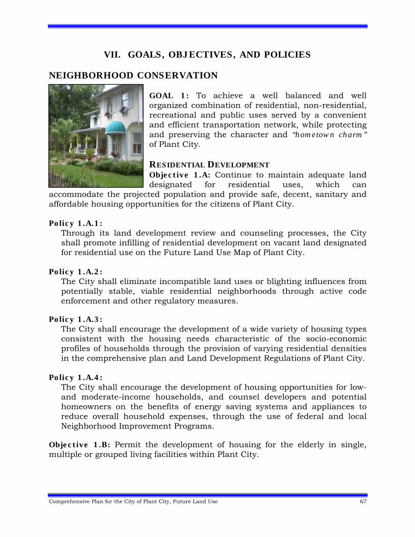
Comprehensive Plan for the City of Plant City, Future Land Use 67
VII. GOALS, OBJECTIVES, AND POLICIES NEIGHBORHOOD CONSERVATION
GOAL 1: To achieve a well balanced and well organized combination of residential, non-residential, recreational and public uses served by a convenient and efficient transportation network, while protecting and preserving the character and “hometown charm” of Plant City. RESIDENTIAL DEVELOPMENT Objective 1.A: Continue to maintain adequate land designated for residential uses, which can
accommodate the projected population and provide safe, decent, sanitary and affordable housing opportunities for the citizens of Plant City. Policy 1.A.1:
Through its land development review and counseling processes, the City shall promote infilling of residential development on vacant land designated for residential use on the Future Land Use Map of Plant City.
Policy 1.A.2:
The City shall eliminate incompatible land uses or blighting influences from potentially stable, viable residential neighborhoods through active code enforcement and other regulatory measures.
Policy 1.A.3:
The City shall encourage the development of a wide variety of housing types consistent with the housing needs characteristic of the socio-economic profiles of households through the provision of varying residential densities in the comprehensive plan and Land Development Regulations of Plant City.
Policy 1.A.4: The City shall encourage the development of housing opportunities for low- and moderate-income households, and counsel developers and potential homeowners on the benefits of energy saving systems and appliances to reduce overall household expenses, through the use of federal and local Neighborhood Improvement Programs.
Objective 1.B: Permit the development of housing for the elderly in single, multiple or grouped living facilities within Plant City.
68 Comprehensive Plan for the City of Plant City, Future Land Use
Policy 1.B.1: The City shall encourage assisted living facility options in character with surrounding neighborhoods through the City's Land Development Regulations.
Policy 1.B.2:
The City shall encourage development of projects serving the elderly that are accessible to medical services, transportation, and other necessary support systems through locational criteria within the City's Land Development Regulations.
Policy 1.B.3:
Calculate total beds permitted in assisted living facilities (ALF) by determining the number of housing units, which would be permitted on site and multiplying the units by the average persons per household for Plant City in the most recent U.S. Census. As long as the proposed ALF facility maintains the overall character of the area, density bonuses up to 20% may be considered when it is part of a planned unit development (Community Unit).
Policy 1.B.4:
The City shall support increased residential densities for developments that provide assisted elderly housing. Increased residential densities shall be in compliance with the Housing Element’s definition of Assisted Elderly Housing and the adopted policies of the Comprehensive Plan for the City of Plant City.
Objective 1.C: Protect single family residential neighborhoods by requiring that any other land uses within single family areas meet applicable locational criteria. Policy 1.C.1:
Higher density residential uses shall be located in close proximity to office and commercial activity centers to minimize the use of the automobile.
Policy 1.C.2:
Higher intensity non-residential land uses that are adjacent to established neighborhoods shall be restricted to collectors and arterials and to locations external to established and developing neighborhoods. Recognizing that interstate interchanges are an important and limited resource, commercial and mixed use developments may be considered on a local roadway within ⅓ of a mile of an interchange. Provided that concurrently, the roadway is improved to meet collector roadway standards, access would not be through an existing or planned residential area and to ensure compatibility with

Comprehensive Plan for the City of Plant City, Future Land Use 69
adjacent parcels through such mechanisms as buffering, developed under a Community Unit Zoning District.18
Objective 1.D: Continue the code enforcement program of Plant City. Policy 1.D.1:
The City shall continue to implement a property maintenance ordinance and ensure that all properties are maintained to at least the minimum standards contained in the Plant City Code of Ordinances.
Policy 1.D.2: The City shall encourage neighborhood groups to take an active role in neighborhood inspection and monitoring through education directed toward neighborhood improvement.
Policy 1.D.3:
The City will monitor the condition of all residential rental units and maintain a residential rental certification program.
RECREATIONAL DEVELOPMENT Objective 1.E: Continue to maintain and/or improve existing recreation lands and encourage the dedication of properties for recreational uses through appropriate incentives. Policy 1.E.1:
The City shall continue to implement appropriate incentives (e.g., increased densities/intensities) for the dedication of public recreation and open space facilities or for improving existing public facilities within Plant City.
Policy 1.E.2: The City shall continue to improve coordination with all levels of government, non-profit providers and private landholders to increase available parkland and facilities through joint utilization agreements and the development review process (including, but not limited to, rezonings and subdivision reviews).
Policy 1.E.3: The City shall provide active and passive recreation facilities and opportunities to meet existing and future needs of neighborhoods in Plant City.
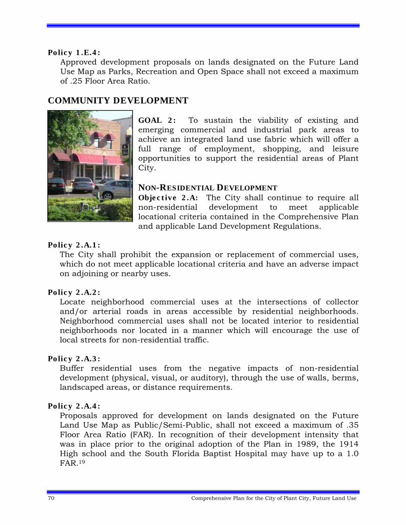
70 Comprehensive Plan for the City of Plant City, Future Land Use
Policy 1.E.4: Approved development proposals on lands designated on the Future Land Use Map as Parks, Recreation and Open Space shall not exceed a maximum of .25 Floor Area Ratio.
COMMUNITY DEVELOPMENT GOAL 2: To sustain the viability of existing and emerging commercial and industrial park areas to achieve an integrated land use fabric which will offer a full range of employment, shopping, and leisure opportunities to support the residential areas of Plant City. NON-RESIDENTIAL DEVELOPMENT Objective 2.A: The City shall continue to require all non-residential development to meet applicable locational criteria contained in the Comprehensive Plan and applicable Land Development Regulations.
Policy 2.A.1:
The City shall prohibit the expansion or replacement of commercial uses, which do not meet applicable locational criteria and have an adverse impact on adjoining or nearby uses.
Policy 2.A.2:
Locate neighborhood commercial uses at the intersections of collector and/or arterial roads in areas accessible by residential neighborhoods. Neighborhood commercial uses shall not be located interior to residential neighborhoods nor located in a manner which will encourage the use of local streets for non-residential traffic.
Policy 2.A.3:
Buffer residential uses from the negative impacts of non-residential development (physical, visual, or auditory), through the use of walls, berms, landscaped areas, or distance requirements.
Policy 2.A.4:
Proposals approved for development on lands designated on the Future Land Use Map as Public/Semi-Public, shall not exceed a maximum of .35 Floor Area Ratio (FAR). In recognition of their development intensity that was in place prior to the original adoption of the Plan in 1989, the 1914 High school and the South Florida Baptist Hospital may have up to a 1.0 FAR.19
Comprehensive Plan for the City of Plant City, Future Land Use 71
Objective 2.B: Infill and redevelop existing commercial areas in lieu of permitting new areas to commercialize. Policy 2.B.1:
The City shall encourage the development of shopping nodes rather than scattered unplanned commercial development in order to limit the number of curb cuts and to reduce conflicts in land uses, particularly along collectors and arterials.
Policy 2.B.2: The City shall encourage public/private partnership and redevelopment/ revitalization strategies for private reinvestment in underutilized commercial areas.
Objective 2.C: Preserve the residential integrity of neighborhoods in Plant City, prohibiting intrusion by traffic, parking lot access or other non-essential activity. Policy 2.C.1:
The City shall protect residential neighborhoods from cut-through non-residential traffic by providing appropriate traffic control mechanisms (e.g. signalization, four-way controls).
Policy 2.C.2: The City shall encourage the reorientation and combined use of existing curb cuts and/or parking lots to minimize the negative impacts of non-residential development on adjacent residential uses and the transportation system through incorporation of design criteria in Land Development Regulations and through the development review process.
Policy 2.C.3: The City shall prohibit construction of commercial or industrial parking lots with ingress/egress into residential neighborhoods. When access is required to be located off a major roadway, such access shall conform to the city's and/or state's minimum curb cut separation distance requirements as applicable.
Objective 2.D: Support the commercial activity centers. Policy 2.D.1:
The City shall utilize design guidelines that encourage development and redevelopment of the major office and commercial activity centers as pedestrian friendly places (e.g., signage, landscaping, public art, public spaces).
72 Comprehensive Plan for the City of Plant City, Future Land Use
Objective 2.E: Support the downtown, stadium, community college, hospital, airport and the industrial areas as the major employment and regional attractors of Plant City. Policy 2.E.1:
The City shall ensure that adequate water, sewer, solid waste, and drainage facilities will be provided concurrent with the impacts of development to serve the major employment centers and attractors through the implementation of the Capital Improvements Program and public/private agreements.20
Objective 2.F: Plant City will monitor development within the Mixed-Use - Residential/Commercial (MU-RC) category to ensure the following minimum and maximum percentages for each of the following uses:
Residential: 65% minimum and 85% maximum
Commercial, including office development and research corporate park uses: 15% minimum and 35% maximum
Policy 2.F.1:
The MU-RC category permits a mixture of residential and commercial uses. Policy 2.F.2:
Consideration of plan amendments to the MU-RC plan category requires at least 20 acres and must be located on a collector or arterial road.
Objective 2.G: Plant City will monitor development within the Mixed Use - Residential/Commercial/Industrial (MU-RCI) category to ensure the following minimum and maximum percentages for each of the following uses:
Residential: 10% minimum and 50% maximum
Commercial, including office development and research corporate park uses: 5% minimum and 35% maximum
Light Industrial: 45% and 85%
Policy 2.G.1:
The MU–RCI category permits a mixture of residential, commercial and light industrial uses.
Comprehensive Plan for the City of Plant City, Future Land Use 73
Policy 2.G.2: Consideration of plan amendments to the MU-RCI plan category requires at least 1000 acres and must be located on an arterial road.
ENHANCE “HOMETOWN CHARM” - VISION/SECTOR/NEIGHBORHOOD PLANNING Objective 2.H: Areas or neighborhoods that are undergoing rapid development, redevelopment, land use transition, becoming blighted or other changing conditions, as staff resources and funding permits, will be studied and governing policies developed with the aim (among other identified issues) of preserving and enhancing the “hometown charm” and character of Plant City. Policy 2.H.1:
As resources allow, the City, with the assistance of the Planning Commission, will conduct future Select Area Studies, Vision, Sector and/or Neighborhood Plans that primarily focus on enhancing these areas to preserve and enhance the overall “hometown charm” of Plant City.
Policy 2.H.2:
As appropriate, the City shall implement the recommendations and policy direction of Select Area Studies, Vision, Sector and/or Neighborhood Plans, such as the Midtown Redevelopment District Vision Plan and the Northeast Plant City Area Master Plan.
Policy 2.H.3:
The Northeast Plant City Area General Growth and Development Guidelines – The City will coordinate future growth and development in the northeast quadrant (study area) of the municipality with land uses and the provision of public facilities, in part, through the application of existing citywide policy direction as articulated in the Comprehensive Plan for the City of Plant City that addresses: Orderly Extension of Public Facilities (see Future Land Use,
Transportation, Public Facilities and Capital Improvements Elements); Development of a Transportation Network that serves the adopted Land
Use Pattern (see Future Land Use and Transportation Elements); Intergovernmental coordination efforts to ensure integrated Land Use
Patterns and the coordinated provision of Transportation and other Public Facilities (see Future Land Use, Transportation and Intergovernmental Coordination Elements), and;
Orderly Annexation and Land Use Growth Patterns (see Future Land Use and Housing Elements).21
74 Comprehensive Plan for the City of Plant City, Future Land Use
Policy 2.H.4: The Northeast Plant City Area Specific Growth and Development Guidelines - The City will coordinate future growth and development in the northeast quadrant (study area) of the municipality with the provision of public facilities, transportation and land uses, in part, through the application of this policy, which is based on provisions in the Northeast Plant City Area Master Plan: Coordination of Growth and Development with the Northeast Plant City Vision The City’s long term goal is to develop the study area into a thriving and
attractive part of the municipality, creating a highly appealing and livable “village” environment in northeast Plant City.
Land uses within the study area shall be governed by the adopted future land uses maps of either Plant City or Hillsborough County, as appropriate.
The City adopts the following maps as a general vision for future growth and development - Phase I - Future Land Scenario Map 2025 (part of the Future Land Use Element Map Series – Figure 5), and Northeast Plant City Master Plan Recommended Improvements (a.k.a. Phase I - Roadway Network Map 2025 - part of the Transportation Element Map Series – Figure 17). Also, the municipality incorporates, by reference, the Northeast Plant City Area Master Plan (May 2008) as supporting background data and analysis into the Comprehensive Plan for the City of Plant City. The conceptual transportation and land use map scenarios are interdependent and allow for future growth and development to occur in part, by establishing a mechanism, i.e. Mobility Fees, to mitigate impacts to Interstate-4 by providing funding for parallel roadway capacity. Development in the area shall be guided by the following concepts22:
i) Creates a village center that is a mixed-use focal point providing a balance of housing, employment and civic uses, while enhancing opportunities for internal trip capture;
ii) Clusters residential density; iii) Builds a series of greenways that provide an alternative to vehicular
travel and recreation opportunities; iv) Allows for the continuation of some agricultural uses, and; v) Provides for roadway improvements that creates a parallel road
network to Interstate-4. Future growth and development will occur incrementally, and as
development projects are proposed, each will be assessed to determine how it implements the overall future land and roadway network scenarios. That assessment will include:
i) How much the proposed land use pattern differs from the scenario and why;
Comprehensive Plan for the City of Plant City, Future Land Use 75
ii) How that difference potentially affects the overall land use scenario and the future ability to establish the mixture of land uses and patterns needed to create a “village”;
iii) The impact on growth assumptions, including the potential effect on the overall transportation scenario and impacts to Interstate-4, and;
iv) The ability to provide public facilities to future growth areas and any potential costs to Plant City.
Based on the results of this assessment, the City will determine if it is in the best public interest to proceed with development proposals that differ from the general vision. Circumstances such as present market conditions, public input, availability of roadway funding opportunities, the willingness of a landowner to dedicate land for parks or right-of-way (to name but a few), may present additional circumstances and opportunities that necessitate minor changes to the specific location of land uses and road corridors shown in the general vision.
Additional Coordination of Growth and Development with Transportation Exact location and alignments of the road network as shown on the
Phase I - Roadway Network Map 2025 will be identified as properties are developed in those proposed road corridors.
The City shall consult with the Florida Department of Transportation on any changes to the Phase I - Future Land Scenario 2025 or Phase I Roadway Network - 2005 Maps. The City will continue to work with the Metropolitan Planning Organization, Florida Department of Transportation and Hillsborough County through coordination and dialogue to determine exact alignments and pursue funding through the transportation improvement planning process and other means to implement the envisioned road corridor scenario for northeast Plant City.
The City will work with Hillsborough County and pursue an intergovernmental coordination mechanism, such as a joint planning area, to define responsibilities for road improvements, access and maintenance.23
76 Comprehensive Plan for the City of Plant City, Future Land Use
FUTURE GROWTH - ANNEXATIONS Objective 2.I: The City shall use the following set of policies as a cohesive strategy to address the issue of future land annexations into Plant City and how they interface with rural land development patterns which remain in unincorporated Hillsborough County. Policy 2.I.1:
The Joint Planning Area included on the Vision Map shall be used to plan for the orderly future growth of Plant City. The boundaries of the joint planning area generally include lands that may annex into the municipality in the future and are considered to be part of a greater Plant City area.24
Policy 2.I.2:
Reserved25 Policy 2.I.3:
By December 31, 2019, the City, to the extent resources allow, shall complete area master plan(s) for the joint planning area. These plan(s) will guide the future growth of those areas that annex into Plant City. Some of the topics that will be considered will include: existing land use patterns, demographics, future land use needs (population and employment) and expected development patterns, infrastructure availability, timing and estimated costs. The area plan(s) will include a conceptual ‘vision’ map that will integrate the findings and illustrate the preferred future land use scenario for that area.26
Policy 2.I.4:
The City will consider entering into agreements with potential property owners seeking annexation and requiring, if appropriate, the dedication of lands for right-of-way for future or expanded roadways and other public facilities.
Policy 2.I.5:
It is the aim of the City that future annexations will occur in an orderly and logically contiguous pattern from the municipality’s existing jurisdictional boundary lines. To promote this, the City will require that property owners adjoining land proposed for annexation are asked if they wish to be part of that annexation, if their inclusion will help to achieve this goal. (For example, squaring off a boundary line if there is a small property surrounded on three sides by the municipality’s proposed new jurisdictional boundary line or extending this boundary line to the edge of a major natural or man made feature.)
Comprehensive Plan for the City of Plant City, Future Land Use 77
COMMERCIAL DEVELOPMENT GOAL 3: To provide a framework within which commercial areas on major arterials can be developed in a manner which enhances the character (hometown charm) and ambience of Plant City. Objective 3.A: Provide guidelines which encourage clear and efficient patterns of movement and access management on commercial streets through the Land Development Regulations of Plant City. Policy 3.A.1:
The City shall establish guidelines for the placement of access points from the street onto commercial properties, requiring the minimum number of access points, and encouraging the joint use of access points, and/or auto circulation between commercial areas.
Objective 3.B: Provide design standards and incentives for principal entry corridors which affect the placement and massing of new commercial and mixed use structures/projects through Land Development Regulations of Plant City. Policy 3.B.1:
Through the rezoning and site plan review process, the City shall encourage the placement and orientation of buildings to address their relationship with other buildings and the street, the promotion of energy conservation and to produce a comfortable pedestrian environment in the City of Plant City.
Policy 3.B.2: The City shall develop land development regulations for the Mixed Use – Gateway District by December 31, 2015. These regulations shall include but are not limited to: Building Form, Orientation and Placement Landscaping and Buffering Public Open Space Sign Standards and Placement Lighting Requirements and Placement Pedestrian and Bicycle Amenities and Continuity Utility, Stormwater Facilities and Solid Waste Receptacle Placement27
Policy 3.B.3: Reserved28
78 Comprehensive Plan for the City of Plant City, Future Land Use
Policy 3.B.4: The City shall apply the land development regulations along James L. Redman Parkway from Alexander Street to the City limits of Plant City, by July 31, 2016.29
Objective 3.C: Continue to provide guidelines and incentives, which establish a well-designed and unified landscape treatment along the entire length of commercial streets. Policy 3.C.1:
The City shall encourage generous and consistent landscaped buffers between the street and commercial uses, and across frontages of adjacent properties.
Policy 3.C.2: The City shall encourage the generous use of landscaping in parking lots and at building edges, to buffer commercial uses from residential uses.
Objective 3.D: Continue to provide guidelines and incentives which produce desirable configurations of parking. Policy 3.D.1:
The City shall encourage the design of parking patterns which enhance the safety and convenience of pedestrians, through pedestrian and landscape amenities.
Policy 3.D.2: The City shall encourage the design of parking layouts which allow for circulation between properties.
Objective 3.E: Continue to provide guidelines and incentives which produce a unified image for signs, lighting, and street furniture. Policy 3.E.1:
Continue to enforce a well-conceived sign ordinance.
Policy 3.E.2: Continue to enforce standards for lighting.
Policy 3.E.3: Provide standards for street furnishings such as waste receptacles and newspaper vending.
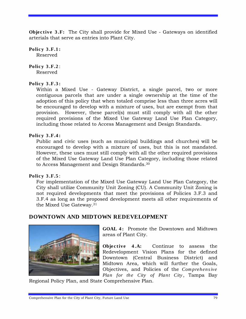
Comprehensive Plan for the City of Plant City, Future Land Use 79
Objective 3.F: The City shall provide for Mixed Use - Gateways on identified arterials that serve as entries into Plant City. Policy 3.F.1:
Reserved Policy 3.F.2:
Reserved Policy 3.F.3:
Within a Mixed Use - Gateway District, a single parcel, two or more contiguous parcels that are under a single ownership at the time of the adoption of this policy that when totaled comprise less than three acres will be encouraged to develop with a mixture of uses, but are exempt from that provision. However, these parcel(s) must still comply with all the other required provisions of the Mixed Use Gateway Land Use Plan Category, including those related to Access Management and Design Standards.
Policy 3.F.4:
Public and civic uses (such as municipal buildings and churches) will be encouraged to develop with a mixture of uses, but this is not mandated. However, these uses must still comply with all the other required provisions of the Mixed Use Gateway Land Use Plan Category, including those related to Access Management and Design Standards.30
Policy 3.F.5: For implementation of the Mixed Use Gateway Land Use Plan Category, the City shall utilize Community Unit Zoning (CU). A Community Unit Zoning is not required developments that meet the provisions of Policies 3.F.3 and 3.F.4 as long as the proposed development meets all other requirements of the Mixed Use Gateway.31
DOWNTOWN AND MIDTOWN REDEVELOPMENT
GOAL 4: Promote the Downtown and Midtown areas of Plant City. Objective 4.A: Continue to assess the Redevelopment Vision Plans for the defined Downtown (Central Business District) and Midtown Area, which will further the Goals, Objectives, and Policies of the Comprehensive Plan for the City of Plant City, Tampa Bay
Regional Policy Plan, and State Comprehensive Plan.
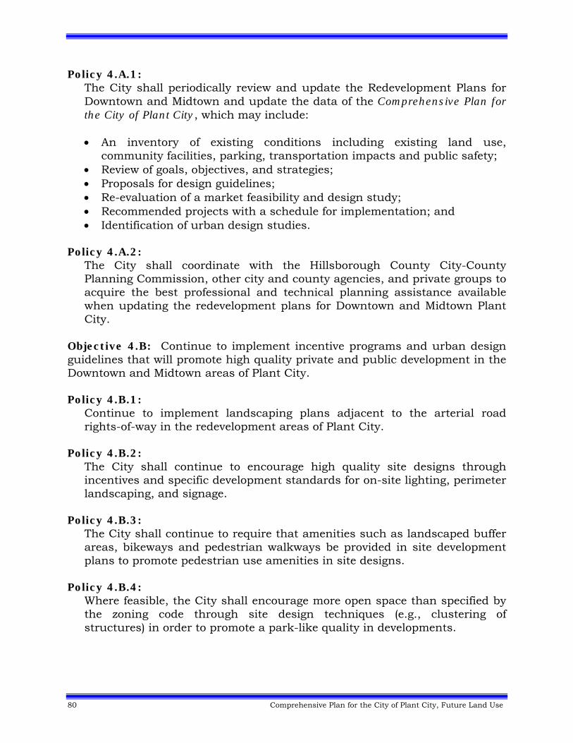
80 Comprehensive Plan for the City of Plant City, Future Land Use
Policy 4.A.1: The City shall periodically review and update the Redevelopment Plans for Downtown and Midtown and update the data of the Comprehensive Plan for the City of Plant City, which may include: An inventory of existing conditions including existing land use,
community facilities, parking, transportation impacts and public safety; Review of goals, objectives, and strategies; Proposals for design guidelines; Re-evaluation of a market feasibility and design study; Recommended projects with a schedule for implementation; and Identification of urban design studies.
Policy 4.A.2: The City shall coordinate with the Hillsborough County City-County Planning Commission, other city and county agencies, and private groups to acquire the best professional and technical planning assistance available when updating the redevelopment plans for Downtown and Midtown Plant City.
Objective 4.B: Continue to implement incentive programs and urban design guidelines that will promote high quality private and public development in the Downtown and Midtown areas of Plant City. Policy 4.B.1:
Continue to implement landscaping plans adjacent to the arterial road rights-of-way in the redevelopment areas of Plant City.
Policy 4.B.2: The City shall continue to encourage high quality site designs through incentives and specific development standards for on-site lighting, perimeter landscaping, and signage.
Policy 4.B.3: The City shall continue to require that amenities such as landscaped buffer areas, bikeways and pedestrian walkways be provided in site development plans to promote pedestrian use amenities in site designs.
Policy 4.B.4: Where feasible, the City shall encourage more open space than specified by the zoning code through site design techniques (e.g., clustering of structures) in order to promote a park-like quality in developments.
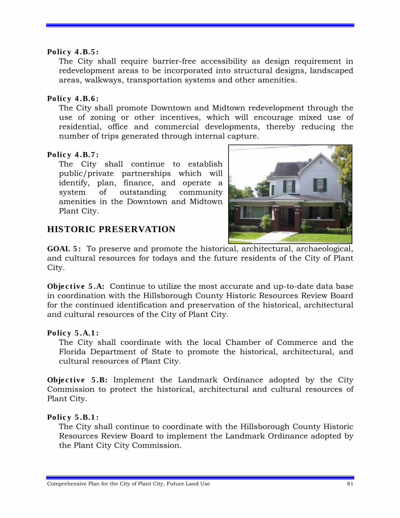
Comprehensive Plan for the City of Plant City, Future Land Use 81
Policy 4.B.5: The City shall require barrier-free accessibility as design requirement in redevelopment areas to be incorporated into structural designs, landscaped areas, walkways, transportation systems and other amenities.
Policy 4.B.6: The City shall promote Downtown and Midtown redevelopment through the use of zoning or other incentives, which will encourage mixed use of residential, office and commercial developments, thereby reducing the number of trips generated through internal capture.
Policy 4.B.7:
The City shall continue to establish public/private partnerships which will identify, plan, finance, and operate a system of outstanding community amenities in the Downtown and Midtown Plant City.
HISTORIC PRESERVATION GOAL 5: To preserve and promote the historical, architectural, archaeological, and cultural resources for todays and the future residents of the City of Plant City. Objective 5.A: Continue to utilize the most accurate and up-to-date data base in coordination with the Hillsborough County Historic Resources Review Board for the continued identification and preservation of the historical, architectural and cultural resources of the City of Plant City. Policy 5.A.1:
The City shall coordinate with the local Chamber of Commerce and the Florida Department of State to promote the historical, architectural, and cultural resources of Plant City.
Objective 5.B: Implement the Landmark Ordinance adopted by the City Commission to protect the historical, architectural and cultural resources of Plant City. Policy 5.B.1:
The City shall continue to coordinate with the Hillsborough County Historic Resources Review Board to implement the Landmark Ordinance adopted by the Plant City City Commission.
82 Comprehensive Plan for the City of Plant City, Future Land Use
Objective 5.C: Continue to protect the special historic, architectural, aesthetic or cultural resources through the future designation of historic landmarks and districts within Plant City. Policy 5.C.1:
The City shall encourage the adaptive use of historic landmarks instead of demolition or destruction through Land Development Regulations and special ordinances designed to support adaptive reuse in Plant City.
Policy 5.C.2: The City shall maintain a high quality of design for infill and new development within historic districts through adoption of special ordinances which establish design guidelines.
Policy 5.C.3: The City shall encourage the restoration and rehabilitation of historic landmarks through appropriate incentive programs.
NATURAL ENVIRONMENT GOAL 6: To ensure proper management and conservation of the natural environment of the City of Plant City. Objective 6.A: All new development and applicable redevelopment must be coordinated with topographic and soil conditions, meet all applicable environmental regulations and be consistent with the Conservation and Aquifer Recharge Element. Policy 6.A.1:
During the land development review process, the City shall recommend the use of soils in accordance with the soil suitabilities identified by the U.S.D.A. Natural Resources Conservation Service (NCRS). Prior to the commitment of resources for potential development and land use activities, actual determination of suitabilities may be required on a site-by-site basis, to allow for the possibility of special exceptions in which proper modification of the natural soil can take place to reduce the limitation for development.
Policy 6.A.2: The City, in cooperation with NCRS, shall recommend that topsoil best management practices be observed during all land alteration activities. To the greatest degree practicable, erosional soil loss due to construction activities shall be minimized.
Comprehensive Plan for the City of Plant City, Future Land Use 83
Policy 6.A.3:
During the land use planning and development review processes, the City shall evaluate and utilize, where appropriate, soil capability analyses for flood hazard, stability, permeability, and other relevant soil characteristics when planning for and permitting new development. Evaluation shall be made in coordination with appropriate agencies (including but not limited to the Environmental Protection Commission, Department of Environmental Protection and Southwest Florida Water Management District).
Policy 6.A.4: The City shall regulate land use and development in all areas subject to flooding by prohibiting all development within the 100 year floodplain, which is not in strict conformance with the provisions of the City of Plant City Flood Hazard Ordinance.
Policy 6.A.5: The City shall coordinate the review and approval of development proposals with applicable federal, state, and local environmental agencies.
Policy 6.A.6: The City shall continue to investigate and promote incentives to encourage the clustering of development away from environmentally sensitive lands.
Policy 6.A.7: The City shall prevent potential contamination by effluent disposal, requiring wastewater effluent to be treated according to Florida Department of Environmental Protection (DEP) and Environmental Protection Commission of Hillsborough County (EPC) effluent standards.
Policy 6.A.8: Sewage collection, treatment and potable water supply systems shall be designed and located to prevent infiltration and outward contamination of the potable water supply.
Policy 6.A.9: Erosion and sedimentation control devices shall be installed between any disturbed area and water bodies, watercourses and wetlands before grading, cutting or filling is begun.
Policy 6.A.10: Land which has been cleared for development, but upon which construction has not commenced, shall be protected from erosion by appropriate techniques designed to stabilize the soil and/or by revegetation of the area with native plantings.
84 Comprehensive Plan for the City of Plant City, Future Land Use
Policy 6.A.11:
Wetlands and other natural water bodies shall not be used as sediment traps for development.
Policy 6.A.12: The City's Land Development Regulations shall be designed to minimize the destruction of natural vegetative communities on development sites by requiring the protection or replacement of significant portions of native vegetation. Vegetation shall be protected both by buffering requirements and by construction barriers around protected areas. Native vegetation shall be retained and protected in a manner which maximizes its aesthetic and natural functions and retains the City's natural heritage without unduly impairing the continued economic development of Plant City.
Policy 6.A.13:
a. The City shall maintain a comprehensive wellhead protection program that shall include the determination of wellhead resource protection areas (WRPAs) surrounding potable water supply wells and criteria for restrictions and prohibitions to be applied within the delineated wellhead resource protection area.
b. Public potable water supply wells included in the City's wellhead resource protection program shall include public water wells that are intended for drinking, culinary or domestic purposes, and are permitted by a consumptive/water use permit with a daily amount of 100,000 gallons-per-day (gpd) or greater.
c. The City shall maintain wellhead resource protection areas using available data and analysis, on a map adopted as part of the Future Land Use Map (FLUM) series, showing where land uses, regulated or associated activities may be regulated or prohibited to prevent potential degradation of public potable water supply wells.
d. The City shall protect existing and planned future wellheads of public potable water supply wells through the regulation of land use activities, and the regulation and prohibition of substances or associated activities that have been established to be significant threats to the present or future use of such wells for potable water purposes.
e. The City shall protect existing and planned future wellheads of public potable water supply wells through the identification of prohibited activities in wellhead resource protection areas. Such prohibited activities are those that have been established to be significant threats which can degrade or contaminate the water resources of the City, such as, but not limited to, new and expanding: sanitary landfills, phosphogypsum piles, adverse industrial land uses, concentrated animal feeding operations, dairy farm storage and treatment facilities, interim wastewater treatment plants, direct stormwater discharges to the Floridan aquifer, land applications of sludge
Comprehensive Plan for the City of Plant City, Future Land Use 85
and septage within 500 feet of a public potable water supply well, and placement of underground storage tanks within 1000 feet of a public potable water supply well. Additionally, the City shall identify certain substances as regulated substances and shall require that handling of said substances in the WRPA be in accordance with state and federal mandates. Regulated substances shall be those substances listed in 40 CFR, Chapter 1, Table 302.4, including Appendices A and B as amended.
f. The City shall maintain a permitting, inspection and enforcement program for the City's policies and regulations to protect wellhead resources for public potable water supplies in wellhead resources protection areas.
Policy 6.A.14:
The City shall protect the potable water wells regulated by the FDEP in Florida Administrative Code Chapter 62-521, as amended. These wells serve at least 15 service connections used by year-round residents or regularly serves at least 25 year-round residents. The protection measures will apply within a 500 foot radial setback from the potable water well. The potable water wells and the potable water well protection areas shall be shown on a map adopted as part of the Future Land Use Map series.
Objective 6.B: Preserve wildlife habitats and archaeological resources. Policy 6.B.1:
The developer of any project shall seek and follow recommendations of the Florida Fish and Wildlife Conservation Commission (FWC) and the Environmental Protection Commission of Hillsborough County for preventing or mitigating probable impacts upon fish and wildlife resources.
Policy 6.B.2: The City shall, through land use planning and land development review processes, and in cooperation with the Environmental Protection Commission of Hillsborough County, continue to conserve and protect wetlands from detrimental physical and hydrological alteration.
Policy 6.B.3:
Archaeological sites shall be evaluated for significance using state or federal criteria to determine if they are eligible for listing on the National Register of Historic Places or other appropriate local, regional or state programs. If they are eligible, they shall be either preserved or excavated prior to destruction.
Policy 6.B.4:
The City shall apply a comprehensive planning based approach to the protection of wetlands within the City of Plant City, which includes:
86 Comprehensive Plan for the City of Plant City, Future Land Use
The identification and mapping of significant wetlands ecosystems through the designation of an Environmentally Sensitive Areas Overlay on the Future Land Use Plan Map.
Utilize this overlay early in land development review processes (map amendments, rezonings, site plans) to direct incompatible uses away from wetlands by first, prohibiting development that impacts jurisdictional wetlands, with the exception of:
o Minimum impact projects such as piers, docks, boardwalks, foot‐bridges, observation decks and similar structures, and;
o Other encroachments only when options to avoid and minimize wetland impacts prove to be infeasible and do not provide for a reasonable use of the property, as determined by the City and the Environmental Protection Commission of Hillsborough County.
Second, requiring wetland encroachment and impacts be mitigated, as appropriate, to maintain a viable and productive vegetative and wildlife habitat, with a no net loss of wetland value or function, as determined by regulations and scientific standards set forth by the City and the Environmental Protection Commission of Hillsborough County.
• Furthermore, the City will coordinate with other agencies (such as the Environmental Protection Commission of Hillsborough County and Southwest Florida Water Management District) in their ongoing efforts to achieve a measurable increase in functionally restored wetland acreage within the City of Plant City.
GROWTH MANAGEMENT Goal 7: Manage growth to discourage urban sprawl, achieve energy efficient land use patterns, promote compact development, encourage alternative transportation modes, reduce greenhouse gas emissions and deliver public facilities and services in a fiscally responsible manner in Plant City.
Comprehensive Plan for the City of Plant City, Future Land Use 87
GENERAL DEVELOPMENT Objective 7.A: In all actions of the City, urban sprawl shall be discouraged and a compact urban pattern of development shall be provided for in a manner which will promote the conservation of energy resources, the reduction of greenhouse gases, the full utilization of existing public infrastructure, and allow for the orderly extension and expansion of municipal facilities in a fiscally responsible manner within Plant City. Policy 7.A.1:
The City shall permit new development to infill on vacant land within urbanized areas where public facilities are provided and capacity is adequate, or in the case of transportation facilities, if the appropriate Mobility Fee is paid, through the development review process (including but not limited to rezoning and subdivision reviews). The City shall review the Capital Improvement Program on a yearly basis to determine appropriate areas where replacement or extension of public facilities is warranted.32
Policy 7.A.2:
The City shall permit redevelopment of lands where public facilities are provided and capacity is adequate, or in the case of transportation facilities, if the appropriate Mobility Fee is paid, through the development review process (including but not limited to rezoning and subdivision reviews). The City shall review the Capital Improvement Program on a yearly basis to determine appropriate areas where replacement of public facilities is warranted.33
Policy 7.A.3: The City shall permit new development which lies contiguous to existing urbanized lands only if public facilities are available, or in the case of transportation facilities, if the appropriate Mobility Fee is paid.34
Policy 7.A.4: The City shall support infill development, the use of master plans (e.g. Midtown Redevelopment Vision Plan, Northeast Plant City Area Master Plan, etc.) and employ mixed-use land use plan categories, as appropriate, during the land development review (map amendments, rezonings, site plans) process to reduce energy consumption (to in part delay the need for additional electric power generation/transmission systems), discourage urban sprawl and advance efficient land use patterns in Plant City.
Policy 7.A.5: To cultivate entrepreneurs of small, home based businesses, the municipality shall allow for the consideration of home occupations in residential areas, pursuant to specific performance and compatibility standards set forth in Plant City’s Land Development Code.35
88 Comprehensive Plan for the City of Plant City, Future Land Use
Objective 7.B: Manage the use of land in the City by approving new development and redevelopment only if the necessary public facilities, or other approved mitigation measures are provided prior to or concurrent with impacts of the development.36 Policy 7.B.1:
The City shall issue no development orders or permits which would result in a reduction of the level of service (LOS) established for public facilities as adopted in the Capital Improvements Element. In the case of transportation facilities, the impacts to the desirable levels of service may be mitigated through the payment of the appropriate Mobility Fee.37
Policy 7.B.2: The City shall locate public facilities and utilities so as to: (a) maximize the efficiency of services provided; (b) minimize their cost; (c) minimize their impacts upon the natural environment; and (d) to promote energy conservation within Plant City.
Policy 7.B.3: Concentrate and infill new development on vacant land with priority given to redevelopment areas where facility capacity is available.
Policy 7.B.4: Extend public facilities into areas of the City, which are under served or without service in conformance with the Future Land Use and Capital Improvements Elements.
Policy 7.B.5: Implement transportation improvements with minimum land use, social and environmental disruption.
Objective 7.C: The City shall ensure that suitable lands and/or easements are available for the provision of utility facilities necessary to support proposed development. Policy 7.C.1:
The City shall continue to review and revise, as necessary, Land Development Regulations to include provisions for the dedication of suitable lands for utility facilities, easements and other public purposes.
Policy 7.C.2: The City shall require the dedication of suitable lands for utility facilities to support proposed development as needed, through the development review process, including but not limited to rezonings and subdivision reviews.
Comprehensive Plan for the City of Plant City, Future Land Use 89
Redevelopment Strategies Objective 7.D: Initiate and support public and private redevelopment efforts in the City's residential and non-residential areas. Policy 7.D.1:
The City shall adopt redevelopment and revitalization strategies and incentives for private reinvestment in underutilized residential and/or commercial areas where adequate infrastructure to support redevelopment exists.
Policy 7.D.2:
Use financial and regulatory incentives and local participation in related state and federal programs to encourage redevelopment and maintenance of declining areas. Regulatory incentives shall not be used to compromise design standards or codes of Plant City.
Policy 7.D.3: The City shall continue to implement plans to facilitate the provision of public facilities in conjunction with the location and timing of neighborhood and commercial redevelopment.
Policy 7.D.4: The City shall give priority to neighborhood and commercial redevelopment projects in those areas where conditions of physical, economic, and/or social blight exist.
Policy 7.D.5:
Development and redevelopment shall be integrated with adjacent land uses through: Creation of like uses; Creation of complementary uses; or Mitigation of adverse impacts.
Policy 7.D.6: The City shall adopt and implement urban design guidelines for redevelopment areas.
Policy 7.D.7: The City shall emphasize rehabilitation and recycling of existing building stock, when appropriate, and the development of adaptive reuse programs.
90 Comprehensive Plan for the City of Plant City, Future Land Use
Policy 7.D.8:
Redevelopment projects shall not destroy the existing social/cultural framework and character of the area. The City shall not approve any development that is contradictory to neighborhood improvement efforts.
Policy 7.D.9: The City shall use community groups to advise and assist the Hillsborough County City-County Planning Commission and the City Commission of Plant City in planning related issues for their respective areas.
Policy 7.D.10: The City shall actively pursue clean non-polluting, non-offensive industrial development in order to diversify the economic base of the City and provide for expanded employment opportunities.
PROVISION OF PUBLIC FACILITIES (NON-TRANSPORTATION) - GENERAL
CONSIDERATIONS Objective 7.E: Service all new development and redevelopment (including the provision of suitable land for utilities) with potable water, sanitary sewerage and stormwater management facilities, solid waste disposal and parks that meet or exceed the adopted levels of service established in the Capital Improvements Element.38 Policy 7.E.1:
Ensure that the location and timing of new development will be coordinated with the City's ability to provide public facilities through implementation of growth management measures such as development phasing, programming of public facilities and zoning and subdivision regulations.
Policy 7.E.2: The City shall provide incentives for developing land in a way that maximizes the use of existing public facilities that have available capacity to serve the development or that reduces existing deficiencies.
Policy 7.E.3: The provision of infrastructure concurrent with development to the extent that facility construction necessary to support development will be available at the adopted level of service concurrent with the impacts of development.
Policy 7.E.4: The City shall prioritize infrastructure programming based on existing facility deficiencies first, replacement and retrofitting of facilities second, and future facility needs third.
Comprehensive Plan for the City of Plant City, Future Land Use 91
Policy 7.E.5: Governmental uses, institutional not-for-profit uses, and public or private utility distribution lines may be considered in any land use plan category subject to the following conditions and limitations:
a. Within any natural preservation land use plan category, only those uses
that are compatible with and enhance the preservation of such environmental lands may be considered;
b. Gas, electric, cable and telephone utility distribution facilities shall be
located only as specifically authorized by their franchise agreement with Plant City;
c. Water, wastewater or reclaimed water facilities may be considered only if
they further the efficient utilization of the City’s water, wastewater or reclaimed water system and are consistent with the Public Facilities Element; and
d. All governmental, institutional and utility facilities must be of a design,
intensity and scale consistent with the surrounding neighborhood or non-residential development in which it occurs, and it must be compatible with the surrounding existing and future land uses and zoning classifications.
Policy 7.E.6:
The City shall support public/private partnerships among state government, local governments and the private sector to identify and build needed public facilities and allocate the costs of such facilities among the partners in proportion to the benefits accruing to each.
Policy 7.E.7: Support the development of innovative, cost effective potable water and wastewater treatment techniques, facility designs, and reclaimed water reuse programs, which will allow for maximum flexibility in the design and construction of city systems.
Policy 7.E.8: Consider the location and timing of new public facility construction in requests for land use plan amendments.
Policy 7.E.9: Provide for expected growth by developing public facilities in areas programmed for growth in conjunction with the City's abilities and private sector participation.
92 Comprehensive Plan for the City of Plant City, Future Land Use
Provision of Public Facilities - Transportation Objective 7.F: Service all new development and redevelopment with transportation facilities funded through the Plant City Mobility Fee and other funding sources and identified in the Capital Improvements Element.39 Policy 7.F.1:
Coordinate land use and Mobility Fees to provide for desirable levels of service.40
Policy 7.F.2: Maximize arterial capacity by supporting the acquiring and/or protecting of adequate rights-of-way.
Policy 7.F.3: Restrict direct access to arterial roadways from development projects when access can be provided via a collector facility or internal road system.
Policy 7.F.4: Protect the capacity and integrity of interstate highways as high volume interstate traffic corridors through the development of an adequate arterial and collector support system.
Policy 7.F.5: Land use planning efforts shall make a distinction between the land uses that may be considered within land areas adjacent to limited access highways but which are not directly accessible to an interchange, and those land areas that are directly accessible to an interchange.
Policy 7.F.6: The City shall discourage curb cuts and intersections with local streets (non-collectors) on planned arterial roadways through the development review process and utilization of applicable Land Development Regulations.
Policy 7.F.7: Require multi-modal transportation options, such as provisions for carpooling, vanpooling, bicycling and/or walking in all development proposals involving two or more units in Plant City.
Policy 7.F.8: The City shall require that frontage roads be provided for all new developments and designated arterials; and where feasible, frontage roads be retrofitted to existing development where they will enhance or complete an adjacent frontage road system.
Comprehensive Plan for the City of Plant City, Future Land Use 93
Policy 7.F.9: Reserved
Policy 7.F.10:
Reserved41 Policy 7.F.11:
Reserved42 Policy 7.F.12: Reserved43 Policy 7.F.13: Reserved44 Policy 7.F.14:
When lands annex into the municipality within the study area of the adopted Northeast Plant City Area Master Plan, a Community Unit Zoning (CU) shall be required. Parcels in existence and recorded as of July 14, 2008 that are under 10 acres and proposed for residential development or public/civic uses are exempt from the requirement of a Community Unit Zoning. Transportation improvements that may be identified through the rezoning process may be mitigated by, but not limited to, payment of mobility fees, proportionate fair share mitigation, right-of-way dedication, or the construction of facilities.45,46
Policy 7.F.15:
Development within the City of Plant City will require the payment of mobility fees at the time customarily due in accordance with the City of Plant City Transportation Mobility Fee Ordinance. The payment of mobility fees may be offset by the construction of certain transportation facilities and/or the dedication of right of way for such facilities, as more specifically provided in the City of Plant City Transportation Mobility Fee Ordinance.47,48
AGRICULTURE - GENERAL CONSIDERATIONS Objective 7.G: Plant City shall foster the economic viability of existing agricultural activities within and outside of Plant City. Policy 7.G.1:
Continue to promote the development and maintenance of the municipality as an agricultural market center through the use of promotional and educational materials fostering agriculture in eastern Hillsborough County.

94 Comprehensive Plan for the City of Plant City, Future Land Use
Policy 7.G.2: Where legally appropriate, defer charging an ongoing agriculturally used property for any public water or sewer line extended through or adjacent to the property until such time as connection is made to the water or sewer lines.
AGRICULTURE - COMPATIBILITY Objective 7.H: Support the compatibility between existing agricultural and non-agricultural uses through the enforcement of appropriate regulatory mechanisms. Policy 7.H.1:
Permit the continuation, on-site expansion, and changing of commodities for agricultural uses even as non-agricultural development is introduced around it, provided that the agricultural uses or zoning for agricultural uses existed at the time of the adoption of the Comprehensive Plan for the City of Plant City.
AGRICULTURE - ENVIRONMENTAL ISSUES Objective 7.I: Protect environmentally sensitive areas from degradation or damage from agricultural activities by establishing regulatory activities. Policy 7.I.1:
Support the regulation of chemical pesticides in accordance with state and federal guidelines.
AGRICULTURE - WATER SUPPLY Objective 7.J: Support water conservation techniques that are beneficial for aquifer recharge and the maintenance of near normal water tables.
Policy 7.J.1:
Continue a phased-in program of water conservation practices within both the agricultural and non-agricultural communities.
LAND DEVELOPMENT REGULATIONS Objective 7.K: Continue to review and revise as necessary all existing and future Land Development Regulations to be consistent with the Comprehensive Plan for the City of Plant City. All subsequent development approvals shall be consistent with those Land Development Regulations. Policy 7.K.1:
Development shall not exceed (expect as noted elsewhere for infill) the densities and intensities established and shall be consistent with the Comprehensive Plan for the City of Plant City.
Comprehensive Plan for the City of Plant City, Future Land Use 95
Policy 7.K.2:
Each land use plan category shall implement a set of different zoning districts that may be permitted within that land use plan category as depicted in a "zoning-plan category matrix" which shall be adopted as part of the Land Development Regulations of Plant City.
Policy 7.K.3: Developments will comply with the requirements of all Land Development Regulations as established and adopted by the City of Plant City, the State of Florida and the federal government, unless such requirements have been previously waived by those governmental bodies.
Objective 7.L: Continue to investigate innovative Land Development Regulations that provide flexible, alternative solutions to development problems. Policy 7.L.1:
Continue to study Land Development Regulations to determine whether to include provisions for the transfer of development rights which: Provide for the transfer of development rights from designated
conservation-protected areas; and Provide for the transfer of development rights to receiving zones where
infill is indicated.
INTERGOVERNMENTAL COORDINATION Objective 7.M: Coordinate growth and development with surrounding jurisdictions in order to promote and to protect inter-jurisdictional interests. Policy 7.M.1:
Coordinate inter-jurisdictional development review through use of the Department of Housing and Development Coordination, the Environmental Protection Commission of Hillsborough County, the Planning Commission and the Metropolitan Planning Organization.
Policy 7.M.2: The City shall encourage the use of joint boards and councils as a means of coordinating the regulation and management of growth and development.
Policy 7.M.3:
The City shall coordinate with adjacent jurisdictions in the siting of locally unpopular public and private land uses. The City shall participate in negotiation meetings, as needed, which will consider factors such as the
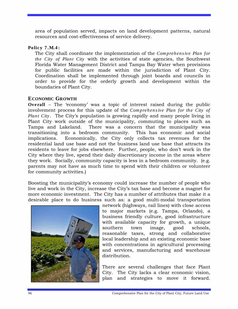
96 Comprehensive Plan for the City of Plant City, Future Land Use
area of population served, impacts on land development patterns, natural resources and cost-effectiveness of service delivery.
Policy 7.M.4: The City shall coordinate the implementation of the Comprehensive Plan for the City of Plant City with the activities of state agencies, the Southwest Florida Water Management District and Tampa Bay Water when provisions for public facilities are made within the jurisdiction of Plant City. Coordination shall be implemented through joint boards and councils in order to provide for the orderly growth and development within the boundaries of Plant City.
ECONOMIC GROWTH Overall – The ‘economy’ was a topic of interest raised during the public involvement process for this update of the Comprehensive Plan for the City of Plant City. The City’s population is growing rapidly and many people living in Plant City work outside of the municipality, commuting to places such as Tampa and Lakeland. There was a concern that the municipality was transitioning into a bedroom community. This has economic and social implications. Economically, the City only collects tax revenues for the residential land use base and not the business land use base that attracts its residents to leave for jobs elsewhere. Further, people, who don’t work in the City where they live, spend their daily discretionary income in the areas where they work. Socially, community capacity is less in a bedroom community. (e.g. parents may not have as much time to spend with their children or volunteer for community activities.) Boosting the municipality’s economy could increase the number of people who live and work in the City, increase the City’s tax base and become a magnet for more economic investment. The City has a number of attributes that make it a desirable place to do business such as: a good multi-modal transportation
network (highways, rail lines) with close access to major markets (e.g. Tampa, Orlando), a business friendly culture, good infrastructure with available capacity for growth, a unique southern town image, good schools, reasonable taxes, strong and collaborative local leadership and an existing economic base with concentrations in agricultural processing and services, manufacturing and warehouse distribution. There are several challenges that face Plant City. The City lacks a clear economic vision, plan and strategies to move it forward.
Comprehensive Plan for the City of Plant City, Future Land Use 97
Population growth has put pressure on landowners to convert industrial lands and lands in use for agricultural production to residential uses threatening the elements that are part of the economic base of Plant City. The following goal, objectives and policies give a framework to build the future economy of Plant City. Goal 8: Recognize the importance of a healthy and vibrant local economy for the citizens of our municipality, and set a deliberate and thoughtful direction and course of action for building the economy of Plant City. Objective 8.A: In cooperation with the Plant City Chamber of Commerce, continue to update and implement the Strategic Guide for the City of Plant City.49 Policy 8.A.1:
Identify the City’s economic assets, and how those assets can be used to their fullest potential to increase local economic impacts.
Policy 8.A.2
Identify, develop, build and market an image of the City that will be used to ‘sell’ the City to economic investors.
Policy 8.A.3:
Give first priority to economic opportunities that are linked to existing economic assets.
Policy 8.A.4:
Be careful of expending resources for economic opportunities that are completely new for the City and can’t be linked to existing economic assets.
Policy 8.A.5:
Periodically identify global trends, the potential impacts they may have on the local economy and opportunities that could give the City a competitive advantage.
Policy 8.A.6:
Strive to develop a highly skilled and/or educated work force. Policy 8.A.7:
Maintain strong, effective and collaborative local leadership. Policy 8.A.8:
Develop and maintain strong ties with regional economic groups that can help build the economy of Plant City.
98 Comprehensive Plan for the City of Plant City, Future Land Use
Policy 8.A.9: Invest in infrastructure that will support and attract economic growth to Plant City.
Policy 8.A.10:
Identify target industries and develop a marketing program to attract these industries to Plant City.
Policy 8.A.11:
Identify lands suitable for different types of economic activity, rank their suitability and discourage their conversion to other uses.
Policy 8.A.12:
Develop and maintain a knowledge base of business assistance plans and foster business participation in them.
Policy 8.A.13:
Recognize that incentives can be useful to target the specific types of industry wanted by Plant City.
Policy 8.A.14:
Reserved50 Policy 8.A.15:
Continue using the Chamber of Commerce as the City’s entity to actively seek and develop opportunities for economic growth in Plant City.
Policy 8.A.16:
One of the implementation strategies the City shall use to attract business and economic investment is to build an appealing and livable city. Some of the elements of an appealing and livable city include: economic opportunity, a sense of place and community, attractiveness, mobility options, feeling of safety, a mix of uses and open spaces.
Objective 8.B: Factor economic considerations in local decision making of Plant City. Policy 8.B.1:
Include simple qualitative economic assessments in local government decision making as a means to build awareness that most decisions have an economic impact.
Policy 8.B.2:
The types of local government decisions where it is appropriate to include simple qualitative economic assessments include: capital expenditures,
Comprehensive Plan for the City of Plant City, Future Land Use 99
planning, provision of City services and intergovernmental coordination activities.
Policy 8.B.3:
The information used in a simple qualitative economic assessment shall include at least a subjective weighing of direct and indirect costs and benefits.
Policy 8.B.4:
The City may require or include, where appropriate, more complex types of economic analysis such as: risk management, leverage, direct and indirect economic impact analysis, cost/benefit analysis, competitive analysis and trend analysis.
Objective 8.C: Increase the supply of land available for light industrial, research, and office development with the aim of increasing the total number of jobs in the following target industries in Plant City:
Professional, Scientific & Technical Services; Bioscience and Research Facilities; Manufacturing Facilities; Finance & Insurance Services; Management Services, and; Administrative & Support Services.51
Policy 8.C.1: Target Development. Encourage private investment that results in the creation and establishment of “target development” in Plant City. Target developments include one or more of the above listed industries in Objective 8.C.52
100 Comprehensive Plan for the City of Plant City, Future Land Use
Policy 8.C.2: Overlay. The target industries noted above may be considered within the areas identified on Figure 7 – Interstate-4 Green Tech Corridor Overlay. No future land use map amendment shall be required for development within the mapped areas, provided it is consistent with the policies established under Objective 8.C and applicable Land Development Regulations. The minimum land area shall be five (5) acres of buildable uplands within
or recently annexed into the City of Plant City.
Furthermore, through the use of this future land use overlay, advance zoning, infrastructure improvements and coordination with economic development interests, the City may create sites that are “permit-ready” and can be developed following approval of site and building plans by the Plant City City Commission.53 Policy 8.C.3: Development Patterns. By December 31, 2012, the City of Plant City shall adopt Land Development Regulations that encourage the establishment of these target industries and implement the desired development patterns within the areas identified on Figure 7 – Interstate-4 Green Tech Corridor Overlay. The most appropriate development patterns will vary by site based on the location and proposed land uses. The land development regulations shall establish more specific requirements and enable the development of each of the patterns in appropriate locations that provide for compatible transitions with residential areas, protection of environmental resources, amount and location of secondary uses, provision of adequate public facilities and the enhancement of community character or “hometown charm” of the City of Plant City. Floor area ratios provided in the following exhibits are the maximum allowable development intensities; this and other development requirements shall be further refined and guided by applicable Land Development Regulations.54 Policy 8.C.4: General Guidelines and Standards. Development within the overlay will be guided by three development patterns: Corporate Village – A master planned mixed‐use development under
unified ownership or control that combines offices and flex spaces for target industries, with retail, restaurants and lodging as secondary support uses. Retail, restaurants and lodging support uses will be located within buildings or clustered in nodes at the entries of the development. Support uses including retail, hotels, motels and restaurants may not exceed 10% of the total floor area ratio of the Corporate Village. Warehousing and distribution facilities are only allowed as an accessory use. Limited residential development may be located in mixed use buildings or on the periphery of the site in support of target development
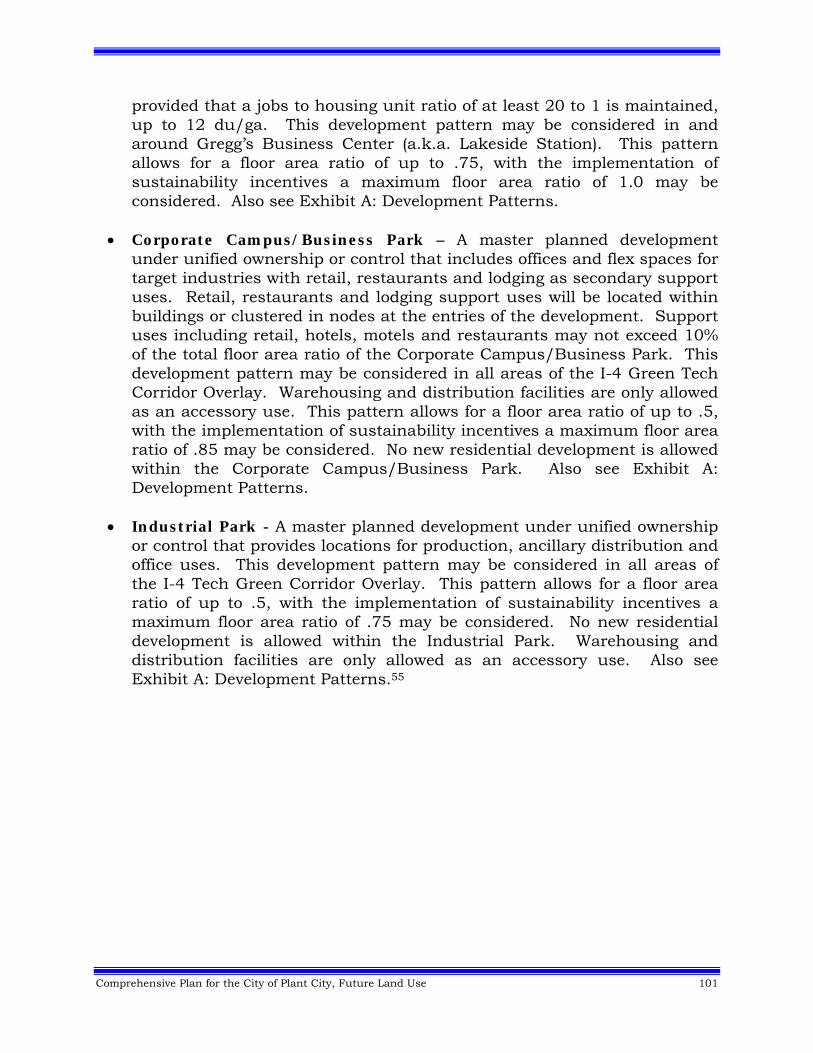
Comprehensive Plan for the City of Plant City, Future Land Use 101
provided that a jobs to housing unit ratio of at least 20 to 1 is maintained, up to 12 du/ga. This development pattern may be considered in and around Gregg’s Business Center (a.k.a. Lakeside Station). This pattern allows for a floor area ratio of up to .75, with the implementation of sustainability incentives a maximum floor area ratio of 1.0 may be considered. Also see Exhibit A: Development Patterns.
Corporate Campus/Business Park – A master planned development under unified ownership or control that includes offices and flex spaces for target industries with retail, restaurants and lodging as secondary support uses. Retail, restaurants and lodging support uses will be located within buildings or clustered in nodes at the entries of the development. Support uses including retail, hotels, motels and restaurants may not exceed 10% of the total floor area ratio of the Corporate Campus/Business Park. This development pattern may be considered in all areas of the I-4 Green Tech Corridor Overlay. Warehousing and distribution facilities are only allowed as an accessory use. This pattern allows for a floor area ratio of up to .5, with the implementation of sustainability incentives a maximum floor area ratio of .85 may be considered. No new residential development is allowed within the Corporate Campus/Business Park. Also see Exhibit A: Development Patterns.
Industrial Park - A master planned development under unified ownership or control that provides locations for production, ancillary distribution and office uses. This development pattern may be considered in all areas of the I-4 Tech Green Corridor Overlay. This pattern allows for a floor area ratio of up to .5, with the implementation of sustainability incentives a maximum floor area ratio of .75 may be considered. No new residential development is allowed within the Industrial Park. Warehousing and distribution facilities are only allowed as an accessory use. Also see Exhibit A: Development Patterns.55
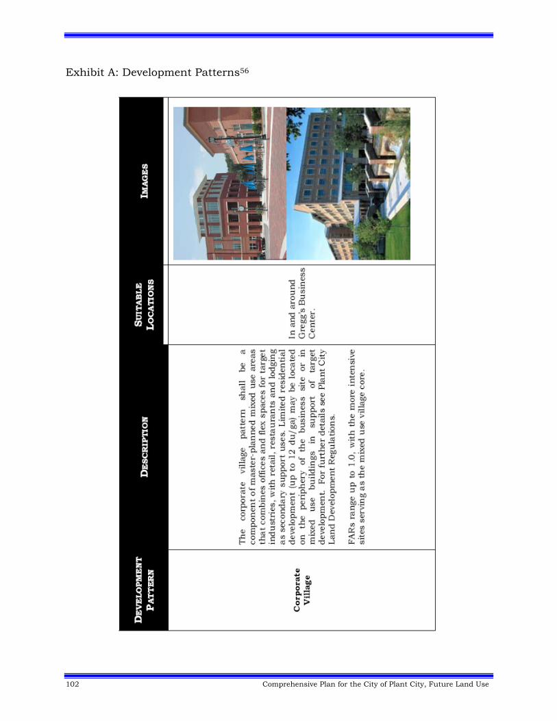
102 Comprehensive Plan for the City of Plant City, Future Land Use
Exhibit A: Development Patterns56
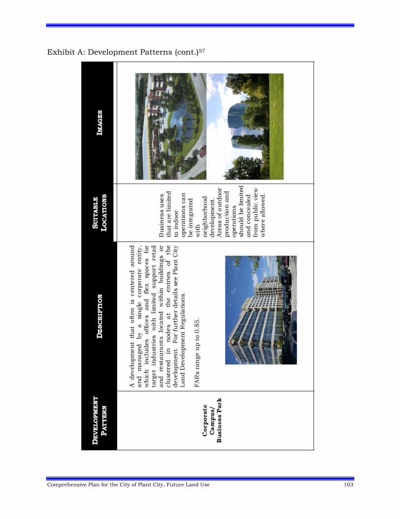
Comprehensive Plan for the City of Plant City, Future Land Use 103
Exhibit A: Development Patterns (cont.)57
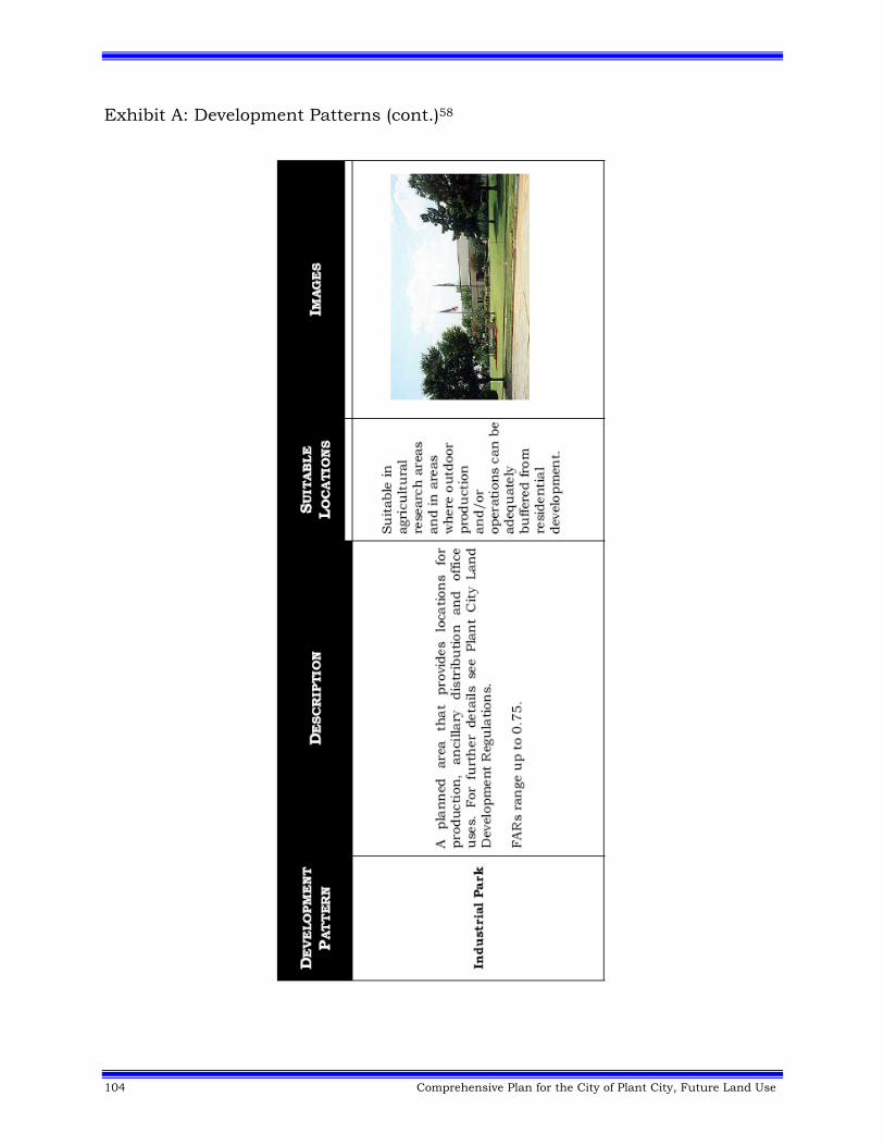
104 Comprehensive Plan for the City of Plant City, Future Land Use
Exhibit A: Development Patterns (cont.)58
Comprehensive Plan for the City of Plant City, Future Land Use 105
Policy 8.C.5: Phasing. Target development shall be encouraged in an orderly growth pattern where water, sewer and transportation capacity is available or funded (planned in the City Capital Improvements Element).59 Policy 8.C.6: Compatible Design Objectives. Ensure high-quality development through the standards of the Land Development Regulations that promotes development that is compatible with abutting land uses in Plant City and Hillsborough County. Compatibility shall be achieved through standards that address the landscaping, height, scale, use and design of target development abutting residential development and environmental features. Also, for applicable lands, ensure these targeted developments are compatible and support the overall concepts of the Northeast Plant City Area Master Plan (Reference Figure 5). Sustainability shall be encouraged through site and building practices that address low impact development, energy efficient building design/construction, improved mobility, and ecological conservation through an incentive based program outlined in the Land Development Regulations of Plant City.60 Policy 8.C.7: Development Incentives. Plant City shall create as part of their Land Development Regulations intensity bonuses for target development in the Land Development Regulations for site and building development, multi-modal transportation enhancements, integrated green space retention and other sustainable development practices that exceed base standards within the areas identified on Figure 7 – Interstate-4 Green Tech Corridor Overlay.61 Policy 8.C.8: Transportation Planning Coordination. Coordinate with the Metropolitan Planning Organization (MPO), Hillsborough County and the Florida Department of Transportation (FDOT) in planning for and providing adequate transportation capacity to serve economic growth along I-4 and the adjacent roadway network within Plant City and Hillsborough County.62 Policy 8.C.9: Workforce Development. Coordinate with the University of South Florida (USF), Hillsborough Community College (HCC), the Hillsborough County School District (HCSD) and all other applicable local and state economic development agencies in institutional strategic planning efforts to facilitate the creation of the required workforce to supply target industries and help grow the local economy of Plant City.63
106 Comprehensive Plan for the City of Plant City, Future Land Use
Objective 8.D: Coordinated Development Incentives. Coordinate with other public and private agencies and entities to develop a comprehensive toolbox of incentives to encourage target development within appropriate preferred economic development areas as shown on Figure 7 – Interstate-4 Green Tech Corridor Overlay. Base incentives on the achievement of the performance measures implemented by a development or specific business that result in production of jobs in target industries, job training, development of sites for target development, sustainable building development or sustainable site development. The toolbox may include, but is not limited to:
a. Business Development Assistance, such as project marketing, workforce development and grants for high wage job creation;
b. Site Development Assistance, such as energy efficiency grants, fee subsidies, tax relief;
c. Infrastructure Incentives, including transportation, water, sewer stormwater management assistance and capacity reservations;
d. Site Assembly Assistance; e. Development Process Incentives, including streamlined permitting and site
plan-review processes, advanced zoning, development entitlements, and/or similar incentives, and;
f. Intensity Incentives.64
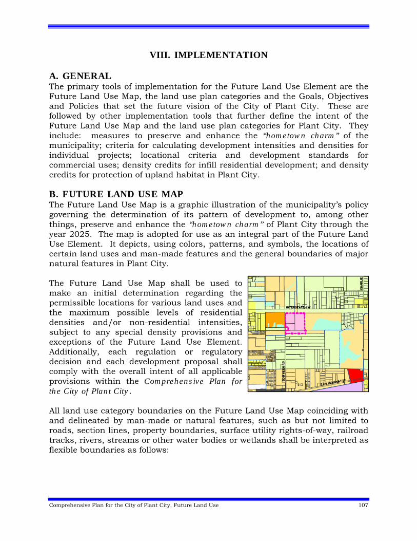
Comprehensive Plan for the City of Plant City, Future Land Use 107
VIII. IMPLEMENTATION A. GENERAL The primary tools of implementation for the Future Land Use Element are the Future Land Use Map, the land use plan categories and the Goals, Objectives and Policies that set the future vision of the City of Plant City. These are followed by other implementation tools that further define the intent of the Future Land Use Map and the land use plan categories for Plant City. They include: measures to preserve and enhance the “hometown charm” of the municipality; criteria for calculating development intensities and densities for individual projects; locational criteria and development standards for commercial uses; density credits for infill residential development; and density credits for protection of upland habitat in Plant City. B. FUTURE LAND USE MAP The Future Land Use Map is a graphic illustration of the municipality’s policy governing the determination of its pattern of development to, among other things, preserve and enhance the “hometown charm” of Plant City through the year 2025. The map is adopted for use as an integral part of the Future Land Use Element. It depicts, using colors, patterns, and symbols, the locations of certain land uses and man-made features and the general boundaries of major natural features in Plant City. The Future Land Use Map shall be used to make an initial determination regarding the permissible locations for various land uses and the maximum possible levels of residential densities and/or non-residential intensities, subject to any special density provisions and exceptions of the Future Land Use Element. Additionally, each regulation or regulatory decision and each development proposal shall comply with the overall intent of all applicable provisions within the Comprehensive Plan for the City of Plant City. All land use category boundaries on the Future Land Use Map coinciding with and delineated by man-made or natural features, such as but not limited to roads, section lines, property boundaries, surface utility rights-of-way, railroad tracks, rivers, streams or other water bodies or wetlands shall be interpreted as flexible boundaries as follows:
108 Comprehensive Plan for the City of Plant City, Future Land Use
Boundary Interpretation Provision In those land use category boundaries on the Future Land Use Map whose location cannot be directly determined from an inspection of the map to coincide with any natural or man-made feature, or where the record clearly indicates that an error was made in the location of the line on the map, the boundary shall be determined by the City Commission. C. LAND USE PLAN CATEGORIES The land use plan categories shown on the Future Land Use Map are named according to the predominant land use or maximum level of intensity intended for that category of land use. Other uses may be permitted in any land use category as described within the individual plan category descriptions. Specific locations for other such uses are not shown graphically because to do so would predetermine locations of individual uses, particularly neighborhood-related uses, at a level of detail beyond the scope of the Future Land Use Map. All uses shall be reviewed for conformance with all applicable provisions contained within the Comprehensive Plan for the City of Plant City and with applicable development standards of Plant City. The character of each land use category is defined by building type, residential density, functional use, and the physical composition of the land. The integration of these factors sets the general atmosphere and character of each land use category. Each category has a range of potentially permissible uses, which are not exhaustive, but are intended to be illustrative of the character of uses permitted within the land use designation. Not all of those potential uses are routinely acceptable anywhere within that land use category. Each potential use must be evaluated for compliance with the Goals, Objectives, and policies of the Future Land Use Element and with applicable development regulations of Plant City. The compatibility of new development in relation to existing development as well as the availability of public facilities and the presence of environmentally sensitive areas will be taken into account in determining if the maximum densities permitted can be achieved. If an area has been identified with a land use plan designation that permits different densities and uses other than its existing uses, it is the intention of the plan to transition that area over time to the densities and uses permitted in the adopted land use plan category. The compatibility of new development in relation to existing development is not necessarily a limiting factor, and compatibility issues should be addressed through more stringent review of site plans and application of site specific Land Development Regulations, such as buffering, rather than simply making new development compatible with the existing development densities and uses.
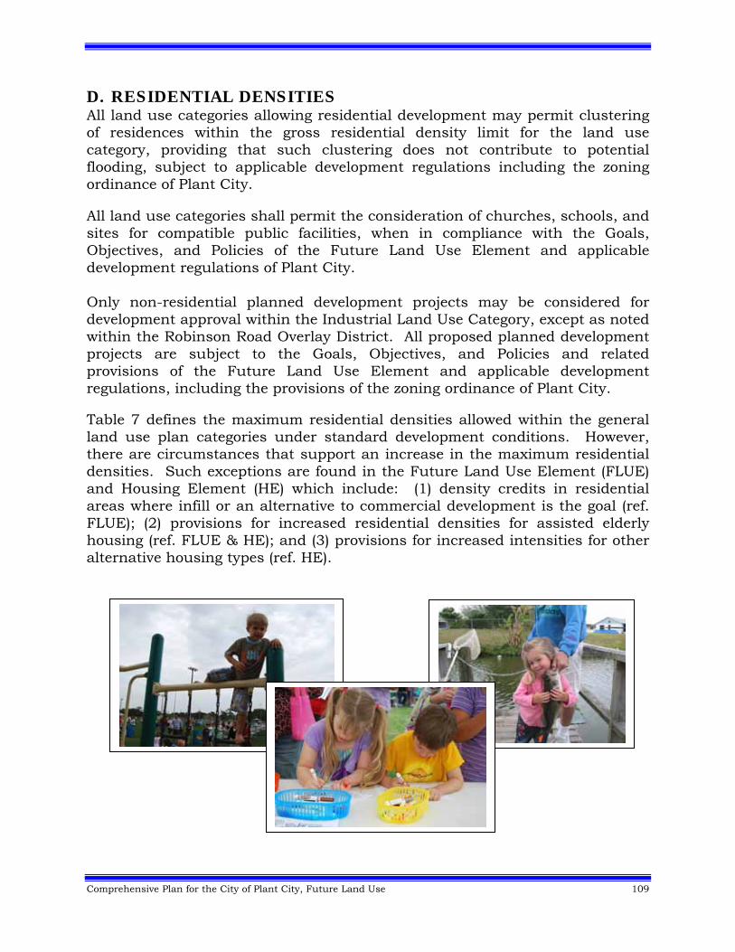
Comprehensive Plan for the City of Plant City, Future Land Use 109
D. RESIDENTIAL DENSITIES All land use categories allowing residential development may permit clustering of residences within the gross residential density limit for the land use category, providing that such clustering does not contribute to potential flooding, subject to applicable development regulations including the zoning ordinance of Plant City. All land use categories shall permit the consideration of churches, schools, and sites for compatible public facilities, when in compliance with the Goals, Objectives, and Policies of the Future Land Use Element and applicable development regulations of Plant City. Only non-residential planned development projects may be considered for development approval within the Industrial Land Use Category, except as noted within the Robinson Road Overlay District. All proposed planned development projects are subject to the Goals, Objectives, and Policies and related provisions of the Future Land Use Element and applicable development regulations, including the provisions of the zoning ordinance of Plant City. Table 7 defines the maximum residential densities allowed within the general land use plan categories under standard development conditions. However, there are circumstances that support an increase in the maximum residential densities. Such exceptions are found in the Future Land Use Element (FLUE) and Housing Element (HE) which include: (1) density credits in residential areas where infill or an alternative to commercial development is the goal (ref. FLUE); (2) provisions for increased residential densities for assisted elderly housing (ref. FLUE & HE); and (3) provisions for increased intensities for other alternative housing types (ref. HE).
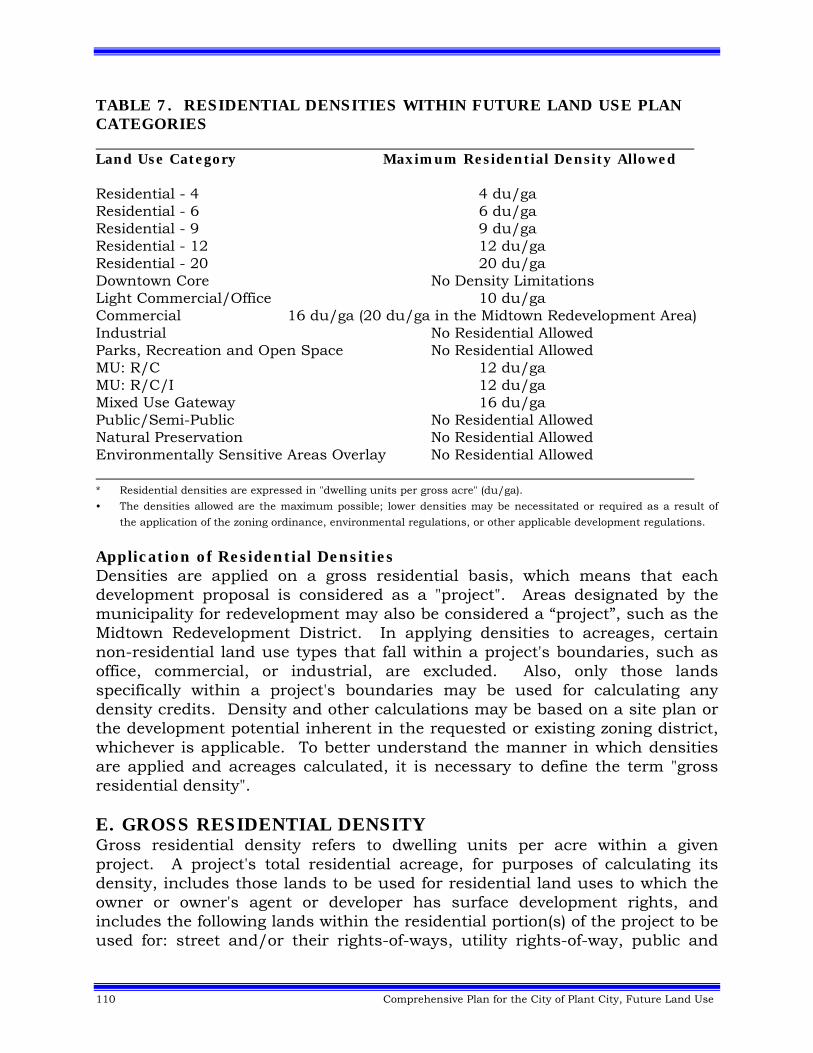
110 Comprehensive Plan for the City of Plant City, Future Land Use
TABLE 7. RESIDENTIAL DENSITIES WITHIN FUTURE LAND USE PLAN CATEGORIES Land Use Category Maximum Residential Density Allowed Residential - 4 4 du/ga Residential - 6 6 du/ga Residential - 9 9 du/ga Residential - 12 12 du/ga Residential - 20 20 du/ga Downtown Core No Density Limitations Light Commercial/Office 10 du/ga Commercial 16 du/ga (20 du/ga in the Midtown Redevelopment Area) Industrial No Residential Allowed Parks, Recreation and Open Space No Residential Allowed MU: R/C 12 du/ga MU: R/C/I 12 du/ga Mixed Use Gateway 16 du/ga Public/Semi-Public No Residential Allowed Natural Preservation No Residential Allowed Environmentally Sensitive Areas Overlay No Residential Allowed * Residential densities are expressed in "dwelling units per gross acre" (du/ga).
• The densities allowed are the maximum possible; lower densities may be necessitated or required as a result of
the application of the zoning ordinance, environmental regulations, or other applicable development regulations.
Application of Residential Densities Densities are applied on a gross residential basis, which means that each development proposal is considered as a "project". Areas designated by the municipality for redevelopment may also be considered a “project”, such as the Midtown Redevelopment District. In applying densities to acreages, certain non-residential land use types that fall within a project's boundaries, such as office, commercial, or industrial, are excluded. Also, only those lands specifically within a project's boundaries may be used for calculating any density credits. Density and other calculations may be based on a site plan or the development potential inherent in the requested or existing zoning district, whichever is applicable. To better understand the manner in which densities are applied and acreages calculated, it is necessary to define the term "gross residential density". E. GROSS RESIDENTIAL DENSITY Gross residential density refers to dwelling units per acre within a given project. A project's total residential acreage, for purposes of calculating its density, includes those lands to be used for residential land uses to which the owner or owner's agent or developer has surface development rights, and includes the following lands within the residential portion(s) of the project to be used for: street and/or their rights-of-ways, utility rights-of-way, public and
Comprehensive Plan for the City of Plant City, Future Land Use 111
private parks and recreation sites, sites for schools and churches, open space sites and other public uses, community centers, wellfields, utility substations, and drainage areas. Notwithstanding the above, for purposes of calculating gross residential density, a project's total residential acreage does not include those lands designated as conservation/preservation and/or water bodies unless as provided for below. Lands for commercial, office, industrial and other non-residential uses except as listed above, shall not be included in a project's total residential acreage, for purposes of calculating gross residential density. With the exception of lands, which are separated only by roadways, streams, rivers or lakes, no density credit can be transferred from one parcel of land to another when such parcels are physically separated from each other. All of the following lands and waters shall be included for purposes of calculating gross residential densities provided that, the total acreage for those areas described below does not exceed 25% of the project’s total upland residential acreage within each land use plan category on which a project or portions thereof is proposed as provided for above: Conservation, Natural Preservation or Environmentally Sensitive Areas, as
descried in the Definitions, with the exception of natural water bodies. Man-made water bodies.
Nothing in this section or in any other language contained in this element shall be assumed to guarantee approval of maximum gross residential density on any proposed project in any category which permits the consideration of residential development. Approval of residential densities shall be fully subject to other policies contained in this element on compatibility of surrounding land uses, existing or approved, the adequacy and availability of public facilities, and subject to other applicable development regulations. Examples for Calculation of a Project's Total Residential Acreage for Purposes of Calculating Gross Residential Densities: In an effort to assist interested parties in their own determination of maximum development potential on any area of land, the following examples are provided to illustrate the manner in which lands, water covered lands, and/or private or public facilities become eligible for, or are excluded from, the calculation of total residential acreage for purposes of calculating gross residential density.
112 Comprehensive Plan for the City of Plant City, Future Land Use
Example A
Assume: Total project = 100 acres. - Entire parcel proposed for residential land uses. - 10 acres conservation/preservation. - 90 acres non-environmentally sensitive lands.
Total residential acreage = 90 non-environmentally sensitive acres plus 10 acres of other creditable lands (note: all 10 acres are creditable because they comprise less than 25% of the 90 acres of non-environmentally sensitive lands). Total acreage eligible for calculating maximum number of dwelling units permissible = 100 acres. Example B Assume: Total project = 100 acres.
- 50 acres to be developed for non-residential uses. - 50 acres to be developed for residential land uses. - 16.66 acres in residential portion is conservation.
Total residential acreage = 33.34 non-environmentally sensitive acres (residential area only) plus 8.33 acres (i.e., 25% of 33.3 acres).
Total acreage eligible for calculating maximum number of dwelling units permissible = 41.67 acres.
Permitted gross residential density shall be applied by multiplying the density of the land use category within which the project is located by the total project acreage as computed and described in the examples to determine the maximum number of residential units allowed. For projects whose boundaries encompass more than one land use category, the process mentioned in the preceding sections will be applied to the project acreage in each respective land use category. In addition, where a project contains areas of more than one of the same land use category, density credits shall be calculated independent of other identical land use category areas. The total number of dwelling units possible under all the above mentioned land use categories will be used as a ceiling for review purposes. This provides maximum design flexibility for those projects, because the location or clustering of those units on the project site need not conform to the land use category boundary on the site as long as the maximum number of dwelling units permitted for the project is not exceeded.
Comprehensive Plan for the City of Plant City, Future Land Use 113
When a project is being considered for development to include uses other than residential, such as commercial, office, or industrial, only those environmentally sensitive area acreages or portions thereof occurring within the residential part of the project shall be counted for purposes of determining density. 1. Application of Densities to Lands Fronting Water Bodies In addition to the restrictions on the calculations of densities and on the prohibition against the use of naturally occurring open water bodies for density credits, the determination of the appropriate levels of density during the development review process for lands fronting on water bodies, as previously defined, shall be further limited to a density level comparable and compatible with other development parcels and lots fronting on lakes and streams. In the case of lakes, comparable and compatible development shall be determined by at least 51% of the land area adjacent to the lake having been developed in a similar fashion. In the case of streams, the 51% development pattern described above shall extend one-half mile from the subject parcel along either side of the stream. The purpose of this restriction is to insure the continuation and protection of the established large lot, lower density residential land uses and character of lands fronting on lakes and streams; and to prevent the application of other provisions in the Future Land Use Element from being construed as granting higher density uses in those locations. 2. Application of Non-Residential Intensities For purposes of calculating the maximum permitted gross building square footage for non-residential uses within a development proposal the following procedure shall apply: In applying floor area ratios (FAR) to acreages, all residential land use types that fall within a project's boundaries are excluded. Also, only those lands specifically within a project's boundaries may be used for calculating maximum permitted gross building square footage. Notwithstanding the above, no non-residential intensity may be transferred from one parcel of land to another when the parcels are physically separated from each other by any land, except when separated only by roadways, streams, rivers or lakes. Calculation of gross building square footage for all non-residential uses shall be based upon a site plan. Gross building square footage for non-residential uses in other plan categories, which do not specify a maximum non-residential FAR in their definition, may be based upon a site plan and/or the development potential inherent in the requested or existing zoning district.
114 Comprehensive Plan for the City of Plant City, Future Land Use
3. Gross Non-Residential Intensity Gross non-residential intensity refers to gross building square footage of non-residential land use types within a given project or, in the case of mixed use projects, portion(s) of a project. A project's total non-residential acreage, for purposes of calculating its gross non-residential land uses to which the owner or owner's agent or developer has surface development rights, includes the following land within the non-residential portion(s) of the project to be used for: street and their rights-of-way, public and private parks and recreation sites, sites for schools and churches, open space sites and other public uses, community centers, wellfields, utility substations, and drainage areas. Lands designated for residential uses shall not be included in a project's total non-residential acreage for purposes of calculating gross non-residential intensity. Provided that the total acreage for areas described below does not exceed 25% of the project's total upland non-residential acreage within each land use plan category on which those areas being proposed for non-residential uses are located, then all of the following lands and waters shall be counted towards a project's total non-residential acreage for purposes of calculating gross non-residential intensity:
Conservation, Natural Preservation and Environmentally Sensitive Areas, as described in the Definitions, with the exception of natural water bodies.
Man-made water bodies. Where the language in this element or in applicable development regulations, including but not limited to the adopted zoning code, establishes maximum floor area ratios for non-residential uses, nothing in this section or in any other language contained in this element, shall be assumed to guarantee approval of maximum gross non-residential intensity on any proposed project. Approval of non-residential intensities shall be fully subject to other policies contained in this element on compatibility of surrounding land uses, existing or approved, the adequacy and availability of public facilities, and subject to other development regulations. Examples for Calculation of a Project's Total Non-Residential Acreage for Purposes of Calculating Gross Non-Residential Intensities: In an effort to assist interested parties in their own determination of maximum non-residential development potential on any area of land, the following examples illustrate the manner in which land, water-covered lands, and/or private or public facilities become eligible for, or are excluded from, the calculation of gross non-residential intensity.
Comprehensive Plan for the City of Plant City, Future Land Use 115
Example A Assume: Total project = 100 acres.
- Entire parcel proposed for non-residential land uses. - 10 acres conservation as defined.
- 90 acres non-environmentally sensitive. Total non-residential acreage = 90 non-environmentally sensitive acres plus 10 acres of other creditable lands (note: all 10 acres are eligible for credit because they comprise less than 25% of the 90 acres of non-environmentally sensitive lands). Total acreage for calculating maximum FAR permissible = 100 acres. Example B Assume: Total project = 100 acres.
- 50 acres to be developed for residential uses. - 50 acres to be developed for non-residential uses. - 16.66 acres within the non-residential portion is classified as
conservation as defined. Total non-residential acreage = 33.34 acres non-environmentally sensitive plus 8.33 acres environmentally sensitive (i.e., 25% of 33.33 acres). Total acreage for calculating maximum FAR permissible = 41.67 acres. Example C Assume: Total project = 100 acres.
- 20 acres residential uses proposed. - 80 acres non-residential uses proposed. - 40 acres within the non-residential portion is classified as
conservation as defined.
Total non-residential acreage = 40 non-environmentally sensitive acres (non-residential area only) plus 10 acres environmentally sensitive (i.e., 25% of 40 acres). Total acreage for calculating maximum FAR permissible = 50 acres. F. IMPLEMENTATION AND CONFORMANCE WITH CITY Development Codes Plant City's land use categories were designed to accommodate the existing zoning framework. Therefore, major revisions to the municipality’s development codes will not be necessary as a result of adoption of the Comprehensive Plan for the City of Plant City. However, as conditions change, a
116 Comprehensive Plan for the City of Plant City, Future Land Use
need for revisions to the zoning code may be necessary. In order to provide guidance for the implementation of the Future Land Use Element and Land Use Plan Map, a plan category/zoning matrix will be adopted as part of revised Land Development Regulations of Plant City. Plant City's development codes are the framework within which the community's goals for neighborhood conservation, community development, commercial development, Downtown and Midtown redevelopment, historic preservation, environmental protection, and growth management will be reached. The most significant expansions in the existing development codes resulting from Plan adoption will be in the areas of environmental conservation and enhancement of “hometown charm” in all areas of Plant City. Adoption of the Comprehensive Plan for the City of Plant City will also require that all new development and redevelopment meet a "concurrency test" for availability of public facilities (except transportation) and services prior to permitting. The Capital Improvements Element defines and describes in detail the levels-of-service and concurrency requirements incorporated into the development permitting process of Plant City. The concurrency test shall not apply to transportation facilities.65 1. Density Credits a. Residential Density Credits for Infill Development The maximum level of residential density may be considered by the City Commission, for increase without a plan amendment, subject to the limitations and conditions herein provided, when the purpose of the request for density increase is either to promote residential infill on vacant sites within developed urbanized areas, which are residential in character, or to provide a residential development alternative to strip commercial development. These density increases may be requested during the permitting of residential development requiring the submittal and approval of a general development plan as defined in applicable development regulations of Plant City. Such requests shall only be considered for locations shown on the Future Land Use Map as Residential-4 (R-4), Residential-6 (R-6), Residential-9 (R-9), Residential-12 (R-12) or as Residential-20 (R-20), and shall be subject to the following limitations or conditions: That density in locations shown on the Future Land Use Map as
Residential-4 may not be increased higher than 6 dwelling units pre gross acre. Residential-6 may not be increased higher than 9 dwelling units per gross acre. Residential-9 may not be increased higher than 12 dwelling units per gross acre. Residential-12 may not be increased higher than 16 dwelling units per gross acre. Residential-20 may not be increased higher than 25 dwelling units per gross acre. Also, the City Commission concurs
Comprehensive Plan for the City of Plant City, Future Land Use 117
that the purpose of the request for density increase is to promote residential infill on vacant or redeveloping sites within existing, developed, urbanized areas, which are residential in character, or to provide a residential development alternative to strip commercialization in areas where:
- Strip commercial development presently exists; or - There is a trend toward strip commercial development; or - Existing zoning lots, although vacant, constitute a potential for the
establishment or expansion of strip commercial development. In all cases of requests for consideration of density increases pursuant to this section, each of the following shall also be applicable: Nothing in this section shall be construed as guaranteeing the achievement
of the density increases, or any portion thereof, provided for in this section; nor shall this section be construed as guaranteeing even the achievement of the maximum density limit, or any portion thereof, established in other sections for the R-4, R-6, R-9, R-12 and R-20 plan categories. This section shall only be construed as providing for the conditions and limitations under which requests for consideration for density increases may be filed. In no case is the City Commission required to grant the request, or any portion thereof. However, if a request has met all the conditions, limitations, and requirements of this section, and if the City Commission finds that a request fulfills the stated intent and public purpose of this section, and meets the Goals, Objectives, and Policies of the Plan, the City Commission may then have the option of granting a request for a density increase without a plan amendment, as provided herein, after receiving the recommendation of the Planning Commission staff.
Any density increase shall be compatible with existing, proposed, or planned
surrounding development. Net project densities within a particular project located within surrounding developments shall not be used as a measure of such compatibility. Compatible densities need not be interpreted as "comparable" or "the same as" surrounding developments, if adequate provision for transitioning to higher densities is required and met by, but not limited to, such means as buffering, setbacks, and graduated height restrictions. Notwithstanding the above, any density increase considered under this section is required to be consistent with all applicable provisions contained in the Comprehensive Plan for the City of Plant City.
All applicable development regulations pertaining to any request for higher
densities shall be adhered to.
118 Comprehensive Plan for the City of Plant City, Future Land Use
Nothing in this section shall be construed as creating an argument for increasing intensities for non-residential uses allowed in residential land use categories.
b. Uplands Density Credit Incentives Because certain upland forest areas are desirable to protect but do not fall into the same degree of environmental sensitivity as protected wetland areas, a method of providing an incentive for their preservation needed to be considered. The upland forest communities identified as desirable to be preserved are defined as Sandhill Pine Flatwoods, Sand Pine Scrub, Xeric Hammock and upland Mesic Hammock. The preservation of these upland forest communities would help provide additional wildlife habitat and increase the aesthetic attractiveness of the developments of which they would be a part. Encouraging the conservation of upland forest communities would also assist in the preservation of an important resource that has been difficult to protect. The rationale for protecting these types of upland forest communities is described within the Conservation Element. This density credit incentive provides a mechanism to encourage developers to preserve upland forest communities, but still provide flexibility in cases where conservation would be difficult, and it will designate agency responsibility for determining on-site inspection of significant upland habitats eligible for density credits. A blanket protection of upland communities would be more difficult than the system of protection established for wetlands. Upland communities often make up a much larger percentage of a development site and are generally located on land that is very suitable for development. Wetlands, in most cases, represent the most difficult sites to develop. Any acreage used to calculate credit for the upland density credit incentive shall be recorded as a permanent conservation easement on the subdivision plat and lot deed and may not be eligible for any future development rights. The density credit formula for protection of wetlands would remain as presently defined in the Future Land Use Element. Wetlands would receive full density credit if they made up less than 25% of a development's upland acreage. A project that contained more than 25% of its acreage in a wetland classification would receive a credit of 25% of the developable upland acreage. Before the upland forest community incentive could be considered the wetland credit must be calculated. The combination of the wetland density credit and the upland density credit incentive can never result in a net density on the developed project acreage of more than double the gross density of the land use category where the development is located.
Comprehensive Plan for the City of Plant City, Future Land Use 119
Example 1: If a project is in the Residential-4 Land Use Plan Category, which allows consideration of up to 4 dwelling units per gross acre, the net density on the acreage actually being developed could never be higher than 8 dwelling units per net acre with a combination of both wetland and upland density credits. The density credit incentive for upland forest preservation would provide a 25% extra credit for Sand Hill Pine Flatwoods, Sand Pine Scrub, Xeric Hammock or Mesic Hammock. This 25% density credit incentive would work in the following manner. For any upland forest community 1 acre or greater in size, a 25% bonus density credit incentive would be given for the land that will be designated on the final plat as a conservation area and protected from development. The following examples illustrate how the density credit incentive could be applied to an actual development: Project not using Upland Forest Community Density Credit: Total Project = 100 Acres Upland Forest Community eligible for Density Credit = 25 Acres Land Use Plan Category R-4 = 4 d.u.'s per Gross Acre
Total allowed dwelling units without Upland Forest Community Density Credit: 100 ac x 4 du/ga = 400 Dwelling Units Same project using Upland Forest Community Density Credit: Total with Upland Forest Community Density Credit: 25 ac (upland preservation) x 1.25 (additional 25% credit) = 31.25 eligible acres for credit x 4 du/ga = 125 Dwelling Units 75 acres remaining developable land x 4 du/ga = 300 d.u.'s + 125 du's from density credit incentive = 425 dwelling units total allowed units per project with upland credit Therefore an incentive of 25 extra units for saving the 25 acre upland forest community would be given to developer. This would equal a net density of 5.66 units per net acre on developable land. Since this density is less than double gross figure this credit could be considered. Example 2: Project not using Upland Forest Community Density Credit:
Total Project = 100 Acres Upland Forest Community eligible for Density Credit = 50 Acres Wetlands = 10 Acres Land Use Plan Category R-4 = 4 d.u.'s per Gross Acre Total allowed d.u.'s without Upland Forest Community Density Credit:
120 Comprehensive Plan for the City of Plant City, Future Land Use
10 acre wetland x 4 d.u.'s per gross acre = 40 Dwelling Units (Full density credit given because wetland makes up less than 25% of project). 90 acre developable land x 4 d.u.'s per gross acre = 360 Dwelling Units Total units without upland Forest Community Density Credit = 400 Dwelling Units Total with Upland Forest Community Density Credit: 50 ac. (upland preservation) x 1.25 (additional 25% credit) = 62.5 eligible acres for credit x 4 (R-4 d.u.'s per gross acre) = 250 d.u.'s 10 ac wetland x 4 (R-4 d.u.'s per gross acre) = 40 d.u.'s 40 acres developable land x 4 (R-4 d.u.'s per gross acre) = 160 d.u.'s 250 d.u.'s + 40 d.u.'s + 160 d.u.'s = 450 Dwelling Units
However, because maximum net density is limited to only 2 times d.u.'s per gross acre allowed in land use category, total units would be limited to 320 units. (2 x 4, R-4 d.u.'s per acre) x 40 acres developable = 320 units. Therefore, maximum upland area that could be protected and still receive maximum density credit would be 35 acres on a 100 acre site with a 10 acre wetland. Example 3: Project not using Upland Forest Community Density Credit:
Total Project = 100 Acres Upland Forest Community eligible for Density Credit = 35 Acres Wetlands = 10 Acres Land Use Plan Category R-4 = 4 d.u.'s per Gross Acre. Total allowed d.u.'s without upland Forest Community Density Credit: 100 Acres x 4 d.u.'s per gross acre = 400 Dwelling Units Total with Upland Forest Community Density Credit = 35 ac (upland preservation) x 1.25 (additional 25% credit) = 43.75 eligible acres for credit x 4 (R-4 d.u.'s per gross acre) = 175 d.u.'s. 10 ac wetland x 4 (R-4 d.u.'s per gross acre )= 40 d.u.'s 55 acres developable land x 4 (R-4) d.u.'s per gross acre = 220 d.u.'s Total units allowed with upland preservation = 40 d.u.'s +175 d.u.'s + 220 d.u.'s = 435 Dwelling Units
Since maximum net density of developable land is limited to only 2 times du/ga (allowed in land use category) 55 developable acres divided by 435 units = 7.90 units per net developable acre) and therefore, 7.90 units per net developable acre would fall within 8 units per net acre which is double the R-4 allowed gross density and could be allowed for consideration. In cases where the allowed number of units is a fraction exceeding the whole number, the number will be rounded to the lower whole number. For example, 12.5 units calculated will be interpreted as 12.0 units.
Comprehensive Plan for the City of Plant City, Future Land Use 121
The upland forest density credit incentive provides an encouragement to creative developers who want to take advantage of a method of conservation by providing them an economic incentive for doing so. The limitation of the net density of a project's developable acres to only double the gross density allowed in the development's land use category protects surrounding neighborhoods from densities that might be incompatible. G. LOCATIONAL CRITERIA AND DEVELOPMENT STANDARDS FOR COMMERCIAL USES IN RESIDENTIAL AND INDUSTRIAL LAND USE CATEGORIES Under the classification system, commercial uses are eligible for consideration in residential land use categories if, among other things, they meet certain "development standards" described in this section. These standards would be applied during the review of proposed rezonings, or during the review of any proposed "development order". The locational criteria and development standards are not the only factors which would have to be considered for approval of a commercial or office use. Considerations involving land use compatibility, adequacy and availability of public services, environmental impacts, adopted service levels of effected roadways and other policies of the comprehensive plan and zoning regulations would carry more weight than the locational criteria and development standards in the approval of the potential commercial use. The locational criteria and development standards would only designate locations that could be considered, and they in no way guarantee the approval of a particular commercial or office use in a possible node. The following statements explain the policies of the comprehensive plan and zoning regulations that will be used to determine whether a commercial use is appropriate that is being considered under the locational criteria and development standards. 1. Land Use Compatibility All proposed commercial uses must be compatible with existing surrounding development. Commercial and offices uses that would have a negative or blighting influence on adjacent residential neighborhoods, or individual residences should not be permitted. Any commercial or office development approved must provide proper buffering between adjacent land uses. 2. Services and Facilities All proposed commercial or office development must maintain the adopted non-transportation levels of services such as water, sewerage and other services found necessary, or be able to provide these services in a manner consistent with other adopted levels of service within the Capital Improvements Element as adopted as part of the comprehensive plan, zoning regulations, health standards, and other appropriate governmental agencies' policies.66
122 Comprehensive Plan for the City of Plant City, Future Land Use
3. Environmental Considerations All proposed commercial or office development shall be allowed only in areas where it can be demonstrated that environmental damage will not occur if the applicable development regulations of environmental agencies such as Southwest Florida Water Management District, Environmental Protection Commission of Hillsborough County (EPC) and Florida Department of Environmental Protection (FDEP) are followed. 4. Transportation All proposed commercial or office development shall only be allowed at nodes and shall mitigate its transportation impacts through the payment of the appropriate Plant City Mobility Fee.67 5. Development Standards and Locational Criteria a. These standards will apply to all retail, office and other commercial uses and are intended to:
• Provide a means of ensuring appropriate commercial development without requiring that all commercial sites be designated on the Future Land Use Map;
• Establish a maximum FAR to ensure that the scale of commercial
development is generally consistent with surrounding residential character; and
• Ensure that commercial uses may be considered for approval only where:
- adequate access can be provided to commercial uses; - such uses are located with access to types of roadways which carry vehicular traffic between residential areas, or between residential and non-residential uses; - their location is directed to appropriate "nodes" and roadways so as to facilitate the determination of areas within which commercial uses may, and may not, be expected to develop in the future, and;
Comprehensive Plan for the City of Plant City, Future Land Use 123
- such uses are located so as to maintain the vehicular capacity of public roads by discouraging linear ("strip") commercial development and the multiple access points which are likely to accompany such linear commercial development. Frontage roads will be located where the City has established a policy for them.
b. These proposed standards are not, however, the only mechanisms in the plan to be relied on for ensuring that commercial uses are of a type, scale, location, and design, which is best suited for achieving the objectives listed. Policies in the Future Land Use Element (and other Elements) of the plan to insure the compatibility of nearby land uses, conserve wetlands and other natural resources, and insure the adequacy and availability of public facilities and services will also limit location, size and design of commercial uses through the development review and approval process.
c. Certain existing commercial uses may not demonstrate consistency with
either the applicable maximum FAR, or the locational criteria, or both, but may represent viable existing development that should be recognized. However, in all cases, new development must be consistent with the adopted Comprehensive Plan for the City of Plant City.
d. These standards for commercial uses are directly linked to the land use
classification system by limiting size, and by requiring consistency with certain locational criteria, based on the land use category within which a commercial use exists or is proposed. The following table indicates the "level" of commercial uses which may be considered under each land use category.
e. Collector and arterial roads shall be defined in accordance with the
Transportation Element. f. Maximum building square footage per project is 3,000 square feet without a
Community Unit Zoning District approval from Plant City. g. All proposed commercial uses must be located on property to which primary
vehicular access is provided from roadways functionally classified as collector or higher.
h. All proposed commercial uses must be located in accordance with the
following locational criteria:
124 Comprehensive Plan for the City of Plant City, Future Land Use
Residential Land Use Categories
Residential-6, Residential-9, Residential-12, and Residential-20 (R-6, R-9, R-12, R-20) Land Use Categories may have neighborhood commercial development considered according to the following criteria:
Residential-6:
Nodal development at the intersection of collectors and/or arterials
at a maximum linear distance of 250 feet measured from the property line along a collector or arterial;
Maximum Floor Area Ratio (FAR) of .25
Residential–9, 12 and 20:
Nodal development at the intersection of collectors and/or arterials
at a maximum linear distance of 500 feet measured from the property line along a collector or arterial;
Maximum Floor Area Ratio (FAR) of .35
Exceeding the maximum nodal distance requirements in a residential land use category may be considered when:
Seventy five (75) percent of the frontage associated with the use is
within the linear frontage of the commercial node, or; Fifty (50) percent of the blockface has existing commercial
development, or; The commercial use is proposed to be developed as an integrated
support component of a residential planned development and utilities are available, along with conformance with the urban design criteria established in this Plan and the Land Development Regulations of Plant City.
The use is a medical office or clinic, associated medical uses that
supports or is the South Florida Baptist Hospital. Such use shall be approved as an adopted Community Unit District after a finding by the City Commission that:
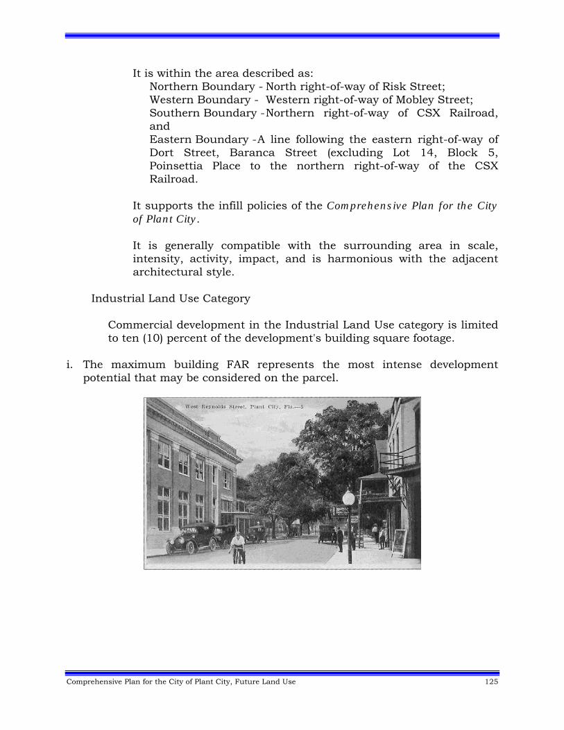
Comprehensive Plan for the City of Plant City, Future Land Use 125
It is within the area described as: Northern Boundary - North right-of-way of Risk Street; Western Boundary - Western right-of-way of Mobley Street; Southern Boundary - Northern right-of-way of CSX Railroad, and Eastern Boundary - A line following the eastern right-of-way of Dort Street, Baranca Street (excluding Lot 14, Block 5, Poinsettia Place to the northern right-of-way of the CSX Railroad.
It supports the infill policies of the Comprehensive Plan for the City of Plant City. It is generally compatible with the surrounding area in scale, intensity, activity, impact, and is harmonious with the adjacent architectural style.
Industrial Land Use Category
Commercial development in the Industrial Land Use category is limited to ten (10) percent of the development's building square footage.
i. The maximum building FAR represents the most intense development potential that may be considered on the parcel.
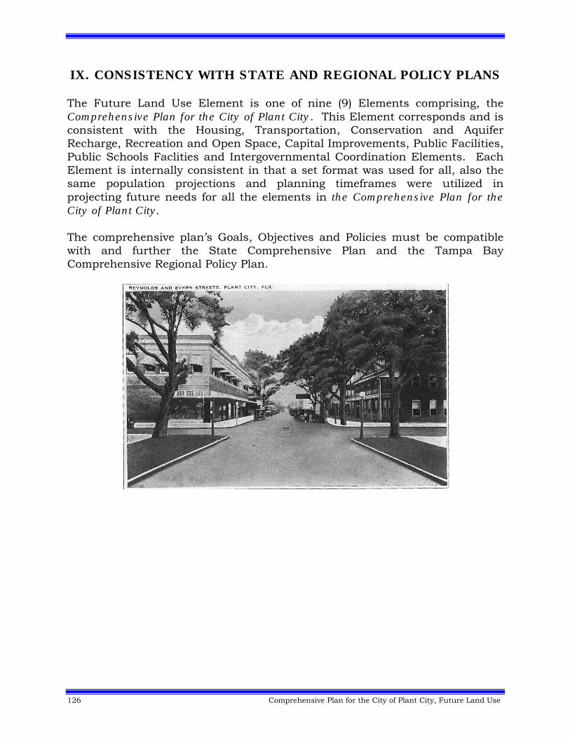
126 Comprehensive Plan for the City of Plant City, Future Land Use
IX. CONSISTENCY WITH STATE AND REGIONAL POLICY PLANS The Future Land Use Element is one of nine (9) Elements comprising, the Comprehensive Plan for the City of Plant City. This Element corresponds and is consistent with the Housing, Transportation, Conservation and Aquifer Recharge, Recreation and Open Space, Capital Improvements, Public Facilities, Public Schools Faclities and Intergovernmental Coordination Elements. Each Element is internally consistent in that a set format was used for all, also the same population projections and planning timeframes were utilized in projecting future needs for all the elements in the Comprehensive Plan for the City of Plant City. The comprehensive plan’s Goals, Objectives and Policies must be compatible with and further the State Comprehensive Plan and the Tampa Bay Comprehensive Regional Policy Plan.
Comprehensive Plan for the City of Plant City, Future Land Use 127
X. SUPPORT DOCUMENT SUMMARY Bibliography Tampa Bay Regional Planning Council, Future of the Region: A Strategic Regional Policy Plan for the Tampa Bay Region, St. Petersburg, Florida. Regional Goals, Objectives, and Policies used to guide the local comprehensive planning process in the Tampa Bay region, including Plant City. Plant City Code of Ordinances, 1956 as amended. Provides the implementation regulations for the Future Land Use Element including zoning, subdivision platting, sign regulations of Plant City. Plant City Evaluation and Appraisal Report, “Embracing the Future, while Preserving Our Past”, 2006. Includes update demographic data, documents public outreach efforts and identified citizen issues to be addressed in the update of the Comprehensive Plan for the City of Plant City, in 2008 & 2009. George Nez, Standards for New Urban Development, Urban Land Institute, Vol 20, No 5.
128 Comprehensive Plan for the City of Plant City, Future Land Use
FIGURE 1. CONCEPTUAL VISION MAP (See Comprehensive Plan Map Folder)
Comprehensive Plan for the City of Plant City, Future Land Use 129
FIGURE 2. CONCEPTUAL VISION MAP (See Comprehensive Plan Map Folder)
130 Comprehensive Plan for the City of Plant City, Future Land Use
FIGURE 3. FUTURE LAND USE (See Comprehensive Plan Map Folder)
Comprehensive Plan for the City of Plant City, Future Land Use 131
FIGURE 4. WELLHEAD RESOURCE PROTECTION MAP (See Comprehensive Plan Map Folder)
132 Comprehensive Plan for the City of Plant City, Future Land Use
FIGURE 5. Phase 1 - Future Land Use Scenario Map (2025) of the Northeast Plant City Area Master Plan (See Comprehensive Plan Map Folder)
Comprehensive Plan for the City of Plant City, Future Land Use 133
FIGURE 6. Energy Conservation Areas (See Comprehensive Plan Map Folder)
134 Comprehensive Plan for the City of Plant City, Future Land Use
FIGURE 7. I-4 Green Tech Corridor Overlay68 (See Comprehensive Plan Map Folder)
Comprehensive Plan for the City of Plant City, Future Land Use 135
1 ENDNOTE: 1st Cycle 2010 (Ref: DCA #10-1): PC/CPA 9-23 I-4 Green Tech Corridor. Ord. 30-2010, 10-11-10. DCA NOI #10-1-NOI-2902-(A)-(I), EFFECTIVE: December 14, 2010. 2 ENDNOTE: 1st Cycle 2010 (Ref: DCA #10-1): PC/CPA 9-24 Transportation Concurrency/Mobility Plan and Fees. Ord. 30-2010, 10-11-10. DCA NOI #10-1-NOI-2902-(A)-(I), EFFECTIVE: December 14, 2010. 3 ENDNOTE: 1st Cycle 2010 (Ref: DCA #10-1): PC/CPA 9-24 Transportation Concurrency/Mobility Plan and Fees. Ord. 30-2010, 10-11-10. DCA NOI #10-1-NOI-2902-(A)-(I), EFFECTIVE: December 14, 2010. 4 ENDNOTE: 1st Cycle 2010 (Ref: DCA #10-1): PC/CPA 9-24 Transportation Concurrency/Mobility Plan and Fees. Ord. 30-2010, 10-11-10. DCA NOI #10-1-NOI-2902-(A)-(I), EFFECTIVE: December 14, 2010. 5 ENDNOTE: 2nd Cycle 2012 (Ref: DCA #12-2): PC/CPA 11-02 Future Land Use Element. Ord. 28-2012, 9-10-12, EFFECTIVE: October 18, 2012. 6 ENDNOTE: 2nd Cycle 2012 (Ref: DCA #12-2): PC/CPA 11-02 Future Land Use Element. Ord. 28-2012, 9-10-12, EFFECTIVE: October 18, 2012. 7 ENDNOTE: 1st Cycle 2010 (Ref: DCA #10-1): PC/CPA 9-24 Transportation Concurrency/Mobility Plan and Fees. Ord. 30-2010, 10-11-10. DCA NOI #10-1-NOI-2902-(A)-(I), EFFECTIVE: December 14, 2010. 8 ENDNOTE: 2nd Cycle 2012 (Ref: DCA #12-2): PC/CPA 11-02 Future Land Use Element. Ord. 28-2012, 9-10-12, EFFECTIVE: October 18, 2012. 9 ENDNOTE: 1st Cycle 2010 (Ref: DCA #10-1): PC/CPA 9-24 Transportation Concurrency/Mobility Plan and Fees. Ord. 30-2010, 10-11-10. DCA NOI #10-1-NOI-2902-(A)-(I), EFFECTIVE: December 14, 2010. 10 ENDNOTE: 1st Cycle 2010 (Ref: DCA #10-1): PC/CPA 9-24 Transportation Concurrency/Mobility Plan and Fees. Ord. 30-2010, 10-11-10. DCA NOI #10-1-NOI-2902-(A)-(I), EFFECTIVE: December 14, 2010. 11 ENDNOTE: 1st Cycle 2010 (Ref: DCA #10-1): PC/CPA 9-24 Transportation Concurrency/Mobility Plan and Fees. Ord. 30-2010, 10-11-10. DCA NOI #10-1-NOI-2902-(A)-(I), EFFECTIVE: December 14, 2010. 12 ENDNOTE: 1st Cycle 2010 (Ref: DCA #10-1): PC/CPA 9-24 Transportation Concurrency/Mobility Plan and Fees. Ord. 30-2010, 10-11-10. DCA NOI #10-1-NOI-2902-(A)-(I), EFFECTIVE: December 14, 2010. 13 ENDNOTE: 1st Cycle 2010 (Ref: DCA #10-1): PC/CPA 9-24 Transportation Concurrency/Mobility Plan and Fees. Ord. 30-2010, 10-11-10. DCA NOI #10-1-NOI-2902-(A)-(I), EFFECTIVE: December 14, 2010. 14 ENDNOTE: 1st Cycle 2010 (Ref: DCA #10-1): PC/CPA 9-24 Transportation Concurrency/Mobility Plan and Fees. Ord. 30-2010, 10-11-10. DCA NOI #10-1-NOI-2902-(A)-(I), EFFECTIVE: December 14, 2010. 15 ENDNOTE: 1st Cycle 2010 (Ref: DCA #10-1): PC/CPA 9-26 Village Center Northeast Plant City. Ord. 30-2010, 10-11-10. DCA NOI #10-1-NOI-2902-(A)-(I), EFFECTIVE: December 14, 2010. 16 ENDNOTE: 1st Cycle 2010 (Ref: DCA #10-1): PC/CPA 9-24 Transportation Concurrency/Mobility Plan and Fees. Ord. 30-2010, 10-11-10. DCA NOI #10-1-NOI-2902-(A)-(I), EFFECTIVE: December 14, 2010. 17 ENDNOTE: 1st Cycle 2010 (Ref: DCA #10-1): PC/CPA 9-24 Transportation Concurrency/Mobility Plan and Fees. Ord. 30-2010, 10-11-10. DCA NOI #10-1-NOI-2902-(A)-(I), EFFECTIVE: December 14, 2010. 18 ENDNOTE: 1st Cycle 2010 (Ref: DCA #10-1): PC/CPA 9-24 Transportation Concurrency/Mobility Plan and Fees. Ord. 30-2010, 10-11-10. DCA NOI #10-1-NOI-2902-(A)-(I), EFFECTIVE: December 14, 2010.
136 Comprehensive Plan for the City of Plant City, Future Land Use
19 ENDNOTE: 2nd Cycle 2012 (Ref: DCA #12-2): PC/CPA 11-02 Future Land Use Element. Ord. 28-2012, 9-10-12, EFFECTIVE: October 18, 2012. 20 ENDNOTE: 1st Cycle 2010 (Ref: DCA #10-1): PC/CPA 9-24 Transportation Concurrency/Mobility Plan and Fees. Ord. 30-2010, 10-11-10. DCA NOI #10-1-NOI-2902-(A)-(I), EFFECTIVE: December 14, 2010. 21 ENDNOTE: 2nd Cycle 2012 (Ref: DCA #12-2): PC/CPA 11-02 Future Land Use Element. Ord. 28-2012, 9-10-12, EFFECTIVE: October 18, 2012. 22 ENDNOTE: 1st Cycle 2010 (Ref: DCA #10-1): PC/CPA 9-24 Transportation Concurrency/Mobility Plan and Fees. Ord. 30-2010, 10-11-10. DCA NOI #10-1-NOI-2902-(A)-(I), EFFECTIVE: December 14, 2010. 23 ENDNOTE: 2nd Cycle 2012 (Ref: DCA #12-2): PC/CPA 11-02 Future Land Use Element. Ord. 28-2012, 9-10-12, EFFECTIVE: October 18, 2012. 24 ENDNOTE: 2nd Cycle 2012 (Ref: DCA #12-2): PC/CPA 11-02 Future Land Use Element. Ord. 28-2012, 9-10-12, EFFECTIVE: October 18, 2012. 25 ENDNOTE: 2nd Cycle 2012 (Ref: DCA #12-2): PC/CPA 11-02 Future Land Use Element. Ord. 28-2012, 9-10-12, EFFECTIVE: October 18, 2012. 26 ENDNOTE: 2nd Cycle 2012 (Ref: DCA #12-2): PC/CPA 11-02 Future Land Use Element. Ord. 28-2012, 9-10-12, EFFECTIVE: October 18, 2012. 27 ENDNOTE: 2nd Cycle 2012 (Ref: DCA #12-2): PC/CPA 11-02 Future Land Use Element. Ord. 28-2012, 9-10-12, EFFECTIVE: October 18, 2012. 28 ENDNOTE: 2nd Cycle 2012 (Ref: DCA #12-2): PC/CPA 11-02 Future Land Use Element. Ord. 28-2012, 9-10-12, EFFECTIVE: October 18, 2012. 29 ENDNOTE: 2nd Cycle 2012 (Ref: DCA #12-2): PC/CPA 11-02 Future Land Use Element. Ord. 28-2012, 9-10-12, EFFECTIVE: October 18, 2012. 30 ENDNOTE: 2nd Cycle 2012 (Ref: DCA #12-2): PC/CPA 11-02 Future Land Use Element. Ord. 28-2012, 9-10-12, EFFECTIVE: October 18, 2012. 31 ENDNOTE: 2nd Cycle 2012 (Ref: DCA #12-2): PC/CPA 11-02 Future Land Use Element. Ord. 28-2012, 9-10-12, EFFECTIVE: October 18, 2012. 32 ENDNOTE: 1st Cycle 2010 (Ref: DCA #10-1): PC/CPA 9-24 Transportation Concurrency/Mobility Plan and Fees. Ord. 30-2010, 10-11-10. DCA NOI #10-1-NOI-2902-(A)-(I), EFFECTIVE: December 14, 2010. 33 ENDNOTE: 1st Cycle 2010 (Ref: DCA #10-1): PC/CPA 9-24 Transportation Concurrency/Mobility Plan and Fees. Ord. 30-2010, 10-11-10. DCA NOI #10-1-NOI-2902-(A)-(I), EFFECTIVE: December 14, 2010. 34 ENDNOTE: 1st Cycle 2010 (Ref: DCA #10-1): PC/CPA 9-24 Transportation Concurrency/Mobility Plan and Fees. Ord. 30-2010, 10-11-10. DCA NOI #10-1-NOI-2902-(A)-(I), EFFECTIVE: December 14, 2010. 35 ENDNOTE: 2nd Cycle 2012 (Ref: DCA #12-2): PC/CPA 11-02 Future Land Use Element. Ord. 28-2012, 9-10-12, EFFECTIVE: October 18, 2012. 36 ENDNOTE: 1st Cycle 2010 (Ref: DCA #10-1): PC/CPA 9-24 Transportation Concurrency/Mobility Plan and Fees. Ord. 30-2010, 10-11-10. DCA NOI #10-1-NOI-2902-(A)-(I), EFFECTIVE: December 14, 2010. 37 ENDNOTE: 1st Cycle 2010 (Ref: DCA #10-1): PC/CPA 9-24 Transportation Concurrency/Mobility Plan and Fees. Ord. 30-2010, 10-11-10. DCA NOI #10-1-NOI-2902-(A)-(I), EFFECTIVE: December 14, 2010.
Comprehensive Plan for the City of Plant City, Future Land Use 137
38 ENDNOTE: 1st Cycle 2010 (Ref: DCA #10-1): PC/CPA 9-24 Transportation Concurrency/Mobility Plan and Fees. Ord. 30-2010, 10-11-10. DCA NOI #10-1-NOI-2902-(A)-(I), EFFECTIVE: December 14, 2010. 39 ENDNOTE: 1st Cycle 2010 (Ref: DCA #10-1): PC/CPA 9-24 Transportation Concurrency/Mobility Plan and Fees. Ord. 30-2010, 10-11-10. DCA NOI #10-1-NOI-2902-(A)-(I), EFFECTIVE: December 14, 2010. 40 ENDNOTE: 1st Cycle 2010 (Ref: DCA #10-1): PC/CPA 9-24 Transportation Concurrency/Mobility Plan and Fees. Ord. 30-2010, 10-11-10. DCA NOI #10-1-NOI-2902-(A)-(I), EFFECTIVE: December 14, 2010. 41 ENDNOTE: 1st Cycle 2010 (Ref: DCA #10-1): PC/CPA 9-24 Transportation Concurrency/Mobility Plan and Fees. Ord. 30-2010, 10-11-10. DCA NOI #10-1-NOI-2902-(A)-(I), EFFECTIVE: December 14, 2010. 42 ENDNOTE: 2nd Cycle 2012 (Ref: DCA #12-2): PC/CPA 11-02 Future Land Use Element. Ord. 28-2012, 9-10-12, EFFECTIVE: October 18, 2012. 43 ENDNOTE: 2nd Cycle 2012 (Ref: DCA #12-2): PC/CPA 11-02 Future Land Use Element. Ord. 28-2012, 9-10-12, EFFECTIVE: October 18, 2012. 44 ENDNOTE: 2nd Cycle 2012 (Ref: DCA #12-2): PC/CPA 11-02 Future Land Use Element. Ord. 28-2012, 9-10-12, EFFECTIVE: October 18, 2012. 45 ENDNOTE: 1st Cycle 2010 (Ref: DCA #10-1): PC/CPA 9-24 Transportation Concurrency/Mobility Plan and Fees. Ord. 30-2010, 10-11-10. DCA NOI #10-1-NOI-2902-(A)-(I), EFFECTIVE: December 14, 2010. 46 ENDNOTE: 2nd Cycle 2012 (Ref: DCA #12-2): PC/CPA 11-02 Future Land Use Element. Ord. 28-2012, 9-10-12, EFFECTIVE: October 18, 2012. 47 ENDNOTE: 1st Cycle 2011 (Ref. DCA #11-1): PC/CPA 10-03 Cone Farms Inc. Ord. 16-2011, 4-11-11. DCA NOI #11-1-NOI-2902-(A)-(I), EFFECTIVE: June 28, 2011. 48 ENDNOTE: 2nd Cycle 2012 (Ref: DCA #12-2): PC/CPA 11-02 Future Land Use Element. Ord. 28-2012, 9-10-12, EFFECTIVE: October 18, 2012. 49 ENDNOTE: 2nd Cycle 2012 (Ref: DCA #12-2): PC/CPA 11-02 Future Land Use Element. Ord. 28-2012, 9-10-12, EFFECTIVE: October 18, 2012. 50 ENDNOTE: 2nd Cycle 2012 (Ref: DCA #12-2): PC/CPA 11-02 Future Land Use Element. Ord. 28-2012, 9-10-12, EFFECTIVE: October 18, 2012. 51 ENDNOTE: 1st Cycle 2010 (Ref: DCA #10-1): PC/CPA 9-22 I-4 Green Tech Corridor Overlay. Ord. 30-2010, 10-11-10. DCA NOI #10-1-NOI-2902-(A)-(I), EFFECTIVE: December 14, 2010. 52 ENDNOTE: 1st Cycle 2010 (Ref: DCA #10-1): PC/CPA 9-22 I-4 Green Tech Corridor Overlay. Ord. 30-2010, 10-11-10. DCA NOI #10-1-NOI-2902-(A)-(I), EFFECTIVE: December 14, 2010. 53 ENDNOTE: 1st Cycle 2010 (Ref: DCA #10-1): PC/CPA 9-22 I-4 Green Tech Corridor Overlay. Ord. 30-2010, 10-11-10. DCA NOI #10-1-NOI-2902-(A)-(I), EFFECTIVE: December 14, 2010. 54 ENDNOTE: 1st Cycle 2010 (Ref: DCA #10-1): PC/CPA 9-22 I-4 Green Tech Corridor Overlay. Ord. 30-2010, 10-11-10. DCA NOI #10-1-NOI-2902-(A)-(I), EFFECTIVE: December 14, 2010. 55 ENDNOTE: 1st Cycle 2010 (Ref: DCA #10-1): PC/CPA 9-22 I-4 Green Tech Corridor Overlay. Ord. 30-2010, 10-11-10. DCA NOI #10-1-NOI-2902-(A)-(I), EFFECTIVE: December 14, 2010.
138 Comprehensive Plan for the City of Plant City, Future Land Use
56 ENDNOTE: 1st Cycle 2010 (Ref: DCA #10-1): PC/CPA 9-22 I-4 Green Tech Corridor Overlay. Ord. 30-2010, 10-11-10. DCA NOI #10-1-NOI-2902-(A)-(I), EFFECTIVE: December 14, 2010. 57 ENDNOTE: 1st Cycle 2010 (Ref: DCA #10-1): PC/CPA 9-22 I-4 Green Tech Corridor Overlay. Ord. 30-2010, 10-11-10. DCA NOI #10-1-NOI-2902-(A)-(I), EFFECTIVE: December 14, 2010. 58 ENDNOTE: 1st Cycle 2010 (Ref: DCA #10-1): PC/CPA 9-22 I-4 Green Tech Corridor Overlay. Ord. 30-2010, 10-11-10. DCA NOI #10-1-NOI-2902-(A)-(I), EFFECTIVE: December 14, 2010. 59 ENDNOTE: 1st Cycle 2010 (Ref: DCA #10-1): PC/CPA 9-22 I-4 Green Tech Corridor Overlay. Ord. 30-2010, 10-11-10. DCA NOI #10-1-NOI-2902-(A)-(I), EFFECTIVE: December 14, 2010. 60 ENDNOTE: 1st Cycle 2010 (Ref: DCA #10-1): PC/CPA 9-22 I-4 Green Tech Corridor Overlay. Ord. 30-2010, 10-11-10. DCA NOI #10-1-NOI-2902-(A)-(I), EFFECTIVE: December 14, 2010. 61 ENDNOTE: 1st Cycle 2010 (Ref: DCA #10-1): PC/CPA 9-22 I-4 Green Tech Corridor Overlay. Ord. 30-2010, 10-11-10. DCA NOI #10-1-NOI-2902-(A)-(I), EFFECTIVE: December 14, 2010. 62 ENDNOTE: 1st Cycle 2010 (Ref: DCA #10-1): PC/CPA 9-22 I-4 Green Tech Corridor Overlay. Ord. 30-2010, 10-11-10. DCA NOI #10-1-NOI-2902-(A)-(I), EFFECTIVE: December 14, 2010. 63 ENDNOTE: 1st Cycle 2010 (Ref: DCA #10-1): PC/CPA 9-22 I-4 Green Tech Corridor Overlay. Ord. 30-2010, 10-11-10. DCA NOI #10-1-NOI-2902-(A)-(I), EFFECTIVE: December 14, 2010. 64 ENDNOTE: 1st Cycle 2010 (Ref: DCA #10-1): PC/CPA 9-22 I-4 Green Tech Corridor Overlay. Ord. 30-2010, 10-11-10. DCA NOI #10-1-NOI-2902-(A)-(I), EFFECTIVE: December 14, 2010. 65 ENDNOTE: 1st Cycle 2010 (Ref: DCA #10-1): PC/CPA 9-24 Transportation Concurrency/Mobility Plan and Fees. Ord. 30-2010, 10-11-10. DCA NOI #10-1-NOI-2902-(A)-(I), EFFECTIVE: December 14, 2010. 66 ENDNOTE: 1st Cycle 2010 (Ref: DCA #10-1): PC/CPA 9-24 Transportation Concurrency/Mobility Plan and Fees. Ord. 30-2010, 10-11-10. DCA NOI #10-1-NOI-2902-(A)-(I), EFFECTIVE: December 14, 2010. 67 ENDNOTE: 1st Cycle 2010 (Ref: DCA #10-1): PC/CPA 9-24 Transportation Concurrency/Mobility Plan and Fees. Ord. 30-2010, 10-11-10. DCA NOI #10-1-NOI-2902-(A)-(I), EFFECTIVE: December 14, 2010. 68 ENDNOTE: 1st Cycle 2010 (Ref: DCA #10-1): PC/CPA 9-24 Transportation Concurrency/Mobility Plan and Fees. Ord. 30-2010, 10-11-10. DCA NOI #10-1-NOI-2902-(A)-(I), EFFECTIVE: December 14, 2010.