Embed Size (px)
Citation preview
MAJOR COMPONENTS OF GIS (T2_LEC-2)
Dr. Supriya
Guest Assistant Professor
Department of Geography
Patna University, Patna
MA-SEM III ( CC-11- Remote Sensing & GIS- Unit –IV)
©DR.SUPRIYA@BHUVANKOSH
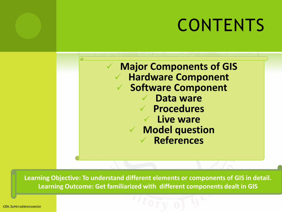
CONTENTS
©DR.SUPRIYA@BHUVANKOSH
Major Components of GIS Hardware Component Software Component
Data ware Procedures Live ware
Model question References
Learning Objective: To understand different elements or components of GIS in detail. Learning Outcome: Get familiarized with different components dealt in GIS
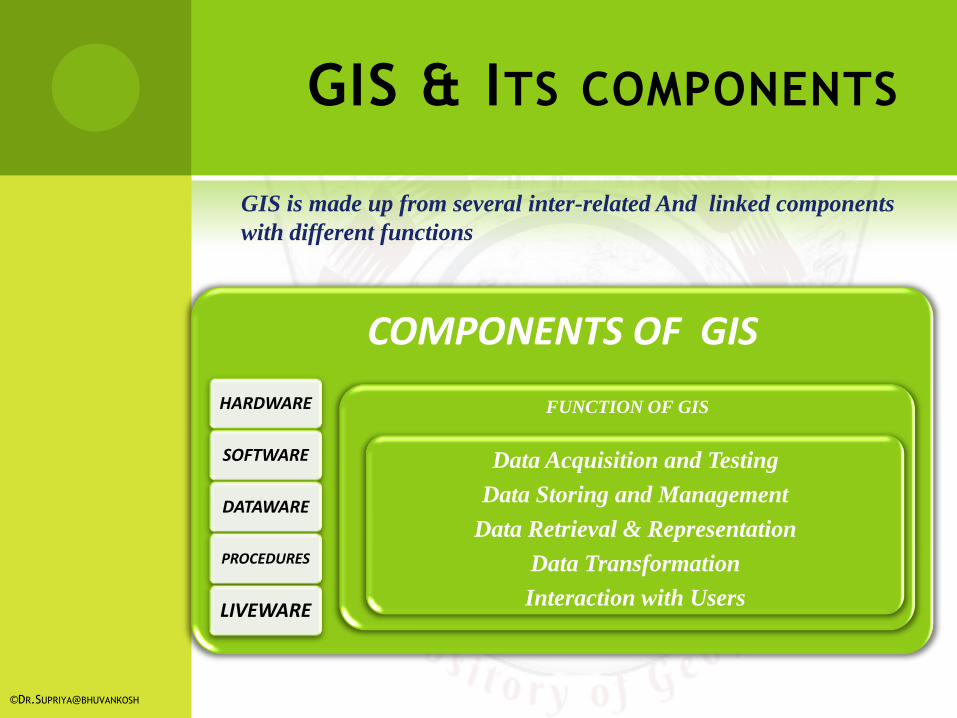
GIS & ITS COMPONENTS
COMPONENTS OF GIS
HARDWARE
SOFTWARE
DATAWARE
PROCEDURES
LIVEWARE
FUNCTION OF GIS
Data Acquisition and Testing
Data Storing and Management
Data Retrieval & Representation
Data Transformation
Interaction with Users
©DR.SUPRIYA@BHUVANKOSH
GIS is made up from several inter-related And linked components
with different functions
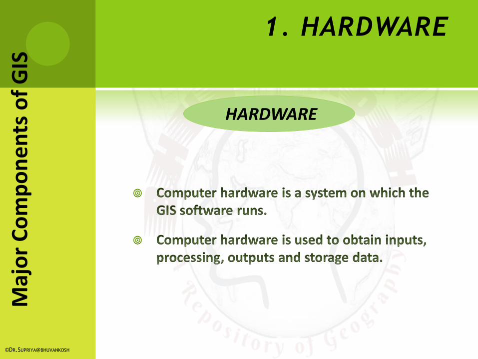
1. HARDWARE
HARDWARE
©DR.SUPRIYA@BHUVANKOSH
Maj
or
Co
mp
on
en
ts o
f G
IS
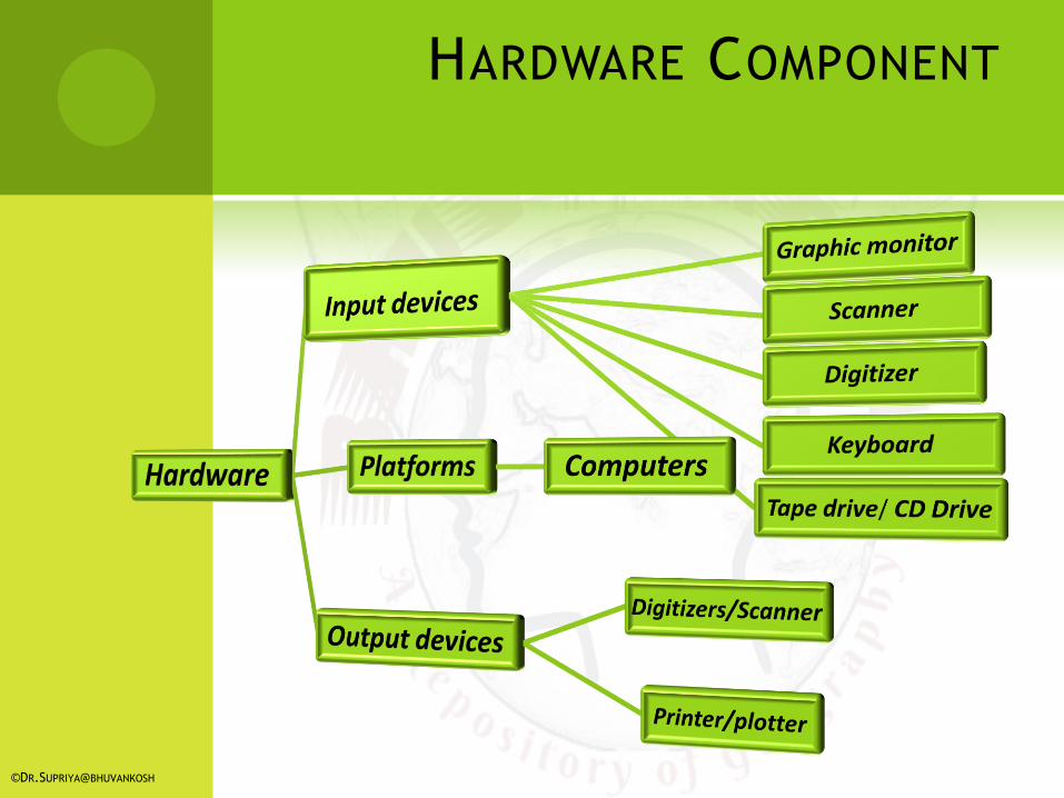
HARDWARE COMPONENT
©DR.SUPRIYA@BHUVANKOSH
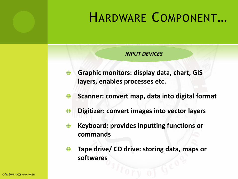
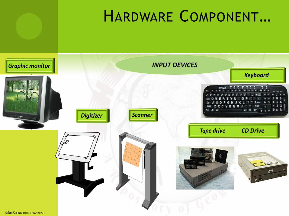
Graphic monitors: display data, chart, GIS layers, enables processes etc.
Scanner: convert map, data into digital format
Digitizer: convert images into vector layers
Keyboard: provides inputting functions or commands
Tape drive/ CD drive: storing data, maps or softwares
INPUT DEVICES
©DR.SUPRIYA@BHUVANKOSH
HARDWARE COMPONENT…
INPUT DEVICES
12
34 1
5
5
5
6
7
78
8
9
©DR.SUPRIYA@BHUVANKOSH
HARDWARE COMPONENT…
PLATFORMS
©DR.SUPRIYA@BHUVANKOSH
HARDWARE COMPONENT…
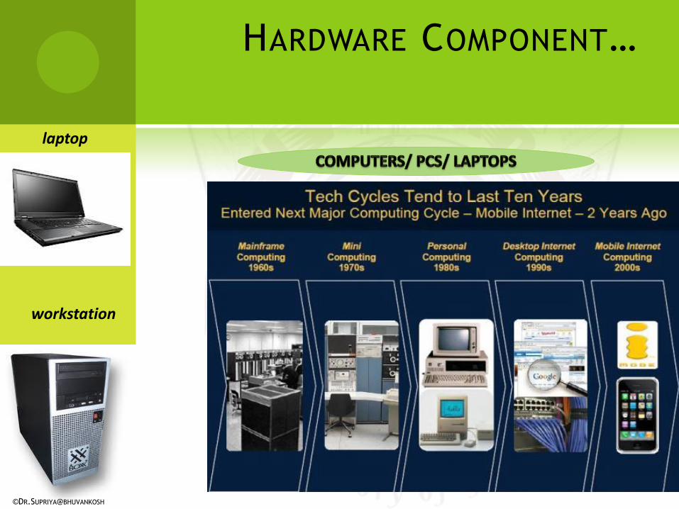
workstation
laptop
©DR.SUPRIYA@BHUVANKOSH
HARDWARE COMPONENT…
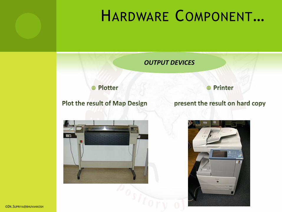
OUTPUT DEVICES
©DR.SUPRIYA@BHUVANKOSH
HARDWARE COMPONENT…
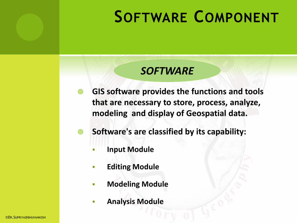
GIS software provides the functions and tools that are necessary to store, process, analyze, modeling and display of Geospatial data.
Software's are classified by its capability:
Input Module
Editing Module
Modeling Module
Analysis Module
SOFTWARE
©DR.SUPRIYA@BHUVANKOSH
SOFTWARE COMPONENT
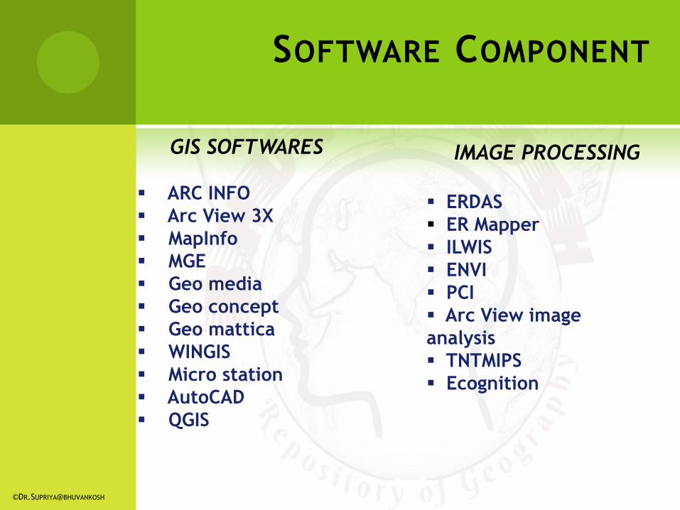
GIS SOFTWARES IMAGE PROCESSING
ARC INFO
Arc View 3X
MapInfo
MGE
Geo media
Geo concept
Geo mattica
WINGIS
Micro station
AutoCAD
QGIS
ERDAS
ER Mapper
ILWIS
ENVI
PCI
Arc View image
analysis
TNTMIPS
Ecognition
©DR.SUPRIYA@BHUVANKOSH
SOFTWARE COMPONENT
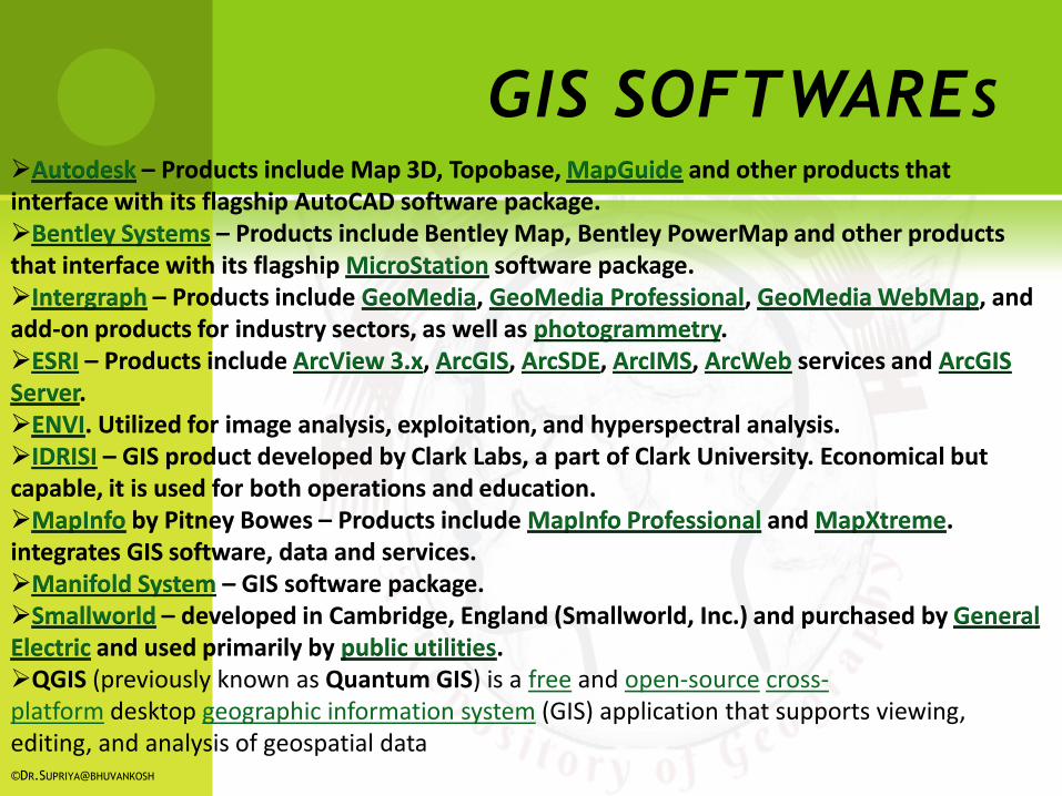
GIS SOFTWARES Autodesk – Products include Map 3D, Topobase, MapGuide and other products that interface with its flagship AutoCAD software package. Bentley Systems – Products include Bentley Map, Bentley PowerMap and other products that interface with its flagship MicroStation software package. Intergraph – Products include GeoMedia, GeoMedia Professional, GeoMedia WebMap, and add-on products for industry sectors, as well as photogrammetry. ESRI – Products include ArcView 3.x, ArcGIS, ArcSDE, ArcIMS, ArcWeb services and ArcGIS Server. ENVI. Utilized for image analysis, exploitation, and hyperspectral analysis. IDRISI – GIS product developed by Clark Labs, a part of Clark University. Economical but capable, it is used for both operations and education. MapInfo by Pitney Bowes – Products include MapInfo Professional and MapXtreme. integrates GIS software, data and services. Manifold System – GIS software package. Smallworld – developed in Cambridge, England (Smallworld, Inc.) and purchased by General Electric and used primarily by public utilities. QGIS (previously known as Quantum GIS) is a free and open-source cross-platform desktop geographic information system (GIS) application that supports viewing, editing, and analysis of geospatial data ©DR.SUPRIYA@BHUVANKOSH
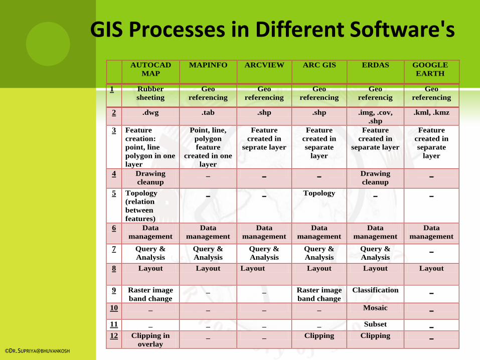
1 Rubber
sheeting
Geo
referencing
Geo
referencing
Geo
referencing
Geo
referencig
Geo
referencing
2 .dwg .tab .shp .shp .img, .cov,
.shp
.kml, .kmz
3 Feature
creation:
point, line
polygon in one
layer
Point, line,
polygon
feature
created in one
layer
Feature
created in
seprate layer
Feature
created in
separate
layer
Feature
created in
separate layer
Feature
created in
separate
layer
4 Drawing
cleanup
_ _ _ Drawing
cleanup
_
5 Topology
(relation
between
features)
_ _ Topology _ _
6 Data
management
Data
management
Data
management
Data
management
Data
management
Data
management
7 Query &
Analysis
Query &
Analysis
Query &
Analysis
Query &
Analysis
Query &
Analysis
_
8 Layout Layout Layout Layout Layout Layout
9 Raster image
band change
_ _ Raster image
band change
Classification _
10 _ _ _ _ Mosaic _
11 _ _ _ _ Subset _
12 Clipping in
overlay
_ _ Clipping Clipping _
AUTOCAD
MAP
MAPINFO ARCVIEW ARC GIS ERDAS GOOGLE
EARTH
GIS Processes in Different Software's
©DR.SUPRIYA@BHUVANKOSH
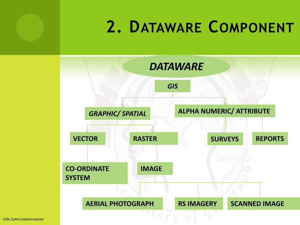
DATAWARE
GIS
ALPHA NUMERIC/ ATTRIBUTE GRAPHIC/ SPATIAL
VECTOR RASTER
RS IMAGERY
IMAGE CO-ORDINATE SYSTEM
AERIAL PHOTOGRAPH SCANNED IMAGE
SURVEYS REPORTS
©DR.SUPRIYA@BHUVANKOSH
2. DATAWARE COMPONENT
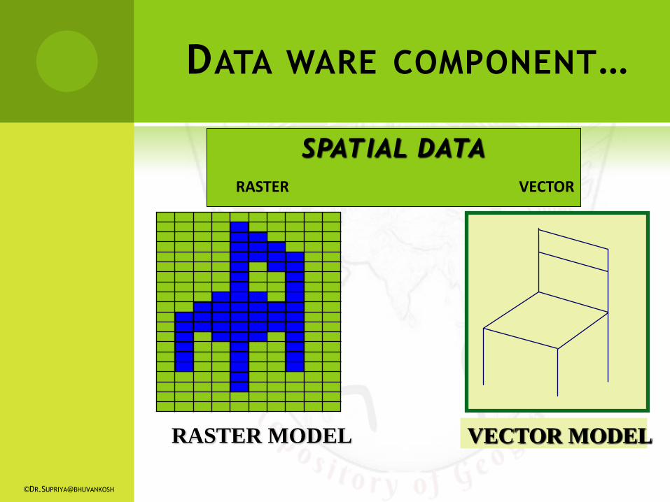
RASTER MODEL VECTOR MODEL
SPATIAL DATA
RASTER VECTOR
DATA WARE COMPONENT…
©DR.SUPRIYA@BHUVANKOSH
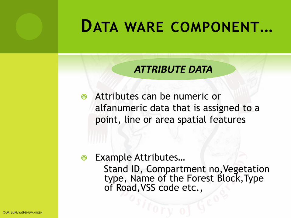
ATTRIBUTE DATA
Attributes can be numeric or
alfanumeric data that is assigned to a
point, line or area spatial features
Example Attributes…
Stand ID, Compartment no,Vegetation type, Name of the Forest Block,Type of Road,VSS code etc.,
©DR.SUPRIYA@BHUVANKOSH
DATA WARE COMPONENT…
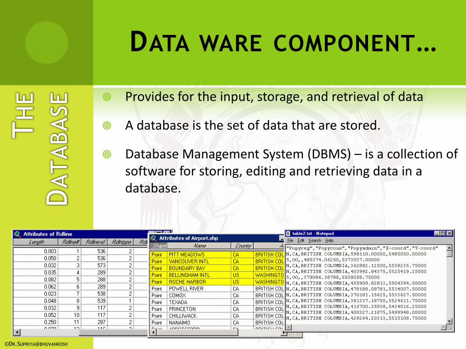
Provides for the input, storage, and retrieval of data
A database is the set of data that are stored.
Database Management System (DBMS) – is a collection of software for storing, editing and retrieving data in a database.
DATA WARE COMPONENT…
©DR.SUPRIYA@BHUVANKOSH
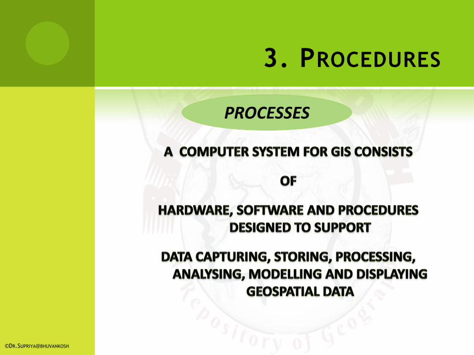
PROCESSES
©DR.SUPRIYA@BHUVANKOSH
3. PROCEDURES
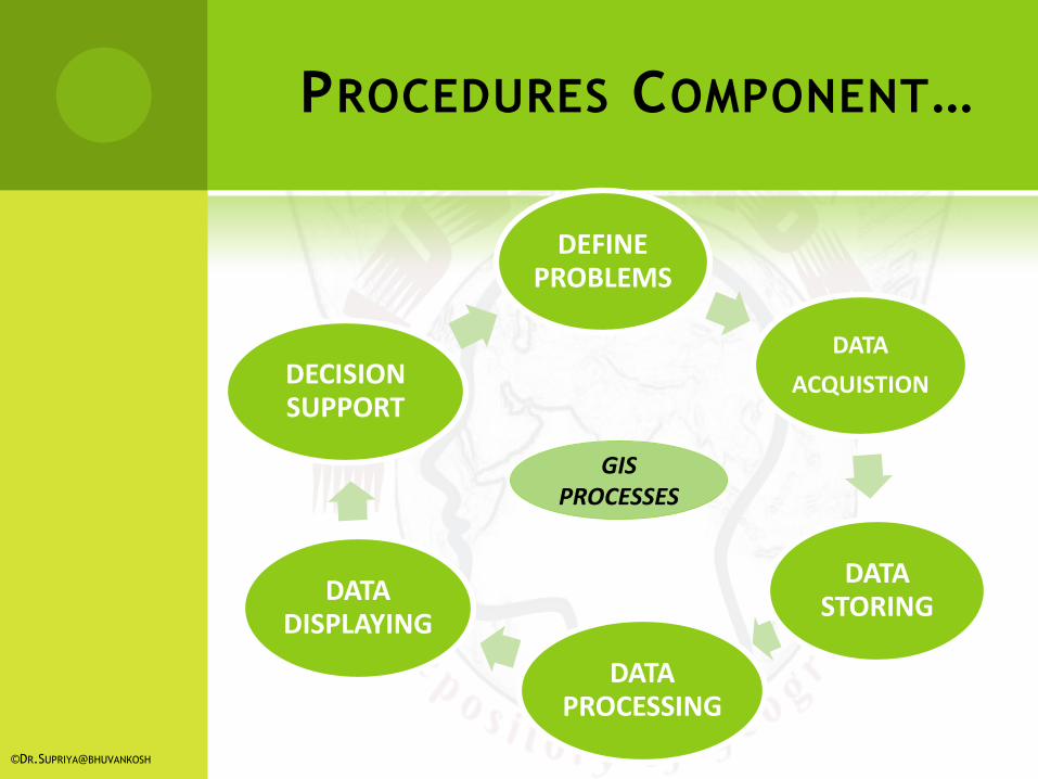
PROCEDURES COMPONENT…
DEFINE PROBLEMS
DATA
ACQUISTION
DATA STORING
DATA PROCESSING
DATA DISPLAYING
DECISION SUPPORT
GIS PROCESSES
©DR.SUPRIYA@BHUVANKOSH
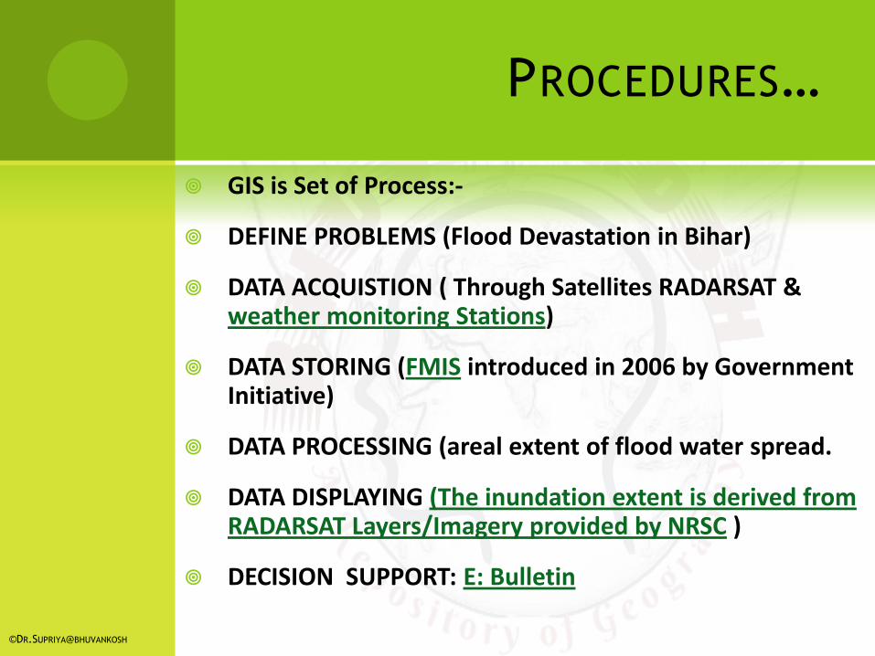
GIS is Set of Process:-
DEFINE PROBLEMS (Flood Devastation in Bihar)
DATA ACQUISTION ( Through Satellites RADARSAT & weather monitoring Stations)
DATA STORING (FMIS introduced in 2006 by Government Initiative)
DATA PROCESSING (areal extent of flood water spread.
DATA DISPLAYING (The inundation extent is derived from RADARSAT Layers/Imagery provided by NRSC )
DECISION SUPPORT: E: Bulletin
©DR.SUPRIYA@BHUVANKOSH
PROCEDURES…
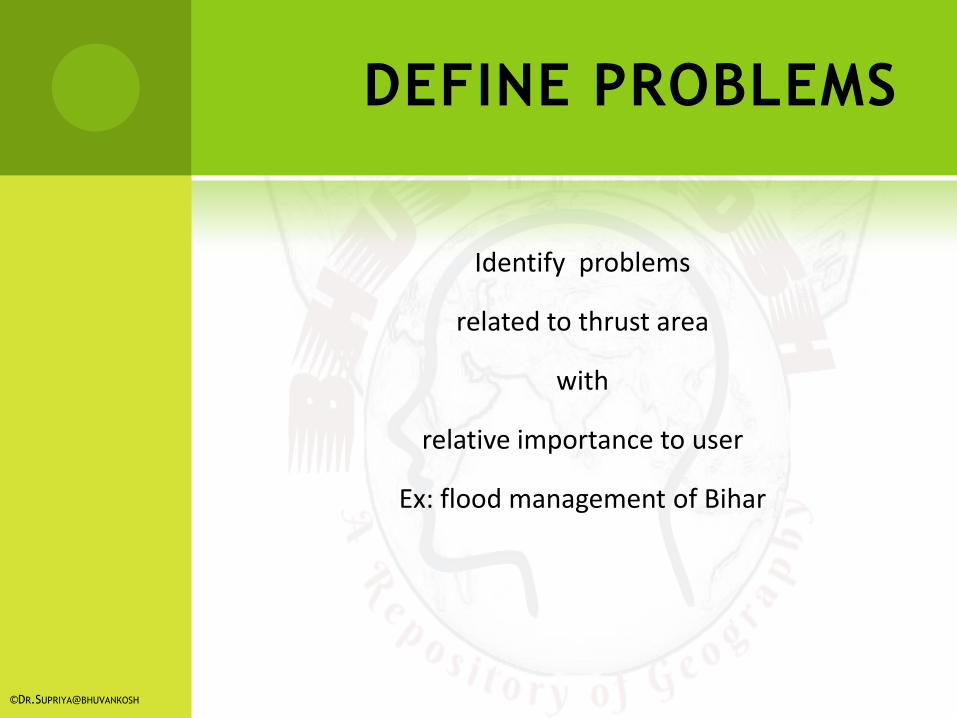
DEFINE PROBLEMS
Identify problems
related to thrust area
with
relative importance to user
Ex: flood management of Bihar
©DR.SUPRIYA@BHUVANKOSH
DATA ACQUISTION
It covers all aspect
of
capturing data from
existing maps, raster images and field survey
converting into digital form
(MS office Excel 97_2003,MS Access, Oracle,
SQL Server, Micro Station )
©DR.SUPRIYA@BHUVANKOSH

DATA STORING
Data stored into computer system
in different forms
Like
location, linkage, attribute, of geospatial features
In
structural and organized form
(DBMS/RDBMS)
©DR.SUPRIYA@BHUVANKOSH

DATA PROCESSING
Transformation, updating, analyzing methods applied to data to answer queries to GIS
Classification, Queries, Area Calculation, Address matching, Overlay, Network, Proximity, Buffer,
DTM, Simulation, Change Detection, Forecasting, Visibility etc are some Models
incorporated with GIS
©DR.SUPRIYA@BHUVANKOSH

DATA DISPLAYING
Data are represented
In
Spatial (vector or raster models)
attribute or tabular form
Like Maps, Models, Tables, Graphs, Chart etc
(ex: Rainfall data, graph showing mean rainfall in a year, flood inundation maps)
©DR.SUPRIYA@BHUVANKOSH
DECISION SUPPORT
GIS outputs
are
used in efficient planning for relevant issues
and
made a decision support system for all
(ex: FMIS is a GIS based decision support system for efficient management of flood control in Bihar
for every level)
©DR.SUPRIYA@BHUVANKOSH

LIVEWARE : no GIS can exists in isolation of the technicians & the users;
Technicians: people behind the plan, implementation and operate the system as well as made decision based on the out put.
Users: people who select pertinent information to set necessary standards to design –cost –efficient GIS outputs for relevant purpose.
LIVEWARE
©DR.SUPRIYA@BHUVANKOSH
5.LIVEWARE
MODEL QUESTIONS
Long type Questions:
Q1. List the main components of GIS. Write short notes on them.
Q2. Discuss briefly “Hardware” as one component of GIS.
Q3. Discuss briefly “Software” as one component of GIS.
Q4.Discuss briefly Data “Information” as one component of GIS.
Q5. Discuss briefly “People” as one component of GIS.
Short type questions:
Q1. Write notes on different platform.
Q2. Write Short Notes on them
a.Input & Output devices c. Hardware and Software
b. Users & technicians d. Process in GIS
Assignment: 1. Explain briefly major components of GIS through flow chart and illustrations. ©DR.SUPRIYA@BHUVANKOSH
SUGGESTED READINGS
Albert , C.P.Lo. & Yeung. K.W., (2007) Concept and techniques of Geographic information system ; PHI Learning PVT Ltd. New Delhi
Burrough,P.A. and McDonnell, R.A., (1998) : Principles of Geographic Information Systems, Oxford University Press, Oxford. De Mers, Michael N., (1999) : Fundamentals of Geographic Information Systems, John Wiley & Sons, NewYork.
Fraser Taylor, D. R. (1991): Geographical Information System, London.
DevidattChauniyal, Sudoor Samvedanevam Bhaugolik Soochna Pranali.
Heywood, I. et al. (2004) : An Introduction to Geographic Information Systems, Pearson Education.
Longley, P.A., Goodchild, M.F., Maguire, D.J. and Rhind, D.W., (2001), Geographic Information Systems and Science, Wiley, Chichester.
Siddiqui, An Introduction to Geographical Information System.
Contact me:
Mob/ WA: 9006640841
Emai:[email protected]
Webpage: http://bhuvankosh.com DR.SUPRIYA@BHUVANKOSH