Embed Size (px)
Citation preview
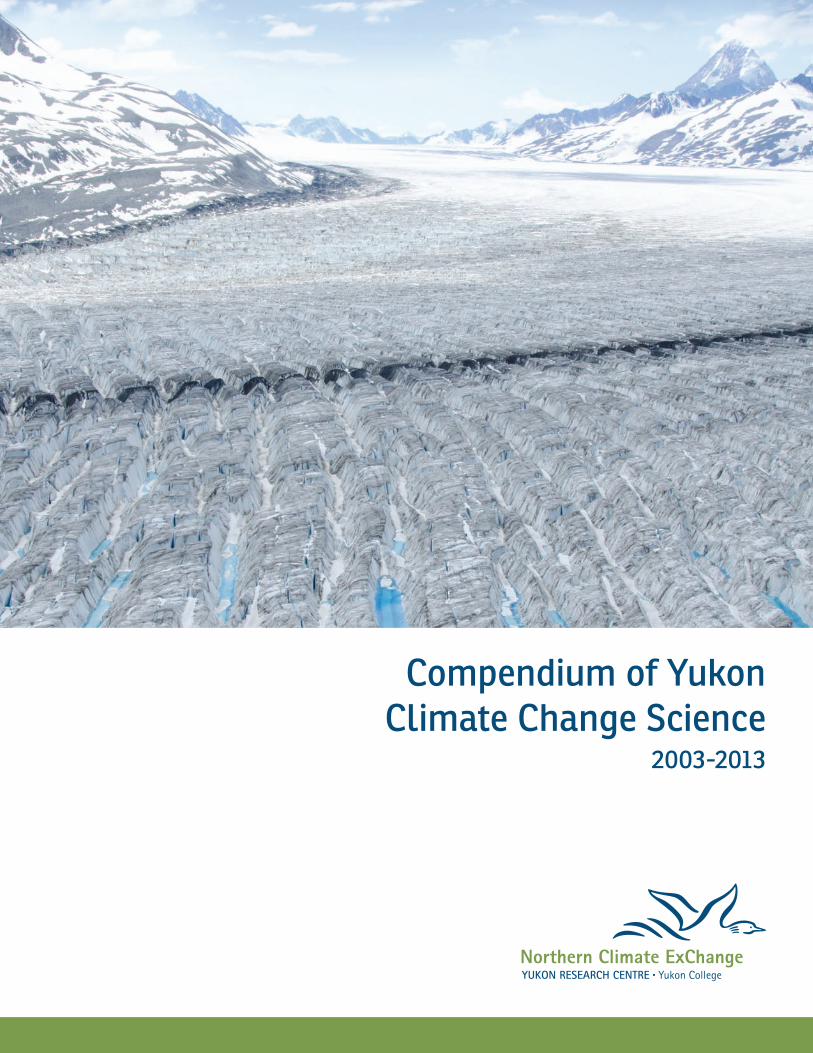
Compendium of Yukon Climate Change Science
2003-2013
This publication may be obtained from:
Northern Climate ExChangeYukon Research Centre, Yukon College520 College DriveP.O. Box 2799,Whitehorse, YukonY1A 5K4(867) 668-88951-800-661-0504www.yukoncollege.yk.ca/research Recommended citation:
Northern Climate ExChange, 2014. Compendium of Yukon Climate Change Science 2003 - 2013. Yukon Research Centre, Yukon College, 237 p. Printed in Whitehorse, Yukon, 2014 by Arctic Star Printing Inc., 204 Strickland St.Front cover photograph: Kluane National ParkPhoto credit: Government of Yukon
Foreword The Compendium is intended to provide an overview of recent (2003-2013) climate change work involving Yukon. It is comprised of various types of documents, including scientific journal articles, government publications, workshop reports, and conference proceedings. Information for the Compendium was gathered through:
• ASTIS Database • Polar Data Catalogue • Yukon Biodiversity Database • Hydrocarbon Impacts (HI) database • Wolf Creek Research Basin database • Kluane Lake Research Station Bibliography • NCE Library • Northern Research Institute Fellowship
Grants list
• Forest Management in a Changing Climate: Compendium of Information Sources
• Government of Canada and Government of Yukon websites
• AANDC Present and Past Climate Change Adaptation Projects list
• Internet searches • Internal knowledge
The Compendium is not an exhaustive list of climate change-related work in Yukon over the period 2003-2013. A greater emphasis was placed on studies dated between 2007 and 2013 and on information that is available online. That being said, the Northern Climate ExChange would appreciate being informed of any relevant information that should be included, or if there are any errors in the Compendium. The Compendium is organized broadly by topic and subsequently separated into more detailed sections. The ‘Local Relevance’ section of each entry highlights information directly related to Yukon climate change. Entries can be searched by various keywords listed in the index, and all entries have been classified as south Yukon, south-central Yukon, central Yukon, north Yukon, or Yukon-wide. The keyword ‘traditional knowledge’ was used when the study integrated knowledge from First Nations communities, and the keyword ‘local knowledge’ was used when information was integrated from a multicultural community or broad area. This edition of the Compendium expands upon the previous edition (2003-2011) which was compiled by Aletta Leitch. I would like to thank Lia Johnson, John Streicker, Bob Van Dijken, Rebecca World, Ryan Hennessey, Lacia Kinnear, Darcie Matthiessen, Aynslie Ogden, and Alison Perrin for their assistance to Aletta and myself. I am also grateful to all of the Yukon First Nations that responded to our requests for information involving studies conducted in their respective traditional territories.
Erin Eady Climate Change Assistant Analyst
Northern Climate ExChange Yukon Research Centre, Yukon College
August 2013
CONTENTS
Foreword ...............................................................................................................................................................................
CONTENTS .............................................................................................................................................................................. 1
I. COMPENDIUM ............................................................................................................................................................. 3
1. Changing Climate ................................................................................................................................................... 3
Climate Change Adaptation ................................................................................................................................. 13
Climate Change Impacts ........................................................................................................................................ 22
2. Hydrology ................................................................................................................................................................ 30
Glacial and Nival Rivers ........................................................................................................................................... 38
Yukon River Basin ..................................................................................................................................................... 43
Old Crow Flats ............................................................................................................................................................ 57
3. Permafrost ............................................................................................................................................................... 62
Historic, Recent & Projected Change ................................................................................................................. 63
Modelling and Mapping Techniques ................................................................................................................. 72
Coastal Erosion .......................................................................................................................................................... 82
4. Forestry ..................................................................................................................................................................... 86
Treeline ......................................................................................................................................................................... 89
Forest Growth ............................................................................................................................................................ 96
Disturbance ............................................................................................................................................................. 104
Forest Management.............................................................................................................................................. 115
Shrubs ........................................................................................................................................................................ 126
5. Glaciology ............................................................................................................................................................. 131
Glacier Systems ....................................................................................................................................................... 131
Individual Glaciers ................................................................................................................................................. 137
6. Fish and Wildlife ................................................................................................................................................. 141
Fish .............................................................................................................................................................................. 145
Mammals .................................................................................................................................................................. 150
Birds ............................................................................................................................................................................ 167
Spiders ....................................................................................................................................................................... 171
7. Hazards .................................................................................................................................................................. 174
Flooding .................................................................................................................................................................... 176
Landslides ................................................................................................................................................................. 177
1
Lightning .................................................................................................................................................................. 178
Infrastructure and Development ...................................................................................................................... 185
8. Food Security ....................................................................................................................................................... 196
9. Pollutants .............................................................................................................................................................. 202
10. General .............................................................................................................................................................. 206
Yukon Government Initiatives ........................................................................................................................... 208
Environment ............................................................................................................................................................ 213
Youth and Education ............................................................................................................................................ 220
Research Needs ...................................................................................................................................................... 223
APPENDICES ...................................................................................................................................................................... 226
Appendix A: Index ...................................................................................................................................................... 226
Appendix B: List of Authors ..................................................................................................................................... 229
2
COMPENDIUM
1. Changing Climate Climatic Conditions in Northern Canada: Past and Future Research Location: Yukon; Northwest Territories; Nunavut Publication Date: 2009 Publication Type: Journal Article Abstract: This article reviews the historical, instrumental, and future changes in climate for the northern latitudes of Canada. Discussion of historical climate over the last 10 000 years focuses on major climatic shifts, including the Medieval Warm Period and the Little Ice Age, and how these changes compare with those most recently experienced during the period of instrumental records. In reference to the latter, details are noted about observed trends in temperature and precipitation that have been recorded over the last half century, which exhibit strong west to east and north to south spatial contrasts. A comprehensive review of future changes is also provided based on outputs from seven atmosphere-ocean global climate models and six emission scenarios. Discussion focuses on annual, seasonal and related spatial changes for three 30-year periods centered on the 2020s, 2050s and 2080s. In summary, substantial changes to temperature and precipitation are projected for the Canadian North during the twenty-first century. Although there is considerable variability within the various projections, all scenarios show higher temperature and, for the most part, increasing precipitation over the entire region. Local Relevance: During the period of 1948-2005, the Yukon experienced an annual average warming of 2.2°C and a winter warming of 4.5°C, the greatest rate of temperature increase in Canada. The period 1950-1998 saw fewer extremely cold days and more extremely warm days, accompanied by more intense and more frequent precipitation events. Temperatures have warmed and precipitation has increased across Canada, and the rate of warming exceeds anything seen since the onset of the Holocene 10,000 years ago. Climate projections predict increasing temperatures (most pronounced during winter and fall) and generally agree that precipitation will increase. Rates of predicted warming increase further north, an effect that would act to equilibrate temperatures across the North and may affect north-flowing rivers. Keywords: air temperature, climate modelling, precipitation, Yukon-wide Available Online: Full Document Citation: Prowse, T.D., Furgal, C., Bonsal, B.R. and Edwards, T.W.D, 2009. Climatic conditions in northern Canada: past and future. Ambio, vol. 38(5), p. 257-265. DOI:10.1579/0044-7447-38.5.257.
3
Northern Canada in a Changing Climate: Major Findings and Conclusions Research Location: Yukon; Northwest Territories; Nunavut Publication Date: 2009 Publication Type: Journal Article Excerpt: The papers in this and a subsequent Special Issue of the international journal Ambio are directly based on a Northern Canada chapter (1, 2) that formed part of a broader regional assessment of Canada’s vulnerability to climate change led by the Government of Canada (3). For the purposes of this national assessment, the ‘‘North’’ of Canada refers to the area north of latitude 60°N that contains three large territorial administrative units: Yukon, Northwest Territories and Nunavut. The issues also include manuscripts which draw from work conducted for a chapter on the health implications of climate change in Canada’s North (4) conducted as part of a health assessment of climate vulnerabilities in the country led by Health Canada (5). The following summarizes the major conclusion and key findings contained in the various papers that comprise these Special Issues… Local Relevance: This paper summarizes the key findings of multiple papers on climate change in the north, based on an assessment of climate change vulnerability conducted by the Government of Canada. Permafrost degradation may damage infrastructure as well as leach contaminants from waste retention areas that rely on underlying permafrost as a barrier. Changes in river hydrology will effect hydroelectric power generation, while rising sea-levels and more storms will damage coastal areas. Aboriginal peoples practicing their traditional way of life in remote communities are the most vulnerable, yet may also benefit from new economic opportunities as northern Canada becomes less remote. Keywords: coastal erosion, economic development, hydroelectricity, impacts, permafrost, vegetation, wildlife, Yukon-wide Available Online: Full Document Citation: Prowse, T.D. and Furgal, C., 2009. Northern Canada in a changing climate: Major findings and conclusions. Ambio, vol. 38(5), p. 290-292. DOI:10.1579/0044-7447-38.5.290. From Impacts to Adaptation: Canada in a Changing Climate 2007, Chapter 3 - Northern Canada Research Location: Yukon; Northwest Territories; Nunavut Publication Date: 2008
Publication Type: Government Publication Excerpt: The climate of the Arctic has shown an unprecedented rate of change during the past 50 years. Over the last half century, the Canadian Arctic has experienced significant increases in both
4
temperature and precipitation, consistent with trends in other circumpolar regions. Increases in air temperature have resulted in many of the most extreme warm years throughout the entire Canadian North being recorded in the last decade, with the greatest temperature increases observed over the western Arctic. All global climate models project continued increases in temperature and precipitation over the Canadian Arctic, with greatest temperature changes at higher latitudes. As a result, there will continue to be significant changes in the physical environment, particularly in the cryosphere (snow, glaciers, permafrost and river/lake/sea ice). There is increasing evidence that changes in climate are already having impacts on ecological, economic and human systems in northern regions, and that some individuals, communities and institutions are already taking action to reduce harmful impacts. Current levels of exposure to climate-related changes and sensitivities, as well as limitations in adaptive capacity, make some northern systems and populations particularly vulnerable to the effects of climate change… Local Relevance: Climate change will affect physical, biological, ecological and social systems in the North because northern stability is directly dependent on the cryosphere (ice, snow, glaciers, permafrost, etc.). Melt of the Yukon-Alaska glaciers has contributed to approximately 9% of the sea-level rise in the past 50 years. Yukon is predicted to experience the largest increases in permafrost active-layer depth in Canada. Drought in southern Yukon forests is preventing forest regeneration following forest fires. Remote communities worry that climate change is affecting their relationship with the natural environment. The Council of Yukon First Nations has highlighted food security, community health and well-being, resource-use conflicts, and emergency preparedness as key issues associated with climate change. Keywords: adaptation, impacts, Yukon First Nations, Yukon-wide Available Online: Full Document Citation: Furgal, C. and Prowse, T.D., 2008. Northern Canada. In: From Impacts to Adaptation: Canada in a Changing Climate 2007, edited by D.S. Lemmen, F.J. Warren, J. Lacroix and E. Bush. Government of Canada, Ottawa, ON, p. 57-118. Maximum June - July Temperatures in the Southwest Yukon over the Last 300 Years Reconstructed from Tree Rings Research Location: southwest Yukon Publication Date: 2008 Publication Type: Journal Article Abstract: A network of seven high-elevation white spruce tree-ring chronologies from the southwest Yukon is used to reconstruct June - July maximum temperatures (Tmax) back to 1684 AD, explaining 46.6% of the climatic variation over the 1946 - 1995 calibration period. The chronologies are characterized by low interannual ring-width variability and display similar patterns of ring-width variation across the sample area over the last 300 years. The driving force of this common signal appears to be a tree growth response to summer temperatures across the region. The reconstruction
5
correlates well with regional records of temperature variability derived from annual ring-width and maximum density data. Periods of cooler temperatures correspond with solar minima and glacier advances, particularly during the early 18th and the early 19th centuries. The maximum reconstructed temperatures are in the 1940s with 20th century values averaging 0.46°C higher than the period 1684 - 1899. In contrast to several regional studies, there does not appear to be a reduction in the sensitivity of tree growth to temperature at these sites during the late 20th century. Instead, a slight increase in the strength of the temperature-tree growth relationship is observed during recent decades. A possible explanation for this difference is the absence of significant summer season warming in the southwest Yukon region in comparison to other areas that have demonstrated this response change. This research is part of an ongoing project aimed at assessing the spatial and temporal potential of dendroclimatic reconstructions from the Yukon Territory. Local Relevance: A tree-ring chronology was created to infer maximum June-July temperatures across the southwest Yukon over the last 300 years. The tree rings showed a consistent response across the study area, most highly correlated with summer temperature. Reconstructed temperatures from the 20th century average was 0.46°C higher than the average temperature from the period 1684 - 1899, and the highest temperatures occurred in the 1940s. In this study, there was no discrepancy between tree-ring width and temperature beginning in the late 20th century; the researchers hypothesize that this is due to insignificant summer warming in the southwest Yukon as compared to areas that have shown a decreased tree-growth response to summer temperatures. Keywords: air temperature, climate reconstruction, south Yukon, tree ring Available Online: Abstract Citation: Luckman, B. and Youngblut, D., 2008. Maximum June-July temperatures in the southwest Yukon over the last 300 years reconstructed from tree rings. Dendrochronologia, vol. 25(3), p.153-166. DOI:10.1016/j.dendro.2006.11.004. Climatic Change and Permafrost Stability in the Eastern Canadian Cordillera Research Location: Eastern Canadian Cordillera Publication Date: 2008 Publication Type: Conference Proceedings Abstract: Permafrost is the result of cold climatic conditions, so the stability of the climate is crucial to permafrost stability. It has been predicted by modelling that Alaska and the Yukon Territory should exhibit the maximum degree of climatic warming in the next century (Anisomov and Poliakov 2003), but Harris (2007) and Sergeev (2007) found that the available climatic data from the most reliable government sources indicated no strong warming trends in large parts of these areas. This paper explores the matter further by extending the study south along the Canadian Cordillera and relating the results to the evidence of associated permafrost stability. Local Relevance: By analyzing weather records, it was determined that the Arctic coast of Alaska and Yukon, the Mackenzie Valley, northern British Columbia, and the eastern side of the Canadian
6
Cordillera have experienced substantial warming since 1980. This warming is illustrated by permafrost degradation in these areas. Temperatures in central Yukon and Alaska have remained stable, supported by lack of permafrost thaw, except where processes other than climate are responsible (e.g., beavers, development, etc.). Weather patterns related to the mountains in this area act to shelter central Yukon and Alaska from climatic changes. Keywords: air temperature, permafrost, Yukon-wide Available Online: Full Document Citation: Harris, S.A., 2008. Climatic change and permafrost stability in the eastern Canadian cordillera. In: Ninth International Conference on Permafrost, Extended Abstracts, D.L. Kane and K.M. Hinkel (eds.), Fairbanks, Alaska, June 29-July 3, 2008, p. 93-94. Diatom Responses to 20th Century Climate-Related Environmental Changes in High-Elevation Mountain Lakes of the Northern Canadian Cordillera Research Location: southern Yukon; northern British Columbia Publication Date: 2005 Publication Type: Journal Article Abstract: Diatom responses to 20th century climate-related environmental change were assessed from three high-elevation lakes in the northern Canadian Cordillera. Dominance of small benthic Fragilaria diatoms reflect the generally cold conditions with long periods of ice cover that have characterized these mountain lakes over at least the last ~300 years until the period of recent warming. At the turn of the 20th century, salient shifts in the diatom assemblages reveal individualistic limnological responses with the onset of climate warming trends in northwest Canada. At YK3 Lake, an oligotrophic, chemically dilute, alpine lake, increased representation of the planktonic Cyclotella pseudostelligera may reflect longer ice-free conditions and/or more stable thermal stratification. By contrast, in the more productive, alkaline lakes (BC2 and Deadspruce lakes), changes to more diverse assemblages of periphytic diatoms suggest greater benthic habitat availability, most likely associated with the enhanced growth of aquatic plants with lengthening of the growing seasons. In addition, diatom assemblages from these lakes suggest less alkaline conditions following the onset of 20th century climate warming. Continued alkalinity reduction throughout the 20th century is qualitatively inferred at the lower elevation, treeline lake (Deadspruce Lake), while greater representation of alkaliphilous Fragilaria diatoms after ~1950 suggested increased alkalinity at the alpine BC2 Lake. Our results confirm the sensitivity of diatoms from high-elevation mountain lakes to regional climate change in northwest Canada. Individualistic limnological responses to 20th century warming are potentially attributed to differences in their physical setting (e.g., bedrock geology, elevation, catchment vegetation) in this complex mountain environment. Local Relevance: Diatom assemblages from two northern British Columbia lakes and one southern Yukon lake were analyzed over approximately the last 300 years to identify climate-induced changes
7
in sedimentary organisms. In all three lakes, the diatom assemblages showed a significant change at the beginning of the 1900s in response to climate warming following the Little Ice Age. Throughout the 1900s, continued abundance changes of certain diatoms are thought to illustrate longer growing seasons and less ice cover on the lakes. Over this time, the thermal regime of the Yukon lake became more stratified in response to warmer climatic conditions, as evident from changes in the abundance of specific diatoms. Keywords: climate reconstruction, diatoms, south Yukon, water temperature Available Online: Full Document Citation: Karst-Riddoch, T.L., Pisaric, M.F.J. and Smol, J.P., 2005. Diatom responses to 20th century climate-related environmental changes in high-elevation mountain lakes of the northern Canadian cordillera. Journal of Paleolimnology, vol. 33, p. 265-282. DOI: 10.1007/s10933-004-5334-9. Climate Change in Northern Canada Research Location: Yukon; Northwest Territories; Nunavut Publication Date: 2007 Publication Type: Discussion Paper Excerpt: That the world’s climate is changing rapidly is no longer a subject of serious debate. A very small number of scientists demur but an overwhelming majority accept that increased level of greenhouse gases (GHG) in the atmosphere—380ppm in 2005 from a pre-industrial level of 280ppm—is altering the world’s climate. The vast majority of scientists also accept that rising GHG concentrations is caused by burning of fossil fuels, and land and resource use changes, primarily deforestation, that reduce the natural environment’s ability to absorb and store (sequester) carbon… Local Relevance: This paper was drafted by the Arctic Athabaskan Council to highlight the issues that climate change presents to northern Canada. Impacts noted by the Intergovernmental Panel on Climate Change and the Arctic Climate Impact Assessment are discussed, followed by perspectives of northern residents related to climate change impacts and adaptation. In general, low adaptive capacity is noted and a desire for government leadership is expressed. Keywords: adaptation, impacts, policy, traditional knowledge, Yukon First Nations, Yukon-wide Available Online: Full Document Citation: AAC, 2007. Climate Change in Northern Canada. Arctic Athabaskan Council, Whitehorse, YT, 12 p.
8
Climate Change in Our Backyard Research Location: Champagne and Aishihik Traditional Territory Publication Date: 2006 Publication Type: Conference Report Excerpt: The Climate Change in Our Backyard conference, held in the spring of 2006, was the first of its kind in the Yukon. It brought together scientific and local experts to share common concerns about climate change and work together on solutions. Outcomes will be used by local managers to guide ongoing management. The first section of this report, “Presentation Summaries” is made up of summaries of all the formal presentations made at the conference. The second section, “Local Observations of Change,” is a summary of the changes observed by residents recorded during the round table discussions. Section Three, “Local Directions: Impacts of Change and Adapting to Change,” summarizes round table discussions of future impacts of climate change and acceptable ways of dealing with those impacts… Local Relevance: Information was gathered and shared by scientists and local community members in Haines Junction in order to gain a better understanding of climate change and plausible adaptive strategies. Locals noted many changes to fish, wildlife, weather, landscape features and the boreal forest, and they provided ideas for adaptation, many of which called for community involvement. Concerns included warm water affecting fish, snow-crusting making it difficult for big game species to access food, and raining and melting in winter harming small mammals. With respect to forest management, a cautious approach was suggested as the best approach. Keywords: adaptation, Champagne and Aishihik First Nations, fish, forest management, Haines Junction, impacts, local knowledge, south Yukon, wildlife, Yukon First Nations Available Online: Full Document Citation: Champagne and Aishihik First Nations and Alsek Renewable Resource Council, 2006. Climate change in our backyard conference report. Haines Junction, Yukon, 34 p. Climate Change in Our Backyard II Research Location: Champagne and Aishihik Traditional Territory Publication Date: 2009 Publication Type: Conference Report Excerpt: Climate Change in Our Backyard II was held March 9 to 12, 2009, in Haines Junction, Yukon, as a follow up to the first conference held in 2006. The spring 2006 Climate Change in Our Backyard conference was the first of its kind in Yukon, and brought together scientific and local experts to share common concerns about climate change, and work together on solutions. Outcomes were used by local managers to guide ongoing management. The purpose of the 2009 workshop was to
9
further discuss the results of climate change in the Champagne and Aishihik First nations Traditional Territory (CATT) with community members, and to identify ways of adapting to change in this region… Local Relevance: This conference took place in Haines Junction, Yukon, and built upon the work of the previous Climate Change in Our Backyard conference held in 2006. Participants were engaged in several formal presentations, with topics ranging from youth engagement in climate change, to the effects of climate warming on fish and wildlife. Formal presentations were followed by round table discussions on the topic of adaptation with residents of the Champagne and Aishihik Traditional Territory (CATT). Residents discussed reported impacts of climate change, and acceptable ways of dealing with those impacts. Local input demonstrated that residents were open to planning for adaptation, and had many recommendations for how to approach the adaptation process in their communities; round table discussions focused on health and preparedness, infrastructure and the economy, land-based traditions and occupations, and establishing priorities for adaptation planning. Participants’ most commonly cited reasons for wanting to adapt to climate change in the CATT included the following: getting back out on the land, respecting the land and its resources, becoming more self-sufficient, passing knowledge onto younger generations, and continuing to work together through partnerships and good communication. Keywords: adaptation, Champagne and Aishihik First Nations, fish, forest management, Haines Junction, impacts, local knowledge, south Yukon, traditional knowledge, wildlife, Yukon First Nations Available Online: Full Document Citation: Champagne and Aishihik First Nations and Alsek Renewable Resource Council, 2009. Climate change in our backyard II conference report. Haines Junction, Yukon, 29 p. Climate Change in the Mayo Area: Observations of Long-Term Local Residents Research Location: Mayo, Yukon Publication Date: 2005 Publication Type: Workshop Report Excerpt: This report summarizes the results of a workshop that was the first step towards documenting the observations of Mayo-area residents about climate change. It is a part of a larger Mayo Community Ecological Monitoring Project (CEMP), which was started in 2004 with funding from Environment Canada’s Northern Ecosystems Initiative. CEMP has three main parts in Mayo: 1) this workshop, aimed at giving us a historical background about local climate change and its effects on subsistence activities, 2) annual interviews with local residents most active on the land aimed at monitoring current influences of weather and environmental conditions on subsistence activities, and 3) monitoring of key components of the boreal forest food web (e.g., berries, spruce cones, small mammals, snowshoe hares, carnivores) using technical methods on selected sites around Mayo…
10
Local Relevance: Participants noted that summer and winter temperatures have increased with fewer periods of extreme cold and there has been increased snow and rain in winter. There have been changes to the freeze-thaw cycle with earlier thaw of water bodies in spring and later freeze-up in fall. Permafrost conditions have also changed, resulting in damage to overlying houses and drainage of lakes into the ground. Noted vegetative changes include larger trees and poorer crop yields from berry bushes. There has also been an increase in the number of forest fires, which has been attributed to higher temperatures, less precipitation, and more lightning. These climatic changes have resulted in changes to fish and wildlife. The contribution of climate change to altered patterns of subsistence activities is hard to identify, because social changes and aging of participants has also affected the way people interact with the land. Keywords: berries, central Yukon, Na-Cho Nyäk Dun First Nation, fish, impacts, local knowledge, Mayo, snowshoe hares, wildlife, Yukon First Nations Citation: Mayo Community Ecological Monitoring Project, 2005. Climate change in the Mayo area: observations of long-term local residents. Workshop Report, 9-10 February 2005, Mayo, Yukon, 16 p. Climate and Other Sources of Change in the St. Elias Region Research Location: St. Elias region, Yukon Publication Date: 2003 Publication Type: Book Chapter Abstract: Climate change is hypothesized to have both a greater effect and/or to be more visible in high latitudes and/or elevations. This is significant for both the peoples who live in these regions and scientists seeking evidence about the nature and magnitude of climate change. The Kluane National Park region of southwest Yukon and adjoining parks in Alaska and British Columbia, is one high-latitude, mountainous region well-suited to such studies. Many factors cause change and disturbance in mountainous regions. Thus important questions for research and management are distinguishing and understanding the interaction of climate-related changes and changes due to other factors. This paper reviews the literature on the interaction of climate-related and other environmental change. It provides an initial assessment of the causes, nature and magnitude of environmental change in the broader St. Elias region as a basis for distinguishing climate-related changes. Key sources of change include resource management policies and practices, land use change, wildlife population fluctuations, long-range transport of pollutants, forestry and mining, and tourism activities. Local Relevance: This study documents both climatic and environmental changes in the St. Elias region, in order to understand the interaction between these two types of change. This paper investigates ways to distinguish climate change from a broad array of other environmental changes, including resource management, land use, wildlife population changes, pollutants, and the forestry, mining and tourism industries.
11
Keywords: economic development, forestry, south Yukon, wildlife, Kluane National Park Available Online: Abstract Citation: Slocombe, D.S, 2003. Climate and other sources of change in the St. Elias region. In: Global Change and Protected Areas, G. Visconti et al. (eds.), Netherlands, p. 61-69. Yukon Climate Trends and Projections Research Location: Yukon Publication Date: 2012 Publication Type: Discussion Paper Excerpt: The Yukon Environmental and Socio-economic Assessment Board (YESAB) is an independent assessment organization that works closely with Yukon residents, governments, and stakeholders. YESAB provides recommendations to decision bodies about Yukon projects and whether they should proceed and under what conditions. The Northern Climate ExChange (NCE) of Yukon College and YESAB recognized that climate change considerations should be included in project assessments in Yukon. Funded by YESAB, the two partners began working together in 2011 to continue bringing climate change into the assessment process. NCE and YESAB worked together to:
- Assemble historical climate information and future climate projections for Dawson City, Haines Junction, Mayo, Teslin, Watson Lake, and Whitehorse (YESAB’s six districts), as well as Beaver Creek, Carcross, Faro, Pelly Crossing and Old Crow.
- Provide continual updates of climate information to YESAB’s Geolocator (a web-based GIS tool).
- Deliver a presentation to YESAB assessors on the effects of climate change on projects in Yukon, the importance of including climate change considerations in environmental assessment, and how to use the climate predictions in an assessment context.
Local Relevance: The Yukon Environmental and Socio-economic Assessment Board is working to integrate climate change into environmental assessment of projects that will take place in Yukon under the Yukon Environmental and Socio-economic Assessment Act (YESAA). The incorporation of climate change-related data into the assessment process will allow project assessments to be more reflective of the changing realities of Yukon communities in the context of a warming climate. Keywords: Beaver Creek, Carcross, Dawson, environment, environmental assessment, Faro, Haines Junction, Mayo, Old Crow, Pelly Crossing, Teslin, Watson Lake, Whitehorse, Yukon-wide Citation: Northern Climate ExChange and Yukon Environmental and Socio-economic Assessment Board, 2012. Yukon Climate Trends and Projections, Whitehorse, Yukon Territory.
12
Climate Change Adaptation Community Adaptation Project: Atlin Climate Change Adaptation Plan Research Location: Atlin, British Columbia Publication Date: 2011 Publication Type: Project Publication Executive Summary: The Atlin Adaptation Plan documents the community-led process of evaluating and addressing disaster mitigation and climate change in Atlin, British Columbia. The plan is the final report of the Atlin Adaptation Project, a three-year study of the projected impacts of climate change on the community of Atlin. Earlier work in the project indicated the following: i) the community was vulnerable to climate change; and ii) the primary limiting factor inhibiting adaptation in the community was the capacity of residents to take action. Work on the adaptation plan was undertaken with the vision to address community vulnerability to those environmental hazards exacerbated by climate change through community capacity development. While initial results indicated that capacity development for climate change adaptation would entail actions to reduce community vulnerability by addressing infrastructure needs and building community resources for disaster mitigation in the community, it became apparent over the course of the planning process that residents were concerned with the potential impact of climate change on the human and social capital of the community. Specifically, the community was concerned with the added stress climate change would place on their ability to collaborate. Concern in the community also existed with regard to the increased collaboration, which would result in a subsequent strain on the predominantly volunteer labour force responsible for responding to emergency situations… Local Relevance: Atlin community members identified four hazards they believed could be exacerbated by climate change: forest fire, power outage, disease outbreak and isolation. The next step was to develop scenarios in which climate change interacted with each hazard and to determine how this could be addressed. This report identifies organizations that are responsible for disaster mitigation in Atlin and calls for increased communication and collaboration between these organizations and members of the community. Five goals intended to decrease the community’s vulnerability to these hazards and ways to achieve these goals are described, as well as a timeline for implementing the adaptations suggested in the Plan. Keywords: adaptation, Atlin, climate modelling, hazards, impacts, local knowledge, south Yukon, Taku River Tlingit First Nation Available Online: Atlin Climate Change Adaptation Plan Available Upon Request: Atlin Workshop: Preparing for Change - Managing Climate Change Risks in the Atlin Area
13
Citation: Hennessey, R., Love, N., Kinnear, L. and Duerden, F., 2011. Atlin climate change adaptation plan. Northern Climate ExChange, Yukon Research Centre, Yukon College, Whitehorse, YT, 55 p. Community Adaptation Project: Whitehorse Climate Change Adaptation Plan Research Location: Whitehorse, Yukon Publication Date: 2011 Publication Type: Project Publication Executive Summary: Climate has been changing in Whitehorse. It is clear from weather data going back to the 1940s that temperature has been warming, especially in winters. Spring break up has been arriving earlier, freeze-up later, and frost free days have been increasing. The Whitehorse Community Adaptation Project, or WhiteCAP, funded by the Northern Strategy Trust, begins the process of preparing Whitehorse for climate change. WhiteCAP consists of two distinct phases: planning and implementation. The WhiteCAP plan assesses how climate change may positively or negatively affect the community over the next forty years, to 2050. The first half of the planning process focuses on exploring multiple scenarios of how the community may change by 2050, and is presented in the companion document for this plan: Future Histories of Whitehorse: Scenarios of Change. The second half of the planning process assesses the risks of climate change impacts and then the priorities of climate change adaptations. Portions of the plan have been implemented in the second year of the WhiteCAP project… Local Relevance: Whitehorse is expected to experience a winter temperature increase of 3.3°C to 5.4°C, increased precipitation (especially in winter), and a growing season lengthened by 18-25 days by 2050. Impacts of climate change are expected to be the most pronounced in relation to natural hazards (flooding, fires), infrastructure, food and energy security, and the environment. Opportunities resulting from climate change are also noted, including an opportunity for increased local agriculture and a heightened need for Whitehorse to be a hub for the north. High priority risks and adaptations are identified and a structure for implementing adaptation strategies is suggested. Keywords: air temperature, climate modelling, impacts, Kwanlin Dün First Nation, precipitation, south Yukon, Ta’an Kwäch’än Council, Whitehorse, Yukon River Available Online: Whitehorse Climate Change Adaptation Plan; Future Histories of Whitehorse: Scenarios of Change Citation: Hennessey, R. and Streicker, J., 2011. Community adaptation project: Whitehorse climate change adaptation plan. Northern Climate ExChange, Yukon Research Centre, Yukon College, Whitehorse, YT, 85p.
14
Climate Change and Institutional Capacity in an ‘Arctic Gateway’ City: A CAVIAR Case Study of Whitehorse Research Location: Whitehorse, Yukon Publication Date: 2010 Publication Type: Book Chapter Abstract: Throughout the north, the majority of residents live in sub-Arctic administrative centres south of the Arctic Circle. These ‘Arctic Gateways’ are critical administrative and service centres through which pass most goods and services to and from the Arctic. Although not Arctic communities in the strict sense, they still must deal with issues of environmental change such as thawing permafrost, and threats from flooding and forest fires. While doing so, they also must cope with expanding economic development, tourism, and growing demands for services throughout the Arctic region. Findings are presented from a CAVIAR case study of adaption and vulnerability of one such ‘Arctic Gateway’ carried out in partnership with the staff and Council of the City of Whitehorse, Yukon Territory. The study is based on extensive, in-depth interviews with elected officials and senior and operational staff of the City of Whitehorse, as well as with representatives of the Yukon Territory Government (YTG), First Nations, inter-governmental bodies, and NGOs responsible for administrative and resource management throughout southern Yukon. We explore key decision processes, institutional linkages and relationships within the civic government structure of the City of Whitehorse as well as with other jurisdictions and levels of government, including two First Nations upon whose traditional territory the City is situated. We find that existing adaptive strategies regarding climate change reside frequently in the processes of decision-making, planning and organizational culture as they are applied in the context of other changes facing the City and Yukon Territory. Thus, we explore the processes by which policies, decisions and adaptive responses take shape in both routine and uncommon or surprise situations around key areas of civic concern related to infrastructure, public health and safety, land-use planning, emergency preparedness and the environment. The case study is linked to the City’s ongoing Integrated Community Sustainability Planning process which provides the temporal basis for exploration of future changes and exposure-sensitivities as defined by various governance institutions. The focus on the application of governance as process and context provides a glimpse of the potential (institutional) capacity of Whitehorse to manage and cope with complex social-ecological changes taking place in the north now and in the future. Local Relevance: This paper addresses the findings of a case study investigating Whitehorse’s adaptive capacity and vulnerability to climatic and economic changes. Policy adaptations to climate change are investigated, as well as partnerships between governmental bodies. This study was based on interviews conducted with a variety of organizations including the City of Whitehorse, Government of Yukon, and First Nations. Keywords: adaptation, Kwanlin Dün First Nation, policy, south Yukon, Ta’an Kwäch’än Council, local knowledge, Whitehorse Available Online: Abstract
15
Citation: Matthews, R. and Sydneysmith, R., 2010. Climate change and institutional capacity in an ‘Arctic Gateway’ city: a CAVIAR case study of Whitehorse. In: Community Adaptation and Vulnerability in Arctic Regions, G.K. Hovelsrud and B. Smit (eds.), Springer Science + Business Media, p. 239-261. Dawson Climate Change Adaptation Project: Final Project Report Research Location: Dawson, Yukon Publication Date: 2010 Publication Type: Project Report Abstract: Following the successful application by the Northern Climate ExChange (NCE) to the Northern Strategy Trust for Adaptation Planning in three Yukon Communities, Dawson was selected as the first community to attempt this level of adaptation planning. Sebastian Jones was hired as the local coordinator; he led a local advisory committee (LAC) that gave direction to the Plan. The Adaptation Plan was developed through a series of local workshops, validated by a technical committee, which identified the impacts of climate change to the Dawson area, how it is vulnerable to these impacts and what would be the best ways to live with and take advantage of these changes. An unusual and valuable aspect of this project was the setting aside of $120,000 with which to fund projects to implement the Plan. Five projects that worked towards implementing the recommendations were funded through the project. The projects improved the community’s ability to provide its own food, reduced its dependence on imported food and fuel, and increased its ability to adapt into the future. The project ended on June 30th 2010. This report will focus primarily on the implementation projects. Local Relevance: This project report addresses four projects initiated in Dawson in response to the recommendations listed in the Northern Climate ExChange’s Dawson Climate Change Adaptation Plan. The first project involves promoting growing and purchasing local produce through community gardens and greenhouses. In the future, cold storage options will be explored. A second project is aimed at establishing selective salmon fishing techniques. An electric vehicle was created by the Conservation Klondike Society which is used for daily Society operations. The last project is intended to establish a network for communicating scientific and local knowledge in Dawson. Keywords: adaptation, central Yukon, Dawson, fish, salmon, Tr’ondëk Hwëch’in First Nation Citation: Jones, S., 2010. Dawson climate change adaptation project: final project report. Report prepared for: Northern Climate ExChange, City of Dawson, and Tr’ondëk Hwëch'in First Nation. Community Adaptation Project: Dawson Climate Change Adaptation Plan Research Location: Tr’ondëk Hwëch’in Traditional Territory Publication Date: 2011
Publication Type: Project Publication
16
Executive Summary: The Dawson Adaptation Plan is based on a collaborative process that draws on the experience and knowledge of residents and integrates it with scientific expertise. The plan is primarily intended as a resource for community use and to support other planning and decision-making processes in the study area, the Tr’ondëk Hwëch’in Traditional Territory. The Dawson Adaptation project team itself is made up by members of the International Polar Year Dawson Community Adaptation and Vulnerability in Arctic Regions (CAVIAR) team, and the Northern Climate ExChange (NCE). The Tr’ondëk Hwëch’in Traditional Territory was selected as the study area boundary because it allowed a broad area from which to assess potential environmental changes that may affect the community. However, this study focused on how climate change may affect the community. The community in turn focused on those aspects of their environment that affects them the most; the infrastructure and townsite of Dawson… Local Relevance: Annual temperature in Dawson is expected to increase by 2.5°C to 3.5°C and precipitation is expected to increase (especially in winter) by 10% to 40% by the 2050s. Based on workshops with local residents and input from science experts, vulnerabilities and opportunities stemming from climate change were noted for Dawson and the Tr’ondëk Hwëch’in Traditional Territory. Areas in which Dawson is expected to experience negative consequences of climate change are all related to alterations to weather, forest fires, and flooding, while possible opportunities may result from changes to weather, forest fires, tourism and recreation, permafrost, and the economy. The importance of these consequences and opportunities was determined based on the likelihood of occurrence, the level of impact, and the community’s capacity to respond. Resulting from the high priority consequences is a list of recommended actions to be implemented both immediately and by 2020. Keywords: adaptation, air temperature, central Yukon, climate modelling, Dawson, impacts, precipitation, local knowledge, Tr’ondëk Hwëch’in First Nation Available Online: Full Document Citation: Hennessey, R., Jones, S., Duerden, F. and Swales, S., 2009. Community adaptation project: Dawson climate change adaptation plan. Northern Climate ExChange, Yukon Research Centre, Yukon College, Whitehorse, YT, 65 p. Dawson City Community Action Plan on Climate Change Forum Report Research Location: Dawson, Yukon Publication Date: 2006 Publication Type: Project Report
Abstract: In November 2005, Sebastian Jones, the Dawson Community Steward for the Yukon Fish and Wildlife Management Board (YFWMB), organized a Climate Change Forum. A Community Steward has a number of objectives, one of which is to assist communities to identify local stewardship priorities and help develop related plans. The overriding purpose of the forum was to
17
develop a community-driven Action Plan on adapting to, and mitigating for, climate change. The plan was developed by working through a series of workshops and meetings. Opportunity arose of the presence of outside resources to undertake related activities consistent with reducing energy consumption. Fifty people contributed to the plan which provides a framework of actions and recommendations for a number of existing organizations to help make Dawson a more sustainable and healthy community. Local Relevance: As part of a project to promote climate change awareness in Canadian communities, 50 people attended a forum hosted in Dawson in 2006. Forum participants separated into groups to discuss key issues and current and potential programs to mitigate these issues for six broad categories: energy, buildings, transportation, land and wildlife, air and water, and waste management. The issues and solutions raised by participants are listed and organized by topic. In addition, the participants noted which organizations should be responsible for each of the strategies proposed. This report concludes with priority actions and recommendations. Keywords: adaptation, central Yukon, Dawson, impacts, infrastructure, local knowledge, mitigation, Tr’ondëk Hwëch’in First Nation Citation: Jones, S., 2006. Dawson City community action plan on climate change forum report. Report prepared for the Yukon Fish and Wildlife Management Board. Pelly Crossing Landscape Hazards: Geological Mapping for Climate Change Adaptation Planning Research Location: Pelly Crossing, Yukon Publication Date: 2011 Publication Type: Project Publication Excerpt: Vulnerability at a local level is conditioned by social, economic, cultural, political and biophysical conditions and processes operating at multiple temporal and spatial scales and in turn affects community exposure and adaptive capacity. To understand vulnerabilities within the landscape, we must assess the environmental conditions that may be affected by climate change and may therefore pose hazards to safe and sustainable development. Factors to be considered include permafrost and ground ice, surface water drainage, groundwater dynamics, surficial geology and slope stability. These factors combine to create landscape hazards that can pose risks to infrastructure, and may be exacerbated in a changing climate. Insights related to these hazards can be used to direct investigations that will support future adaptation and town planning processes. The objective of this project is to identify landscape hazards in the Village of Pelly Crossing and nearby surroundings by gathering and mapping geoscience data (surficial geology and hydrology). This data is used to create a map of landscape hazards based on geotechnical properties that suggest low, moderate and high-risk areas in the Pelly Crossing region. Potential impacts of a changing climate are incorporated in the identification of these three hazard zones. This report is
18
prepared as a guide and not as a document upon which to base planning decisions. It should not be used for site selection for development, but rather treated as a guide in identifying areas that would require additional engineering studies, should development be desired… Local Relevance: A detailed assessment of landforms, ground materials, permafrost and hydrological conditions, vegetation, and projected climate change impacts was undertaken to identify areas vulnerable to climatic changes near Pelly Crossing. The potential climate-induced changes are based upon modelling which projects annual increases in temperature of 2.5°C to 3.7°C, and annual increases in precipitation of 37% to 44% by 2050. These areas are presented in map form and are ranked as low, medium, or high based on the likelihood that projected changes will affect each area. This report describes in detail the hydrological characteristics and surficial geology of the Pelly Crossing region and possible climate-induced changes. Keywords: climate modelling, hazards, hydrology, Pelly Crossing, Pelly River, permafrost, Selkirk First Nation, south-central Yukon, streamflow, surficial geology, vegetation Available Online: Full Document Citation: Northern Climate Exchange, 2011. Pelly Crossing landscape hazards: Geological mapping for climate change adaptation planning. Northern Climate Exchange, Yukon Research Centre, Yukon College, Whitehorse, YT, 56 p. Mayo Landscape Hazards: Geological Mapping for Climate Change Adaptation Planning Research Location: Mayo, Yukon Publication Date: 2011 Publication Type: Project Publication Excerpt: Vulnerability at a local level is conditioned by social, economic, cultural, political and biophysical conditions and processes operating at multiple temporal and spatial scales and in turn affects community exposure and adaptive capacity. To understand vulnerabilities within the landscape, we must assess the environmental conditions that may be affected by climate change and may therefore pose hazards to safe and sustainable development. Factors to be considered include permafrost and ground ice, surface water drainage, groundwater dynamics, surficial geology and slope stability. These factors combine to create landscape hazards that can pose risks to infrastructure, and may be exacerbated in a changing climate. Insights related to these hazards can be used to direct investigations that will support future adaptation and town planning processes. The objective of this project is to identify landscape hazards in the Village of Mayo and nearby surroundings by gathering and mapping geoscience data (surficial geology, permafrost conditions and hydrology). This data is used to create a map of landscape hazards based on geotechnical properties that suggest low, moderate and high-risk areas in the Mayo region. Potential impacts of a changing climate are incorporated in the identification of these three hazard zones.
19
Local Relevance: A detailed assessment of landforms, ground materials, permafrost and hydrological conditions, vegetation, and projected climate change impacts was undertaken to identify areas vulnerable to climatic changes near Mayo. The potential climate-induced changes are based upon modelling which projects annual increases in temperature of 2.1°C to 3.2°C, and increases in precipitation of 36% to 42% by 2050. These areas are presented in map form and are ranked as low, medium, or high based on the likelihood that projected changes will affect each area. Specific climate-induced changes to the hydrological regime and permafrost conditions in the Mayo region that could occur are highlighted. Keywords: central Yukon, climate modelling, Na-Cho Nyäk Dun First Nation, hazards, hydrology, Mayo, Mayo River, permafrost, streamflow, Stewart River, surficial geology Available Online: Full Document Citation: NCE, 2011. Mayo landscape hazards: Geological mapping for climate change adaptation planning. Northern Climate Exchange, Yukon Research Centre, Yukon College, Whitehorse, Yukon, 64 p. Adapting to Climate Change in the Circumpolar North: The Role of the Northern Climate ExChange Research Location: Canada and United States Publication Date: 2004
Publication Type: Project Publication Excerpt: The mandate of the Northern Climate ExChange is, in part, to develop precisely the kinds of linkages that will be vital to the creation of adaptation strategies. In its short history, the NCE has already undertaken initiatives addressing both sides of the adaptation coin: assessment of vulnerability and discussion of adaptation options at the local level, and development of information and expertise from the wider scientific, technical and governmental community to support local action. In February 2001, for example, the NCE joined with the Yukon’s Village of Mayo and the Na-Cho Ny'a'k Dun First Nation in hosting a workshop to discuss climate change and its impacts on the central Yukon. On the broader stage, the NCE partnered with Environment Canada and several academic and independent researchers in the NCE Gap Analysis Project (mentioned earlier), a multi-year project that assessed the current state of knowledge about climate change in northern Canada (NCE, 2002). Both cases highlight the potential value of an organization like the NCE in facilitating the kind of cooperation between regions, disciplines and institutions that will be required to deal with the impacts of climate change… Local Relevance: This paper addresses the role that the Northern Climate ExChange (NCE) plays in climate change adaptation in the North. According to the authors, northerners should respond to climate change with both mitigative and adaptive strategies. Both of these responses are based on behavioural changes, and a behavioural change must be motivated by knowledge. Expanding
20
knowledge is where NCE fits in, i.e., NCE helps to acquire and disseminate knowledge across the various political and social boundaries of the Canadian north. This paper highlights numerous projects and accomplishments of NCE in its first few years of operation after being established in 2000. Keywords: adaptation, Yukon-wide Citation: Eamer, C. and Ogden, A.E, 2003. Adapting to climate change in the circumpolar north: the role of the Northern Climate ExChange. Northern Climate ExChange, Yukon Research Centre, Yukon College, Occasional Paper # 5. Community Adaptation Project: Mayo Region Climate Change Adaptation Plan Research Location: Mayo, Yukon Publication Date: 2012 Publication Type: Project Report Excerpt: The people of the Mayo Region have been watching and remarking upon changes to the landscape and the weather for well over 20 years. Climate change workshops and workshops with Elders to specifically discuss changes have been held in Mayo since 2001. The time was right, therefore, to start talking and planning for continuous changes. Hence, the Mayo Region Climate Change Adaptation Project began. The Local Advisory Committee for the Adaptation project was a group of volunteers who shared a common vision and goal. The vision was that the communities of Keno City, Mayo, and Stewart Crossing, and the region in which they are situated, could adapt to changing climatic conditions in a way that benefits the region and its inhabitants – human and non-human alike. The goal is that the region would adapt in this way and that negative effects of climate change would be minimized. The Mayo Region Climate Change Adaptation Plan should be used as a living document – used and modified as we live through climatic changes. The adaptations we suggest come from discussions with community residents. The adaptations are broad, such as ‘explore agriculture and horticulture potential’ rather than telling everyone they should plant gardens. Broad adaptations allow us to use them in ways that fit out needs rather than pushing us to conform to a blueprint. This allows us to adapt with intelligence… Local Relevance: The Mayo Community Adaptation Project sought to evaluate and address community adaptation to climate change. Two climate change scenarios were utilized. Five goals for community climate change adaptation in the Mayo Region were identified: (1) Ensure the integrity of the region’s environment and the availability of traditional foods; (2) Ensure the integrity of the region’s highways, utility systems, and buildings; (3) Prevent deleterious impacts of climate change on health; (4) Minimize the negative impacts of mining; and (5), Exploit beneficial aspects of climate change in the region. A total of 33 adaptation actions were also identified, including five priority actions. These priority actions included integrating climate change into land and resource planning, ensuring appropriate climate change projections are integrated into new infrastructure planning, upgrading the dike along the Mayo River, evaluating the health needs and capacity of communities in the region to provide health services to residents, and
21
reviewing anticipated demands for water in the region from the mining industry as well as possible downstream impacts from mining in a changing climate. Keywords: adaptation, climate modelling, food security, hazards, impacts, local knowledge, Mayo, mining, Na-Cho Nyäk Dun First Nation, south-central Yukon, traditional knowledge Available Online: Full Document Citation: Hennessey, R., Stuart, S. and Duerden, F., 2012. Mayo Region Climate Change Adaptation Plan. Northern Climate ExChange, Yukon Research Centre, Yukon College, Whitehorse, YT, 118 p.
Climate Change Impacts Climate Impacts on Northern Canada: Regional Background Research Location: Yukon; Northwest Territories; Nunavut Publication Date: 2009 Publication Type: Journal Article Abstract: Understanding the implications of climate change on northern Canada requires a background about the size and diversity of its human and biogeophysical systems. Occupying an area of almost 40% of Canada, with one-third of this contained in Arctic islands, Canada's northern territories consist of a diversity of physical environments unrivaled around the circumpolar north. Major ecozones composed of a range of landforms, climate, vegetation, and wildlife include: Arctic, boreal and taiga cordillera; boreal and taiga plains; taiga shield; and northern and southern Arctic. Although generally characterized by a cold climate, there is an enormous range in air temperature with mean annual values being as high as -5°C in the south, to as low as -20°C in the high Arctic islands. A similar contrast characterizes precipitation, which can be >700 mm y−1 in some southern alpine regions to as low as 50 mm y−1 over islands of the high Arctic. Major freshwater resources are found within most northern ecozones, varying from large glaciers or ice caps and lakes to extensive wetlands and peat lands. Most of the North's renewable water, however, is found within its major river networks and originates in more southerly headwaters. Ice covers characterize the freshwater systems for multiple months of the year while permafrost prevails in various forms, dominating the terrestrial landscape. The marine environment, which envelops the Canadian Arctic Archipelago, is dominated by seasonal to multiyear sea ice often several metres thick that plays a key role in the regional climate. Almost two-thirds of northern Canadian communities are located along coastlines with the entire population being just over 100,000. Most recent population growth has been dominated by an expansion of non-aboriginals, primarily the result of resource development and the growth of public administration. The economies of northern communities, however, remain quite mixed with traditional land-based renewable resource-subsistence activities still being a major part of many local economies.
22
Local Relevance: This paper identifies the physical, biological, geological, and human systems present in Canada in an attempt to better understand and predict the impacts of climate change. Temperature and precipitation regimes vary greatly between regions, as do ecosystems. The North has a vast freshwater supply, available in renewable form in the river networks. Resource development and evolving public administration has led to recent population growth. Keywords: air temperature, economic development, environment, precipitation, Yukon-wide Available Online: Abstract Citation: Prowse, T.D., Furgal, C., Bonsal, B.R. and Peters, D.L., 2009. Climate impacts on northern Canada: Regional background. Ambio, vol. 38(5), p. 248-256. DOI:10.1579/0044-7447-38.5.248. Implications of Climate Change for Northern Canada: The Physical Environment Research Location: Yukon; Northwest Territories; Nunavut Publication Date: 2009 Publication Type: Journal Article Abstract: The physical environment of the Canadian North is particularly sensitive to changes in climate because of a large concentration of cryospheric elements including both seasonal and multiyear forms of freshwater and sea ice, permafrost, snow, glaciers, and small ice caps. Because the cryosphere responds directly to changes in air temperature and precipitation, it is a primary indicator of the effects of climate variability and change. This article reviews the major changes that have occurred in the recent historical record of these cryospheric components at high latitudes in Canada. Some changes have been less pronounced in the Canadian North than elsewhere, such as changes in sea-ice coverage, whereas others have been potentially more significant, such as ablation of the extensive alpine and high-Arctic small glaciers and ice caps. Projections of future changes are also reviewed for each cryospheric component. Discussion about two other physical components of the North intrinsically linked to the cryosphere is also included, specifically: i) freshwater discharge to the Arctic Ocean via major river networks that are fed primarily by various forms of snow and ice, and ii) the related rise in sea level, which is strongly influenced by ablation of the cryosphere, and coastal stability, which also depends on the thermal integrity of coastal permafrost. Local Relevance: Northern hemisphere snow-cover extent has decreased in recent decades and continuing changes are expected to be most pronounced during fall and spring, affecting spring runoff. Of glaciers in northern Canada, the Yukon-Alaska glaciers have experienced the most melting, causing approximately 9% of the global sea-level rise observed over the past 50 years. It is estimated that recent melt of the Yukon-Alaska glaciers contributed two times more to sea-level rise than melt of the Greenland ice sheet. With respect to permafrost, Yukon is expected to experience the largest percentage increase in active layer depth over the coming 50 years. Northern hemisphere lakes and rivers are displaying a trend toward earlier ice breakup and later freeze-up by about 6 days per century each.
23
Keywords: hydrology, impacts, Yukon-wide Available Online: Full Document Citation: Prowse, T.D., Furgal, C., Melling, H. and Smith, S.L., 2009. Implications of climate change for northern Canada: the physical environment. Ambio, vol. 38(5), p. 266-271. Five Year Compendium: Status of Climate Change Impacts and Adaptation from the Perspective of C-CIARN North – Yukon Node Research Location: Yukon Publication Date: 2006 Publication Type: Compendium Excerpt: Hosted by the Northern Research Institute at Yukon College the Yukon office of C-CIARN North serves as a networking and coordination hub for research and information sharing related to climate impacts and adaptation in the Yukon and also serves as the coordination centre for the CCIARN North network… Drawing on outcomes from C-CIARN North Workshops and stakeholder meetings in the past, we were able to synthesize gathered information into three distinct key impacts… The C-CIARN North – Yukon Node maintains one-on-one contact with over 2000 stakeholders and researchers. Many of these contacts stand out as key individuals that must be engaged in order for appropriate decisions to be made to reduce risks to the Yukon. In particular, for the above listed key impacts to be addressed, certain contacts should play a crucial role… Local Relevance: This document summarizes the main accomplishments of the Yukon node of C-CIARN North and identifies prominent climate-change impacts in three broad categories: hydrological shifts, species distribution, and impacts on people. Key stakeholders and best-practice strategies for stakeholder involvement are outlined. Research questions that need to be answered are proposed, as well as a call for further research on impacts and adaptations specific to individual regions and sectors. Keywords: adaptation, impacts, policy, research needs, Yukon-wide Citation: C-CIARN North, 2006. Five year compendium: Status of climate change impacts and adaptation from the perspective of C-CIARN North – Yukon Node. C-CIARN North, Whitehorse, YT.
24
Evidence and Implications of Recent Climate Change in Northern Alaska and Other Arctic Regions Research Location: Arctic; Alaska Publication Date: 2005 Publication Type: Journal Article Abstract: The Arctic climate is changing. Permafrost is warming, hydrological processes are changing and biological and social systems are also evolving in response to these changing conditions. Knowing how the structure and function of arctic terrestrial ecosystems are responding to recent and persistent climate change is paramount to understanding the future state of the Earth system and how humans will need to adapt. Our holistic review presents a broad array of evidence that illustrates convincingly that the Arctic is undergoing a system-wide response to an altered climatic state. New extreme and seasonal surface climatic conditions are being experienced, a range of biophysical states and processes influenced by the threshold and phase change of freezing point are being altered, hydrological and biogeochemical cycles are shifting, and more regularly human sub-systems are being affected. Importantly, the patterns, magnitude and mechanisms of change have sometimes been unpredictable or difficult to isolate due to compounding factors. In almost every discipline represented, we show how the biocomplexity of the Arctic system has highlighted and challenged a paucity of integrated scientific knowledge, the lack of sustained observational and experimental time series, and the technical and logistic constraints of researching the Arctic environment. This study supports ongoing efforts to strengthen the interdisciplinarity of arctic system science and improve the coupling of large-scale experimental manipulation with sustained time series observations by incorporating and integrating novel technologies, remote sensing and modelling. Local Relevance: Peak runoff has declined in most of the interior and northern Yukon River basins analysed, while peak streamflow has increased in the western, glacierized river basins. Contrary to a steady increasing trend of Alaskan caribou herd populations, the Porcupine caribou herd has both increased and decreased since the 1970s. The period of decreasing herd population is correlated with a greater frequency of ice-crusts on top of snow, which can affect foraging, energy output, and ability to escape predators. This implies that negative effects of climate change for caribou may be greater than the positive benefits of increased spring food availability and June calf survival. In this paper, the implications of changes to caribou on the community of Old Crow are addressed. Keywords: caribou, hydrology, impacts, Old Crow, population dynamics, streamflow, Vuntut Gwitchin First Nation, wildlife, Yukon-wide Available Online: Full Document Citation: Hinzman, L.D., Bettez, N.D., Bolton, W.R., Chapin, F.S., Dyurgerov, M.B., Fastie, C.L., Griffith, B., Hollister, R.D., Hope, A., Huntington, H.P., Jensen, A.M., Jia, G.J., Jorgenson, T., Kane, D.L., Klein, D.R., Kofinas, G., Lynch, A.H., Lloyd, A.H., McGuire, A.D., Nelson, F.E., Oechel, W.C., Osterkamp, T.E., Racine, C.H., Romanovsky, V.E., Stone, R.S., Stow, D.A., Sturm, M., Tweedie, C.E., Vourlitis, G.L., Walker, M.D., Walker, D.A., Webber, P.J.,
25
Welker, J.M., Winker, K.S. and Yoshikawa, K., 2005. Evidence and implications of recent climate change in northern Alaska and other Arctic regions. Climatic Change, vol. 72, p. 251-298. DOI:10.1007/s10584-005-5352-2. Translating Climate Change Impacts at the Community Level Research Location: northern Canada Publication Date: 2004 Publication Type: Journal Article Abstract: It is well recognized that climate change will have considerable impact on the physical landscapes of northern Canada. How these impacts will be transmitted to the level of human activity is not clear, but it needs to be understood by governments and other decision makers to help them identify and implement appropriate approaches to ameliorate the effects of climate change. Translating physical changes into human impacts is not a simple task; communities are not passive players that will respond to changes in the physical environment in easily predictable ways. While many prognoses about change are made on a large scale, human activity is highly localized, and impacts and responses will be conditioned by local geography and a range of endogenous factors, including demographic trends, economic complexity, and experience with “change” in a broad sense. More and more studies are yielding important information about community-level experience, both past and current, with environmental shifts in the North, but research effort by social scientists falls short of what is required to reduce the level of uncertainty, and it compares unfavourably with the physical sciences’ dedication to the climate change problem. A pan-northern research effort, building on a long legacy of social science research in the North, would go some way towards translating the promise of change into probable community impacts. Local Relevance: In order to effectively adapt to climate change, governments and decision-makers must be aware of the impacts of climate change at the level of individual communities. Climate change impacts are affected by a range of geographic and endogenous factors that vary between localities. This paper suggests that impacts at the local level can best be predicted by an analysis of previously determined community characteristics and use of traditional knowledge and perspectives of local populations. Keywords: impacts, local knowledge, traditional knowledge, Yukon-wide Available Online: Full Document Citation: Duerden, F., 2004. Translating climate change impacts at the community level. Arctic, vol. 57(2), p. 204-212.
26
Improved Probability of Detection of Ecological “Surprises” Research Location: Kluane Region, Yukon; United States; Australia Publication Date: 2010
Publication Type: Journal Article Abstract: Ecological “surprises” are defined as unexpected findings about the natural environment. They are critically important in ecology because they are catalysts for questioning and reformulating views of the natural world, help shape assessments of the veracity of a priori predictions about ecological trends and phenomena, and underpin questioning of effectiveness of resource management. Despite the importance of ecological surprises, major gaps in understanding remain about how studies might be done differently or done better to improve the ability to identify them. We outline the different kinds of ecological surprises that have arisen from long-term research programs that we lead in markedly different ecosystems around the world. Based on these case studies, we identify important lessons to guide both existing studies and new investigations to detect ecological surprises more readily, better anticipate unusual ecological phenomena, and take proactive steps to plan for and alleviate “undesirable” ecological surprises. Some of these lessons include: (i) maintain existing, and instigate new, long-term studies; (ii) conduct a range of parallel and concurrent research in a given target area; (iii) better use past literature and conceptual models of the target ecosystem in posing good questions and developing hypotheses and alternative hypotheses; and (iv) increase the capacity for ecological research to take advantage of opportunities arising from major, natural disturbances. We argue that the increased anticipatory capability resulting from these lessons is critical given that ecological surprises may become more prevalent because of climate change and multiple and interacting environmental stressors. Local Relevance: Ecological surprises are defined as unexpected findings about the natural environment, outside of the two sets of hypotheses about what is and is not likely to happen in a given ecological investigation. In the Kluane Boreal Forest Ecosystem in southern Yukon, two major ecological surprises have been observed: (1) the red squirrel can be a major predator of juvenile snowshoe hares during their first two weeks of life, and (2) adding food and restricting mammalian predation led to a tenfold increase in hare density, a much stronger effect compared with adding food or reducing predation alone. Under scenarios of climate change, ecological surprises such as these may become more common. Keywords: ecological surprises, impacts, Kluane region, research needs, snowshoe hares, south Yukon, squirrels Available Online: Abstract Citation: Lindenmayer, D.B., Likens, G.E., Krebs, C.J. and Hobbs, R.J., 2012. Improved probability of the detection of ecological surprises. Proceedings of the National Academy of Sciences of the United States of America, vol. 107(51), p. 21957-21962. DOI: 10.1093/aob/mcs257.
27

Arctic Athabaskan Council: Yukon First Nations Climate Change Case Study Research Location: Yukon Publication Date: 2004 Publication Type: Project Report Abstract: The Council of Yukon First Nations held a series of workshops in February of 2003 to address climate change. On February 12 and 13, twenty elders representing the Elders Council of the Council of Yukon First Nations took part in the Elders Climate Change Workshop. This workshop happened as a result of suggestions given by community elders. They said that the changing northern climate was an important issue because it had implications for human health and cultural survival. Following a round-table discussion, the elders divided themselves into three groups – representing the north, central, and south Yukon regions. Each elder shared his or her knowledge and concerns about changes in weather and how these changes have affected the way of life in their nation’s traditional territory. A second Yukon First Nations Climate Change Forum was held February 26 and 27. Elders, community representatives, scientists, and government representatives participated in the forum. Elders listened to explanations of government programs and research and provided suggestions as to how federal and territorial governments and researchers could work in partnership with Yukon First Nations communities to develop a long-term strategy for climate change. Local Relevance: This report describes the results of two workshops held by the Council of Yukon First Nations: the Elders Climate Change Workshop and the Yukon First Nations Climate Change Forum, where elders and community representative described many of the changes they have seen throughout Yukon. Some of these changes included later bird migrations, thawing permafrost, new insect sightings, lakes drying up, changes in animal distribution and behavior, and more. Elders expressed concern and anxiety over these changes; they expressed the need to develop partnerships between federal and territorial governments and Yukon First Nations, and that each community must have the ability to prepare for change. Keywords: adaptation, central Yukon, impacts, north Yukon, research needs, south Yukon, traditional knowledge, Yukon First Nations, Yukon-wide Available Online: Full Document Citation: Huntington, H., Fox, S., Dickson, C. and Arctic Athabaskan Council: Yukon First Nations climate change case study. In: Arctic Climate Impact Assessment Chapter 3: The Changing Arctic: Indigenous Perspectives. Whitehorse, YT, 33p.
28
Plant Responses to Natural and Experimental Variations in Temperature in Alpine Tundra, Southern Yukon, Canada Research Location: south Yukon Publication Date: 2011 Publication Type: Journal Article Abstract: Substantial climate warming is predicted for high latitude regions and may have large impacts on tundra communities. As part of the International Tundra Experiment, this study characterized plant responses to natural and experimental variations in temperature at a subarctic, alpine tundra site. Non-destructive measures of plant reproduction and growth were monitored annually for four target species (Dryas octopetala, Lupinus arcticus, Polygonum viviparum, and Salix arctica) from 1999 to 2008. Plants were exposed to 8 years of an experimental warming treatment using open-topped chambers (OTCs). Temperatures in OTCs tended to be warmer at midday but cooler at night, with little net daily warming. OTCs had relatively little effect on plant responses, except for positive effects on net reproductive characteristics of D. octopetala and P. viviparum. All target species except for L. arcticus showed significant annual variations in vegetative and reproductive characteristics. Nondestructive measures used to monitor plant performance were significantly related to actual growth and reproductive output in most cases. Plant community composition did not show experimental effects nor were there consistent trends in composition over the 10 years of the study. Results of the study highlight individualistic species responses and the resilience of the plant community to observed temperature variations at this site. Local Relevance: This article examined the responses of different subarctic tundra plant species to variations in temperature. With the exception of Arctic Lupine, all species showed significant annual variation in vegetative and reproductive characteristics; there were no consistent trends in species composition over the course of the study. Overall, the plant community at this site was relatively resilient to variations in temperature. The results of the study suggest that different Yukon tundra species will react differently to the same temperature variation under scenarios of change, and that some species at this site are notably resilient to changes in air temperature. Keywords: air temperature, south Yukon, tundra, vegetation Available Online: Abstract Citation: Peiper, S.J., Loewen, V., Gill, M. and Johnstone, J.F., 2011. Plant responses to natural and experimental temperature variations in in alpine tundra, southern Yukon, Canada. Arctic, Antarctic, and Alpine Research, vol. 43(3), p. 442-456. DOI:10.1657/1938-4246-43.3.442.
29
2. Hydrology Yukon Water Availability Analysis Research Location: Yukon Publication Date: 2011 Publication Type: Project Report Executive Summary: The high-latitude ecosystems of the Yukon are vulnerable to climate change, including hydrologic changes. In order to predict potential changes in growing season water balance in the Yukon, the Scenarios Network for Alaska and Arctic Planning (SNAP) and Yukon College collaborated to develop a modelling tool for mapping future growing-season water availability. The model focused on estimating the growing-season balance between precipitation (P) and potential evapotranspiration (PET), a term used to describe the likely amount of water that could be returned to the atmosphere through the combination of evaporation and transpiration. Results showed that much of the Yukon is likely to remain water-limited during summer months, with the balance between P and PET remaining negative. Subtle changes were predicted in this balance, with some regional drying, particularly in the boreal regions. However, the greatest impacts to ecosystem hydrology may stem for associated climate-driven changes such as increases in growing season length and growing degree days and associated vegetation shifts; changing drainage from permafrost loss; and altered fire cycles. Local Relevance: Currently, the amount of water lost from most Yukon ecosystems (with the exception of the Pacific Maritime ecoregion in the southwest) through evapotranspiration (ET) during the summer months is greater than water added to the ecosystem through precipitation, resulting in a water deficit. Based on climate modelling, this deficit is expected to continue, with central and southern areas becoming slightly dryer. However, the exact balance between precipitation and ET as the climate warms will depend on changes to growing season length, permafrost, forest fires and ecosystems. Potential contribution of these factors to future water balance in Yukon is discussed. Keywords: evaporation, evapotranspiration, hydrological modelling, hydrology, precipitation, Yukon-wide Available upon Request Citation: SNAP, 2011. Yukon water availability analysis. Report prepared for the Northern Climate ExChange. Scenarios Network for Alaska and Arctic Planning, University of Alaska Fairbanks, Fairbanks, Alaska.
30
Modeled Continual Surface Water Storage Change of the Yukon River Basin Research Location: Yukon River Basin Publication Date: 2008 Publication Type: Conference Proceedings Excerpt: Climate change in high latitudes, occurring at an observable pace, provides a window into changes the rest of the earth may experience over a longer time scale (Shaver et al. 1992). Large-scale datasets of surface water, groundwater, and permafrost dynamics serve as prerequisites in a variety of other analyses and applications (Lehner et al. 2008). This study models continual surface water storage change in the Yukon River Basin. The project is the underpinning for carbon dioxide and methane flux; taiga-tundra shift; regional surface energy balance; regional weather pattern; migratory waterfowl habitat availability; and infrastructure, building, and community stability studies… Local Relevance: As temperatures increase, soil dehydration will allow oxygen from the air to penetrate further into the ground, potentially resulting in increased output of carbon dioxide from the ground. Increased release of methane into the atmosphere may also occur as a result of permafrost thaw occurring in lake bottoms. It is possible that areas with low precipitation may evolve into grassy tundra as permafrost thaws, soils dry out, and surface water drains into the groundwater table. This may reduce the habitat available for migratory waterfowl. Keywords: carbon, climate modelling, methane, permafrost, precipitation, hydrology, wildlife, Yukon River Basin Available Online: Full Document Citation: Bryan, R., Hinzman, L.D. and Busey, R.C., 2008. Modeled Continual Surface Water Storage Change of the Yukon River Basin. In: Ninth International Conference on Permafrost, Extended Abstracts, D.L. Kane and K.M. Hinkel (eds.), Fairbanks, Alaska, June 29-July 3, 2008, p. 35-36. Yukon Water: An Assessment of Climate Change Vulnerabilities Research Location: Yukon Publication Date: 2011 Publication Type: Government Publication Executive Summary: The need to monitor and respond to climate change—including its impacts on water—is an emerging national and territorial priority. Climate change is already altering, and will continue to alter, the hydrologic cycle in Yukon, affecting not only water-course flows, volumes, and timing, but also the quality of the water. These changes will inevitably affect every aspect of Yukon life, from day-to-day household practices to industrial development and energy generation. This report provides a snapshot of current and forecasted water resource issues in Yukon related to climate change. It documents current and future Yukon water uses and practices, reviews our
31
knowledge about possible climate change impacts on Yukon water, and provides a list of existing programs that collect water-related data. The report was produced through the Adaptive Management for Water Users Responding to Climate Change project (the Water Adaptation Project), led by Environment Yukon’s Water Resources Branch and funded by Indian and Northern Affairs Canada… Local Relevance: Increased winter and summer temperatures have resulted in a thinner snowpack and earlier spring snowmelt, resulting in earlier peak river flows. As permafrost thaws, the influence of groundwater on streamflow increases and water chemistry can be affected as groundwater interacts with deeper soils. Permafrost disintegration likely caused the drainage of two lakes in the Old Crow flats in 2007. River ice break up is affected by air temperature; for example, the break-up date of the Yukon River at Dawson City has moved earlier by five days over the last 100 years as air temperatures have warmed. Our hydroelectricity generation, fisheries and aquaculture and oil and gas industries, and agriculture and mining sectors are all impacted by water and changes that may result from climate change. Keywords: hydrology, impacts, streamflow, Yukon-wide Available Online: Full Document Summary Report Citation: Environment Yukon, 2011. Yukon water: An assessment of climate change vulnerabilities. Whitehorse, Yukon, 98 p. Changes in Past Hydro-Climatology and Projected Future Change—for the City of Whitehorse (Summary Report) Research Location: Whitehorse, Yukon Publication Date: 2008 Publication Type: Project Report Executive Summary: The North in general and Whitehorse (Yukon Territory) in particular are highly susceptible to climate change. Warming is taking place faster in this region than many others. Because of the potential for major disruptions to systems that humans rely on, it is important that planners are provided with information that they can use to initiate the development and implementation of relevant adaptation and mitigation measures. The Pacific Climate Impacts Consortium (PCIC) participated in the City of Whitehorse Sustainability Charrette, October 22nd -25th 2007. For this event, PCIC conducted analysis and created graphics to demonstrate the influence of climate change and variability on air temperature, precipitation, and streamflow in the past for the Whitehorse region. Projections of future changes in these variables were presented as well as impacts such as, forest fire severity, growing degree days, and spruce bark beetle infestations.
32
PCIC Staff (Arelia Werner and Trevor Murdock) made presentations at the Charrette and participated in the planning process over the four days. They were on hand to interact with the Charrette participants and met one-on-one with municipal planners and engineers to discuss the implications of the climate change impacts presented. From this interaction a few key ideas for future work were identified. This brief report summarizes the findings for the historical changes in hydro-climatology for the Whitehorse region and projections for the future. Recommendations for future work will also be outlined. Local Relevance: From 1950-2003, temperatures in Whitehorse increased by 1.5°C to 2.5°C and precipitation increased by up to 30% in some regions (albeit mostly statistically insignificant). Climate models predict average temperature increases of 3°C to 6°C and precipitation increases between 10% and 45% by the 2050s. Streamflow trends were documented for many major rivers in Yukon. For the Yukon River, the current trend of increasing winter flows and decreasing summer flows is expected to continue. This may assist winter hydroelectric power production while having adverse impacts on some ecosystems. Keywords: air temperature, Arctic Oscillation, climate modelling, El Niño/Southern Oscillation, hydroelectricity, hydrology, Kwanlin Dün First Nation, Pacific Decadal Oscillation, precipitation, streamflow, south Yukon, Ta’an Kwäch’än Council, Whitehorse, Yukon River Available Online: Full Document Citation: Werner, A.T. and Murdock, T.Q., 2008. Changes in past hydro-climatology and projected future change—for the City of Whitehorse. Pacific Climate Impacts Consortium, University of Victoria, Victoria, BC, 29 p. Apparent Recent Trends in Hydrologic Response in Permafrost Regions of Northwest Canada Research Location: Yukon Publication Date: 2008 Publication Type: Journal Article Abstract: Yukon air temperature trends have been observed to change over the last several decades with an increase in both summer and winter air temperatures. An assessment of streamflow response was carried out to determine if there are apparent trends in permafrost regions as a result of the observed temperature changes. Degrading permafrost places a greater reliance on the interaction between surface and subsurface processes. Annual mean, maximum and minimum flows were assessed using the Mann–Kendall test to statistically validate observed trends. Annual mean flows are observed to have slight positive trends over the last three decades within continuous and discontinuous permafrost zones, with variable results within sporadic permafrost regions. These results are generally in keeping with similar trends in annual precipitation, which has increased slightly. Though not generally statistically significant, annual peak flows have largely decreased within continuous permafrost regions, and lesser so within discontinuous regions. Results are
33
variable within sporadic permafrost zones. These trends are likely associated with increased annual precipitation; however, it is conceivable that there may be increased infiltration amounts as a result of degrading permafrost. Winter low flows have experienced significant apparent changes over the last three decades. The greatest changes in winter low flows appear to be occurring within the continuous permafrost zone, where flows from the majority of sampled streams have increased. Winter low flows trends in streams within the discontinuous permafrost zone generally exhibit positive significant trends, but are more variable. Winter streamflow trends within the sporadic permafrost zone are not consistent. Local Relevance: This study investigates whether permafrost thaw as a result of warming air temperatures has affected streamflow in Yukon waterways over the last three decades. Streamflow changes in the sporadic permafrost zone are inconsistent; however, within the discontinuous and continuous permafrost zones, annual mean flows have increased slightly and minimum winter flows have also increased. The increase in annual flows may be the result of increased precipitation over the same time period. The increase in minimum winter flows has been the most pronounced in the continuous permafrost zone and less so in the discontinuous zone. Also, peak flows have shown a decrease (albeit not statistically significant) in both continuous and discontinuous zones. This is likely the result of increased precipitation, but may also be due to increased penetration of the water into the ground as permafrost thaws. Keywords: hydrology, streamflow, Yukon-wide Available Online: Abstract Citation: Janowicz, J.R., 2008. Apparent recent trends in hydrologic response in permafrost regions of northwest Canada. Hydrology Research, vol. 39(4), p. 267-275. Climate Change Impacts on Boundary and Transboundary Water Management Research Location: Canada Publication Date: 2003 Publication Type: Project Report Excerpt: This report, funded in part through the Climate Change Action Fund, Natural Resources Canada, deals with the climate change-related issues of water management in boundary and transboundary areas. Climate change is now happening and the projected climate change over this century is unprecedented in thousands of years. As part of climate change, there will be changes to the water cycles and increases, in some areas, and decreases, in others, in the flows in rivers in Canada and around the world. Rivers flow naturally across boundaries, both within Canada and between Canada and the United States. The management of these water resources is governed by a series of agreements between the provinces, territories and the federal government, within Canada and between Canada and the United States for international boundaries. Climate change will test these agreements and the management of water resources within the North American context.
34
Local Relevance: The Yukon River Basin did not experience statistically significant annual streamflow changes over the period 1970-2000. However, maximum and summer flows decreased while winter flows increased. There may be political issues between Yukon and Alaska regarding the potential effects of warming water on salmon populations. The Mackenzie River Basin is susceptible to climatic changes and responding to these changes will have to be a joint effort between Yukon and the Northwest Territories. Keywords: hydrology, Mackenzie River Basin, policy, water management, Yukon River Basin Available Online: Full Document Citation: Bruce, J.P., Martin, H., Colucci, P., McBean, G., McDougall, J., Shurbsole, D., Whalley, J., Halliday, R., Alden, M., Mortsch, L. and Mills, B., 2003. Climate change impacts on boundary and transboundary water management. Report submitted to the Climate Change Action Fund (Project A458/402), Natural Resources Canada, 161 p. Hydrology of the Bennett Lake Watershed: Contemporary Conditions and Potential Impacts of Climate Change Research Location: Bennett Lake Publication Date: 2011
Publication Type: Project Report Excerpt: This report is a pilot project exploring opportunities to include climate change considerations into local land planning and was produced by the Northern Climate ExChange (NCE), Yukon Research Centre, Yukon College, in partnership with the Land Planning Branch, Yukon government. The objective of this project was to explore potential climate change impacts on the Bennett Lake watershed and identify potential hydrological changes due potential stresses as a result of climate change. These potential stresses were analyzed with respect to both the physical and built environments around Carcross that may be impacted by hydrological change. This report provides baseline knowledge of potential stresses in Carcross. It should not be used as a document on which to base planning decisions, but rather as a guide to identify areas that would require additional attention and further study, should development be desired. Time limitations prevented primary data collection from the field as part of this review. Instead, data from secondary sources were used to characterize the contemporary climate and hydrology of the Carcross region and to develop a foundation from which to assess potential future changes. This report was completed under NCE’s Climate Change Information and Mainstreaming Program (CCIMP). CCIMP is supported by the Climate Change Secretariat, Yukon government, with the intention of providing Yukon government departments with support and expertise for the integration of climate change considerations into projects, planning, and decision-making processes. Local Relevance: This report explored potential impacts of climate change on the Bennett Lake watershed area, potential hydrological changes due to these impacts, and the effect that these potential climate-induced hydrological changes may have on the physical and built environments of the Carcross region. As an example, a changing climate may result in increased water levels at
35
Bennett Lake and the Narrows, which in turn may result in reduced boat clearance (for RCMP and EMR boats), higher flood levels, and increased susceptibility to flooding. The report utilizes data from secondary sources to develop a foundation of knowledge about the climate and hydrology of the Carcross region, from which potential future changes may be assessed. Keywords: Bennett Lake, hydrology, impacts, south Yukon Available Online: Full Document Citation: Northern Climate ExChange, 2011. Hydrology of the Bennett Lake watershed: Contemporary conditions and potential impacts of climate change. Whitehorse, YT, 37 p. Inferring Groundwater Contributions and Pathways to Streamflow during Snowmelt over Multiple Years in a Discontinuous Permafrost Subarctic Environment (Yukon, Canada) Research Location: Yukon Publication Date: 2013
Publication Type: Journal Article Abstract: Research on large northern rivers suggests that as permafrost thaws, deeper groundwater flowpaths become active, resulting in greater baseflow, increased concentrations of weathering ions, and reduced concentrations of dissolved organic carbon in the streamflow. In contrast, at the headwater-catchment scale, where understanding of groundwater/surface-water interactions is developed, inter-annual variability in climate and hydrology result in complex hydrological and chemical responses to change. This paper reports on a 4-year runoff investigation in an alpine discontinuous environment in Yukon, Canada, using stable isotopes, major dissolved ions, and hydrometric data, to provide enhanced insight into the inter-annual variability runoff generation processes. Stable isotope results suggest that pre-event (old) water stored within the catchment dominates the snowmelt hydrograph, and dissolved results reveal that groundwater pathways occur predominantly in the near-surface during freshet. Dissolved organic carbon varies inter-annually, reflecting changing melt patterns, whereas weathering ions generated from deeper flowpaths become diluted. The total snow-water equivalent does not have a major influence on the fraction of snowmelt water reaching the stream or the runoff ratio. Results from multiple years highlight the considerable variability over short time scales, limiting our ability to detect climate-change influences on groundwater at the headwater scale. Local Relevance: Permafrost thaw due to climate warming and other factors will have many impacts on streamflow in large northern rivers. This study investigated runoff in the Granger Basin within the Wolf Creek Research Basin in southern Yukon, to provide insight into groundwater contributions and pathways to streamflow during snowmelt. Results suggest that meltwater accounted for 10-26% of streamflow during freshet, and that volume of discharge during freshet varied over the years, and was not directly related to snow-water equivalent or meltwater input plus new precipitation during
36
melt. Though thawing permafrost will have an impact on groundwater and streamflow, other factors, such as changing seasonality and precipitation timing, will have confounding effects on the interpretation of data. Keywords: groundwater, hydrology, permafrost, precipitation, streamflow, Wolf Creek Basin, Yukon-wide Available Online: Abstract Citation: Carey, S., Boucher, J.L. and Duarte, C.L., 2013. Inferring groundwater contributions and pathways to streamflow over multiple years in a discontinuous permafrost subarctic environment. Hydrogeology Journal, vol. 21(1), p. 67-77. DOI: 10.1007/s10040-012-0920-9. An Interdisciplinary Approach to Monitoring the Hydroecology of Thermokarst Lakes in Old Crow Flats, Yukon Territory Research Location: Old Crow Flats Publication Date: 2012
Publication Type: Academic Dissertation Excerpt: Lake-rich thermokarst landscapes, such as Old Crow Flats (OCF) in northern Yukon, Canada, have been identified as amongst the most vulnerable to climate change. This has raised concerns of the Vuntut Gwitchin First Nation (VGFN) and Parks Canada (Vuntut National Park) about the ecological integrity of this significant wetland. The influence of climate change on the hydroecological conditions of thermokarst lakes are complex and vary across the landscape, thus long-term hydroecological monitoring is essential to adequately assess the ecological integrity of the aquatic ecosystem. In a genuinely interdisciplinary and collaborative approach, this thesis establishes an integrated approach using isotope hydrology, aquatic ecology, and paleoliminology to develop a robust long-term aquatic monitoring program that has already been adopted by Parks Canada. In collaboration with Parks Canada, 14 of 58 lakes that were previously studied during the International Polar Year from 2007-09 were selected to represent monitoring lakes. Lakes were sampled in early June and late August/early September 2010-11. Water samples for analysis of hydrogen and oxygen isotope composition and chemistry (i.e., ions and nutrients) were collected to track hydrological and limnological conditions. Artificial substrates were deployed in June and accrued algae were collected at the end of the ice-free season to assess community composition and abundance. Sediment coring was conducted in a culturally significant lake (Zelma Lake – OCF06) to reconstruct long-term baseline hydroecological conditions over the past three centuries. Radiometric dating techniques (137Cs, 210Pb) were used to develop a sediment core chronology… Local Relevance: A long-term aquatic monitoring program was developed for the Old Crow Flats, and has been adopted for use by Parks Canada. This type of landscape has been identified as extremely vulnerable to climate change, and both Vuntut Gwitchin First Nation and Parks Canada have expressed concern about the future of this wetland area. Thus, an interdisciplinary approach to monitoring this wetland was established through this thesis, integrating methods and concepts from
37
isotope hydrology, aquatic ecology, and paleolimnology. Fourteen lakes throughout the Old Crow Flats were sampled, and special attention was paid to Zelma Lake, a lake of distinctive cultural importance to the Vuntut Gwitchin First Nation. Keywords: hydrology, north Yukon, Old Crow Flats, Vuntut Gwitchin First Nation, Vuntut National Park, Yukon First Nations Available Online: Full Document Citation: Tondu, J.-m.E., 2012. An interdisciplinary approach to monitoring the hydroecology of thermokarst lakes in Old Crow Flats, Yukon Territory. MSc Dissertation, Department of Biology, University of Waterloo, Waterloo, ON, 192 p.
Glacial and Nival Rivers Detection of Changes in Glacial Run-off in Alpine Basins: Examples from North America, the Alps, Central Asia and the Andes Research Location: Canada; Switzerland; Austria; central Asia; Peru; Chile Publication Date: 2009
Publication Type: Journal Article Abstract: Atmospheric warming and enhanced melting of glaciers is already resulting in changes in the glacial contribution to run-off in mountain basins around the world. The enhanced melting of glaciers leads at first to increased run-off and discharge peaks and an increased melt season, while in the longer time frame, glacier wasting can be so severe that it results in decreased run-off. Glacier basins with a decreasing run-off trend have been observed in south-central British Columbia, at low elevations in the Swiss Alps, and in the central Andes of Chile, which is probably a combined effect of reduced melt from seasonal snow cover as the snow line rises, and relevant glacier area losses. In contrast, significant run-off increases are reported in Alberta, north-western British Columbia and Yukon in Canada, in highly glacierized basins in the Swiss and Austrian Alps, the Tianshan Mountains and Tibet in central Asia and in the tropical Andes of Peru. The run-off increase within these basins is closely related to observed temperature rise, indicating that there is an unequivocal signal of enhanced glacier melting under the present warming trends. In future warming scenarios, glacier run-off should start to decrease even in high-altitude basins, affecting water availability. Local Relevance: Glacierized river basins located in the southwest Yukon and northwest British Columbia show an increase in runoff which is attributed to glacier thinning as a result of climate warming. However, basins in south and central British Columbia and southwest Alberta show a decrease in runoff. According to the researchers, this runoff decrease is because the southern glaciers have passed the threshold at which increased runoff from glacier thinning no longer compensates for decreased runoff due to glacier area loss. The authors hypothesize decreased runoff in glacierized basins will become increasingly common as glaciers approach a point of significant area loss.
38
Keywords: glaciers, hydrology, south Yukon, streamflow Available Online: Full Document Citation: Casassa, G., López, P., Pouyaud, B. and Escobar, F., 2009. Detection of changes in glacial run-off in alpine basins: examples from North America, the Alps, central Asia and the Andes. Hydrological Processes, vol. 23(1), p. 31-41. DOI: 10.1002/hyp.7194. Glacier-Mediated Streamflow Teleconnections to the Arctic Oscillation Research Location: White, Big Creek, Kluane, Dezadeash, Alsek, M’Clintock, and Wheaton Rivers, Yukon; Wann River, British Columbia
Publication Date: 2006 Publication Type: Journal Article
Abstract: We investigated the potential for glacier- and snowmelt-fed rivers to respond differently to the Arctic Oscillation (AO) by applying nonparametric statistical techniques to standardized and deseasonalized monthly hydrometric data from eight watersheds in southwest Yukon and northwest British Columbia, Canada. We first extracted regionally coherent glacial and nival hydroclimatic signals from the station data using empirical orthogonal function analysis. The annually averaged glacial and nival principal component time series were mutually uncorrelated, suggesting a decoupling of interannual streamflow variability between the two fluvial regimes. Moreover, glacial and nival rivers showed selective teleconnectivity to the AO; the annual glacial signal was significantly positively correlated to the AO index, whereas the nival signal was not. Composite analyses of annual hydrographs, performed using data from individual hydrometric stations, were consistent with the EOF-correlation results and provided details of related changes in hydrologic seasonality. In particular, positive-phase AO events are associated with positive glacial streamflow anomalies in late spring and early summer and an earlier freshet in nival rivers with little or no net change in annual flow. Parallel composite analyses of locally available homogeneous temperature and precipitation station data suggested that the hydrologic behaviour largely arises from the combination of AO-related late spring to early summer temperature anomalies and the presence or absence of a glacial reservoir potentially available for melting. Synoptic-scale correlation mapping of sea-level pressure fields reinforced these inferences. The results provide significant additional evidence that watershed glacierization can control the fundamental nature and patterns of regional-scale spatiotemporal water resource variability resulting from low-frequency climatic forcing. Local Relevance: This study investigates the effects of the Arctic Oscillation (AO) on streamflow trends in both snowmelt- and glacier-fed rivers. In the southwest Yukon and northwest British Columbia, the positive phase of the AO correlates with above-average temperatures from late spring to early summer. Therefore, the positive phase of the AO is correlated with increased glacial melt and results in higher flows in glacier-fed rivers. Whereas the positive phase of the AO creates more water availability in glacier-fed rivers, the positive phase of the AO results in an earlier spring freshet in snowmelt-fed rivers but does not affect overall annual water availability.
39
Keywords: Alsek River, Arctic Oscillation, Big Creek, Dezadeash River, glaciers, hydrology, Kluane River, M’Clintock River, south Yukon, streamflow, Wheaton River, White River Available Online: Abstract Citation: Fleming, S.W., Moore, R.D. and Clarke, G.K.C., 2006. Glacier-mediated streamflow teleconnections to the Arctic Oscillation. International Journal of Climatology, vol. 26, p. 619-636. DOI:10.1002/joc.1273. Comparative Analysis of Glacial and Nival Streamflow Regimes with Implications for Lotic Habitat Quantity and Fish Species Richness Research Location: subarctic Canada Publication Date: 2005
Publication Type: Journal Article Abstract: Growing interest in the differential responses of glacial and nival rivers to climatic forcing, and in ecological distinctions between the two streamflow regimes, suggests the need for a better comparative understanding of how the annual hydrologic cycle differs with presence or absence of catchment glacial cover. In this study, timing and magnitude characteristics of the average annual hydrographs of five glacierized and four nival catchments in the southwestern Canadian subarctic are empirically identified and compared. Likely effects upon fish habitat are qualitatively assessed, and net fisheries potential is tentatively investigated using taxa richness data. The chief hydrological conclusions at P<0.05 using Kolmogorov-Smirnov and empirical function analyses are: (1) catchment glacial cover results in freshets that are longer, larger, and peak later than those experienced by the nival regime; (2) the winter baseflows of glacial rivers are also much higher on a unit-catchment-area basis; and (3) basin scale and degree of catchment glacial cover are of comparable importance in determining the magnitude of the annual hydrologic cycle. These differences arise from the greater availability, both in volume and over time, of meltwater in glacial catchments, which in part reflects the consistently negative alpine glacial mass balances observed both in the present study area and globally under historical climatic warming. Such regime distinctions result in increased spawning season and winter aquatic habitat availability, which may in turn offset negative habitat characteristics previously identified for glacial river ecosystems. While previous studies have suggested that glacial influences tend to decrease macroinvertebrate diversity and increase salmon populations, preliminary analysis of available fish species presence/absence data from the current study area tentatively appears to suggest similar or, perhaps, slightly higher fish taxa richness relative to nival streams; in all three cases, however, catchment lake cover may play a key hydroecological modifying role. The results strongly confirm and extend existing understanding of glacial–nival regime differences with respect to both streamflow and fisheries ecology, and raise new questions for future research. Local Relevance: Glacier- and snowmelt-fed rivers were analyzed with respect to timing and magnitude of streamflow patterns. Major conclusions include: glacier-fed rivers have spring freshets that last longer and are of greater magnitude (but occur later) than snowmelt-fed rivers; and, glacier-
40
fed rivers have higher winter flows. The influence of hydrological conditions on fish abundance and fisheries potential are discussed—evidence suggests greater fish-species richness in glacier-fed waterways. This study enhances understanding of these river systems, and therefore allows for greater accuracy in making climate change predictions. Keywords: fish, glaciers, hydrology, salmon, south Yukon, streamflow Available Online: Abstract Citation: Fleming, S.W., 2005. Comparative analysis of glacial and nival streamflow regimes with implications for lotic habitat quantity and fish species richness. River Research and Applications, vol. 21(4), p. 363-379. DOI: 10.1002/rra.810. Glacial Control of Water Resource and Related Environmental Responses to Climatic Warming: Empirical Analysis Using Historical Streamflow Data from Northwestern Canada Research Location: White, Kluane, Takhini, M’Clintock, Alsek, Big Creek, Dezadeash, and Wheaton Rivers, Yukon; Wann River, British Columbia
Publication Date: 2003 Publication Type: Journal Article Abstract: We applied nonparametric statistical techniques to historical streamflow data from five glacierized and four nonglacierized watersheds in southwest Yukon and northwestern British Columbia, Canada, to determine whether rivers with and without catchment glacial cover respond in significantly different ways to a warming climate. The analysis was posed in terms of contrasts between the two groups with respect to long-term trends in annual time series of total river flow volume. We found that glacier-fed rivers grew larger and nival streams progressively smaller over the historical record under an observed regional warming trend. Although some of these trend effects are subtle, the overall result was statistically significant at restrictive confidence levels. Combined consideration of hydrological, meteorological and glaciological trends suggests that the streamflow consequences of increasing temperature exceed those from a concurrent rise in precipitation in the study area, causing increases in both glacial meltwater production and evapotranspiration; the former appears to have the dominant net hydrologic effect in glacierized catchments, and the latter in glacier-free watersheds. By empirically demonstrating that catchment glacial cover can result in opposite trends in total annual flow volume from river to river within another hydroclimatologically uniform area, the analysis presents strong evidence that climate warming can materially affect downstream water resources specifically via glaciological pathways, and also implies that regional generalizations of interpreted or projected hydrologic trends may not be tenable in variably glacierized regions. Local Relevance: Over the time period investigated, regional temperatures, glacial melt and precipitation increased. These trends were translated into increasing flow volumes in glacier-fed rivers and decreasing volumes in non-glacial rivers in Yukon. Glacier-fed rivers experienced a
41
streamflow increase because water added through glacial melt was greater than water removed via evapotranspiration. Rivers without glacial input experienced decreased streamflow because water removed via evapotranspiration was greater than water added through increased precipitation. Keywords: Alsek River, Big Creek, Dezadeash River, evapotranspiration, glaciers, hydrology, Kluane River, M’Clintock River, precipitation, south Yukon, streamflow, Takhini River, Wheaton River, White River Available Online: Full Document Citation: Fleming, S.W. and Clarke, G.K.C, 2003. Glacial control of water resource and related environmental responses to climatic warming: Empirical analysis using historical streamflow data from northwestern Canada. Canadian Water Resources Journal, vol. 28(1), p. 69-86. DOI:10.4296/cwrj2801069. Projected Future Changes in Glaciers and their Contribution to Discharge of the Yukon River at Whitehorse Research Location: south Beaufort Sea, Canadian Arctic Publication Date: 2012 Publication Type: Project Report Excerpt: This study was carried out by the Northern Climate ExChange (NCE), Yukon Research Centre and Yukon College for the Yukon Energy Corporation (YEC) in order to understand the hydrological role of glaciers, and their future potential response to climate change, in the Upper Yukon River Basin above Whitehorse. There is presently uncertainty in both the contribution that glaciers provide to the flow volume of this river, as well as how future climate change will affect this contribution and alter the balance of runoff from glacial sources and non-glacial sources. To accomplish this research and attempt to solve these issues, this study used a variety of approaches, including: 1) field-based, ice-penetrating radar measurements over a sample of glaciers within the basin to obtain information on their current thickness and volume; 2) compilation of a remotely-sensed, image-based inventory of the present area and distribution of glaciers within the basin, together with an analysis of recent changes in glacier extent over the past several decades (and back to 1948 for some selected regions); 3) calibration and validation of a hydrological model (HBV-EC model with the Green KenueTM platform) for the simulation of seasonal hydrographs and glacier contributions for two tributary rivers (Fantail and Wheaton rivers) of the Yukon River, as well as for the Yukon River at Whitehorse; and 4) the application of various climate scenarios within the model to evaluate the potential response of glacier area and mass balance, river discharge, and glacier contributions to runoff over the last 60 years… Local Relevance: Much of Yukon’s demand for power is met by hydroelectric power generation at the Yukon Energy Corporation facility at Whitehorse. This study examines climate-induced changes to glaciers and their contribution of waters to this hydroelectric power generation. An inventory of glaciers and ice patches contributing to hydroelectric power generation was developed, and the likely impacts of different climate change scenarios on these areas and on discharge from the Yukon River were identified. Finally, recommendations are provided to the Yukon Energy Corporation for
42
the mitigation of flow regime changes, and key areas of additional research and monitoring were suggested. Keywords: glaciers, Fantail River, hydroelectricity, hydrological modelling, hydrology, streamflow, Wheaton River, Whitehorse, Yukon River, Yukon River Basin Available Online: Full Document Citation: Northern Climate ExChange, 2012. Projected future changes in glaciers and their contribution to discharge of the Yukon River at Whitehorse. Northern Climate ExChange, Yukon Research Centre, Yukon College, Whitehorse, YT, 53p.
Yukon River Basin Trends in Streamflow in the Yukon River Basin from 1944 to 2005 and the Influence of the Pacific Decadal Oscillation Research Location: Yukon River Basin Publication Date: 2010 Publication Type: Journal Article Abstract: Streamflow characteristics in the Yukon River Basin of Alaska and Canada have changed from 1944 to2005, and some of the change can be attributed to the two most recent modes of the Pacific Decadal Oscillation (PDO). Seasonal, monthly, and annual stream discharge data from 21 stations in the Yukon River Basin were analyzed for trends over the entire period of record, generally spanning 4 - 6 decades, and examined for differences between the two most recent modes of the PDO: cold-PDO (1944 - 1975) and warm-PDO (1976 - 2005) subsets. Between 1944 and 2005, average winter and April flow increased at 15 sites. Observed winter flow increases during the cold-PDO phase were generally limited to sites in the Upper Yukon River Basin. Positive trends in winter flow during the warm-PDO phase broadened to include stations in the Middle and Lower Yukon River drainage basins. Increases in winter streamflow most likely result from groundwater input enhanced by permafrost thawing that promotes infiltration and deeper subsurface flow paths. Increased April flow may be attributed to a combination of greater baseflow (from groundwater increases), earlier spring snowmelt and runoff, and increased winter precipitation, depending on location. Calculated deviations from long-term mean monthly discharges indicate below-average flow in the winter months during the cold PDO and above-average flow in the winter months during the warm PDO. Although not as strong a signal, results also support the reverse response during the summer months: above-average flow during the cold PDO and below-average flow during the warm PDO. Changes in the summer flows are likely an indirect consequence of the PDO, resulting from earlier spring snowmelt runoff and also perhaps increased summer infiltration and storage in a deeper active layer. Annual discharge has remained relatively unchanged in the Yukon River Basin, but a few glacier-fed rivers demonstrate positive trends, which can be attributed to enhanced glacier melting. A positive
43
trend in annual flow during the warm PDO near the mouth of the Yukon River suggests that small increases in flow throughout the Yukon River Basin have resulted in an additive effect manifested in the downstream-most streamflow station. Many of the identified changes in streamflow patterns in the Yukon River Basin show a correlation to the PDO regime shift. This work highlights the importance of considering proximate climate forcings as well as global climate change when assessing hydrologic changes in the Arctic. Local Relevance: Streamflow data was collected from 21 stations in the Yukon River Basin (YRB): 9 in Alaska and 12 in Yukon. There has been a strong trend of increasing streamflow in the winter and early spring, somewhat balanced by a weaker trend of decreasing summer streamflow. Increases in average winter streamflow were observed throughout both the positive and negative Pacific Decadal Oscillation (PDO) phases, while individual areas experienced streamflow changes related to reversals of the PDO. For example, decreased streamflow in the northern Porcupine River may be the result of less precipitation caused by a PDO shift. This lends support to both global climate change and regional climate conditions as having an impact on streamflow in the YRB. Keywords: hydrology, Pacific Decadal Oscillation, Porcupine River, streamflow, Yukon River Basin Available Online: Full Document Citation: Brabets, T.P. and Walvoord, M.A., 2009. Trends in streamflow in the Yukon River Basin from 1944 to 2005 and the influence of the Pacific Decadal Oscillation. Journal of Hydrology, vol. 371, p. 108-119. DOI:10.1016/j.jhydrol.2009.03.018. Yukon River Streamflow Response to Seasonal Snow Cover Changes Research Location: Yukon River Basin Publication Date: 2009 Publication Type: Journal Article
Abstract: We used remotely sensed weekly snow water equivalent (SWE) and snow cover extent (SCE) data to investigate streamflow response to seasonal snowcover change over the Yukon River watershed. We quantified the seasonal cycles and variations of snowcover (both SWE and SCE) and river streamflow, and identified a clear correspondence of river discharge to seasonal snowcover change. We also examined and compared the weekly mean streamflow with the weekly basin SWE and SCE. The results revealed a strong relation between the streamflow and snowcover change during the spring melt season. This relationship provides a practical procedure of using remotely sensed snowcover information for snowmelt runoff estimation over the large northern watersheds. Analyses of extreme (high/low) streamflow cases (years) and basin snowcover conditions indicate an association of high (low) flood peak with high (low) maximum SWE. Comparative analyses of weekly basin SWE versus SCE, peak snowmelt floods, and climatic variables (temperature and winter precipitation) indicate consistency among basin SWE, SCE, and temperature, but there is some incompatibility between basin SWE and winter precipitation. The inconsistency suggests
44
uncertainties in determination of basin winter snowfall amounts and limitations in applications of the SWE retrieval algorithm over large watersheds/regions with different physical characteristics. Overall, the results of this study demonstrate that the weekly SWE and SCE data/products derived from remote sensing technology are useful in understanding seasonal streamflow changes in the northern regions. Local Relevance: This study used remote sensing of snow water equivalent and snow-cover extent in the Yukon River Basin to examine the relationship between streamflow and snow cover changes. A greater amount of snow results in more runoff and vice versa. The amount of snow in the Basin is highest near the beginning of the year and decreases quickly in spring when the mean temperature hovers around freezing. This decrease in snow amount is significantly correlated with increased river flows. One uncertainty is that there is a lack of agreement between the remotely sensed snow amount and the total winter precipitation for a given year, which may be due to inaccurate precipitation records for the region. Keywords: hydrology, precipitation, streamflow, Yukon River Basin Available Online: Full Document Citation: Yang, D., Zhao, Y., Armstrong, R. and Robinson, D., 2009. Yukon River streamflow response to seasonal snow cover changes. Hydrological Processes, vol. 23, p. 109-121. DOI:10.1002/hyp.7216. Rainfall-Runoff Hydrograph Characteristics in a Discontinuous Permafrost Watershed and Their Relation to Ground Thaw Research Location: Granger Basin and Wolf Creek Basin, Yukon Publication Date: 2008 Publication Type: Conference Proceedings Abstract: Rainfall-runoff hydrographs were analyzed for 49 rainstorms over 5 years in a 7.6 km2 alpine watershed underlain by discontinuous permafrost in order to assess the effect of seasonal thawing on hydrograph parameters. Hydrographs were analyzed for 11 common characteristics including runoff ratio, initial abstraction, recession coefficient, and several parameters related to shape of the hydrograph. Runoff ratios varied between 0 and 0.33 (average 0.09) and declined throughout the summer, reflecting increased active layer storage. Hydrograph recessions were steeper immediately post-freshet and flattened as the summer progressed, as flow pathways descended into soils with lower transmissivities. There was no relation between antecedent wetness and timing response, indicating that saturated areas of the catchment exist near the stream throughout the season, facilitating rapid runoff. Results indicate that at this scale, permafrost and active layer depth exert a strong influence on the stormflow hydrograph. Local Relevance: This study illustrates that headwater streamflow response characteristics throughout the summer season in the discontinuous permafrost zone portray changes in the
45
underlying permafrost. For example, heavy rainfall in the late summer produces less runoff than it would earlier in the year because the ground has a greater water-storage capacity due to increased active layer thickness and ground dryness. Findings support the belief that runoff is controlled by the relationship between the position of the groundwater and frost tables. Keywords: Granger Basin, groundwater table, hydrology, permafrost, south Yukon, streamflow, Wolf Creek Basin Available Online: Full Document Citation: Carey, S. K. and DeBeer, C. M., 2008. Rainfall-runoff hydrograph characteristics in a discontinuous permafrost watershed and their relation to ground thaw. In: Ninth International Conference on Permafrost vol. 1, D.L. Kane and K.M. Hinkel (eds.), Fairbanks, Alaska, June 29-July 3, 2008, p. 233-238. Hydrologic Effects of Climate Change in the Yukon River Basin Research Location: Yukon River Basin; Pilot Station, Alaska Publication Date: 2010
Publication Type: Journal Article Abstract: A monthly water balance (WB) model was developed for the Yukon River Basin (YRB). The WB model was calibrated using mean monthly values of precipitation and temperature derived from the Precipitation-elevation Regression on Independent Slopes Model (PRISM) data set and by comparing estimated mean monthly runoff with runoff measured at Pilot Station, Alaska. The calibration procedure used the Shuffled Complex Evolution global search. Potential hydrologic effects of climate change were assessed for the YRB by imposing changes in precipitation and temperature derived from selected Inter-governmental Panel for Climate Change (IPCC) climate simulations. Scenarios from five general circulation model (GCM) simulations were used to provide a range of potential changes. Results from the scenarios indicate an increase in annual runoff in the twenty-first century for the YRB with simulated increases in precipitation having the greatest effect on increases in runoff. Simulated increases in temperature were found to alter the timing of snow accumulation and melt. Local Relevance: A climate model was used to predict the effects of increased temperature and precipitation on Yukon River Basin (YRB) runoff. Runoff is expected to increase throughout the 21st century, mostly as a result of increased precipitation. Increased winter precipitation will result in increased snowpack available for spring melt, and increased summer precipitation will add to river flows. The model predicts the majority of increased runoff to occur from May through July, as a result of an increase in the ratio of rain to snow as well as increased snowmelt. Increased temperature is expected to delay snow accumulation and promote earlier snowmelt, which will affect the timing of spring runoff. Keywords: hydrological modelling, hydrology, precipitation, Yukon River Basin
46
Available Online: Full Document Citation: Hay, L.E. and McCabe, G.J., 2010. Hydrologic effects of climate change in the Yukon River Basin. Climatic Change, vol. 100, p. 509-523. DOI:10.1007/s0584-010-9805-x. Impact of Doubled CO2 on the Interaction between the Global and Regional Water Cycles in Four Study Regions Research Location: Yukon, Ob, St. Lawrence and Colorado river basins Publication Date: 2008
Publication Type: Journal Article Abstract: Results from a suite of 30-year simulations (after spin-up) of the fully coupled Community Climate System Model version 2.0.1 are analyzed to examine the impact of doubling CO2 on interactions between the global water cycle and the regional water cycles of four similar-size, but hydrologically and thermally different study regions (the Yukon, Ob, St Lawrence and Colorado river basins and their adjacent land). A heuristic evaluation based on published climatological data shows that the model generally produces acceptable results for the control 1x CO2 concentration, except for mountainous regions where it performs like other modern climate models. After doubling CO2, the Northern Hemisphere receives significantly (95% confidence level) more moisture from the Southern Hemisphere during the boreal summer than under 1x CO2 conditions, and the phase of the annual cycle of net moisture transport to areas north of 60°N shifts to a month later than in the reference simulation. Precipitation and evapotranspiration in the doubled CO2 simulation increase for the Yukon, Ob, and St Lawrence, but decrease, on average, for the Colorado region compared to the reference simulation. For all regions, interaction between global and regional water cycles increases under doubled CO2, because the amount of moisture entering and leaving the regions increases in the warmer climate. The degree of change in this interaction depends on region and season, and is related to slight shifts in the position/strength of semi-permanent highs and lows for the Yukon, Ob, and St Lawrence; in the Colorado region, higher temperatures associated with doubling CO2 and the anticyclone located over the region increase the persistence of dry conditions. Local Relevance: Compared to the control scenario (355 ppm CO2), doubling CO2 results in a temperature increase of 5°C in winter and 2°C in summer in the Yukon River Basin region. In the doubled CO2 scenario, winter snowfall starts later, evapotranspiration increases, snowmelt occurs earlier, monthly precipitation increases for more than half the year, the spring runoff peak commences earlier and ends more quickly, and a greater proportion of total precipitation falls in the form of rain. The interaction between the Yukon River Basin and the global water cycle increases under the doubled CO2 conditions, and the region has a decreased role in the regional water cycle due to an increase in precipitation that is greater than the increase in evapotranspiration. Keywords: air temperature, climate modelling, evapotranspiration, hydrological modelling, hydrology, precipitation, streamflow, Yukon River Basin Available Online: Full Document
47
Citation: Li, Z., Bhatt, U.S. and Mölders, M., 2008. Impact of doubled CO2 on the interaction between the global and regional water cycles in four study regions. Climate Dynamics, vol. 30, p. 255-275. DOI: 10.1007/s00382-007-0283-4. Canadian RCM Projected Climate-Change Signal and Its Sensitivity to Model Errors Research Location: Yukon, Mackenzie, Fraser, Nelson, Churchill and Mississippi river basins Publication Date: 2006
Publication Type: Journal Article Abstract: Climate change is commonly evaluated as the difference between simulated climates under future and current forcings, based on the assumption that systematic errors in the current-climate simulation do not affect the climate-change signal. In this paper, we investigate the Canadian Regional Climate Model (CRCM) projected climate changes in the climatological means and extremes of selected basin-scale surface fields and its sensitivity to model errors for Fraser, Mackenzie, Yukon, Nelson, Churchill and Mississippi basins, covering the major climate regions in North America, using current (1961–1990) and future climate simulations (2041–2070; A2 and IS92a scenarios) performed with two versions of CRCM. Assessment of errors in both model versions suggests the presence of non-negligible biases in the surface fields, due primarily to the internal dynamics and physics of the regional model and to the errors in the driving data at the boundaries. In general, results demonstrate that, in spite of the errors in the two model versions, the simulated climate-change signals associated with the long-term monthly climatology of various surface water balance components (such as precipitation, evaporation, snow water equivalent (SWE), runoff and soil moisture) are consistent in sign, but differ in magnitude. The same is found for projected changes to the low-flow characteristics (frequency, timing and return levels) studied here. High-flow characteristics, particularly the seasonal distribution and return levels, appear to be more sensitive to the model version. CRCM climate-change projections indicate an increase in the average annual precipitation for all basins except Mississippi, while annual runoff increases in Fraser, Mackenzie and Yukon basins. A decrease in runoff is projected for Mississippi. A significant decrease in snow cover is projected for all basins, with maximum decrease in Fraser. Significant changes are also noted in the frequency, timing and return levels for low flows. Local Relevance: Two versions of the Canadian Regional Climate Model (3.6 and 3.7) are used to evaluate the differences between each prediction of future climate. This study simulated annual precipitation increases for the Yukon River Basin (YRB); however, it should be noted that both models overestimate summer rain in the YRB. The YRB experiences reduced snow cover and delayed snow buildup resulting in higher fall/winter runoff and earlier and weaker spring runoff peaks. Fall, winter, and spring stream flows are expected to increase. The timing of low winter flows does not change
48
but the magnitude increases. It is noted that both models make the same general projections; these projections just differ in magnitude. Keywords: hydrological modelling, hydrology, precipitation, streamflow, Yukon River Basin Available Online: Full Document Citation: Sushama, L., Laprise, R., Caya, D., Frigon, A. and Slivitzky, M., 2006. Canadian RCM projected climate-change signal and its sensitivity to model errors. International Journal of Climatology, vol. 26(15), p. 2141-2159. DOI: 10.1002/joc.1362. Impact of Climate Change on River Discharge Projected by Multimodel Ensemble Research Location: worldwide Publication Date: 2006 Publication Type: Journal Article Abstract: This study investigates the projections of river discharge for 24 major rivers in the world during the twenty-first century simulated by 19 coupled atmosphere–ocean general circulation models based on the Special Report on Emissions Scenarios A1B scenario. To reduce model bias and uncertainty, a weighted ensemble mean (WEM) is used for multimodel projections. Although it is difficult to reproduce the present river discharge in any single model, the WEM results produce more accurate reproduction for most rivers, except those affected by anthropogenic water usage. At the end of the twenty-first century, the annual mean precipitation, evaporation, and runoff increase in high latitudes of the Northern Hemisphere, southern to eastern Asia, and central Africa. In contrast, they decrease in the Mediterranean region, southern Africa, southern North America, and Central America. Although the geographical distribution of the changes in precipitation and runoff tends to coincide with that in the river discharge, it should be emphasized that the change in runoff at the upstream region affects the river flow in the downstream region. In high-latitude rivers (Amur, Lena, MacKenzie, Ob, Yenisei and Yukon), the discharge increases, and the peak timing shifts earlier because of an earlier snowmelt caused by global warming. Discharge tends to decrease for the rivers in Europe to the Mediterranean region (Danube, Euphrates and Rhine), and southern United Sates (Rio Grande). Local Relevance: Precipitation, evaporation, and river runoff are expected to increase for the Yukon River Basin. The model, which reproduces accurate discharge simulations for the Yukon River with the exception of peak discharge, predicts an increase in discharge with climate change. In addition, peak discharge is expected to occur earlier in the year as a result of earlier onset of snowmelt. Keywords: evaporation, hydrological modelling, hydrology, precipitation, Yukon River, Yukon River Basin Available Online: Full Document
49
Citation: Nohara, D., Kitoh, A., Hosaka, M. and Oki, T., 2006. Impact of climate change on river discharge projected by multimodel ensemble. Journal of Hydrometeorology, vol. 7, p. 1076-1089. DOI:10.1175/JHM531.1. Mobilization Pathways of Organic Carbon from Permafrost to Arctic Rivers in a Changing Climate Research Location: Yukon, Mackenzie and Sag river basins Publication Date: 2007 Publication Type: Journal Article Abstract: Arctic warming may cause the release of vast amounts of soil organic carbon (SOC) from permafrost, which will manifest itself in the fluxes and composition of organic carbon in northern rivers and Arctic coastal regions. To elucidate the transport pathways of SOC, radiocarbon composition was measured for dissolved organic carbon (DOC), particulate organic carbon (POC), sediments and SOC from the Mackenzie, Sagavanirktok and Yukon river basins, and soil leaching experiments were conducted. The radiocarbon ages of riverine suspended POC and sediments ranged from 4430 to ~7970 yr BP, while DOC was much younger (390 - 1440 yr BP) except samples from the Sag River. Soil leaching experiments released <1% of SOC as DOC. The decoupling in age and partitioning between POC and DOC indicates that POC in these rivers is dominated by old SOC derived from permafrost thawing and river-bank erosion in contrast to DOC, which is more readily influenced by modern terrestrial biomass, especially in large river basins which also drain subarctic regions. These observations imply that melting of permafrost will be manifest in the age and amounts of POC in arctic rivers whereas change in DOC will reflect altered plant ecology. Local Relevance: This study investigates the radiocarbon signatures of dissolved organic carbon (DOC) and particulate organic carbon (POC) in order to better understand the relationship between climate warming and carbon dynamics of arctic rivers. For the Yukon River Basin, POC is mainly derived from soil organic carbon (SOC) in permafrost, while DOC is largely supplied by biomass productivity on land. Evidence suggests that there is limited release of DOC from permafrost into the river. It is hypothesized that warming will result in higher DOC levels in arctic rivers mainly due to increased primary production and POC release from permafrost. Keywords: carbon, hydrology, permafrost, primary production, Yukon River Basin Available Online: Full Document Citation: Guo, L., Ping, C.-L. and Macdonald, R.W., 2007. Mobilization pathways of organic carbon from permafrost to Arctic rivers in a changing climate. Geophysical Research Letters, vol. 34(13), p. 1-5. DOI: 10.1029/2007/GL30689.
50
Increased Groundwater to Stream Discharge from Permafrost Thawing in the Yukon River Basin: Potential Impacts on Lateral Export of Carbon and Nitrogen Research Location: Yukon River Basin Publication Date: 2007 Publication Type: Journal Article Abstract: Arctic and subarctic watersheds are undergoing climate warming, permafrost thawing, and thermokarst formation resulting in quantitative shifts in surface water–groundwater interaction at the basin scale. Groundwater currently comprises almost one fourth of Yukon River water discharged to the Bering Sea and contributes 5 - 10% of the dissolved organic carbon (DOC) and nitrogen (DON) and 35 - 45% of the dissolved inorganic carbon (DIC) and nitrogen (DIN) loads. Long-term streamflow records (>30 yrs) of the Yukon River basin indicate a general upward trend in groundwater contribution to streamflow of 0.7 - 0.9%/yr and no pervasive change in annual flow. We propose that the increases in groundwater contributions were caused predominately by climate warming and permafrost thawing that enhances infiltration and supports deeper flowpaths. The increased groundwater fraction may result in decreased DOC and DON and increased DIC and DIN export when annual flow remains unchanged. Local Relevance: It was determined that winter flows in the Yukon River Basin have been increasing without a corresponding increase in annual flows. Only two rivers, Kluane and Atlin, have showed an increase in annual flows, likely because they are glacier-fed. The researchers attribute the trend of increasing winter flows to melting permafrost that results in increased groundwater contribution to winter flows. Groundwater has higher concentrations of dissolved inorganic carbon and nitrogen and lower concentrations of dissolved organic carbon and nitrogen; therefore, this trend is expected to decrease the export of organic molecules while increasing the export of inorganic molecules. Keywords: Atlin River, carbon, hydrology, Kluane River, nitrogen, permafrost, Yukon River Basin Available Online: Full Document Citation: Walvoord, M.A. and Striegl, R.G., 2007. Increased groundwater to stream discharge from permafrost thawing in the Yukon River Basin: Potential impacts on lateral export of carbon and nitrogen. Geophysical Research Letters, vol. 34, p. L12402. DOI:10.1029/2007/GL030216. A Decrease in Discharge-Normalized DOC Export by the Yukon River during Summer through Autumn Research Location: Yukon River Basin Publication Date: 2005 Publication Type: Journal Article
51
Abstract: Climate warming is having a dramatic effect on the vegetation distribution and carbon cycling of terrestrial subarctic and arctic ecosystems. Here, we present hydrologic evidence that warming is also affecting the export of dissolved organic carbon and bicarbonate (DOC and HCO3
-) at the large basin scale. In the 831 400 km2 Yukon River basin, water discharge (Q) corrected DOC export significantly decreased during the growing season from 1978-80 to 2001-03, indicating a major shift in terrestrial to aquatic C transfer. We conclude that decreased DOC export, relative to total summer through autumn Q, results from increased flow path, residence time, and microbial mineralization of DOC in the soil active layer and groundwater. Counter to current predictions, we argue that continued warming could result in decreased DOC export to the Bering Sea and Arctic Ocean by major subarctic and arctic rivers, due to increased respiration of organic C on land. Local Relevance: Using the Yukon River Basin as a case study, the researchers state that when large amounts of dissolved organic carbon (DOC) are released from thawing permafrost, this DOC is no longer carried away by river and streams but instead infiltrates the active layer of permafrost or the groundwater table. This reduces DOC export by rivers and streams—most noticeably during the spring and summer months when the depth of the active layer is greatest. Supporting this statement, summer DOC export in the Yukon River Basin decreased from 1978-1980 to 2001-2003. Reduced DOC export is not observed during spring runoff because the active layer is still frozen. It is expected that the ratio of bicarbonate to DOC will increase and that DOC export to the Arctic Ocean and Bering Sea will decrease with continued warming. Keywords: bicarbonate, carbon, hydrology, permafrost, Yukon River Basin Available Online: Full Document Citation: Striegl, R.G., Aiken, G.R., Dornblaser, M.M., Raymond, P.A. and Wickland, K.P., 2005. A decrease in discharge-normalized DOC export by the Yukon River during summer through autumn. Geophysical Research Letters, vol. 32, p. L21413. DOI:10.1029/2005GL024413. Sources and Export Fluxes of Inorganic and Organic Carbon and Nutrient Species from the Seasonally Ice-Covered Yukon River Research Location: Yukon River Publication Date: 2012 Publication Type: Journal Article Abstract: Climate and environmental changes are having profound impacts on Arctic river basins, but the biogeochemical response remains poorly understood. To examine the effect of ice formation on temporal variations in composition and fluxes of carbon and nutrient species, monthly water and particulate samples collected from the lower Yukon River between July 2004 and September 2005 were measure for concentrations of C, N, and P, dissolved silicate (Si(OH)4), and stable isotope composition (δD and δ18O). All organic carbon and nutrient species had the highest concentration during spring freshet and the lowest during the winter season under the ice, indicating dominant sources from snowmelt and flushing of soils in the drainage basin. In contrast, inorganic species such
52
as dissolved inorganic carbon (DIC) and Si(OH)4 had the highest concentrations in winter and the lowest during spring freshet, suggesting dilution during snowmelt and sources from groundwater and leaching/weathering of mineral layers. The contrasting relation with discharge between organic, such as dissolved organic carbon (DOC), and inorganic, such as DIC and Si(OH)4, indicates hydrological control of solute concentration but different sources and transport mechanisms for organic and inorganic carbon and nutrient species. Concentration of DOC also shows and inter-annual variability with higher DOC in 2005 (higher stream flow) than 2005 (lower stream flow). Average inorganic N/P molar ratio was 110 ± 124, with up to 442 under the ice, and 38-70 during the ice-open season. While dissolved organic matter had a higher C/N ratio under the ice (45-62), the particulate C/N ratio was lower during winter (21-26) and spring freshet (19). Apparent fractionation factors of C, N, P, Si and δD and δ18O between ice and river water varied considerably, with high values for inorganic species such as DIC and Si(OH)4 (45 and 9550, respectively) but lower values for DOC (4.7). River ice formation may result in fractionation of inorganic and organic solutes and the repartitioning of seasonal flux of carbon and nutrient species. Annual export flux from the Yukon River Basin was 1.6 x 10¹² d-DOC, 4.4 x 10¹² g-DIC and 0.89 x 10¹² g-POC during 2004-2005. Flux estimation without spring freshet sampling results in considerable underestimation of organic species but significant overestimation for inorganic species regardless of the flux estimation methods used. Without time-series sampling that includes frozen season, an over- or under-estimation in carbon and nutrient fluxes will occur depending on chemical species. Large differences in carbon export fluxes between studies and sampling years indicate that intensive sampling together with long-term observations are needed to determine the response of the Yukon River to a changing climate. Local Relevance: Particulate matter was sampled from water from the Yukon River at Pilot Station, Alaska. Organic carbon and nutrient species were found to have the highest concentrations during spring thaw and lowest concentrations during the winter under the ice, as compared to inorganic carbon, which had the highest concentration during winter and lowest during freshet. This suggests different sources and mechanisms of transportation for organic vs. inorganic carbon and nutrients. Long-term observations of carbon fluxes can detect how the Yukon River is responding to present changes in climate, and how it will respond to future changes. Keywords: carbon, groundwater, hydrology, nitrogen, Yukon River, Yukon River Basin Available Online: Full Document Citation: Guo, L., Cai, Y., Belzile, C. and Macdonald, R.W., 2012. Sources and export fluxes of inorganic and organic carbon and nutrient species from the seasonally ice-covered Yukon River. Biogeochemistry, vol. 107, p. 187-206. DOI:10.1007/s10533-010-9545-z.
53
Uranium Isotopes (234U/238U) in Rivers of the Yukon Basin (Alaska and Canada) as an Aid in Identifying Water Sources with Implications for Monitoring Hydrologic Change in Arctic Regions Research Location: Yukon River Basin (Alaska, Canada) Publication Date: 2012 Publication Type: Journal Article Abstract: The ability to detect hydrologic variation in large arctic river systems is of major importance in understanding and predicting effects of climate change in high-latitude environments, Monitoring uranium isotopes (234U and 238U) in river water of the Yukon River Basin of Alaska and northwest Canada (2001-2005) has enhanced the ability to identify water sources to rivers, as well as detect flow changes that have occurred over the 5-year study. Uranium isotopic data for the Yukon river and major tributaries (the Porcupine and Tanana rivers) identify several sources that contribute to river flow, including: deep groundwater, seasonally frozen river valley alluvium groundwater, and high-elevation glacial melt water. The main-stem Yukon River exhibits patterns of uranium isotopic variation at several locations that reflect input from ice melt and shallow groundwater in the spring, as well as a multi-year pattern of increased variability in timing and relative amount of water supplier from higher elevations within the basin. Results of this study demonstrate both the utility of uranium isotopes in revealing sources of water in large river systems and of incorporating uranium isotope analysis in long-term monitoring river systems that attempt to assess the effects of climate change. Local Relevance: Uranium isotopes occur in natural waters, and can be used as tracers to identify water sources. When monitored systematically, they have potential to detect the effects of long-term changes in hydrologic processes in Arctic and sub-Arctic environments. This research monitored uranium isotopes in the Yukon River Basin to identify sources that contributed to river flow, including groundwater, glacial meltwater, precipitation, and more. This information can be used to infer the effects of stresses such as climate change on the quality and quantity of river water, among other hydrological factors. Keywords: groundwater, hydrology, Porcupine River, precipitation, Tanana River, Yukon River, Yukon River Basin Available Online: Abstract Citation: Kraemer, T.F. and Brabets, T.P., 2012. Uranium isotopes (234U/238U) in rivers of the Yukon River basin (Alaska and Canada) as an aid in identifying water sources, with implications for monitoring hydrologic change in arctic regions. Hydrogeology Journal, vol. 20, p. 469-481. DOI: 10.1007/s10040-012-0829-3.
54
Accumulated State of the Yukon River Watershed: Part I Critical Review of the Literature Research Location: Yukon River Watershed Publication Date: 2012 Publication Type: Journal Article Excerpt: A consistent methodology for assessing the accumulating effects of natural and manmade changes on riverine systems has not been developed for a whole host of reasons including a lack of data, disagreement over core elements to consider, and complexity. Accumulated state assessments of aquatic systems are an integral component of watershed cumulative effects assessment. The Yukon River is the largest free-flowing river in the world and is the fourth largest drainage basin in North America, draining 855 000 km2 in Canada and the United States. Because of its remote location, it is considered pristine but little is known about its cumulative state. This review identified 7 “hot spot” areas in the Yukon River Basin including Lake Laberge, Yukon River at Dawson City, the Charley and Yukon River confluence, Yukon River at the Dalton Highway Bridge, Tolovana River near Tolovana, and Tanana River at Fairbanks. Climate change, natural stressors, and anthropogenic stresses have resulted in accumulating changes including measurable levels of contaminants in surface waters and fish tissues, fish and human disease, changes in surface hydrology, as well as shifts in biogeochemical loads. This article is the first integrated accumulated state assessment for the Yukon River basin based in a literature review. It is the first part of a 2-part series. The second article (Dube et al. 2012) is a quantitative accumulated state assessment of the Yukon River Basin where hot spots and hot moments are assessed outside a “normal” range of variability... Local Relevance: This literature review includes those studies with an effects-based examination of the Yukon River watershed whereby responses were measured in environmental indicators for the Yukon River, including water quality and quantity, fish tissue contamination, and fish and human disease reports. Human-induced stressors and their effects were also reviewed, including wastewater discharge, waste disposal, mining, military activity, and activities associated with forestry and oil and gas development. Climate change was also reviewed as an anthropogenic stressor in the Yukon River watershed, with resulting vulnerabilities including alterations in flow, altered pH, and increasing loads of nitrogen. Three ‘hot spots’ were identified in Yukon as meriting further investigation, including the Porcupine River, Dawson City and Lake Laberge. The Porcupine River was noted because it is underlain by continuous permafrost which is deteriorating, and annual flow has decreased. Dawson was mentioned because of the effluent discharged from the wastewater treatment facility, of which the impacts on the Yukon River are not known; similarly, Lake Laberge was listed due to waterborne contamination of surface waters and historical contamination (1940s – 1960s), from which PCBs, DDT, and toxaphene can still be found in fish tissue and soils in the area. Keywords: Dawson, fish, hydrology, industry, Lake Laberge, mining, permafrost, Porcupine River, Tanana River, Yukon River, Yukon River Basin Available Online: Abstract
55
Citation: Dube, M., Muldoon, B., Wilson, J. and Maraclem K., 2012. Accumulated state of the Yukon River watershed: Part I critical review of the literature. Integrated Environmental Assessment and Management, vol. 9999, p. 1-13. DOI:10.1002/ieam.1360. Interaction of Impacts of Doubling CO2 and Changing Regional Land-Cover on Evaporation, Precipitation, and Run-Off at Global and Regional Scales Research Location: Yukon, Ob, St. Lawrence, and Colorado rivers Publication Date: 2008 Publication Type: Journal Article Abstract: The Community Climate System Model version 2.0.1 is running for 40 years under 355 ppm CO2 conditions, without and with natural and anthropogenic land-cover changes that are assumed in the inner core of four hydrothermally different, but similar-sized (~3.27x10⁶ km2) regions (Yukon, Ob, St. Lawrence and Colorado rivers, and lands adjacent to them). A further set of simulations assumes 710 ppm CO2 conditions without and with these land-cover changes. Impacts of (1) doubled CO2, (2) changed land-cover, and (3) the interaction between doubled CO2 and changed land cover on the four regional water cycles are elucidated using analysis of variance plus multiple testing. For the Yukon, Ob, and St. Lawrence regions, doubling CO2 significantly increases precipitation, evapotranspiration, and residence time nearly year-round; the opposite is true for precipitation and evapotranspiration in Colorado. In general, doubling CO2 slows down water cycles regardless of land cover changes. Since land-cover changes occur locally, they more strongly affect regional than global water cycling. Sometimes land-cover changes alone reduce regional-scale precipitation and evapotranspiration. Water-cycle changes of comparable absolute magnitude can occur in response to either changed land cover or doubled CO2. Significant interactions between the two treatments indicate that local land-cover changes, even if they have little impact under reference climate conditions, may have substantial regional impact in a warmer climate. Increased residence time after doubling CO2 indicates a generally increased influence of upwind regions on downward regions. If land-cover changes occur concurrently with CO2 changes, they will have farther-reaching impacts than under reference CO2 conditions. Thus, due to atmospheric transport, the interaction between impact of land cover changes and CO2 doubling on water cycle relevant quantities may occur even in regions with unchanged land-cover. A sensitivity study for tripled CO2 showed similar results, but more pronounced slowed-down regional water cycles, and interaction of the two treatments. Local Relevance: A climate model running for 40 years examined the effect of two sets of CO2 conditions, with and without land-cover change, on the Yukon River and three other rivers. Precipitation, evapotranspiration and residence time were significantly increased under scenarios of doubled CO2; doubling CO2 resulted in a slowing of the water cycles regardless of any change to land cover. For the Yukon River, during most months, precipitation is affected more by doubling CO2 than by changes to land cover; the impact of land cover changes on winter precipitation is small. A significant interaction was also observed between doubled CO2 and changing land cover which impacted November evapotranspiration.
56
Keywords: climate modelling, evaporation, evapotranspiration, hydrology, hydrological modelling, precipitation, Yukon River Available Online: Abstract Citation: Li, Z. and Molders, N., 2008. Interaction of impacts of doubling CO2 and changing regional land-cover on evaporation, precipitation, and run-off at global and regional scales. International Journal of Climatology, vol. 28, p. 1653-1579. DOI:10.1002/joc.1666.
Old Crow Flats Environmental Change and Traditional Use of the Old Crow Flats in Northern Canada: An IPY Opportunity to Meet the Challenges of the New Northern Research Paradigm Research Location: Old Crow, Yukon Publication Date: 2011 Publication Type: Journal Article Excerpt: The Old Crow Flats (OCF), northern Yukon Territory, is homeland to the Vuntut Gwitchin First Nation (VGFN) and is a Ramsar Wetland of International Importance. This vast northern area encompasses 5600 km2 and approximately 2700 shallow thermokarst lakes, creating a freshwater landscape that has long been an important refuge for Arctic wildlife, while also supporting the traditional lifestyle of the VGFN. Observations and traditional knowledge of the VGFN indicate that the OCF is undergoing pronounced changes in temperature, precipitation, vegetation cover, lake and river water levels, and ice integrity, along with changes in diversity and distribution of wildlife. Of even greater concern to the VGFN is the apparent rate at which these changes are occurring. Placing these changes within the context of recent environmental change (decades to centuries) and within the perspective of previous change under conditions similar to those projected for the future is necessary to formulate an effective strategy of stewardship for the OCF, and to ensure future food security for the residents of Old Crow… Local Relevance: Community members have noticed thawing permafrost, changes in wildlife abundance and vegetation, and shallower water levels in lakes and rivers. According to Old Crow’s 1930-2000 temperature records, all seasons, with the exception of fall, experienced a mean temperature increase. A tree-ring width chronology resulting from this IPY project illustrates that temperature increases during the last two to three decades were much more rapid than at any other time during the previous 300 years. This project provided community members with an opportunity to share their knowledge as well as to learn from skilled researchers. Locals were hired as field research assistants, one researcher engaged local youth in a Science Camp, and the research team regularly shared their findings and progress with the community.
57
Keywords: air temperature, impacts, north Yukon, Old Crow, Old Crow Flats, traditional knowledge, tree ring, Vuntut Gwitchin First Nation, Yukon First Nations Available Online: Full Document Citation: Wolfe, B.B., Humphries, M.M., Pisaric, M.F.J., Balasubramaniam, A.M., Burn, C.R., Chan, L., Cooley, D., Froese, D.G., Graupe, S., Hall, R.I., Lantz, T., Porter, T.J., Roy-Leveillee, P., Turner, K.W., Wesche, S.D. and William, M., 2011. Environmental change and traditional use of the Old Crow Flats in northern Canada: An IPY opportunity to meet the challenges of the new northern research paradigm. Arctic, vol. 64(1), p. 127-135. Characterizing the Role of Hydrological Processes on Lake Water Balances in the Old Crow Flats, Yukon Territory, Canada, Using Water Isotope Tracers Research Location: Old Crow Flats, Yukon Publication Date: 2010 Publication Type: Journal Article Abstract: We employ water isotope tracers to assess hydrological processes controlling lake water balances in the Old Crow Flats (OCF) landscape, northern Yukon Territory, Canada. Fifty-six lakes were sampled in June and July 2007 and 26 of these were resampled in September 2007. Based on patterns of isotopic evolution in δ18O - δ2H space, calculations of input water compositions (δ I) and evaporation-to-inflow (E/I) ratios, and field observations we identify snowmelt-dominated, rainfall-dominated, groundwater-influenced, evaporation-dominated and drained lake types, which represent the dominant hydrological process influencing the lake water balance. These results highlight the diversity in lake water balance conditions in the OCF, which are strongly associated with landscape characteristics. Snowmelt-dominated lakes are located where more dense vegetation cover entraps snow transported by prevailing northeasterly winds. Rainfall-dominated lakes occupy areas of sparse tundra vegetation cover where less snow accumulates. Groundwater-influenced oxbow lakes are located along the floodplain of higher-order river and creek channels and receive input throughout the ice-free season from snowmelt-recharged channel fens and sub-surface flow. Only one basin became evaporation-dominated during the 2007 open-water season probably because extremely high precipitation during the preceding late summer, late winter and early spring offset vapour loss. However, rainfall-dominated lakes appear to be more susceptible to evaporative drawdown than snowmelt-ominated and groundwater-influenced lakes, and many would likely evolve to evaporation-dominated during drier summers. Drained lakes are commonly observed throughout the landscape and in most cases, likely result from elevated water levels and channel erosion between water-bodies. Unusually high amounts of snowmelt and/or rainfall triggered the drainage of two lakes in early June 2007 in which overflow led to rapid erosion of outlet channels. Our classification of lake types and corresponding isotopic evolution patterns are likely typical of other thermokarst landscapes and their identification could be used to better predict hydrological responses to ongoing climate change. Local Relevance: Lakes in the Old Crow Flats were classified based on the primary process that controls each lake’s water balance. The lakes are classified as snowmelt-dominated, rainfall-
58
dominated, groundwater-influenced, evaporation-dominated, or drained. The researchers state that drained lakes are usually caused by erosion of the land separating one water body from another. This research could be used to identify possible responses of these lakes and other thermokarst lakes to future climatic change. Keywords: hydrology, north Yukon, Old Crow, Old Crow Flats, Vuntut Gwitchin First Nation Available Online: Abstract Citation: Turner, K.W., Wolfe, B.B. and Edwards, T.W.D., 2010. Characterizing the role of hydrological processes on lake water balances in the Old Crow Flats, Yukon Territory, Canada, using water isotope tracers. Journal of Hydrology, vol. 386(1-4), p. 103-117. DOI:10.1016/j.hydrol.2010.03.012 Contemporary (1951–2001) Evolution of Lakes in the Old Crow Basin, Northern Yukon, Canada: Remote Sensing, Numerical Modelling, and Stable Isotope Analysis Research Location: Old Crow Flats, Yukon Publication Date: 2009 Publication Type: Journal Article Abstract: This study reports on changes in the distribution, surface area, and modern water balance of lakes and ponds located in the Old Crow Basin, northern Yukon, over a 50-year period (1951–2001), using aerial photographs, satellite imagery, a numerical lake model, and stable O-H isotope analysis. Results from the analysis of historical air photos (1951 and 1972) and a Landsat-7 Enhanced Thematic Mapper (ETM+) image (2001) show an overall decrease (-3.5%) in lake surface area between 1951 and 2001. Large lakes typically decreased in extent over the study period, whereas ponds generally increased. Between 1951 and 1972, approximately 70% of the lakes increased in extent; however, between 1972 and 2001, 45% decreased in extent. These figures are corroborated by a numerical lake water balance simulation (P-E index) and stable O-H isotope analysis indicating that most lakes experienced a water deficit over the period 1988–2001. These observed trends towards a reduction in lake surface area are mainly attributable to a warmer and drier climate. The modern decrease in lake levels corresponds well to changes in regional atmospheric teleconnection patterns (Arctic and Pacific Decadal oscillations). In 1977, the climate in the region switched from a predominantly cool and moist regime, associated with the increase in lake surface area, to a hot and dry one, thus resulting in the observed decrease in lake surface area. Although some lakes may have drained catastrophically by stream erosion or bank overflow, it is not possible to determine with certainty which lakes experienced such catastrophic drainage, since an interval of two decades separates the two air photo mosaics, and the satellite image was obtained almost 30 years after the second mosaic of air photos. Local Relevance: It was determined that the changing water balance of lakes and ponds in the Old Crow Basin could be best explained by the Pacific Decadal and Arctic Oscillations. In 1977, the
59
regional climate switched from a cool, moist regime to a hot, dry regime, which correlates with a switch from increasing lake surface area to decreasing surface area. As far as climate change effects, permafrost thaw causes ground subsidence that can increase or decrease lake areal extent depending on whether new drainage paths are formed. Greater precipitation may facilitate the formation of new drainage paths and higher temperatures increase evaporation from the basin. Keywords: Arctic Oscillation, hydrology, north Yukon, Old Crow, Old Crow Flats, Pacific Decadal Oscillation, Vuntut Gwitchin First Nation Available Online: Full Document Citation: Labrecque, S., Lacelle, D., Duguay, C.R., Lauriol, B. and Hawkings, J., 2009. Contemporary (1951–2001) evolution of lakes in the Old Crow Basin, Northern Yukon, Canada: Remote sensing, numerical modelling, and stable isotope analysis. Arctic, vol. 62(2), p. 225-238. Near-Record Precipitation Causes Rapid Drainage of Zelma Lake, Old Crow Flats, Northern Yukon Territory Research Location: Old Crow Flats, Yukon Publication Date: 2008 Publication Type: Journal Article Abstract: While conducting the first phase of hydrological fieldwork in June 2007 for the Government of Canada International Polar Year project, Environmental change and traditional use of the Old Crow Flats in northern Canada, we observed the rapid overland drainage of Zelma Lake. The Old Crow Flats (OCF), a 5300 km2 freshwater ecosystem in the northern Yukon, is internationally recognized for its ecological significance and is closely linked to the cultural identity of the Vuntut Gwitchin community of Old Crow. Zelma Lake stands out among the more than 2000 lakes in the OCF because of its large size, its accessibility by boat, and because local residents have long used it for hunting, trapping and fishing. We used aerial photographs from a later survey in July 2007 as well as water depth measurements to estimate that water loss of approximately 5.8 million cubic metres (the equivalent of about 2300 Olympic-size swimming pools) exposed about 5.2 km2 of lake bed, corresponding to 43% reduction in lake area and over 80% reduction in lake volume. Precipitation in the month of May prior to our fieldwork totalled 44.4 mm, the highest recorded since measurements began in 1951; this followed above-average cumulative precipitation during the previous two months. Analysis of lake water isotope composition from Zelma Lake indicates that substantial rainfall likely increased lake levels and ultimately triggered rapid erosion of an outlet leading to the channel network that exports water from the Flats. Local Relevance: It was determined from analyzing water isotope composition that the drainage of Zelma Lake, Old Crow Flats was likely the result of a period of record rainfall which caused rapid erosion of a land barrier separating the lake from the water network that removes water from the Flats. Zelma Lake drained in June 2007, after the largest May precipitation recorded since 1951 and
60
above-average total precipitation from the previous two months. The lake experienced a volume loss of 80% and an area reduction of 43%. Keywords: hydrology, north Yukon, Old Crow, Old Crow Flats, Vuntut Gwitchin First Nation Available Online: Abstract Citation: Wolfe, B.B. and Turner, K.W., 2008. Near-record precipitation causes rapid drainage of Zelma Lake, Old Crow Flats, northern Yukon Territory. Meridian, p. 7-12. Talik Geometry and Permafrost Degradation under Thermokarst Lakes in the Old Crow Flats, Yukon Territory, Canada Research Location: Old Crow Flats Publication Date: 2012 Publication Type: Conference Proceedings
Excerpt: Permafrost degradation around and under lakes may be linked to methane production and create a positive feedback to climatic change. This research investigates factors controlling patterns of permafrost degradation under lakes with receding shorelines in old Crow Flats, Northern Yukon. The 4300 km2 wetland contains over 2500 lakes, which are expanding and draining by thermokarst processes. As the lakes expand, the underlying permafrost thaws and a bulge of unfrozen ground, called a ‘talik’, develops. A study area with shorelines eroding at varied rates was selected to investigate controls on permafrost thaw beneath expanding thermokarst lakes. Rates of erosion, near-shore bathymetry, ice thickness, snow depth, and ground temperatures were investigated at four different shorelines. Field data were used to calculate equilibrium and transient talik configurations along each transect. In May 2009 and 2010, lake ice was used as a drilling platform to determine talik depths along four transects perpendicular to these shorelines. Local Relevance: A talik is a layer or bump of year-round unfrozen ground that occurs in areas of permafrost. As demonstrated at the study site within the Old Crow Flats, talik development is sensitive to winter surface conditions where lakes are shallow and freeze to the bottom. These results suggest that climatic elements other than air temperature must be considered when modelling relationships between climate and permafrost degradation under thermokarst lakes. This permafrost degradation may be linked to methane production and create a positive feedback to climate change. Keywords: erosion, ground temperature, Old Crow Flats, permafrost Available Online: Abstract Citation: Roy-Léveillée, P. and Burn, C.R., 2012. Talik geometry and permafrost degradation under thermokarst lakes in the Old Crow Flats, Yukon Territory, Canada. Carleton University, Ottawa, Canada, 1 p.
61
3. Permafrost Spatial and Thermal Characteristics of Mountain Permafrost, Northwest Canada Research Location: south Yukon; north British Columbia Publication Date: 2012 Publication Type: Journal Article
Abstract: An extensive network of monitoring stations was used to develop a mean annual air temperature map for the complex mountainous terrain in the southern Yukon and northern British Columbia, Canada (latitude 59º to 65º N). Air temperature lapse rates measured at screen height from valley bottoms up to treeline are normal in the maritime extreme southwest, normal but weak in much of the region, and inverted in the highly continental northernmost sites. Relationships between ground and air surface temperatures, as freezing and thawing n-factors, vary significantly with vegetation type and hence elevational band, with the lowest values for the forested zone and the highest for non-maritime alpine tundra. Equilibrium modelling carried out for one site in the southern part of the region and one in the northern part illustrates the impacts of the differing n-factors on trends in mean ground surface temperature with elevation. Ground thermal regimes determined at borehole locations vary greatly due to these climatic controls but are also affected by substrate. Valley-bottom permafrost in the south is scattered at temperatures just below 0ºC, has a depth of zero annual amplitude of 2-3 m (due to latent heat effects), and may be only a few metres in thickness. Permafrost on bedrock summits is cold, has active layers ~5 m thick, is ~50 m thick, and may be locally continuous. Given the range of air temperatures and n-factors, permafrost is possible throughout the Yukon but higher temperatures southward, and stronger lapse rates mean that a lower elevational limit exists in northern British Columbia. Local Relevance: Average annual air temperatures and the relationships between air and ground temperatures were mapped for northern British Columbia and the southern Yukon. Lapse rates, the rate at which variables such as air temperature decrease with altitude, were found to be normal but weak in most regions and inverted in central Yukon. Vegetation type and elevational range were found to influence the relationship between air and ground surface temperatures. Keywords: air temperature, ground temperature, permafrost, permafrost mapping, south Yukon, south-central Yukon, vegetation Available Online: Full Document Citation: Lewkowicz, A.G., Bonnaventure, P.P., Smith, S.L. and Kuntz, Z., 2012. Spatial and thermal characteristics of mountain permafrost, northwest Canada. Geografiska Annaler, vol. 94(2), p. 195-213. DOI:10.1111/j.1468-0459.2012.00462.x.
62
Historic, Recent & Projected Change Permafrost Response to Last Interglacial Warming: Field Evidence from Non-Glaciated Yukon and Alaska Research Location: Ch’ijee’s Bluff and Thistle Creek, Yukon; Palisades, Alaska Publication Date: 2010 Publication Type: Journal Article
Abstract: We present stratigraphic observations from three sites in eastern Beringia—Ch’ijee’s Bluff in northern Yukon and nearby exposures on the Old Crow River, the Palisades on the Yukon River in Alaska, and placer mining exposures at Thistle Creek in west-central Yukon—which provide insight into the response of permafrost to regional warming during the last interglaciation. Chronology is based on the presence of Old Crow tephra, an important regional stratigraphic marker that dates to late Marine Isotope Stage 6, supplemented by paleoecology and non-finite 14C ages on wood-rich organic silts. Old Crow tephra overlies several relict ice wedges at the Palisades and Thistle Creek, indicating that permafrost at these sites did not thaw completely during the last interglaciation. Prominent deposits of last interglacial wood-rich organic silt are present at multiple sites in eastern Beringia, and probably represent accumulations of reworked forest vegetation due to thaw slumping or deposition into thermokarst ponds or depressions. Consistent stratigraphic relations between these deposits, Old Crow tephra, and ice wedge pseudomorphs at our three study sites, and at least six other sites in eastern Beringia, suggest that thaw of shallow permafrost was widespread during the last interglaciation. Limited stratigraphic evidence suggests that thaw was probably on the order of metres, rather than tens of metres. The ubiquity of shallow permafrost degradation during the last interglaciation suggests that current ground warming may foreshadow widespread near-surface thaw under even modest future warming scenarios. However, the persistence of relict pre-last interglacial ice wedges highlights the potential for the regional antiquity of discontinuous permafrost, and provides compelling field evidence for the long-term resilience of deep permafrost during sustained periods of warmer-than-present climate. Local Relevance: It was determined that there was widespread thaw of shallow permafrost during the last interglacial period (likely less than tens of metres) with deeper permafrost persisting. Since the last interglacial was a period of warmer-than-current temperatures that lasted for multiple centuries, the researchers hypothesize that deep permafrost will be resilient to future climate warming, at least for the next couple of centuries. It should be noted that the previous interglacial period is not a perfect analog for the current Holocene period, and that the permafrost sites studied contained ice-rich permafrost which is more resistant to thaw. Keywords: central Yukon, Ch’ijee’s Bluff, north Yukon, permafrost, Thistle Creek Available Online: Full Document
63
Citation: Reyes, A.V., Froese, D.G. and Jensen, B.J.L., 2010. Permafrost response to last interglacial warming: Field evidence from non-glaciated Yukon and Alaska. Quaternary Science Reviews, vol. 29, p. 3256-3274. DOI:10.1016.j.quascirev.2010.07.013. Historic Change in Permafrost Distribution in Northern British Columbia and Southern Yukon Research Location: Alaska Highway corridor, from Whitehorse, Yukon to Fort St. John, British Columbia
Publication Date: 2008 Publication Type: Conference Proceedings Abstract: As a largely climatically controlled phenomenon, permafrost conditions are impacted by air temperature and precipitation, as well as other local surface and subsurface factors (Smith and Riseborough, 1996, 2002). Numerous studies have shown that permafrost should diminish in extent with rising air and ground temperatures (ACIA, 2004). However, most of these predictions are based on modelling, and there are very few field-based studies of long-term permafrost change in Canada. The objective of this study is to directly evaluate the impact of recent climate change on permafrost distribution. We were able to conduct it due to the availability of early baseline permafrost data, which are rare in Canada. In August 2007, we repeated a 1964 permafrost survey undertaken by the late Roger Brown along the Alaska Highway from Whitehorse, YT, to Fort St. John, BC (Brown, 1967). Local Relevance: In 2007, the researchers investigated permafrost extent and distribution at sites along the Alaska Highway from Whitehorse to Fort St. John that had previously been studied in 1964. Of the original sites located, over half of the places where permafrost was present in 1964 no longer contained permafrost. In areas where permafrost was still intact, the active layer had deepened. It is suggested that this permafrost thaw is related to the 1.5-2.0°C rise in air temperature since the previous study, as well as changes in precipitation. Preliminary results also suggest that permafrost boundaries may have moved northward. Keywords: air temperature, Alaska Highway, permafrost, south Yukon Available Online: Full Article Citation: Bryan, R., Hinzman, L.D. and Busey, R.C., 2008. Historic change in permafrost distribution in northern British Columbia and southern Yukon. In: Ninth International Conference on Permafrost, Extended Abstracts, D.L. Kane and K.M. Hinkel (eds.), Fairbanks, Alaska, June 29-July 3, 2008, p. 115-116. Cryostratigraphic Record of Permafrost Degradation and Recovery Following Historic Surface Disturbances, Klondike Area, Yukon Research Location: Dominion Creek area, Klondike Goldfields, Yukon Publication Date: 2009
64
Publication Type: Journal Article Abstract: Cryostratigraphic investigation of near-surface permafrost at a site in the southern Klondike goldfields has revealed three ages of permafrost disturbance and recovery which potentially span the last century. In an undisturbed forest, the base of the modern active layer is stable with a suspended ice/sediment cryofacies at the contact. A recently burned site (2004) shows that the degrading contact has not yet stabilized. An earlier disturbance from the 1970s shows evidence of aggradation (upward shift) of the permafrost table following limited vegetation succession. Underlying all three sites is an older disturbance corresponding to a thaw depth of ~2 m, predating the 1970s disturbance; it is likely that this represents an early 20th century disturbance associated with the deforestation of the valley during the gold rush era. Permafrost has recovered significantly since that time as the boreal forest and understory vegetation was re-established, underscoring the role of vegetation cover in permafrost disturbance and recovery. Local Relevance: Permafrost condition was identified at sites with various disturbance histories, including forest fire, deforestation, and land clearing. The disturbance areas all show a characteristic pattern: initially, the active layer increases over a couple of decades, the height of the permafrost table stabilizes and then slowly rises as the overlying vegetation recovers. Based on the history of these various sites, the researchers hypothesize that changes in vegetation cover will have a more profound impact on permafrost than future changes in temperature. The effects of temperature on permafrost decay will be moderated by the type of vegetation cover that is present. Keywords: central Yukon, Dominion Creek, permafrost, vegetation Available Online: Full Document Citation: Calmels, F. and Froese, D.G., 2009. Cryostratigraphic record of permafrost degradation and recovery following historic surface disturbances, Klondike area, Yukon. In: Yukon Exploration and Geology 2008, L.H. Weston, L.R. Blackburn and L.L. Lewis (eds.), Yukon Geological Survey, p. 85-97. Simulating the Effects of Wildfire on Permafrost and Soil Carbon Dynamics of Black Spruce over the Yukon River Basin Using a Terrestrial Ecosystem Model Research Location: Yukon River Basin Publication Date: 2008 Publication Type: Conference Proceedings Excerpt: Wildfire is considered an important disturbance agent in boreal forest ecosystems (Kasischke et al., 2006). It can affect high-latitude carbon dynamics directly through combustion emissions, and indirectly through vegetation succession and removal of the surface organic layer, which might accelerate the degradation of permafrost and, hence, the release of soil carbon. At the regional scale, the direct effects of fire have received a lot of attention, but the evaluation of the indirect effects has been more limited because the appropriate tools have not yet been developed for application at the regional scale.
65
In this study, we implemented a dynamic soil layer module in the Terrestrial Ecosystem Model (hereafter DSL-TEM) to answer the following questions: (1) What is the change of permafrost over the Yukon River Basin for periods before and after year 1976, when there was a shift in the Pacific Decadal Oscillation? (2) What is the effect of fire on permafrost? and (3) What is the effect of fire on carbon fluxes between the land surface and the atmosphere? … Local Relevance: According to the climate model implemented, Yukon River Basin temperatures increased consistently over the period 1950-2000, accompanied by increased precipitation at the eastern and western ends of the basin and decreased precipitation in the centre. The depth of unfrozen ground decreased in the central basin and increased at both the eastern and western ends, illustrating that the amount of snowfall played a greater role in determining ground temperature characteristics than temperature. Forest fire had little effect on the ground temperature, partially due to a small burn area and to decreased snow cover in areas with high fire activity. Fire was important in determining the net transfer of carbon between the surface and the atmosphere; however, the indirect effect of fire on carbon transfer via stimulating soil decomposition was small. Keywords: air temperature, carbon, climate modelling, forest fire, ground temperature, Pacific Decadal Oscillation, permafrost, precipitation, Yukon River Basin Available Online: Full Document Citation: Yi, S., McGuire, A.D. and Harden, J., 2008. Simulating the effects of wildfire on permafrost and soil carbon dynamics of black spruce over the Yukon River Basin using a terrestrial ecosystem model. In: Ninth International Conference on Permafrost, Extended Abstracts, D.L. Kane and K.M. Hinkel (eds.), Fairbanks, Alaska, June 29-July 3, 2008, p.357-358. Permafrost and Climate Change at Herschel Island (Qikiqtaruq), Yukon Territory, Canada Research Location: Herschel Island, Yukon Publication Date: 2009 Publication Type: Journal Article Abstract: Herschel Island, in the southern Beaufort Sea, is dominantly a glacier ice-thrust feature composed of ice‐rich, perennially frozen sediments. Climate data are available for Herschel Island from 1899 to 1905 and 1995 to 2006. Air temperatures at Herschel Island are similar to sites on the adjacent mainland. Late winter snow depth is only about 20 cm, or half the depth on the mainland, and local topography defines the sites of annually recurring snowdrifts. Near‐surface ground temperatures, thaw depths, and ground ice contents have been investigated over a 750‐m transect leading up Collinson Head, the easternmost part of the island. The ground temperature profile to a 42‐m depth indicates recent warming of permafrost because the temperature decreases with depth. The temperature at a 15‐m depth is -8.0°C, the same as the annual mean temperature at a 1‐m depth at windswept sites along the transect. A simulation of the ground thermal regime, calibrated with
66
local ground properties, equilibrated with the climate of 1899-1905, and driven by the climate of the region during the 20th century reproduces the present ground temperature profile and the annual temperature cycle for a 1‐m depth at windswept sites. The model indicates that the mean annual temperatures at the top of permafrost and at a 20‐m depth have increased by 2.6 and 1.9°C, respectively, since 1899-1905, and the perturbation in ground temperature has reached about a 120‐m depth. Active layer thickness measured in the terrain types studied on Herschel Island is about 55 cm, 15 to 25 cm greater than field data from these units collected in 1985. Local Relevance: The ground temperature profile measured on Herschel Island demonstrates recent permafrost warming. A model of the ground temperature regime illustrates that the temperature at the top of the permafrost and at a depth of 20 m has increased since the earliest period of measurement (1899-1905). This model also indicates that the depth of the active layer has increased since 1985. Keywords: Beaufort Sea, ground temperature, Herschel Island, north Yukon, permafrost, permafrost modelling Available Online: Abstract Citation: Burn, C.R. and Zhang, Y., 2009. Permafrost and climate change at Herschel Island (Qikiqtaruq), Yukon Territory, Canada. Journal of Geophysical Research, vol. 114, p. F02001. DOI:10.1029/2008JF001087. Evaluating the Major Controls on Permafrost Distribution in Ivvavik National Park Based on Process-Based Modelling Research Location: Ivvavik National Park, Yukon Publication Date: 2010 Publication Type: Conference Proceedings Abstract: The permafrost status at some representative sites in three typical land types (e.g., mountain tops, coastal plains, and river valleys) in Ivvavik National Park was evaluated using a process-based model. The results showed that ground conditions were the most important factor controlling the Active Layer Thickness (ALT). ALT in rocky or gravel-rich ground was deeper (80-220 cm), whereas peaty or clay soil made ALT shallower (25-50 cm deep) in the park. Active-layer is usually deeper in mountain sites due to the rocky ground conditions. Air temperature is another significant factor affecting both ALT and permafrost thickness. ALT has become significantly deeper since the mid-1980s corresponding to the climate warming. Local Relevance: Permafrost active layer thickness in Ivvavik National Park significantly increased from the 1980s onward in relation to increasing air temperatures. The model illustrates that air temperature, solar radiation, and peat layer all affect the thickness of the active layer. Conversely, modeled precipitation and wind speed had limited effect on the base height of the active layer.
67
Model outputs indicate that active layer thickness is primarily controlled by the ground conditions at any particular site. Keywords: air temperature, Ivvavik National Park, north Yukon, permafrost, permafrost modelling Available Online: Full Document Citation: Wang, X., Zhang, Y., Fraser, R. and Chen, W., 2010. Evaluating the major controls on permafrost distribution in Ivvavik National Park based on process-based modelling. In: 63rd Canadian Geotechnical Conference & 6th Canadian Permafrost Conference, September 12-16, 2010, Calgary, Alberta, p. 1235-1241. Initial Results from the First Year of the Permafrost Outreach Program, Yukon, Canada Research Location: Beaver Creek, Whitehorse, Ross River, Faro, Dawson, and Old Crow, Yukon
Publication Date: 2009 Publication Type: Journal Article Abstract: In 2007, a permafrost outreach program was initiated in Yukon, Canada by installing long-term permafrost monitoring stations near public schools in Whitehorse, Faro, Ross River, Dawson, Old Crow and Beaver Creek. Shallow boreholes were drilled near participating schools, and data loggers were installed to measure hourly air and ground temperatures at a variety of depths. Frost tubes were also installed in fall 2008 to start monitoring seasonal freezing and thawing trends in the active layer. School students are actively engaged with field data collection and interpretation of results posted on a central website. The program also provides baseline data that can be used to characterize local permafrost conditions and detect long-term changes. A snapshot of current permafrost conditions is provided for each monitoring station, based on the first year of data collection. Local Relevance: Boreholes were drilled in six Yukon communities to investigate the state of permafrost across the territory and to engage students. Mean annual ground temperature is warmer than -1°C at all of the sites except for Old Crow and Beaver Creek. Again with the exception of Old Crow, maximum annual permafrost temperatures at the study sites were very close to 0°C, which is characteristic of melting ice-rich permafrost. The thickness of the active layer was greatest in Ross River where there was no natural organic ground cover. Permafrost degradation as a result of surface disturbance was observed at Beaver Creek, Faro, and Ross River, where ground subsidence is evident. Keywords: Beaver Creek, Dawson, Faro, ground temperature, Kwanlin Dün First Nation, Old Crow, permafrost, Ross River, Ross River Dena Council, Ta’an Kwäch’än Council, Tr’ondëk Hwëch’in First Nation, Vuntut Gwitchin First Nation, Whitehorse, White River First Nation, Yukon-wide Available Online: Full Document
68
Citation: Lipovsky, P.S. and Yoshikawa, K., 2009. Initial results from the first year of the permafrost outreach program, Yukon, Canada. In: Yukon Exploration and Geology 2008, L.H. Weston, L.R. Blackburn and L.L. Lewis (eds.), Yukon Geological Survey, p. 161-172. Modelling Climate Change Effects on the Spatial Distribution of Mountain Permafrost at Three Sites in Northwest Canada Research Location: Wolf Creek and Ruby Range, Yukon; Haines Summit, British Columbia Publication Date: 2011 Publication Type: Journal Article Abstract: Spatial models of present-day mountain permafrost probability were perturbed to examine potential climate change impacts. Mean annual air temperature (MAAT) changes were simulated by adjusting elevation in the models, and cloud cover changes were examined by altering the partitioning of direct beam and diffuse radiation within the calculation for potential incoming solar radiation (PISR). The effects of changes in MAAT on equilibrium permafrost distribution proved to be more important than those due to cloud cover. Under a -2 K scenario (approximating Little Ice Age conditions), permafrost expanded into an additional 22-43% of the study areas as zonal boundaries descended by 155-290 m K−1. Under warming scenarios, permafrost probabilities progressively declined and zonal boundaries rose in elevation. A MAAT change of +5 K, caused two of the areas to become essentially permafrost-free. The absolute values of these predictions were affected up to ±10% when lapse rates were altered by ±1.5 K km−1 but patterns and trends were maintained. A higher proportion of diffuse radiation (greater cloud cover) produced increases in permafrost extent of only 2-4%, while decreases in the diffuse radiation fraction had an equal but opposite effect. Notwithstanding the small change in overall extent, permafrost probabilities on steep, south-facing slopes were significantly impacted by the altered partitioning. Combined temperature and PISR partitioning scenarios produced essentially additive results, but the impact of changes in the latter declined as MAAT increased. The modelling illustrated that mountain permafrost in the discontinuous zone is sensitive spatially to long-term climate change and identified those areas where changes may already be underway following recent atmospheric warming. Local Relevance: Modelling was done with respect to permafrost extent and distribution in the Wolf Creek Basin and Ruby Range. A modelled annual air temperature increase of 5°C predicted that essentially all of the permafrost would disappear from Wolf Creek and just over 10% would be left at Ruby Range. Smaller temperature increases had little effect on permafrost in shaded or high-elevation areas. It should be noted that the model calculates equilibrium states and does not address time frame. Therefore, the stated results are relevant to the long term, and for the short term, results should be considered as only addressing the few metres of permafrost closest to the surface. Keywords: permafrost, permafrost modelling, Ruby Range, south Yukon, St. Elias Mountains, Wolf Creek, Wolf Creek Basin
69
Available Online: Full Document Citation: Bonnaventure, P.P. and Lewkowicz, A.G., 2011. Modelling climate change effects on the spatial distribution of mountain permafrost at three sites in northwest Canada. Climatic Change, vol. 105, p. 293-312. DOI:10.1007/s10584-010-9818-5. Disequilibrium Response of Permafrost Thaw to Climate Warming in Canada Over 1850-2100 Research Location: Canada Publication Date: 2008 Publication Type: Journal Article Abstract: Climate warming would induce permafrost thaw. However, the response of permafrost to atmospheric climate change could take from a few years to millennia. In this study, we simulated the transient changes in ground thermal regimes and permafrost status in Canada over 1850-2100 at a half-degree latitude/longitude resolution using a process-based model. The results show that the ground thermal regimes were in strong disequilibrium, with much stronger warming near the surface than in deeper ground. The reduction in permafrost extent (20.5-24.0%) by the end of the 21st century was much smaller than equilibrium projections, but permafrost thaw would continue after the 21st century even if air temperature stops increasing. Permafrost thaw from the top was very significant, and the area with supra-permafrost taliks increased exponentially, especially during the 21st century. This marked permafrost thaw from the top could have significant impacts on hydrology, landscape, soil biogeochemistry, ecosystems and infrastructure. Local Relevance: This study utilized models to simulate changes in ground temperatures over the period 1850-2100. The model illustrated that permafrost thaw primarily occurred from the top down, and that permafrost will continue to thaw even if air temperature increases are stopped. The implications of permafrost thaw from the top down include hydrological, infrastructure and ecosystem impacts. Keywords: ground temperature, impacts, permafrost, permafrost modelling, Yukon-wide Available Online: Abstract Citation: Zhang, Y., Chen, W. and Riseborough, D.W., 2008. Disequilibrium response of permafrost thaw to climate warming in Canada over 1850-2100. Geophysical Research Letters, vol. 35, L02502. DOI:10.1029/2007GL032117. Characteristics of Discontinuous Permafrost Based on Ground Temperature Measurements and Electrical Resistivity Tomography, Southern Yukon, Canada Research Location: south Yukon Publication Date: 2011
70
Publication Type: Journal Article Abstract: Warm permafrost conditions (mean temperatures of -3°C to -0.1°C) were investigated in detail in 13 mountain and valley sites in the sporadic (10-50%) and extensive (50-90%) discontinuous permafrost zones in the southern half of the Yukon (60°N to 64°N), using a combination of ground temperature modeling, electrical resistivity tomography (ERT), frost table probing and coring. Sites were selected to cover a wide range of substrates, vegetation types, and ground ice contents. ERT profiling in the spring imaged both deep seasonal frost and perennially frozen ground. Deep active layers measured by probing at the end of the summer were also detectable by ERT. Where ground temperatures indicated that the base of permafrost was at a depth of less than 25 m, vertical transitions in apparent resistivity were more sharply defined in coarse materials than in fine-grained deposits, probably because of differences in unfrozen moisture contents at temperatures just below 0°C. Apparent resistivity values related to excess ice fraction and ground temperatures were similar to those previously obtained in Mongolia and Iceland, but generally lower than ice-rich rock glaciers in European studies. The observations revealed the complexity of site conditions where permafrost is discontinuous and that the utility of ERT, in combination with other methods, should be used to investigate permafrost thickness, spatial ice extent, and ice content for infrastructure planning for climate change studies. Local Relevance: Permafrost conditions were studied in the southern half of Yukon. In zones with 10-50% permafrost cover, permafrost thickness was found to vary from 4 to 25 m. In these same zones, mean surface temperatures were higher than 0.8°C, which may indicate that either thermal offsetting is occurring, or that the permafrost has been degrading due to climate warming over the past decades. Electrical resistivity tomography (ERT) was found to be useful to obtain information about permafrost distribution, thickness and layering. ERT used in conjunction with thermal monitoring and deep boreholes was highly recommended for use in planning infrastructure in areas with discontinuous permafrost. Keywords: infrastructure, permafrost, permafrost modelling, south Yukon, south-central Yukon, vegetation Available Online: Abstract Citation: Lewkowicz, A., Etzmüller, B. and Smith, S., 2011. Characteristics of discontinuous permafrost based on ground temperature measurements and electrical resistivity tomography, southern Yukon, Canada. Permafrost and Periglacial Processes, vol. 22(4), p. 320-342. DOI:10.1002/ppp.703. Climate and Ground Temperature Relations at Sites Across the Continuous and Discontinuous Permafrost Zones, Northern Canada Research Location: Yukon; Northwest Territories; Nunavut Publication Date: 2012 Publication Type: Journal Article
71
Abstract: Climate and ground temperature relations are examined under a range of conditions for 10 sites across northern Canada. The sites are located between 60°N and 83°N and at elevations of 40 to 1840 m above sea level. They encompass various environmental and climatic conditions, with permafrost temperatures that range from just below 0°C to 15°C. The substrates range from bedrock to fine-grained sediment with high ice content, and vegetation types include coniferous forests in the Mackenzie Valley, shrub tundra at high elevation in the southern Yukon Territory, and polar desert in the High Arctic. Permafrost conditions at all of these sites are determined primarily by air temperature, followed by snow and substrate conditions. The apparent thermal diffusivity is relatively high at colder sites and is lower at sites in sediment with high ice content. Snow has a greater influence on air-ground temperatures at sites where mean annual air temperatures and active-layer moisture contents are relatively high, leading to physically significant latent heat effects and a slower freeze-back of the active layer. Local Relevance: This article examined the relationship between climate and ground temperature at ten sites across the North, including five in Yukon (Wolf Creek Aggradational Permafrost Mound, Wolf Creek Palsa, Sixty Mile, Red Creek, and alpine Burwash). Mean annual air temperature (MAAT) was found to be the primary determinant of permafrost temperatures across the sites, and ground temperatures in areas with higher MAAT were more influenced by snow. Vegetation characteristics, snow, substrate, and ground moisture were also all proven to influence the relationship between air and ground temperatures. Areas underlain by bedrock were more closely linked to climate than areas underlain by unconsolidated sediment, and therefore their temperatures may respond more rapidly to climatic changes. Keywords: air temperature, ground temperature, permafrost, vegetation, Wolf Creek, Yukon-wide Available Online: Abstract Citation: Throop, J., Lewkowicz, A.G. and Smith, S.L., 2012. Climate and ground temperature relations at sites across the continuous and discontinuous permafrost zones, northern Canada. Canadian Journal of Earth Science, vol. 49, p. 865-876. DOI:101139/e11-075.
Modelling and Mapping Techniques Potential Inclusion of Vegetation Indices in Mountain Permafrost Modelling Research Location: Wolf Creek, Johnson’s Crossing, Sa Dena Hes mine, Faro, Keno, Dawson, and Ruby Range, Yukon; Haines Summit, British Columbia
Publication Date: 2008 Publication Type: Conference Proceedings Excerpt: A widely used method to model the distribution of mountain permafrost employs basal temperature of snow (BTS) measurements as an indicator of the probability of permafrost presence. Multiple regression is used to develop a spatial field of BTS values, and these values are used to
72
predict the distribution of permafrost either through the BTS “rules-of-thumb” or through ground-truthing relationships (e.g., Lewkowicz and Ednie, 2004). The best independent variables for modelling BTS values are generally elevation and potential incoming solar radiation (PISR) (e.g., Gruber and Hoelzle, 2001; Lewkowicz and Ednie, 2004, Ødegård et al., 1999). Multiple regression of BTS against these variables generally results in r2 values of 0.3-0.4, indicating that there are other important factors affecting BTS values and hence permafrost (Gruber and Hoelzle, 2001; Lewkowicz and Ednie, 2004), one of which is vegetation. Vegetation affects the surface offset (Smith and Riseborough, 2002) by influencing turbulent energy fluxes, by shading the ground surface in summer and by altering snow distribution in winter, especially in mountain catchments where significant redistribution of snow may occur (e.g., Pomeroy et al., 2006). A small number of attempts have been made to include vegetation in permafrost spatial models using vegetation indices and land cover classifications created from remotely sensed satellite images. However, there is no generally accepted method to represent vegetation for this purpose… Local Relevance: Although vegetation is strongly related to elevation, this study indicates that vegetation cover may affect permafrost independently of its association with elevation. This effect is most obvious at the three study sites with less permafrost below shrub-covered areas than at forested areas; this may be the result of shrubs trapping blowing snow which insulates the ground from cold air temperatures. It is suggested that vegetation cover may affect permafrost on a local scale, dependent on regional climate. Keywords: central Yukon, Dawson, Faro, ground temperature, Johnson’s Crossing, Keno, Mayo, Na-Cho Nyäk Dun First Nation, permafrost, permafrost modelling, Ross River Dena Council, Ruby Range, Sa Dena Hes mine, south Yukon, Tr’ondëk Hwëch’in First Nation, vegetation, Wolf Creek Available Online: Full Document Citation: Kremer, M., Lewkowicz, A.G., Sawada, M. and Bonnaventure, P.P., 2008. Potential inclusion of vegetation indices in mountain permafrost modelling. In: Ninth International Conference on Permafrost, Extended Abstracts, D.L. Kane and K.M. Hinkel (eds.), Fairbanks, Alaska, June 29-July 3, 2008, p. 149-150. Interchangeability of Mountain Permafrost Probability Models, Northwest Canada Research Location: south and central Yukon Publication Date: 2008
Publication Type: Journal Article Abstract: Spatial models of mountain permafrost probability based on measurements of the basal temperature of snow (BTS) and ground-truthing were developed for three study areas located
>200 km apart. The interchangeability of these locally derived empirical-statistical models was examined by predicting BTS values from the equations developed at the other two sites, and using logistic regression to relate these modelled values to the local ground-truthed data. Equations for
73
two of the areas were effectively interchangeable, producing permafrost extent predictions within 2% of each other, and permafrost probabilities within ±0.1 for more than 85% of the cells. Predictions were much less similar when their equations were applied to the third area and when its equation was applied to them. Model interchangeability appears to depend on where a site lies on a continuum from elevation controlled (infinite ratio of the standardized coefficient of elevation to that of potential incoming solar radiation in the BTS equation), to radiation dominated (ratio much less than unity of the same variables). Extensive ground-truthing is essential, helping to constrain the logistic regression and hence the overall permafrost percentage. Additional investigations are needed to relate these ratios to regional climate in order to allow the spatial interpolation of permafrost probability models across the North American Cordillera. Local Relevance: This study investigates the ability to use a permafrost probability model equation developed for one site at another site, and yield accurate results. It was determined that for two of the sites studied, their equations could be interchanged with very little error; however, using these equations for the third study site produced much larger errors. This led to the conclusion that the ability to interchange permafrost models from one site to another depends on whether permafrost at the site is controlled by solar radiation or by elevation. Keywords: central Yukon, permafrost, permafrost modelling, south Yukon Available Online: Abstract Citation: Lewkowicz, A.G. and Bonnaventure, P.P., 2008. Interchangeability of mountain permafrost probability models, northwest Canada. Permafrost and Periglacial Processes, vol. 19(1), p. 49-62. DOI:10.1002/ppp.612. Potential Use of Rock Glaciers as Mountain Permafrost Indicators in Yukon Territory, Canada Research Location: Yukon Publication Date: 2008 Publication Type: Conference Proceedings Excerpt: Analysis of the distribution of active rock glaciers is widely accepted as a way to establish the lower boundary of mountain permafrost. Rock glaciers have been used in this capacity for modelling probable permafrost distribution, mainly in Europe (e.g., Imhof, 1996; Lambiel and Reynard, 2001; Frauenfelder, 2005; Etzelmüller et al., 2007; Fukui et al., 2007, and others). All of these models have examined permafrost distribution over relatively small areas. We are beginning a similar project in Canada’s Yukon Territory. A key difference from previous research is the spatial extent over which the study is being conducted. Currently the distribution of rock glaciers and their activity status are being examined in the southern half of the territory, an area of approximately 250 000 km2.
74
A second difference between this and the European research is that in North America, rock glacier distribution may represent only the lower limit of high elevation permafrost. Permafrost also occurs in lower elevation valley bottoms due to a combination of temperature inversions due to cold air drainage (Lewkowicz and Ednie, 2004), and ecological interactions associated with surface hydrology. This situation does not occur in Europe, where rock glacier distribution can be used to model the full extent of permafrost in mountainous areas. Our broad goal is to use the distribution of rock glaciers as an independent means of testing mountain permafrost probability models. This abstract focuses on potential sources of information and current knowledge of rock glacier distribution… Local Relevance: In previous studies, the distribution of rock glaciers has been used as an indication of the lower limit of permafrost in mountainous regions. This paper introduces a study intended to produce the first rock glacier inventory of southern Yukon. This inventory may then lead to developing a permafrost probability map or to critiquing current permafrost models for the area. However, rock glacier distribution may only represent the lower limit of high-elevation mountain permafrost, as permafrost can form in lower elevation areas in Yukon due to regional climate factors. Keywords: central Yukon, glaciers, Kluane Range, Pelly Mountains, permafrost, permafrost mapping, Selwyn Mountains, south Yukon Available Online: Full Article Citation: Page, A., Lewkowicz, A., Lipovsky, P. and Bond, J., 2008. Potential use of rock glaciers as mountain permafrost indicators in Yukon Territory, Canada. In: Ninth International Conference on Permafrost, Extended Abstracts, D.L. Kane and K.M. Hinkel (eds.), Fairbanks, Alaska, June 29-July 3, 2008, p. 243-244. Surface Offsets and N-Factors across Altitudinal Tree Line, Wolf Creek Area, Yukon Territory, Canada Research Location: Wolf Creek Research Basin, Yukon Publication Date: 2008
Publication Type: Conference Proceedings Excerpt: Site-specific conditions that control ground heat flow and the surface temperature regime play an important role in determining permafrost occurrence in the discontinuous zone (Smith and Riseborough, 2002). These include depth of snow, soil properties and vegetation cover. As it is currently impractical to fully evaluate the effects of these variables on the energy balance in mountain basins, climate-permafrost relations must be simplified. One method that has recently been attempted is the TTOP model (Juliussen and Humlum, 2007), which describes the relationship between the mean annual air temperature and the temperature at the top of permafrost in terms of the surface and thermal offsets (Smith and Riseborough, 2002). Key components of this model are n-factors, which relate air and ground climate by establishing the ratio between air and surface freezing (winter) and thawing (summer) degree-days, thus summarizing the surface energy balance
75
on a seasonal basis. Here we examine surface offsets and freezing and thawing n-factor variability at a number of sites through altitudinal tree line in southern Yukon… Local Relevance: Air and ground surface temperatures were measured at various sites within the Wolf Creek Research Basin to determine climatic controls affecting the freezing and thawing factor components of a permafrost model. Freezing factors varied with vegetation cover and altitude, and snow depth is the most important determinant of freezing factors. Thawing factors demonstrated less variation across the sites than freezing factors. Keywords: air temperature, ground temperature, permafrost, permafrost modelling, south Yukon, vegetation, Wolf Creek Available Online: Full Document Citation: Schultz, E.A. and Lewkowicz, A.G., 2008. Surface offsets and n-factors across altitudinal tree line, Wolf Creek area, Yukon Territory, Canada. In: Ninth International Conference on Permafrost, Extended Abstracts, D.L. Kane and K.M. Hinkel (eds.), Fairbanks, Alaska, June 29-July 3, 2008, p. 273-274. Geophysical Mapping of Ground Ice in the Western Canadian Arctic Research Location: King Point, Yukon; Richards Island, Northwest Territories Publication Date: 2008 Publication Type: Conference Proceedings
Abstract: Warming in the Arctic is occurring sooner and more rapidly than was initially expected and is predicted to increase with time. The nature and distribution of ground ice is one of the most unpredictable geological variables in near-surface materials characterized by continuous permafrost. It is also the main reason permafrost is considered vulnerable to climate warming. In this study, coordinated measurements by two complementary geophysical tools—capacitive-coupled resistivity (CCR) and ground penetrating radar (GPR)—were used to map ground ice and cryostratigraphy at King Point and Richards Island in the western Canadian Arctic. Validation of geophysical interpretations was accomplished using adjacent natural exposures. The synergenistic benefits of using these two geophysical tools permitted accurate mapping of various types of ground ice including massive ice and wedge ice, and detection of the top of the massive ice bodies. Local Relevance: Various permafrost characteristics were mapped using capacitive-couples resistivity (CCR) and ground penetrating radar (GPR) geophysical techniques. When these two techniques are used concurrently, a more accurate estimate of permafrost depth can be obtained. In addition, using both techniques results in accurate mapping of ground ice characteristics. Keywords: Beaufort Sea, King Point, north Yukon, permafrost, permafrost mapping, Yukon Coastal Plain Available Online: Full Document
76
Citation: De Pascale, G.P. and Pollard, W.H., 2008. Geophysical mapping of ground ice in the western Canadian Arctic. In: Ninth International Conference on Permafrost, vol. 1, D.L. Kane and K.M. Hinkel (eds.), Fairbanks, Alaska, June 29-July 3, 2008, p. 337-342. Permafrost Probability Modelling Above and Below Treeline, Yukon, Canada Research Location: Southern Yukon Publication Date: 2012 Publication Type: Journal Article
Abstract: Empirical-statistical methods were used to model mountain permafrost probability above and below treeline for five areas distributed across the southern half of the Yukon (60°N-64°N). The modelling addressed a key issue by incorporating the effects of inverted or weak surface lapse rates below treeline, as well as the interfingering of lowland and mountain permafrost in the region. The variables used to predict the Basal Temperature of Snow (BTS) by linear regression included equivalent elevation, Potential Incoming Solar Radiation (PISR), slope, and Normalized Difference Vegetation Index (NDVI). Topographic Position index (TPI) was also examined as an explanatory variable but was not statistically significant in any of the areas. Predicted BTS temperatures were compared using logistical regression to late-summer physical verification of permafrost presence or absence. The resulting models indicate that permafrost underlies 19-24% of the Johnson’s Crossing area, 30% of the Sa Dena Hes area, 63% of the Faro and Dawson study areas, and 79% of the Keno area. In the most northerly study locations, where surface lapse rates are inverted, predictions include high permafrost probabilities within valleys, and decreasing probabilities up to treeline. The methods should be transferable to other areas where they could be used as a tool for infrastructure road planning. Local Relevance: The probability of underlying permafrost was calculated above and below treeline for Dawson, Faro, Keno, Johnson’s Crossing, and Sa Dena Hes, Yukon. Permafrost was found to underlie more than half of the Faro, Dawson and Keno study areas. Dawson and Keno were also found to have inverted surface lapse rates, meaning that permafrost is predicted to be probable at lower elevations, less probable as one ascends a slope towards treeline, and very probable at summit areas above treeline. Keywords: Dawson, Faro, infrastructure, Johnson’s Crossing, Keno, permafrost, permafrost mapping, permafrost modelling, Sa Dena Hes, south Yukon, south-central Yukon, treeline Available Online: Abstract Citation: Bonnaventure, P.P. and Lewkowicz, A.G., 2012. Permafrost probability modelling above and below treeline, Yukon, Canada. Cold Regions Science and Technology, vol. 79-80, p. 92-106. DOI:10.1016/j.coldregions.2012.03.004.
77
A Permafrost Probability Model for the Southern Yukon and Northern British Columbia, Canada Research Location: south Yukon; central Yukon Publication Date: 2012 Publication Type: Journal Article Abstract: Permafrost maps are needed for infrastructure planning, climatic change adaptation strategies, and northern development but often lack sufficient detail for these purposes. This high-resolution (30 m x 30 m grid cells) probability model for the southern Yukon and northern British Columbia presented in this paper (regional model) is a combination of seven local empirical-statistical models, each developed from basal temperature of snow measurements in winter, and groundtruthing of frozen-ground presence in summer. The models were blended using a distance-decay power approach to generate a map of permafrost probability over an area of almost 500 000 km2 between 59°N and 65°N. The result is broadly similar to previous permafrost maps with an average permafrost probability of 58% for the region as a whole. There are notable differences in detail, however, because the main predictive variable used in the models is equivalent elevation, which incorporates the effects of gentle or inverted surface lapse rates in the forest zone. Most of the region shows permafrost distribution patterns that are non-linear, resembling those from continental areas such as Mongolia. Only the southwestern area shows a similar mountain permafrost distribution to that in the European Alps with a well-defined lower limit and a linear increase in probability with elevation. The results of the modelling can be presented on paper using traditional classifications into permafrost zones but given the level of detail, they will be more useful as an interactive map online. Local Relevance: A model was developed to generate a high-resolution regional map of the probability of permafrost for central and southern Yukon and northern British Columbia. The entire study area was found to have a probability of permafrost of 58%, and the probability of permafrost was found to not increase uniformly with elevation. This type of map can be employed in infrastructure planning and in adaptation to climate change. Keywords: adaptation, permafrost, permafrost mapping, permafrost modelling, south Yukon, south-central Yukon Available Online: Abstract Citation: Bonnaventure, P.P., Lewkowicz., A.G., Kremer, M. and Sawada, M.C., 2012. A permafrost probability model for the southern Yukon and northern British Columbia, Canada. Permafrost and Periglacial Processes, vol. 23, p. 52-68. DOI:10.1002/ppp.1733.
78
Equivalent Elevation: A New Method to Incorporate Variable Surface Lapse Rates into Mountain Permafrost Modelling Research Location: south Yukon Publication Date: 2011 Publication Type: Journal Article Abstract: Permafrost is present at multiple elevations with no defined lower limit in the southern Yukon Territory, Canada. Empirical statistical modelling of permafrost probability in the region required the development of equivalent elevation, a new variable that reflects measured differences between surface air temperature lapse rates below and above treeline. In areas where surface lapse rates are negative (normal) but gentle up to the altitudinal treeline, equivalent elevations results in a compressed elevational range. Where surface lapse rates are positive (inverted) in the forest due to the strength of winter inversions, equivalent elevations calculated for valley floors are higher than those at treeline. There is a strong relationship between the magnitude and sign of surface lapse rates below treeline and the annual amplitude of monthly air temperatures at nearby climate stations, which permits prediction of equivalent elevation for the entire region. Permafrost probability modelling using equivalent elevation produced statistically significant results in several study areas whereas actual elevation values did not. The concept is of particular use where forested areas are underlain by permafrost and may be transferable to areas with similar terrain and climate such as those in the Canadian Northwest Territories, Alaska, and Mongolia. Local Relevance: This paper introduces a new variable, equivalent elevation, into mountain permafrost modelling. Equivalent elevation takes into account differences in the rate of change of surface temperatures above and below treeline. Study sites included Dawson, Keno, Faro, Wolf Creek, Johnson’s Crossing, the Sa Dena Hes mine site, and the Haines Summit; statistically significant results were produced for several sites by permafrost probability models which included equivalent elevation, where actual elevation did not produce significant results. The article concludes that equivalent elevation takes variable surface lapse rates into account, and that it is useful as a variable for mountain permafrost modelling in Yukon and other areas with similar terrain and air temperature inversions. Keywords: Dawson, Faro, Johnson’s Crossing, Keno, permafrost, permafrost modelling, Sa Dena Hes, south Yukon, south-central Yukon, treeline, Wolf Creek Available Online: Abstract Citation: Lewkowicz, A.G. and Bonnaventure, P.P., 2011. Equivalent elevation: a new method to incorporate variable surface lapse rates into mountain permafrost modelling. Permafrost and Periglacial processes, vol. 22(2), p. 153-162. DOI:10.1002/ppp.720.
79
Utility of Classification and Regression Tree Analyses and Vegetation in Mountain Permafrost Models, Yukon, Canada Research Location: south Yukon Publication Date: 2011 Publication Type: Journal Article Abstract: Classification and regression tree (CART) analyses were undertaken to test the usefulness of including vegetation variables in mountain permafrost distribution models for five widely spaced study areas in Yukon. Digital elevation model (DEM)-derived variables, field-derived vegetation variables, and satellite imagery-derived vegetation variables were employed individually to classify sites into permafrost probably, permafrost improbable, and permafrost ‘uncertain’ categories. The vegetation variables were subsequently combined with the DEM-derived set to see if they could improve the latter’s accuracy. Overall training accuracies for the probable and improbable permafrost categories for 102 sites ranged from 81% to 92%. Remotely sensed imagery alone had the lowest overall training (81%) and testing (50%) accuracies. The CART that combined imagery and DEM-based variables produced high overall accuracy for training (90%) and the highest for testing (77%), had few nodes classified as ‘uncertain’, and could be used to create permafrost probability maps of the study areas. CART analyses appear useful for predicting permafrost distribution because they can incorporate non-linear relationships between independent variables and the presence of permafrost. Remotely sensed variables relating to vegetation, specifically a normalised difference vegetation index, improved the DEM-based results but required considerable additional effort for data collection and processing. Local Relevance: This research evaluates the usefulness of incorporating remotely sensed vegetation characteristics into models of mountain permafrost distribution. The method was tested for five sites across Yukon, including Dawson, Keno, Faro, Johnson’s Crossing, and the Sa Dena Hes mine site north of Watson Lake. As compared to a basal temperature of snow (BTS) method of permafrost modelling, this method offers several advantages: it does not require winter fieldwork, it is able to incorporate non-linear relationships between permafrost and other variables, and it yields a higher testing accuracy than a simple digital elevation model that does not include vegetation variables. Keywords: permafrost, permafrost modelling, south Yukon, vegetation Available Online: Abstract Citation: Kremer, M., Lewkowicz, A.G., Bonnaventure, P.P. and Sawada, M.C., 2011. Utility of classification and regression tree analyses and vegetation in mountain permafrost models, Yukon, Canada. Permafrost and Periglacial Processes, vol. 22, p. 163-178. DOI:10.1002/ppp.719.
80
A Chemical and Thermal Modelling Study of the Active Layer on Herschel Island, Yukon Territory Research Location: Herschel Island Publication Date: 2012 Publication Type: Academic Dissertation Excerpt: An essential requirement in evaluating the potential impacts of climate warming in polar regions, is a greater understanding of the nature and behavior of the active layer and the permafrost system. Numerous studies have documented the inherent capacity of permafrost to limit significant degradation from seasonal thawing because of the ability of overlying soil layers to dissipate influxes of heat. However, information on the degree to which these layers are able to act as buffers to permafrost degradation is limited, and thus further research on this system is needed. The research presented in this thesis is based on a field and laboratory study of the permafrost environment of Herschel Island, in the Southern Beaufort Sea. This research involved field description, sampling, and chemical analyses of a series of soil profiles exposed in the headwall of a retrogressive thaw slump. Exposures contained a cross-section of the current active layer, a paleo active layer, and the upper part of permafrost. The second part of this research modeled the effect of global warming on the active layer thickness from an adjacent monitoring grid. The active layer-monitoring (ALM) site includes measurements made from June 24th, 2011 to August 24th, 2011, at 10-m spacing on a 100-m grid, located several metres upslope from the receding headwall of the retrogressive thaw slump. Results are presented in the form of two manuscripts… Local Relevance: This dissertation is comprised of two manuscripts, which provide insight into the role of active and transition layers in controlling the response of permafrost to climate warming. The first examines the role of chemical processes in soil weathering on Herschel Island, and finds that chemical weathering decreases with depth, where the uppermost active layer was the most weathered and the deeper permafrost was least weathered. In the second manuscript, active layer depths were measured and heat transfer from surface to permafrost was described; climate models were then employed to predict future active layer depths. It was predicted that the active layer in the area will thicken by up to 42% by 2100. Keywords: climate modelling, Herschel Island, permafrost, permafrost modelling, soil Available Online: Full Document Citation: Williams-Jones, L.-A., 2012. A chemical and thermal modelling study of the active layer on Herschel Island, Yukon Territory. MSc dissertation, Department of Geography, McGill University, 147 p.
81
Coastal Erosion Fifty Years of Coastal Erosion and Retrogressive Thaw Slump Activity on Herschel Island, Southern Beaufort Sea, Yukon Territory, Canada Research Location: Herschel Island, Yukon Publication Date: 2008 Publication Type: Journal Article Abstract: Patterns of coastal erosion in the Arctic differ dramatically from those coasts in more temperate environments. Thick sea ice and shore-fast ice limit wave-based erosional processes to a brief open water season, however despite this, permafrost coasts containing massive ice, ice wedges, and ice-bonded sediments tend to experience high rates of erosion. These high rates of erosion reflect the combined thermal-mechanical processes of thawing permafrost, melting ground ice, and wave action. Climate change in the Arctic is expected to result in increased rates of coastal erosion due to warming permafrost, increasing active layer depths and thermokarst, rising sea levels, reduction in sea ice extent and duration, and increasing storm impacts. With the most ice-rich permafrost occurring in the Canadian Arctic, the southern Beaufort Sea coast between the Tuktoyaktuk Peninsula and the Alaskan border is subject to high rates of erosion and retrogressive thaw slump activity. Under many climate change scenarios this area is also predicted to experience the greatest warming in the Canadian Arctic. This paper presents results of a remote sensing study on the long-term patterns of coastal erosion and retrogressive thaw slump activity for Herschel Island in the northern Yukon Territory. Using orthorectified air photos from 1952 and 1970 and an Ikonos image from 2000 corrected with control points collected by kinematic differential global positioning system and processed using softcopy photogrammetric tools, mean coastal retreat rates of 0.61 m/yr and 0.45 m/yr were calculated for the periods 1952-1970 and 1970-2000, respectively. The highest coastal retreat rates are on northwest-facing shorelines which correspond to the main direction of storm-related wave attack. During the period 1970-2000, coastal retreat rates for south to southeast-facing shorelines displayed a distinct increase even though these are the most sheltered orientations. However, south to southeast-facing shorelines correspond to the orientations where the highest densities of retrogressive thaw slumps are observed. Differences in rates of headwall retreat of retrogressive thaw slumps and coastal erosion results in the formation of larger thermokarst scars and the development of polycyclic thaw slumps on south to southeast exposures. The number and the total area of retrogressive thaw slumps increased by 125% and 160%, respectively, between 1952 and 2000. As well, the proportion of active retrogressive thaw slumps increased dramatically. Polycyclic retrogressive thaw slumps appear to develop in a periodic fashion, related to retrogressive thaw slump stage and maximum inland extent. Local Relevance: Results suggest that there has been a decline in coastal erosion on Herschel Island during the latter half of the 20th century, likely as a result of decreased storm activity and increased variability in the spatial distribution of storms. However, although there has been an overall decrease in coastal erosion, south-facing coastlines have experienced increasing rates of coastal erosion, a phenomenon the researchers attribute to climate warming. Warmer temperatures have destabilized the ice-rich permafrost on south-facing coasts, allowing for storm activity to do increased damage.
82
This slumping of ice-rich permafrost has increased in frequency and is correlated with the 1.6°C increase in mean summer temperature seen in this area from 1961-1990. Keywords: air temperature, Beaufort Sea, coastal erosion, Herschel Island, north Yukon, permafrost Available Online: Full Document Citation: Pollard, W.H. and Lantuit, H., 2008. Fifty years of coastal erosion and retrogressive thaw slump activity on Herschel Island, Southern Beaufort Sea, Yukon Territory, Canada. Geomorphology, vol. 95, p. 84-102. DOI:10.1016/j.geomorph.2006.07.040. Modelling the Erosion of Ice-Rich Deposits along the Yukon Coastal Plain Research Location: Komakuk Beach, King Point and Shingle Point, Yukon Publication Date: 2008
Publication Type: Conference Proceedings Abstract: The Yukon Coastal Plain is an area of ice-rich deposits along the Canadian Beaufort Sea and has been identified as highly vulnerable to the effects of sea-level rise and climate warming. Erosion is a function of the composition and morphology of coastal features, as well as wave energy. This paper outlines a simple model that considers these factors. Variations in ground ice contents and onshore and nearshore morphology are examined, as is their effect on the coastal dynamics of the region. Ice volumes are variable, ranging from 52% to 84% by volume. A wave climate for the region is hindcast from historical climate records with offshore significant wave heights averaging between 0.32 and 0.45 m. Modelled wave energy shows that cross-shore energy is up to four times greater than longshore. Net longshore sediment transport is westward at all sites although the magnitude varies. Potential erosion is appraised. Local Relevance: A simple model was developed to assess the vulnerability of the Yukon Coastal Plain to erosion. This model integrates wave energy and the ice content of the ground in order to study the effects of wave energy on rates of coastal erosion. A possible rate of coastal retreat is calculated for this area. Keywords: Beaufort Sea, coastal erosion, erosion modelling, King Point, Komakuk Beach, north Yukon, permafrost, Single Point, Yukon Coastal Plain Available Online: Full Document Citation: Couture, N.J., Hoque, M.A. and Pollard, W.H., 2008. Modelling the erosion of ice-rich deposits along the Yukon Coastal Plain. In: Ninth International Conference on Permafrost, vol. 1, D.L. Kane and K.M. Hinkel (eds.), Fairbanks, Alaska, June 29-July 3, 2008, p. 303-308.
83
Thermal and Mechanical Erosion along Ice-Rich Arctic Coasts Research Location: King Point, Kay Point and Sabine Point, Yukon Publication Date: 2008
Publication Type: Conference Proceedings Abstract: Block failure and retrogressive thaw slump activity are significant modifiers of Arctic costal morphology. This study investigates these erosional processes along ice-rich bluffs of the southern Beaufort Sea coast through a series of analytical models. Block failure potential is linked with different permafrost features like ice wedges and thermo-erosional niches. Failure often occurs along the ice wedge axis when wave erosion undercuts the base of the cliff. Model results indicate that low cliff heights tend to exhibit overturning failure, whereas high cliffs display sliding failure. Headwall retreat of retrogressive thaw slumps are also analyzed using parametric model calculations that incorporate energy balance activity to model melting ground ice. Model findings for block failure and headwall retreat are supported by field observations made in 2007 and previous studies. Using the approaches discussed in this paper, long-term morphologic patterns along Arctic coasts can be estimated using the spatial and rheological nature of permafrost materials and meteorological inputs. Local Relevance: This study investigates erosional processes along the Yukon Coastal Plain with findings relevant to predicting climate change impacts on the region. Temperature affects both of the erosional processes studied: temperature affects block failure by altering the stability of the ice-rich ground; and, higher temperatures increase the rate of retrogressive thaw slump activity, leading to greater coastal headwall retreat. Keywords: Beaufort Sea, coastal erosion, erosion modelling, Kay Point, King Point, permafrost, north Yukon, Sabine Point, Yukon Coastal Plain Available Online: Full Document Citation: Hoque, M.A. and Pollard, W.H., 2008. Thermal and mechanical erosion along ice-rich Arctic coasts. In: Ninth International Conference on Permafrost, vol. 1, D.L. Kane and K.M. Hinkel (eds.), Fairbanks, Alaska, June 29-July 3, 2008, p. 741-746. Past and Future Forcing of Beaufort Sea Coastal Change Research Location: Beaufort Sea (Tuktoyaktuk and Pelly Island, NWT) Publication Date: 2007
Publication Type: Journal Article Abstract: Changes to the Beaufort Sea shoreline occur due to the impact of storms and rising relative sea level. During the open-water season (June to October), storm winds predominantly from the northwest generate waves and storm surges which are effective in eroding thawing ice-rich cliffs and causing overwash of gravel beaches. Climate change is expected to be enhanced in Arctic regions
84

relative to the global mean and include accelerated sea-level rise, more frequent extreme storm winds, more frequent and extreme storm surge flooding, decreased sea-ice extent, more frequent and higher waves, and increased temperatures. We investigate historical records of wind speeds and directions, water levels, sea-ice extent and temperature to identify variability in past forcing and use the Canadian Global Coupled Model ensembles 1 and 2 (CGCM1 and CGCM2) climate modelling results to develop a scenario forcing future change of Beaufort Sea shorelines. This scenario and future return periods of peak storm wind speeds and water levels likely indicate increased forcing of coastal change during the next century resulting in increased rates of cliff erosion and beach migration, and more extreme flooding. Local Relevance: The researchers analyzed wind characteristics, sea level, sea-ice extent, and air temperature for the southern Beaufort Sea in order to better understand past climate change and predict future change. There has been a significant sea-level rise since 1962, accompanied by insignificant increases in air temperature and decreases in ice extent. Although there is likely to be a decrease in storm frequency overall, severe storms are predicted to increase in frequency. Based on a 1-5 scale (where 1 is very unlikely and 5 is very likely) deceased sea-ice extent, sea-level rise, and increased temperatures are very likely, and; increased frequency of severe storms and increased wave energy are likely. More flooding and increased rates of coastal change are predicted. Keywords: Beaufort Sea, climate modelling, coastal erosion, erosion modelling, north Yukon, permafrost, sea ice, sea-level rise Available Online: Full Document Citation: Manson, G.K. and Solomon, S.M., 2007. Past and future forcing of Beaufort Sea coastal change. Atmosphere-Ocean, vol. 45(2), p. 107-122. DOI:10.3137/ao.450204. Investigating the Effects of Climate Change and Sea Level Rise on the Coastal Processes of the Beaufort Sea, Yukon Territory Research Location: Herschel Island, Yukon Publication Date: 2004 Publication Type: Academic Dissertation Abstract: High latitude areas have been identified in most GCMs as regions where global warming will appear earliest and be the greatest. Since much of Canada’s north is underlain by permafrost, a warming of 3-5°C could cause widespread erosion and thermokarst. The Arctic coastal zone is particularly vulnerable, as it lies at the interface between terrestrial systems dominated by permafrost, and marine systems dominated by sea ice and wave action. This study aims at understanding some mechanisms of arctic coastal erosion, such as thermoerosional niches and block failure. The final goal of this research is to identify the areas of Herschel Island, Yukon Territory, which are likely to experience the greatest magnitude of change in the near future. This information is then coupled with a climate change scenario in order to predict future coastal erosion in the area.
85
Local Relevance: It is expected that ice-rich coasts of Herschel Island will be exposed to 25% greater erosion rates if current trends continue. Physical erosion resulting from wave action will increase in a predictable fashion based on wave energy and storm frequency. The various types of erosion that occur on Herschel Island are documented and a climate-change scenario was developed in order to run a model to predict future coastal erosion. Keywords: Beaufort Sea, climate modelling, coastal erosion, erosion modelling, Herschel Island, north Yukon, permafrost Available Online: Full Document Citation: Turner, J., 2004. Investigating the effects of climate change and sea level rise on the coastal processes of the Beaufort Sea, Yukon Territory. MSc dissertation, Department of Geography, McGill University, 134 p.
4. Forestry Climatic Determinants of White Spruce Cone Crops in the Boreal Forest of Southwestern Yukon Research Location: southwest Yukon Publication Date: 2013 Publication Type: Journal Article
Abstract: White spruce (Picea glauca (Moench) Voss) cone crops were measured from 1986 to 2011 in the Kluane region of southwestern Yukon to test the hypothesis that the size of cone crops could be predicted from spring and summer temperature and rainfall of years t, t - 1, and t - 2. We counted cones in the top 3 m of an average of 700 white spruce trees each year spread over 3-14 sites along 210 km of the Alaska Highway and the Haines Highway. We tested the conventional explanation for white spruce cone crops that implicates summer temperatures and rainfall in years t and t - 1 and rejected it, since it explained very little of the variation in our 26 years of data. We used exploratory data analysis with multiple robust regressions coupled with Akaike’s information criterion corrected (AICc) analysis to determine the best statistical model to predict the size of cone crops. We could statistically explain 54% of the variation in cone crops from July and August temperatures of years t -1 and t - 2, and May precipitation of year t - 2. There was no indication of a periodicity in cone crops, and years of large cone crops were synchronous over the Kluane region with few exceptions. This is the first quantitative model developed for the prediction of white spruce cone crops in the Canadian boreal forest and has the surprising result that weather conditions 2 years prior to the cone crop are the most significant predictors. Local Relevance: This research attempts to identify factors which influence the cone crops of white spruce trees at sites along two highways in southwestern Yukon, near Kluane Lake, in the rain shadow of the St. Elias Mountains. Summer temperatures and rainfall during the current and previous years were found to be very poor explanations for the proliferation of cone crops for the
86
data presented. Statistical analysis showed that July and August temperatures of one and two years prior could explain approximately half of the variation in cone crops. Keywords: Alaska Highway, boreal forest, forestry, Haines Highway, Kluane region, precipitation, south Yukon, white spruce Available Online: Abstract Citation: Krebs, C.J., Montagne, J.M., Kenney, A.J. and Boutin, S., 2012. Climatic determinants of white spruce cone crops in the boreal forest of southwest Yukon. Botany, vol. 90, p. 113-119. DOI:10.1139/b11-088. Relationship between Plant Productivity and Soil Conditions in Alpine Tundra of Southern Yukon Territory, Canada Research Location: south Yukon Publication Date: 2012 Publication Type: Academic Dissertation
Abstract: Climate change is predicted to significantly alter ecosystem functioning and species distributions across the globe. Arctic and alpine areas are experiencing a faster rate of temperature increase as compared to other environments, and are expected to be highly sensitive to climate change. Current research and modeling predicts changes in plant productivity and ultimately northward biome shifts; however, the exact mechanisms that will drive these changes are still uncertain. Previous studies suggest that changes in soil temperature, not air temperature, regulate many aspects of plant productivity in cool environments through the indirect effects of temperature on nutrient availability. This research focused on how soil properties are linked to plant productivity in northern environments, through an assessment of soil temperature, soil nitrogen, soil moisture, snow depth, and plant productivity near Whitehorse, Yukon, Canada. The effects of soil warming on soil nitrate and ammonium concentrations, and plant growth, and the effects of ammonium-nitrate fertilization on plant growth, were assessed in an experimental warming and fertilization study. Relationships between mean soil temperature, soil temperature coefficient of variation, total soil nitrogen, soil moisture, snow depth, and plant productivity were examined through field observations along a natural vegetation gradient. In both of these studies I found that plant productivity showed the strongest response to soil nitrogen. In the experimental study, the only species to respond to the experimental manipulations, Carex microchaeta, showed the strongest response of leaf length to warming + fertilizations, and a stronger response to fertilization than warming; in the gradient study, soil nitrogen showed the strongest patterns of covariance with plant productivity. Nitrogen having the strongest relationship with plant productivity, and leaf traits showing the greatest responses to fertilization, was consistent with the theory that nitrogen availability is the strongest factor limiting plant growth in both arctic and alpine tundra plants. I found that soil moisture had the second strongest correlation with plant productivity in the gradient study, and that soil moisture was also strongly correlated to total soil nitrogen levels. Tall shrubs were consistently different from other vegetation types with increased productivity, as compared to
87
other vegetation types at all levels of environmental factors in the gradient study, and the strongest relationship with tall shrub habitat productivity was not soil nitrogen but mean soil temperature. While I could not infer causality from the descriptive study of the landscape, the strong relationship of soil moisture with both plant productivity and soil nitrogen indicated that changes in precipitation resulting in increased soil moisture could be an important determinant of future plant productivity at this alpine site. However, my results also suggested that increasing temperatures will result in tall shrub habitats showing greater increases in productivity than other vegetation types. The positive correlations between most environmental factors and plant productivity indicated that increases in plant productivity could be expected with the environmental changes that have been predicted with climate change. Increases in temperature and precipitation, causing increased soil moisture and nitrogen availability, will likely result in higher plant productivity at this alpine site, but the relative increases in plant productivity between different groups of plants will depend on which environmental factor experiences the greatest changes. Local Relevance: This dissertation included two studies, an experimental warming and fertilization study and a study of the relationships between plant productivity and a variety of soil factors along a gradient. Plant productivity showed the strongest response to soil nitrogen content in both studies. An initial response of grass populations in the latter study and a finding of greater productivity of tall shrubs in the former study may indicate that, while grasses may be the fastest to respond to a changing climate, tall shrubs may have the ability to show a greater overall growth response. Keywords: fertilization, nitrogen, soil, shrubs, south Yukon, vegetation, Whitehorse Available Online: Full Document Citation: Allen, K., 2012. Relationship between plant productivity and soil conditions in alpine tundra of southern Yukon Territory, Canada. MSc Dissertation, Department of Biology, University of Saskatchewan, 139 p. Effects of Observed and Experimental Climate Change on Terrestrial Ecosystems in Northern Canada: Results from the Canadian IPY Program Research Location: northern Canada Publication Date: 2012 Publication Type: Journal Article
Abstract: Tundra and taiga ecosystems comprise nearly 40% of the terrestrial landscapes of Canada. These permafrost ecosystems have supported humans for more than 4500 years, and are currently home to ~115,000 people, the majority of whom are First Nations, Inuit, and Métis. The responses of these ecosystems to the regional warming over the past 30-50 years were the focus of four Canadian IPY projects. Northern residents and researchers reported changes in climate and weather patterns and noted shifts in vegetation and other environmental variables. In forest-tundra areas, tree growth and reproductive effort correlated with temperature, but seedling establishment was often hindered by other factors resulting in site-specific responses. Increased shrub cover has occurred in sites across
88
the Arctic at the plot and landscape scale and this was supported by results from experimental warming. Experimental warming increased vegetation cover and nutrient availability in most tundra soils; however, resistance to warming was also found. Soil microbial diversity in tundra was no different than in other biomes, although there were shifts in mycorrhizal diversity in warming experiments. All sites measured were sinks for carbon during the growing season, with expected seasonal and latitudinal patterns. Modeled responses of a mesic tundra system to climate change showed that the sink status will likely continue for the next 50-100 years, after which these tundra systems will likely become a net source of carbon dioxide to the atmosphere. These IPY studies were the first comprehensive assessment of the state and change in Canadian northern terrestrial ecosystems and showed that the inherent variability in these systems is reflected in their site-specific responses to changes in climate. They also showed the importance of using local traditional knowledge and science, and provided extensive data sets, sites and researchers needed to study and manage the inevitable changes in the Canadian North. Local Relevance: Four studies during the International Polar Year (IPY) examined the responses of tundra and taiga ecosystems of northern Canada to climate warming. It was demonstrated that these ecosystems are carbon sinks during the growing season, a pattern which was projected to continue at one site for 50-100 years, though they have the potential to become sources of carbon due to the high amount stored in soils. Experimental warming was found to result in changes to important soil processes, including mycorrhizal relationships. Warming was also found to have a variety of impacts on vegetation cover, including increased nutrient availability of soils, increased tree growth and reproductive effort, and increases in shrub cover. Keywords: boreal forest, International Polar Year, traditional knowledge, tundra, vegetation, Yukon-wide Available Online: Abstract Citation: Henry, G.H.R., Harper, K.A., Chen, W., Deslippe, J.R., Grant, R.F., Lafleur, P.M., Levesque, E., Siciliano, S.D. and Simard, S.W., 2012. Effects of observed and experimental climate change on terrestrial ecosystems in northern Canada: results from the Canadian IPY program. Climatic Change, vol. 115(1), p. 207-234. DOI:10.1007/s10584-012-0587-1.
Treeline Tree Spatial Pattern within the Forest–Tundra Ecotone: A Comparison of Sites across Canada Research Location: Yukon; Manitoba; Labrador Publication Date: 2011 Publication Type: Journal Article
Abstract: Although many studies have focused on factors influencing treeline advance with climate change, less consideration has been given to potential changes in tree spatial pattern across the forest–tundra ecotone. We investigated trends in spatial pattern across the forest–tundra ecotone
89
and geographical variation in Yukon, Manitoba, and Labrador, Canada. Tree cover was measured in contiguous quadrats along transects up to 100 m long located in Forest, Ecotone and Tundra sections across the forest–tundra transition. Spatial patterns were analyzed using new local variance to estimate patch size and wavelet analysis to determine the scale and amount of aggregation. Compared with the Forest, tree cover in the Ecotone was less aggregated at most sites, with fewer smaller patches of trees. We found evidence that shorter trees may be clumped at some sites, perhaps due to shelter from the wind, and we found little support for regular spacing that would indicate competition. With climate change, trees in the Ecotone will likely become more aggregated as patches enlarge and new patches establish. However, results were site-specific, varying with aspect and the presence of krummholz (stunted trees); therefore, strategies for adaptation of communities to climate change in Canada’s subarctic forest would need to reflect these differences. Local Relevance: The projected influence of climate change on the distribution of trees at the boundary between forest and tundra was investigated. It was found that there was limited evidence supporting competition between tree species. There was also an indication that shorter trees may grow closer together, perhaps for shelter from the wind. As the climate warms, it is expected that trees at the boundary will become more closely packed, but findings vary with aspect. Keywords: forestry, treeline, Yukon-wide Available Online: Abstract Citation: Harper, K.A., Danby, R.K., De Fields, D.L., Lewis, K.P., Trant, A.J., Starzomski, B.M., Savidge, R. and Hermanutz, L., 2011. Tree spatial pattern within the forest–tundra ecotone: A comparison of sites across Canada. Canadian Journal of Forest Research, vol. 41(3), p. 479-489. DOI: 10.1139/X10-221. Tree-line Dynamics: Adding Fire to Climate Change Prediction Research Location: Eagle Plains, Yukon Publication Date: 2010 Publication Type: Journal Article Excerpt: Fire is the dominant disturbance that drives ecosystem structure and function in the boreal forest of North America (Weber and Flannigan, 1997). Fire frequency varies widely across different regions of the boreal forest, but the interval between fires is generally long enough for trees to re-establish and recover to mature stands before the stand burns again (Heinselman, 1981; Payette, 1992). In the western boreal forest of North America, historic fire-return intervals have been estimated as typically 80 - 120 years between fires (Johnson, 1992). Tree establishment occurs most rapidly in the first years following fire, when the availability of viable seed and nutrients is at its highest (Johnson and Fryer, 1989; Johnstone et al., 2004). In a typical fire cycle of one to two centuries, the individuals that germinate in the first few years following a fire are the same individuals that reach reproductive maturity and are burned in the next fire, continuing the cycle of post-fire self-replacement…
90
Local Relevance: As global temperatures increase, forest fires are expected to become more frequent. It is hypothesized that black spruce forests at the forest-tundra boundary may actually recede in a warming climate due to more frequent fires. Black spruce trees take a relatively long time to mature to a reproductive state; therefore, more frequent fires may kill the trees before they are able to produce cones. This could lead to a change from coniferous forest to either deciduous forest or to tundra which will affect the forest’s role as a carbon sink. Keywords: black spruce, central Yukon, fire prediction, forest fire, forestry, treeline, north Yukon Available Online: Full Document Citation: Brown, C.D., 2010. Tree-line dynamics: adding fire to climate change prediction. Arctic, vol. 63(4), p. 488-492. Evidence of Recent Treeline Dynamics in Southwest Yukon from Aerial Photographs Research Location: Kluane Range and St. Elias Mountains, Yukon Publication Date: 2007
Publication Type: Journal Article Abstract: Small-scale vertical aerial photographs taken in 1947 and 1948 covering 200 km2 of the Kluane Range, southwest Yukon, were compared with corresponding photographs taken in 1989 for the purpose of characterizing changes in the distribution and abundance of white spruce (Picea glauca (Moench) Voss) at the alpine treeline. Digital photogrammetry, including orthorectification and on-screen interpretation, was supplemented by stereoscopic inspection of the original prints. Qualitative assessment of change across nine image pairs was accompanied by quantitative analysis of changes in spruce density and elevation using one hectare plots and 100 m-wide elevational belt transects, respectively, superimposed on the orthorectified images. Significant changes were observed over the 41 years, but the degree of change varied throughout the study area. The most common changes were an increase in canopy size of individual trees and an increase in stand density resulting from the establishment of new individuals. Several instances of treeline advance were also observed. An absence of major natural disturbances or widespread land use change indicates that treeline change is attributable to climate. Results from concurrent dendroecological studies indicate that these dynamics represent only part of the total extent of change to occur during the 20th century. Local Relevance: Aerial photographs from 1989 were compared to those from 1947-1948 to determine what changes had occurred along the treeline. The researchers primarily noted greater growth of individual trees, followed by greater tree density and upward advance. Increased tree growth commonly occurred as the only change or accompanied by increased density, while elevational advance generally occurred alongside the other two changes. The researchers believe
91
these changes are the result of climate change and that the photographic evidence likely underestimates the extent of treeline dynamics during the time period studied. Keywords: forestry, treeline, Kluane Range, south Yukon, St. Elias Mountains Available Online: Full Document Citation: Danby, R.K. and Hik, D.S., 2007. Evidence of recent treeline dynamics in southwest Yukon from aerial photographs. Arctic, vol. 60(4), p. 411-420. Variability, Contingency and Rapid Change in Recent Subarctic Alpine Tree Line Dynamics Research Location: Kluane Range, St. Elias Mountains, Yukon Publication Date: 2007 Publication Type: Journal Article
Summary: 1 Boundaries between forest and tundra ecosystems, tree lines, are expected to advance in altitude and latitude in response to climate warming. However, varied responses to 20th century warming suggest that in addition to temperature, tree line dynamics are mediated by species-specific traits and environmental conditions at landscape and local scales. 2 We examined recent tree line dynamics at six topographically different, but climatically similar sites in southwest Yukon, Canada. Dendroecological techniques were used to reconstruct changes in density of the dominant tree species, white spruce (Picea glauca), and to construct static age distributions of willow (Salix spp.), one of two dominant shrub genera. Data were analysed to identify periods and rates of establishment and mortality and to relate these to past climate. 3 Tree line elevation and stand density increased significantly during the early to mid-20th century. However, this change was not uniform across sites. Spruce advanced rapidly on south-facing slopes and tree line rose 65-85 m in elevation. Tree line did not advance on north-facing slopes, but stand density increased 40-65%. Differences observed between aspects were due primarily to the differential presence of permafrost. Additional variability among sites was related to slope and vegetation type. Results were less conclusive for willow, but evidence for an advance was found at two sites. 4 Increases in stand density were strongly correlated with summer temperatures. The period of rapid change coincided with a 30-year period of above-average temperatures, beginning in 1920. The highest correlations were obtained using a forward average of 30-50 years, supporting the hypothesis that tree line dynamics are controlled more by conditions influencing recruitment than by establishment alone. 5 The changes observed at several sites are suggestive of a threshold response and challenge the notion that tree lines respond gradually to climate warming. Overall, the results provide further evidence to support the idea that the pattern and timing of change is contingent on local landscape, and regional-scale factors, as well as species’ biology. Local Relevance: This research revealed an increase in white spruce density on north-facing slopes and treeline advance on south-facing slopes, both related to warm temperatures throughout the 20th
92
century. The difference between slopes is due to the distribution of permafrost. Summer temperatures have been increasing gradually since the 1850s, but the treeline response occurred suddenly, and as a delayed response to temperature; this implies that treeline dynamics in response to climate change may occur rapidly once a threshold temperature in surpassed. There was a reduction in tree growth after 1950, likely related to a temperature decrease from 1950-1980. The study also found limited recent tree growth (1980s to present), but this could be due to sampling height restrictions or to insufficient moisture. Keywords: air temperature, treeline, Kluane Range, south Yukon, St. Elias Mountains, white spruce Available Online: Full Document Citation: Danby, R.K. and Hik, D.S., 2007. Variability, contingency and rapid change in recent subarctic alpine tree line dynamics. Journal of Ecology, vol. 95, p. 352-363. DOI:10.1111/j.1356-2745.2006.01200.x. Shrub Line Advance in Alpine Tundra of the Kluane Region: Mechanisms of Expansion and Ecosystem Impacts Research Location: Kluane region, Yukon Publication Date: 2007 Publication Type: Journal Article Excerpt: With a warming climate, northern ecosystems will face significant ecological changes such as permafrost thaw, increased forest fire frequency, and shifting ecosystem boundaries, including the spread of tall shrubs into tundra. In northern mountain ranges such as those in the southwestern Yukon, the shrub line will likely advance up mountain slopes with climate warming (Danby and Hik, 2007). This loss of alpine tundra will decrease the success of obligate tundra species such as hoary marmot (Marmota caligata), collared pika (Ochotona collaris), and ptarmigan (Lagopus sp.) (Martin, 2001). Vegetation changes in northern ecosystems are also likely to affect foraging mammals and birds (Hinzman et al., 2005). For example, increases in the biomass of woody shrub species such as willow may reduce habitat for caribou (Sturm et al., 2005a) while benefiting moose (Kelsall, 1972). In addition to modifying wildlife habitat, increased shrub height and density will make traversing tundra more difficult, a problem for hikers and hunters… Local Relevance: This study aims to clarify the relationship between climate forcing and feedbacks and vegetation changes. Preliminary results do not show a correlation between shrub cover and the amount of CO2 released to the atmosphere; however, it is predicted a shrub canopy would result in higher temperatures under the canopy and lead to greater CO2 release through decomposition. Other preliminary results indicate that a shrub canopy reduces the species diversity of tundra sites. It is proposed that shrub cover may increase snow trapping which would result in warmer ground temperatures and facilitate more shrub expansion. Keywords: carbon, treeline, south Yukon, vegetation
93
Available Online: Full Document Citation: Myers-Smith, I., 2007. Shrub line advance in alpine tundra of the Kluane region: Mechanisms of expansion and ecosystem impacts. Arctic, vol. 60(4), p. 447-451. Improving the Parameterization of Snow Processes to Model the Implications of Shrub-Tundra Expansion on Soil Temperatures Research Location: Wolf Creek Research Basin, Yukon Publication Date: 2008 Publication Type: Conference Proceedings Excerpt: Field observations, satellite remote sensing, and models suggest that the recent warming of the Arctic has caused an increase in shrub cover (Sturm et al., 2005; Jia et al., 2006; Tape et al., 2006). This change in vegetation structure is expected to significantly affect snow distributions and interactions between the land surface and the atmosphere, with consequences for the hydrology, ecology, carbon, and energy balances of the region. Shrubs capture wind-blown snow, increasing snow depths, and decreasing winter water losses through sublimation. The low thermal conductivity of snow insulates the soil, deepening the active layer and affecting the permafrost regime. Thus, snow/permafrost interactions will be at the core of feedback loops leading to further shrub expansion. For example, warmer winter soil temperatures lead to increased microbial activity and hence to greater nutrient availability, which will further stimulate shrub growth (Chapin et al., 2005; Tape et al., 2006). Carbon cycling will also be affected, although the environmental effects of greater shrub abundance are uncertain. Sturm et al. (2005) suggest that the Arctic may become a carbon sink because of increasing production of above-ground shrub biomass. On the other hand, thawing of permafrost is expected to liberate large amounts of carbon currently sequestered in frozen organic soils (Solomon et al., 2007)… Local Relevance: The aim of this study is to investigate how the representation of snow processes in climate models affects the simulated ground temperature. Simulations of ground temperature are important for predicting northward movement of the shrub-tundra boundary. It was determined that using a model that includes more complex snow processes is much more accurate at determining ground temperature than the original model. The original model consistently underestimates ground temperatures; however, the new model includes the insulating effects of snow cover on ground temperature and therefore predicts warmer, more accurate ground temperatures. Keywords: forestry, ground temperature, soil, south Yukon, treeline, vegetation, Wolf Creek Available Online: Full Document
94
Citation: Menard, C., Essery, R. and Clark, D., 2008. Improving the parameterization of snow processes to model the implications of shrub-tundra expansion on soil temperatures. In: Ninth International Conference on Permafrost, Extended Abstracts, D.L. Kane and K.M. Hinkel (eds.), Fairbanks, Alaska, June 29-July 3, 2008, p. 209-210. Environment, Climate, and Tree Growth Relationships at the Western Canadian Arctic Treeline Research Location: north Yukon; Northwest Territories Publication Date: 2011 Publication Type: Academic Dissertation Abstract: The latitudinal forest-tundra ecotone is an area that is experiencing substantial changes with respect to tree growth and climate change. We examined the response of radial tree growth to climate in adjacent regions of northern Yukon and Northwest Territories, Canada, across environmental and spatial gradients using dendrochronological methods. Principal components analysis was used to derive the primary modes of variation in the tree-ring records, which were subsequently attributed to environmental and climatic features. We found that slope gradient (small spatial scales) and ecoregional classification (larger spatial scales) played substantial roles in determining the response of tree growth to climate. Climate correlations were found for current and previous years to growth, many of which challenge currently held assumptions regarding the dominant climatic determinants of tree growth at high latitudes. These findings indicate that Arctic forest environments are highly complex, and that expected changes in the biosphere will occur at various rates, times, and places. Local Relevance: Climate change is projected to have significant impacts on tree growth throughout the North. This dissertation explores the relationships between tree growth and climate in north Yukon and Northwest Territories. Correlations were found between tree growth and climate, several of which upend current beliefs about the climatic determinants of tree growth. A great diversity in impacts to Yukon trees and other species are expected in light of climate warming. Keywords: environment, tree rings, treeline, north Yukon Available Online: Abstract Citation: Sweeney, S.P., 2011. Environment, climate, and tree growth relationships at the western Canadian Arctic treeline. MSc Dissertation, Faculty of Natural Resources and Environmental Studies, University of Northern British Columbia, 122 p.
95
Forest Growth Growth Responses of Three Coexisting Conifer Species to Climate across Wide Geographic and Climate Ranges in Yukon and British Columbia Research Location: southern British Columbia, south and central Yukon Publication Date: 2010 Publication Type: Journal Article Abstract: This work aimed to compare radial growth–climate relationships among three coexisting coniferous tree species across a wide geographic and climate range from southern British Columbia (BC) to central Yukon, Canada. Tree-ring data were collected from 20 mature stands of white spruce (Picea glauca), lodgepole pine (Pinus contorta var. latifolia), and subalpine fir (Abies lasiocarpa). Linear relationships between annual growth variation and monthly and seasonal climate were quantified with correlation and regression analyses, and variation in climate–growth responses over a climatic gradient were quantified by regressing growth responses against local mean climatic conditions. Temperatures had more consistent and stronger correlations with growth for all three species than precipitation, but growth–climate responses varied among species and among sites. In particular, pine and fir populations showed different responses between BC and Yukon, whereas spruce showed a more consistent response across the study domain. Results indicate that (1) the response and sensitivity of trees to seasonal climate variables vary among species and sites, and (2) winter temperatures prior to growth may have significant impacts on pine and fir growth at some sites. The capacity to adapt to climate change will likely vary among the study species and across climatic gradients, which will have implications for the future management of mixed-species forests in Yukon and BC. Local Relevance: The relationship between tree growth and climate was investigated using tree rings for white spruce, pine, and subalpine fir trees. It was found that tree growth varied more strongly with temperature than with precipitation; however, the relationship between tree growth and climate varied among the tree species and the sites studied. It was also determined that pine and fir growth might be influenced by the temperature of the previous winter. Keywords: air temperature, central Yukon, forestry, forest growth, south Yukon, tree ring, white spruce Available Online: Abstract Citation: Miyamoto, Y., Griesbauer, H.P. and Green, D.S., 2010. Growth responses of three coexisting conifer species to climate across wide geographic and climate ranges in Yukon and British Columbia. Forest Ecology and Management, vol. 259(3), p. 514-523. DOI: 10.1016.j.foreco.2009.11.008.
96
Climate and Nutrient Influences on the Growth of White Spruce Trees in the Boreal Forests of the Yukon Research Location: Kluane region, Yukon Publication Date: 2008 Publication Type: Journal Article Abstract: The boreal forests of North America are undergoing major changes because of the direct effects of global warming and increased CO2 levels. Plant production in the boreal forest is nutrient limited, and we examined how long-term fertilization affected growth of white spruce Picea glauca in the face of these major changes. We conducted a large-scale experiment by fertilizing two 1 km2 stands of white spruce in the southwestern Yukon with commercial NPK fertilizer from 1987 to 1994. Tree growth was measured by the width of annual increments in 60 trees from each of two control and of two matched fertilized 1 km2 sites for the period from 1977 to 1997 in a before, during, and after experimental design. Ring widths increased in both control and fertilized trees over this period as summer temperatures increased. Ring widths in fertilized trees increased from 9 to 48% over control trees during the years in which fertilizer was added, but immediately fell back to control levels from 1995 to 1997 at one site as soon as fertilization was stopped. In the long term, nitrogen in these forests may become tied up in shrubs, grasses, herbs, and fungi and not be available to the trees. There are two other possible explanations for this lack of sustained tree growth: first, the conversion of nitrogen into a form not readily available to spruce, and second, a spruce bark beetle outbreak that hit the southwestern Yukon during and after 1994 and affected one study site much more than the other. Local Relevance: Experimental and control areas were created at two sites in the Kluane area, Flint and Grizzly, with Flint having a lower tree density. Experimental areas at both sites showed increased growth in response to fertilizer addition; however, trees in the Grizzly site responded more dramatically because they were more nutrient-deprived. After fertilization was stopped, trees in the Flint site reverted to the growth rate of the control site by the next year, whereas growth of trees in the Grizzly site only showed a slight decrease three years later. This inconsistent response could be the result of nutrient storage by other forest species in the Flint site or a spruce bark beetle infestation that affected the Flint site more than the Grizzly site. The researchers also note an increase in tree-ring width consistent with increasing summer temperatures in this area. Keywords: air temperature, fertilization, forestry, forest growth, south Yukon, tree ring, white spruce Available Online: Full Document Citation: Boonstra, R., Desantis, L., Krebs, C.J. and Hik, D.S., 2008. Climate and nutrient influences on the growth of white spruce trees in the boreal forests of the Yukon. Climate Research, vol. 36, p. 123-130. DOI:10.3345/cr00735.
97

Responses of White Spruce (Picea glauca) to Experimental Warming at a Subarctic Alpine Treeline Research Location: southwest Yukon Publication Date: 2007 Publication Type: Journal Article Abstract: From 2001 to 2004 we experimentally warmed 40 large, naturally established, white spruce (Picea glauca [Moench] Voss) seedlings at alpine treeline in southwest Yukon, Canada, using passive open-top chambers (OTCs) distributed equally between opposing north and south-facing slopes. Our goal was to test the hypothesis that an increase in temperature consistent with global climate warming would elicit a positive growth response. OTCs increased growing season air temperatures by 1.8°C and annual growing degree-days by one-third. In response, warmed seedlings grew significantly taller and had higher photosynthetic rates compared with control seedlings. On the south aspect, soil temperatures averaged 1.0°C warmer and the snow-free period was nearly 1 month longer. These seedlings grew longer branches and wider annual rings than seedlings on the north aspect, but had reduced Photosystem-II efficiency and experienced higher winter needle mortality. The presence of OTCs tended to reduce winter dieback over the course of the experiment. These results indicate that climate warming will enhance vertical growth rates of young conifers, with implications for future changes to the structure and elevation of treeline contingent upon exposure-related differences. Our results suggest that the growth of seedlings on north-facing slopes is limited by low soil temperature in the presence of permafrost, while growth on south-facing slopes appears limited by winter desiccation and cold-induced photoinhibition. Local Relevance: In order to study the impacts of warming on tree growth, 40 white spruce seedlings were surrounded by warming chambers. These seedlings displayed increased growth height and higher rates of photosynthesis than seedlings that were not warmed. Compared to trees on north-facing slopes, trees on south-facing slopes showed a greater growth response and reduced photosynthesis; researchers hypothesize that growth of south-facing trees is restricted by drying up in winter and cold air temperatures that inhibit photosynthesis. The growth of north-facing trees is likely limited by cold soil temperatures. In summary, warming temperatures will result in taller trees on both north and south-facing slopes. Keywords: forestry, treeline, south Yukon, forest growth, white spruce Available Online: Abstract Citation: Danby, R.K. and Hik, D.S., 2007. Responses of white spruce (Picea glauca) to experimental warming at a subarctic alpine treeline. Global Change Biology, vol. 13(2), p. 437-451. DOI:10.1111/j.1365-2486.2006.01302.x.
98
Tree-Ring Analysis of Five Picea Glauca-Dominated Sites from the Interior Boreal Forest in the Shakwak Trench, Yukon Territory, Canada Research Location: Shakwak Trench, Yukon Publication Date: 2005
Publication Type: Journal Article Abstract: Five tree-ring chronologies were developed from low-elevation stands of white spruce (Picea glauca [Moench] Voss) situated in the interior boreal forest of the Shakwak Trench, Yukon Territory. The objective of this study was to investigate the climate impacts on tree growth using trees from within plots located in an interior boreal forest. The five chronologies depict similar trends in tree-ring width, suggesting a significant climatic influence on tree growth. Although the variability and sensitivity of these chronologies is lower than that of treeline sites, low-frequency ring-width variability is remarkably coherent among all the sites used in this study. The relationship between the chronologies and the regional climate data demonstrates that precipitation is more highly correlated with tree-ring width than temperature. This study demonstrates the importance of climate influences on tree growth within sites located in the interior of the boreal forest. Local Relevance: Results obtained indicate that tree growth is consistent across the study area, illustrating the importance of large-scale climatic conditions. This study yields a correlation between tree-ring width and precipitation that is more significant than the correlation between ring width and temperature. Autumn precipitation is predictive of tree growth the following year and growth is stimulated by low temperatures during the growing season and high temperatures during the winter. In summary, this study predicts that large areas of the boreal forest will undergo similar alterations in response to climate change. Keywords: air temperature, forestry, precipitation, Shakwak Trench, south Yukon, forest growth, tree ring, white spruce Available Online: Full Document Citation: Zalatan, R. and Gajewski, K., 2005. Tree-ring analysis of five Picea Glauca-dominated sites from the interior boreal forest in the Shakwak Trench, Yukon Territory, Canada. Polar Geography, vol. 29(1), p. 1-16. DOI:10.1080/789610162. Non-Equilibrium Succession Dynamics Indicate Continued Northern Migration of Lodgepole Pine Research Location: south and central Yukon Publication Date: 2003
Publication Type: Journal Article
99
Abstract: Because species affect ecosystem functioning, understanding migration processes is a key component of predicting future ecosystem responses to climate change. This study provides evidence of range expansion under current climatic conditions of an indigenous species with strong ecosystem effects. Surveys of stands along the northern distribution limit of lodgepole pine (Pinus contorta var. latifolia) in central Yukon Territory, Canada showed consistent increases in pine dominance following fire. These patterns differed strongly from those observed at sites where pine has been present for several thousand years. Differences in species thinning rates are unlikely to account for the observed increases in pine dominance. Rates of pine regeneration at its range limits were equivalent to those of spruce, indicating a capacity for rapid local population expansion. The study also found no evidence of strong climatic limitation of pine population growth at the northern distribution limit. We interpret these data as evidence of current pine expansion at its range limits and conclude that the northern distribution of lodgepole pine is not in equilibrium with current climate. This study has implications for our ability to predict vegetation response to climate change when populations may lag in their response to climate. Local Relevance: This study proposes that the current northern distribution of lodgepole pine is not limited by climatic factors. Instead, pine migration is highly dependent on forest fires, with the proportion of pine trees near the northern limit increasing drastically following fire disturbance. It is concluded that the current northern limit of lodgepole pine is not in equilibrium with climatic conditions, posing difficulties predicting ecosystem changes resulting from global warming. In addition, the continued northward migration of pine into spruce forests will affect the forest’s role in the carbon cycle. Keywords: central Yukon, forest fire, forestry, south Yukon Available Online: Full Document Citation: Johnstone, J.F. and Chapin, F.S., 2003. Non-Equilibrium succession dynamics indicate continued northern migration of lodgepole pine. Global Change Biology, vol. 9, p. 1401-1409. Effects of Water Addition on Biotic and Abiotic Components of a Dry Boreal Forest in the Yukon Research Location: Kluane region, Yukon Publication Date: 2003 Publication Type: Academic Dissertation Abstract: To test the response of the dry Kluane boreal forest ecosystem (Yukon, Canada) to increased rainfall as predicted from climate change scenarios I irrigated three 1.5 ha forest stands from 1995-1999, to double baseline summer rainfall levels. I tested if various biotic and abiotic components of this ecosystem would react to the reduction of the summer water deficit relative to three control stands. I predicted that in response to irrigation: 1) growth (or biomass) in some species
100
of plants would increase; 2) red-backed voles would in turn increase in numbers with greater plant-food availability because they are food-limited herbivores; 3) mushroom biomass would increase; 4) decomposition would increase, and hence 5) net nitrogen (ammonium, NH4
+) mineralization by soil microbes (i.e., nitrogen availability for plant nutrition) would also increase, further improving plant growth (1). Over the five years of irrigation, none of the selected species of plants or the voles reacted to irrigation. Mushroom biomass increased 2.5-fold on irrigated stands. Litter decomposition increased log-linearly with the enhanced actual evapotranspiration (AET) following irrigation. Soil microbes immobilized NH4
+ (rendering it unavailable to plants) as AET increased, while net NH4
+ mineralization remained unchanged… Local Relevance: None of the plant species studied experienced increased growth as a result of five years of irrigation, but mushroom biomass increased 2.5 times. The plants did not respond to irrigation because it did not result in greater nitrogen availability for plants due to soil microbe activity. This lack of increased plant growth is accompanied by increased decomposition, indicating that increased rainfall as a result of climate change may convert the boreal forest to a carbon source. However, this process may revert as changing forest conditions result in more nitrogen available to plants in the long term. Keywords: carbon, forestry, irrigation, microbes, mushrooms, nitrogen, south Yukon Available Online: Full Document Citation: Carrier, P., 2003. Effects of water addition on biotic and abiotic components of a dry boreal forest in the Yukon. PhD dissertation, Department of Zoology, University of British Columbia, 120 p. Climate Impacts on Lodgepole Pine (Pinus contorta) Radial Growth in a Provenance Experiment Research Location: Yukon; British Columbia Publication Date: 2011 Publication Type: Journal Article Abstract: A potentially confounding radial-growth interaction exists at the intersection of two well-known principles, one in the field of dendrochronology, and the other in quantitative genetics. From a dendrochronology perspective, tree populations growing in climatically marginal environments are expected to be more sensitive to seasonal and annual climate than those growing in optimal climate zones. From a genetics perspective, marginal populations may be adapted to grow a small amount each year and then shut down to prevent climate-induced mortality, or they may be adapted to respond to favourable climate conditions when available. We examined the relative strength of these forces using data from 12 populations of 34-year-old lodgepole pine (Pinus contorta) trees growing in 16 provenance-trial sites in western Canada. Growth generally correlated
101
positively with annual temperature and negatively with summer aridity. The sensitivity of radial growth to interannual climate fluctuations was both site and provenance-related, with the highest sensitivities occurring among populations from warm, central provenances growing at cold, marginal sites, and among populations from cold, marginal provenances growing at warm, central sites. The correlations between climate and growth varied regionally; notably, populations from warm provenances growing at warm sites responded more strongly to summer aridity, while populations from cold provenances growing at warm sites responded more strongly to annual temperature. Our finding that sensitivity varied among populations growing under similar site conditions indicates that sensitivity is influenced by genetics as well as by site climate, but the regional specificity of the growth responses did not support a single hypothesis for the influence of genetics on growth among populations from marginal vs. central locations. Implications of our study for forest productivity under climate change are more positive for trees growing in cool locations, where overall warmer temperatures will lead to increased growth, than in warmer locations, where the negative effects of arid summers may counteract the positive effects of warmer annual temperatures. Local Relevance: Tree cores were collected from lodgepole pine populations throughout interior British Columbia and from Watson Lake and Whitehorse in Yukon, where populations varied in terms of both site and climate provenance. Increased tree-ring growth was generally correlated with warmer annual temperatures, and was associated negatively with summer aridity. Differences in sensitivity to climate where found between populations from climatically different provenances that were growing in the same locations. In accordance with the results of these findings, trees growing in cool locations are more likely to have increased growth under scenarios of climate warming, whereas in warm locations, the negative effects of increased summer aridity on the population may surpass the positive effects of warming temperatures. Keywords: impacts, lodgepole pine, population dynamics, tree rings, Watson Lake, Whitehorse, Yukon-wide Available Online: Abstract Citation: McLean, S.C., Daniels, L.D. and Aitken, S.N., 2011. Climate change impacts on lodgepole pine (Pinus contorta) radial growth in a provenance experiment. Forest Ecology and Management, vol. 262(2), p. 115-123. DOI:10.1016/j.foreco.2011.03.007. Unstable Climate-Growth Relations for White Spruce in Southwest Yukon, Canada Research Location: southwest Yukon Publication Date: 2013 Publication Type: Journal Article Abstract: We used dendroclimatology to quantify inter-annual to multi-decadal climatic variation effects on white spruce radial growth in southwest Yukon, Canada. Local climate is dry and cold, such
102
that tree growth was primarily moisture-, rather than temperature-limited, although the mechanisms varied temporally. During the 20th century, significant increases in precipitation countered warming temperatures, so that heat-moisture indices have not changed significantly. Directional climatic change, superimposed on variation due to the Pacific Decadal Oscillation (PDO), resulted in unstable climate-growth relations. Prior to 1977, ring widths were positively correlated with previous growing season precipitation, and warm temperatures had a negative impact, exacerbating moisture limitations in dry years, especially during the cool, dry negative PDO phase (1946-1946). After 1977, correlations with previous growing season precipitation became negative, and correlations with previous fall and winter precipitation and current year July and August temperatures became positive, although not statistically significant. These changes suggest precipitation and temperature increases over recent decades benefitted white spruce growth. Climate change projections for this region include further temperature and precipitation increases, which may promote white spruce growth depending on the seasonality and interactions between temperature and precipitation. This study demonstrated the complexity of potential responses of white spruce to climatic variation and change. Local Relevance: This study explored relationships between climate and white spruce growth in the Champagne and Aishihik First Nations Traditional Territory using dendroclimatological methods. For most of the 20th century, tree growth was found to be limited by the interaction between below-average precipitation with short growing seasons and warm summer temperatures. The moisture limitations of growth were increased during the cool, dry phase of the Pacific Decadal Oscillation (PDO) from 1946-1976, but this limitation was lessened with a shift to the warmer, wetter, positive PDO phase in 1977. As regional models have projected increased temperatures and precipitation due to global climate change, white spruce growth may increase, though the exact effects on the white spruce population will depend on seasonality, the magnitude of the changes, and other interacting factors. Keywords: Champagne and Aishihik First Nations, Pacific Decadal Oscillation, precipitation, south Yukon, tree rings, white spruce, Yukon First Nations Available Online: Abstract Citation: Chavardes, R.D., Daniels, L.D., Waeber, P.O., Innes, J.L. and Nitschke, C.R., 2013. Unstable climate-growth relations for white spruce in southwest Yukon, Canada. Climatic Change, vol. 116(3-4), p. 593-611. DOI:10.1007/s10584-012-0503-8. Geographic and Temporal Patterns in White Spruce Climate-Growth Relationships in Yukon, Canada Research Location: Yukon Publication Date: 2012 Publication Type: Journal Article
103
Abstract: A growing body of evidence suggests that climate change will have complex effects on the boreal forests of western Canada. Studies that examine historical species responses over large geographic and climatic distances may provide insights into the temporal and spatial complexities underlying forest vulnerabilities to climate change. We analyzed annual tree-ring data collected from 56 white spruce (Picea glauca (Moench) Voss) populations across the species’ distribution in Yukon, Canada. Regional growth patterns were identified and correlation and response functions were computed to determine primary climatic influences on growth within each region. The temporal stability of climate-growth relationships was also tested in regions with sufficient climate records. Key results showed that white spruce radial growth shows strong geographic patterns across Yukon, likely reflecting large-scale climatic influences on growth. Drought appears to be a primary limitation to white spruce growth across much of southern Yukon, whereas snowfall and summer temperatures may be more important limitations in other regions. Spruce populations growing at high elevations in central Yukon may be changing their climatic sensitivity over time and are converging with low-elevation populations in terms of climate-growth relationships. The considerable spatial and temporal complexity of climate-growth relationships suggest that climate change will have varying implications for white spruce growth across Yukon. Local Relevance: The growth of white spruce trees was demonstrated to be strongly geographically patterned across the Yukon, as evidenced through tree-ring analysis. It is likely that this is indicative of large-scale climatic influences on growth. Drought is a limitation to the growth of white spruce in southern Yukon, which differs from other areas where temperature and precipitation are the primary limitations. Climate change was predicted to have different implications for white spruce growth across different areas of the territory. Keywords: boreal forest, central Yukon, drought, forestry, impacts precipitation, south Yukon, tree rings, white spruce, Yukon-wide Available Online: Abstract Citation: Griesbauer, H.P. and Green, D.S., 2012. Geographic and temporal patterns in white spruce climate-growth relationships in Yukon, Canada. Forest Ecology and Management, vol. 267, p. 215-227. DOI:10.1016/j.foreco.2011.12.004.
Disturbance A Sensitive Slope: Estimating Landscape Patterns of Forest Resilience in a Changing Climate Research Location: Fox Lake, Yukon Publication Date: 2010 Publication Type: Journal Article Abstract: Changes in Earth’s environment are expected to stimulate changes in the composition and structure of ecosystems, but it is still unclear how the dynamics of these responses will play out over
104
time. In long-lived forest systems, communities of established individuals may be resistant to respond to directional climate change, but may be highly sensitive to climate effects during the early life stages that follow disturbance. This study combined analyses of pre-fire and post-fire tree composition, environmental data, and tree ring analyses to examine landscape patterns of forest recovery after fire in the south-central Yukon, Canada, a climatically dry region of boreal forest where there is evidence of increasing drought stress. Pre-fire stand composition and age structures indicated that successional trajectories dominated by white spruce (Picea glauca) with little aspen (Populus tremuloides) comprised most of the study area during the last fire cycle. Although spruce seedling recruitment after the fire was highest at sites near unburned seed sources and where surface organic layers were shallow, spruce seedling densities were often insufficient to regenerate the pre-fire spruce forests. In particular, sites in the warmer topographic locations of the valley lowland and south-facing slopes typically had few spruce seedlings and instead were dominated by aspen. The opposite pattern was observed on north-facing slopes. Age reconstructions of pre and post-fire stands indicate that future canopy composition is driven by initial post-fire recruitment and thus observed landscape differences in seedling recruitment are likely to be maintained through the next 100-200 years of succession. Observed results support the hypothesis that sites experiencing greater environmental stress show the lowest resilience to disturbance, or greatest compositional changes. Analyses of tree-ring responses to climate variables across the same landscape indicate that patterns of tree growth prior to a disturbance may be a useful predictor of landscape variations in forest resilience, allowing managers to better anticipate where future changes in forest composition are likely to occur. Local Relevance: Pre-fire, the forest of the Fox Lake valley was mainly composed of white spruce trees; however, after the 1998 fire, trembling aspen began to dominate the study area. This is different than after previous fires in which white spruce continued to be the main species. The researchers hypothesize that the warmer climate is inhibiting white spruce regeneration after disturbance. This implies a possible transition from a boreal forest dominated by coniferous trees (spruce) to a forest of deciduous trees (aspen) which would have profound ecological impacts. This study also illustrates a possible relationship between tree ring signals and the resilience of a forest community to environmental disturbance; drought-stressed areas showed the greatest species redistribution from spruce to aspen following forest fire disturbance. Keywords: aspen, central Yukon, drought, forest fire, forestry, Fox Lake, south Yukon, tree ring, white spruce Available Online: Full Article Citation: Johnstone, J.F., McIntire, E.J.B., Pedersen, E.J., King, G. and Pisaric, M.J.F., 2010. A sensitive slope: Estimating landscape patterns of forest resilience in a changing climate. Ecosphere, vol. 1(6), p. 14. DOI:10.1890/ES10-00102.1.
105
Impacts of Drought on Forest Growth and Regeneration following Fire in Southwestern Yukon, Canada Research Location: southwest Yukon Publication Date: 2005 Publication Type: Journal Article Abstract: The valleys of southwestern Yukon have a continental climate with average annual precipitation of <300 mm. In 1958, fires burned large areas of mature mixed wood forests dominated by white spruce (Picea glauca (Moench) Voss) in the valleys near Whitehorse. Since then, the burned areas have shown poor regeneration of spruce, but have been colonized by scattered clones of trembling aspen (Populus tremuloides Michx.) interspersed by grassland. The objective of the study was to examine the influence of climatic variation on forest growth and regeneration in the 1958 burn and the adjacent unburned forests. Tree-ring analysis was conducted on 50 aspen and 54 white spruce in 12 mature stands where these species were codominant, and on 147 regenerating aspen in the 1958 Takhini burn. The mature stands were uneven in age, and the patterns of growth variation for the aspen and spruce between 1944 and 2000 were similar. Growth of both species was most strongly related to variation in precipitation. The regenerating aspen had a wide age-class distribution (1959–2000) and their growth was also positively related to precipitation. The results indicate that these forests have been slow to regenerate after fire, and are vulnerable if the climate becomes drier under future global change. Local Relevance: Of the factors studied, precipitation had the greatest impact on the growth of mature spruce and aspen, where greater precipitation promotes growth. In addition, researchers observed that forest growth after fire was much slower than they would have expected. Therefore, it is predicted that if the climate becomes warmer and drier, there will be a reduction in forest cover in southwest Yukon due to both temperature-induced drought stress and poor growth following forest fires. Keywords: aspen, drought, forest fire, forestry, precipitation, south Yukon, forest growth, white spruce Available Online: Full Article Citation: Hogg, E.H. and Wein, R.W., 2005. Impacts of drought on forest growth and regeneration following fire in southwestern Yukon, Canada. Canadian Journal of Forest Research, vol. 35, p. 2141-2150. DOI:10.1139/X05-120. Large Forest Fires in Canada and the Relationship to Global Sea Surface Temperatures Research Location: Canada Publication Date: 2006 Publication Type: Journal Article
106
Abstract: Relationships between variations in peak Canadian forest fire season (JJA) severity and previous winter (DJF) global sea surface temperature (SST) variations are examined for the period 1953 to 1999. Coupled modes of variability between the seasonal severity rating (SSR) index and the previous winter global SSTs are analyzed using singular value decomposition (SVD) analysis. The robustness of the relationship is established by the Monte Carlo technique. The importance of the leading three SVD modes, accounting for approximately 90% of the squared covariance, to Canadian summer forest fire severity is identified. The first mode relates strongly to the global long-term trend, especially evident in the warming of the Southern Hemisphere oceans, and shows significant positive correlation in the forested regions of northwestern, western and central Canada, while southern BC, the extreme northwest coastal regions of BC and Yukon, and the Great Lakes region are identified as having significant negative correlation. The second mode relates to the multidecadal variation of Atlantic SST (AMO) and shows highly significant negative correlation extending from the western NWT and Canadian Prairie Provinces across northern Ontario and Quebec. The third mode is related to Pacific Ocean processes and the interrelationship between El Niño–Southern Oscillation (ENSO) and the Pacific Decadal Oscillation (PDO) and shows strong positive correlation in western Canada and negative correlation in the lower Great Lakes region of southern Ontario and southern Quebec. A 6-month lag relationship between Canadian forest fire variability and large-scale SSTs may provide the basis for developing long-range forecasting schemes for fire severity in Canada. Local Relevance: This study investigates the relationship between forest fire severity and the sea-surface temperature of the previous winter. A higher rate of warming of the Southern Hemisphere oceans is positively correlated with fire severity in most of northwestern Canada and is negatively correlated with fire severity in the northwest coastal regions. Fire severity in northwest Canada is related to the Pacific Decadal Oscillation (PDO) and El Niño–Southern Oscillation (ENSO). The positive phase of PDO and the warm phase of ENSO lead to greater fire severity in northwest Canada. This research may be the foundation for using sea-surface temperatures to predict forest fire severity. Keywords: El Niño/Southern Oscillation, fire prediction, forest fire, forestry, Pacific Decadal Oscillation, sea-surface temperature, Yukon-wide Available Online: Full Document Citation: Skinner, W.R., Shabbar, A., Flannigan, M.D. and Logan, K., 2006. Large forest fires in Canada and the relationship to global sea surface temperatures. Journal of Geophysical Research, vol. 111, D14106. DOI:10.1029/2005JD006738. Potential Alteration by Climate Change of the Forest-Fire Regime in the Boreal Forest of Central Yukon Territory Research Location: Dawson and Mayo, Yukon Publication Date: 2005 Publication Type: Journal Article
107
Abstract: Statistical relations were obtained to describe the association between forest fires and climate for the Dawson and Mayo fire management districts, central Yukon Territory. Annual fire incidence, area burned, and seasonal fire severity rating were compared with summer observations of mean temperature, total precipitation, mean relative humidity, and mean wind speed. The relations were obtained by multiple regression and combined with regional scenarios of future climate from general circulation models. The strongest statistical associations for fire occurrence and area burned were with temperature and precipitation at Dawson. Depending on the scenario, the statistics suggest that the average annual fire occurrence and area burned may as much as double by 2069, but there may still be years with few fires. The maximum number of fires may increase by two-thirds over present levels, and the maximum area burned per summer may increase to more than three times the present value. Without incorporating changes in climate variability into the scenarios, the year-to-year variability in number of fires is not projected to increase, but the range in area burned per summer may rise by about 15%. Local Relevance: Overall, the most important variable in predicting fire severity in the Mayo and Dawson region is moisture. In addition, lightening-ignited fires and area burned are strongly correlated with temperature, and fire occurrence is negatively correlated with precipitation. Seven General Circulation Models were analysed for central Yukon: all simulated warmer summer temperatures, 4 of 7 predicted decreased moisture availability, and most called for an increase in precipitation. Using these scenarios, model results predict more forest fires and an increase in area burned as climate change continues. The highest predictions call for 60% more fires per year by 2010-2039 and a 20% increase in area burned by 2040-2069. Keywords: central Yukon, climate modelling, Dawson, fire prediction, Na-Cho Nyäk Dun First Nation, forest fire, forestry, hazards, Mayo, precipitation, Tr’ondëk Hwëch’in First Nation Available Online: Full Document Citation: McCoy, V.M. and Burn, C.R., 2005. Potential alteration by climate change of the forest-fire regime in the boreal forest of central Yukon Territory. Arctic, vol. 58(3), p. 276-285. Risk Assessment of the Threat of Mountain Pine Beetle to Canada’s Boreal and Eastern Pine Forests Research Location: Canada Publication Date: 2008 Publication Type: Government Publication Excerpt: The mountain pine beetle (Dendroctonus ponderosae Hopkins) is the most destructive insect pest of mature pine forests in western North America (Safranyik and Carroll, 2006). Periodic eruptions of populations cause widespread mortality, especially to lodgepole pine (Pinus contorta Dougl. ex Loud. var. latifolia Engelm.) The recent outbreak in British Columbia began in the late 1990s. By 2006,
108
nearly 10 million ha of pine forests had some level of tree mortality and an estimated 582 million m3 of timber had been lost. In the past few years, new infestations have appeared further north and east in British Columbia and Alberta, outside the historical recorded range of the mountain pine beetle. These new infestations are thought to be the result of migration of beetles from outbreaks west of the continental divide into areas east of the divide where there are suitable hosts for attack. Survival of broods has been favoured by a series of mild winters. This combination of available hosts and favourable weather has been observed in the past in the southern Canadian prairies. The current situation is novel, however, in that these new, more northerly areas of attack are not the isolated pine stands of southern Alberta but part of a relatively contiguous pine forest which extends across the boreal zone. Consequently, there is the potential for a native, western insect pest to become invasive outside its historic geographic range within Canada and attack pine species to which it has not been exposed previously. This leads to the question, “Is the mountain pine beetle a threat to the boreal and eastern pines forests of Canada?” If so, management response objectives and strategies must be considered… Local Relevance: Predictions of future distribution and effects of the mountain pine beetle were accumulated from expert sources at two workshops in 2007. It is expected that changing climatic conditions, including warming air temperatures and a longer summer season, will allow the mountain pine beetle in British Columbia to expand its range northward towards Yukon in the near future and the mountain pine beetle may pose a potential threat to Yukon forests. Keywords: climate modelling, forest management, forestry, lodgepole pine, mountain pine beetle, south Yukon Available Online: Full Document Citation: Natural Resources Canada, 2008. Risk Assessment of the Threat of Mountain Pine Beetle to Canada’s Boreal and Eastern Pine Forests. Pacific Forestry Centre, Victoria, British Columbia.
Spruce Beetle and the Forests of the Southwest Yukon Research Location: southwest Yukon Publication Date: 2006 Publication Type: Government Publication Abstract: Beginning in about 1990, populations of spruce beetle, Dendroctonus rufipennis Kirby (Coleoptera: Scolytidae), reached epidemic levels and began killing drought-stressed white spruce, Picea glauca within Kluane National Park and Reserve in the southwest Yukon. By 1994, when the infestation was first discovered, the beetle had already killed spruce over an area of 32 000 ha and had moved from the Alsek River drainage within the park into public forest lands and First Nations settlement lands within the Shakwak Trench north of Haines Junction. In 2000, while the infestation continued to expand, a decision was made to establish a network of plots within infested stands to
109
assess and document the changes that were occurring to the treed overstory and understory, as well as to the associated flora. Also, in response to the greatly increased fire hazard posed by the beetle-killed trees, tree crown and surface fuels were analyzed and a relative fire hazard rating system was developed. From 2000 to 2003, 27 plots were established in the Alsek River drainage within Kluane National Park, the Shakwak Trench from Congdon Creek in the north, to Klukshu Village in the south and east within the Dezadeash River Valley as far as Canyon Lake. A supplementary root disease assessment was completed within selected plots in 2003. As of the date of this report, spruce beetles are still killing trees over large areas, with an accumulated area of infestation in excess of 350 000 ha, and trees are still dying within some of the plots. This establishment report summarizes the findings from the first round of assessments and will serve as a baseline against which later assessments will be compared. To realize the full intent of the project, the second round will be completed some years after the collapse of the beetle infestation when the trees have begun shedding their fine fuels. This will allow the stands to begin adjusting to the loss or partial loss of the white spruce overstory, and increased light penetration to the forest floor will have begun to stimulate a response in the treed understory and the surface vegetation. Local Relevance: Climate warming in the southwest Yukon has led to an outbreak of the spruce bark beetle and many resultant changes to the forest system. Initially, trees killed by the beetle just lose their needles; it is not until the branches are shed that the consequences of increased light penetration to the forest floor will be realized. More light reaching the ground will likely cause changes to lower-level vegetation and may affect future species composition of the forest. Dead trees from the beetle epidemic have resulted in a greater fire risk due to an increase in fuel availability. Keywords: forest fire, Shakwak Trench, south Yukon, spruce bark beetle Available Online: Full Document Citation: Natural Resources Canada, 2006. Spruce beetle and the forests of the southwest Yukon. Pacific Forestry Centre, Victoria, British Columbia.
Spruce Beetle Outbreaks on the Kenai Peninsula, Alaska, and Kluane National Park and Reserve, Yukon Territory: Relationship to Summer Temperatures and Regional Differences in Disturbance Regimes Research Location: Kluane National Park and Reserve, Yukon; Kenai Peninsula, Alaska Publication Date: 2006 Publication Type: Journal Article Abstract: When spruce beetles (Dendroctonus rufipennis) thin a forest canopy, surviving trees grow more rapidly for decades until the canopy closes and growth is suppressed through competition. We used measurements of tree rings to detect such growth releases and reconstruct the history of spruce beetle outbreaks at 23 mature spruce (Picea spp.) forests on and near the Kenai Peninsula,
110
Alaska and four mature white spruce (Picea glauca) forests in Kluane National Park and Reserve, Yukon Territory. On the Kenai Peninsula, all stands showed evidence of 1-5 thinning events with thinning occurring across several stands during the 1810s, 1850s, 1870-1880s, 1910s, and 1970-1980s, which we interpreted as regional spruce beetle outbreaks. However, in the Kluane region we only found evidence of substantial thinning in one stand from 1934 to 1942 and thinning was only detected across stands during this same time period. Over the last 250 years, spruce beetle outbreaks therefore occurred commonly among spruce forests on the Kenai Peninsula, at a mean return interval of 52 years, and rarely among spruce forests in the Kluane region where cold winter temperatures and fire appear to more strongly regulate spruce beetle population size. The massive 1990s outbreaks witnessed in both regions appeared to be related to extremely high summer temperatures. Recent outbreaks on the Kenai Peninsula (1971-1996) were positively associated with the 5-year backwards running average of summer temperature. We suggest that warm temperature influences spruce beetle population size through a combination of increased overwinter survival, a doubling of the maturation rate from 2 years to 1 year, and regional drought-induced stress of mature host trees. However, this relationship decoupled after 1996, presumably because spruce beetles had killed most of the susceptible mature spruce in the region. Thus sufficient numbers of mature spruce are needed in order for warm summer temperatures to trigger outbreaks on a regional scale. Following the sequential and large outbreaks of the 1850s, 1870-1880s, and 1910s, spruce beetle outbreaks did not occur widely again until the 1970s. This suggests that it may take decades before spruce forests on the Kenai Peninsula mature following the 1990s outbreak and again become susceptible to another large spruce beetle outbreak. However, if the recent warming trend continues, endemic levels of spruce beetles will likely be high enough to perennially thin the forests as soon as the trees reach susceptible size. Local Relevance: Tree-ring measurements showed evidence of the known 1940s spruce bark beetle outbreak and indicated that all four Kluane stands had experienced forest fires. Beetle outbreaks have occurred and been sustained due to periods of warmer summers—above-average temperatures beginning in 1989 in the Kluane region are associated with the 1990s outbreak and warm 1930s temperatures are related to the 1934 outbreak. Warm summers allow for greater beetle reproduction and cause trees to suffer drought stress; however, in Kluane, it is suspected that drought stress is the more important factor. Spruce bark beetle infestations have been restricted in Kluane as compared to the Kenai Peninsula because Kluane experiences colder winters and more forest fires. Keywords: air temperature, drought, forestry, spruce bark beetle, south Yukon, white spruce Available Online: Full Document Citation: Berg, E.E., Henry, J.D., Fastie, C.L., De Volder, A.D. and Matsuoka, S.M., 2006. Spruce beetle outbreaks on the Kenai Peninsula, Alaska, and Kluane National Park and Reserve, Yukon Territory: Relationship to summer temperatures and regional differences in disturbance regimes. Forest Ecology and Management, vol. 227, p. 219-232. DOI:10.1016/j.foreco.2006.02.038.
111
Soil Microbial Communities Resistant to Changes in Plant Functional Group Composition Research Location: Kluane, Yukon Publication Date: 2011 Publication Type Topic: Journal Article Abstract: The soil community is an often ignored part of research which links plant biodiversity and ecosystem functioning despite their influence on numerous functions such as decomposition and nutrient cycling. Few consistent patterns have been detected that link plant and soil community composition. We used a removal experiment in a northern Canadian grassland to examine the effects of plant functional group identity on soil microbial community structure and function. Plant functional groups (graminoids, legumes and forbs) were removed independently from plots for five growing seasons (2003-2007) and in the fifth year, effects on the soil microbial community were examined using substrate-induced respiration (SIR – a measure of metabolic diversity) and phospholipid fatty acid analysis (PLFA – a measure of microbial community composition). Removal treatments were also crossed with both a fertilizer treatment and a fungicide treatment to determine if effects of functional group identity on the soil community were context dependent. Plant functional group identity had almost no effect on the soil microbial community as measured by either SIR or PLFA. Likewise, soil properties including total carbon, pH, moisture and nutrients showed a limited response to plant removals in the fifth year after removals. We found a direct effect of fertilizer on the soil community, with fertilized plots having decreased metabolic diversity, with a decreased ability to metabolize amino acids and a phenolic acid, but there was no direct soil microbial response to fungicide. We show that in this northern Canadian grassland, the soil microbial community is relatively insensitive to changes in plant functional group composition, and suggest that in northern ecosystems, where plant material is only slowly incorporated into the soil, five growing seasons may be insufficient to detect the impact of a changing plant community on the soil microbes. Local Relevance: After five years of removing individual plant groups from experimental sites, there was very little effect on both soil microbial composition and soil properties. However, researchers suggest that this lack of response may be due to slow uptake of plant material by soil organisms in northern ecosystems, thereby indicating a slow response of soil properties to altered plant species. Addition of fertilizer did have an effect on the soil community, resulting in decreased metabolic diversity. Keywords: carbon, fertilization, microbes, soil, south Yukon, vegetation Available Online: Abstract Citation: Marshall, C.B., McLaren, J.R. and Turkington, R., 2011. Soil microbial communities resistant to changes in plant functional group composition. Soil Biology and Biochemistry, vol. 43(1), p. 78-85. DOI:10;1016/j.soilbio.2010.09.016.
112
Once Burned, Twice Shy: Repeat Fires Reduce Seed Availability and Alter Substrate Constraints on Picea mariana Regeneration Research Location: north Yukon Publication Date: 2012 Publication Type: Journal Article Abstract: Widespread climate change is expected to lead to altered patterns of disturbance, thereby driving future ecosystem change. This interaction, which is often poorly recognized or understood, may be particularly important in the sub-arctic due to rapid climate change and frequent fire. Our objective was to investigate how an altered fire return interval can interrupt successional pathways in a serotinous boreal ecosystem. We conducted this research in black spruce (Picea mariana [Mill.] BSP.) forests on the northern margin of the species’ distribution in Yukon Territory, Canada. We compared seed availability and seedling establishment of black spruce in stands of varying fire return intervals using experimental manipulations within areas varying in their natural fire histories. Recruitment was drastically reduced following two closely timed fires, compared to stands burned under a typical fire return interval. However, recruitment was also limited in mature forest stands. On-site germination experiments demonstrated that black spruce recruitment was limited by seed availability after a short fire return interval, and by substrate quality in unburned stands. The vegetation of the boreal forest is thought to be highly resilient to climatic change, due in part to the adaptations that conifers have for post-fire regeneration. We show that shortened fire return intervals, through effects on seed availability, disrupt the normal sequence of post-fire recovery on seedbeds released by fire for colonization. The results of this study provide string empirical evidence that disturbance, although essential for stand renewal, may limit forest recovery or expansion when misaligned with reproductive cycles. Local Relevance: It has been well-established that climate warming will contribute to disturbance in ecological systems, such as forest fire. This study, taking place in Eagle Plains, North Yukon, demonstrates how a short fire return interval (only a short period of time between one forest fire and the next) disrupts black spruce strategies to ensure the presence of seeds post-fire. This may mean that when a forest fire return interval of less than 50 years occurs, northern black spruce forests may fail to regenerate. Keywords: black spruce, boreal forest, impacts, fire prediction, forest fire, north Yukon, population dynamics, vegetation Available Online: Abstract Citation: Brown, C.D. and Johnstone, J.F., 2012. Once burned, twice shy: Repeat fires reduce seed availability and alter substrate constraints on Picea mariana regeneration. Forest Ecology and Management, vol. 266, p. 34-41. DOI:10.1016/j.foreco.2011.11.006.
113
Impact of Climate Change on Biogeoclimatic Zones of British Columbia and Yukon Research Location: Yukon-wide; British Columbia Publication Date: 2012 Publication Type: Project Report Excerpt: If climate change occurs as predicted by climate models such as the Coupled Global Climate Model version-1 (CGCM-1) of the Canadian Centre for Climate Modelling and Analysis, profound impacts on ecosystems of British Columbia and Yukon could result. Insights into the impacts can be gained from knowing modern climatic characteristics of dominant species, use of systems models, and examining characteristics of ecosystems of past warm climates. Important trends to be expected with climate change include up-slope migration of tree lines and ecosystem boundaries, disappearance of forested ecosystems in regions of already warm and dry climate, northward migration of forest types in the interior, replacement of biogeoclimatic zones by zones with no modern analogues, and increased fire frequency. On the coast, Douglas-fir dominated stands will expand at the cost of Coastal Western Hemlock (CWH) forests. Sitka spruce may play a much greater role in CWH forests than it does today. The Mountain Hemlock zone will shrink as western hemlock expands up slope. Interior steppe and pine savannah vegetation may expand up slope and northward, displacing Interior Douglas Fir (IDF) ecosystems northward and up slope too. Montane Spruce and Engelmann spruce–Subalpine fir vegetation may merge, be invaded by open patches and experience more fires. Central interior BC zones may expect expansion of steppe vegetation and Douglas-fir dominated stands at the expense of lodgepole pine and spruce. Further north, white spruce and lodgepole pine are likely to predominate whereas black spruce will become less abundant. Forest will invade alpine and Arctic tundra and shrub tundra communities. There are insufficient data on climatic characteristics of ecosystems, species and ecological processes to predict impacts in more than a general way. The impacts predicted above are for a two-times-atmospheric carbon dioxide scenario, but carbon dioxide concentrations will likely continue increasing and greater disruptions of the ecosystem patterns should be expected. Local Relevance: Climate change was projected to have significant effects on the biogeographic zonation of British Columbia and Yukon, under a two-times-atmospheric carbon scenario. As black spruce abundance decreases in Yukon, white spruce and lodgepole pine species were projected to begin to predominate; further north, forest is projected to invade tundra ecosystems. As species distributions shift, some biogeoclimatic zones will shift, while others may disappear and still other new zones may emerge. While most regions were predicted to shift one biogeoclimatic zone, northern BC and Yukon could be subject to a shift of two zones. Keywords: black spruce, boreal forests, Douglas fir, shrubs, tundra, vegetation, white spruce, Yukon-wide Available Online: Full Document Citation: Hebda, R.J., 2012. Impact of climate change on biogeoclimatic zones of British Columbia and Yukon. In: Responding to Global Climate Change in British Columbia and Yukon, Volume I of the Canada Country Study: Climate
114
Impacts and Adaptation. E. Taylor and B. Taylor (eds.), British Columbia Ministry of Environment, Land, and Parks, Vancouver, BC, p. 13-1 – 13-15.
Forest Management Climate Change and Canada’s Forests—From Impacts to Adaptation Research Location: Canada Publication Date: 2009 Publication Type: Government Publication Abstract: Climate change is already affecting Canada’s forests. Current visible effects include changes in the frequency and severity of disturbances (such as fires, drought, severe storms, and damaging insect and disease attacks); other less visible changes such as change in the timing of spring bud burst are also underway. One of the consequences of future climate change will be further increases in the frequency and severity of extreme weather events and disturbances. Changes in productivity, species composition, and age-class distribution are also expected. Moisture and temperature are key factors affecting productivity. Productivity is likely to decrease in areas that are already dry, or will become drier; productivity is expected to increase (at least in the near term) in northern areas that are currently limited by cold temperatures. An important consideration, however, is that genotypes tend to be finely adapted to local climates and potential productivity gains may not be realized if forest managers don’t match genotypes to suitable climates. A higher percentage of the forests will be in younger age classes, and the frequency of early succession species and species adapted to disturbance will increase. Climatically suitable habitats for most species will move northward and will increase in elevation but the actual movement of species will lag behind the rate of movement of climatic niches. Climate change has implications for both current and future timber supply. The net impact of climate change on timber supply will vary from location to location. The recent mountain pine beetle event shows that climate-related factors can have dramatic effects on timber supply in a relatively short time period. Climate change will impact harvest operations. A significant portion of the harvest in Canada occurs in the winter when the ground is frozen. Harvesting on frozen ground allows for access to wetlands, reduces soil disturbance, and decreases costs of delivered wood. The magnitudes of change in climate that will be faced by Canada’s forests and forest management sector and the consequent scale of expected impacts have no historical analogue. Canada’s forest sector will need to adapt and it will need to do so without the benefit of prior experience. Forest managers can expect the unexpected and they can expect that change will be ongoing and unrelenting. Some general recommendations for beginning to address climate change in Canada’s forest sector include enhancing the capacity to undertake integrated assessment of vulnerabilities to climate change at various scales; increasing resources to monitor the impacts of climate change; increasing resources for impacts and adaptation science; reviewing forest policies, forest planning, forest management approaches, and institutions to assess our ability to achieve social objectives under climate change; embedding principles of risk management and adaptive management into forest management; and maintaining or improving the capacity for
115
communicating, networking, and information sharing with the Canadian public and within the forest sector. Local Relevance: Climate change is likely to cause ecosystem disruption that will affect traditional ways of life: northward movement of the boundary between forest and tundra may alter the migration routes of woodland caribou and encroach upon their habitat; and, a greater number of forest fires may directly harm woodland caribou. Increased forest fires as a result of climate change are likely to result in a younger forest and reduce the carbon-storage capacity of the northern boreal forest. In 2004, Yukon experienced a record forest fire season, as a result of some of the highest summer temperatures on record, below-average rain, and a higher frequency of lightning strikes. The northward movement of the tree line is expected to lag behind climatic changes due to the slow process of species recruitment; however, eventually trees will expand into tundra areas and tundra will take over forest areas that suffer forest fire. It is also possible that permafrost thaw may convert boreal forests into treed wetlands over the long term. Keywords: adaptation, forest management, forestry, impacts, Yukon-wide Available Online: Full Document Citation: Williamson, T.B., Colombo, S.J., Duinker, P.N., Gray, P.A., Hennessey, R.J., Houle, D., Johnston, M.H., Ogden, A.E. and Spittlehouse, D.L., 2009. Climate change and Canada’s forests: From impacts to adaptation. Sustainable Forest Management Network and Natural Resources Canada, Canadian Forest Service, Northern Forestry Centre, Edmonton, AB, 104 p.
Adapting to Climate Change in the Southwest Yukon: Locally Identified Research and Monitoring Needs to Support Decision Making on Sustainable Forest Management Research Location: Champagne and Aishihik Traditional Territory, Yukon Publication Date: 2009 Publication Type: Journal Article Abstract: In a community-directed forest management context, research is needed that will help both the managers of forest resources and the community residents who set forest management directions to consider climate change in their decision making. Specific research needed in light of climate change to support implementation of the forest management plan for the Champagne and Aishihik Traditional Territory, southwest Yukon, was identified through 1) sessions with local forest practitioners and 2) a community climate change workshop. Local residents highlighted the importance of formalizing a monitoring network based on local knowledge as part of a broader adaptive management framework. They also wanted an important role in any discussion on adapting existing forest management plans, practices, and policies to incorporate climate change consid-erations. Forest practitioners expressed a need for research to identify forest management tactics that would enable them to achieve community-directed forest management objectives in light of climate change. Addressing these research needs will have benefits beyond just adapting forest
116
management to climate change. Climate change is providing the impetus and a forum for discussing a broader issue: the need for a more comprehensive research and monitoring program to support the sustainable management of forest resources. Local Relevance: This paper analyses the results of a community workshop and a study involving forest practitioners, both aimed at determining research and monitoring needs for the forests of the Champagne and Aishihik Traditional Territory. The 2006 workshop was attended by more than 130 people (100 of whom were local residents) and many noted changes in weather (e.g., warmer temperatures, less snow), fish and wildlife, and altered forest species and ecosystems. Workshop participants expressed a desire for local people to be involved in monitoring of forests and wildlife. The 2007 study involved 30 forest practitioners that expressed the need for increased research and monitoring to identify promising forest management practices. The researchers believe that ongoing collaboration between local residents, governments, and academics will act to enhance the community’s adaptive capacity. Keywords: adaptation, Champagne and Aishihik First Nations, forest management, forestry, Haines Junction, local knowledge, research needs, south Yukon, Yukon First Nations Available Online: Full Document Citation: Ogden, A.E. and Innes, J.L., 2009. Adapting to climate change in the southwest Yukon: Locally identified research and monitoring needs to support decision making on sustainable forest management. Arctic, vol. 62(2), p. 159-174. Climate Change Adaptation and Regional Forest Planning in Southern Yukon, Canada Research Location: Champagne and Aishihik Traditional Territory and Teslin Tlingit Traditional Territory, Yukon Publication Date: 2008
Publication Type: Journal Article Abstract: Recent interest in sustainable forest management planning in Yukon has coincided with growing public awareness of climate change, providing an opportunity to explore how forestry plans are incorporating climate change. In this paper, the Strategic Forest Management Plans for the Champagne and Aishihik First Nations Traditional Territory (CATT) and the Teslin Tlingit Traditional Territory (TTTT) are examined for evidence of adaptation to climate change. For each plan, management policies and practices that are also recognized as ways to adapt to climate change are identified to provide information on the incremental costs and benefits of additional adaptation efforts. A typology for classifying sustainable forest management plans according to how they address climate change is proposed and applied to the CATT and TTTT plans. This typology, which may be useful to any future retrospective assessments on how successful these or other sustainable forest management plans have been in addressing and managing the risks posed by climate change, consists of a matrix that categorizes plans into one of four types; (1) proactive-direct, (2) proactive-
117
indirect, (3) reactive-direct, and (4) reactive-indirect. Neither of the plans available for the southern Yukon explicitly identifies climate change vulnerabilities and actions that will be taken to reduce those vulnerabilities and manage risks. However, both plans have incorporated some examples of ‘best management practices’ for sustainable forest management that are also consistent with appropriate climate adaptation responses. Even in a jurisdiction facing rapid ecological changes driven by climate change, where there is a relatively high level of awareness of climate change and its implications, forestry planning processes have yet to grapple directly with the risks that climate change may pose to the ability of forest managers to achieve the stated goals and objectives of sustainable forest management plans. Local Relevance: This paper reviews the Strategic Forest Management Plans for the Champagne and Aishihik and Teslin Tlingit Traditional Territories in order to assess whether they address climate change vulnerabilities. It was determined that neither Plan directly addresses the risks that climate change poses to forest management or adaptation strategies that could be implemented to deal with such vulnerabilities. Nonetheless, some of the management strategies that were identified as most-promising are those that also make sense from a climate change adaptation perspective. Keywords: adaptation, Champagne and Aishihik First Nations, forest management, forestry, south Yukon, Teslin Tlingit First Nation, Yukon First Nations Available Online: Abstract Citation: Ogden, A.E. and Innes, J.L., 2008. Climate change adaptation and regional forest planning in southern Yukon, Canada. Mitigation and Adaptation Strategies for Global Change, vol. 13, p. 833-861. DOI:10.1016/j.foreco.2011.11.006. Perspectives of Forest Practitioners on Climate Change Adaptation in the Yukon and Northwest Territories of Canada Research Location: Yukon and Northwest Territories Publication Date: 2007
Publication Type: Journal Article Abstract: Forestry practitioners in Yukon and Northwest Territories of Canada were asked to complete a questionnaire examining the likely impacts of climate change on forest sector sustainability and adaptation options to climate change. Practitioners were asked to self-assess their knowledge on various aspects of climate change and ranked their level of knowledge as generally only poor to fair, despite past educational efforts in this area. Changes in the intensity, severity or magnitude of forest insect outbreaks, changes in extreme weather events, and changes in the intensity, severity or magnitude of forest fires were the three impacts most frequently identified as having had an impact on sustainability. More than half of the respondents indicated that commodity prices, availability of timber, trade policies, environmental regulations, and the ability to secure needed capital as presently having more of a negative impact on sustainability than climate change. The assessment of 65 potential adaptation options was structured according to the criteria of the Montréal Process. The majority of respondents considered the goals of adaptation to be synonymous
118
with the criteria of sustainable forest management, indicating that the Montréal Process criteria provide a suitable framework for assessing adaptation options in the forest sector. The intensity, severity and magnitude of forest insect outbreaks under future climate conditions, forest growth and productivity, precipitation, climate variability and the intensity, severity and magnitude of forest fires were ranked as the most important areas where further information would be of assistance to decision making. Local Relevance: This paper highlights the results of a questionnaire completed by forest practitioners in Yukon and Northwest Territories, of which most of the respondents represented Yukon. The respondents generally assessed their knowledge of climate change and related factors as poor to fair. Most of the practitioners state that non-climatic factors (such as prices and policies) currently have a greater impact on forest sustainability than climate change; however, they believe that good forest management practices are also the way to adapt to climate change. Forest fires, insect outbreaks, and extreme weather events were most often noted as having had an adverse effect on sustainability. Keywords: adaptation, forest management, forestry, impacts, local knowledge, Yukon-wide Available Online: Full Document Citation: Ogden, A.E. and Innes, J.L., 2007. Perspectives of forest practitioners on climate change adaptation in the Yukon and Northwest Territories of Canada. The Forestry Chronicle, vol. 83(4), p. 557-569. DOI:10.5558/tfc83557-4. Incorporating Climate Change Adaptation Considerations into Forest Management Planning in the Boreal Forest Research Location: Yukon-wide Publication Date: 2007 Publication Type: Journal Article Abstract: Climate change will pose increasing challenges to forest managers working to achieve sustainable forest management in the boreal forest. To date, discussions around when, where and how to consider adaptation in forest management plans for the boreal forest have been limited. As a starting point, specific objectives for climate change adaptation need to be articulated, which we consider to be synonymous with the criteria for conservation and sustainable management of boreal forests as defined by the Montréal Process. Secondly, because forest management plans are hierarchal — there are higher level strategic plans and lower level operational plans — it is important to distinguish at which planning level adaptation options are most appropriately considered. The purpose of this paper is to put forward a range of alternative adaptation options that forest managers working in the boreal zone could consider during the development of strategic and operational forest management plans in order to achieve sustainability as defined by the Montréal Process.
119
Local Relevance: This paper presents adaptation options for attaining sustainable forest management in the boreal forest. Precise goals for climate change adaptation need to be specified and the level of planning at which adaptation is to be considered also needs to be determined. The researchers believe that climate change adaptations are the same actions needed for sustainable forest management and conservation. Keywords: adaptation, forest management, forestry, Yukon-wide Available Online: Abstract Citation: Ogden, A.E. and Innes, J., 2007. Incorporating climate change adaptation considerations into forest management planning in the boreal forest. International Forestry Review, vol. 9(3), p. 713-733. DOI:10.1505/ifor.9.3.713. Forest Management in a Changing Climate: Building the Environmental Information Base for Southwest Yukon Research Location: Champagne and Aishihik Traditional Territory Publication Date: 2007
Publication Type: Project Report Excerpt: The goal of this project is to develop knowledge and identify actions that forest managers can consider to help make forests—and the communities and people who rely on them—less likely to be negatively affected by the impacts of climate change. The information provided by this project will help the people who will make decisions about forest management by giving them high-quality information to base their decisions on. It is particularly important that managers have reliable information because the forests they are managing are important to people and their communities, and people use the forests every day for recreation, subsistence and for wood for various purposes. Local Relevance: The majority of this overview report is dedicated to highlighting the key findings of the five background reports produced for this project. The first backgrounder, “Climate, Climate Variability and Climate Change,” delves into past, present, and future climates of the southwest Yukon. The second backgrounder, “The Changing Physical Environment,” identifies current and possible future changes to the physical environment. The third backgrounder, “Climate Change and Major Forest Disturbance,” discusses the spruce bark beetle and forest fires, and how these factors affect forest management. This is followed by “Climate Change and Ecosystem Dynamics” which highlights possible changes to both plant and animal species in the boreal forest. The last backgrounder, “Climate Change and Social/Cultural Values,” aims to determine factors that will help decrease vulnerability to future climatic changes. This report also discusses forest management in the Champagne and Aishihik Traditional Territory. Keywords: Champagne and Aishihik First Nations, forest management, forestry, impacts, local knowledge, south Yukon Available Online: Full Document
120
Citation: Ogden, A.E., 2007. Forest management in a changing climate: Building the environmental information base for southwest Yukon. The Forestry Chronicle, vol. 83(6), p. 806-809. DOI:10.5558/tfc83806-6. Evaluating Alternative Forest Management Strategies for the Champagne and Aishihik Traditional Territory, Southwest Yukon Research Location: Champagne and Aishihik First Nations Traditional Territory Publication Date: 2013
Publication Type: Project Report Abstract: Sustainable forest management (SFM) requires the balancing of diverse values and conflicting management objectives. Climate change adds a further degree of uncertainty to this complex issue. In this study we analyzed a Strategic Forest Management Plan (SFMP) from the southwest Yukon, Canada. The SFMP was developed to enable the salvage harvesting of beetle-killed white spruce stands and encourage fuel-abatement treatments to reduce fire risk to local communities. It did not, however, provide a long-term energy strategy to achieve SFM in the region. In this study, the SFMP served as the basis to develop and evaluate alternative forest management strategies in the context of climate change. Working group discussions with local stakeholders enabled the structuring of a ratings table that helped practitioners and experts to characterize five alternative strategies stemming from the SFMP and that were based in its main goals and objectives. An Analytic Hierarchy Process (AHP) was then used to balance competing values and objectives and test the alternatives against each other. The strategy ‘Manage for multiple values and use’ has the highest AHP score when compared to the four other alternatives (timber, wildlife, fire risk reduction, and carbon), which were narrower in scope. It may represent the best balance for the ecological and socioeconomic values listed in the SFMP. Although the multiple values (MV) alternative is closest to the current SFMP in terms of scope, this study highlights that there are viable alternatives such as ‘manage for wildlife’ that achieved similar scores to the MV approach. The current SFMP has great potential to serve as a basis and starting point for a continuous and adaptive planning process for forest management. Exploring the different/alternative strategic directions will help to better address uncertain futures, thereby leading to more sustainable approaches. Local Relevance: The Government of Yukon and Champagne and Aishihik First Nations cooperated to produce a Sustainable Forest Management (SFM) plan for the Champagne and Aishihik Traditional Territory (CATT). Overall, the participatory process found that a strategy of ‘managing for multiple values and use’ would likely ‘best’ represent the achievement of SFM in the CATT. Though a changing climate may increase risk of forest fires, the strategy of managing primarily for fire risk reduction was less popular than other strategies. Climate change was noted as a variable which complicates sustainable forest management, and as an overall context in which forest management strategies must be evaluated. Keywords: carbon, Champagne and Aishihik First Nations, forest fire, forest management, forestry, south Yukon, white spruce, wildlife, Yukon First Nations
121
Available Online: Abstract Citation: Waeber, P.O., Nitschke, C.R., Le Ferrec, A., Harshaw, H.W. and Innes, J.L., 2012. Evaluating alternative forest management strategies for the Champagne and Aishihik Traditional Territory, southwest Yukon. Journal of Environmental Management, vol. 120, p. 148-156. DOI:10.1016/j.jenvman.2013.02.008. Age and Size Effects on Seed Productivity of Northern Black Spruce Research Location: north Yukon; Alaska Publication Date: 2013
Publication Type: Journal Article Abstract: Slow-growing conifers of the northern boreal forest may require several decades to reach reproductive maturity, making them vulnerable to increases in disturbance frequency. Here, we examine the relationship between stand age and seed productivity of black spruce (Picea mariana (Mill.) Britton, Sterns & Poggenb.) in Yukon Territory and Alaska. Black spruce trees were aged and surveyed for cone production and seed viability across 30 even-aged stands ranging from 12 to 197 years old. Logistic regression indicated that individual trees had a ~50% probability of producing cones by age 30 years, which increased to 90% by age 100 years. Cone and seed production increased steadily with age or basal area at both the tree and stand level, with no evidence of declining seed production in trees older than 150 years. Using published seed to seedling ratios, we estimated that post-fire recruitment will be limited by seed availability in stands for up to 50 years (on high-quality seedbeds) to 150 years (low-quality seedbeds) after fire. By quantifying these age and seed productivity relationships, we can improve our ability to predict the sensitivity of conifer seed production to a range of disturbance frequencies and thus anticipate changes in boreal forest resilience to altered fire regime. Local Relevance: Climate change is associated with a variety of changes to disturbance regimes, including forest fires, which will have significant effects on natural ecosystems and ecosystem components. A quantification of the relationship between age and productivity of seeds can improve understanding of the sensitivity of conifer seed production to changes in forest fire regimes. Across 10 black spruce locations in north Yukon, it was shown that half of trees produced cones by 10 years, with 90% producing cones by 100 years, and little evidence of cone production decreasing by 150 years. Keywords: black spruce, boreal forest, forest fire, forest management, forestry, north Yukon Available Online: Full Document Citation: Viglas, J.N., Brown, C.D. and Johnstone, J.F., 2013. Age and size effects on seed productivity of northern black spruce. Canadian Journal of Forest Research, vol. 43, p. 534-543. DOI:10.1139/cjfr-2013-0022.
122
Climate Change in the Canadian Boreal Forest: The Effect of Warming, Forest Events, Cloud Cover, and CO2 Fertilization on Conifer Tree Rings Research Location: Yukon Publication Date: 2012
Publication Type: Academic Dissertation Abstract: Anthropogenic climate change is expected to dramatically affect boreal forests, not only through warming effects, but through changes in seasonal and diurnal temperature patterns, precipitation, cloud-cover, and direct effects of rising CO2. My doctoral research examines the impact of these changes on dominant boreal forest conifer species, using dendrochronological methods. Through my analysis of white spruce (Picea glauca) and lodgepole pine (Pinus contorta) tree rings across five Yukon Territory sites, I found that white spruce growth is showing growth declines in response to all three measured climate changes, with negative correlations between tree ring increment and spring and summer temperature, spring frost events, and growing season cloud cover. Lodgepole pine populations exhibited growth enhancement with increasing spring maximum daily temperatures, but generally neutral responses to warming summers, higher frost event frequency and increased cloud cover. To evaluate the effect of rising CO2 on boreal forest growth, I examined three representative managed forest stands across Canada. By first building a model of climate effects, and examining temporal trends in the residual growth patterns, I found evidence for CO2 fertilization in Ontario black spruce (Picea mariana) and Manitoba white spruce populations, particularly at younger ages, but no growth enhancement in Yukon lodgepole pine. These results taken together suggest that Yukon white spruce may suffer pronounced growth declines under continued climate change, but more eastern spruce populations may be better able to benefit from increased carbon availability. Yukon lodgepole pine populations are less vulnerable to the impacts of climate change, but are also unlikely to exhibit significant growth increases in response to increasing temperature, frost events, cloud cover, or rising CO2. The results from this thesis have important implications for future management of the Canadian boreal forest under progressive climate change. Local Relevance: Dominant conifer growth responses were examined in relation to rising CO2 levels, rising temperatures, frost events, and cloud cover. Observation of the effect of spring/summer warming on Yukon spruce and lodgepole pine showed strong growth declines of white spruce and moderate growth of lodgepole pine under warming summer temperatures. Growth of both white spruce and lodgepole pine was not affected by frost events, and may benefit from fluctuation in spring temperatures. The impact of cloud cover on conifer growth was found to be weak, though increasing cloud cover was found to have a negative effect on radial growth. Because Yukon white spruce have demonstrated negative responses to climate warming, increases in cloud cover, and decrease in frost events (as these events occur due to climate change), white spruce populations may decline dramatically in productivity and dominance. While some other conifer populations in Yukon will experience positive effects, climate change is unlikely to benefit even these populations for long, due to the local adaptation of forest communities to regional conditions. Keywords: black spruce, boreal forests, fertilization, forest management, lodgepole pine, precipitation, temperature, tree rings, white spruce, Yukon-wide
123
Available Online: Full Document Citation: Nelson, E.A., 2012. Climate change in the Canadian boreal forest: The effect of warming frost events, cloud cover, and CO2 fertilization on conifer tree rings. PhD dissertation, Faculty of Forestry, University of Toronto, 120 p. Development of Scale-Free Climate Data for Western Canada for Use in Resource Management Research Location: Alaska; Alberta; British Columbia; Yukon Publication Date: 2006
Publication Type: Journal Article Abstract: Applying climate data in resource management requires matching the spatial scale of the climate and resource databases. Interpolating climate data in mountainous regions is difficult. In this study, we present methodology to generate scale-free climate data through the combination of interpolation techniques and elevation adjustments. We apply it to monthly temperature and precipitation normals for 1961-1990 produced by the Parameter-elevation Regressions on Independent Slopes Model (PRISM) for British Columbia, Yukon Territory, the Alaska Panhandle, and parts of Alberta and the United States. Equations were developed to calculate biologically relevant climate variables including various degree-days, number of frost-free days, frost-free period, and snowfall from monthly temperature and precipitation data. Estimates of climate variables were validated using an independent dataset from weather stations that were not included in the development of the model. Weather station records generally agreed well with estimated climate variables and showed significant improvements over original PRISM climate data. A stand-alone MS Windows application was developed to perform all calculations and to integrate future climate predictions from various global circulation models. We demonstrate the use of this application by showing how climate change may affect lodgepole pine seed planning zones for reforestation in British Columbia Local Relevance: A combination of techniques was used to generate scale-free averages of monthly temperature and precipitation for Yukon and other western Canadian jurisdictions. From this data, equations were used to estimate other climate variables, such as the amount of snowfall and the number of frost-free days. These estimates were similar to data gathered from weather stations. The equations developed can be adjusted to integrate future climate predictions under different scenarios of climate change, which in turn may be used in impact assessments and resource management planning Keywords: air temperature, climate modelling, forest management, lodgepole pine, precipitation, Yukon-wide Available Online: Abstract
124
Citation: Wang, T., Hammam, A., Spittlehours, D.L. and Aitken, S.N., 2006. Development of scale-free climate data for western Canada for use in resource management. International Journal of Climatology, vol. 26, p. 393-397. DOI:10.1002/joc.1247. A Method for Trend-Based Change Analysis in Arctic Tundra Using the 25-Year Landsat Archive Research Location: north Yukon Publication Date: 2012
Publication Type: Journal Article Abstract: Remote sensing has provided evidence of vegetation changes in Arctic tundra that may be attributable to recent climate warming. These changes are evident at local scales as expanding shrub cover observed in aerial photos, and at continental scales as greening trends based in satellite vegetation indices. One challenge in applying conventional two-date, satellite change detection in tundra environments is the short growing season observation window, combined with high inter-annual variability in vegetation conditions. We present an alternative approach for investigating tundra vegetation and surface colour changes based on trend analysis of long-term (1985-present) Landsat TM/ETM+ image stacks. The Tasseled Cap rightness, greenness, and wetness indices, representing linear surface transformations of the optical channels, are analyzed for per-pixel trends using robust linear regression. The index trends are then related to changes in fractional shrub and other vegetation covers using a regression tree classifier trained with high resolution land cover. Fractional trends can be summarized by vegetation or ecosystem type to reveal any consistent patterns. Example results are shown for a 3000 km2 study area in northern Yukon, Canada, where index and fractional changes are related to growth of vascular plants and coastal erosion. Local Relevance: Certain characteristics of Arctic tundra–including a short growing season and differences in vegetation condition between years–pose challenges to the use of remote sensing to detect climate change-related changes to vegetation. In this paper, an alternative method suitable for use at smaller scales was described, which used Landsat TM/ETM+ imagery to reveal vegetation and other landscape changes. The results were demonstrated on an area in north Yukon which included Herschel Island and a section of Ivvavik National Park, revealing increases in vascular vegetation, coastal erosion, and forest fire. Keywords: vegetation, north Yukon, shrubs, erosion, tundra, Ivvavik National Park, Herschel Island Available Online: Abstract Citation: Fraser, R., Olthof, I., Carriere, M., Deschamos, A. and Pouliot, D., 2012. A method for trend-based change analysis in Arctic tundra using the 25-year Landsat archive. Polar Record, vol. 48(1), p. 83-93. DOI: 10.1017/S0032247411000477.
125
Shrubs Four Decades of Plant Community Change in the Alpine Tundra of Southwest Yukon, Canada Research Location: Ruby Range, Yukon Publication Date: 2011 Publication Type: Journal Article
Abstract: Repeat measurements from long-term plots provide precise data for studying plant community change. In 2010, we visited a remote location in Yukon, Canada, where a detailed survey of alpine tundra communities was conducted in 1968. Plant community composition was resurveyed on the same four slopes using the same methods as the original study. Species richness and diversity increased significantly over the 42 years and non-metric multidimensional scaling indicated that community composition had also changed significantly. However, the direction and magnitude of change varied with aspect. Dominant species were not replaced or eliminated, but instead, declined in relative importance. Fine-scale changes in vegetation were evident from repeat photography and dendro-ecological analysis of erect shrubs, supporting the community-level analysis. The period of study in question corresponds to a mean annual temperature increase of 2°C, suggesting that climate warming has influenced these changes. Local Relevance: Changes to alpine plant communities between 1968 and 2010 were measured at a study site in the Ruby Range Mountains, southwest Yukon. While considerable changes were observed across the transect during this time period, the magnitude and directions of change varied between locations within the site. Species richness was found to have increased on all slopes, species diversity was found to have increased on three of four slopes, and plant community composition was found to have changed on all slopes. These changes resulted from the addition of many new, less-abundant species and the reduction in relative dominance of dominant species. The most significant of the changes were noted on the southwest aspect. The period of study corresponds with a period of climate warming, which indicates that climate change may be an important driver of observed changes; however, the mechanisms of this change and reasons for variation across locations remain unclear. Keywords: impacts, Ruby Range, shrubs, south Yukon, tundra, vegetation Available Online: Abstract Citation: Danby, R.K., Koh, S., Hik, D.S. and Price, L.W., 2011. Four decades of plant community change in the alpine tundra of southwest Yukon, Canada. Ambio, vol. 40, p. 660-671. DOI:10.1007/s13280-011-0172-2.
126
The Influence of Shrubs on Soil Temperatures in Alpine Tundra Research Location: Ruby Range, Yukon Publication Date: 2008 Publication Type: Conference Proceedings Excerpt: With a warming climate, northern ecosystems will face significant ecological changes such as permafrost thaw, increased forest fire frequency, and shifting ecosystem boundaries, including the spread of tall shrubs into tundra. In northern mountain ranges such as those in the southwestern Yukon, the shrub line will likely advance up mountain slopes with climate warming. In the last 50 years, rapid shrub expansion has been documented in arctic Alaska (Sturm et al., 2001a; Tape et al., 2006) and the Northern Yukon and NWT (Trevor Lantz, pers. com.) using repeat aerial photography. Paleoecological evidence suggests that tall shrubs last invaded tundra ecosystems in Alaska and northwestern Canada between 7,000 and 12,000 years ago, during the warm post-glacial period (Ritchie, 1984). Growing season temperatures are again warming in Alaska and western Canada (Stafford et al., 2000), and concurrent with this trend, satellite imagery shows a greening of the Arctic (Stow et al., 2004). The correlation between warming and greening has been used to link climate change with shrub expansion (Sturm et al., 2001a); however, the exact mechanisms driving shrub increase are probably more complex. A combination of changes in nutrient mineralization, snow depth, microclimate, (Sturm et al., 2001b) disturbance (Trevor Lantz, pers. com.), and species interactions are most likely all contributing factors to shrub expansion patterns on the landscape… Local Relevance: The effect of vegetation cover on ground temperature was investigated by creating study sites with different vegetation characteristics. Preliminary results indicate that in the summer, shrubs shade the ground from incoming sunlight (as compared to tundra areas without shrub cover) and result in cooler ground temperatures; however, it is predicted that in winter, shrubs will trap snow and result in warmer ground temperatures. Warmer winter ground temperatures could accelerate nutrient cycling and reduce carbon storage, while cooler summer temperatures may increase carbon storage. Keywords: carbon, forestry, ground temperature, Ruby Range, soil, south Yukon, St. Elias Mountains, treeline, vegetation Available Online: Full Document Citation: Myers-Smith, I.H. and Hik, D.S., 2008. The influence of shrubs on soil temperatures in alpine tundra. In: Ninth International Conference on Permafrost, Extended Abstracts, D.L. Kane and K.M. Hinkel (eds.), Fairbanks, Alaska, June 29-July 3, 2008, p. 219-220.
127
Residual Effects of NPK Fertilization on Shrub Growth in a Yukon Boreal Forest Research Location: Kluane Lake, Yukon Publication Date: 2005 Publication Type: Journal Article Abstract: Residual effects of nutrient additions were sustained in shrubs 4 - 8 years after fertilization stopped in a northern boreal forest in Yukon, Canada. We measured the growth rate of grey willow (Salix glauca L.) and bog birch (Betula glandulosa Michx.) twigs during the growing seasons of 1998, 2001 and 2002, 4 - 8 years after NPK fertilization from 1987 to 1994 had ceased. We also measured the nitrogen concentration of the 1998 growth tissue. Willow twigs had significantly higher growth rates in previously fertilized shrubs than control shrubs in these 3 years, even greater than differences observed during fertilization. Willow also had higher N concentration in fertilized twigs than control twigs. Birch growth was negatively correlated with hare abundance during the snowshoe hare (Lepus americanus) abundance cycle. Birch growth rate was higher in fertilized twigs than control twigs in 1998 during the hare peak, but fertilized birch twigs approached control levels by 2002 following the hare decline. Local Relevance: During the fertilization period, both shrubs showed a positive growth response. Willow showed an even stronger growth response once fertilization was stopped, illustrating that the residual effects of fertilization may be greater than the immediate effects. Birch shrubs also showed a strong residual response; however, birch growth is more subject to snowshoe hare abundance. In years with low hare populations, there was little difference in growth between experimental and control plots of birch trees; however, in years with high hare populations, experimental plots exhibited much higher growth rates. Researchers are uncertain whether the growth discrepancy during high hare years was simply coincidental. Keywords: fertilization, forestry, Kluane Lake, snowshoe hares, south Yukon Available Online: Full Document Citation: Melnychuk, M.C. and Krebs, C.J., 2005. Residual effects of NPK fertilization on shrub growth in a Yukon boreal forest. Canadian Journal of Botany, vol. 8, p. 399-404. DOI:10.1139/B09-035. Shrub Expansion in Tundra Ecosystems: Dynamics, Impacts, and Research Priorities Research Location: Alaska; Yukon; Northwest Territories; north Quebec; north Labrador; Greenland; Sweden; Norway; Russia; European Alps; Austrian Alps Publication Date: 2011 Publication Type: Journal Article
128
Abstract: Resent research using repeat photography, long-term ecological monitoring, and dendrochronology has documented shrub expansion in arctic, high-latitude, and alpine tundra ecosystems. Here, we (1) synthesize these findings, (2) present a conceptual framework that identifies mechanisms and constraints on shrub increase, (3) explore causes, feedbacks and implications of the increased shrub cover in tundra ecosystems, and (4) address potential lines of investigation for future research. Satellite observations from around the circumpolar Arctic, showing increased productivity, measured as changes in ‘greenness’, have coincided with a general rise in high-latitude air temperatures and have been partly attributed to increases in shrub cover. Studies indicate that warming temperatures, changes in snow cover, altered disturbance regimes as a result of permafrost thaw, tundra fires, and anthropogenic activities or changes in herbivory intensity, are all contributing to observed changes in shrub abundance. A large-scale increase in shrub cover will change the structure of tundra ecosystems and alter energy fluxes, regional climate, soil-atmosphere exchange of water, carbon and nutrients, and ecological interactions between species. In order to project future rates of shrub expansion and understand the feedbacks to ecosystem and climate processes, future research should investigate the species or trait-specific responses of shrubs to climate change including: (1) the temperature sensitivity of shrub growth, (2) factors controlling the recruitment of new individuals, and (3) the relative influence of the positive and negative feedbacks involved in shrub expansion. Local Relevance: This article seeks to characterize the expansion of shrub cover in tundra ecosystems, including those which exist in parts of Yukon. A review of recent literature shows that there is a strong correlation between growing season temperatures and shrub species growth, in which climate change-related disturbances, including permafrost thaw and forest fires, may contribute to shrub expansion, and other findings have documented that shrub canopies can alter surface albedo and increase atmospheric heating. Shrub encroachment is increasingly recognized as a phenomenon determined by large-scale factors such as those induced by climate change, as well as regional and site-specific factors. Keywords: impacts, research needs, shrubs, tundra, vegetation, Yukon-wide Available Online: Abstract Citation: Myers-Smith, I.H., Forbes, B.C., Wilmking, M., Hallinger, M., Lantz, T., Blok, T., Tape, K.D., Macias-Fauria, M., Sass-Klaasen, U., Levesque, E., Bodreau, S., Ropars, P., Hermanutz, L., Trant, A., Collier, L.S., Weijers, S., Rozema, J., Rayback, S.A., Schmidt, N.M., Schaepman-Strub, G., Wipf, S., Rixen, C., Menard, C.B., Venn, S., Gotez, S., Andreu-Hayles, L., Elmendorf, S., Ravpainin, V., Welker, J., Grogan, P., Epstein, H.E. and Hik, D.S., 2011. Shrub expansion in tundra ecosystems: Dynamics, impacts, and research priorities. Environmental Research Letters, vol. 6, p. 1-15. DOI:10.1088/1749-9326/6/4/045509.
129
Shrub Encroachment in Arctic and Alpine Tundra: Patterns of Expansion and Ecosystem Impacts Research Location: Kluane region, Herschel Island, and Ruby Range, southwest Yukon Publication Date: 2011 Publication Type Topic: Academic Dissertation Abstract: With a warming climate, northern ecosystems will face significant ecological challenges such as permafrost thaw, increased frequency of forest fires, and shifting ecosystem boundaries including the spread of canopy-forming shrubs into tundra communities. A growing number of observations show increases in canopy-forming shrubs at sites around the circumpolar Arctic, which could cause major modifications to the diversity and functioning of tundra ecosystems. In this study of changes in willow (Salix spp.) cover and abundance in tundra ecosystems of the Yukon Territory, I found evidence that canopy-forming willow patches have expanded and canopy heights have increased on Herschel Island and that willows have advanced upslope to extend their altitudinal ranges in the Kluane Region. The growth of these willows is temperature-sensitive, with early growing-season temperatures explaining approximately half of the variation in annual growth rings. I conducted an experimental manipulation of shrub canopy cover that demonstrated that canopies significantly influenced soil temperatures. Snow trapping by shrub canopies insulated soils in winter, and shading by canopies in summer kept soils cool under shrub cover. The experimental manipulation of artificial canopies and canopy removals functioned similarly to the unmanipulated treatments, indicating that the shrub canopy is the dominant control of soil temperatures in this system. I did not, however, observe many significant differences in the nutrient cycling parameters that I measured, and this indicates that the direct effect of shrub canopies on soil temperatures are weak controls over the carbon and nitrogen fluxes at this study site. Understanding both the rate of change in canopy-forming woody shrubs and the impacts of this change on ecosystem function will improve projections of future carbon storage, permafrost integrity, and wildlife habitat in tundra ecosystems. Local Relevance: This research reveals a positive relationship between warm summers and growth in willow shrubs in arctic and alpine tundra; temperatures early in the growing season were found to account for approximately half of the variation in annual willow growth. On Herschel Island, willow patches have expanded and willow canopy heights have increased. In the Kluane region, willow populations have extended their altitudinal ranges upslope. Quantitative measurements of the impacts of shrub expansion on carbon storage and other ecosystem functions are also provided. Keywords: carbon, Herschel Island, impacts, Kluane Region, nitrogen, Ruby Range, shrubs, south Yukon, soil, tundra, tree growth, vegetation, wildlife, willow Available Online: Abstract Citation: Myers-Smith, I.A, 2011. Shrub encroachment in arctic and alpine tundra: Patterns of expansion and ecosystem impacts. PhD dissertation, Department of Biological Sciences, University of Alberta, 163 p.
130
5. Glaciology
Glacier Systems Sustained Rapid Shrinkage of Yukon Glaciers since the 1957–1958 International Geophysical Year Research Location: St. Elias and Mackenzie Mountains, Yukon Publication Date: 2010
Publication Type: Journal Article Abstract: Glaciers in the Yukon, northwest Canada, lost 22% of their surface area during the 50 years following the 1957–58 International Geophysical Year, coincident with increases in average winter and summer air temperatures and decreases in winter precipitation. Scaling these results to ice volume change, we obtain a total mass loss of 406 ±177 Gt, which accounts for 1.13 ± 0.49 mm of global sea-level rise. Yukon glaciers thinned by 0.78 ± 0.34 m yr−1 water equivalent, a regional thinning rate exceeded only by mountain glaciers in Patagonia and Alaska. Our scaling analysis suggests the remaining glaciers have the capacity to contribute a further 5.04 mm to global sea-level rise. Local Relevance: It was determined that Yukon glaciers experienced a surface area decrease of 22% during the fifty-year period from 1956-1958 to 2006-2008. This period of melting was accompanied by increasing summer and winter temperatures, as well as decreasing winter precipitation. Less snow and warmer summers mean that glaciers accumulate less in winter and melt more in summer. This is aggravated by warmer winter temperatures which can cause winter melt and also results in a greater proportion of winter precipitation falling as rain. The estimated contribution of this glacial melt to sea-level rise was calculated, as was the proposed future contribution should the glaciers melt entirely. Keywords: air temperature, glaciology, precipitation, Mackenzie Mountains, sea-level rise, south Yukon, St. Elias Mountains Available Online: Full Document Citation: Barrand, N.E. and Sharp, M.J., 2010. Sustained rapid shrinkage of Yukon glaciers since the 1957–1958 International Geophysical Year. Geophysical Research Letters, vol. 37(7), L07501. DOI:10.1029/2009GL042030.
131
Airborne and Spaceborne DEM- and Laser Altimetry-Derived Surface Elevation and Volume Changes of the Bering Glacier System, Alaska, USA, and Yukon, Canada, 1972-2006 Research Location: Bering Glacier system, Alaska and Yukon Publication Date: 2009
Publication Type: Journal Article Abstract: Using airborne and spaceborne high-resolution digital elevation models and laser altimetry, we present estimates of interannual and multi-decadal surface elevation changes on the Bering Glacier system, Alaska, USA, and Yukon, Canada, from 1972 to 2006. We find: (1) the rate of lowering during 1972-95 was 0.9±0.1 m a−1; (2) this rate accelerated to 3.0±0.7 m a−1during 1995-2000; and (3) during 2000-03 the lowering rate was 1.5±0.4 m a−1. From 1972 to 2003, 70% of the area of the system experienced a volume loss of 191±17 km3, which was an area-average surface elevation lowering of 1.7±0.2 m a−1. From November 2004 to November 2006, surface elevations across Bering Glacier, from McIntosh Peak on the south to Waxell Ridge on the north, rose as much as 53 m. Up-glacier on Bagley Ice Valley about 10 km east of Juniper Island nunatak, surface elevations lowered as much as 28 m from October 2003 to October 2006. NASA Terra/MODIS observations from May to September 2006 indicated muddy outburst floods from the Bering terminus into Vitus Lake. This suggests basal-englacial hydrologic storage changes were a contributing factor in the surface elevation changes in the fall of 2006. Local Relevance: Models and laser measurements were used to estimate surface elevation changes of the Bering Glacier system from 1972 to 2006. These estimates showed a lowering rate during the period 1995-2000 that was greater than the period from 1972-1995, and a lowering rate during 2000-2003 that was greater than the rate during 1972-1995 but less than the 1995-2000 rate. From 1972 to 2003, the glacier system experienced a volume loss correlated to the surface elevation lowering. Keywords: glaciology, Gulf of Alaska, mass balance, south Yukon Available Online: Abstract Citation: Muskett, R.R., Lingle, C.S., Sauber, J.M., Post, A.S., Tangborn, W.V., Rabus, B.T. and Echelmeyer, K.A., 2009. Airborne and spaceborne DEM- and laser altimetry-derived surface elevation and volume changes of the Bering glacier system, Alaska, USA, and Yukon, Canada, 1972-2006. Journal of Glaciology, vol. 55(190), p. 316-326. DOI:10.3189/002212309788608750. Recent Glacier Mass Changes in the Gulf of Alaska Region from GRACE Mascon Solutions Research Location: Gulf of Alaska, Yukon and Alaska Publication Date: 2008 Publication Type: Journal Article
132
Abstract: The mass changes of the Gulf of Alaska (GoA) glaciers are computed from the Gravity Recovery and Climate Experiment (GRACE) inter-satellite range-rate data for the period April 2003 - September 2007. Through the application of unique processing techniques and a surface mass concentration (mascon) parameterization, the mass variations in the GoA glacier regions have been estimated at high temporal (10 day) and spatial (2x2 arc-degrees) resolution. The mascon solutions are directly estimated from a reduction of the GRACE K-band inter-satellite range-rate data and, unlike previous GRACE solutions for the GoA glaciers, do not exhibit contamination by leakage from mass change occurring outside the region of interest. The mascon solutions reveal considerable temporal and spatial variation within the GoA glacier region, with the largest negative mass balances observed in the St Elias Mountains including the Yakutat and Glacier Bay regions. The most rapid losses occurred during the 2004 melt season due to record temperatures in Alaska during that year. The total mass balance of the GoA glacier region was -84 ± 5 Gt a–1 contributing 0.23 ± 0.01 mm a–1 to global sea-level rise from April 2003 through March 2007. Highlighting the large seasonal and interannual variability of the GoA glaciers, the rate determined over the period April 2003 - March 2006 is -102 ± 5 Gt a–1, which includes the anomalously high temperatures of 2004 and does not include the large 2007 winter balance-year snowfall. The mascon solutions agree well with regional patterns of glacier mass loss determined from aircraft altimetry and in-situ measurements. Local Relevance: Of all mountain glacier systems, the Gulf of Alaska glaciers are contributing the most to global sea-level rise. The St. Elias range experienced one of the most negative mass balances of the Gulf of Alaska glaciers over the period 2003-2007. An abnormally warm year occurred in 2004, and of the regions studied, the St. Elias region displayed the greatest summer mass loss during this time. In 2006-2007 however, the rate of mass loss decreased for the St. Elias Mountains, likely to do to above-average snowfall. The mass-loss values determined for the St. Elias range are shown to be accurate by comparison with previous studies that utilized different measurement techniques. Evidence suggests that the mass balance of the St. Elias glaciers is controlled by direct and indirect climatic factors. Keywords: glaciology, Gulf of Alaska, mass balance, sea-level rise, south Yukon, St. Elias Mountains Available Online: Full Document Citation: Luthcke, S.B., Arendt, A.A., Rowlands, D.D., McCarthy, J.J. and Larsen, C.F., 2008. Recent glacier mass changes in the Gulf of Alaska region from GRACE mascon solutions. Journal of Glaciology, vol. 54, p. 767-777. DOI:10.3189/002214308787779933. Volume Changes of Alaska Glaciers: Contributions to Rising Sea Level and Links to Changing Climate Research Location: southwest Yukon; Alaska; northwest British Columbia Publication Date: 2006
Publication Type: Academic Dissertation
133
Abstract: We have used airborne altimetry to measure surface elevations along the central flowline of 86 glaciers in Alaska, Yukon Territory and northwestern British Columbia (northwestern North America). Comparison of these elevations with contours on maps derived from1950s to 1970s aerial photography yields elevation and volume changes over a 30 to 45 year period. Approximately one-third of glaciers have been re-profiled 3 to 5 years after the earlier profile, providing a measure of short-timescale elevation and volume changes for comparison with the earlier period. We have used these measurements to estimate the total contribution of glaciers in northwestern North America to rising sea level, and to quantify the magnitude of climate changes in these regions. We found that glaciers in northwestern North America have contributed to about 10% of the rate of global sea level rise during the last half-century and that the rate of mass loss has approximately doubled during the past decade. During this time, summer and winter air temperatures at low elevation climate stations increased by 0.2±0.1 and 0.4±0.2°C (decade)-1 respectively. There was also a weak trend of increasing precipitation and an overall lengthening of the summer melt season. We modeled regional changes in glacier mass balance with climate station data and were able to reproduce altimetry measurements to within reported errors. We conclude that summer temperature increases have been the main driver of the increased rates of glacier mass loss, but winter warming might also be affecting the glaciers through enhanced melt at low elevations and a change in precipitation from snow to rain, especially in maritime regions. Uncertainties in our calculations are large, owing to the inaccuracies of the maps used to provide baseline elevations, the sparsity of accurate climate data, and the complex and dynamic nature of glaciers in these regions. Tidewater, surging, and lake-terminating glaciers have dynamical cycles that are not linked in a simple way to climate variability. We found that regional volume losses can depend on one or several large and dynamic glaciers. These glaciers should be treated separately when extrapolating altimetry data to an entire region. Local Relevance: Mass balance predicted for the St. Elias glaciers using data from weather stations was less negative than the actual observed mass balance over the study period. Negative mass balances were observed throughout the areas studied, presumably due to warmer summer temperatures. However, warmer winter temperatures may be causing accelerated mass loss in coastal regions such as the St. Elias Mountains via glacier melt occurring in winter and winter precipitation falling as rain rather than as snow. In addition, glacier mass changes are consistent with Pacific Decadal Oscillation and Arctic Oscillation phase changes. Keywords: air temperature, Arctic Oscillation, glaciology, mass balance, Pacific Decadal Oscillation, sea-level rise, south Yukon, St. Elias Mountains Available Online: Full Document Citation: Arendt, A.A., 2006. Volume changes of Alaska glaciers: Contributions to rising sea level and links to changing climate. PhD dissertation, University of Alaska Fairbanks, 143 p.
134
A Preliminary Assessment of Glacier Melt-Model Parameter Sensitivity and Transferability in a Dry Subarctic Environment Research Location: St. Elias Mountains Publication Date: 2011
Publication Type: Journal Article Abstract: Efforts to project the long-term melt of modern glaciers and ice caps require that melt models developed and calibrated for well-studied locations be transferable over large regions. Here, we assess the sensitivity and transferability of parameters within several commonly used melt models for two proximal sites in a dry subarctic environment of northwestern Canada. The models range in complexity from a classical degree-day model to a simplified energy-balance model. Parameter sensitivity is first evaluated by turning the melt models to the output of an energy balance model forced with idealized inputs. This exercise allows us to explore parameter sensitivity both to glacier geometric attributes and surface characteristics, as well as to meteorological conditions. We then investigate the effect of model tuning with different statistics, including a weighted coefficient of determination (wR2), the Nash-Sutcliffe efficiency criterion (E), mean absolute error (MAE) and root mean squared error (RMSE). Finally we examine model parameter transferability between two neighbouring glaciers over two melt seasons using mass balance data collected in the St. Elias Mountains of the southwest Yukon. The temperature-index model parameters appear generally sensitive to glacier aspect, mean surface elevation, albedo, wind speed, mean annual temperature and temperature lapse rate. The simplified energy balance model parameters are sensitive primarily to snow albedo. Model tuning with E, MAE, and RMSE produces similar, or in some cases, identical parameter values. In twelve tests of spatial and/or temporal parameter transferability, the results with the lowest RMSE values with respect to ablation stake measurements were achieved twice with a classical temperature-index (degree-day) model, three times with a temperature-index model in which the melt parameter is a function of potential radiation, and seven times with a simplified energy-balance model. A full energy-balance model produced better results than the other models in nine out of twelve cases, though the tuning of this model differs from that of the others. Local Relevance: Melt models have been employed to project the extent of glacier loss over large regions, though this has produced a wide range of projected contributions of melt of glaciers and ice caps to contemporary sea level. One of the reasons for such a wide range of projections is due to the assumptions that researchers make in applying melt models outside of the area in which they were developed and tested. This study tests different types of models and model parameters for their relative transferability. Keywords: St. Elias Mountains, glaciers, glacier modelling, glaciology Available Online: Abstract Citation: MacDougall, A.H., Wheler, B.A. and Flowers, G.E., 2011. A preliminary assessment of glacier melt-model parameter sensitivity and transferability in a dry subarctic environment. The Cryosphere, vol. 5, p. 1011-1028. DOI:10.5194/tc-5-1011-2011.
135
Glacier Change in Western North America: Influences on Hydrology, Geomorphic Hazards, and Water Quality Research Location: northwestern British Columbia, southwestern Yukon Publication Date: 2009
Publication Type: Journal Article Abstract: The glaciers of Western Canada and the conterminous United States have dominantly retreated since the end of the Little Ice Age (LIA) in the nineteenth century, although average rates of retreat varied from strong in the first half of the twentieth century, with glaciers stabilizing or even advancing until 1980, and then resuming consistent recession. This retreat has been accompanied by statistically detectable declines in late summer streamflow from glacier-fed catchments over much of the study area, although there is some geographical variation. Over recent decades, glaciers in northwest BC and southwest Yukon have lost mass dominantly by thinning with relatively low rates of terminal retreat, and glacier-fed streams in that region have lost mass dominantly by thinning with relatively low rates of terminal retreat; glacier-fed streams in that region have also experienced increasing flows. In many valleys, glacier retreat has produced geomorphic hazards, including outburst floods from moraine-dammed lakes, mass failures from over-steepened valley walls, and debris flows generated on moraines. In addition to these hydrologic and geomorphic changes, evidence is presented that glacier retreat will result in higher stream temperatures, possibly transient increases in suspended sediment fluxes and concentrations, and changes in water chemistry. With climate projected to continue warming over the twenty-first century, current trends in hydrology, geomorphology, and water quality should continue, with a range of implications for water resources availability and management, and hydroecology, particularly for a cool and cold-water species such as salmonids. Local Relevance: Glaciers, such as those present in western North America, are sensitive indicators of climate change. In southwest Yukon, glaciers have experienced several significant hydrologic and geomorphic changes, including retreat and loss of mass by thinning and associated hazards (e.g. debris flow generated on moraines); as well, streams fed by glaciers have had higher levels of streamflow. These findings have implications for water availability and management, as well as for fish and other species. Keywords: glaciers, fish, hazards, hydrology, salmon, south Yukon, streamflow Available Online: Abstract Citation: Moore, R.D., Fleming, S.W., Menounos, B., Wheate, R., Fountain, A., Stahl, K., Holm, K. and Jakob, M., 2009. Glacier change in western North America: Influences on hydrology, geomorphic hazards and water quality. DOI:10.1002/hyp.7162.
136
Individual Glaciers Present Dynamics and Future Prognosis of a Slowly Surging Glacier Research Location: Donjek Range, St. Elias Mountains, Yukon Publication Date: 2011
Publication Type: Journal Article Abstract: Glacier surges are a well-known example of an internal dynamic oscillation whose occurrence is not a direct response to the external climate forcing, but whose character (i.e. period, amplitude, mechanism) may depend on the glacier’s environmental or climate setting. We examine the dynamics of a small (~5 km2) valley glacier in Yukon, Canada, where two previous surges have been photographically documented and an unusually slow surge is currently underway. To characterize the dynamics of the present surge, and to speculate on the future of this glacier, we employ a higher-order flowband model of ice dynamics with a regularized Coulomb-friction sliding law in both diagnostic and prognostic simulations. Diagnostic (force balance) calculations capture the measured ice-surface velocity profile only when non-zero basal water pressures are prescribed over the central region of the glacier, coincident with where evidence of the surge has been identified. This leads to sliding accounting for 50-100% of the total surface motion in this region. Prognostic simulations, where the glacier geometry evolves in response to a prescribed surface mass balance, reveal a significant role played by a bedrock ridge beneath the current equilibrium line of the glacier. Ice thickening occurs above the ridge in our simulations, until the net mass balance reaches sufficiently negative values. We suggest that the bedrock ridge may contribute to the propensity for surges in this glacier by promoting the development of the reservoir area during quiescence, and may permit surges to occur under more negative balance conditions than would otherwise be possible. Collectively, these results corroborate our interpretation of the current glacier flow regime as indicative of a slow surge that has been ongoing for some time, and support a relationship between surge incidence or character and the net mass balance. Our results also highlight the importance of glacier bed topography in controlling ice dynamics, as observed in many other glacier systems. Local Relevance: The future of this slowly surging glacier was modelled for negative mass balance situations—in other words, situations in which the glacier is melting faster than it is being accumulated. The values used in this study for the glacier’s mass balance were based on values found in previous studies for glaciers in the same region. All of these scenarios produced glacial retreat and thinning. These model runs were simplified versions of natural processes and in this case are expected to underestimate glacial retreat and thinning. The researchers hypothesize that a less negative mass balance than present must be sustained in order for future surges to occur. Keywords: Donjek Range, glacier modelling, glaciology, mass balance, south Yukon, St. Elias Mountains Available Online: Full Document Citation: Flowers, G.E., Roux, N., Pimentel, S. and Schoof, C.G.N., 2009. Present dynamics and future prognosis of a slowly surging glacier. The Cryosphere, vol. 5, p. 299-313. DOI:10.5194/tc-5-299-2011.
137
Dynamics of a Small Surge-Type Glacier using One-Dimensional Geophysical Inversion Research Location: Donjek Range, St. Elias Mountains, Yukon Publication Date: 2009 Publication Type: Journal Article Abstract: We investigate the dynamics of a small surge-type valley glacier as part of a study to characterize glacier response to climate in the Donjek Range, southwest Yukon, Canada. Pole displacements were measured using kinematic GPS techniques during three consecutive summer field seasons. Measured surface velocities range from <10ma−1 over the lower 1500 m of the 5 km long glacier to a maximum of ~25-35ma−1 over the upper 3500 m. Basal velocities along an approximate flowline are reconstructed from the measured surface velocities using inverse methods. Control tests are used to validate the inversion scheme, and sensitivity tests are performed to evaluate the influence of the flow-law coefficient, shape factor and longitudinal averaging length. Inversion of the real data shows that basal motion accounts for 50-100% of the total surface motion along the flowline. Based on these results, and several other lines of evidence, we suggest this glacier may be undergoing a slow surge. Local Relevance: The researchers hypothesize that this glacier is undergoing a slow surge—in other words, a surge inconsistent with the previous surge history of this glacier. It is possible that this surge is part of the glacier’s natural surge cycle, but also likely that this slow surge may be the result of insufficient mass accumulation to support a regular surge. Based on the recent mass balance of this glacier, continuation of this slow surge will result in glacier thinning. Keywords: Donjek Range, glaciology, mass balance, south Yukon, St. Elias Mountains Available Online: Full Document Citation: De Paoli, L. and Flowers, G.E., 2009. Dynamics of a small surge-type glacier using one-dimensional geophysical inversion. Journal of Glaciology, vol. 55(194), p. 1101-1112. DOI:10.3189/002212309790794850. Spatial and Temporal Transferability of a Distributed Energy-Balance Glacier Melt Model Research Location: Donjek Range, St. Elias Mountains, Yukon Publication Date: 2011
Publication Type: Journal Article Abstract: Modelling melt from glaciers is crucial to assessing regional hydrology and eustatic sea level rise. The transferability of such models in space and time has been widely assumed but rarely tested. To investigate melt model transferability, a distributed energy-balance melt model (DEBM) is applied to two small glaciers of opposing aspects that are 10 km apart in the Donjek Range of the St.
138
Elias Mountains, Yukon Territory, Canada. An analysis is conducted in four stages to assess the transferability of the DEBM in space and time: 1) locally derived model parameter values and meteorological forcing variables are used to assess model skill; 2) model parameter values are transferred between glacier sites and between years of study; 3) measured meteorological forcing variables are transferred between glaciers using locally derived parameter values; 4) both model parameter values and measured meteorological forcing variables are transferred from one glacier site to the other, treating the second glacier site as an extension of the first. The model parameters are transferable in time to within a <10% uncertainty in the calculated surface ablation over most or all of a melt season. Transferring model parameters or meteorological forcing variables in space creates large errors in modeled ablation. If select quantities (ice albedo, initial snow depth, and summer snowfall) are retained at their locally measured values, model transferability can be improved to achieve ≤15% uncertainty in the calculated surface ablation. Local Relevance: This study addresses whether the common practice of calibrating a glacial-melt climate model for one glacier and then extrapolating it to other glaciers in the same general area is actually accurate. Using two nearby glaciers in the Donjek Range, the transfer of model parameters (such as the reflectivity of the snow) between glaciers was relatively accurate but the transfer of meteorological values (such as the amount of snowfall) yielded large inaccuracies. Transferring both model parameters and meteorological values was also inaccurate. However, the researchers recommend that this error can be greatly improved by using glacier-specific values for ice albedo, initial snow depth, and summer snowfall. Keywords: Donjek Range, glacier modelling, glaciology, south Yukon, St. Elias Mountains Available Online: Full Document Citation: MacDougall, A.H. and Flowers, G.E., 2011. Spatial and temporal transferability of a distributed energy-balance glacier melt model. Journal of Climate, vol. 24, p. 1480-1498. DOI:10.1175/2010JCLI3821.1. Glacier Subsurface Heat-Flux Characterizations for Energy-Balance Modelling in the Donjek Range, Southwest Yukon, Canada Research Location: Donjek Range, St. Elias Mountains, Yukon Publication Date: 2011 Publication Type: Journal Article Abstract: We apply a point-scale energy-balance model to a small polythermal glacier in the St. Elias Mountains of Canada in order to investigate the applicability and limitations of different treatments of the glacier surface temperature and subsurface heat flux. These treatments range in complexity from a multilayer subsurface model that simulates snowpack evolution, to the assumption of a constant glacier surface temperature equal to 0°C. The most sophisticated model includes dry densification of the snowpack, penetration of shortwave radiation into the subsurface, internal melting, refreezing of percolating meltwater and generation of slush layers. Measurements of
139
subsurface temperature and surface lowering are used for model validation, and highlight the importance of including subsurface penetration of shortwave radiation in the model. Using an iterative scheme to solve for the subsurface heat flux as the residual of the energy-balance equation results in an overestimation of total ablation by18%, while the multilayer subsurface model underestimates ablation by 6%. By comparison, the 0°C surface assumption leads to an overestimation of ablation of 29% in this study where the mean annual air temperature is about -8°C. Local Relevance: This study investigates whether glacier surface temperature and sub-surface heat flux patterns need to be included in glacier energy-balance modelling. Different errors resulting from various assumptions when applying the models are presented. It is essential to have accurate energy-balance models in order to fully understand the relationship between glaciers and climate and to enable accurate future calculations. Keywords: Donjek Range, glacier modelling, glaciology, south Yukon, St. Elias Mountains Available Online: Full Document Citation: Wheler, B.A. and Flowers, G.E., 2011. Glacier subsurface heat-flux characterizations for energy-balance modelling in the Donjek Range, southwest Yukon, Canada. Journal of Glaciology, vol. 57(201), p. 121-133. Glacier Melt Modelling in the Donjek Range, St. Elias Mountains, Yukon Territory Research Location: Donjek Range, St. Elias Mountains, Yukon Publication Date: 2009
Publication Type: Academic Dissertation Abstract: Toward addressing the challenges associated with regional glacier melt modelling, I investigate the physical mechanisms of glacier melt using energy balance models, then test empirical temperature-index melt models for regional applications. First, five energy balance models are applied to two glaciers in the Donjek Range, St. Elias Mountains in order to quantify the differences between various treatments of the glacier surface temperature and subsurface heat flux. A model that assumes a constant 0°C surface temperature consistently overestimates cumulative melt by 9-13%, but a simple model that computes surface temperature changes from the residual of the energy balance equation yields significant improvement. Second, I evaluate the transferability of spatially distributed temperature-index melt models through the application of calibrated model parameters to periods and locations that differ from those used for calibration. Results show that the calibrated model parameters can be transferred between the study glaciers with minimal reductions in skill. Local Relevance: This thesis investigates how considerations of surface temperature and subsurface heat flux affect glacier melt models, as well as how accurately these models can be transferred through time and space. It is concluded that it is important to include the subsurface heat flux and surface temperature in the models for the two study glaciers, and that simplifying these factors may increase melt-modelling uncertainty during the spring and fall. Melt was drastically overestimated
140
for one of the study glaciers when the model did not include fluctuations in surface temperature. It was found that model parameters could be transferred between glaciers during the same time period, but the model performs poorly when transferred in time for the same glacier. Mass balances for the two glaciers were estimated to be negative, but there are uncertainties in this estimation associated with modelling winter accumulation. Keywords: Donjek Range, glacier modelling, glaciology, mass balance, south Yukon, St. Elias Mountains Available Online: Full Document Citation: Wheler, B.A., 2009. Glacier melt modelling in the Donjek range, St. Elias Mountains, Yukon Territory. MSc dissertation, Department of Earth Sciences, Simon Fraser University, 293 p.
6. Fish and Wildlife Implications of Climate Change for Northern Canada: Freshwater, Marine, and Terrestrial Ecosystems Research Location: Yukon; Northwest Territories; Nunavut Publication Date: 2009 Publication Type: Journal Article Abstract: Climate variability and change is projected to have significant effects on the physical, chemical, and biological components of northern Canadian marine, terrestrial, and freshwater systems. As the climate continues to change, there will be consequences for biodiversity shifts and for the ranges and distribution of many species with resulting effects on availability, accessibility, and quality of resources upon which human populations rely. This will have implications for the protection and management of wildlife, fish, and fisheries resources; protected areas; and forests. The northward migration of species and the disruption and competition from invading species are already occurring and will continue to affect marine, terrestrial, and freshwater communities. Shifting environmental conditions will likely introduce new animal-transmitted diseases and redistribute some existing diseases, affecting key economic resources and some human populations. Stress on populations of iconic wildlife species, such as the polar bear, ringed seals, and whales, will continue as a result of changes in critical sea-ice habitat interactions. Where these stresses affect economically and culturally important species, they will have significant effects on people and regional economies. Further integrated, field-based monitoring and research programs, and the development of predictive models are required to allow for more detailed and comprehensive projections of change to be made, and to inform the development and implementation of appropriate adaptation, wildlife, and habitat conservation and protection strategies. Local Relevance: Climate change will affect species distribution and biodiversity and is expected to facilitate the expansion of new animal-transmitted diseases as well as alter the distribution of existing diseases. As the extent and distribution of sea ice continues to change, increased stress on
141
polar bear and seal populations (as well as other marine animals) can be expected. All of these effects will have profound physical and cultural implications for people who live in the North. The authors call for more detailed monitoring and modelling to guide the formation of adaptation strategies. Keywords: impacts, wildlife, Yukon-wide Available Online: Abstract Citation: Prowse, T.D., Furgal, C., Wrona, F.J. and Reist, J.D., 2009. Implications of climate change for northern Canada: Freshwater, marine, and terrestrial ecosystems. Ambio, vol. 38(5), p. 282-289. DOI:10.1579/0044-7447-38.5.282. Recent Climate-Related Terrestrial Biodiversity Research in Canada’s Arctic National Parks: Review, Summary, and Management Implications Research Location: Ivvavik National Park, Old Crow, North Slope, Yukon; Northwest Territories; Nunavut Publication Date: 2012 Publication Type: Journal Article Abstract: It is now well documented that Arctic climates and ecosystems are changing at some of the fastest rates on planet Earth. These changes are significant for all Arctic biodiversity, and they are a great challenge for cooperative management boards of Canada’s Arctic national parks, those legislated to maintain or improve the ecological integrity of all national parks. Owing to the inherent complexity of natural ecosystems, it is not at all clear how, nor how rapidly, these ongoing changes will affect park biodiversity and impact traditional land-based lifestyles of Indigenous park cooperative management partners. In this context, this paper reviews and integrates recent research carried out in Canadian Arctic national parks: (1) geophysical – a reduction in glacial area and volume, active layer thickening, warming soil temperatures, and terrain instability; (2) vegetation–widespread but ecosystem-specific increases in NDVI ‘greenness’, plant biomass, shrub and herb coverage, and growing season lengths; and (3) wildlife–complex changes in small mammal and ungulate populations, very negative effect on some polar bear populations, and relatively stable mammalian predator and raptor populations at this time. This work provides a potential snapshot of ongoing and evolving ecological effects of climate change in Arctic national parks, and provides a strong foundation for prioritizing future research and monitoring efforts. These evolving changes also undermine the historical paradigm of place-based conservation and necessitate a new approach for managing protected areas that involves acceptance of ongoing transformational change and adoption of a risk-based, forward-looking paradigm in a changing world. It is proposed that Arctic national parks are ideal locations to focus Arctic science, especially as a component of a strategic, coordinated, and pan-Arctic approach to Arctic research that makes the most effective use of limited resources in the vast areas of Canada’s north. Local Relevance: Recent research carried out in Arctic national parks reveals a wealth of information about the ecological effects of climate change on Arctic terrestrial biodiversity. Plant coverage has
142
become more extensive and growing seasons have lengthened. While glaciers have become smaller, soil temperatures have warmed and the active layer in permafrost environments has thickened. Effects of climate change on Arctic-dwelling species have varied: while effects on polar bear populations have been negative and some populations have declined, others – raptors, Arctic foxes, wolves – have remained stable. This information has implications for park management in the context of climate change. Keywords: forest management, glaciers, Ivvavik National Park, Old Crow, polar bears, foxes, shrubs, soil, vegetation, wildlife Available Online: Abstract Citation: McLennan, D.S., Bell, T., Berteaux, D., Chen, W., Copland, L., Fraser, R., Gallant, D., Gauthier, G., Hik, D., Krebs, C.J., Myers-Smith, I.H., Olthof, I., Reid, D., Sladen, W., Tarnocai, C., Vincent, W.F. and Zhang, Y., 2012. Recent climate-related terrestrial biodiversity research in Canada’s Arctic national parks: Review, summary, management implications. Biodiversity, vol. 13(4), p. 157-173. DOI:10.1080/14888386.2012.720818. Community-Based Fish and Wildlife Work Plan for the Na-Cho Nyäk Dun Traditional Territory 2008-2013 Research Location: Na-Cho Nyäk Dun Traditional Territory (NNDTT) Publication Date: 2008
Publication Type: Government Publication Excerpt: This plan represents a cooperative approach to fish and wildlife management involving the First Nation of Na-Cho Nyäk Dun (NND), the Mayo District Renewable Resources Council (MDRRC), and Environment Yukon (YG); hereafter referred to as the planning participants. The intent of this plan is to document concerns and potential solutions voiced about fish and wildlife management in the NND Traditional Territory (NNDTT), and not to legally bind any of the involved planning participants to specific actions or solutions described herein. This community-based fish and wildlife plan is intended to be implemented over a five-year period (2008-2013) and attempts to coordinate the efforts of the planning participants to address local fish and wildlife concerns. The 2008-2013 Community-Based Fish and Wildlife Work Plan for the NNDTT is the fourth community-based fish and wildlife plan for the Traditional Territory. The plan follows the “1993-1996 Integrated Big Game Management Plan for the Mayo Region”, the “1997 Integrated Wildlife Management Plan for the Nacho Nyäk Dun Traditional Territory” and the “2002-2007 Community-Based Fish and Wildlife Management Plan for the Nacho Nyäk Dun Traditional Territory.”… Local Relevance: There is concern regarding the possible effects of climate change on trout habitat in smaller lakes; obtaining data from previous studies is proposed. Habitat changes such as lakes drying up and altered moose movements have been observed, and it is noted that habitat changes can be promoted by climate change or forest fires. It is also noted that moose are affected by snow depth and whether there is ice-crusting on top of the snow. The report calls for continued
143
monitoring of plant and animal species (with a greater focus on sheep) to identify the potential impacts of climate change on these populations. Keywords: central Yukon, Na-Cho Nyäk Du First Nation, fish, impacts, local knowledge, Mayo, moose, sheep, trout, wildlife, Yukon First Nations Available Online: Full Document Citation: Na-Cho Nyäk Dun Fish and Wildlife Planning Team, 2008. Community-based fish and wildlife management plan for the Na-Cho Nyäk Dun Traditional Territory. Environment Yukon, Whitehorse, Yukon, 45 p. The Effects of Climate Change on Invasive Species and their Potential Impacts in Whitehorse Research Location: Whitehorse Publication Date: 2011 Publication Type: Government Publication Excerpt: Land managers are increasingly compelled to respond to the threat and implications of non-native species invasions. Terrestrial non-native species are considered to be the greatest threats to biodiversity save for the loss of habitat (Wilcove et al., 1998). The World Conservation Union lists several species found in Canada as part of the World’s 100 Worst Invasive Species (2000), including: leafy spurge (Euphorbia esula), Japanese knotweed (Polygonum cuspidatum), purple loosestrife (Lythrum salicaria), rainbow trout (Oncorhynchus mykiss), European Starlings (Sturnus vulgaris), rats (Rattus spp.) and domestic cats (Felis catus) (Lowe, Brown and Boudjelas, 2000). Changes in climate may alter the impacts of invasive species on ecosystems and their components. The Yukon Invasive Species Council (YISC) is a non-profit organization with the mandate of preventing and managing the introduction and spread of invasive species in Yukon (YISC, 2011). The YISC contracted Industry Forest Service Ltd. (LFS) to review relevant knowledge to determine how invasive species may interact with a changing Yukon climate. This review synthesizes key sources that identified known distributions, invasive characteristics, ecological preferences, pathways of introduction, consequences of invasion (ecological, economic, social), and mitigation options for priority non-native invasive species. We found little documentation of invasive species being directly influenced by climate change and none documenting interactions in environments comparable to Whitehorse. Air temperature and precipitation patterns have been modeled on a regional basis for the Whitehorse area, and the resulting predictions give indications of how environmental conditions may change. Many environmental factors influence species presence in an ecosystem and in many cases it is difficult to know exactly how changed conditions will help or hinder the establishment of invasive species. The goal of this document is to provide resource managers with current information to aid the risk management decision-making in regards to invasive species. Information presented in this report attempts to summarize the current state of knowledge about invasive species and their behaviours in the focus area and neighboring jurisdictions as well as summarizing expected climate changes and possible interactions. Phase 1 summarizes findings of the literature review; Phase 2
144
compares and contrasts invasive plant risk analysis procedures developed in Alaska and British Columbia. Local Relevance: The first section of this publication synthesizes current literature relevant to climate change and the spread of invasive species in Yukon. Though Yukon has a low number of introduced species, adjacent jurisdictions (Alaska, British Columbia) contain many invasive species that have not yet spread to Yukon; areas experiencing climate change may also be more vulnerable to colonization of invasive species as their suitability for native species decreases. The second section of the publication compares risk assessment procedures for adjacent jurisdictions, and differences between the two systems are discussed in brief. Keywords: air temperature, environmental assessment, impacts, invasive species, policy, precipitation, vegetation, Whitehorse Available Online: Full Document Citation: Yukon Invasive Species Council, 2011. The effects of climate change on invasive species and their potential impacts in Whitehorse. Produced by Industrial Forest Service Ltd., Prince George, British Columbia, 83 p.
Fish Water Temperature Data Collection Program Research Location: Ta’an Kwäch’än Council Traditional Territory Publication Date: 2010 Publication Type: Government Publication Excerpt: The Ta’an Kwäch’än Council has received funding from Indian and Northern Affairs Climate Change Impacts and Adaptation Program to carry out a Water Temperature Collection Program within our Traditional Territory. The Program will start in the summer of 2010. We wrote this report to inform our citizens of the projects that we will be conducting. We had two other reports prepared. The first is the “Guidebook for the use of Data Loggers to measure Water Temperatures in the Southwest Yukon”. This will help our staff when they carry out the field work. The second is the “Ta’an Kwäch’än Council Water Temperature Data Collection Program: a geographical, administrative and temporal context.” This explains our Program to others who share the land and waters of our Traditional Territory and others beyond them. The reports can be found on the TKC website at: www.taan.ca … Local Relevance: The Water Temperature Data Collection Program is composed of three main projects; information collected from the program can be used to calibrate hydrological models for the southwest Yukon. The first project aims to determine the effect of Lake Laberge on the temperature of the Yukon River at the lake outlet. It is suspected that the Yukon River is colder
145
downstream of Lake Laberge which is helpful to salmon migrating upstream and may become even more important as the climate warms. The second project investigates the effects of climate-related events such as forest fires and landslides on the temperature of important streams. The third project aims to measure the temperatures of groundwater discharge zones. Keywords: fish, hydrology, Lake Laberge, salmon, south Yukon, Ta’an Kwäch’än Council, water temperature, Yukon First Nations, Yukon River Available Online: Water Temperature Data Collection Program Monitoring Fresh Water Thermal Regimes—A Technical Context Guidebook for Use of Data Loggers to Measure Water Temperature in the South West Yukon Citation: TKC, 2010. Water Temperature Data Collection Program. Ta’an Kwäch’än Council. Dept. of Lands, Resources and Heritage, 23 p. The Biotic and Abiotic Interactions Influencing Organochlorine Contaminants in Temporal Trends (1992-2003) of Three Yukon Lakes: Focus on Lake Laberge Research Location: Lake Laberge, Kusawa Lake and Quiet Lake, Yukon Publication Date: 2006
Publication Type: Academic Dissertation Abstract: Periodic monitoring of contaminant levels in fish from the Yukon Territory indicated that organochlorine (OC) contaminants had rapidly declined since the early 1990s. This study examined OC concentrations, including chlordane (sigma-CHL), sigma-DDT, hexachlorocyclohexane (sigma-HCH), toxaphene (sigma-CHB), sigma-PCB and chlorinated benzenes (sigma-CBz) in sentinel fish (species of consistent annual observation and collection) from two Yukon lakes (Kusawa, Quiet), and from the aquatic food web of a focus lake (Lake Laberge) across several temporal points between 1993 and 2003. OC analysis and phytoplankton counts from dated sediment cores as well as climate data were also collected. Population, morphological (length, weight, age), biochemical (lipid content, delta-13C, delta-15N) and OC contaminant data for fish and invertebrates (zooplankton, snails, clams) were reviewed to elucidate the primary causes for these OC declines… Local Relevance: Organochlorine contaminants decreased over 1992-2003 in the three Yukon lakes studied. Organochlorine contaminant levels are most-strongly determined by the length of the food chain or food web dynamics. This decreasing trend may be partly due to lower precipitation and increases in lake primary production as a result of warmer temperatures during the 1990s which both act to reduce contaminant levels at the bottom of the food chain. Another possible factor is increased fish populations, diluting contaminants as they move up the food chain. At the same time, increased rain and glacial melt can contribute more organochlorine contaminants to the lake system. It is believed that increased primary production is the main cause of the decreasing trend.
146
Keywords: chlorine, contaminants, fish, Kusawa Lake, Lake Laberge, precipitation, primary production, south Yukon, Quiet Lake Available Online: Full Document Citation: Ryan, M.J., 2006. The biotic and abiotic interactions influencing organochlorine contaminants in temporal trends (1992-2003) of three Yukon lakes: Focus on Lake Laberge. PhD dissertation, Department of Soil Science, University of Manitoba, 249 p. Projected Impacts of Climate Warming on Production of Lake Trout (Salvelinus namaycush) in Southern Yukon Lakes Research Location: southern Yukon Publication Date: 2006 Publication Type: Journal Article Abstract: We used existing models to predict changes in lake surface temperature and thermocline depth, in combination with a newly developed model to describe lake thermal profiles, to determine how thermal properties of a series of lakes located predominantly in the southern Yukon could change under three realistic climate-warming scenarios. We then used existing models to determine how relative changes in potential harvest of lake trout (Salvelinus namaycush) in southern Yukon lakes could change as availability of optimal thermal habitat was altered under the three warming scenarios. With warming, an overall decrease in availability of optimal thermal habitat and in lake trout potential harvest is predicted in southern Yukon lakes, although considerable lake-specific variation in direction and magnitude of change exists. For southern Yukon lakes overall, 2, 4, and 6°C increases in mean annual air temperature lead to 12%, 35%, and 40% decreases in thermal habitat volume, respectively, and 8%, 19%, and 23% reductions in potential harvest, respectively. Local Relevance: Data were used from 33 southern Yukon lakes to model the impacts of climate change on lake trout. Previous studies have indicated that lake trout prefer 8-12°C water; as the climate warms the availability of water of this temperature in lakes may change. Although there were variations as to whether the quantity of water with the specific temperature range in a specific lake increased or decreased, overall warming scenarios correspond with decreased habitat for lake trout. This corresponds to a decrease in potential lake trout harvest from southern Yukon lakes. It is predicted that in the long term, preferred lake trout habitat will shift northward to colder lakes. Keywords: fish, hydrological modelling, south Yukon, trout, water temperature Available Online: Full Document Citation: Mackenzie-Grieve, J.L. and Post, J.R., 2006. Projected impacts of climate warming on production of lake trout (Salvelinus namaycush) in southern Yukon lakes. Canadian Journal of Fisheries and Aquatic Sciences, vol. 63, p. 788-797. DOI:10.1139/F05-257.
147
A Review of the Occurrence of Pacific Salmon (Oncorhynchus spp.) in the Canadian Western Arctic Research Location: western Canadian Arctic Publication Date: 2006
Publication Type: Journal Article Abstract: This manuscript summarizes all known captures of Pacific salmon (Oncorhynchus spp.) in the Canadian western Arctic up to the end of 2003. Historic information on Pacific salmon distribution in the Canadian western Arctic is limited, and some older identifications are suspect. It is difficult to determine whether salmon numbers are actually increasing, or whether a recently established program to gather information on Pacific salmon abundance has only made them appear more abundant than historically. However, there is no evidence of newly established populations and overall not enough information to state definitively that salmon are increasing in frequency in the Canadian western Arctic as a direct result of climate change. Local Relevance: This paper investigates the known captures of Pacific salmon in the Canadian Arctic up to 2003, with the intention of determining whether populations of non-native salmon species have been increasing in northern waters. In Yukon, there have been reported captures of salmon thought to be chum, sockeye, and chinook. It concluded that Pacific salmon in the Arctic show an increasing trend; however, it is uncertain whether this trend is due to actual population increases or to better monitoring programs. It is determined that there have been no new populations of Pacific salmon in the Arctic and that there is no concrete evidence that climate change is resulting in higher number of Pacific salmon in the Arctic. Keywords: fish, salmon, Yukon-wide Available Online: Full Document Citation: Stephenson, S.A., 2006. A review of the occurrence of Pacific salmon (Oncorhynchus spp.) in the Canadian western Arctic. Arctic, vol. 59(1), p. 37-46. Effect of lchthyophonus on Survival and Reproduction in Yukon River Chinook Salmon Research Location: Yukon River; Tanana River; Chena River; Salcha River Publication Date: 2004
Publication Type: Project Report Abstract: Between 1999 and 2002 a total of 2,475 Yukon River Chinook salmon were examined for the presence of Ichthyophonus and its associated pathogenic effects. Overall infection prevalence in the Yukon River peaked at river mile (rm) 1,230 at ~40% and on the Tanana River it peaked at ~30% at rm 900. Significantly more females than males were infected at all sites and all years in the Yukon
148
River, while in the Tanana River, the difference between male and female infection prevalence was not apparent. Clinical disease in infected fish increased from ~5% at the mouth of the Yukon River to 35% at rm 731 on the Yukon River, and to 22% at rm 900 on the Tanana River. When fish approached the upper reaches of the Yukon River at river mile 1,745 (Whitehorse, YT) and the spawning areas of the Chena and Salcha Rivers, infection prevalence dropped significantly to <15%. Clinical disease dropped to ~12% at rm 1,745 on the Yukon River and <10% on the Chena and Salcha Rivers (rm 970 -1,015). Position of fish within the run did not affect infection or disease prevalence, but a higher percent of fish at the end of the run exhibited disseminated disease (multiple infected organs). This was verified by muscle biopsies taken at the US-Canada border (rm 1,220). Increasing river temperature from mid-June through mid-July occurred during the second half of the run and appeared to be correlated with increased disease prevalence in migrating fish. lchthyophonus was detected in chinook salmon in the Kuskokwim and Taku rivers during limited surveys. The source of infection could not be determined, but no lchthyophonus-infected herring could be found north of the Aleutians, while all populations of herring sampled south of the Aleutians were infected at relatively high levels. The discovery of infected burbot demonstrated the presence of lchthyophonus in a freshwater Yukon River species. It is not known if this infection is endemic or acquired through ingestion of infected salmon tissues. A limited survey of pike, grayling, sheefish and juvenile salmon revealed no infected individuals, however we found 6% of chum salmon to be infected without signs of clinical disease. Local Relevance: From 1999 to 2002, Yukon River chinook salmon were studied for signs of the pathogen lchthyophonus. There was a greater proportion of diseased fish during the second half of the run correlated with increasing water temperatures from the middle of June to mid-July. The greatest number of fish with multiple infected organs was observed during the years with highest water temperature (1999 and 2001) and the lowest number was observed during 2002, the year with the lowest water temperature. Evidence suggests that the pathogen is better able to spread and infect salmon in higher water temperatures (above 15°C). Keywords: Chena River, fish, pathogens, Salcha River, salmon, Tanana River, water temperature, Yukon River, Yukon River Basin Available Online: Full Document Citation: Kocan, R. and Hershberger, P., 2004. Effect of lchthyophonus on survival and reproduction in Yukon River chinook salmon. University of Washington, project # URE-13-01 & 02. Effects of Climate Change on Mercury Concentrations in Arctic Char (Salvelinus Alpinus) in the High Arctic Research Location: Herbert Lake, Yukon; other Arctic locations Publication Date: 2008 Publication Type: Academic Dissertation
149

Abstract: This thesis is an investigation of linkages of climate change and mercury concentrations in landlocked Arctic char and underlying food webs in Canadian Arctic lakes. Although the neurotoxin mercury is globally present in all environments, temporal and spatial trends in aquatic biota are often inconsistent, or do not exist for remote environments. Knowledge gaps include the influence of abiotic factors, possibly climate, and food web parameters on mercury accumulation in top predators. Furthermore, anthropogenic and natural mercury present in the environment are not well differentiated. To address these research needs, we collected landlocked Arctic char from 27 systems and food web organism from 18 lakes, and recorded abiotic lake characteristics expected to influence mercury cycling. Total mercury (THg) and monomethylmercury (MeHg) concentrations, and stable isotopes of carbon (∂ 13C), nitrogen (∂ 15N), and mercury (∂ xHg) were determined. Relationships among these measures and with environmental characteristics were investigated… Local Relevance: Data was collected from many arctic lakes to study the transport of mercury through arctic food webs and to see if mercury concentrations had changed over time. One of the study lakes (Herbert Lake) is located in Yukon; this lake had higher mercury levels than most of the other lakes in the study area. It was determined that changes in air and water temperature are unlikely to have a direct impact on mercury concentrations in arctic food webs; however, mercury may enter lake systems as permafrost thaws, and increased precipitation could deposit greater amounts of mercury into lakes. Keywords: contaminants, fish, Herbert Lake, mercury, north Yukon Available Online: Full Document Citation: Gantner, N. 2008. Effects of climate change on mercury concentrations in Arctic char (Salvelinus Alpinus) in the high Arctic. PhD dissertation, Faculty of Graduate Studies, University of Guelph, 232 p.
Mammals Bioenergetic Prediction of Climate Change Impacts on Northern Mammals Research Location: Canada Publication Date: 2004 Publication Type: Journal Article Abstract: Climate change will likely alter the distribution and abundance of northern mammals through a combination of direct, abiotic effects (e.g., changes in temperature and precipitation) and indirect, biotic effects (e.g., changes in the abundance of resources, competitors, and predators). Bioenergetic approaches are ideally suited to predicting the impacts of climate change because individual energy budgets integrate biotic and abiotic influences, and translate individual function into population and community outcomes. In this review, we illustrate how bioenergetics can be used to predict the regional biodiversity, species range limits, and community trophic organization of mammals under future climate scenarios. Although reliable prediction of climate change impacts
150
for particular species requires better data and theory on the physiological ecology of northern mammals, two robust hypotheses emerge from the bioenergetic approaches presented here. First, the impacts of climate change in northern regions will be shaped by the appearance of new species at least as much as by the disappearance of current species. Second, seasonally inactive mammal species (e.g., hibernators), which are largely absent from the Canadian arctic at present, should undergo substantial increases in abundance and distribution in response to climate change, probably at the expense of continuously active mammals already present in the arctic. Local Relevance: The diversity of mammal species is predicted to increase with climate change as a result of increases in ecosystem productivity, and the diversity increases are expected to be greatest further north. The distribution and relationships between herbivores and carnivores will shift as primary productivity increases. Mammals that are seasonally active are expected to increase in abundance and expand their range northward as summers become longer and winters shorter. This will likely be accompanied by a decrease in abundance and distribution of continuously active species. Keywords: caribou, polar bear, primary production, snowshoe hares, wildlife, Yukon-wide Available Online: Full Document Citation: Humphries, M.M., Umbanhowar, J. and McCann, K.S., 2004. Bioenergetic prediction of climate change impacts on northern mammals. Integrative and Comparative Biology, vol. 44, p. 152-162. DOI:10.1093/icb/44.2.152. ‘‘Emerging’’ Parasitic Infections in Arctic Ungulates Research Location: Yukon; Northwest Territories; Nunavut Publication Date: 2004 Publication Type: Journal Article Abstract: Important drivers for emergence of infectious disease in wildlife include changes in the environment, shrinking habitats or concentration of wildlife, and movement of people, animals, pathogens, or vectors. In this paper we present three case studies of emerging parasitic infections and diseases in ungulates in the Canadian north. First we discuss climate warming as an important driver for the emergence of disease associated with Umingmakstrongylus pallikuukensis, a nematode lungworm of muskoxen. Then we examine how Protostrongylus stilesi, the sheep lungworm, emerged (or re-emerged) in muskoxen after re-introduction of this host into its historical range made it sympatric with Dall’s sheep. Finally, we consider Teladorsagia boreoarcticus, a newly described and common abomasal nematode of muskoxen that is emerging as a disease-causing parasite and may be an important regulator for muskox populations on Banks Island, Northwest Territories. These and other arctic host-parasite systems are exquisitely tuned and constrained by a harsh and highly seasonal environment. The dynamics of these systems will be impacted by climate change and other ecological disruptions. Baseline knowledge of parasite biodiversity and parasite and host ecology, together with predictive models and long-term monitoring programs, are essential for anticipating
151
and detecting altered patterns of host range, geographic distribution, and the emergence of parasitic infections and diseases. Local Relevance: A muskoxen parasite thriving in the region between the Mackenzie and Coppermine rivers in Northwest Territories is thought to be emerging as a result of higher parasite development rates in warmer temperatures. It is suspected that this parasite will continue to thrive in muskoxen populations that migrate west and south, possibly across the Mackenzie River. However, another muskoxen parasite recently seen in Yukon is thought to have emerged as a result of species interactions, not climate change. It is expected that climate change will allow parasites and their host species to migrate northward and habitat reduction will increase chances of parasite transmission within and among species. Keywords: muskoxen, north Yukon, parasites, wildlife Available Online: Full Article Citation: Kutz, S.J., Hoberg, E.P., Nagy, J., Polley, L. and Elkin, B., 2004. “Emerging” parasitic infections in Arctic ungulates. Integrative and Comparative Biology, vol. 44, p. 109-118. DOI:10.1093/icb/44.1.109. Climate Change Threatens Polar Bear Populations: A Stochastic Demographic Analysis Research Location: Beaufort Sea Publication Date: 2010 Publication Type: Journal Article Abstract: The polar bear (Ursus maritimus) depends on sea ice for feeding, breeding, and movement. Significant reductions in Arctic sea ice are forecast to continue because of climate warming. We evaluated the impacts of climate change on polar bears in the southern Beaufort Sea by means of a demographic analysis, combining deterministic, stochastic, environment-dependent matrix population models with forecasts of future sea ice conditions from IPCC general circulation models (GCMs). The matrix population models classified individuals by age and breeding status; mothers and dependent cubs were treated as units. Parameter estimates were obtained from a capture–recapture study conducted from 2001 to 2006. Candidate statistical models allowed vital rates to vary with time and as functions of a sea ice covariate. Model averaging was used to produce the vital rate estimates, and a parametric bootstrap procedure was used to quantify model selection and parameter estimation uncertainty. Deterministic models projected population growth in years with more extensive ice coverage (2001-2003) and population decline in years with less ice coverage (2004-2005). LTRE (life table response experiment) analysis showed that the reduction in λ in years with low sea ice was due primarily to reduced adult female survival, and secondarily to reduced breeding. A stochastic model with two environmental states, good and poor sea ice conditions, projected a declining stochastic growth rate, log λs, as the frequency of poor ice years increased. The observed frequency of poor ice years since 1979 would imply
152
log λs ≈ -0.01, which agrees with available (albeit crude) observations of population size. The stochastic model was linked to a set of 10 GCMs compiled by the IPCC; the models were chosen for their ability to reproduce historical observations of sea ice and were forced with ‘‘business as usual’’ (A1B) greenhouse gas emissions. The resulting stochastic population projections showed drastic declines in the polar bear population by the end of the 21st century. These projections were instrumental in the decision to list the polar bear as a threatened species under the U.S. Endangered Species Act. Local Relevance: A population model was developed to predict the future consequences of climate change on polar bears living in the southern Beaufort Sea area. From 2001-2003 to 2004-2005, the length of the ice-free season in this area increased by about 50%. The model output yielded an 80-94% chance that this polar bear population would become extinct by 2100 as a result of declining sea ice extent and thickness. Polar bears require sea ice to hunt prey and provide travel routes; decreased sea ice results in nutritional deficits, starvation, and increased risk of injury. Keywords: Beaufort Sea, climate modelling, north Yukon, polar bear, population dynamics, sea ice, wildlife Available Online: Full Document Citation: Hunter, C.M., Caswell, H., Runge, M.C., Regehr, E.V., Amstrup, S.C. and Stirling, I., 2010. Climate change threatens polar bear populations: A stochastic demographic analysis. Ecology, vol. 91(10), p. 2883-2897. DOI:10.1890/09-1642.1 The Role of Phenotypic Plasticity in Responses of Hunted Thinhorn Sheep Ram Horn Growth to Changing Climate Conditions Research Location: Southern Lakes, Pelly Mountains, Ruby Range, and Ogilvie/Mackenzie Mountains, Yukon
Publication Date: 2010 Publication Type: Journal Article Abstract: When phenotypic change occurs over time in wildlife populations, it can be difficult to determine to what degree it is because of genetic effects or phenotypic plasticity. Here, we assess phenotypic changes over time in horn length and volume of thinhorn sheep (Ovis dalli) rams from Yukon Territory, Canada. We considered 42 years of horn growth from over 50,000 growth measurements in over 8000 individuals. We found that weather explained a large proportion of the annual fluctuation in horn growth, being particularly sensitive to spring weather. Only 2.5% of variance in horn length growth could be explained by an individual effect, and thus any genetic changes over the time period could only have had a small effect on phenotypes. Our findings allow insight into the capacity for horn morphology to react to selection pressures and demonstrate the overall importance of climate in determining growth.
153
Local Relevance: This study investigated changes in the length and volume of the horns of thinhorn sheep over 42 years in order to determine whether the observed changes were a result of phenotypic plasticity or genetic effects. Altered horn growth was determined to be mainly due to phenotypic plasticity and was particularly affected by spring weather. Keywords: evolution, Mackenzie Mountains, Pelly Mountains, phenotypic plasticity, Ruby Range, sheep, south Yukon, wildlife Available Online: Abstract Citation: Loehr, J., Carey, J., O’Hara, R.B. and Hik, D.S., 2010. The role of phenotypic plasticity in responses of hunted thinhorn sheep ram horn growth to changing climate conditions. Journal of Evolutionary Biology, vol. 23(4), p. 783-790. DOI:10.1111/j.1420-9101.2010.01948.x. Rationale for Implementing Conservation Measures to Protect the Porcupine Caribou Herd Research Location: range of the Porcupine Caribou herd Publication Date: 2009 Publication Type: Government Publication
Excerpt: This paper articulates Yukon government’s scientific rationale for implementing interim conservation measures for the Porcupine Caribou Herd (PCH) and is aimed at a broad audience with a diverse and varied background. This information has been used in public meetings and for government-to-government consultation. The Yukon government’s decision to propose interim conservation measures was based on our obligations under the land claims agreements to ensure conservation, optimum long-term productivity of the herd, sustainability of the herd, and a sustainable harvest. Yukon government’s concern for conservation is shared by all First Nations and Inuvialuit who use the herd for subsistence, as well as the co-management bodies who have a mandate for the management of the herd, communities within the Canadian range of the herd, and the general Yukon public. These collective concerns and our obligation under the land claims agreements, and our obligation to the Yukon public, provided the direction for government to propose these interim measures… Local Relevance: Part of the recent Porcupine caribou population decline may be related to warmer spring temperatures that cause freeze-thaw events during spring migration, resulting in poor conditions for migrating and feeding. It is also possible that the vast burning of the Eagle Plains area which destroyed essential lichen habitat was related to climate change. Overall, it is expected that climate change will be detrimental to the Porcupine Caribou Herd. As part of a model that predicted the herd population to decrease to 50,000 caribou by 2020 under previous harvest levels, a value of 19% mortality was assigned to the combined effects of climate change and development. Keywords: caribou, north Yukon, wildlife
154
Available Online: Full Document Citation: Environment Yukon, 2009. Rationale for implementing conservation measures to protect the Porcupine Caribou Herd. Whitehorse, Yukon, 43 p. Contaminants in Arctic Moose and Caribou – 2006 – Technical Report Research Location: ranges of the Porcupine, Qamanirjuaq, and Dolphin and Union caribou herds
Publication Date: 2008 Publication Type: Technical Report
Executive Summary: Moose and caribou provide an important food resource for Northerners across the Arctic, and have been designated in the NCP blueprint as key species for monitoring contaminants in the terrestrial Arctic ecosystem. Tissue samples were collected from the Bluenose, Dolphin and Union, Porcupine and Qamanirjuaq caribou herds and from the Deh Cho moose in 2006/7. Samples were also collected from the Bathurst caribou as an adjunct to the program. The moose results have not been interpreted pending receiving the sample collection information. Results from the analysis of the Bathurst and Bluenose caribou herds have been received and analyzed and are currently being interpreted in conjunction with NWT biologists. Results from the Porcupine, Qamanirjuaq and Dolphin and Union herds are presented in this report… Local Relevance: Arsenic and lead concentrations in the Porcupine caribou herd declined, potentially due to reduced emissions of these contaminants into the atmosphere in North America and Europe. Mercury and selenium concentrations increased, possibly due to higher emissions into the atmosphere or to climate warming altering mercury composition and deposition in arctic environments. The second option is likely, as atmospheric measurements indicate steady mercury levels following a recent decline in atmospheric mercury concentration. The level of toxic substances found in the Porcupine caribou herd was not considered dangerously high. Keywords: caribou, contaminants, north Yukon, wildlife Available Online: Full Document Citation: Gamberg, M., 2008. Contaminants in Arctic moose and caribou – 2006 – technical report. Gamberg Consulting, 21 p.
155
Recent Infestation of Forest Stands by Spruce Beetles does not Predict Habitat Use by Little Brown Bats (Myotis lucifugus) in Southwestern Yukon, Canada Research Location: southwest Yukon Publication Date: 2011 Publication Type: Journal Article Abstract: Insect outbreaks affect forest structure which may have significant effects on the habitat of other animals. Forest-dwelling insectivorous bats are likely affected by associated changes in the abundance of roost trees and insect prey, altered foraging and flying efficiency, and predation risk. We examined the short-term effects (3-13 years post-infestation) of an outbreak of spruce beetles (Dendroctonus rufipennis) on the habitat use of little brown bats (Myotis lucifugus) in the boreal forest of the southwestern Yukon, Canada. We measured bat activity, using Anabat II bat detectors, in 90 forested stands that had experienced from 0 to 90% tree mortality due to spruce beetles. We used generalized linear models to assess whether bat activity varied with tree mortality, season, tree density, canopy closure, or distance to the nearest lake or town. Bat activity did not vary significantly with tree mortality, season, or canopy closure, but decreased with increasing tree density. Bat activity was significantly greater in areas close to both the nearest lake and nearest town, and was low in areas that were far from either. Our results indicate that in the short term, habitat use by little brown bats was not related to the severity of spruce beetle infestation, but suggest that in the long term, bats may be positively affected by decreased tree density as beetle-killed trees fall down. Local Relevance: It was determined that spruce bark beetle infestations do not affect bat activity in the short term; however, the researchers hypothesize that bats will positively benefit from beetle outbreaks in the long term. This is because trees die and fall down as a result of beetle infestations, and bat activity was found to increase with decreasing tree density. Keywords: bats, south Yukon, spruce bark beetle, wildlife Available online: Abstract Citation: Randall, L.A., Barclay, R.M., Reid, M.L. and Jung, T.S., 2011. Recent infestation of forest stands by spruce beetles does not predict habitat use by little brown bats (Myotis lucifugus) in southwestern Yukon, Canada. Forest Ecology and Management, vol. 261(11), p. 1950-1956. DOI:10.1016/j.foreco.2011.02.021. Problems and Pitfalls in Relating Climate Variability to Population Dynamics Research Location: Kluane Lake, Yukon Publication Date: 2006 Publication Type: Journal Article Abstract: We discuss 3 methodological issues involved in climate-population dynamics research. Precise alternative hypotheses are the first requirement, and correlational studies are the weakest
156
way to test the multiple working hypotheses required. Large-scale effects are difficult to investigate because of heterogeneity in environmental variables, and long-term predictions require more patience to test adequately. Multifactorial hypotheses are required for the investigation of climatic effects but these are too often vague and qualitative. Complex computer models can almost never be empirically validated and their predictions should be carefully examined. We illustrate these problems with 3 case studies: snowshoe hares in Canada, desert rodents in Arizona, and red kangaroos in Australia. Correlations abound but mechanistic understanding is limited because of long causal chains and indirect effects. Local Relevance: The reproductive effort of snowshoe hares in the southwest Yukon is correlated with the sunspot number of two years prior. If this correlation is meaningful, it could be because sunspot numbers are also related to snow depth, which affects food availability and predation by lynx. Food availability affects nutritional status which would affect reproduction. On the other hand, increased predation would increase stress levels, affecting nutritional status or directly affecting the number of young per female hare. This case study illustrates that climate has indirect effects on population dynamics, and that this effect can occur via multiple pathways. Keywords: population dynamics, snowshoe hares, south Yukon, wildlife Available Online: Full Document Citation: Krebs, C.J. and Berteaux, D., 2006. Problems and pitfalls in relating climate variability to population dynamics. Climate Research, vol. 32, p. 143-149. DOI:10.3354/cr032143. Do Changes in Berry Crops Drive Population Fluctuations in Small Rodents in the Southwestern Yukon? Research Location: Kluane Lake, Yukon Publication Date: 2010 Publication Type: Journal Article Abstract: Small mammals in boreal forest ecosystems fluctuate dramatically in abundance and one possible mechanism to explain these changes is the bottom-up hypothesis of variation in food supplies. Here we ask if variation in berry crops produced by six major species of dwarf shrubs and herbs, epigeous mushroom crops, and white spruce seeds allow us to predict changes in the abundance of the red-backed vole (Myodes [Clethrionomys] rutilus), the deer mouse (Peromyscus maniculatus), and field voles (Microtus oeconomus and M. pennsylvanicus combined) over 13 years (1997-2009) in the Kluane Lake region of the southwestern Yukon, Canada. M. rutilus is the dominant rodent in these forests, comprising 64% of the catch. Overwinter survival is a key demographic variable in all these rodents, and the winter food supply—principally berries produced the previous summer—may be one key to overwinter survival. We predicted that berry, mushroom, and tree seed crops in year t would produce changes in rodent density in year t + 1. We could explain statistically 78-98% of the variation in May and August abundance of all 3 rodent species with indices of berry
157
crops and mushrooms in the previous summer. For M. rutilus the critical predictor was berry crops of Empetrum nigrum. For P. maniculatus, the critical species were Arctostaphylos uva-ursi, A. rubra, and mushrooms. Spruce seed crops were not significantly correlated with rodent densities or changes in density. A large fraction of the variation in rodent numbers in this ecosystem is explained by a simple bottom-up model of population limitation. Local Relevance: Most of the variation in summer population density of the three rodent species studied could be explained by the berry and mushroom crop production of the previous summer, supporting the hypothesis that food supply directly affects overwinter survival. The three species studied were the red-backed vole, the deer mouse, and field voles. The researchers suggest that berry production may be an indicator of overall plant production in this ecosystem. In addition, population variation could not be explained by white spruce seed production for any of the species. Keywords: berries, mice, mushrooms, population dynamics, south Yukon, voles, wildlife Available Online: Full Document Citation: Krebs, C.J., Cowcill, K., Boonstra, R. and Kenney, A.J., 2010. Do changes in berry crops drive population fluctuations in small rodents in the southwestern Yukon? Journal of Mammalogy, vol. 91(2), p. 500-509. Keeping Pace with Fast Climate Change: Can Arctic Life Count on Evolution? Research Location: Kluane Lake, Yukon Publication Date: 2004 Publication Type: Journal Article Abstract: Adaptations to the cold and to short growing seasons characterize arctic life, but climate in the Arctic is warming at an unprecedented rate. Will plant and animal populations of the Arctic be able to cope with these drastic changes in environmental conditions? Here we explore the potential contribution of evolution by natural selection to the current response of populations to climate change. We focus on the spring phenology of populations because it is highly responsive to climate change and easy to document across a wide range of species. We show that evolution can be fast and can occur at the time scale of a few decades. We present an example of reproductive phenological change associated with climate change (North American red squirrels in the Yukon), where a detailed analysis of quantitative genetic parameters demonstrates contemporary evolution. We answer a series of frequently asked questions that should help biologists less familiar with evolutionary theory and quantitative genetic methods to think about the role of evolution in current responses of ecological systems to climate change. Our conclusion is that evolution by natural selection is a pertinent force to consider even at the time scale of contemporary climate changes. However, all species may not be equal in their capacity to benefit from contemporary evolution. Local Relevance: A population of red squirrels near Kluane Lake has shifted its birthing date earlier by about 18 days over the past 10 years in response to climate change. It was determined that while 62% of this shift was due to a direct response to changing climatic conditions, 13% of the shift was
158
the result of evolutionary changes in species genetics. Evolution has occurred because squirrels that breed earlier in the year are more likely to have offspring that survive. As a result of responding directly to altered conditions and microevolution, this population has managed to keep pace with climate change in the Kluane region. Researchers caution that other species may not be able to evolve as quickly as the red squirrel. Keywords: evolution, phenology, phenotypic plasticity, population dynamics, south Yukon, squirrels, wildlife Available Online: Full Document Citation: Berteaux, D., Réale, D., McAdam, A.G. and Boutin, S., 2004. Keeping pace with fast climate change: Can Arctic life count on evolution? Integrative and Comparative Biology, vol. 44, p. 140-151. DOI:10.1093/icb/44.2.140. Influence of Food Hoarding Behavior on the Over-Winter Survival of Pikas in Strongly Seasonal Environments Research Location: Ruby Range, Yukon Publication Date: 2009 Publication Type: Journal Article Abstract: Food hoarding is a behavioral adaptation of some herbivores to manage food availability through time and space. In strongly seasonal environments, where summer growing seasons are short relative to winter, an earlier start to hoarding should increase the amount of vegetation stored for winter and improve subsequent survival. We examined hoarding behavior (‘haying’) and its impact on survival for a small alpine lagomorph, the collared pika (Ochotona collaris) in Yukon, Canada. We used a combination of video surveillance, haypile measurements, and survival data from marked individuals of known age and sex. Annual haypile initiation was strongly influenced by age and year. Adult pikas began haying an average of 16 days earlier in 2004 relative to 2005, whereas young of the year (juveniles) did not vary in the timing of haypile initiation. The mean haying rate per hour increased monthly from 3.7 ± 0.7 trips in June to 6.6 ± 0.8 trips in August. Simulation analysis estimated the median haypile mass (dry weight) by mid-September to be 5.5 kg. At least 75% of simulated haypiles had a minimum of 90 days (3 months) of food reserves, and 50% of simulated haypiles had a minimum of 177 days (5.9 months) of food reserves by mid-September, supporting the hypothesis that haypiles serve as the primary source of food during winter. Survival was greatest for pikas in 2005 when they began haying prior to 31 July, but the benefits of earlier accumulation of vegetation on survival also varied between years. The implications of earlier spring snowmelt are discussed with respect to pika foraging and overwinter survival. Local Relevance: This study investigated whether different patterns of pika food hoarding have an influence on overwinter survival. This study supports the hypothesis that food hoarding provides the main food source during the winter for pikas. Earlier summer foraging was beneficial for pikas, but
159
the extent of this benefit varied between years. In addition, this paper discusses how pika food hoarding and overwinter survival are affected by earlier spring snowmelt. Keywords: pikas, population dynamics, Ruby Range, south Yukon, wildlife Available Online: Abstract Citation: Morrison, S.F., Pelchat, G., Donahue, A. and Hik, D.S., 2009. Influence of food hoarding behavior on the over-winter survival of pikas in strongly seasonal environments. Oecologia, vol. 159(1), p. 107-116. DOI:10.1007/s00442-008-1197-5. Demographic Analysis of a Declining Pika Ochotona collaris Population: Linking Survival to Broad-Scale Climate Patterns via Spring Snowmelt Patterns Research Location: Ruby Range, Yukon Publication Date: 2007 Publication Type: Journal Article Summary: 1. Demographic analysis is essential in order to determine which factors, such as survival, fertility and other life-history characteristics, have the greatest influence on a population’s rate of growth (λ). 2. We used life-table response experiments (LTREs) to assess the relative importance of survival and fertility rates for an alpine lagomorph, the collared pika Ochotona collaris, using 12 years (1995–2006) of census data. The LTRE analysis was repeated for each of three subpopulations within the main study site that were defined by aspect (east, west and south). 3. Across the entire study site, the survival and fertility of adults contributed 35.6 and 43.5%, respectively, to the variance observed in the projected population growth rate, V(λ), whereas juvenile survival contributed 20.9%. Adult survival and fertility contributed approximately equal amounts for each subpopulation when considered separately, although their rank order varied spatially. 4. Adult survival across the entire site was positively correlated to the Pacific Decadal Oscillation (PDO) with a time lag of 1 year, and was uncorrelated to adult density. The PDO was negatively correlated to the timing of spring snowmelt at our site, implicating the importance of earlier spring conditions and plant phenology on the subsequent winter survival of adults and therefore, population growth. 5. When subpopulations were analysed separately, survivals and fertilities were variously correlated to lagged PDO and adult densities, but the patterns varied spatially. Therefore, the mechanisms underlying V(λ) can vary substantially over relatively short distances. Local Relevance: Researchers observed a recent decline in pika populations at the study site. This decline is attributed to altered winter and spring snow conditions correlated with the Pacific Decadal Oscillation. Earlier snowmelt is beneficial for pikas, resulting in better nutritional status during the breeding season and allowing for a longer period of harvesting for winter food stocks. Winter rain events are detrimental, increasing mortality due to exposure or to ice forming on top of the snow. With climate change, snowmelt has been occurring earlier and winter freeze-thaw events are expected to increase in frequency.
160
Keywords: Pacific Decadal Oscillation, pikas, population dynamics, Ruby Range, south Yukon, wildlife Available Online: Full Document Citation: Morrison, S.F. and Hik, D.S., 2007. Demographic analysis of a declining pika Ochotona collaris population: Linking survival to broad-scale climate patterns via spring snowmelt patterns. Journal of Animal Ecology, vol. 76, p. 899-907. DOI:10.1111/j.1365-2656.2007.01276.x. Interannual Variation in Timing of Parturition and Growth of Collared Pikas (Ochotona collaris) in the Southwest Yukon Research Location: Ruby Range, St. Elias Mountains, Yukon Publication Date: 2004 Publication Type: Journal Article
Abstract: The length of the snow-free season has a significant influence on reproduction and growth in northern alpine environments, and these life history traits may provide sensitive indicators of the responses of organisms to climate change. We examined growth rates and timing of parturition of collared pikas (Ochotona collaris) from 1995–2002 in the Ruby Range, Yukon Territory, Canada. Growth rates were best described using a Gompertz model, in which the asymptotic mass, determined from the average male and female weights, was 157 g, the growth rate constant (K) was 0.0557, and the age at inflection (I) was 18.12 days, for a birth weight of 10 g. The maximum growth rate for North American pikas (O. collaris and O. princeps) increased with latitude, with maximum growth rates being approximately one-third greater in northern populations where the snow-free season is less than three months long. The mean parturition date varied significantly among years from 3 June to 3 July, and delayed parturition was correlated with indices of high snow accumulation and, to a lesser extent, late spring snowmelt. However, parturition date did not significantly affect the subsequent over-winter survival of juveniles in this population, suggesting that pikas are able to adjust to seasonal uncertainty associated with highly variable spring conditions. Local Relevance: The average breeding date of a population of pikas was shown to fluctuate based on climatic conditions, with breeding date being postponed as a result of increased snow cover and delayed snowmelt. Pikas may be able to use environmental cues to adjust breeding date in order for birthing to occur alongside vegetation growth. There was no evidence that breeding date affects pika survival, but it may affect early survival before young pikas emerge from the nest. Based on this evidence, pikas show an ability to adjust to changing climate conditions. Keywords: phenology, phenotypic plasticity, pikas, population dynamics, Ruby Range, south Yukon, wildlife Available Online: Full Document
161
Citation: Franken, R.J. and Hik, D.S., 2004. Interannual variation in timing of parturition and growth of collared pikas (Ochotona collaris) in the southwest Yukon. Integrative and Comparative Biology, vol. 44, p. 186-193. DOI:10.1093/icb/44.2.186. Population Limitation of the Northern Red-Backed Vole in the Boreal Forests of Northern Canada Research Location: Shakwak Trench, Yukon Publication Date: 2006 Publication Type: Journal Article Summary: 1. Across the vast boreal forests of North America, no population cycles in Clethrionomys species occur. In Eurasia, by contrast, some Clethrionomys populations of the same species undergo regular 3 to 5-year cycles. We examined the effects of nutrients, food, competitors, predators and climate on population limitation in the northern red-backed vole (Clethrionomys rutilus Pallas) in the southwestern Yukon to determine why this difference occurs. 2. From 1986 to 1996 we added food, reduced large mammal predators and excluded snowshoe hares (Lepus americanus Erxleben) from large plots and found that none of these manipulations affected red-backed vole abundance. Adding nutrients as nitrogen, phosphorus and potassium (NPK) fertilizer had a slight negative effect, probably acting through a reduction in dwarf shrub productivity caused by competition from grasses. 3. We monitored weasel populations directly through trapping and indirectly through snow tracking. Predation by these vole specialists was irrelevant as a limiting factor most of the time because voles in this area do not reach the densities needed to sustain weasel populations. Other boreal forest mammal and bird predators did not focus on red-backed voles. However, when red-backed vole populations increased in the forest and Microtus voles also increased in the meadows, weasel populations increased and may have temporarily depressed red-backed voles in winter. 4. We monitored one major potential food, white spruce seeds, but seed fall was not related to population changes in red-backed voles, even after mast years. 5. We assessed the impact of weather variables, and the average depth of the snow pack during winter (October - March) was correlated directly with vole demography, having both direct effects in that year and delayed effects in the following year. 6. Our long-term trapping data (1973 - 96) indicate that Clethrionomys populations fluctuated, with peaks following hare peaks by 2 - 3 years. 7. We propose that the key variable limiting these vole populations is overwinter survival, and this is a function of overwinter food from berries produced during the previous summer by dwarf shrubs. These shrubs may be stimulated by abundant moisture from winter snows or by periodic fertilization from large quantities of pellets produced at snowshoe hare peaks. Local Relevance: Manipulation of various aspects of the boreal forest ecosystem determined that red-backed vole population density is not significantly affected by predation or availability of white spruce seeds. Addition of NPK fertilizer slightly reduced vole populations, likely an indirect effect of increased grass growth limiting the productivity of berry-producing shrubs. It is hypothesized that overwinter survival is the key determinant of vole population density, and that overwinter survival
162
depends on berry production by dwarf shrubs. Berry production is in turn promoted by deeper winter snow cover and fertilization by snowshoe hare feces. Keywords: berries, fertilization, population dynamics, snowshoe hares, south Yukon, voles, wildlife Available Online: Full Document Citation: Boonstra, R. and Krebs, C.J., 2006. Population limitation of the northern red-backed vole in the boreal forests of northern Canada. Journal of Animal Ecology, vol. 75, p. 1269-1284. DOI:10.1111/j.1465-2656.2006.01149.x. Forecasting Ecological and Evolutionary Strategies to Global Change: An Example from Habitat Selection from Lemmings Research Location: Herschel Island Publication Date: 2011
Publication Type: Journal Article Abstract: Ecologists and evolutionary biologists must develop theories that can predict the consequences of global warming and other impacts on Earth’s biota. Theories of adaptive habitat selection are particularly promising because they link distribution and density with fitness. The evolutionarily stable strategy that emerges from adaptive habitat choice is given by the system’s habitat isodar, the graph of densities in pairs of habitats such that the expectation of fitness is the same in each. We illustrate how isodars can be converted into adaptive landscapes of habitat selection that display the density- and frequency-dependent fitness of competing strategies of habitat use. The adaptive landscape varies with the abundance of habitats and can thus be used to predict future adaptive distributions of individuals under competing strategies of habitat change. Application of the theory to three species of Arctic rodents living on Herschel Island in the Beaufort Sea predicts changes in selection gradients as xeric upland increases in frequency with global warming. Selection gradients will become more shallow for brown lemming (Lemmus trimucronatus) and tundra vole (Microtus oeconomus), strategies that preferentially exploit mesic habitat. Climate change will cause selection gradients for the alternative strategy of using mostly xeric habitat to become much steeper. Meanwhile, the adaptive landscape for collared lemmings (Dicrostonyx groenlandicus), which specialize on xeric Dryas-covered upland, will become increasingly convex. Changes in the adaptive landscapes thus predict expanding niches for Lemmus and Microtus, and a narrower niche for Dicrostonyx. The ability to draw adaptive landscapes from current patterns of distribution represents one of the few methods available to forecast the consequences of climate change on the future distribution and evolution of affected species. Local Relevance: Climate warming is changing the distribution and qualities of habitats throughout the world, including mesic and xeric habitats throughout northern Canada. Theories of habitat selection are of use in forecasting population dynamics associated with climate change. This article examines how Arctic rodents’ population density strategies (e.g. habitat choice) are altered by climate-related changes in habitat composition. While ecological niches for brown lemmings and
163
tundra voles are predicted to increase, those for collared lemmings are predicted to become narrower. Keywords: evolution, habitat selection, Herschel Island, impacts, lemmings, north Yukon, population dynamics, tundra, voles Available Online: Abstract Citation: Morris, D.W., Moore, D.E., Ale, S.B. and Dupuch, A., 2011. Forecasting ecological and evolutionary strategies to global change: An example from habitat selection by lemmings. Global Change Biology, vol. 17, p. 1266-1276. DOI:10.1111/j.1356-2486.2010.02305.x. Conservation and Management of Canada’s Polar Bears Research Location: south Beaufort Sea, Canadian Arctic Publication Date: 2011
Publication Type: Journal Article Abstract: Canada has an important responsibility for the research, conservation, and management of polar bears (Ursus maritimus Phipps, 1774) because the majority of polar bears in the world occur within the nation’s borders. Two fundamental and recent changes for polar bears and their conservation have arisen: (1) the ongoing and projected future decline of sea-ice habitat as a result of climate change, and (2) the implementation of aboriginal land claims and treaties in Canada’s North. Science has documented empirical links between productivity of polar bear population and sea-ice change. Predictive modelling based on these data has forecast significant declines of polar bear abundance and distribution of polar bears. With the signing of northern land claims and treaties, polar bear management in Canada has integrated local aboriginal participation, values, and knowledge. The interaction of scientific and local perspectives on polar bears as they relate to harvest, climate change, and declining habitat has recently cause controversy. Some conservation, management, and research decisions have been contentious because of gaps in scientific knowledge and the polarization and politicization of the roles of various stakeholders. With these ecological and governance transitions, there is a need to re-focus and re-direct polar bear conservation in Canada. Local Relevance: This article reviewed current issues and practices in polar bear conservation and management in Canada, with attention to the effects of climate change on polar bear populations. Because of their reliance on sea-ice access for access to prey, including seals, walrus and belugas, polar bear populations are extremely sensitive to climate change and its effects of decreasing quality and quantity of sea ice. This change has been found to result in declines in body condition, decreased survival of adult bears, changes in distribution, and declining subpopulation size. Increases in polar bear-human conflicts have been tied to longer ice-free seasons and increasing nutritional stress on the population of the former. Keywords: Beaufort Sea, north Yukon, pan-territorial, polar bears, population dynamics, sea ice
164
Available Online: Full Document Citation: Peacock, E., Derocher, A.E., Thiemann, G.W. and Stirling, I., 2011. Conservation and management of Canada’s polar bears. Canadian Journal of Zoology, vol. 89(5), p. 371-385. DOI:10.1139/Z11-021. Demographic response of tundra small animals to a snow fencing experiment Research Location: Bylot Island, Nunavut; Herschel Island and Komakuk Beach, Yukon Publication Date: 2012
Publication Type: Journal Article Abstract: Snow cover is a key environmental component for tundra wildlife that will be affected by climate change. Change to the snow cover may affect the population dynamics of high-latitude small mammals, which are active throughout the winter and reproduce under the snow. We experimentally tested the hypotheses that a deepened snow cover would enhance the densities and winter reproductive rates of small mammals, but that predation by mustelids could be higher in areas of increased small mammal density. We enhanced snow cover by setting out snow fences at three sites in the Canadian Arctic (Bylot Island, Nunavut, and Herschel Island and Komakuk Beach, Yukon) over periods ranging from one to four years. Densities of winter nests were higher where snow depth was increased but spring lemming densities did not increase on the experimental areas. Lemmings probably moved from areas of deep snow, their preferred winter habitat, to summer habitat during snow melt once the advantages associated with deep snow were gone. Our treatment had no effect on signs of reproduction in winter nests, proportion of lactating females in spring, or the proportion of juveniles caught in spring, which suggests that deep snow did not enhance reproduction. Results on predation were inconsistent across sites as predation by weasels was higher on the experimental area at one site but lower at two others and was not higher in areas of winter nest aggregations. Although this experiment provided us with several new insights about the impact of snow cover on the population dynamics of tundra small mammals, it also illustrates the challenges and difficulties associated with large-scale experiments aimed at manipulating a critical climatic factor. Local Relevance: Climate change will inevitably affect tundra snow cover, a key component of the environment for small tundra animals such as lemmings. A causal relationship was found between snow depth and lemming habitat use, where nest density was highest in areas with the deepest snow. Possible benefits of deeper snow for lemmings include a protection against cold temperatures and a better snowpack than in areas with more shallow snow. Though the manipulation had a strong effect on winter nest abundance, this effect did not carry over to increased reproduction, nor did areas with increased snow depth have a higher level of predation by weasels. Keywords: Herschel Island, Komakuk Beach, lemmings, North Yukon, population dynamics, precipitation, tundra Available Online: Abstract
165
Citation: Bilodeau, F., Reid, D.G., Gauthier, G., Krebs, C.J., Berteaux, G. and Kenney, A.J., 2012. Demographic response of tundra small animals to a snow fencing experiment. Oikos, vol. 122(8), p. 1167-1176. DOI:10.1111/j.1600-0706.2012.00220.x. Arctic Fox versus Red Fox in the Warming Yukon: Four Decades of Den Surveys in North Yukon Research Location: Old Crow Flats, North Yukon Publication Date: 2012
Publication Type: Academic Dissertation Abstract: During the last century, the red fox (Vulpes vulpes) has expanded its distribution into the Arctic, where it competes with the arctic fox (Vulpes lagopus), an ecologically similar tundra predator. The red fox expansion correlated with climate warming, and the ultimate determinant of the outcome of the competition between the two species is hypothesized to be climate. We conducted aerial and ground fox-den surveys in the northern Yukon (Herschel Island and the coastal mainland) to investigate the relative abundance of red and arctic foxes over the last four decades. This region has undergone the most intense warming observed in North America, and we hypothesized that this climate change led to increasing dominance of red for over arctic fox. Results of recent surveys fall within the range of previous ones, indicating little change in the relative abundance of the two species. North Yukon fox dens are mostly occupied by arctic fox, with active red for dens occurring sympatrically. While vegetation changes have been reported, there is no indication that secondary productivity and food abundance for foxes have increased. Our study shows that in the Western Arctic of North America where climate warming was intense, the competitive balance between arctic and red foxes changed little in 40 years. Our results challenge the hypotheses linking climate to red fox expansion, and we discuss how climate warming’s negative effects on predators may be overriding positive effects of milder temperatures and longer growing seasons. Local Relevance: This study indicated that intense climate warming during the 1971-2010 period in northern Yukon had little, if any, effect on the competitive balance between arctic fox and red fox populations, which would usually compete for food resources in their largely overlapping ecological niches. Red fox populations did not expand during this time, as hypothesized; rather, both species maintained a similar abundance. Keywords: foxes, impacts, North Yukon, Old Crow Flats, population dynamics Available Online: Abstract Citation: Gallant, D., Slough, B.G., Reid, D.G. and Berteaux, D., 2012. Arctic fox versus red fox in the warming Arctic: Four decades of den surveys in North Yukon. Polar Biology, vol. 35, p. 1421-1431. DOI:10.1007/s00300-012-1181-8.
166
Birds Variable Reproductive Effort for Two Ptarmigan Species in Response to Spring Weather in a Northern Alpine Ecosystem Research Location: Pika Creek Valley, Ruby Range, Yukon Publication Date: 2010
Publication Type: Journal Article Abstract: Predicting how animal populations respond to climate change requires knowledge of how species traits influence the response of individuals to variation in annual weather. Over a four-year study with two warm and two cold years, we examined how sympatric rock ptarmigan Lagopus muta and white-tailed ptarmigan L. leucura in the southern Yukon Territory respond to spring weather in terms of breeding phenology and the allocation of reproductive effort. The onset of breeding was approximately synchronous; for each one-degree rise in spring temperature, mean breeding dates of rock and white-tailed ptarmigan advanced by about 2.7 and 4 days respectively. Although onset of breeding was similar, the two species differed in their reproductive effort. As breeding was delayed, average first clutch sizes of rock ptarmigan declined from 9.4 to 5.8 eggs over the breeding period, while those of white-tailed ptarmigan only declined from an average of 7.8 to 6.8. Rock ptarmigan were also less likely to re-nest if their first clutch was lost to predators and as a consequence they had shorter breeding seasons. White-tailed ptarmigan produced about 25% more offspring annually than rock ptarmigan and contributed more young through re-nesting. While white-tailed ptarmigan had higher annual reproductive output, adult rock ptarmigan had a 20 - 25% higher annual survival rate, which may indicate a reproduction–survival trade-off for the two species. These results show that even within the same location, closely related species can differ in how they allocate effort as environmental conditions fluctuate. Local Relevance: This study investigated the response of two closely related ptarmigan species (rock and white-tailed) to spring weather conditions. For both species, warmer spring temperatures corresponded with earlier breeding. Compared to rock-ptarmigan, white-tailed ptarmigan produced more young with warmer spring temperatures but had lower rates of adult survival. Keywords: phenology, population dynamics, ptarmigan, south Yukon, wildlife Available Online: Abstract Citation: Wilson, S. and Martin, K., 2010. Variable reproductive effort for two ptarmigan species in response to spring weather in a northern alpine ecosystem. Journal of Avian Biology, vol. 41(3), p. 319-326. DOI: 10.1111/j.1600-048X.2009.0495.x.
167
Influence of Environmental Variation on Habitat Selection, Life History Strategies and Population Dynamics of Sympatric Ptarmigan in the Southern Yukon Territory Research Location: Pika Creek Valley, Ruby Range, Yukon Publication Date: 2008 Publication Type: Academic Dissertation Abstract: Climatic variation is an important driver of avian life history and population dynamics. Climate change models predict increased variability for many regions and to predict the effects on species, we need to examine how their life history characteristics influence their response to climate. I studied how environmental conditions influenced the ecology of white-tailed (Lagopus leucura) and rock ptarmigan (L. mutus) in tundra habitats of the southern Yukon Territory. Although sympatric in the study area, breeding territories were generally segregated, with white-tailed ptarmigan selecting steep, rocky slopes at higher elevations and rock ptarmigan preferring lower elevation sedge meadows. For both species, cold spring temperatures delayed the onset of breeding, resulting in smaller clutch sizes and fewer hatched young per female. However, delayed breeding led to a stronger reduction in these rates for rock ptarmigan, suggesting a lower resilience to extend reproductive effort in colder years. White-tailed ptarmigan were also more likely to re-nest following failure and had higher daily nest survival, both of which contributed to greater annual productivity compared to rock ptarmigan. Annual adult survival showed the opposite pattern to productivity as rock ptarmigan survival was about 24% higher than white-tailed ptarmigan. This finding suggested a reproduction survival trade-off exists for the two species, which may be driven by differing susceptibility to environmental factors in the region. Life history theory predicts that if the likelihood of future breeding opportunities is low, individuals should increase current reproductive effort, which may explain why white-tailed ptarmigan have longer breeding seasons and higher reproductive effort under unfavourable climatic conditions. Population models showed that growth rates (λ) were approximately stable for rock ptarmigan (λ=1.01), but declining for white-tailed ptarmigan (λ=0.96). Simulations showed that warmer spring temperatures over the next few decades would elevate λ by ~0.05 for both species, but the extent of increase in λ may be reduced with more variable spring conditions. Population growth will also depend on how changing winter conditions influence survival for each species. Model simulations suggest that if juvenile and adult survival are positively correlated, rock ptarmigan would be more resilient to severe years that simultaneously depress reproduction and survival. Local Relevance: In years of late snowmelt, the ptarmigan started breeding later, but there was no movement to a different habitat. During warmer years, both species (rock and white-tailed) experienced more successful reproduction. The author hypothesizes that the most drastic impact of climate change on the ptarmigan populations studied will be the reduction in habitat of rock and white-tailed ptarmigan as trees and shrubs expand to higher elevations. In summary, the short-term effects of climate change on ptarmigan may be beneficial as a result of increased reproductive success, but in the long term, loss of habitat could have adverse effects.
168
Keywords: phenology, population dynamics, ptarmigan, Ruby Range, south Yukon, St. Elias Mountains, wildlife Available Online: Full Document Citation: Wilson, S.D., 2008. Influence of environmental variation on habitat selection, life history strategies and population dynamics of sympatric ptarmigan in the southern Yukon Territory. PhD dissertation, Department of Forestry, University of British Columbia, 140 p. Do Arctic-Nesting Birds Respond to Earlier Snowmelt? A Multi-Species Study in North Yukon, Canada Research Location: Herschel Island Publication Date: 2013 Publication Type: Journal Article Abstract: Climate change has altered the timing of many ecological processes, especially in the Arctic. The initiation of nesting is a key signal of phonological changes in Arctic-nesting birds, and is possible connected to the circumpolar trend of earlier snowmelt. We collected data on lay dates of 7 bird species, representing shorebirds, passerines, a bird of prey, and seabirds, nesting on Herschel Island, Yukon, Canada, in the years 1984-1986 and 2007-2009. Snowmelt was significantly earlier in the 2007-2009 period. Shorebirds and passerines showed trends to earlier lay dates in conjunction with earlier snowmelt; the other species did not. The strength of response in lay date was correlated with the general categories of foods known to be used by study species. However, six species showed a longer time interval between snowmelt and egg-laying in early compared to late springs, suggesting the need for further monitoring of how robust their responses to snowmelt are in the future. Local Relevance: Changes to the timing of snowmelt as a result of climate change has impacted many species of birds in Yukon, and has implications for the nesting of Arctic birds. On Herschel Island, it was shown that two species under investigation – shorebirds and passerines – had earlier lay dates in response to a year with particularly early snowmelt, while other bird species did not. All but one of the bird species investigated experienced a longer time interval between when the snow melted and when eggs were laid during early springs as compared to late ones. Keywords: birds, Herschel Island, phenology Available Online: Abstract Citation: Grabowski, M.M., Doyle, F.I., Reid, D.G., Mossup, D. and Talarico, D., 2013. Do Arctic-nesting birds respond to earlier snowmelt? A multi-species study in north Yukon, Canada. Polar Biology, vol. 36(8), p. 1097-1105. DOI:10.1007/s00300-013-1332-6.
169
Population Vulnerability to Climate Change Linked to Timing of Breeding in Boreal Ducks Research Location: Alberta; Saskatchewan; Manitoba; Northwest Territories; Yukon; Alaska Publication Date: 2011 Publication Type: Journal Article Abstract: Identifying and understanding why traits make species vulnerable to changing climatic conditions remain central problems in evolutionary and applied ecology. We use spring snow cover duration as a proxy for phonological timing of wetland ecosystems, and examined how snow cover duration during spring and during the entire snow season affected population dynamics of duck species breeding in the western boreal forest of North America from 1973 - 2007. We predicted that population level responses would differ among duck species, such that the late-nesting species with reduced flexibility in their timing of breeding (i.e., scaup (Aythya spp.) and scoter (Melanitta spp.)), would be more strongly affected by changing snow cover conditions relative to species better able to adjust the timing of their breeding to seasonal phenology (i.e., mallard (Anas platyrhynchos) and American wigeon (Anas americana)). Population growth rates of scaup and scoter were positively linked to spring snow cover duration; after accounting for effects of density dependence, larger populations resulted after springs with low snow cover duration than after springs with short snow cover duration. In contrast, population growth rates of mallard and wigeon were either negatively or only weakly associated with snow cover duration. Duck population models were then incorporated with snow cover duration derived from climate model simulations under the A2 emission scenario, and these predictions suggested that late-nesting duck species will experience the most severe population declines. Results are consistent with a hypothesis that the gradual climatic warming observed in the western boreal forest of North America has contributed to and may continue to exacerbate population declines of scaup and scoter. Local Relevance: Two types of ducks (scaup and scoter) were found to have a positive relationship between population growth rates and the duration of snow cover, likely due to their late nesting time and relatively restricted timing of breeding. Incorporating population models of these ducks with snow cover duration predictions from climate models, demonstrated that those duck species will experience the most severe population declines under scenarios of climate warming. Keywords: boreal forest, ducks, phenology, population dynamics, precipitation, Yukon-wide Available Online: Abstract Citation: Drever, M.C., Clark, R.G., Derksen, C., Slattery, S.M., Toose, P. and Nudds, T.D., 2011. Population vulnerability to climate change linked to timing of breeding in boreal ducks. Global Change Biology, vol. 18(2), p. 480-492. DOI:10.1111/j.1365-2486.2011.02541.x.
170
Spiders Determinants of Ground-Dwelling Spider Assemblages at a Regional Scale in the Yukon Territory, Canada Research Location: Yukon Publication Date: 2010 Publication Type: Journal Article Abstract: Arctic fauna is undergoing significant alteration in response to global climate change, yet we know little regarding the factors that determine species assemblages at northern latitudes. We used a latitudinal transect to assess environmental determinants of ground-dwelling spider assemblages across the boreal forest—tundra transition at a regional scale. Using multivariate techniques, we tested 3 complementary hypotheses regarding the factors that best explain patterns of assemblage structure. We predicted that spider assemblages would respond most strongly to vegetation composition and structure and that climate and spatial variables would explain less of the variation in the data. We sampled ground dwelling spiders using pitfall traps placed at 36 sites along the latitudinal transect. We constructed 3 separate matrices of spatial, climate, and vegetation variables, with each matrix representing a hypothesis. We used redundancy analysis with variation partitioning to determine which matrix of environmental variables best explained patterns in a matrix of spider abundances. We then used a separate redundancy analysis to determine which environmental variables best explained the variation in measures of species richness and activity density. We collected a total of 2890 individual spiders representing 103 species, 58 genera, and 13 families. Our analysis supports the hypothesis that vegetation composition and its related structure best explain patterns in northern spider assemblages at a regional scale. Local Relevance: In order to predict the effects of climate change on northern fauna, one must understand the various controls on assemblage distribution. This study determined that spider assemblages in Yukon are best explained by vegetation composition and structure. Keywords: spiders, vegetation, Yukon-wide Available Online: Abstract Citation: Bowden, J.J. and Buddle, C.M., 2010. Determinants of ground-dwelling spider assemblages at a regional scale in the Yukon Territory, Canada. Ecoscience, vol. 17(3), p. 287-297. DOI:10.2980/17-3-308. Spider Assemblages across Elevational and Latitudinal Gradients in the Yukon Territory, Canada Research Location: Yukon Publication Date: 2010 Publication Type: Journal Article
171
Abstract: Arthropod assemblages in the Arctic are set for substantial changes in response to climate change, yet we know little about the ecological structure of many groups in the North. We tested the effects of elevation and latitude on northern spider assemblages by sampling along nine mountains across three latitudes in the Yukon Territory, Canada. Spiders were collected in 216 pitfall traps placed at four elevations along each of the nine mountains, representing 36 sites sampled across three latitudes (i.e., distinct mountain ranges). We collected 1954 individuals representing 89 species, 57 genera, and 12 families of spiders. Using nested ANOVAs, we found significant main effects of latitude, elevation, and an interaction of the two factors on species richness and abundance. Using MRPP and NMS ordination, we also found significant effects of latitude and mountain on species composition, but within each of the three latitudes, only elevation produced significant effects. Our study suggests that changes along spatial gradients associated with changes in habitat can have significant effects on the structure of spider assemblages, but responses vary among mountain ranges. We show that within a given mountain range, individual mountains may be used as spatial replicates for studies about northern arthropod assemblages. Local Relevance: This study investigated the effects of latitude and elevation on spider assemblages in Yukon to assist predictions of climate change impacts on northern arthropods. Species richness and abundance could be described by latitude, elevation, or a combination of the two. When considering specific latitudes, elevation was the only factor to have a significant effect on species composition. This study illustrates that the structure of spider assemblages can be significantly impacted by different habitats. Keywords: spiders, vegetation, Yukon-wide Available Online: Abstract Citation: Bowden, J.J. and Buddle, C.M., 2010. Spider assemblages across elevational and latitudinal gradients in the Yukon Territory, Canada. Arctic, vol. 63(3), p. 261-272.
Biodiversity, Biogeography, and Life History of Ground-Dwelling Spiders (Araneae) in the Yukon Territory, Canada Research Location: Tombstone, Ogilvie, and Richardson mountain ranges; Dempster Highway Publication Date: 2011 Publication Type: Academic Dissertation Abstract: Spiders (Arachnida: Araneae) are one of the most diverse and abundant taxa in the Arctic and are affected by fine-scale changes in their environment, including temperature, precipitation, and habitat structure. This thesis describes research that occurred across the boreal forest tundra transition zone in the Yukon Territory, Canada. This study system provides an opportunity to test hypotheses about biogeographic patterns and determinants of diversity and life history of spiders in the north. There were four objectives of this research: first, to determine which environmental factors
172
most influence spider assemblage structure (i.e., composition, richness, abundance) at a regional scale in the Arctic; second, to understand patterns of spider assemblages across latitudinal and elevational gradients; third, to understand relationships of life history traits (i.e., body size, body condition, fecundity, reproductive effort) and some of the factors (i.e., density, parasitism, developmental timing) that might influence these traits; and fourth, to determine the effects of elevation on life history traits (i.e., body size, fecundity) in the region. I employed the use of pitfall traps and visual surveys to collect ground-dwelling spiders across latitude and elevation at a regional scale spanning the boreal forest tundra transition zone. My results show that, at a regional extent, spatially structured changes in vegetation best explain the patterns of spider assemblage structure. Elevation has significant effects on spider composition, species richness and overall abundance, but species-specific responses differed along the gradient. For wolf spiders (Lycosidae), female body size best explained variation in fecundity, and body condition was the best predictor for relative reproductive effort. I found evidence for egg size-number tradeoffs and very high incidences of parasitism in some populations (e.g., 52% of individual egg sacs) of the species studied. I found that body size (which is correlated with fecundity) varied with elevation, between the sexes and among species. This thesis provides quantitative data about the regional biogeography of arctic spider assemblages, as well as relationships between life history traits for northern wolf spiders. These data can also serve as a foundation upon which to develop and test hypotheses in the contexts of biodiversity, biogeography, life history, and climate change in the Arctic. Local Relevance: Data on spider assemblages were collected from a 390 km transect along the Dempster Highway and from nine sites across the Tombstone, Ogilvie, and Richardson mountain ranges. This dissertation includes a broad-scale study of spider populations in the Arctic, including quantitative information on species ranges, biodiversity, and life histories, which can be compared with data to test hypotheses about the impacts of climate change. Assemblages were found to be primarily structured by characteristics of vegetation. Keywords: Dempster Highway, north Yukon, population dynamics, spiders, Available Online: Abstract Citation: Bowden, J.J., 2011. Biodiversity, biogeography and life history of ground-dwelling spiders (Araneae) in the Yukon Territory, Canada. PhD dissertation, Department of Natural Resource Sciences, McGill University, 173 p.
173
7. Hazards Climate Change and Natural Hazards in Northern Canada: Integrating Indigenous Perspectives with Government Policy Research Location: northern Canada Publication Date: 2005 Publication Type: Journal Article Abstract: A study of the relationship between natural hazards and climate change in the international context provides the background for a discussion of the expected changes. In the context of this global discussion, this paper reviews the current perspectives of those natural hazards that are likely to be influenced by climate change, using northern Canada as a regional case study. The northern implications of the United Nations Framework Convention on Climate Change are examined, including the status of climate change action by the northern territorial governments, the evolving role of indigenous people, and the responsibility for climate change impacts. The difficulties surrounding natural hazards research in remote locations, and the approaches of indigenous people to natural hazards are then presented. The paper concludes with a suggested policy approach for climate change and natural hazards in northern Canada, underscoring the need for more comprehensive adaptive strategies to complement the current tendency to focus on the mitigation of greenhouse gases produced in this region. Local Relevance: Natural hazards and their relationship to climate change in northern Canada were investigated, as well as the best ways to address these hazards. This paper presents indigenous perspectives of hazard adaptation and issues associated with conducting hazards research in the north. Finally, a policy recommendation for dealing with natural hazards is presented. In order to address climate change in the north, the researchers suggest integrating more adaptive measures instead of solely focusing on mitigation. Keywords: adaptation, hazards, policy, Yukon-wide Available Online: Abstract Citation: Newton, J., Paci, C.D.J. and Ogden, A., 2005. Climate change and natural hazards in northern Canada: Integrating indigenous perspectives with government policy. Mitigation and Adaptation Strategies for Global Change, vol. 10, p. 541-571. DOI:10.1007/1-4020-4514-X_11. Assessment of Boreal Forest Historical C Dynamics in the Yukon River Basin: Relative Roles of Warming and Fire Regime Change Research Location: Alaska; Yukon Publication Date: 2012 Publication Type: Journal Article
174
Abstract: Carbon (C) dynamics of boreal forest ecosystems have substantial implications for efforts to mitigate the rise of atmospheric CO2 and may be substantially influenced by warming and changing wildfire regimes. In this study we applied a large-scale ecosystem model that included dynamics of organic soil horizons and soil organic matter characteristics of multiple pools to assess forest C stock changes of the Yukon River Basin (YRB) in Alaska, USA, and Canada from 1960 through 2006, a period characterized by substantial climate warming and increases in wildfire. The model was calibrated for major forests with data from long-term research sites and evaluated using a forest inventory database. The regional assessment indicates that forest vegetation storage increased by 46 Tg, but that total soil C storage did not change appreciably during this period. However, further analysis suggests that C has been continuously lost from the mineral soil horizon since warming began in the 1970s, but has increased in the amorphous organic soil horizon. Based on a factorial experiment, soil C stocks would have increased by 158 Tg C if the YRB had not undergone warming and changes in fire regime. The analysis also identified that warming and changes in fire regime were approximately equivalent in their effects of soil C storage, and interactions between these two suggests that the loss of organic horizon thickness associated with increases in wildfire made deeper soil C stocks more vulnerable to loss via decomposition. Sub-basin analyses indicate that C stock changes were primarily sensitive to the fraction of burned forest area within each sub-basin, and that boreal forest ecosystems in the YRB are currently transitioning from being sinks to sources at ~0.7% annual area burned. We concluded that it is important for international mitigation efforts focused on controlling atmospheric CO2 to consider how climate warming and changes in forest regime may affect the CO2 sink strength of boreal forests. It is also important for large-scale biogeochemical and earth system models to include organic soil dynamics in applications to assess regional C dynamics of boreal forests responding to warming and changes in fire regime. Local Relevance: Boreal forests, such as those present in many parts of Yukon, act as CO2 sinks, and the relative strength of these sinks has implications for global carbon management policies. This research demonstrated that soil storage of carbon in the boreal forests of the Yukon River Basin has not appreciably changed since 1960, where it would have been expected to increase significantly without forest fire regime change and other impacts of climate warming. This reduction in soil C storage has implications for climate change mitigation efforts, which might otherwise overestimate sink capacity in these forests. Keywords: boreal forest, carbon, forest fires, mitigation, Yukon River Basin Available Online: Abstract Citation: Yuan, F.M., Yi, S.-H., McGuire, A.D., Johnson, K.F., Harden, J.W., Kasischke, E.S. and Kurz, W.A., 2012. Assessment of boreal forest historical C dynamics in the Yukon River Basin: Relative roles of warming and fire regime change. Ecological Applications, vol. 22, p. 2091-2109. DOI:10.1890/11-1957.1
175

Flooding Community Flood Planning: An Assessment of Hazard and Response in the Dawson City Region, Yukon, Canada Research Location: Dawson, Yukon Publication Date: 2010 Publication Type: Academic Dissertation Abstract: The Dawson City region has a long history of flooding that extends beyond its establishment during the Klondike Gold Rush. Dawson has evolved into a modern settlement with infrastructure that is vulnerable to inundation. After a devastating flood in 1979, a dyke was built to protect the townsite which has helped to ameliorate the flood threat; however, residual risks exist and development that has occurred on the Klondike River floodplain has placed newer subdivisions in peril. In this report, the structural and policy approaches implemented in the region are assessed. Information on hazards associated with climate change are synthesised and GIS is used as a tool for flood-simulation. Research findings point to deficiencies in local hazard information and the inefficiencies in land use that contribute to the encroachment of vulnerable lands. Recommendations are made for risk minimization, which hinge on strategic residential growth and the redistribution of essential services. Local Relevance: In the Dawson area, there has been a trend of earlier spring river break-up dates since 1896, and it is predicted that warmer winter temperatures and greater seasonal temperature variability will manifest in more ice-jam floods. In 2002/2003 for example, abnormally warm December temperatures caused some of the ice on the Klondike River to break up and resulted in flooding of low-lying areas. This thesis includes an assessment of possible flood scenarios and which locations in Dawson would be flooded in each case. It is recommended that there be limited infilling of the Dawson town site and the Klondike Valley area because these locations are at a high flood risk. Keywords: central Yukon, Dawson, flooding, hazards, Klondike River, Tr’ondëk Hwëch’in First Nation, Yukon River Available Online: Full Document Citation: Beasley, E., 2010. Community flood planning: An assessment of hazard and response in the Dawson City region, Yukon, Canada. MA dissertation, Department of Urban Planning, McGill University, 114 p.
176
Landslides Landsliding Following Forest Fire on Permafrost Slopes, Klondike Area, Yukon, Canada Research Location: Steele Creek, Klondike Goldfields, Yukon Publication Date: 2008
Publication Type: Conference Proceedings Excerpt: In the boreal forest, fire is often followed by widespread active layer detachment sliding (McRoberts and Morgenstern 1974a,b; Lewkowicz and Harris 2005a,b). Forest fire, with a recurrence interval of 25 - 300 years, kills adult trees, destroys much of the insulating mossy organic layer, and blackens the ground surface (Dyrness et al., 1986). Seasonal thaw depths (active layer thickness) generally increase in the years following forest fire (Yoshikawa et al., 2003), although this can vary according to the slope aspect and state of vegetation (Swanson 1996; Lewkowicz and Harris, 2005b). When the heat reaches the permafrost, it may thaw the ice-rich transient layer, which lies just below the average maximum depth of thaw (Shur et al., 2005). Water released by this process may raise soil porewater pressures sufficiently to destabilize slopes and cause active layer detachment sliding (McRoberts and Morgenstern, 1974a). Active layer detachment failures occur when all or a portion of the active layer separates from the permafrost beneath and moves as a semi-competent, unsaturated mass downhill over the lubricated slip surface of the thaw plane. Failures occur within the active layer or the transient layer and are triggered by high porewater pressures over frozen ground (Lewkowicz and Harris, 2005b). The depth of the initial failure plane is limited by the position of the permafrost table (Harris and Lewkowicz, 2000)… Local Relevance: Many forest fires occurred in the Klondike region in 2004 and were followed by landslide activity at Steele Creek. These detachments occurred because the forest fires weakened the tree root system and caused accelerated permafrost thaw. It is likely that with a warming climate accompanied by permafrost thaw and more frequent and intense forest fires, Yukon will experience more landslides. Keywords: central Yukon, forest fire, hazards, landslide, permafrost, Steele Creek Available Online: Full Document Citation: Coates, J. and Lewkowicz, A.G., 2008. Landsliding following forest fire on permafrost slopes, Klondike Area, Yukon, Canada. In: Ninth International Conference on Permafrost, Extended Abstracts, D.L. Kane and K.M. Hinkel (eds.), Fairbanks, Alaska, June 29-July 3, 2008, p. 49-50.
177
Lightning Exceptional Cloud-to-Ground Lightning during an Unusually Warm Summer in Yukon, Canada Research Location: Yukon Publication Date: 2011
Publication Type: Journal Article Abstract: Unusual lightning characteristics were detected in Yukon during the hot and dry summer of 2004. Evidence is presented suggesting that atmospheric conditions and smoke from fires may have influenced positive cloud-to-ground (+CG) lightning production. The extreme summer experienced in Yukon may be a hint of future impacts. The 2004 season and related wildfire activity in Yukon, Canada, was exceptional in many aspects. The synoptic environment during the summer was dominated by a persistent upper-level pressure ridge over Alaska and Yukon, bringing above-normal temperatures and below-normal precipitation to Yukon. The number of cloud-to-ground (CG) flashes, lightning-initiated forest fires, and extent of the area burned exceeded historic records. Forest fire smoke affected most of Yukon during the summer. Thunderstorms forming in this northern environment in July exhibited unusual lightning characteristics as detected by Canadian Lightning Detection Network. Changes in the frequency of extreme lightning days, as well as in the fraction of nocturnal lightning occurrence were observed. Lightning properties in July differed from climatology in several ways. The central regions of Yukon experienced enhanced positive CG lightning activity. First-stroke positive peak currents were found to be stronger, while negative peak currents were weaker than climatology. Our observations are consistent with the previous findings reported in southerly climates. Although thunderstorms related to the diurnal heating and cooling cycle influenced positive lightning occurrences in Yukon, other possible sources including pyrocumulonimbus clouds and inverted-polarity thunderstorms, cannot be overlooked. Evidence is presented suggesting that both atmospheric conditions and smoke from fires may have influenced the electrification process of thunderstorms to enhance +CG production. The extreme summer of 2004 experienced in Yukon may provide a hint of future impacts due to climate change. Local Relevance: During the summer of 2004, Yukon experienced above-average temperatures, below-average precipitation, and unusual lightning patterns. The higher number of cloud-to-ground lightning flashes was thought to have been influenced by smoke from forest fires and atmospheric conditions. This summer also featured record numbers of lightning-initiated forest fires and a record level of area burned by fire. Authorities project that as the future climate warms, the frequency, severity, and duration of extreme weather events such as lightning and lightning-caused forest fires will increase; northern latitudes are expected to experience these changes and their associated impacts to a greater extent. Therefore, the weather and exceptional lightning events of the summer of 2004 may foreshadow the future under scenarios of climate change. Keywords: forest fires, hazards, impacts, lightning, precipitation, Yukon-wide Available Online: Abstract
178
Citation: Kochtubajda, B., Burrows, W.R., Green, D., Liu, A., Anderson, K.R. and McLennan, D., 2011. Exceptional cloud-to-ground lightning during an unusually warm summer in Yukon, Canada. Journal of Geophysical Research, vol. 116, D21206. DOI:10.1029/2011JD016080. The Role of Permafrost in the 2002 Ten Mile Creek Debris Torrent, Yukon, Canada Research Location: Ten Mile Creek, Yukon Publication Date: 2008 Publication Type: Conference Proceedings Excerpt: In June 2002, a catastrophic debris torrent initiated from a moderate north-facing slope in the headwaters of Ten Mile Creek, in central Yukon, Canada. Field evidence indicates that permafrost was a major contributing factor that caused an initial landslide which then triggered the debris torrent. The mechanism of failure in the initial landslide appears to be unique in comparison to other permafrost-related landslides (i.e., retrogressive thaw failures and active layer detachments) documented in the region (Lipovsky et al., 2006; Lipovsky and Huscroft 2007; Lyle 2006)… Local Relevance: This study aims to determine the cause of the landslide and debris torrent at Ten Mile Creek in 2002. It is hypothesized that the frozen ground below the landslide source trapped groundwater flow, allowing for pressure to build up underground. The pressure continued to increase until the permafrost and unfrozen ground above this pressure source ruptured. At this point, the stored groundwater drained rapidly, causing the debris torrent. The researchers suggest that permafrost warming associated with climatic warming in this region since 1930 may have weakened the permafrost layer, allowing for the rupture to occur more easily. Keywords: central Yukon, hazards, landslide, permafrost, Ten Mile Creek Available Online: Full Document Citation: Lipovsky, P., Huscroft, C., Lewkowicz, A. and Etzelmüller, B., 2008. The role of permafrost in the 2002 Ten Mile Creek debris torrent, Yukon, Canada. In: Ninth International Conference on Permafrost, Extended Abstracts, D.L. Kane and K.M. Hinkel (eds.), Fairbanks, Alaska, June 29-July 3, 2008, p. 189-190. The July 2007 Rock and Ice Avalanches at Mount Steele, St. Elias Mountains, Yukon, Canada Research Location: Mount Steele, St. Elias Mountains, Yukon Publication Date: 2008
Publication Type: Journal Article Abstract: A large rock and ice avalanche occurred on the north face of Mount Steele, southwest Yukon Territory, Canada, on July 24, 2007. In the days and weeks preceding the landslide, several
179
smaller avalanches initiated from the same slope. The ice and rock debris traveled a maximum horizontal distance 5.76 km with a maximum vertical descent of 2160 m, leaving a deposit 3.66 km2 in area on Steele Glacier. The seismic magnitude estimated from long-period surface waves (M s) is 5.2. Modelling of the waveforms suggests an estimated duration of approximately 100 s and an average velocity of between 35 and 65 m/s. This landslide is one of 18 large rock avalanches known to have occurred since 1899 on slopes adjacent to glaciers in western Canada. We describe the setting, reconstruct the event chronology and present a preliminary characterization of the Mount Steele ice and rock avalanches based on field reconnaissance, analysis of seismic records and an airborne LiDAR survey. We also present the results of a successful dynamic simulation for the July 24 event. Local Relevance: This paper described the events surrounding the 2007 Mount Steele avalanche. The landslide is one of few to have occurred on mountain slopes adjacent to glaciers since the beginning of the 20th century. The significance of this event, both regionally and globally, is addressed. Keywords: hazards, Mt. Steele, landslide, south Yukon, St. Elias Mountains Available Online: Abstract Citation: Lipovsky, P.S., Evans, S.G., Clague, J.J., Hopkinson, C., Couture, R., Bobrowsky, P., Ekström, G., Demuth, M.N., Delaney, K.B., Roberts, N.J., Clarke, G. and Schaeffer, A., 2008. The July 2007 rock and ice avalanches at Mount Steele, St. Elias Mountains, Yukon, Canada. Landslides, vol. 5, p. 445-455. DOI:10.1007/s10346-008-0133-4. A Reconnaissance Inventory of Permafrost-Related Landslides in the Pelly River Watershed, Central Yukon Research Location: Pelly River Basin, Yukon Publication Date: 2007
Publication Type: Journal Article Abstract: A reconnaissance inventory of permafrost-related landslides in the Pelly River watershed was conducted in 2006, largely in response to local community concerns regarding the potential impacts of climate change on slope stability and possible effects on water quality. Using aerial photograph analysis, satellite imagery, and visual inspection from a fixed-wing aircraft, over 100 permafrost-related slides were located near the Pelly and MacMillan rivers and various tributaries. Basic geomorphic characteristics were determined for many of the failures based on analysis of remote sensing data, and reviews of existing literature and surficial geology maps. Most of the landslides identified were small active-layer detachments and retrogressive thaw failures. Several large failures also illustrate important characteristics associated with permafrost-related landslides, including their source-area setting, triggers, high mobility, the longevity of their activity and their ability to impact very large areas. The nature and distribution of the identified failures highlights a number of implications for land-use in central Yukon and emphasizes the need for enhanced methods of permafrost detection and regional mapping in the Territory.
180
Local Relevance: Researchers located over 100 permafrost-related landslides in the study area; most of the slides were initiated over 15 years ago but many of them have remained active. Results indicate that forest fires and river erosion seem to be the two processes that most often directly affect permafrost stability in the region. It is believed that climate change has both initiated and sustained landslides in this region via many factors that directly influence permafrost such as river flow levels, forest fires, and snow depth. Keywords: hazards, landslide, Pelly River Valley, permafrost, south-central Yukon Available Online: Full Document Citation: Lipovsky, P. and Huscroft, C., 2007. A reconnaissance inventory of permafrost-related landslides in the Pelly River watershed, central Yukon. In: Yukon Exploration and Geology 2006, D.S. Emond, L.L. Lewis and L.H. Weston (eds.), Yukon Geological Survey, p. 181-195. Active-Layer Detachments Following the Summer 2004 Forest Fires near Dawson City, Yukon Research Location: Mickey Creek, Steele Creek, and Fifty Mile Creek, Yukon Publication Date: 2006 Publication Type: Journal Article Abstract: Numerous active-layer detachments occurred in watersheds surrounding Dawson City following forest fires that burned the area during the summer of 2004. The distribution of these shallow landslides was mapped in the Mickey Creek, Steele Creek and Fifty Mile Creek watersheds. Selected slope failures were surveyed in detail to describe their geometry and geomorphological settings in order to investigate the mechanisms of failure, and to assess the effects of the forest fires on local permafrost conditions. The failures generally initiated on moderate convex slopes at shallow depths (<65 cm) in silty colluvium; frost tables were close to 1 m in depth. Most active-layer detachments were on the order of 5-20 m wide and 10-100 m long and occurred on slopes with a variety of aspects; however, the detachments occurred only where permafrost was present. In some cases, they developed on gentle slopes (as low as 10°) and traveled several hundred metres, depositing sediment directly into creeks, or across access trails. Their cumulative effects may significantly impact sediment transport within the watersheds. Potential concerns for fish habitat and implications for placer mining water quality regulations have consequently been raised. Local Relevance: Close to 150 active-layer detachments were located after the 2004 forest fires near Dawson. Detachments occurred on moderate to steep slopes where permafrost was present. This paper highlights the impacts of forest fires on permafrost stability, such as increasing absorbed solar radiation, reducing heat transfer to the atmosphere, and increasing heat transfer to deeper ground. As well as forest fire, it is suspected that the many heavy precipitation events in the Steele Creek
181
catchment in 2005 contributed to ground instability. Possible implications for Chinook salmon are presented, including increased sedimentation and nutrient availability. Keywords: central Yukon, Fifty Mile Creek, fish, forest fire, hazards, landslide, Mickey Creek, permafrost, salmon, Steele Creek Available Online: Full Document Citation: Lipovsky, P.S., Coates, J., Lewkowicz, A.G. and Trochim, E., 2006. Active-layer detachments following the summer 2004 forest fires near Dawson City, Yukon. In: Yukon Exploration and Geology 2005, D.S. Emond, G.D. Bradshaw, L.L. Lewis and L.H. Weston (eds.), Yukon Geological Survey, p. 175-194. Landslide Processes in Discontinuous Permafrost, Little Salmon Lake (NTS 105L/1 and 2), South-Central Yukon Research Location: Little Salmon Lake, Yukon Publication Date: 2005
Publication Type: Journal Article Abstract: With increasing development in areas of discontinuous permafrost, greater emphasis is being placed on slope hazard assessment. The current research project was initiated in response to the occurrence of a large flow-type slide, the Magundy River landslide, with the aim of identifying and characterizing slope hazards in the Little Salmon Lake area of the central Yukon. Terrain evaluation studies identified over 35 areas of past and present landslide activity in the project area. Field work was completed in the summer of 2004 to obtain ground truth for the terrain evaluation and to further characterize the most prominent and active landslides. This paper provides an overview of the research project and summarizes observations on four distinct landslide processes found in the Little Salmon Lake area: debris flow, rock slumping, bimodal flow and multiple retrogressive slumping. Local Relevance: This paper describes four separate landslides near Little Salmon Lake. One of the landslides is inactive, and is likely initiated by heavy rainfall or rapid snowmelt. Of the three active landslides, one may be affected by the thawing of ground ice while the other two are related to permafrost decay. Researchers state it is likely that triggering events for these landslides are the result of climate change and that climate change must always be considered when addressing issues of slope stability. Keywords: hazards, landslide, Little Salmon Lake, south-central Yukon Available Online: Full Document Citation: Lyle, R.R., Hutchinson, D.J. and Preston, Y., 2005. Landslide processes in discontinuous permafrost, Little Salmon Lake (NTS 105L/1 and 2), south-central Yukon. In: Yukon Exploration and Geology 2004, D.S. Emond, L.L. Lewis and G.D. Bradshaw (eds.), Yukon Geological Survey, p. 193-204.
182
Permafrost and Landslide Activity: Case Studies from Southwestern Yukon Territory Research Location: Alaska Highway corridor, southwest Yukon Publication Date: 2004
Publication Type: Journal Article Abstract: Five case studies of recent landslides in southwestern Yukon Territory illustrate the role of permafrost in landslide processes of the region. In the Marshall Creek basin, permafrost degradation after recent forest fires caused numerous debris flows near the valley bottom. Similarly, on Haeckel Hill, fire-related deepening of the active layer has facilitated active layer detachment slides on upper hillside slopes. In the Kluane Range, the interface between frozen and unfrozen ground appears to control the depth of movement for active layer detachment slides and debris flows along Silver Creek. The failure mechanism on Mount Sumanik is controlled by a frozen substrate, which contributes to a reduction in drainage and elevated pore-water pressure. Lastly, thawing of segregated ice has caused a thaw slump of fine-grained sediment in lacustrine terraces along Takhini River. Local Relevance: Five permafrost-related landslides in the southwest Yukon provide precedents for future landslides that may result from climate change. The landslides in Marshall Creek Basin and on Haeckel Hill were the result of fire disturbance that increased the depth of the active layer; therefore, more forest fires as a result of climate change will lead to more of this type of ground failure. In addition, predicted increases in air temperature and snow depth would also increase active layer depth. The Silver Creek and Mount Sumanik landslides were the result of heavy rainfall, indicating that more heavy rainfall events associated with climate change may lead to this type of landslide. Increasing precipitation may also lead to river migration, causing ground slumping like that observed in the Takhini Valley. Keywords: Haeckel Hill, hazards, Kluane Range, landslide, Marshall Creek, Mt. Sumanik, Silver Creek, south Yukon, Takhini River Valley Available Online: Full Document Citation: Huscroft, C.A., Lipovsky, P. and Bond, J.D., 2004. Permafrost and landslide activity: Case studies from southwestern Yukon Territory. In: Yukon Exploration and Geology 2003, D.S. Emond and L.L. Lewis (eds.), Yukon Geological Survey, p. 107-119. A Regional Characterization of Landslides in the Alaska Highway Corridor, Yukon Research Location: Alaska Highway corridor, Yukon Publication Date: 2004
Publication Type: Government Publication
183
Executive Summary: The following report describes the settings, causes and geological controls of landslides in the Alaska Highway corridor. Although diverse geologic, geomorphic and climatic environments exist in the region, most landslides are related to the presence of shallow bedrock or permafrost, unconsolidated sediment on steep slopes, weak bedrock, groundwater hydrology, river erosion or the degradation of ice-rich permafrost. Where geologic controls provide appropriate settings, intense rainfall, rapid snow melt and seismic events play important roles in triggering failures. Rainstorms that reach thresholds of combined intensity and duration have triggered abundant shallow landslides within the corridor. Debris flows have historically posed the highest risk to low-lying regions and are capable of damaging settlements and transportation routes. The Shakwak Valley has the highest concentration of landslides within the corridor due to the abundance of steep slopes, high relief and widespread discontinuous permafrost. In Wellesley Depression, shallow permafrost and its subsidence has an important influence on slope instabilities. Landslides in the Yukon Plateau primarily relate to the presence of silt- and ice-rich tills on steep valley sides as well as the incision of fine-grained lacustrine terraces in valley bottoms. Debris flows after intense rainfall events are the most common form of landslide in the Kaska Mountains. Finally, in Liard Lowland, failures associated with glacial meltwater and modern stream incision are the most common landslide events… Local Relevance: This publication highlights the most common types of landslides observed in various areas within the Alaska Highway corridor and factors controlling landslide activity in each area. If climate change results in more summer precipitation, a deeper snowpack, or rapid spring thaw, more landslides will occur. Gullies in parts of the White Mountain area and Kluane Lake are vulnerable to landslides caused by heavy rainfall. Deepening of the active layer of permafrost may have two effects: in ice-rich ground, such as the Kluane Range, it may lead to greater detachment-failure landslides; in ice-poor ground, it may reduce landslides caused by water pressure buildup. A greater number of forest fires will definitely result in more landslides and glacier retreat is expected to promote landslides, especially in parts of the Kluane Range. Keywords: hazards, Kaska Mountains, Kluane Range, landslide, Shakwak Trench, south Yukon Available Online: Full Document Citation: Huscroft, C.A., Lipovsky, P.S. and Bond, J.D., 2004. A regional characterization of landslides in the Alaska Highway corridor, Yukon. Yukon Geological Survey, Open File 2004-18, 65 p.
184
Infrastructure and Development Climate Change and Mining in Canada Research Location: Canada Publication Date: 2011 Publication Type: Journal Article Abstract: Climate is an important component of the operating environment for the Canadian mining sector. However, in recent years, mines across Canada have been affected by significant climatic hazards, several which are regarded to be symptomatic of climate change. For the mining sector, climate change is a pressing environmental threat and a significant business risk. The extent to which the mining sector is able to mitigate its own impact and adapt to climate change will affect its long-term success and prosperity, and have profound economic consequences for host communities. This paper draws upon case studies conducted with mining operations in Canada involving in-depth interviews with mining professionals and analysis of secondary sources to characterize the vulnerability of the Canadian mining industry to climate change. Five key findings are discussed: i) mines in the case studies are affected by climate events that are indicative of climate change, with examples of negative impacts over the past decade; ii) most mine infrastructure has been designed assuming that the climate is not changing; iii) most industry stakeholders interviewed view climate change as a minor concern; iv) limited adaption planning for future climate change is underway; and v) significant vulnerabilities exist in the post-operational phase of mines. This paper argues for greater collaboration among mining companies, regulators, scientists and other industry stakeholders to develop practical adaptation strategies that can be integrated into existing and new mine operations, including in the post-operational phase. Local Relevance: The Minto mine released untreated water into the Yukon River (with more waste discharge than license standards) in both 2008 and 2009 because it was not prepared to deal with increased precipitation. Planning for future torrential rain events has been limited, as the mine requested permission to release untreated water again for 2009 and 2010. Permafrost thaw caused the tailing dumps of the abandoned Clinton Creek asbestos mine to fail, blocking the flow of Wolverine Creek and destroying aquatic life. Future implications of climate change on the mining industry are expected to be high for mines that are located in permafrost areas due to infrastructure damage. Keywords: central Yukon, Clinton Creek mine, economic development, industry, infrastructure, mining, Minto mine, south-central Yukon Available Online: Abstract Citation: Pearce, T.D., Ford, J.D., Prno, J., Duerden, F., Pittman, J., Beaumier, M., Berrang-Ford, L. and Smit, B., 2011. Climate change and mining in Canada. Mitigation and Adaptation Strategies for Global Change, vol. 16, p. 347-368. DOI:10.1007/s11027-010-9269-3.
185
Climate Change and Canadian Mining: Opportunities for Adaptation Research Location: Canada Publication Date: 2009 Publication Type: Project Publication Excerpt: The scientific evidence that the climate is changing is now beyond doubt and a link to human emissions is well established (IPCC, 2007c,b). Acknowledging this fact, research has broadened from focusing solely on the causes and nature of change to its implications for human activity. For individual sectors, and regional and national economies, identifying and characterising impacts and vulnerabilities is of tremendous value because changing environmental conditions have major implications for economic viability and social and cultural well-being. It is increasingly recognised that by identifying and anticipating potential vulnerabilities, stakeholders, practitioners and regulators can take proactive approaches to reducing future uncertainties. Our understanding of the implications of climate change for major industrial activities in Canada, however, remains limited (Health Canada, 2008; Lemmen et al., 2008)… Local Relevance: Permafrost melt is likely to threaten transport and building infrastructures and may increase environmental damage from waste-retention water bodies. Increased precipitation may affect the stability of decommissioned mine sites and cause erosion and washouts of access roads between mine sites and main roads, as was the case of 400 m of the Minto Mine access road in 2008. Changes in river hydrology may impact the Minto Mine which utilizes ferries and winter roads to access the Klondike Highway. There are also potential benefits resulting from climate change, such as easier mineral access in placer mining as permafrost melts. Keywords: adaptation, central Yukon, economic development, industry, infrastructure, mining, Minto mine, south-central Yukon Available Online: Full Document Citation: ArcticNorth Consulting, 2009. Climate change and mining in Canada: Opportunities for adaptation. Report prepared for the David Suzuki Foundation, 163 p. Implications of Climate Change for Economic Development in Northern Canada: Energy, Resource, and Transportation Sectors Research Location: Yukon; Northwest Territories; Nunavut Publication Date: 2009 Publication Type: Journal Article Abstract: Northern Canada is projected to experience major changes to its climate, which will have major implications for northern economic development. Some of these, such as mining and oil and gas development, have experienced rapid expansion in recent years and are likely to expand further,
186
partly as the result of indirect effects of changing climate. This article reviews how a changing climate will affect several economic sectors including the hydroelectric, oil and gas, and mining industries as well as infrastructure and transportation, both marine and freshwater. Of particular importance to all sectors are projected changes in the cryosphere, which will create both problems and opportunities. Potential adaptation strategies that could be used to minimize the negative impacts created by climate change are also reviewed. Local Relevance: Hydroelectric power generation is likely to be impacted by a loss of natural storage capacity resulting from reduced winter snow buildup and by reduced glacier melt contributions to streamflow. Thawing permafrost increases the likelihood that contaminants will be leached from waste retention facilities in the mining and oil and gas sectors. On a time scale of years, permafrost degradation from ground disturbance will be more pronounced than degradation from climate change; however, the opposite is true when we consider periods of decades. This can be seen from infrastructure damage in Dawson as a result of permafrost thaw. Communities and facilities located near major waterways may benefit from a longer transport window, as the ice-free season increases. Keywords: economic development, energy, hydroelectricity, impacts, Yukon-wide Available Online: Full Document Citation: Prowse, T.D., Furgal, C., Chouinard, R., Melling, H., Milburn, D. and Smith S.L., 2009. Implications of climate change for economic development in northern Canada: Energy, resource, and transportation sectors. Ambio, vol. 38(5), p. 272-281. True North: Adapting Infrastructure to Climate Change in Northern Canada Research Location: Yukon; Northwest Territories; Nunavut Publication Date: 2009 Publication Type: Government Publication Excerpt: Climate change is a reality, and the global frontline runs directly through Canada’s North. Warming temperatures, changing precipitation and land ice conditions, melting glaciers and sea ice, earlier springs, increasingly volatile weather, and shifts in the distribution of animals and plants are all occurring. The impacts of climate change touch all regions of Canada, presenting environmental, social, and economic risks, and some potential opportunities. However, Canada’s North is particularly affected, with warming taking place at faster rates than throughout Canada as a whole, and more quickly than projected by climate models, even under the most pessimistic scenarios. Adapting to the impacts of climate change, not just limiting the magnitude of future change through global mitigation of greenhouse gas emissions, is essential for northern communities to be secure in the decades ahead. The impacts of climate change pose risks to a range of economic sectors and systems that northerners value. Chief among them is the region’s infrastructure, including its roads, buildings, communications towers, energy systems, and waste disposal sites for communities, and
187
large-scale facilities and waste-containment sites that support the territories’ energy and mining operations. The risk to infrastructure systems will only intensify as the climate continues to warm… Local Relevance: This report addresses climate change impacts and adaptations in Canada’s north, including the vulnerability of infrastructure and the role of governments in adaptation. Climate change trends and projections are highlighted and recommendations for future actions and strategies are expressed. In Yukon, airport infrastructure could be affected by thawing permafrost, as well as increased temperature and precipitation which increase air moisture levels. Changes to river-ice breakup can damage infrastructure, as was the case in 2009 near Dawson and Faro. Silting and decreased flows in the Porcupine River have affected transportation in Old Crow. Communications infrastructure may be at risk because fibre optic cables traverse highways adjacent to rivers at risk of flooding. Keywords: adaptation, economic development, infrastructure, policy, Yukon-wide Available Online: Full Document Citation: National Round Table on the Environment and the Economy, 2009. True north: Adapting infrastructure to climate change in northern Canada. Ottawa, Ontario. Geophysical and Borehole Investigations of Permafrost Conditions Associated with Compromised Infrastructure in Dawson and Ross River, Yukon Research Location: Dawson and Ross River, Yukon Publication Date: 2011 Publication Type: Journal Article Abstract: The effects of permafrost degradation in Yukon have serious negative implications for the structural integrity of vertical infrastructure. This is especially pertinent for critical buildings such as hospitals, schools, etc., in small communities that are situated on top of warm, ice-rich permafrost. Projections of mean annual air temperature over the next few decades, based on regional climatic models, indicate that air temperature will rise, hastening the thaw of permafrost. The combination of rising of air temperatures and buildings situated on warm permafrost has prompted this investigation into the vulnerability of Yukon government vertical infrastructure. The application of DC resistivity and ground penetrating radar in conjunction with borehole drilling indicates that in Dawson there is warm ice-rich permafrost beneath the Palace Grand Theatre; the Old Territorial Administration building is underlain by primarily unfrozen sediment; and permafrost under the St. Andrew’s Church is characterized by high variability. A deep active layer was observed at Ross River School and geophysical surveys indicate that warm water drainage from the roof is contributing to the thaw of the underlying permafrost. Local Relevance: A survey was conducted to investigate the state of permafrost at various sites in both Dawson and Ross River. In Dawson, the Palace Grand Theatre is at risk for damage due to
188
permafrost degradation because it is underlain by ice-rich permafrost that is at a temperature just below freezing. Increasing depth of the active layer may cause damage to certain areas of St. Andrew’s Church, while the Old Territorial Administration Building is not at risk. In Ross River, the Ross River School may be at risk for damage because it is situated on top of permafrost with a deep active layer. The drainage of warm water from the roof into the ground will accelerate permafrost degradation below the school. Keywords: central Yukon, Dawson, infrastructure, permafrost, Ross River, Ross River Dena Council, south-central Yukon, Tr’ondëk Hwëch’in First Nation Available Online: Full Article Citation: Laxton, S. and Coates, J., 2011. Geophysical and borehole investigations of permafrost conditions associated with compromised infrastructure in Dawson and Ross River, Yukon. In: Yukon Exploration and Geology 2010, K.E. MacFarlane, L.H. Weston and C. Relf (eds.), Yukon Geological Survey, p. 135-148. Impact of Groundwater Flow on Permafrost Degradation: Implications for Transportation Infrastructures Research Location: Beaver Creek, Yukon Publication Date: 2010 Publication Type: Conference Proceedings Abstract: The Alaska Highway is the main terrestrial link between Alaska and the contiguous USA. Since its rehabilitation in the past decades, the road has subsided in response to the degradation of the underlying ice-rich permafrost. At the study site near Beaver Creek (Yukon), the embankment material now intersects the natural groundwater table. It is suggested that water flow under the road proceeds along preferential flow paths essentially located within thawed embankment material. Measurements of water temperature indicate that the water is progressively loosing heat as it flows under the road. We propose that this energy transfer to the surrounding ground contributes to the degradation of the underlying permafrost through various processes of convective and conductive heat transfer. Local Relevance: The embankment of the Alaska Highway near Beaver Creek is now intersecting the water table and groundwater flow paths because the underlying natural ground has subsided as a result of permafrost decay. During the summers of 2008 and 2009, the road subsided at a rate of 30 cm per summer. The flow of groundwater beneath the highway causes permafrost degradation as heat from the water is transferred to the surrounding permafrost. Keywords: Alaska Highway, Beaver Creek, groundwater table, infrastructure, permafrost, south-central Yukon, White River First Nation Available Online: Full Document
189
Citation: de Grandpré, I., Fortier, D. and Stephani, E., 2010. Impact of groundwater flow on permafrost degradation: Implications for transportation infrastructures. In: 63rd Canadian Geotechnical Conference & 6th Canadian Permafrost Conference, September 12-16, 2010, Calgary, Alberta, p. 534-540. Experimentation of Mitigation Techniques to Reduce the Effects of Permafrost Degradation on Transportation Infrastructures at Beaver Creek Experimental Road Site (Alaska Highway, Yukon) Research Location: Beaver Creek, Yukon Publication Date: 2010 Publication Date: Conference Proceedings Abstract: In order to better understand permafrost degradation on transport infrastructures, 12 experimental sections have been constructed on the Alaskan Highway near Beaver Creek. These sections experiment one or several combined methods of thermal stabilization such as convection air embankment, heat drains, grass-covered embankment, reflecting surfaces and snow clearing on embankment slopes. To rigorously monitor the temperature evolution for the next years and to determine the efficiency of theses text sections, thermistor cables have been installed into the shoulder and at the center of the embankment. Local Relevance: Various experimental techniques to reduce permafrost degradation at the Alaska Highway near Beaver Creek have been implemented. Preliminary results suggest that snow removal and air convection systems successfully protect permafrost. Snow removal allows cold air to penetrate the ground during winter and air convection systems transport cold air to the ground in winter and warm air away from the ground in summer. In addition, permafrost degradation was greater at experimental sites with more road excavation. Keywords: Alaska Highway, Beaver Creek, infrastructure, permafrost, south-central Yukon, White River First Nation Available Online: Full Document Citation: Lepage, J.M. and Doré, G., 2010. Experimentation of mitigation techniques to reduce the effects of permafrost degradation on transportation infrastructures at Beaver Creek experimental road site (Alaska Highway, Yukon). In: 63rd Canadian Geotechnical Conference & 6th Canadian Permafrost Conference, September 12-16, 2010, Calgary, Alberta, p. 526-533. Preservation of the Alaska Highway Research Location: Beaver Creek, Yukon Publication Date: 2008 Publication Type: Conference Proceedings
190
Excerpt: Road construction in permafrost areas affects the thermal regime of frozen soils via removal of the vegetation, compaction of the soil, road cut, and use of black asphalt pavement, for instance. The thermal degradation of the permafrost causes the ground ice to melt and results in permafrost thaw settlement, as well as subsidence and cracking of pavement. In many northern areas, roads are now showing signs of instability as a result of permafrost degradation, which could be partly due to recent climate warming. According to the IPCC projection of climate warming, this situation will undoubtedly be exacerbated in the future (IPCC 2007). The Alaska Highway is an essential and widely used communication link between Alaska, Canada, and the southern United States. The highway has a poor driving surface, and some sections of the embankments have experienced substantial settlement. Severe pavement subsidence, longitudinal cracking, and potholes could eventually threaten the structural integrity of the infrastructure. Sections of the Alaska Highway built on ice-rich permafrost might eventually require relocation or replacement with a different design, and sections built on permafrost with a lower volume of ice will require at least rehabilitation. Alternative designs and mitigation measures should be adopted in order to reduce maintenance costs. The Yukon government has decided to implement a test section at Beaver Creek, Yukon Territory, Canada (62°20’N, 140°50’W). Engineering mitigation measures will be tested to control the degradation of the permafrost. Six techniques will be implemented at the Beaver Creek experimental road site: (1) Air convection embankment (ACE); (2) heat drain; (3) air duct cooling system; (4) thermo-reflective snow shed; (5) grass-covered embankment; and (6) light-colored aggregate bituminous surface treatments (BST)… Local Relevance: As the active layer of the natural permafrost ground below the road increases in depth, it causes subsidence of the overlying embankment. The drainage of water from thawed ground below the embankment is limited and the upper part of the permafrost under the road is vulnerable to thaw. The researchers call for a detailed characterization of the permafrost at this site in order to understand how susceptible the permafrost is to climate warming and to determine the best methods to control permafrost decay. Keywords: Alaska Highway, Beaver Creek, infrastructure, permafrost, south-central Yukon, White River First Nation Available Online: Full Document Citation: Stephani, E., Fortier, D., Shur, Y., Doré, G. and Stanley, B., 2008. Preservation of the Alaska Highway. In: Ninth International Conference on Permafrost, Extended Abstracts, D.L. Kane and K.M. Hinkel (eds.), Fairbanks, Alaska, June 29-July 3, 2008, p. 299-300. Degradation of Permafrost beneath a Road Embankment Enhanced by Heat Advected by Groundwater Research Location: Beaver Creek, Yukon Publication Date: 2012 Publication Type: Journal Article
191
Abstract: For the past few decades, northwestern North America has been affected by climate warming, leading to permafrost degradation and instability of the ground. This is problematic for any infrastructure built on permafrost, especially roads and runways. Thaw settlement and soil consolidation promote embankment subsidence and the development of cracks, potholes, and depressions in the road pavement. In this study, we investigate highway stability in permafrost terrain at an experimentally built road embankment near Beaver Creek, Yukon. A network of 25 groundwater monitoring wells was installed along the sides of the road to estimate groundwater flow and its thermal impact on the permafrost beneath the road. Data on topography, water-table elevation, ground temperature, and stratigraphy of the soil were collected at the site. The geotechnical properties of each soil layer were determined by laboratory analysis and used to calibrate a two-dimensional groundwater flow model. Field observations showed that water was progressively losing heat as it flowed under the road embankment. Our results suggest that advective heat transfer related to groundwater flow accelerated permafrost degradation under the road embankment. Local Relevance: The results of this study indicate that groundwater flow took place in embankment and silt material under the road (Alaska Highway near Beaver Creek, Yukon) during thawing and freezing of the active layer during summer and fall, respectively. This transferred heat to the surrounding ground, likely had a positive feedback to permafrost degradation. This suggests that groundwater flow should be considered in permafrost models and climate change scenarios as well as during evaluation of thermal degradation and thaw settlement, and that the presence of groundwater flow can have negative implications for the stability of transportation infrastructure. Keywords: Alaska Highway, Beaver Creek, hydrological modelling, impacts, infrastructure, permafrost, soil Available Online: Abstract Citation: de Grandpré, I., Fortier, D. and Stephani, E., 2012. Degradation of permafrost beneath a road embankment enhanced by heat advected in groundwater. Canadian Journal of Earth Science, vol. 49(8), p. 953-962. DOI:10.1139/e2012-018. Geophysical and Borehole Investigations of Permafrost Conditions Associated with Compromised Infrastructure in Dawson and Ross River, Yukon Research Location: Dawson; Ross River Publication Date: 2011 Publication Type: Journal Article Abstract: The effects of permafrost degradation in Yukon have serious negative implications for the structural integrity of vertical infrastructure. This is especially pertinent for critical buildings such as hospitals, schools, etc. in small communities that are situated on top of warm, ice-rich permafrost. Projections of mean annual air temperature over the next few decades, based on regional climatic
192
models, indicate that air temperature will rise, hastening the thaw of permafrost. The combination of rising of air temperatures and buildings situated on warm permafrost has prompted this investigation into the vulnerability of Yukon government vertical infrastructure. The application of DC resistivity and ground-penetrating radar in conjunction with borehole drilling, indicates that in Dawson there is warm, ice-rich permafrost beneath the Palace Grand Theatre; the Old Territorial Administration building is underlain by primarily unfrozen sediment; and permafrost under the St. Andrew’s Church is characterized by high variability. A deep active layer was observed at Ross River School and geophysical surveys indicate that warm water drainage from the roof is contributing to the thaw of the underlying permafrost. Local Relevance: Throughout the north, degrading permafrost has had, and continues to have serious impacts on critical infrastructure. Climate projections indicate that warming and associated variability in precipitation will induce further disruptions to permafrost in the future. This research identified two structures, the Palace Grand Theatre in Dawson and Ross River School, as being located in regions where climatic warming may lead to permafrost thaw and subsequent structural damage. Keywords: Dawson, impacts, infrastructure, permafrost, permafrost mapping, Ross River Available Online: Full Document Citation: Laxton, S. and Coates, J., 2011. Geophysical and borehole investigations of permafrost conditions associated with compromised infrastructure in Dawson and Ross River, Yukon. In: Yukon Exploration and Geology 2010, K.E. MacFarlane, L.H. Weston and C. Relf (eds.), Yukon Geological Survey, p. 135-148. Permafrost Considerations for Effective Mine Site Development in the Yukon Territory Research Location: Yukon Publication Date: 2004
Publication Type: Discussion Paper Excerpt: The presence and proper classification of permafrost is essential to mine planning, operation, and abandonment in the Yukon Territory. This paper discusses the current state of practice regarding permafrost delineation and classification, presents information regarding design and monitoring of structures on permafrost (with particular reference to mining), and includes examples of Yukon and other northern mines where permafrost has affected operations. Permafrost in the Yukon is particularly sensitive to disturbance, as it is generally “warm” and discontinuous. It is therefore extremely critical that planning for new mines includes provisions for the proper classification of permafrost on the mine property, as it will directly affect operations and abandonment of the site, with corresponding financial implications. Local Relevance: Permafrost is an important consideration in mine site development in Yukon. This paper considers how climate change may affect permafrost in Yukon as it relates to mine site
193
development. Climate warming is projected to cause increased sensitivity of discontinuous permafrost – such as that present in Yukon – to thermal disruption, and possible thawing. This suggests that climate trends must be considered in planning engineering, constructions, and mining activities on permafrost. Keywords: adaptation, infrastructure, mining, permafrost, permafrost mapping, Yukon-wide Available Online: Full Document Citation: EBA Engineering Consultants Ltd., 2004. Permafrost considerations for effective mine site development in the Yukon Territory. Mining and Environment Research Group, Whitehorse, Yukon Territory, 33 p. Adapting the Built Environment in a Changing Northern Climate Research Location: Yukon; Northwest Territories; Nunavut; northern Quebec; Labrador Publication Date: 2013 Publication Type: Project Report Excerpt: The aims of this study are to: (i) Identify vulnerability and climate hazard mapping initiatives, completed since 2007 in Northern Canada in relation to the built environment; (ii) evaluate the methodologies used in different projects and the outputs they have generated, with a particular focus on examining their comparability and consistency; (iii) identify and describe priority information gaps that need to be addressed through future climate hazard mapping and vulnerability assessments; and (iv) consider whether these tools might be standardized in the future to provide improved accessibility and comparability across Northern Canada, and be understandable to different types of users. The methodological approach for this study includes: (i) a literature review (over 200 documents) for both topical areas that aims to characterize the current state of knowledge and identify best practices; (ii) the identification of northern Canadian initiatives (n=30); (iii) key informant interviews to solicit views on current practices and specific initiatives in both topical areas (n=48); and finally (iv), a comparative analysis of initiatives. This report summarizes the findings and recommends means for advancing vulnerability assessment and hazard mapping practice in relation to climate change and the built environment in Northern Canada. Local Relevance: This document systematically reviews climate hazard-related mapping and vulnerability assessments of the built environment (including infrastructure, buildings, and more) in northern Canada to inform climate change adaptation. Within the literature, permafrost hazards were among the most commonly identified hazards, followed by coastal hazards, landslides, and sea ice. A number of key challenges and opportunities were identified for future hazard mapping and vulnerability assessment initiatives, as well as several recommendations. These recommendations included the prioritization of stakeholder inclusion and engagement, the integration of hazard mapping with vulnerability assessment projects, the consideration of uncertainties inherent to these initiatives, accounting for interdependencies among climate change impacts and other socioeconomic factors, fostering collaboration through interdisciplinary research and multi-sectoral activities, thorough documentation and dissemination of the research process and outputs,
194
evaluation and monitoring of adaptation actions, the use of vulnerability assessments and hazard mapping results to support the development of northern building standards and codes, and increasing funding resources and better targeting the foci of research. Keywords: adaptation, hazards, infrastructure, permafrost, Yukon-wide Available Online: Full Document Citation: Champalle, C., Tudge, P., Sparling, E., Riedelsperger, R., Ford, J. and Bell, T., 2013, Adapting the built environment in a changing northern climate. Report for Natural Resources Canada, Climate Change Impacts and Adaptation, Ottawa, Canada, 179 p. Using Air Convection Ducts to Control Permafrost Degradation under Road Infrastructure: Beaver Creek Experimental Site, Yukon, Canada Research Location: Beaver Creek Publication Date: 2012 Publication Type: Journal Article Abstract: Thermal degradation of permafrost under road infrastructure regularly results in thaw settlement and severe structural damages. The present study discusses the results obtained by the implementation of a mitigation technique at a test section along the Alaska Highway near the Alaska-Yukon border (Beaver Creek). The objective of this study was to test possible ways to slow down or prevent permafrost degradation under road embankments. A longitudinal air convection duct is a heat exchanger device based on fluid mechanics allowing for extraction of heat from the embankment by natural convective heat transfers during winter. Thermal analysis of the air temperature inside the ducts indicated that there was a strong thermal gradient between the inlets and the outlets, with air temperatures being 6 to 10°C higher at the outlet than at the inlet of the ducts. The cooling effect of the air convection duct system elevated the permafrost table by about 1 m over 3 years. This indicates that air convection ducts have a very good potential for heat extraction within road embankments and the underlying permafrost. This technique will likely find rapid applications in the engineering community aiming to develop adaptation strategies to climate warming for road infrastructure. Local Relevance: One impact of climate change in Yukon is the thermal degradation of permafrost, a process which has implications for the integrity of road infrastructure as it results in thaw settlement and structural damage. This study tested the use of air convection ducts to impede or prevent the degradation of permafrost under road embankments. This method was shown to have very good potential for heat extraction under the embankment and elevated the permafrost table by one metre over three years. Keywords: adaptation, Alaska Highway, Beaver Creek, infrastructure, permafrost Available Online: Abstract
195
Citation: Coulombe, S., Fortier, D. and Stephani, E., 2012. Using Air Convection Ducts to Control Permafrost Degradation under Road Infrastructure: Beaver Creek Experimental Site, Yukon, Canada. Cold Regions Engineering 2012, p. 21-31. DOI:10.1061/9780784412473.003.
8. Food Security Traditional Food Attributes Must be Included in Studies of Food Security in the Canadian Arctic Research Location: Canadian Arctic Publication Date: 2007 Publication Type: Journal Article Abstract: Objectives. The objective was to explore some typically understudied characteristics of food security in Arctic Canada: observed changes to traditional food systems, perceived advantages and health benefits of traditional food and traditional food preferences. Study Design. Data analysis used a cross-sectional survey of Yukon First Nations, Dene/Métis and Inuit women in 44 Arctic communities. Methods. Open-ended responses to 4 questions were used to qualitatively investigate roles traditional foods play in Arctic food security. Chi-square tests were applied to responses to ascertain differences by age and region. A fifth question explored agreement with cultural responses to harvesting and using traditional food. Results. Traditional food was regarded as natural and fresh, tasty, healthy and nutritious, inexpensive, and socially and culturally beneficial. Between 10% and 38% of participants noticed recent changes in the quality or health of traditional food species, with physical changes and decreasing availability being reported most often. Caribou, moose and seal were among the foods considered particularly healthy and held special values in these populations. The opinion that all traditional food was healthy was also popular. More than 85% of participants agreed with most cultural attributes of traditional food. Conclusions. This study confirms that traditional food remains important to Arctic indigenous women and that food security in the Arctic is contingent upon access to these foods. Local Relevance: A survey involving women in 44 arctic communities, including Yukon First Nations communities, was conducted to delve into the role of traditional foods in arctic food security. Participants highlighted many physical, health, and cultural benefits of traditional foods. The study demonstrated that 38.2% of the participants noted recent changes in traditional food sources; the most common being physical changes to animals and fish, reduced animal and fish populations, and increasing difficulty accessing populations. In summary, this study shows that traditional foods are extremely important to indigenous women; therefore, availability of traditional foods is critical to food security. Keywords: caribou, fish, food security, traditional knowledge, wildlife, Yukon First Nations, Yukon-wide Available Online: Abstract
196

Citation: Lambden, J., Receveur, O. and Kuhnlein, H.V., 2007. Traditional food attributes must be included in studies of food security in the Canadian Arctic. International Journal of Circumpolar Health, vol. 66(4), p. 308-319. Local Observations of Climate Change and Impacts on Traditional Food Security in Two Northern Aboriginal Communities Research Location: Beaver Creek, Yukon; Fort Providence, Northwest Territories Publication Date: 2006
Publication Type: Journal Article Abstract: Objectives. Our primary objective was to record participant observations of changes in the local environment, harvesting situations and traditional food species and to explore what impact these may have on traditional food. Study design. A participatory study with 2 northern Aboriginal communities in Canada. Methods. Focus groups were conducted in both communities. Both specific and open-ended questions were asked in order to gather information about the traditional food harvest and a qualitative analysis was conducted. Results. Members from both communities are witnessing variable changes in climate that are affecting their traditional food harvest. New species and changes in migration of species being observed by community members have the potential to affect the consumption of traditional food. Similarly, changes in water levels in and around harvesting areas are affecting access to harvest areas, which in turn affects the traditional food harvest. Conclusions. Community members have been required to change their harvest mechanisms to adapt to changes in climate and ensure an adequate supply of traditional food. A strong commitment to programs that will ensure the protection of traditional food systems is necessary. Local Relevance: The participants of the White River First Nation at Beaver Creek have noticed changes in species distribution and migratory patterns: deer, lynx, and cougars have been seen around the community; different plants have been identified; birds are migrating north earlier in the spring and migrating south later in the fall; and there has been a large decrease in the population of the local caribou herd. Community members have noticed less precipitation accompanied by drier conditions and lower berry crop yields. The observed trend of less snow in the winter may lead to increased caribou predation by coyotes. Thunder storms are occurring in unusual months and there has been much less ice on water bodies around Beaver Creek. Predicting the weather has become more difficult, storms are endangering travelers, and warmer temperatures are making it more difficult to safely dry meat. Keywords: Beaver Creek, caribou, food security, impacts, south-central Yukon, traditional knowledge, White River First Nation, wildlife, Yukon First Nations Available Online: Abstract
197
Citation: Guyot, M., Dickson, C., Paci, C., Furgal, C. and Chan, H.M., 2006. Local observations of climate change and impacts on traditional food security in two northern aboriginal communities. International Journal of Circumpolar Health, vol. 65(5), p. 403-415. Adaptation and Sustainability in a Small Arctic Community: Results of an Agent-Based Simulation Mode Research Location: Old Crow, Yukon Publication Date: 2004 Publication Type: Journal Article Abstract: Climate warming and resource development could alter key Arctic ecosystem functions that support fish and wildlife resources harvested by local indigenous communities. A different set of global forces—government policies and tourism markets—increasingly directs local cash economies that communities use to support subsistence activities. Agent-based computational models (ABMs) contribute to an integrated assessment of community sustainability by simulating how people interact with each other and adapt to changing economic and environmental conditions. Relying on research and local knowledge to provide rules and parameters for individual and collective decision making, our ABM generates hypothetical social histories as adaptations to scenario-driven changes in environmental and economic conditions. The model generates projections for wage employment, cash income, subsistence harvests, and demographic change over four decades based on a set of user-defined scenarios for climate change, subsistence resources, development, and government spending. Model outcomes assess how scenarios associated with economic and climate change might affect the local economy, resource harvests, and the well-being of residents for the Western Arctic Canadian community of Old Crow, Yukon. The economic and demographic outcomes suggest implications for less quantifiable social and cultural changes. The model can serve as a discussion tool for a fuller exploration of community sustainability and adaptation issues. Local Relevance: Researchers use a simulation model parameterized by scientific research and local knowledge to predict the social responses to changing environmental and economic conditions in Old Crow. Model results address caribou harvest, income, and employment among other variables. Decreases in caribou harvest are predicted; however, gear sharing, harvest sharing, and community hunts can mitigate some of the detrimental effects of reduced harvest on the local economy. It is noted that the independence resulting from the Vuntut Gwitchin land-claim agreement may increase Old Crow’s adaptive capacity. Keywords: adaptation, caribou, food security, local knowledge, social modelling, north Yukon, Old Crow, Vuntut Gwitchin First Nation, Yukon First Nations Available Online: Full Document Citation: Berman, M., Nicolson, C., Kofinas, G. and Tetlichi, J., 2004. Adaptation and sustainability in a small Arctic community: Results of an agent-based simulation mode. Arctic, vol. 57(4), p. 401-414.
198
Where the Wild Things Are: Seasonal Variation in Caribou Distribution in Relation to Climate Change Research Location: ranges of the Porcupine and Bathurst caribou herds Publication Date: 2005 Publication Type: Workshop Report Abstract: In this study, we develop a method to analyse the relationships between seasonal caribou distribution and climate, to estimate how climatic conditions affect interactions between humans and caribou, and ultimately to predict patterns of distribution relative to climate change. Satellite locations for the Porcupine (Rangifer tarandus granti) and Bathurst (R. t. groenlandicus) caribou herds were analysed for eight ecologically defined seasons. For each season, two levels of a key environmental factor influencing caribou distribution were identified, as well as the best climate data available to indicate the factor's annual state. Satellite locations were grouped according to the relevant combination of season and environmental factor. Caribou distributions were compared for opposing environmental factors; this comparison was undertaken relative to hunting access for the Porcupine Herd and relative to exposure to mining activity for the Bathurst Herd. Expected climate trends suggest an overall increase in access to Porcupine caribou for Aklavik (NWT) hunters during the winter and rut seasons, for Venetie (Alaska) hunters during midsummer and fall migration and for Arctic Village (Alaska) during midsummer. Arctic Village may experience reduced availability with early snowfalls in the fall, but we expect there to be little directional shift in the spring migration patterns. For the Bathurst Herd, we expect that fewer caribou would be exposed to the mines during the winter, while more caribou would be exposed to the combined Ekati and Diavik mining zone in the early summer and to the Lupin-Jericho mining zone during the fall migration. If changes in climate cause an increased presence of caribou in the mining sites, monitoring and mitigation measures may need to be intensified. Local Relevance: For the community of Old Crow, snowmelt and snowfall timing significantly alter the ability of hunters to access caribou in some locations during both spring migration and calving, and fall migration and rut season, respectively. In addition, insects significantly affect accessibility in one location. The impacts of different climate conditions varied across the communities studied, with no factor benefiting all. It is predicted that the Porcupine Caribou range will experience deeper snow cover, increased insect harassment, and delayed snowfall. Researchers expect little change in spring migration patterns but caution that ideal times for hunting may change with climate change. Keywords: caribou, food security, north Yukon, Old Crow, Vuntut Gwitchin First Nation, wildlife, Yukon First Nations Available Online: Full Document Citation: McNeil, P., Russell, D.E., Griffith, B., Gunn, A. and Kofinas, G.P., 2005. Where the wild things are: Seasonal variation in caribou distribution in relation to climate change. Rangifer, special issue 16, p. 51-63.
199
Hunting for Models: Grounded and Rational Choice Approaches to Analyzing Climate Effects on Subsistence Hunting in an Arctic Community Research Location: Old Crow, Yukon Publication Date: 2004 Publication Type: Journal Article Abstract: Climate change and uncertain economies challenge small Native communities of the North American Arctic, with their reliance on local fish and wildlife resources. Methodological boundaries of single-discipline analyses limit the contribution of academic research to the real-world questions facing Arctic residents. Oversimplified assumptions and lack of data hamper mainstream economic approaches based on rational choice, while more grounded approaches suffer from the inability to generalize. We attempt to integrate these two approaches to project the effects of climate change on subsistence hunting in a Canadian Arctic community. In our collaboration, we find that rational choice modelling suggests specific questions that help direct the grounded research. Grounded methods provide general relationships and hypotheses as well as data for economic modelling. Using local knowledge (LK) obtained from grounded methods, we estimate a discrete-choice travel-cost model of subsistence hunting, projecting that climate warming may cost a typical household the equivalent of a half day of lost time during a hunting season. Besides providing data needed to make rational choice applications realistic, grounded methods reveal qualitative information essential for understanding relationships. We conclude that integration and synthesis of these disparate analytical approaches provides insights that neither method alone could have produced. Local Relevance: Researchers used local knowledge and socially based models to predict the impacts of climate change on caribou subsistence hunting in Old Crow. Early winters with little snowfall reduce accessibility to hunting grounds and warmer summers increase meat spoilage. Modelling predicts that during years of later winter freeze-up (a consequence of climate change), less than 10% of Old Crow residents will hunt and the average household that does hunt will lose half a day’s worth of time per season. Keywords: caribou, food security, north Yukon, Old Crow, social modelling, local knowledge, Vuntut Gwitchin First Nation, wildlife, Yukon First Nations Available Online: Full Document Citation: Berman, M. and Kofinas, G., 2004. Hunting for models: grounded and rational choice approaches to analyzing climate effects on subsistence hunting in an Arctic community. Ecological Economics, vol. 49, p. 31-46. DOI:10.1016/j.ecolecon.2003.12.005.
200
Climate Change and Food Security in the North: A Literature Review 2010 Research Location: Yukon Publication Date: 2010 Publication Type: Literature Review Excerpt: This document is a short review of some of the most recent literature that currently exists with respect to climate change, food security, and Arctic indigenous communities. It provides a basic overview of the current status of climate change and food security research over the last four years. Local Relevance: A review of recent literature reveals many impacts of climate change on food security in a Northern context. Climate change may impact both the availability and the supply of food. Many established climate-related changes in the north have implications for Northern food security; for instance, hydrological impacts and increased variability of ice freeze-up and break-up times have implications for movement of fish and wildlife, and water-based access to harvesting sites. Caribou survival during winter is dependent on their ability to forage under snowpack, which is negatively affected by climate change; a variety of other impacts on caribou and other animal populations were also noted. Reports from Old Crow suggested that residents are consuming fewer traditional foods and more market foods due to the effects of climate change, which may have negative health consequences because market foods often have lower nutritional contents than traditional foods. The overall relationship between climate conditions and food security in the north remains relatively unexamined and merits further research in the future. Keywords: food security, research needs, Yukon-wide Available Online: Full Document Citation: Friendship, K., 2010. Climate change and food security in the north: A literature review 2010. Arctic Health Research Network-YT, Whitehorse, Yukon Territory, 16 p.
201
9. Pollutants Assessing the Long-Range Transport of PAH to a sub-Arctic Site Using Positive Matrix Factorization and Potential Source Contribution Function Research Location: Little Fox Lake, Yukon Publication Date: 2010 Publication Type: Journal Article Abstract: Gas-phase and particle-phase atmospheric samples collected in a sparsely populated sub-Arctic environment in the Yukon Territory, Canada were analyzed for a wide range of organic pollutants including polycyclic aromatic hydrocarbons (PAH). Receptor modelling using positive matrix factorization (PMF) was applied to a PAH data set from samples collected between August 2007 and December 2008 to afford four factors. These factors were designated as fossil fuel combustion emissions, particle-phase wood combustion emissions, gas-phase wood combustion emissions, and unburned petroleum/petrogenic emissions. The multiple linear regression-derived average contributions of these factors to the total PAH concentrations were 14% for fossil fuel combustion, 6% for particle-phase wood combustion emissions, 46% for gas-phase wood combustion emissions and 34% for petrogenic emissions. When the total PAH concentrations (defined as the sum of twenty-two PAH) and the PMF-modeled PAH concentrations set were compared, the correlation was excellent (R2 = 0.97). Ten-day back trajectories starting at four different heights were used in a potential source contribution function analysis (PSCF) to assess the potential source regions of these PAH factors. Mapping the computed PSCF values for the four PMF factors revealed different source regions in the northern hemisphere for each PMF factor. Atmospheric transport of PAH occurred from both relatively short and long distances with both continental (North American) and trans-oceanic (Asian) sources contributing significantly to the total PAH. This study provides evidence of the transport of fossil fuel and wood combustion emissions from Asia, continental North America and northern Europe to sub-Arctic Canada (and by extension to the Canadian Arctic) primarily during cooler (fall-winter) months. This study demonstrates for the first time that the combined PMF-PSCF methodology can be used to identify geographically dispersed PAH source contributors on a hemispherical scale. Local Relevance: This study investigates the transport of air pollutants to the arctic based on data collected from Yukon. The sources of these pollutants were identified as fossil fuel combustion, wood combustion, and unburned petroleum emissions. These pollutants were transported primarily during fall and winter from Asia, continental North America, and northern Europe. Keywords: atmospheric transport, Little Fox Lake, pollutants, south Yukon Available Online: Abstract Citation: Sofowote, U.M., Hung, H., Rastogi, A.K., Westgate, J.N., Deluca, P.F., Su, Y. and McCarry, B.E., 2010. Assessing the long-range transport of PAH to a sub-arctic site using positive matrix factorization and potential source contribution function. Atmospheric Environment, vol. 45(4), p. 967-976. DOI:10.1016/j.atmosenv.2010.11.005.
202
The Gas/Particle Partitioning of Polycyclic Aromatic Hydrocarbons Collected at a Sub-Arctic Site in Canada Research Location: Little Fox Lake, Yukon Publication Date: 2010 Publication Type: Journal Article Abstract: Polycyclic aromatic hydrocarbons (PAH) were measured in air samples at a remote air monitoring site established in the Yukon Territory, Canada as part of a global project (International Polar Year; IPY) to study the potential for atmospheric long-range transport of anthropogenic pollutants to the Arctic. Gas- and particle-phase PAH were collected in polyurethane foam plugs and on glass fibre filters respectively from August 2007 to October 2009. PAH concentrations were found to be highest in the winter months and lowest in summer. The gas/particle partitioning coefficients of 3 - 5 ringed PAH were computed and seasonal averages were compared. In the summer time, lower molecular mass PAH exhibited relatively higher partitioning into the particle-phase. This particle-phase partitioning led to the shallowest slopes being recorded during summer for the log–log correlation plots between the PAH partition coefficients and their sub-cooled vapour pressures. Air mass back trajectories suggest that local impacts may be more important during the summer time which is marked by increased camping activities at camping sites in the proximity of the sampling station. In conclusion, both summer and wintertime variations in PAH concentrations and gas/particle partitioning are considered to be source- and phototransformation-dependent rather than dependent on temperature-driven shifts in equilibrium partitioning. Local Relevance: Levels of anthropogenic particulates were measured at a site near Little Fox Lake as part of the IPY-INCAPTA project investigating the transport of pollutants to the arctic. The particulate levels were highest during the winter, mainly as a result of long-range transport from other parts of the world. However, the researchers hypothesize that an observed increase in particular pollutants during the winter may be a consequence of increased residential heating during the winter in the north. It is also hypothesized that local sources of anthropogenic particulates from camping activities out-weigh long-range sources during the summer months. Keywords: atmospheric transport, pollutants, south Yukon Available Online: Full Article Citation: Sofowote, U.M., Hung, H., Rastogi, A.K., Westgate, J.N., Su, Y., Severko, E., D’Sa, I., Roach, P., Fellin, P. and McCarry, B.E., 2010. The gas/particle partitioning of polycyclic aromatic hydrocarbons collected at a sub-Arctic site in Canada. Atmospheric Environment, vol. 44(38), p. 4919-4926. DOI:10.1016/j.atmosenv.2010.08.028. Ice Core Record of Rising Lead Pollution in the North Pacific Atmosphere Research Location: Mount Logan, Yukon Publication Date: 2010
203
Publication Type: Journal Article Abstract: A high-resolution, 8000 year-long ice core record from the Mt. Logan summit plateau (5300 m asl) reveals the initiation of trans-Pacific lead (Pb) pollution by ca. 1730, and a >10-fold increase in Pb concentration (1981–1998 mean = 68.9 ng/l) above natural background (5.6 ng/l) attributed to rising anthropogenic Pb emissions from Asia. The largest rise in North Pacific Pb pollution from 1970–1998 (end of record) is contemporaneous with a decrease in Eurasian and North American Pb pollution as documented in ice core records from Greenland, Devon Island, and the European Alps. The distinct Pb pollution history in the North Pacific is interpreted to result from the later industrialization and less stringent abatement measures in Asia compared to North America and Eurasia. The Mt. Logan record shows evidence for both a rising Pb emissions signal from Asia and a trans-Pacific transport efficiency signal related to the strength of the Aleutian Low. Local Relevance: An ice core record from the St. Elias Mountains shows an increase in lead amounts after 1970, the opposite of what was observed at north Atlantic and Arctic sites. This is because Asia is the primary source of lead transport to the north Pacific; the increase in lead levels reflects the pattern of increased industrialization in Asia. Lead is also a byproduct of fossil fuel combustion and metal smelting, activities that are expanding in Asia. The researchers hypothesize that stringent emissions controls will be required in Asia to reduce lead transport to the north Pacific. Keywords: atmospheric transport, Mt. Logan, pollutants, south Yukon, St. Elias Mountains Available Online: Full Document Citation: Osterberg, E., Mayewski, P., Kreutz, K., Fisher, D., Handley, M., Sneed, S., Zdanowicz, C., Zheng, J., Demuth, M., Waskiewicz, M. and Bourgeois, J., 2008. Ice core record of rising lead pollution in the North Pacific atmosphere. Geophysical Research Letters, vol. 35(5), p. 1-4. DOI:10.1029/2007GL032680. Temporal and Spatial Variabilities of Atmospheric Polychlorinated Biphenyls (PCBs), Organochlorine (OC) Pesticides and Polycyclic Aromatic Hydrocarbons (PAHs) in the Canadian Arctic: Results from a Decade of Monitoring Research Location: Tagish and Little Fox Lake, Yukon; Alert and Kinngait, Nunavut; Dunai Island and Amderma, Russia Publication Date: 2005
Publication Type: Journal Article Abstract: The Northern Contaminants Program (NCP) baseline monitoring project was established in 1992 to monitor for persistent organic pollutants (POPs) in Arctic air. Under this project, weekly samples of air were collected at four Canadian and two Russian arctic sites, namely Alert, Nunavut; Tagish, Yukon; Little Fox Lake, Yukon; Kinngait, Nunavut; Dunai Island, Russia and Amderma, Russia. Selected POPs, including polycyclic aromatic hydrocarbons (PAHs), polychlorinated biphenyls (PCBs) and organochlorine (OC) pesticides, were analyzed in both the gas and particulate phases.
204
This paper summarizes results obtained from this project in the past 5 years. Temporal trends were developed for atmospheric PCBs and OCs observed at Alert using a digital filtration (DF) technique. It was found that trends developed with 5 years of data (1993–1997) did not differ significantly from those determined with 7 years of data (1993–1999). This implies that with the DF technique, long-term trends can still be developed with less than 10 years of data. An acceleration in decline of OC and PCB air concentrations was noted in 1999 for some compounds, although the reason is unknown. Monitoring efforts must continue to assess the effect of this decline on the long-term trends of POPs in the Canadian Arctic. Occasional high trans/cis-chlordane ratios and heptachlor air concentrations measured at Alert between 1995 and 1997 suggests sporadic fresh usage of chlordane-based pesticides. However, significant decreasing trends of chlordanes along with their chemical signatures has provided evidence that emission of old soil residues is replacing new usage as an important source to the atmosphere. Measurements of OC air concentrations conducted at Kinngait in 1994–1995 and 2000–2001 indicated faster OC removal at this location than at Alert. This may be attributed to the proximity of Kinngait to temperate regions where both biotic and abiotic degradation rates are faster. The PAH concentrations observed at Alert mimic those at mid-latitudes and are consistent with long-range transport to the Arctic, particularly for the lighter PAHs. A decline in particulate PAH was observed, similar to atmospheric sulphate aerosol and can be attributed to the collapse of industrial activity in the former Soviet Union between 1991 and 1995. Spatial comparisons of OC seasonality at Alert, Tagish, Dunai and Kinngait show elevated air concentrations of some compounds in spring. However, elevated spring concentrations were observed for different compounds at different sites. Potential causes are discussed. Further investigation in the atmospheric flow pattern in spring which is responsible for the transport of POPs into the Arctic is required. OC and PCB air concentrations at Alert were found to be influenced by two climate variation patterns, the North Atlantic Oscillation (NAO) and the Pacific North American (PNA) pattern. Planetary atmospheric patterns must be taken into account in the global prediction and modelling of POPs in the future. Local Relevance: As part of the Northern Contaminants Program, persistent organic pollutant (POP) monitoring stations were set up in northern Canada and Russia. At the Tagish site, there was evidence for increased POP concentrations in spring—potential reasons for this are highlighted in the paper. POP concentrations were affected by atmospheric oscillations which must be considered when making future predictions about POPs. Keywords: atmospheric transport, Carcross/Tagish First Nation, Little Fox Lake, pollutants, south Yukon, Tagish, Yukon First Nations Available Online: Abstract
205
Citation: Hung, H., Blanchard, P., Halsall, C.J., Bidleman, T.F., Stern, G.A., Fellin, P., Muir, D.C.G., Barrie, L.A., Jantunen, L.M., Helm, P.A., Ma, J. and Konoplev, A., 2005. Temporal and spatial variabilities of atmospheric polychlorinated biphenyls (PCBs), organochlorine (OC) pesticides and polycyclic aromatic hydrocarbons (PAHs) in the Canadian Arctic: results from a decade of monitoring. Science of the Total Environment, vol. 342(1-3), p. 119-144. DOI:10.1016/j.scitotenv.2004.12.058.
10. General Regional Assessment of GCM-Simulated Current Climate over Northern Canada Research Location: Yukon; Northwest Territories; Nunavut; Quebec/Labrador Publication Date: 2006 Publication Type: Journal Article Abstract: Several international Global Climate Models (GCMs) are evaluated on their ability to simulate the mean values and spatial variability of current (1961–90) temperature and precipitation over four regions across Canada’s North. A number of observed climate data sets for Arctic Canada are also assessed. Results reveal a close correspondence, particularly for temperature, among the four observed climate data sets assessed. However, the various GCM simulations of this observed climate show considerable inter-regional and seasonal variability, with temperature more accurately simulated than precipitation. Temperature findings indicate that the British HadCM3, German ECHAM4, and Japanese CCSR-98 models best replicate annual and seasonal values over all sub-regions. The Canadian CGCM2 and U.S. NCAR-PCM models have intermediate accuracy, and the Australian CSIRO-Mk2b and U.S. GFDL-R30 models are least representative. Temperature simulations from the various GCMs collectively display a similar degree of accuracy over all sub-regions, with no clear evidence of superiority in any given area. Precipitation, conversely, is accurately simulated by the majority of models only over northern Quebec/Labrador. All GCMs substantially overestimate annual and seasonal precipitation amounts in the western and central Canadian Arctic. Local Relevance: For Yukon, most of the GCMs accurately model temperatures over 1961-1990 as well as spatial differences in temperature across the region. Spring was the most-accurately modelled season with respect to temperature. All of the GCMs overestimate precipitation in Yukon, ranging from 187 mm to more than 364 mm greater than the observed precipitation; however, one model (HadCM3) accurately modelled winter precipitation. The models also poorly portray the spatial variation in precipitation over Yukon, likely because Yukon has a wide range of topographical features. This paper highlights the best GCMs for modelling temperature and precipitation over individual regions and the Canadian north as a whole. Keywords: air temperature, climate modelling, hydrology, precipitation, Yukon-wide Available Online: Full Document Citation: Bonsal, B.R. and Prowse, T.D., 2006. Regional assessment of GCM-simulated current climate over northern Canada. Arctic, vol. 59(2), p. 115-128.
206
Climate Change Risk Assessment and Vuntut Gwitchin Final Agreement Analysis Research Location: Old Crow, Yukon Publication Date: 2009 Publication Type: Project Report Executive Summary: Climate change is having an unequivocal impact on the Arctic environment (IPCC, 2007). The citizens of the Vuntut Gwitchin First Nation and others who live in Old Crow, Yukon, north of the Arctic Circle, are experiencing climate-induced impacts such as changes in temperature, water, flora, fauna, and permafrost. These impacts, observed through both local and scientific methods, have implications for people’s way of life culture, health, socio-economic structure and environment. The Old Crow Climate Change Risk Assessment and Final Agreement Analysis project was conducted from November 2006 to July 2008 to address the community’s concerns about a changing climate. This pilot project, initiated by the Arctic Athabaskan Council (AAC), outlined three objectives: 1) Conduct a legal analysis of the Vuntut Gwitchin First Nation Final Agreement to determine the presence of language that can be used to support climate change initiatives. The analysis determined that there is legal backing in the Final Agreement to support climate change initiatives through the Fish and Wildlife chapter as well as the Land Use Planning chapter. 2) Conduct an assessment of Umbrella Final Agreement-mandated organizations and climate change. The response to climate change by these organizations has been most accurately determined as inactive, with some notable exceptions. Recommendations were developed to address climate change concerns. 3) Conduct the initial stages of a climate change risk assessment and adaptation project for a single Yukon First Nation. Through this portion of the project, the Old Crow community identified 14 indicators of climate change and the impacts and risks associated with changes to these indicators. Where possible, management actions were identified. This Old Crow Climate Change Risk Assessment and Final Agreement project should be followed up with a risk management and adaptation plan that begins by addressing the risks identified in this report… Local Relevance: Two areas within the Vuntut Gwitchin First Nation Final Agreement, the Land Use Planning and Fish and Wildlife sections, contain language that could provide backing for action on climate change; however, there is no wording that requires a direct response to climate change in any portion of the Final Agreement. It was also determined that organizations belonging to the Umbrella Final Agreement have been deficient in their response to climate change. Members from the community of Old Crow identified 14 possible indicators of climate change and the importance of each indicator. These include wildlife, climatic variables, vegetation, and landscape features, and these are described in detail. Keywords: north Yukon, Old Crow, policy, Umbrella Final Agreement, Vuntut Gwitchin First Nation, Yukon First Nations
207
Citation: Arctic Athabaskan Council, 2009. Climate change risk assessment and final agreement analysis. Whitehorse, Yukon.
Yukon Government Initiatives Pan-Territorial Adaptation Strategy: Moving Forward on Climate Change Adaptation in Canada’s North Research Location: Yukon; Northwest Territories; Nunavut Publication Date: 2011 Publication Type: Government Publication Executive Summary: Climate change impacts vary widely in nature and magnitude across Canada’s North. The Governments of Nunavut, the Northwest Territories and Yukon agreed in 2009 to work together on climate change, with a focus on practical adaptation measures. The Pan-Territorial Adaptation Strategy: Moving Forward on Climate Change Adaptation in Canada’s North identifies six approaches for supporting current and future climate change actions: 1) source funding; 2) collaborate with other governments; 3) support communities; 4) integrate adaptation; 5) share knowledge and understanding; and 6) develop and share tools, technology and innovation. Adaptation requires governments to manage risks and ensure that Northern infrastructure, ecosystems and cultures are resilient to future changes. The territorial governments commit to work closely with partners at all levels—local, national, international—as well as with Aboriginal governments and organizations by sharing climate change adaptation knowledge and developing collaborative activities. Local Relevance: This publication was the result of an event at the 2009 Northern Premiers’ Forum in which the governments of the northern territories agreed to work together to better understand climate change impacts and propose suitable adaptation measures. Six strategies for adaptation are outlined which include: establishing secure, effective funding for organizations addressing climate change adaptation; building partnerships between the governments of the three territories, including aboriginal governments; supporting communities’ adaptation efforts; integrating adaptation strategies into government planning; disseminating climate change information to the public; and expanding monitoring and data collection efforts. Keywords: adaptation, pan-territorial, policy, Yukon-wide Available Online: Full Document
208
Citation: Yukon, Northwest Territories, and Nunavut Premier’s Offices, 2011. Pan-territorial adaptation strategy: Moving forward on climate change adaptation in Canada’s north. In: A Northern Vision: A Stronger North and a Better Canada. Whitehorse, Yukon, 32 p. Paths to a Renewable North: A Pan-Territorial Renewable Energy Inventory Research Location: Yukon; Northwest Territories; Nunavut Publication Date: 2011 Publication Type: Government Publication Excerpt: Providing energy to meet the needs of Northern households, communities, and industry in Canada’s three territories is difficult, but critically important. Currently, imported fossil fuels provide a large percentage of the heat and power used in Nunavut, Northwest Territories and Yukon. Dependence on imported fossil fuels puts us at an economic disadvantage; the three territories are vulnerable to high costs, price volatility and supply disruptions. The burning of these fuels also emits greenhouse gases that contribute to the changing climate that is affecting the North. At the 2009 Northern Premiers’ Forum, the three territorial Premiers committed to developing an inventory of current and future renewable energy resources. This inventory describes the current state of renewable energy use in the territories, outlines actions being taken and describes policies under development to increase renewable energy use in the North. Finally, the inventory highlights the geographic and policy contexts faced by each territory that shape our distinct opportunities and challenges in the development of renewable energy… Local Relevance: This report outlines various renewable energy resources and strategies, and their feasibility for each of the territories. Yukon has undeveloped hydroelectric potential that could be developed, but there are significant associated financial, social and economic costs. Integrating solar power into existing electrical grids is being investigated via projects such as solar heat and electricity at Yukon College. With proper harvesting techniques, biomass can be a useful renewable energy source and a bioenergy strategy is being developed for Yukon. Studies have shown that Yukon has substantial geothermal potential. Keywords: adaptation, energy, hydroelectricity, infrastructure, pan-territorial, policy, renewable energy, Yukon-wide Available Online: Full Document Citation: Yukon, Northwest Territories, and Nunavut Premier’s Offices, 2011. Paths to a renewable north: A pan-territorial renewable energy inventory. In: A Northern Vision: A Stronger North and a Better Canada. Whitehorse, Yukon, 64 p.
209
Yukon Government Climate Change Action Plan Research Location: Yukon Publication Date: 2009 Publication Type: Government Publication Excerpt: The Climate Change Action Plan sets out how the Yukon government is responding to climate change. It shows us actions now underway as well as what new or enhanced actions would help advance our priorities. It identifies priority actions which are to be undertaken now and actions which should be undertaken in the future. This action plan is the result of input received from more than 100 individuals and organizations through written submissions, workshops and meetings. The plan, providing clear direction and action, advances the goals of the Climate Change Strategy. Implementation of the Action Plan will involve all departments and agencies of the Yukon government. We will also work with partners to meet the challenges and opportunities of climate change in Yukon—other governments, non-government organizations, industry, and the academic community… Local Relevance: The Climate Change Action Plan describes Yukon government proposed actions and actions currently underway with respect to climate change. These actions are based upon four broad goals: 1) to better understand climate change; 2) enhance Yukon’s adaptive capacity; 3) mitigation of greenhouse gas emissions; and 4) provide leadership in addressing climate change. For each goal, multiple detailed actions are laid out for both near-term and future responses. Keywords: adaptation, mitigation, policy, Yukon-wide Available Online: Full Document Citation: Environment Yukon, 2009. Climate change action plan. Whitehorse, Yukon, 48 p. A Snapshot: Yukon Government Actions on Climate Change during 2006 & 2007 Research Location: Yukon Publication Date: 2008 Publication Type: Government Publication Excerpt: This report provides a list of programs and initiatives that were taken by the Yukon government during 2006 and 2007. In some cases actions were ‘one-time’ initiatives and in others they are ongoing. In all cases, action outcomes were and continue to be complementary to the goals of the Yukon Government Climate Change Strategy and the Yukon Government Climate Change Action Plan. Collectively, the actions identified in this report and the new initiatives presented in the Action
210
Plan provide a comprehensive overview of the Yukon government response and approach to adaptation and mitigation of climate change related effects. Local Relevance: This report highlights actions undertaken by various Yukon government departments addressing climate change. For each action, the responsible department, and whether the action is completed or ongoing are stated. Each action fits under the four broad goals of the Yukon Government Climate Change Action Plan: 1) broaden understanding; 2) improve adaptive capacity; 3) mitigate; and 4) provide leadership. Keywords: adaptation, mitigation, policy, Yukon-wide Available Online: Full Document Citation: Environment Yukon, 2008. A Snapshot: Yukon Government actions on climate change during 2006 & 2007. Whitehorse, Yukon, 20 p. Energy Strategy for Yukon Research Location: Yukon Publication Date: 2008 Publication Type: Government Publication Excerpt: The Energy Strategy for Yukon identifies energy priorities for the Yukon government. It proposes a vision for the energy sector and principles to guide Yukon government decisions. Goals, strategies and actions for efficiency and conservation, renewable energy, electricity, oil and gas and energy choices are identified. The Strategy will provide direction for developing, managing and using energy over the next ten years. This Strategy focuses on the Yukon government’s roles and responsibilities for developing and managing energy resources. The Yukon government’s energy policies and programs will also play a role in guiding other government, industry, business and individual decisions about energy. The Strategy is intended to complement and be coordinated with the government’s Climate Change Strategy and Action Plan… Local Relevance: This publication outlines Yukon’s current and future energy use as well as areas in which energy development will be implemented. Goals outlined include: improve both energy efficiency and renewable energy supply by 20% in 2020; produce more electricity from renewable sources; and identify potential energy sources. Energy efficiency will result in reduced greenhouse gas emissions and will be accomplished by strategies such as supporting local agriculture and providing programs to highlight energy efficiency options. Yukon has significant renewable energy potential including hydro, wood, wind, solar, and geothermal sources. Energy possibilities are detailed in the Strategy.
211
Keywords: energy, hydroelectricity, industry, infrastructure, mitigation, policy, renewable energy, Yukon-wide Available Online: Full Document Citation: Department of Energy, Mines and Resources, Government of Yukon, 2009. Energy strategy for Yukon. Whitehorse, Yukon, 32 p. Government of Yukon Climate Change Strategy Research Location: Yukon Publication Date: 2006 Publication Type: Government Publication Excerpt: Climate change is a global issue, presenting challenges all over the world. Most climate scientists have concluded that global temperatures are rising and that warming in the past 50 years has been accelerated by human activities that release greenhouse gases into the atmosphere. In Yukon, and across the circumpolar north, the effects of climate change are becoming more apparent and better understood. Yukon is experiencing impacts such as thawing permafrost, increased glacial melting, rising sea levels on the north coast, beetle infestations across southern spruce forests and more extreme weather events. These climate change impacts are threatening the structural integrity of buildings and highway infrastructure, are impacting traditional ways of life, damaging heritage sites and increasing the risks, costs and impacts of forest fires… Local Relevance: Four main goals for dealing with climate change and accompanying strategies to achieve said goals are outlined. The four goals are: improve understanding of climate change in Yukon; act to mitigate greenhouse gas emissions; improve Yukon’s adaptive capacity; and be a leader for northern climate change research and action. This publication illustrates Yukon vulnerabilities to climate change and also areas in which Yukon can benefit. The scientific basis of climate change is explained and climate change impacts in Yukon are presented. Keywords: adaptation, impacts, mitigation, policy, Yukon-wide Available Online: Full Document Citation: Environment Yukon, 2006. Climate change strategy. Whitehorse, Yukon, 20 p. Yukon Government Climate Change Action Plan Progress Report Research Location: Yukon Publication Date: 2012 Publication Type: Government Publication
212
Excerpt: The Yukon government recognizes that climate change is happening, that human behaviour is a major contributor, and that a coordinated response is needed. The Yukon government has made significant progress on the climate change actions outlined in the 2009 Climate Change Action Plan. These actions demonstrate the government’s long-term commitments to responding effectively to climate change. This report details progress made of the Yukon government’s 33 priority climate change actions and on actions that have developed over the last three years. Local Relevance: The Government of Yukon has identified four goals for its response to climate change: (1) enhancing knowledge and understanding of climate change; (2) adapting to climate change; (3) reducing greenhouse gas emissions; and (4) leading Yukon action in response to climate change. This progress report outlines actions that have been taken towards these goals. Some of these actions include the development of the Yukon Research Centre, and infrastructure risk and vulnerability assessment of government buildings where permafrost is thawing, a water resources risk and vulnerability assessment and web-based information tool, a baseline study of the transportation sector, pilot projects to demonstrate home and commercial energy efficiency and new heating technologies, a series of youth engagement forums, and the development of the Climate Change Secretariat, among others. Keywords: Yukon-wide, policy, mitigation, adaptation, emissions Available Online: Full Document Citation: Government of Yukon, 2012. Yukon government climate change action plan progress report. Whitehorse, Yukon, 24 p.
Environment Yukon State of the Environment Interim Report: An Update for Environmental Indicators 2013 Research Location: Yukon Publication Date: 2013 Publication Type: Government Publication Excerpt: This interim report provides the best information available on climate change, air, water, land, and fish and wildlife in order to update the previous Yukon State of the Environment Full Report 2008. The base year for comparable trend data is 2010. More recent data and information, up to the end of 2012, was incorporated where possible. Climate change: in 2010, Yukon produced 340 kilotonnes of greenhouse gas emissions, a 36.5% decrease from 1990. In September 2012, Yukon government published the Climate Change Action Plan Progress Report providing updates on priority and ongoing climate change actions.
213
Local Relevance: This report highlights climate-change trends and impacts in Yukon as well as actions that the Yukon government has supported to address climate change. A breakdown of GHG emission sources for Yukon is provided; for example, the majority of Yukon’s GHG emissions come from transport, followed by stationary combustion sources. Yukon is noted to have contributed 0.05% of Canada’s total greenhouse gas emissions in 2010. Yukon government climate-change initiatives that are highlighted include the Climate Change Action Plan and the Energy Strategy for Yukon, as well as steps undertaken by the Yukon Energy Corporation. Trends include warming temperatures and increased winter precipitation, with winter temperatures and precipitation increasing further north. Keywords: air temperature, emissions, energy, environment, greenhouse gases, impacts, mitigation, policy, precipitation, Yukon-wide Available Online: Full Document Citation: Government of Yukon, Environment Yukon, 2013. Yukon state of the environment interim report: An update for environmental indicators 2013. Policy, Planning, and Aboriginal Relations, Whitehorse, Yukon, 70 p. Climatic Determinants of Berry Crops in the Boreal Forest of the Southwestern Yukon Research Location: Kluane Lake, Yukon Publication Date: 2009 Publication Type: Journal Article Abstract: Berry crops in the southwestern Yukon were quantified from 1997 to 2008 at 10 locations along 210 km of the Alaska and Haines highways. We tested the hypothesis that the size of berry crops could be predicted from spring and summer temperature and rainfall of years t, t–1 (1 year prior), and t–2 (2 years prior). Six common species were studied in the boreal forest of the Kluane region: Arctostaphylos rubra (Rehd. & Wils.) Fern., Arctostaphylos uva-ursi (L.) Spreng. s.l., Empetrum nigrum L., Vaccinium vitis-idaea L., Geocaulon lividum (Richards) Fern, and Shepherdia canadensis (L.) Nutt.. For the first five species we counted berries on fixed 40 cm x 40 cm quadrats to obtain an index of berry production for the Kluane region for each of the 12 years, and for S. canadensis we counted berries on two tagged branches of 10 bushes at each location. Stepwise multiple regressions were utilized to predict the size of berry crops for each species. For all species, predictive equations could explain statistically 80% - 96% of the variation in berry crops. Different weather variables characterized each plant species, and there was no common weather regression that could explain the variation in berry crops in all species. Rainfall and temperature from years t–1 and t–2 were typically the significant predictors. There was no indication of a periodicity in berry production, and 43% - 60% of the quadrats counted had large berry crops at one year intervals, while other quadrats never had a high crop during the study interval.
214
Local Relevance: This study investigated whether berry crops of six plant species in the boreal forest could be predicted from climatic variables. It was determined that the significant predictors were the rainfall and temperature regimes of the previous two years. Weather conditions could explain most of the yearly variation (80-96%) in berry crops for each species; however, none of the species responded in the same way to the same climatic variable. Also, mean or total yearly values could not predict berry crops; monthly values were required for accurate prediction. Keywords: berries, Kluane Lake, south Yukon Available Online: Full Article Citation: Krebs, C.J., Boonstra, R., Cowcill, K. and Kenney, A.J., 2009. Climatic determinants of berry crops in the boreal forest of the southwestern Yukon. Botany, vol. 87, p. 401-408. DOI:10.1139/B09-013. Mushroom Crops in Relation to Weather in the Southwestern Yukon Research Location: Kluane Lake, Yukon Publication Date: 2008 Publication Type: Journal Article Abstract: Epigeous mushroom production in the boreal forest ecosystem varies dramatically from year to year. We tested the hypothesis that the aboveground production of epigeous mushrooms in the Kluane region, Yukon, could be predicted by summer rainfall. There is a single crop in this part of the boreal zone with maximum production during the first 2 weeks of August. We measured standing crops from 1993 to 2007 at 13 areas along 210 km of the Alaska Highway and Haines Road in the southwestern Yukon. Aboveground mushroom crops averaged 24 kg/ha wet weight but varied from 0.0 to 117 kg/ha over the 15 years of study, with a coefficient of variation among years of 143%. Epigeous mushroom production could be predicted from June rainfall of the current year and May rainfall of the year previous with R2 = 0.85. Part of the lack of a perfect fit to rainfall was due to the constraint that years of high mushroom crops could not be followed by another high year, no matter what the rainfall pattern. We were not able to identify the species of mushrooms in this study but we confirm from natural history observations that mushrooms are a critical food for several of the small mammal species in the Yukon boreal forest. Local Relevance: It was determined that June rainfall of the current year and May rainfall of the previous year are both good predictors of mushroom crop production in southwest Yukon, whereas temperature showed no correlation. It is hypothesized that May rainfall of the previous year affects plant energy storage which in turn affects crop production the following year. Previous research has found that increased water availability promotes mushroom crop production; however, current and past research has found that a year of high production could not be followed by another productive year, regardless of rainfall. Keywords: Kluane Lake, mushrooms, south Yukon
215

Available Online: Full Article Citation: Krebs, C.J., Carrier, P., Boutin, S., Boonstra, R. and Hofer, E., 2008. Mushroom crops in relation to weather in the southwestern Yukon. Botany, vol. 86, p. 1497-1502. DOI:10.1139/B09-013. State of the Park Report—Kluane National Park and Reserve of Canada Research Location: Kluane National Park and Reserve Publication Date: 2008 Publication Type: Government Publication Excerpt: Kluane National Park and Reserve of Canada (KNP&R), located in southwest Yukon, is an immense region (21 980 km2) of high mountains, icefields, glaciers and impressive wildlife. Wilderness to some, homeland to others, the park was established in 1976 and is part of an international World Heritage Site. KNP&R is within the traditional territory of the Champagne and Aishihik First Nations (CAFN) and the Kluane First Nation (KFN); recently these Southern Tutchone people’s strong ties to the park’s lands have been recognized and encouraged. Parks Canada requires each national park to prepare a five-year state of the park report before launching a management planning process. This is the first such report for KNP&R. The report provides an analysis and assessment of five aspects of the park: ecological integrity; cultural resources; public appreciation and understanding; visitor experience; and cooperative management… Local Relevance: From 1945 onward, climatic records indicate increased average temperature and precipitation, accompanied by decreased rain in summer; elders say winters are not as cold as they used to be. Icefields and glaciers have been melting rapidly in response to climate warming; elders are worried about the future of water systems in the area. Elders hear fewer birds and are worried about effects of the spruce beetle; beetle-killed trees increase the risk of ground fires, impede wildlife movement, and do not take up water from the soil. The arctic ground squirrel population has declined, possibly due to altered precipitation; however, mice and vole populations have increased, possibly due to greater berry production as the forest canopy is destroyed by the spruce beetle. Kokanee salmon populations have decreased since 2002, perhaps due to water temperatures that are too high for optimal reproduction. Keywords: air temperature, Champagne and Aishihik First Nations, environment, fish, impacts, Kluane First Nation, Kluane National Park and Reserve, precipitation, salmon, south Yukon, spruce bark beetle, traditional knowledge, wildlife, Yukon First Nations Available Online: Full Report Citation: Henry, D., Landry, A., Elliot, T., Gorecki, L., Gates, M. and Chow, C., 2008. State of the Park Report—Kluane National Park and Reserve of Canada. Parks Canada, 72 p.
216
Herschel Island Qikiqtaruk Territorial Park Management Plan Research Location: Herschel Island Publication Date: 2006 Publication Type: Government Publication Excerpt: Herschel Island - Qikiqtaruk Territorial Park, approximately 5 km off the north coast of the Yukon, was established in 1987 as a result of the Inuvialuit Final Agreement. Its main purposes are the conservation of wildlife and habitat, protection of the heritage resources and allowing for traditional use. The island is part of the Yukon North Slope and is subject to a number of agreements concerning management of resources. Continued cooperation with the Inuvialuit, various levels of government and other agencies is very important. This 116 km2, low-lying, treeless island and its surrounding waters support healthy wildlife populations and large numbers of migratory birds. People have used the area for hunting, shelter and as a meeting place for many centuries. Whalers were the first Europeans to use the island, starting in the 1890s. Significant historic and prehistoric sites remain… Local Relevance: Climate change and the resulting effects on natural systems have been labeled as ‘major stressors’ occurring at ‘accelerated’ rates in Qikiqtaruk Territorial Park. Temperatures have risen, accompanied by increased winds, more summer storms, elevated water levels, and changes to ice. Associated with climate change are changes to natural processes, including altered vegetation, more erosion, and more frequent landslides. It is noted that the park could assist in monitoring climate change by staffing the weather station in the park. Many of the goals outlined in the report address monitoring the changing climate. Keywords: air temperature, Beaufort Sea, environment, hazards, Herschel Island, Herschel Island Territorial Park, impacts, north Yukon Citation: Environment Yukon, 2006. Herschel Island Qikiqtaruk Territorial Park management plan. Whitehorse, Yukon. Multi-Decadal Changes in Tundra Environments and Ecosystems: Synthesis of the International Polar Year-Back to the Future Project (IPY-BTF) Research Location: Yukon Publication Date: 2011 Publication Type: Project Report Abstract: Polar and alpine environments are changing rapidly due to increases in temperature, which are amplified in the Arctic, as well as changes in many local factors. The impacts on ecosystems and their function have potential consequences for local residents and the global community. Tundra areas are vast and diverse, and the knowledge of geographical variation in environmental and ecosystem change is limited to relatively few locations, or to remote sensing
217
approaches that are limited mostly to the past few decades. The International Polar Year (IPY), provided a context, stimulus, and timely opportunities for re-visiting old research sites and data sets to collate data on past changes, to pass knowledge from old to new generations of researchers, and to document environmental characteristics of sites to facilitate detection and attribution of future changes. Consequently, the project “Retrospective and Prospective Vegetation Change in the Polar Regions: Back to the Future” (BTF), was proposed and endorsed as an IPY activity (project #512). With national funding support, teams of researchers re-visited former sites and data sets throughout the Arctic and some alpine regions. These efforts have amounted to a gamut of “BTF” studies that are collectively, geographically expansive, and disciplinarily diverse. A selection of these studies are introduced and presented in the current issue together with a brief synthesis of their findings. Local Relevance: It is now well known that polar and alpine environments such as those in many parts of Yukon are changing rapidly due to increasing temperatures, and that this effect is amplified in the Arctic; identified changes include glacial recession, warming permafrost, and changes to snow and snow cover. Researchers associated with this IPY project returned to former research sites and datasets to collect information about past changes and to document current environmental characteristics of these sites. In the Yukon, locations on Herschel Island and in southwest Yukon were sampled. Project goals included the assessment of the current status of polar ecosystems and their biodiversity, and the assessment of past changes of the structure and function of polar environments in relation to diverse drivers of change, including climate change. Keywords: Herschel Island, impacts, International Polar Year, south Yukon, tundra, vegetation Available Online: Abstract Citation: Callaghan, T.V., Tweedie, C.E. and Webber, P.J., 2011. Multi-decadal changes in tundra environments and ecosystems: Synthesis of the International Polar Year-Back to the Future project (IPY-BTF). Ambio, vol. 40, p. 555-557. Weathering Changes: Cultivating Local and Traditional Knowledge of Environmental Change in Tr’ondëk Hwëch’in Traditional Territory Research Location: Tr’ondëk Hwëch’in Traditional Territory Publication Date: 2012 Publication Type: Journal Article Excerpt: This paper explores a particular experience of cultural bridging between the Heritage Department of the Tr’ondëk Hwëch’in (TH) First Nation and academics and government funders taking part in the 2007-2009 International Polar Year. The TH Heritage Department acted as lead researcher on the project entitled Documenting Traditional Knowledge in Relation to Climate Change. TH Heritage staff spearheaded and largely carried out the project work. Academic researchers, acting as contractors, collaborated in some project activities and produced academic papers summarizing the work. This collaboration offered a rare opportunity for the TH Heritage Department to share the research it has conducted for more than a decade in the broader, institutional context of university
218
and government research. Its success highlights the fact that relationships between these partners are evolving and becoming more equitable: First Nations’ research is receiving more support, and the corpus of mainstream knowledge is changing, allowing different bodies of work to “count” as knowledge. This paper analyzed some of the differences between TH Heritage approaches to its mandate for gathering and sharing Traditional Knowledge (TK) and the understandings and uses of TK by other governments and by university-based academics. On the basis of project results and recent policy developments in northern governance and research, it makes practical recommendations for reconciling knowledge approaches and building mutually supportive research relationships between First Nations, academics, and government. Local Relevance: The Heritage Department of the Tr’ondëk Hwëch’in (TH) First Nation acted as principal investigator on a climate change and traditional knowledge project within TH Traditional Territory (TT). This project gathered traditional knowledge related to current and past climate change and endeavored to facilitate community conversations about environmental changes that are taking place in TH TT. Project activities included oral history interviews, community mapping, educational activities at culture camps, local presentations, visits to project communities, GPS and photographic data collection, and the development of traditional knowledge collection kits to be used by local youth. The information gathered demonstrates how climate change is affecting the TH TT and the lives of TH citizens, and how TH citizens perceive climate change; this information can be used to inform climate change adaptation, mitigation, and other ling-term planning processes. Keywords: adaptation, impacts, International Polar Year, policy, traditional knowledge, Tr’ondëk Hwëch’in First Nation, Yukon First Nations Available Online: Abstract Citation: Roburn, S. and Tr’ondëk Hwëch’in Heritage Department, 2012. Weathering changes: Cultivating local and traditional knowledge of environmental change in Tr’ondek Hwëch’in Traditional Territory. Journal of the Arctic Institute of North America, vol. 65(4), p. 367-510. Community Energy and Emissions Inventory: A Kluane First Nation – Yukon Research Centre Partnership Project Research Location: Burwash Landing, Destruction Bay, and Silver City; Kluane First Nation Traditional Territory Publication Date: 2012 Publication Type: Project Report Abstract: A community-based approach to inventorying energy and greenhouse gas emissions was developed and carried out by Kluane First Nation (KFN) and the Yukon Research Centre (YRC) in 2011/2012. Residents and commercial and government operators in Burwash Landing, Destruction Bay, and Silver City were interviewed about the types of energy they depend on – including how much it costs them, and how much they used in 2011 – and the associated greenhouse gas emissions were derived. Consideration was given to stationary energy (electricity and heat
219
generation), transport energy (on and off-road vehicle use), and waste sectors. Views on energy concerns and success stories were also solicited to provide insight into the inventory as well as future directions that could be taken with local energy production and consumption. In addition, building characteristics, such as mode of heating, quality of insulation, etc. were gathered so the communities may effectively monitor and interpret changes to energy consumption and emissions over time. This approach to understanding energy use and emissions at the community scale is unique in that it draws upon the strengths of both quantitative and qualitative research methodologies to illuminate current and potential energy states. Local Relevance: The Kluane First Nation, located in southwest Yukon, has a long-standing interest in finding sustainable energy solutions. The results of a community energy and emissions inventory showed that many (32 out of 52 respondents surveyed) are dissatisfied with the use of diesel and heating oil for heat and electricity generation. Stated reasons for this dissatisfaction included impacts on human health and air quality, noise disturbance, inconsistency in electricity production, contribution to climate change, rising costs, and risks of fuel interruption. Alternative energy sources suggested by participants included solar, wind, geothermal, hydro, and bioenergy, which is currently in use in some buildings; some barriers to these renewable energy sources include cost of initial capital and storage systems, and systems maintenance. Many participants also expressed concerns about energy conservation; for instance, many homes and other buildings require more insulation, better windows, etc. Finally, a set of six energy values was distilled from the results of the project, which included affordability, renewability, self-sufficiency, healthy land and water, reliability, and local benefits. Keywords: Burwash Landing, Destruction Bay, Silver City, energy, emissions, Kluane First Nation, Yukon First Nations Available Online: Full Document Citation: Kluane First Nation and Yukon Research Centre, 2012. Community energy and emissions inventory: A Kluane First Nation – Yukon Research Centre Partnership Project. Whitehorse, Yukon Territory, 81 p.
Youth and Education Educating for a Changing Climate: The State of Climate Change Education in the Yukon Research Location: Yukon Publication Date: 2009 Publication Type: Project Report Excerpt: With the severity and immediacy of climate change and the unpredictable challenges it brings, the need to inform the next generation, and empower them to mitigate and adapt to climate
220
change, is crucial. This is particularly true in the Yukon, where the effects of climate change will be severe. This Report looks at the status of climate change teaching, learning and education in the Yukon. Many avenues for learning and teaching have been explored, whether through formal or informal education outside of the home, including elementary and secondary schools, NGO environmental education programs, and online resources… Local Relevance: Yukon Department of Education has implemented and supported many environmental stewardship programs in Yukon schools; however, few of these programs require or promote ongoing participation. A detailed analysis of the British Columbia Department of Education curriculum identifies elementary and secondary school courses and grade levels in which climate change and related factors are included in the Prescribed Learning Outcomes. Numerous environment-related programs and organizations aimed at Yukon teachers and students are outlined. It is concluded that there are many excellent resources for integrating climate change into Yukon schools and curricula— the most valuable of these resources are those that describe how the initiative relates to the Prescribed Learning Outcomes for that grade. Keywords: education, Yukon-wide, youth Citation: Clohosey, S., 2009. Educating for a changing climate: The state of climate change education in the Yukon. Report prepared for the Northern Climate ExChange, Whitehorse, Yukon Territory. Yukon Youth Outside (the Box) Final Report Research Location: Marsh Lake, Yukon Publication Date: 2008
Publication Type: Workshop Report Excerpt: On August 29, 2007, 24 Yukoners between the ages of 16 and 27 packed up their gear and made their way out to Sprucewind Camp at Marsh Lake. On the shores of the flooding lake and surrounded by beetle killed trees, the youth were tasked with the question: What would Youth do, in place of the Yukon government, if asked to solve Climate Change? Over the course of the three-day camp, the group moved through a series of teambuilding, problem solving, reflective, and group discussion-based activities. Quickly and almost cohesively, the participants graduated from feelings of fear, overwhelming helplessness, and pessimism, to separating fact from fiction, determining how they could be most effective, and finding hope in action. Day One was a sharing of feelings and basic knowledge. Day Two was an overwhelming determination of the complexity involved in tackling Climate Change. Day Three began with mild panic at the lack of time available to find a solution and ended with passion focused on an accomplishable outcome…
221
Local Relevance: Youth forum participants came up with a “PETERS” plan as a way to address climate change in Yukon—namely, Planning, Education, Transportation, Energy, Responsibility, and Supply Locally. The participants recommended: a high-density city with centralized housing and curbside collection of compost and recyclables; education to enhance knowledge; energy efficiency in transportation; government incentives and programs to motivate green practices; and supporting local resources. Keywords: adaptation, mitigation, policy, youth, Yukon-wide Available Online: Full Document Citation: Thiessen, J., 2008. Yukon Youth Outside (the Box) Final Report. Report prepared for Government of Yukon, Whitehorse, Yukon Territory, 32 p. Northern Forum Youth Eco-Forum 2012 Final Report: Climate and Creating Balance Research Location: Yukon Publication Date: 2012 Publication Type: Conference Report Excerpt: The 8th Northern Forum Youth Eco Forum (YEF) was held at the Takhini Hot Springs Retreat Centre near Whitehorse, Yukon, from August 8th to 14th, 2012. This event cultivated youth leadership, environmental awareness, and a greater understanding of climate change. It also supported circumpolar/northern regional relationship building and a sharing of cultures and values. Forty delegates and their chaperones joined us from Yukon, Northwest Territories, Nunavut, and Quebec, in Canada; from Hokkaido, Japan; and from Sakha (Yakutia) and Khanty-Mansuysk, in Russia. Nurtured by our theme of Climate Change and Creating Balance, and through thought- and action-provoking conversations, projects and activities, participants learned how to personally and collectively work toward living a life in balance with our communities and the natural world. Hosted on behalf of the Northern Forum, the YEF was organized and led by Environment Yukon’s Youth Programmes; the Climate Change Secretariat; the Department of the Executive Council Office, Intergovernmental Relations; and the Northern Climate ExChange, Yukon College. Local Relevance: Forty youth between the ages of 13 and 19 attended the Northern Forum Youth Eco Forum near Whitehorse, Yukon. The forum brought together delegates from across the North, including Hokkaido, Khanty-Mansiysk, Northwest Territories, Nunavut, Quebec, Sahka, and Yukon. Delegates were engaged in presentations, projects, conversations and hands-on activities which endeavoured to promote a deeper understanding of climate change and discourse around the ‘natural world’, the creation of human communities, and the concept of balance. Themes included food security, mining and resource extraction, energy use and waste, wealth, and water, and youth were challenged to explore these theme areas in relation to the northern context and northern solutions.
222
Keywords: adaptation, food security, environment, energy, mining, mitigation, youth, Yukon-wide Available Online: Full Document Citation: Northern Forum, 2012. Northern Forum youth eco-forum 2012 final report: Climate change and creating balance. Whitehorse Yukon Territory, 36 p.
Research Needs Research Needs Survey: Yukon Community Survey Results Research Location: Yukon Publication Date: 2004 Publication Type: Project Publication Excerpt: The Yukon Community Survey is a component of the C-CIARN North Research Needs Survey, an initiative of the North Region of the Canadian Climate Impacts and Adaptation Research Network (CCIARN North). The larger initiative involves an online survey that solicited information from a broad geographical base, community-based surveys in each of the three northern territories, a literature review of existing expressions of research needs, and a number of other approaches such as topic-focused online workshops. The purpose of the project is to help develop a broad sense of the research needed to understand and adapt to climate change impacts in Canada’s North. The Online Survey and the community-based surveys are based on the Northern Climate ExChange Gap Analysis Project, which reviewed the current state of knowledge regarding climate change in 16 natural and human systems in the North. For purposes of assessment, each system was subdivided into a number of aspects. For each aspect, the Gap Analysis Project assessed the state of baseline knowledge (both knowledge of the system before climate change and knowledge about the fundamental mechanisms operating in the system) and the state of knowledge about several different impacts (temperature change, precipitation change, other and indirect impacts) of climate change. Recognizing that a knowledge gap is not necessarily an important knowledge need, C-CIARN North then undertook the next step– to ask where, in light of the current state of knowledge, it is most important to focus research time and resources in the near future… Local Relevance: In the Yukon Community Survey portion of the Research Needs Survey project, participants were asked two questions about 16 different human and natural systems: 1) “If researchers and community people were to study the impacts of climate change on the system, what specific topics would you like them to study?”; and 2) “Why are these research topics important?” This report presents the responses in an organized list based on which of the 16 systems was addressed (boreal forest, fresh water, transportation, energy, tourism, infrastructure, community health, hunting and trapping, mining, tundra, waste management, agriculture, fisheries, forestry, coast, and marine).
223
Keywords: impacts, research needs, Yukon-wide Citation: Eamer, C., 2004. Research Needs Survey: Yukon Community Survey Results. C-CIARN North, Northern Climate ExChange, Whitehorse, Yukon. Research Needs Survey: Online Survey Results Research Location: Canada and United States Publication Date: 2004
Publication Type: Project Publication Excerpt: The C-CIARN North Online Research Needs Survey was administered through the C-CIARN North website in the first part of 2003, closing in early October. The purpose of the survey is to help develop a broad sense of the research needs related to climate change impacts and adaptation in Canada’s North. The Online Survey is part of a larger C-CIARN North initiative that involves community-based surveys in each of the three northern territories, a literature review of existing expressions of research needs, and a number of other methods such as topic-focused online workshops. The Online Survey is based closely on the Northern Climate ExChange Gap Analysis Project, which reviewed the state of knowledge regarding climate change in the North according to 16 natural and human systems. For purposes of assessment, each system was subdivided into a number of aspects. For each aspect, the Gap Analysis Project assessed the state of baseline knowledge (both knowledge of the system before climate change and knowledge about the fundamental mechanisms operating in the system) and the state of knowledge about several different impacts (temperature change, precipitation change, other and indirect impacts) of climate change. Recognizing that a knowledge gap is not necessarily an important knowledge need, C-CIARN North then undertook the next step– to ask where, in light of the current state of knowledge, it is most important to focus research time and resources in the near future. The survey is complex and was aimed primarily at researchers, managers, and policy makers. Respondents were given a brief indication of the state of knowledge in the various aspects of the systems and asked to rate the importance of improving that state of knowledge. They were also asked to rate the importance of learning more about sample impacts and to suggest other potential impacts that require research. Respondents were not asked to fill out the whole survey, but only those systems that interested them or that they felt competent to discuss… Local Relevance: An online survey was distributed to various researchers and decision-makers across Canada (and the United States to a minor extent) asking participants to state whether further research is needed regarding baseline knowledge of, or impacts on, 16 different human and natural systems. Of the total number of respondents, 35% were Yukon residents. Detailed responses for each of the 16 systems (boreal forest, fresh water, transportation, energy, tourism, infrastructure,
224

community health, hunting and trapping, mining, tundra, waste management, agriculture, fisheries, forestry, coast, and marine) are outlined. Keywords: impacts, research needs, Yukon-wide Citation: Eamer, C., 2004. Research Needs Survey: Online Survey Results. C-CIARN North, Northern Climate ExChange, Whitehorse, Yukon.
225
APPENDICES
Appendix A: Index adaptation .... 5, 9, 13, 15, 16, 17, 18, 21, 24, 116, 117,
118, 119, 120, 174, 186, 188, 208, 209, 210, 211, 212, 222
air temperature ... 3, 6, 7, 14, 17, 23, 33, 47, 58, 64, 66, 68, 76, 83, 93, 96, 97, 99, 111, 131, 134, 206, 214, 216, 217
Alaska Highway ..................................... 64, 189, 190, 191 Alsek River ..................................................................... 40, 42 Arctic Oscillation ........................................ 33, 40, 60, 134 aspen ......................................................................... 105, 106 Atlin ........................................................................................ 13 Atlin River ............................................................................. 51 atmospheric transport ....................... 202, 203, 204, 205 Beaufort Sea .................. 67, 76, 83, 84, 85, 86, 153, 217 Beaver Creek .................................. 68, 189, 190, 191, 197 berries .............................................................. 158, 163, 215 bicarbonate ......................................................................... 52 Big Creek ........................................................................ 40, 42 black spruce ......................................................................... 91 carbon .......... 31, 50, 51, 52, 66, 93, 101, 112, 127, 130 Carcross/Tagish First Nation ........................................ 205 caribou ...... 25, 151, 154, 155, 196, 197, 198, 199, 200 central Yukon 11, 16, 17, 18, 20, 62, 63, 65, 73, 74, 75,
91, 96, 100, 105, 108, 144, 175, 176, 177, 179, 182, 185, 186, 189
Ch’ijee’s Bluff ........................................................................ 63 Champagne and Aishihik First Nations ..... 9, 117, 118,
120, 216 Chena River ....................................................................... 149 chlorine .............................................................................. 147 climate modelling 3, 13, 14, 17, 19, 20, 31, 33, 47, 66,
85, 86, 108, 109, 153, 206 climate reconstruction .................................................... 6, 8 Clinton Creek mine ......................................................... 185 coastal erosion .......................................... 4, 83, 84, 85, 86 contaminants ................................................ 147, 150, 155 Dawson ........................ 16, 17, 18, 68, 73, 108, 176, 189 Dezadeash River .......................................................... 40, 42 diatom ..................................................................................... 8 Dominion Creek .................................................................. 65 Donjek Range . 122, 135, 136, 137, 138, 139, 140, 141 drought ........................................................... 105, 106, 111 economic development .. 4, 12, 23, 185, 186, 187, 188 education .......................................................................... 221
El Niño/Southern Oscillation ................................. 33, 107 energy .............................................................. 187, 209, 212 environment ............................................ 23, 214, 216, 217 erosion modelling ......................................... 83, 84, 85, 86 evaporation ......................................................................... 49 evapotranspiration ............................................. 30, 42, 47 evolution .................................................................. 154, 159 Faro ................................................................................. 68, 73 fertilization .............................................. 97, 112, 128, 163 Fifty Mile Creek ................................................................. 182 fire prediction .......................................................... 107, 108 First Nation of Na-Cho Nyäk Dun . 11, 20, 73, 108, 144 fish .. 9, 11, 16, 144, 146, 147, 148, 149, 150, 182, 196,
216 flooding .............................................................................. 176 food security ................................ 196, 197, 198, 199, 200 forest fire .... 66, 91, 100, 105, 106, 107, 108, 110, 177,
182 forest growth......................................... 96, 97, 98, 99, 106 forest management ............. 9, 116, 117, 118, 119, 120 forestry 12, 87, 90, 91, 92, 94, 96, 97, 98, 99, 100, 101,
105, 106, 107, 108, 109, 111, 116, 117, 118, 119, 120, 127, 128
Fox Lake .............................................................................. 105 glacier modelling ................................ 137, 139, 140, 141 glaciers ............................................... 38, 39, 40, 41, 42, 75 glaciology ...... 131, 132, 133, 134, 137, 138, 139, 140,
141 Granger Basin ..................................................................... 46 greenhouse gases ............................................................ 214 ground temperature ...... 66, 67, 68, 70, 73, 76, 94, 127 groundwater table ................................................... 46, 189 Gulf of Alaska .......................................................... 132, 133 Haeckel Hill ........................................................................ 183 Haines Junction ........................................................... 9, 117 hazards 13, 19, 20, 108, 174, 176, 177, 179, 180, 181,
182, 183, 184, 217 Herbert Lake ...................................................................... 150 Herschel Island ............................................ 67, 83, 86, 217 Herschel Island Territorial Park .................................... 217 hydroelectricity .................................. 4, 33, 187, 209, 212 hydrological modelling ...................... 30, 46, 47, 49, 147
226
hydrology 19, 20, 24, 25, 30, 31, 32, 33, 34, 35, 39, 40, 41, 42, 43, 44, 45, 46, 47, 49, 50, 51, 52, 59, 60, 61, 146, 206
impacts ... 4, 5, 9, 11, 13, 14, 17, 18, 24, 25, 26, 32, 58, 70, 71, 116, 119, 120, 142, 144, 187, 197, 212, 214, 216, 217, 224, 225
industry ........................................................... 185, 186, 212 infrastructure.... 18, 185, 186, 188, 189, 190, 191, 209,
212 irrigation ............................................................................ 101 Ivvavik National Park ........................................................ 68 Johnson’s Crossing ............................................................ 73 Kaska Mountains............................................................. 184 Kay Point ............................................................................... 84 Keno ....................................................................................... 73 King Point ............................................................... 76, 83, 84 Klondike River ................................................................... 176 Kluane First Nation ......................................................... 216 Kluane Lake.............................................................. 128, 215 Kluane National Park and Reserve ............................. 216 Kluane Ranges ................................... 75, 92, 93, 183, 184 Kluane River ........................................................... 40, 42, 51 Komakuk Beach .................................................................. 83 Kusawa Lake ..................................................................... 147 Kwanlin Dün First Nation ............................ 14, 15, 33, 68 Lake Laberge ........................................................... 146, 147 landslide ................... 177, 179, 180, 181, 182, 183, 184 Little Fox Lake .......................................................... 202, 205 Little Salmon Lake ........................................................... 182 local knowledge ... 9, 11, 13, 15, 17, 18, 117, 119, 120,
144, 198, 200 M’Clintock River ........................................................... 40, 42 Mackenzie Mountains .......................................... 131, 154 Mackenzie River Basin ...................................................... 35 Marshall Creek ................................................................. 183 mass balance .................... 132, 133, 134, 137, 138, 141 Mayo ..................................................... 11, 20, 73, 108, 144 Mayo River ........................................................................... 20 mercury .............................................................................. 150 methane ............................................................................... 31 mice ..................................................................................... 158 Mickey Creek ..................................................................... 182 microbes ................................................................... 101, 112 mining ....................................................................... 185, 186 Minto mine ............................................................... 185, 186 mitigation ................................... 210, 211, 212, 214, 222 moose ................................................................................. 144 mountain pine beetle ..................................................... 109
Mt. Logan ........................................................................... 204 Mt. Steele ............................................................................ 180 Mt. Sumanik ...................................................................... 183 mushrooms .................................................... 101, 158, 215 muskoxen ........................................................................... 152 nitrogen ....................................................................... 51, 101 north Yukon . 58, 59, 60, 61, 63, 67, 68, 76, 83, 84, 85,
86, 91, 150, 152, 153, 154, 155, 198, 199, 200, 207, 217
Old Crow...... 25, 58, 59, 60, 61, 68, 198, 199, 200, 207 Old Crow Flats ............................................... 58, 59, 60, 61 Pacific Decadal Oscillation .... 33, 44, 60, 66, 107, 134,
161 pan-territorial ......................................................... 208, 209 parasites ............................................................................. 152 pathogens .......................................................................... 149 Pelly Crossing ...................................................................... 19 Pelly Mountains ......................................................... 75, 154 Pelly River ............................................................................. 19 Pelly River Valley............................................................... 181 permafrost .. 4, 7, 19, 20, 31, 46, 50, 51, 52, 63, 64, 65,
66, 67, 68, 69, 70, 71, 73, 74, 75, 76, 77, 78, 79, 80, 81, 83, 84, 85, 86, 177, 179, 181, 182, 189, 190, 191
permafrost mapping .......................................... 75, 76, 77 permafrost modelling ...... 67, 68, 69, 70, 71, 73, 74, 76 phenology ............................................. 159, 161, 167, 169 phenotypic plasticity ................................... 154, 159, 161 pikas .......................................................................... 160, 161 polar bear ................................................................. 151, 153 policy .... 15, 24, 35, 174, 188, 207, 208, 209, 210, 211,
212, 222 pollutants .............................................. 202, 203, 204, 205 population dynamics .... 153, 157, 158, 159, 160, 161,
163, 166, 167, 169 Porcupine River................................................................... 44 precipitation .... 3, 14, 17, 23, 30, 31, 33, 42, 45, 46, 47,
49, 66, 99, 106, 108, 131, 147, 206, 214, 216 primary production ........................................ 50, 147, 151 ptarmigan ................................................................ 167, 169 Quiet Lake .......................................................................... 147 renewable energy .................................................. 209, 212 research needs ................................................. 24, 117, 224 Ross River .................................................................... 68, 189 Ross River Dena Council ................................... 68, 73, 189 Ruby Range ................... 69, 73, 127, 154, 160, 161, 169 Sa Dena Hes mine .............................................................. 73 Sabine Point ........................................................................ 84
227
Salcha River ...................................................................... 149 salmon ........................... 16, 41, 146, 148, 149, 182, 216 sea ice .......................................................................... 85, 153 sea-level rise ............................................ 85, 131, 133, 134 sea-surface temperature ............................................... 107 Selkirk First Nation ............................................................. 19 Selwyn Mountains ............................................................. 75 Shakwak Trench .............................................. 99, 110, 184 sheep .......................................................................... 144, 154 Silver Creek ........................................................................ 183 Single Point .......................................................................... 83 snowshoe hare .............................................. 128, 151, 157 social modelling ..................................................... 198, 200 soil ....................................................................... 94, 112, 127 south Yukon .. 6, 8, 9, 12, 13, 14, 15, 33, 39, 40, 41, 42,
46, 64, 69, 73, 74, 75, 76, 92, 93, 94, 96, 97, 98, 99, 100, 101, 105, 106, 109, 110, 111, 112, 117, 118, 120, 127, 128, 131, 132, 133, 134, 137, 138, 139, 140, 141, 146, 147, 154, 156, 157, 158, 159, 160, 161,163, 167, 169, 180, 183, 184, 202, 203, 204, 205, 213, 215, 216
south-central Yukon 19, 181, 182, 185, 186, 189, 190, 191, 197
spiders .................................................... 169, 170, 171, 172 spruce bark beetle ............................... 110, 111, 156, 216 squirrels .............................................................................. 159 St. Elias Mountains ........ 69, 92, 93, 122, 123, 124, 125,
127, 131, 133, 134, 136, 137, 138, 139, 140, 141, 169, 180, 204
Steele Creek .............................................................. 177, 182 Stewart River........................................................................ 20 streamflow .... 19, 20, 25, 27, 32, 33, 34, 36, 37, 38, 39,
40, 41, 42, 44, 45, 46, 47, 49 surficial geology .......................................................... 19, 20 Ta’an Kwäch’än Council .................... 14, 15, 33, 68, 146 Tagish ................................................................................. 205 Takhini River ........................................................................ 42 Takhini River Valley......................................................... 183 Taku River Tlingit First Nation .................................. 12, 13 Tanana River .................................................................... 149
Ten Mile Creek ................................................................... 179 Teslin Tlingit First Nation ............................................... 118 Thistle Creek .......................................................... 61, 62, 63 Tr’ondëk Hwëch’in First Nation 16, 17, 18, 68, 73, 108,
176, 189 traditional knowledge .......................... 58, 196, 197, 216 tree ring ............................................. 6, 58, 96, 97, 99, 105 treeline ...................................... 90, 91, 92, 93, 94, 98, 127 trout ........................................................................... 144, 147 Umbrella Final Agreement ............................................ 207 vegetation ....... 4, 19, 65, 73, 76, 93, 94, 112, 127, 171,
172 voles ........................................................................... 158, 163 Vuntut Gwitchin First Nation25, 57, 58, 59, 60, 61, 68,
198, 199, 200, 207 water management .......................................................... 35 water temperature .................................. 8, 146, 147, 149 Wheaton River ............................................................. 40, 42 White River .................................................................... 40, 42 White River First Nation ............. 68, 189, 190, 191, 197 white spruce ..... 93, 96, 97, 98, 99, 103, 104, 105, 106,
111, 129 Whitehorse ..................................................... 14, 15, 33, 68 wildlife..... 4, 9, 11, 12, 25, 31, 142, 144, 151, 152, 153,
154, 155, 156, 157, 158, 159, 160, 161, 163, 167, 169, 196, 197, 199, 200, 216
Wolf Creek ................................................ 69, 72, 73, 76, 94 Wolf Creek Basin ................................................................ 46 youth ......................................................... 10, 219, 221, 222 Yukon Coastal Plain ............................................ 76, 83, 84 Yukon First Nations ....... 5, 9, 11, 53, 58, 117, 118, 144,
146, 196, 197, 198, 199, 200, 207, 216 Yukon River ................................ 14, 33, 49, 146, 149, 176 Yukon River Basin ..... 31, 35, 44, 45, 46, 47, 49, 50, 51,
52, 66, 149 Yukon-wide ..... 3, 4, 5, 7, 21, 23, 24, 25, 26, 28, 30, 32,
34, 68, 70, 87, 88, 89, 90, 107, 113, 114, 116, 119, 120, 126, 142, 143, 148, 151, 169, 171, 172, 174, 187, 188, 192, 193, 195, 196, 206, 208, 209, 210, 211, 212, 214, 221, 222, 223, 224, 225
228

Appendix B: List of Authors Anthony A. Arendt University of Alaska Fairbanks Geophysical Institute t. (907) 474-7427 f. (907) 474-7290 [email protected] Arctic Athabaskan Council Whitehorse, Yukon 2166-2nd Avenue t. (867) 393-9214 f. (867) 668-6577 Robert M.R. Barclay University of Calgary Department of Biology t. (403) 220-3564 (office) t. (403) 220-3561 (lab) [email protected] Nicholas E. Barrand British Antarctic Survey Ice Sheets Group t. +44 (122) 322-1347 f. +44 (122) 336-2616 [email protected] Erica Beasley City of Whitehorse t. 668-8600 [email protected] Edward E. Berg US Fish and Wildlife Service Kenai National Wildlife Refuge [email protected]
Matthew D. Berman University of Alaska Anchorage Institute of Social and Economic Research t. (907) 786-5426 f. (907) 786-7739 [email protected] Dominique Berteaux Université du Québec à Rimouski Canada Research Chair in Conservation of Northern Ecosystems t. (418) 723-1986 ext. 1910 f. (418) 724-1849 [email protected] Philip P. Bonnaventure University of Ottawa Department of Geography t. (613) 562-5725 f. (613) 562-5145 [email protected] Barrie Bonsal Environment Canada Hydrological Process and Modelling Research Saskatoon, Saskatchewan t. (306) 975-5754 f. (306) 975-5143 Rudy Boonstra University of Toronto Scarborough Department of Biological Sciences t. (416) 287-7419 [email protected] Timothy P. Brabets U.S. Geological Survey Hydrologist Anchorage, AK t. (907) 786-7105 f. (907) 786-7150 [email protected]
229
Carissa D. Brown University of Saskatchewan Department of Biology [email protected] Rena Bryan University of Alaska Fairbanks International Arctic Research Centre t. (907) 458-8275 [email protected] Christopher M. Buddle McGill University Department of Natural Resource Sciences t. (514) 398-8026 [email protected] Chris R. Burn Carleton University Department of Geography and Environmental Studies t. (613) 520-2600 ext. 3784 [email protected] Canadian Wildlife Service (Yukon) Whitehorse, Yukon t. (867) 393-6700 f. (867)-393-7970 [email protected] Sean K. Carey Carleton University Department of Geography and Environmental Studies t. (613) 520-2600 ext. 6801 f. (613) 520-4301 [email protected] Fabrice Calmels University of Alberta Department of Earth and Atmospheric Sciences t. (780) 492-0017 [email protected]
Gino Casassa Centro de Estudios Cientificos Area of Glaciology t. +56-63-234535 f. +56-63-234517 [email protected] Laurie H.M. Chan University of Northern British Columbia Community Health Program t. (250) 960-5237 f. (250) 960-5163 [email protected] Climate Change Secretariat Government of Yukon Department of Environment Whitehorse, Yukon t. (867) 456-5544 f. (867) 456 5543 Council of Yukon First Nations Whitehorse, Yukon t. (867) 393-9200 f. (867) 668-6577 [email protected] Ryan K. Danby Queens University Department of Geography Office 1: t. (613) 533-6000 ext. 78540 f. (613) 533-6122 Office 2: t. (613) 533-6000 ext. 77105 f. (613) 533-6090 [email protected] Jesse Devost Government of Yukon Department of Energy, Mines & Resources t. (867) 667-5809 [email protected]
230
Director, Fish and Wildlife Branch Government of Yukon Department of Environment [email protected] Guy Doré Université Laval Department of Civil and Hydrological Engineering t. (418) 656-2131 ext. 2203 f. (418) 656 2928 [email protected] Frank Duerden Ryerson University Department of Geography [email protected] Energy Solutions Centre Government of Yukon Department of Energy, Mines & Resources t. (867) 393-7063 f. (867) 393-7061 [email protected] Richard L.H. Essery University of Edinburgh School of GeoSciences t. +44 (131) 651-9093 f. +44 (131) 668-3184 [email protected] Environment Yukon Government of Yukon t. (867) 667-5652 f. (867) 393-7197 [email protected] First Nation of Na-Cho Nyäk Dun Mayo, Yukon t. (867) 996-2265 f. (867) 996-2267 [email protected]
Sean Fleming Environment Canada Water Management and Indicators Vancouver, British Columbia t. (604) 664-4002 f. (604) 664-9126 [email protected] Gwenn E. Flowers Simon Fraser University Department of Earth Sciences t. (778) 782-6638 f. (778) 782-4198 [email protected] Chris Furgal Trent University Indigenous Environmental Studies t. (705) 748-1011 ext. 7953 [email protected] Konrad Gajewski University of Ottawa Department of Geography t. (613) 562-5800 ext. 1057 [email protected] Mary Gamberg Gamberg Consulting Whitehorse, Yukon t. (867) 668-7023 Nikolaus Gantner University of Victoria Department of Geography [email protected] Global Change Strategies International Ottawa, Ontario t. (613) 232-7979 f. (613) 232-3993 [email protected]
231
Isabelle de Grandpré University of Montreal Department of Geography [email protected] Scott Green University of Northern British Columbia Ecosystems Science and Management t. (250) 960-5817 [email protected] Laodong Guo University of Southern Mississippi Department of Marine Science t. (228) 688-1176 f. (228) 688-1121 [email protected] Karen A. Harper Dalhousie University School for Resource and Environmental Studies t. (902) 494-6355 f. (902) 494-3728 [email protected] Stuart A. Harris University of Calgary Department of Earth Sciences t. (403) 220-7483 [email protected] Brad Hawkes Natural Resources Canada Fire Management Victoria, British Columbia t. (250) 298-2384 [email protected]
Lauren E. Hay U.S. Geological Survey Center Lakewood, Colorado t. (303) 236-7279 f. (303) 236-5034 [email protected] Ryan Hennessey Northern Climate ExChange Yukon Research Centre, Yukon College Manager, Community Adaptation Project t. (867) 668-8874 [email protected] David S. Hik University of Alberta Department of Biological Sciences t. (780) 492-9878 f. (780) 492-9234 [email protected] Larry D. Hinzman University of Alaska Fairbanks International Arctic Research Centre t. (907) 474-7331 f. (907) 474 5662 [email protected] E.H. (Ted) Hogg Natural Resources Canada Climate Change Edmonton, Alberta t. (780) 435-7225 [email protected] Murray M. Humphries McGill University Department of Natural Resource Sciences t. (514) 398-7885 [email protected]
232
Christine M. Hunter University of Alaska Fairbanks Institute of Arctic Biology t. (907) 474-6743 [email protected] Crystal A. Huscroft Thompson Rivers University Department of Geography t. (250) 377-6132 [email protected] D. Jean Hutchinson Queen’s University Department of Geological Sciences and Geological Engineering t. (613) 533-6183 [email protected] Richard Janowicz Government of Yukon Department of Environment t. (867) 667-3223 [email protected] Japan Meteorological Agency Tokyo, Japan t. +81-29-853-8538 f. +81-29-853-8545 [email protected] Jill F. Johnstone University of Saskatchewan Department of Biology t. (306) 966-4421 (office) (306) 996-1297 (lab) f. (306) 966-4461 [email protected]
Lacia Kinnear Northern Climate ExChange Yukon Research Centre, Yukon College Coordinator, Northern Climate ExChange t. (867) 668-8862 [email protected] Kluane National Park and Reserve of Canada Haines Junction, Yukon t. (867) 634-7250 Richard M. Kocan University of Washington Department of Aquatic and Fishery Sciences t. (360) 598-4235 (360) 620-2373 [email protected] [email protected] Harriet V. Kuhnlein McGill University School of Dietetics and Human Nutrition t. (514) 398-7671 (514) 398-7830 [email protected] Champagne and Aishihik First Nations Haines Junction, Yukon t. (867) 634-4200 Whitehorse, Yukon t. (867) 456-6888 Susan J. Kutz University of Calgary Faculty of Veterinary Medicine t. (403) 210-3824 [email protected] Charles J. Krebs University of British Columbia Department of Zoology t. (604) 822-3957 [email protected]
233
Sylvain Labrecque Meteorological Service of Canada Environment Canada Montreal, Quebec [email protected] Sarah Laxton Yukon Government Department of Energy, Mines & Resources Yukon Geological Survey t. (867) 393-7187 [email protected] Antoni Lewkowicz University of Ottawa Department of Geography t. (613) 562-5800 ext. 1067 [email protected] Panya S. Lipovksy Government of Yukon Department of Energy, Mines & Resources Yukon Geological Survey t. (867) 667-8520 [email protected] John Loehr University of Helsinki Lammi Biological Station t. +358 (0)9-191-40674 +358 (0)50-415-1726 [email protected] Brian Luckman University of Western Ontario Department of Geography t. (519) 661-2111 ext. 85012 f. (519) 661-3750 [email protected]
Scott B. Luthcke NASA Goddard Space Flight Centre Planetary Geodynamics Laboratory t. (301) 614-6112 [email protected] Jody L. Mackenzie-Grieve Fisheries and Oceans Canada Oceans, Habitat and Enhancement Branch Whitehorse, Yukon t. (867) 393-6723 Gavin K. Manson Natural Resources Canada Coastal Geoscience Specialist Dartmouth, Nova Scotia t. (902) 426-3144 f. (902) 426-4104 [email protected] Kathy M. Martin University of British Columbia Department of Forest Sciences t. (604) 822-9695 f. (604) 822-9102 [email protected] Ralph Matthews University of British Columbia Department of Sociology t. (604) 822-4386 [email protected] Brian McCarry McMaster University Department of Chemistry t. (905) 525-9140 ext. 24400 f. (905) 522-2509 [email protected]
234

A. David McGuire U.S. Geological Survey Fairbanks, Alaska t. (907) 474-6242 (907) 474-7661 f. (907) 474-7872 [email protected] Jennie R. McLaren University of Texas at Arlington Department of Biology [email protected] Michael C. Melnychuk University of British Columbia Department of Zoology [email protected] Heather Milligan Government of Yukon Department of Environment t. (867) 667-8681 [email protected] Nicole Mölders University of Alaska Fairbanks Department of Atmospheric Sciences t. (907) 474-7910 f. (907) 474-7290 [email protected] Daniel Moore University of British Columbia Department of Geography t. (604) 822-3538 [email protected] Shawn F. Morrison University of Alberta Department of Biological Sciences [email protected]
Reginald R. Muskett University of Alaska Fairbanks Geophysical Institute t. (907) 474-1925 f. (907) 474-7290 [email protected] Isla H. Myers-Smith University of Alberta Department of Biological Sciences t. (780) 492-1295 [email protected] National Round Table on the Environment and the Economy Ottawa, Ontario t. (613) 992-7189 f. (613) 992-7385 [email protected] Vince Nealis Natural Resources Canada Pacific Forestry Centre Victoria, British Columbia t. (250) 363-0663 [email protected] Aynslie Ogden University of British Columbia Department of Forest Resources Management [email protected] Government of Yukon Department of Energy, Mines & Resources t. (867) 633-7908 [email protected] Erich C. Osterberg Dartmouth College Department of Earth Sciences t. (603) 646-1096 [email protected]
235
Tristan D. Pearce University of Guelph Department of Geography [email protected] Michael F.J. Pisaric Carleton University Department of Geography t. (613) 520-2600 ext. 2562 (office) ext. 1836 (lab) f. (613) 520-4301 [email protected] Wayne H. Pollard McGill University Department of Geography t. (514) 398-4454 f. (514) 398-7437 [email protected] Terry D. Prowse University of Victoria Department of Geography [email protected] Environment Canada Aquatic Ecosystem Impacts Research Division Saskatoon, Saskatchewan t. (250) 363-3067 f. (250) 363-3586 [email protected] Alberto V. Reyes University of Wisconsin-Madison Department of Geoscience t. (608) 220-7811 [email protected] Emily Schultz University of Ottawa Department of Geography t. (613) 562-5800 f. (613) 562-5145 [email protected]
Martin J. Sharp University of Alberta Department of Earth and Atmospheric Sciences t. (780) 492-5249 [email protected] Walter R. Skinner Environment Canada Climate Data and Analysis Downsview, Ontario t. (416) 739-4327 f. (416) 739-5700 Scott Slocombe Wilfrid Laurier University Department of Geography and Environmental Studies t. (519) 884-0710 ext. 2781 [email protected] Eva Stephani University of Alaska Fairbanks Institute of Northern Engineering [email protected] Sam Stephenson Fisheries and Oceans Canada Marine Environmental Quality Coordinator Winnipeg, Manitoba t. (204) 984-0577 f. (204) 984-2403 Gary A. Stern University of Manitoba Department of Fisheries and Oceans Fisheries and Oceans Canada Arctic Aquatic Research Division Winnipeg, Manitoba t. (204) 984-6761 f. (204) 984-2403 [email protected]
236
Robert G. Striegl U.S. Geological Survey Lakewood, Colorado t. (303) 236-4993 [email protected] Laxmi Sushama Université du Québec à Montréal Department of Earth and Atmospheric Sciences t. (514) 987-3000 ext. 2414 f. (514) 987-7749 [email protected] Michelle A. Walvoord U.S. Geological Survey Lakewood, Colorado t. (303) 236-4998 [email protected] Kevin W. Turner Wilfrid Laurier University Department of Geography and Environmental Studies t. (519) 884-1970 [email protected] Arelia T. Werner University of Victoria Pacific Climate Impacts Consortium t. (250) 853-3246 [email protected]
Wildlife Management Advisory Council (North Slope) Whitehorse, Yukon t. (867) 633-5476 f. (867) 633-6900 Tim Williamson Natural Resources Canada t. (780) 435-7372 [email protected] Brent B. Wolfe Wilfrid Laurier University Department of Geography and Environmental Studies t. (519) 884-0710 ext. 3470 f. (519) 725-1342 [email protected] Daqing Yang University of Alaska Fairbanks Water and Environmental Research Center t. (907) 474-2468 f. (907) 474-7979 [email protected] Yu Zhang Natural Resources Canada Canada Centre for Remote Sensing t. (613) 947-1367 [email protected]
237