Embed Size (px)
Citation preview
www.srs.fs.usda.gov �
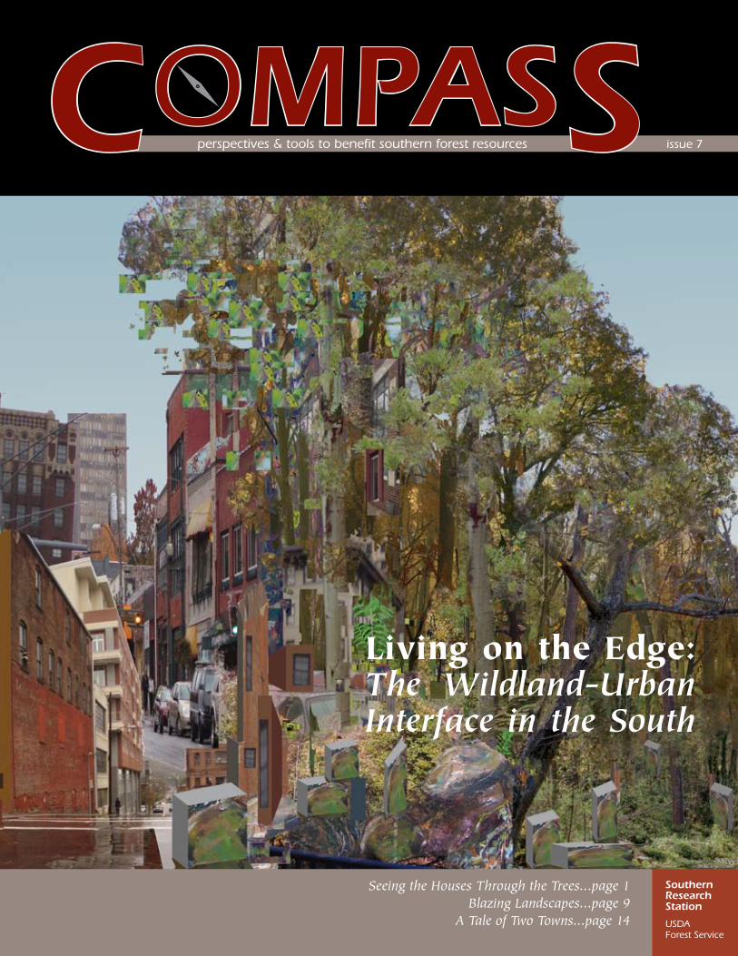
COMPASS perspectives&toolstobenefitsouthernforestresources issue7
Living on the Edge: The Wildland-Urban Interface in the South
Seeing the Houses Through the Trees...page 1Blazing Landscapes...page 9
A Tale of Two Towns...page 14
Southern Research Station
USDA ForestService
compass—december 2006�
inside... thescience
1 Seeing the Houses Through the Trees
by Annie Hermansen-Báez
Forests cover more than 60 percent of most Southern States. The areas where homes and forests or other natural areas intermingle are often referred to as the wildland-urban interface (WUI)—an “edgy” area that presents a host of issues and challenges for natural resource professionals, policymakers, and homeowners alike.
5 Life On the Edge by Joe Kays
9 Blazing Landscapes by Judy Bolyard Purdy
14 A Tale of Two Towns
by Cassandra Johnson
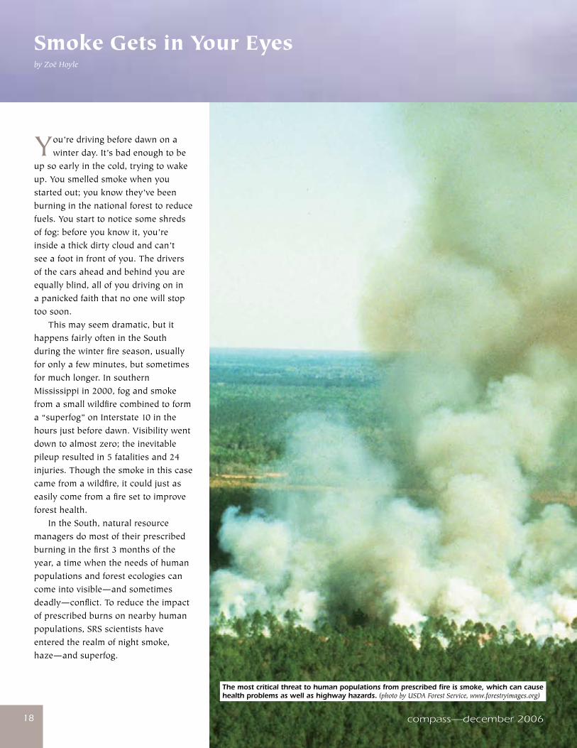
18 Smoke Gets in Your Eyes
by Zoë Hoyle
Growing up on California’s central coast, the world was a laboratory for Annie Hermansen-Báez, thanks in large part to her father, an elementary school teacher. Science writer Joe Kays interviews the center manager and technology transfer coordinator for the SRS Southern Center for Wildland-Urban Interface Research and Information.
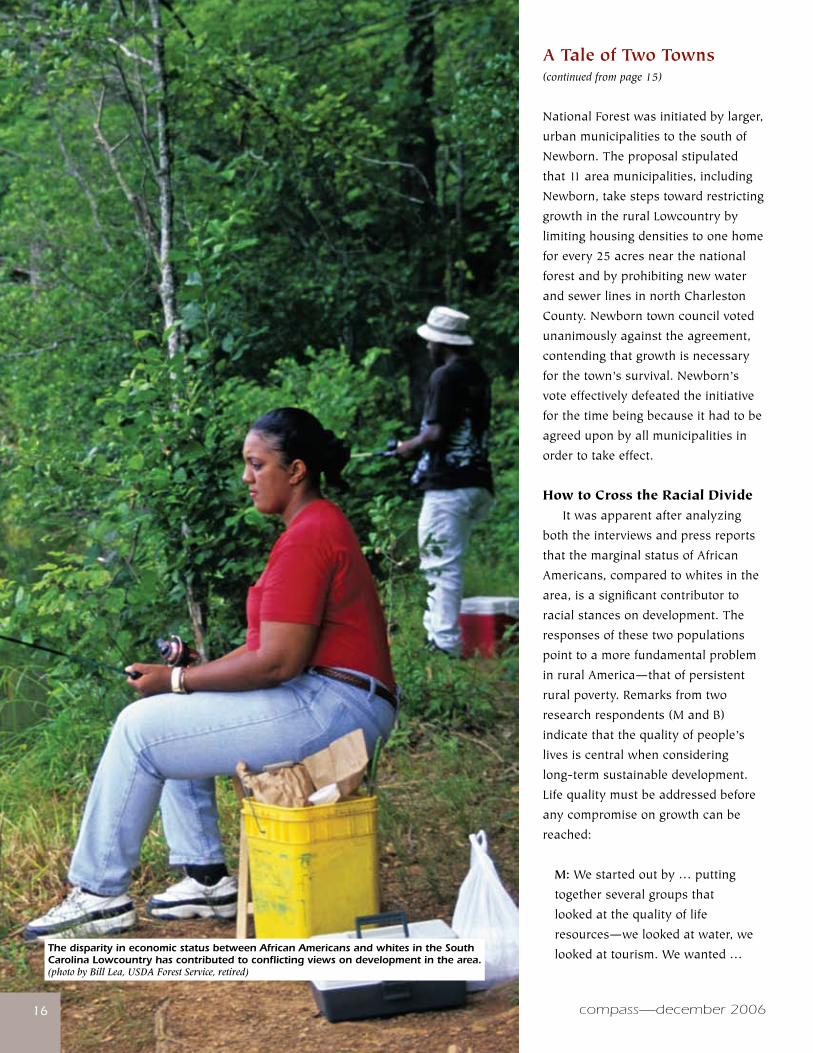
A good deal of research has examined the ecological impacts of sprawl; other work has looked at the social inequities created when middle-income residents abandon central cities, leaving lower income residents to deal with problems that typically accompany urban life. Far less scholarship compares acceptance of urban expansion in communities that are socioeconomically and racially separated.
Many newcomers to rural southern retreats have forgotten—or may have never known—that wildfires are as much a part of their new neighborhood landscapes as nature’s symphony at sunset. Idyllic hideaways perched atop a mountain or nestled in a pine forest may one day be in the path of a destructive wildfire caused by lightning or carelessness.
In the South, natural resource managers do most of their prescribed burning in the first 3 months of the year, a time when the needs of human populations and forest ecologies can come into visible—and sometimes deadly—conflict. To reduce the impact of prescribed burns on nearby human populations, SRS scientists have entered the realm of night smoke, haze—and superfog.
www.srs.fs.usda.gov �
32 Three Communities on the Edge
by Perdita Spriggs
Three SRS partnerships—with the University of Georgia, Auburn University, and American Forests—exemplify the strength of cooperation in solving natural resource issues that have crept over city limits.
24 Time to Burn: Getting a Step Ahead of Wildland Arsonists
by Zoë Hoyle
Arson is a leading cause of wildfire in several heavily populated States—Florida for one. SRS research has developed a model to help law enforcement agencies better predict where and when fires might be set in wildland areas—and design strategies to reduce the risk of arson.
28 Landscaping to Reduce Fire Risk
by Annie Hermansen-Báez
DEPARTMENTS
You probably weren’t thinking about wildfire when you landscaped your yard. If you live in a fire-prone area, you might want to think again. The good news is that SRS research can help you plant in a way to reduce the risk of fire reaching your home.
Landowner’s Toolbox ...................................................................................................................................................31
Recommended Reading .................................................................................................................................................34
Experimental Forests ....................................................................................................................................................36
Around the Station .......................................................................................................................................................38
New Products from the Southern Research Station ......................................................................................................40
Cover photo: The wildland-urban interface is not a finite edge, but rather one that meanders between the natural and manmade habitats of the South, as depicted in this painting by Asheville, NC artist Paul Olszewski.
Email: [email protected]: 828-257-4392Editors: Annie Hermansen-Báez, Technology Transfer Coordinator, Zoë Hoyle, Science Writer, and Claire Payne, Technical Information SpecialistArt Director: Rodney KindlundContributing Staff Writer: Perdita Spriggs
ThemissionoftheSouthernResearchStationistocreatethescienceandtechnologyneededtosustainandenhancesouthernforestecosystemsandthebenefitstheyprovide.
TheU.S.DepartmentofAgriculture(USDA)prohibitsdiscriminationinallitsprogramsandactivitiesonthebasisofrace,color,nationalorigin,age,disability,andwhereapplicable,sex,maritalstatus,familialstatus,parentalstatus,religion,sexualorientation,geneticinformation,politicalbeliefs,reprisal,orbecauseallorpartofanindividual’sincomeisderivedfromanypublicassistanceprogram.(Notallprohibitedbasesapplytoallprograms.)Personswithdisabilitieswhorequirealternativemeansfor
communicationofprograminformation(Braille,largeprint,audiotape,etc.)shouldcontactUSDA’sTARGETCenterat(�0�)7�0-�600(voiceandTDD).
Tofileacomplaintofdiscrimination,writetoUSDA,Director,OfficeofCivilRights,�400IndependenceAvenue,SW,Washington,D.C.�0�50-94�0,orcall(800)795-��7�(voice)or(�0�)7�0-6�8�(TDD).USDAisanequalopportunityproviderandemployer.
The use of trade or firm names in this publication is for reader information and does not imply endorsement by the U.S. Department of Agriculture of any product or service.
The opinions and recommendations offered by guest authors and interviewees are not necessarily those of the U.S. Department of Agriculture, the Forest Service, or the Southern Research Station.
ISSN: 1931-4906
Printed on recycled paper Printed with soy ink
COMPASSScience You Can Use!
December 2006 — Issue 7perspectives and tools to benefit southern forest resources
CoMPASS is published quarterly by the Science Delivery Group of the Southern Research Station (SRS), USDA Forest Service. As part of the Nation’s largest forestry research organization—USDA Forest Service Research and Development—SRS serves 13 Southern States and beyond. The Station’s 130 scientists work at more than 20 units located across the region at Federal laboratories, universities, and experimental forests.
Future issues can be obtained by returning the postcard included in this issue.
www.srs.fs.usda.gov
compass—december 20064 compass—december 2006
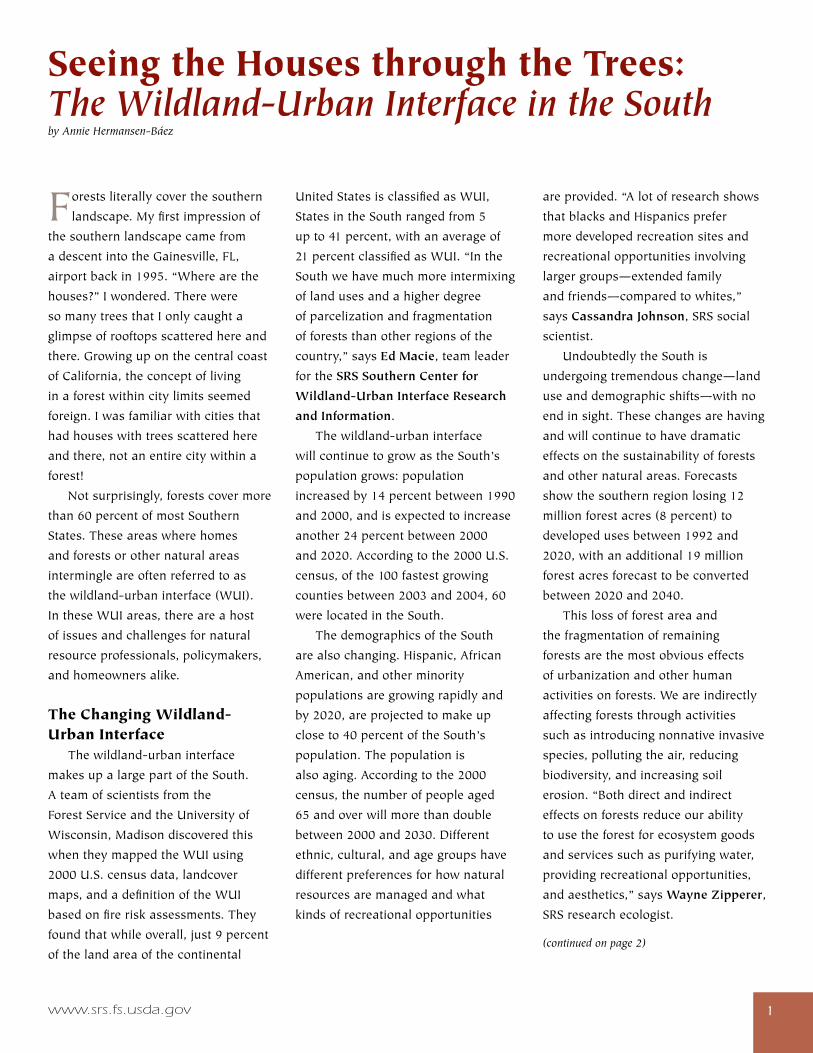
What is the Wildland-Urban Interface? Fromaspatialorgeographicalperspective,manydifferenttypesofwildland-urbaninterface(WUI)havebeendefined.Onetypeistheclassic interface,whereurbansprawlpressesupagainstpublicandprivatenaturalareas,bringingtomindadistinctlinebetweenurbanandruralareas.Theintermixreferstoareasundergoingatransitionfromagriculturalandforestusestourbanlanduses.Theisolated interfaceismadeupofstructuresinterspersedinremoteareas,suchassummerandrecreationhomes,ranches,andfarmsthataresurroundedbylargeareasofvegetation.Andthereareinterface islandswithinpredominantlyurbanareas,islandsofundevelopedlandthatareleftascitiesgrowtogetherandcreateremnantforests. Wildland fireattractsthepublic’sattention,perhapsmorethananyotherWUIissue,andimagesofcommunitiesinflamesontheoutskirtsofcitiesareoftenusedtodepicttheinterface.Onanindividualhomeownerscale,theWUIcanbethoughtofasanareawherehuman-madeinfrastructureisinoradjacenttoareaspronetowildfire.Onacommunityscale,theinterfacecanbethoughtofasanareawhereconditionscanmakeacommunityvulnerabletoawildlandfiredisaster. Fromasociopoliticalperspective,theinterfacecanbethoughtofasaplaceofinteractionbetweendifferentpoliticalforcesandpotentiallycompetinginterests.Itisparticularlyintheinterface—wherepeopleareincloserthanusualcontactwithnaturalresourcemanagement—thatpublicattitudes,values,andperceptionsaffectthewaythatthoseresourcescanbemanagedandconserved.Thisperspectivealsoincludesthewaythediversecultural,ethnic,andagegroupsthatcomprisetheSouth’spopulation—andtheiroftenverydifferentvaluesandattitudesregardingforestsandothernaturalareas—affecthowresourcescanbemanagedandusedintheinterface. One type of wildland-urban interface is the isolated interface, where second homes are
scattered across remote areas. (photo by Larry Korhnak, University of Florida)
www.srs.fs.usda.gov ��
Forestsliterallycoverthesouthern
landscape.Myfirstimpressionof
thesouthernlandscapecamefrom
adescentintotheGainesville,FL,
airportbackin1995.“Wherearethe
houses?”Iwondered.Therewere
somanytreesthatIonlycaughta
glimpseofrooftopsscatteredhereand
there.Growinguponthecentralcoast
ofCalifornia,theconceptofliving
inaforestwithincitylimitsseemed
foreign.Iwasfamiliarwithcitiesthat
hadhouseswithtreesscatteredhere
andthere,notanentirecitywithina
forest!
Notsurprisingly,forestscovermore
than60percentofmostSouthern
States.Theseareaswherehomes
andforestsorothernaturalareas
intermingleareoftenreferredtoas
thewildland-urbaninterface(WUI).
IntheseWUIareas,thereareahost
ofissuesandchallengesfornatural
resourceprofessionals,policymakers,
andhomeownersalike.
The Changing Wildland-Urban Interface Thewildland-urbaninterface
makesupalargepartoftheSouth.
Ateamofscientistsfromthe
ForestServiceandtheUniversityof
Wisconsin,Madisondiscoveredthis
whentheymappedtheWUIusing
2000U.S.censusdata,landcover
maps,andadefinitionoftheWUI
basedonfireriskassessments.They
foundthatwhileoverall,just9percent
ofthelandareaofthecontinental
Seeing the Houses through the Trees: The Wildland-Urban Interface in the Southby Annie Hermansen-Báez
UnitedStatesisclassifiedasWUI,
StatesintheSouthrangedfrom5
upto41percent,withanaverageof
21percentclassifiedasWUI.“Inthe
Southwehavemuchmoreintermixing
oflandusesandahigherdegree
ofparcelizationandfragmentation
offoreststhanotherregionsofthe
country,”saysEd Macie,teamleader
fortheSRS Southern Center for
Wildland-Urban Interface Research
and Information.
Thewildland-urbaninterface
willcontinuetogrowastheSouth’s
populationgrows:population
increasedby14percentbetween1990
and2000,andisexpectedtoincrease
another24percentbetween2000
and2020.Accordingtothe2000U.S.
census,ofthe100fastestgrowing
countiesbetween2003and2004,60
werelocatedintheSouth.
ThedemographicsoftheSouth
arealsochanging.Hispanic,African
American,andotherminority
populationsaregrowingrapidlyand
by2020,areprojectedtomakeup
closeto40percentoftheSouth’s
population.Thepopulationis
alsoaging.Accordingtothe2000
census,thenumberofpeopleaged
65andoverwillmorethandouble
between2000and2030.Different
ethnic,cultural,andagegroupshave
differentpreferencesforhownatural
resourcesaremanagedandwhat
kindsofrecreationalopportunities
areprovided.“Alotofresearchshows
thatblacksandHispanicsprefer
moredevelopedrecreationsitesand
recreationalopportunitiesinvolving
largergroups—extendedfamily
andfriends—comparedtowhites,”
saysCassandra Johnson,SRSsocial
scientist.
UndoubtedlytheSouthis
undergoingtremendouschange—land
useanddemographicshifts—withno
endinsight.Thesechangesarehaving
andwillcontinuetohavedramatic
effectsonthesustainabilityofforests
andothernaturalareas.Forecasts
showthesouthernregionlosing12
millionforestacres(8percent)to
developedusesbetween1992and
2020,withanadditional19million
forestacresforecasttobeconverted
between2020and2040.
Thislossofforestareaand
thefragmentationofremaining
forestsarethemostobviouseffects
ofurbanizationandotherhuman
activitiesonforests.Weareindirectly
affectingforeststhroughactivities
suchasintroducingnonnativeinvasive
species,pollutingtheair,reducing
biodiversity,andincreasingsoil
erosion.“Bothdirectandindirect
effectsonforestsreduceourability
tousetheforestforecosystemgoods
andservicessuchaspurifyingwater,
providingrecreationalopportunities,
andaesthetics,”saysWayne Zipperer,
SRSresearchecologist.
(continued on page 2)
compass—december 2006��
Seeing the Houses Through the Trees(continued from page 1)
Landusepolicyandplanning
decisionshaveanimmenseinfluence
onnaturalresourceissuesinthe
WUI.Lackofvisionandlittleorno
planningandregionalcoordinationfor
comprehensivegrowthmanagement
aremajorfactorscontributingto
interfaceproblemsacrosstheSouth.
Currentlandusepoliciesaredifficult
toimplementacrossFederal,State,
andlocaljurisdictions,whichoften
overlap.Asaresult,variouslevelsof
governmentmakelandusedecisions
independentlyofandofteninconflict
witheachother.Additionally,inmany
SouthernStatesthelocalgovernments
havelimitedauthoritytoplanand
controldevelopment.Zoningand
landuseplansareoftennotenforced
andwaiversareroutinelygranted.
“Weneedtounderstandmoreabout
howlandusepolicyaffectsnatural
resourcesandtheroleofnatural
resourcesinmitigatingtheunintended
consequencesofurbanization,”says
Macie.“Thisunderstandingwillenable
localpolicymakerstomakedecisions
thatwillsupportnature’srolein
providingclearairandwater,andin
creatingmorelivableenvironments.”
With Benefits Come Challenges and Risks Hurricanesareanothermajorrisk
affectingtheSouth.Mostnotably,
HurricaneKatrinahittheGulfCoastin
2005withmaximumsustainedwinds
upto125milesperhour,becoming
thecostliestandoneofthedeadliest
naturaldisastersinU.S.history.
Besidescausinggreatrisktohumans
andproperty,hurricanescanhave
devastatingaffectsonforestsinurban
andurbanizingareas.Urbanforest
lossesfromhurricanesrangedfrom11
to38percentbetween1992and2004.
Althoughfallingtreesarethoughtto
beabigsafetyconcernforresidents
inareasaffectedbyhurricanes,only
about10percentofthedamageto
homescomesfromfallentrees;trees,
especiallythoseinclusters,may
actuallyshelterhomesfromthewind
iftheyarehealthyandwindresistant.
Largeamountsofdownedwoody
debrisfromhurricanescanposea
firerisk.Westillhavemuchtolearn
abouttheeffectsofhurricanesand
othernaturaldisturbancesonnatural
resourcesandtheecologicalservices
theyprovide,aswellasthevalueof
lostecologicalservices.
Managingforwildlifeisalsofar
morecomplexintheinterfacethanin
ruralareas.Manyofusenjoyviewing
wildlifeandgotogreatlengthsto
attractwildlifenearourhomes.Until,
thatis,theymunchonthoseflowers
wejustplantedinourbackyardordig
upthenewlyplantedtomatoplantsin
thoseplantersonourdeck.Managing
wildlifeintheseinterfaceareasbrings
manychallengesandopportunities.
Resolvingnuisancewildlifeconflicts,
providingopportunitiesforboth
huntingandviewingofwildlife,and
conserving,managing,andrestoring
wildlifehabitatinthefaceofmounting
developmentpressuresarebutafew.
Recreationplannersfacethe
challengeofprovidinghigh-quality
experienceswhilesustainingthe
qualityofnaturalresourcesonan
ever-shrinkinglandbase.Theymust
alsobeabletocommunicatewiththe
widerangeofrecreationuserswho
havedifferentculturalbackgrounds
andvaluesystemsfromwhathasbeen
compass—december 2006
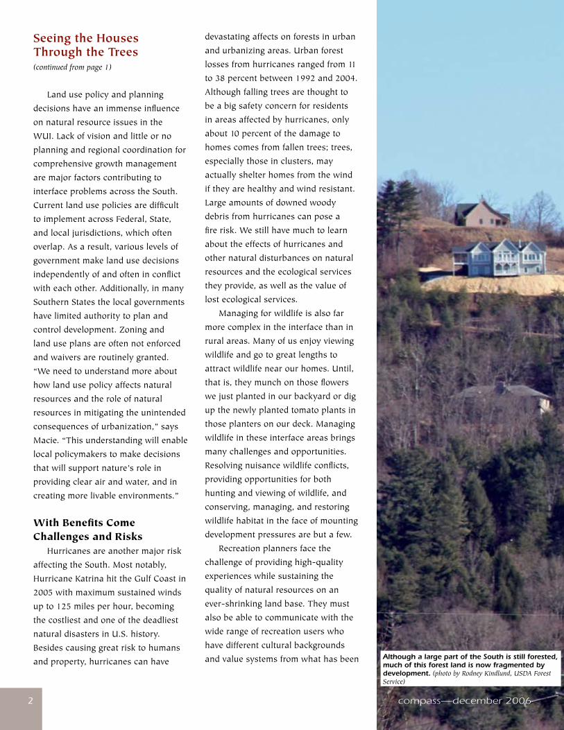
Although a large part of the South is still forested, much of this forest land is now fragmented by development. (photo by Rodney Kindlund, USDA Forest Service)
www.srs.fs.usda.gov ��
thenorm.Asforestrecreationdemand
increases,thereismorepotentialfor
conflictbetweendifferentrecreation
usergroupsusingthesameareas.
All-terrainvehicleriders,forexample,
arelikelytoclashwithhikersoverhow
backcountryareasshouldbeused.
Urbanizationisthemostpressing
landuseissueaffectingwaterquality
andquantity.Thegrowingpopulation
oftheSouthisdemandingever-
largerwatersupplies.Withthis
growingdemandcomesthechallenge
ofassuringfairallocationofwater
suppliesforbothhumanpopulations
andforwildlifeandaquaticspecies
habitat.Nonpoint-sourcepollution
isalsoamajorconcern;sourcesare
widelydispersedacrossthelandscape
andaredifficulttopinpointor
regulate.
A New Way of Doing Business IntheSouth,over90percentof
forestedlandisheldbynonindustrial
privatelandowners.Themajority
oftheseowners(94percent)own
lessthan100acres.Manyarenew
ownerswhobringwiththemdiverse
perceptionsofforestlandsandhow
theyshouldbemanaged.Wecanno
longerassumethatforestlandowners
seetimberastheprimaryreasonfor
owningforests;ownersofsmallforests
tendtoemphasizeamenity,identity,
lifestyle,andecologicalreasonsfor
forestownership.“Incomefromforest
productsisimportant,butwaydown
thelist,”saysBruce Hull,professor
atVirginiaPolytechnicInstituteand
StateUniversityandSRScollaborator.
“Interfacelandownersdependon
forestproductsforlessthan5percent
oftheirincome.”
Additionallymanyofthese
landownersarepoliticallyconnected
Human Influences on Forest Ecosystems: The Southern Wildland-Urban Interface Assessment
In1998,Floridawildfiresdemonstrated
thecomplexitiesofnaturalresource
managementinthewildland-urban
interface(WUI).Shortlyafterthese
fires,theChiefoftheForestService
conductedareviewoftheSouthand
identifiedtheWUIasoneofthemain
challengesfortheForestService.
Inresponse,theSouthernResearch
StationandtheForestService’s
SouthernRegion,incooperation
withtheSouthernGroupofState
Foresters,conductedanassessment
toidentifyandbetterunderstand
factorsdrivingsocialandecological
changeswithintheWUI,aswellasthe
consequencesofsuchchanges.The
resultingassessment,Human Influences
on Forest Ecosystems: The Southern
Wildland-Urban Interface Assessment,
wascompletedin2002.Thepurpose
oftheassessmentwastoprovide
thefoundationforestablishingan
interdisciplinaryprogramofresearch
andtechnologytransferwithinthe
ForestService.
Theassessmentcanbeordered
fromtheInterfaceSouthWebsiteat:
www.interfacesouth.org/products/
publications.html?results=10.
andrepresentapowerfulforce
affectingfundingandinstitutional
policies.Asnaturalresource
professionals,weneedtoadaptto
thischangingclientele.“Manynew
opportunitiesexistforforestryand
foresters,”saysHull,“butweneedto
thinkdifferentlybecauseourclients
andoureconomyarenowdifferent.”
Todothis,weneedtoapply
newskillsandtools.Techniquesfor
managingforestsonsmallerscales
andformultipleobjectivesare
importantinthefragmentedinterface.
Manythreatstoforesthealth,such
assouthernpinebeetleinfestations,
canonlybeproperlycontrolled
withcoordinatedmanagement
amongmultipleowners.Information
abouthowtoprotecttreesduring
constructionandlanddevelopment
andhowtoworkasateamwiththe
variousprofessionsinvolvedisalso
importantforforestersworkingin
areasundergoinglandusechange.
Foresterscannolongerexpectto
justworkaloneinthewoods.The
abilitytocommunicateeffectivelyis
anincreasinglyimportantpartofa
naturalresourceprofessionals’job.
Theabilitytotranslateforestryand
othernaturalresourceinformation
intotermsthepublicisfamiliarwithis
importantforbuildingunderstanding
andacceptanceofnaturalresource
practicesandenvironmental
processes.“Peopleworkinginthe
interfaceneedpeopleskills:patience,
problemsolving,listening,and
aprocessofdoingbusinessthat
istransparentandempowering,”
saysMartha Monroe,professorat
theUniversityofFloridaandSRS
collaborator.
(continued on page 4)
compass—december 200644
Seeing the Houses Through the Trees(continued from page 3)
Landwillcontinuetobedeveloped,
sowemustbeawareofthechanges
broughtaboutbyurbanization
andunderstandthediverseissues,
challenges,andopportunitiesin
thechangingenvironmentofthe
wildland-urbaninterface.Inthe
South,theareaofthecountrywhere
populationisgrowingmostrapidly,
tryingtounderstand—letalone
manage—thefutureofforestscan
seemoverwhelming.Thegoodnews
isthatpeopleacrosstheSouth—
fromagencies,nonprofits,industry,
individualvolunteers—arecoming
upwithwaystoovercomeinterface
challengeswithuniquesolutions.
Inthefollowingpages,wewilllook
atwhatSRSresearchersand
theircollaboratorsaredoingtopredict
andreducetherisksofwildfire,help
resourcemanagerschartwhere
thesmokefromprescribedburning
goesandwherearsonistsarelikely
tostrike,determinetherelationship
betweenlandusepoliciesandforest
canopy,andunderstandtheeffects
ofurbanizationandnaturaldisturb-
ancessuchashurricanesonnatural
resources.Youwillalsolearnabout
trainingandoutreachprograms
thatarehelpingnaturalresource
professionalsandotherstobebetter
preparedtoworkintheinterface.
Onarecentflightoutof
Gainesville,Ipeeredoutofthewindow
attheforestsinterspersedwithhomes
andbusinessesandthoughttomyself,
“THEREarethehouses!”
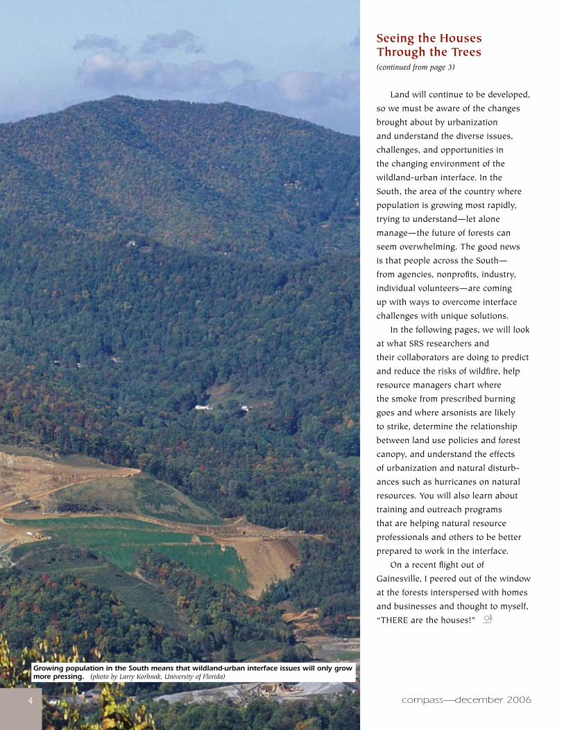
Growing population in the South means that wildland-urban interface issues will only grow more pressing. (photo by Larry Korhnak, University of Florida)
www.srs.fs.usda.gov 55
GrowinguponCalifornia’scentralcoast,theworldwasalaboratory
forAnnie Hermansen-Báez,thanksinlargeparttoherfather,anelementaryschoolteacher. “Wheneverwewentanywherehewasalwayspointingoutthingsaboutthenaturalworldtomeandmytwobrothers,whetherwewantedtohearaboutitornot!”Hermansen-Báezsays.“WecampedalloverCaliforniaandlivedoutinthecountryformanyyears.MybrothersandIalwayshadsnakesandlizardsaspets,alongwithmanydogs,cats,chickens,andgeese.” AfterearningadegreeinbiologyfromtheUniversityofCalifornia,SantaCruzin1991,Hermansen-BáezjoinedthePeaceCorpsandspent3yearsinParaguayteachingsubsistencefarmersaboutagroforestrysystems,cropdiversification,andsoilconservationtechniques;helpingthemconstructsoilerosionbarriersandutilizegreenmanures;andsharingtreenurseryandorganicvegetablegardeningpractices. BasedonherPeaceCorpsexperience,Hermansen-BáezdecidedtogobacktoschoolinforestryattheUniversityofFlorida(UF).In1998,theyearshecompletedhermaster’s,Floridawildfiresscorched500,000acresandcausedmorethan$600millionindamage,promptingtheChiefoftheForestServiceandtheDirectoroftheSouthernResearchStationtocommissionanassessmentofthewildland-urbaninterfaceintheSouth. Hermansen-Báezspentthenext3yearscollaboratingonthatassessmentwithEd Macie,theForestService’sregionalurbanforester,theninearly2002helpedestablishthe
Life on the Edgeby Joe Kays
Southern Center for Wildland-Urban Interface Research and InformationinGainesville,FL.Hermansen-Báezhastwotitlesthesedays—centermanagerandtechnologytransfercoordinator—butshedescribesherselfasafacilitatorbetweenthescientistsandthecenter’sclients,whoincludenaturalresourceprofessionals,privateforestlandowners,planningdepartments,localpolicymakers,andothers. WecaughtupwithHermansen-Báezatthecenter’sofficesontheshoreofUF’sLakeAlice,itselfanaturaloasisinthemiddleofoneoftheNation’slargestuniversities.Lookingaroundheroffice,weseeevidenceofmanytravelstoSouthAmerica,amongthemphotosofherhusbandandtwosons.
You are a strong promoter of multiculturalism, aren’t you? Weareamulticulturalfamily,soIthinkit’sveryimportantthatmychildrenlearnabouttheworldaroundthem.ImetmyhusbandwhileIwasinthePeaceCorps.HeisfromtheareawhereIworkedinParaguay.WemovedtoGainesvillein1995,gotmarried,andnowwehavetwochildren.WespeakSpanishand
evenGuarani,thenativelanguageofParaguay,inourhomeandwetrytogobacktoParaguayatleasteverycoupleofyears.
How do think your background prepared you for the work you’re doing today? BothasavolunteerinthePeaceCorpsinParaguayandasastudentinatropicalbiologycourseinCostaRica,Icametorealizethatyoucouldn’tseparatenaturalresourceissuesfrompeopleissues.IreallywantedtoworkinacareerinwhichIcouldcombinethosetwoissues.ThatcontinuedwhenIwasworkingonmymaster’sdegree.FormythesisIstudiedtheseedgerminationofatreespeciesfromtheBraziliansavannah.Brazilianfarmersselltheseedpodstoapharmaceuticalcompanywhothenextractamedicinalcompound.Ialsolookedathowincomefromsellingtheseedpodsfitsintothewholesocioeconomicstructureofthearea.
How has the center’s mission evolved since its inception? Inthefirearena,theconceptofthewildland-urbaninterfacehasbeenaroundforawhile,butonlyinthelast5yearshasitreallytakenoffasaterm
(continued on page 6)
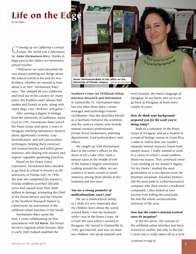
Annie Hermansen-Baéz in her office on the University of Florida campus. (photo by Joe Kays)

compass—december 200666
Life on the Edge(continued from page 5)
usedoutsideoffire.We’retryingtomakepeoplethinkabouttheinterfaceasmuchbroaderthanjustfireandtoincludearangeofissuesrelatedtotheeffectsofurbanizationonnaturalresources.Youcan’tthinkaboutfirewithoutthinkingaboutlanduseplanning,forexample.They’reallconnected.
What has been your greatest challenge? Thedemographicsofpeoplelivinginandclosetoourforestshavechangeddramaticallyinrecentyears.Theaveragelandtractsizeisgoingdownandthenumberoflandownersisgoingup.Alotofthesepeoplehaveanegativeimageofforestrybecausetheydon’tknowmuchaboutforestmanagement.Soweintheforestrycommunityhavehadtospendtimeworkingonourimagewiththegeneralpublic.Wetrytohelpthemunderstandthatforestsarearenewableresourceandthateveryonewillbenefitifwemaintainlandinforests—beitplantationsornaturalforeststands. We’vealsohadtoadaptourtrainingmethodsforforesters.Inthepast,forestersweren’ttrainedtoworkwiththediversegroupofpeoplethatyoufindintheinterfacenow,sowe’respendingalotoftimeonprofessionaldevelopment,retrainingourforestryprofessionalstoworkwithdifferenttypesofforestusersanddifferentmanagementobjectives.We’realsoworkingwiththeforestryschoolhereatUFtoteachfutureforestersaboutworkinginthisnewenvironment,incorporatingmoreinterfaceconceptsintothecurriculum. Anotherchallengeiscommuni-cation.Historically,forestryhasnotmarketeditselfverywell.IfyoulookattheoldForestServicepublications,
Interface challenges mean new training methods for foresters. (photo by Larry Korhnak, University of Florida)
www.srs.fs.usda.gov 77
they’reoftenlackingcolorandillustrationsandtendtoreachalimitedaudience.We’retryingtomakeourproductslookmoreinterestingandwe’remakingthemavailableinmultipleformatssowecanreachawideraudience.
What are some of the center’s most promising areas of research? We’redoingalotofresearchrightnowonplantandmulchflammability.Fireprofessionalswantguidancesotheycanadvisepeoplewholiveintheinterfacewhattheycanplantaroundtheirhomes.We’vedevelopedaseriesoffactsheetsaboutfireinthewildland-urbaninterfacetohelppeoplemaketheirhomesandsurroundinglandscapesmorefirewise. WerecentlystartedastudyonhowurbanizationwillaffecttheforestecosystemsandhumancommunitiesoftheFloridaPanhandle,anareathatisbeginningtoseerapidlandusechange.Wetrytogivepeopleinformationtheycanusetomakesounddecisions.Peopleneedtoknowwhattheconsequencesmightbesothattheycanmakeinformeddecisions. We’realsogettingintothewholebiomassarea.Becauseofenergyconcerns,biomassasapotentialfuelispopularrightnow,andtherearealotofwoodybiomasssourcesintheinterface,everythingfromurbanwoodwastetohurricanedebris.TheUFisreallytakingaleadindevelopingalternativefuels,sothereisalotofopportunityforcollaboration.
In the best-case scenario, what would the wildland-urban interface look like in a place like Florida? It’stoughtosayexactlywhatitwouldlooklike,butourphilosophyisthatsincelandusechangeisgoingtohappen,itcanhappenbestwith
(continued on page 8)
TheSRSSouthernCenterfor
Wildland-UrbanInterfaceResearch
andInformation(WUICenter)was
openedinGainesville,FL,inJanuary
2002.ActivitiesoftheWUICenter
representanimmediateForestService
responsetocriticalfindingsofthe
Southern Wildland-Urban Interface
AssessmentandtheSouthern Forest
Resource Assessment,whichboth
identifiedurbanizationasthebiggest
threattosouthernforests.
Thoughinitiallyfocusedon
researchandtechnologytransfer
neededtoaddressfireinthewildland-
urbaninterface(WUI)intheSouth,
theWUICenterhasexpandedits
focustoincludearangeofissues
relatedtotheurbanizationofsouthern
forests,suchashowecosystemsand
disturbanceregimesarealteredby
humaninfluences;subsequentrisksto
humanandnaturalcommunities;and
therelationshipoflandusepoliciesto
ecologicalprocessesanddisturbances
intheinterface.
Themissionofthecenter
istodevelopandcommunicate
guidelines,models,andtoolsneeded
bynaturalresourcemanagers,
policymakers,planners,andcitizens
toreduceriskstoecosystemsand
humancommunitiesinurban
andurbanizinglandscapes.The
center’stechnologytransferprogram
focusesondisseminatingnewand
existinginformation,servingasa
clearinghouseofWUIinformation,
buildingpartnershipsandcollaborative
effortsandapproaches,andfacilitating
andcreatinglinkages.
TheSouthernWildland-Urban
InterfaceCouncil(SWUIC),achartered
counciloftheSouthernGroupofState
Foresters,istheadvisorycouncilfor
theWUICenter.SWUIChelpsguide
thetechnologytransferactivitiesofthe
WUICenterandassistsinidentifying
researchneeds.Thisguidance
helpsensurethattheresearchand
technologytransferproductsofthe
WUICentermeettheneedsoftheir
stakeholders.
TheWUICenter’sWebsite,
InterfaceSouth(www.interfacesouth.
usda.govorwww.interfacesouth.
org), haspublications,trainingand
outreachprograms,decisionsupport
systems,aliteraturedatabase,aphoto
gallery,currentWUInewsandevents,
andmuchmore.Youcanalsosign
upfortheSouthernWildlandUrban
InterfaceNetworklistservfromthe
WebsiteandreceivetheInterfaceSouth
Update,anelectronic,monthlybulletin
aboutcriticalWUIissues,andthe
InterfaceSouth Post,whichcontains
currentinterfaceinformation,suchas
upcomingconferencesornewsarticles,
sentoutonaweeklybasis.
For more information:AnnieHermansen-Báezat 352–376–[email protected]
The Southern Center for Wildland-Urban Interface Research and Information
compass—december 200688
Life on the Edge(continued from page 7)
planningthattakesintoconsiderationthesuitabilityofsitesforthedevelopmentproposedforthem.Wealsoneedtothinkaboutreducingriskstohumansandforestecosystemsfromeventssuchasfires,floods,andhurricanes.
There’s a certain irony in the fact that your offices are adjacent to a wildland island, isn’t there? Itisinterestingtohaveourofficerightnexttoaninterfacebetweenpeopleandwildlife.Inthespringwehadasandhillcranecouplewithtwoyoungchickswanderingaroundourbuilding,knockingonthedoorswiththeirbeaks.Weoftenfindturtlesonourfrontdoorstep,whichwepromptlyreturntoLakeAlice.We’veevenseenbaldeaglesandhawksinthevicinity.AndwearerightontheUFcampusintheheartofGainesville. Itgoestoshowthatyoucanhaveawildland-urbaninterfacejustaboutanywhere!Peopleoftenthinkofthewildland-urbaninterfaceasbeingontheedgesofcitiesortowns.Buttheinterfaceismoreofaconditionthananexactplace—it’swherethereareamixofelementscomingtogetherinonelocation,suchasthewildlifeandhumaninteractionswehavehere,orhousingsetinalandscapemanagedforbothfireresistanceandaesthetics.IloveworkinginaplacewhereIcanwalkoutthedoorandstepintothatwildland-urbaninterface.Ithinkmostofuswouldprefertoworkandliveinaplacelikethis—thechallengeismakingitsafeandsustainableforboththehumansandwildlife.
Joe Kays is a freelance science writer and editor of Explore, the research magazine for the University of Florida.
In1997,theSRS Southern Center for Urban Forestry Research & Information (UF Center)wasformedtodirecturbanforestryresearchandprovidetechnologytransferwithintheSouthernRegiontoaddresspressingissuesincludingchanginglandusepatterns,increasedurbanization,lossofforestcanopy,andchangingdemographics.TheUFCenterandtheSRS Southern Center for Wildland-Urban Interface Research and Information workcloselytogetherandarenowbothpartofthesameSRSresearchworkunit. ThefocusoftheUFCenteristohelpcommunitiesandlandownersaddressabroadspectrumofsouthernurbannaturalresourceissues—fromthecitycentertothenationalforests—withafocusonthehumandimension.TheUFCenterisacooperativeeffortthatintegratesForestServiceResearch,StateandPrivateForestry,andtheNationalForestSystem.TheUFCenteralsoworkscloselywithuniversities,Stateforestryagencies(urbanandcommunityforestryprograms),cooperativeextensionservices,nonprofitorganizations,andothers. UFCenterresearchfocusesontopicssuchasurbanexpansionanddemographicshiftsandtheireffects;theroleurbanforestsplayinimprovingthelivability,healthiness,andprosperityofurbanneighborhoods;theeconomicvalueoftreesandurbanforestsinsoutherncities;theeffectivenessofurbanforestmanagementanddesignoptionsforimprovingurbanneighborhoodsandcommercialareas;andtherole
The Southern Center For Urban Forestry Research & Information
urbanforestsmayplayincarbonsequestration. TheUFCenter’stechnologytransferprogramfocuseson: •identifyingresearchandinformationneedsofcustomers; •communicatingresearchresultsandotherinformationwithcustomersthroughpublications,conferences,workshops,andotherresources; •facilitatingtheexchangeofinformationamongandbetweenresearchers,practitioners,andothersinvolvedwithurbanforestry; •providingtechnicalassistancetoStateurbanandcommunityforestryprograms;and •assistingwiththedevelopmentofstormdamageassessmentandpoststormurbanforestassessments. TheUFCenter’sWebsite,UrbanForestrySouth(www.urbanforestrysouth.org),wasdevelopedcollaborativelywiththesouthernregionalextensionforesterandtheUniversityofGeorgia,SchoolofForestry&NaturalResources.TheWebsitehasavarietyofurbanforestryresources,suchasadocumentlibrary,treeordinances,classroomactivities,presentations,andmuchmore.Youwillalsofindasectionongrantannouncementsandotherfundingopportunities,jobannouncements,andanurbanforestrymanual.
For more information:DudleyHartelat706–559–[email protected].
www.srs.fs.usda.gov 99
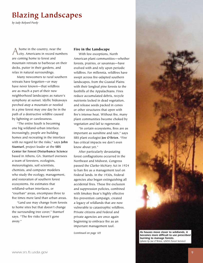
Ahomeinthecountry,nearthecity.Americansinrecordnumbers
arecominghometoforestandmountainretreatstobarbecueontheirdecks,putterintheirgardens,andrelaxinnaturalsurroundings. Manynewcomerstoruralsouthernretreatshaveforgotten—ormayhaveneverknown—thatwildfiresareasmuchapartoftheirnewneighborhoodlandscapesasnature’ssymphonyatsunset.Idyllichideawaysperchedatopamountainornestledinapineforestmayonedaybeinthepathofadestructivewildfirecausedbylightningorcarelessness. “TheentireSouthisbecomingonebigwildland-urbaninterface.Increasingly,peoplearebuildinghomesandrecreatingintheinterfacewithnoregardfortherisks,”saysJohn Stanturf,projectleaderattheSRS Center for Forest Disturbance SciencebasedinAthens,GA.Stanturfoverseesateamofforesters,ecologists,meteorologists,soilscientists,chemists,andcomputermodelerswhostudytheecology,management,andrestorationofsouthernforestecosystems.Heestimatesthatwildland-urbaninterfaces,or“exurban”areas,encompassthreetofivetimesmorelandthanurbanareas. “Landusemaychangefromforeststohomesitesbutthatdoesn’tchangethesurroundingtreecover,”Stanturfsays.“Thefireriskshaven’tgoneaway.”
Blazing Landscapesby Judy Bolyard Purdy
Fire in the Landscape Withfewexceptions,NorthAmericanplantcommunities—whetherforests,prairies,orsavannas—haveevolvedwithandrelyuponperiodicwildfires.Formillennia,wildfireshavesweptacrossfire-adaptedsouthernlandscapes,fromtheCoastalPlainswiththeirlongleafpineforeststothefoothillsoftheAppalachians.Firesreduceaccumulateddebris,recyclenutrientslockedindeadvegetation,andreleaseseedspackedinconesorotherstructuresthatopenwithfire’sintenseheat.Withoutfire,manyplantcommunitiesbecomechokedbyvegetationandfailtoregenerate. “Incertainecosystems,firesareasimportantassunshineandrain,”saysSRSplantecologistJoe O’Brien.“Firehascriticalimpactswedon’tevenknowaboutyet.” AfterparticularlydevastatingforestconflagrationsoccurredintheNortheastandMidwest,CongresspassedtheClarke-McNaryActin1924tobanfireasamanagementtoolonFederallands.Inthe1930s,Federalagenciesalsobeganextinguishingallaccidentalfires.Thesefireexclusionandsuppressionpolicies,combinedwithSmokeyBear’shighlyeffectivefire-preventioncampaign,createdalegacyofwildlandsthatarenowvulnerabletocatastrophicwildfires.PrivatecitizensandFederalandprivateagenciesareonceagainbeginningtoembracefireasanimportantmanagementtool.
(continued on page 10) As houses move closer to wildlands, it becomes more difficult to use prescribed burning to manage forests.(photo by Joe O’Brien, USDA Forest Service)
compass—december 2006�0�0 compass—december 2006
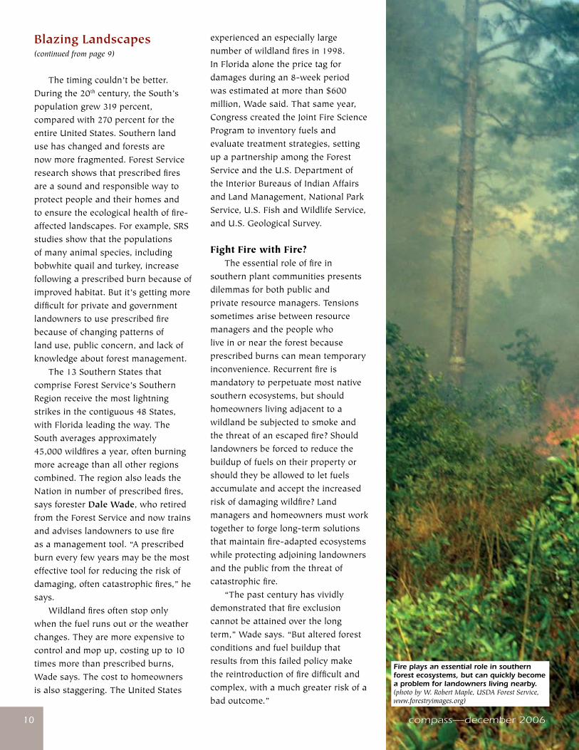
experiencedanespeciallylargenumberofwildlandfiresin1998.InFloridaalonethepricetagfordamagesduringan8-weekperiodwasestimatedatmorethan$600million,Wadesaid.Thatsameyear,CongresscreatedtheJointFireScienceProgramtoinventoryfuelsandevaluatetreatmentstrategies,settingupapartnershipamongtheForestServiceandtheU.S.DepartmentoftheInteriorBureausofIndianAffairsandLandManagement,NationalParkService,U.S.FishandWildlifeService,andU.S.GeologicalSurvey.
Fight Fire with Fire? Theessentialroleoffireinsouthernplantcommunitiespresentsdilemmasforbothpublicandprivateresourcemanagers.Tensionssometimesarisebetweenresourcemanagersandthepeoplewholiveinorneartheforestbecauseprescribedburnscanmeantemporaryinconvenience.Recurrentfireismandatorytoperpetuatemostnativesouthernecosystems,butshouldhomeownerslivingadjacenttoawildlandbesubjectedtosmokeandthethreatofanescapedfire?Shouldlandownersbeforcedtoreducethebuildupoffuelsontheirpropertyorshouldtheybeallowedtoletfuelsaccumulateandaccepttheincreasedriskofdamagingwildfire?Landmanagersandhomeownersmustworktogethertoforgelong-termsolutionsthatmaintainfire-adaptedecosystemswhileprotectingadjoininglandownersandthepublicfromthethreatofcatastrophicfire. “Thepastcenturyhasvividlydemonstratedthatfireexclusioncannotbeattainedoverthelongterm,”Wadesays.“Butalteredforestconditionsandfuelbuildupthatresultsfromthisfailedpolicymakethereintroductionoffiredifficultandcomplex,withamuchgreaterriskofabadoutcome.”
Blazing Landscapes(continued from page 9)
Thetimingcouldn’tbebetter.Duringthe20thcentury,theSouth’spopulationgrew319percent,comparedwith270percentfortheentireUnitedStates.Southernlandusehaschangedandforestsarenowmorefragmented.ForestServiceresearchshowsthatprescribedfiresareasoundandresponsiblewaytoprotectpeopleandtheirhomesandtoensuretheecologicalhealthoffire-affectedlandscapes.Forexample,SRSstudiesshowthatthepopulationsofmanyanimalspecies,includingbobwhitequailandturkey,increasefollowingaprescribedburnbecauseofimprovedhabitat.Butit’sgettingmoredifficultforprivateandgovernmentlandownerstouseprescribedfirebecauseofchangingpatternsoflanduse,publicconcern,andlackofknowledgeaboutforestmanagement. The13SouthernStatesthatcompriseForestService’sSouthernRegionreceivethemostlightningstrikesinthecontiguous48States,withFloridaleadingtheway.TheSouthaveragesapproximately45,000wildfiresayear,oftenburningmoreacreagethanallotherregionscombined.TheregionalsoleadstheNationinnumberofprescribedfires,saysforesterDale Wade,whoretiredfromtheForestServiceandnowtrainsandadviseslandownerstousefireasamanagementtool.“Aprescribedburneveryfewyearsmaybethemosteffectivetoolforreducingtheriskofdamaging,oftencatastrophicfires,”hesays. Wildlandfiresoftenstoponlywhenthefuelrunsoutortheweatherchanges.Theyaremoreexpensivetocontrolandmopup,costingupto10timesmorethanprescribedburns,Wadesays.Thecosttohomeownersisalsostaggering.TheUnitedStates
Fire plays an essential role in southern forest ecosystems, but can quickly become a problem for landowners living nearby. (photo by W. Robert Maple, USDA Forest Service, www.forestryimages.org)
www.srs.fs.usda.gov ����www.srs.fs.usda.gov
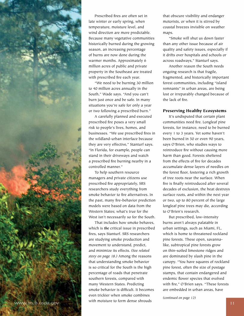
Prescribedfiresareoftensetinlatewinterorearlyspring,whentemperature,moisturelevel,andwinddirectionaremorepredictable.Becausemanyvegetativecommunitieshistoricallyburnedduringthegrowingseason,anincreasingpercentageofburnsarenowdoneduringthewarmermonths.Approximately6millionacresofpublicandprivatepropertyintheSoutheastaretreatedwithprescribedfireeachyear. “Weneedtobeburning30millionto40millionacresannuallyintheSouth,”Wadesays.“Andyoucan’tburnjustonceandbesafe.Inmanysituationsyou’resafeforonlyayearortwofollowingaprescribedburn.” Acarefullyplannedandexecutedprescribedfireposesaverysmallrisktopeople’slives,homes,andbusinesses.“Weuseprescribedfiresinthewildland-urbaninterfacebecausetheyareveryeffective,”Stanturfsays.“InFlorida,forexample,peoplecanstandintheirdrivewaysandwatchaprescribedfireburningnearbyinacontrolledmanner.” Tohelpsouthernresourcemanagersandprivatecitizensuseprescribedfireappropriately,SRSresearchersstudyeverythingfromsmokebehaviortofirealternatives.Inthepast,manyfire-behaviorpredictionmodelswerebasedondatafromtheWesternStates;what’struefortheWestisn’tnecessarilysofortheSouth. Thatincludeshowsmokebehaves,whichisthe criticalissueinprescribedfires,saysStanturf.SRSresearchersarestudyingsmokeproductionandmovementtounderstand,predict,andminimizeitseffects.(See related story on page 18.)AmongthereasonsthatunderstandingsmokebehaviorissocriticalfortheSouthisthehighpercentageofroadsthatpenetratesouthernforests,comparedwithmanyWesternStates.Predictingsmokebehaviorisdifficult.Itbecomeseventrickierwhensmokecombineswithmoisturetoformdenseshrouds
thatobscurevisibilityandendangermotorists,orwhenitisstirredbycoastalbreezesinvisibleonweathermaps. “Smokewillshutusdownfasterthananyotherissuebecauseofairqualityandsafetyissues,especiallyifitdriftsoverhospitalsandschoolsoracrossroadways,”Stanturfsays. AnotherreasontheSouthneedsongoingresearchisthatfragile,fragmented,andhistoricallyimportantforestcommunities,including“islandremnants”inurbanareas,arebeinglostorirreparablychangedbecauseofthelackoffire.
Preserving Healthy Ecosystems It’sundisputedthatcertainplantcommunitiesneedfire.Longleafpineforests,forinstance,needtobeburnedevery1to3years.Yetsomehaven’tbeenburnedin50oreven90years,saysO’Brien,whostudieswaystoreintroducefirewithoutcausingmoreharmthangood.Forestsshelteredfromtheeffectsoffirefordecadesaccumulatedenselayersofneedlesontheforestfloor,fosteringarichgrowthoftreerootsnearthesurface.Whenfireisfinallyreintroducedafterseveraldecadesofexclusion,theheatdestroyssurfaceroots,andwithinthenextyearortwo,upto80percentofthelargelongleafpinetreesmaydie,accordingtoO’Brien’sresearch. Butprescribed,low-intensityburnsaren’talwayspalatableinurbansettings,suchasMiami,FL,whichishometothreatenedrocklandpineforests.Theseopen,savanna-like,subtropicalpineforestsgrowonthin-soiledlimestoneridgesandaredominatedbyslashpineinthecanopy.“Youhavesquaresofrocklandpineforest,oftenthesizeofpostagestamps,thatcontainendangeredandendemicflowerspeciesthatevolvedwithfire,”O’Briensays.“Theseforestsareembeddedinurbanareas,have
(continued on page 12)
compass—december 2006��
Blazing Landscapes(continued from page 11)
beenreducedinsizeby98percent,andneedfiretosurvive.” LikeO’Brien,Tom Waldropstudiesfire-dependentecosystems.TeamleaderforDisturbance Ecology in the Southern Appalachian Mountains and Piedmont,Waldropispartofanationalefforttostudyfireandfiresurrogates—suchasherbicides,harvesting,andmechanicalmulching—onforeststructureandfunction.Firesurrogatescanreducefuelbuildup,butlittledataexistsabouttheirecologicalimpactandeconomiceffectiveness.Inadditiontorelativecosts,whataretheeffectsonseedlinggermination,speciesrichness,ornutrientcycling?Andareessentialprocesseslostwhenfireisexcluded? TheNationalFireandFireSurrogateStudyinvolvesmorethan130scientistsat13sitesacrossthecountrylookingatsuchissuesasinsects,diseases,andwildlife.WaldropoverseesresearchatonesiteinthePiedmontandanotherintheSouthernAppalachianMountains.Earlyresultsfromthestudy,hesays,showthat“mostecosystemcomponentsarenotadverselyimpactedbyprescribedfireormechanicalfuelreduction.Thesetreatmentscanbeusedtorestoreecosystemstructure,function,orboth.” InaseparateprojectWaldropstudiesthefire-dependentTable
MountainpinesthatgrowalongAppalachianridgetops.LittleisknownaboutfireasatoolforAppalachianandPiedmontforests,whereintentionalfirewasrestrictedfor50to80years.Waldropexperimentedwithtwofireregimens—asingle,high-intensityfireandaseriesoflow-intensityfires—anddemonstratedthatprescribedfirecanbereintroducedintoTableMountainpineforestswithlittleadverseimpact.“Thegoalistolearntousefireasamoreeffectivemanagementtoolinanecologicallysensitivemanner,”hesays. Histeamisalsousingatypeofaerialimagery,calledhyperspectralimagery,andtopographytodevelopfuelmodelsforremote,ruggedareasofSouthernAppalachianMountainsthatarehardtotraverseandcontainarichmixofplantcommunities.“Fuelloadestimatesaren’tasaccurateastheycouldbe,”hesays,“andgroundmeasurementsaretimeconsuming.”Themodelswillyieldmapsofspecificgroundfuels,suchasmountainlaurel,anativeshrubwhichcanbeexplosivelyflammableundercertainconditions. WaldropisalsoinvestigatingtwomethodsforrestoringPiedmontforestsheavilydamagedbysouthernpinebeetlesontwodifferenttypesofsites.Oneforestisanhistoricalsite,whiletheotherisbeingpreparedforacommercialtimberoperation.Portionsofeachforesthaveundergonehigh-intensityfires—hottemperature
firesthatburnthetreecrowns—andothersectionsarereceivingextensivemulchingofthedeadtreesfollowedbyseedlingplantings.Waldropiscomparingplantgrowthanddiversity,soilproperties,andtheabundanceofmycorrhizae(beneficialfungithathelprootsabsorbwaterandnutrients)underbothtreatments. It’sobviousthatsomeimportantfire-deprivedecosystemsaredecliningandothersmaydisappearalltogether.Andeventhough22States,including11intheSouth,nowhavelawstofacilitateprescribedburns,thedecisiontoburnlandscapesnearhomesandcitiescanbeacareer-endingrisk. Meanwhile,forestscontinuetogrow,fuelscontinuetoaccumulate,andlandscapescontinuetoburn—whetherfromalightningstrikeoralawnmowerspark. “Therewillbebigproblems,”Stanturfpredicts,“ifwefailtoplanahead.”
For more information:
JohnStanturfat706–559–[email protected]
JoeO’Brienat706–559–[email protected]
TomWaldropat864–656–[email protected]
DaleWade,nowconsultant(RxFireDoctor,LLC)at828–389–[email protected]
Judy Bolyard Purdy is an acquisitions editor for the University of Georgia Press and freelance science writer based in Buford, GA.
�� compass—december 2006
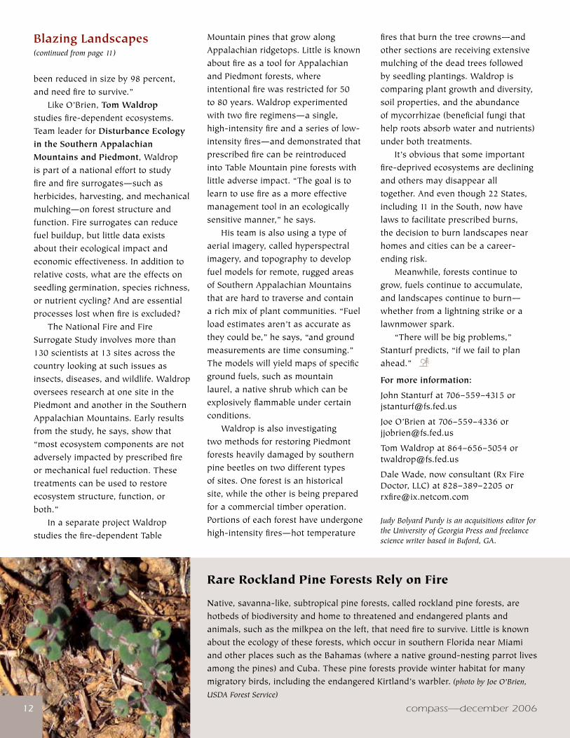
Rare Rockland Pine Forests Rely on Fire
Native,savanna-like,subtropicalpineforests,calledrocklandpineforests,arehotbedsofbiodiversityandhometothreatenedandendangeredplantsandanimals,suchasthemilkpeaontheleft,thatneedfiretosurvive.Littleisknownabouttheecologyoftheseforests,whichoccurinsouthernFloridanearMiamiandotherplacessuchastheBahamas(whereanativeground-nestingparrotlivesamongthepines)andCuba.Thesepineforestsprovidewinterhabitatformanymigratorybirds,includingtheendangeredKirtland’swarbler. (photo by Joe O’Brien,
USDA Forest Service)
compass—december 2006
www.srs.fs.usda.gov ��www.srs.fs.usda.gov ��
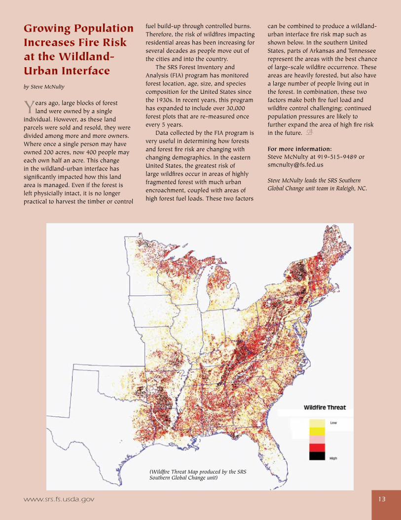
Growing Population Increases Fire Risk at the Wildland-Urban Interfaceby Steve McNulty
Yearsago,largeblocksofforestlandwereownedbyasingle
individual.However,astheselandparcelsweresoldandresold,theyweredividedamongmoreandmoreowners.Whereonceasinglepersonmayhaveowned200acres,now400peoplemayeachownhalfanacre.Thischangeinthewildland-urbaninterfacehassignificantlyimpactedhowthislandareaismanaged.Eveniftheforestisleftphysiciallyintact,itisnolongerpracticaltoharvestthetimberorcontrol
fuelbuild-upthroughcontrolledburns.Therefore,theriskofwildfiresimpactingresidentialareashasbeenincreasingforseveraldecadesaspeoplemoveoutofthecitiesandintothecountry. TheSRSForestInventoryandAnalysis(FIA)programhasmonitoredforestlocation,age,size,andspeciescompositionfortheUnitedStatessincethe1930s.Inrecentyears,thisprogramhasexpandedtoincludeover30,000forestplotsthatarere-measuredonceevery5years. DatacollectedbytheFIAprogramisveryusefulindetermininghowforestsandforestfireriskarechangingwithchangingdemographics.IntheeasternUnitedStates,thegreatestriskoflargewildfiresoccurinareasofhighlyfragmentedforestwithmuchurbanencroachment,coupledwithareasofhighforestfuelloads.Thesetwofactors
canbecombinedtoproduceawildland-urbaninterfacefireriskmapsuchasshownbelow.InthesouthernUnitedStates,partsofArkansasandTennesseerepresenttheareaswiththebestchanceoflarge-scalewildfireoccurrence.Theseareasareheavilyforested,butalsohavealargenumberofpeoplelivingoutintheforest.Incombination,thesetwofactorsmakebothfirefuelloadandwildfirecontrolchallenging;continuedpopulationpressuresarelikelytofurtherexpandtheareaofhighfireriskinthefuture.
For more information: [email protected]
Steve McNulty leads the SRS Southern Global Change unit team in Raleigh, NC.
(Wildfire Threat Map produced by the SRS Southern Global Change unit)
compass—december 2006�4
Agooddealofresearchhas
examinedtheecologicalimpacts
ofsprawl;otherworkhaslookedat
thesocialinequitiescreatedwhen
middle-incomeresidentsabandon
centralcities,leavinglowerincome
residentstodealwithproblemsthat
typicallyaccompanyurbanlife,such
asdecayinginfrastructure,problem
schools,andhighcrimerates.Farless
scholarshipcomparesacceptanceof
urbanexpansionincommunitiesthat
aresocioeconomicallyandracially
separated.
In2002,IworkedwithMyron
FloydfromNorthCarolinaState
Universityonastudyoftwotowns
inruralupperCharlestonCounty,
SC,whereperceptionsaboutfuture
developmentareinconflict.The
contestationinvolvesdifferent
visionsofgrowthfortheruralarea.
Exploratoryresearchsuggeststhese
differencesarehighlycorrelatedwith
socioeconomicstatus,which,inturn,
iscloselyalignedwithrace.
Overthepasthalfcentury,the
paceofdevelopmentontheSea
IslandsofftheSouthCarolinacoast
hasintensified.Fromtheendofthe
CivilWaruntilthe1950s,descendants
ofAfricanslaves(theGullahor
Geecheepeople)weretheprimary
inhabitantsonSouthCarolina’sbarrier
islands.Now,theseplaceshavebeen
developedintopopularresortswith
recreationalamenitiesgearedtoward
theaffluentresidentandvacationer—
andthehistoricalGullahpopulation
A Tale of Two Towns: Rural Communities Divided Over Growthby Cassandra Johnson
hasbeenlargelydisplacedbyhigh-
incomepropertyowners.
Similarpopulationandeconomic
pressuresarenowimpactingsomeof
thecoastalcountiesthatarepartof
theLowcountrynearCharleston,SC.
WhileSouthCarolina’spopulation
increasedroughly15percentfrom
1990to2000,theincreasewasmore
than28percentintheState’seight
coastalcounties.Despitegrowthand
development,substantialtraditional
African-Americanpopulationsremain
inSouthCarolina’scoastalcounties.
Theirsocioeconomicstatus,however,
differsgreatlyfromthatofmigrantand
long-timeresidentwhites.
Forinstance,thepercentageofthe
populationlivingbelowthepoverty
levelinruralupperCharlestonCounty
is16.9percent,whichapproximates
thepovertyrateforthecountyasa
whole(16.7percent),butthepoverty
rateforAfricanAmericansinthearea
isaboutfivetimeshigherthanfor
whites(23.5percentand5percent,
respectively).UpperCharleston
Countycontainsapproximately1
percentofCharleston’spopulation,
withAfricanAmericanscomprising
about64percentofthe5,091residents
andwhites35percent.
Thepreliminarystudywe
conductedshowsthatsocioeconomic
differencesbetweenAfricanAmericans
andwhitescontributegreatlyto
racialdifferencesinperceptionsof
urbangrowth.Usinginterviewsand
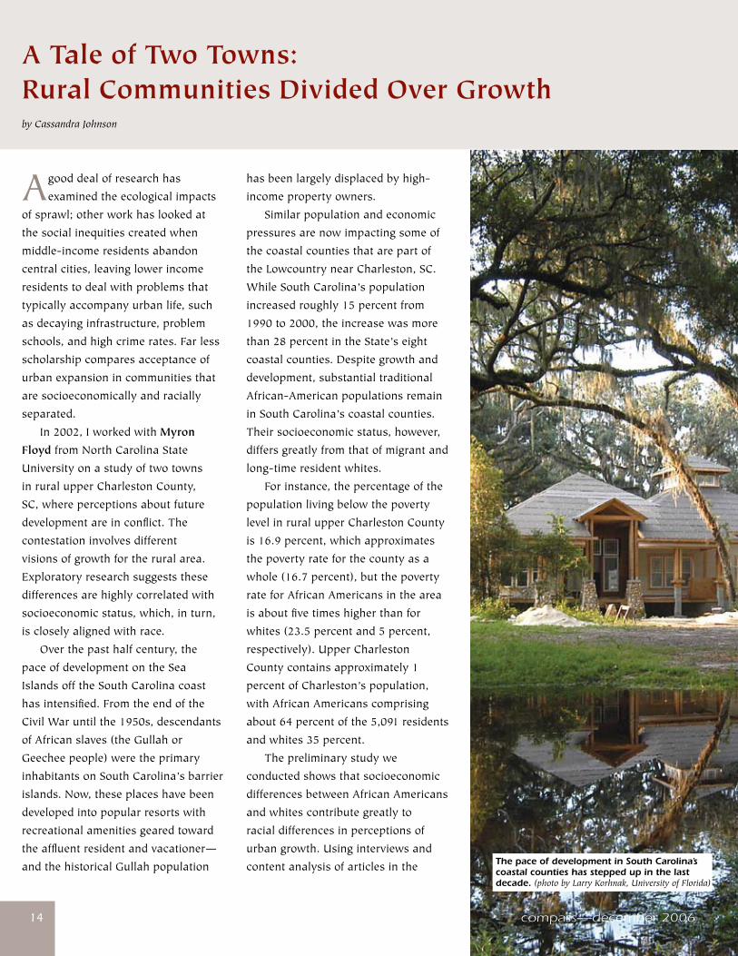
contentanalysisofarticlesinthe The pace of development in South Carolina’s coastal counties has stepped up in the last decade. (photo by Larry Korhnak, University of Florida)
compass—december 2006
www.srs.fs.usda.gov �5
localpress,wecomparedmunicipal
responsestourbangrowthfortwo
ruralmunicipalities“Newborn”and
“SeasideVillage”(pseudonyms)
from2002to2003.Thetowncouncil
inNewborn,wherealltheelected
officialsareAfricanAmerican,
hasbeenmuchmorereceptiveto
developmentinitiativesthanthatof
SeasideVillage,wherealltheelected
officialsarewhite.Also,within
Newborn,AfricanAmericansappear
morewillingthanwhitestoaccept
development.Newborn’spopulationof
1,195istwo-thirdsAfricanAmerican
andone-thirdwhite;SeasideVillage’s
smallerpopulationof459isroughly
93percentwhiteand7percentAfrican
American.
Clean Water Becomes Controversial Newbornwasincorporatedin1992
inresponsetourbanexpansionfrom
metropolitanCharleston.Residents
inthethenunincorporatedruralarea
fearedtheircommunitywouldbe
consumedbytheupscaledevelopment
thathadtransformedothernearby
townsintosuburbanbedroom
communities.Newborniscomposed
ofthreediscontinuousresidentialand
commercialsegments,locatedwithin
11squaremilesalongaU.S.highway.
TheeasternedgeoftheFrancisMarion
NationalForestisalsoincludedwithin
thetown’sborders.
In1997,Newbornpasseda
referendumtoestablishamunicipal
watersystembecausemanyresidents
hadcontaminatedwells.In1999,
acommunity-basedenvironmental
groupconductedanassessmentof
thestudyareaandreportedthat
substandardhousing,lackofpotable
water,andsanitationwerecritical
threatsforarearesidents.Anumber
ofresidentsreportedthatsewagefrom
poorlyconstructedsepticsystems
wascontaminatingwellwater.These
problemswereespeciallyprevalent
amongAfricanAmericans.Inthe
sameyear,thetownalsoproposed
areferendumonasewersystem,
butcancelleditbecauseofmounting
criticismfromasmall,mostlywhite
groupopposedtogrowth.
After7yearsofdebateand
controversysurroundingpublic
water,thetownbeganconstruction
ofthewatersystemin2004,funded
inpartbyaU.S.Departmentof
Agriculturegrant.Opponentsofthe
systemremainfirmintheirconviction
thatmunicipalwaterwillattract
developers;cityofficialsmaintainthat
thewatersystemrepresentsaformof
environmentaljusticeforlow-income
residentswithpoorlyconstructed
wells.
SeasideVillageisabout10miles
northeastofNewborn.Thetown
wasincorporatedinthelate1850s
andhasalong,distinguishedhistory
datingbacktoNativeAmerican
settlement.Residentshaveadeep
historyandstrongsenseofplace
forthetown.SeasideVillageproper
issurroundedbypredominantly
rural,unincorporatedAfrican-
Americancommunitiesthathavea
SeasideVillagemailingaddressbut
arenotincludedwithinthetown’s
politicalboundaries.Incontrastto
Newbornofficials,SeasideVillage’s
governingbodyisadamantlyopposed
toanytypeofdevelopmentthat
woulddetractfromthetown’srural
character.Forthemostpart,residents
herehaveproperlyfunctioningwells,
andmostaremiddle-to-upperincome
wageearners.
A Clash of Perceptions Ouranalysissuggestedthat
African-AmericanleadersinNewborn
viewurbanexpansionasonemeans
ofovercominggenerationalpoverty.
Apublicwatersystemwouldnot
onlyprovideanimmediateremedyto
theproblemofcontaminatedwater
butalsobeaconduitforlongerterm
economicstimulation.Newborn
officialsseeimprovedinfrastructure
andthesubsequentlocationof
commercialestablishmentsasbringing
muchneededjobsandopportunities
forlow-incomeresidents.
Theproposedinfrastructuremerely
highlightedwhatmanydescribedas
long-timeraceandclassdivisionsin
upperCharlestonCounty.Middle-class
residents(mostofwhomwerewhite)
fearedthatthetypeofgrowththat
couldresultfromtheinstallationof
publicwaterandsewerwouldseverely
compromisethearea’sruralcharacter
anduniqueecosystem,specificallythe
ecologicaldiversitycontainedinthe
FrancisMarionNationalForest.These
residentsalsowarnedthatsuburban
developmentwoulddisplacepoor
blackresidentsfromtheirproperty
becauseofrisingrentsandproperty
taxes.Growthopponentspointed
tothehistoryofdisplacedAfrican
AmericansfromtheSeaIslandsand
alsotomorerecentcasesofblacks
beingforcedfromlong-timeAfrican-
Americancommunitiescloserto
Charleston.Growthproponents
counteredthatthoseopposingthe
infrastructureareaprivilegedclass
notconstrainedbypersistentpoverty
orracialdiscrimination.
Inlate2005,aregionalgrowth
managementagreementtolimit
developmentneartheFrancisMarion
(continued on page 16)
compass—december 2006�6
A Tale of Two Towns(continued from page 15)
NationalForestwasinitiatedbylarger,
urbanmunicipalitiestothesouthof
Newborn.Theproposalstipulated
that11areamunicipalities,including
Newborn,takestepstowardrestricting
growthintheruralLowcountryby
limitinghousingdensitiestoonehome
forevery25acresnearthenational
forestandbyprohibitingnewwater
andsewerlinesinnorthCharleston
County.Newborntowncouncilvoted
unanimouslyagainsttheagreement,
contendingthatgrowthisnecessary
forthetown’ssurvival.Newborn’s
voteeffectivelydefeatedtheinitiative
forthetimebeingbecauseithadtobe
agreeduponbyallmunicipalitiesin
ordertotakeeffect.
How to Cross the Racial Divide Itwasapparentafteranalyzing
boththeinterviewsandpressreports
thatthemarginalstatusofAfrican
Americans,comparedtowhitesinthe
area,isasignificantcontributorto
racialstancesondevelopment.The
responsesofthesetwopopulations
pointtoamorefundamentalproblem
inruralAmerica—thatofpersistent
ruralpoverty.Remarksfromtwo
researchrespondents(MandB)
indicatethatthequalityofpeople’s
livesiscentralwhenconsidering
long-termsustainabledevelopment.
Lifequalitymustbeaddressedbefore
anycompromiseongrowthcanbe
reached:
M:Westartedoutby…putting
togetherseveralgroupsthat
lookedatthequalityoflife
resources—welookedatwater,we
lookedattourism.Wewanted…The disparity in economic status between African Americans and whites in the South Carolina Lowcountry has contributed to conflicting views on development in the area. (photo by Bill Lea, USDA Forest Service, retired)
�6
www.srs.fs.usda.gov �7
tochangeanddevelopandmake
it(development)meetourneeds
withoutthismassivedevelopmentof
ourarea.
B:WhichisoneofthethingsI
thinkisourprimarypurpose,that
wehavetoraisethequalityoflife
so…peoplearen’tsoanxiousfor
development.Ifyoucanraisethe
qualityoflifeandofferopportunity
…thenthere’snoneedformassive
development.Peoplearen’tso
vulnerabletobigdeveloperscoming
inandsayingwe’llofferyou
$500,000foryourplace.
Inorderforthattohappen,we’re
goingtohavetobreakdownthe
separationoftheraces.Inorderfor
thatreallytooccur,forthisareanot
tobeoverdeveloped,we’regoingto
havetobreakdowntheracialdivide.
AsruralareasacrosstheSouth
continuetodevelop,wewillseemore
examplesofdifferencesinresponsesto
urbanizationanddevelopmentthatrun
alongracialandsocioeconomiclines.
ResearchersintheSouthhavehardly
beguntoexplorefactorsunderlying
thesedifferencestounderstand
betterhowsociodemographicgroups
experiencerurallandscapesand
drawonthemfortheirpersonaland
collectiveidentities.
For more information:CassandraJohnsonat706–559–[email protected]
Socioeconomic data from:U.S.DepartmentofCommerce,BureauoftheCensus.2002b.Basicfacts:basictablesandmapsfortheU.S.,States,counties,cities,towns,andAmericanIndianReservations.[Dateaccessed:February22,2003].U.S.DepartmentofCommerce,BureauoftheCensus.2002a.U.S.CensusBureau:Stateandcountyquickfacts.[Dateaccessed:February7,2003].
Cassandra Johnson is a research social scientist with the SRS Urban and Social Influences research work unit in Athens, GA.
�7www.srs.fs.usda.gov
(photo by Larry Korhnak, University of Florida)
compass—december 2006�8
You’redrivingbeforedawnonawinterday.It’sbadenoughtobe
upsoearlyinthecold,tryingtowakeup.Yousmelledsmokewhenyoustartedout;youknowthey’vebeenburninginthenationalforesttoreducefuels.Youstarttonoticesomeshredsoffog:beforeyouknowit,you’reinsideathickdirtycloudandcan’tseeafootinfrontofyou.Thedriversofthecarsaheadandbehindyouareequallyblind,allofyoudrivingoninapanickedfaiththatnoonewillstoptoosoon. Thismayseemdramatic,butithappensfairlyoftenintheSouthduringthewinterfireseason,usuallyforonlyafewminutes,butsometimesformuchlonger.InsouthernMississippiin2000,fogandsmokefromasmallwildfirecombinedtoforma“superfog”onInterstate10inthehoursjustbeforedawn.Visibilitywentdowntoalmostzero;theinevitablepileupresultedin5fatalitiesand24injuries.Thoughthesmokeinthiscasecamefromawildfire,itcouldjustaseasilycomefromafiresettoimproveforesthealth. IntheSouth,naturalresourcemanagersdomostoftheirprescribedburninginthefirst3monthsoftheyear,atimewhentheneedsofhumanpopulationsandforestecologiescancomeintovisible—andsometimesdeadly—conflict.Toreducetheimpactofprescribedburnsonnearbyhumanpopulations,SRSscientistshaveenteredtherealmofnightsmoke,haze—andsuperfog.
Smoke Gets in Your Eyesby Zoë Hoyle
compass—december 2006
The most critical threat to human populations from prescribed fire is smoke, which can cause health problems as well as highway hazards. (photo by USDA Forest Service, www.forestryimages.org)
www.srs.fs.usda.gov �9�9
heavilyscoredbyvarioussizesofroads.“Wetookonaveryspecifictask,towriteaPC-basedprogramtosimulatethemovementofground-levelsmokeoverthecomplexterrainofthePiedmontatnight,”saysAchtemeier. Smokecanbecomeaproblematanytimeduringaprescribedburn,butvisibilityproblemsoccurmorefrequentlyinvalleybottomsatnight.Asnightfalls,aircoolsrapidlynearthegroundandwindspeedsdecline.Smokebeginstoaccumulateneartheground,especiallyfromsmolderingfuelsthatdon’tgeneratemuchheat.Thisground-huggingsmokeiscarriedthroughthevalleys,accumulatingatlowpointsandcreatinghazardswherevalleydrainagescrossroadsorbridges.Figuringoutexactlywheresmokegoesinvolvesmuchmorethanjustassumingitwilltraveldowntheterrainofthevalleys. “UndercertainweatherconditionsinthePiedmont,smokecangettrappedinshallowlayersofairnearthegroundatnightandgetcarriedtounexpecteddestinations,”saysAchtemeier.“Whenitgetsconfinedwithinvalleys,smokecanbeslowtodisperse.Whenmoistconditionsarepresent—andyouknowhowhumiditisintheSouth—thissmokecaneasilyturnintofog.” Achtemeierstressesthattheprogramheandfellowresearchersdeveloped,PB-Piedmont(PBforprescribedburn),isdesignedstrictlytopredictthemovementofsmokefromprescribedburning—notwildfire—
(continued on page 20)
Where There’s Fire Prescribedburning—thesettingoffiresundercontrolledconditions—isusedtotreatsome6to8millionacresintheSoutheachyear,morethaninanyotherpartoftheUnitedStates.Abouthalftheacresareburnedtoimproveforesthealth,therestforagriculturalandrangepurposes.Southernlandmanagershavelongacceptedprescribedburningasthemosteconomicalwaytoreducetheriskofwildfiresandmaintainhabitatforfire-dependentplantandanimalspecies.Unfortunately,wherethereisfire,thereisalwayssmoke. Aspeoplemoveclosertoforests,thesmokefromcontrolledburnsbecomesmoreproblematic.Smokecancausehealthproblemsrangingfromirritatedeyesandthroatstomoreseriousdisorderssuchasasthma,bronchitis,reducedlungfunction,andevendeath.Attheveryleast,burningcausesahazethatlimitsvisibilityandcancontributetopoorairqualityacrosstheregion. Probablythegreatestdangerfromsmokecomesfromreducedvisibilityonroads.Smokeontheroadcanbehazardousanywhere,butitposesaparticularthreatintheSouth,whereprescribedburningisdoneduringthewinterrainyseasonwhenhighrelativehumidityaddstosmokedensity.Whenyouaddinfragmentationfromhumandevelopment,someofthehighestroaddensitiesintheNation,andtheerraticmovementofairacrossahighlyvariableterrain,endangeringearlymorningdriverswhendoingprescribedburningseemsalmostunavoidable.
“Mostsmoke-relatedhighwayaccidentsoccurjustbeforesunrisewhentemperaturesarecoldestandsmokeentrapmentismaximized,”saysGary Achtemeier,researchmeteorologistwiththeSRS Center for Forest Disturbance ScienceinAthens,GA.“Intheseconditions,weakdrainagewindsofeven1mileperhourcancarrysmokeover10milesduringthenight—withthedensityoftheroadsystemintheSouth,there’sagoodchancesmokeorfogwillbecarriedoveraroad.” WithfellowSRSresearchmeteorologistsScott GoodrickandYongqiang Liu,Achtemeierhastakenonthetaskofproducingtoolsmanagerscanusetopredictwheresmokewilldriftthedaytheyburnandonintothenightandearlymorningofthenextday.Theresearchersstartedbydevelopingacomputerprogramthatcombineshigh-resolutionnationalweatherdatawithapreciseunderstandingofterraintopredictsmokefromfiressetatdefinedcoordinates.TheytackledtheterrainofthePiedmontfirst,anareawherethereissignificantuseofprescribedburning—andwherepopulationandroadnetworksareexpandingrapidly.
Night Smoke in the Piedmont ThePiedmont,definedastheregionthatliesbetweentheCoastalPlainandtheAppalachianMountains,includespartsofVirginia,NorthandSouthCarolina,Georgia,andAlabama.Theterrainoftheareaisoneofgentlyrollinghillsandvalleysbisectedbynumerousstreamsandriversand
compass—december 2006�0
The Southern High-Resolution Modeling Consortium
In2001,aspartoftheNationalFirePlan,theForestServicesetupfiveregionalmodelingconsortiatoprovideproductsbasedonhigh-resolutionweatherdata.TheSouthernHigh-ResolutionModelingConsortium(SHRMC)wassetupbytheSRS Southern Smoke Management TeambasedinAthens,GA,incollaborationwiththeUniversityofGeorgiaAtmosphericScienceProgram.TheSHRMCsuppliesregionalandlocalweatherforecaststoforestersintheSouthernRegion,whichconsistsofthe13SouthernStatesfromVirginiatoTexas.TheSHRMCcollaborateswithotherscientists;local,State,andFederalairqualityandfireregulators;andothermodelingcentersaspartofvariousnationalinteragencymodelingconsortia. SHRMCprovidesthephysicalinfrastructureformodelingadvancesinairquality,firecontrol,smokeimpact,andweatherprediction,andfortheInternet-baseddistributionofrealtimedatatoconsortiummembers,naturalresourcemanagers,andthepublic.
For more information:shrmc.ggy.uga.edu/
�0
Smoke Gets in Your Eyes(continued from page 19)
underspecificconditions.“PB-Piedmontisawindandparticlemovementmodelthatprovidesthenumerical‘eyes’to‘see’wheresmoketrappednearthegroundwillgoatnight.Itpredictsmovement,notconcentrations,andaddressesproblemsofcomplexterraininareaswhereridgeandvalleyheightdifferencesarelessthan300feet.” Takingintoaccountthenatureofsmokeitself—aphenomenonthathasn’tbeenstudiedextensively—addedcomplexitytothemodel.“Weknewthatsmokeplumestypicallydivergeandsplitintoneighboringvalleys,andthatsmoketrappedinavalleygradually‘bleeds’awayasairentersthevalley,butwehadtofigureouthowtomodeltheprocess,”saysAchtemeier.“Wedesignedthesmokemodelsothatparticlesdivideintosmallerparticles,allowingthemodeltosimulatethebleedoutfromvalleys.” Togetatthesubtledriftofnightsmoke,thesmokemodelwascombinedwithanairflowmodeldevelopedbyAchtemeierthatsimulatespressureforcesthatmovewindsasslowas4inchesasecond.Addtothisinformationabouttopographyandlandscapefeaturessuchasroads,rivers,andstreams,thencombineitwiththemostpowerfulweatherdatadevelopedsofar.Whatyougetisamodelthattakesupatremendousamountofcomputingpowerandspace,muchmorethanatypicalnaturalresourcemanagerwouldhaveaccessto.
How It Works PB-PiedmontactuallyrunsonweatherdatasuppliedthroughahighperformancecomputersystemsetupbytheSouthern High-Resolution Modeling Consortium(SHRMC),agroupofStateandFederalagencieswhojoinedtogethertoprovidetheinfrastructureneededtorunsmokeandothermodels.PB-Piedmontisessentiallya“nowcast,”updatedhourlywithsurfaceweatherdataasitbecomesavailableovertheWeb.ComputingpowerthroughtheSHRMCmakesitpossibletorunPB-Piedmontpredictivelyoutto72hoursusingMM5,thehigh-resolutionweatherdatadevelopedbyacommunityofscientistsanddistributedthroughtheNationalCenterforAtmosphericResearch. Achtemeierrealizedearlyonthatnaturalresourcemanagersplanningprescribedburnswouldhaveveryspecificneeds.Themodelwouldhavetobesmallenoughtofitonalaptop,runfasterthanrealtimetomakepredictions—andstillbepowerfulenoughtomodelsmokeonafineterrainscale.Inaddition,themodelwouldhavetobesimpleenoughtoberunbythosewithnoexperiencewithmeteorologicalmodeling. “Keepingthemathematicssimplesothemodelcanrunrapidlyenoughtoprovidetimelypredictionsisadauntingtask,”saysAchtemeier.“That’swhywemadePB-Piedmontasimplifiedmodeldesignedtorunforthespecificweatherconditionsthatareassociatedwithsmokeentrapmentneartheground.Youcan’tapplyittootherconditions.”
www.srs.fs.usda.gov ����
Theresultisamodeleasilyinstalledontheuser’scomputer,eitherfromadiskordownloadedfromtheSHRMCWebsite.Two“weathergrabbers”areinstalledwiththemodel:everyhourtheygototheSHRMCWebsiteandgrabhigh-resolutionweatherdata.Whenamanagersitsdowntoplanaburn,themodelgrabsdataforthenext72hours,plentyoftimetotrackthemovementofsmokethroughcriticalnightandearlymorninghours—timetodecidewellinadvancewhetherornottodotheburn. ThemovementofsmokepredictedbyPB-Piedmonthasbeenvalidatedbyaircraftvideoimagingfromtwoexperimentalnightburns,andbynearly300groundobservationsofover30prescribedburns.Upgradedseveraltimes,themodelisnowbeingusedtoplanprescribedburnsbytheU.S.FishandWildlifeServiceandtheStateofSouthCarolina.
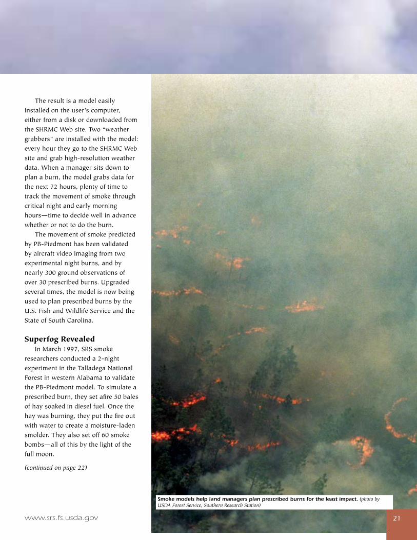
Superfog Revealed InMarch1997,SRSsmokeresearchersconducteda2-nightexperimentintheTalladegaNationalForestinwesternAlabamatovalidatethePB-Piedmontmodel.Tosimulateaprescribedburn,theysetafire50balesofhaysoakedindieselfuel.Oncethehaywasburning,theyputthefireoutwithwatertocreateamoisture-ladensmolder.Theyalsosetoff60smokebombs—allofthisbythelightofthefullmoon.
(continued on page 22)
Smoke models help land managers plan prescribed burns for the least impact. (photo by USDA Forest Service, Southern Research Station)
compass—december 2006����
disappearing.Lookslikesuperfog,hethought,sohesetupanexperiment,usingthesameinstrumentstomeasurerelativehumidityandtemperatureheusedontheindividualsmokesoutinthefield.Hestartedburningsomeleavesinlateevening,whenthetemperaturewasrelativelylow.Whenhegotthefiregoing,hisinstrumentimmediatelyregistered100percenthumidity.“TurnsoutIhadactuallyproducedsuperfoginmyownbackyard.Imeasuredthevisibilityatlessthan4inches.” ThoughAchtemeierisconvincedthatsuperfogcanbecausedbysmoke—andaverypossibleresultofprescribedburning—othersinthescientificcommunityremainunconvinced.Butifhe’sright,hismodelscouldpreventroadaccidentsrelatedtoprescribedburning.“Itmaybethattherearesomeveryspecificconditionsinwhichsuperfogforms,andifwecanisolatetheseconditions,wemightbeabletopinpointwithin72hoursthedayswhenprescribedburnsshouldnottakeplace.”
For more information: GaryAchtemeierat706–559–[email protected].
aboutaphenomenonthatsomescientistsstilldoubttheexistenceof. Thevariousexplanationsforsuperfograngefrom“it’sjustdensesmoke”totheinvolvementofhygroscopicsmokeparticlesthatattractandbondwithwatermolecules,leadingtotheformationofwaterdropletsthatscatterlight.Someexplanationsleaveoutthesmokeparticlesandattributesuperfogsimplytotherapidcoolingofthemoisturecomingoffsmolderinglogsandstumps.Achtemeierdecidedtotakeacloserlook. In2002and2003,Achtemeier,withsystemsanalystKen ForbusandelectronicstechnicianTim GiddensfromtheSRSAthensunit,wentoutto5differentprescribedburnsites,lookingatover20individual“smokes”toseeifthebulkmoisturefromsmolderingfiresaloneisenoughtotriggersuperfog.“We’llhavetolookatthetotalmoisturebudgetbeforewecanmakeconclusions,butourpreliminaryfindingsindicatethatsmolderingcouldaddenoughmoisturetotriggersuperfog,”saysAchtemeier.“Wedidfindoutthatonanyonesiteyoucanhaveindividualsmokesthatrangefromverydrytoverymoist.Thoughthismayseemintuitive,noonehasreallytriedtodocumentit.” Infall2003,Achtemeierwasoutinhisbackyardrakingandburningleaves.Hejustcouldn’tstopthinkingaboutsmokeandsuperfog.Whenherakedoverhisburningpile,adensewhitesmokeformedthatdidn’treallydisperse,butretaineditsstructurewhilemovingaway,eventuallybreakingintopatchesand
Smoke Gets in Your Eyes(continued from page 21)
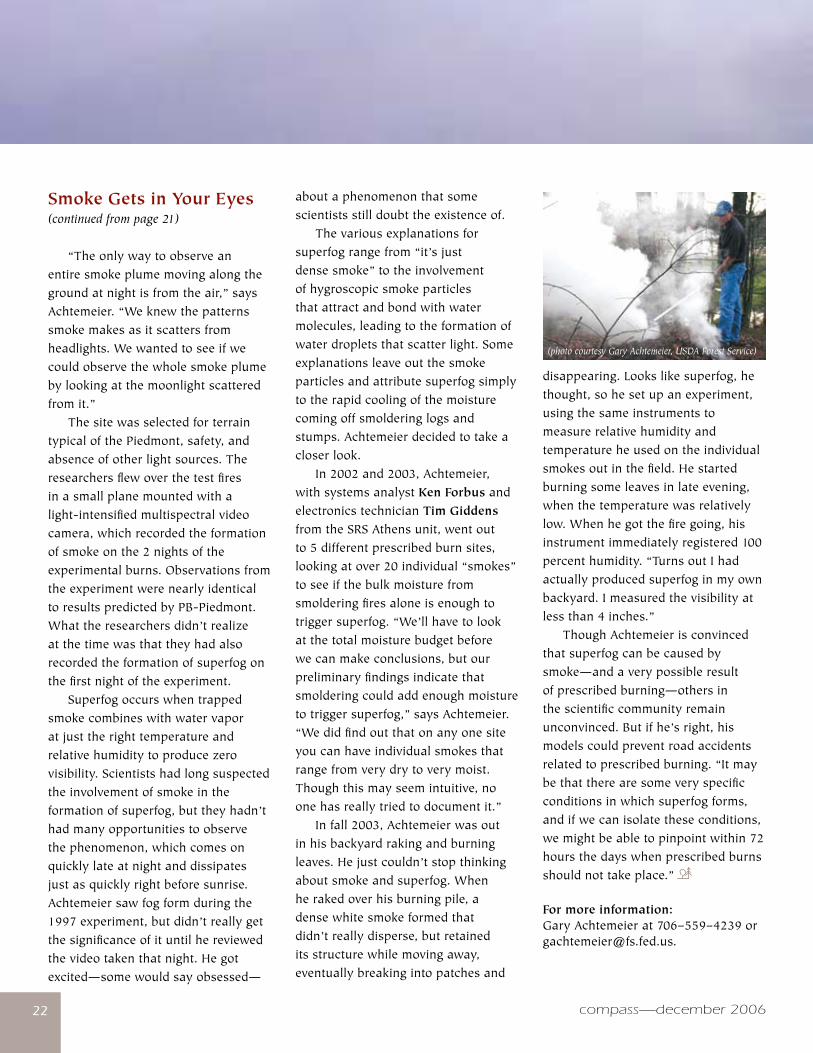
“Theonlywaytoobserveanentiresmokeplumemovingalongthegroundatnightisfromtheair,”saysAchtemeier.“Weknewthepatternssmokemakesasitscattersfromheadlights.Wewantedtoseeifwecouldobservethewholesmokeplumebylookingatthemoonlightscatteredfromit.” ThesitewasselectedforterraintypicalofthePiedmont,safety,andabsenceofotherlightsources.Theresearchersflewoverthetestfiresinasmallplanemountedwithalight-intensifiedmultispectralvideocamera,whichrecordedtheformationofsmokeonthe2nightsoftheexperimentalburns.ObservationsfromtheexperimentwerenearlyidenticaltoresultspredictedbyPB-Piedmont.Whattheresearchersdidn’trealizeatthetimewasthattheyhadalsorecordedtheformationofsuperfogonthefirstnightoftheexperiment. Superfogoccurswhentrappedsmokecombineswithwatervaporatjusttherighttemperatureandrelativehumiditytoproducezerovisibility.Scientistshadlongsuspectedtheinvolvementofsmokeintheformationofsuperfog,buttheyhadn’thadmanyopportunitiestoobservethephenomenon,whichcomesonquicklylateatnightanddissipatesjustasquicklyrightbeforesunrise.Achtemeiersawfogformduringthe1997experiment,butdidn’treallygetthesignificanceofituntilhereviewedthevideotakenthatnight.Hegotexcited—somewouldsayobsessed—
(photo courtesy Gary Achtemeier, USDA Forest Service)
www.srs.fs.usda.gov ��
Theparticulatematterandozonederivativesproducedbyboth
wildfiresandprescribedburninghaveanundeniableeffectonairquality.In1998,theU.S.EnvironmentalProtectionAgency(EPA)issuedaninterimpolicytoprotectpublichealthfromtheimpactsofairpollutantsfromwildlandfires.Aspartofthispolicy,theEPAurgedtheStatestodevelopsmokemanagementprograms.Landmanagersaccustomedtoplanningforsmokehazardsneedednewtoolstolookatlessvisibleairqualityeffectsfromprescribedfires. Withfundingfromthe2001NationalFirePlanandthecomputingpoweroftheSouthernHigh-ResolutionModelingConsortium(SHRMC),theSRS Smoke Management Team ofGary Achtemeier,Scott Goodrick,andYongqiangLiubegandevelopingaresearchtool,theSouthernSmokeSimulationSystem(SHRMC–4S)tomodelfireemissions,smokemovement,andairqualityeffects. SHRMC–4SintegratestheCommunityMultiscaleAirQualitymodeldevelopedbytheEPAwiththehigh-resolutionweatherpredictiondatageneratedbySHRMCwithDaysmoke,aprogramSRSresearchersdevelopedtosimulatethebehaviorofsmokeplumesfromprescribedburning—andtocorrectassumptionsintheprevailingmodelsthatmighthaveledtorestrictionsonanimportantforestmanagementpractice. “Whenwestartedworkingwiththeairqualitycommunity,wefoundoutthatthesystembeingusedaveragedburnsoveranentireyear,whentherearereallyonly30daysorsointheyearthatmanagerscanburnon,”saysAchtemeier.“Thisgreatlyexaggeratedtheairqualityeffectsfromprescribedburning.WedevelopedDaysmoketoindicatetheexactdayandtimeofburns,andtotakeintoaccounthowmanagersengineertheirburnssothatsmokesweepsupandaway.”
Andthenthereisthestructureofwildlandsmoke.EPAparticulatemodelsarebasedonsimplesmokestackplumes.Aprescribedfireincidentinspring2006causedSRSresearcherstochangehowtheylookatthestructureofsmokefromwildlandfires—andmaychangethewayparticulateconcentrationsinairaremodeledinthefuture. InApril2006,smokefromaprescribedburninCockeCounty,TN,jumpedoverthemountainstofinditswayintothestreetsofAsheville,NC.WhenAchtemeierpluggeddatafromtheburnintoDaysmoke,themodelpredictedonlyatenthoftheparticulateconcentrationsrecordedinAsheville.Puzzled,hewenttosatelliteimagesandground-levelphotoimagesoftheeventandnoticedthatwhatlookedlikeonebigplumeofsmokeonthesatelliteimageswasactuallymadeupofmanysmallupdraftcores.WhenhesimulatedfiveorsixcoresinDaysmoke,themodelgaveamoreaccuratereading. “Thisdiscoverygaveusmoreanswersaboutwhyothermodelswerenotpredictingairqualityeffectsfromprescribedburningmoreaccurately,”saysAchtemeier.“Ournextstepistodevelopanumbrellacodethatbringsallthesefindingstogether.Whenwehavethat,we’llrunasimulationusingdatafromFloridatoseehowclosewearegettingtoaccuratelypredictingairqualityeffects.” ForAchtemeier,Goodrick,andLiu,eventheskymaynotbethelimit.Intheplanningstageareproductsthatlinkshort-termandlong-termclimatedatawithwildfire,prescribedfire,andsmokemanagementdatatolookattheeffectsofclimateonwildlandfire—aswellastheeffectsoffireintheSoutheastonclimate.
For more information:GaryAchtemeierat706–559–[email protected].
��
Air Quality Issues Lead to a New Understanding of Day Smoke
www.srs.fs.usda.gov
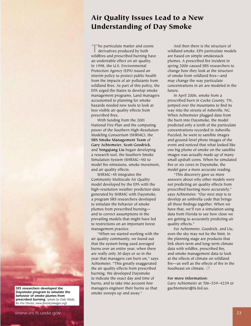
SRS researchers developed the Daysmoke program to simulate the behavior of smoke plumes from prescribed burning. (photo by Dale Wade, Rx Fire Doctor, www.forestryimages.org)
compass—december 2006�4
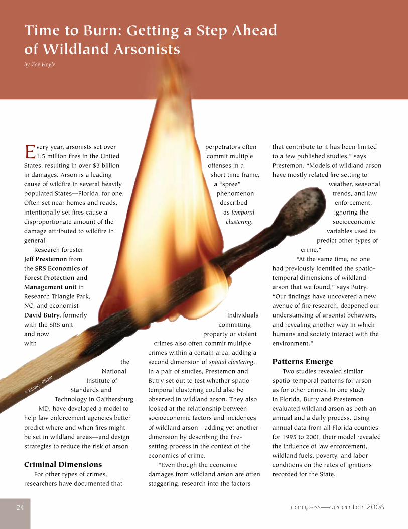
Everyyear,arsonistssetover1.5millionfiresintheUnited
States,resultinginover$3billionindamages.ArsonisaleadingcauseofwildfireinseveralheavilypopulatedStates—Florida,forone.Oftensetnearhomesandroads,intentionallysetfirescauseadisproportionateamountofthedamageattributedtowildfireingeneral. ResearchforesterJeff PrestemonfromtheSRS Economics of Forest Protection and Management unitinResearchTrianglePark,NC,andeconomistDavid Butry,formerlywiththeSRSunitandnowwith
theNational
InstituteofStandardsand
TechnologyinGaithersburg,MD,havedevelopedamodelto
helplawenforcementagenciesbetterpredictwhereandwhenfiresmightbesetinwildlandareas—anddesignstrategiestoreducetheriskofarson.
Criminal Dimensions Forothertypesofcrimes,researchershavedocumentedthat
Time to Burn: Getting a Step Ahead of Wildland Arsonistsby Zoë Hoyle
perpetratorsoftencommitmultipleoffensesinashorttimeframe,a“spree”phenomenondescribedastemporal clustering.
Individualscommitting
propertyorviolentcrimesalsooftencommitmultiple
crimeswithinacertainarea,addingaseconddimensionofspatial clustering.Inapairofstudies,PrestemonandButrysetouttotestwhetherspatio-temporalclusteringcouldalsobeobservedinwildlandarson.Theyalsolookedattherelationshipbetweensocioeconomicfactorsandincidencesofwildlandarson—addingyetanotherdimensionbydescribingthefire-settingprocessinthecontextoftheeconomicsofcrime. “Eventhoughtheeconomicdamagesfromwildlandarsonareoftenstaggering,researchintothefactors
thatcontributetoithasbeenlimitedtoafewpublishedstudies,”saysPrestemon.“Modelsofwildlandarsonhavemostlyrelatedfiresettingto
weather,seasonaltrends,andlawenforcement,ignoringthesocioeconomic
variablesusedtopredictothertypesof
crime.” “Atthesametime,noone
hadpreviouslyidentifiedthespatio-temporaldimensionsofwildlandarsonthatwefound,”saysButry.“Ourfindingshaveuncoveredanewavenueoffireresearch,deepenedourunderstandingofarsonistbehaviors,andrevealinganotherwayinwhichhumansandsocietyinteractwiththeenvironment.”
Patterns Emerge Twostudiesrevealedsimilarspatio-temporalpatternsforarsonasforothercrimes.InonestudyinFlorida,ButryandPrestemonevaluatedwildlandarsonasbothanannualandadailyprocess.UsingannualdatafromallFloridacountiesfor1995to2001,theirmodelrevealedtheinfluenceoflawenforcement,wildlandfuels,poverty,andlaborconditionsontheratesofignitionsrecordedfortheState.
www.srs.fs.usda.gov �5
Tomeasurefinetemporalpatternsofarson,theresearchersparsedthe1995to2001dataintodailyobservations.Theyfocusedthisfine-scaleanalysisonninecountiesinFloridawithhighratesofarson.Theirmodelidentifiedtemporalclusteringthatlastedupto11days—implyinghigherriskofrepeatarsonignitionsfor11daysfollowingtheinitialfire.Thiskindofpatternhadneverbeforebeenfoundinanyresearchintohuman-ignitedwildfires. Inasecondstudy,ButryandPrestemonmeasuredthespatialaswellastemporalclusteringofarsonwildfiresusingadifferentsetofdata—dailyinformationforthesixU.S.censustractsinFloridawiththegreatestarsonactivity.Theirstatisticalresultsshowedthatanarsoneventinonecensustractwasrelatedtoarsonintheneighboringtractsforupto11days,andinthesametractforupto10days. “Notonlydidweconfirmourfindingsfromthepreviousstudy,butwealsoshowedthatarsonclustersinbothspaceandtime,”saysButry.“Inotherwords,youcanusearsonevents
inonetracttopredictfutureignitionsinthesameoradjacenttractsforseveraldays.”
How to Get Ahead of Wildland Arsonists “Combiningthepatternswefoundwithdataonlawenforcementledustoconcludethatthereare strategiesthatlawenforcementcanusetopreventwildlandarson,”saysPrestemon.“Theycancloselymonitorareaswherefireshavebeensetbefore.Theycanalsoincreasearsonenforcementondaysoftheyearwheneventsaremorecommon,andduringdroughts.” Fromtheirstudies,PrestemonandButryalsofoundthatlocationswithdifficulteconomicconditions—lowwagesandhighpovertyrates—havehigherratesofwildlandarson,afindingconsistentwithothereconomicmodelsofcrime.Theyalsofoundthatforestmanagementactivitiesarerelatedtowildlandarson,withfuelreductionsfromprescribedburningandotherwildfirescorrelatedwithlowerarsonrates. “Thisfindingisalsoconsistentwith
�5
TheSRS Southern Center for Wildland-Urban Interface Research and InformationhaspartneredwithSGSFtodevelopFire in the South II,apublicationaboutthetop10findingsoftheSWRA.Dueforcompletioninmid-2007,thepublicationwillbuildonthefirstFire in the South,whichintroducestheriskassessmentinitsearlystages,describescharacteristicsoftheSouththatcontributetothewildlandfireproblem,anddiscussessolutionstothewildlandfireproblemsintheSouth.
For more informationaboutSWRA,ortodownloadacopyofFire in the South,goto:dev.sanborn.com/swra/content/deliverables/index.htm.
aneconomicmodelofwildlandarsoncrime,wherelowerfuelsincreasethecostofsuccessfullystartingfires,”saysPrestemon. ThenextstepistotestthemodelinotherlocationstoseeifthestatisticalresultsholdtrueinotherStates,andevenfurther,toconductnewresearchonwhatmotivatespeopletosetdamagingfires.“Weneedtodirectsomeofoureffortintounderstandingwhoarsonistsareandwhat,precisely,makesthembehavethewaytheydo,”saysButry.“Ifwecouldaddfeedbackfromconvictedwildlandarsonists,wecouldreallyenhanceourunderstandingofhowtheychoosewhereandwhentosetfires.Incorporatingthisinformationintothemodelwouldraiseitspredictivevaluetolawenforcementandgivemoreinsightintoanimportantsocialproblem.”
For more information:JeffPrestemonat919–549–[email protected]
DavidButryat301–975–[email protected]
Southern Wildfire Risk Assessment
Wildfireisaseriousthreattolives,property,andeconomic
andnaturalresourcesintheSouth.ToaddressthisthreattheSouthernGroupofStateForesters(SGSF),anonprofitorganizationconsistingofStateforestersfromeachofthe13SouthernStates,contractedwithSanborn,acompanywhichoffersphotogrammetric(developingmapsfromphotographs)andGeographicInformationSystemmappingservicestodevelopawildlandfireriskassessmentfortheareacoveredbytheSouthernStates.PartnersinthiseffortincludedtheForestServiceSouthernRegion,U.S.FishandWildlifeService,
www.srs.fs.usda.gov
andUSDINationalParkService,andtheBureauofIndianAffairs. Anongoingprocesstoassessrisksaswellasvaluestobeprotected,theSouthernWildfireRiskAssessment(SWRA)isatoolthatwillhelpfiremanagerspredictandtargetmorepreciselythoseareasthatareathighriskforwildfire,andallowsagenciesandorganizationsatthenational,State,andlocallevelstoobtainaclearerpictureoftheoverallpotentialforwildlandfireandassociatedproblems.Someoftheelementsincludedintheassessmentarefireoccurrence,firebehaviorpotential,suppressioneffectiveness,fireeffects,andcommunitiesatrisk.
compass—december 2006�6�6
Naturalresourceagenciesare
beingcalledupontoprovide
solutionstoincreasinglycomplex
challengesatthewildland-urban
interface(WUI).Communities
aregrowingrapidly,landowners’
managementgoalsoftenconflict,
residentsmaynotunderstandthe
benefitsofresourcemanagement,and
theresultingriskstoenvironmental
qualityandhumanqualityoflifeare
becomingmoreapparent.Tohelpmeet
theseneeds,theSouthernGroupof
StateForestersledapartnershipwith
theSRS Center for Wildland-Urban
Interface Research and Information,
theUniversityofFloridaSchoolof
ForestResourcesandConservation,
andtheU.S.FishandWildlifeService
todevelopaWUIprofessional
developmentprogram.Thisprogram
providesStateandFederalnatural
resourceagencieswithasetof
flexibleresourcestoconducttheir
owntrainingprogramsaimedtoward
buildingskillsandtoolstosuccessfully
tackleWUIissues.
Module Topics FindingsfromtheForestService
reportHuman Influences on Forest
Ecosystems: Southern Wildland-Urban
Interface Assessment anddiscussions
withagencyleaderswereusedtoform
thefourmodulesusedtotrainnatural
resourceprofessionalsworkinginthe
WUI:
•Module1:InterfaceIssues
andConnections—introduces
Changing Roles: Wildland-Urban Interface Professional Development Program
participantstokeyWUIissuesand
howtheyareinterconnected.
• Module2:ManagingInterface
Forests—providestoolsand
knowledgeforeffectivelymanaging
fragmentedforestsintheWUI,
includingmanagementpractices
appropriatefortheinterface;
equipmentandsystemsforsmall
forests;managingforwildlife,fire,
water,andvisualandrecreational
amenities;enterpriseopportunities
forlandowners;andforest
cooperatives.
• Module3:LandUsePlanning
andPolicy—explainslanduse
decisionmakingtools,andhow
naturalresourceprofessionalscan
getinvolvedinlocaldecisionmaking
andlanduseplanningprocesses.
•Module4:Communicatingwith
InterfaceResidentsandLeaders—
discusseskeytipsforeffective
communicationwithWUIresidents
andcommunityleaders.
Program Features Anumberofdifferentmaterials
areprovidedtoallowtrainerstoselect
thosethatbestmeettheirobjectives:
•Trainer’sguidesintroducethe
topicwithkeypointsfortraining
emphasis.
•Exercisesprovideaninteractive
opportunityforparticipantsto
discussandapplywhattheyare
learning.
•Factsheetsoutlineimportantpoints,
strategies,andinformationfor
participantsandtrainersiftheywant
additionalbackgroundmaterial.
•PresentationsinMicrosoft
PowerPoint®enabletrainerstoeasily
presentbackgroundinformationto
participants.
•Asetofcasestudiesprovides
examplesofinterfacechallengesas
wellassuccessstoriesfromacross
theSouth.
•ThevideoWhen Nature Is at Your
Doorstep,producedaspartofthis
project,introducesWUIissuesto
programparticipants,andcanalso
beusedforpublicoutreach.
•Abibliographyofbooks,articles,
Websites,programs,andothertools
pertainingtoeachmodulesubject
matterisprovided.
ToviewanddownloadtheWUI
ProfessionalDevelopmentProgram
materials,visit:www.interfacesouth.
usda.gov/products/training/changing_
roles.html.
For more information contact:AnnieHermansen-Báez,at352–376–[email protected].
compass—december 2006�6
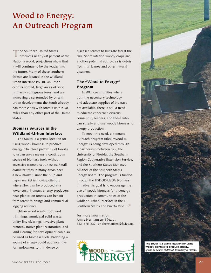
www.srs.fs.usda.gov �7
TheSouthernUnitedStates
producesnearly60percentofthe
Nation’swood;projectionsshowthat
itwillcontinuetobetheleaderinto
thefuture.Manyofthesesouthern
forestsarelocatedinthewildland-
urbaninterface(WUI).Asurban
centersspread,largeareasofonce
primarilycontiguousforestlandare
increasinglysurroundedbyorwith
urbandevelopment;theSouthalready
hasmorecitieswithforestswithin50
milesthananyotherpartoftheUnited
States.
Biomass Sources in the Wildland-Urban Interface TheSouthisaprimelocationfor
usingwoodybiomasstoproduce
energy.Thecloseproximityofforests
tourbanareasmeansacontinuous
sourceofbiomassfuelswithout
excessivetransportationcosts.Small-
diametertreesinmanyareasneed
anewmarket,sincethepulpand
papermarketismovingoffshore
wherefibercanbeproducedata
lowercost.Biomassenergyproducers
nearplantationforestscanbenefit
fromforestthinningsandcommercial
loggingresidues.
Urbanwoodwastefromyard
trimmings,municipalsolidwaste,
utilitylineclearings,invasiveplant
removal,nativeplantrestoration,and
landclearingfordevelopmentcanalso
beusedasbiomassfuels.Providinga
sourceofenergycouldaddincentive
forlandownerstothindenseor
Wood to Energy: An Outreach Program
diseasedforeststomitigateforestfire
risk.Shortrotationwoodycropsare
anotherpotentialsource,asisdebris
fromhurricanesandothernatural
disasters.
The “Wood to Energy” Program InWUIcommunitieswhere
boththenecessarytechnology
andadequatesuppliesofbiomass
areavailable,thereisstillaneed
toeducateconcernedcitizens,
communityleaders,andthosewho
cansupplyandusewoodybiomassfor
energyproduction.
Tomeetthisneed,abiomass
outreachprogramtitled“Woodto
Energy”isbeingdevelopedthrough
apartnershipbetweenSRS,the
UniversityofFlorida,theSouthern
RegionCooperativeExtensionService,
andtheSouthernStatesBiobased
AllianceoftheSouthernStates
EnergyBoard.Theprogramisfunded
throughtheUSDOE/USDABiomass
Initiative;itsgoalistoencouragethe
useofwoodybiomassforbioenergy
productionincommunitiesatthe
wildland-urbaninterfaceinthe13
SouthernStatesandPuertoRico.
For more information: AnnieHermansen-Báezat352–376–[email protected].
www.srs.fs.usda.gov �7
The South is a prime location for using woody biomass to produce energy. (photo by Lauren McDonell, University of Florida)
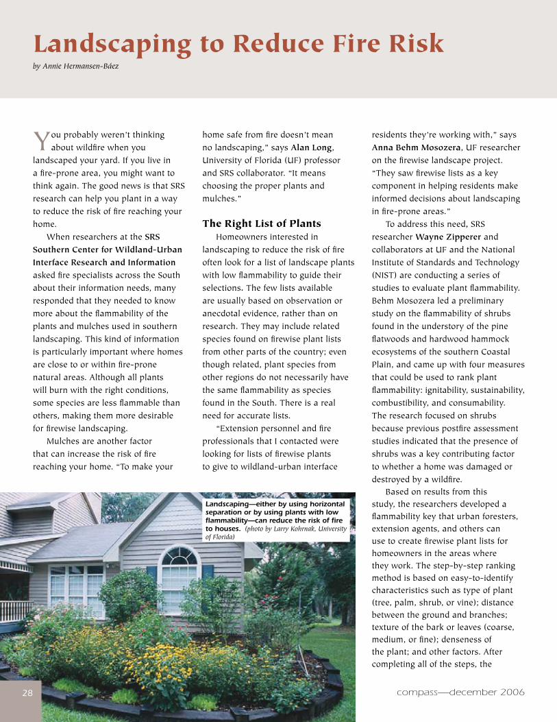
compass—december 2006�8�8
Youprobablyweren’tthinkingaboutwildfirewhenyou
landscapedyouryard.Ifyouliveinafire-pronearea,youmightwanttothinkagain.ThegoodnewsisthatSRSresearchcanhelpyouplantinawaytoreducetheriskoffirereachingyourhome. WhenresearchersattheSRS Southern Center for Wildland-Urban Interface Research and InformationaskedfirespecialistsacrosstheSouthabouttheirinformationneeds,manyrespondedthattheyneededtoknowmoreabouttheflammabilityoftheplantsandmulchesusedinsouthernlandscaping.Thiskindofinformationisparticularlyimportantwherehomesareclosetoorwithinfire-pronenaturalareas.Althoughallplantswillburnwiththerightconditions,somespeciesarelessflammablethanothers,makingthemmoredesirableforfirewiselandscaping. Mulchesareanotherfactorthatcanincreasetheriskoffirereachingyourhome.“Tomakeyour
Landscaping to Reduce Fire Riskby Annie Hermansen-Báez
homesafefromfiredoesn’tmeannolandscaping,”saysAlan Long,UniversityofFlorida(UF)professorandSRScollaborator.“Itmeanschoosingtheproperplantsandmulches.”
The Right List of Plants Homeownersinterestedinlandscapingtoreducetheriskoffireoftenlookforalistoflandscapeplantswithlowflammabilitytoguidetheirselections. Thefewlistsavailableareusuallybasedonobservationoranecdotalevidence,ratherthanonresearch.Theymayincluderelatedspeciesfoundonfirewiseplantlistsfromotherpartsofthecountry;eventhoughrelated,plantspeciesfromotherregionsdonotnecessarilyhavethesameflammabilityasspeciesfoundintheSouth.Thereisarealneedforaccuratelists. “ExtensionpersonnelandfireprofessionalsthatIcontactedwerelookingforlistsoffirewiseplantstogivetowildland-urbaninterface
residentsthey’reworkingwith,”saysAnna Behm Mosozera,UFresearcheronthefirewiselandscapeproject.“Theysawfirewiselistsasakeycomponentinhelpingresidentsmakeinformeddecisionsaboutlandscapinginfire-proneareas.” Toaddressthisneed, SRSresearcher Wayne Zipperer andcollaboratorsatUFandtheNationalInstituteofStandardsandTechnology(NIST)areconductingaseriesofstudiestoevaluateplantflammability.BehmMosozeraledapreliminarystudyontheflammabilityofshrubsfoundintheunderstoryofthepineflatwoodsandhardwoodhammockecosystemsofthesouthernCoastalPlain,andcameupwithfourmeasuresthatcouldbeusedtorankplantflammability:ignitability,sustainability,combustibility,andconsumability.Theresearchfocusedonshrubsbecausepreviouspostfireassessmentstudiesindicatedthatthepresenceofshrubswasakeycontributingfactortowhetherahomewasdamagedordestroyedbyawildfire. Basedonresultsfromthisstudy,theresearchersdevelopedaflammabilitykeythaturbanforesters,extensionagents,andotherscanusetocreatefirewiseplantlistsforhomeownersintheareaswheretheywork.Thestep-by-steprankingmethodisbasedoneasy-to-identifycharacteristicssuchastypeofplant(tree,palm,shrub,orvine);distancebetweenthegroundandbranches;textureofthebarkorleaves(coarse,medium,orfine);densenessoftheplant;andotherfactors.Aftercompletingallofthesteps,the
Landscaping—either by using horizontal separation or by using plants with low flammability—can reduce the risk of fire to houses. (photo by Larry Kohrnak, University of Florida)
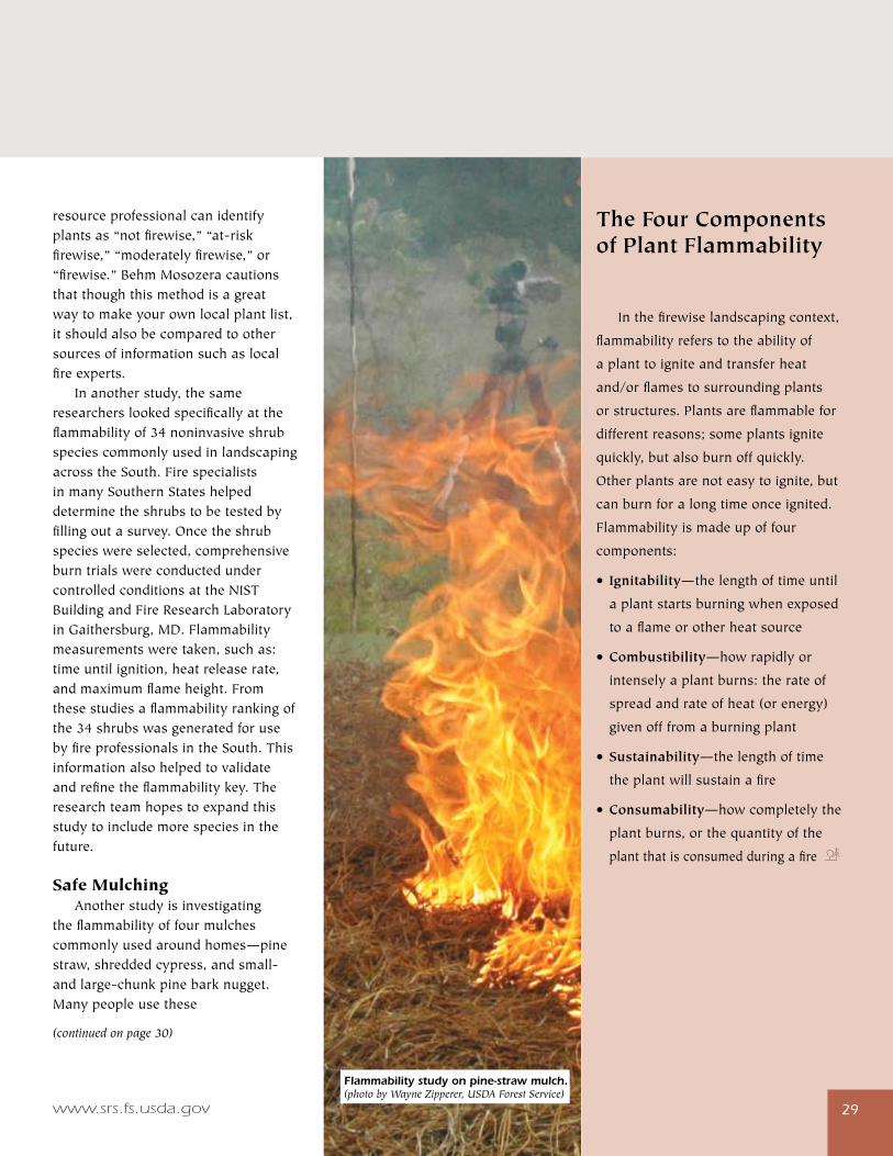
www.srs.fs.usda.gov �9
resourceprofessionalcanidentifyplantsas“notfirewise,”“at-riskfirewise,”“moderatelyfirewise,”or“firewise.”BehmMosozeracautionsthatthoughthismethodisagreatwaytomakeyourownlocalplantlist,itshouldalsobecomparedtoothersourcesofinformationsuchaslocalfireexperts. Inanotherstudy,thesameresearcherslookedspecificallyattheflammabilityof34noninvasiveshrubspeciescommonlyusedinlandscapingacrosstheSouth.FirespecialistsinmanySouthernStateshelpeddeterminetheshrubstobetestedbyfillingoutasurvey.Oncetheshrubspecieswereselected,comprehensiveburntrialswereconductedundercontrolledconditionsattheNISTBuildingandFireResearchLaboratoryinGaithersburg,MD.Flammabilitymeasurementsweretaken,suchas:timeuntilignition,heatreleaserate,andmaximumflameheight.Fromthesestudiesaflammabilityrankingofthe34shrubswasgeneratedforusebyfireprofessionalsintheSouth.Thisinformationalsohelpedtovalidateandrefinetheflammabilitykey.Theresearchteamhopestoexpandthisstudytoincludemorespeciesinthefuture.
Safe Mulching Anotherstudyisinvestigatingtheflammabilityoffourmulchescommonlyusedaroundhomes—pinestraw,shreddedcypress,andsmall-andlarge-chunkpinebarknugget.Manypeopleusethese
(continued on page 30)
�9
The Four Components of Plant Flammability
Inthefirewiselandscapingcontext,
flammabilityreferstotheabilityof
aplanttoigniteandtransferheat
and/orflamestosurroundingplants
orstructures.Plantsareflammablefor
differentreasons;someplantsignite
quickly,butalsoburnoffquickly.
Otherplantsarenoteasytoignite,but
canburnforalongtimeonceignited.
Flammabilityismadeupoffour
components:
• Ignitability—thelengthoftimeuntil
aplantstartsburningwhenexposed
toaflameorotherheatsource
•Combustibility—howrapidlyor
intenselyaplantburns:therateof
spreadandrateofheat(orenergy)
givenofffromaburningplant
•Sustainability—thelengthoftime
theplantwillsustainafire
•Consumability—howcompletelythe
plantburns,orthequantityofthe
plantthatisconsumedduringafire
Flammability study on pine-straw mulch. (photo by Wayne Zipperer, USDA Forest Service)
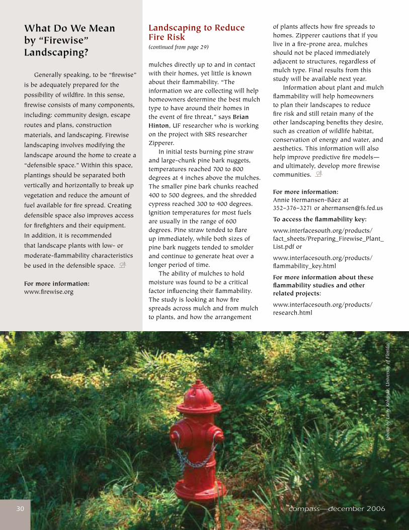
compass—december 2006�0�0 compass—december 2006
Landscaping to Reduce Fire Risk(continued from page 29)
mulchesdirectlyuptoandincontactwiththeirhomes,yetlittleisknownabouttheirflammability.“Theinformationwearecollectingwillhelphomeownersdeterminethebestmulchtypetohavearoundtheirhomesintheeventoffirethreat,”saysBrian Hinton,UFresearcherwhoisworkingontheprojectwithSRSresearcherZipperer. Ininitialtestsburningpinestrawandlarge-chunkpinebarknuggets,temperaturesreached700to800degreesat4inchesabovethemulches.Thesmallerpinebarkchunksreached400to500degrees,andtheshreddedcypressreached300to400degrees.Ignitiontemperaturesformostfuelsareusuallyintherangeof600degrees.Pinestrawtendedtoflareupimmediately,whilebothsizesofpinebarknuggetstendedtosmolderandcontinuetogenerateheatoveralongerperiodoftime. Theabilityofmulchestoholdmoisturewasfoundtobeacriticalfactorinfluencingtheirflammability.Thestudyislookingathowfirespreadsacrossmulchandfrommulchtoplants,andhowthearrangement
ofplantsaffectshowfirespreadstohomes.Zipperercautionsthatifyouliveinafire-pronearea,mulchesshouldnotbeplacedimmediatelyadjacenttostructures,regardlessofmulchtype.Finalresultsfromthisstudywillbeavailablenextyear. Informationaboutplantandmulchflammabilitywillhelphomeownerstoplantheirlandscapestoreducefireriskandstillretainmanyoftheotherlandscapingbenefitstheydesire,suchascreationofwildlifehabitat,conservationofenergyandwater,andaesthetics.Thisinformationwillalsohelpimprovepredictivefiremodels—andultimately,developmorefirewisecommunities.
For more information: AnnieHermansen-Báezat 352–376–[email protected]
To access the flammability key:
www.interfacesouth.org/products/fact_sheets/Preparing_Firewise_Plant_List.pdfor
www.interfacesouth.org/products/flammability_key.html
For more information about these flammability studies and other related projects:
www.interfacesouth.org/products/research.html
Generallyspeaking,tobe“firewise”
isbeadequatelypreparedforthe
possibilityofwildfire.Inthissense,
firewiseconsistsofmanycomponents,
including:communitydesign,escape
routesandplans,construction
materials,andlandscaping.Firewise
landscapinginvolvesmodifyingthe
landscapearoundthehometocreatea
“defensiblespace.”Withinthisspace,
plantingsshouldbeseparatedboth
verticallyandhorizontallytobreakup
vegetationandreducetheamountof
fuelavailableforfirespread.Creating
defensiblespacealsoimprovesaccess
forfirefightersandtheirequipment.
Inaddition,itisrecommended
thatlandscapeplantswithlow-or
moderate-flammabilitycharacteristics
beusedinthedefensiblespace.
For more information:www.firewise.org
What Do We Mean by “Firewise” Landscaping?
(pho
to b
y La
rry
Kohr
nak,
Uni
vers
ity o
f Flo
rida)
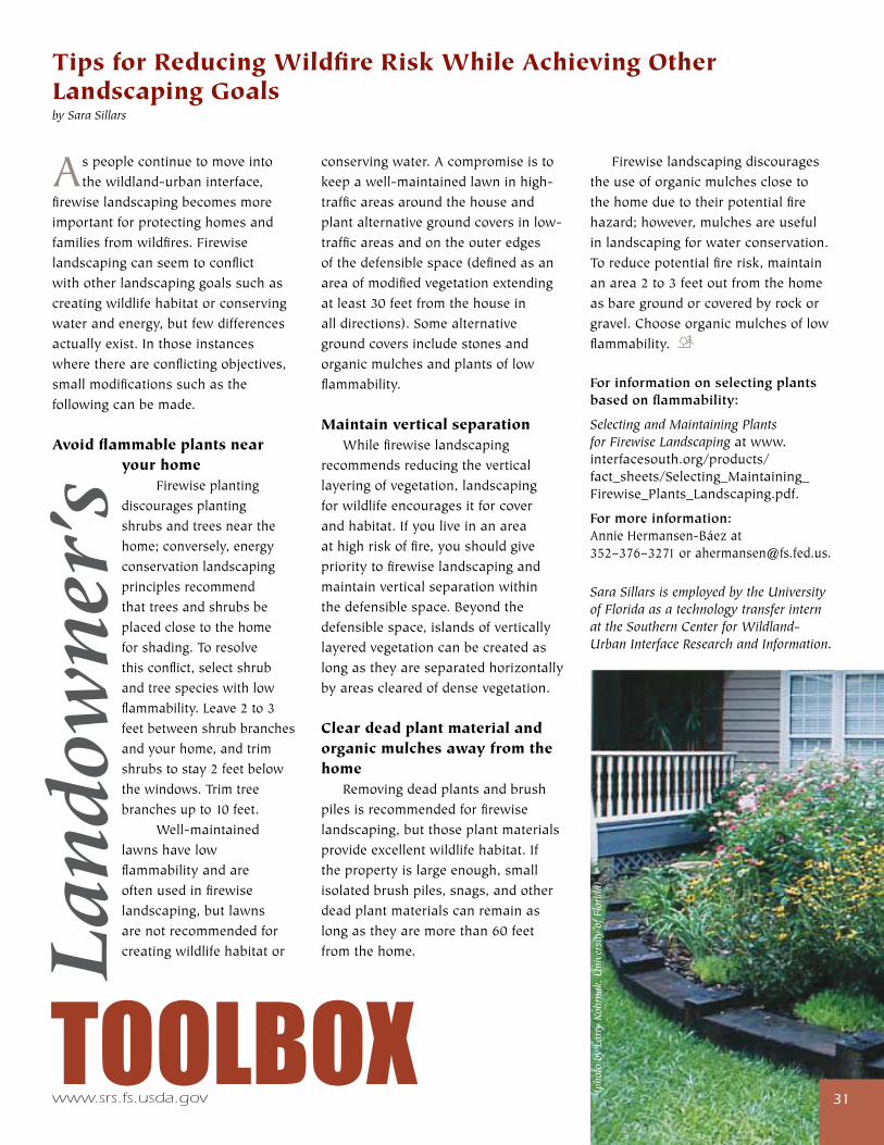
www.srs.fs.usda.gov ��
Aspeoplecontinuetomoveintothewildland-urbaninterface,
firewiselandscapingbecomesmoreimportantforprotectinghomesandfamiliesfromwildfires.Firewiselandscapingcanseemtoconflictwithotherlandscapinggoalssuchascreatingwildlifehabitatorconservingwaterandenergy,butfewdifferencesactuallyexist.Inthoseinstanceswherethereareconflictingobjectives,smallmodificationssuchasthefollowingcanbemade.
Avoid flammable plants near your home Firewiseplantingdiscouragesplantingshrubsandtreesnearthehome;conversely,energyconservationlandscapingprinciplesrecommendthattreesandshrubsbeplacedclosetothehomeforshading.Toresolvethisconflict,selectshrubandtreespecieswithlowflammability.Leave2to3feetbetweenshrubbranchesandyourhome,andtrimshrubstostay2feetbelowthewindows.Trimtreebranchesupto10feet. Well-maintainedlawnshavelowflammabilityandareoftenusedinfirewiselandscaping,butlawnsarenotrecommendedforcreatingwildlifehabitator
��TOOLBOX
Lan
dow
ner
’sconservingwater.Acompromiseistokeepawell-maintainedlawninhigh-trafficareasaroundthehouseandplantalternativegroundcoversinlow-trafficareasandontheouteredgesofthedefensiblespace(definedasanareaofmodifiedvegetationextendingatleast30feetfromthehouseinalldirections).Somealternativegroundcoversincludestonesandorganicmulchesandplantsoflowflammability.
Maintain vertical separation Whilefirewiselandscapingrecommendsreducingtheverticallayeringofvegetation,landscapingforwildlifeencouragesitforcoverandhabitat.Ifyouliveinanareaathighriskoffire,youshouldgiveprioritytofirewiselandscapingandmaintainverticalseparationwithinthedefensiblespace.Beyondthedefensiblespace,islandsofverticallylayeredvegetationcanbecreatedaslongastheyareseparatedhorizontallybyareasclearedofdensevegetation.
Clear dead plant material and organic mulches away from the home Removingdeadplantsandbrushpilesisrecommendedforfirewiselandscaping,butthoseplantmaterialsprovideexcellentwildlifehabitat.Ifthepropertyislargeenough,smallisolatedbrushpiles,snags,andotherdeadplantmaterialscanremainaslongastheyaremorethan60feetfromthehome.
Firewiselandscapingdiscouragestheuseoforganicmulchesclosetothehomeduetotheirpotentialfirehazard;however,mulchesareusefulinlandscapingforwaterconservation.Toreducepotentialfirerisk,maintainanarea2to3feetoutfromthehomeasbaregroundorcoveredbyrockorgravel.Chooseorganicmulchesoflowflammability.
For information on selecting plants based on flammability:
Selecting and Maintaining Plants for Firewise Landscapingatwww.interfacesouth.org/products/fact_sheets/Selecting_Maintaining_Firewise_Plants_Landscaping.pdf.
For more information: AnnieHermansen-Báezat352–376–[email protected].
Sara Sillars is employed by the University of Florida as a technology transfer intern at the Southern Center for Wildland-Urban Interface Research and Information.
Tips for Reducing Wildfire Risk While Achieving Other Landscaping Goalsby Sara Sillars
(pho
to b
y La
rry
Kohr
nak,
Uni
vers
ity o
f Flo
rida)
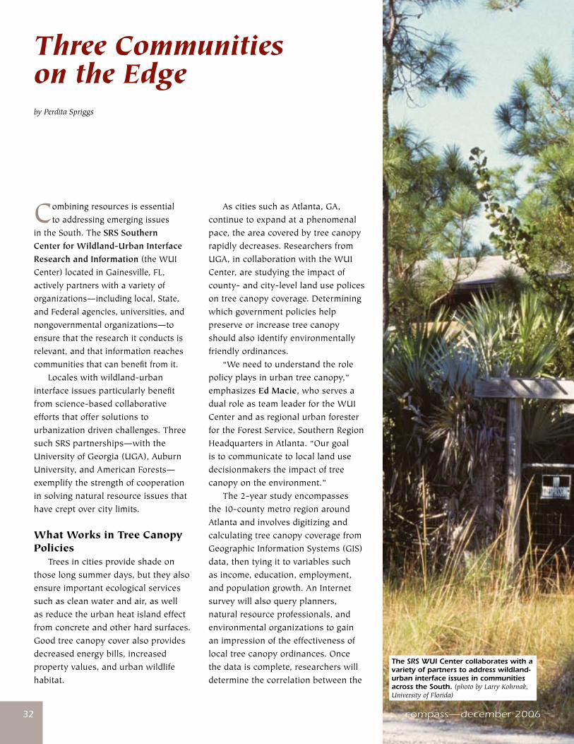
compass—december 2006��
Combiningresourcesisessentialtoaddressingemergingissues
intheSouth.TheSRS Southern Center for Wildland-Urban Interface Research and Information(theWUICenter)locatedinGainesville,FL,activelypartnerswithavarietyoforganizations—includinglocal,State,andFederalagencies,universities,andnongovernmentalorganizations—toensurethattheresearchitconductsisrelevant,andthatinformationreachescommunitiesthatcanbenefitfromit. Localeswithwildland-urbaninterfaceissuesparticularlybenefitfromscience-basedcollaborativeeffortsthatoffersolutionstourbanizationdrivenchallenges.ThreesuchSRSpartnerships—withtheUniversityofGeorgia(UGA),AuburnUniversity,andAmericanForests—exemplifythestrengthofcooperationinsolvingnaturalresourceissuesthathavecreptovercitylimits.
What Works in Tree Canopy Policies Treesincitiesprovideshadeonthoselongsummerdays,buttheyalsoensureimportantecologicalservicessuchascleanwaterandair,aswellasreducetheurbanheatislandeffectfromconcreteandotherhardsurfaces. Goodtreecanopycoveralsoprovidesdecreasedenergybills,increasedpropertyvalues,andurbanwildlifehabitat.
AscitiessuchasAtlanta,GA,continuetoexpandataphenomenalpace,theareacoveredbytreecanopyrapidlydecreases. ResearchersfromUGA,incollaborationwiththeWUICenter,arestudyingtheimpactofcounty-andcity-levellandusepolicesontreecanopycoverage.Determiningwhichgovernmentpolicieshelppreserveorincreasetreecanopyshouldalsoidentifyenvironmentallyfriendlyordinances. “Weneedtounderstandtherolepolicyplaysinurbantreecanopy,”emphasizesEd Macie,whoservesadualroleasteamleaderfortheWUICenterandasregionalurbanforesterfortheForestService,SouthernRegionHeadquartersinAtlanta.“Ourgoalistocommunicatetolocallandusedecisionmakerstheimpactoftreecanopyontheenvironment.” The2-yearstudyencompassesthe10-countymetroregionaroundAtlantaandinvolvesdigitizingandcalculatingtreecanopycoveragefromGeographicInformationSystems(GIS)data,thentyingittovariablessuchasincome,education,employment,andpopulationgrowth.AnInternetsurveywillalsoqueryplanners,naturalresourceprofessionals,andenvironmentalorganizationstogainanimpressionoftheeffectivenessoflocaltreecanopyordinances.Oncethedataiscomplete,researcherswilldeterminethecorrelationbetweenthe
Three Communities on the Edge by Perdita Spriggs
compass—december 2006
The SRS WUI Center collaborates with a variety of partners to address wildland-urban interface issues in communities across the South. (photo by Larry Kohrnak, University of Florida)
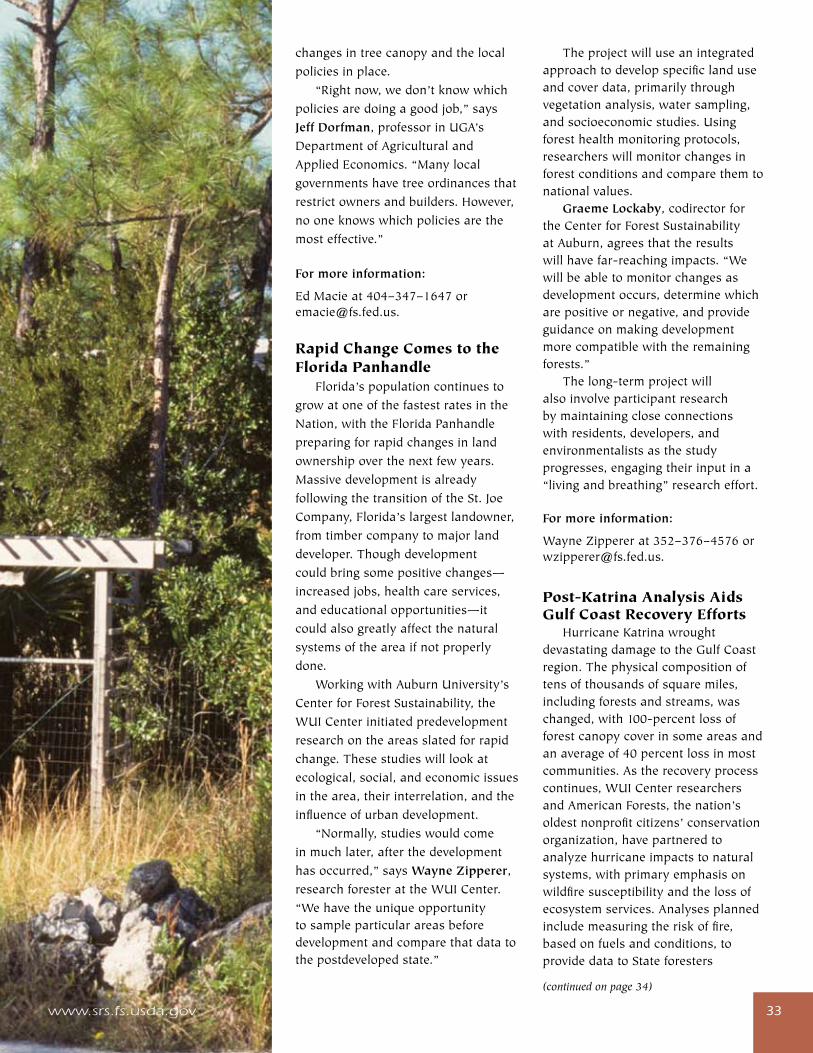
www.srs.fs.usda.gov ��
changesintreecanopyandthelocalpoliciesinplace. “Rightnow,wedon’tknowwhichpoliciesaredoingagoodjob,”saysJeff Dorfman,professorinUGA’sDepartmentofAgriculturalandAppliedEconomics.“Manylocalgovernmentshavetreeordinancesthatrestrictownersandbuilders.However,nooneknowswhichpoliciesarethemosteffective.”
For more information:
EdMacieat404–347–[email protected].
Rapid Change Comes to the Florida Panhandle Florida’spopulationcontinuestogrowatoneofthefastestratesintheNation,withtheFloridaPanhandlepreparingforrapidchangesinlandownershipoverthenextfewyears.MassivedevelopmentisalreadyfollowingthetransitionoftheSt.JoeCompany,Florida’slargestlandowner,fromtimbercompanytomajorlanddeveloper.Thoughdevelopmentcouldbringsomepositivechanges—increasedjobs,healthcareservices,andeducationalopportunities—itcouldalsogreatlyaffectthenaturalsystemsoftheareaifnotproperlydone. WorkingwithAuburnUniversity’sCenterforForestSustainability,theWUICenterinitiatedpredevelopmentresearchontheareasslatedforrapidchange.Thesestudieswilllookatecological,social,andeconomicissuesinthearea,theirinterrelation,andtheinfluenceofurbandevelopment. “Normally,studieswouldcomeinmuchlater,afterthedevelopmenthasoccurred,”saysWayne Zipperer,researchforesterattheWUICenter.“Wehavetheuniqueopportunitytosampleparticularareasbeforedevelopmentandcomparethatdatatothepostdevelopedstate.”
Theprojectwilluseanintegratedapproachtodevelopspecificlanduseandcoverdata,primarilythroughvegetationanalysis,watersampling,andsocioeconomicstudies.Usingforesthealthmonitoringprotocols,researcherswillmonitorchangesinforestconditionsandcomparethemtonationalvalues. Graeme Lockaby,codirectorfortheCenterforForestSustainabilityatAuburn,agreesthattheresultswillhavefar-reachingimpacts.“Wewillbeabletomonitorchangesasdevelopmentoccurs,determinewhicharepositiveornegative,andprovideguidanceonmakingdevelopmentmorecompatiblewiththeremainingforests.” Thelong-termprojectwillalsoinvolveparticipantresearchbymaintainingcloseconnectionswithresidents,developers,andenvironmentalistsasthestudyprogresses,engagingtheirinputina“livingandbreathing”researcheffort.
For more information:
WayneZippererat352–376–[email protected].
Post-Katrina Analysis Aids Gulf Coast Recovery Efforts HurricaneKatrinawroughtdevastatingdamagetotheGulfCoastregion.Thephysicalcompositionoftensofthousandsofsquaremiles,includingforestsandstreams,waschanged,with100-percentlossofforestcanopycoverinsomeareasandanaverageof40percentlossinmostcommunities.Astherecoveryprocesscontinues,WUICenterresearchersandAmericanForests,thenation’soldestnonprofitcitizens’conservationorganization,havepartneredtoanalyzehurricaneimpactstonaturalsystems,withprimaryemphasisonwildfiresusceptibilityandthelossofecosystemservices.Analysesplannedincludemeasuringtheriskoffire,basedonfuelsandconditions,toprovidedatatoStateforesters
(continued on page 34)
��www.srs.fs.usda.gov
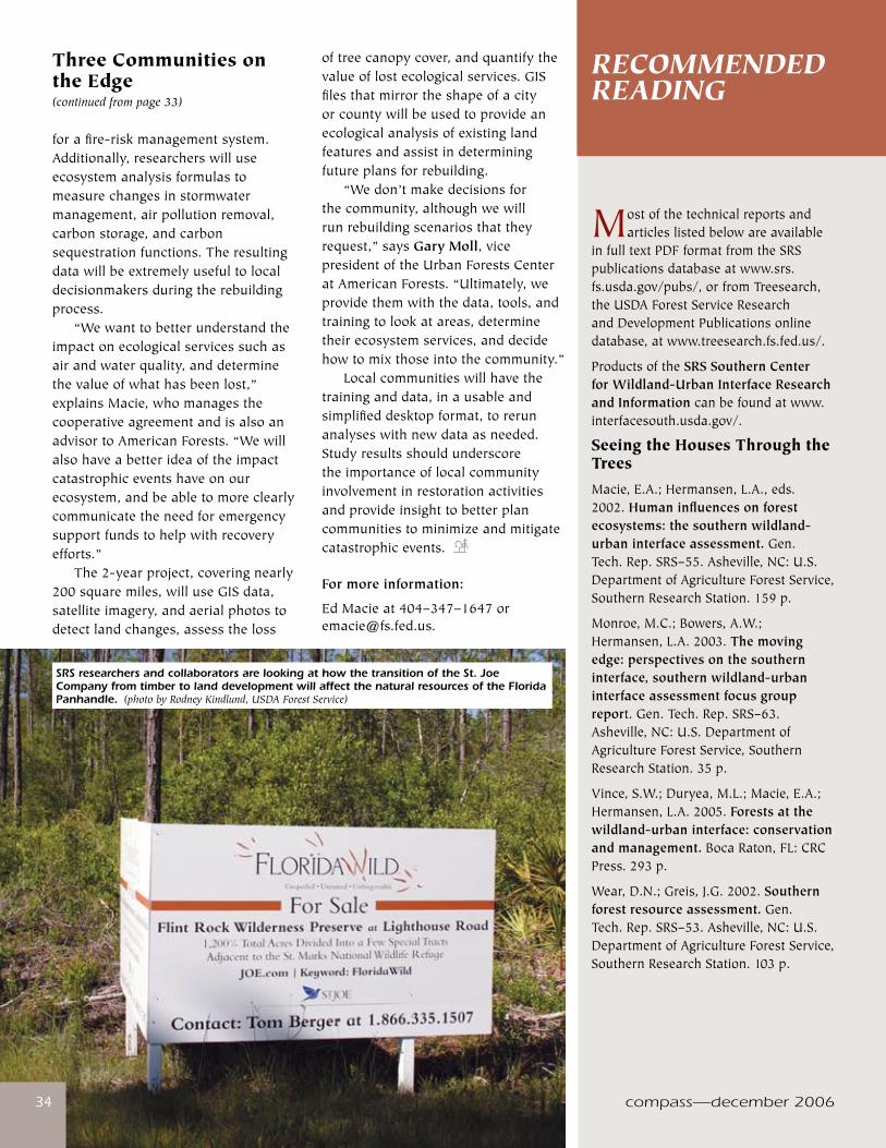
compass—december 2006�4
Mostofthetechnicalreportsandarticleslistedbelowareavailable
infulltextPDFformatfromtheSRSpublicationsdatabaseatwww.srs.fs.usda.gov/pubs/,orfromTreesearch,theUSDAForestServiceResearchandDevelopmentPublicationsonlinedatabase,atwww.treesearch.fs.fed.us/.
ProductsoftheSRS Southern Center for Wildland-Urban Interface Research and Informationcanbefoundatwww.interfacesouth.usda.gov/.
Seeing the Houses Through the TreesMacie,E.A.;Hermansen,L.A.,eds.2002.Human influences on forest ecosystems: the southern wildland-urban interface assessment.Gen.Tech.Rep.SRS–55.Asheville,NC:U.S.DepartmentofAgricultureForestService,SouthernResearchStation.159p.
Monroe,M.C.;Bowers,A.W.;Hermansen,L.A.2003.The moving edge: perspectives on the southern interface, southern wildland-urban interface assessment focus group report.Gen.Tech.Rep.SRS–63.Asheville,NC:U.S.DepartmentofAgricultureForestService,SouthernResearchStation.35p.
Vince,S.W.;Duryea,M.L.;Macie,E.A.;Hermansen,L.A.2005.Forests at the wildland-urban interface: conservation and management.BocaRaton,FL:CRCPress.293p.
Wear,D.N.;Greis,J.G.2002.Southern forest resource assessment.Gen.Tech.Rep.SRS–53.Asheville,NC:U.S.DepartmentofAgricultureForestService,SouthernResearchStation.103p.
RECOMMENDED READING
compass—december 2006�4
Three Communities on the Edge(continued from page 33)
forafire-riskmanagementsystem.Additionally,researcherswilluseecosystemanalysisformulastomeasurechangesinstormwatermanagement,airpollutionremoval,carbonstorage,andcarbonsequestrationfunctions.Theresultingdatawillbeextremelyusefultolocaldecisionmakersduringtherebuildingprocess. “Wewanttobetterunderstandtheimpactonecologicalservicessuchasairandwaterquality,anddeterminethevalueofwhathasbeenlost,”explainsMacie,whomanagesthecooperativeagreementandisalsoanadvisortoAmericanForests.“Wewillalsohaveabetterideaoftheimpactcatastrophiceventshaveonourecosystem,andbeabletomoreclearlycommunicatetheneedforemergencysupportfundstohelpwithrecoveryefforts.” The2-yearproject,coveringnearly200squaremiles,willuseGISdata,satelliteimagery,andaerialphotostodetectlandchanges,assesstheloss
oftreecanopycover,andquantifythevalueoflostecologicalservices.GISfilesthatmirrortheshapeofacityorcountywillbeusedtoprovideanecologicalanalysisofexistinglandfeaturesandassistindeterminingfutureplansforrebuilding. “Wedon’tmakedecisionsforthecommunity,althoughwewillrunrebuildingscenariosthattheyrequest,”saysGary Moll,vicepresidentoftheUrbanForestsCenteratAmericanForests.“Ultimately,weprovidethemwiththedata,tools,andtrainingtolookatareas,determinetheirecosystemservices,anddecidehowtomixthoseintothecommunity.” Localcommunitieswillhavethetraininganddata,inausableandsimplifieddesktopformat,torerunanalyseswithnewdataasneeded.Studyresultsshouldunderscoretheimportanceoflocalcommunityinvolvementinrestorationactivitiesandprovideinsighttobetterplancommunitiestominimizeandmitigatecatastrophicevents.
For more information:
EdMacieat404–347–[email protected].
SRS researchers and collaborators are looking at how the transition of the St. Joe Company from timber to land development will affect the natural resources of the Florida Panhandle. (photo by Rodney Kindlund, USDA Forest Service)
www.srs.fs.usda.gov �5�5
Achtemeier,G.L.;Goodrick,S.;Liu,Y.2005.A coupled modeling system for connecting prescribed fire activity data through CMAQ for simulating regional scale air quality.In:EastFIREconferenceproceedings.Fairfax,VA:GeorgeMasonUniversity.[Numberofpagesunknown].
Liu,Y.;Achtemeier,G.L.;Goodrick,S.2005.Simulation and experiment of air quality effects of prescribed fires in the Southeast.In:EastFIREconferenceproceedings.Fairfax,VA:GeorgeMasonUniversity:1-4.
Time to Burn Butry,D.T.;Prestemon,J.P.2005.Spatio-temporal wildland arson crime functions.SelectedpaperpresentedattheannualmeetingoftheAmericanAgriculturalEconomicsAssociation,July26-29,2005,Providence,RI.28p.
Prestemon,J.P.;Butry,D.T.2005.Time to burn: modeling wildland arson as an autoregressive crime function.AmericanJournalofAgriculturalEconomics.87(3):756-770.
Changing Roles: WUI Professional Development ProgramMacie,E.A.;Hermansen,L.A.,eds.2002.Human influences on forest ecosystems: the southern wildland-urban interface assessment.Gen.Tech.Rep.SRS–55.Asheville,NC:U.S.DepartmentofAgricultureForestService,SouthernResearchStation.159p.
Monroe,M.C.;McDonell,L.W.;Hermansen-Báez,L.A.,eds.2006.Changing roles: wildland-urban interface professional development program.Gainesville,FL:UniversityofFlorida.[Numberofpagesunknown].[Trainingnotebook].
Landscaping to Reduce Fire RiskBehm,A.L.;Long,A.J.;Monroe,M.C.[andothers].2006.Fire in the wildland-urban interface: preparing a firewise plant list for WUI residents.Gainesville,FL:UniversityofFlorida,InstituteofFoodandAgriculturalSciences;U.S.DepartmentofAgricultureForestService,SouthernResearchStation,SouthernCenterforWildland-UrbanInterfaceResearchandInformation.7p.
Doran,J.D.;Randall,C.K.;Long,A.J.2005.Fire in the wildland-urban interface: selecting and maintaining firewise plants for landscaping.Gainesville,FL:UniversityofFlorida,InstituteofFoodandAgriculturalSciences;U.S.DepartmentofAgricultureForestService,SouthernResearchStation,SouthernCenterforWildland-UrbanInterfaceResearchandInformation.7p.
Tips for Reducing Wildfire Risk While Achieving Other Landscaping GoalsRandall,C.K.;Hermansen-Báez,L.A.;Acomb,G.2005.Fire in the wildland-urban interface: reducing wildfire risk while achieving other landscaping goals.Gainesville,FL:UniversityofFlorida,InstituteofFoodandAgriculturalSciences;U.S.DepartmentofAgricultureForestService,SouthernResearchStation,SouthernCenterforWildland-UrbanInterfaceResearchandInformation.7p.
A Tale of Two TownsJohnson,C.Y.;Bowker,J.M.2004.African American land memories.EnvironmentalEthics.26:57-75.
Johnson,C.Y.;Floyd,M.F.2006.A tale of two towns: black and white municipalities respond to urban growth in the South Carolina lowcountry. HumanEcologyReview.13(1):23-38.
Blazing LandscapesMiller,S.R.;Wade,D.D.2003.Re-introducing fire at the urban/wild-land interface: planning for success. Forestry.76(2):253-259.
Mohr,H.H.;Waldrop,T.A.2006.A simulation of wildfire behavior in piedmont forests. In:Gen.Tech.Rep.SRS-92.Asheville,NC:U.S.DepartmentofAgriculture,ForestService,SouthernResearchStation.pp.507-509.
Outcalt,K.W.;Wade,D.D.2004.Fuels management reduces tree mortality from wildfires in southeastern United States. JournalofAppliedForestry.J.28(1):28-34.
Waldrop,T.A.;Mohr,H.H.;Brose,P.H.2006.Early dynamics of Table Mountain pine stands following stand-replacement prescribed fires of varying intensity. In:Gen.Tech.Rep.SRS-92.Asheville,NC:U.S.DepartmentofAgriculture,ForestService,SouthernResearchStation.pp.471-474.
Smoke Gets in Your Eyes Achtemeier,G.L.2005.Planned burn-Piedmont. A local operational numerical meteorological model for tracking smoke on the ground at night: model development and sensitivity tests.InternationalJournalofWildlandFire.14:1-14.
www.srs.fs.usda.gov
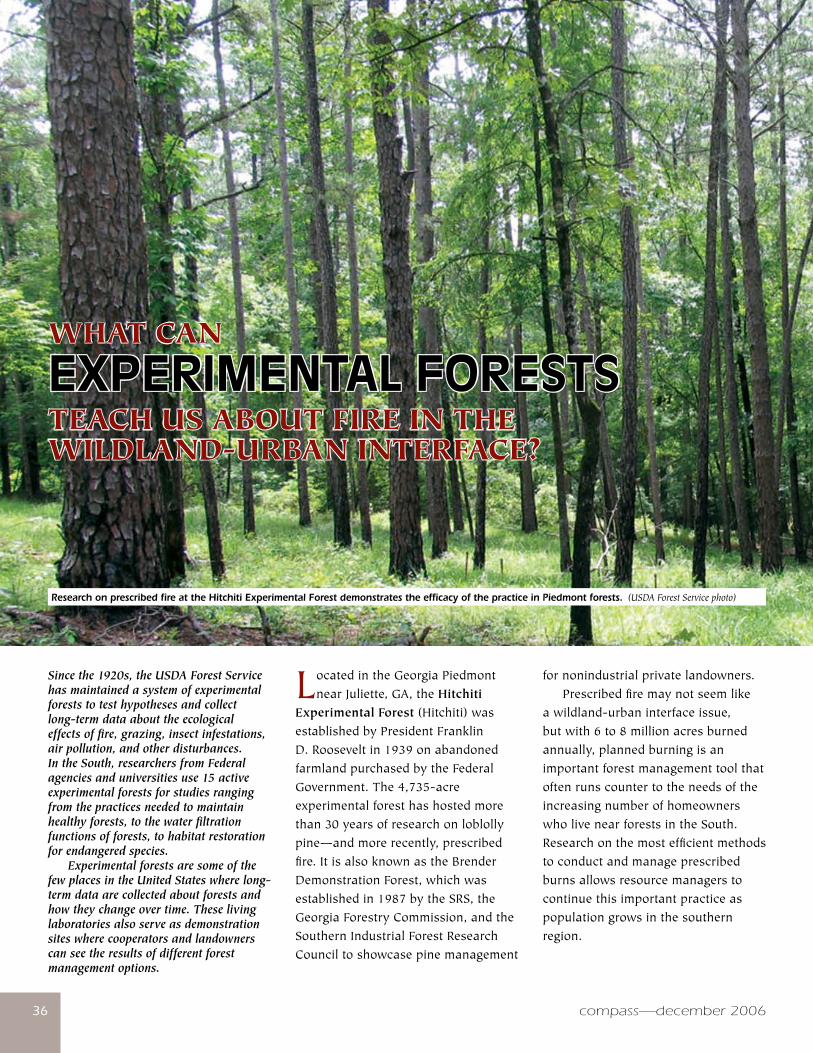
compass—december 2006�6
WHAT CAN
EXPERIMENTALFORESTSTEACH US ABOUT FIRE IN THEWILDLAND-URBAN INTERFACE?
LocatedintheGeorgiaPiedmontnearJuliette,GA,theHitchiti
Experimental Forest (Hitchiti)wasestablishedbyPresidentFranklinD.Rooseveltin1939onabandonedfarmlandpurchasedbytheFederalGovernment.The4,735-acreexperimentalforesthashostedmorethan30yearsofresearchonloblollypine—andmorerecently,prescribedfire.ItisalsoknownastheBrenderDemonstrationForest,whichwasestablishedin1987bytheSRS,theGeorgiaForestryCommission,andtheSouthernIndustrialForestResearchCounciltoshowcasepinemanagement
fornonindustrialprivatelandowners. Prescribedfiremaynotseemlikeawildland-urbaninterfaceissue,butwith6to8millionacresburnedannually,plannedburningisanimportantforestmanagementtoolthatoftenrunscountertotheneedsoftheincreasingnumberofhomeownerswholivenearforestsintheSouth.Researchonthemostefficientmethodstoconductandmanageprescribedburnsallowsresourcemanagerstocontinuethisimportantpracticeaspopulationgrowsinthesouthernregion.
Since the 1920s, the USDA Forest Service has maintained a system of experimental forests to test hypotheses and collect long-term data about the ecological effects of fire, grazing, insect infestations, air pollution, and other disturbances. In the South, researchers from Federal agencies and universities use 15 active experimental forests for studies ranging from the practices needed to maintain healthy forests, to the water filtration functions of forests, to habitat restoration for endangered species. Experimental forests are some of the few places in the United States where long-term data are collected about forests and how they change over time. These living laboratories also serve as demonstration sites where cooperators and landowners can see the results of different forest management options.
�6
Research on prescribed fire at the Hitchiti Experimental Forest demonstrates the efficacy of the practice in Piedmont forests. (USDA Forest Service photo)
compass—december 2006
www.srs.fs.usda.gov �7
ThePiedmont,roughlydefinedastheareabetweentheAppalachianMountainsandtheAtlanticCoastalPlain,extendsfromMarylandtoAlabama.Inthe1800s,muchoftheregionwasclearedforfarming,resultinginextensiveerosionandinsomeareas,soildepletionfromcottonproduction.Areasabandonedinthe1900swererecolonizedbyamixtureofnativehardwoodandpinetrees,withsignificantacresinloblollypine—oftencalledold-fieldpinebecauseitcouldproducedenseseedlingstandsfromafewmaturefencerowtrees.Todayaboutone-thirdofPiedmontforestlandiscoveredbystandsofloblollyorshortleafpine.Hardwood-dominatedforests,mainlyoakandhickory,coveranotherthirdoftheregion;another20percentisdominatedbyamixtureofoakandpine.
Back to the Burn MostoftheHitchitiisinsecond-andthird-growthforest,withstandscontainingloblollyandshortleafpinemixedwithhardwoods.Yellow-poplarandblackwalnutplantationsarealsofoundontheexperimentalforest.Centuriesbefore,NativeAmericansmaintainedthepine-dominatedstandsoftheGeorgiaPiedmontbyfrequentburning.Lightning-ignitedfireswereactuallyrare,sincemostofthestormsintheareacomewithsignificantrainfall.Aperiodoffiresuppressionfollowedreestablishmentofforestsinthe1930s,whenpinestandswereoftenreplacedbyhardwoodsordevelopeddensehardwoodunderstories.Prescribedburningisagainbeingusedtorestoreopenpineforestsforkeyspeciessuchasthered-cockadedwoodpeckerandtoreducefuelsforwildfire. Thoughtheuseofprescribedfiretomaintainthehealthofsouthern
forests,promoteseedproductioninfire-dependentplants,andbenefitwildlifeisalmostuniversallyaccepted,thepracticehasbecomeincreasinglydifficultasmorepeoplemoveclosertoforests.Prescribedburningdoeshavenegativeimpacts,mostlyrelatedtothesmokeitproduces.Smokeparticlescanaggravatehealthproblems,lowerregionalairquality,andreducevisibilityonroadsandbridges.Thoughsomepeoplequestionthecontinueduseofburning,stoppingorevenlimitingitsusewouldquicklyleadtomoreofthethickforestundergrowththatfeedsdestructivewildfire.ScientistsfrommultipleSRSresearchunitsworkwithawiderangeofcooperatorstofindthebestandsafestwaystousefiretorestoreandmaintainforests. In1989,ateamofscientistsledbySRSresearcherDale WadeestablishedaseriesofplotsontheHitchititotestburningregimes—usingdifferentseasonsandfrequencies—onfuelsandtheunderstoryandoverstorycompositionofPiedmontforests.Theytestedresponsestosixdifferenttreatmentsinastandofnaturallyregeneratedloblollyandshortleafpinesthathadnotbeenburnedinover50years,trackingresultsbyperiodicmeasurementsandsurveys.Eachtreatmentwasreplicatedfourtimes,withthe15-yearmeasurementstakenin2004.Kenneth Outcalt,SRSresearchplantecologistbasedinAthens,GA,tookovermanagementofthestudywhenWaderetiredinJanuary2003.“ThereareonlyahandfulofstudieslikethisintheSouth,”saysOutcalt.“ThisistheonlyonethatIamawareofinthePiedmont,orinthesemixedpineandhardwoodstands.”
Visual Proof of Benefits Becausetheplotsarelocatedalongamajorroad—andnexttothepopularHitchitiHikingTrail—researchersand
forestersusetheresearchplotstodemonstratetheeffectsofprescribedburningtothepublic,thedifferencereadilyapparentbetweenplotswherefirehasbeenexcludedandthosethathavebeenburnedfrequentlyatlowintensities.AcompetitivegrantfromtheJointFireScienceProgramwasusedtofundapermanentoutdoordisplay,individualtreatmentplotsigns,andafactsheetforaself-guidedtouroftheprescribedburnstudy. The15-yearmeasurementsshowedthateveninfrequentburningwillcontrolthehardwoodsaplingsandwoodyundergrowththatbegintotakeoverforestunderstories.Burningalsoincreasestheherbaceouscoverintheunderstory,oftenadesirablegoalinrestorationandwildliferecoveryefforts—anditdoesn’taffectthelargepinesthathousethered-cockadedwoodpecker.Thoughprescribedfirewillnotreduceahardwoodmidstory,thepracticegivesmanagersastartingpointforotheroptions.“Burningevery3to4yearsisallmanagersneedtodotokeepfuelloadsdownandreducewildfirehazard,”saysOutcalt.“Ifamanagerwantstocreatered-cockadedwoodpeckerhabitat,theyneedtothinoverstory,removemidstory,andburnonaregularbasis.” Asademonstrationforest,theHitchitihasanon-sitemanagerandstaffwhoprovideoutreachandtourstointerestedgroups.Theprescribedburnstudyisafeaturedstopontoursconductedforotherresearchers,landmanagers,foreignscientists,students,StateandFederalemployees,andtheinterestedpublic.TheexperimentalforestalsoincludesanarboretumofnativeGeorgiatrees,twointerpretivewalkingtrails,andtheHitchitiNaturalArea.–ZH
For more information:KenOutcaltat706–559–[email protected].

compass—december 2006�8
STATION...ar
ou
nd
theExperimentalForests
1 Bent Creek NC
2 Blue Valley NC
3 Coweeta NC
4 John C. Calhoun SC
5 Santee SC
6 Scull Shoals GA
7 Hitchiti GA
8 Olustee FL
9 Chipola FL
10 Escambia AL
11 Tallahatchee MS
12 Delta MS
13 Harrison MS
14 Palustris LA
15 Stephen F. Austin TX
16 Crossett AR
17 Alum Creek AR
18 Sylamore AR
19 Henry F. Koen AR
Thepaceofurbanizationisacceleratinginmanypartsofthe
world,leadingtorapidlychangingenvironmentalconditionsalongurban-ruralinterfaces.Inturn,thesechangingconditionsarecreatingnewecologicalandsocietalchallengesandopportunities.Thisconference,whichwilltakeplaceApril9–13,2007,inAtlanta,GA,seekstobringtogetherresearchers,practitioners,andpolicymakerstosharecurrentresearchresultsandtoidentifyknowledgegapsregardingtheinteractionbetweenurbanizationandnaturalresources.Inparticular,approachesthatfocusonintegratingsocioeconomicandecologicalresearchwillbehighlighted.Thereisfundingavailabletohelpundergraduateandgraduatestudentsattendtheconference,andspecialtimewillbesetasideforpersonalinteractionbetweenkeynotespeakersandstudents. Papertopicsinclude:howecosystemsarebeingalteredby
humaninfluences—directandindirectstressors,restoringandrehabilitatingterrestrialandaquaticecosystemsalteredbyurbanization,howurbanizationaltersthecharacteristicsofnaturaldisturbances,therelationship(s)betweenlandusepoliciesandecologicalprocessesanddisturbancesalongwildland-urbaninterfaces,spatialandscaleaspectsoflandusechange,andmanymore. SponsorsincludeAuburnUniversity’sCenterforForestSustainability,theSRSSouthernCenterforWildland-UrbanInterfaceResearchandInformation,andtheNationalScienceFoundation.
For more information:
www.sfws.auburn.edu/urbanruralinterfaces/orcontactDavidLabandat334–844–[email protected].
August Conference Represents Step Forward for Science Delivery
Report from the Southern Region Conference on Technology Transfer and Extension in Natural Resources held in Hot Springs, AR, August 2–4, 2006
by Mike Rauscher
Forthefirsttimeinrecentmemory,specialistsinnaturalresource
technologytransferandsciencedeliveryfromacrosstheSouthernUnitedStatesgatheredtogetheratoneconferencetoshareexperiencesandconsidernewideas.SouthernRegionalExtensionForesterBill Hubbardservedasprogramchairandmasterofceremoniesfortheconference,whichbroughttogetherprofessionalsintechnologytransferandsciencedeliveryfromtheSRS,ForestServiceStateandPrivateForestry,Stateforestryagencies,anduniversityextension.Unliketheirscienceprogramcounterparts,professionalsintechnologytransferandsciencedeliveryhaverarelyheldregionalmeetingsofthistype.Theknowledgeexchangethattookplaceoverthe3dayswasmetwithenthusiasmbybothpresentersandparticipants,withmanyexpressingthedesiretocontinuethis
Emerging Issues Along Urban/Rural Interfaces ConferenceApril 9–13, 2007, Atlanta, GA
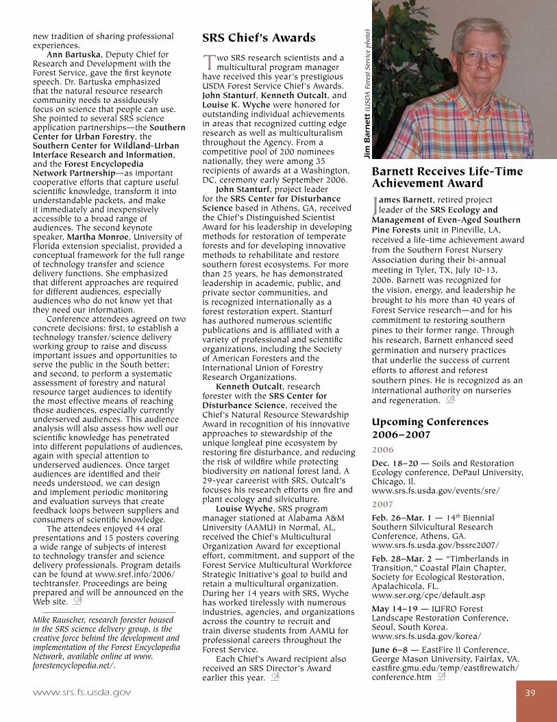
www.srs.fs.usda.gov �9
newtraditionofsharingprofessionalexperiences. Ann Bartuska,DeputyChiefforResearchandDevelopmentwiththeForestService,gavethefirstkeynotespeech.Dr.Bartuskaemphasizedthatthenaturalresourceresearchcommunityneedstoassiduouslyfocusonsciencethatpeoplecanuse.ShepointedtoseveralSRSscienceapplicationpartnerships—theSouthern Center for Urban Forestry,theSouthern Center for Wildland-Urban Interface Research and Information,andtheForest Encyclopedia Network Partnership—asimportantcooperativeeffortsthatcaptureusefulscientificknowledge,transformitintounderstandablepackets,andmakeitimmediatelyandinexpensivelyaccessibletoabroadrangeofaudiences.Thesecondkeynotespeaker,Martha Monroe,UniversityofFloridaextensionspecialist,providedaconceptualframeworkforthefullrangeoftechnologytransferandsciencedeliveryfunctions.Sheemphasizedthatdifferentapproachesarerequiredfordifferentaudiences,especiallyaudienceswhodonotknowyetthattheyneedourinformation. Conferenceattendeesagreedontwoconcretedecisions:first,toestablishatechnologytransfer/sciencedeliveryworkinggrouptoraiseanddiscussimportantissuesandopportunitiestoservethepublicintheSouthbetter;andsecond,toperformasystematicassessmentofforestryandnaturalresourcetargetaudiencestoidentifythemosteffectivemeansofreachingthoseaudiences,especiallycurrentlyunderservedaudiences.Thisaudienceanalysiswillalsoassesshowwellourscientificknowledgehaspenetratedintodifferentpopulationsofaudiences,againwithspecialattentiontounderservedaudiences.Oncetargetaudiencesareidentifiedandtheirneedsunderstood,wecandesignandimplementperiodicmonitoringandevaluationsurveysthatcreatefeedbackloopsbetweensuppliersandconsumersofscientificknowledge. Theattendeesenjoyed44oralpresentationsand15posterscoveringawiderangeofsubjectsofinteresttotechnologytransferandsciencedeliveryprofessionals.Programdetailscanbefoundatwww.sref.info/2006/techtransfer.ProceedingsarebeingpreparedandwillbeannouncedontheWebsite.
Mike Rauscher, research forester housed in the SRS science delivery group, is the creative force behind the development and implementation of the Forest Encyclopedia Network, available online at www.forestencyclopedia.net/.
SRS Chief’s Awards
TwoSRSresearchscientistsandamulticulturalprogrammanager
havereceivedthisyear’sprestigiousUSDAForestServiceChief’sAwards.John Stanturf,Kenneth Outcalt,andLouise K. WychewerehonoredforoutstandingindividualachievementsinareasthatrecognizedcuttingedgeresearchaswellasmulticulturalismthroughouttheAgency.Fromacompetitivepoolof200nomineesnationally,theywereamong35recipientsofawardsataWashington,DC,ceremonyearlySeptember2006. John Stanturf,projectleaderfortheSRS Center for Disturbance SciencebasedinAthens,GA,receivedtheChief’sDistinguishedScientistAwardforhisleadershipindevelopingmethodsforrestorationoftemperateforestsandfordevelopinginnovativemethodstorehabilitateandrestoresouthernforestecosystems.Formorethan25years,hehasdemonstratedleadershipinacademic,public,andprivatesectorcommunities,andisrecognizedinternationallyasaforestrestorationexpert.Stanturfhasauthorednumerousscientificpublicationsandisaffiliatedwithavarietyofprofessionalandscientificorganizations,includingtheSocietyofAmericanForestersandtheInternationalUnionofForestryResearchOrganizations. Kenneth Outcalt,researchforesterwiththeSRS Center for Disturbance Science,receivedtheChief’sNaturalResourceStewardshipAwardinrecognitionofhisinnovativeapproachestostewardshipoftheuniquelongleafpineecosystembyrestoringfiredisturbance,andreducingtheriskofwildfirewhileprotectingbiodiversityonnationalforestland.A29-yearcareeristwithSRS,Outcalt’sfocuseshisresearcheffortsonfireandplantecologyandsilviculture. Louise Wyche,SRSprogrammanagerstationedatAlabamaA&MUniversity(AAMU)inNormal,AL,receivedtheChief’sMulticulturalOrganizationAwardforexceptionaleffort,commitment,andsupportoftheForestServiceMulticulturalWorkforceStrategicInitiative’sgoaltobuildandretainamulticulturalorganization.Duringher14yearswithSRS,Wychehasworkedtirelesslywithnumerousindustries,agencies,andorganizationsacrossthecountrytorecruitandtraindiversestudentsfromAAMUforprofessionalcareersthroughouttheForestService. EachChief’sAwardrecipientalsoreceivedanSRSDirector’sAwardearlierthisyear.
Barnett Receives Life-Time Achievement Award
James Barnett,retiredprojectleaderoftheSRS Ecology and
Management of Even-Aged Southern Pine ForestsunitinPineville,LA,receivedalife-timeachievementawardfromtheSouthernForestNurseryAssociationduringtheirbi-annualmeetinginTyler,TX,July10-13,2006.Barnettwasrecognizedforthevision,energy,andleadershiphebroughttohismorethan40yearsofForestServiceresearch—andforhiscommitmenttorestoringsouthernpinestotheirformerrange.Throughhisresearch,Barnettenhancedseedgerminationandnurserypracticesthatunderliethesuccessofcurrenteffortstoafforestandreforestsouthernpines.Heisrecognizedasaninternationalauthorityonnurseriesandregeneration.
Upcoming Conferences2006–20072006
Dec. 18–20—SoilsandRestorationEcologyconference,DePaulUniversity,Chicago,Il. www.srs.fs.usda.gov/events/sre/
2007
Feb. 26–Mar. 1—14thBiennialSouthernSilviculturalResearchConference,Athens,GA. www.srs.fs.usda.gov/bssrc2007/
Feb. 28–Mar. 2—“TimberlandsinTransition,”CoastalPlainChapter,SocietyforEcologicalRestoration,Apalachicola,FL. www.ser.org/cpc/default.asp
May 14–19—IUFROForestLandscapeRestorationConference,Seoul,SouthKorea. www.srs.fs.usda.gov/korea/
June 6–8—EastFireIIConference,GeorgeMasonUniversity,Fairfax,VA.eastfire.gmu.edu/temp/eastfirewatch/conference.htm
Jim
Bar
net
t (U
SDA
For
est S
ervi
ce p
hoto
)
compass—december 200640
Natural Resources Inventory and Monitoring1Bentley,JamesW.;Cartwright,Walter
E.2006.Alabama’s timber industry—an
assessment of timber product output and
use, 2003.Resour.Bull.SRS-107.Asheville,
NC:U.S.DepartmentofAgriculture,Forest
Service,SouthernResearchStation.45p.
In2003,roundwoodoutputfrom
Alabama’sforeststotaled1.08billion
cubicfeet.Millbyproductsgenerated
fromprimarymanufacturersamounted
to410millioncubicfeet.Almostallplant
residueswereusedprimarilyforfueland
fiberproducts.Pulpwoodwastheleading
roundwoodproductat521millioncubic
feet;sawlogsrankedsecondat404million
cubicfeet;veneerlogswerethirdat107
millioncubicfeet.Thenumberofprimary
processingplantswas178.Totalreceipts
amountedto1.1billioncubicfeet.
2Bentley,J.W.;Howell,M.;Johnson,
T.G.2006.Florida’s timber industry—an
assessment of timber product output and
use, 2003.Resour.Bull.SRS-110.Asheville,
NC:U.S.DepartmentofAgriculture,Forest
Service,SouthernResearchStation.40p.
In2003,volumeofroundwoodoutput
fromFlorida’sforeststotaled509million
cubicfeet,2percentmorethanin1999.
Millbyproductsgeneratedfromprimary
manufacturersdecreasedto151million
cubicfeet.Almostallplantresidueswere
usedprimarilyforfuelandfiberproducts.
Pulpwoodwastheleadingroundwood
productat271millioncubicfeet;sawlogs
rankedsecondat171millioncubicfeet;
veneerlogswerethirdat32millioncubic
feet.Totalreceiptsdeclined2percentto
484millioncubicfeet.Thenumberof
primaryprocessingplantsdeclinedfrom93
in1999to92in2003.
NEW PRODUCTS
40
Autu
mn
at
SRS
Hea
dquar
ters
, A
shev
ille,
NC
(ph
oto
by R
odne
y K
indl
und,
USD
A F
ores
t Ser
vice
)
compass—december 2006
www.srs.fs.usda.gov 4�
3Bentley,JamesW.;Johnson,T.G.
2006.North Carolina harvest and
utilization study, 2002.Resour.Bull.
SRS-109.Asheville,NC:U.S.Department
ofAgriculture,ForestService,Southern
ResearchStation.23p.
In2002,aharvestandutilizationstudy
wasconductedon108operations
throughoutNorthCarolina.Therewere
2,926totaltreesmeasured;1,693,or58
percent,weresoftwood,while1,233,or42
percent,werehardwood.Resultsfromthis
studyshowedthat86percentofthetotal
softwoodvolumemeasuredwasutilized
foraproduct,and14percentwasleftas
loggingresidue.Seventy-fivepercentof
thetotalhardwoodvolumemeasuredwas
utilizedforaproduct,while25percent
wasleftasloggingresidue.
4Howell,Michael;Becker,CharlesW.
2006.Virginia’s timber industry—an
assessment of timber product output and
use, 2003.Resour.Bull.SRS-108.Asheville,
NC:U.S.DepartmentofAgriculture,Forest
Service,SouthernResearchStation.44p.
In2003,roundwoodoutputfromVirginia’s
forestsdecreasedto488millioncubicfeet.
Millbyproductsgeneratedfromprimary
manufacturerstotaled174millioncubic
feet,6percentlessthanin2001.Seventy-
fivepercentoftheplantresidueswereused
primarilyforfuelandfiberproducts.Saw
logsweretheleadingroundwoodproduct
at229millioncubicfeet;pulpwoodranked
secondat186millioncubicfeet;composite
panelswerethirdat54millioncubicfeet.
Thenumberofprimaryprocessingplants
decreasedfrom248in2001to234in
2003.Totalreceiptsremainedstableat492
millioncubicfeet.
5Howell,M.;New,B.D.;Mann,M.C.
2006.North Carolina’s timber industry—
an assessment of timber product
output and use, 2003.Resour.Bull.
SRS-112.Asheville,NC:U.S.Department
ofAgriculture,ForestService,Southern
ResearchStation.42p.
In2003,industrialroundwoodoutputfrom
NorthCarolina’sforeststotaled776million
cubicfeet,2percentmorethanin2001.
Millbyproductsgeneratedfromprimary
manufacturersincreasedfour-tenthsof1
percentto315millioncubicfeet.Almost
allplantresidueswereusedprimarilyfor
fuelandfiberproducts.Sawlogswerethe
leadingroundwoodproductat399million
cubicfeet;pulpwoodrankedsecondat267
millioncubicfeet;veneerlogswerethird
at57millioncubicfeet.Thenumberof
primaryprocessingplantsdeclinedfrom
249in2001to235in2003.Totalreceipts
increased20.7millioncubicfeetto742
millioncubicfeet.
6Johnson,T.G.;Steppleton,C.D.2006.
Southern pulpwood production, 2004.
Resour.Bull.SRS-111.Asheville,NC:U.S.
DepartmentofAgriculture,ForestService,
SouthernResearchStation.39p.
In2004,theSouth’sproductionof
pulpwoodincreasedfrom61.3million
cordsin2003to63.8millioncords.
Roundwoodproductionincreased6percent
to47.0millioncordsandaccountedfor74
percentofthetotalpulpwoodproduction.
Theuseofwoodresiduedeclined1percent
to16.8millioncords.Alabamaledthe
Southintotalproductionat10.2million
cords.In2004,89millswereoperatingand
drawingwoodfromthe13SouthernStates.
PulpingcapacityofSouthernmillsdeclined
from127,390tonsperdayin2003to
125,182tonsperday,andstillaccounts
formorethan70percentoftheNation’s
pulpingcapacity.
7Oswalt,SonjaN.;Brandeis,Thomas
J.;Dimick,BrittaP.2006.Phytosociology
of vascular plants on an international
biosphere reserve: Virgin Islands
National Park, St. John, U.S. Virgin
Islands.CaribbeanJournalofScience.
42(1):53-66.
TheVirginIslandsNationalParkonthe
islandofSt.John,U.S.VirginIslands,is
oneofthefewprotectedcontiguoustracts
ofLesserAntilleandryandmoistforest
intheCaribbeanbasin,abiodiversity
“hotspot”ofinternationallyrecognized
importance.Weinvestigatedthe
relationshipsofvegetationcommunities
toenvironmentalvariablesandcompared
therelativecontributionofnativeand
introducedspeciesinextantforest
communitiesonSt.Johnusinganisland-
wideforestvegetationinventoryand
monitoringnetworkofpermanentplots.
Forest Ecosystem Restoration and Management8Bragg,DonC.2005.Learning the hard
way: the beginnings of Forest Service
research in Arkansas.JournalofForestry.
103(5):248-254.
Peopletakeforgrantedthatforestry,and
theresearchthatsupportsit,hasalways
beenaround.Inreality,theestablishment
ofaresearchbasistothepracticesofthe
ForestServicehasbeenalong-running
struggle.InArkansas,ForestServicestaff
beganassistinglandownersjustafterthe
turnofthe20thcentury,andformedthe
basisofmostforestresearchandextension
untilotheragenciesstartedcontributing
substantiallyaround1940.Theformation
oftheSouthernForestExperiment
Stationin1921,eventuallyfollowedby
theestablishmentoftheCrossettand
Sylamoreexperimentalforests,further
from the Southern Research Station...
4�www.srs.fs.usda.gov
compass—december 20064�
strengthenedtheforestryresearch
programinArkansas,andallowedforthe
widespreadimplementationofsustainable,
scientificallybasedforestry.
9Lang,Ping;Dane,Fenny;Kubisiak,
ThomasL.2006.Phylogeny of Castanea
(Fagaceae) based on chloroplast trnT-L-F
sequence data.TreeGenetics&Genomes.
2(3):132-139.
SpecieswithinthegenusCastanea(the
chestnutsandchinkapins)arenative
tothetemperatezonesoftheNorthern
Hemisphere,fromAsiatoEuropeand
NorthAmerica.ThegenusCastanea
hasbeendividedintothreesections
basedonburandcupulecharacteristics.
ChloroplastDNAsequencedatasuggest
thatevolutionaryinterrelationships
amongtheCastaneaspeciesmaybemore
appropriatelydescribednotbyburand
cupulecharacteristics,butbycurrent
geographicdistributions.Anumberof
chloroplastDNAmarkersarenowavailable
forhypothesizingthelikelymaternal
lineageofanyCastaneatree,anissueof
greatimportancetothebreedingefforts
aimedatrestoringAmericanchestnutto
forestsoftheEasternUnitedStates.
10Ma,Siyan;Chen,Jiquan;Butnor,John
R.[andothers].2005.Biophysical controls
on soil respiration in the dominant patch
types of an old-growth, mixed-conifer
forest.ForestScience.51(3):221-232.
California’sSierraNevadaold-growth,
mixed-coniferforestsarecomprisedof
severalecologicalpatchtypes,which
cyclecarboninverydifferentways.These
patchesareincloseproximityandvary
fromlargeforesttrees(sugarpine,redfir,
whitefir),tonitrogen-fixingceanothus
shrubsanddrysandypatcheswith
drought-adaptedplants.Tounderstand
thefactorswhichcontrolseasonallosses
ofcarbontotheatmosphere,weused
portableandautomatedmeasurement
systemstosamplesoilrespirationfrom
snowmelttomid-summerdrought.The
highestrespirationrateswerefoundinthe
shrubsystem,followedbytheforestand
baresoilpatches.Thesoilrespirationrate
variedwithchangesindailytemperature,
thoughmoistureeffectsdominated
theresponse.Shortlyaftersnowmelt,
saturatedconditionsinhibitedrespiration,
therewasalongperiodinthespring
whereoptimumsoilmoistureproduced
thehighestfluxrates,andthensummer
droughtreducedrates.Usingthisdata
wedevelopedanexponentialmodelto
calculatethetotalsoilCfluxsummedby
anarea-weightedaverageacrossallthree
patchtypes(660±163gCm-2)foryear
2000.
11Roberds,JamesH.;Strom,Brian
L.2006.Repeatability estimates for
oleoresin yield measurements in three
species of the southern pines.Forest
EcologyandManagement.228:215-224.
Thesouthernpinebeetleisthemost
destructiveinsectpestofpinesinhabiting
theSoutheasternUnitedStates.Individual
treesofthesespeciesthatdischargelarge
quantitiesofoleoresinuponwounding
areconsideredtobemostresistantto
attackbythisaggressivebarkbeetle.A
tree’scapacitytoproduceoleoresincan
beassessedbymeasuringamountsof
thischemicalcompositethatflowfrom
smallsurfacewoundscutintoitstrunk
atbreastheight.Toevaluatetheability
oftreestoyieldoleoresin,investigators
needtoknowhowmanyofthese
measurementsarerequiredpertreefora
properassessment.Answerstothisand
otherrelatedsignificantquestionsdealing
withvariabilityintreeoleoresinyieldcan
beobtainedbystudyingitsrepeatability,
ameasureoftraitconsistencywithin
individuals.Inthispaperwereport
estimatesofrepeatabilityforoleoresin
yieldinthreespeciesofthesouthernpines.
12SwordSayer,MaryAnne;Haywood,
JamesD.2006.Fine root production and
carbohydrate concentrations of mature
longleaf pine (Pinus palustris P. Mill.) as
affected by season of prescribed fire and
drought.Trees.20:165-175.
Ourgoalwastoassesshowseasonof
prescribedfireaffectsrootgrowthand
carbohydrateconcentrationsoflongleaf
pine,andidentifythetimeofyearwhen
fireleastaffectsrootprocesses.Root
growthwaslessonJuly-burnedplots
thanoneitherMarch-orMay-burned
plots;weattributethistotheeffectoffire
oninteractionbetweenrootprocesses
andsoilenvironment.Soilmoistureand
temperaturemayhavebeenlessfavorable
forrootgrowthontheJuly-burnedplots.
Wedeterminedthatfirewouldimpacttree
growthlessinNovemberthroughMarch.
Also,severedroughtwasassociatedwith
a3-monthdelayinpeakrootgrowth,
andprolongeddroughtcoincidedwith
areductioninrootstarchstorage.We
concludethatseasonofprescribedfire
affectsrootprocesses,butthatsevereor
prolongeddroughtmayinteractwithor
overridetheseeffects.
Forest Values, Uses, and Policies13Behm,AnnaL.;Duryea,Mary
L.2003.Fire in the wildland-urban
interface: considering fire in Florida’s
ecosystems.Gainesville,FL:Universityof
Florida,InstituteofFoodandAgricultural
Sciences;USDAForestService,Southern
ResearchStation,SouthernCenterfor
Wildland-UrbanInterfaceResearchand
Information.14p.[Editor’snote:This
publicationwasfundedbytheNational
FirePlanthroughtheUSDAForestService,
SouthernResearchStation,Southern
CenterforWildland-UrbanInterface
ResearchandInformation.]
ManyFloridiansliveclosetoorwithin
naturalecosystemsofFloridainanarea
termedthewildland-urbaninterface.The
wildlandsassociatedwiththeinterface
compass—december 20064�
www.srs.fs.usda.gov 4�
dependonfiretomaintainbiodiversityand
health.Intheabsenceoffire,vegetation
quicklygrows,creatingfuelforvery
intensewildfire.Inmanywildlands,firein
theseecosystemsisinevitablebecauseof
lightningorhuman-causedignitions.With
thisthreatofwildfire,theserenityofliving
intheseenvironmentscanbedisrupted.
Becauseofthedifferencesinplantspecies,
soils,andwateravailability,wildfire
frequencyandintensityvaryamongthe
ecosystemswhichareassociatedwiththe
wildland-urbaninterface.
14Behm,AnnaL.;Long,AlanJ.;Monroe,
MarthaC.[andothers].[Dateunknown].
Fire in the wildland-urban interface:
preparing a firewise plant list for WUI
residents.Gainesville,FL:Universityof
Florida,InstituteofFoodandAgricultural
Sciences;USDAForestService,Southern
ResearchStation,SouthernCenterfor
Wildland-UrbanInterfaceResearchand
Information.11p.[Editor’snote:WayneC.
ZippererandL.AnnieHermansen-Báez,
SouthernResearchStation,co-authored
thispublication.]
Thisisaguideformakinglocal
firewiseplantliststhatcanassistlocal
homeownerswithfirewiselandscaping.
Itincludesastep-by-stepmethodfor
determiningwhetherornotaparticular
plantisappropriateforfirewise
landscaping.Extensionagents,nursery
personnel,landscapearchitects,and
urbanforesterscanusethispublicationfor
preparinglocalfirewiseplantlists.
15Clark,Alexander,III;Daniels,Richard
F.;Jordan,Lewis.2005.Juvenile/mature
wood transition in loblolly pine as
defined by annual ring specific gravity,
proportion of latewood, and microfibril
angle.WoodandFiberScience.38(2):
292-299.
Intensivelymanagedsouthernpines
growrapidlyduringtheearlyyearsof
rotation,reachmerchantablesizeata
youngerage,andcontainasignificantly
highproportionofjuvenilewood.Juvenile
woodisacylinderofwoodsurrounding
thepithandextendingthelengthofall
trees,andisproducedbyyoungcambium
intheliveactivecrown.Juvenilewood
haslowerstiffnessandstrengthand
morelongitudinalshrinkagethanmature
wood,andisnotasdesirableforlumber
production.Landownersandlumber
manufacturesneedtounderstandtheeffect
offorestmanagementpracticesonjuvenile
woodformation.Thispaperevaluates
twomethodsfordeterminingtheyearof
transitionwhenatreestopsproducing
juvenilewoodandstartstoproducemature
wood4.5feetaboveground,basedon
annualringspecificgravity,proportionof
latewood,andmircofibrilangle.
16Doran,J.Douglas;Randall,Cotton
K.;Long,AlanJ.2004.Fire in the
wildland-urban interface: selecting
and maintaining firewise plants for
landscaping.Gainesville,FL:Universityof
Florida,InstituteofFoodandAgricultural
Sciences;USDAForestService,Southern
ResearchStation,SouthernCenterfor
Wildland-UrbanInterfaceResearchand
Information.7p.
Oneofthemajorissuesinthesouthern
wildland-urbaninterfaceisthelossof
homestowildfire.Selectinglandscape
plantsbasedontheirflammabilitycan
bechallengingforhomeownersand
landscapers,asfewplantguideslist
firewiseplantsorrankplantsbytheir
flammability.Thispublicationoutlines
keyplantcharacteristicsthathavethe
greatesteffectonflammability,which
canhelphomeownersmakeinformed
decisionsaboutwhichplantstoselect
whencreatinganareaofdefensiblespace,
orhowtomodifyexistingplantstoprevent
thespreadofwildfire.Plantcharacteristics
arediscussedatthreelevels:plant
parts(primarilyleaves),wholeplants,
andgroupsofplants.Selectingfirewise
plantscanreducewildfirerisk;butduring
droughtconditions,mostplantswillburnif
exposedtoenoughheat,regardlessoftheir
flammability.
www.srs.fs.usda.gov 4�
(ph
oto
by L
arry
Koh
rnak
, Uni
vers
ity o
f Flo
rida)
compass—december 200644
importantfactorsinfluencingbuilding
survivalduringawildfirearefireintensity,
vegetationcharacteristics,andbuilding
materials(especiallyroofing).Strategiesfor
protectinghomesfromwildfireshavebeen
developedwiththesefactorsinmind.This
Extensionfactsheetexaminesfactorsthat
affectfirebehavior,strategiestoreducefire
risk,andexamplesofriskreduction.
19Shupe,ToddF.;Groom,LeslieH.;
Eberhardt,ThomasL.[andothers].2006.
Mechanical and physical properties of
composite panels manufactured from
Chinese tallow tree furnish.Forest
ProductsJournal.56(6):64-67.
Chinesetallowtreeisanoxious,invasive
plantintheSoutheasternUnitedStates.
Itisgenerallyconsideredanuisance
andhasnocurrentcommercialuse.The
objectiveofthisresearchwastodetermine
thetechnicalfeasibilityofusingthestem
woodofthisspeciesforparticleboard,
fiberboard,andstructuralflakeboard.Due
toitsrapidgrowth,Chinesetallowtree
couldbealeadingrawmaterialforbio-
basedcompositepanels.Thispreliminary
studyindicatedthatChinesetallowtree
canbesuccessfullyusedforallthree
compositepaneltypestoproducepanels
meetingvariousAmericanNational
StandardsInstitutegradesbasedon
modulusofrupture,modulusofelasticity,
andinternalbond.
Threats to Forest Health20Fraedrich,StephenW.;Cram,
MichelleM.;Zarnoch,StanleyJ.2005.The
effect of fallow on Longidorus americanus,
a nematode associated with stunting of
loblolly pine seedlings in Georgia (USA).
Nematology7(4):487-493.
Basicinformationaboutsoil-bornepests
thatoccurinforesttreenurseriesis
essentialtodevelopmentofintegrated
pestmanagementprograms.Longidorus
americanusisaplant-parasiticnematode
thatcausesseverestuntingofloblolly
17Eberhardt,ThomasL.;So,Chi-Leung;
Herlihy,AmyH.;So,Po-Wah.2006.Use of
gadolinium chloride as a contrast agent
for imaging spruce knots by magnetic
resonance.WoodandFiberScience.38(3):
527-234.
Treatmentsofsprucewoodblocks
withaparamagneticsalt,gadolinium
(III)chloride,incombinationwith
solventpretreatments,providedthefirst
assessmentofcontrastagentsasameans
toenhancethevisualizationofwood
featuresbymagneticresonanceimaging
(MRI).Imagescollectedincollaboration
withresearchersattheMRCClinical
SciencesCentre(ImperialCollege,London,
UK)showedthattheincorporated
gadoliniumionsresultedinanabruptloss
insignalinazonearoundeachknot.This
phenomenonallowsthevisualizationof
compressionwoodknowntosurround
softwoodknots.Applicationsinclude
studiesonwoodanatomybyMRIandthe
modelingofwooddefects.
18Randall,CottonK.2003.Fire in the
wildland-urban interface: understanding
fire behavior.Gainesville,FL:Universityof
Florida,InstituteofFoodandAgricultural
Sciences;USDAForestService,Southern
ResearchStation,SouthernCenterfor
Wildland-UrbanInterfaceResearchand
Information.6p.[Editor’snote:This
publicationwasfundedbytheNational
FirePlanthroughtheUSDAForestService,
SouthernResearchStation,Southern
CenterforWildland-UrbanInterface
ResearchandInformation.]
Wildlandfiresposeaseriousthreatto
humanlifeandpropertywhenhomesare
builtinfire-proneecosystems.Developing
abasicunderstandingofthefactors
thatdeterminewildfiremovementand
intensity(collectivelycalledfirebehavior)
willallowhomeownersandbuildersto
assessfirehazardontheirpropertyand
determinewhattheycandotominimize
risk.Researchhasshownthatthemost
compass—december 200644
(ph
oto
by R
odne
y K
indl
und,
USD
A F
ores
t Ser
vice
)
www.srs.fs.usda.gov 45
pineseedlings.Fieldandgrowthchamber
studiesdeterminedthatpopulation
densitiesofthisnematodedecreased
rapidlyinfallowsoilin3to4months,and
werenotdetectibleafter9to12months.
Longidorus americanusdoesnotsurvivewell
intheabsenceofahost,andtheuseof
fallowmaybeanacceptablealternativeto
pesticidesforthecontrolofthisnematode.
21Fraedrich,StephenW.;Dwinell,L.
David.2005.Effects of dazomet, metam
sodium, and oxamyl on Longidorus
populations and loblolly pine seedling
production.SouthernJournalofApplied
Forestry.29(3):117-122.
Soilfumigationwithmethylbromidehas
beenastandardpracticeforcontrolof
soil-bornepestproblemsinforesttree
nurseries.Theuseofmethylbromideis
currentlybeingphasedoutworldwide
becausethechemicalhasbeenimplicated
inthedepletionofstratosphericozone.
Wefoundthatalternativefumigants,
dazometandmetamsodium,wereeffective
forreducingpopulationdensitiesofa
plant-parasiticnematoderesponsible
forstuntingloblollypineseedlings.Pine
seedlingsproducedinnurserybedswith
thefumigantsweresignificantlylarger
thanthoseproducedinnonfumigated
beds.Althoughfumigationwaseffective
forcontrolofthenematodeduringthe
firstseedlingcrop,productionofasecond
cropwithoutadditionaltreatmentwould
beinadvisablebecauseofincreasesin
nematodepopulationsbytheendofthe
firstgrowingseason.
22Riitters,KurtH.;Wickham,James
D.;Wade,TimothyG.2006.Evaluating
ecoregions for sampling and mapping
land-cover patterns.Photogrammetric
Engineering&RemoteSensing.72(7):781-
788.
www.srs.fs.usda.gov 45
Anecoregionisanareadefinedby
biophysicalparameterssuchasclimate
andtopographythatcontainsadistinct
assemblageofnaturalcommunities.
Ecologicalassessmentsuseecoregions,
likecountiesandwatersheds,as
geographicunitsforsamplingand
mappingenvironmentalconditions.This
researchevaluatedtheuseofecoregions
formonitoringforestfragmentationand
otherland-coverpatternsacrossthelower
48States.Ecoregionsprovedeffectivefor
explainingthegrossregionaldistribution
ofdominantland-covertypes,butwereno
moreeffectivethancountiesorwatersheds
forexplainingthegeographicdistribution
offorestfragmentationorotherland-cover
patterns.
23Zurlini,G.;Riitters,K.;Zaccarelli,N.
[andothers].2006.Disturbance patterns
in a socio-ecological system at multiple
scales.EcologicalComplexity.3:119-128.
Complexitytheoryofferspotentialto
understandthedynamicsoflandusein
relationtoecologicalhealthinhuman-
dominatedlandscapes,butfieldtestsare
requiredtodeveloptoolsandtechniques
foranalysis.Thisresearchexploredthe
useofremotesensingtocharacterize
disturbancepatternsrepresentingland
usechanges,andtheuseofcomplexity
theorytointerprettheresults.Theresults
indicatethatthelikelihoodandpattern
ofdisturbancehavecharacteristicspatial
scales,which,inturn,suggeststhat
theconceptsof“scaledomains”and
“attractors”fromcomplexitytheorywill
helptounderstand,model,andevaluate
theimportanceoflandscapechangesover
time.
Forest Watershed Science24 Adams,SusanB.;Warren,MelvinL.,
Jr.2005.Recolonization by warmwater
fishes and crayfishes after severe drought
in upper Coastal Plain hill streams.
TransactionsofAmericanFisheriesSociety.
134:1173-1192.
Anextremedroughtin2000dried
numeroussmall,normallyperennial
streamsinnorthernMississippi.We
studied12streamreacheswherewehad
predroughtdata,andsampledthefishand
crayfishforoneyearafterthedrought.
Sevenofthereacheshaddriedduringthe
drought,whereasfiveremainedflowing.
Flowsresumedinlateautumn2000,and
recolonizationwasslowoverthewinter.
Recolonizationincreasedconsiderably
duringearlyspring2001;byJune,fish
abundance,speciescomposition,and
speciesrichnessandcrayfishdensity
indrysitesweresimilartopredrought
values.Althoughingeneralthefauna
recoveredquickly,somelingeringeffects
onfishandcrayfishassemblagespersisted
afteroneyear.Theresultsareusefulfor
understandingandpredictingeffectsof
disturbanceandhabitatfragmentationon
streamcommunities.
25Sanchez,FelipeGarza;Leggett,
ZakiyaHolmes;Sankar,Sabapathy.2005.
Analyzing water soluble soil organics
as trifluoroacetyl derivatives by liquid
state proton nuclear magnetic resonance.
CommunicationsinSoilScienceandPlant
Analysis.36:2793-2805.
Watersolubleorganiccompoundsare
importantinforestsbecausetheyprovide
afoodsourceforsoilmicrobes,assistin
cyclingnutrients,andhelpbuildupcarbon
inthesoil.Theseorganiccompounds
comeprimarilyfromliveanddeadroots,
anddecomposingleaves.Inorderto
examinehowlandmanagementaffects
carbonandnutrientcycling,weneedto
beabletodeterminehowtheamount
andcompositionofthewatersoluble
organicshavebeenaltered.Wedescribea
methodbywhichwecandetectamounts
aslowasafewmillionthsofagramand
yetmaintaintheabilitytodeterminethe
chemicalcompositionofthematerial.
compass—december 200646
Research Work UnitsLocation &Project Leader Name & Web Site Phone
Forest Ecosystem Restoration and Management
Asheville,NC UplandHardwoodEcology& 828-667-5261DavidLoftis Management www.srs.fs.usda.gov/bentcreek
Auburn,AL RestoringLongleafPine 334-826-8700KrisConnor Ecosystems www.srs.fs.usda.gov/4111
Monticello,AR SouthernPineEcology 870-367-3464JamesGuldin www.srs.fs.usda.gov/4106
Saucier,MS GeneticsandFoundations 228-832-2747DanaNelson ofProductivity www.srs.fs.usda.gov/organization/ unit/mississippi.htm#SRS-4153
Forest Values, Uses, and Policies
Athens,GA UrbanandSocialInfluences 706-559-4263KenCordell,acting www.srs.fs.usda.gov/trends
Auburn,AL ForestOperations 334-826-8700BobRummer www.srs.fs.usda.gov/forestops/
Pineville,LA Characterizationand 318-473-7268LesGroom PropertiesofWood www.srs.fs.usda.gov/4701
ResearchTriangle ForestEconomicsandPolicy 919-549-4093Park,NC www.srs.fs.usda.gov/econDavidWear
Threats to Forest Health
Asheville,NC EasternForestEnvironmental 828-257-4854DannyLee ThreatAssessmentCenter www.srs.fs.usda.gov/cc /threatassessment.htm
Athens,GA DisturbanceEcology 706-559-4316JohnStanturf http://srs.fs.usda.gov/disturbance
Pineville,LA Insects,Diseases,andInvasive 318-473-7232KierKlepzig PlantsofSouthernForests www.srs.fs.usda.gov/4501
Forest Watershed Science
Franklin,NC ForestWatershedScience 828-524-2128JimVose www.srs.fs.usda.gov/coweeta
Lincoln,NE NationalAgroforestryCenter 402-437-5178MicheleSchoeneberger www.nac.gov
Stoneville,MS BottomlandHardwoods 662-686-3154TedLeininger www.srs.fs.usda.gov/cbhr
Natural Resources Inventory and Monitoring
Knoxville,TN ForestInventoryandAnalysis 865-862-2000BillBurkman www.srsfia2.fs.fed.us
compass—december 200646
(ph
oto
by R
odne
y K
indl
und,
USD
A F
ores
t Ser
vice
)
www.srs.fs.usda.gov 47
compass—december 200648
COMPASSUSDAForestServiceSouthernResearchStationScienceDeliveryOffice200W.T.WeaverBoulevardAsheville,NC28804-3454USA
Address Correction Requested_____________________________
OFFICIAL BUSINESSPenalty for Private Use $300
Science You Can Use!In the next issue of Compass, we will look at a wide range of practices developed by SRS research to “clean up” the environment. These practices range from using fast-growing trees to establish buffers and clean toxic waste from soil to constructing and restoring wetlands.
(photo by Thomas C. Croker, USDA Forest Service, www.forestryimages.org)