Embed Size (px)
Citation preview

COMPARING AND CONTRASTING THE VARIOUS SURVEY METHODS FOR
PROPERTY DEFINITION
by David Jonas, Spatial Solutions Consultant

AAM India Geosmart India 2016
PRESENTATION OUTLINE
1. Department of Land Resources have outlined acceptable Survey Methodology and Deliverables for Digital India Land Records Modernisation Programme (DILRMP)
2. “These are meant for guidance to the States / UTs and they are at liberty to accept / modify any / all of these guidelines”
3. This presentation will compare and contrast the survey methods listed
4. Close with review of processes to maintain and monitor future changes to property boundaries.
Acceptable Survey Methodologies
AAM India Geosmart India 2016
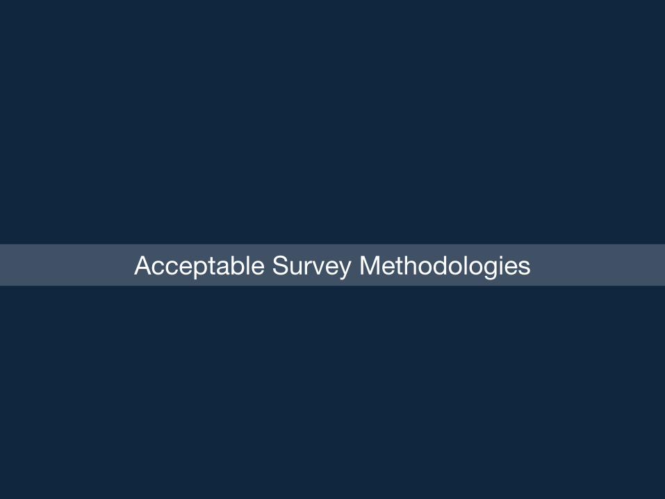
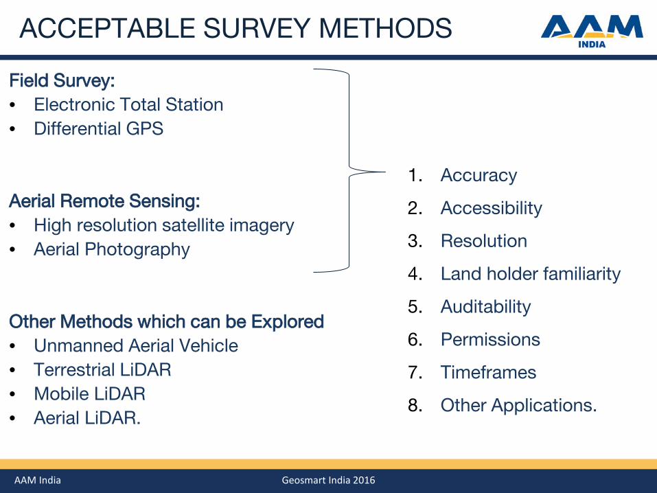
ACCEPTABLE SURVEY METHODS
Field Survey: • Electronic Total Station • Differential GPS
Remote Sensing: • High resolution satellite imagery • Aerial Photography Other Methods which can be Explored • Unmanned Aerial Vehicle • Terrestrial LiDAR • Mobile LiDAR • Aerial LiDAR.
AAM India Geosmart India 2016
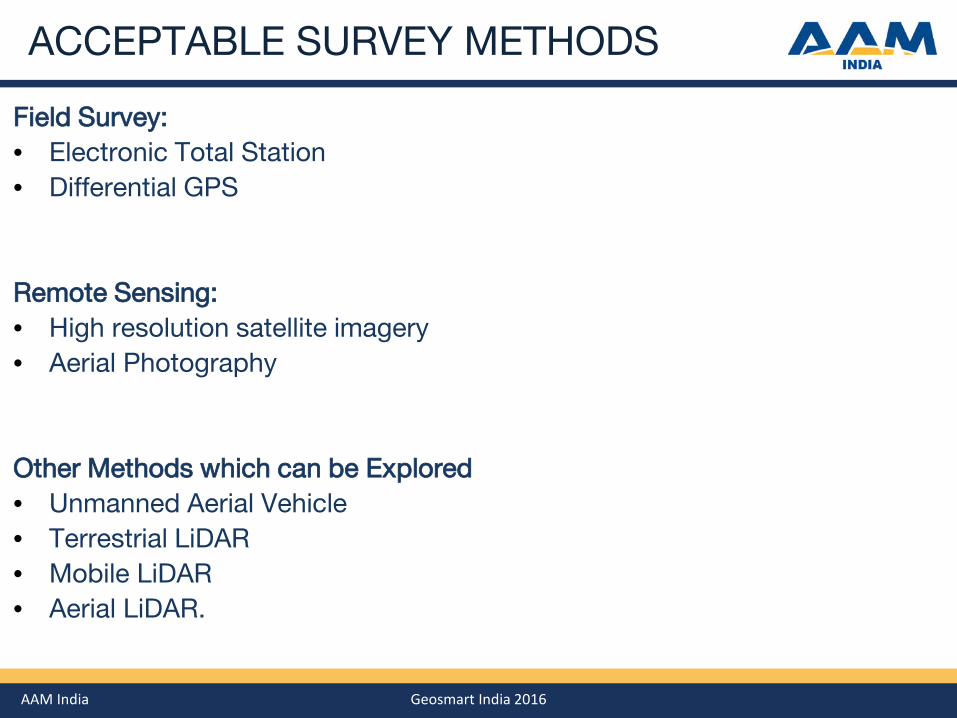
GPS / ETS FIELD SURVEY
Features: • Property survey sits on a Hierarchy of Survey Marks • Property boundaries recorded by brief GPS occupation, or ETS radiation
Pros: • Highest pointing accuracy • Visiting property boundaries often accompanied by land owners
Cons: • Visiting property boundaries often accompanied by land owners • Requires access to, or visibility of, every property corner • Very slow: survey undertaken at walking pace after negotiating site access • Difficult to define non-linear boundaries • No auditability, as field party visits only once.
AAM India Geosmart India 2016
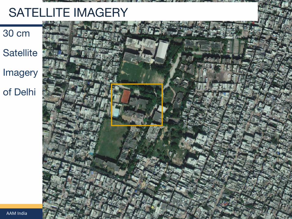
SATELLITE IMAGERY
30 cm
Satellite
Imagery
of Delhi
AAM India Geosmart India 2016
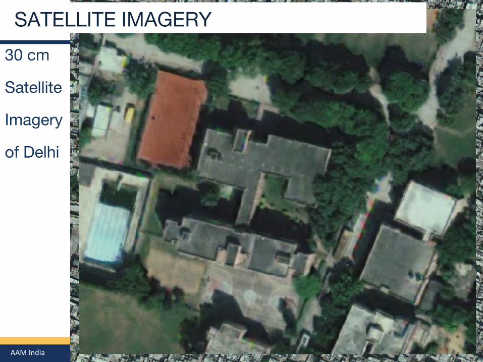
SATELLITE IMAGERY
30 cm
Satellite
Imagery
of Delhi
SATELLITE IMAGERY
AAM India Geosmart India 2016
SATELLITE IMAGERY
Features: • Range of platforms including Cartosat, Digital Globe, … Pros: • No mobilisation costs • Can provide the 3rd dimension with stereo coverage Cons: • Accuracy doesn’t really meet stipulated 1:1000 specifications • Low resolution makes more difficult to recognise subtle land boundaries.

AAM India Geosmart India 2016
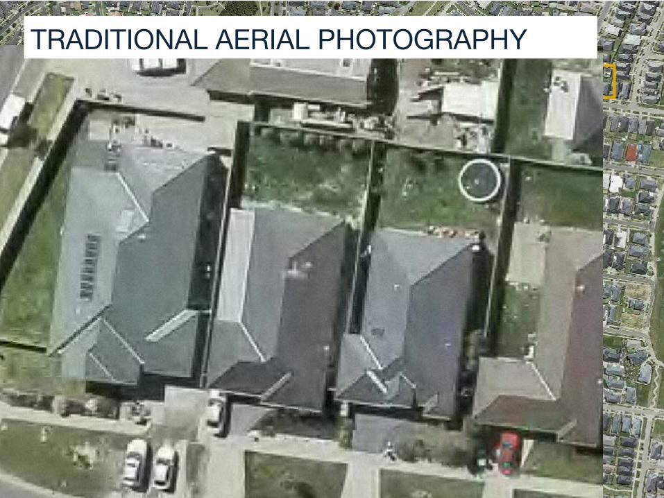
TRADITIONAL AERIAL PHOTOGRAPHY TRADITIONAL AERIAL PHOTOGRAPHY
AAM India Geosmart India 2016
TRADITIONAL AERIAL PHOTOGRAPHY TRADITIONAL AERIAL PHOTOGRAPHY
AAM India Geosmart India 2016
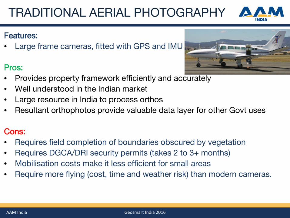
TRADITIONAL AERIAL PHOTOGRAPHY
Features: • Large frame cameras, fitted with GPS and IMU Pros: • Provides property framework efficiently and accurately • Well understood in the Indian market • Large resource in India to process orthos • Resultant orthophotos provide valuable data layer for other Govt uses Cons: • Requires field completion of boundaries obscured by vegetation • Requires DGCA/DRI security permits (takes 2 to 3+ months) • Mobilisation costs make it less efficient for small areas • Require more flying (cost, time and weather risk) than modern cameras.

AAM India Geosmart India 2016
MODERN AERIAL PHOTOGRAPHY
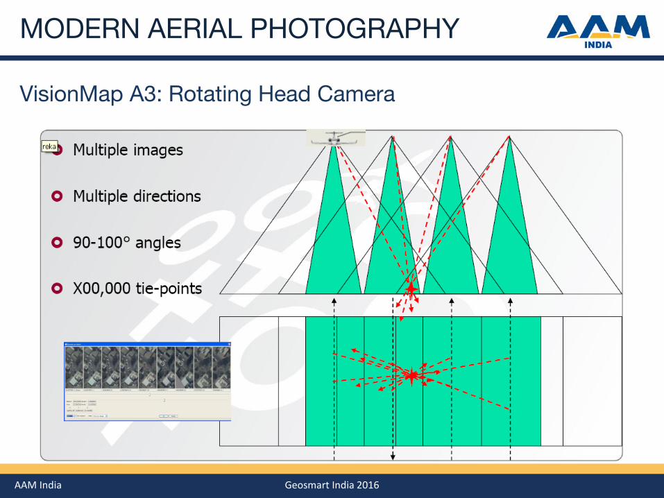
New Technology: eg. VisionMap A3 Allows wider capture per run
AAM India Geosmart India 2016
MODERN AERIAL PHOTOGRAPHY
VisionMap A3: Rotating Head Camera
AAM India Geosmart India 2016
MODERN AERIAL PHOTOGRAPHY MODERN AERIAL PHOTOGRAPHY
AAM India Geosmart India 2016
MODERN AERIAL PHOTOGRAPHY
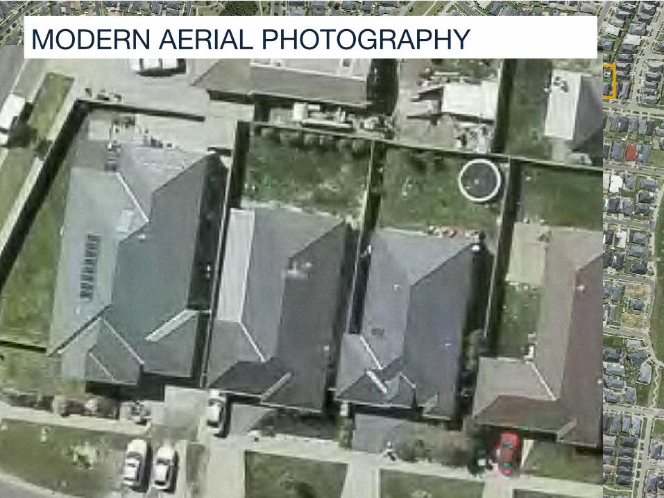
Features: • Rapid capture from frame camera with long focal length • Every ground feature appears on many frames • Allows image capture 2-3x higher than traditional cameras • Suits very large areas (10,000km2 +) Pros: • Same as for Traditional Aerial Photography • Less flying means lower aviation costs, less time, and less weather risk • Redundant imagery allows automatic processing (quicker, cheaper, robust) Cons: • Same as for Traditional Aerial Photography • Specialised processing means less capability in India.
AAM India Geosmart India 2016
ACCEPTABLE SURVEY METHODS
Field Survey: • Electronic Total Station • Differential GPS
Aerial Remote Sensing: • High resolution satellite imagery • Aerial Photography Other Methods which can be Explored • Unmanned Aerial Vehicle • Terrestrial LiDAR • Mobile LiDAR • Aerial LiDAR.
1. Accuracy
2. Accessibility
3. Resolution
4. Land holder familiarity
5. Auditability
6. Permissions
7. Timeframes
8. Other Applications.
AAM India Geosmart India 2016
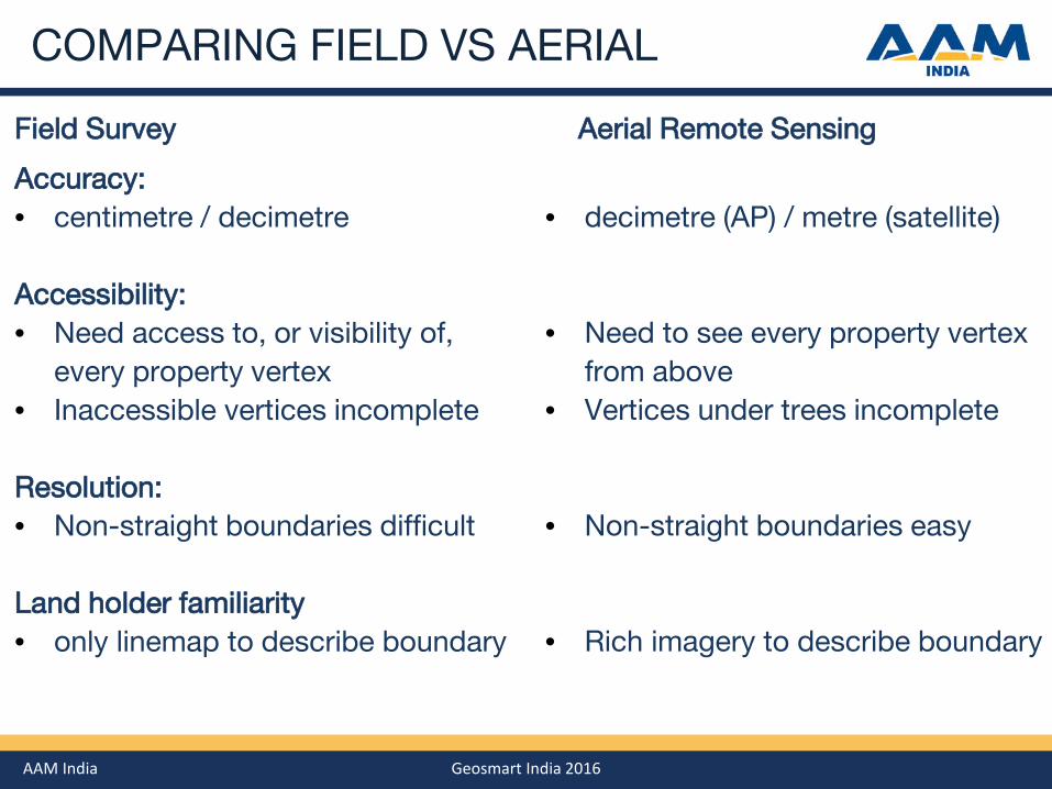
COMPARING FIELD VS AERIAL
Accuracy: • centimetre / decimetre Accessibility: • Need access to, or visibility of,
every property vertex • Inaccessible vertices incomplete
Resolution: • Non-straight boundaries difficult
Land holder familiarity • only linemap to describe boundary
Field Survey Aerial Remote Sensing
• decimetre (AP) / metre (satellite)
• Need to see every property vertex
from above • Vertices under trees incomplete
• Non-straight boundaries easy
• Rich imagery to describe boundary
AAM India Geosmart India 2016
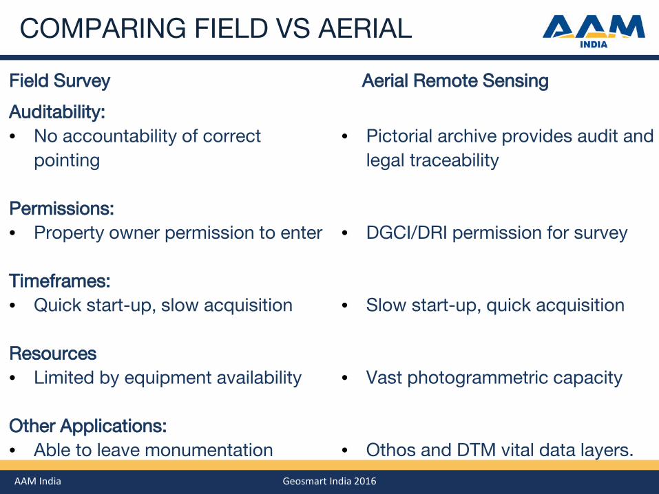
COMPARING FIELD VS AERIAL
Auditability: • No accountability of correct
pointing
Permissions: • Property owner permission to enter
Timeframes: • Quick start-up, slow acquisition
Resources • Limited by equipment availability Other Applications: • Able to leave monumentation
Field Survey Aerial Remote Sensing
• Pictorial archive provides audit and
legal traceability
• DGCI/DRI permission for survey
• Slow start-up, quick acquisition
• Vast photogrammetric capacity
• Othos and DTM vital data layers.

Other Mentioned Survey Methodologys

AAM India Geosmart India 2016
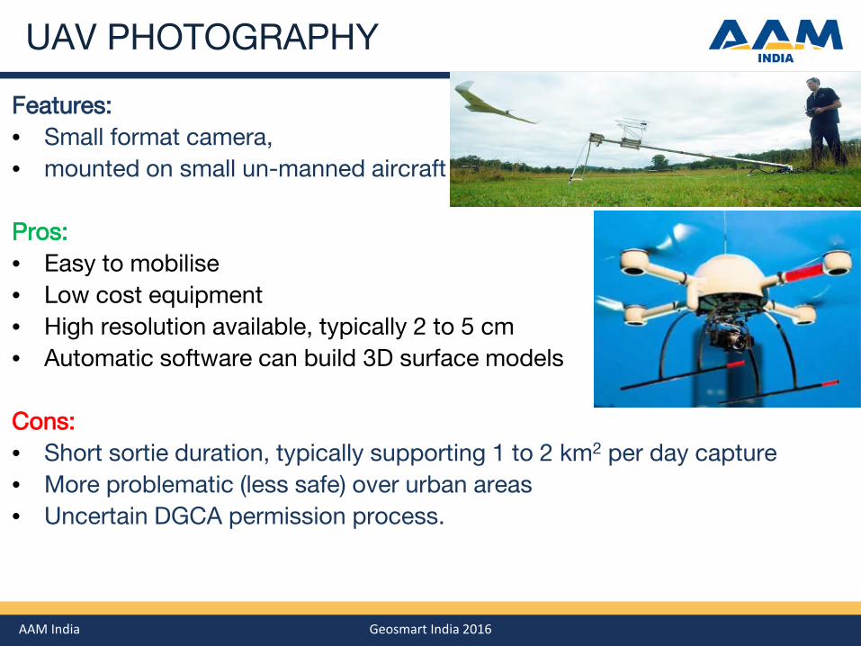
UAV PHOTOGRAPHY

AAM India Geosmart India 2016
UAV PHOTOGRAPHY
AAM India Geosmart India 2016
UAV PHOTOGRAPHY
Features: • Small format camera, • mounted on small un-manned aircraft Pros: • Easy to mobilise • Low cost equipment • High resolution available, typically 2 to 5 cm • Automatic software can build 3D surface models Cons: • Short sortie duration, typically supporting 1 to 2 km2 per day capture • More problematic (less safe) over urban areas • Uncertain DGCA permission process.
AAM India Geosmart India 2016
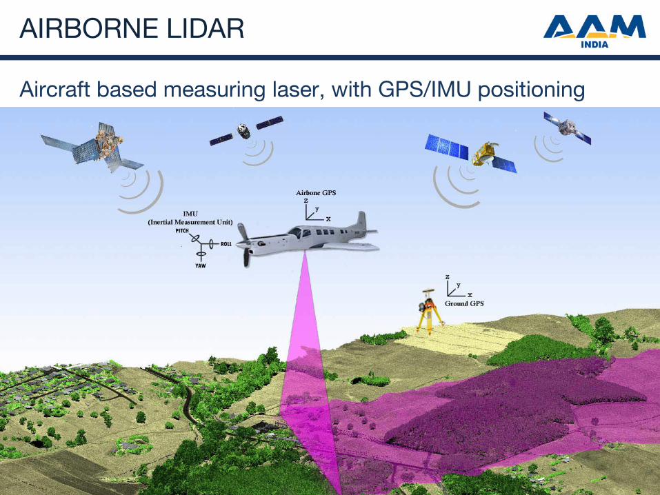
AIRBORNE LIDAR
Aircraft based measuring laser, with GPS/IMU positioning
AAM India Geosmart India 2016
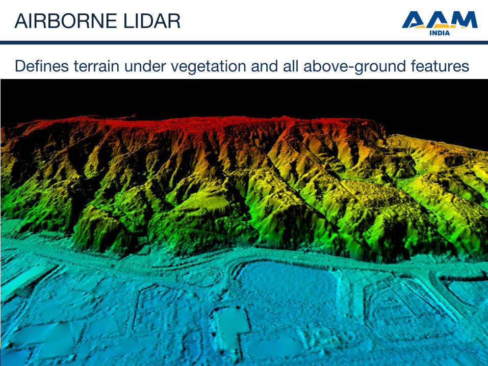
AIRBORNE LIDAR
Defines terrain under vegetation and all above-ground features
AAM India Geosmart India 2016
AIRBORNE LIDAR
Features: • Aircraft based (helicopter or fixed-wing) • Laser defining surface with many points per square metre (1 to 60 pt/m2) • Often operated with aerial camera Pros: • Very dense definition of terrain and everything on it • Large resource in India to process data Cons: • Lacks richness of imagery to define non-spatial boundaries • Poor dataset to show landholders to identify boundaries • Requires DGCA/DRI security permits (takes 2 to 3+ months) • Mobilisation costs make it less efficient for small areas.

AAM India Geosmart India 2016
UAV LIDAR
Features: • Small format LiDAR • mounted on small un-manned aircraft Pros: • Easy to mobilise • Mid cost equipment (US$100,000 upwards) • Sensors and platforms improving quickly Cons: • Lacks richness of imagery to define non-spatial boundaries • Poor dataset to show landholders to identify boundaries • Short sortie duration, typically supporting 1 to 2 km2 per day capture • More problematic (less safe) over urban areas • Uncertain DGCA permission process • Sensors are un-insurable: $100,000 sensor in platform prone to crash .
AAM India Geosmart India 2016
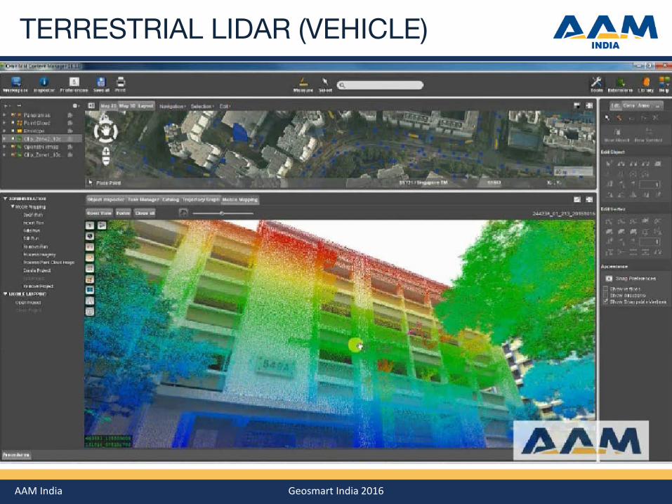
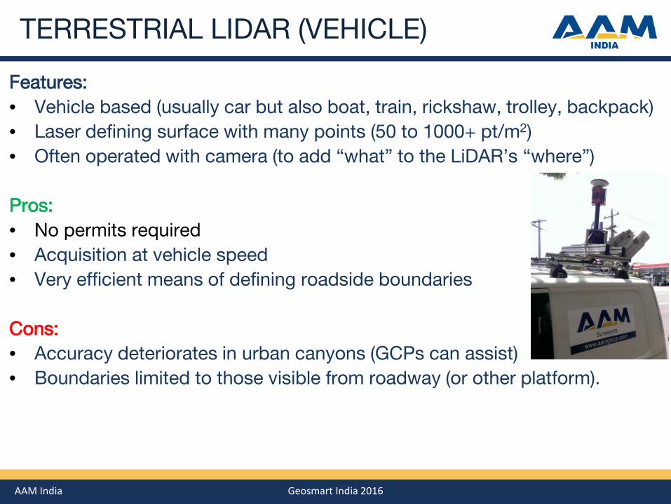
TERRESTRIAL LIDAR (VEHICLE)
AAM India Geosmart India 2016
TERRESTRIAL LIDAR (VEHICLE)
Features: • Vehicle based (usually car but also boat, train, rickshaw, trolley, backpack) • Laser defining surface with many points (50 to 1000+ pt/m2) • Often operated with camera (to add “what” to the LiDAR’s “where”) Pros: • No permits required • Acquisition at vehicle speed • Very efficient means of defining roadside boundaries Cons: • Accuracy deteriorates in urban canyons (GCPs can assist) • Boundaries limited to those visible from roadway (or other platform).
Maintaining Property Database

AAM India Geosmart India 2016
MAINTAINING PROPERTY DATABASE
Two Main Approaches:
1. Procedural Maintenance
a. Implement systems driven by permit applications
b. Send surveyors out to record reported property change
c. lowest cost (driven by procedure, not actuals)
d. but doesn’t detect unreported / illegal changes
2. Change Detection Service
a. Collect Regular (annual ?) imagery – Satellite generally sufficient
b. Automatic and/or Manual Change Detection processes
c. Detect change, and send surveyors out to record property change
d. Added benefit of updating property tax base.

AAM India Geosmart India 2016
CHANGE DETECTION SERVICE
Sample Reports
2 epochs of WV3 imagery
Automatic change detection
Semi-automatic documentation

AAM India Geosmart India 2016
CHANGE DETECTION SERVICE
Sample Reports
2 epochs of WV3 imagery
Automatic change detection
Semi-automatic documentation
AAM India Geosmart India 2016
IN CLOSING
Offer Optimal DILRMP Solution:
1. Aerial photography
2. Field Survey completion
3. Maintain Changes with Procedures
4. Reinforced with Change Detection
Most efficient overall technology
Rigorous, auditable, useable
Easy gap filling using AP as control
Simple and necessary but fallible
Maintain integrity of investment
Additional taxation benefits