Embed Size (px)
Citation preview
Community Working Group Meeting 1 Saturday 25 February
Stroud to Lansdowne Transmission Line Project
Community Working Group (CWG)
Community Working Group Meeting 1 Saturday 25 February
Agenda
Introductions and housekeeping
Project scope, background, need and process
Seeking community input - CWG and member responsibilities
Present Options Selection Report (OSR)
Review corridor options and associated constraints/opportunities
Field visit
Community Working Group Meeting 1 Saturday 25 February
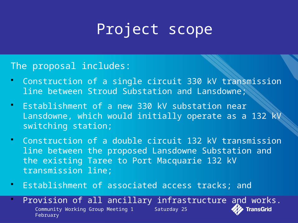
Project scope
The proposal includes:
Construction of a single circuit 330 kV transmission line between Stroud Substation and Lansdowne;
Establishment of a new 330 kV substation near Lansdowne, which would initially operate as a 132 kV switching station;
Construction of a double circuit 132 kV transmission line between the proposed Lansdowne Substation and the existing Taree to Port Macquarie 132 kV transmission line;
Establishment of associated access tracks; and
Provision of all ancillary infrastructure and works.
Community Working Group Meeting 1 Saturday 25 February
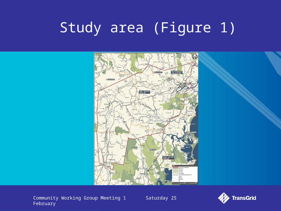
Study area (Figure 1)

Community Working Group Meeting 1 Saturday 25 February
Background and need
Significant population growth in the Mid North Coast region over the coming two decades coupled with growth in employment-generating sectors and associated services.
TransGrid’s objective is to develop and maintain the NSW electricity network to provide a safe and reliable supply of electricity.
Population - increase by more than 30,000
people in next decade
Peak summer demand –
expected to rise by approximately 25%
Longer term solution needed – safeguard
region’s electricity supply
Community Working Group Meeting 1 Saturday 25 February
Background and need
Essential Energy and TransGrid track and periodically report on forecast growth in electricity demands in the region
Current forecasts predict a future need to augment the electricity network to ensure a safe and reliable supply of electricity
TransGrid has sought alternatives to building new transmission infrastructure, but to date no alternative has been identified that would entirely remove the need for a new transmission line
Current estimates indicate a need for a new Stroud to Lansdowne 132 kV transmission connection in the mid 2010s, with energisation to 330 kV expected in the mid 2020s.
Community Working Group Meeting 1 Saturday 25 February
Options Selection Report
Aimed at identifying potential substation site options and transmission line corridor options, and analysing those options based on environmental planning factors
Community consultation will be used to refine options and to inform a decision on a preferred site and corridor
The preferred site and corridor will form the basis of a detailed Environmental Impact Statement, which will be subject to statutory assessment and consultation
Options have been identified with the initial aim of avoiding environmental planning impacts where possible
Community Working Group Meeting 1 Saturday 25 February
CWG – Seeking community input
1) Gathering input on OSR, corridor options and substation locations
2) Identify key constraints: environmental; social; and cultural
3) Collect and disseminate information to stakeholders and wider
community
4) Two meetings:
Saturday 25 February 2012 - Review and understand corridor options and provide initial input
Saturday 24 March 2012 - Group discussion of constraints, recommendations and opportunities
Community Working Group Meeting 1 Saturday 25 February
Seeking community input
Wider community consultation:
Commences Monday 27 February and closes Monday 26 March 2012
Letters to residents/businesses and key stakeholders
Newspaper advertisements
Media release
Website update
Feedback forms
Submissions received
Community Working Group Meeting 1 Saturday 25 February
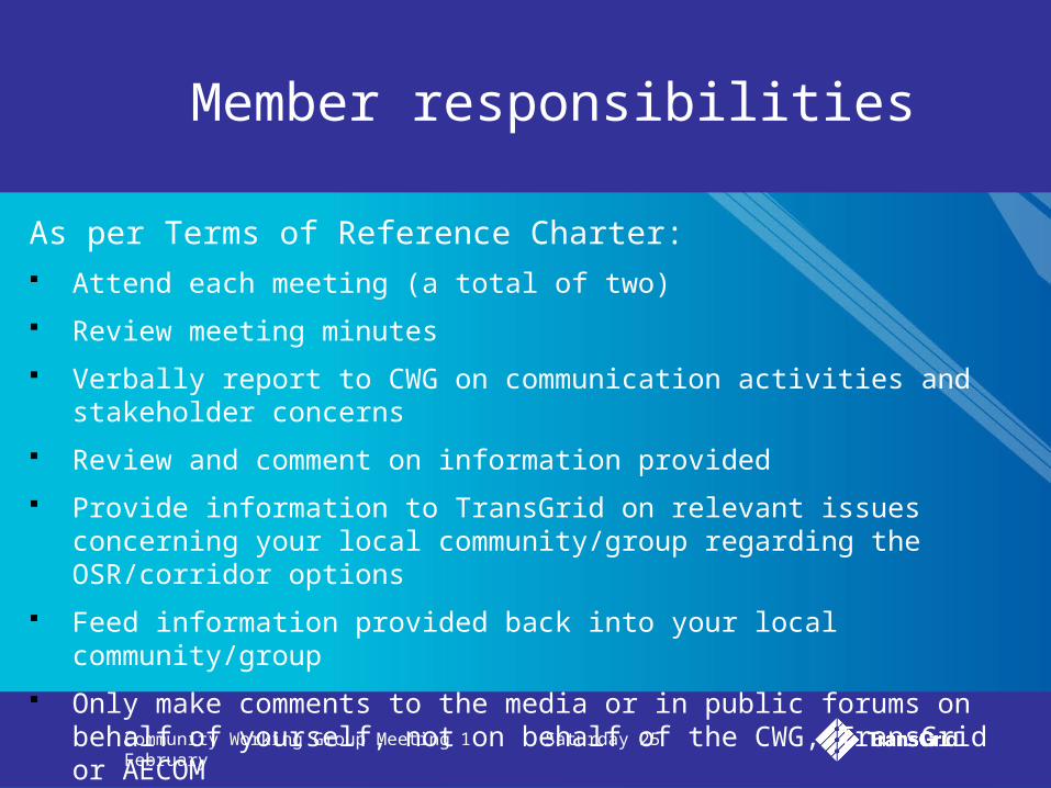
Member responsibilities
As per Terms of Reference Charter: Attend each meeting (a total of two)
Review meeting minutes
Verbally report to CWG on communication activities and stakeholder concerns
Review and comment on information provided
Provide information to TransGrid on relevant issues concerning your local community/group regarding the OSR/corridor options
Feed information provided back into your local community/group
Only make comments to the media or in public forums on behalf of yourself, not on behalf of the CWG, TransGrid or AECOM
Community Working Group Meeting 1 Saturday 25 February
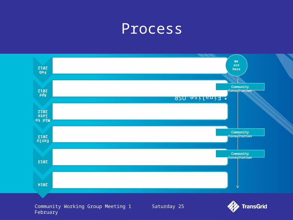
Process
Feb
2012
•Draft OSR and preferred site/ corridor options consultation
Apr 2012
•Finalise OSR
•Identify preferred corridor and substation site
Mid to
late 2012
•EIS preparation
Early
2013
•EIS public exhibition on preferred option
2013
•Pending approval, construction begins
2014
•Completion of construction
We are
here
Community Consultation
Community Consultation
Community Consultation
Community Working Group Meeting 1 Saturday 25 February
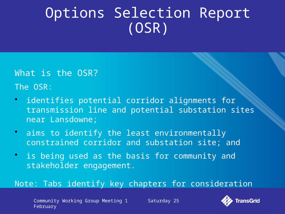
Options Selection Report (OSR)
What is the OSR?
The OSR:
identifies potential corridor alignments for transmission line and potential substation sites near Lansdowne;
aims to identify the least environmentally constrained corridor and substation site; and
is being used as the basis for community and stakeholder engagement.
Note: Tabs identify key chapters for consideration
Community Working Group Meeting 1 Saturday 25 February
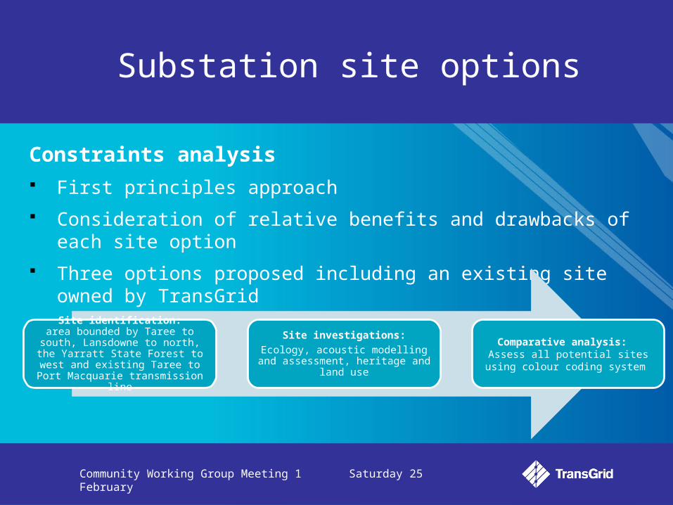
Substation site options
Constraints analysis First principles approach
Consideration of relative benefits and drawbacks of each site option
Three options proposed including an existing site owned by TransGrid
Site identification:area bounded by Taree to south,
Lansdowne to north, the Yarratt State Forest to west and existing Taree to Port
Macquarie transmission line
Site investigations:
Ecology, acoustic modelling and assessment, heritage and land use
Comparative analysis: Assess all potential sites using colour
coding system
Community Working Group Meeting 1 Saturday 25 February
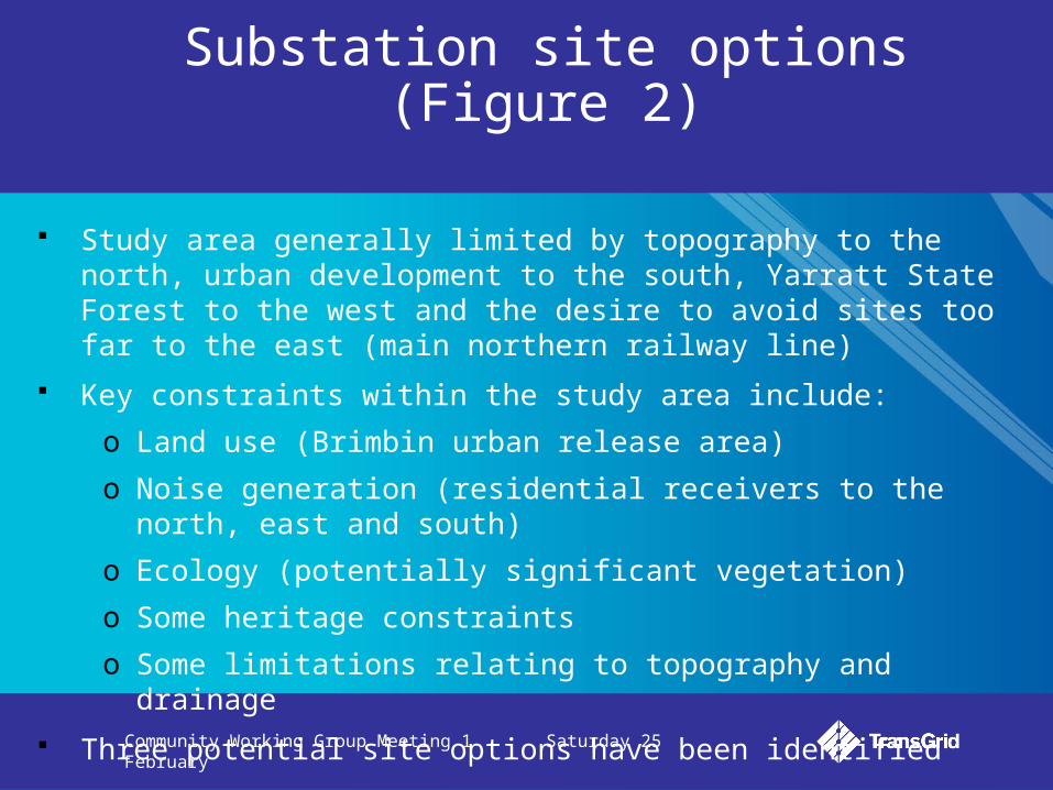
Substation site options (Figure 2)
Study area generally limited by topography to the north, urban development to the south, Yarratt State Forest to the west and the desire to avoid sites too far to the east (main northern railway line)
Key constraints within the study area include:
o Land use (Brimbin urban release area)
o Noise generation (residential receivers to the north, east and south)
o Ecology (potentially significant vegetation)
o Some heritage constraints
o Some limitations relating to topography and drainage
Three potential site options have been identified
Community Working Group Meeting 1 Saturday 25 February
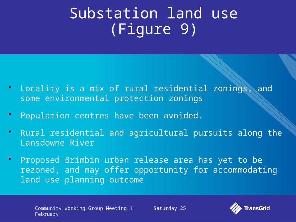
Substation land use (Figure 9)
Locality is a mix of rural residential zonings, and some environmental protection zonings
Population centres have been avoided.
Rural residential and agricultural pursuits along the Lansdowne River
Proposed Brimbin urban release area has yet to be rezoned, and may offer opportunity for accommodating land use planning outcome
Community Working Group Meeting 1 Saturday 25 February
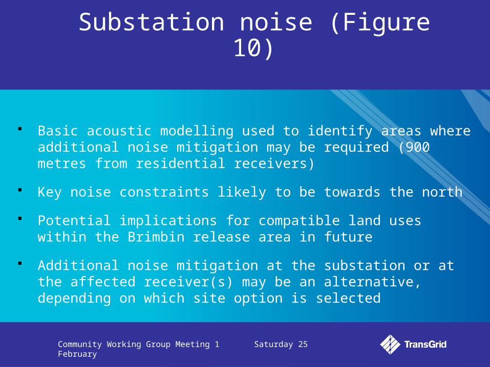
Substation noise (Figure 10)
Basic acoustic modelling used to identify areas where additional noise mitigation may be required (900 metres from residential receivers)
Key noise constraints likely to be towards the north
Potential implications for compatible land uses within the Brimbin release area in future
Additional noise mitigation at the substation or at the affected receiver(s) may be an alternative, depending on which site option is selected
Community Working Group Meeting 1 Saturday 25 February
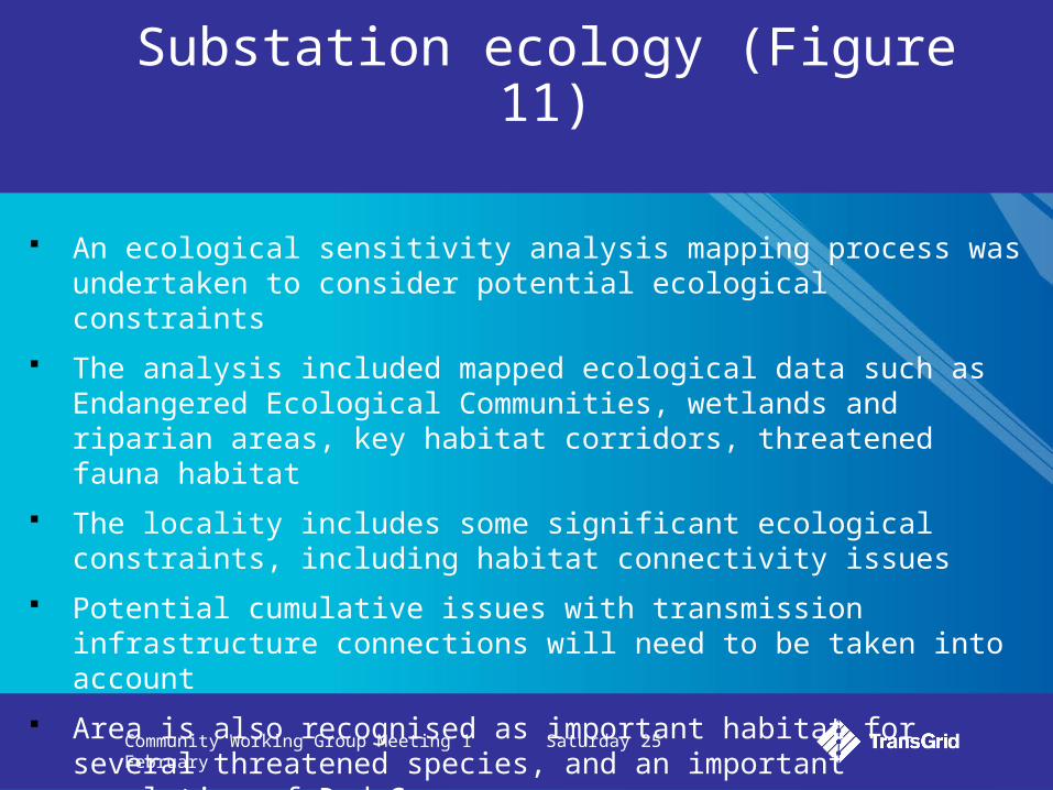
Substation ecology (Figure 11)
An ecological sensitivity analysis mapping process was undertaken to consider potential ecological constraints
The analysis included mapped ecological data such as Endangered Ecological Communities, wetlands and riparian areas, key habitat corridors, threatened fauna habitat
The locality includes some significant ecological constraints, including habitat connectivity issues
Potential cumulative issues with transmission infrastructure connections will need to be taken into account
Area is also recognised as important habitat for several threatened species, and an important population of Red Gum
Community Working Group Meeting 1 Saturday 25 February
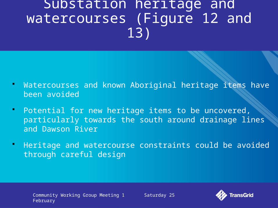
Substation heritage and watercourses (Figure 12 and 13)
Watercourses and known Aboriginal heritage items have been avoided
Potential for new heritage items to be uncovered, particularly towards the south around drainage lines and Dawson River
Heritage and watercourse constraints could be avoided through careful design
Community Working Group Meeting 1 Saturday 25 February
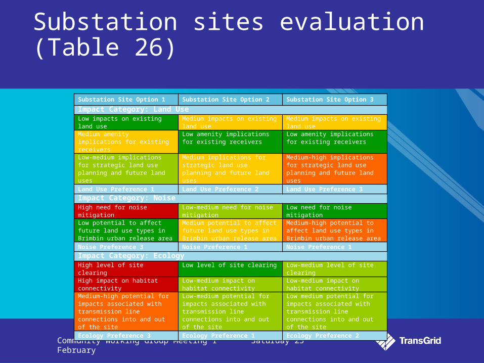
Substation sites evaluation (Table 26)
Substation Site Option 1 Substation Site Option 2 Substation Site Option 3
Impact Category: Land UseLow impacts on existing land use Medium impacts on existing land
useMedium impacts on existing land use
Medium amenity implications for existing receivers
Low amenity implications for existing receivers
Low amenity implications for existing receivers
Low-medium implications for strategic land use planning and future land uses
Medium implications for strategic land use planning and future land uses
Medium-high implications for strategic land use planning and future land uses
Land Use Preference 1 Land Use Preference 2 Land Use Preference 3
Impact Category: Noise High need for noise mitigation Low-medium need for noise
mitigationLow need for noise mitigation
Low potential to affect future land use types in Brimbin urban release area
Medium potential to affect future land use types in Brimbin urban release area
Medium-high potential to affect land use types in Brimbin urban release area
Noise Preference 3 Noise Preference 1 Noise Preference 1
Impact Category: Ecology High level of site clearing Low level of site clearing Low-medium level of site clearingHigh impact on habitat connectivity Low-medium impact on habitat
connectivityLow-medium impact on habitat connectivity
Medium-high potential for impacts associated with transmission line connections into and out of the site
Low-medium potential for impacts associated with transmission line connections into and out of the site
Low medium potential for impacts associated with transmission line connections into and out of the site
Ecology Preference 3 Ecology Preference 1 Ecology Preference 2
Community Working Group Meeting 1 Saturday 25 February
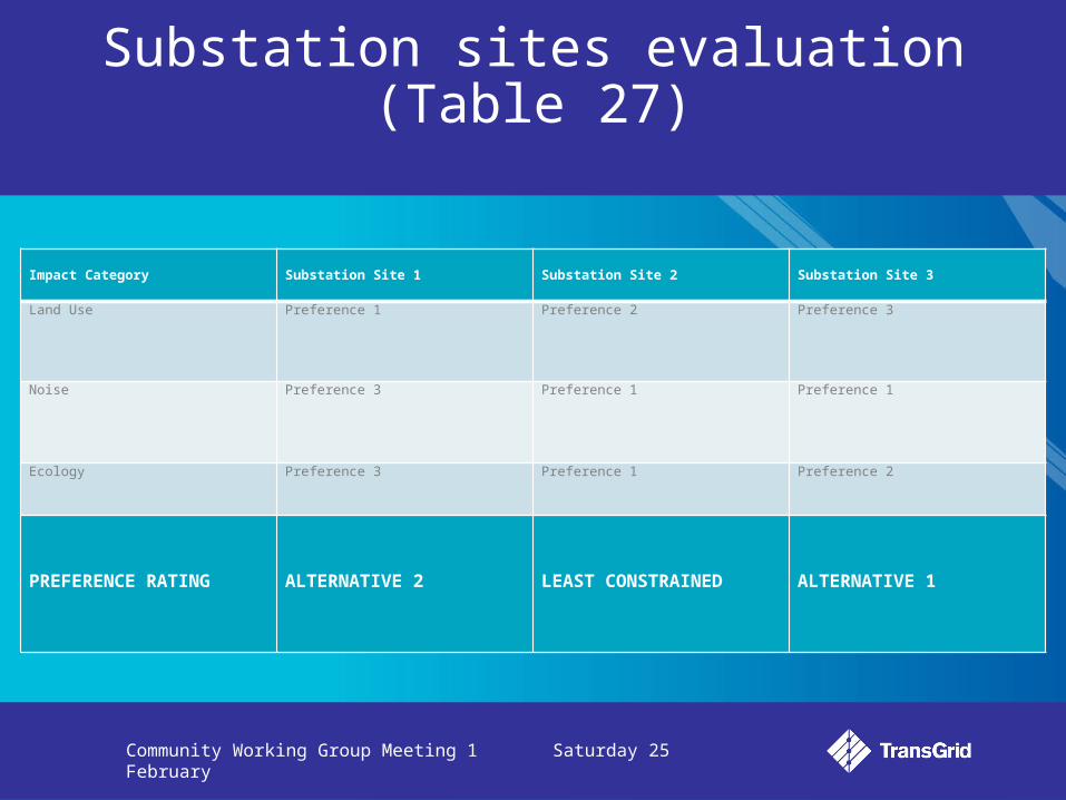
Substation sites evaluation (Table 27)
Impact Category Substation Site 1 Substation Site 2 Substation Site 3
Land Use Preference 1 Preference 2 Preference 3
Noise Preference 3 Preference 1 Preference 1
Ecology Preference 3 Preference 1 Preference 2
PREFERENCE RATING ALTERNATIVE 2 LEAST CONSTRAINED ALTERNATIVE 1
Community Working Group Meeting 1 Saturday 25 February
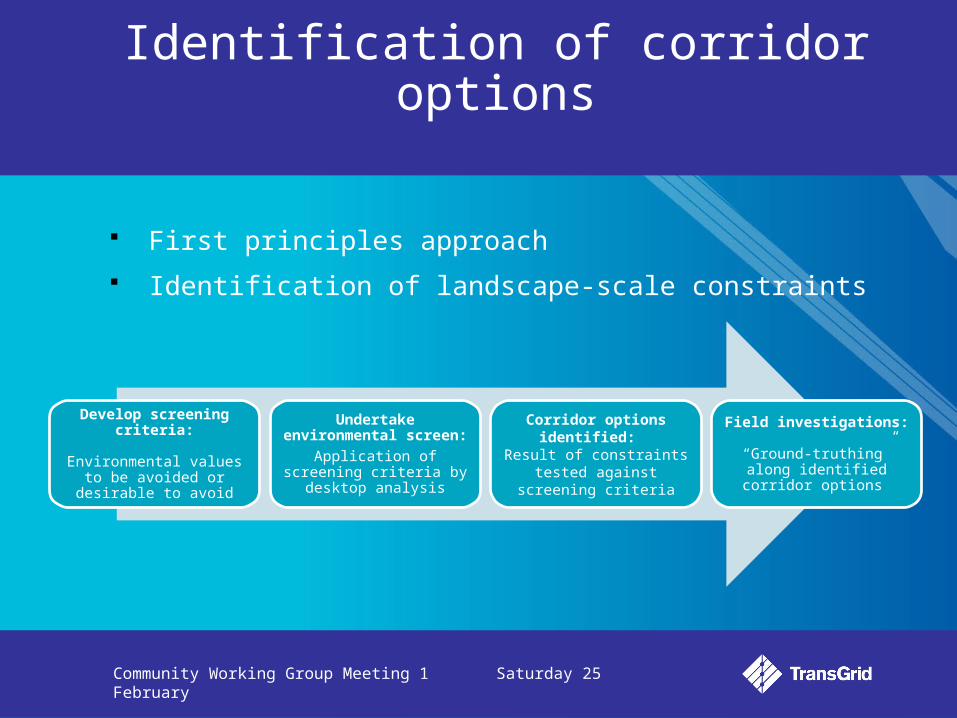
Identification of corridor options
First principles approach
Identification of landscape-scale constraints
Develop screening criteria:
Environmental values to be avoided or desirable to avoid
Undertake environmental screen:
Application of screening criteria by desktop analysis
Corridor options identified: Result of constraints tested against screening criteria
Field investigations: “Ground-truthing” along
identified corridor options

Community Working Group Meeting 1 Saturday 25 February
Study area defined to generally avoid the coastal zone to the east (Pacific Highway) and based on northern (Lansdowne substation site) and southern (Stroud substation) practical limits. Western limit defined by topography and desire to minimise transmission line length
Key environmental planning constraints include land use, landscape/ visual, ecology, heritage, traffic, soils/ water
Key pinch point in the Taree-Wingham area where corridors have been pushed into the Yarratt State Forest to avoid urban development areas
Corridor options (Figure 3 and Figure 4)
Community Working Group Meeting 1 Saturday 25 February
Corridor Option 1 – generally along the existing 132 kV transmission line easement
Corridor Option 1 + 1a – deviation from Corridor Option 1 along The Bucketts Way
Corridor Option 1 + 1b – alternative crossing to the west of Winghman
Corridor Option 1 + 1a + 1b – hybrid option
Corridor Option 2 – western edge of Stroud-Gloucester Valley and north of Wingham
Corridor options (Figures 5-7)
Community Working Group Meeting 1 Saturday 25 February
Urban areas and population centres have been avoided through the corridor identification process
Generally rural residential in nature (Figures 14-16)
Some environmental conservation zonings to the south of Gloucester (Figure 15)
Key pinch point around Taree-Wingham corridor, where urban development density increases (Figure 16)
Mining is also a significant constraint through the Stroud-Gloucester Valley (Figures 17 and 18)
Connection through the Brimbin release area will require careful design (Figure 16)
Corridor options land use
Community Working Group Meeting 1 Saturday 25 February
Corridor alignments along the existing 132 kV transmission line corridor will minimise visual impacts through co-location, rather than spreading transmission line infrastructure
Landscape character mapping (Figure 20) has been used to identify sensitive landscapes, and those with greater potential to ‘hide’ transmission infrastructure within the landscape
Floodplains (landscape character types 3, 9 and 10) are susceptible to visual impacts as are urban/ rural fringe areas (landscape character type 10)
Crossing ridgelines will require careful design to ensure minimisation of potential visual impacts (landscape character type 7)
Corridor options landscape/ visual
Community Working Group Meeting 1 Saturday 25 February
Landscapes such as steep rolling hills (landscape character type 5) and forested hills (landscape character type 11) offer opportunities for ‘hiding’ transmission infrastructure
Concrete/ steel H-frame poles or steel lattice towers will be used for the new power line
Visualisations have been produced to show how H-frame poles and steel lattice towers may look along the corridor options (Appendix A)
Corridor options landscape/ visual

Community Working Group Meeting 1 Saturday 25 February
The ecological sensitivity analysis has been mapped across the study area
Where possible, ecological constraints have been avoided through the corridor identification process
The most significant potential ecological impacts are associated with the crossing of the Yarratt State Forest (Figure 23). This is common to all corridor options.
Other pinch points include the crossing of mountain ranges to the east of Belbora (Figure 22) and along the edges of the Stroud-Gloucester Valley (Figure 21)
Corridor options ecology (Figures 21-23)
Community Working Group Meeting 1 Saturday 25 February
Most known Aboriginal and non-Aboriginal heritage items have been avoided through the corridor identification process, or could be avoided through careful design of the transmission line within the preferred corridor
The Stroud-Gloucester Valley and Vale of Gloucester (Figures 24 and 25) are indicative listings on the Register of the National Estate
Both listings relate to the heritage landscape and span both heritage and landscape values
All options would affect these listing areas, although potential impacts have been minimised by identifying corridors along the edge of the valley, rather than through it
Corridor options heritage (Figures 24-26)
Community Working Group Meeting 1 Saturday 25 February
Killawarra Reserve is also an indicative listing on the Register of the National Estate, but could be avoided through careful transmission line design (Figure 26)
The Hillview property and Bo Bo Creek Cemetery are important European heritage items listed under the Greater Taree local environmental plan (Figure 26), which could also be avoided through careful transmission line design
Corridor options heritage
Community Working Group Meeting 1 Saturday 25 February
The study area spans the catchments for the Manning River and Karuah River (Figure 27)
A watercourse sensitivity analysis has been undertaken to consider the potential impacts of crossing watercourses along each corridor option (Figures 28-30)
Watercourse crossings represent both a practical constraint to construction, but also the potential to impact on riparian areas with possible flow on effects for bank stability, erosion and sedimentation
The Manning River crossing near The Bight (Figure 30) is important in terms of potential impacts on watercourse navigation
Corridor options soils and water

Community Working Group Meeting 1 Saturday 25 February
Consideration has been given to the number of times each corridor option crossings road, rail and existing power infrastructure
Such crossings may represent practical constraints to construction and potential safety issues that will need to be considered further as part of the detailed design process
Potential impacts on airports and landing strips have been avoided through the corridor identification process
Corridor options traffic, transport and infrastructure
Community Working Group Meeting 1 Saturday 25 February
Corridor options evaluation
Please refer to Table 28

Community Working Group Meeting 1 Saturday 25 February
Corridor options evaluation (Table 29)
Impact Category Corridor Option 1 Corridor Option 1 + 1a Corridor Option 1 + 1bCorridor Option 1 + 1a + 1b
Corridor Option 2
Land Use Preference 1 Preference 1 Preference 4 Preference 5 Preference 1
Landscape Character and Visual
Preference 2 Preference 1 Preference 3 Preference 4 Preference 5
Ecology Preference 1 Preference 4 Preference 1 Preference 1 Preference 5
Heritage Preference 4 Preference 3 Preference 1 Preference 1 Preference 5
Soil and Water Preference 3 Preference 3 Preference 5 Preference 3 Preference 1
Traffic and Transport Preference 1 Preference 4 Preference 1 Preference 3 Preference 4
PREFERENCE RANKING
LEAST CONSTRAINED ALTERNATIVE 2 ALTERNATIVE 1 ALTERNATIVE 3 ALTERNATIVE 4
Community Working Group Meeting 1 Saturday 25 February
Initial feedback
Open discussion
Community Working Group Meeting 1 Saturday 25 February
Meeting 2 preparation
We request that you please:
Read the OSR, particularly the marked pages/sections
Watch out for your invitation by mail
Disseminate information provided today to wider groups/communities
Identify other constraints, issues or opportunities to be raised at the next
meeting
Contact the project team if you have any questions –
Phone 1800 222 537 Email [email protected]
Community Working Group Meeting 1 Saturday 25 February
What now?
Field visit – reconvene at 1.25pm for 1.30pm departure


![[CWG] - Habitants & Highlanders](https://img.pdfslide.us/doc/110x75/544b8786b1af9f9f748b4661/cwg-habitants-highlanders.jpg)