Embed Size (px)
Citation preview
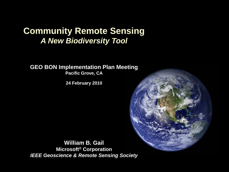
Community Remote SensingA New Biodiversity Tool
GEO BON Implementation Plan MeetingPacific Grove, CA
24 February 2010
William B. GailMicrosoft® Corporation
IEEE Geoscience & Remote Sensing Society
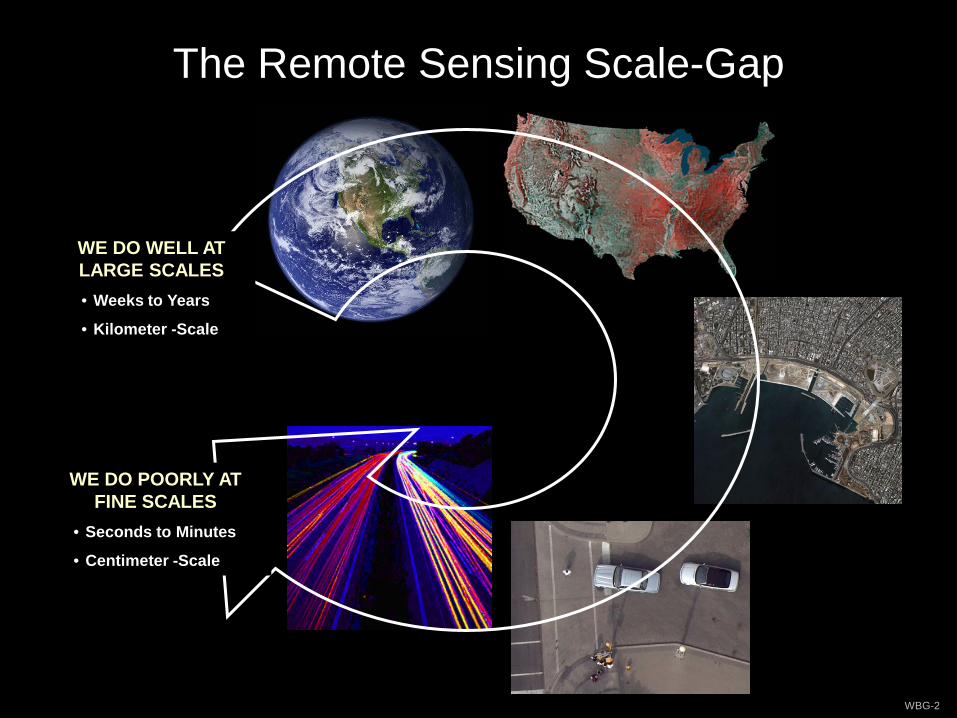
The Remote Sensing Scale-Gap
WE DO WELL AT LARGE SCALES• Weeks to Years
• Kilometer -Scale
WE DO POORLY AT FINE SCALES
• Seconds to Minutes
• Centimeter -Scale
WBG-2
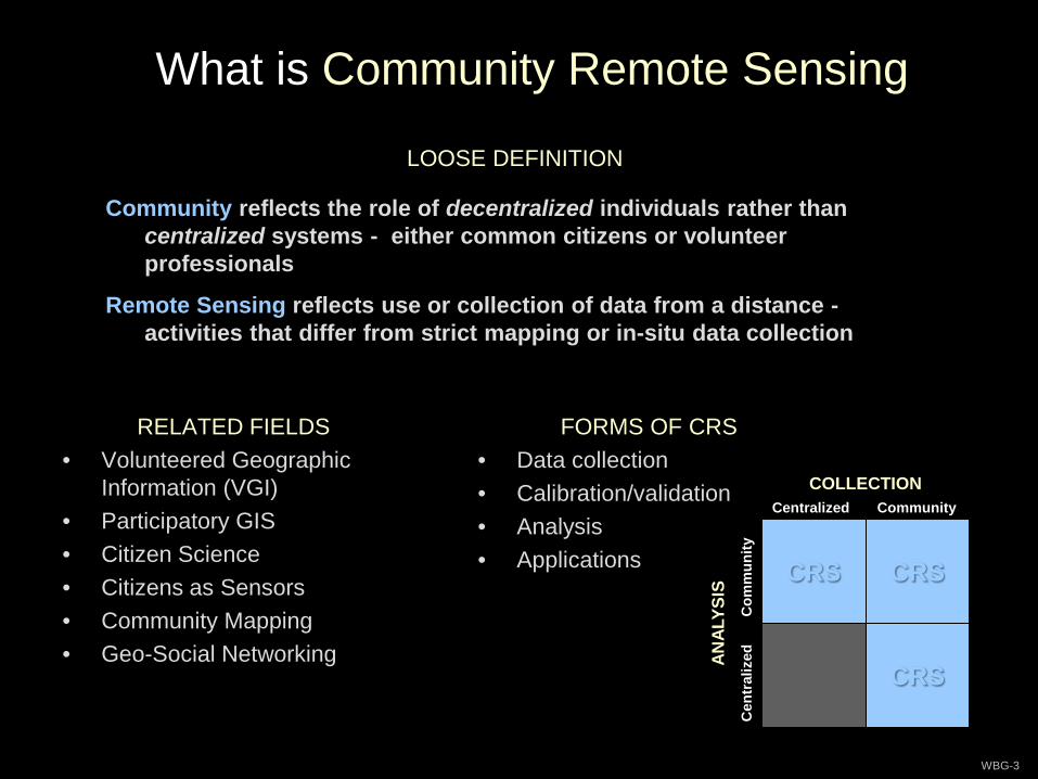
What is Community Remote Sensing
WBG-3
RELATED FIELDS• Volunteered Geographic
Information (VGI)• Participatory GIS• Citizen Science• Citizens as Sensors• Community Mapping• Geo-Social Networking
FORMS OF CRS• Data collection• Calibration/validation• Analysis• Applications
LOOSE DEFINITION
Community reflects the role of decentralized individuals rather than centralized systems - either common citizens or volunteer professionals
Remote Sensing reflects use or collection of data from a distance -activities that differ from strict mapping or in-situ data collection
CRS
COLLECTION
ANAL
YSIS
Centralized Community
Cen
tral
ized
Com
mun
ity
CRS
CRS
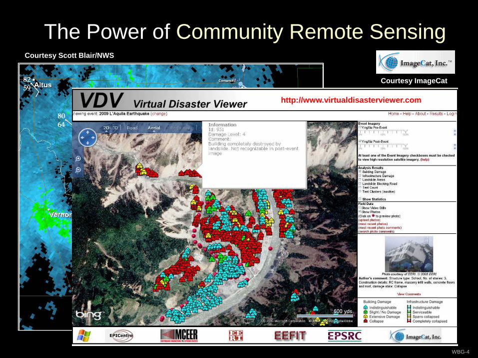
The Power of Community Remote Sensing
WBG-4
Courtesy Scott Blair/NWS
Courtesy ImageCat
http://www.virtualdisasterviewer.com
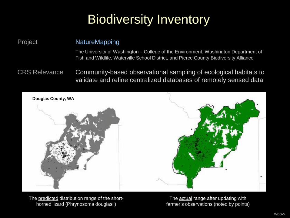
Biodiversity Inventory
WBG-5
Project NatureMappingThe University of Washington – College of the Environment, Washington Department of Fish and Wildlife, Waterville School District, and Pierce County Biodiversity Alliance
CRS Relevance Community-based observational sampling of ecological habitats to validate and refine centralized databases of remotely sensed data
The predicted distribution range of the short-horned lizard (Phrynosoma douglasii)
Douglas County, WA
The actual range after updating with farmer’s observations (noted by points)
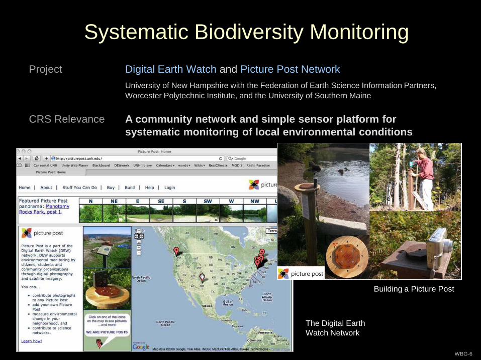
Systematic Biodiversity Monitoring
WBG-6
Project Digital Earth Watch and Picture Post NetworkUniversity of New Hampshire with the Federation of Earth Science Information Partners, Worcester Polytechnic Institute, and the University of Southern Maine
CRS Relevance A community network and simple sensor platform for systematic monitoring of local environmental conditions
Building a Picture Post
The Digital Earth Watch Network
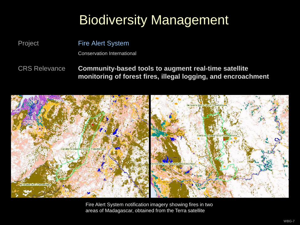
Biodiversity Management
WBG-7
Project Fire Alert SystemConservation International
CRS Relevance Community-based tools to augment real-time satellite monitoring of forest fires, illegal logging, and encroachment
Fire Alert System notification imagery showing fires in two areas of Madagascar, obtained from the Terra satellite
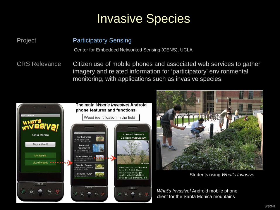
Invasive Species
WBG-8
Project Participatory SensingCenter for Embedded Networked Sensing (CENS), UCLA
CRS Relevance Citizen use of mobile phones and associated web services to gather imagery and related information for ‘participatory’ environmental monitoring, with applications such as invasive species.
Students using What’s Invasive
What’s Invasive! Android mobile phone client for the Santa Monica mountains
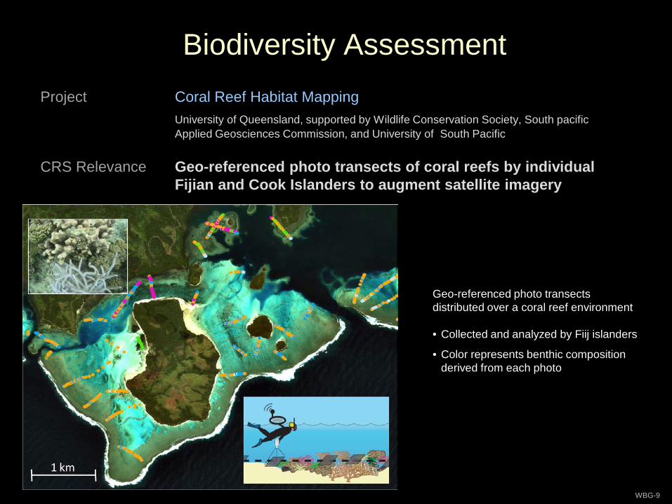
Biodiversity Assessment
WBG-9
Project Coral Reef Habitat MappingUniversity of Queensland, supported by Wildlife Conservation Society, South pacific Applied Geosciences Commission, and University of South Pacific
CRS Relevance Geo-referenced photo transects of coral reefs by individual Fijian and Cook Islanders to augment satellite imagery
Geo-referenced photo transects distributed over a coral reef environment
• Collected and analyzed by Fiij islanders
• Color represents benthic composition derived from each photo
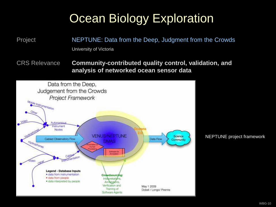
Ocean Biology Exploration
WBG-10
Project NEPTUNE: Data from the Deep, Judgment from the CrowdsUniversity of Victoria
CRS Relevance Community-contributed quality control, validation, and analysis of networked ocean sensor data
NEPTUNE project framework
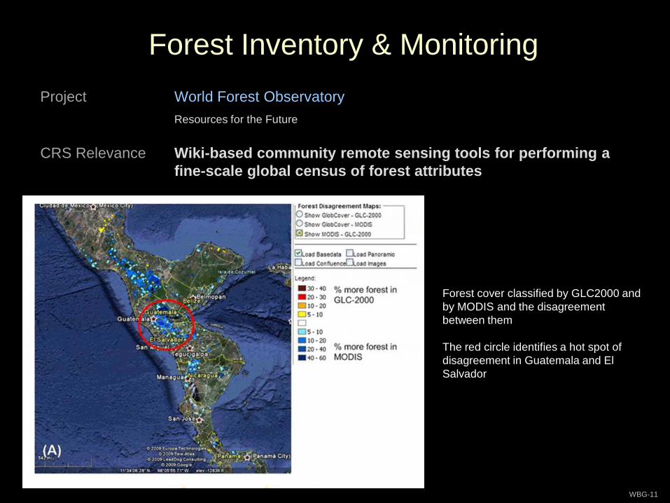
Forest Inventory & Monitoring
WBG-11
Project World Forest ObservatoryResources for the Future
CRS Relevance Wiki-based community remote sensing tools for performing a fine-scale global census of forest attributes
Forest cover classified by GLC2000 and by MODIS and the disagreement between them
The red circle identifies a hot spot of disagreement in Guatemala and El Salvador
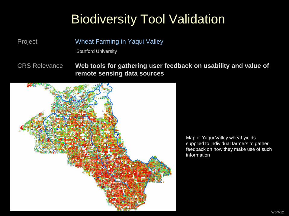
Biodiversity Tool Validation
WBG-12
Project Wheat Farming in Yaqui ValleyStanford University
CRS Relevance Web tools for gathering user feedback on usability and value of remote sensing data sources
Map of Yaqui Valley wheat yields supplied to individual farmers to gather feedback on how they make use of such information
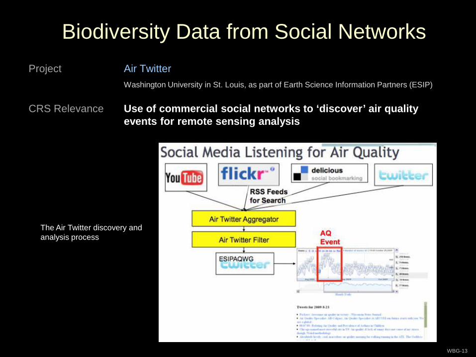
Biodiversity Data from Social Networks
WBG-13
Project Air TwitterWashington University in St. Louis, as part of Earth Science Information Partners (ESIP)
CRS Relevance Use of commercial social networks to ‘discover’ air quality events for remote sensing analysis
The Air Twitter discovery and analysis process
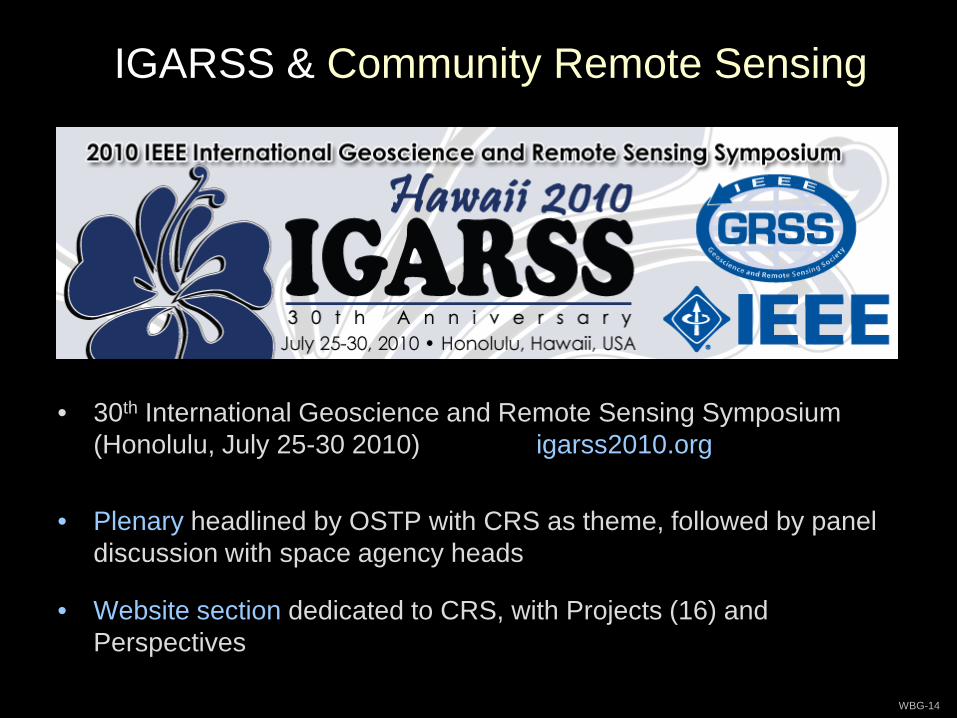
IGARSS & Community Remote Sensing
WBG-14
• 30th International Geoscience and Remote Sensing Symposium (Honolulu, July 25-30 2010) igarss2010.org
• Plenary headlined by OSTP with CRS as theme, followed by panel discussion with space agency heads
• Website section dedicated to CRS, with Projects (16) and Perspectives
The Vision
WBG-15
Information technologies will provide the foundation for society’s rapid progress in the 21st century. Information about the environment (both natural
and human-built) is central to this progress. The enormity of the required undertaking – observing and understanding our world at all space and time
scales – takes your breath away.
Accomplishing it will be enabled in part by citizens who contribute to ‘remotely sensed’ versions of the world around them.
Governments will depend on such information to understand local details of climate change and respond to natural disasters. The private sector will use it
to build online maps and virtual worlds that make commerce more efficient and accessible.
Within just a decade or so, the influence of community remote sensing will be as profound for understanding our Earth as the satellite revolution has been
over the last five decades.


![[REMOTE SENSING] 3-PM Remote Sensing](https://img.pdfslide.us/doc/110x75/61f2bbb282fa78206228d9e2/remote-sensing-3-pm-remote-sensing.jpg)


