Embed Size (px)
Citation preview
1 | P a g e
Report on
Community Base Afforestation Program
2 | P a g e
Table of Contents
Sr.No Chapter No Topic Page No
1 Chapter No-01 Afforestation Summary 03
2 Chapter No-02 Background 04
3 Chapter No-03 Implementation Tools (NRM & DRM) 05
4 Chapter No-04 Implementation strategy & Afforestation 07
5 Chapter No-05 Results & Discussion 08
6 Chapter No-06 Conclusions & Recommendations 17
Reporting Cycle: August 2016
Area of intervention: Mohmand Agency
Villages: Omai Kor, Nasapai, Sikander Khel, Surkha Kor
Activity Type: Plantation
Dates: 22 to 05 August 2016 Cooperating Partner: HUJRA Organization
Donor: UNWFP/SDC
Training participants: 112
Plants Watchers: 03 Reported By: Alamzeb Qazi
3 | P a g e
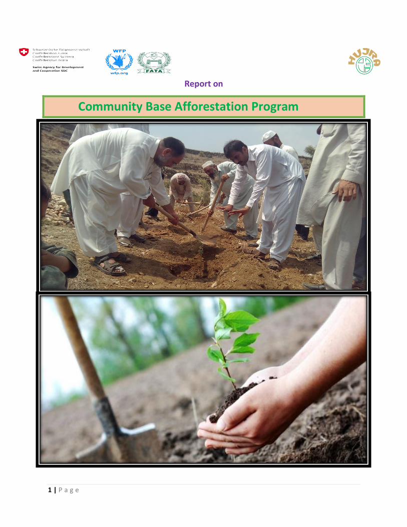
Afforestation Summary ḹ Chapter-01
ḹ
Community base afforestation program was implemented by HUJRA organization with the
financial support of SDC and WFP in Mohmand Agency Tehsil Pendialai in the respective villages
of Surkha Kor, Sikander khel, Omai kor and Nasapai. A total number of 11200 plants were
distributed among the 112 participants from the aforementioned villages while the species
composition was Eucalyptus commaldolensis and Acacia modesta with the concept of mix
forest growing and biodiversity principles. The planting techniques used were Block, Quincunx,
Triangular contributing to disaster risk reduction goals while the total cover area of
afforestation is 26 acres and the per acre plants allocation was 435 according to the standard of
forestry sector master plan (FSMP). So far, according to the forestry impact evaluation a total of
78 Acres land will be conserved. In short, this afforestation program will enhance the quality of
environment, conserve land, provide good wild life habitat and ensure natural ecosystem for
both biotic and abiotic components on sustainable basis which directly paying towards disaster
risk reduction and natural resource management in Mohmand Agency of north FATA.
4 | P a g e
Background ḹ Chapter-02 ḹ
Pakistan and local Overview:
The planet Earth is entering a phase of climate change with a high degree of Global Warming, Green
House Effect, rise in temperature and continuously melting glaciers. In the past few years, there has
been seen a huge level of rise in world’s temperature. It is not just a specific area that is being affected
by these elements of climate change, but the whole world is under the effect of this devolution. Same is
the case with Pakistan, where the gauge of temperature is getting mounted, glaciers are being shrunk
and the climate is continuously getting affected. The biggest factor being considered to be the motive of
this change is deforestation. In past few decades, there has been noticed an excessive dearth in the
production of forests in Pakistan. According to an assertion, in 1990’s 3.3% of the total area of the
country was woody, which then reduced to 2.2% by 2010.
Almost 30% of the world’s land is covered with the forests, while Pakistan contributes a meagre to it.
And this is the country with highest rate of deforestation in Asia. Even there is not a single rainforest in
Pakistan. According to an estimate, rainforests of the world would completely be vanished in about a
hundred years, if the current rate of deforestation continues on. All these figures are really
apprehensive for every human of this planet.
Deforestation is a big threat to all animals, birds and reptiles as forests are the habitats for millions of
species. Pakistan has almost 1029 known species of all animals, while 3.5 of these are endemic (which
exist in no other country). It means they all are being endangered gradually or to be extinct soon. Along
with being a sign of danger for these species, deforestation causes an increase in temperature as the
scarcity of forests means larger amount of greenhouse gases entering the atmosphere, hence resulting
in the increased severity of global warming.
Temperature of Pakistan has increased many degrees since last few decades, which is the biggest reason
for the melting of glaciers. Pakistan is a home to more than 5000 glaciers which feed Indus River in
summers and monsoon. In 2013, Federal Minister of Science and Technology Zahid Hamid stated,
“glaciers in Pakistan are continuously melting because of rising temperature, and by the year 2035, the
country will have no longer water reserves in shape of glaciers”.
These continuously melting glaciers result in the formation of glacial lakes, which outburst floods. Same
is the reason of the deluges and floods which create destruction almost every year, in Pakistan. Likewise
the increasing temperature affects humans and other living organisms. As the Ozone layer around the
Earth, that is getting weaker and weaker due to the greenhouse gases (produced by different human
activities) is not further effective to stop dangerous sun radiations coming to the Earth. And as a result,
these radiations produce different fetal diseases while reacting to the human skin. “Skin Cancer” is one
of these diseases.
Mohmnad Agency is facing few hazards which becomes disasters time and again, while some time they
caused a havoc situation with drastic effect. Flash flood, drought, soil erosion, land sliding,
deforestation, forest degradation and deficient livelihood are the main enlisted hazards found there.
5 | P a g e
Implementation Tools (NRM & DRM) ḹ Chapter-03 ḹ Disaster Risk Reduction (DRR):
The risk of disaster can be assessed and addressed before it occurs then we can greatly
limit the effects on vulnerable communities – such as physical damage, injury and loss of
life. Reducing the impact of disasters – or Disaster Risk Reduction (DRR) – is crucial for
the humanitarian sector to meet the growing demands of future emergencies.
Afforestation & Reforestation:
Afforestation is the establishment of a forest or stand of trees in an area where there
was no previous tree cover. Reforestation is the reestablishment of forest cover, either
naturally (by natural seeding, coppice, or root suckers) or artificially (by direct seeding or
planting).
Agro Forestry.
Agro forestry is an activity that combines production on the same plot of land, from
annual agricultural activities (such as crops and pasture) and from delayed long-term
production by trees (for example timber and services). This is obtained either by
planting trees on agricultural land or by cropping (for example after thinning) on
forested land. Plots that combine arable intercrops with forestry trees are silvoarable
plots, while wooded plots with pasture under the tree canopy are known as
silvopastoral plots.
Agro Forestry & Soil Erosion:
Soil erosion is a natural process. It becomes a problem when human activity causes it to
occur much faster than under natural conditions. Annual soil loss in Pakistan is
estimated at 300 - 400 million tonnes, nearly three tonnes for each hectare of land.
Replacing the soil nutrients carried out to sea by our rivers each year, with fertilizer,
would cost R1000 million.For every tonne of maize, wheat, sugar or other agricultural
crop produced, South Pakistan loses an average of 20 tonnes of soil.The FAO (Food and
Agriculture Organisation, a branch of United Nations) estimates that the global loss of
productive land through erosion is 5-7 million ha/year.
Afforestation & Soil Conservation:
Soil conservation is a set of management strategies for prevention of soil being eroded
from the Earth’s surface or becoming chemically altered by overuse, acidification,
salinization or other chemical soil contamination. It is a component of environmental
soil science. Decisions regarding appropriate crop rotation, cover crops, and planted
windbreaks are central to the ability of surface soils to retain their integrity, both with
respect to erosive forces and chemical change from nutrient depletion. Crop rotation is
simply the conventional alternation of crops on a given field, so that nutrient depletion
6 | P a g e
is avoided from repetitive chemical uptake/deposition of single crop growth. Through
Agro Forestry Plantation, soil conservation is carried out by erosion prevention
Practices, Perimeter runoff control, Windbreaks, Salinity management.
Afforestation & Flooding:
A flood is an accumulation or an overflow of an expanse of water that covers or
inundates land that is usually dry. By means of Vegetation/Afforestation, flooding May
reduced sufficiently.
Afforestation & DRR:
Afforestation means growing trees on piece of land to protect the environment that
contribute to DRR directly via CBDRM (community based disaster risk management)
approach. Even though farmers have used trees in crop and livestock farming Systems
for centuries, it is only over the last decades that this approach to land use gained more
prominence. Worldwide increase of populations and the associated agricultural land use
has led to the degradation of the natural resource base in the form of floods, drought,
glaciers, & earthquake.
Afforestation & DRR included the following:
Risk awareness and assessment, and vulnerability/capacity analysis.
Education, training, research, and information.
Public commitment, policy, legislation, and advocacy work.
Community action.
Social, Economic and Environmental management, land-use, and urban planning.
Early warning systems.
Soil erosion control
Increasing rate in soil conservation
Habitat for wild life
7 | P a g e
Implementation Strategy & Afforestation ḹ Chapter-04 ḹ
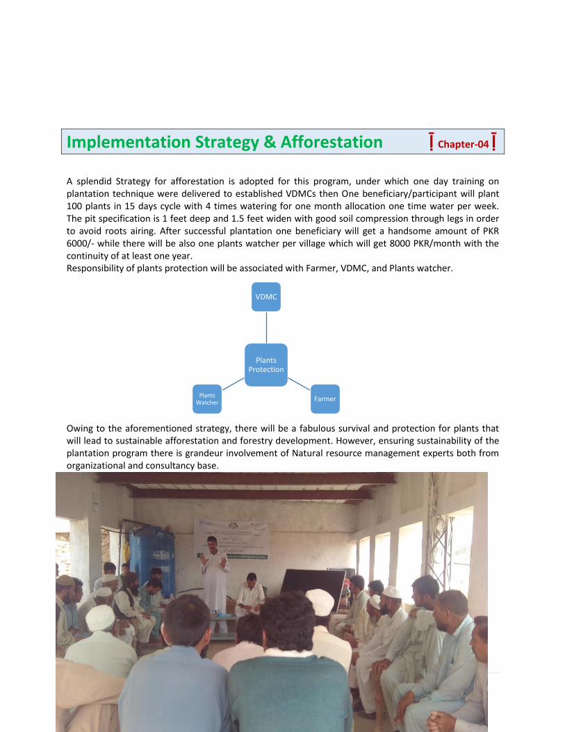
A splendid Strategy for afforestation is adopted for this program, under which one day training on plantation technique were delivered to established VDMCs then One beneficiary/participant will plant 100 plants in 15 days cycle with 4 times watering for one month allocation one time water per week. The pit specification is 1 feet deep and 1.5 feet widen with good soil compression through legs in order to avoid roots airing. After successful plantation one beneficiary will get a handsome amount of PKR 6000/- while there will be also one plants watcher per village which will get 8000 PKR/month with the continuity of at least one year. Responsibility of plants protection will be associated with Farmer, VDMC, and Plants watcher.
Owing to the aforementioned strategy, there will be a fabulous survival and protection for plants that will lead to sustainable afforestation and forestry development. However, ensuring sustainability of the plantation program there is grandeur involvement of Natural resource management experts both from organizational and consultancy base.
Plants Protection
VDMC
Farmer Plants
Watcher
8 | P a g e
Results and Discussion ḹ Chapter-05 ḹ
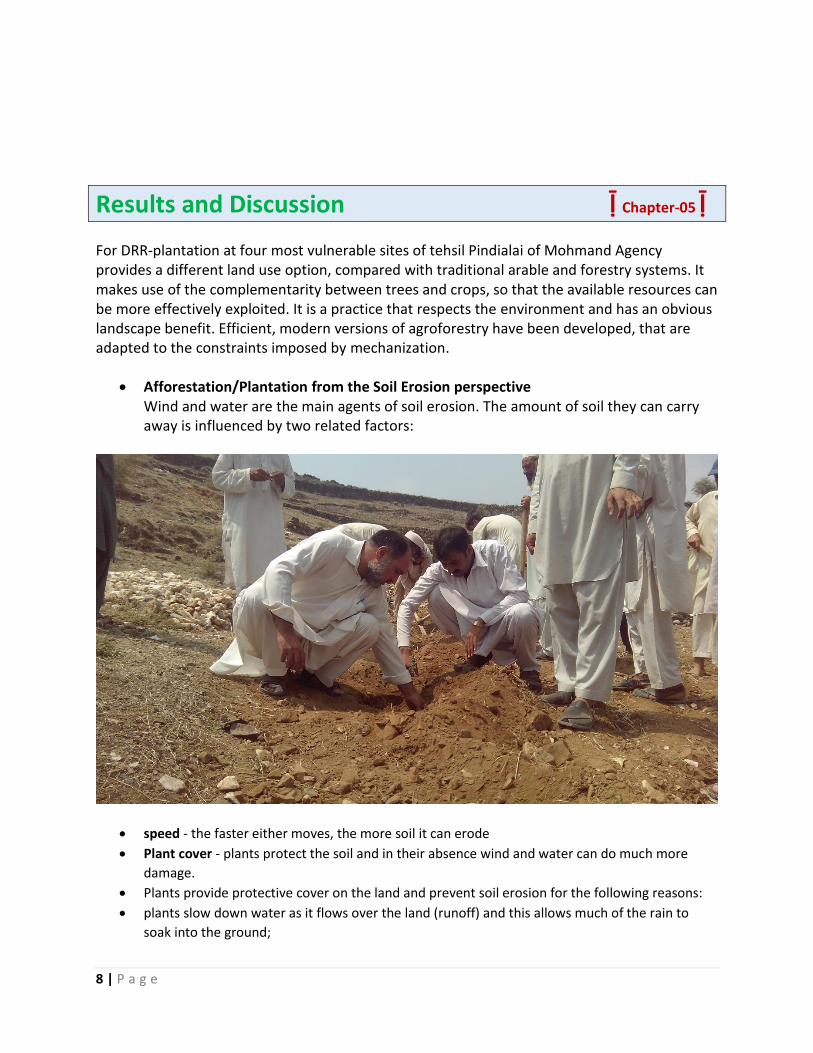
For DRR-plantation at four most vulnerable sites of tehsil Pindialai of Mohmand Agency provides a different land use option, compared with traditional arable and forestry systems. It makes use of the complementarity between trees and crops, so that the available resources can be more effectively exploited. It is a practice that respects the environment and has an obvious landscape benefit. Efficient, modern versions of agroforestry have been developed, that are adapted to the constraints imposed by mechanization.
Afforestation/Plantation from the Soil Erosion perspective Wind and water are the main agents of soil erosion. The amount of soil they can carry away is influenced by two related factors:
speed - the faster either moves, the more soil it can erode
Plant cover - plants protect the soil and in their absence wind and water can do much more
damage.
Plants provide protective cover on the land and prevent soil erosion for the following reasons:
plants slow down water as it flows over the land (runoff) and this allows much of the rain to
soak into the ground;
9 | P a g e
plant roots hold the soil in position and prevent it from being washed away;
Plants break the impact of a raindrop before it hits the soil, thus reducing its ability to erode;
Plants in wetlands and on the banks of rivers are of particular importance as they slow down the
flow of the water and their roots bind the soil, thus preventing erosion.
The loss of protective vegetation through deforestation, over-grazing, ploughing, and fire makes soil
vulnerable to being swept away by wind and water. In addition, over-cultivation and compaction cause
the soil to lose its structure and cohesion and it becomes more easily eroded. Erosion will remove the
top-soil first. Once this nutrient-rich layer of soil is gone, few plants will grow in the soil again. Without
soil and plants the land becomes desert-like and unable to support life - this process is called
desertification. It is very difficult and often impossible to restore decertified land.
DRR-Afforestation from the Politics, economics and soil erosion perspective
To understand soil erosion in DRR-Afforestation project we must be aware of the political and economic
factors affecting land users.
In Pakistan apartheid policies ensured that 42% of the people lived on 13 % of the land. This
overcrowding has resulted in severe erosion. As the land became increasingly degraded and thus less
productive, subsistence farmers were forced to further overuse the land. The intensive agriculture and
overgrazing that followed caused greater degradation. Soil erosion can be seen as both a symptom of
underdevelopment (i.e. poverty, inequality and exploitation), and as a cause of underdevelopment. A
reduced ability to produce, invest one's profit and increase productivity, contributes to increasing
poverty, and can lead to desertification, drought, floods, and famine.
On commercial farm lands, overstocking, mono-cropping, and the ploughing of marginal lands
unsuitable for cultivation has led to soil erosion and desertification. Frequently these practices have
been unwittingly encouraged by the state offering subsidies which made it profitable to exploit the land
in the short-term.
Preventing soil erosion:
Preventing soil erosion requires political, economic and technical changes.
Political and economic changes need to address the distribution of land in Pakistan as well as
the possibility of incentives to encourage farmers to manage their land sustainably.
Aspects of technical changes include:
the use of contour ploughing and wind breaks;
leaving un ploughed grass strips between ploughed land;
Making sure that there are always plants growing on the soil, and that the soil is rich in humus
(decaying plant and animal remains). This organic matter is the "glue" that binds the soil
particles together and plays an important part in preventing erosion;
avoiding overgrazing and the over-use of crop lands;
allowing indigenous plants to grow along the river banks instead of ploughing and planting crops
right up to the water's edge;
encouraging biological diversity by planting several different types of plants together;
Conservation of wetlands.
10 | P a g e
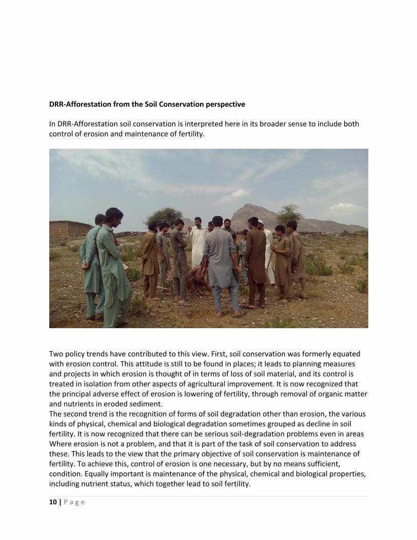
DRR-Afforestation from the Soil Conservation perspective
In DRR-Afforestation soil conservation is interpreted here in its broader sense to include both control of erosion and maintenance of fertility.
Two policy trends have contributed to this view. First, soil conservation was formerly equated with erosion control. This attitude is still to be found in places; it leads to planning measures and projects in which erosion is thought of in terms of loss of soil material, and its control is treated in isolation from other aspects of agricultural improvement. It is now recognized that the principal adverse effect of erosion is lowering of fertility, through removal of organic matter and nutrients in eroded sediment. The second trend is the recognition of forms of soil degradation other than erosion, the various kinds of physical, chemical and biological degradation sometimes grouped as decline in soil fertility. It is now recognized that there can be serious soil-degradation problems even in areas Where erosion is not a problem, and that it is part of the task of soil conservation to address these. This leads to the view that the primary objective of soil conservation is maintenance of fertility. To achieve this, control of erosion is one necessary, but by no means sufficient, condition. Equally important is maintenance of the physical, chemical and biological properties, including nutrient status, which together lead to soil fertility.
11 | P a g e
Soil conservation may expressed as a pseudo-equation in Forestry:
SUSTAINABILITY = PRODUCTIVITY + CONSERVATION OF RESOURCES.
According to soil loss Estimator Formula:
Soil loss, Z, in t/ha/yr, is given by the equation:
Z = K x C x X. Where: K= soil loss from bare soil,
C= Crop Ratio
And X= Topographic Ratio
DRR-Agro Forestry Plantation from the flooding control
A flood is an accumulation or an overflow of an expanse of water that covers or inundates land
that is usually dry. Types of flooding include:
Riverine flooding. This usually occurs when a river overflows its banks. It is usually due to the
volume of water within a body of water, such as a river or lake, exceeding its capacity and
overflowing its banks. It can also occur when the velocity of the river is so high that it flows
right out of the river channel, usually at bends.
Coastal flooding. The sea can overflow or overtop flood defenses such as sea walls, perhaps
due to a heavy storm (storm surge), a high tide, a tsunami or a combination thereof.
Flash flooding. This is a flood that rises and falls rapidly with little or no advance warning. Flash
floods usually result from intense rainfall over a relatively small area.
Urban flooding this occurs as a result of land development. Permeable soil layers are being
replaced by impermeable paved surfaces, through which water cannot infiltrate. This leads to
greater runoff being generated, which can make rivers out of roadways and ponds out of car
parks.
Causes of Flooding:
There are natural and anthropogenic (human-induced) causes of flooding.
Flooding can naturally be attributed to:
Prolonged rainfall. When rain falls for a prolonged period of time, the soil can become
saturated. When water is unable to infiltrate into the saturated soil, it is forced to flow over the
12 | P a g e
soil, thus increasing surface runoff. Rivers that are unable to accommodate excess rain water
overflow their banks onto neighboring flood plains.
Intense/Heavy rainfall. When rain falls heavily; the rain drops hit the ground with a force. This
can cause the rain drops to bounce off the soil instead of infiltrating into the soil. The water
from the rain is then forced to flow over the surface instead, thus increasing the surface runoff.
Relief refers to the difference in height between the highest point and the lowest point on land.
When rain falls, the surface runoff can move very quickly from mountainous or hilly areas to
low lying areas making these low lying areas more prone to flooding.
Human activities that degrade the environment often increases flooding. These activities
include:
Deforestation. The lack of vegetation encourages water to flow over the surface rather than
infiltrate into the soil thus increasing surface runoff.
Poor land use practices. Slash and burn agriculture, over-cultivation and over-grazing eventually cause the soil to become infertile and unable to sustain vegetative growth. Consequently, the lack of green cover encourages water to flow over the surface rather than infiltrate into the soil thus increasing surface runoff.
Urbanization leads to the replacement of permeable soil with that of an impervious layer of
pitch and concrete, through which water cannot infiltrate. This results in increased surface
runoff which leads to flash flooding.
Improper waste disposal. Oftentimes, garbage that is not properly disposed enters into drainage systems and clogs drains. This obstructs the free flow of the water that enters into these drains causing water to back up during rainfall flooding the surrounding area. A buildup of garbage can also obstruct the natural flow of water in rivers and streams.
Quarrying is the clearing of land for the removal of aggregates (mainly sand and gravel) which is to be utilized in the construction industry. The action of quarrying leaves land bare and devoid of any trees and shrubs hence increasing surface runoff produced.
Vulnerabilities to flooding:
Vulnerability describes the characteristics and circumstances of a community that make it
susceptible to the damaging effects of a hazard.
The following can make us more vulnerable to flooding:
Physical
1. Building homes on the river bank or on flood plains.
13 | P a g e
2. Constructing new housing settlements without improving the existing drainage system, thus overwhelming the drainage system.
3. The construction of residential or commercial buildings without taking into consideration the current and future flooding impacts can increase ones vulnerability.
4. Living close to the coast can make one vulnerable to storm surges and coastal flooding. 5. Lack of maintenance of drains and waterways.
Social
1. Lack of education on the causes and mitigation measures that one can use to reduce the effects of flooding.
2. Family Structure- Female headed households and households with a large number of dependencies are considered to be more vulnerable to the negative impacts of disasters.
Economic
1. Unemployment impairs the amount of monetary resources that one to reduce one’s vulnerability to flooding.
2. Debt reduces ability to recover from flood damages 3. Living in coastal areas prone to coastal flooding because of livelihood, e.g., fishing.
Environmental
1. Deforestation or the removal of forest or vegetative cover from land would result in increased flooding and would increase an area’s vulnerability.
2. Pollution and the indiscriminate dumping of garbage into drains and waterways would increase flooding events.
3. Forest fires/bush fires leave the land barren and devoid of vegetation, which increases surface runoff and increases one’s vulnerability to flooding.
How to reduce flooding and flood damages (Afforestation-DRR Approach):
Public education initiatives would increase the population's awareness of the hazard and what
they can do to mitigate against it. Such initiatives would make people better aware of the risks
that they face, especially those that live in high risk areas.
Create proper land use and pollution policies and enforce these policies. Policies that would
encourage sustainable development should be created since this would reduce the amount of
deforestation that takes place as well as illegal quarrying.
Relocate individuals who live in high risk areas. Sometimes public education is too late and the
best option to protect the lives of some individuals is to relocate them to safer areas.
Dredge Rivers and waterways regularly to remove the excess buildup of silt and soil sediments.
14 | P a g e
Build proper drainage systems. Ensure that there is proper drainage or expand on existing
drainage systems whenever there’s new settlements or structures being constructed.
DRR-Afforestation from the environmental perspective
1. DRR-Afforestation/Plantation conduct Improvement to the development of natural resources: the total wood and arable production from an agroforestry plot is greater than the separate production obtained by an arable-forest separate cropping pattern on the same area of land. This effect results from the stimulation of complementarity between trees and crops on agroforestry plots. Thus, weeds, which are spontaneously present in young forestry plantations are replaced by harvested crops or pasture; maintenance is less costly and environmental resources are better used.
2. Better control of cultivated areas of land: by substituting for arable plots, the agroforestry plots contributes to diminishing the cultivated area of land. The intensification of environmental resource use by agroforestry plantation is not resulting in more crop products.
3. Creation of original landscapes that are attractive, open and favor recreational activities. Agroforestry plots have a truly innovative landscaping potential, and would improve the public image of farmers to society. This will be particularly the case in very sparsely wooded areas, where plots are developed by planting arable land, and in very heavily wooded areas, where plots are developed by thinning the existing forest.
4. Counteract the greenhouse effect: constitution of an effective system for carbon sequestration, by combining the maintenance of the stock of organic material in the soil (the case especially with meadows), and the superimposition of a net fixing wooded layer.
5. Protection of soil and water, in particular in sensitive areas. 6. Improvement of biodiversity, especially by the abundance of "edge effects". This in
particular, permits a synergistic improvement, by favoring the habitat of game. The integrated protection of crops by their association with trees, chosen to stimulate the hyper parasite (parasites of parasites) population of crops, is a promising way forwards.
7. These favorable characteristics are as coherent with the many objectives of the laws guiding agriculture and forestry, as they are with the directing principles of the Common Agricultural Policy
Benefits from DRR-Forestry Plantation:
By DRR-Forestry Mix Triangular plantation of 11200 plants we will save the four (04) stated
villages from:
Glaciers
Floods
Soil Erosion
Nutrients Run off
Food Insecurity
15 | P a g e
Income disturbance
fuel shortage
Environmental issue etc.
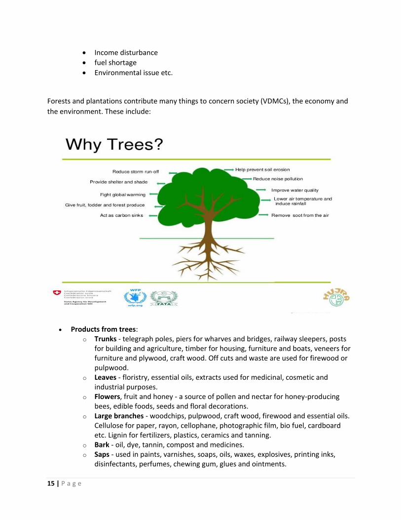
Forests and plantations contribute many things to concern society (VDMCs), the economy and
the environment. These include:
Products from trees: o Trunks - telegraph poles, piers for wharves and bridges, railway sleepers, posts
for building and agriculture, timber for housing, furniture and boats, veneers for furniture and plywood, craft wood. Off cuts and waste are used for firewood or pulpwood.
o Leaves - floristry, essential oils, extracts used for medicinal, cosmetic and industrial purposes.
o Flowers, fruit and honey - a source of pollen and nectar for honey-producing bees, edible foods, seeds and floral decorations.
o Large branches - woodchips, pulpwood, craft wood, firewood and essential oils. Cellulose for paper, rayon, cellophane, photographic film, bio fuel, cardboard etc. Lignin for fertilizers, plastics, ceramics and tanning.
o Bark - oil, dye, tannin, compost and medicines. o Saps - used in paints, varnishes, soaps, oils, waxes, explosives, printing inks,
disinfectants, perfumes, chewing gum, glues and ointments.
16 | P a g e
o Stumps - timber veneers, craft work, boat building and firewood. Can be distilled or treated to produce pine oil, resin, turpentine, charcoal and wood tar.
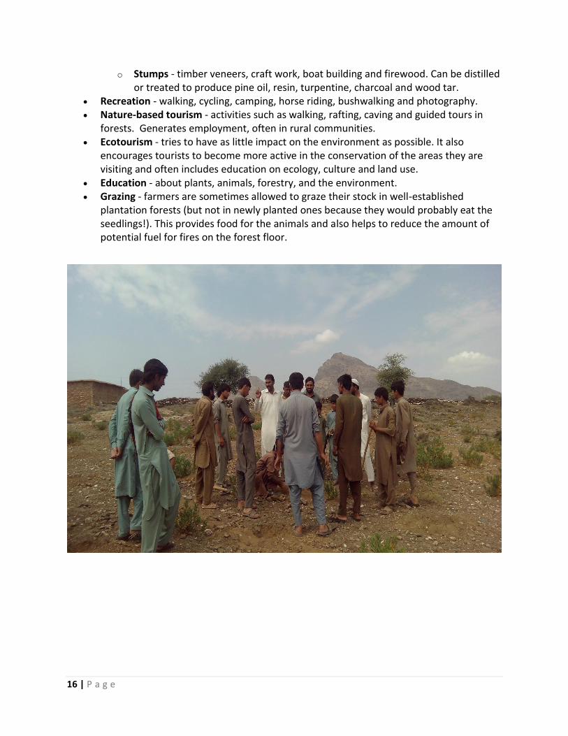
Recreation - walking, cycling, camping, horse riding, bushwalking and photography. Nature-based tourism - activities such as walking, rafting, caving and guided tours in
forests. Generates employment, often in rural communities. Ecotourism - tries to have as little impact on the environment as possible. It also
encourages tourists to become more active in the conservation of the areas they are visiting and often includes education on ecology, culture and land use.
Education - about plants, animals, forestry, and the environment. Grazing - farmers are sometimes allowed to graze their stock in well-established
plantation forests (but not in newly planted ones because they would probably eat the seedlings!). This provides food for the animals and also helps to reduce the amount of potential fuel for fires on the forest floor.
17 | P a g e
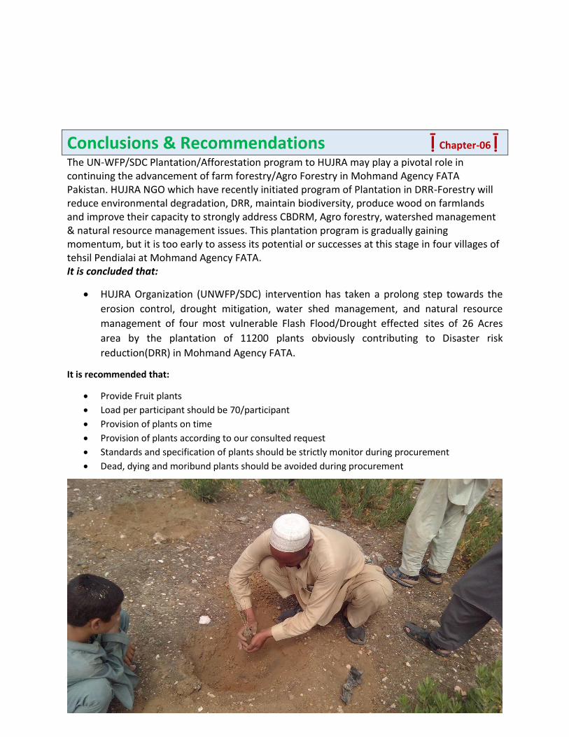
Conclusions & Recommendations ḹ Chapter-06 ḹ The UN-WFP/SDC Plantation/Afforestation program to HUJRA may play a pivotal role in continuing the advancement of farm forestry/Agro Forestry in Mohmand Agency FATA Pakistan. HUJRA NGO which have recently initiated program of Plantation in DRR-Forestry will reduce environmental degradation, DRR, maintain biodiversity, produce wood on farmlands and improve their capacity to strongly address CBDRM, Agro forestry, watershed management & natural resource management issues. This plantation program is gradually gaining momentum, but it is too early to assess its potential or successes at this stage in four villages of tehsil Pendialai at Mohmand Agency FATA. It is concluded that:
HUJRA Organization (UNWFP/SDC) intervention has taken a prolong step towards the
erosion control, drought mitigation, water shed management, and natural resource
management of four most vulnerable Flash Flood/Drought effected sites of 26 Acres
area by the plantation of 11200 plants obviously contributing to Disaster risk
reduction(DRR) in Mohmand Agency FATA.
It is recommended that:
Provide Fruit plants
Load per participant should be 70/participant
Provision of plants on time
Provision of plants according to our consulted request
Standards and specification of plants should be strictly monitor during procurement
Dead, dying and moribund plants should be avoided during procurement