Embed Size (px)
Citation preview
Community and Economic Development
GPS Assessment of Walkable School Routes
Christopher J. Seeger, ASLA, GISP [email protected] Extension Specialist in Landscape Architecture Extension
Associate Professor of Landscape Architecture
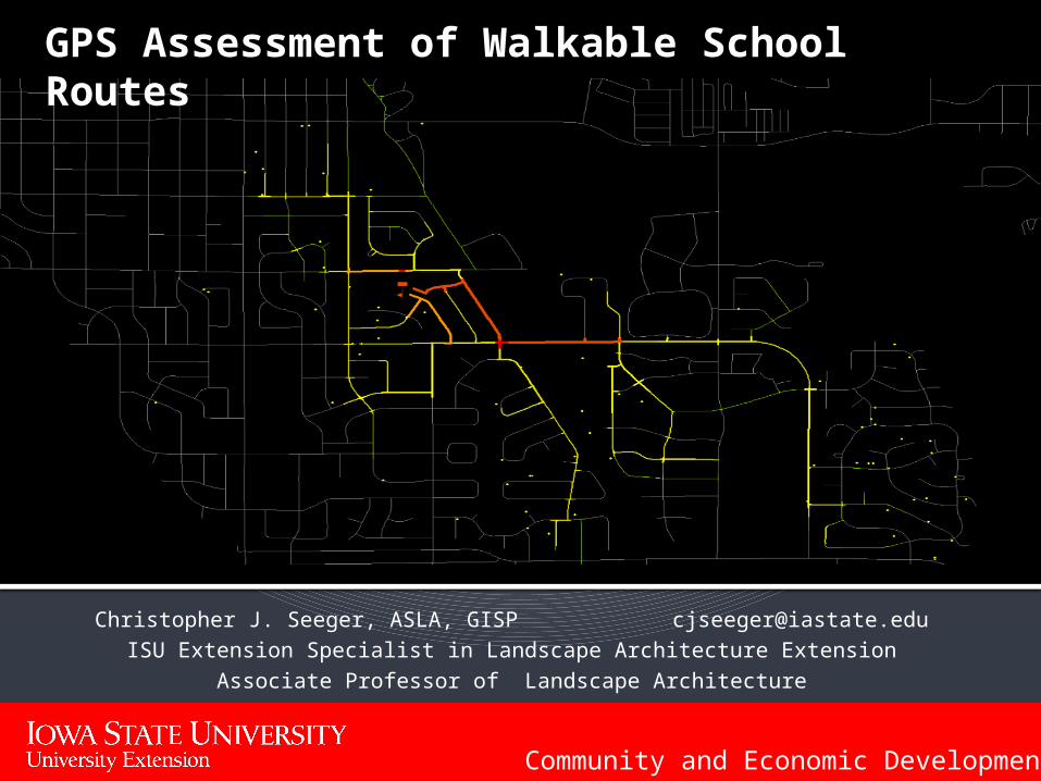
iPhone GPS with GIS Connectivity
Easy to use Mapping interface
Live connection to GIS Server
Built in camera with geotagging
Facetime communication with ISU Extension staff
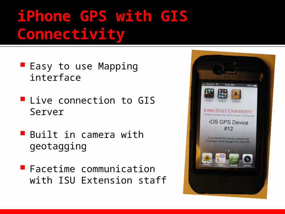
12 Devices for workshop
Checked out to team 12 teams of walkers during the workshop
Devices can be tracked to see progress of team
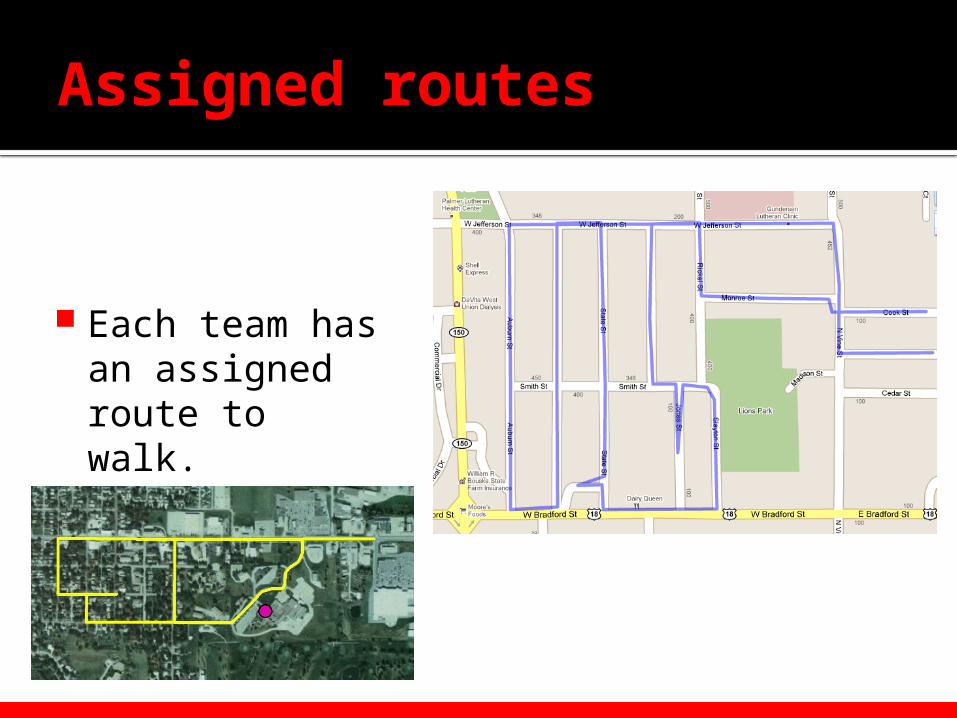
Assigned routes
Each team has an assigned route to walk.
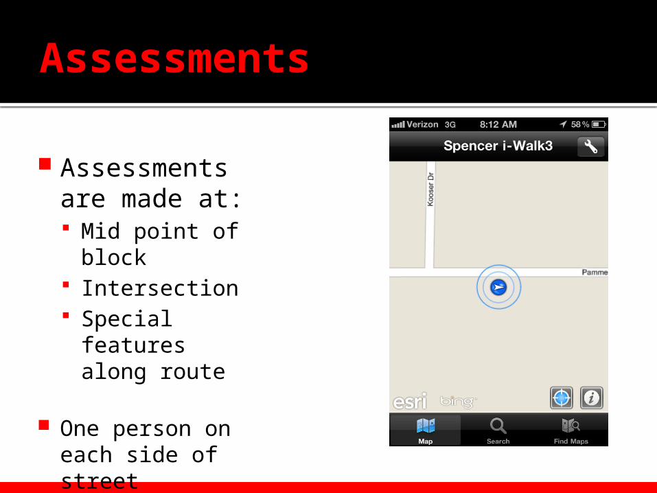
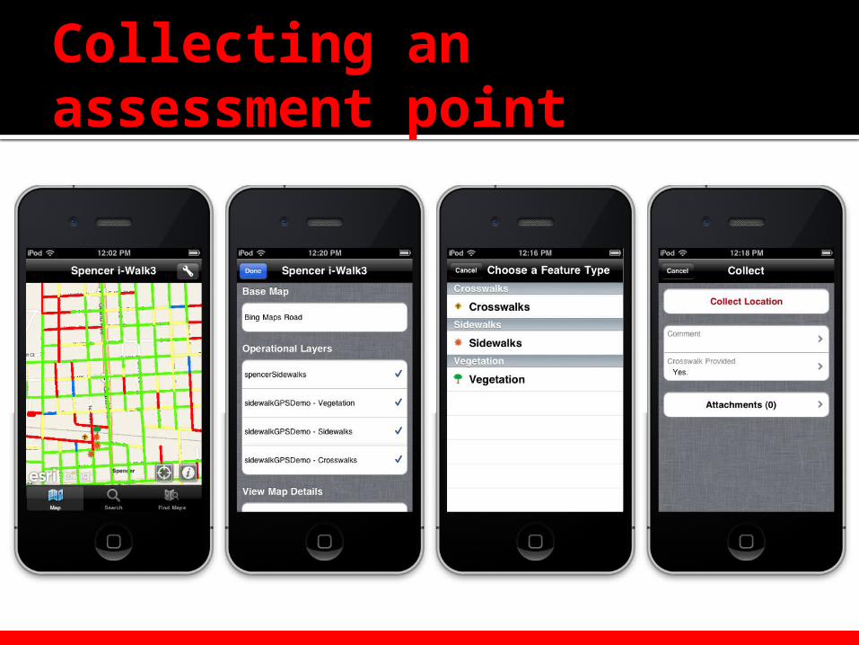
Assessments
Assessments are made at: Mid point of
block Intersection Special features
along route
One person on each side of street
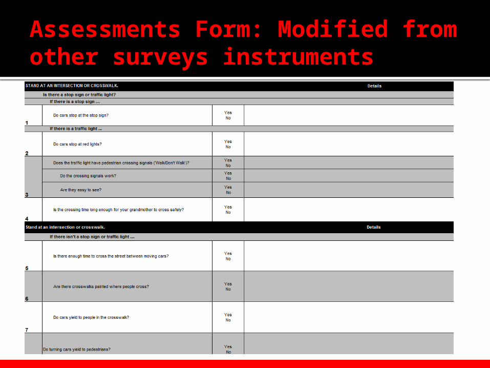
Assessments Form: Modified from other surveys instruments
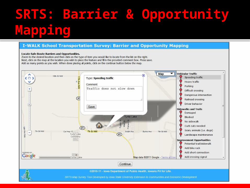
SRTS: Barrier & Opportunity Mapping
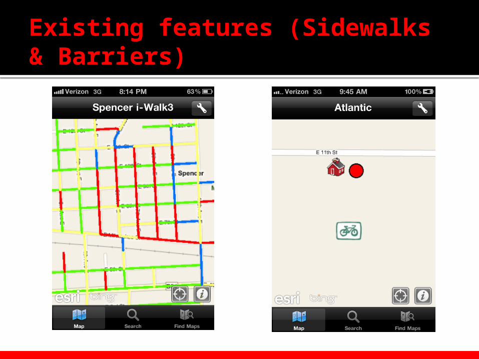
Existing features (Sidewalks & Barriers)
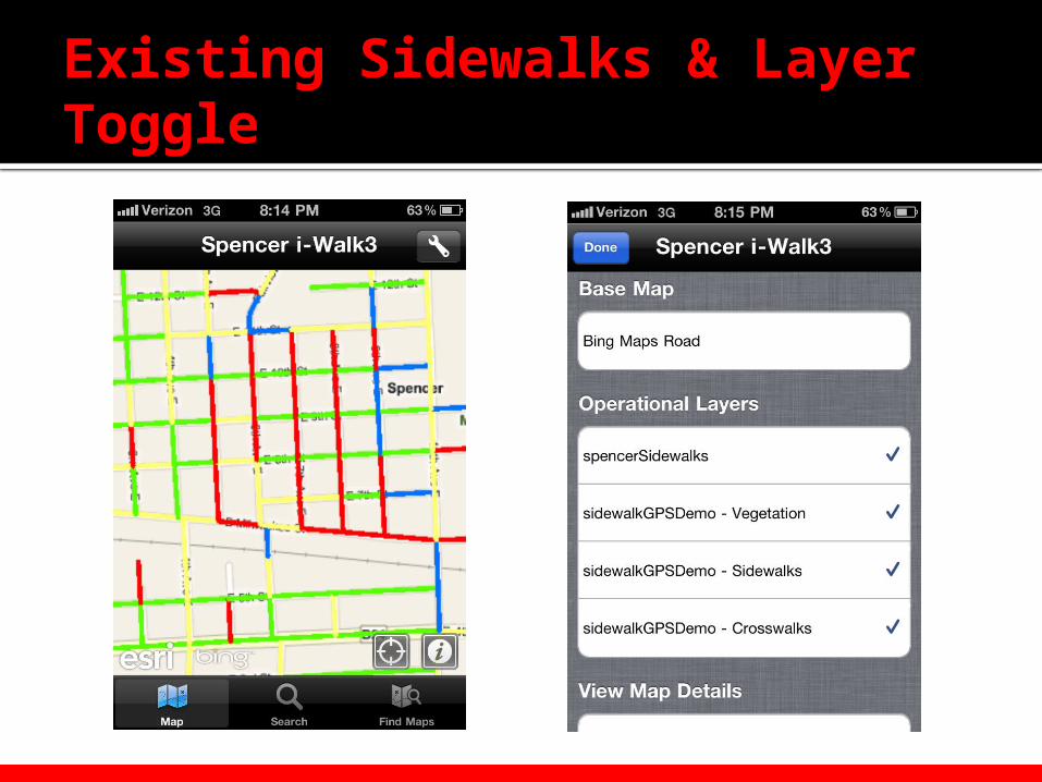
Existing Sidewalks & Layer Toggle
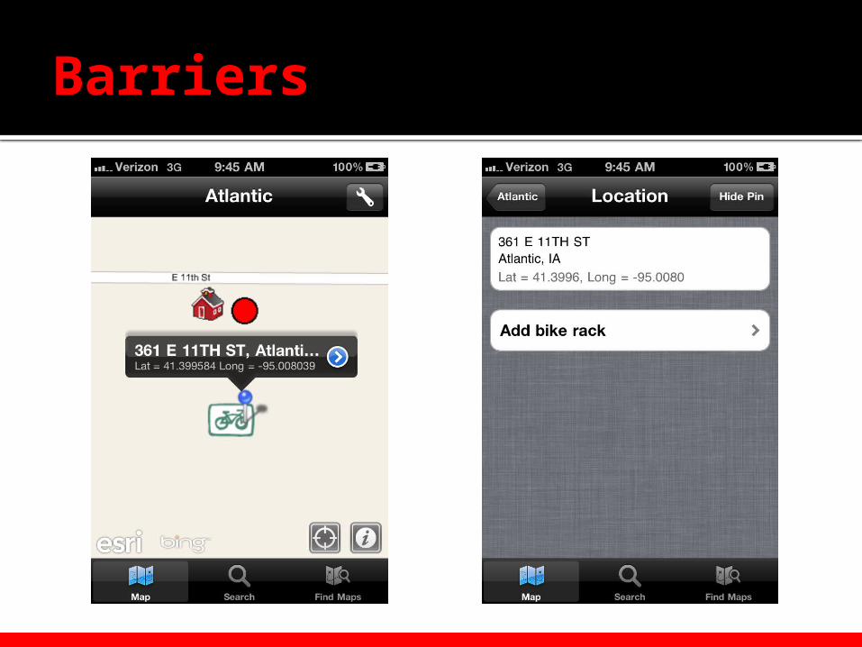
Barriers
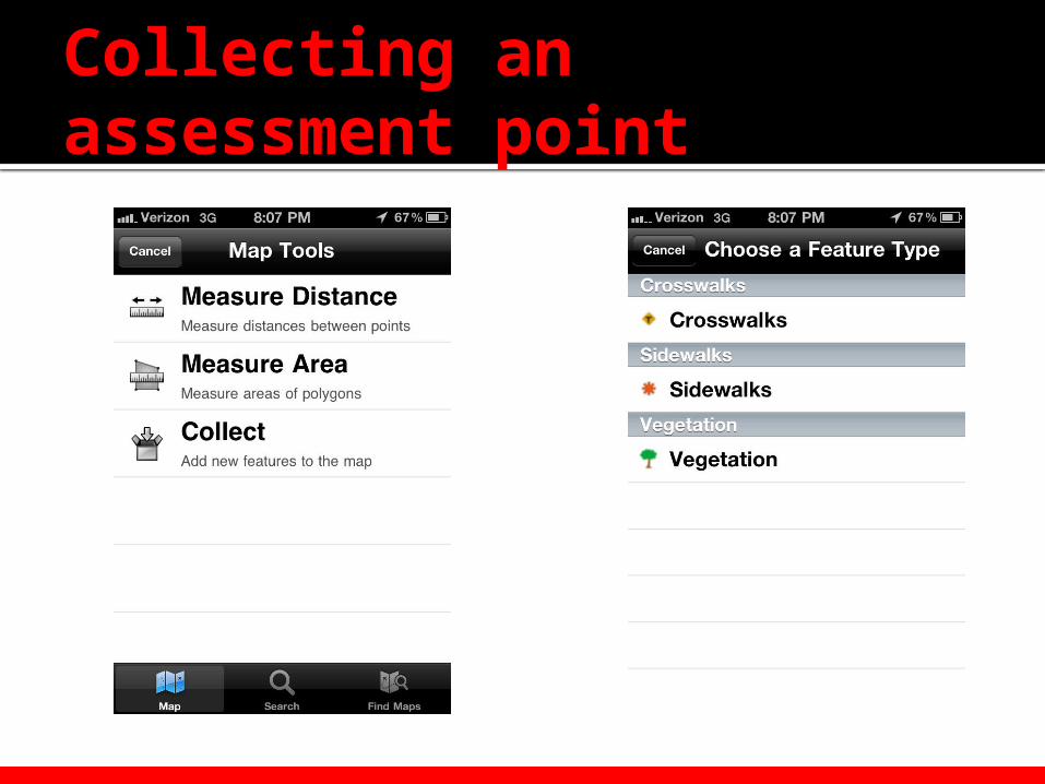
Collecting an assessment point
Collecting an assessment point
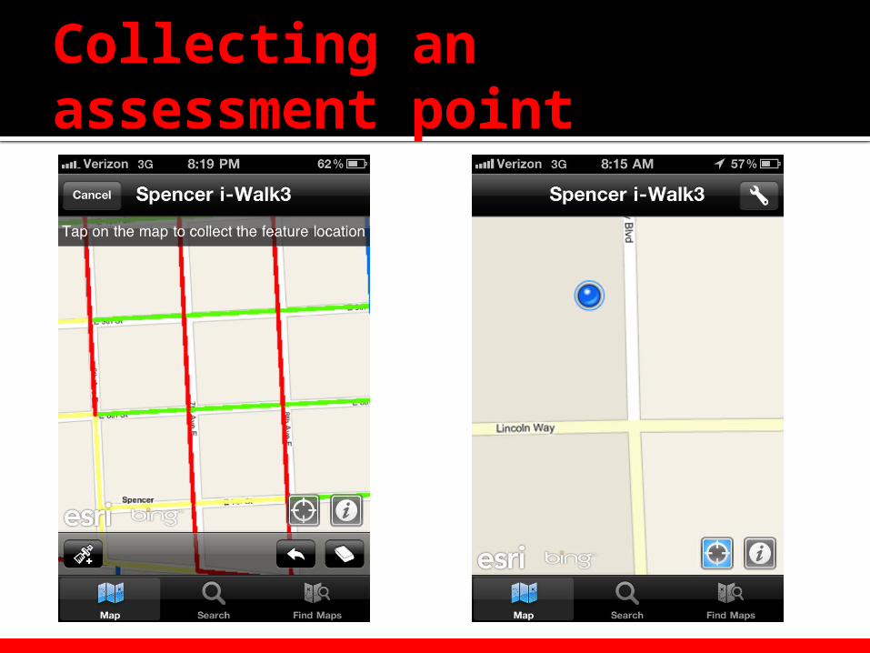
Collecting an assessment point

Community and Economic Development
Questions??
Christopher J. Seeger, ASLAExtension Landscape Architect &Associate Professor of Landscape [email protected]