Embed Size (px)
Citation preview
CLIMATE RISK & VULNERABILITY ASSESSMENT (CRVA): CENTRAL MEKONG DELTA CONNECTIVITY PROJECT
ADB & APAN WorkshopClimate Risk Management in Planning & Investment projectsManila, 9‐10 February, 2015Tarek Ketelsen, ICEM – International Centre for Environmental Management
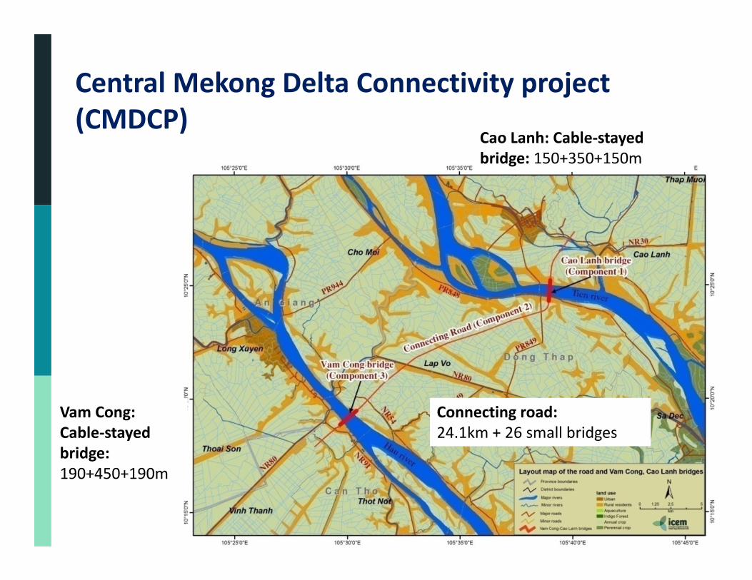
Central Mekong Delta Connectivity project (CMDCP)
Cao Lanh: Cable‐stayed bridge: 150+350+150m
Vam Cong: Cable‐stayed bridge: 190+450+190m
Connecting road: 24.1km + 26 small bridges
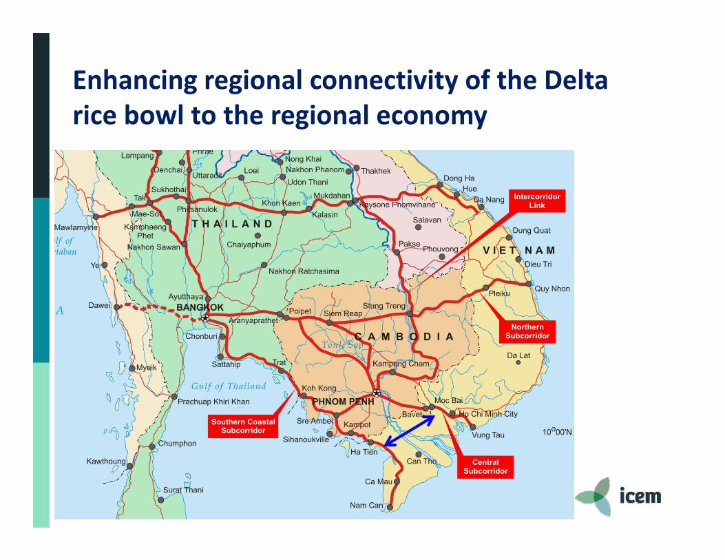
Enhancing regional connectivity of the Delta rice bowl to the regional economy
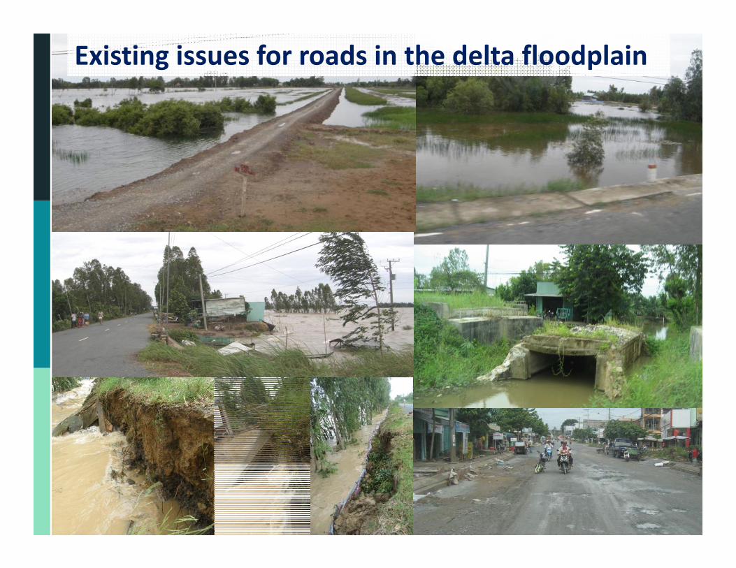
Existing issues for roads in the delta floodplain
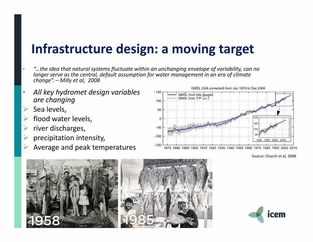
Source: Church et al, 2008
Infrastructure design: a moving target• “…the idea that natural systems fluctuate within an unchanging envelope of variability, can no
longer serve as the central, default assumption for water management in an era of climate change”. – Milly et al, 2008
• All key hydromet design variables are changing
Sea levels, flood water levels, river discharges, precipitation intensity, Average and peak temperatures
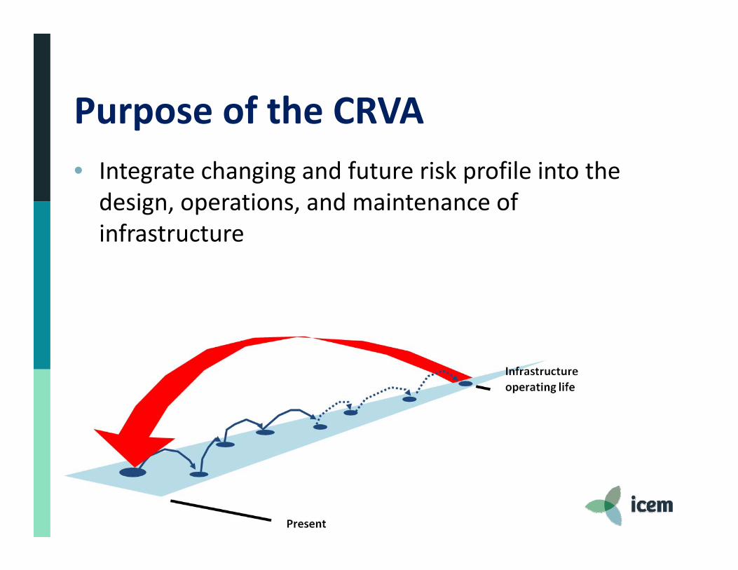
Purpose of the CRVA• Integrate changing and future risk profile into the design, operations, and maintenance of infrastructure
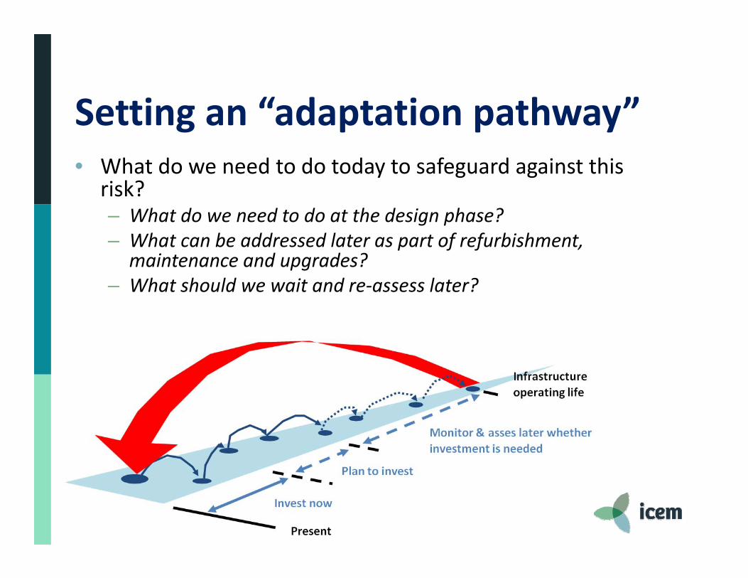
Setting an “adaptation pathway”• What do we need to do today to safeguard against this
risk?– What do we need to do at the design phase?– What can be addressed later as part of refurbishment,
maintenance and upgrades?– What should we wait and re‐assess later?
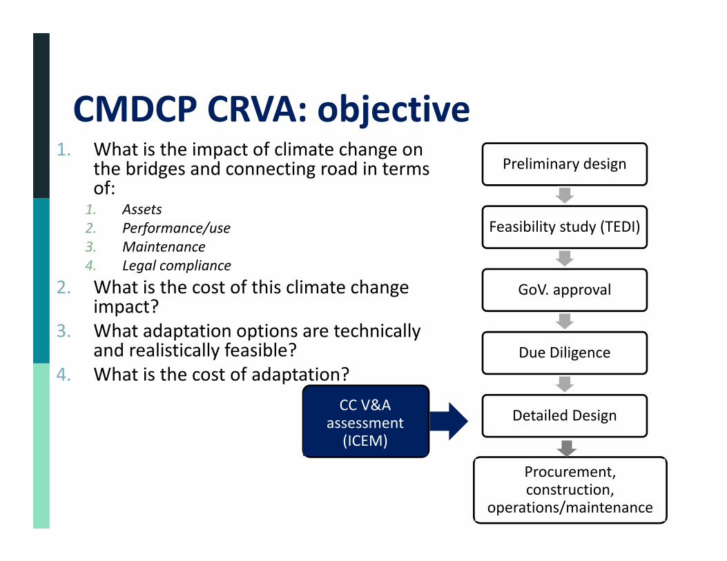
1. What is the impact of climate change on the bridges and connecting road in terms of:
1. Assets2. Performance/use3. Maintenance4. Legal compliance
2. What is the cost of this climate change impact?
3. What adaptation options are technically and realistically feasible?
4. What is the cost of adaptation?
8
Preliminary design
Feasibility study (TEDI)
GoV. approval
Due Diligence
Detailed Design CC V&A
assessment (ICEM)
Procurement, construction,
operations/maintenance
CMDCP CRVA: objective
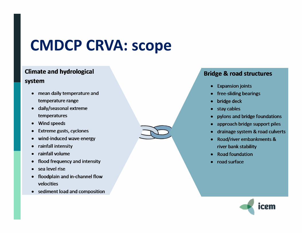
CMDCP CRVA: scope
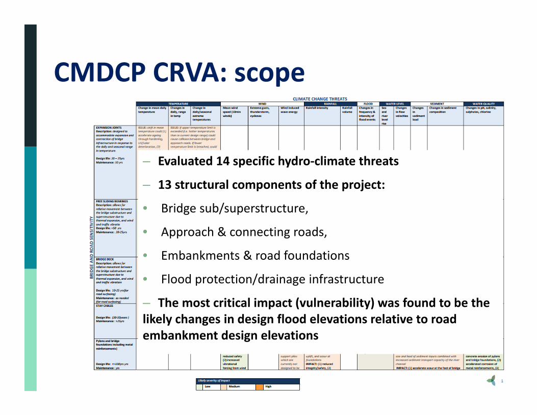
CMDCP CRVA: scope
– Evaluated 14 specific hydro‐climate threats
– 13 structural components of the project:
• Bridge sub/superstructure,
• Approach & connecting roads,
• Embankments & road foundations
• Flood protection/drainage infrastructure
– The most critical impact (vulnerability) was found to be the likely changes in design flood elevations relative to road embankment design elevations
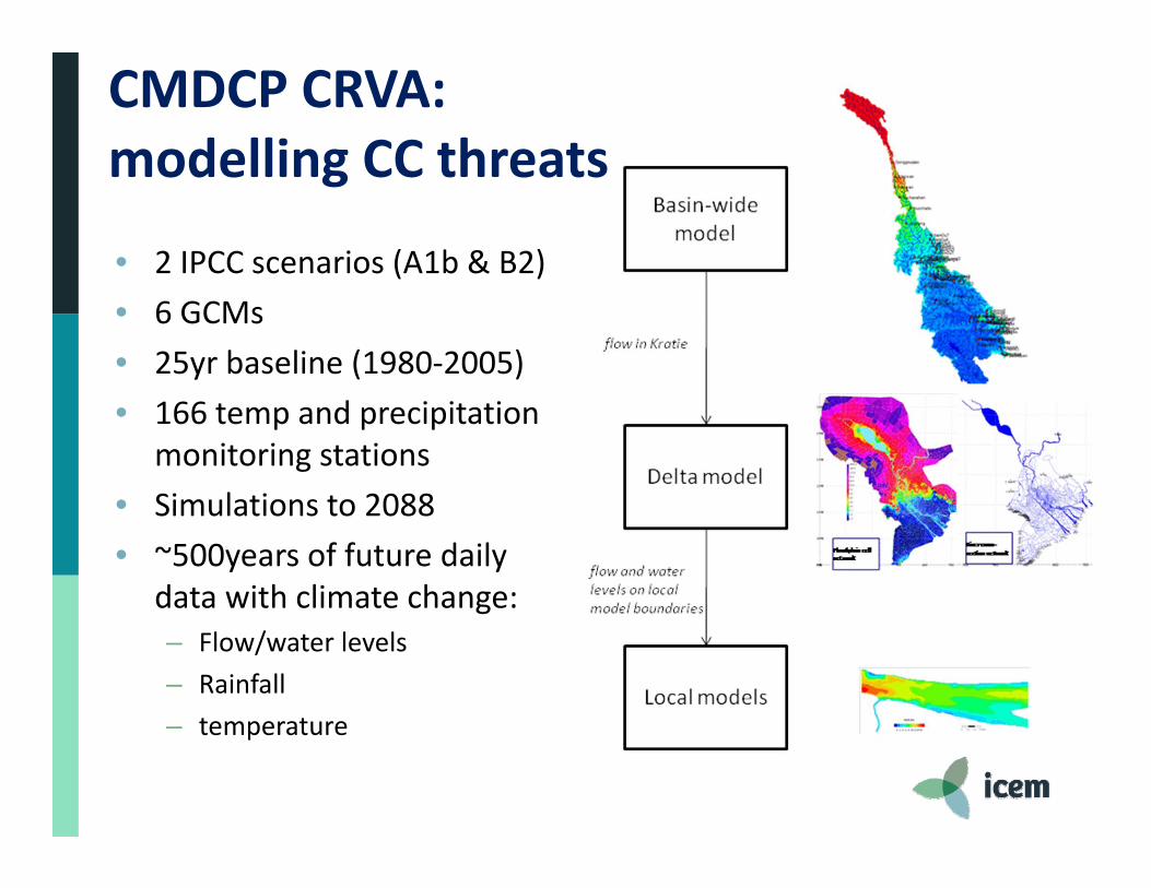
• 2 IPCC scenarios (A1b & B2)• 6 GCMs• 25yr baseline (1980‐2005)• 166 temp and precipitation
monitoring stations• Simulations to 2088• ~500years of future daily
data with climate change:– Flow/water levels– Rainfall– temperature
CMDCP CRVA: modelling CC threats
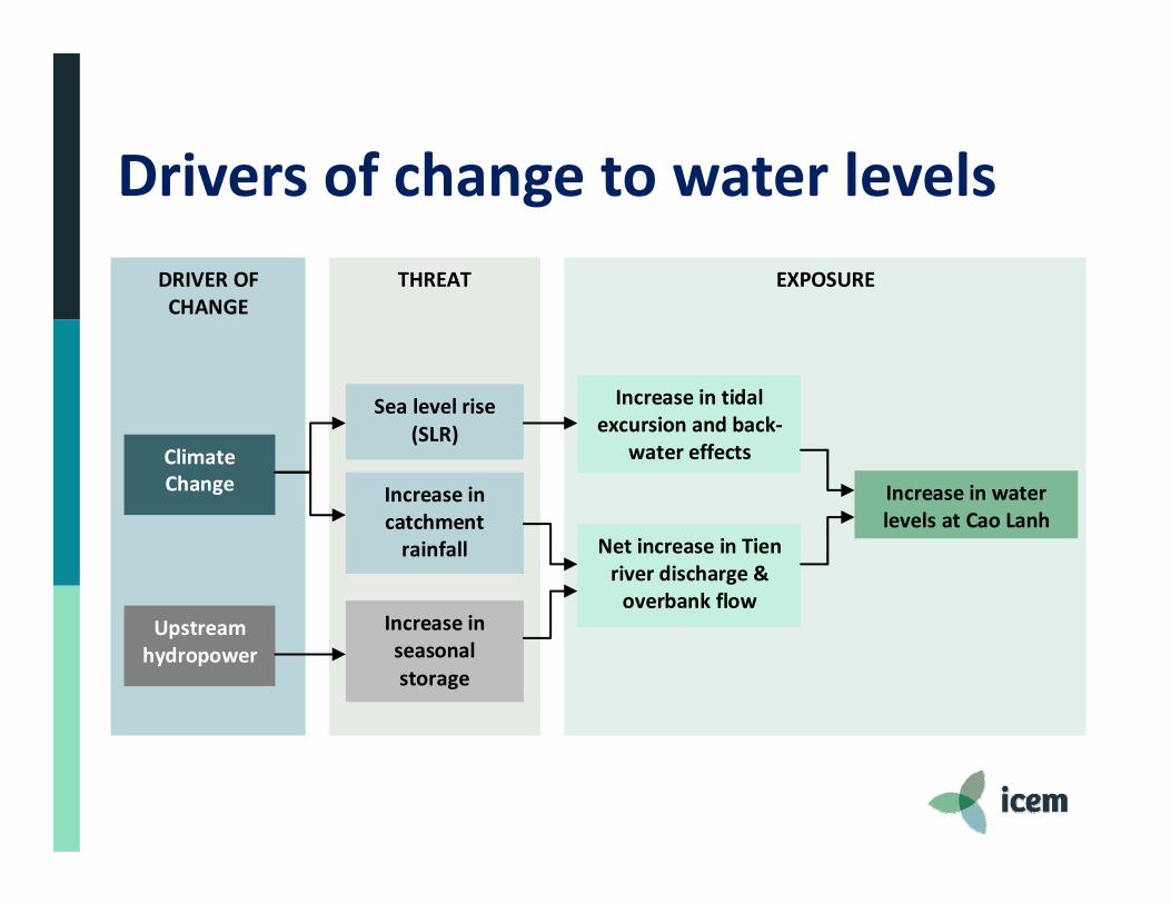
Drivers of change to water levels
DRIVER OF CHANGE
EXPOSURE
THREAT
Upstream hydropower
Climate Change
Sea level rise(SLR)
Increase in catchment rainfall
Increase inseasonal storage
Net increase in Tien river discharge & overbank flow
Increase in tidal excursion and back‐
water effects
Increase in water levels at Cao Lanh
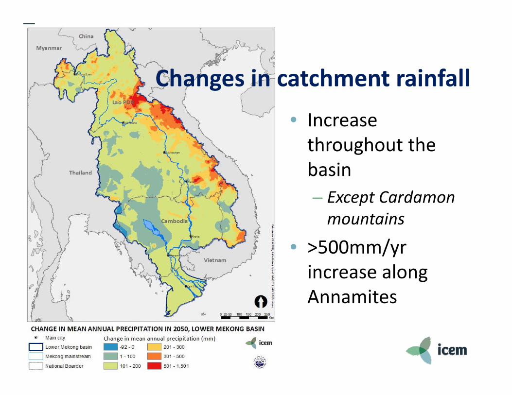
• Increase throughout the basin– Except Cardamonmountains
• >500mm/yr increase along Annamites
Changes in catchment rainfall
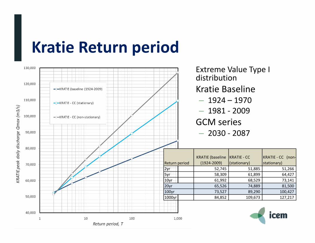
Kratie Return period• Extreme Value Type I
distribution• Kratie Baseline
– 1924 – 1970– 1981 ‐ 2009
• GCM series– 2030 ‐ 2087
Return periodKRATIE (baseline (1924‐2009)
KRATIE ‐ CC (stationary)
KRATIE ‐ CC (non‐stationary)
2yr 52,745 51,885 51,266 5yr 58,309 61,899 64,427 10yr 61,992 68,529 73,141 20yr 65,526 74,889 81,500 100yr 73,527 89,290 100,427 1000yr 84,852 109,673 127,217

Official Government of Vietnam Sea Level Rise projections
• 2050 = 0.3m• 2100 = 1.0mAt bridge site:• 1m SLR =
+0.55m peak WL
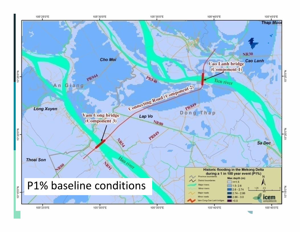
P1% baseline conditions
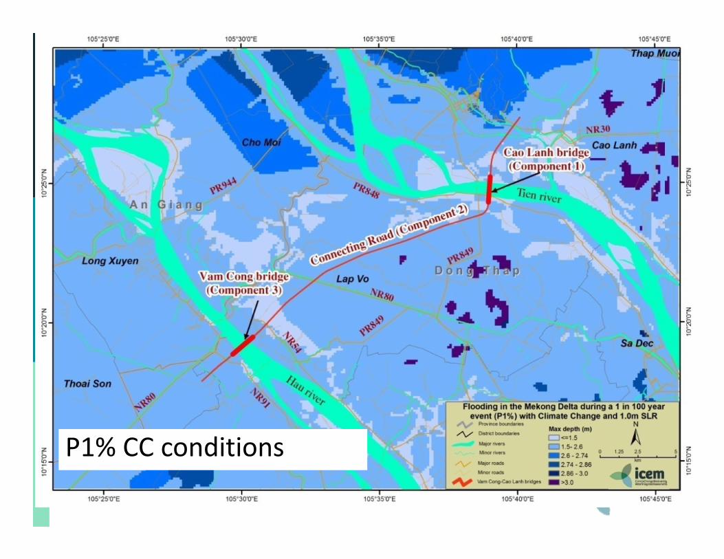
P1% CC conditions
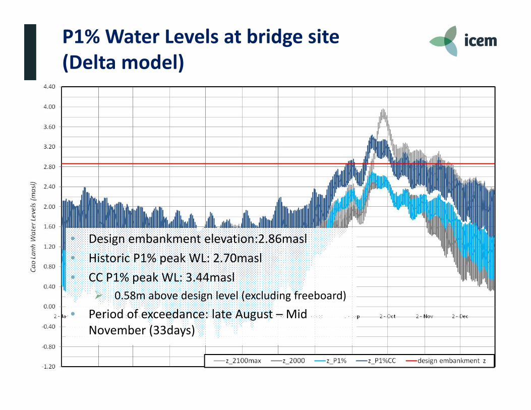
P1% Water Levels at bridge site (Delta model)
• Design embankment elevation:2.86masl• Historic P1% peak WL: 2.70masl• CC P1% peak WL: 3.44masl
0.58m above design level (excluding freeboard)
• Period of exceedance: late August – Mid November (33days)
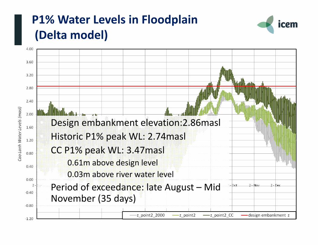
P1% Water Levels in Floodplain(Delta model)
• Design embankment elevation:2.86masl• Historic P1% peak WL: 2.74masl• CC P1% peak WL: 3.47masl 0.61m above design level 0.03m above river water level
• Period of exceedance: late August – Mid November (35 days)
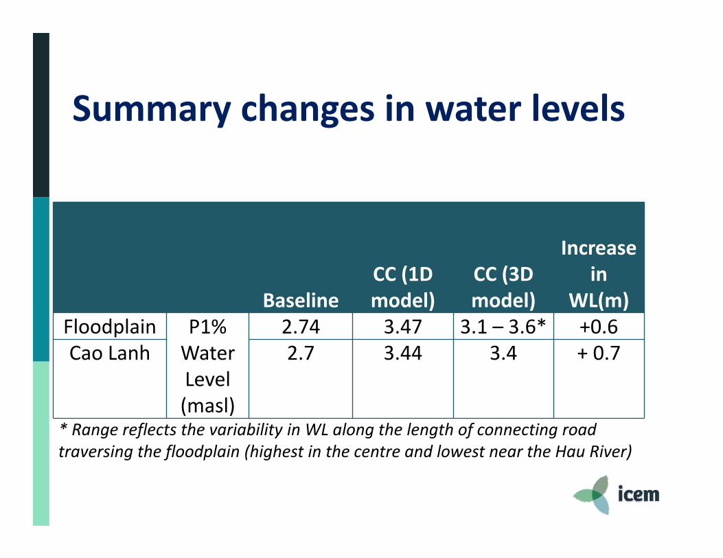
Summary changes in water levels
BaselineCC (1D model)
CC (3D model)
Increase in
WL(m)Floodplain P1%
Water Level (masl)
2.74 3.47 3.1 – 3.6* +0.6Cao Lanh 2.7 3.44 3.4 + 0.7
* Range reflects the variability in WL along the length of connecting road traversing the floodplain (highest in the centre and lowest near the Hau River)
Main Findings
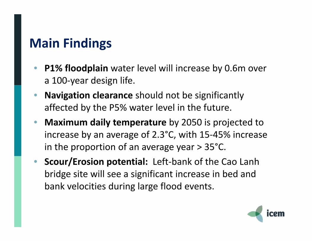
• P1% floodplain water level will increase by 0.6m over a 100‐year design life.
• Navigation clearance should not be significantly affected by the P5% water level in the future.
• Maximum daily temperature by 2050 is projected to increase by an average of 2.3°C, with 15‐45% increase in the proportion of an average year > 35°C.
• Scour/Erosion potential: Left‐bank of the Cao Lanh bridge site will see a significant increase in bed and bank velocities during large flood events.
Main Findings
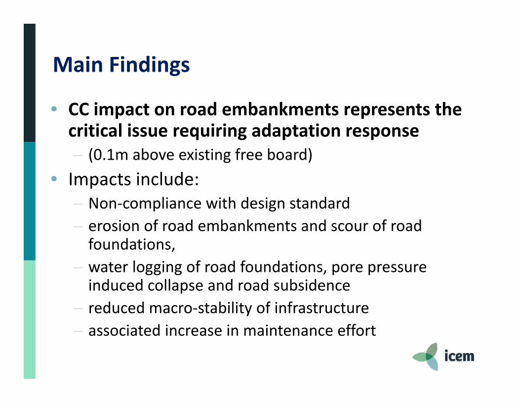
• CC impact on road embankments represents the critical issue requiring adaptation response– (0.1m above existing free board)
• Impacts include:– Non‐compliance with design standard– erosion of road embankments and scour of road foundations,
– water logging of road foundations, pore pressure induced collapse and road subsidence
– reduced macro‐stability of infrastructure– associated increase in maintenance effort
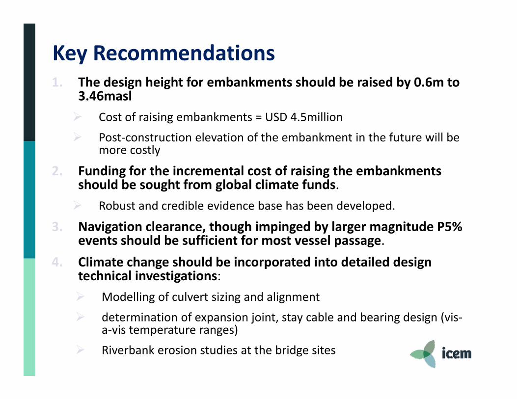
Key Recommendations1. The design height for embankments should be raised by 0.6m to
3.46masl Cost of raising embankments = USD 4.5million Post‐construction elevation of the embankment in the future will be
more costly
2. Funding for the incremental cost of raising the embankments should be sought from global climate funds. Robust and credible evidence base has been developed.
3. Navigation clearance, though impinged by larger magnitude P5% events should be sufficient for most vessel passage.
4. Climate change should be incorporated into detailed design technical investigations: Modelling of culvert sizing and alignment determination of expansion joint, stay cable and bearing design (vis‐
a‐vis temperature ranges) Riverbank erosion studies at the bridge sites
Key Recommendations (cont)
5. Additional study is required to improve understanding of overland flood flow dynamics. Rapid expansion of agricultural and transport infrastructure in the delta is suspected to have changed the floodplain dynamics of the delta‐system over past decade.
6. The climate change assessment should be expanded to cover provincial feeder roads
7. Need for the Government of Vietnam and ADB to assess climate change implications for other key transport infrastructure in the Delta. should be implemented as part of the Ministry of
Transport’s National Target Plan for Climate Change Response.

CMDCP CRVA: lessons learnt1. Integrate CRVA as early as possible into the investment
planning process2. Foster links between the design team and the CRVA team3. Be careful not to proscribe the scope of the CRVA at the
outset (some CC issues are non‐obvious and only emerge as the study unfolds)
4. Take a wider integrated approach to resilience that considers the infrastructure investment in its surrounding environment
Thank you for your attention!
Tarek Ketelsen, Technical DirectorICEM – International Centre for Environmental [email protected]