Embed Size (px)
Citation preview
Climate Change in Atqasuk, AlaskaStrategies for Community Health
ANTHC Center for Climate and Health

Report prepared by:
Michael Brubaker, Alaska Native Tribal Health ConsortiumJake Bell, Alaska Native Tribal Health ConsortiumHeather Dingman, North Slope BoroughMolly Ahkivgak, North Slope Borough Health DepartmentDoug Whiteman- City of AtqasukRichard Drake, Rich Design
ANTHC recognizes all of our technical advisors for this report. Thank you for your support.
Jim Berner, MD ANTHCTed Smith, ANTHCJohn Warren, PE ANTHCJennifer Williams, ANTHC
The writing team would like to thank all of the community and regional contributors to this project. We appreciate your time and support.
Achieving wellness through awareness and adaptation
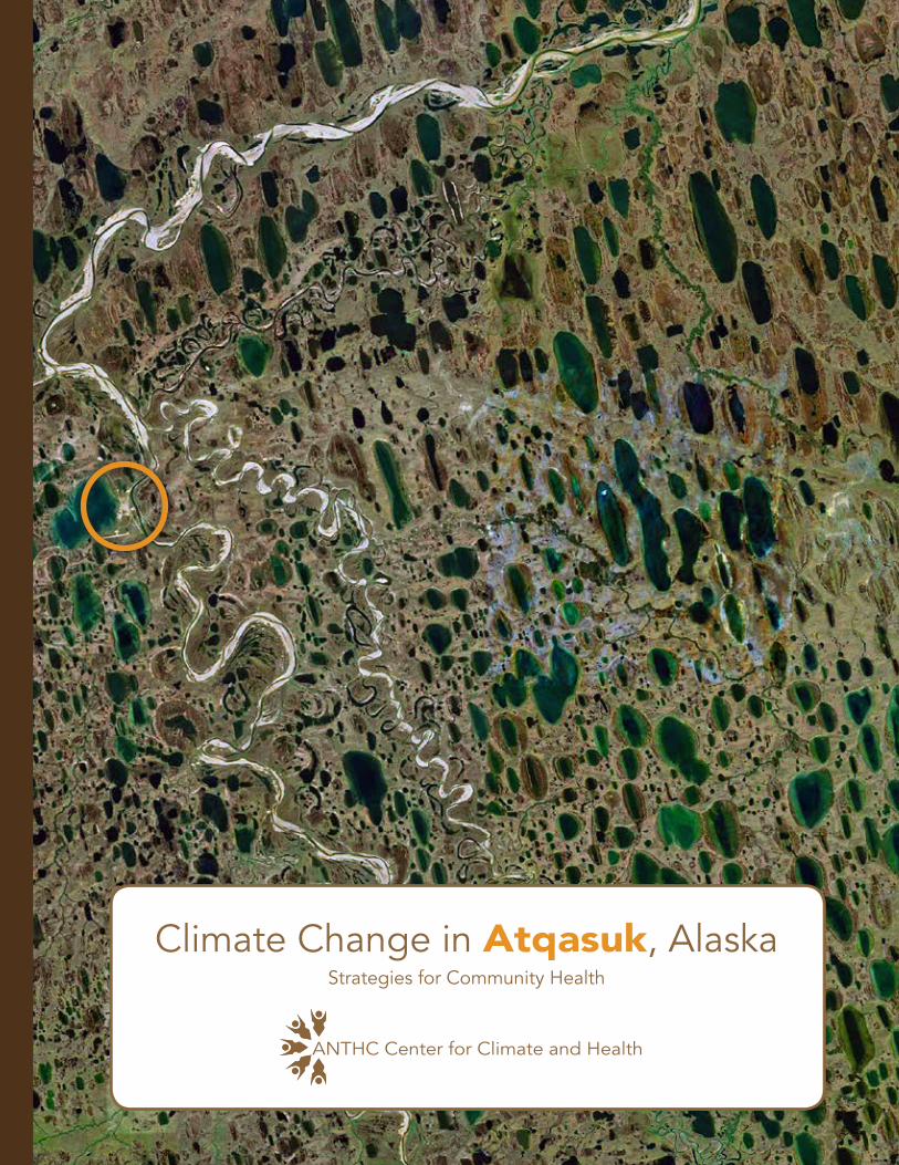
Cover: Satellite image of Atqasuk area. Source: Google Earth.
Native Village of Atqasuk
United States Environmental Protection Agency
United States Environmental Protection Agency
Paid for in part with National Petroleum Reserve-Alaska Program funds made available through the State Department of Commerce, Community, and Economic Development.

Aerial view of Atqasuk. Mike Brubaker, 2013.
TABLE OF CONTENTSIntroduction 1 Community – an Inupiaq river people 3 Ecosystem – a system in change 7 Climate – the new Arctic 9Findings Weather – going to extremes 13 Land – a new landscape 15 River – wider, shallower, dirtier 19 Lake – a disappearing feature 23 Subsistence – changing behavior, species and seasons 25 Infrastructure – thawing and sinking foundations 29Summary 31Conclusion 33
Figures 1. North Slope Borough 22. Atqasuk Area and Region 43. Atqasuk Mean Monthly Temperature 104. Atqasuk Mean Monthly Precipitation 115. Climate Change Health Assessment Summary of Findings 34 Appendices A. Participants and Project Collaborators 35B. Web Resources 36C. Acronyms 37
References 38
1
This Climate Change Health Assessment was performed based on requests from tribal health representatives and from local and regional leadership. Information about local climate, environment, and health conditions was gathered with the help of local and regional government, universities, industry, and state and federal agencies.
Climate change refers to change over time either due to natural variability or as a result of human activity (IPCC, 2008). Today the term is mostly used to describe global changes caused by the burning of fossil fuels and the warming effect caused by the transfer of enormous quantities of carbon dioxide from the earth to the air. But climate change also has local implications and communities seek adaptive strategies that encourage wellness and sustainability. The North Slope of Alaska is characterized by permafrost and ice. The wildlife, vegetation and people have specially adapted to live in an environment that is mostly cold and frozen. But because of warming, the environment is rapidly changing and a new Arctic is emerging, characterized by thawing land, open water and a longer warm season. For residents of the North Slope this means new challenges in building and maintaining infrastructure, for providing local services, collecting food and water, and safely navigating the land and seascape. It also means new opportunities for subsistence, land use, transportation, commerce and development. Understanding local effects is the first step in finding a healthy course through the changes and challenges ahead.
This climate change health assessment project was initiated in 2013 by the North Slope Borough, Health Impact Assessment (HIA) program with a grant from the National Petroleum Reserve-Alaska and supplemental funding from the U.S. Environmental Protection Agency. The project is in collaboration with the Alaska Native Tribal Health Consortium (ANTHC),
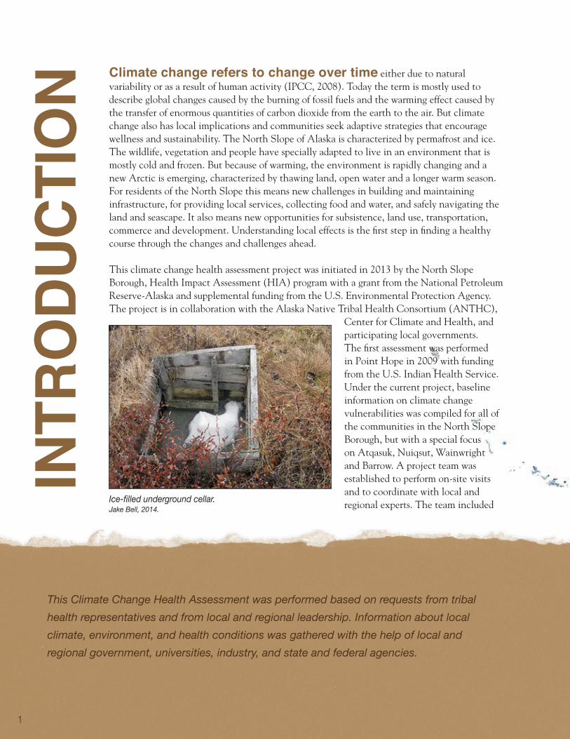
Center for Climate and Health, and participating local governments. The first assessment was performed in Point Hope in 2009 with funding from the U.S. Indian Health Service. Under the current project, baseline information on climate change vulnerabilities was compiled for all of the communities in the North Slope Borough, but with a special focus on Atqasuk, Nuiqsut, Wainwright and Barrow. A project team was established to perform on-site visits and to coordinate with local and regional experts. The team included Ice-filled underground cellar.
Jake Bell, 2014.
intr
odu
Ctio
n
2
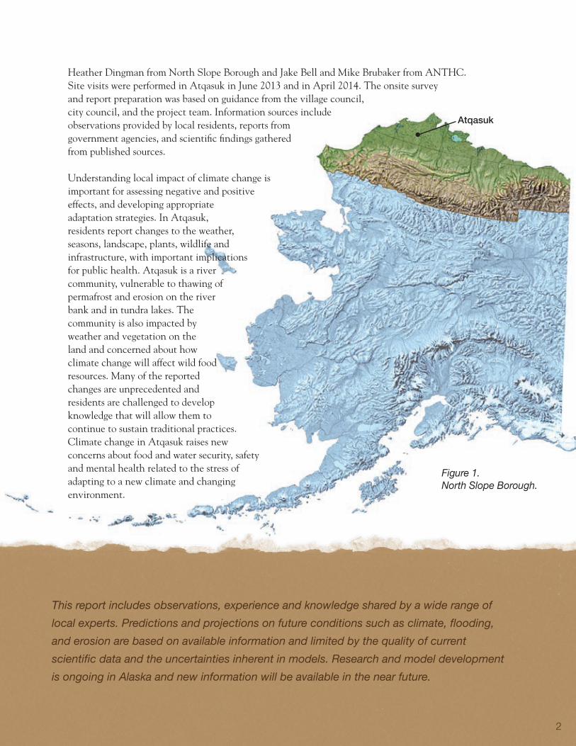
Figure 1. North Slope Borough.
Heather Dingman from North Slope Borough and Jake Bell and Mike Brubaker from ANTHC. Site visits were performed in Atqasuk in June 2013 and in April 2014. The onsite survey and report preparation was based on guidance from the village council, city council, and the project team. Information sources include observations provided by local residents, reports from government agencies, and scientific findings gathered from published sources.
Understanding local impact of climate change is important for assessing negative and positive effects, and developing appropriate adaptation strategies. In Atqasuk, residents report changes to the weather, seasons, landscape, plants, wildlife and infrastructure, with important implications for public health. Atqasuk is a river community, vulnerable to thawing of permafrost and erosion on the river bank and in tundra lakes. The community is also impacted by weather and vegetation on the land and concerned about how climate change will affect wild food resources. Many of the reported changes are unprecedented and residents are challenged to develop knowledge that will allow them to continue to sustain traditional practices. Climate change in Atqasuk raises new concerns about food and water security, safety and mental health related to the stress of adapting to a new climate and changing environment.
This report includes observations, experience and knowledge shared by a wide range of local experts. Predictions and projections on future conditions such as climate, flooding, and erosion are based on available information and limited by the quality of current scientific data and the uncertainties inherent in models. Research and model development is ongoing in Alaska and new information will be available in the near future.
Atqasuk
3
Atqasuk is a traditional Inupiaq community located on the west bank of the Meade River, 60 miles south of Barrow. Its location inland from the Beaufort Sea gives its climate and environment characteristics of both the coastal and interior Arctic. The surrounding landscape is largely flat, except for some steep river banks, and treeless, characterized by tundra vegetation and dotted by lakes. The estimated population in Atqasuk is 248 people (DCCED, 2014). The Atqasuk area has a long history as a hunting and fishing ground for the Inupiaq people, with historical sod houses, ice cellars, and a gravesite testifying to this use. In World War II the area was mined for coal to be burned in Barrow and a small settlement was maintained under the name “Meade River” and had a post office from 1951 to 1957 (DCCED, 2014). The population did not grow significantly until the 1970s when an influx of people migrated to the village site from other communities across the North Slope, particularly Barrow. The village was incorporated with the name Atqasuk as a second-class city in 1982 (NSB 2014).
Atqasuk is an Inupiat community of about 240 residents located on the Meade River.
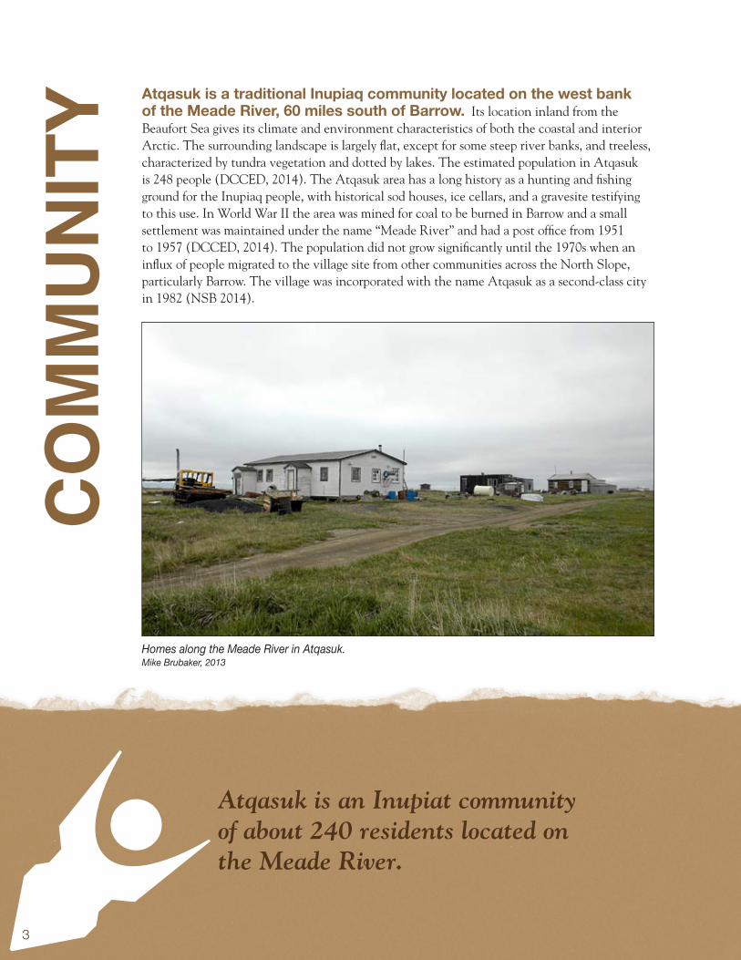
Homes along the Meade River in Atqasuk. Mike Brubaker, 2013
Com
mun
ity

4
Subsistence activities are a major component of Atqasuk’s economy and a range of species are hunted including caribou, polar bear, ptarmigan, ducks and geese. In the Meade River people catch grayling, burbot, salmon, and whitefish. Local harvestable berries near the village include salmonberries, cranberries, and blueberries (Mary Kay Bodfish). Citizens are employed at the school, clinic, in local government, local shops, and in the production of cultural arts and crafts (NSB, 2014). Atqasuk has a piped water system with nanofiltration treatment. There is also a central vacuum pump sewer system to collect waste water from many of the houses and facilities. The newest houses in town have septic tanks. The system was installed from 1999 and completed in 2002 and has been generally dependable, avoiding large scale issues of frozen lines and leaks. Frozen lines and back-ups most often occur in the small above ground vacuum stations which are easily accessed by maintenance workers (James Brower). Air travel provides the only year-round access to Atqasuk, and the North Slope Borough owns and operates the Edward Burnell Sr. Memorial Airport, which has a gravel runway. The roads are constructed from riverbank sand which allows for smoother grating than gravel, but is also more vulnerable to erosion. Residents use boats to fish on the ice free Meade River, and snowmachines and ATVs to travel over the frozen rivers, lakes, and tundra.
Figure 2. Google view of Atqasuk and region.
Atqasuk
“We got our summer birds a month early this year.”
Woodrow Oyagak
5
In 2010, 21% of Atqasuk adults and 38% of children had “good to excellent” general health.Of Atqasuk heads-of-households, 29% were physically active at least five days a week. Atqasuk is a “dry” village meaning that the sale, importation, and possession of alcohol is banned. Despite this, a large proportion of households (42%) felt that the community had “often” been hurt by drugs or alcohol, during the past year. Most adults (61%) smoked tobacco as did 15% of children between 14 and 18 years of age. The prevalence of breathing problems such as asthma or chronic cough among children was 7%. Food security is an issue in Atqasuk. A majority of households (59%) reported that they were not able to get enough healthy food to meet their needs. Thirty-four percent of households were unable to get enough subsistence foods which are nutritious and protective against the development of chronic disease. Twenty percent of households reported that at times they did not have enough food to eat.
“The wind this spring came in from the north which is unusual. It usually comes from a different direction.”
Sharon Aiken-File
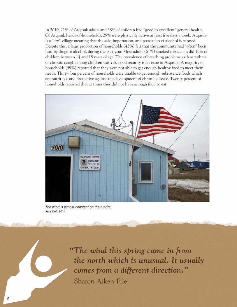
The wind is almost constant on the tundra.Jake Bell, 2014.
6
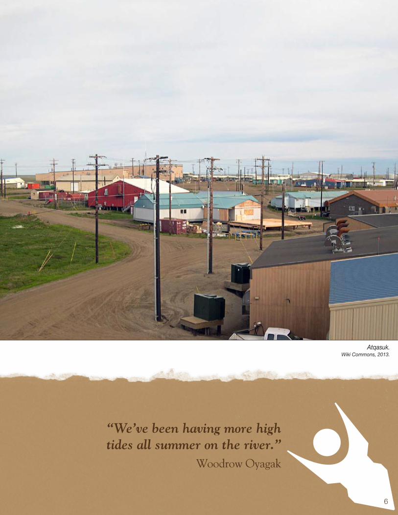
“We’ve been having more high tides all summer on the river.”
Woodrow Oyagak
Atqasuk.Wiki Commons, 2013.
7
“We used to go to the mouth of Niksiktugruk, now it is too shallow and we can’t anymore.” Ethel K. Burke
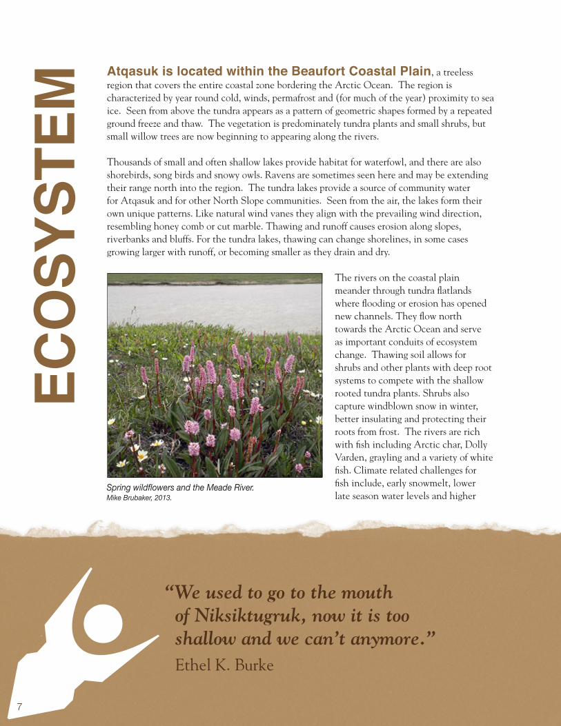
Atqasuk is located within the Beaufort Coastal Plain, a treeless region that covers the entire coastal zone bordering the Arctic Ocean. The region is characterized by year round cold, winds, permafrost and (for much of the year) proximity to sea ice. Seen from above the tundra appears as a pattern of geometric shapes formed by a repeated ground freeze and thaw. The vegetation is predominately tundra plants and small shrubs, but small willow trees are now beginning to appearing along the rivers.
Thousands of small and often shallow lakes provide habitat for waterfowl, and there are also shorebirds, song birds and snowy owls. Ravens are sometimes seen here and may be extending their range north into the region. The tundra lakes provide a source of community water for Atqasuk and for other North Slope communities. Seen from the air, the lakes form their own unique patterns. Like natural wind vanes they align with the prevailing wind direction, resembling honey comb or cut marble. Thawing and runoff causes erosion along slopes, riverbanks and bluffs. For the tundra lakes, thawing can change shorelines, in some cases growing larger with runoff, or becoming smaller as they drain and dry.
The rivers on the coastal plain meander through tundra flatlands where flooding or erosion has opened new channels. They flow north towards the Arctic Ocean and serve as important conduits of ecosystem change. Thawing soil allows for shrubs and other plants with deep root systems to compete with the shallow rooted tundra plants. Shrubs also capture windblown snow in winter, better insulating and protecting their roots from frost. The rivers are rich with fish including Arctic char, Dolly Varden, grayling and a variety of white fish. Climate related challenges for fish include, early snowmelt, lower late season water levels and higher
ECo
SySt
Em
Spring wildflowers and the Meade River. Mike Brubaker, 2013.
8
“The river was so low, it was even hard to travel in our kayaks.”
Mary Ellen Young
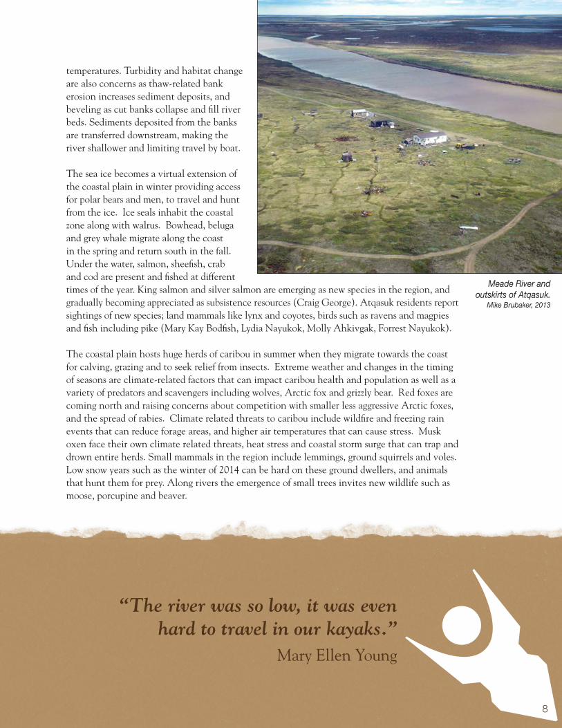
temperatures. Turbidity and habitat change are also concerns as thaw-related bank erosion increases sediment deposits, and beveling as cut banks collapse and fill river beds. Sediments deposited from the banks are transferred downstream, making the river shallower and limiting travel by boat.
The sea ice becomes a virtual extension of the coastal plain in winter providing access for polar bears and men, to travel and hunt from the ice. Ice seals inhabit the coastal zone along with walrus. Bowhead, beluga and grey whale migrate along the coast in the spring and return south in the fall. Under the water, salmon, sheefish, crab and cod are present and fished at different times of the year. King salmon and silver salmon are emerging as new species in the region, and gradually becoming appreciated as subsistence resources (Craig George). Atqasuk residents report sightings of new species; land mammals like lynx and coyotes, birds such as ravens and magpies and fish including pike (Mary Kay Bodfish, Lydia Nayukok, Molly Ahkivgak, Forrest Nayukok).
The coastal plain hosts huge herds of caribou in summer when they migrate towards the coast for calving, grazing and to seek relief from insects. Extreme weather and changes in the timing of seasons are climate-related factors that can impact caribou health and population as well as a variety of predators and scavengers including wolves, Arctic fox and grizzly bear. Red foxes are coming north and raising concerns about competition with smaller less aggressive Arctic foxes, and the spread of rabies. Climate related threats to caribou include wildfire and freezing rain events that can reduce forage areas, and higher air temperatures that can cause stress. Musk oxen face their own climate related threats, heat stress and coastal storm surge that can trap and drown entire herds. Small mammals in the region include lemmings, ground squirrels and voles. Low snow years such as the winter of 2014 can be hard on these ground dwellers, and animals that hunt them for prey. Along rivers the emergence of small trees invites new wildlife such as moose, porcupine and beaver.
Meade River and outskirts of Atqasuk.
Mike Brubaker, 2013

9
“Three or four years ago it was really hot, over 100 degrees. But at least there were no bugs.”
Molly Ahkivgak
A new Arctic - the climate is warmer than in the past. The climate in Atqasuk is classified as “arctic” with cold dry winters and cool summers. Although located close to the Arctic Ocean, it has interior Arctic influence, registering warmer in summer and colder in winter compared to the coast (Doug Whiteman). Temperatures have historically ranged from -56 to +78 degrees Fahrenheit. Precipitation is generally light, averaging only about 5 inches annually as rain and about 22 inches as snowfall. The temperature has historically been below freezing 300 days each year. Despite low precipitation the land is covered with water - ice and snow in winter, lakes and wetlands in summer. This is because permafrost acts as a barrier and prevents water from dissipating into the ground. However in a changing climate the shallow permafrost is diminishing and the seasonal ground thaw zone grows with each year. In Atqasuk the subsistence activities have been altered by change in seasons; early berry flowers in the summer and delayed ice in the fall that interrupts fishing for burbot and other whitefish (Paul Bodfish Sr.).
At the National Weather Service station in Barrow, the average annual temperature has increased by 4.9 degrees Fahrenheit (1949-2012). The biggest increase has occurred during the winter, a n astonishing 7.3 degree increase compared with the (still large) increase of 3.2 degrees during the summer (Alaska Climate Research Center). Between 1958 and 1997 the average number of days in August that exceeded 39 degrees was about 1.2, while between
CLim
AtE
High summer temperatures are reducing water levels in the river.Mike Brubaker, 2013.

10
“I got a brand new snowmachine for geese hunting. There was so little snow
I only used it to open up my cabin.” Herman Kignak Sr.
1998 and 2013 the number increased to 5.9 days. In 2003 there were twenty five days above the 39 degree mark (SNAP 2014).
Average monthly temperature and precipitation trend data is available for Atqasuk and the models compare temperatures between 1961 and 1990 with projected temperatures from 2010 to 2019. Between these periods the temperature has increased in every month except July where a slight decrease is indicated. However, the long-term projection over the next period (2040 -2049) is that average monthly temperatures will increases in every month including July and will continue to increase in every month through at least 2099 (see Figure 3). Through 2019, precipitation change is projected in most months. Precipitation levels are expected to remain constant in April, June September and November. Increasing precipitation is projected in every month except October. Over the long term, increases are projected in every month except May. See Figure 4 (SNAP 2014).
Too much rain can affect subsistence activities including berry harvest. High precipitation in the spring time can be a problem although berries benefit from rains later in the summer (Mary
Figure 3. Historic & Projected Average Monthly Temperature, Atqasuk, Alaska.UAF, Scenarios Network for Alaska & Arctic Planning, 2013.

11
“We have had lightening twice this month. I took a photo.”
Molly Ahkivgak
Figure 4. Historic & Projected Average Monthly Precipitation, Atqasuk, Alaska.UAF, Scenarios Network for Alaska & Arctic Planning, 2013.
Kay Bodfish). Residents report having to travel farther for good berries and berries suffering in quality due to the strange weather patterns (Lydia Nayukok; Della Ivanoff). Increased precipitation could bring more snow to the area, requiring increased activities related to snow management and removal. The lack of a snow fence in some areas of town has been implicated with stranding essential staff (health clinic; fire dept.) in their houses due to drifting snow (Lilly Itta).
The long-term projections are for continued warming and variations in the timing of freeze-up, break-up, and green-up. Increases in the frequency and intensity of extreme weather are also expected. Precipitation is expected to increase significantly in summer with lesser changes in other seasons. More rain is expected in the shoulder seasons with winter rain also occurring periodically. Arctic haze has been reported occurring in ‘mild” temps between -20 and 20oF. This is in contrast to the more traditional winter weather of cold temps and windy clear weather (Doug Whiteman). Benefits of a warmer milder arctic climate include a longer season for water travel, for gardening, for making community water, and for performing maintenance and construction.
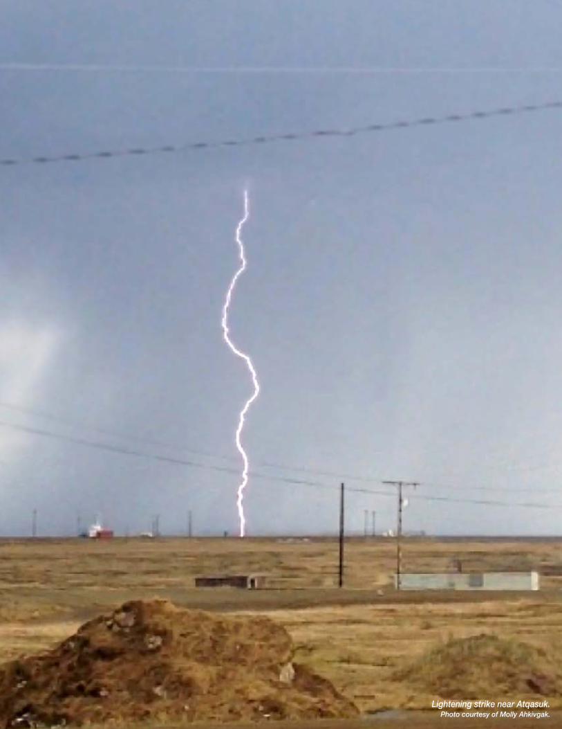
Lightening strike near Atqasuk.Photo courtesy of Molly Ahkivgak.

13
“There was a tundra fire caused by the lightning strike. Between here and Wainwright.”
Paul Bodfish Sr.
wEA
thEr
Going to extremes.
Atqasuk experiences a variety of extreme weather that can result in disasters. High winds and snow can produce blizzards and wind chill of -75°F. Extreme cold (-40°F to -60°F) can cause ice fog that may last weeks at a time. Heavy snow can collapse roofs and rain storms or rapid thaw can result in flooding (NSB 2009). With climate change, the frequency of some types of weather such as extreme cold and ice jams may decrease. This section will consider two kinds of extreme weather likely to increase with climate change, thunderstorms and extreme precipitation.
Thunderstorms in Alaska generally last 20-30 minutes and do not usually produce severe weather. Sometimes however, pulse thunderstorms produce brief high winds, weak tornadoes and hail. Over the last decade Atqasuk residents have observed a funnel cloud and hail (Lydia Nayukok). These hailstorms are very rare and the size of the hail stones has been relatively small. A more common impact is lightening. Atqasuk resident’s report that
thunderstorms have been occurring more frequently, increasing the risk for wildfires and infrastructure damage. Four thunderstorms occurred the summer of 2004, striking a transformer and knocking out electricity and phone service for hours (NSB 2009).
The timing and amount of precipitation has also been changing, with more rain storms in recent years. Rain storms typically occur in mid to late summer. In 2013 rainfall occurred in amounts Anaktuvuk Pass Wildfire.
Ben Jones, 2007.
Changes: more lightning, less extreme cold, more extreme heat, more intense storms; Impacts: wildfire, thawing, erosion, loss of infrastructure; Health effects: respiratory (smoke) reduced cold injury, increased potential for heat injury, mental stress, injury; Adaptations: enhance disaster preparedness and planning.

14
A funnel cloud in Sand Point Alaska.Courtesy Dana Osterback, 2000.
“It gets real warm then thunderstorms. We have had funnel clouds close to town.”
Amelia Kanayurak
much higher than the historical average. An increase in unseasonable rain events has also been reported. In 2013, three instances of “rain-on-snow” occurred after the month of October (Doug Whiteman). In the spring of 2014 the thaw came early and rapidly and turned snow to “slop”. Loaders moved the slop to temporary storage areas where it froze again, making more work for maintenance crews (Doug Whiteman). Rain storms and rapid thaw events can contribute to flooding. Runoff flooding is the most common in Atqasuk, usually after long or extreme rainfall events. Because the bed of the Meade River is considerably lower than the community, there has been low concern for river flooding (NSB 2009)
Increased precipitation could also mean more snow and consequently increased resources and efforts dedicated to snow management and removal. Heavy snow, generally more than 12 inches of accumulation in less than 24 hours, can immobilize a community by bringing transportation to a halt. As Atqasuk experiences only 22 inches of annual average snowfall, heavy snow has not been considered a high risk. However the lack of a snow fence in some areas of town has been reported keeping essential community staff (health clinic; fire dept.) trapped at their houses due to drifting snow (Lilly Itta). Wind storms also occur frequently in Atqasuk with wind gusts reaching over 70 miles per hour. These contribute to snow drifts, and dangerous wind chill conditions. Residents report changes in recent years related to wind intensity and direction (Sharon Aiken-File).
Discussion: Some types of extreme weather may be increasing. These can cause loss of life, injury, mental stress and damage to infrastructure. Consideration of emerging threats is critical for adapting to climate change. Developing comprehensive hazard risk scenarios is helpful to understand potential threat levels. Developing living hazard plans that can be updated regularly is recommended. Also recommended is greater coordination between community and emergency planners to ensure that new infrastructure considers new understandings of projected climate conditions during the intended design life of the infrastructure.
15
“Usually we have to go to the foothills to see those kind of blueberries, now they are close to town.”
Mary Kay Bodfish
A fragile landscape.
For years residents in Atqasuk have been noticing changes to the landscape, and the effect of warming on snow, ice, soil, vegetation and wildlife. In winter and historically through much of the year, the landscape has been frozen, and because of this, highly resilient to the forces of man and nature: development, pollution, extreme weather and erosion. But with warming the ice season has been decreasing and the year-round ice including sea ice and permafrost has been melting. Permafrost is ground that has remained frozen for two or more years. It is frozen remnants from ice ages past, so deep a freeze that in Barrow permafrost
LAnd
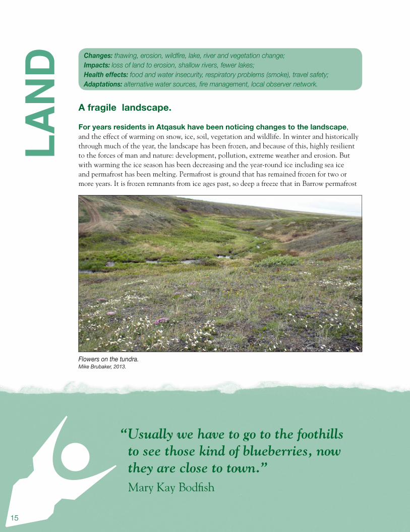
Flowers on the tundra. Mike Brubaker, 2013.
Changes: thawing, erosion, wildfire, lake, river and vegetation change; Impacts: loss of land to erosion, shallow rivers, fewer lakes; Health effects: food and water insecurity, respiratory problems (smoke), travel safety; Adaptations: alternative water sources, fire management, local observer network.
16
“We’re starting to see all kinds of things, coyotes and lynx.”
Mary Kay Bodfish
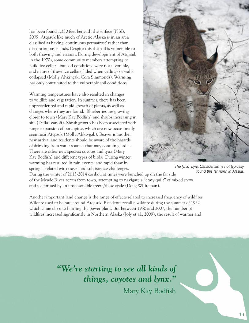
The lynx, Lynx Canadensis. is not typically found this far north in Alaska.
has been found 1,330 feet beneath the surface (NSB, 2009. Atqasuk like much of Arctic Alaska is in an area classified as having ‘continuous permafrost’ rather than discontinuous islands. Despite this the soil is vulnerable to both thawing and erosion. During development of Atqasuk in the 1970s, some community members attempting to build ice cellars, but soil conditions were not favorable, and many of these ice cellars failed when ceilings or walls collapsed (Molly Ahkivgak; Cora Simmonds). Warming has only contributed to the vulnerable soil conditions.
Warming temperatures have also resulted in changes to wildlife and vegetation. In summer, there has been unprecedented and rapid growth of plants, as well as changes where they are found. Blueberries are growing closer to town (Mary Kay Bodfish) and shrubs increasing in size (Della Ivanoff). Shrub growth has been associated with range expansion of porcupine, which are now occasionally seen near Atqasuk (Molly Ahkivgak). Beaver is another new arrival and residents should be aware of the hazards of drinking from water sources that may contain giardia. There are other new species; coyotes and lynx (Mary Kay Bodfish) and different types of birds. During winter, warming has resulted in rain events, and rapid thaw in spring is related with travel and subsistence challenges. During the winter of 2013-2014 caribou at times were bunched up on the far side of the Meade River across from town, attempting to navigate a “crazy quilt” of mixed snow and ice formed by an unseasonable freeze/thaw cycle (Doug Whiteman).
Another important land change is the range of effects related to increased frequency of wildfires. Wildfire used to be rare around Atqasuk. Residents recall a wildfire during the summer of 1952 which came close to burning the power plant. But between 1950 and 2007, the number of wildfires increased significantly in Northern Alaska (Joly et al., 2009), the result of warmer and

17
drier summer conditions, more frequent lightning strikes, an increase in woody plants, and tinder dry conditions on the tundra (Duffy et al. 2005). A lightning storm caused a wildfire near Wainwright in the summer of 1993. The fire took two weeks to extinguish despite the combined efforts of local and state firefighters (NSB 2009). In 2007, the largest tundra fire on record occurred on the North Slope, burning over 240,000 acres in a single season.
Discussion: With warming the length of the fire season can be expected to grow, and local capacity for response, training and equipment should be adjusted appropriately. Respiratory problems will occur downwind of wildfires. With potential for new vectors for waterborne illness, clinical staff should be watchful for giardiasis in residents who use untreated water sources. Health educators can raise awareness about effective portable treatment equipment. A local observer program can help connect residents and local government with technical resources related to landscape changes and new wildlife and environmental impacts.
“That year when the lakes dried, we got very few berries.”
Lydia Nayukok
Tundra flowers and berry plants.Mike Brubaker, 2013.
18
“We are starting to get pike and other different types of fish.”
Forrest Nayukok
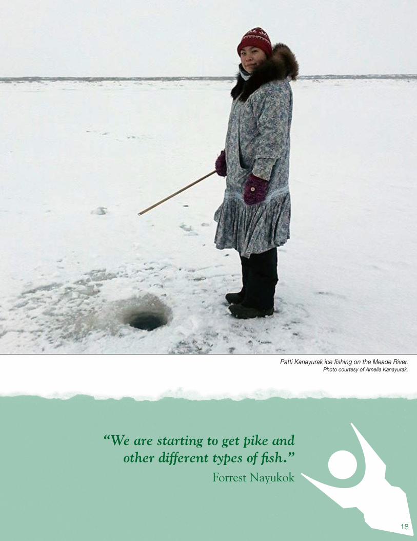
Patti Kanayurak ice fishing on the Meade River.Photo courtesy of Amelia Kanayurak.

19
“We’ve been having more high tides on the river, all summer.”
Woodrow Oyagak
rivE
rWider, shallower, dirtier.
The Meade River originates in the northern foothills of the Arctic Coastal Plain. It runs 186 miles north past Atqasuk before turning east and continuing over 60 miles to the Beaufort Sea via the Dease Inlet. The river drains about 3800 square miles of land (Johnson and Kistner 1967). Atqasuk’s location next to the Meade River provides direct access to subsistence activities as well as a travel corridor in boats in the summertime and on snowmachines in the winter. In the middle of the 20th century large ships used to navigate the Meade but in recent decades the river has gotten wider and shallower due to erosion (Doug Whiteman; Della Ivanoff, Lydia Nayukok, Ethel K. Burke, Mary Ellen Young). Drying of smaller river tributaries has been reported in the region raising concerns about fish migration and the loss of biological conductivity between lakes and streams. Measurements taken at the Meade River Coal Mine in June 1967 indicated that the river was 100 feet wide and 16 feet deep (Johnson and Kistner). The riverbed is lower than the community and resultantly there is no history of localized flooding.
Atqasuk residents report a variety of climate-related changes on the Meade River, including ice conditions and the timing of break-up and freeze-up (Paul Bodfish Sr.). During a site visit in May 2014, the Meade River was beginning its break-up process, though there were still large ice jams mixed with the open A flat-bottomed skiff for shallow water travel.
Mike Brubaker, 2013.
Changes: early breakup, late freeze up, erosion, low water, tidal surge, rapid shrub growth, new species; Impacts: shorter ice travel season, thaw erosion, river travel access changes, new fish and wildlife; Health effects: potential for food and water insecurity, travel related hazards; Adaptations: participation in observer programs – LEO Network, River Watch, education of clinic staff.

20
water. This break up was considered by most contacts as “early” compared to a historical break-up occurring in June or July (Mary Kay Bodfish, Forrest Nayukok). The National Weather Service River Forecast Center provides tracking of freeze up and break-up of many of Alaska’s rivers through their River Watch program; but not the Meade. Formal tracking of river level and conditions would assist in understanding the impacts of climate change.
Another topic discussed during site visits was the increase in high tides that surge further up river (Woodrow Oyagak), which was also described in other communities. Hunters in Wainwright reported travelling farther last year on a high tide than ever in the past; up to 50 miles inland. Rising sea level from melting glaciers and polar ice caps is occurring and will result in greater ocean inundation inland and flood risk for coastal and low elevation areas of Alaska. It may also result in benefits such as increased inland access as tidal influence expands up the rivers. The higher tides may also be related to changing sea ice conditions, including increased wind fetch that pushes water further up river.
Methane gas seeps have been reported upriver of Atqasuk active enough to prevent river and lake ice from freezing (Paul Bodfish Sr.) Residents wonder whether the source is coal gas or instead methane produced from decomposition of material exposed by thawing permafrost. Traditional seep areas are well known but new sites can pose hazards for travelers crossing frozen rivers and lakes. Mapping of these areas is important for travel safety. More information is available from the UAF Geophysical Institute where researchers are mapping, measuring and studying the composition of methane gas released as a result of thawing permafrost.
The erosion season for Arctic rivers has historically occurred mostly in the spring, related to ice scouring, snow melt-off and bank slumping following thaw. Although ice scouring during breakup is decreasing in some rivers and in some years, the addition of permafrost thaw as a mechanism makes for a longer erosion season and results in episodes when large amounts of
Erosion is removing Atqasuk’s river bank.
Mike Brubaker, 2013.
The cracks go 20 feet deep off of the river. The whole hillside fell in the river and
you could see how deep it was.”Paul Bodfish Sr.
21
bank enter the river. The increased erosion effects sediment load, turbidity, fish habitat and makes the Meade both wider and shallower. Hunters have reported that erosion, the widening of the river and shallow conditions (perhaps caused by increased sediment) have in some instances prevented access to hunting grounds.
Residents report rapid growth of willows along the river. This too is an indicator of changing climate. The combination of softer and earlier break up can encourage the growth of vegetation. Scouring ice and ice jams shear off willows, and ice blocks, deposited on river banks by flooding, can delay plant growth by weeks. Softer break up with slush ice decreases scouring erosion and may encourage willow growth.
Willows in turn collect winter snow and provide insulation that prevents freeze up and encourages root growth. The emergence of porcupine in the area (Molly Ahkivgak) may be an indication of the changing river corridor environment, providing habitat for new species of mammals. In the past decade beaver has been reported in rivers near Point Hope and in Wainwright. This raises concerns about the safety of drinking water from traditional sources without water treatment as beavers can carry and transmit giardia, a serious waterborne disease.
There are new fish species arriving in the Meade. Residents report catching northern pike which are both a new subsistence resource and voracious predators (Forrest Nayukok, Paul Bodfish Sr.). Residents are concerned about the impacts on native fish species. River conditions including salinity, turbidity and temperature are other factors which are important for fish and may be changing.
Discussion: The changes occurring on the Meade River have important implications for safe travel, subsistence species survival, access to harvest areas, food security, and water safety related to emergence of species that can carry waterborne pathogens. Monitoring of local river conditions to develop adequate baselines is recommended, including timing of break-up and freeze-up, water level, temperature, turbidity, and other measures of river change. Installation of stream flow gauges and participation in River Watch programs such as with the National Weather Service can help, and local efforts to record and broadcast river conditions, low water, slide areas and poor ice condition are encouraged. Participation in the Local Environmental Observer (LEO) Network can help share observation about new events and connect managers with technical resources to address questions about environmental change. Clinical staff should be aware of potential for emergence of new types of environmental change related illness such as giardia.
“The Meade River is getting dryer and dryer. It get so low in the summer you can’t go anywhere.”
Lydia Nayukok
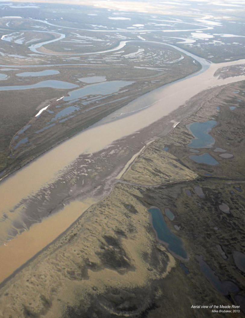
22Aerial view of the Meade River.Mike Brubaker, 2013.
23
“We have had really dry years when the lakes went dry.”
Lydia Nayukok
LAkE
A disappearing feature.
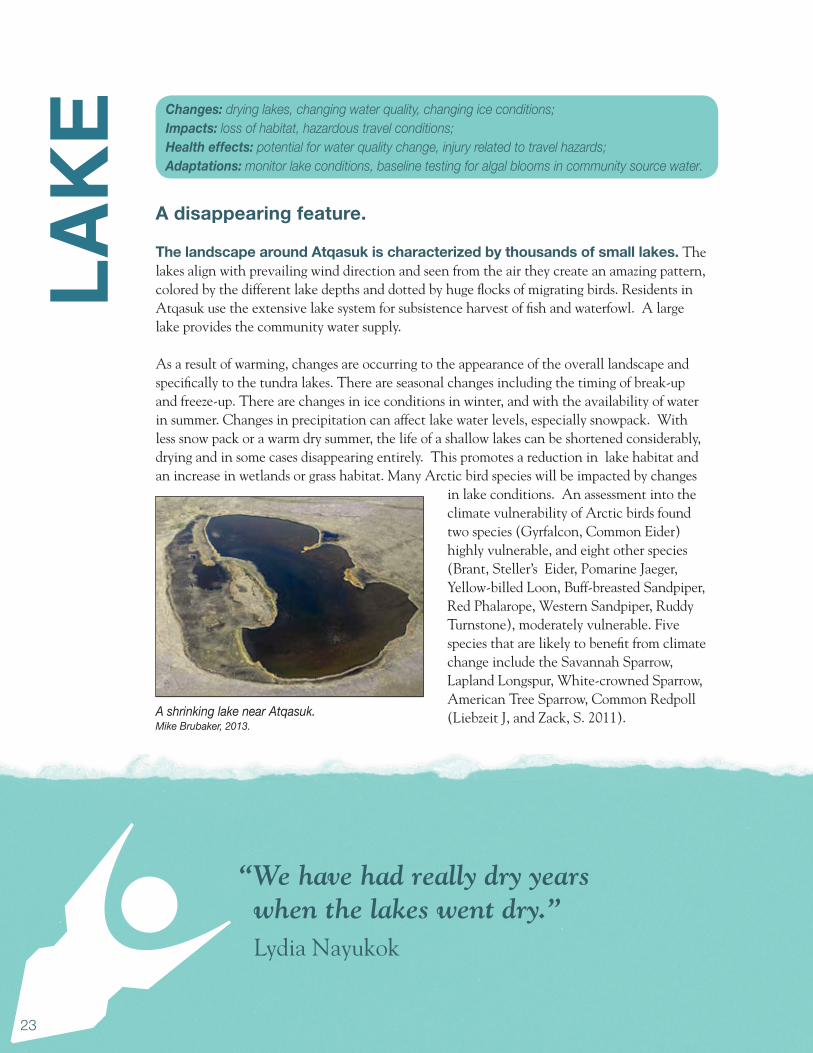
The landscape around Atqasuk is characterized by thousands of small lakes. The lakes align with prevailing wind direction and seen from the air they create an amazing pattern, colored by the different lake depths and dotted by huge flocks of migrating birds. Residents in Atqasuk use the extensive lake system for subsistence harvest of fish and waterfowl. A large lake provides the community water supply.
As a result of warming, changes are occurring to the appearance of the overall landscape and specifically to the tundra lakes. There are seasonal changes including the timing of break-up and freeze-up. There are changes in ice conditions in winter, and with the availability of water in summer. Changes in precipitation can affect lake water levels, especially snowpack. With less snow pack or a warm dry summer, the life of a shallow lakes can be shortened considerably, drying and in some cases disappearing entirely. This promotes a reduction in lake habitat and an increase in wetlands or grass habitat. Many Arctic bird species will be impacted by changes
in lake conditions. An assessment into the climate vulnerability of Arctic birds found two species (Gyrfalcon, Common Eider) highly vulnerable, and eight other species (Brant, Steller’s Eider, Pomarine Jaeger, Yellow-billed Loon, Buff-breasted Sandpiper, Red Phalarope, Western Sandpiper, Ruddy Turnstone), moderately vulnerable. Five species that are likely to benefit from climate change include the Savannah Sparrow, Lapland Longspur, White-crowned Sparrow, American Tree Sparrow, Common Redpoll (Liebzeit J, and Zack, S. 2011).A shrinking lake near Atqasuk.
Mike Brubaker, 2013.
Changes: drying lakes, changing water quality, changing ice conditions; Impacts: loss of habitat, hazardous travel conditions; Health effects: potential for water quality change, injury related to travel hazards; Adaptations: monitor lake conditions, baseline testing for algal blooms in community source water.

24
Community members have reported some benefits that may result from lake change. During a relatively dry two year period some lakes dried up and converted to grasslands. This provided improved across-land travelling conditions (Doug Whiteman). The UAF Geophysical Institute is generating computer models and maps of lake change in the North Slope region, including the area around Atqasuk. The models predict drying or draining of over 2000 lakes by the end of the century; over 200 of these lake could be dry within the next ten years (Jones, B., Grosse, G., Jenkins, J.L., Martin, P.D. 2012).
Thawing and runoff causes erosion along slopes, riverbanks and bluffs. Erosion has been observed by hunters on many area lakes (Woodrow Oyagak). There has been some reported erosion along the south end of the water source lake (Molly Ahkivgak; Lilly Itta). Permafrost thaw also changes lake water catchment conditions resulting in the inflow of melt water which can increase lake size. Thawing and melting of permafrost beneath lakes can result in draining as the thaw zone beneath lakes increase.
Monitoring lake change is important for understanding impacts and for adaptation. Baseline sampling of the community water source in late summer may be appropriate to evaluate levels of cyanobacteria. Cyanobacteria are temperature sensitive and can occur with lake warming, even in the Arctic. They also produce toxins that can be harmful to waterfowl, fish and in extreme cases to people. As temperatures increase in Arctic lakes, monitoring water levels and water quality is recommended.
Discussion: The changes occurring in lakes on the North Slope have important implications for safe travel, access to subsistence areas and food security, and water safety related to emergence of species that can carry waterborne pathogens. Monitoring of lake conditions including timing of break-up and freeze-up, water level, temperature, turbidity, and other measures of change is recommended. Participation in the Local Environmental Observer (LEO) Network can help share observations about new events and better connect managers with technical resources to address questions about environmental change. Clinical staff should be aware of potential for new types of environmental change related illness such as giardia, and education should be provided to community members about options for water treatment from traditional water sources.
Ice plates from receding river levels.
Jake Bell, 2014.
“I found myself wishing for the old days when you could trust the ice”
Doug Whiteman

25
“The Akpik berries are very numerous, there is a cycle going on. Early spring and late freeze ups.”
Paul Bodfish Sr.
SuBS
iStE
nCE
Leaving the ice behind.
Dependence on wild foods makes Atqasuk particularly vulnerable to climate change. Atqasuk’s access to marine resources is limited by the distance to the Beaufort Sea; over 60 miles on the Meade River just to reach Dease Inlet. The subsistence harvest depends largely on fish, birds and land mammals from the Meade River and surrounding areas. Fish is harvested in the greatest quantity and taken throughout the year. Arctic grayling is the most important species (Bacon et al. 2009). Burbot, rainbow smelt Arctic char, chum and king salmon and three species of white fish are also harvested.
The most important land mammal is caribou, the only resource hunted in every month of the year. Seven other species of land mammals large and small are also harvested. For birds, the most important species is white fronted goose, eider duck and ptarmigan. Most of the bird harvest occurs in the spring. Salmon berries and blue berries are the most important wild plants. Small numbers of bearded seal are also harvested during the summer.
Misik and Jared Bodfish of Atqasuk pick akpik berries.Photo courtesy of Amelia Kanayurak.
Changes: harvest seasons, environmental conditions, wildlife health and behavior, species; Impacts: concerns over food safety, adaptation to climate change; Health effects: nutrition, mental health, food security; Adaptations: development of alternative practices to preserve subsistence activities.

26
Snow geese in flight.USGS.
Canada goose with goslings.USGS.
“The geese come in little flocks, like twelve, they used to come in thousands.”
Woodrow Oyagak
The Alaska Department of Fish and Game’s list of ten “at risk” species from climate change in the tundra ecosystem includes important subsistence species for Atqasuk - caribou, musk ox and eider (Clark R. et al. 2010). Observations and local knowledge shared by residents are informative about some of the challenges faced for subsistence resources as well as subsistence harvesters. With extended hot summer temperatures, caribou work tirelessly to escape the heat and bugs, in some instances retreating to the runway in an attempt to catch a breath of wind (Doug Whiteman). Citizens reported fewer geese, an early arrival, and an earlier pairing off of the birds for mating; a behavior that usually signals the end of hunting. In 2014, the geese and ducks generally arrived in April instead of late May or early June (Woodrow Oyagak; Herman Kignak Sr). In the spring of 2014 hunters could not use snow machines to travel to hunting camps because of the lack of snow. Travel by ATV was also impossible, interrupting harvest activities (Herman Kignak Sr.). Potential positive climate impacts including blueberries in increasing amounts close to town. Historically it required a trip to the foothills of the

27
Brooks Range to find the berries in harvestable amounts (Mary Kay Bodfish). Also conversion of lakes to grasslands has improved travelling over the land (Doug Whiteman).
In a number of communities, hunters have reported caribou being absent in traditional hunting grounds or arriving during the fall rut, thus limiting animals available for harvest. The Northwest Arctic caribou herd is down about 27% since 2011. Moose population has also declined by 50 to 75 percent. Factors affecting moose and caribou include both climate and non-climate factors: decreased food resources, loss of forage areas to wildfire and winter thaw and rain events, seasonal change, poor nutrition and increasing predation. Emerging issues for land mammals may include ticks that are now being reported in central and southern Alaska (Kimberly Beckmen, ADFG).
Climate change also has other impacts on subsistence. Late freeze-up can delay ice fishing. Warmer waters can affect the timing of spawning, stream preference and fish health. An outbreak of fungus in white fish was documented near Nuiqsut in 2013 and related to environmental conditions. Warm conditions can encourage new waterfowl illness such as avian cholera. Wild berries are very sensitive to temperature and precipitation.
An assortment of fish caught in winter nets.Mike Brubaker, 2013.
“We catch tittaaliqs with a net and other whitefish. But if we get a late freeze up, we can miss the whole run.”
James Bodfish Sr.

28
Atqasuk is in the range of the Western Arctic caribou herd.
“We see lesions on tuttu (caribou) hindlegs, no fur, and a lot of warble flies. It didn’t look too good to me.”
Flossie Kanayurak
Discussion: In the new Arctic, subsistence resources will be joined or in some cases replaced by new and different species. Time of hunting will be altered and hunters will need to be flexible in order to accommodate current conditions, rather than historical seasons. Changes to the river and land conditions will require new methods of travel, and hunters will need to watch for new hazards and extreme weather. New practices will be necessary for food storage and for food preparation. Sustaining the subsistence lifestyle is central to Inupiaq identity, culture, health, and community sustainability.
29
“We had the water and sewer connection boxes jacking out of the ground and causing freeze ups.”
Stephanie Kippi
infr
AStr
uCtu
rEThawing and sinking foundations.
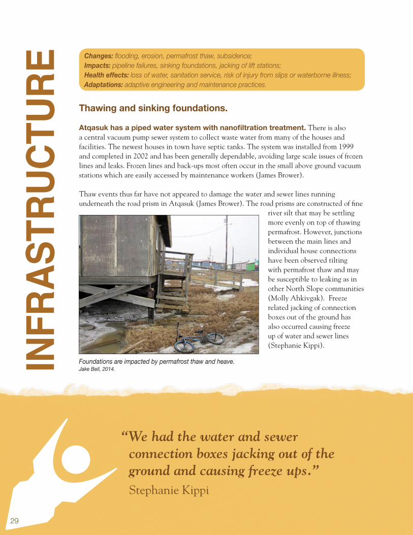
Atqasuk has a piped water system with nanofiltration treatment. There is also a central vacuum pump sewer system to collect waste water from many of the houses and facilities. The newest houses in town have septic tanks. The system was installed from 1999 and completed in 2002 and has been generally dependable, avoiding large scale issues of frozen lines and leaks. Frozen lines and back-ups most often occur in the small above ground vacuum stations which are easily accessed by maintenance workers (James Brower).
Thaw events thus far have not appeared to damage the water and sewer lines running underneath the road prism in Atqasuk (James Brower). The road prisms are constructed of fine
river silt that may be settling more evenly on top of thawing permafrost. However, junctions between the main lines and individual house connections have been observed tilting with permafrost thaw and may be susceptible to leaking as in other North Slope communities (Molly Ahkivgak). Freeze related jacking of connection boxes out of the ground has also occurred causing freeze up of water and sewer lines (Stephanie Kippi).
Foundations are impacted by permafrost thaw and heave.Jake Bell, 2014.
Changes: flooding, erosion, permafrost thaw, subsidence; Impacts: pipeline failures, sinking foundations, jacking of lift stations; Health effects: loss of water, sanitation service, risk of injury from slips or waterborne illness; Adaptations: adaptive engineering and maintenance practices.

30
The water line connecting lake and community storage tank.Mike Brubaker, 2013.
“Higher temperatures could lead to melting of the permafrost upon which homes, power
plants and fuel tanks farms are built.”NSB All Hazards Mitigation Plan, 2009
Ground failure related to permafrost thaw is a significant problem in Alaska and the fine river silt may be especially vulnerable. During development of Atqasuk in the 1970s, some community members attempted to build ice cellars, but soil conditions were not favorable, and many of these ice cellars failed when ceilings or walls collapsed (Molly Ahkivgak; Cora Simmonds).
Permafrost is frozen ground in which a naturally occurring temperature below 32o Fahrenheit (0o Centigrade) has existed for two or more years. Permafrost can be a strong foundation if it is kept in the frozen state, but if allowed to thaw, the soil becomes extremely weak and fails. Although Atqasuk is located in an area termed as a continuous permafrost zone, local residents report a settling in buildings which they feel is a result of a thawing of the upper portion of the permafrost in the summer. Warming has only contributed to the vulnerable soil conditions. Water utility staff worry that changing precipitation, erosion, and runoff may present future pollution issues to the water source lake that sits immediately downslope of the village (James Brower). As the Meade River does not run through a developed area of Atqasuk, erosion does not currently threaten infrastructure. Local residents do report that the Northside Cemetery in Atqasuk could be threatened by erosion of the banks of the Meade River in the future (NSB 2009)
Discussion: Impacts to local water and sanitation system and home foundations indicate that some community infrastructure is vulnerable to changing permafrost conditions. The North Slope Borough is actively addressing these problems, fixing damaged infrastructure, applying new construction methods, and new practices such as aggressively removing snow during winter to encourage ground freeze. Regular monitoring of infrastructure for change, including foundations, along with subsurface monitoring of permafrost conditions, can help to evaluate how permafrost is performing and identify vulnerable areas.
31
“The ice fishing is two months later. Now we have to start in November.”
Molly Ahkivgak
Sum
mAr
y It is becoming warmer with an increase in average annual air temperature. Temperatures have increased in every month of the year except July. More extreme warm days are expected.
Precipitation levels have changed in most months. The amount of precipitation has increased in seven months and decreased in only one. Long term projections are for increases in every month except May.
Extreme weather is increasing, including thunderstorms. Lightening and wildfires are also increasing with related risks: poor air quality, potential for infrastructure damage and loss of tundra plants.
Warming has resulted in decreases in snow and ice. This is affecting conditions for travel on rivers, and lakes. Poor ice conditions are preventing some types of subsistence activities.
Erosion is causing loss of the shoreline and historical sites. Ice cellars, burial grounds and homes have been lost. Recommend armoring the shore and protecting homes that would otherwise need to be relocated.
The Meade River is becoming wider and shallower. Shallow water has interrupted river travel and some subsistence activities.
Higher water is increasing river access. Residents report the ability to periodically travel further upriver, expanding and improving access to subsistence use areas.
Lake change is occurring including draining and drying. This decreases habitat for waterfowl and aquatic animals. It may also someday affect community water supply.
Community members are concerned about food security. Changes are affecting subsistence, including the abundance, availability, timing, and quality of food resources.

32
“Two dry years caused lakes to turn to grasslands, which made for good travel.”
Doug Whiteman
Climate models project continued rapid change. Residents should expect that some plants and wildlife will be stressed during a period of rapid environmental change, but that beneficial new resources and opportunities could emerge.
Change will bring new challenges including natural disasters. As climate and environmental conditions are changing so also are the risks for disasters. Updating the next version of Atqasuk’s all hazards mitigation plan is recommended to address climate change related threats.
School playground. Mike Brubaker, 2013.
33
ConC
LuSi
on Public health considers climate change based on effects to mental health, injury, disease, food,
and water safety and security. In Atqasuk, residents report rapid erosion along the river and in the town caused by warming temperatures and runoff. Potential health effects include risk of injury related to travel in shallow river conditions or on poor or unpredictable ice. With changing environmental conditions, subsistence harvesters are having to adapt. The season for ice and snow based hunting activities is decreasing, while water based hunting is growing.
This report raises awareness about current, emerging, and potential future climate change. It is hoped that this will help Atqasuk make informed planning decisions, find community appropriate development strategies, and pursue a safe, healthy, and sustainable future.
For more information, contact the Center for Climate and Health by e-mail at [email protected] or by phone (907) 729-2464.
It is hoped this report will help Atqasuk make informed decisions and find community appropriate adaptation strategies.
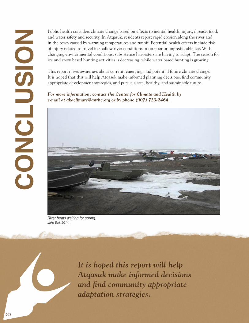
River boats waiting for spring.Jake Bell, 2014.
34Grass and sand.Mike Brubaker, 2013.
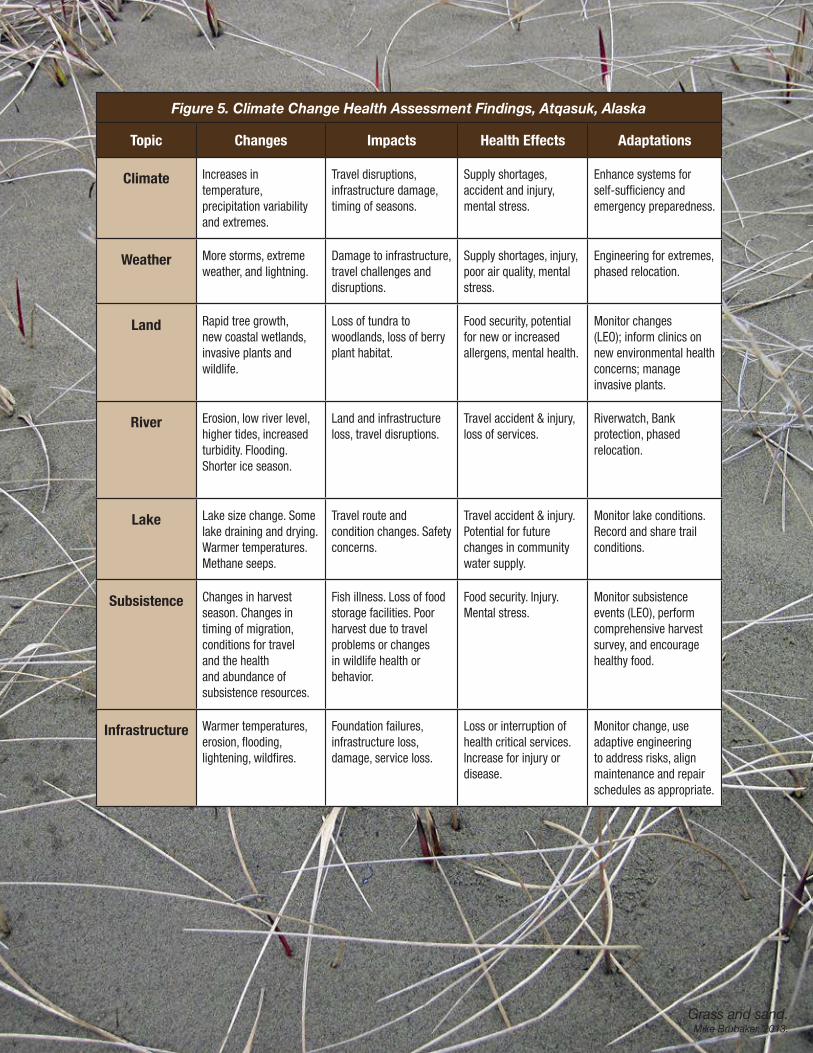
Figure 5. Climate Change Health Assessment Findings, Atqasuk, Alaska
Topic Changes Impacts Health Effects Adaptations
Climate Increases in temperature, precipitation variabilityand extremes.
Travel disruptions,infrastructure damage,timing of seasons.
Supply shortages,accident and injury,mental stress.
Enhance systems forself-sufficiency andemergency preparedness.
Weather More storms, extremeweather, and lightning.
Damage to infrastructure,travel challenges and disruptions.
Supply shortages, injury, poor air quality, mental stress.
Engineering for extremes, phased relocation.
Land Rapid tree growth,new coastal wetlands,invasive plants and wildlife.
Loss of tundra towoodlands, loss of berryplant habitat.
Food security, potentialfor new or increasedallergens, mental health.
Monitor changes(LEO); inform clinics on new environmental healthconcerns; manageinvasive plants.
River Erosion, low river level, higher tides, increased turbidity. Flooding. Shorter ice season.
Land and infrastructure loss, travel disruptions.
Travel accident & injury, loss of services.
Riverwatch, Bank protection, phased relocation.
Lake Lake size change. Some lake draining and drying. Warmer temperatures. Methane seeps.
Travel route and condition changes. Safety concerns.
Travel accident & injury. Potential for future changes in community water supply.
Monitor lake conditions. Record and share trail conditions.
Subsistence Changes in harvest season. Changes in timing of migration, conditions for travel and the health and abundance of subsistence resources.
Fish illness. Loss of food storage facilities. Poor harvest due to travel problems or changes in wildlife health or behavior.
Food security. Injury. Mental stress.
Monitor subsistenceevents (LEO), performcomprehensive harvestsurvey, and encouragehealthy food.
Infrastructure Warmer temperatures, erosion, flooding, lightening, wildfires.
Foundation failures, infrastructure loss, damage, service loss.
Loss or interruption of health critical services. Increase for injury or disease.
Monitor change, use adaptive engineering to address risks, align maintenance and repair schedules as appropriate.
35
APPENDIX A
Community and Regional ContributorsAnecdotal data was collected on observations and experiences from local experts in health, wildlife, weather, subsistence, education, sanitation, local governance, law enforcement, and emergency services.
Name Position Association1 Kate Aiken Elder NA
2 Sharon Aiken File School Bus Driver North Slope Borough
3 Molly Ahkivgak Health Clinic Staff North Slope Borough Health Dept.
4 Betsy Aveoganna Resident NA
5 Paul Bodfish Sr. Equipment Operator North Slope Borough Public Works Dept.
6 Mary Kay Bodfish On Call VRR Arctic Slope Regional Corporation
7 Richard Bordeaux Wildlife Manager North Slope Borough Wildlife Dept.
8 Ethel K. Burke Home School Facilitator North Slope Borough School District
9 Della Ivanoff Resident NA
10 Anne Jensen Senior Scientist Umiaq Science LCC
11 Martha G. Kagak Elder NA
12 Amelia Kanayurak Resident NA
13 Alicia Kanayurak Resident NA
14 Flossie Kanayurak Resident NA
15 Patricia Kanayurak Resident NA
16 Stephanie Kippi Community Health Aide NA
17 Wanda Kippi Wildlife / Subsistence NA
18 Mick Rhees Police Officer North Slope Borough
19 Cora Simmonds Elder NA
20 Lydia Nayukok Health Clinic Staff North Slope Borough
21 Roberta Simmonds Resident NA
22 Doug Whiteman Mayor City of Atqasuk
23 Mary Ellen Young Senior Van Driver North Slope Borough
24 Forrest Nayukok Resident NA
36
APPENDIX B
Atqasuk Climate and Health Web Resources
Topic Resource LocationClimate / Health Study Center for Climate and Health www.anthc.org/chs/ces/climate/links.cfm
Community Profile State of Alaska Community Database www.commerce.state.ak.us/dca/commdb/CF_BLOCK.htm
Community Profile NSB Atqasuk Community Profile www.north-slope.org/assets/images/uploads/AtqasukVillageProfile06.pdf
Regional Climate Data Alaska Climate Research Center, UAF climate.gi.alaska.edu/Climate/Location/TimeSeries/KingSalmon.html
Temperature Charts Scenario Network for Alaska Planning www.snap.uaf.edu/charts.php
Precipitation Charts Scenario Network for Alaska Planning www.snap.uaf.edu/charts.php
Extreme precipitation NOAA Atlas 12 hdsc.nws.noaa.gov/hdsc/pfds/pfds_map_ak.html
Weather Spotters NWS Extreme Weather Spotter www.weather.gov/skywarn/
Precipitation Monitor Collaborative Snow, Rain, Hail Program www.cocorahs.org/
Erosion Data USACE Community Report, 2009 www.poa.usace.army.mil/AKE/Home.html
Flood Data USACE Flood Hazard Database 66.223.166.160/usace_disclaimer.html
Coastal Observations National Weather Service www.nws.noaa.gov/om/coop/index.htm
Season Observations USGS Phenology Network www.usanpn.org/
Local Environment Observers
LEO Network - ANTHC www.anthc.org/chs/ces/climate/leo/
Regional Health Profile North Slope Borough http://www.north-slope.org/our-communities/atqasuk
Regional Climate Studies
Landscape Conservation Cooperative www.arcus.org/arctic-alaska-lcc
Harvest Summary Data Alaska Department of Fish and Game www.adfg.alaska.gov/sb/CSIS/index.cfm?ADFG=commInfo.Summary&CommID=364&Year=1989
37
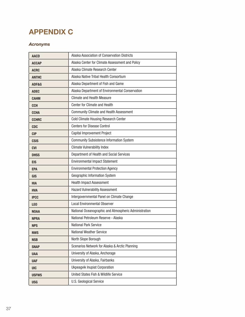
APPENDIX C
Acronyms
AACD Alaska Association of Conservation Districts
ACCAP Alaska Center for Climate Assessment and Policy
ACRC Alaska Climate Research Center
ANTHC Alaska Native Tribal Health Consortium
ADF&G Alaska Department of Fish and Game
ADEC Alaska Department of Environmental Conservation
CAHM Climate and Health Measure
CCH Center for Climate and Health
CCHA Community Climate and Health Assessment
CCHRC Cold Climate Housing Research Center
CDC Centers for Disease Control
CIP Capital Improvement Project
CSIS Community Subsistence Information System
CVI Climate Vulnerability Index
DHSS Department of Health and Social Services
EIS Environmental Impact Statement
EPA Environmental Protection Agency
GIS Geographic Information System
HIA Health Impact Assessment
HVA Hazard Vulnerability Assessment
IPCC Intergovernmental Panel on Climate Change
LEO Local Environmental Observer
NOAA National Oceanographic and Atmospheric Administration
NPRA National Petroleum Reserve - Alaska
NPS National Park Service
NWS National Weather Service
NSB North Slope Borough
SNAP Scenarios Network for Alaska & Arctic Planning
UAA University of Alaska, Anchorage
UAF University of Alaska, Fairbanks
UIC Ukpeagvik Inupiat Corporation
USFWS United States Fish & Wildlife Service
USG U.S. Geological Service
38
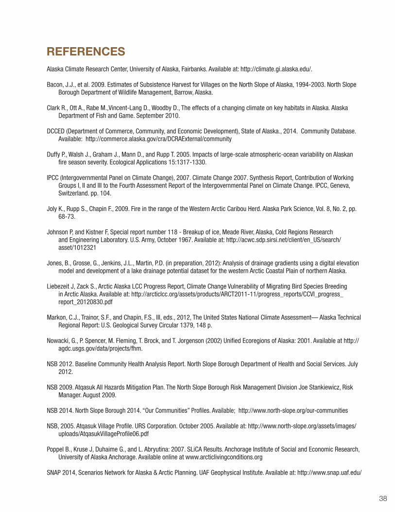
Alaska Climate Research Center, University of Alaska, Fairbanks. Available at: http://climate.gi.alaska.edu/.
Bacon, J.J., et al. 2009. Estimates of Subsistence Harvest for Villages on the North Slope of Alaska, 1994-2003. North Slope Borough Department of Wildlife Management, Barrow, Alaska.
Clark R., Ott A., Rabe M.,Vincent-Lang D., Woodby D., The effects of a changing climate on key habitats in Alaska. Alaska Department of Fish and Game. September 2010.
DCCED (Department of Commerce, Community, and Economic Development), State of Alaska., 2014. Community Database. Available: http://commerce.alaska.gov/cra/DCRAExternal/community
Duffy P., Walsh J., Graham J., Mann D., and Rupp T. 2005. Impacts of large-scale atmospheric-ocean variability on Alaskan fire season severity. Ecological Applications 15:1317-1330.
IPCC (Intergovernmental Panel on Climate Change), 2007. Climate Change 2007. Synthesis Report, Contribution of Working Groups I, II and III to the Fourth Assessment Report of the Intergovernmental Panel on Climate Change. IPCC, Geneva, Switzerland. pp. 104.
Joly K., Rupp S., Chapin F., 2009. Fire in the range of the Western Arctic Caribou Herd. Alaska Park Science, Vol. 8, No. 2, pp. 68-73.
Johnson P, and Kistner F, Special report number 118 - Breakup of ice, Meade River, Alaska, Cold Regions Research and Engineering Laboratory. U.S. Army, October 1967. Available at: http://acwc.sdp.sirsi.net/client/en_US/search/asset/1012321
Jones, B., Grosse, G., Jenkins, J.L., Martin, P.D. (in preparation, 2012): Analysis of drainage gradients using a digital elevation model and development of a lake drainage potential dataset for the western Arctic Coastal Plain of northern Alaska.
Liebezeit J, Zack S., Arctic Alaska LCC Progress Report, Climate Change Vulnerability of Migrating Bird Species Breeding
in Arctic Alaska. Available at: http://arcticlcc.org/assets/products/ARCT2011-11/progress_reports/CCVI_progress_report_20120830.pdf
Markon, C.J., Trainor, S.F., and Chapin, F.S., III, eds., 2012, The United States National Climate Assessment— Alaska Technical Regional Report: U.S. Geological Survey Circular 1379, 148 p.
Nowacki, G., P. Spencer, M. Fleming, T. Brock, and T. Jorgenson (2002) Unified Ecoregions of Alaska: 2001. Available at http://agdc.usgs.gov/data/projects/fhm.
NSB 2012. Baseline Community Health Analysis Report. North Slope Borough Department of Health and Social Services. July 2012.
NSB 2009. Atqasuk All Hazards Mitigation Plan. The North Slope Borough Risk Management Division Joe Stankiewicz, Risk Manager. August 2009.
NSB 2014. North Slope Borough 2014. “Our Communities” Profiles. Available; http://www.north-slope.org/our-communities
NSB, 2005. Atqasuk Village Profile. URS Corporation. October 2005. Available at: http://www.north-slope.org/assets/images/uploads/AtqasukVillageProfile06.pdf
Poppel B., Kruse J, Duhaime G., and L. Abryutina: 2007. SLiCA Results. Anchorage Institute of Social and Economic Research, University of Alaska Anchorage. Available online at www.arcticlivingconditions.org
SNAP 2014, Scenarios Network for Alaska & Arctic Planning. UAF Geophysical Institute. Available at: http://www.snap.uaf.edu/
REFERENCES

39Looking into an abandoned ice cellar.Jake Bell, 2014.
40
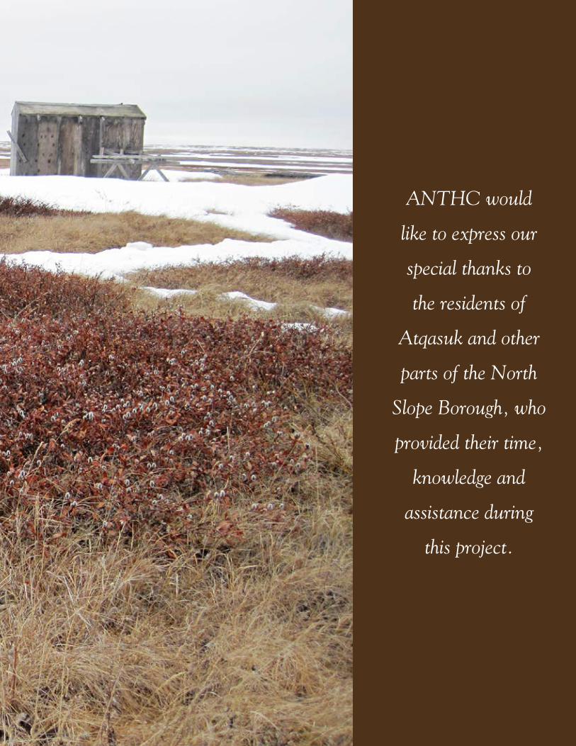
ANTHC would
like to express our
special thanks to
the residents of
Atqasuk and other
parts of the North
Slope Borough, who
provided their time,
knowledge and
assistance during
this project.

© Alaska Native Tribal Health Consortium (ANTHC), July 2014.
We gratefully acknowledge the materials and assistance of these organizations:
City of AtqasukAtqasuk Tribal CouncilNorth Slope Borough
The Alaska Center for Climate Assessment and PolicyThe Alaska Climate Research Center
The Scenarios Network for Alaska & Arctic PlanningThe University of Alaska Fairbanks Geophysical Institute
The State of Alaska Department of Community, Commerce, and Economic DevelopmentThe State of Alaska Department of Health and Social Services
The State of Alaska Department of Fish and GameThe State of Alaska Division of Homeland Security and Emergency Management
The State of Alaska Department of Environmental ConservationThe National Oceanographic and Atmospheric Administration
The National Weather ServiceThe U.S. Geological Survey
The U.S. Army Corps of EngineersThe Environmental Protection Agency
The U.S. Fish & Wildlife Service
For more information please contact:Center for Climate and Health, Alaska Native Tribal Health Consortium: (907) 729-2464
Find this report and other information about climate and health at our website:www.anthc.org/chs/ces/climate/index.cfm
Cite as: Brubaker M., Bell J., Dingman H., Ahkivgak M., Whiteman D.,Climate Change in Atqasuk, Alaska, Strategies for Community Health. ANTHC, 2014.
http://www.anthc.org/chs/ces/climate/climateandhealthreports.cfm
Primary funding for this report provided by a National Petroleum Reserve-Alaska grant funds made available through the Department of Commerce, Community and Economic Development.
Supplemental funding provided through an Indian General Assistance Program grant from the U.S. Environmental Protection Agency. Thank you for your support.
United States Environmental Protection Agency
United States Environmental Protection Agency
Native Village of Atqasuk