Embed Size (px)
Citation preview

What are topographicmaps?
What is elevation?
What is a contourline?
What is a contourinterval?
What are indexcontours?
1
Unit 2: Measuring Earth Lesson 2: Topographic MapsLearning target: I can……determine the highest elevation on a topographic map…determine the direction of stream flow on a map…
Name:Class:Earth SciencePeriod:Date:
2
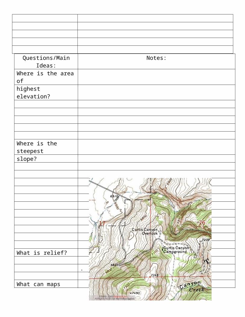
Questions/Main Ideas: Notes:Where is the area ofhighest elevation?
Where is the steepestslope?
What is relief?
.
What can maps tell usabout landscapes?
Questions/Main Ideas: Notes:
What are depressioncontours?
What does this pictureshow?
3

Summary, Reflection, Analysis
4


![[XLS] · Web view0 0 7/31/2018 10/16/2017 0 0 39 40 41 42 43 0 2 0 0 0 0 2 0 0 0 0 2 0 0 0 0 1 0 0 0 0 2 0 0 0 0 1 0 0 0 0 2 0 0 0 0 2 0 0 0 0 2 0 0 0 0 2 0 0 0 0 2 0 0 0 0 2 0 0](https://img.pdfslide.us/doc/110x75/5afad2057f8b9a32348e4124/xls-view0-0-7312018-10162017-0-0-39-40-41-42-43-0-2-0-0-0-0-2-0-0-0-0-2-0.jpg)