Embed Size (px)
Citation preview

Civil & Environmental Consultants, Inc. Cincinnati 3600 Park 42 Drive Pittsburgh 800/365-2324 Suite 130B Chicago 887/963-6026 Cincinnati, Ohio 45241-2072 Columbus 888/598-6808 Phone 513/985-0226 Export 800/899-3610 Fax 513/985-0228 Indianapolis 877/746-0749 Toll Free 800/759-5614 Nashville 800/763-2326 E-mail [email protected] St. Louis 866/250-3679 Corporate Web Site http://www.cecinc.com Detroit 866/380-2324
July 9, 2007 Dr. Mary Knapp U.S. Fish & Wildlife Service Reynoldsburg Ecological Services Office 6950 Americana Pkwy, Suite H Reynoldsburg, OH 43068-4127 Dear Dr. Knapp:
Subject: Agency Coordination Letter and Threatened and Endangered Species Habitat Assessment
Chevron Cincinnati Facility Remedy Construction Areas Hamilton County, Ohio
CEC Project No. 071-242 On behalf of our clients, Chevron Environmental Management Company (Chevron) and Trihydro Corporation (Trihydro), Civil & Environmental Consultants, Inc. (CEC) has prepared the following letter report documenting the results of our federally-listed threatened and endangered species and federal candidate species habitat assessment within the approximately 32.4-acre Chevron Cincinnati Facility Remedy Construction Areas, located east of Hooven, in Hamilton County, Ohio. The study area is located in the vicinity of the intersection of U.S. Highway 50 and State Route 128, along the Great Miami River and in adjacent floodplains (Figure 1). Opinions presented in this letter report were developed based upon site observations made on June 14 and 15, 2007, and available information. BACKGROUND CEC was retained by Chevron and Trihydro to review available information and conduct an endangered and threatened species habitat assessment within the approximately 32.4-acre Chevron Cincinnati Facility Remedy Construction Areas (the Project Areas), which included six irregularly shaped polygons (Areas 1 through 6) along the Great Miami River where bank reinforcement and other activities may occur to alleviate bank erosion (Figure 1). Although six distinct areas were investigated as part of the habitat assessment, primary bank stabilization construction activities are confined to Area 4. The remaining five areas comprise locations at which preliminary analyses conducted by Chevron indicate that excavation of river sediments
Dr. Mary Knapp CEC Project No. 071242 Page 2 July 9, 2007
W:\Projects\2007\071242\Habitat Assessment Ltr Rpt_USFWS.doc
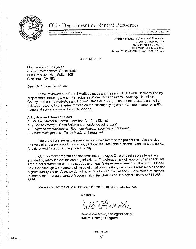
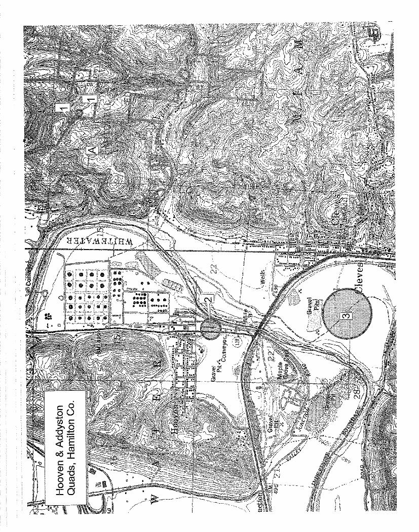
may assist in bank stabilization efforts in the primary construction area (Area 4). Results of ongoing hydraulic modeling performed by Chevron will determine if excavation of sediments in these alternate locations is waranted. Prior to conducting the site visit, CEC reviewed the U.S. Fish & Wildlife Service (USFWS) Reynoldsburg Ecological Services Office website (USFWS 2006) to determine which federally-listed, proposed endangered, proposed threatened, and candidate species are known to occur, or potentially occur, in Hamilton County. CEC also reviewed the U.S. Geological Survey (USGS) topographic map for the Addyston and Hooven quadrangles prior to conducting the site visit of the project area. Additionally, CEC sent the Ohio Department of Natural Resouces Division of Natural Heritage (DNH) a database search request and project map via fax on June 13, 2007, in order to obtain information on occurrences of federally-listed and state-listed species known to occur within a one-mile radius of the proposed project area. SITE OBSERVATIONS AND RESULTS OF DOCUMENT REVIEW The USFWS (2006) listed the following federally-listed and candidate species as occurring, or potentially occurring, in Hamilton County: Indiana bat (Myotis sodalis, endangered), running buffalo clover (Trifolium stoloniferum, endangered), and sheepnose mussel (Plethobasus cyphyus, candidate). The ODNR DNH responded to CEC’s request for information on federally-listed and state-listed species within the project vicinity in a letter dated June 14, 2007 (Attachment I). The DNH stated that the following species are known to occur in the vicinity of the Project Areas: Cave salamander (Eurycea lucifuga, state-endangered), southern wapato (Sagittaria montevidensis, potentially state-threatened), and tansy mustard (Descurainia pinnata, state-threatened). The entire Project Area was investigated by Maggie Vuturo Bosiljevac of CEC during the site visit in order to document existing vegetation communities and hydrological conditions. Each type of habitat present within the project area was qualitatively evaluated for its potential to be suitable habitat for the Indiana bat, running buffalo clover, sheepnose mussel, cave salamander, southern wapato, and tansy mustard. Attachment II contains representative photos of each habitat type found within the project area during the site visits.
Dr. Mary Knapp CEC Project No. 071242 Page 3 July 9, 2007
W:\Projects\2007\071242\Habitat Assessment Ltr Rpt_USFWS.doc
CEC documented the ephemeral Hooven Ditch (Stream 1), one unnamed intermittent stream (Stream 2), the Great Miami River (Stream 3), and an overflow/flood channel to the Great Miami River (Stream 4) within the Project Areas (Figure 4). Representative photos of the streams can be found in Attachment II. Six wetland test pits were sampled during the site visit; no wetlands were identified within the Project Areas. Large portions of the proposed Project Areas were below the ordinary high water mark (OHWM) of the Great Miami River. This included the entirety of Area 1, the majority of Areas 2 and 5, and a large portion of Area 4. The remainder of the proposed Project Areas, located above the OHWM, was dominated by second growth floodplain forest and included small areas of urban/industrial turf and old field vegetation. The locations of each of these habitat types within the Project Areas are shown on Figure 2. Representative photos of each habitat type can be found in Attachment II. The overstory of the second growth floodplain forests within the Project Areas were dominated by American sycamore (Platanus occidentalis), silver maple (Acer saccharinum), green ash (Fraxinus pennsylvanica), common hackberry (Celtis occidentalis), box elder (Acer negundo), eastern cottonwood (Populus deltoides) and black willow (Salix nigra). The moderately dense understory of these forests were dominated by tree saplings, Amur honeysuckle (Lonicera maackii), false nettle (Boehmeria cylindrica), wingstem (Verbesina alternifolia), black snakeroot (Sanicula marilandica), Virginia creeper (Parthenocissus quinquefolia), Canadian honewort (Cryptotaenia canadensis), aniseroot (Osmorhiza longistylis), garlic mustard (Alliaria petiolata), and poison hemlock (Conium maculatum). Urban/industrial turf within the Project Areas consisted of a gravel road within the western portion of Area 4. This road was located within the second growth floodplain forest. Old field vegetation was identified within the southern portion of Areas 4 and 6, and included hooked buttercup (Ranunculus recurvatus), yellow sweet clover (Melilotus officinalis), japanese honeysuckle (Lonicera japonica), common mullein (Verbascum thapsus), goldenrod (Solidago spp.), and daisy fleabane (Erigeron annuus). Old field vegetation in Area 4 was associated with
Dr. Mary Knapp CEC Project No. 071242 Page 4 July 9, 2007
W:\Projects\2007\071242\Habitat Assessment Ltr Rpt_USFWS.doc
the aforementioned gravel road; old field vegetation in Area 6 was associated with openings within the floodplain forest. THREATENED AND ENDANGERED SPECIES DOCUMENT REVIEW AND HABITAT ASSESSMENT Indiana Bat The Indiana bat is a medium-sized, monotypic species within the genus Myotis. This species closely resembles the little brown bat (Myotis lucifugus) and the northern long-eared bat (Myotis septentrionalis). The Indiana bat usually has a distinctly keeled calcar, whereas little brown bats and northern long-eared bats do not. In addition, the hind feet of Indiana bats tend to be small and delicate with fewer, shorter hairs that do not extend beyond the toenails, as compared to the hind feet of little brown bats and northern long-eared bats (USFWS 2007). The Indiana bat is a migratory species whose range includes the Midwest and eastern United States, from the western edge of the Ozark region in Oklahoma, to southern Wisconsin, east to Vermont and New Hampshire, and south to northern Florida. In summer months, this species is apparently absent south of Tennessee (USFWS 1991; USFWS 2007). During winter, Indiana bats are restricted to suitable hibernacula, which are primarily located in the karst regions of the east-central U.S. These hibernacula are usually located in caves, although abandoned mines and a tunnel in a hydroelectric dam are also known to be utilized by this species as hibernacula (USFWS 1991; USFWS 2007). Indiana bats require specific roost sites in caves or mines that attain appropriate temperatures to hibernate. Hibernating Indiana bats choose caves or mines that remain cold, but have a low risk of freezing (USFWS 2007). Limited observations indicate that birth and development occur in very small, widely scattered colonies consisting of approximately 25 to 100 females and their young. Birth usually takes place during June with each female bearing a single offspring. About 25 to 37 days are required for development to the flying stage and the beginning of independent feeding. Male Indiana bats may be found throughout the entire range of the species during the summer months and appear to roost singly or in small groups, except during brief summer visits to hibernacula (USFWS 2007).
Dr. Mary Knapp CEC Project No. 071242 Page 5 July 9, 2007
W:\Projects\2007\071242\Habitat Assessment Ltr Rpt_USFWS.doc
This species typically breeds in early October on the ceilings of large rooms near cave or other hibernacula entrances. Limited mating may also occur in the spring before the hibernating colonies disperse. Hibernating colonies disperse in late March and most of the bats migrate to more northern habitat for the summer. However, migrations have been documented as occurring in a southerly direction as well and some males remain in the hibernating area during this period, forming active bands which wander from cave to cave (USFWS 1991; USFWS 2007). Migration to the wintering caves usually begins in August and reserves of fat depleted during migration are replenished in large part during the month of September. Feeding activities continue at a diminishing rate in the fall. By late November, populations of this species have entered a definite state of hibernation (USFWS 1991; USFWS 2007). According to the USFWS, the Indiana bat’s diet consists of insects, with females and juveniles foraging in the airspace near the foliage of riparian and floodplain trees and males foraging in the densely wooded area at tree top height (USFWS 1991). Summer Indiana bat roosting and foraging habitat consists primarily of floodplain and riparian forests, though recently it has been found that upland forests are also used by Indiana bats for roosting. Upland forests, old fields, and pastures with scattered trees have also been documented to provide foraging habitat. Indiana bats typically use dead and dying trees as summer roost sites, although large trees with bark that is naturally shaggy or peeling away from the tree, such as shagbark hickory (Carya ovata) and white oak (Quercus alba), are also used and may be important as protection from severe weather (USFWS 2007). The suitability of any tree as a roost site is determined by: its condition (dead or alive); the quantity of loose bark it has; the solar exposure and its location in relation to other trees; and its distance to and spatial relationship with water sources and foraging areas (USFWS 2007). The most important characteristics of trees that provide roosts are structure-related and include exfoliating bark with space for bats to roost between the bark and the bole of the tree. Tree cavities, hollow portions of tree boles and limbs, crevices in the top of a lightning struck trees, and splits below splintered, broken tree tops have also been used as roosts. It has been found
Dr. Mary Knapp CEC Project No. 071242 Page 6 July 9, 2007
W:\Projects\2007\071242\Habitat Assessment Ltr Rpt_USFWS.doc
that Indiana bat maternity colonies use multiple roosts, in both living and dead trees, and that exposure of roost trees to sunlight and location relative to other trees are important factors in their suitability and use (USFWS 2007). Indiana bats are thought to have historically been a savannah species because they prefer large trees in the open or at edges of forests, fragmented forest landscapes, open canopies, and forests with an open understory (USFWS 2007). In Ohio, Indiana bats are currently known to inhabit a limited number of abandoned mines during the winter months. In the summer months, Indiana bats are found in both the glaciated and unglaciated portions of the state (USFWS 2007). According to the USFWS, summer occurrences of Indiana bats and maternity colonies have been documented in Hamilton County, however no records of Indiana bat hibernacula are currently known from Hamilton County. The nearest Indiana bat hibernacula to Hamilton County are located in Brown and Preble Counties, Ohio (USFWS 2007). CEC biologist Maggie Vuturo Bosiljevac conducted a habitat assessment and pedestrian survey of potentially suitable Indiana bat habitats within the project area on June 14-15, 2007. During the site visit, all potentially suitable Indiana bat roost trees within the Project Areas were flagged with white pin flags, which were placed on the north side of each such tree. As stated previously, large portions of the Project Areas are located below the OHWM of the Great Miami River. The remainder of the Project Areas consisted of floodplain forests and small areas of old field vegetation and urban/industrial turf. Ephemeral and intermittent streams and the Great Miami River and overflow/flood channel within the proposed Project Areas are potentially suitable as foraging habitat and flight corridors for Indiana bats. The floodplain forests adjacent to the streams and Great Miami River primarily consist of second growth forest and are dominated by live trees with low or no potential for use as roosts by Indiana bats. The majority of Areas 1, 2, and 5 were located below the OHWM of the Great Miami River. These Project Areas contained little, if any, second growth floodplain forest. Areas of floodplain forest were dominated by silver maple, box elder, eastern cottonwood, American sycamore,
Dr. Mary Knapp CEC Project No. 071242 Page 7 July 9, 2007
W:\Projects\2007\071242\Habitat Assessment Ltr Rpt_USFWS.doc
black willow, and common hackberry. No potential Indiana bat roost trees were identified within these portions of the Project Areas. Potential foraging habitat was present in these areas due to their proximity to the Great Miami River. Area 3 is located south of Areas 1 and 2, along the eastern bank of the Great Miami River. Area 3 is dominated by second growth floodplain forest which includes species such as hackberry, box elder, silver maple, and cottonwood. Area 3 also contains a moderately dense herbaceous understory. Approximately three potential Indiana bat roost trees were identified within Area 3, and were marked with white pin flags. These included dead trees with peeling bark or trees with dead limbs or cavities. A flood channel of the Great Miami River is present within Area 3, and was dry at the time of the site visit. Potential foraging habitat was present within Area 3 due to it’s proximity to the Great Miami River and the presence of an overflow/flood channel to the River within its boundary. Area 3 is bound to the north and west by the Great Miami River, and to the south and east by floodplain forest and agricultural fields. Area 4, located within the fence line of the Chevron facility, contains second growth floodplain forest dominated by live trees including American sycamore, green ash, common hackberry, and silver maple. Approximately five potential Indiana bat roost trees were identified within Area 4 and each was marked with white pin flags. These included dead trees with peeling bark or trees with dead limbs or cavities. The understory in the floodplain forest varies from relatively open to moderately dense, as seen in the photographs included in Attachment II. Area 4 contains the ephemeral Hooven Ditch, which only carries storm water to the Great Miami River after rain events, and the Great Miami River. Potential foraging habitat for Indiana bats was present within Area 4 due to it’s proximity to the Great Miami River. Hooven Ditch does not appear to contain suitable foraging habitat due to its ephemeral nature, relatively narrow channel, and dense understory. Area 4 is bound by the Great Miami River and similar floodplain forest along the river’s eastern bank to the south and east, the Chevron facility to the north, and commercial properties and Highway 128 to the west. Area 6 is located on the east bank of Great Miami River, spanning north and south below the U.S. 50 bridge. The majority of Area 6 is within an overflow/flood channel of the Great Miami River. The remainder of Area 6, aligning the eastern and western banks of the flood channel, is
Dr. Mary Knapp CEC Project No. 071242 Page 8 July 9, 2007
W:\Projects\2007\071242\Habitat Assessment Ltr Rpt_USFWS.doc
dominated by second growth floodplain forest. Dominant tree species included silver maple, box elder, American sycamore, and black willow. No potential Indiana bat roost trees were identified within Area 6. Potential foraging habitat was present within Area 6 due to it’s proximity to the Great Miami River and the presence of a flood channel to the river within its boundary. An unnamed perennial tributary to the Great Miami River was identified within Area 6, and was dry at the time of the field survey. This stream does not appear to contain suitable foraging habitat due to its relative dryness, narrow channel, and relatively dense understory. Area 6 is bound by the floodplain forest to the north and south, by the Great Miami River to the west, and by a construction site to the east. During the site visit, Areas 1, 2, 5, and 6 were determined not to contain trees that would be potentially suitable as Indiana bat roost trees. Potential Indiana bat roost trees were identified in Areas 3 and 4, but in small numbers. Other potential roost trees located in adjacent forested floodplains will not be impacted by the proposed bank reinforcement and other related activities. Potentially suitable foraging habitat was identified within each of the Project Areas, due to their proximity to the Great Miami River and associated overflow/flood channel. No hibernacula or summer captures of this species have been documented within the vicinity of the Project Area (Attachment I). Therefore, it is determined that this project may affect, but is not likely to adversely affect, the Indiana bat or its habitat. Any potential take of Indiana bats can be easily avoided if all potentially suitable roost trees are removed during the September 15 to April 15 time period. Running Buffalo Clover Running buffalo clover is a member of the Fabaceae (pea) family that produces erect flowering stems, 10-30 cm tall, that send out long basal runners (stolons) (USFWS 2005). The basal runners root at the nodes and produce leaves that have 1-2 cm long ovate-lanceolate stipules, whose tips gradually narrow to a distinctive point (USFWS 2005). The plant produces 9-12 mm round white flowers from mid-April to June, with fruiting occurring from May to July. A single plant is defined as an individual rooted crown (USFWS 2005). These crowns may occur singly or be attached to other rooted crowns by stolons. Brooks (1983) provides a more comprehensive description of this species.
Dr. Mary Knapp CEC Project No. 071242 Page 9 July 9, 2007
W:\Projects\2007\071242\Habitat Assessment Ltr Rpt_USFWS.doc
Historically, running buffalo clover was found from the central plains to the Appalachian Mountains. The species was once thought extinct until a single population was rediscovered in West Virginia in 1983 (Brooks 1983). Since then, populations have been discovered in Indiana, Kentucky, Missouri and Ohio. Current populations are divided into three regions based on proximity to each other and overall habitat similarities. These regions are Appalachian (West Virginia, and southeastern Ohio), Bluegrass (southwestern Ohio, central Kentucky and Indiana), and Ozark (Missouri) (USFWS 2005). Habitat for running buffalo clover typically includes locations with partial or filtered sunlight and with moist, fertile soils that have been exposed to long-term moderate patterns of disturbance (CPC 2005, Natureserve 2007). It is thought that large herbivores like bison and cattle provided the necessary scarification of the soil for plants to germinate. Populations of this species are often found in the ecotone between forest and tallgrass prairie habitats (CPC 2005). Additionally, others describe the habitat of this species as including mesophytic woodlands (Isely 1998), moist, well drained disturbed woods associated with streams (Gleason and Cronquist 1991), and open woods, borders, and forest clearings (Cusick 1985). It has been reported from a variety of habitats, including mesic woodlands, savannahs, floodplains, stream banks, sandbars (especially where old trails cross or parallel intermittent streams), grazed woodlots, mowed paths (e.g. in cemeteries, parks, and lawns), old logging roads, jeep trails, skidder trails, mowed wildlife openings within mature forest, and steep ravines (USFWS 2005). No critical habitat has been designated for this species. Running buffalo clover was listed by the United States Fish and Wildlife Service (USFWS) as federally endangered on July 6, 1987 (50 FR 21478-21480) (USFWS 2005). Specific threats identified by the Running Buffalo Clover Recovery Team in 1995 were: 1) any irreversible, catastrophic disturbance, such as road construction that completely destroys the habitat and/or kills all plants and seeds within the path of the disturbance; 2) the closing of forest canopies through succession to the point of severe shading, leading to reduced flower and fruit production; 3) the elimination of bison leading to reduced seed dispersal and release of competing vegetation; 4) low population size and associated fragility and susceptibility to

Dr. Mary Knapp CEC Project No. 071242 Page 10 July 9, 2007
W:\Projects\2007\071242\Habitat Assessment Ltr Rpt_USFWS.doc
catastrophe (including genetic diversity concerns); 5) excessive herbivory; 6) viral and fungal diseases; 7) reduction in pollinators; and 8) competition from non-native, invasive plant species (USFWS 2005). Running buffalo clover was rediscovered in Ohio in 1988 (USFWS 2005). As of 2005, 17 extant populations are known in Ohio, predominantly in mesic forest and lawn habitats in Hamilton, Clermont, Brown, and Lawrence Counties. Most of these known populations are located within county park lands, including Mitchell Memorial Park, which is located approximately ¾ mile east of the Project Areas (USFWS 2005). CEC biologist Maggie Vuturo Bosiljevac conducted a habitat assessment and pedestrian survey of potentially suitable running buffalo clover habitats within the project area on June 18, 2007. As stated previously, large portions of the Project Areas are located below the OHWM of the Great Miami River, which would not be suitable habitat for running buffalo clover. The remainder of the Project Areas consisted of floodplain forests and manicured old field vegetation. The majority of the second growth floodplain forests contained a moderately dense understory. However, some portions of the floodplain forest were open. These open forested areas, as well as areas along the banks of the smaller streams within the Project Areas, would be potentially suitable habitat for running buffalo clover. According to the ODNR NHP, the occurrence of this species has not been documented within the immediate vicinity of the Project Area (Attachment I). Therefore, it is determined that this project may affect, but is not likely to adversely affect, running buffalo clover or its habitat. Sheepnose Mussel The sheepnose mussel is a medium-sized mussel that reaches nearly 5.5 inches in length. It has an elongate ovate shaped shell, which is moderately inflated, with a smooth surface overall, and with valves that are thick and solid (ORVETMS 2002). These mussels, as with adults of all freshwater mussel species, are filter feeders that siphon phytoplankton, diatoms, and other microorganisms from the water column. Juveniles feed with their “foot”, feeding on algae and detritus. Like other freshwater species this species is dispersed through glochidia that encyst the

Dr. Mary Knapp CEC Project No. 071242 Page 11 July 9, 2007
W:\Projects\2007\071242\Habitat Assessment Ltr Rpt_USFWS.doc
gills of host fish species. Sauger (Stizostedion canadense) is the only known natural fish host species for sheepnose mussels. Typically, the glochidia spend a few weeks parasitizing the gill tissues of their host fish before metamorphosing into juvenile mussels and dropping off into a free-living existence on the bottom of streams or rivers. These juveniles will die if they drop off in stream or river habitat that is not suitable (ORVETMS 2002). The historical range of the sheepnose mussel includes much of the Mississippi River system, with the exception of the upper Missouri River system and most lowland tributaries in the lower portion of the Mississippi River system. This historic range includes the main stems of the Mississippi, Ohio, Cumberland, and Tennessee rivers and many tributary streams of these rivers (ORVETMS 2002). The sheepnose mussel has disappeared from 51 of the 77 streams/rivers it was historically known from. The current range of this species includes 26 streams/rivers in 14 states, including: Alabama, Illinois, Indiana, Iowa, Kentucky, Minnesota, Mississippi, Missouri, Ohio, Pennsylvania, Tennessee, Virginia, West Virginia, and Wisconsin. In Ohio, the current range of this species includes 11 streams, which includes portions of the Ohio River (ORVETMS 2002). The ephemeral stream (Hooven Ditch) and unnamed intermittent stream identified within the Project Areas lack appropriate hydrology and substrates, therefore not meeting the definition of suitable sheepnose mussel habitat as defined by the Ohio River Valley Ecosystem Team Mollusk Subgroup (ORVETMS 2002). Although the Great Miami River contains potentially suitable habitat for the sheepnose mussel and this species is currently known to occur in the Ohio River (ORVETMS 2002), according to the ODNR’s NHP (Attachment I), no occurrences of the sheepnose mussel are known to occur within the Project Areas or their vicinity. Therefore, this project may affect, but is not likely to adversely affect, the sheepnose mussel or its habitat. CONCLUSIONS No occurrences of federally-listed endangered species are known within the Project Area or its vicinity. The proposed Chevron Cincinnati Facility Remedy Construction Areas project may affect, but is not likely to adversely affect, the following federally-listed endangered and candidate species or their habitat: Indiana bat, running buffalo clover, and sheepnose mussel. In
Dr. Mary Knapp CEC Project No. 071242 Page 12 July 9, 2007
W:\Projects\2007\071242\Habitat Assessment Ltr Rpt_USFWS.doc
order to reduce the potential for take of Indiana bats, it is recommended that all potentially suitable Indiana bat roost trees be removed during the September 15 to April 15 time period. CLOSING On behalf of our clients, Trihydro Corporation and Chevron Environmental Management Company, we respectfully request your concurrence with the above effect determinations for federally-listed and federal candidate species. If you have any questions or require additional information, please contact the undersigned at 513-985-0226. Very truly yours, CIVIL & ENVIRONMENTAL CONSULTANTS, INC. Maggie Vuturo Bosiljevac Daniel J. Godec Project Scientist Project Manager Attachments: Figure 1 – Site Location Map
Figure 2 – Habitat Assessment Map Attachment I – ODNR Natural Heritage Program Search Results Attachment II – Site Photographs
Copy: Justin Pruis, Trihydro Corporation REFERENCES Brooks, R.E. 1983. Trifolium stoloniferum, running buffalo clover: Description, distribution, and
current status. Rhodora 85(842): 343-354. Center for Plant Conservation (CPC). 2005. Trifolium stoloniferum. From the website
http://www.centerforplantconservation.org/ASP/CPC_ViewProfile.asp?CPCNum=4331, accessed 8 December 2005.

Dr. Mary Knapp CEC Project No. 071242 Page 13 July 9, 2007
W:\Projects\2007\071242\Habitat Assessment Ltr Rpt_USFWS.doc
Cusick, A.W. 1985. Trifolium stoloniferum Muhl. ex A. Easton, running buffalo clover. Ohio Department of Natural Resources, Division of Natural Areas and Preserves, Columbus, Ohio. From the website http://www.dnr.state.oh.us/dnap/abstracts/t/trifstol.htm accessed 8 December 2005.
Gleason, H.A. and A. Cronquist. 1991. Manual of Vascular Plants of Northeastern United
States and Adjacent Canada. Second edition. New York Botanical Garden, Bronx, New York. 910 pp.
Isely, D. 1998. Native and naturalized Leguminosae (Fabaceae) of the United States (exclusive
of Alaska and Hawaii). Monte L. Bean Life Science Museum, Brigham Young University, Provo, Utah. 1007 pp.
NatureServe. 2007. NatureServe Explorer: An online encyclopedia of life [web application].
Version 6.0. NatureServe, Arlington, Virginia. Available at http://www.natureserve.org/explorer. Accessed June 19, 2007.
Ohio River Valley Ecosystem Team Mollusk Subgroup (ORVETMS). 2002. Status Assessment
for the sheepnose, Plethobasus cyphyus, occurring in the Mississippi River system (U.S. Fish and Wildlife Service Regions 3, 4, and 5). ORVETMS, U.S. Fish and Wildlife Service, Asheville, NC. 79pp.
U.S. Fish and Wildlife Service (USFWS). 1991. Species Account – Indiana Bat (Myotis
sodalis), located at http://www.fws.gov/endangered/i/a/saa08.html. Accessed June 19, 2007.
U. S. Fish and Wildlife Service (USFWS). 2005. Runnning Buffalo Clover (Trifolium
stoloniferum) Draft Recovery Plan: First Revision. Great Lakes-Big River Region, Fort Snelling, Minnesota.
U.S. Fish and Wildlife Service (USFWS). 2006. Federally Endangered, Threatened, Proposed,
and Candidate Species in Ohio, located at http://www.fws.gov/midwest/reynoldsburg/endangered/pdf/2006_species_list.pdf. Accessed June 12, 2007.
U.S. Fish and Wildlife Service (USFWS). 2007. Indiana Bat (Myotis sodalis) Draft Recovery
Plan: First Revision. Fort Snelling, Minnesota. 258 pp.

FIGURES
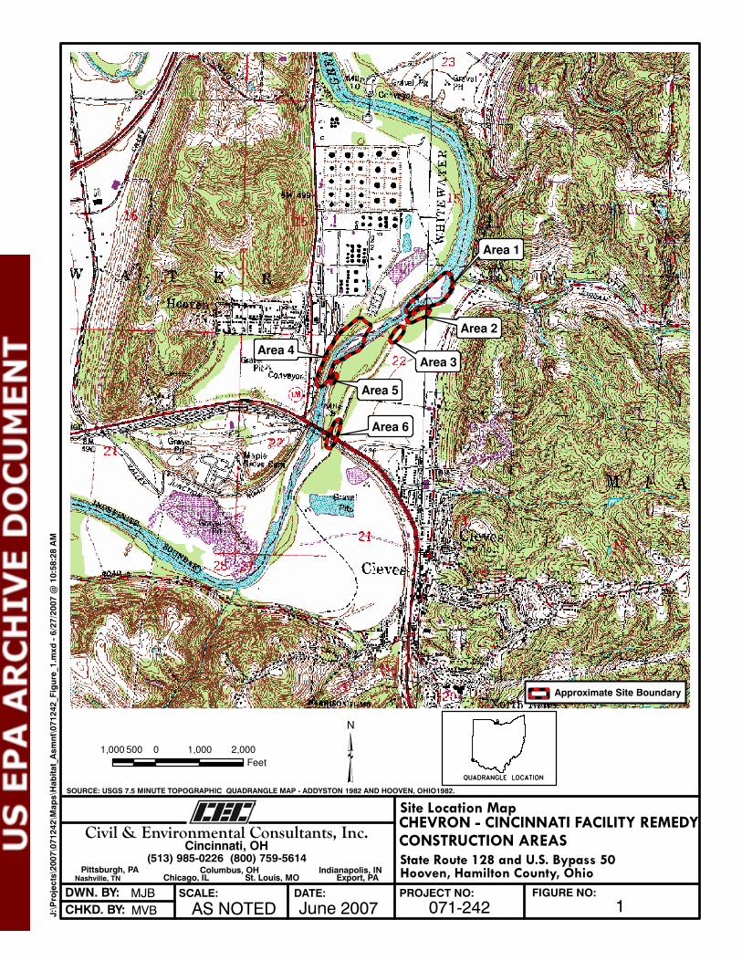
Area 6
Area 5
Area 4
Area 3
Area 1
Area 2
�1,000 0 1,000 2,000500
Feet
Site Location MapCHEVRON - CINCINNATI FACILITY REMEDYCONSTRUCTION AREAS
Hooven, Hamilton County, OhioState Route 128 and U.S. Bypass 50
PROJECT NO: FIGURE NO:
1071-242DATE:SCALE:DWN. BY:
CHKD. BY: June 2007AS NOTED
SOURCE: USGS 7.5 MINUTE TOPOGRAPHIC QUADRANGLE MAP - ADDYSTON 1982 AND HOOVEN, OHIO1982.
QUADRANGLE LOCATIONQUADRANGLE LOCATIONQUADRANGLE LOCATIONQUADRANGLE LOCATION
Civil & Environmental Consultants, Inc.Cincinnati, OH
(513) 985-0226 (800) 759-5614Pittsburgh, PA
Chicago, ILNashville, TN Export, PASt. Louis, MOColumbus, OH Indianapolis, IN
MJB
MVBJ:\Projects\2007\071242\M
aps\Habitat_Asmnt\071242_Figure_1.m
xd - 6/27/2007 @
10:58:28 AM
Approximate Site Boundary
(®
(®
(®
(®
(®
(®
(®(
®
( ® (®
(®(
®
(®
(®
(®
(®
(® Test Pit 2
Floodplain
Forest
Ordinary High Water
Mark - West Bank of
Great Miami River
Hooven Ditch/
Stream 1
Floodplain
Forest
Unnamed
Intermittent
Stream
Great Miami River
Overflow/Flood Channel
Area 6
Area 5
Old Field
Vegetation
Great Miami River
Overflow/Flood Channel14
Area 4
Floodplain
Forest
Floodplain
Forest
Area 3
Area 2
Area 1
Urban/Industrial
Turf and Old Field
Vegetation
Gravel/
Sandbar
Island
Gravel/
Sandbar
Island
Gravel/
Sandbar
Island
Gravel/
Sandbar
Island
Ordinary High Water
Mark - East Bank of
Great Miami River
Great
Mia
mi R
iver
Ordinary High Water
Mark - East Bank of
Great Miami River
9
2
43
7
1
5
12
11
10
13
17
16
15
8
6
14
�150 0 150 30075
Feet
Habitat Assessment MapCHEVRON - CINCINNATI FACILITY REMEDYCONSTRUCTION AREAS
Hooven, Hamilton County, OhioState Route 128 and U.S. Bypass 50
PROJECT NO: FIGURE NO:
2071-242DATE:SCALE:DWN. BY:
CHKD. BY: June 2007AS NOTED
SOURCE: PORTION OF A NATIONAL AGRICULTURAL IMAGERY PROGRAM (NAIP) COUNTY COLOR AERIAL MOSAIC, HAMILTON COUNTY, OHIO 2006.
Civil & Environmental Consultants, Inc.Cincinnati, OH
(513) 985-0226 (800) 759-5614Pittsburgh, PA
Chicago, ILNashville, TN Export, PASt. Louis, MOColumbus, OH Indianapolis, IN
MJB
MVBJ:\
Pro
jec
ts\2
00
7\0
71
24
2\M
ap
s\H
ab
ita
t_A
sm
nt\
07
12
42
_F
igu
re_2
.mxd
- 6
/27
/20
07
@ 3
:19
:26
PM
Approximate Site BoundaryEphemeral Stream
Intermittent StreamOrdinary High Water Mark
Photo Location and Direction(® Great Miami River Overflow/Flood Channel

ATTACHMENT I

ATTACHMENT II
CEC Project No. 071-242 Photographs Taken June 14-15, 2007
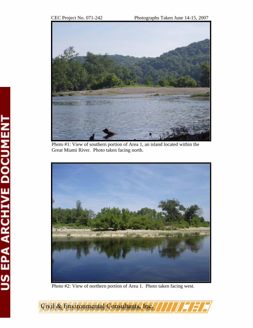
Photo #1: View of southern portion of Area 1, an island located within the Great Miami River. Photo taken facing north.
Photo #2: View of northern portion of Area 1. Photo taken facing west.
CEC Project No. 071-242 Photographs Taken June 14-15, 2007
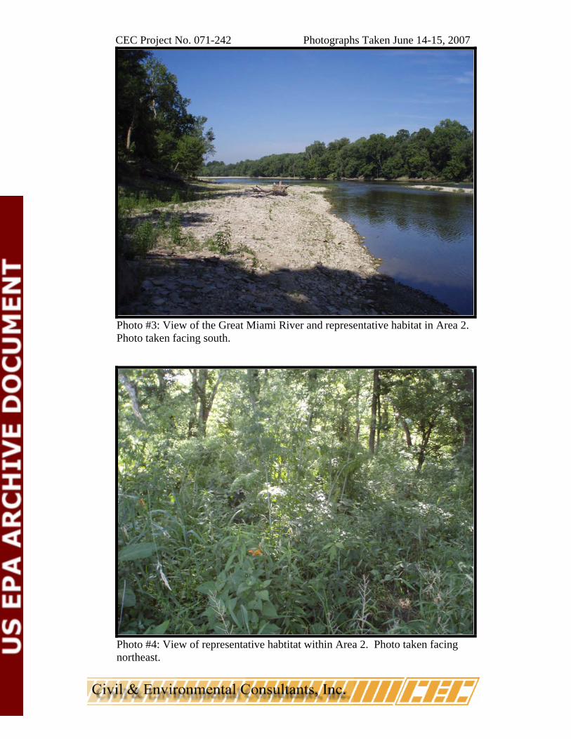
Photo #3: View of the Great Miami River and representative habitat in Area 2. Photo taken facing south.
Photo #4: View of representative habtitat within Area 2. Photo taken facing northeast.
CEC Project No. 071-242 Photographs Taken June 14-15, 2007
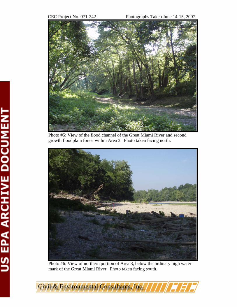
Photo #5: View of the flood channel of the Great Miami River and second growth floodplain forest within Area 3. Photo taken facing north.
Photo #6: View of northern portion of Area 3, below the ordinary high water mark of the Great Miami River. Photo taken facing south.
CEC Project No. 071-242 Photographs Taken June 14-15, 2007
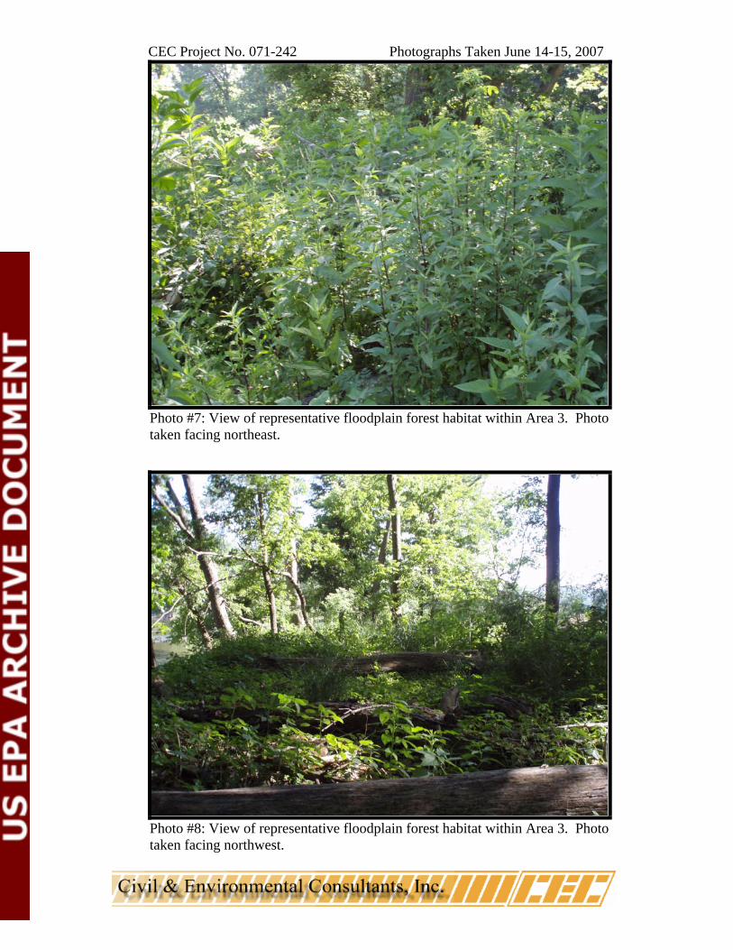
Photo #7: View of representative floodplain forest habitat within Area 3. Photo taken facing northeast.
Photo #8: View of representative floodplain forest habitat within Area 3. Photo taken facing northwest.
CEC Project No. 071-242 Photographs Taken June 14-15, 2007
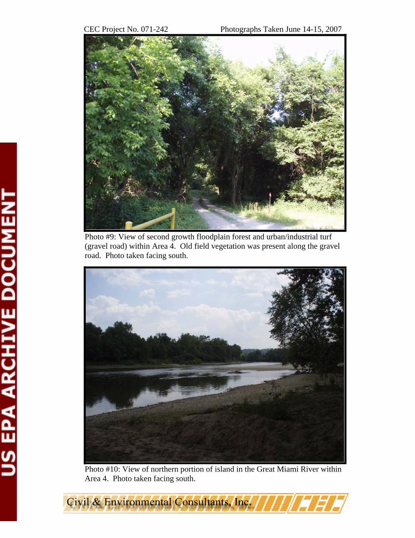
Photo #9: View of second growth floodplain forest and urban/industrial turf (gravel road) within Area 4. Old field vegetation was present along the gravel road. Photo taken facing south.
Photo #10: View of northern portion of island in the Great Miami River within Area 4. Photo taken facing south.
CEC Project No. 071-242 Photographs Taken June 14-15, 2007
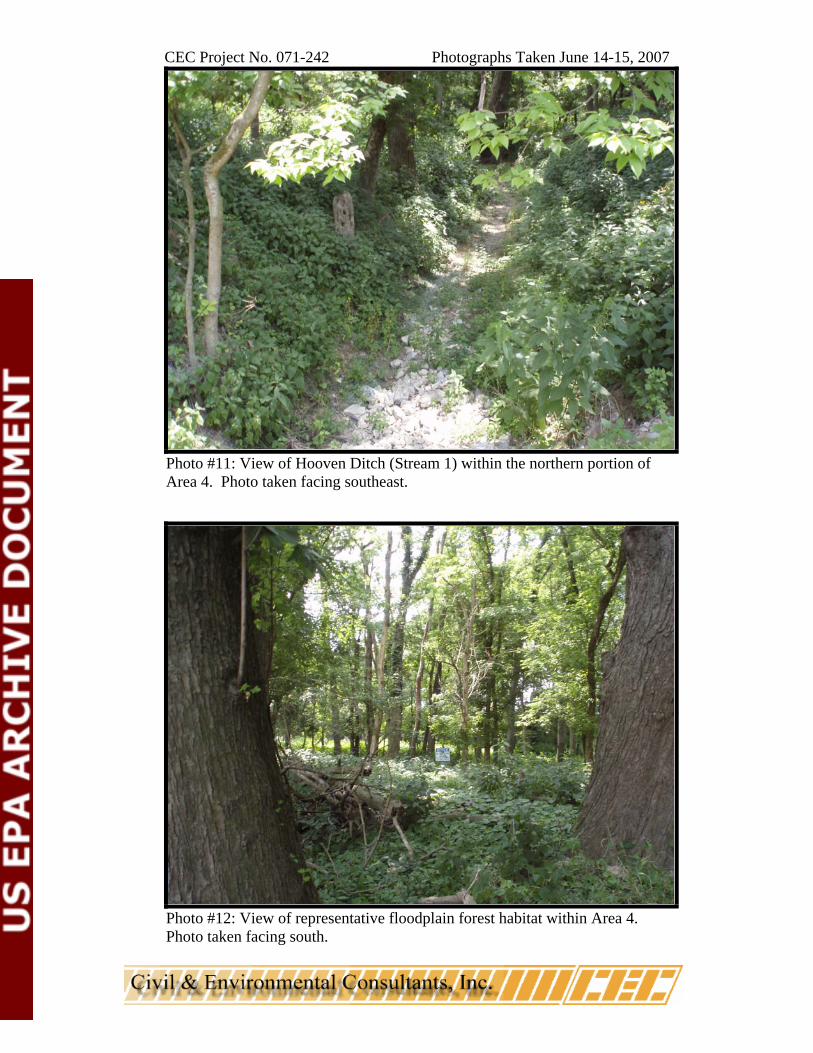
Photo #11: View of Hooven Ditch (Stream 1) within the northern portion of Area 4. Photo taken facing southeast.
Photo #12: View of representative floodplain forest habitat within Area 4. Photo taken facing south.
CEC Project No. 071-242 Photographs Taken June 14-15, 2007
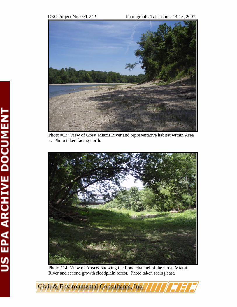
Photo #13: View of Great Miami River and representative habitat within Area 5. Photo taken facing north.
Photo #14: View of Area 6, showing the flood channel of the Great Miami River and second growth floodplain forest. Photo taken facing east.
CEC Project No. 071-242 Photographs Taken June 14-15, 2007
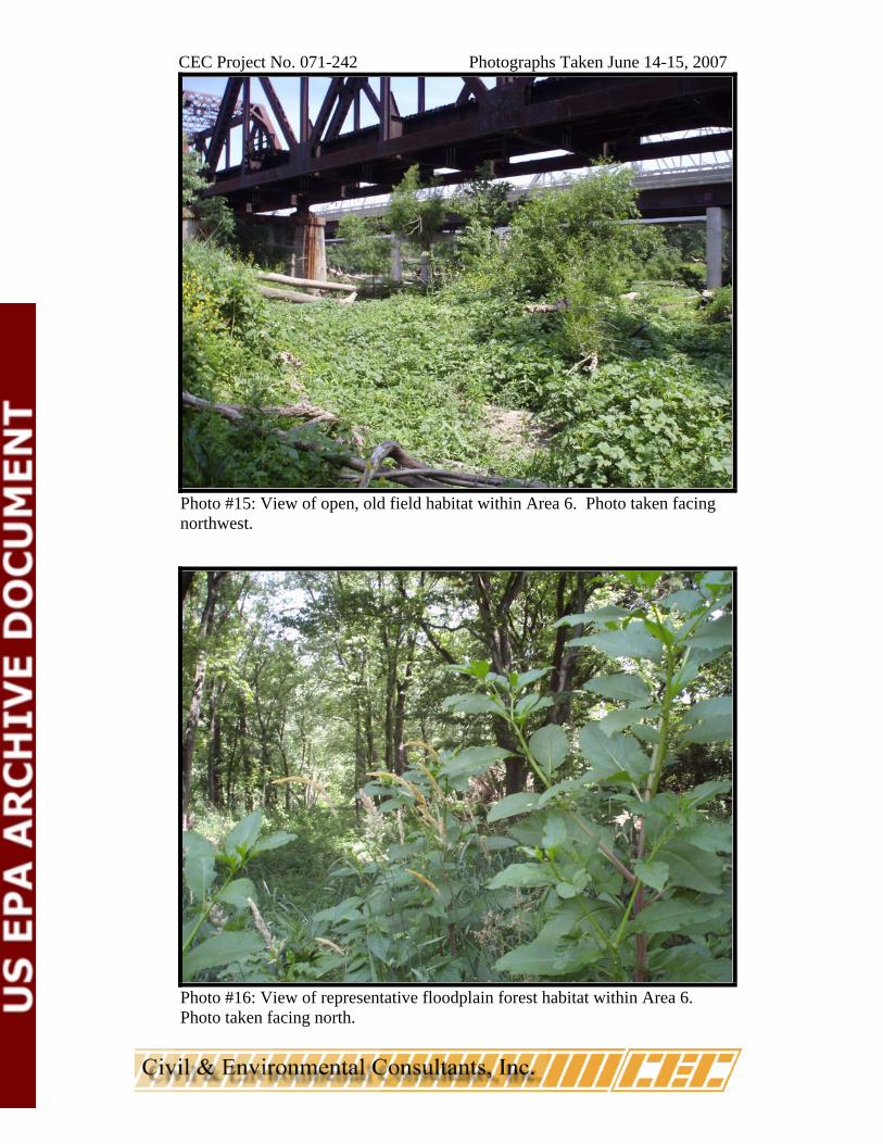
Photo #15: View of open, old field habitat within Area 6. Photo taken facing northwest.
Photo #16: View of representative floodplain forest habitat within Area 6. Photo taken facing north.
CEC Project No. 071-242 Photographs Taken June 14-15, 2007
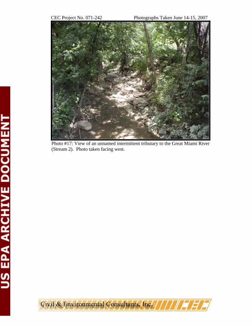
Photo #17: View of an unnamed intermittent tributary to the Great Miami River (Stream 2). Photo taken facing west.