Embed Size (px)
Citation preview
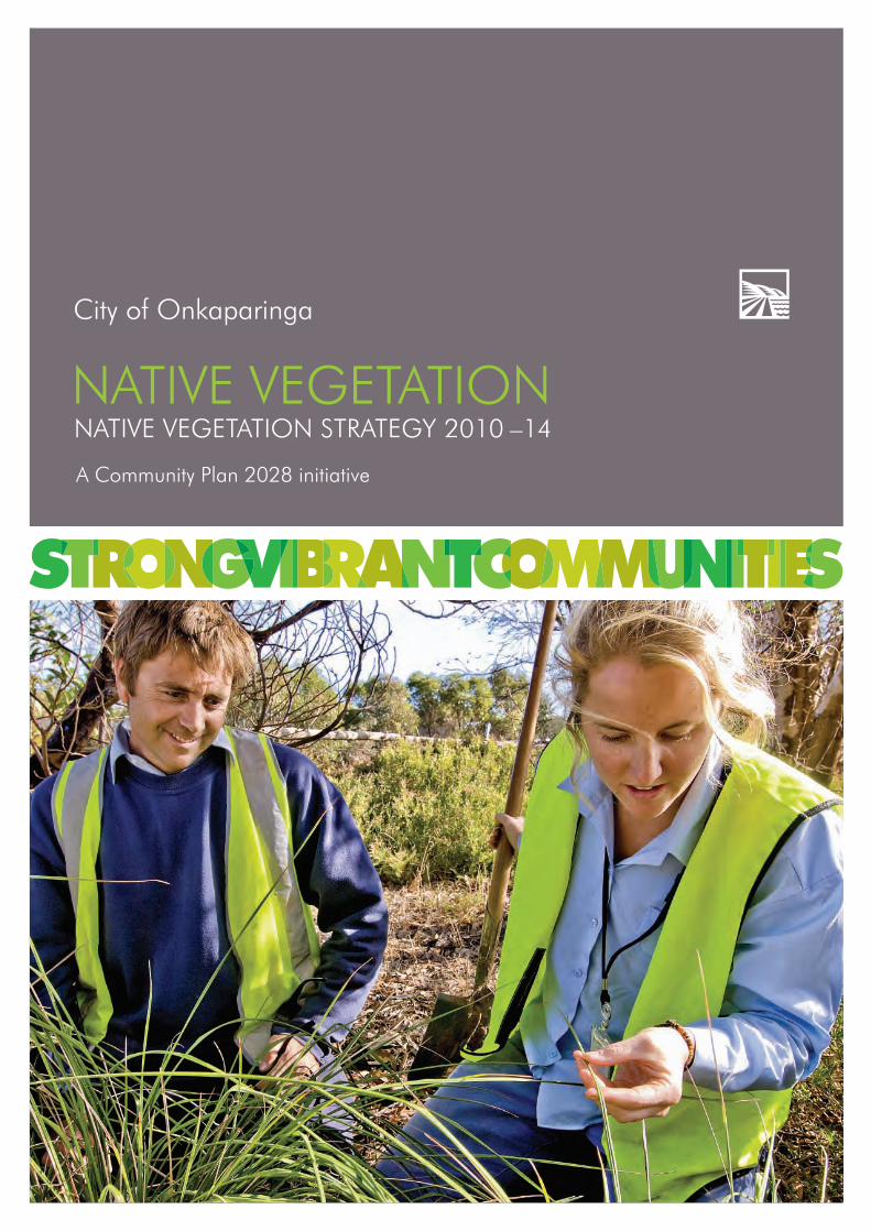
City of Onkaparinga
NATIVE VEGETATION NATIVE VEGETATION STRATEGY 2010 –14
A Community Plan 2028 initiative
Sustainability_FINAL.indd 1Sustainability_FINAL.indd 1 6/09/10 2:45 PM6/09/10 2:45 PM
2
native vegetation strategyA Community Plan 2028 initiative
Sustainability_FINAL.indd 2Sustainability_FINAL.indd 2 6/09/10 2:45 PM6/09/10 2:45 PM
3
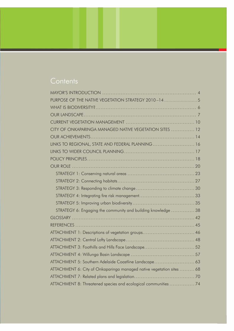
ContentsMAYOR’S INTRODUCTION .. . . . . . . . . . . . . . . . . . . . . . . . . . . . . . . . . . . . . . . . . . . . . . . . . . . . . . . 4
PURPOSE OF THE NATIVE VEGETATION STRATEGY 2010 –14 .. . . . . . . . . . . . . . . . . . . . . . . 5
WHAT IS BIODIVERSITY? . . . . . . . . . . . . . . . . . . . . . . . . . . . . . . . . . . . . . . . . . . . . . . . . . . . . . . . . . . . . 6
OUR LANDSCAPE . . . . . . . . . . . . . . . . . . . . . . . . . . . . . . . . . . . . . . . . . . . . . . . . . . . . . . . . . . . . . . . . . . . 7
CURRENT VEGETATION MANAGEMENT . . . . . . . . . . . . . . . . . . . . . . . . . . . . . . . . . . . . . . . . . 10
CITY OF ONKAPARINGA MANAGED NATIVE VEGETATION SITES . . . . . . . . . . . . . . 12
OUR ACHIEVEMENTS . . . . . . . . . . . . . . . . . . . . . . . . . . . . . . . . . . . . . . . . . . . . . . . . . . . . . . . . . . . . . . 14
LINKS TO REGIONAL, STATE AND FEDERAL PLANNING .. . . . . . . . . . . . . . . . . . . . . . . . 16
LINKS TO WIDER COUNCIL PLANNING .. . . . . . . . . . . . . . . . . . . . . . . . . . . . . . . . . . . . . . . . . 17
POLICY PRINCIPLES . . . . . . . . . . . . . . . . . . . . . . . . . . . . . . . . . . . . . . . . . . . . . . . . . . . . . . . . . . . . . . . . 18
OUR ROLE . . . . . . . . . . . . . . . . . . . . . . . . . . . . . . . . . . . . . . . . . . . . . . . . . . . . . . . . . . . . . . . . . . . . . . . . . 20
STRATEGY 1: Conserving natural areas . . . . . . . . . . . . . . . . . . . . . . . . . . . . . . . . . . . . . . . . 23
STRATEGY 2: Connecting habitats . . . . . . . . . . . . . . . . . . . . . . . . . . . . . . . . . . . . . . . . . . . . . . 27
STRATEGY 3: Responding to climate change . . . . . . . . . . . . . . . . . . . . . . . . . . . . . . . . . . . 30
STRATEGY 4: Integrating fi re risk management . . . . . . . . . . . . . . . . . . . . . . . . . . . . . . . . . 33
STRATEGY 5: Improving urban biodiversity . . . . . . . . . . . . . . . . . . . . . . . . . . . . . . . . . . . . . 35
STRATEGY 6: Engaging the community and building knowledge . . . . . . . . . . . . . . 38
GLOSSARY . . . . . . . . . . . . . . . . . . . . . . . . . . . . . . . . . . . . . . . . . . . . . . . . . . . . . . . . . . . . . . . . . . . . . . . . . 42
REFERENCES . . . . . . . . . . . . . . . . . . . . . . . . . . . . . . . . . . . . . . . . . . . . . . . . . . . . . . . . . . . . . . . . . . . . . . . 45
ATTACHMENT 1: Descriptions of vegetation groups . . . . . . . . . . . . . . . . . . . . . . . . . . . . . . . 46
ATTACHMENT 2: Central Lofty Landscape . . . . . . . . . . . . . . . . . . . . . . . . . . . . . . . . . . . . . . . . . 48
ATTACHMENT 3: Foothills and Hills Face Landscape . . . . . . . . . . . . . . . . . . . . . . . . . . . . . . 52
ATTACHMENT 4: Willunga Basin Landscape . . . . . . . . . . . . . . . . . . . . . . . . . . . . . . . . . . . . . . 57
ATTACHMENT 5: Southern Adelaide Coastline Landscape . . . . . . . . . . . . . . . . . . . . . . . . 63
ATTACHMENT 6: City of Onkaparinga managed native vegetation sites . . . . . . . . . 68
ATTACHMENT 7: Related plans and legislation . . . . . . . . . . . . . . . . . . . . . . . . . . . . . . . . . . . . 70
ATTACHMENT 8: Threatened species and ecological communities . . . . . . . . . . . . . . . 74
Sustainability_FINAL.indd 3Sustainability_FINAL.indd 3 6/09/10 2:45 PM6/09/10 2:45 PM
4
A Community Plan 2028 initiative
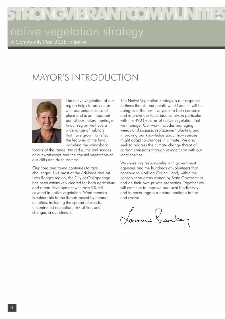
The native vegetation of our region helps to provide us with our unique sense of place and is an important part of our natural heritage. In our region we have a wide range of habitats that have grown to refl ect the features of the land, including the stringybark
forests of the range, the red gums and sedges of our waterways and the coastal vegetation of our cliffs and dune systems.
Our fl ora and fauna continues to face challenges. Like most of the Adelaide and Mt Lofty Ranges region, the City of Onkaparinga has been extensively cleared for both agriculture and urban development with only 9% still covered in native vegetation. What remains is vulnerable to the threats posed by human activities, including the spread of weeds, uncontrolled recreation, risk of fi re, and changes in our climate.
The Native Vegetation Strategy is our response to these threats and details what Council will be doing over the next fi ve years to both conserve and improve our local biodiversity, in particular with the 490 hectares of native vegetation that we manage. Our work includes managing weeds and disease, replacement planting and improving our knowledge about how species might adapt to changes in climate. We also seek to address the climate change threat of carbon emissions through revegetation with our local species.
We share this responsibility with government agencies and the hundreds of volunteers that continue to work on Council land, within the conservation areas owned by State Government and on their own private properties. Together we will continue to improve our local biodiversity and to encourage our natural heritage to live and evolve.
MAYOR’S INTRODUCTION
native vegetation strategyA Community Plan 2028 initiative
Sustainability_FINAL.indd 4Sustainability_FINAL.indd 4 6/09/10 2:45 PM6/09/10 2:45 PM
5
Mayor Lorraine Rosenberg
This plan outlines the City of Onkaparinga’s biodiversity priorities and actions for the next fi ve years with a focus on the management of remnant vegetation, and the revegetation of land that we manage. This includes considering the links between native vegetation and native fauna.
The Native Vegetation Strategy 2010 – 14 is our local response to the national and global issue of a decline in biodiversity. The relationship between this plan and wider government and council planning is presented on page 14 and 15.
PURPOSE OF THE NATIVE VEGETATION STRATEGY 2010 –14
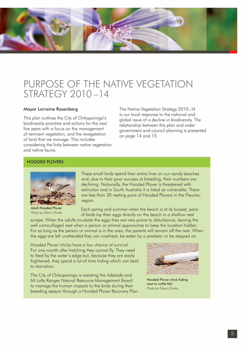
These small birds spend their entire lives on our sandy beaches and, due to their poor success at breeding, their numbers are declining. Nationally, the Hooded Plover is threatened with extinction and in South Australia it is listed as vulnerable. There are less than 30 nesting pairs of Hooded Plovers in the Fleurieu region.
Each spring and summer when the beach is at its busiest, pairs of birds lay their eggs directly on the beach in a shallow nest
scrape. When the adults incubate the eggs they are very prone to disturbance, leaving the well camoufl aged nest when a person or animal approaches to keep the location hidden. For as long as the person or animal is in the area, the parents will remain off the nest. When the eggs are left unattended they can overheat, be eaten by a predator or be stepped on.
Hooded Plover chicks have a low chance of survival. For one month after hatching they cannot fl y. They need to feed by the water’s edge but, because they are easily frightened, they spend a lot of time hiding which can lead to starvation.
The City of Onkaparinga is assisting the Adelaide and Mt Lofty Ranges Natural Resource Management Board to manage the human impacts to the birds during their breeding season through a Hooded Plover Recovery Plan.
HOODED PLOVERS
Adult Hooded PloverPhoto by Glenn Ehmke
Hooded Plover chick hiding next to cuttle fi shPhoto by Glenn Ehmke
Sustainability_FINAL.indd 5Sustainability_FINAL.indd 5 6/09/10 2:45 PM6/09/10 2:45 PM
6
native vegetation strategyA Community Plan 2028 initiative
Biodiversity is the diversity of life in all its forms across the planet. It ranges from large scale ecosystems to the different species of fl ora and fauna, and to genetic differences between individuals of the same species. These three levels work together to create the complexity of life on earth.
Biodiversity is not static but is constantly changing. It is increased by genetic change and evolutionary processes and reduced by processes such as habitat degradation, a decline in fl ora and fauna, and the extinction of species. Diversity in all its forms (genetic, species and ecosystem) is a critical factor in the resilience of an area and its ability to respond
to signifi cant changes such as fi re, food, climate and human impacts. Diversity is the key to maintaining viable populations of our native fl ora and fauna.
Australia is a signatory to the International Convention on Biodiversity which recognises both the importance of conservation and the recovery of threatened species. In the most recent State of the Environment Report (2008) the number of vulnerable and endangered plants, animals and ecological communities in South Australia was found to be increasing, and peri-urban areas were said to be particularly vulnerable due to the pressures of housing and other changes in land use.1
WHAT IS BIODIVERSITY?
1 Environment Protection Authority (2008) State of the Environment Report
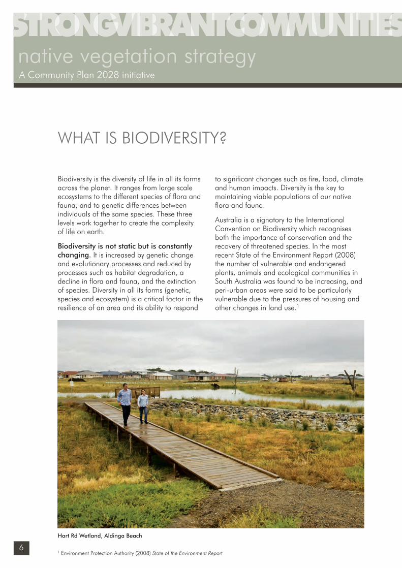
Hart Rd Wetland, Aldinga Beach
Sustainability_FINAL.indd 6Sustainability_FINAL.indd 6 6/09/10 2:45 PM6/09/10 2:45 PM
7
The landscape of our region is highly diverse, covering an area of 51,800 ha at the southern end of the Adelaide and Mt Lofty Ranges region. Our western boundary is 31 km of coastline including open beaches, reefs, dunes and cliff formations. Extending inland from the coast are the Noarlunga and Willunga plains which gently rise up to the foothills of the Southern Mt Lofty Ranges. The highest point is 420 metres above sea level at Coromandel East.
Nine signifi cant catchments and riverine systems carry large volumes of water from the ranges to the coast, especially during the winter months. The City of Onkaparinga’s northern boundary is defi ned in part by the Sturt and Field Rivers and through its centre fl ows the Onkaparinga River. Other signifi cant riverine systems in the region include Christie Creek, Pedler Creek, Maslin Creek, Pt Willunga Creek, Washpool and Sellicks Creek.
Prior to European settlementBefore 1836, the landscape in the City of Onkaparinga refl ected the natural features of the plains, foothills, estuaries and coastal lagoons. These landforms supported a diverse range of native fauna including the platypus which was found in the Onkaparinga River.
The diversity of vegetation and landforms provided a continuous mosaic of different vegetation communities that provided essential resources such as food, water and shelter. It also enabled fauna species to move freely throughout their range, to disperse and take refuge from events such as bushfi re and fl ooding.
The vegetation communities were diverse and included the Stringybark forests of the upper
ranges, Grey Box Woodlands of the foothills, River Red Gum forests along watercourses, Mallee Box Grassy Woodlands of the plains and Samphire swamps within sheltered tidal areas and estuaries. For a full description of our vegetation communities, see Attachment 1.
The Kaurna people managed this landscape before Europeans arrived, and moved through their land as the season and their tradition allowed. Some traded in karko (ochre) and met together at signifi cant places. Clothed in cured hides which were often prepared at a site near Rekarung (the Aldinga Scrub), they lived in wodli which were simple summer housing of branch and leaf and more substantial winter structures moulded of grass and earth. Their diet was rich and diverse, built from the fl ora and fauna that surrounded them.
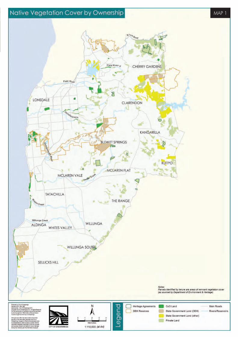
Vegetation clearance and modifi cationResembling the majority of the Adelaide and Mount Lofty Ranges region, the vegetation of our council area has been heavily cleared for agriculture, urban and coastal development. Throughout the entire council region only 9% of our original vegetation remains, existing as small fragmented islands of habitat in a highly modified landscape.
The larger patches of remnant vegetation are owned by state government authorities, much of which is under protected public ownership including the Onkaparinga National Park, Aldinga Scrub Conservation Park and Scott Creek Conservation Park. The protected watershed areas of Mount Bold and Happy Valley Reservoirs also contain signifi cant areas of native vegetation. See Map 1 Native Vegetation Cover by Ownership.
OUR LANDSCAPE
Sustainability_FINAL.indd 7Sustainability_FINAL.indd 7 6/09/10 2:45 PM6/09/10 2:45 PM
8
With the alteration of the landscape, the distribution and abundance of native species has also inevitably changed. Some native species have adapted to urban environments and expanded their range including the possum and the western grey kangaroo. Others have declined and become threatened or extinct causing a fl ow-on effect to other species. For example the stiff white spider orchid relies on the native bee for pollination, and a decline in the number of native bees is a major reason why the orchid is now a threatened species.
Our remaining vegetationIf we are to effectively conserve the native vegetation on our land we need to both understand what it was like originally, and
what we have now. It can be seen from Map 1 that the remaining vegetation is not evenly distributed with the areas that were more suitable for agriculture extensively cleared prior to the 1940s. Typically these were areas with fertile soils and fl at or undulating land that contained grasslands and grassy woodlands, dominated by native grasses, daisies and lilies and occasional trees such as eucalypts and sheoaks.
The grasslands in particular were preferentially cleared to the extent that today only 5% of the pre-European vegetation remains on the fl atter plains area. In comparison, steeper, less accessible terrain with less fertile soils has 26% of its pre-European vegetation remaining.
OUR LANDSCAPE
native vegetation strategyA Community Plan 2028 initiative
Sustainability_FINAL.indd 8Sustainability_FINAL.indd 8 6/09/10 2:45 PM6/09/10 2:45 PM
MAP 1
MAP 1
Sustainability_FINAL.indd 9Sustainability_FINAL.indd 9 6/09/10 2:45 PM6/09/10 2:45 PM
10
The vulnerability of our remaining native vegetation requires that we address threats and improve the condition and resilience of our remnants. Current threats include habit fragmentation, weed and feral animal infestation, uncontrolled access, drought and clearance for fi re management.
We will actively manage the remnant vegetation on our land by gaining knowledge about the type of vegetation and the condition it is in, developing management plans for active restoration in degraded areas and providing adequate resources for ongoing maintenance and monitoring.
Strategies of restorationOur approach to active restoration is based on the following planning framework:1 To maintain the condition of habitats that
remain in good condition, or are largely unmodifi ed (including remnants). It is much easier and cheaper to avoid the effects of degradation than it is to try and reverse them.
2 To improve the condition of habitats that are degraded or that have been modifi ed.
3 To reconstruct habitat elements that have been lost, using revegetation and assisted regeneration.2
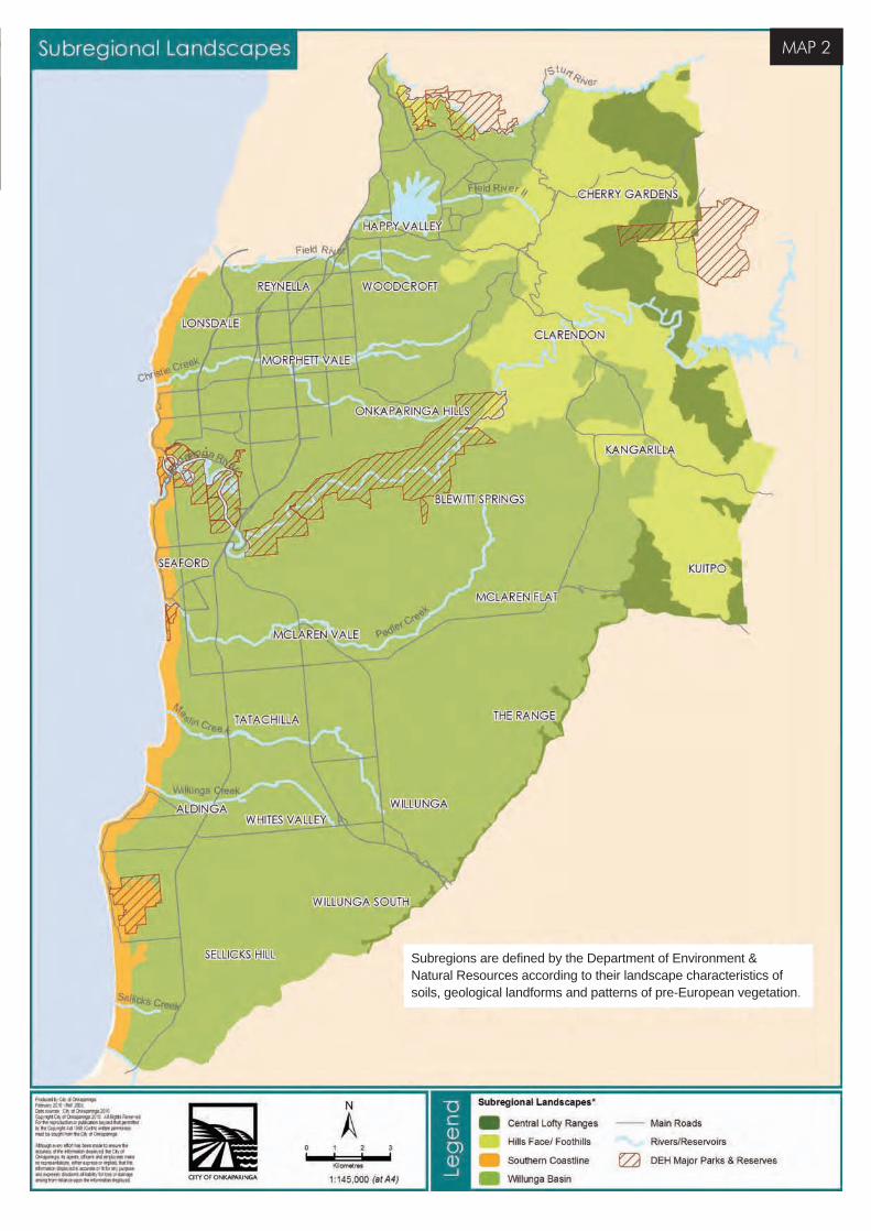
Sub-regional landscapes To assist with planning and priority setting at a regional scale, some state plans have divided the Adelaide and Mt Lofty Ranges into sub-regional landscapes according to their soils, geological landforms and pre-European vegetation patterns. This landscape mapping is a useful guide to analysing our diverse region including the existing vegetation, the threats to remnant vegetation and the opportunities for revegetation.
In applying this tool, the City of Onkaparinga is divided into the following sub regional landscapes, see Map 2 Sub-regional landscapes:›› Central Lofty Landscape – 3,122 ha
›› Hills Face/Foothills Landscape – 8,518 ha
›› Willunga Basin Landscape – 38,342 ha
›› Southern Adelaide Coastline Landscape – 1,818 ha
For a comprehensive description of each sub-region, see Attachments 2 – 5.
CURRENT NATIVE VEGETATION MANAGEMENT
2 Department of Environment & Heritage (2009) Informing Biodiversity Conservation for Adelaide and the Mount Lofty Ranges
A Community Plan 2028 initiative
native vegetation strategy
Sustainability_FINAL.indd 10Sustainability_FINAL.indd 10 6/09/10 2:45 PM6/09/10 2:45 PM
MAP 2MAP 2
MAP 2
Subregions are defi ned by the Department of Environment & Natural Resources according to their landscape characteristics of soils, geological landforms and patterns of pre-European vegetation.
Sustainability_FINAL.indd 11Sustainability_FINAL.indd 11 6/09/10 2:45 PM6/09/10 2:45 PM
12
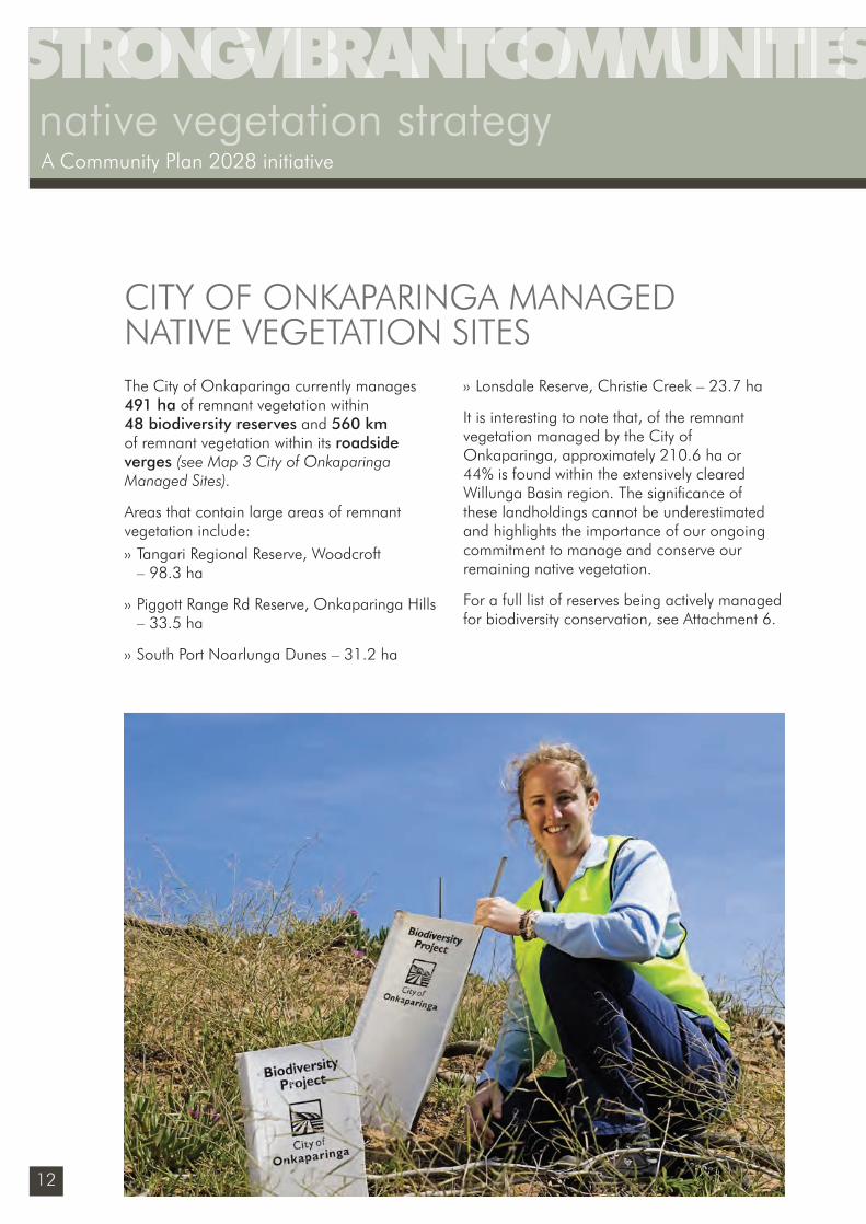
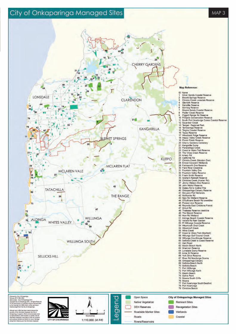
The City of Onkaparinga currently manages 491 ha of remnant vegetation within 48 biodiversity reserves and 560 km of remnant vegetation within its roadside verges (see Map 3 City of Onkaparinga Managed Sites).
Areas that contain large areas of remnant vegetation include:›› Tangari Regional Reserve, Woodcroft
– 98.3 ha
›› Piggott Range Rd Reserve, Onkaparinga Hills – 33.5 ha
›› South Port Noarlunga Dunes – 31.2 ha
›› Lonsdale Reserve, Christie Creek – 23.7 ha
It is interesting to note that, of the remnant vegetation managed by the City of Onkaparinga, approximately 210.6 ha or 44% is found within the extensively cleared Willunga Basin region. The signifi cance of these landholdings cannot be underestimated and highlights the importance of our ongoing commitment to manage and conserve our remaining native vegetation.
For a full list of reserves being actively managed for biodiversity conservation, see Attachment 6.
CITY OF ONKAPARINGA MANAGED NATIVE VEGETATION SITES
native vegetation strategyA Community Plan 2028 initiative
Sustainability_FINAL.indd 12Sustainability_FINAL.indd 12 6/09/10 2:45 PM6/09/10 2:45 PM
MAP 3MAP 3
MAP 3
Sustainability_FINAL.indd 13Sustainability_FINAL.indd 13 6/09/10 2:45 PM6/09/10 2:45 PM
14
native vegetation strategyA Community Plan 2028 initiative
Our management of remnant native vegetation has improved through:›› the creation of a dedicated Biodiversity Unit to
manage areas of remnant vegetation in our reserves, with specialised skills in revegetation, weed and erosion control, volunteer management and education
›› the preparation and implementation of Native Vegetation Management Plans for 13 larger sites and annual work plans for a further 63 sites to prioritise works and ensure that our resources are used for the greatest impact
›› continuing to expand the Roadside Marker System which alerts staff, contractors and the public to areas of signifi cant native vegetation. Markers have been installed at 95 roadside native vegetation sites, totalling 89 km
›› the removal of woody weeds such as olives and boneseed that compete with native vegetation as well as create a fi re risk
›› combining resources with other agencies to deliver revegetation and weed control programs on the ground. In 2009/10, a total of $100 000 was received from the Adelaide Mount Lofty Ranges Natural Resource Management Board and the Department for Environment and Heritage.
Our areas of native vegetation have increased through:›› planting over 400,000 seedlings at Pedler
Creek Reserve, Sellicks Creek and community sites including Willunga Creek, Silver Sands Coastal Reserve and Weymouth Oval
›› working with the state government to revegetate the Coast to Vines Rail Trail, Port Noarlunga dunes, Sellicks Beach foreshore, Hart Road Wetland at Aldinga Beach, Sauerbier Creek at Aberfoyle Park and Tangari Regional Park at Woodcroft through the Million Trees Program
›› integrating local species within our landscape designs in streetscapes, formal gardens and water sensitive design projects
›› altering broad-acre slashing regimes to encourage the regeneration of native grasses and increase the amount of habitat and food sources for butterfl ies and other invertebrate species.
OUR ACHIEVEMENTS
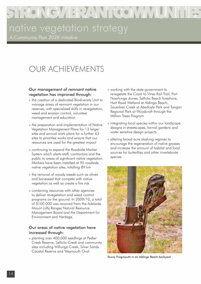
Tawny Frogmouth in an Aldinga Beach backyard
Sustainability_FINAL.indd 14Sustainability_FINAL.indd 14 6/09/10 2:45 PM6/09/10 2:45 PM
15
OUR ACHIEVEMENTS
Our support for the community continues through:›› our 53 community sites (see page 41, Map
4 Community Sites) where volunteers work to restore and improve areas of bush or coastal vegetation with technical, planning and fi nancial assistance from the City of Onkaparinga, Trees For Life and the Adelaide and Mt Lofty Ranges Natural Resources Management Board
›› community planting events that encourage a hands-on experience at sites including South Port Noarlunga Dunes, Thalassa Reserve in Aberfoyle Park and Hart Road Wetland at Aldinga Beach
›› distributing $36,848 since 2006 to community groups and schools for revegetation projects through the Environmental Grants program.
Our knowledge of biodiversity has grown through surveying and mapping:›› 491 hectares of remnant vegetation within
48 council reserves (see Map 3 City of Onkaparinga Sites) including plant species and vegetation communities, allowing us to compare the current vegetation to the original vegetation that was found prior to European settlement
›› environmental weeds along 1200 km of roadsides, enabling us to prioritise our weed control programs starting with sites adjacent to conservation areas.
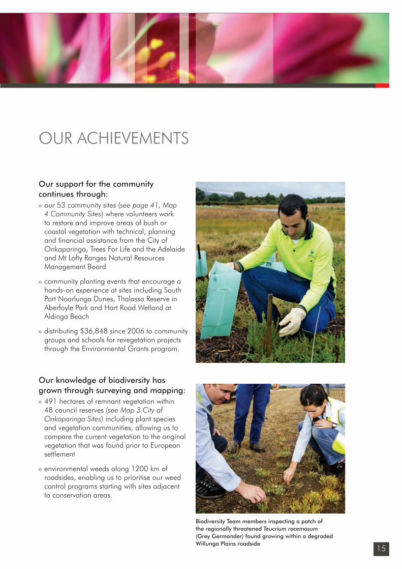
Biodiversity Team members inspecting a patch of the regionally threatened Teucrium racemosum (Grey Germander) found growing within a degraded Willunga Plains roadside
Sustainability_FINAL.indd 15Sustainability_FINAL.indd 15 6/09/10 2:45 PM6/09/10 2:45 PM
16
Regional planning
Informing Biodiversity Conservation for the
Adelaide and Mt Lofty Ranges Region SA (2010)
Regional Recovery Plan 2009-2014: threatened species and ecological
communities of Adelaide & the Mt Lofty Ranges of SA
Metropolitan Adelaide and Northern Coastal
Action Plan
A Biodiversity Investment Plan for Urban Adelaide
2008-2011
International agreements
International Convention on Biological Diversity 1992 Agreements and Convention on Migratory Species
Federal legislation
Environment Protection and Biodiversity Conservation Act (1999)
Federal government plans
Australia’s Biodiversity Conservation Strategy 2010-2020
National Recovery Plans for Threatened Species
Weeds of National Signifi cance & Threat Abatement Plans
State legislation
Native Vegetation Act
1991
Development Act 1993
Crown Lands Act 1929
Natural Resource
Management Act 2004
Coast Protection Act
1972
Fire and Emergency Services Act
2005
South Australian Government plans
State Natural Resources
Management Plan 2006
No Species Loss –a nature conservation
strategy for South Australia 2007-2017
Nature Links –Cape Borda to Barossa
NatureLink
The AMLNRM Board’s Investment Plan
2009/10 -2011/12
City of Onkaparinga Native Vegetation Strategy 2010 –14
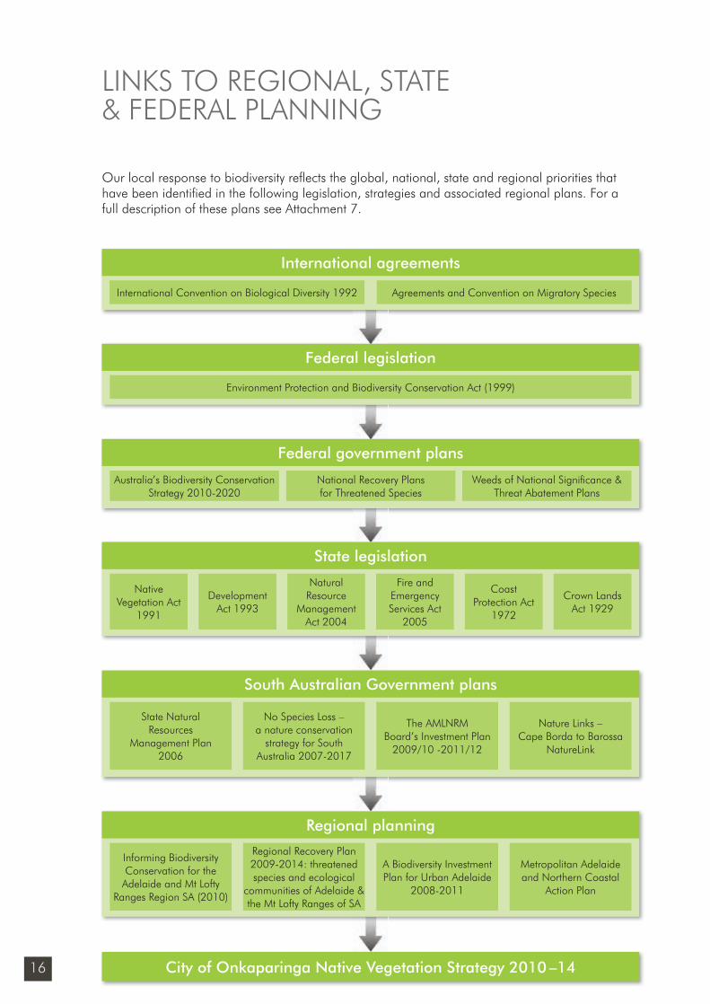
LINKS TO REGIONAL, STATE & FEDERAL PLANNING
Our local response to biodiversity refl ects the global, national, state and regional priorities that have been identifi ed in the following legislation, strategies and associated regional plans. For a full description of these plans see Attachment 7.
Sustainability_FINAL.indd 16Sustainability_FINAL.indd 16 6/09/10 2:45 PM6/09/10 2:45 PM
17
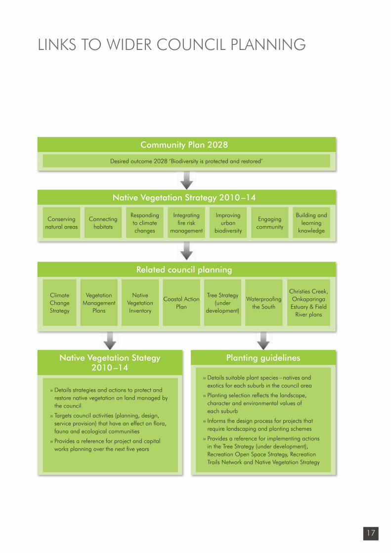
LINKS TO WIDER COUNCIL PLANNING
Regional Planning
Community Plan 2028
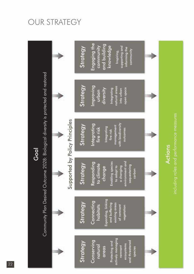
Desired outcome 2028 ‘Biodiversity is protected and restored’
Native Vegetation Strategy 2010 –14
Conserving natural areas
Connecting habitats
Building and learning
knowledge
Responding to climate changes
Engaging community
Integrating fi re risk
management
Improving urban
biodiversity
Related council planning
Climate Change Strategy
Christies Creek, Onkaparinga Estuary & Field
River plans
Vegetation Management
Plans
Tree Strategy (under
development)
Native Vegetation Inventory
Coastal Action Plan
Waterproofi ng the South
Regional Planning
›› Details strategies and actions to protect and restore native vegetation on land managed by the council
›› Targets council activities (planning, design, service provision) that have an effect on fl ora, fauna and ecological communities
›› Provides a reference for project and capital works planning over the next fi ve years
Planting guidelines
›› Details suitable plant species – natives and exotics for each suburb in the council area
›› Planting selection refl ects the landscape, character and environmental values of each suburb
›› Informs the design process for projects that require landscaping and planting schemes
›› Provides a reference for implementing actions in the Tree Strategy (under development), Recreation Open Space Strategy, Recreation Trails Network and Native Vegetation Strategy
Native Vegetation Stategy 2010 –14
Sustainability_FINAL.indd 17Sustainability_FINAL.indd 17 6/09/10 2:45 PM6/09/10 2:45 PM
18
native vegetation strategyA Community Plan 2028 initiative
POLICY PRINCIPLES
3 DEH (June 2009) Regional Recovery Plan 2009-2014 for threatened species and ecological communities of Adelaide and the Mt Lofty Ranges of SA
The Native Vegetation Strategy 2010 –14 is underpinned by the following policy principles that help to guide and clarify our decision-making:
Native vegetation priorities and planning›› Native vegetation planning is most effective
when considering the landscape as a whole including conservation areas, agricultural and urban landscapes.
›› The protection and restoration of native vegetation is achieved most effectively through cooperation with the community, private industry and other relevant government agencies.
›› The effective management of native vegetation assets requires ongoing maintenance and project proposals that refl ect these costs.
›› Native vegetation planning is based on science and evidence-based research, and is informed by the analysis undertaken by government agencies.
Management ›› The highest conservation priority is the
protection and continued maintenance of existing remnant vegetation on land under our own care and control.
›› Conservation areas require active management. ‘Active management’ requires the setting of a biodiversity goal that is specifi c to the site, and the delivery of on-ground works to a level that achieves this goal.3
›› Effective native vegetation protection requires identifying, understanding, preventing and reducing threatening processes.
›› Monitoring outcomes rather than activity is the most effective way to measure the success of management programs.
›› Native vegetation corridors, linkages between remnants and stepping stones allow the movement of local fl ora and fauna and improves a species ability to adapt and evolve.
Revegetation›› The revegetation of open space should seek to
enhance existing remnants through buffer plantings and/or the creation of corridors.
Land use planning›› The principles of the Development Plan will
refl ect the policy principles of this strategy, and areas of high biodiversity value should be zoned to provide protection from development and changes in land use.
Land acquisition, disposal and transfer›› Conservation is a legitimate land use.
›› Council land with conservation values should only be sold or transferred to others where the transfer will result in long-term conservation benefits (eg transfers to the State National Parks System or Heritage Agreements). Independent advice will be sought to determine existing biodiversity value.
Sustainability_FINAL.indd 18Sustainability_FINAL.indd 18 6/09/10 2:45 PM6/09/10 2:45 PM
19
›› The consideration of native vegetation value will include remnant mature trees as they provide critical habitat such as nesting hollows for Australian birds and most tree-living animals.
›› We only consider the purchase of strategic native vegetation sites when all other options have been fully explored (eg heritage agreements, land management agreements). If purchasing land, state or federal government agencies or groups will be approached for fi nancial and/or in-kind support.
Private land›› We will support conservation and revegetation
on private land primarily through: – the Environmental Grants and Awards
program
– cooperation with programs delivered through other levels of government and agencies such as natural resource management boards
– the provision of information to help guide investment, such as strategic revegetation priorities and vegetation data.
Fire management›› Fire risk assessments include the evaluation
and documentation of the risk of reducing biodiversity value, including damage to remnant trees and understorey.
›› When reducing the fuel load in vegetated areas, we aim to minimise harm to native vegetation. Our fuel reduction methods
will be site-specifi c and appropriate to the signifi cance of the vegetation and proximity to people or property.
›› Prescribed burning may be used if justifi ed for ecological and/or or fuel reduction purposes and should be consistent with the Ecological Fire Management Guidelines (in preparation by DENR). Consequences of the burn such as increasing the prevalence of weeds or acacias are considered.
Open space and recreation›› Major park redevelopments and trails
will follow a planting design that includes consideration of biodiversity, habitat, weed potential and fi re risk.
›› The provision, design and management of open space will seek to reduce the impact of uncontrolled activities on biodiversity areas eg horse-riding, mountain-bike riding and walking.
›› The design of open space within land divisions will include sites of high biodiversity value or the creation of new natural landscape or habitat areas as part of their open space allocation.
Community involvement›› We recognise the importance of engaging
with the community in the management of biodiversity.
›› The involvement of volunteers on our land provides a balance of on-ground achievement and educational outcomes.
POLICY PRINCIPLES
Sustainability_FINAL.indd 19Sustainability_FINAL.indd 19 6/09/10 2:45 PM6/09/10 2:45 PM
20
native vegetation strategyA Community Plan 2028 initiative
The City of Onkaparinga is one of many agencies and groups involved in the conservation of biodiversity in our region.The following role statements outline the areas where we have a clear responsibility to act.
Leadership ›› We identify strategic land parcels to create
buffers to existing remnant vegetation, connect existing habitats or to protect threatened species.
›› We monitor state and regional research and methodologies to inform Councils role, decision-making and operations.
›› We support and monitor climate change research on ecosystems and species and their ability to adapt to a changing climate.
›› We integrate biodiversity outcomes into bushfi re management planning, open space, active and passive recreation and water management projects.
›› We inspire custodianship for local biodiversity assets through community planting events, information about threatened species, and through publishing stories from volunteers.
Owner/custodian›› We protect remnant vegetation and improve
and monitor biodiversity outcomes on land under our care and control through vegetation surveys, the roadside and reserve marker system, vegetation management plans, revegetation projects, linear trails, wetlands, carbon sequestration initiatives and weed and disease control programs.
›› When designing and maintaining open space and roadsides we consider both the protection and restoration of biodiversity and the reduction of fi re risk.
›› We comply with relevant legislation and codes of practice.
Regulatory ›› We will apply land use planning and
development controls that protect remnant vegetation.
›› We will enforce where mandated and make others aware of relevant legislation eg Development Act, Local Government Act, Environment Protection and Biodiversity Conservation Act, Native Vegetation Act, Natural Resources Management Act and the Fire and Emergency Services Act.
Information provider›› We provide information to the community
on fl ora and fauna on Council-owned land through interpretive signage, and by distributing information from other agencies on our website and at events.
›› We provide data from vegetation surveys to other agencies to inform their decision-making and strengthen opportunities for collaboration.
›› We provide a link for groups to external funding assistance and relevant networks.
›› We provide staff training in plant identifi cation and weed control methods.
OUR ROLE
Sustainability_FINAL.indd 20Sustainability_FINAL.indd 20 6/09/10 2:45 PM6/09/10 2:45 PM
21
Advocate We advocate to state government for improved biodiversity controls in the Development Plan and for improved biodiversity on land owned by state government and private landholders. This includes the sites of major housing developments.
Facilitator/initiatorWe join or bring together agencies, groups and individuals to collectively resolve biodiversity issues including vegetation clearance, fi re management, data gathering or weed and pest control.
AgentWe provide a service on behalf of another party that funds the service when the funding conditions are consistent with our strategic directions.
Part funder We contribute funds for biodiversity projects through the Environmental Grants & Awards program and provide support to targeted projects and programs in conjunction with other providers.
Direct service providerWe undertake services, capital works and projects that incorporate biodiversity outcomes in accordance with our adopted service levels, plans and strategic directions.
OUR ROLE
Sustainability_FINAL.indd 21Sustainability_FINAL.indd 21 6/09/10 2:45 PM6/09/10 2:45 PM
22
Stra
tegy
Enga
ging
the
co
mm
unity
an
d bu
ildin
g kn
owle
dge
Insp
irin
g,
supp
ortin
g an
d in
form
ing
the
com
mun
ity
Stra
tegy
Con
serv
ing
natu
ral
area
s
Prot
ectin
g an
d ac
tivel
y m
anag
ing
rem
nant
ec
osys
tem
s an
d th
reat
ened
sp
ecie
s
Stra
tegy
Con
nect
ing
habi
tats
Expa
ndin
g, li
nkin
g an
d bu
ffer
ing
exis
ting
area
s of
rem
nant
ve
geta
tion
Stra
tegy
Resp
ondi
ng
to c
limat
e ch
ange
Enab
ling
spec
ies
to a
dapt
to
a ch
angi
ng
envi
ronm
ent
and
sequ
este
ring
ca
rbon
Stra
tegy
Inte
grat
ing
fi re
risk
Inte
grat
ing
fi re
risk
m
anag
emen
tw
ith b
iodi
vers
ity
outc
omes
Stra
tegy
Impr
ovin
g ur
ban
dive
rsity
Inte
grat
ing
natu
ral a
reas
in
to u
rban
op
en s
pace
Act
ions
incl
udin
g ro
les
and
perfo
rman
ce m
easu
res
Goa
lC
omm
unity
Pla
n D
esire
d O
utco
me
2028
: Bio
logi
cal d
iver
sity
is p
rote
cted
and
res
tore
d
Supp
orte
d by
Pol
icy
Prin
cipl
es
OUR STRATEGY
Sustainability_FINAL.indd 22Sustainability_FINAL.indd 22 6/09/10 2:45 PM6/09/10 2:45 PM
23
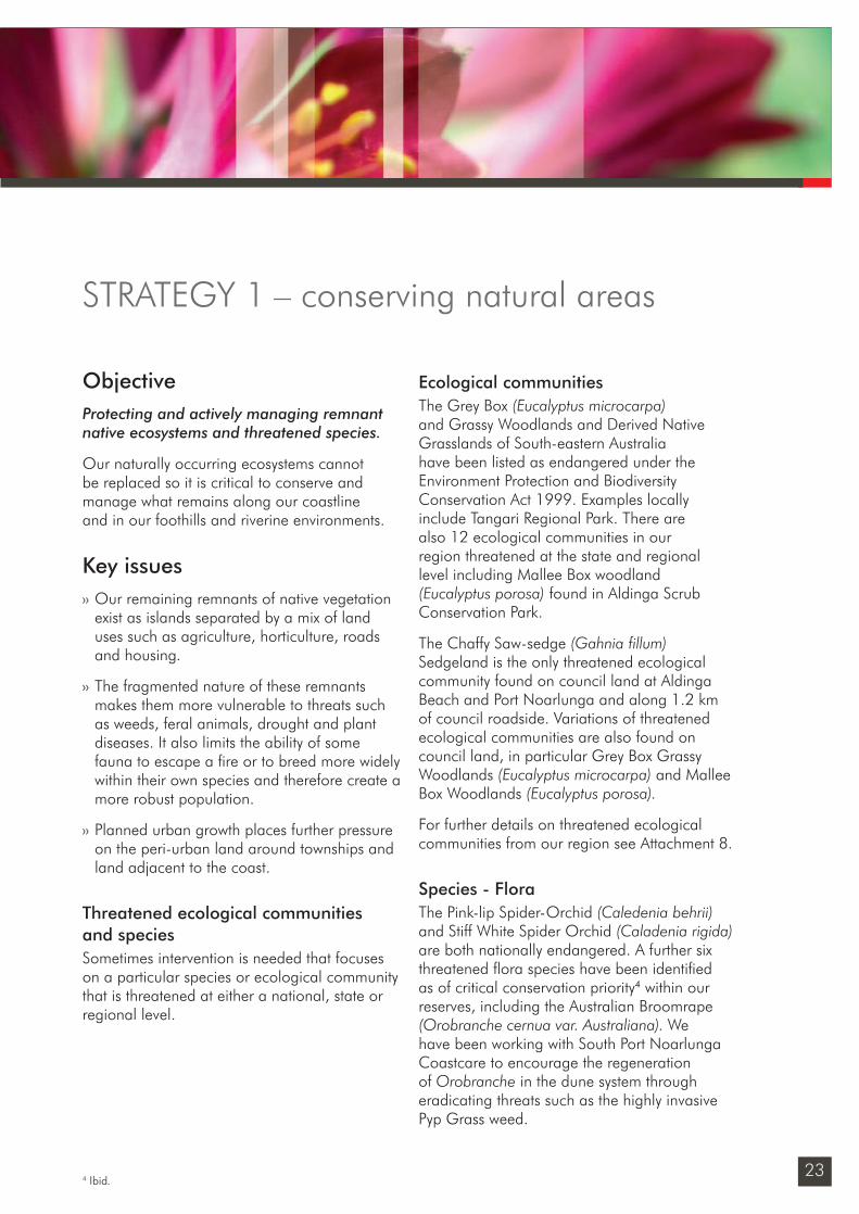
ObjectiveProtecting and actively managing remnant native ecosystems and threatened species.
Our naturally occurring ecosystems cannot be replaced so it is critical to conserve and manage what remains along our coastline and in our foothills and riverine environments.
Key issues›› Our remaining remnants of native vegetation
exist as islands separated by a mix of land uses such as agriculture, horticulture, roads and housing.
›› The fragmented nature of these remnants makes them more vulnerable to threats such as weeds, feral animals, drought and plant diseases. It also limits the ability of some fauna to escape a fi re or to breed more widely within their own species and therefore create a more robust population.
›› Planned urban growth places further pressure on the peri-urban land around townships and land adjacent to the coast.
Threatened ecological communities and speciesSometimes intervention is needed that focuses on a particular species or ecological community that is threatened at either a national, state or regional level.
Ecological communitiesThe Grey Box (Eucalyptus microcarpa) and Grassy Woodlands and Derived Native Grasslands of South-eastern Australia have been listed as endangered under the Environment Protection and Biodiversity Conservation Act 1999. Examples locally include Tangari Regional Park. There are also 12 ecological communities in our region threatened at the state and regional level including Mallee Box woodland (Eucalyptus porosa) found in Aldinga Scrub Conservation Park.
The Chaffy Saw-sedge (Gahnia fillum) Sedgeland is the only threatened ecological community found on council land at Aldinga Beach and Port Noarlunga and along 1.2 km of council roadside. Variations of threatened ecological communities are also found on council land, in particular Grey Box Grassy Woodlands (Eucalyptus microcarpa) and Mallee Box Woodlands (Eucalyptus porosa).
For further details on threatened ecological communities from our region see Attachment 8.
Species - FloraThe Pink-lip Spider-Orchid (Caledenia behrii) and Stiff White Spider Orchid (Caladenia rigida) are both nationally endangered. A further six threatened fl ora species have been identifi ed as of critical conservation priority4 within our reserves, including the Australian Broomrape (Orobranche cernua var. Australiana). We have been working with South Port Noarlunga Coastcare to encourage the regeneration of Orobranche in the dune system through eradicating threats such as the highly invasive Pyp Grass weed.
STRATEGY 1 – conserving natural areas
4 Ibid.
ThanbeBiTain MCo
Sustainability_FINAL.indd 23Sustainability_FINAL.indd 23 6/09/10 2:46 PM6/09/10 2:46 PM
24
native vegetation strategyA Community Plan 2028 initiative
Species - FaunaInformation on fauna is limited to some of the larger council reserves and anecdotal information, however a number of threatened fauna species are known to be present including the Black-chinned Honeyeater (see page 29), Southern Brown Bandicoot, Tawny Frogmouth and the Yellow-tailed Black-Cockatoo.
We will continue to:›› develop annual work plans and undertake
on-ground works within 48 reserves that contain 491 ha of remnant vegetation
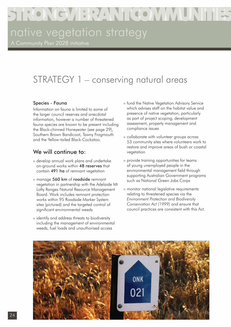
›› manage 560 km of roadside remnant vegetation in partnership with the Adelaide Mt Lofty Ranges Natural Resource Management Board. Work includes remnant protection works within 95 Roadside Marker System sites (pictured) and the targeted control of signifi cant environmental weeds
›› identify and address threats to biodiversity including the management of environmental weeds, fuel loads and unauthorised access
›› fund the Native Vegetation Advisory Service which advises staff on the habitat value and presence of native vegetation, particularly as part of project scoping, development assessment, property management and compliance issues
›› collaborate with volunteer groups across 53 community sites where volunteers work to restore and improve areas of bush or coastal vegetation
›› provide training opportunities for teams of young unemployed people in the environmental management fi eld through supporting Australian Government programs such as National Green Jobs Corps
›› monitor national legislative requirements relating to threatened species via the Environment Protection and Biodiversity Conservation Act (1999) and ensure that council practices are consistent with this Act.
STRATEGY 1 – conserving natural areas
Sustainability_FINAL.indd 24Sustainability_FINAL.indd 24 6/09/10 2:46 PM6/09/10 2:46 PM
25
Twenty (2028) Five (2014)
Desired outcome Our role Our action
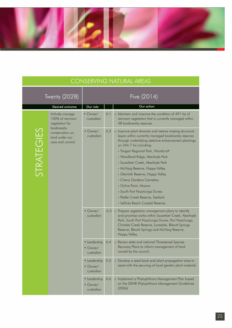
Actively manage 100% of remnant vegetation for biodiversity conservation on land under our care and control.
• Owner/custodian
›› Maintain and improve the condition of 491 ha of remnant vegetation that is currently managed within 48 biodiversity reserves.
A.1
STRA
TEG
IES
CONSERVING NATURAL AREAS
• Owner/custodian
›› Improve plant diversity and restore missing structural layers within currently managed biodiversity reserves through undertaking selective enhancement plantings on 344.7 ha including:
• Tangari Regional Park, Woodcroft
• Woodland Ridge, Aberfoyle Park
• Sauerbier Creek, Aberfoyle Park
• McHarg Reserve, Happy Valley
• Glenloth Reserve, Happy Valley
• Cherry Gardens Cemetery
• Ochre Point, Moana
• South Port Noarlunga Dunes
• Pedler Creek Reserve, Seaford
• Sellicks Beach Coastal Reserve.
A.2
›› Prepare vegetation management plans to identify and prioritise works within Sauerbier Creek, Aberfoyle Park, South Port Noarlunga Dunes, Port Noarlunga, Christies Creek Reserve, Lonsdale, Blewitt Springs Reserve, Blewitt Springs and McHarg Reserve, Happy Valley.
A.3• Owner/custodian
A.4 ›› Review state and national Threatened Species Recovery Plans to inform management of land owned by the council.
• Leadership
• Owner/custodian
• Leadership
• Owner/custodian
›› Develop a seed bank and plant propagation area to assist with the securing of local genetic plant material.
A.5
• Leadership
• Owner/custodian
›› Implement a Phytophthora Management Plan based on the DENR Phytophthora Management Guidelines (2006).
A.6
Sustainability_FINAL.indd 25Sustainability_FINAL.indd 25 6/09/10 2:46 PM6/09/10 2:46 PM
26
native vegetation strategyA Community Plan 2028 initiative
CONSERVING NATURAL AREASProtecting and actively managing remnant native ecosystems and threatened species
Twenty (2028) Five (2014)
Desired outcome Our role Our action
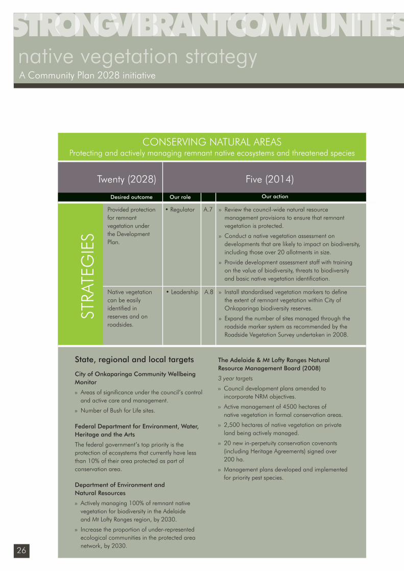
Provided protection for remnant vegetation under the Development Plan.
• Regulator ›› Review the council-wide natural resource management provisions to ensure that remnant vegetation is protected.
›› Conduct a native vegetation assessment on developments that are likely to impact on biodiversity, including those over 20 allotments in size.
›› Provide development assessment staff with training on the value of biodiversity, threats to biodiversity and basic native vegetation identifi cation.
A.7
›› Install standardised vegetation markers to defi ne the extent of remnant vegetation within City of Onkaparinga biodiversity reserves.
›› Expand the number of sites managed through the roadside marker system as recommended by the Roadside Vegetation Survey undertaken in 2008.
A.8• LeadershipNative vegetation can be easily identifi ed in reserves and on roadsides.
State, regional and local targets
City of Onkaparinga Community Wellbeing Monitor
›› Areas of signifi cance under the council’s control and active care and management.
›› Number of Bush for Life sites.
Federal Department for Environment, Water, Heritage and the Arts
The federal government’s top priority is the protection of ecosystems that currently have less than 10% of their area protected as part of conservation area.
Department of Environment and Natural Resources
›› Actively managing 100% of remnant native vegetation for biodiversity in the Adelaide and Mt Lofty Ranges region, by 2030.
›› Increase the proportion of under-represented ecological communities in the protected area network, by 2030.
The Adelaide & Mt Lofty Ranges Natural Resource Management Board (2008)
3 year targets
›› Council development plans amended to incorporate NRM objectives.
›› Active management of 4500 hectares of native vegetation in formal conservation areas.
›› 2,500 hectares of native vegetation on private land being actively managed.
›› 20 new in-perpetuity conservation covenants (including Heritage Agreements) signed over 200 ha.
›› Management plans developed and implemented for priority pest species.
STRA
TEG
IES
Sustainability_FINAL.indd 26Sustainability_FINAL.indd 26 6/09/10 2:46 PM6/09/10 2:46 PM
27
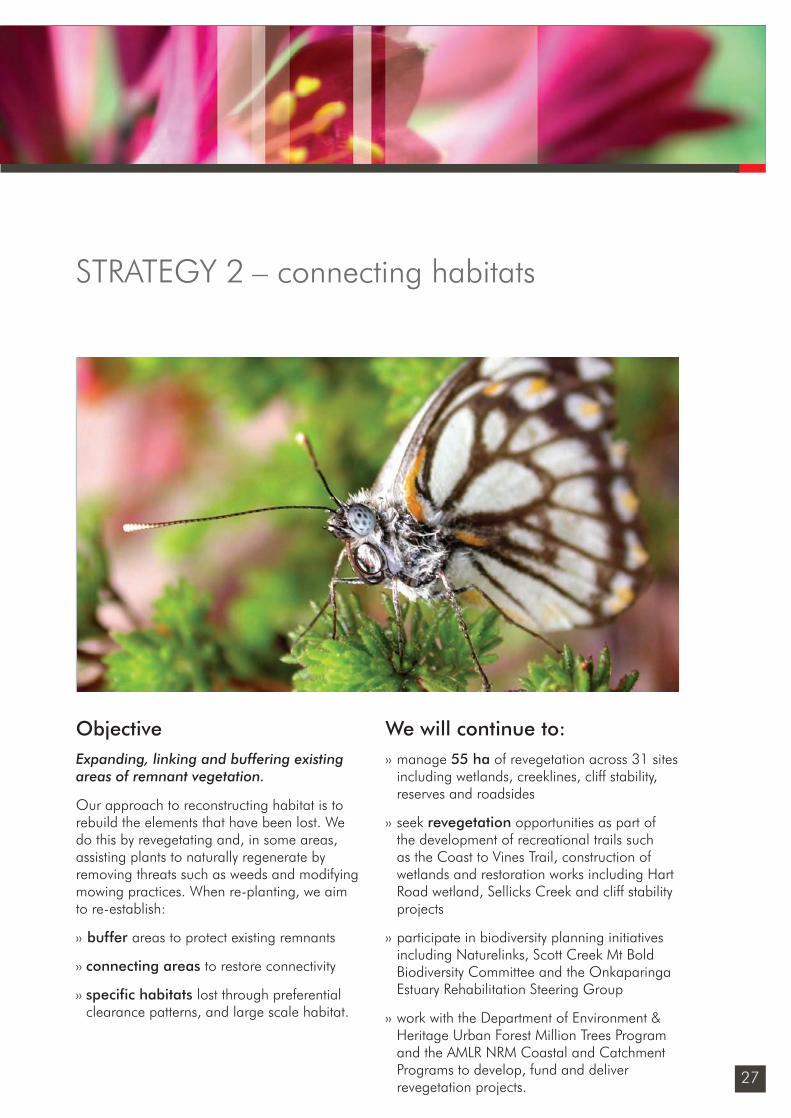
ObjectiveExpanding, linking and buffering existing areas of remnant vegetation.
Our approach to reconstructing habitat is to rebuild the elements that have been lost. We do this by revegetating and, in some areas, assisting plants to naturally regenerate by removing threats such as weeds and modifying mowing practices. When re-planting, we aim to re-establish:
›› buffer areas to protect existing remnants
›› connecting areas to restore connectivity
›› specific habitats lost through preferential clearance patterns, and large scale habitat.
We will continue to:›› manage 55 ha of revegetation across 31 sites
including wetlands, creeklines, cliff stability, reserves and roadsides
›› seek revegetation opportunities as part of the development of recreational trails such as the Coast to Vines Trail, construction of wetlands and restoration works including Hart Road wetland, Sellicks Creek and cliff stability projects
›› participate in biodiversity planning initiatives including Naturelinks, Scott Creek Mt Bold Biodiversity Committee and the Onkaparinga Estuary Rehabilitation Steering Group
›› work with the Department of Environment & Heritage Urban Forest Million Trees Program and the AMLR NRM Coastal and Catchment Programs to develop, fund and deliver revegetation projects.
STRATEGY 2 – connecting habitats
Sustainability_FINAL.indd 27Sustainability_FINAL.indd 27 6/09/10 2:46 PM6/09/10 2:46 PM
28
native vegetation strategyA Community Plan 2028 initiative
CONNECTING HABITATS
Twenty (2028) Five (2014)
Desired outcome Our role Our action
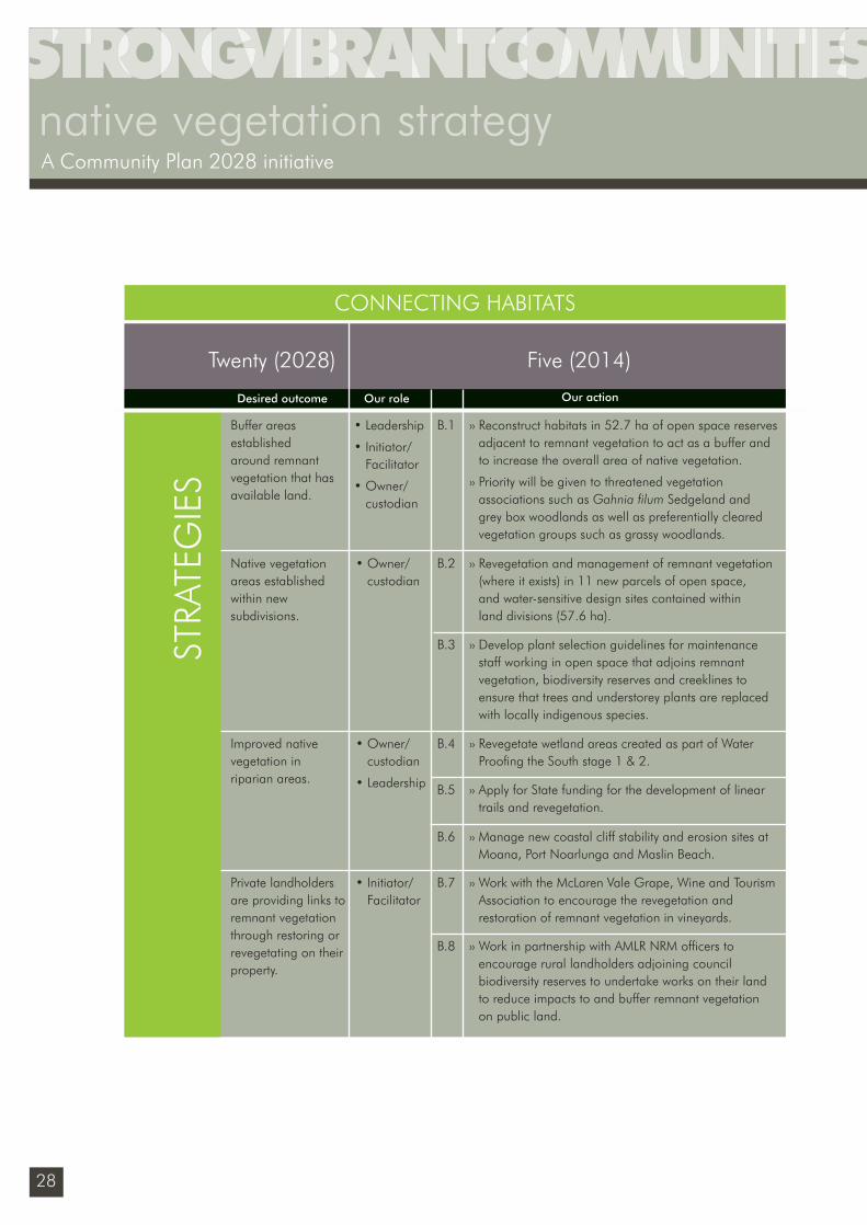
Buffer areas established around remnant vegetation that has available land.
• Leadership
• Initiator/ Facilitator
• Owner/custodian
›› Reconstruct habitats in 52.7 ha of open space reserves adjacent to remnant vegetation to act as a buffer and to increase the overall area of native vegetation.
›› Priority will be given to threatened vegetation associations such as Gahnia fi lum Sedgeland and grey box woodlands as well as preferentially cleared vegetation groups such as grassy woodlands.
B.1
• Owner/custodian
›› Revegetation and management of remnant vegetation (where it exists) in 11 new parcels of open space, and water-sensitive design sites contained within land divisions (57.6 ha).
B.2Native vegetation areas established within new subdivisions.
B.3 ›› Develop plant selection guidelines for maintenance staff working in open space that adjoins remnant vegetation, biodiversity reserves and creeklines to ensure that trees and understorey plants are replaced with locally indigenous species.
• Owner/custodian
• Leadership
›› Revegetate wetland areas created as part of Water Proofi ng the South stage 1 & 2.
B.4Improved native vegetation in riparian areas.
›› Apply for State funding for the development of linear trails and revegetation.
B.5
›› Manage new coastal cliff stability and erosion sites at Moana, Port Noarlunga and Maslin Beach.
B.6
• Initiator/ Facilitator
›› Work with the McLaren Vale Grape, Wine and Tourism Association to encourage the revegetation and restoration of remnant vegetation in vineyards.
B.7Private landholders are providing links to remnant vegetation through restoring or revegetating on their property.
›› Work in partnership with AMLR NRM offi cers to encourage rural landholders adjoining council biodiversity reserves to undertake works on their land to reduce impacts to and buffer remnant vegetation on public land.
B.8
STRA
TEG
IES
Sustainability_FINAL.indd 28Sustainability_FINAL.indd 28 6/09/10 2:46 PM6/09/10 2:46 PM
29
CONNECTING HABITATS
State, regional and local targets
State Strategic Plan
By 2010 have fi ve well-established biodiversity corridors aimed at maximising ecological outcomes particularly in the face of climate change
30 Year Plan for Greater Adelaide
›› Increase the extent of functional ecosystems (coastal, estuarine, terrestrial and riparian) to 30% of the region, excluding urban areas.
›› Develop waterway linear parks along Pedler Creek, Onkaparinga River, Port Willunga Creek, Christies Creek and Field River by 2036.
›› Developing a coastal linear park from Sellicks Beach to North Haven by 2020.
Department of Environment and Natural Resources
Conservation targets for the Adelaide and Mt Lofty Ranges region:
›› An increase in the extent of native vegetation cover in the AMLR. This will be achieved through reconstruction of over 54,000 ha of native vegetation by 2030, in accordance with defi ned restoration priorities for each landscape of the AMLR. This will increase the native cover of the region from 13% to 19%.
The Adelaide and Mt Lofty Region Natural Resource Management Board
3 year target: 440 hectares of functional ecosystems reconstructed in priority areas.
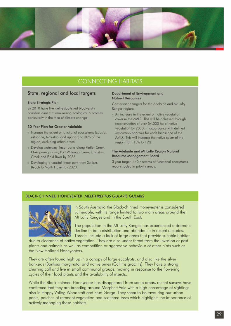
In South Australia the Black-chinned Honeyeater is considered vulnerable, with its range limited to two main areas around the Mt Lofty Ranges and in the South East.
The population in the Mt Lofty Ranges has experienced a dramatic decline in both distribution and abundance in recent decades. Threats include a lack of large areas that provide suitable habitat
due to clearance of native vegetation. They are also under threat from the invasion of pest plants and animals as well as competition or aggressive behaviour of other birds such as the New Holland Honeyeaters.
They are often found high up in a canopy of large eucalypts, and also like the silver banksias (Banksia marginata) and native pines (Callitris gracillis). They have a strong churring call and live in small communal groups, moving in response to the fl owering cycles of their food plants and the availability of insects.
While the Black-chinned Honeyeater has disappeared from some areas, recent surveys have confi rmed that they are breeding around Morphett Vale with a high percentage of sightings also in Happy Valley, Woodcroft and Sturt Gorge. They seem to be favouring our urban parks, patches of remnant vegetation and scattered trees which highlights the importance of actively managing these habitats.
BLACK-CHINNED HONEYEATER MELITHREPTUS GULARIS GULARIS
Sustainability_FINAL.indd 29Sustainability_FINAL.indd 29 6/09/10 2:46 PM6/09/10 2:46 PM
30
native vegetation strategyA Community Plan 2028 initiative
ObjectiveEnabling species to adapt to a changing environment and sequestering carbon.
Key issues›› In biological terms, the Adelaide and Mt
Lofty Ranges region is considered a relatively isolated cool and humid temperate island, and there is evidence that such areas are highly vulnerable to rapid environmental change.
›› There is an urgent need for a better understanding of the climate change impacts, risks and vulnerabilities of our region in relation to how our fl ora, fauna and ecological communities will adapt to this change. Current threats to biodiversity such as habit fragmentation, weed infestation, urbanisation, drought and fi re will be compounded by changes in temperature and rainfall in ways we do not currently understand.
Carbon sinks›› Revegetating land, forestry or growing
crops is a means of storing carbon, sometimes referred to as biosequestration or carbon sinks.
›› In South Australia a strong trend in large scale biosequestration in land use change and forestry has meant that the natural resource sector (including agriculture) has gone from being a net emitter of greenhouse gas emissions (1.67 million tonnes CO2e in 1990) to a signifi cant sink in (3.2 million tonnes CO2e sink in 2002). An increase in commercial forest plantations and revegetation activities has contributed to this trend.
›› While growing trees and other vegetation can reduce carbon, the primary carbon reduction goals of the City of Onkaparinga are to reduce energy use and increase the use of renewable energy. However, if multiple local benefi ts can be achieved through large plantings such as increased biodiversity, reduced erosion, recreational opportunities and increased amenity, then carbon sinks remain an important initiative to pursue.
We will continue to:›› monitor scientifi c research about climate
change projections and impacts
›› implement works on the foreshore to mitigate erosion and gullying impacts as an outcome of the Climate Change Impacts on Coastal Lands Report (2007)
›› implement the Climate Change Strategy.
STRATEGY 3 – responding to climate change
Sustainability_FINAL.indd 30Sustainability_FINAL.indd 30 6/09/10 2:46 PM6/09/10 2:46 PM
31
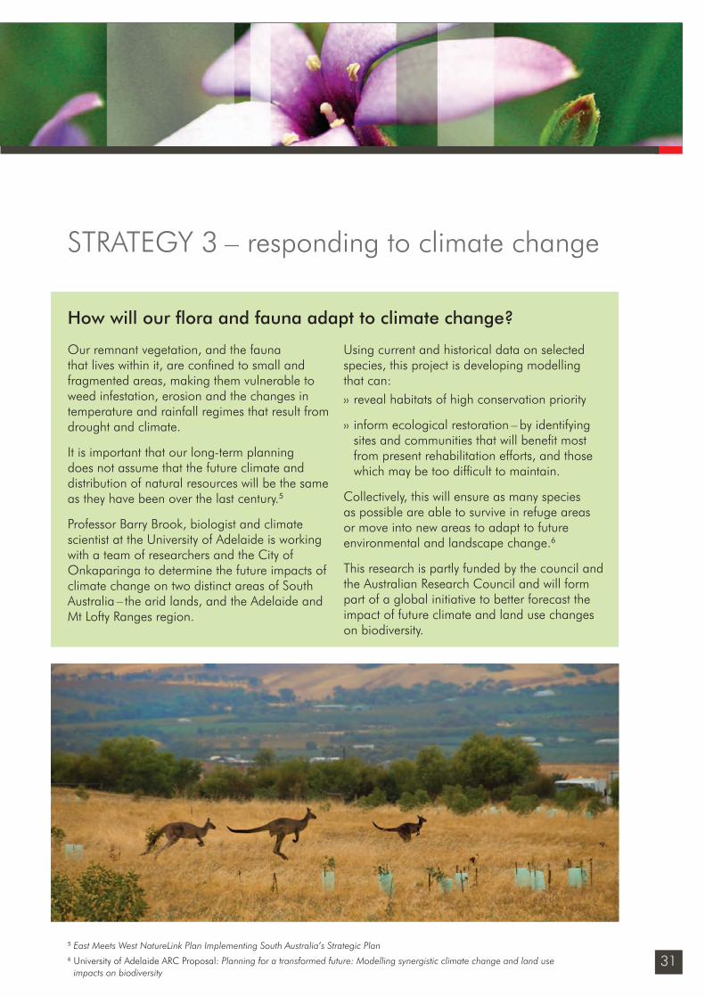
Our remnant vegetation, and the fauna that lives within it, are confi ned to small and fragmented areas, making them vulnerable to weed infestation, erosion and the changes in temperature and rainfall regimes that result from drought and climate.
It is important that our long-term planning does not assume that the future climate and distribution of natural resources will be the same as they have been over the last century.5
Professor Barry Brook, biologist and climate scientist at the University of Adelaide is working with a team of researchers and the City of Onkaparinga to determine the future impacts of climate change on two distinct areas of South Australia – the arid lands, and the Adelaide and Mt Lofty Ranges region.
Using current and historical data on selected species, this project is developing modelling that can:›› reveal habitats of high conservation priority
›› inform ecological restoration – by identifying sites and communities that will benefi t most from present rehabilitation efforts, and those which may be too diffi cult to maintain.
Collectively, this will ensure as many species as possible are able to survive in refuge areas or move into new areas to adapt to future environmental and landscape change.6
This research is partly funded by the council and the Australian Research Council and will form part of a global initiative to better forecast the impact of future climate and land use changes on biodiversity.
STRATEGY 3 – responding to climate change
5 East Meets West NatureLink Plan Implementing South Australia’s Strategic Plan6 University of Adelaide ARC Proposal: Planning for a transformed future: Modelling synergistic climate change and land use
impacts on biodiversity
How will our fl ora and fauna adapt to climate change?
Sustainability_FINAL.indd 31Sustainability_FINAL.indd 31 6/09/10 2:46 PM6/09/10 2:46 PM
32
native vegetation strategyA Community Plan 2028 initiative
Twenty (2028) Five (2014)
Desired outcome Our role Our action
An increase in the resilience of our ecosystems and species to adapt to climate change.
• Leadership
• Part Funder
›› Identify the adaptation needs of keystone fl ora and fauna species and the implications for land use and biodiversity planning in cooperation with Adelaide University.
C.1
›› To develop a local biodiversity planting program that combines biodiversity and carbon sequestration outcomes and meets accreditation standards.
C.2• LeadershipA carbon offset program operating that delivers local biodiversity benefi ts.
State, regional and local targets
State Strategic Plan
›› Achieve the Kyoto target by limiting the state’s greenhouse gas emissions to 108% of 1990 levels during 2008 –12, as a fi rst step towards reducing emissions by 60% by 2050.
Department of Environment and Natural Resources
›› NatureLinks target of ‘have fi ve well established biodiversity corridors aimed at maximising ecological outcomes particularly in the face of climate change, by 2010’
STRA
TEG
IES
RESPONDING TO CLIMATE CHANGE
Sustainability_FINAL.indd 32Sustainability_FINAL.indd 32 6/09/10 2:46 PM6/09/10 2:46 PM
33
STRATEGY 4 – integrating fi re risk managementObjectiveIntegrating fi re risk management with biodiversity outcomes.
Key issues›› Community perception has been heightened
to the potential danger of vegetation close to property. Requests to the council for vegetation clearance have tripled in the 2009/10 fi re season.
›› The risk to property and life in the event of a bushfi re is very real for residents living in a bushfi re zone. We seek to minimise the risk of fi re in two main ways–to reduce fuel load on its own land, and to advise residents of fuel reduction strategies on their own properties. The council also has the authorisation to issue fi nes to landowners if properties are not adequately maintained to reduce fi re risk, however the Country Fire Service is the primary agency responsible for fi re management, community education and fi re ban advice.
›› In the wake of the Black Saturday Royal Commission, there have been changes to the state legislation that governs vegetation clearance.
›› A property owner can now reduce, modify or remove any native vegetation within 20m of a prescribed building without approval.7,8 Clearance beyond 20m of a prescribed building is also allowed subject to the written
approval of the CFS Chief Offi cer, and this area could exceed 50m depending on the fuel type and slope.
›› While the changes to the Native Vegetation Act ‘allow’ clearing however they do not require clearing.
›› While the term ‘clearance’ is often thought to be the removal of all vegetation, the intent of the legislation is to minimise fi re risk by reducing the fuel load. This can be done by various techniques including the selective removal of native vegetation, the eradication of woody or grassy weeds, or the selective removal of low tree limbs.
We will continue to:›› focus on the reduction of grassy and woody
weeds (including olives and boneseed) to encourage the regeneration of biodiversity and the reduction of fi re risk
›› ensure that a 20 metre ‘clearance’ is included around housing and public facilities in new housing areas. This may include roads, grassed areas or other barriers to fi re.
7 Prescribed building – permanently fi xed to the ground, has obtained development consent, may be in the course of construction, dwellings, hotels, motels, schools, offi ce buildings, shops, restaurants, service stations, storage buildings, laboratories, factories, hospitals, private garages, carports and sheds.
8 The exception is the clearance of a Signifi cant Tree (Regulations under the Development Act) which still requires approval from the council.
Sustainability_FINAL.indd 33Sustainability_FINAL.indd 33 6/09/10 2:46 PM6/09/10 2:46 PM
34
native vegetation strategyA Community Plan 2028 initiative
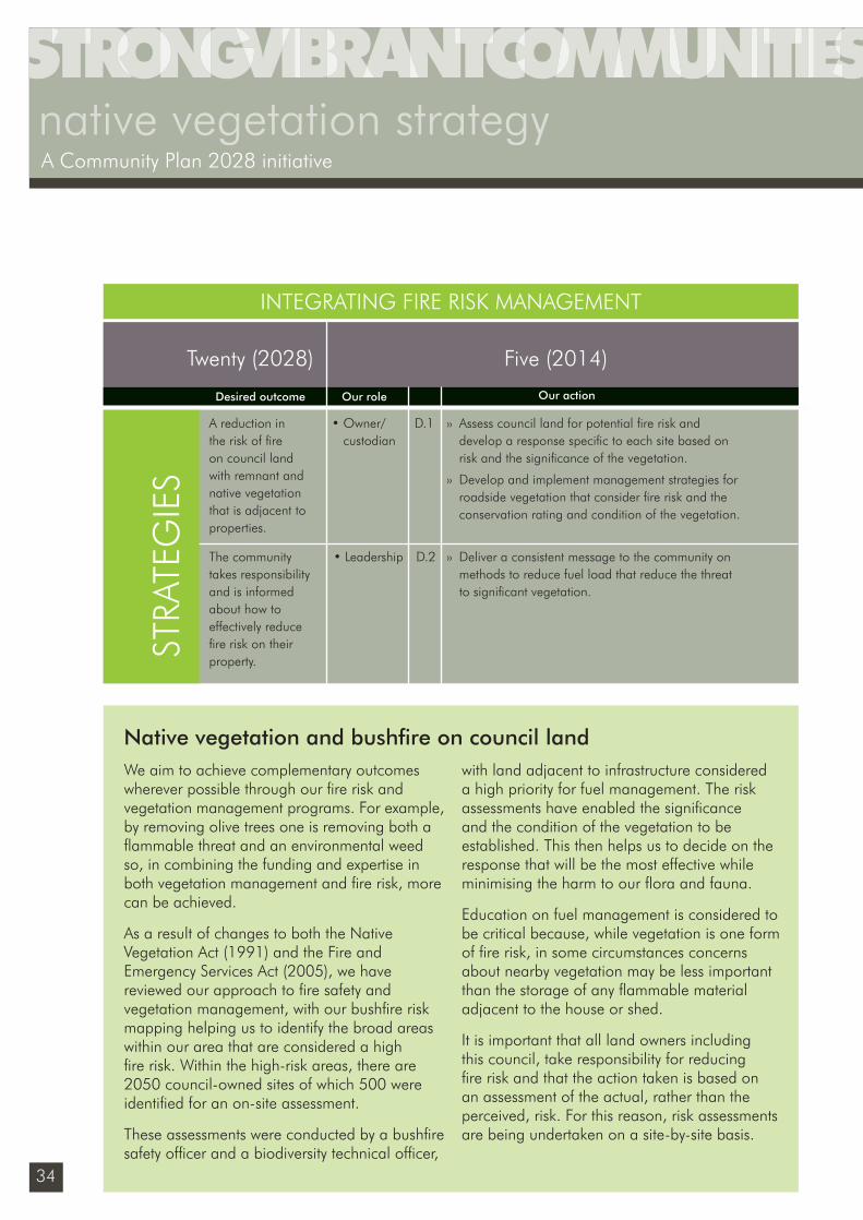
We aim to achieve complementary outcomes wherever possible through our fi re risk and vegetation management programs. For example, by removing olive trees one is removing both a fl ammable threat and an environmental weed so, in combining the funding and expertise in both vegetation management and fi re risk, more can be achieved.
As a result of changes to both the Native Vegetation Act (1991) and the Fire and Emergency Services Act (2005), we have reviewed our approach to fi re safety and vegetation management, with our bushfi re risk mapping helping us to identify the broad areas within our area that are considered a high fi re risk. Within the high-risk areas, there are 2050 council-owned sites of which 500 were identifi ed for an on-site assessment.
These assessments were conducted by a bushfi re safety offi cer and a biodiversity technical offi cer,
with land adjacent to infrastructure considered a high priority for fuel management. The risk assessments have enabled the signifi cance and the condition of the vegetation to be established. This then helps us to decide on the response that will be the most effective while minimising the harm to our fl ora and fauna.
Education on fuel management is considered to be critical because, while vegetation is one form of fi re risk, in some circumstances concerns about nearby vegetation may be less important than the storage of any fl ammable material adjacent to the house or shed.
It is important that all land owners including this council, take responsibility for reducing fi re risk and that the action taken is based on an assessment of the actual, rather than the perceived, risk. For this reason, risk assessments are being undertaken on a site-by-site basis.
Twenty (2028) Five (2014)
Desired outcome Our role Our action
A reduction in the risk of fi re on council land with remnant and native vegetation that is adjacent to properties.
• Owner/ custodian
›› Assess council land for potential fi re risk and develop a response specifi c to each site based on risk and the signifi cance of the vegetation.
›› Develop and implement management strategies for roadside vegetation that consider fi re risk and the conservation rating and condition of the vegetation.
D.1
›› Deliver a consistent message to the community on methods to reduce fuel load that reduce the threat to signifi cant vegetation.
D.2• LeadershipThe community takes responsibility and is informed about how to effectively reduce fi re risk on their property.
INTEGRATING FIRE RISK MANAGEMENT
Native vegetation and bushfi re on council land
STRA
TEG
IES
Sustainability_FINAL.indd 34Sustainability_FINAL.indd 34 6/09/10 2:46 PM6/09/10 2:46 PM
35
ObjectiveIntegrating natural areas into urban open spaces
Natural environments provide an opportunity to maintain our natural heritage, and a space where people can interact with, and receive the benefi ts from nature. As the pressure for urbanisation continues and higher density developments are encouraged in some parts of the city, the provision of green space and nature experiences becomes of even greater importance.
By developing pockets of nature in Adelaide’s parks and gardens we can achieve multiple benefi ts – conserving biodiversity, reducing water consumption, enabling enjoyment from interacting with nature and importantly, developing a local sense of place.
Key issues›› An estimated 97.3% of the pre-European
settlement vegetation of the Adelaide Plains has been removed as our urban area has expanded. Of the vegetation that remains, 75% of it consists of mangroves and coastal samphire communities.9
›› Before this development and clearing, the Adelaide Plains supported 21 vegetation types ranging from open forests and woodlands to coastal dunes and salt marshes.
›› Over 725 species of native plants and 177 species of bird are known to have occurred across Adelaide with 140 (19%) now locally extinct and another 393 (54%) rare or threatened.
›› Much of our current urban fl ora and fauna is introduced species. Apart from birds, native animals are rare in our suburbs. A few such as brush-tailed possums, blue-tongued and shingle-back lizards, geckos and the occasional brown snake have adapted to urban life. However many of the original plant and animal species are no longer found, or only occur in much smaller and fragmented populations.10
›› South Australia is the most suburbanised state in Australia with approximately 80% of people living in metropolitan Adelaide.
Parks and open space provide an accessible alternative for interaction with nature and a landscape in which the natural heritage of the plains can be restored.11
Our public spaces are subject to many competing needs other than revegetation, including formal or informal sports fi elds, picnic areas, events, bike paths and public buildings.
The integration of nature into the design of parks needs to consider these activities as part of the design.
STRATEGY 5 – improving urban biodiversity
9 Urban Biodiversity Unit for the Dept of Heritage, A biodiversity investment plan for urban Adelaide 2008 – 201110 Urban Biodiversity Unit website: Backyards for Wildlife11 Dreschler Z in Daniels C, Tait C Adelaide Nature of a City: the ecology of a dynamic city from 1836 to 2036
Sustainability_FINAL.indd 35Sustainability_FINAL.indd 35 6/09/10 2:46 PM6/09/10 2:46 PM
36
native vegetation strategyA Community Plan 2028 initiative
Twenty (2028) Five (2014)
Desired outcome Our role Our action
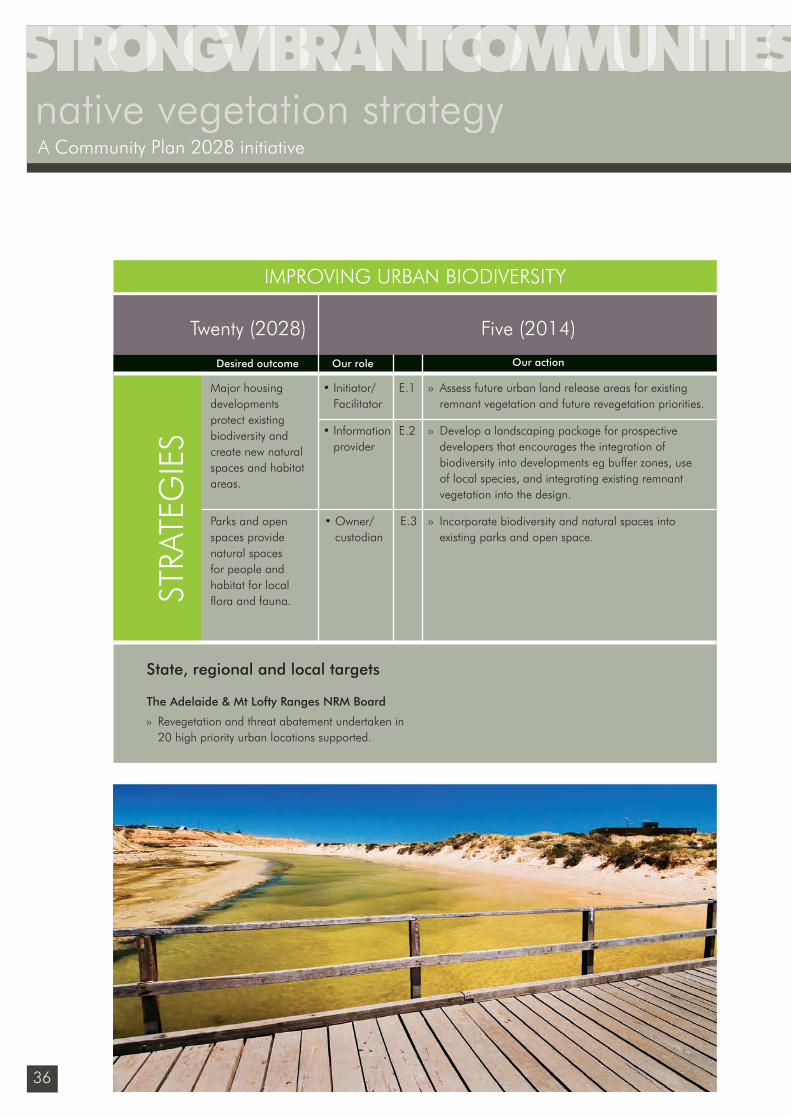
Major housing developments protect existing biodiversity and create new natural spaces and habitat areas.
• Initiator/ Facilitator
›› Assess future urban land release areas for existing remnant vegetation and future revegetation priorities.
E.1
›› Incorporate biodiversity and natural spaces into existing parks and open space.
E.3• Owner/ custodian
Parks and open spaces provide natural spaces for people and habitat for local fl ora and fauna.ST
RATE
GIE
S
IMPROVING URBAN BIODIVERSITY
• Information provider
›› Develop a landscaping package for prospective developers that encourages the integration of biodiversity into developments eg buffer zones, use of local species, and integrating existing remnant vegetation into the design.
E.2
State, regional and local targets
The Adelaide & Mt Lofty Ranges NRM Board
›› Revegetation and threat abatement undertaken in 20 high priority urban locations supported.
Sustainability_FINAL.indd 36Sustainability_FINAL.indd 36 6/09/10 2:46 PM6/09/10 2:46 PM
Sustainability_FINAL.indd 37Sustainability_FINAL.indd 37 6/09/10 2:46 PM6/09/10 2:46 PM
38
native vegetation strategyA Community Plan 2028 initiative
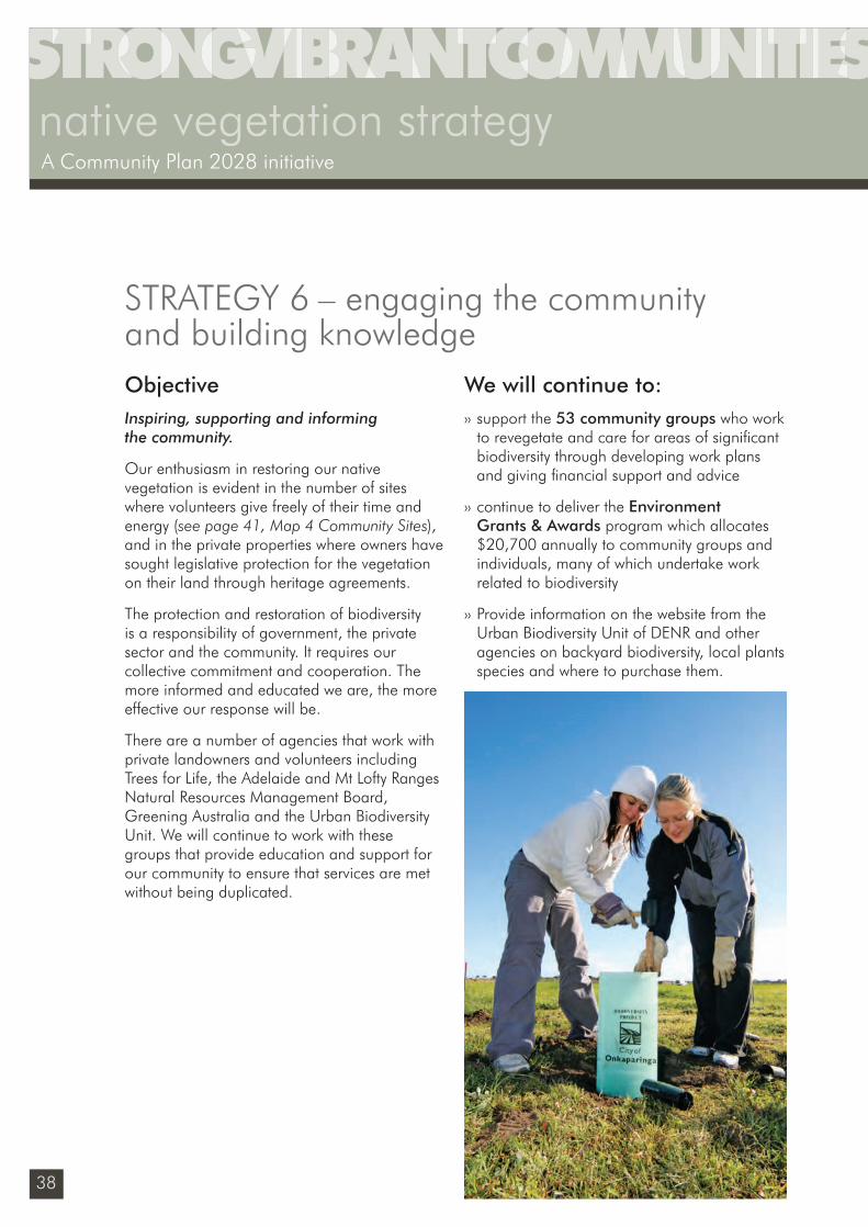
ObjectiveInspiring, supporting and informing the community.
Our enthusiasm in restoring our native vegetation is evident in the number of sites where volunteers give freely of their time and energy (see page 41, Map 4 Community Sites), and in the private properties where owners have sought legislative protection for the vegetation on their land through heritage agreements.
The protection and restoration of biodiversity is a responsibility of government, the private sector and the community. It requires our collective commitment and cooperation. The more informed and educated we are, the more effective our response will be.
There are a number of agencies that work with private landowners and volunteers including Trees for Life, the Adelaide and Mt Lofty Ranges Natural Resources Management Board, Greening Australia and the Urban Biodiversity Unit. We will continue to work with these groups that provide education and support for our community to ensure that services are met without being duplicated.
We will continue to:›› support the 53 community groups who work
to revegetate and care for areas of signifi cant biodiversity through developing work plans and giving fi nancial support and advice
›› continue to deliver the Environment Grants & Awards program which allocates $20,700 annually to community groups and individuals, many of which undertake work related to biodiversity
›› Provide information on the website from the Urban Biodiversity Unit of DENR and other agencies on backyard biodiversity, local plants species and where to purchase them.
STRATEGY 6 – engaging the community and building knowledge
Sustainability_FINAL.indd 38Sustainability_FINAL.indd 38 6/09/10 2:46 PM6/09/10 2:46 PM
39
ENGAGING THE COMMUNITY AND BUILDING KNOWLEDGE
Twenty (2028) Five (2014)
Desired outcome Our role Our action
The community is aware of the signifi cance of local plants and areas of habitat, the threats that they can help alleviate, and how to get involved in local groups.
• Information provider
• Initiator/ Facilitator
›› Operate bus tours of signifi cant biodiversity project sites
›› Engage local groups and residents and include biodiversity information in the annual Sustainable Living Expo.
F.1
STRA
TEG
IES
• Information provider
›› Identify private landholders with property in or adjacent to areas of biodiversity signifi cance. Work with the AMLR NRM Board to alleviate threats on their property and contribute to buffering or connecting vegetation.
F.3Private landholders are creating buffers or providing habitat areas that connect existing patches of vegetation.
• Leadership ›› Ensure native vegetation and fauna data is captured through fi eld assessments, planning, site visits, surveys, photos and opportunistic sightings.
F.5The condition and state of biodiversity is known.
›› Design, establish and promote locally indigenous gardens on suitable council land, in particular at community centres and libraries.
F.2
• Leadership
• Information provider
›› Develop and promote a digital information system that provides data on fl ora and fauna on council land to agencies and the community.
F.4Information on the condition and state of biodiversity is shared between groups.
State, regional and local targets
AMLR NRM 3 year target
›› An increase in the number of people who volunteer to improve the management of our natural resources.
Sustainability_FINAL.indd 39Sustainability_FINAL.indd 39 6/09/10 2:46 PM6/09/10 2:46 PM
40
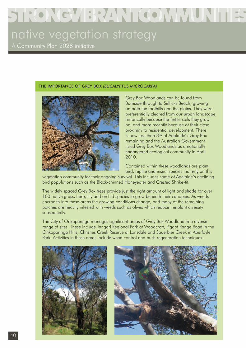
Grey Box Woodlands can be found from Burnside through to Sellicks Beach, growing on both the foothills and the plains. They were preferentially cleared from our urban landscape historically because the fertile soils they grow on, and more recently because of their close proximity to residential development. There is now less than 8% of Adelaide’s Grey Box remaining and the Australian Government listed Grey Box Woodlands as a nationally endangered ecological community in April 2010.
Contained within these woodlands are plant, bird, reptile and insect species that rely on this
vegetation community for their ongoing survival. This includes some of Adelaide’s declining bird populations such as the Black-chinned Honeyeater and Crested Shrike-tit.
The widely spaced Grey Box trees provide just the right amount of light and shade for over 100 native grass, herb, lily and orchid species to grow beneath their canopies. As weeds encroach into these areas the growing conditions change, and many of the remaining patches are heavily infested with weeds such as olives which reduce the plant diversity substantially.
The City of Onkaparinga manages signifi cant areas of Grey Box Woodland in a diverse range of sites. These include Tangari Regional Park at Woodcroft, Piggot Range Road in the Onkaparinga Hills, Christies Creek Reserve at Lonsdale and Sauerbier Creek in Aberfoyle Park. Activities in these areas include weed control and bush regeneration techniques.
THE IMPORTANCE OF GREY BOX (EUCALYPTUS MICROCARPA)
native vegetation strategyA Community Plan 2028 initiative
Sustainability_FINAL.indd 40Sustainability_FINAL.indd 40 6/09/10 2:46 PM6/09/10 2:46 PM
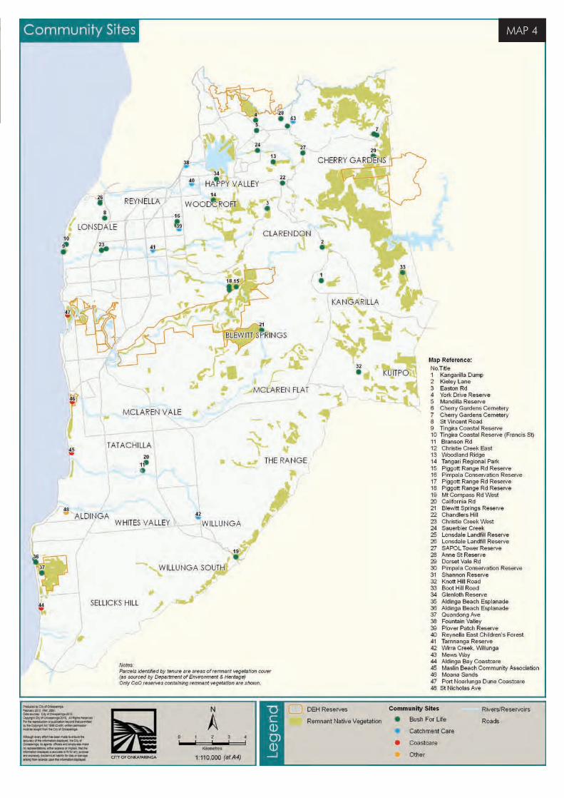
MAP 4
Sustainability_FINAL.indd 41Sustainability_FINAL.indd 41 6/09/10 2:46 PM6/09/10 2:46 PM
42
native vegetation strategyA Community Plan 2028 initiative
Active management is on-ground management undertaken at a level suffi cient to achieve the defi ned goals for improving the condition of biodiversity of a site or a wider area.
Biodiversity refers to the variability among living organisms from all sources (including terrestrial, marine and other aquatic ecosystems and the ecological complexes of which they are part) and includes diversity within species and between species and diversity of ecosystems.
Biosequestation is the process of capturing and storing carbon in living organisms such as plants and algae.
Buffers are areas that directly surround patches of vegetation and are often revegetated.
Carbon sequestration refers to the process of removing carbon dioxide from the atmosphere and storing it in another location (called a carbon sink).
Carbon sinks are natural or man-made means of storing carbon and include forestry and other plantations.
Coastal vegetation is found along cliffs and dunes and in sheltered tidal zones. These plants have adapted to tolerate wind, salt, sandy soils and eroded cliff-tops.
Connecting areas refers to areas between fragments or patches.
Connectivity is the location and spatial distribution of natural areas in the landscape that will allow species and populations to access food, breeding sites and shelter, increase habitat availability and facilitate dispersal and migration, and enable ecological processes
to occur such as evolution, water movement and fi re.
In fragmented landscapes, connectivity is most likely to occur where there are a series of close habitat areas arranged like ‘stepping stones’.
Conservation clusters are multi-property sites that are actively managed for biodiversity. Sites encompass private and public lands and provide a buffer around protected areas such as conservation zones.
Ecological communities are a group of species that interact with each other and are adapted to particular conditions of soil, topography, water availability and climate. These communities need all of their different components to survive.
Ecosystems are a biological community of interacting organisms and their physical environment.
Exotic species are introduced species from outside of Australia.
Fragments are restricted areas of habitat within a variety of other land uses.
Grassy Woodland is typically dominated by scattered eucalypts with an abundance of grasses, sedges, scattered shrubs and herbaceous species such as daisies and lilies. The tree density is variable but, with around 30 trees per hectare, there are open areas without a canopy. In higher rainfall areas tree density may be higher, resulting in woodlands that resemble forests. Grassy Woodlands contain a very high diversity of native plant species, which is particularly noticeable in spring when wildfl owers emerge from between tussocks of grass.
GLOSSARY12
12 No Species Loss, a Nature Conservation Strategy for South Australia 2007-2017, Caring for Country Business Plan 2010/2011, Regional Recovery Plan 2009-2014 for threatened species and ecological communities of Adelaide and the Mt Lofty Ranges of SA, Native Vegetation Act (1999), EPBC Act (1999).
Sustainability_FINAL.indd 42Sustainability_FINAL.indd 42 6/09/10 2:46 PM6/09/10 2:46 PM
43
Heathy Woodland has a dense understorey and mid-storey of low small-leaved shrubs. Most Heathy Woodland is dominated by eucalypts (often stringybarks), although some is dominated by native pines.
Indigenous species are locally naturally occurring species that are genetically distinct.
Keystone species are species that play a critical role in maintaining the structure of an ecological community and whose impact on the community is greater than that which would be expected based on their number.
Landscape scale refers to planning, implementation or reporting which incorporates areas larger than individual sites, properties or habitats, and often includes a mix of different vegetation types and landforms ranging across several sub-catchments or environmental areas.
Landscape scale projects involve groups of landholders which support the development of biodiversity conservation plans and management arrangements across their properties.
Local provenance plants are grown from seed that is collected from plants growing near the planting site in similar environmental situations. Planting local provenance plants increases the success of revegetation projects, as the plants are genetically adapted to local conditions and the risk of disrupting the local fl ora gene pool is minimised.
Native vegetation is defi ned by the Native Vegetation Act as a plant of a species indigenous to South Australia. This covers the full range of naturally occurring native plants, from tall trees to small ground covers, native grasses, wetland plants such as reeds and rushes, and marine plants. The plants may comprise natural bushland or they may be
isolated plants in a modifi ed setting, such as single trees in pastured paddocks.
Passive recreation areas are generally open spaces that have minimal development and allow unstructured or informal activities to occur.
Patches are areas of least modifi ed habitat surrounded by more modifi ed habitat.
Relictual landscapes have been extensively cleared and heavily modifi ed, and have less than 10% of pre-European vegetation remaining.
Reconstruction of habitat or ecosystems using revegetation and/or assisted regeneration. This could include the re-establishment of buffers to protect existing remnants, the re-establishment of corridors to restore connectivity, the re-establishment of specifi c habitats lost through preferential clearance patterns, and large-scale habitat re-establishment.
Remnant vegetation refers to small areas of native plant communities around which most or all of the original native vegetation has been cleared. These remnants are a valuable refuge and habitat corridor for native plants and animals. Remnant trees are isolated native trees that can form important habitat, particularly for their breeding and nesting hollows.
Resilience is the capacity of an ecosystem to tolerate disturbance without collapsing into a qualitatively different state. A resilient ecosystem can withstand shocks and rebuild itself when necessary.
Riparian vegetation is found along water-courses and on fl ood plains and usually refl ects the better soils and moist conditions that are found in these lower parts of the landscape. In the City of Onkaparinga, the steeper slopes and ridges of the foothills are dominated by tall
GLOSSARY
Sustainability_FINAL.indd 43Sustainability_FINAL.indd 43 6/09/10 2:46 PM6/09/10 2:46 PM
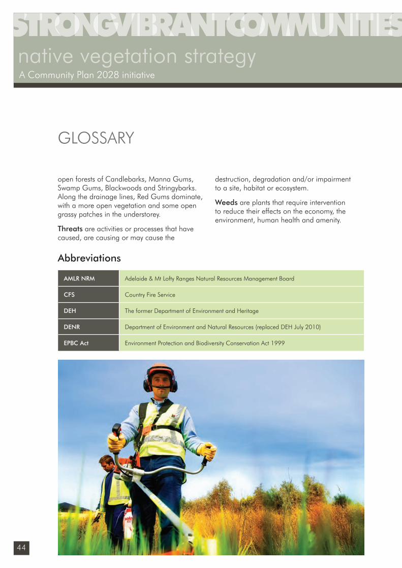
44
native vegetation strategyA Community Plan 2028 initiative
open forests of Candlebarks, Manna Gums, Swamp Gums, Blackwoods and Stringybarks. Along the drainage lines, Red Gums dominate, with a more open vegetation and some open grassy patches in the understorey.
Threats are activities or processes that have caused, are causing or may cause the
destruction, degradation and/or impairment to a site, habitat or ecosystem.
Weeds are plants that require intervention to reduce their effects on the economy, the environment, human health and amenity.
GLOSSARY
Abbreviations
AMLR NRM Adelaide & Mt Lofty Ranges Natural Resources Management Board
CFS Country Fire Service
DEH The former Department of Environment and Heritage
DENR Department of Environment and Natural Resources (replaced DEH July 2010)
EPBC Act Environment Protection and Biodiversity Conservation Act 1999
Sustainability_FINAL.indd 44Sustainability_FINAL.indd 44 6/09/10 2:46 PM6/09/10 2:46 PM
45
Adelaide and Mount Lofty Ranges Natural Resources Management Board (2008). Creating A Sustainable Future. An Integrated Natural Resources Management Plan for the Adelaide and Mount Lofty Ranges Region, Vol A.
Adelaide and Mount Lofty Ranges Natural Resources Management Board (2009). Metropolitan Adelaide and Northern Coastal Action Plan
Australian Museum (December 2009) What is Biodiversity? australianmuseum.net.au/2010-International-Year-of-Biodiversity
Byron Shire Council (2004) Byron Biodiversity Conservation Strategy
City of Burnside Biodiversity Strategy: Nature Conservation in an urbanised landscape
City of Joondalup Biodiversity Action Plan 2009-2019
City of Onkaparinga Climate Change Discussion Paper
City of Onkaparinga website, Environment Profi le: Pre-European Flora and Fauna http://www.onkaparingacity.com/environment/european.asp
Daniels C, Tait C Adelaide Nature of a City: the ecology of a dynamic city from 1836 to 2036
Department of Water, Land and Biodiversity Conservation (2006). State Natural Resources Management Plan 2006.
Department for Environment and Heritage Informing Biodiversity Conservation for Adelaide and the Mount Lofty Ranges SA: priorities, strategies and targets
Department for Environment and Heritage (2008) No Species Loss, A Nature Conservation Strategy for South Australia 2007-2017
Department for Environment and Heritage (June 2009) Regional Recovery Plan 2009-2014 for threatened species and ecological communities
of Adelaide and the Mt Lofty Ranges of SA
Department for Environment and Heritage (2009) East Meets West Plan: Naturelinks
Department of Environment Land & Water Biodiversity State of the Environment 2006: Theme commentary; Steven Cork, Land & Water Australia and CSIRO
http://www.environment.gov.au/soe/2006/publications/commentaries/biodiversity/utilisation.html
Department of the Environment, Water, Heritage and the Arts: Biodiversity http://www.environment.gov.au/biodiversity/hotspots/index.html
Department of Planning and Local Government (2009) 30 Year Plan for Greater Adelaide
Department Water Land Biodiversity (Feb 2009) Management of Native Vegetation to Reduce the Impact of Bushfire
Environment Protection Authority (2008) State of the Environment Report
Government of South Australia (2007) East Meets West NatureLink Plan
Shire of Yarra Ranges (2008) Environment Strategy Policy Directions
South Australian Government, South Australia’s Strategic Plan.
Urban Biodiversity Unit website: Backyards for Wildlife http://www.backyards4wildlife.com.au/index.php?page=adelaide-s-biodiversity
Urban Biodiversity Unit for the Department of Heritage, A biodiversity investment plan for urban Adelaide 2008 – 2011
University of Adelaide ARC Proposal: Planning for a transformed future: Modelling synergistic climate change and land use impacts on biodiversity
REFERENCES
Sustainability_FINAL.indd 45Sustainability_FINAL.indd 45 6/09/10 2:46 PM6/09/10 2:46 PM
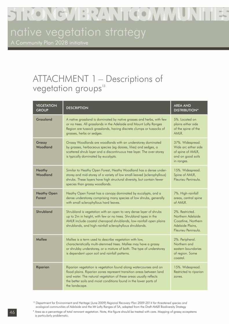
46
native vegetation strategyA Community Plan 2028 initiative
VEGETATION GROUP
DESCRIPTIONAREA AND DISTRIBUTION*
Grassland A native grassland is dominated by native grasses and herbs, with few or no trees. All grasslands in the Adelaide and Mount Lofty Ranges Region are tussock grasslands, having discrete clumps or tussocks of grasses, herbs or sedges.
5%. Located on plains either side of the spine of the AMLR.
Grassy Woodland
Grassy Woodlands are woodlands with an understorey dominated by grasses, herbaceous species (eg daisies, lilies) and sedges, a scattered shrub layer and a discontinuous tree layer. The over-storey is typically dominated by eucalypts.
37%. Widespread. Wide arc either side of spine of AMLR, and on good soils in ranges.
Heathy Woodland
Similar to Heathy Open Forest, Heathy Woodland has a dense under-storey and mid-storey of a variety of low small-leaved (sclerophyllous) shrubs. These layers have high structural diversity, but contain fewer species than grassy woodlands.
15%. Widespread. Spine of AMLR, Fleurieu Peninsula.
Heathy Open Forest
Heathy Open Forest has a canopy dominated by eucalypts, and a dense understorey comprising many species of low shrubs, generally with small sclerophyllous hard leaves.
7%. High-rainfall areas, central spine of AMLR.
Shrubland Shrubland is vegetation with an open to very dense layer of shrubs up to 2m in height, with few or no trees. Shrubland types in the AMLR include coastal chenopod shrublands, low-rainfall open plains shrublands, and high-rainfall sclerophyllous shrublands.
2%. Restricted. Northern Adelaide Coastline, Northern Adelaide Plains, Fleurieu Peninsula.
Mallee Mallee is a term used to describe vegetation with low, characteristically multi-stemmed trees. Mallee may have a grassy or shrubby understorey, or a mixture of both. The type of understorey is dependent upon soil and rainfall patterns.
2%. Peripheral. Northern and eastern boundaries of region. Some coastal.
Riparian Riparian vegetation is vegetation found along watercourses and on fl ood plains. Riparian zones represent transition areas between land and water. The natural vegetation of these areas usually refl ects the better soils and moist conditions found in the lower parts of the landscape.
15%. Widespread. Restricted to riparian zones.
ATTACHMENT 1 – Descriptions of vegetation groups13
13 Department for Environment and Heritage (June 2009) Regional Recovery Plan 2009-2014 for threatened species and ecological communities of Adelaide and the Mt Lofty Ranges of SA, adapted from the Draft AMLR Biodiversity Strategy
* Area as a percentage of total remnant vegetation. Note, this fi gure should be treated with care. Mapping of grassy ecosystems is particularly problematic.
Sustainability_FINAL.indd 46Sustainability_FINAL.indd 46 6/09/10 2:46 PM6/09/10 2:46 PM
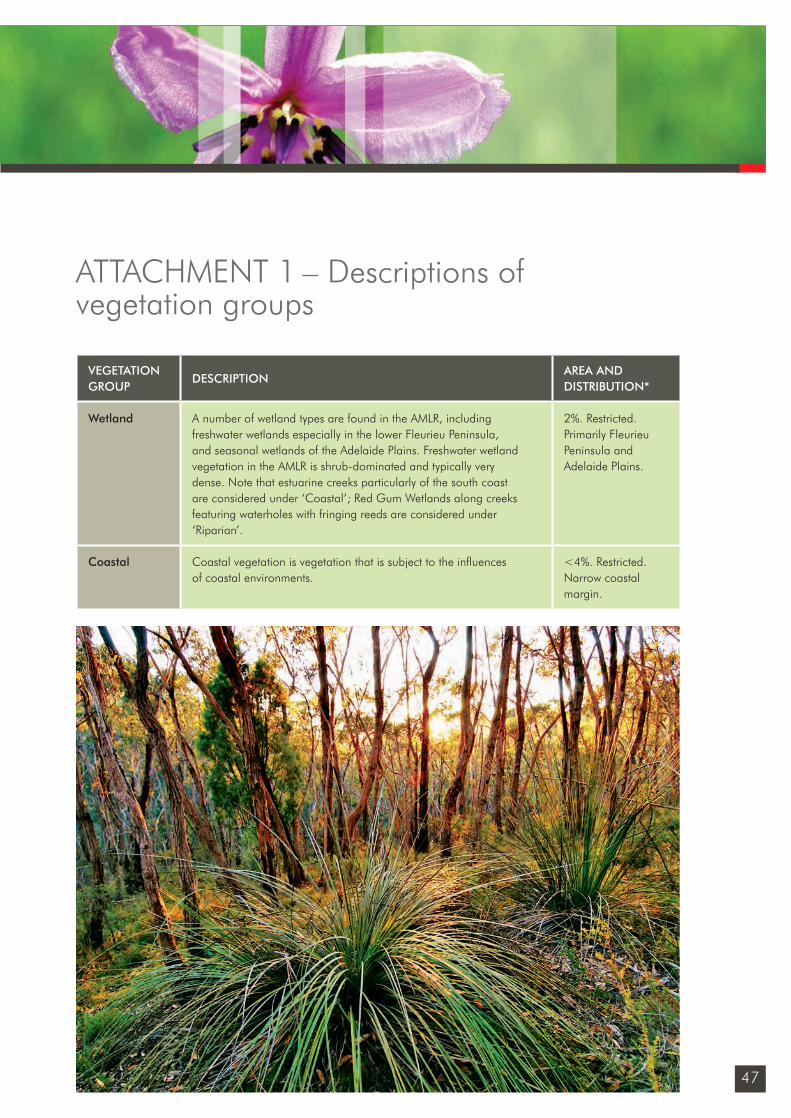
47
VEGETATION GROUP
DESCRIPTIONAREA AND DISTRIBUTION*
Wetland A number of wetland types are found in the AMLR, including freshwater wetlands especially in the lower Fleurieu Peninsula, and seasonal wetlands of the Adelaide Plains. Freshwater wetland vegetation in the AMLR is shrub-dominated and typically very dense. Note that estuarine creeks particularly of the south coast are considered under ‘Coastal’; Red Gum Wetlands along creeks featuring waterholes with fringing reeds are considered under ‘Riparian’.
2%. Restricted. Primarily Fleurieu Peninsula and Adelaide Plains.
Coastal Coastal vegetation is vegetation that is subject to the infl uences of coastal environments.
<4%. Restricted. Narrow coastal margin.
ATTACHMENT 1 – Descriptions of vegetation groups
Sustainability_FINAL.indd 47Sustainability_FINAL.indd 47 6/09/10 2:46 PM6/09/10 2:46 PM

48
native vegetation strategyA Community Plan 2028 initiative
Area and landformsThe Central Lofty Landscape covers an area of 71,833 ha representing 9.2% of the Adelaide and Mt Lofty Ranges region.
3,122 ha of the Central Lofty Landscape is located within the City of Onkaparinga, representing approximately 7% of the total council region.
The Central Lofty landscape is identifi ed as the high elevation central divide of the Mt Lofty Ranges. It contains dissected escarpments, precipitous cliffs, deep narrow gorges, steep to moderately steep slopes and rises with
undulating crests. Gentle slopes and fl ats, broad elongate valleys and rolling low hills, dissected by watercourses and narrow creek fl ats.
Land useMajor land use: peri-urbanMinor land use: grazing, horticulture and conservation.
Pre-European vegetationDominated by heathy forest (40%) and riparian vegetation (33%). Other vegetation types include grassy woodland (14%) and heathy woodland (13%).
Landscape modifi cation and clearance patterns The Central Lofty landscape is classifi ed as ‘fragmented’. Within the Mount Lofty Ranges region 18,500 ha of pre-European vegetation remains (26%).
Half of the pre-European vegetation was cleared prior to the 1940s. Clearance was selective towards good soils, with a disproportionate loss of grassy woodland and riparian vegetation. Only 14% of the pre-European extent of Grassy woodland, and 20% of riparian vegetation remains compared to over 30% of the original extent of heathy vegetation types.
Remnant vegetation and conservation protection Remnant vegetation is dominated by heathy woodland, with this vegetation type comprising almost 50% of the remnant vegetation in the landscape, followed by riparian at 25%.
ATTACHMENT 2 – Central Lofty Landscape of the
Adelaide and Mount Lofty Ranges14
14 Adapted from: Department for Environment and Heritage, Informing Biodiversity Conservation for the Adelaide and Mt Lofty Ranges Region South Australia; Urban Biodiversity Unit for the Department of Heritage, A biodiversity investment plan for urban Adelaide 2008 – 2011; City of Onkaparinga Native Vegetation Inventory.
Sustainability_FINAL.indd 48Sustainability_FINAL.indd 48 6/09/10 2:46 PM6/09/10 2:46 PM
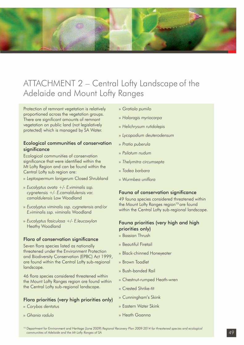
49
Protection of remnant vegetation is relatively proportioned across the vegetation groups. There are signifi cant amounts of remnant vegetation on public land (not legislatively protected) which is managed by SA Water.
Ecological communities of conservation signifi canceEcological communities of conservation signifi cance that were identifi ed within the Mt Lofty Region and can be found within the Central Lofty sub region are: ›› Leptospermum lanigerum Closed Shrubland
›› Eucalyptus ovata +/- E.viminalis ssp. cygnetensis +/- E.camaldulensis var. camaldulensis Low Woodland
›› Eucalyptus viminalis ssp. cygnetensis and/or E.viminalis ssp. viminalis Woodland
›› Eucalyptus fasiculosa +/- E.leucoxylon Heathy Woodland
Flora of conservation signifi canceSeven fl ora species listed as nationally threatened under the Environment Protection and Biodiversity Conservation (EPBC) Act 1999, are found within the Central Lofty sub-regional landscape.
46 fl ora species considered threatened within the Mount Lofty Ranges region are found within the Central Lofty sub-regional landscape.
Flora priorities (very high priorities only)›› Corybas dentatus
›› Ghania radula
›› Gratiola pumilo
›› Haloragis myriocarpa
›› Helichrysum rutidolepis
›› Lycopodium deuterodensum
›› Pratia puberula
›› Psilotum nudum
›› Thelymitra circumsepta
›› Todea barbara
›› Wurmbea uniflora
Fauna of conservation signifi cance49 fauna species considered threatened within the Mount Lofty Ranges region15 are found within the Central Lofty sub-regional landscape.
Fauna priorities (very high and high priorities only)›› Bassian Thrush
›› Beautiful Firetail
›› Black-chinned Honeyeater
›› Brown Toadlet
›› Bush-banded Rail
›› Chestnut-rumped Heath-wren
›› Crested Shrike-tit
›› Cunningham’s Skink
›› Eastern Water Skink
›› Heath Goanna
ATTACHMENT 2 – Central Lofty Landscape of the
Adelaide and Mount Lofty Ranges
15 Department for Environment and Heritage (June 2009) Regional Recovery Plan 2009-2014 for threatened species and ecological communities of Adelaide and the Mt Lofty Ranges of SA
Sustainability_FINAL.indd 49Sustainability_FINAL.indd 49 6/09/10 2:46 PM6/09/10 2:46 PM
50
native vegetation strategyA Community Plan 2028 initiative
›› Lewin’s Rail
›› Pygmy Copperhead
›› Scarlet Robin
›› Southern Brown Bandicoot
›› Tiger Snake
›› Yellow-tailed Black-Cockatoo
City of Onkaparinga profi le
Council reserves – remnant vegetationThe City of Onkaparinga currently manages 7 ha of remnant vegetation within the Cherry Gardens Cemetery Reserve.
The dominant broad vegetation group within this reserve is:›› Heathy Woodland – 5 ha
The most dominant ecological communities within City of Onkaparinga reserves in the Central Lofty landscape are:›› Eucalyptus obliqua, E. cosmophylla
Heathy Low Woodland – 3.2 ha
›› Eucalyptus obliqua, E. cosmophylla Heathy Low Open Woodland – 1.3 ha
›› Eucalyptus fasiculosa, E. cosmophylla Heathy Low Woodland – .48 ha
Ecological communities of conservation signifi cance within City of Onkaparinga reserves:None recorded.
Council roadsides – remnant vegetationThe City of Onkaparinga own a total 70 km of roadsides within the Central Lofty sub-region and 56 km of these roadsides contain the following broad vegetation groups: ›› Heathy Woodland – 37 km
›› Grassy Woodland – 15 km
›› Heathy Forest – 2 km
›› Shrubland – 2 km
The most dominant ecological communities within City of Onkaparinga roadsides in the Central Lofty landscape are:›› Eucalyptus obliqua Heathy Woodland
–12 km
›› Eucalyptus obliqua +/- E. cosmophylla +/- E. camaldulensis var. camaldulensis +/- E. fasciculosa Heathy Woodland – 8 km
›› Eucalyptus leucoxylon ssp. leucoxylon, E. fasciculosa +/- E. viminalis ssp. cygnetensis Grassy Woodland – 8 km
›› Eucalyptus obliqua, E. fasciculosa +/- E. leucoxylon ssp. leucoxylon +/- E. viminalis ssp. cygnetensis +/- Pinus radiata Heathy Woodland – 9 km
Ecological communities of conservation signifi cance within City of Onkaparinga roadsides:None recorded.
56 km of roadside native vegetation is incorporated into our roadside marker system program.
ATTACHMENT 2 – Central Lofty Landscape of the
Adelaide & Mount Lofty Ranges
Sustainability_FINAL.indd 50Sustainability_FINAL.indd 50 6/09/10 2:46 PM6/09/10 2:46 PM
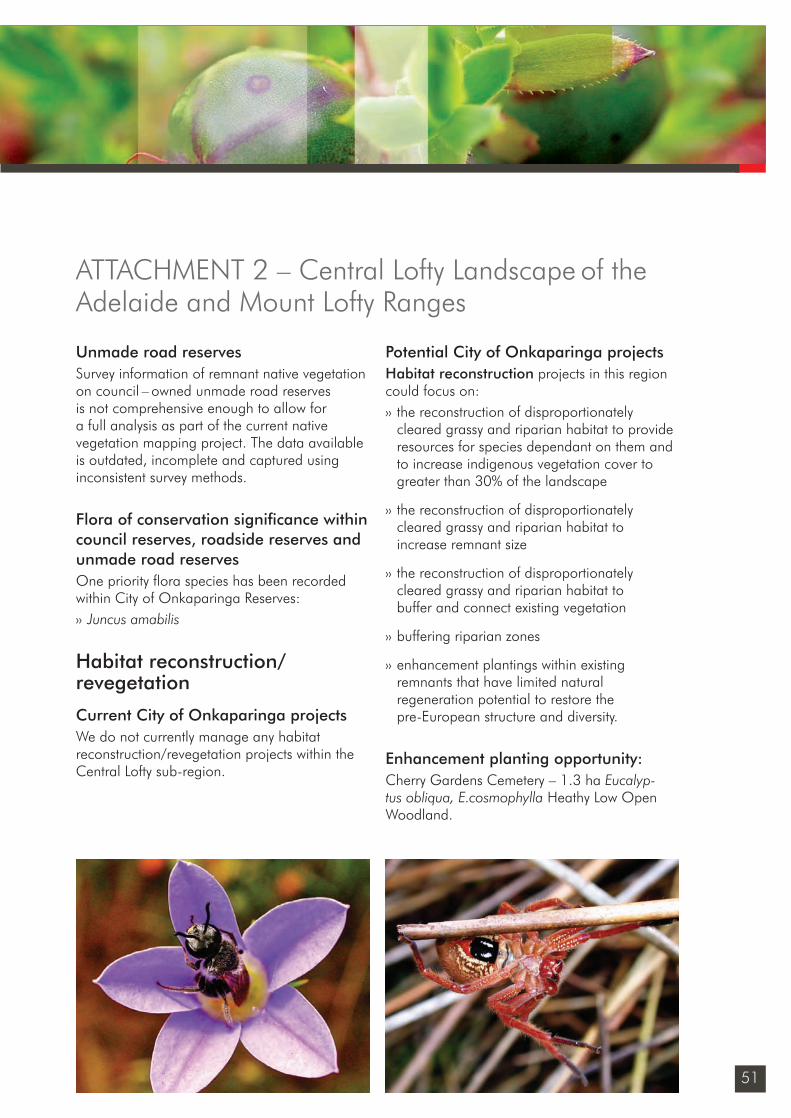
51
Unmade road reservesSurvey information of remnant native vegetation on council – owned unmade road reserves is not comprehensive enough to allow for a full analysis as part of the current native vegetation mapping project. The data available is outdated, incomplete and captured using inconsistent survey methods.
Flora of conservation signifi cance within council reserves, roadside reserves and unmade road reservesOne priority fl ora species has been recorded within City of Onkaparinga Reserves:›› Juncus amabilis
Habitat reconstruction/ revegetation
Current City of Onkaparinga projectsWe do not currently manage any habitat reconstruction/revegetation projects within the Central Lofty sub-region.
Potential City of Onkaparinga projectsHabitat reconstruction projects in this region could focus on:›› the reconstruction of disproportionately
cleared grassy and riparian habitat to provide resources for species dependant on them and to increase indigenous vegetation cover to greater than 30% of the landscape
›› the reconstruction of disproportionately cleared grassy and riparian habitat to increase remnant size
›› the reconstruction of disproportionately cleared grassy and riparian habitat to buffer and connect existing vegetation
›› buffering riparian zones
›› enhancement plantings within existing remnants that have limited natural regeneration potential to restore the pre-European structure and diversity.
Enhancement planting opportunity:Cherry Gardens Cemetery – 1.3 ha Eucalyp-tus obliqua, E.cosmophylla Heathy Low Open Woodland.
ATTACHMENT 2 – Central Lofty Landscape of the
Adelaide and Mount Lofty Ranges
Sustainability_FINAL.indd 51Sustainability_FINAL.indd 51 6/09/10 2:46 PM6/09/10 2:46 PM
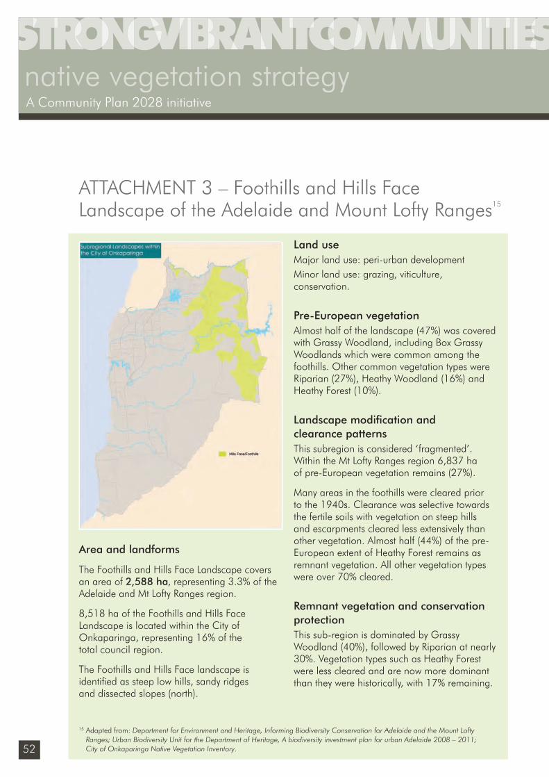
52
native vegetation strategyA Community Plan 2028 initiative
Area and landforms
The Foothills and Hills Face Landscape covers an area of 2,588 ha, representing 3.3% of the Adelaide and Mt Lofty Ranges region.
8,518 ha of the Foothills and Hills Face Landscape is located within the City of Onkaparinga, representing 16% of the total council region.
The Foothills and Hills Face landscape is identifi ed as steep low hills, sandy ridges and dissected slopes (north).
Land useMajor land use: peri-urban developmentMinor land use: grazing, viticulture, conservation.
Pre-European vegetationAlmost half of the landscape (47%) was covered with Grassy Woodland, including Box Grassy Woodlands which were common among the foothills. Other common vegetation types were Riparian (27%), Heathy Woodland (16%) and Heathy Forest (10%).
Landscape modifi cation and clearance patterns This subregion is considered ‘fragmented’. Within the Mt Lofty Ranges region 6,837 ha of pre-European vegetation remains (27%).
Many areas in the foothills were cleared prior to the 1940s. Clearance was selective towards the fertile soils with vegetation on steep hills and escarpments cleared less extensively than other vegetation. Almost half (44%) of the pre-European extent of Heathy Forest remains as remnant vegetation. All other vegetation types were over 70% cleared.
Remnant vegetation and conservation protection This sub-region is dominated by Grassy Woodland (40%), followed by Riparian at nearly 30%. Vegetation types such as Heathy Forest were less cleared and are now more dominant than they were historically, with 17% remaining.
ATTACHMENT 3 – Foothills and Hills Face Landscape of the Adelaide and Mount Lofty Ranges15
15 Adapted from: Department for Environment and Heritage, Informing Biodiversity Conservation for Adelaide and the Mount Lofty Ranges; Urban Biodiversity Unit for the Department of Heritage, A biodiversity investment plan for urban Adelaide 2008 – 2011; City of Onkaparinga Native Vegetation Inventory.
Sustainability_FINAL.indd 52Sustainability_FINAL.indd 52 6/09/10 2:46 PM6/09/10 2:46 PM
53
ATTACHMENT 3 – Foothills and Hills Face Landscape of the Adelaide and Mount Lofty Ranges
Protection of remnant vegetation on protected public land is equally represented by Grassy Woodland and Heathy Forest. However, the pre-European dominant Grassy Woodlands are proportionately not well protected on public lands. Signifi cant amounts of Grassy Woodlands remain in unprotected public lands.
Ecological communities of conservation significanceGrey Box (Eucalyptus microcapra) Grassy Woodlands was listed as a nationally threatened Ecological Community under the Environment Protection and Biodiversity Conservation (EPBC) Act in April 2010.
Ecological communities of conservation signifi cance that were identifi ed within the Mt Lofty Region and can be found within the Foothills Hills Face sub region are:›› Banksia marginata Grassy Low Woodland
›› Eucalyptus microcarpa Grassy Low Woodland
›› Eucalyptus viminalis ssp cygnetensis and / or E.viminalis ssp viminalis Woodland
›› Eucalyptus fasciculosa +/- E.leucoxylon Heathy Woodland
›› Allocasuarina verticillata Grassy Low Woodland
Flora of conservation signifi cance8 fl ora species that are listed as nationally threatened under the EPBC Act are found within the Foothills and Hills Face sub-regional landscape.39 fl ora species considered threatened within the Mount Lofty Ranges region16 are found
within the Foothills and Hills Face sub-regional landscape. Five of these species are endemic to the foothills and the majority of these species have a preference for Grassy Woodlands, Heathy Woodlands and Wetlands.
Flora priorities (very high and high priorities only)›› Brachyscome diversfolia
›› Caledenia behrii
›› Caledenia gladiolata
›› Caledenia rigida
›› Diuris brevifolia
›› Glycine tabacina
›› Helichrysum rutidolepis
›› Lagenophora gracillis
›› Mazus pumilio
›› Oreomyrrhis eriopoda
›› Prasophyllum occultans
›› Pratia puberula
›› Psilotum nudum
›› Pterostylis cucullata ssp. sylvicola
›› Ranunculus papulentus
›› Schoenus discifer
›› Thelymitra cyanapicata
›› Todea barbara
›› Utricularia lateriflora
16 Department for Environment and Heritage (June 2009) Regional Recovery Plan 2009-2014 for threatened species and ecological communities of Adelaide and the Mt Lofty Ranges of SA
Sustainability_FINAL.indd 53Sustainability_FINAL.indd 53 6/09/10 2:46 PM6/09/10 2:46 PM
54
native vegetation strategyA Community Plan 2028 initiative
›› Veronica derwentiana ssp.homa.
›› Viola betonicifolia ssp. betonicifolia
›› Wurmbea uniflora
Fauna of conservation signifi cance44 fauna species considered threatened within the Mount Lofty Ranges region are found within the Foothills and Hills Face sub-regional landscape These species display a preference for Grassy and Heathy Woodlands.
Fauna Priorities (Very high and high priorities only)›› Black-chinned Honeyeater
›› Brown Toadlet
›› Chestnut-rumped Heath-wren
›› Cunningham’s Skink
›› Eastern Water Skink
›› Lewin’s Rail
›› Southern Brown Bandicoot
›› Yellow-tailed Black-Cockatoo
City of Onkaparinga profi le
Council reserves – remnant vegetationThe City of Onkaparinga currently manages 24.2 ha of remnant vegetation within 2 reserves in the Foothills and Hills Face sub region for conservation purposes. These are: ›› Woodland Ridge Reserve – 2.2 ha
›› McHarg Reserve – 22 ha
The dominant broad vegetation groups found within these reserves are:
›› Grassy Woodland – 13.3 ha
›› Riparian – 10.9 ha
The most dominant ecological communities found within the 2 reserves are: ›› Eucalyptus leucoxylon, E.camaldulensis Grassy
Woodland – 8.4 ha
›› Acacia pycnantha, Olea europaea tall Shrubland – 3.9 ha
›› Eucalyptus camaldulensis Woodland – 3.6 ha
›› Eucalyptus leucoxylon Grassy open Woodland – 3.3 ha
Ecological communities of conservation signifi cance within City of Onkaparinga reserves›› Eucalyptus microcapra Grassy Woodlands
– 1.5 ha, a Nationally Threatened Ecological Community under the EPBC Act 1999.
Council roadsides – remnant vegetation The City of Onkaparinga owns 197 km of roadsides within the Foothills and Hills Face sub-region and 157.4 km of this roadside contains the following broad vegetation groups:›› Grassy Woodland – 105 km
›› Heathy Woodland – 23.5 km
›› Riparian – 15 km
›› Heathy Forest – 13.9 km
The most dominant ecological communities within City of Onkaparinga roadsides in the Foothills and Hills Face landscape are:›› Eucalyptus camaldulensis var. camaldulensis
Grassy Woodland – 15.8 km
›› Eucalyptus leucoxylon ssp. Leucoxylon
ATTACHMENT 3 – Foothills and Hills Face Landscape of the Adelaide and Mount Lofty Ranges
Sustainability_FINAL.indd 54Sustainability_FINAL.indd 54 6/09/10 2:46 PM6/09/10 2:46 PM
55
Grassy Woodland – 11.9 km
›› Eucalyptus camaldulensis var. camaldulensis +/- E. leucoxylon ssp. leucoxylon +/- E. fasciculosa +/- E. cosmophylla Grassy Woodland – 11.2 km
›› Eucalyptus obliqua +/- E. cosmophylla +/- E. camaldulensis var. camaldulensis +/- E. fasciculosa Heathy Woodland – 10.7 km
Ecological communities of conservation signifi cance within City of Onkaparinga roadsides:›› Eucalyptus microcapra Grassy Woodlands, a
Nationally Threatened Ecological Community under the EPBC Act 1999.
7 km of roadside remnant vegetation is incorporated into our roadside marker system program.
Council unmade road reservesSurvey information of remnant native vegetation on council owned unmade road reserves is not comprehensive enough to allow for a full analysis as part of the current native vegetation mapping project. The data available is outdated, incomplete and captured using inconsistent survey methods.
Flora of conservation signifi cance within council reserves, roadside reserves and unmade road reservesThree priority fl ora species have been recorded within City of Onkaparinga unmade roadside reserves:›› Caledenia behrii
›› Caledenia rigida
›› Diuris behrii
Habitat reconstruction/ revegetation
Current City of Onkaparinga projectsThe City of Onkaparinga does not currently manage any habitat reconstruction/revegetation projects within the Foothills/Hillsface sub-region.
Potential City of Onkaparinga projectsHabitat reconstruction projects in this region would focus on:›› the reconstruction of disproportionately
cleared grassy habitat to provide resources for species dependant on them and to increase indigenous vegetation cover to greater than 30% of the landscape
›› the reconstruction of disproportionately cleared grassy habitat to increase remnant size
›› the reconstruction of disproportionately cleared grassy habitat to buffer and connect existing vegetation
›› buffering riparian zones
›› enhancement plantings within existing remnants that have limited natural regeneration potential to restore the pre-European structure and diversity.
Enhancement planting opportunitiesTwo sites totalling 24 ha require selective remnant enhancement plantings to increase existing plant diversity and restore missing structural layers:›› McHarg Reserve
›› Woodland Ridge Reserve.
ATTACHMENT 3 – Foothills and Hills Face Landscape of the Adelaide and Mount Lofty Ranges
Sustainability_FINAL.indd 55Sustainability_FINAL.indd 55 6/09/10 2:46 PM6/09/10 2:46 PM
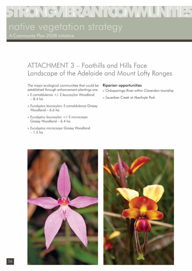
56
native vegetation strategyA Community Plan 2028 initiative
The major ecological communities that could be established through enhancement plantings are:›› E.camaldulensis +/- E.leucoxylon Woodland
– 8.4 ha
›› Eucalyptus leucoxylon, E.camaldulensis Grassy Woodland – 6.6 ha
›› Eucalyptus leucoxylon +/- E.microcarpa Grassy Woodland – 6.4 ha
›› Eucalyptus microcarpa Grassy Woodland – 1.5 ha
Riparian opportunities›› Onkaparinga River within Clarendon township
›› Sauerbier Creek at Aberfoyle Park
ATTACHMENT 3 – Foothills and Hills Face Landscape of the Adelaide and Mount Lofty Ranges
Sustainability_FINAL.indd 56Sustainability_FINAL.indd 56 6/09/10 2:46 PM6/09/10 2:46 PM
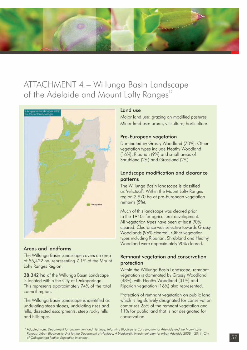
57
Areas and landformsThe Willunga Basin Landscape covers an area of 55,422 ha, representing 7.1% of the Mount Lofty Ranges Region.
38.342 ha of the Willunga Basin Landscape is located within the City of Onkaparinga. This represents approximately 74% of the total council region.
The Willunga Basin Landscape is identifi ed as undulating steep slopes, undulating rises and hills, dissected escarpments, steep rocky hills and hillslopes.
Land useMajor land use: grazing on modifi ed pasturesMinor land use: urban, viticulture, horticulture.
Pre-European vegetationDominated by Grassy Woodland (70%). Other vegetation types include Heathy Woodland (16%), Riparian (9%) and small areas of Shrubland (2%) and Grassland (2%).
Landscape modifi cation and clearance patternsThe Willunga Basin landscape is classifi ed as ‘relictual’. Within the Mount Lofty Ranges region 2,970 ha of pre-European vegetation remains (5%).
Much of this landscape was cleared prior to the 1940s for agricultural development. All vegetation types have been at least 90% cleared. Clearance was selective towards Grassy Woodlands (96% cleared). Other vegetation types including Riparian, Shrubland and Heathy Woodland were approximately 90% cleared.
Remnant vegetation and conservation protection Within the Willunga Basin Landscape, remnant vegetation is dominated by Grassy Woodland (48%), with Heathy Woodland (31%) and Riparian vegetation (16%) also represented.
Protection of remnant vegetation on public land which is legislatively designated for conservation comprises 25% of the remnant vegetation and 11% for public land that is not designated for conservation.
ATTACHMENT 4 – Willunga Basin Landscape of the Adelaide and Mount Lofty Ranges17
17 Adapted from: Department for Environment and Heritage, Informing Biodiversity Conservation for Adelaide and the Mount Lofty Ranges; Urban Biodiversity Unit for the Department of Heritage, A biodiversity investment plan for urban Adelaide 2008 – 2011; City of Onkaparinga Native Vegetation Inventory.
Sustainability_FINAL.indd 57Sustainability_FINAL.indd 57 6/09/10 2:46 PM6/09/10 2:46 PM
58
native vegetation strategyA Community Plan 2028 initiative
Ecological communities of conservation signifi canceGrey Box (Eucalyptus microcapra) Grassy Woodlands is now listed as a nationally threatened Ecological Community under the Environment Protection and Biodiversity Conservation (EPBC) Act 1999.
Ecological communities of conservation signifi cance that were identifi ed within the Mt Lofty Region and can be found within the Willunga Basin sub region are: ›› Eucalyptus porosa Woodland
›› Gahnia filum Sedgelands
›› Banksia marginata Grassy Low Woodland
›› Eucalyptus microcarpa Grassy Low Woodland
›› Eucalyptus fasiculosa +/- E.leucoxylon Heathy Woodland
›› Allocasuarina verticillata Grassy Low Woodland
Flora of conservation signifi canceFive fl ora species are listed as nationally threatened under the EPBC Act 1999 are found within the Willunga Basin sub-regional landscape.
Seventeen fl ora species considered threatened within the Mount Lofty Ranges region are found within the Willunga Basin sub-regional landscape. One of these species is endemic to the Willunga Basin and has a preference for Grassy Woodlands.
Flora priorities ›› Adiantum capillus-veneris
›› Caledenia behrii
›› Carrea eburnea
›› Corybas unguiculatus
›› Cullen parvum
›› Diuris behrii
›› Eleocharis atricha
›› Euphrasia collina ssp. osbornii
›› Glycine latrobeana
›› Helichrysum rutidolepis
›› Maireana decalvans
›› Montia fontana ssp. chondrosperma
›› Prasophyllum occultans
›› Prasophyllum pallidum
›› Pterostylis cucullata ssp. sylvicola
›› Pterostylis curta
›› Schoenus latelaminatus
Fauna of conservation signifi canceFifty fauna species considered threatened within the Mount Lofty Ranges region18 are found within the Willunga Basin sub-regional landscape. These species display a preference for Grassy and Heathy Woodlands.
ATTACHMENT 4 – Willunga Basin Landscape of the Adelaide and Mount Lofty Ranges
18 Department for Environment and Heritage (June 2009) Regional Recovery Plan 2009-2014 for threatened species and ecological communities of Adelaide and the Mt Lofty Ranges of SA
Sustainability_FINAL.indd 58Sustainability_FINAL.indd 58 6/09/10 2:46 PM6/09/10 2:46 PM
59
Fauna priorities (Very high and high priorities only)›› Australian Bittern
›› Baillon’s Crake
›› Beautiful Firetail
›› Black-chinned Honeyeater
›› Bush-banded Rail
›› Crested Shrike-tit
›› Cunningham’s Skink
›› Eastern Water Skink
›› Five-lined Earless Dragon
›› Lewin’s Rail
›› Orange-bellied Parrot
›› Southern Brown Bandicoot
›› Spotless Crake
›› Spotted Quail-thrush
›› Tawny Frogmouth
›› Yellow-tailed Black-Cockatoo
›› Zebra Finch
City of Onkaparinga profi le
Council reserves – remnant vegetationThe City of Onkaparinga currently manages 210.6 ha of remnant vegetation within 28 reserves located within the Willunga Basin sub region for conservation purposes. The major reserves are:›› Tangari Regional Reserve – 98.3 ha
›› Pedler Creek Reserve – 48.9 ha
›› Piggott Range Rd Reserve – 33.5 ha
›› Christies Creek Reserve – 23.7 ha
The dominant broad vegetation groups found within the 28 reserves are:›› Grassy Woodland – 127.1 ha
›› Riparian – 54.1 ha
›› Heathy Woodland 14.7 ha
›› Grassland – 9.7 ha
›› Wetland – 2.9 ha
›› Sheltered Tidal – 1.6 ha
›› Shrubland – .5 ha
The most dominant ecological communities found within the 28 reserves are: ›› Eucalyptus microcarpa +/-Allocasuarina
verticillata Grassy Woodland – 35.5 ha
›› Eucalyptus microcarpa Grassy Woodland – 31 ha
›› Eucalyptus camaldulensis Open Woodland – 21 ha
›› Eucalyptus porosa, Allocasuarina verticillata Grassy Open Woodland – 15.4 ha
ATTACHMENT 4 – Willunga Basin Landscape of the Adelaide and Mount Lofty Ranges
Sustainability_FINAL.indd 59Sustainability_FINAL.indd 59 6/09/10 2:46 PM6/09/10 2:46 PM
60
native vegetation strategyA Community Plan 2028 initiative
›› Eucalyptus microcarpa +/-Eucalyptus camaldulensis Grassy Woodland – 15.4 ha
Ecological communities of conservation signifi cance within City of Onkaparinga reserves:›› Eucalyptus microcapra Grassy Woodlands –
115.9 ha is a listed as a nationally threatened ecological community under the EPBC Act 1999.
Council roadsides – remnant vegetationThe City of Onkaparinga owns a total 819 kmof roadsides within the Willunga Basin sub-region and 341 km of this roadside contains native vegetation from the following broad vegetation groups:›› Grassy Woodland – 287 km
›› Heathy Woodland – 48 km
›› Riparian – 5.6 km
›› Grassland – 0.7 km
›› Shrubland – 0.5 km.
The most dominant ecological communities within City of Onkaparinga roadsides in the Willunga Basin are:›› Eucalyptus microcarpa Grassy Woodland
– 38 km
›› Eucalyptus camaldulensis var. camaldulensis Grassy Woodland – 30 km
›› Eucalyptus porosa +/- E. fasciculosa +/- E. leucoxylon ssp. leucoxylon Grassy Woodland – 29 km
›› Eucalyptus leucoxylon ssp. leucoxylon Grassy Woodland – 24 km.
Ecological communities of conservation signifi cance within City of Onkaparinga roadsides: ›› Eucalyptus microcapra Grassy Woodlands –
(Nationally Threatened Ecological Community under the EPBC Act 1999).
24 km of roadside vegetation is incorporated into the roadside marker system.
Council unmade road reservesSurvey information of remnant native vegetation on council owned unmade road reserves is not comprehensive enough to allow for a full analysis as part of the current native vegetation mapping project. The data available is outdated, incomplete and captured using inconsistent survey methods.
Flora of conservation signifi cance Two priority fl ora species has been recorded within City of Onkaparinga reserves:›› Dianella longifolia var. grandis
›› Cullen parvum
One priority fl ora species has been recorded within City of Onkaparinga roadsides:›› Oleria pannosa ssp. pannosa
ATTACHMENT 4 – Willunga Basin Landscape of the Adelaide and Mount Lofty Ranges
Sustainability_FINAL.indd 60Sustainability_FINAL.indd 60 6/09/10 2:46 PM6/09/10 2:46 PM
61
Habitat reconstruction/ revegetation
Current City of Onkaparinga projectsCouncil currently manages or works in partnership with community groups to implement 26 habitat reconstruction, revegetation or landscaping projects totalling 47 ha within the Willunga Basin sub-region including:
›› Hart Rd Wetland – 17 ha
›› McLaren Flat Wetland – 4.8 ha
›› Christie Creek, Hunter Road Christies Beach – 1.6 ha
›› Christie Creek Biodiversity Site, Marston Dr, Morphett Vale – 1 ha
›› Ernest Crescent Wetland Reserve (Woodcroft) – .6 ha
›› Frank Smith Wetland Reserve, Coromandel Valley – .5 ha
›› Willunga, Wirra Creek Wetland Reserve – 1.8 ha.
Potential City of Onkaparinga projectsHabitat reconstruction projects in this region will focus on:›› the reconstruction of buffering vegetation to
increase remnant size
›› ensuring that development and landuse are managed and that remnants are buffered
›› reconstructing habitat for promotional and educational purposes in the community
›› buffering riparian zones
›› enhancement plantings within existing remnants that have limited natural regeneration potential to restore the pre-European structure and diversity.
Enhancement planting opportunitiesTwenty one sites require selective remnant enhancement plantings to increase existing plant diversity and restore missing structural layers. A total of 109.9 ha of existing remnant requires enhancement planting.
Major enhancement planting opportunities are:›› Tangari Regional Reserve – 41.2 ha
›› Pedler Creek Reserve – 17.4 ha
›› Sauerbier Creek – 7.9 ha
›› Glenloth Reserve – 4.8 ha.
The major ecological communities that could be established through enhancement plantings are:
›› Eucalyptus microcarpa +/- Allocasuarina verticillata Grassy Woodland – 17.2 ha
›› Eucalyptus camaldulensis Woodland – 16.8 ha
›› Eucalyptus microcarpa Grassy Woodland – 15.7 ha
›› Eucalyptus camaldulensis Open Woodland – 12.3 ha.
ATTACHMENT 4 – Willunga Basin Landscape of the Adelaide and Mount Lofty Ranges
Sustainability_FINAL.indd 61Sustainability_FINAL.indd 61 6/09/10 2:46 PM6/09/10 2:46 PM
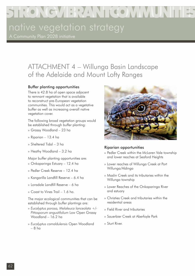
62
native vegetation strategyA Community Plan 2028 initiative
Buffer planting opportunitiesThere is 42.8 ha of open space adjacent to remnant vegetation that is available to reconstruct pre-European vegetation communities. This would act as a vegetative buffer as well as increasing overall native vegetation cover.
The following broad vegetation groups would be established through buffer planting:›› Grassy Woodland – 23 ha
›› Riparian – 13.4 ha
›› Sheltered Tidal – 3 ha
›› Heathy Woodland – 3.2 ha
Major buffer planting opportunities are:›› Onkaparinga Estuary – 12.4 ha
›› Pedler Creek Reserve – 12.4 ha
›› Kangarilla Landfi ll Reserve – 6.4 ha
›› Lonsdale Landfi ll Reserve – 6 ha
›› Coast to Vines Trail – 1.6 ha.
The major ecological communities that can be established through buffer plantings are:›› Eucalyptus porosa, Melaleuca lanceolata +/-
Pittosporum angustifolium Low Open Grassy Woodland – 16.2 ha
›› Eucalyptus camaldulensis Open Woodland – 8 ha
Riparian opportunities›› Pedler Creek within the McLaren Vale township
and lower reaches at Seaford Heights
›› Lower reaches of Willunga Creek at Port Willunga/Aldinga
›› Maslin Creek and its tributaries within the Willunga township
›› Lower Reaches of the Onkaparinga River and estuary
›› Christies Creek and tributaries within the residential areas
›› Field River and tributaries
›› Sauerbier Creek at Aberfoyle Park
›› Sturt River.
ATTACHMENT 4 – Willunga Basin Landscape of the Adelaide and Mount Lofty Ranges
Sustainability_FINAL.indd 62Sustainability_FINAL.indd 62 6/09/10 2:46 PM6/09/10 2:46 PM
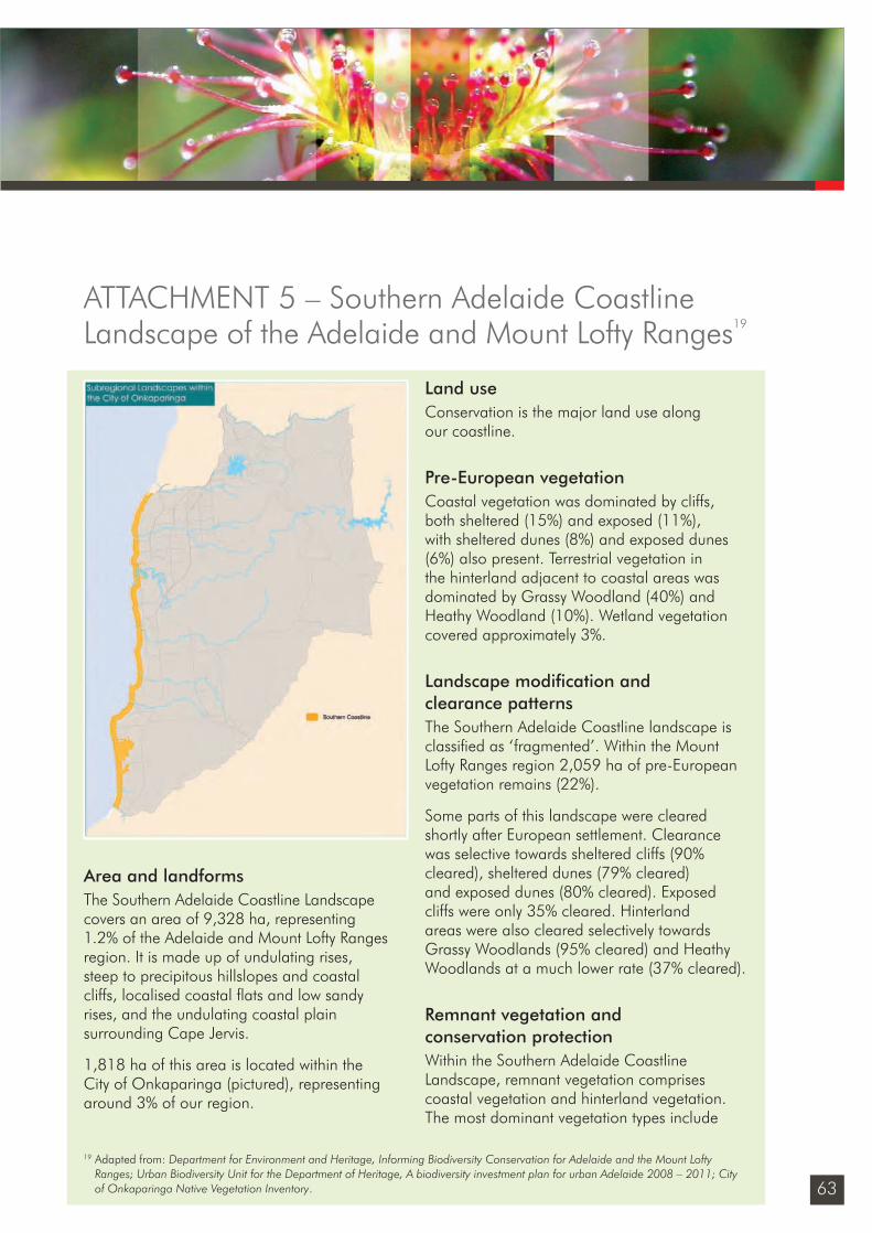
63
Area and landformsThe Southern Adelaide Coastline Landscape covers an area of 9,328 ha, representing 1.2% of the Adelaide and Mount Lofty Ranges region. It is made up of undulating rises, steep to precipitous hillslopes and coastal cliffs, localised coastal fl ats and low sandy rises, and the undulating coastal plain surrounding Cape Jervis.
1,818 ha of this area is located within the City of Onkaparinga (pictured), representing around 3% of our region.
Land useConservation is the major land use along our coastline.
Pre-European vegetationCoastal vegetation was dominated by cliffs, both sheltered (15%) and exposed (11%), with sheltered dunes (8%) and exposed dunes (6%) also present. Terrestrial vegetation in the hinterland adjacent to coastal areas was dominated by Grassy Woodland (40%) and Heathy Woodland (10%). Wetland vegetation covered approximately 3%.
Landscape modifi cation and clearance patternsThe Southern Adelaide Coastline landscape is classifi ed as ‘fragmented’. Within the Mount Lofty Ranges region 2,059 ha of pre-European vegetation remains (22%).
Some parts of this landscape were cleared shortly after European settlement. Clearance was selective towards sheltered cliffs (90% cleared), sheltered dunes (79% cleared) and exposed dunes (80% cleared). Exposed cliffs were only 35% cleared. Hinterland areas were also cleared selectively towards Grassy Woodlands (95% cleared) and Heathy Woodlands at a much lower rate (37% cleared).
Remnant vegetation and conservation protectionWithin the Southern Adelaide Coastline Landscape, remnant vegetation comprises coastal vegetation and hinterland vegetation. The most dominant vegetation types include
ATTACHMENT 5 – Southern Adelaide Coastline Landscape of the Adelaide and Mount Lofty Ranges19
19 Adapted from: Department for Environment and Heritage, Informing Biodiversity Conservation for Adelaide and the Mount Lofty Ranges; Urban Biodiversity Unit for the Department of Heritage, A biodiversity investment plan for urban Adelaide 2008 – 2011; City of Onkaparinga Native Vegetation Inventory.
Sustainability_FINAL.indd 63Sustainability_FINAL.indd 63 6/09/10 2:46 PM6/09/10 2:46 PM
64
native vegetation strategyA Community Plan 2028 initiative
exposed cliff vegetation (33% remnant vegetation) and heathy woodland (28%), along with sheltered cliff (7%), sheltered dune (8%) and exposed dune (5%).
Protection of remnant vegetation on public land which is legislatively designated for conservation comprises 69% of the remnant vegetation and 17% for public land that is not designated for conservation.
Ecological communities of conservation signifi canceGrey Box (Eucalyptus microcapra) Grassy Woodlands was listed as a nationally threatened ecological community under the EPBC Act in April 2010.
Ecological communities of conservation signifi cance that were identifi ed within the Mt Lofty Region and can be found within the Southern Adelaide Coastline sub-region are:›› Eucalyptus porosa Woodland
›› Freshwater Wetlands
›› Gahnia filum Sedgelands
›› Melaleuca halmaturorum Shrubland/Low Open Forest
Flora of conservation signifi canceOne fl ora species found within the Southern Adelaide Coastline sub-regional landscape is listed as nationally threatened under the EPBC Act 1999.
The following 16 fl ora species that are consid-ered threatened within the Mount Lofty Ranges region are found within the Southern Adelaide
Coastline sub-regional landscape. Seven of these species are endemic to the Southern Adelaide Coastline and have a preference for coastal areas.
Flora priorities ›› Asterolasia muricata
›› Austrostipa echinata
›› Calendenia valida
›› Calochilus cupreus
›› Carrea eburnea
›› Corybas expansus
›› Dampiera lanceolata var. intermedia
›› Daviesia pectinata
›› Euphrasia collina ssp. osbornii
›› Logania minor
›› Olearia pannosa ssp. pannosa
›› Orobranche cernua var. australiana
›› Podolepis muelleri
›› Phyllanthus striaticaulis
›› Prostanthera chlorantha
›› Spyridium coactilifolium
Fauna of conservation signifi cance40 fauna species that are considered threatened within the Mount Lofty Ranges region20 are found within the Southern Adelaide Coastline sub-regional landscape.
These species have a preference for Grassy and Heathy Woodlands.
ATTACHMENT 5 – Southern Adelaide Coastline Landscape of the Adelaide and Mount Lofty Ranges
20 Department for Environment and Heritage (June 2009) Regional Recovery Plan 2009-2014 for threatened species and ecological communities of Adelaide and the Mt Lofty Ranges of SA
Sustainability_FINAL.indd 64Sustainability_FINAL.indd 64 6/09/10 2:46 PM6/09/10 2:46 PM
65
Fauna priorities (very high and high priorities only)›› Australian Bittern
›› Beautiful Firetail
›› Black-chinned Honeyeater
›› Brown Quail
›› Chestnut-rumped Heath-wren
›› Cunningham’s Skink
›› Southern Emu-wren
City of Onkaparinga profi le
Council reserves – remnant vegetationThe City of Onkaparinga currently manages 249.5 ha of remnant vegetation in this region for conservation purposes. Major reserves are:
›› Port Noarlunga Dunes – 31.2 ha
›› Onkaparinga Estuary – 23.2 ha
›› Ochre Point, Moana – 19.6 ha
›› Silver Sands Coastal Reserve – 12.7 ha
The dominant broad vegetation groups found in the coastal reserves are:›› Sheltered Cliff – 140.8 ha
›› Sheltered Dune – 69 ha
›› Sheltered Tidal – 32 ha
›› Shrubland – 2.7 ha
›› Riparian – 2.5 ha
›› Wetland – 2.5 ha
The most dominant ecological communities found within the coastal reserves are:›› Nitraria billardierei Atriplex paludosa +/-
Rhagodia candolleana Low Shrubland – 22.8 ha
›› Olearia axillaris Leucopogon parviflorus +/- Acacia longifolia var.sophorae Shrubland –19 ha
›› Beyeria lechenaultii+/-Pomaderris paniculosa+/-Acrotriche patula Shrubland – 13.9 ha
›› Sarcocornia quinqueflora Halosarcia spp. Sclerostegia arbuscula Low Closed Samphire Shrubland – 10.8 ha.
Ecological communities of conservation signifi cance within City of Onkaparinga reserves:›› Gahnia filum Sedgelands – 1.8 ha.
Ecological communities of conservation signifi cance within City of Onkaparinga reserves:›› Gahnia filum Sedgelands – 1.8 ha.
Council roadsides – remnant vegetationThe City of Onkaparinga own a total 13 km of roadsides within the Southern Adelaide Coastline sub-region and 5.3 km of this roadside contains the following broad vegetation groups:›› Heathy Woodland – 2.7 km
›› Sheltered Dune – 1.4 km
›› Wetland – 1.2 km.
ATTACHMENT 5 – Southern Adelaide Coastline Landscape of the Adelaide and Mount Lofty Ranges
Sustainability_FINAL.indd 65Sustainability_FINAL.indd 65 6/09/10 2:46 PM6/09/10 2:46 PM
66
native vegetation strategyA Community Plan 2028 initiative
The most dominant ecological communities found within the coastal reserves are:›› Eucalyptus fasciculosa Heathy Woodland
– 2.7 km
›› Eucalyptus fasciculosa Woodland – 1.4 km
›› Gahnia filum Sedgeland – 1.2 km.
Ecological communities of conservation signifi cance within City of Onkaparinga roadsides:›› Gahnia filum Sedgelands – 1.2 km.
2 km of roadside vegetation is incorporated into our RMS program.
Unmade road reserves – remnant vegetationSurvey information of remnant native vegetation on council – owned unmade road reserves is not comprehensive enough to allow for a full analysis as part of the current native vegetation mapping project. The data available is outdated, incomplete and captured using inconsistent survey methods.
Flora of conservation signifi cance:›› Orobranche cernua var. australiana.
Habitat reconstruction/ revegetation
Current City of Onkaparinga projectsThis currently manages or works in partnership with community groups to implement habitat reconstruction, revegetation, landscaping projects within the Southern Adelaide Coastline sub-region including:›› Sellicks Creek and Foreshore Access Reserve
›› Palmer St Beach Access
›› Maslins Beach esplanade
›› Moana Sands Coastal Reserve
›› Port Noarlunga Dunes
›› Graham Rabbet Reserve
›› Pioneer Reserve
›› Cliff stability plantings at Maslins Beach, Moana, Port Noarlunga
›› Esplanade amenity plantings at Aldinga Beach, Port Willunga, Moana, Port Noarlunga and O’Sullivans Beach.
Potential City of Onkaparinga projectsPotential City of Onkaparinga managed habitat reconstruction projects in this region will focus on:›› the reconstruction of disproportionately
cleared sheltered cliffs and sheltered dune habitat to provide resources for species dependant on them
ATTACHMENT 5 – Southern Adelaide Coastline Landscape of the Adelaide and Mount Lofty Ranges
Sustainability_FINAL.indd 66Sustainability_FINAL.indd 66 6/09/10 2:46 PM6/09/10 2:46 PM
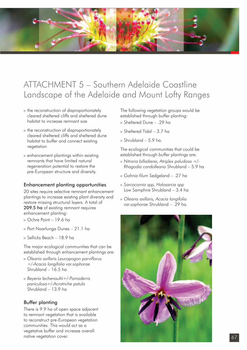
67
›› the reconstruction of disproportionately cleared sheltered cliffs and sheltered dune habitat to increase remnant size
›› the reconstruction of disproportionately cleared sheltered cliffs and sheltered dune habitat to buffer and connect existing vegetation
›› enhancement plantings within existing remnants that have limited natural regeneration potential to restore the pre-European structure and diversity.
Enhancement planting opportunities20 sites require selective remnant enhancement plantings to increase existing plant diversity and restore missing structural layers. A total of 209.5 ha of existing remnant requires enhancement planting:›› Ochre Point – 19.6 ha
›› Port Noarlunga Dunes – 21.1 ha
›› Sellicks Beach – 18.9 ha
The major ecological communities that can be established through enhancement plantings are:›› Olearia axillaris Leucopogon parviflorus
+/-Acacia longifolia var.sophorae Shrubland – 16.5 ha
›› Beyeria lechenaultii+/-Pomaderris paniculosa+/-Acrotriche patula Shrubland – 13.9 ha
Buffer plantingThere is 9.9 ha of open space adjacent to remnant vegetation that is available to reconstruct pre-European vegetation communities. This would act as a vegetative buffer and increase overall native vegetation cover.
The following vegetation groups would be established through buffer planting:›› Sheltered Dune – .29 ha
›› Sheltered Tidal – 3.7 ha
›› Shrubland – 5.9 ha.
The ecological communities that could be established through buffer plantings are:›› Nitraria billadierei, Atriplex paludosa +/-
Rhagodia candolleana Shrubland – 5.9 ha
›› Gahnia filum Sedgeland – .27 ha
›› Sarcocornia spp, Halosarcia spp Low Samphire Shrubland – 3.4 ha
›› Olearia axillaris, Acacia longifolia var.sophorae Shrubland – .29 ha.
ATTACHMENT 5 – Southern Adelaide Coastline Landscape of the Adelaide and Mount Lofty Ranges
Sustainability_FINAL.indd 67Sustainability_FINAL.indd 67 6/09/10 2:46 PM6/09/10 2:46 PM
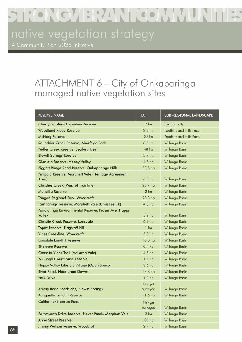
68
native vegetation strategyA Community Plan 2028 initiative
ATTACHMENT 6 – City of Onkaparinga managed native vegetation sites
RESERVE NAME HA SUB-REGIONAL LANDSCAPE
Cherry Gardens Cemetery Reserve 7 ha Central Lofty
Woodland Ridge Reserve 2.2 ha Foothills and Hills Face
McHarg Reserve 22 ha Foothills and Hills Face
Sauerbier Creek Reserve, Aberfoyle Park 8.5 ha Willunga Basin
Pedler Creek Reserve, Seaford Rise 48 ha Willunga Basin
Blewitt Springs Reserve 3.9 ha Willunga Basin
Glenloth Reserve, Happy Valley 4.8 ha Willunga Basin
Piggott Range Road Reserve, Onkaparinga Hills 33.5 ha Willunga Basin
Pimpala Reserve, Morphett Vale (Heritage Agreement Area) 6.3 ha Willunga Basin
Christies Creek (West of Trainline) 23.7 ha Willunga Basin
Mandilla Reserve 2 ha Willunga Basin
Tangari Regional Park, Woodcroft 98.3 ha Willunga Basin
Tarnnannga Reserve, Morphett Vale (Christies Ck) 4.3 ha Willunga Basin
Panalatinga Environmental Reserve, Fraser Ave, Happy Valley 3.2 ha Willunga Basin
Christie Creek Reserve, Lonsdale 6.2 ha Willunga Basin
Topaz Reserve, Flagstaff Hill 1 ha Willunga Basin
Vines Creekline, Woodcroft 5.8 ha Willunga Basin
Lonsdale Landfi ll Reserve 10.8 ha Willunga Basin
Shannon Reserve 0.4 ha Willunga Basin
Coast to Vines Trail (McLaren Vale) 4.5 ha Willunga Basin
Willunga Courthouse Reserve 1.7 ha Willunga Basin
Happy Valley Lifestyle Village (Open Space) 3.6 ha Willunga Basin
River Road, Noarlunga Downs 17.8 ha Willunga Basin
York Drive 1.2 ha Willunga Basin
Amery Road Roadsides, Blewitt SpringsNot yet
surveyed Willunga Basin
Kangarilla Landfi ll Reserve 11.6 ha Willunga Basin
California/Branson Road Not yet surveyed Willunga Basin
Farnsworth Drive Reserve, Plover Patch, Morphett Vale 3 ha Willunga Basin
Anne Street Reserve .05 ha Willunga Basin
Jimmy Watson Reserve, Woodcroft 2.9 ha Willunga Basin
Sustainability_FINAL.indd 68Sustainability_FINAL.indd 68 6/09/10 2:46 PM6/09/10 2:46 PM
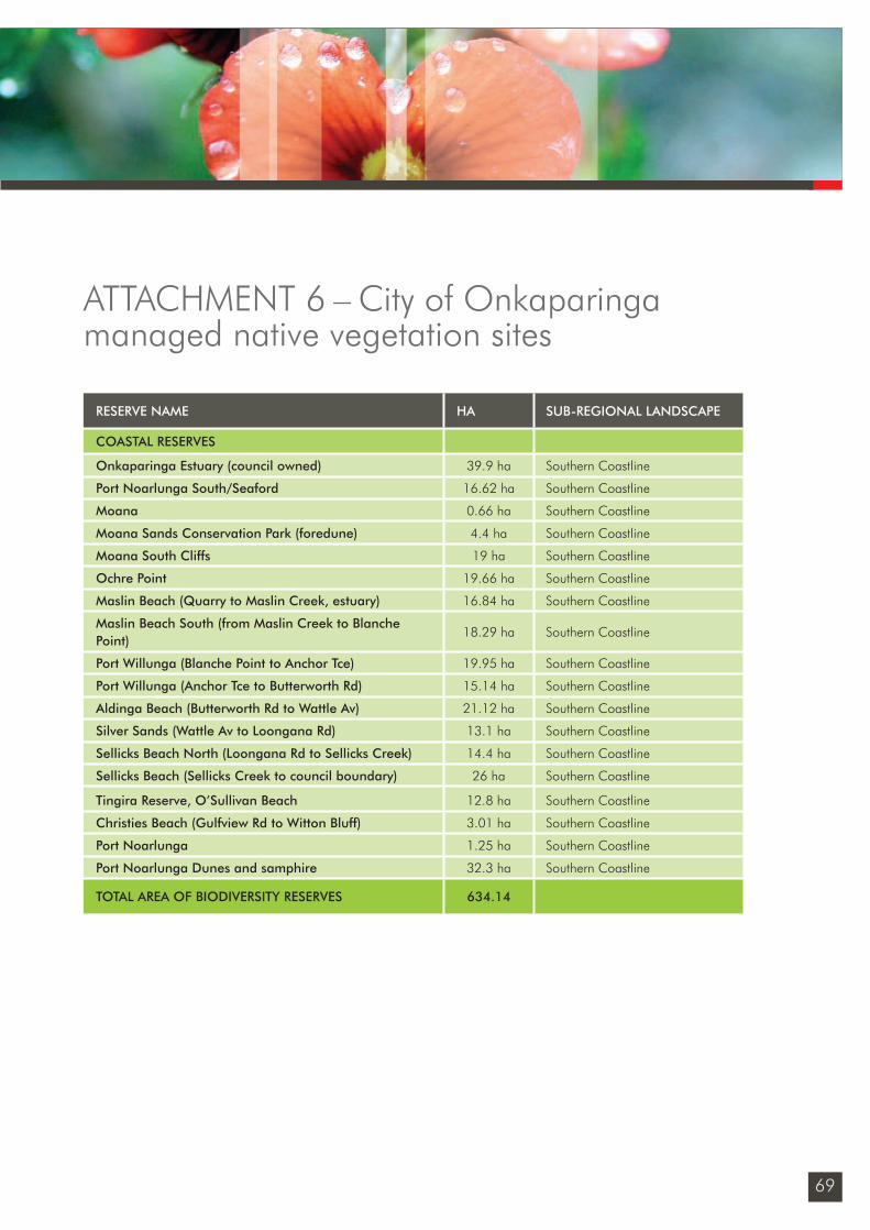
69
ATTACHMENT 6 – City of Onkaparinga managed native vegetation sites
RESERVE NAME HA SUB-REGIONAL LANDSCAPE
COASTAL RESERVES
Onkaparinga Estuary (council owned) 39.9 ha Southern Coastline
Port Noarlunga South/Seaford 16.62 ha Southern Coastline
Moana 0.66 ha Southern Coastline
Moana Sands Conservation Park (foredune) 4.4 ha Southern Coastline
Moana South Cliffs 19 ha Southern Coastline
Ochre Point 19.66 ha Southern Coastline
Maslin Beach (Quarry to Maslin Creek, estuary) 16.84 ha Southern Coastline
Maslin Beach South (from Maslin Creek to Blanche Point)
18.29 ha Southern Coastline
Port Willunga (Blanche Point to Anchor Tce) 19.95 ha Southern Coastline
Port Willunga (Anchor Tce to Butterworth Rd) 15.14 ha Southern Coastline
Aldinga Beach (Butterworth Rd to Wattle Av) 21.12 ha Southern Coastline
Silver Sands (Wattle Av to Loongana Rd) 13.1 ha Southern Coastline
Sellicks Beach North (Loongana Rd to Sellicks Creek) 14.4 ha Southern Coastline
Sellicks Beach (Sellicks Creek to council boundary) 26 ha Southern Coastline
Tingira Reserve, O’Sullivan Beach 12.8 ha Southern Coastline
Christies Beach (Gulfview Rd to Witton Bluff) 3.01 ha Southern Coastline
Port Noarlunga 1.25 ha Southern Coastline
Port Noarlunga Dunes and samphire 32.3 ha Southern Coastline
TOTAL AREA OF BIODIVERSITY RESERVES 634.14
Sustainability_FINAL.indd 69Sustainability_FINAL.indd 69 6/09/10 2:46 PM6/09/10 2:46 PM
70
native vegetation strategyA Community Plan 2028 initiative
International agreements
International Convention on Biological Diversity 1992Australia is a signatory to the Convention on Biological Diversity. The primary aims of the convention are the conservation and sustainable use of biological diversity. The convention emphasises the need for in situ conservation measures and promotes the recovery of threatened species. The main implementation tool for the convention is the National Strategy for the Conservation of Australia’s Biodiversity.
Agreements and Convention on Migratory Species Some of the bird species within the City of Onkaparinga region are migratory. The fol-lowing bilateral agreements provide a formal framework for the conservation of migratory birds of the East Asian – Australasian Flyway. All migratory bird species listed in these bilat-eral agreements are protected in Australia as matters of national environmental signifi cance under the EPBC Act.
›› Japan Australia Migratory Bird Agreement (JAMBA)
›› China Australia Migratory Bird Agreement (CAMBA)
›› Republic of Korea Australia Migratory Bird Agreement (ROKAMBA)
Federal government plans and legislation
Environment Protection and Biodiversity Conservation Act 1999 (EPBC Act)The EPBC is the Australian Government’s central piece of environmental legislation. It provides a legal framework to protect and manage nationally and internationally important fl ora, fauna, ecological communities, wetlands, migratory species and heritage areas. The states and territories have responsibility for matters of state and local signifi cance, in SA under the South Australian National Parks and Wildlife Act 1972.
Australia’s Biodiversity Conservation Strategy 2010-2020This plan sets out broad priorities that seek to build ecosystem resilience through creating conservation linkages, protecting threatened and endangered species, establishing a national framework for conservation outside of designated reserves, building data-sets and implementing an ongoing national campaign for biodiversity education. The plan identifi es local government through its contribution to the development of local biodiversity plans, monitoring and reporting and through its role in local and regional planning.
The Vegetation Strategy 2010-2014 applies the approach contained in the national strategy that seeks to build connectivity around core habitats including reserves and strengthen the resilience of landscapes. This includes managing patches of remnant vegetation outside of reserves that can serve as stepping stones and linear corridors to aid the movement of species.
Attachment 7 – Related plans and legislation
Sustainability_FINAL.indd 70Sustainability_FINAL.indd 70 6/09/10 2:46 PM6/09/10 2:46 PM
71
The following plans are implemented under the framework of the national Biodiversity Conservation Strategy:›› national recovery plans for nationally listed
threatened species
›› Australian Weeds Strategy (2007)
›› threat abatement plans for weeds of national signifi cance.
South Australian legislation
Natural Resources Management Act 2004 This Act provides the legislative framework for the sustainable and integrated management of the state’s natural resources. Key regulatory functions of the NRM Act include the ability to control water use through prescription, allocations and restrictions (eg groundwater at McLaren Vale), and the requirement to control pest plants and animals and any activities that might result in land degradation. A ‘duty of care’ ensures that there is a environmental and civil obligation to take reasonable steps to prevent land and water degradation, and prosecution for negligence is possible under this Act.
Native Vegetation Act 1991The Native Vegetation Act covers both private and public land and is designed to prevent the broad scale clearance of native vegetation for agriculture and urban development. The Act includes the provision of incentives and assistance to landowners for the preservation, enhancement and management of native vegetation. Native Vegetation Regulations (2003) set out circumstances in which native vegetation may be cleared without the
need for specifi c consent from the Native Vegetation Council and also specify the need for the establishment of offset planting in some situations.
Development Act 1993 Development within an area of intact native vegetation is subject to the regulations of the Native Vegetation Act and planning authorities are required to refer certain types of development applications such as land subdivision to other agencies, including the Native Vegetation Council, for specialist advice.
The Coast Protection Board establishes whether land and any development on it is likely to affect, or be affected by, coastal processes including storm surge fl ooding and short or long-term changes in the coastline’s position. The board can recommend that development applications along the coast be rejected if, for example, the development impinges on the conservation of coastal, estuarine and marine habitats.
Fire and Emergency Services Act 2005This Act provides for the South Australian Fire and Emergency Services Commission and its role in the governance, strategic and policy aspects of the emergency services sector. This includes the prevention, control and suppression of fi res and the handling of certain emergency situations.
Environment Protection Act 1993 The State’s Environment Protection Act 1993 is administered by the Environment Protection Authority to provide for the protection of the environment, control actions that will or might result in pollution and prepare the State of Environment Report.
Attachment 7 – Related plans and legislation
Sustainability_FINAL.indd 71Sustainability_FINAL.indd 71 6/09/10 2:46 PM6/09/10 2:46 PM
72
native vegetation strategyA Community Plan 2028 initiative
Coast Protection Act 1972 The State’s Coast Protection Act 1972 is administered by the Department for Environment and Heritage to protect the coast from erosion, deterioration, pollution or misuse on both private and public land and to engage in environmental restoration. The Coast Protection Board is the primary authority and prescribed body in South Australia managing coastal protection issues and providing advice on coastal development.
Crown Lands Act 1929 The state’s Crown Lands Act 1929 regulates the use of Crown land under the care of local government (eg cemetery reserves, water reserves, stone reserves and parklands). Numerous sub-populations of threatened species occur on Crown Land Act reserves. Crown land under the care of local government can be proclaimed as Conservation Reserves under the Crown Lands Act and managed for biodiversity conservation purposes.
South Australian Government Plans
State Natural Resources Management plan 2006This is the guiding document for natural re-source management in South Australia. The NRM Council is established under the NRM Act 2004 and acts as a peak advisory body, with eight regionally based community-driven NRM Boards. Each regional NRM Board is required to prepare a regional NRM Plan and associated investment strategies that establish the priority projects for funding.
Creating a Sustainable Future Volume C – the Board’s Investment Plan 2010/2011-2012/2013 – Adelaide & Mt Lofty Ranges Natural Resources Management Board This plan provides an outline of how the board proposes to invest funds collected through the NRM Levy and other sources over the next three years. The programs address targets that include stormwater quality, stormwater harvesting, ecosystem restoration and community participation.
Nature Links – Cape Borda to Barossa NatureLinkNatureLinks aims to create fi ve discrete biodiversity corridors strategically located across the State. The City of Onkaparinga region falls within the Cape Borda to Barossa NatureLink which ranges from the western edge of Kangaroo Island, north-east across Backstairs Passage, and north through the Adelaide region to the Barossa Valley.
The purpose of NatureLinks is to integrate biodiversity considerations into planning processes and to address habitat fragmentation through building partnerships and community engagement. NatureLinks is led by the Department of Environment and Natural Resources in partnership with regional natural resource management boards and the Department of Primary Industries and Resources SA.
Attachment 7 – Related plans and legislation
Sustainability_FINAL.indd 72Sustainability_FINAL.indd 72 6/09/10 2:46 PM6/09/10 2:46 PM
73
No Species Loss - a nature conservation strategy for South Australia 2007-2017 seeks to fulfi ll South Australia’s role in implementing Australia’s international biodiversity commitments. The overall aim is to not lose any more species in South Australia, on land, in rivers, creeks, lakes, estuaries or the sea. Nature Links supports the implementation of No Species Loss on the ground.
Adelaide and Mt Lofty Ranges Regional Plans
Informing Biodiversity Conservation for Adelaide and the Mount Lofty Ranges SA: Priorities, Strategies and Targets. The strategy proposes landscape restoration based on an analysis of the landscape that includes pre-European vegetation and vegetation modifi cation patterns. The City of Onkaparinga has collated data that enables a similar analysis which is contained in the Native Vegetation Strategy 2010–14, Attachments 2–5.
Regional Recovery Plan 2009-2014 for threatened species and ecological communities of Adelaide and the Mt Lofty Ranges of SA (June 2009)This document guides regional investment of threatened species projects, incorporating 200 priority plant, bird, mammal, reptile, amphibian and freshwater fi sh species, and a number of ecological communities at risk in the region. The long-term aim of the plan is to reduce the probability of threatened species and ecological communities of the AMLR region becoming
extinct in the wild, and to maximise the viability of individual species. Priority species on land managed by the City of Onkaparinga have been identifi ed in Attachments 2 – 5, 8 of the Native Vegetation Strategy 2010 –14.
A Biodiversity Investment Plan for Urban Adelaide 2008-2011 – Urban Biodiversity UnitIdentifi es opportunities for undertaking high priority restoration works in Adelaide’s urban area. Finds key locations and sites for undertaking remnant vegetation management or revegetation and guides investment that will contribute to state conservation targets and help protect the habitats and species of highest conservation priority. The timeframe aligns with the AMLR NRM Board (2008) Creating a Sustainable Future Volume C – the Board’s Investment Plan.
Metropolitan Adelaide and Northern Coastal Action Plan – Adelaide & Mt Lofty Ranges Natural Resource Management Board This plan provides a detailed review of the state of the coastal environment from Port Wakefi eld to Sellicks Beach, including the identifi cation of threats, and recommendations for conservation priorities within each council area. The City of Onkaparinga is working with the NRM Board and local groups on planting projects and addressing threats within the coastal zone such as weeds, pest animals and uncontrolled access.
Attachment 7 – Related plans and legislation
Sustainability_FINAL.indd 73Sustainability_FINAL.indd 73 6/09/10 2:46 PM6/09/10 2:46 PM
74
native vegetation strategyA Community Plan 2028 initiative
National and state threatened speciesFlora and fauna species are listed as threatened at a national level under the Environment Protection and Biodiversity Conservation Act 1999 (EPBC Act) or at a state level under the South Australian National Parks and Wildlife Act 1972 (NPW Act). The EPBC Act lists species as Critically Endangered, Endangered or Vulnerable and the NPW Act lists species as Endangered (Schedule 7), Vulnerable (Schedule 8) or Rare (Schedule 9).
Regional threatened communities and speciesPriority ecological communities that are threatened within the Adelaide and Mount Lofty Ranges and represented within our region include:
›› Banksia marginata Grassy Low Woodland
›› Allocasuarina verticillata Grassy Low Woodland
›› Eucalyptus microcarpa Grassy Low Woodland
›› Themeda triandra =/- Danthonia spp Tussock Grassland
›› Callitris preissii +/- E.leucoxylon Grassy Low Woodland
›› Eucalyptus viminalis ssp. cygnetensis and/or E.viminalis ssp. viminalis Woodland
›› Eucalyptus ovata +/- E.viminalis ssp. cygnetensis +/- E.camaldulensis var. camaldulensis Low Woodland
›› Eucalyptus porosa Woodland
ATTACHMENT 8 – Threatened species and ecological communities
Sustainability_FINAL.indd 74Sustainability_FINAL.indd 74 6/09/10 2:46 PM6/09/10 2:46 PM
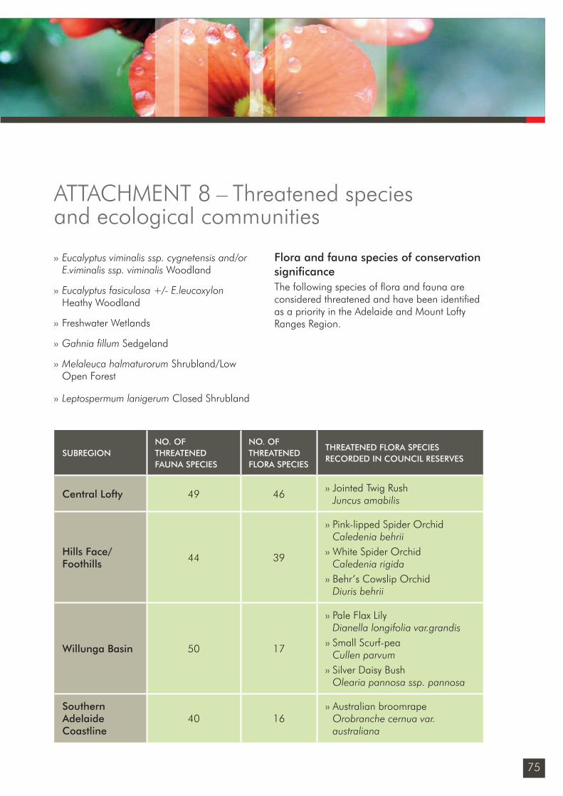
75
SUBREGIONNO. OF THREATENED FAUNA SPECIES
NO. OF THREATENED FLORA SPECIES
THREATENED FLORA SPECIES RECORDED IN COUNCIL RESERVES
Central Lofty 49 46 ›› Jointed Twig RushJuncus amabilis
Hills Face/Foothills 44 39
›› Pink-lipped Spider OrchidCaledenia behrii
›› White Spider OrchidCaledenia rigida
›› Behr’s Cowslip OrchidDiuris behrii
Willunga Basin 50 17
›› Pale Flax LilyDianella longifolia var.grandis
›› Small Scurf-peaCullen parvum
›› Silver Daisy BushOlearia pannosa ssp. pannosa
Southern Adelaide Coastline
40 16›› Australian broomrape
Orobranche cernua var. australiana
›› Eucalyptus viminalis ssp. cygnetensis and/or E.viminalis ssp. viminalis Woodland
›› Eucalyptus fasiculosa +/- E.leucoxylon Heathy Woodland
›› Freshwater Wetlands
›› Gahnia fillum Sedgeland
›› Melaleuca halmaturorum Shrubland/Low Open Forest
›› Leptospermum lanigerum Closed Shrubland
Flora and fauna species of conservation signifi canceThe following species of fl ora and fauna are considered threatened and have been identifi ed as a priority in the Adelaide and Mount Lofty Ranges Region.
ATTACHMENT 8 – Threatened species and ecological communities
Sustainability_FINAL.indd 75Sustainability_FINAL.indd 75 6/09/10 2:46 PM6/09/10 2:46 PM

www.onkaparingacity.com
Sustainability_FINAL.indd 76Sustainability_FINAL.indd 76 6/09/10 2:46 PM6/09/10 2:46 PM


![[Vegetation and Remote Sensing] Vegetation](https://img.pdfslide.us/doc/110x75/577cdfd71a28ab9e78b21a32/vegetation-and-remote-sensing-vegetation.jpg)
