Embed Size (px)
Citation preview
1
Revised February 12, 2018
CITY OF GREENVILLE
REZONING HANDBOOK
REZONING PROCESS
PLANNING AND ZONING COMMISSION
PROCEDURAL FORMAT,
GENERAL OUTLINE OF DUTIES
AND PLANNING CONCEPTS
2
TABLE OF CONTENTS
REZONING PROCESS ............................................................................................. 3
PLANNING AND ZONING COMMISSION ........................................................... 5
Meeting Outline ........................................................................................................................................ 7
Planning and Zoning Commission Policy on Public Comment Period ..................................................... 8
ZONING MAP ......................................................................................................... 10
COMPREHENSIVE PLAN ..................................................................................... 11
FUTURE LAND USE AND CHARACTER MAP ................................................. 12
ROLE OF PETITIONER ......................................................................................... 13
ROLE OF CITY STAFF .......................................................................................... 14
CONTRACT ZONING ............................................................................................ 14
SPOT ZONING ........................................................................................................ 15
CITIZEN COMMENTS ........................................................................................... 15
3
REZONING PROCESS
All requests for a rezoning must be submitted to the Planning Office, on forms provided by the City,
not less than twenty (20) working days prior to the scheduled Planning and Zoning Commission
meeting date.
Planning and Zoning Commission meetings: Third (3rd) Tuesday of each month -
6:00 PM; unless otherwise scheduled
Meeting Location: City Council Chambers, third floor of City Hall, 201 West 5th Street.
Meetings are open to the public and interested persons will be afforded an opportunity to speak in
accordance with the procedural format and meeting outline listed as Item B of this handbook, and the
Commission's Policy on Public Comment Periods.
The Commission will consider and take action on each rezoning petition listed on the approved
agenda. Possible action: recommend approval or denial; continue item to next meeting.
Following the Commission's action, to recommend approval or denial of a petition, the matter will be
forwarded to City Council for public hearing at the next available date. (Typically, the following
month.)
City Council Public Hearing Date: Second (2nd) Thursday of each month - 6:00 PM; unless re-
scheduled by Council.
Meeting Location: City Council Chambers, third floor of City Hall, 201 West 5th Street.
All public hearings are open to the public and interested persons will be afforded an opportunity to
speak in accordance with Council policy.
City Council will consider and take final action on each rezoning petition following a public hearing
on that item.
Rezoning ordinances may be effective immediately upon approval by City Council.
Rezoning requests may be withdrawn not less than ten (10) working days prior to the planning and
zoning commission meeting date. A petition that is withdrawn twice within any twelve-month
period shall not be considered by the planning and zoning commission until the expiration of twelve
(12) months from the date of the last withdrawal.
Rezoning requests may be withdrawn from city council public hearing provided that such request is
made at least seventy-two (72) hours prior to the public hearing date. If the public hearing is
continued to a later date, the date of the original scheduled hearing shall control. A petition that is

4
withdrawn shall not be reconsidered by the planning and zoning commission until the expiration of
six (6) months following the date of withdrawal.
When the city council has denied any request for zoning amendment, a petition for the same
amendment affecting the same property, or any portion thereof, shall not be accepted by the planning
and zoning commission until the expiration of six (6) months from the date of such previous denial.
For additional information, please call the Community Development Department at (252) 329-4498.
5
PLANNING AND ZONING COMMISSION
** PROCEDURAL FORMAT
Call to Order - 6:00 pm
Membership - Nine (9) City Members (7 regular and 2 alternate). Three (3)
County (ETJ area) Members (2 regular and 1 alternate).
Quorum - Five (5) voting members.
Voting - On all matters, a majority vote of the qualified members
present shall be necessary to pass on any motion.
Alternate members shall vote only in the absence of a regular
member.
Authority - Recommendation (only) to City Council concerning
REZONINGS, text amendments, ETJ extensions, street
closings, street name changes involving honorary
designations, comprehensive plan (text/map) amendments.
Jurisdiction - The City of Greenville exercises planning, zoning,
subdivision and building inspection authority within the city
limits and in its extra-territorial jurisdiction (ETJ) area.
Instructions to Audience/Applicants (by Chairman)
1. (Call) of agenda items.
2. (Request) City Staff to present background information and introductory facts relative to the
specific case.
3. (Request) the Applicant or authorized representative to present information in support of
the petition.
The Commission requests that the applicant address the following items with respect to the
current and proposed zoning. NOTE - The Commission and City Council will consider all
land uses and methods of development allowed within the respective zoning districts.
Reference to a specific plan of development or specific land use, either verbally or by
illustration, is therefore considered irrelevant and should not be discussed.
ITEMS: 1. Conformance with the Comprehensive Plan.
2. Compatibility with surrounding zoning pattern(s).
3. Compatibility with existing and future adjacent/area land uses.
4. Impact on area streets and thoroughfares.
5. Other factors which advance the public health, safety and welfare.
6
4. City Staff comment period; additional information and comments prior public testimony.
5. (Request) that those persons wishing to speak in favor of the request to please come forward.
(See note)
6. (Request) that those persons wishing to speak in opposition of the request to please come
forward. (See note)
7. (Request) that those persons wishing to rebut previous testimony; first in favor of then in
opposition to the request to please come forward.
NOTE: Groups of persons such as homeowners associations are requested to appoint a
spokesperson.
Specific issues either in favor of, or in opposition to the request shall be noted and recorded
by the Commission, and in the interest of time should not be repeated by subsequent
speakers. Comments should be reserved to new information only.
The Commission may set a time limit on individual or group public comment as deemed
necessary.
8. City Staff available for additional comment as necessary and on requests of the Commission.
9. (Call) for discussion by Commission Membership.
10. (Call) for motion to approve or deny the request.
11. (Call) for a second to the motion on the floor. Absent a second the Chairman shall entertain a
new motion and second.
12. (Call) for further discussion by the Commission Membership.
13. (Call) for voice vote on the item. If the vote is not unanimous a hand vote shall be recorded.
14. (Advise) the audience and applicant of the action taken and of the scheduled City Council
public hearing for final consideration where applicable (REZONINGS, text amendments,
etc.) or appeal procedure of a final action (preliminary plats, special use permits).
7
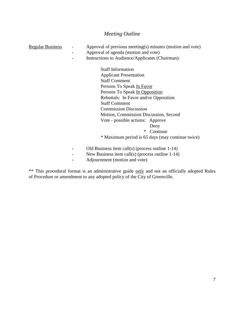
Meeting Outline
Regular Business - Approval of previous meeting(s) minutes (motion and vote)
- Approval of agenda (motion and vote)
- Instructions to Audience/Applicants (Chairman):
Staff Information
Applicant Presentation
Staff Comment
Persons To Speak In Favor
Persons To Speak In Opposition
Rebuttals: In Favor and/or Opposition
Staff Comment
Commission Discussion
Motion, Commission Discussion, Second
Vote - possible actions: Approve
Deny
* Continue
* Maximum period is 65 days (may continue twice)
- Old Business item call(s) (process outline 1-14)
- New Business item call(s) (process outline 1-14)
- Adjournment (motion and vote)
** This procedural format is an administrative guide only and not an officially adopted Rules
of Procedure or amendment to any adopted policy of the City of Greenville.
8
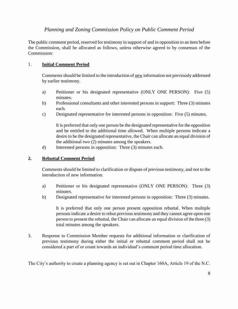
Planning and Zoning Commission Policy on Public Comment Period
The public comment period, reserved for testimony in support of and in opposition to an item before
the Commission, shall be allocated as follows, unless otherwise agreed to by consensus of the
Commission:
1. Initial Comment Period
Comments should be limited to the introduction of new information not previously addressed
by earlier testimony.
a) Petitioner or his designated representative (ONLY ONE PERSON): Five (5)
minutes.
b) Professional consultants and other interested persons in support: Three (3) minutes
each.
c) Designated representative for interested persons in opposition: Five (5) minutes.
It is preferred that only one person be the designated representative for the opposition
and be entitled to the additional time allowed. When multiple persons indicate a
desire to be the designated representative, the Chair can allocate an equal division of
the additional two (2) minutes among the speakers.
d) Interested persons in opposition: Three (3) minutes each.
2. Rebuttal Comment Period
Comments should be limited to clarification or dispute of previous testimony, and not to the
introduction of new information.
a) Petitioner or his designated representative (ONLY ONE PERSON): Three (3)
minutes.
b) Designated representative for interested persons in opposition: Three (3) minutes.
It is preferred that only one person present opposition rebuttal. When multiple
persons indicate a desire to rebut previous testimony and they cannot agree upon one
person to present the rebuttal, the Chair can allocate an equal division of the three (3)
total minutes among the speakers.
3. Response to Commission Member requests for additional information or clarification of
previous testimony during either the initial or rebuttal comment period shall not be
considered a part of or count towards an individual’s comment period time allocation.
The City’s authority to create a planning agency is set out in Chapter 160A, Article 19 of the N.C.
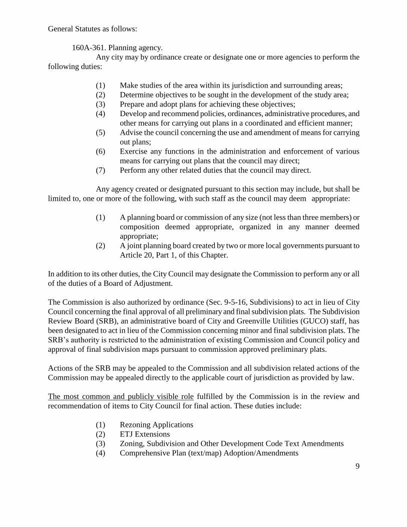
9
General Statutes as follows:
160A-361. Planning agency.
Any city may by ordinance create or designate one or more agencies to perform the
following duties:
(1) Make studies of the area within its jurisdiction and surrounding areas;
(2) Determine objectives to be sought in the development of the study area;
(3) Prepare and adopt plans for achieving these objectives;
(4) Develop and recommend policies, ordinances, administrative procedures, and
other means for carrying out plans in a coordinated and efficient manner;
(5) Advise the council concerning the use and amendment of means for carrying
out plans;
(6) Exercise any functions in the administration and enforcement of various
means for carrying out plans that the council may direct;
(7) Perform any other related duties that the council may direct.
Any agency created or designated pursuant to this section may include, but shall be
limited to, one or more of the following, with such staff as the council may deem appropriate:
(1) A planning board or commission of any size (not less than three members) or
composition deemed appropriate, organized in any manner deemed
appropriate;
(2) A joint planning board created by two or more local governments pursuant to
Article 20, Part 1, of this Chapter.
In addition to its other duties, the City Council may designate the Commission to perform any or all
of the duties of a Board of Adjustment.
The Commission is also authorized by ordinance (Sec. 9-5-16, Subdivisions) to act in lieu of City
Council concerning the final approval of all preliminary and final subdivision plats. The Subdivision
Review Board (SRB), an administrative board of City and Greenville Utilities (GUCO) staff, has
been designated to act in lieu of the Commission concerning minor and final subdivision plats. The
SRB’s authority is restricted to the administration of existing Commission and Council policy and
approval of final subdivision maps pursuant to commission approved preliminary plats.
Actions of the SRB may be appealed to the Commission and all subdivision related actions of the
Commission may be appealed directly to the applicable court of jurisdiction as provided by law.
The most common and publicly visible role fulfilled by the Commission is in the review and
recommendation of items to City Council for final action. These duties include:
(1) Rezoning Applications
(2) ETJ Extensions
(3) Zoning, Subdivision and Other Development Code Text Amendments
(4) Comprehensive Plan (text/map) Adoption/Amendments
10
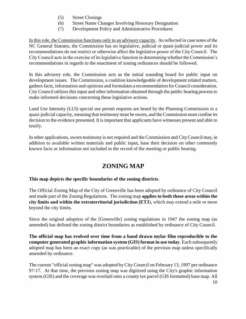
(5) Street Closings
(6) Street Name Changes Involving Honorary Designation
(7) Development Policy and Administrative Procedures
In this role, the Commission functions only in an advisory capacity. As reflected in case notes of the
NC General Statutes, the Commission has no legislative, judicial or quasi-judicial power and its
recommendations do not restrict or otherwise affect the legislative power of the City Council. The
City Council acts in the exercise of its legislative function in determining whether the Commission’s
recommendations in regards to the enactment of zoning ordinances should be followed.
In this advisory role, the Commission acts as the initial sounding board for public input on
development issues. The Commission, a coalition knowledgeable of development related matters,
gathers facts, information and opinions and formulates a recommendation for Council consideration.
City Council utilizes this input and other information obtained through the public hearing process to
make informed decisions concerning these legislative actions.
Land Use Intensity (LUI) special use permit requests are heard by the Planning Commission in a
quasi-judicial capacity, meaning that testimony must be sworn, and the Commission must confine its
decision to the evidence presented. It is important that applicants have witnesses present and able to
testify.
In other applications, sworn testimony is not required and the Commission and City Council may, in
addition to available written materials and public input, base their decision on other commonly
known facts or information not included in the record of the meeting or public hearing.
ZONING MAP
This map depicts the specific boundaries of the zoning districts.
The Official Zoning Map of the City of Greenville has been adopted by ordinance of City Council
and made part of the Zoning Regulations. The zoning map applies to both those areas within the
city limits and within the extraterritorial jurisdiction (ETJ), which may extend a mile or more
beyond the city limits.
Since the original adoption of the [Greenville] zoning regulations in 1947 the zoning map (as
amended) has defined the zoning district boundaries as established by ordinance of City Council.
The official map has evolved over time from a hand drawn mylar film reproducible to the
computer generated graphic information system (GIS) format in use today. Each subsequently
adopted map has been an exact copy (as was practicable) of the previous map unless specifically
amended by ordinance.
The current "official zoning map" was adopted by City Council on February 13, 1997 per ordinance
97-17. At that time, the previous zoning map was digitized using the City's graphic information
system (GIS) and the coverage was overlaid onto a county tax parcel (GIS formatted) base map. All
11
of the district boundaries shown on the current map are either scaled from previously adopted maps
or are based on legal descriptions included in zoning map amendment ordinances. The resulting map
is more accurate than was possible in the past. Although the map can be view at virtually any scale,
due to the computer ability to zoom in/out, the official map scale has been set at 1 inch equals 400
feet. For purposes of zoning district boundary interpretation, the 1 to 400 ratio will be utilized.
The current "GIS based zoning map" is officially a black line coverage printed on mylar film,
however, color patterns representing the various districts have been added by staff for
illustrative purposes.
Where the location of district boundaries on the official zoning map is uncertain and where no
specific ordinance description is found to exist, the following rules apply:
(a) Streets, rights-of-way and easements. Boundaries indicated on the zoning map as
approximately following the centerline of a street, highway, railroad, right-of-way,
utility easement, stream or riverbed, or of such lines extended, are construed to be
such district boundaries.
(b) Lot lines. Boundaries indicated as approximately following platted lot lines are
construed as following such lot lines.
(c) Political boundaries. Boundaries indicated as approximately following political
boundaries are construed as following the political boundaries.
Where any public street or alley is officially closed or abandoned by City Council, the regulations
[zoning] applicable to parcels of abutting property shall apply to that portion of the street or alley
added to the abutting property by virtue of such vacation or abandonment.
In case any further uncertainty exists, the board of adjustment shall interpret the intent of the
map as to location of such boundaries.
The districts can only be amended by City Council following review and recommendation of the
Planning and Zoning Commission and City Council public hearing. Amendments to the Official
Zoning Map are in fact an amendment to the Zoning Ordinance.
COMPREHENSIVE PLAN
The Comprehensive Plan is a document adopted by the city council, which provides direction in
the development of the city. It is a statement by the city as to how the community should look
and function in the future.
The Plan specifically applies to the area within the city limits and to the area within the
extraterritorial jurisdiction (ETJ). Additionally, for long range planning purposes the Land Use Plan
Map boundaries extend beyond the ETJ limits of the City in anticipation of future ETJ and/or city
limit expansion.
The Comprehensive Plan is not a zoning ordinance, but it does provide a legal basis for decision
12
making. The North Carolina General Statutes stated that zoning regulations should be made in
accordance with a comprehensive plan. When challenged in court, development codes are more
likely to be upheld when based on a comprehensive plan rather than as ad hoc decisions.
The Comprehensive Plan is a statement of policies. These policies tell the public and elected
officials what actions are likely to be taken in given situations. The plan is to function as a guide. It
does not hold the same status as the zoning ordinance, which provides for penalties if violated.
The Comprehensive Plan is composed of elements, which affect the physical development of the
city, such as housing, transportation, land use, recreation, utilities and the environment. Each
element has an identification of goals and recommended actions to achieve them. Because the
plan attempts to address so many issues, it is not uncommon for there to be conflicting policies.
The key too a successful comprehensive plan is to find the proper balance when such situations
occur.
The Comprehensive Plan is general, not site specific. It is important to recognize the intent
behind the plan and to take actions, which support that intent.
The Comprehensive Plan seeks to provide insight into the long-range future of the community.
Those interested in investing in the city often review the comprehensive plan to learn more about the
community and to help with investment decisions.
The Comprehensive Plan performs an important role in shaping the future of the City. The plan is
the product of a lengthy public process, involving large numbers of citizens and compromises
among competing interests. Once in place, the plan is an important tool in guiding public and
private decision-makers on issues, which will affect the city for many years. Deviations from the
plan should be possible when needed, but not necessarily easy.
The City of Greenville's Comprehensive Plan is entitled "HORIZONS 2026: Greenville's
Community Plan" , originally adopted on January 9, 1992 was updated on February 12, 2004 by the
Greenville City Council per Ordinance No. 04-10.
On September 8, 2016, it was recently re-written and adopted.
The Comprehensive Plan may be amended from time to time through any public participation
process described by City Council, provided however at minimum, following a review and
recommendation of the Planning and Zoning Commission and a public hearing of City Council.
FUTURE LAND USE AND CHARACTER MAP
The Greenville City Code per Ordinance No., 97-73 originally adopted the Future Land Use Plan
Map on August 14, 1997.
The Future Land Use and Character Map serves as an addendum to the Comprehensive Plan,
Horizons. It is stressed that the land use plan map is based to a large extent on the goals and
13
objectives outlined in the Horizons plan and is not intended to be a stand-alone document.
The Elements of Urban Form are defined and described in detail in the Horizons plan. The
arrangement of land use patterns depicted on the Future Land Use and Character Map are
configured to support the City's Urban Form Policies and in consideration of projected need.
The Future Land Use and Character Map includes 16 separate land use categories. Each of these
categories is associated with 1 or more of the 28 zoning districts or as conservation/open space.
Therefore, the Future Land Use and Character Map, in many cases, represents a range of
available land use options to be evaluated on a site specific case by case basis at the time of
zoning consideration. A description of the allowable uses for each zoning district can be found in
the Zoning Ordinance (Section 9-4-78. Table of Uses).
The Future Land Use and Character Map depicts a desired or optimum pattern of land use for
vacant as well as developed land. For land areas that are already developed, the desired land use
may not be consistent with the existing land use. In cases where the planning process resulted in a
desired land use that deviated from the existing land use, the preferred land use pattern is indicated.
The preferred land use pattern was, at the time of plan adoption, considered more suitable and
compatible with the long range goals and objectives of the City.
The Future Land Use and Character Map provides a visual illustration of the Urban Form
Policies set out in the Horizons document, however, the land use patterns depicted on the plan
are not site (dimensionally) specific. Where land use patterns appear to follow base map property
lines, such description should be considered as general and the City's Urban Form Policies outlined
in the Horizons plan will control. Unlike the zoning map where district boundaries are described by
specific course and distance the Future Land Use and Character Map boundaries are general. It
is important to recognize the intent behind the plan and to take actions, which support that
intent.
Any amendment to the Future Land Use and Character Map is an amendment to Horizons 2026:
Greenville's Community Plan.
ROLE OF PETITIONER
The petitioner, or authorized representative, shall appear before the Commission and City Council
and present compelling information to justify the need for and appropriateness of the proposed
rezoning.
In the presentation of such information, the petitioner should address the following issues:
1. Conformance with the Comprehensive Plan.
2. Compatibility with surrounding zoning pattern(s).
3. Compatibility with existing and future adjacent/area land uses.
4. Impact on area streets and thoroughfares.
5. Other factors which advance the public health, safety and welfare.
14
The Commission and City Council will consider all land uses and methods of development allowed
within the respective zoning districts. Reference to a specific plan of development or specific land
use, either verbally or by illustration, is therefore considered irrelevant and should not be discussed.
ROLE OF CITY STAFF
City staff serves in an advisory capacity to both the Planning and Zoning Commission and City
Council on planning and development related matters.
Staff will assist the Commission by presenting information from zoning maps, adopted plans of the
City, zoning and subdivision regulations and other codes or ordinances that apply in the particular
case.
Following the applicant’s presentation and public input in favor of and against the petition, staff will
then provide their opinion on the issue. If staff believes the request is not in compliance with
adopted plans of the City and is not compatible with existing and future adjacent/area land uses then
staff will voice an objection to the request.
A no objection position does not mean the City staff is an advocate for the request, it merely means
that on the basis of the relevant information collected staff does not believe a conflict exists with
adopted plans of the City and that the proposed zoning and associated land uses will, in staff’s
opinion, be compatible with existing and future adjacent/area land uses.
It is not the responsibility of city staff or of area property owners to present compelling information
to justify approval or denial of any rezoning petition.
It is the sole responsibility of the applicant to justify the need for and appropriateness of any
rezoning.
CONTRACT ZONING
Contract zoning is prohibited by State Law.
With regard to a zoning action, the City may not enter into or acknowledge any contract, agreement,
covenant or other restriction which limits the use of land consistent with the codes and ordinances of
the City.
Contracts between private parties shall not be considered by the Commission or City Council in
making any recommendation or decision.
The Commission and City Council will consider all land uses and methods of development allowed
within the respective zoning districts.
15
Reference by the applicant to a specific plan of development or specific land use, either verbally or
by illustration, is therefore considered irrelevant and should not be discussed.
The absence of an objection from adjoining or interested parties based on a private party contract
shall be sufficient to convey the private parties mutual agreement on the issue in question. Such
contracts are not enforceable by the City and shall have no effect on the validity of the legislative
action.
SPOT ZONING
Illegal spot zoning is the arbitrary zoning of a tract or parcel which benefits or burdens such property
in a manner uncommon to area properties.
Arbitrary classification is the key in determining whether illegal spot zoning has occurred. Zoning in
accordance with an adopted comprehensive plan and designed to promote a legitimate public
purpose is not an arbitrary action.
The North Carolina Supreme Court has determined that, if there is a reasonable basis for spot zoning,
it is legal and valid. Relevant factors for showing a reasonable basis, the court said, include the size
of the tract; the compatibility of the rezoning with the comprehensive plan; the benefits and
detriments to the parcels owner, neighbors, and surrounding community; and the relationship of the
uses envisioned under the new zoning and the uses currently present in adjacent tracts.
CITIZEN COMMENTS
"§ 160A-385. Changes.
(a) Citizen Comments.
(1) Zoning ordinances may from time to time be amended, supplemented, changed,
modified or repealed. If any resident or property owner in the city submits a written
statement regarding a proposed amendment, modification, or repeal to a zoning
ordinance to the clerk to the board at least two business days prior to the proposed vote
on such change, the clerk to the board shall deliver such written statement to the city
council. If the proposed change is the subject of a quasi-judicial proceeding under G.S.
160A-388, the clerk shall provide only the names and addresses of the individuals
providing written comment, and the provision of such names and addresses to all
members of the board shall not disqualify any member of the board from voting.