Embed Size (px)
Citation preview
CIP/NIP/Engineering Web Map Users Manual
City of Monterey, February 2014 A few important things to know: *** Please view this application with Chrome, Firefox, or Internet Explorer 10 or above. CIP/NIP Data Layer: *** There can be several CIP/NIP projects in one location. When this is the case, you will see all of the project numbers on the map, but the symbol (color) will only be correct for whatever project randomly landed on top. Also, if you use the “InfoClick”option, you will only get information for whatever project landed on top. The best way to view information for multiple (stacked) CIP/NIP projects is to:
1. click the CIP/NIP Table button to open the table. 2. click the CIP/NIP button to open that search tool. 3. check the Select by Drawing a Box checkmark, and click OK. 4. draw a box around the project area you are interested in. 5. view the results in the table. All of the projects (and only the projects) within the specified area will be listed in the table.
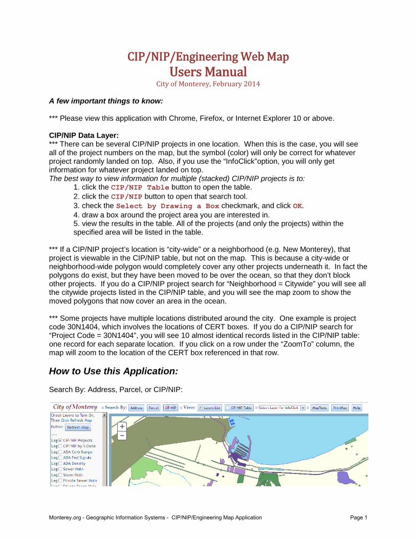
*** If a CIP/NIP project’s location is “city-wide” or a neighborhood (e.g. New Monterey), that project is viewable in the CIP/NIP table, but not on the map. This is because a city-wide or neighborhood-wide polygon would completely cover any other projects underneath it. In fact the polygons do exist, but they have been moved to be over the ocean, so that they don’t block other projects. If you do a CIP/NIP project search for “Neighborhood = Citywide” you will see all the citywide projects listed in the CIP/NIP table, and you will see the map zoom to show the moved polygons that now cover an area in the ocean. *** Some projects have multiple locations distributed around the city. One example is project code 30N1404, which involves the locations of CERT boxes. If you do a CIP/NIP search for “Project Code = 30N1404”, you will see 10 almost identical records listed in the CIP/NIP table: one record for each separate location. If you click on a row under the “ZoomTo” column, the map will zoom to the location of the CERT box referenced in that row. How to Use this Application: Search By: Address, Parcel, or CIP/NIP:
Monterey.org - Geographic Information Systems - CIP/NIP/Engineering Map Application Page 1

Click the CIP/NIP Table button to view the CIP/NIP Table:
Click on a row in the ZoomTo column to zoom to that project on the map, or click on a row in the ViewDoc column to see a popup pdf with more information on that project:
Click on a Column Name to sort the table by that column:
Monterey.org - Geographic Information Systems - CIP/NIP/Engineering Map Application Page 2

Click on Leg in the Layers List to see the Legend for that layer:
Monterey.org - Geographic Information Systems - CIP/NIP/Engineering Map Application Page 3

Click on the CIP/NIP button to open the CIP/NIP search tool. Choose from three options: enter a project code, select by parameters, or check to select by drawing a box. When the user clicks OK, the results will be highlighted on the map, and if the CIP/NIP table is open, the records in the table will be those selected out by the search.
When selecting by parameters, more than one parameter may be defined.
Monterey.org - Geographic Information Systems - CIP/NIP/Engineering Map Application Page 4

Select a layer from the InfoClick pulldown to select that layer for pop-ups.
Once an InfoClick layer is selected, click on the map to see a pop-up with more information about each feature. If the feature has Attachments, you can click on those as well (in the pop-up window) to access even more information.
Monterey.org - Geographic Information Systems - CIP/NIP/Engineering Map Application Page 5

Click on the Address button to open the Address search tool.
Once a street name is selected, all official address numbers for that street will be available in the Address Number pulldown. It is okay to ignore the address numbers and do a search on street name only.
The Street Name pulldown has auto-complete, so as letters are typed into the box, it will automatically offer suggestions. It is always necessary to actually click on the Street Name in the pulldown list, even if there is only one suggestion offered.
Monterey.org - Geographic Information Systems - CIP/NIP/Engineering Map Application Page 6

Click on the MapTools button to open the Map Tools pop-up.
This pop-up offers options to zoom in or out (by drawing a box), to jump to the maximum extent of the map, or to measure a distance (in feet). After clicking the Measure button, the user should press and hold the mouse button until the distance is marked by a red line. When the mouse button is released, the distance of that red line will be displayed in the Map Tools window.
Click on the PrintMap button to export the map ONLY portion of the web page to PDF format. If labels are disappearing from the PDF, it is necessary to zoom in one level further before exporting to PDF.
Where to Find this Application: This application can be found on the monterey.org website. Select City Hall, and from the pulldown list select Geographic Info Systems. From that page there is a link to CIP/NIP/Engineering Map Application. Or access the page directly here: http://gisags8.ci.monterey.ca.us/pub/engr/
Monterey.org - Geographic Information Systems - CIP/NIP/Engineering Map Application Page 7