Embed Size (px)
Citation preview

PRE FEASIBILITY REPORT
of
CIDCO STONE QUARRIES, NAVI MUMBAI
For extraction of Minor Mineral - Stone
Submitted to
MINISTRY OF ENVIRONMENT, FORESTS & CLIMATE CHANGE Indira Paryavaran Bhavan, Jor Bagh, New Delhi
*
Project Proponent
City and Industrial Development Corporation
of Maharashtra Limited NAVI MUMBAI,
THANE DISTRICT, MAHARASHTRA
*
EIA Consultant
POLLUTION & ECOLOGY CONTROL SERVICES
Near Dhantoli Police Station, Dhantoli, Nagpur-440012 (Maharashtra) 0712-249263
Provisional Acreditad by NABET: No.- NABET/EIA/02/12/47 Dated 27/02/2012
May 2016

Pre Feasibility Report
1
1. EXECUTIVE SUMMARY
This Pre Feasibility Report has been prepared for the CIDCO Stone Quarries, Navi
Mumbai located spread over 138.07 Ha in five villages viz., Parvane, Bonsari, Shirvane,
Turbhe & Kukshet, Navi Mumbai Tahsil of Thane District Maharashtra, in accordance
with the Notification of MoEF S.O. 1533 dated 14th September 2006.
Developmental activities like industries or quarry project may cause temporary damage
to land, forest and induce changes in the quality of air, water, flora and fauna of the area.
But, there are favorable effects of industrialization on social development and progress
of the Nation. For overall gain, it is necessary to strike a balance between the two
aspects of economy and ecology and ensure that impacts on the environment are
minimized with improvement in socio-economic conditions. This is better achieved
through a well-planned approach of EMP relevant to the area under consideration.
Stone / Murrum is used for a wide variety of purposes. It is most commonly crushed for
use as an aggregate in construction projects. Crushed Stone/Murrum is required for road
base, concrete aggregate, asphalt pavement aggregate, railroad ballast, filter Stone/
Murrum in drain fields and many other purposes. Stone / Murrum is also cut into
dimension stone. Thin slabs of Stone/ Murrum are cut and sometimes polished for use
as floor tiles, building veneer, monuments and other Stone/Murrum objects.
The quarries are developed as opencast for the production of Stone/Murrum metal of
various sizes. Stone/ Murrum crusher of adequate capacity has been suggested for
aggregate production in various sizes as per the demand. In order to obtain
environmental clearance as per the EIA Notification 2006, the prefeasibility report is
submitted along with the application Form-I for the project under consideration.
The selected area has exposures of Stone. This Stone/Murrum is excellent building
material as it possesses most of the required characteristic. The compact black Stone/
Murrum are quite strong. The applicant has received Forest Clearance in 2006 valid
upto 2026 (Annexure enclosed with Form-1).
Pre Feasibility Report
2
2. INTRODUCTION OF THE PROJECT / BACKGROUND INFORMATION.
i) Identification of Project and Project Proponent
CIDCO – India’s Premiere Town Planning Agency, City and Industrial Development
Corporation of Maharashtra Ltd., is a company wholly owned by the Govt. Of Maharashtra
and was incorporated on 17th March 1970, with the specific aim of Mumbai city and at the
same time creating a new planned, self sufficient and sustainable city on the mainland
across Thane creek adjoining Mumbai. What began as a mission to Mumbai ended up in
the creation of one of the largest planned city known today and elevated CIDCO into the
position of India’s premier town
planning agency.
Mumbai Metropolitan Regional
Planning Board recommended
considering a twin city across to
facilitate the separation of greater
Mumbai and CIDCO was entrusted
with developing necessary social and
physical infrastructure. Forty-one years
later, CIDCO has carved out an
eminent nest of planned, sustainable
and self sufficient inhabitation, out of a
common, undeveloped expanse of 344 sq. km. which was once a marshy sanctuary to salt
pans and paddy fields.
With a wide spectrum of activities, CIDCO is a multi faceted and multi disciplinary
organization having 1,750 employees, which includes planners, architects, engineers and
other professionals. Since its inception, CIDCO has diversified its working spectrum to
accommodate new activities, even though its primary attention is still concentrated in
overlooking the constant development of Navi Mumbai. The multidimensional activities
undertaken today by CIDCO can be classified under these three broad concepts:
Planning and Development of New Towns.
Consultancy.
Project Management and Designing.

Pre Feasibility Report
3
CIDCO Developed Cities:
Navi Mumbai (34400 sq. m.) New Nanded (172 Ha.)
Oros-Sindhudurg (430 Ha.) Waluj (8571 Ha.)
Aurangabad Fringe Area (15184 Ha.) Khopta (9400 Ha.)
Jalna New Town (470 Ha.) New Aurangabad (1012 Ha.)
New Nashik (398 Ha.) Vasai-Virar Sub Region (38000 Ha.)
Meghdoot, New Nagpur Chikhaldara Hill Station (1953 Ha.)
Latur Fringe Area (25131 Ha.)
Navi Mumbai has become a unique project by virtue of its pattern of development,
housing, social and physical infrastructure, method of finance and sustainable futuristic
planning, earning the city a reputation of being a Super City and one of the largest planned
city. Polycentric pattern of development ensured balanced land and even distribution of
residential areas, job centers, wholesale markets, non-polluting industry and population
density. Today, Navi Mumbai is endowed with an entire gamut of infrastructure facilities.
ii) Brief description of nature of the project
The present Pre Feasibility Report has been prepared for the CIDCO Stone Quarries, Navi
Mumbai admeasuring an area of 138.07 Ha of forest Land as per the details given below;
Location/Village Survey No Area in Ha
1. Pawane Village 163 21.23
2. Bonsari Village 203 30.81
3. Shirvane Village 323/A 18.59
4. Turbhe Village 387 47.74
5. Kukshet Village 183 19.70
TOTAL 138.07
For the development for Navi Mumbai during 1970, CIDCO had acquired land from the
villagers with compensation prevalent at that time. Some of the Project Affected Persons
were offered quarries in lieu of their land compensated for the purpose of Navi Mumbai.
The land identified for this purpose was forest land. After the enactment of Forest
Conservation Act, 1980 necessary clearance under the provisions of the Act has been
obtained. Today these stone quarries are being jointly operated by these entitled PAP’s,
whilst some of the stone quarries are abandoned . The quarries are developed by

Pre Feasibility Report
4
mechanized opencast method of mining. A list of them along with area allocated to each of
them is provided in Annexure 2 in Form-1.
In order to obtain environmental clearance as per the EIA Notification 2006 the
prefeasibility report is submitted along with the application Form 1 for the project under
consideration. The project is categorized as Category A.
iii) Need for the project and its importance to the country and or region.
Building material Stone/Murrum metal is an essential requirement as one of the minor
mineral deposits occurring in the majority portion of Maharashtra. It has played a great
role in development of civilization and industrialization. The occurrence of Stone/Murrum
in the area is proved by the way of exposures and its production has important role in the
local infrastructural development.
iv) Demand Supply Gap.
It is an essential constituent infrastructural development projects like road, dams, bridges
and building. Its demand in industrial area of Thane District and nearby areas is increasing
rapidly.
v) Imports vs. Indigenous production.
Maharashtra is one of the major producers of building Stone/ Murrum in the country.
vi) Export Possibility.
Not explored
vii) Domestic / export Markets.
Domestic market for Stone/Murrum as building material is well established..
viii) Employment Generation (Direct and Indirect) due to the project.
Almost every lessee has 5 to 10 persons on its roll. Presentably over 560 persons are
employed, out of these nearly 300 are skilled and highly skilled worked and over 250
unskilled workers.
3 PROJECT DESCRIPTION
i) Type of project including interlinked and Interdependent project, if any.
The project is quarry by opencast method. There is no interlinked and interdependent
project

Pre Feasibility Report
5
ii) Location (map showing general location, specific location, and project
boundary & project site layout) with coordinates.
The mining lease area is covered in parts of Survey of India Toposheet No. 47 E/4
within latitude as given in the Annexure 1. The land is Reserved Forest Land. . The
location of site is shown in the Figure-1.
FIGURE-1: LOCATION OF QUARRIES
Pre Feasibility Report
6
iii) Details of alternate sites considered and the basis of selecting the
proposed site, particularly the environmental consideration gone into
should be highlighted.
The project is a site specific and has to be undertaken at the place of the occurrence of
the mineral and hence no alternative sites explored.
iv) Size or magnitude of operation.
The mining operations in this area are ongoing operations carried out from more than 4
decades with an average production of 6-7 MTPA by opencast method.
v) Project description with process details (a schematic diagram/ flow chart
showing the project layout, components of the project etc. should be
given).
The area has exposures of Stone. This Stone/ Murrum are excellent building material as
it possesses most of the required characteristic. A surface Plan of the mining lease
showing existing features is enclosed as Map-1 while the proposed production plan at
the conceptual stage is depicted at Map-2.
vi) Raw material along with estimated quantity, likely source marketing area of
final products, mode of transport of raw material and Finished product.
There is no requirement of any Raw Material for the production of stone from this
project. Mode of transport of extracted building material is surface transport by existing
roads.
vii) Resource optimization / recycling and reuse envisaged in the project, if
any, should be briefly outlined.
There is no waste material generation as there is no overburden, soil or interburden. All
the excavated material is directly consumed in the market as per the sizes.
viii) Availability of water its source, Energy / power requirement and source
should be given.
Drinking water is supplied through MIDC pipeline partially. At some locations ground
water is abstracted to the tune of 12 m3/day for meeting drinking water purpose through
borewell / tubewell. The power supply is available from the Maharashtra State Electricity
Board.

Pre Feasibility Report
7
ix) Quantity of waste to be generated (liquid and solid) and scheme for their
Management /disposal.
Solid Waste: There is no solid waste generation during quarry development.
Liquid Effluent: There is no effluent generation. The quarries does not intercept the
water table. Storm water during monsoon is drained into natural water courses of
seasonal nature.
x) Schematic representation of the feasibility drawing which give information
of EIA purpose.
Not required
4 SITE ANALYSIS
i) Connectivity.
The area is approachable by well developed road network provided by MIDC.
ii) Land use and Land ownership.
CIDCO Stone Quarries, Navi Mumbai admeasuring an area of 138.07 Ha is
categorized as reserved forest Land as per the details given below;
Location/Village Survey No Area in Ha
1. Pawane Village 163 21.23
2. Bonsari Village 203 30.81
3. Shirvane Village 323/A 18.59
4. Turbhe Village 387 47.74
5. Kukshet Village 183 19.70
TOTAL 138.07
At the time of development of new city of Navi Mumbai during 1970, this forest land
was transferred to CIDCO by State Government in July 1972. This proposal 138.07
Ha of forest land for which lease was granted from time to time from 1972. There
were 94 stone quarries allocated to project affected persons to CIDCO and
Government Contractors. Quarrying was continued in many of the sites from 1972

Pre Feasibility Report
8
till date on the basis of lease granted by revenue department. The Forest
clearance for the above land has been obtained MoEFCC New Delhi.
iii) Topography (along with map).
The topography of the lease area is hilly terrain. The hilly trend is in almost
N-S direction with steep slope towards east and west. The 138.07 Ha of
mining lease lies towards western side of the hill as shown on the surface
plan placed at Map-1.
iv) Existing land use pattern (agriculture, non-agriculture, forest, water
bodies (including area under CRZ), shortest distances from the
periphery of the project to periphery of the forest, national park, wild
life sanctuary, eco sensitive areas, water bodies (distance from the
HFL of the river), CRZ. In case of notified industrial area, a copy of the
Gazette notification should be given.
The mining lease 0f 138.07 Ha is categorized as Forest land has been
used for extraction of the stone for almost 4 decades and has undergone
changes and the current landuse is as under;
Sr. No
Particulars Area
1 Stone quarries area 84.14 Ha
2 Crusher and Allied works, temporary labour shed and
offices etc.
32.20 Ha
3 Approach Road 21.73 Ha
Total 138.07 Ha

Pre Feasibility Report
9
Significant features in 10 Km radius (aerial distance) of the project are tabulated below;
There is no nearest National Park, Wild life Sanctuary in 15 Km radius of the project.
v) Existing Infrastructure.
There are quarrying activities carried out in the surrounding. There is well established
road connection from the quarries to the National Highway /village road.
vi) Soil classification.
The lease area is broken land with Stone/ Murrum exposures and no soil cover.
vii) Climatic data from secondary sources.
The climate of the surrounding area is generally dry except in the south-west
monsoon season. The year may broadly be divided into four seasons.
Sr. No. FEATURES DETAILS DISTANCE
1. Village (Nearest) Kukshet 1.3 km (W)
2. Creek, Nala
Vasai creek 4.5 km (W)
Bava Malang 6 km.(E)
3. Reserved Forest Forest area SQ within Reserved
Forest
Protected Forest - -
4. National Highway NH 4 2.0 (E)
5. Industries MIDC Area 400m (W)
6. Thermal Power Plant None -
7. Mines Various stone quarries
Adjacent
8. Railway Line Nerul Railway 1.62 km (W)
9. Archeological Monument None -
10. National Park None -
11. Wildlife / Bird Sanctuary None -
12. Interstate Boundary None -
Pre Feasibility Report
10
Winter Season : December to February
Pre Monsoon Season : March to May
Monsoon Season : June to September
Post Monsoon Season : October and November
The climate of this district is characterized by hot humid summer, well distributed
high rainfall during the southwest monsoon and general dryness except in the rainy
season. The cold season is mild from December to February. This is followed by
the hot season from March to May. The southwest monsoon season is from June to
September. October and November constitute the post-monsoon season.
Source : IMD
viii) Social Infrastructure available.
The area is closely situated near the Turbhe MIDC and enjoys all the infrastructural
facilities like road, railway, telecommunication, power, water etc. There is plenty of
manpower available and all necessary facilities like Post office, Hospital, Police
Station etc are available within the nearby area of Turbhe.
5 PLANNING BRIEF
i) Planning Concept (type of Industries, facilities, transportation etc) Town and country planning/ Development authority Classification. The stone quarries are developed as opencast for the production Stone/Murrum
metal of various size. A crusher with dust suppression arrangement is installed. The
quarried material is crushed and screened to the desired output before being
dispatched by road through trucks.
ii) Population Projection.
CIDCO Stone Quarries, Navi Mumbai is close to the Turbhe MIDC and exhibit semi
urban nature. Villages like Kukshet, Pawane, Shirvane, Turbhe and Bonsari are
close to the stone quarries. The manpower required for the project is engaged from
the nearby village(s) supplemented with some population from the surrounding
states.
Pre Feasibility Report
11
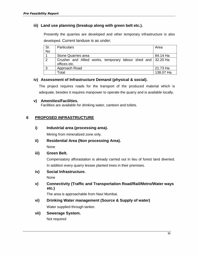
iii) Land use planning (breakup along with green belt etc.).
Presently the quarries are developed and other temporary infrastructure is also
developed. Current landuse is as under;
Sr. No
Particulars Area
1 Stone Quarries area 84.14 Ha
2 Crusher and Allied works, temporary labour shed and offices etc.
32.20 Ha
3 Approach Road 21.73 Ha
Total 138.07 Ha .
iv) Assessment of Infrastructure Demand (physical & social).
The project requires roads for the transport of the produced material which is
adequate, besides it requires manpower to operate the quarry and is available locally.
v) Amenities/Facilities. Facilities are available for drinking water, canteen and toilets.
6 PROPOSED INFRASTRUCTURE
i) Industrial area (processing area).
Mining from mineralized zone only.
ii) Residential Area (Non processing Area).
None
iii) Green Belt.
Compensatory afforastation is already carried out in lieu of forest land diverted.
In addition every quarry lessee planted trees in their premises.
iv) Social Infrastructure.
None
v) Connectivity (Traffic and Transportation Road/Rail/Metro/Water ways etc.)
The area is approachable from Navi Mumbai.
vi) Drinking Water management (Source & Supply of water)
Water supplied through tanker.
vii) Sewerage System.
Not required
Pre Feasibility Report
12
viii) Industrial Waste Management.
Not required
ix) Solid Waste Management.
No Solid waste generation.
x) Power Requirement & Supply / Source.
State Electricity Board
7 REHABILITATION AND RESETTLEMENT (R & R ) PLAN
i) Policy to be adopted (central/state) in respect of the project affected
person including home oustees, land oustees and landless laborers (a brief
outline to be given.)
The allotment of the stone quarries are a part of the compensation given the
land looser of the area who opted for the stone quarry activities.
8 PROJECT SCHEDULE & COST ESTIMATES
i) Likely date of start of construction and likely date of completion (Time schedule for the project to be given.)
The operations are carried as per the statutory guidelines. Adequate reserves
are available. Reclamation and Rehabilitation plan will be prepared for
sustainable development and minimized environmental damage.
ii) Estimated project cost along with analysis in terms of economic viability of the project.
Rs. 50 to 60 lakhs already invested towards each quarry development and stone
crusher.
9 ANALYSIS OF PROPOSAL FINAL RECOMMENDATIONS)
i) Financial and social benefits with special emphasis on the benefit to the
local people including tribal population, if any, in the area.
The local population are employed wherever possible in the project activities
directly or indirectly.

Pre Feasibility Report
13
Map-1 : Surface Plan
T1
Point Latitude Longitude
T9
T10
T11
T12
TU1
T4
T13
T14
T15
T16
T17
T18
T19
T20
T22
T21
TU3
CO-ORDINATES TAKEN WITH DGPS
(LEICA VIVA GS05). MAP DATUM WGS 84)
T2
T3
T5
T6
T7
T8
Easting Northing
293107.567 2106703.513
293297.131
293199.517
293299.982
293289.908
293353.800
293410.771
293179.278
293302.835
293210.782
293072.111
293118.770
293265.100
293220.820
293231.188
293240.252
293293.506
293455.488
293522.045
293198.935
292966.532
292966.373
292966.615
293261.542 2107133.872
2107229.764
2107483.931
2107859.281
2108060.935
2108234.789
2108521.558
2108803.466
2108963.716
2109323.010
2109615.160
2109623.029
2109782.054
2110070.345
2110444.990
2110704.701
2110954.561
2111247.981
2111605.881
2111625.838
2111214.159
2110764.968
2110535.992
0 25020015010050
Scale - 1cm = 50m500 750 1000 1250 M
Bench Crest & Toe
Nala
Haul Road
DGPS Points
Fencing/Wall
Electric Line
Structure
Crusher Area
Culvert
UTM Grid
Silo
Dump
Crusher
Spot Level
Magzine
Toe Crest
SURFACE PLAN
CIDCO STONE QUARRYNAVI MUMBAI,MAHARASTRA
DRG NO : TURBHE/MINE/SUR/2015/1
DATE:-31/12/2014 R.F:-1:5000
THIS IS TO CERTIFY THAT THIS PLAN IS CORRECT
LEGEND
Feature Symbol
Lease Boundary
(5m interval)Contour