Embed Size (px)
Citation preview

C h r i s t o p h e r C a b e z a s
selected works 2010–2013
Portfol ioL A N D S C A P E D E S I G N E R
CREATE | SUSTAIN | INSPIRE SELECTED WORKS
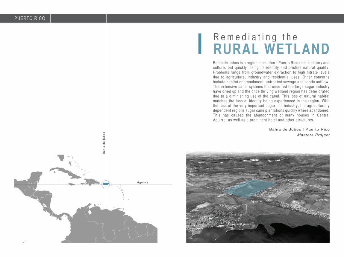
Bahia de Jobos | Puer to RicoRemediating the RURAL WETLAND1
AutoCADConstruction DOCUMENTS3
DigitalDigital LANDSCAPES5
ContactCurriculum Vitae6
Española Way | Miami BeachReclaiming the URBAN POND2
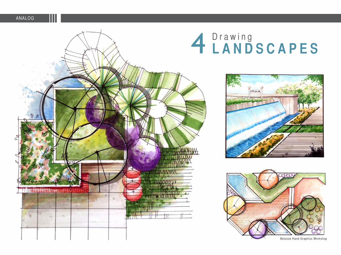
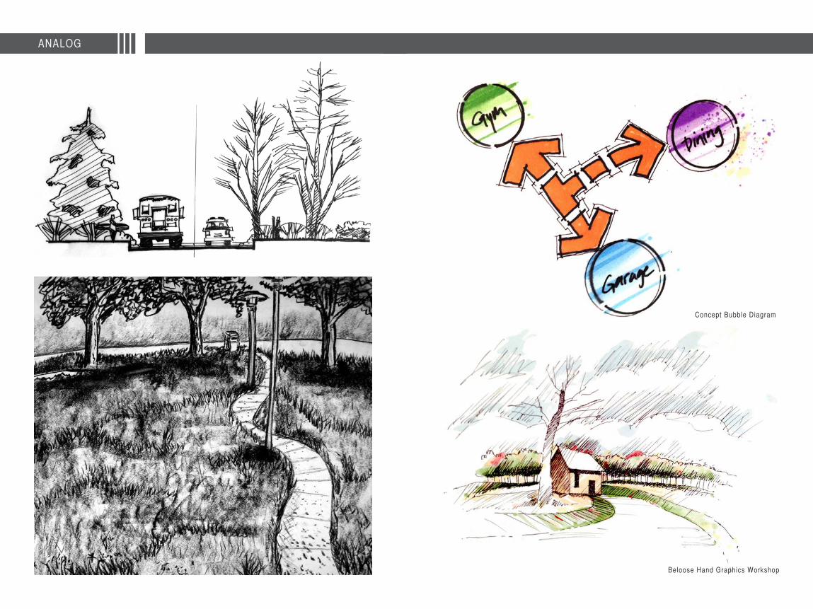
AnalogDrawing LANDSCAPES4
a.c. e. w.
320 S. Ocean Blvd U-R Delray Beach, FL [email protected]
LANDSCAPE DESIGNERChristopher Cabezas
“[Design] is not simply about space and form, but also about event, action, and what happens in space” Bernard Tschumi
R e m e d i a t i n g t h e
Bahia de Jobos is a region in southern Puerto Rico r ich in history and culture, but quickly losing i ts identi ty and prist ine natural qual i ty. Problems range from groundwater extract ion to high nitrate levels due to agriculture, industry and residential uses. Other concerns include habitat encroachment, untreated sewage and septic outf low. The extensive canal systems that once fed the large sugar industry have dried up and the once thriving wetland region has deteriorated due to a diminishing use of the canal. This loss of natural habitat matches the loss of identi ty being experienced in the region. With the loss of the very important sugar mil l industry, the agricultural ly dependent regions sugar cane plantat ions quickly where abandoned. This has caused the abandonment of many houses in Central Aguirre, as wel l as a prominent hotel and other structures.
RURAL WETLAND1
Bahia de Jobos | Puerto Rico
Masters Project
PUERTO RICO
Aguirre
Aguirre
Central Aguirre
Guyama
Bah
ia d
e Jo
bos
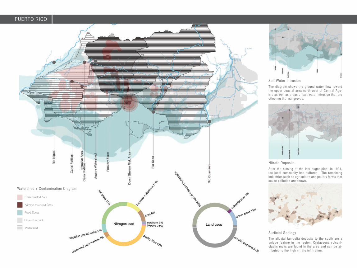
Contaminated Area
Nitrate Overload Sites
Flood Zones
Urban Footprint
Watershed
The al luvial fan-delta deposits to the south are a unique feature in the region. Cretaceous volcani-clast ic rocks are found in the area and can be at-tr ibuted to the high nitrate inf i l t rat ion.
Surf icial Geology
After the closing of the last sugar plant in 1991, the local community has suffered. The remaining industr ies such as agriculture and poultry farms that cause pol lut ion are shown.
Nitrate Deposits
The diagram shows the ground water f low toward the upper coastal area north-west of Central Agu-irre as wel l as areas of salt water intrusion that are effect ing the mangroves.
Salt Water Intrusion
Watershed + Contamination Diagram
PUERTO RICO

1
2
3
9
10
12
13
14
15
16
17
18
11
123456789
101112131415161718
northern access to wetland + parkfirst stage overflow fields + existing streamwetland deck + observation towerproposed walk + bike trailnew access point from adjacent communitysecond stage vehicular overpass + filter wallnew trail + access pointsthird stage overflow fieldsfourth stage large capacity detention pond scenic viewing area + vehicular overpassmain entry access pointopen grasslandparking areaterraced slope gardenhill top visitor structure community access pointbioswale + grey water collection canalscommunity recreation field
4
5
6
7
8
0 200 400 800 ft
The trai ls and roads that traverse the wetland bioretension f ields act not only as connections through the space, adjacent communit ies and region, but also act as a f i l t rat ion devise that helps slow the movement of water in order to more effect ively al low the absorpt ion and col lect ion of ni trates to be f i l tered. Nitrate absorbing vegetat ion, along with the natural plant and wildl i fe that frequent the region wil l inhabit the site and new wet + dry land habitats. Visi tors can walk and bike the tr ials or grasslands, whi le vehicles can drive through the new roadway and park near the terraced slope garden.
Community Connection Model
Wetland + Botanical Park Site Plan
PUERTO RICO
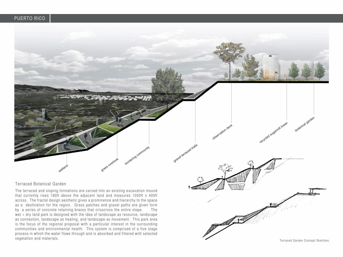
The terraced and sloping formations are carved into an exist ing excavation mound that currently r ises 180ft above the adjacent land and measures 1000ft x 400ft across. The fractal design aesthetic gives a prominence and hierarchy to the space as a destinat ion for the region. Grass patches and gravel paths are given form by a series of concrete retaining braces that cr isscross the entire slope. The wet + dry land park is designed with the idea of landscape as resource, landscape as connection, landscape as heal ing, and landscape as movement. This park area is the focus of the regional proposal with a part icular interest in the surrounding communit ies and environmental health. This system is comprised of a f ive stage process in which the water f lows through and is absorbed and f i l tered with selected vegetat ion and materials.
Terraced Botanical Garden
botanical garden
recycled su
garmill t
ower
observation deck
Terraced Garden Concept Sketches
bordering community
grass overlook
wetland
PUERTO RICO
gravel terra
ced trails
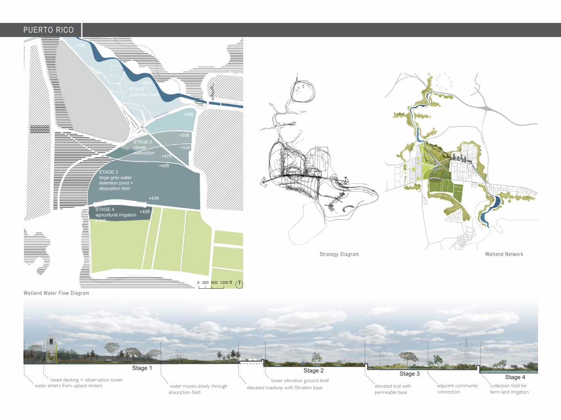
water enters from upland stream water moves slowly through absorption field
raised decking + observation tower
Stage 1
elevated roadway with filtration base elevated trail with permeable base
adjacent community connection
collection field for farm land irrigation
lower elevation ground level
Stage 2 Stage 3 Stage 4
+40ft
+43ft
+45ft
+47ft
+50ft
+55ft
+60ft
+65ftSTAGE 1collection field
STAGE 2nitrate absorption
STAGE 3large grey water detention pond + absorption field
STAGE 4agricultural irrigation pond
0 300 600 1200 ft
Wetland Water Flow Diagram
Strategy Diagram Wetland Network
+70ft
PUERTO RICO

This proposal seeks to use landscape as a means to create new capacit ies to cleanse the water and soi l , but also to create new shared spaces that act as a connecting t issue between a fragmented community. New cultural exchanges can occur and a connection can be made once again with the land. The surf icial gradients run deep and l ink a diverse yet historical ly r ich region. Landscape becomes the medium for transformation.
“Landscape becomes a resource, a healer, a connection, a landmark and a new identity for the region and its people.”
PUERTO RICO

Was
hing
ton
Ave
Was
hing
ton
Ave
R e c l a i m i n g t h e
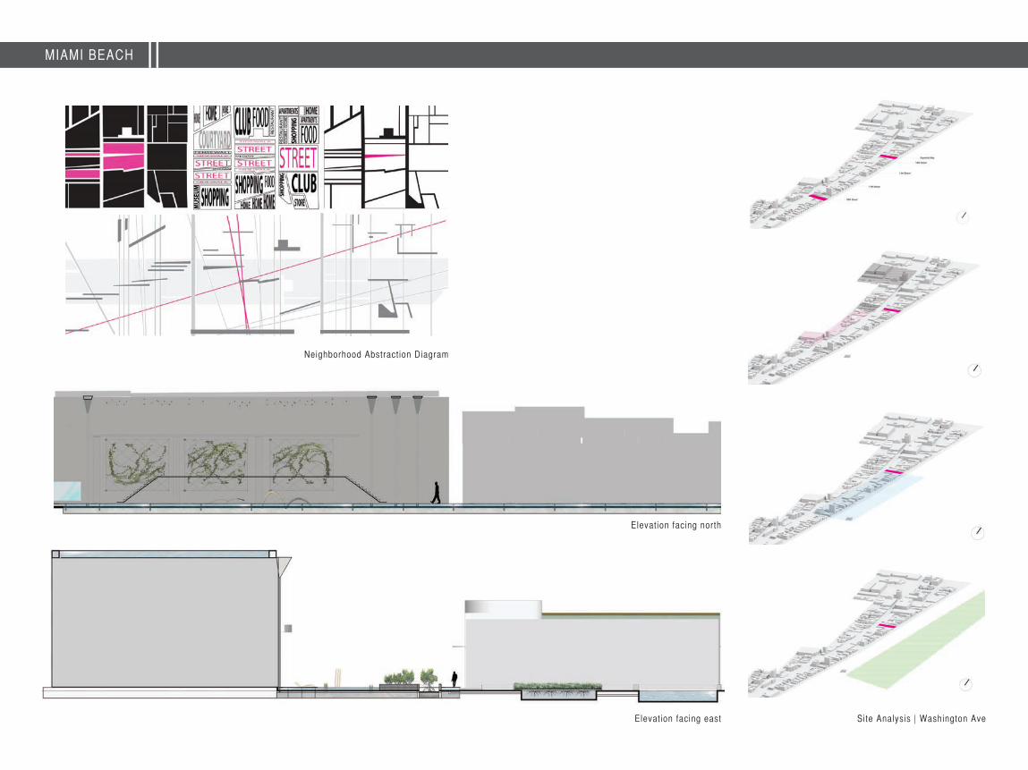
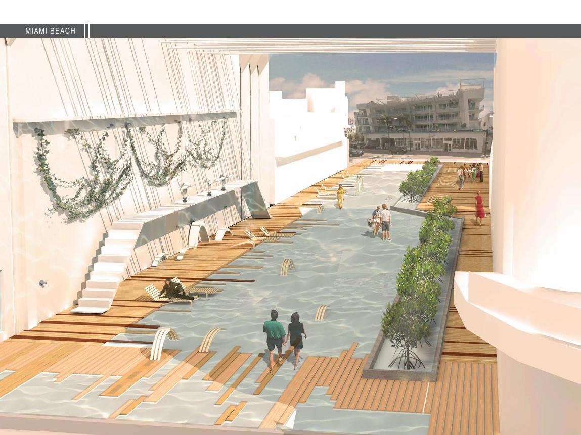
The design proposal takes the idea of landscape as resource. Using water as a datum, the street becomes a shal low foot pool that pedestr ians can walk through and direct ly engage this important Florida resource. A mangrove nursery recal ls Miami Beach’s natural past and native bird wi ldl i fe can inhabit the site once again. Stormwater col lect ion tanks on nearby roofs and al leys clean and store water for the pond and new vegetat ion.
U R B A N P O N D
Washington Ave | Miami Beach, Florida
2
Española Way
Urban Design Studio
“The design proposes an alternative social practice that challenges the expected use values of a street corridor or of an urban condition”
MIAMI BEACH
Washington Ave
Española Way

Site Plan | East Española Way3-Dimensional Study Model
Context + Major Access Routes
0 10 20 40
COLLINS AVE
WASHINGTON AVE
Activi ty Hubs
Ocean DriveColl in
s Avenue
Wash
ington A
ve
Cultural Open SpacePublic
Espanola Way
Lincoln Road
Context + Major Access RoutesContext + Major Access Routes
6
4
5
Adjacency Diagram
1
2
3
123456
Eastern Access + Extended Deck Alley Water Purifi cation SystemWestern Access Pedestrain Only WalkthoughMangrove Linear GardenGreen roof + Rooftop Rain Collector
MIAMI BEACH
MIAMI BEACH
Elevation facing north
Neighborhood Abstract ion Diagram
Elevation facing east Site Analysis | Washington Ave

“Space is shaped by the solids, but is defined and used through the void. The void is where experiences occur and where changes take place. Light, heat, movement + dance happen in these spaces”
MIAMI BEACH
MIAMI BEACH
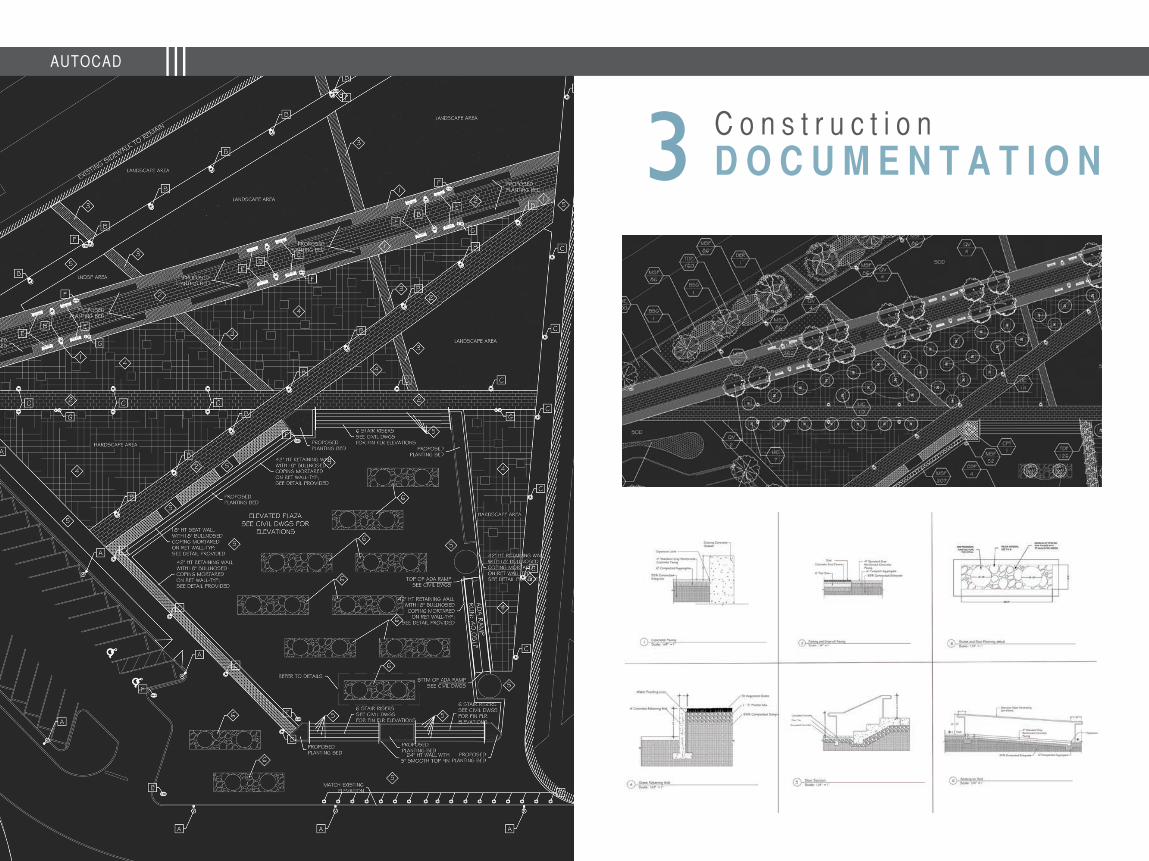
C o n s t r u c t i o nD O C U M E N T A T I O N3
AUTOCAD
D r a w i n g
L A N D S C A P E S34ANALOG
Beloose Hand Graphics Workshop
ANALOG
Concept Bubble Diagram
Beloose Hand Graphics Workshop
DIGITAL
D i g i t a l
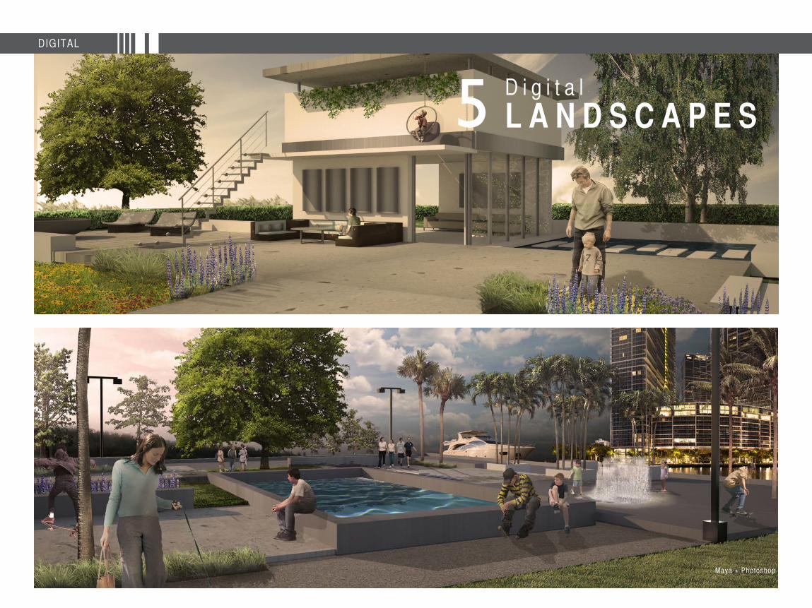
L A N D S C A P E S5
Maya + Photoshop
C u r r i c u l u m
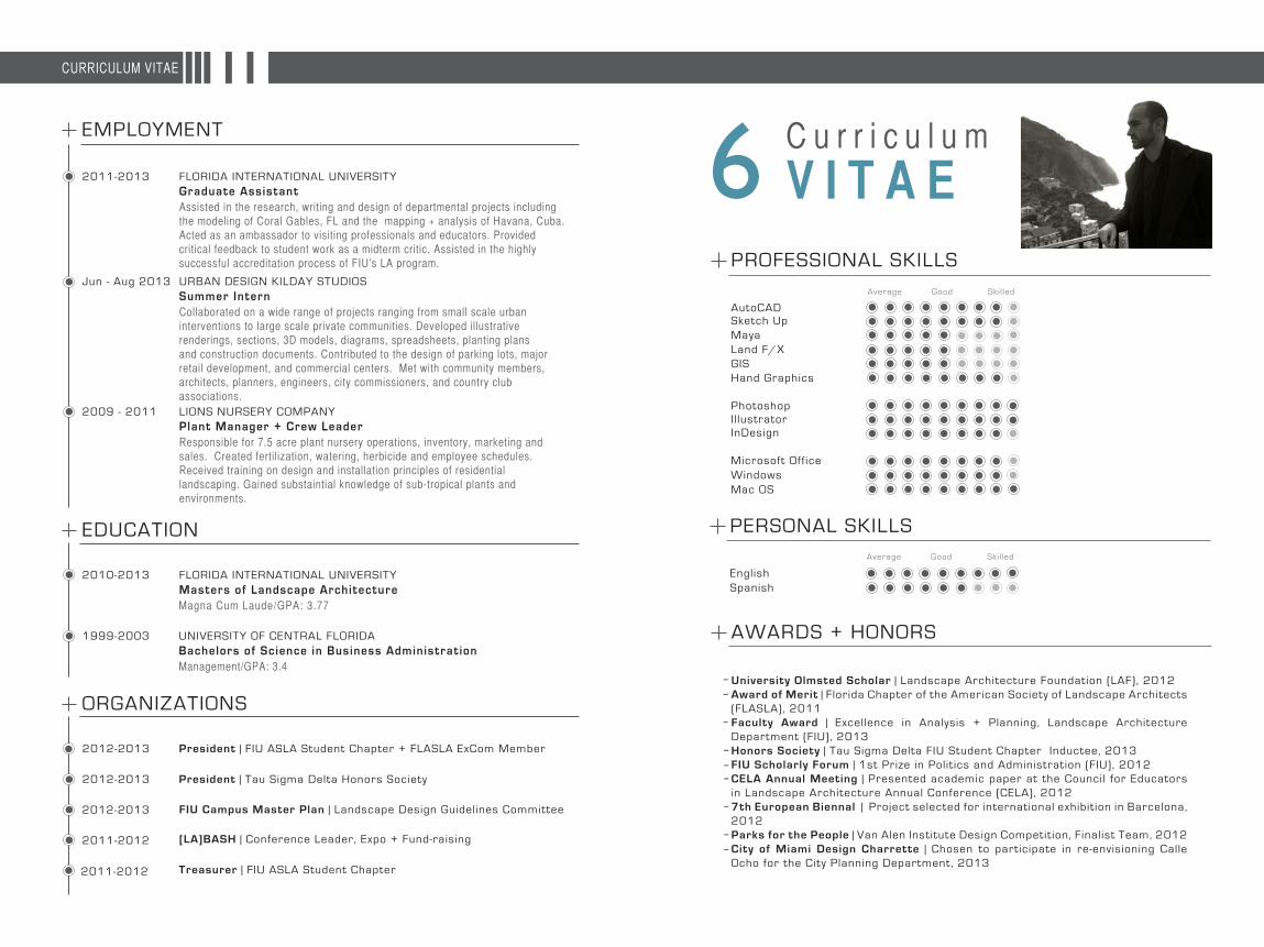
V I T A E6EMPLOYMENT
FLORIDA INTERNATIONAL UNIVERSITY
FLORIDA INTERNATIONAL UNIVERSITY
UNIVERSITY OF CENTRAL FLORIDA
URBAN DESIGN KILDAY STUDIOS
LIONS NURSERY COMPANY
Graduate Assistant
Masters of Landscape Architecture
Bachelors of Science in Business Administrat ion
Magna Cum Laude/GPA: 3.77
Management/GPA: 3.4
Summer Intern
Plant Manager + Crew Leader
2011-2013
2010-2013
2012-2013
2012-2013
2012-2013
1999-2003
2011-2012
2011-2012
Jun - Aug 2013
2009 - 2011
Assisted in the research, writing and design of departmental projects including the modeling of Coral Gables, FL and the mapping + analysis of Havana, Cuba. Acted as an ambassador to visiting professionals and educators. Provided critical feedback to student work as a midterm critic. Assisted in the highly successful accreditation process of FIU’s LA program.
Collaborated on a wide range of projects ranging from small scale urban interventions to large scale private communities. Developed illustrative renderings, sections, 3D models, diagrams, spreadsheets, planting plans and construction documents. Contributed to the design of parking lots, major retail development, and commercial centers. Met with community members, architects, planners, engineers, city commissioners, and country club associations.
Responsible for 7.5 acre plant nursery operations, inventory, marketing and sales. Created fertilization, watering, herbicide and employee schedules. Received training on design and installation principles of residential landscaping. Gained substaintial knowledge of sub-tropical plants and environments.
EDUCATION
ORGANIZATIONS
President | FIU ASLA Student Chapter + FLASLA ExCom Member
President | Tau Sigma Delta Honors Society
[LA]BASH | Conference Leader, Expo + Fund-raising
Treasurer | FIU ASLA Student Chapter
FIU Campus Master Plan | Landscape Design Guidelines Committee
AutoCAD
GoodAverage Skil led
Sketch UpMayaLand F/XGISHand Graphics
PhotoshopIl lustratorInDesign
Microsoft Office
English
Windows
Spanish
Mac OS
PROFESSIONAL SKILLS
PERSONAL SKILLS
AWARDS + HONORS
University Olmsted Scholar | Landscape Architecture Foundation (LAF), 2012 Award of Merit | Florida Chapter of the American Society of Landscape Architects (FLASLA), 2011 Faculty Award | Excellence in Analysis + Planning, Landscape Architecture Department (FIU), 2013Honors Society | Tau Sigma Delta FIU Student Chapter Inductee, 2013FIU Scholarly Forum | 1st Prize in Polit ics and Administration (FIU), 2012CELA Annual Meeting | Presented academic paper at the Council for Educators in Landscape Architecture Annual Conference (CELA), 20127th European Biennal | Project selected for international exhibition in Barcelona, 2012 Parks for the People | Van Alen Institute Design Competition, Finalist Team, 2012 City of Miami Design Charrette | Chosen to participate in re-envisioning Calle Ocho for the City Planning Department, 2013
-
--
--
--
--
CURRICULUM VITAE
GoodAverage Skil led
LANDSC APE DES IGNERChr i s topher Cabezas
a.c. e. w.
320 S. Ocean Blvd U-R Delray Beach, FL [email protected]
GET IN TOUCH