Embed Size (px)
Citation preview
Chester Characterisation Study: Final Report
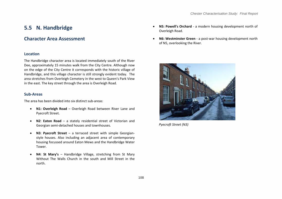
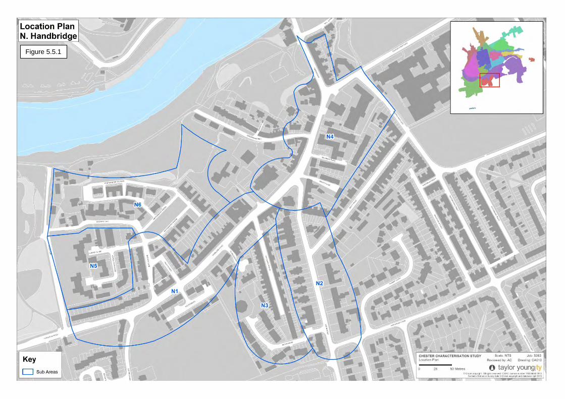
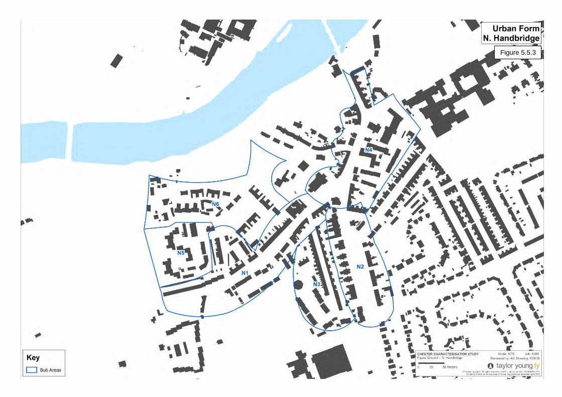
5.5 N. Handbridge
Character Area Assessment
Location
The Handbridge character area is located immediately south of the River Dee, approximately 15 minutes walk from the City Centre. Although now on the edge of the City Centre it corresponds with the historic village of Handbridge, and this village character is still strongly evident today. The area stretches from Overleigh Cemetery in the west to Queen's Park View in the east. The key street through the area is Overleigh Road.
Sub-Areas
The area has been divided into six distinct sub-areas:
N1: Overleigh Road – Overleigh Road between River Lane and Pyecroft Street.
N2: Eaton Road – a stately residential street of Victorian and Georgian semi-detached houses and townhouses.
N3: Pyecroft Street – a terraced street with simple Georgian-style houses. Also including an adjacent area of contemporary housing focussed around Eaton Mews and the Handbridge Water Tower.
N4: St Mary’s – Handbridge Village, stretching from St Mary Without The Walls Church in the south and Mill Street in the north.
N5: Powell's Orchard - a modern housing development north of Overleigh Road.
N6: Westminster Green - a post-war housing development north of N5, overlooking the River.
Pyecroft Street (N3)
108
Chester Characterisation Study: Final Report
109
Figure 5.5.1
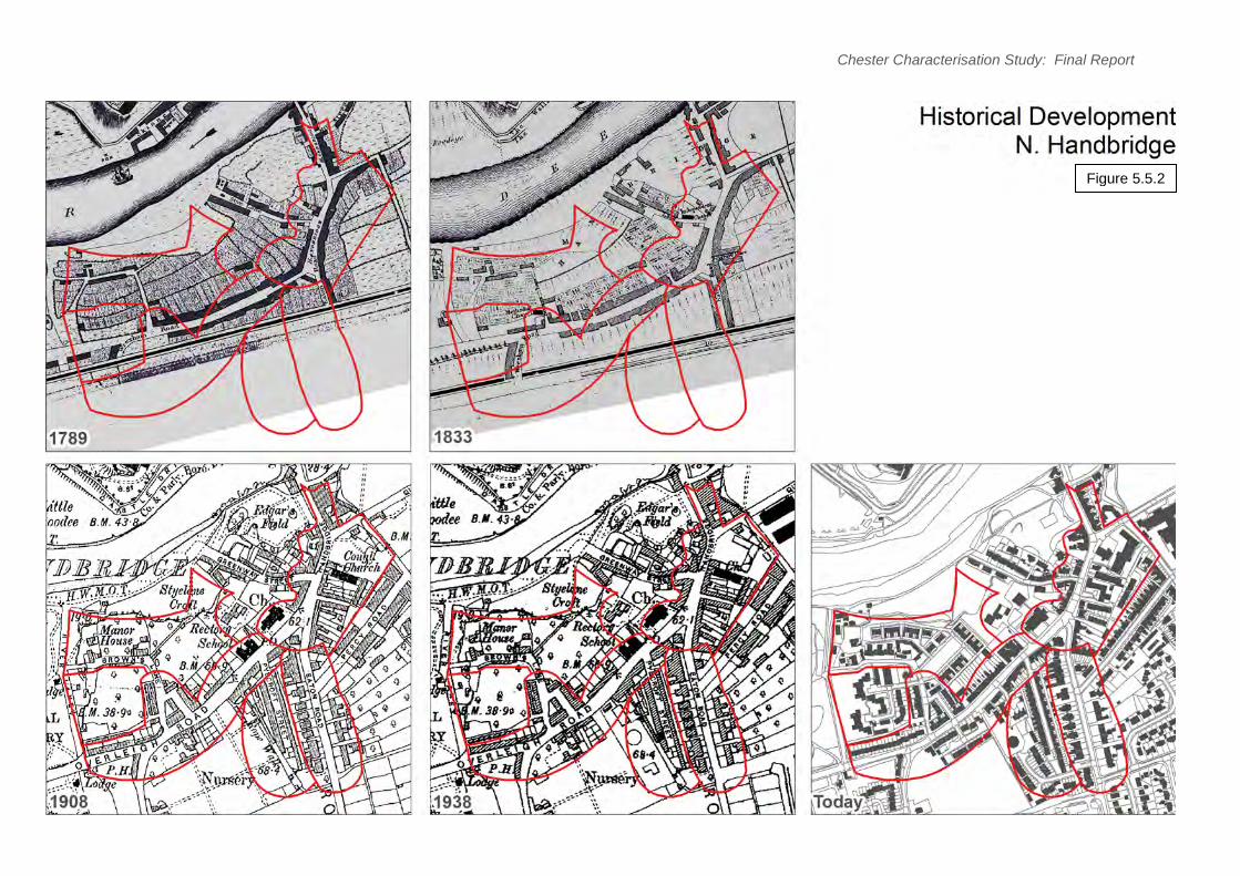
Historical Development
There is evidence of Iron Age activity in Handbridge but the first known settlement was built by the Romans around 74 AD, shortly after the fortress of Deva. Handbridge was built on a large sandstone outcrop and the site was used as a stone quarry until the end of the fourth century, excavating stone to build the city walls and buildings. From this era remains the carved shrine to Minerva (now in Edgar’s Field).
After the Romans left Britain, Handbridge, like Chester, fell into disrepair. Nevertheless, by the time of the Domesday Book, the site had grown large enough to be divided into three manors: Overleigh, Netherleigh and Royal Handbridge. The Domesday Book also tells of the constant repairs that had to be made to the river crossing there, the first written record of what would eventually become known as the Old Dee Bridge. The site was regularly pillaged by the Welsh of what is now the neighbouring county of Flintshire, who frequently burnt down the suburb, leading to the Welsh name for Handbridge, Treboeth, meaning "burnt town". Handbridge was also a centre for the salmon fishing industry from the middle ages. (Please refer to Character Assessment M. Riverside (Section 5/4) for further historical details of Edgar’s Field, the Old Dee Bridge and the weir).
The form of Handbridge by this time may have been recognisable today. �raun’s 1580 plan shows roads which may correspond to the present alignments of Handbridge, Overleigh Road and Eaton Road, as the main routes south out of the walled city with linear development and gardens behind. By the early 17th century there was housing along the main street, Greenway Street, and Overleigh Road.
In the Civil War, Chester was one of the last Royalist strongholds and was heavily besieged. Handbridge was burnt and the Old Dee Bridge was heavily damaged in order to impede the progress of the Roundhead armies.
Chester Characterisation Study: Final Report
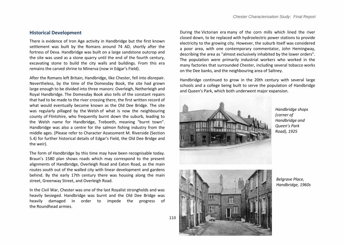
During the Victorian era many of the corn mills which lined the river closed down, to be replaced with hydroelectric power stations to provide electricity to the growing city. However, the suburb itself was considered a poor area, with one contemporary commentator, John Hemingway, describing the area as "almost exclusively inhabited by the lower orders". The population were primarily industrial workers who worked in the many factories that surrounded Chester, including several tobacco works on the Dee banks, and the neighbouring area of Saltney.
Handbridge continued to grow in the 20th century with several large schools and a college being built to serve the population of Handbridge and Queen's Park, which both underwent major expansion.
Handbridge shops (corner of Handbridge and Queen͛s Park Road), 1925
Belgrave Place, Handbridge, 1960s
110
111
Chester Characterisation Study: Final Report
Figure 5.5.2
Land-uses
This character area is predominantly residential in use. Small scale shops and commercial uses are concentrated in Handbridge centre (N6).
Urban Form
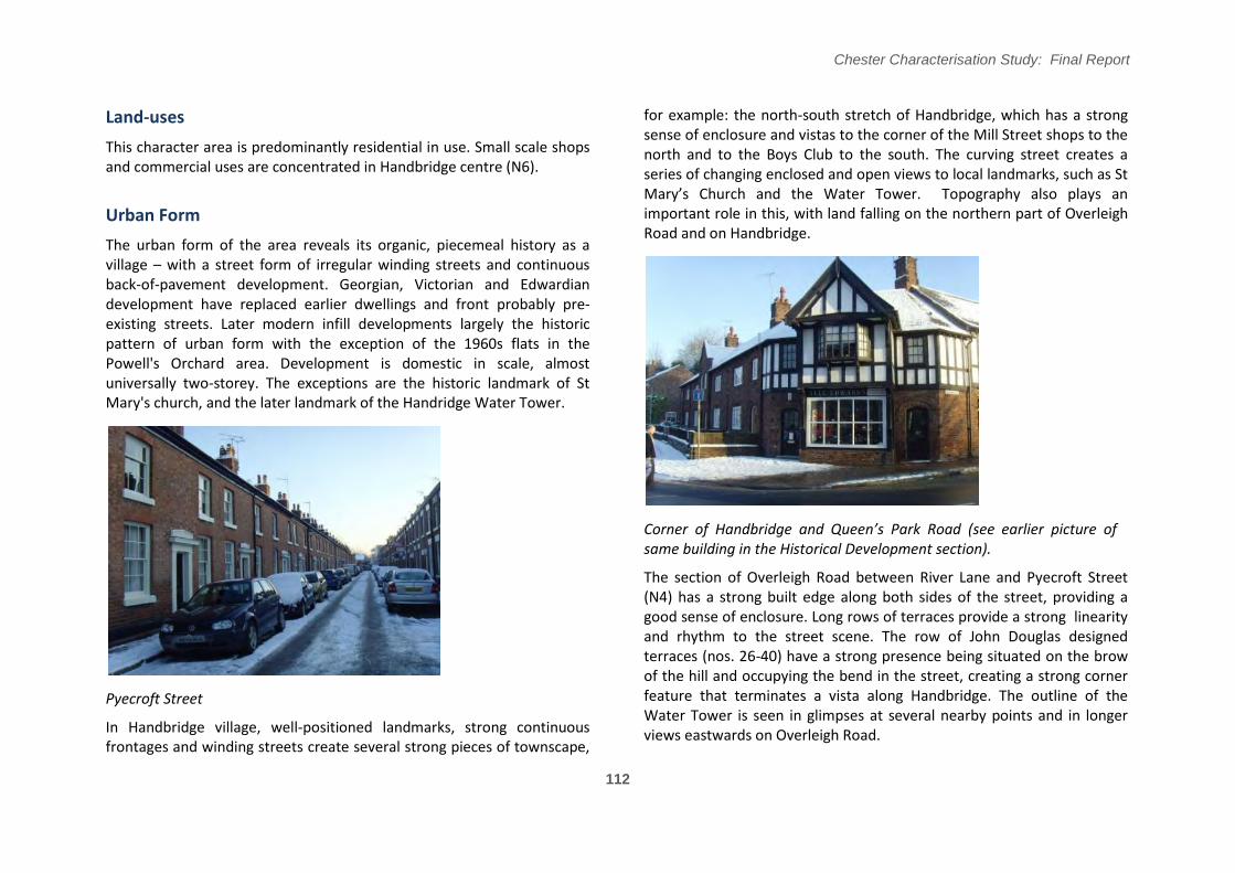
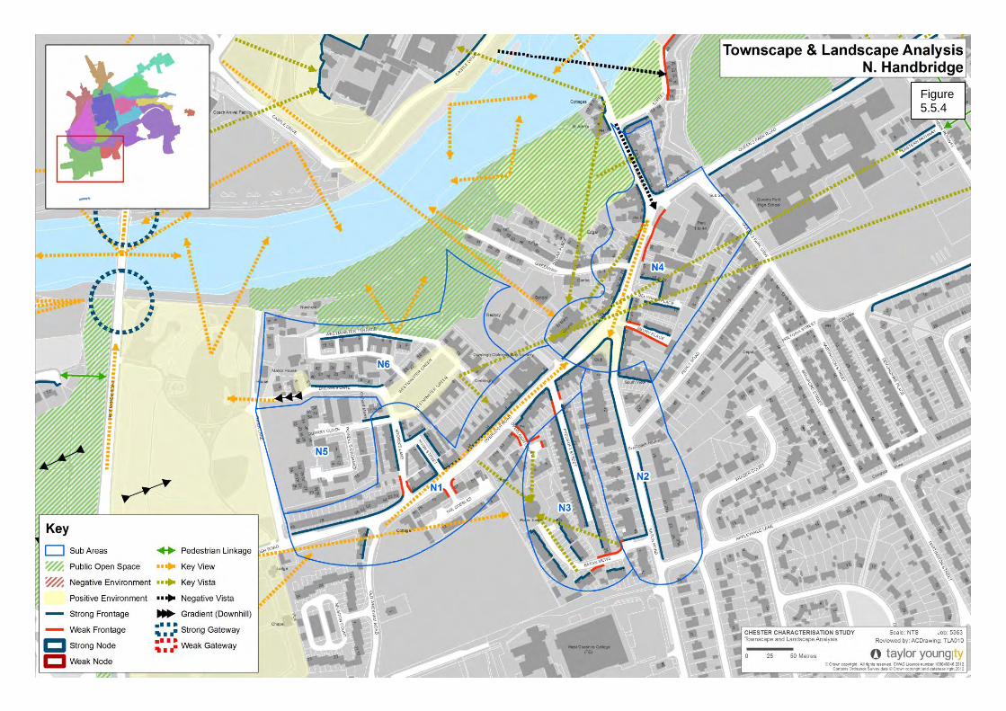
The urban form of the area reveals its organic, piecemeal history as a village – with a street form of irregular winding streets and continuous back-of-pavement development. Georgian, Victorian and Edwardian development have replaced earlier dwellings and front probably preexisting streets. Later modern infill developments largely the historic pattern of urban form with the exception of the 1960s flats in the Powell's Orchard area. Development is domestic in scale, almost universally two-storey. The exceptions are the historic landmark of St Mary's church, and the later landmark of the Handridge Water Tower.
Pyecroft Street
In Handbridge village, well-positioned landmarks, strong continuous frontages and winding streets create several strong pieces of townscape,
Chester Characterisation Study: Final Report
for example: the north-south stretch of Handbridge, which has a strong sense of enclosure and vistas to the corner of the Mill Street shops to the north and to the Boys Club to the south. The curving street creates a series of changing enclosed and open views to local landmarks, such as St Mary’s �hurch and the Water Tower/ Topography also plays an important role in this, with land falling on the northern part of Overleigh Road and on Handbridge.
�orner of Handbridge and Queen͛s Park Road (see earlier picture of same building in the Historical Development section).
The section of Overleigh Road between River Lane and Pyecroft Street (N4) has a strong built edge along both sides of the street, providing a good sense of enclosure. Long rows of terraces provide a strong linearity and rhythm to the street scene. The row of John Douglas designed terraces (nos. 26-40) have a strong presence being situated on the brow of the hill and occupying the bend in the street, creating a strong corner feature that terminates a vista along Handbridge. The outline of the Water Tower is seen in glimpses at several nearby points and in longer views eastwards on Overleigh Road.
112
Chester Characterisation Study: Final Report
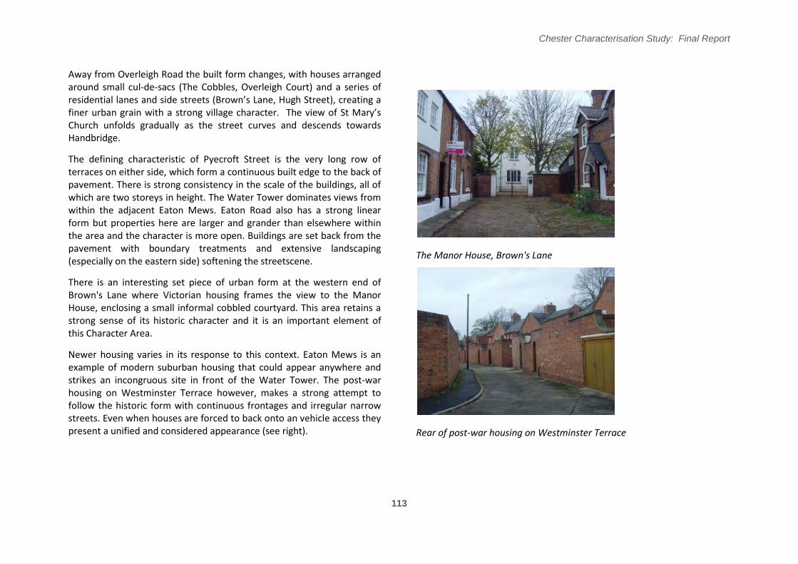
Away from Overleigh Road the built form changes, with houses arranged around small cul-de-sacs (The Cobbles, Overleigh Court) and a series of residential lanes and side streets (�rown’s Lane, Hugh Street), creating a finer urban grain with a strong village character/ The view of St Mary’s Church unfolds gradually as the street curves and descends towards Handbridge.
The defining characteristic of Pyecroft Street is the very long row of terraces on either side, which form a continuous built edge to the back of pavement. There is strong consistency in the scale of the buildings, all of which are two storeys in height. The Water Tower dominates views from within the adjacent Eaton Mews. Eaton Road also has a strong linear form but properties here are larger and grander than elsewhere within the area and the character is more open. Buildings are set back from the pavement with boundary treatments and extensive landscaping (especially on the eastern side) softening the streetscene.
There is an interesting set piece of urban form at the western end of Brown's Lane where Victorian housing frames the view to the Manor House, enclosing a small informal cobbled courtyard. This area retains a strong sense of its historic character and it is an important element of this Character Area.
Newer housing varies in its response to this context. Eaton Mews is an example of modern suburban housing that could appear anywhere and strikes an incongruous site in front of the Water Tower. The post-war housing on Westminster Terrace however, makes a strong attempt to follow the historic form with continuous frontages and irregular narrow streets. Even when houses are forced to back onto an vehicle access they present a unified and considered appearance (see right).
The Manor House, Brown's Lane
Rear of post-war housing on Westminster Terrace
113
Chester Characterisation Study: Final Report
114
Figure 5.5.3
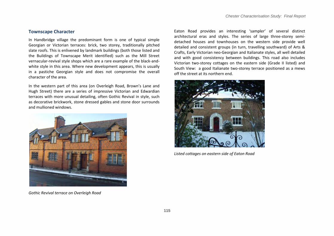
Townscape Character
In Handbridge village the predominant form is one of typical simple Georgian or Victorian terraces: brick, two storey, traditionally pitched slate roofs. This is enlivened by landmark buildings (both those listed and the Buildings of Townscape Merit identified) such as the Mill Street vernacular-revival style shops which are a rare example of the black-andwhite style in this area. Where new development appears, this is usually in a pastiche Georgian style and does not compromise the overall character of the area.
In the western part of this area (on Overleigh Road, �rown’s Lane and Hugh Street) there are a series of impressive Victorian and Edwardian terraces with more unusual detailing, often Gothic Revival in style, such as decorative brickwork, stone dressed gables and stone door surrounds and mullioned windows.
Gothic Revival terrace on Overleigh Road
Chester Characterisation Study: Final Report
Eaton Road provides an interesting ‘sampler’ of several distinct architectural eras and styles. The series of large three-storey semi-detached houses and townhouses on the western side provide well detailed and consistent groups (in turn, travelling southward) of Arts & Crafts, Early Victorian neo-Georgian and Italianate styles, all well detailed and with good consistency between buildings. This road also includes Victorian two-storey cottages on the eastern side (Grade II listed) and South View: a good Italianate two-storey terrace positioned as a mews off the street at its northern end.
Listed cottages on eastern side of Eaton Road
115
Chester Characterisation Study: Final Report
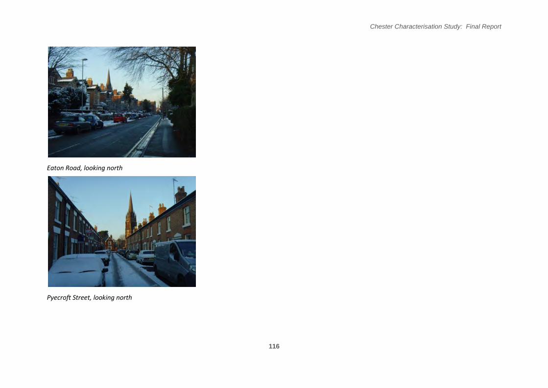
Eaton Road, looking north
Pyecroft Street, looking north
116
Chester Characterisation Study: Final Report
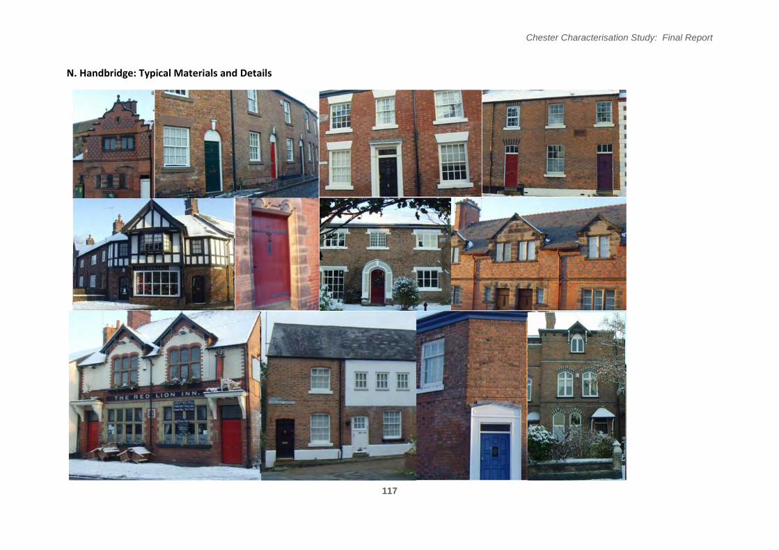
N. Handbridge: Typical Materials and Details
117
Chester Characterisation Study: Final Report
Landscape Character
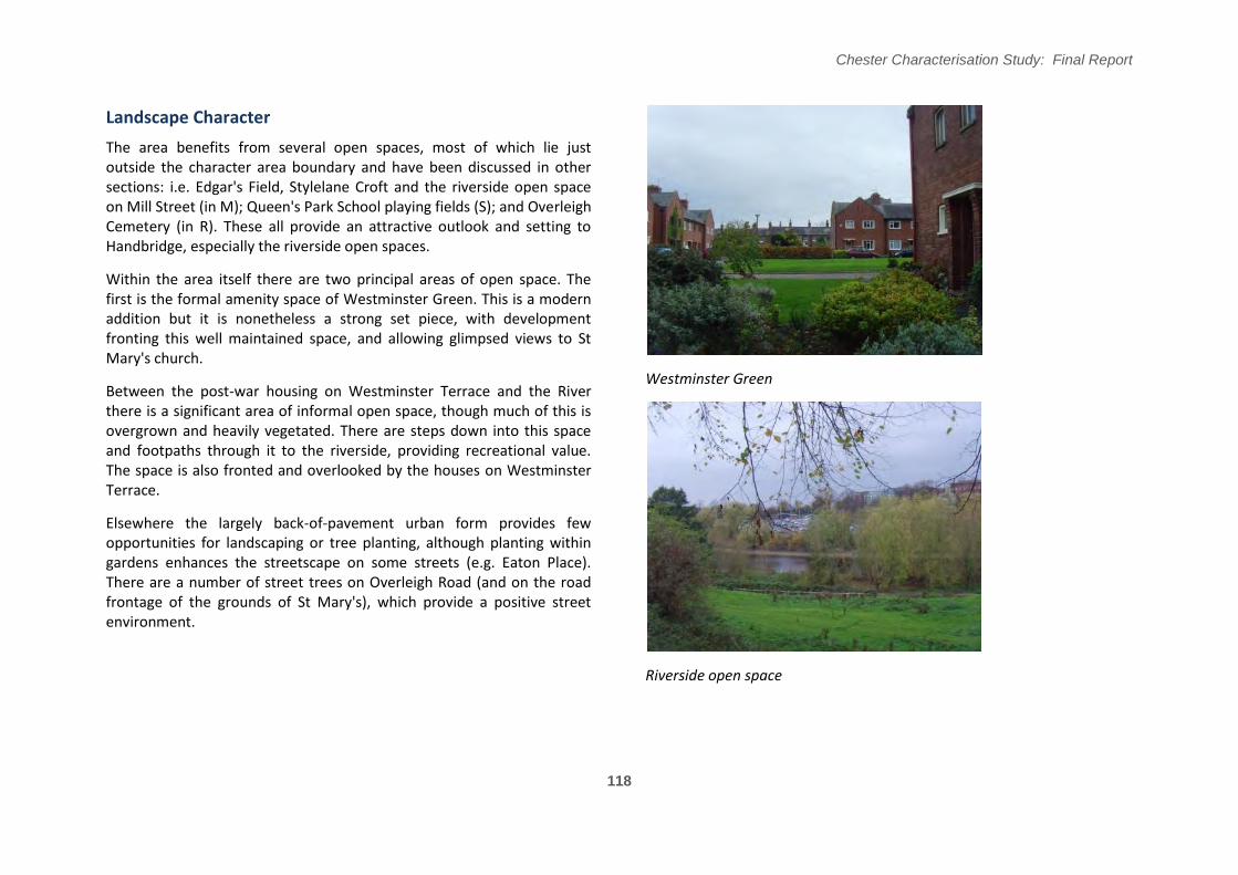
The area benefits from several open spaces, most of which lie just outside the character area boundary and have been discussed in other sections: i.e. Edgar's Field, Stylelane Croft and the riverside open space on Mill Street (in M); Queen's Park School playing fields (S); and Overleigh Cemetery (in R). These all provide an attractive outlook and setting to Handbridge, especially the riverside open spaces.
Within the area itself there are two principal areas of open space. The first is the formal amenity space of Westminster Green. This is a modern addition but it is nonetheless a strong set piece, with development fronting this well maintained space, and allowing glimpsed views to St Mary's church.
Between the post-war housing on Westminster Terrace and the River there is a significant area of informal open space, though much of this is overgrown and heavily vegetated. There are steps down into this space and footpaths through it to the riverside, providing recreational value. The space is also fronted and overlooked by the houses on Westminster Terrace.
Elsewhere the largely back-of-pavement urban form provides few opportunities for landscaping or tree planting, although planting within gardens enhances the streetscape on some streets (e.g. Eaton Place). There are a number of street trees on Overleigh Road (and on the road frontage of the grounds of St Mary's), which provide a positive street environment.
Westminster Green
Riverside open space
118
Chester Characterisation Study: Final Report
119
Figure 5.5.4
Chester Characterisation Study: Final Report
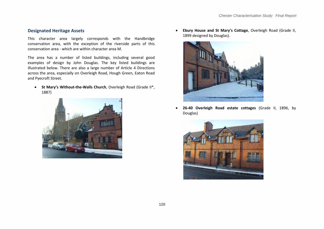
Designated Heritage Assets Ebury House and St Mary’s �ottage, Overleigh Road (Grade II, 1899 designed by Douglas).
This character area largely corresponds with the Handbridge conservation area, with the exception of the riverside parts of this conservation area - which are within character area M.
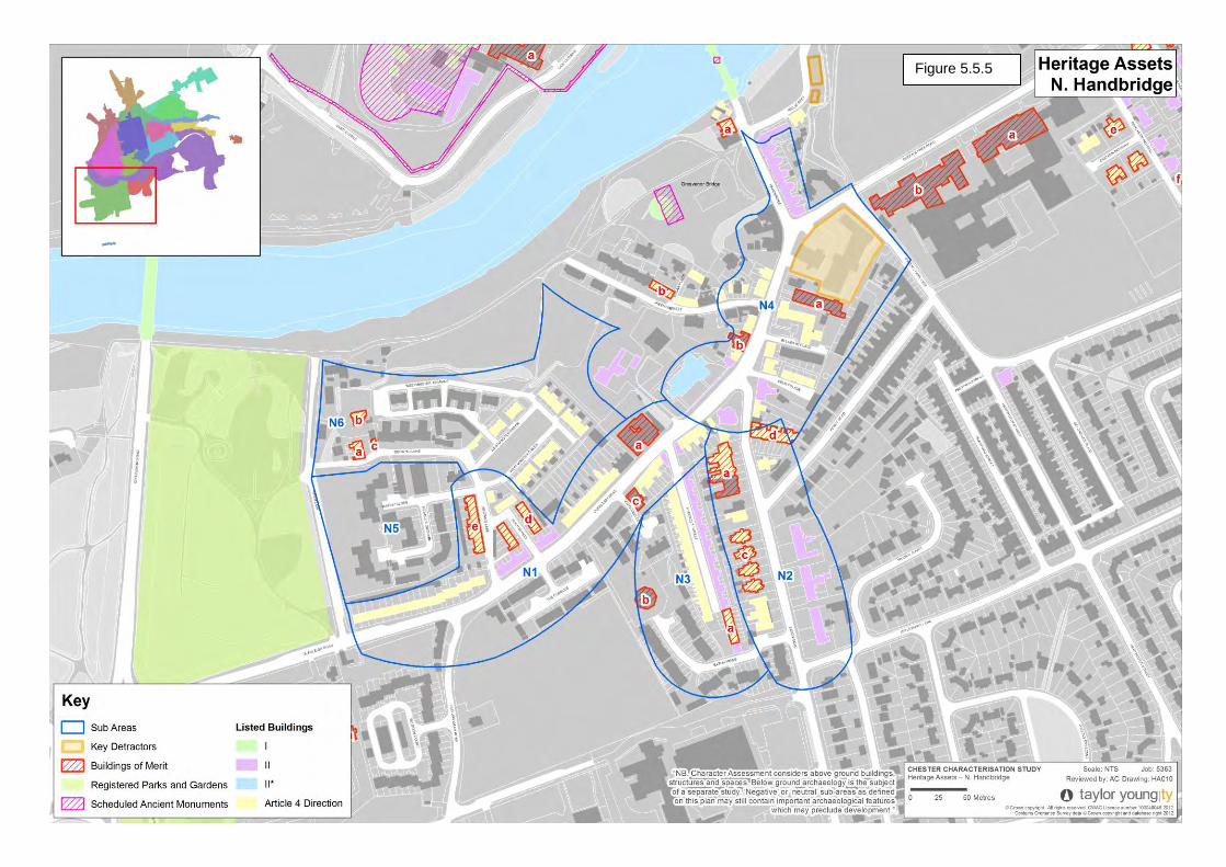
The area has a number of listed buildings, including several good examples of design by John Douglas. The key listed buildings are illustrated below. There are also a large number of Article 4 Directions across the area, especially on Overleigh Road, Hough Green, Eaton Road and Pyecroft Street.
St Mary’s Without-the-Walls Church, Overleigh Road (Grade II*, 1887)
26-40 Overleigh Road estate cottages (Grade II, 1896, by Douglas)
120
Chester Characterisation Study: Final Report
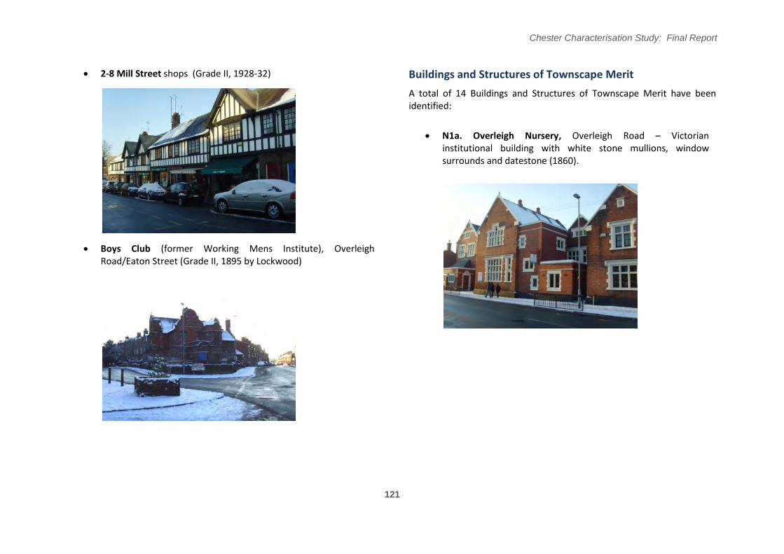
2-8 Mill Street shops (Grade II, 1928-32) Buildings and Structures of Townscape Merit
A total of 14 Buildings and Structures of Townscape Merit have been identified:
N1a. Overleigh Nursery, Overleigh Road – Victorian institutional building with white stone mullions, window surrounds and datestone (1860).
Boys Club (former Working Mens Institute), Overleigh Road/Eaton Street (Grade II, 1895 by Lockwood)
121
Chester Characterisation Study: Final Report
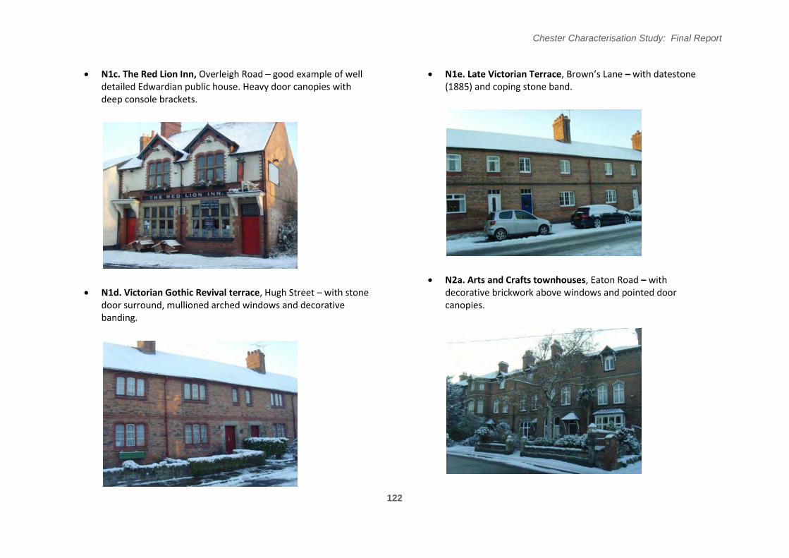
N1c. The Red Lion Inn, Overleigh Road – good example of well N1e. Late Victorian Terrace, �rown’s Lane – with datestone detailed Edwardian public house. Heavy door canopies with (1885) and coping stone band. deep console brackets.
N2a. Arts and Crafts townhouses, Eaton Road – with N1d. Victorian Gothic Revival terrace, Hugh Street – with stone decorative brickwork above windows and pointed door
door surround, mullioned arched windows and decorative canopies. banding.
122
Chester Characterisation Study: Final Report
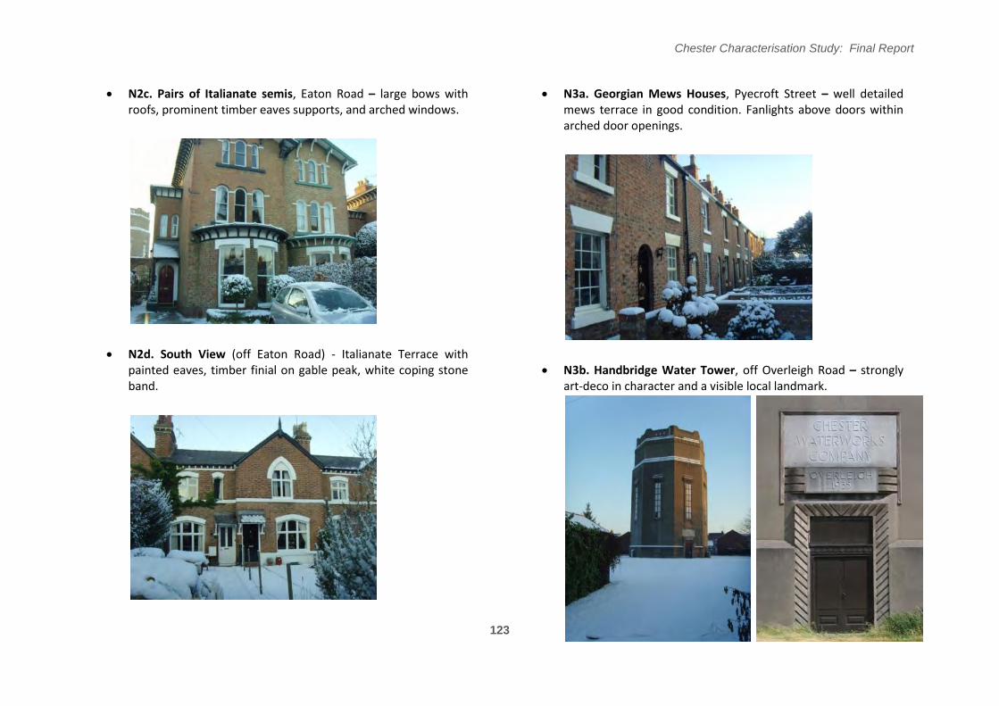
N2c. Pairs of Italianate semis, Eaton Road – large bows with roofs, prominent timber eaves supports, and arched windows.
N3a. Georgian Mews Houses, Pyecroft Street – well detailed mews terrace in good condition. Fanlights above doors within arched door openings.
N2d. South View (off Eaton Road) - Italianate Terrace with painted eaves, timber finial on gable peak, white coping stone N3b. Handbridge Water Tower, off Overleigh Road – strongly band. art-deco in character and a visible local landmark.
123
Chester Characterisation Study: Final Report
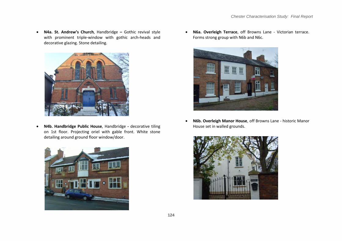
N4a. St; !ndrew’s Church, Handbridge – Gothic revival style with prominent triple-window with gothic arch-heads and decorative glazing. Stone detailing.
N6a. Overleigh Terrace, off Browns Lane - Victorian terrace. Forms strong group with N6b and N6c.
N6b. Overleigh Manor House, off Browns Lane - historic Manor N4b. Handbridge Public House, Handbridge - decorative tiling House set in walled grounds.
on 1st floor. Projecting oriel with gable front. White stone detailing around ground floor window/door.
124
Chester Characterisation Study: Final Report
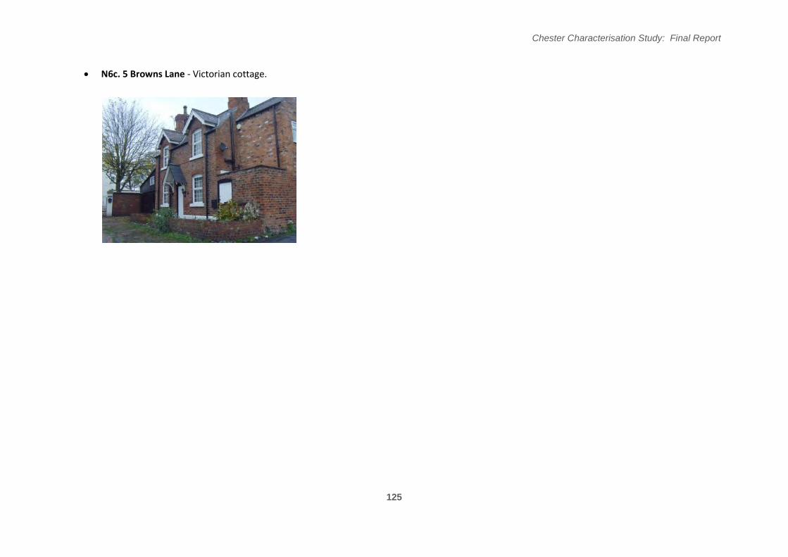
N6c. 5 Browns Lane - Victorian cottage.
125
Chester Characterisation Study: Final Report
126
Figure 5.5.5
Chester Characterisation Study: Final Report
Key Detractors
The petrol station on Handbridge, at the junction with Queen’s Park Road, is identified as a key detractor. Whilst this is an important local function, that needs to be located accessibly, its siting here is overly-prominent. It gives the utilitarian facility an undue presence in long views, notably the vista from the Old Dee Bridge along Handbridge.
Summary: Character Assessment
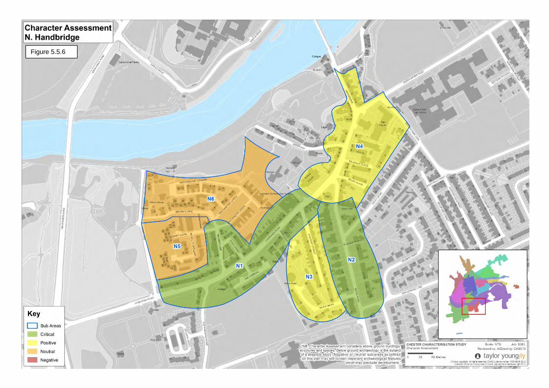
The overall character of Handbridge remains strong. The historic core is in good condition and later development is either tasteful or largely out of immediate sight from areas of heritage significance.
N1. Overleigh Road: Critical - the village core of Handbridge, with a well preserved from and some important terraces.
N2. Eaton Road: Critical - a series of adjacent buildings of townscape value, showcasing several different historical architectural styles, provides a very rich townscape setting.
N3. Pyecroft Street: Positive - consistent and very long terraces on either side of the street create a strong townscape character despite the loss of some original features on the western side.
N4. St Mary’s: Positive - the historic village centre of Handbridge, includes St Mary’s �hurch and several important buildings in a well preserved street form.
N5. Powell's Orchard: Neutral - modern housing developments that are not very sympathetic to the historic character but because this area is largely hidden from views to or from heritage assets it has no significant harmful impact.
N6. Westminster Green: Neutral - a well considered and tasteful post-war housing scheme though without any heritage significance.
Character Statement
“South from the City Centre, over the Old Dee Bridge, lies the historic village core of Handbridge. This area represents the survival of a historic settlement, dating back to Roman times. Handbridge today still retains its historic street form and 19th century buildings. Although only just over the River from the City Centre, it has an immediately different feel and a tangible 'village' character.”
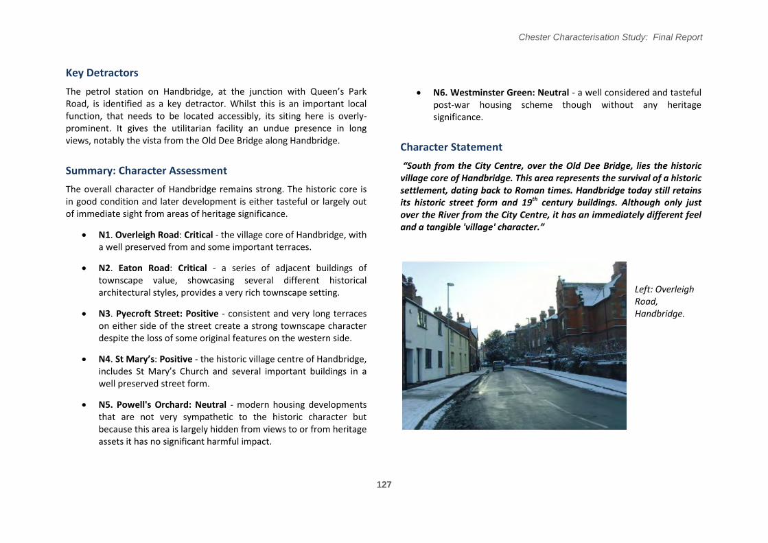
Left: Overleigh Road, Handbridge.
127
Chester Characterisation Study: Final Report
128
Figure 5.5.6
Chester Characterisation Study: Final Report
Management and Policy Recommendations
Conservation policy appears to be generally working well with the historic character of the area being well maintained and respected. There are a large number of Article 4 directions and these seem to be well applied and well enforced. There could be an argument to amend the conservation area boundary to remove sub-area N5 as it does not include, or impact significantly upon views of, any heritage assets. However, this sub-area is surrounded by legitimate parts of the conservation area and if development was taller here it would impact on views to heritage assets. It is also highly visible from Overleigh Cemetery on River Lane, so for these reasons it should remain included.
Capacity to Accommodate Change
There are some opportunities, in conservation terms, to accommodate change within this area. This includes areas of modern development that do not affect the historic context. The most obvious opportunity in this category would be the 1960s flats in the N5 sub-area. Another opportunity for redevelopment may be the petrol filling station on Handbridge.
Otherwise, the capacity to accommodate change is likely to involve extensions and alterations to existing properties. Given the high number of listed buildings, and buildings of townscape merit with Article 4 directions, the opportunities to accommodate change in this way in the historic core will be limited, as is appropriate. There will, however, be opportunities for many homeowners that live within modern houses to make alterations to their homes (subject to normal planning considerations) as these are often located in areas that do not impact upon heritage assets - for example on Eaton Mews, The Cobbles and within sub-area N5.
Design Principles for New Development
If the site of the petrol filling station on Handbridge were to be redeveloped then this would create an important opportunity for gateway development into the historic village core. The site could potentially be extended to include the pastiche-style flats to the rear and the adjacent modern building on Handbrige. Development on this site should present a strong, continuous back-of-pavement frontage to Handbridge and Queen's Park Road. It should create a strong corner feature where these roads split at the Y-shape junction. This corner feature should respond positively to the opposite corner feature of the listed Mill Street shops. The height of this building should follow the prevailing domestic form (with a slightly greater height at the above mentioned corner). The elevations should respond to townscape features and proportions and should break up the frontage into vertically proportioned units.
If the 1960s flats on Quarry's Close/Powell's Orchard were redeveloped then there is more scope for innovation and contemporary style as this site does not impact on heritage assets. The most important consideration will be the view to the rear elevation from Overleigh Cemetery and River Lane, especially as this is on a higher level. Any development should present a positive elevation to this height and be at a height that does not impact upon key views or the historic character of the area.
129