Embed Size (px)
Citation preview
1
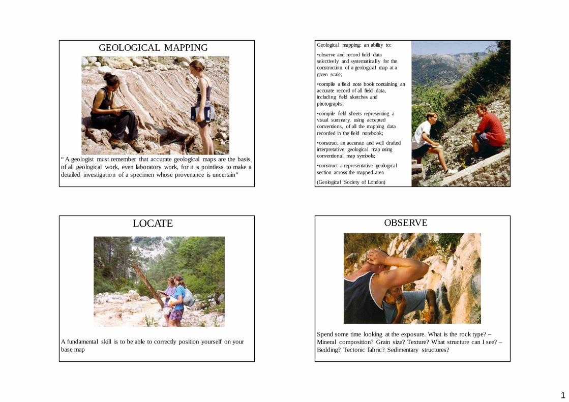
“ A geologist must remember that accurate geological maps are the basis of all geological work, even laboratory work, for it is pointless to make a detailed investigation of a specimen whose provenance is uncertain”
GEOLOGICAL MAPPING Geological mapping: an ability to:
•observe and record field data selectively and systematically for the construction of a geological map at a given scale;
•compile a field note book containing an accurate record of all field data, including field sketches and photographs;
•compile field sheets representing a visual summary, using accepted conventions, of all the mapping data recorded in the field notebook;
•construct an accurate and well drafted interpretative geological map using conventional map symbols;
•construct a representative geological section across the mapped area
(Geological Society of London)
LOCATE
A fundamental skill is to be able to correctly position yourself on your base map
OBSERVE
Spend some time looking at the exposure. What is the rock type? –Mineral composition? Grain size? Texture? What structure can I see? –Bedding? Tectonic fabric? Sedimentary structures?
2
OBSERVE
Observations are recorded in two ways;
•On the field map (field sheet or slip)
•In the field notebook (information which cannot be accommodated on the field map - geological field work).
• Map data is also normally recorded in the field notebook using a locality number reference system on the map and in the field notebook
•Thus you can navigate between the two.
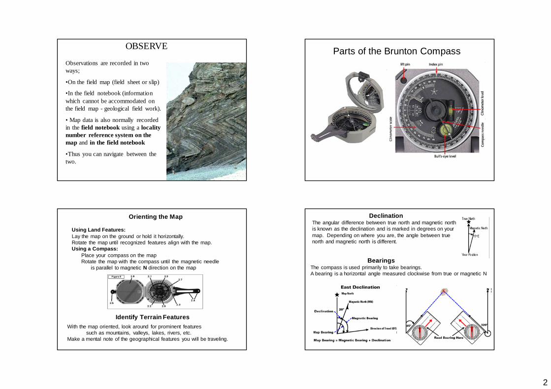
Parts of the Brunton Compass
Orienting the Map
Using Land Features:Lay the map on the ground or hold it horizontally. Rotate the map until recognized features align with the map.Using a Compass:
Place your compass on the map Rotate the map with the compass until the magnetic needle
is parallel to magnetic N direction on the map
Identify Terrain FeaturesWith the map oriented, look around for prominent features
such as mountains, valleys, lakes, rivers, etc. Make a mental note of the geographical features you will be traveling.
DeclinationThe angular difference between true north and magnetic north is known as the declination and is marked in degrees on your map. Depending on where you are, the angle between true north and magnetic north is different.
BearingsThe compass is used primarily to take bearings.A bearing is a horizontal angle measured clockwise from true or magnetic N
3
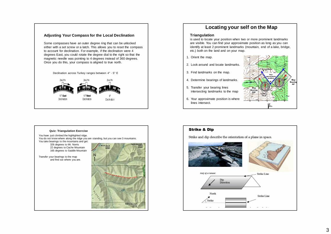
Adjusting Your Compass for the Local Declination
Some compasses have an outer degree ring that can be unlocked either with a set screw or a latch. This allows you to reset the compass to account for declination. For example, if the declination were 4 degrees East, you could rotate the degree dial to the right so that the magnetic needle was pointing to 4 degrees instead of 360 degrees. Once you do this, your compass is aligned to true north.
Declination across Turkey ranges between 4° - 5° E
Triangulationis used to locate your position when two or more prominent landmarks are visible. You can find your approximate position as long as you can identify at least 2 prominent landmarks (mountain, end of a lake, bridge, etc.) both on the land and on your map.
1. Orient the map.
2. Look around and locate landmarks.
3. Find landmarks on the map.
4. Determine bearings of landmarks.
5. Transfer your bearing lines intersecting landmarks to the map
6. Your approximate position is where lines intersect.
Locating your self on the Map
You have just climbed the highlighted ridge.You do not know where along the ridge you are standing, but you can see 3 mountains.You take bearings to the mountains and get:
326 degrees to Mt. Norris 22 degrees to Cache Mountain 165 degrees to Saddle Mountain
Transfer your bearings to the map and find out where you are.
N
Quiz: Triangulation Exercise
4
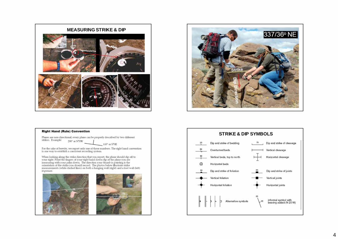
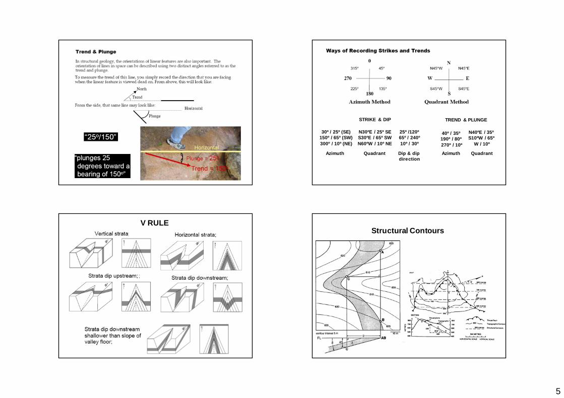
MEASURING STRIKE & DIP
STRIKE & DIP SYMBOLS
5
STRIKE & DIP
30º / 25º (SE)150º / 65º (SW)300º / 10º (NE)
N30ºE / 25º SES30ºE / 65º SWN60ºW / 10º NE
TREND & PLUNGE
40º / 35º190º / 80º270º / 10º
N40ºE / 35ºS10ºW / 65º
W / 10º
Azimuth Quadrant Azimuth Quadrant
25º /120º65º / 240º10º / 30º
Dip & dip direction
V RULEStructural Contours
6
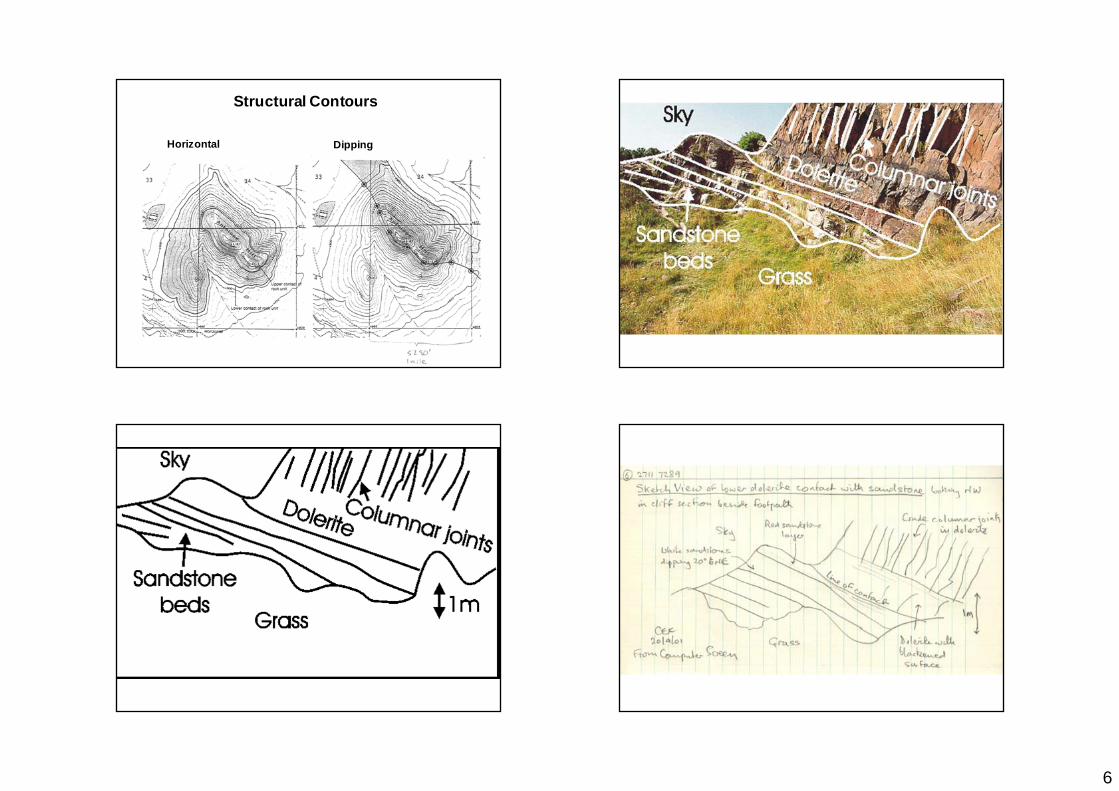
Structural Contours
Horizontal Dipping
7
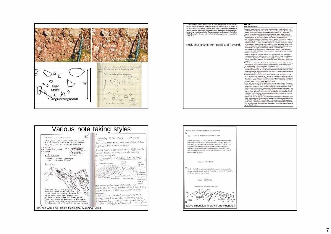
Rock descriptions from Davis and Reynolds
Various note taking styles
-Barnes with Lisle, Basic Geological Mapping, 2004 -Steve Reynolds in Davis and Reynolds
8
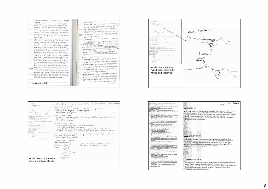
-Compton, 1985
simple notes, showing hypotheses, thinking by writing and sketching
simple notes, progression of sites and basic sketch
Coyan
9
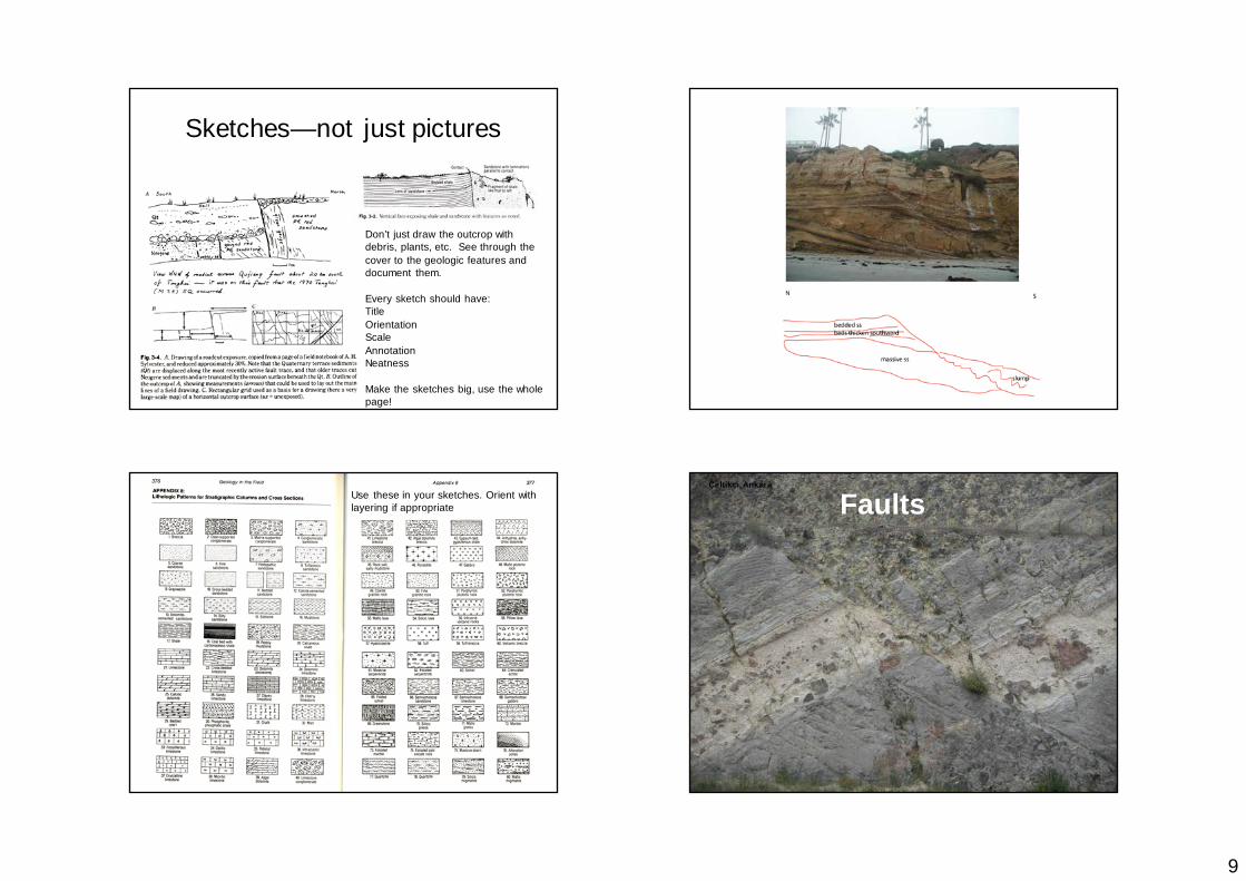
Sketches—not just pictures
Don’t just draw the outcrop with debris, plants, etc. See through the cover to the geologic features and document them.
Every sketch should have:TitleOrientationScaleAnnotationNeatness
Make the sketches big, use the whole page!
Use these in your sketches. Orient with layering if appropriate
Çeltikçi, Ankara
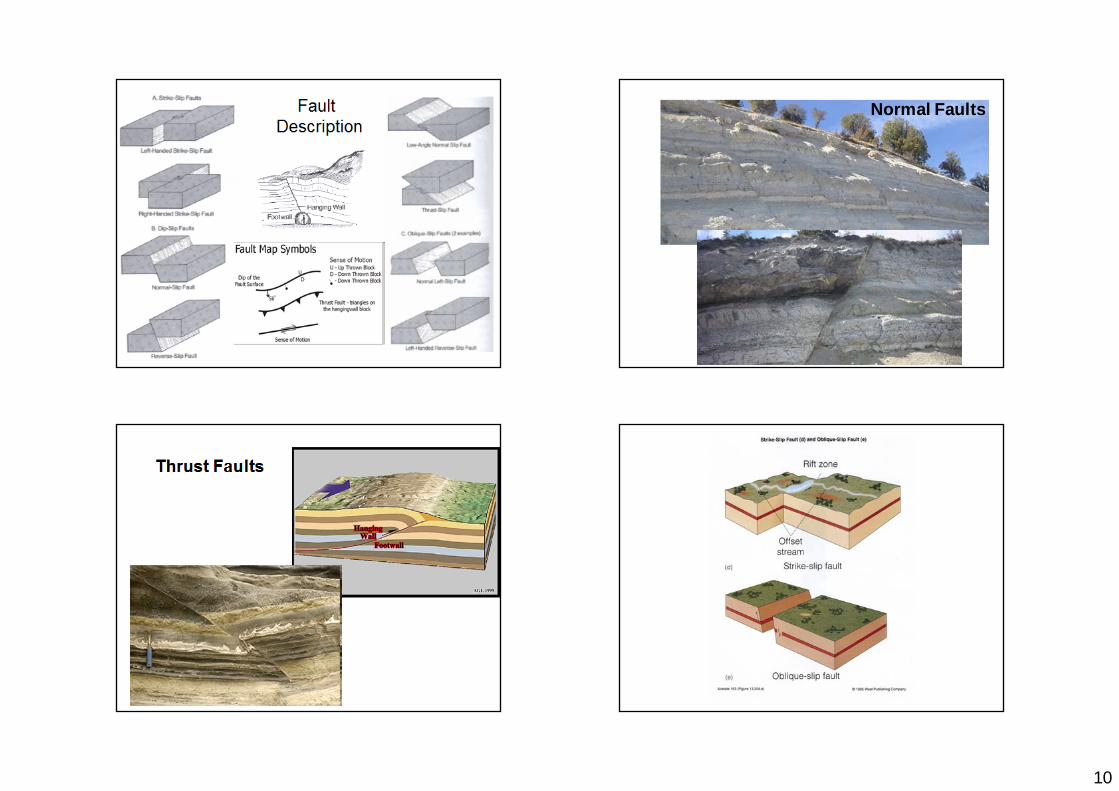
Faults
10
Fault Description
Normal Faults
Thrust Faults
11
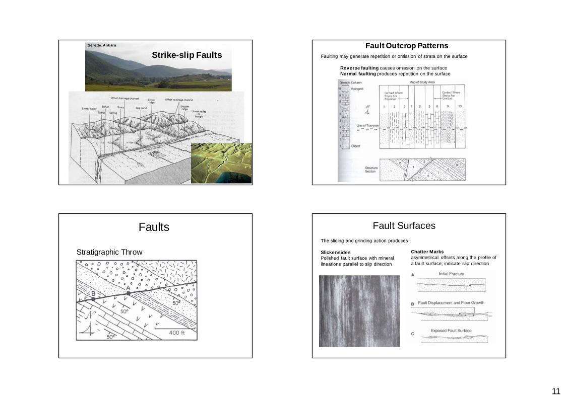
Gerede, Ankara
Strike-slip Faults Faulting may generate repetition or omission of strata on the surface
Reverse faulting causes omission on the surfaceNormal faulting produces repetition on the surface
Fault Outcrop Patterns
Stratigraphic Throw
FaultsThe sliding and grinding action produces :
SlickensidesPolished fault surface with mineral lineations parallel to slip direction
Fault Surfaces
Chatter Marksasymmetrical offsets along the profile of a fault surface; indicate slip direction
12
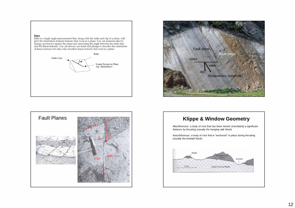
Fault plane
Slickensides (striations)
Fault stepsstrike
dip
rake
Fault Planes Klippe & Window GeometryAllochthonous: a body of rock that has been moved (translated) a significant distance by thrusting (usually the hanging wall block)
Autochthonous: a body of rock that is “anchored” in place during thrusting (usually the footwall block)
13
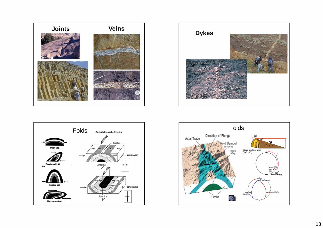
Joints VeinsDykes
Folds Folds
14
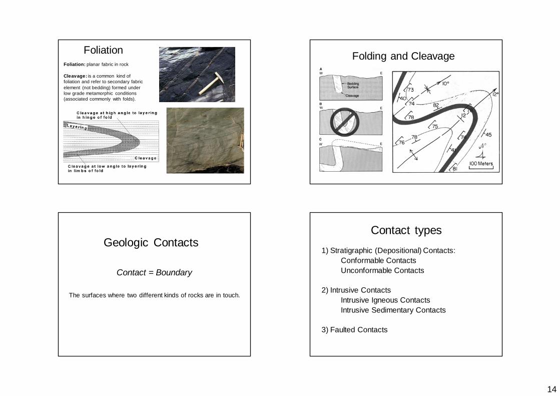
Foliation: planar fabric in rock
Cleavage: is a common kind of foliation and refer to secondary fabric element (not bedding) formed under low grade metamorphic conditions (associated commonly with folds).
Foliation Folding and Cleavage
Geologic Contacts
Contact = Boundary
The surfaces where two different kinds of rocks are in touch.
Contact types1) Stratigraphic (Depositional) Contacts:
Conformable ContactsUnconformable Contacts
2) Intrusive ContactsIntrusive Igneous ContactsIntrusive Sedimentary Contacts
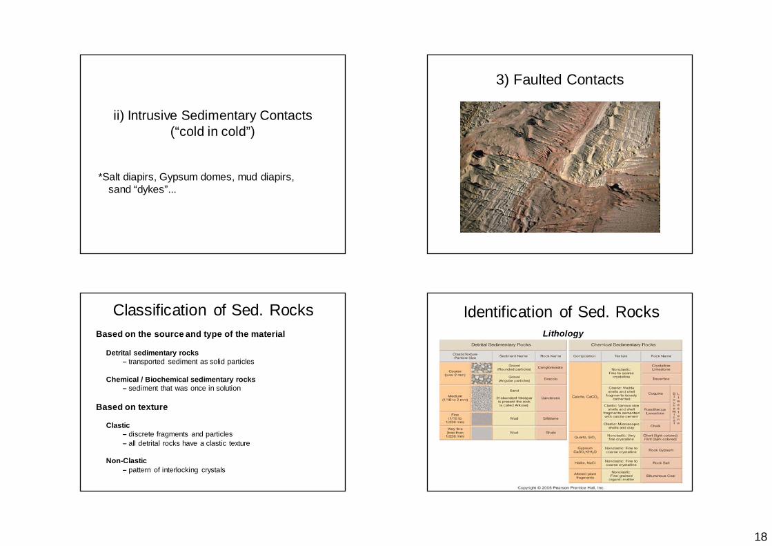
3) Faulted Contacts
15
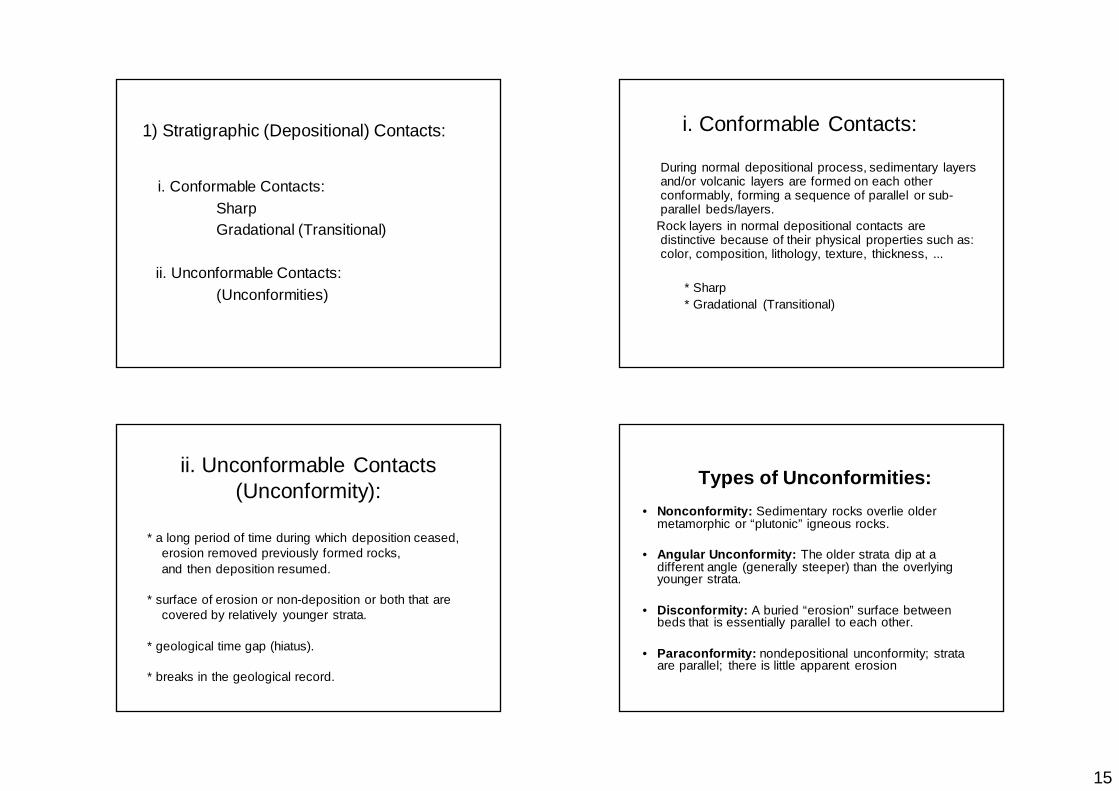
1) Stratigraphic (Depositional) Contacts:
i. Conformable Contacts:Sharp Gradational (Transitional)
ii. Unconformable Contacts:(Unconformities)
i. Conformable Contacts:
During normal depositional process, sedimentary layers and/or volcanic layers are formed on each other conformably, forming a sequence of parallel or sub-parallel beds/layers.
Rock layers in normal depositional contacts are distinctive because of their physical properties such as: color, composition, lithology, texture, thickness, ...
* Sharp * Gradational (Transitional)
* a long period of time during which deposition ceased,erosion removed previously formed rocks,and then deposition resumed.
* surface of erosion or non-deposition or both that arecovered by relatively younger strata.
* geological time gap (hiatus).
* breaks in the geological record.
ii. Unconformable Contacts (Unconformity): Types of Unconformities:
• Nonconformity: Sedimentary rocks overlie older metamorphic or “plutonic” igneous rocks.
• Angular Unconformity: The older strata dip at a different angle (generally steeper) than the overlying younger strata.
• Disconformity: A buried “erosion” surface between beds that is essentially parallel to each other.
• Paraconformity: nondepositional unconformity; strata are parallel; there is little apparent erosion
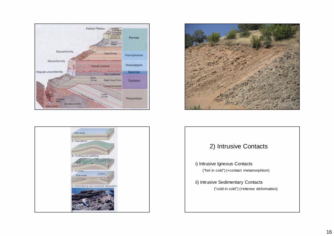
16
Nonconformity, Güdül, Ankara
i) Intrusive Igneous Contacts (“hot in cold”) (+contact metamorphism)
ii) Intrusive Sedimentary Contacts(“cold in cold”) (+intense deformation)
2) Intrusive Contacts

17
Dyke, Kalecik, Ankara
Dyke,Kalecik, Ankara
Lava, Güdül, Ankara
18
ii) Intrusive Sedimentary Contacts(“cold in cold”)
*Salt diapirs, Gypsum domes, mud diapirs, sand “dykes”...
3) Faulted Contacts
Based on the source and type of the material
Detrital sedimentary rocks – transported sediment as solid particles
Chemical / Biochemical sedimentary rocks – sediment that was once in solution
Based on texture
Clastic – discrete fragments and particles– all detrital rocks have a clastic texture
Non-Clastic – pattern of interlocking crystals
Classification of Sed. Rocks Identification of Sed. RocksLithology

19
Sedimentary Rock Texture
• Grain size• Degree of Sorting• Grain morphology (shape, roundness)• Fabric• Color• Fossils
Grain Size
Sorting
Roundness
Grain Morphology
Shape (spherical, disk shape, etc.)

20
Fabric
mutual arrangement of grains.
includes orientation of grains
paleocurrent analysis
and their packinggrain-supportedmatrix supported
Sedimentary Structures
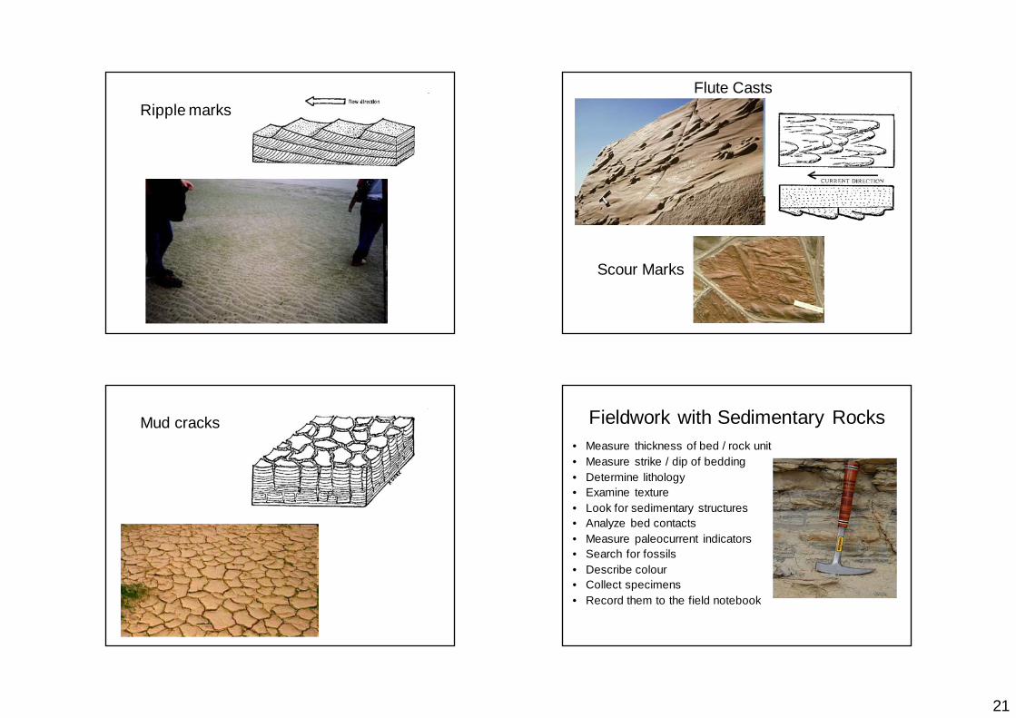
• Graded bedding• Cross-bedding• Ripple marks• Flute Casts, Scour structures (cut and fill) • Mud Cracks
etc.
Graded bedding
BeddingLamination
Cross-bedding
21
Ripple marksFlute Casts
Scour Marks
Mud cracks Fieldwork with Sedimentary Rocks• Measure thickness of bed / rock unit• Measure strike / dip of bedding• Determine lithology• Examine texture• Look for sedimentary structures• Analyze bed contacts• Measure paleocurrent indicators• Search for fossils• Describe colour• Collect specimens• Record them to the field notebook
22
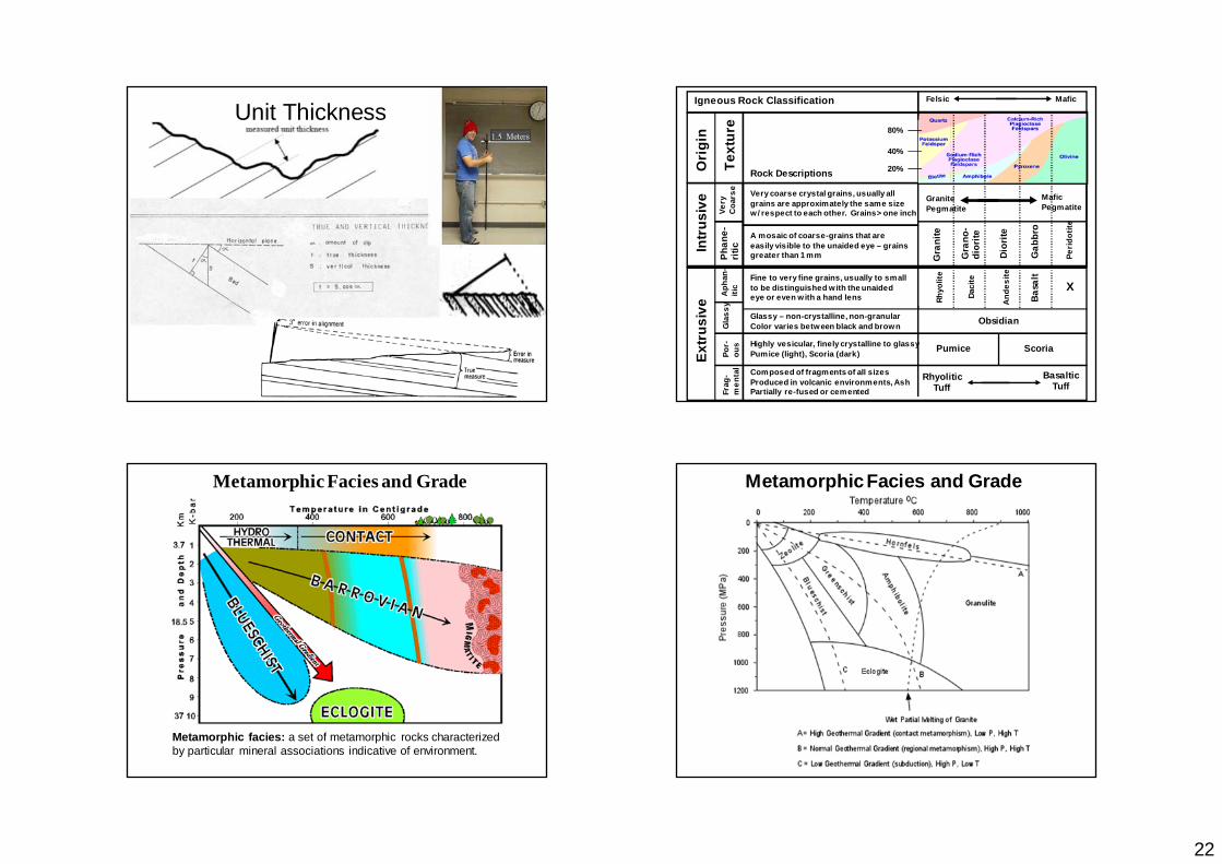
Unit Thickness
Ori
gin
Text
ure
Intr
usiv
ePh
ane-
ritic
Very coarse crystal grains, usually allgrains are approximately the same sizew/ respect to each other. Grains> one inch
A mosaic of coarse-grains that areeasily visible to the unaided eye – grainsgreater than 1 mm G
rani
te
Gra
no-
dior
ite
Dior
ite
Gab
bro
Peri
dotit
e
GranitePegmatite
MaficPegmatite
Rhyo
lite
Daci
te
And
esite
Basa
lt
X
Extr
usiv
e
Fine to very fine grains, usually to smallto be distinguished with the unaidedeye or even with a hand lensA
phan
-iti
cG
lass
yPo
r-ou
sFr
ag-
men
tal
Obsidian
Pumice Scoria
RhyoliticTuff
BasalticTuff
80%
40%
20%
Glassy – non-crystalline, non-granularColor varies between black and brown
Highly vesicular, finely crystalline to glassyPumice (light), Scoria (dark)
Composed of fragments of all sizesProduced in volcanic environments, AshPartially re-fused or cemented
Very
Coa
rse
Rock Descriptions
Igneous Rock Classification Felsic Mafic
Metamorphic Facies and Grade
Metamorphic facies: a set of metamorphic rocks characterized by particular mineral associations indicative of environment.
Metamorphic Facies and Grade

23
Metamorphic Textures
Phyllitic Texture - This texture is formed by the parallel arrangement of fine-grained micas, as in a phyllite.
Slaty Cleavage - alignment of very fine-grained micas, as in a slate derived from the metamorphism of shale.
Foliated Textures
Gneissic banding - segregation of light and dark minerals into distinct layers in the rock, as in a gneiss
Schistosity - alignment of large mica flakes, as in a mica schist.
PhylliteSlate
Schist
Gneiss
Foliated Metamorphic Rocks of Sed. Origin
Migmatite
Mylonites: Mylonites are cataclastic metamorphic rocks that are produced along shear zones deep in the crust.
Metamorphic rocks along shear zones