Embed Size (px)
DESCRIPTION
An essential guide for water protection. This report should be used when considering local planning and zoning decisions that can be used to protect the important water resources in Charlevoix County, Michigan.
Citation preview

Charlevoix CountyLocal Ordinance Gaps Analysis
An essential guide for water protection
Tip of the Mitt Watershed CouncilWritten and compiled by Grenetta Thomassey, Ph.D.


Charlevoix CountyLocal Ordinance Gaps Analysis
An essential guide for water protection
Tip of the Mitt Watershed CouncilWritten and compiled by Grenetta Thomassey, Ph.D.
This publication is designed to provide accurate and authoritative information in regard to the subject matter covered. Mention of specific companies, organizations, or authorities in this book do not imply endorsement by the author or publisher, nor does the mention of specific companies, organizations or authorities imply that they endorse this book, its author or publisher.
Internet addresses and phone numbers given in this book were accurate at the time of printing.
Library of Congress CatalogThomassey, GrenettaCharlevoix County Local Ordinance Gaps AnalysisISBN 978-1-889313-05X1. Government 2. Water Protection 3. Charlevoix County
© 2011 Tip of the Mitt Watershed CouncilAll rights reserved.Printed in the United State of America
Photography by: Kristy Beyer
If you want to reproduce this book or portions of it for reasons consistent with its purpose, please contact the publisher:
Tip of the Mitt Watershed Council
426 Bay StreetPetoskey, MI 49770(231) 347-1181 phone(231) 347-5928 faxwww.watershedcouncil.org
This work should be cited as follows:
Thomassey, Grenetta. Charlevoix County Local Ordinance Gaps Analysis 2011. Tip of the Mitt Watershed Council, Petoskey, MI 49770
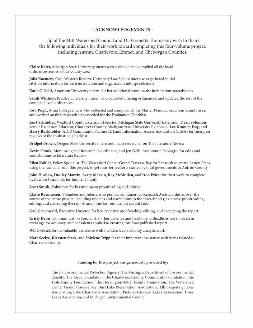
~ ACKNOWLEDGEMENTS ~
Tip of the Mitt Watershed Council and Dr. Grenetta omassey wish to thank the following individuals for their work toward completing this four-volume project,
including Antrim, Charlevoix, Emmet, and Cheboygan Counties:
Claire Kafer, Michigan State University intern who collected and compiled all the local ordinances across a four-county area
Julia Kazmers, Case Western Reserve University Law School intern who gathered initial citation information for each jurisdiction and organized it into spreadsheets
Katie O’Neill, American University intern, for her additional work on the jurisdiction spreadsheets
Sarah Whitney, Bradley University intern who collected missing ordinances, and updated the rest of the compiled local ordinances
Josh Pugh, Alma College intern who collected and compiled all the Master Plans across a four-county area, and worked on final research steps needed for the Evaluation Checklist
Kurt Schindler, Wexford County Extension Director, Michigan State University Extension; Dean Solomon, Senior Extension Educator, Charlevoix County Michigan State University Extension; Lee Kramer, Esq.; and Harry Burkholder, AICP, Community Planner II, Land Information Access Association (LIAA) for their peer reviews of the Evaluation Checklist
Bridget Brown, Oregon State University intern and main researcher on e Literature Review
Kevin Cronk, Monitoring and Research Coordinator, and Jen Gelb, Restoration Ecologist, for edits and contributions to Literature Review
Ellen Kohler, Policy Specialist, e Watershed Center Grand Traverse Bay for her work to create Action Plans,using the raw data from this project, to get near-term efforts started by local governments in Antrim County
John Hoshaw, Dudley Marvin, Larry Marvin, Ray McMullen, and Don Priest for their work to complete Evaluation Checklists for Emmet County
Scott Smith, Volunteer, for his time spent proofreading and editing
Claire Rasmussen, Volunteer and Intern, who performed numerous Research Assistant duties over the course of the entire project, including updates and corrections to the spreadsheets; extensive proofreading, editing, and correcting the report; and other last minute but crucial tasks
Gail Gruenwald, Executive Director, for her extensive proofreading, editing, and correcting the report
Kristy Beyer, Communication Specialist, for her patience and flexibility as deadlines were missed in exchange for accuracy, and her talents applied to creating this final published report
Wil Cwikiel, for his valuable assistance with the Charlevoix County analysis work
Marc Seelye, Kiersten Stark, and Shirlene Tripp for their important assistance with items related to Charlevoix County
Funding for this project was generously provided by:
e US Environmental Protection Agency; e Michigan Department of EnvironmentalQuality; e Joyce Foundation; e Charlevoix County Community Foundation; eDole Family Foundation; e Herrington-Fitch Family Foundation; e WatershedCenter Grand Traverse Bay; Burt Lake Preservation Association; Elk-Skegemog LakesAssociation; Lake Charlevoix Association; Pickerel-Crooked Lakes Association; reeLakes Association; and Michigan Environmental Council.

Table Of Contents
SECTION I: INTRODUCTION 1
SECTION II: LITERATURE REVIEW 5
SECTION III: ANALYSIS
Introduction 19
Chapter 1 Charlevoix County 21
Chapter 2 City of Boyne City 31
Chapter 3 City of Charlevoix 41
Chapter 4 City of East Jordan 51
Chapter 5 Bay Township 61
Chapter 6 Boyne Valley Township 71
Chapter 7 Chandler Township 81
Chapter 8 Charlevoix Township 89
Chapter 9 Evangeline Township 99
Chapter 10 Eveline Township 113
Chapter 11 Hayes Township 125
Chapter 12 Hudson Township 139
Chapter 13 Marion Township 149
Chapter 14 Melrose Township 161
Chapter 15 Norwood Township 173
Chapter 16 Peaine & St. James Townships 183
Chapter 17 South Arm Township 193
Chapter 18 Wilson Township 205
Chapter 19 Village of Boyne Falls 215
SECTION IV: APPENDIX
Appendix A: Document Review Checklist forLocal Ordinance Gaps Analysis 219
Appendix B: Additional Resources 239
Appendix C: Charlevoix County Map 244

Introduction
1www.watershedcouncil.org
SECTION I: Introduction
Protecting Lakes, Streams, Wetlands and Ground Water
Prevent or Save?It is much easier to prevent degradation of a lake than to save it from the brink of ruin.
Some Michigan lakes are in trouble. People love these lakes, but failure to prevent degradation has resultedin real and difficult challenges for communities. Drinking water sources are threatened, recreational use islimited, and habitat is disappearing. These factors impact quality of water - and quality of life - and placeproperty values at risk.
Fortunately, in Northern Michigan, most of our treasured lakes, streams, and ground water sources are cleanand plentiful. We still have wetlands to nurture those waters, drinking water is delicious and healthy, andrecreational use abounds. Wildlife thrives among us, and property values are solid. Because these conditionsexist, more and more people want to be here. In addition to new opportunities, this also brings a new set ofchallenges to our area, especially for local governments. This Local Ordinance Gaps Analysis is designed tohelp local governments deal with the water resource-related challenges that come with this growth.
Contrary to widely-held beliefs, state and federal regulations do not adequately protect water resources andwetlands from impacts that can be prevented at the local level. For example, federal regulations mainly address discharge of fill material into wetlands, but do not protect against other significant impacts. Thestate of Michigan does have a statutory Wetland Protection Program in place, but it is constantly threatenedwith budget cuts and attempts to weaken it. Additionally, it can fail to protect local wetlands that fall outsideof its scope.
Growth pressures bring a new awareness of the limitations of state and federal protections, and local governments have come to realize the need to fill in the gaps. Sensible local regulations create a certaintythat protects investments, not only for homeowners but also for small businesses and developers of largerprojects. They also allow economic growth while protecting vital water resources.
Purpose
The purpose of this project is to give you, the local government official, a comprehensive picture of:
• the water resource protections now in place at the county and township levels, including your jurisdiction;
• our recommended local approaches to protect waters;
• and what we suggest could be improved, to better protect your water resources.
CHARLEVOIx COUnTy - Local Ordinance Gaps Analysis
Tip of the Mitt Watershed Council2
Obviously, the “comprehensive picture” being presented here is a snapshot in time. However, every
attempt has been made to give you a “living document” that should serve you for planning purposes,
years into the future. Several items noted here as needing improvements may already be improved, by
the time this document is published. Also, you might find an error, as this work was quite detail-oriented
and it’s possible that we missed something. Nevertheless, most of this information should be timely,
useful, and provide helpful guidance.
The project was done across the entire service area of Tip of the Mitt Watershed Council: Antrim,
Charlevoix, Emmet, and Cheboygan Counties. Every jurisdiction in each county was included. The
project is divided into four reports, and this report is for Charlevoix County.
Critical Elements of this ProjectThis project was done with the underlying assumption that specific Critical Elements are considered vital
to address, if a local government wants to create strong protections for local water resources. These
Critical Elements are:
• Master Plan Components
• Basic Zoning Components
• Shorelines
• Impervious Surfaces and Stormwater Management
• Soil Erosion and Sediment Control
• Sewer/Septic
• Wetlands
• Groundwater and Wellhead Protection
• Other: Floodplains, Steep Slopes, and Critical Dunes
The reasons for creating this particular list are detailed in the Literature Review that is found in Section II.
The Literature Review is a formal academic review, documenting the current relevant research literature
for each of these items. It explains why the Critical Elements are considered important enough to include
in this work.
Project Evaluation and AnalysisAn Evaluation Checklist was created to focus on the Critical Elements listed above, in accordance with
the Literature Review. You will find a copy in the Appendix.
The checklist was compared to each jurisdiction’s Master Plan and any ordinances in place. The checklist
question was asked; the answer was found and noted. If the answer was “yes”, the question earned 3
points. If the answer was “yes, partially” the question earned 2 points. If the answer was “yes, minimally”
the question earned 1 point. If the answer was no, the question earned 0 points and that item is considered
to be missing. The score for each question was assigned and then the next question was asked, until
the entire checklist was complete.
It is important to note that the scoring system used with the Evaluation Checklist does not penalize a
jurisdiction for missing ordinances that are not appropriate for their area, because of geographic or other
circumstances. We understand that there cannot be a cookie cutter approach to water protections for
any region. The cover page of the Evaluation Checklist gives you a detailed explanation of the system
used to accommodate those situations.
Introduction
3www.watershedcouncil.org
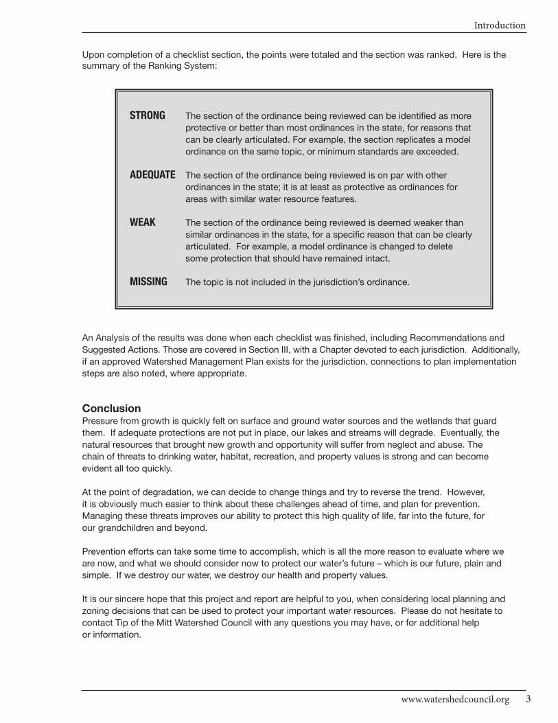
Upon completion of a checklist section, the points were totaled and the section was ranked. Here is thesummary of the Ranking System:
STRONG The section of the ordinance being reviewed can be identified as more
protective or better than most ordinances in the state, for reasons that
can be clearly articulated. For example, the section replicates a model
ordinance on the same topic, or minimum standards are exceeded.
ADEQUATE The section of the ordinance being reviewed is on par with other
ordinances in the state; it is at least as protective as ordinances for
areas with similar water resource features.
WEAK The section of the ordinance being reviewed is deemed weaker than
similar ordinances in the state, for a specific reason that can be clearly
articulated. For example, a model ordinance is changed to delete
some protection that should have remained intact.
MISSING The topic is not included in the jurisdiction’s ordinance.
An Analysis of the results was done when each checklist was finished, including Recommendations and
Suggested Actions. Those are covered in Section III, with a Chapter devoted to each jurisdiction. Additionally,
if an approved Watershed Management Plan exists for the jurisdiction, connections to plan implementation
steps are also noted, where appropriate.
ConclusionPressure from growth is quickly felt on surface and ground water sources and the wetlands that guard
them. If adequate protections are not put in place, our lakes and streams will degrade. Eventually, the
natural resources that brought new growth and opportunity will suffer from neglect and abuse. The
chain of threats to drinking water, habitat, recreation, and property values is strong and can become
evident all too quickly.
At the point of degradation, we can decide to change things and try to reverse the trend. However,
it is obviously much easier to think about these challenges ahead of time, and plan for prevention.
Managing these threats improves our ability to protect this high quality of life, far into the future, for
our grandchildren and beyond.
Prevention efforts can take some time to accomplish, which is all the more reason to evaluate where we
are now, and what we should consider now to protect our water’s future – which is our future, plain and
simple. If we destroy our water, we destroy our health and property values.
It is our sincere hope that this project and report are helpful to you, when considering local planning and
zoning decisions that can be used to protect your important water resources. Please do not hesitate to
contact Tip of the Mitt Watershed Council with any questions you may have, or for additional help
or information.
CHARLEVOIx COUnTy - Local Ordinance Gaps Analysis
Tip of the Mitt Watershed Council4

Literature Review
5
SECTION II: Literature Review
IntroductionMichigan has abundant water resources, including more than 11,000 inland lakes (Michigan DNR, 2009) and
nearly 4,000 miles of Great Lakes shoreline (Michigan DEQ, 2008a). These lakes are intricately connected
to the region’s rivers, wetlands, and underground aquifers. If cared for properly, Michigan’s water resources
can offer clean drinking water, healthy ecosystems and vital wildlife habitat, as well as provide ample
opportunities for recreation and scenic views.
Because Michigan is a home rule state1, local Master Plans and ordinances play a crucial role in protecting
environmental resources, such as water. We reviewed the water-related sections of local plans and ordinances
within the Watershed Council’s four-county service area. The review was based on several Critical Elements
that account for the quality and reliability of local water resources:
• Master Plan Components
• Basic Zoning Components
• Shorelines
• Impervious Surfaces and Stormwater Management
• Soil Erosion and Sediment Control
• Sewer/Septic
• Wetlands
• Ground Water and Wellhead Protection
• Other: Floodplains, Steep Slopes, and Critical Dunes
Literature ReviewThis literature review was conducted to provide a more in-depth explanation of why these specific factors
are important to maintain water quality and aquatic ecosystem integrity. It also provides resources for local
government entities. You will find a complete annotated list of these resources at the end of this literature
review, which is organized by each Critical Element.
1 In Michigan, counties, townships, and villages meeting certain statutory requirements may become home-rule units of government. If those statutory requirements are not met, a local unit of government cannot engage in activities unless the state expressly grants authority for it to do so. By law in Michigan, all cities are home rule units(Public Sector Consultants, 2002).

CHARLEVOIx COUnTy - Local Ordinance Gaps Analysis
Tip of the Mitt Watershed Council6
Master Plan Components
“A master plan is a comprehensive long range plan intended to guide growth and development of a
community or region” (Antrim County Master Plan, 2008).
The Michigan Planning Enabling Act (PA33 2008) describes a master plan as: “A land use plan that
consists in part of a classification and allocation of land for agriculture, residences, commerce,
industry, recreation, ways and grounds, public buildings, schools, soil conservation, forests, woodlots,
open space, wildlife refuges, and other uses and purposes.” This Act provides for the formation of
planning commissions and uniform procedures for preparing, adopting, amending, and implementing
these plans. Master Plans are intended to provide a basis for a zoning ordinance within a jurisdiction,
if justified, including natural resource protection or rehabilitation (Michigan Legislature 2008).
A master plan that is regularly updated provides your community with important tools. These include
facts on existing conditions and trends to help understand the impact of decisions; and a description
of where and what type of development is desired. It allows individuals and businesses to reliably plan
for the purchase and use of property, consistent with community goals. It also promotes the wise use
of resources by helping prioritize which projects to undertake while still preserving community character
(Antrim County Master Plan, 2008).
Basic Zoning Components
The Michigan Zoning Enabling Act (PA 110 of 2006) stipulates that a local unit of government may provide for
the regulation of land development by using a zoning ordinance. It also allows the establishment of
districts within its jurisdiction that regulate the use of land and structures to meet the needs of citizens for
“food, fiber, energy, and other natural resources, places of residence, recreation, industry, trade, service,
and other uses of land, to ensure that use of the land is situated in appropriate locations and relationships,
to limit the inappropriate overcrowding of land and congestion of population, transportation systems, and
other public facilities, to facilitate adequate and efficient provision for transportation systems, sewage
disposal, water, energy, education, recreation, and other public service and facility requirements, and to
promote public health, safety, and welfare” (Michigan Legislature, 2006). Corrective amendments to the
Act (PA 12 of 2008) included clarification in Article III for transfer of powers to the planning commission
and Article IV, providing for Zoning Adoption and Enforcement (Ball and Sweet, 2008).
Shorelines
Great Lakes:
Development along coastal areas of the Great Lakes shoreline can have serious impacts on dunes,
beaches, coastal wetlands, and the adjacent aquatic ecosystem. Coastal shorelines serve as an important
interface between inland systems and the lake or ocean, both physically and biologically. For example, a
review by Defeo et al. (2009) discussed the importance of coastal sandy beaches:
Physical: sand transport and storage, which protects the shoreline from permanent erosion; stormbuffering; breakdown of pollutants; water filtration and purification; nutrient mineralization and recycling; aquifer recharge.
Biological: biodiversity; juvenile fish nurseries; nesting sites; prey resources for birds and terrestrial animals.
Whether Great Lakes coastal shorelines are sandy or rocky, the services and benefits of any natural
shoreline can be impeded if they are overly developed, modified, or removed. Establishing a minimum
setback distance can lessen these impacts by concentrating development away from the water body and
other important features (e.g. dunes, beaches). Beach grooming, a major impact that uses heavy equipment
to rake and sieve the sand, creates large unvegetated areas, which can result in erosion and kill eggs,
juvenile fish, turtles and shorebirds that nest in these areas (Defeo et al., 2009). Recreation is another

Literature Review
7www.watershedcouncil.org
major concern, as it can impact the behavior of species in the area. Motorized recreation, such as the use of
Off Road Vehicles (ORVs), is particularly destructive due to trampling and loss of necessary dune vegetation
(Defeo et al., 2009).
Inland Lakes and Streams:
Shoreline development impacts lakes and streams as well as the surrounding terrestrial ecosystems.
However, appropriate planning and management techniques can lessen these impacts. Techniques that
benefit and protect inland lake and stream ecosystems include the use of vegetated buffer strips using
native plant species, shoreline setbacks, and limits on development density and other human disturbances.
Shorelines are vital transition zones between land and water, where many important interactions occur
that benefit the aquatic ecosystem, including food and nutrient exchange. These benefits are diminished
when shoreline properties are developed and vegetation removed, but can be recovered by planting
vegetated buffer strips using a variety of native species. Establishing a diverse vegetated buffer strip
encourages a shoreline to revert to natural conditions, which improves the effectiveness of the transition
zone in protecting lakes and streams from the negative impacts of adjacent land-use activity.
In the literature discussed below, authors advocate buffer strips be anywhere from 50 to 600 feet in
width, depending on their intended purpose. Brooks et al. (2003) write that buffer strips have the following
benefits: 1) reducing runoff velocity, which allows sediments, nutrients, and chemicals in the water to filter
out before reaching the water; and 2) reducing the amount of solar radiation entering the water, creating
cooler temperatures in the shoreline waters, which increases dissolved oxygen and protects sensitive
aquatic life. The District of Muskoka, Ontario, Canada (2003) presented the following additional benefits
of buffers: erosion protection, flood control, wildlife food and habitat, increased property value, and
aesthetic value.
In terms of water quality, Woodward and Rock (1995) found that vegetated buffer strips reduce both
phosphorus and total suspended solids (TSS) inputs, provided the buffer strips were constructed and
maintained properly. They noted that large areas of exposed soil increased sediment loads entering the
water, so this point is critical. Improvements garnered by maintaining a vegetated buffer strip were
the greatest at construction sites, where erosion is a major issue. A literature review by Norris (1993)
concluded that three major factors affect how effective buffer strips are at improving water quality: 1)
physical attributes of the buffer zone (width, vegetation type, soil type, etc.), 2) types of pollutants
entering the buffer strip, and 3) proximity of buffer zone to pollution source.
Merrell, Howe and Warren (2009) studied 40 inland lakes in Vermont. They concluded that minimizing
shoreline conversion to lawns and maximizing the extent of vegetated buffered shores will benefit lake
ecosystems. Specifically, they found that compared to undeveloped or buffered sites, developed/unbuffered
sites had less shoreline tree cover, less shading, less large and small woody structure in the shallow water
zone, and less leaf litter; these sites also had less food sources, including biofilms on lakebed rocks,
invertebrate exoskeletons, and aquatic plants. In a study focused on impacts of logging near small inland
lakes, authors found that vegetated buffer strips prevented temperature increases in shallow waters along
the shoreline (Steedman, Kushneriuk and France, 2001).
Shoreline setbacks are another tool used to lessen impacts of development on inland lakes and streams.
Development directly along shorelines has been shown to have many negative effects on lakes. In a
study of lakes in the Northeast United States, researchers observed that lakes with visible human activity
in half of the shoreline area or more had highly disturbed shoreline habitat (Whittier et al., 2002). This
point also relates to the issue of development density and keyhole funneling. Keyhole funneling allows
direct access to lakes by people who do not own property on the lakeshore, thus increasing human
impacts on that part of the shoreline.
CHARLEVOIx COUnTy - Local Ordinance Gaps Analysis
Tip of the Mitt Watershed Council8
In addition to protecting the lake ecosystem, lakefront property owners may benefit economically from utilizing
shoreline protection techniques. A study in Minnesota found that property values increase as lake water clarity
increases (Krysel, Boyer and Parson, 2003). According to Cappiella and Schueler (2001), natural shorelines are
a major factor contributing to the high value of lakefront property and thus, shoreline buffers can be justified as
much economically as ecologically. It therefore stands to reason that shoreline protection techniques that
preserve and restore water quality and wildlife habitat are crucial for maintaining and increasing the value of
shoreline properties.
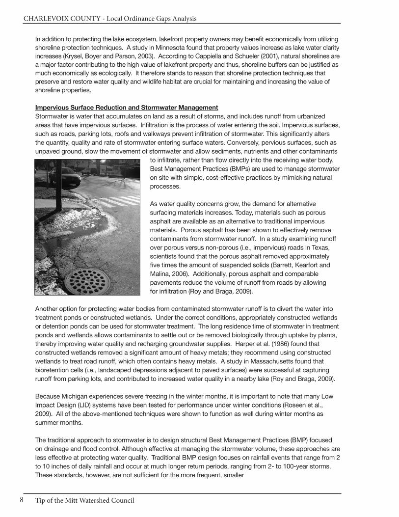
Impervious Surface Reduction and Stormwater Management
Stormwater is water that accumulates on land as a result of storms, and includes runoff from urbanized
areas that have impervious surfaces. Infiltration is the process of water entering the soil. Impervious surfaces,
such as roads, parking lots, roofs and walkways prevent infiltration of stormwater. This significantly alters
the quantity, quality and rate of stormwater entering surface waters. Conversely, pervious surfaces, such as
unpaved ground, slow the movement of stormwater and allow sediments, nutrients and other contaminants
to infiltrate, rather than flow directly into the receiving water body.
Best Management Practices (BMPs) are used to manage stormwater
on site with simple, cost-effective practices by mimicking natural
processes.
As water quality concerns grow, the demand for alternative
surfacing materials increases. Today, materials such as porous
asphalt are available as an alternative to traditional impervious
materials. Porous asphalt has been shown to effectively remove
contaminants from stormwater runoff. In a study examining runoff
over porous versus non-porous (i.e., impervious) roads in Texas,
scientists found that the porous asphalt removed approximately
five times the amount of suspended solids (Barrett, Kearfort and
Malina, 2006). Additionally, porous asphalt and comparable
pavements reduce the volume of runoff from roads by allowing
for infiltration (Roy and Braga, 2009).
Another option for protecting water bodies from contaminated stormwater runoff is to divert the water into
treatment ponds or constructed wetlands. Under the correct conditions, appropriately constructed wetlands
or detention ponds can be used for stormwater treatment. The long residence time of stormwater in treatment
ponds and wetlands allows contaminants to settle out or be removed biologically through uptake by plants,
thereby improving water quality and recharging groundwater supplies. Harper et al. (1986) found that
constructed wetlands removed a significant amount of heavy metals; they recommend using constructed
wetlands to treat road runoff, which often contains heavy metals. A study in Massachusetts found that
bioretention cells (i.e., landscaped depressions adjacent to paved surfaces) were successful at capturing
runoff from parking lots, and contributed to increased water quality in a nearby lake (Roy and Braga, 2009).
Because Michigan experiences severe freezing in the winter months, it is important to note that many Low
Impact Design (LID) systems have been tested for performance under winter conditions (Roseen et al.,
2009). All of the above-mentioned techniques were shown to function as well during winter months as
summer months.
The traditional approach to stormwater is to design structural Best Management Practices (BMP) focused
on drainage and flood control. Although effective at managing the stormwater volume, these approaches are
less effective at protecting water quality. Traditional BMP design focuses on rainfall events that range from 2
to 10 inches of daily rainfall and occur at much longer return periods, ranging from 2- to 100-year storms.
These standards, however, are not sufficient for the more frequent, smaller
Literature Review
9www.watershedcouncil.org
runoff event because there is too little retention time for effective pollutant treatment. The need to strike a
balance between accommodating large volumes of stormwater and promoting water quality is becoming
more broadly recognized. As a result, municipalities are shifting their BMP design approach to encompass
both the peak discharge hydrology and the more water quality-based small storm hydrology. One approach
is to specify a treatment volume that is designed to capture the initial component of the stormwater runoff.
In practice, this may be achieved by specifying a rainfall amount (e.g., the first ½-inch or 1-inch) or the
capture of a stormwater runoff volume that correlates to a design storm (e.g., 6-month, 1-year, or 2-year
frequency storm).
Soil Erosion and Sediment Control
Sediment is a major pollutant in Michigan’s surface waters. Soil erosion often results in increased sediment
loads to lakes and rivers, which can adversely impact aquatic ecosystems in a number of ways. Increased
turbidity from sedimentation decreases photosynthetic production (Berry, Rubinstein and Melzian, 2003).
Suspended sediments interfere with ingestion and respiration of aquatic insects (Berry et al., 2003), which
can decrease populations and consequently, affect the dynamics of entire food chains. Erosion and
sedimentation can also introduce into the water harmful contaminants contained in soils from human
activities, such as pesticides, household cleaning products, automotive fluids, or nutrients from pet
waste. Although erosion is a natural process, development alters and accelerates that process by
removing vegetation necessary for soil stabilization. Construction activity creates increased opportunities
for erosion due to exposed soil. However, these impacts can be minimized by utilizing proper soil stabilization
techniques. For example, Faucette et al. (2009) found that erosion control blankets (ECBs) successfully
prevented soil erosion at construction sites; thicker blankets were more effective than thinner blankets.
Steep slopes or bluffs are especially vulnerable to erosion, particularly in areas with sandy soils, or areas
subject to wave action, surface or subsurface drainage, or heavy precipitation. Reducing the volume and
rate of water that reaches the bluff can help slow the erosion process; often this can be accomplished
simply by preserving natural vegetation and features (e.g., rocks, driftwood, etc.) on the slope or bluff (UMN,
2008). In some cases where natural features are inadequate to slow erosion, French drains or other water
diversion systems may be used (UMN, 2008) until water-absorbing vegetation can be reestablished.
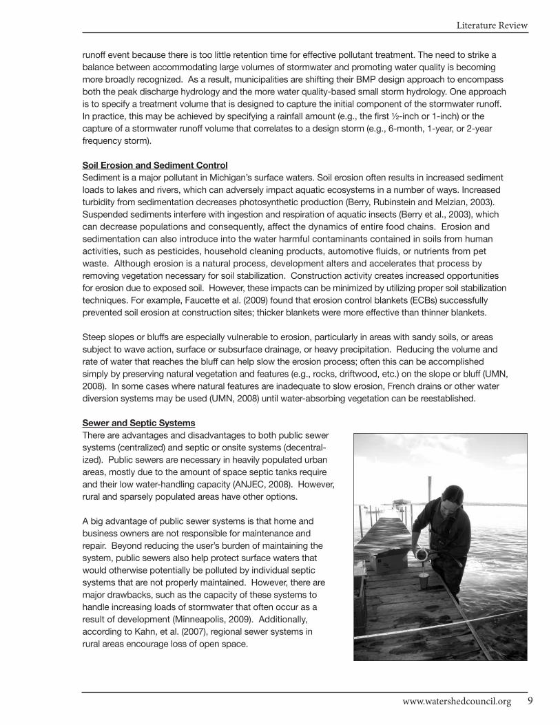
Sewer and Septic Systems
There are advantages and disadvantages to both public sewer
systems (centralized) and septic or onsite systems (decentral-
ized). Public sewers are necessary in heavily populated urban
areas, mostly due to the amount of space septic tanks require
and their low water-handling capacity (ANJEC, 2008). However,
rural and sparsely populated areas have other options.
A big advantage of public sewer systems is that home and
business owners are not responsible for maintenance and
repair. Beyond reducing the user’s burden of maintaining the
system, public sewers also help protect surface waters that
would otherwise potentially be polluted by individual septic
systems that are not properly maintained. However, there are
major drawbacks, such as the capacity of these systems to
handle increasing loads of stormwater that often occur as a
result of development (Minneapolis, 2009). Additionally,
according to Kahn, et al. (2007), regional sewer systems in
rural areas encourage loss of open space.
CHARLEVOIx COUnTy - Local Ordinance Gaps Analysis
Tip of the Mitt Watershed Council10
Public sewer systems can be either “combined” or “separate”. Combined systems send both stormwater
runoff and wastewater to treatment plants. Separate systems send only wastewater to treatment plants;
stormwater may or may not be handled separately. In combined systems, large volumes of water from
major storm events can exceed the capacity of treatment plants, resulting in untreated sewage and
wastewater being discharged directly into nearby water bodies, as well as sewage backing up into homes.
Obviously, this can have detrimental impacts on both humans and the environment. One activity in
particular that places added stress on combined systems is the use of downspouts that direct rainwater
from households or commercial areas straight into sewer systems (Minneapolis, 2009).
According to the USEPA (2009), septic tanks serve almost 25% of U.S. households. Cappiella and
Schueler (2001) point out that septic systems commonly serve households along inland lakeshores due
to the difficulty and distance involved with hooking up to public sewer systems. It can be costly to extend
sewer lines from existing systems, or to build new public sewers where none currently exist. One advantage
of septic systems is their ability to provide wastewater treatment where public sewer systems cannot.
Additional advantages include 1) they are less expensive to homeowners over the long-term; 2) installation
and maintenance is less disruptive to the environment; 3) they help replenish ground water resources; and
4) they provide simple, yet effective treatment of wastewater (NESC, 2004). They also mimic the natural
water cycle, according to ANJEC (2008).
If septic systems are not properly maintained or are overloaded with more water than they are designed
to accommodate, they can fail and release untreated sewage into the environment (USEPA, 2003).
Because of this risk, and the liability that falls on the home or business owner, it is important that
septic systems be thoroughly inspected before a transfer of property transaction is completed. This
will ensure that the new owner has an adequately functioning septic system at the time of transfer,
thereby minimizing the risk of liability for environmental contamination and public health threats resulting
from a malfunctioning system. A legal phrase used for this process is “point of transfer inspection”.
Provisions can be added to local ordinances to accommodate property sales in winter months, when
inspections are not feasible. In addition to protecting property owners, “point of transfer inspection”
ordinances also reduce pollution to lakes and other water sources by finding those systems that need
repair or replacement. This practice, along with others discussed below, can help ensure septic
systems do not contaminate precious water resources.
Standley et al. (2008) found that surface waters were more contaminated in residential areas containing
many septic systems, particularly with pharmaceuticals and hormones. In a study on septic tanks in
Florida, Arnade (1999) found a strong relationship between the distance of septic tanks from wells and the
amount of fecal coliform bacteria, phosphorus, and nitrates found in the wells. She found the relationship
to be even stronger during rainy months, when the water table rises and soils become saturated. For this
reason, many local governments require minimum setback distances for septic tanks. These setbacks can
be described as either “horizontal” or “vertical”. Horizontal separation distance refers to the distance a
tank must be from drinking wells, lakes, rivers, and houses, in order to protect environmental and human
health. Vertical separation distance refers to the distance a tank must be from the water table, in order to
provide enough space for contaminants to be removed and allow for aerobic digestion of nutrients (NESC,
2008). With proper setbacks, design, maintenance and sludge removal, septic systems will only dis-
charge treated water (e.g., clean and not harmful) into the surrounding environment.
Wetlands
Wetlands are unique, diverse, and sensitive ecosystems. They provide important habitat for wildlife
(particularly migratory birds), naturally filter surface water, and recharge ground water supplies. Wetlands
also store large quantities of water, which dampens the effects of major flood events. One acre of
wetlands can store up to 1.5 million gallons of flood-derived water (Ardizone and Wyckoff, 2003).

Literature Review
11www.watershedcouncil.org
Additional valuable functions provided by wetlands include: erosion reduction, shoreline stabilization,
and scenic opportunities (Gordon, 1992). As they are difficult to re-create once destroyed, preserving
and protecting wetlands today is the best option to ensure their benefits continue well into the future.
Wetlands in Michigan are found both inland and in coastal areas of the Great Lakes. Unfortunately, most
coastal wetlands that once existed in the Great Lakes region have been drained or filled for development.
As the ecological and water quality benefits of coastal wetlands become more readily acknowledged,
more coastal wetland restoration projects are being implemented in the Great Lakes Basin (Mitsch and
Wang, 2000). In fact, studies show that coastal wetland restoration can be a powerful tool for reducing
nonpoint source pollution. Mitsch and Wang (2000) assessed the effectiveness of coastal wetland
restoration in improving both water quality and wildlife habitat. They concluded that restoration is most
effective when strategically located in areas receiving heavy nonpoint source pollution inputs with
potential for productive habitat.
As with lakes, buffers and setbacks can be useful tools for wetland protection. However, Ludwa (1994)
found that buffers and other mitigation measures only protected wetlands when land-use impacts were
minimized throughout the watershed. Wetlands in watersheds that had less impervious surface cover
and more forest cover had better resistance to impacts than those in more vulnerable areas with more
impervious surfaces.
However, even with buffers and setbacks, activities adjacent to sensitive wetlands can still degrade the
quality of wetlands (Gordon, 1992). To reduce these impacts, a basin-wide approach to wetland protection
can be adopted. Local regulations are extremely important when it comes to wetlands. Federal legislation
offers some protection, but the Clean Water Act was not designed with wetland protection in mind (Porter
and Salvesen, 1995). To complement local wetland regulations, strategies such as preservation programs,
restoration programs and public education can be implemented (Gordon, 1992). Ensuring that existing
wetlands are functioning and healthy will improve and protect the water quality of all related surface waters.
Ground Water
Ground water is a major source of freshwater, contributing about half of the total water consumed by
humans for drinking, agriculture, and other purposes (New Jersey Geological Survey, 2009). In addition,
depending on water table depth, ground water may serve as a significant source of water to lakes, rivers
and wetlands (Brooks et al., 2003). Ground water protection, which includes consideration of both
quantity and quality, is therefore crucial.
When ground water resources are consumed using pumping and extraction, natural processes replenish
them. This is known as “ground water recharge” and typically occurs through precipitation, infiltration and
percolation (South Brunswick ERI, 2007). The capacity for ground water recharge in any given area depends
on climate, soils, vegetation and land-use patterns (Charles et al., 1993). The relationship among soils,
vegetation and land-use must be considered. In order to ensure ample ground water recharge, areas that
offer the highest potential for recharge (referred to as “ground water recharge areas”) should be protected.
Protection involves 1) identifying ground water recharge areas, then 2) limiting development and other
activities that impede infiltration or negatively impact water quality in those areas.
Some areas in Northern Michigan have municipal well fields. Recharge areas for these well fields are
known as “wellheads” and they should be protected by using plans that identify contaminant sources
and provide recommendations to prevent contamination. In other areas, ground water recharge areas
must be identified; various techniques, including mapping, can accomplish this. By combining local
land-use/land-cover maps with local soil maps, approximate ground water recharge areas for counties
or municipalities can be determined (Charles et al., 1993). Today, GIS technology and digital maps are
readily available to expedite this process.
CHARLEVOIx COUnTy - Local Ordinance Gaps Analysis
Tip of the Mitt Watershed Council12
Once ground water recharge areas are identified, protection measures can be implemented to ensure
their proper function. These include regulating development that increases impervious surface area,
which can alter or obstruct ground water recharge. If recharge rates are reduced, ground water
extraction can become unsustainable (Fayette County, 2000).
The quality of ground water can be compromised by various activities, such as storage and the subsequent
leaking or spilling of hazardous materials, and the use of floor drains at commercial sites (Michigan DEQ,
2008b). According to the DEQ (2008b), even small traces of contaminants discharging into the ground
can have enormous effects on ground water quality. This is because contaminants will both accumulate
in the soil and spread quickly once reaching the water source. Proper storage of hazardous materials
to mitigate these effects includes appropriate site selection and leak-proof containers. Furthermore,
underground storage tanks for fuel and other substances pose a risk to groundwater and should be
identified, evaluated, monitored and repaired or removed, as necessary.
Abandoned wells can also threaten ground water quality (Michigan DEQ, 2007). Because wells connect
the Earth’s surface with underground aquifers, the potential for harmful contaminants to enter ground water
resources exists. Plugging, or closing off, wells that are no longer in use can thereby reduce threats to
ground water quality.
Literature Review
13www.watershedcouncil.org
Works Cited - Annotated
Antrim County Master Plan 2008 Chapter 1: What is a Master Plan? Retrieved from: http://www.antrim-county.org/masterplan.asp This chapter summarizes the focus, elements and considerations in developing the Antrim County Master Plan.
Association of New Jersey Environmental Commissions. 2008. Clean Water, Sewers, Septics and Sprawl.Retrieved from: http://www.anjec.org/pdfs/Sewers_Web_Reader.pdf This article stresses the importance of local wastewater management plans, and discusses the benefits and drawbacks of converting from septic systems to centralized sewer systems.
Ardizone K.A. and Wyckoff M.A., FAICP. Filling the Gaps: Environmental Protection Options for Local Governments, Michigan DEQ, Coastal Management Program with financial assistance from NOAA,authorized by the Coastal Zone Management Act of 1972. June, 2003. Addressing environmental protection at the county and city levels, this book pays special attention to water resources such as lakes, rivers, and wetlands. It discusses qualities, threats, and protection options.
Arnade J.A. 1999. Seasonal correlation of well contamination and septic tank distance. Ground Water:37(6): 920-923. This study examined the influence of seasonal precipitation on the relationship between well contamination from septic tanks, and the distance of the tanks. During the rainy months, the wells had higher concentrations of phosphorus, nitrates and fecal coloform.
Ball, J. and Sweet, L. 2008. Summary of Changes to the Michigan Zoning Enabling Act (PA 110 of 2006)Made by PA 12 of 2008. Planning and Zoning News 26 (5): 6-7. This article summarizes changes to PA 110 of 2006 by the Michigan Legislature for each section amended including a brief explanation.
Barrett M.E., Kearfott P., and Malina J.F. 2006. Stormwater quality benefits of a porous friction course andits effect on pollutant removal by roadside shoulders. Water Environment Research 78(11): 2177-2185. Stormwater study that examined the impact of porous friction courses (PFCs) on the quality of stormwater runoff from highways in Austin Texas, and additionally assessed the impact vegetative shoulder strips have on pollutant removal when used in conjunction with PFCs. The PFCs left very little (on average around 20 mg/L) total suspended solids (TSS) in the stormwater runoff, while the traditional asphalt left significantly more (on average over 100 mg/L).
Berry W., Rubinstein N. and Melzian B. 2003. The biological effects of suspended and bedded sediment(SABS) in aquatic systems: a review. United States Environmental Protection Agency Internal Report. Retrieved from: http://www.epa.gov/waterscience/criteria/sediment/pdf/ appendix1.pdf Published by the EPA, this report summarizes relevant literature pertaining to the impacts increased sediment loads have on lakes and rivers. Separate discussions are included for plants, invertebrates, fish, coral, etc.
Brooks K.N., Ffolliott P.F., Gregersen H.M., and DeBano L.F. Hydrology and the Management of Watersheds.Iowa 2003: Iowa State Press, pp. 334-337. A textbook in which the authors draw upon various scientific studies to discuss watershed processes and recommend management practices for lakes, rivers, and other hydrologic systems.
Cappiella K. and Schueler T. 2001. Crafting a lake protection ordinance. Urban Lake Management 3(4):751-768. This article outlines the major necessary elements for ordinances to protect lakes in developed areas. It includes descriptions of protection measures from the lakeshore to the entire watershed.
CHARLEVOIx COUnTy - Local Ordinance Gaps Analysis
Tip of the Mitt Watershed Council14
Charles E.G., Behroozi C., Schooley J., and Hoffman J.L. 1993. A method for evaluating ground-waterrecharge areas in New Jersey. New Jersey Geological Survey Report (GSR) 32. Published to assist municipalities with identifying ground water recharge areas and ranking them by importance, this report provides detailed methods of such, along with example maps and tables.
Defeo O., McLachlin A., Schoemann D.S., Schlacher T.A., Dugan J., Jones A., Lastra M., and Scapini F.2009. Threats to sandy beach ecosystems: a review. Estuarine, Coastal and Shelf Science 81: 1-12. This is a literature review, discussing the importance of coastal beaches, and activities that have great impacts on them. Surface and sub-surface physical and biological processes are addressed.
Faucette L.B., Scholl B., Beighley R.E., and Governo J. 2009. Large-scale performance and design for constructionactivity erosion control best management practices. Journal of Environmental Quality 38(3): 1248-1254. This study examined the effectiveness of various impact-mitigation techniques at construction sites. Thick erosion control blankets (ECBs) over large areas significantly delayed riling and disturbance.
Fayette County, Georgia. Groundwater Recharge Area Protection Ordinance (June 22, 2000 Ord. 2000-13).Retrieved from: http://www.fayettecountyga.gov/engineering/pdf/Art11GroundwaterRechargeArea ProtectionOrdinance.pdf This is an example of an ordinance to protect ground water recharge areas from various pollution sources.
Gordon D.G. Ed. Designing Wetland Preservation Programs for Local Governments: A Guide to Non-RegulatoryProtection. Washington State Department of Ecology, March 1992. This is a manual discussing the importance of creating — as well as guidelines for designing — wetland preservation programs in order to meet federal, state and local goals of “no net loss”.
Harper H.H., Wanielista M.P., Baker D.M., Fries B.M., and Livingston E.H. 1986. Treatment efficiencies forresidential stormwater runoff in a hardwood wetland. Lake and Reservoir Management 2(1): 351-356. How effective wetlands are at removing heavy metals and nutrients? The results of this study suggest that wetlands are very effective at removing heavy metals, but not as effective at removing nutrients. The authors recommend wetlands be used to filter stormwater off of systems such as highways, where heavy metals are of a greater concern than nutrient pollution.
Kahn L., Hulls J., and Aschwanden P. The Septic System Owner’s Manual. Bolinas, California 2007: ShelterPublications, Inc., p. 127 More than 28 million households have septic systems, but few homeowners know how they operate or how to maintain them. This illustrated guide addresses that need. It emphasizes conventional septic systems powered by gravity flow, filtering through soil, and the natural soil organisms that purify sewage. It also discusses maintenance, what to do if things go wrong, and alternative systems such as mounds and sand filters.
Kauffman Gerald J., Wozniak Sara L., Vonck Kevin J. March 2004, revised May 2005. Source Water Protection Guidance Manual for the Local Governments of Delaware. Retrieved from:http://www.wr.udel.edu/swaphome_old/phase2/SWPguidancemanual.html The State of Delaware Source Water Protection Law of 2001 requires local governments with year-round populations of 2,000 or more to implement protections for the quality and quantity of public water supplies by 2007. The purpose of this manual was to provide local governments with measures meant to comply with the legislation, and encourage smaller jurisdictions protect their sources of public drinking water.
Krysel, C, Boyer E.M., Parson, C, and Welle, P. 2003. Lakeshore Property Values and Water Quality. Evidencefrom Property Sales in Mississippi Headwater Region. Submitted to the Legislative Commission on MinnesotaResources. Retrieved from: http://www.friendscvsf.org/bsu_study.pdf From the Forward to this report: “For the first time, this study defines the dollar value of water quality to the northern Minnesota economy. The State of Minnesota consists of a well-educated popula-
Literature Review
15www.watershedcouncil.org
tion, aware of the value of the State’s most valuable resource, clean water. In today’s political/ budgetary climate, support of the environment that maintains water quality has been viewed as frivolous, anti-business, or an unnecessary expense. Through objective scientific method and hedonic modeling, this study attaches tremendous economic value to investing in a clean environment.”
Ludwa K.A. 1994. Wetland water quality impacts in developing watersheds: empirical models and biologicalindicators. Lake and Reservoir Management 9(1): 75-79. This study examined how deforestation and urban development can impact wetland systems, and how to best mitigate those impacts. Watershed-wide measures were found to be most effective.
Merrell K., Howe E.A., and Warren S. 2009. Examining shorelines, littorally. Lake Line 29(1): 8-13. 40 natural lakes in Vermont were examined in this study, observing differences between undeveloped or buffered sites, and developed/unbuffered sites. Many physical and biological differences were found.
Michigan Department of Environmental Quality. 2007. Plugging abandoned wells. Groundwater ProtectionFact Sheet 1. This fact sheet discusses how to identify abandoned wells and how to close them off. It also outlines the hazards associated with abandoned wells.
Michigan Department of Environmental Quality. 2008(a). Michigan Great Lakes plan: our path to protect andrestore Michigan’s natural treasures. Retrieved from: http://www.michigan.gov/documents/deq/Draft_MI_Great_Lakes_Plan_251564_7.pdf This is a manual of strategies for restoration and increased protection in the state of Michigan, aligned with the 2005 Great Lakes Regional Collaborative “Strategy to Restore and Protect the Great Lakes.” It also contains background information on Michigan’s natural areas.
Michigan Department of Environmental Quality. 2008(b). Pollution prevention at small commercial and in-dustrial facilities. Groundwater Protection Fact Sheet 2. This fact sheet contains a list of commercial and industrial activities potentially hazardous to ground water. It also contains a section on floor drains.
Michigan Department of Natural Resources. 2009. Michigan’s Waters. Retrieved from: http://www.michigan.gov/dnr/0,1607,7-153-30301_31431---,00.html. Description and maps for Michigan’s waters.
Michigan Legislature. 2006 PA 110. Michigan Zoning Enabling Act, Article II. Zoning Authorization and Initiation, Section 125.3201 (1). Retrieved from: http://www.legislature.mi.gov(S(taxk4345o1gumu550g1u2zfc))/mileg.aspx?page=getObject&objectName=mcl-125-3201 “AN ACT to codify the laws regarding local units of government regulating the development and use of land; to provide for the adoption of zoning ordinances; to provide for the establishment in counties, townships, cities, and villages of zoning districts; to prescribe the powers and duties of certain officials; to provide for the assessment and collection of fees; to authorize the issuance of bonds and notes; to prescribe penalties and provide remedies; and to repeal acts and parts of acts.”
Michigan Legislature. 2008 PA 33. Michigan Planning Enabling Act, Article II. Planning CommisionCreation and Administration, Section 125.3811and Article III. Preparation and adoption of MasterPlan,125.3833 Parts (2)(a),(c),(d). Retrieved from: http://www.legislature.mi.gov (S(xupi1mesibiknsmteqka5g55))/mileg.aspx?page=GetObject&objectname=mcl-act-33-of-2008 “AN ACT to codify the laws regarding and to provide for county, township, city, and village planning; to provide for the creation, organization, powers, and duties of local planning commissions; to provide for the powers and duties of certain state and local governmental officers and agencies; to provide for the regulation and subdivision of land; and to repeal acts and parts of acts.”
Minneapolis, City of. 2009. History of Stormwater and Wastewater Drainage Systems in Minneapolis. Retrieved from: http://www.ci.minneapolis.mn.us/stormwater/overview/construction-history.asp This site discussed both combined and separate sewer systems, mainly stressing the advantages of converting to separate systems.
CHARLEVOIx COUnTy - Local Ordinance Gaps Analysis
Tip of the Mitt Watershed Council16
Mitsch, W.J. and N. Wang. 2000. Large-scale coastal wetland restoration on the Laurentian Great Lakes: Determining the potential for water quality improvement. Ecological Engineering 15: 267-282 FROM THE ABSTRACT: Coastal wetlands around the Great Lakes are rarely restored for water quality enhancement of the Great Lakes, despite the need for minimizing phosphorus and other pollutant inputs to the lakes. A simulation model, developed and validated for a series of created experimental marshes in northeastern Illinois, was aggregated and simplified to estimate the nutrient retention capacity of hypothetical large-scale coastal wetland restoration in Michigan and Ohio. A wetland distribution model developed for a Saginaw Bay site illustrated a technique for identifying sites that have high potential for being transition zones between open water and upland and thus logical locations for wetland restoration.
Mortsch, L., M. Alden and J. Scheraga. August 2003. Climate change and water quality in the Great LakesRegion – Risks, Opportunities and Responses. Retrieved from:http://www.ijc.org/rel/pdf/climate_change_2003_part3.pdf This report was prepared for the International Joint Commission (IJC). Recognizing that Climate Change was an emerging issue that required a survey of potential impacts and the ability to adapt, the IJC Great Lakes Water Quality Board commissioned this white paper to explore implications of a changing climate on the Great Lakes watershed. It addresses four broad questions: 1) What are the Great Lakes water quality issues associated with climate change? 2) What are the potential impacts of climate change on the “beneficial uses” in the Great Lakes Water Quality Agreement? 3) How might these impacts vary across the Great Lakes? and 4) What are the implications for decision-making?
Muskoka, District of, Planning and Economic Development Department. 2003. Shoreline vegetative buffers.Retrieved: http://muskoka.fileprosite.com/Documents/DocumentList.aspx?ID=4844 This publication defines vegetated buffer strips and discusses the various benefits of using them to protect water quality. Authors recommend different widths for buffers based on intended use and benefit (e.g. water quality versus mammal habitat).
National Environmental Service Center. 2004. Septic systems—a practical alternative for small communities. Pipeline 15(3): 1-8. This article discusses septic systems, providing an insightful list of “pros” and “cons” for using septic systems versus sewer systems.
National Environmental Service Center. 2008. Ground water Protection and Your Septic System. Retrievedfrom: http://www.nesc.wvu.edu/pdf/ww/septic/septic_tank3.pdf This document discusses the connection between ground water and septic tanks. Included is a description of both “horizontal” and “vertical” separation distances.
New Jersey Geological Survey. 2009. Aquifer Recharge Mapping. Retrieved from:http://www.state.nj.us/dep/njgs/enviroed/aqfrchrg.htm This website describes the process of aquifer recharge, and presents an example of creating a map highlighting recharge areas.
Norris V. 1993. The use of buffer zones to protect water quality: a review. Water Resources Management 7:257-272. This literature review assesses how effective buffer strips are at filtering out harmful inputs due to land-use practices. The author concluded that their effectiveness can be attributed to three major factors: 1) physical attributes of the buffer zone (width, vegetation type, soil type, etc.), 2) types of pollutants entering buffer strip, and 3) proximity of buffer zone to pollution source.
Porter D.R. and Salvesen D.A. Eds. 1995. Collaborative Planning for Wetlands and Wildlife. WashingtonD.C.: Island Press. This book offers a number of case studies centered on local planning for wetland protection.
Literature Review
17www.watershedcouncil.org
Public Sector Consultants. 2002. Michigan in Brief: 2002–03. Retrieved from:http://www.michiganinbrief.org/edition07/Chapter5/LocalGov.htm Michigan in Brief: 2002–03, prepared and published by Public Sector Consultants, Inc., provides information about Michigan and more than 40 public policy topics of concern to residents and elected representatives. Each policy topic is presented in four parts: a glossary; background information; discussion of policy options, including a balanced, nonpartisan presentation of various viewpoints; and sources of additional information, including telephone and FAX numbers as well as Web sites where available.
Roseen R.M., Ballestero T.P., Houle J.J., Avalleneda P., Briggs J., Fowler G., and Wildey R. 2009. Seasonalperformance variations for storm-water management systems in cold climate conditions. Journal of Environmental Engineering 135(3): 128-137. Research shows that winter freezing does not inhibit the performance of certain low-impact design (LID) systems for storm-water management. Contaminant removal was not impeded by the freezing. Design systems that were tested included: bioretention systems, surface sand filter, subsurface gravel wetland, street tree, and porous asphalt.
Roy S.P. and Braga A.M. 2009. Saving Silver Lake. Civil Engineering 79(2): 72-29. This article presented the findings of a study in Massachusetts, involving improving lake water quality. Techniques used included LIDs, such as porous pavement, bioretention cells, rain gardens, and vegetated swales.
Severson J.P., Nawrot J.R. and Eichholz M.W. 2009. Shoreline stabilization using riprap breakwaters on aMidwestern reservoir. Lake and Reservoir Management 25(2): 208-216. This study explored an off-shore erosion mitigation technique that reduced wave height. The study areas that used breakwaters showed higher densities of shoreline vegetation than the control areas.
Standley L.J., Rudel R.A., Swartz C.H., Attfield K.R., Christian J., Erikson M., and Brody J.G. 2008. Wastewater-contaminated ground water as a source of endogenous hormones and pharmaceuticalsto surface water ecosystems. Environmental Toxicology and Chemistry 27(12): 2457-2468. This study examined the potential impacts of increased residential development—and resulting increase in septic systems—on the amount and concentrations of prescription pills and hormones in surface ponds. Authors found the level of development to be an indicator of pollution levels. Steedman R.J., Kushneriuk R.S., and France R.L. 2001. Littoral water temperature to experimental shorelinelogging around small boreal forest lakes. Canadian Journal of Fisheries and Aquatic Sciences 58: 1638-1647. The effects of various logging practices on lake temperatures were examined in this study. The authors found that control and buffered areas did not experience the temperature increases (15%) that clear cut areas experienced.
Township of South Brunswick Environmental Resource Inventory of 2007. “Ground water Recharge Areas.”Retrieved from: http://www.sbtnj.net/vertical/Sites/%7B9E5944A6-A9C2-418C-9E3F-EB23EB627DB9%7D/uploads/%7B10BD2265-5249-4D2D-8CD8-2F3B574EA6EB%7D.PDF South Brunswick, NJ compiled this Environmental Resource Inventory (ERI) to describe the state of various environmental resources in the community. It is a compilation of text and maps the community can use to evaluate, and possibly revise, planning documents, policy initiatives, and local ordinances.
University of Minnesota. 2008. Stabilizing your shoreline to prevent erosion: shoreland best managementpractices. Retrieved from: http://www.extension.umn.edu/distribution/naturalresources/components/DD6946g.html. This is part 7 of an 18-document series on protecting water resources in Minnesota. The focus is on best management practices to reduce harmful consequences of increased shoreline erosion.
CHARLEVOIx COUnTy - Local Ordinance Gaps Analysis
Tip of the Mitt Watershed Council18
U.S. Environmental Protection Agency. 2003. A Homeowners Guide to Septic Systems. Retrieved from:http://www.epa.gov/owm/septic/pubs/homeowner_guide_long.pdf Intended as a guide for homeowners, this document provides information on installation, operation and maintenance of onsite septic systems, as well as substances and activities that can result in septic failure.
USEPA. 2009. Septic (Onsite) Systems. Retrieved from: http://cfpub.epa.gov/owm/septic/index.cfm This site provides information on individual and community septic systems, including links to case studies and data on U.S. septic system use, management, and preventative measures against pollution.
Whittier T.R., Paulsen S.G., Larsen D.P., Peterson S.A., Herlihy A.T., and Kauffman P.R. 2002. Indicators of ecological stress and their extent in the population of Northeastern lakes: a regional scale assessment.Bioscience 52(3): 235-247. Authors assessed the results of a study conducted by the EPA and USFWS in the early 1990’s, which examined 345 lakes in the northeast U.S. to determine how much of an impact various stressors have on lake ecosystems. Lakes with visible human activity in half of the shoreline area or more had highly disturbed shoreline habitat.
Woodward S.E. and Rock C.A. 1995. Control of residential stormwater by natural buffer strips. Lake andReservoir Management 11(1): 37-45. This study examined the effectiveness of natural buffer strips at removing pollutants such as Phosphorus (P) and TSS from residential runoff. All sites from the study showed 50 ft buffer strips to bring P levels within average control values; the authors recommend that this minimum width be implemented for single family homes. This width may need to be doubled for more impacting activities and greater slope locations. Exposed soil in buffer strips may actually increase sediment loads, though.
Analysis Introduction
19www.watershedcouncil.org
SECTION III: Analysis
Introduction
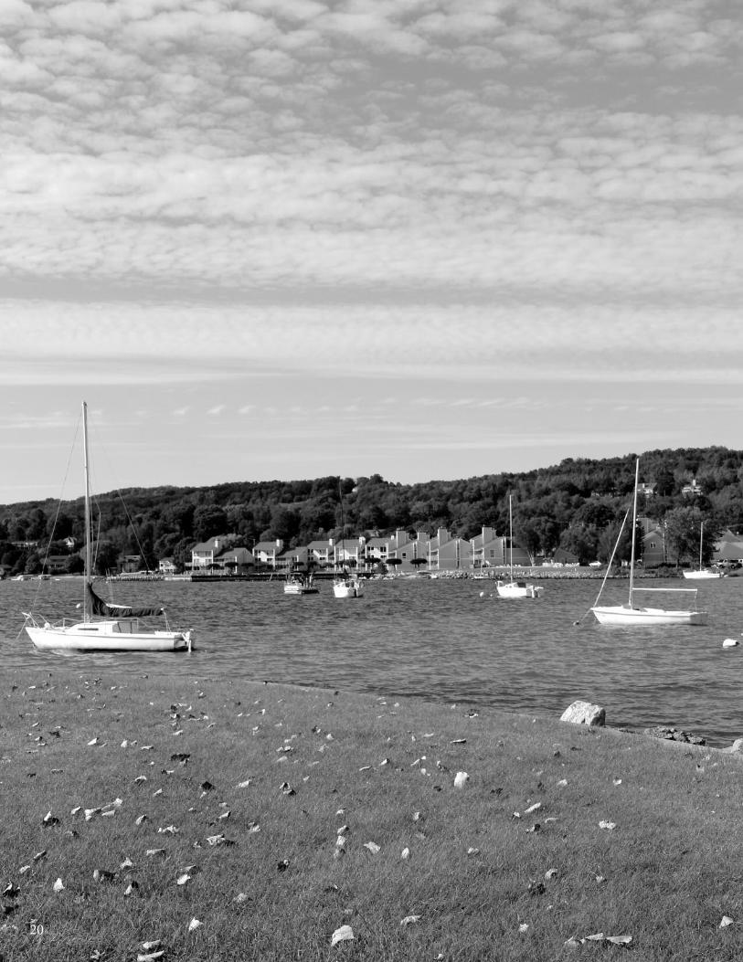
No matter where you are, you are in a watershed.
In a watershed, melting snow and rainfall create flowing water over the landscape. This flowing water
eventually drains into surface water bodies, ground water recharge areas, and wetlands. This flow is also
absorbed into the ground along the way, as it moves to the drainage destination. How this water flows and
where it drains creates the boundaries of our watershed. In Charlevoix County, drainage destinations include
lakes, streams, wetlands, and ground water – all familiar and important characteristics in our landscape.
They provide us with numerous recreational uses, making significant and meaningful contributions to our
local economies. And, the aesthetic character of these waters is also a source of immense value to local
residential and business property owners.
Treated and untreated wastewater and stormwater flow directly into these valuable waters. If ignored, the
waters will degrade, which is unfortunate because these same waters also provide habitat for numerous
plants, animals, and birds. This illustrates an historic clash that can create a source of tension among vari-
ous users of water and wetlands.
When land use in a watershed is changed, the flow it contributes to water bodies and wetlands is impacted
by those changes. For example, when farmland is converted for housing, business, and entertainment uses,
there is an increase in impervious surfaces – places where rain drops and snow melt cannot permeate the
ground. The flow is then affected by these hard surfaces, such as rooftops and parking lots, creating what
is known as nonpoint source water pollution. The flow collects oil, pollutants, salt, grit, etc., as it moves
and eventually dumps into drainage areas – our beloved lakes, rivers, wetlands, and ground water recharge
regions. Hard ground can also impact the amount and velocity of runoff water. Not surprisingly, this can
lead to other undesirable conditions, such as increased flooding, erosion, and loss of habitats, in addition to
decreased water quality.
This project is intended to help you protect the watershed that encompasses your jurisdiction, and work
with watershed partners do to so. The following Chapters summarize results of this project for Charlevoix
County. It begins with a chapter devoted to the county itself, and is followed by separate chapters devoted
to each city, township, or village in the county.
20
Chapter 1: Charlevoix County
21www.watershedcouncil.org
SECTION III: Analysis
Chapter 1 Charlevoix County
IntroductionThis chapter summarizes results of the Local Ordinance Gaps Analysis project for Charlevoix County, which
borders Lake Michigan on the west and includes Beaver Island. The county also includes beautiful Lake
Charlevoix, which is the drainage destination and major watershed of the county. However, parts of the
county are also located in other watersheds, including the Grand Traverse Bay Watershed and the Little
Traverse Bay Watershed.
The county is a partner in the Watershed Management Plan for Lake Charlevoix, which has a very active
and engaged Advisory Committee to oversee implementation, including local government representatives.
Therefore, at appropriate points in the Analysis below, any connection to implementation tasks for the Lake
Charlevoix Watershed Management Plan is also highlighted.
Evaluation Scores and Summary
Master Plan ComponentsPOSSIBLE SCORE: 30
TOTAL SCORE: 22, STRONG
Charlevoix County does not have zoning in place at the county level. It has a Future Land Use Plan in place,
however, completed in 2009. The Introduction to the plan notes the following (bold is original): “The Charlevoix
County Future Land Use Plan is not intended to replace or supersede any local plan in the County. It has
not been developed for, nor is it intended as the basis for developing a County Zoning Ordinance to replace
township and city zoning ordinances.” (http://www.charlevoixcounty.org/downloads/landuse_section
1of3.pdf, p.1.1) The plan also notes that each city, village and township in Charlevoix County either has its
own master plan, comprehensive plan, land use plan or the legal ability to create and adopt one. Each city
and township also has a zoning ordinance in effect to regulate the use of land within their community (p.1.1).
Given the prevalence of local planning and zoning in the county, the plan notes that it was developed for the
following reasons:
• Provide a county-wide vision to support county and local planning and zoning efforts.
• Facilitate planning within and between townships, cities, villages and the county.
• Foster consistency between plans and zoning ordinances among jurisdictions.

CHARLEVOIx COUnTy - Local Ordinance Gaps Analysis
Tip of the Mitt Watershed Council22
• Promote the use of the county-wide vision to assist all units of government in the county with
the procurement of grants.
• Support local planning and zoning activities at all governmental levels with data, studies and
educational resources.
• Promote continued economic growth and improvements in our quality of life by using all
available tools.
• Serve as a guide to the Board of Commissioners, the County Planning Commission and County
Departments in their decision-making process regarding County-owned properties (p.1.1).
The plan does indicate the watersheds in the county by referring to maps provided by the Michigan State
University (MSU) Institute of Water Research website, with boundaries and information about Charlevoix
County watersheds (p.5.15). It also refers to numerous other resources throughout Chapter 5 to provide
an inventory of surface water and wetlands in the county. It does not mention mapping of ground water
recharge areas.
Open space is an important feature of the plan. Chapter 4 includes a section called: “Protect Unique Natural
Features and Open Spaces”. Actions to do so include having the Planning Commission, local units of government,
and land conservancies work together to develop a coordinated program to protect lands with unique natural
features and significant open spaces. Objective 2 under the same sections notes: “Develop and promote
county-wide policies to maintain and enhance the County’s outstanding surface and groundwater quality.”
This includes numerous specific actions for the Planning Commission, including providing sample zoning
ordinance language to help townships use techniques for water quality protection, including buffer zones,
site plan review standards, and overlay districts (p.4.4, 4.5).
Chapter 4, Objective 2, Actions also identifies stormwater management as an important community policy.
It notes the following: “Any expansion or upgrading of County-owned facilities will incorporate site designs
to treat on site or to reduce the impact of surface water runoff.” (p.4.5) Also, “The Planning Commission, in
conjunction with the Drain Commissioner and the Soil Erosion and Sedimentation Control Officer, will research
and provide recommendations to local units of government and developers on ways to reduce or eliminate
stormwater runoff (e.g. rain gardens, pervious surface parking lots, stormwater retention, detention basins).”
(p.4.5) The plan does not call for minimizing impervious surfaces in new construction and redevelopment
projects to reduce stormwater runoff and improve infiltration.
The Future Land Use Plan includes identification and protection of wildlife corridors, also in Chapter 4, under
the Protect Unique Natural Features and Open Spaces section. The first Goal is: “Maintain and enhance the
unique natural features and open spaces that draw people to Charlevoix County.” This is followed by Objective
1: “Develop and promote the adoption of a Countywide strategy linking key natural features and wildlife
corridors.” (p.4.4)
The intent to preserve and protect natural areas and wetlands is made clear. Chapter 3 includes this definition
of Sensitive Lands: “These lands fall into one of two classifications: 1) wetlands, based on the National
Wetlands Inventory (NWI) and Michigan Resource Information System (MIRIS) maps, or 2) small islands in
Lake Michigan, which by virtue of being islands have uniquely sensitive features. Not all of the lands depicted
as being Sensitive Lands on this map will actually be wetlands because, in order to be accurate, wetland
determinations require onsite evaluation of the land, which is not possible at a county level map scale. In
addition, some wetland areas may exist, which are not depicted on this map. For purposes of this plan, the
recommendation is one of no development on wetlands regardless of whether or not they are depicted on
this map. Some of the lands within the Sensitive Lands category are publicly owned, serve as wildlife habitat
and provide recreational opportunities.” (3.2).
The plan does not acknowledge the importance of well-constructed and maintained road stream crossings
on the quality of stream and water resources.

Chapter 1: Charlevoix County
23www.watershedcouncil.org
Master Plan Components: RECOMMENDATIONS
We applaud Charlevoix County for its excellent Future Land Use Plan. We have
only two suggestions for when the plan is updated, which should be in 2014.
SUGGESTED ACTION: Consider addressing the importance of preventing
new impervious surfaces, and the various tools and incentives available for
doing so.
SUGGESTED ACTION: Consider addressing road stream crossings, where
proper construction and design techniques are critical to avoid excessive
sedimentation in streams.
Basic Zoning ComponentsPOSSIBLE SCORE: 54
TOTAL SCORE: 0, MISSING
As noted above, Charlevoix County does not have zoning in place at the county level. The local entities are
all very active and have taken steps to do planning and zoning. The county is an active partner in supporting
those efforts at the city, township, and village levels. That has been working for a very long time, and we respect
this process. However, it should be noted that for water protection efforts, in particular, there are situations
where county zoning, or specific ordinances, offer more effective and coordinated protections.
For example, townships may have shorelines on a common water body, but they can be uncoordinated in their
protection efforts. One township could require protections that are strong or adequate, while the neighboring
township does not require the same protective steps, at all. This does not help the water body in question.
As noted earlier, the county has a strong Future Land Use Plan in place to guide cities, townships, and villages.
But you will also see, in subsequent chapters, that some of those jurisdictions are still weak on certain items, or
missing protections completely. We generally support and encourage zoning at the county level for the purpose
of providing help and water protections to the other local entities, if they cannot enact them for any reason.
For now, we have no further recommendations for this element. In the future, if circumstances change, we
may have different recommendations to ensure that the vital water resources in Charlevoix County are protected
to the fullest extent, because those resources provide our key economic driver.
ShorelinesPOSSIBLE SCORE: 60
TOTAL SCORE: 0, MISSING
For this element, we acknowledge the statements in the Future Land Use Plan that support providing model
ordinances to local entities, including various efforts at shoreline protection such as setbacks and buffer
strips (p.4.4). As noted in the Literature Review, shorelines are vital transition zones between land and water,
where many important interactions occur that benefit the lake ecosystem, including food and nutrient exchange.
These benefits are diminished when shoreline properties are developed and vegetation is removed, but they can
be recovered by planting vegetated buffer strips using a variety of native species. The county should continue
efforts at educating citizens on these points and encouraging local governments to enact shoreline protections.
CHARLEVOIx COUnTy - Local Ordinance Gaps Analysis
Tip of the Mitt Watershed Council24
Impervious SurfacesPOSSIBLE SCORE: 33
TOTAL SCORE: 0, MISSING
As noted above, the Future Land Use plan does not address using tools or incentives to prevent unnecessary
increases in impervious surfaces. The more a local government can do to reduce impervious surfaces, the
better for water quality.
As noted in the Lake Charlevoix Watershed Management Plan, impervious surfaces (streets, roofs, sidewalks,
etc.) generate much more stormwater runoff than natural forested, or even agricultural, land uses.
Lake Charlevoix has three relatively large urban areas on its shorelines – East Jordan, Boyne City, and the
City of Charlevoix. A portion of all these cities have paved streets with curbs, gutters, and subsurface
drainage pipes called storm sewers.
The main purpose of storm sewers is to prevent flooding and water damage. Unfortunately, some of these
were installed many decades ago. Additionally, substances finding their way onto the streets and sidewalks
are likely to be washed into Lake Charlevoix, or tributary streams, by rainfall and snowmelt. This includes
things like bacteria from pet and animal wastes, fertilizer, oil and grease, sediment, heavy metals, salt, etc.
A multitude of studies from around the nation and world have documented that urban stormwater is a
serious source of pollution.
Additionally, the four Goals identified in the Lake Charlevoix Watershed Management Plan are:
Goal 1. Aquatic life and wildlife--Protect the diversity of aquatic habitats
within the Lake Charlevoix Watershed by reducing the contribution of sediment,
nutrient, and toxic pollutants.
Goal 2. Cold water fishery--Reduce sediment and nutrient loads which
threaten to harm habitat conditions for the cold water fishery in Lake
Charlevoix and its tributaries.
Goal 3. Partial or total body contact--Maintain the excellent recreational
opportunities in the rivers and lake by reducing sediment and nutrient
contributions.
Goal 4. Navigation--Maintain navigation in the rivers and lake by reducing
any sediment inputs.
In order to accomplish these goals, each one includes the objective to reduce the pollutant load from
stormwater in the urban areas. Reducing impervious surfaces supports this objective. Among other low
cost approaches to reduce impervious surfaces, a community can increase the retention or restoration of
native vegetation in riparian areas and in open spaces. Minimizing impervious surfaces can be also
addressed in creative and cost-effective ways, ranging from using Low Impact Design (LID) techniques
in development plans, to incentives for limiting impervious surface lot coverage in zoning ordinances.
Ordinances can be crafted to guide overall development design to benefit water quality, such as incentives
to protect natural vegetation throughout the development site. Lot design and general development provisions
in zoning ordinances provide great opportunities to encourage alternatives to and reductions of impervious
surfaces, such as shared driveways. We reiterate our recommendation that the county include this element
in the next plan update, and in the interim, discourage the increase of impervious surfaces wherever possible.
Chapter 1: Charlevoix County
25www.watershedcouncil.org
Stormwater ManagementPOSSIBLE SCORE: 27
TOTAL SCORE: 24, STRONG (AS PROPOSED; MUST BE PASSED IN COUNTY MUNICIPALITIES)
In 2006, the Grand Traverse County Prosecutor queried the State Attorney General (AG) Office aboutstormwater management. In response, a letter from the AG stated that counties cannot regulate stormwaterrunoff beyond what is needed for soil erosion and sediment control, and said that only townships, cities andvillages have authority to control flooding. Tip of the Mitt Watershed Council disagreed strongly with theconclusions of the AG’s office on this matter. We sent two letters to them over the course of the followingyear, endorsed by local officials in Emmet County, Charlevoix County, and Grand Traverse County, asking for a review of the opinion delivered in the AG’s letter.
After the second letter was sent, the AG’s office telephoned us to say that our letters were well-received andraised excellent points for additional legal research to address. However, the AG’s office exists to respond toquestions of law from the Governor, the legislature, departments and agencies of state government, and incertain circumstances, county prosecutors. The AG’s office is required to prioritize this work according totheir primary mission, and letters from entities such as Tip of the Mitt Watershed Council do not have priority.Despite numerous efforts, we found no other way to have these letters formally reviewed, and most countiesin the state rescinded their stormwater ordinances, including Charlevoix County. Doing so means thatstormwater control is now left up to individual townships to address, but most find that a burden, due to limited resources.
After much discussion and consideration, Charlevoix County officials decided to address this situation in amanner similar to what was done in Grand Traverse County. A draft has been prepared for a new Storm
Water Control (SWC) Ordinance that would need to be passed by individual municipalities, giving the
county authority to administer and enforce the ordinance. To make this work effectively and efficiently, all participating municipalities would have to pass identical language and participate in an Intergovernmental
Agreement. We support this approach for two reasons: the draft ordinance is strong, and this approach isbeing successfully used in Grand Traverse County.
Stormwater Management: RECOMMENDATIONS
The new ordinance is being prepared for presentation, as of this writing, andwe urge all county municipalities to pass it. Construction concerns are not theonly issues with stormwater management, but that aspect is a very importantfactor. Additionally, in keeping with the Charlevoix County Future Land UsePlan, the county should incorporate Best Management Practices (BMPs) for county facilities, and help local units of government address stormwatermanagement.
SUGGESTED ACTION: Finish the Storm Water Control Ordinance and Intergovernmental Agreement and present it to all county municipalities for passage in each of their separate jurisdictions.
SUGGESTED ACTION: Per the Future Land Use Plan, ensure that any expansion or upgrade of county-owned facilities incorporates site designsto treat on site or reduce the impact of stormwater runoff, using BMPs.
SUGGESTED ACTION: The County Planning Commission, in conjunctionwith the Drain Commissioner and the Soil Erosion and Sedimentation ControlOfficer, should follow through with research and recommendations to localunits of government and developers on ways to reduce or eliminate stormwaterrunoff (e.g. rain gardens, pervious surface parking lots, stormwater retention,detention basins)”, per the Future Land Use Plan.
CHARLEVOIx COUnTy - Local Ordinance Gaps Analysis
Tip of the Mitt Watershed Council26
Soil Erosion and Sediment ControlPOSSIBLE SCORE: 18
TOTAL SCORE: 14, STRONG
At the state level, Part 91 of the Natural Resources and Environmental Protection Act 1994 PA 451, as amended,addresses Soil Erosion and Sedimentation Control (SESC). From Part 91, a state program was implementedto regulate the pollution of Michigan waters, due to improper construction site management practices, includingimproper stormwater runoff. Counties are mandated to administer and enforce Part 91, and CharlevoixCounty has two state-recognized agencies that do so: The Soil Erosion Control Officer and the County RoadCommission. If any project is within 500 feet of a lake or stream, OR if a project disturbs more than one acreof earth, applicants are required to contact the county's Soil Erosion Control Officer for a permit.
We have no additional recommendations for this element.
Sewer/SepticPOSSIBLE SCORE: 24
TOTAL SCORE: 5, WEAK
Chapter 5 of the County Future Land Use Plan includes a section called: “Public Facilities: Utilities, Sewer &Water”. Here it notes that the county’s three cities (Boyne City, Charlevoix, and East Jordan) provide sewerservice to the majority of the area within their municipal boundaries, and also to limited areas outside of theirboundaries (p.5.19). The same section also notes that conditional transfer of lands between cities and town-ships (under Public Act 425 of 1984) has been used in the county as a vehicle for the extension of sewer andwater from cities into townships (p.5.17). Additionally, it is important to note that due to soil limitations,smaller areas within the county generally cannot expand without the provision of sewer and/or water service.
The Future Land Use Plan also notes that septic systems require periodic maintenance. It emphasizes thatneglecting to do so can result in failure, which carries the risk of localized ground water contamination issues(p.5.23). The same section goes on to make this important point: “These localized contamination areas tend to go undetected for long periods of time due to individual wells not being tested for a broad range of contaminants on a frequent basis.” It does not mention the fact that failing septic systems can also contaminate surface waters, such as lakes and streams. However, if septic systems are left unchecked on a shoreline, they can be a source of trouble for all water resources in the area.
As noted in the Literature Review, septic systems that are not properly maintained can fail and release untreatedsewage into the environment. Because of this risk, and the liability that falls on the home or business owner,it is important that septic systems be thoroughly inspected before a transfer of property is completed. Thiswill ensure that the new owner has an adequately functioning septic system at the time of transfer, therebyminimizing the risk of liability for environmental contamination and public health threats resulting from a malfunctioning system. In addition to protecting property owners, “point of transfer inspection” ordinancesalso reduce pollution to lakes and other water sources by identifying those systems that need repair or replacement.
There exists a real need for broad education about septic system maintenance and some oversight to ensurefailing systems are not transferred to new owners. To ensure strong coordination, a point of transfer septicordinance is something we would suggest for consideration as a county-wide ordinance. In the absence ofa county-wide ordinance, we urge all the municipalities in the county to enact such an ordinance.
Sewer/Septic: RECOMMENDATIONS
SUGGESTED ACTION: Educate residents about proper septic system man-
agement and encourage them to maintain septic systems on a regular basis.
SUGGESTED ACTION: Enact a county “point of transfer” septic inspection
ordinance, working in coordination with local municipalities and the Health
Department.
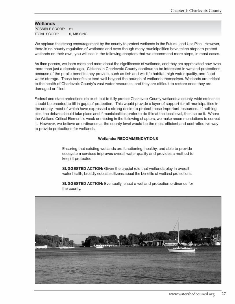
Chapter 1: Charlevoix County
27www.watershedcouncil.org
WetlandsPOSSIBLE SCORE: 21
TOTAL SCORE: 0, MISSING
We applaud the strong encouragement by the county to protect wetlands in the Future Land Use Plan. However,
there is no county regulation of wetlands and even though many municipalities have taken steps to protect
wetlands on their own, you will see in the following chapters that we recommend more steps, in most cases.
As time passes, we learn more and more about the significance of wetlands, and they are appreciated now even
more than just a decade ago. Citizens in Charlevoix County continue to be interested in wetland protections
because of the public benefits they provide, such as fish and wildlife habitat, high water quality, and flood
water storage. These benefits extend well beyond the bounds of wetlands themselves. Wetlands are critical
to the health of Charlevoix County’s vast water resources, and they are difficult to restore once they are
damaged or filled.
Federal and state protections do exist, but to fully protect Charlevoix County wetlands a county-wide ordinance
should be enacted to fill in gaps of protection. This would provide a layer of support for all municipalities in
the county, most of which have expressed a strong desire to protect these important resources. If nothing
else, the debate should take place and if municipalities prefer to do this at the local level, then so be it. Where
the Wetland Critical Element is weak or missing in the following chapters, we make recommendations to correct
it. However, we believe an ordinance at the county level would be the most efficient and cost-effective way
to provide protections for wetlands.
Wetlands: RECOMMENDATIONS
Ensuring that existing wetlands are functioning, healthy, and able to provide
ecosystem services improves overall water quality and provides a method to
keep it protected.
SUGGESTED ACTION: Given the crucial role that wetlands play in overall
water health, broadly educate citizens about the benefits of wetland protections.
SUGGESTED ACTION: Eventually, enact a wetland protection ordinance for
the county.
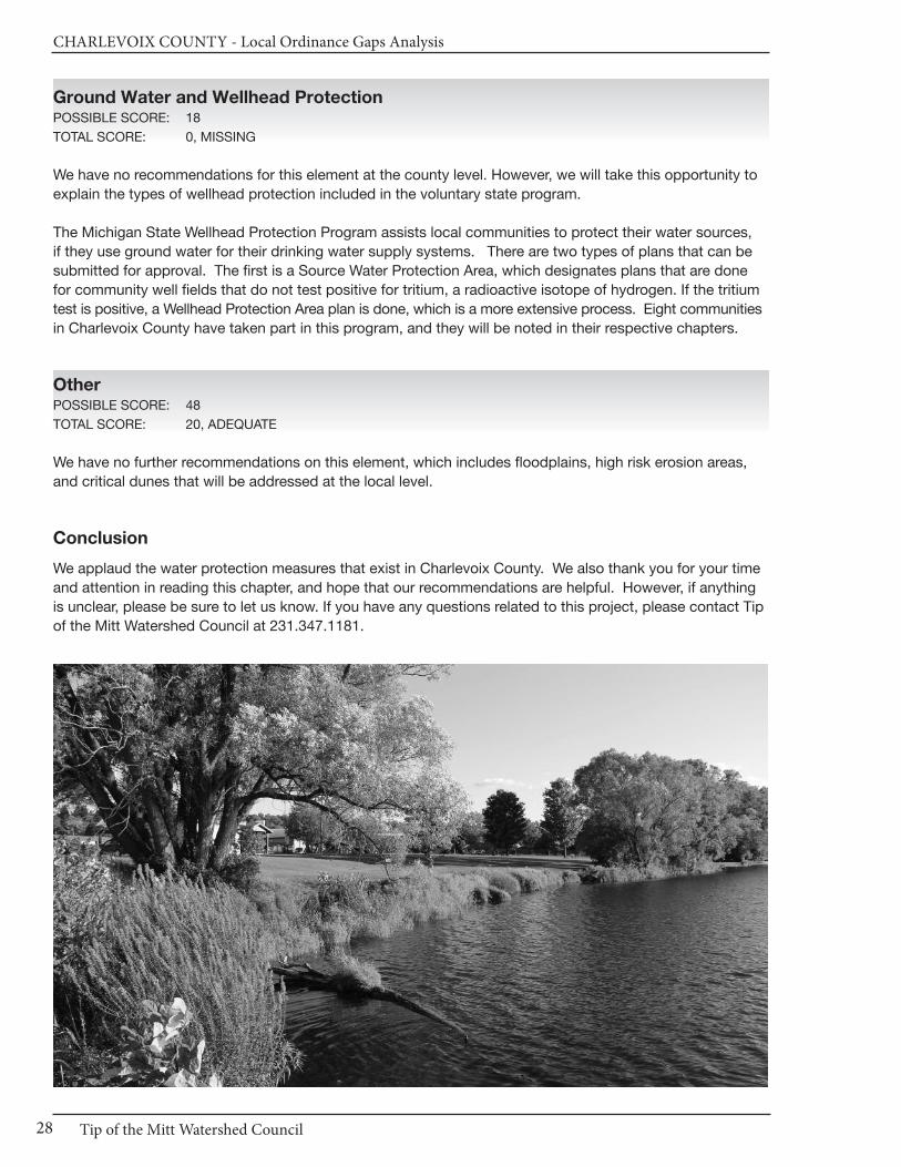
CHARLEVOIx COUnTy - Local Ordinance Gaps Analysis
Tip of the Mitt Watershed Council28
Ground Water and Wellhead ProtectionPOSSIBLE SCORE: 18
TOTAL SCORE: 0, MISSING
We have no recommendations for this element at the county level. However, we will take this opportunity to
explain the types of wellhead protection included in the voluntary state program.
The Michigan State Wellhead Protection Program assists local communities to protect their water sources,
if they use ground water for their drinking water supply systems. There are two types of plans that can be
submitted for approval. The first is a Source Water Protection Area, which designates plans that are done
for community well fields that do not test positive for tritium, a radioactive isotope of hydrogen. If the tritium
test is positive, a Wellhead Protection Area plan is done, which is a more extensive process. Eight communities
in Charlevoix County have taken part in this program, and they will be noted in their respective chapters.
OtherPOSSIBLE SCORE: 48
TOTAL SCORE: 20, ADEQUATE
We have no further recommendations on this element, which includes floodplains, high risk erosion areas,
and critical dunes that will be addressed at the local level.
Conclusion
We applaud the water protection measures that exist in Charlevoix County. We also thank you for your time
and attention in reading this chapter, and hope that our recommendations are helpful. However, if anything
is unclear, please be sure to let us know. If you have any questions related to this project, please contact Tip
of the Mitt Watershed Council at 231.347.1181.
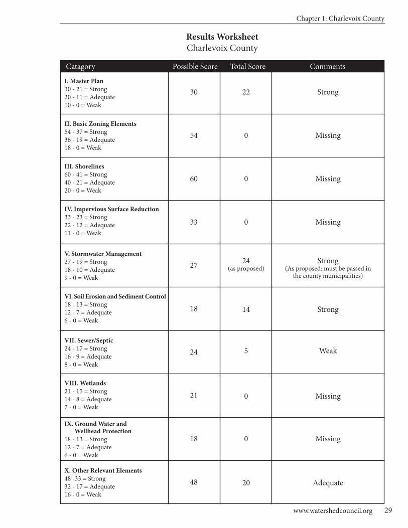
Chapter 1: Charlevoix County
29www.watershedcouncil.org
Results WorksheetCharlevoix County
Catagory Possible Score Total Score Comments
I. Master Plan30 - 21 = Strong20 - 11 = Adequate10 - 0 = Weak
II. Basic Zoning Elements54 - 37 = Strong36 - 19 = Adequate18 - 0 = Weak
III. Shorelines60 - 41 = Strong40 - 21 = Adequate20 - 0 = Weak
IV. Impervious Surface Reduction33 - 23 = Strong22 - 12 = Adequate11 - 0 = Weak
V. Stormwater Management27 - 19 = Strong18 - 10 = Adequate9 - 0 = Weak
VI. Soil Erosion and Sediment Control18 - 13 = Strong12 - 7 = Adequate6 - 0 = Weak
VII. Sewer/Septic24 - 17 = Strong16 - 9 = Adequate8 - 0 = Weak
VIII. Wetlands21 - 15 = Strong14 - 8 = Adequate7 - 0 = Weak
IX. Ground Water and Wellhead Protection
18 - 13 = Strong12 - 7 = Adequate6 - 0 = Weak
X. Other Relevant Elements48 -33 = Strong32 - 17 = Adequate16 - 0 = Weak
30
54
60
33
27
18
24
21
18
48
22
0
0
0
24(as proposed)
14
5
0
0
20
Strong
Missing
Missing
Missing
Strong(As proposed; must be passed in
the county municipalities)
Strong
Weak
Missing
Missing
Adequate

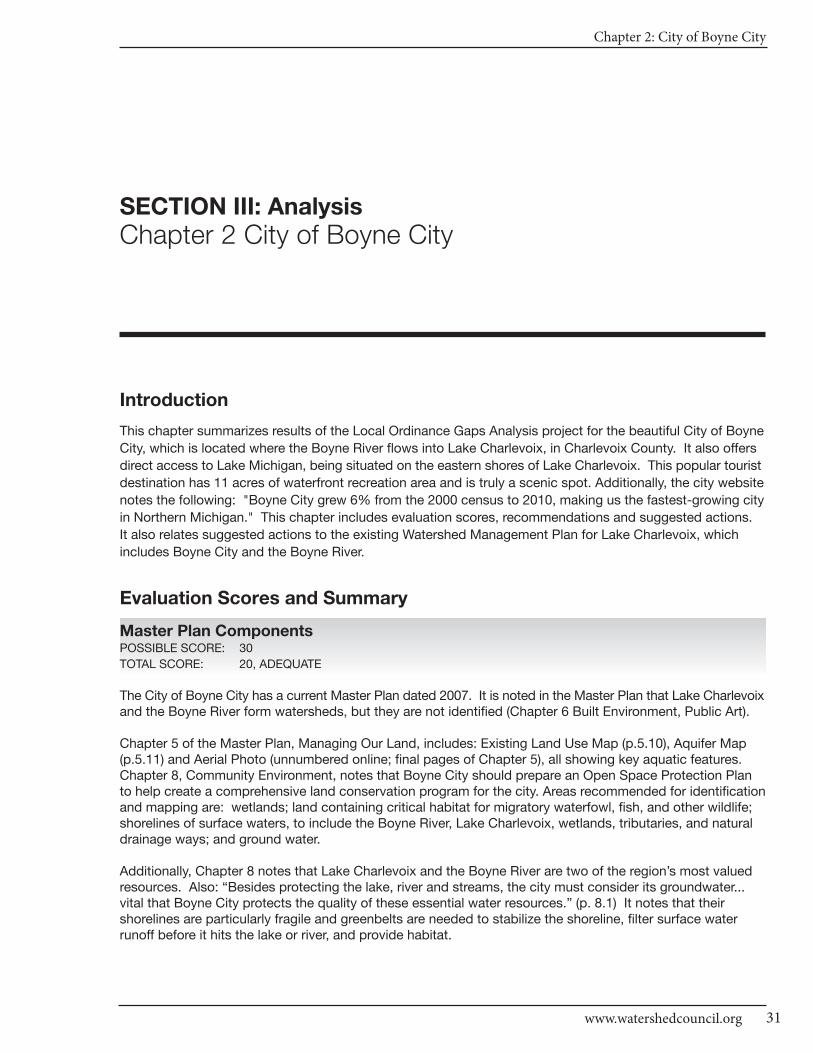
Chapter 2: City of Boyne City
31www.watershedcouncil.org
SECTION III: Analysis
Chapter 2 City of Boyne City
Introduction
This chapter summarizes results of the Local Ordinance Gaps Analysis project for the beautiful City of Boyne
City, which is located where the Boyne River flows into Lake Charlevoix, in Charlevoix County. It also offers
direct access to Lake Michigan, being situated on the eastern shores of Lake Charlevoix. This popular tourist
destination has 11 acres of waterfront recreation area and is truly a scenic spot. Additionally, the city website
notes the following: "Boyne City grew 6% from the 2000 census to 2010, making us the fastest-growing city
in Northern Michigan." This chapter includes evaluation scores, recommendations and suggested actions.
It also relates suggested actions to the existing Watershed Management Plan for Lake Charlevoix, which
includes Boyne City and the Boyne River.
Evaluation Scores and Summary
Master Plan ComponentsPOSSIBLE SCORE: 30
TOTAL SCORE: 20, ADEQUATE
The City of Boyne City has a current Master Plan dated 2007. It is noted in the Master Plan that Lake Charlevoixand the Boyne River form watersheds, but they are not identified (Chapter 6 Built Environment, Public Art).
Chapter 5 of the Master Plan, Managing Our Land, includes: Existing Land Use Map (p.5.10), Aquifer Map(p.5.11) and Aerial Photo (unnumbered online; final pages of Chapter 5), all showing key aquatic features.Chapter 8, Community Environment, notes that Boyne City should prepare an Open Space Protection Planto help create a comprehensive land conservation program for the city. Areas recommended for identificationand mapping are: wetlands; land containing critical habitat for migratory waterfowl, fish, and other wildlife;shorelines of surface waters, to include the Boyne River, Lake Charlevoix, wetlands, tributaries, and naturaldrainage ways; and ground water.
Additionally, Chapter 8 notes that Lake Charlevoix and the Boyne River are two of the region’s most valuedresources. Also: “Besides protecting the lake, river and streams, the city must consider its groundwater...vital that Boyne City protects the quality of these essential water resources.” (p. 8.1) It notes that theirshorelines are particularly fragile and greenbelts are needed to stabilize the shoreline, filter surface waterrunoff before it hits the lake or river, and provide habitat.
CHARLEVOIx COUnTy - Local Ordinance Gaps Analysis
Tip of the Mitt Watershed Council32
On the topic of stormwater, the city envisions the design and retrofitting of “stormwater detention basins asnatural wetland/prairie systems to enhance water quality and other environmental benefits.” (Chapter 8 CommunityEnvironment, Natural Landscaping) The same section also calls for reduction in the amount of impervioussurfaces by substituting vegetation, where appropriate. It also notes that current wetland regulations shouldbe reconsidered, placing value on the functions that wetlands provide for keeping waters clean.
The Master Plan includes identification and protection of wildlife corridors. Chapter 5 states, “The shorelinesoutside of the downtown and along the river have a network of protected conserved lands including natural areasoffering habitat and travel corridors for wildlife…” (p. 5.1) Chapter 8 advocates for Proactive Conservation toidentify high priority sites for protection and set aside these lands. The recommended approach is creationof a Boyne City Conservation Fund by the city, and the establishment of a Conservation Legacy Program,which will guide the acquisition of conservation land (p. 8.7).
Boyne City also has a separate Waterfront Master Plan (2006). This plan acknowledges the importance ofboth environmental protections for the city’s outstanding water resources, as well as economic protectionsfor their role as drivers of the local economy. This balance has been appreciated for awhile now, and thesection called Previous Planning Efforts for the Project Area notes the following: “Key to enhancing, preservingand protecting the character and quality of downtown /Boyne City is to focus on the community’s greatestresources – Lake Charlevoix and Boyne River. These two water bodies created the framework and form ofthe city as it evolved over the years. They are vital to the city’s economic base.” (p. 6, from the 2004 “BoyneCity, Michigan Resource Team Report”)
The plan also notes that the State of Michigan wetland regulations are the primary source of environmentalprotections, and the city ordinance is not as stringent as those used in surrounding townships (p. 31). Finally,the Waterfront Master Plan recommends that it be reviewed at each point of implementation, and every 5years to reaffirm or amend, as appropriate. 2011 is the year this plan update process should begin for thewaterfront plan.
Master Plan Components: RECOMMENDATIONS
SUGGESTED ACTION: When the Master Plan is updated (due in 2012),identify the watersheds in which the city is located and educate about thefact that you are always in a watershed, and everyone’s actions impact thewater resources upon which you depend.
SUGGESTED ACTION: Improve the emphasis on stormwater managementtechniques and reduction or prevention of impervious surfaces, and note theimportance of well-maintained road stream crossings for water quality.
Basic Zoning ComponentsPOSSIBLE SCORE: 54
TOTAL SCORE: 42, STRONG
Boyne City has some very strong Basic Zoning Components in place to aid in protection of water resources.The stated purpose of the Zoning Ordinance is to “secure the most appropriate use of land.... facilitating adequate water, sewers.... all in accordance with a comprehensive plan.” (Art I Sec 1.10) The purpose of the Waterfront Residential District includes: provide an environment of low density; ensure that developmentremains at a sustainable density and scale, and that lots and public rights-of-way do not unreasonably degrade the quality of Lake Charlevoix and other bodies of water (Art V Sec 5.10). It also includes protectionsfor sensitive areas (Art V Waterfront Residential District; Art IX Waterfront Marina District; Art XVI FloodHazard District).
A fee system is in place to cover costs to the community for review of proposal applications, authorized bythe ordinance: “The City Commission may, from time to time, prescribe and amend, by resolution, a reasonableschedule of fees to be charged to applicants wishing to rezone, seek development plan approval, or obtain a
Chapter 2: City of Boyne City
33www.watershedcouncil.org
zoning permit within the City of Boyne City.” (Art XXVIII Sec 28.40) It also has methods in place for enforcement,including a clearly defined process for inspections and correction of violations [Art XXVIII Section 28.60(A)].
The Zoning Ordinance proposal review process is coordinated with the receipt of other applicable county, state,and/or federal permits: “Other Agency Reviews. The applicant has provided documentation of compliancewith other appropriate agency review standards, including, but not limited to, the Michigan DNR, MichiganDEQ, Michigan DOT, Charlevoix County Drain Commissioner, Northwest Michigan Community HealthAgency, Charlevoix County Building Department, and other federal and state agencies, as applicable.” [Art XIX, Sec 19.40, Development Approval Criteria (T)]
Site Plan Review is also required by the Zoning Ordinance “for all activities except single-family detachedresidences and accessory buildings.” (Art. XIX Development Plan Requirements Sec 19.10) There is alsostrong coordination with the county for Soil Erosion permits [Art XIX Sec 19.40 Development Approval Criteria(L) Soil Erosion Control; Art XXI Sec 21.19 Waterfront Overlay District Regulations (6)]. Importantly, Site PlanReview also includes Open Space provisions, reflecting the intent of the Master Plan [Art XIX Sec 19.40 Development Approval Criteria (K)].
Additionally, Boyne City makes use of Planned Unit Development (PUD) provisions to “offer an alternative totraditional residential developments and subdivisions through the use of planned unit development legislation.”(Art XVIII Open Space Community Option Sec 18.10) PUDs also require inclusion of a minimum twenty-fivepercent (25%) of the total site area designated as permanent open space, and contain preservation of naturalassets [Art. XVIII Sec 18.40 (B); (C)(1)]. There are also flexible site design criteria available to encourage developers to include open space or cluster design provisions [Art XVIII Sec 18.40 (K)(1-2)&(L)(1-4)]. Finally,the same section requires a Guarantee of Open Space to ensure proper maintenance, including use of conservation easements as an option, in agreement with the Master Plan [Sec 18.40 (E)].
Basic Zoning Components: RECOMMENDATIONS
We applaud Boyne City for having most of what we consider to be essentialBasic Zoning Components for water resource protections. We have only thefollowing recommendations:
SUGGESTED ACTION: Consider restricting any allowable uses in openspaces to low impact uses, managed in a natural condition, to preserve nat-ural assets as intended and stated in the ordinance.
SUGGESTED ACTION: Consider ways to encourage retention of nativevegetation in dedicated open spaces of PUDs and prohibit the use of inva-sive species.
ShorelinesPOSSIBLE SCORE: 60
TOTAL SCORE: 13, WEAK
Shoreline protection efforts in Boyne City could be improved – and should be, as a priority, given the economicimportance of clean water to the community. And, there are some positive protection aspects upon which tobuild. Setbacks are in place to minimize harmful runoff and erosion. All structures except docks, shorelineprotection structures, and walkways six feet or less in width are required to be set back a minimum of thirty-fivefeet from the high water elevation [Art V Sec5.60 (A, Art IX Sec. 9.50(A) & Art XX Sec 20.30 (m)(1)].
The Boyne City Zoning Ordinance also regulates dock lot minimum frontage, including allowances for legalnonconforming structures. No more than one dock is allowed per every 100 feet of waterfront. However, anywaterfront lot, regardless of frontage, without a dock as of the adoption of the ordinance, is permitted onedock. Additionally, each single family detached dwelling is limited to three watercraft, per dock [Art V Sec.5.40(E) Waterfront Residential District - Watercraft / Dock Limitation]. The ordinance does not regulate thesize of docks, and there are no keyhole/funneling prevention provisions.
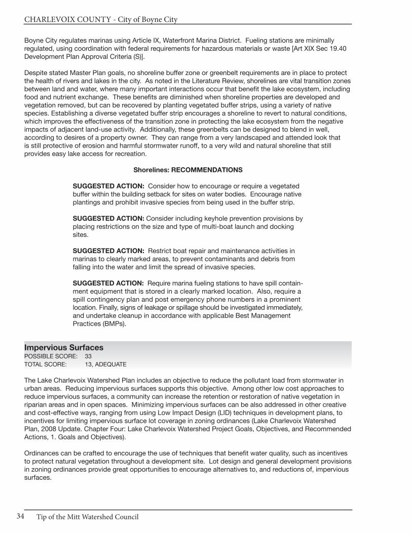
CHARLEVOIx COUnTy - City of Boyne City
Tip of the Mitt Watershed Council34
Boyne City regulates marinas using Article IX, Waterfront Marina District. Fueling stations are minimally regulated, using coordination with federal requirements for hazardous materials or waste [Art XIX Sec 19.40Development Plan Approval Criteria (S)].
Despite stated Master Plan goals, no shoreline buffer zone or greenbelt requirements are in place to protectthe health of rivers and lakes in the city. As noted in the Literature Review, shorelines are vital transition zonesbetween land and water, where many important interactions occur that benefit the lake ecosystem, includingfood and nutrient exchange. These benefits are diminished when shoreline properties are developed andvegetation removed, but can be recovered by planting vegetated buffer strips, using a variety of nativespecies. Establishing a diverse vegetated buffer strip encourages a shoreline to revert to natural conditions,which improves the effectiveness of the transition zone in protecting the lake ecosystem from the negativeimpacts of adjacent land-use activity. Additionally, these greenbelts can be designed to blend in well, according to desires of a property owner. They can range from a very landscaped and attended look that is still protective of erosion and harmful stormwater runoff, to a very wild and natural shoreline that still provides easy lake access for recreation.
Shorelines: RECOMMENDATIONS
SUGGESTED ACTION: Consider how to encourage or require a vegetatedbuffer within the building setback for sites on water bodies. Encourage nativeplantings and prohibit invasive species from being used in the buffer strip.
SUGGESTED ACTION: Consider including keyhole prevention provisions byplacing restrictions on the size and type of multi-boat launch and dockingsites.
SUGGESTED ACTION: Restrict boat repair and maintenance activities inmarinas to clearly marked areas, to prevent contaminants and debris fromfalling into the water and limit the spread of invasive species.
SUGGESTED ACTION: Require marina fueling stations to have spill contain-ment equipment that is stored in a clearly marked location. Also, require aspill contingency plan and post emergency phone numbers in a prominentlocation. Finally, signs of leakage or spillage should be investigated immediately,and undertake cleanup in accordance with applicable Best ManagementPractices (BMPs).
Impervious SurfacesPOSSIBLE SCORE: 33
TOTAL SCORE: 13, ADEQUATE
The Lake Charlevoix Watershed Plan includes an objective to reduce the pollutant load from stormwater inurban areas. Reducing impervious surfaces supports this objective. Among other low cost approaches toreduce impervious surfaces, a community can increase the retention or restoration of native vegetation in riparian areas and in open spaces. Minimizing impervious surfaces can be also addressed in other creativeand cost-effective ways, ranging from using Low Impact Design (LID) techniques in development plans, toincentives for limiting impervious surface lot coverage in zoning ordinances (Lake Charlevoix WatershedPlan, 2008 Update. Chapter Four: Lake Charlevoix Watershed Project Goals, Objectives, and RecommendedActions, 1. Goals and Objectives).
Ordinances can be crafted to encourage the use of techniques that benefit water quality, such as incentivesto protect natural vegetation throughout a development site. Lot design and general development provisionsin zoning ordinances provide great opportunities to encourage alternatives to, and reductions of, impervioussurfaces.
Chapter 2: City of Boyne City
35www.watershedcouncil.org
In Boyne City, a maximum of forty percent (40%) of the front yard of a lot may be covered with inorganic material, such as asphalt or cement concrete, paving stone, flagstone, rock or gravel [Art IV Sec4.40(B)& Sec 5.4(B) Landscape/Hardscape Material]. To provide acomparison, our checklist awards highest ranking for rural, low density areas that limit impervious coverage to 15% maximum to be most protective of water quality. It also awards high marks forflexible lot coverage standards that allow creative approaches to mitigate impacts from larger footprints. The city does not limit the extent of lawn area for residential lots.
The Zoning Ordinance does require some portion of proposed parkinglots to be planted with trees/vegetation within the parking lot paving[Art XXIII Sec 23.30 Parking Lot Landscaping (A-C) Specific Land-scaping requirements]. This is beneficial because landscaping, if donewith BMPs for stormwater control, can help mitigate the effects ofnew impervious surfaces.
City streets can be designed with the minimum required pavement width needed to support travel lanes,emergency, maintenance and service vehicles. The required pavement width may be reduced by the PlanningCommission to a minimum twenty-two (22) foot width easement of at least forty (40) feet, where primary orsecondary conservation areas will be preserved [Art XVIII Sec 18.50 (N)(2) private streets]. Boyne City cul-de-sacs should be designed with a central island planted with native trees and shrubs [Art XVIII Sec18.50(N)(1)(b)].
Impervious Surfaces: RECOMMENDATIONS
The Zoning Ordinance could allow flexible lot coverage standards to encour-age cost-effective, creative approaches that limit impervious surfaces forboth single lots and larger developments; rural or urban. It could also limitparking space numbers and space sizes, among other options for easilycurbing the amount of new impervious surface that is created in the area.Additionally, it could allow for relaxation of yard setbacks to reduce drivewaylengths and overall site imperviousness.
The following suggested actions relate directly to the Watershed ManagementPlan for Lake Charlevoix, which includes reducing the pollutant load fromstormwater runoff. Reducing impervious surfaces helps to accomplish thisobjective to protect township waters from sediment, nutrients, and toxicsubstances.
SUGGESTED ACTION: Consider flexible lot coverage standards to allowcreative and cost-effective approaches to limiting impervious surfaces forboth single lots and larger developments.
SUGGESTED ACTION: Consider setting parking space dimensions as amaximum. Also consider reducing the number of required parking spacesand setting the number as a maximum number, as opposed to a minimum.
SUGGESTED ACTION: Consider allowing shared parking for the reductionof parking requirements.
SUGGESTED ACTION: Consider requiring spillover parking areas to be pervious surfaces, or planted in grass. Require that parking lot landscapingbe designed to help address pollutant removal from stormwater runoff (i.e.providing curb cuts to allow flow of stormwater into landscaped areas).
SUGGESTED ACTION: Consider ways to encourage shorter driveways,and shared driveways, where appropriate.
CHARLEVOIx COUnTy - Local Ordinance Gaps Analysis
Tip of the Mitt Watershed Council36
Stormwater Management
POSSIBLE SCORE: 27
TOTAL SCORE: 10, ADEQUATE
Stormwater Management in Boyne City is weakened because it intends to coordinate with the county, but thecounty ordinance is no longer in effect, as addressed in Chapter 1 of this Section. This creates some holesin the provisions for protective stormwater regulation. In the Site Plan Review process, however, a gradingplan is required, including indicating where stormwater runoff is appropriately channeled into an approveddrain or detention/retention pond. A general description and location of the stormwater management systemis also required [Art XIX Sec 19.30 Application Requirements (H, I)]. All plans must comply with the CharlevoixCounty Stormwater Ordinance, which is no longer in effect, as noted. There is also a provision for coordinationwith the county Drain Commissioner and other appropriate agency review standards [Art XIX Sec 19.40 Development Plan Approval Criteria (T)].
Stormwater management areas and facilities, whether on-site or off-site, are required to be designed, constructed,and maintained to prevent flooding and protect surface and ground water quality. “Appropriate measuresshall be taken to ensure that removal of surface waters will not adversely affect neighboring properties or thepublic storm drainage system. Provisions shall be made to accommodate stormwater which complementsthe natural drainage patterns and wetlands, prevent erosion and the formation of dust. Sharing of stormwaterfacilities with adjacent properties shall be encouraged. The use of detention/retention ponds may be required.… All such measures shall comply with the Charlevoix County Stormwater Ordinance.” [Art XIX Sec 19.40Development Plan Approval Criteria (N) Stormwater Management]
Stormwater outfalls that discharge into surface waters or wetlands must have appropriate state and federalpermits, and the status of those applications must be available. Direct discharge of stormwater into naturalwatercourses, including lakes, ponds, rivers, streams and wetlands is not prohibited, unless regulated as apollutant discharge at the state or federal level. Specific prohibitions do not exist for stormwater that exitsproperty after exposure to harmful sources; however, businesses that include exposure to hazardous materials for their normal operation must demonstrate compliance to state and federal standards.
For various property zoning designations, “a soil erosion plan and a stormwater plan submitted to and approvedby the Charlevoix County Soil Erosion Officer shall be required prior to obtaining a Zoning Permit. For propertyzoned WMD, MFRD, and CBD an engineered stormwater plan meeting the requirements of the CharlevoixCounty Soil Erosion Sedimentation and Stormwater Runoff Control Ordinance shall be required prior to obtaining a Zoning Permit.” Again – those specific protections no longer apply, since the county ordinanceis no longer in effect.
Stormwater Management: RECOMMENDATIONS
SUGGESTED ACTION: Coordinate efforts with the County DrainCommissioner to enact local stormwater ordinances in the county, allowingthe county to administer and enforce them for local jurisdictions. Ask the countyto finish the Storm Water Control (SWC) Ordinance and IntergovernmentalAgreement, and present it to Boyne City for passage.
SUGGESTED ACTION: Consider adding review of stormwater BMPs andother water quality protections in the site plan review ordinance.
Soil Erosion and Sediment ControlPOSSIBLE SCORE: 18
TOTAL SCORE: 9, ADEQUATE
This element is also importantly linked to the county. “The site shall have adequate lateral support so as toensure that there will be no erosion of soil or other material. The final determination shall be made by thePlanning Director or City Engineer, and have a valid Charlevoix County Soil Erosion permit.” [Art XIX Sec19.40 Development Plan Approval Criteria (L) Soil Erosion Control]
Chapter 2: City of Boyne City
37www.watershedcouncil.org
“For property zoned RED, TRD, WRD and CSD, a soil erosion plan and a stormwater plan submitted to andapproved by the Charlevoix County Soil Erosion Officer shall be required prior to obtaining a Zoning Permit.For property zoned WMD, MFRD, and CBD an engineered stormwater plan meeting the requirements of theCharlevoix County Soil Erosion Sedimentation and Stormwater Runoff Control Ordinance shall be requiredprior to obtaining a Zoning Permit.” [Art XXI Sec 21.19 Waterfront Overlay Regulations, Zoning and Use Regulations (6)] The lack of a county stormwater ordinance impacts this section.
Soil Erosion and Sediment Control: RECOMMENDATIONS
SUGGESTED ACTION: Specifically require that all proposed developmentproject earth change activities within 500 feet of a stream, wetland, or otherwaterway in all zoning districts receive a soil erosion and sedimentation control permit from Charlevoix County before they receive a permit from the City of Charlevoix.
Sewer/SepticPOSSIBLE SCORE: 24
TOTAL SCORE: 6, WEAK
The Boyne City Master Plan does not include some key points of protection for its sewer system. Privatewells and septic systems are not allowed within the City of Boyne City. However, there is a rural zoning district that does allow for the use of wells and septic systems. Regulations that pertain to septic systemsare coordinated with the County Health Department regulations. Art XXXIII Sec 28.20 (B) states: “The writtenapproval of the sewage disposal facilities, when required from the Charlevoix County Health Department orthe Boyne City Water and Sewer Department shall accompany the zoning permit, which shall be filed and retained by the office of the Planning Director or Zoning Administrator.”
SUGGESTED ACTION: If not already done, ensure the Sewer Service Areais mapped, including sewers that currently exist, areas that will be seweredin the future, and areas that will not be sewered.
SUGGESTED ACTION: Require that existing infrastructure be inventoriedfor age and condition, and ensure that a maintenance and replacementschedule is provided in the Master Plan.
SUGGESTED ACTION: Require the community to have a program to identify sanitary sewer or septic systems that are seeping into the stormwater system, surface waters or ground water.
SUGGESTED ACTION: In the rural zoning district that allows septic systems, require that systems be located at least 100 feet from streams,wetlands, or other water bodies.
SUGGESTED ACTION: Consider establishing a “point of transfer” inspectionrequirement for the rural septic district, whereby septic systems must be inspected to ensure they are operating properly before ownership is transferred.
WetlandsPOSSIBLE SCORE: 21
TOTAL SCORE: 5, WEAK
Boyne City has adopted some local wetland ordinance provisions. Site plans must indicate all existing natural features, and, “Judicious effort shall be used to preserve the integrity of the land, in particular wetlandsdesignated or regulated by the Michigan DEQ and to a lesser extent, wetlands which are not regulated bythe Department.” [Art XIX Sec 19.40 Development Plan Approval Criteria (C) - Preservation of SignificantNatural Features]
CHARLEVOIx COUnTy - Local Ordinance Gaps Analysis
Tip of the Mitt Watershed Council38
Additionally, Site Plan Application requirements include specifying the location of regulated wetlands, includinga wetland delineation by a qualified consultant, and the status of any needed wetland permit, including anymitigation requirements. It also requires specifying the location of other significant unregulated wetlandslarger than two contiguous acres.
Finally, the Zoning Ordinance requires a building setback of 25 feet from areas defined as wetlands by theBoyne City Comprehensive Plan [Art V Sec 5.60(B), Art IX Sec 9.60(B), Art XXI(3) & Art XX Sec 20.30(m)(2)].
Wetlands: RECOMMENDATIONS
As noted above, the Master Plan acknowledges that the State of Michiganwetland regulations are the primary source of environmental protections in Boyne City, and the city ordinance is not as stringent as those used in surrounding townships (p. 31). Federal and state protections for wetlandsdo exist, but to fully protect Boyne City wetlands in the absence of a countyordinance, a local wetland ordinance should be enacted to fill in gaps ofprotection. Ensuring that existing wetlands are functioning, healthy, andable to provide ecosystem services improves overall water quality and provides a method to keep it protected.
SUGGESTED ACTION: Given the crucial role that wetlands play in overall waterhealth, broadly educate citizens about the benefits of wetland protections.
SUGGESTED ACTION: Enact a local wetland protection ordinance, as suggested by the city Master Plan. Also, consider establishing a wetlandsetback similar to shoreline setbacks. This would protect wetlands and besimple to administer, in the short term.
SUGGESTED ACTION: Specifically require applicants seeking zoning permitsto secure applicable state wetland permits before issuing a local zoning permit.
Ground Water and Wellhead Protection
POSSIBLE SCORE: 18
TOTAL SCORE: 7, ADEQUATE
The Boyne City Master Plan and the Boyne City 2010 Water Quality Report indicate that the city gets itsdrinking water from municipal wells. The city participates in the State Wellhead Protection program, with aplan that was approved in 2002. This is a voluntary program, and we applaud the township for taking thiscritical step to protect these precious drinking water sources.
Additionally, the city takes steps to protect its ground water in the zoning ordinance. From Chapter 70, Utilities, Art II - Water system, Sec. 70-24 (a-b) Protection of Potable water supply: “No person shall introduceany chemical, biological, or other substance into the waterworks system with the intent to cause the watersupply to be unfit for human or animal consumption under applicable state and/or federal safe drinking waterstandards. Any person violating this provision shall be guilty of a misdemeanor. The department of publicworks shall regularly monitor and test the water within the waterworks system for the purpose of detectingwater contamination and to ensure that the water continues to meet all applicable state and federal safedrinking water standards.”
Storage of hazardous materials is regulated under Part 5 Rules issued for Part 31 Water Resources Protection,of the Natural Resources and Environmental Protection Act (NREPA) 1994 PA 451. This includes PollutionIncident Prevention Plans, which can be efficiently coordinated with Local Emergency Planning Committee work.
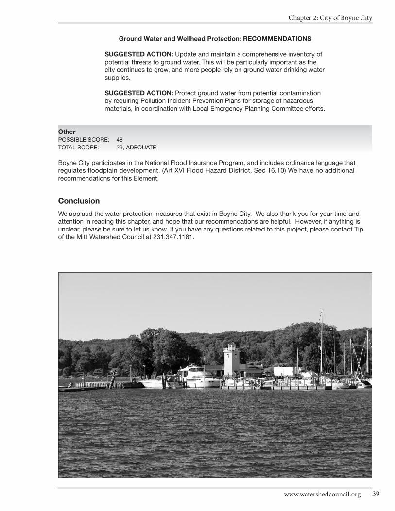
Chapter 2: City of Boyne City
39www.watershedcouncil.org
Ground Water and Wellhead Protection: RECOMMENDATIONS
SUGGESTED ACTION: Update and maintain a comprehensive inventory ofpotential threats to ground water. This will be particularly important as thecity continues to grow, and more people rely on ground water drinking watersupplies.
SUGGESTED ACTION: Protect ground water from potential contaminationby requiring Pollution Incident Prevention Plans for storage of hazardousmaterials, in coordination with Local Emergency Planning Committee efforts.
Other
POSSIBLE SCORE: 48
TOTAL SCORE: 29, ADEQUATE
Boyne City participates in the National Flood Insurance Program, and includes ordinance language that regulates floodplain development. (Art XVI Flood Hazard District, Sec 16.10) We have no additional recommendations for this Element.
Conclusion
We applaud the water protection measures that exist in Boyne City. We also thank you for your time and attention in reading this chapter, and hope that our recommendations are helpful. However, if anything is unclear, please be sure to let us know. If you have any questions related to this project, please contact Tip of the Mitt Watershed Council at 231.347.1181.

CHARLEVOIx COUnTy - Local Ordinance Gaps Analysis
40
Results WorksheetCity of Boyne City
Catagory Possible Score Total Score Comments
I. Master Plan30 - 21 = Strong20 - 11 = Adequate10 - 0 = Weak
II. Basic Zoning Elements54 - 37 = Strong36 - 19 = Adequate18 - 0 = Weak
III. Shorelines60 - 41 = Strong40 - 21 = Adequate20 - 0 = Weak
IV. Impervious Surface Reduction33 - 23 = Strong22 - 12 = Adequate11 - 0 = Weak
V. Stormwater Management27 - 19 = Strong18 - 10 = Adequate9 - 0 = Weak
VI. Soil Erosion and Sediment Control18 - 13 = Strong12 - 7 = Adequate6 - 0 = Weak
VII. Sewer/Septic24 - 17 = Strong16 - 9 = Adequate8 - 0 = Weak
VIII. Wetlands21 - 15 = Strong14 - 8 = Adequate7 - 0 = Weak
IX. Ground Water and Wellhead Protection
18 - 13 = Strong12 - 7 = Adequate6 - 0 = Weak
X. Other Relevant Elements48 -33 = Strong32 - 17 = Adequate16 - 0 = Weak
30
54
60
33
27
18
24
21
18
48
20
42
13
13
10
9
6
5
7
29
Adequate
Strong
Weak
Adequate
Adequate
Adequate
Weak
Weak
Adequate
Adequate
Chapter 3: City of Charlevoix
41www.watershedcouncil.org
SECTION III: Analysis
Chapter 3 City of Charlevoix
Introduction This chapter summarizes results of the Local Ordinance Gaps Analysis project for the City of Charlevoix, located at the junction of Lake Charlevoix and Lake Michigan. Affectionately known as “Charlevoix theBeautiful,” the city includes parts of both the Lake Charlevoix and Lake Michigan watersheds. Round Lake isa focal point for the city, and Stover Creek is a focus for some excellent restoration and protection projects.
With a year-round population of about 3,000, the summertime average population is closer to 9,000 and on a festival or holiday, the city can expect as many as 30,000 visitors during a summer weekend. This Chapterincludes evaluation scores, recommendations and suggested actions. It also relates suggested actions tothe existing Watershed Management Plan for Lake Charlevoix, where appropriate.
Evaluation Scores and Summary
Master Plan ComponentsPOSSIBLE SCORE: 30
TOTAL SCORE: 21, STRONG
The City of Charlevoix Master Plan is hot off the presses! The Planning Commission approved it on January10, 2011. The City Council then held a public hearing on February 7th and unanimously approved Resolution2011-02-01, officially adopting the Master Plan. We congratulate them on this important accomplishmentand thank them for this badly needed update. We also thank them for their strong emphasis on the uniqueconnection to water that exists in the community.
The Master Plan specifically identifies the watershed in which the city is located using a watershed map thatincludes an inventory of surface water features (Chapter 2, Community Profile 2.3 Environment, Water - Mapp.11). It also has a goal statement to protect water in Chapter 3, Community Vision & Goals: “Work with organizations like Tip of The Mitt Watershed Council, the Little Traverse Land Conservancy, and the LakeCharlevoix Association to inform the public on water quality protection measures.” (3.5 Community Goals,Objectives & Action Items, Item 3.4 Coordinate Efforts on Natural Resource Protection p.40)
The City of Charlevoix’s plan also includes goals for open space, which protects surface water, ground water,and wetlands. Infill development is encouraged in Chapter 2 (Community Profile, p.24-25). Chapter 4 notesthat some undeveloped open spaces, both public and private, have high scenic and recreational value. Many of those include shorelines, which are extremely important to water quality, and extremely sensitive. It recommends that any development in these areas should pay special attention to setbacks, stormwater
CHARLEVOIx COUnTy - Local Ordinance Gaps Analysis
Tip of the Mitt Watershed Council42
Best Management Practices (BMPs), and other environmental considerations (Chapter 4 Charlevoix Tomorrow, Scenic Reserve p. 51).
Stormwater management is also addressed in the city plan. In recent years, Charlevoix partnered with Tip ofthe Mitt Watershed Council on this topic, and recommendations for stormwater control were received by thecity (included in Master Plan Appendix G). Two Rain gardens and a stormwater filtration device have beenimplemented, so far, and the plan acknowledges the need to incorporate BMPs. This is a great policy approachfor water protection. The city demonstrates to citizens, businesses, and visitors that cost effective, sustainabletechnology is available to keep water quality high that can also be very attractive or non-intrusive (Chapter 2Community Profile, 2.11 City Utilities; Stormwater page 31).
The plan also includes this crucial point: “Work cooperatively with all jurisdictions to adopt a unified StormwaterControl Ordinance for Charlevoix County.” (Chapter 3 Community Vision & Goals, 3.5 Community Goals, Objectives & Action Items, Item 3.4, p. 40) The need for doing so is described below, in the Stormwater Element, and in more detail in Chapter 1 of this project, covering Charlevoix County.
Master Plan Components: RECOMMENDATIONS
Again, we congratulate the city on the new Master Plan and the hard work ittook to complete. The City Planning office is now starting an update of theexisting Zoning Ordinance, and this plan will serve as the basis for thatwork, in accordance with state law. We understand that decades went bybefore a new Master Plan update was attempted, but it is now finished andthat is a wonderful accomplishment. We urge city officials to adopt thepractice of review and updating the plan every five years. When this plancomes up for review in 2016, we recommend the following points.
SUGGESTED ACTION: In the next plan update, consider calling for minimizingimpervious surfaces in new construction and redevelopment projects to reducestormwater runoff and improve infiltration. Encourage incentive-based approaches that are creative and effective, and educate citizens and businesses about the need to do so.
SUGGESTED ACTION: Ensure that the plan update acknowledges the importance of well-constructed and maintained road stream crossings onthe quality of Stover Creek.
SUGGESTED ACTION: Finally, the next plan update should also includeidentification and protection of any wildlife corridors that may exist in thecity, working with neighboring jurisdictions to make them effective.
Basic Zoning ComponentsPOSSIBLE SCORE: 54
TOTAL SCORE: 19, ADEQUATE
As noted above, the Zoning Ordinance is now up for review, which we hope is good timing for this Local Ordinance Gaps Analysis project, in terms of opportunities to improve water protection measures for the City of Charlevoix. The score for this element for Charlevoix is 19 of a possible 54. It scored “Adequate” but one less point would have put it into the “Weak” category. However, that is not to diminish the goodbasic components that are evident and can be used as a foundation for improvement.
The ordinance includes a fee system to cover costs for review of proposal applications or appeals: “The feesfor processing planning and zoning requests within the City of Charlevoix shall be as specified by the citycouncil in the annual City of Charlevoix budget ordinance.” (CHAPTER 52 FEE SCHEDULE--ZONING ANDSUBDIVISION REVIEW; 5.295) It also has methods in place for enforcement, including a clearly definedprocess for inspections and correction of violations: “Any person, partnership, corporation, or association

Chapter 3: City of Charlevoix
43www.watershedcouncil.org
who creates or maintains a nuisance per se as defined in subsection (a) above or who violates or fails tocomply with this Chapter or any permit issued pursuant to this Chapter shall be responsible for a municipalcivil infraction punishable by a fine of no more than $500.00 as determined by the court.” [Chap 51 Art XIISec 5.291 Penalties (b)]
The city Zoning Ordinance proposal review process is also coordinated with the receipt of other applicablepermits. Approval is based upon, among other things, compliance with requirements of the city for fire andpolice protection, water supply, sewage disposal or treatment, storm drainage, and other public facilities andservices. Also, approval is based on compliance with the standards of other government agencies, whereapplicable, and the approval of these agencies must be obtained or somehow assured [Chap 51 Art V GeneralProvisions Sec 5.188 Development Plan (2)(b-c)]. This is good policy that allows more certainty early in theprocess. It is good to know about everything that is required before spending thousands of dollars. It is ourexperience that developers, including individuals who propose development projects on a single-family scale,appreciate understanding what is needed, up front. They often need to be educated about working in waterand wetlands, or about concerns for ground water that is underfoot and out of sight, but nevertheless, crucialfor the community.
Site plan review is required for all activities, except in R-1 and R-2 [Chap 51 Art V General Provisions Sec5.188 Development Plan (1)]. Additionally, they are not required to include open spaces. However, PlannedUnit Development (PUD) proposals are included in the ordinance, and they are required to provide 40 percentOpen Space [Chapter 51, Art IV PUD Sec 5.73(1)(i)].
Site plans are only minimally required to indicate all existing natural features; this could be improved [Chapter51 Art V Sec 5.188 Development Plan Review (3)(f)(9)]. In the R-4 zone, which is Multiple Family Dwellingareas, natural features are required, where possible [Chapter 51, Art IV Sec 5.64 Area Regulations, R-4Planned Residential Zone (13)].
Basic Zoning Components: RECOMMENDATIONS
SUGGESTED ACTION: Consider requiring a pre-application or pre-construction meeting for new development or redevelopment proposals.This can help applicants to understand what is needed, up front, and create a climate of certainty.
SUGGESTED ACTION: Consider improving site plan requirements to indicate all existing natural features, including the location and elevations of existing water courses and water bodies, man-made drainage pathways,flood plains, county drains, wetlands and ground water recharge areas.
SUGGESTED ACTION: Consider requiring open spaces in all districts ofthe city, and require open spaces to be managed in a natural condition withretention of native vegetation. Open space allowable uses should also be restricted to low impact activities. Finally, open spaces should be protected,using a conservation easement or other similar mechanism, to ensure theycontinue to serve the purpose of protecting water quality in the watershed.
ShorelinesPOSSIBLE SCORE: 60
TOTAL SCORE: 13, WEAK
The City of Charlevoix is blessed with a Great Lakes shoreline, forming part of the special northeastern shoreof Lake Michigan. It also has a significant, mostly hardened, urban shoreline surrounding Round Lake, whichconnects Lake Michigan to Lake Charlevoix. The urban shoreline of Lake Charlevoix in the city limits eventuallygives way to parkland or private residences, or water-related, recreational business concerns. Charlevoix is a true gateway to some of the most prized water resources in the state, and it is visited by thousands ofpeople from around the world, every year. These people come to the city for the shoreline and the waters,
CHARLEVOIx COUnTy - Local Ordinance Gaps Analysis
Tip of the Mitt Watershed Council44
and special care must be taken to ensure this enthusiasm also incorporates efforts to protect those belovedshorelines and waters.
On the topic of shoreline protection, the city could improve. We recognize the enormous challenges of doingso, and appreciate the work already done in this regard. Two of the most effective ways that local governmentscan protect water quality is to require setbacks from the water’s edge, and require a shoreline protectionstrip of native vegetation between the water and the upland land use, also called a vegetative buffer.
All principal uses located in the R-1 and R-4 districts of the City of Charlevoix must have a setback of 50 feet from the ordinary high water mark (OHWM) of Lakes Michigan and Charlevoix and Round Lake, as wellas the Pine River Channel Marine-Commercial district (Art V Sec 5.198 Setback from Water bodies). TheScenic Reserve (SR) District also requires a minimum structure setback of 50 feet from the OHWM on theadjacent lake or water body [Art IV Sec 5.134 Scenic Reserve; Other Regulations (1)]. The SR has one statedpurpose of providing for appropriate residential development along lake shores that will protect both the environment and the scenic qualities of this unique land area, which includes both public and private lands.
Charlevoix does not require vegetative buffers, except in the SR District, and even there, the provisionsshould be improved. It is generally recommended that a vegetative buffer should be at least 30 feet deep.The Other Regulations section in the SR includes: “Natural trees, shrubbery, or other vegetation shall bepreserved as far as practicable, and where removed shall be replaced with other vegetation that is equallyeffective in retarding run off, preventing erosion and preserving natural beauty.” [Art IV Sec 5.134 Scenic Reserve; Other Regulations (1)]
As you can see, there is no minimum depth for the vegetative strip. Elsewhere in the ordinance, there areconflicting definitions of greenbelt. In Art II Sec 5.5 Definitions, Greenbelt is noted as having a minimumdepth of 10 feet. However, Art V General Purposes, Sec 5.203 addresses plant materials and landscapingrequirements, and notes that if a greenbelt is required, it has to be at least 8 feet deep [9(e)]. Neither of these specifies greenbelts to serve as vegetative buffers, and both have limited effectiveness for shorelineprotection because of their narrow depth.
As noted in the Literature Review, shorelines are vital transition zones between land and water, where manyimportant interactions occur to benefit the lake ecosystem. These benefits are diminished when shorelineproperties are developed and vegetation is removed, but can be recovered by planting vegetated bufferstrips using a variety of native species. It is clear that some areas, such as the Marine-Commercial districtand similar areas will not provide a practical setting for a riparian buffer. But other low cost and effectivetechniques exist to mitigate impacts of polluted stormwater runoff from impervious surfaces, directly into our lakes and streams.
Boating use of inland lakes can impact water quality, wildlife habitat, and the use and enjoyment of the lake by residents and visitors. A common way for local governments to address boating use is through dock restrictions and provisions. The Definition section of the ordinance defines Boat Docking Space as 26 linealfeet. If you have more than 2 docking spaces, each 1 ½ spaces more must have an on-site parking spotavailable. There are no keyhole prevention provisions to place restrictions on the size and type of multi-boatlaunch and docking sites, which may or may not make sense, given the site specifics and historic uses.
Since even a very small amount of petroleum products or hazardous chemicals can impact a large amount of water, it is important to ensure proper management of these liquids. Charlevoix does not have much oversight of marinas, even though the Marine-Commercial District provides principle uses for berthing,launching, handling or servicing of recreational or commercial boats [Art IV Sec 5.142 (1)]. It does not specify restrictions of boat repair and maintenance activities to prevent debris from falling into the water and prevent invasive species. It also does not specify fueling station spill prevention and containment measures, or BMPs.
Site plan review and special use permits require the disclosure of the use of hazardous or toxic materials in adevelopment plan, but there is no mention of coordinating permit approvals from state or federal agencies,or requiring designs to prevent spills and (unless permitted by state or federal statute) discharges to surfaceor ground water.
Chapter 3: City of Charlevoix
45www.watershedcouncil.org
Shorelines: RECOMMENDATIONS
SUGGESTED ACTION: Maintaining native vegetation along the shoreline iscritical to preserving water quality and providing wildlife habitat. Shorelineprotection strip provisions should be required in all shoreline districts in the city,with some exception. In the exception areas, however, low cost and effectivemethods can and should be used to mitigate the impacts of pollutedstormwater runoff directly into the city lakes and streams.
SUGGESTED ACTION: Encourage a minimum depth of 30 feet for allShoreline Protection Strips. Require the maintenance and re-establishmentof native vegetation and prohibit the use of invasive species.
SUGGESTED ACTION: Restrict boat repair and maintenance activities inmarinas to clearly marked areas to prevent debris from falling into the waterand prevent the spread of invasive species.
SUGGESTED ACTION: Require marina fueling stations to have spill contain-ment equipment that is stored in a clearly marked location. Also require a spillcontingency plan, and post emergency phone numbers in a prominent location.Finally, signs of leakage or spillage should be investigated immediately, andundertake cleanup in accordance with applicable BMPs.
Impervious SurfacesPOSSIBLE SCORE: 33
TOTAL SCORE: 6, WEAK
The more a local government can do to reduce impervious surfaces, the better for water quality. As noted in the Lake Charlevoix Watershed Management Plan, impervious surfaces (streets, roofs, sidewalks, etc.)generate much more stormwater runoff than natural forested, or even agricultural, land uses. That pollutedrunoff discharges directly into Lakes Michigan and Charlevoix and Round Lake from pavement and rooftops,and includes bacteria from pet and animal wastes, fertilizer, oil and grease, sediment, heavy metals, salt, etc.To reduce impervious surfaces, a community should increase the retention or restoration of native vegetationin riparian areas and in open spaces, and install simple and effective solutions, ranging from rain barrels andrain gardens, to engineering approaches that treat stormwater that has traveled across impervious surfaces,before it discharges into the water.
On a positive note, Article V, Section 5.206 (2) requires parking areas to have canopy trees and planting areasthat increase, with the increased size of the lot. Additionally, the SR district limits impervious surfaces to nomore than 30 percent of the usable lot area [Art IV Sec 5.133 Lot Requirements for Scenic Reserve (4)].
Impervious Surfaces: RECOMMENDATIONS
There are many opportunities for local governments to reduce impervioussurfaces through their Zoning Ordinance. Additionally, the Lake CharlevoixWatershed Plan calls for reduction of impervious surfaces to reduce the pollutantload from stormwater running into our water resources. We encourage theCity of Charlevoix to consider integrating the following provisions into theirordinance.
SUGGESTED ACTION: Consider reducing the parking space dimensionsand setting them as a maximum. Also consider reducing the number of required parking spaces and setting the number as a maximum number, as opposed to a minimum.
CHARLEVOIx COUnTy - Local Ordinance Gaps Analysis
Tip of the Mitt Watershed Council46
SUGGESTED ACTION: Establish impervious surface lot coverage limits in
all zoning districts (especially residential districts) to limit impervious surfaces
to 15% of the total lot. Provide incentives for using LID techniques to
mitigate the impacts of impervious surfaces, in exchange for a larger
building footprint.
SUGGESTED ACTION: Consider adding a provision that allows for flexibilityin front yard setbacks or side yard setbacks to encourage shorter drivewaysor shared driveways between two lots.
Stormwater ManagementPOSSIBLE SCORE: 27
TOTAL SCORE: 3, WEAK
A multitude of studies from around the nation and world have documented that urban stormwater is a serioussource of pollution. The city has some minimal oversight of stormwater. Site plan review requires that thedrainage plan for proposed developments is adequate to handle anticipated stormwater runoff, and will notcause undue runoff onto neighboring property or overloading of watercourses in the area [Chap 51 Art IXSec 5.263.3 Special Use Permit (7)(j)].
The city Zoning Ordinance also limits grading: “No premises shall be filled or graded so as to discharge surface runoff on abutting premises in such a manner that will cause inconvenience or damage to adjacentproperties. When property is developed adjacent to existing properties previously developed, existing gradesshall have priority.” (Art V Sec 5.186)
Stormwater Management: RECOMMENDATIONS
As noted in Chapter 1, the county stormwater ordinance is no longer in effect.This should be remedied as soon as possible.
SUGGESTED ACTION: Consider adding review of stormwater BMPs andother water quality protections in the site plan review ordinance.
SUGGESTED ACTION: Coordinate efforts with the County Drain Commissioner to enact local stormwater ordinances in the county, allowingthe county to administer and enforce them for local jurisdictions. Ask the countyto finish the Storm Water Control (SWC) Ordinance and IntergovernmentalAgreement, and present it to the City of Charlevoix for passage.
Soil Erosion and Sediment ControlPOSSIBLE SCORE: 18
TOTAL SCORE: 1, WEAK
By volume, sediment is the single largest pollutant to waters of the United States. Any time earth is disturbedor graded (as typically happens during the construction process), there is a potential for soil to erode andsediment to be deposited into lakes, streams, and wetlands. The City of Charlevoix Site Plan Review requiresthat a proposed development will not cause soil erosion or sedimentation problems [Art IX Sec 5.263.3 SpecialUse Permit (7)(i)].
As noted in the first chapter, counties are mandated to administer and enforce Part 91, and CharlevoixCounty has two state-recognized agencies that do so: The Soil Erosion Control Officer in the Department ofBuilding Safety, and the County Road Commission.

Chapter 3: City of Charlevoix
47www.watershedcouncil.org
Soil Erosion and Sediment Control: RECOMMENDATIONS
All properties that are located near streams, wetlands, or drainage wayshave the potential to erode and cause sedimentation to nearby waters. Accordingly, it is recommended that local units require all earth movementactivities associated with development or construction projects to followBMPs to control erosion and ensure that any sediment-laden runoff doesnot enter waterways. Coordination between townships and the county is essential to ensure that soil erosion and sedimentation is controlled.
SUGGESTED ACTION: Specifically require that all proposed developmentproject earth change activities within 500 feet of a stream, wetland, or otherwaterway in all zoning districts receive a soil erosion and sedimentation control permit from Charlevoix County before they receive a permit from the City of Charlevoix.
Sewer/SepticPOSSIBLE SCORE: 24
TOTAL SCORE: 11, ADEQUATE
The city’s Master Plan includes goals to closely monitor the municipal water supply system to minimize orprevent leaks and/or ruptures; and integrate GIS and revise capital improvement plans to more effectivelypredict and plan for future infrastructure upgrades [Chapter 3 Community Vision & Goals, 3.5 CommunityGoals, Objectives & Action Items, 1.12 and 1.13(v)].
City regulations that pertain to septic systems are coordinated with the County Health Department regulations:“Every building .....shall be provided with a safe and sanitary water supply system. For those areas of thecity not served by water and sewer, the written approval by the district health department of proposed facilitiesfor water generation and treatment of waste, shall be filed with an application for a zoning permit.” (Art V Sec5.181)
Sewer/Septic: RECOMMENDATIONS
SUGGESTED ACTION: If not already done, ensure the Sewer Service Areais mapped, including sewers that currently exist, areas that will be seweredin the future, and areas that will not be sewered.
SUGGESTED ACTION: Require that existing infrastructure be inventoriedfor age and condition, and ensure that a maintenance and replacementschedule is provided in the Master Plan.
SUGGESTED ACTION: Require the community to have a program to iden-tify sanitary sewer or septic systems that are seeping into the storm watersystem, surface waters or ground water.
SUGGESTED ACTION: In the rural zoning district that allows septic, requirethat septic systems be located at least 100 feet from streams, wetlands, orother water bodies.
SUGGESTED ACTION: Consider establishing a “point of transfer” inspectionrequirement for the rural septic district, whereby septic systems must be inspected to ensure they are operating properly before ownership is transferred.
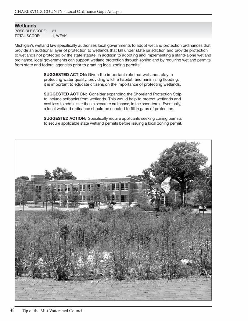
CHARLEVOIx COUnTy - Local Ordinance Gaps Analysis
Tip of the Mitt Watershed Council48
WetlandsPOSSIBLE SCORE: 21
TOTAL SCORE: 1, WEAK
Michigan’s wetland law specifically authorizes local governments to adopt wetland protection ordinances thatprovide an additional layer of protection to wetlands that fall under state jurisdiction and provide protectionto wetlands not protected by the state statute. In addition to adopting and implementing a stand-alone wetlandordinance, local governments can support wetland protection through zoning and by requiring wetland permitsfrom state and federal agencies prior to granting local zoning permits.
SUGGESTED ACTION: Given the important role that wetlands play in protecting water quality, providing wildlife habitat, and minimizing flooding, it is important to educate citizens on the importance of protecting wetlands.
SUGGESTED ACTION: Consider expanding the Shoreland Protection Stripto include setbacks from wetlands. This would help to protect wetlands andcost less to administer than a separate ordinance, in the short term. Eventually,a local wetland ordinance should be enacted to fill in gaps of protection.
SUGGESTED ACTION: Specifically require applicants seeking zoning permitsto secure applicable state wetland permits before issuing a local zoning permit.
Chapter 3: City of Charlevoix
49www.watershedcouncil.org
Ground Water and Wellhead ProtectionPOSSIBLE SCORE: 18
TOTAL SCORE: 6, WEAK
The city relies on Lake Michigan for its drinking water (Master Plan, Chapter 2, 2.11 City Utilities, Water Supply p. 30). However, there could be protections in place for ground water sources in the city, which areimportant to surface water sources. For example, site plan review can be used to ensure direct discharge of potentially hazardous material is prevented, and required to be coordinated with state statutes.
Discharges to ground water are regulated by the state under Part 31, Water Resources Protection, of the Natural Resources and Environmental Protection Act (NREPA) 1994 PA 451, and Part 22 Rules. Any proposed discharges should be prohibited by the city until required state permits are received by the applicant. Storage of hazardous material is also regulated under Part 5 Rules issued for Part 31. This includes Pollution Incident Prevention Plans, which can be efficiently coordinated with Local EmergencyPlanning Committee work.
Ground Water and Wellhead Protection: RECOMMENDATIONS
Ground water is vital for not only drinking water, but also to feed tributaries,seeps, springs, and wetland resources with fresh water supplies to supportthose ecosystems, including important recreational fisheries.
SUGGESTED ACTION: Complete and maintain a comprehensive inventoryof potential threats to ground water. This will be particularly important as thecity continues to grow.
SUGGESTED ACTION: If direct or indirect discharges to ground water areproposed, use site plan review or some other ordinance provision to prohibitthis until appropriate approvals or permits are obtained from the state.
SUGGESTED ACTION: Protect ground water from potential contaminationby requiring Pollution Incident Prevention Plans for storage of hazardousmaterials, in coordination with Local Emergency Planning Committee efforts.
OtherPOSSIBLE SCORE: 48
TOTAL SCORE: 24, ADEQUATE
The City of Charlevoix participates in the National Flood Insurance Program, and the Zoning Ordinance coordinates efforts by requiring proposed development properties to respect floodways and floodplains onor in the vicinity of the subject project [Art IX Special Use Permits Sec 5.263 (7)(g)]. We have no additionalrecommendations for this element.
Conclusion
We applaud the water protection measures that exist in the City of Charlevoix. We also thank you for yourtime and attention in reading this chapter, and hope that our recommendations are helpful. However, if anything is unclear, please be sure to let us know. If you have any questions related to this project, pleasecontact Tip of the Mitt Watershed Council at 231.347.1181.

CHARLEVOIx COUnTy - Local Ordinance Gaps Analysis
50
Results WorksheetCity of Charlevoix
Catagory Possible Score Total Score Comments
I. Master Plan30 - 21 = Strong20 - 11 = Adequate10 - 0 = Weak
II. Basic Zoning Elements54 - 37 = Strong36 - 19 = Adequate18 - 0 = Weak
III. Shorelines60 - 41 = Strong40 - 21 = Adequate20 - 0 = Weak
IV. Impervious Surface Reduction33 - 23 = Strong22 - 12 = Adequate11 - 0 = Weak
V. Stormwater Management27 - 19 = Strong18 - 10 = Adequate9 - 0 = Weak
VI. Soil Erosion and Sediment Control18 - 13 = Strong12 - 7 = Adequate6 - 0 = Weak
VII. Sewer/Septic24 - 17 = Strong16 - 9 = Adequate8 - 0 = Weak
VIII. Wetlands21 - 15 = Strong14 - 8 = Adequate7 - 0 = Weak
IX. Ground Water and Wellhead Protection
18 - 13 = Strong12 - 7 = Adequate6 - 0 = Weak
X. Other Relevant Elements48 -33 = Strong32 - 17 = Adequate16 - 0 = Weak
30
54
60
33
27
18
24
21
18
48
20
42
13
13
10
9
6
5
7
29
Adequate
Strong
Weak
Adequate
Adequate
Adequate
Weak
Weak
Adequate
Adequate

Chapter 4: City of East Jordan
51www.watershedcouncil.org
SECTION III: Analysis
Chapter 4 City of East Jordan
Introduction This chapter summarizes results of the Local Ordinance Gaps Analysis project for the City of East Jordanin Charlevoix County. The city’s website notes that it is located at the mouth of the Jordan River, where itflows into the South Arm of Lake Charlevoix. The city slogan is: “Where river, lake, and friendly peoplemeet.” It is an attractive tourist destination with outstanding fresh water resources. This chapter includesthe evaluation scores, recommendations and suggested actions. It also relates suggested actions to the existing Lake Charlevoix Watershed Management Plan, which includes East Jordan and the JordanRiver subwatershed.
Evaluation Scores and Summary
Master Plan ComponentsPOSSIBLE SCORE: 30
TOTAL SCORE: 14, ADEQUATE
The City of East Jordan has a Master Land Use Plan. According to the city website, the plan is dated June11, 1992. However, the plan that is linked from the website notes an update being done in August of 1998.Regardless, it is recommended that Master Plans be updated every five years, so this one is due for an update as soon as feasible.
The existing plan does not identify the watersheds in which the city is located. No maps of natural resourceareas could be found, but the city website does include a detailed zoning map that shows some water features.There are goal statements that reflect a clear intent to protect water resources: “Conserve or wisely use thewetlands, Jordan River, drainageways, so that they can continue to function for their natural purpose;” and“Preserve or at least conserve or wisely use all existing natural environmental conditions including… surfacewater and drainage features, wetlands, etc. so that development will least disturb or change the present natural conditions wherever possible.” [Appendix Part A-8, Summary (8, 12) pages xxxiii, xxxiv]
The importance of protecting open space is expressed in various sections of the plan, but not explicitly. Itrefers to the critical importance of protecting and enhancing the large wetland, wildlife, and Jordan River flowarea into Lake Charlevoix [Section 1 Introduction (12)]. It also refers to setbacks as important for shorelineprotection [Part IV Prescriptions for Future City Development (2) Waterfront Areas], and there are specificprohibited activities in wetlands listed (Appendix Part A-11 Uses Permitted & Prohibited in Wetlands page 1x).
CHARLEVOIx COUnTy - Local Ordinance Gaps Analysis
Tip of the Mitt Watershed Council52
Stormwater management is only minimally mentioned, and the plan does not call for minimizing impervioussurfaces in new construction and redevelopment projects to reduce stormwater runoff and improve infiltration.It also does not acknowledge the importance of well-constructed and maintained road stream crossings onthe quality of stream and water resources.
Master Plan Components: RECOMMENDATIONS
SUGGESTED ACTION: Because the current plan is so old, consider an update as soon as possible.
SUGGESTED ACTION: When the plan is updated, be sure to address theimportance of dedicated open space, stormwater management, and theprevention of increased impervious surfaces.
SUGGESTED ACTION: When the plan is updated, consider including theimportance of well-constructed and maintained road stream crossings onthe quality of stream and water resources
Basic Zoning ComponentsPOSSIBLE SCORE: 54
TOTAL SCORE: 40, STRONG
The Zoning Ordinance for the City of East Jordan has a statement of purpose that includes protection ofwater: “…to provide for … the conservation of open space lands, wetlands and land areas containing naturalor cultural resources or features necessary to the social and economic well-being of present and future generations…” (Chap 48 Art I Sec 48-2 Purpose)
Additionally, the purpose of the Conservation Reservation District is “…to provide for the arrangement ofland uses that are compatible with the conservation and preservation of large tracts of land presently havinga most desirable natural environment that should not be disturbed, except minimally, or natural habitat forwildlife, native flora, natural water features including extensive wetlands...” (Chap 48 Art III Sec 48-561 Purpose)
The ordinance also includes a fee system to cover costs to the community for review of proposal applicationsor appeals, and a method in place for enforcement of the ordinance. [Chap 48 Art II Sec 48-38(d) Fees; Sec48-40 Penalties] Importantly, the city also attempts to coordinate the local zoning permitting process to ensurethat a project applicant receives all applicable permits from other agencies. “All uses of land, buildings orstructures shall conform to all applicable local, county, state and federal laws, rules and regulations that havebeen promulgated and administered by the respective responsible public agency or official as well as theprovisions of this chapter.” (Chap 48 Art III Div 1 Sec 48-189)
The city also offers a pre-application or pre-construction meeting with the Planning Commission for the purpose of reviewing and discussing a proposed preliminary site plan (Chap 48 Art II Div 2 Sec 48-74). The Planning Commission may also require the applicant to provide an impact statement for a Planned UnitDevelopment (PUD) that includes environmental impacts, such as soils, topography, and natural features onthe site that could be impacted by the proposed development (Chap 48 Art III Div 15 Sec 48-600).
Site plans are required for all activities except single-family and mobile homes located on separate lots orparcels (Chap 48 Art II Div 2 Sec 48-70 & 48-71). The site plan is required to indicate all existing natural features, with the intent to preserve existing conditions of the natural environment (Chap 48 Art II Div 2 Sec.48-7). Site plan approval requires that the applicant meet all requirements of the state soil erosion and sedi-mentation control provisions of part 91 of Public Act No. 451 of 1994 [Chap 48 Art II Div 2 Sec. 48-75(d)].
Site plan review for East Jordan does not include open space provisions, but PUDs are required to include a minimum open space threshold. A land, water, or land/water area making up not less than twenty five percent (25% ) of the total land area of a lot or parcel shall be designed as permanent open space [Chap 48
Chapter 4: City of East Jordan
53www.watershedcouncil.org
Art III, Div 15 Sec 48-602 (c)]. Additionally, “The city commission may require upon recommendation of theplanning commission, that unique natural amenities such as ravines, rock outcrops, wooded areas, tree orshrub specimens, unusual wildlife habitats, ponds, streams, and marshes be preserved as part of the openspace system.” [Chap 48 Art III Div 15 Sec 48-602(3)(e)] Fortunately, the open space is also required to beprotected through a conservation easement or other similar mechanism. “Legal instruments setting forth themanner of permanent maintenance of common area and facilities shall be submitted to the city attorney forreview before the city commission approves a final site plan or final plat, if a subdivision is planned to be partof the PUD.” [Chap 48 Art III Div 15 Sec 48-602 (7)(a)]
Basic Zoning Components: RECOMMENDATIONS
We applaud the City of East Jordan for its strong basic zoning components,and have only two additional suggestions.
SUGGESTED ACTION: Consider requiring open space provisions in thesite plan review process.
SUGGESTED ACTION: Consider ways to encourage retention of nativevegetation in dedicated open spaces of PUDs.
ShorelinesPOSSIBLE SCORE: 60
TOTAL SCORE: 13, WEAK
Shoreline protection efforts in East Jordan could be improved – and should be, as a priority, given the economicimportance of clean water to the community. We recognize the enormous challenges of doing so in an urbanenvironment, however, and appreciate the work already done in this regard. There are some positive protectionaspects upon which to build.
Two of the most effective ways that local governments can protect water quality is to require setbacks fromthe water’s edge, and require a shoreline protection strip of native vegetation between the water and the upland land use, also called a vegetative buffer.
East Jordan has some good shoreline setbacks. The Single Family Residential District (RA) requires a minimumsetback of 40 feet from the shoreline of any surface water features, except as otherwise required for specialuses, and unless a greater setback from the shoreline is required by the state department of environmentalquality or other public agency [Chap 48 Art III Div 2 RA Single Family Sec. 48-223(5)(a)]. The Waterfront District (WF) has a minimum required waterfront yard setback from the established shoreline of 50 feet [Chap 48, Art III Div 12 Sec 48-513(b)]. The Industrial District (I) requires a minimum of 75 feet from all waterfront shorelines [Chap 48, Art III Div 12 Div 13 Sec 48-541(4)(a)].
However, on the subject of shoreline protection strips, the city could improve its requirements, which areminimal. In the RA district, permitted principal special uses on a waterfront shall be landscaped in trees,shrubs and grass and be maintained in a healthy condition [Chap 48, Art III, Div 2 Sec 48-220(2)(b)]. However,this is not a true shoreline buffer; grass is permitted to the water’s edge, and that is less than ideal. Althoughthey are not impervious surfaces, manicured lawns generate more runoff than does ground covered in nativeplants, trees, and shrubs.
As noted in the Literature Review, shorelines are vital transition zones between land and water. Naturalshorelines benefit lake and river ecosystems by providing habitat and improving water quality. These benefitsare diminished when shoreline vegetation is removed for development, but they can be recovered by plantingvegetative buffer strips using a variety of native species.
Establishing a diverse buffer strip in an urban area may not recover habitat conditions, but it can mimic naturalconditions to protect water quality in the lake or river. It improves the effectiveness of the shoreline transitionzone to prevent negative impacts of adjacent land-use activity.
CHARLEVOIx COUnTy - Local Ordinance Gaps Analysis
Tip of the Mitt Watershed Council54
East Jordan permits marinas as part of provisions in the WF district [Chap 48 Art III Div 12 Sec. 48-509 (20)].However, we could find no evidence of other basic oversight for marina operations.
Shorelines: RECOMMENDATIONS
We encourage the City of East Jordan to consider the following, in order tobetter protect the valuable shorelines in their jurisdiction.
SUGGESTED ACTION: Where feasible, establish a shoreline protection stripimmediately adjacent to lakes, streams, and other water bodies. To be mosteffective, the shoreline protection strip should be 30 feet wide, maintained innative vegetation, prohibit pesticide or herbicide use, with minimum cuttingto afford a filtered view of the water.
SUGGESTED ACTION: Restrict boat repair and maintenance activities inmarinas to clearly marked areas to prevent contaminants and debris fromfalling into the water and limit the spread of invasive species.
SUGGESTED ACTION: Require marina fueling stations to have spill containment equipment that is stored in a clearly marked location. Also require a spill contingency plan, and post emergency phone numbers in a prominent location. Finally, signs of leakage or spillage should be investigated immediately, and undertake cleanup in accordance with applicable best management practices.
Impervious SurfacesPOSSIBLE SCORE: 33
TOTAL SCORE: 0, MISSING
The Lake Charlevoix Watershed Plan includes an objective to reduce the pollutant load from stormwater inurban areas. Reducing impervious surfaces supports this objective. Among other low cost approaches toreduce impervious surfaces, a community can increase the retention or restoration of native vegetation in riparian areas and in open spaces. Minimizing impervious surfaces can also be addressed in other creativeand cost-effective ways, ranging from using Low Impact Design (LID) techniques in development plans, toincentives for limiting impervious surface lot coverage in zoning ordinances (Lake Charlevoix WatershedPlan, 2008 Update. Chapter Four: Lake Charlevoix Watershed Project Goals, Objectives, and RecommendedActions, 1. Goals and Objectives).
Ordinances can be crafted to encourage the use of techniques that benefit water quality, such as incentives to protect natural vegetation throughout a development site. Lot design and general developmentprovisions in zoning ordinances provide great opportunities to encourage alternatives to, and reductions of,impervious surfaces.
Impervious Surfaces: RECOMMENDATIONS
There are many opportunities for local governments to reduce impervioussurfaces through their Zoning Ordinance. Additionally, the Lake CharlevoixWatershed Management Plan calls for reduction of impervious surfaces toreduce the pollutant load from stormwater runoff into our water resources.We encourage East Jordan to consider integrating the following provisionsinto their ordinance.
SUGGESTED ACTION: Establish impervious surface lot coverage limits inall zoning districts to limit impervious surfaces throughout the township.Consider limiting the percent lot coverage to 15% of the total lot.

Chapter 4: City of East Jordan
55www.watershedcouncil.org
SUGGESTED ACTION: Add a provision that allows for flexibility in front yardsetbacks or side yard setbacks to encourage shorter driveways or shareddriveways between two lots.
SUGGESTED ACTION: Allow reductions in the size of parking and loadingareas when appropriate for water quality protection, or encourage use ofgrass parking areas or pervious pavers.
Stormwater ManagementPOSSIBLE SCORE: 27
TOTAL SCORE: 1, WEAK
Stormwater runoff from buildings, driveways, parking lots, streets, and other impervious surfaces is a majorsource of pollutants to northern Michigan’s waterways. Local governments can do much to reduce stormwaterrunoff as part of their zoning ordinance.
Although East Jordan does not have a stand-alone stormwater provision, there are places in the ordinancewhere stormwater management is addressed. For example, the criteria for site plan review includes: “Surfacewater drainage. Special attention shall be given to proper site surface drainage so that the flow of surfacewaters will not adversely affect adjacent and surrounding properties or the public storm drainage system. Ifnecessary, stormwater shall be removed from all roofs, canopies and paved areas and carried away in an underground piped drainage system.” [Chapter 48 Art II Div 2 Sec. 48-77(4)]
Stormwater Management: RECOMMENDATIONS
As noted in Chapter 1, the county storm water ordinance is no longer in effect. This should be remedied as soon as possible.
SUGGESTED ACTION: For the short term, consider requiring review of development proposals by the County Drain Commissioner to ensure that stormwater management is properly addressed on all proposed development projects.
SUGGESTED ACTION: Coordinate efforts with the County Drain Commissioner to enact local stormwater ordinances in the county, allowingthe county to administer and enforce them for local jurisdictions. Ask the countyto finish the Storm Water Control (SWC) Ordinance and IntergovernmentalAgreement, and present it to the City of East Jordan for passage.
Soil Erosion and Sediment ControlPOSSIBLE SCORE: 18
TOTAL SCORE: 6, WEAK
By volume, sediment is the single largest pollutant to waters of the United States. Any time earth is disturbedor graded, as typically happens during the construction process, there is a potential for soil to erode and causesedimentation to nearby waters. Accordingly, it is recommended that local units require all earth movementactivities associated with development or construction projects to follow Best Management Practices (BMPs).This is done to control erosion and ensure that any sediment-laden runoff does not enter waterways. TheCharlevoix County Department of Building Safety administers Part 91 of Michigan’s Natural Resources andEnvironmental Protection Act (NREPA).
The City of East Jordan does coordinate efforts with the county for soil erosion and sediment control, but it couldbe clearer so that applicants understand a permit is issued in a separate county process. Site plan approvalrequires that the applicant “…meet all of the requirements of the state soil erosion and sedimentation control
CHARLEVOIx COUnTy - Local Ordinance Gaps Analysis
Tip of the Mitt Watershed Council56
provisions of part 91…” [Chap 48 Art II Div 2 Sec. 48-75(d)]. Additionally, the same section notes that conditions for approval of a grading permit may include provisions for control of possible erosion.
Finally, the Zoning Ordinance requires site plan approval prior to earth changing actions. No grading, removalof trees or other vegetation, land filling, or construction of improvements shall commence until a final siteplan is approved and is in effect, unless the ordinance grants exceptions (Chap 48 Art II Div 2 Sec. 48-73).
Soil Erosion and Sediment Control: RECOMMENDATIONS
Coordination between townships and the county is essential to ensure thatsoil erosion and sedimentation is controlled.
SUGGESTED ACTION: Specifically require that all proposed developmentproject earth change activities within 500 feet of a stream, wetland, or otherwaterway in all zoning districts receive a soil erosion and sedimentation control permit from Charlevoix County before they receive a permit from the City of East Jordan.
Sewer/SepticPOSSIBLE SCORE: 24
TOTAL SCORE: 15, ADEQUATE
East Jordan has a delineated Sewer Service Area and it has been mapped. The map can be accessed on thecity website (http://www.eastjordancity.org/info/PDF/Sewer_map.pdf). The city requires that all developments,new and old, hook up to the city sewer [Chapter 46 Art III Sec 46-124 (a-f) Use of Public Sewers Required].
Where a public sanitary sewer is not available, the building must be connected to a private sewage disposalsystem. The owner must first obtain a written permit signed by a district health department officer [Chap 46Art III Sec 46-125(a-b)].
Sewer/Septic: RECOMMENDATIONS
SUGGESTED ACTION: Require the community to have a program to identify sanitary sewer or septic systems that are seeping into the stormwater system, surface waters or ground water.
SUGGESTED ACTION: In the areas that allows septic, require that septicsystems be located at least 100 feet from streams, wetlands, or other waterbodies.
SUGGESTED ACTION: Consider establishing a “point of transfer” inspectionrequirement for the rural septic district, whereby septic systems must be inspected to ensure they are operating properly before ownership is transferred.
Chapter 4: City of East Jordan
57www.watershedcouncil.org
WetlandsPOSSIBLE SCORE: 21
TOTAL SCORE: 0, MISSING
Michigan’s wetland law specifically authorizes local governments to adopt wetland protection ordinances thatprovide an additional layer of protection to wetlands that fall under state jurisdiction and provide protectionto wetlands not protected by the state statute. In addition to adopting and implementing a stand-alone wetlandordinance, local governments can support wetland protection through zoning and by requiring wetland permitsfrom state and federal agencies prior to granting local zoning permits.
Wetlands: RECOMMENDATIONS
There are a few steps that East Jordan could consider to better protect existing wetland resources.
SUGGESTED ACTION: Given the important role that wetlands play in protecting water quality, providing wildlife habitat, and minimizing flooding, it is important to educate citizens on the importance of protecting wetlands.
SUGGESTED ACTION: Consider setting a wetland setback provision to allother zoning classifications in the city. This would protect wetlands andcost less to administer than adopting a local wetland ordinance. Eventually,a local wetland ordinance should be enacted to fill in gaps of protection.
SUGGESTED ACTION: Specifically require applicants seeking zoning permitsto secure applicable state wetland permits before issuing a local zoning permit.
Ground Water and Wellhead ProtectionPOSSIBLE SCORE: 18
TOTAL SCORE: 7, ADEQUATE
Importantly, East Jordan participated in the state Wellhead Protection Plan process, getting its plan approved
in 2005. This is a voluntary program, and we applaud the township for taking this critical step toward protecting
these precious drinking water sources.
The Zoning Ordinance mentions ground water in the following instances. First, the ordinance section that
addresses solid waste includes this statement: “The storage container shall be placed on a smooth cleanable
surface (i.e. concrete) and shall be properly managed to prevent discharge of waste grease into the soil,
surface water or groundwater or into a drain or sewer.” [Ch 36 Art II Div 2 Sec 36-58 (d)]
Next, the utilities section notes the following:
No person shall discharge or cause to be discharged any waters or sewage into the city system that will cause
violation of the city's groundwater discharge permit. No person shall discharge or cause to be discharged
any stormwater, surface water, groundwater, roof runoff, subsurface drainage, uncontaminated cooling water,
or unpolluted industrial process waters to any sanitary sewer. [Ch 46 Art III Div 2 Sec 46-129 (a) (b)]
Discharges to ground water are regulated by the state under Part 31, Water Resources Protection, of the
Natural Resources and Environmental Protection Act (NREPA) 1994 PA 451, and Part 22 Rules. We did not
find in the ordinance how proposed discharges to ground water that do not involve city sewers are to be
addressed for new developments. If it does not exist, this should be clearly stated as being prohibited by
the city, until required state permits are received by the applicant. Storage of hazardous materials is also
regulated under Part 5 Rules issued for Part 31. This includes Pollution Incident Prevention Plans, which
can be efficiently coordinated with Local Emergency Planning Committee work.

CHARLEVOIx COUnTy - Local Ordinance Gaps Analysis
Tip of the Mitt Watershed Council58
Ground Water and Wellhead Protection: RECOMMENDATIONS
Ground water is vital for not only drinking water, but also to feed tributaries,seeps, springs, and wetland resources with fresh water supplies to supportthose ecosystems, including important recreational fisheries.
SUGGESTED ACTION: Update and maintain a comprehensive inventory ofpotential threats to ground water. This will be particularly important as thecity continues to grow.
SUGGESTED ACTION: If direct or indirect discharges to ground water areproposed, use site plan review or some other ordinance provision to prohibitthis until appropriate approvals or permits are obtained from the state.
SUGGESTED ACTION: Protect ground water from potential contaminationby requiring Pollution Incident Prevention Plans for storage of hazardousmaterials, if not already required, in coordination with Local EmergencyPlanning Committee efforts.
OtherPOSSIBLE SCORE: 48
TOTAL SCORE: 26, ADEQUATE
The City of East Jordan participates in the National Flood Insurance Program (FEMA Flood Ins Program CID#: 260372# EAST JORDAN, CITY OF CHARLEVOIX COUNTY 07/11/75 07/19/82 07/19/82 07/19/82). TheZoning Ordinance coordinates efforts by creating a basis for establishing the areas of special flood hazard(Chap 18 Sec 18.3, 18.4, 18.5).
Additionally, Section 18.7 and 18.8 state purposes and objectives to provide restrictions where there is adanger to health, safety, or property due to flood waters, and to build protections into construction controlsto prevent flood water from altering the landscape. We have no other recommendations for this Element.
Conclusion
We applaud the water protection measures that exist in East Jordan. We also thank you for your time andattention in reading this chapter, and hope that our recommendations are helpful. However, if anything is unclear, please be sure to let us know. If you have any questions related to this project, please contact Tip of the Mitt Watershed Council at 231.347.1181.

Chapter 4: City of East Jordan
59www.watershedcouncil.org
Results WorksheetCity of East Jordan
Catagory Possible Score Total Score Comments
I. Master Plan30 - 21 = Strong20 - 11 = Adequate10 - 0 = Weak
II. Basic Zoning Elements54 - 37 = Strong36 - 19 = Adequate18 - 0 = Weak
III. Shorelines60 - 41 = Strong40 - 21 = Adequate20 - 0 = Weak
IV. Impervious Surface Reduction33 - 23 = Strong22 - 12 = Adequate11 - 0 = Weak
V. Stormwater Management27 - 19 = Strong18 - 10 = Adequate9 - 0 = Weak
VI. Soil Erosion and Sediment Control18 - 13 = Strong12 - 7 = Adequate6 - 0 = Weak
VII. Sewer/Septic24 - 17 = Strong16 - 9 = Adequate8 - 0 = Weak
VIII. Wetlands21 - 15 = Strong14 - 8 = Adequate7 - 0 = Weak
IX. Ground Water and Wellhead Protection
18 - 13 = Strong12 - 7 = Adequate6 - 0 = Weak
X. Other Relevant Elements48 -33 = Strong32 - 17 = Adequate16 - 0 = Weak
30
54
60
33
27
18
24
21
18
48
14
40
13
0
1
6
15
0
7
26
Adequate
Strong
Weak
Missing
Weak
Weak
Adequate
Missing
Adequate
Adequate
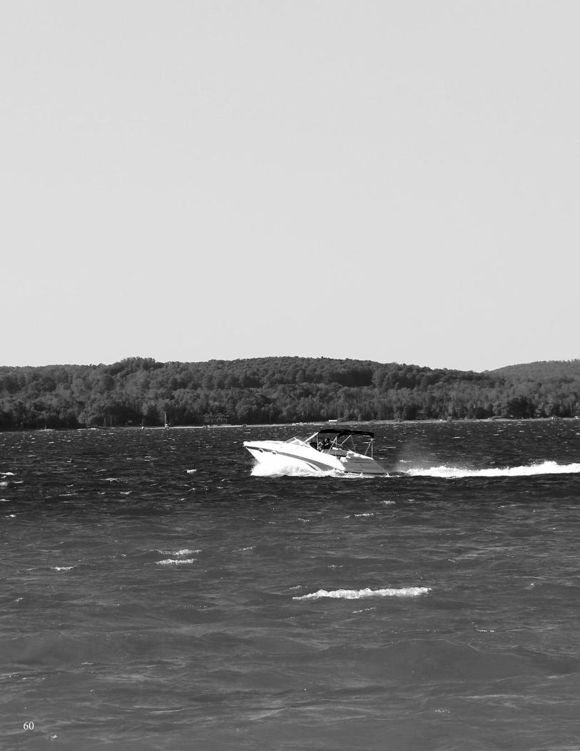
60

Chapter 5: Bay Township
61www.watershedcouncil.org
SECTION III: Analysis
Chapter 5 Bay Township
Introduction This chapter summarizes results of the Local Ordinance Gaps Analysis project for Bay Township, which is blessed with shoreline along both Walloon Lake and Lake Charlevoix, and is subsequently located inboth the Lake Charlevoix and Little Traverse Bay Watersheds. The chapter includes evaluation scores,recommendations and suggested actions. It also relates suggested actions to the existing WatershedManagement Plans for both Lake Charlevoix and Little Traverse Bay.
Evaluation Scores and Summary
Master Plan ComponentsPOSSIBLE SCORE: 30
TOTAL SCORE: 27, STRONG
A Master Plan exists for Bay Township, and the current version was adopted in 2006. No update is scheduledbut it is generally recommended that Master Plans be reviewed every five years, so this year would be agood time to do so. Prior versions were dated 1981 and 1995, so the tradition has been to review it every10-15 years but we recommend at least a casual review in 2011.
The existing Master Plan earns a Strong ranking in this project for protection of water resources. It specificallyidentifies the watersheds in which the community is located. Chapter 5 notes, under Natural Resources Inventory, Surface Water Resources that Lake Charlevoix forms the township southwestern boundary andWalloon Lake forms the township eastern boundary (p.5-1). In the same chapter, under Watersheds: theWestern portion of Bay Township is located within the Lake Charlevoix-Lake Michigan Watershed; the remainderof the township is located within the Walloon Lake-Bear River-Little Traverse Bay-Lake Michigan Watershed(p.5-8). The Master Plan also includes an inventory of lakes, rivers, and wetlands, and groundwater (MapEnvironmentally Sensitive Areas, Chapter 5 Natural Resources page 5-4a).
The Bay Township Master Plan also has a focused goal statement of intent to protect water resources:“Within Bay Township the long term quality and conservation of natural resources, water quality protectionand environmental protection should be considered of significant importance when making land use decisions.”(Chap 8 Future Land Use, Policies, Goals & Actions; General Policy Statements - p.8-1) It includes goals forcommunity acquisition or conservation of open space to protect surface water, ground water, and wetlands.It recommends securing Open Spaces by utilizing planning tools and techniques including land trusts/
CHARLEVOIx COUnTy - Local Ordinance Gaps Analysis
Tip of the Mitt Watershed Council62
conservancies, purchase of development rights, conservation easements, promote conservation design and low impact development. Also: “Protect groundwater and surface waters from contamination, depletion and degradation. Promote the protection of wetlands in maintaining and improving water qualitywithin the township.” (Chap 8 Future Land Use, Policies, Goals & Actions; General Policy Statements (3) Environment - pgs.8-4, 8-5)
Importantly, the Master Plan also identifies stormwater management as an important community policy. Itrecommends review of the existing overlay district, including on-site stormwater management techniquesand percent impermeable surface requirements, to protect water quality and property values along inlandlakeshores, and stream and creek banks (Chap 8 Future Land Use, Policies, Goals & Actions; General PolicyStatements (3) Environment - p.8-4).
The Master Plan also takes special note of important ecosystem components of Bay Township, with a verystrong effort to educate citizens about the important biological diversity surrounding them. This includesidentification and protection of wildlife corridors with the following: “In the review of future developmentplans, Bay Township will consider and seek to conserve open space and natural buffers, and recognize theneed for interconnected tracts of land as wildlife corridors.” (Chap 8 Future Land Use, Policies, Goals & Actions; General Policy Statements (3) Environment - p.8-4) Additionally, the following items are included inthe Plan: In Chapter 5, Natural Resource Inventory, Fish & Wildlife, common species observed are listed (p.5-10). In Chapter 6, Public & Private Facilities, Table 35 lists Land Preserves, with size and location, belonging to Little Traverse Conservancy and Walloon Lake Trust and Conservancy within Bay Township(p.6-3). Table 33 lists all the protected species in Bay Township including plants, mammals, birds, and invertebrates (p.5-11).
Master Plan Components: RECOMMENDATIONS
The Bay Township Master Plan lost points on only one section of the evaluation:it does not acknowledge the importance of road stream crossings, whereproper construction and design techniques are critical to avoid excessivesedimentation in streams.
SUGGESTED ACTION: When the Master Plan is updated, include the importance of well-constructed and maintained road stream crossings on the quality of local water resources.
Basic Zoning Components
POSSIBLE SCORE: 54
TOTAL SCORE: 44, STRONG
The Bay Township Zoning Ordinance also scored a ranking of Strong in the evaluation stage of this project.It includes a statement of purpose or intent to protect water: Encourage the use of lands and natural resourcesin accordance with their traditional character, establish minimum standards and regulations applicable toopen spaces (Art II Sec 2.1). Fees are in place to cover costs to the community for review of proposal applications or appeals [Art XII Sec 12.7(a)]. The Zoning Administrator is responsible for instituting proceedings for enforcement of the ordinance, as well (Art XVIII).
Importantly, the Zoning Ordinance proposal review process is also coordinated with the receipt of other applicable county, state, and/or federal permits. All site plans require review and approval by the CharlevoixCounty Soil Erosion and Sedimentation Control Officer, Northwest Michigan Community Health Agency,MDEQ and MDNR, and Charlevoix County Planning Department [Art XII Sec 12.7(c)]. Zoning permit applications must demonstrate that all required federal, state, and county licenses or permits have been acquired, or that applications have been filed and are in progress [Art XVIII Sec 18.2 (i)].
The Zoning Ordinance requires site plan review. Prior to submitting an application for site plan review, applicants are encouraged to meet with the Zoning Administrator or Planning Commission to discuss theprocess, to present a preliminary or conceptual site plan, and to allow the Planning Commission to provide
Chapter 5: Bay Township
63www.watershedcouncil.org
comments (Art XII Sec 12.6). Additionally, applicants are required to attend a pre-application conference with the Zoning Administrator and/or township planner to present Planned Unit Development (PUD) conceptsfor informal, non-binding, informational purposes (Art XI Sec 11.4). These meetings are beneficial for waterresources because they present opportunities to ensure full understanding about what is required ahead oftime, before significant investment of time and money. Plans can be done in sustainable ways that provideeconomic opportunities while also protecting water resources that drive the economy.
The site plan is required to include the location and type of significant vegetation, including woodlots and individual trees twelve inches and larger in diameter. It also must include the location and elevations of existing water courses and water bodies, including county drains, man-made surface drainage ways, 100-year flood plains, and wetlands [Art XII Sec 12.8(j, k)]. The site plan review process is required to include adetailed description of measures to control soil erosion and sedimentation during and after completion ofgrading and construction [Art XII Sec 12.8(i)]. All site plans require review/approval by Charlevoix CountySoil Erosion and Sedimentation Control Officer [Art XII Sec 12.7(c)]. The site plan review process does notinclude open space provisions.
The Bay Township PUD provisions require inclusion of a minimum open space threshold. Not less than sixtypercent (60%) of the total land is required to be dedicated open space [Art XI Sec 11.8 (a)(2)]. Importantly,flexible site design criteria or incentives are available to encourage developers to include open space orcluster design provisions [Art XI Sec 11.8 (a) (3)]. Additional units may be developed by the applicant byusing natural and cultural resource conservation, in accordance with density-bonus incentives outlined inTable 1 Conservation Point System Chart (p.47). The open space does not have to be managed in a naturalcondition, but they are restricted to low impact uses. To the greatest extent feasible, open space includesbut is not limited to: scenic vistas; pathways; or other recreation areas [Art XI Sec 11.8 (a)(2)].
The open space is required to be protected by the applicant through an irrevocable conveyance acceptableto the township. The open space will be protected from all forms of development, except as shown on anapproved site plan, and cannot be changed to another use without approval by the Planning Commission[Art XI Sec 11.8 (a)(2)]. Finally, the Zoning Ordinance includes sensitive area protections. The WaterfrontOverlay District "WF” encompasses all land within 100 feet of the Lake Charlevoix and Walloon Lake shorelines,and the banks of all natural and built watercourses such as rivers, streams, and channels (Art VI).
Basic Zoning Components: RECOMMENDATIONS
We applaud the Bay Township for its strong basic zoning components, andhave only a few additional suggestions.
SUGGESTED ACTION: Consider requiring open space provisions in thesite plan review process.
SUGGESTED ACTION: Consider ways to encourage retention of nativevegetation in dedicated open spaces of PUDs.
SUGGESTED ACTION: Because Bay Township has already taken suchcare with protected species in the Master Plan, consider how to coordinateusing this information to improve the permit application process to ensureprotection of resources.
CHARLEVOIx COUnTy - Local Ordinance Gaps Analysis
Tip of the Mitt Watershed Council64
ShorelinesPOSSIBLE SCORE: 60
TOTAL SCORE: 30, ADEQUATE
The Bay Township Zoning Ordinance requires a minimum shoreline setback of sixty-five (65) feet from theOHWM of a water body or the bank of a river, stream or creek [Art VI Sec 6.4 a (1)]. It also requires vegetativebuffers; the Waterfront Overlay District encompasses all land within 100 feet of the shorelines of LakeCharlevoix and Walloon Lake, and the banks of all natural and built watercourses such as channels, riversand streams (Art VI).
Existing vegetation that shades water surfaces is required to be preserved to the maximum extent possible[Art VI Sec 6.4 (b)(2)]. Existing natural ground cover and native vegetation must be preserved to the fullestextent feasible. If it has been removed, it must be replaced with native vegetation that is equally effective inretarding runoff, preventing erosion, preserving property values, and protecting community scenic values.Non-native exotic or noxious plants and shrubs, including poison ivy, poison sumac, purple loosestrife,Phragmites, etc. may be removed at the homeowner’s discretion [Art VI Sec 6.4 b. (8)]. Additionally, the natural vegetation buffer must be fenced with silt fence and construction barrier fencing, prior to grading or other on-site construction activities. This protective fencing must be maintained until the completion ofconstruction [Art VI Sec 6.4 (b)(3)].
The Zoning Ordinance does not include specific keyhole prevention provisions, but it does place restrictionson the size and type of docking sites and dock lot minimum frontage. Each legally created lakefront lot isentitled to one seasonal dock. A minimum of 200 hundred feet of frontage is required for a second dock.Each additional dock or boat hoist shall require an additional 100 hundred feet of water frontage [Art VI Sec6.4 (h)(1)]. Additionally, not more than three motor-powered-watercraft are allowed to be docked at any single dock, at any time [Art VI Sec 6.4 (h)(2)]. One swimming/diving raft is allowed per legally created waterfront lot. A minimum of 200 hundred feet of water frontage is required for a second raft. Each additionalraft requires an additional 100 hundred feet of water frontage [Art VI Sec 6.4 (h)(3)].
Bay Township does not regulate road ends. Marinas are regulated in the Commercial Zoning District (Art X).However, it does not specify marina practices. Drainage provisions require proper state permits for hazardoussubstances, but boat repair and maintenance at the water’s edge is not specified.
Shorelines: RECOMMENDATIONS
SUGGESTED ACTION: Consider local regulation of road ends that terminateat the edge of navigable waters. Ensure the right of public access does not include the ability to install private docks or boat hoists for the overnightmooring of boats, or the right to use public road ends for lounging, sun-bathing or picnicking.
SUGGESTED ACTION: Consider preventions against the practice of keyhole/funneling.
SUGGESTED ACTION: Consider regulations for marinas to ensure waterprotection. Include restricting boat repair and maintenance activities to clearlymarked areas, in order to prevent debris from falling into the water and prevent invasive species. Require fueling stations to have spill containmentequipment that is stored in a clearly marked location. Require a spill contingency plan, posting emergency phone numbers in a prominent location. Require signs of leakage or spillage to be investigated immediately,and undertake cleanup in accordance with applicable Best ManagementPractices (BMPs).
Impervious SurfacesPOSSIBLE SCORE: 33
TOTAL SCORE: 13, ADEQUATE
A large majority of impervious surfaces within a community are roads or parking lots. Most road design issignificantly influenced by the county road commission and local fire departments. However, townships canaddress the design of private roads, and Bay Township has an ordinance to do so.
Unfortunately, in Bay Township, there are not flexible lot coverage standards to allow creative approachesthat limit impervious surfaces in all zoning districts, and we encourage that. However, there are protectionsin place according to parcel slope, which is a good thing. In the waterfront overlay district, there is a standardfor the maximum percentage of lot coverage. For lots with a sealed surface, such as roofs, structures, asphalt,concrete, etc., maximum percentages are as follows:
Maximum % lot coverage with impervious surface by slope: • average parcel slope 0-25%: maximum impervious surface coverage 50% • average parcel slope 26-35%: maximum impervious surface coverage 25% • average parcel slope > 35%: maximum impervious surface coverage 10% [Art VI Sec 6.4 (f)]
Additionally, the PUD requirements for parking are good for reducing impervious surface impacts: “Commonparking areas shall provide stormwater management systems that infiltrate to groundwater to prevent off-siteimpacts of any kind. The use of innovative stormwater management, treatment and disposal is strongly encouraged, such as rain gardens, grassed waterways, constructed wetlands, etc. The direct discharge of stormwater from parking areas to natural watercourses, wetlands, or other surface waters is prohibited.”[Article XI Planned Unit Development (PUD) Zoning District (11.8)(10)]
Impervious Surfaces: RECOMMENDATIONS
SUGGESTED ACTION: Consider impervious cover limits for all zoning dis-tricts, in addition to the sloped lots.
SUGGESTED ACTION: The private road ordinance gives dimensions forprivate roads that act as shared driveways. Consider ways to encourageshorter driveways, and shared driveways, where appropriate in all existingzoning districts.
SUGGESTED ACTION: Consider reducing the parking space dimensionsand setting them as a maximum. Also consider reducing the number of re-quired parking spaces and setting the number as a maximum number, asopposed to a minimum.
Stormwater ManagementPOSSIBLE SCORE: 27
TOTAL SCORE: 16, ADEQUATE
In spite of the lack of a county stormwater ordinance, Bay Township has taken steps to manage stormwater.Development cannot alter, modify or restrict stormwater runoff from adjoining lots, or result in discharge ontoadjoining lots, lakes or streams. Stormwater generated by a 100-year event is to be retained, treated, anddisposed of by using innovative methods, such as infiltration basins, constructed wetlands, rain gardens,pervious pavements, etc., with township approval. Waterfront Overlay District runoff is to be directed awayfrom the lake ward side of a lot [Art IV Sec 4.20, Art VI Sec 6.4 (g)].
Areas that are improved to handle stormwater are managed to prevent off-site impacts. Stormwater plan reviewand approval is required from Charlevoix County and/or state agencies in accordance with Section 11.6(Step 5, #4 Charlevoix County Soil Survey). Failure to demonstrate stormwater plan approval from the countyand/or state agencies may be a basis for PUD denial by the Planning Commission or Township Board [Art XISec 11.8(15)].
Chapter 5: Bay Township
65www.watershedcouncil.org
CHARLEVOIx COUnTy - Local Ordinance Gaps Analysis
Tip of the Mitt Watershed Council66
Additionally, site plans must include a map of stormwater retention and detention areas. All site plans alsorequire review/approval by the Charlevoix County Soil Erosion and Sedimentation Control Officer, the NorthwestMichigan Community Health Agency, MDEQ & MDNR, and the Charlevoix County Planning Department [ArtXII Sec 12.8 (t)(5)].
Stormwater management areas and facilities, whether on-site or off-site, are required to be designed, constructed,and maintained to prevent flooding and protect surface and ground water quality. Special attention is givento proper site drainage so that stormwater runoff will not affect neighboring properties or overload watercoursesin the area. Stormwater management systems are to be designed in accordance with professionally acceptedprinciples, and provide on-site retention or detention facilities designed to hold runoff from a 50-year frequencystorm event. Naturally occurring and pre-existing drainage ways are used for the movement of stormwater[Art XII Sec 12.11(d)].
Additionally, discharge of stormwater runoff from any site which may contain oil, grease, toxic chemicals, orother hazardous substances or polluting materials is prohibited unless measures to trap pollutants meet therequirements of the Michigan Department of Environmental Quality, based upon professionally acceptedprinciples [Art XII Sec 12.11(d)].
Stormwater Management: RECOMMENDATIONS
SUGGESTED ACTION: Consider requiring review of development proposalsby the County Drain Commissioner to ensure that stormwater managementis properly addressed on all proposed development projects.
SUGGESTED ACTION: Coordinate efforts with the Charlevoix County DrainCommissioner to enact local stormwater ordinances in the county, allowing thecounty to administer and enforce them for local jurisdictions. Ask the countyto finish the Storm Water Control (SWC) Ordinance and IntergovernmentalAgreement, and present it to Bay Township for passage.
Soil Erosion and Sediment ControlPOSSIBLE SCORE: 18
TOTAL SCORE: 6, WEAK
All properties that are located near lakes, streams, wetlands, ponds, or drainage ways---essentially any waterbody or water course—have the potential to erode and cause sedimentation to nearby waters. Accordingly,it is recommended that local units require all earth movement activities associated with development or construction projects follow BMPs to control erosion and ensure that any sediment-laden runoff does notenter waterways. The Charlevoix County Department of Building Safety administers Part 91 of Michigan’sNatural Resources and Environmental Protection Act (NREPA). Coordination between townships and thecounty is essential to ensure that soil erosion and sedimentation is controlled.
Soil Erosion and Sediment Control: RECOMMENDATIONS
SUGGESTED ACTION: Specifically require that all proposed developmentproject earth change activities within 500 feet of a lake, stream, wetland, orother waterway in all zoning districts receive a soil erosion and sedimenta-tion control permit from Charlevoix County before they receive a permit fromBay Township.
Sewer/SepticPOSSIBLE SCORE: 24
TOTAL SCORE: 10, ADEQUATE
Both the Lake Charlevoix and Little Traverse Bay Watershed Protection Plans emphasize the need to educate citizens about the importance of septic system maintenance. The Master Plan notes that all of BayTownship is served by private septic systems and ground water drinking sources (p.5-6). There is no public
Chapter 5: Bay Township
67www.watershedcouncil.org
sewer access. The Master Plan recommends that the community have a program to identify septic systemsthat are seeping into the stormwater system. It calls for promoting the protection of water quality and ground waterrecharge areas by exploring the creation of point-of-sale septic inspection program encouraging the efficientuse of septic treatment/disposal and promoting water resource protection.
Additionally, the Master Plan recommends an inventory be compiled of active and inactive licensed septageapplication/disposal sites within Bay Township to ensure compliance with Part 117: Septage Disposal Act ofMichigan's P.A. 451 of 1994, as amended [p.8-5, Chap 8 Future Land Use, Policies, Goals & Actions; GeneralPolicy Statements (3) Environment].
Regulations that pertain to septic systems in Bay Township are coordinated with the County Health Departmentregulations. Zoning permit applicants are required to provide evidence of Northwest Michigan CommunityHealth Agency approval of septic disposal and potable water supply, prior to final site plan (Art IV Sec 4.18).
Sewer/Septic: RECOMMENDATIONS
SUGGESTED ACTION: Consider requiring that a septic system be locatedat least 100 feet from a wetland or open water feature, and specify a minimumisolation distance from all nearby wells.
SUGGESTED ACTION: Consider adopting a “point of transfer” septic inspection ordinance.
WetlandsPOSSIBLE SCORE: 21
TOTAL SCORE: 2, WEAK
Michigan’s wetland law specifically authorizes local governments to adopt wetland protection ordinances thatprovide an additional layer of protection to wetlands that fall under state jurisdiction and provide protectionto wetlands not protected by the state statute. In addition to adopting and implementing a stand-alone wetlandordinance, local governments can support wetland protection through zoning and by requiring wetland permitsfrom state and federal agencies prior to granting local zoning permits.
There are a few steps that Bay Township could consider in order to better protect existing wetland resources.The township already requires a building setback from wetland areas. Wetlands are included in the ConservationPoint System for Density Bonus Incentives and Credits (p.47): Wetland Buffers (25.0 feet for a no-grade bufferand 40.0 foot building setback buffer is required (Art XI Sec 11.8 Table 1).
Wetlands: RECOMMENDATIONS
SUGGESTED ACTION: Given the important role that wetlands play in protecting water quality, providing wildlife habitat, and minimizing flooding, it is important to educate township citizens on the importance of protectingwetlands.
SUGGESTED ACTION: Consider expanding the wetland setback provisionto all other zoning classifications in the township. This would protect townshipwetlands and cost less to administer than adopting a local wetland ordinance.Eventually, a local wetland ordinance should be enacted to fill in gaps of protection.
SUGGESTED ACTION: Specifically require applicants seeking zoning permitsto secure applicable state wetland permits before issuing a local zoning permit.
Ground Water and Wellhead ProtectionPOSSIBLE SCORE: 18
TOTAL SCORE: 15, STRONG
Ground water is the sole source of drinking water for Bay Township, as noted in the Master Plan (p.5-6).
Site plan review is required to ensure there are no unnecessary threats posed to ground water by new or
redevelopment proposals. Art XI 11.5(e) requires site plan applications to include: A natural and cultural
features inventory identifying primary conservation areas such as wetlands, waterways, floodplains, shorelines,
views into and from the site, etc. and secondary conservation areas such as steep slopes, ridgelines, old
buildings/structures, historic/archeological features, farmland, ground water recharge/discharge areas,
significant plant/wildlife habitat, etc., and potential development areas.
Additionally, the Zoning Ordinance prohibits both direct and indirect discharge of hazardous substances to
ground water without appropriate approvals/permits. Site plans must conform to all applicable requirements
of state and federal statutes, and approval and an occupancy permit may be conditioned on the applicant
receiving necessary state and federal permits applicable to wetlands, lakes, streams, floodplains, hazardous
substances, and ground water discharges [Art XII Sec 12.11 (i)].
Ground water protection requirements for mining operations are included in the Zoning Ordinance. Art IV
Sec. 4.28(a)(2)(vii)(b) Mining & Extractive Operations supplemental standards notes: “Groundwater conditions,
including groundwater depth, flow direction and gradient, flow velocity, and background water quality (i.e.
dissolved oxygen, specific conductivity, alkalinity, iron, manganese and other heavy metals, etc.) and the
results of a valid and reliable aquifer pump test submitted to the Planning Commission to determine any
possible impact on groundwater wells, including residential, commercial industrial and/or agricultural
wells in the area.”
Storage of hazardous materials is regulated by the state under Part 5 Rules issued for Part 31 Water Resources
Protection, of the Natural Resources and Environmental Protection Act (NREPA) 1994 PA 451. This includes
Pollution Incident Prevention Plans, which can be efficiently coordinated with Local Emergency Planning
Committee work.
Ground Water and Wellhead Protection: RECOMMENDATIONS
The township has strong protections in place for ground water; we have only
a few recommendations:
SUGGESTED ACTION: Complete and maintain a comprehensive inventory
of potential threats to ground water. This will be particularly important as the
township continues to grow and more and more people rely on ground
water.
SUGGESTED ACTION: Since many common activities can impact ground
water quality, provide ground water education materials to township residents.
SUGGESTED ACTION: Require Pollution Incident Prevention Plans for storage
of hazardous materials, in coordination with Local Emergency Planning
Committee efforts.
CHARLEVOIx COUnTy - Local Ordinance Gaps Analysis
Tip of the Mitt Watershed Council68
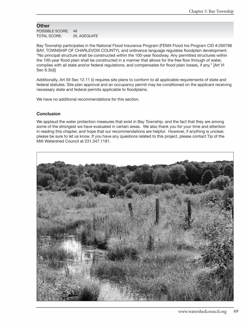
Chapter 5: Bay Township
69www.watershedcouncil.org
OtherPOSSIBLE SCORE: 48
TOTAL SCORE: 26, ADEQUATE
Bay Township participates in the National Flood Insurance Program (FEMA Flood Ins Program CID #:260796BAY, TOWNSHIP OF CHARLEVOIX COUNTY), and ordinance language regulates floodplain development.“No principal structure shall be constructed within the 100-year floodway. Any permitted structures withinthe 100-year flood plain shall be constructed in a manner that allows for the free flow through of water, complies with all state and/or federal regulations, and compensates for flood plain losses, if any.” [Art VI Sec 6.3(d)]
Additionally, Art XII Sec 12.11 (i) requires site plans to conform to all applicable requirements of state andfederal statutes. Site plan approval and an occupancy permit may be conditioned on the applicant receivingnecessary state and federal permits applicable to floodplains.
We have no additional recommendations for this section.
Conclusion
We applaud the water protection measures that exist in Bay Township, and the fact that they are amongsome of the strongest we have evaluated in certain areas. We also thank you for your time and attention in reading this chapter, and hope that our recommendations are helpful. However, if anything is unclear,please be sure to let us know. If you have any questions related to this project, please contact Tip of the Mitt Watershed Council at 231.347.1181.
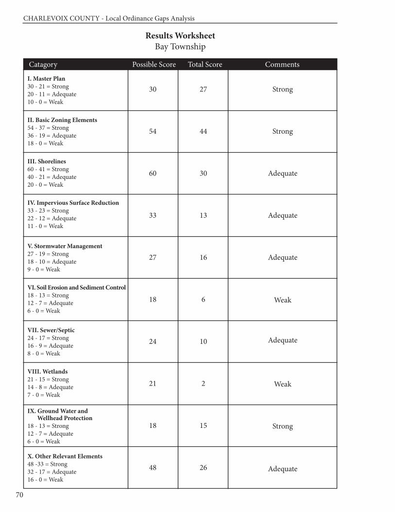
CHARLEVOIx COUnTy - Local Ordinance Gaps Analysis
70
Results WorksheetBay Township
Catagory Possible Score Total Score Comments
I. Master Plan30 - 21 = Strong20 - 11 = Adequate10 - 0 = Weak
II. Basic Zoning Elements54 - 37 = Strong36 - 19 = Adequate18 - 0 = Weak
III. Shorelines60 - 41 = Strong40 - 21 = Adequate20 - 0 = Weak
IV. Impervious Surface Reduction33 - 23 = Strong22 - 12 = Adequate11 - 0 = Weak
V. Stormwater Management27 - 19 = Strong18 - 10 = Adequate9 - 0 = Weak
VI. Soil Erosion and Sediment Control18 - 13 = Strong12 - 7 = Adequate6 - 0 = Weak
VII. Sewer/Septic24 - 17 = Strong16 - 9 = Adequate8 - 0 = Weak
VIII. Wetlands21 - 15 = Strong14 - 8 = Adequate7 - 0 = Weak
IX. Ground Water and Wellhead Protection
18 - 13 = Strong12 - 7 = Adequate6 - 0 = Weak
X. Other Relevant Elements48 -33 = Strong32 - 17 = Adequate16 - 0 = Weak
30
54
60
33
27
18
24
21
18
48
27
44
30
13
16
6
10
2
15
26
Strong
Strong
Adequate
Adequate
Adequate
Weak
Adequate
Weak
Strong
Adequate

Chapter 6: Boyne Valley Township
71www.watershedcouncil.org
SECTION III: Analysis
Chapter 6 Boyne Valley Township
Introduction
This chapter summarizes results of the Local Ordinance Gaps Analysis project for Boyne Valley Township,
which is located in the southeast portion of Charlevoix County. The Boyne River, including much of the
North and South Branch of the Boyne, is among the important water resources in Boyne Valley Township.
Additionally, the township includes a sizeable portion of Deer Lake, numerous streams, and a variety of
wetland types. Other than a small portion in the northern part of the township (Gimlet Creek, which is part
of the Little Traverse Bay Watershed), the entire township is located in the Lake Charlevoix Watershed.
This analysis includes evaluation scores, recommendations, and suggested actions. It also relates
suggested actions to the existing Watershed Management Plan for Lake Charlevoix, which includes
Boyne Valley Township.
Evaluation Scores and Summary
Master Plan ComponentsPOSSIBLE SCORE: 30
TOTAL SCORE: 0, MISSING
Boyne Valley Township does not currently have a Master Plan. A Master Plan is a comprehensive long
range plan that would serve to guide the growth and development of Boyne Valley Township. These Master
Plans include an inventory of existing land use and natural resources, including lakes, streams, wetlands,
ground water recharge areas, wildlife habitat, and scenic areas and a description of where and what type of
development is desired. Such a plan provides a strong basis for implementation of the zoning ordinance, as
well as enabling individuals and businesses to reliably plan for the purchase and use of property in a way
that is compatible with community goals.
Master Plan Components: RECOMMENDATIONS
SUGGESTED ACTION: Initiate a process to develop a township Master
Plan that includes public involvement, does a comprehensive inventory of
water resources, and integrates recommendations of the Lake Charlevoix
Watershed Management Plan.
CHARLEVOIx COUnTy - Local Ordinance Gaps Analysis
Tip of the Mitt Watershed Council72
Basic Zoning ComponentsPOSSIBLE SCORE: 54
TOTAL SCORE: 30, ADEQUATE
The Boyne Valley Zoning Ordinance includes several items that promote water resource protection. For example, the statement of purpose encourages “the use of lands and natural resources in accordance withtheir character, adaptability and suitability for particular purposes.” (Article I Section 1.0)
One important aspect of the local zoning permitting process is to ensure that a project applicant receives allapplicable permits from other agencies. The standards for granting site plan approval state that “Site plansshall conform to all applicable requirements of Township, County, State and Federal statutes and approvalshall be conditioned on the applicant receiving all necessary permits before final site plan approval.” [Article V Section 5.4 (11)] As well, Article XIV Section 14.2(E) states that zoning permit applications shall contain “Evidence that all federal, state and county licenses or permits have been acquired.” These requirementshelp to ensure that protection of resources, such as rivers, lakes, wetlands, and endangered species, are integrated into a proposed development as part of the planning process.
Although Boyne Valley Township does not have Planned Unit Development (PUD) provisions, the R-3 MultipleFamily Residential District does provide flexible site design criteria. It also includes a minimum open spacethreshold of 50% of the gross area of a development, which is required to be maintained as open space ornon-profit recreational uses, and density bonuses to promote cluster design [Article VIII Section 8.2 (E)(2 and 3)].
Boyne Valley’s ordinance includes a fee system that helps to fund administration of the ordinance, as well asprovide penalties for those who fail to obtain a permit prior to construction (Article XV 15.1). It authorizes thetownship Zoning Administrator to issue civil infraction citations directing alleged zoning ordinance violators toappear in court [Article XIV, Section 14.4(D)]. These provisions help to ensure that prospective developers gothrough the zoning process, and in so doing consider the protection of water resources.
Basic Zoning Components: RECOMMENDATIONS
We have a few recommendations for Boyne Valley Township to consider, inorder to strengthen water protection measures in the Zoning Ordinance.
SUGGESTED ACTION: Pre-application or pre-construction meetings canhelp to identify water resource protection needs and opportunities early inthe development process, thereby avoiding potential problems and savingmoney. Consider including a pre-application meeting with the applicant aspart of the zoning application process.
SUGGESTED ACTION: Require that all designated open space, establishedas part of a multi-family development, be protected in perpetuity to ensurethat it actually remains open space into the future. In addition, to ensure themaintenance and protection of wildlife habitat, open space designed as partof an R-3 development should be managed in a natural condition.
ShorelinesPOSSIBLE SCORE: 60
TOTAL SCORE: 22, ADEQUATE
Two of the most effective ways to protect and maintain water quality through zoning are building setbacks,and the establishment of vegetated buffers, or shoreline protection strips.
Boyne Valley Township addresses setbacks in two locations. First, in the general provisions section of theZoning Ordinance, Section 4.21-Shoreline Protection Strip states that “no building or structure, except docksand ramps shall be erected closer than 50 feet from the shoreline at normal high water level of any lake,
Chapter 6: Boyne Valley Township
73www.watershedcouncil.org
stream, or creek in the township.” (Article IV Section 4.21) Second, the development standards for the RuralResidential District (RR-1 zone) exceeds this minimum standard when it stipulates that lots, building envelopesor site condominium units must be located 100 feet upland from the high water elevation of any lake, river orstream or 50 feet upland of any area designated as wetland [Article VIII Section 8.3(J)(4)].
These two sections also address the issue of vegetative buffers. In Section 4.21, Shoreline Protection Strip,the ordinance requires “a strip of land 35 feet wide from the normal high water mark bordering the body ofwater shall be maintained in trees and shrubs in their natural state. Trees and shrubs may be pruned, however,to afford a view of the water.” (Article IV Section 4.21) In the RR-1 development standards, it appears asthough the intention of the ordinance is to have the entire setback area serve as a shoreline protection strip:“Except for the planting of trees or shrubs said setback areas shall remain in an undisturbed state.” [ArticleVIII Section 8.3(J)(4)]
Dockage regulations are a valuable tool to address the character of the natural shoreline, recreational enjoyment,and the rights of waterfront owners. No general provisions address dockage issues. However, the zoning provisions for the Resort Residential (C-1) district addresses dockage in two ways. First, the location ofdocks must comply with side yard requirements for this district, not less than twenty five (25) feet setbackfrom the adjacent property line. Second, docks, boat landings, and similar structures shall not be longer thanwhat is required to reach a water depth of four (4) feet at normal low water [Article VIII, Section 8.4 (F)(1)].
Since even a very small amount of petroleum products or hazardous chemicals can impact a large amount ofwater, it is important to ensure proper management of these liquids. Boyne Valley Township addresses theseissues minimally in the section of the ordinance addressing Application for Site Plan Review. For facilities oruses where hazardous substances are stored, used, or generated, the following information is required as partof the site plan review: 1) location of structures to be used for storage, use, loading/unloading, recycling, ordisposal of hazardous substances; 2) Location of any above or underground hazardous material storage tanks;3) location or exterior drains or any facilities designed to collect, store, or transport storm water and the pointsof discharge for all drains and sumps; and 4) copies of all required Federal, State, or County permits [Article V,Section 5.2(A)(2)(t,v)].
Shorelines: RECOMMENDATIONS
SUGGESTED ACTION: Maintaining native vegetation along the shoreline iscritical to preserving water quality and providing wildlife habitat. Specificallyencouraging the maintenance and re-establishment of native vegetation inthe Shoreline Protection Strip (Section 4.21) is recommended.
SUGGESTED ACTION: Currently, Boyne Valley’s ordinance only addressesdocks in the Resort Residential (C-1) district. This zone includes only a smallpercentage of the Deer Lake shoreline. In order to protect the rights of all wa-terfront owners and maintain the character of the shoreline, docks should beaddressed in all zones that include shoreline.
SUGGESTED ACTION: Initiate a program designed to ensure that the invasivestrain of Phragmites does not become established in Boyne Valley Township.This would involve an initial inventory to determine if there are invasive standsof Phragmites, treat them if they exist, and conduct a follow up inventory andtreatment, if necessary. Although Phragmites is of concern mostly on GreatLakes shorelines, it has become established on some inland waters, and thisstep would help to ensure that Deer Lake and the Boyne River do not becomeinvested with this invasive species.
CHARLEVOIx COUnTy - Local Ordinance Gaps Analysis
Tip of the Mitt Watershed Council74
Impervious SurfacesPOSSIBLE SCORE: 33
TOTAL SCORE: 5, WEAK
As noted in the Lake Charlevoix Watershed Management Plan, impervious surfaces prevent rainwater and
snowmelt from naturally percolating into the soils. This reduces the opportunity for contaminants to be
removed from stormwater runoff, before it flows into lakes, rivers, and wetlands. The more a local unit of
government can do to reduce impervious surfaces, the better for water quality.
The only provision in the Boyne Valley Township ordinance that helps to encourage reduction of impervious
surfaces is Article VI, Section 6.3(A)(1), which stipulates that the private road roadbed minimum is 18 feet. This
is a reasonable width, and by specifically mentioning this number, the ordinance encourages road beds of this
width. Some local governments have their minimum roadbed width larger, which encourages more impervious
surface in the jurisdiction.
Impervious Surfaces: RECOMMENDATIONS
There are many opportunities to reduce impervious surfaces in local zoning
ordinances. We encourage Boyne Valley Township to integrate these
provisions into their ordinance.
SUGGESTED ACTION: Consider establishing impervious surface lot coverage
limits in all zoning districts (especially residential districts) to limit impervious
surfaces to 15% of the total lot.
SUGGESTED ACTION: Consider adding a provision that allows for flexibility
in front yard setbacks or side yard setbacks to encourage shorter driveways
or shared driveways between two lots.
SUGGESTED ACTION: Establish a process whereby parking and loading
requirements in Article X, Section 10.1-3 can be modified to reduce impervious
surfaces by reducing the number of spaces or the square footage of parking
spaces and loading areas.
Stormwater Management POSSIBLE SCORE: 27
TOTAL SCORE: 11, ADEQUATE
Local governments can do much to reduce stormwater runoff as part of their zoning ordinance. Although
Boyne Valley Township does not have a stand-alone stormwater provision, there are several places in the
ordinance where stormwater management is addressed. The site plan review standards [Article V Section 5.4
(3)] state that special attention shall be given to proper drainage, so as not to adversely affect neighboring
properties. Runoff from such sites must run through detention and settling basins, before being discharged
off site. Such basins shall have the capacity to handle all stormwater runoff from a 3.5 inch in 24 hour period
rainfall event.
The section on grading regulations (Article IV Section 4.16) states that no property shall be filled or graded
so as to discharge surface runoff onto abutting premises. Additionally, the site plan review section requires
the location of hazardous materials storage, handling, disposal, exterior drains, retention areas, facilities to
collect, store or transport stormwater [Article V Section 5.2(A)(2)(v)(3)]. Together, these provisions provide the
opportunity for adequate review of stormwater management through the local zoning process.
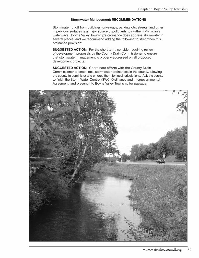
Chapter 6: Boyne Valley Township
75www.watershedcouncil.org
Stormwater Management: RECOMMENDATIONS
Stormwater runoff from buildings, driveways, parking lots, streets, and otherimpervious surfaces is a major source of pollutants to northern Michigan’swaterways. Boyne Valley Township’s ordinance does address stormwater inseveral places, and we recommend adding the following to strengthen thisordinance provision:
SUGGESTED ACTION: For the short term, consider requiring review of development proposals by the County Drain Commissioner to ensure that stormwater management is properly addressed on all proposed development projects.
SUGGESTED ACTION: Coordinate efforts with the County Drain Commissioner to enact local stormwater ordinances in the county, allowingthe county to administer and enforce them for local jurisdictions. Ask the countyto finish the Storm Water Control (SWC) Ordinance and IntergovernmentalAgreement, and present it to Boyne Valley Township for passage.
CHARLEVOIx COUnTy - Local Ordinance Gaps Analysis
Tip of the Mitt Watershed Council76
Soil Erosion and Sediment ControlPOSSIBLE SCORE: 18
TOTAL SCORE: 3, WEAK
By volume, sediment is the single largest pollutant to waters of the United States. Any time earth is disturbedor graded (as typically happens during the construction process), there is a potential for soil to erode and sediment to be deposited into lakes, streams, and wetlands. Construction or use of steep or unstable slopescan also present an erosion and sedimentation hazard. Because local governments have the opportunity toreview every single development project as part of zoning review, they are uniquely situated to ensure that soilerosion is controlled and sedimentation is minimized.
Currently, Boyne Valley Township does not specifically regulate soil erosion and sedimentation. However, soilerosion is mentioned in three locations:
1) The removal of soil, sand, or other material is not permitted in any zone regulated by the county Soil Erosion and Sedimentation Control program, except under a temporary permit (Article IV Section 4.18). These zones are not specified in the Boyne Valley Township ordinance, however.
2) In the general provisions, the private roads section states that soil erosion control measures shall be applied, as per Charlevoix County Soil & Water Conservation standards and specifications. [Article VI, Section 6.2 (c)]; and
3) The “other development regulations” for the Resort Commercial District (“C-1”) stipulate that all fill material shall not be allowed to enter the water by erosion or mechanical means, and that excessive soil erosion will be avoided [Article VIII Section 8.4(F)(3-4)].
Soil Erosion and Sediment Control: RECOMMENDATIONS
All properties that are located near lakes, streams, wetlands, ponds, ordrainage ways – essentially any water body or water course – have the potential to erode and cause sedimentation to nearby waters. Accordingly,it is recommended that local governments require all earth movement activities,associated with development or construction projects, to follow Best Management Practices (BMPs) to control erosion and ensure that any sediment-laden runoff does not enter waterways. The Charlevoix CountyDepartment of Building Safety administers Part 91 of Michigan’s Natural Resources and Environmental Protection Act (NREPA). Coordination between townships and the county is essential to ensure that soil erosionand sedimentation is controlled.
SUGGESTED ACTION: Specifically require that all proposed developmentproject earth change activities within 500 feet of a lake, stream, wetland, orother waterway in all zoning districts receive a soil erosion and sedimentationcontrol permit from Charlevoix County before they receive a permit fromBoyne Valley Township.
Sewer/SepticPOSSIBLE SCORE: 24
TOTAL SCORE: 9, ADEQUATE
Sewer and septic management are critical to both human health and water quality. The Lake Charlevoix Watershed Management Plan includes an Objective to educate citizens about the importance of septic systemmaintenance in order to reduce the amount of harmful nutrients in our waters. Boyne Valley Township, as partof its general provisions, states that “Every building shall be provided with a safe and sanitary water supplyand sewage disposal system. The written approval of such facilities by the District Department of Health, No.3, Charlevoix, shall be filed with an application for zoning permit.” (Article IV Section 4.13)
Chapter 6: Boyne Valley Township
77www.watershedcouncil.org
Sewer/Septic: RECOMMENDATIONS
In addition to ensuring compliance with the health code, local units of gov-ernment can regulate the siting of septic fields to ensure protection of waterresources. The main concern with septic systems and water quality is thepotential for a septic system to contribute excess nutrients to water bodies.These nutrients can cause the growth of aquatic weeds and algae.
SUGGESTED ACTION: Require that septic systems be located at least 100feet from lakes, streams, wetlands, or other water bodies.
SUGGESTED ACTION: Consider establishing a “point of transfer” inspectionrequirement, whereby septic systems must be inspected to ensure they areoperating properly, before ownership is transferred.
WetlandsPOSSIBLE SCORE: 21
TOTAL SCORE: 6, WEAK
Wetlands are some of our most valuable water resources. They provide excellent wildlife habitat, help controlflooding, and contribute to water quality protection. Although Michigan has a statewide wetland protectionstatute, not all wetlands are covered and not all activities that could impact wetlands are regulated. Localgovernments have the opportunity to supplement the state’s wetland protection program.
Boyne Valley Township has several provisions that specifically mention wetlands. First, the site plan reviewapplication section requires that the location of wetlands is noted on the site plan [Article V, Section 5.2 (d)].Second, the Rural Residential district ("RR-1") requires that building envelopes or site condominium unitsshall be setback a minimum of 50 feet upland of any area designated as a wetland [Article VIII Section 8.3(J)4].This section also stipulates that this setback area shall remain in an undisturbed state, which amounts to a buffer zone of natural vegetation. Buffer zones between buildings and wetlands can be a very effective protection tool.
Wetlands: RECOMMENDATIONS
Michigan’s wetland law specifically authorizes local governments to adoptwetland protection ordinances that regulate wetlands not protected by the statestatute. In addition to a stand-alone wetland ordinance, local governmentscan support wetland protection through zoning and by requiring wetlandpermits from state and federal agencies, prior to granting local zoning permits.
SUGGESTED ACTION: Given the important role that wetlands play in protecting water quality, providing wildlife habitat, and minimizing flooding, it is important to educate township citizens on the importance of protectingwetlands.
SUGGESTED ACTION: For the short term, consider expanding the wetlandsetback provision to all other zoning classifications in the township. Thiswould protect township wetlands and cost less to administer than adoptinga local wetland ordinance. Eventually, a local wetland ordinance should beenacted to fill in gaps of protection.
SUGGESTED ACTION: Specifically require applicants seeking zoning permits to secure applicable state wetland permits before issuing a localzoning permit.
CHARLEVOIx COUnTy - Local Ordinance Gaps Analysis
Tip of the Mitt Watershed Council78
Ground Water and Wellhead ProtectionPOSSIBLE SCORE: 18
TOTAL SCORE: 7, ADEQUATE
Ground water is the primary source of drinking water for nearly all Northern Michigan residents. Protectingground water resources from contamination is vitally important. The Boyne Valley Township ordinance mentionsthe importance of ground water protection in the description of the Mobile Home Park Residential District (“R-2”): “Because of the potential for groundwater contamination from septic systems due to the porous natureof the soils in Boyne Valley Township and density of development allowed in this District, R-2 shall only be established in areas serviced by a minimum of primary and secondary sewage treatment facilities.” [Article VIII Section 8.1(A)]
Discharges to ground water are regulated by the state under Part 31, Water Resources Protection, of the NaturalResources and Environmental Protection Act (NREPA) 1994 PA 451, and Part 22 Rules. Any proposed dis-charges should be prohibited by the township until required state permits are received by the applicant. Storageof hazardous material is also regulated under Part 5 Rules issued for Part 31. This includes Pollution IncidentPrevention Plans, which can be efficiently coordinated with Local Emergency Planning Committee work.
Ground Water and Wellhead Protection: RECOMMENDATIONS
Importantly, Boyne Valley Township participated in the state Source WaterProtection Plan process, getting its plan approved in 2002. This is a voluntaryprogram, and we applaud the township for taking this critical step and protecting these precious drinking water sources.
SUGGESTED ACTION: Update and maintain a comprehensive inventory ofpotential threats to ground water. This will be particularly important as thetownship continues to grow and more and more people rely on ground water.
SUGGESTED ACTION: If direct or indirect discharges to ground water areproposed, use site plan review or some other ordinance provision to prohibitthis until appropriate approvals or permits are obtained from the state.
SUGGESTED ACTION: Protect ground water from potential contaminationby requiring Pollution Incident Prevention Plans for storage of hazardous materials, in coordination with Local Emergency Planning Committee efforts.
Other Relevant ElementsPOSSIBLE SCORE: 48
TOTAL SCORE: 30, ADEQUATE
There are no additional provisions in the Boyne Valley Township ordinance that could contribute to water resourceprotection. There are no high risk erosion or steep slopes restrictions, or critical dunes in the township. TheDeer Creek Watershed, which includes Deer Lake and all its tributaries, is not included in the Jordan RiverNatural River Zone. Despite this, the township could consider implementing their own natural river zoningoverlay for protection of these precious waters.
ConclusionWe applaud the water protection measures that exist in Boyne Valley Township. We also thank you for yourtime and attention in reading this chapter, and hope that our recommendations are helpful. However, if anything is unclear, please be sure to let us know. If you have any questions related to this project, pleasecontact Tip of the Mitt Watershed Council at 231.347.1181.

Chapter 6: Boyne Valley Township
79www.watershedcouncil.org
Results WorksheetBoyne Valley Township
Catagory Possible Score Total Score Comments
I. Master Plan30 - 21 = Strong20 - 11 = Adequate10 - 0 = Weak
II. Basic Zoning Elements54 - 37 = Strong36 - 19 = Adequate18 - 0 = Weak
III. Shorelines60 - 41 = Strong40 - 21 = Adequate20 - 0 = Weak
IV. Impervious Surface Reduction33 - 23 = Strong22 - 12 = Adequate11 - 0 = Weak
V. Stormwater Management27 - 19 = Strong18 - 10 = Adequate9 - 0 = Weak
VI. Soil Erosion and Sediment Control18 - 13 = Strong12 - 7 = Adequate6 - 0 = Weak
VII. Sewer/Septic24 - 17 = Strong16 - 9 = Adequate8 - 0 = Weak
VIII. Wetlands21 - 15 = Strong14 - 8 = Adequate7 - 0 = Weak
IX. Ground Water and Wellhead Protection
18 - 13 = Strong12 - 7 = Adequate6 - 0 = Weak
X. Other Relevant Elements48 -33 = Strong32 - 17 = Adequate16 - 0 = Weak
30
54
60
33
27
18
24
21
18
48
0
30
22
5
11
3
9
6
7
30
Missing
Adequate
Adequate
Weak
Adequate
Weak
Adequate
Weak
Adequate
Adequate

Chapter 7: Chandler Township
81www.watershedcouncil.org
SECTION III: Analysis
Chapter 7 Chandler Township
Introduction This chapter summarizes results of the Local Ordinance Gaps Analysis project for Chandler Township, locatedin the northeast portion of Charlevoix County. Chandler Township is situated in the upper reaches of twomain watersheds: Little Traverse Bay and the Cheboygan River.
Arising from the base of the Chandler Hills, which essentially bisect the township from north to south, numerous ground water seeps and springs provide cold, high quality ground water to various flowing waters. These include the north and south branches of Spring Brook, which join and then flow into theBear River, and ultimately into Little Traverse Bay. Also fed by these seeps and springs are MinnehahaCreek and the West Branch of the Sturgeon River, which ultimately flow into the Cheboygan River Watershed via Pickerel and Burt Lakes, respectively.
This analysis includes evaluation scores, recommendations and suggested actions. It also relates sug-gested actions to the existing Watershed Management Plan for Little Traverse Bay.
Evaluation Scores and Summary
Master Plan ComponentsPOSSIBLE SCORE: 30
TOTAL SCORE: 18, ADEQUATE
Chandler Township has a Master Plan in place, which was adopted in 2009. Although the Master Plan doesnot specifically mention the watersheds that occur in the township, it does contain a contour map (fig. 3-2)and a surface geology map (fig. 3-1) with water features.
Chapter 6 of the Master Plan contains a Natural Resource Goal that addresses community concerns for protectingwater resources: “Protect and preserve groundwater, surface water, woodlands, wetlands, open space,wildlife habitat, and steep slopes.” (Chapter 6--Goals) Stated objectives to accomplish this goal include:
• encouraging a land use pattern that respects the natural features of the area by evaluating type and density of proposed developments based on soil suitability, slope, potential for ground water and surface water degradation and contamination, compatibility with adjacent land uses, and impacts to sensitive natural areas like wetlands, greenways and wildlife corridors; • strengthening of ground water protection and stormwater management regulations while encouraging the continued natural use of wetlands as ground water recharge, stormwater filtering, and stormwater holding areas; and • supporting erosion control measures.
CHARLEVOIx COUnTy - Local Ordinance Gaps Analysis
Tip of the Mitt Watershed Council82
Although the Master Plan shows the distribution of forested land in the township and mentions predominantwildlife, it does not specifically identify wildlife corridors or call for their protection. Conservation-reserve isthe most extensive land use category recommended in the Master Plan. Including all state lands as well assome private lands, this category is designed to provide protection to existing recreation property, areasplanned for future recreation use, or other environmentally sensitive areas and natural resources, while allowing for very limited and low intensity development to occur (Chapter 7). Finally, the Little Traverse Bay Watershed Management Plan notes that road stream crossings are important sources of sediment pollution, and maintaining them helps to protect aquatic life, the cold water fishery, and recreation and navigational interests.
Master Plan Components: RECOMMENDATIONS
SUGGESTED ACTION: In the next Master Plan update, specifically mentionthe watersheds of the township, and the importance of ground water seepsand springs that feed these watersheds.
SUGGESTED ACTION: In the next Master Plan update, acknowledge theimportance of well-constructed and maintained road stream crossings onthe quality of stream and water resources.
SUGGESTED ACTION: In the next Master Plan update, identify wildlife corridors and recommend use of conservation easements or other measuresto permanently protect wildlife corridors that occur on private land.
Basic Zoning ComponentsPOSSIBLE SCORE: 54
TOTAL SCORE: 37, STRONG
The Chandler Township Zoning Ordinance includes several basic components that contribute to water qualityprotection. The statement of purpose includes several comments that contribute to water quality protection,including encouraging the use of the lands and resources in accordance with their character and adaptabilityand to conserve life, property and natural resources (Article I, Section 1.5). In addition, Article IX Planned Unit Development (PUD) District includes the following criteria: “long-term protection and/or preservation ofnatural resources and natural features.” [Article IX, Section 9.2(1)]
An important aspect of the local zoning permitting process is coordination with other applicable county, state,or federal permits. The data required for site plan review includes water courses, wetlands, and measures beingtaken to control erosion. It also includes a statement that the Zoning Administrator or Planning Commissionmay request that copies of the site plan be submitted to other agencies for review [Article X, Sec. 10.3(2)].However, the only statute beyond the township that is specifically mentioned as being required for coordinationis the sanitary code. Requiring permits such as soil erosion, lakes and streams, or wetlands, prior to grantingsite plan approval, helps to ensure that protection of resources is integrated into a proposed development aspart of the planning process.
The Chandler Township ordinance includes a fee system that helps to fund administration of the ordinance,and a provision whereby the township can require additional fees to cover the costs of professional review(Article XIV, Section 14.4). The ordinance authorizes the township Zoning Administrator to initiate appropriateaction for proceedings to prevent, restrain, correct or abate any illegal act in violation of the ordinance (ArticleXIV, Section 14.2). These provisions help to ensure that prospective developers comply with the zoning ordinance, and in so doing, consider the protection of water resources.
Chandler Township’s PUD District provides flexible site design criteria and density incentives to encouragedevelopers to include open space or cluster design provisions in their projects. All PUDs require a minimumof 50% of the project area to be protected under a conservation easement, or an equivalent recorded legalinstrument acceptable to the township [Sec 9.2 (4)(l)]. The minimum open space threshold to qualify for adensity bonus is sixty (60) percent and ranges up to eighty (80) percent on the following sliding scale:
Chapter 7: Chandler Township
83www.watershedcouncil.org
• 60 % = 5% more dwelling units; • 70% = 10% more dwelling units; • 80% = 15% more dwelling units [Article IX Sec 9.2 (4)(n)(1)]
The open space set aside in PUDs is not limited to low impact uses, but the ordinance does stress the importanceof water resources by requiring that all sensitive natural features shall remain unencumbered by any principalor accessory buildings and structures (Article IX Sec. 9.2(4)(h)). This includes features such as drainageways and streams, wetlands, land within the 100 year flood plains, and stream or river banks, which by virtueof soil and slope may create highly erodible hazards to the public health and safety.
Basic Zoning Components: RECOMMENDATIONS
SUGGESTED ACTION: There are multiple laws at the county, state, andfederal level designed to protect water resources. One of the simplest waysthat local governments can ensure that county, state, and federal laws areenforced, is to require that all required permits from other governmental entities have been issued before a local zoning permit is issued.
SUGGESTED ACTION: Pre-application or pre-construction meetings canhelp to identify water resource protection needs and opportunities early inthe development process, thereby avoiding potential problems and savingmoney. Consider including a pre-application meeting with the applicant aspart of the zoning application process.
ShorelinesPOSSIBLE SCORE: 60
TOTAL SCORE: 26, ADEQUATE
Two of the most effective ways to protect and maintain water quality through zoning are building setbacks,and the establishment of vegetative buffers, or shoreline protection strips.
Chandler Township addresses both of these zoning methods in Article III, Section 3.16, Stream Bank ProtectionStrip. This provision states that “no building or structure, except docks or launch ramps, shall be erectedcloser than fifty (50) feet from the shoreline at normal high water level of any stream or creek within the township.In addition, a strip of land thirty-five (35) feet wide from normal high water level bordering the body of watershall be maintained in trees and shrubs in their natural state. Trees and shrubs may be pruned, however, toafford a view of the water.” (Article III, Section 3.16)
Shorelines: RECOMMENDATIONS
Section 3.16, Stream Bank Protection Strip is an effective way to ensure thatChandler Township’s valuable streams and springs are protected. We offerthe following recommendations to strengthen this zoning provision and toencourage the township to consider additional measures to protect thetownship’s streams.
SUGGESTED ACTION: Maintaining native vegetation along the shoreline iscritical to preserving water quality and providing wildlife habitat. We recom-mend that you specifically encourage the maintenance and re-establishmentof native vegetation in the Stream Bank Protection Strip (Sec. 3.16).
SUGGESTED ACTION: Although Phragmites is of concern mostly on GreatLakes shorelines, it has become established on some inland waters and roadditches. We encourage all local governments to initiate a program designedto ensure that the invasive strain of Phragmites does not become establishedin their jurisdiction. Such a project would involve an initial inventory to determineif there are invasive stands of Phragmites, treat those if they exist, and conducta follow up inventory and treatment, if necessary.

CHARLEVOIx COUnTy - Local Ordinance Gaps Analysis
Tip of the Mitt Watershed Council84
Impervious SurfacesPOSSIBLE SCORE: 33
TOTAL SCORE: 3, WEAK
The Little Traverse Bay Watershed Plan notes that impervious surfaces limit opportunities for rainwater to naturally percolate into the soils. This reduces the opportunity for contaminants to be removed fromstormwater runoff, before it flows into lakes, rivers, and wetlands. The more a local unit of government can do to reduce impervious surfaces, the better for water quality.
The only provision in the Chandler Township ordinance that helps to encourage reduction of impervious surfaces is the maximum allowable impervious surface coverage contained in the PUD provisions. Article IX,Sec 9.2(4)(k) states that the maximum allowable impervious surface coverage is 20% of the entire projectarea. To provide a comparison, 15% is recommended for watershed health.
Impervious Surfaces: RECOMMENDATIONS
SUGGESTED ACTION: Consider revising impervious surface lot coveragelimits in all zoning districts to limit impervious surfaces to 15% of the total lot.
SUGGESTED ACTION: Consider adding a provision that allows for flexibilityin front yard setbacks or side yard setbacks to encourage shorter drivewaysor shared driveways between two lots.
SUGGESTED ACTION: Establish a process whereby parking and loadingrequirements in Article III can be modified to reduce impervious surfaces byreducing the number of spaces or the square footage of parking spaces andloading areas, or allowing pervious surfaces such as grass, gravel, or brickpavers.
Stormwater ManagementPOSSIBLE SCORE: 27
TOTAL SCORE: 4, WEAK
Chandler Township does not have a stand-alone stormwater provision, but there are several places in the ordinance where stormwater management is addressed. This includes Article X Sec 10.3(2)(b), which authorizes the Zoning Administrator or Planning Commission to request that applicants distribute copies ofthe site plan to the Charlevoix County Drain Commissioner for review and comment. Article X Sec 10.3(1)(sand aa) requires the applicant to provide site plan data regarding all facilities designed to collect, store, ortransport storm water. By requesting the information, one can assume that the Township requires applicantsto manage stormwater. However, this expectation is not stated clearly.
Stormwater Management: RECOMMENDATIONS
Stormwater runoff from buildings, driveways, parking lots, streets, and otherimpervious surfaces is a major source of pollutants to northern Michigan’swaterways. Local governments can do much to reduce stormwater runoffas part of their zoning ordinance. Chandler Township’s ordinance does addressstormwater in several places. In addition, we recommend considering addingthe following stormwater management practices, either as a separate item ingeneral provisions, or as part of the site plan review.
SUGGESTED ACTION: Consider requiring review of development proposalsby the County Drain Commissioner to ensure that stormwater managementis properly addressed on all proposed development projects.
Chapter 7: Chandler Township
85www.watershedcouncil.org
SUGGESTED ACTION: Coordinate efforts with the County Drain Commissioner to enact local stormwater ordinances in the county, allowingthe county to administer and enforce them for local jurisdictions. Ask the countyto finish the Storm Water Control (SWC) Ordinance and IntergovernmentalAgreement, and present it to Chandler Township for passage.
Soil Erosion and Sediment ControlPOSSIBLE SCORE: 18
TOTAL SCORE: 6, WEAK
By volume, sediment is the single largest pollutant to waters of the United States. Any time earth is disturbedor graded, as typically happens during the construction process, there is a potential for soil to erode andsediment to be deposited into lakes, streams, and wetlands. Construction or use of steep or unstable slopescan also present an erosion and sedimentation hazard. Because local governments have the opportunity toreview every single development project as part of zoning review, they are uniquely situated to ensure thatsoil erosion is controlled and sedimentation is minimized.
Currently, Chandler Township does not specifically regulate soil erosion and sedimentation. However,Charlevoix County Department of Building Safety administers a county-wide soil erosion control program. In addition, the Chandler Township Zoning Ordinance mentions soil erosion control in two locations. First, Article X, Section 10.3 (h) Site Plan Data Required, calls for a detailed description of measures to be taken to control soil erosion and sedimentation during and after completion of grading and construction operations.Second, Article X, Section 10.4 stipulates that no grading, removal of vegetation, filling of land, nor constructionof buildings (all activities that can cause erosion) is permitted until a site plan has been approved by thePlanning Commission.
Soil Erosion and Sediment Control: RECOMMENDATIONS
All properties located near streams, wetlands, or drainage ways have thepotential to erode and cause sedimentation of nearby waters. Accordingly,it is recommended that local units of government require all earth movementactivities associated with development or construction projects to followBest Management Practices (BMPs) to control erosion and ensure that anysediment-laden runoff does not enter waterways. Coordination between the township and the county is essential to ensure that soil erosion and sedimentation is controlled.
SUGGESTED ACTION: Specifically require that all proposed developmentproject earth change activities within 500 feet of a stream, wetland, or otherwaterway in all zoning districts receive a soil erosion and sedimentation control permit from Charlevoix County before they receive a permit fromChandler Township.
Sewer/SepticPOSSIBLE SCORE: 24
TOTAL SCORE: 9, ADEQUATE
Sewer and septic management is critical to both human health and water quality. Chandler Township, as partof its general provisions, states that “All buildings shall provide water supply and sewage disposal facilities,as appropriate to their use, as required by the Charlevoix County Sanitary Code.” (Article III, Section 3.11)Simply requiring sanitary permits, prior to being granted a local zoning permit, is an effective way of ensuringthat waters are protected from inappropriate sewer and septic facilities.
CHARLEVOIx COUnTy - Local Ordinance Gaps Analysis
Tip of the Mitt Watershed Council86
Sewer/Septic: RECOMMENDATIONS
In addition to ensuring compliance with the local health code, local units ofgovernment can influence the siting of septic fields to ensure protection ofwater resources. The main concern with septic systems and water quality isthe potential for septic systems to contribute excess nutrients to water bodies.These nutrients can cause the growth of aquatic weeds and algae. The LittleTraverse Bay Watershed Management Plan includes an Objective to educatecitizens about the importance of septic system maintenance in order to reduce the amount of harmful nutrients in our waters.
SUGGESTED ACTION: Require that septic systems be located at least 100feet from streams, wetlands, or other water bodies.
SUGGESTED ACTION: Consider establishing a “point of transfer” inspectionrequirement whereby septic systems must be inspected to ensure they areoperating properly before ownership is transferred.
WetlandsPOSSIBLE SCORE: 21
TOTAL SCORE: 0, MISSING
Wetlands are some of our most valuable water resources. They provide excellent wildlife habitat, help controlflooding, and contribute to water quality protection. Although Michigan has a statewide wetland protectionstatute, not all wetlands are covered and not all activities that could impact wetlands are regulated. Localgovernments have the opportunity to supplement the state’s wetland protection program.
Chandler Township requires information on the location of wetlands as part of the PUD application processand the site plan review process. Otherwise, the ordinance is silent with respect to wetlands. Given the proximityof high quality riparian wetlands adjacent to streams in the township, the Stream Bank Protection Strip sectionof the ordinance (Article III, Section 3.16) could result in some wetland protection.
Wetlands: RECOMMENDATIONS
Michigan’s wetland law specifically authorizes local governments to adoptwetland protection ordinances to provide protection for wetlands not pro-tected by the state statute. In addition to a stand-alone wetland ordinance,local governments can support wetland protection through zoning, and byrequiring wetland permits from state and federal agencies, prior to grantinglocal zoning permits.
SUGGESTED ACTION: Given the important role that wetlands play in protecting water quality, providing wildlife habitat, and minimizing flooding, it is important to educate township citizens on the importance of protecting wetlands.
SUGGESTED ACTION: Consider expanding the Stream Bank ProtectionStrip to include wetlands as water bodies from which a setback is required.This would protect wetlands and cost less to administer than a separate ordinance. Eventually, a local wetland ordinance should be enacted to fill in gaps of protection.
SUGGESTED ACTION: Require applicants seeking zoning permits to secure state wetlands permits before issuing a local zoning permit. This is the most cost-effective way to ensure that wetlands are protected.
Chapter 7: Chandler Township
87www.watershedcouncil.org
Ground Water and Wellhead ProtectionPOSSIBLE SCORE: 18
TOTAL SCORE: 6, WEAK
The six points scored in the ground water evaluation simply account for items that are not applicable to thetownship, and ensures the township is not penalized for those items. The Chandler Township Zoning Ordinanceis silent with respect to ground water, according to our research. This is somewhat ironic, given that ChandlerTownship’s ground water resources are a key reason why Spring Brook and the West Branch of the SturgeonRivers are such high quality trout streams. In addition to the environmental importance of ground water, it isthe primary source of drinking water for nearly all Northern Michigan residents. Protecting ground waterresources from contamination is vitally important.
Discharges to ground water are regulated by the state under Part 31, Water Resources Protection, of theNatural Resources and Environmental Protection Act (NREPA) 1994 PA 451, and Part 22 Rules. Any proposeddischarges should be prohibited by the township until required state permits are received by the applicant.Storage of hazardous materials is also regulated under Part 5 Rules issued for Part 31. This includes PollutionIncident Prevention Plans, which can be efficiently coordinated with Local Emergency Planning Committee work.
Ground Water and Wellhead Protection: RECOMMENDATIONS
Ground water is vital for not only drinking water, but also to feed tributaries,seeps, springs, and wetland resources with fresh water supplies to supportthose ecosystems, including important recreational fisheries.
SUGGESTED ACTION: Complete and maintain a comprehensive inventoryof potential threats to ground water. This will be particularly important as thetownship continues to grow and more and more people rely on groundwater as a drinking water source.
SUGGESTED ACTION: If direct or indirect discharges to ground water areproposed, use site plan review or some other ordinance provision to prohibitthis until appropriate approvals or permits are obtained from the state.
SUGGESTED ACTION: Protect ground water from potential contaminationby requiring Pollution Incident Prevention Plans for storage of hazardousmaterials, in coordination with Local Emergency Planning Committee efforts.
OtherPOSSIBLE SCORE: 48
TOTAL SCORE: 30, ADEQUATE
There are no additional provisions in Chandler Township’s ordinance that contribute to water resource protection, such as floodplain ordinances. There are no high risk erosion or steep slopes restrictions, or critical dunes in the township. We have no additional recommendations for this element.
Conclusion
We applaud the water protection measures that exist in Chandler Township. We also thank you for your timeand attention in reading this chapter, and hope that our recommendations are helpful. However, if anythingis unclear, please be sure to let us know. If you have any questions related to this project, please contact Tipof the Mitt Watershed Council at 231.347.1181.

CHARLEVOIx COUnTy - Local Ordinance Gaps Analysis
Tip of the Mitt Watershed Council88
Results WorksheetChandler Township
Catagory Possible Score Total Score Comments
I. Master Plan30 - 21 = Strong20 - 11 = Adequate10 - 0 = Weak
II. Basic Zoning Elements54 - 37 = Strong36 - 19 = Adequate18 - 0 = Weak
III. Shorelines60 - 41 = Strong40 - 21 = Adequate20 - 0 = Weak
IV. Impervious Surface Reduction33 - 23 = Strong22 - 12 = Adequate11 - 0 = Weak
V. Stormwater Management27 - 19 = Strong18 - 10 = Adequate9 - 0 = Weak
VI. Soil Erosion and Sediment Control18 - 13 = Strong12 - 7 = Adequate6 - 0 = Weak
VII. Sewer/Septic24 - 17 = Strong16 - 9 = Adequate8 - 0 = Weak
VIII. Wetlands21 - 15 = Strong14 - 8 = Adequate7 - 0 = Weak
IX. Ground Water and Wellhead Protection
18 - 13 = Strong 12 - 7 = Adequate6 - 0 = Weak
X. Other Relevant Elements48 -33 = Strong32 - 17 = Adequate16 - 0 = Weak
30
54
60
33
27
18
24
21
18
48
18
37
26
3
4
6
9
0
6
30
Adequate
Strong
Adequate
Weak
Weak
Weak
Adequate
Missing
Weak
Adequate
Chapter 8: Charlevoix Township
89www.watershedcouncil.org
SECTION III: Analysis
Chapter 8 Charlevoix Township
Introduction This chapter summarizes results of the Local Ordinance Gaps Analysis project for Charlevoix Township inCharlevoix County. The township surrounds the City of Charlevoix to the northeast and the southwest, butthe city has its own planning and zoning (see Chapter 3).
Charlevoix Township is located in the Lake Charlevoix Watershed, but it also has waters draining directly intoLake Michigan. Stover Creek is another notable water resource in the township. The Little Traverse Wheelwayis a 26-mile paved trail extending along the beautiful Lake Michigan coast, through Petoskey, and into HarborSprings, and the trailhead is located at the Charlevoix Township hall. Additionally, Mt. McSauba Preserve islocated in the township, which is a 28-acre dune and wooded area along the Great Lake coastline.
This chapter includes evaluation scores, recommendations and suggested actions. It also relates suggestedactions to the existing Watershed Management Plan for Lake Charlevoix.
Evaluation Scores and Summary
Master Plan ComponentsPOSSIBLE SCORE: 30
TOTAL SCORE: 18, ADEQUATE
Charlevoix Township has a Master Plan that was adopted 2005. It is recommended that Master Plans beupdated every five years, so this plan should be reviewed again, as soon as it is feasible. The plan does notidentify the watersheds in which the township is located, but it does include maps showing lakes, streams,creeks, ponds, and wetlands (Chapter 2). Additionally, Chapter 4 includes this goal statement: Optimum utilization of land, water, air and natural resources including their preservation and conservation.
Importantly, Chapter 5 states that it is the intent of the township to protect water quality, in addition to thebeauty of the lakes and streams by establishing buffer areas along the water's edge. These buffers shouldconsist of natural vegetation and undisturbed open space, to impede the flow of surface water and minimizesoil erosion and siltation of the township's water resources.
Chapter 5 also notes the importance of interconnecting valuable natural resources that define the township.This includes lakes, wetlands, and stream corridors, and the intent to create a system of connected openspaces and natural environmental corridors as the organizing structure of future development.

CHARLEVOIx COUnTy - Local Ordinance Gaps Analysis
Tip of the Mitt Watershed Council90
Chapter 6 recognizes the importance of acquiring and protecting land for public use by purchase or the imposition of conservation easements. The same chapter notes that a minimum of a 100 foot buffer is intended on both sides of Stover Creek to protect it from stormwater incursion. The intent is also to protectwater quality and appearance by the employment of stormwater Best Management Practices (BMPs) andthe establishment of buffers for the region's riparian lands already occupied by homes.
Master Plan Components: RECOMMENDATION
We have a few suggestions that will strengthen the Master Plan, when thenext update is done.
SUGGESTED ACTION: Consider addressing the importance of preventingnew impervious surfaces, and the various tools and incentives available fordoing so.
SUGGESTED ACTION: Consider addressing the importance of road streamcrossings, where proper construction and design techniques are critical toavoid excessive sedimentation in streams.
Basic Zoning ComponentsPOSSIBLE SCORE: 54
TOTAL SCORE: 38, STRONG
The Charlevoix Township Zoning Ordinance has a statement of purpose that includes protection of water. “Itis the purpose of this Zoning Ordinance to promote the safety, health, morals, convenience, and general welfare;to encourage the use of lands and natural resources in the Township in accordance with their character,adaptability, and suitability for particular purpose. Recognizing the waterfront along Lake Charlevoix and LakeMichigan as a unique and valuable resource, it is the purpose of Charlevoix Township to adopt provisions toinsure wise, proper, and compatible uses of this property.” (Art I Sec 1.1)
The ordinance includes a fee system to cover costs to the community for review of proposal applications orappeals, including professional reviews [Art XII Sec 12.1(G)(1)]. For enforcement, the Zoning Administratorand Supervisor are designated as authorized township officials to issue municipal civil infraction citationsthat require alleged violators to appear in court [Art XII Sec 12.2(D)].
The need for coordination is recognized in the Planned Unit Development (PUD) section, giving the PlanningCommission Chair discretion to solicit comments from other agencies [Art V Sec 5.5 (E)(1)(c)]. In Site PlanReview, “The Planning Commission Chair shall circulate site plans to the appropriate officials for comments andrecommendations as to their conformance with applicable standards and requirements.” [Art IX Sec 9.3(A)(3)]This coordination could be improved by specifically stating that applicants are responsible for securingneeded permits from county, state and federal agencies prior to having a permit issued by the township. Applicants may also request a meeting with the Chairperson of the Planning Commission, the township Supervisor and the township Zoning Administrator, together with consultants, local officials, and staff [Art V Sec 5.5 (E)(1)(a)]. This is an important step that allows applicants to understand what is needed, earlyin the process, to protect water resources and include all the necessary elements for township approval of their proposals.
Site Plan Review is required, and the location and elevation of “water bodies and courses, floodplains,drainage ways and wetlands and how they will be protected or altered by the project.” [Art IX Sec 9.4(A)(2)(e-f)] There are also density bonuses in the Planned Unit Development (PUD) section that involve openspace protection, and at least 40 percent of the PUD is required to include open space or recreational facilities[Art V Sec 5.5(D)(5)]. The open space does not have to be managed in a natural condition, nor is it restricted
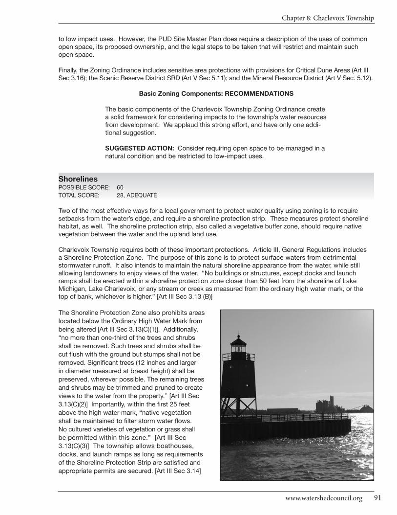
Chapter 8: Charlevoix Township
91www.watershedcouncil.org
to low impact uses. However, the PUD Site Master Plan does require a description of the uses of commonopen space, its proposed ownership, and the legal steps to be taken that will restrict and maintain suchopen space.
Finally, the Zoning Ordinance includes sensitive area protections with provisions for Critical Dune Areas (Art IIISec 3.16); the Scenic Reserve District SRD (Art V Sec 5.11); and the Mineral Resource District (Art V Sec. 5.12).
Basic Zoning Components: RECOMMENDATIONS
The basic components of the Charlevoix Township Zoning Ordinance createa solid framework for considering impacts to the township’s water resourcesfrom development. We applaud this strong effort, and have only one addi-tional suggestion.
SUGGESTED ACTION: Consider requiring open space to be managed in anatural condition and be restricted to low-impact uses.
ShorelinesPOSSIBLE SCORE: 60
TOTAL SCORE: 28, ADEQUATE
Two of the most effective ways for a local government to protect water quality using zoning is to require setbacks from the water’s edge, and require a shoreline protection strip. These measures protect shorelinehabitat, as well. The shoreline protection strip, also called a vegetative buffer zone, should require nativevegetation between the water and the upland land use.
Charlevoix Township requires both of these important protections. Article III, General Regulations includes a Shoreline Protection Zone. The purpose of this zone is to protect surface waters from detrimentalstormwater runoff. It also intends to maintain the natural shoreline appearance from the water, while still allowing landowners to enjoy views of the water. “No buildings or structures, except docks and launchramps shall be erected within a shoreline protection zone closer than 50 feet from the shoreline of LakeMichigan, Lake Charlevoix, or any stream or creek as measured from the ordinary high water mark, or thetop of bank, whichever is higher.” [Art III Sec 3.13 (B)]
The Shoreline Protection Zone also prohibits areas
located below the Ordinary High Water Mark from
being altered [Art III Sec 3.13(C)(1)]. Additionally,
“no more than one-third of the trees and shrubs
shall be removed. Such trees and shrubs shall be
cut flush with the ground but stumps shall not be
removed. Significant trees (12 inches and larger
in diameter measured at breast height) shall be
preserved, wherever possible. The remaining trees
and shrubs may be trimmed and pruned to create
views to the water from the property.” [Art III Sec
3.13(C)(2)] Importantly, within the first 25 feet
above the high water mark, “native vegetation
shall be maintained to filter storm water flows.
No cultured varieties of vegetation or grass shall
be permitted within this zone.” [Art III Sec
3.13(C)(3)] The township allows boathouses,
docks, and launch ramps as long as requirements
of the Shoreline Protection Strip are satisfied and
appropriate permits are secured. [Art III Sec 3.14]
CHARLEVOIx COUnTy - Local Ordinance Gaps Analysis
Tip of the Mitt Watershed Council92
The community regulates marinas using the Marine Industrial District. The purposes of this district are “toprovide water related sites and locations for businesses that manufacture, repair, sell, and store boats andmarine equipment and provide boat harborage.” [Art V Sec 5.9(A) I-2] Later in the same section, the ordinancenotes that marinas may not emit toxic or corrosive fumes or gases, except those produced by internal combustion engines under designed operating conditions [Art V Sec 5.9(G)(5)].
Shorelines: RECOMMENDATIONS
SUGGESTED ACTION: Although marinas are regulated using the Marine Industrial District, we encourage the township to consider expanding theiroversight by adding standards related to preventing the spread of invasivespecies, having spill containment equipment, and otherwise following BMPs.
SUGGESTED ACTION: Keyhole, or “funnel,” developments increase impactsto lakes and streams. The township may want to consider adopting a provisionthat specifically addresses these types of developments.
SUGGESTED ACTION: Phragmites is a concern mostly on Great Lakesshorelines, but it has become established on some inland waters and roadditches. We encourage all local governments to initiate a program designedto ensure that the invasive strain of Phragmites does not become establishedin their jurisdiction. Such a project would involve an initial inventory to determineif there are non-native stands of Phragmites, treat those stands if they are inexistence, and conduct a follow up inventory and treatment, if necessary. To do so, we suggest you coordinate your efforts with the Lake CharlevoixAssociation’s Phragmites eradication program.
Impervious SurfacesPOSSIBLE SCORE: 33
TOTAL SCORE: 0, MISSING
The more a local government can do to reduce impervious surfaces, the better for water quality. As noted in the Lake Charlevoix Watershed Management Plan, impervious surfaces (streets, roofs, sidewalks, etc.)generate much more stormwater runoff than natural forested, or even agricultural, land uses. Polluted runoffdischarges directly into Lakes Michigan and Charlevoix from pavement and rooftops, and includes bacteriafrom pet and animal wastes, fertilizer, oil and grease, sediment, heavy metals, salt, etc.
To reduce impervious surfaces, a community should increase the retention or restoration of native vegetationin riparian areas and in open spaces, and install simple and effective solutions, ranging from rain barrels andrain gardens, to engineering approaches that treat stormwater that has traveled across impervious surfaces,before it discharges into the water.
Impervious Surfaces: RECOMMENDATIONS
There are many opportunities for local governments to reduce impervioussurfaces through their Zoning Ordinance. Additionally, the Lake CharlevoixWatershed Plan calls for reduction of impervious surfaces to reduce the pollutant load from stormwater running into our water resources. We encourage Charlevoix Township to consider integrating the following provisions into their ordinance.
SUGGESTED ACTION: Consider reducing parking space dimensions andsetting them as a maximum. Also consider reducing the number of requiredparking spaces and setting the number as a maximum number, as opposedto a minimum.
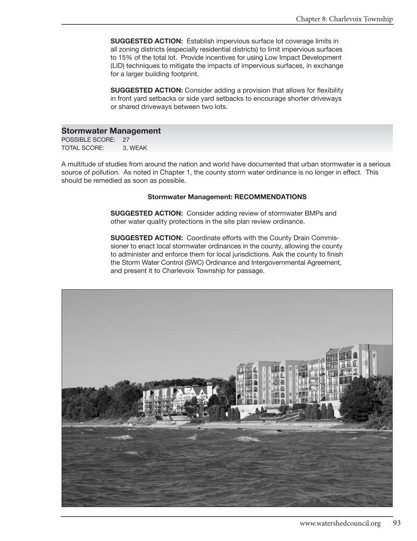
Chapter 8: Charlevoix Township
93www.watershedcouncil.org
SUGGESTED ACTION: Establish impervious surface lot coverage limits inall zoning districts (especially residential districts) to limit impervious surfacesto 15% of the total lot. Provide incentives for using Low Impact Development(LID) techniques to mitigate the impacts of impervious surfaces, in exchangefor a larger building footprint.
SUGGESTED ACTION: Consider adding a provision that allows for flexibilityin front yard setbacks or side yard setbacks to encourage shorter drivewaysor shared driveways between two lots.
Stormwater ManagementPOSSIBLE SCORE: 27
TOTAL SCORE: 3, WEAK
A multitude of studies from around the nation and world have documented that urban stormwater is a serioussource of pollution. As noted in Chapter 1, the county storm water ordinance is no longer in effect. Thisshould be remedied as soon as possible.
Stormwater Management: RECOMMENDATIONS
SUGGESTED ACTION: Consider adding review of stormwater BMPs andother water quality protections in the site plan review ordinance.
SUGGESTED ACTION: Coordinate efforts with the County Drain Commis-sioner to enact local stormwater ordinances in the county, allowing the countyto administer and enforce them for local jurisdictions. Ask the county to finishthe Storm Water Control (SWC) Ordinance and Intergovernmental Agreement,and present it to Charlevoix Township for passage.

CHARLEVOIx COUnTy - Local Ordinance Gaps Analysis
Tip of the Mitt Watershed Council94
Soil Erosion and Sediment ControlPOSSIBLE SCORE: 18
TOTAL SCORE: 6, WEAK
By volume, sediment is the single largest pollutant to waters of the United States. Any time earth is disturbedor graded, as typically happens during the construction process, there is a potential for soil to erode andsediment to be deposited into lakes, streams, and wetlands. As noted in the first Chapter, counties are mandated to administer and enforce Part 91, and Charlevoix County has two state-recognized agencies that do so: The Soil Erosion Control Officer and the County Road Commission.
Charlevoix Township Site Plan Review states that “…no grading, or excavation shall be commenced on any lot or parcel until a site plan that meets all of the requirements of this Article has been approved by the Planning Commission.” [Art IX Sec 9.2(A)] It also requires a storm water management and soil erosioncontrol plan [Art IX Sec 9.4 (A)(2)(p)], but it does not specify approval by the county. It does, however, require approval by the Planning Commission. PUD procedures require Planning Commission Chair reviewand notes the Chair shall have discretion to solicit comments from the county [Art V Sec 5.5 (E)(1)(c)]. Soilerosion is also mentioned in the Manufactured Home Development District (R-3) and the Special Land UsesArticles but again, county approval is not specified.
Soil Erosion and Sediment Control: RECOMMENDATIONS
All properties that are located near streams, wetlands, or drainage wayshave the potential to erode and cause sedimentation to nearby waters. Accordingly, it is recommended that local units require all earth movementactivities associated with development to follow BMPs to control erosionand ensure that sediment-laden runoff does not enter waterways. Coordination between township and the county is essential.
SUGGESTED ACTION: Specifically require that all proposed developmentproject earth change activities within 500 feet of a stream, wetland, or otherwaterway in all zoning districts receive a soil erosion and sedimentation control permit from Charlevoix County before they receive a permit fromCharlevoix Township.
Sewer/SepticPOSSIBLE SCORE: 24
TOTAL SCORE: 12, ADEQUATE
Most of Charlevoix Township is served by the sewer system for the City of Charlevoix. The township MasterPlan notes that the urban neighborhood is served by sewer and water (Chapter 6 Future Land Use Plan,Urban Neighborhood p.25) and that water and sewer is supplied to some areas designated as single familyneighborhoods (Chapter 6 Future Land Use Plan, Single Family Neighborhood p.22).
Additionally, the township Zoning Ordinance notes that every building shall be provided with a safe and sanitary water supply system and sewage disposal facilitates. The written approval of such facilities by theNorthwest Michigan Community Health Agency shall be filed with an application for a Zoning Permit, so ifthere is a property that needs a private well for drinking water or a septic system, they are regulated (Art IIISec 3.10). We have no additional recommendations for this element.
Chapter 8: Charlevoix Township
95www.watershedcouncil.org
WetlandsPOSSIBLE SCORE: 21
TOTAL SCORE: 0, MISSING
Wetlands are some of our most valuable water resources. They provide excellent wildlife habitat, help controlflooding, and contribute to water quality protection. Although Michigan has a statewide wetland protectionstatute, not all wetlands are covered and not all activities that could impact wetlands are regulated.
Local governments have the opportunity to supplement the state’s wetland protection program. Eventhough the Charlevoix Township Zoning Ordinance specifically mentions wetlands in several places,these points fall short, in terms of what can be done to ensure township wetlands are viable and continueto protect water quality.
The R-3 District requires location of wetlands to be included in the Review Standards (Art V Sec 5.3 D(6)]. Boththe Planned Residential (PRD) District and the PUD District award density bonuses that include considerationof wetlands [Art V Sec 5.4 D(2)(b); Art V Sec 5.5 D(2)(b)]. The PUD Submittal Requirements also require a development plan that includes unbuildable areas such as wetlands [Art V Sec 5.5 F(1)(a)(2)] and Article VIII,Special Land Uses, requires wetlands to be included on an Impact Assessment [Sec 8.1 B (2)(c)(5)]. Finally,Article IX, Site Plan Review requires wetland locations to be noted, and specify how they will be protected or altered by the project [Sec 9.4 (A)(2)(f)].
Wetlands: RECOMMENDATIONS
Michigan’s wetland law specifically authorizes local governments to adoptwetland protection ordinances to regulate wetlands not protected by the statestatute. In addition to a stand-alone wetland ordinance, local governmentscan support wetland protection by taking the following steps:
SUGGESTED ACTION: Given the important role that wetlands play in protecting water quality, providing wildlife habitat, and minimizing flooding, it is important to educate township citizens on the importance of protectingwetlands.
SUGGESTED ACTION: Consider requiring a 25-foot wetland setback provision to all zoning districts in the township. This would protect townshipwetlands in the short run, and cost less to administer than adopting a wetlandordinance. Eventually, a local wetland ordinance should be enacted to fill ingaps of protection, perhaps in coordination with the City of Charlevoix.
SUGGESTED ACTION: Specifically require applicants seeking zoning permits to secure applicable state and federal wetland permits before issuing a local zoning permit.
Ground Water and Wellhead ProtectionPOSSIBLE SCORE: 18
TOTAL SCORE: 0, MISSING
Charlevoix Township relies on Lake Michigan for its drinking water because it is served by the City ofCharlevoix Water Treatment Facility (Annual Drinking Water Quality Report of the City of Charlevoix WaterSupply, January 2011 p. 4). However, there could be protections in place for ground water sources in thetownship, which are important to surface water sources. For example, site plan review can be used to ensure direct discharge of potentially hazardous material is prevented, and required to be coordinated with state statutes.
CHARLEVOIx COUnTy - Local Ordinance Gaps Analysis
Tip of the Mitt Watershed Council96
Discharges to ground water are regulated by the state under Part 31, Water Resources Protection, of theNatural Resources and Environmental Protection Act (NREPA) 1994 PA 451, and Part 22 Rules. Any proposeddischarges should be prohibited by the city until required state permits are received by the applicant. Storageof hazardous material is also regulated under Part 5 Rules issued for Part 31. This includes Pollution IncidentPrevention Plans, which can be efficiently coordinated with Local Emergency Planning Committee work.
Ground Water and Wellhead Protection: RECOMMENDATIONS
Ground water is vital for not only drinking water, but also to feed tributaries,seeps, springs, and wetland resources with fresh water supplies to supportthose ecosystems, including important recreational fisheries.
SUGGESTED ACTION: Complete and maintain a comprehensive inventoryof potential threats to ground water. This will be particularly important as thetownship continues to grow.
SUGGESTED ACTION: If direct or indirect discharges to ground water areproposed, use site plan review or some other ordinance provision to prohibitthis until appropriate approvals or permits are obtained from the state.
SUGGESTED ACTION: Protect ground water from potential contaminationby requiring Pollution Incident Prevention Plans for storage of hazardousmaterials, in coordination with Local Emergency Planning Committee efforts.
OtherPOSSIBLE SCORE: 48
TOTAL SCORE: 23, ADEQUATE
Charlevoix Township participates in the National Flood Insurance Program [FEMA Flood Ins Program CID #: 260790 CHARLEVOIX, TOWNSHIP OF CHARLEVOIX COUNTY Map (NSFHA) Emer-Reg Date 09/18/87].For PUDs, the Zoning Ordinance requires mapping and descriptions of existing conditions that must includefloodplains [Art V Sec 5.5 (E)(2)(f)(1)(a)(3)PUD Master Development Plan].
Charlevoix Township Lake Michigan Shoreline has designated MDEQ Critical Dune Areas. (http://www.michigan.gov/documents/deq/lwm_sanddunes_statewide_CDA_262858_7.pdf) No permits are issued by the townshipfor construction within any Critical Dune Area, whether or not shown on the Zoning Map, until approved by the Michigan Department of Environmental Quality in accordance with the Sand Dune Protection andManagement Act, Part 353 of PA 451 of 1994 (Art III Sec 3.16). We have no additional recommendations for this element.
Conclusion
We applaud the water protection measures that exist in Charlevoix Township. We also thank you for yourtime and attention in reading this chapter, and hope that our recommendations are helpful. However, if anything is unclear, please be sure to let us know. If you have any questions related to this project, pleasecontact Tip of the Mitt Watershed Council at 231.347.1181.

Chapter 8: Charlevoix Township
97www.watershedcouncil.org
Results WorksheetCharlevoix Township
Catagory Possible Score Total Score Comments
I. Master Plan30 - 21 = Strong20 - 11 = Adequate10 - 0 = Weak
II. Basic Zoning Elements54 - 37 = Strong36 - 19 = Adequate18 - 0 = Weak
III. Shorelines60 - 41 = Strong40 - 21 = Adequate20 - 0 = Weak
IV. Impervious Surface Reduction33 - 23 = Strong22 - 12 = Adequate11 - 0 = Weak
V. Stormwater Management27 - 19 = Strong18 - 10 = Adequate9 - 0 = Weak
VI. Soil Erosion and Sediment Control18 - 13 = Strong12 - 7 = Adequate6 - 0 = Weak
VII. Sewer/Septic24 - 17 = Strong16 - 9 = Adequate8 - 0 = Weak
VIII. Wetlands21 - 15 = Strong14 - 8 = Adequate7 - 0 = Weak
IX. Ground Water and Wellhead Protection
18 - 13 = Strong12 - 7 = Adequate6 - 0 = Weak
X. Other Relevant Elements48 -33 = Strong32 - 17 = Adequate16 - 0 = Weak
30
54
60
33
27
18
24
21
18
48
18
38
28
0
3
6
6
0
0
23
Adequate
Strong
Adequate
Missing
Weak
Weak
Weak
Missing
Missing
Adequate
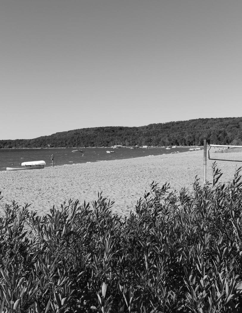
98
Chapter 9: Evangeline Township
99www.watershedcouncil.org
SECTION III: Analysis
Chapter 9 Evangeline Township
Introduction This chapter summarizes results of the Local Ordinance Gaps Analysis project for Evangeline Township, locatedin both the Lake Charlevoix and Little Traverse Bay Watersheds in Charlevoix County. Evangeline Township’scharacter can be defined by abundant water resources, including shoreline frontage on Lake Charlevoix andWalloon Lake, several creeks and a small portion of the Boyne River, and Mud Lake, which is situated whollywithin the township. This chapter includes evaluation scores, recommendations and suggested actions. Italso relates suggested actions to the existing Watershed Management Plan for Lake Charlevoix and for Little Traverse Bay.
Evaluation Scores and Summary
Master Plan ComponentsPOSSIBLE SCORE: 30
TOTAL SCORE: 19, ADEQUATE
The Evangeline Township Land Use and Recreation Plan was last updated in 2001. Since it is recommendedthat Master Planning documents be updated every five years, this one should be considered for review as soonas feasible. The plan acknowledges the township’s abundant natural resources and contains a good listingof water resources, including frontage on Lake Charlevoix and Walloon Lake, a significant number of wetlandslocated adjacent to Lake Charlevoix, Walloon Lake and Mud Lake, and the Boyne River, which crosses througha small portion the township. The Evangeline Township webpage (www.charlevoixcounty.org/evangeline.asp)does not provide the existing Land Use Plan, but contains several useful graphic resources, including a contourmap, environmentally sensitive areas map, land cover map, relief map, priority parcels map, and wetlands map.
The Evangeline Township Land Use Plan contains several goals related to protecting water resources. In theGoals, Objectives and Actions section, a primary goal is to “Protect the natural environment, wildlife habitatand waterways within the township.” Other goals include minimizing growth within environmentally sensitiveareas; conserving unique natural areas, such as wetlands, that perform important environmental functions;utilizing conservation design when development occurs; regulating development in areas designated as unsuitable, such as floodplains and wetlands; and limiting development in sensitive areas along lakes, rivers,and streams (Section III, Evangeline Township Land Use Plan).
In addition, the Community Planning Principles, General Statements section of the plan notes that site designshould encourage open space; that sensitive and fragile lands should be protected from degradation; and

CHARLEVOIx COUnTy - Local Ordinance Gaps Analysis
Tip of the Mitt Watershed Council100
that wildlife habitat corridors should be interwoven with development to achieve environmental balance andachieve biodiversity (Section I, Evangeline Township Land Use Plan).
Master Plan Components: RECOMMENDATIONS
We applaud the water resource information and goals that are contained inthe Evangeline Township Land Use and Recreation Plan. We offer the followingsuggestions for the next plan update, to further strengthen the role this document can play in guiding water resource protection.
SUGGESTED ACTION: As soon as possible, make the township Land Useand Recreation Plan available online.
SUGGESTED ACTION: As soon as possible, update the current Land Useand Recreation Plan, dated 2001. Updates are recommended every fiveyears.
SUGGESTED ACTION: When updating the township’s plan, include comments on the problems associated with impervious surfaces and identify stormwater management as an important community priority.
SUGGESTED ACTION: When updating the township’s plan, acknowledgethe importance of well-constructed and maintained road-stream crossingswith regard to the quality of streams in the township.
Basic Zoning ComponentsPOSSIBLE SCORE: 54
TOTAL SCORE: 40, STRONG
The statement of purpose articulated in the Evangeline Township Zoning Ordinance contains several elementsthat promote water resource protection, including the following:
• Provide for the orderly development of the Township while minimizing the impacts of incompatible adjoining land uses and preventing nuisances from interfering with the reasonable use and enjoyment of private property. In all cases, it is the purpose of this Ordinance to regulate the use of real property so that it does not adversely impact upon broader public interest;
• Insure the public health, safety and general welfare;
• Promote the use of lands and natural resources of the Township in accordance with their character and adaptability and, in turn, limit their improper use;
• Reduce hazards to life and property;
• Facilitate the development of an adequate system of transportation, education, recreation, sewage disposal, safe and adequate water supply and other public requirements; • Conserve life, property and natural resources and the expenditure of funds for public improvements and services to conform to the most advantageous uses of land, resources and properties. [Article I, Section 1.02 (A,B,C,D,G,H)]
The Evangeline Township Zoning Ordinance includes a fee system to assist in defraying the costs of investigating,reviewing and administering the Zoning Ordinance [Article X, Section 10.05 (A,B)], and a provision wherebythe township can require additional fees, set aside in an escrow account by the applicant, to cover the costsof additional professional review when necessary [Article X, Section 10.05 (C)]. The ordinance also authorizesthe township to require performance guarantees for development activities, in connection with the constructionof improvements authorized through site plan approval, special land use approval, or a Planned Unit Devel-opment (PUD) in an amount equal to the estimated costs of the improvements [Article X, Section 10.06 (A)].
Chapter 9: Evangeline Township
101www.watershedcouncil.org
Article X of the Zoning Ordinance also addresses the issue of enforcement. Any person or other entity whocreates or maintains a nuisance, or who violates or fails to comply with the ordinance or any permit issuedpursuant to the ordinance, shall be responsible for a municipal civil infraction and be subject to a fine of notmore than five hundred dollars. Each day of violation is considered a separate and distinct offence. The ZoningAdministrator is authorized to issue infraction citations directing alleged violators to appear in court. In additionto enforcing this ordinance as a civil infraction, the township may initiate proceedings in any court of competentjurisdiction to address any other violations of the Zoning Ordinance [Article 10, Section 10.09 (A-B)].
One important aspect of the local zoning permitting process is to ensure that the issuance of local permits is coordinated with county, state, and federal permits or approvals. The Evangeline Township Zoning Ordinanceaddresses this with respect to those projects that require a site plan review, using the following blanketstatement: “the site plan shall conform to all applicable requirements of Township, County, State and Federalstatutes.” [Article VI, Section 6.02(E)(3)(i)] In addition, the ordinance specifically mentions coordination withsoil erosion control and wetland statutes. The section on required site plan data states that “all site plansshall comply with part 91 of Public Act 451 of 1994 as amended, and any applicable local Soil Erosion Sedimentation and/or Stormwater Runoff Control Ordinances, with documentation of approval to be providedby the applicant.” [Article VI, Section 6.02(C)(15)] The site plan review standards section states that “if thearea is in a State regulated wetlands, permits to build in those areas will be needed prior to final action on asite plan.” [Article VI, Section 6.02(D)(5)] Conditioning local approval on required state and federal permits isan effective way to ensure that water resources are considered, early in the development process, and theirprotection is properly integrated into the development proposal.
Pre-application meetings are another excellent way to ensure that the protection of water resources is considered, early in the development process. There are two pre-application opportunities written into the Evangeline Township Zoning Ordinance. The first one is required as part of the review process for an application to split a property under the Conservation Design option in the Rural Residential/Farm Forest(RRF) district. The purpose of the pre-application conference is “to discuss the applicant’s objectives andhow these may be achieved under the Ordinance.” (Article V, Section 5.08.12) The second opportunity is inthe site plan review process: “An applicant may request to be placed on the agenda of a meeting of thePlanning Commission to review and discuss a proposed site plan prior to a formal site plan application being filed.” [Article VI, Section 6.02(A)]
An important aspect of the implementation of any Zoning Ordinance is the review process. The effectivenessof the review process is determined by the quality of the information provided to the township by the applicant.The section of the ordinance that deals with site plan review (Article VI) requires the applicant to submit acomprehensive description of the project, including the following: “the location of existing environmental features, such as watercourses, wetlands, shorelines, man-made drains, areas with slopes of twelve (12%)percent or greater, mature specimen trees, wooded areas, scenic view sheds or any other unusual environmental features.” [Article VI, Section 6.02(C)(7)] This section also requires the applicant to provide a statement that assesses “the impact of the proposed development on soil erosion, shoreline protection,wildlife habitat, air pollution, water pollution (ground and surface), noise and the scale of development interms of the surrounding environment.” [Article VI, Section 6.02(C)(17)] Such requirements help to ensurethat water resource protection is fully considered as part of the site plan review process.
Some townships integrate open space provisions into their site plan review process. The Evangeline Townshipopen space stipulations are integrated into provisions for the specific zoning districts in which open space orcluster development is likely to occur, including the Mixed Use and RRF districts. Most relevant to watershedmanagement considerations are the open space provisions in the RRF district.
The Conservation Design option in the RRF district includes an open space provision that allows an areaequivalent to 50% of the master parcel’s buildable net acreage to be divided into small lots, or 35% of themaster parcel’s total acreage, whichever is greater. The maximum density of small lots shall be one lot forevery 5 full acres of the total master parcel acreage. For example, a 40-acre master parcel could have amaximum of 8 small lots. The remainder of the master parcel will remain as conservation lands. A minimumof 20% of the conservation lands shall be under common ownership of a homeowner’s association, and the
CHARLEVOIx COUnTy - Local Ordinance Gaps Analysis
Tip of the Mitt Watershed Council102
remainder shall be protected by a permanent conservation easement or similar legal instrument [Article V,Section 5.08.7(C)]. There appear to be no density bonuses or other incentives to encourage developers touse open space or cluster design options.
Basic Zoning Components: RECOMMENDATIONS
The basic components of Evangeline Township’s Zoning Ordinance create a good framework for considering impacts from development to the township’s water resources. The following actions are suggested to helpstrengthen the ordinance:
SUGGESTED ACTION: Consider requiring open space to be managed in anatural condition and be restricted to low-impact uses.
SUGGESTED ACTION: Consider implementing a density bonus or other incentives to encourage conservation design.
ShorelinesPOSSIBLE SCORE: 60
TOTAL SCORE: 6, ADEQUATE
Evangeline Township employs both of the most effective ways a local governments can protect water qualityand shoreline habitat through zoning. The first is to require setbacks from the water’s edge. The second is torequire a shoreline protection strip of native vegetation between the water and the upland land use, alsocalled a vegetative buffer zone.
Evangeline Township has established a consistent 50-foot setback from Lake Charlevoix and Walloon Lakein all the waterfront zoning districts. In steep slope situations, waterfront setback shall be increased basedon existing slope. For example, a 100 foot setback is required for areas identified on the Evangeline TownshipShoreline Steep Slopes Map (Article III, Section 3.07).
In addition, the waterfront setback in the Rural Residential/Farm Forest District is 100 feet [Article V, Section5.08.4(G)]. Setbacks are measured from the high water elevation, which is defined in Article II Definitions inthe following manner: “for Lake Charlevoix this is the highest water level elevation for Lake Michigan/Huronas recorded by the United States Army Corps of Engineers (currently 582.35’ IGLD recorded in October1986), plus one (1) foot. For Walloon Lake this level is the elevation of the outlet dam or as set by the courts,plus one-half (1/2) foot. For all other lakes and streams this level is the 100-year flood plain elevation plusone-half (1/2) foot.” (Article II, Section 2.01)
Evangeline Township’s greenbelt provisions are located in the General Provisions section of the ordinance(Article III). The stated purpose of the township Natural Vegetation Waterfront Buffer Strip provision is to enhance protection of water quality. For properties being developed or re-developed that do not have existingvegetation, establishment of a buffer strip meeting ordinance standards is a required condition for site planapproval [Article III, Section 3.06(A)]. The minimum depth of the greenbelt is twenty-five feet and shall extendacross the full width of the waterfront portion of the lot. The depth is required to be fifty feet for lots withsteep slopes. The buffer strip shall be planted with native trees and low growing woody shrubs suitable forthe site. Shrubs shall be of sufficient size and planted to provide 100% ground coverage, except as allowedin district regulations for a viewing platform and path. No supplemental plant nutrients, nor maintained lawn,shall be between the buffer strip and the water’s edge [Article III, Section 3.06(B)(1-6)].
Townships have the opportunity to manage the environmental and recreational quality of lakes by regulatingdocks. Evangeline Township addresses dockage in each of the waterfront residential districts, but is consistentthroughout, allowing one seasonal dock per lot, with a length of 150 feet or the length necessary to extendout to a water depth of four feet, whichever is greater [Article V, Sections 5.01-5.05]. Lot widths dependupon the zoning district. The ordinance does not mention the number of boat parking spaces per dock.
Chapter 9: Evangeline Township
103www.watershedcouncil.org
Evangeline Township regulates activities on road endings that terminate on the shoreline of lakes and riversin the township. Such “police power” ordinances both ensure the right of the public to access the lake, whileat the same time controlling nuisance activities and regulating potential environmental impacts from use at theroad end. The Evangeline Township road end ordinance regulates the placement of docks or other structures;anchoring or mooring a boat for more than five hours; using the road end in a manner that would cause adisturbance or nuisance; trespassing on adjacent private properties, or littering; camping; starting a fire unlessit is in an approved device installed by the township; removing water from the lake, other than for fire suppressionpurposes; or launching a boat, unless it is a designated township boat launch (Evangeline Township OrdinanceNo.3 of 2002).
Marinas are not specifically mentioned in the ordinance, likely because there is no waterfront zone wheremarinas would be considered an allowable use. However, all business or industries which store, use or generate hazardous substances in quantities greater than 25 gallons or 220 pounds, whichever is less, shall meet all state and federal requirements for storage, spill prevention, record keeping, emergency response, transport and disposal of said hazardous substances (Article III, Section 3.05).
Shorelines: RECOMMENDATIONS
The Evangeline Township Zoning Ordinance has many good provisions withrespect to protecting shorelines. Here are a few suggestions that the Townshipmay want to consider to further strengthen their shoreline management:
SUGGESTED ACTION: Although the Evangeline Township Zoning Ordinancehas regulations that state the number of dwellings per front foot in their waterfront zoning districts, the township may want to consider adopting aprovision that specifically addresses funnel or keyhole developments.
SUGGESTED ACTION: Although Evangeline Township regulates the numberof docks per lot, the ordinance does not address the number of boats perdock. This can help to ensure that lakes are not subject to excessive use.
SUGGESTED ACTION: Although Phragmites is of concern mostly on GreatLakes shorelines, it has become established on some inland waters and roadditches. We encourage all local governments to initiate a program designedto ensure that the invasive strain of Phragmitesdoes not become establishedin their jurisdiction. Such a project would involve an initial inventory to determineif there are invasive stands of Phragmites, treat those stands if they exist,and conduct a follow up inventory, and treatment, if necessary. To do so, wesuggest you coordinate your efforts with the Lake Charlevoix Association’sPhragmites eradication program.
Impervious SurfacesPOSSIBLE SCORE: 33
TOTAL SCORE: 23, STRONG
Impervious surfaces stop rainwater and snowmelt from naturally percolating into soils, thus reducing the opportunity for contaminants to be removed from the resulting stormwater runoff before it flows into lakes,rivers, and wetlands. The more a local unit of government can do to reduce impervious surfaces, the betterfor water quality.
The Evangeline Township Zoning Ordinance addresses impervious surfaces in several places. The definitionsand the general provisions section of the ordinance both clearly define impervious surfaces and how they areto be calculated, with regard to lot coverage. The Impervious Surface Regulations in the General Provisionsalso provide for special considerations when using pervious paving systems [Article III, Section 3.24(B)].
CHARLEVOIx COUnTy - Local Ordinance Gaps Analysis
Tip of the Mitt Watershed Council104
The individual descriptions of the zoning districts and the schedule of regulations establish the maximum impervious lot coverage. All Lake Charlevoix shoreline districts have 15% maximum impervious coverage, or 2,500 square feet, whichever is greater. This is the percentage recommended by watershed managers.The exception is the Pinehurst Waterfront Residential District, which is 25%, or 3,000 square feet, whicheveris greater, but no more than 15% within 500 feet of the waterfront.
For the Walloon Waterfront Residential District, the maximum is 15% or 3,000 square feet, whichever is greater.No more than 15% of the lot area within 200 feet of the waterfront may be impervious surface (Article V, Section5.11.1). Maximum imperviousness in the non-waterfront districts ranges from 20% in the Residential Districtto 70% in the Mixed Use District, depending on the use (Article V, Section 5.11.2).
The ordinance also provides some flexibility with respect to the stated maximum lot coverage. For example,in the waterfront districts, the impervious maximum can be increased to 3,125 square feet, provided that thedepth of the required natural vegetation buffer strip is increased to twice the depth required by Section 3.06.It may also be increased from 15% to 20%, provided that the depth of the natural vegetation waterfrontbuffer strip is doubled, that the waterfront setback for all structures is doubled, and that all other setbacksare met without the need for a variance (Article V, Section 5.11.1).
The ordinance also allows the Planning Commission to approve a smaller parking area than required, when theproperty owner can demonstrate that the required amount of parking is excessive, provided that the area tomeet the parking requirements is set aside as open space. As well, citing stormwater concerns, the ordinancelimits the amount of parking to no more than 10% of the minimum, unless approved by the Planning Commissionand based on documented evidence [Article III, Section 3.12(C,D)].
Evangeline Township also has a private road ordinance that addresses some of the impervious surface issuesassociated with roads. The ordinance allows for the construction of a “T” or “hammerhead” instead of a cul-de-sac, which can encourage more creative solutions to drainage [Evangeline Township Private Road Ordinance, Article V, Section 5.01(D)]. It also allows for the reduction of pavement width to 12 feet, if onlyserving three lots or less, which can dramatically reduce the overall square footage of a typical road [Evangeline Township Private Road Ordinance, Article V, Section 5.02(A)(2,5)].
The ordinance also requires that all soil erosion and stormwater control measures shall be maintained in aworkable condition at all times, and that the township may enter the property to inspect these measures toensure they continue to be in compliance with the ordinance [Evangeline Township Private Road Ordinance,Article V, Section 5.01(F)].
Impervious Surfaces: RECOMMENDATIONS
Between the Zoning Ordinance and the stand-alone Private Road Ordinance,Evangeline Township has strong provisions with respect to impervious sur-faces. The following recommendations are offered to assist the township in strengthening their efforts to address the problems associated with impervious surfaces.
SUGGESTED ACTION: Consider limiting the extent of lawn area inlakeshore zoning districts. Although not impervious, manicured lawns generate more runoff than does ground covered in trees and shrubs.
SUGGESTED ACTION: Consider reducing the minimum radii of cul-de-sacsto 35 feet to reduce impervious surface coverage.
SUGGESTED ACTION: Consider encouraging grass or turf parking where appropriate.
Chapter 9: Evangeline Township
105www.watershedcouncil.org
Stormwater Management
POSSIBLE SCORE: 27
TOTAL SCORE: 10, ADEQUATE
Evangeline Township does not currently regulate stormwater as a stand-alone ordinance. However, there areprovisions of the Zoning Ordinance where stormwater management planning and implementation is requiredas part of the zoning review process.
For example, the standards for the site plan data state that “all site plans shall comply with part 91 of PublicAct 451 of 1994 as amended, and any applicable local Soil Erosion Sedimentation and/or Stormwater RunoffControl Ordinances, with documentation of approval to be provided by the applicant.” [Article VI, Section6.02(C)(15)] Similarly, the general development standards for the Mixed Use District requires: “as a conditionfor approval the applicant shall provide official documentation indicating the stormwater run-off system asproposed meets the requirements of the Charlevoix County Storm Water Control Ordinance, and has beenreviewed and approved by the Charlevoix County Soil Erosion Officer.” [Article V, Section 5.07.23(F)] Asnoted in Chapter 1, this county ordinance was rescinded, but a replacement is currently being worked on to present to townships for consideration.
Steep slopes and road construction are of particular concern with stormwater management. The Constructionon Steep Slopes section of Evangeline Township’s Zoning Ordinance requires that “all new developmentshall be constructed according to Charlevoix County Soil Erosion and Sedimentation Control standards.” [Article III, Section 3.23(J)] With respect to private roads, the Evangeline Township Private Road Ordinancestates that “all erosion and stormwater control measures shall be maintained in a workable condition at alltimes.” [Evangeline Township Private Road Ordinance, Article V, Section 5.01(F)]
It is important to note that the proper administration of stormwater regulations often requires specialized expertise. For this reason, it is recommended that the township continue to cooperate with the county in theenforcement of county-wide standards. As noted above, Charlevoix County officials are in the process ofpreparing a comprehensive, county-wide Storm Water Control Ordinance that would be passed by individualtownships and give the county authority to administer and enforce the ordinance. To make this work effectivelyand efficiently, all participating townships and cities would have to pass identical language and participate inan Intergovernmental Agreement.
Stormwater Management: RECOMMENDATIONS
There is great value in working with Charlevoix County on the adoption andimplementation of a comprehensive county-wide stormwater ordinance. The measures taken to control stormwater that would be required by suchan ordinance are consistent with recommendations in the Lake Charlevoixand Little Traverse Bay Watershed Management Plans. To this end, we encourage the following actions.
SUGGESTED ACTION: Coordinate efforts with the County Drain Commissionerto enact local stormwater ordinances in the county, allowing the county toadminister and enforce them for local jurisdictions. Ask the county to finishthe Storm Water Control (SWC) Ordinance and Intergovernmental Agreement,and present it to Evangeline Township for passage.
SUGGESTED ACTION: Between now and the adoption of the CharlevoixCounty Stormwater Ordinance, continue to utilize the county’s expertise inreviewing and commenting on stormwater plans presented in developmentproposals.
SUGGESTED ACTION: Require that all stormwater management systemsare regularly evaluated and properly maintained to ensure that no dischargeof polluted runoff enters lakes or streams in Evangeline Township.
CHARLEVOIx COUnTy - Local Ordinance Gaps Analysis
Tip of the Mitt Watershed Council106
Soil Erosion and Sediment ControlPOSSIBLE SCORE: 18
TOTAL SCORE: 7, ADEQUATE
All properties that are located near streams, wetlands, or drainage ways have the potential to erode and causesedimentation to nearby waters. Sediment, by volume, is the single largest pollutant to waters of the UnitedStates. Any time earth is disturbed or graded, as typically happens during the construction process, there isa potential for soil to erode and sediment to be deposited into lakes, streams, and wetlands. Construction,or use of steep or unstable slopes, can also present an erosion and sedimentation hazard.
Because local governments have the opportunity to review every single development project as part of zoningreview, they are uniquely situated to ensure that soil erosion is controlled and sedimentation is minimized.Soil erosion control is an essential component in watershed management efforts.
Although Evangeline Township does not regulate soil erosion and sedimentation control directly, it is clear inthe township ordinance that soil erosion is taken seriously in the zoning process. In the General Provisionssection of the ordinance that addresses construction on steep slopes, the ordinance requires that “all newdevelopment shall be constructed according to Charlevoix County Soil Erosion and Sedimentation Controlstandards.” [Article III, Section 3.23(J)]
To ensure that all permits are in place before earth movement activities commence, the ordinance states that no “excavation, tree removal or filling of land commence until a Zoning Permit application has been filedwith the township Zoning Administrator and a Zoning Permit has been issued by the Zoning Administrator.”[Article X, Section 10.02(A)]
The section on required site plan data states that “all site plans shall comply with part 91 of Public Act 451 of 1994 as amended, and any applicable local Soil Erosion Sedimentation and/or Stormwater Runoff ControlOrdinances, with documentation of approval to be provided by the applicant.” [Article VI, Section 6.02(C)(15)]Part 91 is administered by the Charlevoix County Department of Building Safety.
In addition to these requirements, the section on sand and gravel mining also requires that the reclamation planfor these operations contain provisions for “grading, drainage, re-vegetation/re-forestation, and stabilizationthat will minimize soil erosion, sedimentation, and public safety problems, and re-establish a natural resourcebase.” [Article VII, Section 8.12(6)(c)]
Soil Erosion and Sediment Control: RECOMMENDATIONS
The simplest and most effective way to control erosion at the township levelis to partner with the county enforcement agents. It appears that this is happen-ing, given the several instances noted above where applicants are requiredto receive soil erosion permits from Charlevoix County as a prerequisite totownship approval. To strengthen the township’s role in soil erosion and sediment control, we recommend the following:
SUGGESTED ACTION: Clearly state that all zoning applicants for any con-struction or earth change activity proposed within 500 feet of a stream, river,or lake, must receive a soil erosion and sedimentation control permit fromthe county, prior to issuance of an Evangeline Township Zoning Permit.
SUGGESTED ACTION: Require that soil erosion and sedimentation controlsbe established prior to earth change activities, and maintained and monitoredon a periodic basis until the site is completely stabilized and vegetated.
SUGGESTED ACTION: Require a pre-winter meeting to assess whether existing controls are in place to ensure that the site will not erode or causesedimentation over winter or during spring runoff events.

Chapter 9: Evangeline Township
107www.watershedcouncil.org
Sewer/SepticPOSSIBLE SCORE: 24
TOTAL SCORE: 12, ADEQUATE
From the perspective of water quality, the main concern with septic systems and water quality is the potentialfor a septic system to contribute excess nutrients to water bodies. These nutrients can cause the growth ofaquatic weeds and algae. Although Evangeline Township does not provide water or sanitary sewer services,Glenwood Beach and Young State Park are served by the Boyne City municipal sewer system.
The majority of Evangeline Township residents rely on private wells for domestic drinking water needs, andprivate on-site septic systems for wastewater disposal. The importance to water quality of properly addressingseptic and sewer treatment is acknowledged in the Goals, Objectives, and Actions section of the EvangelineTownship Land Use Plan, which includes the following: Encourage the protection of Lake Charlevoix andWalloon Lake surface waters from degradation due to failing septic systems, and encourage routine countyinspections of septic systems (Section III, p. 18).
The Evangeline Township Zoning Ordinance requires that all buildings used for any purpose that may generatewaste must be provided with a safe and sanitary water supply, and a means of collecting and disposing ofhuman excreta and all other waste water that may adversely affect health. The ordinance requires that written“approval of such facilities by the Northwest Michigan Community Health Agency shall be filed with an application for a Zoning Permit.” [Article III, Section 3.04]
Sewer/Septic: RECOMMENDATIONS
The simplest and most effective way for townships to ensure compliance withthe county or district health code is to require that all permits for residencesand businesses receive local health department approval prior to granting atownship permit. Evangeline Township’s Zoning Ordinance clearly does this.In addition, local units of government can regulate the siting of septic fieldsto ensure protection of water resources.
SUGGESTED ACTION: Require that septic systems be located at least 100feet from lakes, streams, wetlands, or other water bodies.
SUGGESTED ACTION: Consider establishing a “point of transfer” inspectionrequirement whereby septic systems in the township must be inspected toensure they are operating properly before ownership is transferred. TheEvangeline Township Land Use Plan calls for this sort of a program on acounty-wide scale, and we would support that, as well.
Wetlands POSSIBLE SCORE: 21
TOTAL SCORE: 7, WEAK
Wetlands are some of our most valuable water resources. They provide excellent wildlife habitat, help controlflooding, and contribute to water quality protection. Although Michigan has a statewide wetland protectionstatute, not all wetlands are covered and not all activities that could impact wetlands are regulated. Localgovernments have the opportunity to supplement the state’s wetland protection program.
The Evangeline Township Zoning Ordinance specifically mentions wetlands. The Critical Areas section of the General Provisions addresses wetlands by requiring a Michigan Department of Environmental Quality(MDEQ) approved wetland delineation for all areas mapped as potential wetland areas on the MDEQ WetlandInventory Maps, unless specifically waived by the Zoning Administrator after a site visit. Furthermore, lotcoverage in areas deemed as wetlands will be no greater than five (5) percent [Article III, Section 3.08 (A)(1,2)].This attention to wetlands is supported by the site plan review standards which clearly state that “if the area
CHARLEVOIx COUnTy - Local Ordinance Gaps Analysis
Tip of the Mitt Watershed Council108
is in a State regulated wetlands, permits to build in those areas will be needed prior to final action on a siteplan.” [Article VI, Section 6.02(D)(5)]
In addition to this coordination with the MDEQ permitting process, the ordinance requires a 25 foot buildingsetback from wetlands in the Rural Residential/Farm Forest District [Article V, Section 5.08.6(E)(2)]. Andplease note: applicants on Lake Charlevoix also need an Army Corps of Engineers permit, but the state application process provides them with a Joint Permit Application that will automatically coordinate with the Corps. Nevertheless, two permits are needed before starting any work in regulated wetlands.
Wetlands: RECOMMENDATIONS
Michigan’s wetland law specifically authorizes local governments to adoptwetland protection ordinances to protect wetlands not protected by the statestatute. In addition to a stand-alone wetland ordinance, local governmentscan support wetland protection by educating their residents about the importance of wetlands, by requiring zoning setbacks and buffers, and byrequiring wetland permits from state and federal agencies prior to grantinglocal zoning permits.
SUGGESTED ACTION: Given the important role that wetlands play in protectingwater quality, providing wildlife habitat, and minimizing flooding, it is importantto educate township citizens on the importance of protecting wetlands.
SUGGESTED ACTION: Consider expanding the 25-foot wetland setbackprovision in the Rural Residential/Farm Forest District to all other zoning districtsin the township. This would protect township wetlands in the short run, andcost less to administer than adopting a wetland ordinance. Eventually, a localwetland ordinance should be enacted to fill in gaps of protection.
SUGGESTED ACTION: Specifically require applicants seeking zoning permitsto secure applicable state and federal wetland permits before issuing a localzoning permit.
Ground Water and Wellhead Protection POSSIBLE SCORE: 18
TOTAL SCORE: 15, STRONG
Ground water is the primary source of drinking water for nearly all Northern Michigan residents, and all but a few Evangeline Township residents get their drinking water from private wells. Protecting ground water resources from contamination is vitally important.
The data required in Evangeline Township’s site plan review process includes an impact statement that addresses the following with respect to ground water protection: volume of water consumption related toground water reserves, and statements relative to the impact of the proposed development on ground andsurface water pollution [Article VI, 6.02(17)(B,C)].
Ground water protection is specifically mentioned in General Provisions with respect to proper treatment ofseptic and hazardous wastes (Article III, Sections 3.04 and 3.05). With regard to hazardous substances, theordinance is very clear: “no discharge to groundwater, including direct and indirect discharges, shall be allowedwithout required permits and approvals.” (Article III, Section 3.05)
The Zoning Ordinance also specifically addresses two uses that carry a high risk of contaminating groundwater: salvage yards and sand and gravel excavation operations. With regard to salvage yards, the followingprovisions to protect ground water resources apply:
Chapter 9: Evangeline Township
109www.watershedcouncil.org
• No oils, lubricants, or other liquids from vehicles, machinery, or equipment or other materials, shall be disposed of on-site, unless State of Michigan approved facilities are properly in place and properly functioning. No burial of wastes shall be permitted on the property under this ordinance section.
• The applicant shall state in writing and/or illustrate how potentially hazardous liquids are to be prevented from entering the groundwater, and present a written plan for handling and disposal of such hazardous liquids.
• The applicant shall be required to provide a written contingency plan for hazardous/toxic spills. The Planning Commission may require a roofed work area with an impervious floor with floor drain collection system.
• The proposed site shall have a minimum of six (6) feet of vertical isolation from groundwater, and be at least one thousand (1,000) feet from an identified body of surface water [Article VIII, Section 8.11 (B)(3-6)]
With respect to sand and gravel excavation operations, the ordinance contains the following to specificallyaddress groundwater impacts: “extractive operations shall be managed and designed so as to not causeany negative impact on groundwater and potable water supply, whether as a result of contamination or reduction in the rate and/or volume of flow.” [Article VIII, Section 8.12 (D)(4)]
Importantly, Evangeline Township participated in the state Wellhead Protection Plan process, getting its planapproved in 2002. This is a voluntary program, and we applaud the township for taking this critical step andprotecting these precious drinking water sources.
Ground Water and Wellhead Protection: RECOMMENDATIONS
Evangeline Township has several provisions that both raise awareness andwork to protect ground water resources. In addition, we encourage the townshipto consider the following to help strengthen ground water protection:
SUGGESTED ACTION: Identify critical groundwater recharge areas andmaintain a comprehensive inventory of potential threats to ground water.This will be particularly important as the township continues to grow andmore and more people rely on ground water for drinking water supplies.
CHARLEVOIx COUnTy - Local Ordinance Gaps Analysis
Tip of the Mitt Watershed Council110
OtherPOSSIBLE SCORE: 48
TOTAL SCORE: 30, ADEQUATE
With respect to other provisions in the ordinance that may contribute to water resource protection, EvangelineTownship participates in the National Flood Insurance Program. Additionally, floodplains are specifically addressed twice in the general development standards for the Rural Residential/Farm Forest District. First,“new development (including septic systems) will not be sited in areas of wetlands, floodplains or on slopesgreater than 33%.” [Article V, Section 5.08.6(B)] Secondly, the Planning Commission is given authority to reduce the public road setback in the Rural Residential/Farm Forest District in the case where strict compliance would cause building sites to encroach on wetlands, floodplains or areas of steep slopes [Article V, Section 5.08.6 (E)].
With regard to steep slopes, the Evangeline Township Zoning Ordinance contains special regulations on newconstruction proposed for areas where the natural grade is 18% or greater. Construction in these areas ispermissible subject to site plan review and meeting a range of conditions designed to protect the slope andnearby resources from erosion. Examples of the conditions for construction in steep slope areas include:
• New buildings shall not be located with 200 feet of lakes or rivers.
• Clearing and grading of a site shall be the minimum area to accommodate the proposed buildings or structures.
• All new development shall be constructed according to Charlevoix County Soil Erosion and Sedimentation Control standards and the Evangeline Township Stormwater Control Ordinance Standards.
• All erosion and stormwater control measures shall be maintained in a workable condition at all times. All new lots created shall be required to have an agreement with the Township allowing the Township to enter the property to inspect these measures to insure that they continue to be in compliance (Article III, Section 3.23)
Other: RECOMMENDATIONS
The additional provisions regarding floodplains and steep slopes help contribute to an overall framework of conscious development and water resource protection.
SUGGESTED ACTION: In order to help ensure that floodplains throughoutthe township are considered in the zoning permit review process, requirethat floodplain locations be delineated on all site plans.
Conclusion
We applaud the quite excellent water protection measures that exist in Evangeline Township. We also thankyou for your time and attention in reading this chapter, and hope that our recommendations are helpful.However, if anything is unclear, please be sure to let us know. If you have any questions related to this project, please contact Tip of the Mitt Watershed Council at 231.347.1181.
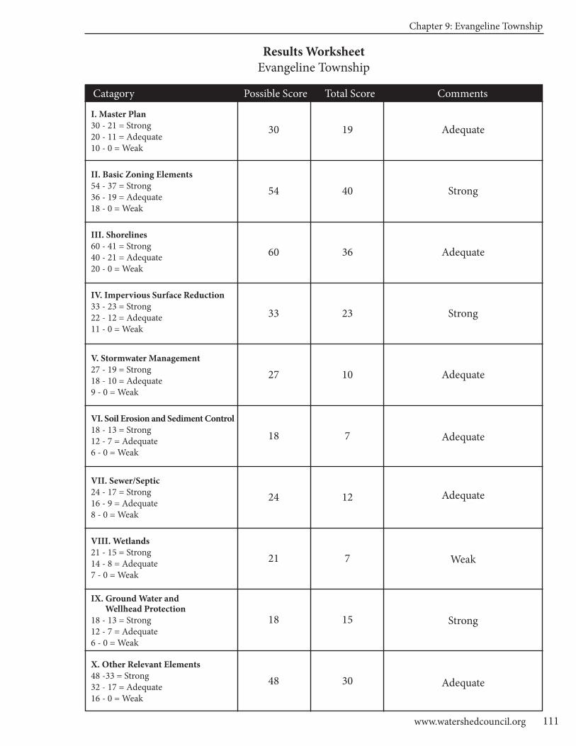
Chapter 9: Evangeline Township
111www.watershedcouncil.org
Results WorksheetEvangeline Township
Catagory Possible Score Total Score Comments
I. Master Plan30 - 21 = Strong20 - 11 = Adequate10 - 0 = Weak
II. Basic Zoning Elements54 - 37 = Strong36 - 19 = Adequate18 - 0 = Weak
III. Shorelines60 - 41 = Strong40 - 21 = Adequate20 - 0 = Weak
IV. Impervious Surface Reduction33 - 23 = Strong22 - 12 = Adequate11 - 0 = Weak
V. Stormwater Management27 - 19 = Strong18 - 10 = Adequate9 - 0 = Weak
VI. Soil Erosion and Sediment Control18 - 13 = Strong12 - 7 = Adequate6 - 0 = Weak
VII. Sewer/Septic24 - 17 = Strong16 - 9 = Adequate8 - 0 = Weak
VIII. Wetlands21 - 15 = Strong14 - 8 = Adequate7 - 0 = Weak
IX. Ground Water and Wellhead Protection
18 - 13 = Strong12 - 7 = Adequate6 - 0 = Weak
X. Other Relevant Elements48 -33 = Strong32 - 17 = Adequate16 - 0 = Weak
30
54
60
33
27
18
24
21
18
48
19
40
36
23
10
7
12
7
15
30
Adequate
Strong
Adequate
Strong
Adequate
Adequate
Adequate
Weak
Strong
Adequate
Chapter 10: Eveline Township
113www.watershedcouncil.org
SECTION III: Analysis
Chapter 10 Eveline Township
Introduction This chapter summarizes results of the Local Ordinance Gaps Analysis project for Eveline Township, which is located in the Lake Charlevoix Watershed in Charlevoix County. Eveline Township is rich in water resources, including 24.5 miles of Lake Charlevoix shoreline (41% of the total Lake Charlevoix shoreline); several smalllakes, including Nowland, Steele, and Mud Lakes; and many creeks, including Dyer, Sear, Monroe, and Porter.This chapter includes the evaluation scores, recommendations and suggested actions. It also relates suggestedactions to the existing Watershed Management Plan for Lake Charlevoix.
Evaluation Scores and Summary
Master Plan ComponentsPOSSIBLE SCORE: 30
TOTAL SCORE: 12, ADEQUATE
Although the Eveline Township Mater Plan does not specifically mention watersheds, the Hydrology andLakefronts section of the Natural Resources Overview provides a comprehensive listing of the lakes andstreams, as well as inventory maps of wetlands, streams, lakes, septic limitations, topography, and steepslopes (Eveline Township Master Plan, pp. 30-36).
The Community Goals and Objectives section of Eveline Township’s Master Plan addresses water qualityand aquatic habitat in several places. The overall goal of the Master Plan includes the following statement:“support the protection of surface water, ground water, wetlands, and the quality of ecological, environmental,natural, and recreational resources of the township.” (p. 3)
Specific strategies to achieve this goal are articulated in Objective 3, which reads “promote the preservation ofscenic resources, recreational resources, natural features, environmentally significant features, and ecologicallyimportant resources in the township.” (p. 4)
Strategy #3 calls for the support of any county or region-wide purchase of development rights. Strategy #5 is to promote ground and surface water protection through encouraging individual property owners to bestewards of the land especially to protect groundwater resources by adhering to appropriate agriculturalpractices (p.4). Strategy #6 is to design local zoning to protect lake water quality to the highest possiblestandard…and promoting the standards recommended by outside agencies such as the Tip of the Mitt Watershed Council and other, similar agencies.” (p.4) Strategy #7 calls for recognizing the importance oflinking greenways and wildlife corridors when approving development proposals (p.4).
CHARLEVOIx COUnTy - Local Ordinance Gaps Analysis
Tip of the Mitt Watershed Council114
Master Plan Components: RECOMMENDATIONS
The Eveline Township Master Plan does a good job of highlighting the importance of water resources in the township, and establishing goals andspecific objectives for water resource protection. The following recommen-dations arise from the Lake Charlevoix Watershed Management Plan andare offered to help strengthen the Master Plan, the next time it is updated:
SUGGESTED ACTION: Add a description of the township’s sub-watersheds(all watersheds in the township eventually run into Lake Charlevoix) and howwater quality is determined by human actions in the watershed.
SUGGESTED ACTION: Mention the importance of minimizing impervioussurfaces in new construction to increase infiltration and reduce stormwaterrunoff.
SUGGESTED ACTION: Acknowledge the importance of well-constructedand maintained road-stream crossings on the quality of stream and waterresources.
Basic Zoning ComponentsPOSSIBLE SCORE: 54
TOTAL SCORE: 31, ADEQUATE
The Eveline Township Zoning Ordinance statement of purpose has several elements that promote water resource protection, including the following:
• Promote the use of lands and natural resources of their character and adaptability and in turn, limit their improper use. • Facilitate the development of adequate systems of transportation, education, recreation, sewage disposal, safe and adequate water supply, and other public requirements. • Conserve life, property and natural resources and the expenditure of funds for public improvements and service to conform with the most advantageous uses of land, resources, and properties. [Article I, Section 1.3 (C, G, and H)]
In addition, the purpose statement for the Multiple Family Residential District includes the following statement:“To provide a more desirable living environment by preserving the natural characteristic of open fields,stands of trees, flood plains, bodies of water, and similar natural assets.” [Article II, Section 2.1(B)(1)(a)].
As well, the purpose statement for the Farm-Forest District includes the following: “To conserve areas containingunique and sensitive natural features such as steep slopes, floodplains and wetlands, by setting them asidefrom development.” [Article II, Section 2.1 (E)(1)(a)]
The Eveline Township Zoning Ordinance includes a fee system to fund administration of the ordinance, and a provision whereby the township can require additional fees to cover the costs of additional professional review when deemed necessary [Article 5, Section 5.3 (A,B)]. The ordinance also authorizes the township torequire financial guarantees for development activities in the Village Area Mixed Use District of a sufficientsum to assure that the project is completed (Article 5, Section 5.7).
Additionally, the Zoning Ordinance addresses the issue of enforcement. Violations of the ordinance or conditionsof permits are declared to be a nuisance, per se, and the persons responsible for the nuisance shall be responsible for a municipal civil infraction. Each day of violation is considered a separate and distinct offence.The Zoning Administrator is authorized to issue infraction citations directing alleged violators to appear incourt, and the township may initiate proceedings in the Circuit Court to address any other violations of thisordinance [Article 5, Section 5.5 (A-D)].

Chapter 10: Eveline Township
115www.watershedcouncil.org
One important aspect of the local zoning permitting process is to ensure that the issuance of local permits iscoordinated with county, state, and federal permits or approvals. The Eveline Township Zoning Ordinanceaddresses this with respect to those projects that require a site plan review. This is essentially for a proposeduse other than a single-family home, and comes under the following blanket statement: “Site Plans shall fullyconform to all applicable state and federal statutes.” [Article VII, Section 8.5(I)]
In addition, compliance with Charlevoix County Drain Commission standards to address drainage and erosionis specifically mentioned [Article VII, Section 8.5(E, F)]. In order to simplify administration, many townshipssimply condition local approval on the applicant receiving necessary state and federal permits before finalsite plan approval or a zoning permit is granted. This is the only way for the applicant to show that the proposed project conforms to applicable state and federal statutes.
The level of specificity required on applications and site plans is an important factor in making a decision on a zoning application. There appears to be some discrepancy in the ordinance with respect to the level of detail required. For example, the Preliminary Development Plan to be submitted in the Village Area MixedUse District calls for the “delineation of any wetlands (as defined by the State of Michigan), including bothregulated and unregulated, and areas within the 100 year floodplain.” [Article III, Section 3.2(A)(c)] However,the information requirements for the site plan include the “general locations of natural features such aswoodlots, water bodies, wetlands, high-risk erosion areas, slopes fifteen (15%) percent and over, beach,sand dunes, drainage, and similar features.” [Article VIII, Section 8.3(B)(12)]
Although Eveline Township does not have a specific Planned Unit Development (PUD) provision, the VillageArea Mixed Use District accomplishes the same objectives as the traditional PUD process, but limits it to theunincorporated Advance or Ironton Village areas. Whereas most PUD ordinances require 50% open space,the Village Area Mixed Use District requires a minimum of 35% open space that is readily accessible andavailable to all of the residents and provides access “to Lake Charlevoix and/or to the adjacent rivers or tributaries where the property borders or contains surface water. Such water access shall be active and may include a beach, marina, fishing access, or waterfront walkway.” [Article III, Section 3.3 (L)(1-3)]
In a similar manner, the Conservation Subdivision District allows for creative development on any legally created Master Parcel in the Township. This is intended to protect farmland while allowing development, asonly 40% of a parcel developed in this District is allowed to be divided into sublots [Article II, Section 2.8(L)].
Basic Zoning Components: RECOMMENDATIONS
The basic components of the Eveline Township Zoning Ordinance create a good initial framework for considering impacts to the township’s water resources from development. The following actions are suggested to helpstrengthen the ordinance:
SUGGESTED ACTION: Clearly state that no zoning permit for a project that might impact wetlands, lakes, or streams will be issued without county,state, or federal permits anywhere in the township. SUGGESTED ACTION: Consider implementing a PUD process, wherebydevelopers are encouraged to set aside open space and permanently protectit through a conservation easement, deed restriction, or similar permanentlegal instrument, and stipulate that open space is to be managed in a natural condition.
CHARLEVOIx COUnTy - Local Ordinance Gaps Analysis
Tip of the Mitt Watershed Council116
ShorelinesPOSSIBLE SCORE: 60
TOTAL SCORE: 41, STRONG
Two of the most effective ways that local governments can protect water quality through zoning is to requiresetbacks from the water’s edge and require a shoreline protection strip of native vegetation between the waterand the upland land use, also called a vegetative buffer zone. Eveline Township employs both of these measures.
The waterfront setback requirements in Eveline Township do a great job of ensuring that buildings are set backfrom the waterfront an appropriate distance. Waterfront setbacks in the Single Family Residential District,Multiple Family District, and the Government/Utility District are all 100 feet. In the Light Industrial District andthe Commercial Recreation District, the waterfront setbacks are 200 feet. In the Mobile Home Park Districtand the Rural Residential District, the waterfront setbacks are 300 feet. In the Village Commercial District, “aminimum fifty (50) foot building setback from all water bodies shall be observed. Setbacks shall be measuredfrom the all time high water level (582.35 feet International Great Lakes Datum 1985) or, in the case of astream or river, the observed edge of the shoreline.” [Article III, Section 3.3(H)(2)]
Eveline Township’s greenbelt provisions are located in the General Provisions section of the ordinance (ArticleIV) and apply to “any land abutting on lakes, rivers, or streams.” (Article IV, Section 4.6) The 50-foot waterfrontgreenbelt is measured from the 582.35 feet elevation on Lake Charlevoix (International Great Lakes Datum1985), or from the observed edge of the shoreline of smaller lakes, rivers, and streams. Decks not exceeding200 square feet and walkways not exceeding 4 feet in width are allowed in the greenbelt area. All vegetationwithin a waterfront greenbelt area shall remain in an undisturbed or natural state. Natural ground cover shallbe preserved to the fullest extent feasible, and where removed it shall be replaced with vegetation that isequally effective in retarding runoff, preventing erosion, and preserving natural beauty. A combination ofgrasses, shrubs, and trees shall be introduced in a naturalized planting pattern where native shoreline vegetation does not exist.
Trees may not be removed within the waterfront greenbelt area unless specifically allowed by a permit. However, the ordinance allows minimal selective pruning of trees in order to afford a view of the water. Theordinance also lists invasive and exotic species to be avoided, including purple loosestrife, reed canary grass,crown vetch, white and yellow sweet clover, Russian olive, autumn olive, and Tartarian honeysuckle. The ordinance also states that no application of supplemental nutrients, pesticides or herbicides will be allowedin the waterfront greenbelt area or between the waterfront greenbelt area and the water’s edge [Article IV,Section 4.6 (A-G)].
In July of 2009, Eveline Township passed a stand-alone ordinance to address the threat of the invasivePhragmites. There are two strains of Phragmites, one of which is invasive and has the potential to dramaticallyimpact shorelines by crowding out all native vegetation, blocking access to the shoreline and obscuring viewsof the water. The ordinance describes potential problems associated with Phragmites and provides a frameworkfor control, including reporting, property access and inspection, public hearing process, obtaining requiredpermits, treatment, and cost. This stand-alone ordinance compliments the greenbelt and setback provisionsin the zoning ordinance [Eveline Township Phragmites Ordinance (Ordinance No. 0714 of 2009)].
Townships have the opportunity to manage the environmental and recreational quality of lakes by regulatingdocks. The General Provisions article of the Eveline Township Zoning Ordinance contains a section specificto docks. This section states that except for properties upon which a marina is permitted by local, state, andfederal agencies, “only one dock will be permitted for each one hundred (100) feet of lake frontage.” [ArticleIV, Sec 4.19 (A)] The ordinance also states that only two boat parking spaces may be provided for each onehundred feet of lake frontage in any zoning district, other than Village Mixed Use or an approved marina, andthat the legal resident of the lot must own all boats stored on that lot [Article IV, Sec 4.19 (B)].
Although the ordinance does not regulate dock length, Section 4.19(D) does state that each dock shall be located at least ten feet from the riparian boundary line, and that all docks must receive proper permits fromthe township, the MDEQ, and the Army Corps of Engineers [Section 4.19(C)]. The Corps and MDEQ permitprocesses usually consider dock length with regard to navigation and environmental issues.
Chapter 10: Eveline Township
117www.watershedcouncil.org
A major concern for water quality and recreational use are “keyhole” or “funnel” developments, whereby residents of a large non-waterfront parcel gain access (like a funnel) to a small lakefront. Eveline Townshipaddresses this issue in the General Provisions article, as well. Section 4.18 (Access to Water Frontage)clearly states that “not more than one (1) single-family home, cottage, condominium or apartment unit maygain water access for each one hundred (100) feet of lake or stream frontage.” [Article IV, Section 4.18(C)]The only exceptions are developments located within the Village Mixed Use District.
Another area of concern on inland lakes is the use of road ends. Townships have the authority to regulateroad end usage to ensure both the right of the public to access the water and the rights of adjacent propertyowners by limiting such activities as installing docks or boat moorings, lounging, sunbathing, or partying.The Eveline Township ordinance does not mention road ends.
Given the sailing and boating opportunities provided by Lake Charlevoix, marinas are an important commercialuse in Eveline Township. Marinas, if not properly, located, developed, and operated, can cause harm towater resources. Eveline Township considers marinas as a special use in the Mixed Village Use and theCommercial Recreation districts. As such, they require a special use permit and must also go through thesite plan review process.
In determining whether to grant a special use permit, the ordinance states that the Township Planning Commissionmust determine that an application will be “designed, constructed, operated and maintained so as to be harmonious with the existing or intended character of the general vicinity and that such a use will not changethe essential character of the area in which it is proposed to be located” and that the project “will not be hazardous or disturbing to existing or future nearby uses.” [Article VII, Section 7.3(A)(1,2)]
Similarly, the standards for site plan approval state that projects must retain as many natural features as possible, conform to applicable fire safety, drainage, erosion, hazardous waste management, and publichealth requirements, and fully conform to all applicable state and federal statutes [Article VIII, Section 8.5 (B, D, E, F, G, H, I)].
Shorelines: RECOMMENDATIONS
The Eveline Township Zoning Ordinance is strong with respect to shorelines.Here are a few suggestions to further strengthen shoreline management.
SUGGESTED ACTION: Conduct an inventory of road ends that may provideaccess to Lake Charlevoix and other water bodies in the township. The inventorycould include the location of the road end, its legal status (is it still in the posses-sion of a public entity), its current use, and potential to cause environmentaldamage (based on location and use pattern). Once complete, the townshipcould then determine if specific standards to regulate road ends are necessary.
SUGGESTED ACTION: We applaud the township’s efforts to control Phragmites. There are two strains of Phragmites — one is invasive and theother is native. We encourage the township to distinguish between the twostrains in the ordinance to ensure that the native strain is not eradicatedfrom the shoreline.
SUGGESTED ACTION: Although marinas are regulated through the specialuse and site plan review provisions of the ordinance, we encourage thetownship to consider expanding the role that they play in regulating marinasby adding standards related to preventing the spread of invasive species,having spill containment equipment, and otherwise following best management practices.
CHARLEVOIx COUnTy - Local Ordinance Gaps Analysis
Tip of the Mitt Watershed Council118
Impervious Surfaces
POSSIBLE SCORE: 33
TOTAL SCORE: 4, WEAK
As noted in the Lake Charlevoix Watershed Management Plan, impervious surfaces prevent rainwater andsnowmelt from naturally percolating into the soils. This reduces the opportunity for contaminants to be removed from stormwater runoff, before it flows into lakes, rivers, and wetlands. The more a local unit ofgovernment can do to reduce impervious surfaces, the better for water quality.
Eveline Township limits impervious lot coverage in the provisions found in the section on waterfront greenbelts,which state the following: a maximum of twenty percent (20%) lot coverage shall be allowed on any parcelwithin five hundred (500) feet of any lake, river or stream, unless stricter standards apply elsewhere in this ordinance.” [Article IV, Section 4.6(F)]
Impervious Surfaces: RECOMMENDATIONS
There are many opportunities for local governments to reduce impervioussurfaces through their Zoning Ordinance. Additionally, the Lake CharlevoixWatershed Management Plan calls for reduction of impervious surfaces toreduce the pollutant load from stormwater runoff into our water resources.We encourage Eveline Township to consider integrating the following provisions into their ordinance.
SUGGESTED ACTION: Establish impervious surface lot coverage limits inall zoning districts (not just the waterfront greenbelt district) to limit impervioussurfaces throughout the township. Consider limiting the percent lot coverageto 15% of the total lot.
SUGGESTED ACTION: Add a provision that allows for flexibility in frontyard setbacks or side yard setbacks to encourage shorter driveways orshared driveways between two lots.
SUGGESTED ACTION: Allow reductions in the size of parking and loadingareas when appropriate for water quality protection, or encourage use ofgrass parking areas or pervious pavers.
Chapter 10: Eveline Township
119www.watershedcouncil.org
Stormwater ManagementPOSSIBLE SCORE: 27
TOTAL SCORE: 5, WEAK
Eveline Township does not regulate stormwater as a stand-alone ordinance. However, there are provisions ofthe Zoning Ordinance where stormwater management planning and implementation is required as part of thezoning review process. In the site plan review information standards, the applicant is required to provide thelocation and dimension of all “facilities designed to collect, store or transport stormwater or wastewater aswell as point of discharge.” [Article VIII, Section 8.3(B)] The site plan review standards state that site plansshall be “designed to retain as many natural features as possible, particularly where such features…helpcontrol soil erosion or stormwater runoff” and that site plans “shall fully conform to the Charlevoix CountyDrain Commission standards.” [Article VIII, Section 8.5(B, E)]
Steep slopes are of particular concern with stormwater management. Eveline Township’s ordinance has additional standards to address steep slopes, including this warning: “particular caution shall be taken toprevent increases in the rate of stormwater runoff and erosion downslope of any steep slope developmentsite.” [Article IV, Section 4.26(B)(2)] As well, Section 4.26 clearly requires that the applicant must provide anapproved soil erosion permit before Township approval is granted.
It is important to note that the proper administration of stormwater regulations often requires specialized expertise. For this reason, it is recommended that townships cooperate with counties in the enforcement ofcounty-wide standards. Charlevoix County officials are in the process of preparing a comprehensive county-wide Storm Water Control Ordinance that would be passed by individual townships and give the county authority to administer and enforce the ordinance. To make this work effectively and efficiently, all participatingtownships and cities would have to pass identical language and participate in an Intergovernmental Agreement.
Stormwater Management: RECOMMENDATIONS
There is great value in working with Charlevoix County on the adoption andimplementation of a comprehensive county-wide stormwater ordinance. Themeasures taken to control stormwater that would be required by such an ordinance are consistent with recommendations in the Lake Charlevoix Watershed Management Plan. To this end, we encourage the following actions.
SUGGESTED ACTION: Coordinate efforts with the County Drain Commis-sioner to enact local stormwater ordinances in the county, allowing thecounty to administer and enforce them for local jurisdictions. Ask the countyto finish the Storm Water Control (SWC) Ordinance and IntergovernmentalAgreement, and present it to Eveline Township for passage.
SUGGESTED ACTION: Between now and the adoption of the CharlevoixCounty Stormwater Ordinance, utilize the county’s expertise in reviewingand commenting on stormwater plans presented in development proposals.
SUGGESTED ACTION: Require that all stormwater management systemsare regularly evaluated and properly maintained to ensure that no dischargeof polluted runoff enters lakes or streams in Eveline Township.
CHARLEVOIx COUnTy - Local Ordinance Gaps Analysis
Tip of the Mitt Watershed Council120
Soil Erosion and Sediment ControlPOSSIBLE SCORE: 18
TOTAL SCORE: 6, WEAK
Sediment, by volume, is the single largest pollutant to waters of the United States. Any time earth is disturbedor graded, as typically happens during the construction process, there is a potential for soil to erode andsediment to be deposited into lakes, streams, and wetlands. Construction, or use of steep or unstableslopes, can also present an erosion and sedimentation hazard. Because local governments have the opportunity to review every single development project as part of zoning review, they are uniquely situated to ensure that soil erosion is controlled and sedimentation is minimized.
Although Eveline Township does not regulate soil erosion and sedimentation control directly, the followingsections of the ordinance require that applicants receive permits from the Charlevoix County Soil Erosionand Sedimentation Control Officer, or that the standards must be met, as a condition of Township approval:Sand and Gravel Mining [Article II, Section 2.8(M)(4)]; Grading Permits [Article IV, Section 4.11(B)(1)]; SteepSlopes Protection Overlay Standards [Article IV, Section 4.26(B)(2)]; and Standards for Granting Site Plan Approval [Article VIII, Section 8.5(F)].
Soil Erosion and Sediment Control: RECOMMENDATIONS
All properties that are located near streams, wetlands, or drainage wayshave the potential to erode and cause sedimentation to nearby waters. Soilerosion control is an essential component in watershed management efforts.The Charlevoix County Department of Building Safety administers Part 91 ofMichigan’s Natural Resources and Environmental Protection Act (NREPA),Michigan’s Soil Erosion and Sedimentation Control statute.
The simplest and most effective way to control erosion at the township level isto partner with the county enforcement agents. It appears that this is happen-ing given the several instances noted above where applicants are required toreceive soil erosion permits from Charlevoix County as a prerequisite to townshipapproval. To strengthen Eveline Township’s role in soil erosion and sedimentcontrol, we recommend the following:
SUGGESTED ACTION: Clearly state that all zoning applicants for any construction or earth change activity proposed within 500 feet of a stream,river, or lake, must receive a soil erosion and sedimentation control permitprior to issuance of an Eveline Township Zoning Permit.
SUGGESTED ACTION: Require that soil erosion and sedimentation controlsbe maintained and monitored on a periodic basis until the site is completelystabilized and vegetated.
SUGGESTED ACTION: Require a pre-winter meeting to assess whether existing controls are in place to ensure that the site will not erode or causesedimentation over winter or during spring runoff events.
Sewer/SepticPOSSIBLE SCORE: 24
TOTAL SCORE: 11, ADEQUATE
The importance of proper septic systems for disposal of wastewater is mentioned in several portions of theEveline Township Comprehensive Plan, including a goal to establish a county-wide point of sale inspectionfor septic systems (p. 5); an acknowledgement that other than a few private associations, the majority of residents are served by individual septic systems (p. 20); and that in an effort to discontinue practices that
Chapter 10: Eveline Township
121www.watershedcouncil.org
could contaminate drinking water wells, sandy soils near Lake Charlevoix have been reclassified to indicatethat they are severely limited as sites for septic systems (p.31).
However, the Eveline Township Zoning Ordinance has minimal standards that relate directly to waste watertreatment. Although it may be present, we found no clear blanket provision requiring all residences and businesses to have a sanitary waste permit from the district health department prior to receiving townshipapproval. Rather, sanitary requirements were mentioned in the context of individual processes, such asstandards for Bed and Breakfast facilities [Article II, Section 2.8 (B)(7), the use of boats for temporarydwelling places in the Village Marina District [Article III, Section 3.3(L)(4)(f), and granting site plan review approval [Article VIII, Section 8.5(H)], which is not required on single-family residential projects.
Sewer/Septic: RECOMMENDATIONS
The simplest and most effective way for townships to ensure compliance withthe county or district health code is to require that all permits for residencesand business receive local health department approval prior to granting atownship zoning permit. In addition, local units of government can regulatethe siting of septic fields to ensure protection of water resources. The mainconcern with septic systems and water quality is the potential for the systemto contribute excess nutrients to water bodies. These nutrients can causethe growth of aquatic weeds and algae.
SUGGESTED ACTION: Clearly state that a septic permit from the HealthDepartment of Northwest Michigan is required as a prerequisite to issuingany Eveline Township zoning permit for a residential or commercial use thatmay generate human waste in any zoning district.
SUGGESTED ACTION: Require that septic systems be located at least 100feet from lakes, streams, wetlands, or other water bodies.
SUGGESTED ACTION: Consider establishing a “point of transfer” inspectionrequirement whereby septic systems in the Township must be inspected toensure they are operating properly before ownership is transferred (theTownship’s Comprehensive Plan calls for this sort of a program on a county-wide scale).
WetlandsPOSSIBLE SCORE: 21
TOTAL SCORE: 1, WEAK
Wetlands are some of our most valuable water resources. They provide excellent wildlife habitat, help controlflooding, and contribute to water quality protection. Although Michigan has a statewide wetland protectionstatute, not all wetlands are covered and not all activities that could impact wetlands are regulated. Localgovernments have the opportunity to supplement the state’s wetland protection program.
Despite the value of wetlands to water resources and habitat in Eveline Township, the Comprehensive Planand the Zoning Ordinance barely mention these resources. In the Master Plan’s Natural Resources Overview,wetlands are referred to as “wet areas,” and there is no mention of the functions they provide (p.31).
The Zoning Ordinance mentions wetlands in these sections:
• Wetland protection is one of the purposes of the Farm Forest (FF) District [Article II, Section 2.1(E)(2)(a)];
• The “general” location of wetlands must be noted on site plans as part of the informational requirements, Article VII, Section 8.3(B)(12)];
• Wetlands are included as a consideration in the designation of Class A nonconforming uses [Article VIX, Section 9.4(C)(3)].

CHARLEVOIx COUnTy - Local Ordinance Gaps Analysis
Tip of the Mitt Watershed Council122
Although not specifically mentioned, it is safe to assume that wetlands are considered in the following stan-dard for site plan approval: “Site Plans shall fully conform to all applicable state and federal statutes.” [ArticleVII, Section 8.5(J)]
Wetlands: RECOMMENDATIONS
Michigan’s wetland statute specifically authorizes local governments toadopt wetland protection ordinances to protect wetlands not protected bythe state statute. In addition to a stand-alone wetland ordinance, local governments can support wetland protection through zoning and by requiringwetland permits from state and federal agencies prior to granting local zoning permits.
SUGGESTED ACTION: Given the important role that wetlands play in pro-tecting water quality, providing wildlife habitat, and minimizing flooding, it isimportant to educate township citizens on the importance of protecting wet-lands.
SUGGESTED ACTION: Include information about wetlands and their impor-tance to the township’s water resources the next time the ComprehensivePlan is updated.
SUGGESTED ACTION: Amend the township ordinance to make it clear thatstate and federal wetland permits are required prior to the issuance of anytownship zoning permit on a parcel where wetlands are present and may beimpacted, regardless of the zoning district.
SUGGESTED ACTION: Consider establishing a wetland setback similar tothe shoreline setbacks in the Zoning Ordinance. Even a short setback fromthe wetland edge (e.g., 25 feet) is much better than constructing a use at theedge of the wetland. This would protect wetlands and cost less to adminis-ter than a separate ordinance. Eventually, a local wetland ordinance shouldbe enacted to fill in gaps of protection.
Ground Water and Wellhead ProtectionPOSSIBLE SCORE: 18
TOTAL SCORE: 9, ADEQUATE
Ground water is the primary source of drinking water for nearly all Northern Michigan residents, and all but afew Eveline Township residents who reside in private associations with central sewer and water systems get theirdrinking water from private wells. Protecting ground water resources from contamination is vitally important.
Article IV (General Provisions) of Eveline Township Zoning Ordinance contains a section titled “Ground WaterProtection.” The purpose of this section is to protect ground water from hazardous substances and to in turn protect surface waters recharged by ground water. This section states that: “No storage of or direct or indirect discharge of any materials that may pollute ground water shall be permitted in any location in theTownship unless evidence of required permits and approvals from all pertinent Federal, State or Countyagencies is provided to the Township.” [Article IV, Section 4.10(B)] As a general provision, this standard applies to all activities that may require a zoning permit in all districts.
Eveline Township also has a stand-alone ordinance that authorizes the Township to recover emergencycleanup costs from those responsible for spilling hazardous materials [Eveline Township Hazardous SpillsExpense Recover Ordinance (Ordinance No. 0308 of 2011)].
Chapter 10: Eveline Township
123www.watershedcouncil.org
Ground Water and Wellhead Protection: RECOMMENDATIONS
SUGGESTED ACTION: Update and maintain a comprehensive inventory ofpotential threats to ground water. This will be particularly important as thetownship continues to grow and more and more people rely on groundwater for drinking water supplies.
SUGGESTED ACTION: Although the general provision noted above appliesto all activities that may require a permit in all zoning districts, it may be usefulto include similar information in the site plan review section of the ordinance,particularly with respect to providing the township with information regardingmeasures taken to reduce the likelihood of hazardous materials spills andwhat measures will be taken if a spill occurs.
OtherPOSSIBLE SCORE: 48
TOTAL SCORE: 27, ADEQUATE
With respect to other provisions in the ordinance that may contribute to water resource protection, EvelineTownship participates in the National Flood Insurance Program. It requires the 100 year floodplain to be delineated on preliminary development plans to be submitted when developing parcels within the VillageArea Mixed Use District [Article III, Section 3.2(A)(2)(c)].
The Eveline Township Zoning Ordinance also contains steep slopes protection overlay standards that are“intended to protect resources in environmentally sensitive areas to ensure that development does not resultin erosion and in flooding during site preparation and the development process.” [Article IV, Section 4.26(A)]Any slope disturbance over 15% shall be minimized, and those proposed disturbances on slopes greaterthan 25% shall be allowed only under certain circumstances. All finished slopes of cuts and fills shall not exceed three-to-one (3:1) slope, unless the applicant can demonstrate that steeper slopes can be stabilizedand maintained adequately [Article IV, Section 4.26(B)].
Other: RECOMMENDATIONS
SUGGESTED ACTION: In order to help ensure that floodplains throughoutthe Township are considered in the zoning permit review process, requirethat floodplain locations be delineated on all site plans.
Conclusion
We applaud the water protection measures that exist in the Eveline Township Zoning Ordinance. We alsothank you for your time and attention in reading this chapter, and hope that our recommendations are helpful. However, if anything is unclear, please be sure to let us know. If you have any questions related to this project, please contact Tip of the Mitt Watershed Council at 231.347.1181.
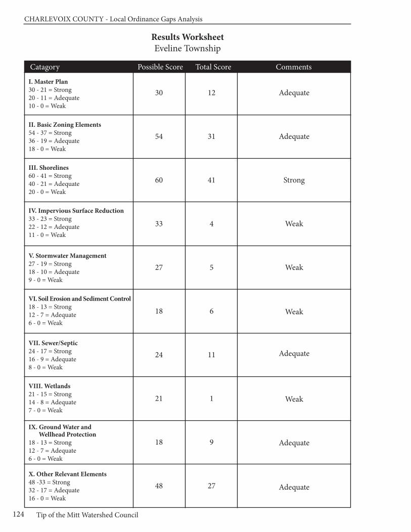
CHARLEVOIx COUnTy - Local Ordinance Gaps Analysis
Tip of the Mitt Watershed Council124
Results WorksheetEveline Township
Catagory Possible Score Total Score Comments
I. Master Plan30 - 21 = Strong20 - 11 = Adequate10 - 0 = Weak
II. Basic Zoning Elements54 - 37 = Strong36 - 19 = Adequate18 - 0 = Weak
III. Shorelines60 - 41 = Strong40 - 21 = Adequate20 - 0 = Weak
IV. Impervious Surface Reduction33 - 23 = Strong22 - 12 = Adequate11 - 0 = Weak
V. Stormwater Management27 - 19 = Strong18 - 10 = Adequate9 - 0 = Weak
VI. Soil Erosion and Sediment Control18 - 13 = Strong12 - 7 = Adequate6 - 0 = Weak
VII. Sewer/Septic24 - 17 = Strong16 - 9 = Adequate8 - 0 = Weak
VIII. Wetlands21 - 15 = Strong14 - 8 = Adequate7 - 0 = Weak
IX. Ground Water and Wellhead Protection
18 - 13 = Strong12 - 7 = Adequate6 - 0 = Weak
X. Other Relevant Elements48 -33 = Strong32 - 17 = Adequate16 - 0 = Weak
30
54
60
33
27
18
24
21
18
48
12
31
41
4
5
6
11
1
9
27
Adequate
Adequate
Strong
Weak
Weak
Weak
Adequate
Weak
Adequate
Adequate

Chapter 11: Hayes Township
125www.watershedcouncil.org
SECTION III: Analysis
Chapter 11 Hayes Township
Introduction This chapter summarizes results of the Local Ordinance Gaps Analysis project for Hayes Township, located inthe northwest portion of Charlevoix County. The township is located in the Lake Charlevoix Watershed, but alsohas waters that drain directly into Lake Michigan. The township also includes two inland lakes, Susan and Mud,and several creeks, including Susan Creek and a portion of Horton Creek. This chapter includes the evaluationscores, recommendations, and suggested actions. It also relates suggested actions to the existing WatershedManagement Plan for Lake Charlevoix.
Evaluation Scores and Summary
Master Plan ComponentsPOSSIBLE SCORE: 30
TOTAL SCORE: 16, ADEQUATE
The Hayes Township Master Plan is current, dated August 2008, so the next update should be scheduled for 2013. Although the Hayes Township Master Plan does not specifically mention watersheds, the NaturalResources chapter provides a very good summary of the importance of water resources and a comprehensivelisting of lakes, wetlands, and streams. This chapter also contains a good description of ground water andthe importance of protecting this vital resource upon which all Hayes Township residents rely for their drinkingwater (Hayes Township Master Plan, pp. 3-1 to 3-5). Maps and inventories include a map of septic limitations(Fig. 3-1) and existing land use, which shows water and wetlands (Fig 4-1). A map of all water features, includingtheir watersheds and sub-watersheds would be helpful.
Chapter 7 of the Master Plan presents the Hayes Township strategic goals, policies, and action plans. Thereare two goals specific to water resources: to protect and preserve ground and surface water for all townshipresidents, and to limit the impact of waterfront development to maintain the quality of adjoining surface waters.These goals are supported by specific policies and a range of actions, including maintaining vegetative bufferstrips along shorelines and watercourses; educating the public regarding ground water resources; and limitingnew development along shorelines to no less than one dwelling per 100 feet of shoreline frontage (HayesTownship Master Plan, p. 7-3).
In addition, the Community Character, Natural Resources and Open Space Goals address water resources.They call for maintaining the integrity of open space, ecosystems and wildlife habitats, and protecting shorelines
CHARLEVOIx COUnTy - Local Ordinance Gaps Analysis
Tip of the Mitt Watershed Council126
and wetlands (Hayes Township Master Plan, p. 7-2). Given that wetlands and shorelines are considered sensitivenatural areas, the Planning and Use Goal, also contributes to water resource protection: “to plan for andguide new development that preserves renewable resources and open space, protects environmentally sensitiveareas, and maintains the historically rural character of Hayes Township”. (Hayes Township Master Plan, p. 7-3)
Master Plan Components: RECOMMENDATIONS
The Hayes Township Master Plan provides many elements that promote the long term protection of water resources. The following suggestions arerecommended in an effort to strengthen the Master Plan, when it is time forthe next update.
SUGGESTED ACTION: Include a water resources map in the Master Plan thatshows lakes, streams, wetlands, and watershed/sub-watershed boundaries.
SUGGESTED ACTION: The Master Plan only discusses runoff in the contextof natural wetlands and woodlands helping to ameliorate the negative effectsof stormwater. Consider addressing the importance of reducing impervioussurfaces to help prevent long term stormwater runoff impacts.
SUGGESTED ACTION: The Hayes Township Master Plan discusses the importance of open space protection. When the plan is updated, considerincluding the value of identifying wildlife corridors and urging their protection,in cooperation with neighboring jurisdictions.
SUGGESTED ACTION: Creeks and their adjacent riparian wetlands arecritical natural features in Hayes Township. A discussion of the importanceof well-constructed and maintained road stream crossings would help topromote protection of these resources.
Basic Zoning ComponentsPOSSIBLE SCORE: 54
TOTAL SCORE: 41, STRONG
The statement of purpose in the Hayes Township Zoning Ordinance contains several elements that promotewater resource protection, including the following:
• Promote the public health, safety and general welfare;
• Encourage the use of lands in accordance with their character and adaptability and limit the improper use of land;
• Control sprawl and maintain rural character; and
• Facilitate adequate provisions for a system of…sewage disposal, safe and adequate water supply… recreation and other public requirements [Article I, Section 1.02 (A,B,C,E)]
Furthermore, in the Lakefront Regulations section of General Provisions, the Zoning Ordinance states that“waterfront property owners have a special obligation to preserve and protect natural resources, water qualityand community scenic and recreational values; therefore a shoreland protection strip shall be establishedand maintained on all waterfront property.” (Article III, Section 3.14)
The Hayes Township Zoning Ordinance includes a fee system to assist in defraying the costs of investigating,reviewing and administering the Zoning Ordinance [Article IX, Section 9.05 (1)]. It also includes a provisionwhereby the township can require additional fees, set aside in an escrow account by the applicant, to coverthe costs of additional professional review when necessary [Article IX, Section 9.05 (2)]. The ordinance alsoauthorizes the township to require performance guarantees for development activities, in an amount equal to

Chapter 11: Hayes Township
127www.watershedcouncil.org
the estimated costs of the improvements. This can be done in connection with the construction of improvementsauthorized through site plan approval, special land use approval, or a Planned Unit Development (PUD) [ArticleIX, Section 9.06).
Article IX of the Zoning Ordinance also addresses the issue of enforcement. Any person or other entity whocreates or maintains a nuisance, or who violates or fails to comply with the ordinance or any permit issuedpursuant to the ordinance, shall be responsible for a municipal civil infraction and be subject to a fine of notmore than five hundred dollars. Each day of violation is considered a separate and distinct offence. The ZoningAdministrator is authorized to post a stop work order on site and to issue infraction citations directing allegedviolators to appear in court. In addition to enforcing this ordinance as a civil infraction, the township may initiate proceedings in the any court of competent jurisdiction to address any other violations of the ZoningOrdinance. (Article IX, Section 9.07.1-.4).
An important element of the local zoning permitting process is to ensure that the issuance of local permits is coordinated with county, state, and federal permits or approvals. The Hayes Township Zoning Ordinancecontains several provisions that call for permit coordination or compliance with other statutes.
In the section of General Provisions that deals with hazardous substances, the Zoning Ordinance requiresthat “all business or industries that store, use or generate hazardous substances…shall meet all state andfederal requirements for storage, spill prevention, record keeping, emergency response, transport and disposalof said hazardous substances.” (Article III, Section 3.17)
The site plan review process requires that “site plans shall conform to all applicable requirements of stateand federal statutes and the Hayes Township Master Plan, and approval may be conditioned on the applicantreceiving necessary state and federal permits before the actual zoning permit authorizing the special landuse is granted.” [5.03(5)(A)(11)]
Additionally, the ordinance specifically requires compliance with any soil erosion sedimentation and stormwaterrunoff control ordinance and notes it is the applicant’s responsibility to provide proof of compliance [5.03(3)(N)].Conditioning local approval on required state and federal permits is an effective way to ensure that water resources are considered, early on in the development process, and that their protection is properly integratedinto the development proposal.
Pre-application meetings are another excellent way to ensure that the protection of water resources is considered early on in the development process. The Hayes Township site plan review process provides the township with authority to conduct a pre-application meeting with the applicant. This is to assist the applicant with understanding ordinance requirements and the site plan review process. It is also intended to provide insight as to what portions of the proposed development may be of special concern. Althoughrecommended, this conference is not mandatory. However, meeting in advance does give the applicant timeto prepare needed information for the Planning Commission to make a proper review [Article V, Section5.03(2)]. In addition, the PUD section of the ordinance calls for a pre-application conference with the applicant,unless waived by the applicant. The purpose of this meeting is to determine the eligibility of the proposedPUD application and to review the procedures and standards for PUD approval [Article VI, Section 6.03(D)(1)].
An important aspect of the implementation of any Zoning Ordinance is the review process. The effectivenessof the review process is determined by the quality of the information provided to the township by the applicant.The section of the ordinance that deals with site plan review (Article V) requires the applicant to submit acomprehensive description of the project, including the following: the location of existing environmental features,such as watercourses, wetlands, shorelines, and man-made drains; the topography of the existing and finishedsite; generalized soil analysis data; and documentation that the site plan complies with applicable soil erosionand sedimentation control ordinances [Article V, Sec 5.03(3)(F,L,M,N)].
As part of the site plan data, the applicant is also required to prepare an impact statement that addressesthe following with respect to water resources: volume of sewage that will need to be treated; volume of waterconsumption related to ground water reserves or community system capacity; and statements relative to theimpact of the proposed development on soil erosion, shoreline protection, wildlife habitat, air pollution, and
CHARLEVOIx COUnTy - Local Ordinance Gaps Analysis
Tip of the Mitt Watershed Council128
water pollution [Article V, Sec 5.03(3)(P)(3)]. By requiring an impact statement, the township encourages theapplicant to thoroughly consider their development proposal with respect to environmental protection.
The Hayes Township PUD provisions require a minimum of 50% of the entire project area to be set aside asopen space. This open space “shall be dedicated to the public or set aside for the common use of the ownersand users within the PUD, and shall remain perpetually in an undeveloped state…” It is also required to beprotected by the developer in a conservation easement, or other legal means acceptable to the township [Article VI, Section 6.03(2)(C)(3)]. Density bonuses are awarded on the following schedule: “for each ten (10)acres of contiguous protected open space within the PUD, excluding state regulated wetlands, other areascharacterized with hydric soils and areas with slopes of greater than 25 percent, the PUD project shall be eligible for one (1) additional bonus unit.” [Article VI, Section 6.03(2)(C)(2)]
Basic Zoning Components: RECOMMENDATIONS
The basic components of Hayes Township’s Zoning Ordinance create a solidframework for considering impacts to the township’s water resources fromdevelopment. We applaud this strong effort, and have only one additionalsuggestion.
SUGGESTED ACTION: Consider requiring open space to be managed in a natural condition and be restricted to low-impact uses. This may be assumed in the ordinance with the term “undeveloped state,” but some clarification could be useful.
ShorelinesPOSSIBLE SCORE: 60
TOTAL SCORE: 41, STRONG
Two of the most effective ways for a local government to protect water quality through zoning is to requiresetbacks from the water’s edge, and require a shoreline protection strip. Both of these measures also protect shoreline habitat. The shoreline protection strip, also called a vegetative buffer zone, requires nativevegetation between the water and the upland land use. Hayes Township employs both of these measures inthe Lakefront Regulations section of the township ordinance General Provisions.
Hayes Township has established a consistent 100-foot setback from Lake Charlevoix and Lake Michigan,and an 80-foot setback from Susan Lake (as measured from the maximum recorded high water level). Nostructures, except for launching ramps and docking facilities including steps and retaining walls, shall be allowed within the waterfront setback [Article III, Section 3.14(1)(A)]. A shoreland protection strip 50 feet wide shall be established and maintained on all waterfront property. The strip is to have at least 70% naturalvegetation cover, including trees, shrubs, or herbaceous plants. The following use regulations apply to theshoreline protection strip:
• leaves, grass clippings, and other yard wastes may not be burned or stored within the shoreland protection strip;
• septic tanks or septic system filtration fields may not be located within the shoreland protection strip;
• pruning of trees, shrubs or other native vegetation is prohibited within the shoreland protection strip, except for the removal of parts of the trees, shrubs or other vegetation that are already dead; and
• removal of invasive species is encouraged within the shoreland protection strip
In cases where the vegetation or soils are disturbed within the Shoreland Protection Strip, the followingrestoration and replanting requirements shall be met:

Chapter 11: Hayes Township
129www.watershedcouncil.org
• Any and all fill material placed within the Shoreland Protection Strip shall be removed. New soils, consistent with soils already found on the property may be added as needed to provide for growth of new vegetation; • The replanted strip shall consist of native vegetation, trees no less than 2.5 inch diameter at 6 inches above grade, and shrubs, as best suited to soil conditions on the property, as recommended by the Charlevoix Conservation District or the MSU Extension Service; • The shoreland protection strip shall not be replanted with invasive and/or exotic species such as: Phragmites, Purple Loosestrife, Reed Canary Grass, Crown Vetch, White and Yellow Sweet Clover, Russian Olive, Autumn Olive, Tartarian Honeysuckle any other invasive or exotic species as identified by Tip of the Mitt Watershed Council; and • A combination of native vegetation shall be introduced in a naturalized planting pattern where native shoreline vegetation does not exist. [Article III, Section 3.14(2)(A-D)]
In 2009, Hayes Township passed a stand-alone ordinance to address the threat of the invasive Phragmites.There are two main strains of Phragmites, one if which is invasive and has the potential to dramatically impactshorelines by crowding out native vegetation, blocking access to the shoreline, and obscuring views of thewater. The ordinance describes potential problems associated with Phragmites and provides a framework forcontrol, including reporting, property access and inspection, public hearing process, obtaining required permits,treatment, and cost. This stand-alone ordinance compliments the greenbelt and setback provisions in thezoning ordinance (Hayes Township Phragmites Ordinance).
Townships have the opportunity to manage the environmental and recreational quality of lakes by regulatingdocks. The Lakefront Regulations section of the General Provisions article of the Hayes Township ZoningOrdinance contains a section specific to docks. This section specifies restrictions that allow “Not more thanone (1) mooring, or one (1) slip, or one (1) dock space for each one hundred (100) feet of lake frontage.” [Article III, Sec 3.14 (3)] This provision goes on to clarify that this stipulation refers only to space for a singleboat that is powered by an engine, including a sailboat powered by an auxiliary engine, and does not applyto small sailboats or any other non-motorized boat powered by hand or foot power. The ordinance is silentwith regard to dock length or placement.
Funnel, or keyhole, developments have the potential to put excessive recreational pressure on lakes. In addition to boating congestion, overuse can have water quality and aquatic habitat impacts. Hayes Town-ship addresses this issue by stipulating that “not more than one (1) single family home or cottage or one (1)condominium unit or one (1) apartment unit shall use or be permitted to use each one hundred (100) feet oflake or stream frontage as measured along the normal high water mark of the lake or stream.” [Article III,Section 3.14(4)] Furthermore, “this restriction shall apply to any parcel regardless of whether access to thewater shall be gained by easement, common fee ownership, single fee ownership or lease.” [Article III, Section 3.14(4)]
Hayes Township regulates road ends terminating at the shoreline, other than the Eastern Avenue road ending.Road end ordinances both ensure the right of the public to access the lake, while at the same time controllingnuisance activities and regulating potential environmental impacts from boating use. The Hayes Townshiproad end ordinance prohibits the placement of docks or other structures; anchoring or mooring an unattendedboat except in emergency situations; using the road end in a manner that would cause a disturbance or nuisance; overnight parking or camping; launching a boat into Lake Charlevoix (Hayes Township Road Ending Ordinance); making noise that endangers, annoys, or disturbs others; littering; trespassing on adjacent property; building a fire; or remaining at the road ending after being asked to leave by a police officer. The ordinance also articulates penalties for violators and provides for enforcement by the townshipOrdinance Enforcement Officer or deputies of the Charlevoix County Sheriff (Hayes Township Road EndingOrdinance 2010, Sections 3-7).
Although Hayes Township does not regulate marinas, per se, there are two provisions in the Zoning Ordinancethat could serve as a framework for marina regulation if the need arose. First, the marine sewage pump-outfacility provision states that “any dock facility providing dockage for four (4) or more boats with marinesewage holding tanks on board shall provide a marine sewage pump-out facility which shall be capable ofproviding pump-out service to a local health department approved sewage disposal facility.” [Article III,
CHARLEVOIx COUnTy - Local Ordinance Gaps Analysis
Tip of the Mitt Watershed Council130
Section 3.14(5)] Secondly, the Hazardous Substances section of the General Provisions states that: all business or industries that store, use or generate hazardous substances…shall meet all state and federal requirements for storage, spill prevention, record keeping, emergency response, transport and disposal ofsaid hazardous substances. No discharge to groundwater, including direct and indirect discharges, shall beallowed without required permits and approvals.
Shorelines: RECOMMENDATIONS
The Hayes Township Zoning Ordinance has many good provisions with re-spect to protecting shorelines. Here are a few suggestions that the townshipmay want to consider to further strengthen their shoreline management:
SUGGESTED ACTION: We applaud the township’s efforts to control Phragmites. There are two types of Phragmites — one is invasive and theother is native. We encourage the township to distinguish between the twotypes in the ordinance, to ensure that the native strain is not eradicated from the shoreline.
SUGGESTED ACTION: Consider adding additional standards regardingdock placement (e.g. side yard setbacks), width, and length so as not to in-terfere with the rights of other waterfront owners or negatively affect thecharacter of the shoreline.
Impervious SurfacesPOSSIBLE SCORE: 33
TOTAL SCORE: 10, WEAK
Impervious surfaces stop rainwater and snowmelt from naturally percolating into soils, thus reducing the opportunity for contaminants to be removed from the resulting stormwater runoff before it flows into lakes,rivers, and wetlands. The more a local unit of government can do to reduce impervious surfaces, the betterfor water quality. The Hayes Township Zoning Ordinance addresses impervious surfaces in several places.The Definitions and the General Provisions Articles of the ordinance clearly define impervious surfaces andhow they are to be calculated with regard to lot coverage. The schedule of regulations articulates the maximum impervious lot coverage in each of the zoning districts. Maximum imperviousness ranges from15% to 60% (Article IV, Section 4.13).
The ordinance has some creative approaches that allow reductions of impervious surfaces related to parkingand loading areas. When the property owner can demonstrate that the required amount of parking is excessive,the Planning Commission may approve a smaller parking area. An area large enough to meet the parkingspace requirements shall be retained as open space, in case the need arises to construct the parking spaceat a later date [Article III, Section 3.23(3)]. As well, citing aesthetic and stormwater concerns, the ordinancelimits the amount of parking to no more than 10% more than the minimum unless approved by the PlanningCommission and based on documented evidence [Article III, Section 3.23(4)]. In addition, the ordinance requires that there shall be one tree for every 8 parking spaces [Article III, Section 3.24(5)(A)].
Impervious Surfaces: RECOMMENDATIONS
Although the Zoning Ordinance refers to “Township private road standards”in the standards for granting site plan approval [Article V, Section 5.03(5)(A)(10)],these standards could not be found on the Townships website nor in theZoning Ordinance itself. The following recommendations are made based on not having access to these standards.
SUGGESTED ACTION: Consider limiting the extent of lawn area inlakeshore zoning districts. Even though they are not impervious, manicuredlawns generate more runoff than yards covered in trees and shrubs.
Chapter 11: Hayes Township
131www.watershedcouncil.org
SUGGESTED ACTION: Consider developing private road standards andadd provisions that would help reduce impervious surfaces, such as creating maximum road widths and cul-de-sac radii.
SUGGESTED ACTION: Consider encouraging grass or turf parking whereappropriate.
Stormwater ManagementPOSSIBLE SCORE: 27
TOTAL SCORE: 11, ADEQUATE
Hayes Township does not currently regulate stormwater as a stand-alone ordinance. However, there are several provisions in the Zoning Ordinance where stormwater management planning and implementation isrequired as part of the zoning review process.
First, one of the General Provisions specifically addresses Storm Water Retention. As a general provision,the following applies to all uses: “Stormwater drainage in excess of natural conditions shall be retained onsite.” (Article III, Section 3.09) This section goes on to state that compliance with this provision may requirethe construction of a stormwater retention pond and that exceptions may be made for water leaving a sitevia an adequately sized existing facility, or one that is created at the same time as the proposed new use. Allstormwater management efforts shall be consistent with the provisions of the Charlevoix County Stormwaterand Soil Erosion Control Program (Article III, Section 3.09). This overarching provision is supported throughoutthe site plan review process, from the data to be required to the standards for granting site plan approval [Article V, Sections 5.03(3,5)]. In addition, the Planning Commission may distribute the site plan to theCharlevoix County Soil Erosion and Sedimentation Control Officer and the Charlevoix County Drain Commissioner for comment prior to consideration for approval.
One way to reduce the discharge of polluted stormwater during construction is to limit the amount of landdisturbance and grading in a project. The standards for granting site plan approval include the followingcomponents:
• All elements of the site plan shall be designed so that there is a limited amount of change in the overall natural contours of the site,
• The landscape shall be preserved in its natural state by minimizing tree and soil removal, and by topographic modifications which result in smooth natural appearing slopes as opposed to abrupt changes in grade between the project and adjacent areas, and
• Special attention shall be given to proper site drainage so that removal of storm waters will not adversely affect neighboring properties. Article V, Section 5.03(5)(A)(1-3)
It is important to note that the proper administration of stormwater regulations often requires specialized expertise. For this reason, it is recommended that Hayes Township cooperate with the county in the enforcementof county-wide standards. Charlevoix County officials are in the process of preparing a comprehensive,county-wide Storm Water Control Ordinance that would be passed by individual townships and give thecounty authority to administer and enforce the ordinance. To make this work effectively and efficiently, all participating townships and cities would have to pass identical language and participate in an Intergovernmental Agreement.
Stormwater Management: RECOMMENDATIONS
There is great value in working with Charlevoix County on the adoption andimplementation of a comprehensive county-wide stormwater ordinance. Themeasures taken to control stormwater that would be required by such an ordinanceare consistent with recommendations in the Lake Charlevoix WatershedManagement Plan. To this end, we encourage the following actions.
SUGGESTED ACTION: Coordinate efforts with the County Drain Commissionerto enact local stormwater ordinances in the county, allowing the county to
CHARLEVOIx COUnTy - Local Ordinance Gaps Analysis
Tip of the Mitt Watershed Council132
administer and enforce them for local jurisdictions. Ask the county to finishthe Storm Water Control (SWC) Ordinance and Intergovernmental Agreement,and present it to Hayes Township for passage.
SUGGESTED ACTION: Between now and the adoption of the CharlevoixCounty Stormwater Ordinance, continue to utilize the county’s expertise inreviewing and commenting on stormwater plans presented in developmentproposals.
SUGGESTED ACTION: Require that all stormwater management systemsare regularly evaluated and properly maintained to ensure that no dischargeof polluted runoff enters lakes or streams in Hayes Township.
Soil Erosion and Sediment ControlPOSSIBLE SCORE: 18
TOTAL SCORE: 1, WEAK
All properties located near streams, wetlands, or drainage ways have the potential to erode and cause sedimentation to nearby waters. Sediment, by volume, is the single largest pollutant to waters of the UnitedStates. Any time earth is disturbed or graded, as typically happens during the construction process, there isa potential for soil to erode and sediment to be deposited into lakes, streams, and wetlands. Construction,or use of steep or unstable slopes, can also present an erosion and sedimentation hazard. Because localgovernments have the opportunity to review every single development project as part of zoning review, theyare uniquely situated to ensure that soil erosion is controlled and sedimentation is minimized.
Soil erosion control is an essential component in watershed management efforts. The Charlevoix County Department of Building Safety administers Part 91 of Michigan’s Natural Resources and Environmental Protection Act (NREPA), Michigan’s Soil Erosion and Sedimentation Control statute.
Although Hayes Township does not regulate soil erosion and sedimentation control directly, the Hayes Township ordinance makes some specific references to the importance of soil erosion control, and the needfor applicants to comply with the Charlevoix County Soil Erosion and Sedimentation Control statues. For thesite plan review process, the Zoning Ordinance states that “all site plans shall comply with the terms of anyapplicable soil erosion sedimentation and stormwater runoff control ordinance.” [Article V, Section 5.03(3)(N)]This principal is re-emphasized in site plan requirements in the section on resource mining, extraction, andfill [Article VII, Section 7.01.(15)(A)(8)].
Soil Erosion and Sediment Control: RECOMMENDATIONS
The simplest and most effective way to control erosion at the township level isto partner with the county enforcement agents. It appears that this is happening,given the instances noted above where applicants are required to receivesoil erosion permits from Charlevoix County as a prerequisite to townshipapproval. To strengthen Hayes Township’s role in soil erosion and sedimentcontrol, we recommend the following:
SUGGESTED ACTION: Clearly state that all zoning applicants for any construction or earth change activity proposed within 500 feet of a stream,river, or lake, must receive a soil erosion and sedimentation control permitprior to issuance of a Hayes Township Zoning Permit.
SUGGESTED ACTION: Require that soil erosion and sedimentation controlsbe maintained and monitored on a periodic basis, until the site is completelystabilized and vegetated.
SUGGESTED ACTION: Require a pre-winter meeting to assess whether ex-isting controls are in place to ensure that the site will not erode or causesedimentation over winter or during spring runoff events.
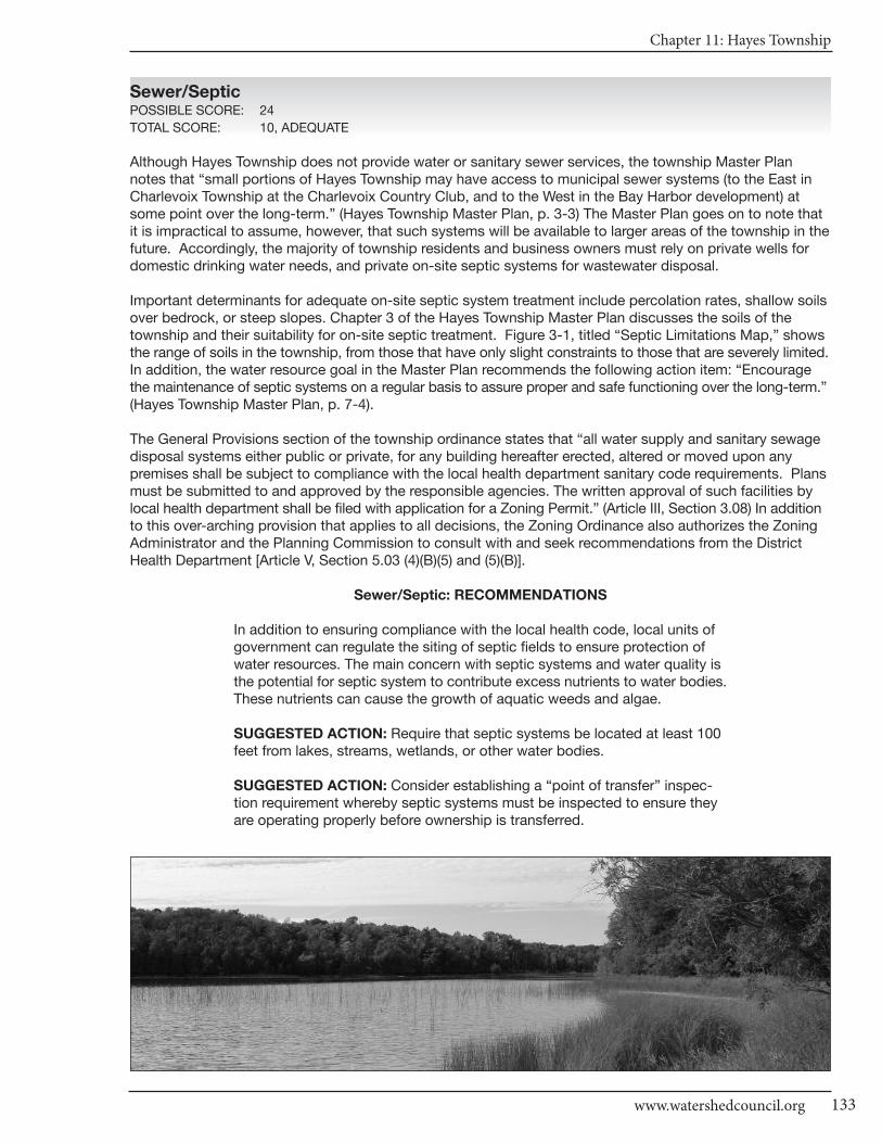
Chapter 11: Hayes Township
133www.watershedcouncil.org
Sewer/SepticPOSSIBLE SCORE: 24
TOTAL SCORE: 10, ADEQUATE
Although Hayes Township does not provide water or sanitary sewer services, the township Master Plannotes that “small portions of Hayes Township may have access to municipal sewer systems (to the East inCharlevoix Township at the Charlevoix Country Club, and to the West in the Bay Harbor development) atsome point over the long-term.” (Hayes Township Master Plan, p. 3-3) The Master Plan goes on to note thatit is impractical to assume, however, that such systems will be available to larger areas of the township in thefuture. Accordingly, the majority of township residents and business owners must rely on private wells fordomestic drinking water needs, and private on-site septic systems for wastewater disposal.
Important determinants for adequate on-site septic system treatment include percolation rates, shallow soilsover bedrock, or steep slopes. Chapter 3 of the Hayes Township Master Plan discusses the soils of thetownship and their suitability for on-site septic treatment. Figure 3-1, titled “Septic Limitations Map,” showsthe range of soils in the township, from those that have only slight constraints to those that are severely limited.In addition, the water resource goal in the Master Plan recommends the following action item: “Encouragethe maintenance of septic systems on a regular basis to assure proper and safe functioning over the long-term.”(Hayes Township Master Plan, p. 7-4).
The General Provisions section of the township ordinance states that “all water supply and sanitary sewagedisposal systems either public or private, for any building hereafter erected, altered or moved upon anypremises shall be subject to compliance with the local health department sanitary code requirements. Plansmust be submitted to and approved by the responsible agencies. The written approval of such facilities bylocal health department shall be filed with application for a Zoning Permit.” (Article III, Section 3.08) In additionto this over-arching provision that applies to all decisions, the Zoning Ordinance also authorizes the ZoningAdministrator and the Planning Commission to consult with and seek recommendations from the DistrictHealth Department [Article V, Section 5.03 (4)(B)(5) and (5)(B)].
Sewer/Septic: RECOMMENDATIONS
In addition to ensuring compliance with the local health code, local units ofgovernment can regulate the siting of septic fields to ensure protection ofwater resources. The main concern with septic systems and water quality isthe potential for septic system to contribute excess nutrients to water bodies.These nutrients can cause the growth of aquatic weeds and algae.
SUGGESTED ACTION: Require that septic systems be located at least 100feet from lakes, streams, wetlands, or other water bodies.
SUGGESTED ACTION: Consider establishing a “point of transfer” inspec-tion requirement whereby septic systems must be inspected to ensure theyare operating properly before ownership is transferred.
CHARLEVOIx COUnTy - Local Ordinance Gaps Analysis
Tip of the Mitt Watershed Council134
WetlandsPOSSIBLE SCORE: 21
TOTAL SCORE: 1, WEAK
As noted in the Hayes Township Master Plan, wetlands are important to the character of the township and“provide important wildlife habitat and play an important role in the hydrologic cycle. Wetlands store and filter storm and flood waters.” (Hayes Township Master Plan, p. 3-1) Although Michigan has a statewidewetland protection statute, not all wetlands are covered and not all activities that could impact wetlands areregulated. Local governments have the opportunity to supplement the state’s wetland protection program.
Although Hayes Township does not have a stand-alone wetland protection ordinance, the Zoning Ordinancementions wetlands in some sections:
• The location of wetlands on the parcel is to be shown on site plan maps [Article V, Section 5.03(3)(F)];
• State regulated wetlands are not to be considered when calculating density bonus in PUD developments, but may count toward the open space requirements [Article VI, Section 6.03(2)(C)(2,3)]; and
• No portion of any cemetery that is partially located in a wetland shall be developed or platted for gravesites [Article VI1, Section 7.01(3)(A)].
Although not specifically mentioned, it is safe to assume that wetlands are considered in the following standard for site plan approval: “site plans shall conform to all applicable requirements of state and federalstatutes and the Hayes Township Master Plan, and approval may be conditioned on the applicant receivingnecessary state and federal permits before the actual zoning permit authorizing the special land use isgranted.” [Article V, Section 5.03(5)(A)(11)]
Wetlands: RECOMMENDATIONS
Michigan’s wetland statute specifically authorizes local governments toadopt wetland protection ordinances to protect wetlands not protected by the state statute. In addition to a stand-alone wetland ordinance, localgovernments can support wetland protection through zoning and by requir-ing wetland permits from state and federal agencies prior to granting localzoning permits. It appears as though Hayes Township’s Zoning Ordinancecontains these basic elements. We offer the following recommendations tofurther encourage wetland protection in the township.
SUGGESTED ACTION: Given the important role that wetlands play in protecting water quality, providing wildlife habitat, and minimizing flooding, it is important to educate township citizens on the importance of protecting wetlands.
SUGGESTED ACTION: Amend the township ordinance to specifically mention that state and federal wetland permits are required, prior to the issuance of any township zoning permit on a parcel where wetlands arepresent and may be impacted, regardless of the zoning district.
SUGGESTED ACTION: Consider establishing a wetland setback similar tothe shoreline setbacks in the Zoning Ordinance. Even a short setback fromthe wetland edge (e.g., 25 feet) is much better than constructing a use at theedge of the wetland. This would protect wetlands and be simple to administer,in the short term. Eventually, a local wetland ordinance should be enactedto fill in gaps of protection.
Chapter 11: Hayes Township
135www.watershedcouncil.org
Ground Water and Wellhead ProtectionPOSSIBLE SCORE: 18
TOTAL SCORE: 15, STRONG
Protecting ground water resources from contamination is vitally important. As noted in the Hayes TownshipMaster Plan, “groundwater serves as the sole source of drinking water for the majority of residents of thetownship and region.” (Hayes Township Master Plan, p. 3.1) The Master Plan also states that “the townshipwill strive to protect groundwater from the harmful effects of intensive and incompatible development” andwill “educate the public regarding the township’s reliance on groundwater resources.” (Hayes Township Master Plan, p. 7.4)
Perhaps the most direct ground water protection provision in the township Zoning Ordinance is found in theGeneral Provisions section that relates to hazardous substances. In this section, all entities that store, use orgenerate substances that could contaminate ground water “shall meet all state and federal requirements forstorage, spill prevention, record keeping, emergency response, transport and disposal of said hazardoussubstances. No discharge to groundwater, including direct and indirect discharges, shall be allowed withoutrequired permits and approvals.” (Article III, Section 3.17) Consideration for ground water protection is an important part of the site plan review process, with the applicant having to provide information on groundwater in the impact statement [Article V, Section 5.03(3)(P)(2)]. As well, the supplemental regulations for Resource Mining, Extraction and Fill has special provisions for excavations that will encounter ground water,including the requirement that a hydro-geological report be conducted [Article VII, Section 7.01(15)(A)(5)].
Ground Water and Wellhead Protection: RECOMMENDATIONS
Importantly, Hayes Township participated in the state Source Water ProtectionPlan process, getting its plan approved in 2002. This is a voluntary program,and we applaud the township for taking this critical step and protectingthese precious drinking water sources.
SUGGESTED ACTION: Update and maintain a comprehensive inventory ofpotential threats to ground water. This will be particularly important as thetownship continues to grow and more and more people rely on groundwater for drinking water supplies.
OtherPOSSIBLE SCORE: 48
TOTAL SCORE: 24, ADEQUATE
With respect to other provisions in the ordinance that may contribute to water resource protection, HayesTownship participates in the National Flood Insurance Program. Additionally, floodplains are noted in theMaster Plan as one of many “resources that are essential to the region’s economic base.” (Hayes TownshipMaster Plan, p. 3-1) Floodplains are mentioned twice in the Hayes Township Zoning Ordinance. First, flood-plains may count toward up to a maximum of twenty-five (25%) percent the required open space in a PUDdevelopment [Article VI, Section 6.03(2)(C)(2,3)]. Second, no portion of any cemetery that is partially locatedin a floodplain shall be developed or platted for gravesites. [Article VI1, Section 7.01(3)(A)].
Other: RECOMMENDATIONS
The additional provisions regarding floodplains help contribute to an overallframework of conscious development and water resource protection. Althoughapplicants may already provide this information, we encourage you to amendthe site plan review section of the ordinance to ensure that floodplain informationis provided on all applications.
SUGGESTED ACTION: In order to help ensure that floodplains throughoutthe Township are considered in the zoning permit review process, requirethat floodplain locations be delineated on all site plans.
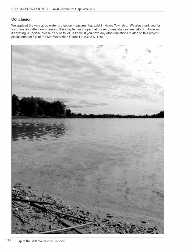
CHARLEVOIx COUnTy - Local Ordinance Gaps Analysis
Tip of the Mitt Watershed Council136
Conclusion
We applaud the very good water protection measures that exist in Hayes Township. We also thank you foryour time and attention in reading this chapter, and hope that our recommendations are helpful. However, if anything is unclear, please be sure to let us know. If you have any other questions related to this project,please contact Tip of the Mitt Watershed Council at 231.347.1181.

Chapter 11: Hayes Township
137www.watershedcouncil.org
Results WorksheetHayes Township
Catagory Possible Score Total Score Comments
I. Master Plan30 - 21 = Strong20 - 11 = Adequate10 - 0 = Weak
II. Basic Zoning Elements54 - 37 = Strong36 - 19 = Adequate18 - 0 = Weak
III. Shorelines60 - 41 = Strong40 - 21 = Adequate20 - 0 = Weak
IV. Impervious Surface Reduction33 - 23 = Strong22 - 12 = Adequate11 - 0 = Weak
V. Stormwater Management27 - 19 = Strong18 - 10 = Adequate9 - 0 = Weak
VI. Soil Erosion and Sediment Control18 - 13 = Strong12 - 7 = Adequate6 - 0 = Weak
VII. Sewer/Septic24 - 17 = Strong16 - 9 = Adequate8 - 0 = Weak
VIII. Wetlands21 - 15 = Strong14 - 8 = Adequate7 - 0 = Weak
IX. Ground Water and Wellhead Protection
18 - 13 = Strong12 - 7 = Adequate6 - 0 = Weak
X. Other Relevant Elements48 -33 = Strong32 - 17 = Adequate16 - 0 = Weak
30
54
60
33
27
18
24
21
18
48
16
41
41
10
11
1
10
1
15
24
Adequate
Strong
Strong
Weak
Adequate
Weak
Adequate
Weak
Strong
Adequate
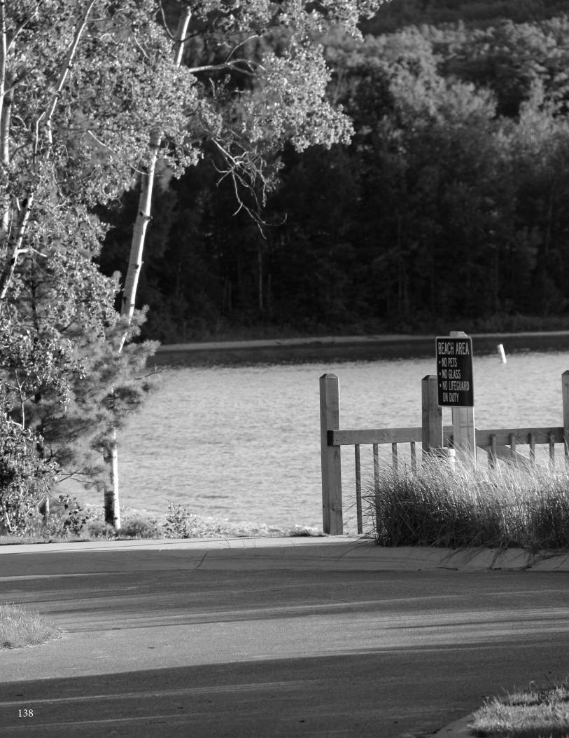
138
Chapter 12: Hudson Township
139www.watershedcouncil.org
SECTION III: Analysis
Chapter 12 Hudson Township
Introduction This chapter summarizes results of the Local Ordinance Gaps Analysis project for Hudson Township, located in the southeastern corner of Charlevoix County. The township contains numerous inland lakes, includingThumb Lake (Lake Louise), Huffman Lake, and many other smaller lakes, as well as the headwaters of threemain watersheds: Lake Charlevoix (via the North Branch of the Boyne River), the Cheboygan River (via the West Branch of the Sturgeon River), and Little Traverse Bay (via a small portion of the South Branch of SpringBrook’s Watershed).
This analysis includes evaluation scores, recommendations and suggested actions from the Local OrdinanceGaps Analysis project. The western portion of Hudson Township is located in the Lake Charlevoix Watershed,and where appropriate, this analysis also relates suggested actions to the Lake Charlevoix Watershed Management Plan.
Evaluation Scores and Summary
Master Plan ComponentsPOSSIBLE SCORE: 30TOTAL SCORE: 21, STRONG
The Hudson Township Comprehensive Plan was updated in January, 1994. Although it doesn’t specificallymention the watersheds in which the township is located, Chapter 3 does a nice job of listing the lakes andstreams, and providing a description of the wetlands that occur in the township. This chapter also includes adescription of the forested habitat.
Hudson Township’s original 1974 “Sketch Land Use Plan” had several goals addressing the need to protectwater resources, especially the lakes in the township. The 1993 Comprehensive Plan updated these goals,with respect to water resources, in the following manner: “Protect environmental resources within the Township including air, water, soils, forests, wildlife, and historic structures.”
A. Support enforcement of soil erosion controls, especially in hilly or erodible areas.
B. Require stormwater management as part of site development.
C. Strengthen water quality controls through greenbelt regulations.
D. Preserve scenic views of hills and lakes.
E. Preserve fish and wildlife resources. (Chapter 6: Goals and Objectives—1993 Comprehensive Plan)
CHARLEVOIx COUnTy - Local Ordinance Gaps Analysis
Tip of the Mitt Watershed Council140
Chapter 7, the Future Land Use section of the Comprehensive Plan, calls for the management of forest landsand shoreline properties. It recommends that planning and zoning strategies be put in place to ensure thatthey maintain their natural character, including minimum lot sizes, greenbelt provisions, and various waterquality protection measures.
Master Plan Components: RECOMMENDATIONS
Although it is eighteen years old, the Hudson Township Comprehensive Plan is still strong with regard to water resource protection. However, updates to Master Planning documents are recommended every 5 years,and we encourage the township to consider doing this in order to reviewother aspects. When this is done, we suggest the following:
SUGGESTED ACTION: Call for minimizing impervious surfaces in new construction and redevelopment projects, to reduce stormwater runoff and improve infiltration.
SUGGESTED ACTION: Acknowledge the importance of well-constructedand maintained road-stream crossings on the quality of stream and waterresources.
SUGGESTED ACTION: Identify wildlife corridors and recommend use ofconservation easements or other measures to permanently protect wildlifecorridors that occur on private land.
Basic Zoning ComponentsPOSSIBLE SCORE: 54TOTAL SCORE: 23, ADEQUATE
The Hudson Township Zoning Ordinance includes several basic components that contribute to water qualityprotection. The statement of purpose includes the following: “to encourage the use of lands and natural resources in the township in accordance with their character, adaptability and suitability for particular purposes.”(Article I, Section 1.0) In addition, the purpose statement for the R-1 zoning district (Single Family ResidentialDistrict, Lake and Stream) states that the purpose is to encourage the proper development of lands alongthe shores of water bodies within the township, to avoid pollution of these water bodies, and to preserve thenatural resources of the township [Article VI, Section 6.0(a)].
The Zoning Ordinance includes a fee system that helps to fund administration of the ordinance, and a provisionwhereby the township can amend such fees, from time to time, to reflect the changing costs of administration(Art XI Sec 11.5). The section of the ordinance dealing with enforcement was amended in 2003 to streamlineaddressing violations. Originally, the Township Board was to initiate criminal proceedings and there was alimit on penalties of five hundred (500) dollars, or imprisonment at the discretion of the court. The amendmentsmake it clear that each day of violation is a separate offence; that the Zoning Administrator can initiate civilcitations and direct alleged violators to appear in court; and there are limits on the severity of penalties for violation (Zoning Ordinance Amendment No. 4 of 2003).
One important aspect of the local zoning permitting process is to ensure that a project applicant receives allapplicable permits from other agencies. The Hudson Township zoning permit application process requiresthat applications provide “evidence that all required federal, state and county licenses or permits, includingany necessary soil erosion and sediment control permit, have been acquired or that applications have beenfiled for same.” [Article XI, Section 11.2(e)] This requirement helps to ensure that protection of resources,such as rivers, lakes, wetlands, and endangered species, are integrated into a proposed development aspart of the planning process.
There is no site plan review process spelled out. However, a site plan is required as part of the Special UsePermit process (Article IX). Although the special use application requirements call for the applicant to identifythe location of unusual environmental features, there are no specific open space requirements.
Chapter 12: Hudson Township
141www.watershedcouncil.org
There are, however, open space incentives in the R-4 (Multiple Family Residential) district. Density bonusesare awarded based on this schedule:
• 50 percent open space, plus 4 units/acre ; • 55 percent open space, plus 6 units/acre; • 60 percent open space, plus 8 units/acre; • 70 percent open space, plus 10 units/acre [Art VI Sec 6.3 (e)(3)].
Unfortunately, the only condition on the use of the open space is that it be maintained as “open space ornon-profit recreational uses.” [Article 6, Section 6.3(e)(2)]
Basic Zoning Components: RECOMMENDATIONS
Although the Hudson Township ordinance contains some basic provisionsthat provide a framework for water resource protection, there are severalways to strengthen it. We encourage the township to consider the following:
SUGGESTED ACTION: Require a pre-application or pre-constructionmeeting for new development or redevelopment proposals. Such meetingsensure that applicants understand all requirements of the ordinance and aremore likely to consider all water resource issues, early in the process.
SUGGESTED ACTION: Modify the fee schedule to include a process bywhich the applicant establishes an escrow fund that pays for the costs ofprofessional environmental or engineering review, if necessary.
SUGGESTED ACTION: Require that all open spaces established are restricted to low impact uses that allow for the landscape to be managedand maintained in a natural condition, and permanently protect all designatedopen space through conservation easements, covenants, or other permanentlegal instruments.
ShorelinesPOSSIBLE SCORE: 60TOTAL SCORE: 20, WEAK
Two of the most effective ways to protect and maintain water quality through zoning are building setbacksand the establishment of vegetated buffers or shoreline protection strips.
Hudson Township addresses both of these zoning methods in Article IV, Section 4.21, Shoreland ProtectionStrip. This provision states, “No building, fence or structure, except docks or launch ramps, shall be erectedcloser than fifty (50) feet from the shoreline at normal high water level of any lake, stream or creek within theTownship.” In addition, the ordinance requires that “a strip of land thirty-five (35) feet wide from the normalhigh water mark bordering the body of water shall be maintained in trees and shrubs in their natural state.”(Article IV, Section 4.21) Within the 35 foot strip, the ordinance allows trees and shrubs to be pruned in orderto afford a view of the water. It allows only 15 feet per 100 feet of frontage to be removed for pedestrian access, and discourages the use of pesticides or herbicides, or burning or storing of vegetation.
Dockage regulations are a valuable tool to address the character of the natural shoreline, recreational enjoyment,and the rights of waterfront owners. No general provisions address dockage issues in Hudson Township.However, the zoning provisions for the R-1 district (Single Family Residential District, Lake and Stream) addressdockage in two ways. First, the placement of docks must comply with the side yard requirements for the district (15 feet from adjacent properties and 35 feet from a road-end). Second, the dock length “shall notbe longer than is required to reach a water depth of six (6) feet at normal low water, provided no dock shallexceed fifty (50) feet.” [Article VI, Section 6.0(f)(1)] Although these measures are positive, the ordinance couldalso include restrictions on the number of water crafts, docks, or rafts per lot.
Since even a very small amount of petroleum products or hazardous chemicals can impact a large amount of water, it is important to ensure proper management of these liquids. Hudson Township addresses these

CHARLEVOIx COUnTy - Local Ordinance Gaps Analysis
Tip of the Mitt Watershed Council142
issues minimally in the section of the ordinance addressing special use permits. It simply requests that applicants note “the location of any areas where toxic or hazardous materials will be used, stored, as well as the safety precautions proposed where such materials are used or stored.” [Article IX, Section 9.1(12)]
Shorelines: RECOMMENDATIONS
The heart of the Hudson Township shoreline provisions are embedded in theR-1 (Single Family Residential District, Lake and Stream) district. In additionto these provisions, we encourage the township to consider the followingactions:
SUGGESTED ACTION: Maintaining native vegetation along the shoreline iscritical to preserving water quality and providing wildlife habitat. The ShorelineProtection Strip (Article IV, Section 4.21) provisions could be strengthenedby specifically encouraging the maintenance and re-establishment of nativevegetation and prohibiting the use of non-native species.
SUGGESTED ACTION: Although Phragmites is of concern mostly on GreatLakes shorelines, it has become established on some inland lakes, streams,and roadside ditches. Because of the high quality of Hudson Township’s inland lakes, and the ability to effectively control Phragmites if it is addressedearly, we encourage the Township to initiate a program to ensure that the invasive strain of Phragmites does not become established in Hudson Township’s waters. This would involve an initial inventory to determine ifthere are non-native stands of Phragmites, treat those stands if they are inexistence, and conduct a follow up inventory and treatment, if necessary.
Impervious SurfacesPOSSIBLE SCORE: 33
TOTAL SCORE: 2, WEAK
Impervious surfaces stop rainwater and snowmelt from naturally percolating into soils, thus reducing the opportunity for contaminants to be removed from the resulting stormwater runoff before it flows into lakes,rivers, and wetlands. The more a local unit of government can do to reduce impervious surfaces, the betterfor water quality. The Lake Charlevoix Watershed Management Plan recommends reducing the pollutantload from stormwater runoff. Reducing impervious surfaces helps to accomplish this objective to protectTownship waters from sediment, nutrients, and toxic substances.
Impervious Surfaces: RECOMMENDATIONS
There are no provisions in the Hudson Township Zoning Ordinance that reduce the amount of impervious surfaces associated with proposed or existing uses. We encourage you to consider the following measures to reduce impervious surfaces:
SUGGESTED ACTION: Consider revising impervious surface lot coveragelimits in all zoning districts to limit impervious surfaces to 15% of the total lot.
SUGGESTED ACTION: Consider adding a provision that allows for flexibilityin front yard setbacks or side yard setbacks to encourage shorter drivewaysor shared driveways between two lots.
SUGGESTED ACTION: Establish a process whereby parking and loading requirements in Article VII can be modified to reduce impervious surfaces byreducing the number of spaces or the square footage of parking spaces andloading areas, or allowing pervious surfaces such as grass, gravel, or brick pavers.
Chapter 12: Hudson Township
143www.watershedcouncil.org
SUGGESTED ACTION: Consider removing the condition in the R-4 (Multiple
Family Residential) District that requires “all areas provided for use by vehicles
shall be surfaced with bituminous asphalt, concrete or similar materials.”
[Article VI, Section 6.3(g)(3)] There are numerous impervious and pervious
surfaces available that serve as suitable parking surfaces to allow stormwater
infiltration rather than runoff.
Stormwater ManagementPOSSIBLE SCORE: 27TOTAL SCORE: 5, WEAK
Hudson Township does not have a stand-alone stormwater regulatory program, but there are several placesin the ordinance where stormwater management is addressed. Article IV, General Provisions, Section 4.15(Storm Water Drainage and Grades) requires that: “No premises shall be filled or graded so as to dischargesurface runoff on abutting premises in amounts and at intervals which exceed the natural or preceding conditions on site. When property is developed adjacent to existing properties previously developed, existing grades shall have priority.” (Article IV, Section 4.15)
In addition, Article VI (Zoning District Regulations) includes two comments regarding drainage. One is includedin the R-1 district requirement and states, “no subsoil footings drain system shall empty directly into anywater body.” [Article VI, Section 6.0(f)(2)] The other is in the R-3 district requirements: “All property in anymobile home court shall be graded so as to be well drained, and a means of conveying storm water awayfrom structures and streets shall be provided.” [Article VI, Section 6.2(b)(1)]
Stormwater Management: RECOMMENDATIONS
Stormwater runoff from buildings, driveways, parking lots, streets, and otherimpervious surfaces is a major source of pollutants to northern Michigan’swaterways. The existing stormwater management language in the HudsonTownship Zoning Ordinance serves as a foundation upon which to build additional protection for the township’s waters. To build on this base, werecommend adding the following stormwater management practices, eitheras a separate item in general provisions, or as part of the site plan review:
SUGGESTED ACTION: Consider requiring review of development proposalsby the County Drain Commissioner to ensure that stormwater managementis properly addressed on all proposed development projects.
SUGGESTED ACTION: Coordinate efforts with the County Drain Commis-sioner to enact local stormwater ordinances in the county, allowing the countyto administer and enforce them for local jurisdictions. Ask the county to finish the Storm Water Control (SWC) Ordinance and IntergovernmentalAgreement, and present it to Hudson Township for passage.
Soil Erosion and Sediment ControlPOSSIBLE SCORE: 18
TOTAL SCORE: 6, WEAK
By volume, sediment is the single largest pollutant to waters of the United States. Any time earth is disturbedor graded, as typically happens during the construction process, there is a potential for soil to erode andsediment to be deposited into lakes, streams, and wetlands. Construction or use of steep or unstable slopescan also present an erosion and sedimentation hazard. Because local governments have the opportunity toreview every single development project as part of zoning review, they are uniquely situated to ensure thatsoil erosion is controlled and sedimentation is minimized.
CHARLEVOIx COUnTy - Local Ordinance Gaps Analysis
Tip of the Mitt Watershed Council144
Hudson Township does not specifically regulate soil erosion and sedimentation. However, by requiring zoning applicants to receive soil erosion permits from the Charlevoix County Department of Building Safety,which administers a county-wide soil erosion control program, the township effectively ensures that soil erosion is addressed. In addition to Article XI, Section 11.2(e), which requires a soil erosion and sedimentcontrol permit, there are two other places where soil erosion is addressed in the Hudson Township ordinance.First, Article IV, Section 4.17 regulates the removal of soil, sand or other material and prohibits the land surface from being left in an unstable condition. Second, Article VI, Section 6.0(f)(4) requires that any development in the R-1 (Single Family Residential District, Lake and Stream) district be done in a way that avoids excessive soil erosion.
Soil Erosion and Sediment Control: RECOMMENDATIONS
All properties that are located near streams, wetlands, or drainage wayshave the potential to erode and cause sedimentation to nearby waters. TheCharlevoix County Department of Building Safety administers Part 91 ofMichigan’s Natural Resources and Environmental Protection Act (NREPA).Coordination between the township and the county is essential to ensurethat soil erosion and sedimentation is controlled.
SUGGESTED ACTION: Although Hudson Township states that soil erosionpermits must be received before a zoning permit can be issued, it may behelpful to specifically require that all proposed development project earthchange activities within 500 feet of a stream, wetland, or other waterway inall zoning districts receive a soil erosion and sedimentation control permitfrom Charlevoix County. This will help to ensure that no projects “fallthrough the cracks.”
Sewer/SepticPOSSIBLE SCORE: 24TOTAL SCORE: 9, ADEQUATE
Sewer and septic management are critical to both human health and water quality. In two separate places,the Hudson Township Zoning Ordinance clearly requires a permit from the District Heath Department as partof the zoning application process. First, the zoning permits section states that “all buildings shall providewater supply and sewage disposal facilities as required & permitted by the District Department of HealthSanitary Code.” (Article IV, Section 4.12) Second, “the written approval of the water supply and sewage disposal facilities, as obtained from the District Health Department, and as required in Article IV, Section 4.12of this Ordinance, shall be accompanied by one copy of both plans and specification.” [Article XI, Section11.2(e)] This simple provision that requires sanitary permits, prior to submitting an application for a localzoning permit, is a very effective way to ensure that Hudson Township’s high quality lakes, streams, and wetlands are protected from inappropriate sewer and septic facilities.
Sewer/Septic: RECOMMENDATIONS
In addition to ensuring compliance with the local health code, local units ofgovernment can influence the siting of septic fields to ensure protection ofwater resources. The main concern with septic systems and water quality isthe potential for septic system to contribute excess nutrients to water bodies.These nutrients can cause the growth of aquatic weeds and algae.
SUGGESTED ACTION: Require that septic systems be located at least 100feet from streams, wetlands, or other water bodies.
SUGGESTED ACTION: Consider establishing a “point of transfer” inspectionrequirement, whereby septic systems must be inspected to ensure they areoperating properly before ownership is transferred.

Chapter 12: Hudson Township
145www.watershedcouncil.org
WetlandsPOSSIBLE SCORE: 21TOTAL SCORE: 2, WEAK
Wetlands are some of our most valuable water resources. They provide excellent wildlife habitat, help controlflooding, and contribute to water quality protection. Although Michigan has a statewide wetland protectionstatute, not all wetlands are covered and not all activities that could impact wetlands are regulated. Localgovernments have the opportunity to supplement the state’s wetland protection program.
Hudson Township requires information on the location of wetlands as part of the special use permit applicationprocess [Article IX, Section 9.1 (a)(5)]. Otherwise, the ordinance is silent with respect to wetlands. Given theproximity of high quality riparian wetland adjacent to streams in the township, the Shoreland Protection Stripsection of the ordinance (Article IV, Section 4.21) could result in some wetland protection.
Wetlands: RECOMMENDATIONS
Michigan’s wetland law specifically authorizes local governments to adoptwetland protection ordinances that provide protection to wetlands not protected by the state statute. In addition to adopting and implementing a stand-alone wetland ordinance, local governments can support wetlandprotection through zoning and by requiring wetland permits from state andfederal agencies, prior to granting local zoning permits.
SUGGESTED ACTION: Given the important role that wetlands play in protecting water quality, providing wildlife habitat, and minimizing flooding, it is important to educate township citizens on the importance of protectingwetlands.
SUGGESTED ACTION: Consider expanding the Shoreland Protection Stripto include setbacks from wetlands. This would protect wetlands and costless to administer than a separate ordinance. Eventually, a local wetland ordinance should be enacted to fill in gaps of protection.
SUGGESTED ACTION: Specifically require applicants seeking zoning permits to secure applicable state wetland permits before issuing a localzoning permit.
CHARLEVOIx COUnTy - Local Ordinance Gaps Analysis
Tip of the Mitt Watershed Council146
Ground Water and Wellhead ProtectionPOSSIBLE SCORE: 18 TOTAL SCORE: 6, WEAK
The six points scored in the ground water evaluation simply account for items that are not applicable to thetownship, and ensures that the township is not penalized for those items. The Hudson Township zoning ordinance is silent with respect to ground water protection. This is unfortunate, because Hudson’s Townshipsground water resources are a key reason why the lakes and streams are of such high quality. In addition tothe environmental importance of ground water, it is the primary source of drinking water for nearly all NorthernMichigan residents. Protecting ground water resources from contamination is vitally important.
Discharges to ground water are regulated by the state under Part 31, Water Resources Protection, of theNatural Resources and Environmental Protection Act (NREPA) 1994 PA 451, and Part 22 Rules. Any proposeddischarges should be prohibited by the township until required state permits are received by the applicant.Storage of hazardous materials is also regulated under Part 5 Rules issued for Part 31. This includes PollutionIncident Prevention Plans, which can be efficiently coordinated with Local Emergency Planning Committee work.
Ground Water and Wellhead Protection: RECOMMENDATIONS
Ground water is vital for not only drinking water, but also to feed tributaries,seeps, springs, and wetland resources with fresh water supplies to supportthose ecosystems, including important recreational fisheries.
SUGGESTED ACTION: Complete and maintain a comprehensive inventoryof potential threats to ground water. This will be particularly important as thetownship continues to grow and more and more people rely on groundwater as a drinking water source.
SUGGESTED ACTION: If direct or indirect discharges to ground water areproposed, use site plan review or some other ordinance provision to prohibitthis until appropriate approvals or permits are obtained from the state.
SUGGESTED ACTION: Protect ground water from potential contaminationby requiring Pollution Incident Prevention Plans for storage of hazardousmaterials, in coordination with Local Emergency Planning Committee efforts.
OtherPOSSIBLE SCORE: 48
TOTAL SCORE: 30, ADEQUATE
There are no additional provisions in Hudson Township’s ordinance that contribute to water resource protection, such as floodplain ordinances. There are no high risk erosion or steep slopes restrictions, or critical dunes in the township. We have no additional recommendations for this element.
Conclusion
We applaud the water protection measures that exist in Hudson Township. We also thank you for your timeand attention in reading this chapter, and hope that our recommendations are helpful. However, if anythingis unclear, please be sure to let us know. If you have any questions related to this project, please contact Tip of the Mitt Watershed Council at 231.347.1181.

Chapter 12: Hudson Township
147www.watershedcouncil.org
Results WorksheetHudson Township
Catagory Possible Score Total Score Comments
I. Master Plan30 - 21 = Strong20 - 11 = Adequate10 - 0 = Weak
II. Basic Zoning Elements54 - 37 = Strong36 - 19 = Adequate18 - 0 = Weak
III. Shorelines60 - 41 = Strong40 - 21 = Adequate20 - 0 = Weak
IV. Impervious Surface Reduction33 - 23 = Strong22 - 12 = Adequate11 - 0 = Weak
V. Stormwater Management27 - 19 = Strong18 - 10 = Adequate9 - 0 = Weak
VI. Soil Erosion and Sediment Control18 - 13 = Strong12 - 7 = Adequate6 - 0 = Weak
VII. Sewer/Septic24 - 17 = Strong16 - 9 = Adequate8 - 0 = Weak
VIII. Wetlands21 - 15 = Strong14 - 8 = Adequate7 - 0 = Weak
IX. Ground Water and Wellhead Protection
18 - 13 = Strong12 - 7 = Adequate6 - 0 = Weak
X. Other Relevant Elements48 -33 = Strong32 - 17 = Adequate16 - 0 = Weak
30
54
60
33
27
18
24
21
18
48
21
23
20
2
5
6
9
2
6
30
Strong
Adequate
Weak
Weak
Adequate
Weak
Adequate
Weak
Weak
Adequate
148

Chapter 13: Marion Township
149www.watershedcouncil.org
SECTION III: Analysis
Chapter 13 Marion Township
Introduction This chapter summarizes results of the Local Ordinance Gaps Analysis project for Charlevoix County’s MarionTownship, which is located in both the Lake Charlevoix and Elk River Watersheds, with a small western portionof the township draining directly to Lake Michigan. The Marion Township landscape features drumlins andnumerous small lakes, creeks, and wetlands. In addition to Lake Charlevoix (a portion of which is located inthe northeast corner of the Township), small lakes in the Township include Adams Lake, Cunningham Lake,East and West Twin Lakes, Lake Marion, Matchett Lake, Mitchell Lake, Nowland Lake, and Skinner Lake.Bordering the lakes and their associated creeks are numerous wetland areas, comprising 25.4% of the township’s land area. This chapter includes the evaluation scores, recommendations and suggested actions.It also relates suggested actions to the existing Watershed Management Plan for Lake Charlevoix.
Evaluation Scores and Summary
Master Plan ComponentsPOSSIBLE SCORE: 30
TOTAL SCORE: 15, ADEQUATE
Marion Township’s current Land Use Plan was adopted July 22, 2008. Although the Plan does not specificallymention the large watersheds in which Marion Township is located, it does provide a good description of thetownship’s water resources.
Fig 2-1 in the Marion Township Land Use Plan (p. II A – 2) maps water features and wetlands, both forestedand non-forested. Fig. 2-3 (p. II A-3) also maps wetland soils. The Plan indicates that both groundwater andsurface water are vital resources, and the majority of the township “is located in an area where vulnerabilityof drinking water aquifers to surface contamination is high due to permeable soils or sensitive drift lithology.”(p. II B-1)
The Community Goals and Policies section of the Land Use Plan addresses water quality and aquatic habitatin several places. One of the policies stated in the Community Planning and Development Goal (to maintainan ecologically sound balance between human activities and the environment to retain and enhance theTownship’s quiet, scenic and rural character) is to “encourage the preservation and protection of scenicviews of hills, valleys, farms, lakes and streams.” (p. III-2)
CHARLEVOIx COUnTy - Local Ordinance Gaps Analysis
Tip of the Mitt Watershed Council150
The Natural Environment and Waterfront Goal is to “Protect and preserve the natural resources, including thewaterfront areas.” (p. III-3) Specific polices to promote this goal include:
• Encourage a land use pattern that is oriented to and respects the natural features and water resources of the area;
• Evaluate the environmental impact of all new development;
• Protect land resources and water quality related to our lakes, streams and wetlands;
• Encourage the continued natural use of wetlands as groundwater recharge and stormwater holding areas; and
• Protect lake and river shorelines (Plan, p. III-3)
In addition to these, policies such as those established to promote the goal of preserving open space canalso serve to protect water resources.
Master Plan Components: RECOMMENDATIONS
We applaud the water resource information and goals contained in the MarionTownship Land Use Plan. We offer the following suggestions to furtherstrengthen the role this document can play in guiding water resource protection.
SUGGESTED ACTION: To help ensure citizens can learn more aboutthe township, make the most recent Land Use Plan available online.
SUGGESTED ACTION: When updating the Land Use Plan, include a description of the watersheds in the township and how land use impactsanywhere in a watershed influence water quality throughout the watershed.
SUGGESTED ACTION: When updating the Land Use Plan, include commentson the problems associated with impervious surfaces and identify stormwatermanagement as an important community priority.
SUGGESTED ACTION: When updating the township’s Land Use Plan, acknowledge the importance of well-constructed and maintained road-stream crossings with regard to the quality of streams in the township.
Basic Zoning ComponentsPOSSIBLE SCORE: 54
TOTAL SCORE: 38, STRONG
The Marion Township Zoning Ordinance does not have an over-arching purpose specific to water resourceprotection (though water resources are surely part of the purpose of promoting “public health, safety, andwelfare” stated in Article I, Section 1.02). The preamble to the Greenbelt section of the ordinance states the following purpose: “to preserve natural resources, water quality and community scenic and recreationalvalues.” (Article III, Section 3.11)
The Marion Township Zoning Ordinance includes a fee system to assist in defraying the costs of investigating,reviewing and administering the Zoning Ordinance [Article X, Section 10.05(1)]. The township can requireadditional fees, set aside in an escrow account by the applicant, to cover the costs of additional professionalreview when necessary [Article X, Section 10.05(2)]. The ordinance also authorizes the township to requireperformance guarantees to ensure the construction of roads, lighting, utility, sidewalk, landscaping anddrainage improvements associated with a project in an amount equal to the estimated costs of the improvements (Article X, Section 10.06).
Chapter 13: Marion Township
151www.watershedcouncil.org
Article X of the Zoning Ordinance also addresses the issue of enforcement. Any person or other entity whocreates or maintains a nuisance, or who violates or fails to comply with the ordinance or any permit issuedpursuant to the ordinance, shall be responsible for a municipal civil infraction and be subject to a fine of notmore than five hundred dollars. Each day of violation is considered a separate and distinct offence. The Zoning Administrator is authorized to issue infraction citations directing alleged violators to appear in court.In addition to enforcing this ordinance as a civil infraction, the township may initiate proceedings in the anycourt of competent jurisdiction to address any other violations of the Zoning Ordinance [Article 10, Section10.07.3(1-3)].
One important aspect of the local zoning permitting process is to ensure that the issuance of local permits is coordinated with county, state, and federal permits or approvals. This concept is reiterated in the purposestatement or Article VI (Site Plan Review), which reads: “The purpose of this chapter is…to ensure that a proposed land use or development activity is in compliance with this ordinance, other local ordinances, andstate and federal statutes and regulations. Despite this broad purpose, there is not a specific provision thatcodifies this notion into a tangible standard by requiring other local, state, or federal permit approvals as acondition of a local zoning permit. Rather, the Zoning Ordinance states that the township “may distribute asite plan to various county agencies for comment prior to consideration for approval.” [Article VI, Section6.03(5)(G)]
Additionally, this same section states that the Planning Commission shall base their decision for approval on“the ability of the sewage disposal and water systems to meet the applicable health and sanitary codes andordinances,” among other things [Section 6.03(5)(A)]. However, it does not require a permit from the HealthDepartment prior to permit issuance. Nowhere in the site plan review standards is the requirement for stateor federal permits stated, such as those required for wetland or lakeshore project.
In order to simplify administration, many townships simply condition local approval on the applicant receivingnecessary state and federal permits before final site plan approval or a zoning permit is granted. This is theonly way for the applicant to prove that the proposed project conforms to applicable state and federal statutes.
Pre-application meetings are another excellent way to ensure that the protection of water resources is considered, early on in the development process. There are two opportunities for pre-application conferencesin Marion Township’s Zoning Ordinance. The first is an optional meeting between the developer and thetownship representatives to discuss the site plan review process, other ordinance requirements, and to provide insight as to what portions of a project may be of special concern to the Planning Commission. Such pre-meetings allow the applicant to understand the site planning process and prepare the needed information for a proper review [Article VI, Section 6.03(2)]. The second opportunity is required as part of thePlanned Unit Development (PUD) approval process. The Zoning Administrator may request or recommendthat the applicant request representatives from township or county agencies to ensure that the applicant canconsider a broad range of issues before preparing a preliminary plan [Article VIII, Section 8.01(20)(C)(1)]
An important aspect of the implementation of any Zoning Ordinance is the site plan review process. The effectiveness of the review process is determined by the quality of the information provided to the townshipby the applicant. The section of the ordinance that deals with site plan review requires the applicant to submita description of the project, including “the location of existing environmental features, such as watercourses,wetlands, shorelines, man-made drains, high risk erosion areas, mature specimen trees, wooded areas, scenicviewsheds or any other unusual environmental features.” (Article VI, Section 6.03(3)(F) This section also requires the applicant to provide a statement that assesses “the impact of the proposed development on soilerosion, shoreline protection, wildlife habitat, air pollution, water pollution (ground and surface), noise andthe scale of development in terms of the surrounding environment.” [Article VI, Section 6.03(3)(P)(3)]
In addition, this section requires the applicant to assess expected demands on community services, includingthe “volume of sewage for treatment, volume of water consumption related to ground water reserves orcommunity system capacity.” [Article VI, Section 6.03(3)(P)(3)] Unfortunately, in Marion Township, site plansare required for all activities except one and two-family residential units, which is the typical developmentpattern on lakeshores in northern Michigan.
Open space provisions that allow for clustering development on one portion of a parcel, while protecting theremainder in its natural state, can help to protect water quality. Marion Township encourages open spacedevelopment by establishing open space minimums in the PUD provisions and providing density bonuses inone of the land division options.
CHARLEVOIx COUnTy - Local Ordinance Gaps Analysis
Tip of the Mitt Watershed Council152
The Marion Township Zoning Ordinance Planned Unit Development (PUD) requirements state that at least 50percent of the total land area shall be designated as dedicated open space. Unlike many Townships that donot count unbuildable lands toward the open space requirements, the Zoning Ordinance states that “theopen space may consist of areas which contain physical characteristics that limit the development potentialsuch as steep slopes or wetlands.” [Article VIII, Section 8.01(20)(B)(1)(d)] The Zoning Ordinance requires thata permanent conservation easement be placed on the property. There is no stipulation that the open spacemust be limited to low impact (non-construction) uses, nor that it be managed in its natural state.
The Land Division Options provided for parcels in the Agricultural (A) District, provide another option foropen space protection, articulated in the Conservation Subdivision Planned Unit Development Option. This development option requires a minimum of 50% of the parcel’s buildable land area to be designated as Conservation Lands to be permanently protected from further lot splits by a conservation easement. Wetlands, land within the 100-year floodplain, and land on slopes greater than 25% are not to be included in the calculation. The easement would still allow all uses allowed in the Agriculture District, as well as theconstruction of two additional dwelling units. The density of the area to be developed is based on how manylots could be built on the buildable area of the master parcel. This assumes one dwelling unit per two acres,with a consideration of the number of homes that could be supported by individual septic systems on conventional lots.
In addition to the maximum lot density as determined above, when the required easement covering ConservationLands shall be held in part by a locally recognized non-profit land conservancy, a maximum of two additionallots shall be allowed for the purpose of funding an endowment to cover expenses for monitoring compliancewith the conservation easement [Article V, Section 5.07.6(3)].
Basic Zoning Components: RECOMMENDATIONS
The basic components of Marion Township’s Zoning Ordinance create agood framework for considering impacts to the Township’s water resourcesfrom development. The following actions are suggested to help strengthenthe ordinance:
SUGGESTED ACTION: Consider requiring open space to be managed in a natural condition and be restricted to low-impact uses. In so doing, thetownship will ensure that these developments are contributing to water resource protection.
SUGGESTED ACTION: Specifically require that applicants must receive approval for all applicable county, state, and federal permits (such as soilerosion control, wetlands, inland lakes and streams, etc.) prior to receiving a township zoning permit.
SUGGESTED ACTION: Require site plan review for all activities (even singlefamily residences) on lakeshore properties. Such review will help to ensurethat impacts to water resources are avoided as much as possible.
ShorelinesPOSSIBLE SCORE: 60
TOTAL SCORE: 16, WEAK
Two of the most effective ways that local governments can protect water quality and shoreline habitat throughzoning is to require setbacks from the water’s edge and require a shoreline protection strip of native vegetationbetween the water and the upland land use, also called a vegetative buffer zone. Marion Township employsboth of these measures in the Greenbelt section of their General Provisions article.
As noted above, the purpose of Marion Township’s greenbelt provision is to “preserve natural resources,water quality and community scenic and recreational values.” (Article III, Section 3.11) This provision calls fora consistent 50-foot setback from the ordinary high water mark of all lakes or streams in the township. Nostructures or septic system filtration fields may be located within the greenbelt except for boathouses,
Chapter 13: Marion Township
153www.watershedcouncil.org
launching ramps and docking facilities, so long as they meet the side yard setback requirements for the district in which they are located.
The ordinance states that no dredging or filling shall be allowed except for reasonable sanding of beacheswhere permitted by state or federal law (Article III, Section 3.11). In addition to the greenbelt provision thatapplies to all zoning districts, the minimum building setback in the Agricultural District is “one hundred (100)feet from any lake, river or stream and twenty five (25) feet from any designated wetland area.” [Article V,Section 5.07.5(3)]
With regards to natural vegetation, this provision requires that at least seventy percent (70%) of the lake orstream frontage within the greenbelt be covered with natural vegetation, including trees, shrubs or herbaceousplants. Beach sand, gravel, cobblestone or rock may be substituted for vegetated areas where these materialsnaturally exist. The use of pesticides, herbicides and fertilizers is prohibited and leaves, grass clippings andsimilar yard and garden wastes may not be burned or stored (Article III, Section 3.11). The ConservationSubdivision Planned Unit Development Option in the Agricultural District calls for the maintenance or creationof ”an undisturbed upland buffer of natural native vegetation of at least 100 feet in depth adjacent to surfacewaters, including lakes, rivers and streams.” [Article V, Section 5.07.6(3)]
Townships have the opportunity to manage the environmental and recreational quality of lakes by regulatingdock length, location, and number of boat spaces allowed. Other than stating that docks shall meet the sideyard setback for the district in which they are located and meet setback requirements for the riparian line asdetermined by state law (Article III, Section 3.11), the Marion Township Zoning Ordinance is silent on theissue of regulating boat dockage.
Shorelines: RECOMMENDATIONS
Marion Township’s Zoning Ordinance greenbelt and setback provisions areuseful tools to help protect shorelines and water quality. Here are a few suggestions that the Township may want to consider to further strengthentheir shoreline management:
SUGGESTED ACTION: Keyhole, or “funnel” developments are those thatutilize a small portion of lake frontage to provide lake access to a large numberof back lot owners. We encourage Marion Township to consider adopting aprovision that specifically prohibits this sort of development.
SUGGESTED ACTION: Although Marion Township’s side yard setbacksapply to dock placement, the ordinance does not address the number ofdocks per lot or the number of boats per dock. Such provisions can help to ensure that lakes are not subject to excessive use.
SUGGESTED ACTION: Although Phragmites is of concern mostly on GreatLakes shorelines, it has become established on some inland waters and roadditches. We encourage all local governments to initiate a program designedto ensure that the invasive strain of Phragmites does not become establishedin their jurisdiction. Such a project would involve an initial inventory to determineif there are non-native stands of Phragmites, treat those stands if they are inexistence, and conduct a follow up inventory, and treatment, if necessary.To do so, we suggest you coordinate your efforts with the Lake CharlevoixAssociation’s Phragmites eradication program
SUGGESTED ACTION: Conduct an inventory of road ends that may provideaccess to Lake Charlevoix and other water bodies in the township. The inventorycould include the location of the road end, its legal status (is it still in thepossession of a public entity?), its current use, and potential to cause envi-ronmental damage (based on location and use pattern). Once complete, thetownship could then determine if specific standards to regulate road endsare necessary.
CHARLEVOIx COUnTy - Local Ordinance Gaps Analysis
Tip of the Mitt Watershed Council154
Impervious SurfacesPOSSIBLE SCORE: 33
TOTAL SCORE: 3, WEAK
As noted in the Lake Charlevoix Watershed Management Plan, impervious surfaces prevent rainwater andsnowmelt from naturally percolating into the soils. From a ground water standpoint, this reduces the aquiferrecharge. From a surface water standpoint, this reduces the opportunity for contaminants to be removedfrom runoff before it flows into lakes, rivers, and wetlands. The more a local unit of government can do to reduce impervious surfaces, the better for water quality.
The Marion Township Zoning Ordinance does a nice job of defining impervious surfaces and calculating lotcoverage of impervious surfaces (see Article II, Section 2.01). There is apparently only one provision that actually serves to reduce impervious surfaces. The Agricultural District provisions state that “no more than20% of the total area of any lot shall be covered by impervious surface.” [Article V, Section 5.07.5(6)]
Impervious Surfaces: RECOMMENDATIONS
There are many opportunities for local governments to reduce impervioussurfaces through their Zoning Ordinance. Additionally, the Lake CharlevoixWatershed Management Plan calls for reduction of impervious surfaces toreduce the pollutant load from stormwater runoff into our water resources.We encourage Marion Township to consider integrating the following provisionsinto their ordinance.
SUGGESTED ACTION: Establish impervious surface lot coverage limits inall zoning districts (not just the agricultural district) to limit impervious surfacesthroughout the township. Consider limiting the percent lot coverage to 15%of the total lot.
SUGGESTED ACTION: Allow reductions in the size of parking and loadingareas when appropriate for water quality protection, or encourage use ofgrass parking areas or pervious pavers.
SUGGESTED ACTION: Provide guidance for reducing impervious surfaceswith respect to private road construction, including right of way widths,pavement widths, radii of cul-de-sacs, etc.
Stormwater ManagementPOSSIBLE SCORE: 27
TOTAL SCORE: 1, WEAK
Marion Township does not regulate stormwater as a stand-alone ordinance. However, there are provisions ofthe Zoning Ordinance where stormwater management is addressed. The first is in the section that articulatesthe data required for the site plan review process: “all site plans shall comply with the terms of the Soil Erosionand Charlevoix County Stormwater Runoff Control Ordinance.” [Article VI, Section 6.03(3)(N)] Although requiringthe applicant to comply with a county stormwater ordinance is an effective way to regulate stormwater, theCharlevoix County stormwater ordinance was rescinded in 2009 and is currently being reworked (see Chapter 1).
The site plan review approval process notes that the Planning Commission may distribute the site plan to theCharlevoix County Soil Erosion and Sedimentation Control Officer and the Charlevoix County Drain Commis-sioner (both of whom have stormwater expertise) for review and comment prior to making a decision [ArticleVI, Section 6.03(5)(G)]. The only other place that stormwater is mentioned in the Zoning Ordinance is with respect to supplemental site development standards for home improvement centers and lumber yards, whichrequires that “storage uses, buildings, parking lots, and sidewalks, shall provide a minimum setback of ten(10) feet from one side yard and forty (40) feet from the side property line to afford transition space for stormwater, snow storage, and/or landscaped buffers.” [Article VIII, Section 8.01(9)(C)]

Chapter 13: Marion Township
155www.watershedcouncil.org
It is important to note that the proper administration of stormwater regulations often requires specialized expertise. For this reason, it is recommended that townships cooperate with counties in the enforcement ofcounty-wide standards. Charlevoix County officials are in the process of preparing a comprehensive county-wideStorm Water Control Ordinance that would be passed by individual townships and give the county authorityto administer and enforce the ordinance. To make this work effectively and efficiently, all participating townshipsand cities would have to pass identical language and participate in an Intergovernmental Agreement.
Stormwater Management: RECOMMENDATIONS
There is great value in working with Charlevoix County on the adoption andimplementation of a comprehensive county-wide stormwater ordinance. Themeasures taken to control stormwater that would be required by such an ordinance are consistent with recommendations in the Lake Charlevoix Watershed Management Plan. To this end, we encourage the following actions.
SUGGESTED ACTION: Coordinate efforts with the County Drain Commis-sioner to enact local stormwater ordinances in the county, allowing thecounty to administer and enforce them for local jurisdictions. Ask the countyto finish the Storm Water Control (SWC) Ordinance and IntergovernmentalAgreement, and present it to Marion Township for passage.
SUGGESTED ACTION: Between now and the adoption of the CharlevoixCounty Stormwater Ordinance, utilize the county’s expertise in reviewingand commenting on stormwater plans presented in development proposals.
SUGGESTED ACTION: Require that all stormwater management systemsare regularly evaluated and properly maintained to ensure that no dischargeof polluted runoff enters lakes or streams in Marion Township.
Soil Erosion and Sediment ControlPOSSIBLE SCORE: 18
TOTAL SCORE: 2, WEAK
Marion Township does not have detailed standards in their ordinance to address soil erosion and sedimentcontrol. However, the issue of soil erosion control is addressed to some extent in the site plan review sectionof the Zoning Ordinance. First, the data required for site plan review includes “generalized soil analysis data,which may include data prepared by the Charlevoix County Soil Conservation District regarding the soils andtheir adaptability to the use.” [Article VI, Section 6.03(3)(M)] This section goes on to say that more detailed information may be required for a more critical review of soils, but provides no detail regarding upon whatcriteria that more critical analysis may be based. The site plan data requirements also include an impactstatement relative to the impact of the proposed development on soil erosion (among other items) [Article VI, Section 6.03(3)(M)].
As part of the site plan review approval process, the Planning Commission may distribute the site plan to theCharlevoix County Soil Erosion and Sedimentation Control Officer for review and comment prior to making adecision [Article VI, Section 6.03(5)(G)]. Although the Township Zoning Ordinance indicates an interest in soilerosion control, the ordinance does not clearly state that a soil erosion and sedimentation control permit fromthe local Soil Erosion Control enforcement agent is required before a Marion Township permit will be issued.
Soil Erosion and Sediment Control: RECOMMENDATIONS
All properties that are located near lakes, streams, wetlands, ponds, ordrainage ways have the potential to erode and cause sedimentation tonearby waters. Accordingly, it is recommended that local governments require all earth movement activities associated with development or construction projects to follow Best Management Practices (BMPs) to
CHARLEVOIx COUnTy - Local Ordinance Gaps Analysis
Tip of the Mitt Watershed Council156
control erosion and ensure that any sediment-laden runoff does not enterwaterways. The Charlevoix County Department of Building Safety administersPart 91 of Michigan’s Natural Resources and Environmental Protection Act(NREPA). Coordination between the township and county is essential to ensure that soil erosion and sedimentation is controlled.
SUGGESTED ACTION: Specifically require that all proposed developmentproject earth change activities within 500 feet of a lake, stream, wetland, orother waterway in all zoning districts receive a soil erosion and sedimentationcontrol permit from Charlevoix County before they receive a permit fromMarion Township.
SUGGESTED ACTION: Specifically require a pre-winter meeting to assesswhether the existing soil cover on a development site will provide adequatesoil erosion and sedimentation control during winter months.
Sewer/SepticPOSSIBLE SCORE: 24
TOTAL SCORE: 9, ADEQUATE
The importance of proper septic systems for disposal of wastewater is mentioned in several portions of theMarion Township Land Use Plan, including Figure 2-5, which maps the township’s limitations to on-site septicdisposal. Although a sewer extends from the northern township border at Marion Center Road south to thehigh school, most township residents rely on private, on-site septic systems to safely dispose of their humanwaste (Marion Township Land Use Plan, p. II E-1). Accordingly, it is in the township’s best interest to ensurethat on-site septic systems are managed properly.
From a water quality perspective, the primary concern with failing septic systems is the potential to contributeexcess nutrients to lakes and streams, which in turn cause weed growth and algae blooms. Marion Township’sgreenbelt provision states that no septic system filtration fields may be located within the greenbelt (50 feetof the shoreline) [Article III, Section 3.11(6)]. The “Water Supply and Sewage Disposal Facilities” section ofthe General Provisions requires that “all water supply and sanitary sewage disposal systems shall be subjectto compliance with District Health Department sanitary code requirements. The written approval of such facilities by District Health Department shall be filed with the application for a Zoning Permit.” (Article III,Section 3.14). This requirement ensures that all activities that might generate human waste have met HealthDepartment standards.
Sewer/Septic: RECOMMENDATIONS
The simplest and most effective way for townships to ensure compliancewith the county or district health code is to require that all permits for residences and business receive local health department approval prior togranting a township permit. Marion Township’s Zoning Ordinance clearlydoes this. In addition, local units of government can regulate the siting ofseptic fields to ensure protection of water resources.
SUGGESTED ACTION: Require that septic systems be located at least 100 feet from lakes, streams, wetlands, or other water bodies.
SUGGESTED ACTION: Consider establishing a “point of transfer” inspectionrequirement whereby septic systems in the township must be inspected toensure they are operating properly before ownership is transferred.
Chapter 13: Marion Township
157www.watershedcouncil.org
WetlandsPOSSIBLE SCORE: 21
TOTAL SCORE: 2, WEAK
Wetlands are some of our most valuable water resources. They provide excellent wildlife habitat, help controlflooding, and contribute to water quality protection. Although Michigan has a statewide wetland protectionstatute, not all wetlands are covered and not all activities that could impact wetlands are regulated. Localgovernments have the opportunity to supplement the state’s wetland protection program.
The Marion Township Land Use Plan does a nice job of articulating the functions and values of wetlands,and provides an inventory map of the general wetland areas (Marion Township Land Use Plan, p. II A-2, II B-1). In addition, the Land Use Plan’s Natural Environment and Waterfront Goal contains several policiesthat effectively promote wetland protection (Marion Township Land Use Plan, p. III-3).
Although the Marion Township Zoning Ordinance does not have a general provision that provides for wetlandprotection, such as a broad requirement that no wetlands will be impacted without applicable state and federalpermits, it does mention these valuable resources in three different sections:
• The Agricultural District includes special considerations for wetland protection in several locations, including:
• Avoiding wetlands in the design and construction of access roads,
• Requiring a 25 foot building setback from all wetlands,
• Excluding wetlands from the building areas calculations and determining maximum allowable density in the Conservation Subdivision Planned Unit Development Option, and
• Considering the extent to which a plan protects wetlands in the final approval process. (Article V, Section 5.07)
• The data required for site plans includes the location of existing environmental features, such as watercourses, wetlands, shorelines, etc. [Article VI, Section 6.03(3)(F)]
• The supplemental site development standards state that “no portion of any cemetery that is located in a wetland shall be developed or platted for grave sites.” [Article VII, Section 8.01(5)(A)]
Wetlands: RECOMMENDATIONS
Michigan’s wetland statute specifically authorizes local governments to adoptwetland protection ordinances to protect wetlands not protected by the statestatute. In addition to a stand-alone wetland ordinance, local governmentscan support wetland protection through zoning and by requiring wetlandpermits from state and federal agencies prior to granting local zoning permits.
SUGGESTED ACTION: Given the crucial role that wetlands play in protectingwater quality, providing wildlife habitat, and minimizing flooding, it is importantto educate township citizens on the importance of protecting wetlands.
SUGGESTED ACTION: Amend the township ordinance to make it clear that state and federal wetland permits are required prior to the issuance ofany township zoning permit on a parcel where wetlands may be impacted,regardless of the zoning district.
SUGGESTED ACTION: Consider establishing a wetland building setback inall zoning districts similar to the 25 foot setbacks in the Agricultural District.Even this narrow setback from the wetland edge is much better than constructinga use at the edge of the wetland. This would protect wetlands and be simpleto administer, in the short term. Eventually, a local wetland ordinance shouldbe enacted to fill in gaps of protection.
CHARLEVOIx COUnTy - Local Ordinance Gaps Analysis
Tip of the Mitt Watershed Council158
Ground Water and Wellhead ProtectionPOSSIBLE SCORE: 18
TOTAL SCORE: 10, ADEQUATE
According to the Marion Township Land Use Plan, the majority of the township relies on ground water for drinking water (Marion Township Land Use Plan, p. II B-1). Protecting ground water resources from contamination is vitally important.
The Marion Township Zoning Ordinance contains several over-arching provisions that are intended to protect ground water resources. The Dumping of Materials section of General Provision states that (amongother things), “the material to be placed on the site shall be of such a composition as not to create potentialcontamination of the natural environment including groundwater… [and] dumping of toxic materials and/ornuclear wastes shall not be allowed in Marion Township.” [Article III, Section 3.15 (2,3)] The data required forthe site plan review process requires an impact statement that addresses the proposed project’s expecteddemands on the volume of water consumption related to ground water reserves or community system capacity [Article VI, Section 6.03(3)(P)(2)].
In addition to these provisions that apply to many different activities, there are special considerations for salvage yards, including:
• the applicant must state how potentially hazardous liquids are to be prevented from entering the ground water and present a written plan for handling and disposal of hazardous liquids;
• the applicant may be required to provide a written contingency plan for toxic spills;
• the Planning Commission may require a roofed work area with an impervious floor with floor drain collection system; and
• The proposed site shall have a minimum of six (6) feet of vertical isolation from groundwater, and be at least one thousand (1,000) feet from an identified body of surface water [Article VIII, Section 8.01(24)(2,3)]
Discharges to ground water are regulated by the state under Part 31, Water Resources Protection, of theNatural Resources and Environmental Protection Act (NREPA) 1994 PA 451, and Part 22 Rules. Any proposeddischarges should be prohibited by the township until required state permits are received by the applicant.Storage of hazardous materials is also regulated under Part 5 Rules issued for Part 31. This includes PollutionIncident Prevention Plans, which can be efficiently coordinated with Local Emergency Planning Committee work.
Ground Water and Wellhead Protection: RECOMMENDATIONS
Marion Township has information in its Land Use Plan and several provisionsin its Zoning Ordinance that both raise awareness and work to protectground water resources. In addition, we encourage the township to considerthe following to help strengthen ground water protection:
SUGGESTED ACTION: Complete and maintain a comprehensive inventoryof potential threats to ground water. This will be particularly important as thetownship continues to grow and more and more people rely on groundwater as a drinking water source.
SUGGESTED ACTION: If direct or indirect discharges to ground water areproposed, use site plan review or some other ordinance provision to prohibitthis until appropriate approvals or permits are obtained from the state.
SUGGESTED ACTION: Protect ground water from potential contaminationby requiring Pollution Incident Prevention Plans for storage of hazardousmaterials, in coordination with Local Emergency Planning Committee efforts.
Chapter 13: Marion Township
159www.watershedcouncil.org
OtherPOSSIBLE SCORE: 48
TOTAL SCORE: 26, ADEQUATE
With respect to other provisions in the ordinance that may contribute to water resource protection, MarionTownship participates in the National Flood Insurance Program. The only place floodplains are mentioned inthe Zoning Ordinance is in the Conservation Subdivision Planned Unit Development land division option inthe Agricultural District. Floodplains are to be considered when calculating the minimum conservation landrequirement, maximum lot density, and the siting of lots in conservation subdivision PUDs [Article V, Section5.07.6(3)].
Other: RECOMMENDATIONS
SUGGESTED ACTION: In order to help ensure that floodplains throughoutthe township are considered in the zoning permit review process, requirethat floodplain locations be delineated on all site plans.
Conclusion
We applaud the water protection measures that exist in Marion Township. We also thank you for your timeand attention in reading this chapter, and hope that our recommendations are helpful. However, if anythingis unclear, please be sure to let us know. If you have any questions related to this project, please contact Tip of the Mitt Watershed Council at 231.347.1181.
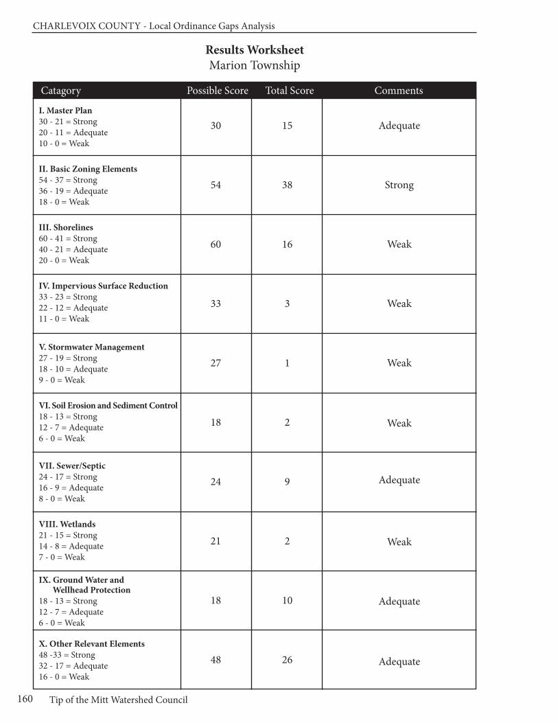
CHARLEVOIx COUnTy - Local Ordinance Gaps Analysis
Tip of the Mitt Watershed Council160
Results WorksheetMarion Township
Catagory Possible Score Total Score Comments
I. Master Plan30 - 21 = Strong20 - 11 = Adequate10 - 0 = Weak
II. Basic Zoning Elements54 - 37 = Strong36 - 19 = Adequate18 - 0 = Weak
III. Shorelines60 - 41 = Strong40 - 21 = Adequate20 - 0 = Weak
IV. Impervious Surface Reduction33 - 23 = Strong22 - 12 = Adequate11 - 0 = Weak
V. Stormwater Management27 - 19 = Strong18 - 10 = Adequate9 - 0 = Weak
VI. Soil Erosion and Sediment Control18 - 13 = Strong12 - 7 = Adequate6 - 0 = Weak
VII. Sewer/Septic24 - 17 = Strong16 - 9 = Adequate8 - 0 = Weak
VIII. Wetlands21 - 15 = Strong14 - 8 = Adequate7 - 0 = Weak
IX. Ground Water and Wellhead Protection
18 - 13 = Strong12 - 7 = Adequate6 - 0 = Weak
X. Other Relevant Elements48 -33 = Strong32 - 17 = Adequate16 - 0 = Weak
30
54
60
33
27
18
24
21
18
48
15
38
16
3
1
2
9
2
10
26
Adequate
Strong
Weak
Weak
Weak
Weak
Adequate
Weak
Adequate
Adequate
Chapter 14: Melrose Township
161www.watershedcouncil.org
SECTION III: Analysis
Chapter 14 Melrose Township
Introduction This chapter summarizes results of the Local Ordinance Gaps Analysis project for Melrose Township, locatedprimarily in the Little Traverse Bay Watershed via the Bear River in Charlevoix County. However, small southernportions of the township are in the Lake Charlevoix Watershed, via the Boyne River. The chapter includes theevaluation scores, recommendations and suggested actions. It also relates suggested actions to the existingWatershed Management Plans for both Little Traverse Bay and Lake Charlevoix.
Evaluation Scores and Summary
Master Plan ComponentsPOSSIBLE SCORE: 30
TOTAL SCORE: 13, ADEQUATE
The Melrose Township Land Use Plan was adopted in 2000. Although the land use plan does not have a detailed inventory map of water resources in the township, the Community Profile section does a nice job of describing the wetlands, creeks, and shoreline attributes for the Walloon Lake watershed. It also notes the flow of the Bear River from Walloon to Lake Michigan’s Little Traverse Bay. Perhaps most importantly, the land use plan speaks to the importance of water resources to residents and landowners in MelroseTownship, and seeks to maintain and protect these resources through several related goals.
Section III of the Land Use Plan, titled “Goals, Objectives, and Actions for Melrose Township,” contains thefollowing six sections, with goals that address water resources in some fashion: Water and Wastewater, Natural Resources, Recreation, Boat Launches, Water Front, and Growth Management. For example, theWater and Wastewater goal reads: “Protect and improve the water quality of our lakes and streams to ensurethe health and well-being of the Township and the residents.” The Natural Resources goal reads: “Preserve,protect and enhance Melrose Township’s natural features and environment.” (Section III) Each goal is followedby specific objectives that guide efforts to accomplish these goals. These objectives range from specific actions, such as “inventory, map and protect the significant natural features (wetlands, slopes, wooded areas,scenic views, lake and streams) in the Township,” to more general recommendations, such as “continue towork with the Walloon Lake Association and Tip of the Mitt Watershed Council to maintain and improve thewater quality of Walloon Lake.” (Section III)
In addition to the Melrose Township Zoning Ordinance, the recommendations of the Land Use Plan are addressed in two “police power” ordinances, one titled “Boat Launch Ordinance” (Ordinance No. 1 of 2010)and the other titled the “Melrose Township Lake Access and Mooring Ordinance” (Ordinance No.3 of 2010).
CHARLEVOIx COUnTy - Local Ordinance Gaps Analysis
Tip of the Mitt Watershed Council162
Together, these two ordinances regulate the use of township-owned boat launches and public road ends toensure access to the lake by the public and protect the lake and adjacent property owners from impacts ofinappropriate use by boaters.
Master Plan Components: RECOMMENDATIONS
As noted above, the Melrose Township Land Use Plan does a nice job ofhighlighting the importance of water resources in the township and establishinggoals and specific objectives for water resource protection. The followingrecommendations are offered to help strengthen the Land Use Plan:
SUGGESTED ACTION: Include maps and a comprehensive inventory ofthe Township’s water resources, including Spring Brook, Haymarsh Creek,and the other creeks flowing into the Bear River or Walloon Lake.
SUGGESTED ACTION: Include a discussion of the impacts of stormwaterrunoff and the importance of minimizing impervious surfaces and otherwisemanaging stormwater, especially in Walloon Village.
SUGGESTED ACTION: Acknowledge the importance of well-constructedand maintained road-stream crossings on the quality of stream and waterresources.
Basic Zoning ComponentsPOSSIBLE SCORE: 54
TOTAL SCORE: 40, STRONG
The statement of purpose for the Melrose Township Zoning Ordinance includes the following: “to encouragethe use of lands and natural resources in the township in accordance with their character, adaptability andsuitability for particular purposes.” (Article I, Section 1.0) In addition to this general statement, the purposestatement of the Melrose Township Walloon Lake Shoreline Protection Overlay District state that the provisions“are intended to protect the unique and sensitive natural environment of the lake as well as the shore areasadjacent to Walloon Lake in Melrose Township.” [Article VI, Section 6.11(C)(1)]
The Melrose Township ordinance includes a fee system that helps to fund administration of the ordinanceand a provision whereby the township can require additional fees (set aside in an escrow account by the applicant) to cover the costs of additional professional review when deemed necessary [Art XIII, Section13.4(B,C)]. From an enforcement standpoint, the ordinance makes it clear that any person violating any provision of the ordinance is guilty of a misdemeanor, and that each day of violation is considered a separateoffence. The Zoning Administrator reports offenses to the Township Board, who, in turn, initiates prosecutionproceedings [Article XII, Section 13.5 (C,D)].
One important aspect of the local zoning permitting process is to ensure that the issuance of local permits is coordinated with county, state, and federal permits or approvals. The Melrose Township Zoning Ordinanceaddresses this in several locations. In provisions to receive a zoning permit in the Walloon Lake Overlay Protection District, the ordinance states that “a zoning permit shall be withheld pending verification that theapplicant has received all required county, state or federal permits, including septic and water well permits;soil erosion and sedimentation control permits; wetland permits; flood plain and culvert permits; and/ordriveway permits.” [Article VI, Section 6.11(C)(2)(b)(2)] This very clear and detailed statement ensures that all requirements of state and federal environmental regulations are addressed on every development proposalthat may impact Walloon Lake.
Furthermore, this requirement is stated in general terms for the entire township in Article 13, Section 13.2(e)that requires the following with a zoning permit application: “Evidence that all required federal, state andcounty licenses or permits have been acquired except building, electrical or plumbing permits.” In addition,the Township’s development plan review process states that “the Zoning Administrator shall mail one (1)

Chapter 14: Melrose Township
163www.watershedcouncil.org
copy of the Application for Development Plan review and one (1) copy of the development plan to the following agencies” and lists several local agencies and relevant state and federal agencies [Article XI, Sec11.3(A)(1-9]. The ordinance further states that the agencies have 15 days after delivery to review and commenton the applications.
Many impacts to water resources from development projects can be avoided or minimized if the developer is able to understand the resources at risk, and design the project around them. One way to do this is to require pre-application meetings for development proposals. Article XIV, Section 14.6 requires that all applicantsfor planned unit developments (PUDs) shall meet with the zoning administrator or the planning commission“for the purpose of determining the eligibility of the proposed PUD application and to review the proceduresand standards for PUD approval.” [Article XIV, Section 14.6]
The key to the implementation of any zoning ordinance is the review process. The effectiveness of the reviewprocess is determined by the quality of the information provided to the township by the applicant. The sectionof the ordinance that deals with development plan review (Section 11) includes two important requirements.First, it states that the application must contain a written narrative stating the anticipated impacts upon thenatural environment. It also requires a development plan map that includes the “location and elevations ofexisting water courses and water bodies, including county drains and man-made surface drainage ways,floodplains and wetlands” and “identification of any significant amenities or unique natural features [Section11.1(A)(2)(d) and (u)]. Describing and mapping water features helps to serve as the basis for a dialogue between the developer and the township about how to reduce potential impacts on those resources.
PUDs provide the opportunity to combine multiple uses, or cluster development in a way that reduces overallimpacts on water resources and the environment compared, to traditional development. The Melrose Townshipordinance contains open space minimums and density bonuses designed to concentrate development onone portion of a parcel, while maintaining the rest of the parcel.
In the R-4 (Multiple Family) District, the ordinance stipulates a minimum open space of 50%. Developerswho set aside additional open space receive density bonuses on the following schedule:
• Open Space Density 50% - 4-Units per acre;
• Open Space Density 55% - 6-Units per acre;
• Open Space Density 60% - 8-Units per acre;
• Open Space Density 70% - 10-Units per acre [ Article VI, Section 6.3 (E) (2-3)]
The minimum open space requirement for PUDs is 25% of the project area [Article XIV, Section 14.1(C)(2)]and density bonuses are also awarded [Article XIV, Sec 14.1(D)(2)].
Basic Zoning Components: RECOMMENDATIONS
The basic components of Melrose Township’s Zoning Ordinance are verystrong and create a sound framework for considering impacts to the township’swater resources from development. The following action is suggested tohelp strengthen the ordinance:
SUGGESTED ACTION: Require open space that is set aside as part of aPUD to be permanently protected through a conservation easement, deedrestriction, or similar permanent legal instrument, and stipulate that openspace is to be managed in a natural condition.
CHARLEVOIx COUnTy - Local Ordinance Gaps Analysis
Tip of the Mitt Watershed Council164
ShorelinesPOSSIBLE SCORE: 60
TOTAL SCORE: 34, ADEQUATE
Two of the most effective ways that local governments can protect water quality is to require setbacks fromthe water’s edge, and require a shoreline protection strip of native vegetation between the water and the upland land use, also called a vegetative buffer. Melrose Township employs both of these measures.
For those waters not included in the Walloon Lake Shoreline Protection Overlay District, the “Shoreland Protection Strip” provision in Article IV (General Provisions) requires a setback of 50 feet from the ordinaryhigh water mark and furthermore states that a “strip of land forty (40) feet deep from the normal high waterlevel bordering the body of water…shall be maintained in trees and shrubs in their natural state. Up to 20%of the trees and shrubs may be pruned, however, to afford a view of the water.” (Article IV, Section 4.20)
For those properties adjacent to Walloon Lake, Melrose Township has established the Walloon Lake ShorelineProtection Overlay District. Like the Shoreline Protection Strip provisions for other waters, the minimum setbackfrom the ordinary high water mark is 50 feet [Article VI, Section 6.11(C)(2)(c)(1)]. Additionally, the Overlay District requires a lake front vegetative buffer zone 40 feet landward of the ordinary high water mark. The ordinance requires that the buffer remain natural and undisturbed, but allows cutting of vegetation to createa filtered view or to remove fallen, dead, diseased or dangerous trees. Cutting of trees on the parcel is limitedto 20 percent (30 percent in the case of dead and dying trees). Cutting or removal of trees and vegetationneed to be approved by the Zoning Administrator. In cases where native vegetation does not exist within abuffer zone, the landowner is encouraged to replant the buffer zone with native plant species. [Article VI,Section 6.11(C)(3)(a-c)]
Boating use of inland lakes can impact water quality, wildlife habitat, and the use and enjoyment of the lakeby residents and visitors. The two most common ways for local governments to address boating use isthrough dock restrictions and provisions that address use at road ends.
The zoning district regulations for the R-1 (Single Family Residential District, Lake & Stream) District requirethat boat docks, landings, and similar structures are subject to state regulations. In addition, “boat docksshall not exceed one (1) per one hundred fifty (150) feet of lot width at the shore” and “not more than three(3) motor powered crafts shall be moored per one hundred fifty (150) feet of lot width.” [Article VI, Section6.0(b)(3-4)] Furthermore, “only one (1) raft will be allowed per one hundred fifty (150) feet of lot width.” [ArticleVI, Section 6.0(b)(3-4)] Although the ordinance does not regulate the size of the dock, it does state that the “the location of any dock must respect adjoining property uses” [(Article VI, Section 6.0(b)(3)] and suchconsiderations are also part of the state permitting review process.
Melrose Township regulates the road ends terminating at the shoreline of Walloon Lake through their policepowers. Such ordinances ensure the right of the public to access the lake, while at the same time controllingnuisance activities and regulating potential environmental impacts from boating use. The Melrose Townshiproad end ordinance regulates the placement of docks or other structures; anchoring or mooring a boat formore than five hours; using the road end in a manner that would cause a disturbance or nuisance; picnickingor lounging; removing water from the lake (other than for fire suppression purposes); or launching a boat, unless it is a designated township boat launch (Melrose Township Ordinance No. 3 of 2010). Designatedboat launching facilities are managed pursuant to the rules and regulations put forth in the Melrose TownshipBoat Launch Ordinance (Ordnance No. 1 of 2010).
Walloon Village is an important location for marina services, which often store, use, and generate hazardousmaterials that could impact water resources. Although Melrose Township’s ordinance does not have a provi-sion to address marinas specifically, Article XI (Development Plan Review) does require that those develop-ments where hazardous substances are stored, used, or generated follow these guidelines:
• be designed in such a manner to prevent spills and discharges to the air, ground, or any waters (including groundwater and wetlands);
• provide secondary containment ; and
• restrict the construction of general purpose floor drains [Article XI, Section 11.4 (E)(1-3)]
Such provisions help to ensure a consciousness regarding spills that could impact water resources, and ensure that applicants are aware of state and federal permit processes and that they are followed.
Chapter 14: Melrose Township
165www.watershedcouncil.org
Shorelines: RECOMMENDATIONS
SUGGESTED ACTION: Keyhole, or “funnel,” developments allow direct accessto water bodies by people who do not own riparian property, thus increasinghuman impacts to the lake or stream. Although the Melrose Township ordinancehas regulations that state the number of dwellings per front foot, the townshipmay want to consider adopting a provision that specifically addresses funnelor keyhole developments.
SUGGESTED ACTION: Consider regulating marinas to ensure that they donot obstruct navigation or otherwise interfere with the rights of boaters andtake measures that prevent the spread of invasive species.
SUGGESTED ACTION: Although Phragmites is of concern mostly on GreatLakes shorelines, it has become established on some inland waters androad ditches. We encourage all local governments to initiate a program designed to ensure that the invasive strain of Phragmites does not becomeestablished in their jurisdiction. Such a project would involve an initial inventoryto determine if there are non-native stands of Phragmites, treat those standsif they are in existence, and conduct a follow up inventory (and treatment, ifnecessary). To do so, we suggest you coordinate your efforts with the LakeCharlevoix Association’s Phragmites eradication program.
Impervious SurfacesPOSSIBLE SCORE: 33TOTAL SCORE: 5, WEAK
Impervious surfaces limit opportunities for rainwater to naturally percolate into the soils, thus reducing theopportunity for contaminants to be removed from runoff before it flows into lakes, rivers, and wetlands. Themore a local unit of government can do to reduce impervious surfaces, the better for water quality.
The only provision in the Melrose Township ordinance that helps to encourage reduction of impervious surfacesis Art XI Sec 11.4(D), which stipulates that the traveled portion of the road shall be a minimum of eighteen(18) feet in width with a two (2) foot shoulder on each side. This is a reasonable width, and by specificallymentioning this number, the ordinance encourages road beds of this width. Some local governments havetheir minimum roadbed width larger, which encourages more impervious surface in the jurisdiction.
Impervious Surfaces: RECOMMENDATIONS
There are many opportunities to reduce impervious surfaces in local zoningordinances. We encourage Melrose Township to consider integrating thefollowing provisions into their ordinance. Additionally, both the Lake Charlevoixand the Little Traverse Bay Watershed Management Plans call for reductionof impervious surfaces to reduce the pollutant load from stormwater runoffinto our water resources.
SUGGESTED ACTION: Establish impervious surface lot coverage limits inall zoning districts (especially residential districts) to limit impervious surfacesto 15% of the total lot.
SUGGESTED ACTION: Consider adding a provision that allows for flexibilityin front yard setbacks or side yard setbacks to encourage shorter drivewaysor shared driveways between two lots.
SUGGESTED ACTION: Modify Article VIII, Section 8.2 to allow reductions inthe size of parking and loading areas when appropriate, or encourage use ofgrass parking areas or pervious pavers.
SUGGESTED ACTION: Consider modifying Article XI, Section 11.4(A)(14) tolimit private road widths to 18 feet and to allow more narrow rights of way,when appropriate, to reduce mass clearing and grading.
CHARLEVOIx COUnTy - Local Ordinance Gaps Analysis
Tip of the Mitt Watershed Council166
Stormwater ManagementPOSSIBLE SCORE: 27
TOTAL SCORE: 11, ADEQUATE
Although Melrose Township does not regulate stormwater as a stand-alone ordinance, there are several provisionsin the zoning ordinance where stormwater management planning and implementation is required as part ofthe zoning review process. Article IV, General Provisions, Section 4.14 (Grades), states that “No premisesshall be filled or graded so as to discharge surface runoff on abutting premises in such a manner that willcause inconvenience or damage to adjacent properties.” (Article IV, Section 4.14)
A similar general statement is conveyed in Section 14.10 - Standards for PUD Approval; Conditions; Waiverof Standards, which reads: “The planned unit development shall not result in any greater storm water runoffto adjacent property after development, than before. The open space shall be provided with ground coversuitable to control erosion, and vegetation which no longer provides erosion control shall be replaced.” [Section 14.10(A)(11)]
These general guidelines are made more specific in Article XI, which articulates the Standards for DevelopmentPlan Approval. Article XI, Section 11.4(A)(3) states that “special attention shall be given to proper developmentdrainage so that removal of storm waters will not adversely affect neighboring properties.” This section goeson to specifically state that “run-off from such developments must run through detention and settling basinsbefore being discharged off development. Such basins shall have the storage capacity to handle all stormwater runoff from a four and two tenths (4.2) inch rainfall (a 100 year rain fall event) in a twenty-four (24) hourperiod.” [Article XI, Section 11.4(A)(3)]
Such requirements, if enforced and monitored, could go far to address the problem of stormwater runoff in Melrose Township. It is important to note that the proper administration of stormwater regulations often requires specialized expertise. For this reason, it is recommended that townships cooperate with counties in the enforcement of county-wide standards. Charlevoix County officials are in the process of preparing acomprehensive county-wide Storm Water Control (SWC) Ordinance that would be passed by individualtownships, giving the county authority to administer and enforce the ordinance. To make this work effectivelyand efficiently, all participating townships and cities would have to pass identical language and participate in an Intergovernmental Agreement.
Stormwater Management: RECOMMENDATIONS
While the Melrose Township Zoning Ordinance contains valuable stormwaterprovisions, there is also great value in working with Charlevoix County on the adoption and implementation of a comprehensive county-wide stormwaterordinance.
SUGGESTED ACTION: Coordinate efforts with the County Drain Commis-sioner to enact local stormwater ordinances in the county, allowing the countyto administer and enforce them for local jurisdictions. Ask the county to finishthe Storm Water Control (SWC) Ordinance and Intergovernmental Agreement,and present it to Melrose Township for passage.
SUGGESTED ACTION: Between now and the adoption of the CharlevoixCounty Stormwater Ordinance, utilize the county’s expertise in reviewingand commenting on stormwater plans presented in development proposals.
SUGGESTED ACTION: Require that all stormwater management systemsare regularly evaluated and properly maintained to ensure that no dischargeof polluted runoff enters lakes or streams in Melrose Township.
Chapter 14: Melrose Township
167www.watershedcouncil.org
Soil Erosion and Sediment ControlPOSSIBLE SCORE: 18
TOTAL SCORE: 7, ADEQUATE
By volume, sediment is the single largest pollutant to waters of the United States. Any time earth is disturbedor graded, as typically happens during the construction process, there is a potential for soil to erode andsediment to be deposited into lakes, streams, and wetlands. Construction, or use of steep or unstable slopes,can also present an erosion and sedimentation hazard. Because local governments have the opportunity toreview every single development project as part of zoning review, they are uniquely situated to ensure thatsoil erosion is controlled and sedimentation is minimized.
Although Melrose Township does not specifically regulate soil erosion and sedimentation, by requiring zoningapplicants to receive soil erosion permits from the Charlevoix County Department of Building Safety theTownship effectively ensures that erosion is addressed. Zoning permits for properties within the WalloonShoreline Overlay district are withheld, pending verification that a Soil Erosion and Sedimentation Control permithas been received by the applicant [Article VI, Section 6.11(C)2(b)(2)]. The Township’s website prominentlyfeatures a notice to inform all applicants that any building or construction within 500 feet of a lake or streamrequires a Soil Erosion and Sedimentation Control Permit. In addition, Article IV, Section 4.16 regulates theremoval of soil, sand or other material and requires Soil Erosion and Sedimentation Control permits before aproject can proceed, and states that soil cannot be taken within 200 feet of adjacent lot lines and the landmust be left in a stable condition (Article IV, Section 4.16).
Soil Erosion and Sediment Control: RECOMMENDATIONS
All properties that are located near streams, wetlands, or drainage wayshave the potential to erode and cause sedimentation to nearby waters. TheCharlevoix County Department of Building Safety administers Part 91 ofMichigan’s Natural Resources and Environmental Protection Act (NREPA)—Michigan’s Soil Erosion and Sedimentation Control statute. The MelroseTownship Ordinance and website does a nice job of informing potential applicants of the need to receive a Soil Erosion and Sedimentation Controlpermit from Charlevoix County (the local enforcement agent). To furtherstrengthen this cooperative working arrangement, we recommend the following:
SUGGESTED ACTION: Require that soil erosion and sedimentation controlsbe maintained and monitored on a periodic basis until the site is completelystabilized and vegetated.
SUGGESTED ACTION: Require a pre-winter meeting to assess whether existing controls are in place to ensure that the site will not erode or causesedimentation over winter or during spring runoff events.
Sewer/SepticPOSSIBLE SCORE: 24
TOTAL SCORE: 11, ADEQUATE
According to the Natural Resources section of the township Master Plan, properties within the township relyon private septic systems and drain fields. Limitations for on-site septic systems occur in locations of hydric(wetland) soils and areas where slopes are in excess of 12%. There is a privately owned sewer system locatedin Walloon Village that could offer limited waste disposal, but it has been contaminated with hydrocarbonsand is presently inoperable (Melrose Township Land Use Plan, p. 7).
CHARLEVOIx COUnTy - Local Ordinance Gaps Analysis
Tip of the Mitt Watershed Council168
Section III of the Land Use Plan conveys Melrose Township’s Goals, Objectives and Actions. The water andwastewater goals include providing adequate potable water and sewer services for the community. Objectivesand actions include:
• encourage land uses that protect well water from degradation;
• maintenance and upgrade of existing water supplies;
• encourage protection for the surface waters of Walloon Lake and the Bear River from degradation, due to failing septics;
• encourage on-going inspections for septic tanks and systems;
• encourage the development of a sewer district for the Village of Walloon; and
• establish an ordinance to have all septics inspected and repaired, prior to the sale or transfer of existing structures (Melrose Township Land Use Plan, pps. 15, 16)
The township has a long history of working closely with the Tip of the Mitt Watershed Council and the WalloonLake Association to inventory problem shoreline septic systems, and providing information to landowners onhow to properly maintain and upgrade their systems.
The “General Provisions” in Melrose Township’s zoning ordinance have a section that makes it very clear thatevery building must have a safe and sanitary water supply system, as well as means to dispose of sanitary andindustrial wastes. To verify these systems are in place, “the written approval of such facilities by the DistrictDepartment of Health shall be filed with an application for a zoning permit.” (Article IV, Section 4.11)
Sewer/Septic: RECOMMENDATIONS
In addition to ensuring compliance with the local health code, local units ofgovernment can regulate the siting of septic fields to ensure protection ofwater resources. The main concern with septic systems and water quality isthe potential for septic systems to contribute excess nutrients to water bodies.These nutrients can cause the growth of aquatic weeds and algae.
SUGGESTED ACTION: Require that septic systems be located at least 100feet from lakes, streams, wetlands, or other water bodies.
SUGGESTED ACTION: Consider establishing a “point of transfer” inspectionrequirement whereby septic systems must be inspected to ensure they areoperating properly before ownership is transferred.
WetlandsPOSSIBLE SCORE: 21
TOTAL SCORE: 2, WEAK
Wetlands are some of our most valuable water resources. They provide excellent wildlife habitat, help controlflooding, and contribute to water quality protection. Although Michigan has a statewide wetland protectionstatute, not all wetlands are covered and not all activities that could impact wetlands are regulated. Localgovernments have the opportunity to supplement the state’s wetland protection program.
The Melrose Township Land Use Plan provides a good overview of the importance of wetlands and includesgoals that encourage wetland protection. The Melrose Township Zoning Ordinance specifically mentionswetlands in several areas. This includes requiring the location of wetlands on all development plan reviewapplications [Article XV, Section 11.1(A)(2)(d)], and making it clear that wetland permits are required prior toissuance of a zoning permit in the Walloon Lake Shoreline Overlay District [Article VI, 6.11(C)(2)(b)(2)].
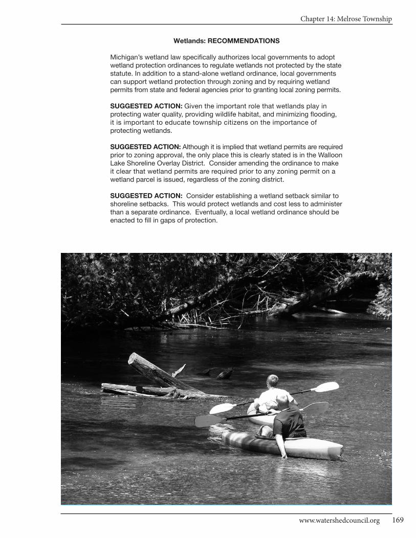
Chapter 14: Melrose Township
169www.watershedcouncil.org
Wetlands: RECOMMENDATIONS
Michigan’s wetland law specifically authorizes local governments to adoptwetland protection ordinances to regulate wetlands not protected by the statestatute. In addition to a stand-alone wetland ordinance, local governmentscan support wetland protection through zoning and by requiring wetlandpermits from state and federal agencies prior to granting local zoning permits.
SUGGESTED ACTION: Given the important role that wetlands play in protecting water quality, providing wildlife habitat, and minimizing flooding, it is important to educate township citizens on the importance of protecting wetlands.
SUGGESTED ACTION: Although it is implied that wetland permits are requiredprior to zoning approval, the only place this is clearly stated is in the WalloonLake Shoreline Overlay District. Consider amending the ordinance to makeit clear that wetland permits are required prior to any zoning permit on awetland parcel is issued, regardless of the zoning district.
SUGGESTED ACTION: Consider establishing a wetland setback similar toshoreline setbacks. This would protect wetlands and cost less to administerthan a separate ordinance. Eventually, a local wetland ordinance should beenacted to fill in gaps of protection.
CHARLEVOIx COUnTy - Local Ordinance Gaps Analysis
Tip of the Mitt Watershed Council170
Ground Water and Wellhead ProtectionPOSSIBLE SCORE: 18
TOTAL SCORE: 9, ADEQUATE
Ground water is the primary source of drinking water for nearly all Northern Michigan residents. Protectingground water resources from contamination is vitally important. The Melrose Township ordinance requiresthat state and federal permits be provided for any facilities or uses where hazardous substances are stored,used or generated, prior to local township approval for that use. Although there are many other activities thatcan impact ground water, such as individuals draining their oil onto the ground when changing the oil in theirautomobiles, requiring state and federal permits for proposed uses that involve hazardous materials is agood first step for protecting ground water in Melrose Township.
Discharges to ground water are regulated by the state under Part 31, Water Resources Protection, of theNatural Resources and Environmental Protection Act (NREPA) 1994 PA 451, and Part 22 Rules. Any proposeddischarges should be prohibited by the township until required state permits are received by the applicant.Storage of hazardous material is also regulated under Part 5 Rules issued for Part 31. This includes PollutionIncident Prevention Plans, which can be efficiently coordinated with Local Emergency Planning Committee work.
Ground Water and Wellhead Protection: RECOMMENDATIONS
Importantly, Melrose Township participated in the state Wellhead ProtectionPlan process, getting its plan approved in 2002. This is a voluntary program,and we applaud the township for taking this critical step and protectingthese precious drinking water sources.
SUGGESTED ACTION: Update and maintain a comprehensive inventory ofpotential threats to ground water. This will be particularly important as thetownship continues to grow and more and more people rely on ground water.
SUGGESTED ACTION: If direct or indirect discharges to ground water areproposed, use site plan review or some other ordinance provision to prohibitthis until appropriate approvals or permits are obtained from the state.
SUGGESTED ACTION: Protect ground water from potential contaminationby requiring Pollution Incident Prevention Plans for storage of hazardousmaterials, in coordination with Local Emergency Planning Committee efforts.
OtherPOSSIBLE SCORE: 48
TOTAL SCORE: 30, ADEQUATE
There are no additional provisions in Melrose Township’s zoning ordinance that contribute to water resourceprotection, such as a floodplain ordinance. However, it is important to note that floodplains and steepslopes are required to be identified on development plan maps. There are no critical dunes in the township.We have no additional recommendations for this element.
Conclusion
We applaud the good water protection measures that exist for Melrose Township. We also thank you for your time and attention in reading this chapter, and hope that our recommendations are helpful. However, if anything is unclear, please be sure to let us know. If you have any questions related to this project, pleasecontact Tip of the Mitt Watershed Council at 231.347.1181.

Chapter 14: Melrose Township
171www.watershedcouncil.org
Results WorksheetMelrose Township
Catagory Possible Score Total Score Comments
I. Master Plan30 - 21 = Strong20 - 11 = Adequate10 - 0 = Weak
II. Basic Zoning Elements54 - 37 = Strong36 - 19 = Adequate18 - 0 = Weak
III. Shorelines60 - 41 = Strong40 - 21 = Adequate20 - 0 = Weak
IV. Impervious Surface Reduction33 - 23 = Strong22 - 12 = Adequate11 - 0 = Weak
V. Stormwater Management27 - 19 = Strong18 - 10 = Adequate9 - 0 = Weak
VI. Soil Erosion and Sediment Control18 - 13 = Strong12 - 7 = Adequate6 - 0 = Weak
VII. Sewer/Septic24 - 17 = Strong16 - 9 = Adequate8 - 0 = Weak
VIII. Wetlands21 - 15 = Strong14 - 8 = Adequate7 - 0 = Weak
IX. Ground Water and Wellhead Protection
18 - 13 = Strong12 - 7 = Adequate6 - 0 = Weak
X. Other Relevant Elements48 -33 = Strong32 - 17 = Adequate16 - 0 = Weak
30
54
60
33
27
18
24
21
18
48
13
40
34
5
11
7
11
2
9
30
Adequate
Strong
Adequate
Weak
Adequate
Adequate
Adequate
Weak
Adequate
Adequate
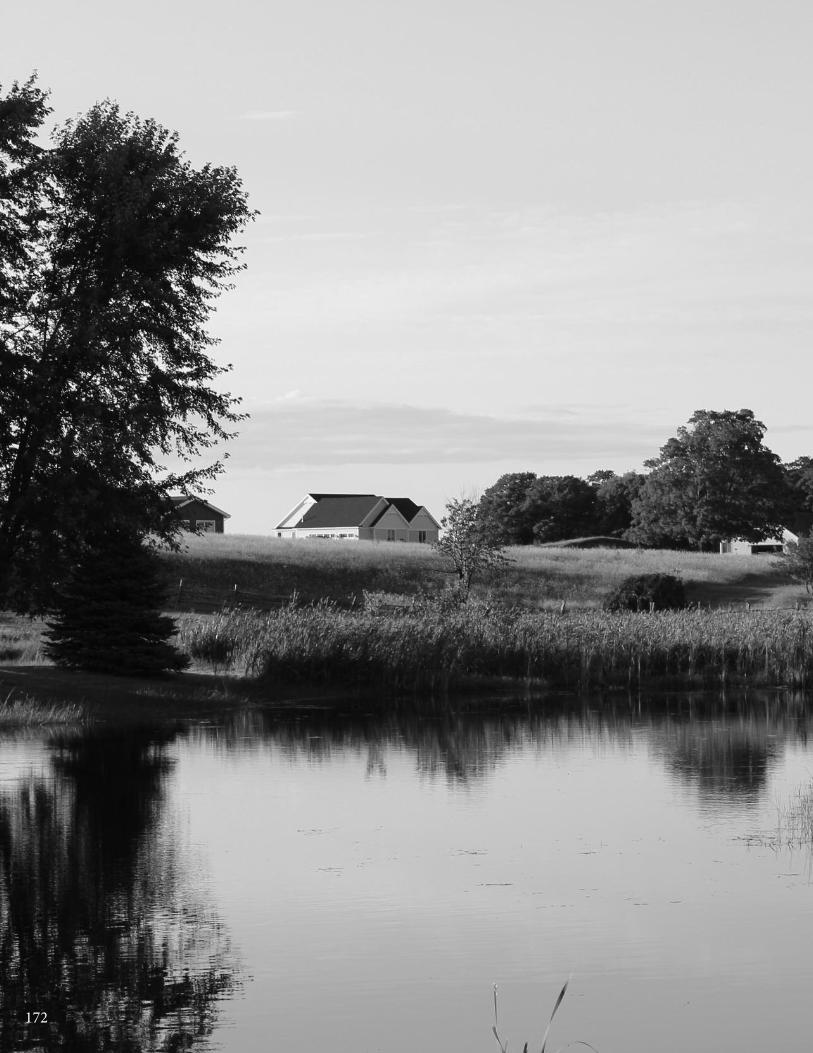
172
Chapter 15: norwood Township
173www.watershedcouncil.org
SECTION III: Analysis
Chapter 15 Norwood Township
Introduction This chapter summarizes results of the Local Ordinance Gaps Analysis project for Norwood Township inCharlevoix County. Norwood is situated along the beautiful shoreline of Lake Michigan, where waters draindirectly into the Great Lakes. It is also blessed with many inland water features, including Inwood Creek,McGeach Creek, and Whiskey Creek; Harwood Lake; and the lovely Fisherman’s Island State Park. This chapterincludes the evaluation scores, recommendations and suggested actions. It also relates suggested actionsto the existing Watershed Management Plan for Grand Traverse Bay, which is relevant to Norwood Township.
Evaluation Scores and Summary
Master Plan ComponentsPOSSIBLE SCORE: 30
TOTAL SCORE: 7, WEAK
The Norwood Township Master Plan is dated 2008. Since it is recommended that Master Plans be updatedevery five years, an update should be scheduled for 2013. The plan does not specify the watershed in whichthe community is located. Wetlands are noted in the Community Profile, Section II. A map in the GeneralizedLand Use Patterns also shows lakes, streams and wetlands. There is a goal statement related to water protectionin Section IV, Sensitive Overlay District: to maintain environmentally sensitive areas such as wetlands and creeks.
Master Plan Components: RECOMMENDATIONS
We understand that the township has undergone some major planning andzoning battles in recent years, and that a review is being considered of theMaster Plan and Zoning Ordinance. We support such a review, and havethe following suggestions for the next update of the Master Plan:
SUGGESTED ACTION: In the next Master Plan update, specifically mentionthe watersheds of the township. Also, clearly articulate a focused goalstatement to protect the valuable water resources in the township.
SUGGESTED ACTION: In the next Master Plan update, note the importanceof ground water seeps and springs that feed the water resources in the township.
CHARLEVOIx COUnTy - Local Ordinance Gaps Analysis
Tip of the Mitt Watershed Council174
SUGGESTED ACTION: When updating the township plan, include commentson the problems associated with impervious surfaces and identify stormwatermanagement as an important community priority.
SUGGESTED ACTION: In the next plan update, acknowledge the importanceof well-constructed and maintained road stream crossings on the quality ofstream and water resources.
SUGGESTED ACTION: When updating the township plan, identify wildlifecorridors and recommend use of conservation easements or other measuresto permanently protect wildlife corridors that occur on private land.
Basic Zoning ComponentsPOSSIBLE SCORE: 54
TOTAL SCORE: 36, ADEQUATE
The Norwood Township Zoning Ordinance includes the following statements of purpose to protect water andnatural resources:
• Meet the needs of the citizens for food, fiber, energy, and other natural resources (Art I Sec 1.02)
• The land uses in the Conservation Reserve District are intended to promote the proper use, enjoyment and conservation of water, land, topographic and forest resources of the township particularly adapted to recreational and forest uses (Art V Sec 5.02.1)
The Zoning Ordinance also includes the following: “To assist in defraying the costs of investigating, reviewing,and administering zoning applications, appeals, rezoning requests from individual property owners, andother types of decisions which result in extra costs to the Township, the Township Board may from time totime adopt by resolution a fee schedule establishing basic zoning fees...” (Art VIII Sec 8.05) Additionally, theordinance has methods in place for enforcement. The Zoning Administrator is authorized to issue municipalcivil infraction citations directing alleged violators to appear in court. In addition to enforcing the ordinanceas a municipal civil infraction, the township may also initiate proceedings in Circuit Court to take actionagainst violations. [Art VIII Sec 8.07.3(2-3)]
One important aspect of the local zoning permitting process, in terms of water protection, is to ensure coordination with county, state, and federal permits or approvals. The Norwood review process does not do so, but it should. In order to simplify administration, condition local approval on the applicant receivingnecessary state and federal permits before final site plan approval or a zoning permit is granted. This is theonly way for the applicant to prove that the proposed project conforms to applicable state and federal statutes.
Importantly, the procedure for application and approval of a Planned Unit Development (PUD) permit includesone or more informal conferences between the applicant, Township Planning Commission designee, andZoning Administrator [Art VII Sec 7.03(9)(c) (1)]. This is required for PUDs only, but should be made availablefor all local reviews. Pre-application meetings are an excellent way to ensure that the protection of water resources is considered, early on in the development process.
The township Zoning Ordinance also requires Site Plan Review for:
A. All new uses except one-family residential units.
B. Expansion or renovation of an existing use, other than 1 or 2-family residential where floor space increases > 25%.
C. Changes of use for an existing structure or lot.
D. Other uses as required by this Ordinance.
E. Establishment via the Land Division Act, Subdivision Control Act, Condominium Act or any combination. [Art VI Sec 6.01(1)(A-E)]
Chapter 15: norwood Township
175www.watershedcouncil.org
The location of existing environmental features, such as streams, wetlands, shorelands, and other unusualenvironmental features are required to be noted in site plans [Art VI Sec 6.01(2)(f)].
The PUD process requires open space. Fifty percent of the gross project area must be open space, and isrequired to be protected under a conservation easement or an equivalent recorded legal instrument acceptableto the township. The full extent of common open space area dedicated for use by residents, or the public,must also be shown on the site plan [Art VII Sec. 7.03.(9)(B)(3)(l)].
Additionally, flexible site design criteria or incentives are available to encourage developers to include openspace or cluster design provisions. Projects must provide a minimum of sixty percent dedicated open spacein order to be considered for bonus dwelling units. This is based on the following sliding scale:
Percent Dedicated Open Space / Percent Dwelling Unit Bonus
60% / 5% more dwelling units
70% / 10% more dwelling units
80% / 15% more dwelling units
Basic Zoning Components: RECOMMENDATIONS
The Norwood Township Zoning Ordinance has some very good provisionsfor water protection. To strengthen these, we suggest the following:
SUGGESTED ACTION: Specifically require that applicants must receive approval for all applicable county, state, and federal permits (such as soilerosion control, wetlands, inland lakes and streams, etc.) prior to receiving a township zoning permit.
SUGGESTED ACTION: Pre-application or pre-construction meetings canhelp to identify water resource protection needs and opportunities early inthe development process, thereby avoiding potential problems and savingmoney. Consider including a pre-application meeting with all applicants aspart of the zoning application process, not just for PUDs.
SUGGESTED ACTION: Require site plan review for all activities, even singlefamily residences, on lakeshore properties. Such review will help to ensurethat impacts to water resources are avoided as much as possible.
SUGGESTED ACTION: Consider requiring open space to be managed in anatural condition, not just to qualify for a density bonus. Restrict openspace to low-impact uses. In so doing, the township will ensure that thesedevelopments are contributing to water resource protection.
ShorelinesPOSSIBLE SCORE: 60
TOTAL SCORE: 24, ADEQUATE
Two of the most effective ways that local governments can protect water quality and shoreline habitatthrough zoning is to require setbacks from the water’s edge and require a shoreline protection strip of native vegetation between the water and the upland land use, also called a vegetative buffer zone. Norwood Township uses both of these tools to protect their Great Lake coastline and inland stream banks.
For lots that border a lake or stream, the minimum structure setback on the waterfront side is 50 feet fromthe ordinary high water mark [Art V Sec 5.08(a)]. Greenbelt is another word used to mean a shoreline protectionstrip, under the right conditions. In Norwood Township, shoreline greenbelts must include all the land arealocated within 50 feet of the ordinary high water mark of a lake or stream abutting or traversing the property
CHARLEVOIx COUnTy - Local Ordinance Gaps Analysis
Tip of the Mitt Watershed Council176
in question (Art III Sec 3.14). The township also requires natural vegetation cover in the greenbelt, includingtrees, shrubs or herbaceous plants and they shall be maintained on a least 70 percent of the lake or streamfrontage. An exception can be made when a landscape plan is submitted and approved by the PlanningCommission. Beach sand, gravel, cobblestone or rock may be substituted for vegetated areas where suchmaterials naturally exist [Art III Sec. 3.14(7)]. Invasive plants are not specifically prohibited from being used in the greenbelt.
Norwood Township has a stand-alone Phragmites Ordinance adopted in 2009. It covers doing a phragmitesinspection; reporting the results; gaining access to property to do the inspection; consent of property ownersto treat; a public hearing process; obtaining required permits; treatment process; and the cost of doing allthis.
Any dock in the township must comply with setback requirements for the riparian line, as determined by thestate law [Art III Sec 3.14(1)]. Other than that, there are no dock regulations in place. Marinas are subject toSpecial Approval under Art V Sec 5.06.2 (12), but only minimal requirements are spelled out in the ordinance.This is because there are no marinas that exist, currently, and limited opportunity for marinas in the future.
Shorelines: RECOMMENDATIONS
SUGGESTED ACTION: Specify that invasive plants are prohibited frombeing used in the greenbelt.
SUGGESTED ACTION: Consider using a dock lot minimum frontage andspecifying the size of docks allowed so as not to interfere with the rights ofother waterfront owners, or negatively affect the character of the naturalshoreline.
Impervious SurfacesPOSSIBLE SCORE: 33
TOTAL SCORE: 8, WEAK
The more a local government can do to reduce impervious surfaces, the better for water quality. As noted inthe Grand Traverse Bay Watershed Management Plan, impervious surfaces (streets, roofs, sidewalks, etc.)generate much more stormwater runoff than natural forested, or even agricultural, land uses. That pollutedrunoff discharges directly into lakes and streams from pavement and rooftops, and includes bacteria frompet and animal wastes, fertilizer, oil and grease, sediment, heavy metals, salt, etc.
To reduce impervious surfaces, a community should increase the retention or restoration of native vegetationin riparian areas and in open spaces, and install simple and effective solutions, ranging from rain barrels andrain gardens, to engineering approaches that treat stormwater that has traveled across impervious surfaces,before it discharges into the water.
In Norwood Township, PUD Site Design Standards state a maximum impervious surface limit to 20% of projectarea; 15% is recommended [Art VII Sec 7.03 9 (k)]. The permanent right-of-way easement for private roadsis stated as a minimum of 40 feet in width, unless additional right-of-way is required for adequate construction.It should be stated as a maximum of 45 feet, where feasible. On a positive note, as stated above, flexiblesite design criteria are available to encourage developers to include open space or cluster design provisions.However, more could be done to limit the creation of new impervious surface in the township.
Impervious Surfaces: RECOMMENDATIONS
There are many opportunities for local governments to reduce impervioussurfaces through their Zoning Ordinance. Additionally, the Grand TraverseBay Watershed Management Plan calls for reduction of impervious surfacesto reduce the pollutant load from stormwater running into our water resources.We encourage Norwood Township to consider integrating the following provisions into their ordinance.
Chapter 15: norwood Township
177www.watershedcouncil.org
SUGGESTED ACTION: Consider reducing parking space dimensions andsetting them as a maximum. Also consider reducing the number of requiredparking spaces and setting the number as a maximum number, as opposedto a minimum.
SUGGESTED ACTION: Establish impervious surface lot coverage limits in all zoning districts (especially residential districts) to limit impervious surfaces to 15% of the total lot. Provide incentives for using Low ImpactDevelopment (LID) techniques to mitigate the impacts of impervious surfaces,in exchange for a larger building footprint.
SUGGESTED ACTION: Consider adding a provision that allows for flexibilityin front yard setbacks or side yard setbacks to encourage shorter drivewaysor shared driveways between two lots.
Stormwater ManagementPOSSIBLE SCORE: 27
TOTAL SCORE: 19, STRONG
Norwood Township has strong protections in place regarding stormwater. Art III Sec. 3.18 notes: Stormwaterdrainage in excess of natural conditions shall be retained on site. This provision may require stormwater retention ponds where appropriate. An exception may be made for water leaving the site via an adequatelysized existing stormwater ditch, stormwater pipe or through other stormwater facilities that will be developedat the same time as the proposed new use. Stormwater management efforts shall be consistent with the provisions of the Charlevoix County Stormwater and Soil Erosion Control Program. In the case of conflictingregulations, between the Township Zoning Ordinance and the Charlevoix County Stormwater and ErosionControl Program, the more stringent of the two shall apply. Written approval from the Michigan Departmentof Transportation (MDOT) shall be required for an additional site run-off directed into a state trunkline ditch,i.e.US-31.
Additionally, “…to protect soil resources, adjacent properties, public roads, public watercourse, and to pro-vide for adequate drainage of surface water, the following rules shall apply to all construction activities re-quiring permits pursuant to this Ordinance.
1. Clearing of a Site: Stripping and removal of topsoil from the site is prohibited.
2. Flow Restrictions: The final grade surface of ground areas surrounding a building or structure shall be designed and landscaped such that surface water flows away from the building or structure and is managed in a manner which avoids increase flow (volume or speed) onto adjacent properties or public roads, the erosion or filling of a roadside ditch, the blockage of a public watercourse or creation of standing water over a private sewage disposal drainage field.
3. Elevation Restrictions: Filling a parcel of land with earth or other materials to an elevation above the finished grade of adjacent development land or the natural grade for adjacent undeveloped land is prohibited without written approval of the Planning Commission.” (Art III Sec 3.32)
It is important to note that the proper administration of stormwater regulations often requires specialized expertise. For this reason, it is recommended that townships cooperate with counties in the enforcement ofcounty-wide standards. As noted in Chapter 1, Charlevoix County officials are in the process of preparing acomprehensive county-wide Storm Water Control (SWC) Ordinance to replace the one that was rescinded.The new one must be passed by individual townships, giving the county authority to administer and enforcethe ordinance. To make this work effectively and efficiently, all participating townships and cities would haveto pass identical language and participate in an Intergovernmental Agreement.
CHARLEVOIx COUnTy - Local Ordinance Gaps Analysis
Tip of the Mitt Watershed Council178
Stormwater Management: RECOMMENDATIONS
While the Norwood Township Zoning Ordinance contains valuable stormwaterprovisions, there is also great value in working with Charlevoix County onthe adoption and implementation of a comprehensive county-wide stormwater ordinance.
SUGGESTED ACTION: Coordinate efforts with the County Drain Commis-sioner to enact local stormwater ordinances in the county, allowing the countyto administer and enforce them for local jurisdictions. Ask the county to finishthe SWC Ordinance and Intergovernmental Agreement, and present it toNorwood Township for passage.
SUGGESTED ACTION: Between now and the adoption of the CharlevoixCounty Stormwater Ordinance, utilize the county’s expertise in reviewingand commenting on stormwater plans presented in development proposals.
SUGGESTED ACTION: Require that all stormwater management systemsare regularly evaluated and properly maintained to ensure that no dischargeof polluted runoff enters lakes or streams in Norwood Township.
Soil Erosion and Sediment ControlPOSSIBLE SCORE: 18
TOTAL SCORE: 4, WEAK
By volume, sediment is the single largest pollutant to waters of the United States. Any time earth is disturbedor graded, as typically happens during the construction process, there is a potential for soil to erode andsediment to be deposited into lakes, streams, and wetlands. Construction, or use of steep or unstable slopes,can also present an erosion and sedimentation hazard. Because local governments have the opportunity toreview every single development project as part of zoning review, they are uniquely situated to ensure thatsoil erosion is controlled and sedimentation is minimized.
In the Norwood Township Zoning Ordinance, Art VIII Sec 8.02(1) notes the following: “No building or structuresubject to the provisions of this Ordinance shall hereafter be erected, structurally altered, reconstructed,used, or moved, nor shall any excavation of land commence until a Zoning Permit application has been filedwith the Township Zoning Administrator and a Zoning Permit has been issued by the Zoning Administrator.”
As noted in Chapter 1, counties are mandated to administer and enforce Part 91 of the state Natural Resourcesand Environmental Protection Act 1994 PA 451, as amended. Charlevoix County has two state-recognizedagencies that do so: The Soil Erosion Control Officer and the County Road Commission.
Soil Erosion and Sediment Control: RECOMMENDATIONS
All properties that are located near streams, wetlands, or drainage wayshave the potential to erode and cause sedimentation to nearby waters. Accordingly, it is recommended that local units require all earth movementactivities associated with development to follow BMPs to control erosionand ensure that sediment-laden runoff does not enter waterways. Coordination between the township and the county is essential.
SUGGESTED ACTION: Specifically require that all proposed developmentproject earth change activities within 500 feet of a stream, wetland, or otherwaterway in all zoning districts receive a soil erosion and sedimentation control permit from Charlevoix County before they receive a permit fromCharlevoix Township.

Chapter 15: norwood Township
179www.watershedcouncil.org
Sewer/SepticPOSSIBLE SCORE: 24
TOTAL SCORE: 10, ADEQUATE
The Norwood Township Zoning Ordinance states that all water supply and sanitary sewage disposal systems,either public or private, are subject to compliance with District Health Department sanitary code requirements.Plans must be submitted to and approved by the responsible agencies, and written approval by the DistrictHealth Department must be filed with the application for a Zoning Permit (Art III Sec 3.17). The township alsoprohibits septic tanks and septic system filtration fields from being located in a greenbelt [Art III Sec 3.14 (6)].
In addition to ensuring compliance with the local health code, local units of government can regulate the sitingof septic fields to ensure protection of water resources. The main concern with septic systems and waterquality is the potential for septic systems to contribute excess nutrients to water bodies. These nutrients can cause the growth of aquatic weeds and algae. The Grand Traverse Bay Watershed Management Planemphasizes education of citizens about the importance of septic system maintenance in order to reduce theamount of harmful nutrients in our waters.
Sewer/Septic: RECOMMENDATIONS
SUGGESTED ACTION: Require that septic systems be located at least 100feet from lakes, streams, wetlands, or other water bodies.
SUGGESTED ACTION: Consider establishing a “point of transfer” inspectionrequirement whereby septic systems must be inspected to ensure they areoperating properly before ownership is transferred.
WetlandsPOSSIBLE SCORE: 21TOTAL SCORE: 3, WEAK
Wetlands are some of our most valuable water resources. They provide excellent wildlife habitat, help controlflooding, and contribute to water quality protection. Although Michigan has a statewide wetland protectionstatute, not all wetlands are covered and not all activities that could impact wetlands are regulated. Localgovernments have the opportunity to supplement the state’s wetland protection program.
As noted earlier, wetlands are required to be noted in site plans and for PUD design standards. Other thanthat, wetlands are not given much attention in the Zoning Ordinance.
Wetlands: RECOMMENDATIONS
Michigan’s wetland law specifically authorizes local governments to adoptwetland protection ordinances that regulate wetlands not protected by thestate statute. In addition to a stand-alone wetland ordinance, local governmentscan support wetland protection through zoning and by requiring wetlandpermits from state and federal agencies prior to granting local zoning permits.
SUGGESTED ACTION: Given the important role that wetlands play in protectingwater quality, providing wildlife habitat, and minimizing flooding, it is importantto educate township citizens on the importance of protecting wetlands.
SUGGESTED ACTION: Ensure that all state and federal wetland statutesare followed and that wetland permits are received before Norwood Townshipzoning permits are issued.
SUGGESTED ACTION: Consider establishing a wetland setback similar toshoreline setbacks. This would protect wetlands and be simple to administer,in the short term. Eventually, a local wetland ordinance should be enactedto fill in gaps of protection.
CHARLEVOIx COUnTy - Local Ordinance Gaps Analysis
Tip of the Mitt Watershed Council180
Ground Water and Wellhead ProtectionPOSSIBLE SCORE: 18
TOTAL SCORE: 8, ADEQUATE
Ground water is the primary source of drinking water for nearly all Northern Michigan residents. Protectingground water resources from contamination is vitally important. The Norwood Township Zoning Ordinancehas the following provisions in place to protect ground water that apply to persons, businesses, or entitiesthat use, generate, or store hazardous substances in quantities greater than 25 gallons, or 220 pounds per month:
1. Sites at which hazardous substances and polluting material are stored/used/generated shall be designed to prevent spills or discharges to ground water, surface water, or wetlands, among other features.
2. Secondary containment measures must be in place.
3. Floor drains are allowed only if connected to a public sewer system, an on-site holding tank, or a system authorized through a state ground water discharge permit.
4. State and federal agency requirements for storage/ spill prevention/ record keeping/ emergency response, transport and disposal of hazardous substances and polluting materials shall be met. No discharges to ground water are allowed. [Art III Sec 3.19(1-4)]
Ground Water and Wellhead Protection: RECOMMENDATIONS
Ground water is vital for not only drinking water, but also to feed tributaries,seeps, springs, and wetland resources with fresh water supplies to supportthose ecosystems, including important recreational fisheries.
SUGGESTED ACTION: Compile and maintain a comprehensive inventory ofpotential threats to ground water. This will be particularly important as thetownship continues to grow and more and more people rely on groundwater for drinking water supplies.
SUGGESTED ACTION: Since many common activities can impact groundwater quality, provide ground water education materials to township residents.
OtherPOSSIBLE SCORE: 48
TOTAL SCORE: 25, ADEQUATE
Norwood Township participates in the National Flood Insurance Program [FEMA Flood Ins Program CID #:260769 NORWOOD, TOWNSHIP OF CHARLEVOIX COUNTY Map (NSFHA) Emer-Reg Date 09/18/87]. Thetownship PUD Design Standards require land within the 100 year to remain unencumbered by any principalor accessory buildings and structures [Art VII Sec 7.03(9)(b)(3)(h)].
There are critical dunes in the township, primarily in Fisherman's Island State Park that are on public land,under state jurisdiction. The township should clarify, if unknown, exactly what critical dunes are under theirjurisdiction, and work with the state to identify any needed protections. If there are dunes to protect, theZoning Ordinance should be amended to do so.
We have no additional recommendations for this element.
Conclusion
We applaud the water protection measures that exist in Norwood. We also thank you for your time and
attention in reading this chapter, and hope that our recommendations are helpful. However, if anything is
unclear, please be sure to let us know. If you have any questions related to this project, please contact
Tip of the Mitt Watershed Council at 231.347.1181.

Chapter 15: norwood Township
181www.watershedcouncil.org
Results Worksheetnorwood Township
Catagory Possible Score Total Score Comments
I. Master Plan30 - 21 = Strong20 - 11 = Adequate10 - 0 = Weak
II. Basic Zoning Elements54 - 37 = Strong36 - 19 = Adequate18 - 0 = Weak
III. Shorelines60 - 41 = Strong40 - 21 = Adequate20 - 0 = Weak
IV. Impervious Surface Reduction33 - 23 = Strong22 - 12 = Adequate11 - 0 = Weak
V. Stormwater Management27 - 19 = Strong18 - 10 = Adequate9 - 0 = Weak
VI. Soil Erosion and Sediment Control18 - 13 = Strong12 - 7 = Adequate6 - 0 = Weak
VII. Sewer/Septic24 - 17 = Strong16 - 9 = Adequate8 - 0 = Weak
VIII. Wetlands21 - 15 = Strong14 - 8 = Adequate7 - 0 = Weak
IX. Ground Water and Wellhead Protection
18 - 13 = Strong12 - 7 = Adequate6 - 0 = Weak
X. Other Relevant Elements48 -33 = Strong32 - 17 = Adequate16 - 0 = Weak
30
54
60
33
27
18
24
21
18
48
7
36
24
8
19
4
10
3
8
25
Weak
Adequate
Adequate
Weak
Strong
Weak
Adequate
Weak
Adequate
Adequate
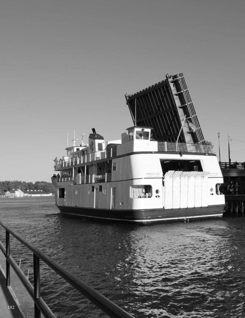
182

Chapter 16: Peaine & St. James Townships
183www.watershedcouncil.org
SECTION III: Analysis
Chapter 16 Peaine & St. James Townships
Introduction This chapter summarizes results of the Local Ordinance Gaps Analysis project for Peaine and St. James Townshipsin Charlevoix County. These townships are located on Beaver Island, a special, remote island in the middle ofLake Michigan with a year-round population of 650 people, accessible by ferry, boat, or airplane. In the spring,summertime, and fall, visitors swell the population of the island to swim the beautiful beaches, view and huntwildlife, fish, hike, and generally enjoy themselves.
Beaver Island waters drain directly into Lake Michigan, or into numerous small inland lakes, including Font Lake, Barney’s Lake, Fox Lake, Greens Lake, and Lake Geneserath. This chapter includes evaluation scores,recommendations, and suggested actions.
Additionally, since both townships use the same Master Plan and Zoning Ordinance, we will refer to them simplyas “the townships” or “Beaver Island” below.
Evaluation Scores and Summary
Master Plan ComponentsPOSSIBLE SCORE: 30
TOTAL SCORE: 16, ADEQUATE
Peaine and St. James Townships both adopted the Beaver Island Master Plan in June, 2006. This document,as well as the jointly adopted Zoning Ordinance, serves as a good example of intergovernmental cooperation.However, Master Plans should be updated every five years, and as such, this one was due for a review thisyear. If not already scheduled, that review should be done as soon as feasible.
The Master Plan notes that Beaver Island is the largest island in Lake Michigan. Although the plan does notprovide a complete inventory of the streams, inland lakes, and wetlands, it does provide a list of the lakesand a description of wetlands on the island. In addition, the plan includes the 1992 Land Cover Map, whichshows lakes and streams, and the general location of wetlands on the island. The Master Plan does notidentify the relevant watersheds of the island.
The Beaver Island Master Plan has several specific and focused goal statements that seek to protect aquatichabitats and water quality. Chapter Two of the Master Plan features ten Guiding Principles. Aquatic habitatsare noted in Principal #2, Protect and Preserve the Environment: “Streams, lakes, wetlands, woodlands,
CHARLEVOIx COUnTy - Local Ordinance Gaps Analysis
Tip of the Mitt Watershed Council184
beaches, shorelines, critical dunes, steep slopes, wildlife habitat, and view sheds also need to be preservedand protected or prudently cared for because they are the natural features that shape and define this place.They are continuously connected systems from one property to another that are essential to the health of thenatural landscape while maintaining the island’s natural beauty. The intent is to protect these natural elements.”(Beaver Island Master Plan, Chapter 2, Page 2)
Water quality is the focus of Principal #9: “One of the most crucial elements of a location is water quality; thisis especially the case on an island. The quality of water which people drink is fundamental to their standard ofliving. If a place does not have high water quality, the population base can disappear. The water quality of thelakes and streams directly affects the natural environment. If the water quality is degraded, the environmentis directly impacted. It is important that prior to the approval of developments and other land uses, the impactto ground water and the watersheds (surface water) is investigated.” (Beaver Island Master Plan, Chapter 2,Page 4)
Beaver Island natural resource protection goals are also an important part of Chapter 5, Future Land Use Plan.The chapter begins with a description of the features to protect. Water-related features include shorelines,public open space, critical dunes, and sensitive features such as wetlands around the inland lakes on the Island. Chapter 5 goes on to provide a future vision and some protection strategies for each feature. For example, the protection strategies for shoreline preservation include the following:
• Establish a “no soil disturbance” zone along the water’s edge.
• Maintain a natural vegetative buffer area along the water’s edge.
• Regulate the design of development so impervious surfaces such as driveways, sidewalks, and rooftops drain away from the water’s edge.
• Limit size and number of structures within this boundary.
• Regulate keyhole developments, but allow designated areas for public access for recreational uses.
• Use zoning to establish setbacks and development standards for these areas. (Beaver Island Master Plan, Chapter 2, Page 2)
Master Plan Components: RECOMMENDATIONS
The Beaver Island Master Plan does a good job of highlighting the importanceof water resources for the future of the island, and establishing a vision,goals, and specific objectives for water resource protection. The followingrecommendations are offered to help strengthen the Master Plan, the nexttime it is updated.
SUGGESTED ACTION: Identify and map the watersheds of the island.
SUGGESTED ACTION: Add a description of the creeks that flow on BeaverIsland and acknowledge the importance of well-constructed and maintainedroad-stream crossings on the quality of stream and water resources.
SUGGESTED ACTION: Add a description of the threatened and endangeredshoreline plants that occur on Beaver Island, including the Lake HuronTansy, Michigan Monkey Flower, and Pitcher’s Thistle. These plants are an important part of Beaver Island’s natural heritage.
Chapter 16: Peaine & St. James Townships
185www.watershedcouncil.org
Basic Zoning ComponentsPOSSIBLE SCORE: 54
TOTAL SCORE: 44, STRONG
The Beaver Island Zoning Ordinance has a statement of purpose: to encourage the use of lands and naturalresources in accordance with their character, adaptability and suitability for particular purposes (Art I Sec 1.0).It includes a fee system that helps to fund administration of the ordinance [Art XII Sec 12.08 (A)]. It also hasan enforcement process. The township Zoning Administrator is designated as the authorized official to issuecivil infraction citations to alleged violators of the ordinance [Art XII Sec 12.10 Enforcement (C)].
One important aspect of the local zoning permitting process is to ensure that the issuance of permits is coordinated with county, state, and federal permits or approvals. In the Beaver Township Zoning Ordinance,the review process is coordinated with the receipt of other applicable county, state, and federal permits. ThePlanning Commission may require an applicant to submit one copy of the application for development planreview, along with any applicable maps and changes by the Planning Commission, to county officials, theHealth Department, state and federal agencies. This includes the Charlevoix Erosion and SedimentationControl Officer [Art. XIV Sec 14.03(a)].
The Zoning Ordinance requires site plan review, called a Development Plan Review [Art. XIV Sec 14.01(a)].The Planned Unit Residential Development (PURDs) Overlay “is intended to be employed as a vehicle toarrange housing in clusters and other patterns that permanently preserve large areas of natural open spaceand the Township’s rural character by allowing for variations in density, lot area, lot width and setback.” [Art XVI Sec 16.00] It is also intended to be flexible and provide incentives, such as density bonuses, in exchange for extraordinary efforts to preserve large areas of the site. In addition to preserving the Island’srural character, it also describes preservation of land in its “existing natural, topographic, and woodedstate…” Such efforts protect hydrology that feeds creeks, streams, wetlands, ground water and lakes, and provides water quality protection for the waters of the island and Lake Michigan.
Density bonuses of up to 100 percent may be considered if the Planning Commission finds six of eight potentialadditional requirements to be satisfied. These include preserving at least fifty percent of the project site areain permanent open space; avoiding the grading and development of steep slopes; and protecting an uplandbuffer of at least 100 feet of native vegetation along water bodies and critical dunes [Art XVI Sec 16.03(b)].
A PURD must comply with the requirements and standards of the County Drain Commissioner and the CountySoil Erosion Control Officer regarding grading, storm water management, and soil erosion control. [Art XVISec 16.05(b)(4)(d)]. It must also retain a minimum of twenty five percent of the project site as permanentopen space [Art XVI Sec 16.04(a) (d)]. Lands used to meet the minimum area requirements for designatedopen space prohibit: roads and road rights-of-way or easements; required front, side, and rear yards ofbuildings; hard surfaced recreational facilities such as tennis and basketball courts; or permanently submergedlands including marinas and submerged wetlands. Not more than fifty percent of the minimum required openspace shall include wetlands.
Additionally, the ordinance requires the applicant or agent of the applicant to be present at any meeting considering the Development Plan [Art XIV Sec 14.02 (a)]. In the Critical Dune (CD) District, the PlanningCommission may require additional information to evaluate the proposed development, including an environmental assessment [Art VI Sec 6.14(g)(3)(j)].
The basic components of the Beaver Island Zoning Ordinance are very strong, and create a sound frameworkfor considering impacts to water resources from development. We have no additional recommendations forthis element and applaud the island townships for their work.
CHARLEVOIx COUnTy - Local Ordinance Gaps Analysis
Tip of the Mitt Watershed Council186
ShorelinesPOSSIBLE SCORE: 60
TOTAL SCORE: 42, STRONG
Two of the most effective ways that local governments can protect water quality is to require setbacks fromthe water’s edge, and require a shoreline protection strip of native vegetation between the water and the upland land use, also called a vegetative buffer. Beaver Island townships employ both.
Except for the Marine Related District, no building or structure is allowed to be closer than 50 feet from thehigh water elevation of inland lake, stream, or creek (Art IV Sec 4.21). Additionally, shoreline protection stripsare required by preserving at least 2/3 of the trees and shrubs in a strip twenty-five feet landward from theordinary high water elevation of Lake Michigan or the high water mark on any lake, stream or creek (Art IVSec 4.21).
The Zoning Ordinance also regulates dock lot minimum frontage. Boat docks shall not exceed one per onehundred feet of lot width. Additionally, no dock shall be located in a manner that will impede the use of thelake by adjoining properties [Art XIV Sec 14.04(c)(4)(3-5)]. No more than three motor powered crafts shall bemoored per one hundred feet of lot width. Only one raft is allowed per one hundred feet of lot width [Art XIVSec 14.04(c)(4-5)].
The townships also regulate marinas: Land, buildings, docks or other structures in the Marine Related District may be used for designated purposes such as commercial docks, charters, and marinas [Art VI Sec6.12(b) Marine Related District Use Regulations (1-12)]. This district is intended to accommodate businessesand facilities that have a relationship to boating [Art VI Sec 6.14(a)]. While there are requirements in thesame section for storage of petroleum or chemical products only upon written permission from the townshipPlanning Commission, this could be improved.
Finally, the work of Beaver Island townships to manage the invasive reed Phragmites along its shorelinesshould be mentioned here. To be clear – it was groundbreaking. The Phragmites ordinance for Beaver Island,passed in 2008, has been used dozens of times across the state, serving as a model for other townships andcounties. The effort on Beaver Island was a partnership of concerned and active citizens, local government,and businesses to take effective action against this invasive species. We thank those people for such forwardthinking and hard work, which had benefits that reached far beyond the island borders.
Shorelines: RECOMMENDATIONS
SUGGESTED ACTION: Specify that invasive plants are prohibited frombeing used in the shoreline protection strip.
SUGGESTED ACTION: Per the island Master Plan, consider including preventions against the practice of keyhole/funneling that still allow designated areas for public access for recreational uses.
SUGGESTED ACTION: Consider some additional steps to better regulatemarinas to ensure water protection. Restrict boat repair and maintenanceactivities to clearly marked areas, in order to prevent debris from falling intothe water and prevent invasive species. Require fueling stations to havespill containment equipment that is stored in a clearly marked location. Require a spill contingency plan, posting emergency phone numbers in aprominent location. Require signs of leakage or spillage to be investigatedimmediately, and undertake cleanup in accordance with applicable BestManagement Practices (BMPs).
Chapter 16: Peaine & St. James Townships
187www.watershedcouncil.org
Impervious SurfacesPOSSIBLE SCORE: 33
TOTAL SCORE: 5, WEAK
Impervious surfaces prevent rainwater and snowmelt from naturally percolating into the soils. This reducesthe opportunity for contaminants to be removed from stormwater runoff, before it flows into lakes, rivers, andwetlands. The more a local unit of government can do to reduce impervious surfaces, the better for water quality.
Even though the Beaver Island Master Plan notes the importance of designing impervious surfaces so thatdriveways, sidewalks, and rooftops drain away from the water’s edge, this is not yet reflected in zoning efforts.However, Article VIII, Off-Street Parking, does include this statement: “The Planning Commission may reduceor eliminate the parking requirements as part of a Development Plan review upon a finding by the PlanningCommission that the parking required by this Ordinance is not needed and the reduction or elimination ofparking will not be detrimental to surrounding properties.” [Art VIII Sec 8.01 (d)]
Impervious surfaces are also mentioned in the CD District: The total impervious surface area of the site (structures,paved areas, patios, etc.) shall not exceed 10% of the total area of the lot, except non-conforming lots whereit shall not exceed 30% total lot area [Art VI Sec 6.14 (4) Review Standards (e)]. This is good, but impervioussurfaces should be addressed in other ordinance sections, as well.
Impervious Surfaces: RECOMMENDATIONS
SUGGESTED ACTION: In addition to the CD District, consider limiting impervious surfaces to no more than 15% of the total lot in all zoning districts,including residential. Provide incentives for using Low Impact Development(LID) techniques to mitigate the impacts of impervious surfaces, in exchangefor a larger building footprint.
SUGGESTED ACTION: Consider adding a provision that allows for flexibilityin front yard setbacks or side yard setbacks to encourage shorter drivewaysor shared driveways between two lots.
SUGGESTED ACTION: Consider reducing parking space dimensions andsetting them as a maximum. Also consider reducing the number of requiredparking spaces and setting the number as a maximum number, as opposedto a minimum. Also, consider allowing grass or turf parking, where appropriate.
Stormwater ManagementPOSSIBLE SCORE: 27
TOTAL SCORE: 14, ADEQUATE
There are provisions of the Beaver Island Zoning Ordinance where stormwater management planning andimplementation is required as part of the zoning review process.
In the R2, Single Family Residential District: No subsoil footings drain system shall empty directly into anywater body. Also: the applicant is required to ensure that new or altered structures will not be damaged byflooding or flood hazards and that excessive soil erosion, adverse changes in natural drainage, or unnecessarydestruction of natural features will be avoided [Art VI Sec 6.0(f)(2-3),Sec 6.01(f)(2-3), Sec 6.04(f)(2-3)].
Additionally, as noted above, the PURD plan must comply with requirements and standards of the CountyDrain Commissioner and the County Soil Erosion Control Officer regarding grading, storm water management,and soil erosion control [Art XVI Sec 16.05(b)(4)(d)]. This is good, but it should apply to all development proposalsin all zoning districts. The proper administration of stormwater regulations often requires specialized expertise.For this reason, it is recommended that the townships continue to cooperate with the county in the enforcementof county-wide standards.
CHARLEVOIx COUnTy - Local Ordinance Gaps Analysis
Tip of the Mitt Watershed Council188
As noted in Chapter 1, Charlevoix County officials are in the process of preparing a comprehensive, county-wideStorm Water Control Ordinance that would be passed by individual townships and give the county authorityto administer and enforce the ordinance. To make this work effectively and efficiently, all participating townshipsand cities would have to pass identical language and participate in an Intergovernmental Agreement.
Stormwater Management: RECOMMENDATIONS
There is great value in working with Charlevoix County on the adoption andimplementation of a comprehensive county-wide stormwater ordinance. The measures taken to control stormwater that would be required by such anordinance are consistent with recommendations in most approved WatershedManagement Plans. To this end, we encourage the following actions.
SUGGESTED ACTION: Coordinate efforts with the County Drain Commis-sioner to enact local stormwater ordinances in the county, allowing thecounty to administer and enforce them for local jurisdictions. Ask the countyto finish the Storm Water Control (SWC) Ordinance and IntergovernmentalAgreement, and present it to Peaine and St. James Townships for passage.
SUGGESTED ACTION: Between now and the adoption of the CharlevoixCounty Stormwater Ordinance, continue to utilize the county’s expertise inreviewing and commenting on stormwater plans presented in developmentproposals.
SUGGESTED ACTION: Require that all stormwater management systemsare regularly evaluated and properly maintained to ensure that no dischargeof polluted runoff enters lakes or streams on Beaver Island.
Soil Erosion and Sediment ControlPOSSIBLE SCORE: 18
TOTAL SCORE: 4, WEAK
By volume, sediment is the single largest pollutant to waters of the United States. Any time earth is disturbedor graded, as typically happens during the construction process, there is a potential for soil to erode andsediment to be deposited into lakes, streams, and wetlands. Construction, or use of steep or unstableslopes, can also present an erosion and sedimentation hazard. Because local governments have the \opportunity to review every single development project as part of zoning review, they are uniquely situatedto ensure that soil erosion is controlled and sedimentation is minimized.
As noted several times above, PURDs are required to comply with requirements and standards of thecounty, in relation to soil erosion control. Docks in the Marine Related District zone shall be constructed toinsure that the structure does not in any way cause erosion [Art VI Sec 6.12 (f)(5)].
Soil Erosion and Sediment Control: RECOMMENDATIONS
All properties that are located near streams, wetlands, or drainage wayshave the potential to erode and cause sedimentation to nearby waters. TheCharlevoix County Department of Building Safety administers Part 91 ofMichigan’s Natural Resources and Environmental Protection Act (NREPA)—Michigan’s Soil Erosion and Sedimentation Control statute. The Beaver Is-land Zoning Ordinance notes that the Planning Commission may requireapplicants to receive a Soil Erosion and Sedimentation Control permit fromCharlevoix County [Art. XIV Sec 14.03(a)]. To further strengthen this cooperative working arrangement, we recommend the following:
Chapter 16: Peaine & St. James Townships
189www.watershedcouncil.org
SUGGESTED ACTION: Specifically require that all proposed earth changeactivities within 500 feet of a lake, stream, wetland, or other waterway in allzoning districts receive a soil erosion and sedimentation control permit fromCharlevoix County before they receive a permit from Peaine or St. JamesTownship.
SUGGESTED ACTION: Require that soil erosion and sedimentation controlsbe maintained and monitored on a periodic basis until the site is completelystabilized and vegetated.
SUGGESTED ACTION: Require a pre-winter meeting to assess whether existing controls are in place to ensure that the site will not erode or causesedimentation over winter or during spring runoff events.
Sewer/SepticPOSSIBLE SCORE: 24
TOTAL SCORE: 9, ADEQUATE
Chapter 6 of the Master Plan notes that properties on Beaver Island are served by well and septic systems.Article IV in the Zoning Ordinance notes the following: All buildings shall provide water supply and sewagedisposal facilities. The written approval of such facilities by the Northwest Michigan Community HealthAgency shall be filed with an application for a zoning permit (Art IV Sec 4.13).
Sewer/Septic: RECOMMENDATIONS
SUGGESTED ACTION: Consider requiring that a septic system be located at least 100 feet from a wetland or open water feature, and specify a minimum isolation distance from all nearby wells.
SUGGESTED ACTION: Consider adopting a “point of transfer” septic inspection ordinance.

CHARLEVOIx COUnTy - Local Ordinance Gaps Analysis
Tip of the Mitt Watershed Council190
WetlandsPOSSIBLE SCORE: 21
TOTAL SCORE: 2, WEAK
Michigan’s wetland law specifically authorizes local governments to adopt wetland protection ordinancesthat provide an additional layer of protection to wetlands that fall under state jurisdiction and provide protection to wetlands not protected by the state statute. In addition to adopting and implementing a stand-alone wetland ordinance, local governments can support wetland protection through zoning and by requiring wetland permits from state and federal agencies prior to granting local zoning permits.
The site plan review process notes the Planning Commission may require the locations of wetlands to be included in the Development Plan Review [Art XIV Sec 14.04 e)]
Wetlands: RECOMMENDATIONS
There are a few steps that the Beaver Island townships could consider inorder to better protect existing wetland resources.
SUGGESTED ACTION: Given the important role that wetlands play in protecting water quality, providing wildlife habitat, and minimizing flooding, it is important to educate township citizens on the importance of protectingwetlands.
SUGGESTED ACTION: Consider setting a wetland setback provision for allzoning classifications in the townships. This would protect wetlands andcost less to administer than adopting a local wetland ordinance. Eventually,a local wetland ordinance should be enacted to fill in gaps of protection.
SUGGESTED ACTION: Specifically require applicants seeking zoning per-mits to secure applicable state or federal wetland permits before issuing alocal zoning permit.
Ground Water and Wellhead ProtectionPOSSIBLE SCORE: 18
TOTAL SCORE: 9, ADEQUATE
Ground water is the primary source of drinking water for nearly all Northern Michigan residents. Protectingground water resources from contamination is vitally important.
As noted in the shoreline section above, there are requirements in place for storage of petroleum or chemicalproducts in the Marine Related District (Art VI Sec 6.12). Additionally, for any developments “where hazardoussubstances are stored, used or generated; said developments shall be designed in such a manner to preventspills and (unless permitted by state or federal statute) discharges to the air, surface or the ground, groundwater, lakes, streams, rivers or wetlands.” [Art XIV Sec 14.04(d)(1)]
Storage of hazardous materials is regulated by the state under Part 5 Rules issued for Part 31 Water ResourcesProtection, of the Natural Resources and Environmental Protection Act (NREPA) 1994 PA 451. This includesPollution Incident Prevention Plans, which can be efficiently coordinated with Local Emergency PlanningCommittee work.
Ground Water and Wellhead Protection: RECOMMENDATIONS
Ground water is vital for not only drinking water, but also to feed tributaries,seeps, springs, and wetland resources with fresh water supplies to supportthose ecosystems, including important recreational fisheries.
Chapter 16: Peaine & St. James Townships
191www.watershedcouncil.org
SUGGESTED ACTION: Compile and maintain a comprehensive inventory ofpotential threats to ground water. This will be particularly important as thetownship continues to grow and more and more people rely on groundwater for drinking water supplies.
SUGGESTED ACTION: Since many common activities can impact groundwater quality, provide ground water education materials to township residents.
SUGGESTED ACTION: If direct or indirect discharges to ground water areproposed, use site plan review or some other ordinance provision to prohibitthis until appropriate approvals or permits are obtained from the state.
SUGGESTED ACTION: Protect ground water from potential contaminationby requiring Pollution Incident Prevention Plans for storage of hazardousmaterials, in coordination with Local Emergency Planning Committee efforts.
OtherPOSSIBLE SCORE: 48
TOTAL SCORE: 35, STRONG
As already noted in the discussion above, Critical Dunes are regulated by the townships on Beaver Island:“Critical Dunes District - These lands include the entire critical dune area as designated by the Michigan Department of Natural Resources pursuant to Part 353 of the Natural Resources and Environmental ProtectionAct, being the Sand Dunes Protection and Management portion of Act 451 of the Public Acts of 1994, as amended,and to such other lands as locally designated and depicted thereon.” [Art VI Sec 6.14(a)] Development permitsproposed in this area are subject to close coordination and approval by the state.
Setbacks are in place, in coordination with state law [Art VI Sec 6.14(C)]. “Lands that are within 250 feet of acritical dune area, that are determined by the Planning Commission to be essential to the hydrology, ecology,topography, or integrity of a critical dune area, shall also receive all the protection afforded to critical dunesin this zoning district, even if not so depicted on the zoning map.” [Art VI Sec 6.14(a)] Impervious surfacelimits are also in place [Art VI Sec 6.14 Critical Dunes (4)(e)]. We have no additional recommendations forthis element.
Conclusion
We applaud the very good water protection measures that exist in the townships on Beaver Island. We alsothank you for your time and attention in reading this chapter, and hope that our recommendations are helpful.However, if anything is unclear, please be sure to let us know. If you have any questions related to this project,please contact Tip of the Mitt Watershed Council at 231.347.1181.
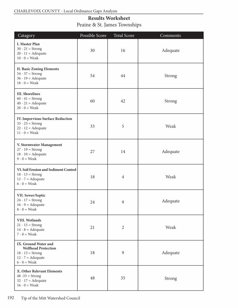
CHARLEVOIx COUnTy - Local Ordinance Gaps Analysis
Tip of the Mitt Watershed Council192
Results WorksheetPeaine & St. James Townships
Catagory Possible Score Total Score Comments
I. Master Plan30 - 21 = Strong20 - 11 = Adequate10 - 0 = Weak
II. Basic Zoning Elements54 - 37 = Strong36 - 19 = Adequate18 - 0 = Weak
III. Shorelines60 - 41 = Strong40 - 21 = Adequate20 - 0 = Weak
IV. Impervious Surface Reduction33 - 23 = Strong22 - 12 = Adequate11 - 0 = Weak
V. Stormwater Management27 - 19 = Strong18 - 10 = Adequate9 - 0 = Weak
VI. Soil Erosion and Sediment Control18 - 13 = Strong12 - 7 = Adequate6 - 0 = Weak
VII. Sewer/Septic24 - 17 = Strong16 - 9 = Adequate8 - 0 = Weak
VIII. Wetlands21 - 15 = Strong14 - 8 = Adequate7 - 0 = Weak
IX. Ground Water and Wellhead Protection
18 - 13 = Strong12 - 7 = Adequate6 - 0 = Weak
X. Other Relevant Elements48 -33 = Strong32 - 17 = Adequate16 - 0 = Weak
30
54
60
33
27
18
24
21
18
48
16
44
42
5
14
4
9
2
9
35
Adequate
Strong
Strong
Weak
Adequate
Weak
Adequate
Weak
Adequate
Strong

Chapter 17: South Arm Township
193www.watershedcouncil.org
SECTION III: Analysis
Chapter 17 South Arm Township
Introduction This chapter summarizes results of the Local Ordinance Gaps Analysis project for Charlevoix County’s SouthArm Township, located in both the Lake Charlevoix Watershed and the Elk River Chain of Lakes Subwatershedof Grand Traverse Bay. Prominent water features in South Arm Township include Lake Charlevoix, the JordanRiver, Deer Creek and Patricia Lake, Six Mile Lake, and many small streams and riparian wetlands. This chapterincludes evaluation scores, recommendations and suggested actions. It also relates suggested actions to theexisting Lake Charlevoix Watershed Management Plan.
Evaluation Scores and Summary
Master Plan ComponentsPOSSIBLE SCORE: 30
TOTAL SCORE: 25, STRONG
The updated Master Plan for South Arm Township is currently in draft form; the distribution draft is datedNovember 2010. Chapter 4 (Natural Resources) of the draft Master Plan does a nice job of inventoryingwater resources in the township, including specifically identifying watersheds, describing the extent of wetlandsin the township, and discussing ground water (pp. 4-6 to 4-10). Figure 4-2 shows the major surface water resources and the major watersheds (p.4-8). The 2010 Existing Land Use Map shows all water features, including wetlands (p.5-2). The Natural Resources chapter of the Plan also acknowledges that in 1972, theJordan River was the first river to be designated wild and scenic under the state’s Natural Rivers Act, and indicates that the natural river zoning regulates activities within 400 feet of the river’s edge.
The Community Goals and Objectives section of the Master Plan addresses water quality and aquatic habitatin several places. For example, one of the objectives listed under the residential goal addresses the potentialproblems related to keyhole development: “manage waterfront development, including restricting the use ofwaterfront lots as waterfront access sites for off water properties, in order to minimize the associated negativeimpacts on water quality.” (p. 6-4)
The “Natural Environment” goal reads, “Protect and preserve the natural environment by protecting groundwater,surface water, highly erosive areas, woodlands, wetlands, open space, fish and wildlife.” (p. 6-7) It containsmany objectives that address the range of water quality issues, including:
• Encourage a land use pattern that is oriented to the natural features and water resources of the area by evaluating type and density of proposed developments based on soil suitability; slope
CHARLEVOIx COUnTy - Local Ordinance Gaps Analysis
Tip of the Mitt Watershed Council194
of land; potential for ground water and surface water degradation and contamination; compatibility with adjacent land uses; and impacts to sensitive natural areas like wetlands, greenways and wildlife corridors.
• Limit and control the density and type of residential and commercial development adjacent to lakes, ponds, streams, and wetlands.
• Maintain greenbelt areas adjacent to lakes, ponds, streams, and wetlands.
• Implement groundwater protection and stormwater management regulations in the Township's Zoning Ordinance, while encouraging the continued natural use of wetlands as groundwater recharge, stormwater filtering and stormwater holding areas.
• Limit high density development on steeply sloped areas. Require erosion control measures where construction is permitted. Require slope stabilization and re-vegetation on disturbed slopes or in extraction areas. (p.6-7)
Master Plan Components: RECOMMENDATIONS
The South Arm Township draft Master Plan does a wonderful job of highlightingthe importance of water resources in the township and establishing goalsand specific objectives for water resource protection. The following recommendations arise from both the Lake Charlevoix Watershed Plan andare offered to help strengthen the draft Master Plan before it is adopted:
SUGGESTED ACTION: In the discussion of the stormwater impacts andhow to address them, mention the importance of minimizing impervious surfaces in new construction to reduce runoff and increase infiltration.
SUGGESTED ACTION: Acknowledge the importance of well-constructedand maintained road-stream crossings on the quality of stream and waterresources.
Basic Zoning ComponentsPOSSIBLE SCORE: 54TOTAL SCORE: 43, STRONG
The overall statement of purpose for the South Arm Township Zoning Ordinance contains three elementsthat address water resource protection:
• To promote the public health, safety, and general welfare.
• To encourage the use of lands in accordance with their character and adaptability, and to limit the improper use of land, and
• To conserve natural resources and energy. [Article I, Section 1.02 (A-C)]
In addition, goals for specific zoning districts, such as the Greenbelt Residential District and the NaturalRivers Zone District, also have statements of purpose regarding water resource protection. The statement ofpurpose for the Natural Rivers Zone District is so comprehensive, it could serve as a good model for statementsof purpose addressing all water resource protection. It includes everything from promoting the health, safetyand general welfare to preventing flood damage. [Article V, Section 5.09(A)(1-4)]
The South Arm Township Zoning Ordinance includes a fee system that helps to fund administration of the ordinance, and a provision whereby the township can require additional fees, set aside in an escrow accountby the applicant, to cover the costs of additional professional review when necessary. As well, the ordinanceauthorizes the township to require financial guarantees of a sufficient sum to assure that the project is completed[Art X, Section 10.4(A-C)]. From an enforcement standpoint, the ordinance makes it clear that any person violating any provision of the ordinance is guilty of a misdemeanor, and that each day of violation is considereda separate offense. The Zoning Administrator is authorized to issue infraction citations directing alleged violators of this Ordinance to appear in court, and the township may initiate proceedings in the Circuit Courtto address any other violations of this Ordinance [Article X, Section 10.5 (A-E)].
Chapter 17: South Arm Township
195www.watershedcouncil.org
One important aspect of the local zoning permitting process is to ensure that the issuance of local permits iscoordinated with county, state, and federal permits or approvals. The South Arm Township Zoning Ordinanceaddresses this in several locations. In the Site Plan Review Standards, the ordinance states that “site plansshall conform to all applicable requirements of State and Federal statutes and approval may be conditionedon the applicant receiving necessary State and Federal permits before final site plan approval or a zoningpermit is granted.” [Article III, Section 3.14(D)(10)] The ordinance also authorizes the Zoning Administrator or Planning Commission to require an applicant to submit a copy of their site plan to various agencies for review and comment [Article III, Section 3.14(D)(11)]. In addition, the Single Family Greenbelt Residential District clearly states that no filling shall occur on lands in this district without a permit from the State ofMichigan, the U.S. Army Corps of Engineers, and the Charlevoix County Soil Erosion Control Officer [Article V, Section 5.02(I)(5)].
The key to the implementation of any Zoning Ordinance is the review process. South Arm Township’s siteplan review process is required on all projects except one and two family residential units. The effectivenessof the review process is determined by the quality of the information provided to the township by the applicant.The section of the ordinance that deals with site plan review (Section 3.14) includes two important requirements.First, it states that the applicant must provide an “impact statement addressing the demands the developmentwill have on community services and any environmental impacts.” [Article III, Section 3.14(B)(13)] It also requires a drawing of the development plan that includes the location of “water courses and water bodies,including flood plains and wetlands, county drains, and manmade surface drainage ways” and “identificationof any significant site amenities or unique natural features.” [Article III, Section 3.14(C)(5 and 21)] Describingand mapping water features helps to serve as the basis for a dialogue between the developer and the townshipabout how to reduce potential impacts on those resources.
Open space provisions that allow for clustering development on one portion of a parcel, while protecting the remainder in its natural state, can help to protect water quality. South Arm Township encourages openspace development by establishing open space minimums and providing density bonuses in the MultipleFamily Residential (R-3) District and for Planned Unit Developments (PUDs). The minimum open space requirement for new developments in the R-3 district is 50% and density bonuses are awarded on the following schedule:
• 50% open space, 4 units/acre density;
• 55% open space, 6 units/acre density;
• 60% open space, 8 units/acre density;
• 70% open space,10 units/acre density. [Article V, Section 5.03(C)(2-3)
For PUDs, the minimum open space is 25% of the parcel (minus undevelopable portions such as lakes, wetlands, floodplains, etc.), and open space bonuses are awarded on the following schedule:
• For the first 25% of open space, a 15% increase in density.
• For each additional 5% open space a 5% increase in density.
The ordinance states, however, that all density bonuses are subject to Northwest Michigan CommunityHealth Agency approval for water supply and sewage disposal [Article VIII, Section 8.06 (A and B)].
Although these minimum open space requirements and density bonuses are useful tools to promote the integration of resource protection measures in development projects, it is important that the open spaces be maintained in their natural state and protected in perpetuity. The PUD standards say that open spaces“may” consist of natural areas and that the township Planning Commission “may require that the site be designed to preserve and protect, to the greatest extent feasible, existing natural or unique land featuressuch as, but not limited to, mature trees, significant vegetation, waterways, steep slopes or scenic views.”[Article VIII, Section 8.08] Furthermore, there appears to be no requirements that the open space be protectedin perpetuity with a conservation easement, deed restriction, or other permanent legal instrument.
CHARLEVOIx COUnTy - Local Ordinance Gaps Analysis
Tip of the Mitt Watershed Council196
Basic Zoning Components: RECOMMENDATIONS
The basic components of the South Arm Township Zoning Ordinance arevery strong and create a sound framework for considering impacts to thetownship’s water resources from development. The following is suggestedto help strengthen the ordinance:
SUGGESTED ACTION: Use the statement of purpose in the Natural RiversZone District (Section 5.09) as a model for the statement of purpose in theSingle Family Greenbelt Residential District (Section 5.02).
SUGGESTED ACTION: The Single Family Greenbelt Residential Districtclearly states that no filling shall occur on lands in this district without a permit from appropriate county, state, and federal agencies. We suggestthat the same should apply in all zoning districts, and no zoning permit thatmight impact wetlands, lakes, or streams will be issued without county,state, or federal permits, anywhere in the township.
SUGGESTED ACTION: Require open space that is set aside as part of a R-3 development or PUD to be permanently protected through a conservationeasement, deed restriction, or similar permanent legal instrument, and stipulatethat open space is to be managed in a natural condition.
ShorelinesPOSSIBLE SCORE: 60TOTAL SCORE: 23, ADEQUATE
Two of the most effective ways that local governments can protect water quality through zoning is to requiresetbacks from the water’s edge, and require a shoreline protection strip of native vegetation between thewater and the upland land use, also called a vegetative buffer zone. South Arm Township employs both ofthese measures.
The waterfront setback requirements in South Arm Township are wonderfully protective. Building setbacks inthe Single Family Greenbelt Residential District (Section 5.02), Waterfront Commercial District (Section 5.06),and the Conservation Reserve District (Section 5.10) are all 100 feet from the ordinary high water mark of thelake or stream. In the Agricultural District (5.08), waterfront setbacks are 100 feet from a river or a lake and50 feet from a stream. In the Natural Rivers Zone District (Section 5.09), the setback is 200 feet from thewater’s edge.
South Arm Township requires shoreline protection strips in only two districts: Single Family Greenbelt Residentialand the Natural Rivers Zone. The Single Family Greenbelt Residential District requirements call for a 50 footwide strip bordering the stream, river, or lake that is maintained in trees and shrubs. Trees & shrubs in aspace not to exceed one-third (1/3) of the lot width may be removed, for a view of the water and installationof a dock [Article V, Section 5.02(H)]. The Natural Rivers Zone District calls for a strip 100 feet wide parallelingthe mainstream of the Jordan River, and 25 feet on the tributaries. The strip is to be maintained in trees andshrubs (or in its natural state), except that dead, diseased, unsafe, or fallen trees may be removed [Article V,Section 5.09(G)].
In October 2001, South Arm Township amended their Zoning Ordinance to provide clarity with respect todockage in the Single Family Greenbelt Residential District. This amendment stipulates that only one dockmay be constructed per lake front lot or parcel, but that two or more adjacent nonconforming lots that areowned by the same person shall be allowed one dock. Furthermore, one additional dock may be allowed for each 100 foot of frontage in excess of the first 100 feet of frontage [Amendment #3, creating Article V,Section 5.02(L)]. The ordinance is silent on the allowable size of the dock or the number of boats per dock.Although not docks, per se, platforms and boardwalks along rivers and streams are restricted to 20 feet inlength with a total of 80 square feet and shall not extend into the water [Article V, Section 5.02(C)(2)].
Chapter 17: South Arm Township
197www.watershedcouncil.org
Currently, the South Arm Township ordinance does not have a provision that addresses marinas, specifically.Article III (Site Plan Review Standards) does require that applicants, such as marinas, provide information onthe “location and specifications for any existing or proposed above or below ground storage facilities for anychemicals, salts, flammable materials, or hazardous materials as well as any containment structures or clearzones required by government authorities.” [Article III, Section 3.14 (C)(20)] Such provisions help to ensure aconsciousness regarding spills that could impact water resources and ensure that applicants are aware of,and follow, state and federal permit processes.
Shorelines: RECOMMENDATIONS
The South Arm Township shoreline zoning provisions, especially the 100foot building setback from the ordinary high water mark, help protect waterresources of the township. To strengthen these provisions, we recommendthe following:
SUGGESTED ACTION: Although South Arm Township does require shorelineprotective strips on waterfront parcels, this section of the ordinance could bestrengthened by restricting the use of pesticides or herbicides, and specifyingthe use of native plant species, or prohibiting the use of non-native orinvasive plants.
SUGGESTED ACTION: Although the South Arm Township ordinance hasregulations that state the number of dwellings per front foot, the townshipmay want to consider adopting a provision that specifically addresses funnelor keyhole developments. Such a provision is called for in the draft MasterPlan, but is not currently integrated into the Zoning Ordinance.
SUGGESTED ACTION: Consider regulating marinas to ensure that they donot contribute to water quality degradation, obstruct navigation or otherwiseinterfere with the rights of boaters, and that they take measures that preventthe spread of invasive species.
SUGGESTED ACTION: Although Phragmites is of concern mostly on GreatLakes shorelines, it has become established on some inland waters and roadditches. We encourage all local governments to initiate a program designedto ensure that the invasive strain of Phragmites does not become establishedin their jurisdiction. Such a project would involve an initial inventory to determineif there are invasive stands of Phragmites, treat those stands if they exist,and conduct a follow up inventory and treatment, if necessary. To do so, wesuggest you coordinate your efforts with the Lake Charlevoix Association’sPhragmites eradication program.
Impervious SurfacesPOSSIBLE SCORE: 33
TOTAL SCORE: 3, WEAK
Impervious surfaces stop rainwater and snowmelt from naturally percolating into soils, thus reducing the opportunity for contaminants to be removed from the resulting stormwater runoff before it flows into lakes,rivers, and wetlands. The more a local unit of government can do to reduce impervious surfaces, the betterfor water quality.
South Arm Township limits impervious lot coverage in two zoning districts: Single Family Greenbelt ResidentialDistrict (R-2) and Multiple Family Residential (R-3). In the R-2 district, “total dwellings, buildings, structures,hard surfaces, driveways and parking areas shall not exceed thirty percent (30%) of the total lot area.” [Article V, Section 5.02(C)(3)] In the R-3 zone, the limit is 50% of the total lot area. The R-3 district requires a
CHARLEVOIx COUnTy - Local Ordinance Gaps Analysis
Tip of the Mitt Watershed Council198
minimum of 50% open space, and conversely a maximum of 50% impervious lot coverage [Article V, Section5.02(C)(3)]. Beyond these two instances, there appears to be no other measures in the South Arm TownshipZoning Ordinance intended to reduce impervious surfaces.
Impervious Surfaces: RECOMMENDATIONS
There are many opportunities for local governments to reduce impervioussurfaces through their Zoning Ordinance. Additionally, the Lake CharlevoixWatershed Plan calls for reduction of impervious surfaces to reduce the pollutant load from stormwater running into our water resources. We encourageSouth Arm Township to consider integrating the following provisions intotheir ordinance.
SUGGESTED ACTION: Establish impervious surface lot coverage limits in all zoning districts (especially residential districts) to limit impervious surfaces to 15% of the total lot.
SUGGESTED ACTION: Add a provision that allows for flexibility in frontyard setbacks or side yard setbacks to encourage shorter driveways orshared driveways between two lots.
SUGGESTED ACTION: Amend 3.19 (Parking) and 3.20 (Loading) to allowreductions in the size of parking and loading areas when appropriate forwater quality protection, or encourage use of grass parking areas or pervious pavers.
SUGGESTED ACTION: Instead of having a minimum roadway width (as defined in the Mobile Home Park or Manufactured Housing Developmentzone [Article V, Section 5.04 B(5)], consider having a maximum road width(18-22 feet) to reduce mass clearing and grading.
Stormwater ManagementPOSSIBLE SCORE: 27
TOTAL SCORE: 7, WEAK
Although South Arm Township does not regulate stormwater as a stand-alone ordinance, there are provisionsin Article III (General Provisions) of the Zoning Ordinance where stormwater management planning and implementation is required as part of the zoning review process. For example, the section regarding gradesunequivocally states that “no premises shall be filled or graded so as to discharge surface runoff on abuttingpremises in such a manner that will cause inconvenience or damage to adjacent properties. When propertyis developed adjacent to existing properties, previously developed existing grades shall have priority.” (Article III, Section 3.11)
A similar general statement is conveyed in Article III, Section 3.14(D)(3): “Special attention shall be given to proper site drainage so that removal of stormwater will not adversely affect neighboring properties.” Although there are no specific guidelines in the ordinance regarding design, installation, and maintenance of temporary or permanent stormwater control devices, the Zoning Administrator and/or the Planning Commission is authorized to require the applicant to submit a complete application and site plan to theCharlevoix County Soil Erosion Control Enforcing Agent for review and comment.
It is important to note that the proper administration of stormwater regulations often requires specialized expertise.For this reason, it is recommended that townships cooperate with counties in the enforcement of county-widestandards. Charlevoix County officials are in the process of preparing a comprehensive county-wide StormWater Control (SWC) Ordinance that would be passed by individual townships and give the county authorityto administer and enforce the ordinance. To make this work effectively and efficiently, all participating town-ships and cities would have to pass identical language and participate in an Intergovernmental Agreement.
Chapter 17: South Arm Township
199www.watershedcouncil.org
Stormwater Management: RECOMMENDATIONS
There is great value in working with Charlevoix County on the adoption andimplementation of a comprehensive county-wide stormwater ordinance. Themeasures taken to control stormwater that would be required by such an ordinanceare consistent with recommendations in the watershed management planfor Lake Charlevoix. To this end, we encourage the following actions:
SUGGESTED ACTION: Coordinate efforts with the County Drain Commissioner to enact local stormwater ordinances in the county, allowingthe county to administer and enforce them for local jurisdictions. Ask the countyto finish the SWC Ordinance and Intergovernmental Agreement, and presentit to South Arm Township for passage.
SUGGESTED ACTION: Between now and the adoption of the CharlevoixCounty Stormwater Ordinance, utilize the county’s expertise in reviewingand commenting on stormwater plans presented in development proposals.
SUGGESTED ACTION: Require that all stormwater management systemsare regularly evaluated and properly maintained to ensure that no dischargeof polluted runoff enters lakes or streams in South Arm Township.
Soil Erosion and Sediment ControlPOSSIBLE SCORE: 18
TOTAL SCORE: 1, WEAK
Sediment, by volume, is the single largest pollutant to waters of the United States. Any time earth is disturbedor graded, as typically happens during the construction process, there is a potential for soil to erode andsediment to be deposited into lakes, streams, and wetlands. Construction, or use of steep or unstable slopes,can also present an erosion and sedimentation hazard. Because local governments have the opportunity toreview every single development project as part of zoning review, they are uniquely situated to ensure thatsoil erosion is controlled and sedimentation is minimized.
There is a brief mention in the section on extractive industries, which states that excavated areas shall begraded and seeded “to minimize soil erosion.” [Article VII, Section 7.09(C)] The Site Plan Review Standardsauthorize the Zoning Administrator or the Planning Commission to require an applicant to submit an applica-tion to the County Soil Erosion Control Officer at their discretion. Other than these two examples, the SouthArm Township Zoning Ordinance is silent on the issue of soil erosion. This is surprising, given the presenceof such spectacular water resources as the Jordan River and Lake Charlevoix in the township.
Soil Erosion and Sediment Control: RECOMMENDATIONS
All properties that are located near streams, wetlands, or drainage wayshave the potential to erode and cause sedimentation to nearby waters. Soilerosion control is an essential component in watershed management efforts.The Charlevoix County Department of Building Safety administers Part 91 ofMichigan’s Natural Resources and Environmental Protection Act (NREPA),Michigan’s Soil Erosion and Sedimentation Control statute. The simplest andmost effective way to control erosion at the township level is to partner withthe county enforcement agents. To that end, we recommend the following:
SUGGESTED ACTION: Require that all zoning applicants for any constructionor earth change activity proposed within 500 feet of a stream, river, or lake,receive a soil erosion and sedimentation control permit prior to issuance of aSouth Arm Township Zoning Permit.
CHARLEVOIx COUnTy - Local Ordinance Gaps Analysis
Tip of the Mitt Watershed Council200
SUGGESTED ACTION: Require that soil erosion and sedimentation controlsbe maintained and monitored on a periodic basis until the site is completelystabilized and vegetated.
SUGGESTED ACTION: Require a pre-winter meeting to assess whether existing controls are in place to ensure that the site will not erode or causesedimentation over winter or during spring runoff events.
Sewer/SepticPOSSIBLE SCORE: 24
TOTAL SCORE: 11, ADEQUATE
Although South Arm Township does not provide water or sanitary sewer services, a small number of townshipresidences, and the Grandvue Medical Care Facility located near the East Jordan city limits, are served byEast Jordan’s system. Furthermore, East Jordan’s two lagoon treatment systems are located in the south-eastern corner of the township. The current policy is that water and sewer services will only be extended ifthere is a 425 or standard annexation of the property into the City of East Jordan.
The majority of South Arm’s residents and business owners must rely on on-site private wells for domesticdrinking water needs, and private on-site septic systems for wastewater disposal. Two important determinantsfor siting a septic system are soil suitability, including slope and depth to groundwater, and depth to bedrock.Chapter 4 of the South Arm Township Master Plan discusses the geology and soils of the township. Figure4-1, titled “Soils Constraints,” shows a steeply sloped areas and areas with hydric soils that have septic system limitations. Article III, the General Provisions section, states that any building or facility that couldpossibly use or generate human waste “shall be provided with a safe and sanitary water supply system andwith means for collecting and disposing of all human excreta…and other wastes that may adversely affecthealth conditions, subject to the written approval of the Northwest Michigan Community Health Agency.” (Article III, Section 3.09)
Sewer/Septic: RECOMMENDATIONS
In addition to ensuring compliance with the local health code, local units ofgovernment can regulate the siting of septic fields to ensure protection ofwater resources. The main concern with septic systems and water quality is the potential for septic system to contribute excess nutrients to waterbodies. These nutrients can cause the growth of aquatic weeds and algae.
SUGGESTED ACTION: Require that septic systems be located at least 100feet from lakes, streams, wetlands, or other water bodies.
SUGGESTED ACTION: Consider establishing a “point of transfer” inspectionrequirement whereby septic systems must be inspected to ensure they areoperating properly before ownership is transferred.
WetlandsPOSSIBLE SCORE: 21
TOTAL SCORE: 1, WEAK
Wetlands are some of our most valuable water resources. They provide excellent wildlife habitat, help controlflooding, and contribute to water quality protection. Although Michigan has a statewide wetland protectionstatute, not all wetlands are covered and not all activities that could impact wetlands are regulated. Localgovernments have the opportunity to supplement the state’s wetland protection program.
The South Arm Township Master Plan provides a good overview of the importance of wetlands. Wetlandprotection also features prominently in the goals and objectives, the “future vision” portion of the Master
Chapter 17: South Arm Township
201www.watershedcouncil.org
Plan, and the future land use recommendations of the plan. That being said, wetlands are only mentioned intwo places in the Zoning Ordinance. First, applicants are required to depict the location of wetlands on theirsite plan drawings [Article III, Section 3.14(C)(5)]. Second, wetlands and other water bodies are not to beconsidered part of the gross area of the property when calculating required open space for PUDs. Beyondthese two instances, wetlands are not mentioned in the Zoning Ordinance.
Wetlands: RECOMMENDATIONS
Michigan’s wetland statute specifically authorizes local governments toadopt wetland protection ordinances to regulate wetlands not protected bythe state statute. In addition to a stand-alone wetland ordinance, local gov-ernments can support wetland protection through zoning and by requiringwetland permits from state and federal agencies prior to granting local zon-ing permits.
SUGGESTED ACTION: Given the important role that wetlands play in pro-tecting water quality, providing wildlife habitat, and minimizing flooding, it isimportant to educate township citizens on the importance of protecting wet-lands.
SUGGESTED ACTION: Amend the township ordinance to make it clearthat state and federal wetland permits are required prior to the issuance ofany township zoning permit on a parcel where wetlands are present andmay be impacted, regardless of the zoning district.
SUGGESTED ACTION: Consider establishing a wetland setback similar tothe shoreline setbacks in the Zoning Ordinance. Even a short setback fromthe wetland edge (e.g., 25 feet) is much better than constructing a use at theedge of the wetland. This would protect wetlands and cost less to adminis-ter than a separate ordinance. Eventually, a local wetland ordinance shouldbe enacted to fill in gaps of protection.
Ground Water and Wellhead ProtectionPOSSIBLE SCORE: 18
TOTAL SCORE: 12, ADEQUATE
Ground water is the primary source of drinking water for nearly all Northern Michigan residents, and all but afew township residents get their drinking water from private wells. Protecting ground water resources fromcontamination is vitally important.
Site plan review standards in the South Arm Township Zoning Ordinance require applicants to identify the“location and specifications for any existing or proposed above or below ground storage facilities for anychemicals, salts, flammable materials, or hazardous materials as well as any containment structures or clearzones required by government authorities.” [Article III, Section 3.14 (C)(20)] Although it can be assumed thatstate and federal authorization must be received before a local zoning permit is issued, this is not clearlystated in the ordinance. In addition, section of Article VII (Site Development Standards) addresses extractiveindustries, such as mining. It states that the Planning Commission, when making its decisions on extractionproposals, shall consider the “effect of such removal in causing a safety hazard, creating erosion problems,or altering the groundwater table.” [Article VII, Section 7.09(E)(4)]
Discharges to ground water are regulated by the state under Part 31, Water Resources Protection, of theNatural Resources and Environmental Protection Act (NREPA) 1994 PA 451, and Part 22 Rules. Any proposeddischarges should be prohibited by the township until required state permits are received by the applicant.Storage of hazardous material is also regulated under Part 5 Rules issued for Part 31. This includes PollutionIncident Prevention Plans, which can be efficiently coordinated with Local Emergency Planning Committee work.
CHARLEVOIx COUnTy - Local Ordinance Gaps Analysis
Tip of the Mitt Watershed Council202
Ground Water and Wellhead Protection: RECOMMENDATIONS
Importantly, South Arm Township participated in the state Wellhead ProtectionPlan process, getting its plan approved in 2002. This is a voluntary program,and we applaud the township for taking this critical step to protect theseprecious drinking water sources. In addition, we encourage the Township toconsider the following: SUGGESTED ACTION: Update and maintain a comprehensive inventory ofpotential threats to ground water. This will be particularly important as thetownship continues to grow and more and more people rely on groundwater for drinking water supplies.
SUGGESTED ACTION: If direct or indirect discharges to ground water areproposed, use site plan review or some other ordinance provision to prohibitthis until appropriate approvals or permits are obtained from the state.
SUGGESTED ACTION: Protect ground water from potential contaminationby requiring Pollution Incident Prevention Plans for storage of hazardousmaterials, in coordination with Local Emergency Planning Committee efforts.
OtherPOSSIBLE SCORE: 48
TOTAL SCORE: 26, ADEQUATE
South Arm Township participates in the National Flood Insurance Program. In several locations, the ZoningOrdinance requires the applicant to provide information regarding the location of the flood zone. As well, preventing damage from floods is stated as a purpose Natural Rivers District [Article V, Section 5.09(A)(3)].There are no high risk erosion or steep slopes restrictions, and there are no critical dunes in the township.
ConclusionWe applaud the water protection measures that exist in South Arm Township. We also thank you for yourtime and attention in reading this chapter, and hope that our recommendations are helpful. However, if anything is unclear, please be sure to let us know. If you have any questions related to this project, pleasecontact Tip of the Mitt Watershed Council at 231.347.1181.

Chapter 17: South Arm Township
203www.watershedcouncil.org
Results WorksheetSouth Arm Township
Catagory Possible Score Total Score Comments
I. Master Plan30 - 21 = Strong20 - 11 = Adequate10 - 0 = Weak
II. Basic Zoning Elements54 - 37 = Strong36 - 19 = Adequate18 - 0 = Weak
III. Shorelines60 - 41 = Strong40 - 21 = Adequate20 - 0 = Weak
IV. Impervious Surface Reduction33 - 23 = Strong22 - 12 = Adequate11 - 0 = Weak
V. Stormwater Management27 - 19 = Strong18 - 10 = Adequate9 - 0 = Weak
VI. Soil Erosion and Sediment Control18 - 13 = Strong12 - 7 = Adequate6 - 0 = Weak
VII. Sewer/Septic24 - 17 = Strong16 - 9 = Adequate8 - 0 = Weak
VIII. Wetlands21 - 15 = Strong14 - 8 = Adequate7 - 0 = Weak
IX. Ground Water and Wellhead Protection
18 - 13 = Strong12 - 7 = Adequate6 - 0 = Weak
X. Other Relevant Elements48 -33 = Strong32 - 17 = Adequate16 - 0 = Weak
30
54
60
33
27
18
24
21
18
48
25
43
23
3
7
1
11
1
12
26
Strong
Strong
Adequate
Weak
Weak
Weak
Adequate
Weak
Adequate
Adequate

204
Chapter 18: Wilson Township
205www.watershedcouncil.org
SECTION III: Analysis
Chapter 18 Wilson Township
Introduction
This chapter summarizes results of the Local Ordinance Gaps Analysis project for Wilson Township, located in
the south-central section of Charlevoix County. Wilson Township is wholly in the Lake Charlevoix Watershed, and
its water resources include numerous streams and half of Deer Lake. This analysis includes evaluation scores,
recommendations, and suggested actions to assist Wilson Township in protecting water resources. It also relates
suggested actions to the existing Lake Charlevoix Watershed Management Plan.
Evaluation Scores and Summary
Master Plan ComponentsPOSSIBLE SCORE: 30
TOTAL SCORE: 12, ADEQUATE
Wilson Township’s Master Plan was updated in 2006. Although it doesn’t specifically mention the main wa-tersheds in which the township is located, nor any specific streams or lakes, Chapter 3 of the Master Plandescribes Wilson Township’s water resources (including groundwater), and Figure 3.8 shows the wetland andwater resources of Wilson Township. It is recommended that Master Plans be updated every five years, sothis plan is due to be evaluated.
Wilson Township’s Master Plan has several community goals, one of which is to maintain and protect naturalresources in the Township (Chapter 7). As you can see by the following objective and goals, water resourceprotection is an important element in the Master Plan:
Objective: Maintain the high quality of land, air, surface water and ground water resources.
Strategy 1: Adopt zoning ordinance regulations for green belts and buffer strips.
Strategy 2: Maintain adequate setback distances from lakes and streams.
Strategy 3: Maintain annual township clean-up program.
Strategy 4: Avoid the fractionalization of woodland resources.
Strategy 5: Protect environmentally sensitive areas such as surface waters, wetlands and steep slopes through planning, education and ordinances.
CHARLEVOIx COUnTy - Local Ordinance Gaps Analysis
Tip of the Mitt Watershed Council206
Master Plan Components: RECOMMENDATIONS
The Wilson Township Master Plan has strong goals with respect to water resources. When the township updates the Master Plan, we encourage including the components listed below in order to strengthen the role thatthe Master Plan can play in guiding community development measures and supporting the Zoning Ordinance.
SUGGESTED ACTION: Specifically name the water resources that occur in the township (named creeks, lakes, and ponds), as well as the main watersheds that drain the township.
SUGGESTED ACTION: Although it only addresses a small portion of ToddCreek within Wilson Township, specifically mention the Jordan River NaturalRiver Zoning program as part of the management scheme in the township,and possibly use this program as model for management of other creeksand streams in the watershed.
SUGGESTED ACTION: Call for minimizing impervious surfaces in new construction and redevelopment projects to reduce stormwater runoff andimprove infiltration.
SUGGESTED ACTION: Acknowledge the importance of well-constructedand maintained road-stream crossings on the quality of stream and waterresources.
SUGGESTED ACTION: Identify wildlife corridors and recommend use ofconservation easements or other measures to permanently protect wildlifecorridors that occur on private land.
Basic Zoning ComponentsPOSSIBLE SCORE: 54
TOTAL SCORE: 41, STRONG
The statement of purpose in Wilson Township’s zoning ordinance includes the following: “to provide for theconservation of agricultural, forest, open space lands, wetlands, flood plains, flood ways and land areas containing natural or cultural resources or features necessary to the social and economic well-being of present and future generations.” (Article I, Section 1.02) In addition, Article XV, which contains specific environmental conservation provisions, has the following purpose statement:
“The purpose of this Article is to promote in all Zoning Districts the conservation or wise useof important unrenewable natural resources and to protect the desirable qualities of the naturalenvironment which may involve the saving of important vegetation, wildlife cover, watersheds,water recharge areas, areas which periodically flood, natural rivers and their natural environment,features controlling wind or water erosion, wetlands, and areas of topographical, archeological,geological, historical or agricultural significance for the purpose of preserving or conservingspecific features and areas of these natural resources and environments for present and future generations of the Township.” (Article XV, Section 15.01)
The Wilson Township ordinance includes a fee system that helps to fund administration of the ordinance,and a provision whereby the township can require additional fees, set aside in an escrow account by the applicant, to cover the costs of additional professional review when deemed necessary [Art XIX, Section19.4(D)]. From an enforcement standpoint, the ordinance makes it clear that each day of violation is a separate offence, and that the Zoning Administrator is authorized to initiate civil citations and direct alleged violators to appear in court (Article XIX, Section 19.06).
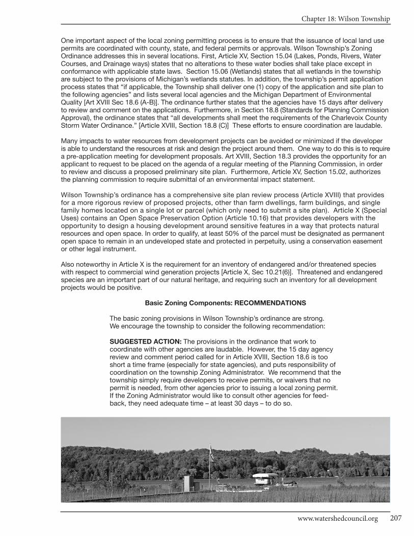
Chapter 18: Wilson Township
207www.watershedcouncil.org
One important aspect of the local zoning permitting process is to ensure that the issuance of local land usepermits are coordinated with county, state, and federal permits or approvals. Wilson Township’s Zoning Ordinance addresses this in several locations. First, Article XV, Section 15.04 (Lakes, Ponds, Rivers, WaterCourses, and Drainage ways) states that no alterations to these water bodies shall take place except in conformance with applicable state laws. Section 15.06 (Wetlands) states that all wetlands in the townshipare subject to the provisions of Michigan’s wetlands statutes. In addition, the township’s permit applicationprocess states that “if applicable, the Township shall deliver one (1) copy of the application and site plan tothe following agencies” and lists several local agencies and the Michigan Department of Environmental Quality [Art XVIII Sec 18.6 (A-B)]. The ordinance further states that the agencies have 15 days after deliveryto review and comment on the applications. Furthermore, in Section 18.8 (Standards for Planning CommissionApproval), the ordinance states that “all developments shall meet the requirements of the Charlevoix CountyStorm Water Ordinance.” [Article XVIII, Section 18.8 (C)] These efforts to ensure coordination are laudable.
Many impacts to water resources from development projects can be avoided or minimized if the developer is able to understand the resources at risk and design the project around them. One way to do this is to requirea pre-application meeting for development proposals. Art XVIII, Section 18.3 provides the opportunity for anapplicant to request to be placed on the agenda of a regular meeting of the Planning Commission, in orderto review and discuss a proposed preliminary site plan. Furthermore, Article XV, Section 15.02, authorizesthe planning commission to require submittal of an environmental impact statement.
Wilson Township’s ordinance has a comprehensive site plan review process (Article XVIII) that provides for a more rigorous review of proposed projects, other than farm dwellings, farm buildings, and single family homes located on a single lot or parcel (which only need to submit a site plan). Article X (SpecialUses) contains an Open Space Preservation Option (Article 10.16) that provides developers with the opportunity to design a housing development around sensitive features in a way that protects natural resources and open space. In order to qualify, at least 50% of the parcel must be designated as permanentopen space to remain in an undeveloped state and protected in perpetuity, using a conservation easementor other legal instrument.
Also noteworthy in Article X is the requirement for an inventory of endangered and/or threatened specieswith respect to commercial wind generation projects [Article X, Sec 10.21(6)]. Threatened and endangeredspecies are an important part of our natural heritage, and requiring such an inventory for all developmentprojects would be positive.
Basic Zoning Components: RECOMMENDATIONS
The basic zoning provisions in Wilson Township’s ordinance are strong. We encourage the township to consider the following recommendation:
SUGGESTED ACTION: The provisions in the ordinance that work to coordinate with other agencies are laudable. However, the 15 day agencyreview and comment period called for in Article XVIII, Section 18.6 is tooshort a time frame (especially for state agencies), and puts responsibility ofcoordination on the township Zoning Administrator. We recommend that thetownship simply require developers to receive permits, or waivers that nopermit is needed, from other agencies prior to issuing a local zoning permit.If the Zoning Administrator would like to consult other agencies for feed-back, they need adequate time – at least 30 days – to do so.
CHARLEVOIx COUnTy - Local Ordinance Gaps Analysis
Tip of the Mitt Watershed Council208
ShorelinesPOSSIBLE SCORE: 60
TOTAL SCORE: 12, WEAK
Two of the most effective ways to protect and maintain water quality through zoning are building setbacksand the establishment of vegetated buffers or shoreline protection strips. Although Wilson Township doesnot have a shoreline protection strip or vegetative buffer provision, they do have a waterfront setback of 50feet for all zones (Article III, Section 3.21). Furthermore, it is important to note that the Zoning Ordinance requires all applicants to secure permits from other agencies before doing any work along the shoreline oflakes and streams.
Wilson Township does not regulate docks on inland lakes and streams. Such regulations can serve to protectthe rights of waterfront owners and preserve the character of the natural shoreline. The township also doesnot regulate marinas or road ends terminating at the edge of navigable waters.
Shorelines: RECOMMENDATIONS
The township-wide 50 foot waterfront setback on all water bodies in all zoning districts, and the requirement for permits from other agencies areboth very useful tools in helping to protect water resources. However, thereare several provisions that could be added to the ordinance that would helpstrengthen Wilson Township’s shoreline protection measures.
SUGGESTED ACTION: Establish a shoreline protection strip immediatelyadjacent to lakes, streams, and other water bodies. To be most effective, theshoreline protection strip should be 30 feet wide, maintained in native vege-tation, no pesticide or herbicide use, with minimum cutting to afford a fil-tered view of the water.
SUGGESTED ACTION: Establish dockage regulations in order to protectthe rights of all waterfront owners and maintain the character of the shoreline.
SUGGESTED ACTION: Explore the need to establish provisions to regulateuse of road ends by the public, or potential marina operations on Deer Lake,to ensure that these activities don’t harm water quality or impact the natureof the lake.
SUGGESTED ACTION: Although Phragmites is of concern mostly on GreatLakes shorelines, it has become established on some inland waters and roadditches. We encourage all local governments to initiate a program designed toensure that the invasive strain of Phragmites does not become established intheir jurisdiction. Such a project would involve an initial inventory to determineif there are invasive stands of Phragmites, treat those stands if they exist,and conduct a follow up inventory and treatment, if necessary.
Impervious SurfacesPOSSIBLE SCORE: 33
TOTAL SCORE: 2, WEAK
Impervious surfaces limit opportunities for rainwater and snowmelt to naturally percolate into the soils. Thisdoes not allow contaminants to be removed from stormwater runoff before it flows into lakes, rivers, andwetlands. The more a local unit of government can do to reduce impervious surfaces, the better for waterquality. There do not appear to be any provisions in the Wilson Township ordinance that would help to encourage reduction of impervious surfaces. Additionally, the Lake Charlevoix Watershed Management Plan recommends reducing the pollutant load from stormwater runoff. Reducing impervious surfaces helpsto accomplish this objective to protect township waters from sediment, nutrients, and toxic substances.

Chapter 18: Wilson Township
209www.watershedcouncil.org
Impervious Surfaces: RECOMMENDATIONS
There are many opportunities to reduce impervious surfaces in local zoningordinances. We encourage Wilson Township to consider the following provisions for their ordinance:
SUGGESTED ACTION: Establish impervious surface lot coverage limits inall zoning districts, especially residential districts, to limit impervious sur-faces to 15% of the total lot.
SUGGESTED ACTION: Consider adding a provision that allows for flexibilityin front yard setbacks or side yard setbacks to encourage shorter drivewaysor shared driveways between two lots.
SUGGESTED ACTION: Modify Article XVII, Section 18.12(A)(5) to allow reductions in the size of impervious surfaces of parking and loading areas,or encourage use of grass parking areas or pervious pavers.
Stormwater ManagementPOSSIBLE SCORE: 27
TOTAL SCORE: 9, WEAK
Wilson Township does not have a stand-alone stormwater management provision. However, there are placesin the ordinance where stormwater management is addressed. First, the Standards for Private Roads statesthat “all private roads constructed in Wilson Township shall be constructed so as to sufficiently control stormwater runoff and permit effective storm water drainage and prevent soil erosion. Storm water retentionbasins shall be designed to store all storm water runoff from a two and one half (2.5) inch in a twenty-four(24) hour period rainfall event” Article XIV, Section 14.42(B).
In addition to this requirement, there are three places in the ordinance where Wilson Township requires a proposed development to meet the requirements of the Charlevoix County Stormwater Ordinance: Standardsfor Private Roads [Article XIV, Section 14.42(C)], General Requirements for Environmentally Sensitive Areas[Article XV, Section 15.07(B)], and Standards for Planning Commission Approval [Article XVIII, Sec 18.8(C)].Although typically requiring the applicant to comply with a county stormwater ordinance is an effective wayto regulate stormwater, Charlevoix County’s stormwater ordinance was rescinded in 2009, as noted in Chapter 1. It is currently being reworked, and full implementation of the new Charlevoix County Storm Water Control (SWC) Ordinance will require each township and local municipality to adopt it.
Stormwater Management: RECOMMENDATIONS
Stormwater runoff from buildings, driveways, parking lots, streets, and otherimpervious surfaces is a major source of pollutants to northern Michigan’swaterways. Local governments can do much to reduce stormwater runoffas part of their zoning ordinance. Wilson Township’s ordinance does addressstormwater in several places, we recommend considering adding the followingstormwater management practices, either as a separate item in general provisions, or as part of the site plan review.
SUGGESTED ACTION: Consider requiring review of development proposalsby the County Drain Commissioner to ensure that stormwater managementis properly addressed on all proposed development projects.
SUGGESTED ACTION: Coordinate efforts with the County Drain Commis-sioner to enact local stormwater ordinances in the county, allowing the countyto administer and enforce them for local jurisdictions. Ask the county to finish the SWC Ordinance and Intergovernmental Agreement, and presentit to Wilson Township for passage.

CHARLEVOIx COUnTy - Local Ordinance Gaps Analysis
Tip of the Mitt Watershed Council210
Soil Erosion and Sediment ControlPOSSIBLE SCORE: 18
TOTAL SCORE: 0, MISSING
Wilson Township does not have detailed standards in their ordinance to address soil erosion and sedimentcontrol. However, there are places in the township Zoning Ordinance where soil erosion and sediment controlis mentioned, including: Standards for Private Roads [Article XIV, Section 14.42 (B) and (C)], Lakes, Ponds,Rivers, Streams, Water Courses and Drainage ways [Article XV,15.04 (B)], and General Requirements for Environmentally Sensitive Areas [Article XV, Section 15.07(B)(1)]. In these instances, the ordinance states thatplans shall conform to the provisions of either county or state regulations. However, there is no place whereit clearly states that a soil erosion control permit from the local Soil Erosion Control enforcement agent is required before a Wilson Township permit will be issued. In addition, the Site Plan Review process allows for the Zoning Administrator to deliver a copy of an application and site plan to the Charlevoix County SoilErosion Control officer for review and comment (Article XVII, Section 18.6).
Soil Erosion and Sediment Control: RECOMMENDATIONS
All properties that are located near lakes, streams, wetlands, ponds, ordrainage ways have the potential to erode and cause sedimentation to nearbywaters. Accordingly, it is recommended that local governments require allearth movement activities associated with development or constructionprojects to follow Best Management Practices (BMPs) to control erosion and ensure that any sediment-laden runoff does not enter waterways. TheCharlevoix County Department of Building Safety administers Part 91 ofMichigan’s Natural Resources and Environmental Protection Act (NREPA).Coordination between the township and county is essential to ensure thatsoil erosion and sedimentation is controlled.
SUGGESTED ACTION: Specifically require that all proposed developmentproject earth change activities within 500 feet of a lake, stream, wetland, orother waterway in all zoning districts receive a soil erosion and sedimentationcontrol permit from Charlevoix County before they receive a permit from Wilson Township.
SUGGESTED ACTION: Amend Article XVII, Section 18.6 to lengthen thetime frame for review and comment by the Charlevoix County Soil ErosionControl officer from 15 to at least 30 days.
Sewer/SepticPOSSIBLE SCORE: 24
TOTAL SCORE: 9, ADEQUATE
Sewer and septic management is critical to both human health and water quality. Wilson Township, as part of its Supplemental Regulations, states that wastewater disposal facilities “shall meet the requirementsestablished by the Health Code of the County.” (Article XIV, Sec 14.10)
Sewer/Septic: RECOMMENDATIONS
In addition to ensuring compliance with the local health code, local units ofgovernment can regulate the siting of septic fields to ensure protection ofwater resources. The main concern with septic systems and water quality isthe potential for septic systems to contribute excess nutrients to water bodies.These nutrients can cause the growth of aquatic weeds and algae. The LakeCharlevoix Watershed Management Plan includes an Objective to educatecitizens about the importance of septic system maintenance in order to reduce the amount of harmful nutrients in our waters.
Chapter 18: Wilson Township
211www.watershedcouncil.org
SUGGESTED ACTION: Require that septic systems be located at least 100feet from lakes, streams, wetlands, or other water bodies.
SUGGESTED ACTION: Consider establishing a “point of transfer” inspectionrequirement whereby septic systems must be inspected to ensure they areoperating properly before ownership is transferred.
WetlandsPOSSIBLE SCORE: 21
TOTAL SCORE: 3, WEAK
Wetlands are some of our most valuable water resources. They provide excellent wildlife habitat, help controlflooding, and contribute to water quality protection. Although Michigan has a statewide wetland protectionstatute, not all wetlands are covered and not all activities that could impact wetlands are regulated. Localgovernments have the opportunity to supplement the state’s wetland protection program.
Wilson Township specifically mentions wetlands in the intent and purpose of the ordinance (Article I, Section1.02), and in the purpose for the RDA (Resource Development-Agricultural) District (Section 4.01). From a specificprovision standpoint, applicants are required to note the location of wetlands on their site plan application[Article XVII, Section 18.5(B)(4)]. Article 15 (Environmental Conservation Provisions) clearly states that, “Allwetlands in the Township are hereby subject to the provisions of [Michigan’s wetlands act] to encourage theproper use and development of the wetlands.” (Article XV, Section 15.06)
Wetlands: RECOMMENDATIONS
Michigan’s wetland law specifically authorizes local governments to adoptwetland protection ordinances that regulate wetlands not protected by the statestatute. In addition to a stand-alone wetland ordinance, local governmentscan support wetland protection through zoning and by requiring wetlandpermits from state and federal agencies prior to granting local zoning permits.
SUGGESTED ACTION: Given the important role that wetlands play in protectingwater quality, providing wildlife habitat, and minimizing flooding, it is importantto educate township citizens on the importance of protecting wetlands.
SUGGESTED ACTION: Continue working with applicants and the Departmentof Environmental Quality to ensure that all state and federal wetland statutesare followed and that wetland permits are received before zoning permitsare issued.
SUGGESTED ACTION: Consider establishing a wetland setback similar toshoreline setbacks. This would protect wetlands and be simple to administer,in the short term. Eventually, a local wetland ordinance should be enactedto fill in gaps of protection.
Ground Water and Wellhead ProtectionPOSSIBLE SCORE: 18
TOTAL SCORE: 8, ADEQUATE
Ground water is the primary source of drinking water for nearly all Northern Michigan residents. Protectingground water resources from contamination is vitally important. The Wilson Township ordinance requires thatstate and federal permits be provided for any facilities or uses where hazardous substances are stored, usedor generated prior to local township approval for that use. Although there are many other activities that canimpact ground water, such as individuals draining their oil onto the ground when changing the oil in their automobiles, requiring state and federal permits for proposed uses that involve hazardous materials is agood first step in protecting ground water in Wilson Township.
CHARLEVOIx COUnTy - Local Ordinance Gaps Analysis
Tip of the Mitt Watershed Council212
Discharges to ground water are regulated by the state under Part 31, Water Resources Protection, of theNatural Resources and Environmental Protection Act (NREPA) 1994 PA 451, and Part 22 Rules. Any proposeddischarges should be prohibited by the township until required state permits are received by the applicant.Storage of hazardous materials is also regulated under Part 5 Rules issued for Part 31. This includes PollutionIncident Prevention Plans, which can be efficiently coordinated with Local Emergency Planning Committee work.
Ground Water and Wellhead Protection: RECOMMENDATIONS
Importantly, Wilson Township participated in the state Wellhead ProtectionPlan process, getting its plan approved in 2002. This is a voluntary program,and we applaud the township for taking this critical step and protectingthese precious drinking water sources.
SUGGESTED ACTION: Update and maintain a comprehensive inventory ofpotential threats to ground water. This will be particularly important as thetownship continues to grow and more and more people rely on groundwater for drinking water supplies.
SUGGESTED ACTION: Since many common activities can impact groundwater quality, provide ground water education materials to township residents.
SUGGESTED ACTION: If direct or indirect discharges to ground water areproposed, use site plan review or some other ordinance provision to prohibitthis until appropriate approvals or permits are obtained from the state.
SUGGESTED ACTION: Protect ground water from potential contaminationby requiring Pollution Incident Prevention Plans for storage of hazardousmaterials, in coordination with Local Emergency Planning Committee efforts.
OtherPOSSIBLE SCORE: 48
TOTAL SCORE: 31, ADEQUATE
There are two elements of Wilson Township’s Zoning Ordinance that add to the water quality protectionframework. First, although only a small creek in the southwest corner of the Township is subject to JordanRiver’s Natural River Zoning, Wilson Township’s ordinance clearly articulates that the state law is “herebymade a part of this Ordinance.” [Article XV, Section 15.04(C)] Secondly, the ordinance limits uses in floodplainsto agriculture and recreational uses, provided no buildings are constructed in the floodplain [Article XV, Section15.05 (A-C)]. These provisions help to protect water resources in the township and ensure that those seekinga zoning permit are made aware of these state and federal water resource protection statutes.
Conclusion
We appreciate the water protection measures that exist in Wilson Township. We also thank you for your timeand attention in reading this chapter, and hope that our recommendations are helpful. However, if anythingis unclear, please be sure to let us know. If you have any questions related to this project, please contact Tipof the Mitt Watershed Council at 231.347.1181.

Chapter 18: Wilson Township
213www.watershedcouncil.org
Results WorksheetWilson Township
Catagory Possible Score Total Score Comments
I. Master Plan30 - 21 = Strong20 - 11 = Adequate10 - 0 = Weak
II. Basic Zoning Elements54 - 37 = Strong36 - 19 = Adequate18 - 0 = Weak
III. Shorelines60 - 41 = Strong40 - 21 = Adequate20 - 0 = Weak
IV. Impervious Surface Reduction33 - 23 = Strong22 - 12 = Adequate11 - 0 = Weak
V. Stormwater Management27 - 19 = Strong18 - 10 = Adequate9 - 0 = Weak
VI. Soil Erosion and Sediment Control18 - 13 = Strong12 - 7 = Adequate6 - 0 = Weak
VII. Sewer/Septic24 - 17 = Strong16 - 9 = Adequate8 - 0 = Weak
VIII. Wetlands21 - 15 = Strong14 - 8 = Adequate7 - 0 = Weak
IX. Ground Water and Wellhead Protection
18 - 13 = Strong12 - 7 = Adequate6 - 0 = Weak
X. Other Relevant Elements48 -33 = Strong32 - 17 = Adequate16 - 0 = Weak
30
54
60
33
27
18
24
21
18
48
12
41
12
2
9
0
9
3
8
31
Adequate
Strong
Weak
Weak
Weak
Missing
Adequate
Weak
Adequate
Adequate
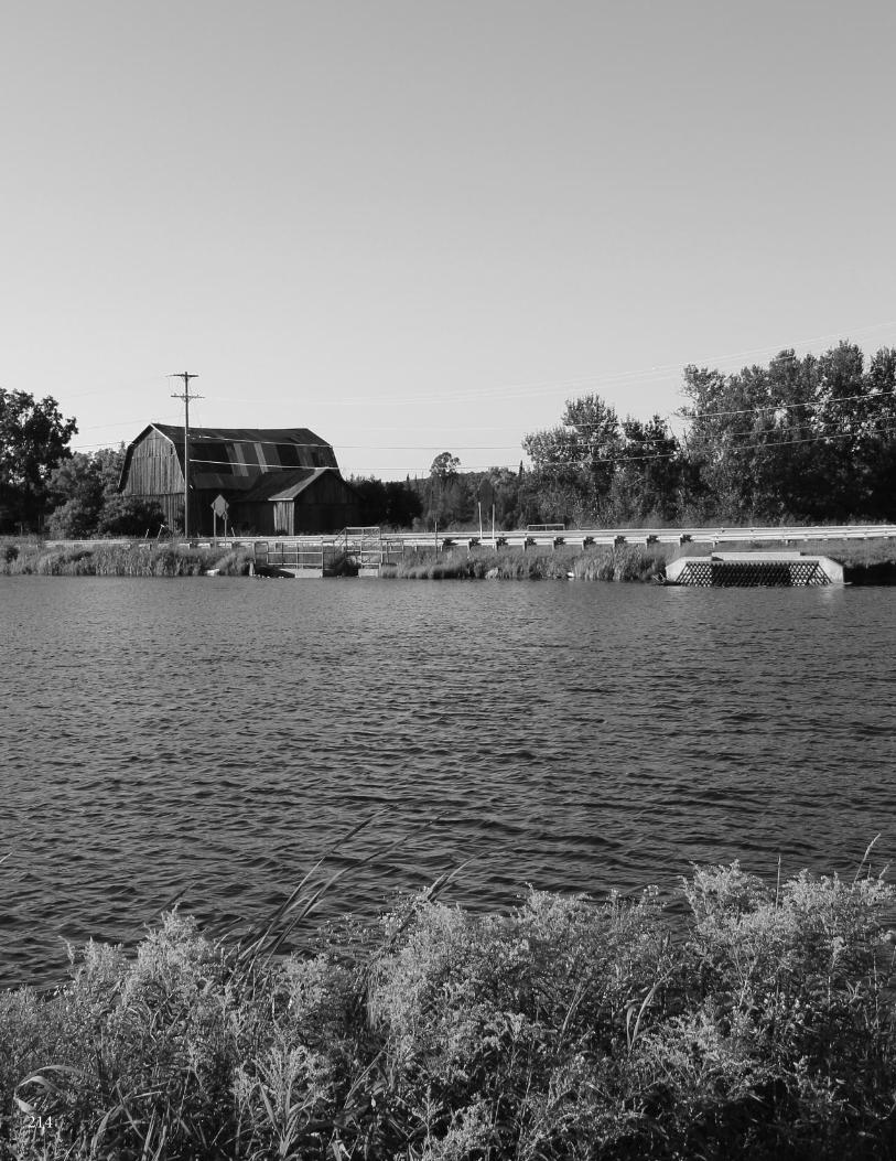
214

Chapter 19: Village of Boyne Falls
215www.watershedcouncil.org
SECTION III: Analysis
Chapter 19 Village of Boyne Falls
Introduction The Village of Boyne Falls is located in Boyne Valley Township. According to the US Census Bureau, the villagehas a total area of 0.6 square miles (1.5 km²) and the 2000 population was recorded at 370. Even though the village is tiny, its water resources are important assets: the south branch of the Boyne River and the Boyne FallsPond. The village is included in the Lake Charlevoix Watershed.
Evaluation Scores and Summary
Master Plan Components
Boyne Falls does not have a Master Plan or Zoning Ordinance. First and foremost, we encourage the Villageof Boyne Falls to re-consider adopting local zoning, which should start with a sound Master Plan. However,even if Boyne Falls is not ready to do zoning, we encourage them to create a Future Land Use Plan for thevillage, which can help evaluate whether zoning is appropriate or not at this time, and pinpoint other ordi-nances that could be helpful.
Shorelines
Two of the most effective ways that local governments can protect water quality is to require setbacks fromthe water’s edge, and require a shoreline protection strip of native vegetation between the water and the upland land use, also called a vegetative buffer.
There is no regulation of shoreline areas by the county government. Therefore, any local jurisdiction that doesnot have zoning also does not have shoreline setbacks or vegetative buffer protections in place. However,the Charlevoix County Future Land Use Plan supports providing model ordinances to local entities, includingvarious efforts at shoreline protection such as setbacks and buffer strips (Charlevoix County Future LandUse Plan p.4.4).
SUGGESTED ACTION: Consider education efforts that would encouragepermanent retention of native vegetation in areas immediately adjacent towater bodies throughout the Village of Boyne Falls. When appropriate forthe community, consider a stand-alone ordinance to require setbacks andvegetative buffer strips along the water.
CHARLEVOIx COUnTy - Local Ordinance Gaps Analysis
Tip of the Mitt Watershed Council216
Impervious Surfaces/Stormwater/ Soil Erosion and Sediment Control
The more a local government can do to reduce impervious surfaces and manage stormwater, the better forwater quality. The Lake Charlevoix Watershed Protection Plan includes the following task: Conduct and updateimpervious surface studies on the tributaries and shoreline areas for the watershed. The point of doing suchassessments is to understand the current impact of development and trends for the municipality, so as tomanage the addition of hard surfaces. Tools exist to help with future development pressures, such as allowancesfor parking lot construction and various Best Management Practices (BMPs).
As noted in Chapter 1, Charlevoix County officials are working on a new Storm Water Control (SWC) Ordinancethat would need to be passed by individual municipalities, giving the county authority to administer and enforcethe ordinance. To make this work effectively and efficiently, all participating municipalities would have to passidentical language and participate in an Intergovernmental Agreement.
Soil erosion control is an essential component in watershed management efforts. The Charlevoix County Department of Building Safety administers Part 91 of Michigan’s Natural Resources and Environmental Protection Act (NREPA), Michigan’s Soil Erosion and Sedimentation Control statute.
SUGGESTED ACTION: Do an impervious surface assessment for the Villageof Boyne Falls. Review and establish trends to inform next steps.
SUGGESTED ACTION: Coordinate efforts with the County Drain Commissionerto enact local stormwater ordinances in the county, allowing the county toadminister and enforce them for local jurisdictions. Ask the county to finishthe SWC Ordinance and Intergovernmental Agreement, and present it to theVillage of Boyne Falls for passage.
SUGGESTED ACTION: If not already in place, establish a process to ensurethat any individual or business understands that they must receive a soil erosionand sedimentation control permit from the county, prior to construction orearth change activity within 500 feet of a river or pond.
Sewer/Septic
There is no county regulation of septic point of transfer inspections. In addition to protecting property owners,point of transfer inspection ordinances also reduce pollution to rivers and other water sources by locatingthose systems that need repair or replacement. This practice can help ensure septic systems do not contaminateprecious water resources.
SUGGESTED ACTION: Educate residents about proper septic system management and encourage residents to maintain septic systems on a regular basis.
SUGGESTED ACTION: Consider adopting a “point of transfer” septic inspection ordinance.
Wetlands
As time passes, we learn more and more about the importance of wetlands. Citizens in Charlevoix Countycontinue to be interested in wetland protections because of the public benefits they provide, such as fish andwildlife habitat, high water quality, and flood water storage. These benefits extend well beyond the bounds ofwetlands themselves. Wetlands are critical to the health of Charlevoix County’s vast water resources, and theyare difficult to restore once they are damaged or filled.
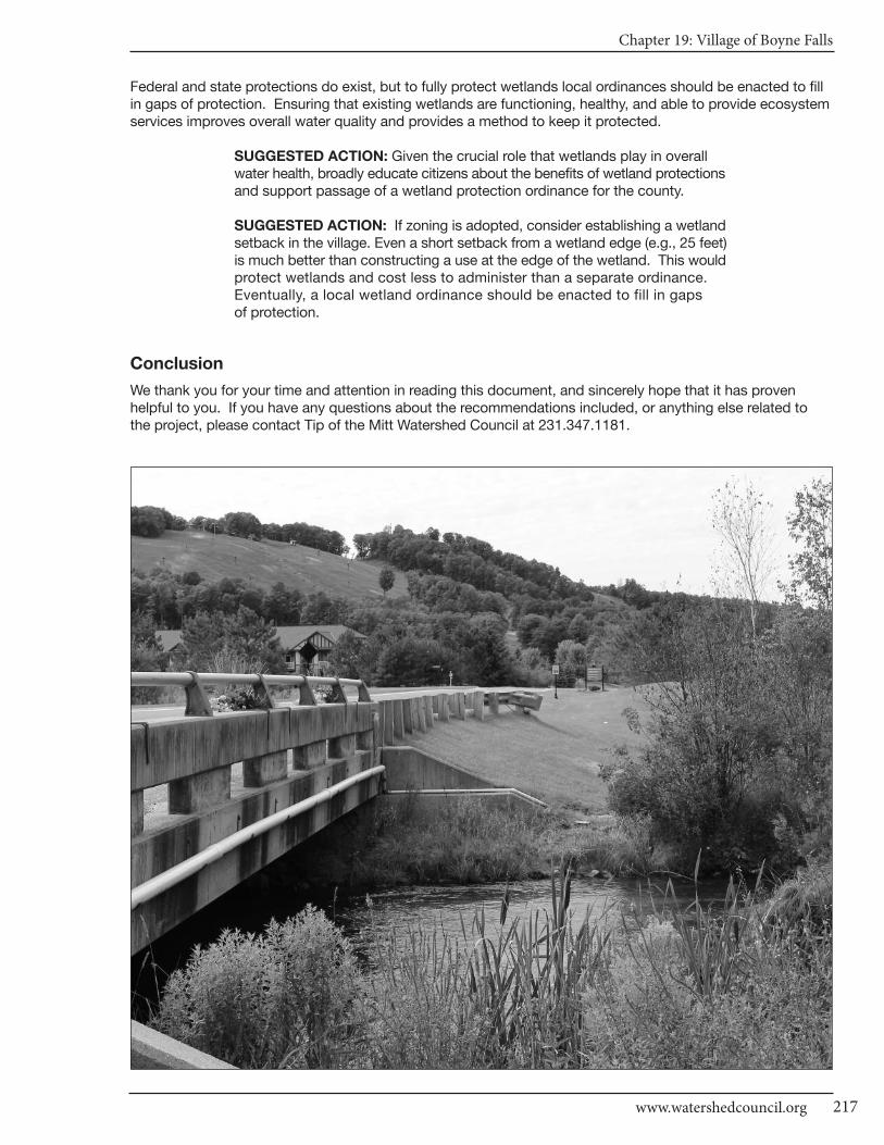
Chapter 19: Village of Boyne Falls
217www.watershedcouncil.org
Federal and state protections do exist, but to fully protect wetlands local ordinances should be enacted to fillin gaps of protection. Ensuring that existing wetlands are functioning, healthy, and able to provide ecosystemservices improves overall water quality and provides a method to keep it protected.
SUGGESTED ACTION: Given the crucial role that wetlands play in overallwater health, broadly educate citizens about the benefits of wetland protectionsand support passage of a wetland protection ordinance for the county.
SUGGESTED ACTION: If zoning is adopted, consider establishing a wetlandsetback in the village. Even a short setback from a wetland edge (e.g., 25 feet)is much better than constructing a use at the edge of the wetland. This wouldprotect wetlands and cost less to administer than a separate ordinance. Eventually, a local wetland ordinance should be enacted to fill in gaps of protection.
Conclusion
We thank you for your time and attention in reading this document, and sincerely hope that it has proven helpful to you. If you have any questions about the recommendations included, or anything else related to the project, please contact Tip of the Mitt Watershed Council at 231.347.1181.
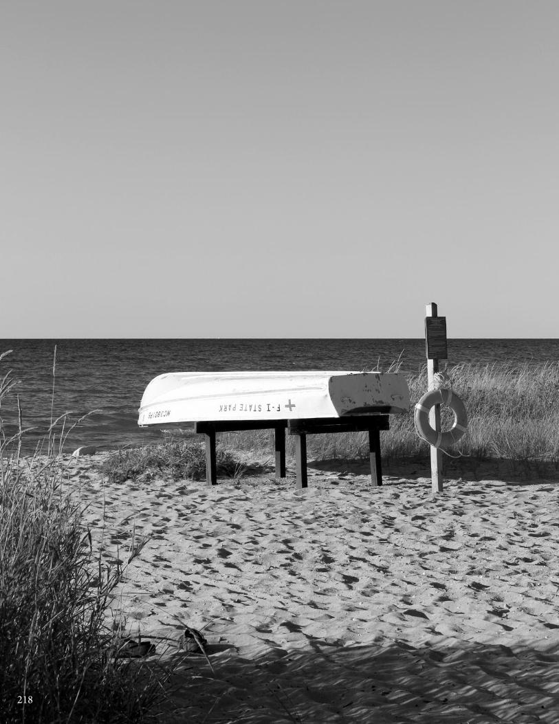
218
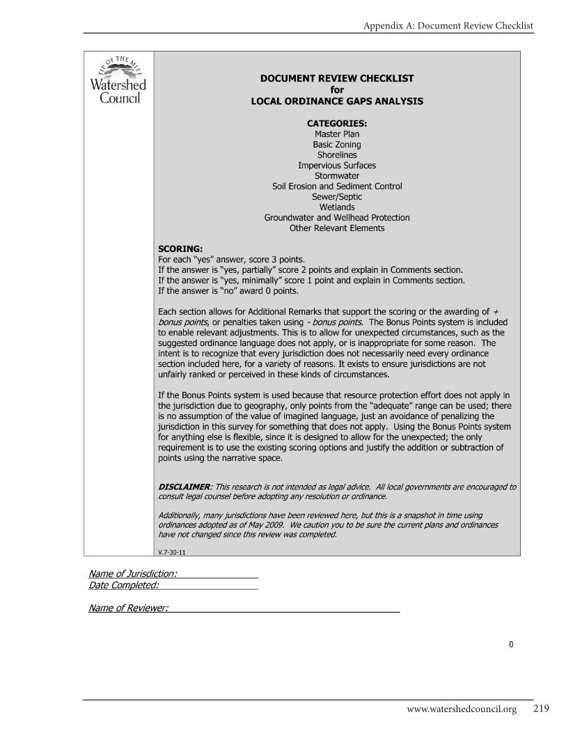
Appendix A: Document Review Checklist
219www.watershedcouncil.org

CHARLEVOIx COUnTy - Local Ordinance Gaps Analysis
Tip of the Mitt Watershed Council220
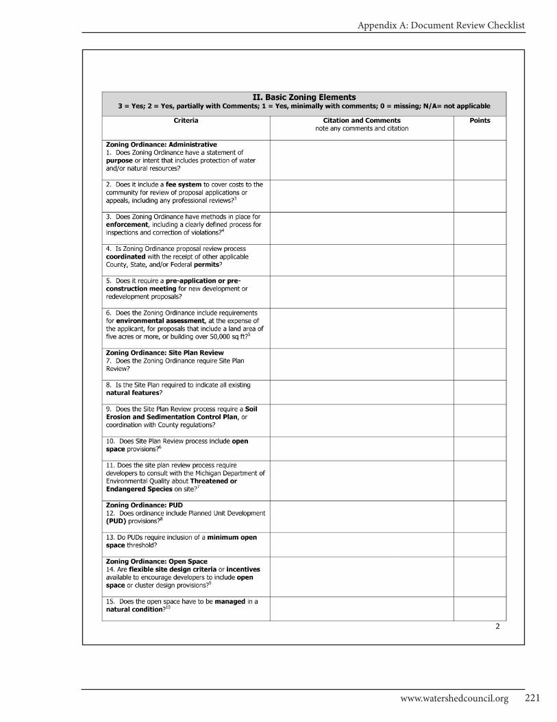
Appendix A: Document Review Checklist
221www.watershedcouncil.org

CHARLEVOIx COUnTy - Local Ordinance Gaps Analysis
Tip of the Mitt Watershed Council222
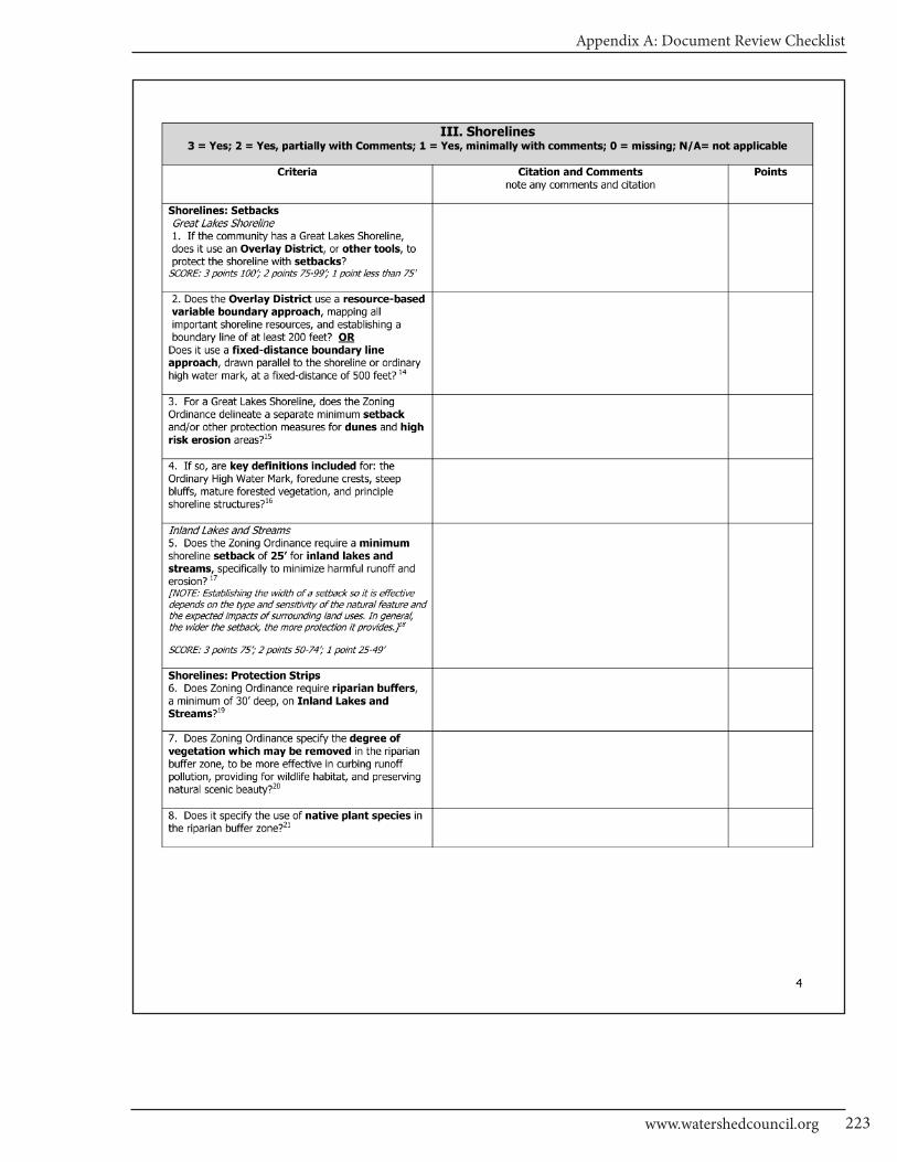
Appendix A: Document Review Checklist
223www.watershedcouncil.org
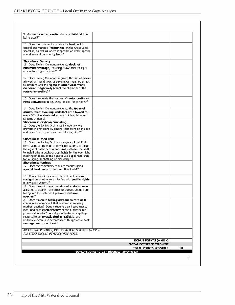
CHARLEVOIx COUnTy - Local Ordinance Gaps Analysis
Tip of the Mitt Watershed Council224
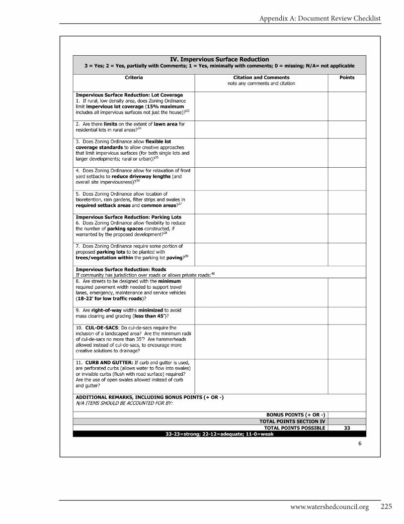
Appendix A: Document Review Checklist
225www.watershedcouncil.org
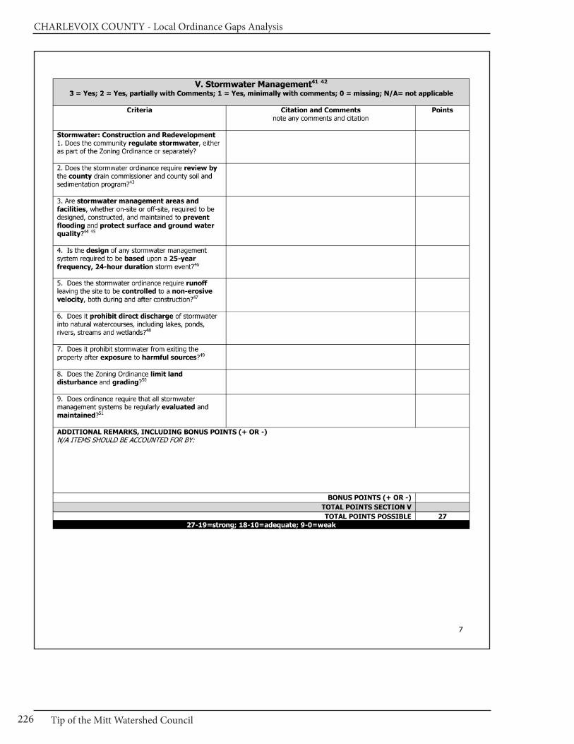
CHARLEVOIx COUnTy - Local Ordinance Gaps Analysis
Tip of the Mitt Watershed Council226
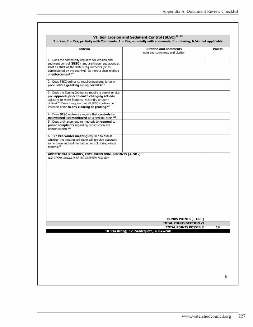
Appendix A: Document Review Checklist
227www.watershedcouncil.org
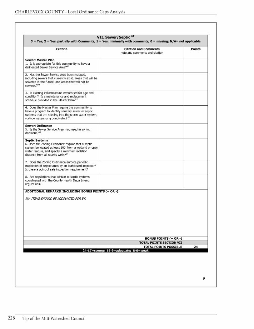
CHARLEVOIx COUnTy - Local Ordinance Gaps Analysis
Tip of the Mitt Watershed Council228

Appendix A: Document Review Checklist
229www.watershedcouncil.org
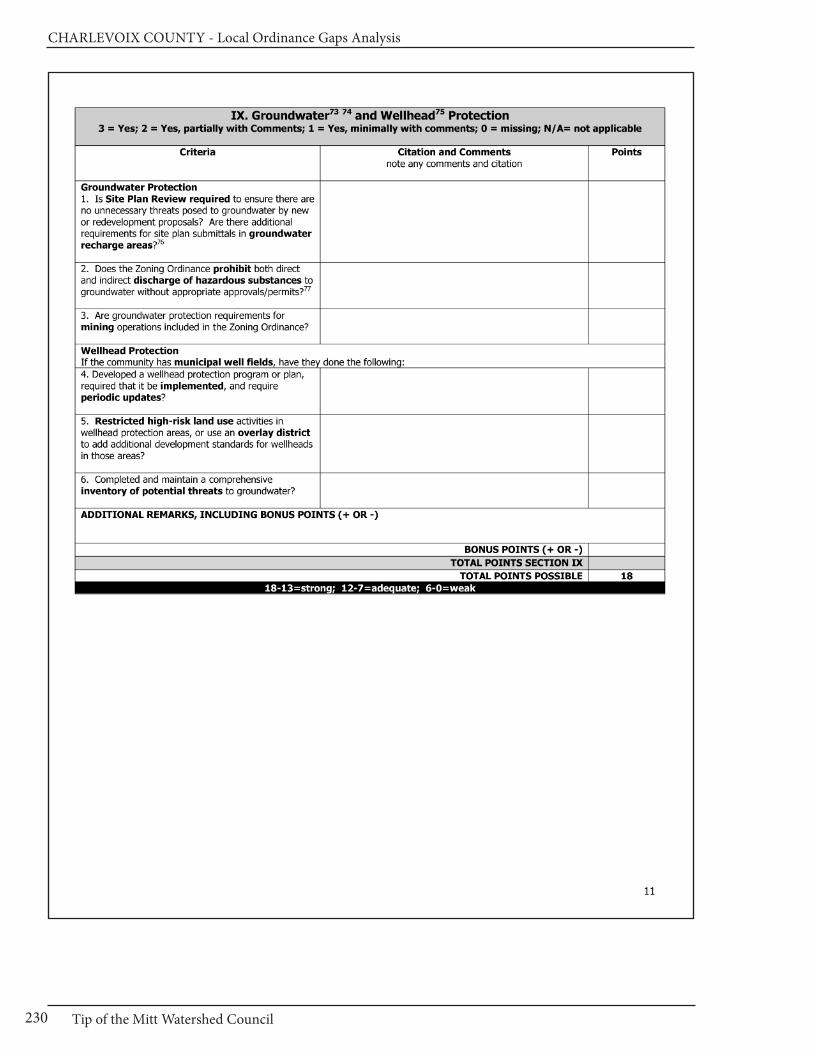
CHARLEVOIx COUnTy - Local Ordinance Gaps Analysis
Tip of the Mitt Watershed Council230
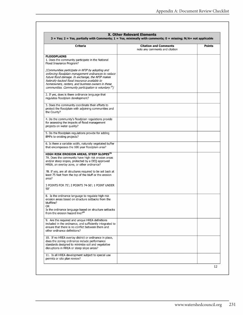
Appendix A: Document Review Checklist
231www.watershedcouncil.org
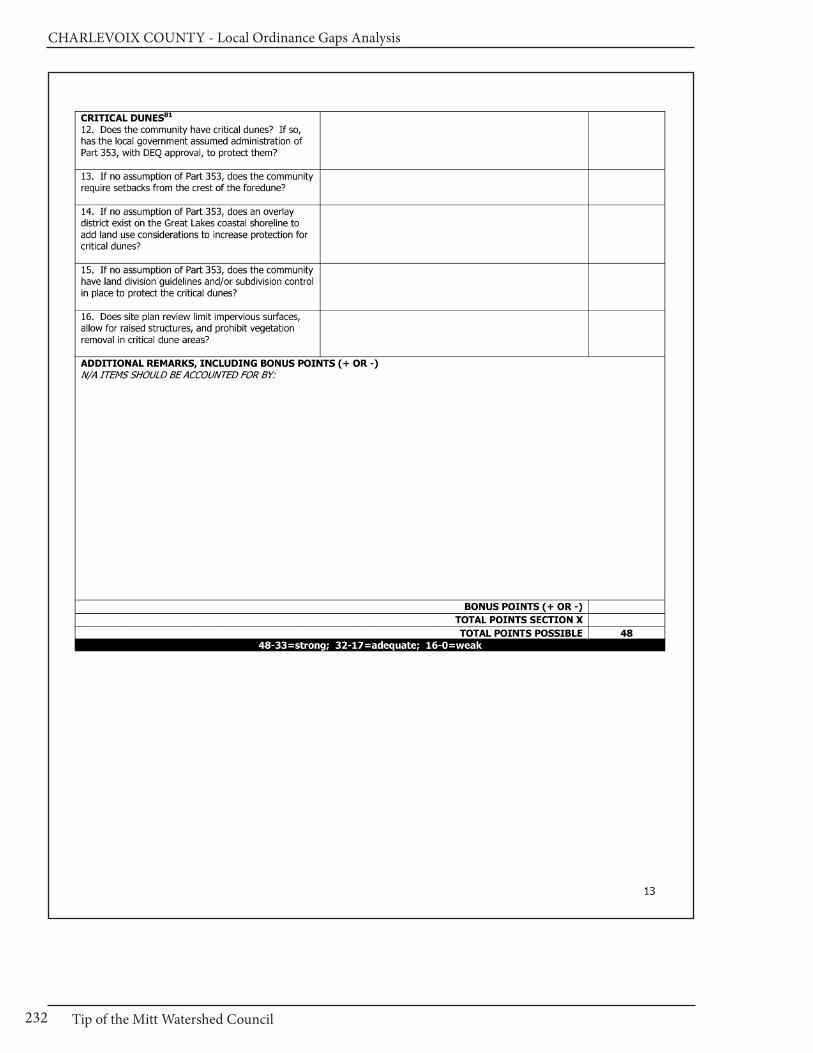
CHARLEVOIx COUnTy - Local Ordinance Gaps Analysis
Tip of the Mitt Watershed Council232

Appendix A: Document Review Checklist
233www.watershedcouncil.org
Results Worksheet
Catagory Possible Score Total Score Comments
I. Master Plan30 - 21 = Strong20 - 11 = Adequate10 - 0 = Weak
II. Basic Zoning Elements54 - 37 = Strong36 - 19 = Adequate18 - 0 = Weak
III. Shorelines60 - 41 = Strong40 - 21 = Adequate20 - 0 = Weak
IV. Impervious Surface Reduction33 - 23 = Strong22 - 12 = Adequate11 - 0 = Weak
V. Stormwater Management27 - 19 = Strong18 - 10 = Adequate9 - 0 = Weak
VI. Soil Erosion and Sediment Control18 - 13 = Strong12 - 7 = Adequate6 - 0 = Weak
VII. Sewer/Septic24 - 17 = Strong16 - 9 = Adequate8 - 0 = Weak
VIII. Wetlands21 - 15 = Strong14 - 8 = Adequate7 - 0 = Weak
IX. Ground Water and Wellhead Protection
18 - 13 = Strong12 -7 = Adequate6 - 0 = Weak
X. Other Relevant Elements48 -33 = Strong32 - 17 = Adequate16 - 0 = Weak
CHARLEVOIx COUnTy - Local Ordinance Gaps Analysis
Tip of the Mitt Watershed Council234
Appendix A: Document Review Checklist
235www.watershedcouncil.org
CHARLEVOIx COUnTy - Local Ordinance Gaps Analysis
Tip of the Mitt Watershed Council236
Appendix A: Document Review Checklist
237www.watershedcouncil.org
CHARLEVOIx COUnTy - Local Ordinance Gaps Analysis
Tip of the Mitt Watershed Council238
Appendix B: Additional Resources
239www.watershedcouncil.org
Additional Resources
Master Planning & Basic Zoning
Planning and Zoning Center (PZC) at MSU, Online listing Michigan local governments with amaster plan and/or zoning ordinance: www.pzcenter.msu.eduLink under “Resources”: over 200 plans and 200zoning ordinances are listed including links to similar online lists in other states. The PZC alsomaintains online information resources, developsdecision support systems and serves as an information/data clearinghouse to enhance city, village, township, county, regional and state planning efforts.
Michigan Planning Guidebook: for Citizens and
Local Officials, MSU Planning & Zoning Center,2008, by Wyckoff, Mark. The guidebook describes the roles and responsi-bilities of the planning commission and legislativebody under the new Michigan Planning EnablingAct, PA 33 of 2008, with clear direction on procedures and standards to guide decisions.
Michigan Zoning Guidebook: for Citizens and
Local Officials, MSU Planning & Zoning Center,2nd edition, 2008, by Wyckoff, Mark. The guidebook describes the roles and responsi-bilities of all bodies under the Michigan Zoning Enabling Act, PA 110 of 2006, as amended by PA12 of 2008, with clear direction on procedures andstandards to guide decisions.
Checklist 1F: What Should be in a Master Plan?
Michigan State University Extension, Land Use Series, May 2008, by Solomon, Dean. 17 pages.Can be found on the web at:http://web5.msue.msu.edu/lu/pamphlet/Bclsam/pamphlet1F%20PlanContents.pdf
Sample Approach to Update a Zoning
Ordinance to Comply With Michigan Zoning
Enabling Act of 2006. Michigan State University Extension, Land Use Series, May 2008, bySchindler, Kurt H. 16 pages.Can be found on the web at:http://web5.msue.msu.edu/lu/pamphlet/Bclsam/pamphlet9SampleZoneAmdMiZoneEnabAct.pdf
Sample Ordinances from within the
Grand Traverse Bay Watershed
Sample Vegetated Riparian Buffer Ordinances
East Bay Township Zoning Ordinance: Article 4BR:Boardman River District Ordinance 406 Link:http://www.eastbaytwp.org/downloads/article_4br.pdfTitle: ARTICLE IV - DISTRICT STANDARDS - SECTION 406 BOARDMAN RIVER DISTRICT, BR(Similar language found in several other zoning ordinances within the area of the Boardman Riverdesignated as a Natural River)
East Bay Township Zoning Ordinance: Article 2:General Provisions; Mitchell and Baker CreeksArea Ordinance 219 Link:http://www.eastbaytwp.org/downloads/article_2.pdfTitle: ARTICLE V - DIMENSIONAL REQUIREMENTS
Garfield Township Zoning Ordinance: Article 7:Section 7.5.7 Setback from Designated WetlandsLink: http://garfield-twp.com/downloads/sec7_5_5setbklakesrivers_streams.pdf(The section appears on this page of the zoning ordinance) http://garfield-twp.com/downloads/sec7_5suppshorelandregs.pdf
Sample Open Space/Cluster
Development Ordinances
East Bay Township Zoning Ordinance: Article 2:General Provisions, Open Space Preservation Section 225 Link: http://www.eastbaytwp.org/downloads/article_2.pdf
East Bay Township Zoning Ordinance: Article 2:General Provisions, Residential Cluster SubdivisionsSection 226 Link: http://www.eastbaytwp.org/downloads/article_2.pdf
Whitewater Township Zoning Ordinance: Article 31: Planned Unit Development See also: http://www.whitewatertownship.org/downloads/article_xxxi.pdf (Purpose is to preserveopen space; minimum open space requirement of50 percent of development)
Sample Ground Water Protection and Septic
System Maintenance Ordinances
East Bay Township Zoning Ordinance: Article 2:General Provisions, Ground Water Protection
Standards Section 220 Link: http://www.eastbay-twp.org/downloads/article_2.pdf (Similar languagefound in several other local zoning ordinances)
Long Lake Township: Septic System Time of Transfer OrdinanceLink:http://www.longlaketownship.com/planning/tot-septic-ord-final-10-31-08.pdfTitle: Long Lake Township - Grand Traverse CountyMichigan - Ordinance 107 - INSPECTION OF ON-SITE SEWAGE DISPOSAL SYSTEMS AT THE TIME OF PROPERTY TRANSFER ORDINANCE
Sample Private Roads Ordinance
Whitewater Township Private Road Ordinance No.32 Link: http://www.whitewatertownship.org/downloads/private_road_ord.pdf
Whitewater Township Road PlanSee also: http://www.eastbaytwp.org/downloads/whitewaterroadplan.pdf
Sample Off-Street Parking Ordinance
Whitewater Township Zoning Ordinance: Article34, Section 34.30, Parking Lot and Loading AreaRequirements and Article 33, section 33.40, Off-Street Parking Areas Link: www.whitewater-township.org/downloads/article_xxxiv.pdf andwww.whitewatertownship.org/downloads/article_xxxiii.pdf (For stormwater management and landscaping requirements)
Sample Tree Planting Ordinance
Blair Township Zoning Ordinance: Article 16, Section 16.05.3b, General Site Landscaping Link:www.blairtownship.org/Planning_Zoning/Work-ing_Zoning_Ordinance.pdf (See page 67 of the ordinance)
Sample Site Plan Review Ordinance
Whitewater Township Zoning Ordinance: Article 25: Site Plan Review Link: http://www.whitewatertownship.org/downloads/article_xxv_amend_55.pdfFilename: ARTICLEXXVAmend 55-whitewater-twp-site-plan-review.pdf (Includes language about stormwater management and preservation of natural vegetation)
Sample Wetland Ordinance
Forest Home Township Zoning Ordinance: Article5: Wetlands Overlay DistrictLink: www.foresthometwp.com/zoning/Articles_04_through_06.htm
Sample Supporting Documents
Long Lake Township Community Forestry Plan Link: http://www.longlaketownship.com/forestry/longlaketwn.html Link to Table of Contents:http://www. longlaketownship.com/forestry/con-tents.html Files in folder: LongLakeTwp-CommunityForestryPlan (all are in HTML format) Long LakeTownship Natural Features InventoryLink: http://www.longlaketownship.com/planning/long-lake-nfi-final-report.pdf
Whitewater Township Road PlanSee also: http://www.eastbaytwp.org/downloads/whitewaterroadplan.pdf (Supporting informationfor township road ordinance)
Other Model Ordinance Resources
Tip of the Mitt Watershed Council
The Watershed Council has numerous Model Ordinances available for your use on a variety of topics. These ordinances are featured by theMichigan DEQ in a variety of places, including thewidely used book, Filling the Gaps: EnvironmentalProtection Options for Local Governments. If youneed help with a Model Ordinance, please contactus and we can send them to you electronically:(231) 347-1181
Michigan DEQ – Local Wetland Ordinance web-
page
Link: http://www.michigan.gov/deq/0,1607,7-135-3313_3687-24312--,00.html
Macomb County Model
Environmental Ordinances
http://www.macombcountymi.gov/planning/Model_Envir_Ordinances.htm
Michigan Township Association, Open Space
Preservation Provisions
Link: http://michigantownships.org/zoning.asp
Land Information Access Association, Model
Zoning Policies and Ordinances
Includes floodplain standards, private road ordinance,resource protection overlay, steep slope developmentstandards, stormwater management, tree preser-vation standards, and wetlands/natural featuressetbacks Link: http://www.parternerhipsforchange.cc/planningeduc0124.asp
CHARLEVOIx COUnTy - Local Ordinance Gaps Analysis
Tip of the Mitt Watershed Council240
Appendix B: Additional Resources
241www.watershedcouncil.org
Oakland County Planning & Economic
Development Services, Environmental
Stewardship Services, Planning Tools for
Natural Resource Protection
Includes sample and model ordinances for naturalarea protection; wetland, floodplain, and water-course protection; natural features setback/ buffer;woodland protection; native vegetation; stormwaterprotection; groundwater protection; surface waterprotection; erosion & sediment control; reductionof impervious surfaces; and reduction of phospho-rous/fertilizers. Link: Http://www/oakgov.com/peds/program_service/es_prgm/com_mo.html
Low Impact Development and Best
Management Practice Resources
A Natural Solution: An Introduction to Low ImpactDevelopment for Commercial and Residential Applications in the Grand Traverse RegionLink: http://www.gtbay.org/downloads/low_im-pact_development_guidebook_small_3.pdfFilename: low_impact_development_guidebook_small_3.pdf
Better Site Design: A Handbook for Changing
Development Rules in Your Community
Link to Part 1: http://www.cwp.org/Resource_Library/Center_Docs/BSD/ELC_BSDpart1.pdfFilename: ELC_BSDpart1.pdf Link to Part 2:http://www.cwp.org/Resource_Library/Center_Docs/BSD/ELC_BSDpart2.pdf Filename: ELC_BSDpart2.pdf
Michigan DEQ Best Management Practices De-
sign Manuals webpage
Link: http://www.michigan.gov/deq/0,1607,7-135-3313_3682_3714-118554--,00.html
Guidebook of Best Management Practices for
Michigan Watersheds (Introduction) Link: http://www.michigan.gov/documents/deq/deq-wb-nps-Intro_250601_7.pdf
Guidebook of Best Management Practices for
Michigan Watersheds (Entire)
Link: http://www.michigan.gov/documents/deq/deq-wb-nps-WholeGuidebook_250602_7.pdf
State of Michigan Environmental
Protection Resources:
Michigan Department of Natural Resources and
Environment (DNRE) website home page
http://www.michigan.gov/deq
Filling the Gaps: Environmental Protection
Options for Local Governments Written byKatherine Ardizone, NOAA Coastal ManagementFellow for DEQ (2001-2003), and Mark Wyckoff,FAICP and President of Planning & Zoning Center,Inc. This book was created to equip local officialswith important information to consider when making local land use plans, adopting new environmentally focused regulations, or reviewingproposed development. As of January 2011, it isin the process of being updated. It is in electronicform and can be downloaded at this website:http://www.michigan.gov/deq/0,1607,7-135-3313_3677_3696-73358--,00.html
Michigan DNRE Forest, Land and Water
Management website
http://www.michigan.gov/dnr/0,1607,7-153-30301---,00.html
Michigan’s Waters website
http://www.michigan.gov/dnre - Click the link onthe left that says “Water”: “DNRE Water Programsestablish water quality standards, assess waterquality, provide regulatory oversight for all public water supplies, issue permits to regulate the discharge of industrial and municipal waste-waters, monitor State Water resources for waterquality, the quantity and quality of aquatic habitat,the health of aquatic communities, and compliancewith state laws.”
Inland Lakes and Streams website
www.mi.gov/dnreinlandlakes “The Inland Lakes and Streams Program is responsible for the protection of the natural resources and the public trust waters of the inland lakes and streams of the state. The program oversees activities including dredging, filling, constructing or placement of a structure on bottomlands, constructing or operating a marina, interfering with natural flow of water orconnecting a ditch or canal to an inland lake orstream.”
Surface Water website
http://www.michigan.gov/deq/0,1607,7-135-3313_3682---,00.html “DNRE is committed to protecting and preserving Michigan’s water resources. There are several programs in placewhich support this goal. These include non-pointsource pollution, septage, storm water, and sanitary and combined sewer overflow.”
CHARLEVOIx COUnTy - Local Ordinance Gaps Analysis
Tip of the Mitt Watershed Council242
Nonpoint Source Pollution website
http://www.michigan.gov/deq/0,1607,7-135-3313_3682_3714---,00.html“Michigan’s Nonpoint Source Program assists local units of government, non-profit entities, andnumerous other state, federal, and local partners to reduce nonpoint source pollution statewide. The basis of our program is watershed manage-ment and our program works with stakeholders todevelop and implement plans to protect the water-sheds of the state. We look forward to working with you to protect and improve Michigan’s waterresources.”
Water Management website
http://www.michigan.gov/deq/0,1607,7-135-3313_3684---,00.html“Water Management Activities that may have potential impacts to the public trust, riparian rights, or may impair or destroy the waters or other natural resources of the state, including inland lakes and streams, the Great Lakes, wet-lands, and groundwater, are regulated by DNRE.Information on the DNRE permit processes andwater resource related databases and digital maps is provided.”
Aquatic Invasive Species website
http://www.michigan.gov/deq/0,1607,7-135-3313_3677_8314---,00.html
Coastal Management Program website
http://www.michigan.gov/deq/0,1607,7-135-3313_3677_3696---,00.html“Michigan’s Coastal Management Program was developed under the federal Coastal ZoneManagement Act and approved in 1978. Sincethen, the Program has assisted organizations inprotecting and enhancing their coastal areas,funded studies related to coastal management and helped to increase recreational opportunities in Michigan’s Great Lakes coastal area.”
Drinking Water website
http://www.michigan.gov/deq/0,1607,7-135-3313_3675---,00.html“DNRE has primary enforcement authority in Michigan for the Federal Safe Drinking Water Actunder the legislative authority of the Michigan Safe Drinking Water Act. As such, the division hasregulatory oversight for all public water supplies,including approximately 1,500 community watersupplies and 11,000 non-community water supplies. In addition the program regulates
drinking water well drilling. Michigan has morehouseholds served by private wells than any otherstate, with approximately 25,000 domestic wellsdrilled per year. DNRE also investigates drinkingwater well contamination, and oversees remedialactivities at sites of groundwater contamination affecting drinking water wells.”
Water Quality Monitoring website
http://www.michigan.gov/deq/0,1607,7-135-3313_3686---,00.html“DNRE has several water quality monitoring programs that assist in keeping all of Michigan’swater clean.” These include beach water and inland lakes monitoring.
Wetlands Protection website
http://www.michigan.gov/deq/0,1607,7-135-3313_3687---,00.html“Michigan’s wetland statute, Part 303, WetlandsProtection, of the Natural Resources and Environ-mental Protection Act, 1994 PA 451, as amended,defines a wetland as “land characterized by thepresence of water at a frequency and duration sufficient to support, and that under normal circumstances does support, wetland vegetation or aquatic life, and is commonly referred to as abog, swamp, or marsh.” The definition applies topublic and private lands regardless of zoning or ownership.”
Soil Erosion and Sedimentation Control
Program website
http://www.michigan.gov/deq/0,1607,7-135-3311_4113---,00.html“Soil Erosion and Sedimentation Control Programwas implemented to regulate the pollution of Michigan waters by improper construction sitemanagement practices. Special provisions for alldevelopment sites where there will be a disruptionin the site land cover is required.”
Clean Water Fund website
http://www.michigan.gov/deq/0,1607,7-135-3307_3515-93611--,00.html“The purpose of the Clean Water Fund is to implementDNRE’s surface water quality monitoring plan andto implement water pollution controls.”
Surface Water Quality Monitoring Projects
“The legislation for the Clean Water Fund statedthat the highest priority for the Fund would be themonitoring strategy; therefore, $45 million of the$90 million was set aside to implement the

Appendix B: Additional Resources
243www.watershedcouncil.org
monitoring strategy. Implementation of the monitoringstrategy is being done using both grants and directcontracts to vendors.”
Water Pollution Control Projects
“The other half of the Clean Water Fund is intendedto implement water pollution control activities,which, under the Clean Water Fund administrativerules, were identified as the following:
• Providing state match to establish and implement the conservation reserve enhancement program (CREP) in Michigan. The administrative rules established a $5 million limit on the CREP and that obligation has been met.
• Implementing water quality protection or improvement activities in approved watershed management plans that are required under a NPDES voluntary storm water permit.
• Implementing water quality protection or improvement recommendations in approved watershed plans that place a strong emphasis on protecting high quality waters.
• Implementing water quality recommen- dations in RAPs and LaMPs, other than those involving contaminated sediments. • Implementing programs to identify and require the correction of illicit connections to storm sewer systems. • Identifying failing on-site septic systems. • Implementing corrective measures to correct failing on-site septic systems. • Locating and plugging abandoned wells.”
Natural Rivers Program website
http://www.michigan.gov/dnr/0,1607,7-153-30301_31431_31442---,00.html“Michigan citizens are fortunate to be surroundedby more than 36,500 miles of rivers and streams,12,500 miles of which are classified as cold watertrout streams. We are also fortunate that Michiganhas many programs focused on the protection andenhancement of those river resources”.
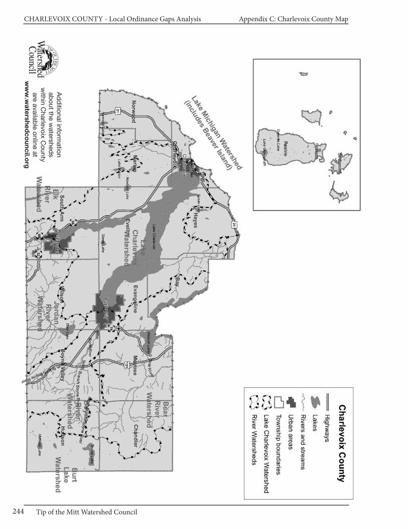
CHARLEVOIx COUnTy - Local Ordinance Gaps Analysis Appendix C: Charlevoix County Map
Tip of the Mitt Watershed Council244
Ad
ditio
nal in
form
atio
nab
out th
e w
ate
rshed
sw
ithin
Charle
voix
Co
unty
are
ava
ilab
le o
nlin
e a
tw
ww
.wa
ters
he
dc
ou
nc
il.org

Blank Page
426 Bay StreetPetoskey, MI 49770
(231) 347-1181
www.watershedcouncil.org
Financial support for this project
was generously provided by:
US Environmental Protection Agency
Michigan Department of Environmental Quality
Joyce Foundation
Charlevoix County Community Foundation
Dole Family Foundation
Herrington-Fitch Family Foundation
The Watershed Center Grand Traverse Bay
Burt Lake Preservation Association
Elk-Skegemog Lakes Association
Lake Charlevoix Association
Pickerel-Crooked Lakes Association
Three Lakes Association
Michigan Environmental Council
ISBn 978-1-889313-05x