Embed Size (px)
Citation preview
LYON COUNTY
TITLE 15
LAND USE AND DEVELOPMENT CODE
LAND DIVISION REGULATIONS
CHAPTERS 15.600 – 15.607
November 1, 2018

This page left blank intentionally
Lyon County Title 15 – Land Use and Development Code
Revised: 11/01/2018 Land Division - i
Contents 1
General Land Division Provisions ....................................................................... 15.600-1 2
Purpose ..................................................................................................................... 15.600-1 3
Scope of Provisions .................................................................................................. 15.600-1 4
Planned Unit Developments ..................................................................................... 15.600-2 5
Public Notice and Review ......................................................................................... 15.600-2 6
15.600.05 Mandatory Water Rights Dedication or Relinquishment Requirements ................... 15.600-2 7
Map and Easement Modifications ....................................................................... 15.601-1 8
Amended Maps ......................................................................................................... 15.601-1 9
Modifications to Approved Tentative Maps ............................................................... 15.601-1 10
Reversion of Maps and Lot Consolidations or Reversion of Division of Land to Acreage11
................................................................................................................................................... 15.601-2 12
Merger and Resubdivision of Land Without Reversion to Acreage .......................... 15.601-3 13
Vacation or Abandonment of Street or Easement .................................................... 15.601-4 14
Administrative Vacation or Abandonment of Public Utility Easements .................... 15.601-4 15
Boundary Line Adjustment .................................................................................. 15.602-1 16
Applicability ............................................................................................................... 15.602-1 17
Exclusions ................................................................................................................. 15.602-1 18
Procedures for Boundary Line Adjustment ............................................................... 15.602-1 19
Standards for Approval ............................................................................................. 15.602-2 20
Public Notice and Review ......................................................................................... 15.602-3 21
– Reserved .......................................................................................................... 15.603-1 22
– Reserved .......................................................................................................... 15.604-1 23
Division of Land Into Large Parcels ..................................................................... 15.605-1 24
General Procedures .................................................................................................. 15.605-1 25
Applicability ............................................................................................................... 15.605-1 26
Procedures for Tentative Maps for Division of Land Into Large Parcels .................. 15.605-1 27
Findings for Tentative Map for Division of Land Into Large Parcels ......................... 15.605-2 28
Lyon County Title 15 – Land Use and Development Code
Revised: 11/01/2018 Land Division - ii
Duration, Extension and Amendment of Tentative Map of Division Into Large Parcels1
................................................................................................................................................... 15.605-3 2
Final Land Division Map Procedure .......................................................................... 15.605-4 3
Final Land Division Map Content .............................................................................. 15.605-5 4
Effect of Approval ..................................................................................................... 15.605-6 5
Recording.................................................................................................................. 15.605-6 6
Parcel Maps ......................................................................................................... 15.606-1 7
Purpose ..................................................................................................................... 15.606-1 8
Parcel Map Required ................................................................................................ 15.606-1 9
Survey Required ....................................................................................................... 15.606-2 10
Submittal of Tentative Parcel Map ............................................................................ 15.606-3 11
Data to Accompany Tentative Parcel Map ............................................................... 15.606-5 12
Form of Tentative Parcel Map .................................................................................. 15.606-6 13
Tentative Parcel Map Review Procedures ............................................................... 15.606-6 14
Submittal of Final Parcel Map ................................................................................... 15.606-8 15
Form of Final Parcel Map ......................................................................................... 15.606-8 16
Contents of Final Parcel Map ................................................................................... 15.606-8 17
Review Procedures for Final Parcel Map ................................................................. 15.606-9 18
Appeals ................................................................................................................... 15.606-10 19
Certificates and Statements.................................................................................... 15.606-12 20
Recordation............................................................................................................. 15.606-14 21
Expiration Date ....................................................................................................... 15.606-14 22
Waiver of Parcel Map ............................................................................................. 15.606-14 23
Document Required if Parcel Map Waived ............................................................. 15.606-15 24
Subdivision Application Procedure and Approval Process ................................. 15.607-1 25
General Requirements .............................................................................................. 15.607-1 26
Tentative Subdivision Map Procedures .................................................................... 15.607-2 27
Tentative Subdivision Map Findings ......................................................................... 15.607-8 28
Conditions and Phasing of Maps .............................................................................. 15.607-9 29
Lyon County Title 15 – Land Use and Development Code
Revised: 11/01/2018 Land Division - iii
Duration, Extension, and Amendment of Tentative Subdivision Map .................... 15.607-11 1
Procedures for Final Subdivision Map .................................................................... 15.607-12 2
Effect of Approval ................................................................................................... 15.607-19 3
Signing and Recordation of Final Subdivision Map ................................................ 15.607-20 4
Reversion of Final Subdivision Map ....................................................................... 15.607-20 5
Procedures For Planned Development Applications .............................................. 15.607-21 6
7
8
Lyon County Title 15 – Land Use and Development Code
Revised: 11/01/2018 15.600-1
General Land Division Provisions 1
2
Purpose 3
The purposes of this chapter are: 4
5
A. To safeguard the public health, safety, and general welfare by establishing certain standards of 6
design, improvement, survey and construction of land developments hereafter platted in all areas of the 7
county; 8
9
B. To provide and ensure the orderly and proper growth thereof; 10
11
C. To aid in the prevention of pollution of land or water resources; 12
13
D. To encourage new concepts and innovations in the arrangement of building sites; 14
15
E. To protect, enhance and preserve the county's vast and valuable agricultural land; and 16
17
F. To provide for the continued protection and beneficial use of all waters appurtenant to lands within 18
Lyon County. 19
20
Scope of Provisions 21
A. It is unlawful for any individual, firm, association, syndicate, co-partnership, trust or any other legal 22
entity, as a principal, agent or otherwise, to reserve, offer to reserve, to sell, to offer to sell, to contract to 23
sell or lease or transfer any division of land or any part thereof in the county unless and until all the 24
requirements hereinafter provided have been performed or guaranteed by bond or other surety 25
satisfactory to the county. 26
27
B. All "condominiums", "cooperatives" or "townhouses", "commercial" and "industrial" type developments 28
shall be subject to the full requirements of this title as pertinent. 29
Lyon County Title 15 – Land Use and Development Code
Revised: 11/01/2018 15.600-2
1
Planned Unit Developments 2
All planned unit land developments hereinafter platted and improved within the county shall be 3
characterized by a complete planning approach in the tentative map stage. Planned Unit Developments 4
may include tentative subdivision map and final subdivision map applications concurrent with the planned 5
unit development tentative approval and final approval procedures respectively as outlined in the 6
requirements of chapter 15.349. 7
8
Public Notice and Review 9
All land divisions, adjustments, amendments, and modifications subject to review under this title shall be 10
open to inspection and comment by the public and subject to the public notice and review requirements 11
outlined in this title. 12
13
15.600.05 Mandatory Water Rights Dedication or Relinquishment Requirements 14
All maps of land division, including parcel maps, subdivision maps and maps of division of land into large 15
parcels, must dedicate or relinquish water rights as follows: 16
1. If the land encompassed by any map of land division is not within the existing boundaries of a 17
public water system as defined in NRS 445A and the newly created parcels are to be served by 18
domestic well: 19
a. The land divider shall relinquish to the state engineer water rights necessary to ensure an 20
adequate water supply for domestic use of the newly created parcels from within the water 21
basin in which the parcel is located; and 22
b. The land divider shall bear all costs associated with such relinquishment; and 23
c. For purposes of this section, valid underground water rights in the amount of 2.0 acre-feet per 24
year shall be relinquished for each new parcel created by the land division; and 25
d. No map of land division shall be recorded until the requirements of this section have been 26
satisfied. 27
2. If the land encompassed by any map of land division is within the boundaries of, or will be served 28
by a public water system as defined in NRS 445A: 29
a. The dedication or relinquishment of water rights necessary to ensure an adequate supply for 30
the domestic use of the newly created parcels shall follow the rules and requirements of that 31
system, or a written statement from the water system that no dedication or relinquishment 32
Lyon County Title 15 – Land Use and Development Code
Revised: 11/01/2018 15.600-3
requirement exists, or that dedication or relinquishment requirements have been satisfied, 1
must be submitted before a map may be recorded; and 2
b. The land divider shall bear all costs associated with such relinquishment; and 3
c. For the purpose of this section, necessary water rights required shall be determined by the 4
rules and requirements of the water system. 5
3. If a land division map is created on land subject to a conservation or agricultural easement 6
meeting the requirements of section 170(h) of the Internal Revenue Code, the requirements for 7
dedication or relinquishment of water rights enumerated in paragraphs 1 and 2 above may be 8
waived by the board for those portions of the land division map subject to the easement when the 9
following findings can be made: 10
a. The conservation or agricultural easement creates a perpetual restriction on development 11
of the parcel(s) for residential use; and 12
b. The conservation or agricultural easement is held by a qualified land protection 13
organization; and 14
c. The conservation or agricultural easement document conforms to the requirements of 15
15.340.A.5.e. 16
17
18
Lyon County Title 15 – Land Use and Development Code
Revised: 11/01/2018 15.601-1
Map and Easement Modifications 1
2
Amended Maps 3
A. Certificate of amendment. If an error or omission is found in any subdivision map, record of survey, 4
parcel map, map of division into large parcels, or reversionary map, and the correction does not change 5
or purport to change the physical location of any survey monument, property line or boundary line, the 6
error or omission may be corrected by the filing and recordation of a certificate of amendment authorized 7
by the board. The certificate of amendment shall contain the items required by NRS 278.473(2). 8
9
B. Amending map. If an error or omission is found in any recorded subdivision map, record of survey, 10
parcel map, map of division into large parcels, or reversionary map, and the correction changes or 11
purports to change the physical location of any survey monument, property line or boundary line, the 12
correction may be effected by the filing of an amended map pursuant to the procedures of this section. 13
This procedure may be utilized only to correct errors or omissions which do not result in a change of the 14
number of lots, result in significant changes to the area of any lot or the amount of land reserved or 15
dedicated for public use and improvements, or result in the removal of any covenants or restrictions 16
attached to the final approved or recorded map. 17
18
C. Procedures for amending map. The same procedures and requirements shall be applied to the 19
application for an amended map as to the original land division, except, in the case of subdivisions, only 20
those procedures for the approval and filing of a final subdivision map shall apply. The amending map 21
shall be in the format and shall contain the certificates required by NRS 278.477(2) and this title. 22
23
D. Public Notice and Review. Map amendments shall be subject to the same personal notice and 24
hearing requirements as required for an original map review. 25
26
Modifications to Approved Tentative Maps 27
A. Applicability. Whenever the owners of land or their representatives desire to modify an approved 28
tentative map or conditions of approval, an application shall be filed with the department. Those requests 29
Lyon County Title 15 – Land Use and Development Code
Revised: 11/01/2018 15.601-2
resulting in no net change or reduction in the number of parcels, the re-design of the map involving less 1
than ten (10) percent of the total number of parcels or land area, minor clarification of a condition resulting 2
in no impact to public health or safety, or changes to map design resulting from the mapping of 3
environmental constraints or historic sites, an application for a minor modification may be filed. All other 4
requests shall constitute a major amendment. 5
6
B. Procedures for processing a minor modification or a technical correction. An application for a minor 7
modification or technical correction shall be filed with the department, on the form provided, with the 8
applicable fees. The director is the designated authority for minor modifications and technical corrections. 9
Minor modifications as defined in paragraph A above shall be subject to the personal notice requirements 10
of Chapter 15.09.04. The applicant shall be notified in writing of the decision regarding the request within 11
30 working days of the official filing date. The decision of the director may be appealed. 12
13
C. Procedures for processing a major amendment. Major amendments shall be processed in the same 14
manner as the original application for land division. With the consent of the department, the applicant may 15
incorporate the previous applications and procedures by reference, to the extent that the amendment 16
makes no material changes on the matters addressed therein. Public notice and hearing requirements 17
shall be those precedent to the approval of the original tentative map. 18
19
Reversion of Maps and Lot Consolidations or Reversion of Division of Land to Acreage 20
A. All applications for a reversion of map and lot consolidation or reversion of division of land to acreage 21
must be filed with the department on the appropriate forms and meet all applicable submittal 22
requirements. The director, or his designee, shall be the final decision maker regarding reversion of maps 23
and lot consolidations or reversion of division of land to acreage. 24
25
B. The applicant shall pay a fee as set by the board. 26
27
Lyon County Title 15 – Land Use and Development Code
Revised: 11/01/2018 15.601-3
C. All applications for reversion of maps and lot consolidations or reversion of land to acreage must 1
comply with NRS 278.490. 2
3
D. Easements. Reversion of maps and lot consolidations or reversion of division of land to acreage does 4
not automatically eliminate any public utility, irrigation, or other private easement that may exist along a 5
lot line. It is the responsibility of the property owner(s) to resolve any and all interest of record in 6
conformance with 15.601.06. 7
8
E. All applications of reversion of maps and lot consolidation or reversion of division of land to acreage 9
must include a reversion to acreage map which contains the same survey dimensions as the previous 10
recorded map. When the lot line to be deleted was created by deed, the lot line deletion may be 11
accomplished by deed and record of survey. 12
13
F. Reversion of maps and consolidations or reversions of division of land to acreage shall be subject to 14
the personal notice requirements of 15.09.04. 15
16
G. Appeal. A decision of the director made under this section may be appealed in the manner provided 17
in Chapter 15.04. 18
19
Merger and Resub division of Land Without Reversion to Acreage 20
A. An owner or governing body that owns two or more contiguous parcels may merge and resub divide 21
the land into new parcels or lots without reverting the preexisting parcels to acreage pursuant to NRS 22
278.490. 23
24
B. Streets and easements will remain in effect after the merger and resub division of land, unless 25
abandoned in accordance with the provisions of 15.601.06 and NRS. 26
27
Lyon County Title 15 – Land Use and Development Code
Revised: 11/01/2018 15.601-4
C. All applications of a merger and resub division of land must be filed with the department on the 1
appropriate forms meeting all applicable submittal requirements. 2
3
D. The applicant shall pay a fee as set by the board. 4
5
E. All applicants for merger and resub division of land must comply with NRS 278.4925, 278.4955, 6
278.496 and 278.4965. 7
8
F. All applications for merger and resub division of land, whether created by a map or deed, must follow 9
the same county approval process as would be required for a division of land based on the number of lots 10
to be created. 11
12
Vacation or Abandonment of Street or Easement 13
Any abutting property owner desiring the vacation or abandonment of any street or easement or portion 14
thereof shall file a petition in writing with the department. The petition for vacation or abandonment of the 15
street or easement shall be processed in accordance with the procedures set forth in NRS 278.480. A 16
vacation or abandonment of a street easement may be approved in conjunction with the approval of a 17
tentative map pursuant to NRS 278.349. The board may initiate the vacation or abandonment of a street 18
or easement by resolution. 19
20
Administrative Vacation or Abandonment of Public Utility Easements 21
A. Purpose. For the purposes of this section, a public utility easement is an easement owned or 22
controlled by public or private utility, and which runs in favor of such utility. Pursuant to NRS 278.480(11) 23
and through the use of the procedure contained in this section, the director, or his designee, is authorized 24
to take final action on the vacation or abandonment of a public utility easement subject to the procedures 25
set forth below. 26
27
B. General procedure. The owner of property who seeks abandonment of a public utility easement 28
involving his property shall file an application with the department on the forms provided by the 29

Lyon County Title 15 – Land Use and Development Code
Revised: 11/01/2018 15.601-5
department. The applicant shall pay a fee as set by the board. The applicant shall provide written 1
verification that all public utility or video service providers have approved the application. The application 2
shall also include a legal description and exhibit prepared and signed a Nevada licensed land surveyor, 3
unless the county engineer waives the requirements of retaining a state licensed surveyor for the 4
preparation of the documents. The director shall provide all conditions of approval to the applicant in 5
writing within 45 days of receiving an application. 6
7
C. Decision. The director, or his designee, may issue a written order abandoning a public utility 8
easement after: 9
1. Receiving a complete application; 10
2. Providing notice to each owner of property abutting the easement to be abandoned in 11
conformance with the procedures set forth in Chapter 15.09. Property owners shall be given ten (10) 12
days to respond; 13
3. Obtaining written approval from all public utility or video service providers indicating that they no 14
longer request the reservation of the easement(s). Written approval shall consist of a legal description 15
sufficient to identify the easement being abandoned and the notarized signatures of all parties holding 16
an interest in the easement. If there is an associated map or record of survey, the acknowledgement 17
of relinquishment shall be provided on the map or record of survey. 18
4. Verification that the applicant has fulfilled all prescribed conditions, and; 19
5. A determination that the subject public utility easement is no longer necessary or useful to Lyon 20
County and that the public will not be materially injured by the proposed vacation. 21
22
D. Appeal. A decision of the director made under this section may be appealed in the manner provide for 23
in Chapter15. 04. 24
25
Lyon County Title 15 – Land Use and Development Code
Revised: 11/01/2018 15.602-1
Boundary Line Adjustment 1
2
Applicability 3
This chapter applies to an adjustment of the boundary line between two abutting parcels or the transfer of 4
land between two owners of abutting parcels. 5
6
Exclusions 7
A. An adjustment of the boundary line between abutting parcels or the transfer of land between two 8
owners of abutting parcels may not be approved if it reduces the size of a non-conforming parcel, 9
increases a non-conformity, or results in the creation of a non-conforming condition or parcel. 10
11
B. An adjustment of the boundary line between abutting parcels or the transfer of land between two 12
owners of abutting parcels may be disapproved if it does not contain adequate access, utility, water 13
conveyance and drainage easements to serve the resulting parcels. 14
15
Procedures for Boundary Line Adjustment 16
A. All applications for a boundary line adjustment must be filed with the department on the appropriate 17
forms and meet all applicable submittal requirements. The applicant shall pay a fee(s) as set by the 18
board. The director, or his designee, shall be the final decision maker regarding boundary line 19
adjustments. 20
21
B. The applicant shall prove that there are no delinquent taxes or assessments on the parcels involved 22
in the boundary line adjustment. 23
24
C. Contents of boundary line adjustments. Every map for boundary line adjustments shall show, at a 25
minimum, the information required by NRS 278.469 and NRS 278.5693. 26
27
D. Applicants for boundary line adjustments shall submit a metes and bounds description, the 28
appropriate number of printed and electronic record of survey maps of said parcels showing lot line 29
Lyon County Title 15 – Land Use and Development Code
Revised: 11/01/2018 15.602-2
dimensions, adjacent streets, north arrow, and the locations of all structures, wells, septic tanks, and 1
leach fields. A record of survey is defined in NRS 278.469 and NRS 278.5693.3. A record of survey and 2
additional materials must be signed and stamped by a Nevada registered land surveyor complying with 3
NRS 278.461(3c), 278.469, 278.5693 and 278.5695.4. 4
5
E. Processing by department. The department shall distribute copies of the boundary line adjustment 6
map and any accompanying materials for review by the county engineer, county surveyor and county 7
agencies as applicable to the map. The department will review the application and boundary line 8
adjustment map for compliance with NRS 278.469, NRS 278.5693, this title, and the comments by other 9
reviewing agencies. 10
11
C. Decision. The director, or his designee, may make a decision regarding a boundary line adjustment 12
after: 13
1. Receiving a complete application; 14
2. Verifying that there are no delinquent taxes or assessments on the parcels involved in the 15
boundary line adjustment; and 16
3. Providing notice in conformance with the procedures set forth in Chapter 15.09. Property owners 17
shall be given ten (10) days to respond; 18
19
Standards for Approval 20
A. The adjustment of the boundary line between abutting parcels or the transfer of land between two 21
owners of abutting parcels shall be approved without conditions or further administrative proceedings 22
when: 23
1. It does not result in the creation or reduction in size of non-conforming lots; 24
2. The map meets the formal requirements of NRS 278.469 and NRS 278.5693; 25
3. The map is not in conflict with the provisions of this title and NRS 278.010 to 278.630, inclusive. 26
27
Lyon County Title 15 – Land Use and Development Code
Revised: 11/01/2018 15.602-3
B. If the proposed configuration is to accommodate new residential, commercial or industrial 1
development, the director, or his designee, may require, prior to approval and recordation of the map, that 2
public facilities and improvements be constructed, in the manner and at the same level as if parcel map 3
approval had been sought. 4
5
C. Appeal. A decision of the director made under this section may be appealed in the manner provided 6
in Chapter 15.04. 7
8
Public Notice and Review 9
An application for a boundary line adjustment under this chapter shall be subject to the personal notice 10
requirements of Chapter 15.09.04 of this title. 11
12
Lyon County Title 15 – Land Use and Development Code
Revised: 11/01/2018 15.604-1
– Reserved 1
2
– Reserved 3
4
Lyon County Title 15 – Land Use and Development Code
Revised: 11/01/2018 15.605-1
Division of Land Into Large Parcels 1
2
General Procedures 3
Except as otherwise provided for in this section, all applications for division of land into large parcels shall 4
be processed in two stages: 5
1. Application for tentative map for division of land into large parcels, and 6
2. Application for final map for division of land into large parcels. 7
8
Applicability 9
All owners of land or their authorized representatives who propose to divide any land or portion thereof, 10
vacant or improved, for transfer or development into lots or parcels, each of which is at least: 1) one-11
sixteenth (1/16) of a section as described by government land office survey; or 2) 40 acres in area, 12
including roads and easements, shall file an application for approval of a tentative map of division into 13
large parcels; provided that, the provisions of this chapter shall not apply to the proposed division of land 14
where each lot is at least one section or 640 acres, or where the division of land conforms to the 15
provisions of NRS 278.320, paragraph 4, division of land for agricultural purposes. 16
17
Procedures for Tentative Maps for Division of Land Into Large Parcels 18
A. Application. The landowner or his authorized representative shall submit a complete tentative map 19
application with the department in accordance with the established and published application and 20
submittal schedule. 21
22
B. Contents of Tentative Map for Division of Land into Large Parcels. Every tentative map for division of 23
land into large parcels shall show, at minimum, the information required by NRS 278.471 through 24
278.4713, inclusive. 25
26
C. Processing by Department. The department shall distribute copies of the tentative map and 27
accompanying materials to all agencies charged by statute. The department shall schedule the 28
application for public hearing and file reports with the commission and subsequently with the board. 29
Lyon County Title 15 – Land Use and Development Code
Revised: 11/01/2018 15.605-2
1
D. Hearing Notice and Procedure. Notice of the hearings before the commission and the board shall be 2
provided in accordance with 15.09. 3
4
E. Planning Commission Action. Within 60 days after the official filing date, unless the time is extended 5
by mutual consent of the applicant and the commission, the commission shall, following a public hearing, 6
shall recommend approval, conditional approval or denial of the tentative map of division into large 7
parcels by a majority vote of the members present. The commission shall set forth findings and reasons 8
for its decisions in accordance with the criteria identified in section 15.605.04 below. 9
10
F. Decision by Board. Within 30 days after receipt of the commission's recommendation, unless the time 11
is extended by mutual consent of the applicant and the board, the board shall conduct a public hearing, 12
and approve, conditionally approve or disapprove the tentative map of division into large parcels. The 13
review and decision of the board shall conform to the provisions of chapter 15.07 and include findings and 14
reasons for its decision in accordance with the criteria identified in chapter 15.605.04. 15
16
Findings for Tentative Map for Division of Land Into Large Parcels 17
The commission and the board, in rendering a decision on the tentative map, shall base the 18
recommendation for approval or approval (respectively) on finding in the affirmative of the following: 19
20
A. The tentative map meets the formal requirements of this Chapter and NRS. 21
22
B. The tentative map secures adequate access for subsequent purchasers. 23
24
C. Where applicable, the tentative map secures the ability to irrigate and drain each parcel, consistent 25
with the water rights appurtenant, and that the rights of downstream users are secured and not impaired. 26
27
Lyon County Title 15 – Land Use and Development Code
Revised: 11/01/2018 15.605-3
D. The location and width of easements for roads and public utilities are adequate for the area to be 1
divided. 2
3
E. The location and width of easements for drainage and irrigation purposes are adequate for the area 4
to be divided. 5
6
F. There are no delinquent taxes or assessments on the land to be divided. 7
8
Duration, Extension and Amendment of Tentative Map of Division Into Large Parcels 9
A. Time for Submission of Final Map. Unless the time is extended by the board in the manner set forth in 10
paragraph B, the final map shall be filed within one (1) year from the date of approval of the tentative map 11
by the board or the date that the requirement of its filing was extended pursuant to paragraph B, below. If 12
a final map of division into large parcels is not recorded within the time frames listed above, all 13
proceedings concerning the map of division into large parcels are terminated. 14
15
B. Extension of Tentative Map. The board may extend the period for presentation of a final map of 16
division into large parcels for not more than one (1) additional year if the application for extension is 17
submitted prior to the expiration of the initial one-year period for presenting the final map as provided in 18
Chapter 15.13. If a party is aggrieved by the decision of the board concerning an application for 19
extension, the party may appeal such determination in accordance with the provisions of Chapter 15.12. 20
21
C. Amendment of Tentative Map. At any time after tentative map approval, and before the time required 22
for presentation of a final map, the applicant may request amendment to the approval or conditional 23
approval of the tentative map. The director may approve minor tentative map amendments, subject to 24
appeal to the commission in accordance with Chapter 15.04. Major amendments shall be determined in 25
accordance with the procedure for original approval of the tentative map under this Chapter. Additional 26
conditions which are reasonably related to the proposed amendment may be attached to approval of the 27
tentative map amendment. An applicant who is unwilling to accept conditions attached to the proposed 28
Lyon County Title 15 – Land Use and Development Code
Revised: 11/01/2018 15.605-4
amendment may withdraw the amendment. Action on the application for amendment of the tentative map 1
shall not extend the period for presenting a final map, unless a request for extension pursuant to 2
paragraph B is approved. 3
4
Final Land Division Map Procedure 5
A. Application Requirements. Final land division map shall be filed with the department on a form 6
provided by the department. The board shall be the final decision maker for approval of the final map. 7
8
B. Action by Board. 9
1. Unless the time period is extended by a mutual consent of the developer and the board, the 10
board shall approve, conditionally approve or disapprove the final map within 60 days of the official 11
filing date. 12
2. If the board does not approve, approve with conditions or disapprove the final map within 60 13
days, the final map shall be deemed approved unconditionally. 14
3. The board shall approve the map only upon findings as follows: 15
a. The final map conforms in every respect with the approved tentative map. 16
b. All conditions established upon approval of the tentative map have been satisfied. 17
c. The final map conforms to all county ordinances applicable at the time of the hearing on the 18
final map. 19
d. All necessary certificates required by state law or by this title have been presented with the 20
application for approval of the final map. 21
4. If the map is disapproved, the board shall also provide the applicant with a written statement of 22
what changes would be necessary to render the map acceptable. 23
5. The board shall, at the time of approval of the final map, accept or reject any or all offers of 24
dedication. 25
26
C. Appeal. The board’s action to deny the final land division map may be appealed in accordance with 27
the procedures of Chapter 15.12. 28
Lyon County Title 15 – Land Use and Development Code
Revised: 11/01/2018 15.605-5
1
Final Land Division Map Content 2
A. Contents of Final Map. Every final map shall include all data required for the tentative map and all 3
changes required as conditions of tentative map approval, and shall contain contents required by NRS 4
278.472, and the following information: 5
1. All lots by number and actual acreage of each lot. 6
2. All roads or easements of access which exist and which the owner intends to offer for dedication, 7
all roads or easements or access which are shown on the applicable master plan, and all roads or 8
easements of access which are specifically required by the tentative approval. 9
3. Any easements for public utilities which exist or are proposed. 10
4. Any existing easements for irrigation or drainage, and any normally continuously flowing 11
watercourses of any conveyance ditches or other irrigation water structure within the proposed land 12
division map. 13
5. An offer or offers to dedicate the utility and right-of-way easements. 14
15
B. Final Map Certificates. The following certificates shall appear on the final map and shall be combined 16
when appropriate: 17
1. A certificate signed and acknowledged by the owner of land consenting to the dedication of the 18
roads and granting of the easements. 19
2. A certificate of the director and the county engineer certifying the following: 20
a. That the map conforms to the approved tentative land division map, that and all conditions 21
imposed upon such approval have been satisfied. 22
b. That all the improvements have been installed in accordance with the requirements of these 23
regulations, or adequate assurances have been provided that improvements will be completed 24
and maintained in accordance with this development code. 25
c. That the County has accepted or deferred any land offered for dedication for public use in 26
conformity with the terms of the offer of dedication. 27
Lyon County Title 15 – Land Use and Development Code
Revised: 11/01/2018 15.605-6
3. If the property includes, impacts, or is adjacent to an irrigation or drainage ditch, a certificate of the 1
appropriate Irrigation and/or Conservation District stating that all irrigation water conveyance facilities and 2
associated access and maintenance easements or rights-of-way are depicted on the map and that all 3
required improvements have been completed. 4
4. Certificate of any holder of a security interest in the land to be divided. 5
6
Effect of Approval 7
No vested rights shall accrue to the owner or developer of any division of land into large parcels by 8
reason of the approval of a tentative or final map for division into large parcels approval until the actual 9
signing of the final map by all parties required to sign the map and has been recorded by the county 10
recorder. All requirements, conditions or regulations adopted by the county applicable to the division of 11
land shall be deemed a condition for any division prior to the time of signing of the final map. 12
13
Recording 14
A. Recording of the Map. The developer shall file the official final map with the county recorder once all 15
of the final map certificates have been signed by the appropriate agency/utility/district representatives. 16
17
B. Effect of Recording. Recording of the final map operates as a continuing: 18
1. Offer to dedicate for public roads the areas shown as proposed roads or easements of access, 19
which the county may accept in whole or in part at any time or from time to time. 20
2. Offer to grant the easements shown for public utilities, which any public utility may similarly 21
accept without excluding any other public utility whose presence is physically compatible. 22
23
C. Conveyances. After a map has been filed with the county recorder and recorded, any lot shown 24
thereon may be conveyed by reference to the map, without further description. 25
26
Lyon County Title 15 – Land Use and Development Code
Revised: 11/01/2018 15.606-1
Parcel Maps 1
2
Purpose 3
The purpose of this Chapter is to prescribe the requirements for, and waiver of, parcel maps. 4
5
Parcel Map Required 6
A parcel map shall be required as set forth in this section. 7
8
A. Parcel Map Required. A parcel map shall be required for all subdivisions, merger and re-subdivision 9
of existing lots, and common-interest communities consisting of four (4) or fewer units, except as provided 10
in this section. 11
12
B. Exempt Divisions. A parcel map is not required when the division is for the express purpose of: 13
1. The creation or realignment of a public right-of-way by a public agency; 14
2. The creation or realignment of an easement; 15
3. An adjustment of the boundary line between two (2) abutting parcels or the transfer of land 16
between two owners of abutting parcels which does not result in the creation of any additional 17
parcels; 18
4. The purchase, transfer or development of space within an apartment building or an industrial or 19
commercial building; or 20
5. Carrying out an order of any court of dividing land as a result of an operation of law; 21
6. Creation of cemetery plots; 22
7. A division of land for agricultural purposes in conformance with NRS 278.320, paragraph 5. 23
24
C. Exempt Transactions. A parcel map is not required for any of the following transactions involving 25
land: 26
1. The creation of a lien, mortgage, deed of trust, or any other security instrument; 27
2. The creation of a security or unit of interest in any investment trust regulated under the laws of 28
this state or any other interest in an investment entity; 29
Lyon County Title 15 – Land Use and Development Code
Revised: 11/01/2018 15.606-2
3. Conveying an interest in oil, gas, minerals or building materials which are severed from the 1
surface ownership of real property; 2
4. Conveying an interest in land acquired by the Department of Transportation pursuant to Chapter 3
408 of NRS; or 4
5. Filing a certificate of amendment. 5
6
D. Waiver. A parcel map may be waived pursuant to 15.606.16, Waiver of Parcel Map. 7
The following land divisions are eligible for consideration of a waiver: 8
1. Creation of sites for utility services, such as well sites, pump stations, transformer boxes, as long 9
as the utility is a regulated utility or operated by a government entity. A waiver will require 10
conformance with 15.606.17, Document Required if Parcel Map Waived. 11
12
E. Separate Lots. When two (2) or more separate lots, parcels, sites, units or plots of land are 13
purchased, they remain separate for the purposes of this article. 14
15
F. Conveyance. When lots, parcels, sites, units or plots are resold or conveyed, they are exempt from 16
the provisions of this article until further division of the lots, parcels, sites, units or plots is proposed. 17
18
Survey Required 19
A parcel map shall be based on a survey made for that purpose, unless this requirement is waived by the 20
county surveyor within 45 days of the submittal of an application for the waiver, unless this time is 21
extended by mutual consent. The requirement of a survey may be waived if, in the judgment of the county 22
surveyor, a survey is not required to accomplish the purposes of this article. Failure of the county 23
surveyor to act on the waiver request within the time prescribed in this section shall result in approval of 24
the waiver. 25
26
Lyon County Title 15 – Land Use and Development Code
Revised: 11/01/2018 15.606-3
Submittal of Tentative Parcel Map 1
A tentative parcel map must be submitted to the department for the purpose of review prior to or 2
concurrent with submittal of the final parcel map. Every tentative parcel map shall be prepared by a 3
professional land surveyor licensed in the State of Nevada and shall contain the following data: 4
5
A. Existing Parcels. Boundary lines and dimensions of the parcel being divided, regulatory zone 6
designation, and date of creation of the parcel being proposed to be subdivided. 7
8
B. Merger and Resub division of Pre-Existing Parcels. Pre-existing, contiguous parcels held under the 9
same ownership may be merged into a single parcel with a simultaneous resub division of that parcel as 10
proposed in the tentative parcel map. 11
12
C. Proposed Parcels. Proposed division lines using solid lines with dimensions of each parcel being 13
created and required setbacks of each parcel being created that meet the requirements of this chapter 14
using lines that are not solid. 15
16
D. Area. The area of the original parcel and of each proposed new parcel. 17
18
E. Rights-of-Way. Names, locations and widths of all streets, alleys or rights-of-way adjoining the 19
property showing relationships to the streets in the proposed parcel map. 20
21
F. Easements. The dimensions and approximate location of all existing or proposed road easements, 22
slope and curve easements, conservation easements, open space easements, recreation or trail 23
easements, drainage easements, sewer easements, irrigation ditch easements, or public utility 24
easements, whether for public or private purposes. 25
26
Lyon County Title 15 – Land Use and Development Code
Revised: 11/01/2018 15.606-4
G. Slope. A general indication of the slope of the land using contour intervals of no greater than two (2) 1
feet where slopes are less than ten (10) percent, and no greater than five (5) feet where slopes exceed 2
ten (10) percent. 3
4
H. North Point and Scale. North arrow and scale of drawing. 5
6
I. Street Names. All street names, denoting if they are existing or proposed. 7
8
J. Parcel Data. Parcel designation and a graphic border around the proposed division. The area of each 9
parcel and lot, and the total area of land to be divided. If the area is two (2) acres or more, the area shall 10
be calculated to the nearest one-hundredth of an acre. If the area is less than two (2) acres, then the area 11
shall be calculated in square feet. 12
13
K. Monuments. All monuments found, set, re-set, replaced or removed, describing their size and location 14
and other data. 15
16
L. Bearings. Bearing or witness monuments, basis of bearings, bearing and length of lines, and scale of 17
map. 18
19
M. Legal Designation. The name and legal designation of the tract or grant in which the survey is located 20
and any ties to adjoining tracts. 21
22
N. Date of Survey. The date of the survey. 23
24
O. Owners. The owner or owners of the land to be divided. 25
26
P. Vicinity Map. A vicinity map of the location of the map. 27
28
Lyon County Title 15 – Land Use and Development Code
Revised: 11/01/2018 15.606-5
Q. Other Data. Any other data necessary for the intelligent interpretation of the various items and 1
locations of the points, lines, area shown and required yards. 2
3
Data to Accompany Tentative Parcel Map 4
The following data shall accompany a tentative parcel map: 5
6
A. Owner. Name, legal address and telephone number of the owner of the land. In addition, an affidavit 7
from the legal owner of the land acknowledging that a tentative parcel map is being prepared with his 8
permission. If the sub divider of the land is different from the owner of the land, the name, legal address 9
and telephone number of that person shall also be included. 10
11
B. Preparer. Name, address and telephone number of the person who prepared the map. 12
13
C. Legal Description. Legal description of original parcel. It is sufficient to give the county recorder's 14
book and page of deed or document and the county assessor's parcel number. 15
16
D. Zoning designation for each parcel. 17
18
E. Proposed Use. Proposed use of each parcel. 19
20
F. Water Supply and Sewage. Source of water supply and proposed method of sewage disposal for 21
each parcel. 22
23
G. Survey Computations. A copy of all survey computations. 24
25
H. Existing Structures. If applicable, a map showing all structures located on the property and their 26
distances from the existing and proposed property lines and each other, and all septic (including septic 27
tank and leach lines) and well locations. 28
Lyon County Title 15 – Land Use and Development Code
Revised: 11/01/2018 15.606-6
1
Form of Tentative Parcel Map 2
The tentative parcel map shall be legibly drawn in permanent black ink on material of a permanent nature 3
generally used for such purposes in the engineering profession. The size of each sheet must be 24 by 32 4
inches. A marginal line must be drawn completely around each sheet, leaving an entirely blank margin of 5
one (1) inch at the top, bottom and right edges, and of two (2) inches at the left edge along the 24 inch 6
dimension. 7
8
Tentative Parcel Map Review Procedures 9
The review procedures for tentative parcel maps shall be as set forth in this section. 10
11
A. Filing. The sub divider shall file with the department a complete application and the required 12
supporting materials as outlined in 15.606.04 and 15.606.05 and the application packet. The subdivider 13
shall pay the required fees upon acceptance of a complete application. 14
15
B. Application Review. The department will review the submitted packet and accept or reject the 16
application as complete within three (3) working days after the published application submittal date. If the 17
application is deemed complete by the department, then the department shall distribute the parcel map 18
application to the appropriate reviewing agencies for comments regarding compliance with their 19
regulations, standards and policies. The department will compile those comments into a staff report for 20
the Planning Commission. 21
22
C. Action Required by the Planning Commission. The commission shall approve, conditionally approve, 23
or disapprove the tentative parcel map within 60 days of the date that the application is determined to be 24
complete, unless the time limit is extended in writing by the mutual consent of the subdivider and the 25
commission. Failure of the commission to take action within the time prescribed in this section shall result 26
in approval of the parcel map. 27
28
29
Lyon County Title 15 – Land Use and Development Code
Revised: 11/01/2018 15.606-7
1
D. Review Criteria. Prior to approving a tentative parcel map, the commission shall determine that the 2
following are or will be adequately provided for: 3
1. General improvement considerations for all parcel maps including, but not limited to: 4
a. Environmental and health laws and regulations concerning water and air pollution, the 5
disposal of solid waste, facilities to supply water, community or public sewage disposal and, 6
where applicable, individual systems for sewage disposal; 7
b. The availability of water which meets applicable health standards and is sufficient for the 8
reasonably foreseeable needs of the subdivision; 9
c. Conformity with the zoning ordinances and master plan; 10
d. General conformity with the governing body’s master plan of streets and highways; 11
e. Physical characteristics of the land such as floodplain, slope and soil; 12
f. The recommendations and comments of those entities reviewing the tentative parcel map; 13
g. The availability and accessibility of fire protection including, but not limited to, the availability 14
and accessibility of water and services for the prevention and containment of fires including fires 15
in wild lands; 16
2. Where an applicant proposes to create parcels of less than one (1) acre, the commission may 17
require additional improvements which are reasonably necessary and consistent with the use of the 18
land if it is developed as proposed. 19
20
3. For a second or subsequent parcel map with respect to a single parcel or a contiguous tract of 21
land under the same ownership, the commission may require any reasonable improvement up to 22
those required for subdivisions. 23
24
E. Conditions. An approval of any tentative parcel map may be subject to conditions relating to the items 25
specified in subsection D Review Criteria above, as are reasonably necessary. 26
27
Lyon County Title 15 – Land Use and Development Code
Revised: 11/01/2018 15.606-8
F. Notice of Action. The applicant shall be notified in writing of the decision of the commission. If the 1
tentative parcel map is conditionally approved, the notice of decision shall contain a statement of all 2
conditions imposed. If the tentative parcel map is disapproved, a statement of the reasons for such 3
disapproval shall be included. 4
5
G. No Guarantee of Final Map Approval. Approval or conditional approval of a tentative parcel map 6
imposes no obligation on the part of the director, or the board to approve the final parcel map or to accept 7
any public dedication shown on the tentative or final parcel map. 8
9
H. Cessation of Further Action. Failure to submit a complete final parcel map and pay the required fees 10
within one (1) year from the date of approval shall render the tentative parcel map approval as expired. 11
12
Submittal of Final Parcel Map 13
After approval or conditional approval of the tentative parcel map, the applicant may submit a final parcel 14
map for review. 15
16
Form of Final Parcel Map 17
The final parcel map shall be legibly drawn in permanent black ink on tracing cloth or produced by the use 18
of other materials of a permanent nature generally used for such purpose in the engineering profession. 19
The size of each sheet must be 24 by 32 inches. A marginal line must be drawn completely around each 20
sheet, leaving an entirely blank margin of one (1) inch at the top, bottom and right edges, and of two (2) 21
inches at the left edge along the 24 inch dimension. 22
23
Contents of Final Parcel Map 24
In addition to the information required by Section 15.606.04, the following information must be shown on 25
the final parcel map: 26
27
A. Monuments. All monuments found, set, reset, replaced or removed, describing their kind, location and 28
giving other data relating thereto; 29
Lyon County Title 15 – Land Use and Development Code
Revised: 11/01/2018 15.606-9
1
B. Oaths. A memorandum of oaths; 2
3
C. Surveyor. The signature of the Nevada licensed surveyor; 4
5
D. Owners. The signature of the owner or owners of the land to be divided; 6
7
E. Easements and Dedications. Any easements granted or dedications made including, but not limited 8
to, community water and wastewater systems; and 9
10
F. Survey. Name of the person or persons for whom the survey on which the map is based was made. 11
12
Review Procedures for Final Parcel Map 13
The review procedures for final parcel maps shall be as set forth in this section. 14
15
A. Filing. The sub divider shall file with the department and county engineer a final parcel map 16
application and the required supporting materials showing that all conditions imposed by the commission 17
have been met within one (1) year of the date of approval of the tentative parcel map. The sub divider 18
shall pay the required fees upon the filing of the final parcel map. 19
20
B. Application Review. The department and county engineer will review the submitted final parcel map 21
and supporting materials and recommend to the director acceptance or rejection of the map as complete 22
within 14 working days after submittal, unless the time limit is extended in writing by the mutual consent of 23
the sub divider and the director. 24
25
C. Action Required by Director. Within 25 working days of submittal of the final parcel map application, 26
the director shall determine whether the conditions placed on the tentative parcel map approval have 27
been met. The final parcel map application shall be considered incomplete if the director cannot make a 28
Lyon County Title 15 – Land Use and Development Code
Revised: 11/01/2018 15.606-10
determination that all of the tentative map conditions have been met. If the final parcel map is determined 1
to be complete, the director shall approve or disapprove the map within 30 working days of the submittal 2
date, unless the time limit is extended in writing by the mutual consent of the sub divider and the director. 3
4
D. Review Criteria. Prior to approving a final parcel map, the director shall determine that the following 5
have been met: 6
7
1. Completion of all conditions imposed on the subdivision prior to approval of the final parcel map 8
or, in the alternative, acceptance by the director and county engineer of a satisfactory guarantee of 9
completion and faithful performance of all conditions. The amount of the guarantee shall be in a sum 10
which, in the opinion of the county engineer, equals 150 percent of the cost of performance of the 11
conditions. If a sub divider fails to perform any condition within the time specified, the board, upon 12
recommendation of the director and county engineer, may cause the guarantee to be forfeited in an 13
amount necessary to finish the uncompleted portion of the work. If a security was previously posted to 14
guarantee completion of improvements for two (2) or more contiguous parcels and those 15
improvements will not be completed because of a merger and subsequent re-subdivision pursuant to 16
this article, a credit on a pro-rata basis of the security posted by the owner shall be credited toward 17
the financial assurance required for the parcel map re-subdivision. 18
2. Completion of all certificates and statements required by 15.606.10. 19
20
E. Notice of Action. The applicant shall be notified in writing of the decision of the director. If the final 21
parcel map is disapproved, a statement of the reasons for such disapproval shall be included. 22
23
24
Appeals 25
All appeals regarding tentative and final parcel maps shall be made as provided in this section. 26
27
Lyon County Title 15 – Land Use and Development Code
Revised: 11/01/2018 15.606-11
A. Process for Tentative Parcel Map. For 30 days following the notification of the decision, a decision of 1
the commission may be appealed to the board. 2
1. The statement of appeal shall be filed with the department, set forth the particular actions or 3
conditions appealed, the reasons for the appeal, and shall be accompanied by all supporting 4
documentation. 5
2. The department shall set an appeal hearing before the board within 30 days of receipt of a 6
complete statement of appeal. 7
3. If the board fails to render a decision after 60 days of the scheduled appeal hearing, the appeal 8
shall be deemed to have been decided in favor of the appellant. 9
10
B. Process for Final Parcel Map. For 15 days following the notification of the decision, a decision of the 11
director to deny a final parcel map may be appealed to the board. 12
1. The statement of appeal shall be filed with the department, set forth the particular actions or 13
conditions appealed, the reasons for the appeal, and shall be accompanied by all supporting 14
documentation. 15
2. The department shall set an appeal hearing before the board within 30 days of receipt of a 16
complete statement of appeal. 17
3. If the board fails to render a decision after 60 days of the scheduled appeal hearing, the appeal 18
shall be deemed to have been decided in favor of the appellant. 19
20
C. Final Action on Appeal. The board shall take action on the appeal within the time prescribed above. 21
1. The board may impose additional conditions on the parcel map, provided the conditions are 22
related to the review criteria in 15.606.07 23
2. Any disapproval or conditional approval must include a statement of the reason for that action 24
and must be acted upon by an affirmative vote of a majority of the full membership of the board. In 25
the case of a tie vote due to the absence of a member, the appeal shall be continued to a future 26
meeting unless requested otherwise by the appellant. 27
28
Lyon County Title 15 – Land Use and Development Code
Revised: 11/01/2018 15.606-12
D. Notice of Final Action. Within ten (10) days of the final action, the director shall report to the applicant 1
concerning the decision of the board. Such report shall contain, at a minimum, any additional conditions 2
placed upon the parcel map, the statement of the reason for the final action, and a statement that the 3
board’s decision is final for the purpose of judicial review. 4
5
Certificates and Statements 6
Language satisfying the intent of the following certificates and statements shall appear on a parcel map 7
before it can be filed for record. Final parcel maps that have been approved for recordation prior to the 8
date of adoption of this title, but which have not been recorded, shall not be required to comply with this 9
section. 10
11
A. Certificate of Director. A certificate for execution by the director stating that the map has been 12
approved for subdivision purposes and accepted or rejected on behalf of the public any parcel of land, or 13
portion of a parcel, offered for dedication for public use in conformity with the terms of the offer of 14
dedication. If the final parcel map includes a merger of pre-existing lots and the re-subdivision of those 15
lots, the certificate shall acknowledge that any public streets, easements or utility easements that will not 16
remain were abandoned pursuant to Chapter 15.601. 17
18
B. Certificate of Surveyor. A certificate by the Nevada licensed surveyor responsible for the parcel map 19
giving the date of survey on which the map is based, and stating that the survey was made by him or 20
under his direction and setting forth the name of the owner who authorized him to make the survey, and 21
that the parcel map is true and complete as shown. This certificate shall also state: 22
1. That the monuments are of the character and occupy the position indicated or that they will be set 23
in such positions and at such time as is agreed upon under the provisions of Chapter 278 of NRS; 24
2. That the monuments are or will be sufficient to enable the survey to be retraced; and 25
3. The completion date. 26
27
Lyon County Title 15 – Land Use and Development Code
Revised: 11/01/2018 15.606-13
C. Certificate of Record Title Owner. A certificate signed and acknowledged by all persons having any 1
record title in the land subdivided, evidencing their grant or permanent easements for utility installations 2
and access, as designated on the map. 3
4
D. Certificate of Public Utilities Concerning Easements. A statement acknowledging such easements, 5
signed by each Public Utility Company or agency in whose favor the easements are created or whose 6
utility services are to be required for the platted parcels. It is the responsibility of the applicant to obtain 7
acknowledgement of serving utility companies as to location of any utility easements which are to be 8
shown on the parcel map. 9
10
E. Statement from County Treasurer. A written statement by the county treasurer indicating that all 11
property taxes on the land have been paid for the period identified in NRS 278. 12
13
F. Guarantee of Title. A subdivision guarantee of title, in a form acceptable to the county engineer and 14
district attorney, issued by a competent title company to and for the benefit and protection of the county. 15
Said guarantee of title shall be continued complete up to the instant of filing the final map with the county 16
recorder, guaranteeing that the names of all persons whose consent is necessary to pass a clear title to 17
the land being subdivided, and all public easements being offered for dedication, and all 18
acknowledgements thereto, appear on the proper statements and are correctly shown on the map, both 19
as to contents as to the making thereof and affidavits of dedication where necessary. 20
21
G. Certificate of the County Utility Department or Other Utility Concerning Water Right Dedications. A 22
certificate for execution by the county utilities director or other applicable authorized utility representative 23
stating that the provisions of Chapter 15.110 of this title related to the dedication of water resources have 24
been satisfied. 25
26
H. Certificate of any holder of a security interest in the land to be divided. 27
28
Lyon County Title 15 – Land Use and Development Code
Revised: 11/01/2018 15.606-14
Recordation 1
The approved parcel map with the certificates and statements set forth in 15.806.13 and the required 2
filing fee advanced by the owner shall be transmitted to the county recorder by the sub divider for 3
recording and filing. The land division is complete when the approved parcel map with its required 4
certificates and statements have been filed in the office of the county recorder within one (1) year from 5
the date of approval of the tentative parcel map. There shall be no extension of this time period. The 6
recordation time shall be extended as a part of the one (1) year time period set forth in this section should 7
an appeal be filed with the director until the date of the board action on the appeal plus an additional ten 8
(10) days. 9
10
Expiration Date 11
Failure of the sub divider to record an approved parcel map within one (1) year from the date of approval 12
of the tentative parcel map requires that all proceedings on the parcel map terminate, and a new 13
application shall be required. There shall be no extension of this time frame. The expiration date shall be 14
extended as part of the one (1) year time period set forth in this section should an appeal be filed. The 15
expiration date for an approved tentative parcel map shall become the date of the board action on the 16
appeal plus an additional ten (10) days. If an approved parcel map is not recorded within the time frames 17
listed above, all proceedings concerning the parcel map are terminated. 18
19
Waiver of Parcel Map 20
The requirement for filing a parcel map for divisions of land into four (4) or less parcels may be waived by 21
the commission, if it finds all the following: 22
23
A. Conformity with Laws. That the proposed division of land complies with Chapter 278 of NRS and this 24
title; 25
26
B. Conformity with Regulations. That the proposed division of land conforms to state and county 27
requirements as to area, improvement and design, and flood water drainage control; 28
29
Lyon County Title 15 – Land Use and Development Code
Revised: 11/01/2018 15.606-15
C. Environmental Effects. That the proposed division of land will not have an adverse effect on the 1
environment; 2
3
D. Conformity with Master Plan. That the proposed division of land conforms to the Lyon County 4
Comprehensive Master Plan, including community plans and any specific plans adopted by the county; 5
6
E. Change in Nonconformity. That no existing nonconformity with the other divisions in this title will be 7
increased; 8
9
F. Conformity with Other Ordinances. That the proposed division of land complies with all other county 10
ordinances; 11
12
G. Lack of Need. That unusual circumstances exist so that a parcel map is not necessary to insure 13
proper legal description of property and proper monuments are in place to identify the location of property 14
lines; and 15
16
H. Facilities. That appropriate improved public roads, adequate sanitary disposal facilities, and adequate 17
water supplies are available. 18
19
Document Required if Parcel Map Waived 20
If the requirement for a parcel map is waived by the commission, said requirement having been waived 21
within 60 days of the date of the request to waive the tentative map requirement, the applicant shall 22
comply with the provisions of this section. 23
24
A. Document Recordation. The county surveyor may require the applicant to prepare and record a 25
document which contains: 26
1. A legal description of all parts based on a system of rectangular surveys; 27
2. A provision for the dedication or reservation of any road right-of-way or easement; and 28
Lyon County Title 15 – Land Use and Development Code
Revised: 11/01/2018 15.606-16
3. The approval of the authority which granted the waiver. 1
2
B. Description of Metes and Bounds. The county surveyor shall require a description of metes and 3
bounds if necessary to describe the parcel division. The description shall be prepared by a Nevada 4
licensed professional land surveyor with a signature and stamp. 5
6
C. Waiver. The person preparing the document shall include the following statement: 7
8
"This document was prepared from existing information (identifying the existing information and 9
stating where the information is filed and recorded) and the undersigned assumes no responsibility 10
for the existence of monuments or correctness of other information shown on or copied from any prior 11
documents." 12
13
D. Statement Indicating That No Property Taxes Delinquent. A document recorded pursuant to this 14
section shall be accompanied by a written statement by the county treasurer indicating that all property 15
taxes on the land have been paid pursuant to NRS 278. 16
17
Lyon County Title 15 – Land Use and Development Code
Revised: 11/01/2018 15.607-1
Subdivision Application Procedure and Approval Process 1
2
General Requirements 3
A. General Procedures. All subdivision applications shall be processed in two stages: 4
1. Application for tentative map approval; and 5
2. Application for final map approval. 6
7
The director shall be the designated official. The board shall be the final decision maker for purposes of 8
tentative subdivision maps and final subdivision maps, except as otherwise provided. 9
10
B. Pre-application Conference. Before preparing the tentative subdivision map, the sub divider shall 11
meet with County staff and the appropriate outside reviewing agencies and conduct a preliminary review 12
of the tentative subdivision map application to discuss the procedure for approval of a tentative 13
subdivision map and the requirements as to the general layout of streets and for reservations of land, 14
street improvements, drainage, sewerage, fire protection, and similar matters, as well as the availability of 15
existing services, including schools. 16
17
C. Applicability. All owners of land or their authorized representatives who propose to divide any land or 18
portion thereof, vacant or unimproved, for transfer or development into five or more lots, parcels, sites, 19
units or plots, or to create a commercial or industrial subdivision, pursuant to NRS 278.325, shall file an 20
application for approval of a tentative subdivision map. 21
22
The provisions of this part shall not apply to: 23
1. A division of land into large parcels which creates lots, parcels, sites, units or plots of land, each 24
of which comprises 40 nominal acres or more of land including roads and roadway easements, and is 25
subject to chapter 15.605; 26
2. Any division of land which is ordered by any court in this state or created by operation of law; 27
Lyon County Title 15 – Land Use and Development Code
Revised: 11/01/2018 15.607-2
3. A lien, mortgage, deed of trust or any other security instrument, provided, however, that creation 1
or foreclosure of such an instrument on a portion of a larger parcel shall not result in the division of 2
the larger parcel; 3
4. A security or unit of interest in any investment trust regulated under the laws of the state or any 4
other interest in an investment entity; 5
5. Cemetery lots; or 6
6. An interest in oil, gas, minerals or building materials which are now or hereafter severed from the 7
surface ownership of the real property. 8
9
Tentative Subdivision Map Procedures 10
A. Application. The landowner or his authorized representative shall submit a complete tentative map 11
application with the department in accordance with the established and published submittal schedule. The 12
application shall contain the following items: 13
1. A Subdivision Feasibility Analysis containing the following components: 14
a. Water Availability: Information as to how domestic water service will be provided including 15
status and source of required water rights, and availability of water that meets applicable health 16
standards and is sufficient in quantity for the reasonably foreseeable needs required for the land 17
development and proposed land use, and a written statement of the ability and willingness of a 18
water utility to provide water service to the proposed development. 19
b. Electricity Availability: Name of the utility company that will serve the area and a written 20
statement of the ability and willingness of such company to provide electrical power to the 21
proposed development. 22
c. Telephone Availability: Name of the telephone company that will serve the area and a written 23
statement of the ability and willingness of such company to provide telephone service to the 24
proposed development. 25
d. Natural Gas Availability: Name of utility company that will serve the area and a written 26
statement of the ability and willingness of such company to provide natural gas service to the 27
proposed development. 28
Lyon County Title 15 – Land Use and Development Code
Revised: 11/01/2018 15.607-3
e. Sewage Disposal: Information as to how sewage disposal will be provided and a written 1
statement of the ability and willingness of any applicable utility to provide sewage disposal service 2
to the proposed development, or evidence that on-site sewage disposal is possible based on an 3
analysis of the soils, groundwater levels, and sub-surface geologic conditions. 4
f. Fire Protection: Provide information regarding the fire district within which the proposed 5
development is located and distance from the nearest firefighting equipment. Identify the 6
availability and accessibility of fire protection, including, but not limited to, the availability and 7
accessibility of water and services for the prevention and containment of fires, including wildland 8
fires. 9
g. Schools: Proximity to existing schools and school bus service, if such service is operating 10
within the vicinity of the proposed development. 11
h. Parks And Recreational Areas: Parks and recreational facilities in the general area of the 12
proposed development; distance and access to such facilities. 13
i. Commercial And Shopping Areas: Distance and access to the closest commercial and 14
shopping facilities from the proposed development. 15
j. Road Construction and Maintenance: Proposed maintenance plan for both access roads and 16
roads within the subdivision; general timetable for construction of such roads; plan for 17
maintenance until public maintenance is secured; type of anticipated public maintenance - state, 18
county, city or general improvement district. 19
k. Restrictive Covenants: Proposed restrictive covenants applicable to the subdivision or 20
development. 21
l. Adjacent Ownership and Use: Present legal owner of properties adjacent to the proposed 22
subdivision; and present use and zoning of all adjacent properties. 23
m. Traffic Impacts: Identify all roads, streets and highways that will be affected by the 24
development. Identify the effect of the proposed subdivision on existing public roads and streets 25
and the need for new roads, streets or highways to serve the subdivision. Provide a traffic study 26
prepared by a traffic engineer licensed to practice in the State of Nevada if the subdivision will 27
meet or exceed 80 peak hour vehicle trips or 500 average daily vehicle trips. 28
Lyon County Title 15 – Land Use and Development Code
Revised: 11/01/2018 15.607-4
n. Drainage Study and Storm water Impact Analysis: Identify existing natural and constructed 1
storm water structures, proposed storm water management concepts and general impacts from 2
and on surrounding property. Provide a drainage study and storm water impact analysis prepared 3
by a civil engineer licensed to practice in the State of Nevada in conformance with the Lyon 4
County Drainage Guidelines. 5
o. Solid Waste Disposal: Identify the method and availability of solid waste disposal. 6
p. Soils Report, Geotechnical Analysis, and Land Capability Analysis: Identify the physical 7
characteristics of the land such as floodplain, slope, vegetation and soil. Provide a soils report, 8
geotechnical analysis and land capability analysis prepared by a geological engineer licensed to 9
practice in the State of Nevada. 10
q. If applicable, a map showing the location, by distance from existing and proposed property 11
lines of all above ground structures, the placement on the property of all existing structures and 12
other manmade features including buildings, irrigation ditches, utility poles, fences, driveways and 13
accesses, signs, existing wells, sewers, septic systems (including leach lines), culverts, bridges, 14
drain pipes, fire hydrants and sand, gravel or other excavations within the subdivision. Indicate 15
which existing structures and uses will remain and which will be removed; 16
r. Zoning and master plan designations and land uses of adjoining properties, including across 17
any rights-of-way. Indicate distance from property line to any off-site structures that are within 25 18
feet of property line. 19
2. A description of all contiguous holdings of the owner, including land in the same ownership with 20
indication of the portion of the property which is to be subdivided; 21
3. The number of copies of the tentative subdivision map, with contents as prescribed in the 22
application form; 23
4. A certificate from the county treasurer stating that no taxes or assessments are delinquent; 24
5. A statement as to whether the subdivision is to be developed in phases and a conceptual phasing 25
plan; 26
6. Documentation indicating that all applicable fees and application materials have been submitted 27
to the Nevada Division of Environmental Protection, Water Quality Division; 28
Lyon County Title 15 – Land Use and Development Code
Revised: 11/01/2018 15.607-5
7. Copies of all applicable “will serve” or “intent to serve” letters from the utility providers; 1
8. Copies of all applicable special studies and reports; 2
9. Other information necessary for review of the tentative subdivision map required by the director. 3
4
B. Contents of Tentative Subdivision Map. Every tentative subdivision map shall show, at minimum, the 5
following data and information: 6
1. List of the names, addresses and telephone numbers of the owners of record, sub divider and the 7
engineer or surveyor preparing the map; 8
2. List of the names, addresses and telephone numbers of public utility companies which will serve 9
the subject property, including water supply and method of sewage disposal; 10
3. A north point, scale, date, boundary line and dimensions of the project. The direction of the north 11
arrow should be shown pointing towards the top or right hand side of the map; 12
4. Show the entire assessor’s parcel, identify any remainder portion, and any contiguous properties 13
under common ownership (whole or partial ownership); 14
5. Legal description of the land included within the tentative subdivision map sufficient to define the 15
boundaries of the map. Note: A portion of a section is not sufficient. If the boundary is by metes and 16
bounds, that description shall be on the tentative map; 17
6. The parcel layout, the approximate dimensions of each lot, where pads are proposed for building 18
sites, the approximate pad elevation, the elevations of all adjacent parcels, the top and toe of cut and 19
fill slopes to scale, preliminary design and approximate finish of all grading, and a number for each 20
parcel utilizing consecutive numbers. Any portion of property in common contiguous ownership not 21
included in the map shall be labeled as a remainder parcel; 22
7. In tabular form, indicate the approximate acreage, the number of lots, proposed density, existing 23
and proposed zoning and master plan designations, proposed use of lots, number of lineal feet of 24
new streets, and acreage of any remainder parcels/open space parcels; 25
8. The street, approximate gradient or centerline profile for each proposed highway, street 26
easement and drainage improvement shown of the tentative subdivision map; 27
Lyon County Title 15 – Land Use and Development Code
Revised: 11/01/2018 15.607-6
9. Note the width and approximate locations of all existing and proposed easements or rights-of-1
way, including any proposed to be abandoned as part of the subdivision map whether for public or 2
private roads, irrigation ditches, drainage, sewers, utilities (overhead and underground) or flood 3
control purposes, shown by dashed lines. Overhead utility lines on peripheral streets shall also be 4
indicated. Existing easements shall show the name of the easement holder, purpose of easement, 5
and legal reference (official records) for the easement. If an easement is blanket or intermittent in 6
nature, a legible note to this effect shall be placed on the tentative map; 7
10. Note of the approximate radius of all centerline curves on highways, streets or ways; 8
11. The locations of all areas subject to inundation or flood hazard and the locations, width, and 9
directions of flow of all watercourses and flood control areas within and adjacent to the property 10
involved. Include community panel number, date of the Flood Insurance Rate Map (FIRM) index map, 11
and the method for handling storm water; 12
13
12. The tentative subdivision map must show contour of land at intervals of not more than two (2) feet 14
if the general slope of the land is less than the ten (10) percent and five (5) feet for all other areas. 15
This shall include an area of not less than 100 feet surrounding the tentative subdivision map. 16
Indicate contour interval and the source and date the contours were compiled; 17
13. Vicinity map of the area showing the proposed subdivision map in relation to any established 18
roads or other landmarks so that the site can be easily located. Indicate the proposed access route to 19
the site from the nearest public maintained road; 20
14. On a subdivision map consisting of a condominium project or a planned development, the 21
tentative subdivision map shall show, by dashed lines, the approximate location from all existing and 22
proposed property lines and building envelopes and other structures to be erected and the 23
designated open space areas; 24
15. The identity and location of any existing or proposed drainage conveyance ditches and/or other 25
irrigation water conveyance structure within or adjacent to the proposed subdivision. The subdivision 26
map shall also provide dimensioned typical channel cross sections with centerline, average slope 27
through the property, arrows indicating direction of flow, and design flow capacity of conveyance 28
Lyon County Title 15 – Land Use and Development Code
Revised: 11/01/2018 15.607-7
structures. If the proposed subdivision includes water impoundment there must be identification of the 1
source of water and documentation of the state engineer's approval for the water rights. 2
3
B. Processing by Director. The director or his designee will distribute copies of the tentative subdivision 4
map and accompanying materials to all agencies charged by statute. The director will determine within 5
three (3) working days after the published application submittal date whether the application for a 6
tentative subdivision map is complete, and notify the applicant, in writing, of his finding. In addition to the 7
notice to the applicant, notice shall be given to any conveyance ditch users adjacent to or downstream of 8
the proposed map. The ditch users to be notified shall be determined from the appropriate irrigation 9
district and/or conservation district where the subdivision is located. If complete, and applicable fees are 10
tendered and collected, the director will file his report with the commission and schedule the application 11
for public hearing. 12
13
C. Hearing Notice and Procedure. Notice of the hearings before the commission and the board shall be 14
provided in accordance with chapters 15.09 and 15.10. Hearings shall be held in accordance with the 15
procedures established in chapters 15.06 and 15.07. 16
17
D. Planning Commission Recommendation. Within 60 days after the official filing date, the commission 18
shall hear the application and recommend to the board approval, conditional approval or disapproval of 19
the tentative subdivision map in accordance with the procedures established in chapter 15.06, unless the 20
time period is extended by mutual consent of the applicant and the commission. The commission shall set 21
forth findings and reasons for its decision in accordance with the criteria identified in chapter 15.607.03. 22
23
E. Decision by Board. Within 30 days after receipt of the commission's recommendation, unless the time 24
is extended by mutual consent of the applicant and the board, the board shall conduct a public hearing, 25
and approve, conditionally approve or disapprove the tentative subdivision map. The review and decision 26
of the board shall conform to the provisions of chapter 15.07 and include findings and reasons for its 27
decision in accordance with the criteria identified in chapter 15.607.03. 28
Lyon County Title 15 – Land Use and Development Code
Revised: 11/01/2018 15.607-8
1
Tentative Subdivision Map Findings 2
A. The commission in making its recommendation and the board in rendering a decision on the tentative 3
subdivision map shall base its decision on the requirements of NRS and make affirmative findings on the 4
following factors, taking into account the recommendations of reviewing agencies: 5
1. The property to be subdivided is zoned for the intended uses and the density and design of the 6
subdivision conforms to the requirements of the zoning regulations contained in this code; 7
2. If located within a planned unit development, the tentative subdivision map conforms to the 8
density requirements, lot dimension standards and other design standards regulations approved for 9
the planned unit development; 10
3. The tentative subdivision map conforms to public facilities and improvement standards contained 11
in the development code; 12
4. The tentative subdivision map conforms to the improvement and design standards contained in 13
the development code and adopted design criteria and improvement standards; 14
5. If applicable, that a phasing plan has been submitted and is deemed acceptable; 15
6. There are no delinquent taxes or assessments on the land to be subdivided, as certified by the 16
county treasurer; 17
7. The project complies with all environmental and health laws and regulations concerning water 18
and air pollution, the disposal of solid waste, facilities to supply water, community or public sewage 19
disposal and, where applicable, individual systems for sewage disposal; 20
8. The availability of water which meets applicable health standards and is sufficient in quantity for 21
the reasonably foreseeable needs of the subdivision; 22
9. There is adequate access and availability to public services such as schools, police protection, 23
transportation, recreation and parks; 24
10. The project is in general conformity with the Lyon County Comprehensive Master Plan, the local 25
community plan, if adopted, and the master plan of streets and highways; 26
11. The project will have no adverse impacts, or provides adequate mitigation of adverse impacts, to 27
existing public streets; 28
Lyon County Title 15 – Land Use and Development Code
Revised: 11/01/2018 15.607-9
12. The physical characteristics of the land such as floodplain, slope and soil have been considered 1
and provisions to adequately mitigate adverse impacts of development on the environment have been 2
incorporated; 3
13. The project demonstrates availability and accessibility of fire protection services, including, but 4
not limited to, the availability and accessibility of water and services for the prevention and 5
containment of fires, including fires in wild lands. 6
7
Conditions and Phasing of Maps 8
In addition to all other conditions that may be recommended by the commission and required by the 9
board pursuant to chapter 15.07 in reviewing a tentative subdivision map, the following actions may be 10
taken: 11
12
A. Except as otherwise provided, as a condition of tentative subdivision map approval, the commission 13
may recommend and the board may require that the sub divider install and dedicate to the county all 14
public improvements, whether on-site or off-site, prior to the signing of the final subdivision map by the 15
chairman of the commission. In lieu of such requirement, the board shall require that the sub divider 16
provide adequate assurances for completion and maintenance of improvements. 17
18
B. The commission may recommend and the board may require as a condition of tentative subdivision 19
map approval that the sub divider divide the subdivision into two or more phases, provided as follows: 20
1. Each phase must be designed to meet the public facilities and improvement standards 21
independently and as part of the overall design. 22
2. Unless a longer time is provided in a development agreement or an agreement pursuant to NRS 23
278.350, the final map must be approved and recorded for the initial phase within four (4) years of 24
tentative subdivision map approval, and the final map for each subsequent phase must be approved 25
and recorded within two (2) years following recording of the final map for the previous phase. The 26
board may grant a single extension of two (2) years for final map approval for each phase. 27
Lyon County Title 15 – Land Use and Development Code
Revised: 11/01/2018 15.607-10
3. Unless a longer time is provided in a development agreement or an agreement pursuant to NRS 1
278.350, all phases must be completed, and all final maps approved and recorded, within ten (10) 2
years of the date of initial subdivision map approval by the board. 3
4. Amendment of the approval to permit development beyond the initial ten (10) year period will 4
require submission and approval of a new tentative subdivision map application, and the approval 5
may be conditioned on compliance with statutes, codes, design standards, fees and capital 6
improvements plans current at the time of application for such amendment. 7
5. The board and the applicant may enter and adopt a development agreement, pursuant to chapter 8
15.150, to implement the provisions of this chapter. 9
10
C. Where an industrial or commercial subdivision is proposed pursuant to NRS 278.325, and the sub 11
divider desires to record a single final map without the completion or securing of improvements, the board 12
may approve the map and allow recording of the final map subject to the following: 13
1. A conceptual development phasing plan is submitted concurrently with the tentative map 14
indicating the proposed development phasing, including a general description of improvements, on-15
site and off-site to be constructed with each development phase. 16
2. Improvement plans are to be submitted and approved for the entire project site. The improvement 17
plans shall be subject to modification, based on changes to this title or the county design criteria and 18
improvement standards as they relate to public health and safety. 19
3. A security agreement shall be prepared and approved subsequent to the filing of the final map, 20
consistent with this title. In addition to the standard provisions, the plan must provide a detailed 21
description of on-site and off-site improvements to be provided prior to the issuance of a building 22
permit within a given development phase. 23
4. No building permit will be issued on the site until any and all required improvements are 24
constructed or secured, and provided that those improvements required for fire protection and 25
emergency access are in place. 26
27
Lyon County Title 15 – Land Use and Development Code
Revised: 11/01/2018 15.607-11
Duration, Extension, and Amendment of Tentative Subdivision Map 1
A. The sub divider shall present to the board a final subdivision map, prepared in accordance with the 2
tentative subdivision map. The map shall cover the entire area for which the tentative subdivision map 3
was approved, or one of a series of final subdivision maps, each covering one or more phases of the 4
approved tentative subdivision map. Unless a longer time is provided in a development agreement or an 5
agreement pursuant to NRS 278.350, the final map covering the entire subdivision or the first of a series 6
of final maps covering a portion of the approved tentative map shall be recorded within four (4) years after 7
the date of approval of tentative subdivision map by the board. If the subdivider elects to present a 8
successive map in a series of final maps, the final map must be approved and recorded for the initial 9
phase within four (4) years of tentative subdivision map approval, and the final map for each subsequent 10
phase must be approved and recorded within two (2) years following recording of the final map for the 11
previous phase. The board may grant a single extension of two (2) years for final map approval for each 12
phase.. 13
14
B. The board may extend the period for presentation of final successive subdivision map covering a 15
portion of the approved tentative map for not more than two (2) years after the expiration of the two-year 16
period for presenting the successive final subdivision map. If the sub divider is presenting in a timely 17
manner a series of final maps, each covering a portion of the approved tentative map, no requirements 18
other than those imposed on each of the final maps in the series may be placed on the map when an 19
extension of time is granted unless the requirement is directly attributable to a change in applicable laws 20
which affect the public health, safety or welfare. Extension applications must be accompanied by the 21
applicable fee and written statement of justification, and must be filed 45 days prior to the expiration of the 22
final map. 23
24
C. At any time after tentative subdivision map approval, and before the time required for presentation of 25
a final subdivision map, the sub divider may request amendment to the approval or conditional approval 26
of the tentative subdivision map. The director may approve minor tentative subdivision map amendments 27
in accordance with Chapter15.601.02. Major amendments shall be determined in accordance with the 28
Lyon County Title 15 – Land Use and Development Code
Revised: 11/01/2018 15.607-12
procedures for original approval of the tentative subdivision map under this chapter. Additional conditions 1
may be attached to approval of the tentative subdivision map amendment which are reasonably related to 2
the proposed amendment. A sub divider who is unwilling to accept conditions attached to the proposed 3
amendment may withdraw the amendment. Action on the application for amendment of the tentative 4
subdivision map shall not stay the period for presenting the final subdivision map, unless a request for 5
extension pursuant to paragraph B is approved. 6
D. If the sub divider fails to comply with the provisions of Chapter 15.607.05 (A) and (B), all proceedings 7
concerning the subdivision including approvals are terminated. 8
9
Procedures for Final Subdivision Map 10
A. Application Requirements. Following approval of the tentative subdivision map, a sub divider who 11
wishes to proceed with the subdivision shall file with the department an application for final approval and 12
recordation of a final subdivision map. The application shall be prepared on a form provided by the 13
department. The board shall be the final decision maker for approval of a final subdivision map. 14
15
The application shall contain the following information: 16
1. At least five (5) printed copies of the final subdivision map and at least one (1) electronic copy of 17
the final subdivision map in the form required by paragraph B, containing all required certificates and 18
acknowledgments required by paragraph C, one (1) copy of the closure calculations, all documents 19
required as conditions of tentative map approval, and the fee(s) set by the board; 20
2. A certificate from the county treasurer stating that taxes and assessments are paid in full; 21
3. Improvement plans approved by the county engineer, and other agencies required to approve the 22
construction plan along with either a signed executed improvement agreement or a certificate of 23
satisfactory completion issued by the county engineer; 24
4. Written documentation that all conditions of the tentative map have been met; 25
5. Other items listed on the application form. 26
27
Lyon County Title 15 – Land Use and Development Code
Revised: 11/01/2018 15.607-13
B. The final map shall be clearly and legibly drawn in permanent black ink on material of a permanent 1
nature generally used for such purposes in the engineering profession, including affidavits, certificates 2
and acknowledgments. Each sheet shall be 24 inches by 32 inches in size. A margin line shall be drawn 3
completely around each sheet showing an entirely blank margin of one (1) inch at the bottom, top and 4
right and two (2) inches on the left edge on the 24 inch dimension. The scale of the map shall be not less 5
than one (1) inch equals 100 feet (1" = 100'). The particular number of the sheet and the total number of 6
sheets comprising the map shall be so stated on each of the sheets and the number in relation to each 7
adjoining sheet shall be clearly shown. The title sheet shall contain the location of the property being 8
divided with references to maps that have been previously recorded or by reference to the plat of the 9
United States survey. The final map shall be provided in a format compatible with the geographic 10
information system (GIS) maintained by the county. The contents are as follows: 11
1. Affidavits, certificates, acknowledgments, endorsements, acceptances of dedication, and the 12
notarial seals required by law and this title. These may be placed thereon with colored ink or by 13
photographic reproduction. If more than three (3) sheets are used, a key diagram shall be included. 14
2. The scale on each sheet containing a map. The basis of bearing shall be that approved by the 15
county engineer and shall be required on one sheet only. 16
3. All easements that are required to be offered for dedication of acceptance and their particular 17
use. 18
4. Every final map shall closely conform to the approved tentative map and shall also show all data 19
required for the tentative map except contour lines, position of buildings, relationship to streets and 20
highways beyond the area shown on the map and the proposed use of building sites and shall 21
contain, in addition, the following data: sufficient linear, angular and radial data to determine the 22
bearings and lengths of boundary lines of the land development and boundary lines of each and 23
every building site or parcel which is a part thereof. 24
5. Easements not disclosed by the records in the office of the county recorder and found by the 25
surveyor or engineer to be existing in the development prior to the date of filing for record of the final 26
map, naming the party or parties using said easement and describing the specific purpose for which 27
the easement is being used. 28
Lyon County Title 15 – Land Use and Development Code
Revised: 11/01/2018 15.607-14
6. Easements evidenced by records in the office of the county recorder prior to the date of filing for 1
record of the final map, by the volume and page of the conveyance which established said easement 2
and the name of the grantee in said conveyance who or which reserved said easement. 3
7. Easements, rights of way and other property interests necessary to implement and maintain any 4
water conveyance and delivery system required by any rule or regulation of the Walker River 5
irrigation district or the U.S. water master for the Carson River. 6
8. The exterior boundary of the land included within the land development shall be highlighted by a 7
border making all delineations covered by it readily discernible on reproductions or prints of the 8
original. 9
9. Each county boundary and government land survey line crossing or adjoining the subdivision with 10
adequate ties to monuments set or found within the same. 11
10. If any portion of the land within the boundaries of the final map is subject to inundation, storm flow 12
conditions, geologic hazard or other hazard, the land so affected shall be clearly marked by a 13
prominent note on each sheet. The map shall show the line of high water in case the development is 14
adjacent to a stream, lake or reservoir and/or areas subject to inundation by water. 15
11. The monument line and boundary of each street, including the width of the portion of any 16
fractional street being dedicated, the width of existing road rights of way when available from public 17
records and the widths on each side of the adjacent streets as determined from public records. 18
Whenever the engineer has established either the centerline or monument line of the street and such 19
information is made a public record, this location and data shall be shown on the final map. 20
12. Building sites. 21
a. Numbers shall begin with the number 1 and continue consecutively with no omissions or 22
duplications; except, that multiple-unit development numbering of building sites shall begin where 23
the numbering of previous building sites stopped. 24
b. Each building site must be shown in its entirety on one (1) sheet of the final map and may not 25
be divided between sheets. 26
c. No ditto marks shall be used in the dimensions and data. 27
d. Building site area, if shown, shall be a net figure. 28
Lyon County Title 15 – Land Use and Development Code
Revised: 11/01/2018 15.607-15
13. Block numbers shall begin with the letter A, continuing consecutively without omission or 1
duplication throughout the tract. Lots shall be numbered consecutively for each block. The numbers 2
or letters shall be solid and of sufficient size and thickness to stand out, shall be so placed as not to 3
obliterate any figure and shall not be enclosed in any design. Each block, in its entirety, shall be 4
shown on one (1) sheet. Where adjoining blocks appear on separate sheets, the street adjoining both 5
blocks shall be shown on both sheets complete with monument line and property line data. 6
14. The final map shall particularly define, delineate and designate all building sites intended for 7
private purposes, all parcels offered for dedication for any purpose, public or private, common area 8
and Private Street, with all dimensions, boundaries and courses clearly defined. Parcels offered for 9
dedication but not accepted shall be so designated and streets offered but not accepted for 10
dedication shall be designated "Not a Public Street". 11
15. Maps filed for the purpose of showing, as acreage, lands previously divided into numbered or 12
lettered parcels shall be conspicuously marked under the title "the purpose of this map is to `Revert to 13
Acreage'". 14
16. Wherever the land development is contained within the boundaries of more than one district for 15
which separate taxes are levied, the boundaries of such districts shall be located and shown 16
accurately on the final map. 17
17. Each sheet shall show the subdivision tract number assigned by the county recorder; each sheet 18
may show the subdivision tract name and unit number. 19
18. A reference to any private covenants, conditions and records to be recorded with the map; 20
19. A signed statement indicating a petition of annexation into any special taxing district, if the subject 21
property is so located. 22
20. Other items listed on the application or required by conditions of approval. 23
21. The final subdivision map must be reviewed and endorsed by the following county department 24
heads and fire district representatives prior to final review for acceptance by the county. Fire districts 25
that want to participate in the review process must pass a resolution stating that the district will be 26
part of the review process and submit a copy of the resolution to the department. A jurat for 27
endorsements must be placed on the final map. The jurat shall read as follows: 28
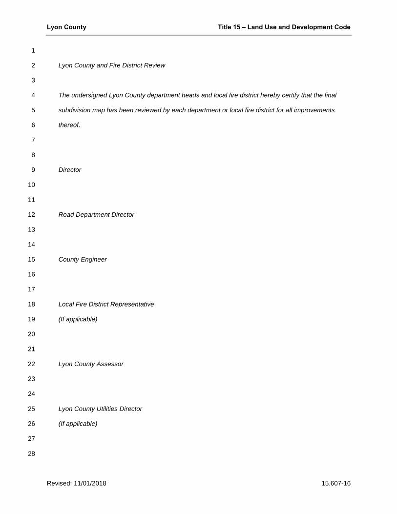
Lyon County Title 15 – Land Use and Development Code
Revised: 11/01/2018 15.607-16
1
Lyon County and Fire District Review 2
3
The undersigned Lyon County department heads and local fire district hereby certify that the final 4
subdivision map has been reviewed by each department or local fire district for all improvements 5
thereof. 6
7
8
Director 9
10
11
Road Department Director 12
13
14
County Engineer 15
16
17
Local Fire District Representative 18
(If applicable) 19
20
21
Lyon County Assessor 22
23
24
Lyon County Utilities Director 25
(If applicable) 26
27
28

Lyon County Title 15 – Land Use and Development Code
Revised: 11/01/2018 15.607-17
C. Final subdivision Map Certificates. The following certificates and acknowledgments shall appear on 1
the final subdivision map and shall be combined when appropriate: 2
1. A certificate signed and acknowledged by all parties having any security interest and/or record 3
title interest in the land subdivided, consenting to the preparation and recordation of the map; 4
2. A certificate signed and acknowledged as above, offering for dedication for certain specified 5
public uses those certain parcels of land which the parties desire so dedicated; 6
3. A certificate of title indicating: 7
a. That each person signing the final subdivision map owns a record of interest in the land and 8
that all the owners of record of the land have signed the final subdivision map; 9
b. Listing of any lien or mortgage holders of record, if any. If there are no lien or mortgage 10
holders of record, the fact that there are none shall be stated in the certificate; 11
c. The certificate of title shall be signed and dated by an officer of the title company responsible 12
for the statements contained within said title certificate; 13
4. A certificate by the Nevada licensed surveyor responsible for the survey and final subdivision 14
map as prescribed by state law; 15
5. A certificate by the county engineer stating that he has examined the final subdivision map, that 16
he is satisfied that the map is technically correct, and that sub divider has complied with one of the 17
following alternatives: 18
a. All the improvements have been installed in accordance with the requirements of these 19
regulations; or 20
b. Adequate assurances have been provided that improvements will be completed and 21
maintained in accordance with chapter 15.110; 22
6. A certificate by the health division of the department of human resources indicating that the final 23
subdivision map is approved concerning sewage disposal, water pollution, water quality and water 24
supply facilities; 25
7. A certificate by the division of water resources of the state department of conservation and 26
natural resources showing that the final subdivision map is approved concerning water quality and 27
any other matters in its jurisdiction; 28
Lyon County Title 15 – Land Use and Development Code
Revised: 11/01/2018 15.607-18
8. A certificate of the director that the map conforms to the approved tentative subdivision map and 1
all conditions imposed upon such approval have been satisfied; 2
9. A certificate for execution by the county clerk stating that the county has approved the map and 3
accepted (or deferred) on behalf of the public the parcels of land offered for dedication for public use 4
in conformity with the terms of the offer of dedication; 5
10. A certificate by the appropriate public utilities accepting the designated easements; 6
11. Proper certificates of a notary public as required; 7
12. A certificate for execution by the county recorder concerning the appropriate recording data 8
required by NRS § 278.460. 9
13. If the property includes, impacts, or is adjacent to a conveyance ditch, a letter to the director by 10
the water conveyance advisory committee stating that all irrigation water conveyance facilities and 11
associated access and maintenance easements or rights-of-way are depicted on the map; 12
14. A certificate granting rights-of-way for water conveyance and maintenance. The grant of the right-13
of-way shall run to the benefit of all persons entitled to the use of the conveyance ditch under the 14
Alpine Decree or other court decree and their successors in interest or to any ditch company or 15
similar entity having an interest in or responsibility for the water conveyance ditch and associated 16
structures; 17
15. Other certificates as may be required. 18
19
E. Action by the Board. 20
1. Prior to its expiration, the sub divider shall submit the application for a final map to the 21
department. 22
2. Unless the time period is extended by a mutual consent of the developer and the board, the 23
board shall render a decision on the application for final subdivision map approval within 60 days 24
following the determination that the final map application is complete, except as follows: 25
a. If any errors or omissions are found on the prints of the final map submitted to the county, the 26
map shall be returned to the sub divider or his engineer for correction and shall not be submitted 27
for board approval until such errors and omissions are corrected. 28
Lyon County Title 15 – Land Use and Development Code
Revised: 11/01/2018 15.607-19
b. The corrected final map shall be required to be resubmitted to the department and the time 1
period for board action set forth in 2 above shall be reset. 2
3. The board shall refuse any final map approval when a report of error is made and shall continue 3
to refuse to approve until all deficiencies are resolved. 4
4. The board shall approve the map only if it is found that: 5
a. The map conforms in every respect with the approved tentative subdivision map, as 6
amended; 7
b. All conditions established upon approval of the tentative subdivision map, as amended, have 8
been satisfied; 9
c. The final subdivision map conforms to all county ordinances applicable at the time of the 10
decision on the final subdivision map; 11
d. All required improvements have been installed as certified by the county engineer, or 12
sufficient assurances for completion and maintenance of improvements have been made 13
pursuant to this development code; 14
e. All necessary certificates required by state law or by the development code have been 15
presented with the application of approval of the final subdivision map; 16
4. The board shall, at the time of approval of the final subdivision map, accept or reject any or all 17
offers of dedication. 18
19
C. Appeal. The board’s action to deny the final subdivision map may be appealed in accordance with the 20
procedures of Chapter 15.12. 21
22
Effect of Approval 23
No vested right shall accrue to the owner, sub divider or developer of any subdivision by reason of 24
tentative or final subdivision map approval until the actual recording of the final subdivision map 25
containing all of the signatures of all parties required to sign the map. All requirements, conditions, or 26
regulations adopted by the county applicable to the subdivision or on all subdivisions generally shall be 27
deemed a condition for any subdivision prior to the time of signing of the final subdivision map by the 28
Lyon County Title 15 – Land Use and Development Code
Revised: 11/01/2018 15.607-20
county engineer. Where the county has required the installation of improvements prior to signing of the 1
final subdivision map, and improvements have, in fact, been completed, the sub divider may be required 2
to comply with the local laws and regulations in effect at the time when the final subdivision map is 3
considered for approval only if the commission makes a finding on the record that such compliance is 4
necessary to prevent a substantial risk of injury to the public health, safety and general welfare. 5
6
Signing and Recordation of Final Subdivision Map 7
A. Signing of Map. 8
1. When an improvement agreement and security are required, the county engineer shall endorse 9
approval of the map only after security has been provided and all conditions of the map have been 10
satisfied. 11
2. When installation of improvements is required, the county engineer shall endorse approval on the 12
map only after all conditions of the map have been satisfied and upon issuance of a notice of 13
completion. 14
3. The county engineer shall sign the map only after determination in cooperation with any utility 15
providing water and/or sewer service to the subdivision or accepting improvements for maintenance 16
that the map is in compliance with the county code relating to the dedication of facilities, water rights 17
and rights-of-way/easements. 18
19
B. Recording of the Map. It shall be the responsibility of the sub divider to file the original map with the 20
county clerk for signing and submission to the county recorder within two (2) years from the date of 21
approval pursuant to chapter 15.13. Simultaneously with the filing of the map the sub divider shall cause 22
to be recorded such other legal documents as may be required to be recorded by the county. 23
24
Reversion of Final Subdivision Map 25
A final subdivision map which has been recorded may be revoked pursuant to chapter 15.13, and the 26
subdivision reverted to acreage, pursuant to chapters 15.603 and 15.604, where applicable, in the event 27
that the sub divider or his successor in interest fails to complete improvements as required by the 28
subdivision improvement agreement, development agreement or as otherwise provided by law. The 29
Lyon County Title 15 – Land Use and Development Code
Revised: 11/01/2018 15.607-21
proceeding may be initiated by either the owner or the county. At the initiation of proceedings to revoke or 1
revert to acreage, the county shall record a document with the county clerk and recorder's office giving 2
notice thereof. If final subdivision approval is revoked or the property reverted to acreage, the board order 3
to that effect will be recorded with the county clerk and recorder's offices, the subdivision will no longer be 4
valid and further sale or development of lots or parcels within the revoked subdivision shall be prohibited 5
without approved division of land pursuant to this development code. 6
7
Procedures For Planned Development Applications 8
Whenever an application for planned unit development proposes the division of land into five (5) or more 9
parts, the applicant may include with such application a tentative subdivision map, to be processed in 10
accordance with the provisions of chapter 15.349 and this chapter. If submitted concurrently with the 11
planned unit development application, consideration of the tentative subdivision map shall be reviewed in 12
conjunction with the application for planned unit development tentative approval, and approval of the 13
tentative subdivision map shall be conditioned upon final approval of the planned unit development. 14
15


![[120]+france+lyon weekend+a+lyon-](https://img.pdfslide.us/doc/110x75/55a83da01a28ab8c4f8b463f/120francelyon-weekendalyon-.jpg)