Embed Size (px)
Citation preview

© 2013 Autodesk
Chapter2: Introduction to MapGuide APIs
MapGuide Server API Overview and Map Viewer API
© 2013 Autodesk
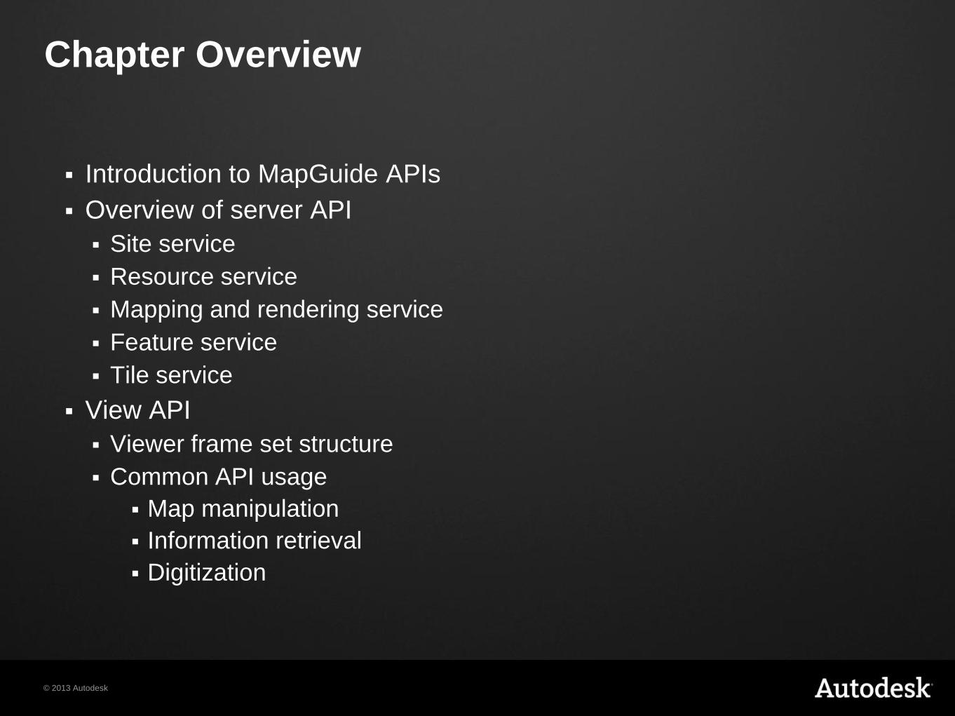
Chapter Overview
Introduction to MapGuide APIs
Overview of server API
Site service
Resource service
Mapping and rendering service
Feature service
Tile service
View API
Viewer frame set structure
Common API usage
Map manipulation
Information retrieval
Digitization
© 2013 Autodesk
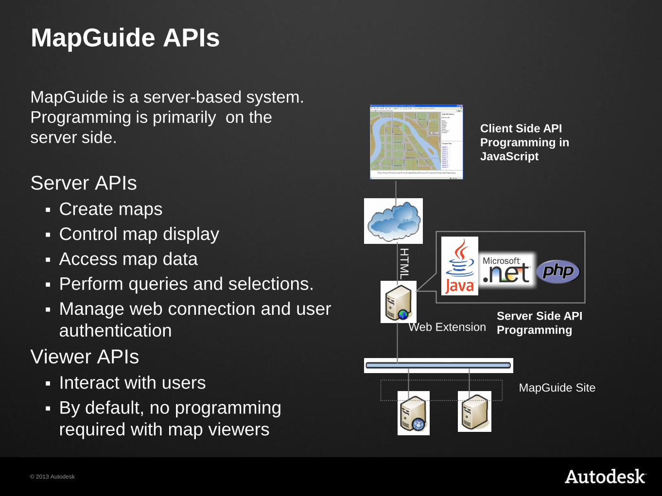
MapGuide APIs
MapGuide is a server-based system.
Programming is primarily on the
server side.
Server APIs
Create maps
Control map display
Access map data
Perform queries and selections.
Manage web connection and user
authentication
Viewer APIs
Interact with users
By default, no programming
required with map viewers
MapGuide Site
Server Side API
Programming
HT
ML
Client Side API
Programming in
JavaScript
Web Extension
© 2013 Autodesk
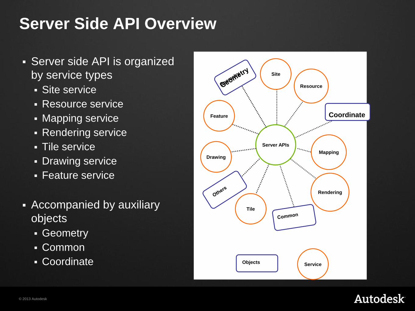
Server Side API Overview
Server side API is organized
by service types
Site service
Resource service
Mapping service
Rendering service
Tile service
Drawing service
Feature service
Accompanied by auxiliary
objects
Geometry
Common
Coordinate
Tile
Drawing
Rendering
Mapping
Resource
Feature
Site
Server APIs
Objects Service
Coordinate
© 2013 Autodesk
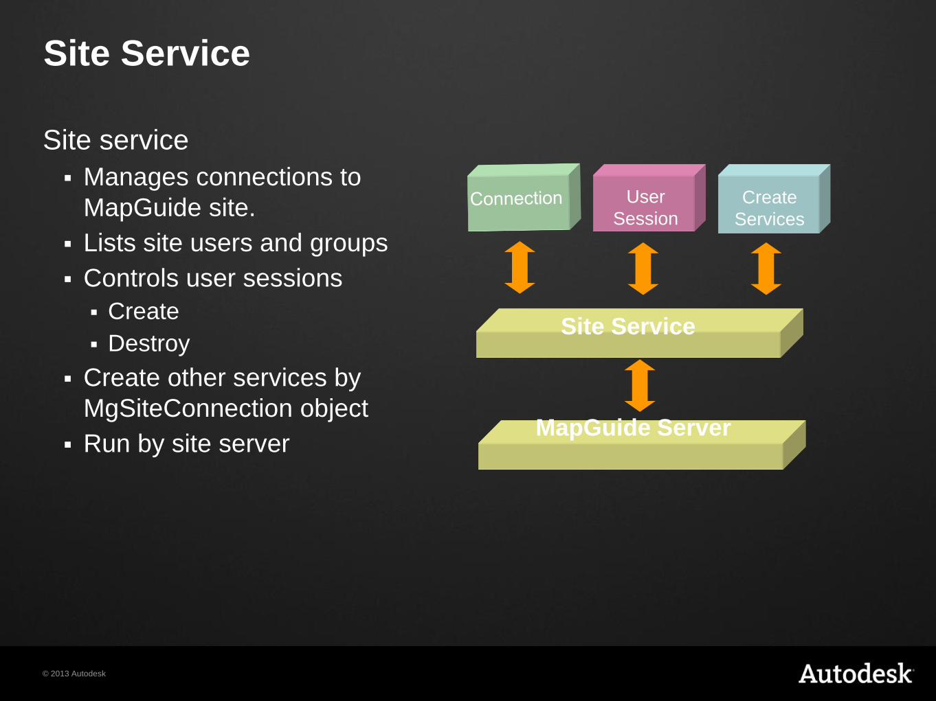
Site Service
Site service
Manages connections to
MapGuide site.
Lists site users and groups
Controls user sessions
Create
Destroy
Create other services by
MgSiteConnection object
Run by site server
Site Service
User
Session Create
Services
MapGuide Server
© 2013 Autodesk
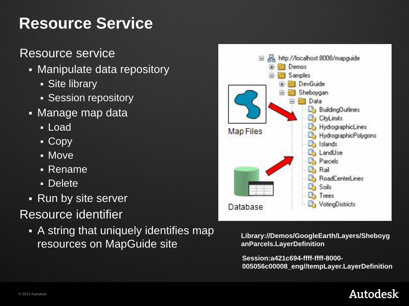
Resource Service
Resource service
Manipulate data repository
Site library
Session repository
Manage map data
Load
Copy
Move
Rename
Delete
Run by site server
Resource identifier
A string that uniquely identifies map
resources on MapGuide site Library://Demos/GoogleEarth/Layers/Sheboyg
anParcels.LayerDefinition
Session:a421c694-ffff-ffff-8000-
005056c00008_eng//tempLayer.LayerDefinition
© 2013 Autodesk
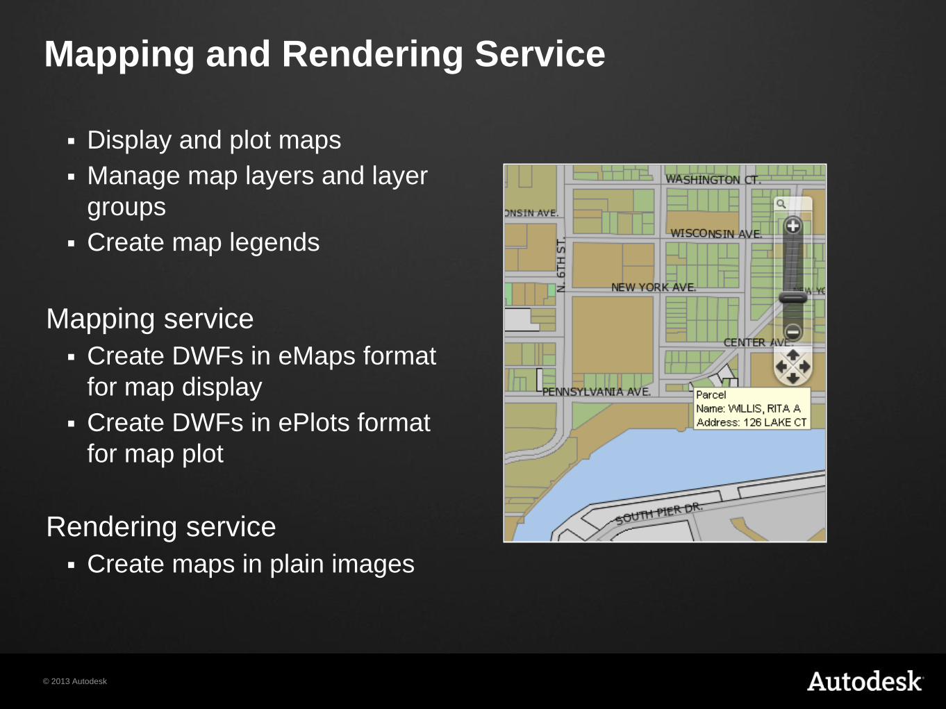
Mapping and Rendering Service
Display and plot maps
Manage map layers and layer
groups
Create map legends
Mapping service
Create DWFs in eMaps format
for map display
Create DWFs in ePlots format
for map plot
Rendering service
Create maps in plain images
© 2013 Autodesk
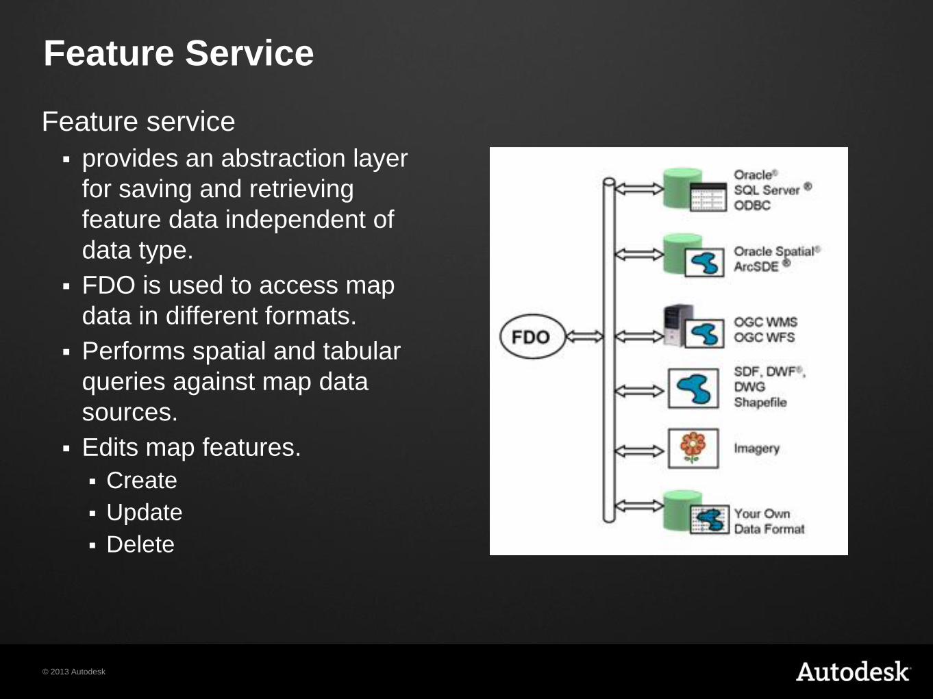
Feature Service
Feature service
provides an abstraction layer
for saving and retrieving
feature data independent of
data type.
FDO is used to access map
data in different formats.
Performs spatial and tabular
queries against map data
sources.
Edits map features.
Create
Update
Delete
© 2013 Autodesk
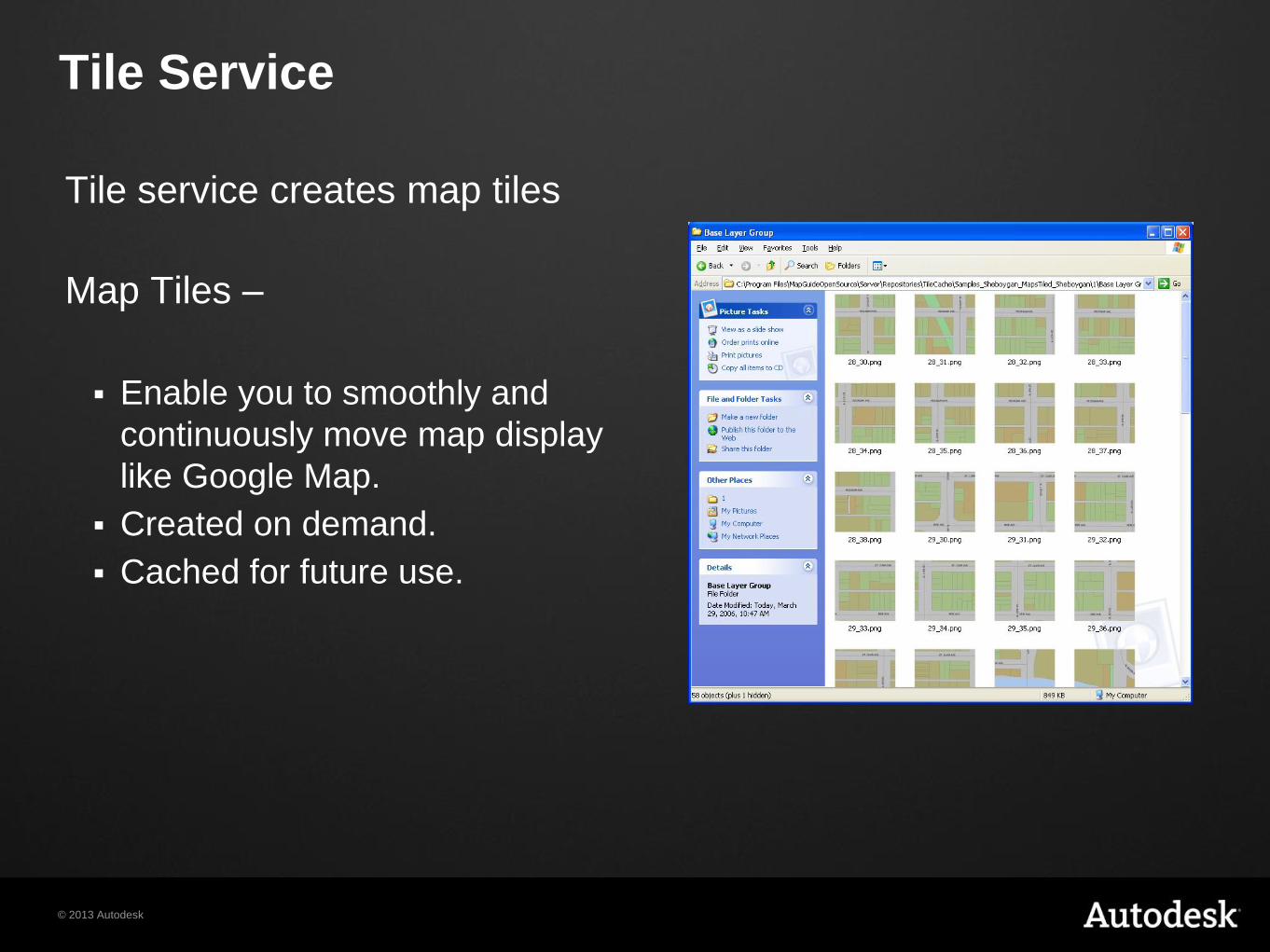
Tile Service
Tile service creates map tiles
Map Tiles –
Enable you to smoothly and
continuously move map display
like Google Map.
Created on demand.
Cached for future use.
© 2013 Autodesk
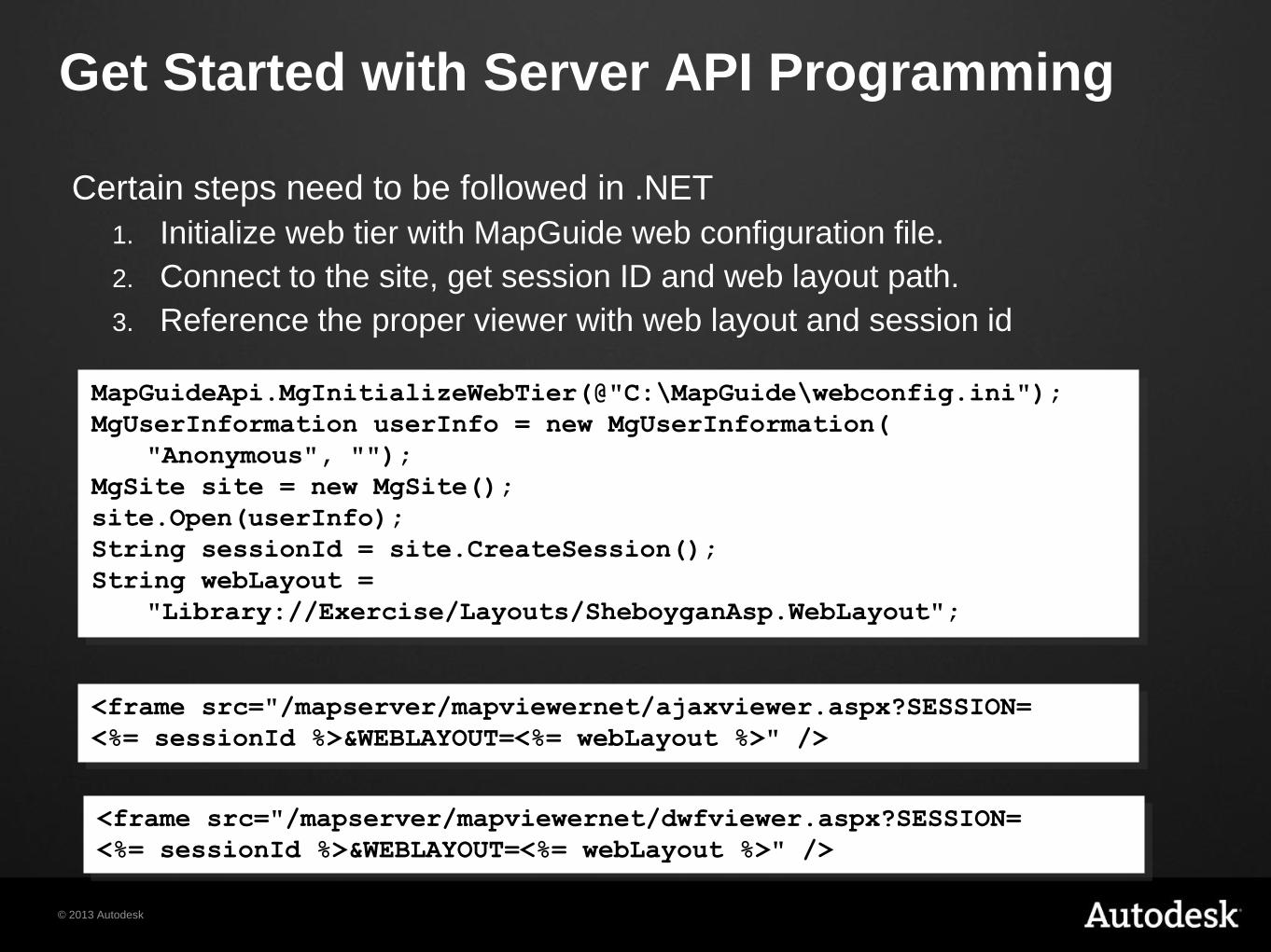
Get Started with Server API Programming
Certain steps need to be followed in .NET
1. Initialize web tier with MapGuide web configuration file.
2. Connect to the site, get session ID and web layout path.
3. Reference the proper viewer with web layout and session id
MapGuideApi.MgInitializeWebTier(@"C:\MapGuide\webconfig.ini");
MgUserInformation userInfo = new MgUserInformation(
"Anonymous", "");
MgSite site = new MgSite();
site.Open(userInfo);
String sessionId = site.CreateSession();
String webLayout =
"Library://Exercise/Layouts/SheboyganAsp.WebLayout";
<frame src="/mapserver/mapviewernet/dwfviewer.aspx?SESSION=
<%= sessionId %>&WEBLAYOUT=<%= webLayout %>" />
<frame src="/mapserver/mapviewernet/ajaxviewer.aspx?SESSION=
<%= sessionId %>&WEBLAYOUT=<%= webLayout %>" />

© 2013 Autodesk
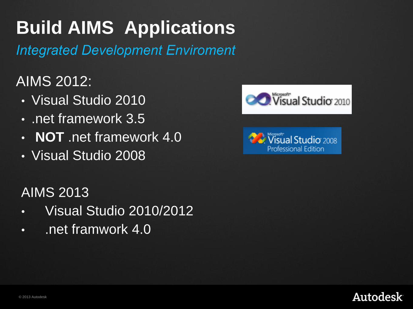
Build AIMS Applications
© 2013 Autodesk
AIMS 2012:
• Visual Studio 2010
• .net framework 3.5
• NOT .net framework 4.0
• Visual Studio 2008
AIMS 2013
• Visual Studio 2010/2012
• .net framwork 4.0
Build AIMS Applications
© 2013 Autodesk
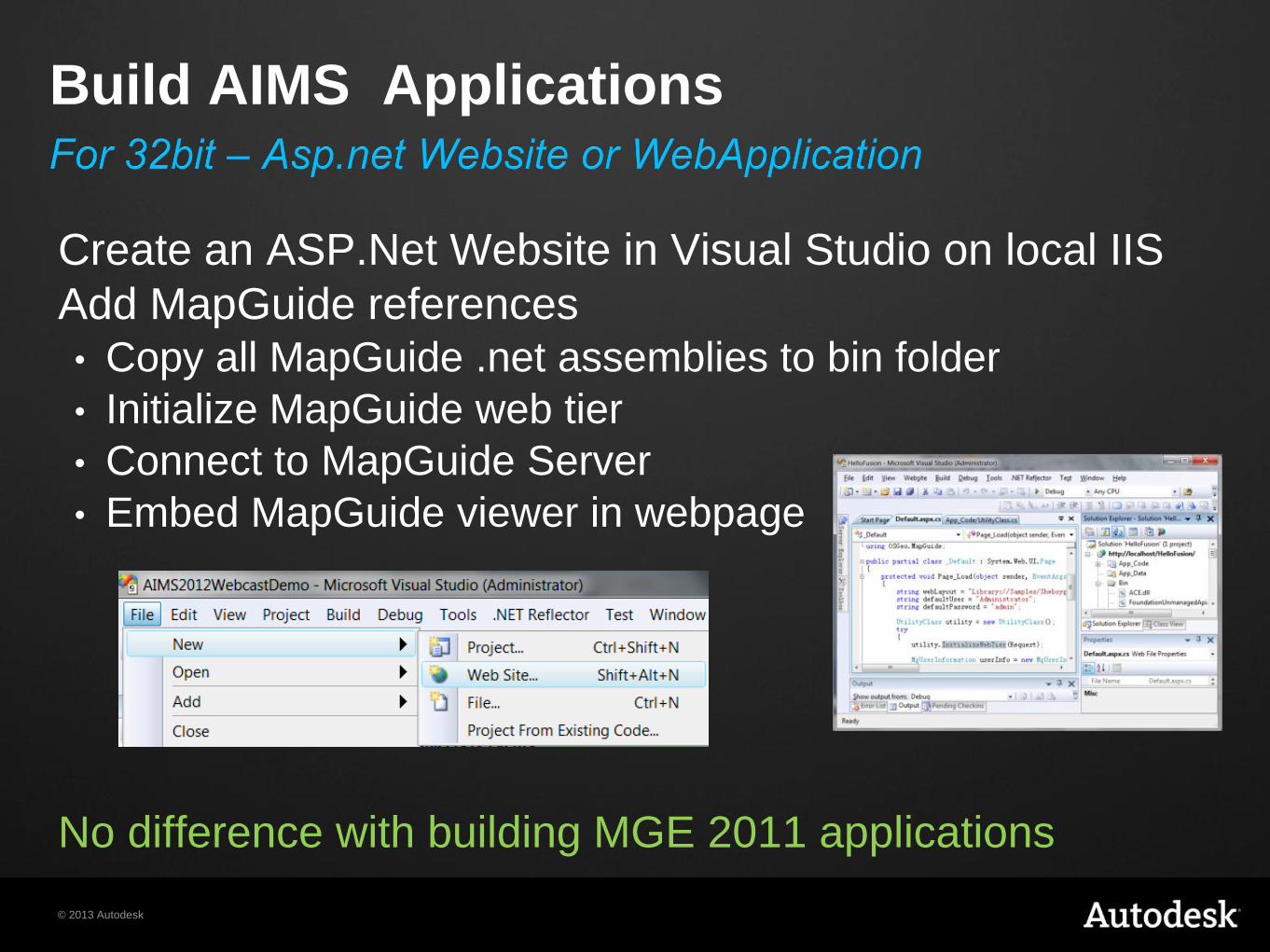
Build AIMS Applications
Create an ASP.Net Website in Visual Studio on local IIS
Add MapGuide references
• Copy all MapGuide .net assemblies to bin folder
• Initialize MapGuide web tier
• Connect to MapGuide Server
• Embed MapGuide viewer in webpage
No difference with building MGE 2011 applications
© 2013 Autodesk
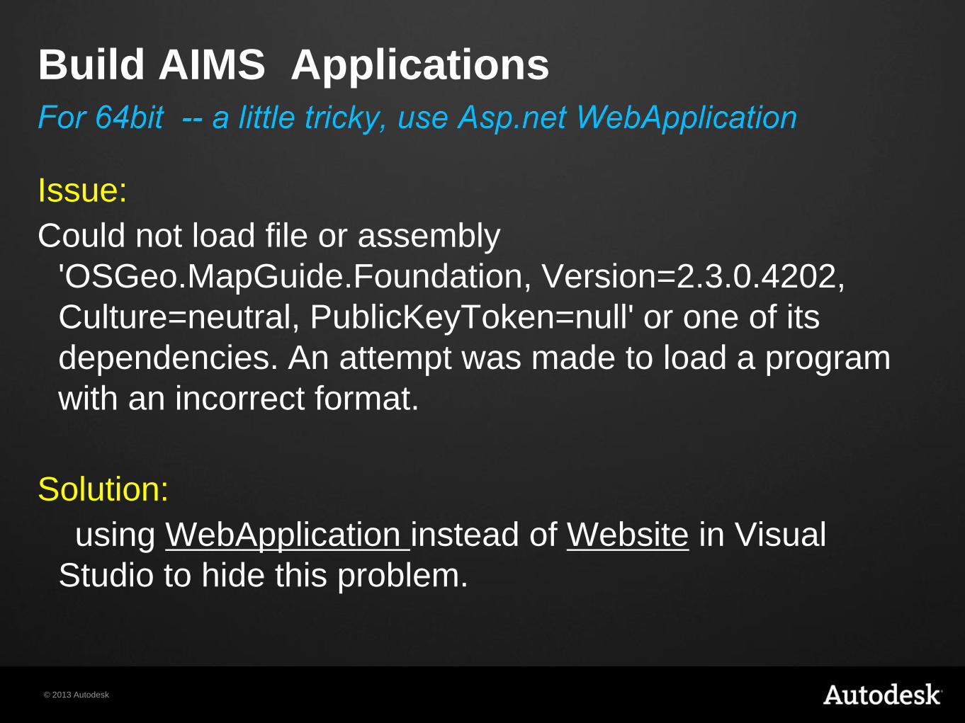
Issue:
Could not load file or assembly
'OSGeo.MapGuide.Foundation, Version=2.3.0.4202,
Culture=neutral, PublicKeyToken=null' or one of its
dependencies. An attempt was made to load a program
with an incorrect format.
Solution:
using WebApplication instead of Website in Visual
Studio to hide this problem.
Build AIMS Applications
© 2013 Autodesk
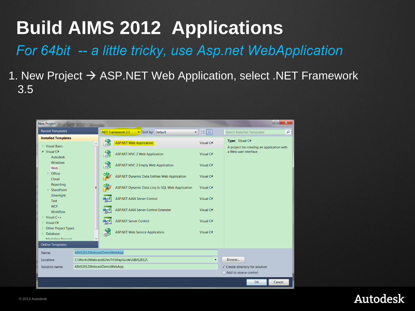
1. New Project ASP.NET Web Application, select .NET Framework
3.5
Build AIMS 2012 Applications
© 2013 Autodesk
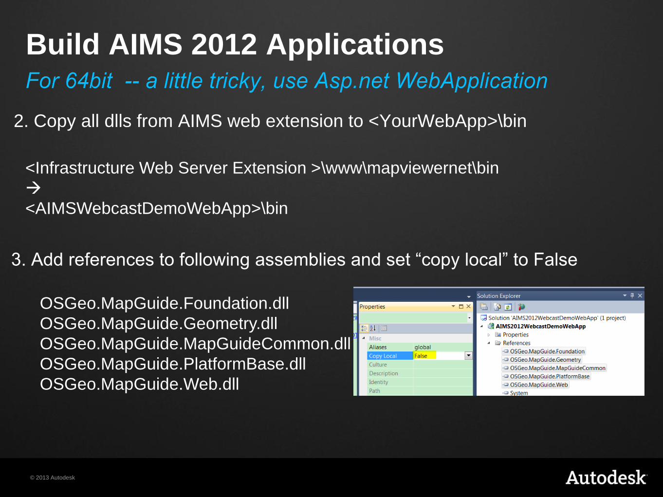
2. Copy all dlls from AIMS web extension to <YourWebApp>\bin
Build AIMS 2012 Applications
<Infrastructure Web Server Extension >\www\mapviewernet\bin
<AIMSWebcastDemoWebApp>\bin
3. Add references to following assemblies and set “copy local” to False
OSGeo.MapGuide.Foundation.dll
OSGeo.MapGuide.Geometry.dll
OSGeo.MapGuide.MapGuideCommon.dll
OSGeo.MapGuide.PlatformBase.dll
OSGeo.MapGuide.Web.dll
© 2013 Autodesk
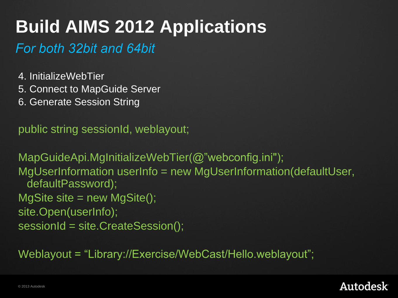
Build AIMS 2012 Applications
4. InitializeWebTier
5. Connect to MapGuide Server
6. Generate Session String
public string sessionId, weblayout;
MapGuideApi.MgInitializeWebTier(@”webconfig.ini");
MgUserInformation userInfo = new MgUserInformation(defaultUser, defaultPassword);
MgSite site = new MgSite();
site.Open(userInfo);
sessionId = site.CreateSession();
Weblayout = “Library://Exercise/WebCast/Hello.weblayout”;
© 2013 Autodesk
Build AIMS 2012 Applications
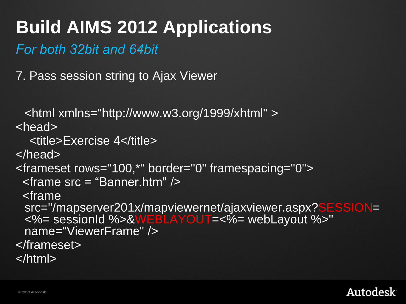
7. Pass session string to Ajax Viewer
<html xmlns="http://www.w3.org/1999/xhtml" >
<head> <title>Exercise 4</title> </head> <frameset rows="100,*" border="0" framespacing="0"> <frame src = “Banner.htm" /> <frame
src="/mapserver201x/mapviewernet/ajaxviewer.aspx?SESSION=<%= sessionId %>&WEBLAYOUT=<%= webLayout %>" name="ViewerFrame" />
</frameset> </html>
© 2013 Autodesk
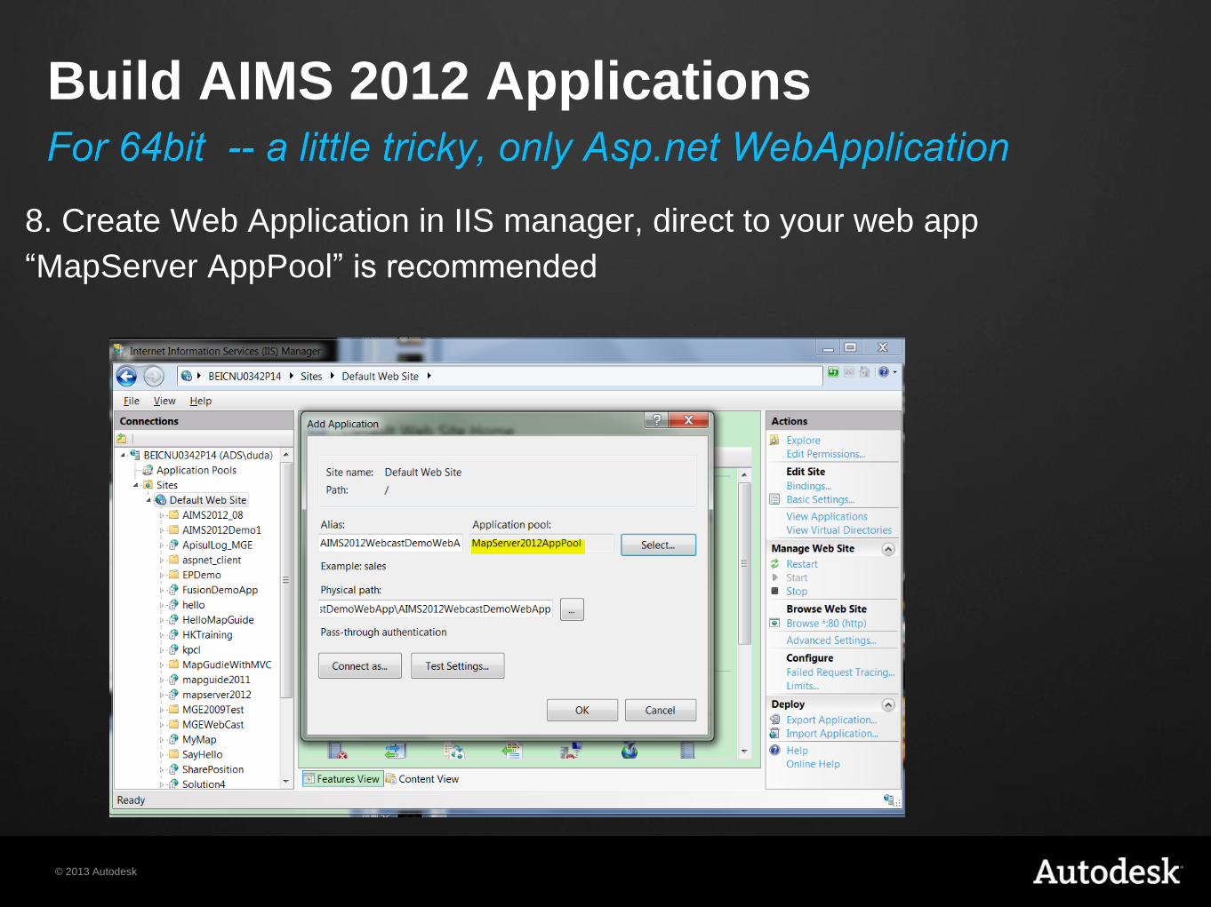
8. Create Web Application in IIS manager, direct to your web app
“MapServer AppPool” is recommended
Build AIMS 2012 Applications
© 2013 Autodesk
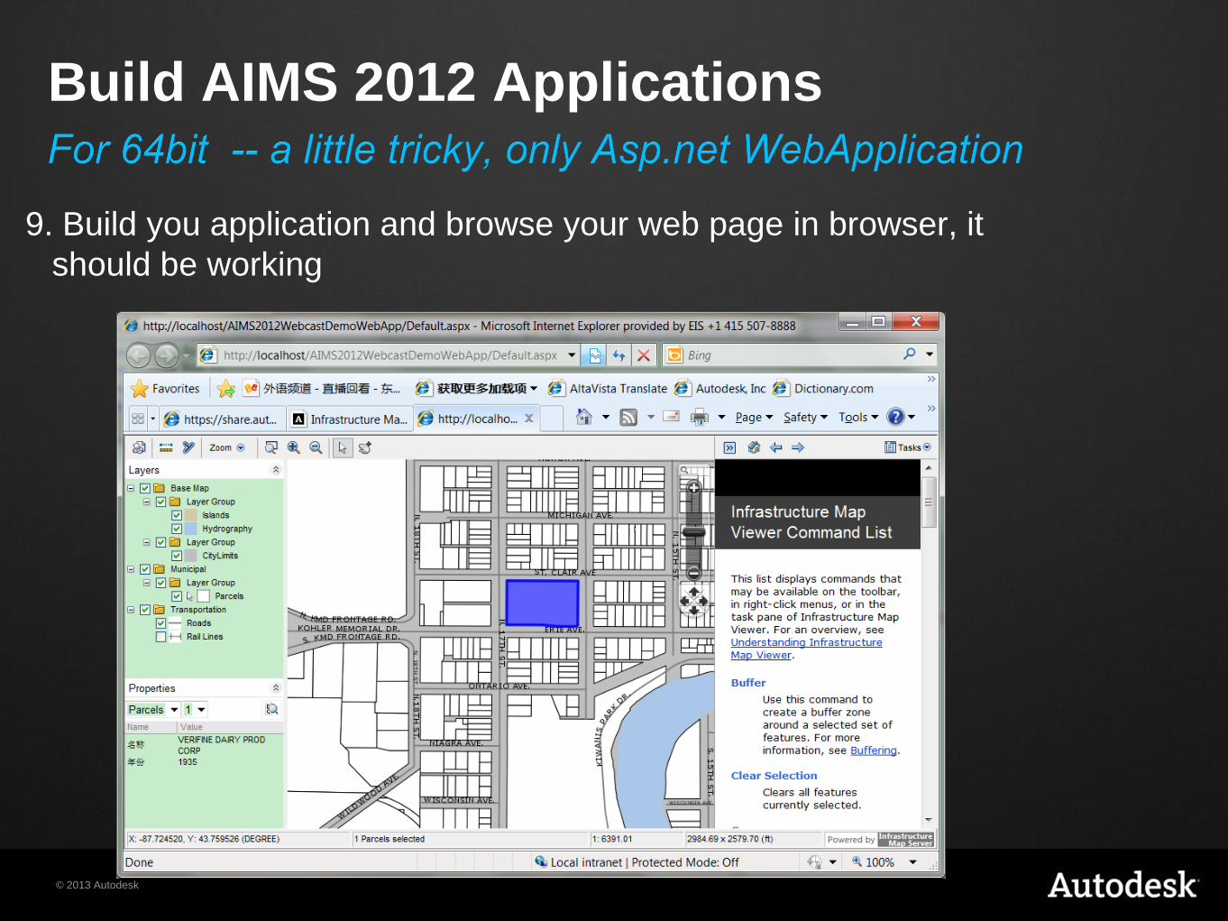
9. Build you application and browse your web page in browser, it
should be working
Build AIMS 2012 Applications
© 2013 Autodesk
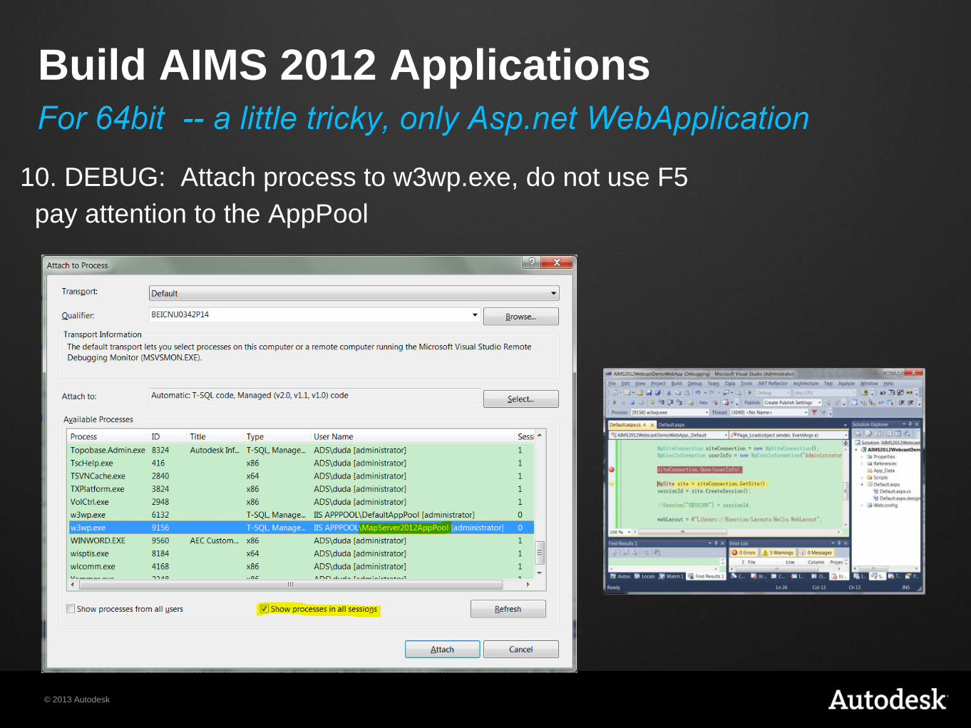
10. DEBUG: Attach process to w3wp.exe, do not use F5
pay attention to the AppPool
Build AIMS 2012 Applications
© 2013 Autodesk
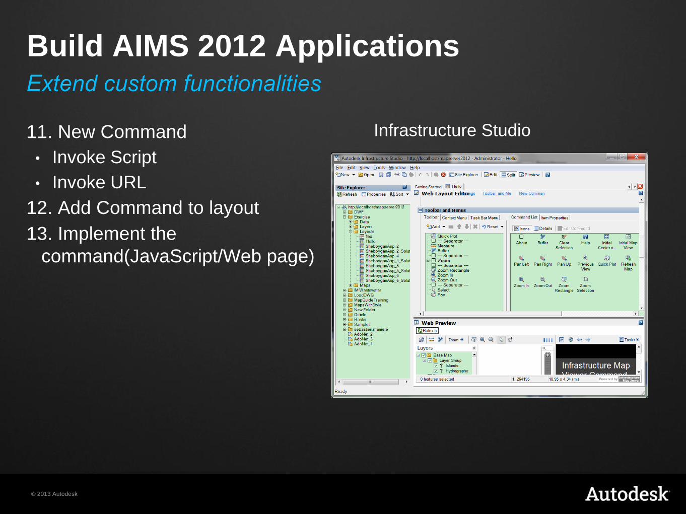
11. New Command
• Invoke Script
• Invoke URL
12. Add Command to layout
13. Implement the
command(JavaScript/Web page)
Build AIMS 2012 Applications
Infrastructure Studio
© 2013 Autodesk
Use .NET Framework 4.0/ASP.NET 4.0
Use correct version of dlls in <webExtension>\bin folder
Use correct version of webconfig.ini
Steps are almost the same with AIMS 2012.
For AIMS 2013/2014
© 2013 Autodesk
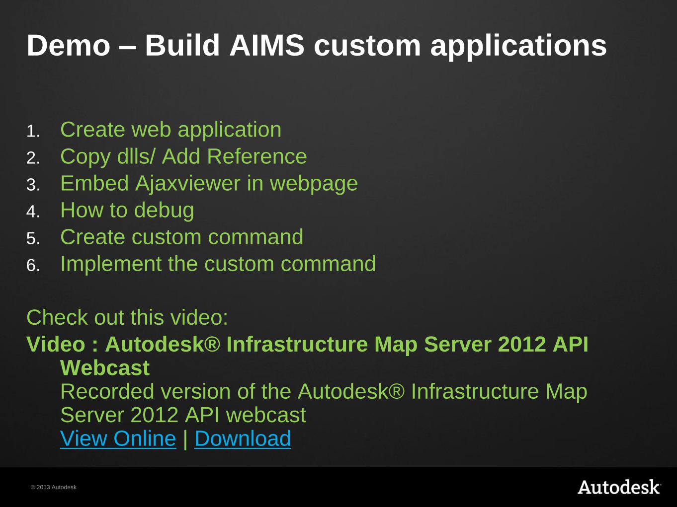
1. Create web application
2. Copy dlls/ Add Reference
3. Embed Ajaxviewer in webpage
4. How to debug
5. Create custom command
6. Implement the custom command
Check out this video:
Video : Autodesk® Infrastructure Map Server 2012 API Webcast Recorded version of the Autodesk® Infrastructure Map Server 2012 API webcast View Online | Download
Demo – Build AIMS custom applications
© 2013 Autodesk
Exercise
Create first MapGuide Web Application
© 2013 Autodesk
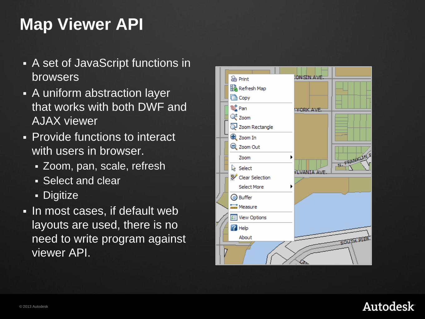
Map Viewer API
A set of JavaScript functions in
browsers
A uniform abstraction layer
that works with both DWF and
AJAX viewer
Provide functions to interact
with users in browser.
Zoom, pan, scale, refresh
Select and clear
Digitize
In most cases, if default web
layouts are used, there is no
need to write program against
viewer API.
© 2013 Autodesk
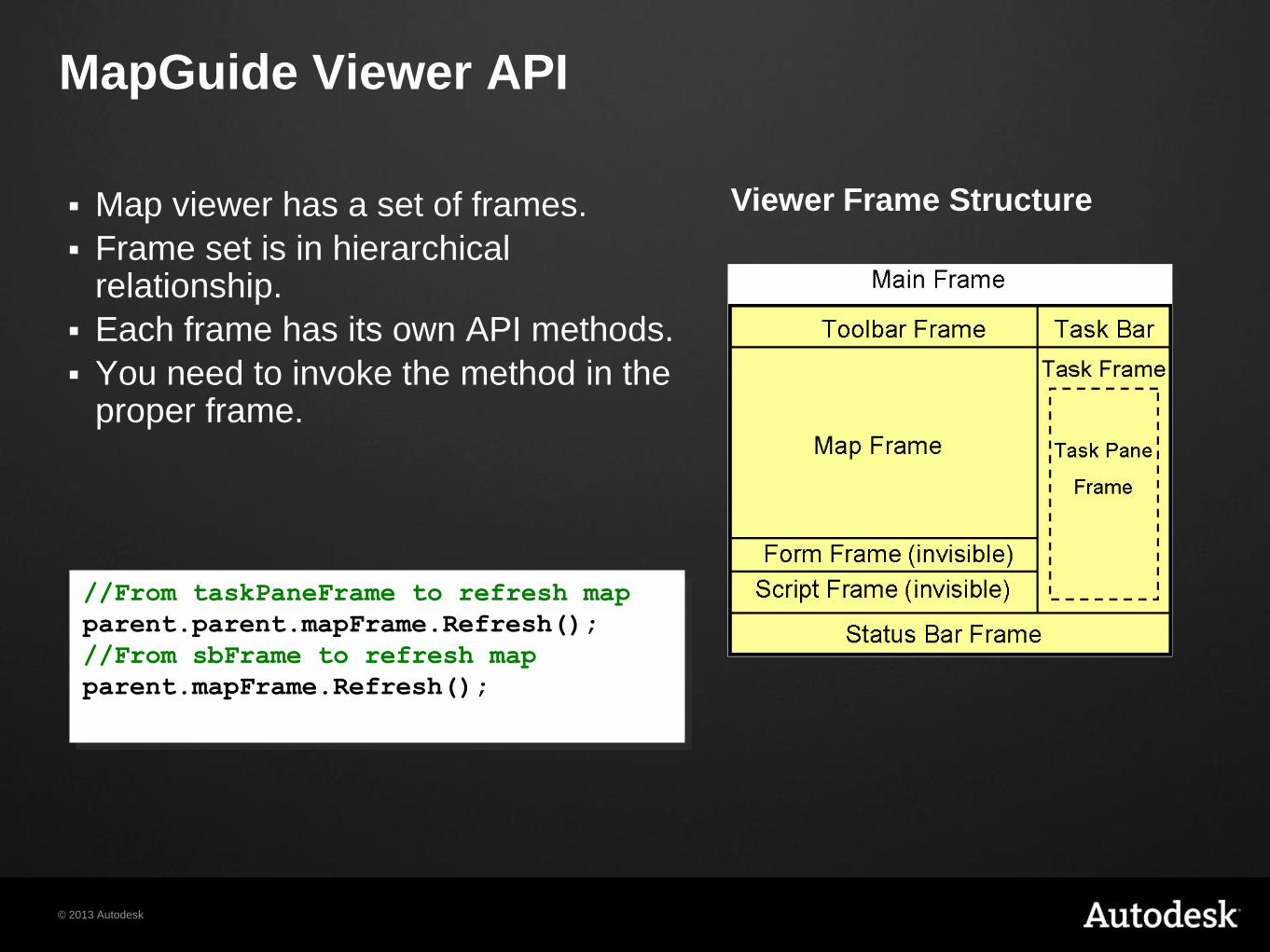
MapGuide Viewer API
Map viewer has a set of frames.
Frame set is in hierarchical relationship.
Each frame has its own API methods.
You need to invoke the method in the proper frame.
Viewer Frame Structure
//From taskPaneFrame to refresh map
parent.parent.mapFrame.Refresh();
//From sbFrame to refresh map
parent.mapFrame.Refresh();
© 2013 Autodesk
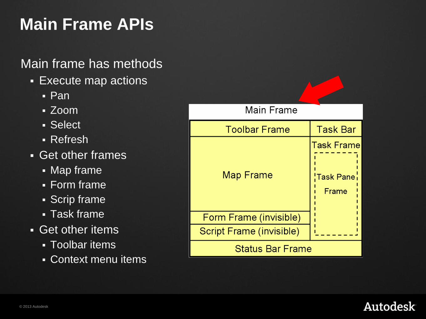
Main Frame APIs
Main frame has methods
Execute map actions
Pan
Zoom
Select
Refresh
Get other frames
Map frame
Form frame
Scrip frame
Task frame
Get other items
Toolbar items
Context menu items
© 2013 Autodesk
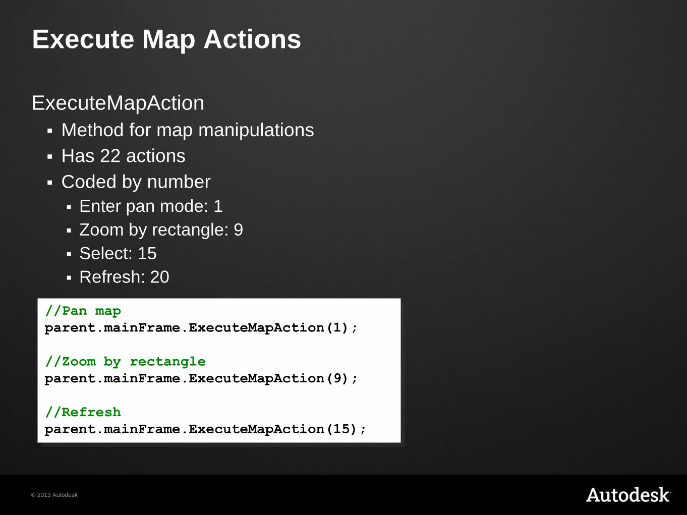
Execute Map Actions
ExecuteMapAction
Method for map manipulations
Has 22 actions
Coded by number
Enter pan mode: 1
Zoom by rectangle: 9
Select: 15
Refresh: 20
//Pan map
parent.mainFrame.ExecuteMapAction(1);
//Zoom by rectangle
parent.mainFrame.ExecuteMapAction(9);
//Refresh
parent.mainFrame.ExecuteMapAction(15);
© 2013 Autodesk
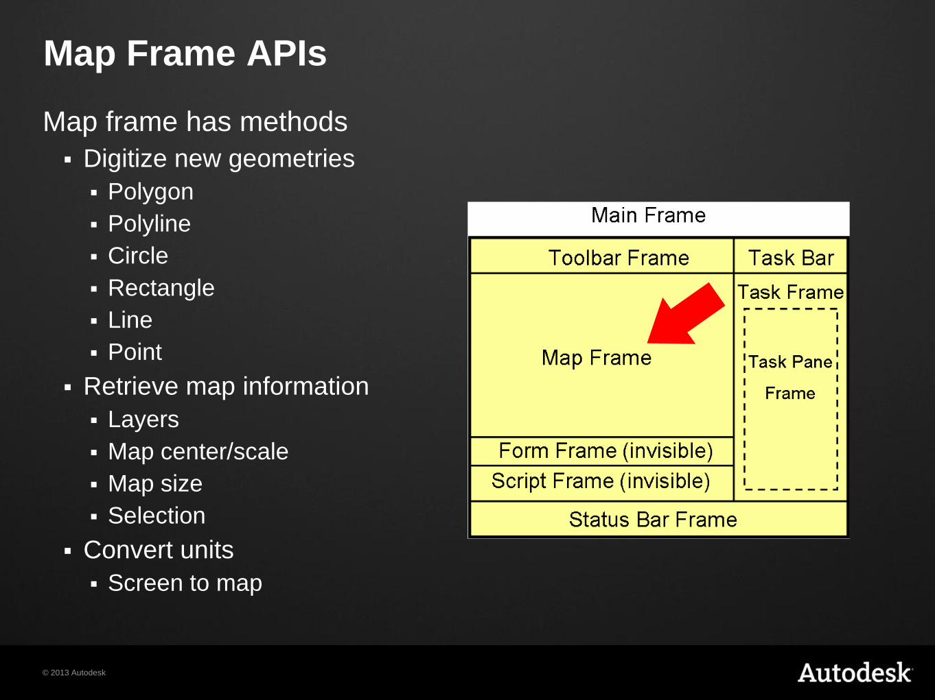
Map Frame APIs
Map frame has methods
Digitize new geometries
Polygon
Polyline
Circle
Rectangle
Line
Point
Retrieve map information
Layers
Map center/scale
Map size
Selection
Convert units
Screen to map
© 2013 Autodesk
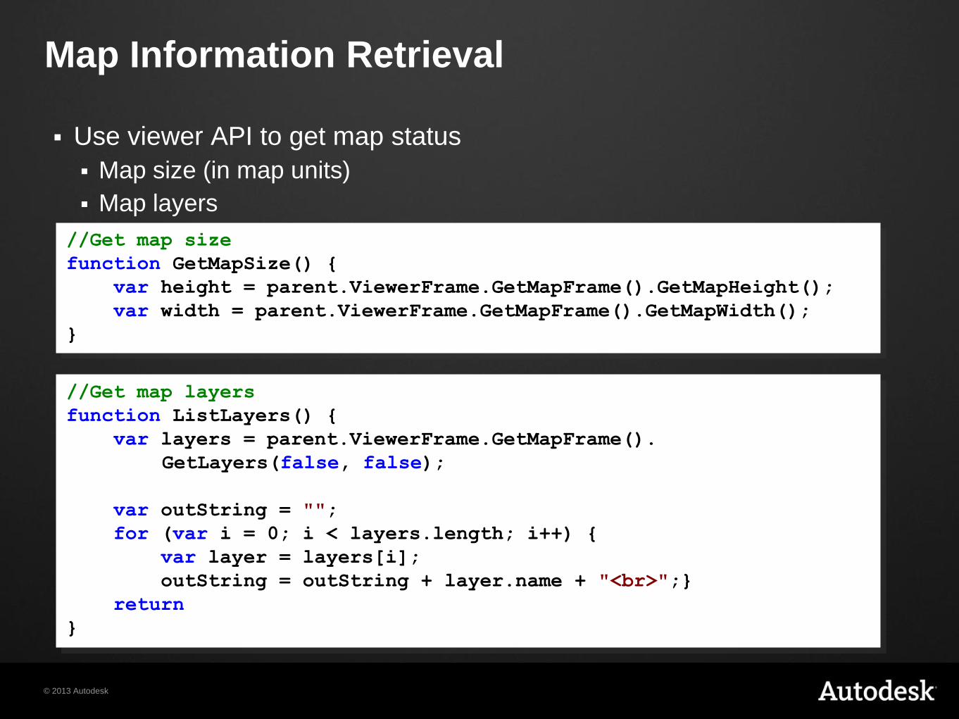
Map Information Retrieval
Use viewer API to get map status
Map size (in map units)
Map layers
//Get map size
function GetMapSize() {
var height = parent.ViewerFrame.GetMapFrame().GetMapHeight();
var width = parent.ViewerFrame.GetMapFrame().GetMapWidth();
}
//Get map layers
function ListLayers() {
var layers = parent.ViewerFrame.GetMapFrame().
GetLayers(false, false);
var outString = "";
for (var i = 0; i < layers.length; i++) {
var layer = layers[i];
outString = outString + layer.name + "<br>";}
return outString;
}
© 2013 Autodesk
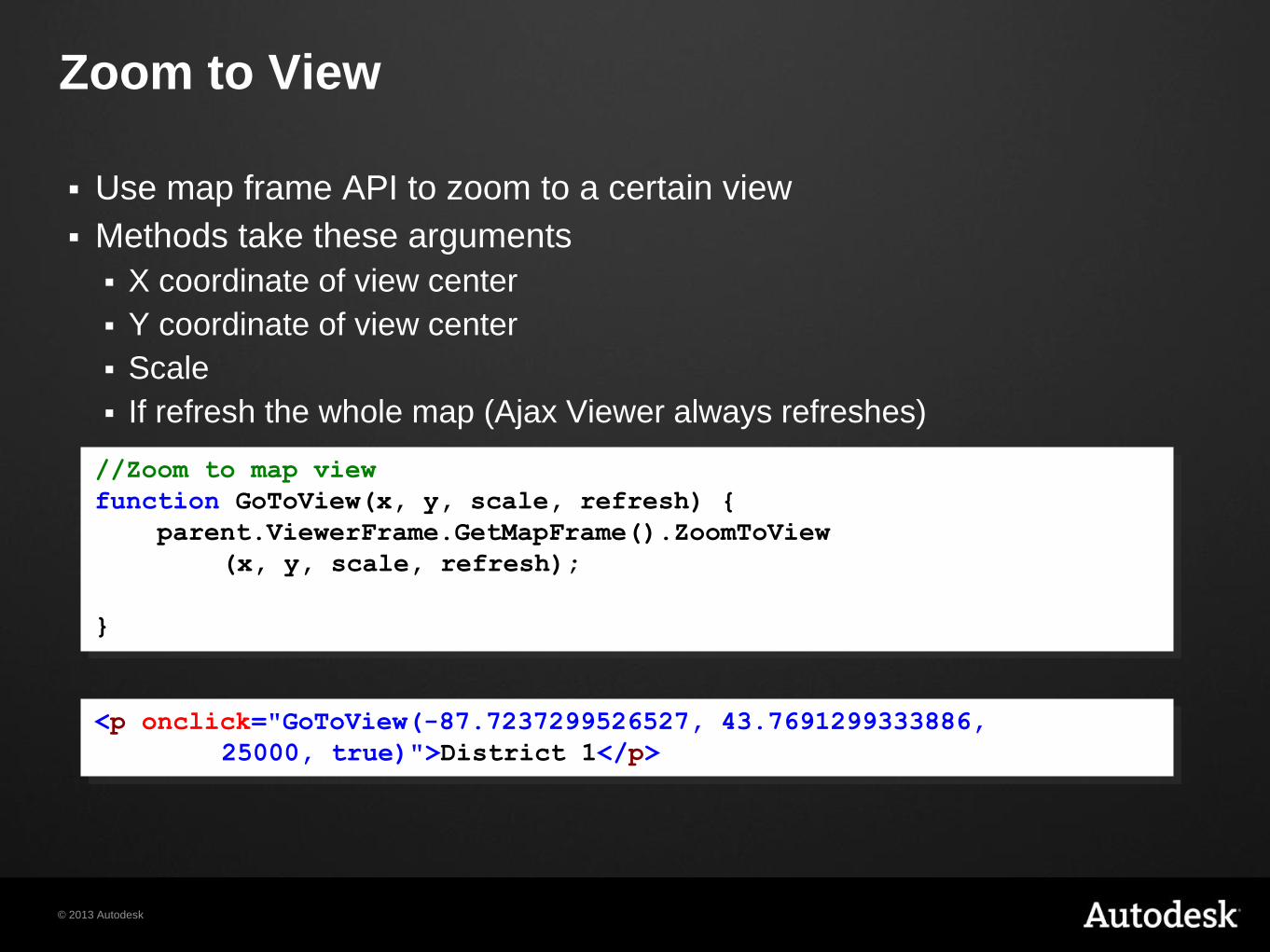
Zoom to View
Use map frame API to zoom to a certain view
Methods take these arguments
X coordinate of view center
Y coordinate of view center
Scale
If refresh the whole map (Ajax Viewer always refreshes)
//Zoom to map view
function GoToView(x, y, scale, refresh) {
parent.ViewerFrame.GetMapFrame().ZoomToView
(x, y, scale, refresh);
}
<p onclick="GoToView(-87.7237299526527, 43.7691299333886,
25000, true)">District 1</p>
© 2013 Autodesk
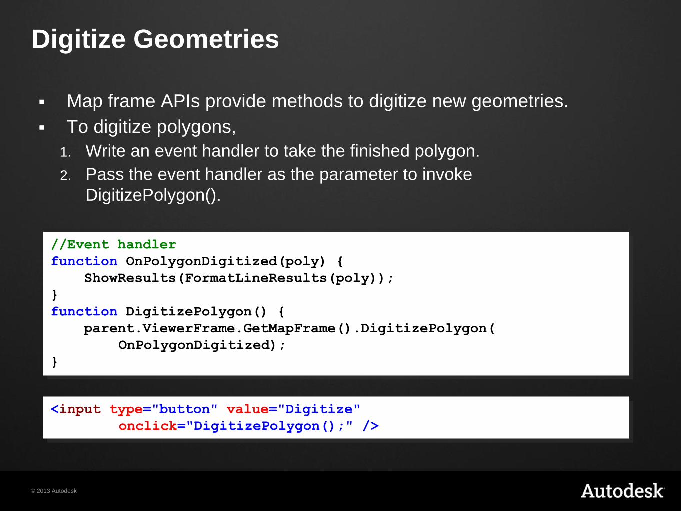
Digitize Geometries
Map frame APIs provide methods to digitize new geometries.
To digitize polygons,
1. Write an event handler to take the finished polygon.
2. Pass the event handler as the parameter to invoke
DigitizePolygon().
//Event handler
function OnPolygonDigitized(poly) {
ShowResults(FormatLineResults(poly));
}
function DigitizePolygon() {
parent.ViewerFrame.GetMapFrame().DigitizePolygon(
OnPolygonDigitized);
}
<input type="button" value="Digitize"
onclick="DigitizePolygon();" />
© 2013 Autodesk
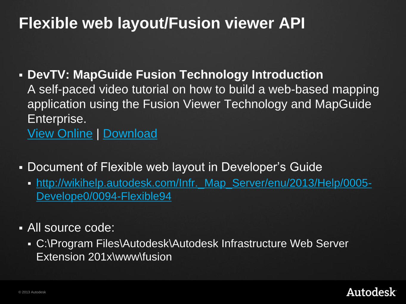
Flexible web layout/Fusion viewer API
DevTV: MapGuide Fusion Technology Introduction
A self-paced video tutorial on how to build a web-based mapping
application using the Fusion Viewer Technology and MapGuide
Enterprise.
View Online | Download
Document of Flexible web layout in Developer’s Guide
http://wikihelp.autodesk.com/Infr._Map_Server/enu/2013/Help/0005-
Develope0/0094-Flexible94
All source code:
C:\Program Files\Autodesk\Autodesk Infrastructure Web Server
Extension 201x\www\fusion
© 2013 Autodesk
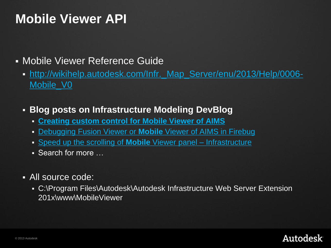
Mobile Viewer API
Mobile Viewer Reference Guide
http://wikihelp.autodesk.com/Infr._Map_Server/enu/2013/Help/0006-
Mobile_V0
Blog posts on Infrastructure Modeling DevBlog
Creating custom control for Mobile Viewer of AIMS
Debugging Fusion Viewer or Mobile Viewer of AIMS in Firebug
Speed up the scrolling of Mobile Viewer panel – Infrastructure
Search for more …
All source code:
C:\Program Files\Autodesk\Autodesk Infrastructure Web Server Extension
201x\www\MobileViewer

© 2013 Autodesk
Questions
Questions ?

© 2013 Autodesk
Exercise
Solution 2 – viewer API