Embed Size (px)
Citation preview
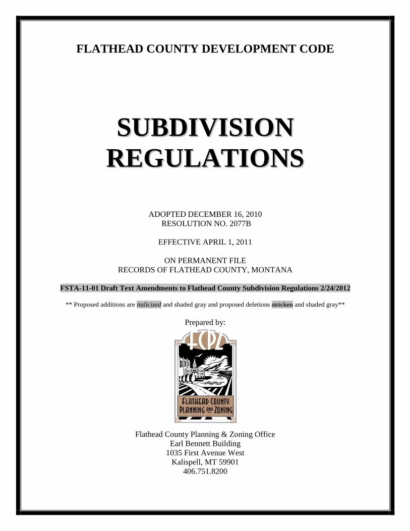
FLATHEAD COUNTY DEVELOPMENT CODE
SSUUBBDDIIVVIISSIIOONN
RREEGGUULLAATTIIOONNSS
ADOPTED DECEMBER 16, 2010
RESOLUTION NO. 2077B
EFFECTIVE APRIL 1, 2011
ON PERMANENT FILE
RECORDS OF FLATHEAD COUNTY, MONTANA
FSTA-11-01 Draft Text Amendments to Flathead County Subdivision Regulations 2/24/2012
** Proposed additions are italicized and shaded gray and proposed deletions stricken and shaded gray**
Prepared by:
Flathead County Planning & Zoning Office
Earl Bennett Building
1035 First Avenue West
Kalispell, MT 59901
406.751.8200
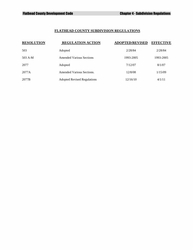
Flathead County Development Code Chapter 4 - Subdivision Regulations
FLATHEAD COUNTY SUBDIVISION REGULATIONS
RESOLUTION
REGULATION ACTION
ADOPTED/REVISED
EFFECTIVE
503
503 A-M
2077
2077A
2077B
Adopted
Amended Various Sections
Adopted
Amended Various Sections.
Adopted Revised Regulations
2/28/84
1993-2005
7/12/07
12/8/08
12/16/10
2/28/84
1993-2005
8/1/07
1/15/09
4/1/11
Flathead County Development Code Chapter 4 - Subdivision Regulations
TABLE OF CONTENTS
CHAPTER Page
4.0 GENERAL PROVISIONS
4.0.1 Purpose 1
4.0.2 Jurisdiction and Coordination 2
4.0.3 Applicable Regulations 2
4.0.4 Amendment of Subdivision Regulations 2
4.0.5 Violation and Penalties 2
4.0.6 Transfers of Title 2
4.0.7 Construction Timing 3
4.0.8 Permission to Enter 3
4.0.9 Appeals 3
4.0.10 Restrictive Covenants 3
4.0.11 Subdivision Variances 3
4.0.12 Subdivision Variance Procedure 4
4.0.13 Subdivision Variance Statement of Facts 4
4.0.14 Public Hearings and Notices – In General 4
4.0.15 Application Fees 5
4.0.16 Subdivision Improvements Agreement; Guaranty 5
4.0.17 Waiver Of The Right To Protest 5
4.0.18 Latecomers Agreement 6
4.1 APPLICATION AND REVIEW PROCESS
4.1.1 Subdivision Pre-application Process 7
4.1.2 Application and Preliminary Plat Submittal 7
4.1.3 Element and Sufficiency Reviews 7
4.1.4 Time Period for Approval, Conditional Approval, or Denial 9
4.1.5 Public Agency and Utility Review 9
4.1.6 Water and Sanitation-Special Rules 9
4.1.7 Subdivision Consideration and Evidence 10
4.1.8 Commission Decision 11
4.1.9 Subdivider’s Preference for Mitigation 11
4.1.10 Documentation of Decision 11
4.1.11 Preliminary Plat Terms of Approval 12
4.1.12 Changes to Approved Preliminary Plats before Final Plat Approval 12
4.1.13 Subdivision Application and Final Plat Submittal 14
4.1.14 Final Plat Review 14
4.1.15 Final Plat Approval 14
4.1.16 Final Plat Filing 15
4.1.17 Amending Filed Subdivision Plats 15
Flathead County Development Code Chapter 4 - Subdivision Regulations
4.2 FIRST MINOR SUBDIVISIONS Page
4.2.1 First Minor Subdivision Exceptions 16
4.2.2 First Minor Subdivision Amended Preliminary Plat Application 16
4.2.3 First Minor Subdivision Administrative Approval of Preliminary Plat 17
4.3 SUBSEQUENT MINOR SUBDIVISIONS
4.3.1 Subsequent Minor Subdivision Review Procedure 19
4.4 MAJOR SUBDIVISIONS
4.4.1 Major Subdivision Amended Preliminary Plat Application 20
4.4.2 Phased Major Subdivision Plat Submittals 21
4.4.3 Major Subdivision Public Hearing, Consideration
and Recommendation 22
4.4.4 Mid-Process Resubmitted Applications 23
4.4.5 Changes to Major Subdivision Preliminary Plat After Public Hearing 24
4.4.6 Major Subdivision Determination of New Information 25
4.4.7 Subsequent Public Hearing 25
4.5. SUBDIVISIONS CREATED BY LEASE OR RENT
4.5.1 General 26
4.5.2 Exemption from Survey and Filing Requirement 26
4.5.3 State Health Approval 26
4.5.4 Procedures 26
4.5.5 General Standards for Subdivisions Created by
Lease or Rent 27
4.5.6 Manufactured Home Park Standards 28
4.5.7 Recreational Vehicle Park and Campground Standards 29
4.6. CONDOMINIUMS
4.6.1 General Guidance for Condominiums 31
4.6.2 Condominium Development Standards 32
4.6.3 Condominium Exemption from Subdivision Regulations 32
4.6.4 Unit Ownership Act 32
4.7 SUBDIVISION DESIGN STANDARDS
4.7.1 Subdivision Design Standard Compliance 33
4.7.2 Conformance with Existing Regulations 33
4.7.3 Natural Environment 33
4.7.4 Lands Unsuitable for Subdivision 33
4.7.5 Site Design 33
4.7.6 Landscape Requirements 34
4.7.7 Lots 34
4.7.8 Payment for Extension of Public Improvements 36
4.7.9 Floodplain Provisions 36
Flathead County Development Code Chapter 4 - Subdivision Regulations
4.7.10 Wetlands Provisions 37
4.7.11 Stream Riparian Protection Requirements 37
4.7.12 Groundwater Provisions 41
4.7.13 Drainage Facilities 41
4.7.14 Dust Control and Air Pollution 42
4.7.15 Access 43
4.7.16 Road Design and Construction Standards 44
4.7.17 Roadway Improvements 45
4.7.18 Alleys 48
4.7.19 Walkways and Pedestrian/Bicycle Paths and Easements 48
4.7.20 Water Supply Systems 48
4.7.21 Sewage Treatment 49
4.7.22 Solid Waste 49
4.7.23 Utilities 50
4.7.24 Parkland Dedication 50
4.7.25 Weed Control 53
4.7.26 Fire Protection 54
4.7.27 Wildland Urban Interface 54
4.7.28 Mail Box Facilities 57
4.7.29 School Bus Stops 57
4.8 DIVISIONS OF LAND EXEMPT FROM SUBDIVISION REVIEW
4.8.1 Purpose 58
4.8.2 Procedure and General Requirements 59
4.8.3 Criteria for Review of Exemption 59
4.8.4 Definitions 63
DEFINITIONS (pgs. 64 -79)
APPENDICES
App A Subdivision Pre-application Process A1
App B Application and Preliminary Plat Supplements A3
App C Environmental Assessment A9
App D First Minor Subdivision Impact Criteria Report A21
App E Contents of Final Plat Application A25
App F Contents of Revised Preliminary Plat Application A31
App G Sample Forms A33
App H Subdivision Improvement Agreement A39
App I Sample Subdivision Roadway Latecomers Agreement A47
App J Sample Dust Control Plan A51
App K Sample Road User’s Agreement A53
App L Sample Wildland Urban Interface
Fire Prevention Control & Fuels Reduction Plan A55

Flathead County Development Code Chapter 4 - Subdivision Regulations
Flathead County Development Code Chapter 4 - Subdivision Regulations
Page 1
Flathead County Subdivision Regulations
4.0 General Provisions
4.0.1 Purpose
The purposes of these regulations are to promote the public health, safety, and general welfare by
regulating the subdivision of land; to prevent the overcrowding of land; to lessen congestion in
the streets and highways; to provide for adequate light, air, water supply, sewage disposal, parks
and recreation areas, ingress and egress, and other public requirements; to require development
in harmony with the natural environment; to minimize impacts to wildlife and to promote
preservation of wildlife habitat; to promote preservation of open space; to promote cluster
development approaches that minimize costs to local citizens and that promote effective and
efficient provision of public services; to protect the rights of property owners; and to require
transferring interests in real property by reference to a plat or certificate of survey (76-3-102,
MCA). These regulations are intended to comply with the MSPA, and are intended to promote:
a. the orderly development of the jurisdictional area;
b. the coordination of roads within subdivided land with other roads, both existing and
planned;
c. the dedication of land for roadways and for public utility easements;
d. the improvement of roads;
e. the provision of proper physical and legal access, including obtaining necessary
easements;
f. the provision of adequate open spaces for travel, light, air, and recreation;
g. the provision of adequate transportation, water, drainage, and sanitary facilities;
h. the avoidance or minimizing of congestion;
i. the avoidance of subdivisions which would involve unnecessary environmental
degradation;
j. the avoidance or minimizing of impacts to wildlife;
k. the avoidance or minimizing of impacts to wildlife habitat;
l. the avoidance of danger or injury by reason of natural hazard, including but not limited to
fire and wildland fire, the lack of water, drainage, access, transportation, or other public
improvements;
m. the avoidance of excessive expenditure of public funds for the supply of public
improvements and services;
Flathead County Development Code Chapter 4 - Subdivision Regulations
Page 2
n. the manner and form of making and filing of any preliminary plat for subdivided lands;
o. the administration of these regulations by defining the powers and duties of approving
authorities, including procedures for the review and approval of all plats of subdivisions
covered by these provisions; and
p. implementation in accordance with Flathead County Growth Policy and other local
community zoning districts under the jurisdiction of Flathead County.
4.0.2 Jurisdiction and Coordination
These Regulations govern the subdivision of land within the jurisdictional area of the Flathead
County Board of County Commissioners (Commission). The Commission may enter into land
use inter-local agreements with cities and other jurisdictional agencies to guide land use decision
making. If a proposed subdivision lies within one mile of a third class city or town or within two
miles of a second-class city or within three miles of a first class city, the Commission shall
submit the preliminary plat to the city or town governing body or its designated agent for review
and comment. If a proposed subdivision lies partly within an incorporated city or town, the
preliminary plat shall be submitted to, and approved by, both the city or town and the county
governing bodies.
4.0.3 Applicable Regulations
Subdivision review, including final plats, shall occur under those Regulations in effect at the
time a preliminary plat is deemed to contain sufficient information for review.
4.0.4 Amendment of Subdivision Regulations
Before the Commission amends these Regulations it will hold a public hearing on the proposed
amendment. Notice of the time and place of the public hearing must be published in a
newspaper of general circulation in the county not less than 15 days or more than 30 days before
the date of the hearing.
4.0.5 Violation and Penalties
Any person, firm, corporation, or other entity that violates any of the provisions of these
Regulations is guilty of a misdemeanor violation. Each sale, lease, or transfer, or offer of sale,
lease, or transfer of each separate parcel of land in violation of any provision of these
Regulations shall be deemed a separate and distinct offense. The foregoing is not deemed a
limitation on any other action for enforcement.
4.0.6 Transfers of Title
Pursuant to 76-3-302, MCA, a final subdivision plat must be filed of record with the Flathead
County Clerk and Recorder (Clerk and Recorder) before title to any lot created by the subdivided
land can be sold or transferred in any manner. Pursuant to 76-3-303 MCA, after the preliminary
plat of a subdivision has been approved or conditionally approved, the subdivider may enter into
contracts to sell lots in the proposed subdivision.
Flathead County Development Code Chapter 4 - Subdivision Regulations
Page 3
4.0.7 Construction Timing
The subdivider is discouraged from engaging in construction of improvements prior to approval
of the preliminary plat. On-site improvements shall not be considered in the decision to approve,
conditionally approve or deny the preliminary plat.. There shall be no site disturbance of any
area within 100 feet of a stream or riparian area prior to preliminary plat approval.
4.0.8 Permission to Enter
The Commission or its designated agent(s) may investigate, examine, and evaluate the site of the
proposed subdivision to verify information provided by the subdivider and to subsequently
monitor compliance with any conditions if the preliminary plat is approved conditionally. In the
event of a noticed, on-site public meeting, this consent applies to members of the public and
affected agencies attending a noticed public meeting for a site visit.
4.0.9 Appeals
A decision of the Commission regarding a proposed subdivision may be appealed to the district
court pursuant to 76-3-625, MCA. A party who is aggrieved by a decision of the Commission
may, within 30 days from the date of the written decision, appeal to the district court. The
petition must specify the grounds upon which the appeal is made.
4.0.10 Restrictive Covenants
No covenants shall be allowed to satisfy any preliminary subdivision plat conditions of approval
except for provisions of road maintenance, stream riparian protection buffers, Wildland Urban
Interface mitigations and no-build zone/building envelope provisions where applicable. The
Commissioners may require a separate section of a set of Covenants that addresses the applicable
item(s) and which would require the consent of the Commissioners to amend.
4.0.11 Subdivision Variances The subdivider may request a variance from design standards set forth in Section 4.7 of these
Regulations (Subdivision Design Standards) when, due to the characteristics of land proposed
for subdivision, strict compliance with these standards would result in undue hardship and would
not be essential to the public welfare. All variances associated with subsequent minor and major
subdivisions shall be specifically considered in a public hearing. A variance shall not be granted
if it would have the effect of nullifying the intent and purpose of these Regulations. The
Commission shall not approve a variance unless it finds that all of the following are met:
a. The variance will not be detrimental to the public health, safety, or general welfare or
injurious to other adjoining properties;
b. Due to the physical surroundings, shape, or topographical conditions of the property
involved, strict compliance with the regulations will impose an undue hardship on the
owner. Undue hardship does not include personal or financial hardship, or any hardship
that is self imposed;
c. The variance will not cause a substantial increase in public costs, now or in the future;
d. The variance will not place the subdivision in nonconformance with any adopted growth
policy, neighborhood plan or zoning regulations;
Flathead County Development Code Chapter 4 - Subdivision Regulations
Page 4
e. The variance is consistent with the surrounding community character of the area.
4.0.12 Subdivision Variance Procedure
The subdivider shall include with the preliminary plat application a written statement describing and
justifying any requested variance. If during the review period a need for a variance is identified, and
the variance has not been specifically requested, the application is insufficient and the review period
will be suspended until the issue is determined to be sufficiently addressed. For all variances
associated with subsequent minor and major subdivisions, the Flathead County Planning Board
(Planning Board) will consider the requested variances and recommend approval or denial to the
Commission. In granting variances, the Commission may impose reasonable conditions to secure
the objectives of these Regulations.
4.0.13 Subdivision Variance Statement of Facts
When a variance is granted by the Commission, the motion of approval of the proposed
subdivision must contain a statement describing the variance and the facts and conditions upon
which the issuance of the variance is based.
4.0.14 Public Hearings and Notices – In General
The Planning Board shall hold a public hearing on all land use applications when a hearing is
required by these Regulations. The Commission may refer a proposed preliminary major
subdivision back to the Planning Board for a subsequent public hearing if new information
becomes available that was not considered in the previous public hearing pursuant to 76-3-615,
MCA. In both cases the following procedure applies:
a. Notice of the times and dates of the hearings shall be given by publication in a newspaper
of general circulation in the county not less than 15 days prior to the date of the hearings;
b. At least 15 days prior to the date of the hearing, notice of the hearing shall be given by
certified mail to the each property owner of record whose property is within 150 feet
from the subject property. Where the proposed subdivision abuts a public right-of-way or
river less than 150 feet in width, the properties across such right-of-way or water course
shall be considered as adjacent;
c. The Planning and Zoning Office shall post notices at conspicuous places on the property
of the proposed land division;
d. Public hearing notices shall be posted on the Planning and Zoning website at least 15
days prior to the date of the hearing;
e. In order to allow sufficient time for reasonable comment, should new information or the
comment at a public hearing extend so long that the Planning Board determines that its
decision would be affected by the members’ fatigue, or should natural events occur which
preclude the completion of the public hearing or Planning Board deliberations, the
Planning Board, by majority vote of those present, may continue the hearing to the next
available meeting. This continued hearing is not a subsequent hearing, nor does it extend
the time limits stated in these Regulations without subdivider approval.
Flathead County Development Code Chapter 4 - Subdivision Regulations
Page 5
4.0.15 Application Fees
All application fees for preliminary and final applications and plats will be due at the time of the
subdivision application. The fee schedule and application deadlines will be reviewed annually by
the Planning Board and set by the Commission. All of the following apply:
a. No application fees will be refunded once an application has been deemed sufficient;
b. If an application is terminated prior to an application being deemed sufficient
the Planning and Zoning Office will refund one-half of the application fee;
c. Application submittal deadlines will be scheduled by the Planning and Zoning Office and
posted annually. All application submittals will be logged into the Planning and Zoning
Office as of the date of next scheduled deadline for review and processing.
4.0.16 Subdivision Improvements Agreement; Guaranty
Pursuant to 76-3-507 MCA the subdivider must have installed all required improvements or have
entered into a subdivision improvements agreement (Appendix H) guaranteeing the construction
and installation of all required improvements prior to final plat approval. At least 65% of the
total improvement cost must be expended by the developer on subdivision improvements
required as conditions of plat approval before the developer may enter into a subdivision
improvements agreement with the county. The 65% requirement would apply only to
preliminary plats approved after adoption of these regulations. The Commission may also require
specific types of improvements necessary to protect public health and safety to be completed
prior to the governing body allowing a Subdivision Improvement Agreement. The Commission
shall not approve a subdivision improvement agreement until all Department of Environmental
Quality and other state agency approvals have been obtained.
a. The subdivision improvement agreement must be complete and submitted with the
application for final plat;
b. The term of the Subdivision Improvement Agreement is no more than
eighteen (18) months following final plat approval;
c. The subdivider may request a one year extension to the subdivision improvement
agreement. The Commission shall require a new “estimated construction cost” and surety
to reflect 125 percent of the estimated construction cost, prior to extension approval.
4.0.17 Waiver Of The Right To Protest
Pursuant to 76-3-608[7]MCA, the governing body may require as a condition of preliminary plat
approval that a property owner waive the right to protest the creation of a special improvement
district or rural improvement district for capital improvement projects that identify the specific
capital improvements for which protest is being waived. A waiver of the right to protest may not be
valid for a time period longer than 20 years after the date that the final subdivision plat is filed with
the Flathead County Clerk and Recorder.

Flathead County Development Code Chapter 4 - Subdivision Regulations
Page 6
4.0.18 Latecomers Agreement For improvements that a subdivider constructs beyond those directly attributable to the
subdivision, the subdivider may request a Latecomers Agreement (Appendix I). The agreement
would put into place a mechanism to reimburse a portion of the capital construction costs the
subdivider incurs which are not directly attributable to impacts caused from the subdivision.
Payback funds would be exacted from future subdividers who directly benefit from the fronted
capital improvements.
Flathead County Development Code Chapter 4 - Subdivision Regulations
Page 7
4.1 Application and Review Process
4.1.1 Subdivision Pre-application Process
A preliminary meeting to explain the subdivision application and review process is required.
Prior to submittal of a subdivision application, the subdivider shall request a pre-application
meeting with the Planning and Zoning Office (authorized agent) by submitting a Pre-application
Request Form and attachments. The Planning and Zoning Office and subdivider shall follow the
pre-application process identified in Appendix A (Subdivision Pre-application Process).The
Planning and Zoning Office shall notify the subdivider within five working days of the meeting
date and time. The pre-application meeting shall occur within 30 days after the request is
submitted. Condominium developments shall be reviewed and processed pursuant to Section 4.6.
4.1.2 Application and Preliminary Plat Submittal
The subdivider shall submit to the Planning and Zoning Office a subdivision application
containing all of the following materials:
a. For first minor subdivisions with five or fewer lots, a completed original copy of a First
Minor Subdivision Preliminary Plat Application Form and information required in
Appendix B (Application and Preliminary Plat Supplements) and the required fee;
b. For subsequent minor subdivisions and subdivisions with more than five lots, a
completed original copy of either a Major Subdivision Preliminary Plat Application Form
and information required in Appendix B (Application and Preliminary Plat Supplements)
and the required fee;
c. Such additional relevant and reasonable information as may be required to adequately
assess whether the proposed first minor subdivision complies with these Regulations and
the Montana Subdivision and Platting Act.
d. The Planning and Zoning office shall have the discretion to waive one or more of the
items listed in Appendix B (Application and Preliminary Plat Supplements) depending on
conditions unique to the subdivision, so long as the item(s) is not required by state law.
When the Planning and Zoning office waives one or more item, the subdivider shall
include a statement along with the preliminary plat application identifying why the
item(s) was not required in order to document this action.
4.1.3 Element and Sufficiency Reviews
The Planning and Zoning Office shall complete the element and sufficiency review following the
procedures below:
a. Element Review: Within five working days of receipt of a subdivision application, the
Planning and Zoning Office shall determine whether the application contains all of the
materials required by Appendix B and shall notify the subdivider in writing of the
determination within five working days whether:
i. The application contains all the information needed to conduct a sufficiency
review;
Flathead County Development Code Chapter 4 - Subdivision Regulations
Page 8
ii. If elements are missing from the application, the Planning and Zoning Office shall
identify those elements in the notification and no further action shall be taken on
the application until the missing elements are submitted;
iii. Information submitted subsequent to a letter of incompleteness shall be evaluated,
and a letter of determination made within five working days.
iv. If the missing elements are not corrected and submitted to the Planning and
Zoning Office within 60 days following the deficiency letter date, the Planning
and Zoning Office will terminate the application and file.
b. Sufficiency Review: Within 15 working days of the date of element completeness the
Planning and Zoning Office shall determine whether the subdivision application and
elements contain detailed, supporting information required for review and shall notify the
subdivider whether:
i. The application information is sufficient to continue review and processing;
ii. The information is not sufficient to allow for review. The Planning and Zoning
Office shall identify the insufficient information in its notification and no further
action shall be taken on the application until all material is resubmitted and
determined to be sufficient;
iii. The subdivider shall correct the sufficiency deficiencies within six months from
the date of the original application submittal date. If the subdivider corrects the
deficiencies the Planning and Zoning Office shall have 15 working days to notify
the subdivider whether the additional materials are sufficient for review and
processing;
iv. If the sufficiency deficiencies are not corrected within six months following the
date of the insufficiency letter the Planning and Zoning Office shall terminate the
application and file;
v. If an applicant submits additional information after the application was
determined to contain sufficient information, the review period shall be extended
an additional 15 working days to allow for a determination that the additional
information is sufficient for continued review and processing;
vi. A determination that an application contains sufficient information for review
does not ensure that the proposed subdivision will be approved or conditionally
approved by the Commission and does not limit the ability of the Planning and
Zoning Office or the Commission to request additional information during the
review process.
Flathead County Development Code Chapter 4 - Subdivision Regulations
Page 9
4.1.4 Time Period for Approval, Conditional Approval, or Denial
The review period begins once the Planning and Zoning Office has given notice to the subdivider
that the subdivision application is sufficient for review. Notification constitutes the date when the
Planning and Zoning Office has sent the notice to the subdivider.
a. Following the determination of sufficiency the Commission shall approve, conditionally
approve, or deny the proposed subdivision within the following timeframes:
i. Within 35 working days for a first minor subdivision;
ii. Within 60 working days for a subsequent minor subdivision, unless the subdivider
and the planning director agree to an extension or suspension of the review
period, not to exceed one year;
iii. Within 60 working days for a major subdivision with less than fifty (50) lots,
unless the subdivider and the planning director agree to an extension or
suspension of the review period, not to exceed one year;
iv. Within 80 working days for a major subdivision with fifty (50) or more lots,
unless the subdivider and the planning director agree to an extension or
suspension of the review period, not to exceed one year;
b. If, during the application review, the preliminary plat or supporting information is found
to be in non-compliance with these Regulations the application will be considered
insufficient. Within 15 working days the Planning and Zoning Office will notify the
subdivider that the application has become insufficient. The original review period (either
35 working days for a first minor subdivision, or 60 working days for a major
subdivision, or 80 working days for a major subdivision with 50 or more lots) shall be
suspended and resume at the time the deficiency is corrected and found to be sufficient;
4.1.5 Public Agency and Utility Review
Review and comment by public agencies or utilities shall not delay the Commission’s action on
the subdivision application beyond the review period. The Commission shall make these
comments available to the subdivider and to the general public upon request.
4.1.6 Water and Sanitation-Special Rules
The Commission shall approve, conditionally approve or deny a subdivision application based
on the water and sanitation information or public comment only if the action is based on existing
subdivision, zoning or other regulations that the Commission has the authority to enforce,
including:
a. For a proposed subdivision that will create one or more lots containing less than 20 acres,
the Commission shall require approval by the Montana Department of Environmental
Quality as a condition of approval for the final plat;
b. The Commission shall collect public comments submitted regarding water and sanitation
information and shall make any comments or a summary of the comments submitted
Flathead County Development Code Chapter 4 - Subdivision Regulations
Page 10
available to the subdivider within 30 days after conditional approval or approval of the
subdivision application and preliminary plat. It is recommended that public comment
related to sewer and water be submitted in writing at least five days prior to the public
hearing or meeting;
c. The subdivider shall, as part of the application for sanitation approval, forward the
comments or the summary provided by the Commission to the:
i. Reviewing authority provided in Title 76, Chapter 4, MCA, for subdivisions that
will create one or more lots containing less than 20 acres;
ii. Flathead City-County Health Department for proposed subdivisions that will
create one or more lots containing 20 acres or more and less than 160 acres.
4.1.7 Subdivision Consideration and Evidence
The Commission shall not approve a subdivision application unless the proposed subdivision
complies with all of the following:
a. Assures easements for the location and installation of any planned utilities, roadways,
pedestrian and bike trails, or other easements required by the Commission shall be shown
on the final plat;
b. Conforms to all applicable design standards set forth in Section 4.7 (Subdivision Design
Standards) and other provisions of these Regulations, unless the subdivider secures a
variance pursuant to Section 4.0.11;
c. Assures legal and physical access to each lot within the subdivision and the notation of
that access on the applicable plat and any instrument transferring the lot;
d. Assures that all required public improvements shall be installed before final plat
approval, or that their installation after final plat approval shall be guaranteed with a
subdivision improvement agreement;
e. Regarding the disclosure and disposition of surface water rights, if the proposed first
minor subdivision will create lots averaging fewer than five acres in size, the subdivider
shall either:
i. Reserve all or a portion of the appropriated water rights owned by the owner of
the land to be subdivided and transfer the water rights to a single entity for use by
landowners within the subdivision who have a legal right to the water;
ii. Establish a landowner’s water use agreement administered through a single entity
that specifies administration and the rights and responsibilities of landowners
within the subdivision who have a legal right and access to the water, if the land
to be subdivided is subject to a contract or interest in a public or private entity
formed to provide the use of a water right on the subdivision lots;
Flathead County Development Code Chapter 4 - Subdivision Regulations
Page 11
iii. Reserve and sever all surface water rights from the land.
f. Complies with zoning and other applicable regulations authorized by law.
4.1.8 Commission Decision
In making its decision to approve, conditionally approve, or deny a subdivision application the
Commission shall consider any of the following, as applicable:
a. The subdivision application, supporting information, and preliminary plat. A decision to
deny cannot be made solely on impacts to educational services;
b. These Regulations, including but not limited to, the design standards set forth in Section
4.7 (Subdivision Design Standards);
c. Applicable zoning and other regulations;
d. An officially adopted growth policy or neighborhood plan;
e. The environmental assessment (Appendix C) if a major subdivision application or
statements of probable impacts (Appendix D) if a first minor subdivision;
f. Agency and public hearing(s) comments pursuant to Section 4.4.4(c);
g. Planning Board recommendations and Findings of Fact;
h. Neighborhood and land use advisory committee recommendations;
i. Planning staff report, and its recommendation for approval or denial;
j. Any additional information that is allowed by statute or these Regulations pertaining to
the proposed major subdivision.
4.1.9 Subdivider’s Preference for Mitigation Before or at the meeting at which the Commission is to consider the subdivision application and
preliminary plat, the subdivider may submit in writing or verbally to the Planning and Zoning
Office comments on and responses to the findings and recommendations. This document shall
include the subdivider’s alternative proposals, if any, for mitigating the impacts identified in the
recommendations. The Commission shall consult with the subdivider and shall give due weight
and consideration to the subdivider’s expressed preferences.
4.1.10 Documentation of Decision
The Commission shall issue written Findings of Fact that discuss and weigh the proposed
subdivision’s impacts identified pursuant to Section 4.1.8. Within 30 working days following a
decision to approve, conditionally approve, or deny a subdivision the Commission shall send the
subdivider a letter with the appropriate signature, and make the letter available to the public. The
letter shall:
Flathead County Development Code Chapter 4 - Subdivision Regulations
Page 12
a. Contain information regarding the appeal process for the denial or imposition of
conditions;
b. Identify the regulations and statutes used to reach the decision to approve, deny, or
impose conditions and explain how they apply to the decision;
c. Provide the facts and conclusions the Commission relied on to make its decision and
reference documents, testimony, or other materials that form the basis of the decision;
d. Provide the conditions that apply to the preliminary plat approval that must be satisfied
before the final plat may be approved.
4.1.11 Preliminary Plat Terms of Approval
The term of the approval or conditional approval of a subdivision application is to be a period of
three calendar years beginning at the date of approval or conditional approval.
a. The Commission may, at the request of the subdivider, extend its approval for a period of
one year mutually agreed-upon period of time, and such an extension must be in writing
and dated and signed by the members of the Commission and the subdivider or
subdivider’s agent. The Commission may issue more than one extension. The subdivider
must give written notice to the Planning and Zoning Office requesting an extension at
least 30 working days prior to the end of the three-year period. The planning director has
discretion to waive the minimum 30 working day requirement;
b. After the application and preliminary plat are approved, the Commission shall not impose
any additional conditions for final plat approval without the consent of the applicant;
c. The Commission may withdraw approval of an application and preliminary plat if it
determines that information provided by the subdivider, and upon which was material to
the approval or conditional approval, is inaccurate;
d. If the final plat is not filed within the three year time frame or granted a one year
extension, the preliminary plat expires and is subject to a new application. The
determination made under the expired preliminary plat approval shall not be binding on a
subsequent application.
4.1.12 Changes to Approved Preliminary Plats Before Final Plat Approval
If the subdivider proposes to materially change the preliminary plat after the preliminary plat
approval but before the final plat approval, the subdivider shall submit the proposed changes, all
supporting documents and required fee to the Planning and Zoning Office for review. All
material changes will be reviewed pursuant to these regulations, as applicable.
a. The following changes, although not an exhaustive list, may be considered material:
i. Configuration that would affect access to proposed lots or increases the number of
lots;
Flathead County Development Code Chapter 4 - Subdivision Regulations
Page 13
ii. Road layout that would alter the recommended conditions of approval or place the
subdivision out of compliance with these regulations;
iii. Water and/or septic proposals;
iv. Configuration of park land, open spaces or natural areas;
v. Easement provisions that would affect access or lot development;
vi. Designated primary or secondary emergency access to the subdivision; or
vii. Proposed changes to conditions of approval;
b. Within 30 working days of receiving the proposed changes, the Planning and Zoning
Office shall review the changes to determine whether they would cause the preliminary
plat to become out of compliance with the applicable zoning, subdivision regulations,
growth policy or would be likely to have a negative impact on any of the primary review
criteria specified in 76-3-608, MCA, or if the changes are material. If at any time within
the review period the Planning and Zoning Office determines the materials submitted are
not adequate for review, the subdivider shall be notified and the review period is
suspended until the requested information is obtained.
i. If the Planning and Zoning Office determines the changes are not material, the
subdivider shall be notified in writing that the proposed changes have been accepted.
ii. If the Planning and Zoning Office determines the changes are material, the subdivider
shall be notified in writing of what information and additional fees will be necessary
to review the modifications. When the subdivider has submitted the required
information and fees, the Planning and Zoning Office shall conduct element and
sufficiency reviews as described in Section 4.1.3. When the information is determined
to be sufficient for review, a 35-working day review period shall begin. During this
period the Planning and Zoning Office shall prepare a report detailing the proposed
changes and making a recommendation based on compliance with the subdivision
regulations, growth policy, zoning regulations, and other adopted documents. As
applicable, the Planning Board shall hold a properly noticed public hearing.
c. After considering the evaluation and recommendations of the Planning and Zoning Office
and/or Planning Board based on the above criteria, the Board of Commissioners may
approve, approve with conditions or deny the requested changes. The Board of
Commissioners may only impose conditions if such conditions mitigate potential
negative impacts of the requested changes under the review criteria.
d. A subdivider whose proposed changes to the preliminary plat have been deemed material
by the Planning and Zoning Office may appeal the Planning and Zoning Office's decision
to the governing body by written notice within 10 working days. The subdivider may
request a meeting with the Board of Commissioners, and may submit additional evidence
to show that the changes to the preliminary plat are not material.
Flathead County Development Code Chapter 4 - Subdivision Regulations
Page 14
e. If the subdivider and Planning and Zoning Office determine that a condition of approval
is illegal or impossible to comply with due to circumstances outside the subdivider’s
control, economic hardship notwithstanding, the condition may be reviewed by the
governing body through a properly noticed public meeting in order to determine if the
condition may be waived or amended.
4.1.13 Subdivision Application and Final Plat Submittal
The subdivision final plat submitted for approval must substantially conform to the preliminary
plat as previously approved by the Commission or the Flathead County Planning Director for an
Administrative Approval of Preliminary Plat (per Section 4.2.3) and must incorporate all
required modifications and comply with all conditions imposed at the time of preliminary plat
approval.
a. The subdivision final plat, application and all supplementary documents must be
submitted to the Planning and Zoning Office at least 45 working days prior to the
expiration of preliminary plat approval, or an approved extension of time. Final plat
certificates shall be consistent with samples included in Appendix E (Contents of Final
Plat) and Appendix G (Sample Forms). The planning director has the discretion to waive
the 45 working days time period.
b. The subdivision final plat including all supplementary documents shall be submitted with
the following:
i. A complete final plat application and fee;
ii. The final plat and accompanying documents must comply with the Montana
Uniform Standards for Final Subdivision Plats and Appendix E (Contents of Final
Plat Application) and Appendix G (Sample Forms);
iii. A written explanation of how each of the conditions of the preliminary plat
approval has been satisfied;
4.1.14 Final Plat Review
The Planning and Zoning Office shall review the subdivision final plat to confirm that all
conditions and requirements for final plat approval have been met. The Planning and Zoning
Office shall not accept, begin processing, or schedule any actions on a major subdivision final
plat submittal until a complete application and fee have been received:
a. Final subdivision plats shall be reviewed for errors and omissions in calculation or
drafting by an examining land surveyor before recording with the Clerk and Recorder.
The examining surveyor shall certify the compliance in a printed or stamped certificate
on the plat or certificate of survey. The certificate must be signed by the surveyor;
b. Insignificant and nonmaterial changes which have a minimal impact on the scale or scope
of the project or neighborhood shall be noted in the report to the Commission.
Flathead County Development Code Chapter 4 - Subdivision Regulations
Page 15
4.1.15 Final Plat Approval
The Commission shall examine the final subdivision final plat and, within 45 working days of its
submission to the Planning and Zoning Office, approve it if it conforms to the conditions of
preliminary plat approval and is within scheduled deadlines of approval:
a. If the final subdivision plat is approved, the Commission shall certify its approval on the
face of the final plat. When applicable, a certificate of the Commission expressly
accepting any dedicated land, easements, or improvements shall be filed with the final
plat;
b. If the subdivision final plat is denied, the Commission shall write a letter stating the
reason for denial and forward a copy to the subdivider. The Commission shall return the
final plat to the subdivider within 10 working days of the action. The subdivider may then
make any necessary corrections and resubmit the major subdivision final plat for
approval.
c. If the final plat differs substantially from the approved preliminary plat, the Commission
shall return the final plat to the Planning and Zoning Office for additional review or deny
the plat based on inconsistency with the preliminary plat.
4.1.16 Final Plat Filing
The Clerk and Recorder may file an approved subdivision final plat only if it is accompanied by
Commission certification and the documents specified in the Montana Uniform Standards for
Monumentation, Certificates of Survey, and Final Subdivision Plats:
a. The approved subdivision final plat shall not be altered in any manner, except as
provided in Section 4.1.17 and the Montana Subdivision and Platting Act;
b. The Clerk and Recorder shall not accept and file an approved final plat if it is not
accompanied by the Commission’s certification and the documents specified in the
Montana Uniform Standards for Monumentation, Certificates of Survey, and Final
Subdivision Plats;
c. The subdivision final plat must be filed with the Clerk and Recorder within 180 working
days of Commission approval and not altered in any way.
4.1.17 Amending Filed Subdivision Plats
Changes that add lots or that may alter the original conditions of approval of a filed subdivision
plat are subject to Section 4.2 if a first minor or Section 4.4 if a major subdivision. The
Commission shall not approve an amendment that will create a non-conforming lot according to
the design standards contained in Section 4.7 (Subdivision Design Standards) and these
Regulations.
Flathead County Development Code Chapter 4 - Subdivision Regulations
Page 16
4.2 First Minor Subdivisions
If the division of land results in a cumulative total of five or less lots from the original tract of
record as it existed on July 1, 1973, the division of land shall be reviewed and processed as a first
minor subdivision.
4.2.1 First Minor Subdivision Exceptions:
All of the following do not apply to first minor subdivisions:
a. Preparation of an environmental assessment;
b. Public hearing requirements.
4.2.2 First Minor Subdivision Amended Preliminary Plat Application
If the subdivider changes the first minor subdivision application or preliminary plat before the
Commission makes its decision regarding the preliminary plat, the subdivider shall submit the
amended application or amended preliminary plat to the Planning and Zoning Office for review:
a. Within 15 working days of receiving the amended application or preliminary plat, the
planning director shall determine whether the changes to the subdivision application or
preliminary plat are material and would create additional impacts which the application
does not address;
b. The 35 working day review period is suspended while the planning director and
Commission consider the amended application or preliminary plat;
i If the planning director determines the changes are not material, the 35 working
day review period resumes when the Planning and Zoning Office sends notice of
the decision to the subdivider;
ii. If the planning director determines the changes are material, the subdivider may
schedule a new pre-application meeting and submit a new application and fifty
percent of the original fees. The original application fee shall not be refunded or
transferred to the new application.
c. The following changes, although not an exhaustive list may be considered material:
i. Configuration that would affect access to proposed lots or increases the number of
lots;
ii. Road layout that would alter the recommended conditions of approval or place the
subdivision out of compliance with these Regulations;
iii. Water and/or septic proposals;
iv. Configuration of park land, open spaces or natural areas;
v. Easement provisions that would affect access or lot development;
Flathead County Development Code Chapter 4 - Subdivision Regulations
Page 17
vi. Designated primary or secondary emergency access to the subdivision.
d. Any subdivider may appeal the decision of the planning director to the Commission. If
appealed, the subdivider shall request a hearing, and may submit additional evidence to
show that the changes to the preliminary plat are not material:
i. If the Commission concludes that the changes to the subdivision application are
material, the subdivider shall be required to submit a new subdivision application
and preliminary plat;
ii. If the Commission concludes that the evidence and information demonstrate the
changes to the subdivision application are not material, the 35 working day
review period resumes as of the date of the decision.
4.2.3 First Minor Subdivision Administrative Approval of Preliminary Plat
Based on information provided at the Pre-Application meeting Pursuant to 76-3-609(2)(f) MCA,
the applicant may request an expedited review of a First Minor Subdivision via Administrative
Approval of the Preliminary Plat per 76-3-609(2)(f). Administrative Approval of the Preliminary
Plat may be granted only when review of the proposed subdivision identifies no adverse impacts
to the review criteria outlined in 76-3-608(3) MCA which would require mitigation through
conditions of approval.
a. The applicant must request the Administrative Action Approval in writing and provide
maps a Preliminary Plat accompanied by a completed First Minor Subdivision Impact
Criteria Report (Appendix D) and materials required by Appendix B, as applicable,
documentation to address the criteria below. Upon receipt of the written request for
administrative approval, the Flathead County Planning Director or designee shall
complete the element and sufficiency review pursuant to Section 4.1.3 and either grant
approval or deny the request within 10 working days from the date the application was
determined to be sufficient. The Flathead County Planning Director or designee may
grant Administrative Approval of the First Minor Subdivision preliminary plat, subject to
conditions, if the following criteria are satisfied:
1. The First Minor Subdivision contains three (3) or fewer parcels.
2. The property has been zoned in accordance with MCA 76-2 (Part 2)
3. The proposed First Minor Subdivision complies with the Flathead County
Subdivision Regulations and the Flathead County Zoning Regulations.
4. No subdivision variance is needed in order to comply with the Flathead County
Subdivision Regulations and the Flathead County Zoning Regulations. No
subdivision variance requests can be may be requested or approved through this
Administrative Approval of Preliminary Plat process.
5. Parkland dedication, if required, shall be cash-in-lieu of land dedication.
Flathead County Development Code Chapter 4 - Subdivision Regulations
Page 18
6. All lots have suitable access from existing public or private right-of-way/easement
conforming to Flathead County Subdivision Regulations. If access is provided by an
existing private road easement, the applicant shall provide proof said easement.
7. Each lot shall have a building site and driveway location compliant with the
provisions outlined in Section 4.7.7.
8. There are no environmental hazards as identified in Section 4.7.4 present onsite
which constitute land unsuitable for subdivision, and which would require mitigation
through conditions of preliminary plat approval. pursuant to Section 4.7.4.
Topographic surveys are only required if the average cross slope of the developable
portion of the property (house, garage, and driveway) exceed 25%.
9. Each lot can support on-site sewer and water services or can be served by public
sewer and water. (For on-site sewer and water facilities, the applicant shall provide
the water and sanitation information as described in 76-3-622)
10. No significant effects are anticipated on agriculture, agricultural user facilities, local
services, natural environment, wildlife, wildlife habitat, and public health and safety
(Must address all in the written request).
b. With a written Administrative Preliminary Plat Approval, the applicant may proceed to
final plat following the procedures outlined in Sections 4.1.13 – 4.1.16 of these
Regulations (4.1.13 – 4.1.16). except that tThe Planning and Zoning Office Flathead
County Planning Director or designee shall also prepare findings of fact recommending
regarding the basis of the administrative approval of the preliminary plat and
compliance of the final plat with the Flathead County Subdivision Regulations
subdivision concurrent with as a component of the Final Plat Review and
recommendation to the Commission.
c. When the Flathead County Planning Director or designee has granted an Administrative
Approval of the First Minor Subdivision, the Commission shall adopt findings of fact for
approval based on the criteria above and concurrent with the final plat.

Flathead County Development Code Chapter 4 - Subdivision Regulations
Page 19
4.3 Subsequent Minor Subdivisions
4.3.1 Subsequent Minor Subdivision Review Procedure
A proposed subsequent minor subdivision application and preliminary plat shall be reviewed as a
major subdivision if the division of land results in a cumulative total of more than five lots from
the original tract of record as it existed on July 1, 1973
Flathead County Development Code Chapter 4 - Subdivision Regulations
Page 20
4.4 Major Subdivisions
A proposed subdivision application and preliminary plat shall be reviewed as a major
subdivision if the subject property is the sixth or greater lot resulting from division of the original
tract of record as it existed on July 1, 1973 or if the proposed division of land results in a
cumulative total of more than five lots from the original tract of record as it existed on July 1,
1973.
4.4.1 Major Subdivision Amended Preliminary Plat Application
If the subdivider changes the major subdivision application or preliminary plat after the Planning
and Zoning Office deems the application sufficient pursuant to Section 4.1.3, but before the
Planning Board public hearing, the subdivider shall submit the amended application to the
Planning and Zoning Office for review:
a. Within 15 working days of receiving the amended application or preliminary plat, the
planning director shall determine whether the changes to the subdivision application or
preliminary plat are material. The review period is suspended while the planning director
considers if the changes to the major subdivision application or preliminary plat are
material and would create additional impacts which the application does not address:
i. If the planning director determines the changes are not material, the review period
resumes when the Planning and Zoning Office sends notice of the decision to the
subdivider;
ii. If the planning director determines the changes are material, the subdivider may
schedule a new pre-application meeting and submit a new application and fifty
percent of the original fees. The original application fees shall not be refunded or
transferred to the new application.
b. The following changes, although not exhaustive, may be considered material:
i. Configuration that would affect access to proposed lots or increases the number of
lots;
ii. Road layout that would alter the recommended conditions of approval or place the
subdivision out of compliance with these Regulations;
iii. Water and/or septic proposals;
iv. Configuration of park land, open spaces or natural areas;
v. Easement provisions that would affect access or lot development;
vi. Designated primary or secondary emergency access to the subdivision.
c. Any subdivider whose major subdivision application or preliminary plat has been deemed
materially changed by the planning director may appeal the decision to the Commission.
If appealed, the subdivider shall request a hearing, and may submit additional evidence to
Flathead County Development Code Chapter 4 - Subdivision Regulations
Page 21
show that the changes to the preliminary plat are not material. The Commission may or
may not agree to hear the appeal:
i. If the Commission concludes the changes to the major subdivision application or
preliminary plat are material, the subdivider shall be required to resubmit the
subdivision application and preliminary plat and fifty percent of the original fees;
ii. If the Commission concludes that the changes to the subdivision application or
preliminary plat are not material, the review period resumes as of the date of the
decision.
4.4.2 Phased Major Subdivision Plat Submittals
The subdivider, as part of the preliminary plat application, may propose to phase a proposed
major subdivision over time. Phasing must be identified at preliminary plat application submittal.
Phasing must be approved at the time of preliminary plat approval:
a. Each phase must be filed sequentially, according to the phasing plan, and be fully capable
of functioning with all the required improvements in place in the event the future phases
are not completed or completed at a much later time;
b. A phasing plan must be submitted and must include all of the following:
i. A plat delineating each phase and a general time frame for each phase;
ii. A public facilities improvement plan showing which improvements will be
completed with each phase.
c. The Commission may require that parkland requirements, as part of the preliminary plat
approval pursuant to Section 4.7.24, for the entire subdivision be met prior to approval of
the first phase final subdivision plat. Parkland dedication for each phase shall not be
deferred until a later phase;
d. The preliminary plat of a phased subdivision shall have the following time limits:
i. The first phase final subdivision plat must be approved and filed within three
years of preliminary phased plat approval unless the preliminary plat approval
has been granted an extension pursuant to Section 4.1.11(a). On final plat
approval of the first phase, final plats for each successive phase must be filed
within three years of the previous final plat approval. Failure to meet this time
frame will cause the remainder of the preliminary plat to become void, and no
additional final phased plats shall be accepted;
ii. A one year Pursuant to Section 4.1.11(a) an extension of preliminary plat
approval for any phase may be requested by the subdivider;
iii. The subdivider shall include a revised time frame for all remaining phases with a
request for any phased preliminary plat extension.
Flathead County Development Code Chapter 4 - Subdivision Regulations
Page 22
e. Modifications to an approved phasing plan which do not materially change the impacts
on adjoining property may be approved or denied by the planning director. Changes
which materially change impacts to adjacent property owners shall be approved or denied
by the Commission;
f. If a major subdivision is part of an approved planned unit development which contains a
specific phasing plan complete with time lines, such phasing plan shall be binding, unless
an amendment to the phasing plan is approved by the Commission.
4.4.3 Major Subdivision Public Hearing, Consideration and Recommendation
After the major subdivision application is deemed to have all the required elements containing
detailed, supporting information that is sufficient to allow for review and public comment, the
Planning Board shall schedule and hold a public hearing on the subdivision application pursuant
to Section 4.0.14:
a. The Planning Board shall base its recommendation to approve, conditionally approve, or
deny the major subdivision application and preliminary plat based on the following if
applicable:
i. The subdivision application, supporting information, and preliminary plat. A
decision to deny cannot be made solely on impacts to educational services;
ii. These Regulations, including but not limited to, the design standards set forth in
Section 4.7 (Subdivision Design Standards);
iii. Applicable zoning and other regulations;
iv. An officially adopted growth policy or neighborhood plan;
v. The environmental assessment (Appendix C);
vi. Agency and public hearing(s) comments;
vi. Neighborhood and land use advisory committee recommendations;
vii. Planning staff report and its recommendation for approval or denial;
viii. Any additional information that is allowed by statute or these Regulations
pertaining to the proposed major subdivision.
b. The Planning Board shall not recommend approval of a preliminary major subdivision
plat that will place a lot in non-compliance with these Regulations unless the subdivider
secures a subdivision variance pursuant to Section 4.0.11;
c. Within 10 working days after the public hearing, the Planning Board or designee shall
submit the following in writing to the subdivider and to the Commission:
Flathead County Development Code Chapter 4 - Subdivision Regulations
Page 23
i. All public and agency comments;
ii. Findings of Fact that discuss and weigh the subdivision’s compliance with these
regulations and its impact to the physical, biological and human environment;
iii. A recommendation for approval, conditional approval (including any
recommended conditions and/or mitigation measures), or denial of the subdivision
application and preliminary plat.
d. The Planning Board or Planning and Zoning Office shall collect public comment given
regarding the water and sanitation information and forward all comments regarding water
and sanitation to the Commission and to the agencies responsible for reviewing the
application for water and sanitation. It is recommended that public comment related to
sewer and water be submitted in writing at least five working days prior to the public
hearing.
4.4.4 Mid-Process Resubmitted Applications
The subdivider may, following the Planning Board’s public hearing, request revisions to the
application and preliminary plat. Mid-process resubmitted applications will be based on feedback
and recommendations from the Planning Board, the public and other agencies, and Planning and
Zoning Office:
a. Within five working days following the Planning Board public hearing the subdivider
shall notify the Planning and Zoning Office in writing with a request to submit a revised
application and preliminary plat. The letter must include a waiver to the statutory
timeframe until the revised application is resubmitted and a second hearing public
hearing is held by the Planning Board;
b. If no written request to resubmit the application and preliminary plat is received by the
Planning and Zoning Office within five working days, the application will continue to be
processed and forwarded to the Commission for final action;
c. Within 90 working days following receipt of the letter to request a mid-process
correction, the subdivider will provide the Planning and Zoning Office a revised
application and preliminary plat. The application fee shall be 50 percent of the original
fee plus mailing costs to adjacent property owners for public notice. The original
application will terminate after 90 days if the subdivider does not submit a revised
application and preliminary plat;
d. The revised application will be scheduled for the next available Planning Board public
meeting where a new public hearing will be held;
e. The public hearing shall be conducted pursuant to Subsection 4.0.14 and all adjacent
property owners will be re-noticed;
Flathead County Development Code Chapter 4 - Subdivision Regulations
Page 24
f. The original review period shall resume starting five working days after the second
public hearing date and action by the Planning Board.
4.4.5 Changes to Major Subdivision Preliminary Plat After Public Hearing
If the subdivider does not request a mid-process correction pursuant to Section 4.4.4, and makes
changes to the major subdivision plat or application following the Planning Board’s public
hearing but before the date when the Commission considers the application and plat, the
subdivider shall submit an amended application or preliminary plat to the Planning and Zoning
Office for review. The review period shall be suspended until a determination is made regarding
whether the changes to the proposed major subdivision plat are material:
a. Within 15 working days of receiving the amended application or preliminary plat, the
planning director shall determine if the changes to the subdivision application or
preliminary plat are material:
i. If the planning director determines that the changes are not material, the review
period resumes when the Planning and Zoning Office sends notice of the decision
to the subdivider;
ii. If the planning director determines the changes are material, the subdivider may
schedule a new pre-application meeting and submit a new application and fees.
The original application fees shall not be refunded or transferred to the new
application.
b. The following changes, although not an exhaustive list, may be considered material:
i. Configuration that would affect access to proposed lots or increases the number of
lots;
ii. Road layout of lots that would alter the recommended conditions of approval or
place the subdivision out of compliance with these Regulations;
iii. Water and/or septic proposals;
iv. Configuration of park land, open spaces or natural areas;
v. Easement provisions that would affect access or lot development;
vi. Designated primary or secondary emergency access to the subdivision.
c. Any subdivider may appeal the decision of the planning director to the Commission. If
appealed, the subdivider shall request a hearing, and may submit additional evidence to
show that the changes to the preliminary plat are not material. The Commission may or
may not agree to hear the appeal:
i. If the Commission concludes that the changes to the major subdivision
application or preliminary plat are material, the subdivider shall be required to
resubmit the application and preliminary plat;
Flathead County Development Code Chapter 4 - Subdivision Regulations
Page 25
ii. If the Commission concludes that the changes to the resubmitted subdivision
application or preliminary plat are not material, the review period resumes as of
the date of the decision;
4.4.6 Major Subdivision Determination of New Information
If new and additional information is presented following the Planning Boards’ public hearing
regarding the proposed major subdivision, the Commission shall determine if the new
information constitute the need for a subsequent public hearing. New information is considered
to be information or analysis of information not considered by the Planning Board at the public
hearing:
a. The Commission shall consider if the public or the subdivider was provided a reasonable
opportunity to examine and comment on the new information;
b. If the Commission determines that public comments or documents presented constitute
new information the Commission shall either:
i. Approve, conditionally approve, or deny the proposed major subdivision without
basing its decision on the new information if the Commission determines the
information is either irrelevant or not credible;
ii. Direct the Planning Board to schedule a subsequent public hearing pursuant to
Section 4.4.7 for consideration of only the new information that may have an
impact on the findings and conclusions that the Commission will rely on to make
its decision on the proposed subdivision.
c. The Commission shall consult with the Planning and Zoning Office in the determination
of new information.
4.4.7 Subsequent Public Hearing
When a subsequent public hearing is scheduled for a major subdivision preliminary plat, it must
be held within 45 days of the Commission’s determination to schedule a subsequent hearing
pursuant to Section 4.0.14. Only the new information shall be considered at the subsequent
public hearing:
a. If a subsequent public hearing is scheduled, the review period is suspended as of the date
of the Commission’s decision to schedule a subsequent hearing and resumes five working
days following the subsequent public hearing;
b. The Commission shall not consider any information regarding the major subdivision
application that is presented after the subsequent hearing when making its decision to
approve, conditionally approve, or deny the proposed major subdivision.
Flathead County Development Code Chapter 4 - Subdivision Regulations
Page 26
4.5 Subdivisions Created For Lease or Rent
4.5.1 General A subdivision created for rent or lease, including but not limited to, manufactured home parks,
recreation vehicle parks, or campgrounds, is any tract of land divided by renting or leasing portions
under single ownership. Proposed subdivisions created for lease or rent must be under single lot or
parcel and subject to these Regulations. Any subdivision created for lease or rent which is converted
to condominium use must be reviewed pursuant to Section 4.6 (Condominiums).
4.5.2 Exemption from Survey and Filing Requirement Manufactured home parks, recreation vehicle parks and campgrounds are exempt from the
surveying and filing requirements of the Montana Subdivision and Platting Act but must be
submitted for review and approved by the Commissioners before portions may be rented or leased.
4.5.3 State Health Approval If a subdivision that will provide multiple spaces for recreational camping vehicles or mobile
homes is also known as a “trailer court,” “work camp,” “youth camp,” or “campground” as those
terms are defined in Section 50-52-101, MCA, the Commission will not grant final approval of
the subdivision until the subdivider obtains a license for the facility from the State of Montana.
4.5.4 Procedures
The subdivider shall submit to the Planning and Zoning Office the preliminary plans, profiles,
tentative grades, and specifications for proposed improvements. The plan must show the lot
layout and the proposed location of mobile homes, recreational vehicles, camp sites or other
units on the lot. The layout plan shall also show all existing and proposed buildings and
structures, roads, parking and recreational areas:
a. Subdivisions created by lease or rent comprised of six or more spaces or units shall comply
with and be processed in accordance to the preliminary plat procedures for major
subdivisions;
b. Subdivisions created by lease or rent comprised of five or fewer spaces or units shall comply
with and be processed in accordance with the preliminary plat procedures for minor
subdivisions;
c. In lieu of filing a final plat, the subdivider shall submit to the Planning and Zoning Office
four full size hard copies of a revised preliminary plat (Appendix F). The revised
preliminary plat shall conform to the approved preliminary plat and the conditions of
preliminary plat approval. The approved revised preliminary plat shall be maintained in the
Planning and Zoning Office and with the Clerk and Recorder;
d. Before any portion of the development may be rented or leased, the subdivider shall have
installed all required improvements;
e. In case of a phased development, unit spaces in each phase shall be rented or leased only
after all improvements pertaining to that phase are completed. The Commission may
provide for inspection of all required improvements in order to assure conformance with the
approved construction plans and specifications.
Flathead County Development Code Chapter 4 - Subdivision Regulations
Page 27
4.5.5 General Standards for Subdivisions Created by Lease or Rent
All subdivisions created by rent or lease shall comply with all applicable provisions of Section 4.7
(Subdivision Design Standards). The following standards also apply:
a. Road requirements:
i. Entrance roads leading into subdivisions for lease or rent shall maintain safe site
distances and posted no parking along these safe site distances;
ii. Roads within the subdivision shall be private unless otherwise required by the
Commission;
iii. Easements in excess of the roadway width shall not be required for private roads;
iv. Roads must be designed to provide safe access to public roads;
v. Roads within the development must be designed to provide safe traffic circulation
and parking;
vi. Cul-de-sacs are required on all dead-end roads for emergency turn around.
b. The development may be required to maintain fire control equipment in good working order
of such type, size and number and located within the development as prescribed by the
appropriate fire department;
c. The Commission may require, including but not limited to, the additional improvements:
i. Storage facilities on the lot or in compounds located within a reasonable distance;
ii. A central area storage for parking of boats, trailers or other recreational vehicles;
iii. A landscape site plan which is acceptable to the Planning and Zoning Office;
iv. An off-road area for mail delivery and school bus stops;
v. Sidewalks or paths;
vi. Curbs and gutters;
vii. Road lighting;
viii. Management regulations;
ix. Centralized solid waste containers;
x. Fencing and screening.
Flathead County Development Code Chapter 4 - Subdivision Regulations
Page 28
4.5.6 Manufactured Home Park Standards All manufactured home parks shall comply with the following standards in addition to the
requirements of Section 4.5.5:
a. Road requirements:
i. One-way roads must be at least a 15 foot wide travel surface;
ii. Two-way roads must be at least a 24 foot wide travel surface;
iii. Roads must be designed to allow safe placement and removal of mobile homes.
b. Lot/Space requirements:
i. Manufactured home lots/spaces shall be arranged to permit safe and practical
placement and removal of manufactured homes;
ii. The minimum lot width shall not be less than 50 feet and the minimum lot area shall
be 5,000 square feet for single-wide manufactured homes and 6,000 square feet for
double-wide manufactured homes. Triple-wide mobile homes shall have a minimum
lot/space area of 10,000 square feet:
A. All manufactured homes shall be located at least 25 feet from any property
boundary line abutting a public road or highway right-of-way and at least 15
feet from the other outer boundaries of the park;
B. The mobile home pad, all buildings, structures and manufactured homes
shall be at least 10 feet from the road providing access to it;
C. A manufactured home shall not occupy more than one third of the lot/space
area. The total area occupied by a manufactured home and its roofed
accessory buildings and structures shall not exceed two-thirds of the area of
the lot/space.
D. No manufactured home or its attached structures, such as awnings or
carports shall be located within 20 feet of any other manufactured home or
its attached structures;
E. No detached structure, such as a storage shed, shall be located within five
feet of any manufactured home or its attached structures;
F. The Commission shall require that the mobile home pad be improved to
provide adequate support for the placement and tie-down of the mobile
home.
Flathead County Development Code Chapter 4 - Subdivision Regulations
Page 29
c. A minimum of two parking spaces shall be provided for each manufactured home lot. In
addition, guest parking at the ratio of one space for every five units. Each parking space
shall measure 9 feet by 20 feet;
d. The limits of each manufactured home lot shall be clearly marked on the ground by
permanent flush stakes, markers or other suitable means. Location of lot limits on the
ground shall be approximately the same as shown on the approved plans;
e. Each manufactured home shall be skirted within 30 days after it is moved on a lot within
the manufactured home park. The skirting shall be of fire resistant material
complementary to that of which the manufactured home exterior is constructed;
f. All electrical lines serving the subdivision shall be underground, designed and
constructed in accordance to the most recent edition of the "National Electrical Code";
g. Where oil or propane gas heating of a manufactured home is necessary, a fuel storage
facility shall be provided on the manufactured home site not to exceed a three hundred
(300) gallon capacity. The storage facility shall extend no higher than six feet above
ground level and shall be located and screened to blend with its surroundings;
h. All gas systems serving the subdivision shall be designed and constructed in accordance
with the most recent edition of the "National Fuel Gas Code" and the "Standard for the
Storage and Handling of Liquefied Petroleum Gases":
i. A readily accessible and identifiable shutoff valve controlling the flow of gas to the
entire gas piping system shall be installed near the point of connection of the
liquefied petroleum gas container;
ii. Each manufactured home lot shall have an accessible, listed gas shutoff installed.
The valve shall not be located under a manufactured home. Whenever a
manufactured home lot outlet is not in use, the shutoff valve shall be plugged to
prevent accidental discharge.
i. A comprehensive site plan that includes road and pad lay-out, amenities, perimeter fencing
if proposed, and site landscaping (entrance and perimeter buffering) shall be submitted with
the application.
4.5.7 Recreational Vehicle Park and Campground Standards All recreational vehicle parks and campgrounds shall comply with the following standards in
addition to the requirements of Section 4.5.5:
a. Road Requirements:
i. A minimum 12 foot travel surface shall be provided for one-way roads if such road:
A. Has no on-road parking;
Flathead County Development Code Chapter 4 - Subdivision Regulations
Page 30
B. Serves 25 or less spaces.
b. If two way roads are proposed the following shall apply:
i. 20 foot travel surface if no on-road parking is proposed;
ii. 28 foot travel surface if parking is proposed on one side of the road;
iii. 36 foot travel surface if parking is proposed on both sides of the road;
iv. Minimum centerline curvature radius of 45 feet.
c. The recreation vehicle spaces shall meet the following standards:
i. Minimum lot (space) width of 25 feet;
ii. Minimum lot (space) area of 1,500 square feet.
d. The distance between the recreational vehicles shall not be less than 15 feet. This
includes any fold-out or pop-out portion or awnings attached to the vehicle;
e. Spaces in recreational vehicle parks must be arranged to allow safe movement of traffic
and access to spaces;
f. No recreational vehicle space shall be located less than 25 feet from any public road or
highway right-of-way;
g. The density of a recreational vehicle park must not exceed 25 recreational vehicle
spaces per acre of gross site area;
h. At least one private 5,000 square foot functional recreational area shall be provided and
developed with at least a minimum level of ‘tot lot’ amenities for children as approved by
the county parks director.
Flathead County Development Code Chapter 4 - Subdivision Regulations
Page 31
4.6 Condominiums
4.6.1 General Guidance for Condominiums
All condominium developments are subdivisions subject to the terms of the Montana Subdivision
and Platting Act and these Regulations. Condominium developments must include two or more
residential units within the same building:
a. Condominium development shall be reviewed under the procedures identified below:
i. If the proposed condominium development contains five or fewer dwelling units,
it shall be processed in accordance with preliminary plat procedures for minor
subdivisions.
ii. If the proposed condominium development contains six or more dwelling units, it
shall be processed in accordance with preliminary plat procedures for major
subdivisions.
iii. Condominium “lock off units” and subdivisions originally created for lease or
rent pursuant to Section 4.5 converting to condominium ownership shall be
reviewed per this Section. Any proposed condominium unit that includes a
dividable “lock off unit” shall be considered as containing the sum of these units;
iv. No structure containing a condominium unit shall extend across a property line.
b. In lieu of filing a final plat, the subdivider shall submit four full size hard copies of a
revised preliminary plat to the Planning and Zoning Office:
i. The plat shall be labeled “Revised Preliminary Plat” and conform to all
requirements for revised preliminary plats pursuant to Appendix F - Contents of
Revised Preliminary Plat Application;
ii. The revised preliminary plat shall show all existing and proposed buildings and
structures, roads, parking and recreation areas;
iii. The revised preliminary plat shall conform to the approved preliminary plat and
meet the conditions of approval of the preliminary plat.
c. All parkland dedication provisions pursuant to Section 4.7.24 shall be met;
d. Final approval will not be granted until the subdivider has met all conditions of
preliminary plat approval and has installed all required improvements or entered into a
subdivision improvements agreement (Appendix H);
e. The Clerk and Recorder shall not process or record any condominium title transactions or
deeds if the planning director or county attorney determines a condominium project has not
met the requirements of Section 4.6.3 or has not been reviewed pursuant to this Section;
f. The approved plat shall be maintained in the Planning and Zoning Office and in the Office
Flathead County Development Code Chapter 4 - Subdivision Regulations
Page 32
of the Clerk and Recorder. The subdivider shall provide the Planning and Zoning Office
with a copy of the recorded Declaration of Unit Ownership. The Declaration of Unit
Ownership will reflect where these copies are maintained.
4.6.2 Condominium Development Standards
Condominium development shall comply with all applicable standards contained in Section 4.7
(Subdivision Design Standards) and these Regulations:
a. Condominium developments shall meet all applicable standards of the Montana Department
of Environmental Quality and Flathead County-City Health Department;
b. In unzoned areas all buildings and structures in a condominium project shall be located at
least 20 feet from a road right-of-way or easement and at least 15 feet from all other site
boundaries. No detached primary structure shall be located closer than 15 feet to another
detached primary structure. (Note: All distances are measured from the roof line or farthest
projecting point of the building or structure).
4.6.3 Condominium Exemption from Subdivision Regulations
Condominiums constructed on land subdivided in compliance with these Regulations are exempt
from review pursuant to Section 4.6.1 if any of the following conditions are met:
a. The approval of the original subdivision of land or subdivision expressly contemplated the
construction of the condominiums. The number of units and impact of condominiums
identified and contemplated in a subdivision must have been reviewed as part of the
subdivision application or conditional use permit;
b. The condominium proposal is in conformance with local zoning regulations;
c. Conversion of existing structures into condominiums where the conversion is not intended
to circumvent the review and approval process and where no alterations and additions are
made to existing structures to accommodate conversion of existing units into
condominiums.
4.6.4 Unit Ownership Act
Condominium developments must comply with all provisions of the Unit Ownership Act, Title
70 Chapter 23, MCA.
Flathead County Development Code Chapter 4 - Subdivision Regulations
Page 33
4.7 Subdivision Design Standards
4.7.1 Subdivision Design Standards Compliance All subdivisions shall comply with design standards included in this Section, unless a subdivision
variance from any particular section is requested in writing and is granted by the Commission
pursuant to Section 4.0.11 of these Regulations or unless it is a Planned Unit Development (PUD).
Engineering and survey plans, specifications, design details and reports shall be prepared by a
licensed professional engineer or licensed surveyor as their respective license laws allow in
accordance with the Montana Subdivision and Platting Act and these Regulations. In areas which
are zoned and for which the PUD provisions exist in applicable zoning regulations, the subdivider
shall conform to the procedures and specifications of the applicable zoning regulations. Individual
variances to these Regulations are not necessary when the application is accompanied by a PUD
plan.
4.7.2 Conformance with Existing Regulations
The design and development of subdivisions shall conform to all applicable zoning, lake shore and
floodplain regulations, etc. and all provisions of these Regulations.
4.7.3 Natural Environment The design and development of subdivisions shall contain satisfactory building sites which are
properly related to topography and shall preserve the natural terrain, natural drainage, existing top
soil, trees, native vegetation, wildlife, and fish habitats to the extent possible. The design and
development of subdivisions should not result in increased pollution to surface or groundwater
supplies.
4.7.4 Lands Unsuitable for Subdivision Lands on which there is evidence of hazards such as flooding, snow avalanches, rock falls, land
slides, steep slopes in excess of 40 percent grade, subsidence, high hazard fire areas, high water
table, polluted or non-potable water supply, high voltage lines, high pressure gas lines, air or
vehicular traffic hazards or congestion, or other features which may be detrimental to the health,
safety or general welfare of existing or future residents, or where development would place
unreasonable burdens on the general public including the requirements of excessive expenditure of
public funds or environmental degradation shall not be subdivided for building or residential
purposes unless the hazards are mitigated or will be overcome by approved design and construction
plans.
4.7.5 Site Design The subdivision design shall take into consideration the following:
a. Land subject to flooding shall be set aside for uses which will not aggravate the danger of
flood hazard, will not be endangered by flooding, or endanger the general health, safety, and
welfare of the residents;
b. Multiple land uses within the subdivision shall be properly separated to avoid land
development compatibility issues and provide the maximum convenience to the residents;
Flathead County Development Code Chapter 4 - Subdivision Regulations
Page 34
c. Land division activities in areas subject to hazardous conditions such as land slides, rock
falls, possible subsidence, shallow water table of four feet or less, open quarries, floods and
polluted or non-potable water supply shall be strongly discouraged or prohibited;
d. No-Build Zones and/or Building Envelopes may be used as a means of mitigation on areas
where hazards and/or sensitive environmental features exist.
e. Where a subdivision is traversed by an irrigation channel or ditch, an easement or right-of-
way shall be required to parallel the lines of the watercourse at a sufficient width to allow
for maintenance and vegetative buffer;
f. When a subdivision leaves a remainder of 160 acres or greater, the subdivider may be
required to provide a plan of development showing in a general fashion proposed roadways,
residential lot locations and densities, and park and common areas where there may be
connectivity to future subdivisions;
g. No singular proposed lot shall be bisected by a school district or other taxing district.
h. The subdivision plan should be designed to permit continuation of roads into adjacent
subdivisions unless there is justification for an alternate design;
4.7.6 Landscape Requirements
The Commission may impose landscaping requirements on the subdivider or homeowner. In
general, landscape plans shall consist of over-story coniferous or broadleaf trees with an under-story
of shrubs and grasses. Plant materials shall be warranted for one year following installation. All
landscape site plans shall be approved by the Planning and Zoning Office.
4.7.7 Lots Each lot shall contain a satisfactory building site which is properly located in regards to topography
and conforms to City/County Health Department, zoning, floodplain, and lake shore regulations and
these Regulations. The proposed lots shall meet the following standards:
a. No lot shall be divided by a municipal or county boundary line;
b. No lot shall be divided by a street, road, alley, right-of-way, or secondary emergency access
easement. Note, this section does not apply to driveway or utility easements;
c. Each lot shall abut onto a subdivision or local road and have legal and physical vehicle
access. Direct access onto a collector or arterial road is not permitted unless no other
reasonable alternative exists or the proposed subdivision is otherwise qualified for
administrative review pursuant to Section 4.2.3(a). Existing encroachment permits do not
preclude requiring alternative locations for access to individual lots;
d. Each lot shall have a building site (minimum 40 foot by 40 foot square pad) on existing
undisturbed terrain of less than 40 percent slope. Where a building site is not obvious, and
when the average slope of a lot exceeds 25 percent, minimum two foot ground contour
intervals shall be shown on the preliminary plat for the building pad and driveway. Any
Flathead County Development Code Chapter 4 - Subdivision Regulations
Page 35
building pad on slopes between 25 and 40 percent in cross slope shall be required to
undergo a geo-technical soils analysis conducted by a licensed professional engineer prior to
final plat approval. The soils analysis must demonstrate that development of this lot would
pose no significant geological hazards to either this lot or neighboring properties.
e. Each building site shall be able to be accessed by a minimum 10 foot wide driveway with no
point of the driveway exceeding 12 percent slope and a maximum 5 percent slope for the
initial 20 feet from the primary access road to the lot;
f. Corner lots shall have a driveway access to the same road as interior lots and shall have
sufficient area to provide acceptable site distances for traffic safety;
g. The Commission may require that portions of a subdivision lot which abut a river, stream or
lake and contain slopes of 40 percent or greater be protected from development.
h. Land within the 100-Year floodplain shall not be subdivided for building purposes
creating a lot or parcel whose only building site lies within the 100-Year floodplain. No
subdivision of property shall create infrastructure or allow for buildings within the
floodway of a 100-Year frequency;
i. The maximum lot depth to width ratio shall be substantially 3:1, unless the average lot width
is more than 200 feet;
j. Side lot lines shall be substantially right angles to road easements and radial to curved road
or cul-de-sac easements;
k. All lots in unzoned areas shall adhere to the following:
i. A minimum average width of 60 feet;
ii. Lakeshore and river front lots shall have a minimum average width of 100 feet with
a minimum 100 foot of frontage on the river or lake measured at the high water line;
iii. A minimum frontage of 30 feet abutting the local or primary road access and having
access to that road;
iv. A growth policy or growth policy compliant neighborhood plan may be used as a
guide for subdivision density.
l. Through lots or reverse lots are discouraged except where essential to provide separation of
residential development from traffic arteries or to overcome specific disadvantages of
topography or orientation;
m. A planting screen easement of a minimum width of 10 feet shall be provided along the line
of lots abutting a traffic artery, other disadvantageous situations, or non-compatible uses;
n. No remainder lots or parcels are permitted on tracts of land less than 160 acres.
Flathead County Development Code Chapter 4 - Subdivision Regulations
Page 36
o. Only one active approved preliminary plat is permitted on an individual lot or parcel at a
time. Any existing approved preliminary plat shall be withdrawn and file terminated at
the time of approval of the second preliminary plat.
4.7.8 Payment for Extension of Public Improvements
The Commission shall require the subdivider to pay or guarantee payment for part or all of the costs
of extending capital facilities related to the public health and safety, including but not limited to
public roads and transportation facilities, sewer lines, water supply lines, and storm drains to a
subdivision. The costs must reasonably reflect the expected impacts directly attributable to the
subdivision (76-3-510, MCA):
a. The Commission may not require a subdivider to pay or guarantee payment for part or all of
the costs of constructing or extending the capital facilities related to education;
b. All fees, costs, or other money paid by a subdivider under this section must be expended on
the capital facilities for which the payments were required.
c. The distance of required off-site paving and the extent of required off-site improvements
shall be determined per the methodology identified in Section 4.7.17.
4.7.9 Floodplain Provisions
Land located in the floodplain of 100-Year frequency as defined by Title 76, Chapter 5, M.C.A., or
land deemed subject to flooding as delineated by the most current floodplain maps available and
adopted by Flathead County, shall not be subdivided for building or residential purposes, or other
uses that may increase flood hazard to life, health or property. Residential and commercial lots may
contain areas in the 100-Year Floodplain, however the building sites shall be located outside of the
floodplain. Areas delineated as 100-Year Floodplain may be designated as ‘No Build Zone’ on the
final plat:
a. The Commission shall not grant a subdivision variance to the floodplain provisions of
these Regulations;
b. Land deemed to be subject to overland flooding may be unsuitable for subdivision based
on, but not limited to, the following:
i. Verifiable documented historically flooded lands;
ii. Narrow valleys that are susceptible to high stream velocities often associated with
flash flooding;
iii. Any portion of a subdivision located within the 100-Year floodplain as designated
by a Federal Emergency Management Agency (FEMA) Flood Insurance Rate
Map, FEMA Floodway Map, or a county approved flood study.
c. If any portion of a subdivision is within 2,000 horizontal feet and 20 vertical feet of a
perennial stream draining an area of 25 square miles or more and no official floodplain
Flathead County Development Code Chapter 4 - Subdivision Regulations
Page 37
delineation or floodplain studies of the stream have been made, the subdivider shall furnish
survey data to the Water Resources Division of the Montana Department of Natural
Resources and Conservation (DNRC) for review and comment;
d. Survey data shall comply with the standards required by DNRC and FEMA.
e. If less than five percent of a lot or subdivision is located in an approximate 100-Year
floodplain or land deemed to be subject to flooding (as identified in sub-section b above) the
subdivider may provide an analysis prepared by a professional engineer supporting a flood
hazard elevation and identify measures to mitigate any potential flooding hazard in lieu of a
DNRC/FEMA approved flood study;
f. The County Commission shall waive this requirement where the subdivider contacts the
DNRC Water Resources Division and that agency states in writing that available data
indicates that the proposed subdivision is not in a flood hazard area.
4.7.10 Wetlands Provisions
Proposed subdivisions in proximity to or containing wetlands shall be designed in consideration
of impacts to water quality, wildlife, and other uses that may increase or aggravate wetland
hazards to life, health or welfare, or that may be prohibited by state wetland regulations.
Residential and commercial lots may contain areas of wetland but the building sites shall be
located outside and away from said wetlands.
a. Wetlands are determined based upon the Army Corps of Engineers Wetland Delineation
manual.
b. Areas delineated as wetlands may be designated as ‘No Build Zones’ on the final plat.
c. A wetland delineation may be required as a part of the preliminary plat submittal.
However, where wetlands extent is apparent and protective measures such as building
setbacks and/or ‘No Build Zones’ are proposed and deemed sufficient, formal wetland
delineation may not be required.
4.7.11 Stream Riparian Protection Requirements
In order to protect the integrity and function of riparian areas in subdivisions, the Commission
shall require vegetative buffers and riparian resource management plans for the protection and
maintenance of stream corridor riparian areas in all subdivisions which contain or are contiguous
to perennial or intermittent streams, creeks or rivers. The following requirements are not
intended to provide public access or easements of any kind and shall not do so unless expressly
authorized by the subdivider.
a. A proposed vegetative buffer shall be clearly delineated on the preliminary plat. There
shall be no removal of natural vegetation in the vegetative buffer except as permitted
under these Regulations.
Flathead County Development Code Chapter 4 - Subdivision Regulations
Page 38
b. A Riparian Resource Management Plan shall be submitted with the subdivision proposal.
The plan shall demonstrate that the proposed subdivision will not involve unnecessary
environmental degradation and will include but not be limited to:
i. A site map showing the following:
A. Location of vegetation types from available data (i.e. riparian vegetation,
upland vegetation, prominent nesting sites, etc.);
B. The proposed vegetative buffer areas;
C. Drainage, slope and topography;
D. The delineated or approximate FEMA 100-Year Floodplain, as indicated
on the applicable FIRM Panel;
E. Plans for disturbance, restoration or enhancement as applicable; and
F. Vegetative buffer areas proposed as ‘No-Build Zones’, if applicable.
ii. A written description including photographs of the following:
A. Vegetation types;
B. Role of the vegetative type in preventing erosion based on abundance,
topography, soil type and other factors;
C. Fish and wildlife habitat, including big game species, upland game bird
species, non-game bird species, fisheries, and threatened or endangered
species that are known or suspected of inhabiting the area;
D. The boundary and area identified as the vegetative buffer based on the
analysis of site;
E. Photographs of the proposed vegetative buffer and surrounding uplands.
iii. A description outlining how the vegetative buffer will be used, restored,
maintained or enhanced. The description shall include, at a minimum, the
following:
A. Proposed disturbance within the vegetative buffer, including alteration,
enhancement, restoration, re-vegetation and bank stabilization as
applicable.
B. Discussion of proposed land uses their intensities and potential effects on
riparian resources;
C. A description of Best Management Practices to protect the vegetative
Flathead County Development Code Chapter 4 - Subdivision Regulations
Page 39
buffer and water quality during and after construction;
D. Vegetative buffer areas proposed as ‘No-Build Zones’.
iv. A maintenance and monitoring plan outlining how the vegetative buffer will be
cared for.
c. The following uses are allowed in a vegetative buffer and exempt from these Regulations,
provided, if regulated, these uses are permitted under applicable local, state and/or federal
regulations:
i. Recreational structures such as docks, boat ramps, pathways or unimproved picnic
areas. Pedestrian and bike trails may be allowed within the vegetated buffer areas,
provided the proposed measures to protect water quality are deemed sufficient by the
Commission;
ii. Re-vegetation and/or re-forestation to stabilize flood prone areas;
iii. Stream bank stabilization/erosion control measures and stream restoration projects
that have obtained any required permits. Riprap, rock vanes, weirs, and other bank
stabilization structures are allowed if permitted under the County floodplain
ordinance, the Montana Natural Land and Streambed Preservation Act, and other
applicable laws;
iv. Crossings of designated streams through the vegetative buffer by highways, roads,
driveways, sewer and water lines, and public or private utility lines, provided the
proposed measures to protect water quality are deemed sufficient by the
Commission;
v. Reconstruction, replacement or repair of an on-site septic system provided the new
improvements are no closer to the ordinary high water mark of the stream;
vi. Agricultural and forest management uses not in conflict with the vegetative buffer
area, including facilities not requiring electricity;
vii. Hydro-electric facilities licensed by the Federal Energy Regulatory Commission;
viii. Grassy swales, roadside ditches, drainage ditches created to convey storm water, tile
drainage systems and stream culverts are exempt from the vegetative buffer
requirements.
ix. Agricultural and forest management uses not in conflict with the purposes of the
vegetative buffer and that will ensure the intended function of the vegetative buffer.
x. Agricultural irrigation facilities.
d. There shall be no structures designed for human occupancy, sewage disposal systems,
Flathead County Development Code Chapter 4 - Subdivision Regulations
Page 40
or accessory structures within the vegetative buffer, except as permitted under these and
other applicable Regulations.
e. No proposed road or other crossing shall be approved for construction if located in the
vegetative buffer unless there is no other possible route to access that portion of the
subdivision. The requirements for placement and construction of roads through the
vegetative buffer may be waived with the consent of the Commission:
i. The side casting of road material into a perennial or intermittent stream during
road construction or maintenance is prohibited. The following additional
standards shall apply to crossings in these areas:
A. Effective erosion and sedimentation control practices shall be conducted
during all clearing, construction or reconstruction operations;
B. Road fill material shall not be deposited in such a location or manner that
adverse impacts will result to the vegetative buffer;
ii. All crossings through the vegetative buffer must occur at an approximate
perpendicular angle and in such a manner as to mitigate site disturbance.
A. In the event it is necessary to route a road through the vegetative buffer, open
areas should be utilized in order to minimize impact on vegetated areas;
B. Roads should not be constructed in areas where soils have a high
susceptibility to erosion which would have a high likelihood of resulting in
sedimentation within the vegetative buffer during and after construction;
C. Roads should not intrude into areas adjacent to open exposures of water and
should avoid scenic intrusion by building below ridge crests and high points.
f. The Commission may require the proposed vegetative buffer and Riparian Resource
Management Plan to be modified in order to carry out the purposes of this section. The
approved vegetative buffer shall be shown on the final plat and the approved Riparian
Resource Management Plan shall be filed along with the final plat or in another document.
Flathead County may become a party to the Plan and enforce its provisions.
g. The Commission may grant a variance to this Section under Sections 4.0.11 and 4.0.12 for a
variance to Stream Riparian Protection Requirements if the subdivider demonstrates an
unnecessary hardship would result of circumstances unique to the parcel, including but not
limited to size, shape, topography or location:
i. A variance request must include information necessary to evaluate the variance
request, including plans, maps, specifications, topography and floodplain
boundaries, as appropriate;
ii. The variance must be supported by a finding(s) that:
Flathead County Development Code Chapter 4 - Subdivision Regulations
Page 41
A. The hardship is not created through the actions of the subdivider;
B. The variance would not:
1. Adversely impact water quality;
2. Increase stream bank erosion;
3. Increase flood heights or the velocity of flood water;
4. Impair the function of the riparian area;
C. The variance is as small as reasonably possible to accommodate the proposed
use while preserving the intent of the stream riparian protection provisions.
iii. The conditions of each variance request to this section will be considered unique and
not applicable to adjoining or other properties.
4.7.12 Groundwater Provisions
Surface areas where monitored groundwater elevation is four feet or less to the surface, generally
from March 15 through June 30, during average precipitation years, shall not be subdivided for
residential, commercial, or industrial purposes, unless municipal or public sewer service is
available, or a properly designed waste water treatment system and engineered advanced treatment
system is constructed and building plans are provided by a qualified professional that indicate
building construction will not be impacted by high ground water.
a. Land shall be deemed subject to high groundwater and unsuitable for wastewater treatment
and construction based on the following:
i. Areas historically inundated with high ground water;
ii. Soil types as determined from test pit data which do not provide adequate
percolation and absorption;
iii. Other relevant information indicating areas of seasonal or periodic high ground
water levels.
b. The subdivider shall provide groundwater elevation monitoring data as required by
Department of Environmental Quality and Flathead County Health Department with the
preliminary plat application;
c. Land deemed to be subject to groundwater less than four (4) feet from the surface shall be
identified in a written analysis by a licensed professional engineer of the project area’s
likelihood to experience subsurface flooding that would affect subdivision improvements.
Flathead County Development Code Chapter 4 - Subdivision Regulations
Page 42
4.7.13 Drainage Facilities
The subdivider shall be responsible for installing temporary and/or permanent erosion and
sedimentation control facilities to control surface runoff. No silt laden or contaminated water or
excess shall flow to downstream areas or lakes. These controls shall be in accordance with the
Flathead County Lake and Lakeshore Protection Regulations and the Montana Department of
Environmental Quality regulations:
a. A conceptual “storm water management plan” including map and text which identifies
measures and locations to minimize the potential for surface water pollution is required with
the preliminary application submittal. The plan shall include temporary (best management
practices) and permanent storm water pollution control measures following the format of
the Montana Department of Environmental Quality and be submitted at the time of
preliminary plat application;
b. All drainage systems and facilities required for any surface runoff created by the subdivision
or exterior access road system from the subdivision shall be designed to meet requirements
of the Montana Department of Environmental Quality, road and bridge department and
certified by a licensed engineer;
c. Drainage structures shall be designed so there is no net increase in the rate of surface water
runoff from a site after development than what naturally occurred before development. This
may require on-site storm water detention or retention facilities;
d. The subdivider shall provide suitable drainage facilities for any surface runoff affecting the
subdivision. These facilities shall be located in road easements or in perpetual easements of
appropriate width and are subject to approval by the Commission;
e. Storm water drainage systems shall not discharge into any sanitary sewer facility;
f. Any runoff leaving the proposed subdivision discharges into a stream or lake shall meet all
Flathead County Lake and Lakeshore Protection Regulations and comply with Montana
Department of Environmental Quality standards;
g. All areas disturbed during development of the subdivision shall be re-vegetated in
accordance with a plan approved the Flathead County Weed Board.
4.7.14 Dust Control and Air Pollution
The Commission shall require dust mitigation measures. Effective control of particulate matter
(dust) on activities that are part of the subdivision process, including off-site roadways and other
required on-site construction, is in the county’s interest and promotes public health and safety. Any
subdivider’s activity that disturbs the top layer of soil shall provide dust control applications that
may include, but are not limited to, daily watering of unpaved roadways during actual construction,
dust control applications, and soil binding agents on un-paved roadways and other site disturbance
areas. Subdivision construction operations which leave mud and soil carryout onto paved roadways
creating re-entrained dust and/or hazardous driving conditions shall immediately remove the
carryout material from the roadway surface by washing or sweeping:
Flathead County Development Code Chapter 4 - Subdivision Regulations
Page 43
a. A “dust control plan” which identifies measures to minimize fugitive dust during site
construction and development activities is required with the preliminary application
submittal. The dust control plan shall be submitted with the preliminary plat application
and approved by the Planning and Zoning Office;
b. The dust control plan shall be implemented prior to soil disturbing construction activities;
c. The “dust control plan” shall also include proposed post-construction dust mitigation
measures to control dust on County roads;
d. See also Roadway Improvements (4.7.17 (c)(d) and (f)).
4.7.15 Access Each subdivision shall have legal and physical access via a primary access road, and all subdivision
lots shall have legal and physical access. Secondary emergency access roads shall not be used to
provide the primary access to a subdivision or lot:
a. The Commission may require a second primary access road or multiple primary access
road(s) to a subdivision when the proposed subdivision generates more than 200 vehicle
trips per day;
b. Secondary emergency access roads shall not function now or in the future as the primary
access for an existing or proposed subdivision unless upgraded to current arterial,
collector, or local road standards;
c. Proposed subdivisions accessed by a U.S. Forest Service or Montana Department of Natural
Resources and Conservation road or easement shall have written authorization from the U.S.
Forest Service or Montana Department of Natural Resources and Conservation,
respectively, for use to the subdivision at the time of final plat. This includes both primary
and secondary emergency road access;
d. When a new subdivision adjoins un-subdivided land (lands or parcels not created by a filed
subdivision plat) the subdivider may be required to provide rights-of-way or easements from
proposed subdivision road easement to the adjacent un-subdivided property. Subsequent
subdivisions using an existing subdivision road system as a primary access shall be required
to pay a pro-rata share of road maintenance for the shared portion of the existing subdivision
roads, and a latecomer’s agreement, if applicable:
i. This requirement may be waived by the Commission when the road department
finds that topography or other physical conditions would make it impractical to
provide access to adjacent un-subdivided property;
ii. This requirement may be waived by the Commission if the adjoining property does
not require such access and is subject to a conservation easement, deed restriction or
other legally restrictive covenant as confirmed by the County Attorney’s Office.
Flathead County Development Code Chapter 4 - Subdivision Regulations
Page 44
e. Subdivision roads shall be designated as public access easements and shall be shown and
described as such on the face of the final plat. All subdivision roads shall be maintained by
the property owners within the subdivision, unless accepted by the Commission for
maintenance. The Commission accepts no responsibility for development or maintenance of
roads unless accepted by the Commission for maintenance. To ensure a proper maintenance
mechanism is in place, an approved Road Users’ Agreement (See Appendix K - Road
User’s Agreement) or a Property Owners’ Association as part of Conditions, Covenants and
Restrictions (CC&R) shall be formed which shall require each property owner to bear their
pro-rata share for road maintenance within the subdivision and for any integral access roads
lying outside the subdivision. Individual lots accessing internal local roads within the
subdivision are granted encroachment permits upon the filing of the final plat. The road
users agreement shall include a provision for a resubdivision of an existing lot within the
subdivision. The Road Users’ Agreement shall be reviewed and approved by the
Commission and recorded with the Clerk and Recorders Office as a separate document prior
to or at the same time of final plat.
4.7.16 Road Design and Construction Standards All roadway improvements including approaches, pavement, curbs, gutters, traffic control devices,
and drainage systems shall be designed and constructed in accordance with all applicable provisions
of the Flathead County Road and Bridge Departments’ “Minimum Standards for Design and
Construction Manual” and these Regulations. Construction and “As Built” plans and drawings for
all roads shall be designed and certified by a licensed professional engineer and provided to the
Road and Bridge department prior to final plat application, unless a Subdivision Improvement
Agreement is executed:
a. Residential driveways shall not have direct access to arterial roads, collector roads or
highways, unless approved by the road and bridge department or Montana Department of
Transportation. The road and bridge department shall not approve an approach permit to an
arterial or collector road if the parcel or lot abuts a local road;
b. Collector roads shall be designed to afford easy access to arterial or other collector roads or
to provide connectivity to adjoining areas;
c. When a subdivision abuts a controlled access highway, a frontage road or an alternative
subdivision road design may be required. The off-set distance of frontage roads from the
highway shall be determined based upon site design, connectivity to adjacent properties and
comments from the road and bridge department and Montana Department of Transportation;
d. Dead-end roads are required to terminate with a cul-de-sac or hammerhead turn-around. The
road and bridge department or local fire chief may approve alternative emergency
turnaround designs. Where future road extension is proposed an approved temporary
turnaround shall be provided;
e. Half streets or roads are not permitted, except where essential to the development of the
subdivision and where the Commission is assured that it will be possible to require the
dedication of the other half of the roadway when an adjoining property is subdivided;
Flathead County Development Code Chapter 4 - Subdivision Regulations
Page 45
f. The alignment of all roads must provide adequate sight distances;
g. Roadway intersections shall meet the following requirements:
i. Two roads meeting a third road from opposite sides shall meet the same point. Road
centerlines shall be offset at least 125 feet for local roadways and at least 300 feet for
arterials or collector roads;
ii. No more than two roads shall intersect at one point;
iii. Intersections of local roads with arterials shall be kept to a minimum;
iv. All roads shall be named in accordance with County Resolution #1626. Names of
new roads aligned with existing roads shall be the same as those of existing roads.
Proposed road names shall not duplicate or cause confusion with existing road
names and shall be approved by the Flathead County Address Coordinator;
v. Intersection locations on collector and arterial roads shall comply with the approved
Growth Policy or any other applicable road or highway plan adopted by the
Commission.
4.7.17 Roadway Improvements
All road improvements including approaches, gravel, pavement, curbs, gutters, sidewalks, traffic
control devices and drainage systems shall be constructed in accordance with the specifications and
standards prescribed in the Flathead County Road and Bridge Departments’ “Minimum Standards
for Design and Construction Manual”:
a. All internal subdivision roads, with the exception of secondary emergency roads, shall be
paved;
b. Average Daily Trips (ADT) is defined as the number of vehicle trips generated per day
from the subdivision;
c. Average Daily Trips (ADT) shall be calculated based on 10 vehicle trips per day per lot for
single family residential units. Multiple family residential units, commercial and other land
use development ADT shall be based on the figures from the most current volume of the
Institute of Traffic Engineers (ITE) Trip Generation Manual. Combined ADT is calculated
by adding the proposed ADT generated by the subdivision to the existing daily trips on the
road (derived from the most current available traffic counts);
d. All subdividers shall utilize "Reasonable Precautions” techniques to prevent the emission
and/or the airborne transport of dust and dirt while constructing roads and other
improvements. Reasonable precautions include, but not limited to, the application of
water or other liquid, the use of a chemical-based dust suppressant, paving or other such
measures.
Flathead County Development Code Chapter 4 - Subdivision Regulations
Page 46
e. Subdivisions which will contribute 50 or less average vehicle trips (ADT) per day to the
County road system are exempt from off-site roadway improvement requirements if the
primary access is paved.
f. For a subdivision which will contribute 50 or less average vehicle trips (ADT) per day to
the County road system and where the primary access to the subdivision is an existing
unpaved road (either public or private), the Commission shall require the subdivider to
improve and pave a portion of the road.
i. The distance of required paving and the extent of required improvements shall be
determined per the methodology of the ‘standard improvement formula’(see
section i below); or
ii. The distance of required paving and the extent of required improvements shall
maintain the identified existing Level of Service (LOS) as determined by a Traffic
Impact Study (TIS) conforming to the requirements of section j below. The TIS shall
be completed by a licensed professional engineer and submitted with the preliminary
plat application. The subdivider shall be required to make transportation
improvements recommended in the Traffic Impact Study to maintain the
identified existing Level of Service (LOS) and which are directly attributable to
the proposed subdivision.
g. For a subdivision which will contribute between 51 and 399 average vehicle trips (ADT)
per day to the County road system and where the primary access to the subdivision is an
existing unpaved road (either public or private), the Commission shall require the
subdivider to improve and pave a portion of the road.
i. The distance of required paving and the extent of required improvements shall be
determined per the methodology of the ‘standard improvement formula’(see
section i below); or
ii. The distance of required paving and the extent of required improvements shall
maintain the identified existing Level of Service (LOS) as determined by a Traffic
Impact Study (TIS) conforming to the requirements of section j below. The TIS shall
be completed by a licensed professional engineer and submitted with the preliminary
plat application. The subdivider shall be required to make transportation
improvements recommended in the Traffic Impact Study to maintain the
identified existing Level of Service (LOS) and which are directly attributable to
the proposed subdivision.
h. Subdivisions which will contribute 400 or more average vehicle trips (ADT) per day to the
County road system shall have a Traffic Impact Study (TIS) conforming to the requirements
of section j below. The TIS shall be completed by a licensed professional engineer and
submitted with the preliminary plat application. The subdivider shall be required to make
transportation improvements recommended in the Traffic Impact Study to maintain the
identified existing Level of Service (LOS) and which are directly attributable to the
proposed subdivision.
Flathead County Development Code Chapter 4 - Subdivision Regulations
Page 47
i. The ‘standard improvement formula’ addresses the sub-standard and/or unpaved portion of
off-site primary access road(s) (either public or private) for a subdivision, and is intended to
fairly determine the percent of the primary access length which is required to be improved
and paved based on projected impacts directly attributable to the subdivision.
i. The sub-standard and/or unpaved segment of off-site primary access road(s) to
which the ‘standard improvement formula’ is applied shall include the road(s) which
provide the most direct and obvious travel route between the subdivision and the
nearest paved arterial or collector road(s) providing the highest order access to local
primary services (i.e. cities, services, convenience destinations). Most recently
acquired traffic count(s) which reasonably represent current existing vehicle trips
for the identified primary access(es) to the proposed subdivision shall be used for
computing the ‘standard improvement formula’.
ii. The ‘standard improvement formula’ shall be based on the ratio of the projected
subdivision ADT (P) divided by the sum of the projected subdivision ADT (P) and
the existing traffic count (E). The quotient of the ratio shall be multiplied by 100 in
order to determine the percentage of the unpaved length of the primary access
road(s) required to be improved and paved (I). The ‘standard improvement formula’
is graphically represented as follows:
IEP
P)100(*
)(
Where:
P = Projected ADT
E = Existing Traffic Count
I = Percent of the primary access length to be improved
j. The Traffic Impact Study for determining projected impacts directly attributable to the
subdivision and the extent of recommended off-site road improvements and paving shall
indicate the expected increase in traffic movements on the existing roadways and adjacent
major intersections serving the development, and shall determine the existing conditions on
roadways and major intersections likely to be impacted by the proposed subdivision. The
study should present an objective technical analysis in a straight forward and logical manner
that leads the reviewer through the analytical process to the resulting conclusions and
recommendations. Sufficient detail must be provided so the reviewer is able to follow the
path and methodology of the study. All assumptions shall be documented, published sources
referenced as necessary, and stamped by a licensed professional engineer. At a minimum
the study should include all of the following:
i. The study’s purpose and goals;
ii. A description of the site and the study area;
iii. A description of the existing conditions in the area of the site
(existing roadway geometrics, traffic counts, crash analysis, existing
Flathead County Development Code Chapter 4 - Subdivision Regulations
Page 48
intersection Level of Service (LOS), existing roadway capacity
analysis);
iv. The anticipated nearby land developments and transportation
improvements when known;
v. Analysis and discussion of trip generation, distribution, and modal
splits;
vi. The traffic assignment resulting from the proposed subdivision;
vii. The projection and assignment of future traffic volumes;
viii. An assessment of the traffic impacts attributable to the development. If the level of
service (LOS) on the roadways and intersections will be impacted improvements
shall be required to be made in order to maintain the identified existing level of
service. If the level of service (LOS) on the roadways and intersections is not
impacted and the identified existing level of service is maintained, then no
improvements shall be required;
ix. Recommendations for off-site improvements to the primary access and related
transportation facilities and infrastructure which are directly attributable to the
subdivision.
4.7.18 Alleys Alleys may be required or allowed by the Commission. If required or allowed, alleys shall contain a
minimum 16-foot driving surface, a minimum 20 foot easement, and be open at both ends. Alleys
shall be available for public use but privately maintained.
4.7.19 Walkways and Pedestrian/Bicycle Paths and Easements Easements for walkways and pedestrian and bicycle paths not less than 10 feet wide, on both
sides adjacent to all arterial and public collector roads shall be required to provide connectivity
and public access to common facilities such as schools, parks, playgrounds, streams and lakes, or
when necessary to provide for pedestrian safety:
Easements may be required in order to provide pedestrian connectivity and public access to
service centers and common public facilities such as schools, parks, playgrounds, streams and
lakes, or when necessary to provide for pedestrian safety.
a. Walkway (sidewalk) easements at least 10 feet wide may be required adjacent to public
roads when such roads abut subdivision boundaries and the subdivision is located in
close proximity to service centers and/or common public facilities. The minimum width of
the walkway shall be four feet if a boulevard separates the walkway from the road and five
feet if the walkway abuts the road;
b. Easements at least 15 feet wide for pedestrian/bicycle paths shall be required adjacent to
public arterial and collector roads where such roads abut the subdivision boundaries
Flathead County Development Code Chapter 4 - Subdivision Regulations
Page 49
when the specific location is identified as a proposed arterial or connector trail route in
the Flathead County Trails Plan. The minimum paved width for a pedestrian/ bicycle path
shall be eight feet;
c. All walkway and pedestrian/bicycle path improvements shall be constructed to the most
current American Association of State Highway Transportation Officials (AASHTO) or
Americans With Disabilities Act (ADA) standards, and maintained by a Property Owners
Association.
4.7.20 Water Supply Systems All water supply systems required by the Commission shall meet the minimum standards of
Flathead County, the Flathead City-County Health Department, Montana Department of
Environmental Quality, and the Montana Department of Natural Resources and Conservation:
a. Where a proposed subdivision is not required to be connected to a public or multi-user water
system or provide a public water system and the growth policy or neighborhood plan has
indicated the area within five years will be connected to a public system, the water system
must be designed to be compatible with and designed to the same standards as the public
water system to allow for future extension of and connection to the public water system;
b. The Commission shall require proof that an applicable water right ‘provisional permit’ has
been issued by the Montana Department of Natural Resources and Conservation (DNRC)
for a multi-user water system at the time of final plat review.
c. The Commission may require multi-user water systems in areas where availability of ground
water is limited;
d. The subdivider shall present evidence that the water supply is available in quantity and
quality to serve the subdivision and shall provide documentation at the time of preliminary
plat application submittal pursuant to 76-3-622, MCA.
4.7.21 Sewage Treatment All sewage treatment systems required by the Commission shall meet the minimum standards of
Flathead County, the Flathead City-County Health Department, and the Montana Department of
Environmental Quality:
a. For subdivisions that will create one or more parcels containing less than 20 acres, the
subdivision must have approval by the Montana Department of Environmental Quality
and the Flathead City-County Health Department, under the Sanitation Act, Title 76,
Chapter 4, MCA, before the Commission can approve the final plat;
b. For those lots which range in size from 20 acres to 160 acres and on-site sewer and water
facilities is not sought prior to final plat review, a disclaimer shall be placed on the face of
the final plat stating this plat has not been reviewed or approved for individual sewer or
water facilities or for stormwater drainage;
Flathead County Development Code Chapter 4 - Subdivision Regulations
Page 50
c. Where the subdivision is within the service area of a public or community sewer system, the
subdivider shall install complete sanitary sewer system facilities in accordance with the City
or appropriate Sewer District and the Department of Environmental Quality requirements
prior to final plat approval;
d. The Commission may require advanced wastewater treatment systems in areas of high
groundwater and other environmentally constrained locations;
e. The Commission may require sewer lines to be installed in anticipation of an expansion of a
municipal sewer system prior to final plat approval.
4.7.22 Solid Waste The subdivider shall assure the provisions for collection and disposal of solid waste meet the
minimum requirements of Flathead County and the Montana Department of Environmental Quality:
a. The method of solid waste collection and disposal will be determined between the
subdivider and private waste hauler and shall specify whether the collection and disposal of
the solid waste generated by future occupants within the subdivision will either be
centralized collection and disposal or individual curb side pick up by lot;
b. If solid waste pick up and disposal is not curb-side pick-up, the subdivider shall provide an
off street area within the subdivision for solid waste collection or be waived in writing by
the solid waste pick-up provider. The collection area will be screened from general public
view and conveniently accessible to collection vehicles;
c. All subdivisions may be required to incorporate wildlife (bear) proof trash containers.
4.7.23 Utilities Easements shall be provided for all utilities. All new utilities shall be placed underground. Except
for sewer and water lines underground utilities, if placed in the road right-of-way or easement, shall
be located between the roadway and the right-of-way or easement line to simplify location and
repair of lines. These underground facilities shall be installed before the road is surfaced to
eliminate so far as practicable the necessity for disturbing such surfacing for the connection of
individual services:
a. Utility lines shall be designed by utility firms in cooperation with the subdivider, subject to
all applicable laws and all rules and regulations of any appropriate regulatory authority
having jurisdiction over such facilities;
b. Utility easements shall be located along side and rear lot lines, or where requested by the
utility service provider.
c. Utility easements shall be 10 feet wide unless otherwise specified by a utility company or
the Commission;
Flathead County Development Code Chapter 4 - Subdivision Regulations
Page 51
d. Where an off-site utility extension is required and proposed to be located in an existing
dedicated easement, a notice of utility occupancy must be obtained from the appropriate
public agency administering the easement, if applicable.
4.7.24 Parkland Dedication The subdivider shall either dedicate a cash donation or land for parkland dedication. The governing
body will administer funds dedicated to the public in accordance with Section 76-3-621, MCA:
a. Parkland dedication shall not be required for:
i. Subdivision lots created greater than five gross acres in size;
ii. Non-residential subdivision lots;
iii. Subdivisions in which parcels of land will not be created, other than subdivisions
that will provide permanent multiple spaces for recreational camping vehicles,
mobile homes, or condominiums;
iv. Subdivisions which create only one additional lot;
v. First Minor single family residential subdivisions.
b. The Commission may require parkland dedication for a first minor subdivision if the
preliminary plat indicates development of condominiums or other multi-family housing, the
first minor subdivision is within the boundaries of a zoned area which permits
condominiums or other multi-family housing, or any of the lots are located within the
boundaries of a municipality.
c. The Commission, Planning Board or Park Board, in consultation with the subdivider, may
determine suitable locations for parks and recreational purposes, giving due weight and
consideration to the expressed preference of the subdivider. The Commission may
determine whether the parkland dedication must be a land donation, cash donation, or a
combination of both. When a combination of land and cash donation is required, the cash
donation may not exceed the proportional amount covered by the parkland donation. The
dedicated parkland for parks and recreational use may be inside or outside the boundaries of
the proposed subdivision;
For the purposes of this park dedication requirement “cash donation” means the fair
market value of the un-subdivided, unimproved land, and “dwelling unit” means a
residential structure in which a person or persons reside;
d. The Commission shall waive the parkland dedication requirement if it determines that one
of the following applies:
i. The proposed subdivision provides for a planned unit development or other
development with land permanently set aside for parkland sufficient to meet the
needs of the residents of the development and equals or exceeds the area of the
Flathead County Development Code Chapter 4 - Subdivision Regulations
Page 52
required parkland dedication pursuant to Subsection (e);
ii. The subdivider proposes to dedicate parkland, within the subdivision and
maintained by the home owners association in an amount equal to or exceeding
the area required pursuant to Subsection (e);
iii. The proposed subdivision provides long-term protection of critical wildlife
habitat; cultural, historical, or natural resources; agricultural interests; or aesthetic
values and will result in the reduction of the area of the land proposed to be
subdivided by an amount equal to or exceeding the area of the required parkland
dedication pursuant to Subsection (e);
iv. The subdivider provides parkland outside the subdivision to be set aside sufficient
to meet the needs of the residents of the development and the area of the parkland
and any improvements set aside equals or exceeds the area of dedication required
under Subsection (e);
v. The area of the land proposed to be subdivided, by virtue of a combination of the
provisions of the above Subsections, is reduced by an amount equal to or
exceeding the area of the parkland dedication required under Subsection (e).
e. Parkland cash or land donation dedication requirements shall be based on the following
formula:
i. 11% of the combined gross area of the land proposed to be subdivided into parcels
of 1/2 acre and smaller;
ii 7.5% of the combined gross area of the land proposed to be subdivided into parcels
larger than 1/2 acre and not larger than one acre;
iii. 5% of the combined gross area of the land proposed to be subdivided into parcels
larger than one acre and not larger than three acres;
iv. 2.5% of the combined gross area of the land proposed to be subdivided into parcels
larger than three acres and not larger than five acres;
v. For residential condominium or multi-family subdivisions in zoned areas, the
subdivider shall dedicate to the County a cash or land dedication equal to 0.03
acres per dwelling unit.
f. The Commission may accept a cash donation in lieu of the dedication of parkland that
would have been dedicated;
g. It shall be the responsibility of the subdivider to provide satisfactory evidence of the
parkland fair market value of the unimproved land. The subdivider shall provide a current
appraisal from a Certified General Appraiser (CGA), dated no more than six months prior to
final plat application submittal, to set the baseline value of the parkland cash donation. The
Flathead County Development Code Chapter 4 - Subdivision Regulations
Page 53
appraisal fee shall be the responsibility of the subdivider. The Planning and Zoning Office
shall determine the actual parkland donation based on the baseline appraisal at that time;
h. Land dedicated for public parks or recreational purposes shall be useable land, shall be of
appropriate shape and size and shall have convenient access by public roads meeting all
appropriate County standards and specifications. Proposed public parkland with any of the
following limitations may not be considered appropriate for park purposes:
i. Where more than five percent of the site has an average cross slope greater than 25
percent;
ii. Where more than 50 percent of site has an averages cross slope greater than two to
six percent;
iii. Where more than one percent of the park site is swampy or marshy;
iv. Where the site is less than five acres in size, except in cases of providing public
access to water based recreation;
v. Where the site is an undeveloped open space area within a subdivision which does
not have appropriate size, dimensions, or access to serve as a park;
vi. Where proposed sites have been utilized in the past for industrial or other uses which
could have hazardous waste implications.
i. Proposed parkland with any of the following assets shall be considered highly desirable,
regardless of size:
i. Any area which is along a river, lake or provides public access to a water body;
ii. Any area which is connected to and/or provides linkage to a trail system.
j. The Commission may use the dedicated money to acquire, develop or maintain, within its
jurisdiction, parks or recreational areas or for the purchase of public open space or
conservation easements only if:
i. The park, recreational area, open space or conservation easement is within a
reasonably close proximity to the proposed subdivision;
ii. The Commission has formally adopted a park plan that establishes the needs and
procedures for use of the money.
k. The Commission may not use more than 50 percent of the dedicated money for park
maintenance;
l. Subject to approval by the Commission and acceptance by local school district trustees, a
subdivider may dedicate a land donation provided in Subsection (e) to a school district;
Flathead County Development Code Chapter 4 - Subdivision Regulations
Page 54
m. No home-owners’ park, accepted by the Commission to satisfy parkland requirements, may
be sold by the home owner’s association without Commission approval. If approved, the
home owners association must provide cash-in-lieu fees to the County pursuant to
Subsection (g) above based on the present value of the un-subdivided land.
4.7.25 Weed Control
A Weed Control Plan shall be developed and implemented for every subdivision. The Weed
Control Plan shall be approved by the County Weed Supervisor or designee and implemented
before the Commission will approve the final subdivision plat. The County Weed Supervisor or
designee may inspect the subdivision and approve the implementation of the plan. The Weed
Control Board may charge an initial fee for plan review and a per lot inspection fee.
4.7.26 Fire Protection All subdivisions shall be planned, designed, constructed, and maintained so as to minimize the risk
of fire, to allow for safe and adequate vehicular escape from fire by residents, and to permit
effective and efficient suppression of fires in order to protect persons, property and public safety:
a. Subdivisions with a public or community water system that are within the five year service
area of a city or within one mile from the corporate limits of a city, if no such service area
has been established, shall be designed in accordance with the adopted standards of that city
and the water distribution system shall be designed for fire suppression flow capabilities as
required by that city;
b. Reasonable fire protection measures as recommended by the applicable fire protection
authority and required by the Commission shall be incorporated into the subdivision;
c. A note on the final plat shall be included which states: "All road names shall be assigned by
the Flathead County Address Coordinator. House numbers shall be clearly visible from the
road, either at the driveway entrance or on the house. House numbers shall be at least four
inches in length per number”;
d. The Commission may impose additional fire protection requirements which it may deem
necessary based on the consideration of size, location, density and nature of the subdivision;
e. Where a water supply is proposed, the preliminary plat application shall include a
maintenance plan. Legal easements for access to water supply systems shall be shown on
the face of the final plat.
4.7.27 Wildland Urban Interface Subdivisions in the Wildland Urban Interface (WUI) shall be planned, designed, constructed and
maintained so as to minimize the risk of fire, to allow for adequate vehicular escape from fire by
residents, and to permit effective and efficient suppression of fires in order to protect persons,
property and public safety. All subdivisions in the WUI shall be subject to the requirements of
Section 4.7.26 in addition to this section.
Flathead County Development Code Chapter 4 - Subdivision Regulations
Page 55
a. General Requirements
i. The subdivider shall incorporate fire safety measures into the design and
improvements of subdivisions in the WUI. Such measures may include road
design, an adequate water supply, vegetation thinning, designated building
envelopes to direct construction to areas of lower fire risk, no-build zones in areas
of higher fire risk, road maintenance agreements that include periodic vegetation
thinning along roadways, water supply maintenance agreements and other
practices to protect lives, property and fire fighting resources.
ii. The following statements shall be placed on the Final Plat, CC&R’s, or other
documents accompanying the Final Plat when the subdivision is located in the
WUI:
A. This subdivision is located in the Wildland Urban Interface area where
wildfires can and do occur.
B. Only Class A and Class B fire-rated roofing materials are allowed.
C. Firewise defensible space standards shall be incorporated around all
primary structures and improvements.
D. All road names are assigned by the Flathead County Address Coordinator.
House numbers shall be clearly visible from the road, either at the
driveway entrance or on the house. House numbers shall be at least four
inches in height per number.
iii. The Commission reserves the right to deny any subdivision application or require
further mitigation in the WUI to provide for public health, safety and protect
against property loss.
b. Fire Prevention, Control and Fuels Reduction Plan
i. A Fire Prevention, Control and Fuels Reduction Plan is required to be submitted
along with the preliminary plat application for all subdivisions in the WUI.
Appendix L contains a sample plan outline. The Fire Prevention, Control and
Fuels Reduction Plan shall include the following:
A. An analysis of the wildfire hazards on and in the vicinity of the property,
as influenced by existing vegetation, fuel types, topography, fire history,
land uses and other factors in the vicinity of the subdivision;
B. A map showing the areas that are to be cleared for building sites and/or
thinned of wildland vegetation to reduce fuel loading, provide for safe
ingress and egress and/or to provide fire breaks, open, maintained
parkland and/or areas that may provide one or more safe zone;
Flathead County Development Code Chapter 4 - Subdivision Regulations
Page 56
C. Identification of roads, driveways, secondary emergency access routes and
drainage crossings that may be used for fire suppression activities along
with proposed specifications (width, grade, construction standards, etc.);
D. A discussion of the existing and proposed resources available to fight fire
within the subdivision including water supply, equipment, facilities and
personnel. This discussion must evaluate the potential impacts of the
proposed subdivision on the resources of the applicable fire protection
authority, and discuss measures proposed by the subdivider to mitigate
potential impacts; and
E. Information sources used in the preparation of the plan and the preparer’s
qualifications.
ii. Review of the Fire Prevention, Control and Fuels Reduction Plan
A. The Planning and Zoning Office shall forward a copy of the Fire
Prevention, Control and Fuels Reduction Plan to the applicable fire
protection authority, for evaluation and comment within the permitted
time periods pursuant to these regulations.
B. After considering the Fire Prevention, Control and Fuels Reduction Plan,
the comments of the fire protection authority and other agencies, as well
as the size, location, density and other factors regarding the subdivision,
the Commission may impose additional fire protection requirements in a
manner proportionate to the subdivision’s anticipated impacts to public
health and safety.
iii. Implementation of Fire Prevention, Control and Fuels Reduction Plan
A. Prior to final plat filing the subdivider shall provide written
correspondence from the local fire protection authority, Flathead County
Office of Emergency Services, or other fire management agency, as
applicable, verifying the approved Fire Prevention, Control and Fuels
Reduction Plan has been implemented.
c. Multiple Accesses
i. Unless the subdivider installs an adequate water supply for fire suppression, the
Commission shall require more than one access when the following conditions are
present:
A. When the subdivision contains 10 or more lots or spaces and the road
providing primary access to the subdivision is greater than one mile in
length from the WUI boundary and only provides one reasonable direction
for travelling to an existing population center.
Flathead County Development Code Chapter 4 - Subdivision Regulations
Page 57
B. When the subdivision contains 9 or fewer lots or spaces and the road
providing primary access to the subdivision is greater than two miles in
length from the WUI boundary and only provides one reasonable means
for travelling to an existing population center.
For the purposes of this subsection, an existing population center means an
incorporated or unincorporated city, town or Census Designated Place as
identified by the U.S. Census Bureau.
C. Subdivision roads, including looped roads, which connect to a primary
access road that terminates, shall not be considered to meet the second or
multiple access road requirements of this sub-section.
ii. The Commission may require multiple accesses or fire safety zones when deemed
necessary to provide for public health, safety and protect against property loss.
d. Water Supply for Fire Suppression
When deemed necessary by the Commission, the subdivider shall provide a water system
that may be used for fire suppression within the subdivision as follows:
i. The water system may be located within the subdivision or within 5 road miles of
the subdivision, as deemed appropriate by Commission in consultation with the
fire protection authority.
ii. The water system shall have a minimum flow rate deemed appropriate by the
Commission in consultation with the fire protection authority.
iii. The water system shall be connected to a community or public water supply and
hydrant system meeting the minimum requirements of the fire protection authority
and the Montana Department of Environmental Quality; or
Shall consist of one or more cistern, pond or reservoir with pump, attachments,
well, float and alarm as necessary, placed at an appropriate location(s), which has:
A. A minimum capacity of 2,500 gallons for 1 dwelling unit.
B. A minimum capacity of 2,000 gallons per unit for 2 to 5 dwelling units.
C. A minimum capacity of 10,000 gallons plus 500 gallons for each unit over
5 dwelling units.
iv. Where a water supply is proposed, the preliminary plat application shall include a
maintenance plan. Legal easements for access to water supply systems shall be
shown on the face of the final plat.
v. In cases where a local fire protection authority is in greater need of equipment
than water supply, or in the estimation of the fire protection authority, a
combination of equipment and water supply would be most effective to serve the
Flathead County Development Code Chapter 4 - Subdivision Regulations
Page 58
future residents of the subdivision, the governing body may require the subdivider
to donate a sum less than or equal to the cost of providing the entire water supply
system based on an estimate submitted by a licensed professional engineer or fire
protection consultant. When a donation is accepted, the fire protection authority
shall purchase the stated or similar equipment within 5 years of final plat filing or
shall refund the donation to the subdivider upon written request.
4.7.28 Mail Box Facilities A common mail delivery site shall be provided with the design and location to be approved by the
local post master of the U.S. Postal Service. The roadside face of such facility shall be offset from
the edge of the traveled roadway a minimum of eight feet and a minimum a pull off area for at least
one vehicle shall be provided.
4.7.29 School Bus Stops
The Commission shall, at the request of the school district, require that school bus stops be
incorporated into the preliminary plat design to accommodate school children.
Flathead County Development Code Chapter 4 - Subdivision Regulations
Page 59
4.8 Divisions of Land Exempt from Subdivision Review
4.8.1 Purpose The State of Montana provides that certain divisions of land, which would otherwise constitute
subdivisions, are exempt from local subdivision review and approval, unless the transactions are
an attempt to evade the Montana Subdivision and Platting Act (Title 76, Chapter 3, M.C.A). The
Commission adopted Resolution 509 as Criteria for Local Determination of Evasion of the
Subdivision and Platting Act:
a. The exemptions from subdivision review under Sections 76-3-201 through 76-3-207,
M.C.A., are intended to relieve a landowner from the requirements of local review when
the division of land either creates no additional building sites (agricultural exemption or
boundary line adjustment) or creates so few building sites that only minimal impact will
likely result. The purpose of the exemptions is not to provide a means of creating
numerous building sites without subdivision review, but rather to deal with the
exceptional circumstances when plenary subdivision review is unnecessary;
b. The proper use of an exemption will not compromise or conflict with the purpose of the
Subdivision and Platting act which is to:
i. To promote the public health, safety, and general welfare by regulating the
subdivision of land;
ii. To prevent overcrowding of land;
iii. To lessen congestion in the streets and highways;
iv. To provide for adequate light, air, water supply, sewage disposal, park and
recreational areas, ingress and egress, and other public requirements;
v. To require development in harmony with the natural environment;
vi. To promote preservation of open space;
vii. To promote cluster development approaches which minimize costs to local
citizens;
viii. To promote effective and efficient provision of public services;
ix. To protect the rights of property owners.
c. The likelihood that land development problems will occur greatly increases when
building sites are created without public review and are further divided without review;
d. The Commission has the authority and duty to evaluate and determine from all the
circumstances whether the proposed division of land is based on a purpose to evade
subdivision review requirements;
Flathead County Development Code Chapter 4 - Subdivision Regulations
Page 60
e. It is in the best interest of Flathead County to establish procedures, criteria and
requirements for the review of certificates of survey claiming an exemption to the Act.
4.8.2 Procedure and General Requirements
Any person seeking exemption from the requirements of the regulations and from the
requirements of the Act, shall furnish evidence of entitlement to the claimed exemption. The
landowner shall sign a statement provided by the County and intended to provide all the
information required by this resolution. The statement shall be filed with the Certificate of
Survey, unless otherwise not required, creating the parcels subject to exemption:
a. For those parcels for which an exemption from subdivision review is claimed, a paper
copy of the Certificate of Survey, in final form, and the required statement shall be
submitted to the Clerk and Recorder. The Clerk and Recorder shall have five working
days to review the submitted documents. The Clerk and Recorder shall review the
submitted documents with representatives of the Planning and Zoning Office, Flathead
City-County Health Department and the County Attorney’s Office;
b. If the Clerk and Recorder determines that the claimed exemption may constitute an
evasion of the Act under these Regulations, the Clerk and Recorder shall notify the
landowner or surveyor within five days stating in writing the reason leading to such a
determination. Thereafter, the landowner may withdraw the instrument or may request in
writing within 30 days of the date of written notification to the landowner by the Clerk
and Recorder that he/she be given a hearing before the Commission. The Planning and
Zoning Office shall receive a copy of the notification to the landowner;
c. If the Clerk and Recorder does not make such determination and the instrument otherwise
complies with all laws, the instrument is eligible for recording;
d. Upon receipt of the written request for hearing, the Commission shall set a time and place
for the hearing and inform the landowner thereof. The Planning and Zoning Office shall
provide an evaluation and recommendation on the subject instrument. At the hearing, the
landowner may present any additional evidence in support of the claim of exemption.
The Commission shall approve or disapprove the proposed exemption within 30 days of
the receipt of the request for hearing. The Commission shall provide written notification
of its decision to the landowner or surveyor and the Clerk and Recorder. If the proposed
exemption is approved, the Commission shall notify the Clerk and Recorder that the
instrument is deemed not to be an evasion of the Act. If the proposed exemption is
disapproved, the Commission shall instruct the Clerk and Recorder not to file the
exemption instrument.
4.8.3 Criteria for Review of Exemption
The question of whether an exemption is claimed “for the purpose of evading” review under the
Act shall be decided by the Commission taking into consideration all of the surrounding
circumstances which may include but are not limited to the nature of the claimant’s business, the
prior history of the particular tract in question, the proposed configuration of the tracts if the
proposed exempt transactions are completed and any pattern of development by use of exempt
Flathead County Development Code Chapter 4 - Subdivision Regulations
Page 61
land divisions which will result in the equivalent of a subdivision without local government
review:
a. Pattern of development: The scope of review of a pattern of development shall apply to
the creation of a division of land or multiple divisions of land by use of or proposed use
of an exemption(s):
i. Original Tract Less Than 20 Acres: It is presumed that a pattern of development
occurs whenever more than three parcels (i.e., two exempt parcels and a
remaining parcel) have been divided from the original tract of less than 20 acres
regardless of ownership by use of exemptions of the Act;
ii. Original Tract 20 Acres Or More: It is presumed that a pattern of development
occurs whenever more than four parcels under 20 acres (i.e., three exempt parcels
and a remaining parcel) have been divided from the original tract of 20 acres or
more, regardless of ownership, by use of exemptions of the Act;
iii. A pattern of development may be evidenced by the use of exemption(s)
contiguous to platted lots where common roads are shared or the exempted tracts
have similar shape or size to the platted lots, or the exempted tracts are being
created by the same landowner who created the platted lots.
b. Exemption as a gift or sale to a member of the immediate family: The proper use of the
exemption as a single gift or sale in each county to each member of the immediate family
is to convey one parcel of land to a member of the landowner’s immediate family for the
benefit of the grantee:
i. A deed transferring the property to the grantee must be recorded along with the
recording of the Certificate of Survey;
ii. A proposed division of land as a family transfer may be declared to be an evasion
of the Act if it is determined that one or more of the following conditions exist:
A. The proposed new parcel would result in a pattern of development;
B. The division is made for the purpose of speculation by the grantor or for
resale for the benefit of the grantor by using the grantee as a “straw
person”;
C. The transfer is the second or subsequent family transfer of property owned
by the grantor to the same member of the immediate family;
D. The name of the grantee and relationship to the grantor do not appear on
the face of the proposed Certificate of Survey;
E. The grantee is also one of the grantors.
Flathead County Development Code Chapter 4 - Subdivision Regulations
Page 62
c. Relocation of Common Boundary Lines: The proper use of the exemption for relocating
common boundary lines is to establish a new boundary between adjoining parcels of
land:
i. Certificates of Survey showing the relocation of common boundary lines must be
accompanied by a quit claim or warranty deed or recordable agreement from
adjoining property owners for the entire newly described parcel(s) or that portion
of the tract(s) that is being affected;
ii. A proposed relocation of common boundary lines may be considered an evasion
of the Act if it is determined that:
A. The documentation submitted does not support the stated reason for
relocation;
B. It creates a parcel of less than 160 acres which, prior to the relocation had
more than 160 acres.
d. Security for Financing: The proper use of the exemption is to provide security for
mortgages, liens, or trust indentures for the purpose of construction, improvements to the
land being divided, or refinancing purposes:
i. Prior to filing any COS or upon the filing of any other document purporting to
create a division of land under one-hundred and sixty acres by use of exemption,
the COS shall be reviewed under the procedure set forth in Section 4.8.2. Any
other document shall be reviewed under the procedure set forth in Section 4.8.2
(a);
ii. A proposed transfer based on the assumption to provide construction security may
be determined to be for the purpose of evading the Act under the following
conditions:
A. It will create more than one parcel from the original tract under one
hundred and sixty acres;
B. The financing is for construction or improvements on land other than the
exempted parcel;
C. The person named in the “statement explaining who would have
possession of the remainder parcel if the title to the exempted parcel is
conveyed” is anyone other than the landowner;
D. Title to the exempted parcel is not initially obtained by the lending
institution or mortgagee if foreclosure occurs;
E. There exists a prior agreement to default or a prior agreement to purchase
only a portion of the original tract;
Flathead County Development Code Chapter 4 - Subdivision Regulations
Page 63
F. There is more than one construction mortgage, lien or trust indenture that
proposes to or would create more than one new parcel on the tract;
G. The mortgagee, lien holder or beneficiary is not a lending institution.
iii. When the security for construction financing exemption is to be used, documents
shall be submitted, in addition to such other documents as may be required, to the
Clerk and Recorder:
A. Explaining how many parcels within the original tract will be created upon
foreclosure/default;
B. Explaining who will have title to and possession of the remainder of the
original tract after title to the exempted parcel is conveyed;
C. Including a signed statement from a lending institution or mortgagee that
the creation of the exempted parcel is necessary to secure a construction
loan for buildings or other improvements on the parcel.
iv. At the time of the deed creating the division of land is recorded, all
instruments/documents including the statements shall be presented to the Clerk
and Recorder;
v. Certificates of Survey and land transfer documents must be accompanied by the
following:
A. A statement explaining how many parcels within the original tract will be
created upon foreclosure/default;
B. A statement explaining who will have title to and possession of the
remainder of the original parcel after title to the exempted parcel is
conveyed;
C. A signed statement from a lending institution or mortgagee that the
creation of the exempted parcel is necessary to secure a construction loan
for buildings or other improvements on the parcel.
vi. Once the loan for construction mortgage, lien or trust indenture has been satisfied,
the exemption is no longer applicable and the boundaries delineating the exempt
parcel are extinguished and the acreage previously identified reverts back into the
acreage of the initial parcel. This will be accomplished by the filing of the
warranty deed for the initial parcel when the conditions of the contract are
satisfied, in the event that the parcel is being purchased in that matter.
e. Court Order: The proper use of the exemption is a division of land created by order of
any court of record in this state or by operation of law or that, in the absence of
Flathead County Development Code Chapter 4 - Subdivision Regulations
Page 64
agreement between the parties to the sale, could be created by an order of any court in
this state pursuant to the law of eminent domain, Title 70, chapter 30:
i. A Certificate of Survey using this exemption must be accompanied by a copy of
the court order;
ii. Before a court of record orders a division of land, the court shall notify the
governing body of the pending division and allow the County to present written
comment on the division.
4.8.4 Definitions
The following definitions, in combination with those contained in the Montana Subdivision and
Platting Act and those contained in the Flathead County Development Code, shall apply:
a. Act: Montana Subdivision and Platting Act;
b. Grantee: The person or entity who buys or otherwise receives the title to or possession of
the parcel which has been segregated from the original tract;
c. Grantor: The person(s), individual(s) or entity who sells, rents leases or otherwise
conveys the title to or possession of the parcel which has been segregated from the
original tract
d. Landowner: The owner of the property or his/her agent;
e. Original Tract: All tracts of land held in single and undivided ownership 20 calendar
years prior to the date of submission of the proposed Certificate of Survey for review
under these criteria, as indicated by the official records filed with the Flathead County
Clerk and Recorder;
f. Regulations: Flathead County Subdivision Regulations.
Flathead County Development Code Chapter 4 - Subdivision Regulations
Page 65
4.9 Definitions
Whenever the following words or phrases appear in these Regulations, they shall have the
meaning assigned to them by this section. Words may be further defined in the Regulations. In
those cases the most restrictive meaning shall apply.
When not inconsistent with the context, words used in the present tense include the future; the
singular includes the plural, and the plural the singular; the words “shall” or “must” are always
mandatory, and the word “may” indicates use of discretion in making decisions.
ACCESS (LEGAL): Access to the subdivision, or any lot within a subdivision, is provided by a
dedicated or deeded public road right-of-way or by a private road easement.
ACCESS (PHYSICAL): Physical access is the actual location of the traveled way of the access
road(s) (ingress and egress) which reach the lots or parcels.
ACCESSORY BUILDING OR STRUCTURE: Buildings and/or other structures which are
incidental to the principal use established on the same lot; shall be subordinate to and
serve such principal use; shall be subordinate in area, extent and purpose to such
principal use; and shall contribute to the comfort, convenience or necessity if users of
such principal use.
ADJACENT PROPERTY OWNER: The owner of record of a parcel of land that is contiguous,
at any point, or land that is separated from the parcel by a road, watercourse, or deeded
right-of-way.
AGRICULTURAL: All aspects of farming, including the cultivation and tillage of the soil;
dairying; and the production, cultivation, growing, and harvesting of any agricultural or
horticultural commodities, including commodities defined as agricultural commodities in
the federal Agricultural Marketing Act [12 U.S.C. 1141j(g)]. The raising of livestock,
bees, fur-bearing animals, or poultry; and any practices, including farming, dairying,
pasturage, agriculture, horticulture, floriculture, viticulture and animal/poultry husbandry,
performed by a farmer or on a farm as an incident to or in conjunction with farming
operations, including preparation for market or delivery to storage, to market, or to
carriers for transportation to market.
AGRICULTURAL WATER USER FACILITIES: Those facilities which provide water for
agricultural land as defined in 15-7-202, MCA, or which provide water for the production
of agricultural products as defined in 15-1-101, MCA, including, but not limited to,
ditches, pipes, and head gates.
APPROACH: The point where a driveway meets a public road or where a local access road, for
example, intersects a higher classification of public road.
AVERAGE DAILY TRAFFIC (ADT): The average number of vehicles crossing a specific
point on a roadway during a 24-hour period. The projected or estimated ADT for a
subdivision shall be based on the most representative land use(s) described in the manual
Flathead County Development Code Chapter 4 - Subdivision Regulations
Page 66
entitled “Trip Generation” (latest edition) published by the Institute of Transportation
Engineers.
BLOCK: A group of lots, tracts or parcels within well-defined and fixed boundaries, such as
public streets, railroads, or natural features, which may or may not include alleys.
BOARD OF ADJUSTMENT: The Flathead County Board of Adjustment.
BUILDING AREA: The total area covered by the enclosed building including attached
structures.
CERTIFICATE OF SURVEY: A drawing of a field survey prepared by a registered surveyor
for the purpose of disclosing facts pertaining to boundary locations [76-3-103, MCA].
CITY CLASSIFICATION: For the purposes of these Regulations, cities/municipalities are
defined as follows:
a. First Class: Every city having a population of 10,000 or more.
b. Second Class: Every city having a population of less than 10,000 and more than
5,000.
c. Third Class: Every city having a population of less than 5,000 and more than
1,000.
d. Town: Every municipal corporation having a population of less than 1,000 and
more than 300.
CLUSTER DEVELOPMENT: A subdivision with lots clustered in a group that is designed to
concentrate developable area in order to reduce capital and maintenance costs for
infrastructure, while allowing other lands to remain perpetually undeveloped [76-3-103,
MCA].
COMMERCIAL: The activities of purchase, sale, or transaction involving the disposition of any
article, substance, commodity, or service; the maintenance or conduct of offices,
professions, or recreational or amusement enterprises conducted for profit and including
renting of rooms, business offices and sales display rooms and premises.
COMMISSION: The Flathead County Board of County Commissioners.
COMMON WALL: A wall common to, but dividing units in a building; such a wall contains no
openings.
COMMUNITY CHARACTER: The unique cultural and physical attributes of a particular
location.
CONDOMINIUM: A form of individual ownership with unrestricted right of disposal of one or
more units in a multiple unit project with all the land and all other parts of the project
held in common ownership or use with owners of the other units.
Flathead County Development Code Chapter 4 - Subdivision Regulations
Page 67
CONSERVATION EASEMENT: A non-possessory interest in real property imposing
limitations or affirmative obligations in perpetuity, the purposes of which may include
retaining or protecting natural, scenic or open space values of real property, assuring its
availability for agricultural, forest, recreation, or open space use protecting natural
resources or maintaining air or water quality. Permitted and prohibited uses are
determined by an agreement between the lessor of the easement and the owner of the
land.
COVENANT (RESTRICTIVE COVENANT): A limitation contained in a deed or recorded
document that restricts or regulates the use of the real property.
DEDICATION: The deliberate appropriation of land by an owner for any general and public
use, reserving to the landowner no rights that are incompatible with the full exercise and
enjoyment of the public use to which the property has been devoted [76-3-103, MCA].
DEFENSIBLE SPACE: An area between improved property and potential wildland fire fuels
where combustibles have been removed or modified with the following intent:
a. To protect life and property from wildland fire.
b. To reduce the potential for fire on improved property spreading to wildland fuels.
c. To provide a safe working area for fire fighters protecting life and improved
property
DENSITY: The number of units per gross acre in any development.
DEQ: Montana Department of Environmental Quality.
DIVISION OF LAND: The segregation of one or more parcels of land from a larger tract held in
single or undivided ownership by transferring or contracting to transfer title to or
possession of a portion of the tract or properly filing a certificate of survey or subdivision
plat establishing the identity of the segregated parcels pursuant to the Montana
Subdivision and Platting Act. The conveyance of a tract of record or an entire parcel of
land that was created by a previous division of land is not a division of land [76-3-103,
MCA].
DNRC: Montana Department of Natural Resources and Conservation
DWELLING UNIT: A single unit providing complete, independent living facilities for one or
more persons, including permanent provisions for living, sleeping, eating, cooking and
sanitation facilities for use solely by one family. All rooms comprising a dwelling unit
shall have access through an interior door to other parts of the dwelling unit.
DWELLING, DUPLEX: A residential structure, designed to house two families living
independently of each other in separate dwelling units but having one common wall. .

Flathead County Development Code Chapter 4 - Subdivision Regulations
Page 68
DWELLING, MULTI-FAMILY: A dwelling on one lot, containing separate dwelling units for
three or more families, having separate or joint entrances, one or more common walls,
and one common yard.
DWELLING, TOWNHOUSE: A single dwelling unit in a town house group, located or capable
of being located on a separate lot, and being separated from the adjoining dwelling unit
by a common wall extending from the foundation through the roof.
EASEMENT: A non-possessory interest in land other than as a tenant, for a specific purpose,
such right being held by someone other than the owner.
ENGINEER (LICENSED PROFESSIONAL ENGINEER): A person licensed in conformance
with the Montana Professional Engineers’ Registration Act (Title 37, Chapter 67, MCA)
to practice engineering in the State of Montana.
ENVIRONMENTAL ASSESSMENT (EA): A document that accompanies a major subdivision
application which must include:
a. A description of every body or stream of surface water that may be affected by
the proposed subdivision, together with available ground water information, and a
description of the topography, vegetation, and wildlife use within the area of the
proposed subdivision;
b. A summary of the probable impacts of the proposed subdivision based on the
criteria described in 76-3-608;
c. A community impact report containing a statement of anticipated needs of the
proposed subdivision for local services, including education and busing; roads
and maintenance; water, sewage, and solid waste facilities; and fire and police
protection; and
d. Additional relevant and reasonable information related to the applicable
regulatory criteria adopted under 76-3-501 as may be required by the governing
body.
EXISTING USE: The use of a lot, parcel or structure at the time of the enactment of the code or
any section thereof.
FAMILY: One or more persons living together as a single housekeeping unit in a dwelling unit.
A family may or may not be related by blood, marriage, or adoption.
FENCE: An enclosure or barrier, such as wooden posts, wire, iron, etc., used as a boundary,
means of protection, privacy screening or confinement, but not including retaining walls,
or hedges, shrubs, trees, or other natural growth.
FINDING OF FACT: A written conclusion or determination based on evidence from which a
decision is based.
Flathead County Development Code Chapter 4 - Subdivision Regulations
Page 69
FIRE PROTECTION AUTHORITY (FPA): The fire district that encompasses the subdivision,
or the Flathead County Office of Emergency Services where no fire district is present.
FIRST MINOR SUBDIVISION: A proposed subdivision of a tract of record that has not been
subdivided or created by a subdivision under these regulations, or has not resulted from
division of a tract of record that has created more than five parcels through exemption,
created from a tract of record under 76-3-201, MCA, or 76-3-207, MCA, since July 1,
1973.
FLOOD: A temporary increase in the flow or stage of a stream, or river, or in the state of a
wetland or lake, that results in the inundation of normally dry areas.
FLOOD OF 100 YEAR FREQUENCY: A flood magnitude expected to recur on the average of
once every 100 years, or a flood magnitude which has a one percent chance of occurring
in any given year.
FLOODPLAIN: The area adjoining the watercourse or drainage that would be covered by the
floodwater of a flood.
FLOODWAY: The channel of a watercourse or drainage and those portions of the floodplain
adjoining the channel that are reasonably required to carry and discharge the floodwater
of any watercourse or drainage.
FLOODWAY FRINGE: That portion of the floodplain outside the limits of the floodway.
FOUNDATION: The supporting substructure of a building or other structure, including but not
limited to basements, slabs, sills, posts, or frost walls.
FREEHOLDER: The owner of a property or estate.
GROUND WATER: Any water beneath the earth’s surface.
GROWTH POLICY: This term is synonymous with a comprehensive development plan, master
plan, or comprehensive plan that meets the requirements of 76-1-601, MCA.
HISTORICAL AND CULTURAL RESOURCE: Any district, site, building, structure, or object
located upon or beneath the earth or under water that is significant in American or Tribal
history, architecture, archaeology, biology, or anthropology. This item includes
fossilized plants and animals of a geological nature, as well as historical records, art,
historical places, sites, and monuments, which are rare and critical to scientific research
or has a potential to address specific research questions.
HOMEOWNER’S ASSOCIATION: A private, nonprofit corporation of homeowners or
property owners, established according to state law for the purpose of owning, operating
and maintaining various common properties.
Flathead County Development Code Chapter 4 - Subdivision Regulations
Page 70
HOMEOWNER’S PARK: A park serving a specific subdivision or group of subdivisions that is
maintained by a homeowner’s association or park owner’s agreement.
IMPACT FEE: Any charge imposed upon development by a governmental entity as part of the
development approval process in order to fund the additional service capacity required by
the new development pursuant to 7-6-1601, MCA. An impact fee may include a fee for
the administration of the impact fee not to exceed five percent of the total impact fee
collected.
IMPROVEMENT AGREEMENT (or SIA): A contractual agreement that may be required by
the governing body to ensure the construction of such improvements as required by local
subdivision regulations and/or conditions of approval. The improvement agreement
requires collateral to secure the construction of such improvements.
INDUSTRIAL: The manufacture, fabrication, processing or reduction of any article, substance,
or commodity or any other treatment thereof in such a manner to change the form
character or appearance thereof. It also shall include trucking facilities, warehousing,
materials or equipment storage, businesses serving primarily industry and similar
enterprises.
INFRASTRUCTURE: Public facilities and services that typically include roads, sewers, water,
schools, police and fire buildings, libraries, hospitals, parks, trails, utilities, etc., to serve
public demand and safety.
LANDSCAPE SITE PLAN: A plan associated with a subdivision, or other land development
indicating the placement of landscape materials, including specifications, species,
quantities, and method of installation.
LIVESTOCK: Generally accepted outdoor farm animals (i.e., cows, goats, horses, pigs,
barnyard fowl, etc.) not to include cats, dogs, and other house pets.
LOCAL SERVICES: Local services are any and all services that local governments, public or
private utilities are authorized to provide for the benefit of their citizens. These services
include, but are not limited to, law enforcement, fire protection, water supply, recreation,
streets and roads, parks, libraries, schools, wastewater, electrical and telephone service
and solid waste collection and disposal.
LOCK-OFF UNIT: Commercial transient lodging or multifamily units with more than one
entrance from the hallway, common areas, or exterior, and able to be divided into more
than one unit for use by owners or renters by locking interior doors.
LOT: A parcel, plot, or other land area created by subdivision for sale, rent, or lease.
LOT MEASUREMENTS: For the purposes of these regulations lot measurements are defined as
follows:
Flathead County Development Code Chapter 4 - Subdivision Regulations
Page 71
a. Lot Depth -- The length of a line drawn perpendicularly from the front lot line and
to the rear lot line. If the front and rear lines are not parallel, the distance between
the mid-point of the front lot line and the mid-point of rear lot line. For irregular
lots (flag and pie shaped) the lot depth is measured by the length of the front lot
line to the rear lot line.
b. Lot Width -- The average width of the lot. In an irregularly shaped lot, the
average width shall be the average of the following: the length of the front lot
line, the length of the rear lot line, and the length of a line drawn between the side
lot lines, measured at right angles to the lot depth at a point midway between the
front and rear lot lines.
c. Lot Frontage – the length of a lot’s boundary adjacent to something, such as a
road, easement, body of water, etc.
i. Lakeshore or river – The length along the lake or river measured at the
high water line
ii. Corner lot front line - The line separating the narrowest frontage of the lot
from street. When the lines are equal, the front lot line shall be the line
which is similar to the prevailing custom of the other buildings on the
block. If such front is not evident, the Zoning Administrator shall
determine the front property line.
iii. Interior lot front line - The line bounding the street frontage.
iv. Through lot front line: The line which is similar to the prevailing custom
of the other buildings on the block. If such front is not evident, the Zoning
Administrator shall determine the front property line.
d. Net Lot Area – The gross lot area less the area within any existing or proposed
public or private street, road or easement for ingress and egress, and less the area
within any existing or proposed easement wherein the owner of the lot is
prohibited from using the surface of the land. Included in the net area is the area
lying within public utility easements, sanitary sewer easements, landscaping
easements, and other such easements wherein the owner of the lot is not
prohibited from using the surface of the land.
e. Gross Lot Area – the total area, measured in a horizontal plane, within the
boundary lines of a lot.
f. Taxable Lot Acreage: The gross area of a lot plus any proportionate area assigned
to the lot for roads, parks, and/or common areas/facilities.
g. Lot Line, Rear: The line which is opposite the front lot line. If the rear lot line is
less than 10 feet in length, or if the lot forms a point at the rear, the rear lot line
Flathead County Development Code Chapter 4 - Subdivision Regulations
Page 72
shall be a line 10 feet in length within the lot, parallel to and at the maximum
distance from the front lot line.
h. Lot Line, Side: The lines which connect the front and rear property lines of a lot.
LOT TYPES: For the purposes of these Regulations lot types are defined as follows:
a. Corner Lot: A lot located at the intersection of two or more intersecting roads.
b. Interior Lot: A lot with frontage on only one road.
c. Irregular Lot (Flag Lot): An irregularly shaped lot typified by being almost
entirely landlocked and having limited access and/or no direct frontage. Access to
a public or private road is typically by an extended strip of land either deeded or
by easement.
d. Irregular Lot (Pie Lot): An irregularly shaped lot which, at the front lot line,
contains minimal frontage and a substandard lot width but, as the depth increases,
side lot lines rapidly expand to a legal width.
e. Reverse Lot: A lot in which the frontage is reversed from the general pattern of
the area.
f. Through Lot: A lot with double frontage where the front lot line faces one road
and the rear lot line faces another road.
g. Lakeshore Lot: A lot bounded on at least one side by water and located on the
perimeter of a permanently established lake.
MAJOR SUBDIVISION: A subdivision which includes six or more lots from a single parcel or
tract of record.
MANUFACTURED HOME: A detached residential dwelling unit, which may consist of one or
more sections, fabricated at a factory and designed to be towed on its own chassis to a
building site for occupation as a dwelling with or without a permanent foundation. The
term includes, but is not limited to, “trailer homes,” “house trailers,” and “mobile homes”
whether or not the unit has been constructed after July 1, 1976, in conformance with
Federal Manufactured Home Construction and Safety Standards. The term does not
include “modular” or “factory-built buildings” that are fabricated at a factory in
accordance with the Uniform Building Code Standards applicable to site-built homes,
and are transported to the site for final assembly on a permanent foundation.
MARINA: A waterfront facility which provides for recreational boating and other water related
activities. Any facility which provides dock slips or moorage for five or more watercraft
is considered a marina.
Flathead County Development Code Chapter 4 - Subdivision Regulations
Page 73
MATERIAL: (as in a material change to an application or plat): Significant change that
substantially alters the proposal or has an impact on any of the primary review criteria,
conformance with the subdivision regulations, growth policy, or zoning regulations, as
applicable.
MINOR SUBDIVISION: See First Minor Subdivision or Subsequent Minor Subdivision.
MITIGATION: The action(s) which minimizes the adverse impacts which would be created by
a subdivision or development.
MIXED USE: Development designed to encourage a diversity of compatible land uses, which
include a mixture of two or more of the following uses: residential, office, retail,
recreational, light industrial, and other miscellaneous uses.
MANUFACTURED HOME PARK: A tract of land that provides or will provide spaces for two
or more manufactured homes.
MANUFACTURED HOME SPACE: A designated portion of a parcel of land designed for the
accommodation of one manufactured home and its accessory buildings or structures for
the exclusive use of the occupants.
NATURAL ENVIRONMENT: The physical and biological conditions which exist within a
given area, including land, air, water, mineral, flora, fauna, noise, human, and objects of
historic or aesthetic significance.
NATURAL RESOURCES: Land, fish, wildlife, biota, air, surface water, ground water,
drinking water supplies, and any other resources within the state of Montana, owned,
managed, held in trust, or otherwise controlled by or appertaining to the state of Montana
or a political subdivision of the state. [75-10-701, MCA]
NO BUILD ZONE: An area in which no building or structure may be constructed or otherwise
placed. A No Build Zone is generally intended to mitigate potentially adverse impacts.
OPEN SPACE: Land or water areas retained for use as active or passive recreation areas,
resource protection and use, and for agricultural, horticultural, and silvicultural use.
OVERALL DEVELOPMENT PLAN: The plan of a subdivision design for a single tract
proposed to be subdivided in stages.
ORIGINAL TRACT OF RECORD (as pertaining to subdivision review): The original parcel of
land that is the subject, or a portion of which is the subject of a subdivision or
development proposal, as established on July 1, 1973.
ORIGINAL TRACT OF RECORD (as pertaining to exemption survey review): All tracts of
land held in single and undivided ownership 20 calendar years prior to the date of
submission of the proposed Certificate of Survey for review under these criteria, as
indicated by the official records filed with the Flathead County Clerk and Recorder.
Flathead County Development Code Chapter 4 - Subdivision Regulations
Page 74
PERMANENT: Designed, constructed, and intended to exist indefinitely.
PERPETUAL: Continuing forever.
PERSON: The word ‘person’, wherever used in the subdivision regulations, shall be construed
to mean any person, partnership, joint-stock company, unincorporated association, or
society or municipal or other corporation of any character whatsoever.
PHASED SUBDIVISION: A subdivision proposed to be subdivided in stages with each stage
fully capable of functioning independently with all the required improvements in place.
PLANNED UNIT DEVELOPMENT (PUD): A land development project consisting of
residential clusters, industrial parks, shopping centers, or office building parks that
compose a planned mixture of land uses built in a prearranged relationship to each other
and having open space and community facilities in common ownership or use. [76-3-103,
MCA]
PLANNING AND ZONING OFFICE: The Flathead County Planning and Zoning Office.
PLANNING BOARD: The Flathead County Planning Board.
PLANTING SCREEN: An area of landscaping separating two distinct land uses, or a land use
and a public right-of-way, and acts to soften or mitigate the effects of one land use on the
other.
PLAT: A graphical representation of a subdivision showing the division of land into lots,
parcels, blocks, roads, alleys, and other divisions and dedications. [76-3-103, MCA]
a. Preliminary Plat: A neat and scaled drawing of a proposed subdivision showing
the layout of roads, alleys, lots, blocks, and other elements of a subdivision that
furnish a basis for review by a governing body. [76-3-103, MCA].
b. Final Plat: The final drawing of the subdivision and dedication required to be
prepared for filing for record with the county Clerk and Recorder containing all
elements and requirements set forth in these regulations and the Montana
Subdivision and Platting Act. [76-3-103, MCA].
c. Amended Plat: The final drawing of any change to a filed platted subdivision.
d. Revised Preliminary Plat: In lieu of a filed Final Plat, a plat document associated
with Subdivisions Created By Rent Or Lease and Condominiums, which conform
to the approved Preliminary Plat and conditions of Preliminary Plat approval.
PRESUMED: The fact is established unless rebutted by other evidence.
Flathead County Development Code Chapter 4 - Subdivision Regulations
Page 75
PRIME FARMLAND: As defined by the Natural Resources Conservation Service, those lands
that are best suited to producing food, feed, forage, fiber and oilseed crops.
PRINCIPAL USE: The primary or predominant use to which the property is or may be devoted,
and to which all other uses on the premises are accessory.
PRIVATE IMPROVEMENT: The same type of improvement that is defined under Public
Improvement, except the structure or facility has not been dedicated to the public or
otherwise acquired by a government entity for public use.
PUBLIC HEALTH AND SAFETY: A condition of well-being, free from danger, risk, or injury
for a community at large, or for all people, not merely for the welfare of a specific
individual or a small class of persons.
PUBLIC IMPROVEMENT: Any structure or facility constructed to serve the residents of a
subdivision or the general public.
PUBLIC UTILITY: Any person, firm, corporation, municipal department, or board duly
authorized to furnish, and furnishing under state or municipal regulations to the public,
electricity, gas, steam, communication, telegraph, transportation, wastewater or water.
RECREATION: An activity or pastime that promotes health or spirits by relaxation and
enjoyment and may be performed individually or with others. Active type recreation
activities, usually performed with others, often require equipment and takes place at
prescribed places, sites, or fields. Active type recreation activities include, but are not
limited to, swimming, tennis and other court games, baseball and other field sports, golf,
and playground activities. Passive type recreational activities generally do not require a
developed site. Passive type recreation generally includes such activities as hiking,
horseback riding, and picnicking. Passive recreation areas may also include areas of
unimproved open space that provide aesthetic or environmental benefits.
RECREATION VEHICLE (RV): A vehicle built on a single chassis, designed to be self
propelled or towed by another vehicle. A recreational vehicle is not designed or intended
for use as a permanent dwelling, but as temporary living quarters for recreational
camping, travel, or seasonal use. This definition includes vehicles such as travel trailers,
motor-coaches, boats, house boats, and campers.
RECREATION VEHICLE SPACE: A designated portion of a recreational vehicle park
designed for placement of a single recreational vehicle and the exclusive use of its
occupants.
RECREATION VEHICLE PARK: A lot, tract or parcel of land used or offered for use in whole
or in part with or without charge for the parking of occupied recreational vehicles, tents
or similar devices used for temporary living quarters for recreational camping or travel
purposes.
Flathead County Development Code Chapter 4 - Subdivision Regulations
Page 76
REMAINDER: A portion of a tract of record left over from the creation of a subdivision from a
larger original tract of record.
RESIDENTIAL: Regularly used by occupants as a semi-permanent or permanent place of abode
which is made one’s home as opposed to one’s place of business, and which has
housekeeping and cooking facilities for its occupants.
RIPARIAN AREA: The area which lies between channels of flowing water and uplands, and
which serves several functions, including water storage and aquifer recharge, filtering of
chemical and organic wastes, sediment trapping, bank building and maintenance, flow
energy dissipation, and primary biotic production. Riparian areas provide important
habitat for many species of wildlife.
ROADS: For purposes of these Regulations, roads are defined as follows:
ROAD CLASSIFICATION:
Arterial: Provides the highest level of service at the greatest speed for the longest
uninterrupted distance, with some degree of access control.
Collector: Provides a less highly developed level of service at a lower speed for shorter
distances by collecting traffic from local roads and connecting them with arterials.
Local: Consists of all roads not defined as arterials or collectors; primarily provides
direct access to residential, commercial, industrial, or other abutting properties in areas of
lower traffic volumes at low speeds. Typically these roads are located within a
subdivision or commercial/business development. Local roads have two moving lanes of
traffic, up to two parking lanes, and provide access to abutting properties
(Source: Federal Highway Commission)
ROAD TYPES: The roads listed in this section are intended to be a guide or basic
comparison of road types in Flathead County. It is not intended to be a definitive list.
The list of road types include, but are not limited to, the following:
*Arterial, Major: U.S. Highways: 2 and 93
*Arterial, Minor: State Highways: 28, 35 from Kalispell to 206, 206, 82, and 83;
Going to the Sun Highway, US 2 from Kalispell to Columbia Falls
*Collector, Major: State Highways: 209 (from 35 to 83), 424, 486, 487 (Big Mt.Road)
Batavia Lane to Ashley Lake Road to South Ashley Lake Road to
US 2, Camas Road, Foothills Road, Rocky Cliff Drive to Airport
Road to US 93, Airport Drive to Foys Canyon Road to Foys Lake
Road to Meridian, Three Mile Drive to Spring Creek Drive to
Farm to Market (424) to Lodgepole Road to Twin Bridges Road to
Hwy 93, North Fork Road (southern part), West Reserve Drive,
Whitefish Stage
*Collector, Minor: Blacktail Road, Blankenship Road, Columbia Falls Stage, East
Lakeshore Drive, East Side Road, Edgewood Drive, Farm to
Market Road from Lodgepole Road to Hwy 93, Half Moon Road,
Flathead County Development Code Chapter 4 - Subdivision Regulations
Page 77
Helena Flats Road, Hodgson Road, Lost Prairie Road, Lower
Valley Road, Kila Road from US 2 to Brown’s Meadow Road to
Hog Heaven Road to Hwy 28, McCaffery Road, North Fork Road
(northern part), Olney Crossover Road, Pleasant Valley Road, Star
Meadows Road, Tamarack Lane, Truman Creek Road, Trumble
Creek Road (loop from US 2 to US 2) Voerman Road to Braig
Road to Half Moon Road, West Side Road
*(Source: MDT Montana Highway Functional Classification)
Highways: Those major thoroughfares which are the most important rural and
urban traffic arteries of the state and those auxiliary highways
which are the principal rural and urban inter-county routes of
statewide importance as designated by the (state) director of
transportation.
Local Roads:
Alley: A road used primarily for vehicular access to the rear of properties, but
are not to serve as primary access or carry daily traffic.
Cul-de-sac: A dead-end street providing at the closed end special enlarged turning
and maneuvering space for vehicular and emergency traffic.
Frontage: A local service or access road, usually parallel and adjacent to an
arterial, major collector, or highway which provides access to abutting
properties and controls traffic access.
Half-Road: A portion of the width of a road, usually located along the perimeter of
a subdivision, the remaining portion of which road must be located on
adjacent property if the road is to be fully constructed.
Hammerhead: A t-shaped turn around used at the end of a dead end street which
provides a three point turn around capacity.
Horseshoe: A street which begins and ends on the same road, but not at the same
location.
Looped: A street having a single common ingress/egress for vehicular traffic,
but includes a loop, the inside of which may be used for parking, open
space, or, if large enough to allow for two tiers of lots.
Primary Access: A road providing direct access to the subdivision. Primary access
can be by arterial, collector, or a local road other than a secondary
emergency road, and may be a private or public road.
Secondary emergency: A road that functions only as limited emergency
ingress/egress to a subdivision. These roads can connect to arterial,
collector or local roads, but are not to serve as primary access or carry
daily traffic.
Subdivision: Roadways used for direct access to residential, commercial or
industrial lots, or other abutting land and connections to higher order
road systems, such as arterial or collector roads. These roads typically
Flathead County Development Code Chapter 4 - Subdivision Regulations
Page 78
service a subdivision and through traffic movements are discouraged.
Subdivision roads may be internal or located on the perimeter of the
subdivision.
RURAL: Rural land is pastoral countryside and usually incorporates a variety of agricultural or
forestry uses and small to medium sized woodlots. Average residential densities are low
and large tracts of land predominate.
SETBACK: The minimum distance by which any building or structure must be separated from a
road easement, water body, or other identified physical or biological condition.
SITE PLAN: A schematic diagram, to scale, of the lot, tract or parcel of land showing the
specific location of all existing and proposed features, such as buildings, other structures,
driveways, parking, landscaped areas, easements, utilities, surface water, drainage, etc.
SPECIAL IMPROVEMENT DISTRICT (SID): A district created by the County Commissioners
for the purpose of building, constructing, or acquiring by purchase one or more of the
improvements of the kind described in 7-12-4102 M.C.A., in or for the benefit of the
special improvement district.
STORMWATER DETENTION POND: A low lying area designed to temporarily hold a set
amount of water while controlling the out-flow to another location. The water level
recedes due to planned drainage and evaporation.
STORMWATER RETENTION POND: A pond designed to collect and store stormwater. The
water is not released to another location.
STREAM TYPES: Source: Glossary of Geology, Margaret Gray, Robert McFee Jr., and Carol L.
Wolfe, Editors, American Geological Institute, Copyright 1972.
Ephemeral Stream – A stream or reach of stream that flows briefly only in direct response to
precipitation in the immediate locality and whose channel is at all times above the water
table. The term “may be arbitrarily restricted” to a stream that does “not flow continuously
during periods of as much as one month”.
Intermittent Stream – (a) A stream or reach of stream that flows only at certain times of year,
as when it receives water from springs or from surface source. The term “may be arbitrarily
restricted” to a stream that “flows continuously during periods of as much as one month”. (b)
A stream that does not flow continuously, as when water losses from evaporation or seepage
exceed the available streamflow.
Perennial Stream – A stream or reach of a stream that flows continuously throughout the year
and whose upper surface generally stands lower than the water table in the region adjoining
the stream.
STRUCTURE: A combination of materials constructed and erected permanently on the ground
or attached to something having a permanent location on the ground including buildings
and signs. Not included are residential fences less than six feet in height, retaining walls,
rockeries and similar improvements of a minor character less than three feet in height.
Flathead County Development Code Chapter 4 - Subdivision Regulations
Page 79
SUBDIVIDER: Any Person, firm or corporation, or other entity which causes land to be
subdivided or which proposes a subdivision of land. When used in these regulations, the
term "subdivider" also includes the subdivider's agent(s). [76-3-103, MCA]
SUBDIVISION: A division of land or land so divided which creates one or more parcels
containing less than 160 acres that cannot be described as a one-quarter aliquot part of a
United States government section, exclusive of public roadways, in order that the title to
or possession of the parcels may be sold, rented, leased, or otherwise conveyed and
includes any re-subdivision and further includes a condominium or area, which area, that
provides or will provide multiple space for recreational camping vehicles or mobile
homes [76-3-103, MCA].
SUBSEQUENT MINOR SUBDIVISION: A division of land which is the second or subsequent
minor subdivision on a tract of record as it existed on July 1, 1973, that results in a
cumulative total of no more than five lots. The tract of record, as it existed on July 1,
1973, may be divided by the use of exemptions up to five times and still be considered a
first minor subdivision.
SURVEYOR (LICENSED PROFESSIONAL LAND SURVEYOR): A person licensed in
conformance with the Montana Professional Engineer’s Registration Act (Title 37,
Chapter 67, MCA) to practice surveying in the State of Montana.
SURVEYOR (EXAMINING LAND SURVEYOR): A licensed land surveyor duly appointed by
the governing body to review surveys and plats submitted for filing [76-3-103, MCA].
SWALE: A drainage channel or depression which directs surface water flow.
TEMPORARY: Any structure or use placed on a parcel of land for a period of short duration.
TRACT OF RECORD: An individual parcel of land, irrespective of ownership, that can be
identified by legal description, independent of any other parcel of land, using documents
on file in the records of the county clerk and recorder’s office [76-3-103, MCA].
URBAN: Of, relating to, characteristic of or constituting a city, generally characterized by
moderate and higher density residential, commercial, and industrial development
including infrastructure required for that development.
USE: The specific purpose for which a building or lot is arranged, intended, designed, occupied,
and maintained.
VARIANCE: Permission to depart from these regulations when, because of special
circumstances applicable to the property, strict application of these regulations deprives
such property of privileges enjoyed by other property in the vicinity.
VEGETATIVE BUFFER: An area of vegetated land generally located on the waterward side of
impervious surfaces where disturbances of vegetation are not allowed or are limited by a
Flathead County Development Code Chapter 4 - Subdivision Regulations
Page 80
use agreement, easement, deed restriction or similar document. Vegetative buffers are
meant to protect water resources by stabilizing stream banks, minimizing soil erosion,
helping to control water temperature and exclude noxious weeds, and intercepting
nonpoint source pollution from surface and stormwater runoff. Vegetative buffer
enhance wildlife habitat, scenic resources and recreational resources. Mowed lawns are
not considered vegetative buffers as vegetative buffers typically consist of trees, shrubs,
forbs and perennial grasses with at least 50% of the species mixture native to the area.
VICINITY MAP: A map at a scale suitable to locate a proposed subdivision or development,
showing the boundary lines of all adjacent properties and roads and other information
necessary to determine the location of the proposed subdivision.
VIEWSHED: A visually sensitive area that is visible from a defined observation point. Visually
sensitive areas include pleasing vistas or prospects or scenes, including but not limited to
skylines, ridgelines, bluffs, rock outcroppings, foothills, mountain backdrop, unique
vegetation, floodplains, streams, surface water, natural drainages, and wildlife habitat.
WETLANDS: Areas inundated or saturated by surface or ground water at a frequency and
duration sufficient to support, and that may or may not support a prevalence of vegetation
typically adapted for life in saturated soil conditions. If vegetation is absent, soils or
hydrology may indicate wetland areas.
WILDLAND URBAN INTERFACE: Where structures and other human developments meet and
intermingle with wildland vegetation.
WILDLAND VEGETATION: Uncultivated land covered by forest, brush or grass. Wildland
vegetation does not include agricultural lands that are fallow or grazed on an annual or
more frequent basis.
WILDLIFE: Living animals which are neither human nor domesticated.
WILDLIFE HABITAT: A place frequented by wildlife or site where wildlife naturally lives.

Flathead County Development Code Chapter 4 - Subdivision Regulations
Page 81
Flathead County Development Code Chapter 4 - Subdivision Regulations
Appendices
Page -A1
Appendix A
Subdivision Pre-application Process
General Instructions
A pre-application meeting to explain the subdivision process is required for all interested
parties. Prior to submittal of a subdivision application, the subdivider shall request a pre-
application meeting with the Planning and Zoning Office by submitting a completed Pre-
application Request Form and its required attachments, as applicable. The Planning and
Zoning Office shall notify the subdivider within five working days of the meeting date
and time. The pre-application meeting shall occur within 30 days after the request is
submitted:
a. At the time of the pre-application meeting request, the subdivider shall provide
the Planning and Zoning Office with a concept plan of the proposed subdivision
showing the layout of the proposed features in relation to existing site conditions.
The concept plan must include the following:
i. Information on the current status of the site, including:
A. General location;
B. Approximate boundaries of existing tract;
C. Wildlife and wildlife habitat;
D. Natural features;
E. Existing structures and public improvements;
F. Steep slopes (40 percent or greater);
G. Existing utility lines and facilities;
H. Known easements and rights of way;
I. Wetlands;
J. Drainages and swales;
K. Water resources (rivers, streams, lakes);
L. 100-year floodplain;
M. Documentation of original tract of record as of July 1, 1973.
ii. Information on the proposed subdivision, including:
Flathead County Development Code Chapter 4 - Subdivision Regulations
Appendices
Page -A2
A. Tract and lot boundaries;
B. Public improvements;
C. Location of utility lines and facilities;
D. Easements and rights of way;
E. Any parks, common areas, or open space.
b. At the subdivision pre-application meeting the Planning and Zoning Office shall:
i. Identify, for informational purposes, the state laws, local regulations and
growth policy provisions that may apply to the subdivision review
process;
ii. Provide the subdivider with a list of public utilities, local, state and federal
agencies, and other entities that may have a substantial interest in the
proposed subdivision and be contacted for comment on the subdivision
application and the timeframes that the public utilities, agencies, and other
entities are given to respond;
iii. Identify particular additional information the Planning and Zoning Office
anticipates will be required for review of the subdivision application. This
does not limit the ability of the Planning and Zoning Office to request
additional information at a later time.
c. The Planning and Zoning Office may require additional relevant and reasonable
information to adequately assess whether the proposed subdivision complies with
these regulations and the Montana Subdivision and Platting Act. Any request for
additional information shall be in writing within 10 working days following the
pre-application meeting. The subdivider will be notified if the Planning and
Zoning Office identifies a public utility, agency or other entity that was not on the
original list of contacts;
d. Unless the subdivider submits the subdivision application as provided in Section
4.1.2 within six months of the pre-application meeting, the pre-application is void.
The subdivider may request one six-month extension by submitting a written
request prior to expiration of the pre-application;
e. The information submitted as part of the pre-application meeting shall be retained
and used for review purposes by the Planning and Zoning Office.
Flathead County Development Code Chapter 4 - Subdivision Regulations
Appendices
Page -A3
Appendix B
Application and Preliminary Plat Supplements
Part 1 – Application Supplements
In addition to a subdivision application and requirements of these Regulations the
following information, including one reproducible set of all application information, must
be supplied and considered part of the subdivision application, if applicable:
a. A fee simple property deed or other instrument showing title and ownership for
the property being subdivided. No subdivision application is allowed on a parcel
or tract of land which is not recorded or recognized by the county assessor;
b. A copy of each certificate of survey or subdivision plat(s) pertaining to the subject
parcel filed or recorded since July 1, 1973;
c. If the proposed subdivision is a major or subsequent minor, an environmental
assessment which meets the requirement of Appendix C (Environmental
Assessment);
d. If the subdivision is a first minor subdivision a summary of probable impacts,
Appendix D (First Minor Subdivision Impact Criteria), including any mitigation
of impacts;
e. A Fire Prevention Control and Fuels Reduction Plan for subdivisions in a
Wildland Urban Interface, pursuant to Section 4.7.27;
f. A Flood Hazard Evaluation pursuant to Section 4.7.9;
g. A conceptual storm water drainage plan in conformance with section 4.7.13;
h. A Dust Control Plan identifying reasonable precautions intended to mitigate dust
generated by the subdivision pursuant to Section 4.7.14 and Appendix J;
i. Copies of easements or proposed easements to provide legal primary, and
secondary if required, access to the subdivision. If any access easement is
provided through federal or state lands, evidence that the land management
agency has been contacted;
j. Copies of any existing Road Approach Permits if proposing to use an existing
access onto a County road or State highway;
k. When the subdivider owns adjacent property, the subdivider may be required to
provide a plan of development indicating intent for the development of the other
property;
l. A copy of any existing covenants and restrictions on any lands to be subdivided;
Flathead County Development Code Chapter 4 - Subdivision Regulations
Appendices
Page -A4
m. If common property is to be deeded to a property owners association, a draft of
the covenants and restrictions or Home Owners Agreement which will govern the
common property;
n. Drafts of proposed covenants and restrictions are encouraged to be submitted, if
applicable;
o. A draft Road User’s Agreement or CC&R’s addressing road maintenance;
p. A “Will Serve Letter” or agreement from the public water and/or sewer provider
indicating they will provide service to the subdivision;
q. A description and map of the proposed subdivision’s water supply systems, solid
waste disposal systems, and wastewater treatment systems, including whether the
water supply and wastewater treatment systems are individual, shared, multiple
user, or public as those systems are defined in rules published by the Montana
Department of Environmental Quality. The map must show the location, within
100 feet outside of the exterior property line of the subdivision and on the
proposed lots the following:
i. 100-Year flood plains;
ii. Surface water features, including lakes, streams and rivers, springs and
irrigation ditches;
iii. Existing, previously approved, and, for parcels less than 20 acres,
proposed water wells and wastewater systems;
iv. Location, within 500 feet outside the of the exterior property line of the subdivision,
of public water and sewer facilities.
r. Evidence of suitability for new onsite wastewater treatment systems which include:
i. Soil profile description(s) from a representative drain field site or sites
identified on the vicinity map that complies with standards published by the
Montana Department of Environmental Quality;
ii. Demonstration that each soil profile contains a minimum of four feet of
vertical separation distance between the bottom of the permeable surface of
the proposed wastewater treatment system and a limiting layer;
iii. In cases in which the soil profile or other information indicates that ground
water is within five feet of the natural ground surface, evidence that the
ground water will not exceed the minimum vertical separation distance.
Flathead County Development Code Chapter 4 - Subdivision Regulations
Appendices
Page -A5
s. For new water supply systems, unless storage tanks are proposed, evidence of
adequate water availability which includes information from:
i. Well logs or testing of onsite or nearby wells;
ii. Published hydro-geological reports;
iii. As otherwise specified by rules adopted by the Montana Department of
Environmental Quality.
t. Evidence of sufficient water quality in accordance with rules adopted by the Montana
Department of Environmental Quality;
u. A preliminary analysis of potential impacts to ground water quality from new
wastewater treatment systems, using as guidance rules adopted by the Board of
Environmental Review pursuant to 75-5-301 and 75-5-303, MCA related to standard
mixing zones for ground water, source specific mixing zones, and non-significant
changes in water quality. The preliminary analysis may be based on currently
available information and must consider the effects of overlapping mixing zones from
proposed and existing wastewater treatment systems within and directly adjacent to
the subdivision. The subdivider may perform a complete non-degradation analysis in
the same manner as is required for an application that is reviewed by the Department
of Environmental Quality;
v. A drawing of the conceptual lot layout at a scale no smaller than 1 inch equal to 200
feet that shows all information required for a lot layout document in rules adopted by
the Montana Department of Environmental Quality;
w. Information regarding the disposition of water rights. This includes copies of any
water rights owned by the land owner to be reserved and/or transferred. The
subdivider shall indicate a proposal to:
i. Reserve all or a portion of the appropriated water rights owned by the
owner of the land to be subdivided and transfer the water rights to a single
entity for use by landowners within the subdivision who have a legal right
to the water;
ii. Establish a landowner’s water use agreement administered through a
single entity that specifies administration and the rights and
responsibilities of landowners within the subdivision who have a legal
right and access to the water if the subdivision creates parcels with lot
sizes averaging less than 5 acres and the land to be subdivided is subject to
a contract or interest in a public or private entity formed to provide the use
of a water right on the subdivision lots; or
iii. Reserve and sever all surface water rights from the land.
Flathead County Development Code Chapter 4 - Subdivision Regulations
Appendices
Page -A6
x. For major subdivisions, an adjoiners list of all tracts, lots, or land parcels
adjoining the proposed subdivision together with the name and address of the
owner of each tract, lot, or land parcel certified by the clerk and recorder, GIS
Office or title company, generated not more than 30 days prior to the application
submittal. Where the proposed subdivision abuts a public right-of-way, or rivers
less than 150 feet in width, the properties across such right-of-way or water
course shall be considered as adjacent;
Note: Adjoiner lists shall be valid for a six month period. If the origination date of
the adjoiners list is older than six months of the scheduled public hearing the
Planning and Zoning Office shall require a new adjoiners list before the
application is scheduled for a public hearing.
y. A draft Latecomers Agreement pursuant to Section 4.0.17 and Appendix I;
z. A clear written description of directions to the subject site for vehicle travel;
aa. One or more site location map(s) on 11” x 17” paper. Site location maps shall be
clear, concise and reproducible, showing the following:
i. The locations of the proposed subdivision in relation to the nearest town,
highway, and road system;
ii. Vehicle access to the subdivision from the adjoining or nearest public roads;
iii. Names of any adjoining platted subdivisions and/or numbers of adjoining
Certificates of Survey on record in the Office of the Clerk and Recorder.
bb. A description of any existing or proposed stream bank or shoreline alterations, and
any proposed construction or modification of lake beds or stream channels.
Provide information on location, extent, type, and purpose of alteration;
cc. A description of all existing and proposed easements or rights-of-way for utilities,
or other purposes on or adjacent to the proposed subdivision, including:
i. A description of each easement width;
ii. The approximate on-site location, size and depth or existing water and
sewer mains, fire hydrants, gas, electric and telephone lines as well as the
nearest off-site location of the above named utilities;
iii. All on-site utility descriptions shall be referenced to the preliminary plat.
dd. A request for any/all variance(s) to these Regulations.
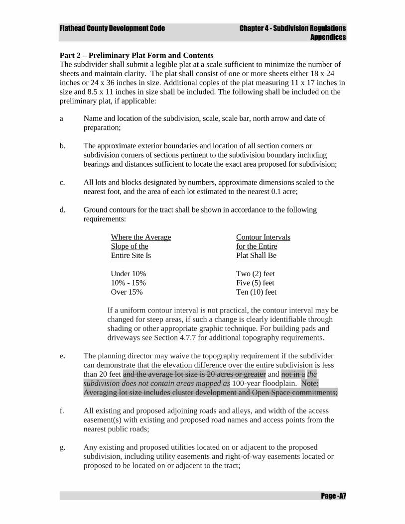
Flathead County Development Code Chapter 4 - Subdivision Regulations
Appendices
Page -A7
Part 2 – Preliminary Plat Form and Contents
The subdivider shall submit a legible plat at a scale sufficient to minimize the number of
sheets and maintain clarity. The plat shall consist of one or more sheets either 18 x 24
inches or 24 x 36 inches in size. Additional copies of the plat measuring 11 x 17 inches in
size and 8.5 x 11 inches in size shall be included. The following shall be included on the
preliminary plat, if applicable:
a Name and location of the subdivision, scale, scale bar, north arrow and date of
preparation;
b. The approximate exterior boundaries and location of all section corners or
subdivision corners of sections pertinent to the subdivision boundary including
bearings and distances sufficient to locate the exact area proposed for subdivision;
c. All lots and blocks designated by numbers, approximate dimensions scaled to the
nearest foot, and the area of each lot estimated to the nearest 0.1 acre;
d. Ground contours for the tract shall be shown in accordance to the following
requirements:
Where the Average
Slope of the
Entire Site Is
Contour Intervals
for the Entire
Plat Shall Be
Under 10% Under 10% Two (2) feet
10% - 15% Five (5) feet
Over 15% Ten (10) feet
If a uniform contour interval is not practical, the contour interval may be
changed for steep areas, if such a change is clearly identifiable through
shading or other appropriate graphic technique. For building pads and
driveways see Section 4.7.7 for additional topography requirements.
e. The planning director may waive the topography requirement if the subdivider
can demonstrate that the elevation difference over the entire subdivision is less
than 20 feet and the average lot size is 20 acres or greater and not in a the
subdivision does not contain areas mapped as 100-year floodplain. Note:
Averaging lot size includes cluster development and Open Space commitments;
f. All existing and proposed adjoining roads and alleys, and width of the access
easement(s) with existing and proposed road names and access points from the
nearest public roads;
g. Any existing and proposed utilities located on or adjacent to the proposed
subdivision, including utility easements and right-of-way easements located or
proposed to be located on or adjacent to the tract;
Flathead County Development Code Chapter 4 - Subdivision Regulations
Appendices
Page -A8
h. Location, boundaries, dimensions and areas of any parks or areas dedicated for
common or public use;
i. Location and size of existing buildings, structures and improvements, if to be
retained;
j. Designated one hundred year (100-year) floodplain and/or floodway area, if any;
k. Location and size of all natural and environmental features on the site including all
surface water bodies, wetlands, springs and areas of shallow ground water eight feet
or less;
l. For each lot where the obvious building area is in question (general topography of
the lot or immediate topography adjacent to the primary access road averages
25%) show:
i. A typical building pad (measuring a minimum 40 foot square);
ii. The building pad must be able to be accessed by a minimum 10 foot wide
private drive with no point of the driveway exceeding a developed grade of
12%, and the initial 20 feet of driveway surface shall not exceed 5% grade.
In the case ground contours provided in conformance with (d) above do not
indicate conformance with the grade standard, the application shall include
driveway profiles demonstrating conformance of developed grade;
iii. The driveway and building pad shall be identified on the preliminary plat
using minimum 2-foot contour intervals for clarity;
iv. Any building pad which exceeds 25% in cross slope shall be required to
receive a favorable report and comply with the recommendations of a geo-
technical soils analysis conducted by a licensed engineer prior to final plat
approval.
Flathead County Development Code Chapter 4 - Subdivision Regulations
Appendices
Page -A9
Appendix C
Environmental Assessment
General Instructions
It shall be the responsibility of the subdivider to submit the information required by this
Section with the preliminary plat. This Environmental Assessment format shall be used by
the applicant in compiling a thorough description of the potential impacts for the proposed
subdivision. Each question pertinent to the proposal must be addressed in a full
comprehensive and systematic fashion (both maps and/or text as applicable). Incomplete
Environmental Assessments will not be accepted.
The Environmental Assessment will be objectively measured to assure that all mandatory
elements are included and that, based upon objective standards, all prospective impacts are
adequately addressed. At a minimum the Environmental Assessment must contain the
following for all assessment contents:
a. A summary of probable impacts and statement of impact for each environmental
consideration topic;
b. A discussion to support the statement of impact;
c. Referenced sources and citations to support the statement of impact;
d. If applicable, site specific maps and documentation to support the statement of
impact and discussion.
If, at any time during the application process, material information comes to light that is not
addressed in the Environmental Assessment, the subdivider shall be required to amend the
Environmental Assessment to adequately address the issue. In this event the 60 working day
review period is suspended and will not resume until the amended Environmental
Assessment has been submitted, reviewed and approved by the Planning and Zoning Office.
Following review and acceptance of the amended Environmental Assessment, the
application review process will resume at the same stage of the 60 working day review
period that the original application was at before the additional information came to light.
Environmental Assessment Contents
There are two major sections to the Environmental Assessment. The first section
incorporates the natural system provisions of 76-3-603 and 76-3-608, MCA. The second
section evaluates the impacts to the human community and incorporates 76-3-608 (3)(a)
criteria for public health, safety and local services. The sources of information for each
section of the Assessment shall be identified. All Environmental Assessments shall contain
the signature, date of signature and mailing address of the owner of the property and the
person, or persons, preparing the report and citation and a copy of all supporting
information.
Flathead County Development Code Chapter 4 - Subdivision Regulations
Appendices
Page -A10
Section 1 – Resource Assessment and Impact Criteria Report
a. Surface Water:
i. Locate on the preliminary plat and describe all surface water and the
delineated 100 year floodplain(s) which may affect or be affected by the
proposed subdivision including:
A. All natural water systems such as perennial and intermittent
streams, lakes and ponds, rivers, or marshes;
B. All artificial water systems such as canals, ditches, aqueducts,
reservoirs, irrigation or drainage systems;
ii. Describe all probable impacts to surface waters which may affect or be
affected by the proposed subdivision including name, approximate size,
present use, and time of year when water is present and proximity of
proposed construction (e.g. buildings, sewer systems, roads) to surface
waters;
iii. Describe any existing or proposed stream bank or shoreline alterations or
any proposed construction or modification of lake beds or stream
channels. Provide information on location, extent, and purpose of
alteration. If any construction or changes are proposed which require a 310
Permit from the Flathead County Conservation District the subdivider
shall acknowledge that the permit is required and will be obtained prior to
final plat;
iv. If wetlands are present, the subdivider shall identify and provide a map
showing wetland areas. A wetlands investigation completed by a qualified
consultant, using the most current U.S. Army Corps of Engineers’
Wetlands Delineation Manual may be required. If any construction or
changes are proposed which require a 404 Permit, the subdivider shall
acknowledge that the permit is required and will be obtained.
b. Ground Water:
i. Establish the seasonal minimum and maximum depth to water table, dates
on which these depths were determined, and the location and depth of all
known aquifers which may be affected by the proposed subdivision.
Monitoring may be waived if evidence of minimum and maximum ground
water elevations can be documented;
ii. If determined from subsection (ab)(i) above that any area within the
proposed subdivision is within eight four feet of the surface, the high
water table shall be measured from tests taken during the period of the
Flathead County Development Code Chapter 4 - Subdivision Regulations
Appendices
Page -A11
highest groundwater elevations, generally from March 15 through June 30,
during average precipitation years and reported in the environmental
assessment;
iii. Describe any steps necessary to avoid probable impacts and the
degradation of ground water and ground water recharge areas as result of
the subdivision.
c. Geology/Soils:
i. Locate on the preliminary plat any known geologic hazards affecting the
subdivision which could result in property damage or personal injury due
to rock falls or slides, mud, snow; surface subsidence (e.g., settling or
sinking); and seismic activity;
ii. Explain what measures will be taken to prevent or materially lessen the
danger and probable impacts of future property damage or personal injury
due to any of the hazards referred to above;
iii. Explain any unusual soil, topographic or geologic conditions on the
property which limit the capability for building or excavation using
ordinary and reasonable construction techniques. The explanation should
address conditions such as shallow bedrock, high water table, unstable or
expansive soil conditions, and slope. On the preliminary plat identify any
slopes in excess of 40 percent;
iv. Identify any soils constraints, including probable impacts due to expansive
soils, hydric soils, or any soils which limit sanitary facilities. Explain
special design considerations and methods needed to overcome the soil
limitations;
v. Describe the location and amount of any cut or fill three or more feet in
depth. These cuts and fills should be indicated on a plat overlay or sketch
map. Where cuts or fills are necessary, describe any plans to prevent
erosion and to promote re-vegetation such as replacement of topsoil and
grading.
d. Vegetation:
i. On a sketch map or aerial photo indicate the distribution of the major
vegetation types such as marsh, grassland, shrub, coniferous forest,
deciduous forest, mixed forest, including critical plant communities such
as stream bank or shore line vegetation; vegetation on steep, unstable
slopes; vegetation on soils highly susceptible to wind or water erosion;
Flathead County Development Code Chapter 4 - Subdivision Regulations
Appendices
Page -A12
ii. Identify any locations of noxious weeds and identify the species of weeds
and explain measures to control weed invasion;
iii. Describe any probable impacts and any protective measures to preserve
trees and critical plant communities (e.g., design and location of roads,
lots and open spaces).
e. Wildlife:
i. Describe species of fish and wildlife which use the area affected by the
proposed subdivision;
ii. Identify on the preliminary plat any known critical or “key” wildlife areas,
such as big game winter range, waterfowl nesting areas, habitat for rare or
endangered species, or wetlands;
iii. Identify rare and endangered species on-site. Describe the impact(s) and
measures to mitigate the impact(s), or submit a statement explaining why
no impact is anticipated, providing documentation to support that
statement;
iv. Describe any probable impacts and proposed measures to protect or
enhance wildlife habitat or to minimize degradation (i.e. keeping buildings
and roads back from shorelines; setting aside marshland as undeveloped
open space);
v. It is recommended that the subdivider discuss the impact of the proposed
development on fish and wildlife with the Department of Fish, Wildlife
and Parks (FWP) and incorporate any recommendations from the agency
to mitigate wildlife impacts.
f. Wildlife Habitat:
i. Proposed subdivisions that are contiguous to urbanized areas are presumed
to have a minimal impact on wildlife habitat;
ii. Proposed subdivisions in locations with riparian areas, wetlands, rivers,
streams, lakes, or other natural surface waters are presumed to have an
impact on wildlife habitat. Describe the impact(s) and measures to
mitigate the impact(s), or submit a statement explaining why no impact is
anticipated, providing documentation to support that statement;
iii. Proposed subdivisions in an area with rare or endangered species, as
identified by state or federal agencies, are presumed to have an impact on
the habitat of those species. Describe the impact(s) and measures to
Flathead County Development Code Chapter 4 - Subdivision Regulations
Appendices
Page -A13
mitigate the impact(s), or submit a statement explaining why no impact is
anticipated, providing documentation to support that statement;
iv. Proposed subdivisions on and or adjacent to land identified by state or
federal agencies as critical habitat are presumed to have an impact on
wildlife habitat. Describe the impact(s) and measures to mitigate the
impact(s), or submit a statement explaining why no impact is anticipated,
providing documentation to support that statement.
g. Agriculture and Timber Production:
i. On a sketch map locate the acreage, type and agricultural classifications of
soils;
ii. Identify and explain the history of any agricultural production of the by crop
type and yield;
iii. Describe the historical and current agricultural uses which occur adjacent to
the proposed subdivision and explain any probable impacts and measures
which will be taken to avoid or limit development conflicts with adjacent
agricultural uses;
iv. If timbered, identify and describe any timber management recommendations
which may have been suggested or implemented by a professional forester.
h. Agricultural Water User Facilities:
i. On a sketch map or aerial photo locate the location of any agricultural water
user facility, including but not limited to agricultural water works, wells,
canals, irrigation ditches and pump houses on-site or adjacent to the
proposed subdivision;
ii. Describe any agricultural water user facility on the site or in proximity that
might be affected and explain any probable impact(s) and measures which
will be taken to avoid or mitigate probable impacts;
iii. It is recommended that the subdivider discuss any impact of the proposed
development on agricultural water users facilities with the irrigation
company or organization controlling the facility and incorporate any
recommendations from the agency to mitigate agricultural water users
impacts.
i. Historical Features:
Flathead County Development Code Chapter 4 - Subdivision Regulations
Appendices
Page -A14
i. Describe and locate on a plat overlay or sketch map any known or possible
historic, paleontological, archeological or cultural sites, structures, or
objects which may be affected by the proposed subdivision;
ii. Describe any plans to protect such sites or properties;
iii. Describe the impact of the proposed subdivision on any historic features,
and the need for inventory, study and/or preservation and consultation
with the State Historic Preservation Office (SHPO).
j. Visual Impact:
i. Describe any efforts to visually blend development activities with the
existing environment.
k. Air Quality:
i. Describe any anticipated impact to air quality caused from dust or other air
pollutants, including dust created from roads, and any means to mitigate
the impact to air quality.
l. Area Hazards:
i. Describe and locate on a plat overlay or sketch map any hazardous
concerns or circumstances associated with the proposed subdivision site,
including, but not limited to:
A. Any part of the proposed subdivision that is located within the
Wildland Urban Interface priority area. If located in the Wildland
Urban Interface or high fire hazard area identified by a local fire
district or fire protection authority describe probable impact(s) and
measures to mitigate the impact(s), or submit a statement
explaining why no impact is anticipated, providing documentation
to support the statement;
B. Any potential hazardous materials contained on site, including
high pressure gas lines, high voltage transmission lines, super fund
sites, abandoned landfills, mines or sewer treatment plants, etc. In
some cases an Environmental Site Assessment may be required;
C. Describe measures to mitigate any adverse impacts associated with
area hazards.
Flathead County Development Code Chapter 4 - Subdivision Regulations
Appendices
Page -A15
Section 2 - Community Impact Report
a. Water Supply:
i. Describe the proposed water system and how water will be provided for
household use and fire protection and the number of gallons needed to
meet the needs of the anticipated final population;
ii. Indicate whether the plans for water supply meet state standards for
quality, quantity and construction criteria.
iii. If the subdivider proposes to connect to an existing water system:
A. Identify and describe that system;
B. Provide written evidence that permission to connect to that system
has been obtained;
C. State the approximate distance to the nearest main or connection
point;
D. State the cost of extending or improving the existing water system
to service the proposed development;
E. Show that the existing water system is adequate to serve the
proposed subdivision.
iv. If a public water system is to be installed, discuss:
A. Who is to install that system and when it will be completed;
B. Who will administer and maintain the system at the beginning of
subdivision development and when subdivision is completed;
C. Provision of evidence that the water supply is adequate in quantity,
quality, and dependability (75-6-101 MCA).
v. If individual water systems are to be provided, describe the adequacy of
supply of the ground water for individual wells or cisterns and how this
was determined.
b. Sewage Disposal:
i. Describe the proposed method of sewage disposal and system;
Flathead County Development Code Chapter 4 - Subdivision Regulations
Appendices
Page -A16
ii. Indicate the number of gallons of effluent per day which will be generated
by the proposed subdivision at its full occupancy, whether the proposed
method of sewage disposal is sufficient to meet the anticipated final needs
of the subdivision and whether it meets state standards;
iii. If the development will be connected to an existing public sewer system,
include:
A. A description of that system and approximate distance from the
nearest main or connection point to the proposed subdivision;
B. Written evidence that permission to connect to that system has
been obtained.
iv. If a new public sewage disposal system, as defined under 75-6-102 MCA,
is to be installed, discuss:
A. When the system will be completed, and how it will be financed;
B. Who is to administer and maintain the proposed system at the
beginning of subdivision development and when development is
completed?
c. Storm Water Drainage:
i. Describe the proposed methods of storm water drainage for roads and
other anticipated impervious surfaces, including storm water calculations;
ii. Describe the proposed methods of storm water drainage for other areas of
the subdivision, including storm water calculations;
iii. Identify the mechanism and who is responsible for the maintenance of the
storm water drainage system.
d. Solid Waste Disposal:
i. Describe the proposed system of solid waste collection and disposal for
the subdivision including:
A. Evidence that existing systems for collection and facilities for
disposal are available and can handle the anticipated additional
volume;
B. A description of the proposed alternative where no existing system
is available.
Flathead County Development Code Chapter 4 - Subdivision Regulations
Appendices
Page -A17
e. Roads:
i. Describe any proposed new public or private access roads or substantial
improvements of existing public or private access roads;
ii. Discuss whether any of the individual lots or tracts have access directly to
arterial or collector roads; and if so, the reason access was not provided by
means of a road within the subdivision;
iii. Explain any proposed closure or modification of existing roads.
iv. Identify existing primary road Average Vehicle Traffic and subdivision
daily vehicle traffic assigned to that primary road.
v. Describe provisions considered for dust control on roads;
vi. Indicate who will pay the cost of installing and maintaining dedicated
and/or private roadways;
vii. Discuss how much daily traffic will be generated on existing local and
neighborhood roads and main arterial, when the subdivision is fully
developed;
viii. Indicate the capacity of existing and proposed roads to safely handle any
increased traffic. Describe any anticipated increased maintenance that will
be necessary due to increased traffic and who will pay the cost of
maintenance;
ix. Explain whether year round access by conventional automobile will be
available over legal rights of way to the subdivision and to all lots and
common facilities within the subdivision.
f. Utilities:
i. Include a description of:
A. The method of furnishing electric, natural gas or telephone service,
where provided;
B. The extent to which these utilities will be placed underground;
C. Estimated completion of each utility installation.
Flathead County Development Code Chapter 4 - Subdivision Regulations
Appendices
Page -A18
g. Emergency Services:
i. Describe the emergency services available to the subdivision such as:
A. Is the proposed subdivision in an urban or rural fire district? If not,
will one be formed or extended? In absence of a fire district, what
fire protection procedures are planned?;
B. Police protection;
C. Ambulance service/Medical services;
D. Give the estimated response time of the above services;
E. Can the needs of the proposed subdivision for each of the above
services be met by present personnel and facilities.
h. Schools:
i. Identify the School Districts and describe the available educational
facilities which would service this subdivision;
ii. Estimate the number of school children that will be generated from the
proposed subdivision;
iii. The subdivider shall discuss the impact of the proposed development on
the provision of educational services with the administrator(s) of the
appropriate school system(s). The subdivider shall provide a written
statement outlining whether the increased enrollment can be
accommodated by the present personnel and facilities and by the existing
school bus system, any recommendations of the administrator(s), and any
mitigation planned to overcome any adverse impacts of the proposed
development on the provision of educational services.
i. Land Use:
i. Describe comprehensive planning and/or land use regulations covering the
proposed subdivision or adjacent land and if located near the jurisdictional
area of an incorporated city or town, whether annexation is propose;
ii. Describe how the subdivision will affect access to any public lands. Where
public lands are adjacent to or near the proposed development, describe
present and anticipated uses for those lands; (e.g., grazing, logging,
recreation, etc.);
iii. Describe the effect of the subdivision on adjacent land use;
Flathead County Development Code Chapter 4 - Subdivision Regulations
Appendices
Page -A19
iv. Describe any health or safety hazards on or near the subdivision, such as
mining activity or potential subsidence, high pressure gas lines,
dilapidated structures or high voltage power lines. Any such conditions
should be accurately described and their origin and location identified.
List any provisions that will be made to mitigate these hazards.
j. Housing:
i. Indicate the proposed use(s) and number of lots or spaces in each:
A. For residential indicate the type of dwelling unit;
B. For all other uses the type and intensity of use (e.g. industrial,
commercial, etc.).
k. Parks and Recreation Facilities:
i. Describe park and recreation facilities to be provided within the proposed
subdivision and other recreational facilities which will serve the
subdivision.
l. Public Health and Safety:
i. Describe any probable impacts and any measures to mitigate the impacts,
or submit a statement explaining why no impact is anticipated, providing
documentation to support that statement that might affect public health
and safety that aren’t specifically addressed in other sub-section of the
environmental assessment;

Flathead County Development Code Chapter 4 - Subdivision Regulations
Appendices
Page -A20
Flathead County Development Code Chapter 4 - Subdivision Regulations
Appendices
Page -A21
Appendix D
First Minor Subdivision Impact Criteria Report
General Instructions
The Montana Subdivision and Platting Act (76-3-608 MCA) sets criteria for the local
government review of subdivisions. Listed below are policy statements that are to be used
as criteria for evaluating the impacts of a subdivision. Please address how the policy
statements relate to the proposed subdivision in a comprehensive and systematic fashion.
For each of the criteria, describe the impact(s) and measures to mitigate the impact(s), or
include a statement explaining why no impact is anticipated, and provide documentation
to support that statement. If any of the criteria impacts are not applicable it shall be
noted; with an explanation as to why it is not applicable. Incomplete impact reports will
not be accepted.
The source(s) of information for each criteria impact shall be identified as part of the
analysis. All impact analyses shall contain the name of the property, owner of the
property and the person(s) preparing the criteria impact report.
Impact Criteria
a. Impacts on Agriculture:
i. Proposed first minor subdivisions that are contiguous to urbanized areas
are presumed to have a minimal impact on agriculture;
ii. Proposed first minor subdivisions located on or in proximity to prime
farmland are presumed to have an impact on agriculture.
b. Impact on Agricultural Water User Facilities:
i. Proposed first minor subdivisions located on land with agricultural water
user facilities or adjoining an agricultural water use facility are presumed
to have an impact on agricultural water user facilities;
ii. Proposed first minor subdivisions that involve the abandonment or transfer
of water rights from the property being subdivided, or that involve the
abandonment or removal of agricultural water user facilities are presumed
to have an impact on agricultural water user facilities;
iii. Proposed first minor subdivisions that will alter access for maintenance of
agricultural water user facilities are presumed to have an impact on
agricultural water user facilities;
iv. Proposed first minor subdivisions that will alter the movement or
availability of water are presumed to have an impact on agricultural water
user facilities.
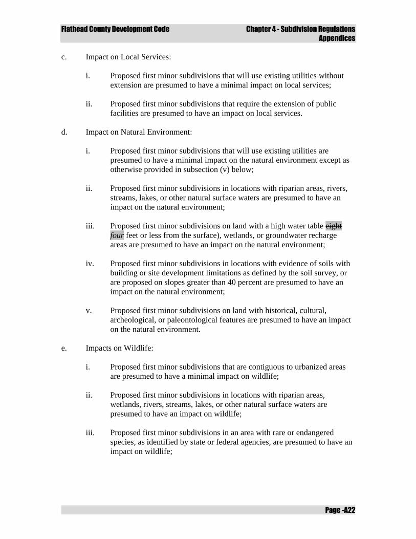
Flathead County Development Code Chapter 4 - Subdivision Regulations
Appendices
Page -A22
c. Impact on Local Services:
i. Proposed first minor subdivisions that will use existing utilities without
extension are presumed to have a minimal impact on local services;
ii. Proposed first minor subdivisions that require the extension of public
facilities are presumed to have an impact on local services.
d. Impact on Natural Environment:
i. Proposed first minor subdivisions that will use existing utilities are
presumed to have a minimal impact on the natural environment except as
otherwise provided in subsection (v) below;
ii. Proposed first minor subdivisions in locations with riparian areas, rivers,
streams, lakes, or other natural surface waters are presumed to have an
impact on the natural environment;
iii. Proposed first minor subdivisions on land with a high water table eight
four feet or less from the surface), wetlands, or groundwater recharge
areas are presumed to have an impact on the natural environment;
iv. Proposed first minor subdivisions in locations with evidence of soils with
building or site development limitations as defined by the soil survey, or
are proposed on slopes greater than 40 percent are presumed to have an
impact on the natural environment;
v. Proposed first minor subdivisions on land with historical, cultural,
archeological, or paleontological features are presumed to have an impact
on the natural environment.
e. Impacts on Wildlife:
i. Proposed first minor subdivisions that are contiguous to urbanized areas
are presumed to have a minimal impact on wildlife;
ii. Proposed first minor subdivisions in locations with riparian areas,
wetlands, rivers, streams, lakes, or other natural surface waters are
presumed to have an impact on wildlife;
iii. Proposed first minor subdivisions in an area with rare or endangered
species, as identified by state or federal agencies, are presumed to have an
impact on wildlife;
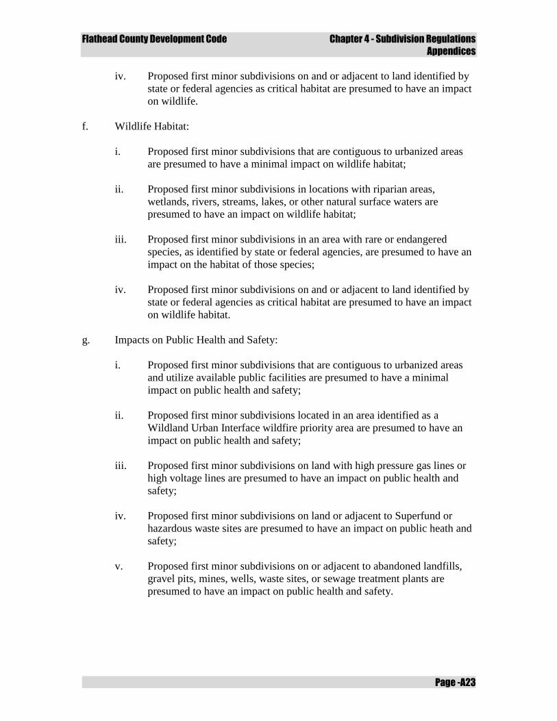
Flathead County Development Code Chapter 4 - Subdivision Regulations
Appendices
Page -A23
iv. Proposed first minor subdivisions on and or adjacent to land identified by
state or federal agencies as critical habitat are presumed to have an impact
on wildlife.
f. Wildlife Habitat:
i. Proposed first minor subdivisions that are contiguous to urbanized areas
are presumed to have a minimal impact on wildlife habitat;
ii. Proposed first minor subdivisions in locations with riparian areas,
wetlands, rivers, streams, lakes, or other natural surface waters are
presumed to have an impact on wildlife habitat;
iii. Proposed first minor subdivisions in an area with rare or endangered
species, as identified by state or federal agencies, are presumed to have an
impact on the habitat of those species;
iv. Proposed first minor subdivisions on and or adjacent to land identified by
state or federal agencies as critical habitat are presumed to have an impact
on wildlife habitat.
g. Impacts on Public Health and Safety:
i. Proposed first minor subdivisions that are contiguous to urbanized areas
and utilize available public facilities are presumed to have a minimal
impact on public health and safety;
ii. Proposed first minor subdivisions located in an area identified as a
Wildland Urban Interface wildfire priority area are presumed to have an
impact on public health and safety;
iii. Proposed first minor subdivisions on land with high pressure gas lines or
high voltage lines are presumed to have an impact on public health and
safety;
iv. Proposed first minor subdivisions on land or adjacent to Superfund or
hazardous waste sites are presumed to have an impact on public heath and
safety;
v. Proposed first minor subdivisions on or adjacent to abandoned landfills,
gravel pits, mines, wells, waste sites, or sewage treatment plants are
presumed to have an impact on public health and safety.

Flathead County Development Code Chapter 4 - Subdivision Regulations
Appendices
Page -A24
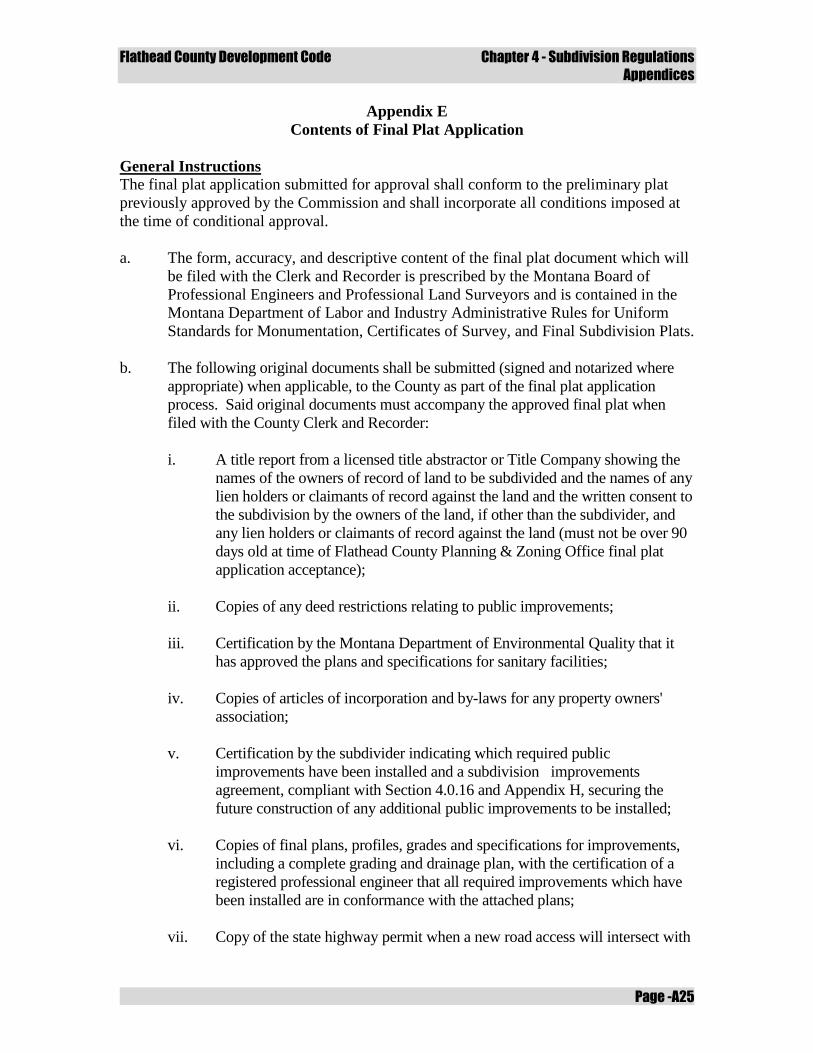
Flathead County Development Code Chapter 4 - Subdivision Regulations
Appendices
Page -A25
Appendix E
Contents of Final Plat Application
General Instructions
The final plat application submitted for approval shall conform to the preliminary plat
previously approved by the Commission and shall incorporate all conditions imposed at
the time of conditional approval.
a. The form, accuracy, and descriptive content of the final plat document which will
be filed with the Clerk and Recorder is prescribed by the Montana Board of
Professional Engineers and Professional Land Surveyors and is contained in the
Montana Department of Labor and Industry Administrative Rules for Uniform
Standards for Monumentation, Certificates of Survey, and Final Subdivision Plats.
b. The following original documents shall be submitted (signed and notarized where
appropriate) when applicable, to the County as part of the final plat application
process. Said original documents must accompany the approved final plat when
filed with the County Clerk and Recorder:
i. A title report from a licensed title abstractor or Title Company showing the
names of the owners of record of land to be subdivided and the names of any
lien holders or claimants of record against the land and the written consent to
the subdivision by the owners of the land, if other than the subdivider, and
any lien holders or claimants of record against the land (must not be over 90
days old at time of Flathead County Planning & Zoning Office final plat
application acceptance);
ii. Copies of any deed restrictions relating to public improvements;
iii. Certification by the Montana Department of Environmental Quality that it
has approved the plans and specifications for sanitary facilities;
iv. Copies of articles of incorporation and by-laws for any property owners'
association;
v. Certification by the subdivider indicating which required public
improvements have been installed and a subdivision improvements
agreement, compliant with Section 4.0.16 and Appendix H, securing the
future construction of any additional public improvements to be installed;
vi. Copies of final plans, profiles, grades and specifications for improvements,
including a complete grading and drainage plan, with the certification of a
registered professional engineer that all required improvements which have
been installed are in conformance with the attached plans;
vii. Copy of the state highway permit when a new road access will intersect with
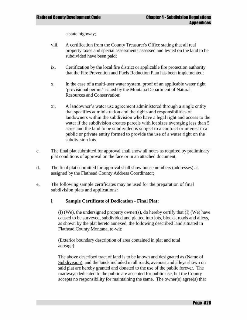
Flathead County Development Code Chapter 4 - Subdivision Regulations
Appendices
Page -A26
a state highway;
viii. A certification from the County Treasurer's Office stating that all real
property taxes and special assessments assessed and levied on the land to be
subdivided have been paid;
ix. Certification by the local fire district or applicable fire protection authority
that the Fire Prevention and Fuels Reduction Plan has been implemented;
x. In the case of a multi-user water system, proof of an applicable water right
‘provisional permit’ issued by the Montana Department of Natural
Resources and Conservation;
xi. A landowner’s water use agreement administered through a single entity
that specifies administration and the rights and responsibilities of
landowners within the subdivision who have a legal right and access to the
water if the subdivision creates parcels with lot sizes averaging less than 5
acres and the land to be subdivided is subject to a contract or interest in a
public or private entity formed to provide the use of a water right on the
subdivision lots.
c. The final plat submitted for approval shall show all notes as required by preliminary
plat conditions of approval on the face or in an attached document;
d. The final plat submitted for approval shall show house numbers (addresses) as
assigned by the Flathead County Address Coordinator;
e. The following sample certificates may be used for the preparation of final
subdivision plats and applications:
i. Sample Certificate of Dedication - Final Plat:
(I) (We), the undersigned property owner(s), do hereby certify that (I) (We) have
caused to be surveyed, subdivided and platted into lots, blocks, roads and alleys,
as shown by the plat hereto annexed, the following described land situated in
Flathead County Montana, to-wit:
(Exterior boundary description of area contained in plat and total
acreage)
The above described tract of land is to be known and designated as (Name of
Subdivision), and the lands included in all roads, avenues and alleys shown on
said plat are hereby granted and donated to the use of the public forever. The
roadways dedicated to the public are accepted for public use, but the County
accepts no responsibility for maintaining the same. The owner(s) agree(s) that
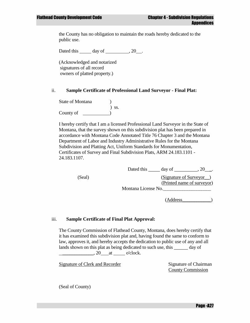
Flathead County Development Code Chapter 4 - Subdivision Regulations
Appendices
Page -A27
the County has no obligation to maintain the roads hereby dedicated to the
public use.
Dated this day of , 20 .
(Acknowledged and notarized
signatures of all record
owners of platted property.)
ii. Sample Certificate of Professional Land Surveyor - Final Plat:
State of Montana )
) ss.
County of )
I hereby certify that I am a licensed Professional Land Surveyor in the State of
Montana, that the survey shown on this subdivision plat has been prepared in
accordance with Montana Code Annotated Title 76 Chapter 3 and the Montana
Department of Labor and Industry Administrative Rules for the Montana
Subdivision and Platting Act, Uniform Standards for Monumentation,
Certificates of Survey and Final Subdivision Plats, ARM 24.183.1101 -
24.183.1107.
Dated this day of , 20 _.
(Seal) (Signature of Surveyor__)
(Printed name of surveyor)
Montana License No.____________________
(Address____________)
iii. Sample Certificate of Final Plat Approval:
The County Commission of Flathead County, Montana, does hereby certify that
it has examined this subdivision plat and, having found the same to conform to
law, approves it, and hereby accepts the dedication to public use of any and all
lands shown on this plat as being dedicated to such use, this day of
_____________, 20 at o'clock.
Signature of Clerk and Recorder Signature of Chairman
County Commission
(Seal of County)
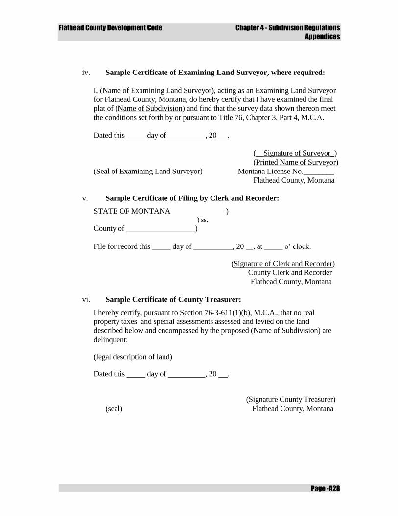
Flathead County Development Code Chapter 4 - Subdivision Regulations
Appendices
Page -A28
iv. Sample Certificate of Examining Land Surveyor, where required:
I, (Name of Examining Land Surveyor), acting as an Examining Land Surveyor
for Flathead County, Montana, do hereby certify that I have examined the final
plat of (Name of Subdivision) and find that the survey data shown thereon meet
the conditions set forth by or pursuant to Title 76, Chapter 3, Part 4, M.C.A.
Dated this day of , 20 .
(__Signature of Surveyor_)
(Printed Name of Surveyor)
(Seal of Examining Land Surveyor) Montana License No.________
Flathead County, Montana
v. Sample Certificate of Filing by Clerk and Recorder:
STATE OF MONTANA ) ) ss.
County of )
File for record this day of , 20 , at o’ clock.
(Signature of Clerk and Recorder)
County Clerk and Recorder
Flathead County, Montana
vi. Sample Certificate of County Treasurer:
I hereby certify, pursuant to Section 76-3-611(1)(b), M.C.A., that no real
property taxes and special assessments assessed and levied on the land
described below and encompassed by the proposed (Name of Subdivision) are
delinquent:
(legal description of land)
Dated this day of , 20 .
(Signature County Treasurer)
(seal) Flathead County, Montana
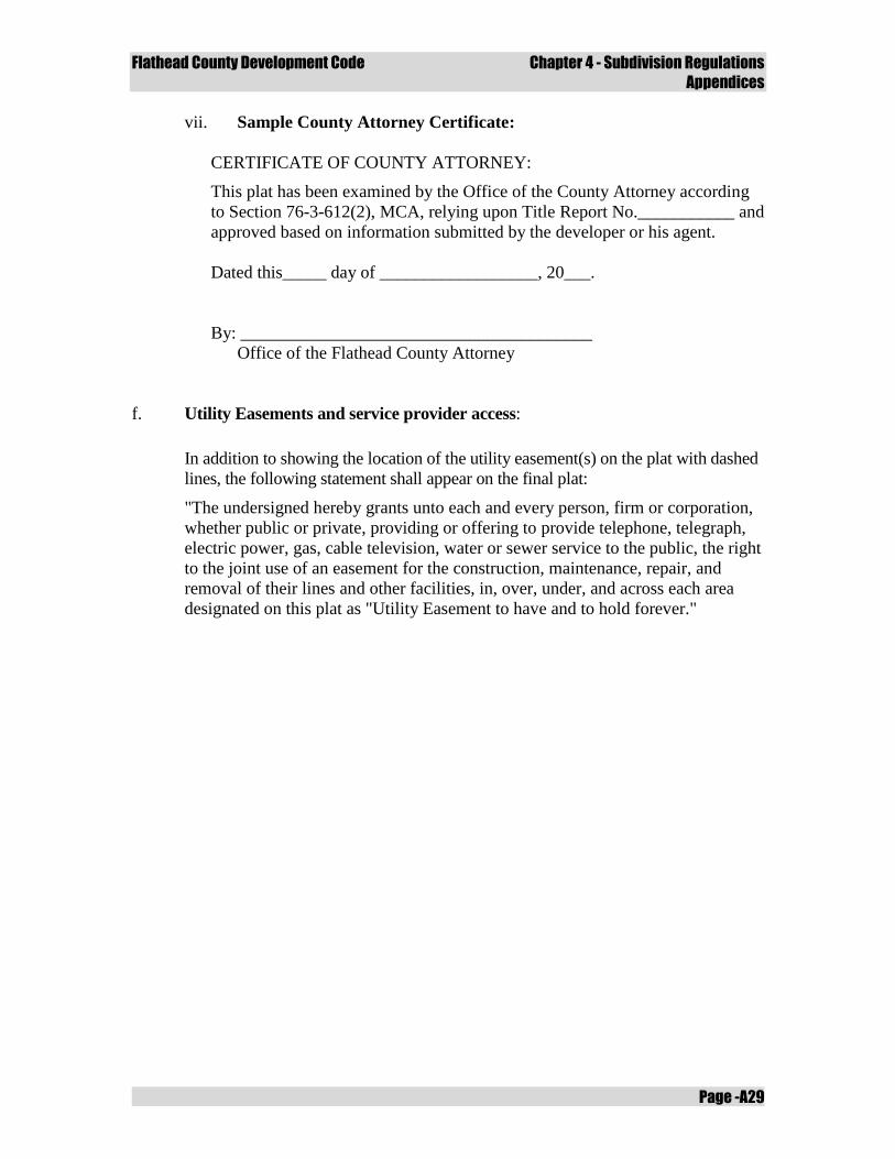
Flathead County Development Code Chapter 4 - Subdivision Regulations
Appendices
Page -A29
vii. Sample County Attorney Certificate:
CERTIFICATE OF COUNTY ATTORNEY:
This plat has been examined by the Office of the County Attorney according
to Section 76-3-612(2), MCA, relying upon Title Report No.___________ and
approved based on information submitted by the developer or his agent.
Dated this_____ day of __________________, 20___.
By: ________________________________________
Office of the Flathead County Attorney
f. Utility Easements and service provider access:
In addition to showing the location of the utility easement(s) on the plat with dashed
lines, the following statement shall appear on the final plat:
"The undersigned hereby grants unto each and every person, firm or corporation,
whether public or private, providing or offering to provide telephone, telegraph,
electric power, gas, cable television, water or sewer service to the public, the right
to the joint use of an easement for the construction, maintenance, repair, and
removal of their lines and other facilities, in, over, under, and across each area
designated on this plat as "Utility Easement to have and to hold forever."

Flathead County Development Code Chapter 4 - Subdivision Regulations
Appendices
Page -A30
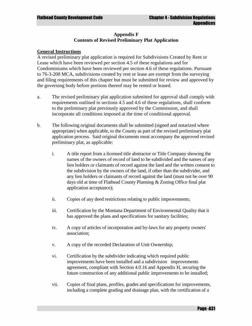
Flathead County Development Code Chapter 4 - Subdivision Regulations
Appendices
Page -A31
Appendix F
Contents of Revised Preliminary Plat Application
General Instructions
A revised preliminary plat application is required for Subdivisions Created by Rent or
Lease which have been reviewed per section 4.5 of these regulations and for
Condominiums which have been reviewed per section 4.6 of these regulations. Pursuant
to 76-3-208 MCA, subdivisions created by rent or lease are exempt from the surveying
and filing requirements of this chapter but must be submitted for review and approved by
the governing body before portions thereof may be rented or leased.
a. The revised preliminary plat application submitted for approval shall comply with
requirements outlined in sections 4.5 and 4.6 of these regulations, shall conform
to the preliminary plat previously approved by the Commission, and shall
incorporate all conditions imposed at the time of conditional approval.
b. The following original documents shall be submitted (signed and notarized where
appropriate) when applicable, to the County as part of the revised preliminary plat
application process. Said original documents must accompany the approved revised
preliminary plat, as applicable:
i. A title report from a licensed title abstractor or Title Company showing the
names of the owners of record of land to be subdivided and the names of any
lien holders or claimants of record against the land and the written consent to
the subdivision by the owners of the land, if other than the subdivider, and
any lien holders or claimants of record against the land (must not be over 90
days old at time of Flathead County Planning & Zoning Office final plat
application acceptance);
ii. Copies of any deed restrictions relating to public improvements;
iii. Certification by the Montana Department of Environmental Quality that it
has approved the plans and specifications for sanitary facilities;
iv. A copy of articles of incorporation and by-laws for any property owners'
association;
v. A copy of the recorded Declaration of Unit Ownership;
vi. Certification by the subdivider indicating which required public
improvements have been installed and a subdivision improvements
agreement, compliant with Section 4.0.16 and Appendix H, securing the
future construction of any additional public improvements to be installed;
vii. Copies of final plans, profiles, grades and specifications for improvements,
including a complete grading and drainage plan, with the certification of a
Flathead County Development Code Chapter 4 - Subdivision Regulations
Appendices
Page -A32
registered professional engineer that all required improvements which have
been installed are in conformance with the attached plans;
viii. Copy of the state or county approach permit for road or driveway access
which approaches onto a state highway or county road;
ix. A certification from the County Treasurer's Office stating that all real
property taxes and special assessments assessed and levied on the land to be
subdivided have been paid;
x. Certification by the local fire district or applicable fire protection authority
that the Fire Prevention and Fuels Reduction Plan has been implemented;
xi. In the case of a multi-user water system, proof of an applicable water right
‘provisional permit’ issued by the Montana Department of Natural
Resources and Conservation.
c. The revised preliminary plat submitted for approval shall show all notes as required
by preliminary plat conditions of approval on the face or in an attached document.
d. The revised preliminary plat submitted for approval shall show house numbers
(addresses) as assigned by the Flathead County Address Coordinator, if applicable;
Flathead County Development Code Chapter 4 - Subdivision Regulations
Appendices
Page -A33
Appendix G
Sample Forms
General Instructions
The following sample forms may be used for the preparation of final subdivision plats
and applications. Sample forms and letters include:
a. Grant of Easement Letter;
b. Irrevocable Letter of Credit;
c. Consent to Platting and Dedication;
d. Wavier of Protest – Participation in Special Improvement District;
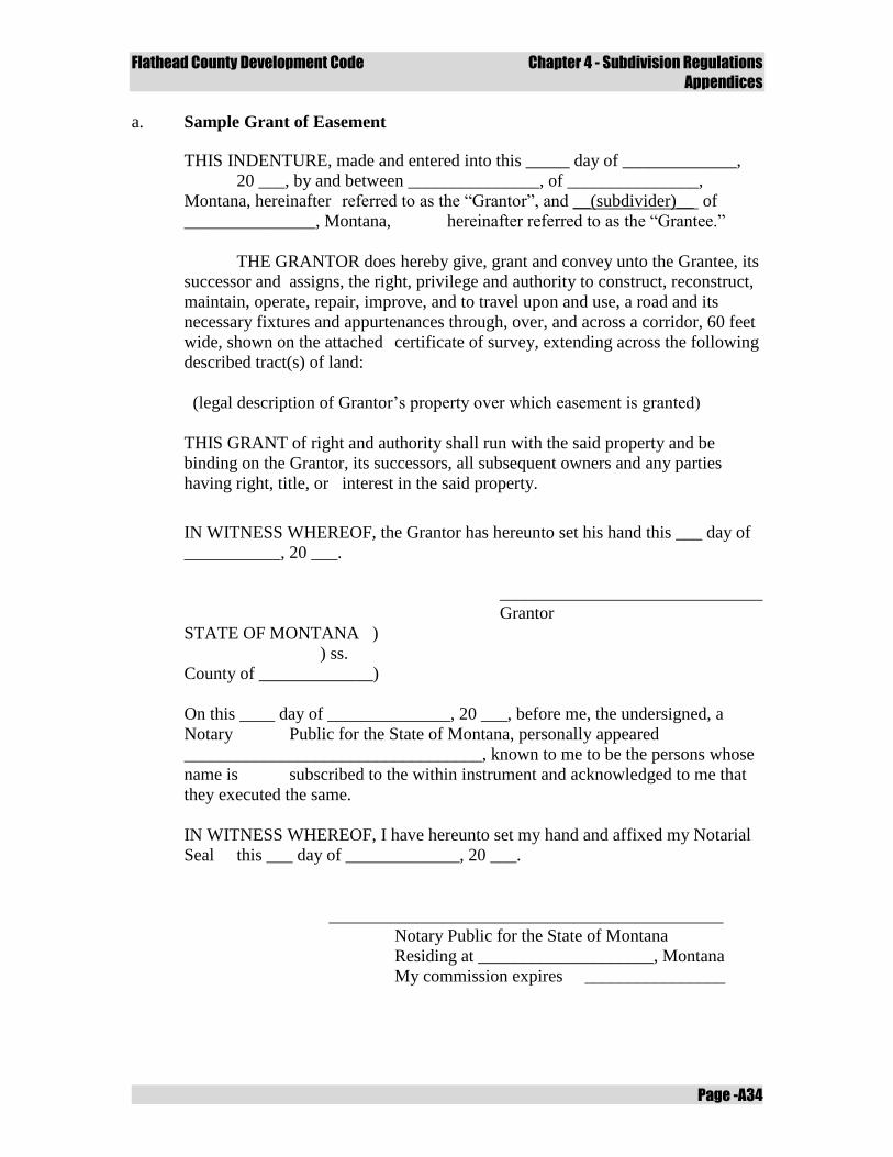
Flathead County Development Code Chapter 4 - Subdivision Regulations
Appendices
Page -A34
a. Sample Grant of Easement
THIS INDENTURE, made and entered into this _____ day of _____________,
20 ___, by and between _______________, of _______________,
Montana, hereinafter referred to as the “Grantor”, and __(subdivider)__ of
_______________, Montana, hereinafter referred to as the “Grantee.”
THE GRANTOR does hereby give, grant and convey unto the Grantee, its
successor and assigns, the right, privilege and authority to construct, reconstruct,
maintain, operate, repair, improve, and to travel upon and use, a road and its
necessary fixtures and appurtenances through, over, and across a corridor, 60 feet
wide, shown on the attached certificate of survey, extending across the following
described tract(s) of land:
(legal description of Grantor’s property over which easement is granted)
THIS GRANT of right and authority shall run with the said property and be
binding on the Grantor, its successors, all subsequent owners and any parties
having right, title, or interest in the said property.
IN WITNESS WHEREOF, the Grantor has hereunto set his hand this ___ day of
___________, 20 ___.
______________________________
Grantor
STATE OF MONTANA )
) ss.
County of _____________)
On this ____ day of ______________, 20 ___, before me, the undersigned, a
Notary Public for the State of Montana, personally appeared
__________________________________, known to me to be the persons whose
name is subscribed to the within instrument and acknowledged to me that
they executed the same.
IN WITNESS WHEREOF, I have hereunto set my hand and affixed my Notarial
Seal this ___ day of _____________, 20 ___.
_____________________________________________
Notary Public for the State of Montana
Residing at ____________________, Montana
My commission expires ________________
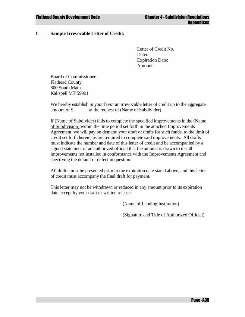
Flathead County Development Code Chapter 4 - Subdivision Regulations
Appendices
Page -A35
b. Sample Irrevocable Letter of Credit:
Letter of Credit No.
Dated:
Expiration Date:
Amount:
Board of Commissioners
Flathead County
800 South Main
Kalispell MT 59901
We hereby establish in your favor an irrevocable letter of credit up to the aggregate
amount of $ at the request of (Name of Subdivider).
If (Name of Subdivider) fails to complete the specified improvements in the (Name
of Subdivision) within the time period set forth in the attached Improvements
Agreement, we will pay on demand your draft or drafts for such funds, to the limit of
credit set forth herein, as are required to complete said improvements. All drafts
must indicate the number and date of this letter of credit and be accompanied by a
signed statement of an authorized official that the amount is drawn to install
improvements not installed in conformance with the Improvements Agreement and
specifying the default or defect in question.
All drafts must be presented prior to the expiration date stated above, and this letter
of credit must accompany the final draft for payment.
This letter may not be withdrawn or reduced in any amount prior to its expiration
date except by your draft or written release.
(Name of Lending Institution)
(Signature and Title of Authorized Official)
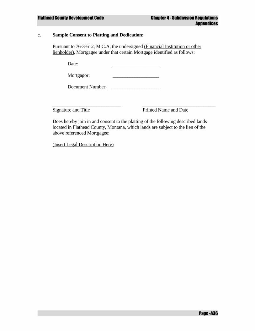
Flathead County Development Code Chapter 4 - Subdivision Regulations
Appendices
Page -A36
c. Sample Consent to Platting and Dedication:
Pursuant to 76-3-612, M.C.A, the undersigned (Financial Institution or other
lienholder), Mortgagee under that certain Mortgage identified as follows:
Date: ___________________
Mortgagor: ___________________
Document Number: ___________________
____________________________ ______________________________
Signature and Title Printed Name and Date
Does hereby join in and consent to the platting of the following described lands
located in Flathead County, Montana, which lands are subject to the lien of the
above referenced Mortgagee:
(Insert Legal Description Here)
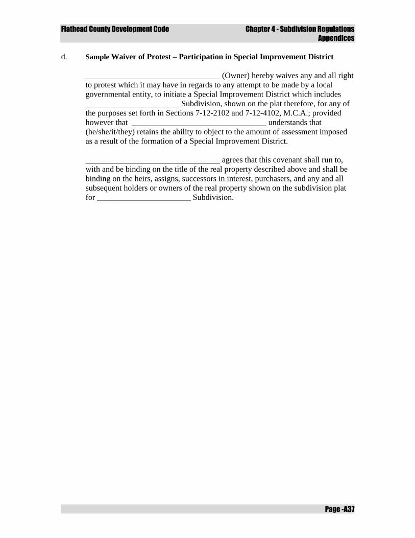
Flathead County Development Code Chapter 4 - Subdivision Regulations
Appendices
Page -A37
d. Sample Waiver of Protest – Participation in Special Improvement District
_________________________________ (Owner) hereby waives any and all right
to protest which it may have in regards to any attempt to be made by a local
governmental entity, to initiate a Special Improvement District which includes
_______________________ Subdivision, shown on the plat therefore, for any of
the purposes set forth in Sections 7-12-2102 and 7-12-4102, M.C.A.; provided
however that _________________________________ understands that
(he/she/it/they) retains the ability to object to the amount of assessment imposed
as a result of the formation of a Special Improvement District.
_________________________________ agrees that this covenant shall run to,
with and be binding on the title of the real property described above and shall be
binding on the heirs, assigns, successors in interest, purchasers, and any and all
subsequent holders or owners of the real property shown on the subdivision plat
for _______________________ Subdivision.

Flathead County Development Code Chapter 4 - Subdivision Regulations
Appendices
Page -A38
Flathead County Development Code Chapter 4 - Subdivision Regulations
Appendices
Page -A39
Appendix H
Subdivision Improvement Agreement
General Instructions
The model subdivision improvement agreement is intended to be used in situations where
improvements required for final approval or conditional approval to be extended beyond
the three year preliminary subdivision plat approval. A subdivider may request a
subdivision improvement agreement to guarantee the construction of improvements in a
timely manner.
Procedures
A subdivider requesting a subdivision improvement agreement shall follow the following
procedures:
a. At least 65% of the total improvement cost must be expended by the developer on
subdivision improvements, required as conditions of plat approval, before the
developer may enter into a subdivision improvements agreement with the county;
b. The subdivision improvement agreement must be complete and submitted with
the application for final plat;
c. The term of the agreement in Section 2 is no more than eighteen (18) months
following final plat approval;
d. The subdivider may request a one year extension to the subdivision improvement
agreement. The Commission shall require a new “estimated construction cost”
and surety to reflect 125 percent of the estimated construction cost;
e. All Department of Environmental Quality approvals required for final plat shall
be obtained prior to entering into a subdivision improvement agreement.
Flathead County Development Code Chapter 4 - Subdivision Regulations
Appendices
Page -A40
SAMPLE SUBDIVISION IMPROVEMENT AGREEMENT
THIS AGREEMENT, made and entered into this __________ day of
___________, 20_____, by and between the FLATHEAD COUNTY BOARD OF
COMMISSIONERS of Flathead County, Montana, Party of the First Part and hereinafter
referred to as the COUNTY, and
______________________ (Name of Developer)______________________________
a _______________(Individual, Company or Corporation)_________________________
located at (Street Address/P. O. Box) (City, County, State, Zip)____________
Party of the Second Part and hereinafter referred to as DEVELOPER.
WITNESSETH:
THAT WHEREAS, the Developer is the owner and developer of a new subdivision
known as ____________ (Name of Subdivision) _________________________
located at _________________(Location of Subdivision)_________________________
and,
WHEREAS, the County has conditioned it's approval of the final plat of
____________ (Name of Subdivision)___________________________,
upon the conditions as set forth in the Preliminary Plat approval of the Subdivision being
completed; and
WHEREAS, at least 65% of the total improvement cost of improvements required
as conditions of plat approval, as cited in ‘Exhibit A’, have been expended by the developer
on improvements installed within the subdivision, as certified in ‘Exhibit B’; and
WHEREAS, all required improvements, as cited in ‘Exhibit A’, have not been
completed at this time, and the Developer wishes to bond for the completion of those
improvements set forth in ‘Exhibit A’; and
WHEREAS, the Flathead County Subdivision Regulations require that a subdivider
shall provide a financial security of 125% of the estimated total cost of construction of said
improvements as evidenced by an estimate prepared by a licensed public engineer included
herewith as ‘Exhibit B’; and
WHEREAS, the estimated total cost of construction of improvements to be bonded
for is the sum of $______________________________________________.
NOW THEREFORE, in consideration of the approval of the final plat of said
Subdivision by the County, the Developer hereby agrees as follows:
1. The Developer shall deposit as collateral with the County a Letter of Credit, or other
acceptable collateral as determined by the Flathead County Board of
Commissioners, in the amount of $_______________________. Said Letter of
Credit or other collateral shall have an expiration date of at least sixty (60) days
following the date set for completion of the improvements, certifying the following:
Flathead County Development Code Chapter 4 - Subdivision Regulations
Appendices
Page -A41
a. That the creditor guarantees funds in the sum of $___________________ the
estimated cost of completing the required improvements in
__________________.
(Name of Subdivision)
b. That if the Developer fails to complete the specified improvements within
the required period, the creditor will pay to the County immediately, and
without further action, such funds as are necessary to finance the completion
of those improvements up to the limit of credit stated in the letter;
2. That said required improvements shall be fully completed by _______________,
20_____.
3. That upon completion of the required improvements, the Developer shall cause to be
filed with the County a statement certifying that:
a. All required improvements are complete.
b. That the improvements are in compliance with the minimum standards
specified by the County for their construction and that the Developer
warrants said improvements against any and all defects for a period of one
(1) year from the date of acceptance of the completion of those
improvements by the County.
c. That the Developer knows of no defects in those improvements.
d. That these improvements are free and clear of any encumbrances or liens.
e. That a schedule of actual construction costs has been filed with the County.
f. All applicable fees and surcharges have been paid.
4. The Developer shall cause to be filed with the County copies of final plans, profiles,
grades and specifications of said improvements, with the certification of the
registered professional engineer responsible for their preparation that all required
improvements have been installed in conformance with said specifications.
IT IS ALSO AGREED BY AND BETWEEN THE PARTIES HERETO AS FOLLOWS,
TO-WIT:
That the Developer shall provide for inspection of all required improvements by a registered
professional engineer before the Developer shall be released from the Subdivision
Improvement Agreement.
Flathead County Development Code Chapter 4 - Subdivision Regulations
Appendices
Page -A42
That if the County determines that any improvements are not constructed in compliance
with the specifications, it shall furnish the Developer with a list of specific deficiencies and
may withhold collateral sufficient to insure such compliance. If the County determines that
the Developer will not construct any or all of the improvements in accordance with the
specifications, or within the required time limits, it may withdraw the collateral and employ
such funds as may be necessary to construct the improvement or improvements in
accordance with the specifications. The unused portions of the collateral shall be returned to
the Developer or the crediting institution, as is appropriate.
IN WITNESS WHEREOF, the Parties have hereunto set their hands and seals the
day and year herein before written.
____________________________________
(Name of Subdivision/Developer/Firm)
by _________________________________
____________________________________
(Title)
STATE OF MONTANA
COUNTY OF ________________________
On this __________ day of ____________________, 20_____, before me, a Notary
Public for the State of Montana, personally appeared
_________________________________, known to me to be the
_________________________ of _______________________________, whose name is
subscribed to the foregoing instrument and acknowledged to me that he/she executed the
same.
IN WITNESS WHEREOF, I have hereunto set my hand and affixed my Notarial
Seal this day and year first above written.
__________________________________________
Notary Public for the State of Montana
Residing at ________________________________
My Commission Expires _____________________
FLATHEAD COUNTY BOARD OF COMMISSIONERS ATTEST:
Paula Robinson
Clerk and Recorder
By: ______________________________________ By: _____________________
Chairperson Deputy
Flathead County Development Code Chapter 4 - Subdivision Regulations
Appendices
Page -A43
++++++
EXHIBIT A
Conditions of approval as fixed to the preliminary plat by the Flathead County Board of
Commissioners.
Flathead County Development Code Chapter 4 - Subdivision Regulations
Appendices
Page -A44
ACCEPTABLE FORMS OF IMPROVEMENTS GUARANTEES
Comment:
The following are acceptable means of guaranteeing subdivision improvements
agreements, although others may also be acceptable. The irrevocable letter of credit is
often the preferable guaranty because it is usually feasible for a subdivider to secure, and
the local government can readily obtain funds to complete the required improvements
should the subdivider fail to install the required the improvements. A suggested
irrevocable letter of credit is included as part of this Appendix. The other common
guaranties are also explained below.
The subdivider shall provide one or more of the following financial security guarantees in
the amount of 125 percent of the estimated total cost of installing all required
improvements.
a. Letter of Credit - Subject to governing body approval, the subdivider shall
provide the governing body an irrevocable letter of credit from a bank or other
reputable institution or individual certifying the following:
i. That the creditor guarantees funds in an amount equal to the cost, as
approved by the governing body, of completing all required
improvements. The letter of Credit or other collateral shall have an
expiration date of at least sixty (60) days following the date set for
completion of the improvements;
ii. That if the subdivider fails to complete the specified improvements within
the required period, the creditor will immediately pay to the governing
body upon presentation of a sight draft* without further action, an amount
of cash necessary to finance the completion of those improvements, up to
the limit of credit stated in the letter;
* A “sight draft” commits the payer to make payment at the time the draft
is presented, or on sight.
iii. That this letter of credit may not be withdrawn, or reduced in amount,
until released by the governing body.
b. Escrow Account - The subdivider shall deposit cash, or collateral readily
convertible to cash at face value, either with the governing body or in escrow with
a bank. The use of collateral other than cash, and the selection of the bank where
funds are to be deposited must be approved by the governing body. Where an
escrow account is to be used, the subdivider shall give the governing body an
agreement with the bank guaranteeing the following:
i. That the funds in the escrow account are to be held in trust until released
by the governing body and may not be used or pledged by the subdivider
as security for any obligation during that period;
Flathead County Development Code Chapter 4 - Subdivision Regulations
Appendices
Page -A45
ii. That, should the subdivider fail to complete the required improvements,
the bank shall immediately make the funds in escrow available to the
governing body for completing these improvements.
c. Surety Performance Bond - The bond must be executed by a surety company
authorized to do business in the State of Montana and acceptable as a surety to the
governing body and countersigned by a Montana agent. The bond must be
payable to the County (City) of ____________. The bond must be in effect until
the completed improvements are accepted by the governing body;
d. Sequential Development - Where a subdivision is to be developed in phased
portions, the governing body may, at its discretion, waive the use of a guarantee
on the initial portion, provided that the portion contains no more than 25 lots, or
50 percent of the total number of lots in the proposed subdivision, whichever is
less. The governing body may grant final plat approval to only one portion at a
time. The plat approval for each succeeding portion will be contingent upon
completion of all improvements in each preceding portion and acceptance of
those improvements by the governing body. Completion of improvements in the
final portion of the subdivision must be guaranteed through the use of one of the
other methods detailed in this section;
e. Special Improvements District - The governing body may enter into an
agreement with the subdivider, and the owners of the property proposed for
subdivision if other than the subdivider, that the installation of required
improvements will be financed through a special or rural improvement district
created pursuant to Title 7, Chapter 12, MCA. This agreement must provide that
no lots within the subdivision will be sold, rented, or leased, and no contract for
the sale of lots executed, before the improvement district has been created. If the
proposed subdivision lies in an unincorporated area, the subdivider, or other
owners of the property involved must also petition the board of county
commissioners to create a rural improvement district pursuant to Section 7-12-
2102, MCA:
i. An agreement to finance improvements through the creation of a special
improvement district, or a petition to create a rural improvement district,
constitutes a waiver by the subdivider or the other owners of the property
of the right to protest, or petition against, the creation of the district under
either Section 7-12-2109 or Section 7-12-4110, MCA. This waiver must
be filed with the county clerk and recorder and will be deemed to run with
the land.
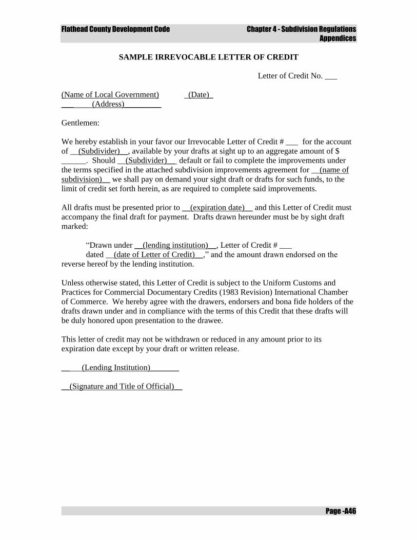
Flathead County Development Code Chapter 4 - Subdivision Regulations
Appendices
Page -A46
SAMPLE IRREVOCABLE LETTER OF CREDIT
Letter of Credit No. ___
(Name of Local Government) (Date)_
___ (Address)_________
Gentlemen:
We hereby establish in your favor our Irrevocable Letter of Credit # ___ for the account
of __(Subdivider)__, available by your drafts at sight up to an aggregate amount of $
______. Should __(Subdivider)__ default or fail to complete the improvements under
the terms specified in the attached subdivision improvements agreement for __(name of
subdivision)__ we shall pay on demand your sight draft or drafts for such funds, to the
limit of credit set forth herein, as are required to complete said improvements.
All drafts must be presented prior to __(expiration date)__ and this Letter of Credit must
accompany the final draft for payment. Drafts drawn hereunder must be by sight draft
marked:
“Drawn under __(lending institution)__, Letter of Credit # ___
dated __(date of Letter of Credit)__,” and the amount drawn endorsed on the
reverse hereof by the lending institution.
Unless otherwise stated, this Letter of Credit is subject to the Uniform Customs and
Practices for Commercial Documentary Credits (1983 Revision) International Chamber
of Commerce. We hereby agree with the drawers, endorsers and bona fide holders of the
drafts drawn under and in compliance with the terms of this Credit that these drafts will
be duly honored upon presentation to the drawee.
This letter of credit may not be withdrawn or reduced in any amount prior to its
expiration date except by your draft or written release.
__ (Lending Institution)_______
__(Signature and Title of Official)__
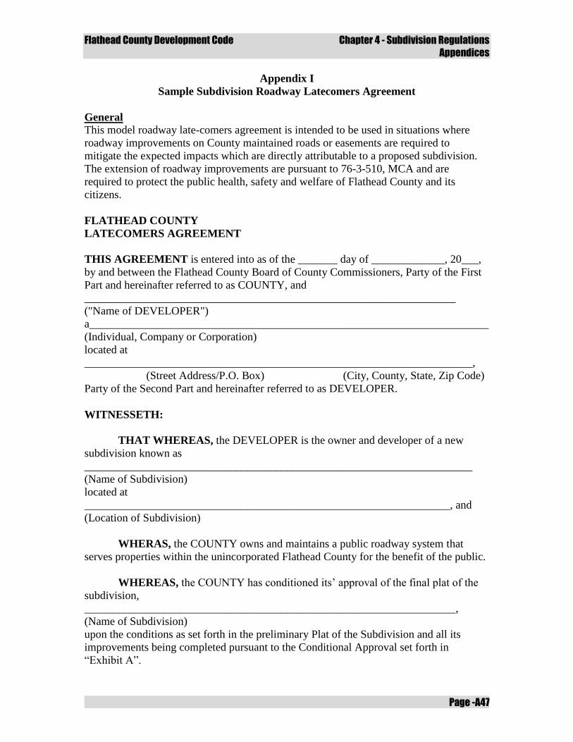
Flathead County Development Code Chapter 4 - Subdivision Regulations
Appendices
Page -A47
Appendix I
Sample Subdivision Roadway Latecomers Agreement
General
This model roadway late-comers agreement is intended to be used in situations where
roadway improvements on County maintained roads or easements are required to
mitigate the expected impacts which are directly attributable to a proposed subdivision.
The extension of roadway improvements are pursuant to 76-3-510, MCA and are
required to protect the public health, safety and welfare of Flathead County and its
citizens.
FLATHEAD COUNTY
LATECOMERS AGREEMENT
THIS AGREEMENT is entered into as of the _______ day of _____________, 20___,
by and between the Flathead County Board of County Commissioners, Party of the First
Part and hereinafter referred to as COUNTY, and
__________________________________________________________________
("Name of DEVELOPER")
a_______________________________________________________________________
(Individual, Company or Corporation)
located at
_____________________________________________________________________,
(Street Address/P.O. Box) (City, County, State, Zip Code)
Party of the Second Part and hereinafter referred to as DEVELOPER.
WITNESSETH:
THAT WHEREAS, the DEVELOPER is the owner and developer of a new
subdivision known as
_____________________________________________________________________
(Name of Subdivision)
located at
_________________________________________________________________, and
(Location of Subdivision)
WHERAS, the COUNTY owns and maintains a public roadway system that
serves properties within the unincorporated Flathead County for the benefit of the public.
WHEREAS, the COUNTY has conditioned its’ approval of the final plat of the
subdivision,
__________________________________________________________________,
(Name of Subdivision)
upon the conditions as set forth in the preliminary Plat of the Subdivision and all its
improvements being completed pursuant to the Conditional Approval set forth in
“Exhibit A”.
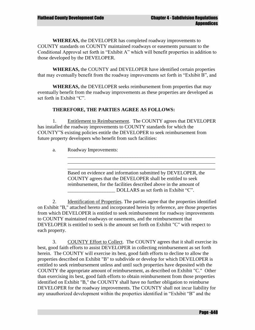
Flathead County Development Code Chapter 4 - Subdivision Regulations
Appendices
Page -A48
WHEREAS, the DEVELOPER has completed roadway improvements to
COUNTY standards on COUNTY maintained roadways or easements pursuant to the
Conditional Approval set forth in “Exhibit A” which will benefit properties in addition to
those developed by the DEVELOPER.
WHEREAS, the COUNTY and DEVELOPER have identified certain properties
that may eventually benefit from the roadway improvements set forth in “Exhibit B”, and
WHEREAS, the DEVELOPER seeks reimbursement from properties that may
eventually benefit from the roadway improvements as these properties are developed as
set forth in Exhibit “C”.
THEREFORE, THE PARTIES AGREE AS FOLLOWS:
1. Entitlement to Reimbursement. The COUNTY agrees that DEVELOPER
has installed the roadway improvements to COUNTY standards for which the
COUNTY”S existing policies entitle the DEVELOPER to seek reimbursement from
future property developers who benefit from such facilities:
a. Roadway Improvements:
___________________________________________________________
___________________________________________________________
___________________________________________________________
Based on evidence and information submitted by DEVELOPER, the
COUNTY agrees that the DEVELOPER shall be entitled to seek
reimbursement, for the facilities described above in the amount of
___________________ DOLLARS as set forth in Exhibit “C”.
2. Identification of Properties. The parties agree that the properties identified
on Exhibit "B," attached hereto and incorporated herein by reference, are those properties
from which DEVELOPER is entitled to seek reimbursement for roadway improvements
to COUNTY maintained roadways or easements, and the reimbursement that
DEVELOPER is entitled to seek is the amount set forth on Exhibit "C" with respect to
each property.
3. COUNTY Effort to Collect. The COUNTY agrees that it shall exercise its
best, good faith efforts to assist DEVELOPER in collecting reimbursement as set forth
herein. The COUNTY will exercise its best, good faith efforts to decline to allow the
properties described on Exhibit "B" to subdivide or develop for which DEVELOPER is
entitled to seek reimbursement unless and until such properties have deposited with the
COUNTY the appropriate amount of reimbursement, as described on Exhibit "C." Other
than exercising its best, good faith efforts to obtain reimbursement from those properties
identified on Exhibit "B," the COUNTY shall have no further obligation to reimburse
DEVELOPER for the roadway improvements. The COUNTY shall not incur liability for
any unauthorized development within the properties identified in “Exhibit “B” and the
Flathead County Development Code Chapter 4 - Subdivision Regulations
Appendices
Page -A49
COUNTY shall not be obligated to pay to DEVELOPER any amount of reimbursement
as set forth therein until the COUNTY has actually collected such amount from the
properties described on Exhibit "B." DEVELOPER acknowledges that the COUNTY has
entered into this Agreement as an accommodation and as a convenience to
DEVELOPER, and the COUNTY does not guaranty that any amount of reimbursement
will be collected for DEVELOPER; nor will the COUNTY be liable if it fails, through
negligence or otherwise, to collect from a particular property.
4. Payment to Developer. Within thirty (30) days of the COUNTY'S
collection of reimbursement from one of the property owners described on Exhibit "B,"
the COUNTY shall remit such amount to the DEVELOPER, less a service charge equal
to seven (7) percent of the amount collected (but in no event exceeding $500.00) to
defray the COUNTY’S costs of administering this Agreement.
5. Term; Incorporation of Policies. This Agreement shall be in effect for a
period of fifteen (15) years, after which time it shall automatically terminate.
DEVELOPER shall have no right to reimbursement from any properties described on
Exhibit "B" after the termination of this Agreement; nor shall the COUNTY have any
further obligation to monitor or identify properties that benefit after the termination of
this Agreement.
6. Attorneys' Fees. In the event of any litigation to enforce or interpret the
provisions of this Agreement, or to remedy a breach thereof, the prevailing party shall be
entitled to reasonable attorneys' fees as fixed by the court.
7. Entire Agreement. This Agreement contains the entire agreement of the
parties hereto, and supersedes any prior written or oral agreements between them
concerning the subject matter contained herein. There are no representations,
agreements, arrangements, or understandings, oral or written, between the parties hereto
relating to the subject matter contained in this Agreement which are not fully expressed
herein. The provisions of this Agreement may be waived, altered, amended or repealed
in whole or in part only upon the written consent of all parties to this Agreement.
8. Governing Law. The construction of this Agreement, and the rights and
liabilities of the parties hereto, shall be governed by the laws of the State of Montana.
9. Forum. Any litigation to enforce or interpret the provisions of this
Agreement or the parties' rights and liabilities arising out of this Agreement or the
performance hereunder shall be maintained only in the courts in the County of Flathead,
Montana.
10. Successors in Interest. This Agreement shall inure to the benefit of, and
shall be binding upon, the assigns, successors in interest, personal representatives, estate,
heirs, and legatees of each of the parties hereto.
Flathead County Development Code Chapter 4 - Subdivision Regulations
Appendices
Page -A50
11. Notices. All notices, requests, payments, demands and other
communications required or permitted to be given under this Agreement shall be in
writing and shall either be delivered in writing personally or be sent by telegram or by
regular or certified first-class mail, postage prepaid, deposited in the United States mail,
and properly addressed to the party at his address set forth on the signature page of this
Agreement, or at any other address that such party may designate by written notice to the
other party.
IT IS ALSO AGREED BY AND BETWEEN THE PARTIES HERETO AS
FOLLOWS, TO WIT:
IN WITNESS WHEREOF, the parties have hereunto set their hands and seals
the day and year herein before written.
Dated: ___________________ DEVELOPER
By:
_____________________________________
Address:
Dated: ___________________ FLATHEAD COUNTY
By: ________________________________
Chairperson
ATTEST:
________________________________
County Clerk and Recorder
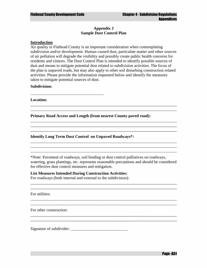
Flathead County Development Code Chapter 4 - Subdivision Regulations
Appendices
Page -A51
Appendix J
Sample Dust Control Plan
Introduction
Air quality in Flathead County is an important consideration when contemplating
subdivision and/or development. Human caused dust, particulate matter and other sources
of air pollution will degrade the visibility and possibly create public health concerns for
residents and visitors. The Dust Control Plan is intended to identify possible sources of
dust and means to mitigate potential dust related to subdivision activities. The focus of
the plan is unpaved roads, but may also apply to other soil disturbing construction related
activities. Please provide the information requested below and identify the measures
taken to mitigate potential sources of dust.
Subdivision:
____________________________________
Location:
________________________________________________________________________
________________________________________________________________________
Primary Road Access and Length (from nearest County paved road):
________________________________________________________________________
________________________________________________________________________
________________________________________________________________________
Identify Long Term Dust Control on Unpaved Roadways*:
________________________________________________________________________
________________________________________________________________________
________________________________________________________________________
*Note: Pavement of roadways, soil binding or dust control palliatives on roadways,
watering, grass plantings, etc. represents reasonable precautions and should be considered
for effective dust control measures and mitigation.
List Measures Intended During Construction Activities:
For roadways (both internal and external to the subdivision):
________________________________________________________________________
________________________________________________________________________
For utilities:
________________________________________________________________________
________________________________________________________________________
For other construction:
________________________________________________________________________
________________________________________________________________________
Signature of subdivider: ____________________________

Flathead County Development Code Chapter 4 - Subdivision Regulations
Appendices
Page -A52
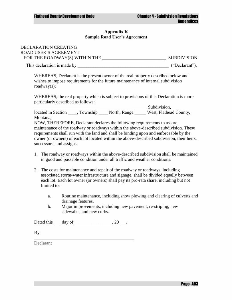
Flathead County Development Code Chapter 4 - Subdivision Regulations
Appendices
Page -A53
Appendix K
Sample Road User’s Agreement
DECLARATION CREATING
ROAD USER’S AGREEMENT
FOR THE ROADWAY(S) WITHIN THE ____________________________ SUBDIVISION
This declaration is made by ________________________________________ (“Declarant”).
WHEREAS, Declarant is the present owner of the real property described below and
wishes to impose requirements for the future maintenance of internal subdivision
roadway(s);
WHEREAS, the real property which is subject to provisions of this Declaration is more
particularly described as follows:
__________________________________________________Subdivision,
located in Section ____, Township ____ North, Range _____ West, Flathead County,
Montana;
NOW, THEREFORE, Declarant declares the following requirements to assure
maintenance of the roadway or roadways within the above-described subdivision. These
requirements shall run with the land and shall be binding upon and enforceable by the
owner (or owners) of each lot located within the above-described subdivision, their heirs,
successors, and assigns.
1. The roadway or roadways within the above-described subdivision shall be maintained
in good and passable condition under all traffic and weather conditions.
2. The costs for maintenance and repair of the roadway or roadways, including
associated storm-water infrastructure and signage, shall be divided equally between
each lot. Each lot owner (or owners) shall pay its pro-rata share, including but not
limited to:
a. Routine maintenance, including snow plowing and clearing of culverts and
drainage features.
b. Major improvements, including new pavement, re-striping, new
sidewalks, and new curbs.
Dated this ___ day of_________________, 20___.
By:
____________________________________________
Declarant

Flathead County Development Code Chapter 4 - Subdivision Regulations
Appendices
Page -A54
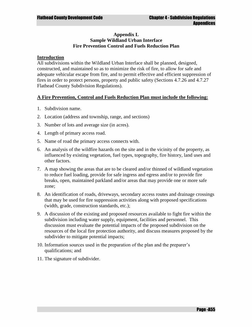
Flathead County Development Code Chapter 4 - Subdivision Regulations
Appendices
Page -A55
Appendix L
Sample Wildland Urban Interface
Fire Prevention Control and Fuels Reduction Plan
Introduction
All subdivisions within the Wildland Urban Interface shall be planned, designed,
constructed, and maintained so as to minimize the risk of fire, to allow for safe and
adequate vehicular escape from fire, and to permit effective and efficient suppression of
fires in order to protect persons, property and public safety (Sections 4.7.26 and 4.7.27
Flathead County Subdivision Regulations).
A Fire Prevention, Control and Fuels Reduction Plan must include the following:
1. Subdivision name.
2. Location (address and township, range, and sections)
3. Number of lots and average size (in acres).
4. Length of primary access road.
5. Name of road the primary access connects with.
6. An analysis of the wildfire hazards on the site and in the vicinity of the property, as
influenced by existing vegetation, fuel types, topography, fire history, land uses and
other factors.
7. A map showing the areas that are to be cleared and/or thinned of wildland vegetation
to reduce fuel loading, provide for safe ingress and egress and/or to provide fire
breaks, open, maintained parkland and/or areas that may provide one or more safe
zone;
8. An identification of roads, driveways, secondary access routes and drainage crossings
that may be used for fire suppression activities along with proposed specifications
(width, grade, construction standards, etc.);
9. A discussion of the existing and proposed resources available to fight fire within the
subdivision including water supply, equipment, facilities and personnel. This
discussion must evaluate the potential impacts of the proposed subdivision on the
resources of the local fire protection authority, and discuss measures proposed by the
subdivider to mitigate potential impacts;
10. Information sources used in the preparation of the plan and the preparer’s
qualifications; and
11. The signature of subdivider.