Embed Size (px)
Citation preview

Chapter 3
Geoscience projectsat Géologie Québec

3
60
Geoscience projects at Géologie Québec, Sylvain Lacroix, Serge Perreault ..................................... 61Copper Plan ..................................................................................................................................................................61Far North ......................................................................................................................................................................61Grenville Province and Appalachians .........................................................................................................................61Quaternary Geology .....................................................................................................................................................61Geochemistry and Geophysics .....................................................................................................................................62Exploration Targets .......................................................................................................................................................62
3
61
Geoscience projectsat Géologie Québec
Sylvain Lacroix, P.Geo., DirectorBureau de l’exploration géologique du Québec
Serge Perreault, P.Geo.Direction générale de Géologie Québec
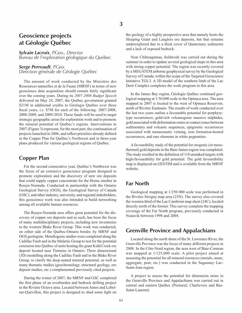
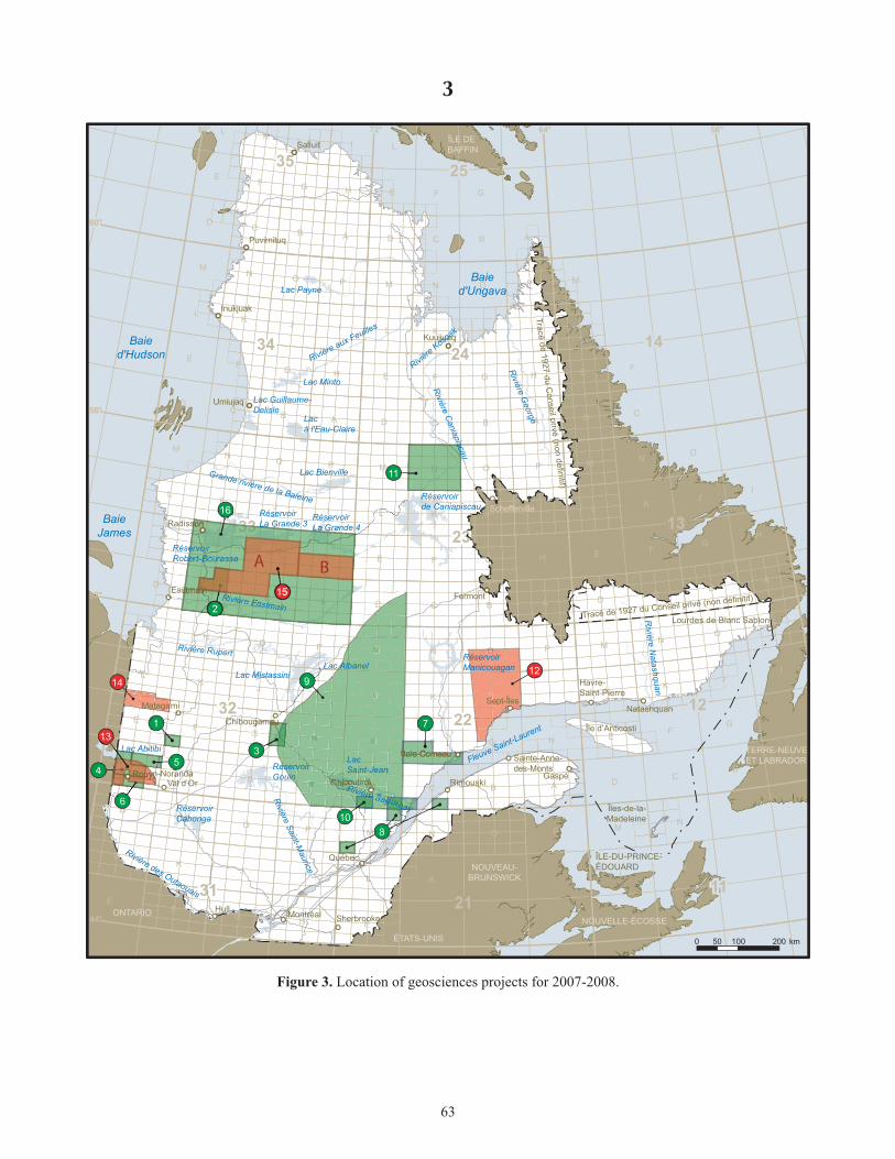
The amount of work conducted by the Ministère des Ressources naturelles et de la Faune (MRNF) in terms of new geoscience data acquisition should remain fairly signifi cant over the coming years. During its 2007-2008 Budget Speech delivered on May 24, 2007, the Québec government granted $21M in additional credits to Géologie Québec over three fi scal years, i.e. $7M for each of the following: 2007-2008, 2008-2009, and 2009-2010. These funds will be used to target strategic geographic areas for exploration work and to promote the mineral potential of Québec’s regions. Interventions in 2007 (Figure 3) represent, for the most part, the continuation of projects launched in 2006, and refl ect priorities already defi ned in the Copper Plan for Québec’s Northwest and in three-year plans produced for various geological regions of Québec.
Copper PlanFor the second consecutive year, Québec’s Northwest was
the focus of an extensive geoscience program designed to promote exploration and the discovery of new ore deposits that could supply copper concentrate for the Horne smelter in Rouyn-Noranda. Conducted in partnership with the Ontario Geological Survey (OGS), the Geological Survey of Canada (GSC), and other industry, university, and regional stakeholders, this geoscience work was also intended to build networking among all available human resources.
The Rouyn-Noranda area offers great potential for the dis-covery of copper ore deposits and as such, has been the focus of many multidisciplinary projects, including new inventories in the western Blake River Group. This work was conducted, on either side of the Québec-Ontario border, by MRNF and OGS geologists. Metallogenic studies were completed along the Cadillac Fault and in the Malartic Group to test for the potential extension into Québec of units hosting the giant Kidd Creek ore deposit located near Timmins in Ontario. Three dimensional (3D) modelling along the Cadillac Fault and in the Blake River Group, to clarify the deep-seated mineral potential, as well as many thematic studies (geochronology, structural geology, ore deposit studies, etc.) complemented previously cited projects.
During the winter of 2007, the MRNF and GSC completed the fi rst phase of an overburden and bedrock drilling project in the Rivière Octave area. Located between Amos and Lebel-sur-Quévillon, this project is designed to shed some light on
the geology of a highly prospective area that namely hosts the Sleeping Giant and Langlois ore deposits, but that remains underexplored due to a thick cover of Quaternary sediments and a lack of exposed bedrock.
Near Chibougamau, fi eldwork was carried out during the summer in order to update several geological maps in this area with strong copper potential. The region was recently covered by a MEGATEM airborne geophysical survey by the Geological Survey of Canada, within the scope of the Targeted Geoscience Initiative TGI-3. A 3D model of the southern limb of the Lac Doré Complex completes the work program in this area.
In the James Bay region, Géologie Québec continued geo-logical mapping at 1/50,000 scale in the Opinaca area. The area mapped in 2007 is located to the west of Opinaca Reservoir, north of Rivière Eastmain. The results of work conducted over the last two years outline a favourable potential for porphyry-type occurrences, gold-rich volcanogenic massive sulphides, gold associated with deformation zones or contact zones between sedimentary and volcanic sequences, epigenetic occurrences associated with metasomatic veining, iron formation-hosted occurrences, and rare elements in white pegmatites.
A favourability study of the potential for orogenic (or meso-thermal) gold deposits in the Baie-James region was completed. The study resulted in the defi nition of 118 unstaked targets with high-favourability for gold potential. The gold favourability map is displayed on GESTIM and is available from the MRNF website.
Far NorthGeological mapping at 1/250 000 scale was performed in
the Rivière Sérigny map area (23N). The survey also covered the western third of the Lac Cambrien map sheet (24C), localed directly north of the former. This survey complete the mapping coverage of the Far North program, previously conducted in Nunavik between 1998 and 2004.
Grenville Province and AppalachiansLocated along the north shore of the St. Lawrence River, the
Grenville Province was the focus of many different projects in 2008. In the Côte-Nord region, the area west of Baie-Comeau was mapped at 1/125,000 scale. A pilot project aimed at assessing the potential for all mineral resources (metals, stone, aggregate, peat, etc.) was conducted in the Saguenay–Lac-Saint-Jean region.
A project to assess the potential for dimension stone in the Grenville Province and Appalachians was carried out in central and eastern Québec (Portneuf, Charlevoix and Bas-Saint-Laurent).

3
62
Quaternary GeologyThe Côte-Nord, Bas-Saint-Laurent, and Capitale-Nationale
(Québec) regions were the focus of a compilation study of unconsolidated sediments and erosional features.
Geochemistry and GeophysicsA regional lake bottom sediment survey was completed in
the fall of 2007. This survey covers a surface area of 21,500 km2 located to the west and north of Sept-Îles, in the Côte-Nord region. The goal is to identify new exploration targets in order to stimulate mineral exploration in this part of the Grenville Province.
During the fall, the MRNF completed a high-resolution ground gravity survey covering the western Blake River Group in the Abitibi region, whereas the Geological Survey of Canada (GSC) completed a similar survey in the eastern part of the same geological unit. Following consultations with the mining industry, the coverage was expanded to include the entire Blake River Group, in order to address regional priorities defi ned within the Copper Plan and the Targeted Geoscience Initiative TGI-3. The new gravity coverage, jointly completed by the MRNF and the GSC, should provide a better portrait, in three dimensions, of the volcanic and plutonic architecture of the Blake River Group and help defi ne new exploration targets in the Rouyn-Noranda mining camp, Québec’s most prolifi c copper district.
Exploration TargetsFieldwork by the MRNF during the summer of 2007 also
led to the defi nition of 65 new targets for base and precious metal exploration, dimension stone, and construction materials in the Nord-du-Québec, Abitibi-Témiscamingue, Côte-Nord, Capitale-Nationale, Saguenay–Lac-Saint-Jean, and Bas-Saint-Laurent regions.
Mapping – Opinaca Reservoir
Mapping – Blake River Group
Study – Malartic Group
Metallogeny – Cadillac Ouest Fault
Evaluation of the potentialof the Saguenay – Lac-Saint-Jean area
Aggregates inventory – Saguenay – Lac-Saint-Jean area
Evaluation of the potentialfor architectural stone
Drilling – Octave River
Mapping – Chibougamau
Mapping – Pons River
Mapping – Labrieville area
Ground gravity survey – Blake River Group
Airborne gravity survey – Harricana – Turgeon Belt
Lake-bottom-sediment survey – Sept-Îles
Aeromagnetic survey – Baie-James area
Location of Projects2007-2008
2
8
5
6
7
11
4
1
10
3
9
PROGRAM – MAY 2007
Assessment of the potential for orogenicgold deposits in the Baie-James area 16
12
15
14
13
OTHER SURVEYS
Figure 3. Legend of the location map of geosciences projects for 2007-2008.
3
63
80°
80°80°
56°56°56°
60°
21213131 1111
2212123232
23231313
24243434 1414
25253535
72° 64° 56°
44°
14
25
52°
48°
11
12
2434
35
3222
2313
3121
I
I
I
I
II
II
I
J
JJ
J
L
L L
F
JJ
J
L
LL
E
E
F F
JJ
L
L L
K KK
PP
BB
B
A
H
E
EE
FF
K
KK
J
LLL
N NN
P
PP
CD C
C
G
AB
BA
H
E
E E
FF
F
OO
KK
K
NN
N
L
L
PP
D
CCD
GG
G
B ABA
H
H
M
M M
E
E E
OO
O
FF
KK
N N
PP
CD
CD C D
G
G
B ABA
HH
M
M M
E
E
OO
O
K
NN
GG
DC
CD
M
MM
H
OO
GG
MMM
Tracé de 1927 du Conseil privé (non définitif)
Tracé de 1927 du Conseil privé (non définitif)
LLLL
EEEE
MMMM
16
45
6
1
3
9
108
2
7
11
8
JJJJ
OOOOOO
12
13
15
A B
14
TERRE-NEUVEET LABRADOR
ÎLE-DU-PRINCE-ÎLE-DU-PRINCE-ÉDOUARDÉDOUARD
NOUVELLE-ÉCOSSE
NOUVEAU-BRUNSWICK
ÉTATS-UNIS
ONTARIO
ÎLE DE BAFFIN
ÎLE-DU-PRINCE-ÉDOUARD
Lac Payne
Lac Minto
Rivière aux Feuilles
Lac Guillaume-Delisle
Lacà l'Eau-Claire
Lac BienvilleGrande rivière de la Baleine
Réservoir Robert-Bourassa
Réservoir La Grande 3
Réservoir La Grande 4
Rivière Eastmain
Lac MistassiniLac Albanel
Rivière Rupert RéservoirManicouagan
Lac Saint-Jean
Rivière Saguenay
RéservoirGouin
Rivière Saint-Maurice
RéservoirCabonga
Rivière des Outaouais
Lac Abitibi
Rivière N
atashquan
Réservoirde Caniapiscau
Rivière Koso
ak
Rivière C
aniapiscau
Rivière G
eorge
BaieJames
Baied'Hudson
Baied'Ungava
Fleuve Saint-Laurent
0 100 20050 km
Figure 3. Location of geosciences projects for 2007-2008.

3
64