Embed Size (px)
Citation preview


3 Environmental Systems
DRAFT September 2012 Markham Official Plan
3.1 GREENWAY SYSTEM 3.1.1 General Policies
3.1.2 Natural Heritage Network
3.1.3 Natural Heritage Network Enhancement Lands
3.1.4 Rouge Watershed Protection Area
3.1.5 Oak Ridges Moraine Conservation Plan and Greenbelt Plan
3.2 URBAN FOREST SYSTEM
3.3 WATER SYSTEM 3.3.1 Watershed Planning
3.3.2 Groundwater and Surface Water Resources
3.3.3 Stormwater Management
3.4 ENVIRONMENTAL HAZARDS 3.4.1 Natural Environmental Hazards
3.4.2 Other Environmental Hazards
3.4.3 Emergency Preparedness
3.5 ENVIRONMENTAL REPORTING
CONTENTSENVIRONMENTAL SYSTEMS
3.0

Environmental Systems 3-1
DRAFT September 2012Markham Official Plan
3.0 ENVIRONMENTAL SYSTEMS
Markham’s landforms and watercourses provide key ecological linkages that connect and integrate its natural features and systems with a broader ecosystem encompassing the Oak Ridges Moraine, the Niagara Escarpment and surrounding major lake and watershed system identified by the Province, the Region and the Toronto and Region Conservation Authority. In particular, the tributaries of the Rouge watershed and the Little Rouge River located in Markham serve as a vital ecological corridor linking the environmental systems of Lake Ontario to the Oak Ridges Moraine. Portions of the Don, Highland, Petticoat and Duffins watershed are also located in Markham.
By defining a system of linked natural heritage and hydrologic features and associated lands to support their functions, the Natural Heritage Areas establish limits and priorities for protection of Markham’s significant environmental features relative to the use of lands within and adjacent to them. This Environment First approach to land use planning ensures that significant natural heritage and hydrologic features and the lands needed to support the function of these features are protected.
The Oak Ridges Moraine is a geological landform that extends from the Niagara Escarpment to the Ganaraska Forest and includes parts of the Greater Toronto Area. The Province enacted the Oak Ridges Moraine Conservation Plan to protect, restore and enhance its ecological and hydrological features and functions. Portions of the southern toe of the Oak Ridges Moraine extend into Markham at the northern boundary of the City.
The Greenbelt is an area identified by the Province for the long-term protection of environmental and agricultural lands. In Markham, the Greenbelt extends along the major tributaries of the Rouge watershed north of Major Mackenzie Drive and in eastern Markham on lands predominantly owned by the Toronto Region Conservation Authority and Provincial and Federal governments.
Markham lies on a relatively flat till plain south of the Oak Ridges Moraine bisected by the major tributaries of the Rouge River. This portion of Rouge River watershed is of particular significance serving as a vital ecological corridor linking the environmental systems of Lake Ontario to the Oak Ridges Moraine. There has been extensive public investment in establishing the Rouge Park in eastern Markham with all levels of government involved in the preparation of the Rouge North Management Plan.
A systems approach to natural heritage, agricultural, urban forest and water resource planning has been undertaken by Markham within the context of the Council-endorsed Growth Alternative to 2031 and this Plan.
The Greenway System includes Natural Heritage Areas, enhancement lands and protected agricultural lands, which enhance human health and well-being by providing for the protection of natural heritage and hydrologic features, improvements to air and soil quality, and the protection and restoration of flora and fauna habitat. The Greenway System policies
By defining a system of linked natural heritage and hydrologic featuresand associated lands to support their functions, the Natural HeritageAreas establish limits and priorities for protection of Markham’s significantenvironmental features.

3-2 Environmental Systems
DRAFT September 2012 Markham Official Plan
further support ecological linkages that connect and integrate the natural landscape in Markham across five watersheds. The Oak Ridges Moraine and the Greenbelt are included as part of the Greenway System.
The Urban Forest System provides a variety of environmental benefits to the community and, in particular, contributes to the quality and character of the urban environment. It is important that the urban forest be protected and enhanced and that public awareness of the benefits of the urban forest be promoted through public education and stewardship programs.
Markham’s Water System identifies a more specific policy framework for addressing watershed planning, groundwater and surface water resources and stormwater management.
The policies in Chapter 3 provide policies for the identification, protection and enhancement of the Greenway System, the Urban Forest System and the Water System and associated Environmental Reporting Policies. The land use policies for protecting these systems are contained in Chapter 8 of this Plan.
3.1 GREENWAY SYSTEM
The Greenway System encompasses approximately 33 percent of the land base in Markham comprising natural heritage and hydrologic features and their functions, vegetation protection zones, protected agricultural lands and enhancement lands. Markham’s Greenway System lands are not available for urban development.
The purpose of the Greenway System policies is to maintain, as a permanent landscape, an interconnected system of natural open space, agricultural lands and enhancement areas that will preserve areas of significant ecological value and protected agricultural lands while providing, where appropriate, opportunities to improve biodiversity and connectivity of natural features and ecological function.
The Greenway System also connects to and assists with the implementation the Region’s Greenlands System and supports other agency natural heritage programs by providing a finer level of detail for protected features. Markham’s Greenway System is one its most valuable assets to be maintained and enhanced over the long term. Markham is committed to protecting, rehabilitating and actively managing the natural heritage landscape.
The land use policies for protecting the Greenway System are contained in Section 8.6 of this Plan.
3.1.1 General Policies
It is the policy of Council:
3.1.1.1 Toidentify,protectandenhance Markham’s Greenway System as shown on Map 1 – Markham Structure by:
The Greenway System encompasses approximately 33% of the land base in Markham comprising natural heritage and hydrologic features and their functions, vegetation protection zones, protected agricultural lands and enhancement lands.

Environmental Systems 3
DRAFT September 2012Markham Official Plan
Markham will continue to be a leader in natural heritage preservation, protection and enhancement.

3 Environmental Systems
DRAFT September 2012 Markham Official Plan
Markham will ensure that approximately 35 percent of the City’s land area will remain untouched by future urban development.

Environmental Systems 3-3
DRAFT September 2012Markham Official Plan
a) directing permitted development, redevelopment and site alteration away from non-agricultural lands within the Greenway System;
b) protecting a network of natural heritage and hydrologic features and their functions, vegetation protection zones, protected agricultural lands and enhancement lands, to improve the biodiversity and connectivity of natural features and their ecological function;
c) protecting the ecological integrity of the Oak Ridges Moraine;d) providing protection for agricultural lands and ecological features and
functions in the Greenbelt;e) providing public access to publicly owned natural areas for nature-based
recreation uses in a manner that respects ecological sensitivities in support of a healthy and active community; and
f) encouraging public acquisition of the Natural Heritage Network lands where possible over the long term.
3.1.1.2 That the components of the Greenway System include the following:a) Natural Heritage Network lands;b) Natural Heritage Network Enhancement Lands;c) Rouge Watershed Protection Area lands;d) Oak Ridges Moraine Conservation Plan Area lands; ande) Greenbelt Plan Area lands.
To the extent possible, given the limitation of available data, these components are generally identified on Map 4 – Greenway System, Map 5 – Natural Heritage Features and Landforms, Map 6 – Hydrologic Features and Map 7 – Provincial and Federal Policy Areas. Markham’s Greenway System also includes the Regional Greenlands System.
3.1.1.3 That the boundaries of the Natural Heritage Network as shown on Map 4 – Greenway System, the Woodlands as shown on Map 5 – Natural Heritage Features and Landforms, and Valleylands and Watercourse Corridors and Wetlands shown on Map 6 – Hydrologic Features reflect the most accurate information available.
Recognizing the scale of mapping, completeness of available information and natural evolution of features and functions, refinements to the boundaries and location of features may be considered by Council without an amendment to this Plan, where supported by a Subwatershed Plan, Master Environmental Servicing Plan, Environmental Impact Study, Natural Heritage Evaluation and/or Hydrological Evaluation, or equivalent, and where there is no net loss to features or functions.
Major modifications to the boundaries of the Greenway Components, as determined by the City, shall only occur through an amendment to this Plan. An amendment to this Plan shall not be required to add lands to the Greenway System where confirmed through an appropriate study.
The outer boundaries of the ‘Oak Ridges Moraine Conservation Plan Area’ and the ‘Greenbelt Plan Area’ can only be modified by the Province through amendments to the relevant Provincial Plan or as identified in applicable legislation.
3-4 Environmental Systems
DRAFT September 2012 Markham Official Plan
3.1.1.4 To coordinate with York Region, the Province and the Toronto and Region Conservation Authority efforts to ensure a consistent approach towards the protection of features and natural heritage systems.
3.1.1.5 To incorporate the protection and enhancement of the Greenway System as a component of the parks and open space system in accordance with Section 4.3.1.2 and a required secondary plan in accordance with Section 9.1.1.
3.1.1.6 That lands within the Greenway System are subject to the policies of this Plan, and where applicable, policies in the Greenbelt Plan, Oak Ridges Moraine Conservation Plan, and Minister’s Zoning Order – Airport and other applicable land use policy regulations and/or standards. In the event of conflict among plans, regulations and standards the most restrictive requirements prevail, except in the case of agriculture, mineral aggregates and wayside pits where provincial plans and policies prevail.
3.1.1.7 To collaborate with other agencies to prepare plans to guide the management of public parks and recreation uses within the Greenway System while safeguarding and enhancing natural features and functions.
3.1.1.8 To minimize the impacts of nature-based recreation infrastructure such as trails, trailheads, foot bridges, parking, signage, picnic facilities, washrooms and interpretative facilities on the ecological integrity of the Greenway System.
3.1.1.9 To require minimum vegetation protection zones and other protection measures where development, redevelopment or site alteration is approved on lands adjacent to features identified in Section 3.1.2.24.
3.1.1.10 To ensure that connectivity is maintained or where possible enhanced between key natural heritage and key hydrologic features to ensure the movement of native plants and animals across the landscape where development, redevelopment and site alteration is proposed in the Greenway System.
3.1.1.11 To discourage the removal of other natural features not identified as key natural heritage features or key hydrologic features and encourage the incorporation of the features into the planning and design of proposed uses wherever possible.
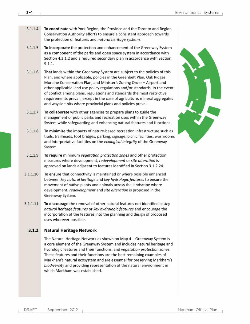
3.1.2 Natural Heritage Network
The Natural Heritage Network as shown on Map 4 – Greenway System is a core element of the Greenway System and includes natural heritage and hydrologic features and their functions, and vegetation protection zones. These features and their functions are the best remaining examples of Markham’s natural ecosystem and are essential for preserving Markham’s biodiversity and providing representation of the natural environment in which Markham was established.
Environmental Systems 3-5
DRAFT September 2012Markham Official Plan
Natural heritage and hydrologic features are generally intended to be conveyed into public ownership with the approval of development. Markham has committed funds and developed a land securement strategy for the purpose of identifying and securing important natural heritage and hydrologic features within the Natural Heritage Network.
General Policies
It is the policy of Council:
3.1.2.1 That the Natural Heritage Network, as shown on Map 4 – Greenway System, includes the following components:a) natural heritage and hydrologic features and their functions: i. key natural heritage features and key hydrologic features; ii. valleylands and watercourse corridors; and iii. woodlands and wetlands (evaluated or unevaluated);b) vegetation protection zones; andc) hazardous lands and sites.
3.1.2.2 That where natural heritage and hydrologic features and functions have been damaged, destroyed or removed without the approval of Council, appropriate compensation in the form of penalties and/or rehabilitation and enhancement to the impacted area shall be provided by the landowner at their cost. There shall be no adjustment to the Natural Heritage Network boundary or redesignation of lands where natural heritage and hydrologic features are damaged or destroyed without required approvals.
3.1.2.3 To integrate naturalized stormwater management facilities associated with valleylands and watercourse corridors, where it has been demonstrated to the satisfaction of Markham and the Toronto and Region Conservation Authority that feasible opportunities do not exist for new stormwater management facilities outside of valley corridors, to further enhance the function of the Natural Heritage Network.
3.1.2.4 To work cooperatively with landowners, governments and agencies to ensure that restoration activities within ‘Natural Heritage Restoration’ areas shown on Map 4 – Greenway System:a) support a natural linkage and ecological corridor function;b) achieve the naturalization of publicly owned lands over time; andc) minimize impacts to agricultural operations.
3.1.2.5 To require conveyance of lands within the Natural Heritage Network to a public authority as part of the development approval process at no cost to Markham. Conveyance of lands within the Natural Heritage Network shall not be considered as contributing towards the parkland dedication requirements under the Planning Act.
3.1.2.6 That where lands in the Natural Heritage Network cannot be secured in public ownership, the following stewardship and regulatory tools shall be used to secure the appropriate protection and/or public access for the lands:a) municipal land use controls;b) education;c) stewardship and other agreements; andd) conservation Easements.
The Natural Heritage Network features and their functions are essential for preserving biodiversity and providing representation of the natural environment in which Markham was established.

3-6 Environmental Systems
DRAFT September 2012 Markham Official Plan
3.1.2.7 To work in partnership with the Region, other senior levels of government, community partners and landowners, to secure in public ownership strategic land parcels within the Natural Heritage Network for the purpose of environmental protection.
3.1.2.8 That in addition to conveyance of lands within Natural Heritage Network through development approvals in Section 3.1.2.5, Markham may also consider the following options for acquiring land into public ownership:a) public acquisition;b) land exchanges;c) donations, gifts, bequests; andd) other appropriate methods.
3.1.2.9 That the Markham Environmental Land Securement Fund or other funding sources as may be appropriate, may be used to contribute to the costs of acquisition of properties within the Natural Heritage Network. Natural Heritage Enhancement lands shall be considered a priority for public acquisition.
3.1.2.10 To prepare Natural Heritage Network Edge Management Guidelines to address appropriate mechanisms for protecting and managing the interface between lands within the Natural Heritage Network and other land uses.
3.1.2.11 To minimize the impact of public infrastructure on the Natural Heritage Network, where need is demonstrated and no reasonable alternative is available, by:a) avoiding key natural heritage features and key hydrologic features and
the associated vegetation protection zone where possible in accordance with the recommendations of an appropriate study;
b) minimizing the amount of the Natural Heritage Network traversed and/or occupied by such infrastructure;
c) locating planned linear infrastructure parallel to valleylands outside of the minimum vegetation protection zone identified in Section 3.1.2.24;
d) minimizing the impacts and disturbance of the existing landscape including, but not limited to, impacts caused by light intrusions, noise and road salt through planning, design and construction practices;
e) optimizing existing capacity and coordination with different infrastructure services;
f) working with senior governments and agencies to address appropriate mitigation measures to minimize the impact of public infrastructure improvements and human activity on wildlife habitats; and
g) ensuring compliance with the applicable policies of the Oak Ridges Moraine Conservation Plan and the Greenbelt Plan by demonstrating how the policies are being met through environmental approval.
KeyNaturalHeritageFeatures,KeyHydrologicFeaturesandSpeciesatRisk
Key natural heritage features and key hydrologic features are the principal features of the Natural Heritage Network that are identified by the Province for protection.

Environmental Systems 3-7
DRAFT September 2012Markham Official Plan
Key natural heritage features and key hydrologic features support a wide variety of habitat for both plant and animal species. Habitat for endangered species, threatened species and special concern species are identified as Species at Risk by the Province, occurring in significantly low population numbers, restricted geographic areas or threatened by human activities. Endangered and threatened species may be subject to Provincial regulations governing habitat and species protection.
It is the intent of this Plan that key natural heritage features and key hydrologic features shall be assessed, expanded and planned for in a comprehensive and integrated manner, which builds upon and supports the Natural Heritage Network.
It is the policy of Council:
3.1.2.12 That the components of key natural heritage features and key hydrologic features include the following:a) wetlands;b) significant portions of the habitat of: i. endangered species and threatened species; ii. special concern species in the ‘Oak Ridges Moraine Conservation
Area’ and ‘Greenbelt Plan Area’; and iii. Provincially rare species in the ‘Oak Ridges Moraine Conservation
Plan Area’c) fish habitat;d) Areas of Natural and Scientific Interest;e) significant valleylands;f) significant woodlands;g) significant wildlife habitat;h) sand barrens, savannahs and tallgrass prairies;i) permanent and intermittent streams; andj) seepage areas and springs or sensitive surface water features.
3.1.2.13 To protect and enhance key natural heritage features and key hydrologic features and their functions by:a) prohibiting development, redevelopment and site alteration within
key natural heritage features and key hydrologic features and their vegetation protection zones as determined through an Environmental Impact Study, Natural Heritage Evaluation and/or Hydrological Evaluation, or equivalent study identified in Section 3.1.2.24 except for uses provided for in this Plan;
b) evaluating features not identified on Map 5 – Natural Heritage Features and Landforms and Map 6 – Hydrologic Features using standard provincial procedures to determine if they qualify for protection as key natural heritage features and key hydrologic features; and
c) working with other governments and agencies to identify habitat for endangered species, threatened species, and special concern species and provide habitat protection through recovery strategies or management plans in accordance with provincial policy.
3.1.2.14 That key natural heritage features and key hydrologic features on Map 5 – Natural Heritage Features and Landforms and Map 6 – Hydrologic Features shall be precisely delineated on a site-by-site basis using procedures
It is intended that key natural heritage features and key hydrologic features be assessed, expanded and planned for in a comprehensive and integrated manner, which builds upon and supports the Natural Heritage Network.

3-8 Environmental Systems
DRAFT September 2012 Markham Official Plan
established by the Region and Province, where applicable, and through the approval of Planning Act applications where supported by the appropriate study. Where approved by Council, the refined boundaries of the features may be identified without an amendment to this Plan.
Valleylands and Watercourse Corridor Policies
Valleylands and watercourse corridors as shown on Map 6 – Hydrologic Features comprise significant valleylands, river and stream corridors and permanent and intermittent streams that are defined by the Toronto and Region Conservation Authority and the Province. These lands support flood protection, erosion control, nature-based recreation uses and provide for fish habitat and flora and fauna. They are an integral part of the Natural Heritage Network and frequently provide ecological linkage among natural heritage features.
It is the intent of this Plan to ensure the long-term protection of valleylands and watercourse corridors through the policies contained within this Section and the management documents produced by the Toronto and Region Conservation Authority.
It is a policy of Council:
3.1.2.15 To only permit development, redevelopment and site alteration within valleylands and watercourse corridors and their associated vegetation protection zones, in accordance with Section 3.1.2.24 of this Plan on:a) lands identified as Special Policy Areas on Map 8 – Special Policy Areas
and in accordance with Toronto and Region Conservation Authority regulations and provincial requirements; and
b) lands regulated under the Conservation Authorities Act with the approval of the Toronto and Region Conservation Authority.
3.1.2.16 To work in cooperation with the Toronto and Region Conservation Authority to protect and improve fish habitat in watercourse corridors in accordance with approved Fisheries Management Plans. Development, redevelopment and site alteration is not permitted where it impacts fish habitat except in accordance with provincial and federal requirements.
3.1.2.17 That vegetation protection zones for significant valleylands, permanent streams, intermittent streams and fish habitat be provided in accordance with Section 3.1.2.24.
Woodlands and Wetlands
Woodlands provide ecological, social, economic, and environmental benefits including enhancing biodiversity, providing wildlife habitat, moderating temperatures, erosion control, pollution filtration, opportunities for passive recreation and respite from the urban environment. Woodlands are generally associated with valleylands or fragmented tableland parcels throughout Markham. It is a priority of Markham to protect woodlands of all sizes and integrate them into existing and new communities, as well as protect and actively manage the urban forest.
Valleylands and watercourse corridors support flood protection, erosion control, nature-based recreation uses and provide for fish habitat and flora and fauna.

Environmental Systems 3-9
DRAFT September 2012Markham Official Plan
The woodlands identified on Map 5 – Natural Heritage Features and Landforms are mapped using best available information based on existing data sources from the City, York Region and Toronto and Region Conservation Authority and are subject to additions and refinement in the field. It is the intent of this Plan to protect significant woodlands and woodlands (locally significant) and encourage the protection and enhancement of all other woodlands to the extent possible.
Wetlands are areas that are seasonally or permanently covered by shallow water or where the water table is close to or at the ground surface and are generally classified as swamps, marshes, bogs or fens. Wetlands control and store surface water to assist in flood control and groundwater recharge and support water tolerant vegetation. The wetlands shown on Map 6 – Hydrologic Features include those wetlands evaluated using standard provincial procedures and those wetlands that have yet to be evaluated.
It is the policy of Council:
3.1.2.18 To increase the quantity and quality of woodlands in Markham by protecting and enhancing:
a) significant woodlands as defined by the Region and Province and their vegetation protection zones by:
i. prohibiting development, redevelopment and site alteration on significant woodlands and their vegetation protection zones;
ii. integrating significant woodlands into new communities as amenity features;
iii. securing public ownership of significant woodlands through the development approval process; and
iv. securing conservation easements and other protection tools for the long-term protection of significant woodlands in private ownership.
b) woodlands (locally significant) and their vegetation protection zones by: i. prohibiting development, redevelopment and site alteration on
woodlands (locally significant) and their vegetation protection zones except where all the following requirements are met:
• the woodlands (locally significant) are not connected to the Greenway System;
• there is a significant net gain in woodland cover demonstrated through a Woodland Compensation Plan as described in Section 3.1.2.19;
• impact to the woodlands (locally significant) is unavoidable; • the woodland (locally significant) is determined through an
Environmental Impact Study, Natural Heritage Evaluation or equivalent to be a cultural or regenerating woodland and not suitable for restoration and rehabilitation;
ii. integrating woodlands (locally significant) into new communities as amenity features;
iii. securing public ownership of woodlands (locally significant) through the development approval process; and
iv. securing conservation easements and other protection tools for the long-term protection of woodlands (locally significant) in private ownership.
It is a priority of Markham to protect woodlands of all sizes and integrate them into existing and new communities, as well as protect and actively manage the urban forest.

3-10 Environmental Systems
DRAFT September 2012 Markham Official Plan
c) all other woodlands by identifying them in an inventory and incorporating them into new communities and developments where appropriate and feasible.
3.1.2.19 That a Woodland Compensation Plan shall address the woodland restoration in the following areas:a) Natural Heritage Network Enhancement Lands; andb) areas adjacent to existing key natural heritage features and key
hydrologic features.
Woodland compensation will not be accepted in areas that already meet the definition of woodland or within key natural heritage features or key hydrologic features or their vegetation protection zones.
3.1.2.20 To work in collaboration with the Province, Region and other stakeholders involved in woodland management to maintain and enhance private and public woodland resources and to implement good forestry practices.
3.1.2.21 To protect all wetlands identified by the Toronto and Region Conservation Authority and Ministry of Natural Resources (evaluated or unevaluated) and their function in Markham as:a) shown on Map 6 – Hydrologic Features; orb) identified and evaluated by an Environmental Impact Study or
Hydrologic Evaluation using standard provincial procedures.
3.1.2.22 To only permit development, redevelopment and site alteration within 120 metres of a wetland, but outside of the vegetation protection zone, where it has been demonstrated through an appropriate study that there will be no negative impacts to the feature or its functions. The study shall identify the importance, function and means of protection and/or maintenance of function to the satisfaction of the approval authority.
3.1.2.23 Toconfirm the boundaries of wetlands in consultation with the Ministry of Natural Resources and/or Toronto and Region Conservation Authority. Confirmation of wetland boundaries by the Province or Toronto and Region Conservation Authority shall not require an amendment to this Plan.
VegetationProtectionZone
A vegetation protection zone is a buffer area adjacent to a natural heritage feature or a hydrologic feature that is intended to protect the feature and its ecological function from adjacent land use impacts in order to maximize the long-term viability of the feature. Vegetation protection zone requirements vary depending on the feature and the relevant policy application (local, regional or provincial).
The Rouge watershed tributaries are subject to application of the ecological delineation criteria approved in 2009, and are incorporated into this Plan as the Rouge Watershed Protection Area Criteria in Section 3.1.4. The application of the Rouge Watershed Protection Criteria incorporates vegetation protection zones.
Wetlands control and store surface water to assist in flood control and groundwater recharge and support water tolerant vegetation.

Environmental Systems 3-11
DRAFT September 2012Markham Official Plan
It is the intent of this Plan that where development, redevelopment and site alteration is proposed adjacent to a natural heritage feature or hydrologic feature, a vegetation protection zone be provided and secured in public ownership as part of the Natural Heritage Network.
It is the policy of Council:
3.1.2.24 Toidentify and protect vegetation protection zones adjacent to natural heritage features and hydrologic features by:a) applying the minimum vegetation protection zone requirements
outlined below to development, redevelopment or site alteration on lands adjacent to key natural heritage features and key hydrologic features, valleylands, watercourse corridors, woodlands and wetlands (evaluated or unevaluated) as determined by an Environmental Impact Study, Natural Heritage Evaluation and/or Hydrological Evaluation, or equivalent;
b) requiring an appropriate study to determine the extent of the vegetation protection zone where development, redevelopment or site alteration is proposed within the minimum adjacent lands identified in Section 3.1.2.24 a); and
c) securing vegetation protection zones through: i. conveyance into public ownership through the development
approval process; and ii. appropriate zoning controls.
MinimumVegetationProtectionZones
On the Oak Ridges Moraine Conservation Plan Area and the Greenbelt Plan Area the standards specified by the Provincial Plans will apply. Standards provided in this Table are minimums and their adequacy must be evaluated through site-specific studies.
Feature Minimum Adjacent Lands
MinimumVegetationProtectionZone Measurement
Provincially significant wetlands, or wetlands (evaluated or unevaluated) on the Oak Ridges Moraine and the Greenbelt
120 metres 30 metres or greater as determined by a Natural Heritage Evaluation and/or Hydrological Evaluation or Environmental Impact Study
Edge of the feature
All other wetlands (evaluated or unevaluated) outside the Oak Ridges Moraine and the Greenbelt
120 metres Determined by an Environmental Impact Study but not less than 15 metres
Edge of the feature
Seepage areas and springs on the Oak Ridges Moraine and the Greenbelt
120 metres 30 metres Edge of the feature
Significant valleylands 120 metres 30 metres or greater as determined by a Natural Heritage Evaluation and/or Hydrological Evaluation or Environmental Impact Study
Long-term stable top of bank
A vegetation protection zone is a buffer area intended to protect a natural heritage or hydrologic feature and its ecological function from adjacent land use impacts.

3-12 Environmental Systems
DRAFT September 2012 Markham Official Plan
Feature Minimum Adjacent Lands
MinimumVegetationProtectionZone Measurement
Permanent and intermittent streams outside of the urban area
120 metres 30 metres on drainage areas of 30 hectares or greater 10 metres on drainage areas between 10 and 30 hectares Drainage areas less than 10 hectares determined by an Environmental Impact Study
Limit of the floodplain or hazard lands as defined by the TRCA
Permanent and intermittent streams inside the urban area
60 metres 10 metres or where site constrained determined by an Environmental Impact Study
Greater of stable top of bank or floodplain
Fish habitat 120 metres 30 metres Edge of water feature
Significant woodlands on the Oak Ridges Moraine and Greenbelt
120 metres 30 metres Drip line of edge trees or outermost trunks for Oak Ridges Moraine
Significant woodlands off the Oak Ridges Moraine and Greenebelt
120 metres Determined by an Environmental Impact Study evaluation but not less than 10 metres
Drip line of edge trees
Woodlands (locally significant)
60 metres Determined by an Environmental Impact Study or Natural Heritage Evaluation but not less than 10 metres
Drip line of edge trees
Other woodlands 60 metres Determined by an Environmental Impact Study
Drip line of edge trees
Significant wildlife habitat and habitat of endangered species and threatened species and Provincially rare species on the Oak Ridges Moraine
120 metres Determined by an Environmental Impact Study evaluation and/or applicable Provincial regulation and guideline
Edge of the feature
Sand barrens, savannahs and tallgrass prairies on the Oak Ridges Moraine or Greenbelt
120 metres 30 metres or greater as determined by a Natural Heritage Evaluation and/or Hydrological Evaluation
Edge of the feature
Rouge River tributaries within the Rouge Watershed Protection Area
120 metres Determined in accordance with Section 3.1.4.1
Edge of the feature
Natural heritage and hydrologic features in the Built-up Urban Area
NA Determined by approved secondary plan or Environmental Impact Study but not less than 10 metres
Edge of the feature
Environmental Systems 3-13
DRAFT September 2012Markham Official Plan
3.1.2.25 That where development, redevelopment or site alteration outside the urban area is proposed between key natural heritage features or key hydrologic features the minimum adjacent lands requirements identified in Section 3.1.2.24 a) may be increased.
3.1.2.26 To coordinate with the York Region requirements for a Natural Heritage Evaluation and/or Hydrological Evaluation, or an Environmental Impact Study where lands within the Greenway System and the Region’s Greenlands overlap. All applications for development within 120 metres of the Regional Greenlands System shall be accompanied by an Environmental Impact Study or equivalent to the satisfaction of York Region.
3.1.2.27 To consider a reduced vegetation protection zone within the existing urban area only where:a) supported by an Environmental Impact Study; andb) site constraints such as existing lot size or physical site characteristics
clearly limit the ability to achieve a minimum 10-metre vegetation protection zone.
3.1.2.28 That should areas of natural or scientific interest (life science or earth science) be identified in Markham, the feature and its vegetation protection zone shall be protected in accordance with Provincial requirements.
3.1.3 Natural Heritage Network Enhancement Lands
Natural Heritage Network Enhancement Lands are areas that have the potential to increase the resilience of the Natural Heritage Network by, among other things, facilitating movement of wildlife and dispersal of plants among features. These areas can improve the biodiversity and connectivity of key natural heritage features and key hydrologic features, valleylands and watercourse corridors, and woodlands, and improve the ecological function of the network. The Natural Heritage Network Enhancement Lands are shown symbolically on Map 4 – Greenway System as ‘Core Area Enhancements’, ‘Core Linkage Enhancement’ and ‘Natural Heritage Restoration Areas’.
‘Core Area Enhancements’ have been targeted as areas that would greatly enhance the function of existing natural areas by improving their shape and marginally increasing their size to provide the minimum area required to support valued species in the long term. This is done in recognition of the increased stresses put on smaller natural features within urban areas. ‘Core Linkage Enhancements’ are intended to mitigate the reduction in connectivity among natural features that generally occurs when agricultural lands are urbanized. ‘Natural Heritage Restoration Areas’ are publicly owned lands that are targeted for natural heritage restoration activities such as reforestation and wetland rehabilitation.
It is the intent of this Plan to identify and refine ‘Core Area Enhancements’, ‘Core Linkage Enhancements’ and ‘Natural Heritage Restoration Areas’, and seek their protection and enhancement through the development approval process for development, redevelopment and site alteration, particularly on lands designated as ‘Future Urban Area’ on Map 3 – Land
Natural Heritage Network Enhancement Lands are areas that have the potential to increase the resilience of the Natural Heritage Network by facilitating movement of wildlife and dispersal of plants among features.

3-14 Environmental Systems
DRAFT September 2012 Markham Official Plan
Use. In addition, naturalized stormwater management facilities adjacent to valleylands and watercourse corridors have the potential to enhance the function of the Natural Heritage Network.
It is the policy of Council:
3.1.3.1 Toidentify Natural Heritage Network Enhancement Lands comprising ‘Core Area Enhancements’, ‘Core Linkage Enhancement’, and ‘Natural Heritage Restoration Areas’ shown symbolically on Map 4 – Greenway System and integrate them into the Natural Heritage Network to:a) improve biodiversity around existing natural features and protected
provincial policy areas;b) improve connectivity of subwatersheds and their features; andc) improve ecological function.
3.1.3.2 To delineate the Natural Heritage Network Enhancement Lands through a subwatershed plan, Master Environmental Servicing Plan, Environmental Impact Study, Natural Heritage Evaluation and/or Hydrological Evaluation, or equivalent and where appropriate, identify additional Natural Heritage Network Enhancement Lands for long-term protection.
3.1.3.3 To require the protection and enhancement of Natural Heritage Network Enhancement Lands through the development approval process for development, redevelopment and site alteration, particularly on lands designated as ‘Future Urban Area’ on Map 3 – Land Use, to maintain existing connectivity among natural heritage and hydrologic features and create large blocks of habitat. Natural heritage enhancements may also be secured through greening initiatives, partnership and infrastructure projects to achieve ecological gains.
3.1.3.4 To work cooperatively with landowners and agencies to ensure the ‘Natural Heritage Restoration Areas’ shown on Map 4 – Greenway System are appropriately phased to minimize impacts on agricultural operations.
3.1.4 RougeWatershedProtectionArea
The ‘Rouge Watershed Protection Area’ as shown on Map 4 – Greenway System comprises the Rouge watercourses, their associated valleylands and riparian zones, key natural heritage features and key hydrologic features associated with the corridor and a protective buffer. The ‘Rouge Watershed Protection Area’ forms part of the Natural Heritage Network and the Greenbelt.
The ‘Rouge Watershed Protection Area’ is of particular significance given the extensive public investment in establishing the Rouge Park and the efforts of all levels of government in preparing the Rouge North Management Plan.
The Rouge North Management Plan provides the framework for the delineation of the boundary of the ‘Rouge Watershed Protection Area’ and contains objectives to ensure the long-term protection of Rouge watershed tributaries that flow into the Rouge Park. The Rouge North Implementation Manual provides the requirements for the interpretation and refinement
The Rouge Watershed Protection Area is of particular significance given the extensive public investment in establishing the Rouge Park and the efforts of all levels of government in preparing the Rouge North Management Plan.

Environmental Systems 3-15
DRAFT September 2012Markham Official Plan
of the ‘Rouge Watershed Protection Area’ boundary. The boundary of the ‘Rouge Watershed Protection Area’ is preliminary and will continue to be refined through the development approvals process.
It is the policy of Council:
3.1.4.1 That where development, redevelopment or site alteration is proposed adjacent to a watercourse within the Rouge watershed, the refinement and confirmation of the boundary of the ‘Rouge Watershed Protection Area’ as shown on Map 4 – Greenway System will be required in accordance with the ‘Rouge Watershed Protection Area’ objectives contained in the table below and the requirements of the boundary delineation criteria for the ‘Rouge Watershed Protection Area’ contained in the Rouge North Implementation Manual.
RougeWatershedProtectionAreaCriteria
Criterion Objective
1 Watercourses and existing regulatory floodplain
To protect form, function, ecological health and floodplain function of the watercourses.
2 Meander belt To provide for the natural evolution of stream morphology and minimize long-term risk to life and property.
3 Valley and Stream Corridor Features
To preserve the stability and integrity of the valley and stream corridors and to preserve and enhance valley and stream corridors consistent with the intent of the TRCA policy.
4 Natural Vegetation Communities and Riparian Vegetation Communities and Interior Forest Conditions
To preserve and protect existing natural vegetation, riparian zones, aquatic habitats, woodlands and interior forest condition consistent with TRCA programs.
5 Wetlands (evaluated and unevaluated)
To preserve and protect wetlands (evaluated and unevaluated) and Areas of Natural and Scientific Interest in accordance with Markham, TRCA and Provincial policy and regulations.
6 Significant habitat for endangered, threatened, special concern or provincially rare species
To protect habitats for vulnerable, threatened and endangered species and species of concern as identified by TRCA, Provincial and Federal governments.
7 Terrestrial Corridor Habitat Function and Woodland Restoration Requirement
To provide, maintain and enhance corridors required for species movement, maintain appropriate biodiversity consistent with TRCA policy and programs and to provide for the enhancement of natural vegetation communities and interior forest conditions and to enhance woodland connectivity and reduce fragmentation.
8 Seepage Areas and Areas Exhibiting Groundwater Discharge
To ensure maintenance of baseflow for habitat for aquatic and wetland species and maintain and enhance water quality, consistent with TRCA programs
9 Vegetation Community Maintenance Area to protect riparian zones
To protect vegetation communities, species and habitats from edge effects; to protect from invasive species colonization; to achieve TRCA restoration targets; to protect interior forest habitat; to accommodate access; to protect adjacent properties from damage, and to accommodate recreational uses
10 Cultural and Archaeological Resources
To identify and protect cultural heritage and archaeological resources and to provide for cultural heritage interpretation.

3-16 Environmental Systems
DRAFT September 2012 Markham Official Plan
3.1.4.2 That the ‘Rouge Watershed Protection Area’ boundary along the main branch of the Little Rouge Creek on lands in private ownership shall be interpreted as coincident with the Greenbelt Plan boundary.
3.1.4.3 To support the long-term protection of the Little Rouge Creek corridor as shown on Map 6 – Hydrologic Features as a functional and sustainable ecological corridor with the long-term goal of achieving interior forest habitat conditions generally extending 600 metres in width.
3.1.4.4 That in the event that the minimum vegetation protection zone identified in Section 3.1.2.24 is not consistent with the boundary as established through the application of the ‘Rouge Watershed Protection Area’ criteria identified in Section 3.1.4.1, the boundary of the ‘Natural Heritage Network’ shown on Map 4 – Greenway System shall be deemed to be the boundary which provides the greatest protection for the natural feature.
3.1.4.5 That where lands are located both within the ‘Rouge North Management Plan Area’ and the ‘Greenbelt Plan Area’ the most restrictive policies shall prevail.
3.1.5 OakRidgesMoraineConservationPlanandGreenbeltPlan
The Provincial Oak Ridges Moraine Conservation Plan provides policies and guidelines for the protection of the landform features and natural heritage resources within the ‘Oak Ridges Moraine Conservation Plan Area’ shown on Map 7 – Provincial and Federal Policy Areas. The Provincial Greenbelt Plan provides policies and guidelines for the management of lands within the ‘Greenbelt Plan Area’ shown on Map 7 – Provincial and Federal Policy Areas. In addition to the land use policies in Section 8.6, the following policies apply to all lands within the ‘Oak Ridges Moraine Conservation Plan Area’ and the ‘Greenbelt Plan Area’.
It is the intent of this Plan to support the Provincial Plans and implement the requirements of the Provincial Plans. The ‘Oak Ridges Moraine Conservation Plan Area’ and the ‘Greenbelt Plan Area’ form part of the Greenway System as shown on Map 4 – Greenway System.
It is the policy of Council:
3.1.5.1 To protect and manage lands within the ‘Oak Ridges Moraine Conservation Plan Area’ and the ‘Greenbelt Plan Area’ as shown on Map 7 – Provincial and Federal Policy Area in accordance with the policies of the appropriate Provincial Plans and this Plan where applicable. Development, redevelopment and site alteration shall only be permitted where they comply with applicable provincial legislation.
3.1.5.2 That for the purpose of interpretation of Provincial and Regional policy, agricultural lands within the ‘Oak Ridges Moraine Conservation Plan Area’ and the ‘Greenbelt Plan Area’ are classified ‘prime agricultural lands’.
It is the intent of this Plan to support and implement the requirements of the Oak Ridges Moraine Conservation Plan and the Greenbelt Plan.

Environmental Systems 3-17
DRAFT September 2012Markham Official Plan
3.1.5.3 To prohibit development, redevelopment or site alteration within key natural heritage features and key hydrologic features and their vegetation protection zones in the ‘Oak Ridges Moraine Conservation Plan Area’ and the ‘Greenbelt Plan Area’ with the exception of conservation, resource management, nature-based recreation and public infrastructure.
3.1.5.4 That existing uses, expansion to existing uses, reconstruction of existing buildings and structures and conversions of existing uses to more compatible uses may be permitted subject to satisfying the specific applicable policies in the Oak Ridges Moraine Conservation Plan and the Greenbelt Plan providing that the use or expansion was lawfully used for that purpose on or before November 15, 2001 within the ‘Oak Ridges Moraine Conservation Plan Area’ and on or before February 28, 2005 in the ‘Greenbelt Plan Area’.
3.1.5.5 That activities related to non-renewable resources including mineral aggregates and wayside pits, may be permitted in the ‘Oak Ridges Moraine Conservation Plan Area’ and the ‘Greenbelt Plan Area’ subject to an amendment to this Plan and the specific policies in the Oak Ridges Moraine Conservation Plan and the Greenbelt Plan.
3.1.5.6 That the technical papers prepared by the Province associated with the Oak Ridges Moraine Conservation Plan and the Greenbelt Plan shall be used to provide guidance in the definition and implementation of policies related to key natural heritage features and key hydrologic features as identified in the Plans.
3.1.5.7 That lands identified as ‘Oak Ridges Moraine Countryside’ and ‘Oak Ridges Moraine Natural Linkage Area’ on Map 7 – Provincial and Federal Policy Areas, and ‘Oak Ridges Moraine Landform Conservation Area Category 2’ on Map 5 – Natural Heritage Features and Landforms, and ‘Oak Ridges Moraine Areas of High Aquifer Vulnerability’ on Map 6 – Hydrologic Features, are subject to the specific policies of the Oak Ridges Moraine Conservation Plan.
3.1.5.8 To recognize that the southern boundary of the Oak Ridges Moraine be based on the 245-metre contour established by Ontario Regulation 01-02. Where lands are certified by an Ontario Land Surveyor as below the 245-metre contour to the satisfaction of Markham and the Region such lands shall be exempt from the provisions of the Oak Ridges Moraine Conservation Plan, but shall be subject to the Protected Countryside policies of the Greenbelt Plan.
3.1.5.9 To maintain and where possible restore lands identified for ‘Natural Heritage Restoration’ areas shown on Map 4 – Greenway System within the ‘Oak Ridges Moraine Natural Linkage Area’ shown on Map 7 – Provincial and Federal Policy Areas that support a regional scale natural linkage and ecological corridor function consistent with the Natural Linkage objectives of Section 12 of the Oak Ridges Moraine Conservation Plan.
3.1.5.10 That lands identified as ‘Oak Ridges Moraine Countryside’ on Map 7 – Provincial and Federal Policy Areas are intended to support and provide for the continuation of agricultural uses and form part of the Greenway System.

3-18 Environmental Systems
DRAFT September 2012 Markham Official Plan
3.1.5.11 That applications for development, redevelopment or site alteration on lands identified as ‘Oak Ridges Moraine Landform Conservation Area Category 2’ on Map 5 – Natural Heritage Features and Landforms shall be accompanied by a Landform Conservation Plan and be consistent with the polices and requirement in the Oak Ridges Moraine Conservation Plan.
3.1.5.12 That applications for development, redevelopment or site alteration on lands identified as ‘Oak Ridges Moraine Areas of High Aquifer Vulnerability’ on Map 6 – Hydrologic Features shall be subject to the policies of Section 8.6.1.4 b).
3.1.5.13 To only permit consents on lands identified as ‘Oak Ridges Moraine Conservation Plan Area’ on Map 7 – Provincial and Federal Policy Areas, subject to meeting all the requirements of Section 32 of the Oak Ridges Moraine Conservation Plan.
3.1.5.14 That lands identified as ‘Greenbelt Protected Countryside’ on Map 7 – Provincial and Federal Policy Areas are subject to additional Natural Heritage System policies contained in the Greenbelt Plan and refinements to the boundary of the Natural Heritage System shall only be considered through a provincial review process.
3.1.5.15 To only permit consents on lands identified as the ‘Greenbelt Plan Area’ Area’ on Map 7 – Provincial and Federal Policy Areas, subject to meeting all the requirements of Section 4.6 of the Greenbelt Plan.
3.2 URBAN FOREST SYSTEM
The Urban Forest System comprises all woodlands, individual trees and shrubs, under storey and soils that grow on public and private property in Markham. The urban forest provides various benefits to Markham including reduction in air pollution, moderation of urban heat island effect, energy savings, mitigating climate change effects, habitat for urban adapted wildlife, stormwater management, recreation and opportunities for physical activity, biodiversity, improving mental well-being and contributing to the quality and character of the urban environment.
It is the policy of Council:
3.2.1 To protect, expand and integrate the urban forest in existing and new communities.
3.2.2 To develop in cooperation with York Region an Urban Forest Management Plan to address local tree canopy targets, tree species diversity, invasive species management, strategies to implement tree canopy targets and provide for the long-term maintenance of Markham’s urban forest.
3.2.3 To encourage the enhancement of the urban forest through tree planting and restoration of public and private lands in the urban area. Restoration sites may include hydro corridors, municipal parks, schools, stormwater management ponds and other public infrastructure sites. Diversity of tree species shall be encouraged to ensure a resilient and healthy urban forest.
The Urban Forest System comprises all woodlands, individual trees and shrubs, under-storey and soils that grow on public and private property in Markham.

Environmental Systems 3-19
DRAFT September 2012Markham Official Plan
3.2.4 To require appropriate compensation in the form of rehabilitation and enhancement of the urban forest where the urban forest has been impacted by the provision of infrastructure.
3.2.5 To maintain and update the Tree Conservation By-law to manage the removal and destruction of trees on private property and cooperate with the York Region in the implementation of the Regional Tree By-law.
3.2.6 To protect and enhance rural and urban hedgerows and integrate into development, redevelopment and site alteration where possible, particularly where they provide a linkage to other natural areas, provide for wildlife habitat and movement, and are composed of healthy and mature trees.
3.2.7 To increase awareness of the benefits of the urban forest and promote public education and involvement in the stewardship of Markham’s urban forest.
3.3 WATER SYSTEM
Water is a resource that sustains aquatic and wetland habitats, provides drinking water for residents and supports recreational opportunities. The Water System policies in this Section provide a framework for watershed planning, guide the delivery of safe and sustainable water and wastewater services as well as provide direction for the protection of local surface water and groundwater resources.
3.3.1 Watershed Planning
Watershed plans provide management direction for the protection of natural heritage and hydrologic features at the watershed scale using an ecosystem approach. Watershed plans have been prepared for the five watersheds located in Markham including the Don, Rouge, Duffins, Petticoat and Highland watersheds identified on Map 6 – Hydrologic Features. These plans provide a community vision and policy framework to achieve a sustainable and healthy watershed through the protection of safe and sustainable local surface water and groundwater resources and an integrated water conservation approach.
Markham recognizes watershed and subwatershed planning and its ecosystem-based approach to resource management as an important tool for guiding land use and infrastructure decisions that protect water and land resources.
It is the policy of Council:
3.3.1.1 To work in cooperation with the Toronto and Region Conservation Authority and other partners in the preparation and update of watershed plans if required.
3.3.1.2 To work in partnership with the Toronto and Region Conservation Authority, York Region and other partners in the preparation of a framework for watershed plan implementation that may include the
Water is a resource that sustains aquatic and wetland habitats, provides drinking water for residents and supports recreational opportunities.

3-20 Environmental Systems
DRAFT September 2012 Markham Official Plan
preparation of detailed implementation plans and the consideration of appropriate best management practices and sustainable technologies in development of the ‘Future Urban Area’ lands shown on Map 3 – Land Use.
3.3.1.3 To work in cooperation with the Toronto and Region Conservation Authority, Ministry of Natural Resources and other partners, in the preparation of subwatershed plans for smaller drainage areas within Markham’s watershed area boundaries.
3.3.1.4 To require the preparation of subwatershed plans prior to development in Markham’s ‘Future Urban Areas’ as shown on Map 3 – Land Use to guide land use options and identify mitigation and restoration strategies required to protect and enhance natural heritage and hydrologic features and their ecological functions and hydrologic functions.
3.3.1.5 To address watershed and subwatershed plans in the preparation of Master Environmental Servicing Plans and all other required studies prepared in support of development, redevelopment and site alteration.
3.3.2 GroundwaterandSurfaceWaterResources
Groundwater resources sustain rural drinking water supplies and support sensitive aquatic habitat and natural features throughout Markham. Features considered to be critical to the protection of these resources include recharge areas, discharge areas, and lands above aquifers that are susceptible to contamination.
Land uses impacting drinking water supplies are managed through the Clean Water Act and local Source Protection Plans that consider the sensitivity of specific features. In Markham, the sensitivity of local aquifers to potential contamination is limited. From a drinking water quantity perspective, significant groundwater recharge areas and intake protection zones lie beyond Markham boundaries and will be managed by adjacent municipalities through implementation of Source Protection Plan policies.
Groundwater and surface water resources in Markham are important from an ecological perspective and sensitive features are protected through this Plan and the provincial Oak Ridges Moraine Conservation Plan and the Greenbelt Plan. Watershed plans prepared by the Toronto and Region Conservation Authority have also identified potential significant local groundwater recharge areas which contribute to maintaining aquifer levels and aquatic habitat and may be further defined through a subwatershed plan. At a local scale, sensitive features such as small streams will be identified and protected through the development approval process.
It is the policy of Council:
3.3.2.1 To direct development, redevelopment and site alteration away from sensitive groundwater features and sensitive surface water features.
3.3.2.2 That water balance must be managed as a result of development to maintain the natural quality, hydrological function and ecological integrity of key hydrologic features as much as possible.
Markham recognizes watershed and subwatershed planning and its ecosystem-based approach to resource management as an important tool for guiding land use and infrastructure decisions that protect water and land resources.
Environmental Systems 3-21
DRAFT September 2012Markham Official Plan
3.3.2.3 To work with provincial agencies and adjacent municipalities to manage activities which pose potential contamination risks on highly vulnerable aquifers.
3.3.2.4 That where potentially significant local groundwater recharge areas are identified in an approved watershed plan and/or subwatershed plan, Markham shall require that a subwatershed plan, a Master Environmental Servicing Plan, an Environmental Impact Statement, a Natural Heritage Evaluation and/or Hydrological Evaluation, or equivalent in support of development, redevelopment or site alteration include a hydrological and modeling component to address aquifer water levels, groundwater flow patterns and aquatic habitat where target species rely on groundwater discharge.
3.3.2.5 To support programs developed by York Region and the Toronto and Region Conservation Authority to monitor the quality and quantity of surface water and groundwater systems.
3.3.2.6 That where development, redevelopment or site alteration is proposed on lands containing small drainage features as identified on Appendix B – Small Streams and Drainage Features, the features shall be evaluated and protected where required using Markham’s ‘Small Streams Classification System and Management Protocol’.
3.3.2.7 To prepare and maintain an Erosion Restoration Master Plan for eroded and degraded watercourse corridors for the purpose of protecting infrastructure, restoring natural form and function, and where possible improving fish habitat through the restoration of natural riparian vegetation and removal of barriers to fish migration.
3.3.2.8 To prohibit permanent dewatering.
3.3.3 StormwaterManagement
Stormwater management is the control of stormwater runoff for the purpose of pollution and water quantity controls, often using water retention facilities to provide controlled release into receiving streams. Stormwater management is the means by which broad goals for water management are implemented.
An integrated design approach to stormwater management considering engineering, landscape architecture, geosciences, planning and ecology aspects is required to achieve technical as well as complementary social and environmental objectives. This approach is necessary to address:
• traditional flood and erosion control;
• water quality treatment; and
• low-impact development measures that preserve natural hydrologic functions and protect natural systems.
Markham continues to support innovative methods to manage and integrate stormwater as a resource.
Groundwater and surface water resources in Markham are important from an ecological perspective and sensitive features are protected through this Plan and the provincial Oak Ridges Moraine Conservation Plan and the Greenbelt Plan.
3-22 Environmental Systems
DRAFT September 2012 Markham Official Plan
It is the policy of Council:
3.3.3.1 To require all stormwater management facilities be designed and located to meet or exceed provincial guidelines for stormwater management best practices and in accordance with Markham’s Stormwater Management Guidelines and Engineering Design Standards.
3.3.3.2 That stormwater management facilities shall:a) maintain groundwater quality and flow and stream baseflow;b) protect water quality;c) minimize the disruption of natural drainage patterns wherever possible;d) minimize increases in stream channel erosion;e) prevent any increase in flood risk;f) protect aquatic species and their habitat;g) minimize vegetation removal, grading, soil compaction, and sediment
erosion;h) use an integrated treatment approach where appropriate to minimize
stormwater management flows and structures;i) comply with recommendations, standards or targets contained within
watershed plans and water budgets; andj) comply with the specific requirements of the Oak Ridges Moraine
Conservation Plan and Greenbelt Plan, watershed plans and subwatershed plans.
3.3.3.3 That all stormwater management plans submitted to Markham in support applications for development, redevelopment or site alteration, identify best management practices that will meet or exceed the minimum design criteria specified for flood control, erosion control (as specified in a sediment and erosion control report), water quality treatment and infiltration (water balance) identified in Markham’s Stormwater Management Guidelines and Engineering Design Standards and any large-scale supporting studies. Minimum criteria specified in the guidelines may be superseded by additional requirements for drinking water protection, Oak Ridges Moraine and Greenbelt conservation, and/or protection of sensitive and endangered aquatic species.
3.3.3.4 To encourage an integrated design approach in the selection and design of innovative best management practices for stormwater management in order to improve technical effectiveness, minimize maintenance and operation requirements, advance other initiatives (water conservation) and to promote naturalized solutions that integrate with other features in the public and private realms.
3.3.3.5 That low-impact development measures be promoted as part of overall stormwater management strategies in order to address impacts at-source and to maintain or restore components of the natural water balance.
3.3.3.6 That naturalized stormwater management facilities, including wetland configurations, be located and designed to complement the Greenway System and further enhance the function of the Natural Heritage Network.
3.3.3.7 Stormwater management facilities are prohibited in key natural heritage and key hydrologic features except in valleylands and watercourse corridors. In these areas, naturalized stormwater management facilities
An integrated design approach to stormwater management considering engineering, landscape architecture, geosciences, planning and ecology aspects is required to achieve technical as well as complementary social and environmental objectives.

Environmental Systems 3-23
DRAFT September 2012Markham Official Plan
may be permitted provided that a Hydrological Evaluation or Environmental Impact Study demonstrates that there is an anticipated benefit to the function of the natural heritage network by locating the facility there and that:a) there is minimal impact to existing features or enhancement areas;b) sufficient riparian buffering is provided;c) sufficient land is protected for trail and amenity features surrounding
the facility;d) bird hazard impacts are addressed, where subject to airport regulation;e) the facility is integrated into the Natural Heritage Network; andf) the facility is located a minimum of 30 metres from the edge of the
watercourse and outside of the meander belt and 100-year floodplain.
3.3.3.8 That all proposed development, redevelopment or site alteration shall have erosion and sediment control measures in place to the satisfaction of Markham.
3.3.3.9 That construction practices and sediment control measures during construction shall be implemented, monitored and maintained to the satisfaction of Markham.
3.3.3.10 To prepare a Stormwater Management Retrofit Master Plan to identify and prioritize opportunities to:a) improve stormwater management in the existing urban area;b) improve existing water quality treatment and erosion control; andc) restore pre-development hydrologic functions.
3.3.3.11 To require that stormwater management facilities be inspected and maintained on an on-going basis to ensure their proper function.
3.4 ENVIRONMENTAL HAZARDS
Environmental hazards can pose a threat to public health and safety. Environmental hazards include natural hazards such as floodplain lands and erosion sites, as well human environmental hazards resulting from soil contamination, and illnesses associated with air quality resulting from the burning of fossil fuels in homes, transportation vehicles and industrial operations.
It is the intent of Markham to take a proactive and precautionary approach to protecting public health and safety through prevention, protection and emergency preparedness.
3.4.1 Natural Environmental Hazards
Natural environmental hazards such as flooding and erosion can present an inherent risk to life and property damage. Policies respecting restrictions on hazardous lands and floodplain management in Special Policy Areas and flood vulnerable areas can reduce this risk and enhance public health and safety. Appendix A – Toronto and Region Conservation Authority Regulatory Framework outlines the key components of the Toronto and Region Conservation Authority Regulatory Framework related to floodplain management and flood vulnerable areas including:
Environmental hazards include natural hazards such as floodplain lands and erosion sites, as well human environmental hazards resulting from soil contamination, and illnesses associated with air quality.

3-24 Environmental Systems
DRAFT September 2012 Markham Official Plan
• the screening area for development, redevelopment or site alteration established through Ontario Regulation 166-06;
• flood vulnerable areas that are shown symbolically and are potentially susceptible to flood events where the flood risk must be assessed and addressed prior to development, redevelopment or site alteration; and
• the floodplain and erosion hazards where development, redevelopment or site alteration is regulated.
Map 8 – Special Policy Areas identifies areas that have historically existed within the floodplain where site-specific policies approved by the Province are intended for the continued viability of existing uses.
General Policies
It is the policy of Council:
3.4.1.1 To protect the safety of the public and reduce property damage by directing development, redevelopment or site alteration to locations outside of the hazardous lands and hazardous sites as generally shown in Appendix A – Toronto and Region Conservation Authority Regulatory Framework.
3.4.1.2 To prohibit the following uses on hazardous lands, hazardous sites and Special Policy Areas:a) uses associated with hospitals, nursing homes, pre-school, school
nurseries, daycare and schools, where there is a threat to the safe evacuation of the sick, the elderly, persons with disabilities or the young during an emergency as a result of flooding, failure of floodproofing measures or protection works or erosion;
b) uses associated with essential emergency services such as that provided by fire, police and ambulance stations and electrical substations, that would be impaired during an emergency as a result of flooding, the failure of floodproofing measures and/or protection works or erosion; and
c) uses associated with the manufacture, storage, disposal or treatment of hazardous substances.
3.4.1.3 To promote and encourage mitigation and remediation works for existing development within hazardous lands and hazardous sites.
Hazardous Lands
Hazardous lands are areas that pose risks to human health and safety and private property due to potential flood impacts and unstable slopes and erosion issues. Hazardous lands and hazardous sites are regulated in accordance with the natural hazard policies of the Provincial Policy Statement and the regulations of the Toronto and Region Conservation Authority. It is the intent of Markham to direct development, redevelopment and site alteration away from these areas to protect the safety of the public. Hazardous lands are designated ‘Greenway’.
Natural environmental hazards such as flooding and erosion can present an inherent risk to life and property damage.
Environmental Systems 3-25
DRAFT September 2012Markham Official Plan
It is the policy of Council:
3.4.1.3 That hazardous lands and hazardous sites located within the areas as generally shown in Appendix A – Toronto and Region Conservation Authority Regulatory Framework, but excluding Special Policy Areas and certain flood vulnerable lands, shall be generally designated as ‘Greenway’ lands on Map 3 – Land Use.
3.4.1.4 To prohibit development, redevelopment or site alteration and lot creation in hazardous lands and hazardous sites contained within the ‘Greenway’ designation in accordance with the policies and requirements of the Provincial Policy Statement and Toronto and Region Conservation Authority.
3.4.1.5 To require conveyance of hazardous lands and hazardous sites within the ‘Greenway’ designation at no cost to a public authority.
3.4.1.6 That the management of floodplain lands as generally shown in Appendix A - Toronto and Region Conservation Authority Regulatory Framework be based on the regulatory flood standard in accordance with Provincial standards and mapping produced by the Toronto and Region Conservation Authority.
3.4.1.7 That where development, redevelopment or site alteration is proposed in areas subject to erosion hazards and slope instability, a geotechnical report shall be prepared by the proponent to address the nature and extent of the erosion and identify appropriate setbacks and remediation measures to prevent long-term erosion hazards to the satisfaction of Markham and the Toronto and Region Conservation Authority.
SpecialPolicyAreas
Special Policy Areas are areas within Markham that have historically existed within the floodplain where site-specific policies approved by the Province provide for the continued viability of existing uses. Specific policies are provided to address the management of these areas including criteria and procedures for development, redevelopment or site alteration as established by the Province.
Markham’s Special Policy Areas are shown as an overlay on Map 8 – Special Policy Areas with the underlying land use designation reflecting existing uses, existing zoning and statutory approvals shown on Map 3 – Land Use. It is the intent that the Special Policy Area provide for the continued viability of existing uses and manage development and redevelopment where provided for in this Plan. A Special Policy Area is not intended to allow for intensified development if a community has feasible opportunities for intensification outside of the floodplain.
It is the policy of Council:
3.4.1.8 To work with the Toronto and Region Conservation Authority to ensure that development, redevelopment or site alteration within a Special Policy Area shown on Map 8 – Special Policy Areas will not result in an unacceptable hazard risk to life or property or where flood protection measures would have a negative impact on adjacent properties.
Special Policy Areas are areas within Markham that have historically existed within the floodplain where site-specific policies approved by the Province provide for the continued viability of existing uses.

3-26 Environmental Systems
DRAFT September 2012 Markham Official Plan
3.4.1.9 That development, redevelopment or site alteration within the Special Policy Area is permitted subject to meeting technical flood proofing and safe access criteria in accordance with the underlying land use designations and the policies of this Plan and in accordance with Section 3.4.1.2. Development applications which would intensify the level of development beyond what is permitted by this Plan, must demonstrate that no alternatives exist outside of the floodplain and shall be assessed in a comprehensive manner and require the review and endorsement of the Province.
3.4.1.10 That ingress and egress to all buildings and structures shall comply with all applicable provincial and Toronto and Region Conservation Authority safety standards and shall achieve the maximum level of flood protection determined feasible.
3.4.1.11 To require that applications for development, redevelopment or site alteration on lands in a Special Policy Area shall include:a) technical engineering studies detailing information such as flood
velocity and depth of storm flows, flood damage reduction measures and stormwater management techniques, or other information as determined appropriate by Markham and the Toronto and Region Conservation Authority;
b) scoped study requirements to the satisfaction of Markham and the Toronto and Region Conservation Authority where applications are considered minor such as additions or replacement structures;
c) an emergency response plan prepared by a qualified professional where determined appropriate by Markham and the Toronto and Region Conservation Authority; and
d) a comprehensive floodproofing and management review to identify any remediation strategies as may be required to support larger redevelopment parcels in Markham Centre.
Technical studies shall only be approved where it is demonstrated that there are no adverse downstream or upstream impacts and no increase in risk to life or property as a result of flooding.
3.4.1.12 That the approval of buildings and structures in the Special Policy Areas shall be conditional upon the landowner incorporating flood protection measures to the regulatory flood standard on all new buildings and new additions to minimize flooding impacts to the satisfaction of Markham and the Toronto and Region Conservation Authority. A level of flood protection, to a level not less than the 1:350 year storm event, may only be permitted where the regulatory flood standard is not technically feasible and where determined acceptable to Markham and the Toronto and Region Conservation Authority.
3.4.1.13 That prior to the issuance of a building or site alteration permit, applications for development on lands wholly or partially within a Special Policy Area shall require approval and permits from the Toronto and Region Conservation Authority in accordance with applicable criteria, procedures, standards and regulations.

Environmental Systems 3-27
DRAFT September 2012Markham Official Plan
3.4.1.14 That Special Policy Area lands shall continue to be identified with a Special Policy Area zone overlay in all applicable zoning by-laws including the necessary provisions to implement the relevant policies and shall be subject to site plan approval.
3.4.1.15 That modifications to the Special Policy Area boundary, new Special Policy Areas or modifications to Special Policy Area policies shall be approved by Ministers of Natural Resources and Municipal Affairs and Housing prior to the adoption and approval by Markham and York Region, except where the zoning by-law is in keeping with the original intent of the use as of the date of the approval of the Special Policy Area, in which case York Region is the approval authority.
Flood Vulnerable Areas
Flood vulnerable areas are lands contained within the regulatory floodplain within the existing urban area containing multiple structures and roads for which the Toronto and Region Conservation Authority has identified the potential to address flood risk issues through a comprehensive flood remediation approach. The location of flood vulnerable areas will be confirmed by the Toronto and Region Conservation Authority. Markham will work with the Toronto and Region Conservation Authority and other agencies and landowners to ensure the flood risk is assessed and addressed.
It is the policy of Council:
3.4.1.16 To work with the Toronto and Region Conservation Authority, other agencies and landowners to:a) explore opportunities to manage flood risk and develop comprehensive
long-term solutions for flood vulnerable areas;b) establish a process to address major development, redevelopment or
site alteration within flood vulnerable areas to ensure that the level of risk is maintained or decreased through specific actions and strategies for flood remediation, floodproofing, flood warning and emergency response measures; and
c) allow minor development, redevelopment or site alteration within flood vulnerable areas subject to the one zone flood plain management policies of the Toronto and Region Conservation Authority.
3.4.1.17 To work with the Toronto and Region Conservation Authority and upstream municipalities to ensure development, redevelopment or site alteration upstream of flood vulnerable areas provide for stormwater management controls that decrease existing flooding levels on properties within Markham for storms up to and including the Regulatory Storm event.
3.4.2 Other Environmental Hazards
Environmental hazards resulting from human activities such as air quality impacts and contaminated lands as well as noise, vibration and light impacts, have the potential to adversely impact human health and quality of life.
Markham will work with the Toronto and Region Conservation Authority and other agencies and landowners to ensure flood risks issues in flood vulnerable areas are assessed and addressed.

3-28 Environmental Systems
DRAFT September 2012 Markham Official Plan
Air Quality and Climate Change
Direct or indirect air pollution impacts human and ecosystem health. The most significant sources of air pollution are related to the burning of fossil fuels and emission of greenhouse gases, which directly contribute to global warming and climate change. By managing and reducing these sources of air pollution and enhancing greenspaces, the impacts on human and ecosystem health can be mitigated.
Markham’s Greenprint Community Sustainability Plan is a long-term strategy prepared to address climate change mitigation and adaptation in a comprehensive manner and serves as Markham’s Climate Action Plan. Priority climate change adaptation and mitigation policies have been incorporated throughout this Plan.
It is the policy of Council:
3.4.2.1 To work cooperatively with the Region and other partners to support and implement locally based climate change adaptation actions identified in Markham’s Greenprint Community Sustainability Plan.
3.4.2.2 To work in consultation with other public health agencies and stakeholders to develop outreach and programs to raise awareness of air quality issues and encourage behavioural change in order to reduce air pollution and improve air quality.
3.4.2.3 To provide leadership in the reduction of the impact of climate change through the design of municipal buildings, public infrastructure, transportation services and municipal policies and procedures.
3.4.2.4 That sensitive land uses not be located near significant known air emission sources including the provincial 400 series highways.
3.4.2.5 To require air quality impact studies be undertaken where potential or known air quality emission levels can potentially impact existing sensitive land uses.
NoiseandVibration
Noise and vibration policies address the management of impacts associated with noise generating uses such as airports, railways, highways, arterial roads and primary transit corridors.
It is the policy of Council:
3.4.2.6 To require that applications for development approval for sensitive land uses adjacent to a Provincial Highway, an airport, an arterial road, a rail line or an industrial use shall be accompanied by a Noise and Vibration Analysis prepared in accordance with Ministry of Environment Guidelines and York Region noise policies including required mitigation measures prepared to the satisfaction of Markham and York Region.
Environmental hazards resulting from human activities such as air quality impacts and contaminated lands as well as noise, vibration and light impacts, have the potential to adversely impact human health and quality of life.

Environmental Systems 3-29
DRAFT September 2012Markham Official Plan
3.4.2.7 To require development, redevelopment and site alteration on lands adjacent to sensitive land uses to be appropriately designed and buffered using land use restrictions, building design, location of outdoor living spaces and landscaping such as berms and fencing to address noise and vibration impacts.
3.4.2.8 That the Noise Exposure Forecast as may be in place for an airport site and Airport Zoning Regulations shall be used as a basis for land use planning and development control on affected lands.
BrownfieldsandSiteRemediation
Brownfield sites are abandoned, underutilized or active properties where previous or current development activities such as waste disposal sites, recycling facilities or activities involving fuel and chemicals have led to environmental contamination of the soil or groundwater. In order to minimize the risk on human and ecosystem health, brownfield sites have to be remediated before they can be redeveloped. Former Waste Disposal Sites are lands previously used for the disposal of waste materials by burial. Markham will support the reuse and redevelopment of brownfield sites and former waste disposal sites for community improvement in accordance with provincial legislation and guidelines and in a manner that protects human and ecosystem health and safety.
It is the policy of Council:
3.4.2.9 To encourage and support the remediation and reuse of brownfield sites and former waste disposal sites.
3.4.2.10 To restrict, where appropriate, land uses on brownfield sites and former waste disposal sites subsequent to clean-up and subject to satisfactory approval of all technical studies.
3.4.2.11 To require Environmental Site Assessments and a Record of Site Condition prepared by a qualified person in accordance with the Environmental Protection Act and its regulations, for any redevelopment of a brownfield site.
3.4.2.12 To require that a Record of Site Condition, confirmed by the Ministry of Environment, be submitted for all land conveyances to Markham. Minor road widening may be exempt from the requirement of a Record of Site Condition.
3.4.2.13 That redevelopment or reuse of lands identified as a former waste disposal site on Appendix I – Former Waste Disposal Sites shall require approval from the Minister of the Environment in accordance with the Environmental Protection Act. The symbol on Appendix I – Former Waste Disposal Sites may be removed without an amendment to this Plan subject to confirmation by the Ministry of Environment that the site has been decommissioned and rehabilitated in accordance with applicable legislation and to the satisfaction of Markham.
3.4.2.14 That where development, redevelopment or site alteration is proposed within 500 metres of a known or suspected former waste disposal site, the following requirements shall be completed to the satisfaction of Markham and the appropriate approval authority:
Markham will support the reuse and redevelopment of brownfield sites and former waste disposal sites for community improvement in accordance with provincial legislation and guidelines and in a manner that protects human and ecosystem health and safety.

3-30 Environmental Systems
DRAFT September 2012 Markham Official Plan
a) determination of the impacted area;b) submission of technical studies prepared by qualified persons
identifying the level of contamination and remediation measure and post clean up conditions as required by legislation; and
c) implementation of cleaning and remediation measures in accordance with provincial criteria, policies of this Plan and technical study recommendations.
3.4.3 Emergency Preparedness
Emergency situations are unpredictable and can happen anywhere and anytime. These could include naturally caused events such as storms or health emergencies, technological failures such as power outages or human caused actions such as a terrorist event. Markham has in place a coordinated emergency management program and response plan.
It is the policy of Council:
3.4.3.1 To develop and update an Emergency Response Plan to coordinate emergency management measures and best practices for disaster response including a flood hazard warning system.
3.5 ENVIRONMENTAL REPORTING
Markham requires the preparation of environmental reports such as Master Environmental Servicing Plans, Environmental Impact Studies, and Natural Heritage Evaluations, in support of certain development, redevelopment and site alteration.
A Master Environmental Servicing Plan is a comprehensive study intended to address:
• the delineation and protection of key natural heritage features, key hydrologic features and natural hazards;
• provincial requirements relative to water resources and endangered species, threatened species and special concern species;
• municipal servicing in the context of urban development; and
• compliance with higher order subwatershed plans where prepared.
A Scoped Environmental Servicing Plan for ‘Intensification Areas’ may be provided where there are site specific requirements for a major intensification area.
An Environmental Impact Study or Natural Heritage Evaluation and/or Hydrological Evaluation is required to address and manage the impacts of development, redevelopment, site alteration or land use changes on lands adjacent to key natural heritage features or key hydrologic features and their vegetation protection zones or other Natural Heritage Network.
The Environmental Impact Study is used for lands outside of the ‘Oak Ridges Moraine Plan Area’ or the ‘Greenbelt Plan Area’ identified on Map 7 – Provincial and Federal Policy Areas. Within the ‘Oak Ridges Moraine
Markham has a coordinated emergency management program and response plan in place for unpredictable emergency situations.

Environmental Systems 3-31
DRAFT September 2012Markham Official Plan
Plan Area’ or the ‘Greenbelt Plan Area’ a Natural Heritage Evaluation and/or Hydrological Evaluation is used and is required to conform with the requirements of the respective Provincial Plan.
Other environmental studies may also be required by Markham to address soil contamination, tree preservation and other specific environmental issues. Markham’s Submission Requirements for Development Applications will be prepared for specific study requirements referenced in the Official Plan and in Section 9.6.2. The Submission Requirements will include the Terms of Reference for planning studies prepared in consultation with appropriate agencies and approved by Markham.
It is the policy of Council:
3.5.1 To require the preparation of a Master Environmental Servicing Plan to the satisfaction of Markham, the Toronto and Region Conservation Authority and other agencies where appropriate prior to any development of lands designated ‘Future Urban Area’ on Map 3 – Land Use and major developments, as deemed appropriate. The Master Environmental Servicing Plan shall have regard for the recommendations of applicable watershed plans and subwatershed plans where prepared and endorsed by Council.
3.5.2 To require, where appropriate, the preparation of a Scoped Environmental Servicing Plan for Intensification Areas to address issues related to municipal servicing, stormwater management, protection of natural heritage and key hydrologic features and sustainability requirements.
3.5.3 To require a Natural Heritage Evaluation and/or Hydrological Evaluation or equivalent where development, redevelopment or site alteration is proposed adjacent to a key natural heritage feature or a key hydrologic feature within the ‘Oak Ridges Moraine Conservation Plan Area’ and the ‘Greenbelt Plan Area’ to identify and confirm the protection of the feature and its vegetation protection zone in accordance with the requirements of the applicable Provincial Plan.
3.5.4 To require an Environmental Impact Study or equivalent where development, redevelopment or site alteration is proposed adjacent to a natural heritage feature or hydrologic feature outside of the ‘Oak Ridges Moraine Conservation Plan Area’ and the ‘Greenbelt Plan Area’ to identify and confirm the protection of the feature and its vegetation protection zone.
3.5.5 To prepare, where appropriate, a management plan for lands subject to ecological stress or in a degraded state, as part of an Environmental Impact Study or Natural Heritage Evaluation and/or Hydrological Evaluation or equivalent study to address the rehabilitation and enhancement of Natural Heritage Network lands.