Embed Size (px)
Citation preview

Planning Base Studies Village of Rye Brook, New York
Chapter 2 External Influences – Regional Context
2-1 May 2012
Prepared by the Westchester County Department of Planning
2.1 External Influences – Regional Context
The Village of Rye Brooks is part of a region, connected in many
ways with its neighboring municipalities in Westchester and Con-
necticut, part of a complex transportation network – roads, rails,
trails and an airport, part of a natural region of watersheds and wild-
life and part of the economy of the tri-state
region. Map 2-1, Regional Map, identifies
Rye Brook in the region. Several regional
topics are discussed in other chapters of this
report. For instance, a proposed off-road
pathway along the Hutchinson River Park-
way, part of the East Coast Greenway bicy-
cle and pedestrian pathway running along the
full length of the east coast, is discussed in
the Parks, Recreation and Open Space chap-
ter. A discussion of the regionally important
Westchester County Airport is included in
the Transportation chapter. Discussions on
water quality, stormwater and flooding are
discussed in the Natural Resources chapter.
Regional fair and affordable housing needs
are discussed in the Residential Develop-
ment chapter.
The following is a summary of several other
important regional issues, projects and plan-
ning efforts impacting the region and Rye
Brook’s future. Also included is a discussion
of Westchester 2025: Plan Together, the
County’s long-range land use planning poli-
cies, as well as a brief description of the
communities surrounding Rye Brook and the
status of their recent planning efforts.
CHAPTER 2 EXTERNAL INFLUENCES — REGIONAL
CONTEXT
Map 2-1. Regional Map
Westchester County Department of Planning March 2012
Source: Westchester County Department of Planning
Planning Base Studies Village of Rye Brook, New York
2-2 May 2012
Prepared by the Westchester County Department of Planning
Chapter 2 External Influences – Regional Context
2.2 Westchester 2025: Plan Together The Rye Brook’s Planning Base Studies effort is part of Westchester
2025: Plan Together, the County’s web-based, long-range land use
planning policies and ―toolbox.‖ The Base Studies help communities
more easily develop local comprehensive plans which, in turn, help
the County better plan for the future of Westchester County.
Another tool of Westchester 2025 is the ―Zoning Build-Out Analy-
sis,‖ developed by the Westchester County Department of Planning
in cooperation with Village staff. It provides an understanding of lo-
cal zoning that is not only an important tool for the Village, but is
also an important tool for the County to understand existing and po-
tential density county-wide and the many infrastructure issues related
to future land development and densities.
For more information on Westchester 2025, its array of tools, data,
services and efforts to bring our communities together to envision our
future, go to the website at: westchester2025.westchestergov.com.
2.3 Surrounding Communities and Their Plans While planning the future of Rye Brook, it is important to understand
surrounding communities, their characteristics and plans for the fu-
ture. Most Rye Brook residents visit outside communities regularly –
for work, shopping, recreation, etc. Development near the Village’s
borders may directly impact properties, infrastructure and views
within the Village. Here is brief information on the four communities
directly adjacent to Rye Brook.
Port Chester-Rye Brook-Rye Town Chamber of Commerce Rye Brook and Port Chester share a Chamber of Commerce. The chamber works to promote a
positive business environment in both Villages. As stated on its website, the ―chamber is the lead-
ing advocate for business and promotes its members by focusing on fostering a positive business
environment and continual economic development. The chamber provides its members with a
strong legislative voice and cost-effective programs and services.‖ Background on the Villages and
their business environment, links to important government agencies and events are found on their
website.
As municipalities, including Rye Brook, work to retain and attract businesses within their borders
and within Westchester County, several other important business related groups can be found at:
Westchester County Office of Economic Development
Westchester County Industrial Development Agency (IDA)
Westchester County Association
The Business Council of Westchester
Planning Base Studies Village of Rye Brook, New York
Chapter 2 External Influences – Regional Context
2-3 May 2012
Prepared by the Westchester County Department of Planning
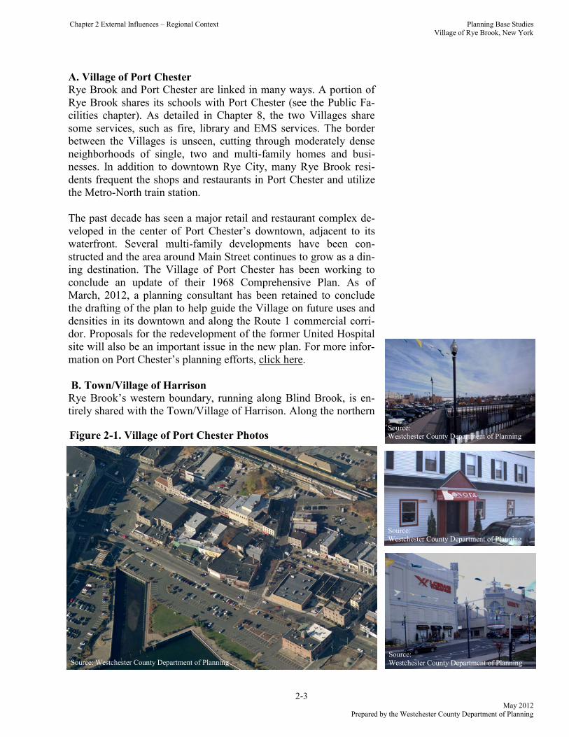
A. Village of Port Chester
Rye Brook and Port Chester are linked in many ways. A portion of
Rye Brook shares its schools with Port Chester (see the Public Fa-
cilities chapter). As detailed in Chapter 8, the two Villages share
some services, such as fire, library and EMS services. The border
between the Villages is unseen, cutting through moderately dense
neighborhoods of single, two and multi-family homes and busi-
nesses. In addition to downtown Rye City, many Rye Brook resi-
dents frequent the shops and restaurants in Port Chester and utilize
the Metro-North train station.
The past decade has seen a major retail and restaurant complex de-
veloped in the center of Port Chester’s downtown, adjacent to its
waterfront. Several multi-family developments have been con-
structed and the area around Main Street continues to grow as a din-
ing destination. The Village of Port Chester has been working to
conclude an update of their 1968 Comprehensive Plan. As of
March, 2012, a planning consultant has been retained to conclude
the drafting of the plan to help guide the Village on future uses and
densities in its downtown and along the Route 1 commercial corri-
dor. Proposals for the redevelopment of the former United Hospital
site will also be an important issue in the new plan. For more infor-
mation on Port Chester’s planning efforts, click here.
B. Town/Village of Harrison
Rye Brook’s western boundary, running along Blind Brook, is en-
tirely shared with the Town/Village of Harrison. Along the northern
Figure 2-1. Village of Port Chester Photos
Source: Westchester County Department of Planning
Source: Westchester County Department of Planning
Source: Westchester County Department of Planning
Source: Westchester County Department of Planning
Planning Base Studies Village of Rye Brook, New York
2-4 May 2012
Prepared by the Westchester County Department of Planning
Chapter 2 External Influences – Regional Context
half of this boundary are several large, low density uses – the West-
chester County Airport, the SUNY Purchase college campus and
Pepsico corporate headquarters office campus. Along the southern
half of this boundary are primarily neighborhoods of noticeably
lower density than Rye Brook, including the Purchase area. Several
office campus developments in Harrison are also adjacent to Rye
Brook along the I-287 corridor. The Blind Brook also presents
some flooding challenges to both municipalities.
While not as directly linked to Harrison’s downtown, which is lo-
cated in the southern portion of Harrison, office developments in
Harrison are a nearby employment source for Rye Brook. Rye
Brook’s access to I-287 is also primarily through Harrison.
As of March, 2012, the Town/Village of Harrison is considering
retaining a consultant to initiate the development of a new compre-
hensive plan update. The plan update may focus on downtown Har-
rison near the Metro-North train station as well as the substantial
office campus parks along the I-287 corridor, known as the
―Platinum Mile.‖ Recent high office vacancy rates in Harrison and
elsewhere in the County has spurred interest in the reuse and rede-
velopment of some of these office parks, including for uses other
than traditional single-occupant corporate tenants. Two recent
Figure 2-2. Photos of Harrison
Figure 2-3. Lincoln Lane Subdivision on Rye Brook Border
RY
E B
RO
OK
HA
RR
ISO
N
SUNY Purchase
Pepsico Headquarters
Source: Westchester County Department of Planning
Source: Westchester County Department of Planning
Source: Westchester County Department of Planning
Planning Base Studies Village of Rye Brook, New York
Chapter 2 External Influences – Regional Context
2-5 May 2012
Prepared by the Westchester County Department of Planning
new ―non traditional‖ tenants in the area include the new 62,000
square foot Fordham University campus and the 209,000 square
foot Lifetime Fitness facility on the site of the former Journal News
office building.
C. City of Rye
The City of Rye shares a small boundary at the southern tip of Rye
Brook. Rye serves as a nearby downtown for residents of Rye
Brook for shopping and dining. The City’s Metro-North train sta-
tion, also in downtown Rye, serves Rye Brook residents. The past
decade has seen growth in boutique shops and restaurants in the
very walkable downtown of Rye. Outside of Rye’s downtown are
low and medium density residential neighborhoods, many of which
are walkable to either the downtown and train station or are walking
distance to Long Island Sound. The City of Rye last updated their
comprehensive plan in 1985. No update is known to be in progress.
Other planning efforts have included flood mitigations studies near
Bowman Avenue, 2007-2008 studies and report on a proposed
―road diet‖ along Route 1, or Boston Post Road, in the southern sec-
tion of the city, a 2005 study on neighborhood business districts and
a 2003 study regarding the size and bulk of new homes. For more
information on these efforts, click here.
As discussed in the Parks, Recreation and Open Space chapter, Rye
Town Park is located on Long Island Sound, adjacent to West-
chester County’s Playland Amusement Park. The beach at Rye
Town Park is open to the general public, but residents of Rye
Brook, Rye City, Port Chester, and Rye Neck may purchase sea-
sonal permits with discounts for parking and beach access. Non-
residents can also purchase seasonal permits for higher fees. This
park is governed by a board of representatives from the Town of
Rye, City of Rye and Villages of Port Chester and Rye Brook.
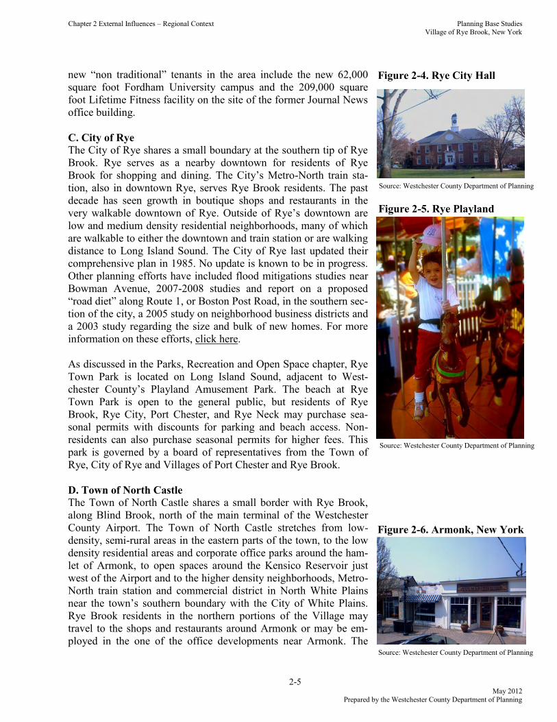
D. Town of North Castle
The Town of North Castle shares a small border with Rye Brook,
along Blind Brook, north of the main terminal of the Westchester
County Airport. The Town of North Castle stretches from low-
density, semi-rural areas in the eastern parts of the town, to the low
density residential areas and corporate office parks around the ham-
let of Armonk, to open spaces around the Kensico Reservoir just
west of the Airport and to the higher density neighborhoods, Metro-
North train station and commercial district in North White Plains
near the town’s southern boundary with the City of White Plains.
Rye Brook residents in the northern portions of the Village may
travel to the shops and restaurants around Armonk or may be em-
ployed in the one of the office developments near Armonk. The Source: Westchester County Department of Planning
Figure 2-4. Rye City Hall
Figure 2-5. Rye Playland
Figure 2-6. Armonk, New York
Source: Westchester County Department of Planning
Source: Westchester County Department of Planning
Planning Base Studies Village of Rye Brook, New York
2-6 May 2012
Prepared by the Westchester County Department of Planning
Chapter 2 External Influences – Regional Context
Town last updated its comprehensive plan in 1996. For more infor-
mation on planning efforts and development projects, click here.
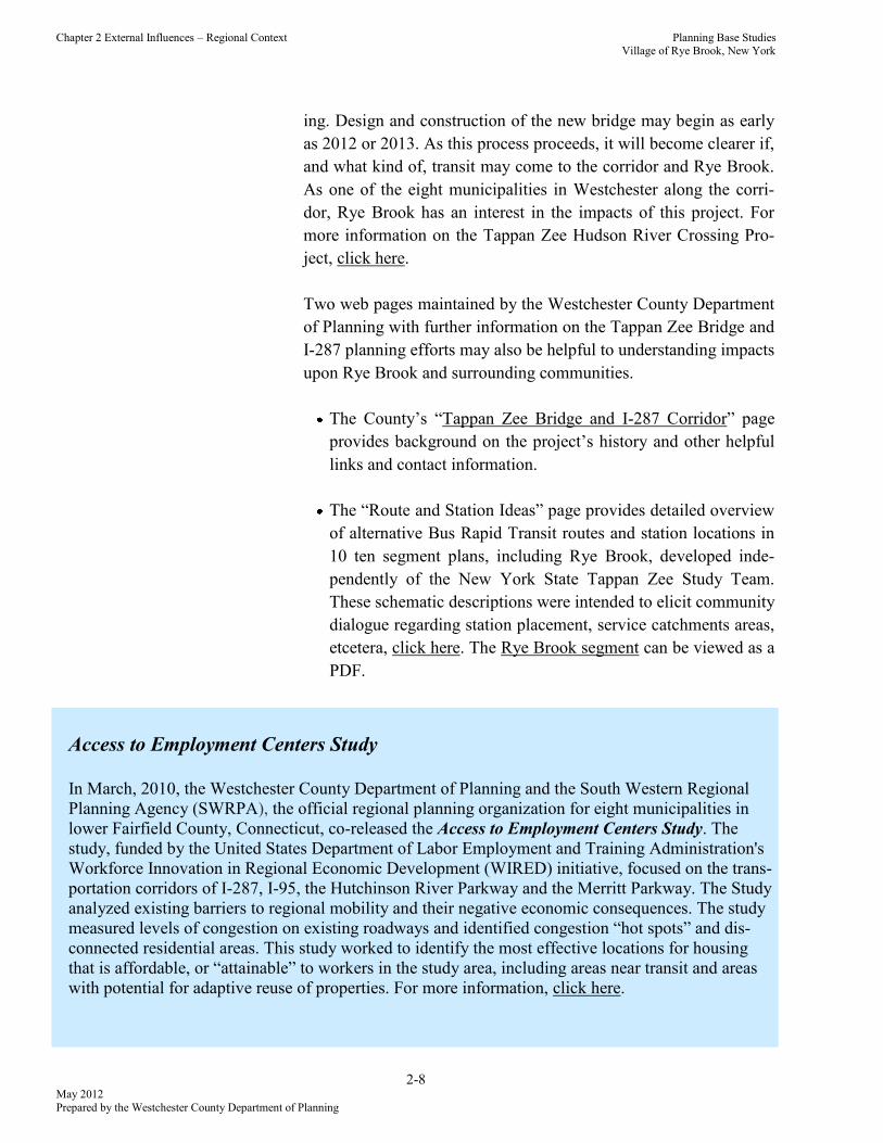
E. Town of Greenwich, Connecticut
Rye Brook is bounded to the east by the Town of Greenwich in Con-
necticut. This area of Greenwich is primarily low or moderate density
single-family neighborhoods. To the east of the Westchester County
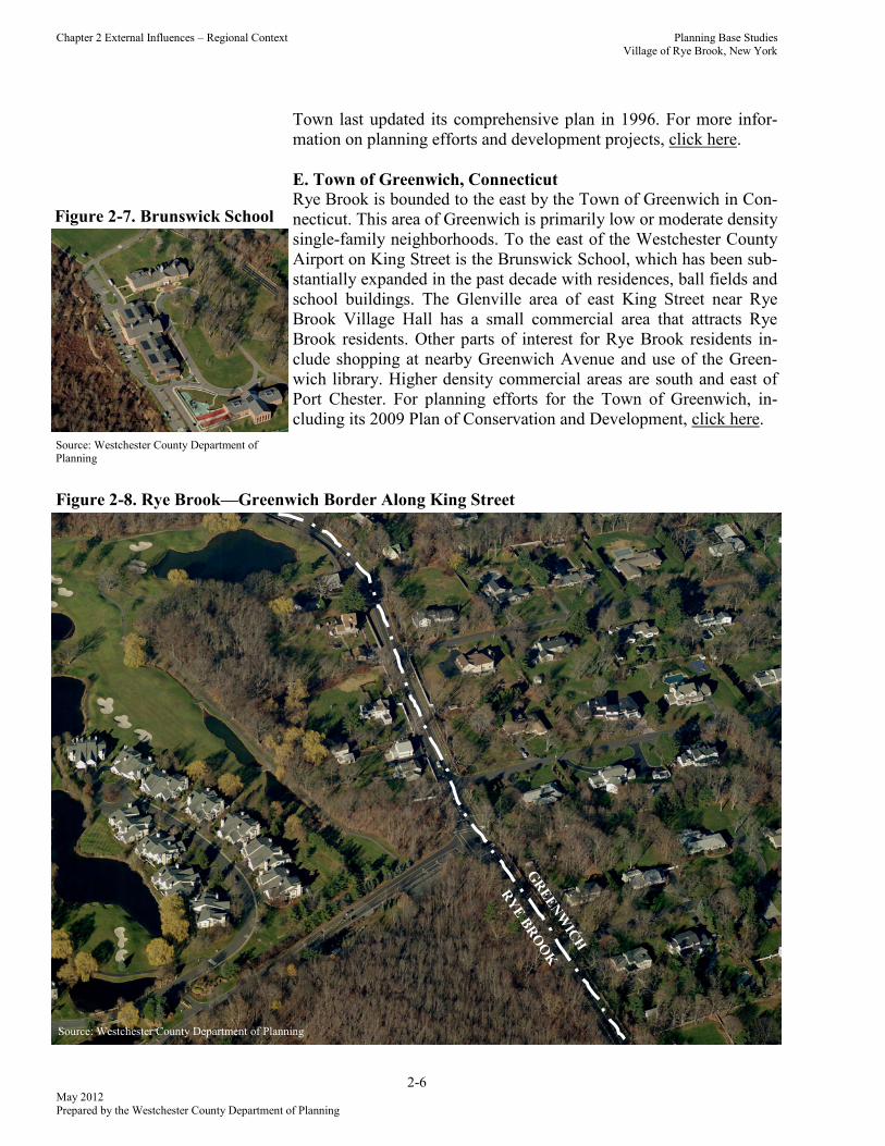
Airport on King Street is the Brunswick School, which has been sub-
stantially expanded in the past decade with residences, ball fields and
school buildings. The Glenville area of east King Street near Rye
Brook Village Hall has a small commercial area that attracts Rye
Brook residents. Other parts of interest for Rye Brook residents in-
clude shopping at nearby Greenwich Avenue and use of the Green-
wich library. Higher density commercial areas are south and east of
Port Chester. For planning efforts for the Town of Greenwich, in-
cluding its 2009 Plan of Conservation and Development, click here.
RY
E B
RO
OK
GR
EE
NW
ICH
Figure 2-7. Brunswick School
Figure 2-8. Rye Brook—Greenwich Border Along King Street
Source: Westchester County Department of Planning
Source: Westchester County Department of Planning

Planning Base Studies Village of Rye Brook, New York
Chapter 2 External Influences – Regional Context
2-7 May 2012
Prepared by the Westchester County Department of Planning
2.4 Interstate 287 and the Tappan Zee Bridge
I-287, the major east-west transportation corridor within West-
chester County, runs through the Village near its southernmost
boundary. Access to I-287 is in nearby Harrison, Rye and Port
Chester. Recent plans for the replacement of the Tappan Zee Bridge
over the Hudson River included transit alternatives across the 30-
mile corridor between Port Chester and Suffern in Rockland
County. A potential Bus Rapid Transit (BRT) system included a
station near the South Ridge Street crossing of I-287. In October,
2011, the Federal Highway Administration (FHWA) and the Fed-
eral Transportation Administration published a Notice of Intent to
rescind the Tappan Zee Bridge/I-287 Corridor Project, thereby con-
cluding the environmental review process for a combined study of
bridge, highway and transit along the corridor. FHWA published a
new Notice of Intent for the Tappan Zee Hudson River Crossing
Project to examine alternatives for an improved Hudson River
crossing between Rockland and Westchester Counties. As of
March, 2012, an expedited environmental review process is ongo-
Figure 2-9. Tappan Zee Bridge
Source: Westchester County Department of Planning
Figure 2-10. I-287 in Rye Brook
Source: Westchester County Department of Planning
Planning Base Studies Village of Rye Brook, New York
2-8 May 2012
Prepared by the Westchester County Department of Planning
Chapter 2 External Influences – Regional Context
ing. Design and construction of the new bridge may begin as early
as 2012 or 2013. As this process proceeds, it will become clearer if,
and what kind of, transit may come to the corridor and Rye Brook.
As one of the eight municipalities in Westchester along the corri-
dor, Rye Brook has an interest in the impacts of this project. For
more information on the Tappan Zee Hudson River Crossing Pro-
ject, click here.
Two web pages maintained by the Westchester County Department
of Planning with further information on the Tappan Zee Bridge and
I-287 planning efforts may also be helpful to understanding impacts
upon Rye Brook and surrounding communities.
The County’s ―Tappan Zee Bridge and I-287 Corridor‖ page
provides background on the project’s history and other helpful
links and contact information.
The ―Route and Station Ideas‖ page provides detailed overview
of alternative Bus Rapid Transit routes and station locations in
10 ten segment plans, including Rye Brook, developed inde-
pendently of the New York State Tappan Zee Study Team.
These schematic descriptions were intended to elicit community
dialogue regarding station placement, service catchments areas,
etcetera, click here. The Rye Brook segment can be viewed as a
PDF.
Access to Employment Centers Study
In March, 2010, the Westchester County Department of Planning and the South Western Regional
Planning Agency (SWRPA), the official regional planning organization for eight municipalities in
lower Fairfield County, Connecticut, co-released the Access to Employment Centers Study. The
study, funded by the United States Department of Labor Employment and Training Administration's
Workforce Innovation in Regional Economic Development (WIRED) initiative, focused on the trans-
portation corridors of I-287, I-95, the Hutchinson River Parkway and the Merritt Parkway. The Study
analyzed existing barriers to regional mobility and their negative economic consequences. The study
measured levels of congestion on existing roadways and identified congestion ―hot spots‖ and dis-
connected residential areas. This study worked to identify the most effective locations for housing
that is affordable, or ―attainable‖ to workers in the study area, including areas near transit and areas
with potential for adaptive reuse of properties. For more information, click here.
Planning Base Studies Village of Rye Brook, New York
Chapter 2 External Influences – Regional Context
2-9 May 2012
Prepared by the Westchester County Department of Planning
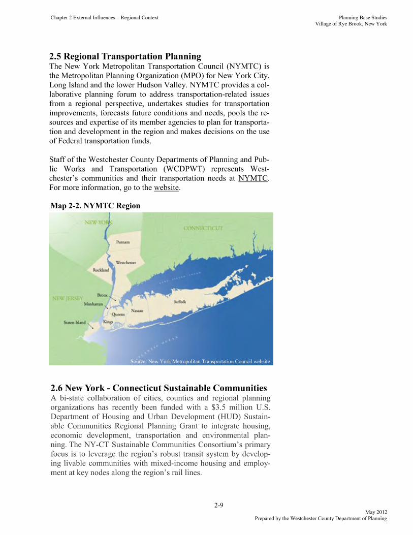
2.5 Regional Transportation Planning The New York Metropolitan Transportation Council (NYMTC) is
the Metropolitan Planning Organization (MPO) for New York City,
Long Island and the lower Hudson Valley. NYMTC provides a col-
laborative planning forum to address transportation-related issues
from a regional perspective, undertakes studies for transportation
improvements, forecasts future conditions and needs, pools the re-
sources and expertise of its member agencies to plan for transporta-
tion and development in the region and makes decisions on the use
of Federal transportation funds.
Staff of the Westchester County Departments of Planning and Pub-
lic Works and Transportation (WCDPWT) represents West-
chester’s communities and their transportation needs at NYMTC.
For more information, go to the website.
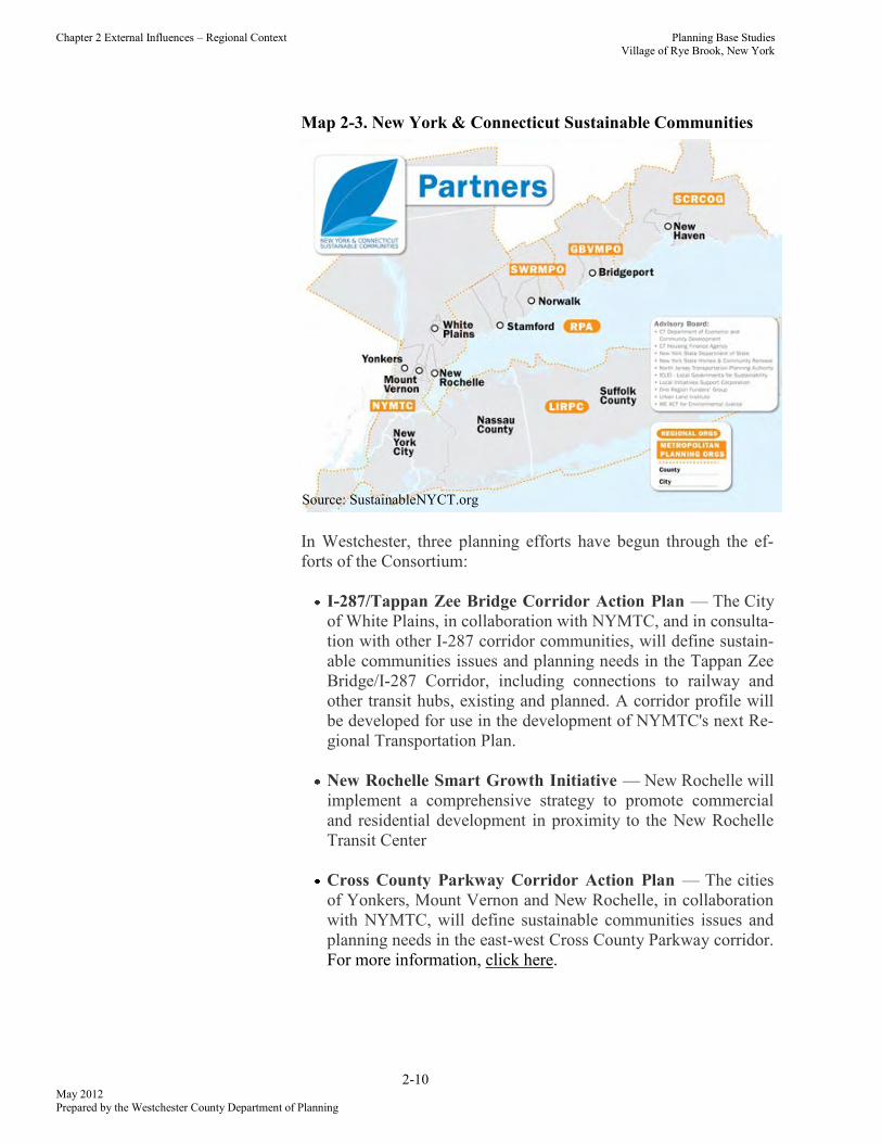
2.6 New York - Connecticut Sustainable Communities A bi-state collaboration of cities, counties and regional planning
organizations has recently been funded with a $3.5 million U.S.
Department of Housing and Urban Development (HUD) Sustain-
able Communities Regional Planning Grant to integrate housing,
economic development, transportation and environmental plan-
ning. The NY-CT Sustainable Communities Consortium’s primary
focus is to leverage the region’s robust transit system by develop-
ing livable communities with mixed-income housing and employ-
ment at key nodes along the region’s rail lines.
Map 2-2. NYMTC Region
Source: New York Metropolitan Transportation Council website
Planning Base Studies Village of Rye Brook, New York
2-10 May 2012
Prepared by the Westchester County Department of Planning
Chapter 2 External Influences – Regional Context
In Westchester, three planning efforts have begun through the ef-
forts of the Consortium:
I-287/Tappan Zee Bridge Corridor Action Plan — The City
of White Plains, in collaboration with NYMTC, and in consulta-
tion with other I-287 corridor communities, will define sustain-
able communities issues and planning needs in the Tappan Zee
Bridge/I-287 Corridor, including connections to railway and
other transit hubs, existing and planned. A corridor profile will
be developed for use in the development of NYMTC's next Re-
gional Transportation Plan.
New Rochelle Smart Growth Initiative — New Rochelle will
implement a comprehensive strategy to promote commercial
and residential development in proximity to the New Rochelle
Transit Center
Cross County Parkway Corridor Action Plan — The cities
of Yonkers, Mount Vernon and New Rochelle, in collaboration
with NYMTC, will define sustainable communities issues and
planning needs in the east-west Cross County Parkway corridor.
For more information, click here.
Map 2-3. New York & Connecticut Sustainable Communities
Source: SustainableNYCT.org
Planning Base Studies Village of Rye Brook, New York
Chapter 2 External Influences – Regional Context
2-11 May 2012
Prepared by the Westchester County Department of Planning
2.7 Hudson River Valley Greenway/National Heritage
Area The Hudson River Valley Greenway was created to continue and
advance the State’s commitment to the preservation, enhancement
and development of the world-renowned scenic, natural, historic,
cultural and recreational resources of the Hudson River Valley
while continuing to emphasize economic development activities
and remaining consistent with the tradition of municipal home rule.
The Greenway includes most municipalities of Westchester
County, including Rye Brook.
The Hudson River Valley National Heritage Area includes 250
communities in ten counties bordering the Hudson River for 154
miles of tidal estuary. This area is approximately three million acres
of Hudson Highlands, Catskill Mountains, rolling farmland and
compact villages, small cities and hamlets. The region extends from
the confluence of the Mohawk and Hudson Rivers, south to the
northern border of New York City.
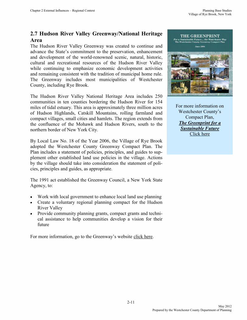
By Local Law No. 18 of the Year 2006, the Village of Rye Brook
adopted the Westchester County Greenway Compact Plan. The
Plan includes a statement of policies, principles, and guides to sup-
plement other established land use policies in the village. Actions
by the village should take into consideration the statement of poli-
cies, principles and guides, as appropriate.
The 1991 act established the Greenway Council, a New York State
Agency, to:
Work with local government to enhance local land use planning
Create a voluntary regional planning compact for the Hudson
River Valley
Provide community planning grants, compact grants and techni-
cal assistance to help communities develop a vision for their
future
For more information, go to the Greenway’s website click here.
For more information on
Westchester County’s
Compact Plan,
The Greenprint for a
Sustainable Future
Click here