Embed Size (px)
Citation preview
Chapter 15 Landforms Made by Running Water
Junction of Rio Uruguay and a tributary, Misioes Province, Argentina.Most of the landforms we see around us are formed by running water as it erodes, transports, and deposits sediment. How do slopes erode, and what happens to eroded particles? How do streams build their beds and erode their banks? What causes streams to form floodplains and to meander? Why are fluvial processes so active in dry and desert climate? These are some of the questions we will answer in this chapter.
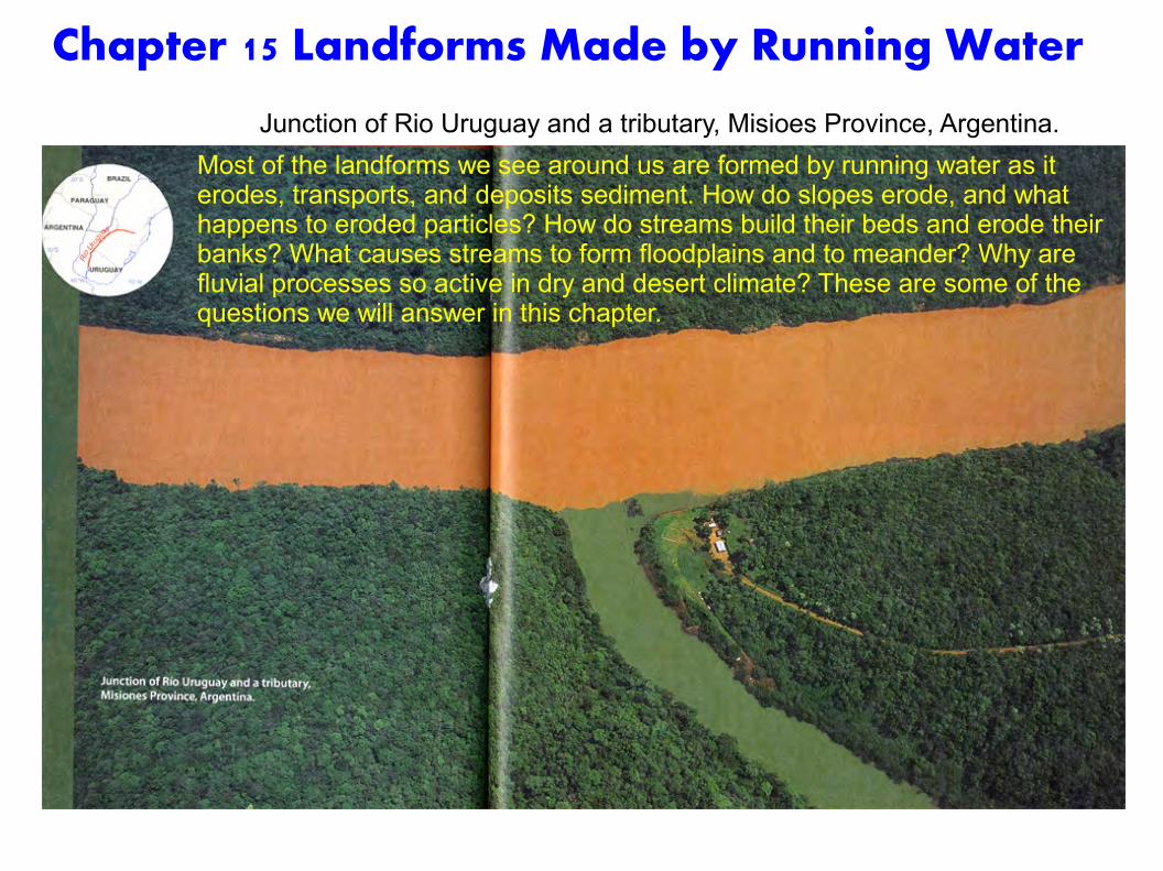
Slope Erosion Fluvial landforms are shaped by the fluvial processes of overland flow and stream flow. Wherever rain falls, these processes act to create erosional and depositional landforms.
Fluvial landforms are made by fluvial processes, which include overland flow and streamflow.
Grand Canyon, Colorado River, Arizona.
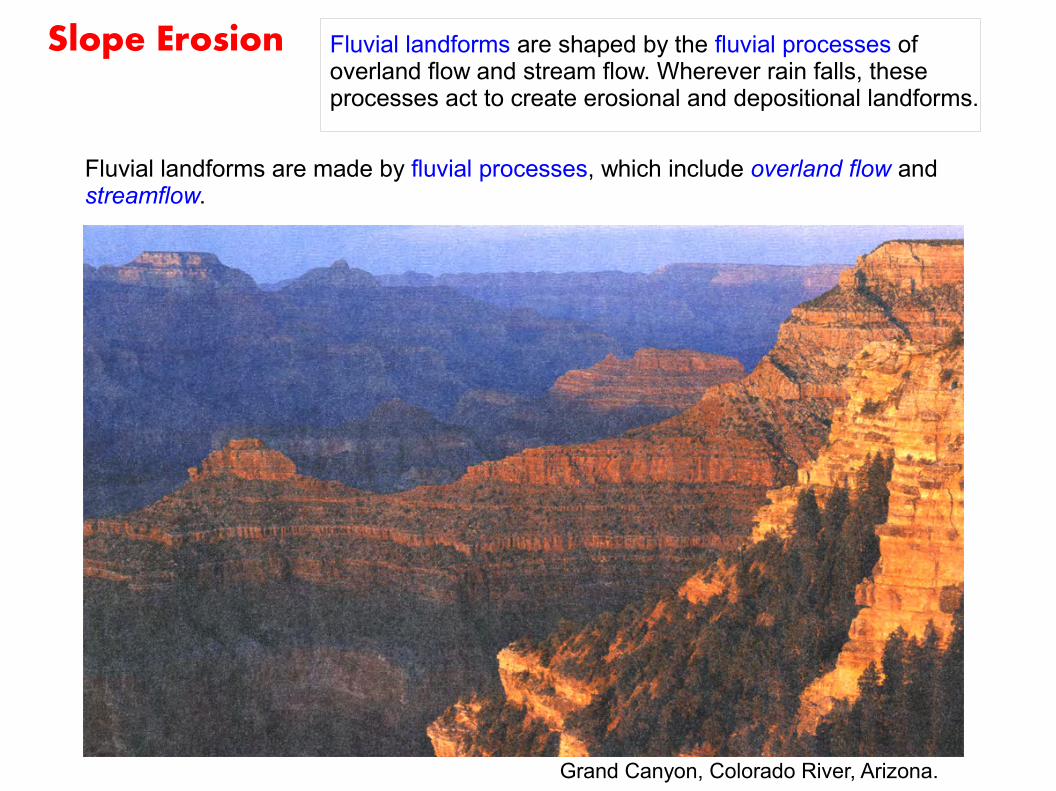
“Landforms Made by Running Water”とはどういうことか
(杉谷ほか、「風景のなかの自然地理」古今書院)
“Running water erodes mountains and hills, carves valleys, and deposits sediment.”
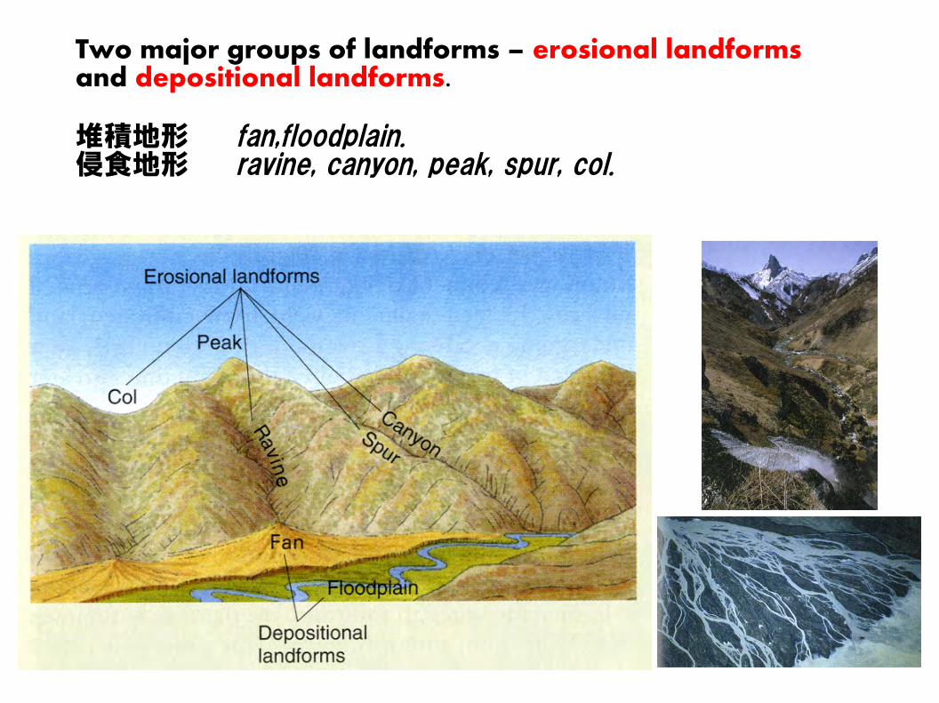
Two major groups of landforms – erosional landforms and depositional landforms.
堆積地形 fan,floodplain.侵食地形 ravine, canyon, peak, spur, col.
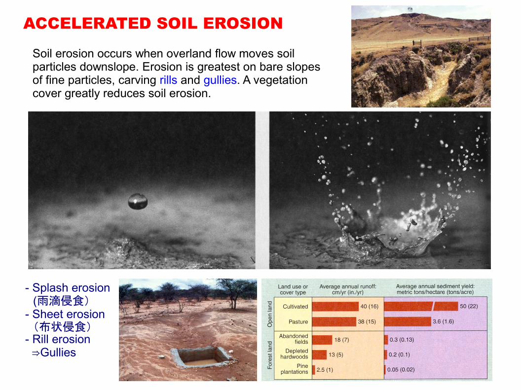
ACCELERATED SOIL EROSION
Soil erosion occurs when overland flow moves soil particles downslope. Erosion is greatest on bare slopes of fine particles, carving rills and gullies. A vegetation cover greatly reduces soil erosion.
- Splash erosion (雨滴侵食)- Sheet erosion (布状侵食)- Rill erosion ⇒Gullies
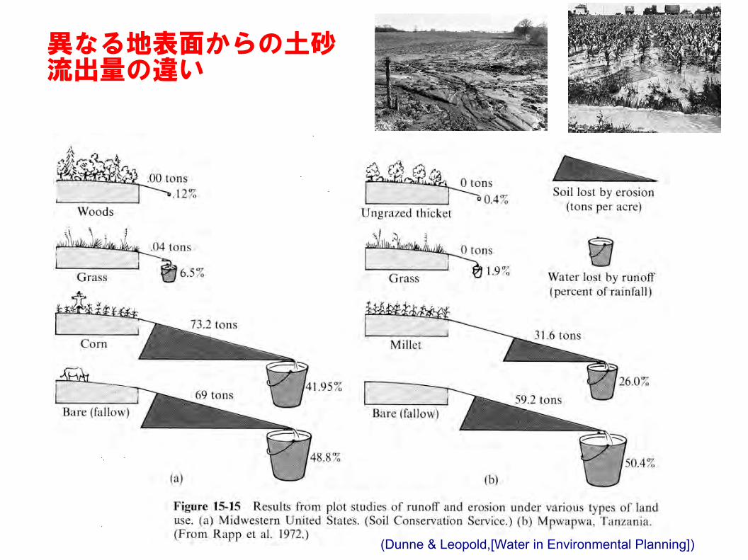
(Dunne & Leopold,[Water in Environmental Planning])
異なる地表面からの土砂流出量の違い
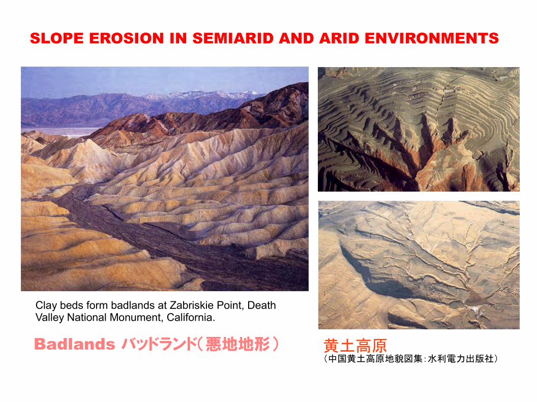
SLOPE EROSION IN SEMIARID AND ARID ENVIRONMENTS
Clay beds form badlands at Zabriskie Point, Death Valley National Monument, California.
黄土高原(中国黄土高原地貌図集:水利電力出版社)
Badlands バッドランド(悪地地形)
The Work of Streams and Stream Gradation
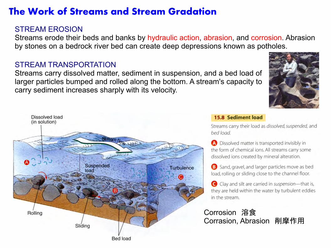
STREAM EROSIONStreams erode their beds and banks by hydraulic action, abrasion, and corrosion. Abrasion by stones on a bedrock river bed can create deep depressions known as potholes.
STREAM TRANSPORTATIONStreams carry dissolved matter, sediment in suspension, and a bed load of larger particles bumped and rolled along the bottom. A stream's capacity to carry sediment increases sharply with its velocity.
Corrosion 溶食Corrasion, Abrasion 削摩作用
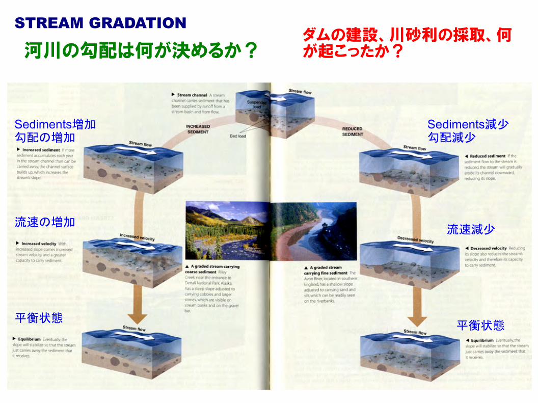
STREAM GRADATION
Sediments増加勾配の増加
流速の増加
平衡状態
Sediments減少勾配減少
流速減少
平衡状態
河川の勾配は何が決めるか?ダムの建設、川砂利の採取、何が起こったか?
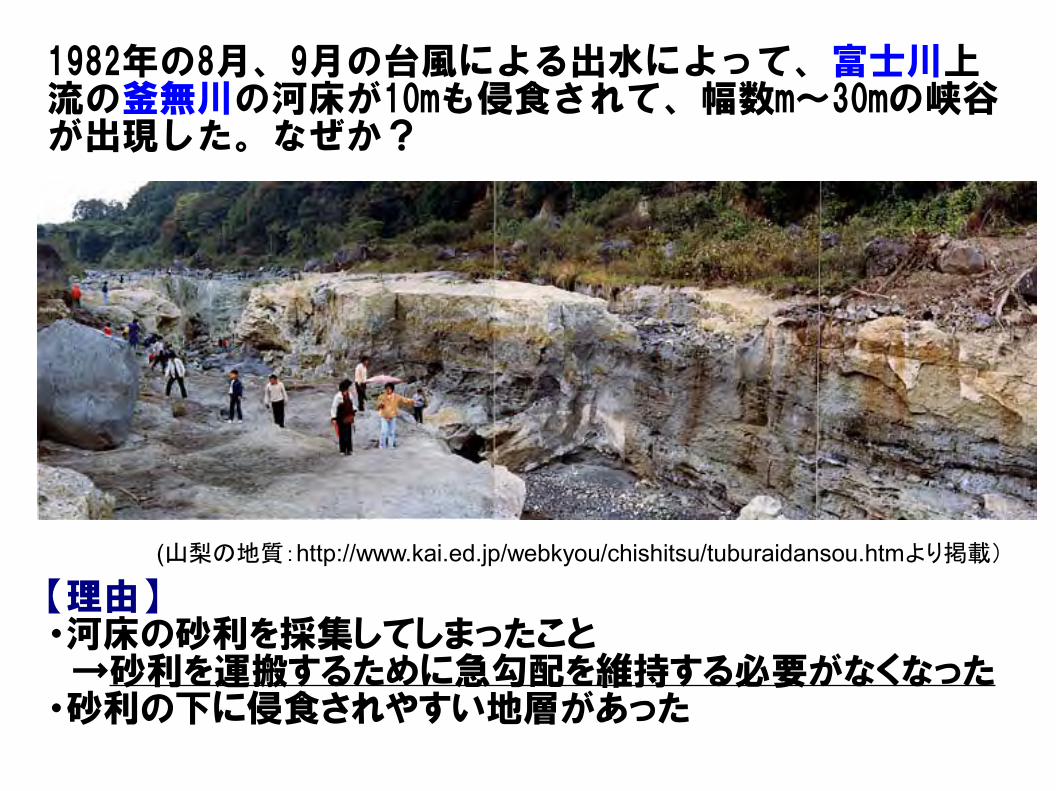
(山梨の地質:http://www.kai.ed.jp/webkyou/chishitsu/tuburaidansou.htmより掲載)
1982年の8月、9月の台風による出水によって、富士川上流の釜無川の河床が10mも侵食されて、幅数m~30mの峡谷が出現した。なぜか?
【理由】・河床の砂利を採集してしまったこと →砂利を運搬するために急勾配を維持する必要がなくなった・砂利の下に侵食されやすい地層があった
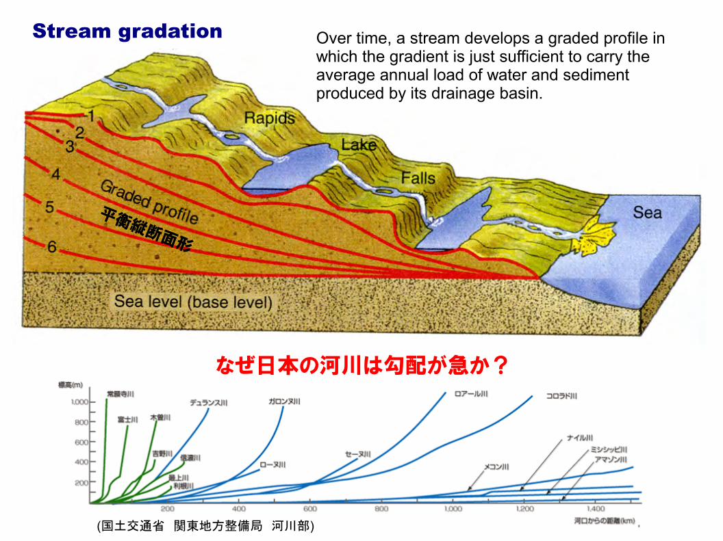
Stream gradation Over time, a stream develops a graded profile in which the gradient is just sufficient to carry the average annual load of water and sediment produced by its drainage basin.
(国土交通省 関東地方整備局 河川部)
なぜ日本の河川は勾配が急か?
平衡縦断面形
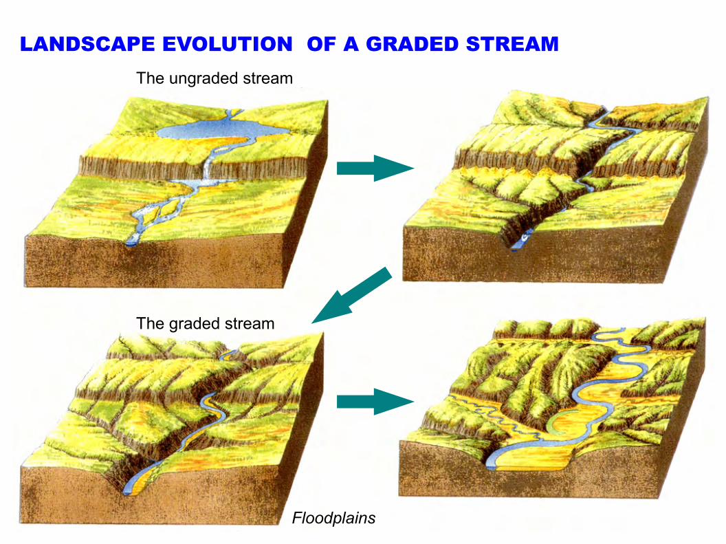
LANDSCAPE EVOLUTION OF A GRADED STREAMThe ungraded stream
Floodplains
The graded stream
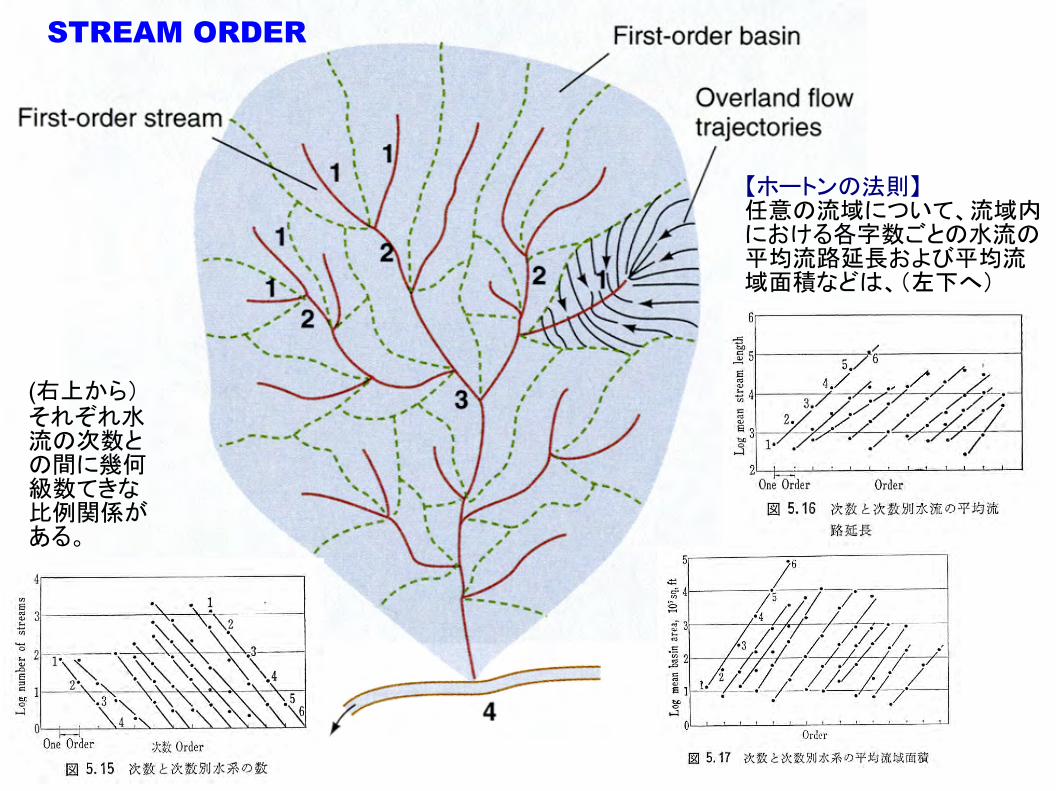
STREAM ORDER
【ホートンの法則】任意の流域について、流域内における各字数ごとの水流の平均流路延長および平均流域面積などは、(左下へ)
(右上から)それぞれ水流の次数との間に幾何級数てきな比例関係がある。
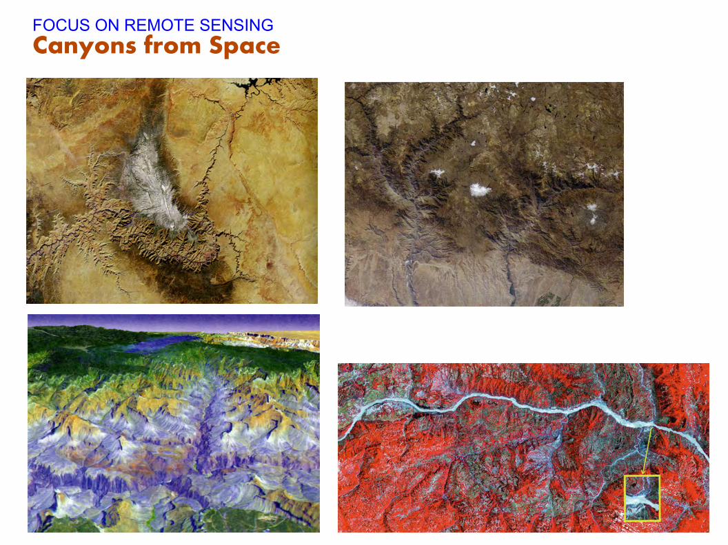
FOCUS ON REMOTE SENSINGCanyons from Space
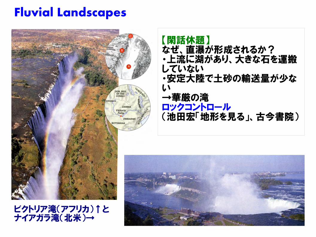
Fluvial Landscapes
【閑話休題】なぜ、直瀑が形成されるか?・上流に湖があり、大きな石を運搬していない・安定大陸で土砂の輸送量が少ない→華厳の滝ロックコントロール(池田宏「地形を見る」、古今書院)
ビクトリア滝(アフリカ)↑とナイアガラ滝(北米)→
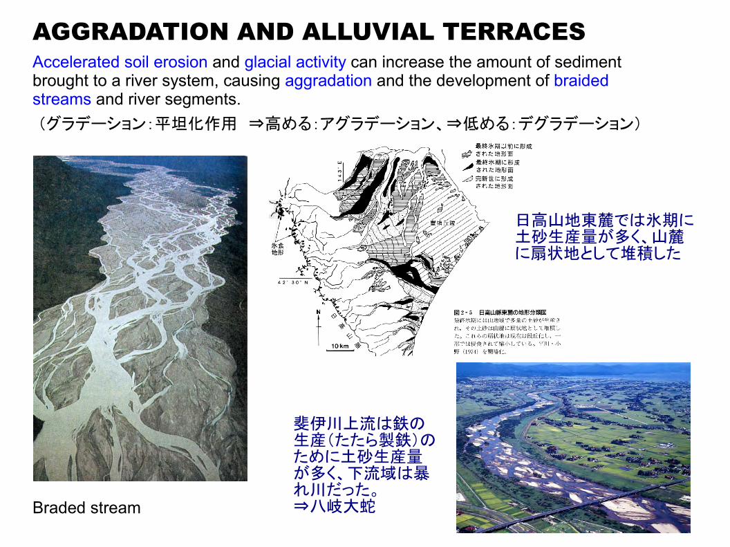
AGGRADATION AND ALLUVIAL TERRACESAccelerated soil erosion and glacial activity can increase the amount of sediment brought to a river system, causing aggradation and the development of braided streams and river segments.(グラデーション:平坦化作用 ⇒高める:アグラデーション、⇒低める:デグラデーション)
Braded stream
日高山地東麓では氷期に土砂生産量が多く、山麓に扇状地として堆積した
斐伊川上流は鉄の生産(たたら製鉄)のために土砂生産量が多く、下流域は暴れ川だった。⇒八岐大蛇
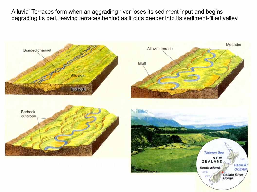
Alluvial Terraces form when an aggrading river loses its sediment input and begins degrading its bed, leaving terraces behind as it cuts deeper into its sediment-filled valley.
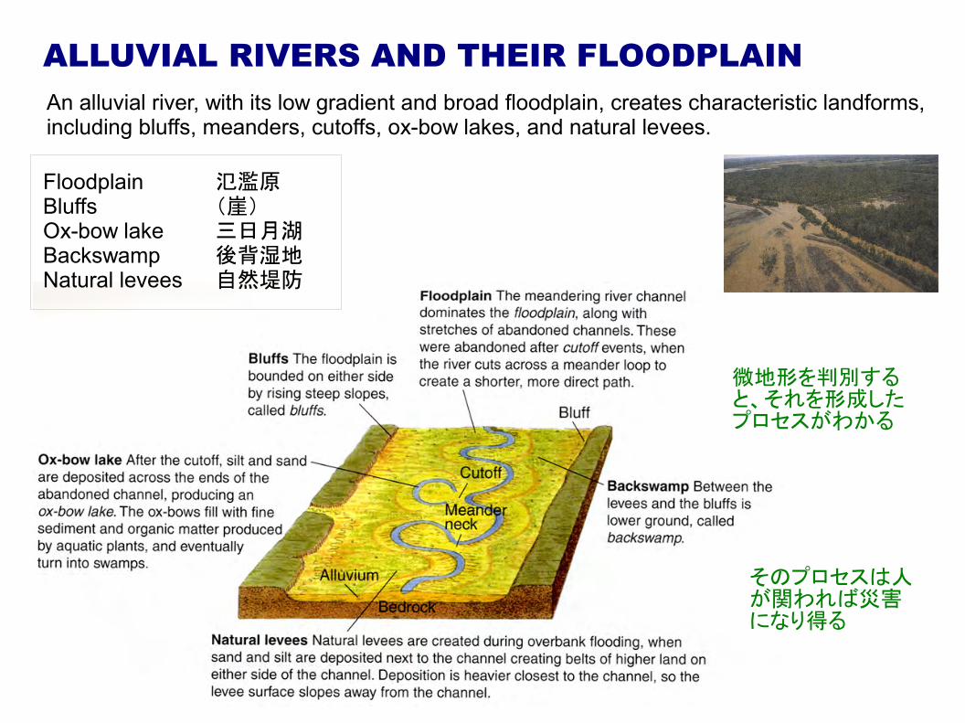
ALLUVIAL RIVERS AND THEIR FLOODPLAINAn alluvial river, with its low gradient and broad floodplain, creates characteristic landforms, including bluffs, meanders, cutoffs, ox-bow lakes, and natural levees.
Floodplain 氾濫原Bluffs (崖)Ox-bow lake 三日月湖Backswamp 後背湿地Natural levees 自然堤防
微地形を判別すると、それを形成したプロセスがわかる
そのプロセスは人が関われば災害になり得る
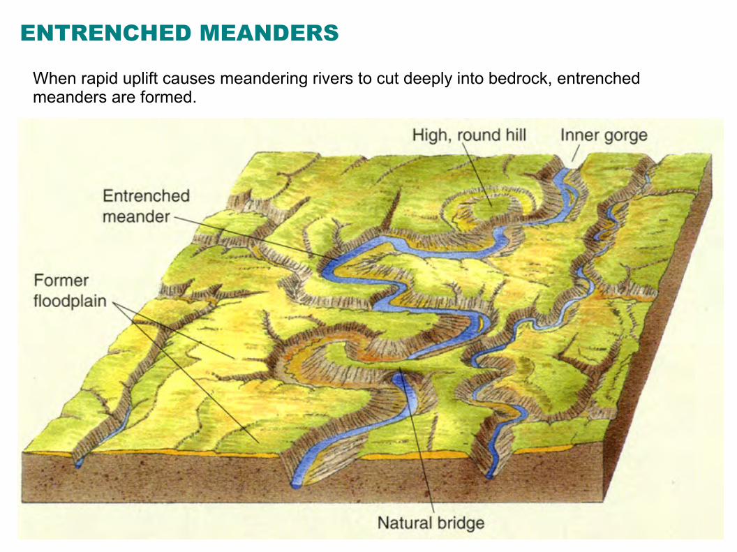
ENTRENCHED MEANDERS
When rapid uplift causes meandering rivers to cut deeply into bedrock, entrenched meanders are formed.
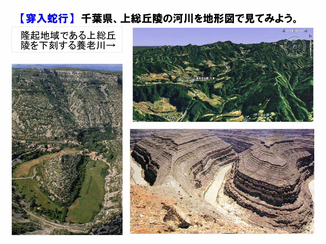
【穿入蛇行】 千葉県、上総丘陵の河川を地形図で見てみよう。
隆起地域である上総丘陵を下刻する養老川→
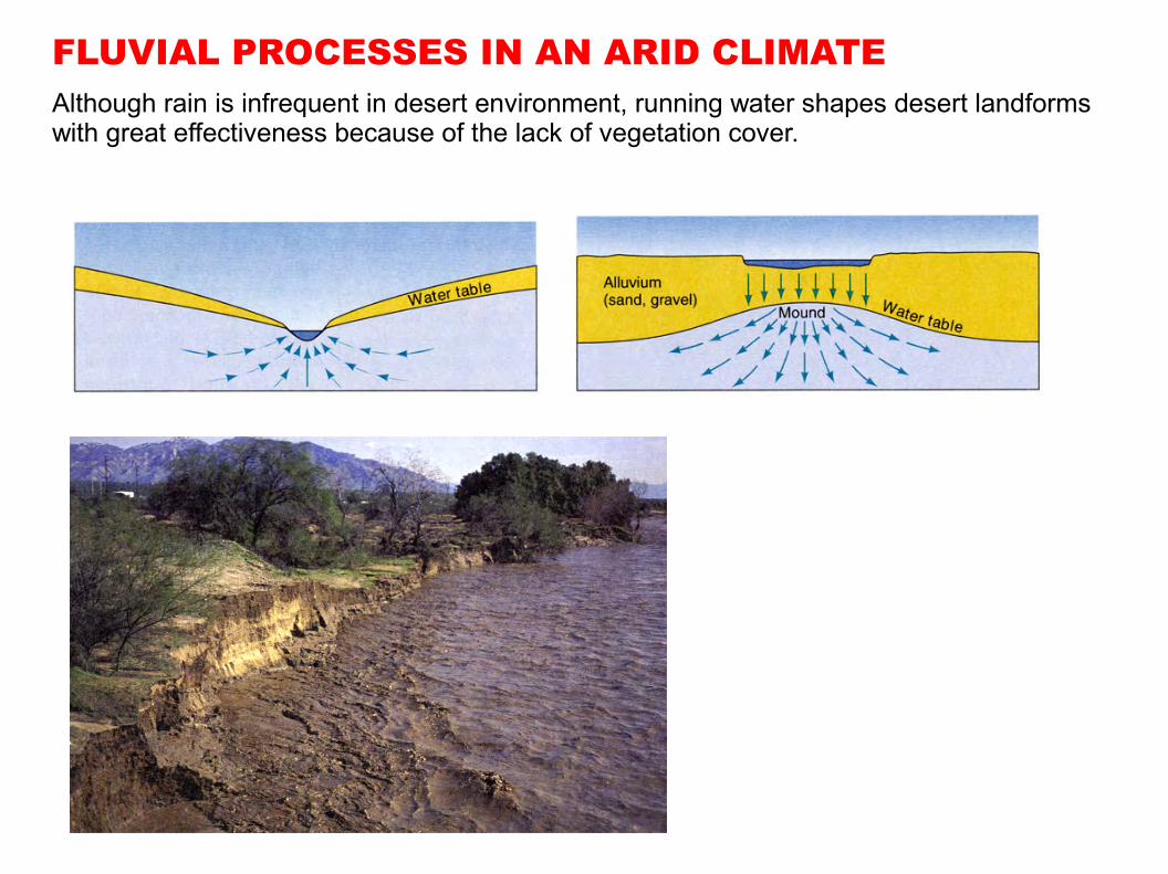
FLUVIAL PROCESSES IN AN ARID CLIMATEAlthough rain is infrequent in desert environment, running water shapes desert landforms with great effectiveness because of the lack of vegetation cover.
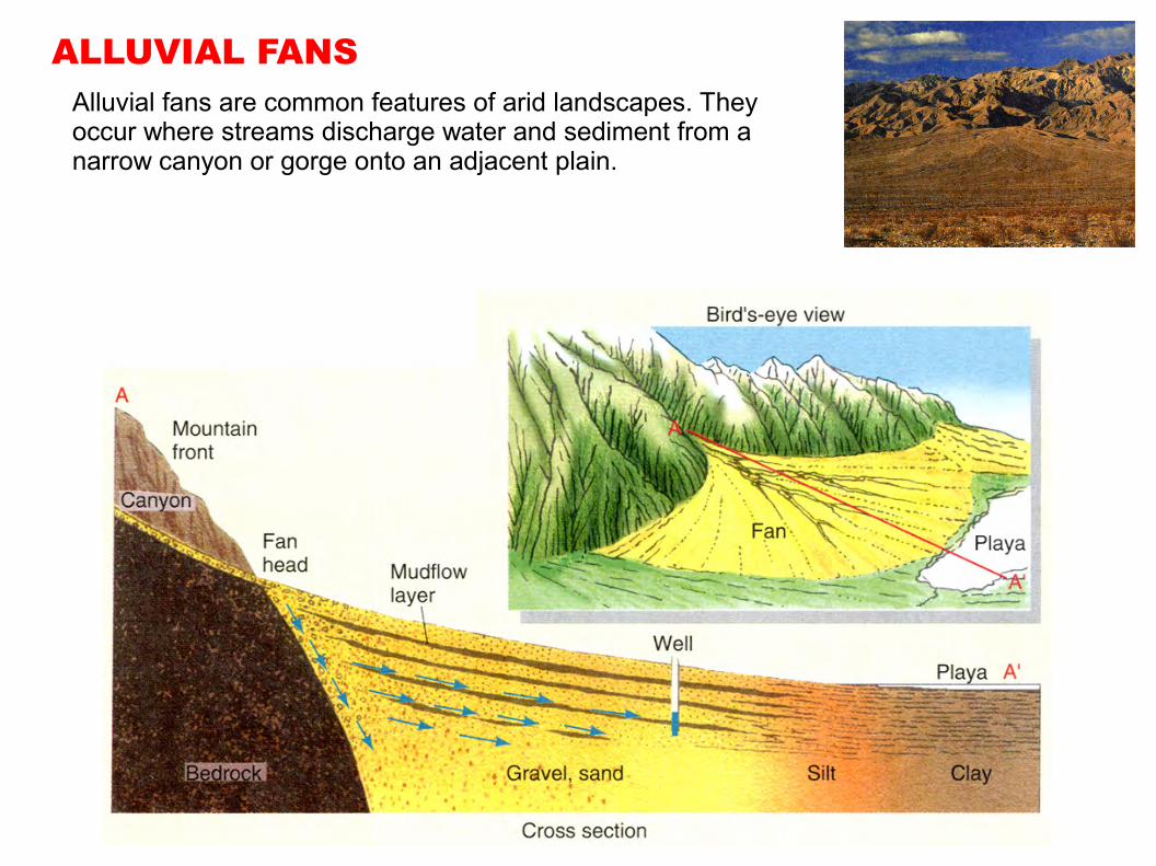
ALLUVIAL FANSAlluvial fans are common features of arid landscapes. They occur where streams discharge water and sediment from a narrow canyon or gorge onto an adjacent plain.
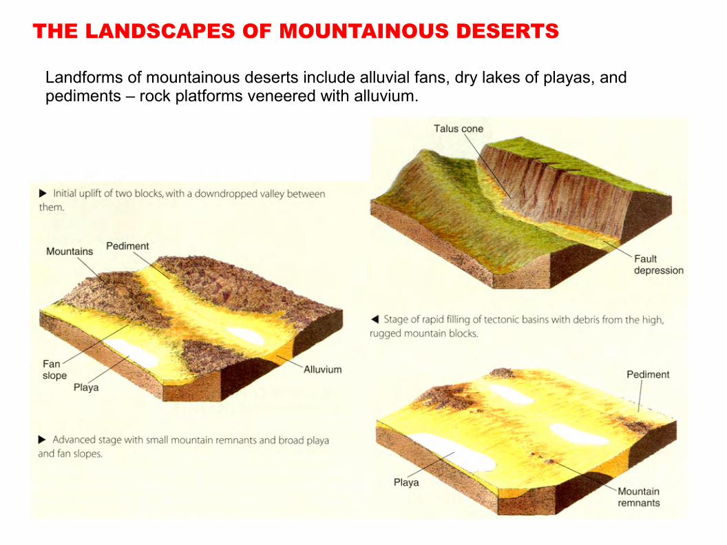
THE LANDSCAPES OF MOUNTAINOUS DESERTS
Landforms of mountainous deserts include alluvial fans, dry lakes of playas, and pediments – rock platforms veneered with alluvium.
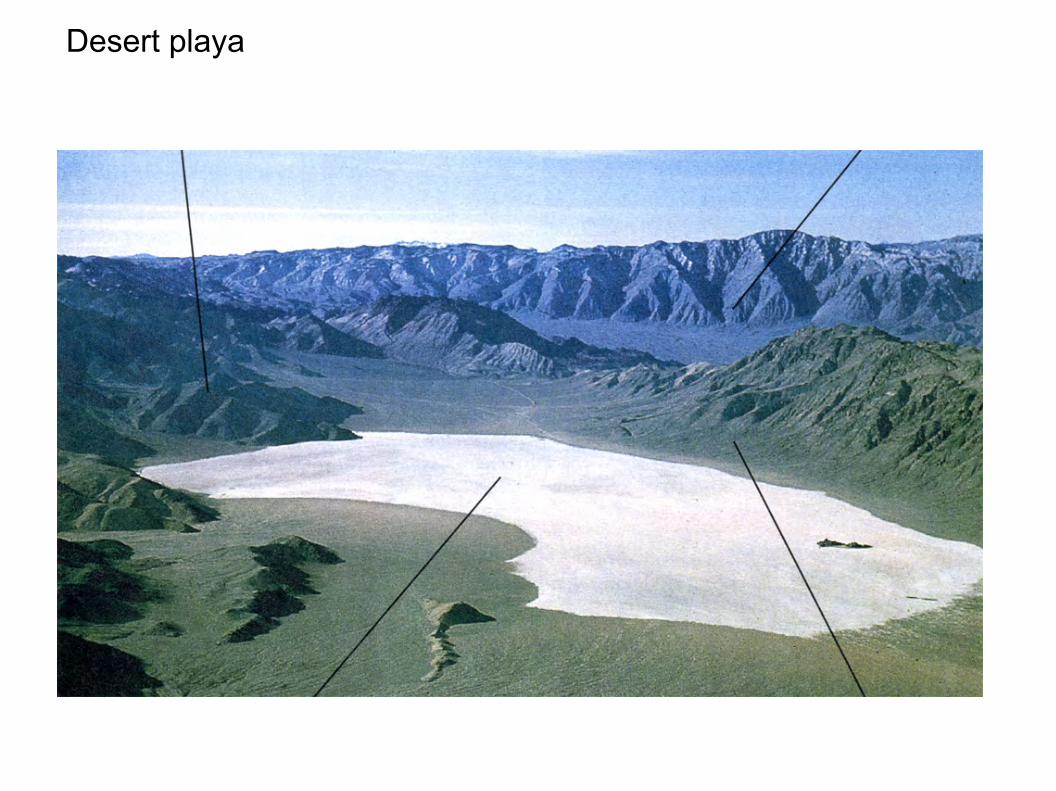
Desert playa
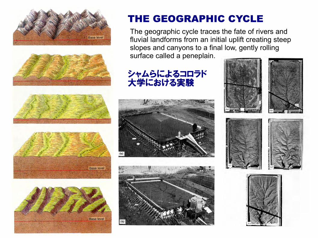
THE GEOGRAPHIC CYCLEThe geographic cycle traces the fate of rivers and fluvial landforms from an initial uplift creating steep slopes and canyons to a final low, gently rolling surface called a peneplain.
シャムらによるコロラド大学における実験
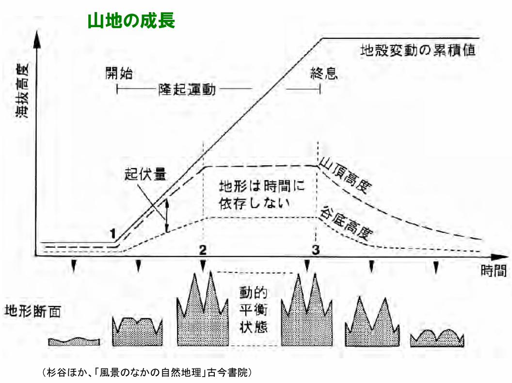
山地の成長
(杉谷ほか、「風景のなかの自然地理」古今書院)


![Landforms Mady By Wind [Desert Landforms]](https://img.pdfslide.us/doc/110x75/56813971550346895da1066c/landforms-mady-by-wind-desert-landforms.jpg)