Embed Size (px)
Citation preview
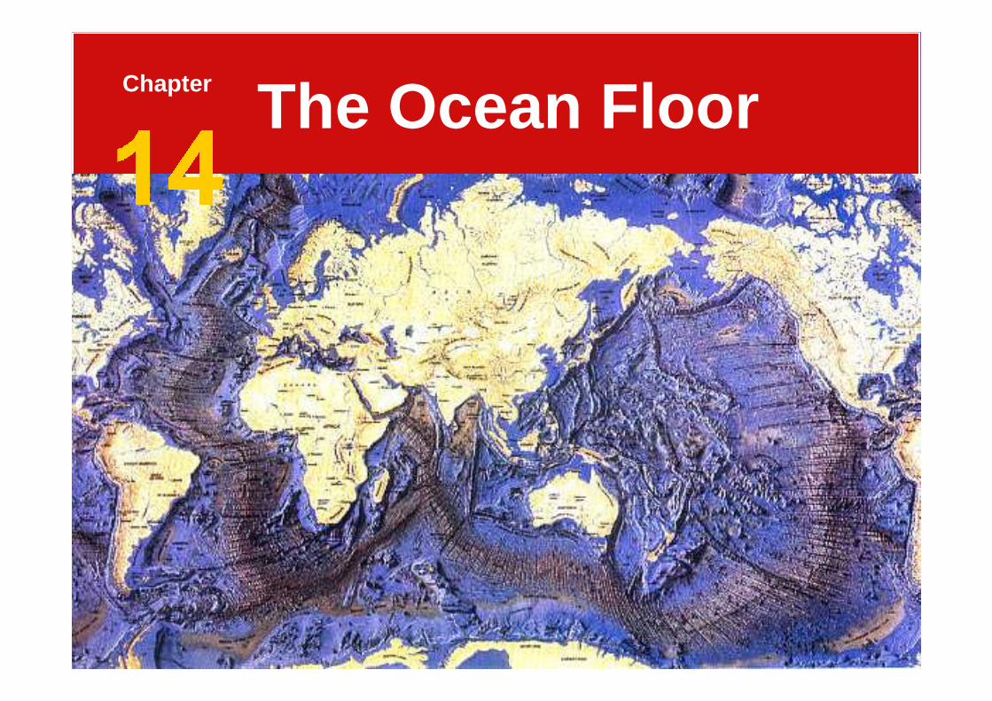
The Ocean FloorChapter
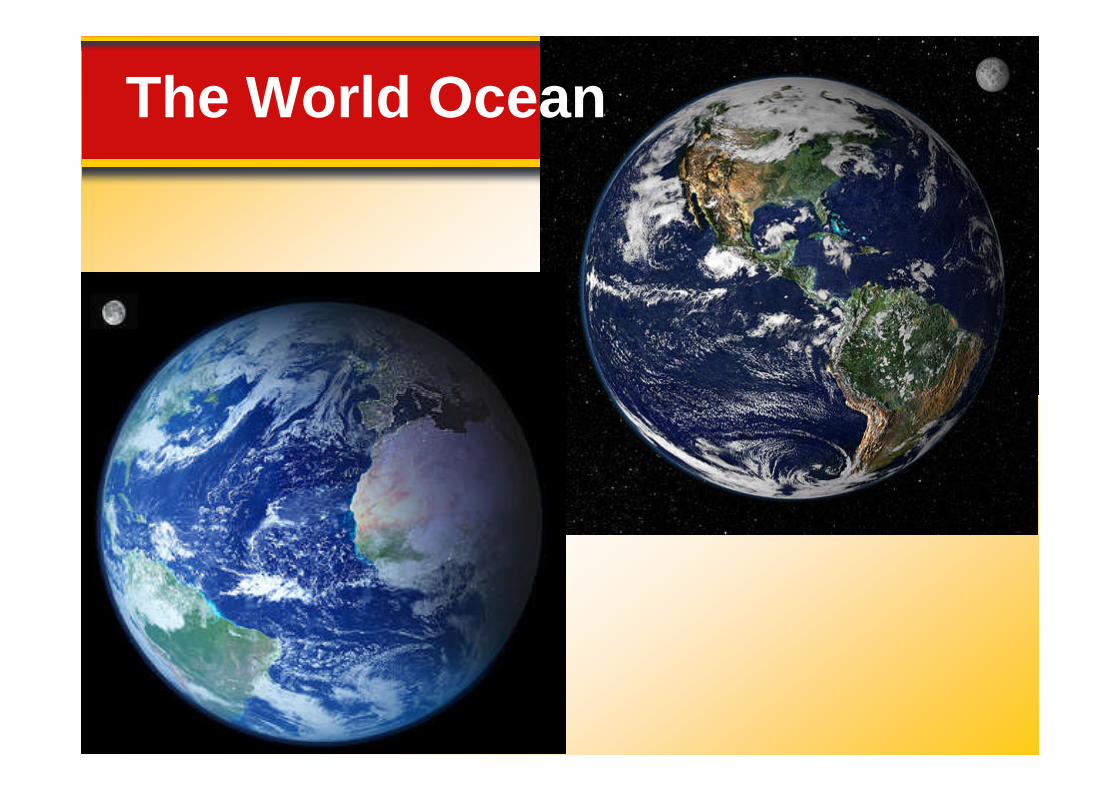
The Blue Planet
14.1 The Vast World Ocean
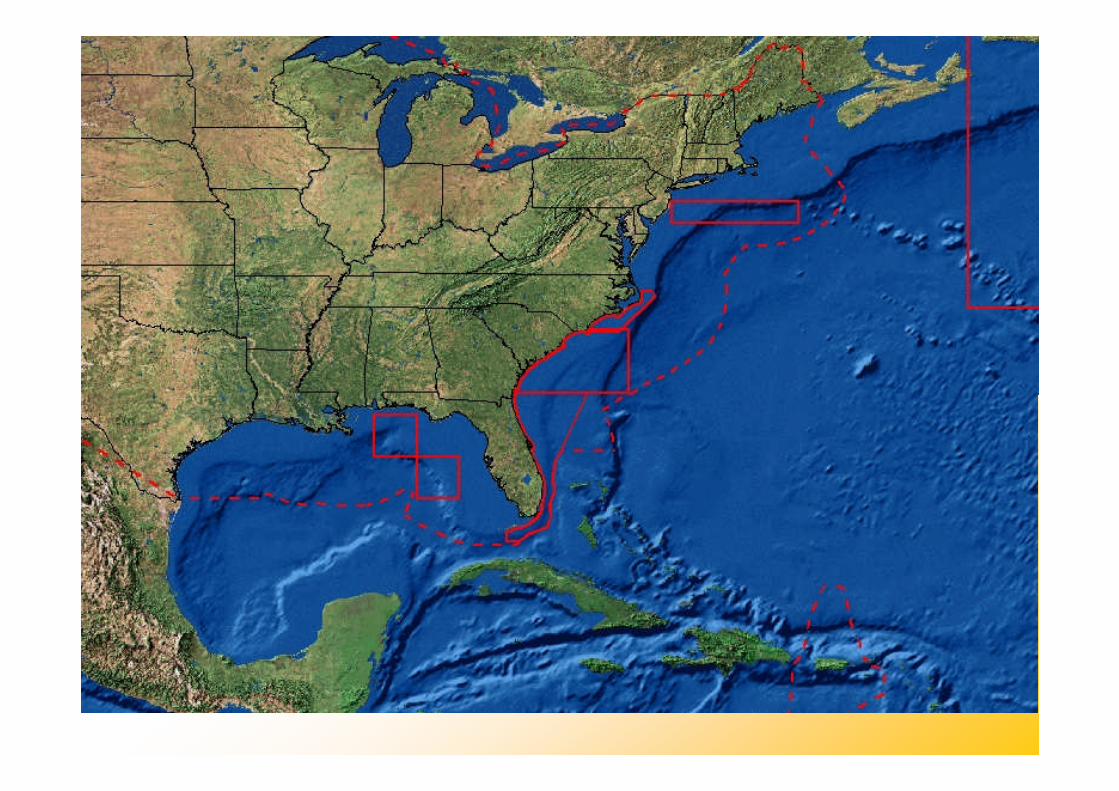
Nearly 71 percent of Earth’ssurface is covered by the globalocean.ocean.
Oceanography is a science thatdraws on the methods andknowledge of geology, chemistry,physics, and biology to study allaspects of the world ocean.
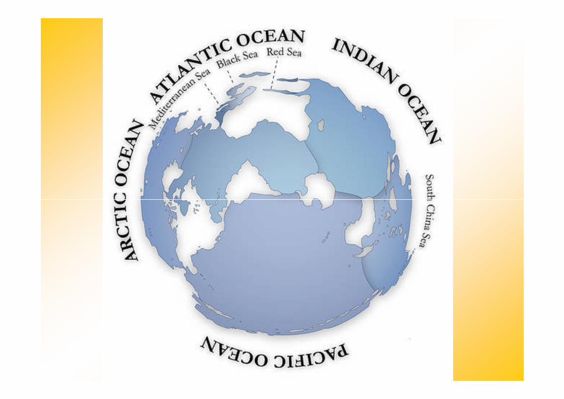
The World Ocean
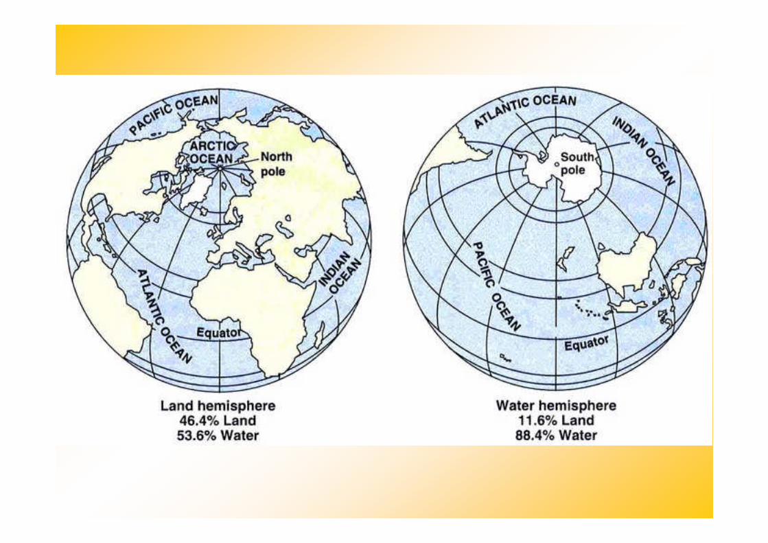
Geography of the Oceans
14.1 The Vast World Ocean
The world ocean can be dividedinto four main ocean basins—thePacific Ocean, the Atlantic Ocean,the Indian Ocean, and the ArcticOcean.
14.1 The Vast World Ocean
• The Pacific Ocean is the largestand has the greatest depth.
• The Atlantic Ocean is about halfthe size of the Pacific and not quite
Geography of the Oceans
• The Arctic Ocean is about 7 percentof the size of the Pacific.
the size of the Pacific and not quiteas deep.
• The Indian Ocean, largely asouthern hemisphere body, isslightly smaller than the Atlantic.
14.1 The Vast World Ocean
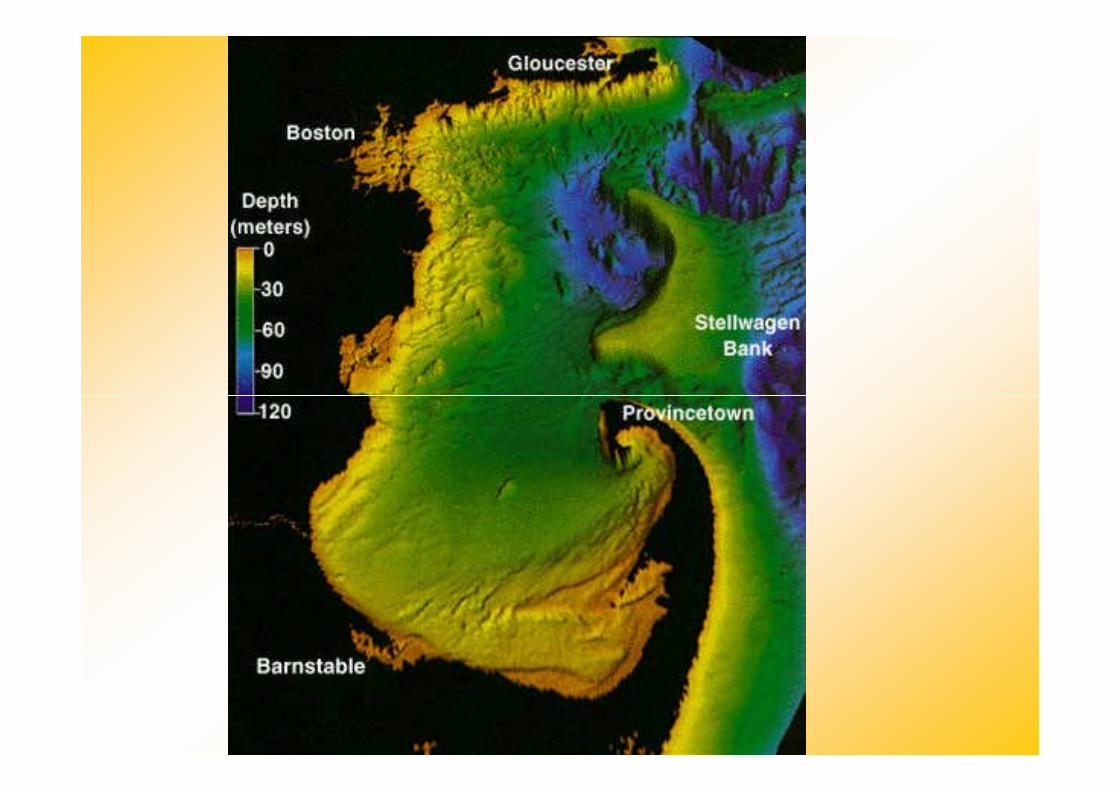
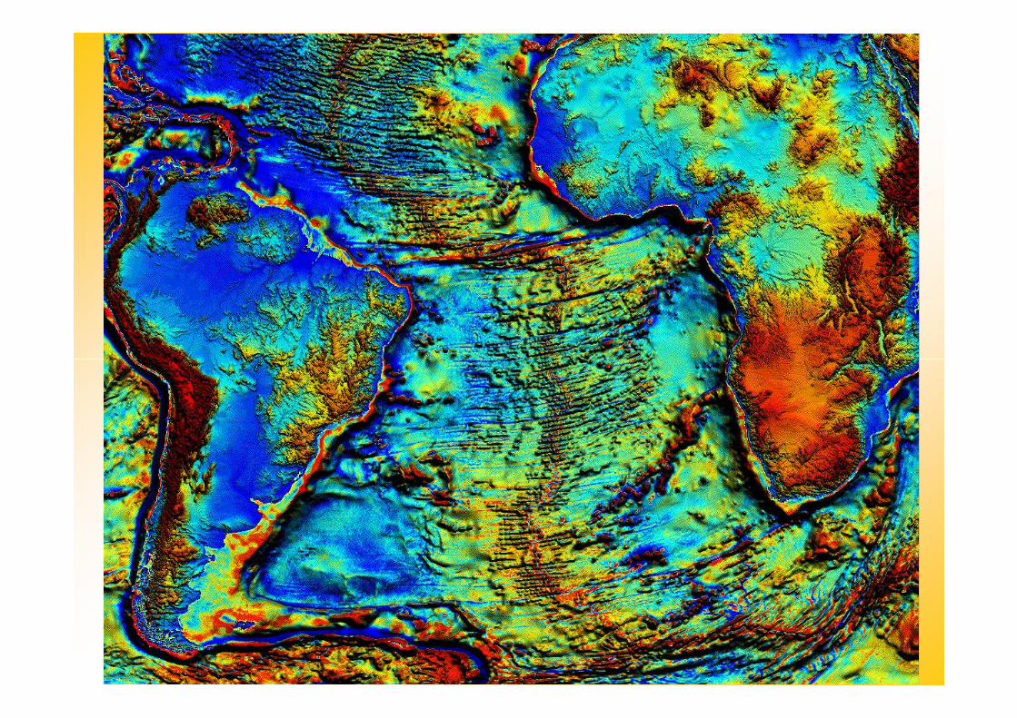
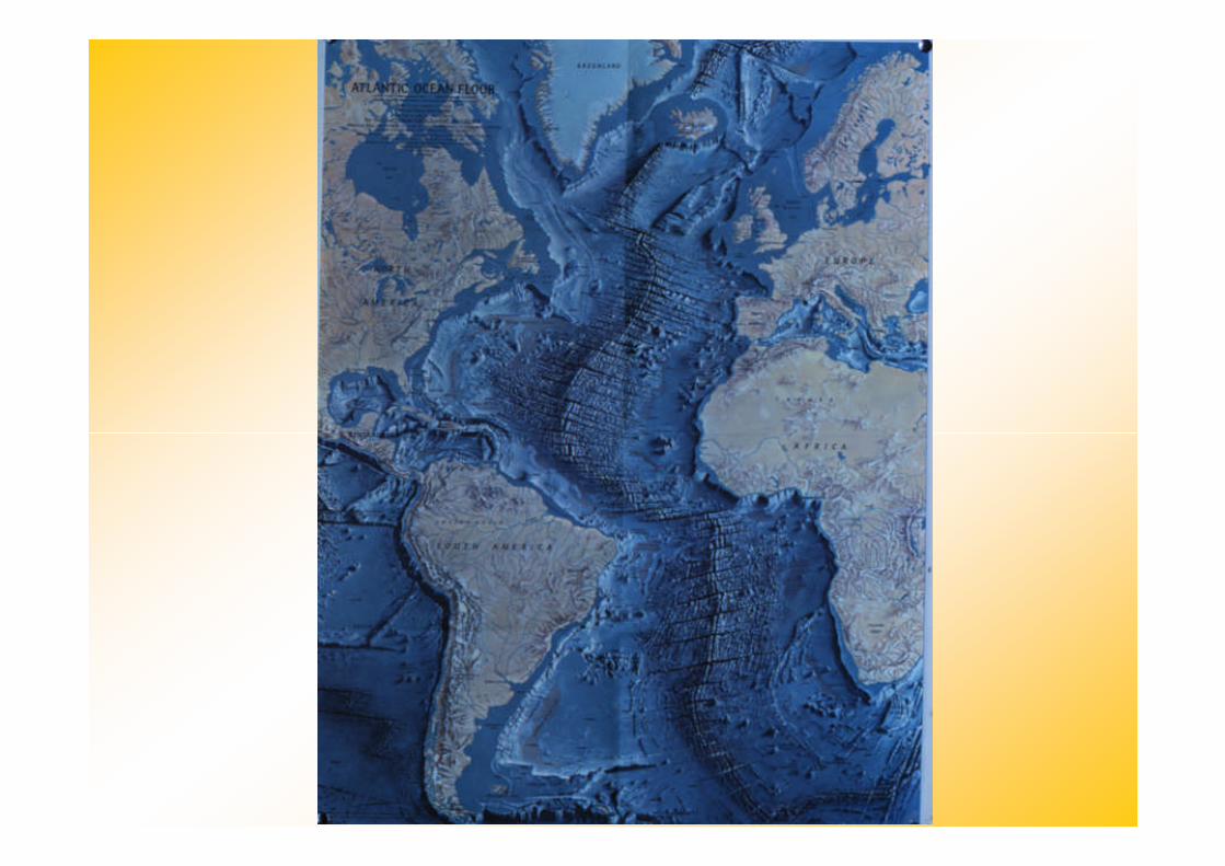
The topography of the ocean flooris as diverse as that of thecontinents.
Bathymetry is the measurement
Mapping the Ocean Floor
Bathymetry is the measurementof ocean depths and the chartingof the shape or topography of theocean floor.
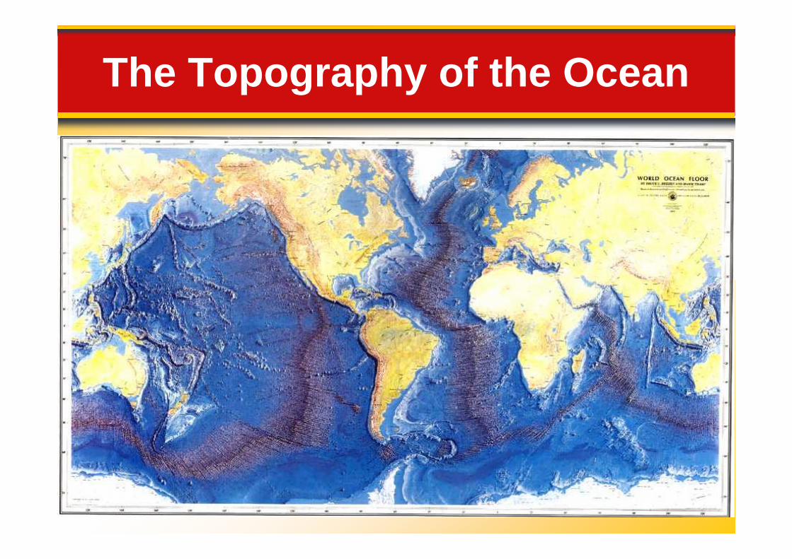
The Topography of the Ocean
14.1 The Vast World Ocean
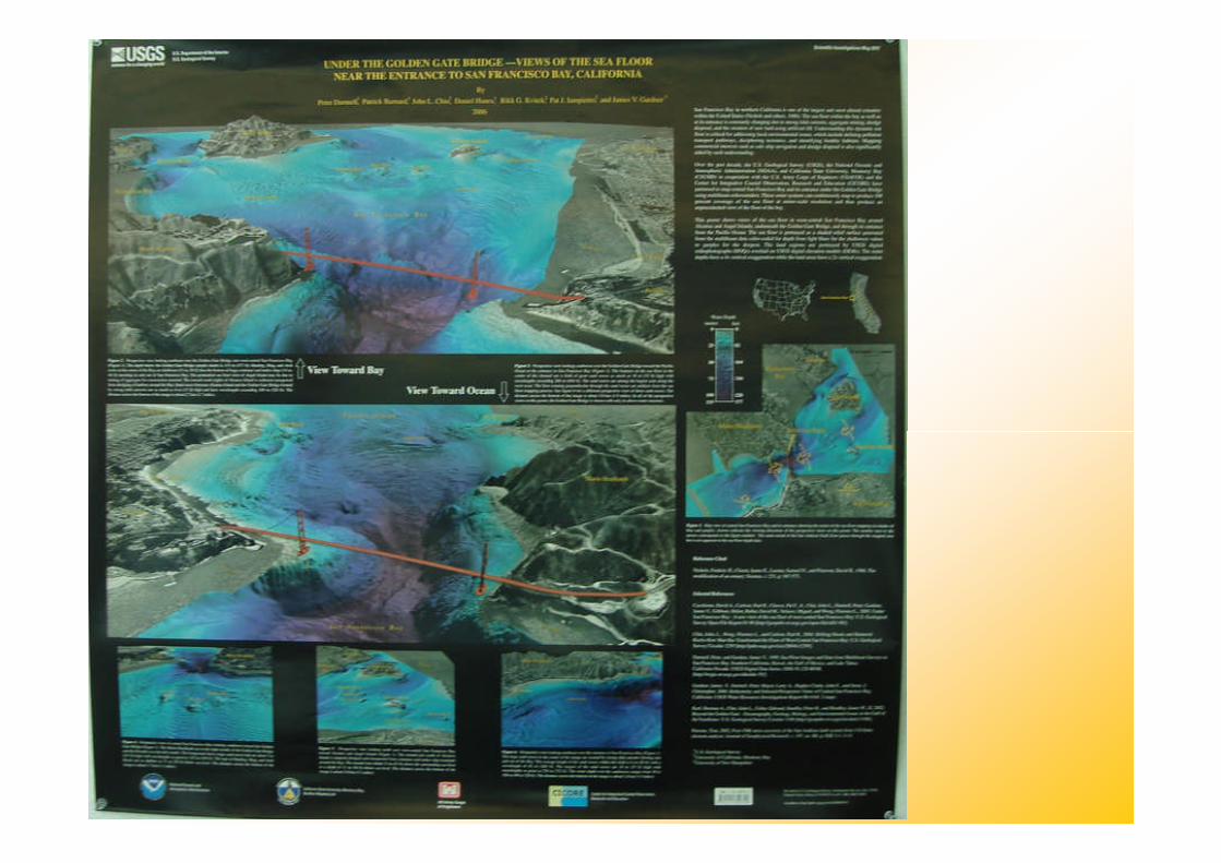
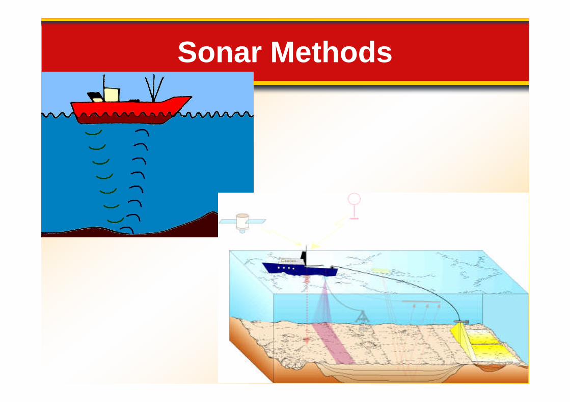
Today’s technology—particularly sonar, satellites,and submersibles —allowsscientists to study the ocean
Mapping the Ocean Floor
and submersibles —allowsscientists to study the oceanfloor in a more efficient andprecise manner than everbefore.
Mapping the Ocean Floor
14.1 The Vast World Ocean
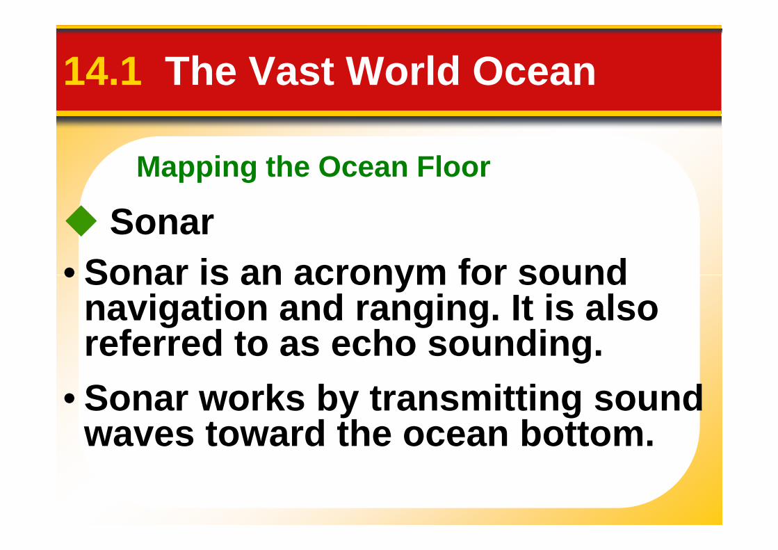
Sonar
• Sonar is an acronym for sound• Sonar is an acronym for soundnavigation and ranging. It is alsoreferred to as echo sounding.
• Sonar works by transmitting soundwaves toward the ocean bottom.
Sonar Methods
14.1 The Vast World Ocean
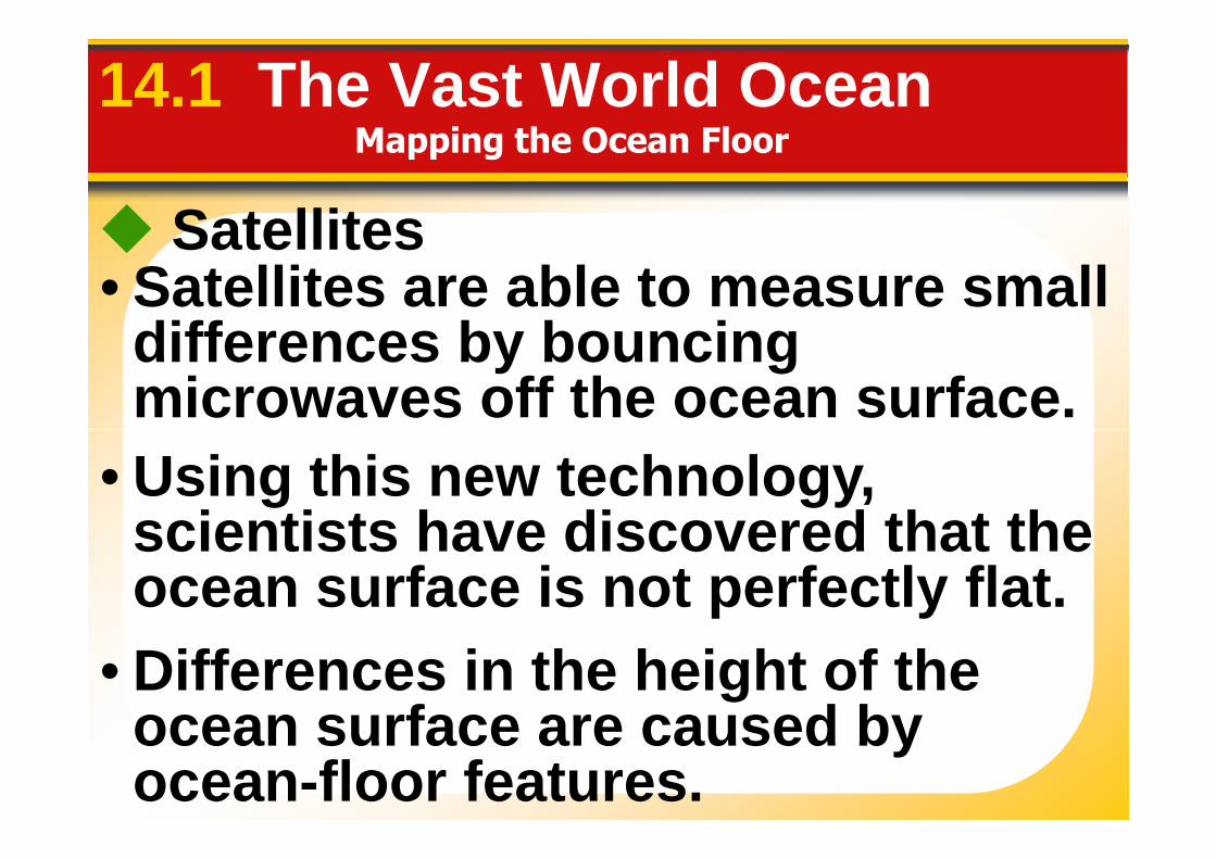
Satellites• Satellites are able to measure small
differences by bouncingmicrowaves off the ocean surface.
Mapping the Ocean Floor
microwaves off the ocean surface.
• Using this new technology,scientists have discovered that theocean surface is not perfectly flat.
• Differences in the height of theocean surface are caused byocean-floor features.
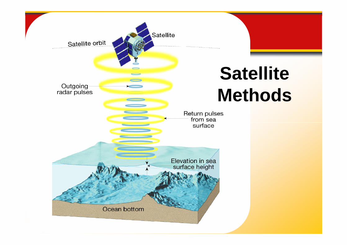
SatelliteMethods
14.1 The Vast World Ocean
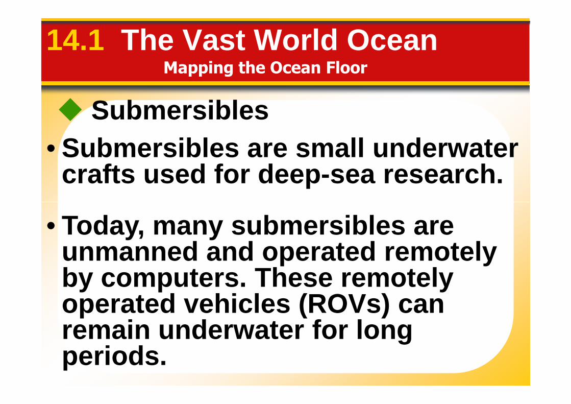
Submersibles
• Submersibles are small underwatercrafts used for deep-sea research.
Mapping the Ocean Floor
• Today, many submersibles areunmanned and operated remotelyby computers. These remotelyoperated vehicles (ROVs) canremain underwater for longperiods.
Mapping the Ocean Floor
14.2 Ocean Floor Features
The ocean floor regions arethe continental margins, thethe continental margins, theocean basin floor, and themid-ocean ridge.
Continental Margins
14.2 Ocean Floor Features
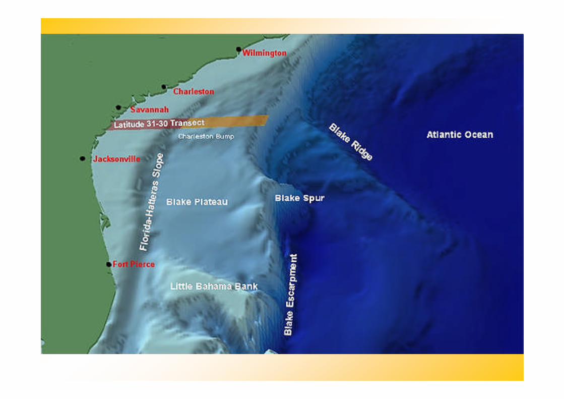
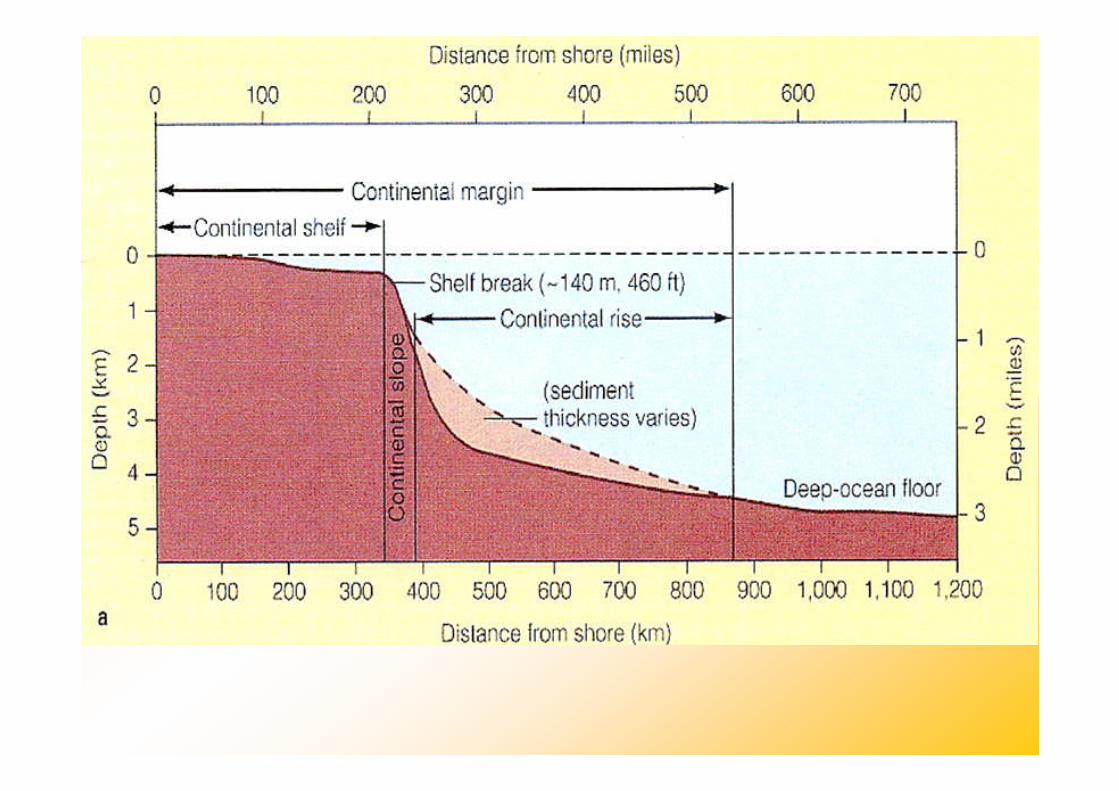
A continental margin is the zoneof transition between a continentand the adjacent ocean basin floor.
In the Atlantic Ocean, thick layersof undisturbed sediment cover thecontinental margin. This regionhas very little volcanic orearthquake activity.
and the adjacent ocean basin floor.
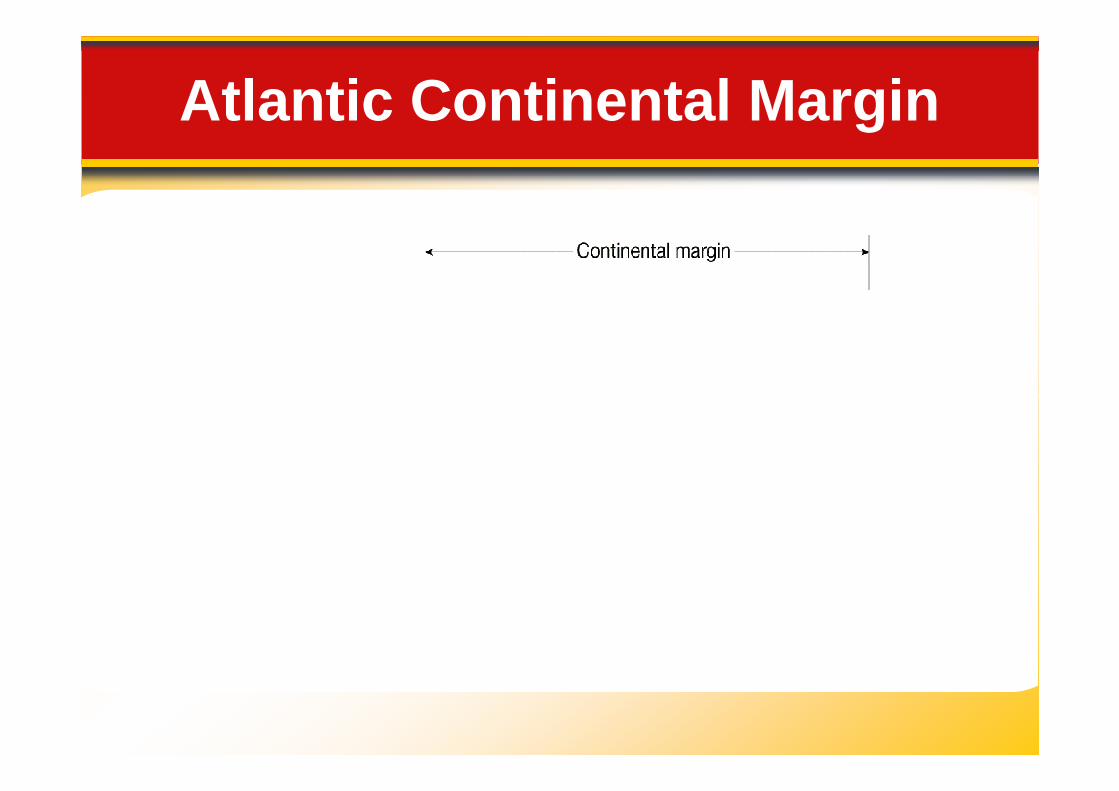
Atlantic Continental Margin
Continental Margins
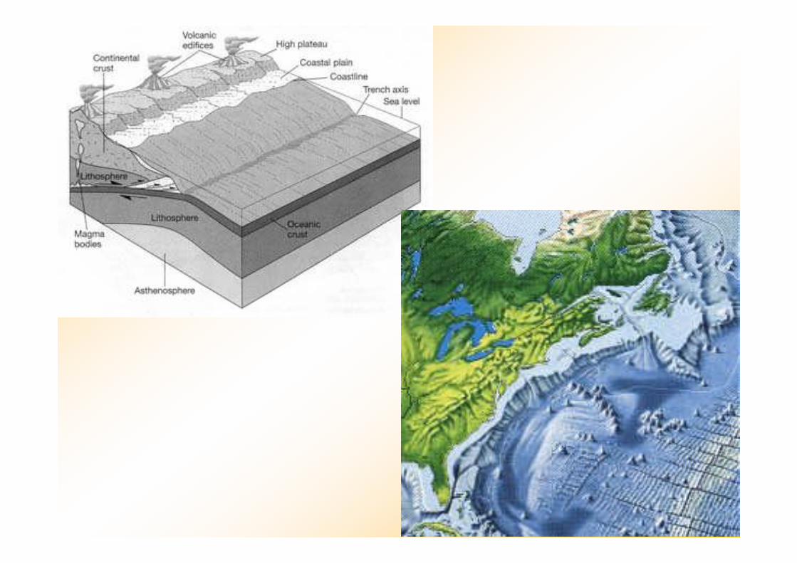
In the Pacific Ocean, oceaniccrust plunges beneath
14.2 Ocean Floor Features
continental crust. This forceresults in a narrow continentalmargin that experiences bothvolcanic activity and earthquakes.
Continental Margins
14.2 Ocean Floor Features
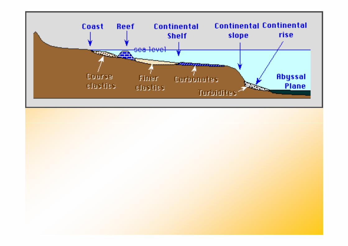
Continental Shelf• A continental shelf is the gently
sloping submerged surfacesloping submerged surfaceextending from the shoreline.
• Continental shelves containimportant mineral deposits, largereservoirs of oil and natural gas,and huge sand and graveldeposits.
Continental Margins
14.2 Ocean Floor Features
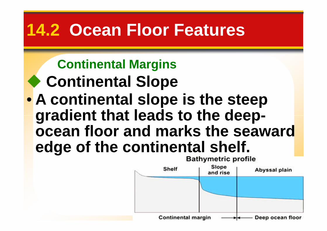
Continental Slope• A continental slope is the steep
gradient that leads to the deep-gradient that leads to the deep-ocean floor and marks the seawardedge of the continental shelf.
Continental Margins
14.2 Ocean Floor Features
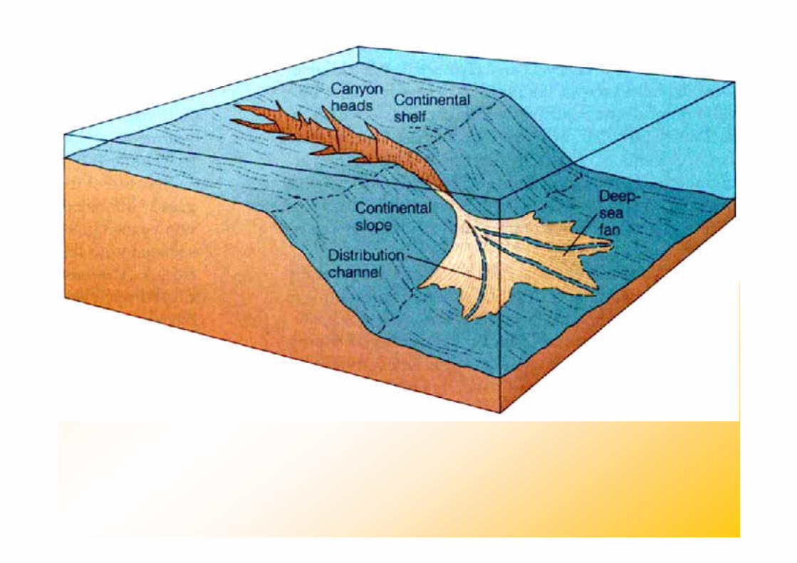
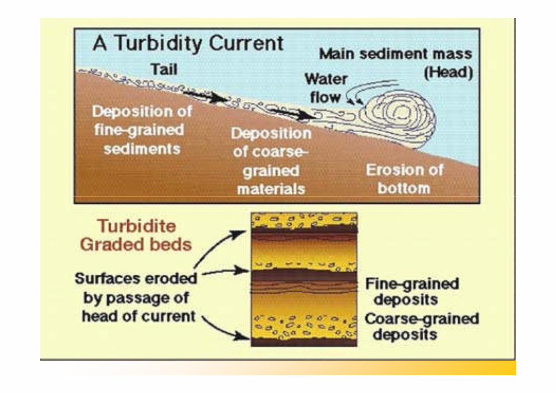
Continental Slope
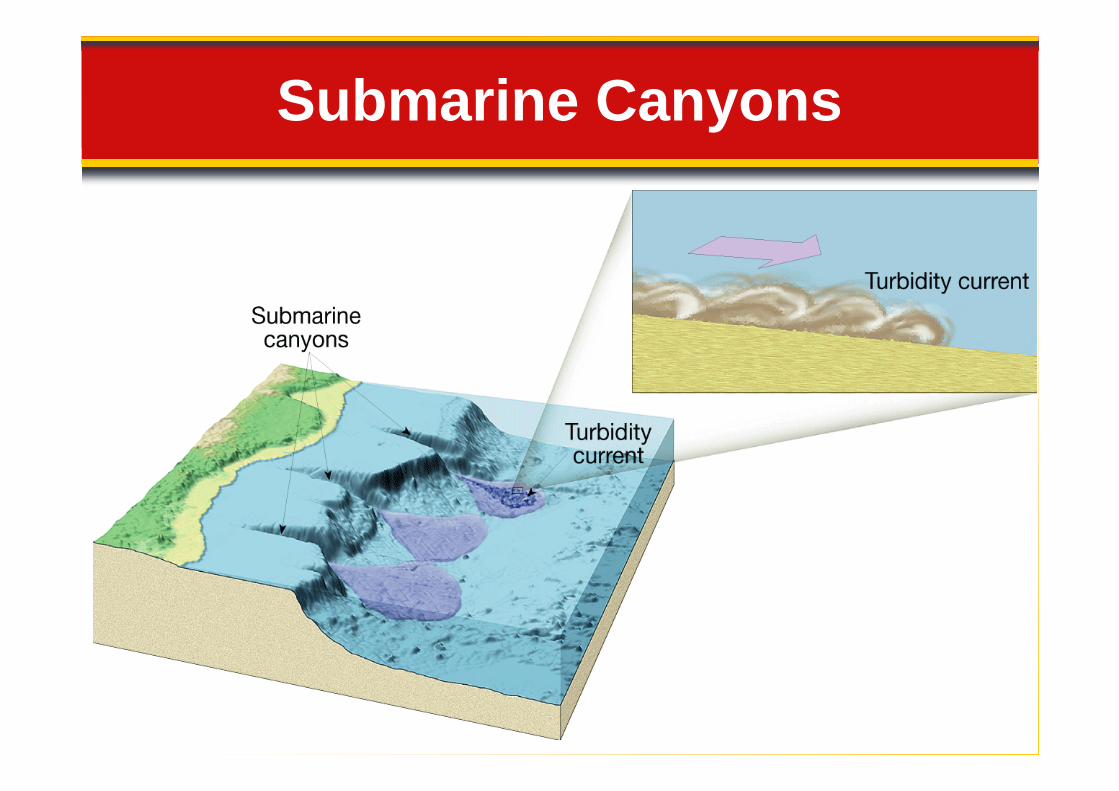
• A submarine canyon is the seawardextension of a valley that was cutextension of a valley that was cuton the continental shelf during atime when sea level was lower—acanyon carved into the outercontinental shelf, slope, and rise byturbidity currents.

Continental Margins
14.2 Ocean Floor Features
Continental Slope
• A submarine canyon is the seawardextension of a valley that was cutextension of a valley that was cuton the continental shelf during atime when sea level was lower—acanyon carved into the outercontinental shelf, slope, and rise byturbidity currents.
Submarine Canyons
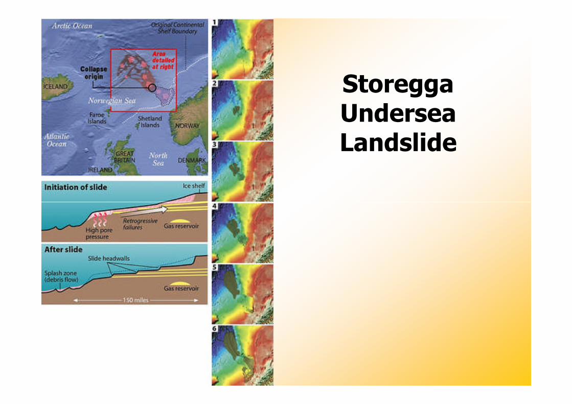
StoreggaUnderseaLandslide
Continental Margins
14.2 Ocean Floor Features
Continental Rise
• A continental rise is the gently• A continental rise is the gentlysloping surface at the base of thecontinental slope.
14.2 Ocean Floor Features
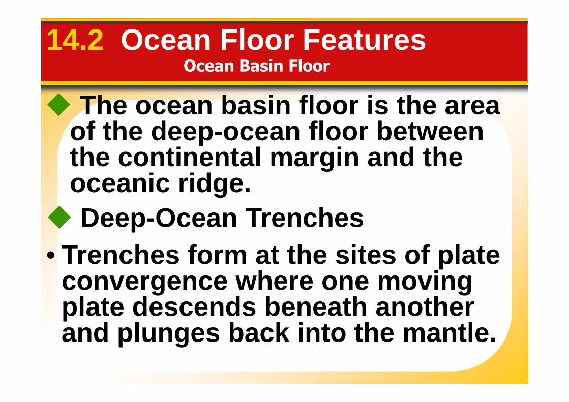
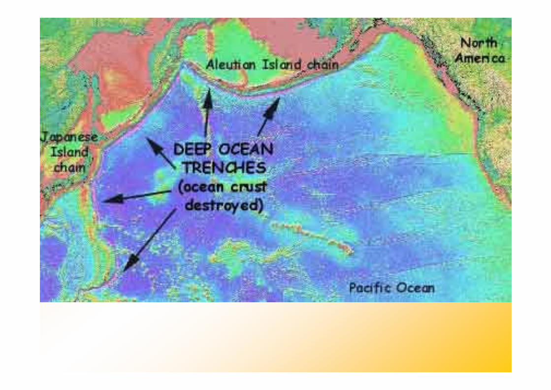
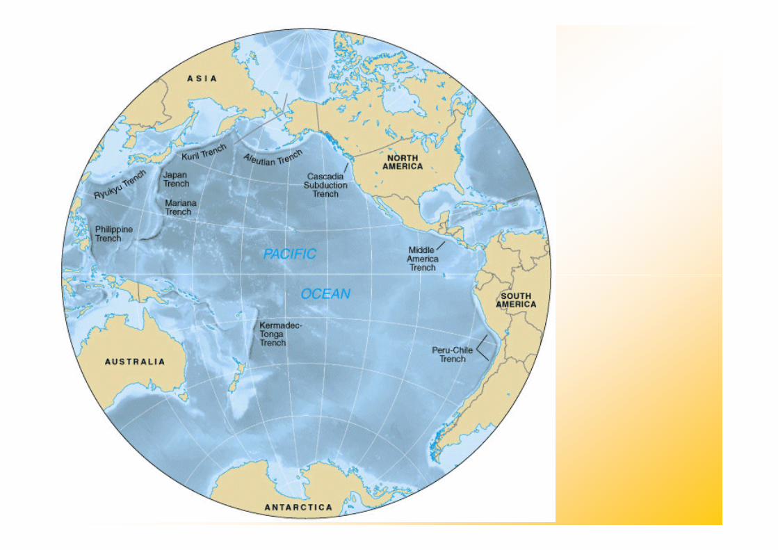
The ocean basin floor is the areaof the deep-ocean floor betweenthe continental margin and theoceanic ridge.
Ocean Basin Floor
• Trenches form at the sites of plateconvergence where one movingplate descends beneath anotherand plunges back into the mantle.
Deep-Ocean Trenches
14.2 Ocean Floor Features
Abyssal Plains
• An abyssal plain is a very levelarea of the deep-ocean floor,usually lying at the foot of the
Ocean Basin Floor
usually lying at the foot of thecontinental rise.
• The sediments that make upabyssal plains are carried there byturbidity currents or are depositedas suspended sediment settles out.
Ocean Basin Floor
14.2 Ocean Floor Features
Seamounts and Guyots
• A seamount is an isolated volcanic• A seamount is an isolated volcanicpeak that rises at least 1000 metersabove the deep-ocean floor, and aguyot is an eroded, submergedseamount.
Abyssal Plain Cross Section
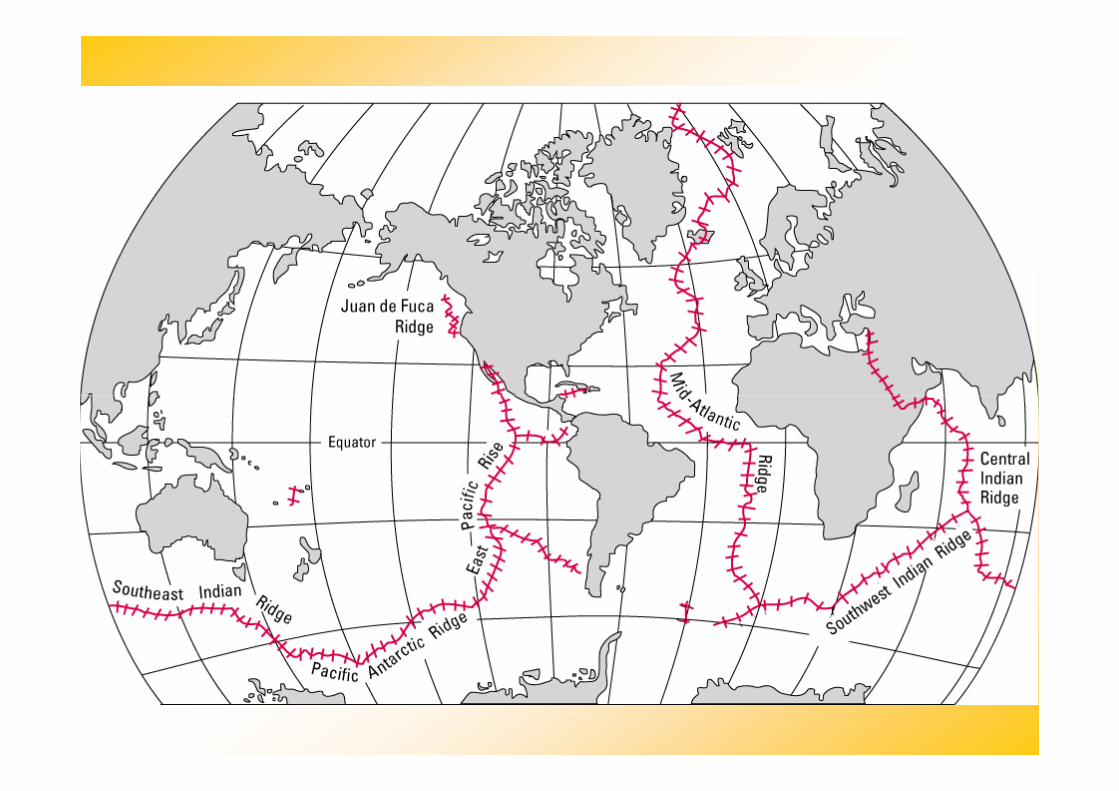
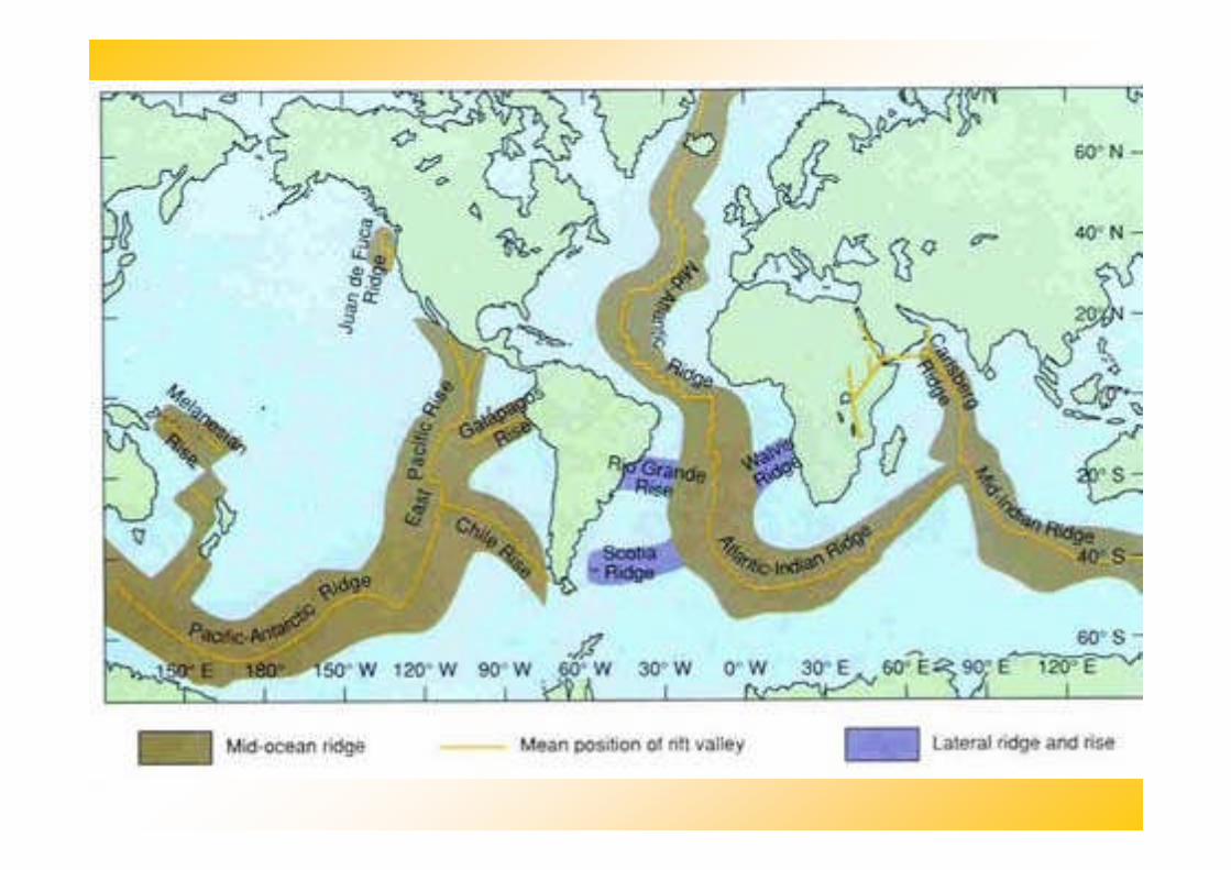
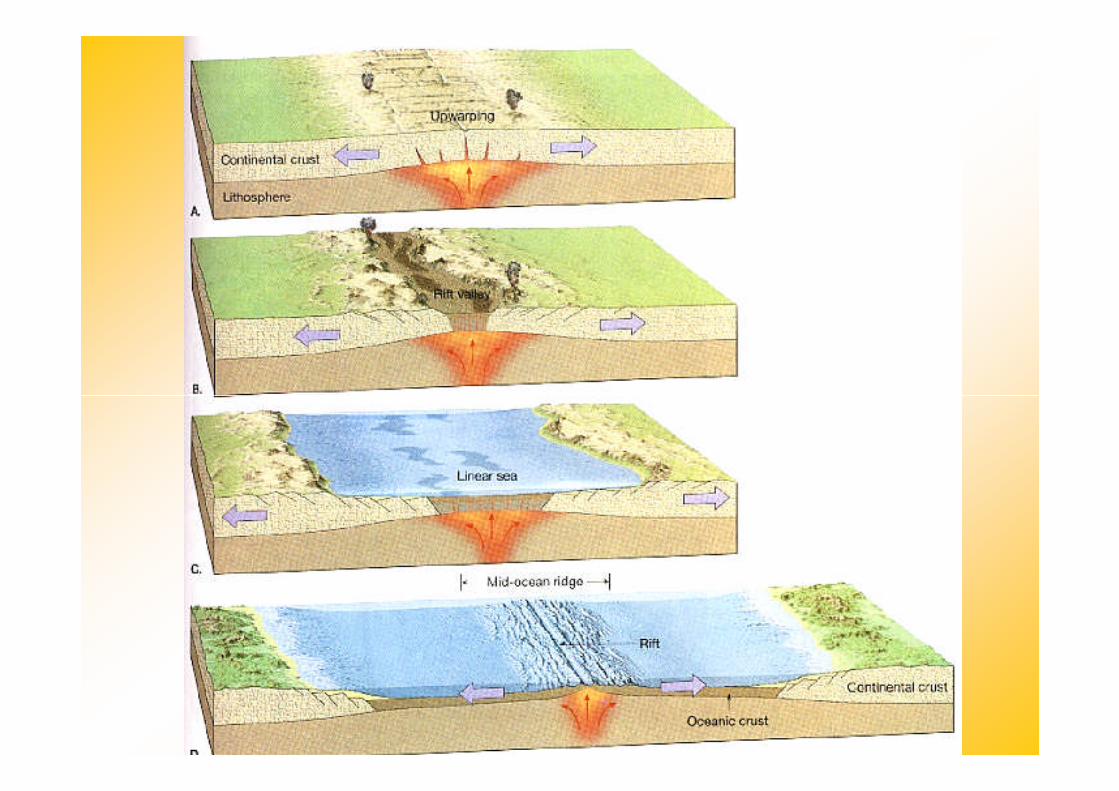
Mid-Ocean Ridges
14.2 Ocean Floor Features
A mid-ocean ridge is found nearthe center of most ocean basins. Itthe center of most ocean basins. Itis an interconnected system ofunderwater mountains that havedeveloped on newly formed oceancrust.
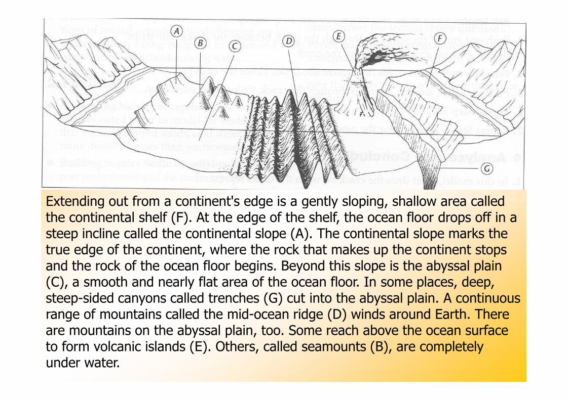
Extending out from a continent's edge is a gently sloping, shallow area calledExtending out from a continent's edge is a gently sloping, shallow area calledthe continental shelf (F). At the edge of the shelf, the ocean floor drops off in asteep incline called the continental slope (A). The continental slope marks thetrue edge of the continent, where the rock that makes up the continent stopsand the rock of the ocean floor begins. Beyond this slope is the abyssal plain(C), a smooth and nearly flat area of the ocean floor. In some places, deep,steep-sided canyons called trenches (G) cut into the abyssal plain. A continuousrange of mountains called the mid-ocean ridge (D) winds around Earth. Thereare mountains on the abyssal plain, too. Some reach above the ocean surfaceto form volcanic islands (E). Others, called seamounts (B), are completelyunder water.
14.2 Ocean Floor Features
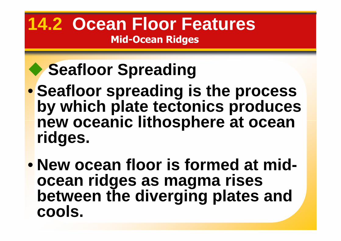
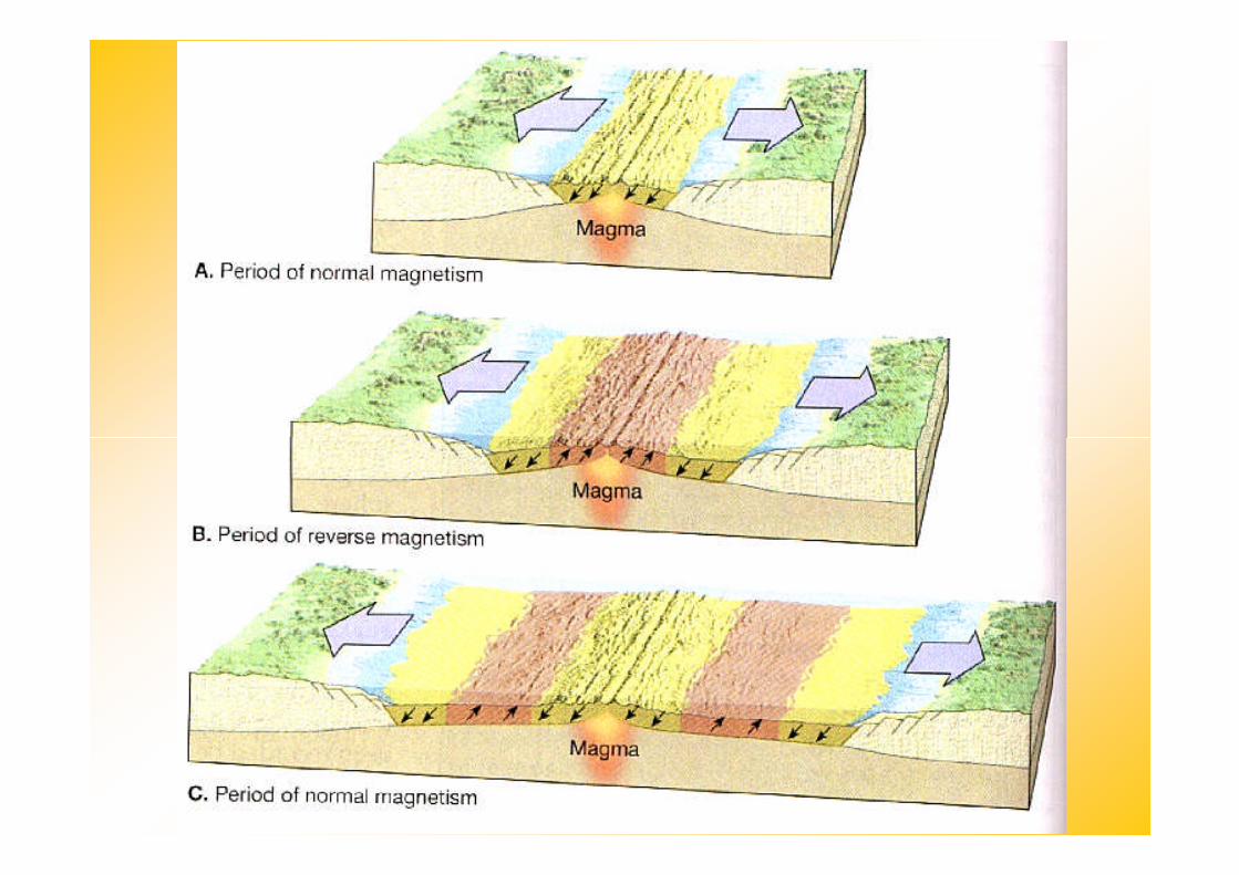
Seafloor Spreading
• Seafloor spreading is the processby which plate tectonics producesnew oceanic lithosphere at ocean
Mid-Ocean Ridges
new oceanic lithosphere at oceanridges.
• New ocean floor is formed at mid-ocean ridges as magma risesbetween the diverging plates andcools.
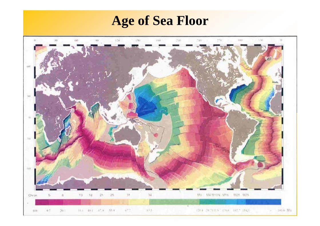
Age of Sea Floor
Mid-Ocean Ridges
14.2 Ocean Floor Features
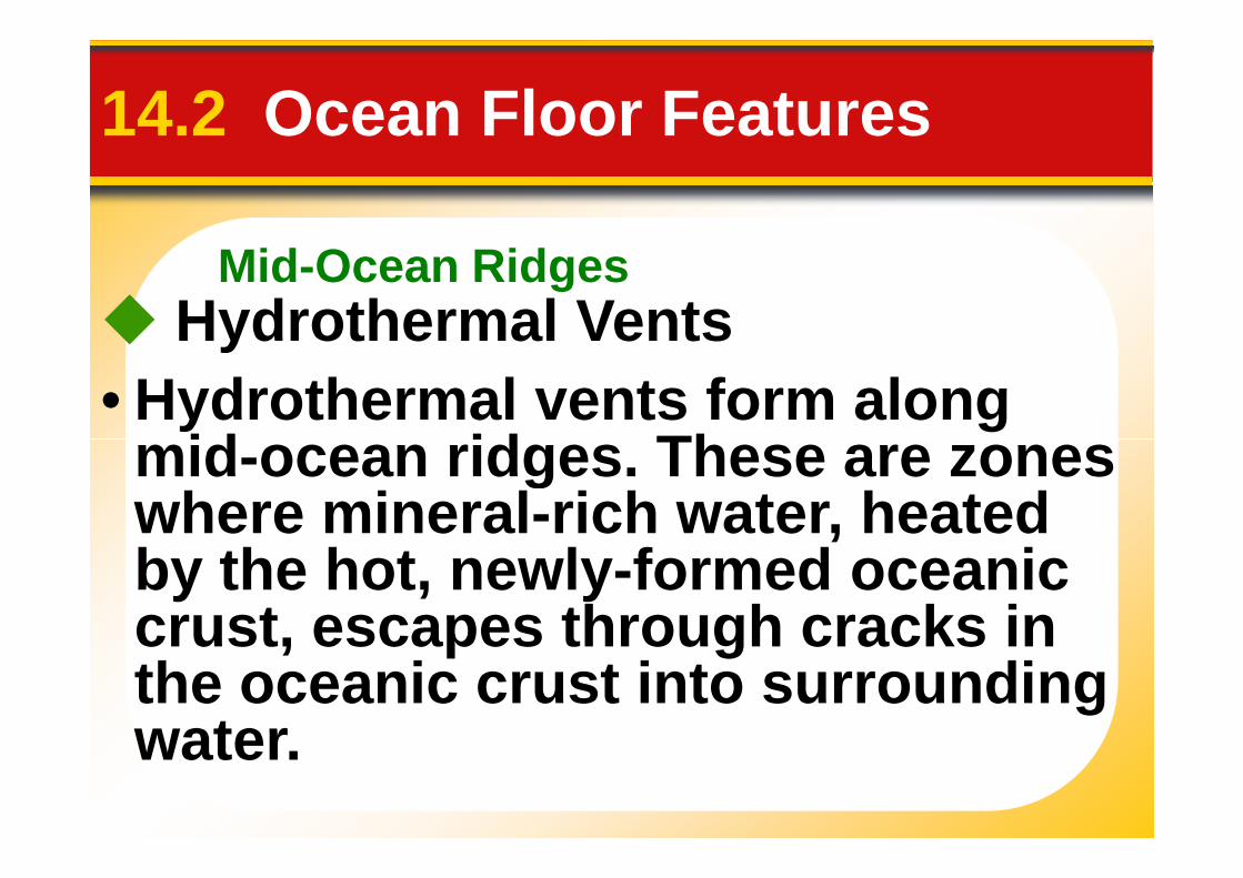
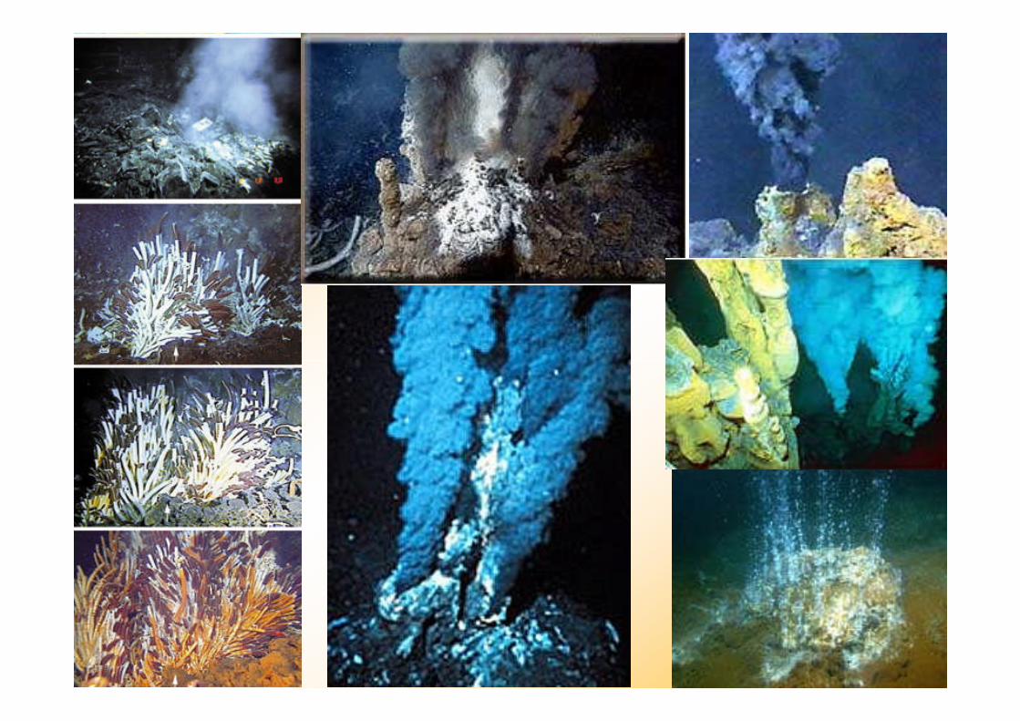
Hydrothermal Vents
• Hydrothermal vents form alongmid-ocean ridges. These are zonesmid-ocean ridges. These are zoneswhere mineral-rich water, heatedby the hot, newly-formed oceaniccrust, escapes through cracks inthe oceanic crust into surroundingwater.
Types of Seafloor Sediments
14.3 Seafloor Sediments
Ocean-floor sediments can beclassified according to their originclassified according to their origininto three broad categories:terrigenous sediment, biogenoussediment, and hydrogenoussediment.
14.3 Seafloor Sediments
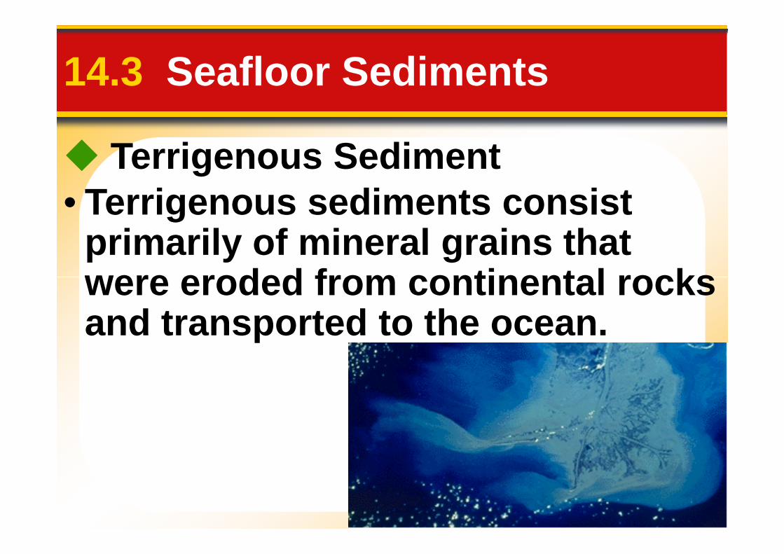
Terrigenous Sediment• Terrigenous sediments consist
primarily of mineral grains thatwere eroded from continental rockswere eroded from continental rocksand transported to the ocean.
14.3 Seafloor Sediments
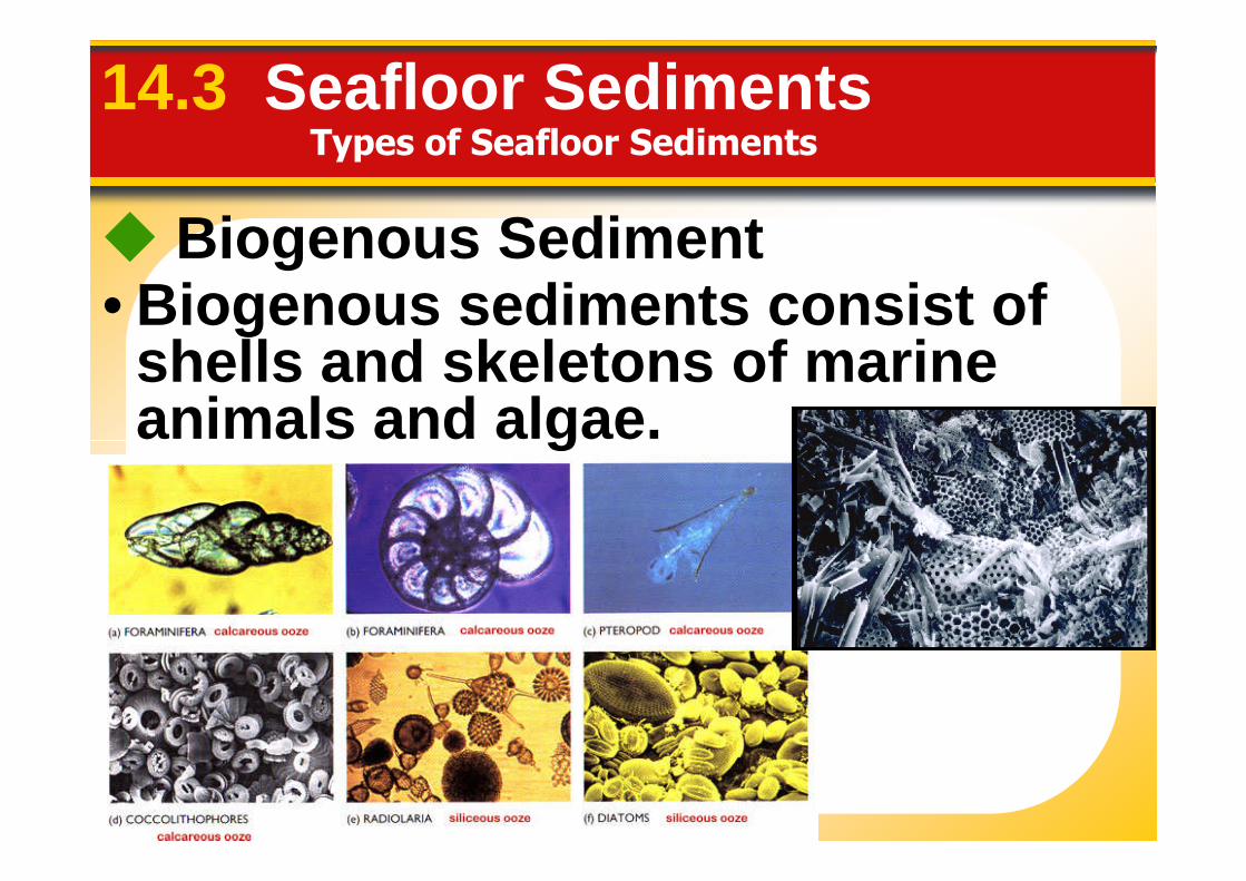
Biogenous Sediment• Biogenous sediments consist of
shells and skeletons of marineanimals and algae.
Types of Seafloor Sediments
animals and algae.
14.3 Seafloor Sediments
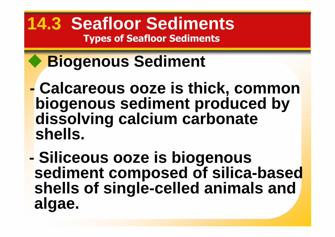
Biogenous Sediment
- Calcareous ooze is thick, commonbiogenous sediment produced bydissolving calcium carbonate
Types of Seafloor Sediments
dissolving calcium carbonateshells.
- Siliceous ooze is biogenoussediment composed of silica-basedshells of single-celled animals andalgae.
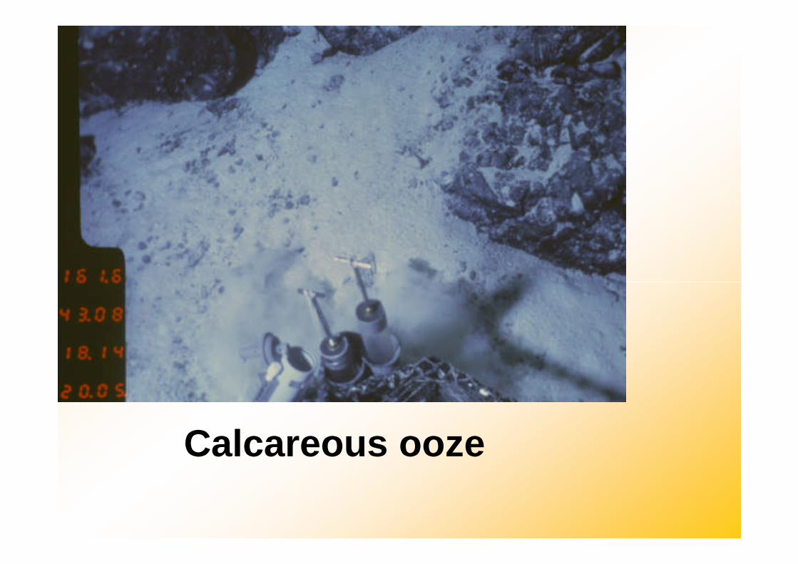
Calcareous ooze

14.3 Seafloor Sediments
HydrogenousSediment
• Hydrogenoussediment consistssediment consistsof minerals thatcrystallize directlyfrom ocean waterthrough variouschemicalreactions.
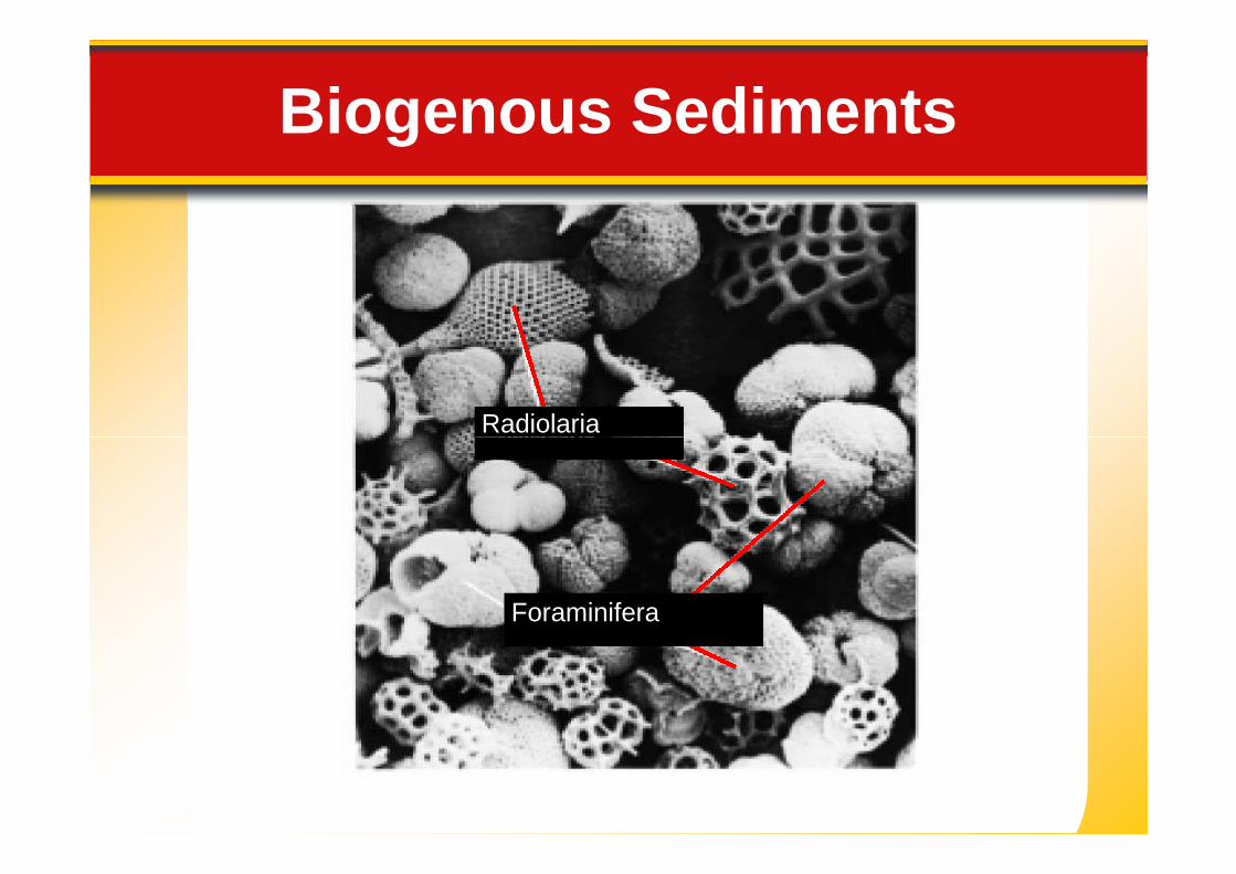
Radiolaria
Biogenous Sediments
Radiolaria
Foraminifera
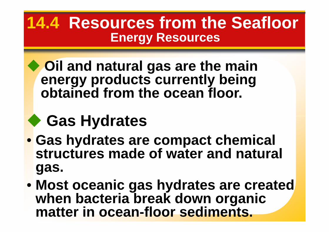
14.4 Resources from the Seafloor
Oil and natural gas are the mainenergy products currently beingobtained from the ocean floor.
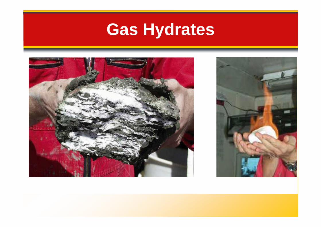
Gas Hydrates
Energy Resources
• Gas hydrates are compact chemicalstructures made of water and naturalgas.
Gas Hydrates
• Most oceanic gas hydrates are createdwhen bacteria break down organicmatter in ocean-floor sediments.
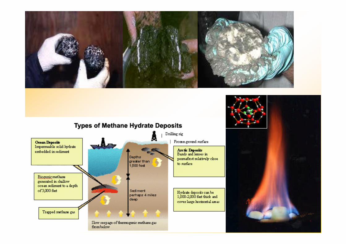
Gas Hydrates
14.4 Resources from the Seafloor
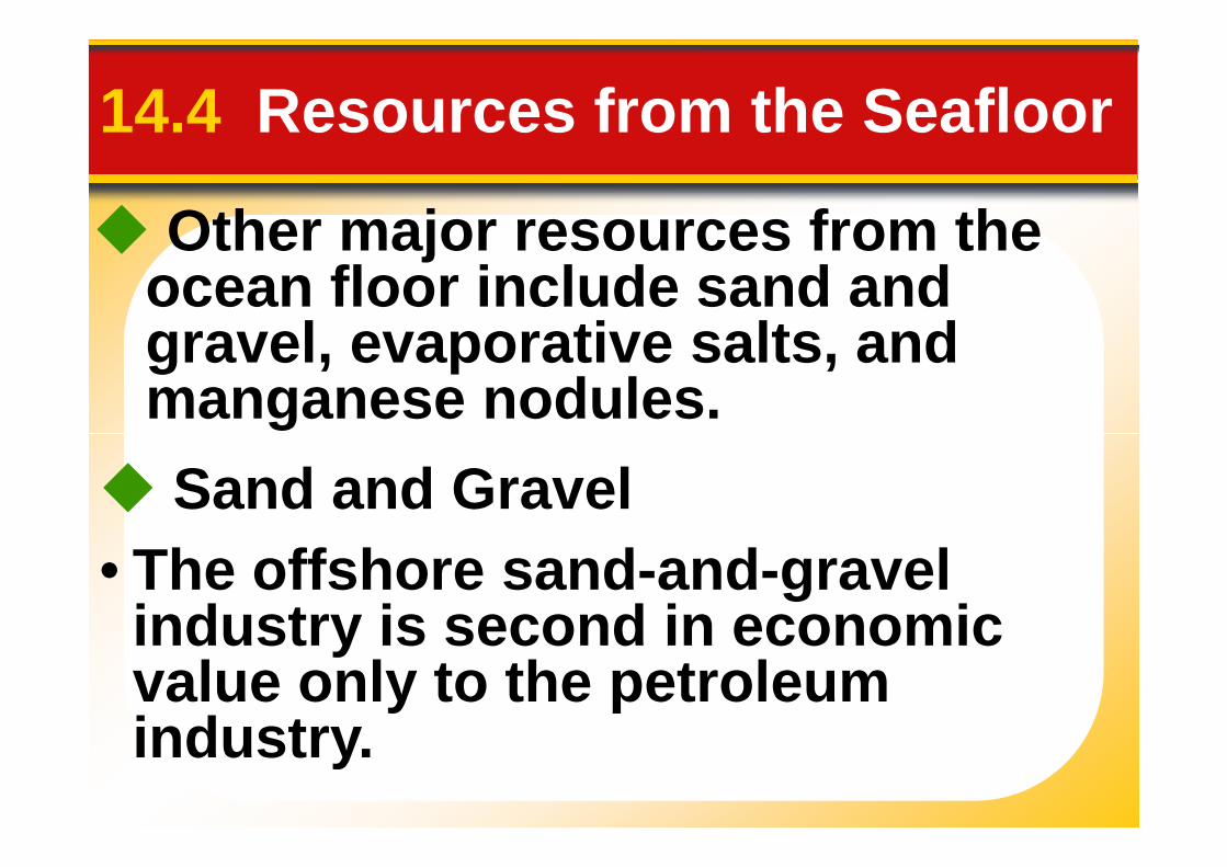
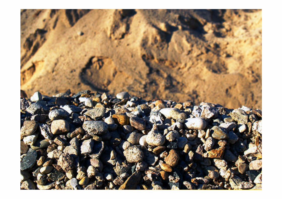
Other major resources from theocean floor include sand andgravel, evaporative salts, andmanganese nodules.
Sand and Gravel
• The offshore sand-and-gravelindustry is second in economicvalue only to the petroleumindustry.
14.4 Resources from the Seafloor
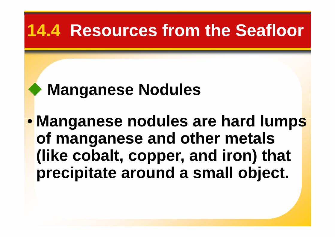
Manganese Nodules
• Manganese nodules are hard lumps• Manganese nodules are hard lumpsof manganese and other metals(like cobalt, copper, and iron) thatprecipitate around a small object.

Manganese Nodules
14.4 Resources from the Seafloor
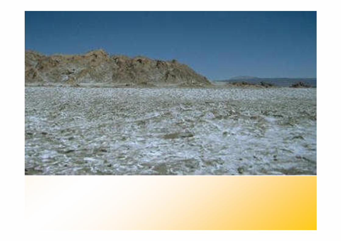
Evaporative Salts• When seawater evaporates, the salt
increases in concentration until itcan no longer remain dissolved.When the concentration becomescan no longer remain dissolved.When the concentration becomeshigh enough, the salts precipitateout of solution and form saltdeposits.
• The most economically importantsalt is halite—common table salt.