Embed Size (px)
Citation preview
5/1/2017
1
Chapter 10
Geoprocessing
(Continued)
Copyright © McGraw-Hill Education. Permission required for reproduction or display.
10-1
More map overlay geoprocessing functions
Copyright © 2015 by Marbeth H. Price
10-2
5/1/2017
2
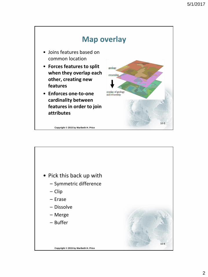
Map overlay
• Joins features based on common location
• Forces features to split when they overlap each other, creating new features
• Enforces one-to-one cardinality between features in order to join attributes
Copyright © 2015 by Maribeth H. Price
10-3
• Pick this back up with
– Symmetric difference
– Clip
– Erase
– Dissolve
– Merge
– Buffer
Copyright © 2015 by Maribeth H. Price
10-4
5/1/2017
3
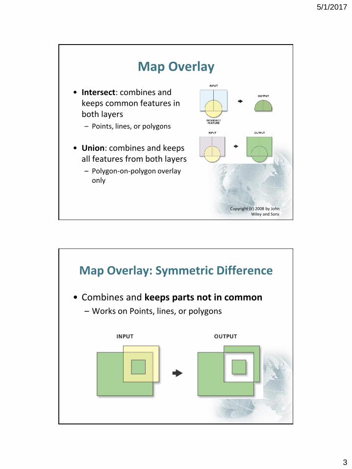
Map Overlay
• Intersect: combines and keeps common features in both layers
– Points, lines, or polygons
• Union: combines and keeps all features from both layers
– Polygon-on-polygon overlay only
Copyright (c) 2008 by John Wiley and Sons
Map Overlay: Symmetric Difference
• Combines and keeps parts not in common
– Works on Points, lines, or polygons
5/1/2017
4
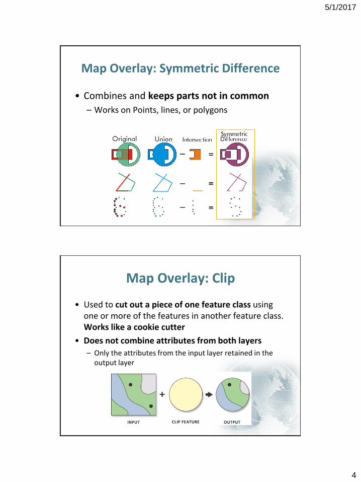
Map Overlay: Symmetric Difference
• Combines and keeps parts not in common
– Works on Points, lines, or polygons
Map Overlay: Clip
• Used to cut out a piece of one feature class using one or more of the features in another feature class. Works like a cookie cutter
• Does not combine attributes from both layers
– Only the attributes from the input layer retained in the output layer
5/1/2017
5
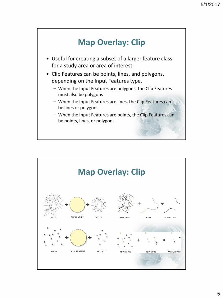
Map Overlay: Clip
• Useful for creating a subset of a larger feature class for a study area or area of interest
• Clip Features can be points, lines, and polygons, depending on the Input Features type.
– When the Input Features are polygons, the Clip Features must also be polygons
– When the Input Features are lines, the Clip Features can be lines or polygons
– When the Input Features are points, the Clip Features can be points, lines, or polygons
Map Overlay: Clip
5/1/2017
6
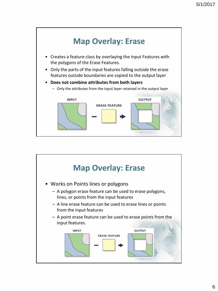
Map Overlay: Erase
• Creates a feature class by overlaying the Input Features with the polygons of the Erase Features.
• Only the parts of the input features falling outside the erase features outside boundaries are copied to the output layer
• Does not combine attributes from both layers– Only the attributes from the input layer retained in the output layer
Map Overlay: Erase
• Works on Points lines or polygons
– A polygon erase feature can be used to erase polygons, lines, or points from the input features
– A line erase feature can be used to erase lines or points from the input features
– A point erase feature can be used to erase points from the input features.
5/1/2017
7
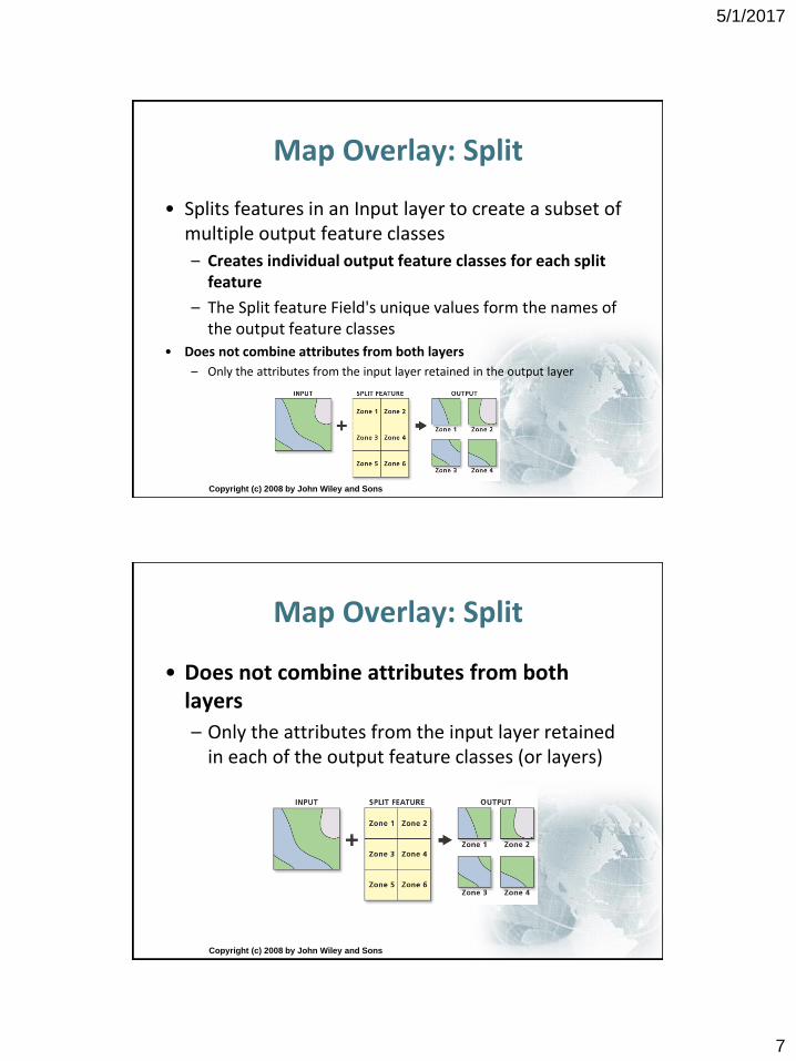
Map Overlay: Split
• Splits features in an Input layer to create a subset of multiple output feature classes
– Creates individual output feature classes for each split feature
– The Split feature Field's unique values form the names of the output feature classes
• Does not combine attributes from both layers
– Only the attributes from the input layer retained in the output layer
Copyright (c) 2008 by John Wiley and Sons
Map Overlay: Split
• Does not combine attributes from both layers
– Only the attributes from the input layer retained in each of the output feature classes (or layers)
Copyright (c) 2008 by John Wiley and Sons
5/1/2017
8
Length/area changes
Copyright © 2015 by Maribeth H. Price
10-15
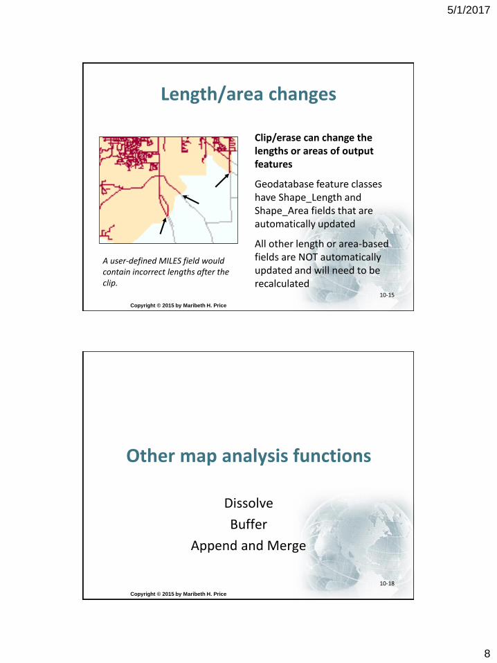
Clip/erase can change the lengths or areas of output features
Geodatabase feature classes have Shape_Length and Shape_Area fields that are automatically updated
All other length or area-based fields are NOT automatically updated and will need to be recalculated
A user-defined MILES field would contain incorrect lengths after the clip.
Other map analysis functions
Dissolve
Buffer
Append and Merge
Copyright © 2015 by Maribeth H. Price
10-18
5/1/2017
9
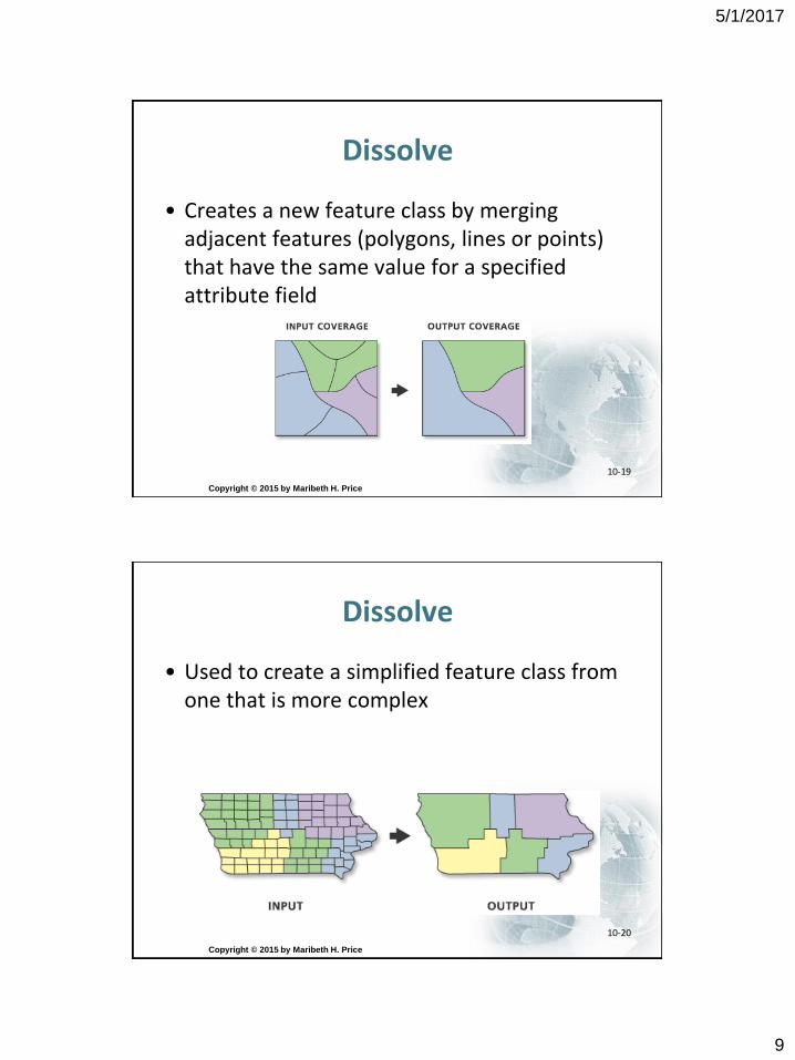
Dissolve
• Creates a new feature class by merging adjacent features (polygons, lines or points) that have the same value for a specified attribute field
Copyright © 2015 by Maribeth H. Price
10-19
Dissolve
• Used to create a simplified feature class from one that is more complex
Copyright © 2015 by Maribeth H. Price
10-20
5/1/2017
10
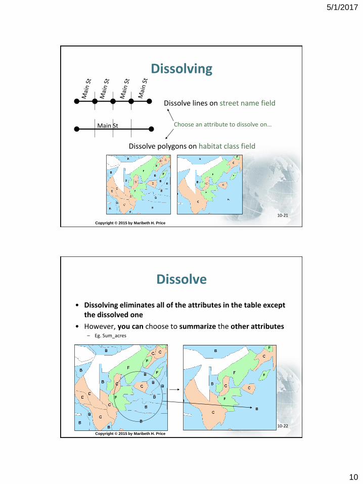
Dissolving
Copyright © 2015 by Maribeth H. Price
10-21
Dissolve polygons on habitat class field
Dissolve lines on street name field
Main St Choose an attribute to dissolve on…
Dissolve
• Dissolving eliminates all of the attributes in the table except the dissolved one
• However, you can choose to summarize the other attributes– Eg. Sum_acres
Copyright © 2015 by Maribeth H. Price
10-22
5/1/2017
11
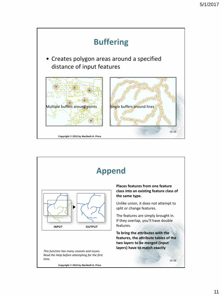
Buffering
• Creates polygon areas around a specified distance of input features
Copyright © 2015 by Maribeth H. Price
10-23
Single buffers around linesMultiple buffers around points
Append
Copyright © 2015 by Maribeth H. Price
10-24
Places features from one feature class into an existing feature class of the same type.
Unlike union, it does not attempt to split or change features.
The features are simply brought in. If they overlap, you’ll have double features.
To bring the attributes with the features, the attribute tables of the two layers to be merged (input layers) have to match exactly
This function has many caveats and issues. Read the Help before attempting for the first time.
5/1/2017
12
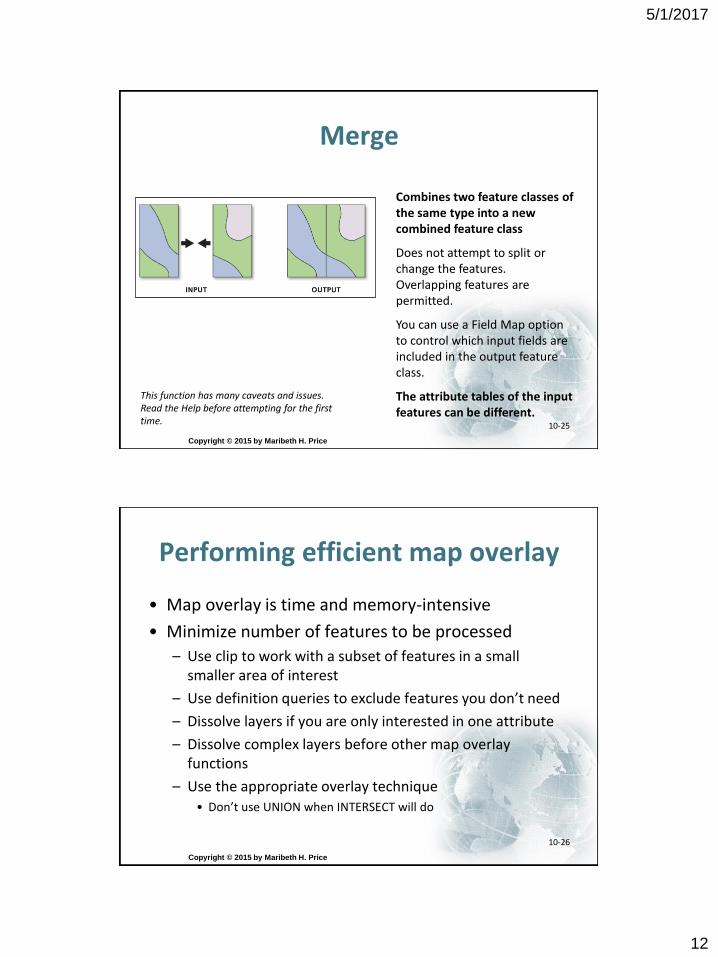
Merge
Copyright © 2015 by Maribeth H. Price
10-25
Combines two feature classes of the same type into a new combined feature class
Does not attempt to split or change the features. Overlapping features are permitted.
You can use a Field Map option to control which input fields are included in the output feature class.
The attribute tables of the input features can be different.
This function has many caveats and issues. Read the Help before attempting for the first time.
Performing efficient map overlay
• Map overlay is time and memory-intensive
• Minimize number of features to be processed
– Use clip to work with a subset of features in a small smaller area of interest
– Use definition queries to exclude features you don’t need
– Dissolve layers if you are only interested in one attribute
– Dissolve complex layers before other map overlay functions
– Use the appropriate overlay technique• Don’t use UNION when INTERSECT will do
Copyright © 2015 by Maribeth H. Price
10-26
5/1/2017
13
Copyright © 2015 by Maribeth H. Price
10-27
Map Overlay problems: Slivers
• Tiny polygons created during geoprocessing
• Result of slight differences in boundaries
• Can build up as a result of multiple operations
• Nuisance for some applications of GIS
– Maps from overlays
Copyright © 2015 by Maribeth H. Price
10-28
5/1/2017
14
Slivers
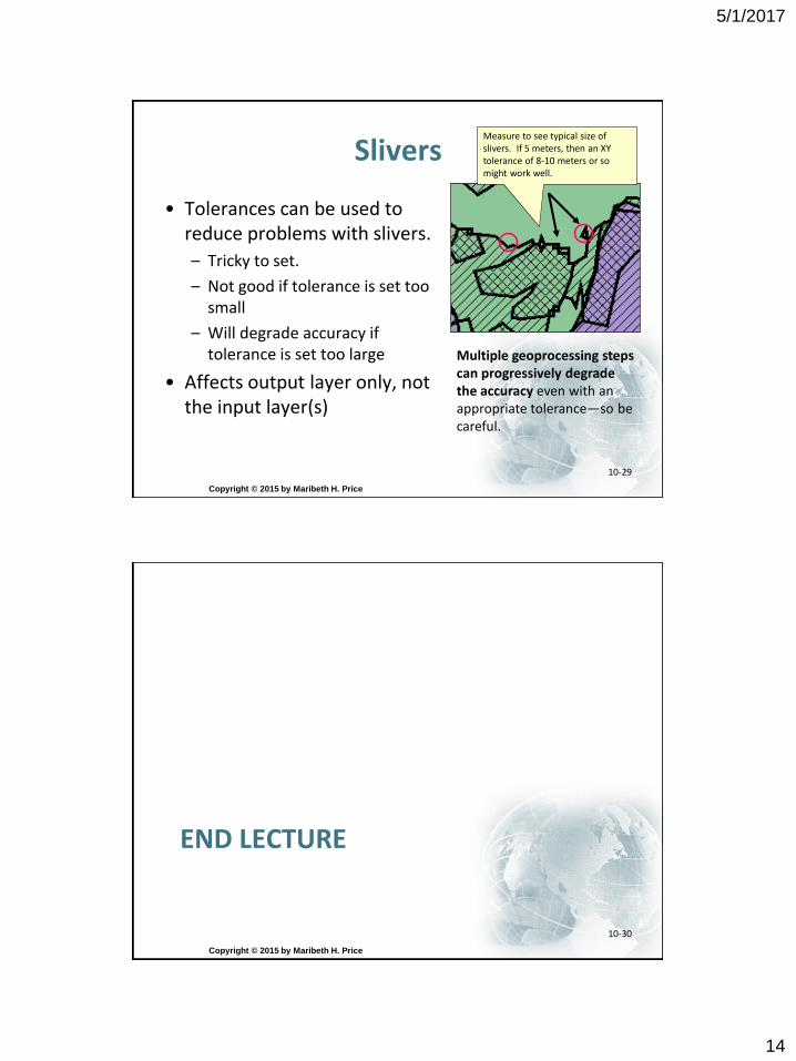
• Tolerances can be used to reduce problems with slivers.
– Tricky to set.
– Not good if tolerance is set too small
– Will degrade accuracy if tolerance is set too large
• Affects output layer only, not the input layer(s)
Copyright © 2015 by Maribeth H. Price
10-29
Multiple geoprocessing steps can progressively degrade the accuracy even with an appropriate tolerance—so be careful.
Measure to see typical size of slivers. If 5 meters, then an XY tolerance of 8-10 meters or so might work well.
END LECTURE
Copyright © 2015 by Maribeth H. Price
10-30