Embed Size (px)
Citation preview
Ch 9 – Water Resources
These lectures contain copyrighted images that are provided in the teacher materials for Friedland/Relyea Environmental Science for AP Textbook. By using these lectures, you guarantee that you have legal access to these images or that you have replaced the copyrighted images with images that you have the rights to use.
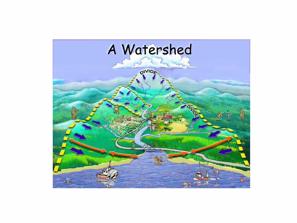
If all the water in the world could fit in a two liter bottle, all of the
freshwater in the world would fit in a
teaspoon
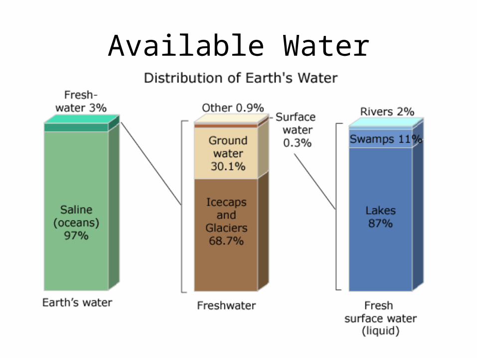
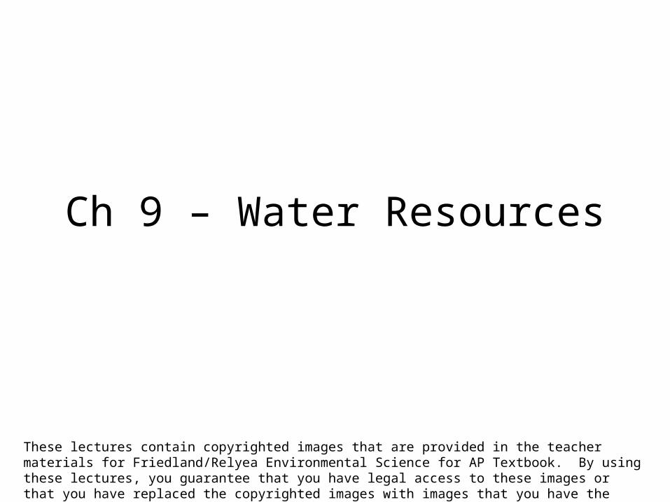
Available Water
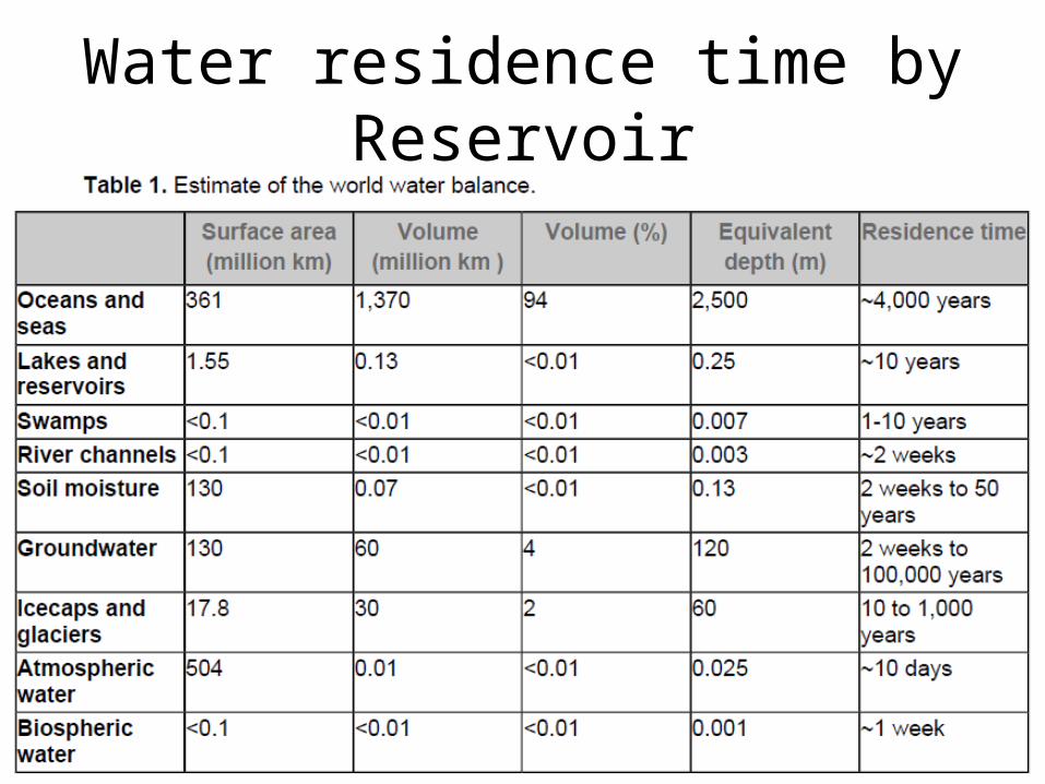
Water residence time by Reservoir
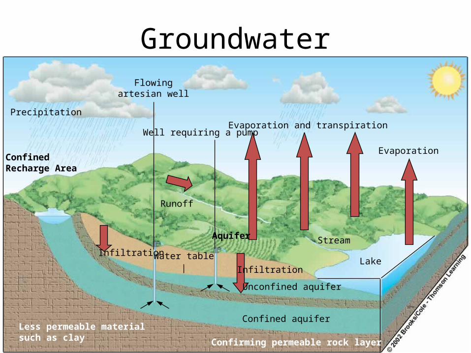
Groundwater
Evaporation and transpiration
Evaporation
Stream
Infiltration
Water tableInfiltration
Unconfined aquifer
Confined aquifer
Lake
Well requiring a pump
Flowingartesian well
Runoff
Precipitation
ConfinedRecharge Area
Aquifer
Less permeable materialsuch as clay Confirming permeable rock layer
Groundwater• Precipitation infiltrates and percolates through
pores and fractures in soil and rock until it hits an impermeable layer
• Zone of saturation is at a depth were ground is filled with water – Top of this zone is water table
• Falls in dry weather• Rises in wet weather
• Groundwater flows slowly based on the amount of recharge and the amount of discharge
• Over pumping of groundwater can result in a variety of environmental problems
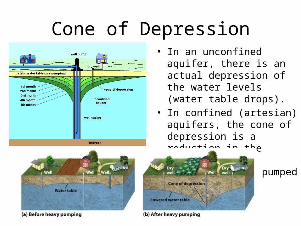
Cone of Depression• In an unconfined aquifer, there
is an actual depression of the water levels (water table drops).
• In confined (artesian) aquifers, the cone of depression is a reduction in the pressure head surrounding the pumped well.
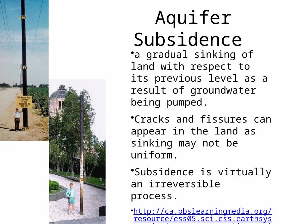
Aquifer Subsidence •a gradual sinking of land with respect to its previous level as a result of groundwater being pumped.
•Cracks and fissures can appear in the land as sinking may not be uniform.
•Subsidence is virtually an irreversible process.•http://ca.pbslearningmedia.org/resource/ess05.sci.ess.earthsys.mexico/water-conservation-mexico
/

Salt Water Intrusion• Over pumping of freshwater
near salt water results in the movement of the salt water aquifer inward
• Creates brackish water that is unsuitable for drinking and irrigation
• Solution: injection well that pumps freshwater into the aquifer pushing the salt water out
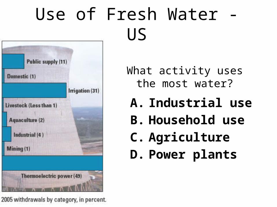
Use of Fresh Water - US
What activity uses the most water?
A. Industrial useB. Household useC. AgricultureD. Power plants
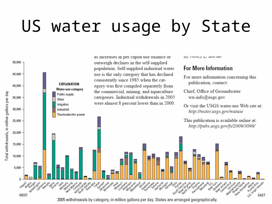
US water usage by State
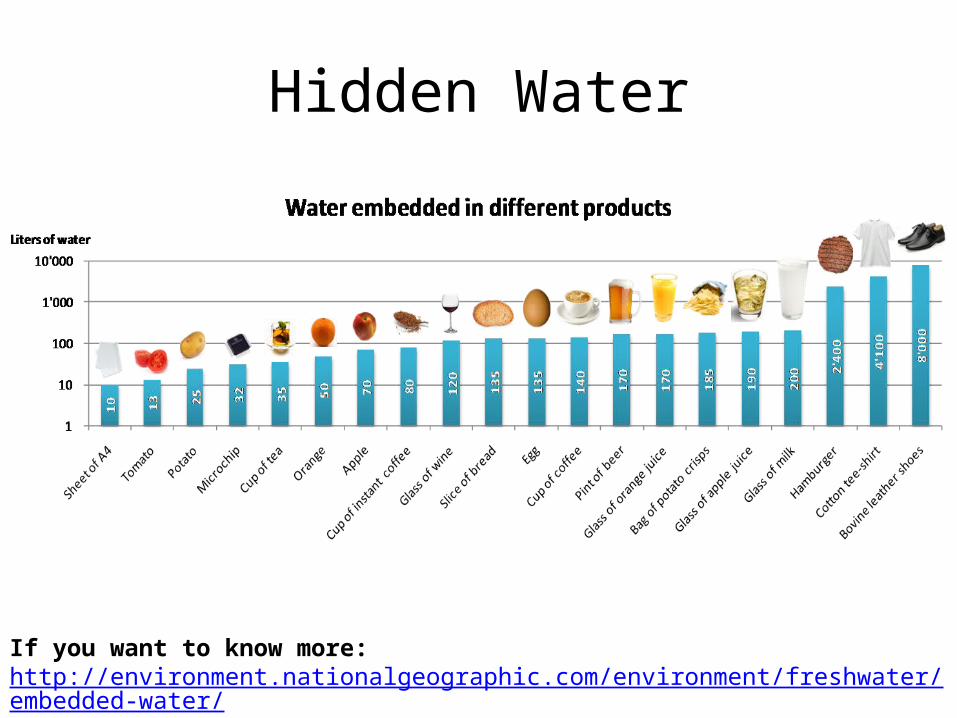
Hidden Water
If you want to know more: http://environment.nationalgeographic.com/environment/freshwater/embedded-water/
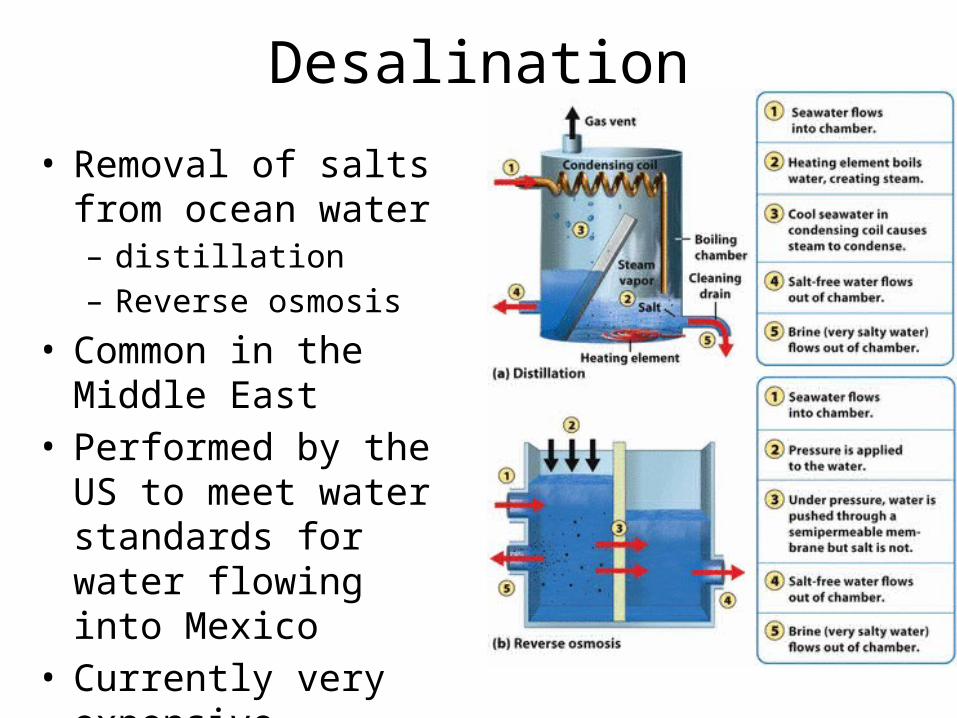
Desalination
• Removal of salts from ocean water – distillation – Reverse osmosis
• Common in the Middle East
• Performed by the US to meet water standards for water flowing into Mexico
• Currently very expensive
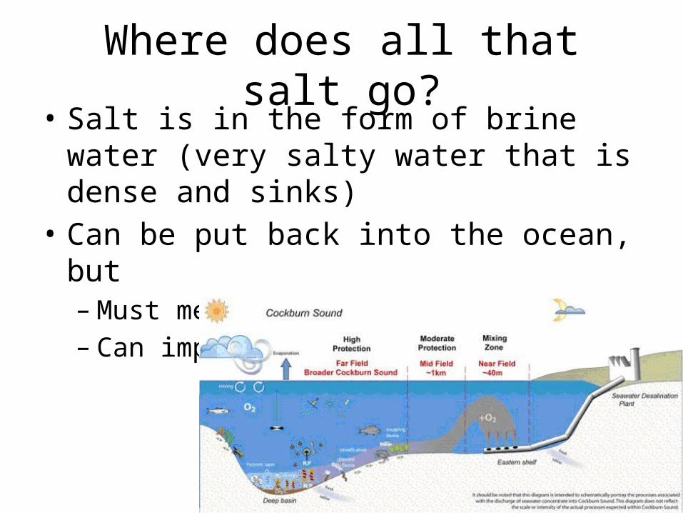
Where does all that salt go?• Salt is in the form of brine water (very salty
water that is dense and sinks)• Can be put back into the ocean, but
– Must meet salinity requirements– Can impact benthic organisms
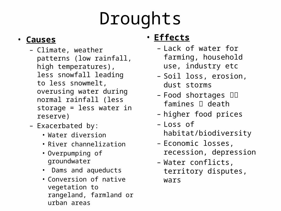
Droughts• Causes
– Climate, weather patterns (low rainfall, high temperatures), less snowfall leading to less snowmelt, overusing water during normal rainfall (less storage = less water in reserve)
– Exacerbated by: • Water diversion• River channelization• Overpumping of
groundwater• Dams and aqueducts• Conversion of native
vegetation to rangeland, farmland or urban areas
• Effects– Lack of water for farming,
household use, industry etc
– Soil loss, erosion, dust storms
– Food shortages famines death
– higher food prices– Loss of habitat/biodiversity– Economic losses,
recession, depression– Water conflicts, territory
disputes, wars
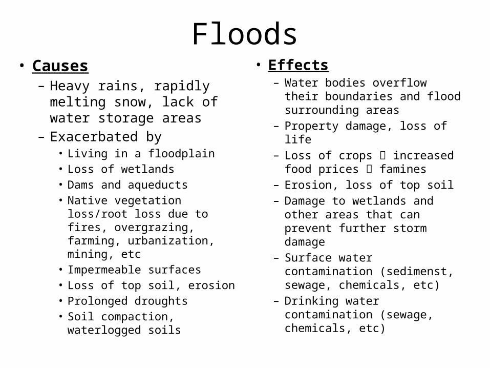
Floods• Causes
– Heavy rains, rapidly melting snow, lack of water storage areas
– Exacerbated by• Living in a floodplain• Loss of wetlands• Dams and aqueducts• Native vegetation loss/root
loss due to fires, overgrazing, farming, urbanization, mining, etc
• Impermeable surfaces• Loss of top soil, erosion • Prolonged droughts• Soil compaction, waterlogged
soils
• Effects– Water bodies overflow their
boundaries and flood surrounding areas
– Property damage, loss of life– Loss of crops increased
food prices famines– Erosion, loss of top soil– Damage to wetlands and
other areas that can prevent further storm damage
– Surface water contamination (sedimenst, sewage, chemicals, etc)
– Drinking water contamination (sewage, chemicals, etc)
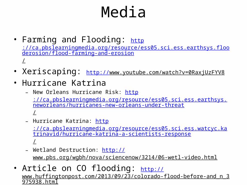
Media
• Farming and Flooding: http://ca.pbslearningmedia.org/resource/ess05.sci.ess.earthsys.flooderosion/flood-farming-and-erosion/
• Xeriscaping: http://www.youtube.com/watch?v=0RaxjUzFYV8
• Hurricane Katrina– New Orleans Hurricane Risk: http
://ca.pbslearningmedia.org/resource/ess05.sci.ess.earthsys.neworleans/hurricanes-new-orleans-under-threat/
– Hurricane Katrina: http://ca.pbslearningmedia.org/resource/ess05.sci.ess.watcyc.katrinavid/hurricane-katrina-a-scientists-response/
– Wetland Destruction: http://www.pbs.org/wgbh/nova/sciencenow/3214/06-wetl-video.html
• Article on CO flooding: http://www.huffingtonpost.com/2013/09/23/colorado-flood-before-and_n_3975938.html
• Ways to conserve water interactive: http://wateruseitwisely.com/100-ways-to-conserve/