Embed Size (px)
Citation preview
1
Contents
MessagefromtheDirector.....................................................................................................................2
TheCGISteam.............................................................................................................................................31.AdvisoryBoard....................................................................................................................................................................31.1Chairperson...........................................................................................................................................................................................31.2Representativesofkeystakeholders..........................................................................................................................................31.3HeadsofcollaboratingdepartmentsandschoolsattheUniversityofPretoria......................................................31.4Exofficiomembers.............................................................................................................................................................................4
2.Staffandcollaborators......................................................................................................................................................43.Postgraduatestudents......................................................................................................................................................53.1Mastersstudents.................................................................................................................................................................................53.2Doctoralstudents................................................................................................................................................................................5
2016Highlights..........................................................................................................................................71.InternalplatformatUP.....................................................................................................................................................71.1 UnitforGeoinformationandMapping(UGM)...................................................................................................................71.2Undergraduateteaching...................................................................................................................................................................81.3Geoinformaticsproject.....................................................................................................................................................................81.4Winningstudents................................................................................................................................................................................9
2.Facilitatorofcollaborations........................................................................................................................................122.1AgriculturalResearchCouncil(ARC).......................................................................................................................................122.2CSIRBuiltEnvironment.................................................................................................................................................................132.3CSIRMerakaInstitute.....................................................................................................................................................................132.4CSIRNaturalresourcesandtheenvironment(NRE).......................................................................................................132.5HartRAO...............................................................................................................................................................................................142.6KarlsruheUniversityofAppliedSciences,Germany........................................................................................................142.7KatholiekeUniversiteitLeuven,BelgiumandTechnicalUniversityofDelft,Netherlands..............................152.8SouthAfricanNationalSpaceAgency(SANSA)...................................................................................................................152.9UPDepartmentofFamilyMedicine.........................................................................................................................................162.10UPDepartmentofStatistics......................................................................................................................................................16
3.CommunityEngagement...............................................................................................................................................163.1GeoForAll...........................................................................................................................................................................................163.2InternationalCartographicAssociation(ICA).....................................................................................................................173.3InternationalSocietyforPhotogrammetryandRemoteSensing(ISPRS)..............................................................183.4StandardsdevelopmentinSouthAfricaandinternationally........................................................................................183.5SouthAfricanCommitteeforSpatialInformation(CSI)..................................................................................................193.6SouthAfricanGeomaticsProfessionCouncil.......................................................................................................................193.7YouthMappers...................................................................................................................................................................................19
4.PartnertothegeoinformationindustryofSouthAfrica....................................................................................204.12016CGISmini-conference.........................................................................................................................................................204.2Awarenessofgeoinformaticsasacareer..............................................................................................................................214.3EnterprisesUPcoursesforprofessionalsfromindustry................................................................................................21
5.Researchoutput...............................................................................................................................................................225.1Peer-reviewedjournalarticles...................................................................................................................................................225.2Paperspresentedatrefereedconferences............................................................................................................................235.3Peer-reviewedchaptersinbooks..............................................................................................................................................235.4Other......................................................................................................................................................................................................234.5Postgraduatestudents...................................................................................................................................................................23
6.Funding...............................................................................................................................................................................24AnnexA:ConstitutionoftheCentreforGeoinformationScience(CGIS).............................25
2
MessagefromtheDirector2016was an exciting year of new beginnings for CGIS. Prof Greg Breetzke joined UP and CGIS. His focus ongeospatialanalysisisanimportantcontributiontothecurrentmixofresearchexpertise.DrJoelBotaichangedhisrolefromlecturertoextraordinarylecturer.NewcollaborationswereinitiatedwiththeUPDepartmentsofStatisticsandFamilyMedicinerespectively.ThefirststudentexchangestotheKarlsruheUniversityofAppliedSciences took place, a first German student visited South Africa, and the first summer school took place inKarlsruhe, Germany. YouthMappers is a global network of student-led chapters that participate and organizemappingactivities,andUPwasoneoftheinauguralYouthMapperschapters.Finally,jointresearchwasinitiatedwiththeTechnicalUniversityofDelftintheNetherlandsandtheKatholiekeUniversiteitinLeuven,Belgium.At the same time, there was continuity in collaborations with our local partners, such as the AgriculturalResearchCouncil(ARC),CSIR,HartRAOandtheSouthAfricanNationalSpaceAgency(SANSA).WecontinuetobeactivelyinvolvedinthelocalandinternationalgeoinformaticscommunitythroughGeoForAll,theInternationalCartographicAssociation(ICA),theInternationalSocietyforPhotogrammetryandRemoteSensing(ISPRS),theSouthAfricanBureauofStandards (SABS), the InternationalOrganization forStandardization(ISO), theSouthAfricanCommitteeforSpatialInformation(CSI),andtheSouthAfricanGeomaticsCouncil(SAGC).TheUnitforGeoinformationandMappingcontinuestoprovideUPstaffandstudentswithcartographicandgeoinformationservicesandsupport,andwecontinuetoeducatestudentsaboutgeoinformatics.Throughnewbeginnings and continuity in collaborations, community engagement andGISc services, supportand education at UP, we work towards the CGIS vision of achieving excellence in GISc research, education,professional development and community engagement by being an internal platform, a facilitator ofcollaborations,andapartnertotheSouthAfricangeoinformationindustry.Onceagain,thankyoutoallofyouwhomakeCGISwhatitis!ProfSerenaCoetzeeCGIS:DirectorOctober2017
3
TheCGISteam
1.AdvisoryBoardTheAdvisoryBoardprovidesstrategicdirectionandadviceregardingmarketing,aswellasresearch,educationandtraining,professionaldevelopment,communityengagement,andcapacitybuildinginCGIS;italsoadvisesonoperationaldecisions,reviewstheannualbudgetandreviewstherealizationofthevisionandtheexecutionofthemission.
1.1Chairperson
ProfJeanLubumaChairperson:CGISAdvisoryBoardDean:FacultyofNaturalandAgriculturalSciences,UniversityofPretoria
1.2Representativesofkeystakeholders
DrHermanBooysen
PastNationalChair:Geo-informationSocietyofSouth
Africa(GISSA)
DrDerekClarkeVice-President:InternationalCartographicAssociation
(ICA)
AdridelaReyGISManager,Technology,
Eskom
GavinFlemingChair:OSGeoAfricaand
ManagingDirector:Kartoza
AshwellJeneker
DeputyDirector-General:StatisticalSupportandInformatics,StatsSA
DrJaneOlwochManagingDirector:SANSA
EarthObservationSouthAfricanNationalSpace
Agency
MagnusRademeyerManagingDirector,AfriGIS
SanetEksteenEsriEducation,EsriSouth
Africa
1.3HeadsofcollaboratingdepartmentsandschoolsattheUniversityofPretoria
ProfAndriesEngelbrechtHead:DepartmentofComputerScience
4
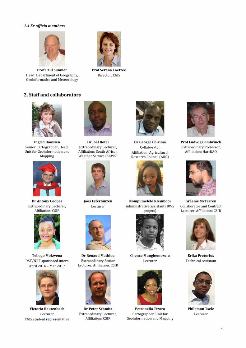
1.4Exofficiomembers
ProfPaulSumner
Head:DepartmentofGeography,GeoinformaticsandMeteorology
ProfSerenaCoetzeeDirector:CGIS
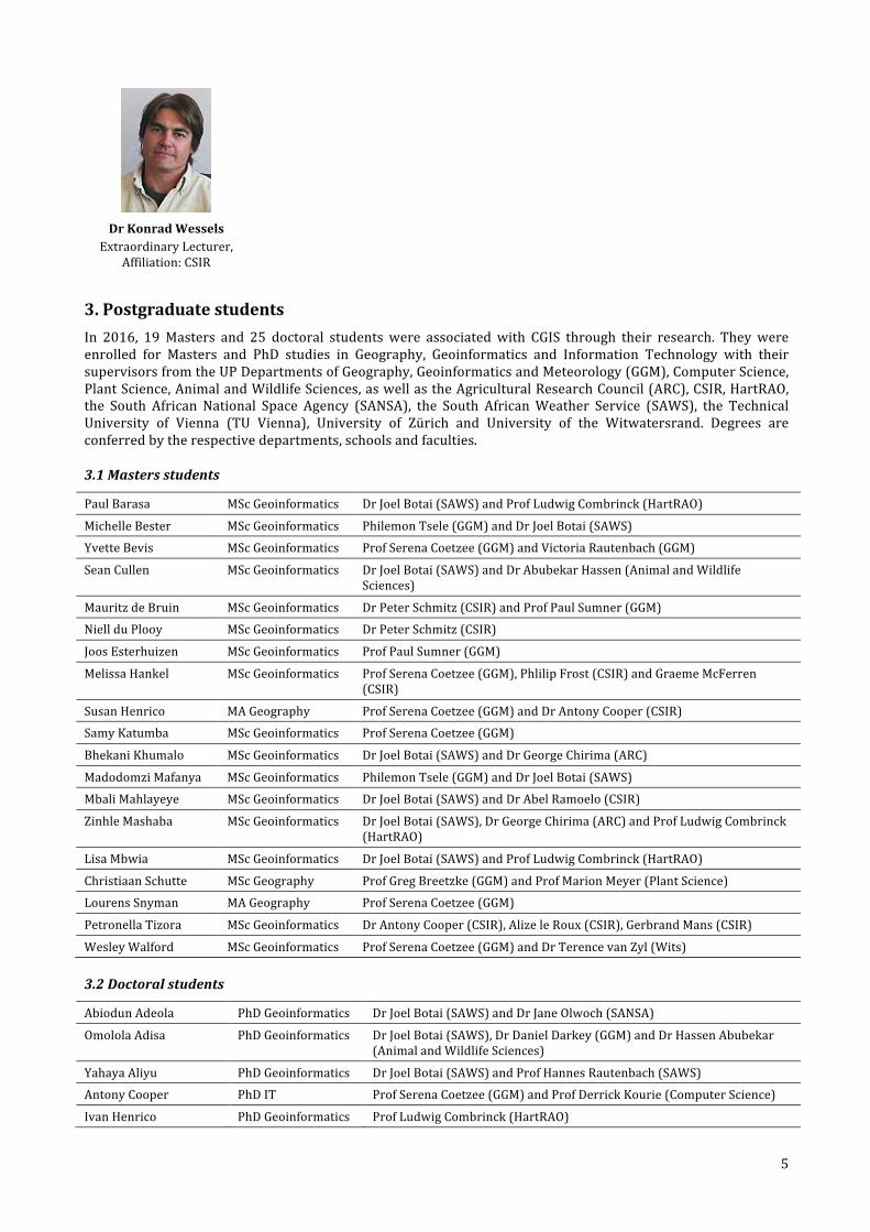
2.Staffandcollaborators
IngridBooysen
SeniorCartographer,Head:UnitforGeoinformationand
Mapping
DrJoelBotaiExtraordinaryLecturer,Affiliation:SouthAfricanWeatherService(SAWS)
DrGeorgeChirimaCollaborator
Affiliation:AgriculturalResearchCouncil(ARC)
ProfLudwigCombrinckExtraordinaryProfessor,Affiliation:HartRAO
DrAntonyCooper
ExtraordinaryLecturer,Affiliation:CSIR
JoosEsterhuizenLecturer
NompumeleloKleinbooiAdministrativeassistant(BWS
project)
GraemeMcFerrenCollaboratorandContractLecturer,Affiliation:CSIR
TebogoMokwena
DST/NRFsponsoredinternApril2016–Mar2017
DrRenaudMathieuExtraordinarySenior
Lecturer,Affiliation:CSIR
CilenceMunghemezuluLecturer
ErikaPretoriusTechnicalAssistant
VictoriaRautenbach
LecturerCGISstudentrepresentative
DrPeterSchmitzExtraordinaryLecturer,
Affiliation:CSIR
PetronellaTizoraCartographer,Unitfor
GeoinformationandMapping
PhilemonTseleLecturer
5
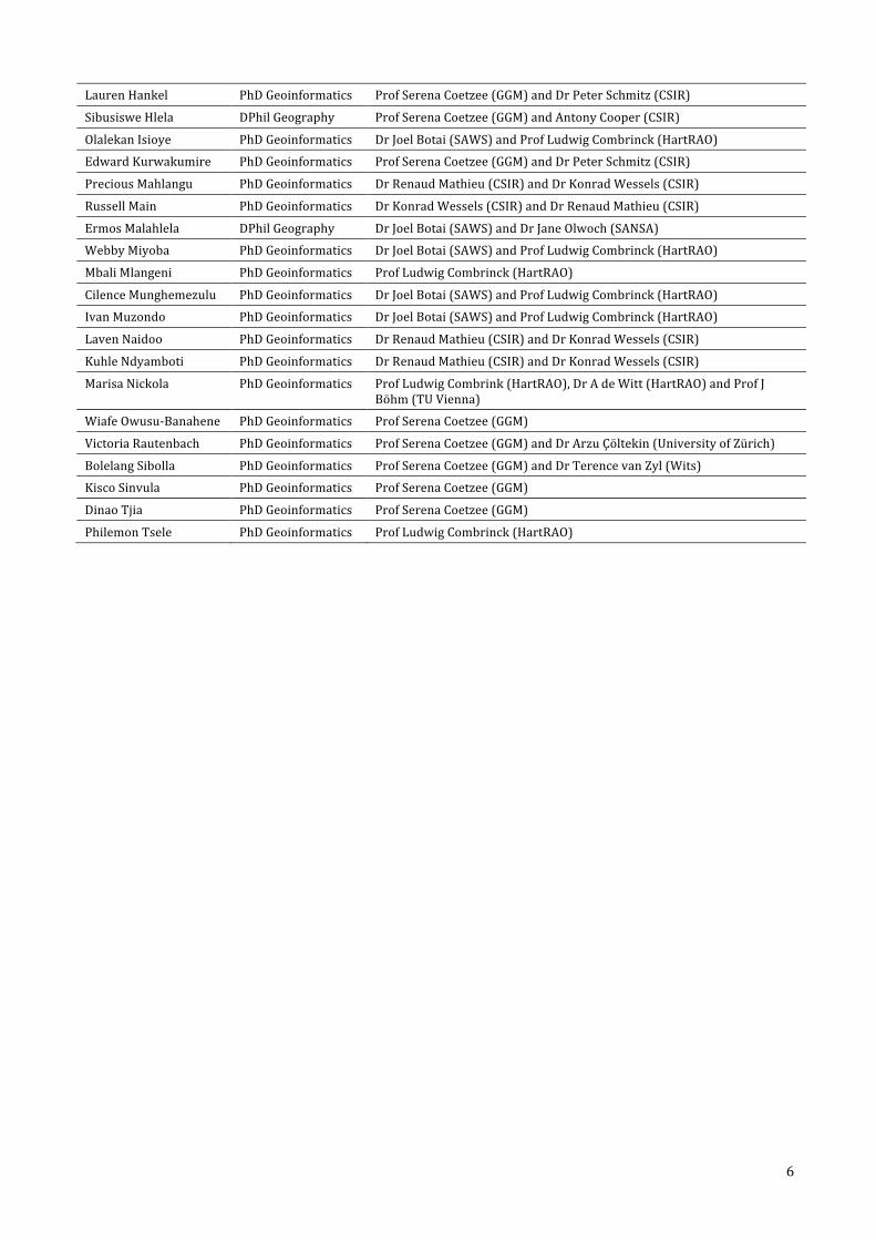
DrKonradWesselsExtraordinaryLecturer,
Affiliation:CSIR
3.PostgraduatestudentsIn 2016, 19Masters and 25 doctoral students were associatedwith CGIS through their research. Theywereenrolled for Masters and PhD studies in Geography, Geoinformatics and Information Technology with theirsupervisorsfromtheUPDepartmentsofGeography,GeoinformaticsandMeteorology(GGM),ComputerScience,PlantScience,AnimalandWildlifeSciences,aswellastheAgriculturalResearchCouncil(ARC),CSIR,HartRAO,the South African National Space Agency (SANSA), the South AfricanWeather Service (SAWS), the TechnicalUniversity of Vienna (TU Vienna), University of Zürich and University of the Witwatersrand. Degrees areconferredbytherespectivedepartments,schoolsandfaculties.
3.1Mastersstudents
PaulBarasa MScGeoinformatics DrJoelBotai(SAWS)andProfLudwigCombrinck(HartRAO)
MichelleBester MScGeoinformatics PhilemonTsele(GGM)andDrJoelBotai(SAWS)
YvetteBevis MScGeoinformatics ProfSerenaCoetzee(GGM)andVictoriaRautenbach(GGM)
SeanCullen MScGeoinformatics DrJoelBotai(SAWS)andDrAbubekarHassen(AnimalandWildlifeSciences)
MauritzdeBruin MScGeoinformatics DrPeterSchmitz(CSIR)andProfPaulSumner(GGM)
NiellduPlooy MScGeoinformatics DrPeterSchmitz(CSIR)
JoosEsterhuizen MScGeoinformatics ProfPaulSumner(GGM)
MelissaHankel MScGeoinformatics ProfSerenaCoetzee(GGM),PhlilipFrost(CSIR)andGraemeMcFerren(CSIR)
SusanHenrico MAGeography ProfSerenaCoetzee(GGM)andDrAntonyCooper(CSIR)
SamyKatumba MScGeoinformatics ProfSerenaCoetzee(GGM)
BhekaniKhumalo MScGeoinformatics DrJoelBotai(SAWS)andDrGeorgeChirima(ARC)
MadodomziMafanya MScGeoinformatics PhilemonTsele(GGM)andDrJoelBotai(SAWS)
MbaliMahlayeye MScGeoinformatics DrJoelBotai(SAWS)andDrAbelRamoelo(CSIR)
ZinhleMashaba MScGeoinformatics DrJoelBotai(SAWS),DrGeorgeChirima(ARC)andProfLudwigCombrinck(HartRAO)
LisaMbwia MScGeoinformatics DrJoelBotai(SAWS)andProfLudwigCombrinck(HartRAO)
ChristiaanSchutte MScGeography ProfGregBreetzke(GGM)andProfMarionMeyer(PlantScience)
LourensSnyman MAGeography ProfSerenaCoetzee(GGM)
PetronellaTizora MScGeoinformatics DrAntonyCooper(CSIR),AlizeleRoux(CSIR),GerbrandMans(CSIR)
WesleyWalford MScGeoinformatics ProfSerenaCoetzee(GGM)andDrTerencevanZyl(Wits)
3.2Doctoralstudents
AbiodunAdeola PhDGeoinformatics DrJoelBotai(SAWS)andDrJaneOlwoch(SANSA)
OmololaAdisa PhDGeoinformatics DrJoelBotai(SAWS),DrDanielDarkey(GGM)andDrHassenAbubekar(AnimalandWildlifeSciences)
YahayaAliyu PhDGeoinformatics DrJoelBotai(SAWS)andProfHannesRautenbach(SAWS)
AntonyCooper PhDIT ProfSerenaCoetzee(GGM)andProfDerrickKourie(ComputerScience)
IvanHenrico PhDGeoinformatics ProfLudwigCombrinck(HartRAO)
6
LaurenHankel PhDGeoinformatics ProfSerenaCoetzee(GGM)andDrPeterSchmitz(CSIR)
SibusisweHlela DPhilGeography ProfSerenaCoetzee(GGM)andAntonyCooper(CSIR)
OlalekanIsioye PhDGeoinformatics DrJoelBotai(SAWS)andProfLudwigCombrinck(HartRAO)
EdwardKurwakumire PhDGeoinformatics ProfSerenaCoetzee(GGM)andDrPeterSchmitz(CSIR)
PreciousMahlangu PhDGeoinformatics DrRenaudMathieu(CSIR)andDrKonradWessels(CSIR)
RussellMain PhDGeoinformatics DrKonradWessels(CSIR)andDrRenaudMathieu(CSIR)
ErmosMalahlela DPhilGeography DrJoelBotai(SAWS)andDrJaneOlwoch(SANSA)
WebbyMiyoba PhDGeoinformatics DrJoelBotai(SAWS)andProfLudwigCombrinck(HartRAO)
MbaliMlangeni PhDGeoinformatics ProfLudwigCombrinck(HartRAO)
CilenceMunghemezulu PhDGeoinformatics DrJoelBotai(SAWS)andProfLudwigCombrinck(HartRAO)
IvanMuzondo PhDGeoinformatics DrJoelBotai(SAWS)andProfLudwigCombrinck(HartRAO)
LavenNaidoo PhDGeoinformatics DrRenaudMathieu(CSIR)andDrKonradWessels(CSIR)
KuhleNdyamboti PhDGeoinformatics DrRenaudMathieu(CSIR)andDrKonradWessels(CSIR)
MarisaNickola PhDGeoinformatics ProfLudwigCombrink(HartRAO),DrAdeWitt(HartRAO)andProfJBöhm(TUVienna)
WiafeOwusu-Banahene PhDGeoinformatics ProfSerenaCoetzee(GGM)
VictoriaRautenbach PhDGeoinformatics ProfSerenaCoetzee(GGM)andDrArzuÇöltekin(UniversityofZürich)
BolelangSibolla PhDGeoinformatics ProfSerenaCoetzee(GGM)andDrTerencevanZyl(Wits)
KiscoSinvula PhDGeoinformatics ProfSerenaCoetzee(GGM)
DinaoTjia PhDGeoinformatics ProfSerenaCoetzee(GGM)
PhilemonTsele PhDGeoinformatics ProfLudwigCombrinck(HartRAO)
7
2016HighlightsActivitiesin2016continuedtocontributetowardsachievingtheCGISvision:strivingtobeaninternalplatformforGIScatUP,afacilitatorofcollaborationsinGIScresearchandeducation,andapartnertotheGIScindustry.Highlightsof2016activitiesareprovidedinthissection.
1.InternalplatformatUPCGISaimstobean internalplatformatUPfromwheretheexcellenceofUP individualsandteamsinvolved inGIScresearch,educationandtraining,professionaldevelopmentandcommunityengagementissupportedandstrengthened.Informationaboutsuchinternalactivitiesisprovidedinthissection.
1.1 UnitforGeoinformationandMapping(UGM)
TheUGM(representedbyMs IngridBooysenandMsPetronellaTizora)deliversmainlyGISand cartographicservices and support to students and staff from various departments in almost every faculty atUP regardinggeoinformationandmapping.TheDepartmentisalsothecustodianforGISsoftwarelicensesfortheUniversityofPretoria. Italsoprovidesgeospatialandgeographic informationona localserverandpeoplecanaccessthedata on campus. Apart from services to the Department of Geography, Geoinformatics and Meteorology, thedepartments of Architecture, Consumer Science, Landscape Architecture, Town and Regional Planning,Environmental Health, Consumer Science, Geology, Civil Engineering, Plant Sciences, Veterinary Sciences,Zoology and Entomology, Animal and Wildlife Sciences, Historical & Heritage Studies, Anthropology andArchaeology,theCentreforEnvironmentalStudies,DepartmentofConstructionEconomics,UPNaturalHazardCentreAfricaandtheCentrefortheAdvancementofScholarshipreceivedUGMassistancein2016.
The UGM liaises and acquires (either by contract, MOU or public domain data) with various institutions forgeographicinformation,suchascadastraldata,floodlineandstormwaterchannelinformation,pointsofinterest,stand(erf)numbers,streetaddressesandaerialphotosfromtheCityofTshwane.SatelliteimageryfromSANSA(South African Space Agency) especially the SPOT satellite data are provided to the University on an annualbasis. Other datasets include Eskom’s categorized Spot Building Count and environmental spatial data fromSANBI (SouthAfricanNationalBiodiversity Institute), theDepartmentofWaterAffairsand theDepartmentofEnvironmentalAffairs.UpdatedNationalMapSeriesdataona1:50000(vectorandrasterdata),1:250000and1:500000scale isacquiredonanannualbasisfromtheDepartmentofDevelopmentandLandAffairs,sectionNational Geospatial Information (NGI). Historical data is acquired upon request. The South African Censusattribute data is available from a desktopwith the SuperCross software in theUGM. SuperCross allows crosstabulations of all kinds of surveyed parameters for Census 2011 (from Statistics South Africs). The output, ifcorrectly designed, can be linked directly to the various administrative units of South Africa in any GIS foranalysisandrepresentation.TheSuperCrosssoftwareisfreelyavailabletostudentsandstaffontheUGMserver(FIRE\campus)forinstallationontotheirowndesktopsornotebooks.EarlierdemographicattributedatafromCensusYears,1996,2001arealsoelectronicallyavailabletobemanipulatedforuseintheGISystem.
EsriArcGISandENVI(remotesensing)softwarelicenseswereagainpurchased(withtheaidoffacultyfunds)fortheyearof2016.Thesecommercial softwarepackagesareused for trainingpurposes invariousdepartmentsand across various faculties to mainly undergraduate students but also to Geoinformatics postgraduates. AllenrolledstudentsandstaffofUPcaninstalltheArcGISsoftwareontheirnotebooksforoff-campususeforayear.Afterthatthelicenseneedstoberenewed.
In addition to the annual ArcGIS software site license, ESRI offers various types of learning material (WebCourses,TrainingSeminars,MassiveOnlineOpenCourses(Moocs),Tutorialsandapplicablevideos),tomembersofthisacademicinstitutionforfree.StudentsandstaffneedtoberegisteredbytheArcGISadministrator(whichishousedintheUnitforGeoinformationandMapping)tobeamemberoftheorganizationofUP.Exceptfortheabovementionedadvantage, thepersonalsohasaccesstoArcGISOnlinewithanendlessmapgallerytouse inArcMap (NDVImaps, background terrainmaps, Landsat imagery,Open Source streetmaps, andmanymore).Academic departments having used these ArcGIS functions in 2016, are students from the Departments ofGeography,GeoinformaticsandMeteorology,CentreforWildlifeManagement,CentreforEnvironmentalStudies,Geology,PlantScience,Architecture,LandscapeArchitecture,Theology,ZoologyandEngineering.
Under- and postgraduate students are supported with step-by-step user-friendly manuals for some of thesoftwareproducts(e.g.ArcGIS,SuperCrossforCensus2011data).
Except for the various site- and orientation maps the cartographers electronically compile for journals,dissertationsandtheses, theyrecommendtrustworthywebsitestostudentswherespecificgeospatialdatasetsare required, and assist students with projecting their layers, cleaning the data, manipulating the data,geoprocessing,statisticallyanalysingandvisualisingthedata.
8
DuringtheyearpersonnelattheUGMprepares,onacontinuousbasis,informationpanels(includingmaps)fora‘conservation interpretationandsupport’projecton thedescriptionand interpretationof thegeologyand theidentificationofgeologicalfeaturesintheKrugerNationalPark.Oneofthepurposesoftheprojectistoidentifysitesofgeological,geomorphologicandassociatedprocessesactiveintheformationofgeologicalfeaturesinthepark. Posters (maps, photo’s, graphs, artwork, explanatory notes) and models of geological features orlandscapes(sitescapes)areincludedinexhibitionsintheparkwiththeaimtointroduce,informandeducatethegeneralpubliconthegeologicallandscapeandassociatedgeositesintheKrugerNationalPark.ThemaintenanceofthePark’sConservationInformationPanelsandExhibitsisanongoingproject.
UGMstaffhavealsobeen involved inwritingorco-authoringpeer-reviewedarticlesandchapters inacademicbooksonvariousresearch topics in2016.Proofof thesearticlesbeenrecorded in theUniversityofPretoria’sRIM(ResearchInformationSystem).
1.2Undergraduateteaching
UndergraduategeoinformaticsmodulesarenotonlyincludedintheBScGeoinformaticsdegree,butalsoinmanyother degrees presented in the Faculties of Natural and Agricultural Sciences; Education; Humanities; andEngineering,BuiltEnvironment&InformationTechnology:
− BScEnvironmentalSciences,FacultyofNaturalandAgriculturalSciences− BScGeography,FacultyofNaturalandAgriculturalSciences− BScMeteorology,FacultyofNaturalandAgriculturalSciences− BSc,FacultyofNaturalandAgriculturalSciences− BSc Information technology, information and knowledge systems (GIS elective group) (Faculty of
Engineering,BuiltEnvironmentandInformationTechnology− BScArch,BScLArch,FacultyofEngineering,BuiltEnvironmentandInformationTechnology− BA,BPoliticalSciences,BHeritageandCulturalSciences,BSportsPsychology,FacultyofHumanities
Apart fromtheabove,manystudentsfromthesefacultiesregisterforgeoinformaticselectivemodules.Awiderange of software products IS used in teaching geoinformatics modules to ensure that students grasp thegeoinformaticstheoryandfundamentals,anddonotgetusedtopressingbuttonsinsoftware.Themostwidelyuserproductsarelistedbelow.− AfriGISGISlike− AfriGISJavaScriptAPI− ArcGIS− GeoDa− GeoServer
− deegree− ENVI,ENVIIDL− Erdas− MapInfo− MicrosoftExcel
− EnterpriseArchitect− LeafletJSAPI− MapWindow− OpenLayersAPI− OpenStreetMap
− PostgreSQLandPostGIS− QuantumGIS(QGIS)− R(statistics)− Rasdaman− SAGA
1.3Geoinformaticsproject
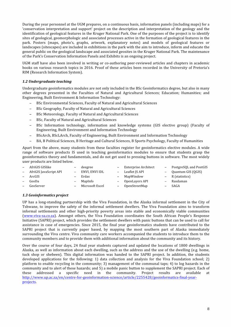
UPhasa long-standingpartnershipwith theVivaFoundation, in theAlaska informal settlement in theCityofTshwane, to improve the safety of the informal settlement dwellers. The Viva Foundation aims to transforminformal settlements and other high-priority poverty areas into stable and economically viable communities(www.viva-sa.co.za). Amongst others, the Viva Foundation coordinates the South African People's ResponseInitiative(SAPRI)project,whichprovidesthesettlementdwellerswithpanicbuttonsthatcanbeusedtocallforassistance in case of emergencies. Since 2015, the final year geoinformatics students have contributed to theSAPRI project that is currently paper based, by mapping the most southern part of Alaska immediatelysurroundingtheVivacentre.Vivacommunitycareworkersaccompaniedthestudentstointroducethemtothecommunitymembersandtoprovidethemwithadditionalinformationaboutthecommunityanditshistory.
Over the course of fourdays, 24 final year students captured andupdated the locations of 1800dwellings inAlaska,aswellasinformationabouteachdwelling,suchastheaddressandtheuseofthedwelling(e.g.home,tuck shop or shebeen). This digital information was handed to the SAPRI project. In addition, the studentsdeveloped applications for the following: 1) data collection and analysis for the Viva Foundation school; 2)platformtoenablerecyclinginthecommunity;3)managementofthecommunaltaps;4)to loghazardsinthecommunityandtoalertofthesehazards;and5)amobilepanicbuttontosupplementtheSAPRIproject.Eachofthese addressed a specific need in the community. Project results are available athttp://www.up.ac.za/en/centre-for-geoinformation-science/article/2255428/geoinformatics-final-year-projects.
9
TheGMT320teamattheVivaFoundationintheAlaskainformalsettlementinMamelodi
This community project was integrated into the academic activities of the semester module, GMT 320(Geoinformatics project). The module provides a unique first learning opportunity for the students to beinvolvedinarealprojectwithaclient.Upuntilthen,studentsworkwithhypotheticalscenarioswhere“perfect”dataandabreakdownofthesolutionareprovidedtothem.ForGMT320,studentshavetoimplementtheentireprojectmanagementprocess,capturetheirowndata,andthenimplementaninnovativesolutionwiththedatatheyhavecaptured.GMT320isalsoafirstopportunitytoworkwithhandheldanddifferentialglobalpositioningsystem(GPS)devicesand togain fieldworkexperience.Thisexperience is invaluable to thestudentswhowillplanprojectsandcapturedatainthefieldduringtheirprofessionalcareers.
Twostudents,SamanthaChamberlainandZizoVunguvungu,wroteablogpostfortheYouthMappersblogabouttheir experiences and lessons learned from mapping the informal settlement of Alaska, seehttp://www.youthmappers.org/single-post/2016/11/02/Mapping-the-informal-settlement-of-Alaska-South-Africa.
ThegeoinformaticsprojectwasselectedasoneofthewinnersoftheGeoForAllCartographicChallenge,andasaresult the project was featured on a poster prepared by the International Cartographic Association (ICA)CommissiononOpenSourceGeospatialTechnologies.Theposter ispartof thecollectionofpostersabout thecontributionofcartographytotheUnitedNationsSustainableDevelopmentGoals(SDGs).
1.4Winningstudents
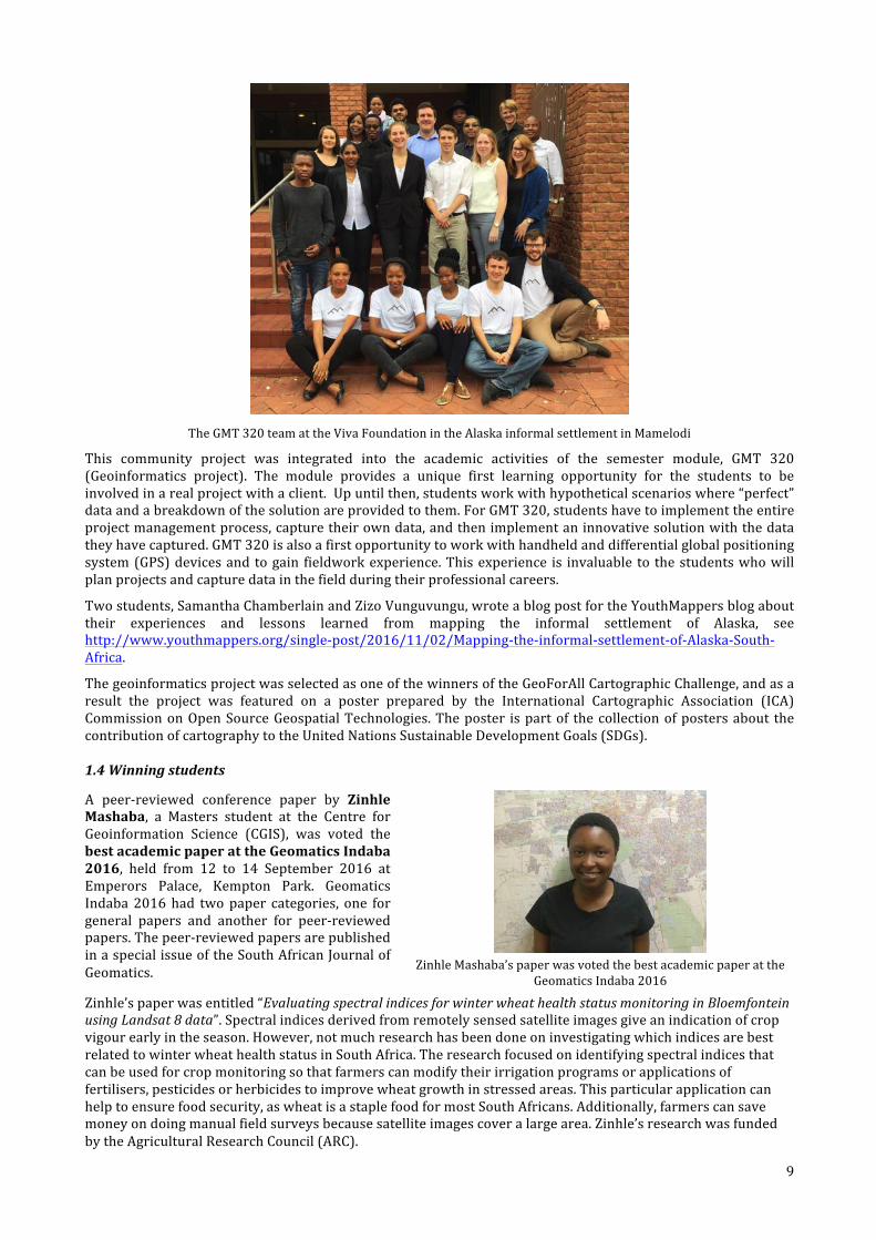
A peer-reviewed conference paper by ZinhleMashaba, a Masters student at the Centre forGeoinformation Science (CGIS), was voted thebestacademicpaperattheGeomaticsIndaba2016, held from 12 to 14 September 2016 atEmperors Palace, Kempton Park. GeomaticsIndaba2016had twopaper categories, one forgeneral papers and another for peer-reviewedpapers.Thepeer-reviewedpapersarepublishedinaspecialissueoftheSouthAfricanJournalofGeomatics.
ZinhleMashaba’spaperwasvotedthebestacademicpaperatthe
GeomaticsIndaba2016
Zinhle’spaperwasentitled“EvaluatingspectralindicesforwinterwheathealthstatusmonitoringinBloemfonteinusingLandsat8data”.Spectralindicesderivedfromremotelysensedsatelliteimagesgiveanindicationofcropvigourearlyintheseason.However,notmuchresearchhasbeendoneoninvestigatingwhichindicesarebestrelatedtowinterwheathealthstatusinSouthAfrica.Theresearchfocusedonidentifyingspectralindicesthatcanbeusedforcropmonitoringsothatfarmerscanmodifytheirirrigationprogramsorapplicationsoffertilisers,pesticidesorherbicidestoimprovewheatgrowthinstressedareas.Thisparticularapplicationcanhelptoensurefoodsecurity,aswheatisastaplefoodformostSouthAfricans.Additionally,farmerscansavemoneyondoingmanualfieldsurveysbecausesatelliteimagescoveralargearea.Zinhle’sresearchwasfundedbytheAgriculturalResearchCouncil(ARC).
10
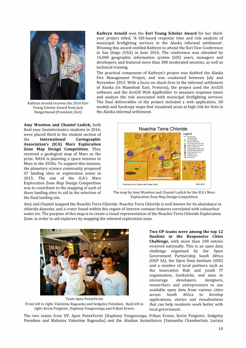
KathrynArnoldreceivesthe2016Esri
YoungScholarAwardfromJackDangermond(President,Esri)
Kathryn Arnold won the Esri Young Scholar Award for her third-year project titled, 'A GIS-based response time and risk analysis ofmunicipal firefighting services in the Alaska informal settlement'.WinningthisawardentitledKathryntoattendtheEsriUserConferencein San Diego (USA) in June 2016. The conference was attended by16,000 geographic information system (GIS) users, managers anddevelopers,andfeaturedmorethan300moderatedsessions,aswellastechnicaltraining.The practical component of Kathryn’s projectwas dubbed the AlaskaFire Management Project, and was conducted between July andNovember2015.Withafocusonshackfiresintheinformalsettlementof Alaska (in Mamelodi East, Pretoria), the project used the ArcGISsoftware and the ArcGISWebAppBuilder tomeasure response timesand analyse the risk associated with municipal firefighting services.The final deliverables of the project included a web application, 3DmodelsandhardcopymapsthatvisualisedareasathighriskforfiresintheAlaskainformalsettlement.
AmyWootton and Chantel Ludick, bothfinal-yearGeoinformaticsstudentsin2016,wereplacedthird inthestudentsectionofthe International CartographicAssociation’s (ICA) Mars ExplorationZone Map Design Competition. Theyreceived a geological map of Mars as theprize.NASA isplanningaspacemission toMarsinthe2030s.Tosupportthismission,theplanetarysciencecommunityproposed47 landing sites or exploration zones in2015. The aim of the ICA’s MarsExploration ZoneMapDesign Competitionwastocontributetothemappingofeachoftheselandingsitestoaidintheselectionofthefinallandingsite.
ThemapbyAmyWoottonandChantelLudickfortheICA’sMars
ExplorationZoneMapDesignCompetition
AmyandChantelmappedtheNoachisTerraChloride.NoachisTerraChlorideiswellknownforitsabundanceinchloridedeposits,andacraterfoundwithinthisregionofinterestcontainsfeaturescorrelatedwithsubsurfacewaterice.ThepurposeofthismapistocreateavisualrepresentationoftheNoachisTerraChlorideExplorationZone,inordertoaidexplorersbymappingtheselectedexplorationzone.
TeamApexPentaVertix
Frontlefttoright:ValentineRagoashaandSedgeleyPenniken.Backlefttoright:KevinPotgieter,DaphneyVunguvunguandFrikanErwee.
TwoUPteamswereamongthetop12finalists in the Responsive CitiesChallenge, with more than 100 entriesreceivednationally.This is anopendatachallenge organised by the OpenGovernment Partnership South Africa(OGP SA), the Open Data Institute (ODI)and a number of local partners such asthe Innovation Hub and youth ITorganisation, Geekulcha, and aims toencourage developers, designers,researchers and entrepreneurs to useavailable open data from various citiesacross South Africa to developapplications, stories and visualisationsthatcanhelpresidentsworkbetterwithlocalgovernment.
The two teams from UP, Apex PentaVertix (Daphney Vunguvungu, Frikan Erwee, Kevin Potgieter, SedgeleyPenniken and Mabutsu Valentine Ragoasha) and the Alaskan Assimilators (Samantha Chamberlain, Larissa
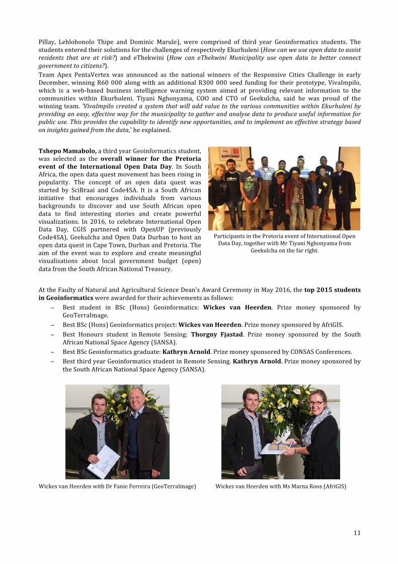
11
Pillay, Lehlohonolo Thipe and Dominic Marule), were comprised of third year Geoinformatics students. ThestudentsenteredtheirsolutionsforthechallengesofrespectivelyEkurhuleni(Howcanweuseopendatatoassistresidents that are at risk?) and eThekwini (How can eThekwini Municipality use open data to better connectgovernmenttocitizens?).Team Apex PentaVertex was announced as the national winners of the Responsive Cities Challenge in earlyDecember,winningR60000 alongwith an additionalR300000 seed funding for their prototype,VivaImpilo,which is a web-based business intelligence warning system aimed at providing relevant information to thecommunities within Ekurhuleni. Tiyani Nghonyama, COO and CTO of Geekulcha, said he was proud of thewinningteam. 'VivaImpilocreatedasystemthatwilladdvalue to thevariouscommunitieswithinEkurhulenibyprovidinganeasy,effectivewayforthemunicipalitytogatherandanalysedatatoproduceusefulinformationforpublicuse.Thisprovidesthecapabilitytoidentifynewopportunities,andtoimplementaneffectivestrategybasedoninsightsgainedfromthedata,'heexplained. TshepoMamabolo,athirdyearGeoinformaticsstudent,was selected as the overall winner for the Pretoriaevent of the International Open Data Day. In SouthAfrica,theopendataquestmovementhasbeenrisinginpopularity. The concept of an open data quest wasstarted by SciBraai and Code4SA. It is a South Africaninitiative that encourages individuals from variousbackgrounds to discover and use South African opendata to find interesting stories and create powerfulvisualizations. In 2016, to celebrate International OpenData Day, CGIS partnered with OpenUP (previouslyCode4SA),GeekulchaandOpenDataDurban tohost anopendataquestinCapeTown,DurbanandPretoria.Theaim of the eventwas to explore and createmeaningfulvisualisations about local government budget (open)datafromtheSouthAfricanNationalTreasury.
ParticipantsinthePretoriaeventofInternationalOpenDataDay,togetherwithMrTiyaniNghonyamafrom
Geekulchaonthefarright.
AttheFaultyofNaturalandAgriculturalScienceDean'sAwardCeremonyinMay2016,thetop2015studentsinGeoinformaticswereawardedfortheirachievementsasfollows:
− Best student in BSc (Hons) Geoinformatics: Wickes van Heerden. Prize money sponsored byGeoTerraImage.
− BestBSc(Hons)Geoinformaticsproject:WickesvanHeerden.PrizemoneysponsoredbyAfriGIS.− Best Honours student inRemote Sensing: Thorgny Fjastad. Prize money sponsored by the South
AfricanNationalSpaceAgency(SANSA).− BestBScGeoinformaticsgraduate:KathrynArnold.PrizemoneysponsoredbyCONSASConferences.− BestthirdyearGeoinformaticsstudentinRemoteSensing.KathrynArnold.Prizemoneysponsoredby
theSouthAfricanNationalSpaceAgency(SANSA).
WickesvanHeerdenwithDrFanieFerreira(GeoTerraImage) WickesvanHeerdenwithMsMarnaRoos(AfriGIS)
12
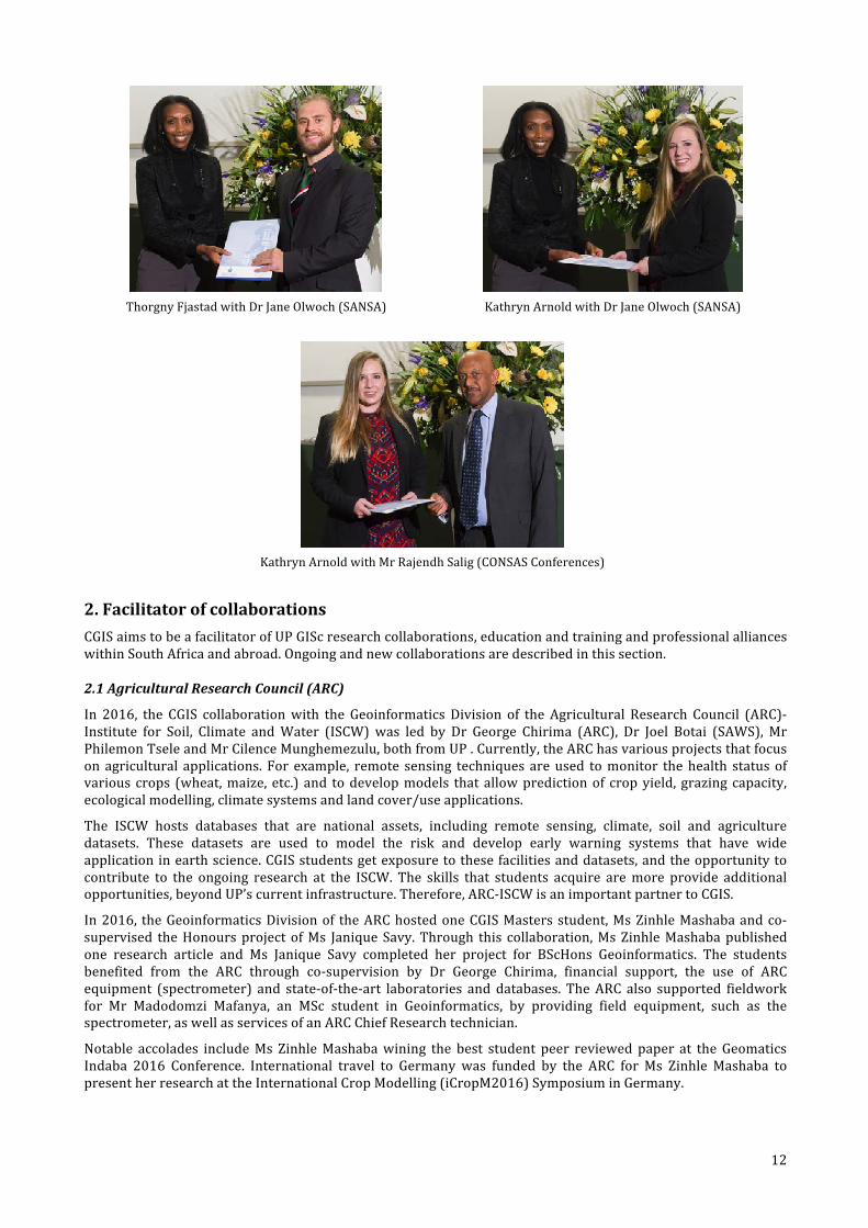
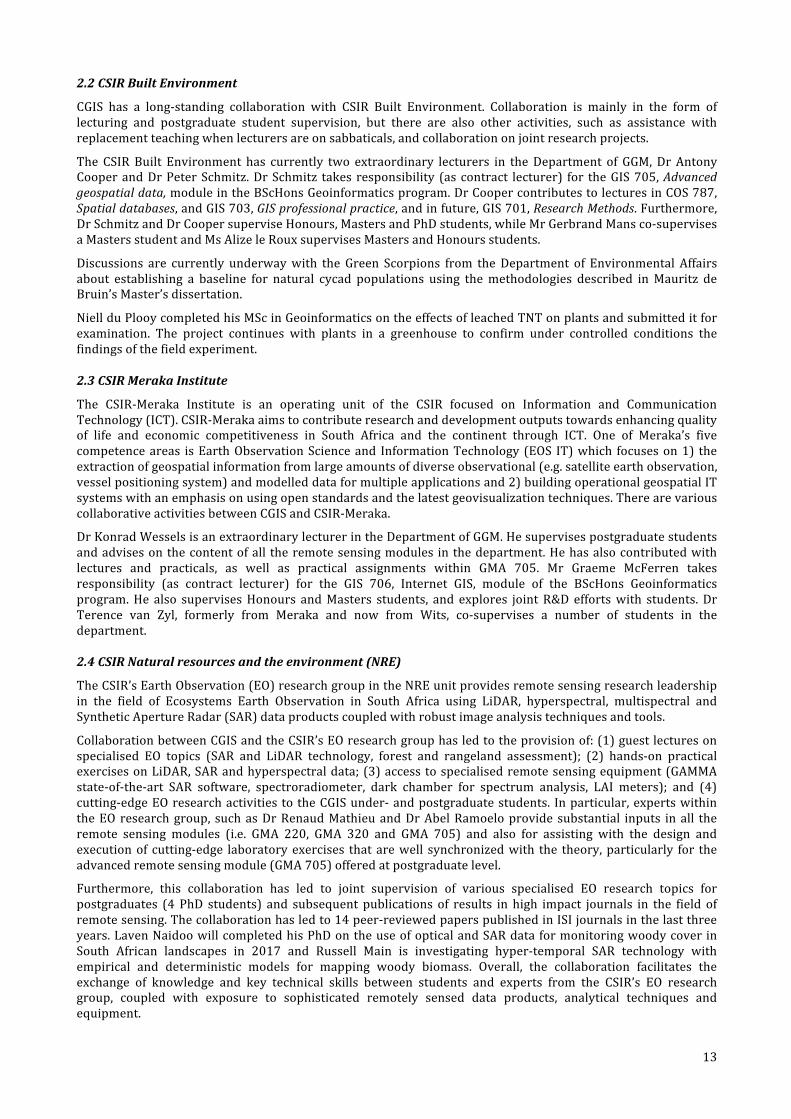
ThorgnyFjastadwithDrJaneOlwoch(SANSA) KathrynArnoldwithDrJaneOlwoch(SANSA)
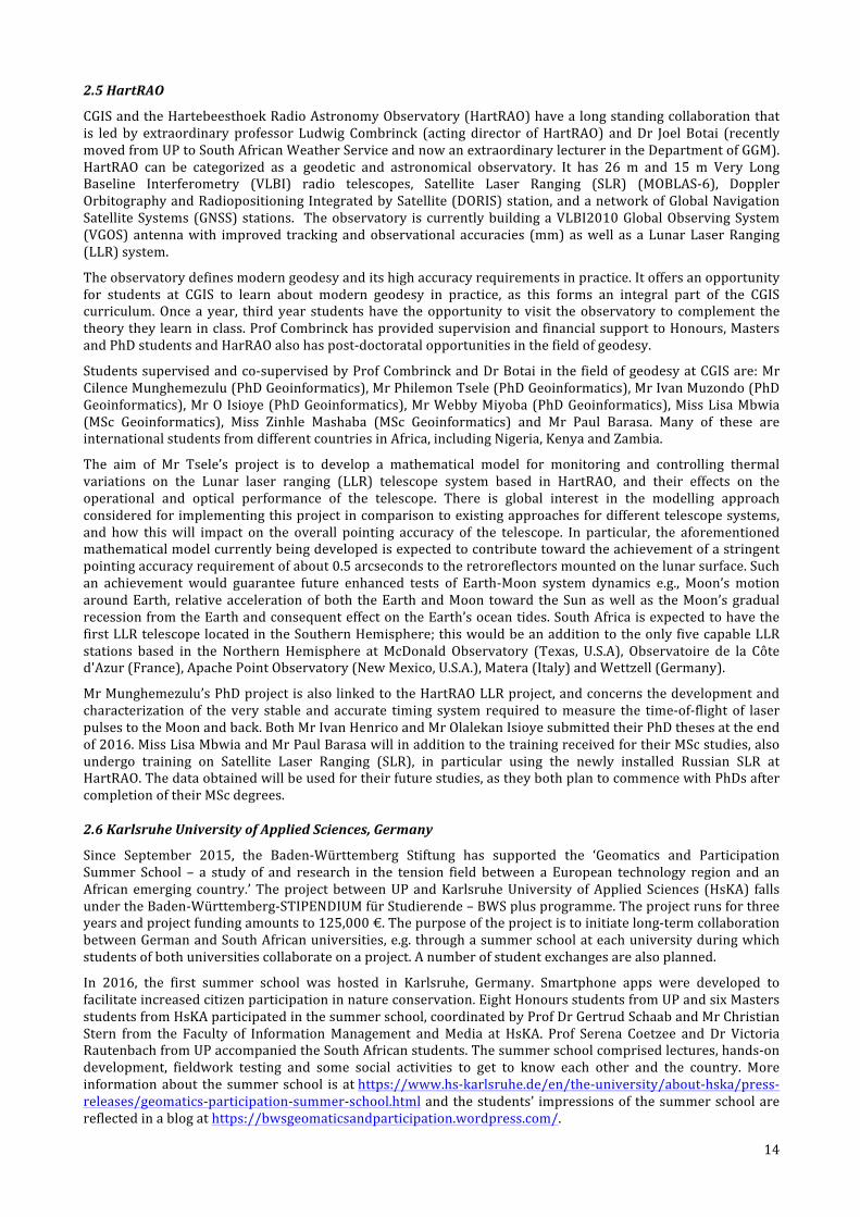
KathrynArnoldwithMrRajendhSalig(CONSASConferences)
2.FacilitatorofcollaborationsCGISaimstobeafacilitatorofUPGIScresearchcollaborations,educationandtrainingandprofessionalallianceswithinSouthAfricaandabroad.Ongoingandnewcollaborationsaredescribedinthissection.
2.1AgriculturalResearchCouncil(ARC)
In 2016, the CGIS collaborationwith the Geoinformatics Division of the Agricultural Research Council (ARC)-Institute for Soil, Climate andWater (ISCW)was led by Dr George Chirima (ARC), Dr Joel Botai (SAWS), MrPhilemonTseleandMrCilenceMunghemezulu,bothfromUP.Currently,theARChasvariousprojectsthatfocusonagricultural applications. For example, remote sensing techniques areused tomonitor thehealth statusofvariouscrops (wheat,maize, etc.) and todevelopmodels thatallowpredictionof cropyield, grazingcapacity,ecologicalmodelling,climatesystemsandlandcover/useapplications.
The ISCW hosts databases that are national assets, including remote sensing, climate, soil and agriculturedatasets. These datasets are used to model the risk and develop early warning systems that have wideapplicationinearthscience.CGISstudentsgetexposuretothesefacilitiesanddatasets,andtheopportunitytocontribute to the ongoing research at the ISCW. The skills that students acquire aremore provide additionalopportunities,beyondUP’scurrentinfrastructure.Therefore,ARC-ISCWisanimportantpartnertoCGIS.
In2016, theGeoinformaticsDivisionof theARChostedoneCGISMastersstudent,MsZinhleMashabaandco-supervised theHonoursprojectofMs JaniqueSavy.Through this collaboration,MsZinhleMashabapublishedone research article and Ms Janique Savy completed her project for BScHons Geoinformatics. The studentsbenefited from the ARC through co-supervision by Dr George Chirima, financial support, the use of ARCequipment (spectrometer) and state-of-the-art laboratories anddatabases. TheARC also supported fieldworkfor Mr Madodomzi Mafanya, an MSc student in Geoinformatics, by providing field equipment, such as thespectrometer,aswellasservicesofanARCChiefResearchtechnician.
Notable accolades includeMs ZinhleMashabawining the best student peer reviewed paper at theGeomaticsIndaba 2016 Conference. International travel to Germany was funded by the ARC for Ms Zinhle Mashaba topresentherresearchattheInternationalCropModelling(iCropM2016)SymposiuminGermany.
13
2.2CSIRBuiltEnvironment
CGIS has a long-standing collaboration with CSIR Built Environment. Collaboration is mainly in the form oflecturing and postgraduate student supervision, but there are also other activities, such as assistance withreplacementteachingwhenlecturersareonsabbaticals,andcollaborationonjointresearchprojects.
The CSIRBuilt Environment has currently two extraordinary lecturers in theDepartment of GGM,DrAntonyCooperandDrPeterSchmitz.DrSchmitz takes responsibility (as contract lecturer) for theGIS705,Advancedgeospatialdata,moduleintheBScHonsGeoinformaticsprogram.DrCoopercontributestolecturesinCOS787,Spatialdatabases,andGIS703,GISprofessionalpractice,andinfuture,GIS701,ResearchMethods.Furthermore,DrSchmitzandDrCoopersuperviseHonours,MastersandPhDstudents,whileMrGerbrandMansco-supervisesaMastersstudentandMsAlizeleRouxsupervisesMastersandHonoursstudents.
Discussions are currently underwaywith the Green Scorpions from theDepartment of Environmental Affairsabout establishing a baseline for natural cycad populations using themethodologies described inMauritz deBruin’sMaster’sdissertation.
NiellduPlooycompletedhisMScinGeoinformaticsontheeffectsofleachedTNTonplantsandsubmitteditforexamination. The project continues with plants in a greenhouse to confirm under controlled conditions thefindingsofthefieldexperiment.
2.3CSIRMerakaInstitute
The CSIR-Meraka Institute is an operating unit of the CSIR focused on Information and CommunicationTechnology(ICT).CSIR-Merakaaimstocontributeresearchanddevelopmentoutputstowardsenhancingqualityof life and economic competitiveness in South Africa and the continent through ICT. One of Meraka’s fivecompetenceareas isEarthObservationScienceand InformationTechnology (EOS IT)which focuseson1) theextractionofgeospatialinformationfromlargeamountsofdiverseobservational(e.g.satelliteearthobservation,vesselpositioningsystem)andmodelleddataformultipleapplicationsand2)buildingoperationalgeospatialITsystemswithanemphasisonusingopenstandardsandthelatestgeovisualizationtechniques.TherearevariouscollaborativeactivitiesbetweenCGISandCSIR-Meraka.
DrKonradWesselsisanextraordinarylecturerintheDepartmentofGGM.Hesupervisespostgraduatestudentsandadvisesonthecontentofall theremotesensingmodules inthedepartment.Hehasalsocontributedwithlectures and practicals, as well as practical assignments within GMA 705. Mr Graeme McFerren takesresponsibility (as contract lecturer) for the GIS 706, Internet GIS, module of the BScHons Geoinformaticsprogram.He also supervisesHonours andMasters students, and explores jointR&Deffortswith students.DrTerence van Zyl, formerly from Meraka and now from Wits, co-supervises a number of students in thedepartment.
2.4CSIRNaturalresourcesandtheenvironment(NRE)
TheCSIR’sEarthObservation(EO)researchgroupintheNREunitprovidesremotesensingresearchleadershipin the field of Ecosystems Earth Observation in South Africa using LiDAR, hyperspectral, multispectral andSyntheticApertureRadar(SAR)dataproductscoupledwithrobustimageanalysistechniquesandtools.
CollaborationbetweenCGISandtheCSIR’sEOresearchgrouphasledtotheprovisionof:(1)guestlecturesonspecialised EO topics (SAR and LiDAR technology, forest and rangeland assessment); (2) hands-on practicalexercisesonLiDAR,SARandhyperspectraldata;(3)accesstospecialisedremotesensingequipment(GAMMAstate-of-the-art SAR software, spectroradiometer, dark chamber for spectrum analysis, LAI meters); and (4)cutting-edgeEOresearchactivities totheCGISunder-andpostgraduatestudents. Inparticular,expertswithintheEOresearchgroup, suchasDrRenaudMathieuandDrAbelRamoeloprovide substantial inputs inall theremote sensing modules (i.e. GMA 220, GMA 320 and GMA 705) and also for assisting with the design andexecutionof cutting-edge laboratoryexercises that arewell synchronizedwith the theory,particularly for theadvancedremotesensingmodule(GMA705)offeredatpostgraduatelevel.
Furthermore, this collaboration has led to joint supervision of various specialised EO research topics forpostgraduates (4 PhD students) and subsequent publications of results in high impact journals in the field ofremotesensing.Thecollaborationhasledto14peer-reviewedpaperspublishedinISIjournalsinthelastthreeyears.LavenNaidoowillcompletedhisPhDontheuseofopticalandSARdataformonitoringwoodycoverinSouth African landscapes in 2017 and Russell Main is investigating hyper-temporal SAR technology withempirical and deterministic models for mapping woody biomass. Overall, the collaboration facilitates theexchange of knowledge and key technical skills between students and experts from the CSIR’s EO researchgroup, coupled with exposure to sophisticated remotely sensed data products, analytical techniques andequipment.
14
2.5HartRAO
CGISandtheHartebeesthoekRadioAstronomyObservatory(HartRAO)havealongstandingcollaborationthatis led by extraordinary professor Ludwig Combrinck (acting director ofHartRAO) andDr Joel Botai (recentlymovedfromUPtoSouthAfricanWeatherServiceandnowanextraordinarylecturerintheDepartmentofGGM).HartRAO can be categorized as a geodetic and astronomical observatory. It has 26 m and 15 m Very LongBaseline Interferometry (VLBI) radio telescopes, Satellite Laser Ranging (SLR) (MOBLAS-6), DopplerOrbitographyandRadiopositioningIntegratedbySatellite(DORIS)station,andanetworkofGlobalNavigationSatelliteSystems(GNSS)stations. Theobservatory iscurrentlybuildingaVLBI2010GlobalObservingSystem(VGOS)antennawith improved trackingandobservational accuracies (mm)aswell as aLunarLaserRanging(LLR)system.
Theobservatorydefinesmoderngeodesyanditshighaccuracyrequirementsinpractice.Itoffersanopportunityfor students at CGIS to learn about modern geodesy in practice, as this forms an integral part of the CGIScurriculum.Onceayear, thirdyear studentshave theopportunity tovisit theobservatory to complement thetheorytheylearninclass.ProfCombrinckhasprovidedsupervisionandfinancialsupporttoHonours,MastersandPhDstudentsandHarRAOalsohaspost-doctoratalopportunitiesinthefieldofgeodesy.
Studentssupervisedandco-supervisedbyProfCombrinckandDrBotai inthefieldofgeodesyatCGISare:MrCilenceMunghemezulu(PhDGeoinformatics),MrPhilemonTsele(PhDGeoinformatics),MrIvanMuzondo(PhDGeoinformatics),MrOIsioye(PhDGeoinformatics),MrWebbyMiyoba(PhDGeoinformatics),MissLisaMbwia(MSc Geoinformatics), Miss Zinhle Mashaba (MSc Geoinformatics) and Mr Paul Barasa. Many of these areinternationalstudentsfromdifferentcountriesinAfrica,includingNigeria,KenyaandZambia.
The aim of Mr Tsele’s project is to develop a mathematical model for monitoring and controlling thermalvariations on the Lunar laser ranging (LLR) telescope system based in HartRAO, and their effects on theoperational and optical performance of the telescope. There is global interest in the modelling approachconsideredforimplementingthisprojectincomparisontoexistingapproachesfordifferenttelescopesystems,and how thiswill impact on the overall pointing accuracy of the telescope. In particular, the aforementionedmathematicalmodelcurrentlybeingdevelopedisexpectedtocontributetowardtheachievementofastringentpointingaccuracyrequirementofabout0.5arcsecondstotheretroreflectorsmountedonthelunarsurface.Suchan achievement would guarantee future enhanced tests of Earth-Moon system dynamics e.g., Moon’s motionaroundEarth, relativeaccelerationofboth theEarthandMoon toward theSunaswell as theMoon’sgradualrecessionfromtheEarthandconsequenteffectontheEarth’soceantides.SouthAfricaisexpectedtohavethefirstLLRtelescopelocatedintheSouthernHemisphere;thiswouldbeanadditiontotheonlyfivecapableLLRstations based in the Northern Hemisphere atMcDonald Observatory (Texas, U.S.A), Observatoire de la Côted'Azur(France),ApachePointObservatory(NewMexico,U.S.A.),Matera(Italy)andWettzell(Germany).
MrMunghemezulu’sPhDprojectisalsolinkedtotheHartRAOLLRproject,andconcernsthedevelopmentandcharacterizationof the very stable and accurate timing system required tomeasure the time-of-flight of laserpulsestotheMoonandback.BothMrIvanHenricoandMrOlalekanIsioyesubmittedtheirPhDthesesattheendof2016.MissLisaMbwiaandMrPaulBarasawillinadditiontothetrainingreceivedfortheirMScstudies,alsoundergo training on Satellite Laser Ranging (SLR), in particular using the newly installed Russian SLR atHartRAO.Thedataobtainedwillbeusedfortheirfuturestudies,astheybothplantocommencewithPhDsaftercompletionoftheirMScdegrees.
2.6KarlsruheUniversityofAppliedSciences,Germany
Since September 2015, the Baden-Württemberg Stiftung has supported the ‘Geomatics and ParticipationSummer School – a study of and research in the tension field between a European technology region and anAfricanemerging country.’TheprojectbetweenUPandKarlsruheUniversityofAppliedSciences (HsKA) fallsundertheBaden-Württemberg-STIPENDIUMfürStudierende–BWSplusprogramme.Theprojectrunsforthreeyearsandprojectfundingamountsto125,000€.Thepurposeoftheprojectistoinitiatelong-termcollaborationbetweenGermanandSouthAfricanuniversities,e.g.throughasummerschoolateachuniversityduringwhichstudentsofbothuniversitiescollaborateonaproject.Anumberofstudentexchangesarealsoplanned.
In 2016, the first summer school was hosted in Karlsruhe, Germany. Smartphone apps were developed tofacilitateincreasedcitizenparticipationinnatureconservation.EightHonoursstudentsfromUPandsixMastersstudentsfromHsKAparticipatedinthesummerschool,coordinatedbyProfDrGertrudSchaabandMrChristianStern from the Faculty of InformationManagement andMedia at HsKA. Prof Serena Coetzee and Dr VictoriaRautenbachfromUPaccompaniedtheSouthAfricanstudents.Thesummerschoolcomprisedlectures,hands-ondevelopment, fieldwork testing and some social activities to get to know each other and the country. Moreinformationabout the summerschool isathttps://www.hs-karlsruhe.de/en/the-university/about-hska/press-releases/geomatics-participation-summer-school.htmlandthestudents’ impressionsof thesummerschoolarereflectedinablogathttps://bwsgeomaticsandparticipation.wordpress.com/.
15
TheSouthAfricanConsul-General,MrGeorge
Monyemangene,greetstheparticipantsofthe’GeomaticsandParticipation’SummerSchool(Photo:JohnChrist/HsKA)
SummerschoolparticipantsattheRastatterRheinauenatureconservationarea,closetoKarlsruheinGermany
TwoBScHonsGeoinformaticsstudents,KathrynArnoldandKathleenGodfrey,departedinSeptember2016toKarlsruhe.TheywillcompletethewintersemesterfromOctober2016tomidMarch2017attheHsKA.TheywillreceivecreditsforthemodulescompletedinGermanytowardstheirUPBScHonsGeoinformaticsdegrees.
In 2017, a winter school will be hosted in Pretoria, another two Honours students will complete the wintersemesterattheHsKA,andwearealsoexpectingaresearchvisitbyaHsKAMastersstudent.
2.7KatholiekeUniversiteitLeuven,BelgiumandTechnicalUniversityofDelft,Netherlands
Duringhersabbaticalin2016,ProfSerenaCoetzeevisitedProfJoepCrompvoetsattheKatholiekeUniversiteitLeuveninBelgiumandProfJantienStoterandDrBastiaanvanLoenenattheTechnicalUniversityofDelftintheNetherlands. The aim was to conduct joint research on the development and use of standards for makinggeospatialdatafromlocalauthoritiesavailableandaccessible(seealsovisittoTUDelftbelow).Thefocuswasonaddresses, because they are typically created and maintained within a municipality, but used beyond thejurisdictionalboundariesofanindividualmunicipality.
TheNetherlands government has established 12 base registers as a central source of vital information aboutcitizens, companies and organizations. The aim with the registers is to create a single authentic source ofreferenceofsuchqualitythatgovernmentcanusetheinformationinitsworkwithoutfurtherinvestigation.Theregistersareessentialforservicedeliverybythegovernmenttoitscitizens,butalsoplayaroleinmaintainingpublicorderandsafety,incombatingfraudandinpolicydevelopment.
Oneof these registers, theBasisregistratiesadressen engebouwen (BAG), includesaddressdata.BAG isbothasourceofreferenceforthecurrentstateofaddresses,aswellasaregisterofauthenticdocumentsthatprovidethe justification for and background of each current address. A large number of stakeholders coordinate thecollection,qualitycontrolanddisseminationofthisregister.ProfCoetzeeinterviewedrepresentativesofthesestakeholders.
The ‘CentraalReferentieadressenBestand’(CRAB)isadigitalauthoritativeaddressdatasetforFlanders,oneofthreeregionsinBelgium.Inthecontextofaninformation-drivengovernment,addressesplayanimportantrolein linking different kinds of government-related information to each other. For reliable linking, differentauthorities have to use the same addressing terminology and addressdata.Municipalities are responsible formaintaining the address data, while the Flemish government has ownership of the authoritative dataset ofaddresses.GovernmentdepartmentsinFlandersareobligedtouseCRABaddressdataandtoreportanyerrorsdetectedinthedata(reference).
JointpapersabouttheBAGandCRABresearchresultsrespectivelyareinpreparation,andacomparativepaperbetweenBAGandCRABareinpreparation.
2.8SouthAfricanNationalSpaceAgency(SANSA)
SANSA’smandate is “to provide for the promotion and use of space and cooperation in space related activities,fosterresearchinspacescience,advancescientificengineeringthroughhumancapitalandsupportthecreationofan environment conducive to industrial development in space technologies within the framework of nationalgovernmentpolicy”.
Since2011,therehasbeenon-goingcollaborationbetweenSANSAandCGIS.Thiscollaborationischaracterizedby: (1) joint supervisionofMScandPhDGeoinformatics students’; (2)provisionofpostgraduatebursaries tobothlocalandinternationalstudents;(3)organizedfieldtripstoSANSAinorderforstudentstogetexposuretogroundspacestationequipmentandtheassociatedoperationssuchassatellitesignaltrackingandreceipt;(4)
16
provisionofsatellite-derivedimageryorEarthObservation(EO)dataproductsaswellas,lendingofspecialisedremote sensing equipment, such as the hand-held spectroradiometer for acquisition of hyperspectral insitumeasurements; and (5) calls for participation in capacity building workshops focusing on EO Science andsatelliteimageprocessingforbothstudentsandstaff.Forthepastfewyears,SANSAhasalsosponsoredstudentprizesforthebestthirdyearstudentinremotesensing,andthebestHonoursstudentinremotesensing.
These opportunities have been realised through CGIS with remote sensing lectures by Dr Joel Botai and MrPhilemonTseleinthepast5years,duetocontinuedsupportandcommitmentbySANSA’sexecutiveleadership,inparticularDrSandileMalingaandDrJaneOlwoch,whoisalsoanextraordinarylecturerinthedepartment.
2.9UPDepartmentofFamilyMedicine
Since2016,CGIScollaborateswiththeDepartmentofFamilyMedicine,primarilyondatacollectedthroughtheirCommunityOrientedPrimaryCare(COPC)project.COPC isan internationallyrecognisedsetofprinciplesandpractices that has beendeveloped to support universal health care. It is organised to provide comprehensiveservices to individuals and families in geographically defined communities. Services are based on healthinformationthat iscollected from,analysedandusedtorespondto localhealthneedsaccordingto theEquityPrinciple.Thisensures thateveryonewith thesameneedgets thesameattention,andthatresourcesareputwhere the needs are greatest – both in system terms (ward health teams in communities) and service terms(prioritising local individual, familyandcommunityneeds).Healthservicesareorganised fromandresponsesare tailored to the information collected from specific individuals and families living andworking in definedgeographicplaces.InthiswayCOPCrequiresthatservicesareintegratedaroundusers–i.e.theyarepersonandfamilycentredandtheysupportrelationship,informationandservicecontinuity.
In2016, twoHonoursstudents,ClaudioDuarteandRuheeMaharaj,completedtheirHonoursprojectsondatacollectedbyCOPCcommunityhealthworkers.Claudioevaluateddifferentgeo-maskingmethodsforprotectingtheCOPChousehold location informationprivacy,whileRuheedevelopeda tuberculosisvulnerability index.AnumberofnewMastersstudentswereassignedtopicsrelatedtoCOPCdataandwillstartworkingonthesein2017.
2.10UPDepartmentofStatistics
Prof Gregory Breetzke (CGIS) has established a working relationship with Dr Inge Fabris-Rotelli from theDepartment of Statistics. Prof Breetzke and Dr Fabris-Rotelli recently published a paper in the ISI-ratedAustralian andNew Zealand Journal of Criminology and are currently collaborating on another project that isinvestigating the spatial diffusion of crime around schools in Khayelitsha, Cape Town. They are currently indiscussionsaboutjointlysupervisingHonoursstudentsfrom2018onwards.
3.CommunityEngagementCGISmembersareactivelyengagedwiththegeoinformaticscommunityaspartoftheireducationandresearch,bothlocallyandinternationally.Selectedinvolvementsaredescribedinthissection.
3.1GeoForAll
CGIS has been amember of Geo For All since 2012. Geo For All is the Open Source Geospatial Foundation’s(OSGeo) Committee for Educational outreach and works in close collaboration with the InternationalCartographicAssociation(ICA),theInternationalSocietyforPhotogrammetryandRemoteSensing(ISPRS),theUnited Nations GIS and other partners worldwide in our mission for making geospatial education andopportunitiesaccessibletoall.CentraltomissionofGeoForAllisthebeliefthatknowledgeisapublicgoodandthat open principles in educationwill provide great opportunities for everyone. Though themembers of ourcommunityhailfrommanydifferentbackgrounds,weallseektoeliminatethedigitaldivideandempowerallasfullcitizensandcontributetobuildingopenknowledgeforthebenefitofsocietyandforfuturegenerations.
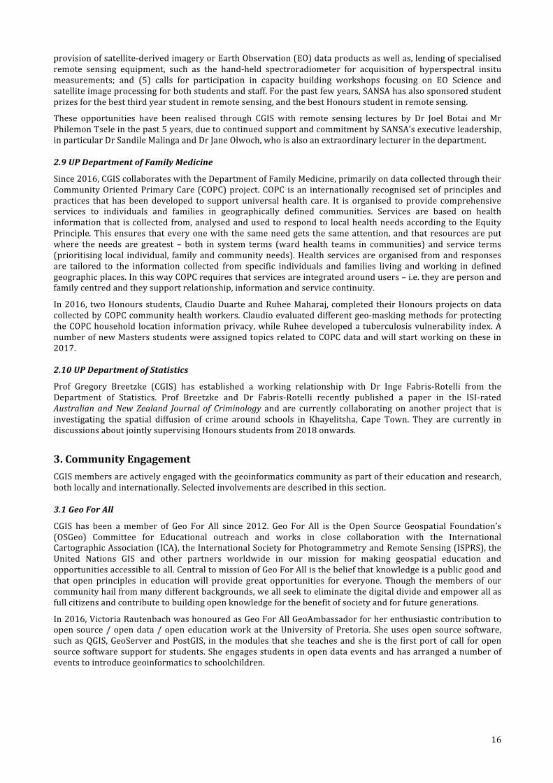
In2016,VictoriaRautenbachwashonouredasGeoForAllGeoAmbassadorforherenthusiasticcontributiontoopensource/opendata/openeducationworkat theUniversityofPretoria. Sheusesopensource software,suchasQGIS,GeoServerandPostGIS, in themodules thatshe teachesandshe is the firstportofcall foropensourcesoftwaresupportforstudents.Sheengagesstudentsinopendataeventsandhasarrangedanumberofeventstointroducegeoinformaticstoschoolchildren.
17
AnnouncementofVictoriaRautenbachasGeoAmbassadorofthemonthonthewebsiteoftheICACommissiononOpen
SourceGeospatialTechnologieshttp://opensourcegeospatial.icaci.org/2016/11/geoambassador-of-the-month-victoria-rautenbach/
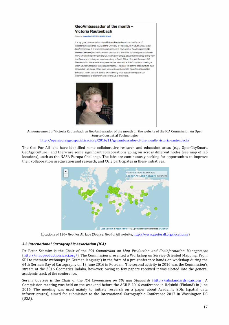
The Geo For All labs have identified some collaborative research and education areas (e.g., OpenCitySmart,GeoAgriculture),andtherearesomesignificantcollaborationsgoingonacrossdifferentnodes(seemapof lablocations),suchastheNASAEuropaChallenge.The labsarecontinuouslyseekingforopportunitesto improvetheircollaborationineducationandresearch,andCGISparticipatesintheseinitiatives.
Locationsof120+GeoForAlllabs(Source:GeoForAllwebsite,http://www.geoforall.org/locations/)
3.2InternationalCartographicAssociation(ICA)
Dr Peter Schmitz is the Chair of the ICA Commission on Map Production and Geoinformation Management(http://mapproduction.icaci.org/).TheCommissionpresentedaWorkshoponService-OrientedMapping:FromSDItothematicwebmaps(inGermanlanguage)intheformofapre-conferencehands-onworkshopduringthe64thGermanDayofCartographyon13June2016inPotsdam.Thesecondactivityin2016wastheCommission’sstream at the 2016Geomatics Indaba, however, owing to fewpapers received itwas slotted into the generalacademictrackoftheconference.
Serena Coetzee is the Chair of the ICA Commission on SDI and Standards (http://sdistandards.icaic.org). ACommissionmeetingwasheldontheweekendbeforetheAGILE2016conferenceinHelsinki(Finland)inJune2016. The meeting was used mainly to initiate research on a paper about Academic SDIs (spatial datainfrastructures), aimed for submission to the International Cartographic Conference 2017 inWashington DC(USA).
18
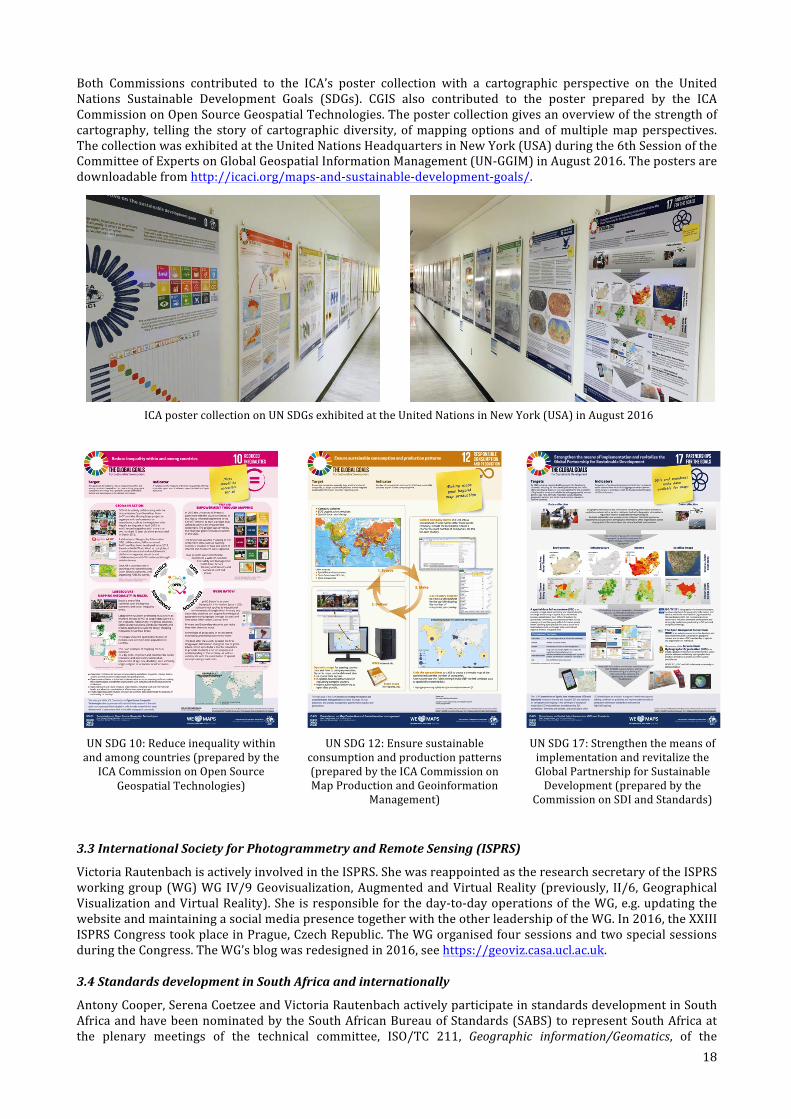
Both Commissions contributed to the ICA’s poster collection with a cartographic perspective on the UnitedNations Sustainable Development Goals (SDGs). CGIS also contributed to the poster prepared by the ICACommissiononOpenSourceGeospatialTechnologies.Thepostercollectiongivesanoverviewofthestrengthofcartography, telling the story of cartographic diversity, ofmappingoptions andofmultiplemapperspectives.ThecollectionwasexhibitedattheUnitedNationsHeadquartersinNewYork(USA)duringthe6thSessionoftheCommitteeofExpertsonGlobalGeospatialInformationManagement(UN-GGIM)inAugust2016.Thepostersaredownloadablefromhttp://icaci.org/maps-and-sustainable-development-goals/.
ICApostercollectiononUNSDGsexhibitedattheUnitedNationsinNewYork(USA)inAugust2016
UNSDG10:Reduceinequalitywithinandamongcountries(preparedbytheICACommissiononOpenSource
GeospatialTechnologies)
UNSDG12:Ensuresustainableconsumptionandproductionpatterns(preparedbytheICACommissiononMapProductionandGeoinformation
Management)
UNSDG17:StrengthenthemeansofimplementationandrevitalizetheGlobalPartnershipforSustainableDevelopment(preparedbythe
CommissiononSDIandStandards)
3.3InternationalSocietyforPhotogrammetryandRemoteSensing(ISPRS)
VictoriaRautenbachisactivelyinvolvedintheISPRS.ShewasreappointedastheresearchsecretaryoftheISPRSworkinggroup(WG)WGIV/9Geovisualization,AugmentedandVirtualReality (previously, II/6,GeographicalVisualizationandVirtualReality).Sheisresponsiblefortheday-to-dayoperationsoftheWG,e.g.updatingthewebsiteandmaintainingasocialmediapresencetogetherwiththeotherleadershipoftheWG.In2016,theXXIIIISPRSCongresstookplaceinPrague,CzechRepublic.TheWGorganisedfoursessionsandtwospecialsessionsduringtheCongress.TheWG’sblogwasredesignedin2016,seehttps://geoviz.casa.ucl.ac.uk.
3.4StandardsdevelopmentinSouthAfricaandinternationally
AntonyCooper,SerenaCoetzeeandVictoriaRautenbachactivelyparticipateinstandardsdevelopmentinSouthAfricaandhavebeennominatedbytheSouthAfricanBureauofStandards(SABS)torepresentSouthAfricaatthe plenary meetings of the technical committee, ISO/TC 211, Geographic information/Geomatics, of the
19
International Organization for Standardization (ISO) (www.iso.org) for several years now. While the SouthAfricanBureauofStandards(SABS)supportstheirtravelandaccommodationforthemeetings.InDrCooper’scase,theCSIRsponsorshistimeinvolvedinstandardization.
Thethreesharetheir internationalexperiencewiththeirSouthAfricancolleaguesbypresentingshortcoursesongeographicinformationstandards,bypresentingatworkshopsandconferences,byarrangingworkshops,byparticipatinginthesub-committeeonStandardsoftheCommitteeforSpatialInformation(CSI),andbytakingonleadershiprolesinthelocalstandardsdevelopmentcommunity.SerenaCoetzeechairstheISO/TC211ProgramMaintenanceGroup (PMG) and actively participates in the development of the ISO 19160 suite of addressingstandards.AntonyCooper isconvenorofWorkingGroup7,InformationCommunities,andleadstheproject forISO19126,Geographicinformation–Featureconceptdictionariesandregisters,andchairstheAdhocgrouponclassification issues. Victoria Rautenbach chairs the ISO/TC 211 Advisory Group on Outreach. The three alsoactivelycontributetothedevelopmentofSouthAfricanstandardstandards,suchasSANS1883(addressing)andSANS1876(featureinstanceidentifiers).Aguideforstandardsimplementationwaswrittenbythethreeauthorsand is now freely available online, see wiki.icaci.org. Students are encouraged to participate in standardsdevelopmentandanumberofthemarenowinvolved.
UP is a member of the Open Geospatial Consortium (OGC), one of only very few African members, seewww.opengeospatial.org. OGC is an international industry consortium of more than 500 companies,government agencies and universities participating in a consensus process to develop publicly availableinterface standards. Examples of standards are the Geography Markup Language (GML), Keyhole MarkupLanguage(KML)andWebMapService(WMS).OGCmembershipgivesstudentsaccesstotheOGCportalwiththelatestinformationonstandardsdevelopmentandhappeningsattheOGC.
3.5SouthAfricanCommitteeforSpatialInformation(CSI)
TheCommittee forSpatial Information(CSI) isastatutorybodyestablishedby theSpatialData InfrastructureAct, No 54 of 2003. Serena Coetzee represents the Council on Higher Education on the CSI and chairs theSubcommittee on Education and Training, and Antony Cooper represents the CSIR on the CSI and chairs theSubcommitteeonStandards.
3.6SouthAfricanGeomaticsProfessionCouncil
Two staffmembers are registeredwith the South African Geomatics Profession Council: Joos Esterhuizen, asSurveyor (S0414) and Serena Coetzee as GISc Professional (PGP1245). Serena is a member of the Council,nominatedbytheCouncilonHigherEducation,since2015.
3.7YouthMappers
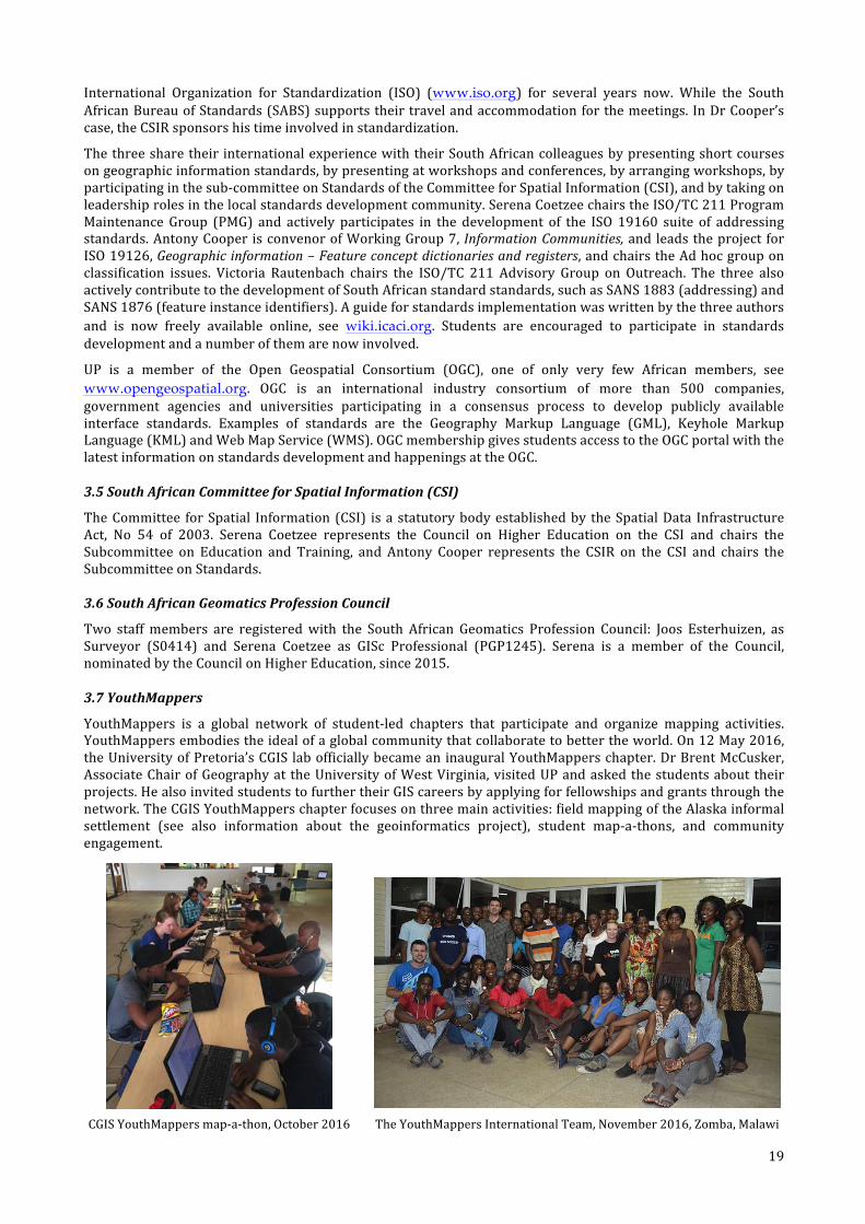
YouthMappers is a global network of student-led chapters that participate and organize mapping activities.YouthMappersembodiestheidealofaglobalcommunitythatcollaboratetobettertheworld.On12May2016,theUniversityofPretoria’sCGISlabofficiallybecameaninauguralYouthMapperschapter.DrBrentMcCusker,AssociateChairofGeographyat theUniversityofWestVirginia,visitedUPandaskedthestudentsabouttheirprojects.HealsoinvitedstudentstofurthertheirGIScareersbyapplyingforfellowshipsandgrantsthroughthenetwork.TheCGISYouthMapperschapterfocusesonthreemainactivities:fieldmappingoftheAlaskainformalsettlement (see also information about the geoinformatics project), student map-a-thons, and communityengagement.
CGISYouthMappersmap-a-thon,October2016 TheYouthMappersInternationalTeam,November2016,Zomba,Malawi
20
Anumberofstudentmap-a-thonswereheldin2016,typicallylastinganhourortwo.Themainmap-a-thonwasheldinOctober2016withtheaimofcontributingtothePeaceCorpseffortsinBotswana,anaimdefinedbytheHumanitarian OpenStreetMap Team (HOT), to improve the basemap for 45 sites in Botswana. The studentsYouthMappers mapped buildings and roads that would ultimately support long-term development and HIVprojects in Botswana. The group used OpenStreetMap and MapSwipe during the map-a-thon. Apart fromcontributingtotheHOTtask,themap-a-thonwasasocialeventforCGISYouthMapperstoroundoffagoodyear.
SeanCullenandMichelleBester,bothbusywiththeirMScGeoinformaticsatUP,wereselectedtoparticipateinthefirstInternationalJointYouthMapperstraininginNovember2016inZomba,Malawi.TheeventallowedtheYouthMappersfromthetwochapterstoexchangeinformationandshareexperiences.Theywerealsotrainedtouse variousOpenStreetMap platforms. Dr. BrentMcCusker demonstrated the JavaOSM (JOSM) application forofflinemapping and further explained how the information that YouthMappers aremappingwill be used fordecision-making. A YouthMappers blog post about the event is available athttp://www.youthmappers.org/single-post/2016/11/29/The-First-International-Youth-Mappers-Exchange-between-Malawi-and-South-Africa-Part-One.
4.PartnertothegeoinformationindustryofSouthAfricaCGISaimstobeapartnerto theSouthAfricangeoinformation industry insupportofGIScresearch,educationandtraining,professionaldevelopment,communityengagement.Afewhighlightsfrom2016arepresentedhere.
4.12016CGISmini-conference
The 2016 CGIS mini-conference showcased ‘GISc in research at UP’. In addition to the presentations bypostgraduate students, three exchange students presented about their experiences: Yvette Bevis about herexperiencesas a SouthAfrican studentsona researchvisit to theKarlsruheUniversityofAppliedSciences inGermany;AnnaMantelfromtheKarlsruheUniversityofAppliedSciencesinGermanyrelatedexperiencesasanintern at the City of Johannesburg Metropolitan Municipality; the eight Honours students presented theirparticipationinthesummerschoolattheKarlsruheUniversityofAppliedSciencesinGermany;andRoyKrijgerfromtheSaxionUniversityofAppliedSciences,Deventer,Netherlandsabouthisworkonsafetyandsecurityinpublic transportasanexchangestudent inSouthAfrica.Despitevenuechallengesduetothestudentprotests,approx.75studentsandprofessionalsattendedthemini-conference.Presentationsarelistedbelow.
Modeling land use change in the Western Cape Province Petronella Tizora, MSc Geoinformatics, supervised by Alize le Roux, Antony Cooper, Gerbrand Mans
Experiences of a South African exchange student at the Karlsruhe University of Applied Sciences, Germany Yvette Bevis, UP exchange student to the Karlsruhe University of Applied Sciences, Germany A geographic accessibility analysis in Limpopo Province: Current and optimal provisioning of Thusong Service Centres Lourens Snyman, MA Geography, supervised by Serena Coetzee
Experiences of a Dutch exchange student working on safety and security of public transport in South Africa Roy Krijger, Exchange student from the Saxion University of Applied Sciences, Deventer, Netherlands, hosted by Maryna Storie
Analysing the practical feasibility of using FOSSGIS in military operations Susan Henrico, MA Geography, supervised by Serena Coetzee, Antony Cooper Monitoring and analysis of growing vegetation endangering the operation of power lines in South Africa using multi-spectral satellite imagery Michelle Bester, MSc Geoinformatics, supervised by Philemon Tsela, Joel Botai Determining pasture quantity using remote sensing in the Kalahari area Sean Cullen, MSc Geoinformatics, supervised by Joel Botai, Abubeker Hassen
Experiences of a German intern at the City of Johannesburg Anna Mantel, Exchange student from the Karlsruhe University of Applied Sciences, Germany, hosted by Marcelle Hattingh at the City of Johannesburg Metropolitan Municipality Geomatics & Participation – reflection by the South African students UP Honours students who participants in the July 2016 Summer School at the Karlsruhe University of Applied Sciences, Germany
Analysing the influence of TNT on Southern African trees, grass and shrubs using in-situ hyperspectral data Niell du Plooy, MSc Geoinformatics supervised by Peter Schmitz
Evaluation of Fire Danger and Fire Potential Indices in South Africa Melissa Burgess, MSc Geoinformatics, supervised by Phillip Frost, Serena Coetzee, Graeme McFerren Modelling dryland winter wheat yield using remotely sensed imagery and agro-meteorological parameters Zinhle Mashaba, MSc Geoinformatics, supervised by Joel Botai, Georg Chirima, Ludwig Combrinck
21
4.2Awarenessofgeoinformaticsasacareer
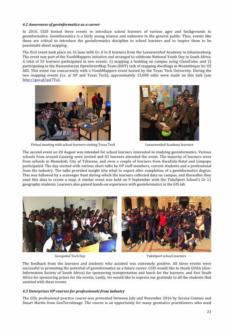
In 2016, CGIS hosted three events to introduce school learners of various ages and backgrounds togeoinformatics.Geoinformatics is a fairly young science andunknown to the general public. Thus, events likethese are critical to introduce the geoinformatics discipline to school learners and to inspire them to bepassionateaboutmapping.
Thefirsteventtookplaceon16JunewithGr.6to8learnersfromtheLeeuewenhofAcademyinJohannesburg.TheeventwaspartoftheYouthMappersinitiativeandarrangedtocelebrateNationalYouthDayinSouthAfrica.A total of 55 learners participated in two events: 1)mapping a building on campus using ClassiCube; and 2)participatingintheHumanitarianOpenStreetMapTeam(HOT)taskofmappingdwellingsinMozambiqueforUSAID.ThiseventranconcurrentlywithaYouthMapperseventhostedby theTexasTechUniversity.During thetwo mapping events (i.e. at UP and Texas Tech), approximately 15,000 edits were made on this task (seehttp://goo.gl/qst7Vu).
VirtualmeetingwithschoollearnersvisitingTexasTech LeeuewenhofAcademylearners
Thesecondeventon20Augustwasintendedforschoollearnersinterestedinstudyinggeoinformatics.Variousschools fromaroundGautengwere invitedand43 learnersattended theevent.Themajorityof learnerswerefrom schools inMamelodi, City of Tshwane, and even a couple of learners fromKwaZulu-Natal and Limpopoparticipated.ThedaystartedwithvariousshorttalksbyUPstaffmembers,currentstudentsandaprofessionalfromthe industry.The talksprovided insight intowhat toexpectaftercompletionofageoinformaticsdegree.Thiswasfollowedbyascavengerhuntduringwhichthelearnerscollecteddataoncampus,andthereaftertheyused this data to create amap. A similar eventwas held on 9 Septemberwith the TuksSport School’s Gr 11geographystudents.Learnersalsogainedhands-onexperiencewithgeoinformaticsintheGISlab.
GeospatialTechDay TuksSportschoollearners
The feedback from the learners and students who assisted was extremely positive. All three events weresuccessfulinpromotingthepotentialofgeoinformaticsasafuturecareer.CGISwouldliketothankGISSA(Geo-Information Society of SouthAfrica) for sponsoring transportation and lunch for the learners, andEsri SouthAfricaforsponsoringprizesfortheevents.Lastly,wewouldliketoexpressourgratitudetoallthestudentsthatassistedwiththeseevents.
4.3EnterprisesUPcoursesforprofessionalsfromindustry
TheGIScprofessionalpracticecoursewaspresentedbetweenJulyandNovember2016bySerenaCoetzeeandStuartMartin fromGeoTerraImage. The course is an opportunity formany geomatics practitionerswhoneed
22
this certificate in order to meet the academic requirements of the SAGC academic model required forprofessional registration. Other specialized courses are presented from time to time and are registeredwithSAGC for CPD points, thus providing an opportunity for registered GISc practitioners to continue theirprofessionaldevelopment.
5.ResearchoutputCGISaimstobeafacilitatorofUPGIScresearchcollaborations,educationandtrainingandprofessionalallianceswithinSouthAfricaandabroad.Researchoutputpublishedin2016islistedwiththenamesofCGISauthorsinbold.
5.1Peer-reviewedjournalarticles
Adeola AM, Joel Botai, Olwoch J, Rautenbach CJDW, Adisa OM, Taiwo O, Kalumba A (2016). Environmental factors andpopulationatriskofmalariainNkomazimunicipality,SouthAfrica.TropicalMedicine&InternationalHealth,21(5),May:pp.675-686.
AyeniA,ChoA,RenaudMathieu,AdegokeJ(2016).Thelocalexperts'perceptionofenvironmentalchangeanditsimpactsonsurfacewaterinSouthwesternNigeria.EnvironmentalDevelopment,17pp.33-47.
Gerrie du Rand, Ingrid Booysen, Doreen Atkinson (2016). Culinarymapping and tourism development in South Africa’sKarooregion,AfricanJournalofHospitality,TourismandLeisure,5(4).
Ivan Henrico, Ludwig Combrinck, Corné Eloff (2016) Accuracy comparison of Pléiades satellite ortho-images using GPSdevicebasedGCPsagainstTerraSAR-X-basedGCPs,SouthAfricanJournalofGeomatics,5(3),pp.358-372.
SibusisiweHlela,SerenaCoetzee,AntonyCooper(2016)EvaluatingaPublicSectorOrganisationforSDIReadiness–TheCaseofaSouthAfricanGovernmentDepartment,SouthAfricanJournalofGeomatics,5(2),pp.95-107.
Isioye OA, Ludwig Combrinck, Botai C (2016). Modelling weighted mean temperature in the West African region:implicationsforGNSSmeteorology.MeteorologicalApplications,23pp.614-632.
Kaszta Z, VanDeKerchoveR, RamoeloA, ChoA,Modonsela S,MathieuR,Wolff E (2016). Seasonal Separation of AfricanSavanna Components UsingWorldview-2 Imagery: A Comparison of Pixel-and Object-Based Approaches and SelectedClassificationAlgorithms.RemoteSensing,8(8),pp.1-19.
RusselMain,RenaudMathieu,WaldoKleynhans,KonradWessels,LavenNaidoo,AsnerG(2016).Hyper-TemporalC-BandSARforBaselineWoodyStructuralAssessmentsinDeciduousSavannas.RemoteSensing,8pp.1-19.
MuchuruS,JoelBotai,BotaiC,LandmanWA,AdeolaAM(2016).VariabilityofrainfalloverLakeKaribacatchmentareaintheZambeziriverbasin,Zimbabwe.TheorecticalandAppliedClimatology,124(1),pp.325-338.
CilenceMunghemezulu,LudwigCombrinck, JoelBotai, JQuick (2016)Analysis of theperformance of hydrogenmaserclocksattheHartebeesthoekRadioAstronomyObservatory,SouthAfricanJournalofGeomatics,5(3),pp.325-339.
Cilence Munghemezulu, Ludwig Combrinck, Joel Botai (2016). A review of the lunar laser ranging technique andcontributionoftimingsystems.SouthAfricanJournalofScience,112(3),pp.1-9.
CilenceMunghemezulu,LudwigCombrinck, JoelBotai,BothaR (2016).Designof the timingsystem for thenewLunarLaserRangerproposedfortheMatjiesfonteinSpaceGeodeticObservatoryintheGreatKaroo,SouthAfrica:preliminaryresults.SouthAfricanJournalofGeology,119(1),March:pp.91-98.
CilenceMunghemezulu,LudwigCombrinck,JoelBotai,ZinhleMashaba(2016)MappingGPSMultipath:aCaseStudyfortheLunarLaserRangerTimingAntennaatHartRAO,SouthAfricanJournalofGeomatics,5(2),pp.142-155.
Zinhle Mashaba, George Chirima, Joel Botai, Ludwig Combrinck, Cilence Munghemezulu (2016) Evaluating SpectralIndicesforWinterWheatHealthStatusMonitoringinBloemfonteinusingLsat8data,SouthAfricanJournalofGeomatics,5(2),pp.227-243.
ZinhleMashaba,LudwigCombrinck, JoelBotai,CilenceMunghemezulu, BothaR (2016).Designof aweb-basedGNSSdatamanagementsystematHartRAO:preliminaryresults.SouthAfricanJournalofGeology,119.1pp.117-124.
LavenNaidoo,RenaudMathieu,RusselMain,KonradWessels,AsnerG(2016).L-bandSyntheticApertureRadarimageryperforms better than optical datasets at retrievingwoody fractional cover in deciduous, dry savannahs. InternationalJournalofAppliedEarthObservationandGeoinformation,52pp.54-64.
Victoria Rautenbach, Serena Coetzee, Danie Jooste (2016) Results of an evaluation of augmented reality mobiledevelopmentframeworksforaddressesinaugmentedreality,SpatialInformationResearch,24(3),pp.211-223.
PeterSchmitz (2016)TheUseofSupplyChainsandSupplyChainManagement in theProductionofForensicMapsUsingDatafromaFraudCase,SouthAfricanJournalofGeomatics,5(2),pp.325-339.
PhilemonTsele,LudwigCombrinck,BothaR,NgcoboBL(2016).AproposedmathematicalmodelofthermalvariationsontheHartRAO lunar laser ranging telescope for enhanced test of earth-moon systemdynamics.SouthAfrican Journal ofGeology,119(1),pp.83-90.
23
PhilemonTsele,LudwigCombrinck,BothaR,BonganiNgcobo(2016).ThermalanalysisoftheLLRopticaltelescopetubeassemblybasedinHartebeesthoekradioastronomyobservatory.ActaGeodaeticaetGeophysica,51pp.393-403.
Philemon Tsele, Ludwig Combrinck, Bongani Ngcobo (2016) A spatiotemporal analysis of the effect of ambienttemperaturesonthethermalbehaviouroftheLunarLaserRangingopticaltelescopeatHartebeesthoekRadioAstronomyObservatory,SouthAfricanJournalofGeomatics,5(2),pp.373-329.
KonradWessels,FransVandenBergh,DRoy,BSalmon,KSteenkamp,BMacAlister DSwanepoel,DJewitt(2016).RapidLandCoverMapUpdatesUsingChangeDetectionandRobustRandomForestClassifiers.RemoteSensing,8(11),pp.1-24.
5.2Peer-reviewedpaperspresentedatrefereedconferences
PetronellaTizora,AlizeLeRoux,GerbrandMans,AntonyCooper(2016)LandUseandLandCoverChangeintheWesternCape Province: Quantification of Changes & Understanding of Driving Factors, Proceedings of the 7th Planning AfricaConference2016,4-6July2016.
Bolelang Sibolla, Terrence van Zyl,SerenaCoetzee (2016) Towards theDevelopment of a Taxonomy for Visualisation ofStreamed Geospatial Data,The ISPRS Annals of the Photogrammetry, Remote Sensing and Spatial Information Sciences,VolumeIII-2,2016XXIIIISPRSCongress,12–19July2016,Prague,CzechRepublic
VictoriaRautenbach,SerenaCoetzee,MelissaHankel(2016)Exploratoryuserstudytoevaluatetheeffectofstreetnamechangesonrouteplanningusing2Dmaps,TheInternationalArchivesofthePhotogrammetry,RemoteSensingandSpatialInformationSciences,VolumeXLI-B2,2016XXIIIISPRSCongress,12–19July2016,Prague,CzechRepublic.
VictoriaRautenbach,SerenaCoetzee,ArzuColtekin(2016),Investigatingtheuseof3DgeovisualizationsforurbandesignininformalsettlementupgradinginSouthAfrica,TheInternationalArchivesofthePhotogrammetry,RemoteSensingandSpatialInformationSciences,VolumeXLI-B2,2016XXIIIISPRSCongress,12–19July2016,Prague,CzechRepublic.
5.3Peer-reviewedchaptersinbooks
Serena Coetzee, Victoria Rautenbach (2016) Reflections on a Community-Based Service Learning Approach in aGeoinformaticsProjectModule.InICTEducation,editedbyStefanGruner,ISBN:978-3-319-47679-7,pp.143-159.
JoanFairhurst,PhillipHattingh,PaulSumner,IngridBooysen(2016)AhistoryofGeographyattheUniversityofPretoria.InThe Origin and Growth of Geography as a Discipline at South African Universities, edited by Gustav Visser, RonnieDonaldson,CecilSeethal,ISBN:978-1-928357-25-4,pp.33-54.
5.4Other
GregBreetzke(2016).GISanditsroleincrimepreventioninSouthAfrica.PositionIT,leadeditorial,7thSeptember,2016.
Greg Breetzke,Elley B and Gilbert J (2016).Post-quake analysis of crime and alcohol in Christchurch.Wellington: HealthPromotionAgency.
SerenaCoetzee,2016.SDIs,standards,cartographyandlocalauthorities.Keynoteaddress:GeoCart’2016,Wellington,NewZealand,2September2016.5
4.5Postgraduatestudents
The titles of Doctoral theses,Masters dissertations andHonours projects of students graduating in 2016 arelisted below. Their supervisors were from the Departments of Geography, Geoinformatics and Meteorology(GGM),ComputerScience,theUPNaturalHazardCentreAfricaandfromtheAgriculturalResearchCentre(ARC),City of Johannesburg, CSIR, SouthAfricanNational SpaceAgency (SANSA) and SouthAfricanWeather Service(SAWS).
Doctoraltheses
AbiodunMAdeola(2016).Applicationof remotely sensedenvironmentalvariables forpredictingmalariacases inNkomazimunicipalitySouthAfrica,supervisedbyJoelBotai(SAWS)andJaneOlwoch(SANSA).
Antony K Cooper (2016). An exposition of the nature of volunteered geographical information and its suitability forintegrationintospatialdatainfrastructures,supervisedbySerenaCoetzee(GGM)andDerrickGKourie(ComputerScience).
WiafeOwusu-Banahene (2016).Evaluating different options of integrating linked open data into standard geospatialwebservicesforthematicmapping,supervisedbySerenaCoetzee(GGM).
Mastersdissertations
MauritzdeBruin (2016).TheapplicationofForensicGeomorphology in rhinocerospoaching (SouthAfrica), supervisedbyPeterSchmitz(CSIR)andPaulSumner(GGM).
ErikaPretorius(2016).Analysisofvegetationstructureinatrans-frontiersavannaregionusingin-situobservationsandSPOT5imagery,supervisedbyPaulSumner(GGM).
24
Honoursreports
KathrynArnold(2016).ImpactofthreeGautrainStationsonRealEstateintheCityofJohannesburgbetween2006and2015,supervisedbyAlizeleRoux(CSIR)andMarcelleHattingh(CityofJohannesburg)
ClaudioDuarte (2016).Evaluating the donut geo-maskingmethod for protecting the COPC household location informationprivacy–AusecaseofMamelodi,CityofTshwane,supervisedbyVictoriaRautenbach(GGM)andSerenaCoetzee(GGM).
NadineduPreez (2016). Developing a Web-based GIS application for accessing, analyzing and disseminating agriculturalgeospatialinformationinSouth,supervisedbyPhilemonTsele(GGM).
Elanie Joubert (2016).Potentialwoody structural change detection in savannah andwoodland in the Lowveld using ALOSPALSAR–1and-2SARandLiDARimagery,supervisedbyRenaudMathieu(CSIR)andLavenNaidoo(CSIR).
AphiweMadubedube(2016).InvestigatingtheImpactofDifferentTypesofDirectionsonWayfindingEfficiencyinanInformalSettlement,supervisedbyVictoriaRautenbach(GGM)andSerenaCoetzee(GGM).
RuheeMaharaj (2016).TowardsaTBvulnerabilityIndexusingCommunityOrientatedPrimaryCaredata:AMamelodiCaseStudy,supervisedbyVictoriaRautenbach(GGM)andSerenaCoetzee(GGM).
PhillipMogaleamalla(2016).Validatingstructurefrommotion(SFM)stockpileminevolumeestimatesusingaGNSS-RTKsurveysimulation,supervisedbyPhilemonTsele(GGM).
TebogoMokwena (2016).Assessing the influenceof lightdirectionon theaccuracyof landformperception in shaded reliefmaps(SRMs),supervisedbyVictoriaRautenbach(GGM)andSerenaCoetzee(GGM).
Darren Moult (2016). A refinement of the Fortunate Index: A means of measuring peoples’ perception of service delivery,supervisedbyPeterSchmitz(CSIR).
Yashena Naidoo (2016). Evaluation of Different Address Allocation Systems for Informal Settlements in South Africa,supervisedbySerenaCoetzee(GGM)andVictoriaRautenbach(GGM).
Thubalakhe Potelwa (2016). Investigating the effect of thermal variations on the frequencey stability of hydrogen maserclocks,supervisedbyCilenceMunghemezulu(GGM).
DeanRobertson (2016).SpatialandTemporalAnalysisandModellingofFireEvents in theCityofTshwane, supervisedbyAnsieSmit(UPNaturalHazardCentre)andAlizeleRoux(CSIR).
JaniqueSavy(2016).Mappingandanalysischlorophyll-AlevelsalongcoastalregionsofSouthAfricawiththeuseofremotelysenseddata,supervisedbyCilenceMunghemezulu(GGM),PhilemonTsele(GGM)andGeorgeChirima(ARC).
NtombifuthiTshabalala(2016).Understandingandmapping the foodenvironmentofan informal settlementcalled ‘MarryMe’inSoshanguve,supervisedbyAntonyCooper(CSIR)andPeterSchmitz(CSIR).
TarrynWhittle (2016).Urban food environment investigation: PretoriaGardens, supervisedbyAntonyCooper (CSIR) andPeterSchmitz(CSIR).
6.FundingThere were two main sources of funding from which CGIS day-to-day operations were covered in 2016: anannualbudgetallocationfromthefacultyandprofitallocationsfromEnterprisesUPcourses.
Research activities and travel were supported by the Agricultural Research Council (ARC), Armscor (via afundingmechanismthroughtheCSIR);Baden-WürttembergStiftung(BWS);CSIR/MerakaInstitute;theGautengCityRegionObservatory(GCRO);HartRAO;theInternationalCouncil forScience(ICSU); theNationalResearchFoundation(NRF);theSouthAfricanBureauofStandards(SABS);theSouthAfricanWeatherServices(SAWS);StatisticsSouthAfrica;andUSAID.
Geoinformatics student prizes were sponsored by AfriGIS, CONSAS, GeoTerrraImage and the South AfricanNationalSpaceAgency(SANSA).PrizesforthelearnereventstopromotegeoinformaticsweresponsoredbyEsriSouthAfrica.
The time spent on CGIS activities by the extraordinary lecturers was funded by their employers, the CSIR,HartRAO,SAWSandSANSA.TheARC,CSIR,HartRAOandSANSAalsosupportvariousunder-andpostgraduatestudentswithbursaries,internshipsand/orstudentships,insomecasesalsowithofficespace.
25
AnnexA:ConstitutionoftheCentreforGeoinformationScience(CGIS)
University of Pretoria
Constitution
Centre for Geoinformation Science (CGIS)
Article 1 – Definition of Terms
a) Advisory Board - As in Article 4 b) CGIS - Centre for Geoinformation Science c) CGIS Director - Director of the CGIS, as in Article 6 d) Dean - Dean of the Faculty of Natural and Agricultural Sciences e) Department - Department Geography, Geoinformatics and Meteorology f) GISc - Geographic Information Science (GISc) g) HOD - Head of the Department Geography, Geoinformatics and Meteorology h) Management Committee - As in Article 5 i) Student representative - As in Article 5 j) UP - University of Pretoria
Article 2 – Vision
In its Vision the UP CGIS strives to be:
• An internal platform at UP from where the excellence of UP individuals and teams involved in GISc research, education and training, professional development and community engagement is supported and strengthened.
• A facilitator of UP GISc research collaborations, education and training and professional alliances within South Africa and abroad.
• A partner to the South African geoinformation industry in support of GISc research, education and training, professional development, community engagement.
Article 3 – Mission
The UP CGIS aims to achieve theVision statements by the following Mission actions:
• Engaging in research, education and training, professional development, community engagement and capacity building, in line with the overall strategy of UP.
• Obtaining funding for GISc research, education and training, professional development and community engagement by establishing new partnerships and alliances, as well as strengthening those already in existence.
• Creating high-level human resource capacity by involving students in GISc research, education and training, professional development and community engagement projects.
• Transferring knowledge and expertise through conferences, seminars, training, training events (e.g. workshops and short courses), publications and other appropriate avenues.
• Communicating and coordinating with other UP departments on GISc research, education and training, professional development and community engagement.
• Collaborating with other UP departments, universities and research institutes on GISc research, education and training, professional development and community engagement.
Article 4 – Advisory Board
• The Advisory Board is responsible for o providing strategic direction and advice regarding marketing, as well as the research, education
and training, professional development, community engagement and capacity building in CGIS; o giving advice on operational decisions; o reviewing the annual budget; and o reviewing the realization of the vision and the execution of the mission of the UP CGIS.
• The Dean is the Chairperson of the Advisory Board. … continues
26
• The Advisory Board consists of the Dean, HOD, the UP CGIS Director (ex officio), the heads of collaborating departments, representatives of key stakeholders as identified from time to time by the CGIS Director in consultation with the Chairperson.
• The Advisory Board meets at least once a year.
Article 5 – Management Committee
• The Management Committee consists of the CGIS Director; selected members of the Department and the Department’s Unit for Cartography; a student representative as appointed by the CGIS Director; and one member per collaborating department.
• The Management Committee is responsible for: o coordinating CGIS research, education and training, professional development and community
engagement activities; o evaluating, and making inputs into, the strategic plan of the CGIS; o evaluating, and making inputs into, the business plan of the CGIS; o identifying opportunities to further the vision, mission of the CGIS.
• The CGIS Director is the Chairperson of the Management Committee. • The Management Committee meets at least once every six months. • A quorum for the Management Committee is half of the members plus one.
Article 6 – Appointment, powers, functions and duties of the CGIS Director
The CGIS Director is appointed in terms of prevailing regulations of the University for the appointment of Directors.
• The CGIS Director is responsible for o preparing the annual strategic plan of the CGIS; o preparing the annual business plan of the CGIS; o preparing the annual financial report of the CGIS; o organising meetings as provided for in this Constitution; o marketing the CGIS outside and within UP; o fundraising for the CGIS; o initiating discussions with potential donors and funders; o financial and budget management; o information management; and o ensuring the realisation of the research, education and training, professional development
activities and community engagement mandate of the CGIS. • The CGIS Director reports to the Dean.
Article 7 – Duties of the Department
The Department will provide
• administrative support for meetings as provided in this Constitution; and • administrative support for the operational and financial management of the CGIS.
Article 8 – Approval and amendments
The Senate Committee for Research of the University of Pretoria is responsible for the
approval of this Constitution and any amendment thereof.