Embed Size (px)
Citation preview

CEOPCoordinated Energy and water cycle
Observation Project
May 14, 2007
Ryousuke Shibasaki – UTBen Burford - RESTEC

Coordinated Energy and water cycle Observation Period
Convergence of Observations A Prototype of the Global Water Cycle
Observation System of Systems

CEOP In-situ Data(In-situ Data from 35 Reference Sites)
Four types of CEOP in-situ data
• Surface (19 variables)
• Tower (9 variables)• Soil (temperature,
moisture)• Flux (Sensible Heat,
Latent Heat, CO2, Soil Heat Flux)
Archived at NOAA NCAR (USA)

CEOP Satellite Data(Satellite data from JAXA, NASA, ESA and Eumetsat)
250 km x 250 km subset scenes, regridded to Lat/Lon grid, centered over the 35 in-situ data sites.
Satellite Sensors
TRMM PR TMI CERES
Aqua AMSR MODIS CERES AIRS AMSU MHS
Terra MISR MODIS CERES ASTER
ADEOS-II AMSR GLI
ALOS PRISM AVNIR-2 PALSAR
ENVISAT ASAR AATSR
NOAA AVHRR
DMSP SSM/I
GMS S-VISSR
Archived at Univ. Tokyo (Japan)

CEOP Model Output Data(10 Major National and Multi-National Centers)
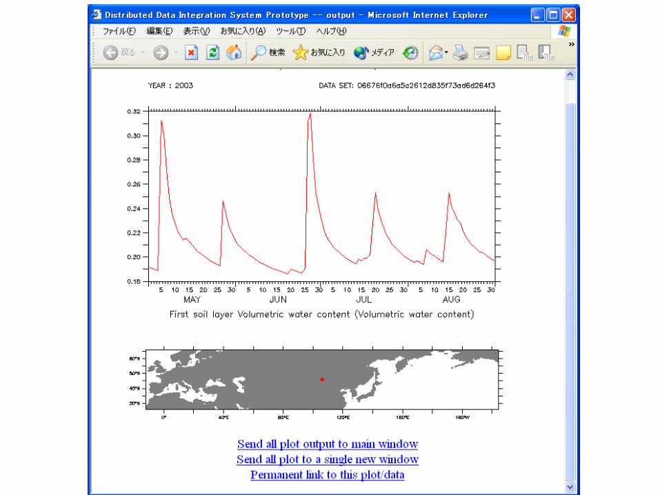
NWP – Numerical Weather Prediction data• MOLTS – Model Output Location Time Series (time ser
ies at model grid point nearest center of in-situ data sites).
• Gridded Model Output – 2D/3D time series.
Major National and Multi-National Centers• BoM, CPTEC, ECMWF, ECPC, JMA, DAO, GLDAS, N
CEP, NCMRWF, UKMO
Archived at the Max Planck Institute (Germany)

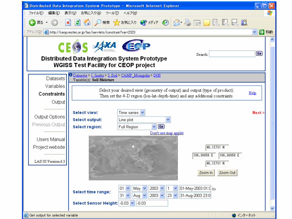
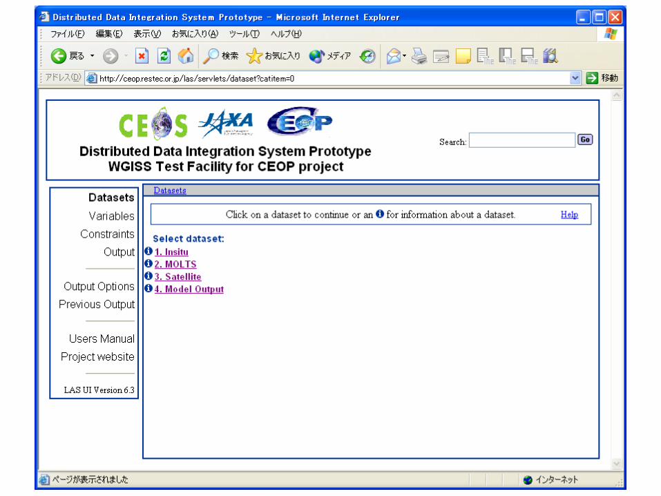
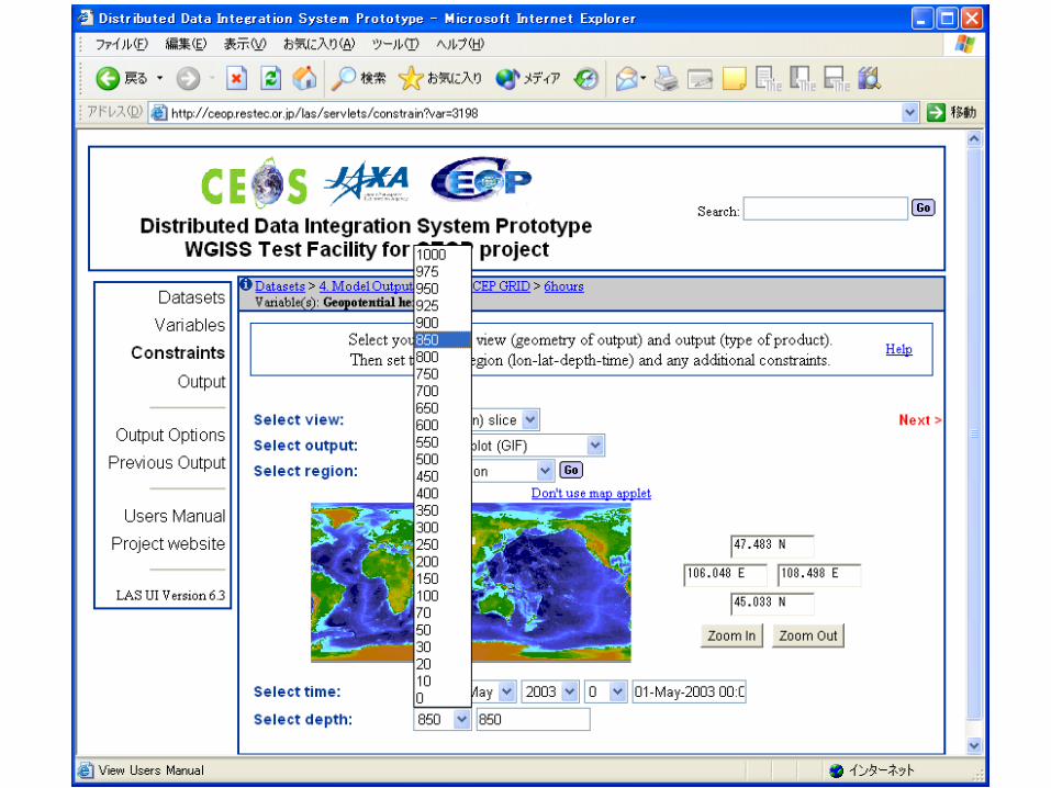
Live Access Server(LAS)
Ferret
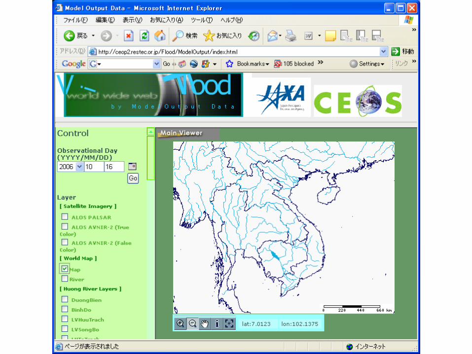
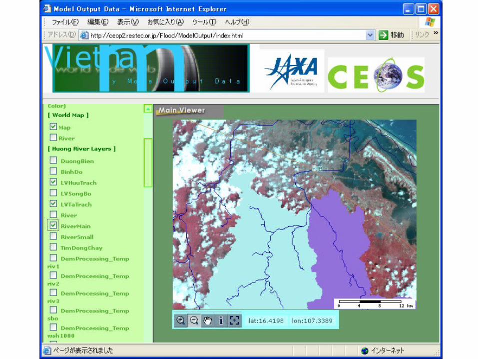
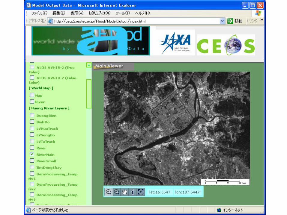
Web BrowserWTF-CEOP
JAXA Prototype System
CSDIC Archive
Satellite
(Japan)
DODS
UCAR Archive
In-situ
(U.S.)
DODS
MPI Archive MOLTS,
Model Output (Germany)
DODS
WTF-CEOP JAXA Prototype System(Coordinated Energy and water cycle Observation Project)


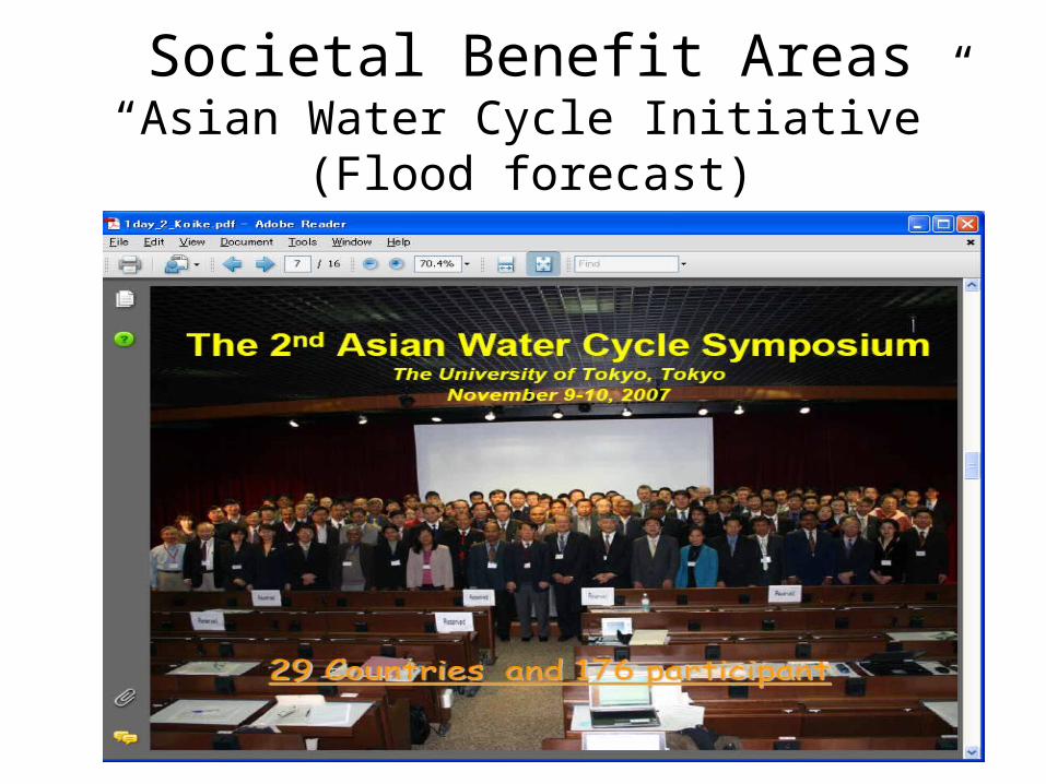
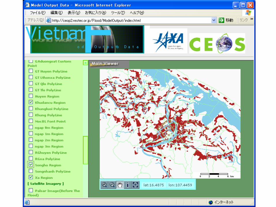
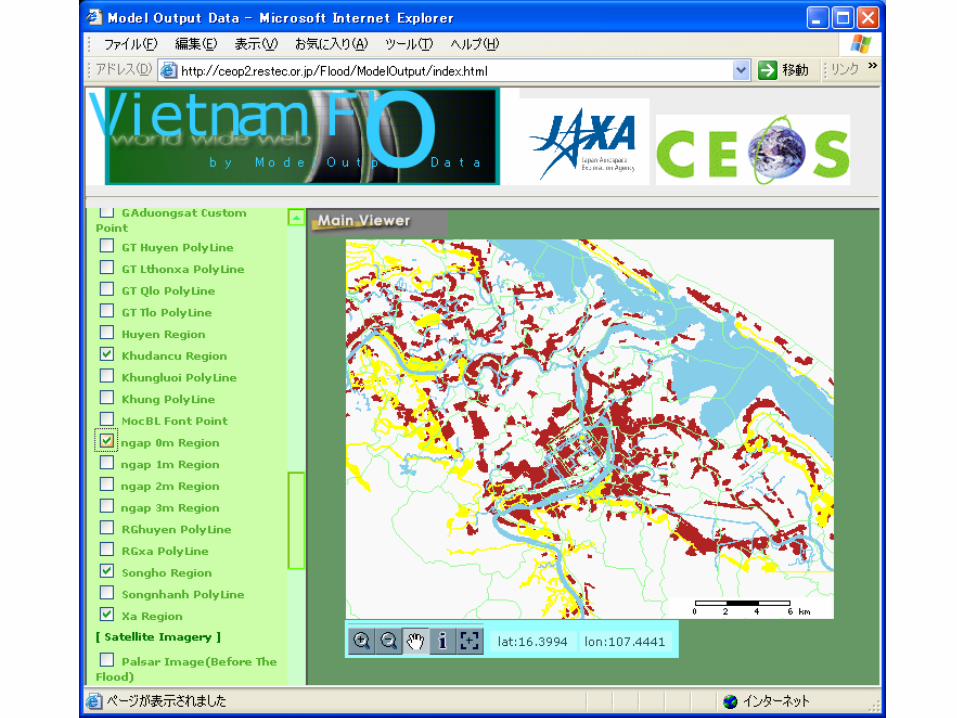
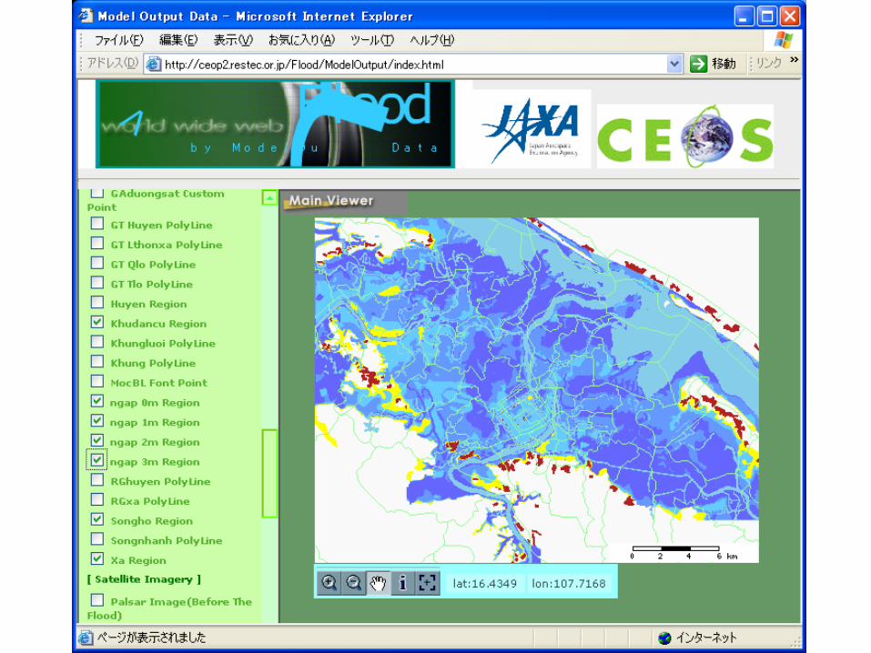
Societal Benefit Areas“Asian Water Cycle Initiative”
(Flood forecast)

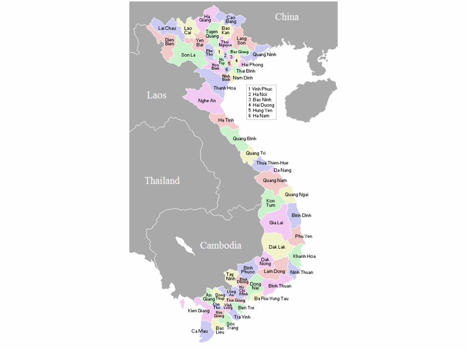
18 Countries, 29 River Basins(Vietnam – Huong River)


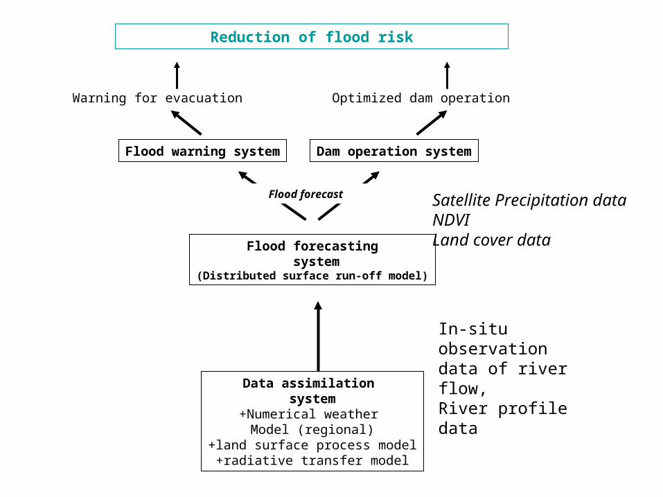
Data assimilation system
+Numerical weather Model (regional)
+land surface process model+radiative transfer model
Flood forecasting system
(Distributed surface run-off model)
Dam operation system
Reduction of flood risk
Warning for evacuation
Flood warning system
Optimized dam operation
Flood forecast Satellite Precipitation dataNDVILand cover data
In-situ observation data of river flow,River profile data

Hydrology Model Outputstreamflow at Kim Long
0
1000
2000
3000
4000
5000
6000
7000
8000
11/24 11/25 11/26 11/27 11/28 11/29 11/30
2004
m3/s
RAINGAUGE
OBS FLOW
HRM 24-h forecast, hourly
GPV 24-h forecast, 6-hourly
Rain = 0
HRM 24-h forecast, 6-hourly

Live Access Server(LAS)
Ferret
Web BrowserJAXA Prototype System
CSDIC Archive
Satellite
(Japan)
DODS
UCAR Archive
In-situ
(U.S.)
DODS
MPI Archive MOLTS,
Model Output (Germany)
DODS
Integrate WMS
WMSWeb
MappingClient
Filter


Possible scenarios1. Meteorological scenario – describe meteorological
conditions that caused heavy rainfall, put related data and images on JAXA Prototype System.
2. CEOP science scenario – information and data that is useful to CEOP scientists.
3. National Hydrometeorological Service of Vietnam – a scenario and data that would be useful to them.
4. Flood forecast scenario – information and GIS useful to decision makers (e.g. for issuing flood warnings, to determine inundation levels, etc.).
5. Evacuation scenario – evacuation, medical care, food, recovery, etc.