Embed Size (px)
Citation preview
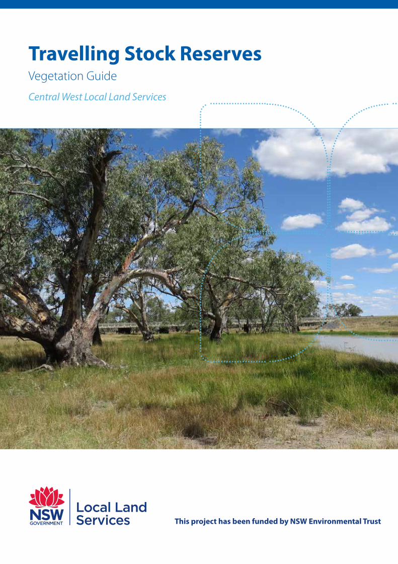
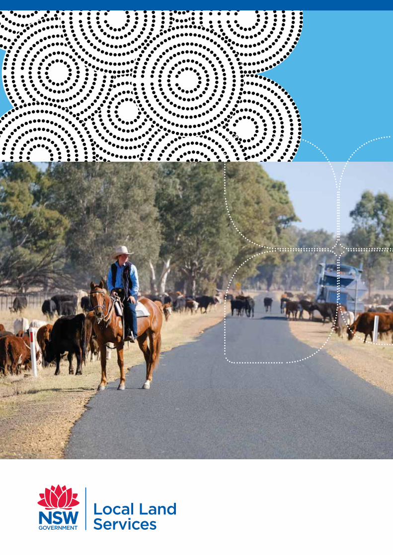
Travelling Stock Reserves Vegetation Guide
Central West Local Land Services
This project has been funded by NSW Environmental Trust
Central West Local Land Services Travelling Stock Reserve Vegetation Guide
Prepared for NSW Local Land Services
Report for: Local Land Services
Prepared by: Applied Ecology
Date: February 2020
Funded by: NSW Environmental Trust
This work draws heavily on material from the website of the Office of Environment and Heritage. The authors of this guide do not claim authorship, nor accept responsibility for, content drawn from this site.
Central West Local Land Services Travelling Stock Reserves | Vegetation Guide
1
2
4
5
7
Contents Vegetation in the Central West region
The Central West Local Land Services region
Vegetation classes
Floodplain transition woodlands
Western peneplain woodlands
Semi-arid floodplain grasslands
North-west floodplain woodlands
Riverine plain grasslands
Western slopes grasslands
Western Slopes Grassy Woodlands
Inland riverine forests
Riverine chenopod shrublands
Western slopes dry sclerophyll forests
Riverine plain woodlands
Pilliga outwash dry sclerophyll forests
Inland rocky hill woodlands
Inland floodplain swamps
Endangered and threatened ecological communities
Brigalow within the Brigalow Belt South, Nandewar and Darling Riverine Plains bioregions
Brigalow-Gidgee woodland/shrubland in the Mulga Lands and Darling Riverine Plains bioregions
Coolibah black box woodlands of the Northern Riverine Plains in the Darling Riverine Plains and Brigalow Belt South bioregions
Fuzzy box on alluvials of South West Slopes, Darling Riverine Plains and the Brigalow Belt South
Inland grey box woodland in the Riverina, NSW South Western Slopes, Cobar Peneplain, Nandewar and Brigalow Belt South bioregions
Native vegetation on cracking clay soils of the Liverpool Plains
Mallee and mallee-broombush dominated woodland and shrubland, lacking triodia, in the NSW South Western Slopes Bioregion (critically endangered)
Myall woodland in the Darling Riverine Plains, Brigalow Belt South, Cobar Peneplain, Murray-Darling Depression, Riverina and NSW South Western Slopes bioregions
White box yellow box Blakely’s red gum woodland
9
10
11
12
13
15
17
19
21
22
23
25
26
26
26
27
27
27
28
28
28
29
iv Central West Local Land Services Travelling Stock Reserves | Vegetation Guide
Table of fgures
Figure 1: The Central West Local Land Services region 1
Figure 2: Vegetation mapping for the Central West region 2
Figure 3: Legend for vegetation mapping in Central West Local Land Services region 2
Figure 4: Floodplain Transition Woodlands - Keith Class 5
Figure 5: Western Peneplain Woodlands - Keith Class 7
Figure 6: Semi-arid Floodplain grasslands - Keith Class 9
Figure 7: North-west Floodplain Woodlands - Keith Classs 10
Figure 8: Riverine Plain Grasslands - Keith Class 11
Figure 9: Western Slopes Grasslands - Keith Class 12
Figure 10: Western Slopes Grassy Woodlands - Keith Class 13
Figure 11: Inland Riverine Forests - Keith Class 15
Figure 12: Riverine Chenopod Shrublands - Keith Class 17
Figure 13: Western Slopes Dry Sclerophyll Forests - Keith Class 19
Figure 14: Riverine Plain Woodlands - Keith Class 21
Figure 15: Pilliga Outwash Dry Sclerophyll Forests - Keith Class 22
Figure 16: Inland Rocky Hill Woodlands - Keith Class 23
Figure 17: Inland Floodplain Swamps - Keith Class 25
1 Central West Local Land Services Travelling Stock Reserves | Vegetation Guide
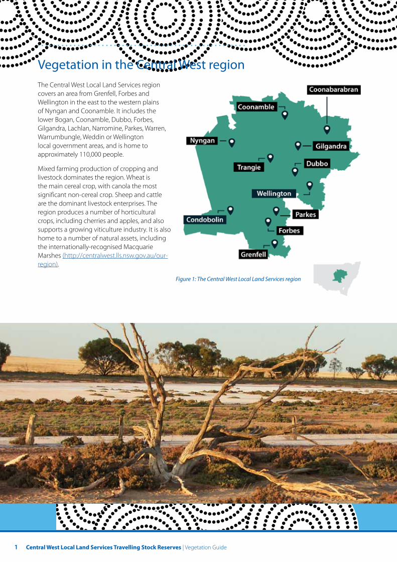
Vegetation in the Central West region The Central West Local Land Services region covers an area from Grenfell, Forbes and Wellington in the east to the western plains of Nyngan and Coonamble. It includes the lower Bogan, Coonamble, Dubbo, Forbes, Gilgandra, Lachlan, Narromine, Parkes, Warren, Warrumbungle, Weddin or Wellington local government areas, and is home to approximately 110,000 people.
Mixed farming production of cropping and livestock dominates the region. Wheat is the main cereal crop, with canola the most significant non-cereal crop. Sheep and cattle are the dominant livestock enterprises. The region produces a number of horticultural crops, including cherries and apples, and also supports a growing viticulture industry. It is also home to a number of natural assets, including the internationally-recognised Macquarie Marshes (http://centralwest.lls.nsw.gov.au/our-region).
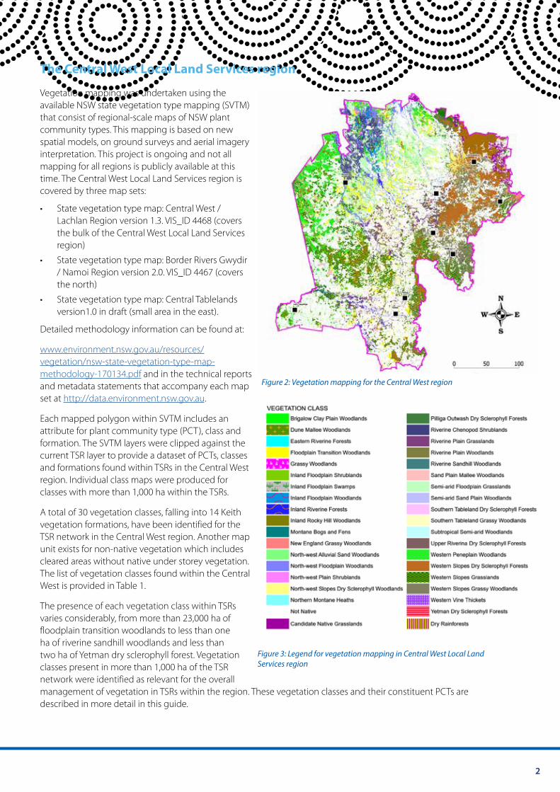
Figure 1: The Central West Local Land Services region
2
The Central West Local Land Services region
Vegetation mapping was undertaken using the available NSW state vegetation type mapping (SVTM) that consist of regional-scale maps of NSW plant community types. This mapping is based on new spatial models, on ground surveys and aerial imagery interpretation. This project is ongoing and not all mapping for all regions is publicly available at this time. The Central West Local Land Services region is covered by three map sets:
• State vegetation type map: Central West / Lachlan Region version 1.3. VIS_ID 4468 (covers the bulk of the Central West Local Land Services region)
• State vegetation type map: Border Rivers Gwydir / Namoi Region version 2.0. VIS_ID 4467 (covers the north)
• State vegetation type map: Central Tablelands version1.0 in draft (small area in the east).
Detailed methodology information can be found at:
www.environment.nsw.gov.au/resources/ vegetation/nsw-state-vegetation-type-map-methodology-170134.pdf and in the technical reports
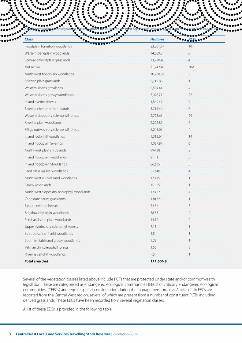
Figure 2: Vegetation mapping for the Central West region and metadata statements that accompany each map set at http://data.environment.nsw.gov.au.
Each mapped polygon within SVTM includes an attribute for plant community type (PCT), class and formation. The SVTM layers were clipped against the current TSR layer to provide a dataset of PCTs, classes and formations found within TSRs in the Central West region. Individual class maps were produced for classes with more than 1,000 ha within the TSRs.
A total of 30 vegetation classes, falling into 14 Keith vegetation formations, have been identified for the TSR network in the Central West region. Another map unit exists for non-native vegetation which includes cleared areas without native under storey vegetation. The list of vegetation classes found within the Central West is provided in Table 1.
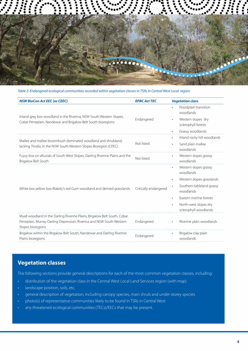
The presence of each vegetation class within TSRs varies considerably, from more than 23,000 ha of floodplain transition woodlands to less than one ha of riverine sandhill woodlands and less than two ha of Yetman dry sclerophyll forest. Vegetation Figure 3: Legend for vegetation mapping in Central West Local Land
classes present in more than 1,000 ha of the TSR Services region
network were identified as relevant for the overall management of vegetation in TSRs within the region. These vegetation classes and their constituent PCTs are described in more detail in this guide.
3 Central West Local Land Services Travelling Stock Reserves | Vegetation Guide
Table 1: Area reported for vegetation classes within TSRs in the Central West Local Land Services region, with number of PCTs in each class.
Class Hectares PCTs
Floodplain transition woodlands 23,301.67 10
Western peneplain woodlands 14,589.8 6
Semi-arid floodplain grasslands 13,730.48 4
Not native 11,242.46 N/A
North-west floodplain woodlands 10,768.38 5
Riverine plain grasslands 5,719.86 1
Western slopes grasslands 5,534.44 4
Western slopes grassy woodlands 5,078.27 22
Inland riverine forests 4,849.47 9
Riverine chenopod shrublands 3,715.44 6
Western slopes dry sclerophyll forests 2,723.61 29
Riverine plain woodlands 2,296.87 2
Pilliga outwash dry sclerophyll forests 2,043.05 4
Inland rocky hill woodlands 1,312.64 14
Inland floodplain Swamps 1,027.87 6
North-west plain shrublands 994.38 2
Inland floodplain woodlands 911.1 5
Inland floodplain Shrublands 662.35 5
Sand plain mallee woodlands 352.48 4
North-west alluvial sand woodlands 173.79 1
Grassy woodlands 151.85 1
North-west slopes dry sclerophyll woodlands 133.57 4
Candidate native grasslands 130.32 1
Eastern riverine forests 73.84 3
Brigalow clay plain woodlands 58.35 2
Semi-arid sand plain woodlands 14.12 2
Upper riverina dry sclerophyll forests 7.11 1
Subtropical semi-arid woodlands 5.5 1
Southern tableland grassy woodlands 2.23 1
Yetman dry sclerophyll forests 1.53 2
Riverine sandhill woodlands <0.1 1
Total area (ha) 111,606.8
Several of the vegetation classes listed above include PCTs that are protected under state and/or commonwealth legislation. These are categorised as endangered ecological communities (EECs) or critically endangered ecological communities (CEECs) and require special consideration during the management process. A total of six EECs are reported from the Central West region, several of which are present from a number of constituent PCTs, including derived grasslands. These EECs have been recorded from several vegetation classes.
A list of these EECs is provided in the following table.
4
Table 2: Endangered ecological communities recorded within vegetation classes in TSRs in Central West Local region.
NSW BioCon Act EEC (or CEEC) EPBC Act TEC Vegetation class
• Floodplain transition woodlands
Inland grey box woodland in the Riverina, NSW South Western Slopes, Endangered • Western slopes dry
Cobar Peneplain, Nandewar and Brigalow Belt South bioregions sclerophyll forests
• Grassy woodlands
• Inland rocky hill woodlands Mallee and mallee-broombush dominated woodland and shrubland,
Not listed • Sand plain malleelacking Triodia, in the NSW South Western Slopes Bioregion (CEEC) woodlands
Fuzzy box on alluvials of South West Slopes, Darling Riverine Plains and the • Western slopes grassy Not listed
Brigalow Belt South woodlands
• Western slopes grassy woodlands
• Western slopes grasslands
• Southern tableland grassy White box yellow box Blakely’s red Gum woodland and derived grasslands Critically endangered
woodlands
• Eastern riverine forests
• North-west slopes dry sclerophyll woodlands
Myall woodland in the Darling Riverine Plains, Brigalow Belt South, Cobar Peneplain, Murray-Darling Depression, Riverina and NSW South Western Endangered • Riverine plain woodlands Slopes bioregions
Brigalow within the Brigalow Belt South, Nandewar and Darling Riverine • Brigalow clay plain Endangered
Plains bioregions woodlands
Vegetation classes
The following sections provide general descriptions for each of the most common vegetation classes, including:
• distribution of the vegetation class in the Central West Local Land Services region (with map)
• landscape position, soils, etc.
• general description of vegetation, including canopy species, main shrub and under storey species
• photo(s) of representative communities likely to be found in TSRs in Central West
• any threatened ecological communities (TECs)/EECs that may be present.
5 Central West Local Land Services Travelling Stock Reserves | Vegetation Guide
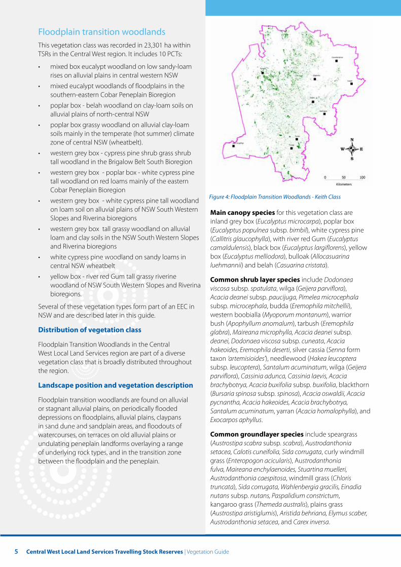
Floodplain transition woodlands This vegetation class was recorded in 23,301 ha within TSRs in the Central West region. It includes 10 PCTs:
• mixed box eucalypt woodland on low sandy-loam rises on alluvial plains in central western NSW
• mixed eucalypt woodlands of floodplains in the southern-eastern Cobar Peneplain Bioregion
• poplar box - belah woodland on clay-loam soils on alluvial plains of north-central NSW
• poplar box grassy woodland on alluvial clay-loam soils mainly in the temperate (hot summer) climate zone of central NSW (wheatbelt).
• western grey box - cypress pine shrub grass shrub tall woodland in the Brigalow Belt South Bioregion
• western grey box - poplar box - white cypress pine tall woodland on red loams mainly of the eastern Cobar Peneplain Bioregion
Figure 4: Floodplain Transition Woodlands - Keith Class • western grey box - white cypress pine tall woodland on loam soil on alluvial plains of NSW South Western Main canopy species for this vegetation class are Slopes and Riverina bioregions inland grey box (Eucalyptus microcarpa), poplar box
• western grey box tall grassy woodland on alluvial (Eucalyptus populnea subsp. bimbil), white cypress pine loam and clay soils in the NSW South Western Slopes (Callitris glaucophylla), with river red Gum (Eucalyptus and Riverina bioregions camaldulensis), black box (Eucalyptus largiflorens), yellow
• white cypress pine woodland on sandy loams in box (Eucalyptus melliodora), bulloak (Allocasuarina central NSW wheatbelt luehmannii) and belah (Casuarina cristata).
• yellow box - river red Gum tall grassy riverine Common shrub layer species include Dodonaea woodland of NSW South Western Slopes and Riverina viscosa subsp. spatulata, wilga (Geijera parviflora), bioregions. Acacia deanei subsp. paucijuga, Pimelea microcephala
Several of these vegetation types form part of an EEC in subsp. microcephala, budda (Eremophila mitchellii), NSW and are described later in this guide. western boobialla (Myoporum montanum), warrior
bush (Apophyllum anomalum), tarbush (Eremophila Distribution of vegetation class glabra), Maireana microphylla, Acacia deanei subsp.
deanei, Dodonaea viscosa subsp. cuneata, Acacia Floodplain Transition Woodlands in the Central hakeoides, Eremophila deserti, silver cassia (Senna form West Local Land Services region are part of a diverse taxon ‘artemisioides’), needlewood (Hakea leucoptera vegetation class that is broadly distributed throughout subsp. leucoptera), Santalum acuminatum, wilga (Geijera the region. parviflora), Cassinia adunca, Cassinia laevis, Acacia
Landscape position and vegetation description brachybotrya, Acacia buxifolia subsp. buxifolia, blackthorn (Bursaria spinosa subsp. spinosa), Acacia oswaldii, Acacia
Floodplain transition woodlands are found on alluvial pycnantha, Acacia hakeoides, Acacia brachybotrya, or stagnant alluvial plains, on periodically flooded Santalum acuminatum, yarran (Acacia homalophylla), and depressions on floodplains, alluvial plains, claypans Exocarpos aphyllus. in sand dune and sandplain areas, and floodouts of watercourses, on terraces on old alluvial plains or Common groundlayer species include speargrass undulating peneplain landforms overlaying a range (Austrostipa scabra subsp. scabra), Austrodanthonia of underlying rock types, and in the transition zone setacea, Calotis cuneifolia, Sida corrugata, curly windmill between the floodplain and the peneplain. grass (Enteropogon acicularis), Austrodanthonia
fulva, Maireana enchylaenoides, Stuartina muelleri, Austrodanthonia caespitosa, windmill grass (Chloris truncata), Sida corrugata, Wahlenbergia gracilis, Einadia nutans subsp. nutans, Paspalidium constrictum, kangaroo grass (Themeda australis), plains grass (Austrostipa aristiglumis), Aristida behriana, Elymus scaber, Austrodanthonia setacea, and Carex inversa.
6
Endangered ecological communities
EECs that may be present as part of this vegetation class include inland grey box woodland in the Riverina, NSW South Western Slopes, Cobar Peneplain, Nandewar and Brigalow Belt South bioregions, which are listed in NSW under the Biological Conservation Act 2015 and the Commonwealth Environmental Protection & Biodiversity Conservation Act 2000. Other EECs that are potentially present include Brigalow within the Brigalow Belt South, Nandewar and Darling Riverine Plains bioregions and Brigalow – Gidgee Woodland in the Brigalow Belt South, Nandewar and Darling Riverine Plains bioregions.
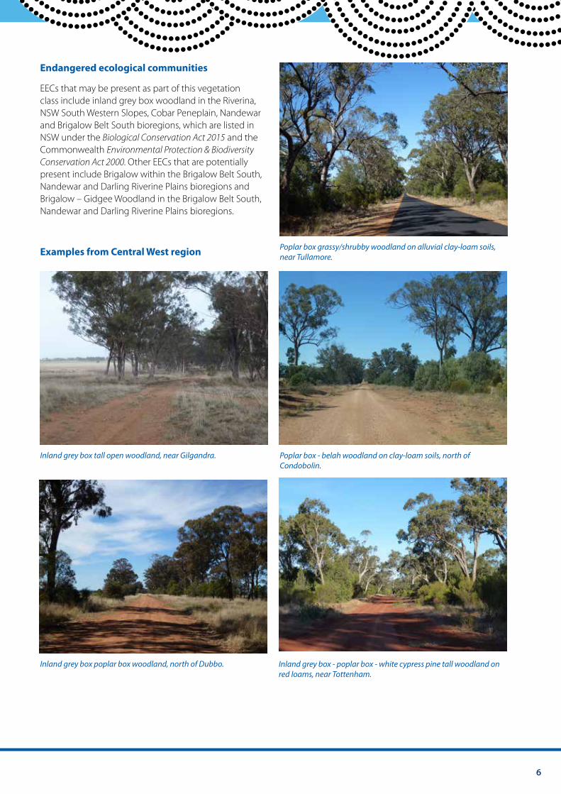
Poplar box grassy/shrubby woodland on alluvial clay-loam soils, Examples from Central West region near Tullamore.
Inland grey box tall open woodland, near Gilgandra. Poplar box - belah woodland on clay-loam soils, north of Condobolin.
Inland grey box poplar box woodland, north of Dubbo. Inland grey box - poplar box - white cypress pine tall woodland on red loams, near Tottenham.
7 Central West Local Land Services Travelling Stock Reserves | Vegetation Guide
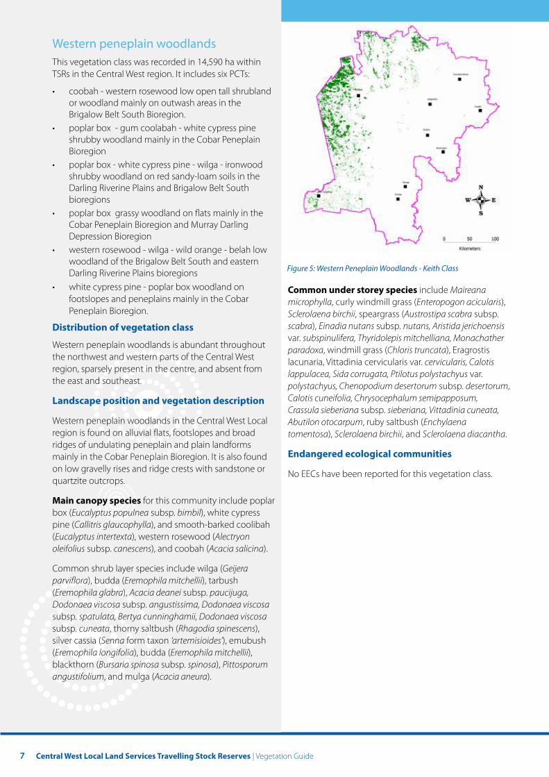
Western peneplain woodlands This vegetation class was recorded in 14,590 ha within TSRs in the Central West region. It includes six PCTs:
• coobah - western rosewood low open tall shrubland or woodland mainly on outwash areas in the Brigalow Belt South Bioregion.
• poplar box - gum coolabah - white cypress pine shrubby woodland mainly in the Cobar Peneplain Bioregion
• poplar box - white cypress pine - wilga - ironwood shrubby woodland on red sandy-loam soils in the Darling Riverine Plains and Brigalow Belt South bioregions
• poplar box grassy woodland on flats mainly in the Cobar Peneplain Bioregion and Murray Darling Depression Bioregion
• western rosewood - wilga - wild orange - belah low woodland of the Brigalow Belt South and eastern
Figure 5: Western Peneplain Woodlands - Keith Class Darling Riverine Plains bioregions • white cypress pine - poplar box woodland on Common under storey species include Maireana
footslopes and peneplains mainly in the Cobar microphylla, curly windmill grass (Enteropogon acicularis), Peneplain Bioregion. Sclerolaena birchii, speargrass (Austrostipa scabra subsp.
Distribution of vegetation class scabra), Einadia nutans subsp. nutans, Aristida jerichoensis var. subspinulifera, Thyridolepis mitchelliana, Monachather
Western peneplain woodlands is abundant throughout paradoxa, windmill grass (Chloris truncata), Eragrostis the northwest and western parts of the Central West lacunaria, Vittadinia cervicularis var. cervicularis, Calotis region, sparsely present in the centre, and absent from lappulacea, Sida corrugata, Ptilotus polystachyus var. the east and southeast. polystachyus, Chenopodium desertorum subsp. desertorum,
Landscape position and vegetation description Calotis cuneifolia, Chrysocephalum semipapposum, Crassula sieberiana subsp. sieberiana, Vittadinia cuneata,
Western peneplain woodlands in the Central West Local Abutilon otocarpum, ruby saltbush (Enchylaena region is found on alluvial flats, footslopes and broad tomentosa), Sclerolaena birchii, and Sclerolaena diacantha. ridges of undulating peneplain and plain landforms mainly in the Cobar Peneplain Bioregion. It is also found Endangered ecological communities on low gravelly rises and ridge crests with sandstone or No EECs have been reported for this vegetation class. quartzite outcrops.
Main canopy species for this community include poplar box (Eucalyptus populnea subsp. bimbil), white cypress pine (Callitris glaucophylla), and smooth-barked coolibah (Eucalyptus intertexta), western rosewood (Alectryon oleifolius subsp. canescens), and coobah (Acacia salicina).
Common shrub layer species include wilga (Geijera parviflora), budda (Eremophila mitchellii), tarbush (Eremophila glabra), Acacia deanei subsp. paucijuga, Dodonaea viscosa subsp. angustissima, Dodonaea viscosa subsp. spatulata, Bertya cunninghamii, Dodonaea viscosa subsp. cuneata, thorny saltbush (Rhagodia spinescens), silver cassia (Senna form taxon ‘artemisioides’), emubush (Eremophila longifolia), budda (Eremophila mitchellii), blackthorn (Bursaria spinosa subsp. spinosa), Pittosporum angustifolium, and mulga (Acacia aneura).
8
Examples from Central West Local region
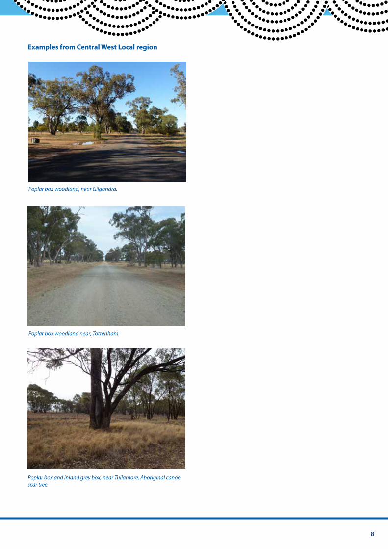
Poplar box woodland, near Gilgandra.
Poplar box woodland near, Tottenham.
Poplar box and inland grey box, near Tullamore; Aboriginal canoe scar tree.
9 Central West Local Land Services Travelling Stock Reserves | Vegetation Guide
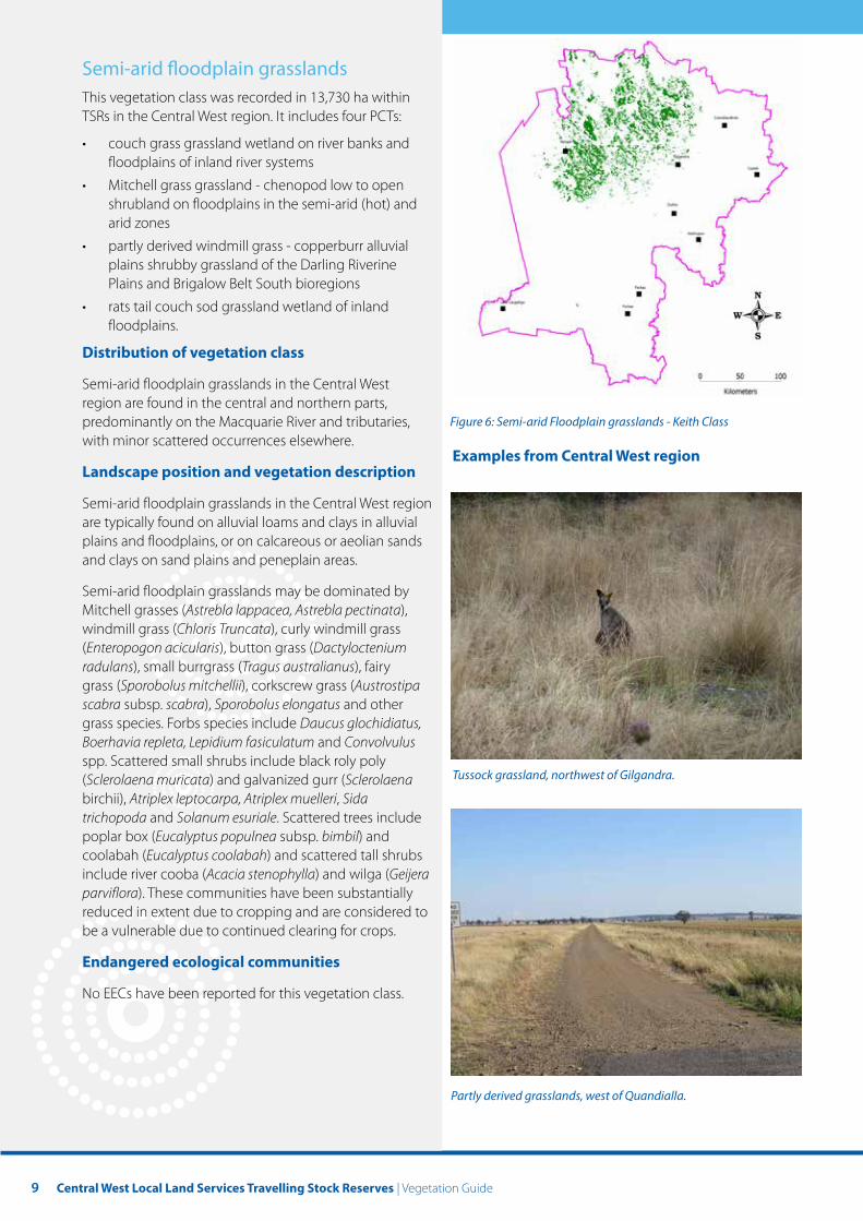
Semi-arid foodplain grasslands This vegetation class was recorded in 13,730 ha within TSRs in the Central West region. It includes four PCTs:
• couch grass grassland wetland on river banks and floodplains of inland river systems
• Mitchell grass grassland - chenopod low to open shrubland on floodplains in the semi-arid (hot) and arid zones
• partly derived windmill grass - copperburr alluvial plains shrubby grassland of the Darling Riverine Plains and Brigalow Belt South bioregions
• rats tail couch sod grassland wetland of inland floodplains.
Distribution of vegetation class
Semi-arid floodplain grasslands in the Central West region are found in the central and northern parts, predominantly on the Macquarie River and tributaries, Figure 6: Semi-arid Floodplain grasslands - Keith Class with minor scattered occurrences elsewhere.
Examples from Central West region Landscape position and vegetation description
Semi-arid floodplain grasslands in the Central West region are typically found on alluvial loams and clays in alluvial plains and floodplains, or on calcareous or aeolian sands and clays on sand plains and peneplain areas.
Semi-arid floodplain grasslands may be dominated by Mitchell grasses (Astrebla lappacea, Astrebla pectinata), windmill grass (Chloris Truncata), curly windmill grass (Enteropogon acicularis), button grass (Dactyloctenium radulans), small burrgrass (Tragus australianus), fairy grass (Sporobolus mitchellii), corkscrew grass (Austrostipa scabra subsp. scabra), Sporobolus elongatus and other grass species. Forbs species include Daucus glochidiatus, Boerhavia repleta, Lepidium fasiculatum and Convolvulus spp. Scattered small shrubs include black roly poly (Sclerolaena muricata) and galvanized gurr (Sclerolaena Tussock grassland, northwest of Gilgandra.
birchii), Atriplex leptocarpa, Atriplex muelleri, Sida trichopoda and Solanum esuriale. Scattered trees include poplar box (Eucalyptus populnea subsp. bimbil) and coolabah (Eucalyptus coolabah) and scattered tall shrubs include river cooba (Acacia stenophylla) and wilga (Geijera parviflora). These communities have been substantially reduced in extent due to cropping and are considered to be a vulnerable due to continued clearing for crops.
Endangered ecological communities
No EECs have been reported for this vegetation class.
Partly derived grasslands, west of Quandialla.
10
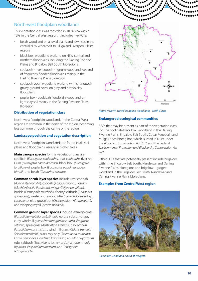
North-west foodplain woodlands This vegetation class was recorded in 10,768 ha within TSRs in the Central West region. It includes five PCTs:
• belah woodland on alluvial plains and low rises in the central NSW wheatbelt to Pilliga and Liverpool Plains regions
• black box woodland wetland on NSW central and northern floodplains including the Darling Riverine Plains and Brigalow Belt South bioregions.
• coolabah - river coobah - lignum woodland wetland of frequently flooded floodplains mainly in the Darling Riverine Plains Bioregion
• coolabah open woodland wetland with chenopod/ grassy ground cover on grey and brown clay floodplains
• poplar box - coolabah floodplain woodland on light clay soil mainly in the Darling Riverine Plains Bioregion.
Figure 7: North-west Floodplain Woodlands - Keith Classs Distribution of vegetation class
North-west floodplain woodlands in the Central West Endangered ecological communities region are common in the north of the region, becoming EECs that may be present as part of this vegetation class less common through the centre of the region. include coolibah-black box woodland in the Darling
Landscape position and vegetation description Riverine Plains, Brigalow Belt South, Cobar Peneplain and Mulga Lands bioregions, which is listed in NSW under
North-west floodplain woodlands are found in alluvial the Biological Conservation Act 2015 and the Federal plains and floodplains, usually in higher areas. Environmental Protection and Biodiversity Conservation Act
2000. Main canopy species for this vegetation class are coolibah (Eucalyptus coolabah subsp. coolabah), river red Other EECs that are potentially present include brigalow Gum (Eucalyptus camaldulensis), black box (Eucalyptus within the Brigalow Belt South, Nandewar and Darling largiflorens), poplar box (Eucalyptus populnea subsp. Riverine Plains bioregions and brigalow – gidgee bimbil), and belah (Casuarina cristata). woodland in the Brigalow Belt South, Nandewar and
Darling Riverine Plains bioregions. Common shrub layer species include river coobah (Acacia stenophylla), coobah (Acacia salicina), lignum Examples from Central West region (Muehlenbeckia florulenta), wilga (Geijera parviflora), budda (Eremophila mitchellii), thorny saltbush (Rhagodia spinescens), western rosewood (Alectryon oleifolius subsp. canescens), nitre goosefoot (Chenopodium nitrariaceum), and weeping myall (Acacia pendula).
Common ground layer species include Warrego grass (Paspalidium jubiflorum), Einadia nutans subsp. nutans, curly windmill grass (Enteropogon acicularis), Eragrostis setifolia, speargrass (Austrostipa scabra subsp. scabra), Paspalidium constrictum, windmill grass (Chloris truncata), Sclerolaena birchii, black roly poly (Sclerolaena muricata), Oxalis chnoodes, Goodenia fascicularis, Abutilon oxycarpum, ruby saltbush (Enchylaena tomentosa), Austrodanthonia bipartita, Paspalidium aversum, and Tetragonia tetragonioides.
Coolabah woodland, south of Walgett.
11 Central West Local Land Services Travelling Stock Reserves | Vegetation Guide
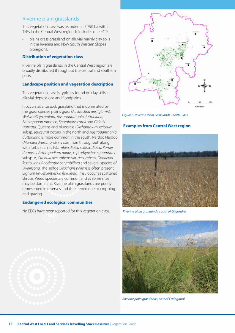
Riverine plain grasslands This vegetation class was recorded in 5,790 ha within TSRs in the Central West region. It includes one PCT:
• plains grass grassland on alluvial mainly clay soils in the Riverina and NSW South Western Slopes bioregions.
Distribution of vegetation class
Riverine plain grasslands in the Central West region are broadly distributed throughout the central and southern parts.
Landscape position and vegetation description
This vegetation class is typically found on clay soils in alluvial depressions and floodplains.
It occurs as a tussock grassland that is dominated by the grass species plains grass (Austrostipa aristiglumis), Walwhalleya proluta, Austrodanthonia duttoniana, Enteropogon ramosus, Sporobolus caroli and Chloris truncata. Queensland bluegrass (Dichanthium sericeum subsp. sericeum) occurs in the north and Austrodanthonia duttoniana is more common in the south. Nardoo Nardoo (Marsilea drummondii) is common throughout, along with forbs such as Wurmbea dioica subsp. dioica, Rumex dumosus, Arthropodium minus, Leptorhynchos squamatus subsp. A, Crassula decumbens var. decumbens, Goodenia fascicularis, Rhodanthe corymbiflora and several species of Swainsona. The sedge Eleocharis pallens is often present. Lignum (Muehlenbeckia florulenta) may occur as scattered shrubs. Weed species are common and at some sites may be dominant. Riverine plain grasslands are poorly represented in reserves and threatened due to cropping and grazing.
Endangered ecological communities
No EECs have been reported for this vegetation class.
Figure 8: Riverine Plain Grasslands - Keith Class
Examples from Central West region
Riverine plain grasslands, south of Gilgandra.
Riverine plain grasslands, east of Cadagabal.
12
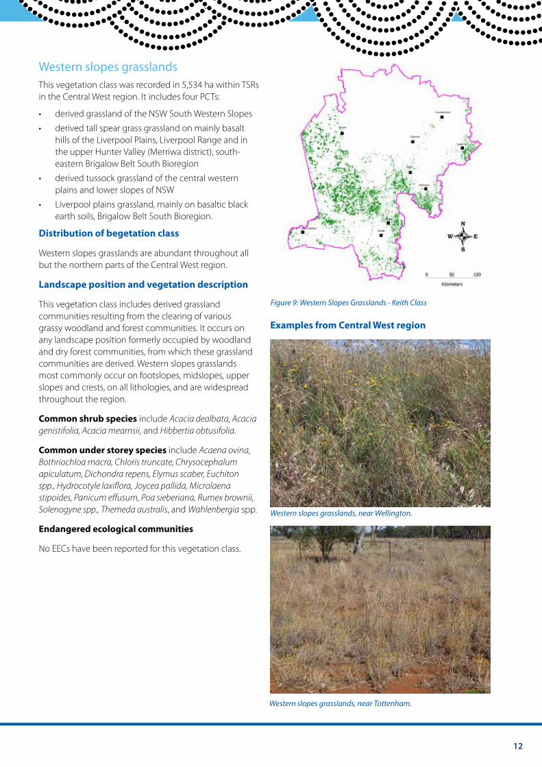
Western slopes grasslands This vegetation class was recorded in 5,534 ha within TSRs in the Central West region. It includes four PCTs:
• derived grassland of the NSW South Western Slopes
• derived tall spear grass grassland on mainly basalt hills of the Liverpool Plains, Liverpool Range and in the upper Hunter Valley (Merriwa district), south-eastern Brigalow Belt South Bioregion
• derived tussock grassland of the central western plains and lower slopes of NSW
• Liverpool plains grassland, mainly on basaltic black earth soils, Brigalow Belt South Bioregion.
Distribution of begetation class
Western slopes grasslands are abundant throughout all but the northern parts of the Central West region.
Landscape position and vegetation description
This vegetation class includes derived grassland Figure 9: Western Slopes Grasslands - Keith Class
communities resulting from the clearing of various grassy woodland and forest communities. It occurs on Examples from Central West region any landscape position formerly occupied by woodland and dry forest communities, from which these grassland communities are derived. Western slopes grasslands most commonly occur on footslopes, midslopes, upper slopes and crests, on all lithologies, and are widespread throughout the region.
Common shrub species include Acacia dealbata, Acacia genistifolia, Acacia mearnsii, and Hibbertia obtusifolia.
Common under storey species include Acaena ovina, Bothriochloa macra, Chloris truncate, Chrysocephalum apiculatum, Dichondra repens, Elymus scaber, Euchiton spp., Hydrocotyle laxiflora, Joycea pallida, Microlaena stipoides, Panicum effusum, Poa sieberiana, Rumex brownii, Solenogyne spp., Themeda australis, and Wahlenbergia spp. Western slopes grasslands, near Wellington.
Endangered ecological communities
No EECs have been reported for this vegetation class.
Western slopes grasslands, near Tottenham.
13 Central West Local Land Services Travelling Stock Reserves | Vegetation Guide
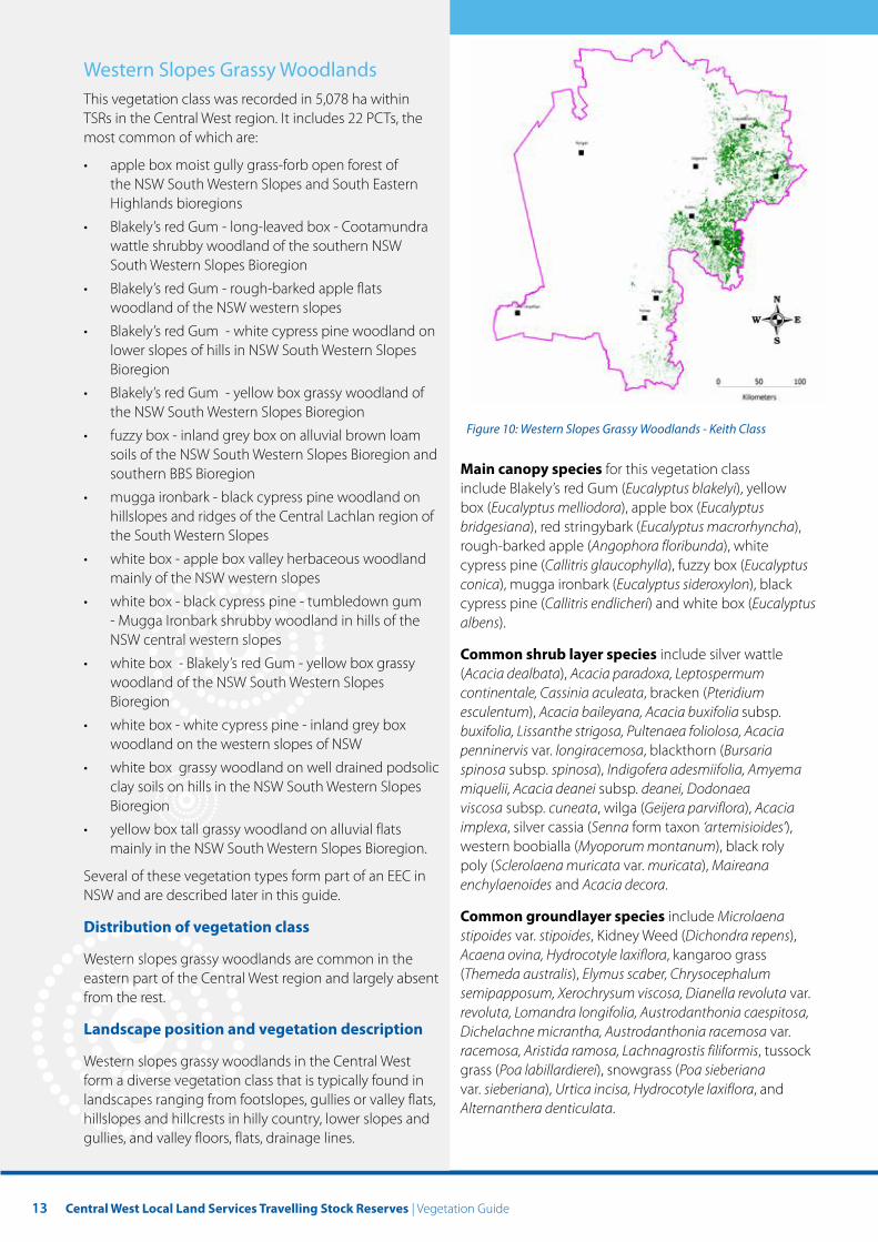
Western Slopes Grassy Woodlands This vegetation class was recorded in 5,078 ha within TSRs in the Central West region. It includes 22 PCTs, the most common of which are:
• apple box moist gully grass-forb open forest of the NSW South Western Slopes and South Eastern Highlands bioregions
• Blakely’s red Gum - long-leaved box - Cootamundra wattle shrubby woodland of the southern NSW South Western Slopes Bioregion
• Blakely’s red Gum - rough-barked apple flats woodland of the NSW western slopes
• Blakely’s red Gum - white cypress pine woodland on lower slopes of hills in NSW South Western Slopes Bioregion
• Blakely’s red Gum - yellow box grassy woodland of the NSW South Western Slopes Bioregion
Figure 10: Western Slopes Grassy Woodlands - Keith Class • fuzzy box - inland grey box on alluvial brown loam soils of the NSW South Western Slopes Bioregion and
for this vegetation class southern BBS Bioregion Main canopy speciesinclude Blakely’s red Gum (Eucalyptus blakelyi), yellow • mugga ironbark - black cypress pine woodland on box (Eucalyptus melliodora), apple box (Eucalyptus hillslopes and ridges of the Central Lachlan region of bridgesiana), red stringybark (Eucalyptus macrorhyncha), the South Western Slopes rough-barked apple (Angophora floribunda), white
• white box - apple box valley herbaceous woodland cypress pine (Callitris glaucophylla), fuzzy box (Eucalyptus mainly of the NSW western slopes conica), mugga ironbark (Eucalyptus sideroxylon), black
• white box - black cypress pine - tumbledown gum cypress pine (Callitris endlicheri) and white box (Eucalyptus - Mugga Ironbark shrubby woodland in hills of the albens). NSW central western slopes
Common shrub layer species include silver wattle • white box - Blakely’s red Gum - yellow box grassy (Acacia dealbata), Acacia paradoxa, Leptospermum woodland of the NSW South Western Slopes continentale, Cassinia aculeata, bracken (Pteridium Bioregion esculentum), Acacia baileyana, Acacia buxifolia subsp.
• white box - white cypress pine - inland grey box buxifolia, Lissanthe strigosa, Pultenaea foliolosa, Acacia woodland on the western slopes of NSW penninervis var. longiracemosa, blackthorn (Bursaria
• white box grassy woodland on well drained podsolic spinosa subsp. spinosa), Indigofera adesmiifolia, Amyema clay soils on hills in the NSW South Western Slopes miquelii, Acacia deanei subsp. deanei, Dodonaea Bioregion viscosa subsp. cuneata, wilga (Geijera parviflora), Acacia
• yellow box tall grassy woodland on alluvial flats implexa, silver cassia (Senna form taxon ‘artemisioides’), mainly in the NSW South Western Slopes Bioregion. western boobialla (Myoporum montanum), black roly
poly (Sclerolaena muricata var. muricata), Maireana Several of these vegetation types form part of an EEC in enchylaenoides and Acacia decora. NSW and are described later in this guide.
Common groundlayer species include Microlaena Distribution of vegetation class stipoides var. stipoides, Kidney Weed (Dichondra repens),
Western slopes grassy woodlands are common in the Acaena ovina, Hydrocotyle laxiflora, kangaroo grass
eastern part of the Central West region and largely absent (Themeda australis), Elymus scaber, Chrysocephalum
from the rest. semipapposum, Xerochrysum viscosa, Dianella revoluta var. revoluta, Lomandra longifolia, Austrodanthonia caespitosa,
Landscape position and vegetation description Dichelachne micrantha, Austrodanthonia racemosa var. racemosa, Aristida ramosa, Lachnagrostis filiformis, tussock
Western slopes grassy woodlands in the Central West grass (Poa labillardierei), snowgrass (Poa sieberiana form a diverse vegetation class that is typically found in var. sieberiana), Urtica incisa, Hydrocotyle laxiflora, and landscapes ranging from footslopes, gullies or valley flats, Alternanthera denticulata. hillslopes and hillcrests in hilly country, lower slopes and gullies, and valley floors, flats, drainage lines.
14
Endangered ecological communities:
White box yellow box Blakely’s red Gum woodland, a CEEC listed in NSW under the Biodiversity Conservation Act 2015 and the Commonwealth Environmental Protection and Biodiversity Conservation Act 2000, is included in this vegetation class.
Fuzzy box on alluvials of South West Slopes, Darling Riverine Plains and the Brigalow Belt South, an EEC listed under the Biodiversity Conservation Act 2015, is included in this vegetation class.
Native vegetation on cracking clay soils of the Liverpool Plains is another EEC listed under the Biodiversity Conservation Act 2015 that is in this vegetation class.
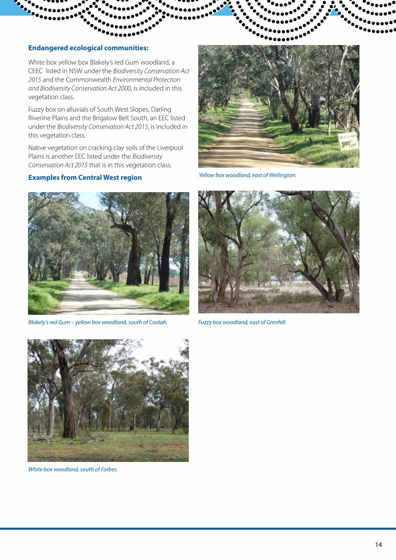
Examples from Central West region Yellow box woodland, east of Wellington.
Blakely’s red Gum – yellow box woodland, south of Coolah. Fuzzy box woodland, east of Grenfell.
White box woodland, south of Forbes.
15 Central West Local Land Services Travelling Stock Reserves | Vegetation Guide
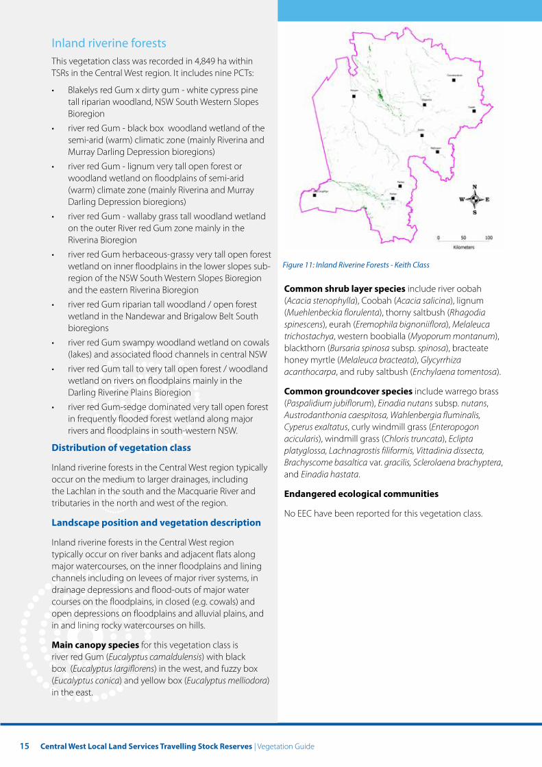
Inland riverine forests This vegetation class was recorded in 4,849 ha within TSRs in the Central West region. It includes nine PCTs:
• Blakelys red Gum x dirty gum - white cypress pine tall riparian woodland, NSW South Western Slopes Bioregion
• river red Gum - black box woodland wetland of the semi-arid (warm) climatic zone (mainly Riverina and Murray Darling Depression bioregions)
• river red Gum - lignum very tall open forest or woodland wetland on floodplains of semi-arid (warm) climate zone (mainly Riverina and Murray Darling Depression bioregions)
• river red Gum - wallaby grass tall woodland wetland on the outer River red Gum zone mainly in the Riverina Bioregion
• river red Gum herbaceous-grassy very tall open forest wetland on inner floodplains in the lower slopes sub- Figure 11: Inland Riverine Forests - Keith Class
region of the NSW South Western Slopes Bioregion and the eastern Riverina Bioregion Common shrub layer species include river oobah
(Acacia stenophylla), Coobah (Acacia salicina), lignum • river red Gum riparian tall woodland / open forest (Muehlenbeckia florulenta), thorny saltbush (Rhagodia wetland in the Nandewar and Brigalow Belt South spinescens), eurah (Eremophila bignoniiflora), Melaleuca bioregions trichostachya, western boobialla (Myoporum montanum),
• river red Gum swampy woodland wetland on cowals blackthorn (Bursaria spinosa subsp. spinosa), bracteate (lakes) and associated flood channels in central NSW honey myrtle (Melaleuca bracteata), Glycyrrhiza
• river red Gum tall to very tall open forest / woodland acanthocarpa, and ruby saltbush (Enchylaena tomentosa). wetland on rivers on floodplains mainly in the Darling Riverine Plains Bioregion Common groundcover species include warrego brass
(Paspalidium jubiflorum), Einadia nutans subsp. nutans, • river red Gum-sedge dominated very tall open forest Austrodanthonia caespitosa, Wahlenbergia fluminalis, in frequently flooded forest wetland along major Cyperus exaltatus, curly windmill grass (Enteropogon rivers and floodplains in south-western NSW. acicularis), windmill grass (Chloris truncata), Eclipta
Distribution of vegetation class platyglossa, Lachnagrostis filiformis, Vittadinia dissecta, Brachyscome basaltica var. gracilis, Sclerolaena brachyptera, Inland riverine forests in the Central West region typically and Einadia hastata. occur on the medium to larger drainages, including
the Lachlan in the south and the Macquarie River and Endangered ecological communities tributaries in the north and west of the region.
No EEC have been reported for this vegetation class. Landscape position and vegetation description
Inland riverine forests in the Central West region typically occur on river banks and adjacent flats along major watercourses, on the inner floodplains and lining channels including on levees of major river systems, in drainage depressions and flood-outs of major water courses on the floodplains, in closed (e.g. cowals) and open depressions on floodplains and alluvial plains, and in and lining rocky watercourses on hills.
Main canopy species for this vegetation class is river red Gum (Eucalyptus camaldulensis) with black box (Eucalyptus largiflorens) in the west, and fuzzy box (Eucalyptus conica) and yellow box (Eucalyptus melliodora) in the east.
16
Examples from Central West region
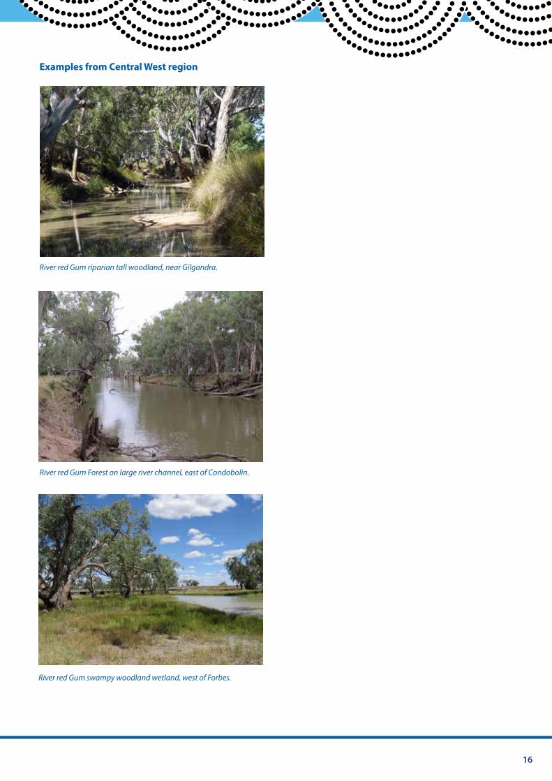
River red Gum riparian tall woodland, near Gilgandra.
River red Gum Forest on large river channel, east of Condobolin.
River red Gum swampy woodland wetland, west of Forbes.
17 Central West Local Land Services Travelling Stock Reserves | Vegetation Guide
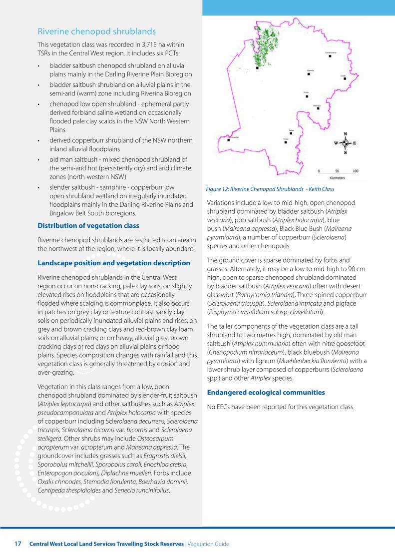
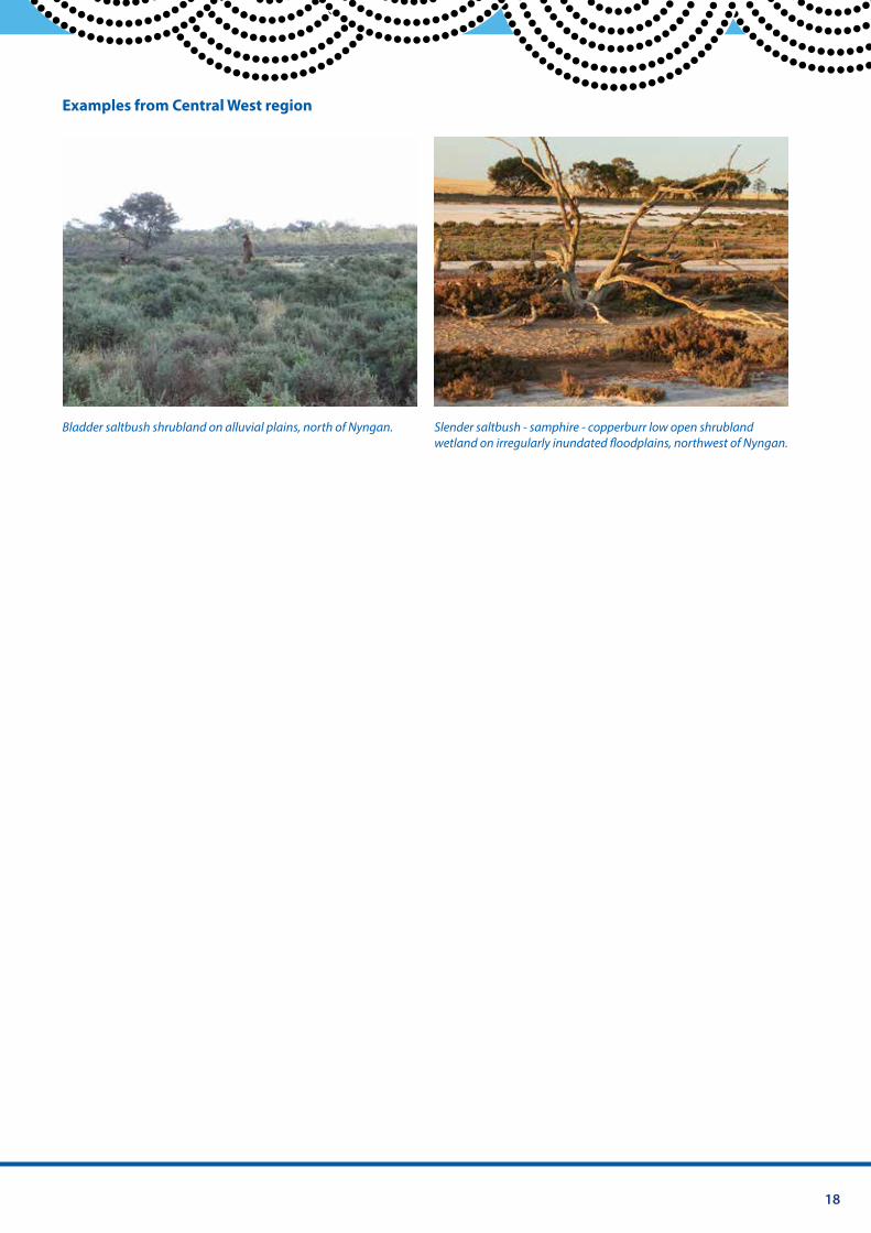
Riverine chenopod shrublands This vegetation class was recorded in 3,715 ha within TSRs in the Central West region. It includes six PCTs:
• bladder saltbush chenopod shrubland on alluvial plains mainly in the Darling Riverine Plain Bioregion
• bladder saltbush shrubland on alluvial plains in the semi-arid (warm) zone including Riverina Bioregion
• chenopod low open shrubland - ephemeral partly derived forbland saline wetland on occasionally flooded pale clay scalds in the NSW North Western Plains
• derived copperburr shrubland of the NSW northern inland alluvial floodplains
• old man saltbush - mixed chenopod shrubland of the semi-arid hot (persistently dry) and arid climate zones (north-western NSW)
• slender saltbush - samphire - copperburr low Figure 12: Riverine Chenopod Shrublands - Keith Class open shrubland wetland on irregularly inundated floodplains mainly in the Darling Riverine Plains and Variations include a low to mid-high, open chenopod
Brigalow Belt South bioregions. shrubland dominated by bladder saltbush (Atriplex vesicaria), pop saltbush (Atriplex holocarpa), blue
Distribution of vegetation class bush (Maireana appressa), Black Blue Bush (Maireana pyramidata), a number of copperburr (Sclerolaena) Riverine chenopod shrublands are restricted to an area in species and other chenopods. the northwest of the region, where it is locally abundant.
Landscape position and vegetation description The ground cover is sparse dominated by forbs and grasses. Alternately, it may be a low to mid-high to 90 cm
Riverine chenopod shrublands in the Central West high, open to sparse chenopod shrubland dominated region occur on non-cracking, pale clay soils, on slightly by bladder saltbush (Atriplex vesicaria) often with desert elevated rises on floodplains that are occasionally glasswort (Pachycornia triandra), Three-spined copperburr flooded where scalding is commonplace. It also occurs (Sclerolaena tricuspis), Sclerolaena intricata and pigface in patches on grey clay or texture contrast sandy clay (Disphyma crassifolium subsp. clavellatum). soils on periodically inundated alluvial plains and rises; on
The taller components of the vegetation class are a tall grey and brown cracking clays and red-brown clay loam shrubland to two metres high, dominated by old man soils on alluvial plains; or on heavy, alluvial grey, brown saltbush (Atriplex nummularia) often with nitre goosefoot cracking clays or red clays on alluvial plains or flood (Chenopodium nitrariaceum), black bluebush (Maireana plains. Species composition changes with rainfall and this pyramidata) with lignum (Muehlenbeckia florulenta) with a vegetation class is generally threatened by erosion and lower shrub layer composed of copperburrs (Sclerolaena over-grazing. spp.) and other Atriplex species.
Vegetation in this class ranges from a low, open Endangered ecological communities chenopod shrubland dominated by slender-fruit saltbush
(Atriplex leptocarpa) and other saltbushes such as Atriplex No EECs have been reported for this vegetation class. pseudocampanulata and Atriplex holocarpa with species of copperburr including Sclerolaena decurrens, Sclerolaena tricuspis, Sclerolaena bicornis var. bicornis and Sclerolaena stelligera. Other shrubs may include Osteocarpum acropterum var. acropterum and Maireana appressa. The groundcover includes grasses such as Eragrostis dielsii, Sporobolus mitchellii, Sporobolus caroli, Eriochloa crebra, Enteropogon acicularis, Diplachne muelleri. Forbs include Oxalis chnoodes, Stemodia florulenta, Boerhavia dominii, Centipeda thespidioides and Senecio runcinifolius.
18
Examples from Central West region
Bladder saltbush shrubland on alluvial plains, north of Nyngan. Slender saltbush - samphire - copperburr low open shrubland wetland on irregularly inundated foodplains, northwest of Nyngan.
19 Central West Local Land Services Travelling Stock Reserves | Vegetation Guide
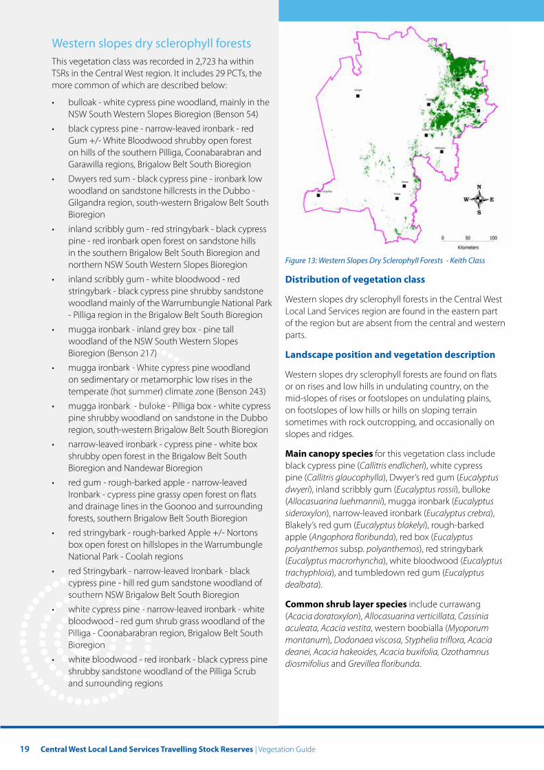
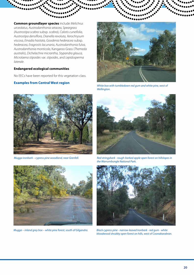
Western slopes dry sclerophyll forests This vegetation class was recorded in 2,723 ha within TSRs in the Central West region. It includes 29 PCTs, the more common of which are described below:
• bulloak - white cypress pine woodland, mainly in the NSW South Western Slopes Bioregion (Benson 54)
• black cypress pine - narrow-leaved ironbark - red Gum +/- White Bloodwood shrubby open forest on hills of the southern Pilliga, Coonabarabran and Garawilla regions, Brigalow Belt South Bioregion
• Dwyers red sum - black cypress pine - ironbark low woodland on sandstone hillcrests in the Dubbo - Gilgandra region, south-western Brigalow Belt South Bioregion
• inland scribbly gum - red stringybark - black cypress pine - red ironbark open forest on sandstone hills in the southern Brigalow Belt South Bioregion and
Figure 13: Western Slopes Dry Sclerophyll Forests - Keith Class northern NSW South Western Slopes Bioregion
• inland scribbly gum - white bloodwood - red Distribution of vegetation class stringybark - black cypress pine shrubby sandstone
Western slopes dry sclerophyll forests in the Central West woodland mainly of the Warrumbungle National Park Local Land Services region are found in the eastern part - Pilliga region in the Brigalow Belt South Bioregion of the region but are absent from the central and western
• mugga ironbark - inland grey box - pine tall parts. woodland of the NSW South Western Slopes Bioregion (Benson 217) Landscape position and vegetation description
• mugga ironbark - White cypress pine woodland Western slopes dry sclerophyll forests are found on flats on sedimentary or metamorphic low rises in the or on rises and low hills in undulating country, on the temperate (hot summer) climate zone (Benson 243) mid-slopes of rises or footslopes on undulating plains,
• mugga ironbark - buloke - Pilliga box - white cypress on footslopes of low hills or hills on sloping terrain pine shrubby woodland on sandstone in the Dubbo sometimes with rock outcropping, and occasionally on region, south-western Brigalow Belt South Bioregion slopes and ridges.
• narrow-leaved ironbark - cypress pine - white box shrubby open forest in the Brigalow Belt South Main canopy species for this vegetation class include
Bioregion and Nandewar Bioregion black cypress pine (Callitris endlicheri), white cypress pine (Callitris glaucophylla), Dwyer’s red gum (Eucalyptus • red gum - rough-barked apple - narrow-leaved dwyeri), inland scribbly gum (Eucalyptus rossii), bulloke Ironbark - cypress pine grassy open forest on flats (Allocasuarina luehmannii), mugga ironbark (Eucalyptus and drainage lines in the Goonoo and surrounding sideroxylon), narrow-leaved ironbark (Eucalyptus crebra), forests, southern Brigalow Belt South Bioregion Blakely’s red gum (Eucalyptus blakelyi), rough-barked
• red stringybark - rough-barked Apple +/- Nortons apple (Angophora floribunda), red box (Eucalyptus box open forest on hillslopes in the Warrumbungle polyanthemos subsp. polyanthemos), red stringybark National Park - Coolah regions (Eucalyptus macrorhyncha), white bloodwood (Eucalyptus
• red Stringybark - narrow-leaved Ironbark - black trachyphloia), and tumbledown red gum (Eucalyptus cypress pine - hill red gum sandstone woodland of dealbata). southern NSW Brigalow Belt South Bioregion
Common shrub layer species include currawang • white cypress pine - narrow-leaved ironbark - white (Acacia doratoxylon), Allocasuarina verticillata, Cassinia bloodwood - red gum shrub grass woodland of the aculeata, Acacia vestita, western boobialla (Myoporum Pilliga - Coonabarabran region, Brigalow Belt South montanum), Dodonaea viscosa, Styphelia triflora, Acacia Bioregion deanei, Acacia hakeoides, Acacia buxifolia, Ozothamnus
• white bloodwood - red ironbark - black cypress pine diosmifolius and Grevillea floribunda. shrubby sandstone woodland of the Pilliga Scrub and surrounding regions
20
Common groundlayer species include Melichrus urceolatus, Austrodanthonia setacea, Speargrass (Austrostipa scabra subsp. scabra), Calotis cuneifolia, Austrostipa densiflora, Dianella revoluta, Xerochrysum viscosa, Einadia hastata, Goodenia hederacea subsp. hederacea, Eragrostis lacunaria, Austrodanthonia fulva, Austrodanthonia monticola, Kangaroo Grass (Themeda australis), Dichelachne micrantha, Stypandra glauca, Microlaena stipoides var. stipoides, and Lepidosperma laterale.
Endangered ecological communities
No EECs have been reported for this vegetation class.
Examples from Central West region White box with tumbledown red gum and white pine, west of Wellington.
Mugga ironbark – cypress pine woodland, near Grenfell. Red stringybark - rough-barked apple open forest on hillslopes in the Warrumbungle National Park.
Mugga – inland grey box – white pine forest, south of Gilgandra. Black cypress pine - narrow-leaved Ironbark - red gum - white bloodwood shrubby open forest on hills, west of Coonabarabran.
21 Central West Local Land Services Travelling Stock Reserves | Vegetation Guide
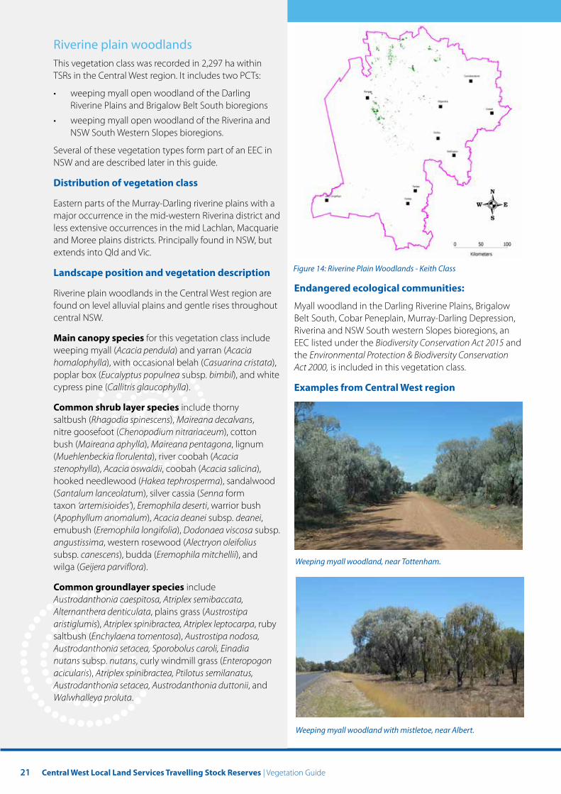
Riverine plain woodlands This vegetation class was recorded in 2,297 ha within TSRs in the Central West region. It includes two PCTs:
• weeping myall open woodland of the Darling Riverine Plains and Brigalow Belt South bioregions
• weeping myall open woodland of the Riverina and NSW South Western Slopes bioregions.
Several of these vegetation types form part of an EEC in NSW and are described later in this guide.
Distribution of vegetation class
Eastern parts of the Murray-Darling riverine plains with a major occurrence in the mid-western Riverina district and less extensive occurrences in the mid Lachlan, Macquarie and Moree plains districts. Principally found in NSW, but extends into Qld and Vic.
Landscape position and vegetation description Figure 14: Riverine Plain Woodlands - Keith Class
Endangered ecological communities: Riverine plain woodlands in the Central West region are found on level alluvial plains and gentle rises throughout Myall woodland in the Darling Riverine Plains, Brigalow central NSW. Belt South, Cobar Peneplain, Murray-Darling Depression,
Riverina and NSW South western Slopes bioregions, an Main canopy species for this vegetation class include EEC listed under the Biodiversity Conservation Act 2015 and weeping myall (Acacia pendula) and yarran (Acacia the Environmental Protection & Biodiversity Conservation homalophylla), with occasional belah (Casuarina cristata), Act 2000, is included in this vegetation class. poplar box (Eucalyptus populnea subsp. bimbil), and white cypress pine (Callitris glaucophylla). Examples from Central West region
Common shrub layer species include thorny saltbush (Rhagodia spinescens), Maireana decalvans, nitre goosefoot (Chenopodium nitrariaceum), cotton bush (Maireana aphylla), Maireana pentagona, lignum (Muehlenbeckia florulenta), river coobah (Acacia stenophylla), Acacia oswaldii, coobah (Acacia salicina), hooked needlewood (Hakea tephrosperma), sandalwood (Santalum lanceolatum), silver cassia (Senna form taxon ‘artemisioides’), Eremophila deserti, warrior bush (Apophyllum anomalum), Acacia deanei subsp. deanei, emubush (Eremophila longifolia), Dodonaea viscosa subsp. angustissima, western rosewood (Alectryon oleifolius subsp. canescens), budda (Eremophila mitchellii), and
Weeping myall woodland, near Tottenham. wilga (Geijera parviflora).
Common groundlayer species include Austrodanthonia caespitosa, Atriplex semibaccata, Alternanthera denticulata, plains grass (Austrostipa aristiglumis), Atriplex spinibractea, Atriplex leptocarpa, ruby saltbush (Enchylaena tomentosa), Austrostipa nodosa, Austrodanthonia setacea, Sporobolus caroli, Einadia nutans subsp. nutans, curly windmill grass (Enteropogon acicularis), Atriplex spinibractea, Ptilotus semilanatus, Austrodanthonia setacea, Austrodanthonia duttonii, and Walwhalleya proluta.
Weeping myall woodland with mistletoe, near Albert.
22
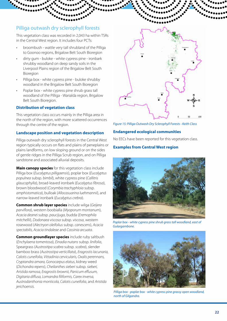
Pilliga outwash dry sclerophyll forests This vegetation class was recorded in 2,043 ha within TSRs in the Central West region. It includes four PCTs:
• broombush - wattle very tall shrubland of the Pilliga to Goonoo regions, Brigalow Belt South Bioregion
• dirty gum - buloke - white cypress pine - ironbark shrubby woodland on deep sandy soils in the Liverpool Plains region of the Brigalow Belt South Bioregion
• Pilliga box - white cypress pine - buloke shrubby woodland in the Brigalow Belt South Bioregion
• Poplar box - white cypress pine shrub grass tall woodland of the Pilliga - Warialda region, Brigalow Belt South Bioregion.
Distribution of vegetation class
This vegetation class occurs mainly in the Pilliga area in the north of the region, with more scattered occurrences through the centre of the region. Figure 15: Pilliga Outwash Dry Sclerophyll Forests - Keith Class
Landscape position and vegetation description Endangered ecological communities
Pilliga outwash dry sclerophyll forests in the Central West No EECs have been reported for this vegetation class.
region typically occurs on flats and plains of peneplains or Examples from Central West region plains landforms, on low sloping ground or on the sides of gentle ridges in the Pilliga Scrub region, and on Pilliga sandstone and associated alluvial deposits.
Main canopy species for this vegetation class include Pilliga box (Eucalyptus pilligaensis), poplar box (Eucalyptus populnea subsp. bimbil), white cypress pine (Callitris glaucophylla), broad-leaved ironbark (Eucalyptus fibrosa), brown bloodwood (Corymbia trachyphloia subsp. amphistomatica), bulloak (Allocasuarina luehmannii), and narrow-leaved ironbark (Eucalyptus crebra).
Common shrub layer species include wilga (Geijera parviflora), western boobialla (Myoporum montanum), Acacia deanei subsp. paucijuga, budda (Eremophila mitchellii), Dodonaea viscosa subsp. viscosa, western
Poplar box - white cypress pine shrub grass tall woodland, east of rosewood (Alectryon oleifolius subsp. canescens), Acacia Gulargambone. spectabilis, Acacia tindaleae and Cassinia arcuata.
Common groundlayer species include ruby saltbush (Enchylaena tomentosa), Einadia nutans subsp. linifolia, Speargrass (Austrostipa scabra subsp. scabra), slender bamboo brass (Austrostipa verticillata), Eragrostis lacunaria, Calotis cuneifolia, Vittadinia cervicularis, Oxalis perennans, Cryptandra amara, Gonocarpus elatus, kidney weed (Dichondra repens), Cheilanthes sieberi subsp. sieberi, Aristida ramosa, Eragrostis brownii, Panicum effusum, Digitaria diffusa, Lomandra filiformis, Carex inversa, Austrodanthonia monticola, Calotis cuneifolia, and Aristida jerichoensis.
Pilliga box - poplar box - white cypress pine grassy open woodland, north of Gilgandra.
23 Central West Local Land Services Travelling Stock Reserves | Vegetation Guide
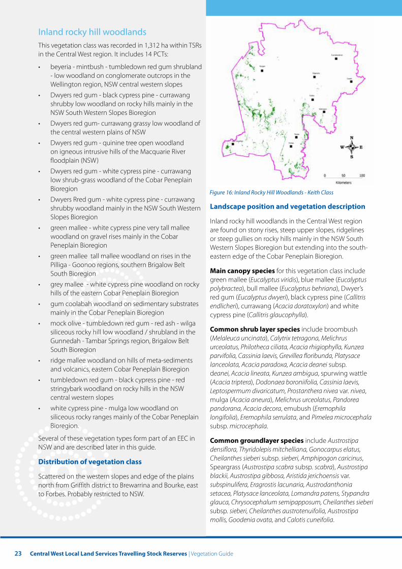
Inland rocky hill woodlands This vegetation class was recorded in 1,312 ha within TSRs in the Central West region. It includes 14 PCTs:
• beyeria - mintbush - tumbledown red gum shrubland - low woodland on conglomerate outcrops in the Wellington region, NSW central western slopes
• Dwyers red gum - black cypress pine - currawang shrubby low woodland on rocky hills mainly in the NSW South Western Slopes Bioregion
• Dwyers red gum- currawang grassy low woodland of the central western plains of NSW
• Dwyers red gum - quinine tree open woodland on igneous intrusive hills of the Macquarie River floodplain (NSW)
• Dwyers red gum - white cypress pine - currawang low shrub-grass woodland of the Cobar Peneplain Bioregion Figure 16: Inland Rocky Hill Woodlands - Keith Class
• Dwyers Rred gum - white cypress pine - currawang shrubby woodland mainly in the NSW South Western Landscape position and vegetation description Slopes Bioregion Inland rocky hill woodlands in the Central West region
• green mallee - white cypress pine very tall mallee are found on stony rises, steep upper slopes, ridgelines woodland on gravel rises mainly in the Cobar or steep gullies on rocky hills mainly in the NSW South Peneplain Bioregion Western Slopes Bioregion but extending into the south-
• green mallee tall mallee woodland on rises in the eastern edge of the Cobar Peneplain Bioregion. Pilliga - Goonoo regions, southern Brigalow Belt
Main canopy species for this vegetation class include South Bioregion green mallee (Eucalyptus viridis), blue mallee (Eucalyptus
• grey mallee - white cypress pine woodland on rocky polybractea), bull mallee (Eucalyptus behriana), Dwyer’s hills of the eastern Cobar Peneplain Bioregion red gum (Eucalyptus dwyeri), black cypress pine (Callitris
• gum coolabah woodland on sedimentary substrates endlicheri), currawang (Acacia doratoxylon) and white mainly in the Cobar Peneplain Bioregion cypress pine (Callitris glaucophylla).
• mock olive - tumbledown red gum - red ash - wilga Common shrub layer species include broombush siliceous rocky hill low woodland / shrubland in the (Melaleuca uncinata), Calytrix tetragona, Melichrus Gunnedah - Tambar Springs region, Brigalow Belt urceolatus, Philotheca ciliata, Acacia rhigiophylla, Kunzea South Bioregion parvifolia, Cassinia laevis, Grevillea floribunda, Platysace
• ridge mallee woodland on hills of meta-sediments lanceolata, Acacia paradoxa, Acacia deanei subsp. and volcanics, eastern Cobar Peneplain Bioregion deanei, Acacia lineata, Kunzea ambigua, spurwing wattle
• tumbledown red gum - black cypress pine - red (Acacia triptera), Dodonaea boroniifolia, Cassinia laevis, stringybark woodland on rocky hills in the NSW Leptospermum divaricatum, Prostanthera nivea var. nivea, central western slopes mulga (Acacia aneura), Melichrus urceolatus, Pandorea
• white cypress pine - mulga low woodland on pandorana, Acacia decora, emubush (Eremophila siliceous rocky ranges mainly of the Cobar Peneplain longifolia), Eremophila serrulata, and Pimelea microcephala Bioregion. subsp. microcephala.
Several of these vegetation types form part of an EEC in Common groundlayer species include Austrostipa NSW and are described later in this guide. densiflora, Thyridolepis mitchelliana, Gonocarpus elatus,
Cheilanthes sieberi subsp. sieberi, Amphipogon caricinus, Distribution of vegetation class Speargrass (Austrostipa scabra subsp. scabra), Austrostipa
Scattered on the western slopes and edge of the plains blackii, Austrostipa gibbosa, Aristida jerichoensis var. north from Griffith district to Brewarrina and Bourke, east subspinulifera, Eragrostis lacunaria, Austrodanthonia to Forbes. Probably restricted to NSW. setacea, Platysace lanceolata, Lomandra patens, Stypandra
glauca, Chrysocephalum semipapposum, Cheilanthes sieberi subsp. sieberi, Cheilanthes austrotenuifolia, Austrostipa mollis, Goodenia ovata, and Calotis cuneifolia.
24
Endangered ecological communities
This vegetation class includes mallee and mallee-broombush dominated woodland and shrubland, lacking Triodia, in the NSW South Western Slopes Bioregion, which is critically endangered in NSW but not listed federally.
Examples from Central West region
Ridge mallee woodland on hills of meta-sediments and volcanics, near Bobadah.
Yorrell and mallee woodland, west of Condobolin.
River red gum low woodland of rocky gorges and creeks, near Gilgandra .
White cypress pine - mulga low woodland.
25 Central West Local Land Services Travelling Stock Reserves | Vegetation Guide
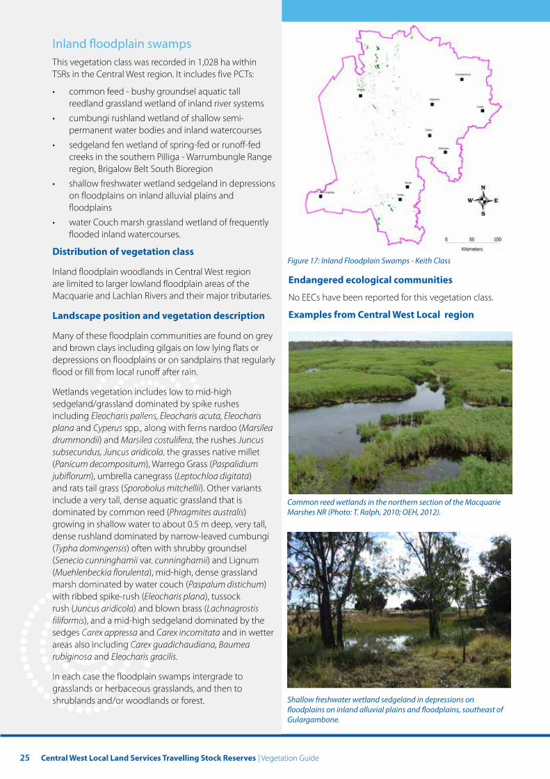
Inland foodplain swamps This vegetation class was recorded in 1,028 ha within TSRs in the Central West region. It includes five PCTs:
• common feed - bushy groundsel aquatic tall reedland grassland wetland of inland river systems
• cumbungi rushland wetland of shallow semi-permanent water bodies and inland watercourses
• sedgeland fen wetland of spring-fed or runoff-fed creeks in the southern Pilliga - Warrumbungle Range region, Brigalow Belt South Bioregion
• shallow freshwater wetland sedgeland in depressions on floodplains on inland alluvial plains and floodplains
• water Couch marsh grassland wetland of frequently flooded inland watercourses.
Distribution of vegetation class Figure 17: Inland Floodplain Swamps - Keith Class
Inland floodplain woodlands in Central West region Endangered ecological communities are limited to larger lowland floodplain areas of the
Macquarie and Lachlan Rivers and their major tributaries. No EECs have been reported for this vegetation class.
Landscape position and vegetation description Examples from Central West Local region
Many of these floodplain communities are found on grey and brown clays including gilgais on low lying flats or depressions on floodplains or on sandplains that regularly flood or fill from local runoff after rain.
Wetlands vegetation includes low to mid-high sedgeland/grassland dominated by spike rushes including Eleocharis pallens, Eleocharis acuta, Eleocharis plana and Cyperus spp., along with ferns nardoo (Marsilea drummondii) and Marsilea costulifera, the rushes Juncus subsecundus, Juncus aridicola, the grasses native millet (Panicum decompositum), Warrego Grass (Paspalidium jubiflorum), umbrella canegrass (Leptochloa digitata) and rats tail grass (Sporobolus mitchellii). Other variants include a very tall, dense aquatic grassland that is Common reed wetlands in the northern section of the Macquarie dominated by common reed (Phragmites australis) Marshes NR (Photo: T. Ralph, 2010; OEH, 2012). growing in shallow water to about 0.5 m deep, very tall, dense rushland dominated by narrow-leaved cumbungi (Typha domingensis) often with shrubby groundsel (Senecio cunninghamii var. cunninghamii) and Lignum (Muehlenbeckia florulenta), mid-high, dense grassland marsh dominated by water couch (Paspalum distichum) with ribbed spike-rush (Eleocharis plana), tussock rush (Juncus aridicola) and blown brass (Lachnagrostis filiformis), and a mid-high sedgeland dominated by the sedges Carex appressa and Carex incomitata and in wetter areas also including Carex guadichaudiana, Baumea rubiginosa and Eleocharis gracilis.
In each case the floodplain swamps intergrade to grasslands or herbaceous grasslands, and then to shrublands and/or woodlands or forest. Shallow freshwater wetland sedgeland in depressions on
foodplains on inland alluvial plains and foodplains, southeast of Gulargambone.
26
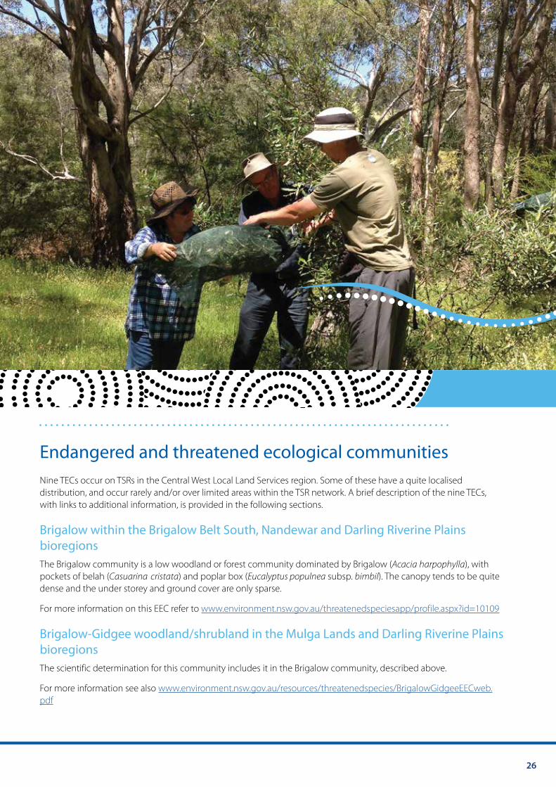
Endangered and threatened ecological communities Nine TECs occur on TSRs in the Central West Local Land Services region. Some of these have a quite localised distribution, and occur rarely and/or over limited areas within the TSR network. A brief description of the nine TECs, with links to additional information, is provided in the following sections.
Brigalow within the Brigalow Belt South, Nandewar and Darling Riverine Plains bioregions The Brigalow community is a low woodland or forest community dominated by Brigalow (Acacia harpophylla), with pockets of belah (Casuarina cristata) and poplar box (Eucalyptus populnea subsp. bimbil). The canopy tends to be quite dense and the under storey and ground cover are only sparse.
For more information on this EEC refer to www.environment.nsw.gov.au/threatenedspeciesapp/profile.aspx?id=10109
Brigalow-Gidgee woodland/shrubland in the Mulga Lands and Darling Riverine Plains bioregions The scientific determination for this community includes it in the Brigalow community, described above.
For more information see also www.environment.nsw.gov.au/resources/threatenedspecies/BrigalowGidgeeEECweb. pdf
27 Central West Local Land Services Travelling Stock Reserves | Vegetation Guide
Coolibah black box woodlands of the Northern Riverine Plains in the Darling Riverine Plains and Brigalow Belt South bioregions This woodland community is found on the grey, self-mulching clays of the periodically waterlogged floodplains, swamp margins, ephemeral wetlands, and stream levees of the Darling Riverine Plains and Brigalow Belt South bioregions. The structure of the community may vary from tall riparian woodlands to very open ‘savanna like’ grassy woodlands with a sparse midstorey of shrubs and saplings. Typically these woodlands form mosaics with grasslands and wetlands.
These variations are mainly determined by the frequency and duration of inundation by overbank floods. As a result, there are clear differences in species makeup between the channelised parts of the floodplain and the less frequently inundated outer parts of the floodplain.
The over storey typically includes Eucalyptus coolibah subsp. coolibah (Coolibah), with:
• eucalyptus largiflorens (black box )
• casuarina cristata (belah)
• acacia stenophylla (river cooba)
• acacia salicina (cooba)
• eremophila bignoniiflora (eurah).
Eucalyptus populnea subsp. bimbil (bimbil box) may occur on the outer floodplain. Eucalyptus largiflorens (black box ) may be the dominant tree species on parts of the central-northern riverine plains and on slightly more elevated parts of the floodplain. This is accompanied by a typically sparse midstorey layer and a predominantly grassy understorey.
For more information on this EEC refer to www.environment.nsw.gov.au/threatenedspecies/ CoolibahBlackBoxWoodland.htm
Fuzzy box on alluvials of South West Slopes, Darling Riverine Plains and the Brigalow Belt South This EEC is described as a tall woodland or open forest dominated by fuzzy box (Eucalyptus conica), often with grey box (Eucalyptus microcarpa), yellow box (Eucalyptus melliodora), or Kurrajong (Brachychiton populneus). Buloke (Allocasuarina luehmannii) is common in places. Shrubs are generally sparse, and the groundcover moderately dense, although this will vary with season.
For more information on this EEC refer to www.environment.nsw.gov.au/threatenedspeciesapp/profile.aspx?id=10335
Inland grey box woodland in the Riverina, NSW South Western Slopes, Cobar Peneplain, Nandewar and Brigalow Belt South bioregions This EEC is described as woodlands in which the most characteristic tree species, Eucalyptus microcarpa (inland grey box), is often found in association with E. populnea subsp. bimbil (bimble or poplar box), Callitris glaucophylla (white cypress pine), Brachychiton populneus (kurrajong), Allocasuarina luehmannii (bulloak) or E. melliodora (yellow box), and sometimes with E. albens (white box). Shrubs are typically sparse or absent, although this component can be diverse and may be locally common, especially in drier western portions of the community. A variable ground layer of grass and herbaceous species is present at most sites. At severely disturbed sites the ground layer may be absent. The community generally occurs as an open woodland 15 to 25 m tall but in some locations the overstorey may be absent as a result of past clearing or thinning, leaving only an under storey.
For more information on this EEC refer to www.environment.nsw.gov.au/threatenedspeciesapp/profile.aspx?id=20072
28
Native vegetation on cracking clay soils of the Liverpool Plains Native Vegetation on cracking clay soils of the Liverpool Plains is mainly a native grassland community which includes a range of small forb and herb species. The main grass species include plains grass (Austrostipa aristiglumis), Queensland bluegrass (Dichanthium sericeum) and coolibah grass (Panicum queenslandicum). It also contains scattered and patchy shrubs and trees, including boree (Acacia pendula), rough-barked apple (Angophora floribunda), fuzzy box (Eucalyptus conica), bimble Box (E. populnea) and yellow box (E. melliodora). In wetter locations rushes and sedges are common.
For more information on this EEC refer to www.environment.nsw.gov.au/threatenedspeciesapp/profile.aspx?id=10550
Mallee and mallee-broombush dominated woodland and shrubland, lacking triodia, in the NSW South Western Slopes Bioregion (critically endangered) Mallee and mallee-broombush dominated woodland and shrubland, lacking Triodia, in the NSW South Western Slopes Bioregion varies in structure from tall mallee woodland with an open to mid-dense shrub layer and groundcover (sparseness perhaps an artefact of grazing history), to open or very dense mallee shrubland, with or without broombush (Melaleuca uncinata). Three variants have been described (Benson 2008) as distinct communities, based largely on canopy composition and their tendency to occur on somewhat different landforms. These are ‘ID 355: bull mallee-white mallee tall mallee woodland on red sandy loam soils in the central western slopes of NSW’; ‘ID 177: blue mallee-bull mallee-green mallee very tall mallee shrubland of the West Wyalong region, NSW South Western Slopes Bioregion’, and ‘ID 178: broombush-green mallee-blue mallee very tall shrubland on stony rises in the NSW South Western Slopes Bioregion’. Benson noted however that these units do intergrade. The floristic composition of shrub layer and ground cover varies widely within, and overlaps between, the variants and the variability in the density and floristic composition of the shrub and ground layers may be partly a consequence of grazing history.
This community typically has a canopy layer co-dominated by the mallee eucalypts Eucalyptus behriana (bull mallee) and E. dumosa (white mallee), with either (on flat land) E. socialis (red mallee), or (on low rises) E. polybractea (blue mallee) and E. viridis (green mallee). More rarely, on higher rocky rises, the dominant species may be E. polybractea and either E. viridis or E. dwyeri (Dwyer’s red gum), with a tall shrub layer of Melaleuca uncinata.
For more information on this EEC refer to www.environment.nsw.gov.au/threatenedSpeciesApp/profile.aspx?id=20149
Myall woodland in the Darling Riverine Plains, Brigalow Belt South, Cobar Peneplain, Murray-Darling Depression, Riverina and NSW South Western Slopes bioregions This ecological community is scattered across the eastern parts of the alluvial plains of the Murray-Darling river system. The community is also known as boree, particularly in the southern part of its distribution. Typically, it occurs on red-brown earths and heavy textured grey and brown alluvial soils within a climatic belt receiving between 375 mm and 500 mm mean annual rainfall. The structure of the community varies from low woodland and low open woodland to low sparse woodland or open shrubland, depending on site quality and disturbance history.
The tree layer grows up to a height of about 10 m and invariably includes Acacia pendula (weeping myall or boree) as one of the dominant species or the only tree species present. The under storey includes an open layer of chenopod shrubs and other woody plant species and an open to continuous groundcover of grasses and herbs. The structure and composition of the community varies, particularly with latitude, as chenopod shrubs are more prominent south of the Lachlan River district, while other woody species and summer grasses are more common further north.
For more information on this EEC refer to www.environment.nsw.gov.au/threatenedspeciesapp/profile.aspx?id=10973
29 Central West Local Land Services Travelling Stock Reserves | Vegetation Guide
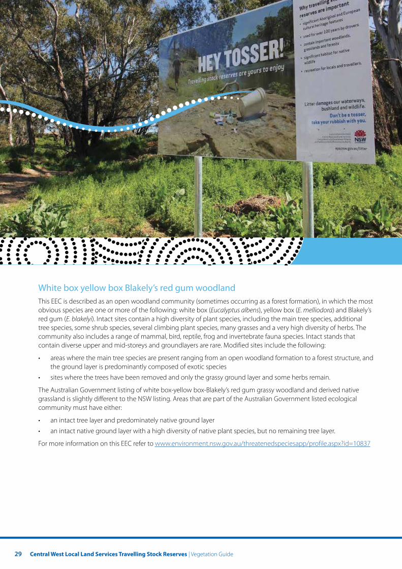
White box yellow box Blakely’s red gum woodland This EEC is described as an open woodland community (sometimes occurring as a forest formation), in which the most obvious species are one or more of the following: white box (Eucalyptus albens), yellow box (E. melliodora) and Blakely’s red gum (E. blakelyi). Intact sites contain a high diversity of plant species, including the main tree species, additional tree species, some shrub species, several climbing plant species, many grasses and a very high diversity of herbs. The community also includes a range of mammal, bird, reptile, frog and invertebrate fauna species. Intact stands that contain diverse upper and mid-storeys and groundlayers are rare. Modified sites include the following:
• areas where the main tree species are present ranging from an open woodland formation to a forest structure, and the ground layer is predominantly composed of exotic species
• sites where the trees have been removed and only the grassy ground layer and some herbs remain.
The Australian Government listing of white box-yellow box-Blakely’s red gum grassy woodland and derived native grassland is slightly different to the NSW listing. Areas that are part of the Australian Government listed ecological community must have either:
• an intact tree layer and predominately native ground layer
• an intact native ground layer with a high diversity of native plant species, but no remaining tree layer.
For more information on this EEC refer to www.environment.nsw.gov.au/threatenedspeciesapp/profile.aspx?id=10837

30