Embed Size (px)
Citation preview
CDMC - Trip Report
http://www.comoxhiking.com/archive/display/224/2012[3/28/2017 2:10:32 PM]
CDMC Trip Report
Member
Changes today yesterday < 7 days < 30 days
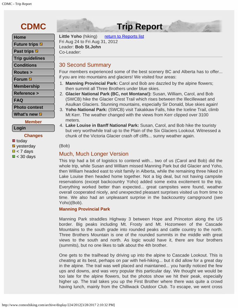
Little Yoho (hiking) return to Reports list Fri Aug 24 to Fri Aug 31, 2012 Leader: Bob St.JohnCo-Leader:
30 Second SummaryFour members experienced some of the best scenery BC and Alberta has to offer...if you are into mountains and glaciers! We visited four areas:1. Manning Provincial Park: Carol and Bob are dazzled by the alpine flowers;
then summit all Three Brothers under blue skies.2. Glacier National Park (BC, not Montana!): Susan, William, Carol, and Bob
(SWCB) hike the Glacier Crest Trail which rises between the Illecillewaet andAsulkan Glaciers. Stunning mountains, especially Sir Donald, blue skies again!
3. Yoho National Park: (SWCB) visit Takakkaw Falls, hike the Iceline Trail, climbMt Kerr. The weather changed with the views from Kerr clipped over 3100meters.
4. Lake Louise in Banff National Park: Susan, Carol, and Bob hike the touristybut very worthwhile trail up to the Plain of the Six Glaciers Lookout. Witnessed achunk of the Victoria Glacier crash off cliffs... sunny weather again.
(Bob)
Much, Much Longer VersionThis trip had a bit of logistics to contend with... two of us (Carol and Bob) did thewhole trip, while Susan and William missed Manning Park but did Glacier and Yoho,then William headed east to visit family in Alberta, while the remaining three hiked inLake Louise then headed home together. Not a big deal, but not having campsitereservations (except backcountry Yoho) added some extra excitement to the trip.Everything worked better than expected... great campsites were found, weatheroverall cooperated nicely, and unexpected pleasant surprises visited us from time totime. We also had an unpleasant surprise in the backcountry campground (seeYoho)(Bob).Manning Provincial Park
Manning Park straddles Highway 3 between Hope and Princeton along the USborder. Big peaks including Mt. Frosty and Mt. Hozomeen of the CascadeMountains to the south grade into rounded peaks and cattle country to the north.Three Brothers Mountain is one of the rounded summits in the middle with greatviews to the south and north. As logic would have it, there are four brothers(summits), but no one likes to talk about the 4th brother.
One gets to the trailhead by driving up into the alpine to Cascade Lookout. This ischeating at its best, perhaps on par with heli-hiking... but it did allow for a great dayin the alpine. The trail was well placed and maintained... you hardly noticed the fewups and downs, and was very popular this particular day. We thought we would betoo late for the alpine flowers, but the photos show we hit their peak, especiallyhigher up. The trail takes you up the First Brother where there was quite a crowdhaving lunch, mainly from the Chilliwack Outdoor Club. To escape, we went cross
HomeFuture trips Past trips Trip guidelinesConditionsRoutes >Forum MembershipReference >FAQPhoto contestWhat's new
Login

CDMC - Trip Report
http://www.comoxhiking.com/archive/display/224/2012[3/28/2017 2:10:32 PM]
The start of the trail with theThree Brothers in the distance
[Carol Hunter photo]
Beautiful alpine meadow[Carol Hunter photo]
Mt Frosty and the Skyline Ridgebehind Lightning Lake (future
hikes)[Carol Hunter photo]
On the summit of theFirst Brother
[Carol Hunter photo]
country to the 2nd and 3rd summits... the 4th summit being too far away to get to inone day.
We cooked dinner at the lookout with the sun setting over the mountains, with thecompany of Cascade Golden Mantle Ground Squirrels, Clark's Nutcrackers, and araven. This was a far superior location than the Coldspring Campground where westayed for two nights. Not only was it cold enough to wear down jackets at night, ithad a group of partiers carrying on late into the evening. (Bob)
Looking to the south west from Mt Hozomeen to MtSilvertip
[Carol Hunter photo]
CDMC - Trip Report
http://www.comoxhiking.com/archive/display/224/2012[3/28/2017 2:10:32 PM]
Heading to the Third Brother[Carol Hunter photo]
Anemones gone to seed[Carol Hunter photo]
Lovely lupines[Carol Hunter photo]
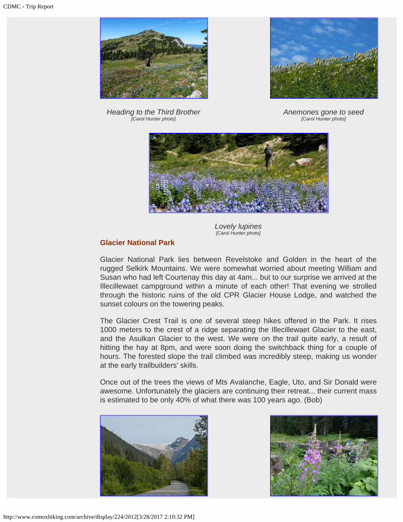
Glacier National Park
Glacier National Park lies between Revelstoke and Golden in the heart of therugged Selkirk Mountains. We were somewhat worried about meeting William andSusan who had left Courtenay this day at 4am... but to our surprise we arrived at theIllecillewaet campground within a minute of each other! That evening we strolledthrough the historic ruins of the old CPR Glacier House Lodge, and watched thesunset colours on the towering peaks.
The Glacier Crest Trail is one of several steep hikes offered in the Park. It rises1000 meters to the crest of a ridge separating the Illecillewaet Glacier to the east,and the Asulkan Glacier to the west. We were on the trail quite early, a result ofhitting the hay at 8pm, and were soon doing the switchback thing for a couple ofhours. The forested slope the trail climbed was incredibly steep, making us wonderat the early trailbuilders' skills.
Once out of the trees the views of Mts Avalanche, Eagle, Uto, and Sir Donald wereawesome. Unfortunately the glaciers are continuing their retreat... their current massis estimated to be only 40% of what there was 100 years ago. (Bob)

CDMC - Trip Report
http://www.comoxhiking.com/archive/display/224/2012[3/28/2017 2:10:32 PM]
Looking back towards RogersPass
[Carol Hunter photo]
The meeting of the waters (theIllecillewaet and the Asulkan)
[Carol Hunter photo]
Enjoying the Illecillewaet Glacierand Mt Sir Donald
[Carol Hunter photo]
Asulkan Glacier[Carol Hunter photo]
The goal is the ridge on the right[Carol Hunter photo]
Historic ruins[Carol Hunter photo]
Summit of Glacier Crest[Bob St.John photo]
Nap time[Carol Hunter photo]
270 degree panorama[Carol Hunter photo]

CDMC - Trip Report
http://www.comoxhiking.com/archive/display/224/2012[3/28/2017 2:10:32 PM]
Golden Mantle Ground squirrelgathering for winter
[Carol Hunter photo]
Pika posing[Carol Hunter photo]
Yoho National Park
Yoho is one of four national parks bunched together between Banff and Jasper, andour backpack there was to be the highlight of the trip. After picking up ourWilderness Passes from the Visitor Centre in Field, we made our way to TakakkawFalls... takakkaw meaning 'magnificent' in Cree. They did not disappoint, andjudging by the number of tourists, they are a major attraction.
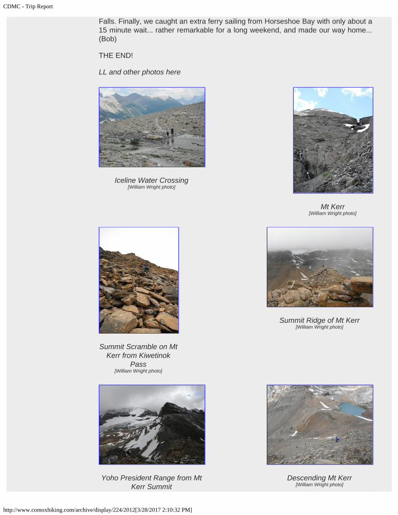
Our backpack destination was the Little Yoho campground. There are two trails tochoose from... the Yoho Valley Trail (somewhat pedestrian) and the Iceline Trail(very takakkaw). I am afraid I am running out of adjectives here... suffice to say wewalked by two pocket glaciers in close proximity to us with the Waputik Icefieldacross the valley.
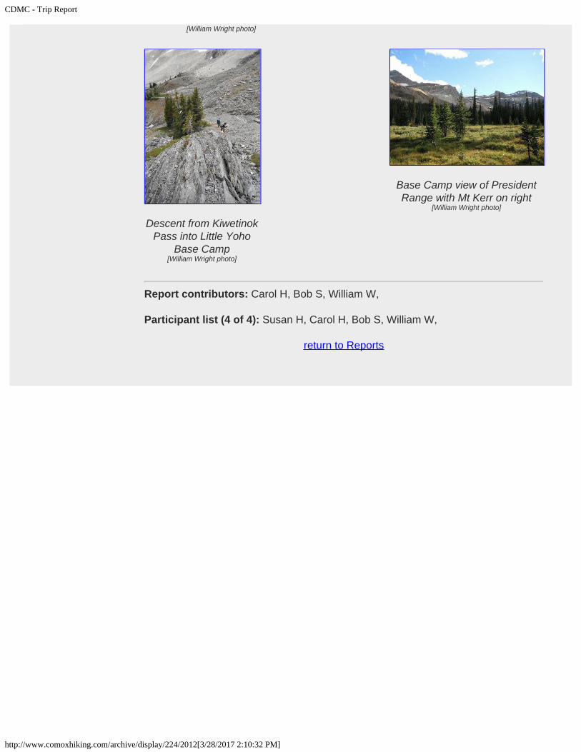
Little Yoho Valley sports a wilderness campground, an ACC hut (Stanley Mitchell),and a Warden's cabin all within a couple of hundred meters. The campgroundseemed to be in fine shape until the outhouse horror was discovered. Thiscomposting nightmare would give Stephen King pause... the seat and well of thetoilet was crawling with fly maggots... there were hundreds of them, with an army ofbackups coming up from below. The building structure had been badly damagedfrom winter snowloads with half the roof on the ground and a solar cell powered fancrumpled next to it. There was also no composting agent that was supposed to beadded with each use. This disgusting situation led to campers using the hillsideabove the outhouse as their preferred site for relief. I will stop here as I will beposting my letter to Parks on the forum... stay tuned.
Apart from the campgound sanitation problem, Little Yoho is a gem. Two glaciatedpeaks (the President, and the Vice-President) lorded over us from across the valley.These climbs require mountaineering gear to ascend the glacier between them andto get over the 'shrund... not for us this trip. There are however some really nicescrambling summits (Kerr, Pollinger, McAuthur) to keep us busy. (Scrambling is lowgrade climbing where the use of hands is generally required, and perhaps a rope onharder routes, but not technical in nature... CDSC anyone?).
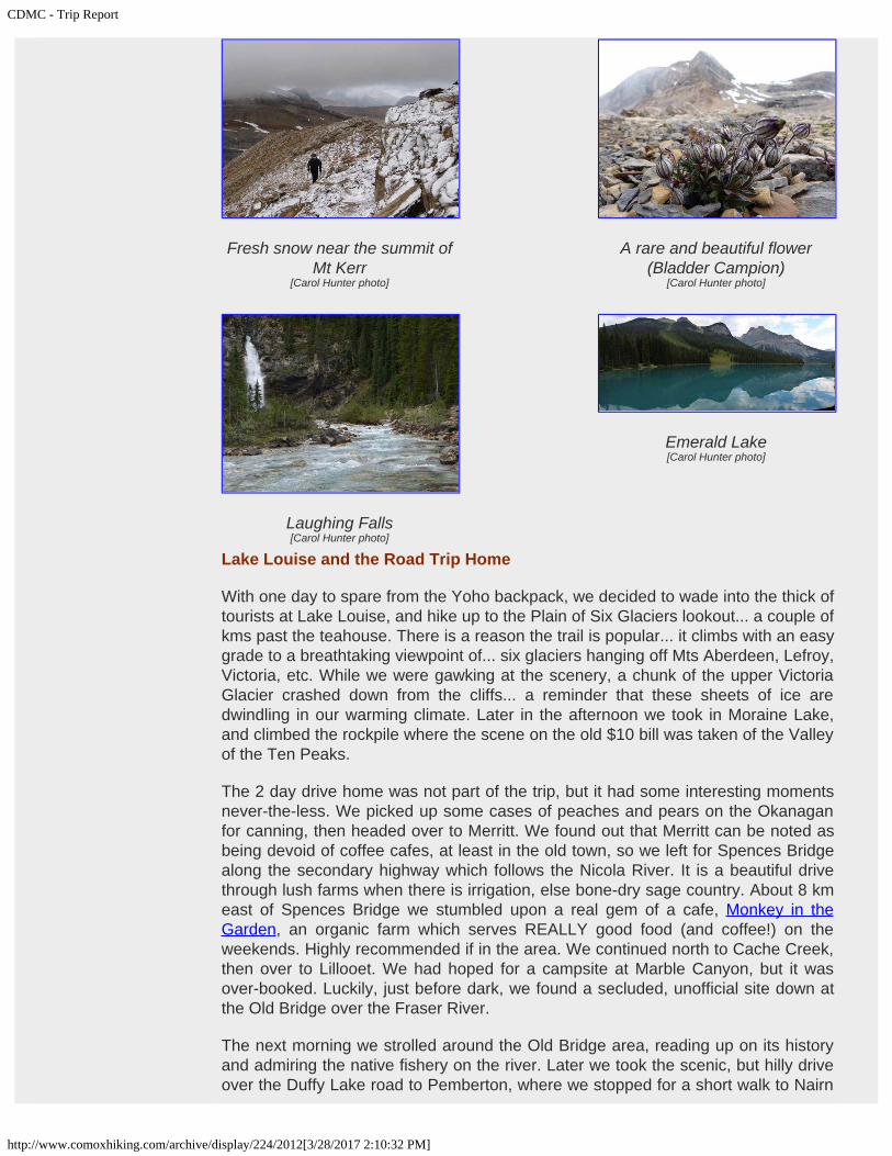
That night we were treated to a really good lighting storm with a bit of hail. I say'treated' genuinely, as some of us enjoy them. The following morning we set out withmixed sun and cloud for Mt Kerr at the head of the valley, a cocktail of alpinemeadows and glacial moraines making for a very pleasant walk. The top 200 metersor so of the President and VP were decked in the first snow of the season...summer's end is near! Kiwetinok Pass and Lake were reached in a couple of hours,both of which were framed by Mt. Kerr and Kiwetinok Peak. Kerr is a typical Rockies

CDMC - Trip Report
http://www.comoxhiking.com/archive/display/224/2012[3/28/2017 2:10:32 PM]
Enjoying the view[Carol Hunter photo]
Iceline Trail[Carol Hunter photo]
Yahoo in Little Yoho[Carol Hunter photo]
Kiwetinok Lake[Carol Hunter photo]
Takakkaw Falls[Carol Hunter photo]
Iceline Trail[Carol Hunter photo]
scramble... limestone scree skirting a summit block. We all made it to the top whilekeeping a watchful eye on the weather. We could only see the lower 3000 meters ofsurrounding peaks due to the cloud cover... a bit disappointing... but only a little.
Showers and more cloud cover the next day convinced us to head out a day earlyvia the Yoho Valley route. Laughing Falls became the highlight of our exit... nothingcompared to the Iceline Trail but worth noting. This early exit did allow us to snag agood campsite at Kicking Horse Campground near Field... which filled up fast withthe long weekend approaching. We ended the day with a surprisingly excellentdinner at Truffle Pigs in Field, then a quick tour of Emerald Lake. William made hisexit for Alberta later in the evening. (Bob)
CDMC - Trip Report
http://www.comoxhiking.com/archive/display/224/2012[3/28/2017 2:10:32 PM]
Fresh snow near the summit ofMt Kerr
[Carol Hunter photo]
A rare and beautiful flower(Bladder Campion)
[Carol Hunter photo]
Laughing Falls[Carol Hunter photo]
Emerald Lake[Carol Hunter photo]
Lake Louise and the Road Trip Home
With one day to spare from the Yoho backpack, we decided to wade into the thick oftourists at Lake Louise, and hike up to the Plain of Six Glaciers lookout... a couple ofkms past the teahouse. There is a reason the trail is popular... it climbs with an easygrade to a breathtaking viewpoint of... six glaciers hanging off Mts Aberdeen, Lefroy,Victoria, etc. While we were gawking at the scenery, a chunk of the upper VictoriaGlacier crashed down from the cliffs... a reminder that these sheets of ice aredwindling in our warming climate. Later in the afternoon we took in Moraine Lake,and climbed the rockpile where the scene on the old $10 bill was taken of the Valleyof the Ten Peaks.
The 2 day drive home was not part of the trip, but it had some interesting momentsnever-the-less. We picked up some cases of peaches and pears on the Okanaganfor canning, then headed over to Merritt. We found out that Merritt can be noted asbeing devoid of coffee cafes, at least in the old town, so we left for Spences Bridgealong the secondary highway which follows the Nicola River. It is a beautiful drivethrough lush farms when there is irrigation, else bone-dry sage country. About 8 kmeast of Spences Bridge we stumbled upon a real gem of a cafe, Monkey in theGarden, an organic farm which serves REALLY good food (and coffee!) on theweekends. Highly recommended if in the area. We continued north to Cache Creek,then over to Lillooet. We had hoped for a campsite at Marble Canyon, but it wasover-booked. Luckily, just before dark, we found a secluded, unofficial site down atthe Old Bridge over the Fraser River.
The next morning we strolled around the Old Bridge area, reading up on its historyand admiring the native fishery on the river. Later we took the scenic, but hilly driveover the Duffy Lake road to Pemberton, where we stopped for a short walk to Nairn
CDMC - Trip Report
http://www.comoxhiking.com/archive/display/224/2012[3/28/2017 2:10:32 PM]
Summit Scramble on MtKerr from Kiwetinok
Pass[William Wright photo]
Summit Ridge of Mt Kerr[William Wright photo]
Yoho President Range from MtKerr Summit
Descending Mt Kerr[William Wright photo]
Iceline Water Crossing[William Wright photo]
Mt Kerr[William Wright photo]
Falls. Finally, we caught an extra ferry sailing from Horseshoe Bay with only about a15 minute wait... rather remarkable for a long weekend, and made our way home...(Bob)
THE END!
LL and other photos here
CDMC - Trip Report
http://www.comoxhiking.com/archive/display/224/2012[3/28/2017 2:10:32 PM]
[William Wright photo]
Descent from KiwetinokPass into Little Yoho
Base Camp[William Wright photo]
Base Camp view of PresidentRange with Mt Kerr on right
[William Wright photo]
Report contributors: Carol H, Bob S, William W,
Participant list (4 of 4): Susan H, Carol H, Bob S, William W,
return to Reports