Embed Size (px)
Citation preview
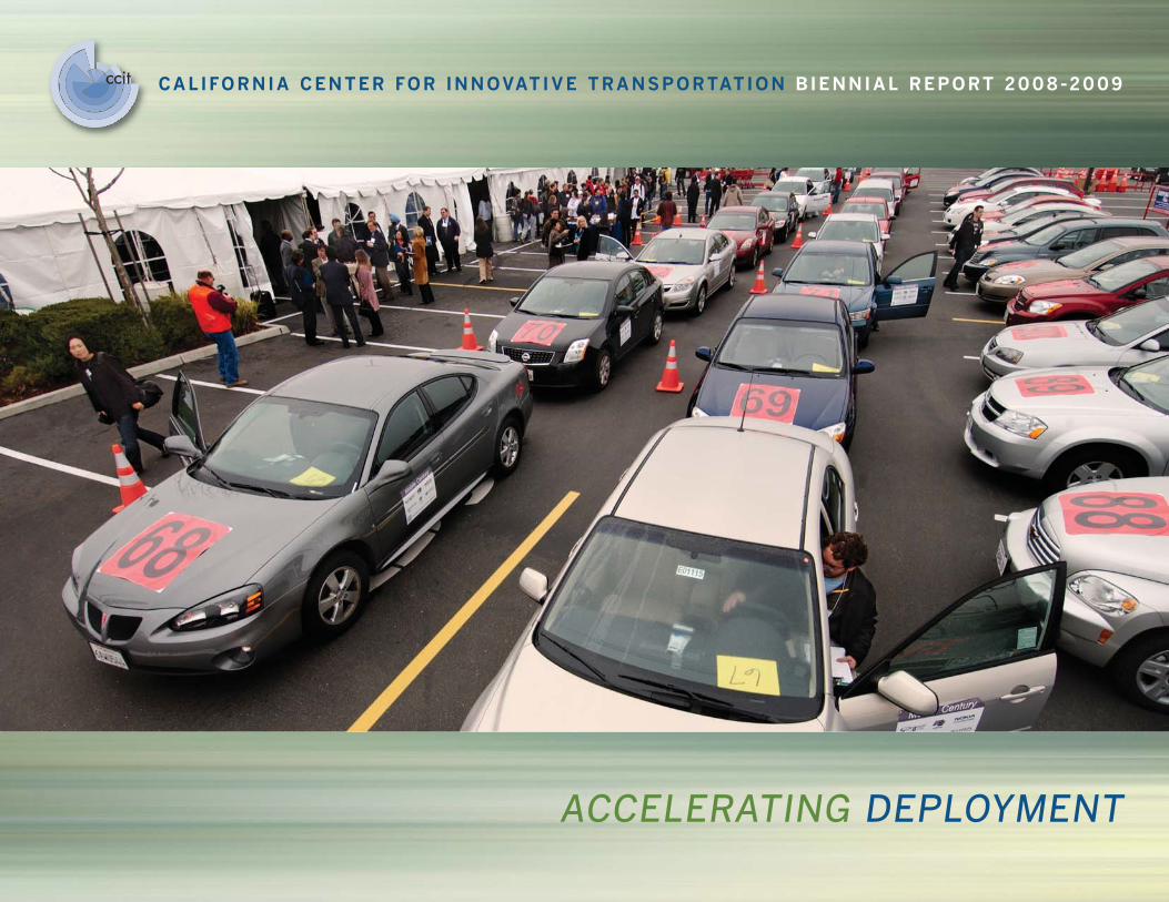
ccccitit CALIFORNIA CENTER FOR INNOVATIVE TRANSPORTATION BIENNIAL REPORT 2008-2009
ACCELERATING DEPLOYMENT
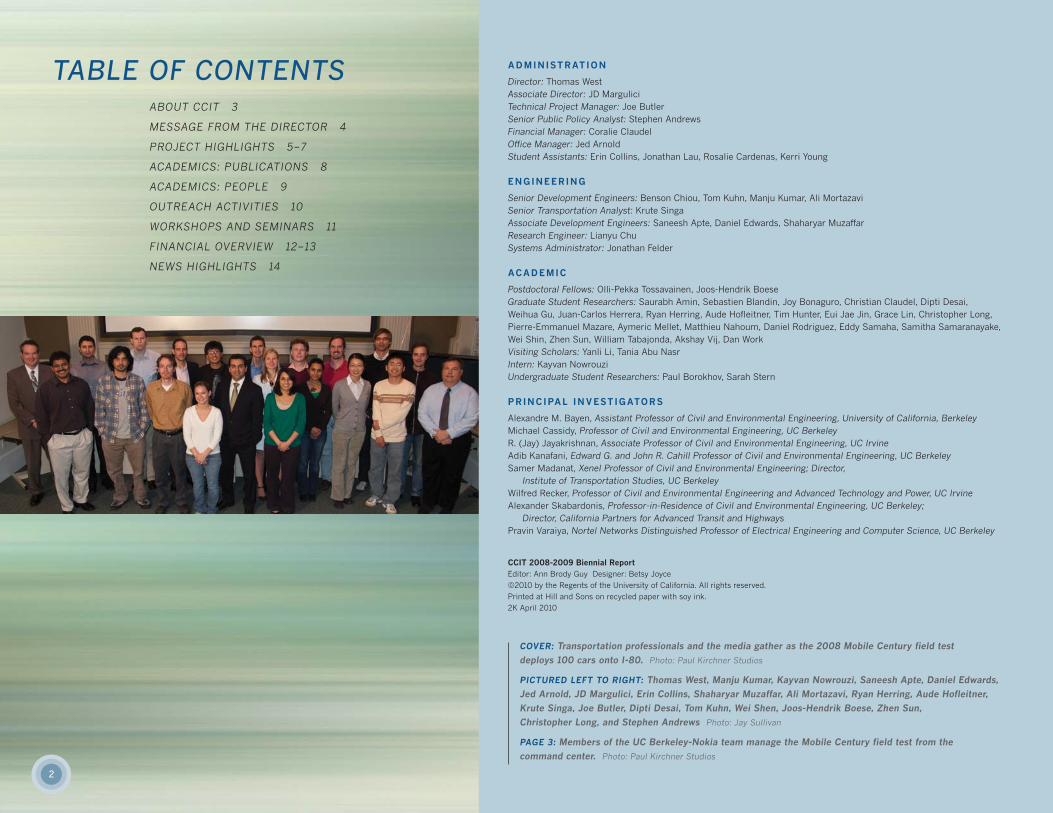
TABLE OF CONTENTSABOUT CCIT 3
MESSAGE FROM THE DIRECTOR 4
PROJECT HIGHLIGHTS 5–7
ACADEMICS: PUBLICATIONS 8
ACADEMICS: PEOPLE 9
OUTREACH ACTIVITIES 10
WORKSHOPS AND SEMINARS 11
FINANCIAL OVERVIEW 12–13
NEWS HIGHLIGHTS 14
ADMINISTRATION
Director: Thomas WestAssociate Director: JD MarguliciTechnical Project Manager: Joe ButlerSenior Public Policy Analyst: Stephen AndrewsFinancial Manager: Coralie ClaudelOffice Manager: Jed ArnoldStudent Assistants: Erin Collins, Jonathan Lau, Rosalie Cardenas, Kerri Young
ENGINEERING
Senior Development Engineers: Benson Chiou, Tom Kuhn, Manju Kumar, Ali MortazaviSenior Transportation Analyst: Krute SingaAssociate Development Engineers: Saneesh Apte, Daniel Edwards, Shaharyar MuzaffarResearch Engineer: Lianyu ChuSystems Administrator: Jonathan Felder
ACADEMIC
Postdoctoral Fellows: Olli-Pekka Tossavainen, Joos-Hendrik BoeseGraduate Student Researchers: Saurabh Amin, Sebastien Blandin, Joy Bonaguro, Christian Claudel, Dipti Desai, Weihua Gu, Juan-Carlos Herrera, Ryan Herring, Aude Hofleitner, Tim Hunter, Eui Jae Jin, Grace Lin, Christopher Long,Pierre-Emmanuel Mazare, Aymeric Mellet, Matthieu Nahoum, Daniel Rodriguez, Eddy Samaha, Samitha Samaranayake,Wei Shin, Zhen Sun, William Tabajonda, Akshay Vij, Dan WorkVisiting Scholars: Yanli Li, Tania Abu Nasr Intern: Kayvan NowrouziUndergraduate Student Researchers: Paul Borokhov, Sarah Stern
PRINCIPAL INVESTIGATORS
Alexandre M. Bayen, Assistant Professor of Civil and Environmental Engineering, University of California, Berkeley Michael Cassidy, Professor of Civil and Environmental Engineering, UC BerkeleyR. (Jay) Jayakrishnan, Associate Professor of Civil and Environmental Engineering, UC IrvineAdib Kanafani, Edward G. and John R. Cahill Professor of Civil and Environmental Engineering, UC BerkeleySamer Madanat, Xenel Professor of Civil and Environmental Engineering; Director,
Institute of Transportation Studies, UC BerkeleyWilfred Recker, Professor of Civil and Environmental Engineering and Advanced Technology and Power, UC IrvineAlexander Skabardonis, Professor-in-Residence of Civil and Environmental Engineering, UC Berkeley;
Director, California Partners for Advanced Transit and HighwaysPravin Varaiya, Nortel Networks Distinguished Professor of Electrical Engineering and Computer Science, UC Berkeley
CCIT 2008-2009 Biennial ReportEditor: Ann Brody Guy Designer: Betsy Joyce
©2010 by the Regents of the University of California. All rights reserved.
Printed at Hill and Sons on recycled paper with soy ink.
2K April 2010
COVER: Transportation professionals and the media gather as the 2008 Mobile Century field test
deploys 100 cars onto I-80. Photo: Paul Kirchner Studios
PICTURED LEFT TO RIGHT: Thomas West, Manju Kumar, Kayvan Nowrouzi, Saneesh Apte, Daniel Edwards,
Jed Arnold, JD Margulici, Erin Collins, Shaharyar Muzaffar, Ali Mortazavi, Ryan Herring, Aude Hofleitner,
Krute Singa, Joe Butler, Dipti Desai, Tom Kuhn, Wei Shen, Joos-Hendrik Boese, Zhen Sun,
Christopher Long, and Stephen Andrews Photo: Jay Sullivan
PAGE 3: Members of the UC Berkeley-Nokia team manage the Mobile Century field test from the
command center. Photo: Paul Kirchner Studios
2
3
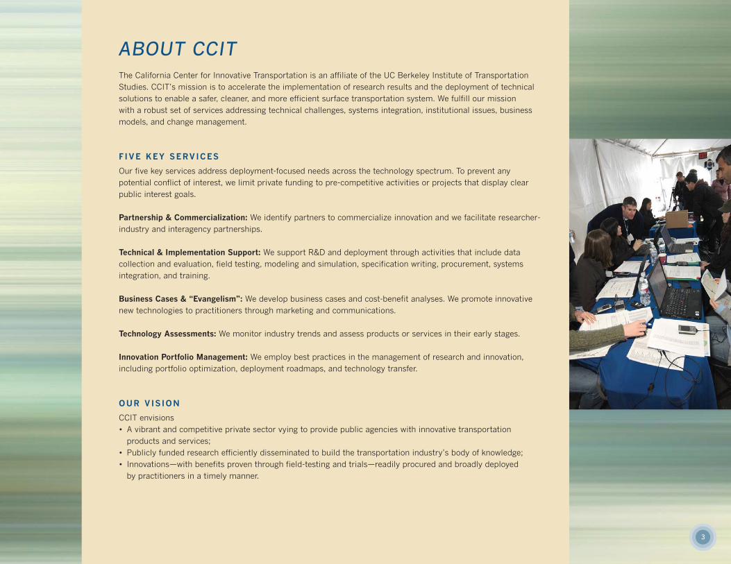
ABOUT CCITThe California Center for Innovative Transportation is an affiliate of the UC Berkeley Institute of TransportationStudies. CCIT’s mission is to accelerate the implementation of research results and the deployment of technicalsolutions to enable a safer, cleaner, and more efficient surface transportation system. We fulfill our mission with a robust set of services addressing technical challenges, systems integration, institutional issues, businessmodels, and change management.
F IVE KEY SERVICES
Our five key services address deployment-focused needs across the technology spectrum. To prevent any potential conflict of interest, we limit private funding to pre-competitive activities or projects that display clearpublic interest goals.
Partnership & Commercialization: We identify partners to commercialize innovation and we facilitate researcher-industry and interagency partnerships.
Technical & Implementation Support: We support R&D and deployment through activities that include data collection and evaluation, field testing, modeling and simulation, specification writing, procurement, systems integration, and training.
Business Cases & “Evangelism”: We develop business cases and cost-benefit analyses. We promote innovativenew technologies to practitioners through marketing and communications.
Technology Assessments: We monitor industry trends and assess products or services in their early stages.
Innovation Portfolio Management: We employ best practices in the management of research and innovation, including portfolio optimization, deployment roadmaps, and technology transfer.
OUR VIS ION
CCIT envisions• A vibrant and competitive private sector vying to provide public agencies with innovative transportation
products and services;• Publicly funded research efficiently disseminated to build the transportation industry’s body of knowledge;• Innovations—with benefits proven through field-testing and trials—readily procured and broadly deployed
by practitioners in a timely manner.

4
MESSAGE FROM THE DIRECTOR
DEAR COLLEAGUES,
The past two years—my first two complete years at CCIT—have brought breakthroughs, challenges, milestones, and growth for this young organization.
Our Mobile Century and Mobile Millennium projects broke new ground in research on traffic data collection and the development of location-based services.Our Traveler Information on Changeable Message Signs project quantified and analyzed ways that public agencies can provide the most valuable and timely information to motorists already en route. EDAPTS developed comprehensive resources to help rural transit districts benefit from intelligent transport systems(ITS), including technical assistance and procurement guidance. Our CalFranceproject created a framework for collaboration between California researchers orpractitioners and our international counterparts. From traffic information to ITS solutions to collaborations, browse our Project Highlights, starting on the facing page.
At this writing, projects for 2010 and 2011 are already well underway. CCIT is engaged in traveler-information enhancements, transit improvements, and, mostnotably, a data-fusion initiative for traffic monitoring and forecasting that will ensure California’s leadership in the use of sophisticated real-time traffic information to manage its roadways. Read more about what’s ahead on page 15.
As we go forward, we understand that the future holds technology yet to be invented, paradigms yet to be changed. But people’s quest for improved information—and improved access to it—is at the heart of contemporary society.CCIT is committed to accelerating innovations in information and technology that support this quest, and to deploy those innovations into the real world toimprove the lives of the traveling public.
Thomas WestDirector
PAGE 5, TOP: A message sign on U.S. 101 in Millbrae shows drivers how much time
they can save by taking Caltrain. Photo: Jay Sullivan
PAGE 5, BOTTOM: Estimated time of arrival for the next bus is provided at this
San Luis Obispo bus stop as part of EDAPTS implementation.
5
PROJECT HIGHLIGHTSOur projects speak volumes about CCIT’s capabilities to bring innovations to the transportation network. In 2008 and 2009, we put more than $7 million dollars of research funds to work. Because we can’t possibly show you all of our work on a few short pages,we’ve included summaries from several different key service areas. More details on these and on all of our recent and active projectsare available at www.calccit.org, on the “Projects” tab.
TRAVELER INFORMATION ON CHANGEABLE MESSAGE S IGNS
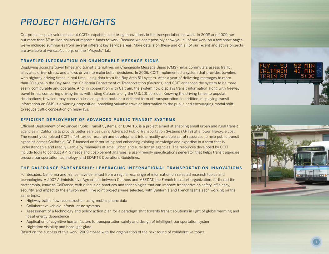
Displaying accurate travel times and transit alternatives on Changeable Message Signs (CMS) helps commuters assess traffic, alleviates driver stress, and allows drivers to make better decisions. In 2006, CCIT implemented a system that provides travelerswith highway driving times in real time, using data from the Bay Area 511 system. After a year of delivering messages to more than 20 signs in the Bay Area, the California Department of Transportation (Caltrans) and CCIT enhanced the system to be moreeasily configurable and operable. And, in cooperation with Caltrain, the system now displays transit information along with freeway travel times, comparing driving times with riding Caltrain along the U.S. 101 corridor. Knowing the driving times to popular destinations, travelers may choose a less-congested route or a different form of transportation. In addition, displaying transit information on CMS is a winning proposition, providing valuable traveler information to the public and encouraging modal shift to reduce traffic congestion on highways.
EFFIC IENT DEPLOYMENT OF ADVANCED PUBLIC TRANSIT SYSTEMS
Efficient Deployment of Advanced Public Transit Systems, or EDAPTS, is a project aimed at enabling small urban and rural transitagencies in California to provide better services using Advanced Public Transportation Systems (APTS) at a lower life-cycle cost. The recently completed CCIT effort turned research and development into a readily available set of resources to help public transitagencies across California. CCIT focused on formulating and enhancing existing knowledge and expertise in a form that is understandable and readily usable by managers at small urban and rural transit agencies. The resources developed by CCIT include tools to conduct APTS needs and cost/benefit analyses, a user-friendly specifications generator that helps transit agenciesprocure transportation technology, and EDAPTS Operations Guidelines.
THE CALFRANCE PARTNERSHIP : LEVERAGING INTERNATIONAL TRANSPORTATION INNOVATIONS
For decades, California and France have benefited from a regular exchange of information on selected research topics and technologies. A 2007 Administrative Agreement between Caltrans and MEEDAT, the French transport organization, furthered thepartnership, know as CalFrance, with a focus on practices and technologies that can improve transportation safety, efficiency, security, and impact to the environment. Five joint projects were selected, with California and French teams each working on thesame topic: • Highway traffic flow reconstruction using mobile phone data• Collaborative vehicle-infrastructure systems• Assessment of a technology and policy action plan for a paradigm shift towards transit solutions in light of global warming and
fossil energy dependence• Application of cognitive human factors to transportation safety and design of intelligent transportation system• Nighttime visibility and headlight glareBased on the success of this work, 2009 closed with the organization of the next round of collaborative topics.
6
PROJECT HIGHLIGHTS (CONTINUED)
MOBILE CENTURY
On February 8, 2008, CCIT, Caltrans, Nokia, and UC Berkeley’s Department of Civil and Environmental Engineering collaborated to conduct an unprecedented proof-of-concept experiment in the area of traffic monitoring. The goal of this controlled field experiment was totest traffic-data collection from cell phones equipped with a global positional system (GPS) that were driving on a stretch of highway in the San Francisco Bay Area. One hundred vehiclescarrying the GPS-enabled Nokia N95 phones drove along a 10-mile stretch of I-880 from 9:30 a.m. to 6:30 p.m. The principal objectives for this experiment were to feature 1) Online, real-time data assimilation; 2) Privacy preservation; 3) Data efficiency, i.e. not requiring excessive smartphone measurements. The success of this large-scale event, both technically andlogistically, led to a broader public-private partnership in support of the next research step,named the Mobile Millennium Project. In January 2010, data from Mobile Century was releasedto the transportation researcher community for further study.
MOBILE MILLENNIUM
Mobile Millennium is a pilot traffic-monitoring system that uses the GPS in cellular phones togather traffic information, process it, and distribute it back to the phones in real time. The public-private research collaboration (CCIT, UC Berkeley Department of Civil and EnvironmentalEngineering, Caltrans, Nokia Research Center, and NAVTEQ) launched the pilot from the Berkeley campus on November 10, 2008. It ran for exactly 12 months. During that time, morethan 5,000 users downloaded the experimental traffic software onto their phones. As a key focus of the project, the team built in high levels of privacy that separated position data from information about individual phone users. These included collecting the data using “virtual triplines”—data collection points that yield only traffic information and do not detect a user’s personal information—and transmitting the data using banking-grade encryption. The project advanced the field of location-based services, and remains operational at UC Berkeley, integrating numerous feeds into traffic models, include data obtained from GPS-enabled mobilephones, all of San Francisco’s taxis (through GPS), plus radar, loop detectors, and historicaldatabases. The Mobile Millennium team is currently working to provide the same high-quality,real-time travel information on arterials.
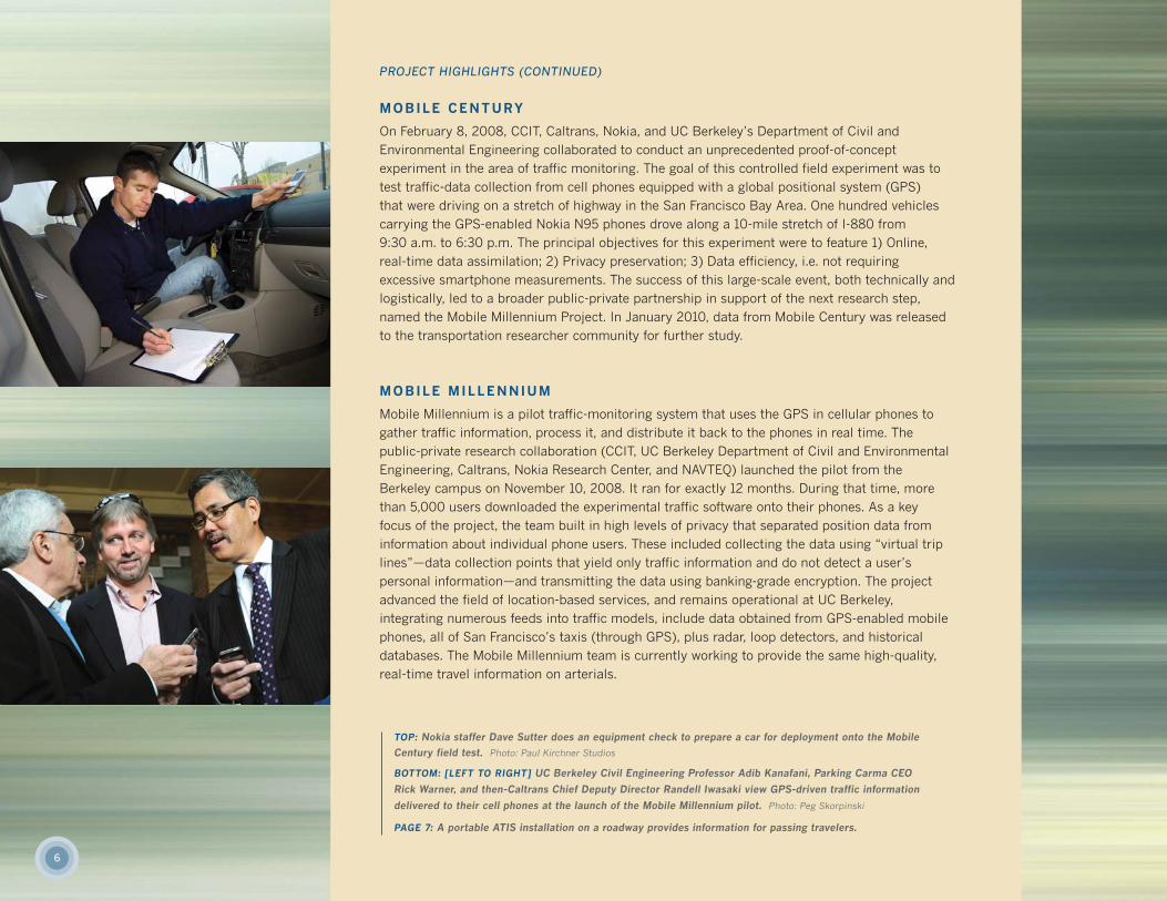
TOP: Nokia staffer Dave Sutter does an equipment check to prepare a car for deployment onto the Mobile
Century field test. Photo: Paul Kirchner Studios
BOTTOM: [LEFT TO RIGHT] UC Berkeley Civil Engineering Professor Adib Kanafani, Parking Carma CEO
Rick Warner, and then-Caltrans Chief Deputy Director Randell Iwasaki view GPS-driven traffic information
delivered to their cell phones at the launch of the Mobile Millennium pilot. Photo: Peg Skorpinski
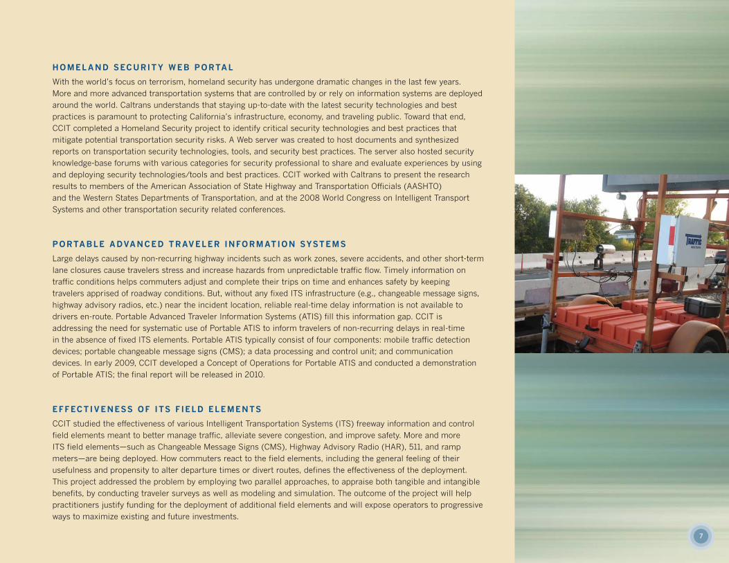
PAGE 7: A portable ATIS installation on a roadway provides information for passing travelers.
7
HOMELAND SECURITY WEB PORTAL
With the world’s focus on terrorism, homeland security has undergone dramatic changes in the last few years. More and more advanced transportation systems that are controlled by or rely on information systems are deployedaround the world. Caltrans understands that staying up-to-date with the latest security technologies and best practices is paramount to protecting California’s infrastructure, economy, and traveling public. Toward that end,CCIT completed a Homeland Security project to identify critical security technologies and best practices that mitigate potential transportation security risks. A Web server was created to host documents and synthesized reports on transportation security technologies, tools, and security best practices. The server also hosted securityknowledge-base forums with various categories for security professional to share and evaluate experiences by usingand deploying security technologies/tools and best practices. CCIT worked with Caltrans to present the research results to members of the American Association of State Highway and Transportation Officials (AASHTO) and the Western States Departments of Transportation, and at the 2008 World Congress on Intelligent Transport Systems and other transportation security related conferences.
PORTABLE ADVANCED TRAVELER INFORMATION SYSTEMS
Large delays caused by non-recurring highway incidents such as work zones, severe accidents, and other short-termlane closures cause travelers stress and increase hazards from unpredictable traffic flow. Timely information on traffic conditions helps commuters adjust and complete their trips on time and enhances safety by keeping travelers apprised of roadway conditions. But, without any fixed ITS infrastructure (e.g., changeable message signs,highway advisory radios, etc.) near the incident location, reliable real-time delay information is not available to drivers en-route. Portable Advanced Traveler Information Systems (ATIS) fill this information gap. CCIT is addressing the need for systematic use of Portable ATIS to inform travelers of non-recurring delays in real-time in the absence of fixed ITS elements. Portable ATIS typically consist of four components: mobile traffic detectiondevices; portable changeable message signs (CMS); a data processing and control unit; and communication devices. In early 2009, CCIT developed a Concept of Operations for Portable ATIS and conducted a demonstrationof Portable ATIS; the final report will be released in 2010.
EFFECTIVENESS OF ITS F IELD ELEMENTS
CCIT studied the effectiveness of various Intelligent Transportation Systems (ITS) freeway information and controlfield elements meant to better manage traffic, alleviate severe congestion, and improve safety. More and more ITS field elements—such as Changeable Message Signs (CMS), Highway Advisory Radio (HAR), 511, and ramp meters—are being deployed. How commuters react to the field elements, including the general feeling of their usefulness and propensity to alter departure times or divert routes, defines the effectiveness of the deployment.This project addressed the problem by employing two parallel approaches, to appraise both tangible and intangiblebenefits, by conducting traveler surveys as well as modeling and simulation. The outcome of the project will helppractitioners justify funding for the deployment of additional field elements and will expose operators to progressiveways to maximize existing and future investments.
8
ACADEMICS
Journal Publications
• “A traffic model for velocity data assimilation,” D. Work, S.
Blandin, O.-P. Tossavainen, B. Piccoli and A. Bayen,
Applied Mathematics Research eXpress (AMRX). At press;
to appear 2010.
• “Lax-Hopf based incorporation of internal boundary conditions
into Hamilton-Jacobi equation. Part I: Theory,” C. Claudel and
A. Bayen. IEEE Transactions on Automatic Control. At press;
to appear 2010.
• “Lax-Hopf based incorporation of internal boundary conditions
into Hamilton-Jacobi equation. Part II: Computational
methods,” C. Claudel and A. Bayen. IEEE Transactions on
Automatic Control. At press; to appear 2010.
• “Evaluation of traffic data obtained via GPS-enabled mobile
phones: the Mobile Century field experiment,” J.-C. Herrera,
D. Work, X. Ban, R. Herring, Q. Jacobson and A. Bayen.
Transportation Research C. At press, 2009.
doi:10.1016/j.trc.2009.10.006.
• “Incorporation of Lagrangian measurements in freeway traffic
state estimation,” J.-C. Herrera and A. Bayen. Transportation
Research B. At press, 2009. doi:10.1016/j.trb.2009.10.005.
• “Delay pattern estimation for signalized intersections using
sampled travel times,” J. Ban, R. Herring, P. Hao, and A. Bayen,
Transportation Research Record, No. 2130, pp. 109–119, 2009.
doi:10.3141/2130-14.
• “Dirichlet problems for some Hamilton-Jacobi equations with
inequality constraints,” J.-P. Aubin, A. Bayen, P. Saint-Pierre,
SIAM Journal on Control and Optimization, 47(5), pp. 2348–
2380, 2008, doi:10.1137/060659569.
Technical Reports
• “Evaluation of Displaying Transit Information on Changeable
Message Signs,” Mortazavi, Ali; Pan, Xiaohong; Jin, Eui Jae;
Odioso, Marin, August 2009, Caltrans Report.
• “Homeland Security: Keeping Abreast of Transportation
Security Technologies and Best Practices,” Chiou, Bensen,
UCB-ITS-CWP-2008-2.
• “Monitoring of High-Occupancy Vehicle Lanes in Districts 3 &
4,” Robinson, Ellen and Margulici, JD, UCB-ITS-CWP-2008-1.
• “Travel Time Variability Analysis: CA-154 and U.S. 101 from
Los Olivos to Santa Barbara,” Mortazavi, Ali; Sun, Zhen;
Adjaka, Kossi, May 2009, Caltrans Report.
Peer-Reviewed Conferences
• “Path and travel time inference from GPS probe vehicle data,”
T. Hunter, R. Herring, P. Abbeel, A. Bayen, Neural Information
Processing Systems foundation (NIPS), Vancouver, Canada,
Dec. 2009.
• 48th IEEE Conference on Decision and Control, Shanghai, China,
Dec. 2009:
— “Kernel regression for travel-time estimation via convex
optimization,” S. Blandin, L. El Ghaoui and A. Bayen.
— “Quadratic programming based data assimilation with
passive drifting sensors for shallow water flows,” A. Tinka,
I. Strub, Q. Wu and A. Bayen.
— “Kalman filter based estimation of flow states in open
channels using Lagrangian sensing,” M. Rafiee, Q. Wu and
A. Bayen.
— “Dirichlet problems for some Hamilton-Jacobi equations with
inequality constraints,” J.-P. Aubin, A. Bayen, P. Saint-Pierre.
• “Minimal error certificates for detection of faulty sensors using
convex optimization,” C. Claudel and A. Bayen. 2009 Allerton
Conference on Communication and Control, Allerton, IL,
Sept. 2009.
• “Optimal sensor placement for freeway travel time estimation,”
X. Ban, R. Herring, J.-D. Margulici, A. Bayen, 18th International
Symposium on Transportation and Traffic Theory (ISTTT),
July 2009.
• “A general phase transition model for vehicular traffic,”
S. Blandin, D. Work, P. Goatin, B. Piccoli and A. Bayen, 2009 IFAC
Workshop on Control of Distributed Parameter Systems,
Toulouse, France, July 20-24, 2009.
• “Lagrangian Sensing: Traffic Estimation with Mobile Devices,”
D. Work, O.-P. Tossavainen, Q. Jacobson and A. Bayen,
2009 American Control Conference, June 2009.
• “Capturing Hybrid Vehicles in HOV Lanes,” Rajagopal, Ram;
Zhang; Mortazavi, Ali; Varaiya, Pravin; Kwong, Karric; and Wunder
Sheilon, 50th Annual Transportation Research Forum, Portland,
OR, March 2009.
• 88th Transportation Research Board Annual Meeting, Washington,
D.C., Jan. 2009:
— “Commuter Travel Time Information System: Displaying
Transit Messages on Changeable Message Signs.” Mortazavi,
Ali; Pan, Xiaohong; McDonald, Tia; Jin, Eui Jae; and
Odioso, Marin.
— “Guaranteed bounds on highway travel times using probe
and fixed data,” C. Claudel, A. Hofleitner, N. Mignerey,
A. Bayen.
— “Delay pattern estimation for signalized intersections using
sampled travel times,” X. Ban, R. Herring, P. Hao, and
A. Bayen.
• “An ensemble Kalman filtering approach to highway traffic
estimation using GPS enabled mobile devices,” D. Work, O.-P.
Tossavainen, S. Blandin, A. Bayen, T. Iwuchukwu, K. Tracton,
47th IEEE Conference on Decision and Control, pp. 5062-5068,
Cancun, Mexico, Dec. 2008. doi:10.1109/CDC.2008.4738999.
• “Impacts of the Mobile Internet on Transportation Cyber -
physical Systems: Traffic Monitoring Using smartphones,”
D. Work and A. Bayen, National Workshop for Research on
High-Confidence Transportation Cyber-Physical Systems:
Automotive, Aviation and Rail, Washington, D.C., November
18-20, 2008.
• 15th World Congress on Intelligent Transportation Systems,
New York, NY, Nov. 2008:
— “State-of-the-Practice and Opportunities for Advanced
Traveler Information Systems (ATIS),” Kumar M. and
O. Elhamshary, November 2008.
— “Development of a Prototype Traveler Information System
for Rural Work Zones: Parts 1-3,” Kumar M. and D. Galarus.
— “Methods for Generating Travel Time Representation from
Probe Vehicle Data,” Mortazavi, Ali and Ban, Jeff.
— “Mobile Century – Using GPS Mobile Phones as Traffic
Sensors: A Field Experiment,” S. Amin et al.
• Guaranteed bounds for traffic flow parameters estimation using
mixed Lagrangian-Eulerian sensing,” C. Claudel and A. Bayen,
46th Annual Allerton Conference on Communication, Control,
and Computing, Allerton, IL, Sept. 23-26, 2008.
• Virtual trip lines for distributed privacy preserving traffic
monitoring,” B. Hoh, M. Gruteser, R. Herring, J. Ban, D. Work,
J.-C. Herrera, A. Bayen, M. Annavaram, Q. Jacobson, Mobile
Systems and Applications (MOBISYS), June 17-18, 2008,
Brekenridge, CO. doi:10.1145/1378600.1378604.
• Automotive cyber physical systems in the context of human
mobility,” D. Work, A. Bayen, and Q. Jacobson, National
Workshop on High-Confidence Automotive Cyber-Physical
Systems, Troy, MI, April 3-4, 2008.
• Traffic flow reconstruction using mobile sensors and loop
detector data,” J.C. Herrera and A. Bayen, 87th Transportation
Research Board Annual Meeting, Washington D.C., January
13-17, 2008.
PUBLICATIONS
Documentation is at the core of engineering. As part of one of the world’s leading public research institutions, CCIT’s graduate students, facultyprincipal investigators, and staff engineers regularly advance the field through journal publications, academic papers, and technical reports.Below is a sample of publications from 2008 and 2009.
9
PEOPLE
Graduate student researchers (GSRs) are the heart and soulof the Institute of Transportation Studies, providing paid, hands-on research opportunities with Berkeley’s world-renowntransportation engineering faculty. CCIT accepts an average of15 GSRs per term; their work is critical to CCIT’s research operations and leads to papers that are published in journalsand presented at conferences. Faculty Principal Investigatorsuse the research relationship to help guide their students toward meeting their broader educational goals; the GSRs alsowork directly with a CCIT project manager, getting business-oriented direction on the specific tasks and deadlines relatedto their research.
American University-Beruit has been working with UC Berkeley to place students who want experience working in a cutting-edge research center in the U.S. Working as interns, the students spend an entire summer semester applying themselves to CCIT projects and experiencing the San Francisco Bay Area.
Undergraduate Student Assistants join the CCIT team to perform a variety of the tasks that make projects operate andbring results. From updating Web sites to processing data to answering phones, these students learn about the researchprocess through first-hand participation while they work tosupport their education.
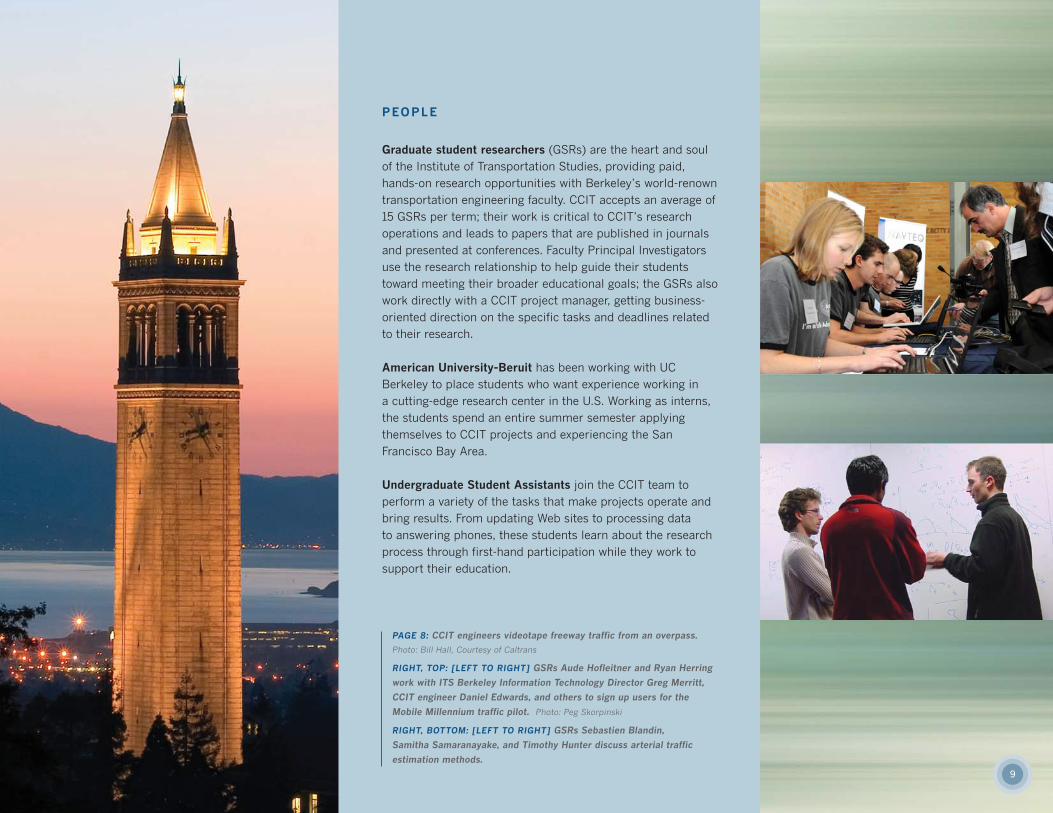
PAGE 8: CCIT engineers videotape freeway traffic from an overpass.
Photo: Bill Hall, Courtesy of Caltrans
RIGHT, TOP: [LEFT TO RIGHT] GSRs Aude Hofleitner and Ryan Herring
work with ITS Berkeley Information Technology Director Greg Merritt,
CCIT engineer Daniel Edwards, and others to sign up users for the
Mobile Millennium traffic pilot. Photo: Peg Skorpinski
RIGHT, BOTTOM: [LEFT TO RIGHT] GSRs Sebastien Blandin,
Samitha Samaranayake, and Timothy Hunter discuss arterial traffic
estimation methods.
10
OUTREACH ACTIVITIESInteracting with the public is intrinsic to our work as transportation professionals. CCIT believes that researchers and agencies gain enormous benefits by explaining and promoting emerging technologies to theultimate end-users. Sharing our work—and our enthusiasm—garners valuable support for the idea that publicdollars spent on research ultimately benefit everyone.
TRAVEL CONNECTIONS
Hard data is one of the foundations of science. But what about soft data? Sometimes the best way to find outwhether people found a new technology useful is to ask them. As part of its research, the Travel Times onChangeable Message Signs project team implemented a commuter survey, asking people questions to determine whether they saw the signs, understood information, and, most importantly, changed their behavioras a result. According to project manager Ali Mortazavi, “the survey responses presented a key counterbalanceto the technical aspects of the study, and gave the team valuable insight into rider perceptions.”
VISUALIZE NO TRAFFIC
CCIT was proud to contribute one of the inaugural exhibits for the Technology Museum at the Center for Intelligent Technology in the Interest of Society (CITRIS). The Tech Museum is part of CITRIS’s glistening new home in Sutarja-Dai Hall, which opened in October 2009 to great fanfare. The Mobile Millennium traffic visualizer is an interactive touch-screen map showing live traffic in the Bay Area generated by data from the project’s aggregated traffic feeds.
MISSION: DOWNLOADS
To recruit and retain thousands of “Early Adopters” willing to use research-grade technology in exchange forfree cutting-edge traffic information, CCIT’s Mobile Millennium project waged a multimedia campaign, including a media event, a Web site, campus-news stories, student recruiters, flyers, and an e-newsletter. The exposure resulted in more than 5,000 software downloads.
AIR-POWERED CARS
The next generation of transportation engineers has already been born. To coax out those talents, CCIT assembled a team of volunteers for UC Berkeley’s Cal Day, when more than 40,000 neighbors, friends, alumni,and potential students descend on the campus’s biggest open house of the year. In both 2008 and 2009, ourballoon-car building station was one of the hottest family activities of the day. Not only did we put smiles onthe faces of both kids and parents, but our hands-on interactions with the public promoted an understandingof the value of research, and planted seeds to encourage the transportation leaders of the future.
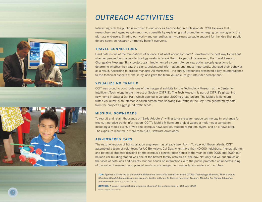
TOP: Against a backdrop of the Mobile Millennium live-traffic visualizer in the CITRIS Technology Museum, Ph.D. student
Christian Claudel demonstrates the project's traffic software to Valérie Pécresse, France’s Minister for Higher Education
and Research. Photo: Coralie Claudel
BOTTOM: A young transportation engineer shows off his achievement at Cal Day 2009.
Photo: Beth Muramoto
11
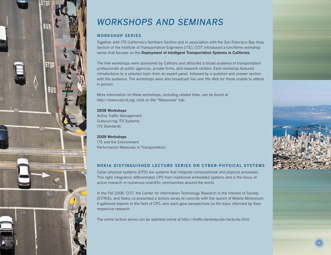
WORKSHOPS AND SEMINARSWORKSHOP SERIES
Together with ITS California’s Northern Section and in association with the San Francisco Bay AreaSection of the Institute of Transportation Engineers (ITE), CCIT introduced a lunchtime workshopseries that focuses on the Deployment of Intelligent Transportation Systems in California.
The free workshops were sponsored by Caltrans and attracted a broad audience of transportationprofessionals at public agencies, private firms, and research centers. Each workshop featured introductions to a selected topic from an expert panel, followed by a question and answer sectionwith the audience. The workshops were also broadcast live over the Web for those unable to attendin person.
More information on these workshops, including related links, can be found athttp://www.calccit.org; click on the “Resources” tab.
2008 WorkshopsActive Traffic Management Outsourcing ITS Systems ITS Standards
2009 WorkshopsITS and the Environment Performance Measures in Transportation
NOKIA DISTINGUISHED LECTURE SERIES ON CYBER-PHYSICAL SYSTEMS
Cyber-physical systems (CPS) are systems that integrate computational and physical processes.This tight integration differentiates CPS from traditional embedded systems and is the focus of active research in numerous scientific communities around the world.
In the Fall 2008, CCIT, the Center for Information Technology Research in the Interest of Society(CITRIS), and Nokia co-presented a lecture series to coincide with the launch of Mobile Millennium.It gathered experts in the field of CPS, who each gave perspectives on the topic informed by theirrespective research.
The entire lecture series can be watched online at http://traffic.berkeley.edu/lectures.html.
12
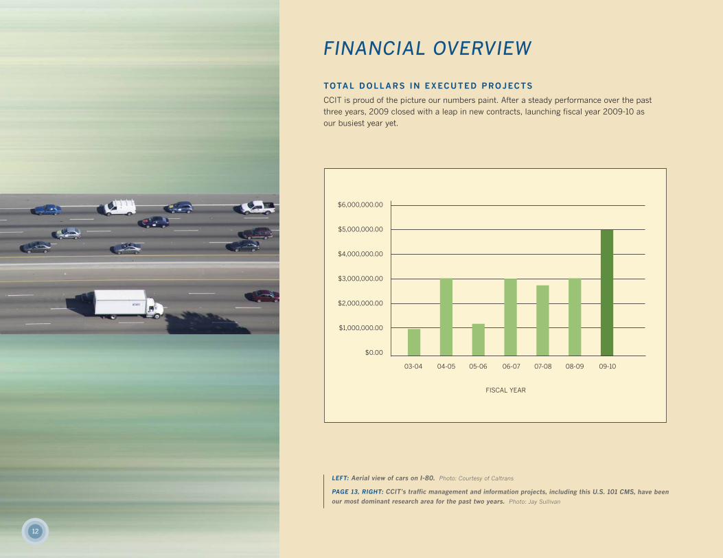
FINANCIAL OVERVIEW
TOTAL DOLLARS IN EXECUTED PROJECTS
CCIT is proud of the picture our numbers paint. After a steady performance over the pastthree years, 2009 closed with a leap in new contracts, launching fiscal year 2009-10 asour busiest year yet.
$6,000,000.00
$5,000,000.00
$4,000,000.00
$3,000,000.00
$2,000,000.00
$1,000,000.00
$0.00
03-04 04-05 05-06 06-07 07-08 08-09 09-10
FISCAL YEAR
LEFT: Aerial view of cars on I-80. Photo: Courtesy of Caltrans
PAGE 13, RIGHT: CCIT’s traffic management and information projects, including this U.S. 101 CMS, have beenour most dominant research area for the past two years. Photo: Jay Sullivan
13
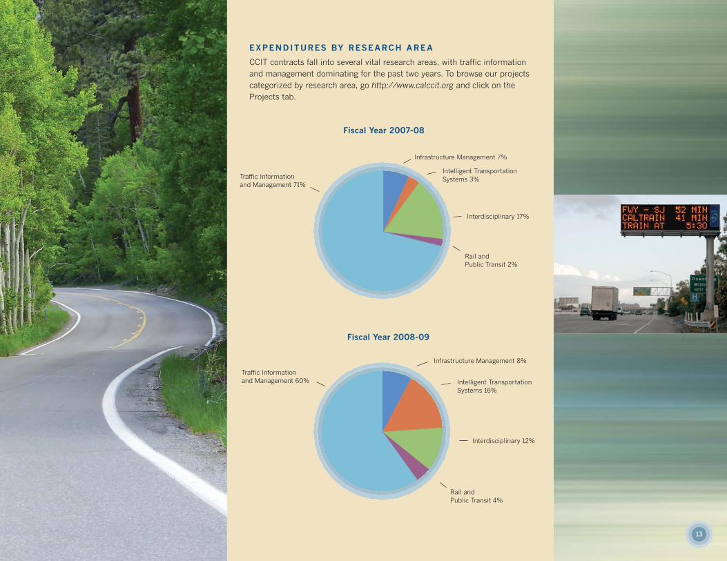
EXPENDITURES BY RESEARCH AREA
CCIT contracts fall into several vital research areas, with traffic informationand management dominating for the past two years. To browse our projectscategorized by research area, go http://www.calccit.org and click on the Projects tab.
Fiscal Year 2007-08
Fiscal Year 2008-09
Infrastructure Management 7%
Infrastructure Management 8%
Intelligent TransportationSystems 3%
Interdisciplinary 17%
Rail and Public Transit 2%
Traffic Information and Management 71%
Traffic Information and Management 60% Intelligent Transportation
Systems 16%
Interdisciplinary 12%
Rail and Public Transit 4%
14
NEWS HIGHLIGHTS
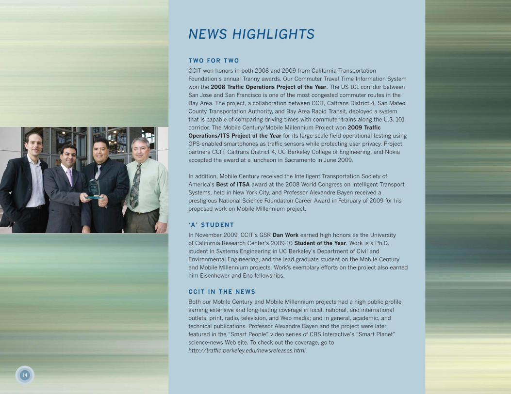
TWO FOR TWO
CCIT won honors in both 2008 and 2009 from California Transportation Foundation’s annual Tranny awards. Our Commuter Travel Time Information Systemwon the 2008 Traffic Operations Project of the Year. The US-101 corridor betweenSan Jose and San Francisco is one of the most congested commuter routes in theBay Area. The project, a collaboration between CCIT, Caltrans District 4, San MateoCounty Transportation Authority, and Bay Area Rapid Transit, deployed a system that is capable of comparing driving times with commuter trains along the U.S. 101corridor. The Mobile Century/Mobile Millennium Project won 2009 Traffic Operations/ITS Project of the Year for its large-scale field operational testing usingGPS-enabled smartphones as traffic sensors while protecting user privacy. Projectpartners CCIT, Caltrans District 4, UC Berkeley College of Engineering, and Nokia accepted the award at a luncheon in Sacramento in June 2009.
In addition, Mobile Century received the Intelligent Transportation Society of America’s Best of ITSA award at the 2008 World Congress on Intelligent TransportSystems, held in New York City, and Professor Alexandre Bayen received a prestigious National Science Foundation Career Award in February of 2009 for hisproposed work on Mobile Millennium project.
‘A ’ STUDENT
In November 2009, CCIT’s GSR Dan Work earned high honors as the University of California Research Center’s 2009-10 Student of the Year. Work is a Ph.D. student in Systems Engineering in UC Berkeley’s Department of Civil and Environmental Engineering, and the lead graduate student on the Mobile Centuryand Mobile Millennium projects. Work's exemplary efforts on the project also earnedhim Eisenhower and Eno fellowships.
CCIT IN THE NEWS
Both our Mobile Century and Mobile Millennium projects had a high public profile,earning extensive and long-lasting coverage in local, national, and international outlets; print, radio, television, and Web media; and in general, academic, and technical publications. Professor Alexandre Bayen and the project were later featured in the “Smart People” video series of CBS Interactive’s “Smart Planet” science-news Web site. To check out the coverage, go tohttp://traffic.berkeley.edu/newsreleases.html.
15
LOOKING AHEAD
As one the top universities in the world, UC Berkeley is rich with history, achievement, and a reverence for learningfrom what came before us. But with more than $4 million worth of projects already in the works for 2010 and well beyond, CCIT researchers are also steeped in the present and the future.
Our key theme for the upcoming year can best be described as: data, data, data. An umbrella project we are calling the Traffic Data Management Institute is the beginning of CCIT’s large and coordinated effort to transform California’straffic-data collection, assimilation, analysis, modeling, and forecasting capabilities. Building on work from 2008 and2009, we will further our development of algorithms that assimilate data from a variety of sources, including mobilesensors, and we will work with new communication technologies to develop real-time, enhanced-quality information fortravelers where and when they need it.
In the coming year, CCIT will continue to improve the long-successful Berkeley Highway Laboratory (BHL) test-bedprogram with the installation of state-of-the-art detection devices that will be beneficial to transportation researchersfrom around the world. BHL will also test its data-sending capabilities through a sophisticated cellular network, striving to send more data using less bandwidth.
Other key areas of focus include High Occupancy Vehicle (HOV) Lane Management in the San Francisco Bay Area,Smart Parking in San Diego in conjunction with the Coaster Commuter Train service, and the evaluation of a new Dynamic Lane Management system in the Los Angeles area. This range of projects defines CCIT—the diversity of projects we tackle, our relevance to current issues, and our statewide reach.
Most importantly, we will continue to select and propose only those projects that we believe play meaningful and significant roles in shaping a future surface-transportation network that is safe, clean, and efficient. With fiscal year2009-2010 already marking a high point in our seven-year history, CCIT continues to demonstrate our expertise in getting technological innovations—the right ones—moved out of research labs and deployed into the transportationnetwork.
PAGE 14: [LEFT TO RIGHT] JD Margulici and Ali Mortazavi (CCIT), and Larry Orcutt and Greg Larson (Caltrans) accept the “Best of ITS”
award at the 2008 ITS World Congress. Photo: Bill Stone
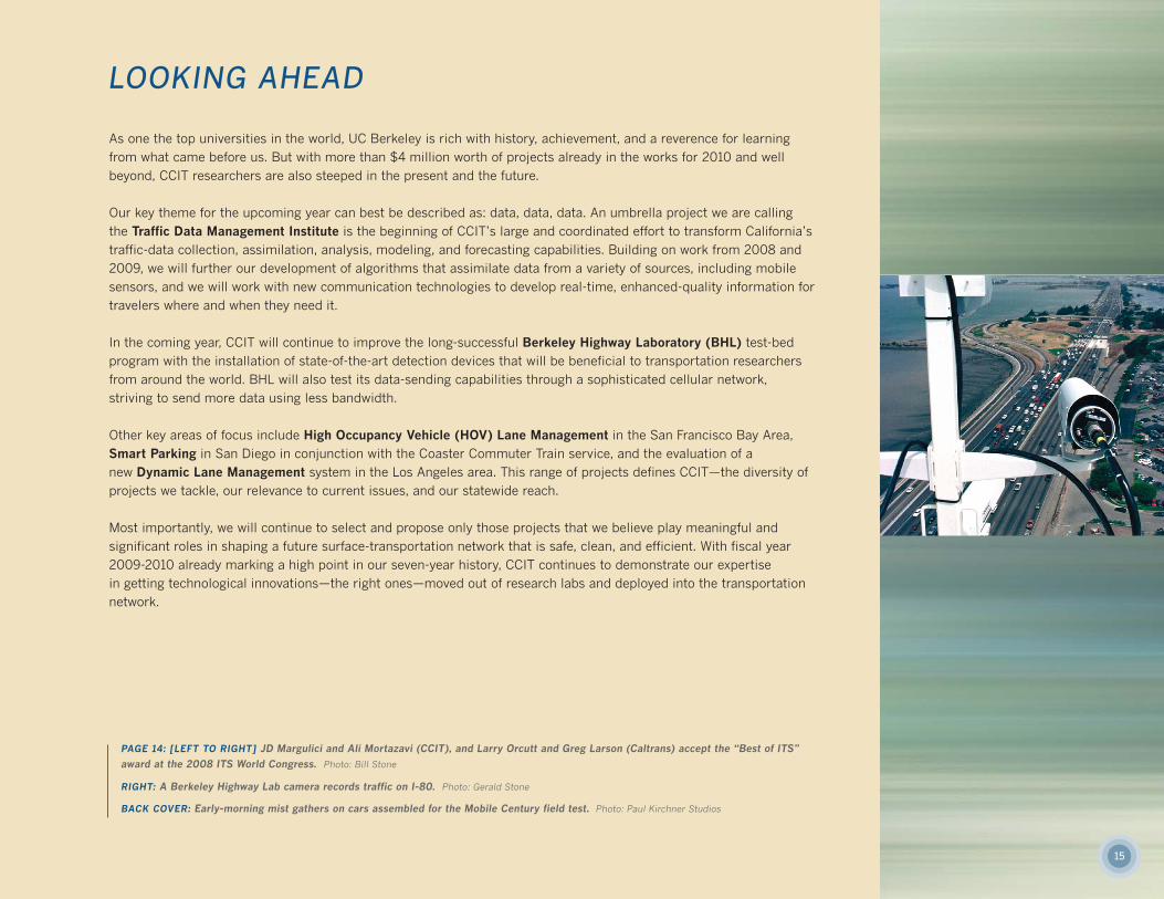
RIGHT: A Berkeley Highway Lab camera records traffic on I-80. Photo: Gerald Stone
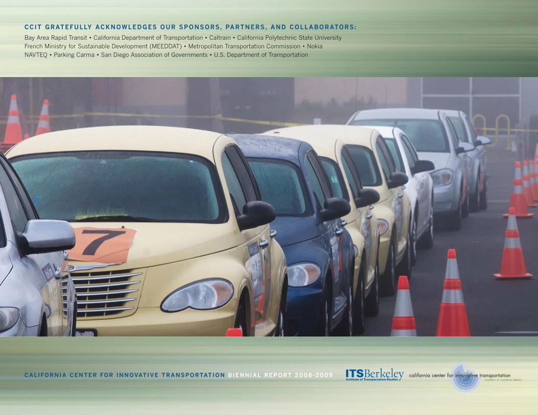
BACK COVER: Early-morning mist gathers on cars assembled for the Mobile Century field test. Photo: Paul Kirchner Studios
CCIT GRATEFULLY ACKNOWLEDGES OUR SPONSORS, PARTNERS, AND COLLABORATORS:
Bay Area Rapid Transit • California Department of Transportation • Caltrain • California Polytechnic State University French Ministry for Sustainable Development (MEEDDAT) • Metropolitan Transportation Commission • Nokia NAVTEQ • Parking Carma • San Diego Association of Governments • U.S. Department of Transportation
CALIFORNIA CENTER FOR INNOVATIVE TRANSPORTATION BIENNIAL REPORT 2008-2009