Embed Size (px)
Citation preview

[1]
City Center Neighborhood Plan As adopted by Ordinance No. 2014-09-049 and amended by Ordinance Nos. Formerly CBD Neighborhood as adopted by Ordinance No. 8868 and amended by Ordinance Nos. 8946, 9693, 9717, 10317, 2004-12-087, 2008-03-022 and 2014-09-049.
City Center Neighborhood Plan – September 23, 2014
[2] Neighborhood Plan Adoption: In 1980, the Bellingham Plan was adopted and included individual plans for each neighborhood. When the Washington State Growth Management Act (GMA) was adopted in 1990, the City was required to update and amend the Bellingham Plan to include comprehensive planning elements required by the GMA. The Bellingham Comprehensive Plan was adopted in 1995 and again included all of the individual neighborhood plans. Neighborhood Plan Amendment: The Bellingham Municipal Code (BMC) 20.20 includes procedures by which individual property owners may petition the City for an amendment to an individual neighborhood plan. This may be a simple text amendment to address a condition or concern in a particular neighborhood or it may be a request for a change to the land use designation in a portion of a neighborhood. Because the neighborhood plans are adopted as part of the Bellingham Comprehensive Plan, the GMA restricts amendments to once per year. The deadline for submitting neighborhood plan amendments to the City is December 1 of each year (See BMC 20.20). An amendment to a neighborhood plan is made by ordinance. All of the changes made to this plan since it was originally adopted are listed on the last page of the plan. Neighborhood Plan Update: Periodically, individual neighborhood plans merit a complete update due to changes of conditions in the neighborhood and/or the City. A complete neighborhood plan update can be a complex process requiring a great deal of time, public participation, and planning staff resources. Some of the individual neighborhood plans that were originally adopted in 1980 have received complete updates, while others have not.
City Center Neighborhood Plan – September 23, 2014

[3]
CITY CENTER NEIGHBORHOOD PLAN SECTION I. NEIGHBORHOOD CHARACTER 1.1 The City Center Neighborhood includes the Downtown District, Waterfront District, Old Town District, and Squalicum Harbor. As the commercial, employment and entertainment center for Bellingham, the City Center Neighborhood has experienced building booms, commercial exodus, and the evolution from a traditional small town business district into a multi-use neighborhood1. In 2013, the area includes a variety of jobs, housing, entertainment, and services for a diverse and growing population.
In recent years, the City Center has seen significant new development. Since 2002, approximately 750 new housing units have been constructed and another 203 are in the permitting or construction phase. As a result, the total number of housing units in the City Center is now over 1,000. This new development has contributed greatly to the sense of optimism that surrounds the area. Even more residential development is expected in the Downtown, Old Town, and Waterfront districts in the coming decades.
1 See Chapter 2 of the Downtown Bellingham Plan for a brief history of the City Center Neighborhood.
City Center Neighborhood Plan – September 23, 2014

[4] With respect to employment, the City Center Neighborhood had around 8,450 jobs in 2011 (20% of total in-city jobs). Significant job growth can be accommodated in the Downtown, Old Town and Waterfront Districts. As established in countless planning efforts over the years, the City Center Neighborhood of the future will continue to be the cultural, social and economic center of the region. This role will be reinforced by a diverse job supply, housing for a range of income groups, an outstanding cultural/arts/entertainment district, increased retail development, improved access to the waterfront, preserved historic buildings, an active civic center, parking improvements, pedestrian-oriented streetscapes and a safe and vibrant street life. The City Center Neighborhood will be home to a mix of uses, so that retail, offices, housing and social/cultural facilities are located near one another. There will be large buildings in the downtown, but design requirements will ensure that new buildings reflect the traditional mass, scale and form in the downtown, yet allow flexibility for landmark and stylistic architecture. 1.2 The City Center portion of the Bellingham Bay waterfront extends from the Squalicum Creek Waterway south to approximately Palm Street. Included within this area are many commercial, industrial and marine related land uses. The waterfront has changed dramatically over the years, from a Native American fishing village to a bustling turn-of-the-century shipping center, to an industrial employment center. Then in 2005, when most of the Georgia Pacific pulp and paper mill operations had ended, much of the central waterfront area was purchased by the Port of Bellingham. Soon thereafter, the Port and City began a process to create a plan for redevelopment of the area, now known as the "Waterfront District". After a lengthy community process, the Waterfront District Sub-Area Plan was adopted in 20132. SECTION II. CITY CENTER NEIGHBORHOOD PLANNING 2.1 - The City Center has been the focus of a number of planning efforts over the years. Since just 2002, the following has occurred:
• 2000 Bellingham Bay Demonstration Pilot Project Comprehensive Strategy • 2002 City Center Master Plan and Design Guidelines • 2004-05 Public Facilities District - Cultural District plans • 2004 Waterfront Futures Group Vision and Framework Plan • 2006 Downtown Circulation and Parking Study • 2008 Old Town District Plan • 2011 Downtown Housing Analysis and Report • 2012 Historic Resource Survey and Inventory • 2013 Downtown Parking Study • 2013 Waterfront District Plan • 2014 Downtown Bellingham Plan
2 See Chapter 1 of the Waterfront District Subarea Plan for details of the extensive planning work that has occurred in Bellingham's central waterfront area.
City Center Neighborhood Plan – September 23, 2014

[5] While done at different times and by different stakeholders, all these plans had two things in common: 1) they recognized and reinforced the downtown’s critical importance to the city and region; and 2) they reaffirmed the long range vision for the area that includes, among other things:
Maintaining the downtown as the employment, civic, cultural, financial, and entertainment heart of the city and region.
Preserving historical buildings and sites. Increasing the supply of housing and jobs in and around the City Center. Increasing access to recreational opportunities and the waterfront.
A few of the more significant planning efforts are described here. 2.2 - The 2002 City Center Master Plan (CCMP) process was inspired by the many planning efforts that took place in the 1990s. The CCMP was intended to tie the various planning efforts together in one cohesive, coordinated document. After a lengthy public process to develop and review the CCMP, it was adopted as an addendum to this neighborhood plan. Many of the actions and projects identified in the CCMP were completed, and as a result, it was replaced by the Old Town Sub-Area Plan (2008), Waterfront District Sub-Area Plan (2013), and the Downtown Bellingham Plan (2014). 2.3 - Waterfront Futures Group (WFG). Bellingham’s central waterfront area has also been the focus of a number of planning efforts over the years. The resulting documents all identified the tremendous potential of the area, while at the same time lamenting the lack of public access and the fact that much of the downtown area had “turned its back” to Bellingham’s waterfront. The WFG was formed in January 2003 by the City of Bellingham and the Port of Bellingham. Eleven citizens were asked to take a fresh and independent look at the entire Bellingham Bay waterfront. Two years, dozens of meetings, and many thousands of working hours later, the group’s “Waterfront Vision and Framework Plan” and “Waterfront Action Plan” were completed. The WFG plans contained:
A “vision” for the future of Bellingham's marine shoreline areas. Thirty-nine general “guiding principles” (policy statements) and a number of
specific principles for the character areas. Specific recommendations for the character areas and an implementation
component designed to help accomplish the visions. The visions for the six “character areas” along the waterfront and the 39 general guiding principles were included in the Framework Goals and Policies chapter of Bellingham’s 2006 Comprehensive Plan. The WFG's "Squalicum" and "City Center" character areas are within the boundaries of the City Center Neighborhood. The applicable City Center guiding principles were included in the Waterfront District Plan. The WFG’s vision for the Squalicum character area can be summarized in a few key statements:
City Center Neighborhood Plan – September 23, 2014

[6] Waterfront Futures Group’s “Squalicum” Character Area Vision3:
• Over time, the area will become a diverse center of marine-related activities and also include other light industry, commerce and residences.
• Continue developing the Bellwether Peninsula with retail, support services and some housing.
• Re-create marine habitat at the mouth of Squalicum Creek. • Enhance public access to the water and around the area.
2.4 - 2008 Old Town Plan. Bellingham's Comprehensive Plan established infill as the preferred method to accommodate and manage growth. A key this the infill strategy was establishment of a series of "urban centers". Now called "urban villages", these were areas where one could live in an urban environment, with employment, shopping and recreation opportunities nearby. The villages would serve as the neighborhood's focal point, with a pleasant and well-connected pedestrian and bicycle circulation network. The comprehensive plan recognized that master plans would be needed in order for the urban villages to develop as envisioned. The first area chosen to receive an urban village master plan was the "Old Town" portion of the City Center Neighborhood. The master planning process began in 2005 and concluded with the adoption of the Old Town Plan in 2008. The plan anticipates that between 860 and 1,120 new housing units and 400,000 square feet of Commercial space could be built in Old Town over the next 10 to 20 years.4
3 See the WFG Vision and Framework Plan for additional information on the Squalicum Character Area. 4 See the Old Town District Plan for details.
City Center Neighborhood Plan – September 23, 2014

[7] 2.5 - 2013 Waterfront District Plan (WD PLAN). The Waterfront District was the next portion of the City Center Neighborhood to be the subject of an intensive planning process. Bellingham's central waterfront area has changed dramatically over the years, from a Native American fishing village to a bustling turn-of-the-century shipping center, to an industrial employment center. Then in 2005, when most of the Georgia Pacific pulp and paper mill operations had ended, much of the area was purchased by the Port of Bellingham. Soon thereafter, the Port and City began a process to create a plan for redevelopment of the area now known as the "Waterfront District". After a lengthy community process, the Waterfront District Plan was adopted by the City and Port in 20135.
The WD Plan is similar to Bellingham's other urban village plans. The plan's goals, policies, and implementation strategies are intended to provide a framework for redevelopment of the site into a mixed-use urban neighborhood. The plan envisions up to 5.3 million square feet of development, including marine-related and other industries, commercial development, Western Washington University or other educational facilities, and over 1,600 housing units.6 Specific development regulations, design standards and a planned action ordinance were adopted to implement the goals and policies in the plan. A development agreement and an interlocal agreement for facilities were also approved by the Port of Bellingham
and the City in 2013. These documents address a number of issues related to the redevelopment of the Waterfront District, including the mix of land use types, development phasing, timing of infrastructure and park improvements, and affordable housing provisions.
5 See Chapter 1 of the Waterfront District Plan. 6 See Chapter 4 of the Waterfront District Plan.
City Center Neighborhood Plan – September 23, 2014
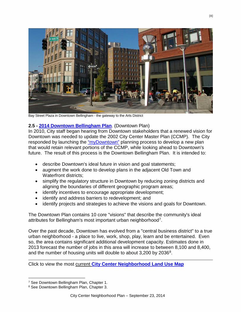
[8]
Bay Street Plaza in Downtown Bellingham - the gateway to the Arts District 2.5 - 2014 Downtown Bellingham Plan. (Downtown Plan) In 2010, City staff began hearing from Downtown stakeholders that a renewed vision for Downtown was needed to update the 2002 City Center Master Plan (CCMP). The City responded by launching the “myDowntown” planning process to develop a new plan that would retain relevant portions of the CCMP, while looking ahead to Downtown's future. The result of this process is the Downtown Bellingham Plan. It is intended to:
• describe Downtown's ideal future in vision and goal statements; • augment the work done to develop plans in the adjacent Old Town and
Waterfront districts; • simplify the regulatory structure in Downtown by reducing zoning districts and
aligning the boundaries of different geographic program areas; • identify incentives to encourage appropriate development; • identify and address barriers to redevelopment; and • identify projects and strategies to achieve the visions and goals for Downtown.
The Downtown Plan contains 10 core "visions" that describe the community's ideal attributes for Bellingham's most important urban neighborhood7. Over the past decade, Downtown has evolved from a "central business district" to a true urban neighborhood - a place to live, work, shop, play, learn and be entertained. Even so, the area contains significant additional development capacity. Estimates done in 2013 forecast the number of jobs in this area will increase to between 8,100 and 8,400, and the number of housing units will double to about 3,200 by 20368.
Click to view the most current City Center Neighborhood Land Use Map
7 See Downtown Bellingham Plan, Chapter 1. 8 See Downtown Bellingham Plan, Chapter 3.
City Center Neighborhood Plan – September 23, 2014

[9]
City Center Neighborhood Plan – September 23, 2014

[10] SECTION IV, SUBAREA DESCRIPTIONS AND LAND USE DESIGNATIONS
Area 1
Presently this Port of Bellingham owned property is occupied primarily by Bellingham Cold Storage and various subtenants. The current uses are appropriate water-related uses on the shoreline. The WFG’s plan included Area 1 in the Squalicum Character Area. The long-term vision for the area includes a mixture of both water dependent and non-water dependent light industrial uses. This vision is implemented by the Industrial land use designation and Light Industrial Mixed zoning classification. Refer to the City Center section of the Land Use and Development Code for permitted “mixed” manufacturing, storage and other water related uses in this area. Area 1 Land Use Designation: Industrial ______________________________________________________________________ Area 2 The property in Area 2 is primarily owned by the BNSF Railway Company and includes the property north of Broadway, below the Eldridge bluff, and east of Roeder Avenue. The long-term vision for the area is reflected in the Waterfront Futures Group’s 2004 Waterfront Vision and Framework Plan. The WFG’s Squalicum Character Area plan envisioned Area 2 remaining in light industrial use. This recommendation is reflected in the Industrial land use designation and light industrial zoning classification. ______________________________________________________________________ Area 2 Land Use Designation: Industrial ______________________________________________________________________ Area 3 The property in Area 3 is owned by the Port of Bellingham and is primarily characterized by commercial fishing and recreational boating activities and supporting uses. The area includes the Squalicum Marina, Harbormasters offices, harbor Mall, restaurants, the Squalicum and Bellingham yacht Clubs, boat launch and docking facilities, the Squalicum Boathouse and Zuanich Point Park. Spectacular views of Bellingham Bay, the San Juan Islands, commercial fishing activities and the presence of the park and shoreline promenade make the area of population destination for residents and visitors. The long-term vision for the Squalicum Character Area is outlined in the Waterfront Futures Group's 2004 Vision and Framework Plan. The vision includes a mixture of
City Center Neighborhood Plan – September 23, 2014

[11] marina and maritime-related commercial uses and some residential uses. This vision reflected in the Commercial land use designation and Waterfront Commercial zoning. ______________________________________________________________________ Area 3 Land Use Designation: Commercial ______________________________________________________________________
Area 4 Located on the south and east sides of the Squalicum inner harbor, Area 4 was originally created in the early and mid-1980s when the harbor area was dredged and adjacent land area created. Overall, Squalicum harbor is home to more than 1,500 commercial and recreational boats making it one of the largest marine complexes on Puget Sound. The area includes the Harbor Center Building and office/commercial development, a Coast Guard station and the “Bellwether on the Bay” development. Bellwether is a mixed-use waterfront development featuring a hotel, restaurants, office space and a waterfront park, plaza and promenade. The existing boat launch, trail system and public parks were established by the Port beginning with the early harbor development and completed with the first phase of the Bellwether development. The Port plans to complete development of the vacant parcels and to explore the possibility of reducing or eliminating the existing boat launch at Bellwether and Roeder Avenue upon relocation within the Waterfront District. The existing boat launch area should not be permitted to be redeveloped until a new public boat launch facility of comparable size is established. If the US Coast Guard relocates, pedestrian access should be required to continue along the peninsula perimeter with redevelopment. The area has been designated as Planned Commercial for many years. Development has occurred according to approved ‘planned’ review and the special design and development regulations are written into the Land Use and Development Code. Planned approvals will remain in force and in effect until a modification or subsequent plan is approved by the City. The long-term vision for this area is reflected in the Waterfront Futures Group’s 2004 Waterfront Vision and Framework Plan. The WFG plan included Area 4 in the Squalicum “Character Area”. The Squalicum Character Area envisions further mixed-use development, including retail, visitor support services and some housing. This vision can be achieved under the Commercial land use designation and Planned Commercial zoning. Area 4 Land Use Designation: Commercial ______________________________________________________________________
City Center Neighborhood Plan – September 23, 2014

[12] The following three areas include the Waterfront District, and portions of the Downtown Bellingham and Old Town districts. Readers should consult those documents for goals, policies, and implementing development regulations and design standards. Area 5 The Old Town Subarea Plan includes land within the Lettered Streets and the City Center Neighborhoods on either side of Whatcom Creek, with Area 5 comprising the portion of the City Center Neighborhood within the Subarea Plan boundary. The Subarea Plan is intended as a policy document for an overlay zone that will guide future development within the subarea. See Appendix A – Old Town Subarea Plan for details. ______________________________________________________________________
Area 5 Land Use Designation: Commercial ______________________________________________________________________
Area 6 The Waterfront District Sub-Area Plan includes land entirely within the City Center Neighborhood on Bellingham Bay. The Subarea Plan is intended as a policy document for an overlay zone that will guide future development within the subarea. See Appendix B – Waterfront District Sub-Area Plan for details. ______________________________________________________________________ Area 6 Land Use Designation: Urban Village ______________________________________________________________________ Area 7 The Downtown Bellingham Plan includes land within the City Center, Lettered Streets, Sehome, Sunnyland, and York Neighborhoods. Area 7 is the City Center Neighborhood portion of the Plan Boundary. The Plan is intended as a policy document for an overlay zone that will guide future development within the subarea. See Appendix C – Downtown Bellingham Plan for details. ______________________________________________________________________ Area 7 Land Use Designation: Urban Village ______________________________________________________________________
City Center Neighborhood Plan – September 23, 2014
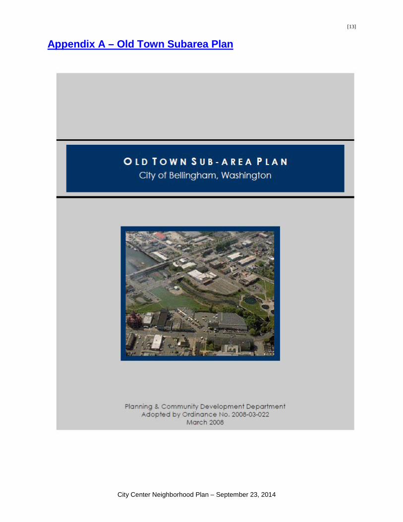
[13]
Appendix A – Old Town Subarea Plan
City Center Neighborhood Plan – September 23, 2014

[14]
Appendix B – Waterfront District Sub-Area Plan
City Center Neighborhood Plan – September 23, 2014

[15]
Appendix C – Downtown Bellingham Plan
DOWNTOWN BELLINGHAM PLAN
Planning and Community Development Department Adopted by Ordinance 2014-09-049
September 2014
City Center Neighborhood Plan – September 23, 2014


![District Environment Plan- Tikamgarh [2021] District](https://img.pdfslide.us/doc/110x75/621465e76b4416275f6864ea/district-environment-plan-tikamgarh-2021-district-.jpg)