Embed Size (px)
DESCRIPTION
From Brwonfeild to Public Park: Creating Public Access to the Dayton Tire Natural Area in Southern Dayton.
Citation preview
Southern Dayton View 4- 1
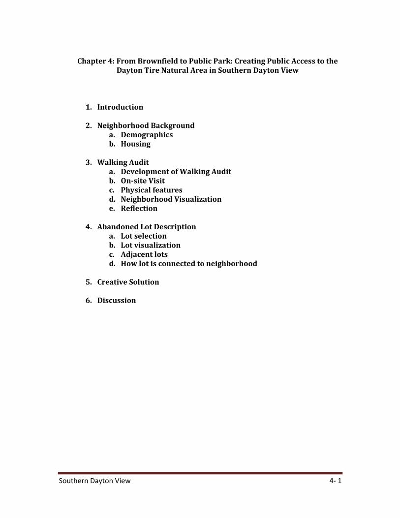
Chapter 4: From Brownfield to Public Park: Creating Public Access to the
Dayton Tire Natural Area in Southern Dayton View
1. Introduction
2. Neighborhood Background a. Demographics b. Housing
3. Walking Audit
a. Development of Walking Audit b. On-site Visit c. Physical features d. Neighborhood Visualization e. Reflection
4. Abandoned Lot Description
a. Lot selection b. Lot visualization c. Adjacent lots d. How lot is connected to neighborhood
5. Creative Solution
6. Discussion
Southern Dayton View 4- 2
I. Introduction The City of Dayton is facing the challenge of confronting shrinkage head on. Since 1970, Dayton has lost 48% of its population and 46% of its manufacturing jobs. These losses, coupled with sprawling development patterns adopted since World War II, has left the city with high residential, commercial and industrial infrastructure vacancy rates. Miami University’s Advanced Urban & Regional Planning students have been asked to propose creative alternatives that might be used to reimagine the city’s vacant and abandoned lots. Methods We approached this project by progressing through several distinct phases that resulted in specific deliverables. These phases included:
1. Researching and mapping Dayton: GIS data was obtained from Dayton’s Planning Department. This data included U.S. Census, transportation, waterways, building and city services. It was used to create maps of Dayton neighborhoods and to make decisions on priority neighborhoods to focus our class project on.
2. Neighborhood Selection: We examined three neighborhoods and selected one neighborhood, which would be the focus of the project.
3. On-site visit: A walking audit was developed and conducted on the selected neighborhood to get a feel for the neighborhood character and to identify specific vacant lots to implement an alternative on.
4. Vacant lot selection: Selection of a vacant lot to implement an alternative was based on data collection from the walking audit.
5. Detail vacant lot: Details of the chosen vacant lot were obtained from the walking audit, newspaper articles and GIS data.
6. Generate Alternatives: The alternatives were based on current use of the selected vacant lot
7. Propose alternative: The proposed alternative integrated current uses with potential transportation and community needs.
II. Neighborhood Background After completing several lab assignments to get a general idea of Dayton neighborhoods and their demographic and housing characteristics, it was determined that Southern Dayton View had one of the highest vacancy rates in the city. The large number of vacant lots represented challenges for neighborhood and opportunities for thinking about possible uses of vacant lots. A rather large 37-acre vacant lot in Southern Dayton View provided an excellent opportunity to propose an alternative that required a large area.
Southern Dayton View 4- 3
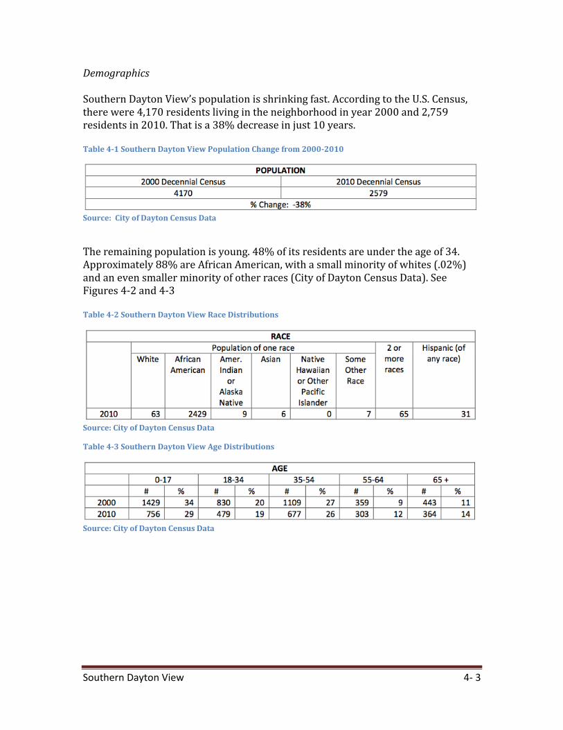
Demographics Southern Dayton View’s population is shrinking fast. According to the U.S. Census, there were 4,170 residents living in the neighborhood in year 2000 and 2,759 residents in 2010. That is a 38% decrease in just 10 years. Table 4-1 Southern Dayton View Population Change from 2000-2010
Source: City of Dayton Census Data
The remaining population is young. 48% of its residents are under the age of 34. Approximately 88% are African American, with a small minority of whites (.02%) and an even smaller minority of other races (City of Dayton Census Data). See Figures 4-2 and 4-3 Table 4-2 Southern Dayton View Race Distributions
Source: City of Dayton Census Data
Table 4-3 Southern Dayton View Age Distributions
Source: City of Dayton Census Data
Southern Dayton View 4- 4
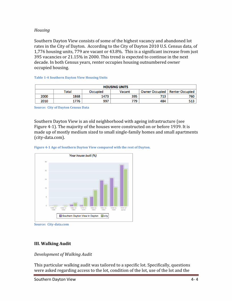
Housing Southern Dayton View consists of some of the highest vacancy and abandoned lot rates in the City of Dayton. According to the City of Dayton 2010 U.S. Census data, of 1,776 housing units, 779 are vacant or 43.8%. This is a significant increase from just 395 vacancies or 21.15% in 2000. This trend is expected to continue in the next decade. In both Census years, renter occupies housing outnumbered owner occupied housing. Table 1-4 Southern Dayton View Housing Units
Source: City of Dayton Census Data
Southern Dayton View is an old neighborhood with ageing infrastructure (see Figure 4-1). The majority of the houses were constructed on or before 1939. It is made up of mostly medium sized to small single-family homes and small apartments (city-data.com). Figure 4-1 Age of Southern Dayton View compared with the rest of Dayton.
Source: City-data.com
III. Walking Audit Development of Walking Audit This particular walking audit was tailored to a specific lot. Specifically, questions were asked regarding access to the lot, condition of the lot, use of the lot and the
Southern Dayton View 4- 5
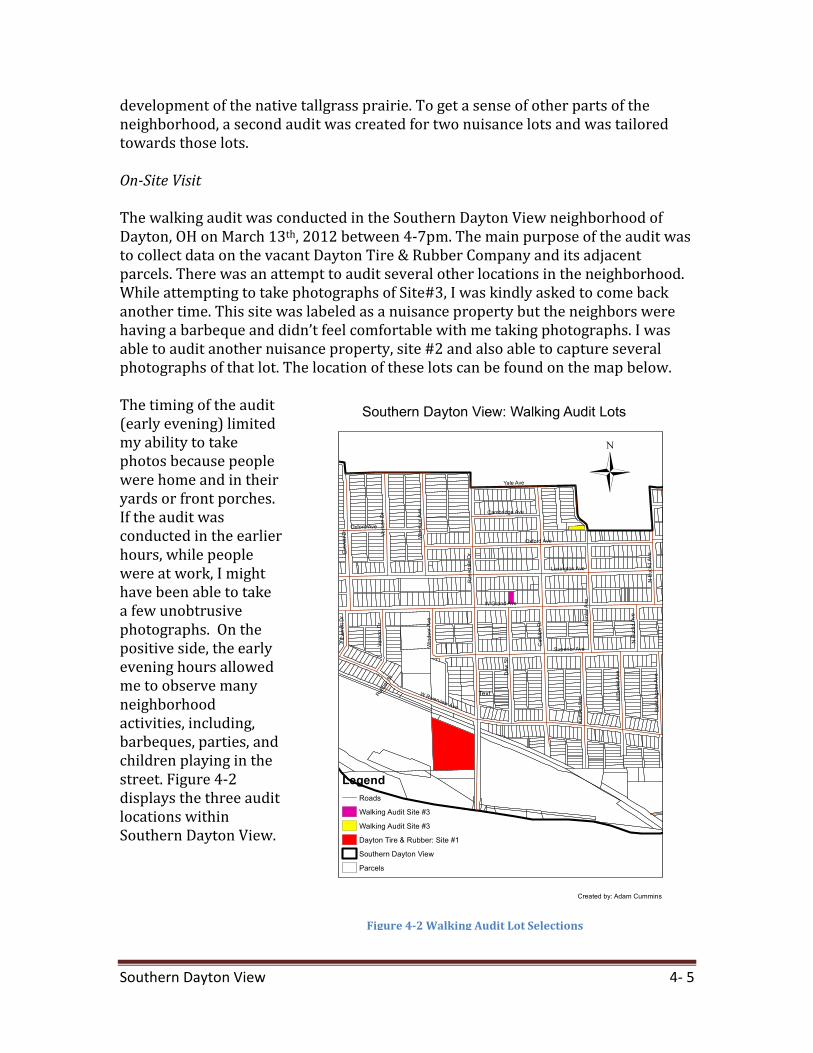
development of the native tallgrass prairie. To get a sense of other parts of the neighborhood, a second audit was created for two nuisance lots and was tailored towards those lots. On-Site Visit The walking audit was conducted in the Southern Dayton View neighborhood of Dayton, OH on March 13th, 2012 between 4-7pm. The main purpose of the audit was to collect data on the vacant Dayton Tire & Rubber Company and its adjacent parcels. There was an attempt to audit several other locations in the neighborhood. While attempting to take photographs of Site#3, I was kindly asked to come back another time. This site was labeled as a nuisance property but the neighbors were having a barbeque and didn’t feel comfortable with me taking photographs. I was able to audit another nuisance property, site #2 and also able to capture several photographs of that lot. The location of these lots can be found on the map below. The timing of the audit (early evening) limited my ability to take photos because people were home and in their yards or front porches. If the audit was conducted in the earlier hours, while people were at work, I might have been able to take a few unobtrusive photographs. On the positive side, the early evening hours allowed me to observe many neighborhood activities, including, barbeques, parties, and children playing in the street. Figure 4-2 displays the three audit locations within Southern Dayton View.
Figure 4-2 Walking Audit Lot Selections
Southern Dayton View 4- 6
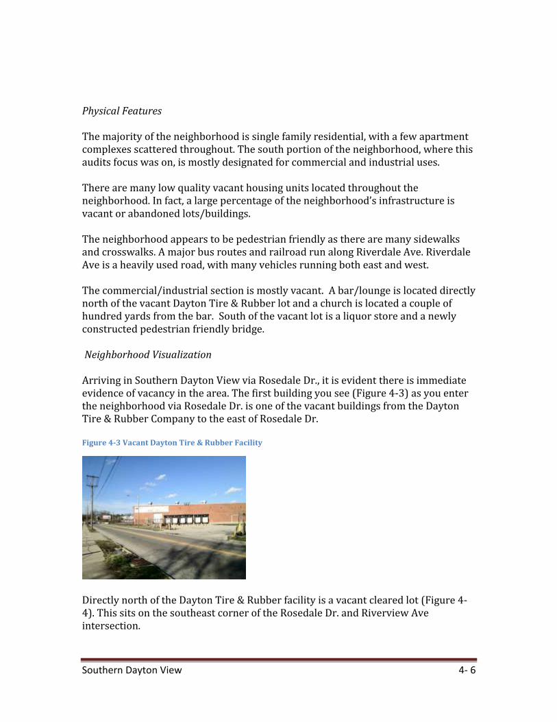
Physical Features The majority of the neighborhood is single family residential, with a few apartment complexes scattered throughout. The south portion of the neighborhood, where this audits focus was on, is mostly designated for commercial and industrial uses. There are many low quality vacant housing units located throughout the neighborhood. In fact, a large percentage of the neighborhood’s infrastructure is vacant or abandoned lots/buildings. The neighborhood appears to be pedestrian friendly as there are many sidewalks and crosswalks. A major bus routes and railroad run along Riverdale Ave. Riverdale Ave is a heavily used road, with many vehicles running both east and west. The commercial/industrial section is mostly vacant. A bar/lounge is located directly north of the vacant Dayton Tire & Rubber lot and a church is located a couple of hundred yards from the bar. South of the vacant lot is a liquor store and a newly constructed pedestrian friendly bridge. Neighborhood Visualization Arriving in Southern Dayton View via Rosedale Dr., it is evident there is immediate evidence of vacancy in the area. The first building you see (Figure 4-3) as you enter the neighborhood via Rosedale Dr. is one of the vacant buildings from the Dayton Tire & Rubber Company to the east of Rosedale Dr. Figure 4-3 Vacant Dayton Tire & Rubber Facility
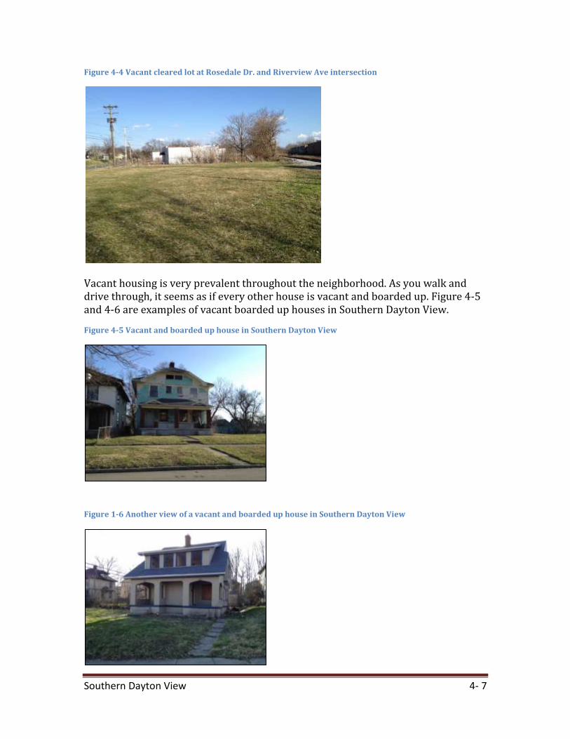
Directly north of the Dayton Tire & Rubber facility is a vacant cleared lot (Figure 4-4). This sits on the southeast corner of the Rosedale Dr. and Riverview Ave intersection.
Southern Dayton View 4- 7
Figure 4-4 Vacant cleared lot at Rosedale Dr. and Riverview Ave intersection
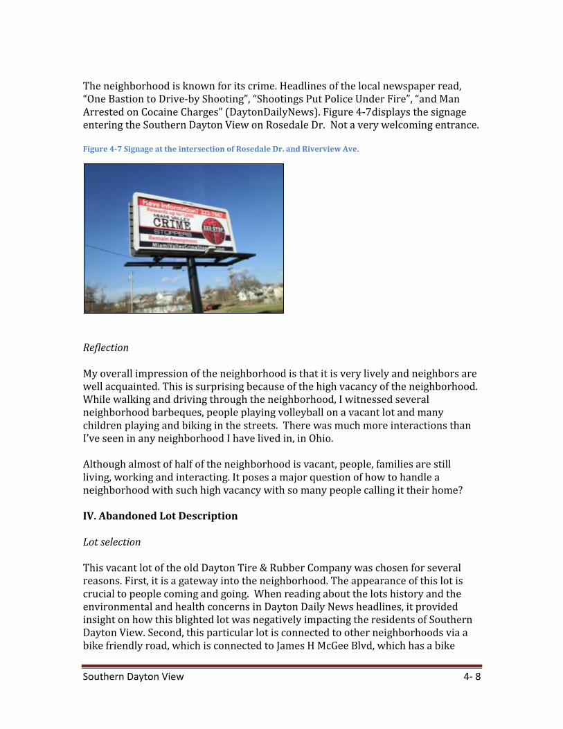
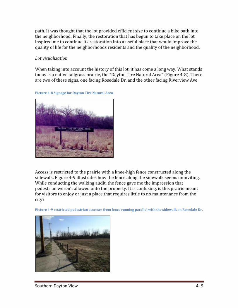
Vacant housing is very prevalent throughout the neighborhood. As you walk and drive through, it seems as if every other house is vacant and boarded up. Figure 4-5 and 4-6 are examples of vacant boarded up houses in Southern Dayton View.
Figure 4-5 Vacant and boarded up house in Southern Dayton View
Figure 1-6 Another view of a vacant and boarded up house in Southern Dayton View
Southern Dayton View 4- 8
The neighborhood is known for its crime. Headlines of the local newspaper read, “One Bastion to Drive-by Shooting”, “Shootings Put Police Under Fire”, “and Man Arrested on Cocaine Charges” (DaytonDailyNews). Figure 4-7displays the signage entering the Southern Dayton View on Rosedale Dr. Not a very welcoming entrance. Figure 4-7 Signage at the intersection of Rosedale Dr. and Riverview Ave.
Reflection My overall impression of the neighborhood is that it is very lively and neighbors are well acquainted. This is surprising because of the high vacancy of the neighborhood. While walking and driving through the neighborhood, I witnessed several neighborhood barbeques, people playing volleyball on a vacant lot and many children playing and biking in the streets. There was much more interactions than I’ve seen in any neighborhood I have lived in, in Ohio. Although almost of half of the neighborhood is vacant, people, families are still living, working and interacting. It poses a major question of how to handle a neighborhood with such high vacancy with so many people calling it their home? IV. Abandoned Lot Description Lot selection This vacant lot of the old Dayton Tire & Rubber Company was chosen for several reasons. First, it is a gateway into the neighborhood. The appearance of this lot is crucial to people coming and going. When reading about the lots history and the environmental and health concerns in Dayton Daily News headlines, it provided insight on how this blighted lot was negatively impacting the residents of Southern Dayton View. Second, this particular lot is connected to other neighborhoods via a bike friendly road, which is connected to James H McGee Blvd, which has a bike
Southern Dayton View 4- 9
path. It was thought that the lot provided efficient size to continue a bike path into the neighborhood. Finally, the restoration that has begun to take place on the lot inspired me to continue its restoration into a useful place that would improve the quality of life for the neighborhoods residents and the quality of the neighborhood. Lot visualization When taking into account the history of this lot, it has come a long way. What stands today is a native tallgrass prairie, the “Dayton Tire Natural Area” (Figure 4-8). There are two of these signs, one facing Rosedale Dr. and the other facing Riverview Ave
Picture 4-8 Signage for Dayton Tire Natural Area
Access is restricted to the prairie with a knee-high fence constructed along the sidewalk. Figure 4-9 illustrates how the fence along the sidewalk seems uninviting. While conducting the walking audit, the fence gave me the impression that pedestrian weren’t allowed onto the property. It is confusing, is this prairie meant for visitors to enjoy or just a place that requires little to no maintenance from the city? Picture 4-9 restricted pedestrian accesses from fence running parallel with the sidewalk on Rosedale Dr.
Southern Dayton View 4- 10
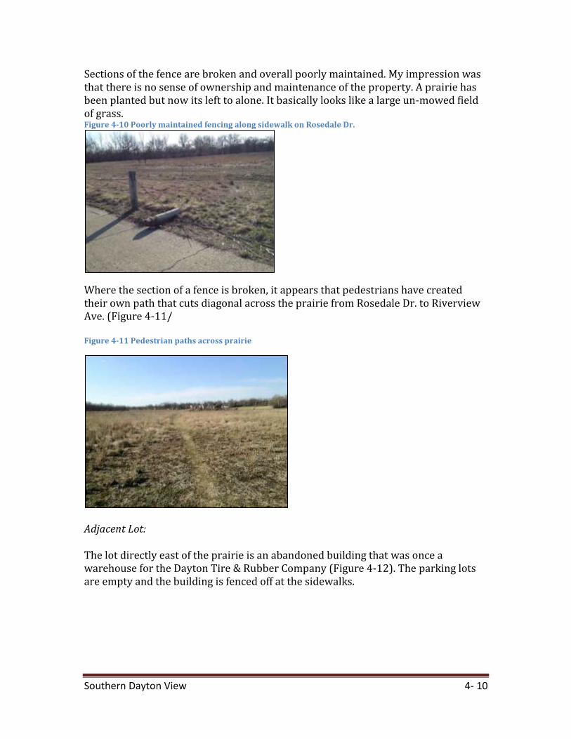
Sections of the fence are broken and overall poorly maintained. My impression was that there is no sense of ownership and maintenance of the property. A prairie has been planted but now its left to alone. It basically looks like a large un-mowed field of grass. Figure 4-10 Poorly maintained fencing along sidewalk on Rosedale Dr.
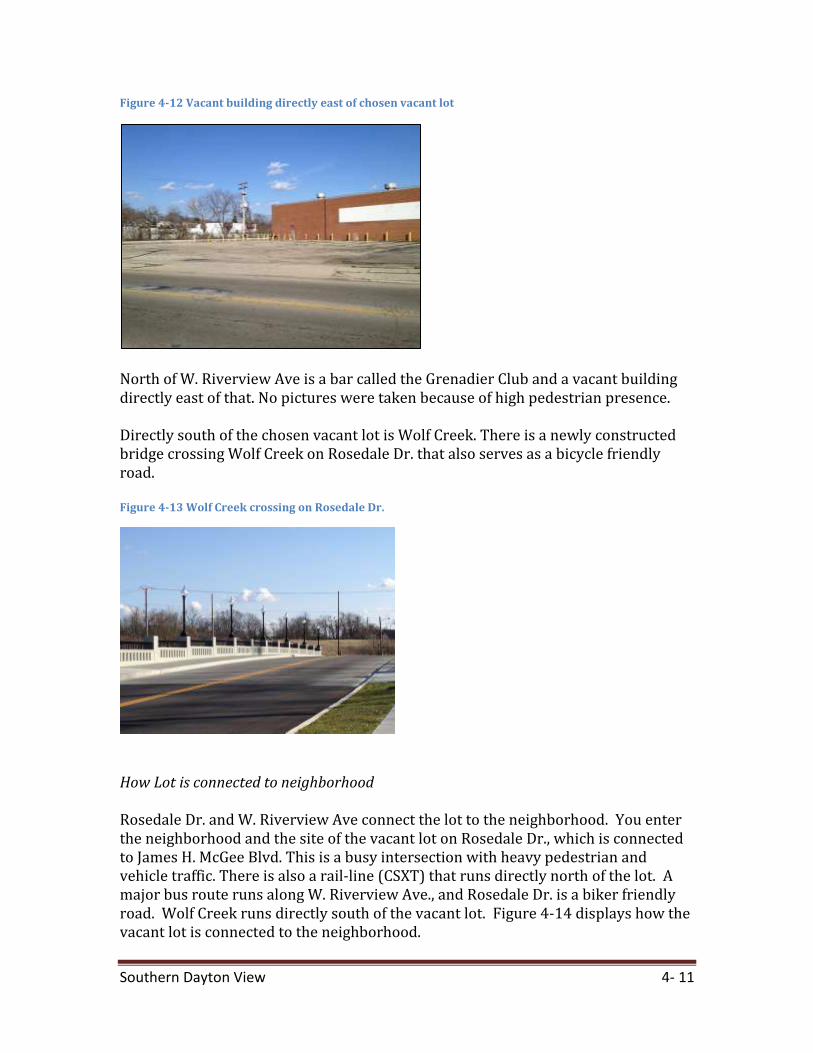
Where the section of a fence is broken, it appears that pedestrians have created their own path that cuts diagonal across the prairie from Rosedale Dr. to Riverview Ave. (Figure 4-11/ Figure 4-11 Pedestrian paths across prairie
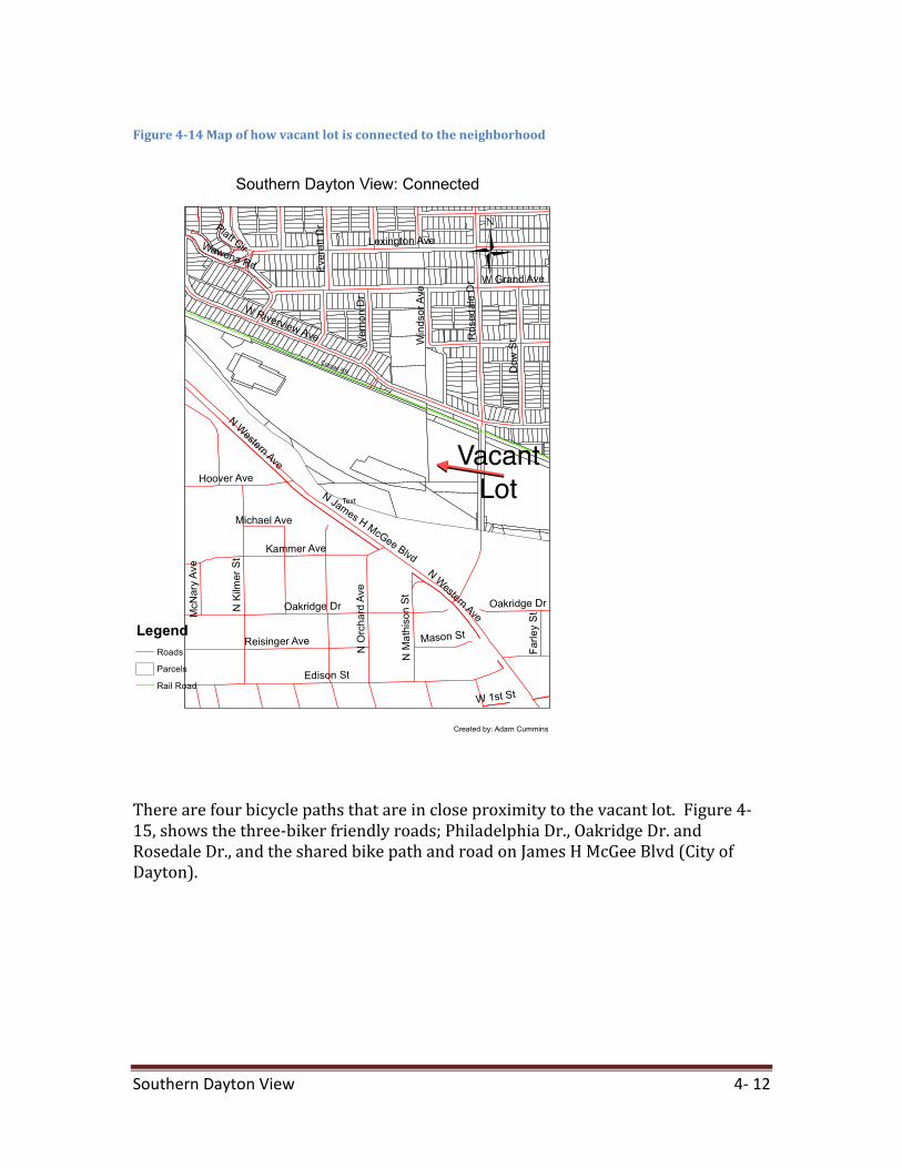
Adjacent Lot: The lot directly east of the prairie is an abandoned building that was once a warehouse for the Dayton Tire & Rubber Company (Figure 4-12). The parking lots are empty and the building is fenced off at the sidewalks.
Southern Dayton View 4- 11
Figure 4-12 Vacant building directly east of chosen vacant lot
North of W. Riverview Ave is a bar called the Grenadier Club and a vacant building directly east of that. No pictures were taken because of high pedestrian presence. Directly south of the chosen vacant lot is Wolf Creek. There is a newly constructed bridge crossing Wolf Creek on Rosedale Dr. that also serves as a bicycle friendly road. Figure 4-13 Wolf Creek crossing on Rosedale Dr.
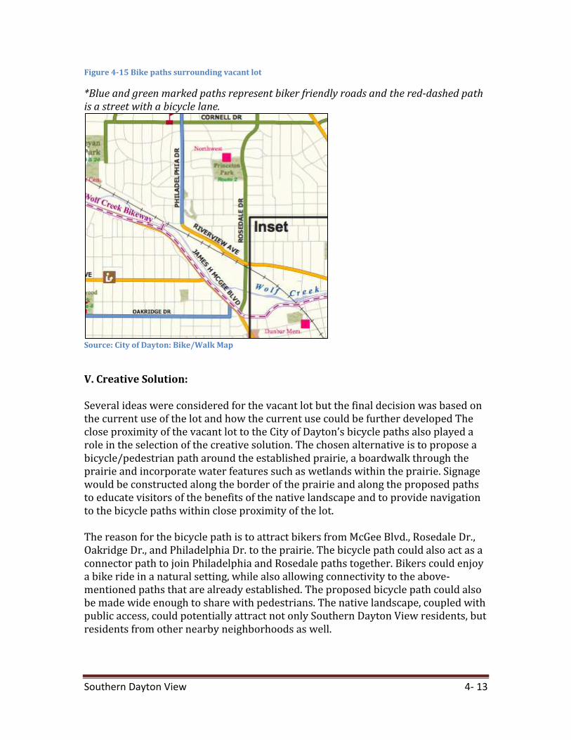
How Lot is connected to neighborhood Rosedale Dr. and W. Riverview Ave connect the lot to the neighborhood. You enter the neighborhood and the site of the vacant lot on Rosedale Dr., which is connected to James H. McGee Blvd. This is a busy intersection with heavy pedestrian and vehicle traffic. There is also a rail-line (CSXT) that runs directly north of the lot. A major bus route runs along W. Riverview Ave., and Rosedale Dr. is a biker friendly road. Wolf Creek runs directly south of the vacant lot. Figure 4-14 displays how the vacant lot is connected to the neighborhood.
Southern Dayton View 4- 12
Figure 4-14 Map of how vacant lot is connected to the neighborhood
There are four bicycle paths that are in close proximity to the vacant lot. Figure 4-15, shows the three-biker friendly roads; Philadelphia Dr., Oakridge Dr. and Rosedale Dr., and the shared bike path and road on James H McGee Blvd (City of Dayton).
Southern Dayton View 4- 13
Figure 4-15 Bike paths surrounding vacant lot
*Blue and green marked paths represent biker friendly roads and the red-dashed path is a street with a bicycle lane.
Source: City of Dayton: Bike/Walk Map
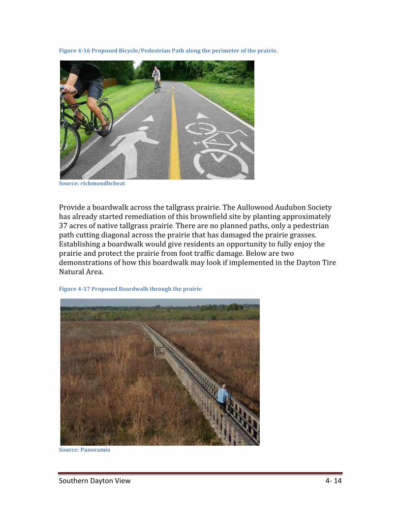
V. Creative Solution: Several ideas were considered for the vacant lot but the final decision was based on the current use of the lot and how the current use could be further developed The close proximity of the vacant lot to the City of Dayton’s bicycle paths also played a role in the selection of the creative solution. The chosen alternative is to propose a bicycle/pedestrian path around the established prairie, a boardwalk through the prairie and incorporate water features such as wetlands within the prairie. Signage would be constructed along the border of the prairie and along the proposed paths to educate visitors of the benefits of the native landscape and to provide navigation to the bicycle paths within close proximity of the lot. The reason for the bicycle path is to attract bikers from McGee Blvd., Rosedale Dr., Oakridge Dr., and Philadelphia Dr. to the prairie. The bicycle path could also act as a connector path to join Philadelphia and Rosedale paths together. Bikers could enjoy a bike ride in a natural setting, while also allowing connectivity to the above-mentioned paths that are already established. The proposed bicycle path could also be made wide enough to share with pedestrians. The native landscape, coupled with public access, could potentially attract not only Southern Dayton View residents, but residents from other nearby neighborhoods as well.
Southern Dayton View 4- 14
Figure 4-16 Proposed Bicycle/Pedestrian Path along the perimeter of the prairie.
Source: richmondbcbeat
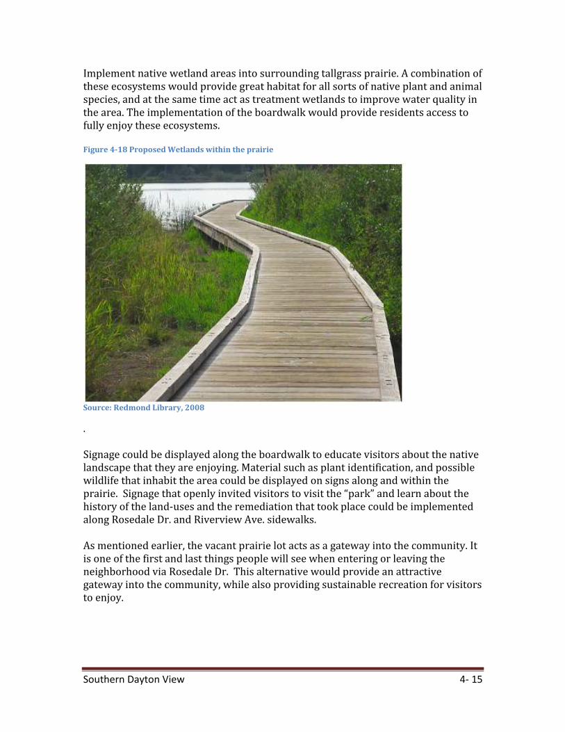
Provide a boardwalk across the tallgrass prairie. The Aullowood Audubon Society has already started remediation of this brownfield site by planting approximately 37 acres of native tallgrass prairie. There are no planned paths, only a pedestrian path cutting diagonal across the prairie that has damaged the prairie grasses. Establishing a boardwalk would give residents an opportunity to fully enjoy the prairie and protect the prairie from foot traffic damage. Below are two demonstrations of how this boardwalk may look if implemented in the Dayton Tire Natural Area. Figure 4-17 Proposed Boardwalk through the prairie
Source: Panoramio
Southern Dayton View 4- 15
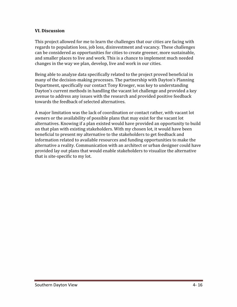
Implement native wetland areas into surrounding tallgrass prairie. A combination of these ecosystems would provide great habitat for all sorts of native plant and animal species, and at the same time act as treatment wetlands to improve water quality in the area. The implementation of the boardwalk would provide residents access to fully enjoy these ecosystems. Figure 4-18 Proposed Wetlands within the prairie
Source: Redmond Library, 2008
. Signage could be displayed along the boardwalk to educate visitors about the native landscape that they are enjoying. Material such as plant identification, and possible wildlife that inhabit the area could be displayed on signs along and within the prairie. Signage that openly invited visitors to visit the “park” and learn about the history of the land-uses and the remediation that took place could be implemented along Rosedale Dr. and Riverview Ave. sidewalks. As mentioned earlier, the vacant prairie lot acts as a gateway into the community. It is one of the first and last things people will see when entering or leaving the neighborhood via Rosedale Dr. This alternative would provide an attractive gateway into the community, while also providing sustainable recreation for visitors to enjoy.
Southern Dayton View 4- 16
VI. Discussion This project allowed for me to learn the challenges that our cities are facing with regards to population loss, job loss, disinvestment and vacancy. These challenges can be considered as opportunities for cities to create greener, more sustainable, and smaller places to live and work. This is a chance to implement much needed changes in the way we plan, develop, live and work in our cities. Being able to analyze data specifically related to the project proved beneficial in many of the decision-making processes. The partnership with Dayton’s Planning Department, specifically our contact Tony Kroeger, was key to understanding Dayton’s current methods in handling the vacant lot challenge and provided a key avenue to address any issues with the research and provided positive feedback towards the feedback of selected alternatives. A major limitation was the lack of coordination or contact rather, with vacant lot owners or the availability of possible plans that may exist for the vacant lot alternatives. Knowing if a plan existed would have provided an opportunity to build on that plan with existing stakeholders. With my chosen lot, it would have been beneficial to present my alternative to the stakeholders to get feedback and information related to available resources and funding opportunities to make the alternative a reality. Communication with an architect or urban designer could have provided lay out plans that would enable stakeholders to visualize the alternative that is site-specific to my lot.
Southern Dayton View 4- 17
Bibliography City-Data.com. 2009. Southern Dayton View Neighborhood in Dayton, OH Detailed
Profile. http://www.city-data.com/neighborhood/Southern-Dayton-View-Dayton-OH.html
City of Dayton. 2012. Bike/Walk Map:
http://www.cityofdayton.org/Documents/DaytonBike-WalkMap2010.pdf City of Dayton. Department of Planning and Community Development. 2012. 2010
Decennial Census Summary, City of Dayton, Ohio. http://www.cityofdayton.org/departments/pcd/Documents/Census%202010/2010DaytonCensusSummaryReport.pdf
Dayton Daily News Archive. Man Arrested on Cocaine Charges:
http://www.daytondailynews.com/. Accessed 2012 Panoramio. Boardwalk through the marsh at Ocklawaha Prairie Restoration Area:
http://www.panoramio.com/photo/33740351 Redmond Library. 2008. Snohomish County Bike Trails: Centennial Trail:
http://redmondlibrary.blogspot.com/2008_08_01_archive.html Richmondbcbeat. 2012. Crabapple Ridge Bike Path Nears Completion:
http://richmondbcbeat.wordpress.com/2012/03/09/crabapple-ridge-bike-route-nears-completion/
Southern Dayton View 4- 18
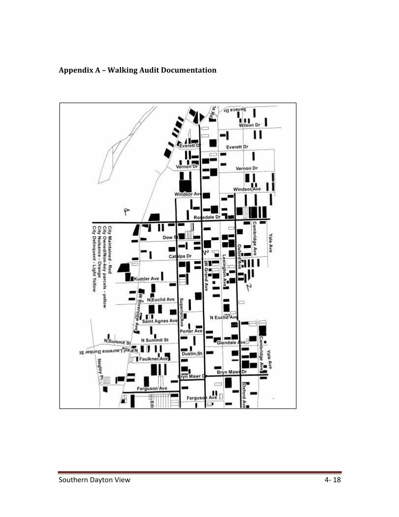
Appendix A – Walking Audit Documentation
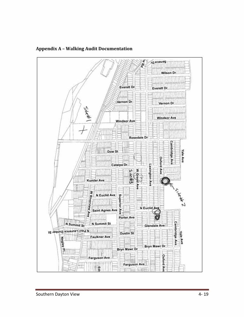
Southern Dayton View 4- 19
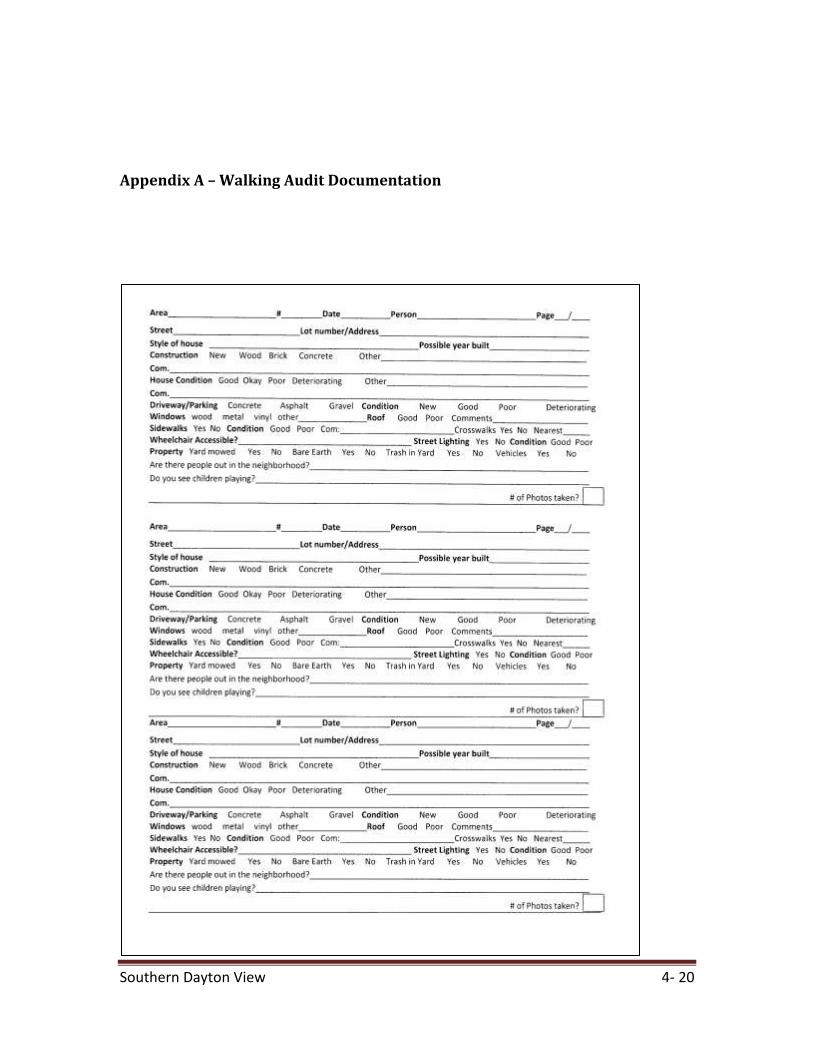
Appendix A – Walking Audit Documentation
Southern Dayton View 4- 20
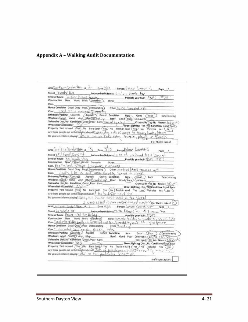
Appendix A – Walking Audit Documentation
Southern Dayton View 4- 21
Appendix A – Walking Audit Documentation
Southern Dayton View 4- 22
Appendix A- Walking Audit Documentation Walking audit specific for vacant Dayton Tire & Rubber Company 3/13/12 Adam Cummins 1) Is there access to the property? Sidewalks run adjacent on the east and north side of the vacant lot but access is denied by fencing. The fence is poorly maintained. 2) Is there signage? There are two signs on the vacant lot reading, “ Dayton Tire Natural Area” There is also a billboard sign east of the lot. 3) What uses are in place? Open space/tallgrass prairie 4) Are there paths? The fence is broken in multiple places and a pedestrian path can be seen cutting across the prairie. 5) Is it walkable to and from? There are sidewalks that run on the east and north side of the vacant lot. Very pedestrian-friendly. I feel safe walking the property 6) Is it well maintained? No. The fence is broken in multiple places and there is trash and debris scattered everywhere. 7) Is there litter? Yes. Litter is mainly along the fence line and in the adjacent lots 8) Are there businesses nearby?
Southern Dayton View 4- 23
Yes. There is a bar/lounge directly north of the vacant lot. There is also a vacant business, “ Mama’s Kitchen to the east of the lot. Also, there is a vacant Dayton Tire & Rubber warehouse to the east of the lot. The nearby adjacent lots have a lot of open/empty parking spaces. 9) Do you feel safe? I feel safe walking around. There are a lot of people out and about. I did witness a few drunken people urinating in the prairie but the sidewalks and signage are well equipped. Vehicles yielded when crossing the streets. 10) Are there vacant adjacent properties? Yes. Directly north and directly east are open spaces. I’m not sure if they are meant to be green space or are vacant lots. There is a vacant DT&R building to the east. 11) Bike paths? There are not bike paths. Rosedale Dr. is supposed to be biker friendly but I did not see any paths, although plenty of bikers were using the road. No paths were anywhere on the vacant lot. 12) Sidewalk conditions? Sidewalks are well maintained, with crosswalks at the intersection directly adjacent to the vacant lot. There were a lot of pedestrians out. No access to the prairie. 13) Are there place to sit? No benches along the prairie or on the surrounding sidewalks. It seems as if the area is meant to keep people moving. 14) What are your overall thoughts? The vacant lot has a lot of potential. The prairie is young and should establish itself in a few years but it seems cut off from the community. I do not know if this is intention or not. No access is evident for people to enjoy. It basically looks like a poorly maintained field. I can see boardwalks being implemented and picnic areas as well so that people are able to enjoy the natural area and it looks more inviting. To me, it is not a place where I would want spend time.

Southern Dayton View 4- 24
Appendix B - Poster
Southern Dayton View 4- 25
Appendix C – Author Credentials Adam Cummins Master’s of Environmental Science Candidate, Miami University B.A. in Geography, Miami University Throughout my professional experience and in a school setting, I have become proficient in Microsoft Word, Excel and PowerPoint. My first year of graduate school, I had to give many presentations using PowerPoint to classes and clients. This was done in a team setting and on an individual basis. My experience in Word came from many papers during both my undergrad and graduate school experience. I have written many research papers, typed a few reports and also just completed a Solid Waste Management Plan for the Adams-Clermont Solid Waste District. The SWP included many Excel spreadsheets and written chapters, where I had to use both Word and Excel. I have taken 2 GIS courses and used GIS for a few projects in a school setting. An internship also provided me with GIS experience where I learned to georeference CAD drawings into a GIS and map stormwater structures. After completing my undergraduate degree in 2006, I worked in the Environmental Consulting field for approximately 3 years. I worked for two different firms, Terracon Consultants and Dynamac Corporation. My duties included soil sampling, soil testing, concrete testing, asbestos inspections/oversight, lead-based paint inspections and phase I environmental site assessments. During my first year of graduate school, I obtained an internship with Clermont County’s Water Resources Department and its Office of Environmental Quality. My duties included storm water mapping using GIS and GPS and water quality testing. I would work in the field, collecting GPS coordinates and then place them into a GIS to produce maps of the County’s’ stormwater structures. I also helped collect water samples for water quality analysis. After completing my internship, the Adams-Clermont Solid Waste District hired me as a private consultant to co-author their Solid Waste Management Plan. My duties included, collecting current data on solid waste generation, demographics data and making projections for future planning /handling of the District’s solid waste. I did this by conducting surveys to industries and commercial facilities in the District, gathering demographic data from U.S. Census Bureau, reading solid waste reports from the Ohio EPA and making population/waste projections from current data.