Embed Size (px)
Citation preview
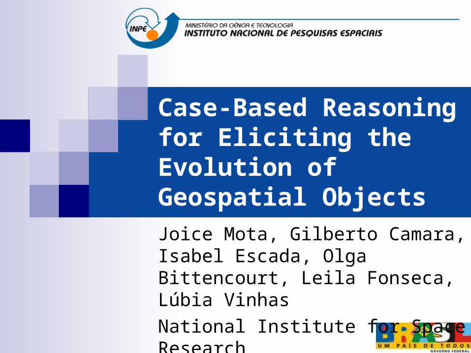
Case-Based Reasoning for Eliciting the Evolution of Geospatial Objects
Joice Mota, Gilberto Camara, Isabel Escada, Olga Bittencourt, Leila Fonseca, Lúbia VinhasNational Institute for Space Research
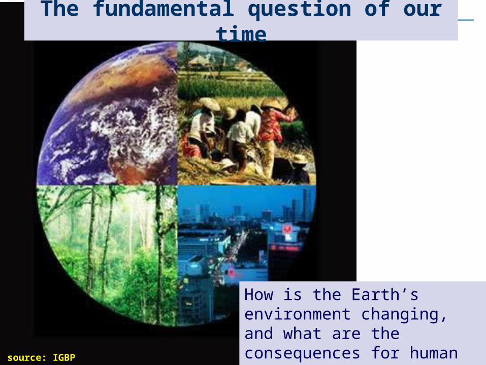
source: IGBP
How is the Earth’s environment changing, and what are the consequences for human civilization?
The fundamental question of our time
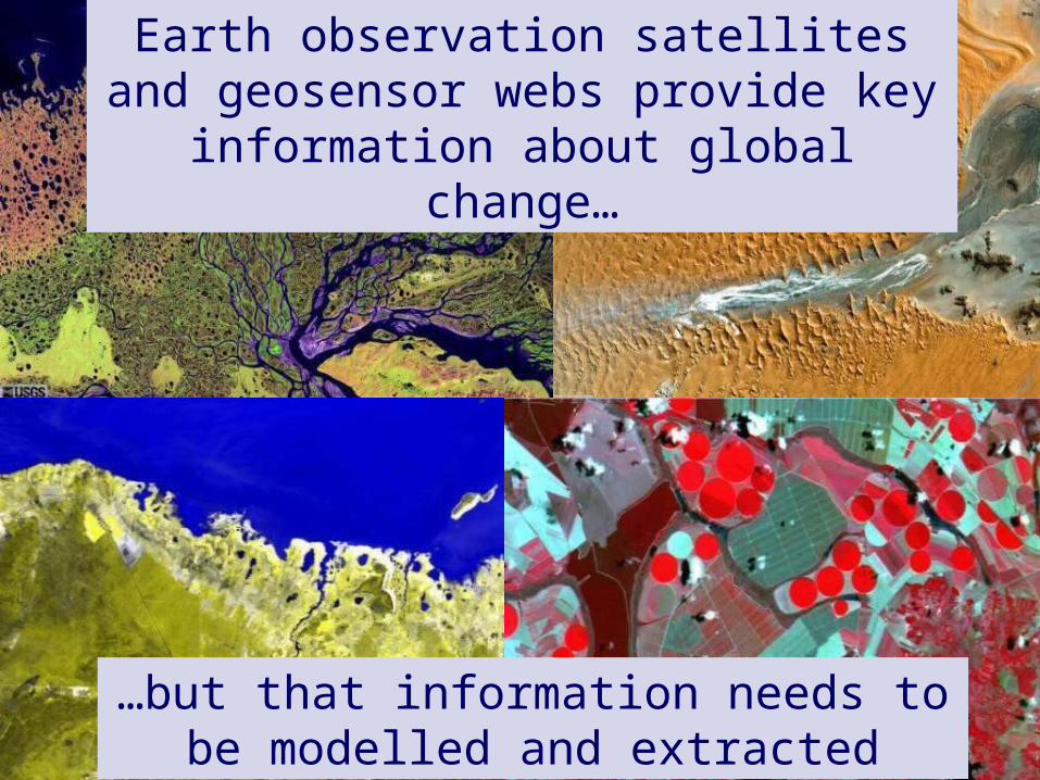
Earth observation satellites and geosensor webs provide key information about global
change…
…but that information needs to be modelled and extracted
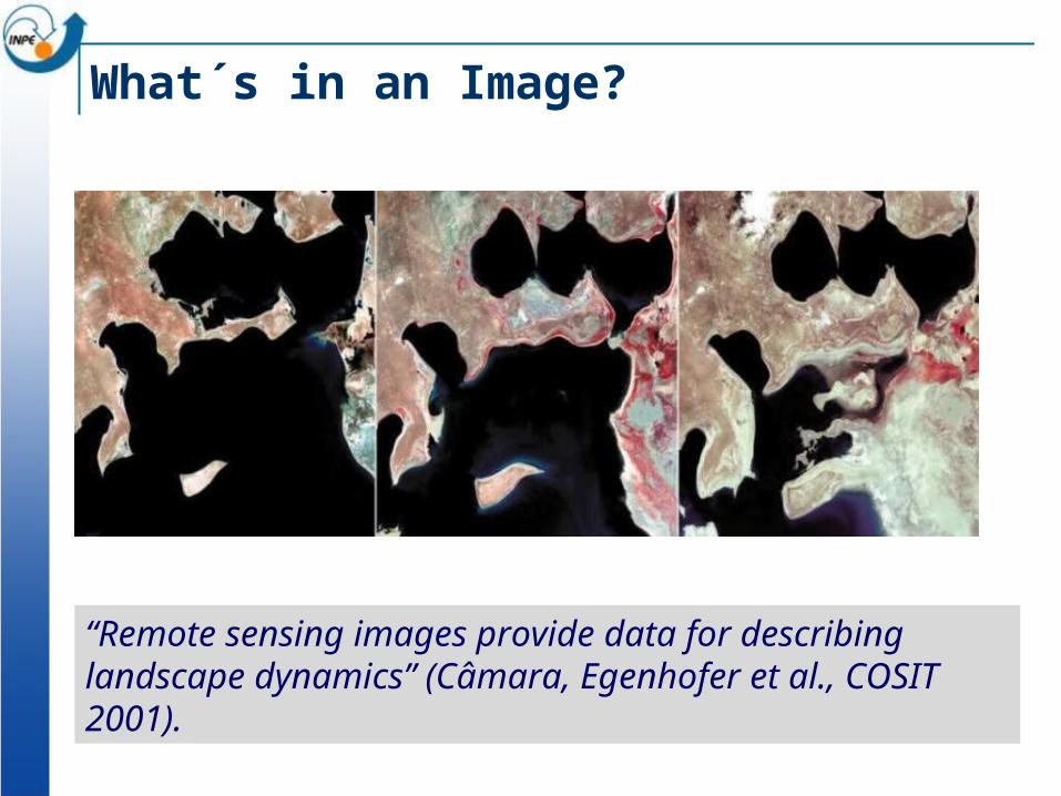
What´s in an Image?
“Remote sensing images provide data for describing landscape dynamics” (Câmara, Egenhofer et al., COSIT 2001).
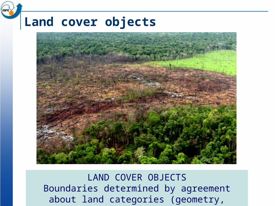
Land cover objects
LAND COVER OBJECTSBoundaries determined by agreement about land
categories (geometry, topology and properties change)
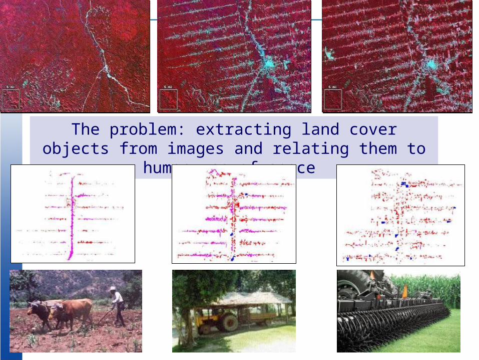
The problem: extracting land cover objects from images and relating them to human use of space
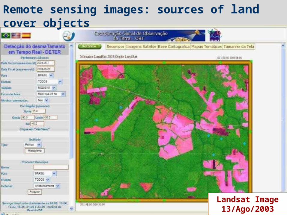
Landsat Image 13/Ago/2003
Remote sensing images: sources of land cover objects
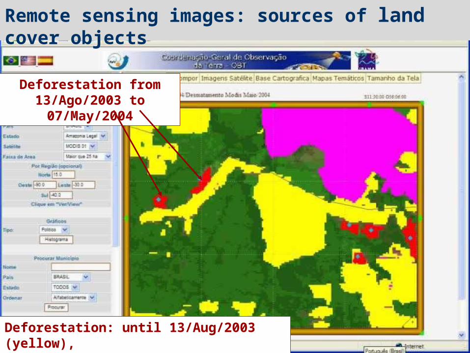
Deforestation from 13/Ago/2003 to 07/May/2004
Deforestation: until 13/Aug/2003 (yellow),from 13/Aug/2003 until 07/mai/2004 (red)
Remote sensing images: sources of land cover objects
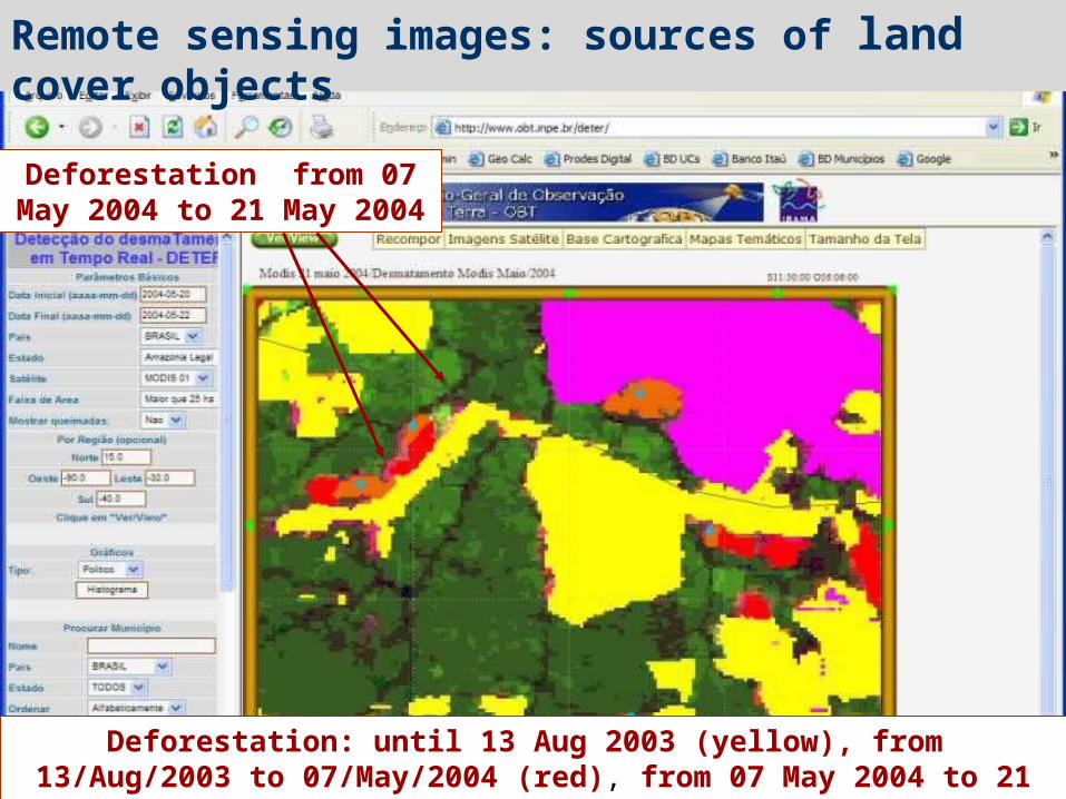
Deforestation from 07 May 2004 to 21 May 2004
Deforestation: until 13 Aug 2003 (yellow), from 13/Aug/2003 to 07/May/2004 (red), from 07 May 2004 to 21 May 2004 (orange)
Remote sensing images: sources of land cover objects
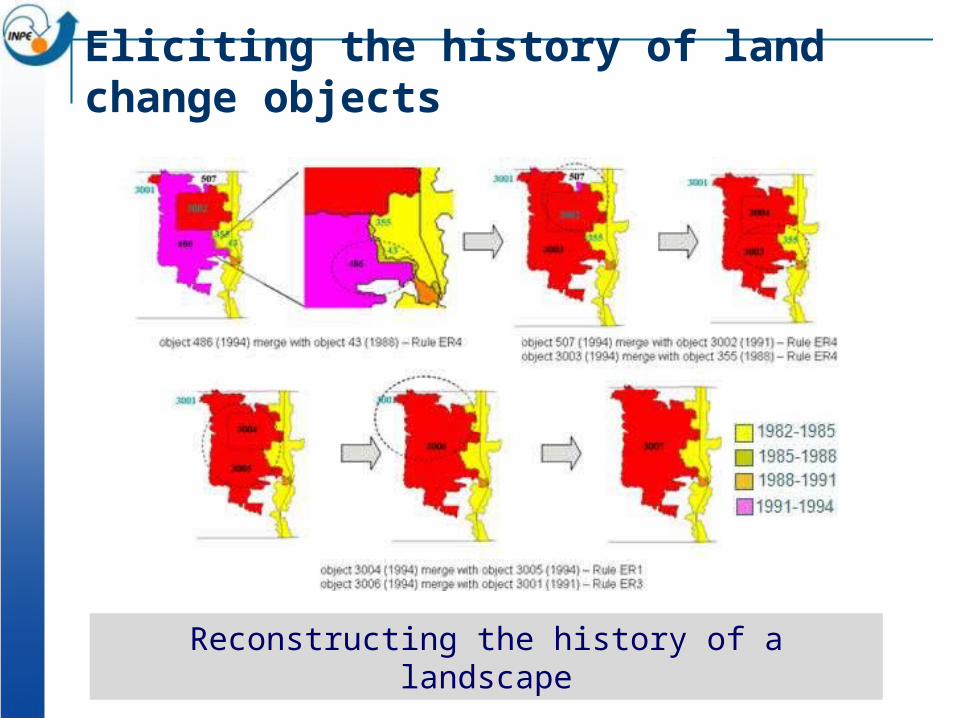
Eliciting the history of land change objects
Reconstructing the history of a landscape
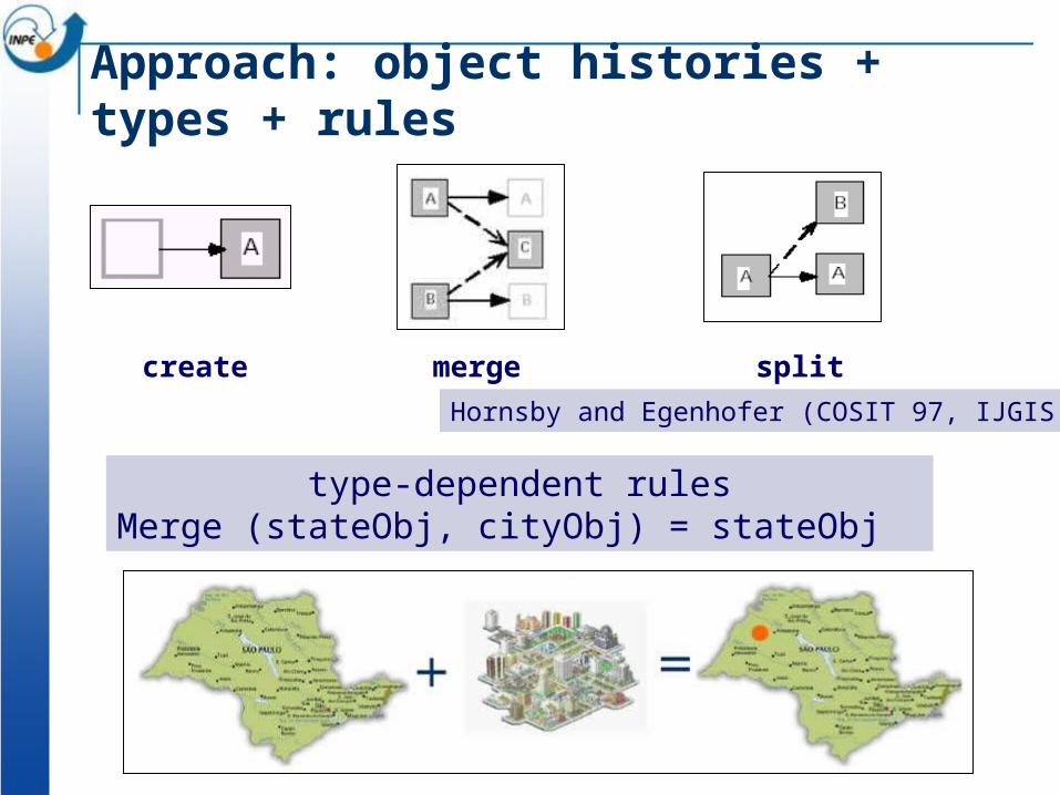
type-dependent rulesMerge (stateObj, cityObj) = stateObj
Approach: object histories + types + rules
splitcreate mergeHornsby and Egenhofer (COSIT 97, IJGIS 2000)
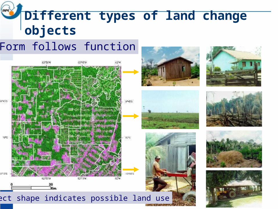
Form follows function
Object shape indicates possible land use
Different types of land change objects
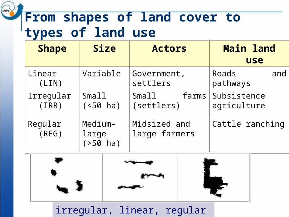
From shapes of land cover to types of land use
Shape Size Actors Main land use
Linear (LIN) Variable Government, settlers Roads and pathways
Irregular (IRR) Small (<50 ha)
Small farms (settlers) Subsistence agriculture
Regular (REG) Medium- large(>50 ha)
Midsized and large farmers
Cattle ranching
irregular, linear, regular
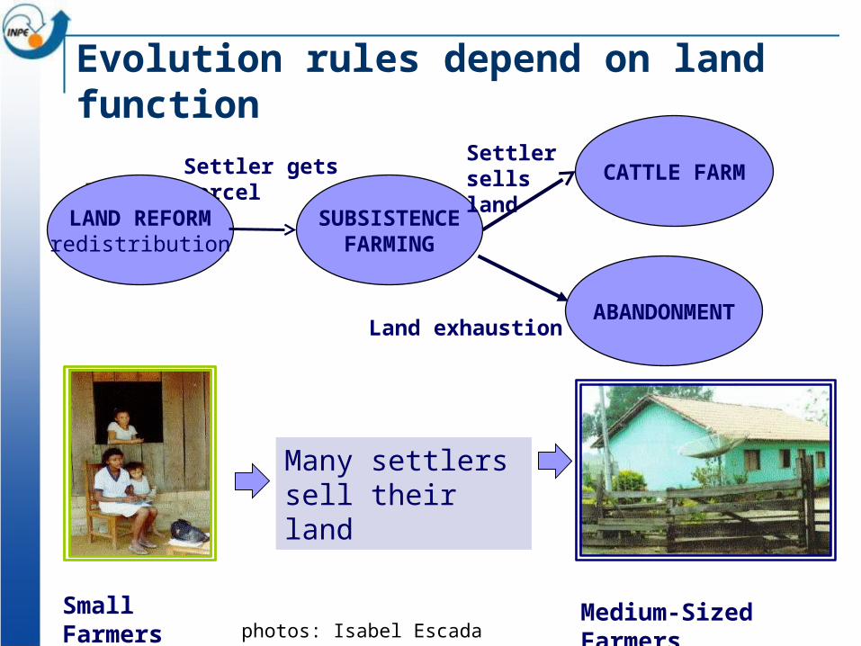
Evolution rules depend on land function
Small Farmers Medium-Sized Farmersphotos: Isabel Escada
Many settlers sell their land
SUBSISTENCEFARMING
Settler gets parcelSettler sells land CATTLE FARM
ABANDONMENTLand exhaustion
LAND REFORMredistribution
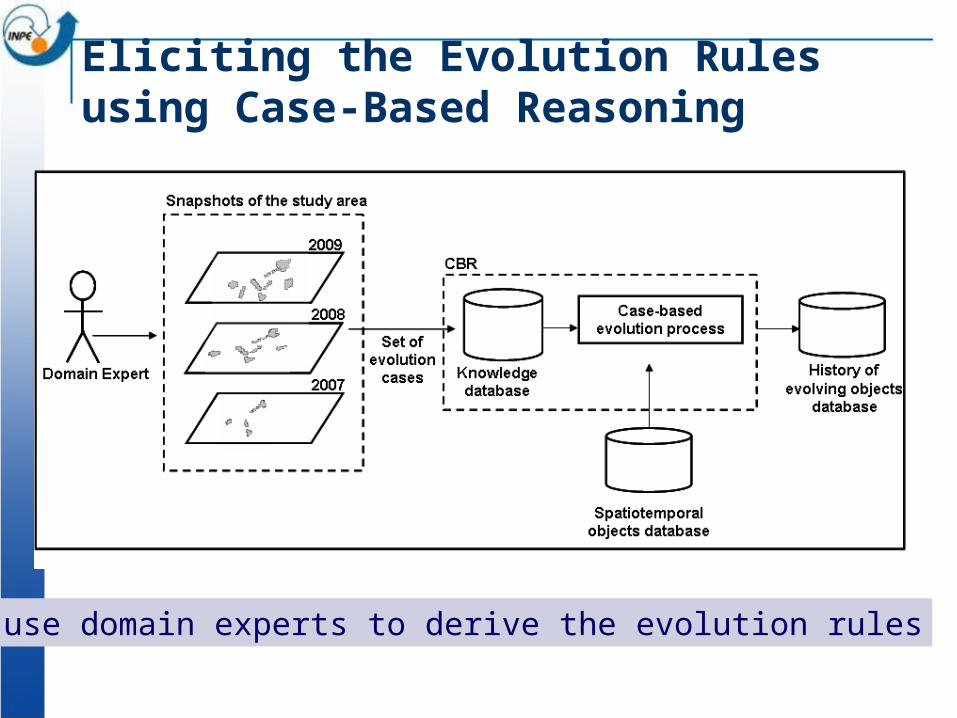
Eliciting the Evolution Rules using Case-Based Reasoning
We use domain experts to derive the evolution rules
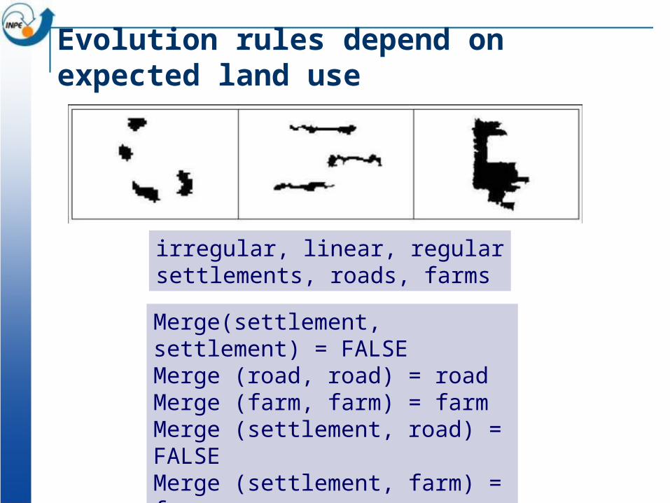
Evolution rules depend on expected land use
irregular, linear, regularsettlements, roads, farms
Merge(settlement, settlement) = FALSEMerge (road, road) = roadMerge (farm, farm) = farmMerge (settlement, road) = FALSEMerge (settlement, farm) = farmMerge (farm, road) = FALSE
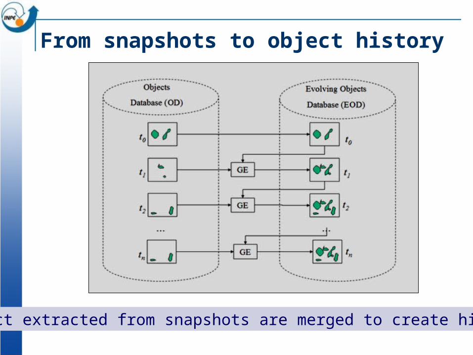
From snapshots to object history
Object extracted from snapshots are merged to create histories
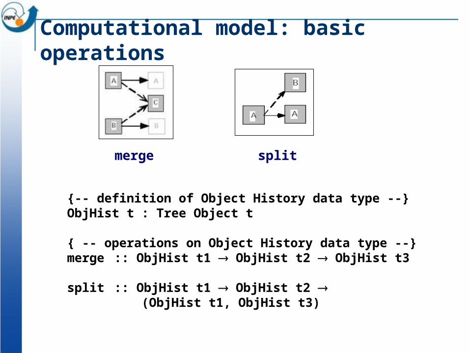
{-- definition of Object History data type --}ObjHist t : Tree Object t
{ -- operations on Object History data type --}merge :: ObjHist t1 ObjHist t2 ObjHist t3
split :: ObjHist t1 ObjHist t2 (ObjHist t1, ObjHist t3)
Computational model: basic operations
splitmerge
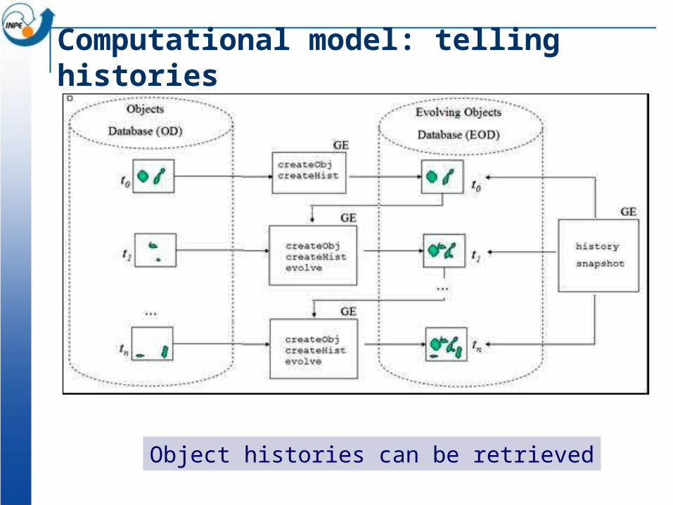
Computational model: telling histories
Object histories can be retrieved
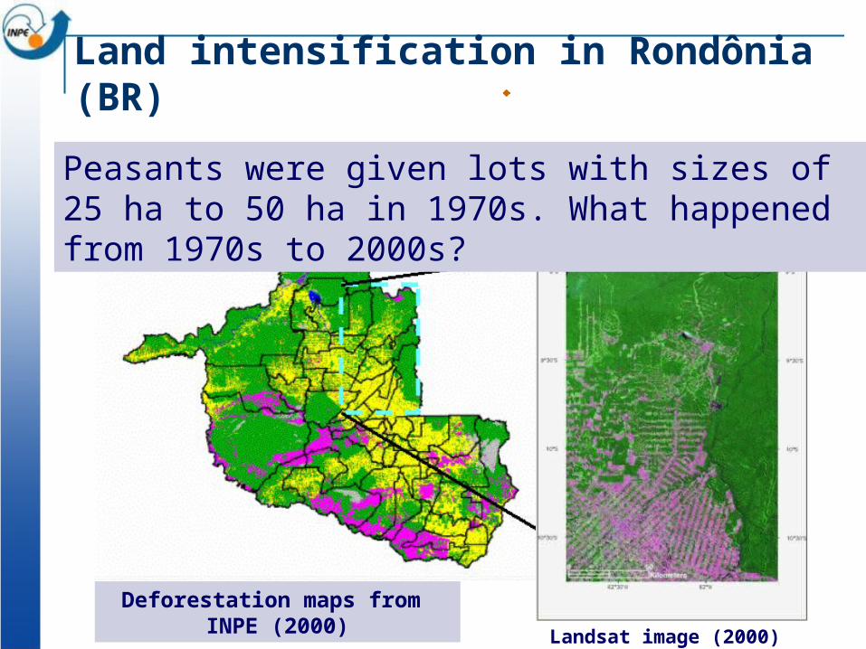
Landsat image (2000)
Deforestation maps from INPE (2000)
Peasants were given lots with sizes of 25 ha to 50 ha in 1970s. What happened from 1970s to 2000s?
Land intensification in Rondônia (BR)
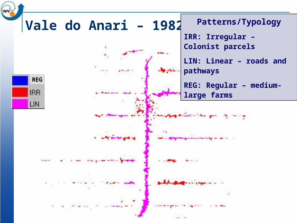
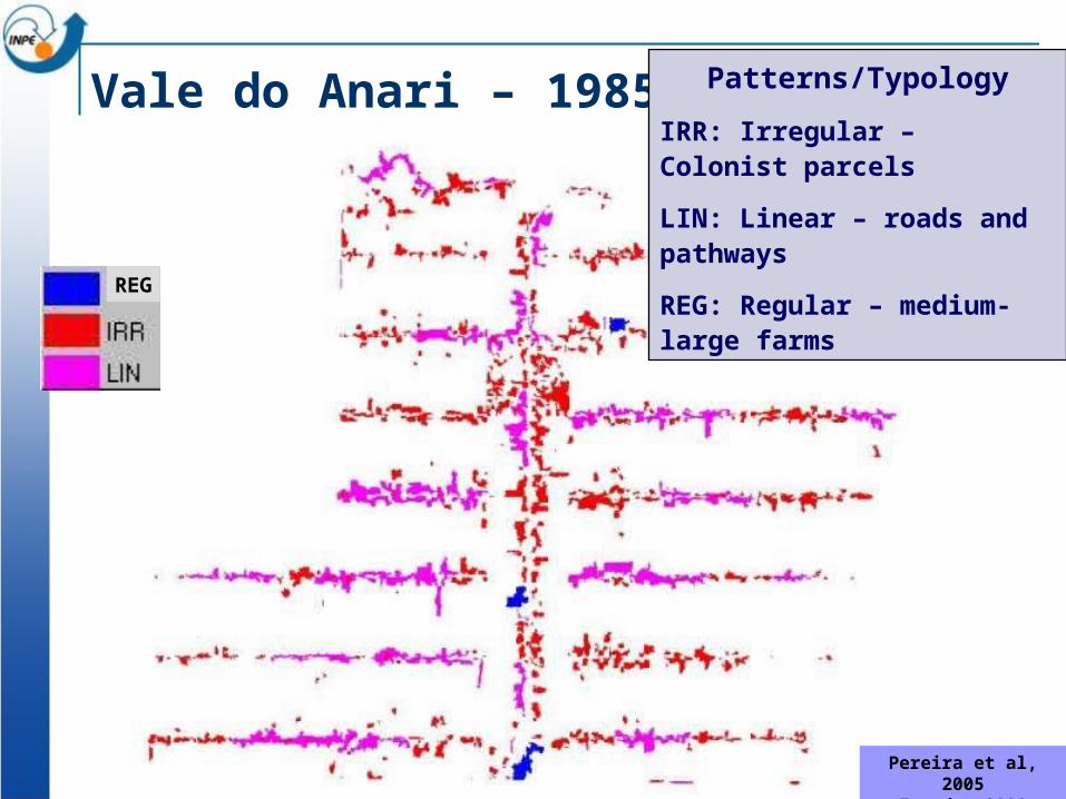
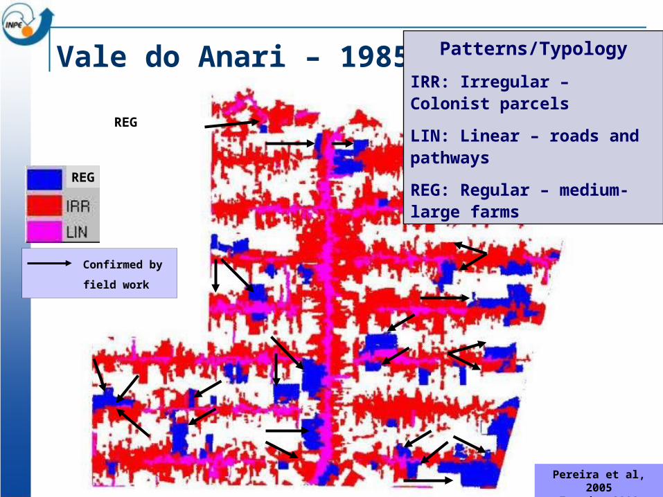
Vale do Anari – 1982 -1985 Patterns/Typology
IRR: Irregular – Colonist parcels
LIN: Linear – roads and pathways
REG: Regular – medium-large farms
REG
Vale do Anari – 1985 - 1988
Pereira et al, 2005
Escada, 2003
REG
Patterns/Typology
IRR: Irregular – Colonist parcels
LIN: Linear – roads and pathways
REG: Regular – medium-large farms
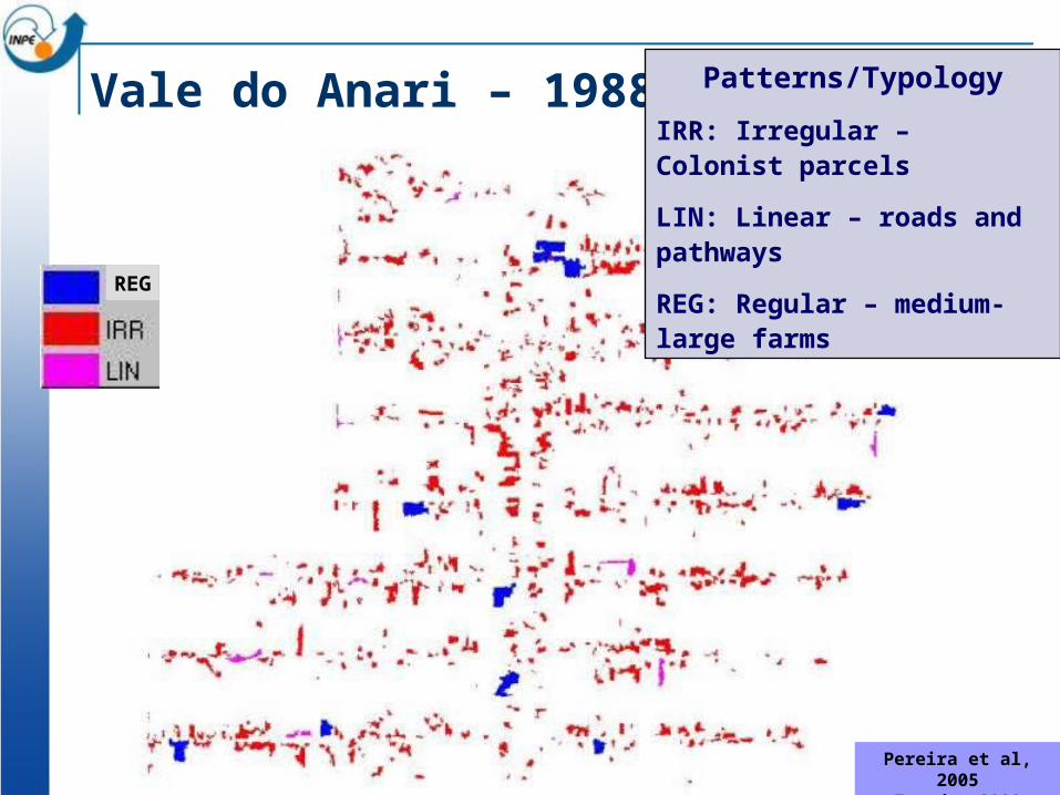
Vale do Anari – 1988 - 1991
Pereira et al, 2005
Escada, 2003
REG
Patterns/Typology
IRR: Irregular – Colonist parcels
LIN: Linear – roads and pathways
REG: Regular – medium-large farms
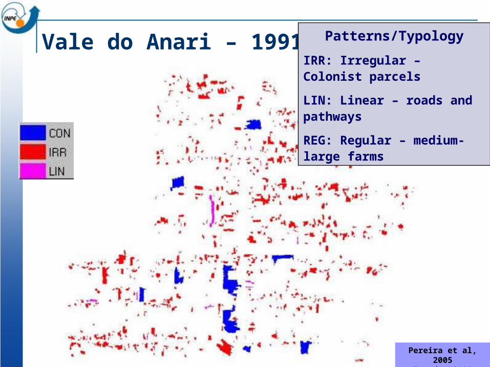
Vale do Anari – 1991 - 1994
Pereira et al, 2005
Escada, 2003
Patterns/Typology
IRR: Irregular – Colonist parcels
LIN: Linear – roads and pathways
REG: Regular – medium-large farms
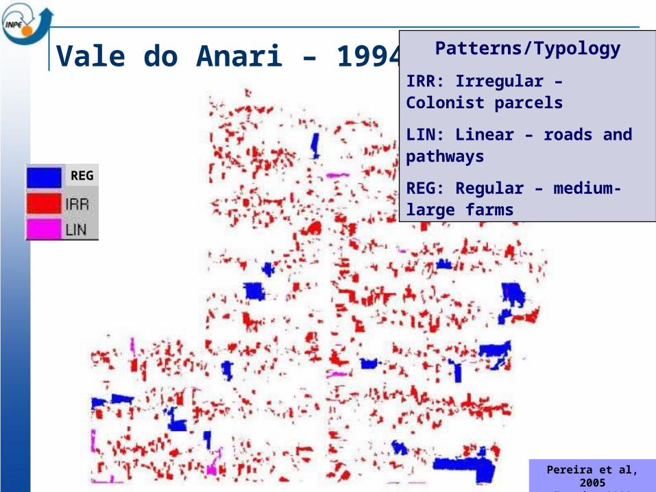
Vale do Anari – 1994 - 1997
Pereira et al, 2005
Escada, 2003
REG
Patterns/Typology
IRR: Irregular – Colonist parcels
LIN: Linear – roads and pathways
REG: Regular – medium-large farms
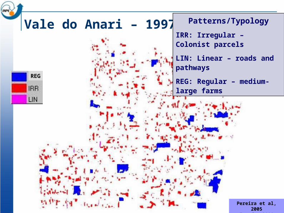
Vale do Anari – 1997 - 2000
Pereira et al, 2005
Escada, 2003
REG
Patterns/Typology
IRR: Irregular – Colonist parcels
LIN: Linear – roads and pathways
REG: Regular – medium-large farms
Vale do Anari – 1985 - 2000
Confirmed by
field work
Pereira et al, 2005
Escada, 2003
REG
REG
Patterns/Typology
IRR: Irregular – Colonist parcels
LIN: Linear – roads and pathways
REG: Regular – medium-large farms
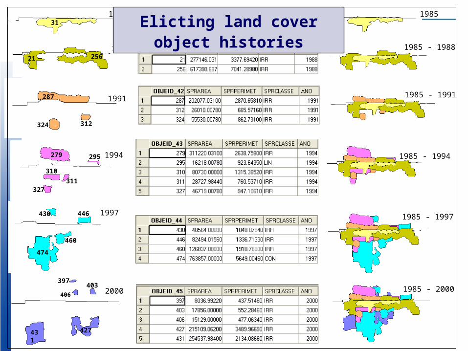
311985
2561988
1991287
312324
279 295
310
311327
1994
430 446
460
474
1997
397403
406
427431
2000
21
1985
1985 - 1988
1985 - 1991
1985 - 1994
1985 - 1997
1985 - 2000
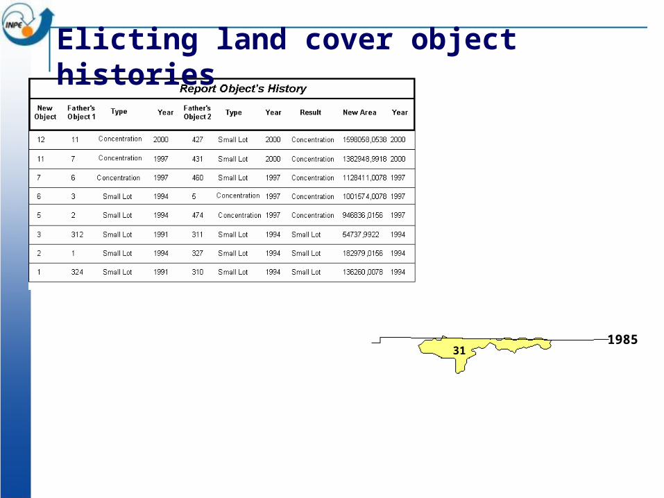
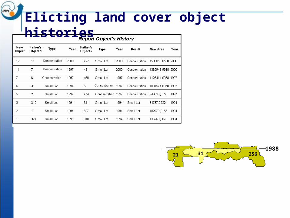
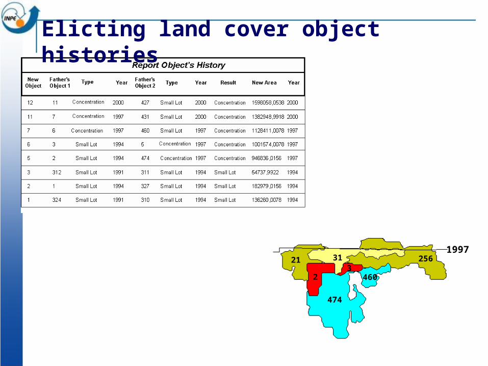
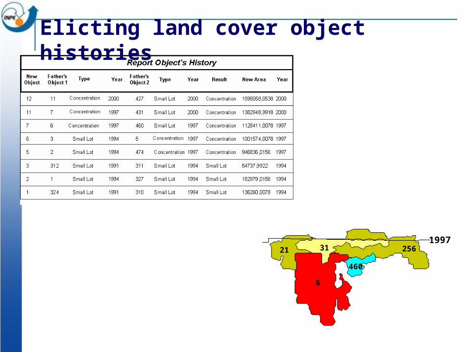
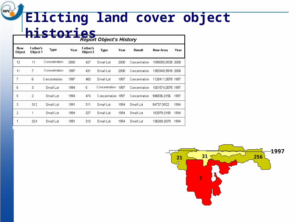
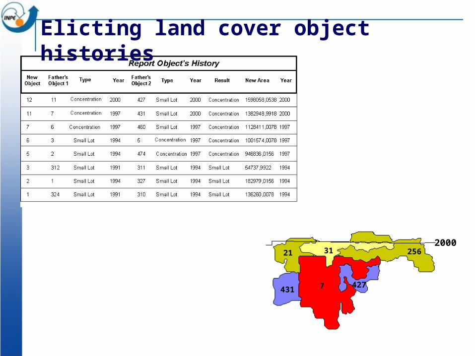
Elicting land cover object histories
311985
Elicting land cover object histories
3121 2561988
Elicting land cover object histories
3121 256
324
312
1991
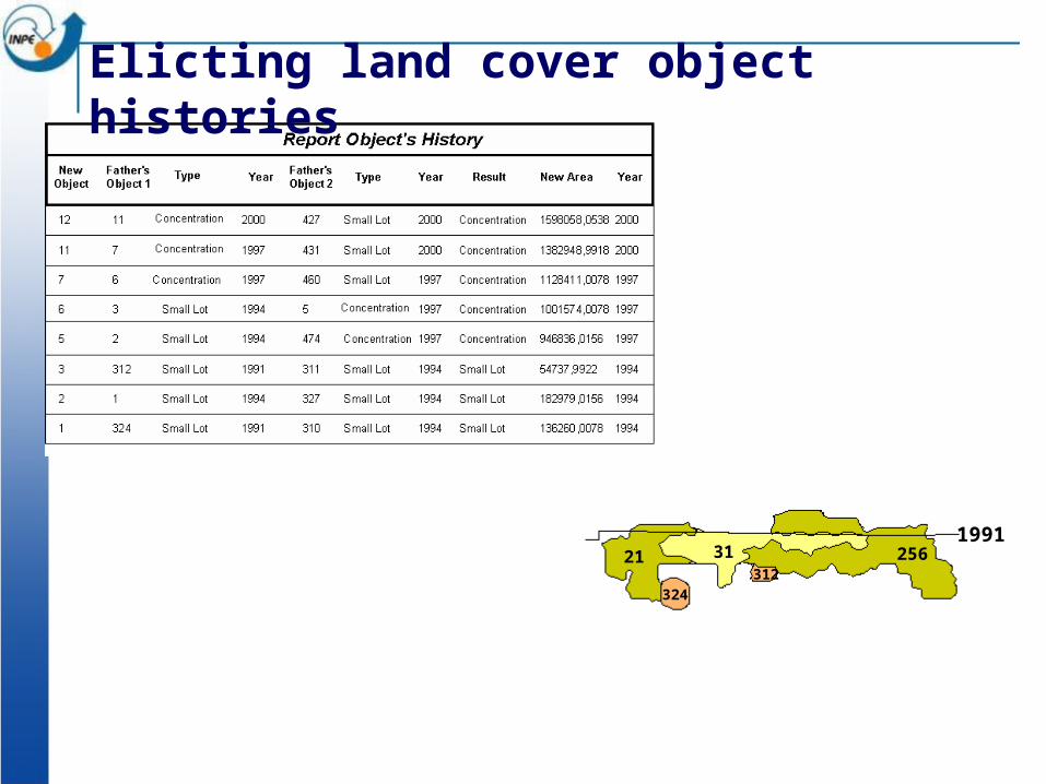
Elicting land cover object histories
3121 256
324
312310
327
311
1994
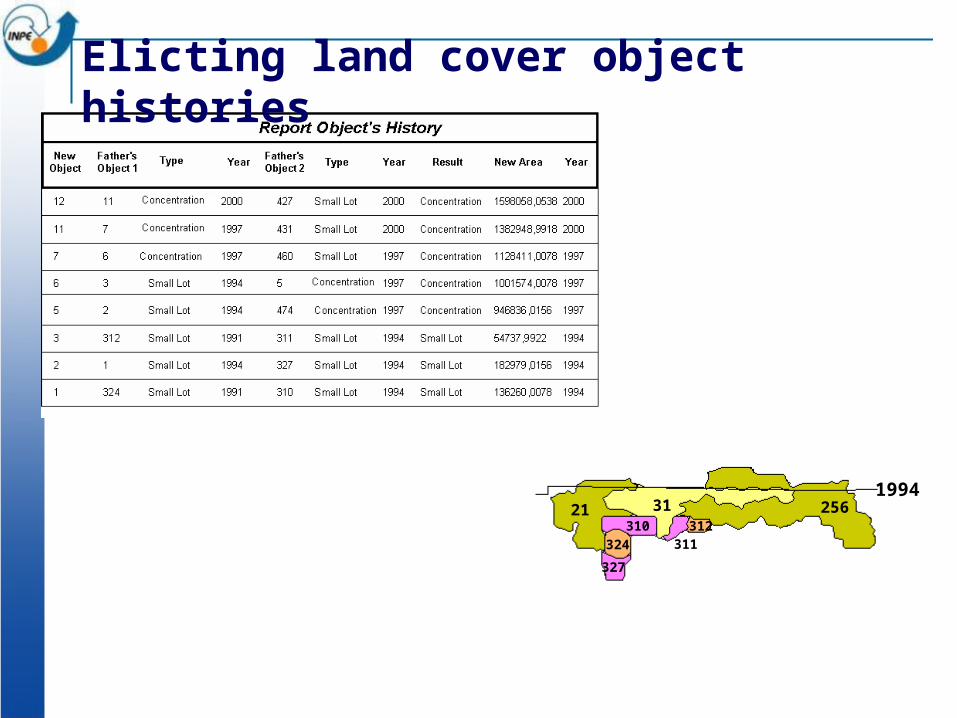
Elicting land cover object histories
3121 256312
327
1311
1994
Elicting land cover object histories

3121 256312
2 311
1994
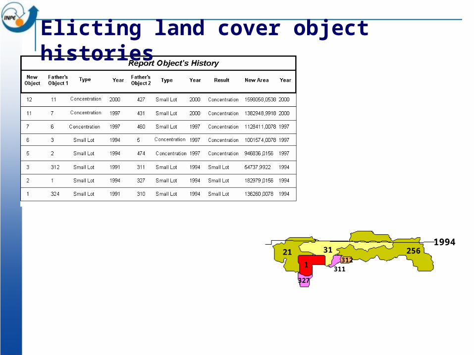
Elicting land cover object histories

3121 256
23
1994
Elicting land cover object histories
3121 256
23
474
460
1997
Elicting land cover object histories

3121 256
4603
5
1997
Elicting land cover object histories
3121 256
460
6
1997
Elicting land cover object histories
3121 256
7
1997
Elicting land cover object histories
3121 256
7431427
2000
Elicting land cover object histories
3121 256
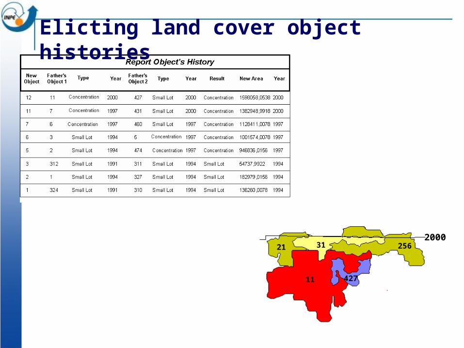
42711
2000
Elicting land cover object histories
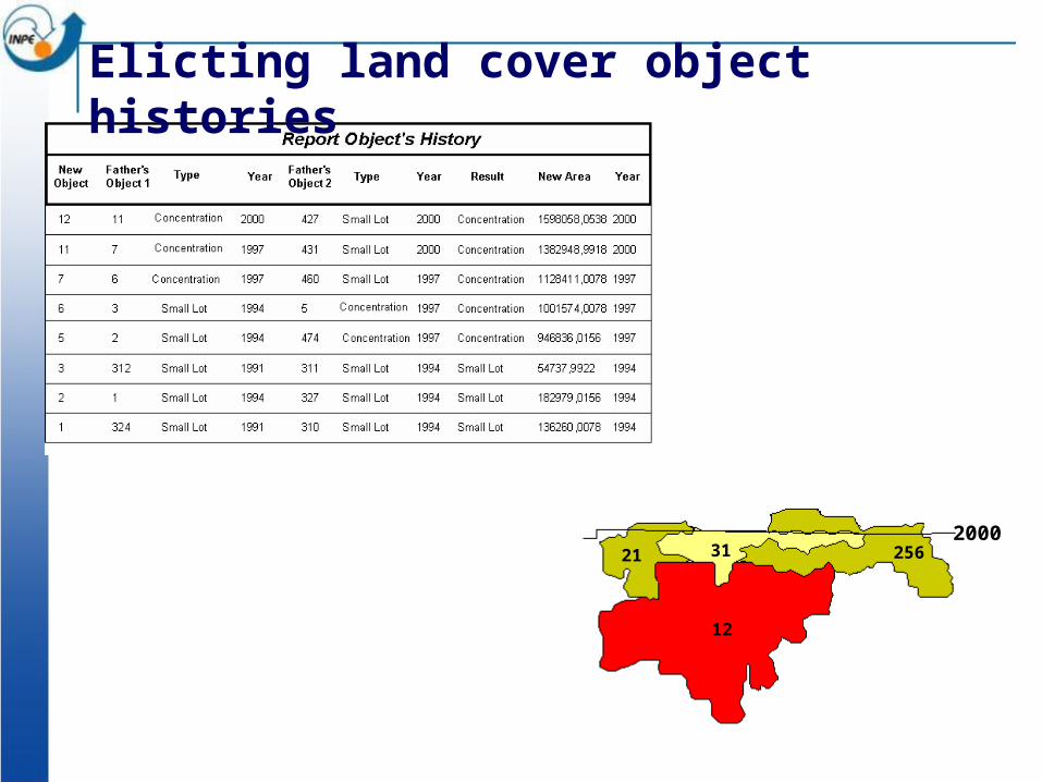
3121 256
12
2000
Elicting land cover object histories
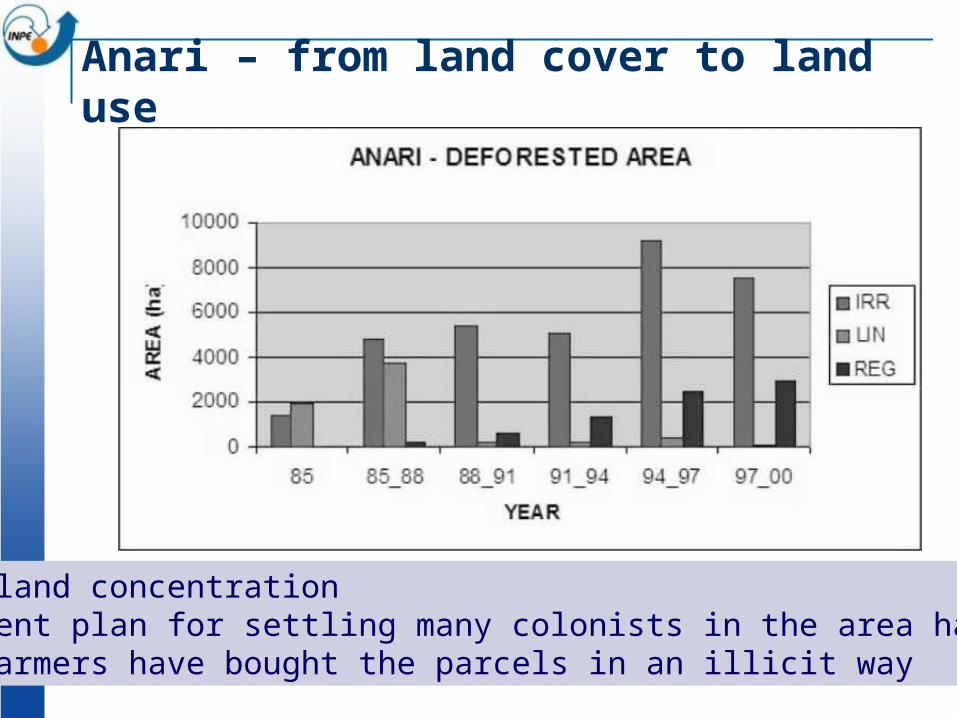
Marked land concentrationGovernment plan for settling many colonists in the area has failed. Large farmers have bought the parcels in an illicit way
Anari – from land cover to land use
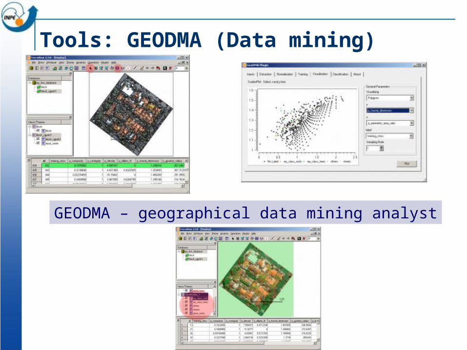
Tools: GEODMA (Data mining)
GEODMA – geographical data mining analyst
45
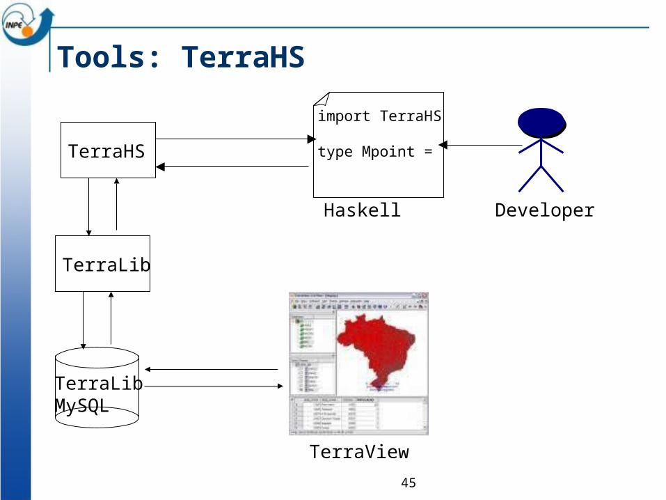
Tools: TerraHS
TerraHS
TerraView
import TerraHS
type Mpoint =
Haskell
TerraLibMySQL
TerraLib
Developer
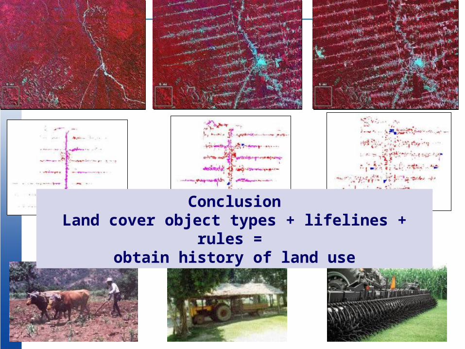
ConclusionLand cover object types + lifelines + rules =
obtain history of land use