Embed Size (px)
Citation preview
Canada’s Landform Regions
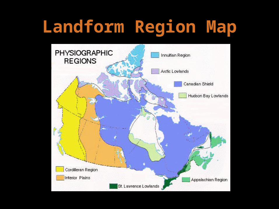
Landform Region Map
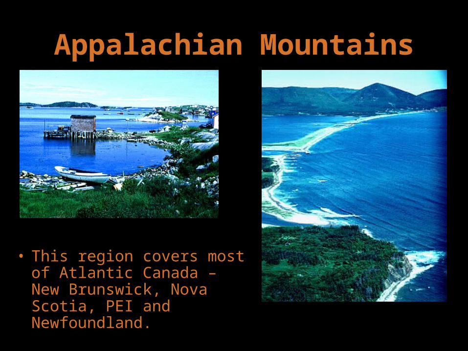
Appalachian Mountains
• This region covers most of Atlantic Canada – New Brunswick, Nova Scotia, PEI and Newfoundland.

Appalachian Mountains
• It is thought they were formed about 375 million years ago
• These mountains have been worn down by ice and water over the years. Their typical height is 1000 m.
• The vegetation is a mix of coniferous and deciduous forest.
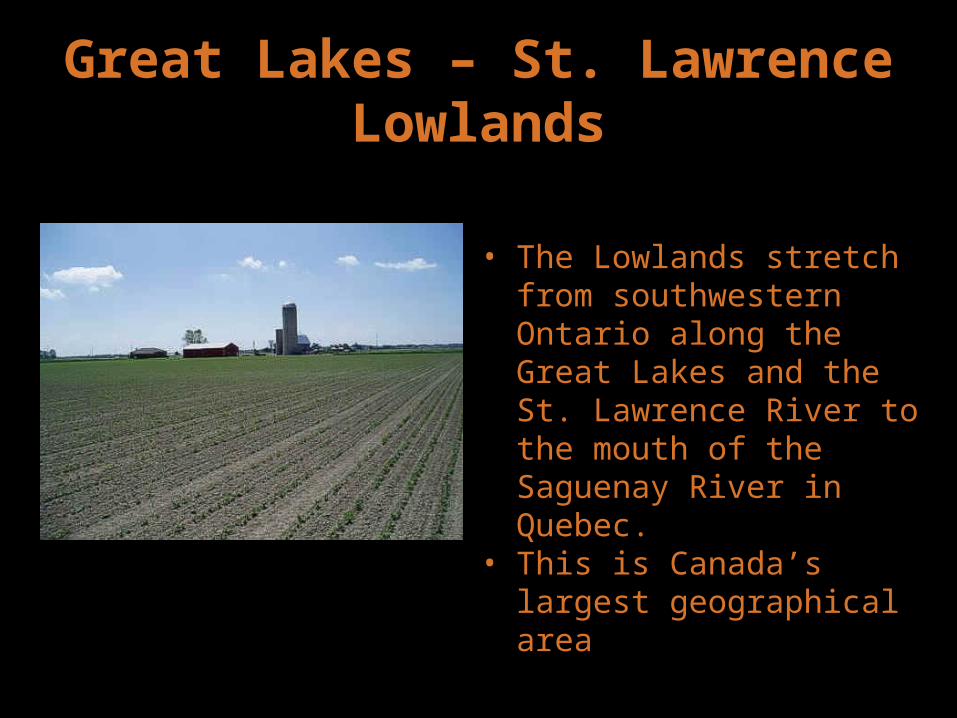
Great Lakes – St. Lawrence Lowlands
• The Lowlands stretch from southwestern Ontario along the Great Lakes and the St. Lawrence River to the mouth of the Saguenay River in Quebec.
• This is Canada’s largest geographical area

Great Lakes – St. Lawrence Lowlands
• The city of Toronto
The city of Montreal

Great Lakes – St. Lawrence Lowlands
• Farmers grow grapes, peaches, pears and other fruits
Farmland near Toronto

Canadian Shield
• This region is mostly covered with coniferous forests with a few areas suited for agriculture.
• Covers Central Canada: Saskatchewan, Manitoba, Ontario, Quebec, Labrador, the Northwest Territories, and Nunavut.

Canadian Shield
• The rocks of the Canadian Shield are about four billion years old.
• Notice the scratches in the rock
• They were caused by glaciers
Canadian Shield
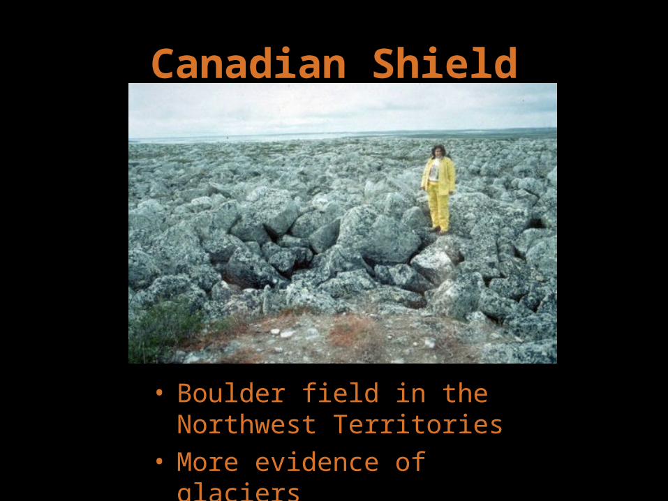
• Boulder field in the Northwest Territories
• More evidence of glaciers

Canadian Shield
• A boulder in the Northwest Territories
• It was deposited here by a retreating glacier
Hudson Bay Lowlands
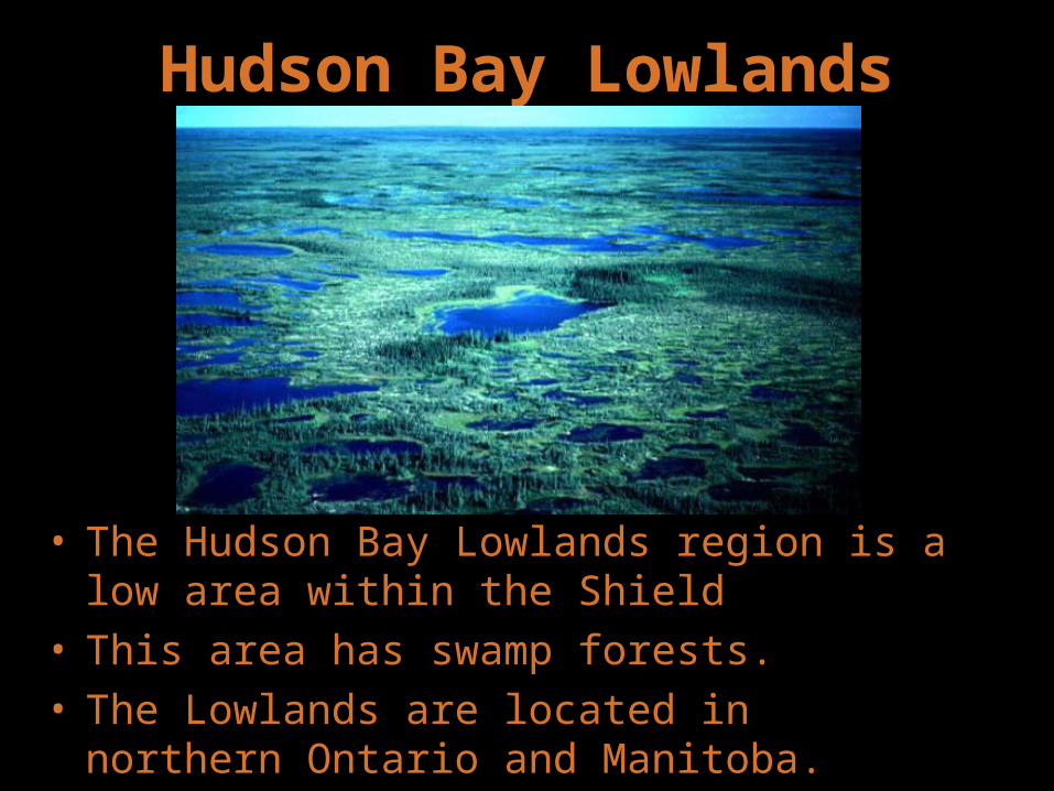
• The Hudson Bay Lowlands region is a low area within the Shield
• This area has swamp forests.• The Lowlands are located in northern Ontario
and Manitoba.
Hudson Bay Lowlands
Hudson Bay Lowlands

Hudson Bay Lowlands
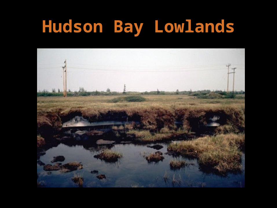
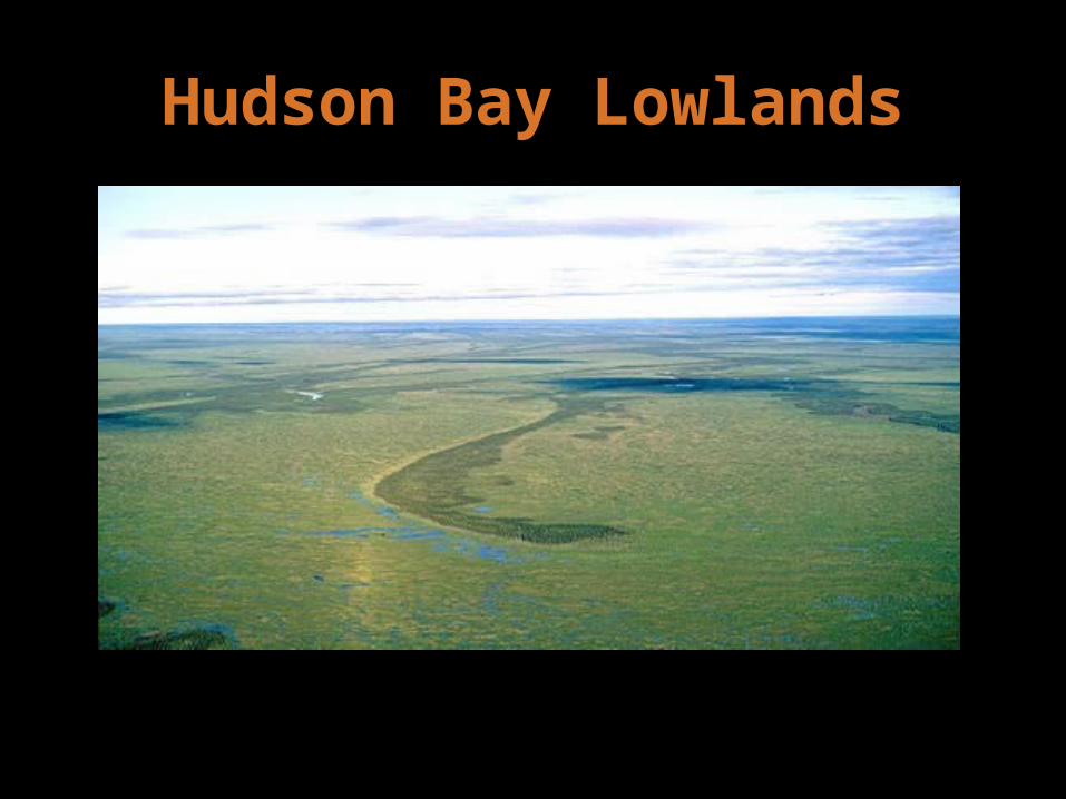
• A forested bog outside Gilliam, Manitoba
Interior Plains
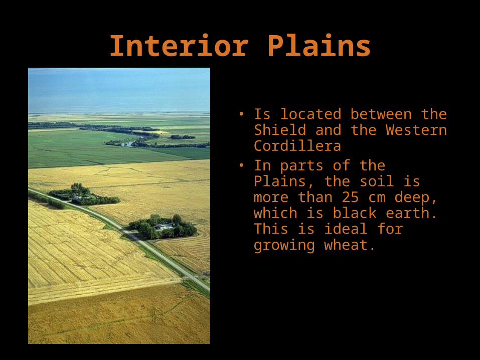
• Is located between the Shield and the Western Cordillera
• In parts of the Plains, the soil is more than 25 cm deep, which is black earth. This is ideal for growing wheat.
Interior Plains
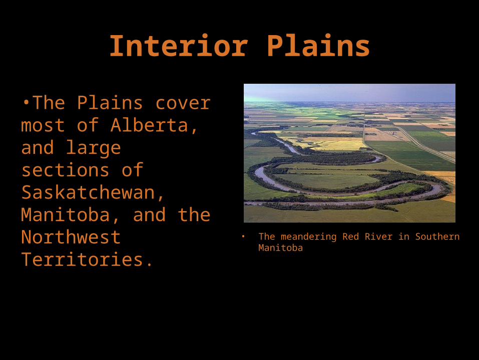
• The meandering Red River in Southern Manitoba
•The Plains cover most of Alberta, and large sections of Saskatchewan, Manitoba, and the Northwest Territories.

Interior Plains
• The Cypress Hills in Southern Saskatchewan

Interior Plains
• The Qu’Appelle Valley in Southern Saskatchewan• A rare change from the flat landscape in this region

Western Cordillera
• If you looks carefully, you will also see glaciers
•This region is made up mountain ranges – The Coast Mountains, the Columbia Mountains, and the Rocky Mountains, separated by plateaus.•The height of many of these mountains reaches over 3000 m.•This region includes British Columbia, Yukon Territory, and part of Alberta.

Western Cordillera
• One of the large glaciers found in the Yukon
Western Cordillera
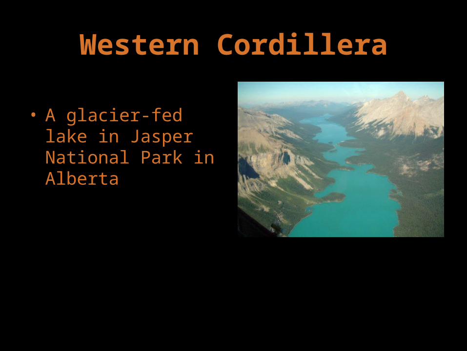
• A glacier-fed lake in Jasper National Park in Alberta

Western Cordillera
• Jasper National Park• The valley is U-
shaped because it was carved by a glacier, not the river you see here

Western Cordillera
• The Coast Mountains provide a dramatic backdrop in this picture of North Vancouver, BC
Arctic Lowlands
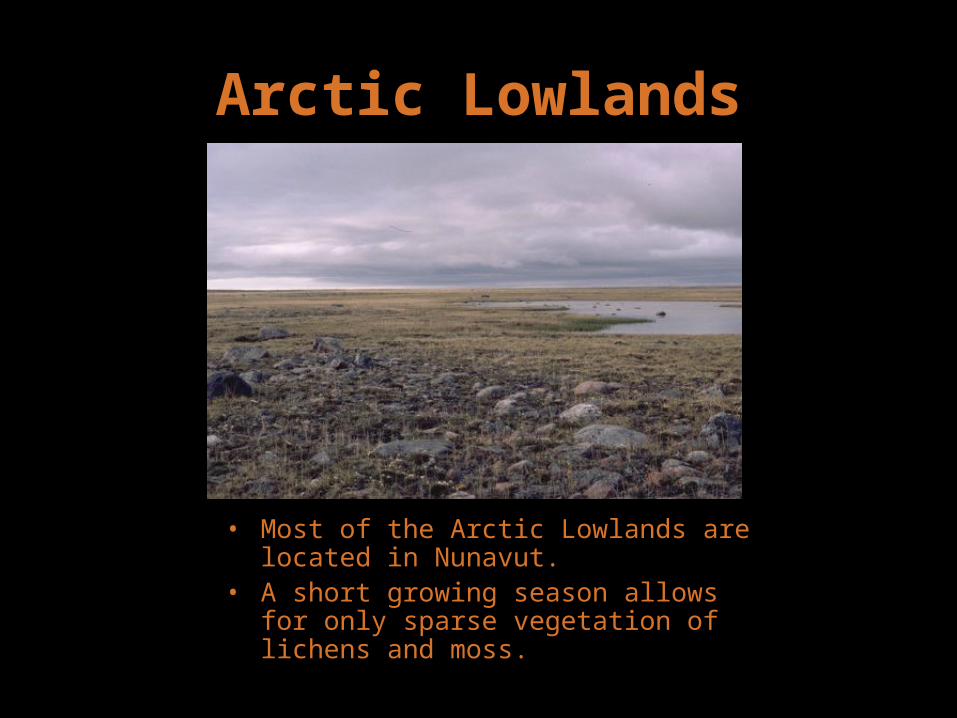
• Most of the Arctic Lowlands are located in Nunavut.
• A short growing season allows for only sparse vegetation of lichens and moss.

Arctic Lowlands
• This is a region of tundra, a treeless plain, with a cold, dry climate and poorly drained soil.
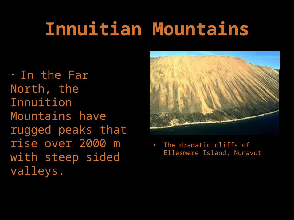
Innuitian Mountains
• The dramatic cliffs of Ellesmere Island, Nunavut
• In the Far North, the Innuition Mountains have rugged peaks that rise over 2000 m with steep sided valleys.

Innuitian Mountains
• A glacier and its melt water on Ellesmere Island, Nunavut
• This area is too cold for trees to survive.

Innuitian Mountains
• Red rocks and barren landscape on Melville Island
• Melville Island is divided between Nunavut and the Northwest Territories