Embed Size (px)
Citation preview

BYLAW 5807 Schedule B


Bylaw - 5807-
Downtown Area Redevelopment Plan
Prepared by
City of Lethbridge
Planning and Development Services
May, 2013


i
Acknowledgements This Downtown Area Redevelopment Plan would not have been accomplished
without the support of many individuals who have demonstrated their passion and
commitment to creating a vibrant downtown.
The project team would like to thank the Heart of Our City Revitalization Committee –
Design, Planning, and Regulatory subcommittee members for their contribution to
project implementation. The project team would also like to thank all members of
the public who participated in the past engagement process.
The project team would like to acknowledge each individual who provided
knowledge and support.
George Kuhl, RPP, MCIP
Downtown Revitalization Manager
Tatsuyuki Setta, RPP, MCIP, AICP
Community Planner
List of Contributors
City of Lethbridge
Planning and Development Services
Infrastructure Services
Corporate Services
Community Services
City Manager‟s Office
Heart of Our City Revitalization Committee (HOC)
The HOC, Design, Planning, and Regulatory sub-committee
External Stakeholders
Downtown Business Revitalization Zone
Lethbridge Chamber of Commerce
Allied Arts Council
Economic Development Lethbridge
Shaw
ATCO Gas
TELUS
Lethbridge School District No. 51
Park Place Mall
ii
Executive Summary The Downtown Area Redevelopment Plan (Bylaw 5807, the DARP) is a statutory plan
authorized by the Municipal Government Act. The DARP provides a planning
framework and supporting policies that will guide the next 10 years of development
in the Downtown, in accordance with the 2010 Integrated Community Sustainability
Plan/Municipal Development Plan (ICSP/MDP) and the vision of the 2007 Heart of
Our City Master Plan (The Master Plan).
The DARP consists of two distinct parts. The first part provides background information
describing the Plan area, background analysis, and the factors that have influenced
the evolution of Downtown including previous Downtown planning efforts. The
second part provides the policy framework, policies and implementation strategies.
The DARP is intended to create a vibrant and walkable downtown where people
enjoy working, living, and playing in two major ways:
1) by creating a wide range of policy areas including land use, urban design,
heritage resource preservation, livability, public realm, traffic circulation and
mobility, parking, sustainability, infrastructure renewal and replacement.
2) by recommending capital projects for City Council‟s consideration of future
Capital Improvement Programs (CIP‟s). Monitoring and evaluation strategies
have been devised as part of the implementation strategy to ensure priority
projects are administered and executed.
Consequently, the DARP has become a comprehensive plan. It is our hope that the
DARP will assist in creating a vibrant downtown and providing a more positive
downtown experience for all downtown users.

iii
Table of Contents
Acknowledgement i
Executive Summary ii
Table of Contents iii
List of Figures vi
List of Tables vi
1. Introduction ................................................................................... 2
1.1 Purpose ......................................................................................................... 2
1.2 Legislative Authority ....................................................................................... 2
1.3 Planning Rationale ......................................................................................... 2
1.4 Plan Objectives .............................................................................................. 3
2. Planning Context .......................................................................... 4
2.1 Significant Downtown Revitalization Events Timeline .................................... 4
2.2 Relationship to Other Plans and Initiatives .................................................... 7
2.2.1 Provincial Act and Statutory Plans ............................................................................. 7
2.2.2 Non-Statutory Plans & Initiatives ............................................................................... 9
2.3 Planning Process ......................................................................................... 11
2.4 Regional Context ......................................................................................... 12
2.5 Plan Area ..................................................................................................... 13
2.6 Analysis ....................................................................................................... 14
2.6.1 Demographics .......................................................................................................... 14
2.6.2 Land Use .................................................................................................................. 15
2.6.3 Built Environment ..................................................................................................... 16
2.6.4 Public Realm and Transportation Study (PRATS) ................................................... 25
2.6.5 Strengths and Opportunities .................................................................................... 26
2.6.6 Challenges ............................................................................................................... 28
3. Plan Elements .............................................................................. 30
3.1 The Past ...................................................................................................... 30
3.1.1 The 1988 Downtown Area Redevelopment Plan (Bylaw 4183) .............................. 30
3.1.2 Heart of Our City Master Plan (the Master Plan) ..................................................... 30
iv
3.1.3 Integrated Community Sustainability Plan/Municipal Development Plan (ICSP/MDP) (Bylaw 5650) ....................................................................................................... 34
3.2 The Present ................................................................................................. 35
3.3 The Future ................................................................................................... 36
3.3.1 Planning Direction .................................................................................................... 36
3.3.2 Planning Goal ........................................................................................................... 36
3.3.3 Planning Principles ................................................................................................... 37
4. Policy Framework ....................................................................... 40
4.1 Foundation ................................................................................................... 40
4.2 Policy Themes ............................................................................................. 40
4.2.1 Core Policy Themes ................................................................................................. 41
5. Policies ........................................................................................ 52
5.1 Land Use ..................................................................................................... 52
5.1.1 Purpose .................................................................................................................... 52
5.1.2 Goals ........................................................................................................................ 52
5.1.3 Policies ..................................................................................................................... 52
5.2 Urban Design ............................................................................................... 54
5.2.1 Purpose .................................................................................................................... 54
5.2.2 Goals ........................................................................................................................ 54
5.2.3 Policies ..................................................................................................................... 54
5.3 Heritage Resource Preservation .................................................................. 56
5.3.1 Purpose .................................................................................................................... 56
5.3.2 Goals ........................................................................................................................ 56
5.3.3 Policies ..................................................................................................................... 56
5.4 Commercial & Business Development ......................................................... 58
5.4.1 Purpose .................................................................................................................... 58
5.4.2 Goals ........................................................................................................................ 58
5.4.3 Policies ..................................................................................................................... 58
5.5 Livability ....................................................................................................... 61
5.5.1 Purpose .................................................................................................................... 61
5.5.2 Goals ........................................................................................................................ 61
5.5.3 Policies ..................................................................................................................... 61
5.6 Public Realm ................................................................................................ 64
5.7 Circulation and Mobility ................................................................................ 68

v
5.8 Parking ......................................................................................................... 72
5.8.1 Purpose .................................................................................................................... 72
5.8.2 Goals ........................................................................................................................ 72
5.8.3 Policies ..................................................................................................................... 72
5.9 Underground Infrastructure .......................................................................... 74
5.9.1 Purpose .................................................................................................................... 74
5.9.2 Goals ........................................................................................................................ 74
5.9.3 Policies ..................................................................................................................... 74
5.10 Sustainability ............................................................................................ 76
5.10.1 Purpose .................................................................................................................... 76
5.10.2 Goals ........................................................................................................................ 76
5.10.3 Policies ..................................................................................................................... 76
6. Plan Implementation .................................................................. 78
6.1 Components ................................................................................................ 78
6.2 Governance and Leadership ........................................................................ 78
6.2.1 Roles of the Key Stakeholders ................................................................................. 78
6.3 Strategic Initiatives and Capital Projects ...................................................... 80
6.3.1 Strategic Initiatives ................................................................................................... 80
6.3.2 Capital Projects ........................................................................................................ 80
6.4 Downtown Parking Management ................................................................. 87
6.4.1 Purpose .................................................................................................................... 87
6.4.2 Goals ........................................................................................................................ 87
6.4.3 Policy Considerations ............................................................................................... 87
6.4.4 Downtown Parking Management Plan ..................................................................... 89
6.5 Managing Downtown Land Use ................................................................... 90
6.5.1 Preamble .................................................................................................................. 90
6.5.2 Enhancing Downtown Character ............................................................................. 91
6.5.3 New Land Use Districts ............................................................................................ 92
6.5.4 Regulatory and Design Elements ............................................................................ 95
6.5.5 Pace of Change ....................................................................................................... 98
6.5.6 Selecting a Pace of Change Option ......................................................................... 98
6.5.7 Moving Forward ....................................................................................................... 99
6.6 Funding Sources ........................................................................................ 100
6.6.1 Public Sector Funding ............................................................................................ 100
6.6.2 Potential Redevelopment Levy .............................................................................. 100

vi
6.6.3 Major grants available for the municipality and individual business owners ......... 100
6.7 Performance Monitoring and Evaluation .................................................... 101
6.7.1 Principles ................................................................................................................ 101
6.7.2 Outcome Identification ........................................................................................... 102
6.7.3 Measure of Success ............................................................................................... 102
6.7.4 Action Identification ................................................................................................ 104
6.8 Reporting ................................................................................................... 105
6.9 Plan Amendment ....................................................................................... 105
6.10 Plan Revision .......................................................................................... 105
List of Figures Figure 1: Regional Map ............................................................................................................................. 12 Figure 2: Plan Area ..................................................................................................................................... 13 Figure 3: Downtown Population and the Number of Dwelling ......................................................... 14 Figure 4: 2012 Population Pyramid: Downtown versus. City-Wide ................................................... 14 Figure 5: Current Land Use ....................................................................................................................... 15 Figure 6: Built Footprint .............................................................................................................................. 16 Figure 7: Downtown Open Space .......................................................................................................... 17 Figure 8: Built Year – Downtown Buildings (August 2012) ................................................................... 18 Figure 9: Downtown Road Network/Classification (2012) ................................................................. 20 Figure 10: Downtown Underground Infrastructure Analysis ............................................................... 21 Figure 11: Adjacent Residential Neighbourhoods ............................................................................... 27 Figure 12: Heart of Our City Master Plan Diagram .............................................................................. 31 Figure 13: BID Hierarchy of Creating the Downtown Experience .................................................... 35 Figure 14: Proposed Road Hierarchy/Classification ............................................................................ 71 Figure 15: 3rd Ave. Future Image ............................................................................................................. 81 Figure 16: 3rd Ave. Proposed Street Section .......................................................................................... 82 Figure 17: 5th St. Future Image ................................................................................................................. 83 Figure 18: 5th St. Proposed Street Section .............................................................................................. 84 Figure 19: Conceptual Image of Future Parking Structure on Bompass ......................................... 86 Figure 20: Proposed Land Use Districts ................................................................................................... 92
List of Tables
Table 1: Land Use Statistics ....................................................................................................................... 15 Table 2: Main Street Program Summary ................................................................................................ 19 Table 3: Future Market Analysis Summary ............................................................................................. 22

1
PART I

2
1. Introduction
1.1 Purpose
The purpose of this Downtown Area Redevelopment Plan (the DARP) is to
provide a planning framework and supporting policies that will guide the
next 10 years of development in the Downtown in accordance with the
Integrated Community Sustainability Plan/Municipal Development Plan
(2010) and the vision of the Heart of Our City Master Plan (2007).
1.2 Legislative Authority
An Area Redevelopment Plan (ARP) is a statutory plan authorized by the
Municipal Government Act. According to the Act, an ARP must describe;
1) the objectives of the plan and how they are proposed to be achieved
2) the proposed land uses for the redevelopment area
3) if a redevelopment levy is imposed, the reasons for imposing it, any
proposals for the acquisition of land for any municipal use, school
facilities, parks and recreation facilities or any other purposes the
Council considers necessary
4) it may contain any other proposals that the Council considers necessary.
1.3 Planning Rationale
The previous Plan (Bylaw 4183), which was adopted in 1988 by City Council,
set out to accomplish the following goal:
“To enhance the Downtown as the cohesive, central focus for commercial,
social, cultural and government activity in Lethbridge in order to develop a
sense of place and identity”
Bylaw 4183 also established a series of objectives and policies to provide
guidance for coordinating public and private sector initiatives which were
intended to be complementary and mutually supportive in order that
Downtown Lethbridge could achieve the goal of remaining the central
focus for the City.
It has been nearly a quarter of a century since adoption of the bylaw.
Numerous changes have occurred within the City and in the Downtown
that could not have been foreseen at the time the previous DARP was
adopted. In particular, an economic recession occurred during the 90‟s
which stalled Downtown revitalization for several years.

3
Between the 1990‟s and up to the mid 2000‟s, “big box” retailing areas were
established in suburban areas of the city creating competition for the
consumer‟s dollar. Consequently, Downtown experienced some
community investment reluctance resulting in fewer businesses, fewer
people on the streets and a growing lack of building and property
maintenance. In addition, during this time, various social issues manifested
themselves on the streets of Downtown.
Although the bylaw‟s goals, objectives and policies were articulated, the
lack of an overall vision for the Downtown coupled with prolonged
economic dormancy, resulted in slower than anticipated reinvestment. City
Council recognized that a catalyst was necessary to reverse decline in the
Downtown core.
Between 2005 and 2007, the City undertook an initiative to develop a
Downtown Master Plan. As a result, City Council adopted sections of the
Heart of Our Master Plan in 2007. The Integrated Community Sustainability
Plan/Municipal Development Plan (ICSP/MDP) was adopted by the City
Council in 2010. Both plans recognize that Lethbridge has a strong and
vibrant Downtown and a new Area Redevelopment Plan should be
prepared.
1.4 Plan Objectives
As a statutory plan, the DARP is used as a development guideline on a daily
basis by staff, developers, and business owners. Therefore, it is important
that the intent of the DARP be clear and understandable and that the
DARP achieves the following:
1) To reflect community values
2) To establish strong planning principles that will guide the next 10
years of redevelopment in the Downtown
3) To provide supporting policies based on the planning principles
4) To ensure strong relationships with both internal and external
stakeholders for policy implementation
5) To take a comprehensive approach for overcoming challenges
and issues facing Downtown
6) To focuses on implementation plans for achieving the planning
objectives

4
2. Planning Context
2.1 Significant Downtown Revitalization Events
Timeline
The following section provides an overview of significant events that have
taken place in the revitalization of Downtown Lethbridge over the last quarter
century. These events underlie the continued effort to maintain and expand
the vitality of Downtown.
1987 Through a municipal bylaw authorized by the Municipal Government
Act, the Downtown Lethbridge Business Revitalization Zone (BRZ) was
established to provide a mechanism for the Downtown business
community to initiate projects that would enhance and revitalize
Downtown. City Council also established the BRZ tax, which is levied
on properties within the BRZ boundaries, that provides funds for the BRZ
to operate.
1988 First Downtown Area Redevelopment Plan (Bylaw 4183) was adopted
1990 An economic recession in the early to mid 1990‟s impacted the City in
general and the Downtown in particular early. Revitalization activity in
Downtown essentially stalled.
1995 Although an economic recovery was beginning in the City, Downtown
still experienced some business community investment reluctance, the
impact being fewer businesses, fewer people on the streets, an
increase of social issues, and a growing lack of building and property
maintenance.
The 1995 General Municipal Plan (Bylaw 4678) recognized that
Downtown should:
be a “People Place” as well as a strong commercial and
cultural centre
be a place that helps create community identity and pride
have more & varied housing
have more mixed-use development
have more student housing; and attract tourists
1999 A Co-design Charrette, that complied citizen generated ideas in
graphic form, was held to energize Downtown revitalization.
2000 The “big box retailing” paradigm shift was in full swing in the City. This
new alternative shopping form brought less expensive shopping closer
to growing areas in southeast Lethbridge. Most new commercial
investment went elsewhere than Downtown.
Negative behaviour, much of which was attributable to underling
social issues, in turn contributed to a downward slide of Downtown.
Positive experiences were declining and business clientele began to
avoid downtown. It became apparent to City Council that to
revitalize Downtown, something had to be done to arrest and reverse

5
the downward trend taking hold.
In a response to reverse the growing trend of building decay, the
Downtown Lethbridge BRZ and the City partnered with the
Government of Alberta to launch the Main Street Program.
2003 The Downtown Redevelopment Steering Committee (DRSC) was
established by City Council
City Council established the Downtown Redevelopment Fund to
provide capital for the DRSC to undertake projects in the fulfillment of
its mandate.
City Council also established the Tax Abatement Program or
Downtown Redevelopment Incentive Policy (DRIP).
2004 McGill University School of Architecture students developed
conceptual revitalization plans for nine blocks in Lethbridge‟s
Downtown core. The study was completed in 2004 and formed the
basis of a “catalytic” community forum which resulted in a Community
Charter to provide direction for action to the DRSC.
2005 In June of 2005, in a report entitled “Framework for Moving from
Planning to Action”, the DRSC presented an initiative to City Council
to create a master plan that would comprehensively describe the
actions required to ensure the Downtown remains vital and vibrant.
2006 A Downtown revitalization master planning project, that involved a
comprehensive corporate and community engagement process,
commenced and delivered the Heart of Our City Master Plan.
2007 The Heart of Our City Master Plan was partially adopted by City
Council.
2008 City Council created the Heart of Our City Revitalization Committee
(HOCRC), comprised of City Council members and stakeholder
representatives to champion the revitalization of Downtown
Lethbridge through implementation of the Heart of Our Master Plan.
The construction of Rotary Centennial Plaza water feature essentially
transformed Galt Gardens.
City Council created an Art Acquisition Program to add Public Art to
the Downtown and other areas of the City.
Two significant adaptive reuse projects were completed; the
conversion of the Coalbanks Inn from a tavern and hotel into a mixed-
use commercial and residential and the conversion of the iconic
Paramount Theatre into an office building.
2009 Public and private investment became more visible with renovations
to coffee shops and restaurants, the Southern Alberta Art Gallery, Post
Office, and the new fire station.
City Council purchased lands for a new Community Arts Centre
(replacing the aging Bowman Arts Centre) and potentially a
Performing Arts Centre.
2010 City Council adopts the Integrated Community Sustainability Plan
/Municipal Development Plan. The plan supports the Downtown and

6
states “The Downtown is a symbol of the whole city – one important
way residents throughout the world identify with their cities – the more
attractive and vibrant the Downtown is the more pride the residents of
the whole city seem to have. For this important reason, among others,
the Downtown should always be reinforced and enhanced”.
Preliminary work commenced on a new Downtown Area
Redevelopment Plan (DARP) to replace the 1988 Downtown Area
Redevelopment Plan which had become obsolete.
Private investment continued with a multimillion dollar renovation to
Lethbridge Centre which was more than all of the other Downtown
construction values combined.
2011 With joint funding from Canadian Badlands, the Heart of Our City
Revitalization Committee sponsored the Public Realm and
Transportation Study which concentrated on 3 key Downtown
corridors to determine the nature and extent of possible future
improvements to the public realm which consists of the streets and
adjacent sidewalk areas within the existing rights-of-way.
A Downtown Marketing Study was undertaken by the HOCRC to
devise a strategy that would increase the Downtown‟s use by both
residents and visitors. In addition, the HOCRC instituted the Heart of
Our City Activity Grant to help organizations host events that create
an exciting and vibrant Downtown and attract audiences to the Heart
of the City.
Another significant adaptive reuse project was completed; the
conversion of the Alec Arm Hotel into an affordable housing/mixed-
use commercial and residential building.
2012 The Public Realm and Transportation Study (PRATS) was completed
and some recommendations from that study will be implemented
through the new DARP.

7
2.2 Relationship to Other Plans and Initiatives
The diagram below illustrates how the DARP is related to other plans and
studies and provides a better understanding of the overall planning context of
the DARP.
2.2.1 Provincial Act and Statutory Plans
1) Province of Alberta Municipal Government Act (MGA)
The Municipal Government Act is the primary Provincial legislation that
provides municipalities with a planning framework by setting out the legislated
roles and responsibilities of municipal Councils, boards and administrative staff
to ensure the development and redevelopment of land in a systematic,
orderly, economically, and environmentally responsible manner.
2) 2010 Integrated Community Sustainability Plan/
Municipal Development Plan (ICSP/MDP)
In 2010, the City of Lethbridge introduced its new ICSP/MDP. This guiding policy
document enables Council and the community to work toward a vision of the
community over the next 50 years. The plan is based on the balance of social,
cultural, economic, built and natural environment, and governance
dimensions of sustainability. The community‟s aspirations for the City are
Public Realm and Transportation
Study (2012)
Integrated Community Sustainability Plan/
Municipal Development Plan (ISCP/MDP)
(2010)
The DARP
(2013)
Heart of Our City Master Plan (2007)
Municipal Government Act
Public Art Master Plan (2012)
Non-Statutory Plans and Studies Provincial Act and Statutory Plans
Market Analysis and
Development Forecast (2010)
Transportation Master Planning
Bylaw 4183
Downtown
Area
Redevelopment
Plan (1988)

8
contained within the policies and the intent is for future planning efforts to find
their basis or roots with the ICSP/MDP. All statutory plans adopted by the
municipality must comply with their ICSP/MDP and all the major planning
initiatives and statutory plans including this DARP will follow the policies within
the ICSP/MDP.
The ICSP/MDP recognizes the importance of the Downtown in the context of
overall community vibrancy. Consequently, maintaining a Strong and Vibrant
Downtown is one of the main objectives of the ICSP/MDP.
3) The 1988 Downtown Area Redevelopment Plan (Bylaw 4183) Bylaw 4183 remains in effect until superseded by a new DARP Bylaw. Many
aspects of the previous DARP have been accomplished, several remain valid,
and as indicated previously, many things have changed in the City over the
past quarter century. Among those aspects which remain valid is the
fundamental Downtown planning principles, which have been followed in the
preparation of both the Heart of Our City Master Plan and the new DARP.
For instance, the central goal of the Bylaw was to recognize Downtown as “the
cohesive central focus for commercial, social, cultural and government
activity in Lethbridge in order to develop a sense of place and identity.”
Implementation policies were formulated based on identified areas of concern
or opportunity. Some of the policies and implementation strategies in the Bylaw
are still relevant and will be incorporated into the DARP. This will maintain
continuity and ensure a smooth transition from the past to the future.

9
2.2.2 Non-Statutory Plans & Initiatives
1) Heart of Our City Master Plan (the Master Plan)
The Master Plan, part 3: the vision, part 4: the guiding framework, part 5:
development guidelines, was adopted by City Council in 2007. Though it is not
considered a statutory plan, the Master Plan provides the framework to guide
future public involvements and private development and to ensure the
emergence of cohesive, vibrant, and economically vital Downtown. The
Master Plan also presents a long-term vision with the potential to transform
Downtown and benefit the entire community.
It is a comprehensive document that consists of
the vision statement, campaign pillars, guiding
principles and guiding framework. Therefore, the
majority of the core planning principles from the
Master Plan has been rearticulated in the DARP.
2) Public Realm and Transportation Study (PRATS)
The PRATS is a comprehensive technical exercise that provides an examination
of the public realm elements that contribute to a pleasing environment and
included both streetscape design and traffic engineering for the DARP. Parking
condition analysis and future parking demand were also examined to identify
challenges and opportunities.
10
3) Downtown Lethbridge Market Analysis and Development Forecast
This analysis was undertaken for the purpose of providing background
information of the potential for economic investment in the Downtown. The
analysis includes a future population projection, future housing supply and
demand projection, and a future retail growth outlook.
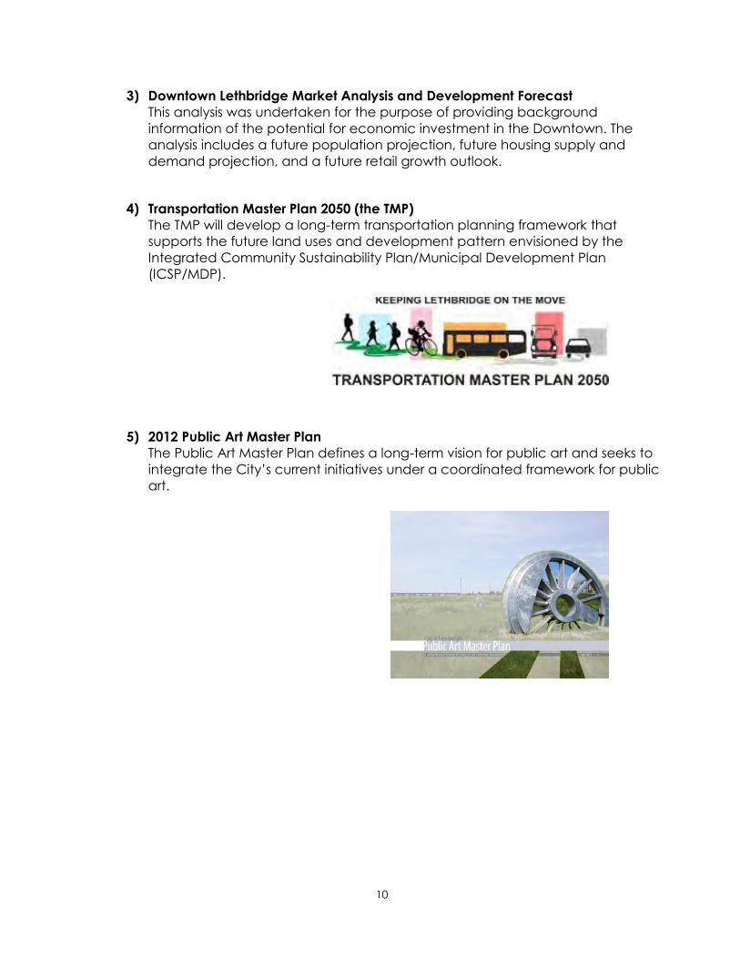
4) Transportation Master Plan 2050 (the TMP)
The TMP will develop a long-term transportation planning framework that
supports the future land uses and development pattern envisioned by the
Integrated Community Sustainability Plan/Municipal Development Plan
(ICSP/MDP).
5) 2012 Public Art Master Plan
The Public Art Master Plan defines a long-term vision for public art and seeks to
integrate the City‟s current initiatives under a coordinated framework for public
art.
11
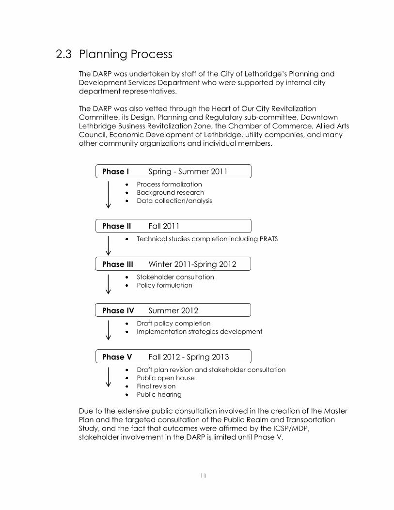
2.3 Planning Process
The DARP was undertaken by staff of the City of Lethbridge‟s Planning and
Development Services Department who were supported by internal city
department representatives.
The DARP was also vetted through the Heart of Our City Revitalization
Committee, its Design, Planning and Regulatory sub-committee, Downtown
Lethbridge Business Revitalization Zone, the Chamber of Commerce, Allied Arts
Council, Economic Development of Lethbridge, utility companies, and many
other community organizations and individual members.
Phase I Spring - Summer 2011
Process formalization
Background research
Data collection/analysis
Phase II Fall 2011
Technical studies completion including PRATS
Phase III Winter 2011-Spring 2012
Stakeholder consultation
Policy formulation
Phase IV Summer 2012
Draft policy completion
Implementation strategies development
Phase V Fall 2012 - Spring 2013
Draft plan revision and stakeholder consultation
Public open house
Final revision
Public hearing
Due to the extensive public consultation involved in the creation of the Master
Plan and the targeted consultation of the Public Realm and Transportation
Study, and the fact that outcomes were affirmed by the ICSP/MDP,
stakeholder involvement in the DARP is limited until Phase V.

12
2.4 Regional Context
According to the market analysis and development forecast,
Lethbridge‟s trade area is generally considered to extend to the
eastern boundaries of the Municipal District of Taber and the
County of Warner No.5 in the east, the United States border to the
south, a portion of the East Kootenay Regional District in British
Columbia to the west, and the southern portion of the Municipal
District of Willow Creek and Vulcan County to the north. Within this
trade and service area, Lethbridge serves as the centre for southern
Alberta's 190,000 residents.
Lethbridge‟s history began in the Downtown. Located in the centre
of our community, it plays an important role for economic and
cultural activities. Downtown Lethbridge is truly the community‟s
focal point of business as it provides approximately 8,000
employment opportunities.
Although the Downtown has been in competition with other
commercial districts within the City such as the Mayor Magrath Drive
South commercial area, due to its history, mixture of business, retail,
public sector, and cultural activities it still remains the Heart of the
City.
As the City continues to grow and new commercial areas are
developed in other sections of the City such as the Crossings and the
West Lethbridge Employment Centre, The Downtown will continue to
function as the City‟s focal point because of its physical location and
centralized functions.
Figure 1: Regional Map
13
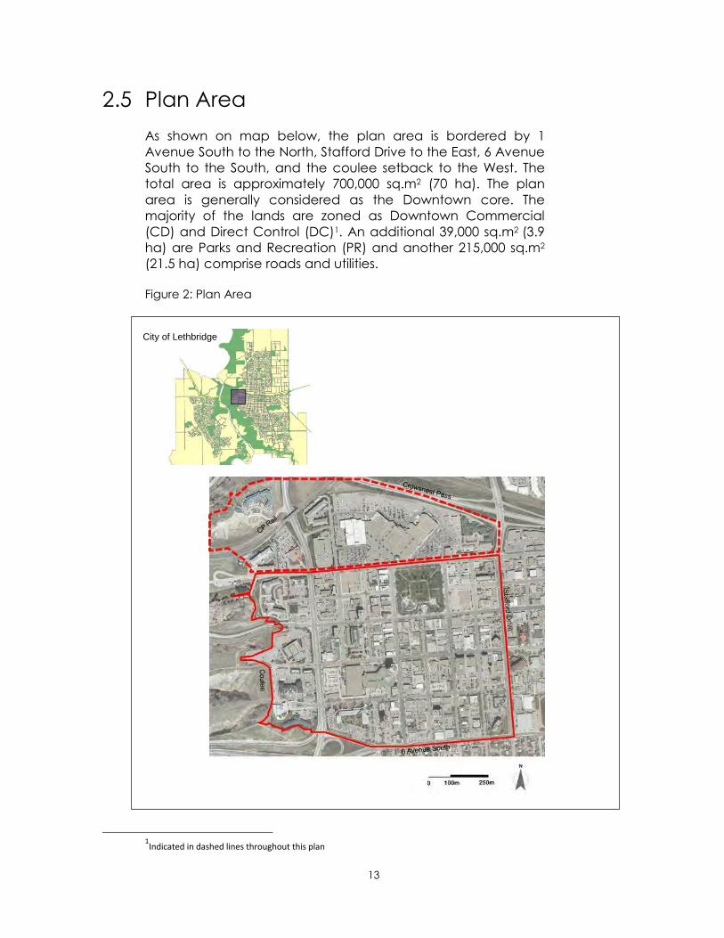
2.5 Plan Area
As shown on map below, the plan area is bordered by 1
Avenue South to the North, Stafford Drive to the East, 6 Avenue
South to the South, and the coulee setback to the West. The
total area is approximately 700,000 sq.m2 (70 ha). The plan
area is generally considered as the Downtown core. The
majority of the lands are zoned as Downtown Commercial
(CD) and Direct Control (DC)1. An additional 39,000 sq.m2 (3.9
ha) are Parks and Recreation (PR) and another 215,000 sq.m2
(21.5 ha) comprise roads and utilities.
Figure 2: Plan Area
1Indicated in dashed lines throughout this plan
City of Lethbridge

14
2.6 Analysis
2.6.1 Demographics
The population growth in the last ten years in the Downtown area has
been fairly flat. This is due to the limitation of the residential infill
development opportunities and the market demand for residential
developments in the downtown. Influencing the Downtown population
is single concentration of residents over 55 years old. A large number of
the senior oriented buildings have been built on the west side of Scenic
Drive due to the market demand at the time and public funding that
was available. This pattern is unique to Downtown and is not replicated
elsewhere in the City.
Figure 3: Downtown Population and the Number of Dwelling
Figure 4: 2012 Population Pyramid: Downtown versus. City-Wide
Source: The Municipal Census
Source: The Municipal Census 2012
15
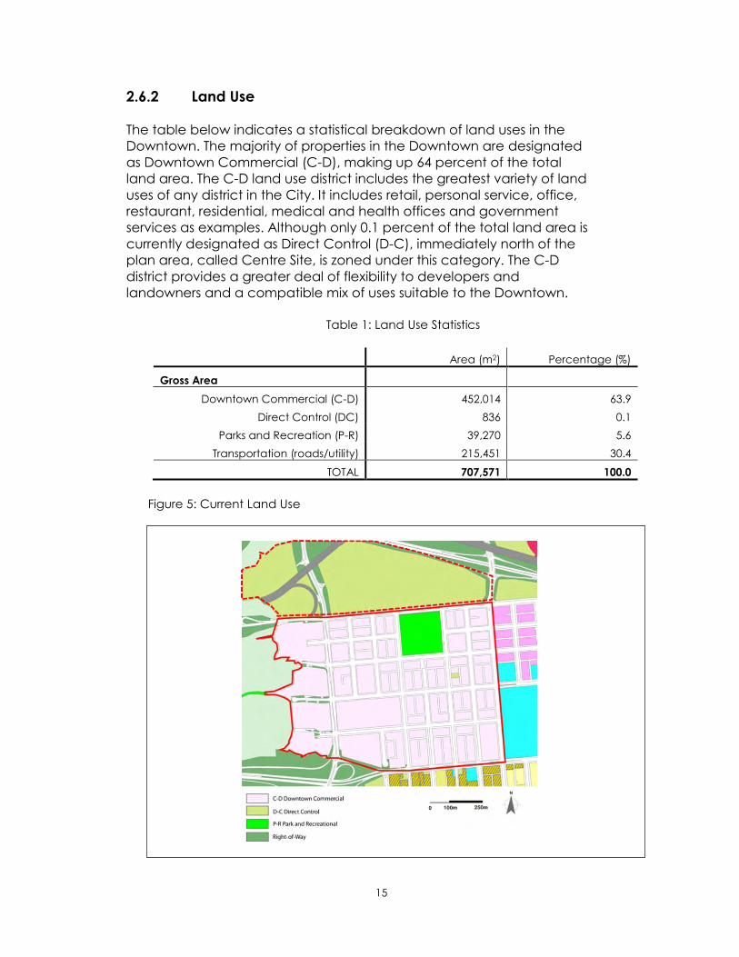
2.6.2 Land Use
The table below indicates a statistical breakdown of land uses in the
Downtown. The majority of properties in the Downtown are designated
as Downtown Commercial (C-D), making up 64 percent of the total
land area. The C-D land use district includes the greatest variety of land
uses of any district in the City. It includes retail, personal service, office,
restaurant, residential, medical and health offices and government
services as examples. Although only 0.1 percent of the total land area is
currently designated as Direct Control (D-C), immediately north of the
plan area, called Centre Site, is zoned under this category. The C-D
district provides a greater deal of flexibility to developers and
landowners and a compatible mix of uses suitable to the Downtown.
Table 1: Land Use Statistics
Area (m2) Percentage (%)
Gross Area
Downtown Commercial (C-D) 452,014 63.9
Direct Control (DC) 836 0.1
Parks and Recreation (P-R) 39,270 5.6
Transportation (roads/utility) 215,451 30.4
TOTAL 707,571 100.0
Figure 5: Current Land Use

16
2.6.3 Built Environment
1) Built Form
The Downtown is comprised of relatively low-rise buildings between one to
three stories high. Minimal building setbacks along the minor streets provide a
strong street wall and engage pedestrians walking by. Many building still show
evidence of the attractive architectural detailing of the pre World War II era of
their construction.
Amongst historic buildings in the Downtown, the Lethbridge Post Office built in
the early 20th century with distinctive architectural features made of Tyndall
stone is often noted as a civic landmark. Several other buildings in the same
era such as the former Royal Bank now Esquires or the new Foster & Sons
Jewelers Ltd., also incorporated this unique building material. Brick is also a
popular material used for many buildings in Downtown and acts as a unifying
element across building eras.
The majority of the buildings are used as retail stores, restaurants or offices. The
redevelopment of the CP rail marshalling yard allowed for the establishment of
Park Place Mall within the Downtown. The Mall‟s design is unique in that there
continues to be a strong pedestrian focus along 1st Avenue with the majority of
the parking in the rear.
Figure 6: Built Footprint

17
2) Galt Gardens and Urban Forest
Galt Gardens, a beautifully landscaped urban oasis with a multi functional
open theatre and a water feature, is located in the centre of the Downtown.
The land was originally owned by the Galt family and kept as parkland. At one
time, the park was used as a turning ground for bull trains. In 1908, Elliot
Torrence Galt, Sir Alexander Galt‟s son, donated the land to the city and the
park was named Galt Gardens in their honour.
Most recently, the Lethbridge Rotary Club approached the city to revitalize the
park with a Rotary Centennial Plaza Project. In June 2008, Galt Gardens Water
Feature and associated improvements were completed and opened for the
residents. This project contributed a significant civic feature and amenity to
Downtown Lethbridge and essentially transformed Galt Gardens. Throughout
the year, Galt Gardens is a popular place for not only daily activities but also
annual festivals including the Bright Lights Festival at Christmas time.
Mature urban trees along the streets in the Downtown are well-maintained and
not only provide a pleasant atmosphere for visitors and residents but also
mitigate the hard surfaces of roads and buildings and contribute to the
environmental health of the Downtown.
Figure 7: Downtown Open Space
18
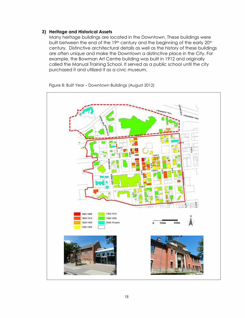
3) Heritage and Historical Assets
Many heritage buildings are located in the Downtown. These buildings were
built between the end of the 19th century and the beginning of the early 20th
century. Distinctive architectural details as well as the history of these buildings
are often unique and make the Downtown a distinctive place in the City. For
example, the Bowman Art Centre building was built in 1912 and originally
called the Manual Training School. It served as a public school until the city
purchased it and utilized it as a civic museum.
Figure 8: Built Year – Downtown Buildings (August 2012)

19
4) Building Façade (Alberta Main Street Program)
The Main Street Program was initially established by a three party agreement
amongst the Alberta Historical Resources Foundation, the Heritage Canada
Foundation, and Alberta Culture and Community Spirit in 1987. Since its
establishment, this program has been a strong tool to preserve historic assets in
downtowns throughout Alberta.
In Lethbridge, the City and the Downtown BRZ have been participating in this
program since 2000. The Lethbridge Main Street Project receives annual
funding for building rehabilitation projects through the Heart of Our City
Revitalization Committee with additional funding through the Alberta Historical
Resources Foundation (AHRF).
Table 2: Main Street Program Summary
Year Project Total Value
2002 2 $45,000.00
2003 11 $69,525.22
2004 13 $73,441.82
2005 7 $51,315.90
2006 13 $26,942.35
2007 7 $39,162.92
2008 11 $98,383.65
2009 8 $36,758.66
2010 13 $35,472.65
TOTAL 85 $476,003.17

20
5) Roads/Pathways Network
The street pattern within the Plan area is a typical grid system. All local streets
are well connected with adjacent neighbourhoods allowing for the
movements of pedestrians and cyclists. Connectivity with the major arterial
roads and Highway 3 allows for a large volume of traffic movement to major
destinations not only north and south of Lethbridge but also to Calgary and
other major cities. Local roads provide efficient movement for all transportation
modes within the City.
Both pedestrian pathways and vehicular access to the River Valley provide an
excellent opportunity for Downtown visitors to experience the natural beauty of
the River Valley.
Figure 9: Downtown Road Network/Classification (2012)

21
6) Infrastructure Condition
Downtown is served with all municipality underground utilities as well as
telecommunication and a natural gas system.
A GIS analysis was conducted based on the following criteria:
Road condition (PQI pavement quality index)
Water main breaks (Quantity per street)
Water - year installed
Sanitary -year installed
Storm- year installed
Electric- year installed
As indicated, in Figure 10, the underground infrastructure in the Downtown is
aging. For instance, blue indicates better pavement quality and newer
infrastructure; light yellow indicates moderate conditions while red indicates
the poorest pavement quality and the oldest infrastructure. This means that
well-coordinated asset management and replacement strategies are
required. This will ultimately lead to sustainable Downtown redevelopment.
Figure 10: Downtown Underground Infrastructure Analysis

22
7) Future Market Analysis
A Downtown Market Analysis and Development Forecast Study was
undertaken in 2010. It identified the future market demand for residential,
office, and retail developments in the Downtown.
Population
The projected number suggests that if current trend continues the Downtown
could experience population growth of approximately 12 to 53 persons per
year between 2010 and 2031.
Residential, Office/Retail Development
Due to the limitation of vacant lands, unless there are any major
redevelopment projects, it cannot be anticipated that the area will capture
significant population or office/retail growth. However, table 1 below indicates
the possible scenarios for future residential and office/retail development
prospects in the Downtown.
Future Market Outlook
Although the study identified that a range of retail growth is expected in the
Downtown as the population increases, the economics of new development in
the Downtown, in terms of the price of land per square foot and development
costs, makes it difficult for developers to create financially viable projects that
generate an adequate return on investment in comparison with cheaper land
on the extremities of the City. This ultimately requires a comprehensive
approach to the future redevelopment that could include a parking, incentive
program and an appropriate developer engagement process.
Low Scenario High Scenario
Population Share (person)
Downtown share (1%) 260 470
Downtown share (3.5%) 910 1,645
Residential (unit)
Single 0 0
Multi-family 118 746
Office (sqft.)
20% of city-wide office additions (TOTAL)
70,000 154,000
Retail (sqft.)
Neighbourhood Retail 20
sqft./Capita.
5,200 32,900
Employment-based retail 200 sqft.
of Office Space per worker.
1,750 3,850
TOTAL 6,590 36,750
Table 3: Future Market Analysis Summary
23
8) Parking
General Observation
Parking for private automobile is a matter that requires frequent monitoring.
Several prevailing patterns that influence this situation are apparent. Firstly,
citizens of Lethbridge are predominately car-oriented as opposed to other
modes of mobility. Secondly, business clients and employees alike prefer to
park as close as possible to their Downtown destinations. Thirdly, on-street
parking contributes to the domination of public realm space dedicated to the
automobile.
Current Condition and Analysis
The Downtown parking supply is comprised of both on street and off street
parking areas. All of the on-street parking is owned and managed by the City.
Most off-street parking facilities are privately owned and operated.
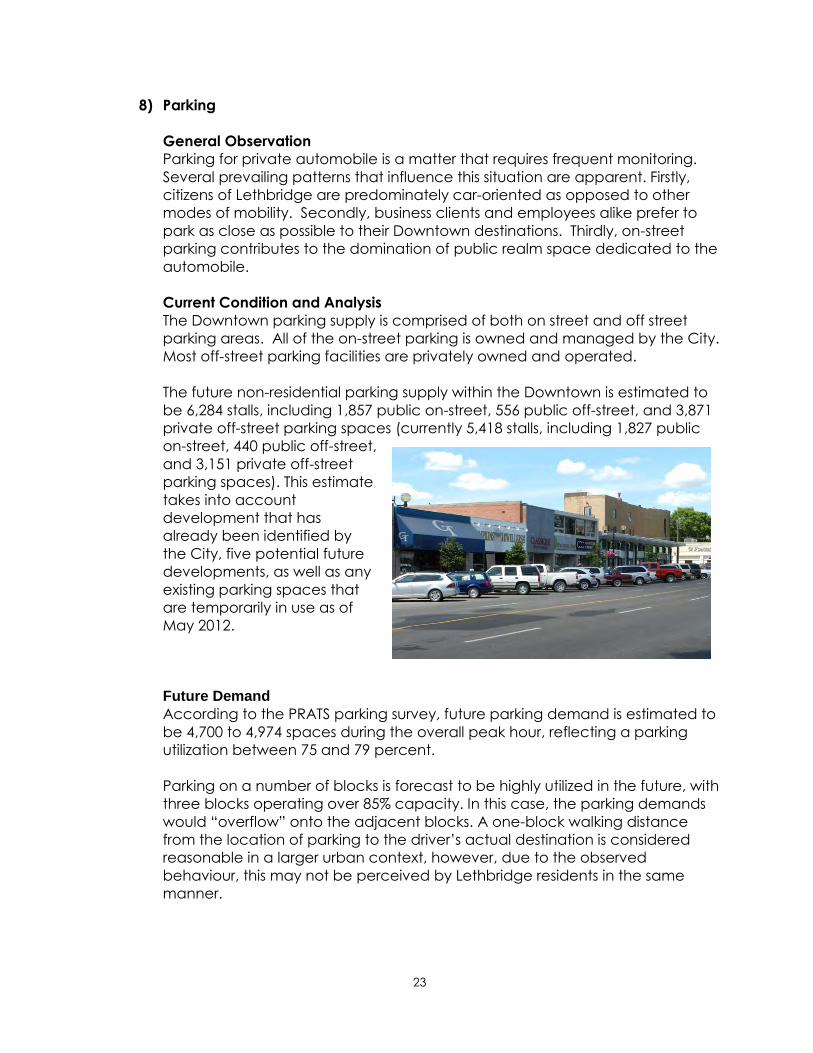
The future non-residential parking supply within the Downtown is estimated to
be 6,284 stalls, including 1,857 public on-street, 556 public off-street, and 3,871
private off-street parking spaces (currently 5,418 stalls, including 1,827 public
on-street, 440 public off-street,
and 3,151 private off-street
parking spaces). This estimate
takes into account
development that has
already been identified by
the City, five potential future
developments, as well as any
existing parking spaces that
are temporarily in use as of
May 2012.
Future Demand
According to the PRATS parking survey, future parking demand is estimated to
be 4,700 to 4,974 spaces during the overall peak hour, reflecting a parking
utilization between 75 and 79 percent.
Parking on a number of blocks is forecast to be highly utilized in the future, with
three blocks operating over 85% capacity. In this case, the parking demands
would “overflow” onto the adjacent blocks. A one-block walking distance
from the location of parking to the driver‟s actual destination is considered
reasonable in a larger urban context, however, due to the observed
behaviour, this may not be perceived by Lethbridge residents in the same
manner.

24
Future Considerations
In order to create more public realm space and promote a modal shift
towards sustainable transportation, The PRAT recommended a small reduction
of the on-street parking supply. The reduction should be garnered from among
each of the priority streets, rather than at one location.
The PRATS parking surveys also indicated a residual capacity and that the
parking supply could accommodate a small reduction. When the parking
demand exceeds parking supply, the short-fall may be met by spare capacity
on adjacent streets or by the off-street supply.
In its present state, the on-street parking is critical to the vitality of businesses
and commerce in Lethbridge. The PRAT considered that the level of parking
reduction shown in the Master Plan, without an accompanying replacement
strategy, was too great a change initially and that a gradual reduction in
parking, together with improvements in transit and active transportation, was
preferable.
To minimize the potential impacts related to the reduction of the existing on-
street parking supply, PRATS recommend that the City adopt mitigation
measures such as the following:
Converting all of the on-street parking into short term parking
Strategize parking rates to ensure that the utilisation level, of the on-street
parking, is maintained at about 85-90%.
Encourage long term parkers to use off-street parking providing convenient
alternative parking locations nearby.
Providing signage to direct parkers to alternative parking opportunities
Providing new parking opportunities
The Master Plan also indicated that the fragile balance between demand and
supply should be maintained. If any parking stalls are to be removed from the
supply side, an equivalent number of stalls should be provided elsewhere. In
order to redistribute public realm space to create the more welcoming
environment that is envisioned, a great deal of creativity and thought is
required. Therefore it stands to reason that with less space available on streets
for parking and with the need to maintain the demand supply balance, that a
new parking solution such as a parkade may be required.
25
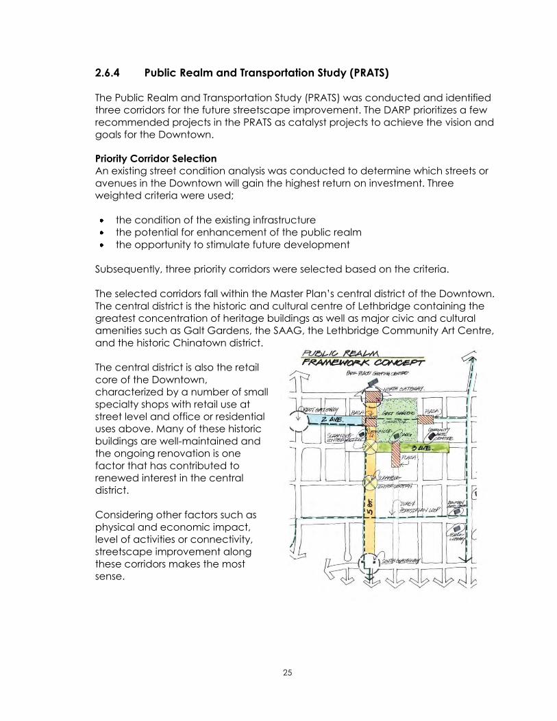
2.6.4 Public Realm and Transportation Study (PRATS)
The Public Realm and Transportation Study (PRATS) was conducted and identified
three corridors for the future streetscape improvement. The DARP prioritizes a few
recommended projects in the PRATS as catalyst projects to achieve the vision and
goals for the Downtown.
Priority Corridor Selection
An existing street condition analysis was conducted to determine which streets or
avenues in the Downtown will gain the highest return on investment. Three
weighted criteria were used;
the condition of the existing infrastructure
the potential for enhancement of the public realm
the opportunity to stimulate future development
Subsequently, three priority corridors were selected based on the criteria.
The selected corridors fall within the Master Plan‟s central district of the Downtown.
The central district is the historic and cultural centre of Lethbridge containing the
greatest concentration of heritage buildings as well as major civic and cultural
amenities such as Galt Gardens, the SAAG, the Lethbridge Community Art Centre,
and the historic Chinatown district.
The central district is also the retail
core of the Downtown,
characterized by a number of small
specialty shops with retail use at
street level and office or residential
uses above. Many of these historic
buildings are well-maintained and
the ongoing renovation is one
factor that has contributed to
renewed interest in the central
district.
Considering other factors such as
physical and economic impact,
level of activities or connectivity,
streetscape improvement along
these corridors makes the most
sense.
26
2.6.5 Strengths and Opportunities
1) Built Character
Downtown‟s distinctive built form and architectural features of historic buildings
make the Downtown an attractive and unique place.
2) Employment and Commercial Opportunities
As a regional trade centre, the City and the Downtown draws businesses,
employees, and tourists. The Downtown accommodates large employers such
as provincial government offices, Lethbridge Centre, Park Place Mall, the Fire
and Emergency Services, and Lethbridge Regional Police Services.
It is estimated more than 8,000 people are employed. Park Place Mall as the
largest retail use has over 1,000 employees and Lethbridge Centre
accommodates many finance, government and health related offices. Major
public transit service hubs are located in the Downtown core on 4th Avenue
and provide daily access to the community.
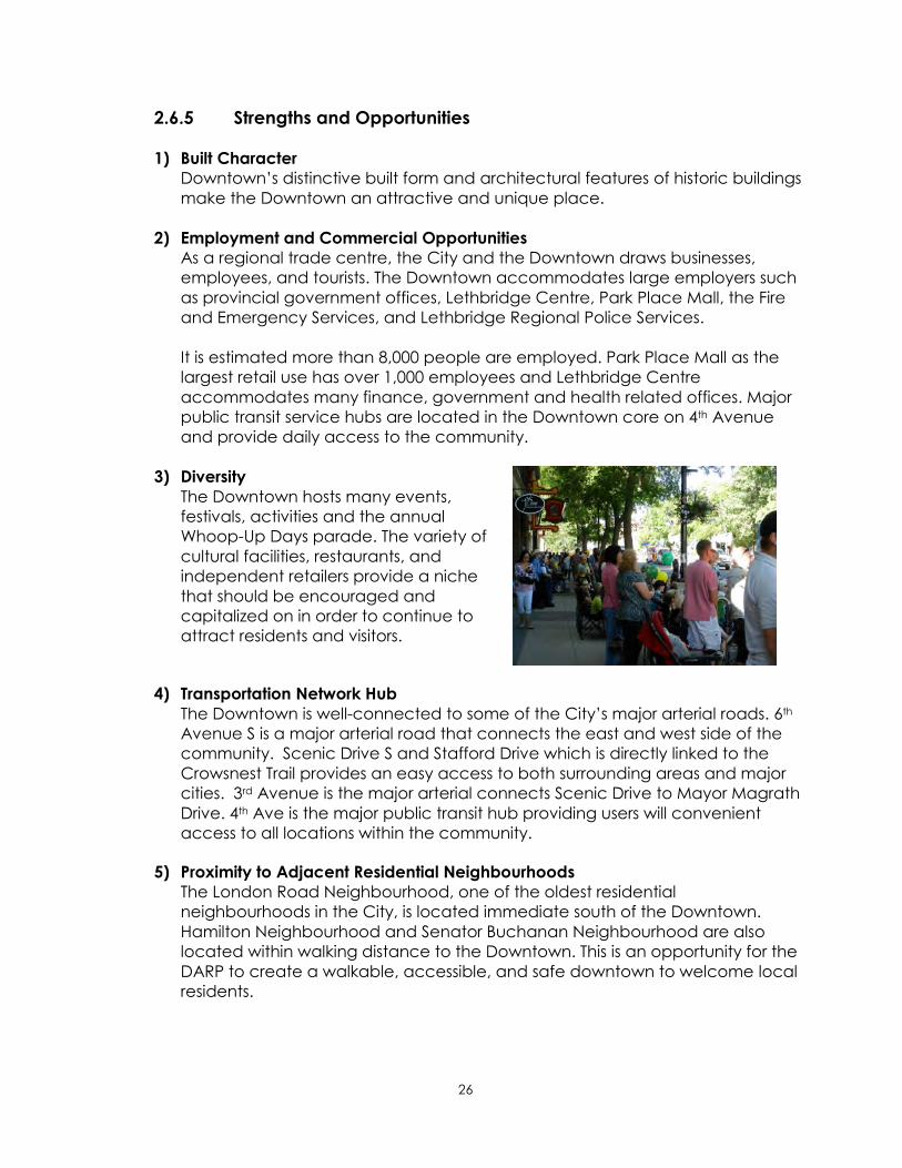
3) Diversity
The Downtown hosts many events,
festivals, activities and the annual
Whoop-Up Days parade. The variety of
cultural facilities, restaurants, and
independent retailers provide a niche
that should be encouraged and
capitalized on in order to continue to
attract residents and visitors.
4) Transportation Network Hub
The Downtown is well-connected to some of the City‟s major arterial roads. 6th
Avenue S is a major arterial road that connects the east and west side of the
community. Scenic Drive S and Stafford Drive which is directly linked to the
Crowsnest Trail provides an easy access to both surrounding areas and major
cities. 3rd Avenue is the major arterial connects Scenic Drive to Mayor Magrath
Drive. 4th Ave is the major public transit hub providing users will convenient
access to all locations within the community.
5) Proximity to Adjacent Residential Neighbourhoods
The London Road Neighbourhood, one of the oldest residential
neighbourhoods in the City, is located immediate south of the Downtown.
Hamilton Neighbourhood and Senator Buchanan Neighbourhood are also
located within walking distance to the Downtown. This is an opportunity for the
DARP to create a walkable, accessible, and safe downtown to welcome local
residents.

27
Figure 11: Adjacent Residential Neighbourhoods

28
2.6.6 Challenges
1) The Impact of Technologies and Behavioral Change
The speed of movement of goods, services, money and information is much
faster than ever before. The economic impact through the use of online retail
activities continues to grow and can be combated with personalized service
and a great shopping experience.
2) Competition with Commercial Nodes
In the last few decades, Lethbridge has seen the development of commercial
nodes in both the north and south. A large highway commercial zone along
Mayor Magrath Drive, consisting of major retail companies such as Costco and
Wal-Mart, has become a popular
destination among residents in the trade
area. In West Lethbridge, a new area
structure plan for a future employment
centre is also being prepared. The
Downtown is no longer the only shopping
destination and will have to continue to
provide employment opportunities and
cultural activities to maintain its
momentum.
3) Regulatory Environment
Amongst the existing City‟s bylaws, the list below indicates the name of the
bylaws that influence activities in the Downtown. These bylaws ensure the
public safety and health in the Downtown. At the same time, these bylaws
must be understandable, reviewed on a regular basis and updated if
necessary. Effort on compliance should also be made.
1. Assessment and Taxation Bylaws
2. Development Bylaws
Bylaw 5700 Land Use
Bylaw 5624 Building Permit2
3. Streets and Roads Bylaws
Bylaw 3499 Traffic - parking etc.
Bylaw 3446 Streets – street signs etc.
Bylaw 4865 Snow Removal
4. Bylaw 5270 Noise Bylaw
5. Parks Bylaws
2 In addition to the City Building Permit Bylaw, Provincial Building legislation may apply.

29
4) Higher Redevelopment Cost
The cost of land in the downtown is approximately $30 per square foot. The
market analysis identified that this is significantly higher than that in new areas
within the city boundary and that the higher cost of land is somewhat viewed
as an investment barrier for developers.
5) Lack of Housing Choice and Residents Support Services
There is a lack of housing choices for wider demographic groups in the
Downtown. This is a barrier to the creation of a lively and vibrant environment
24 hours a day, 365 days of the year. A strategy to encourage or facilitate
residential development may be required.
6) Preservation of Historic Buildings
While historic buildings provide unique
urban characteristics, preservation of
these buildings can be challenging.
Regular maintenance is required more
often than newer buildings. The way these
buildings were built almost a century ago
does not meet the current building codes.
Consequently, restoration costs of these
buildings are extremely high and some
buildings are left vacant.
7) Negative Public Perceptions
According to the citizen satisfactory survey conducted in 2011, the general
perceptions about safety in the Downtown were the lowest scored. There was
a slight improvement since the previous two surveys in 2005 and 2008. A total of
55% of the participants agreed that the Downtown area is safe. Crime
prevention and safety enhancement has been identified as important
concerns for many citizens. Continued effort to encourage more street
activities will be a strong initiative to
increase public awareness toward the
positive aspects of the Downtown.
30
3. Plan Elements
From the Past to the Future
In order to determine the future planning direction for Downtown, it is crucial for the
DARP to incorporate core values and fundamental components formulated in
previous plans. This ensures that the DARP will be consistent with the existing paradigm
and direct new planning initiatives appropriately in Downtown. Present conditions
must also be taken into account when determining focus areas for the future and
allocation of resources. Finally the vision for the Downtown will be achieved over
many years.
3.1 The Past
3.1.1 The 1988 Downtown Area Redevelopment Plan (Bylaw 4183)
Downtown Lethbridge has been as a strong centre for business, culture, and
institutional activities in Southern Alberta since the beginning of the last century.
City Council in the mid-1980‟s recognized the importance of Downtown and
commissioned a Task Force with responsibility for the preparation of a detailed
action plan which would serve to guide future growth and development in the
following decades. Consequently, Bylaw 4183 was created in1988. Some
streetscape improvement projects including 6 St (between 3rd Ave. and 4th Ave.)
were successfully completed based on this plan.
Bylaw 4183 played a vital role for redevelopment activities in the last 24 years in
Downtown and some of the planning principles such as creating a pedestrian
friendly environment are still valuable by today‟s standard. These principles should
be re-evaluated and carried over to the next planning period.
3.1.2 Heart of Our City Master Plan (the Master Plan)
Prior to the adoption of the ICSP/MDP, the Master Plan was developed in 2007. The
primary sections of the Master Plan that were adopted by City Council included
the vision statement and six campaign pillars. The Master Plan was also
characterized as a “Campaign”, meaning that revitalization requires ongoing
commitment that is dynamic and able to respond to both issues and
opportunities. Guiding Principles and a Guiding Framework were also established
to facilitate implementation of the Master Plan.

31
Figure 12: Heart of Our City Master Plan Diagram
The Vision Statement
The Heart of Our City Vision Statement sets the overarching intent and
Master Plan objectives and it‟s fundamental direction.
Downtown is characterized by a variety of residential,
commercial, institutional, cultural and recreational components
that firmly establish the role of the city core as the heart of the
greater Lethbridge community.
Downtown is also the symbolic and historic heart of Lethbridge. It
is distinguished by its rich past that is evident in its historic
architecture, streets, parks, neighbourhoods and landmarks, which
are also expressive of the cultural heritage and community values
that are unique to Lethbridge as a whole. Downtown is thus both
a source and an expression of community identity and pride.
Change and growth should strive to strengthen these roles and
build on the best qualities that define this urban environment.
Downtown will build on its rich history and distinctive character to
nurture an urban context that will create broad sustainable
benefits to the community with respect to social, arts, cultural,
Heart of Our City Vision
Heart of Our City Campaign Pillars
Guiding Principles
Guiding Framework
A Vibrant
Downtown
An Accessible
Downtown
An Exciting
Downtown
A Sustainable
Downtown
A Livable
Downtown
A Beautiful
Downtown
Built Form
Framework
Public Realm
Framework
Districts &
Neighbourhoods
Concept
Plan
32
educational, environmental and economic vitality. Downtown will
serve to enhance the quality of life for all Lethbridge citizens.
The vibrancy of Downtown is rooted in its diverse population and
accordingly it will strive to be an open, safe, affordable,
accessible and welcoming place to people of all walks of life. This
social diversity will be embraced and celebrated through urban
design, architecture and the day-today function and role of
Downtown Lethbridge (Heart of Our City Master Plan 2007).
The Master Plan Campaign Pillars
The six campaign pillars establish the core building blocks of the Master
Plan.
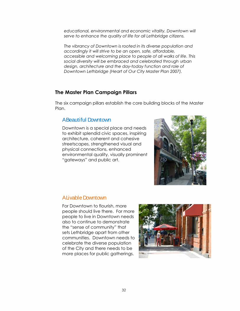
A Beautiful Downtown
Downtown is a special place and needs
to exhibit splendid civic spaces, inspiring
architecture, coherent and cohesive
streetscapes, strengthened visual and
physical connections, enhanced
environmental quality, visually prominent
“gateways” and public art.
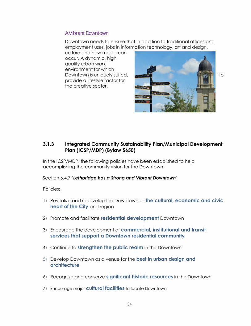
A Livable Downtown
For Downtown to flourish, more
people should live there. For more
people to live in Downtown needs
also to continue to demonstrate
the “sense of community” that
sets Lethbridge apart from other
communities. Downtown needs to
celebrate the diverse population
of the City and there needs to be
more places for public gatherings.

33
A Sustainable Downtown
Downtown needs to be socially, economically, and environmentally
sustainable. Downtown must take a balanced approach to be active
at all hours and in all seasons.
By utilizing infrastructure and
transportation more efficiently
and taking a “life-cycle
approach” to new
infrastructure replacement,
sustainability is demonstrated.
An Exciting Downtown
Downtown needs to attract and retain a creative and talented
workforce like that being generated at the University of Lethbridge and
Lethbridge College. To facilitate
this happening, it is important to
continue to concentrate civic
and cultural attractions in the
core. Development of more
“night-life”, utilizing cultural and
artistic assets, will benefit tourism
and the overall economy in
general.
An Accessible Downtown
Downtown should be a destination for everyone. It should be
welcoming and convenient for shopping, walking, dining, lingering and
exploring. It is thus necessary to enhance the quality of connectivity
through the Downtown and to the surrounding neighbourhoods.
Connections to existing streets
and trails should be accessible
to all people. As well a variety of
movement choices, including
walking, biking, transit, and
driving should be ensured.
34
A Vibrant Downtown
Downtown needs to ensure that in addition to traditional offices and
employment uses, jobs in information technology, art and design,
culture and new media can
occur. A dynamic, high
quality urban work
environment for which
Downtown is uniquely suited, to
provide a lifestyle factor for
the creative sector.
3.1.3 Integrated Community Sustainability Plan/Municipal Development
Plan (ICSP/MDP) (Bylaw 5650)
In the ICSP/MDP, the following policies have been established to help
accomplishing the community vision for the Downtown:
Section 6.4.7 „Lethbridge has a Strong and Vibrant Downtown’
Policies;
1) Revitalize and redevelop the Downtown as the cultural, economic and civic
heart of the City and region
2) Promote and facilitate residential development Downtown
3) Encourage the development of commercial, institutional and transit
services that support a Downtown residential community
4) Continue to strengthen the public realm in the Downtown
5) Develop Downtown as a venue for the best in urban design and
architecture
6) Recognize and conserve significant historic resources in the Downtown
7) Encourage major cultural facilities to locate Downtown

35
3.2 The Present
There are many stakeholders, groups, and individuals that have worked
tirelessly over the past number of years to improve the health, aesthetics and
functioning of the Downtown.
The illustration below is the Business Improvement District (BID) hierarchy of
creating a positive downtown experience. It suggests that the most basic level
of needs must be met before the secondary or higher level needs are
achieved. The most fundamental layers of the pyramid contain aesthetic
cleanness and security of place. The second and third most fundamental
layers contain welcoming public spaces and attractive environment. If these
fundamental needs are not met, creating a vibrant downtown will not be
possible.
Figure 13: BID Hierarchy of Creating the Downtown Experience

36
3.3 The Future
3.3.1 Planning Direction
One of the most important elements of the DARP is to employ planning concepts
identified by the PRATS in the next 10 years. It utilized New Urbanism, which
promotes the creation and restoration of diverse, walkable, compact, vibrant,
mixed-use communities and Sustainable Development Planning principles that
create an exciting and lively urban space. More precisely, it sought to balance
the space allocated to vehicles with pedestrian/cyclist opportunities.
In order to carry out this planning concept, PRATS identified three priority corridors
for future streetscape improvement based upon current infrastructure conditions,
the potential for enhancement of the public realm, and the opportunity to
stimulate future redevelopment. PRATS also provided preliminary design
alternatives, implementation methods, and cost estimate for these streets.
It is believed that streetscape improvement along the priority streets will address
level 2 and 3 of the Business Improvement District hierarchy and move the
experience of the Downtown users from pleasant to truly enjoyable.
3.3.2 Planning Goal
In the next 10 years, Downtown Lethbridge will
become more walkable, increase its vibrancy,
and demonstrate sustainability through the
adherence to the policies and the
implementation strategies of the Plan.

37
3.3.3 Planning Principles
Downtowns are constantly evolving across North America and the world. While
the future is often unpredictable, there are basic principles that can be employed
in the DARP to order to accentuate positive conditions and mitigate negatives.
The DARP incorporates the following four planning principles for the purpose of
achieving the planning goals.
INTEGRATION
FLEXIBLE &
RESPONSIBLE
The DARP‟s policies and implementation strategies will
be integrated to address the plan objectives.
Effective integration requires expertise from various
fields and the use of a wide variety of planning tools
and existing and new processes. Unlike typical green
field development, redevelopment of an established
neighbourhood like Downtown involves many layers
of coordination and consultation with multiple
stakeholders. The integrated approach will foster
mutual understanding amongst stakeholders such as
City administration, business owners, the development
community, special interest groups, and individual
residents and achieve better results in the end.
Since the DARP is intended to be implemented over
the next 10 years, it must be both flexible and time
sensitive. The DARP will be used as a “living document”
on a daily basis. Therefore, the policies have been
written in such a manner that some interpretation is
allowed and the intent of the Downtown Area
Redevelopment Plan is respected.

38
PARTNERSHIPS
SUSTAINABLE
The DARP will not be implemented without strong and
effective partnerships amongst stakeholders. This
requires new ways of achieving results and ensuring
the vision for Downtown is continued to be
communicated. The use of existing committees and
relationships, all forms of communication and creative
thinking will be used to foster positive interaction
amongst stakeholders.
In developing the implementation strategy of the
DARP, economic, social and environmental
sustainability is improved from the current situation. An
equitable balance of these three components will be
achieved at the end of the 10 year planning period
of the DARP.

39
PART II

40
4. Policy Framework
This section develops a fundamental policy framework that links the planning contexts
and the plan elements described in the previous sections to actionable outcomes in
the implementation section.
4.1 Foundation
The DARP has been developed based upon the planning context as well as
the current conditions of the Downtown including demographics, land use,
and the built environment. The DARP illustrates opportunities and challenges
that the Downtown currently faces. It has become apparent that some
conditions positively influence the development of the Downtown while others
do not. While the Downtown has much to offer, it faces challenges that must
be addressed.
A „successful downtown‟ is one that is created by a combination of a number
of positive factors, not a single factor. Downtown users are also diverse from
business and land owners, employees and customers, to visitors and residents.
Their expectations are high and complex. As a result, a tremendous amount of
attention and care is required.
Traditional area redevelopment plans tend to focus only on land use
components. However, for a successful downtown, the DARP needs to focus
not only on physical elements, but also social and economic components.
Policies in the DARP cover a wide range of areas, but are targeted in their
focus.
4.2 Policy Themes
This section outlines core policy themes that support a successful Downtown.
The policy themes are broad groupings that have a relationship to each other
as well as the planning context and plan elements.
These themes were chosen based on either accentuating a positive attribute,
improving a negative condition, supporting the 6 Master Plan Campaign Pillars
and/or the ICSP/MDP vision and goals. For example, the analysis section earlier
suggested that the distinct urban build form including the concentration of
heritage buildings makes the Downtown a unique place and attracts business
and commercial activities. Therefore, polices that address this characteristic
are included. As an underlying premise the requirement for a safe and clean
Downtown is paramount and must be maintained to ensure the positive
Downtown experience continues to be refined and improved.

41
4.2.1 Core Policy Themes
Core policy themes are;
1) LAND USE Develops overlay districts to reflect a distinction in the land use activities
within the Downtown.
2) URBAN DESIGN Addresses building design to enhance a walkable, vibrant, and beautiful
Downtown.
3) HERITAGE RESOURCE PRESERVATION Supports heritage resources in the Downtown for the benefit of future
generations.
4) COMMERCIAL & BUSINESS DEVELOPMENT Supports public and private investment and encourages partnerships.
5) LIVABILITY Provides a complete neighbourhood approach to live, work, play, and
shop in the Downtown.
6) PUBLIC REALM Addresses improvements to public space that attracts business, residents,
and visitors in the Downtown.
7) CIRCULATION AND MOBILITY Supports desired development and manages transportation demands in
the Downtown efficiently.
8) PARKING Provides options for Downtown users now and into the future.
9) UNDERGROUND INFRASTRUCTURE Provides a linkage with public space improvements and coordinated asset
management.
10) SUSTAINABILITY Responds to the community‟s growing awareness in sustainability.
The following section provides more detailed descriptions of why the Policy
Themes are important in the Lethbridge context, what the implications are, and
how they are further articulated into policies.

42
1) LAND USE Sub-Theme
Regulation and control of the use and
development of land within the Downtown is an
essential component in the realization of the
Downtown vision. Regulatory elements are
those aspects of development control which will
direct the built form that development will take.
Most new structures will likely have a lifespan
that exceeds the range of the current
Downtown vision. It is therefore important that
new structures contribute both individually and
collectively to the quality and durability of the
Downtown built-form environment.
Districts
Overlay Land Use
Regulation
Interim
Redevelopment

43
2) URBAN DESIGN Sub-Theme
Urban space is composed of buildings, streets,
places, parks and open spaces. These are the
features that residents, workers, and visitors
experience and crucial components that
contribute to city vibrancy. Downtown is often
considered as the “face of the community” as
all of the urban features occur in one place.
The quality of the urban space relies heavily on
the variety of design and materials that are
used. Therefore, good urban design is a key
factor in continuously improving the
attractiveness of Downtown.
Building Design
Safety and Security
Stakeholder
Engagement
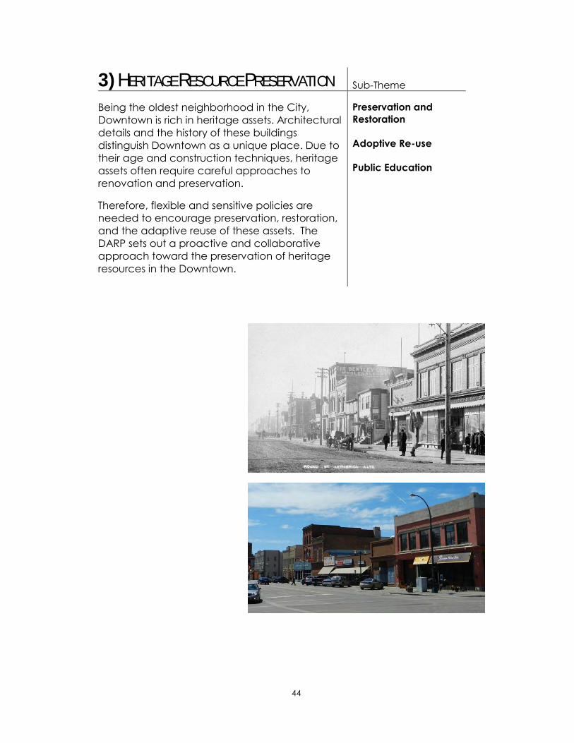
44
3) HERITAGE RESOURCE PRESERVATION Sub-Theme
Being the oldest neighborhood in the City,
Downtown is rich in heritage assets. Architectural
details and the history of these buildings
distinguish Downtown as a unique place. Due to
their age and construction techniques, heritage
assets often require careful approaches to
renovation and preservation.
Therefore, flexible and sensitive policies are
needed to encourage preservation, restoration,
and the adaptive reuse of these assets. The
DARP sets out a proactive and collaborative
approach toward the preservation of heritage
resources in the Downtown.
Preservation and
Restoration
Adoptive Re-use
Public Education
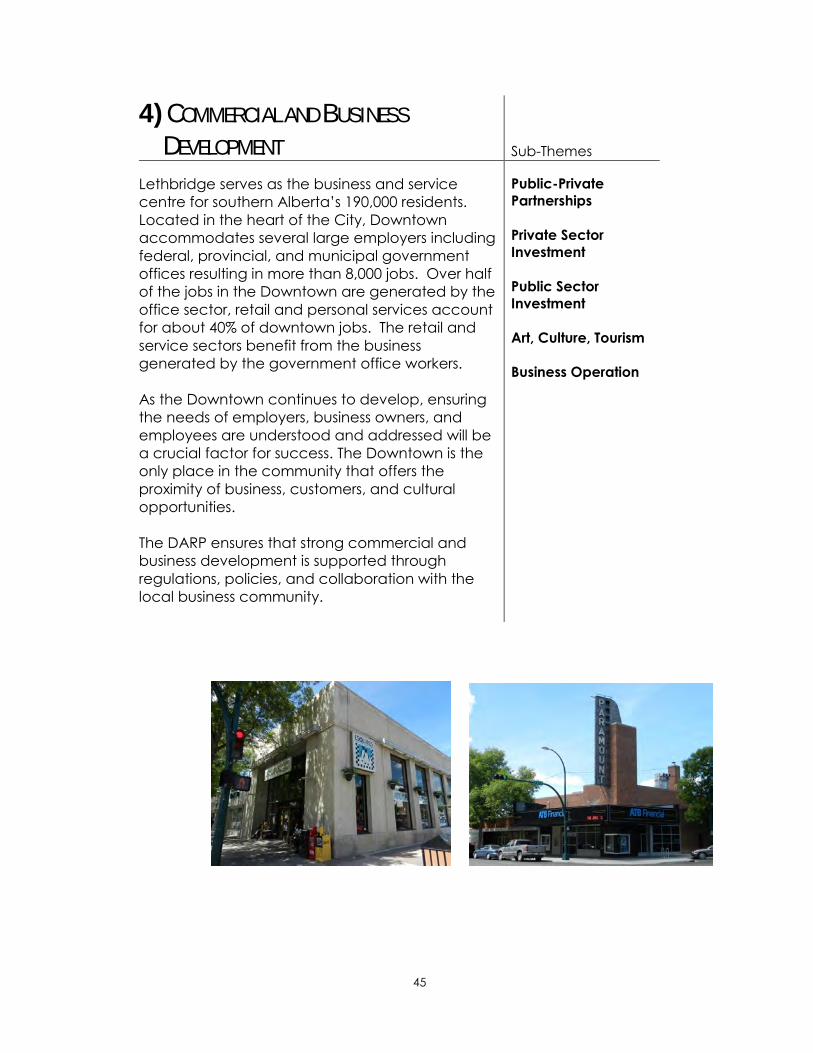
45
4) COMMERCIAL AND BUSINESS
DEVELOPMENT Sub-Themes
Lethbridge serves as the business and service
centre for southern Alberta‟s 190,000 residents.
Located in the heart of the City, Downtown
accommodates several large employers including
federal, provincial, and municipal government
offices resulting in more than 8,000 jobs. Over half
of the jobs in the Downtown are generated by the
office sector, retail and personal services account
for about 40% of downtown jobs. The retail and
service sectors benefit from the business
generated by the government office workers.
As the Downtown continues to develop, ensuring
the needs of employers, business owners, and
employees are understood and addressed will be
a crucial factor for success. The Downtown is the
only place in the community that offers the
proximity of business, customers, and cultural
opportunities.
The DARP ensures that strong commercial and
business development is supported through
regulations, policies, and collaboration with the
local business community.
Public-Private
Partnerships
Private Sector
Investment
Public Sector
Investment
Art, Culture, Tourism
Business Operation
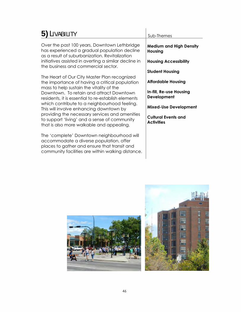
46
5) LIVABILITY Sub-Themes
Over the past 100 years, Downtown Lethbridge
has experienced a gradual population decline
as a result of suburbanization. Revitalization
initiatives assisted in averting a similar decline in
the business and commercial sector.
The Heart of Our City Master Plan recognized
the importance of having a critical population
mass to help sustain the vitality of the
Downtown. To retain and attract Downtown
residents, it is essential to re-establish elements
which contribute to a neighbourhood feeling.
This will involve enhancing downtown by
providing the necessary services and amenities
to support „living‟ and a sense of community
that is also more walkable and appealing.
The „complete‟ Downtown neighbourhood will
accommodate a diverse population, offer
places to gather and ensure that transit and
community facilities are within walking distance.
Medium and High Density
Housing
Housing Accessibility
Student Housing
Affordable Housing
In-fill, Re-use Housing
Development
Mixed-Use Development
Cultural Events and
Activities
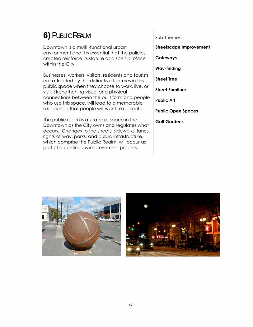
47
6) PUBLIC REALM Sub-Themes
Downtown is a multi -functional urban
environment and it is essential that the policies
created reinforce its stature as a special place
within the City.
Businesses, workers, visitors, residents and tourists
are attracted by the distinctive features in this
public space when they choose to work, live, or
visit. Strengthening visual and physical
connections between the built form and people
who use this space, will lead to a memorable
experience that people will want to recreate.
The public realm is a strategic space in the
Downtown as the City owns and regulates what
occurs. Changes to the streets, sidewalks, lanes,
rights-of-way, parks, and public infrastructure,
which comprise the Public Realm, will occur as
part of a continuous improvement process.
Streetscape Improvement
Gateways
Way-finding
Street Tree
Street Furniture
Public Art
Public Open Spaces
Galt Gardens

48
7) CIRCULATION & MOBILITY Sub-Themes
The historic Downtown grid street pattern
creates and defines the urban form of the
Downtown. Within this urban structure, the street
network‟s primary function is to accommodate
the needs of pedestrians, cyclists, public
transportation users, freight vehicles, and private
vehicles.
Policies in this section aim to reinforce the
efficiency of the network while expanding the
pedestrian environment without compromising
system functionality and to support desired
future development.
Pedestrian Mobility
Bicycle Mobility
Public Transit
Private Automobile
Emergency Access and
Delivery for EMS Service
Universal Design
Pathways
Connection with Adjacent
Neighbourhoods
Snow Removal and Other
Regular Maintenance
Transportation Demand
Management

49
8) PARKING Sub-Themes
Parking is an ongoing concern to all Downtown
users. Due to the nature of modern urban
development, there will not be a perfect
solution for parking. However, the DARP
recognizes that the perceived lack of
convenient parking for employees or shoppers
and a poor public perception toward parking in
general is significant. Therefore, parking in the
Downtown should be managed appropriately.
The DARP provides policies that have the
potential to minimize the parking related issues in
the Downtown.
Parking Needs
Assessment
Public-Private
Partnerships
Parking Management

50
9) UNDERGROUND INFRASTRUCTURE Sub-Themes
Cost and impact of underground infrastructure
renewal and replacement projects can be
substantially high. Therefore, other related
projects that are located in the same spaces
must be well managed and coordinated to
minimize and mitigate any negative impacts.
The DARP expects that when underground
infrastructure projects are undertaken in the
Downtown, they are planned and executed
wherever possible and that all underground
infrastructure remains reliable for all users.
Renewal/Replacement
Project
Public Engagement
Sustainable Approach

51
10) SUSTAINABILITY Sub-Themes
In response to the growing awareness of
environmental concerns within the community, it
is appropriate for this DARP to address the
concept of sustainability in the Downtown
context.
This is an opportunity for the Downtown to
achieve some of the sustainability visions and
policies established in the ICSP/MDP for the 10-
year horizon.
The focus for sustainability will include policies on
building construction, solid waste, and water
conservation.
Building Construction
Solid Waste
Management
Water Conservation

52
5. Policies
5.1 Land Use
5.1.1 Purpose
The land use policy section establishes policies that regulate and
control of the land use and development within the Downtown in
order to achieve the built form envisioned by the Master Plan. Since
the DARP is a regulatory document, it also requires appropriate
policies and strategies to achieve planning goals and policies.
Therefore, in addition to the policies below, new approaches are
introduced in the following Plan Implementation section to support
the policies.
5.1.2 Goals
1) To protect the unique urban characteristics in the Downtown
core area through land use regulations.
2) To achieve the built-form envisioned by the Heart of Our City
Master Plan.
3) To develop new regulations and overlays that will replace parts
of the current Land Use Bylaw.
4) To create a vibrant mixed-use downtown where people enjoy
working and living through new land use and development
regulations.
5.1.3 Policies
Districts
1) Create land use districts that demonstrate distinctive
characteristics within the Downtown.
2) Amend the Land Use Bylaw according to the creation of new
land use districts.

53
Overlay Land Use Regulation
3) Develop land use overlays and land use regulations that
enhance the character of existing built-form and active retail
frontage in the Downtown.
4) Amend the Land Use Bylaw according to the creation of new
overlay land use regulations.
Interim Redevelopment
5) Until new land use regulations are developed and the Land Use
Bylaw is officially amended, proponents shall be required to
consult staff of the Planning and Development Services to
ensure development proposals are in alignment with the
proposed regulations in the Plan Implementation section.

54
5.2 Urban Design
5.2.1 Purpose
The urban design policy section establishes policies to create vibrant
urban spaces including streets, built form, parks and open spaces. As
urban design is strongly connected with the land use related policies
described in the previous section, the policy implementation
between the two areas will be integrated in the Plan Implementation
section.
5.2.2 Goals
1) To create exciting streets, built form, parks and open spaces.
2) To ensure quality development in the Downtown through
quality urban design regulations.
3) To develop distinctive character, human scale architecture
and a pedestrian-focused environment in the Downtown.
4) To involve the Downtown stakeholders in the DARP Plan
Implementation process.
5.2.3 Policies
General
1) Whenever improvements to Downtown streets or public
spaces are contemplated, the surrounding urban design
elements shall be considered in the overall project scope.
2) City Administration should consider partnering with the
HOCRC and Downtown stakeholders to establish an Urban
Design Awards Program to acknowledge outstanding
redevelopment projects that reflect the philosophy of the
DARP.
Building Design
3) When a redevelopment opportunity arises, proponents shall
give special considerations to the following aspects;
i. Impact on views and shadowing from adjacent buildings
and streets.

55
ii. Compatibility with surrounding buildings and
streetscapes.
4) Linkages with major focal points, destinations, streets, open
spaces, and other significant gathering places shall be
reinforced through providing a walkable street network.
5) Continue the Main Street Program partnership with the BRZ
to reinforce continuity of façade rehabilitation and signage
design throughout Downtown.
6) Animation, transparency, articulation and material quality
will be a component of overlay requirements.
7) Reinforce street network links with adjacent
neighbourhoods, major activity centres, landmarks and
open spaces through way-finding3 strategies including
gateway features identified in the Master Plan.
Safety and security
8) Support a safe and secure downtown environment through
continuation of CPTED (Crime Prevention Through
Environmental Design) analyses of public and private
development projects.
Stakeholder Engagement
9) Continue to engage stakeholders including business/land
owners, residents, groups, and associations through the Plan
Implementation phase of the DARP.
10) When significant development projects that have
incompatible design elements in terms of the DARP,
opportunities for public input shall be provided.
3 The ways which people orient themselves in physical space and navigate from place to place. Wayfinding refers to both the built
and natural environment and contributes to making a city more "legible" for users.

56
5.3 Heritage Resource Preservation
5.3.1 Purpose
This section establishes policies that support heritage resources
preservation in the Downtown. As one of the original cores of the
community, there are many heritage resources remaining in the
Downtown. Policies in this section are focused on the integrity of the
heritage resources and provide better understanding of both
conservation and active reuse for the community.
5.3.2 Goals
1) To enhance the unique character of Downtown through
preservation and restoration of heritage assets.
2) To facilitate enhancement and adaptive reuse of heritage
buildings.
3) To improve public awareness of heritage assets and support
for preservation that includes regular maintenance and
upkeep.
5.3.3 Policies
Preservation & Restoration of Heritage Assets
1) Continue to identify buildings, structures, monuments and
artifacts that are historic or that have architectural merit
2) Heritage assets will continue to be preserved by;
i. Continuous consultation with the Heritage Advisory
Committee, the Building Safety and Inspection Services
Department, owners, local groups, and individuals to
identify and prioritize heritage assets; and
ii. Providing financial and city administrative support to the
Heritage Advisory Committee to enable continuation of
heritage asset preservation.
3) Acknowledge and support federal, provincial, and
municipal designations, when evaluating redevelopment
opportunities.

57
4) When preservation of heritage assets conflict with the
existing legislation (e.g. the City of Lethbridge Land Use
Bylaw and the Province of Alberta Building Code),
alternative methods to preserve those assets should be
considered.
5) Any variance from established legislation shall be examined
on a case by case basis in consultation with the City‟s
Building Inspection Services since each case is likely to be
unique.
6) When new buildings or renovations to existing buildings are
being proposed, consideration should be given to the
character of any adjacent heritage buildings.
7) Communicate available funding opportunities to provide
barrier-free access to historic buildings.
Adaptive Re-use
8) Conduct research on various types of funding mechanisms
and seek opportunities for adaptive re-use of heritage
assets.
9) Facilitate the preservation and enhancement of buildings
featuring heritage or architectural significance through
adaptive reuse measures such as asbestos removal, life-
safety system upgrading, and universal access.
Public Education
10) Increase public awareness through funding interpretive
displays or other strategies that tell the story of the resources
in a meaningful and engaging manner.
11) Planning and Development Services assists stakeholders
such as the Galt Museum, the Heritage Advisory Committee,
Lethbridge Historical Society or individual owners in heritage
preservation activities including plaque program and
walking tours.

58
5.4 Commercial & Business Development
5.4.1 Purpose
This section establishes policies that support commercial and
business development in the Downtown. As the largest commercial
and business district in the region, attractive commercial and
business environment is crucial for both existing and future
businesses. Policies in this section are designed to maximize the
opportunities to champion the Downtown.
5.4.2 Goals
1) To facilitate the continued development of Downtown
Lethbridge as a significant economic driver and premiere
business centre of Southern Alberta.
2) To identify opportunities for public - private partnerships.
3) To advance business development in the Downtown
through partnerships with BRZ, EDL, and the Lethbridge
Chamber of Commerce.
4) To develop Downtown into a creative urban environment
that provides a creative milieu for artists, community groups
and non-profit organizations.
5.4.3 Policies
Public-Private Partnerships
1) Attract employment growth through the development of
high quality services, facilities and amenities in partnerships
with BRZ, EDL, and the Lethbridge Chamber of Commerce.
2) Structure the Downtown land use districts to allow various
forms of residential development that would appeal to a
broad and diverse residential and worker demographic.
3) In partnership with BRZ, EDL, the Lethbridge Chamber of
Commerce, promote Downtown Lethbridge as centre of
new business opportunities such as technology transfer,
business incubation, University-business partnerships, and
College-business partnerships; and government agencies
(e.g. research station)

59
4) Structure the Downtown land use districts to allow for
flexibility through use of variance opportunities to enable
mixed-use development.
Private Sector Investment
5) Support EDL in engaging the development community to
determine the needs of financial institutions, professional
offices, and knowledge-based companies in order for them
to locate in the Downtown in the preferred built form for the
area or street.
6) Ensure that stakeholders such as the BRZ, the Lethbridge
Chamber of Commerce, or Park Place Mall are involved to
identify needs and barriers of their businesses development.
Public Sector Investment
7) Support governments, offices, and public agencies to
maintain a strong presence in the Downtown.
8) Provide adequate infrastructure to support a wide range of
business and commercial activities.
9) If considering financial incentives aimed at the small
businesses, ensure that increasing business opportunities in
the Downtown is an outcome.
10) The City, in cooperation with BRZ, assists new businesses in
the Downtown by providing guidance with regulatory
processes including development and building permit
applications.
Arts, Culture, and Tourism
11) Provide for arts and culture land uses to locate Downtown
as a key component in the revitalization of Downtown.
12) Allow for development of creative spaces for artists, cultural
organizations and business incubation in the land use
overlays for Downtown.
13) The HOCRC, through partnerships with entities including the
Allied Arts Council, broaden the tourism market for
Downtown by developing an array of cultural-oriented
events and attractions.
14) The HOCRC, through partnerships with entities including the
Chinook Country Tourism Association, broaden the tourism
60
market for Downtown by supporting and promoting an array
of tourist-oriented facilities, events and attractions.
15) Continue to leverage program funding, such as the Heart of
Our City Activity Grant, to expand the creation of
downtown events and festivals.
16) Provide education, accessibility and participation
opportunities for arts, performances, concerts, and
exhibitions, through strategic partnerships with the HOCRC,
Allied Arts Council, and other groups.
Business Operation/Building Maintenance
17) In conjunction with the City‟s business license bylaw, each
individual business owner shall be responsible for obtaining
appropriate licenses or permits in order to maintain a safe
and secure business environment in the Downtown.
18) Provide timely guidance on the building codes and the
inspection process to business and land owners through
printed materials, the City‟s website or consultation.

61
5.5 Livability
5.5.1 Purpose
This section establishes policies that support livability with a strong
focus on a wider range of housing provision in the Downtown. New
policies are intended to diversify the current demographic pattern
and create a more dynamic living environment that attracts artists,
professionals, or young families while supporting a critical mass of
cultural activities and diversity.
5.5.2 Goals
1) To continue to expand services and amenities that support
residential living and a sense of community.
2) To attract residents with different life styles, occupations,
family structure and/or income status.
3) To celebrate the cultural diversity that the Downtown has to
offer.
4) To allow for a mix and variety of housing types that
reinforces and supports a critical mass of activity and
diversity.
5.5.3 Policies
General
1) Allow for a wide range of housing choice in terms of type,
affordability, and design in all districts in the Downtown.
2) Support the BRZ and the development community in the
creation of an effective marketing program to promote
downtown living.
3) Collaborate with the current or future owner regarding the
conversion of a heritage building into residential use,
building safety, and potential options such as preservation.
4) If the number of school age children increases, consult with
school boards to ensure that access to schools is not a
barrier to residential development in the Downtown.
62
5) Evaluate residential development proposals, in accordance
with a Crime Prevention Through Environmental Design
(CPTED) process to ensure that potential safety and security
issues are effectively addressed.
Medium and High Density Housing
6) Medium and high density housing development is to be
provided for the proposed Office Mixed-Use Land Use
district.
7) Design of medium and high density housing developments
should align with design criteria established in the land
use/urban design policy section.
8) Structure the Downtown land use districts to allow for a
density bonus or parking waivers to help achieve housing
objectives.
Housing Accessibility
9) Based on the Provincial Building Codes, universal access
principles shall be employed and utilized in designing
accommodation for persons with special needs and persons
with disabilities.
10) The most current Barrier Free Design Guidelines shall be
applied as a minimum standard. Any use of innovative and
advanced technologies is encouraged in consultation with
Building Inspection Services to ensure compliance.
Student Housing
11) Collaborate with the University of Lethbridge and Lethbridge
College administration and their student associations to
understand the opportunities for student housing in the
Downtown.
Affordable Housing
12) Collaborate with stakeholder organizations such as the
Lethbridge Housing Authority to understand the housing
needs in the Downtown.
In-fill, Re-use Housing Development
13) Allow for infill and adaptive reuse housing development in
appropriate districts of the Downtown to achieve housing
objectives.
14) When considering infill or adaptive reuse housing projects,
proponents should consult with City officials in assessing sites
for potential incompatible uses on adjacent properties.
63
Mixed-Use Development
15) Allow for mixed-use development to maximize housing
opportunities as well as to contribute to the vibrancy of the
Downtown.
16) Engage with the development community and property
owners to determine the requirements for live-work units,
such as artist studios and one bedroom apartments, above
or behind permitted commercial and the combination of
compatible commercial uses within the Downtown.
Cultural Events and Activities
17) In partnership with HOCRC, BRZ, and Allied Arts Council,
continue to encourage festivals and cultural or community
events year round as part of the Downtown Lethbridge
experience.
18) Any redevelopment of Galt Gardens should be evaluated
to ensure that space to host annual festivals, seasonal and
cultural events, and recreational activities is provided.
19) When the City contemplates creation or development of
new public open spaces, such as a Civic Plaza at 5th
Avenue and Stafford Drive and on 3rd Avenue at 6th Street,
between Festival Square and the SAAG, the capacity of
such public spaces should be capable of supporting larger
community events.
20) When barriers that reduce opportunities for such events and
activities to occur in the Downtown are presented by the
HOCRC planning, design, regulatory sub-committee, City
Administration shall investigate to ensure the livability of
Downtown is not compromised.

64
5.6 Public Realm
5.6.1 Purpose
This section establishes policies that are also intended to create the
built form envisioned by the Master Plan with focuses on public realm
components such as street trees, public art, signage or street
furniture. This section is therefore strongly connected with the land
use and section the urban design section. The policies in this section
will support creating a successful public realm in the Downtown.
5.6.2 Goals
1) To create a vibrant, beautiful, exciting, accessible,
sustainable public realm in the Downtown without
compromising its functionality.
5.6.3 Policies
Streetscape Improvement
1) Streetscape improvement projects identified in the PRATS for
3rd Avenue S. and 5th Street S. should be considered for
inclusion in future City Capital Improvement Programs.
Gateways
2) When redevelopment or public realm improvement
opportunities occur in strategic Downtown locations;
Gateway creation as a means of identifying and enhancing
the entrances to Downtown should be considered.
3) Public art should be incorporated as part of Gateway
projects wherever possible.
Wayfinding
4) Enhance the visual quality of the public realm as well as
guide users to and from their destinations by creating an
easy to understand and attractive wayfinding system.
5) Coordinate wayfinding signage with any streetscape
pageantry.
6) Adopt a graphic layout for the wayfinding system that is
distinctive for the Downtown area while maintaining a level

65
of consistency and cohesiveness with any the City-wide
way-finding strategy.
7) The following key destinations should be identified in the
strategic way-finding program (see also policy 5.2.3, 7)):
Galt Gardens and the Southern Alberta Art Gallery
The Galt Museum
Chinatown District
City Hall
University of Lethbridge Penny Building
CASA
Park Place Mall and Lethbridge Centre
Transit shelters and bike parking facilities
Lethbridge Regional Police Services headquarters
Public washrooms in Galt Gardens
Any new civic institutional facilities
8) Ensure the periodic maintenance, review, and repair of
signage and maps with way-finding components are
coordinated with the City‟s infrastructure asset
management plan.
Street Trees
9) Support urban forestry initiatives and biodiversity
conservation in the Downtown, the City, through the Parks
Department, should consider increasing the quantity and
variety of species of boulevard trees on all streets in the
Downtown.
Street Furniture
10) Harmonize the selection of street furniture which includes:
street light poles, benches, trash receptacles, bike racks,
bike shelters, information kiosks, and banner poles, to create
a pleasant, unified, clutter free, safe, low maintenance, and
pedestrian oriented environment.
11) Adopt a Street Furniture Manual to be comprised of a
representative selection of common site furniture elements
that correspond with the different streetscape characters
and unique historical images which may consist of:
Historical, Transitional, or Contemporary design styles.
12) Ensure that future street light replacement occurs in
accordance with City energy saving street light
replacement programs and utilize street furniture elements
identified in a street furniture manual adopted for
Downtown.

66
13) Street furniture maintenance throughout the Downtown
should be coordinated with the City‟s infrastructure asset
management plan.
Public Art
14) The design, installation and maintenance of public art in the
Downtown as a means to intensify Downtown arts and
culture should be coordinated with the City‟s infrastructure
asset management program.
15) Opportunities for public art shall be considered in the overall
design and context of the Downtown redevelopment.
16) Include and coordinate public art installation with identified
streetscape priority investments and the Public Art Master
Plan in consultation with the Public Art Committee.
Public Open Spaces
17) Evaluate changes to Downtown open spaces to ensure that
both active and passive recreational needs of residents,
workers and visitors, throughout the year is continued.
18) Public open spaces should be developed to a high
standard and should be clean and well maintained.
19) Employ Crime Prevention Through Environmental Design
(CPTED) principles to ensure continued safety in all public
and private Downtown open spaces.
20) The supply of parks and open space will be monitored
based on changes in the Downtown so that the needs of
the Downtown residents, workers, and visitors are continued
to be met.
21) Explore the creation of a new classification of park such as
an “urban park” that responds to the needs of the
Downtown and ensure the classifications are incorporated
into the Parks Master Plan.
22) Allow for new, innovative open spaces such as pocket
parks, and rooftop gardens to occur throughout the
Downtown.
23) When planning or constructing new roadways or trails, the
existing connections between open spaces streets and the
pathways system will be maintained and linked.
67
Galt Gardens
24) Any redevelopment of Galt Gardens shall be evaluated and
its function as a multi-purpose urban park will not be
compromised.
25) Any concept planning for redevelopment of the north half
of Galt Gardens will be in consultation with community
stakeholders and will recognize emerging social gathering,
recreation needs, and the history and identity of Galt
Gardens as the oldest park in Lethbridge.
26) High quality landscaping and rigorous lifecycle
management should be employed in keeping with the
significance of this unique urban park.

68
5.7 Circulation and Mobility
5.7.1 Purpose
This section is one of the fundamental components of the DARP as
Transportation plays a critical role in creating a walkable downtown.
Therefore, policies in this section are intended to provide a clear
direction for future roadway and development projects in the
Downtown.
5.7.2 Goals
1) To upgrade selected Downtown streets to create a
walkable environment and provide more space for multi
modal transportation modes.
2) To expand walking and cycling opportunities and the use of
public transit as optional modes of circulation.
3) To create a high quality, universally accessible circulation
system.
4) To support desired land use, built form, and other
development activities through transportation planning.
5) To manage transportation demand in the Downtown
efficiently and appropriately.
6) To provide an acceptable level of service for roadway
operations.
7) To provide safe, flexible, timely transportation management
for all users.
5.7.3 Policies
Pedestrian Mobility
1) When contemplating changes to streets, the design should
be safe, secure, comfortable, and accessible for all users.
2) Employ the PRATS pedestrian walkways planning principles
to new streetscape improvement projects in the Downtown.

69
3) The existing maintenance program for Downtown streets
should be evaluated with pedestrians in mind.
Bicycle Mobility
4) Updates to the current bicycle network should consider the
construction of the necessary amenities to support
expanded bicycle use within the Downtown.
5) A separated commuter bicycle lane is optimal where street
configuration allows.
6) When contemplating upgrades to the bicycle network
connectivity within the Downtown and adjacent
neighbourhoods or major destinations, arterial roads such as
6th Avenue South, Scenic Drive, 13th Street, or Mayor
Magrath Drive shall be considered.
7) Signage, racks, and safe and secure bicycle parking
facilities in the public open spaces, major transit stops, and
public parking lots should be a part of capital and
operational budgets in order to maximize the convenience
of using bicycles in the Downtown.
Public Transit
8) Lethbridge Transit should engage major employers such as
government entities to determine their employee‟s thoughts
and needs to provide convenient public transit services to
the Downtown.
9) The corner of 4th Avenue and 6th Street will continue to
function as a Downtown public transit hub.
10) Upgraded bus stops in high use locations should include
shelters, benches, garbage bins, updated route map, and
timetables and employ barrier free design principles to
support growth in transit ridership.
11) Design public transit facilities in alignment with the planning
concepts that are established in the PRATS.
12) Downtown redevelopment projects shall be circulated to
Lethbridge Transit to capitalize on opportunities to improve
transit ridership.
13) CPTED principles should be employed to evaluate and
design the transit facilities such as shelters or benches.

70
Private Automobiles
14) Any changes to the Downtown streets classification and
functionality need to balance all users‟ requirements and
multi modal choices.
Emergency Access and Delivery EMS Service
15) Any changes to streets and parking facilities in the
Downtown shall have adequate provision for access for
emergency and protective service vehicles.
Universal Design
16) Universal access principles will be utilized in designing
accommodation for persons with special needs and persons
with disabilities and to increase accessibility to the
Downtown.
17) The PRATS barrier free planning principles will be referred to
when designing future streetscape improvement projects.
Pathways
18) Develop well-connected pathways to the River Valley from
the Downtown to maximize the opportunity to enjoy the
integrity of the nature.
19) Strengthen the links with the Downtown core and adjacent
neighbourhoods in consideration of safety and efficiency for
pedestrians and bicycle users.
Connection with Adjacent Neighbourhoods
20) Strengthen connections between the Downtown core and
adjacent neighbourhoods by improving street pavement,
landscape, and intersection safety.
Snow Removal and other Regular Maintenance
21) Any changes to the maintenance of streets and right-of-
ways should be evaluated to support efficient traffic flow in
the Downtown and to increase safety and accessibility.
Transportation Demand Management
22) Continue to improve traffic movements in the Downtown by
implementing transportation management measures that
address specific needs such as parking and public transit as
well as to achieve the vision of the ICSP/MDP, the Heart of
Our City Master Plan, the Transportation Master Plan and the
DARP.
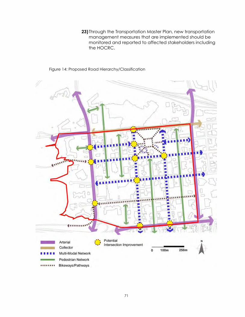
71
23) Through the Transportation Master Plan, new transportation
management measures that are implemented should be
monitored and reported to affected stakeholders including
the HOCRC.
Figure 14: Proposed Road Hierarchy/Classification

72
5.8 Parking
5.8.1 Purpose
Parking is an on-going challenge in the Downtown. Although the
PRATS indicated that there is a reasonable amount of parking
spaces available throughout the Downtown, a lack of parking is
seen as a problem on certain streets or in some areas. Therefore,
policies in this section are intended to ensure adequate amount of
and access to parking are provided to all users. In addition, the
policies are intended to coordinate future parking management
plans and strategies in the Downtown.
5.8.2 Goals
1) To mitigate parking related issues in the Downtown.
2) To provide convenient access to parking for both
employees and customers.
3) To provide a level of certainty in regards to the provision of
parking in the Downtown in the future.
4) To coordinate Downtown parking plans and programs.
5.8.3 Policies
Parking Needs Assessment and Plan Revision
1) City Administration shall continue to monitor and evaluate
the parking availability in the Downtown, particularly in
areas adjacent to large office/commercial, recreational,
and cultural facilities.
2) City Administration shall report to City Council, the Heart of
Our City Revitalization Committee, and stakeholders with
regard to parking issues in the Downtown as requested.
3) If, as a result of redevelopment or other land use changes in
the Downtown, the parking availability undergoes a large
change, the DARP should be revisited to determine if policy
changes are warranted.
73
Public-Private Partnerships
4) The City will be open to the involvement of local business
organizations, retail businesses and landowners in the
development of parking solutions and initiatives.
Parking Management
5) Based on the issues identified and policies established in the
DARP, a comprehensive downtown parking management
plan and cost sharing formulas that would create a flexible
and realistic funding framework should be developed as
part of implementation plan.
6) A parking management plan should take a comprehensive
approach that balances technologies, land use
considerations, alternative transportation modes, and
regulatory requirements.
7) The development of a multi-level parking facility (-ies) shall
be considered where and when appropriate based on
parking needs to balance the supply and the demand.
8) Detailed financial and engineering analysis for a future
parking structure will be undertaken once location and
timing of the project are determined.
9) When planning and designing a parking facility, the
following design principles shall be considered in addition to
the minimum development regulations defined in the Land
Use Bylaw:
i. High quality facade design including, but not limited to,
display windows, public art, lighting, landscaping, small
retail or office spaces, and effective signage to navigate
the facility.
ii. Crime Prevention through Environmental Design (CPTED)
10) Research and evaluate new technologies for an on-street
parking system that will improve the user experience and
increase future flexibility.
11) Reevaluate Land Use Bylaw parking requirements in the
Downtown, which may include minimizing the supply of off-
street parking spaces required for both residential and
commercial uses.
12) When issuing development permits for private property lots,
owners shall undertake effective and efficient parking
improvements in compliance with the goals of the DARP.

74
5.9 Underground Infrastructure
5.9.1 Purpose
Without stable and reliable underground infrastructure, activities in
the Downtown would not be possible. Underground infrastructure
improvements and replacements are also costly. This section
establishes policies that ensure provision of an efficient and reliable
underground infrastructure, coordinate future projects according to
the planning principles, and consider advanced technologies in the
Downtown.
5.9.2 Goals
1) To coordinate underground infrastructure
renewal/replacement with surface improvements and major
redevelopment projects.
2) To provide efficient, reliable underground infrastructure that
support development of the Downtown, wherever possible.
3) To consider the use of Green Infrastructure and Low Impact
Design in infrastructure projects in the Downtown.
5.9.3 Policies
Renewal/Replacement
1) Except for emergency situations such as water main
breakages, any underground utility infrastructure
renewal/replacement projects shall be coordinated with
streetscape improvements to ensure speedy and cost-
effective public works. Related budget shall be allocated
strategically and communication shall occur amongst
stakeholders.
Public Engagement
2) When planning new infrastructure projects, require public
consultation and effective communication with affected
business/landowners and residents.
Sustainable Approach
3) Employ innovative construction techniques or methods for
infrastructure projects to secure minimum business
interruption.

75
4) Consider sustainable approaches for any underground
infrastructure renewal/replacement projects.

76
5.10 Sustainability
5.10.1 Purpose
This section establishes policies that support and promote
environmental sustainability in the areas of building construction,
waste management, and water conservation. This is an opportunity
for the Downtown to achieve some of the sustainability visions and
policies established in the ICSP/MDP for the 10-year horizon.
5.10.2 Goals
1) To be able to demonstrate a measurable improvement in
one of the three component areas of sustainability from the
current status quo.
2) To accomplish best practices in sustainable construction in
all aspects of redevelopment activities from planning to
completion.
5.10.3 Policies
Building Construction
1) All municipal building construction in the Downtown will be
equivalent to LEED (Leadership in Energy & Environmental
Design) silver or higher or similar standard.
2) The Downtown land use districts will be structured to include
LEED certified projects as criteria for allowing a waiver of
development requirements.
3) Support re-use of historic buildings and a sustainable
approach in building construction to reduce solid waste and
preserve heritage assets in the Downtown.
Solid Waste Management
4) The reuse and recycling of building materials generated by
the construction process should be explored by the City, the
BRZ, and the development community.
5) Continue to reduce the amount of solid waste generated in
the Downtown through approved recycling programs that
ensure areas, heavily used by pedestrians, are adequately
supplied with recycling receptacles.

77
6) The City and the BRZ should explore strategies to increase a
focused effort on the recycling of cardboard, paper, and
food waste for the Downtown businesses.
7) Continue to support education and outreach programs in
the Downtown that benefit community health and the
environment.
Water Conservation
8) Develop an Urban Forestry protocol that balances the
introduction of more boulevard trees with the principles of
water conservation and xeriscaping.
9) Communicate the usage of new technologies in water
conservation through building renovation projects such as
low flush toilets, upgraded plumbing fixtures, and water
efficient faucets or showerheads through community events
or the City‟s website and outreach initiatives.

78
6. Plan Implementation
5.1 Components
This chapter outlines a number of key components that are fundamental to the
success of the DARP implementation. The components include; governance
and leadership, projects and initiatives, funding tools, development guidance,
performance monitoring and evaluation system, reporting, plan amendment,
and revision.
In the beginning of this section, it is important to revisit the guiding principles of
the DARP to ensure the Plan Implementation is consistent throughout. Those
principles are;
INTEGRATION
FLEXIBLE & RESPONSIBLE
PARTNERSHIPS
SUSTAINABLE
5.2 Governance and Leadership
The implementation of the DARP will be a cooperative effort that involves
many stakeholders from both public and private sectors. Each stakeholder has
their own functions and roles, which must be well defined in order to provide a
clear understanding of how governance and leadership is structured.
5.2.1 Roles of the Key Stakeholders
1) City Council
Strong support from City Council is essential for implementation of the
DARP. City Council provides leadership and support for implementing
policies and securing financial resources. City Council also listens to the
Downtown community and provides direction to City Administration.
Without long-term commitment and continuing effort by City Council,
vision, goals, and policies of the DARP will not be achieved regardless of
its merits and numerous efforts made in the past.
2) City Administration
City administration is responsible for supporting Council‟s direction and
decision-making process by administering programs, initiatives, and
projects.
79
All City business units are responsible for reviewing the policies in this plan
when making operational and capital planning decisions. Staff from
Planning and Development Services will utilize the policies in this plan
when rendering land use decisions, providing advice and liaising with
business units within the organization and external partners and
stakeholders in the Downtown.
3) Heart of Our City Revitalization Committee (HOCRC)
The HOCRC consists of seven City Council appointed members as well as
City Council representatives. The HOCRC‟s primary role is to provide
strategic leadership and to champion the revitalization of Downtown
Lethbridge through implementation of the Heart of Our Master Plan.
The Planning, Design, and Regulatory Sub-committee is a working
committee that researches new initiatives, reviews plans, planning
documents and provides recommendations to the larger HOCRC.
4) Business Revitalization Zone (BRZ)
The Downtown BRZ is a non-profit organization that is funded by over 400
businesses in the Downtown. Membership in the BRZ is required by a
mandatory fee. Each business continues to be a member as long as it falls
within the Downtown Commercial district boundaries. The Downtown BRZ
serves its members by implementing unique programs to promote the
community‟s interests and attractions and promoting the Downtown
business community.
5) Business/Land Owners, Interest Groups, and Individuals
Those who live, work or operate businesses in the Downtown are the key
players for revitalization. Patronizing businesses, attending events and
festivals, supporting City projects such as streetscape improvements are
all actions that contribute to the DARP implementation.
They will continue to be advocates of Downtown revitalization. It is
important that communication amongst all the stakeholders including the
business community, special interest groups and individuals, professionals,
artists, and residents or visitors is open, effective, clear, and transparent.

80
5.3 Strategic Initiatives and Capital Projects
5.3.1 Strategic Initiatives
Redevelopment initiatives and programs should be undertaken strategically to
support the vision, goals, and policies of the DARP and other plans. Specific
initiatives and programs are planned annually and the budget is allocated from
the Downtown Redevelopment Fund (DRF) or other available funding sources.
1) Criteria
The DARP establishes criteria for use in evaluating redevelopment initiatives
and programs to ensure effective and efficient use of resources in achieving
the vision for the Downtown.
a) Will the initiative contribute to high quality private sector developments
that align with the vision and goals of the DARP and supporting plans?
b) Does the initiative contribute to creative and flexible development in
the following areas such as historic preservation, mixed-used
development, infill development, or sustainable development?
c) Does the initiative seek new ways of attaining Public-Private Partnerships
in redevelopment/revitalization activities?
5.3.2 Capital Projects
Through the Capital Improvement Program (CIP) and the Downtown
Redevelopment Fund (DRF), City Council will determine priorities and funding
amounts to be allocated to public projects.
City Administration is responsible for preparing documentation accompanied by a
budget and project status for submission to City Council. The proposed budget will
clearly identify project phasing, timeframe, and proposed funding sources.
1) Streetscape Improvement
Although three transportation corridors have been identified by the PRATS for
future street improvement, 3rd Avenue S. and 5th Street S are recommended
to be the first two capital projects for the next 10 years. The detailed design,
construction scheduling and phasing will be determined for each segment,
based on the allocated budget. Another potential capital project is a
Downtown parking structure. This project may be planned and undertaken
when appropriate budgets and resources are allocated.

81
3rd Avenue South. (between 4th St. S. and 8th St. S.)
a) Contemporary Urban Design Direction
3 Avenue S is one of the multi-modal roadways serving Downtown. Major
focal points such as the Southern Alberta Art Gallery (SAAG) and the CASA
(Lethbridge Community Arts Centre) are located here. Much like the
building design of the SAAG, the design character of the CASA is defined
by the contrast between historic and modern-day styling. Ample heritage
elements are demonstrated in existing buildings, thus it is recommended
that the urban design of the public
realm be of a more contemporary
character featuring wide
„promenade‟ sidewalks and a high
level of pageantry. Where it is
evident that historic design
elements would be more
complementary to existing features,
those should be used instead of
contemporary design elements.
Figure 15: 3rd Ave. Future Image
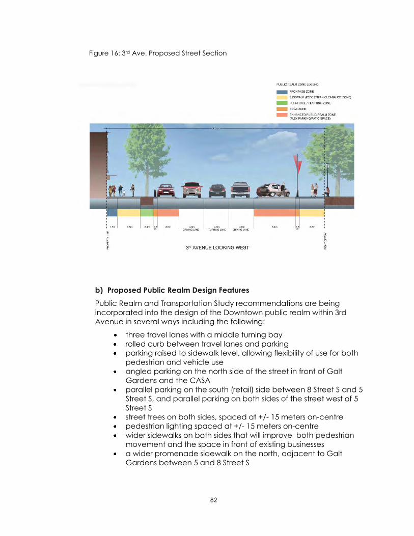
82
Figure 16: 3rd Ave. Proposed Street Section
b) Proposed Public Realm Design Features
Public Realm and Transportation Study recommendations are being
incorporated into the design of the Downtown public realm within 3rd
Avenue in several ways including the following:
three travel lanes with a middle turning bay
rolled curb between travel lanes and parking
parking raised to sidewalk level, allowing flexibility of use for both
pedestrian and vehicle use
angled parking on the north side of the street in front of Galt
Gardens and the CASA
parallel parking on the south (retail) side between 8 Street S and 5
Street S, and parallel parking on both sides of the street west of 5
Street S
street trees on both sides, spaced at +/- 15 meters on-centre
pedestrian lighting spaced at +/- 15 meters on-centre
wider sidewalks on both sides that will improve both pedestrian
movement and the space in front of existing businesses
a wider promenade sidewalk on the north, adjacent to Galt
Gardens between 5 and 8 Street S

83
5th Street South (between 1st Ave. S and 6th Ave. S.)
a) Contemporary Urban Design Direction
5th Street S will continue to be a major retail corridor in the Downtown. This
street should be defined by wider sidewalks to accommodate higher levels
of pedestrian activity. Two distinct characteristics help define the street:
the concentration of heritage structures along the street across from
Galt Gardens
the transition from business uses to residential uses south of 6th Avenue
The character of this corridor is proposed to be supported by
complementary site elements such as paving treatment, benches, trash
receptacles, bollards, and lighting. Gateway spaces within the public realm
are proposed at both the 1st
avenue and the 6th Avenue ends
of 5th street. Public Art
opportunities will animate these
spaces, create convenient
gathering spaces and provide
opportunities for public
interaction. A multi-modal bike
lane on the west side of 5 Street S
would provide an improved
connection from the London
Road neighbourhood to Galt
Gardens and other destinations.
Figure 17: 5th St. Future Image

84
Figure 18: 5th St. Proposed Street Section
b) Proposed Design Features
Public Realm and Transportation Study recommendations are being
incorporated into the design of the Downtown public realm within 5th
Street in several ways including the following:
two travel lanes, with a middle turning lane at each intersection
rolled curb between travel lanes and parking
parking raised to sidewalk level, allowing flexibility of use for both
pedestrian and vehicle use
angled parking on the east side and parallel parking on the west
side
a multi-modal corridor (recreational bike lane) on the west side
street trees on both sides, spaced at +/- 15 meters on-centre
pedestrian lighting spaced at +/- 15 meters on-centre
wider sidewalks on both sides that will improve both pedestrian
movement and the space in front of existing businesses
a wider promenade sidewalk on the north, adjacent to Galt
Gardens between 1 and 3 Avenues S

85
2) Future Parking Structure
The PRATS indicated that a new public parking structure may not be necessary
in the short term, based on the supply and demand for parking across the
entire Downtown area. However, areas where supply is limited were identified
and it was suggested that it would be prudent to protect future parking
opportunities where possible.
Strategically, it may be worthwhile to construct a parking facility, sooner than
indicated in the PRATS, to alleviate some supply side challenges in parts of
Downtown and to address customer and employee parking needs. Parking
alternatives would then be in place when streetscape improvement projects
commence that could possibly remove parking stalls, either temporarily or
permanently.
Identification and protection of potential parking structure sites also provides
flexibility for the City to accommodate future changes in parking supply or
demand, including reductions in on-street parking or unforeseen
developments.
The following section suggests a process for moving forward with approval and
planning of a parking structure:
a) Process
Prior to City Council budget approval, additional research into funding
options, including potential partnerships, as well as stakeholder
consultation should be undertaken. This would assist in determining if,
when and where a parking structure should be built. Following budget
approval, detailed design and construction would proceed.
b) Parking Structure Considerations
i. Site Location Factors
Location of a parking facility will be influenced by several factors
including proximity to existing or possible uses especially those that have
or may have relatively high parking utilization such as: the CASA; the
public library; adjacent blocks with development potential and the
possible Performing Arts Centre.
City ownership of potential sites will help reduce both time and cost
since land acquisition would be unnecessary. Vacant land is desirable
to avoid demolition costs. Both the area and shape of a site are
important so that development of potentially available sites is
maximized. Sites bounded by streets and lanes also provide greater
design flexibility for access/egress and circulation.
ii. Preferred Parking Structure Site
With these factors in mind, the municipally owned Bompass lot located
north of 5th Avenue S between 7th Street S and 8th Street S has been
identified as a preferred site.

86
iii. Parking Capacity
A multi-storied structure capable of accommodating at least 375
parking stalls could be constructed on the preferred site. In addition,
latent development intensification may occur on vacant, underutilized,
or potentially redevelopable parcels which would elevate parking
demand. Therefore, it may also be beneficial to design a parking
structure with future expansion up to 450 parking stalls for which the site
has additional capacity.
iv. Facility Design Considerations
When planning and designing a parking facility, the following design
elements should be considered in addition to the minimum Land Use
Bylaw requirements:
at-grade retail and office use designed to interface with a
pedestrian environment;
high quality façade; design including, but not limited to, display
windows, lighting, and effective signage to find and navigate the
facility;
site amenities such as landscaping and public art; and
Crime Prevention Through Environmental Design (CPTED)
v. Funding Considerations
Detailed funding and engineering for a parking structure will be required
once location and timing of the project are determined.
Figure 19: Conceptual Image of Future Parking Structure on Bompass

87
5.4 Downtown Parking Management
5.4.1 Purpose
Downtown parking should encourage private investment and be regarded as an
essential and integral part of the City‟s economic development strategy. Thus it is
important to provide a Downtown parking system that makes parking an incentive
rather than a disincentive to downtown revitalization and improvement.
The Public Realm and Transportation Study indicated that there is a reasonable
amount of parking space available throughout the Downtown; however a lack of
parking is seen as a problem on certain streets or in some areas. In addition,
stakeholders have identified a range of other issues that could be considered as
part of Downtown parking management.
The policy considerations in this section are therefore intended to take a holistic
approach in the management of Downtown parking.
5.4.2 Goals
1) To develop a parking management plan to address issues and guide
policy implementation.
2) To create a parking management strategy that enhances the economic
viability of Downtown.
3) To provide convenient parking for Downtown customers, visitors and
employees.
4) To coordinate Downtown parking planning and programming.
5) To mitigate parking related issues in the Downtown.
5.4.3 Policy Considerations
1) There is a need to:
1) monitor and evaluate parking availability in the Downtown,
particularly in areas adjacent to significant parking generators;
2) consult with stakeholders, including the Heart of Our City
Revitalization Committee, with regard to:
i. better understand downtown parking situations;
ii. specific short-term issues;
iii. long-term parking issues; and
iv. development of parking solutions and initiatives that insure there
is an adequate supply of public parking in the downtown area;

88
3) continue to improve the Downtown parking system so that parking is
an incentive to downtown revitalization;
4) ensure coordination with other plans and programs; and
5) report to City Council with regard to parking matters when necessary.
2) Employees should be encouraged to park in underutilized, peripheral
areas of Downtown, thus providing convenient parking for visitors and
customers, unless employment requires regular vehicle access to during
the business day.
3) Incentivizing Downtown companies to provide employees with options,
such as transit, to reduce commuter trips to and from Downtown should
be considered.
4) If, as a result of proposed redevelopment or other land use changes in
the Downtown, parking availability may undergo a significant change,
the DARP should be amended if revisions to policy are warranted.
5) The City should consider the possibility of partnerships with other public
sector entities as well as the private sector when new parking facilities
are proposed.
6) Evaluation of Land Use Bylaw parking requirements which may include
minimizing the off-street requirements should be undertaken.
7) Development of a multi-level parking and mixed-use facility or facilities
should be considered based on the principle of balancing parking
demand and supply.
8) Parking garages should be considered as a catalyst for private sector
investment.
9) Parking meter fees should increase in accordance with operational
requirements and to continue contributing to the capital growth of the
off-street parking fund.

89
5.4.4 Downtown Parking Management Plan
In accordance with the Parking Management goals of this DARP, a
comprehensive Downtown Parking Management Plan intended to mitigate
parking related issues should be prepared in collaboration with: the Planning and
Department Services Department; Infrastructure Services Department; the
Regulatory Services Department; Lethbridge Transit and stakeholders. The
proposed Downtown Parking Management Plan should address:
1) new, on-street parking system technologies that could improve user
experience and allow for future flexibility;
2) a better understanding of downtown parking customer needs;
3) location, design and scale of adequate, convenient, reasonably priced
parking areas;
4) alternative cost-sharing formulas that would create a responsive funding
framework and which may require revamping of the off-street parking fund;
5) balancing reserved and scramble parking in City facilities;
6) promotion of alternatives to single vehicle occupancy transportation such
as car-pooling, transit, walking and cycling;
7) a higher level of administrative focus on parking meter management,
marketing and infrastructure provision which may include creation of a
Downtown Parking Authority;
8) if a Downtown parking Authority was to be created, such matters as the
following could be assigned to the authority:
a) management of parking meter collection maintenance, security and
marketing
b) enforcement and management of the off-street parking fund;
c) management downtown parking infrastructure development, using
dedicated revenues from parking meter collections, fines and parking
infrastructure
90
5.5 Managing Downtown Land Use
5.5.1 Preamble
Downtown has undergone several economic cycles resulting in the construction of
a variety of buildings that reflected prevalent design styles of the period.
Furthermore, the areas in which these buildings were located were characterized
by the types of land use activities that occurred within them. Thus, in the
development and redevelopment of downtown, several unique buildings and
areas, were created and are still identifiable.
The Heart of Our City Master Plan recognized these identifiable areas of
Downtown together with the differing purposes each have played in the past.
New or different “built-form” ideas are emerging as Downtown continues to
transition into the future. In tandem with possible “built-form” changes, the
permit/approval system created to manage development will also need to
transform.
To facilitate this transformation, both new and modified approaches to
development control will be required. Traditional “zoning”, currently in place,
primarily regulates the use of land through a development application process
which provides for both permitted uses and discretionary uses which may or may
not be approved with or without conditions. Additional regulatory aspects, such as
parcel size, building setbacks, parking requirements and design criteria are also
addressed.
Presently, there are five Land Use Districts within the Downtown boundaries4. These
land use district classifications were created over time to manage the
contemporary land use issues. As Downtown has evolved and conditions have
changed, some of the original land use districts and corresponding regulations,
that were created to manage those issues, are no longer appropriate. In
recognition of this obsolescence and with the emergence of new circumstances,
it is proposed to introduce new land use districts. The intention of these changes is
to position the regulatory system to respond to current conditions while being
flexible enough to address emerging opportunities.
Lands to the west of Scenic Drive have developed in a more suburban and car-
oriented layout than the traditional Downtown east of Scenic Drive. With many
newer buildings in place and little developable land left, this area is not currently
in need of revitalization. Applying new standards at this time would be
unnecessary and could create uncertainty for existing businesses. Therefore
4 Current Land Use Districts include: Downtown Commercial; Park and Recreation (Galt Gardens & a sliver of the River Valley);
Transportation (parts of the roadway system) and 2 Direct Control Districts (former Railway Relocation Project lands & the “Atrium
Site”)

91
retention of the Downtown Commercial (CD) Land Use District classification is
advisable for the foreseeable future.
Retention of CD zoning is sufficiently aligned with shorter range aspects of the
Heart of Our City Master Plan Vision. Longer range goals of the Heart of Our City
Master Plan, such as reconnecting land west of Scenic Drive with lands to the east
thus providing both a “front door” to Downtown and the Oldman River valley, will
be addressed in the future when conditions warrant.
Property lying between 1st Avenue South and the Crowsnest Trail Corridor, once
referred to as the “Centre Site Lands”, are regulated by the 1983 Railway
Relocation Lands Area Redevelopment Plan (RRLARP) Bylaw #3899 and the 1986
Direct Control Bylaw #4190. This area too, is car-oriented and suburban in layout.
Major land use decisions, which lead to the creation of the Park Place Mall
shopping centre, were made by City Council. Subsequent development decisions
have been delegated to the Municipal Planning Commission and Development
Officers in the Planning and Development Department.
Since a satisfactory regulatory system that is in relative alignment with the Heart of
Our City Master Plan is in place, it is recommended that the existing Direct Control
Bylaw be retained for the present.
5.5.2 Enhancing Downtown Character
The Downtown Core includes property located between 1st and 6th Avenues and
between Scenic and Stafford Drives. When considering potential changes to the
regulatory system, it is important to build upon the strengths and character of
particular areas as well as to address aspects of the regulatory system that may
also need to be improved. The Heart of Our City Master Plan land use evaluation
indicated that there were several areas, both within and adjacent to Downtown,
that exhibited particular features which could be built upon to further enhance
special characteristics.
To establish the regulatory approach which responds to these challenges, a three-
pronged approach has been created that will entail:
1) creating zoning districts with appropriate land uses
2) articulating the form based and design elements within the new zoning
districts; and
3) identifying the preferred pace of change.

92
5.5.3 New Land Use Districts
In order to establish and support land uses that more directly distinguish the
character and purpose of the Downtown Core described above, two sub-areas
have been further recognized and designated:
Figure 20: Proposed Land Use Districts

93
1) Downtown One (DT-1) is the area located between First and Fourth Avenues
and between Scenic and Stafford Drives.
a) Purpose
The DT-1 district is intended to align with the Heart of Our City Master
Plan Pillars of “Vibrant and “Exciting”. The range of uses is intended to
encourage continuation of street-oriented, private sector commercial
investment as well as uses with cultural and entertainment orientations.
In addition, the DT-1 would support associated and complementary
uses and provisions to preserve the heritage character within this district.
b) Permitted and Discretionary Uses
The mix of Permitted and Discretionary Uses in the proposed DT-1 District
are closely aligned with the purpose suggested in the possible new DT-1
District and would resemble those in the current Downtown Commercial
District (CD). The following list provides an example of the suggested
mix:
Permitted Uses Discretionary Uses
accessory buildings
animal care, minor
amusement facilities
business support services
clubs
child care, major
child care, minor
commercial schools
cultural facilities
dwelling, apartment mixed use
education facilities
entertainment establishments
exterior building alterations or
improvements (that meet design
criteria)
financial institutions
fitness facility
government services
home occupations – type A
hotel/motels
household repair services
manufacturing, specialty
medical and health offices
(outpatient)
offices
parking facilities, parkade
parks
personal services
restaurants
retail stores
retail stores, convenience
signs (that meet design criteria)
tourist information centres
drop-in centre
entertainment establishments
freight and storage, except on
ground floors
home occupations – type B
home occupations – type C
medical and health facilities
(inpatient and outpatient)
parkade
parking facilities, surface
protective services
recycling facilities
religious assembly
transportation services
utility facilities
vehicle rental
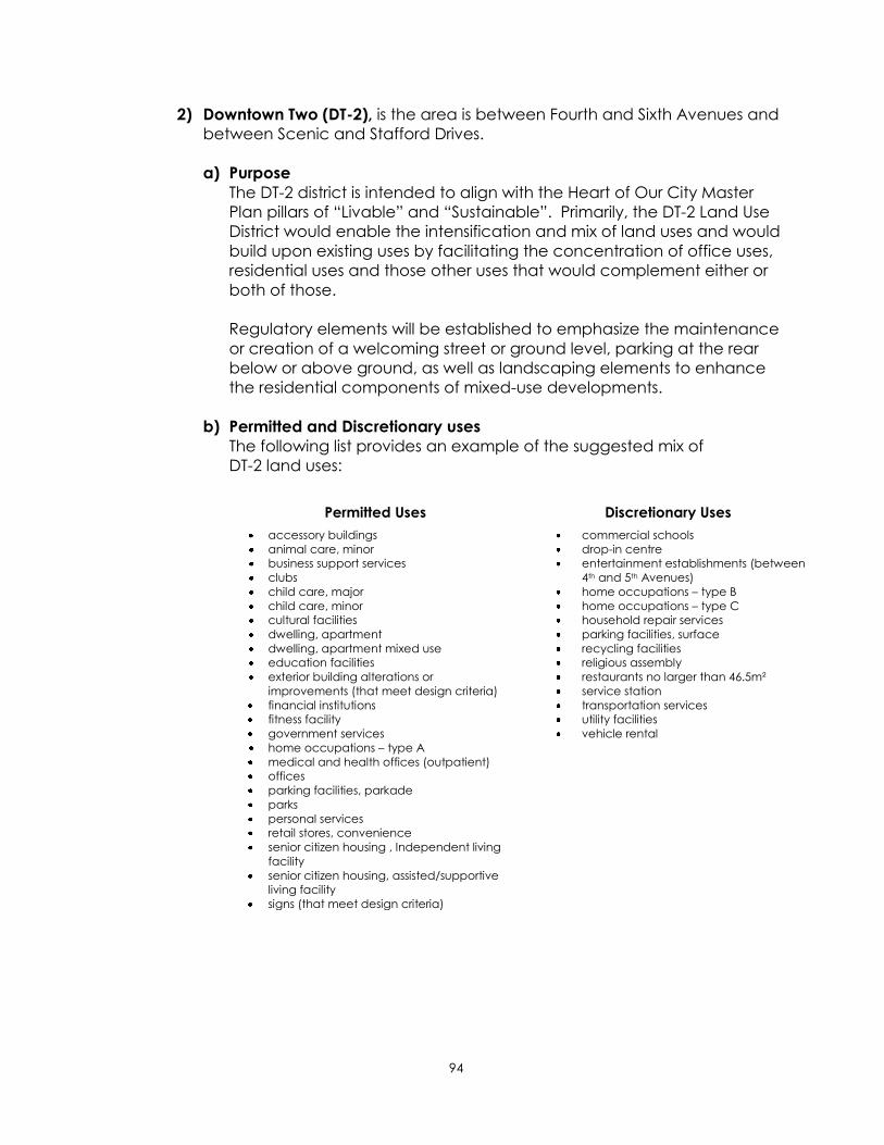
94
2) Downtown Two (DT-2), is the area is between Fourth and Sixth Avenues and
between Scenic and Stafford Drives.
a) Purpose
The DT-2 district is intended to align with the Heart of Our City Master
Plan pillars of “Livable” and “Sustainable”. Primarily, the DT-2 Land Use
District would enable the intensification and mix of land uses and would
build upon existing uses by facilitating the concentration of office uses,
residential uses and those other uses that would complement either or
both of those.
Regulatory elements will be established to emphasize the maintenance
or creation of a welcoming street or ground level, parking at the rear
below or above ground, as well as landscaping elements to enhance
the residential components of mixed-use developments.
b) Permitted and Discretionary uses
The following list provides an example of the suggested mix of
DT-2 land uses:
Permitted Uses Discretionary Uses
accessory buildings
animal care, minor
business support services
clubs
child care, major
child care, minor
cultural facilities
dwelling, apartment
dwelling, apartment mixed use
education facilities
exterior building alterations or
improvements (that meet design criteria)
financial institutions
fitness facility
government services
home occupations – type A
medical and health offices (outpatient)
offices
parking facilities, parkade
parks
personal services
retail stores, convenience
senior citizen housing , Independent living
facility
senior citizen housing, assisted/supportive
living facility
signs (that meet design criteria)
commercial schools
drop-in centre
entertainment establishments (between
4th and 5th Avenues)
home occupations – type B
home occupations – type C
household repair services
parking facilities, surface
recycling facilities
religious assembly
restaurants no larger than 46.5m²
service station
transportation services
utility facilities
vehicle rental

95
5.5.4 Regulatory and Design Elements
The subsections which follow are intended to help create a built form that
generally describes the regulatory and design elements that will be considered for
the DT-1 and the DT-2 Land Use Districts when they are subsequently articulated.
Several of these design elements represent a strengthening of existing Land Use
Bylaw direction.
1) Desired Building Types
Building Types refers to the conventional
terms used to describe standards of building
forms. At this time, there are certain building
types that are sought after in the Downtown
but not currently evident. This feature is
intended to identify “missing” building forms
that would be attracted when the market
conditions permit.
This design element provides guidance to
potential builders and developers, for
proposed new buildings. Currently this
provision does not exist in any City regulatory
documents.
2) Building Height and Massing
Massing refers to the general shape and size
of the building footprint in three dimensions.
It is important to achieve appropriate
proportions among these 3 elements so that
a building does not appear too tall, too short
or too long. This feature represents a
strengthening of existing Land Use Bylaw
direction.
3) Building Elements
To encourage continuity in the streetscape
and to ensure breaks in facade, buildings
should be designed to reinforce key
elements through the use of setbacks,
extrusions, textures and materials. This design
element represents a strengthening of
existing Land Use Bylaw direction.

96
4) Street Wall and Facade Articulation
Street wall refers to the part of a building that
faces the street, but it generally pertains to
how and where several buildings line up
together to define a proper walking
environment. At the most basic level,
buildings should be set back an equal
distance so that facades are aligned for as
far as a pedestrian can see. New buildings
should also respect the established pattern
of façade division by ensuring the horizontal
and vertical alignment of façade elements
with neighbouring buildings. The sense of
formality thus created also includes a
continuous variety of first floor businesses.
Solid upper floors also help to focus all street
activity on the building‟s “permeable” first
floor (retail, restaurants and services), which
attracts “eyes on the street”. This design
element represents a strengthening of
existing Land Use Bylaw direction.
5) Corner Site Terminus and Site Maximization
New developments on terminus and corner
sites can shape the image and character of
an area. Thus there is an implied civic
obligation to enhance the distinction and
landmark quality of prominent corner sites to
ensure that the highest possible standards in
design and material quality are met. This
feature represents a strengthening of existing
Land Use Bylaw direction.
6) Building Orientation and Placement
Site design taking into consideration where
buildings are situated on a site as well as how
they are oriented provides opportunities to:
retain architectural continuity with existing
buildings; introduce new buildings that will
not be out of place; reduce overall
environmental impacts; and the flexibility to
adaptively reuse space. This design feature
represents a strengthening of existing Land
Use Bylaw direction.

97
7) Architectural Quality and Façade Materials
Developers of new buildings should seek to contribute to the rich variety of
architectural styles and expressions evident in the Downtown Core by
utilizing building materials chosen for their functional and aesthetic quality.
Exterior finishes should exhibit quality of workmanship, sustainability and
ease of maintenance. If introduced as a design element, this feature
would represent a strengthening of existing Land Use Bylaw direction.
8) Site Access, Off-street Parking & Servicing (loading/unloading)
In recognition of the type and extent of
existing development, current parking
requirements within the current CD Land Use
District is generally less onerous than in all
other commercial land use districts. To obtain
a reasonable balance between supply and
demand for parking, the amount of parking
provided for any new development should
be in direct proportion to the need
generated from the users of the building.
Opportunities to create below or above
surface parking should be encouraged to
stretch the supply of developable land.
9) Landscaping & Amenity Areas
Creation of landscaped and other amenity
features on the site will contribute to the
aesthetics, enjoyment, and ambiance of the
site. Landscape guidelines from Land Use
Bylaw #5700 would continue to apply,
however expansion in the variety of
landscaped forms is encouraged. An
example would be the creation of a
landscaped courtyard.
10) Open Storage
Aesthetic quality is one of the most important contributing factors to
making Downtown a Special Place. Open storage areas often become
cluttered and unsightly thus detracting from the aesthetic qualities of
Downtown. Regulatory requirements would continue to eliminate the
possibility of open storage associated with future development applications
from being approved.

98
5.5.5 Pace of Change
As mentioned previously, the intention of proposed regulatory changes is to
respond to both current conditions and anticipated opportunities so, in addition to
identifying “character areas”, the pace of introducing change to the regulatory
system is important. In this context, two options have emerged.
1) Option One - “Go Slow”
The primary intention of the “go slow” option is to balance higher standards
that would advance the Heart of Our City Vision for Downtown, with the
economic and market realities facing Downtown stakeholders. For this to
be accomplished, regulatory change in the Downtown would be
introduced at a more measured rate, allowing for transition to take place
gradually and stakeholders to adapt accordingly.
Option One would also improve existing standards and features more
“should” or discretionary clauses, than Option Two, thus reinforcing the
gradual transition to higher standards.
2) Option Two - “Raise the Bar” (RTB)
The primary intention of Option Two would be a more immediate
introduction of the higher standards recommended in the Heart of Our City
Master Plan. This “Raise the Bar” approach accelerates incorporation of
higher development standards in the near term. In Option Two, the degree
of regulatory vigour would be higher than in the Option One. In particular,
there would be a more immediate emphasis on those aspects, described in
the previous section, and would utilize more mandatory or “shall” provisions
than the Option One.
A secondary intention of the Option Two would be to introduce special
purpose, overlay zones. Overlay zones are individual or groups of property,
to which specific development requirements are applied. The intention of
overlay zones is to address unique circumstances or situations through the
land use bylaw. In this case, requirements that would assist in achieving
Heart of Our City Master Plan objectives have also been included. In
consideration of this situation, two potential overlay zones a Heritage
Character focus sub-area and Animated Frontages focus sub-area are
identified in sections of both the DT-1 and the DT-2 (for additional details,
refer to Appendix A).
5.5.6 Selecting a Pace of Change Option
The primary purpose of an Area Redevelopment Plan is to establish a direction
that works towards achieving the Heart of Our City Master Plan Vision for
Downtown revitalization. It is evident that revitalization efforts undertaken over the
past decade have reversed a downward trend that was being experienced at
end of the 1990‟s.

99
Through the Heart of Our City Master Plan, the vision and a suggested framework
provided a much needed focus for revitalization to continue. It is vital that
ongoing change continues to build upon the successes of existing plans, policies
and investments, both public and private. Furthermore, change should not stall
momentum or create uncertainty in the business community.
Therefore, as previously indicated, it is essential to maintain the necessary balance
between public and private interests in a regulatory environment. Bearing this in
mind, the Option One, the Go Slow approach, provides a reasonable balance
between modified or new regulatory elements and the capacity of the
Downtown stakeholders to absorb the proposed changes.
5.5.7 Moving Forward
Several phases have to be undertaken for the three-pronged approach to
materialize as envisioned in the Managing Land Use section of the DARP.
Amendments to the Land Use Bylaw will require refinement of the land uses within
each land use district to ensure that the permitted and discretionary uses support
the purpose of the land use district and are in unison with the pace of change.
Amid competing interests, it would be prudent to engage stakeholders during the
refinement process of Land Use Bylaw amendments so that the resulting regulatory
framework continues to balance the certainty of a land use approval with the
desired outcome of the land use regulations.
Upon completion of the Land Use Bylaw amendment consultation process, the
pace of change selected by City Council, whether “Go Slow” or the “Raise the
Bar”, will establish the degree of transformation desired. This, in turn, will direct
both when and the extent to which the Land Use Bylaw needs amending to
establish the proposed new land use districts and corresponding regulatory and
design elements.
The concept of Overlay Zoning should be evaluated further as the Downtown
continues to transform, so that its unique characteristics can be accentuated and
maximized. Incentive considerations, similar to the previous Downtown
Redevelopment Investment Program (DRI P), may be desirable to “jump-start”
private investment incorporating overlay objectives. (refer to Appendix A).

100
5.6 Funding Sources
5.6.1 Public Sector Funding
Most of the Downtown projects will be financed through the City‟s Capital
Improvement Plan. Currently the City‟s Downtown Revitalization business unit is
responsible for administering budget and coordinating Downtown related projects
and initiatives from the Downtown Redevelopment Fund. In addition to City
funding, other financing mechanisms that assist with plan implementation may
become available from time-to-time, through both the provincial and the federal
government programs.
5.6.2 Potential Redevelopment Levy
Additional funding could possibly include private sector partnerships,
redevelopment levies and Community Revitalization Levies, as allowed for by the
Municipal Government Act. Should either or both of these options be considered
in the future, City Administration would establish a business case indicating the
rationale for engaging in a partnership and/or imposing a redevelopment levy.
5.6.3 Major grants available for the municipality and individual business
owners
Alberta Historical Resources Foundation (AHRF)
The Alberta Historical Resources Foundation (AHRF) was established in 1973
through the Historical Resources Act to promote public awareness and
enjoyment of Alberta's heritage. It provides financial and technical assistance
to individuals and organizations for initiatives that preserve and interpret
Alberta's heritage through a variety of grants offered by the Heritage
Preservation Partnership Program and to municipalities through Municipal
Heritage Partnership Program.
Main Street Program
The Alberta Main Street Program was successfully applied in Downtown
Lethbridge until discontinued in 2009. At that time, the City decided to carry on
with a similar Main Street Program funded through the Downtown
Redevelopment Fund, to ensure that meaningful projects continued to receive
funding which helps maintain both heritage aspects of buildings and
compatible business signage. Stakeholders are encouraged to continue to
utilize this program which is effectively managed through the BRZ.
Business improvement Loans
A Business Improvement Loan program that provides loans with a $10,000
maximum from Community Futures while the interest component is paid by the

101
Heart of Our City. These “interest-free” loans are available to downtown
business owners for 3-year terms which are intended for improvement projects
such as painting, flooring, shelving, lighting, signage, restoring or repairing
building exteriors to name a few.
5.7 Performance Monitoring and Evaluation
The main purpose for performance monitoring and evaluation is to ensure that
planning initiatives and programs are consistent with: the Heart of Our City vision and
the goals and objectives of this DARP; established planning principles, policies,
initiatives, or other programs are implemented as effectively as possible.
Performance measures, based on the principles described below, will establish the
essential monitoring and evaluation components of plan implementation.
5.7.1 Principles
Performance measurements can be either qualitative or qualitative but the results
of actions should be easy to understand and be measurable. Performance
monitoring and evaluation will be conducted according to the followings:
Timeframe Benchmarks: Benchmarks will be established for short-term (1-
3 year), mid-term (4-6 years), and long-term (7-10 years) evaluation of
projects and programs.
Downtown Experience: The Business Improvement District (BID) Hierarchy for
Creating Special Downtown Experiences5 will form the basis of evaluations
for success.
o It is essential that the Downtown is always clean and always feels
safe. If Downtown is messy and dirty, it generally fells unsafe and
provides a poor visitor experience.
o When Downtown is clean it feels and is safer and the visitor
experience improves.
o It is important to sustain “Clean and Safe” aspects which are the
foundation of the Downtown experience, otherwise it is not
possible to improve on the Downtown experience and public
realm investments could be wasted.
o When Downtown is clean and feels safe, investment in the
creation of welcoming public spaces will contribute to a more
pleasant Downtown experience.
o As public spaces become more welcoming, the experience is
continually improved with enhancements to the physical and
5 Refer to page 35, Figure 13 BID Hierarchy of Creating Downtown Experience.

102
aesthetic environment such as public art, “street furniture”,
flowers and vegetation coupled with other public realm
elements.
o Programming and promotion of existing and new public spaces
begins to transform the Downtown experience from pleasant to
enjoyable.
o Vibrant uses such as festivals and open air markets contribute the
vibrancy and so on until a “Great City Experience” has been
created.
It should be noted that as the various stages are succeeding
encountered, there is an increase in positive cues and a decrease in
negative cues exhibited within the Downtown area. To be effective and
sustainable, the experience needs to be a collaborative effort between
the City, the BRZ Downtown businesses and land owners.
5.7.2 Outcome Identification
Before success can be measured, detailed targets can be identified. For
instance it is valuable to know/measure:
the total number of employees Downtown and how those figures have
changed over time
comparison of jobs per unit of land (job density) and whether
employment is a stable, growing or declining compared to other
employment areas in the City
how much non-residential tax is collected from the Downtown area and
how that changes/fluctuates during the 10 year timeframe
how much construction investment takes place during 10 year
timeframe, how high the completion rate of approved building permits
is and how new construction impacts the value of tax generation
Downtown
track the change the amount of commercial floor space as the City has
grown
determine the effectiveness of public sector investment in the
stability/growth of Downtown by tracking public sector investments –
(draw correlations)
5.7.3 Measure of Success
Citizens, the business community and other Downtown entities together with City
Council and City Administration all have a stake in the success of Downtown
revitalization endeavours. Thus, assessing the success of the DARP is important.
Measuring success is also challenging because achievements are not often
publicized. As a way to maintain momentum, successes attributable to the DARP

103
should be widely accepted, acknowledged, and promoted amongst all
Downtown stakeholders and the public.
Acceptance
Downtown stakeholders and the public share the vision and goals of the
DARP and work together to implement the policies.
Acknowledgement
Downtown stakeholders and the public respect each other, work together,
and celebrate each other‟s success.
Promotion
Success stories should be shared and promoted.
Stakeholders can also analyze the success of the DARP quantitatively by utilizing
information such as municipal census data, citizen surveys, data collected by
special studies or projects. Typically, questions described below can be asked
whether a successful downtown is being created.
Example questions:
Is Downtown cleaner and safer than in the base year?
What projects have been approved by City Council for CIP funding?
What projects and initiatives of the HOCRC have been funded and
completed or are successful and ongoing?
Other metrics could include;
o Changes in employment numbers
o Numbers of dwelling units created
o Population change
o Extent & value of construction (new & renovation-adaptive
reuse)
o Assessment & taxation change

104
5.7.4 Action Identification
The table below lists actions that are proposed to occur during the next 10 years in
both operational and Capital Improvement Program. Through this timeframe
matrix, projects and programs have been identified as short-term, medium term or
long term. The type of action and the City Department responsible has also been
indicated. Proposed actions may, however, need to be adjusted over the course
of the 10 year timeframe due to changes in priorities, budget availability or other
circumstances.
The DARP - 10-Year Action Matrix
Action Plans Action
Type
Department
Responsible
Sh
ort-Te
rm
Establishment of Urban Design
Award
Program Community Planning
Core District Overlays and
Development Guidelines
Program Community Planning
Development of Street
Furniture Manual
Program Community Planning,
Parks Planning
Development of a Downtown
Bylaw
Program City Clerk‟s Office
Urban Park Classification
Study
Program Community Planning
Mid
-Term
Comprehensive downtown
parking management plan
Capital
Project
Community Planning,
Transportation,
Regulatory Services
Streetscape Improvement
(3rd Avenue S)
Capital
Project
Transportation,
Community Planning,
Water, Wastewater, &
Stormwater
Lon
g-Te
rm
Streetscape Improvement
(5th Street S)
Capital
Project
Transportation, Community
Planning, Water,
Wastewater & Stormwater

105
5.8 Reporting
City Administration is responsible for regular reporting results of DARP actions to
City Council, Downtown stakeholders and members of the public. Normally,
these results will be reported in conjunction with the HOCRC Year End Report.
5.9 Plan Amendment
Amendments to the DARP will be consistent with the vision, planning
principles, goals and policies of all the statutory plans and aligned with the
Master Plan. Plan amendment may be triggered by;
Changes in legislation (federal, provincial, inter-municipal, municipal)
Changes in Council direction
New findings based on research or studies
Significant social, environmental, or economic trend changes
City Administration will continue to engage stakeholders and members of the
public when amendments to the DARP and/or to related bylaws, including
the Land Use Bylaw, are proposed.
5.10 Plan Revision
Comprehensive review/update of the DAPR should be initiated within 10 years
following adoption by City Council.

106
APPENDIX

107
Appendix A - Potential Zone Overlay Zones
Overlay zoning if or when it is enacted, would be subject to a stakeholder
consultation process associated with amending the Land Use Bylaw. To achieve
maximum investment impact, Overlay Zoning would endeavour to co-ordinate public
realm improvements with both private and public sector development, wherever
possible.
Actual overlay requirements will need to be created and where a district overlay is
indicated, requirements of both the base Land Use District and the Overlay area
would be considered in a land use related decision.
Potential zone overlay zones are briefly described below:
Heritage Character Focus Overlay Zone
Within the proposed DT-1 district, a Heritage Character Focus Overlay is
suggested. Such an overlay zone would identify and facilitate the use of
significant heritage resources by permitting appropriate, adaptive re-use and
compatible infill development sensitive to the quality, scale and character of
adjacent heritage character buildings.
Animated Frontages Focus Overlay Zone
This potential overlay zone features animated retail frontages intended for street
oriented specialty stores, boutiques and restaurants; residential development as
part of mixed-use developments is proposed as follows:
o Phase 1 would concentrate on those sections of 5th Street and 3rd Avenue
identified for Public Realm investments within a City of Lethbridge Capital
Improvement Program.
o Additional development phases may be identified in subsequent Capital
Improvement Programs.
Future District Overlay zones
No Heritage Overlay Zones are proposed within the DT-2 at this time however,
future district overlays may include arterial roadway corridors which also provide
unique development opportunities including: 6th Avenue and/or 5th. Avenue
Future District Overlay zones may also include arterial roadway corridors which
also provide unique development opportunities including: Scenic Drive, Stafford
Drive, 6th Avenue, 3rd Avenue and 5th. Avenue.

108
Heritage Character Focus Area
Animated Retail Frontage Area

109