Embed Size (px)
Citation preview
Highlights of Wildlife Management in the Yukon during the
Seventies and early Eighties with Emphasis on Sheep
Prepared for
Yukon Fish and Wildlife Branch
by
Manfred Hoefs
March 2009

Table of content
Introduction
Sheep Hunting Regulations
Restrictions on A TV use in the Kluane Lake Area
Easing Tension between Outfitters and resident Hunters
Boundary changes of Concession No 13
Government Buy-out of Concession No. 18
Tennination of Concession No. 21
Wildlife Surveys
The Dempster Highway
Mount Cronin Dan's Sheep Project
Proposing a Sheep Management Plan for Dempster Corridor
Proposed Pipelines from the Beaufort Sea
Key Sheep Habitats and their Protection
Ibex Valley Sheep Monitoring
Wildlife Habitat Management
Prescribed Burning at Kluane Lake
MacArthur Game Sanctuary Habitat Inventory
Faro Mine Fannin Sheep Project
Sheep-related Wildlife Research
Kluane National Park
Yukon Game Farm
Hom Aberrations
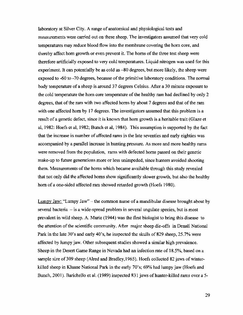
Lumpy Jaw
Wildlife Transplants and Re-introductions
Re-introduction of Mountain Goats to White Mountain
Summary
References cited
Personal Communications
Unpublished Infonnation Sources
3
4
5
6
6
7
8
9
11
11
13
16
16
17
19
20
21
24
25
26
27
28
29
30
31
32
32
39
40
2
Introduction
The Seventies were a turning point in wildlife management in the Yukon, which was
brought about by several concurrent events:
1) Yukon experienced an economic boom with five operating mines (Clinton Creek near
Dawson, Curragh Resources at Faro, Whitehorse Copper, Wells Green Mine in the
Kluane Game Sanctuary and the Tungsten Mine north of Watson Lake) as well as
numerous placer operations.
2) Construction of the Aishihik hydro-power generating station.
3) Completion of construction of the Dempster Highway, and
4) Impact assessments of several proposed pipeline routes.
All these activities brought money into this Territory, as well as a requirement to
establish a wildlife management system that could properly address potential impacts of
these development on wildlife and - if required - propose adequate mitigative measures.
As a consequence, the Yukon Government began to hire technical staff for its Game
Branch in 1972. Until then, its staff components consisted of the Director of Game, his
secretary and five wardens, and the focus of their activities was trapline management,
wolf control and administrative and enforcement tasks. Now it became possible to build
up a technical staff section in the Branch as well as hiring additional Game Wardens,
some of which were stationed outside of Whitehorse in communities such as Dawson,
Watson Lake and Haines Junction. By 1976 the staff of the Branch had grown to 18
members consisting of the director and secretary, 9 game wardens and 7 biologists and
technicians. This growth in staff number and expertise and the concurrent increase in
operating money allowed the Branch to initiate a number of programs that greatly
improved its ability to manage wildlife.
In the following we will discuss the various activities and programs the Game Branch
undertook and the accomplishments it achieved during the Seventies and into the
Eighties. The report's focus is on sheep management but mountain goats have been
included as well, since these two mountain ungulates have overlapping ranges and are
usually dealt with concurrently in aerial surveys. In addition, some of the regulation
3
changes discussed, such as the creation of game management zone and sub-zones, were
of benefit to the management of all wildlife, not only sheep and goats.
The report covers the following topics:
Administrative and regulatory matters such as hunting regulations changes, restrictions of
A TV use, and changes to outfitter concessions.
Sheep and goat inventories, which include routine government-paid surveys; special
surveys, impact assessments and management proposals in connection with the
Dempster Highway construction and the pipeline proposals paid for by the federal
government, the Highway Branch, the pipelines company and other external sources.
Wildlife habitat programs such as key habitat mapping, protective measures, and
enhancement projects.
Wildlife research projects, for the most co-operative effort with other agencies, and
Wildlife transplants and re-introductions, including the goat re-introduction to White
Mountain.
For some of these topics a brief description of context was considered beneficial, and
these descriptions are typed in italics. The reports concludes with a substantive reference
collection for readers who want to have more information about specific projects.
Sheep Hunting Regulations: In 1972, sheep hunting was permitted for rams with half
curl horns, and two rams could be taken per season. Outfitters always had to submit the
sheep trophies shot by their clients, but no information was recorded on where the rams
had been shot nor about the measurement of the horns. In 1975, the hom size ofa ram
had to be % curl (270 degrees) to be legal for hunting, Starting in 1979, rams shot by
guided non-resident hunters had to have completed full curl (360 degrees) horns, while
resident hunters continued with the % curl provision. In the early 80's the full-curl rule
was extended to all hunters, but the definitions of "legal' was somewhat more restrictive
than the current one. Most importantly, a legal ram had to have a minimum age of9
years. Since 1985, the hunting regulations allow rams to be taken if they are 8 years old
or older, or if their horns have completed full-curl growth. The latter stipulation was
included, because some rams have full-curl horns before reaching an age of 8 years. In
4
1975, game management zones were established, followed by their division into sub
zones by 1978. Since 1979, successful sheep hunters have to submit the horns of their
rams for measurements.
These various regulations changes during the 70's and into the mid 80's are evidence of
the government's position to manage sheep for trophy hunting. But it was not until 1996,
with the release of the Sheep Management Guidelines, that the government articulated its
desire to not only maintain sheep numbers but also population quality.
Restrictions on ATV use in the Kluane Lake area: The first step taken in the Yukon
to regulate the use of A TV's in the hinterland was done for the 1989/90 hunting season.
In 1988, the exploration company Archer Cathro proposed a cat trail from Fourth of July
Creek to mineral claims near Killermun Lake. Their land-use application called for a
minimum access trail for use by heavy equipment needed to carry out exploratory work.
The work would have been carried out in good Dall's sheep habitat and caribou calving
areas. From the wildlife management perspective, there were concerns about the effects
of a trail into this area would have on sheep and caribou in terms of direct impact due to
increased hunting. There were also concerns about the effects of disturbance by
motorized vehicles driven to the area for other types of recreation.
This proposal became a very contentious issue receiving considerable press coverage.
Interveners, besides the Fish and Wildlife Branch included First Nations, affected
outfitters and the Yukon Conservation Society.
In addition to opposing this land-use application, the Department of Renewable
Resources used its recently completed Access Management Policy to formulate an
approach for managing the effect of personal-use all-terrain vehicles. The underlying
concept was to allow access into the area for hunting by means of the existing network of
roads and trails, but to not allow it off such roads or trails. To that end, eight roads and
trails in GMS 5-36 to 5-39 were exempted from the restrictions imposed by the
regulations, to regulate A TV use in the hinterland. The regulation was approved in
November 1988 for implementation in the 1989-90 hunting season. Since then, two more
trails have been added to the list of "designated" trails.
5
However, the proponent got permission to walk in his trenching equipment "blades up"
under the direct supervision of a Yukon and a federal land-use officer.
Note that this summary was derived by interviewingformer government employees who
were associated with this project (L. Mychasiw, D. Drummond, Ken Kiemele and John
Jennings). Files are no longer available in Archives, Lands Branch or Wildlife Branch
collections, nor did interveners such as Outfitters or Yukon Conservation Society retain
copies of their submissions ..
Easing the tension between outfitters and resident hunters.
For the Yulwn outfitting industry, sheep and grizzlies have always been the most
important attractions for non-resident hunters. The Outfitters' Association was a very
influential lobby group into the early 70 'so All of Yulwn 's regions that supported sheep
were part of outfitting concessions, except for the Kluane Game Sanctuary, the MacAthur
Game Sanctuary and some small herds in the northern Yulwn. Non-resident hunters took
- and still do - between 70% and 80% of all rams and all grizzlies shot in the Yulwn.
Obviously, this fact was a contentious issue with local hunters and members of the Yulwn
Fish and Game Association with the prevailing attitude being that the Director of Game
at the time was too close to the outfitters. To ease this tension, the government took the
following steps: Two outfitting concessions were closed, another concession underwent
boundary changes, grizzly hunting by outfitters was put on a quota and sheep hunting
was restricted to foil-curl rams. While not covered in this report, the grizzly quota was
the most contentious of these changes. The data presented in Lortie (1978) to justify this
step were challenged by the Outfitter Association, who hired their own consultant to
prepare the intervention (Acres Consulting Services, 1979).
Boundary changes of outfitting concession No. 13 to accommodate resident hunters:
Pilot Mountain has been of special interest to resident and non-resident sheep hunters
ever since Jack O'Connor took a large ram in the area in 1950, which - at the time
ranked high in the Boone and Crocket Record book. O'Connor published the story of this
hunting trip in magazines and books, which brought it to the attention of the international
6
trophy hunting fraternity (O'Connor,1951 and 1974). O'Connor's outfitter was Alex
Davis, but there were no formally established outfitting concession at that time. Outfitters
had a gentleman agreement among themselves, that reduced potential conflicts over
hunting locations between them. Outfitting concessions with legally described boundaries
came into being until 1958, with Alex Davis and Len Berard being the first outfitters to
hold concession No 13. At the time, the Miners Range (pilot Mountain and Flat
Mountain) was part of concession No. 13. In 1972 the outfit was sold to Vic Hotte, who
kept it till 1979. He sold to Rod Hardie, who in turn sold it to the present concession
holder, Tim Mervyn, in 1997 (File # 2120-30-13).
Sometimes during J. B. Fitzgerald's tenure as Director of Game, the Miners Range was
removed from the outfitting concession and set aside for resident hunting only. J. B.
Fitzgerald retired in 1976. Searching the files in the Archives, Law Library or Field
Services collections to pinpoint the exact date of this boundary change was not
successful. Interviews with old-timers such as Fred Last, Rod Hardie, D. Nowlan and
Ralph Hotte to clarify this question were inconsistent.
Government buy-out of outfitting concession #18 (Dennis Callison): The establishment
of game management zones in 1975 and particularly that of game management sub-zones
over the following years allowed the Game Branch for the first time to determine hunting
pressure and harvest at a local level, and it became obvious after only a few years of
monitoring which locations in the Yukon and which game populations required attention.
One of those areas was the eastern portion of Game Management Zone 7, bordered by
Kusawa Lake in the west, the Carcross Road in the east, the B. C. border in the south and
the Alaska Highway in the north. Easy access through roads, trails and many lakes and
the large human population in the Whitehorse and Southern Lakes areas brought about
this predicament. Sheep and goat surveys had already been completed in 1974 (Hoefs,
1974), and it was the status and harvest of these species that the government reacted to
fairly quickly. It was in Outfitting Concession #18, where the combined harvest of non
resident and resident hunters exceeded a sustainable level and a sheep quota was
imposed. The division of the quota between the outfitter and resident hunters was subject
to much debate and became a controversial issue, when the outfitter engaged a lawyer to
7
represent his interest. Outfitters obtain a 5-year pennit for holding a concession. In 1977,
D. Callison had completed the third year of his pennit, leaving two years (1978 and
1979) before it would expire and a new permit would have to be applied for. Depending
on circumstances such as hunting pressure, status of the game populations in the
concession and performance of the outfitter, the government is not obliged to renew a
permit, but at that time it had been the practice to do so, with only one exception
(outfitting concession # 21). However, renewal of a permit to continue operating
Concession # 18 had become questionable as the following quote in a Request for
Decision to the Executive Council, dated June 25/79, will reveal: " ... Hunting pressure,
resident and non-resident, has led to a decline in the number and quality of sheep in
outfitter concession # 18. A quota has been instituted. This has led to conflicts regarding
quota division between residents and non-residents. The government has informed Mr. D.
Callison that he will not be able to transfer his outfitting licence and that his sheep quota
will probably be reduced ... ". With D. Callison not being able to sell his outfitting
concession and facing a reduced sheep quota which could seriously reduce his income, a
government take-over was a logical conclusion. In the flowing months there were many
meetings about the value of the outfitting concession, but the issue could be settled out of
court. In a Record of Decision by the Executive Council, dated June 26/1980, the
following quote is found: "Subject: D. Callison's outfitting. Cabinet gave approval:
1) to monetarily compensate Mr. Callison for two year loss of income on the average
for 1977, 1978 and 1979 (Writer's note. These were the two years left on the 5-
year permit).
2) Obtain funds to purchase Mr. Callison's base camp, all his buildings and
ancillary equipment at the appraised cost,"
Mr. D. Callison's Certificate of Registration for Guiding Area # 18 was cancelled by
Order-in- Council No. 1980/82, terminating non-resident hunting in this area.
(Information source: File # 2120-30-18.)
Termination of Outfitting Concession # 21: Outfitting concession #21 was located in
south-eastern Yukon and included Watson Lake, Frances Lake, the Cantung Highway
and parts of the south Campbell Highway. The concession had no sheep but a few goats
8
and caribou, with moose being the most numerous big game species. The outfitting
concession was held by Louis Pospisil under Permit No. 70-8. L. Pospisil's business
differed from those of other outfitters in that he conducted most of his hunts from the
roads, rivers and lakes, and not by taking hunters into the back-country on horse back.
This practice resulted in considerable competition between resident and non-resident
hunting.
The Government reacted and decided to set this area aside for the exclusive use by
resident hunters.
In a letter from Commissioner James Smith, dated March 18/1974, Mr. L. Pospisil was
informed that guiding area No. 21, held under permit 70-8 under Pospisil's name, will not
be renewed after its expiry date on July 20/1975. This letter contains the following
quote:" Game surveys carried out by the Game Branch, analyses of hunters'
questionnaires as well as outfitter and trapper reports indicate to us that it will no longer
be possible to accommodate both non-resident as well as local hunters in areas of
southern Yukon, if we want to maintain game populations at harvestable levels."
(Information source: File # 2120-30-18).
Wildlife surveys: No wildlife surveys had been carried out by the Yukon Game Branch
before biologists were hired, starting in 1972. However, biologists of the Canadian
federal government as well as from the United States had done biological reconnaissance
work. The more important projects include Osgood's (1909) general surveys in parts of
Alaska and Yukon, Sheldon's (1911) expedition- type collection trips into the Ogilvie-,
Pelly- and Selvyn- and Glenlyon Mountains focusing on sheep, Murie's (1953) work on
Alaska-Yukon caribou, Clarke's (1943) biological reconnaissance along the Alaska
Highway and that by Rand (1945 and 1946) along the Canol Road. Youngman (1975)
spent several years in the Yukon in search of mammals and his book contains a very
detailed reference list of previous investigations. These surveys were done on foot, horse
back or from boats and were augmented by anecdotal information derived by
interviewing local residents. Geist and Ogilvie'S (1972) studies in the MacAthur Game
Sanctuary-focusing on Fannin sheep, and Pearson's (1967) elk counts were most likely
the first examples of using aircraft for game surveys in the Yukon.
9
Once biologists were on staff, the Yukon Government became convinced of the necessity
to carry out inventories for responsible wildlife management. Starting in 1974 funds
became available to do so. Aircraft - for the most helicopters- were used for all these
surveys.
Because of its importance to local hunters as well as outfitters, South-central Yukon was
surveyed first (Hoefs, 1974). This was the western half of what is now Game
Management zone 7. Next came the south-western Yukon (Outfitting Concession No. 16)
(Hoefs, 1975 a) as well as the entire Game Management Zone 5 (Outfitting Concessions
Nos. 10,11,12 and13) (Hoefs and Lortie, 1975). In those early days, there was a
deliberate attempt to make survey areas coincide with outfitting concessions, because
outfitters' clients shot 80% of the annual harvest of sheep, and the public had expressed
concerns about such a high harvest in comparison to what local hunters were taking.
Game Management Zone 11 (outfitting concession No. 22) was surveyed in 1976 (Hoefs
and Lortie, 1976). This zone along the YukonlNWT boundary has both sheep and goat
populations. Concerns had been voiced about Tungsten miners hunting in the Yukon, and
about new road and trail developments to facilitate exploration. In 1978, surveys in the
southern Yukon were completed by doing Game Management Zones 8 and 10, which
covered outfitting concessions Nos, 15, 19 and 20 (Lortie et al.1978). During the same
summer a special survey was conducted of goats in the southern part of Game
Management 7, because the popUlation was small and might have been over-harvested
(Hoefs, 1978 a). That year the Yukon Wildlife Branch's focus of attention shifted to the
north, because of ongoing or proposed developments in that region. The sheep in the
Richardson Mountains were counted (Hoefs, 1978 b) as well as those in the central
Ogilvie Mountains (Outfitting concessions Nos. 2 and 3) (Larsen, 1978). The inventory
of the Olgilvie Mountains was completed in 1981, when the western parts- along the U.S
border- were surveyed (outfitting concession No.1) (Hoefs and Nette, 1981).
Based on surveys completed by the end of 1975, an inventory of large mammals in
the Kluane National Park Reserve (Hoefs, 1973), interviews of outfitters in other areas
and review of the harvest reports on hand, the size of the Yukon's sheep population was
estimated at 22 410 (Hoefs, 1975 b). The most recent Yukon-wide summary on sheep
numbers, based on all surveys done by that time, came up with an estimate of22 000
10
sheep ( Barichello et al. 1989). In 1977 the number of goats estimated for the Yukon was
1400 (Hoefs et al. 1977).
The Dempster Highway
The Dempster Highway begins at the North Klondike Highway, about 42 km east of
Dawson, and terminates at Inuvik in the Mackenzie delta, covering a distance of about
742 km. As early as 1956, the wish for a road was expressed by an exploration company
applyingfor aid to build a route to Eagle Plain (Macleod 1978). Although the bid was
rejected, Aubrey Simmons, the Liberal member of Parliament for Yukon, lobbied
successfully in the House of Commons on January 15, 1957 for the road's construction.
Later that year, after a change in government, Prime Minister J. Diefenbaker conceived
the program of Roads to Resources and the Flat Creek-Eagle Plain road, now known as
the Dempster Highway and was given high priority. By 1961 the road reached Chapman
Lake (km 124), hastened by the discovery of oil in the Eagle Plain on August 17, 1959.
However, due to dwindling prospects in the Eagle Plain, construction was halted until
1969. In 1963, during this construction lull, the road became known as the Dempster
Highway to commemorate Corporal W. D. Dempster of the Royal Canadian Mounted
Police who patrolledfrom Dawson City to Fort McPherson. He became a northern hero
when he found a previous patrol of police officers who had perished along the way in
1911. The Highway reached the Ogilvie River in 1970 and construction proceeded slowly
over the next years until completion in 1979 (Stewart, D., 1981).
It noteworthy that the first stretch of the Dempster Highway to the Ogilvie River was
done without any kind of environmental and socio/economic impacts assessment. None
was required This changed in 1971, and an assessment was commissioned for the
remainder of the Highway (Schultz International Ltd. 1972).
The following two studies were in part paidfor by DIAND.
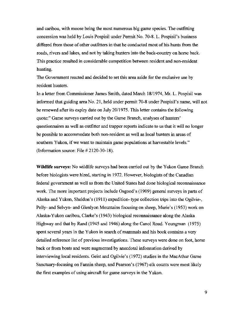
Investigation of the Mount Cronin Dall's sheep population off the Dempster Highway
near the N.W.T. border: Sheep surveys in the Richardson Mountains by Hoefs (1978)
had determined that the range of the Dall' s sheep population around Mount Cronin is
bounded by the new Highway over a distance of about 16 kIn. Follow-up surveys
11
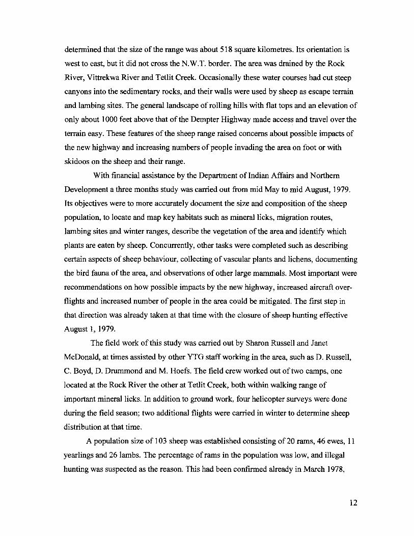
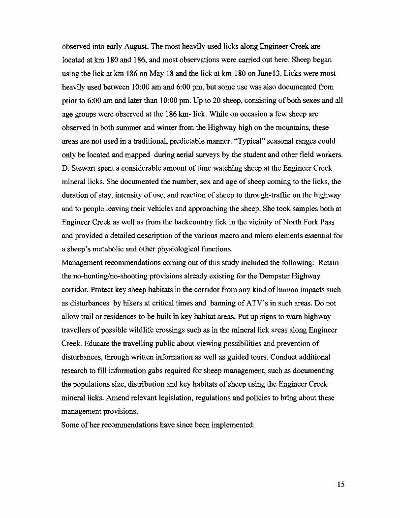
Dempster Highway Projects (photos by M. Hoefs)
Dall's sheep using mineral lick at Engineer Creek
Sharon Russell and Janet McDonald in their field camp near Mt. ~"' .. 'J..LI..LI
determined that the size of the range was about 518 square kilometres. Its orientation is
west to east, but it did not cross the N.W.T. border. The area was drained by the Rock
River, Vittrekwa River and Tetlit Creek. Occasionally these water courses had cut steep
canyons into the sedimentary rocks, and their walls were used by sheep as escape terrain
and lambing sites. The general landscape of rolling hills with flat tops and an elevation of
only about 1000 feet above that of the Dempter Highway made access and travel over the
terrain easy. These features of the sheep range raised concerns about possible impacts of
the new highway and increasing numbers of people invading the area on foot or with
skidoos on the sheep and their range.
With financial assistance by the Department of Indian Affairs and Northern
Development a three months study was carried out from mid May to mid August, 1979.
Its objectives were to more accurately document the size and composition of the sheep
population, to locate and map key habitats such as mineral licks, migration routes,
lambing sites and winter ranges, describe the vegetation of the area and identify which
plants are eaten by sheep. Concurrently, other tasks were completed such as describing
certain aspects of sheep behaviour, collecting of vascular plants and lichens, documenting
the bird fauna of the area, and observations of other large mammals. Most important were
recommendations on how possible impacts by the new highway, increased aircraft over
flights and increased number of people in the area could be mitigated. The first step in
that direction was already taken at that time with the closure of sheep hunting effective
August 1, 1979.
The field work of this study was carried out by Sharon Russell and Janet
McDonald, at times assisted by other YTG staff working in the area, such as D. Russell,
C. Boyd, D. Drummond and M. Hoefs. The field crew worked out of two camps, one
located at the Rock River the other at Tetlit Creek, both within walking range of
important mineral licks. In addition to ground work, four helicopter surveys were done
during the field season; two additional flights were carried in winter to determine sheep
distribution at that time.
A population size of 103 sheep was established consisting of 20 rams, 46 ewes, 11
yearlings and 26 lambs. The percentage of rams in the population was low, and illegal
hunting was suspected as the reason. This had been confirmed already in March 1978,
12
when 4 sheep were poached, 3 of them rams. It was also suspected the lamb mortality
during their first winter was high, but several years of monitoring would be needed to
confirm this. The field crew described the vegetation in several habitat types, colleted 50
species of vascular plants and 12 species of lichens, and determined from permanent
vegetation plots that sheep used at least 20 species. With help from local ornithologist
Robert Frisch, 80 bird species were reported for the area. Four other large mammals were
observed- caribou, grizzly, wolf and wolverine- of which the grizzly observations are
noteworthy. Between May 17 and August 19, the crew saw a total of 12, ranging from
singles to adult pairs, sows with one cub and a sow with two cubs. Seven bears could be
individually identified.
Since the crew worked on foot, only about 20 % of the total sheep range could be
covered, or about 100 to 150 square kilometre. This points to a high grizzly density in
this area.
Relevant to possible negative impacts on the sheep population by this recent
development were the following factors. The reaction of sheep to disturbances such as
noisy traffic on the highway, blasting at the highway and aircraft over-flights varied
greatly form complete disregard over stopping to feed and observing the disturbance
factor, walking away or running away. By contrast, the reaction to people was always
negative and quick. This applied to the occasional hikers as well as the researchers
themselves, who could never approach the sheep closely. This points to bad experience
made by sheep when encountering humans.
Of concern was also the close proximity of less than 8 km to key habitats, such as
lambing areas, winter ranges and an important mineral lick at the Rock River, to the
highway. The much-used Rock River mineral lick is located only 2.4 km from the
Highway. The nature of this open and smooth terrain and the small elevation difference
between the highway and the mountain tops, allows hikers to get into key sheep habitat in
two to three hours and motorized hunters within less than one hour. This predicament
will have great influence on the continuing existence of this population.
Proposing a management plan for sheep in the Ogilvie Mountains in vicinity of the
Dempster Highway: In 1980, Donna Stewart - a graduate student from the University of
13
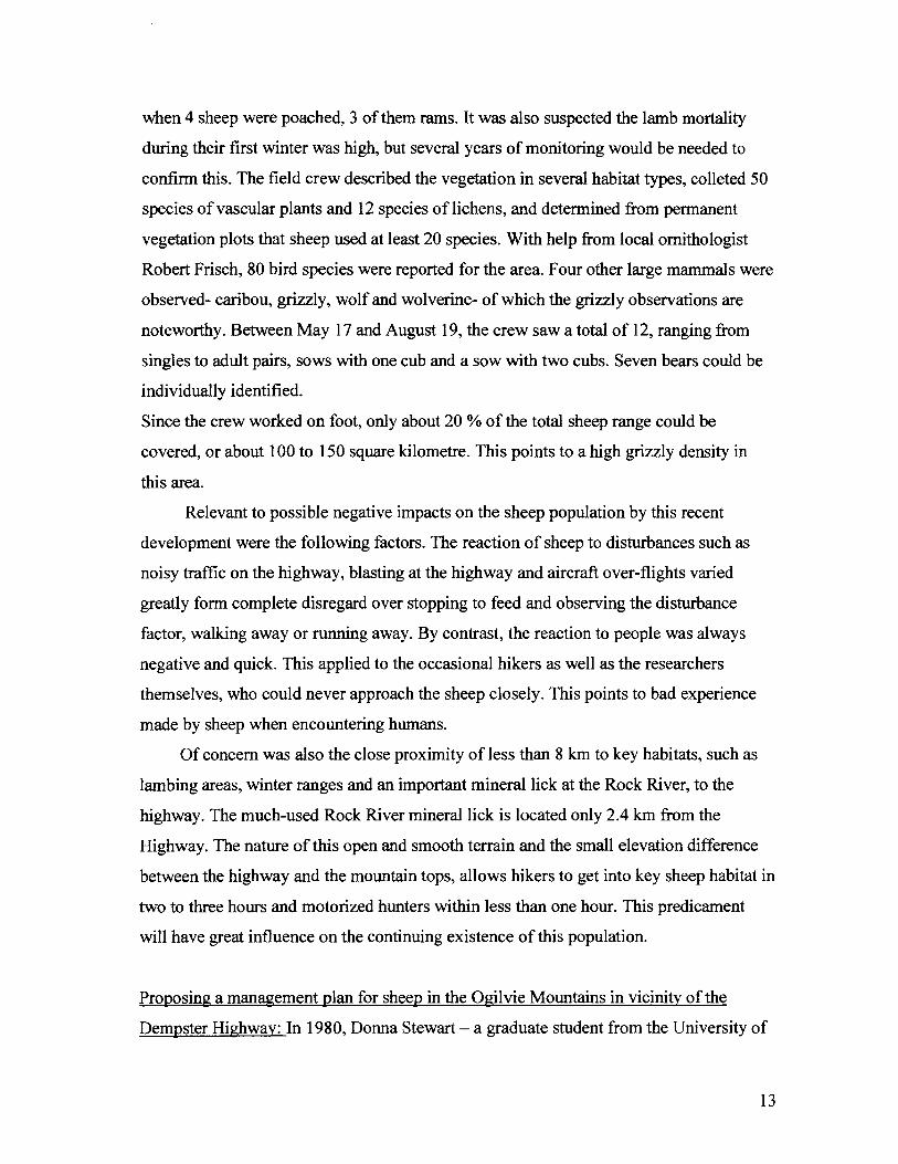
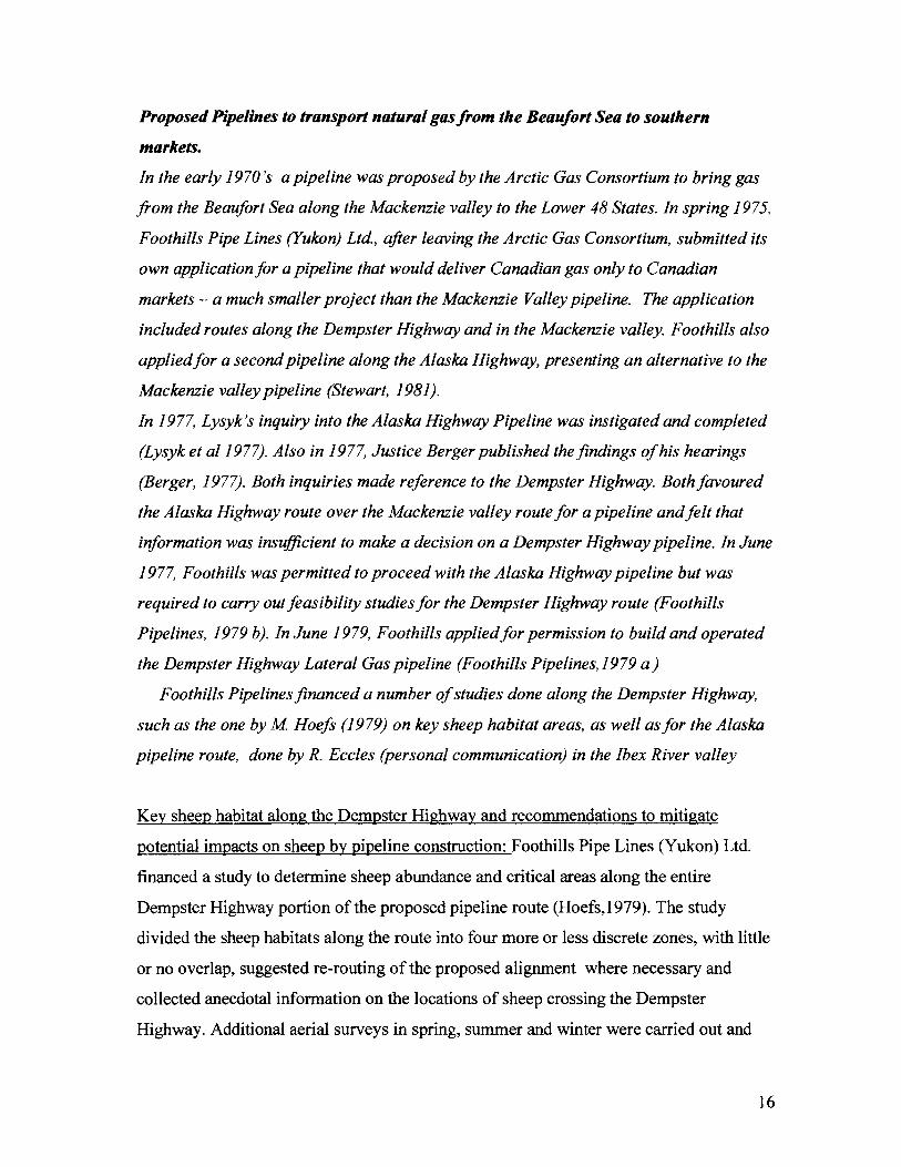
Dempster Highway Projects (photos by Donna Stewart)
South Ogilvie Mountains Sheep Range
This photography shows typical habitat in the south Ogilvie Mountains. The only known mineral lick in the range is marked by the arrow. The photograph was taken from the air, looking southeast.
Jensen's Cliff Lambing Area
This lambing area is located behind Jensen's Outfitting Camp at km 186 of the Dempster Highway. In 1980, at least 19 lambs were born here. THe photograph was taken looking east from the highway.
Calgary - began a Master of Science study on Dall's sheep along the Dempster Highway.
Her supervisor was V. Geist, a well-known sheep expert, who had attracted some
attention for his submissions to the Berger Inquiry on the proposed Mackenzie Valley
pipeline (Geist, 1975 a,b). His interventions dealt with potential impacts of the pipeline
on birds and large mammals. He was therefore well qualified to participate in this
investigation.
The primary objective of the study was the maintenance of natural populations ofDall's
sheep with representative sex-age ratios in the Dempster Highway corridor.
To bring this about D. Stewart had to research existing information about the highway,
wildlife, habitats, legislation and policies. She had to locate and map key sheep habitats
through ground observations, aerial surveys and cooperative efforts with other Wildlife
Branch biologists working in the area at the time. Areas within sight of the highway were
to be subjected to detailed observations of intensity and frequency of sheep use, reaction
of sheep to traffic and other types of disturbances. Information gained from a
questionnaire distributed to the travelling public was meant to augment her own data. The
study was to conclude with management recommendations.
Sites for intensive studies were located in two areas of the Ogilvie Mountains. The first
and southern one was around North Fork Pass between km 80 and km 94, the second
and central area along Engineer Creek between km 171 and km 198. Focal points in the
southern area included one mountain - locally referred to as "Sheep Mountain" - at km 86
and another mountain to the east ofP. Jensen's outfitter camp at km 93. Both mountains
were known to be lambing areas (Hoefs, 1979). The central area along Engineer Creek
contained several mineral licks.
Based on observations from the ground as well as aerial surveys within the corridor, D.
Stewart estimated to population size in the study are at 235 sheep. One previously
unknown mineral lick was discovered east of the southern study area, about 15 km off
the Highway. It was a much-used lick, with several trails leading to it, and 45 sheep
counted there. The maximum number of lambs documented was 10 at Sheep Mountain
and 19 at Jensen's cliffs. The lambing period extended from May 5 to May 22, with a
peak at May 15. The nursery bands vacated the lambing areas by mid June and could no
longer be observed from the Highway. Most lick use occurred in mid June, with some use
14
observed into early August. The most heavily used licks along Engineer Creek are
located at km 180 and 186, and most observations were carried out here. Sheep began
using the lick at km 186 on May 18 and the lick at km 180 on Junel3. Licks were most
heavily used between 10:00 am and 6:00 pm, but some use was also documented from
prior to 6:00 am and later than 10:00 pm. Up to 20 sheep, consisting of both sexes and all
age groups were observed at the 186 km- lick. While on occasion a few sheep are
observed in both summer and winter from the Highway high on the mountains, these
areas are not used in a traditional, predictable manner. "Typical" seasonal ranges could
only be located and mapped during aerial surveys by the student and other field workers.
D. Stewart spent a considerable amount of time watching sheep at the Engineer Creek
mineral licks. She documented the number, sex and age of sheep coming to the licks, the
duration of stay, intensity of use, and reaction of sheep to through-traffic on the highway
and to people leaving their vehicles and approaching the sheep. She took samples both at
Engineer Creek as well as from the backcountry lick in the vicinity of North Fork Pass
and provided a detailed description of the various macro and micro elements essential for
a sheep's metabolic and other physiological functions.
Management recommendations coming out of this study included the following: Retain
the no-huntinglno-shooting provisions already existing for the Dempster Highway
corridor. Protect key sheep habitats in the corridor from any kind of human impacts such
as disturbances by hikers at critical times and banning of A TV's in such areas. Do not
allow trail or residences to be built in key habitat areas. Put up signs to warn highway
travellers of possible wildlife crossings such as in the mineral lick areas along Engineer
Creek. Educate the travelling public about viewing possibilities and prevention of
disturbances, through written information as well as guided tours. Conduct additional
research to fill information gabs required for sheep management, such as documenting
the populations size, distribution and key habitats of sheep using the Engineer Creek
mineral licks. Amend relevant legislation, regulations and policies to bring about these
management provisions.
Some of her recommendations have since been implemented.
15
Proposed Pipelines to transport natural gas from the Beaufort Sea to southem
markets.
In the early 1970's a pipeline was proposed by the Arctic Gas Consortium to bring gas
from the Beaufort Sea along the Mackenzie valley to the Lower 48 States. In spring 1975,
Foothills Pipe Lines (Yukon) Ltd, after leaving the Arctic Gas Consortium, submitted its
own application for a pipeline that would deliver Canadian gas only to Canadian
markets - a much smaller project than the Mackenzie Valley pipeline. The application
included routes along the Dempster Highway and in the Mackenzie valley. Foothills also
applied for a second pipeline along the Alaska Highway, presenting an alternative to the
Mackenzie valley pipeline (Stewart, 1981).
In 1977, Lysyk's inquiry into the Alaska Highway Pipeline was instigated and completed
(Lysyk et al 1977). Also in 1977, Justice Berger published the findings of his hearings
(Berger, 1977). Both inquiries made reforence to the Dempster Highway. Both favoured
the Alaska Highway route over the Mackenzie valley route for a pipeline and felt that
information was insufficient to make a decision on a Dempster Highway pipeline. In June
1977, Foothills was permitted to proceed with the Alaska Highway pipeline but was
required to carry out feasibility studies for the Dempster Highway route (Foothills
Pipelines, 1979 b). In June 1979, Foothills appliedfor permission to build and operated
the Dempster Highway Lateral Gas pipeline (Foothills Pipelines, 1979 a)
Foothills Pipelines financed a number of studies done along the Dempster Highway,
such as the one by M Hoefs (1979) on key sheep habitat areas, as well as for the Alaska
pipeline route, done by R. Eccles (personal communication) in the Ibex River valley
Key sheep habitat along the Dempster Highway and recommendations to mitigate
potential impacts on sheep by pipeline construction: Foothills Pipe Lines (Yukon) Ltd.
financed a study to determine sheep abundance and critical areas along the entire
Dempster Highway portion of the proposed pipeline route (Hoefs,1979). The study
divided the sheep habitats along the route into four more or less discrete zones, with little
or no overlap, suggested re-routing of the proposed alignment where necessary and
collected anecdotal information on the locations of sheep crossing the Dempster
Highway. Additional aerial surveys in spring, summer and winter were carried out and
16
information already collected in surveys done by Larsen (1978), Hoefs (1978) and Russel
et al. (1979) was incorporated to establish the following four zones: 1) Pipeline km 372 to
394 (Richardson Mountains), 2) pipeline km 597 to 586 (Northern Ogilvie Mountains), 3)
pipeline km 586 to 610 (Central Ogilvie Mountains) and 4) pipeline km 667 to 699
(South Ogilvie Mountains). Note that pipeline km 0 was at the Beaufort Sea. For each of
these zones sheep population size was estimated and key areas such as lambing sites,
winter ranges and mineral licks were mapped. Sheep crossing the Dempster Highway
was documented for zones 3 and 4, mineral lick use in zones 1 and 3, winter ranges in
proximity to the Highway in zones 1 and 4, and lambing sites close to the Highway in
zone 4. Recommendations were made on pipeline routing and timing of construction to
reduce possible impacts on sheep. The Central and Southern Ogilvie Mountains zones
were in a subsequent study by Stewart (1981) subjected to more detailed on the ground
monitoring.
Ibex River Valley sheep monitoring; One of the pipeline -related projects the Yukon
Government participated in an advisory and supervisory capacity was an assessment of
the potential impact of the pipeline on Dall's sheep in the Ibex River area west of
Whitehorse. It had been decided that the pipeline should not be build close to Whitehorse
but be diverted to south of the city. Part of this re-routing followed the Ibex River valley.
It had been known that Dall' s sheep inhabit the mountain ranges on both sides of the
Ibex River valley, and anecdotal information pointed to occasional crossing of the river
by sheep. A study was therefore proposed to assess the size and composition of that sheep
herd and the frequency and locations of crossings. Obviously, sheep in close proximity to
the planned pipeline route and particularly their crossing of the route would have
implications to the construction and maintenance of the pipeline. The study was carried
out by Ross Eccles of Foothills Pipeline (Yukon) Ltd. and supervised by YTG staff. R.
Eccles submitted weekly reports about his monitoring, which can no longer be located in
YTG, Library or Archives collections. The writer therefore tracked down R. Eccles
where-about and asked him to provide a short summary of his work from memory, which
is copied below: "I conducted ground-based and occasional helicopter supported counts
from May 1979 to late fall 1980. An old logging road that led from Scout Lakes to
17
through the valley and back to the highway east of the Takhini River, together with
several access roads leading up the north side of Mt. North Ibex provided me with
excellent visual coverage of Mt. North Ibex, as well as the north facing aspects of Mt
Ingram. Through much of the snow free period of the year, I completed 7 to 12 surveys a
month, and my classified counts were very consistent for North Ibex for the majority of
the study period. Based on my observations, there was a resident group of maternal
sheep (yearlings, Class 1 rams and adult females) that resided on Mt. North Ibex year
round. After a particular good lamb crop in the spring of 1980, this group grew in size to
over 50 sheep, but based on my classified counts, I saw no evidence of maternal sheep
moving between North Ibex and the Mt. Ingram complex to the south. During June to
early August, I frequently observed the maternal group at mineral licks right at the base
ofMt. North Ibex immediately adjacent to the valley floor, but I saw no movement onto
the valley floor from those licks.
In the early fall of 1980 (September I think), the Class 2 and 3 ram numbers increased by
approximately 8 animals on Mt. North Ibex, indicating a movement of new animals onto
Mt. North Ibex from the south. As my intensive survey work terminated in late 1980, I
can not comment on trends since then. I was unable to find any conclusive evidence of
where the ram band crossed the valley, although the Arkell Creek floodplain at the west
end of the valley offers perhaps the most open, direct route across the valley to the sub
alpine habitats at the west end ofMt. North Ibex, and I did encounter potential sheep
tracks (but there were also deer in the valley) on a sandy portion of the logging road just
above the floodplain.
A trapper whom I encountered in the valley on one of my surveys indicated that he had,
on one occasion, in previous years sighted a small maternal group crossing the valley
through dense regenerating pine at the east end of the valley. I spent several days with an
assistant covering the east end of the valley to the lower slopes oflngram looking for
possible game trails through the area but found none."
Clarifying note: The name Mt. North Ibex is not official but was coined during this study
to facilitate communication about sheep distribution and movement in this area. Mt.
18
North Ibex takes in Game Management sub-zone 7-15 and part of 7-18. In reaction to
this study and the possibility of a pipeline, these sub-zones were closed to sheep hunting.
Wildlife Habitat Management in the Yukon.
A range reconnaissance in the Aishihik area done by D. Soper (1950) was the first
wildlife habitat project carried out in the Yukon. Soper had been commissioned to assess
the feasibility of importing bison and elk into the Yukon.
In 1972, the Yukon Game Branch hired itsfirst biologist. Part of his duties included to
represent the Game Branch on the Land Use and the Tote-Trail Assistance Committees,
and bring up wildlife concerns when applications for land, land-use and road
construction were under discussion. Early in 1986 a Habitat Section was established.
Starting with only three staff members it grew quickly and reached its peak in 1990, when
14 permanent and casual staff member worked there.
While the need for habitat inventory and protection had long been recognized, the fact
that land was under federal control was the reason for not proceeding with it.
Two factors were important to bring about a change in this attitude. Firstly, Wildlife
Habitat Canada, a private foundation dedicated to conserving, restoring and enhancing
wildlife habitat nation-wide, had come into being. Secondly, a Vancouver lawyer
(Andrew Thompson) was contracted at Wildlife Habitat Canada's expense to provide a
legal opinion on Yukon's ability to regulate the use o/lands. A. Thompson concluded that
Yukon legislation which regulate the use of lands, whether it is Commissioner's lands or
federal lands, for the purpose of protecting wildlife habitat, will be valid and enforceable,
if a number of condition are met, as outlined in Hoefs (1988).
Wildlife Habitat Canada was very supportive of Yukon's fledging habitat program. As
a start, a workshop was organized in which an approach was articulated. It was decided
that the following six components were necessary for a comprehensive program: Policy,
planning, inventory, protection, enhancement and program monitoring.
Wildlife Habitat Canada providedfundingfor three years to hire two habitat specialist as
well as a significant amount of operation financing. During these years all five of the
proposed habitat program components were addressed, but habitat inventories - the
locating and mapping of key wildlife habitats - received most attention. A Habitat
19
protection policy and an Access Management Policy were developed Habitat
information was provided for land-use planning and land-claims negotiations. Habitat
protection was brought about through participation on various resource management
committees that dealt with land-use decisions, environmental impact assessments and
land disposition applications. Habitat enhancements consisted of three prescribed
burning projects at Kluane Lake, Faro and the Wheaton River valley. Detailed
information about the activities and future ambitions of the Habitat Section are contained
in Hoefs (1988 a), Hawkings and Mychasiw (1988) and Habitat Section (1989).
Of importance to this report are the projects at Kluane Lake, in the MacArthur Game
Sanctuary (Kennedy and Asquith, 1988) and at Faro (Hoefs, 1988b), since all of them
dealt with sheep and their habitat ..
Prescribed Burning to improve sheep habitat: In 1983 the Yukon Wildlife Branch
undertook its first attempt to use fire for habitat enhancement. The experimental area was
the west side of Talbot Arm at Kluane Lake. The Kluane Lake area has a high density of
Dall's sheep, and the winter range along Talbot Arm was being invade by aspen, willows,
Shepherdia and other shrubs, while grasses - the sheep' primary forage - were declining.
The Burwash First Nation has always been very interested in their sheep and supported
this project. Jo Johnson was their designated co-operator. The project was carried out in
April, when snow on south-facing slopes had disappeared, but when the ice on the Lake
still allowed travel by vehicles. Management of this burn was the responsibility of the
Yukon Forest Service. They had their fire-fighting crew stationed at Burwash, since that
early in the season there were no natural fires to fight. A helicopter was used to drop
ping-pong sized balls, which ignited on impact. The weather was too cool and moist for
the fires to get started, but a few of these balls had rolled under roots and into crags
between rocks, where the ignited organic layer of the soil started to smolder, unnoticed
by the forestry crew. Then the weather changed and it got hot and windy. Several wild
fires flared up in other parts of the Yukon, and the fire-fighting crew was pulled out of
Burwash to fight those new fires. But the smoldering little bums at Talbot Arm also
benefited from the weather change. They took off and united into one large fire. Without
any control, it burnt the entire west side of the Arm and was only stopped by the presence
20
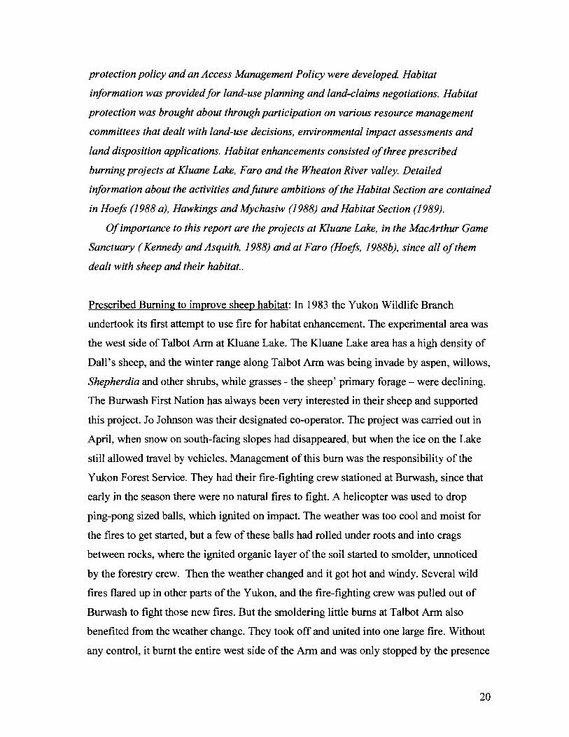
Prescribed burning project at Kluane Lake to enhance habitat of sheep and moose Photo by G. Balmer
Attempt to start a prescribed fire at Talbot Arm on Kluane Lake were not successful. There was lots of smoke, but no flames. The weather was not warm enough .
of Serpenthead Lake and a change in weather. An estimated 10 square miles burnt and
created good habitat for sheep and moose in the following years.
While the fire was effective in obtaining the goal of the project, it was an uncontrolled,
wild fire that did the job and not a prescribed one. This incident negatively affected the
interest of the Forest Service do engage in similar projects for years to come.
Assessing the status of Fannin sheep and their habitat in the McArthur Game Sanctuary
In 1901 William T. Hornaday of the New York Zoological Society collected specimens
in the Yukon and shot a sheep with an interesting colour pattern of its hide. He described
it as a new species of wild sheep and named it Ovisfannini after John Fannin, a
prominent naturalist and first curator of the British Columbia Provincial Museum. This
species designation was later revoked, and these sheep are now considered a colour
variant of the Stone's sheep (Ovis dalli stonei). The British Museum, not to be outdone,
dispatched prominent explorers and hunters F.C. Selous and C. Sheldon to the Yukon.
They were guided by an Englishman, Nevill Armstrong, who had come to the Yukon
already in 1898. All three of these became successful authors (Iris Warner, 1977
manuscript) and their books provide interesting infonnation about wildlife in the early
part of the last century.
H. Bostock had come to the Yukon in 1931 with the Geological Survey of Canada and as
resident mining engineer. He carried out geological mapping in and around the McArthur
Range for a number of years. Besides being a well-known geologist, Bostock was also a
keen naturalist. At the time, A. Jeckel was Commissioner of the Yukon, and Bostock
advised him about a number of areas which should be protected from encroachment by
roads, as well as mining, trapping and hunting. The McAthur Range was on top of his
priority list. Ongoing strong lobbying by Bostock persuaded Commissioner J. Gippen
and the Yukon Territorial Council to pass an amendment of the Yukon Game Ordinance
on July 2311948 to establish the McArthur and the Kluane Game Sanctuaries. J. J.
McArthur was Dominion Land Surveyor of the Topographical Survey, Department of
Interior, at the time (Iris Warner, 1977 manuscript). Bostock was particularly interested
in the Fannin sheep, which he considered unique in the Yukon, limited in distribution to
21
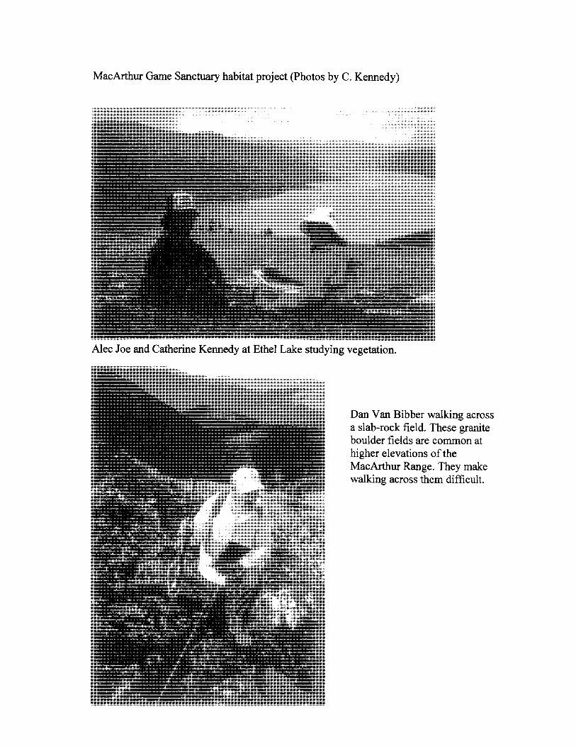
MacArthur Game Sanctuary habitat project (Photos by C. Kennedy)
Alec Joe and Catherine Kennedy at Ethel Lake studying vegetation.
Dan VanBibber walking across a slab-rock field. These granite boulder fields are common at higher elevations of the MacArthur Range. They make walking across them difficult.
the McArthur Group and surrounding mountain ranges. However, there were other
features as well, that justified the protection of this interesting area. It has a hotspring
with a very high water temperature. The southern part of the McArthur Group was
glaciated, the northern part was not. Two high peaks, Grey Hunter Peak (7285 ft.) and
Black Ram Peak (8950 ft.), tower over the surrounding much lower landscape and
intercept moisture-laden clouds drifting in from the south. As a consequence, south and
west-facing slopes receive much higher precipitation than those facing north and east.
This diversity in geology, glaciology, altitude and weather has created a significant
diversity in vegetation communities and plant species.
Little attention was paid to the McArthur Game Sanctuary for the next twenty years, but
interest rose again in the late 60's and early 70's, the time of the International Biological
Program (I.B.P.). Part of its goal was the identification and protection of significant
biological communities. To collect relevant information, the Yukon was assigned to
University of Calgary professors V. Geist (Zoologist) and R. Ogilvie (Botanist). They
inspected a number of areas in the Yukon and assessed their potential as future ecological
preserves, among them the McArthur Sanctuary.
Their report (Geist and Ogilvie, 1972) makes interesting reading and reminds one of the
reports or early explorers, who looked at the entire range of ecological components
during their expeditions. Geist and Ogilvie described the local geology, physiography,
glaciology, soils, weather factors, plant communities and species diversity of vascular
plants, mosses and lichens, mammals and birds as well as the micro organisms of ponds.
They provided detailed floristic compositions of 27 vegetation types and listed 11 species
as endemic and possibly threatened.
Of interest in this report is Geist's assessment of the Fannin sheep status. Geist writes:
" The present ecological survey has indicated that, despite the protection granted by law,
mountain sheep have suffered severely in the past forty yeas, probably due to
uncontrolled prospecting, and the population is reduced to a mere fragment of its former
self.· Human activity has become noticeable in the Sanctuary, particularly in the vicinity
of the hotspring and the mineralized portions of the range."
Based on their ground surveys and a couple of fixed-wing over-flights, Geist estimated
the population size to be 60 to 65 sheep. He claims that the population during 1939 to
22
1943 was three times as high, based on counts done by Bostock and interviews conducted
by Bostock with old-timers, such as trappers and prospectors. The Most recent population
estimate of about 65 sheep is found in the Management Plan (DDHA W GHRO Habitat
Protection Area Management Plan, 2007). Therefore, the herd size has been stable over
the years, which puts into question Geist and Ogilvie'S (1972) assumption that some 200
sheep occupied this range in the past.
In 1987 the Yukon Wildlife Branch's habitat section engaged in a very detailed
investigation of the extent and vegetative composition of various habitat types in the
Sanctuary and of their use by wildlife. The reasons for this initiative were the following:
Geist and Ogilvie (1972) had recommended that an ecological preserve be established
there to protect its many unique features. This proposal was echoed by the Selkirk and
Na-Cho Nyak Dun First Nations, who at the time were involved in land claims
negotiations. While the federal government had control over land, the Yukon
Government had established a Habitat Section in its Wildlife Branch. Here was an
opportunity to do Yukon's first habitat mapping project on a larger scale. Lastly, it was
the first attempt of the Yukon Wildlife Branch to engage in a cooperative study with the
two affected First Nations, who had used the area for centuries and could contribute
valuable local knowledge to this undertaking. During the three-months field work in the
summer of 1987, seven members from the Selkirk and Na-Cho Nyak Dun First Nations
participated. Their input consisted of identifying game trails, participating in game
surveys and habitat work and most importantly, identifying animal signs (tracks, feces,
feathers) in the various vegetation communities surveyed to determine their relative use
by game species.
The study team classified 26 vegetation association in the Sanctuary as well as adjacent
areas up to Ethel Lake and produced a habitat/vegetation map at a scale of 1: 1 00 000
(Kennedy and Asquith, 1988). Even though animal observations were not frequent during
the field work, it is of interest to note that 24 habitat types showed signs of moose, 23 of
caribou and 10 of sheep. Sheep preferred Dryas/GrasslLichen communities, caribou
Cotton Grass/Sedge meadows and HeatherlForb communities, while moose spent most of
their time in Fir/ Feathermoss and Willow/Sedge habitats. Besides this habitat work,
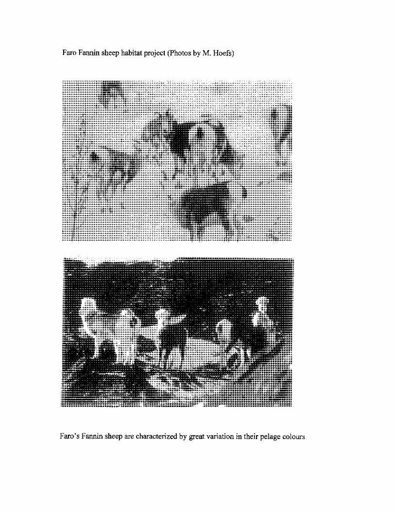
23
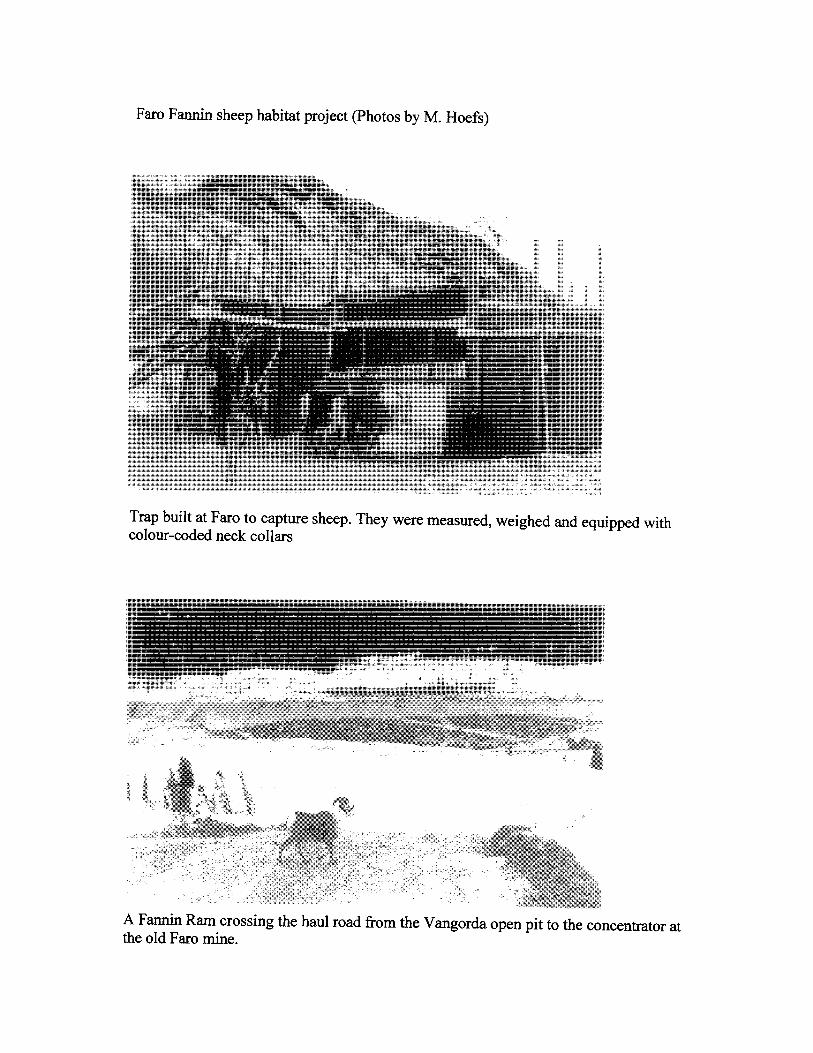
Faro Fannin sheep habitat project (Photos by M. Hoefs)
Trap built at Faro to capture sheep. They were measured, weighed and equipped with colour-coded neck collars
A Fannin Ram crossing the haul road from the Vangorda open pit to the concentrator at the old Faro mine.
Faro Fannin sheep habitat project (photos by M. Hoefs)
Faro's Fannin sheep are characterized by great variation in their pelage colours
cutter out of this sheep wintering area to a less sensitive location up the Pelly River,
diverting the road along the base of "Sheep Mountain" farther downhill into the valley,
cutting artificial migration trails around the developing area, establishing wildlife
viewing spots and trails and doing some prescribed burning to prevent the winter range
from shrinking because of encroachment by aspen and willows (Hoefs, 1988).
For the most the various mitigative steps have been successful. The sheep population size
has remained stable. The sheep continue to undertake their seasonal migrations across the
Vangorda Plateau and the possibility of watching relatively tame sheep from close range
has put Faro on the maps of wildlife viewers and photographers from within the Yukon
as well as from outside.
Wildlife Research in the Yukon
The Yukon Wildlife Branch is a management agency and research has not been a priority
objective for it when it came to funding and man-power commitments. In fact, some
administrations felt that research was not necessary at all, and in contrast to other
wildlife management agencies, Yukon Government never established a research unit in
its Wildlife Branch. It follows, that research was for the most the result of cooperative
projects with other agencies, who either provided funding because the proposed research
was of interest or necessity to them or they were university researchers with their
graduate students, who provided expertise and helped to address wildlife issues. During
my tenure with the Yukon Wildlife Branch I have been involved in joint studies with
universities (B.C., Calgary, Utah, and Giessen), mining companies such as Currah
Resources at Faro, Foothills Pipelines, other YTG Branches such as Highways and
Public Works and Agriculture, federal agencies such a DlAND and Parks Canada, the
Foundationfor North American Wild Sheep, Wildlife Habitat Canada and the Yukon
Game Farm.
In the context of this report, it is not possible to described all the cooperative projects
carried out, but a summary of the more interesting sheep-related projects will be given..
"Research" is defined here as investigations that follow standard scientific procedures in
planning, execution, data analyses and reporting, with the results published in peer
reviewed scientific journals. "
25
Kluane National Park.: The writer worked in the area from 1968 to 1971 with the
University of British Columbia, which at that time was still a Game Sanctuary, and
subsequently had a contract with the Canadian Wildlife Service to do a large mammal
inventory in this newly established National Park Reserve in 1972 (Hoefs, 1973).
Coopemtion with the Parks Service continued after joining the Yukon Game Branch late
in 1972. Ongoing monitoring included annual survey flights supplemented with surveys
from the ground to establish population size and composition of the Sheep Mountain herd
and annual measuring of the skulls of winter-killed sheep. A data set spanning a period of
nearly four decades is very valuable. It allows insight into the magnitude of variation of
lamb production and their survival to yearling age; it allows correlations to be done
between a range of climatic variables with sheep performance and between predator
caused lamb mortalities and the hare cycle. Early green-ups enhanced survival of lambs
as well as adults and produce more hom growth, late green-ups did the opposite.
During this long-term monitoring, lamb crops varied between a low of 11 lambs in 1982
to a high of 88 lambs in 1988. Population declines, when more than 20% to 30 % of the
herd did not make it over winter were observed in two years: 1983 and 2007.
An analyses of population dynamics is provided in Hoefs and Bayer (1983), and of the
relevance of population dynamics and hom growth to management in Hoefs (1984).
Predation of sheep by wolves is documented in Hoefs et al (1986), of eagles by Nette et
al (1984), Detailed evaluations of cause and effects of winter mortalities are provided in
BurIes and Hoefs (1984) and Buries, Hoefs and Barichello (1984).
Estimates of range forage composition and net primary productivity for a 10-year period
were documented for the semi-arid grasslands of Sheep Mountain, which at the time
supported a winter population of about 200 sheep. Estimates varied among plots
depending on altitude and aspect, as well as among years according to rainfall during the
growing season. Extremes were 29.1 g / square meter and 120 g / square meter. Over the
10-year assessment period the vegetation composition did not change nor was there a
grazing-related reduction in productivity. Winter range use by sheep was within the
carrying capacity of the range. A 40% utilization rate of the winter range could evidently
be sustained, which translates into a stocking rate of about 1.9 sheep-monthlha. A
26
significant correlation was demonstrated between forage production of the winter range,
lamb survival the following winter and lamb production the following spring (Hoefs,
1984).
In a more recent study, German geneticist J. Ludwig used Sheep Mountain and Ruby
Range ram and female hom growth data to determine to what extent variation in hom
growth is under genetic control and to what extent it is determined by environmental
variables (Ludwig and Hoefs, 1995). We know from that study that hom growth is a
heritable trait, with length largely influenced by environmental parameters such range
quality, time of green-up and length of growing season, while hom mass (circumference)
is largely under genetic control.
The Yukon Game Farm: In the early Seventies Danny Nowlan and his wife Erika
established the Yukon Game Farm - now referred to as the Yukon Wildlife Preserve. At
the time, government was supportive of this initiative, and Government staff helped with
the capture of breeding stock, such as sheep, goats and caribou, as well as carrying out
predator control around the Farm to protect the captive wildlife. While the Farm has
become a destination for tourists, Yukon schools, photographers and film-makers, of
particular benefit to government was its use as a nursery of orphaned wildlife as well as a
rehabilitation facility for injured birds and mammals. Perhaps the greatest contribution to
wildlife conservation in Canada was the support the Farm provided in the recovery of the
Peregrine Falcon. This falcon was practically extinct in Yukon and many other areas of
Canada, but under the leadership of Yukon Ornithologist Dave Mossop, a complete
recovery to historic levels was achieved. The Yukon's successful program was a major
factor in the removal of this bird from the Canadian list of endangered species.
Often overlooked was and is the potential of this Wildlife Center for research.
Over the years, studies were done by scientists such as B. Stonehouse, M. Hoefs, B.
Horejsi and J. Weir, for the most on Dall's sheep. Already in 1971, only one year after
Dall's sheep were first kept at the farm a detailed study was done on their feeding
behaviour (Hoefs, 1971). At the time the vegetation in the sheep enclosure resembled
very closely that of the winter range at Sheep Mountain. These captive sheep were
imprinted on man and could be observed at very close range of only a few feet. It was
27
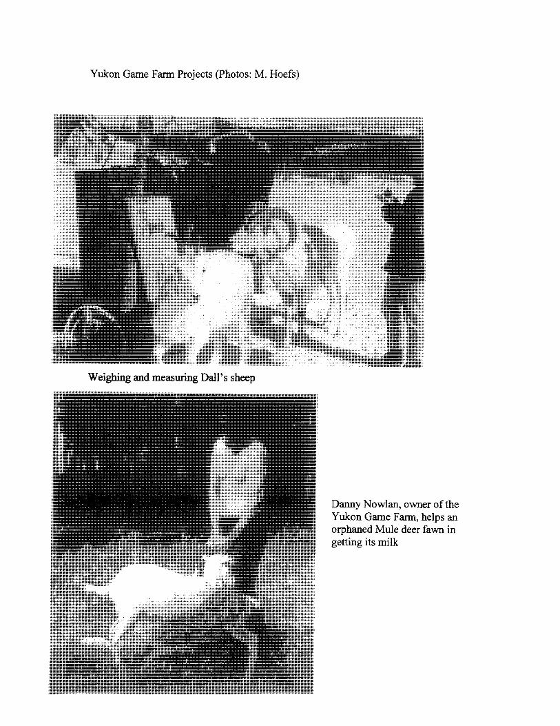
Yukon Game Farm Projects (Photos: M. Hoefs)
Weighing and measuring Dall's sheep
Danny Nowlan, owner of the Yukon Game Fann, helps an orphaned Mule deer fawn in getting its milk
possible to identify the species of plants they ate and the number of bites they took over a
given time and how much time per day was spent with feeding. These observations were
done twice a month over one year. Each observation day lasted from dawn to dust.
More recent examples of sheep-related publications reflecting research at the farm
are Hoefs and Nowlan (1993), dealing with the minimum breeding age of Dall's sheep
females; Hoefs and Nowlan (1994) with the influence of nutrition on the sex ratio of
new-borns; Hoefs and Nowlan (1997a) with the hybridization of Dall's and Bighorn
sheep and Hoefs and Nowlan (1997b) with a comparison of hom growth of wild and
captive Dall's sheep.
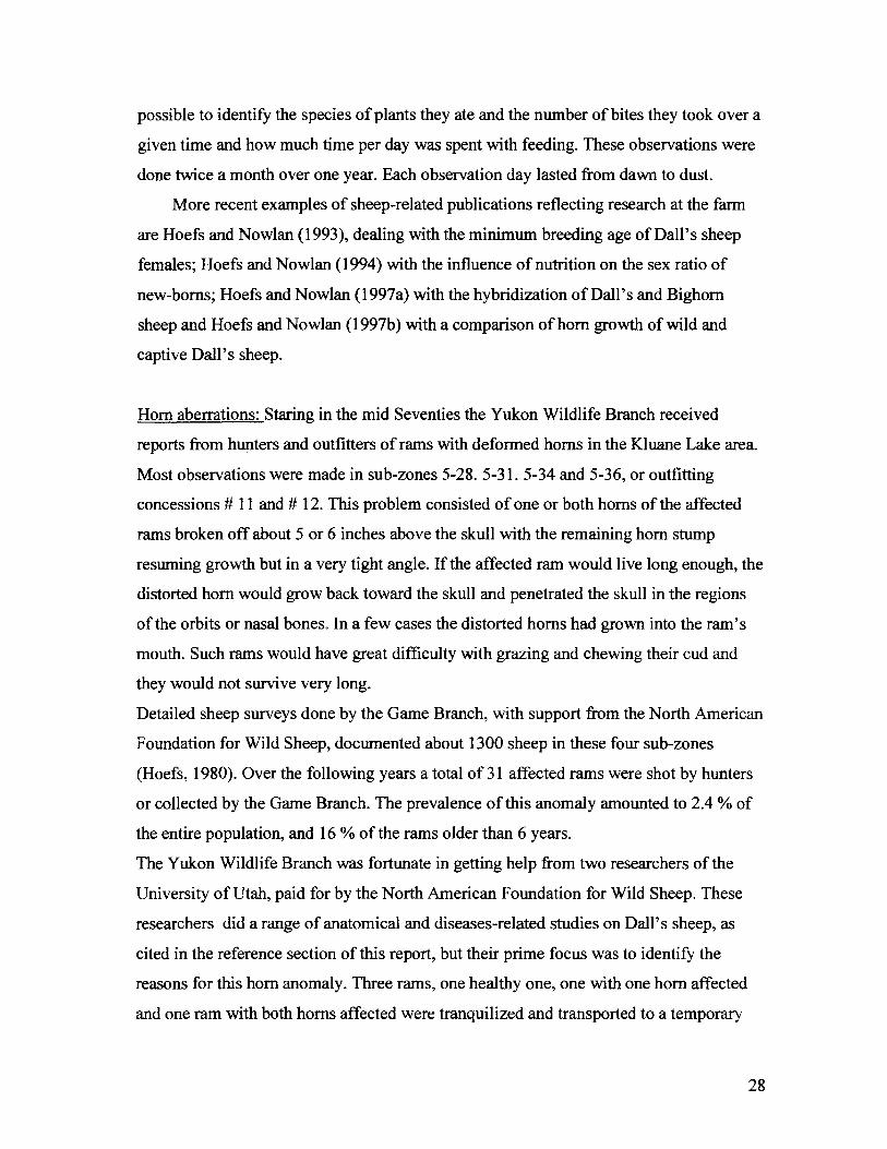
Hom aberrations: Staring in the mid Seventies the Yukon Wildlife Branch received
reports from hunters and outfitters of rams with deformed horns in the Kluane Lake area.
Most observations were made in sub-zones 5-28. 5-31. 5-34 and 5-36, or outfitting
concessions # 11 and # 12. This problem consisted of one or both horns of the affected
rams broken off about 5 or 6 inches above the skull with the remaining hom stump
resuming growth but in a very tight angle. If the affected ram would live long enough, the
distorted hom would grow back toward the skull and penetrated the skull in the regions
of the orbits or nasal bones. In a few cases the distorted horns had grown into the ram's
mouth. Such rams would have great difficulty with grazing and chewing their cud and
they would not survive very long.
Detailed sheep surveys done by the Game Branch, with support from the North American
Foundation for Wild Sheep, documented about 1300 sheep in these four sub-zones
(Hoefs, 1980). Over the following years a total of 31 affected rams were shot by hunters
or collected by the Game Branch. The prevalence of this anomaly amounted to 2.4 % of
the entire popUlation, and 16 % of the rams older than 6 years.
The Yukon Wildlife Branch was fortunate in getting help from two researchers of the
University of Utah, paid for by the North American Foundation for Wild Sheep. These
researchers did a range of anatomical and diseases-related studies on Dall's sheep, as
cited in the reference section of this report, but their prime focus was to identify the
reasons for this hom anomaly. Three rams, one healthy one, one with one hom affected
and one ram with both horns affected were tranquilized and transported to a temporary
28
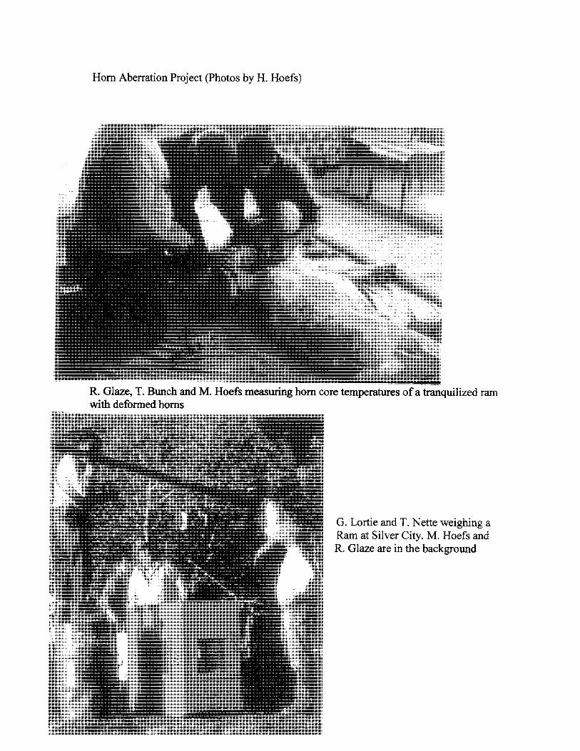
Horn Aberration Project (Photos by H. Hoefs)
R. Glaze, T. Bunch and M. Hoefs measuring horn core temperatures of a tranquilized ram with deformed horns
G. Lortie and T. Nette weighing a Ram at Silver City. M. Hoefs and R. Glaze are in the background
Hom Aberration Project (photos by M. Hoefs)
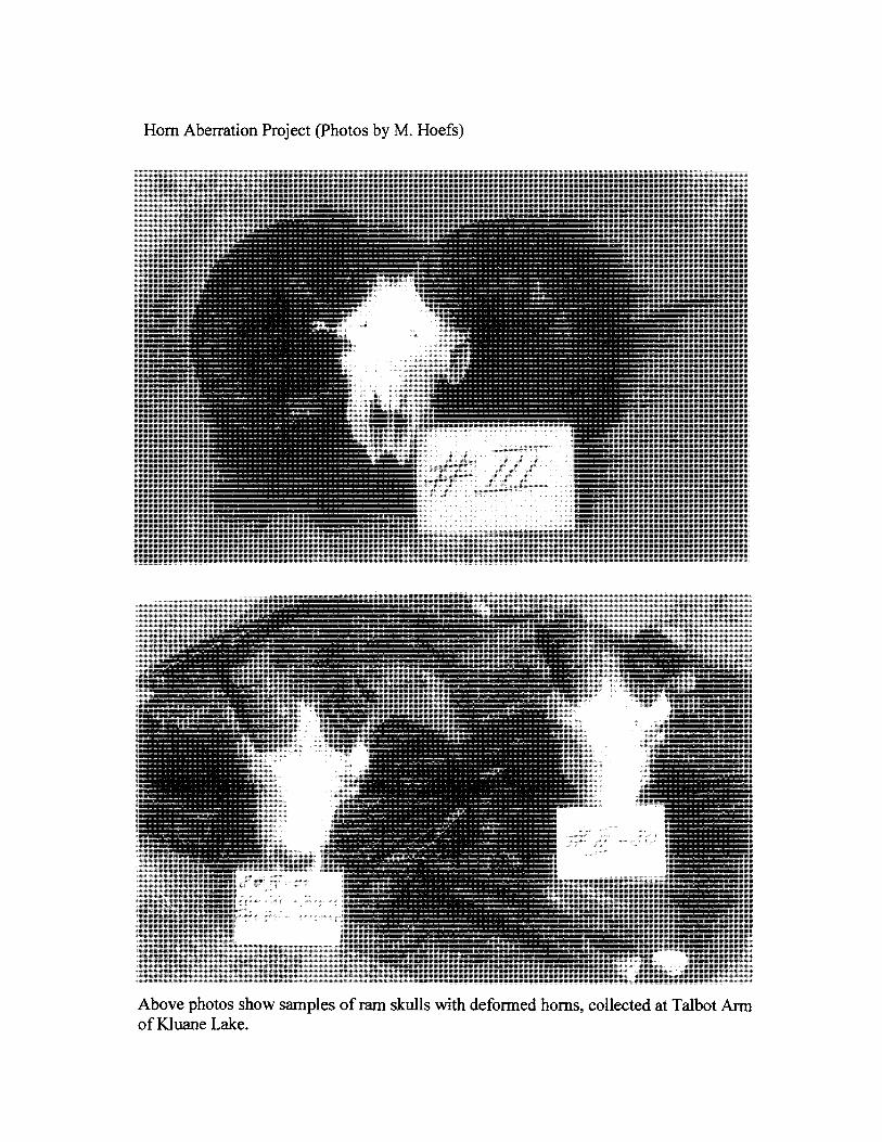
Above photos show samples of ram skulls with deformed horns, collected at Talbot Ann of Kluane Lake.
laboratory at Silver City. A range of anatomical and physiological tests and
measurements were carried out on these sheep. The investigators assumed that very cold
temperatures may reduce blood flow into the membrane covering the hom core, and
thereby affect hom growth or even prevent it. The horns of the three test sheep were
therefore artificially exposed to very cold temperatures. Liquid nitrogen was used for this
experiment. It can potentially be as cold as -80 degrees, but more likely, the sheep were
exposed to -60 to -70 degrees, because of the primitive laboratory conditions. The normal
body temperature of a sheep is around 37 degrees Celsius. After a 30 minute exposure to
the cold temperature the hom core temperature of the healthy ram had declined by only 2
degrees, that of the ram with two affected horns by about 7 degrees and that of the ram
with one affected hom by 17 degrees. The investigators assumed that this problem is a
result of a genetic defect, since it is known that hom growth is a heritable trait (Glaze et
al, 1982: Hoefs et al, 1982; Bunch et al, 1984). This assumption is supported by the fact
that the increase in number of affected rams in the late seventies and early eighties was
accompanied by a parallel increase in hunting pressure. As more and more healthy rams
were removed from the population, rams with defected horns passed on their genetic
make-up to future generations more or less unimpeded, since hunters avoided shooting
them. Measurements of the horns which became available through this study revealed
that not only did the affected horns show significantly slower growth, but also the healthy
hom of a one-sided affected ram showed retarded growth (Hoefs 1980).
Lumpy Jaw: "Lumpy Jaw" - the common name of a mandibular disease brought about by
several bacteria - is a wide-spread problem in several ungulate species, but is most
prevalent in wild sheep. A. Murie (1944) was the first biologist to bring this disease to
the attention of the scientific community. After major sheep die-offs in Denali National
Park in the late 30's and early 40's, he inspected the skulls of 829 sheep, 25.7% were
affected by lumpy jaw. Other subsequent studies showed a similar high prevalence.
Sheep in the Desert Game Range in Nevada had an infection rate of 18.5%, based on a
sample size of309 sheep (Alred and Bradley, 1965). Hoefs collected 82 jaws of winter
killed sheep in Kluane National Park in the early 70's; 69% had lumpy jaw (Hoefs and
Bunch, 2001). Barichello et al. (1989) inspected 831 jaws of hunter-killed rams over a 5-
29
"Lumpy Jaw" project (Photos by M. Hoefs)
Samples of infected jaws, ranging from recently infected (top), over severely infected (center) to the healed jaw of an old ewe" kept at the Yukon Game Farm.
year period and reported an average prevalence of 37%. A follow-up, global assessment
of this problem looking at all species of wild sheep, was a co-operative effort with the
University of Utah (Hoefs and Bunch, 2001).
It is assumed that sheep contract this disease by consuming very rough forage with awns
and spines. Forage gets compacted between adjacent molariform teeth and eventually the
gums are punctured. The bacteria enter the soft tissue and cause infections. The disease
causes a swelling of the mandible, accompanied by significant bone loss. The jaw takes
on a spongy, perforated appearance. Bone around the roots of mandibular teeth is eroded
and the teeth become loose, often changing their alignment and no longer meeting their
opposing teeth in the maxilla. Teeth eventually fall out, severely affecting the animal's
ability to chew its cud.
Initially it was assumed that the causative agent was Actinomyces bovis, but in North
American sheep the bacteria Actinomyces isreali, Arcanobacterium pyogenes and to a
lesser degree Fusobacterium necrophorum were isolated ( Cowan, 1951; Neiland, 1972).
Relevant to management are the following references: Murie (1944) documented that
affected sheep had a lower life expectancy than healthy ones, and Hoefs and Bunch
(2001) provided evidence that sheep may contract this disease already at a young age,
that ewes are more susceptible to it, and that affected rams had impaired hom growth
compared to healthy ones.
The disease is not contagious and there is some indication that high-density populations
have a higher prevalence.
Wildlife Transplants and Re-Introductions;
The first game transplants of elk and bison into the Yukon were made in the early Fifties
at the request of the Yukon Fish and Game Association. When approached, the
Commissioner insisted on a foasibility study to be done first, before a transplant would
go ahead The Canadian Wildlife Service sent biologist Dewey Soper to the Yukon to
undertake this study. Travelling by pack-train, Soper and guides covered an area
bounded by the Alaska Highway in the south, Aishihik road and Lake in the west and
Lake Laberge in the east.
30
Soper (1950) supported the transplants of both Plains bison and elk, since the area
surveyed provided suitable habitats. In 1951 and 1954 a total of 49 elk were brought in
from Elk Island National Park and released near Braeburn. Six plains bison were
obtained from Alaska's Delta herd and also released near Braeburn. Starting in 1986
wood bison were re-introduced to the Yukon as a contribution to Canada's Wood bison
recovery program to save this endangered species from extinction. All these bison had
their origin at Elk Island National Park. In the late 80 's the Yukon Wildlife Branch
started to import additional elkfrom Elk Island National Park to augment the stagnant
Yukon herd Over the years there were a number of releases of pheasants, for the most by
private individuals. To help with the establishment of the Yukon Game Farm, wild sheep,
goats and caribou were captured in the early Seventies and taken to the Farm. Relevant
to this report was the re-introduction of goats to White Mountain.
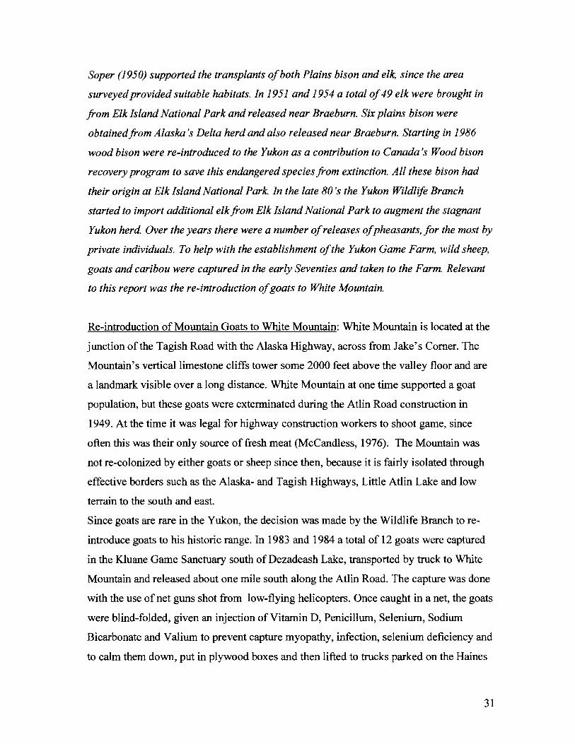
Re-introduction of Mountain Goats to White Mountain: White Mountain is located at the
junction of the Tagish Road with the Alaska Highway, across from Jake's Comer. The
Mountain's vertical limestone cliffs tower some 2000 feet above the valley floor and are
a landmark visible over a long distance. White Mountain at one time supported a goat
population, but these goats were exterminated during the Atlin Road construction in
1949. At the time it was legal for highway construction workers to shoot game, since
often this was their only source of fresh meat (McCandless, 1976). The Mountain was
not re-colonized by either goats or sheep since then, because it is fairly isolated through
effective borders such as the Alaska- and Tagish Highways, Little Atlin Lake and low
terrain to the south and east.
Since goats are rare in the Yukon, the decision was made by the Wildlife Branch to re
introduce goats to his historic range. In 1983 and 1984 a total of 12 goats were captured
in the Kluane Game Sanctuary south of Dezadeash Lake, transported by truck to White
Mountain and released about one mile south along the Atlin Road. The capture was done
with the use of net guns shot from low-flying helicopters. Once caught in a net, the goats
were blind-folded, given an injection of Vitamin D, Penicillum, Selenium, Sodium
Bicarbonate and Valium to prevent capture myopathy, infection, selenium deficiency and
to calm them down, put in plywood boxes and then lifted to trucks parked on the Haines
31
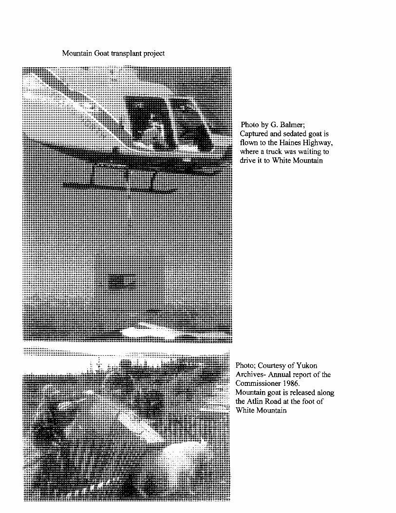
Mountain Goat transplant project
Photo by G. Balmer; Captured and sedated goat is flown to the Haines Highway, where a truck was waiting to drive it to White Mountain
Photo; Courtesy of Yukon Archives- Annual report of the Commissioner 1986. Mountain goat is released along the Atlin Road at the foot of White Mountain
Highway. The goats were then transported some 400 Ian to their release site. The
operation was marred by a helicopter crash, but fortunately neither the pilot nor the
passenger were injured, while the machine burnt up. All but two goats survived this
ordeal and settled down on White Mountain. In 1985 two additional billy goats were
obtained from the Yukon Game Fann and also released on White Mountain to
supplement this fledging population. The project was successful and the new herd is
currently estimated at about 20 head (Carey and Barichello, 1986, and Barichello,
personal communication).
This event was noteworthy, since it marked the first time that a transplant and re
introduction ofa native large mammal was carried within the Yukon.
Summary:
The Seventies and Eighties were years when considerable progress was achieved with
sheep and goat management in the Yukon. Much became known about the numbers and
distribution of these ungulates and their habitat requirements. A number of regulations
were implemented to assure that they are managed in a sustainable manner. Yukon was
the first jurisdiction to measure all sheep trophies taken by hunters as well as to plug
horns with metal tags for permanent identification. The records of hom data of rams now
spanning a time frame of over thirty years, allow a great range of analyses to be done and
trends to be documented. This storehouse of information is the envy of many other
wildlife management agencies and research institutions.
References cited:
Acres Consulting Services Ltd. (1979): The Management of Grizzly Bears in the Yukon
Territory. Acres Consulting Services. 37 pp.
Barichello, N., J. Carey, M. Hoefs and H. Hoefs. (1989): Lumpy jaw in thin-horn sheep
in the Yukon. Yukon Department of Renewable Resources, Whitehorse, Yukon, 20 pp.
32
Barichello, N., Jean Carey, and M. Hoefs. (1989). Mountain sheep status and harvest in
the Yukon: A summary of distribution, abundance, and the registered harvest by game
management zones. Yukon Renewable Resources. 80 pp.
Bunch, T., M. Hoefs, R. Glaze, and H. Ellsworth. (1984): Further studies on Hom
aberrations in Dall's sheep (Ovis dally dalli) from Yukon Territory, Canada. Journal of
Wildlife Diseases 20(2):125-133.
BurIes, D. and M. Hoefs. (1984a). Winter mortality ofDall sheep, Ovis dalli dalli, in
Kluane National Park. Can Field Nat. 98:479-484.
BurIes, D., M. Hoefs and N. Barichello. (1984b). The influence of winter severity on Dall
sheep productivity in south-western Yukon. Pp.67-84, IN Northern Wild Sheep and Goat
Counci14th Biennial Symposium.
Carey, J. and N. Barichello. (1986): Relocation of Mountain Goats to Mt. White, Yukon.
1983-1984. Yukon Renewable Resources. 21 pp.
Clarke, C. H. D. (1943). Biological Reconnaissance of the Alaska Highway. Ms. in the
collection of the Canadian Wildlife Service.
Cowan, I. M. (1951): The diseases and parasites of big game mammals in western
Canada. Proceedings of the annual Game Convention 5:37-54.
DDHA W GHRO Habitat Protection Area Steering Committee (2007). Ddhaw Ghro
Habitat protection Area Management Plan. Government of Yukon. 60 pp.
Foothills Pipe Lines (Yukon) Ltd. (1979 a): Benefits of the Dempster Highway Pipeline.
Foothills Dempster Newsletter: 79/09. 5 pp.
33
Foothills Pipe Lines (Yukon) Ltd.(1979 b): The Dempster Lateral Pipeline Project. Vol.
4: Environmental Impact Statement, application for certificates of public convenience
and necessity. Calgary, Alberta. 631 pp.
Geist, V. and R. T. Ogilvie. (1972). Report on the McArthur Range, Yukon. International
Ecological Reserves program. CT Site 20, Panel 10. 86 pp. University of Calgary.
Geist, V. (1975 a). Harassment oflarge mammals and birds - a critique of the research
submitted by Arctic Gas Studies Ltd. on this subject. Report to the Berger Commission.
Mackenzie Valley pipeline inquiry. Exhibit # 359.62 pp.
Geist, V. (1975 b). Testimony to the Mackenzie Valley pipeline inquiry, Whitehorse,
Aug. 1311975. Vol. 54 pp. 7397-7447.
Glaze, R., M. Hoefs and T. Bunch (1982). Aberrations of the Tooth Arcade and Mandible
in Dall's sheep from south-western Yukon. Journal of Wildlife Disease 18 (3): 305-310.
Hawkings, B. and L. Mychasiw. (1988): Identification of Key Habitats in the Yukon.
Paper of file in YTG Habitat Section. 5 pp.
Habitat Section. (1990): Yukon Habitat Management Program - Towards 1995. Report
on file in YTG Habitat Section. 12 pp.
Hoefs, M. (1971): Food Selection by Dall's sheep. IN International Symposium on The
Behaviour of Ungulates and its Relevance to Management. IUCN publication, Pages:
759-786.
Hoefs, M. (1973): Ecological Investigation in Kluane National Park Reserve, Yukon
Territory, Report on File with the Canadian Wildlife Service. 71 pp.
34
Hoefs, M. (1974). Game surveys in south-central Yukon and an evaluation of the present
degree of exploitation. Yukon Game Branch, 30 pp.
Hoefs, M.(1975a). Sheep surveys and evaluations of present harvests in south-western
Yukon. Yukon Game Branch.
Hoefs, M. (1975 b). Estimation of numbers and description of present distribution of wild
sheep in the Yukon Territory. Pages: 17-23, IN The wild sheep in modem North
America. Boone and Crocket Club publication. 302 pp.
Hoefs, M. and G. Lortie. (1975). Wildlife (sheep) inventories in Game Management Zone
5. Yukon Game Branch.
Hoefs, M. and G. Lortie. (1976). Big Game (sheep and goats) inventories in Game
Management Zone 11. Yukon Game Branch.
Hoefs, M., G. Lortie and D. Russell. (1977). Distribution, abundance and management of
Mountain Goats in the Yukon. Pages: 47-53, IN Proceedings of the First International
Mountain Goat Symposium. Province of British Columbia, 243 pp.
Hoefs, M. (1978). An assessment of the status of goats in Game Management 7. Yukon
Game Branch.
Hoefs, M. (1978): DalI's sheep in the Richardson Mountains - distribution, abundance
and management concerns. Yukon Game Branch. 44 pp.
Hoefs, M. (1979): DalI's sheep distribution, abundance and "critical" areas along the
proposed Dempster Lateral Pipeline Route. Foothills Pipe Lines (Yukon) Ltd. Calgary,
Alberta. 42 pp.
35
Hoefs, M. (1980): Hom Defonnities in Dall's Rams. Biennial Symposium of the
Northern Wild Sheep and Goat Council 2: 270-286.
Hoefs, M. and T. Nette. (1981). Distribution, abundance and harvest of Dall's sheep in
outfitting concession No.1 (West Ogilvie Mountains). Yukon Wildlife Branch.
Hoefs, M., T. Bunch, R. Glaze and H. Ellsworth. (1982): Hom Aberrations in DalI's
sheep (Ovis dalli) from Yukon Territory, Canada. Journal of Wildlife Diseases 18:297-
304.
Hoefs, M. (1984): Population dynamics and hom growth characteristics of Dall's sheep
and their relevance to management. Pages 99 -115, IN Northern Ecology and Resource
Management, University of Alberta Press, Edmonton.
Hoefs, M. (1984): Productivity and carrying capacity of a sub-arctic sheep winter rage.
Arctic 37 (2): 141-147.
Hoefs, M., H. Hoefs and D. BurIes (1986): Observations on DalI's sheep - Grey Wolf
interactions in the Kluane Lake area, Yukon. Canadian Field Naturalist 100:78-84.
Hoefs, M. (1988a). Management Plan for Sheep Mountain near Faro and its Fanning
sheep population. Yukon Renewable Resources. 39 pp.
Hoefs, M. (1988b): A general Overview of Wildlife Habitat Programs in Yukon. Paper
on file in YTG Habitat section. 14 pp.
Hoefs, M and U. Nowlan (1993). Minimum breeding age of Dall's sheep ewes. Can.
Field-Naturalist 107(2):241-243.
Hoefs, M. and U. Nowlan. (1994): Distorted sex ratios in young ungulates: the role of
nutrition. J. Mammal. 75(3):331-336.
36
Hoefs, M. and U. Nowlan. (1997a): Comparison of horn growth in captive and free
ranging Dall's rams. J. Wildlife Management. 61(4): 1154-1160.
Hoefs, M. and U. Nowlan. (1997b): Hybridization ofThinhorn and Bighorn sheep. Can.
Field-Naturalist. 111(4): 647-648.
Hoefs, M. and T. Bunch. (2001). Lwnpy jaw in wild sheep and its evolutionary
implications. Journal of Wildlife Diseases 37 (1): 39-48.
Kennedy, C. E. and K. Asquith. (1988). Vegetation and habitat survey- Mc Arthur
MountainslEthel Lake study area. Yukon Fish and Wildlife Branch. 127 pages.
Larsen, D. G. (1978): Wildlife (sheep) Inventories in G.M.Z. 2 (Yukon Territory) with an
evaluations of Dall's sheep populations and harvests. Yukon Game Branch. 35 pp.
Lortie, G.M. (1978): The Quota - A new management system for Yukon Grizzly bear.
Yukon Wildlife Branch, 14 pp.
Ludwig, J. and M. Hoefs (1995): Eine populationsgenetische Studie an Dallschafen (Ovis
dalli dalli) im siidwestlichen Yukongebiet Kanadas. Zeitschrift fUr Jagdwissenscha:ft:
41 :256-266.
Macleod, W.G. (1978). The Dempster Highway. CARC Research Monograph No.1.
Yukon Series. Ottawa, 58 pp.
Murie, A. (1944): The Wolves of Mount McKinley. Fauna of the National Parks of the
United States. Fauna Series # 5. 238 pp.
Murie, O. (1935). Alaska-Yukon caribou. United States Bureau of Biological Surveys.
North American Fauna. # 54. 93 pp.
37
Mychasiw, L. and M. Hoefs (1988). Access-related impacts of Backcountry Roads to
Wildlife and Management Approaches to mitigate them. Yukon Renewable Resources.
43 pp.
Nette, T., D. BurIes and M. Hoefs (1984): Observation of Golden Eagle predation on
Dall'sheep. Canadian Field Naturalist 98: 252-254.
Neiland, K. A. (1972): Sheep disease studies. Alaska Department ofFish and Game,
Juneau, Alaska. Projetc W-17-3, 32 pp.
Nolan, J. W., and J. P, Kelsall (1977): Dall sheep and their Habitat in relation to Pipeline
proposals in North-western Canada. Canadian Wildlife Service (Mackenzie Valley
Pipeline investigation). 64 pp.
Lortie, G., M. Hoefs, T. Wagner, W. Klassen and M. Mychasiw. (1978). Wildlife
inventories (sheep and goats) in Game Management Zones 8 and 10, with an evaluation
of the present level of sheep harvest. Yukon Wildlife Branch.
O'Connor, J. (1951). The Big Ram of Pilot Mountain. Outdoor Life. 4 pp.
O'Connor, J. (1974). Sheep and Sheep Hunting. Winchester Press, New York. 308 pp.
Osgood, W. H. (1909). Biological investigation in Alaska and Yukon Territory. I. East
central Alaska. II. The Ogilvie Range, Yukon. III. The Macmillan River, Yukon. United
States Dept. of Interior. Fauna Series No. 30.
Pearson, A. M. (1967). Annual File report. Project M5-1-1. Elk survey in Yukon
Territory. Canadian Wildlife Service 10 pp.
38
Rand, A. L. (1945). Mammal investigations on the Canol Road, Yukon and Northwest
Territories. National Museum of Canada Bulletin 99.
Rand, A. L. (1946). List of birds and those of the Canol Road. National Museum of
Canada. Bulletin No, 105. 76 pp.
Russell, Sharon, M. Hoefs and Janet McDonald (1979); Mount Cronin Dall's Sheep
Report. Yukon Game Branch. 95 pp.
Schultz International Ltd. (1972). Environmental Impact Study of the Dempster
Highway. Prepared for Dept. Pub. Works, Canada. Vancouver. 68 pp.
Sheldon, C. (1911). The Wilderness of the upper Yukon. Charles Scribner's Sons., New
York. 364 pp.
Soper, D. (1950): Proposed introduction of American Elk and Plains bison to Yukon
Territory, Canada. Canadian Wildlife Service. 56 pp.
Stewart, Donna (1981): A Plan for Managing Dall's Sheep along the Dempster Highway,
Yukon Territory. Master of Science Thesis, University of Calgary, Alberta, 172 pp.
Warner, Iris (1977, unpublished manuscript): Tiny McArthur - the park no one knows.
Youngman, P. M. (1975). Mammals ofthe Yukon. National Museum of Canada.
Publication in Zoology No. 10. 192 pp.
Personal Communications:
Dan Drummond (retired Conservation Officer).
Len Mychasiw (retired Conservation Officer and Habitat Protection Biologist).
Ken Kiemele (retired YTG Land-use Officer)
39
Tom Grantham (Trapper, hunter, guide, former president of the Yukon Trappers
Association - now living in B. C.)
Ross Eccles (Biologist with Foothills Pipeline Ltd., working in the Yukon in the late
70's and early 80's)
John Jennings (D.I.A.N.D. Field Officer stationed in Haines Junction in 1989/90)
Fred Last (former outfitter, who regularly hunted in the Miners Range since the
Seventies)
Norm Barrichello (former YTG Sheep and Goat Biologist, now an independent
consultant)
Ralph Hotte (Son of the late Vic Hotte, former outfitter in Concession No. 13)
Gordon Hartman ( YTG Director of Wildlife from 1977 to 1979)
Beth Hawkings ( YTG Dept. of Environment)
Catherine Kennedy (YTG Dept. of Environment)
Dan Nowlan (former outfitter and owner of the Yukon Game Farm)
Rod Hardie (Holder of outfitting concession # 13 from 1979 to 1997)
George Balmer (retired Conservation Officer)
Unpublished information sources:
File # 2120-30-21, Field Service's collection
File # 2120-30-18, Field Services Collection
File # 2120-30-13, Field Services Collection
Yukon Archives: YTG Annual Report by the Commissioner for the year 1986
40