Embed Size (px)
Citation preview
ArcGIS 9.2
GIS Helping Manage Our WorldBy Jack Dangormond
Jack's Vision Articleto come
continned Ol/ pogei
Hurricane RecoveryESRlls actively assisting organizations, gavernment agencies, and oHicial disaster relief el·forts that need help in responding to Hurricane Katrina. See www.esri.comlnevvslpress·roomlhurricanemaps.html and the Winter 2005-2006 issue ol ArcNews for artieles descnb-ing GIS in these applications.
The Nature ConservancyUses GIS to Meet 2015 GoalsThe Nature Conservency (TNC) has set an arnbitious goal to work with others to ensure conservationaf places that represent at least 10 percent af cvery major habitat type an earth by 2015. To accomplishthi s, it has developed an approach called Censcrvanen by Design. which involves setting priori tics.dcsigning strategles. taking action. and measuring results at multiple scales. Conservarien by Designcreates vast amcunts 01' information, for which TNC has selected ESRl'sArcGlS Deskrop software tomaintain, analyze, and sbare. Piease "H~(! urticlcs an pages 30·35.
Data Now Available to Oil, Gas Industry Via ESRl Technology
lHS Energy and UNEP-WCMC FormBiodiversity Data Delivery PartnershipTbe International Energy Agency reports that the global demand for oil is clirnbing and estimates theworld uses an average af 81.1 million bcrrels per day, Economic growth and expanding industrializa-tion promise a steady elirub in oil and natutal gas cousumption cround the wcrld. In a quest to meetthis growing demand for oil and narutal gas resources, energy comparties need access to a range afcomprebensive data and information resources to assist with thc ful! range af business developmentplanning and decision-making processes and activities.
continued 011 page 23
Shaping the Change
From Pharaohs to GeoinformaticsBy Prof. Dr.-Ing. Holger Magel, President, FIG
Al the huernational Fed-eration af Surveyors(FlG) ItfJrkin~ Week andthe t"ighlh Global Spa-tial Data Irfrastructure(GSD!) Association COII-
[erence held together inCoiro. Egypt, April 17,
2005, F/G presiacnt Pmf Dr.-Ing. Holger Magelreficcted on the historv ofsurveving and the criti-
cal nature o/ spattot information in his openingspeech. ilte fotlmving has been euracted from hisspeech.
Ladies and Gentlemen-vwelcome to an extraor-dinary event in an extraordinary country in anextraordinary city.
Egypt as our host country is an ideal and srimu-lating place for our Working week 2005 and the
continned an page 2
Changing How Imagery Is Managed, Processed, and Distributed
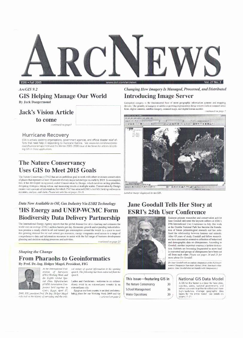
Introducing Image ServerGeospanal imagery is the fundamental base af most geographic information systems and mappingdevices. The quantity af imagery available is growing exponenrially from sources such as seanned aerialfilms, digital cameras, sarellire lmagery, seanned maps, and digital terrain modeis.
continned on page 7
Landsar image displayed in ArcGlS.
Jane Goodall Tells Her Story atESRl's 25th User Conference
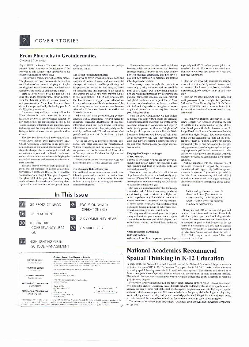
Eminent primate researcher and conservation activistJane Goodall delivered the keynote address at ESRrs25th International User Conference in Jl~Y. Her workat the Gombe National Park has become the founda-tion of future pdmarologlcal research and has rede-fined the relationship between humans and anirnals,Af ter 45 years of study, Goodall and fellow research-ers have amassed an extensive collection af behavioraland demographic data on chimpanzees. According toGoodall, another important concem is habitat destrue-tion. Habitars are becoming fragruenred as more landis converted and groups af chimpanzees have been cutaf! from each other. Piease see pages 24 and 25 formorf! about Dr. Goodall.
Dr. Jane Goodatl witic (III orplum ckunpanzre af lirelG/ Sweet-WD1as Chimpatcee Sanctuary: Kenya. (Nole," Sonemary chim-panzee . Jane Cool/all does 1101 handie wdd c"impanzee~·.)
National GIS Data ModelThis Issue-featuring GIS inThe Nature Conservancy 30
5chool Management 36
Water Operations 39
A GIS for the Nation is a vision for how cities,counties, states, national governments, andothers ean work toget her to cellect and sharehigh-resolution, strategic geographic datalayers for the entire nation See details an
\..pages 27-29. .:>
• COVER STORlES
From Pharaohs to GeoinformaticsContinued from cover
Eighth GSDI conference. The motto af our con-ference "From Pharaohs to Geoinformaucs" fitsperfectly to this country-and figwatively to allcountries and all members af HG!
The surveyors af ancienr Egypt arc still a model.The pharaonic surveyors demonstrate the timelesscontributions af surveyors to shaping and imple-menting land tenure. land reform, and land man-agement to the bcncfit af the state and citizens.
Here in Egypt we feel both the honorable oldspirit af scicnti tic and professional survcying alongwith file dynarnic pawer af modem survcyingand geoinformation .. More than elxewhere, thesedynamics arc pcrsonified by the leading pcople afthe Egyptian govenunem.
l remember VC!)' well my courtesy call to thePrime Minister last year-c-when he still was inhis earlier position as the responsible minister fornew tcchnologics. He impressed rne deeply by his:isions involving information and communk-ationtechnology and his comprehensive idea af com-bining activities of surveyors and geoinfonnationexperts.
This first joint International Federation af Sur-vcyors/Global SpatiaJ Data Infraslructure (FlG!GSDI) Association Conterence is an impressivedemonstration of our confident miud and will "toshapc the changc," thai is. to change from individ-ual activities to joint and combined contribution.such as those that are necded now for helping thetsunarni-hit countries and member associations inthese counrries.
The great interest shown in participating in thisevent and the hundreds of papers demonstratevery clearly what the old Romans have called the"genius loci,' ar in English "the spirit af a placc. "This place is full af the spirit af cooperation. l veryrnuch welcome the attendance af so man}' sisterorganizations and mernbcrs af the global family
of geospatial information societies as wc perhapsnever had befcre.
Let Us Not Ferget Eratosthenes'Evcn if we do have very quick pietures. maps. andanalyses 01' natural disasters and environmentaldamuges. erc.i--due to sarellite positioning andimagery-these are. in the final analysis, basedon sornething elsc that happcned in old Egypt instill Mother eta. Let us now move forward in limeto the third cenrury BCE. It was Eratosthencs.the third librarian of Egypt's great AlexandnanLibrary, who calculated the circumference of thecarth using sun shadow measurements betvveenAlexandria in the north, Syene in the mlddle, andMeroe in the south.
With this and other groundbreaking geodcricscienrific works. Erarosthenes' research began theextremely succcssful development of real-timeiruormation about our globe toward continuensinformation about what is happening daily an theearth by satellites and GPS and tcward so-calledgcoinfonnation as a basis for decisions on land-related aspecis.
As you all knov v, 80 percent of political, eco-nonile. and other decisions are georeferenced.Without Eratosthenes and his successors-c-up toour partners, such as lhe International Associationaf Geodesy-we wouldn'r have rhis high standardand service today,
Both examples. of the pharaonic surveyors andEratosthenes, lead lIS to the present and future.
The Changing Roje of SurveyorsThe traditional role of surveyors has been to con-tribute to public and private interests and acrions.But this is changing, so that today their roleinc1udes more equity. more security, and more sus-rainable developmem.
In This Issue
l] GIS PRODUCT NEWS II FOCUS ON WATER
ml OPERATIONS GISGIS IN ACTION
III1mGIS COMMUNITY NEWS
THE NATURECONSERVANCY USES iii GIS DIRECTORYGIS
II HIGHLIGHTING GIS INSCHOOL MANAGEMENT
,------------------------------------
EDITOR·IN·CHIEFI HOl\."rAS i',. MILlt-~
ArcNeW$ SwbKriptionl. Ch.ngel, or Req~rulo ri'{~""''' h~ W;',UlJ."1On Cl!to d~lf:Ie fCU' addrB!. tc{l"'j:!el~ 1'\1",',:0-":: IOfffi
r•.•,~_o",r r~:r;JI"<tIj-,,:·t~lor e·mailyol.l Mile. Of9<J1l.!itI/O!l. ,ndrm, ph:ne,@-malJn:! ESRI QJ!l~mt'l'
IlD (iI UlmOT1lto IEquestS@I'srrcom;c.- 'Ol nils ~~me rlform,i:lOll (1l9(E·~01·3051.\·..,..end'oar"!j(lgyOUf
adoil''i~. pleJ~e 2fI{bse thI' most rK@fII/!U-llml rformal en, rf .lVJllabl<e.FOUNDING EDITOR
(,.·~RHI HURl BUT
ThOfr.l!K.Milier
ArcNe-"vs Editcr-n·(hritSR'380r,~wl'()(~SneetH~dlands. (A 92373·8100 LISA\IIlII'.'IVI'PMI.r.r:m
GRAPHIC DESIGNERTAMMY JOH\50N
How to Reach UI'Till. <j(H·193·18S3.elO.I·1660
O"'S oe tt~UMxl States. ~lease COIllCKtYOJf load d >!filurDr.
AtucU!iul:::mls!lIJnguidelin"slaIt •.etIISIIl!lrnformarlor,\wM'.€!rLcOOliillcrt!f~
ADVERTISING COORDINATORCINOY EVERETT
CIRCULATION COORDINATORWILL [ (ALHOUt,
S\!<2 !elect~d .Y!i{I~~ar
Al'cNe\'.IS llSSN 1064·6' 08) is :lublished qlla,ler~' b~ ES~I at 380 New York StIW. Redlanu5, CA 92373-8100. USA. AreNe,,, ..!; s wrrtten bi lh~F5RI liSP' (()mr-'iJl'lI,) as "/~II ,15 OIb'rs rn:!'resled Ir! m,'rrJln~ ,1nn !l~Qg(1lphlr inlollT\a!l0n ~y~t~m lCiISj ~e[hn0io~y.lt cont;;ins mat"ri.,1 ol int~rp.st!()plil{'!i,"r~, lur(!~ ·.(!r~. s:: (!I\I sis, r••• rtugrdphi'rs., 9Q(;yr<);.oh.,:~.~nt:lil1(>(>rs., bU~!fl~~~pr(.of(>ssrcllal~. ,.no other, 'lille lJ~C ,P(j\idi hlfol'l1dtiO'i. /
Now more than ever, there is a need for a balancebetween public and private sectors and betweenstate and citizens. Surveyors have to adapt to thesenew sociopolitical dirnensions, and they have todeal with new technologies. methods, and tools asit has happeued every time.
Now, surveyors need to explicitly centribure lodcmocracy, good govemance. and the establish-ment of civil sociery Due to increasing globaliza-tion and related economic and private interests (Uldpressure. democratic struerures on local, national.and global leveis are now in great dangen Morethan ever, we should underscore rhe need and ben-efit of a functioning and even strengtherred dernoc-racy for all people, who, at the very least, deservegood living conditions.
Wlth our sister orgenizations. we feel obligedto discuss joint steps without losing our organiza-tional individuality to strengthen our profile as "thegeospatial information cornrnunity and experts"and to jointly present our ideas and "single voice"at thc global stage. sueh as we will al rhe WorldSummit an the Information Soclety in Tunis, Tuni-sia, in November of this year. This conference inCairo ean therefore become a historie meeting ofthe joint hoard of all respective geospatial informa-tion socicties.
Shaping the Change: ChaUengesto FIG and SDIThere is no doubt that we botn. the surveyor com-rnuniries and the SDI farnily, have reacbed a veryhigh standard and level cf methods, tools, andtechnical philosophy.
There is no doubt, too, that there still exisr Iotsaf problems that have lo be solved jointly (e.g ..between differenr GIS providers and users) or thaithe cooperation between surveying and GIS shouldbe intensified lo bridge the gap.
But ever we should remember that technologyis no end in itself. NI that we are doing, producingand delivering, must be oriented lo a higher andmore comprehensive goal and vision: we want toaddress betler social, economic, and environmen-tal issues; in other words, we wan! to address hettersustalnable development and to better serve sod-et)' and our endangered and limited c..'lJ1h.
\Vorking toward these overall goals, "ve are part-lIering with national govemments; sister nongov-cmmentaJ organizations: and global players, sllehas the United Nations, the World Bank, and manyothcrs.
About lntensified Partnershipand Contributions\Vilh "'gam lO these impartanl partncrships,
especially with GSDI and our present joint boardmembers. l would like to ask same questions tosrimulare discussions and incentives within AGand with our partners:
• How can we better help countries and memberassociarions that are hit by natural disasters. suchas tsunarnis. burricanes ar ryphcons. landslides,earthquakes, floods, and fires, or hit by civil wars,etc.?• How can we better contribute to the respectivcdrafr proces ses af, for example, the spectacular"Africa" or "New- Partnership for Africa's Devel-oprnent (NEPAD)" action plans to better fil inissues such as security of ten ure or access to bildand water?
HG strongly supports the approach of UN See-retary General Kof Armen to strengthen the roleaf NGOs in the implernentation af the Millen-nium Developruenr Goals. In his recent report. "InLarger Frecdom- Tbwards Development. Securityand Human Rights for All," the Seeretarv Generalpaints out his philosophy af "help for self-help."He says, "Eacb develcping country has prirnaryresponsibility for its own development= strength-ening govemancc, combating corruption, and put-ting in placc the policies and investments lo driveprivate sector-Ied growth and rnaximize domesticresources available to fund national developmentstrategies. to
And he continues with the expecred role ofdeveloped eountries lo support thc developtngcountries. All will happen onJy "with transparent.accountable systems of govemance, grounded inthc rule of law, encompassing civil and politicalas well as economic and social righrs, and under-pinned by accountable and efficienr public admin-istration."
Ladies and gentlemen, it must beclear to each 01' us: lf W(~ dOII ~ succeedro improve lil:ing cOfldiliofls in devd·oping cowuries, de'veloped countricswill hal't: n0.litlHre as Hid!.
Surveying and SDl are an essential part andprovider of such frameworks as rul es of laws. indi-viduaJ and public rights, and funetiorling adminis-tmtions. SUr1->eyorsknow very well the weaknessesor strengths of good or bad frameworks for thefutu!"e of the cOlmtries. And FIG and its partncrsmore than ever ShOllld feel confinned and inspiredby what Kofi Anllan has said about the lask 01'NGOs: '"dclivering services to people. ,. This mus!be dear to each of us.
\National Academies RecommendSpatial Thinking in K-12 EducationIn early 2001. Ihe National Research Council (part of the National Academies) began a researchproject on the use af GIS in K-12 education. The report, due in fall 2005, males a clear statementpromoting spatial thinking aeross Ihe U.S. K-12 education system: 'The uJtimate goal should be tofoster a new generation of spatially literate students who have the habil of mind of thinking spatially.There should be a national commitment to Ihe syslemal'ic edueational efforts necessary to meel thegoal nf spatialliterney_"
Five follaw-up recommendations in the report offer stralegies through which GIS c.1n pIa y :I pow-enul role in the process. \Vith many states. districIs, schools, and teachers focusing an speeific contell!assessed via easily scored high stakes testing, the report's cmphasis Oll scientifie Ihinking and spatialanalysis is all the more important. GIS users who believc that geospatial teehnology can play a keyrole in hel ping stlldents develop background knowledge, critical thinking skilIs, a disposition to learn,and valuable workforce experience SllOlIld makc sure local educators know about the rcport.
The report ean be ordered from the National Academies Press at books.nap.edlL1cataJoC7/11 019 btmlon the Web.
![Jack LaLanne's Physical Conditioningintv.mphokie.com/manuals/Mattel/Jack LaLannes Physical Conditioni… · The Jack LaLanne conditioning program is designed for ... Press@]key Jack's](https://img.pdfslide.us/doc/110x75/5b7392377f8b9a26208b48d7/jack-lalannes-physical-lalannes-physical-conditioni-the-jack-lalanne-conditioning.jpg)