Embed Size (px)
Citation preview

BU
ILD
WIT
H U
S.™
Business Performance & Technology in Forestry: A Proactive Approach
Steven Hills, RPF
GIS-Certification Forester
Swan Valley Forest Resources DivisionLP Canada Ltd.
Swan River, Manitoba Canada
www.SwanValleyForest.ca
BUILD WITH US.™www.SwanValleyForest.ca
Outline
• History: Forest Industry Recognizing the Need.
• The Plan: LP Team Approach and Partners.
• The Process: LP Implementation and Development.
• Currently: Where we are now Industry Highlights.
• The Future: The Future of Business Performance and Technology in Forestry.
• So What?
• Our Experience
• Final Comments
• Questions
BUILD WITH US.™www.SwanValleyForest.ca
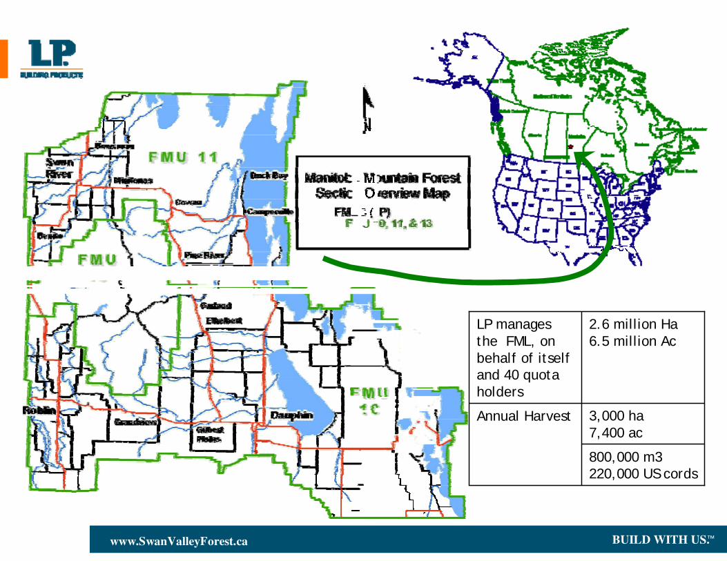
3,000 ha 7,400 ac
Annual Harvest
800,000 m3 220,000 US cords
2.6 million Ha 6.5 million Ac
LP manages the FML, on behalf of itself and 40 quota holders
BUILD WITH US.™www.SwanValleyForest.ca
Forest Industry Recognizing the Need
THE FACTS
• Foresters, in general, have had an aversion to technology
• Foresters have always had a need for detailed information and maps
• Forest companies, for the most part, view Woodlands operations as cost centres that provide no benefit to the bottom line
“DO MORE WITH LESS”
• Forestry has become and will continue to be more “digital”
• The amount and types of data have become increasingly more complex
• Forest companies are required to provide more data, information and analysis to regulators and the public
• The public has an expectation to be involved in and to ask questions about forest management on crown lands, and need products they can understand
BUILD WITH US.™www.SwanValleyForest.ca
• One of the most significant developments in forest management has been the advent of Geographic Information Systems
• Even though GIS technology has become more sophisticated there are challenges that will inhibit a forest company from using this technology to its full potential
• GIS Systems in and of themselves are undervalued if only used for producing maps. A GIS system must be fully integrated into all aspects of a forestry operation including planning, strategic development, data collection, contract payment, data analysis and budgeting
Forest Industry Recognizing the Need
BUILD WITH US.™www.SwanValleyForest.ca
LP’s Swan Valley FRD Challenge
• LP’s vision was to have a computer on every foresters desk and that they would be responsible for developing, updating, printing and addressing their individual needs for data, reporting and mapping requirements
• LP Swan Valley began a long-term relationship/business partnership with a software developer to enhance and further develop its WTS product as part owners
• LP Swan Valley sold its Woodlands-the-System software rights to the developer in 2000
BUILD WITH US.™www.SwanValleyForest.ca
The Process: LP’s Implementation & Development• LP worked with the developer to establish a “Project Charter”, defining
requirements, functionality, data migration and an implementation plan
• LP’s forest operations in Swan River became a testing site for many of the WTS modules including: Contractor, Scaler, Yardstick, Cruiser, Manager and Planner
• Testing and upgrades were completed in and on an operational environment – much of this was “on the fly”
• Completed by GIS staff members but also the planners and administration staff for core components
• Bugs and fixes were reported and implemented
• LP Swan Valley has continued to complete internal customization on reports, templates, integrations and upgrades
• LP has continued to work with the developers on enhancement of operational modules and refining the business practices of the software
• LP has moved from a Arcview 3x single seat WTS setup on 5 desktops in 1995 to an ArcGIS based Citrix environment supporting more than 35 users from Manitoba and 2 British Columbia locations today
BUILD WITH US.™www.SwanValleyForest.ca
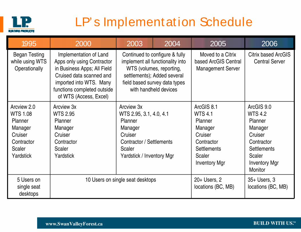
LP’s Implementation Schedule
20+ Users, 2 locations (BC, MB)
ArcGIS 8.1WTS 4.1 PlannerManagerCruiserContractorSettlements ScalerInventory Mgr
Moved to a Citrix based ArcGIS Central Management Server
20052004 2006200320001995Citrix based ArcGIS
Central ServerContinued to configure & fully implement all functionality into
WTS (volumes, reporting, settlements); Added several field based survey data types
with handheld devices
Implementation of Land Apps only using Contractor in Business Apps; All Field Cruised data scanned and imported into WTS. Many
functions completed outside of WTS (Access, Excel)
Began Testing while using WTS
Operationally
35+ Users, 3 locations (BC, MB)
10 Users on single seat desktops5 Users on single seat desktops
ArcGIS 9.0WTS 4.2 PlannerManagerCruiserContractorSettlements ScalerInventory MgrMonitor
Arcview 3xWTS 2.95, 3.1, 4.0, 4.1PlannerManagerCruiserContractor / SettlementsScalerYardstick / Inventory Mgr
Arcview 3xWTS 2.95PlannerManagerCruiserContractorScalerYardstick
Arcview 2.0WTS 1.08PlannerManagerCruiserContractorScalerYardstick
BUILD WITH US.™www.SwanValleyForest.ca
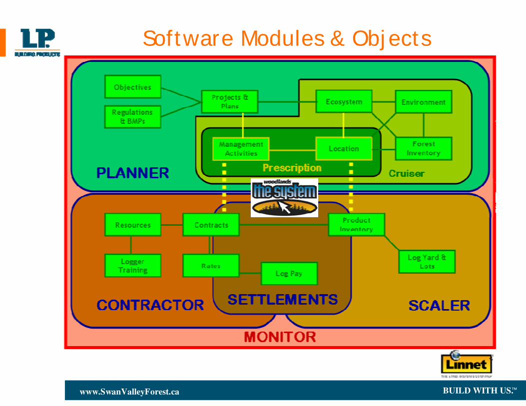
Software Modules & Objects
BUILD WITH US.™www.SwanValleyForest.ca
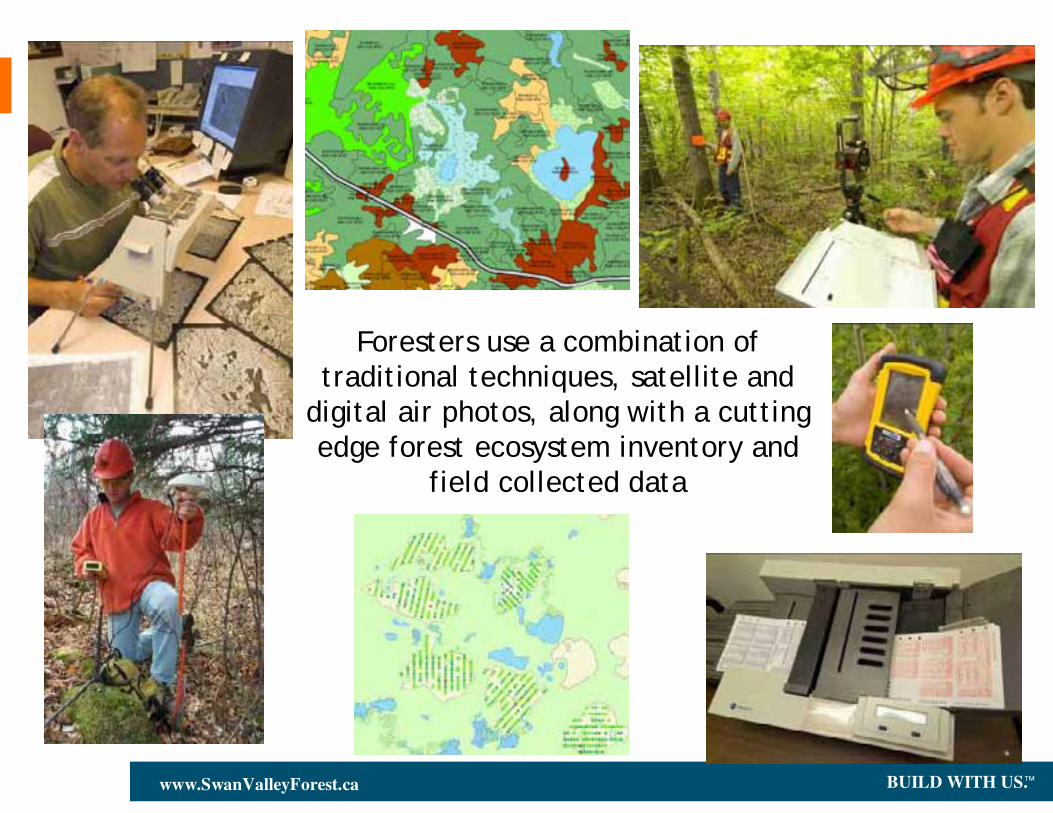
Foresters use a combination of traditional techniques, satellite and
digital air photos, along with a cutting edge forest ecosystem inventory and
field collected data
BUILD WITH US.™www.SwanValleyForest.ca
Pre-harvest Surveys - Data is collected in the field and entered onto optical mark reader cards. These cards are then scanned through a reader, data is error checked and verified then it is immediately available for use. The savings here is on the data entry and data input. There is also no incorrect data entry as the information is accurate when uploaded. Time saved about 6 weeks of data entry as well as another 4 weeks of interpretation before being used.
The LP Swan Valley Experience
Silviculture Surveys - We have moved from a tally sheet system to a hand held data collector for these surveys. Data again is accurate with no re-entry. This software was written in house with an additional annual savings of 6 weeks of data entry. We have also worked with one of our contractors who now use this same program for work they do with us, which saves the compilation costs we used to pay for.
Integrated Planning - We have incorporated all aspects of forestry into the planning experience. All team member contribute their expertise to the planning efforts. Regulatory agencies also participate through interactive mitigation meetings during which changes and comments are captured ‘on the fly’ and into the system
BUILD WITH US.™www.SwanValleyForest.ca
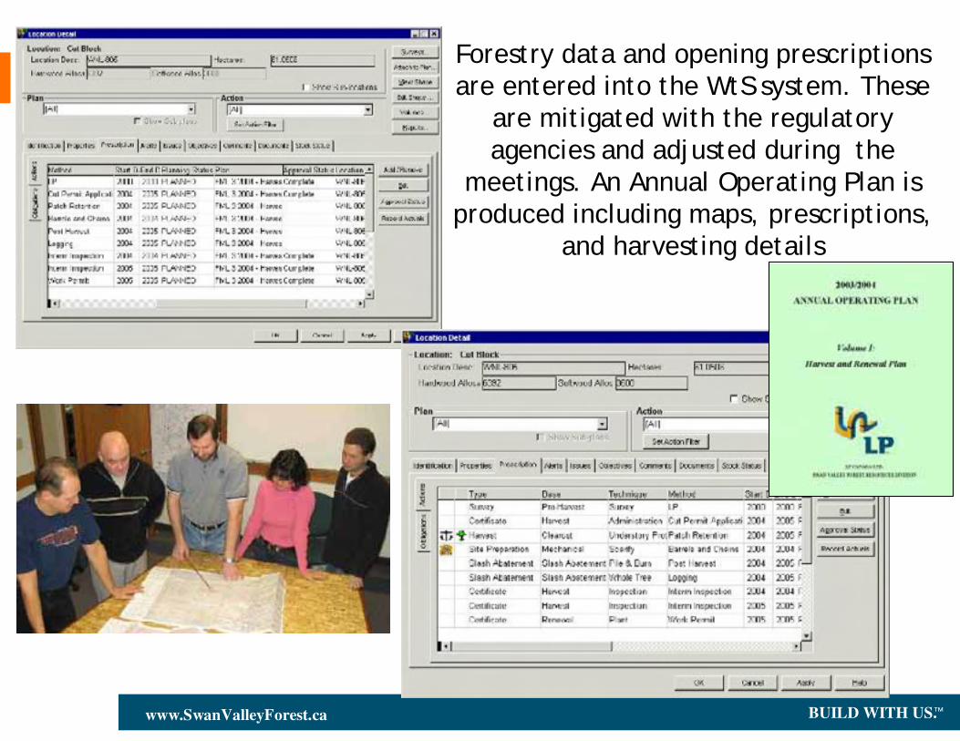
Forestry data and opening prescriptions are entered into the WtS system. These
are mitigated with the regulatory agencies and adjusted during the
meetings. An Annual Operating Plan is produced including maps, prescriptions,
and harvesting details
BUILD WITH US.™www.SwanValleyForest.ca
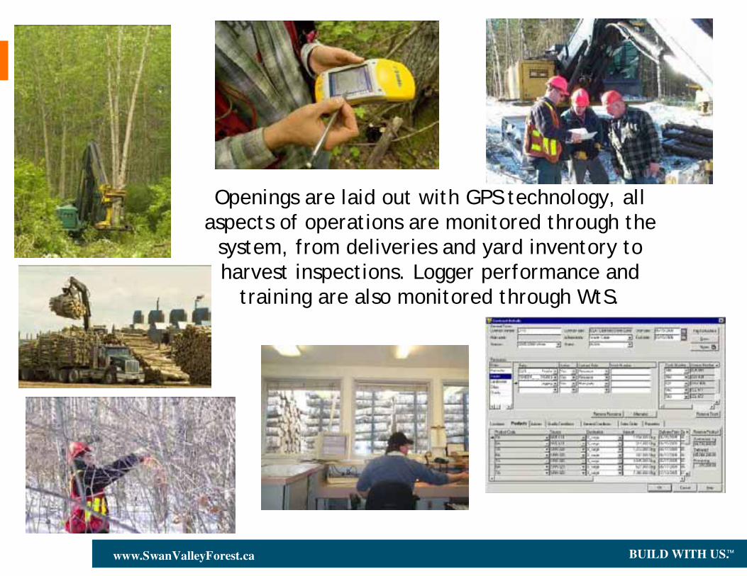
Openings are laid out with GPS technology, all aspects of operations are monitored through the
system, from deliveries and yard inventory to harvest inspections. Logger performance and
training are also monitored through WtS.
BUILD WITH US.™www.SwanValleyForest.ca
The LP Swan Valley Experience
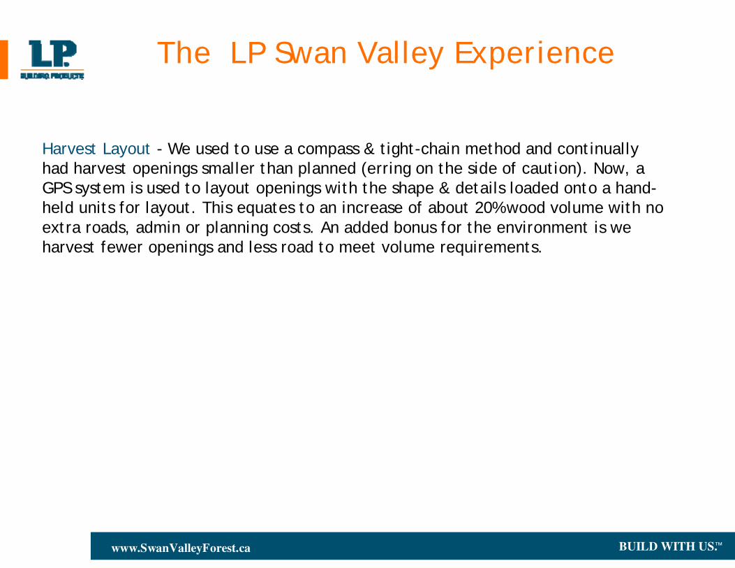
Harvest Layout - We used to use a compass & tight-chain method and continually had harvest openings smaller than planned (erring on the side of caution). Now, a GPS system is used to layout openings with the shape & details loaded onto a hand-held units for layout. This equates to an increase of about 20% wood volume with no extra roads, admin or planning costs. An added bonus for the environment is we harvest fewer openings and less road to meet volume requirements.
BUILD WITH US.™www.SwanValleyForest.ca
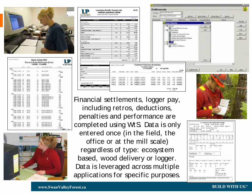
Financial settlements, logger pay, including retros, deductions,
penalties and performance are completed using WtS. Data is only
entered once (in the field, the office or at the mill scale)
regardless of type: ecosystem based, wood delivery or logger.
Data is leveraged across multiple applications for specific purposes.
BUILD WITH US.™www.SwanValleyForest.ca
Log Pay - We used to handle log pay manually: load slip recorded and handled with transactions into a variety of spreadsheets. Using the integrated data from the system we obtain mill delivery data daily and complete financial payments (payments to harvester, trucker, landowners) within the system complete with retros, deductions and penalties. Log pay normally took two to three days each pay period, this has been reduced to a few hours. This system also identifies stumpage payments LP pays the province, makes the financial system easily auditable and the ability to track ‘chain-of-custody’ rules for forest certification.
The LP Swan Valley Experience
Annual Report & Annual Operating Plan – Each report type used to be developed manually, with a variety of people assisting. Data within the system now is used to automatically populate the necessary information for these two reports. Mapping templates produce consistent maps at various scales for differing purposes. LP Staff can print their own opening maps, volume summaries, detailed reports & prescriptions in-house.
BUILD WITH US.™www.SwanValleyForest.ca
The LP Swan Valley Experience
• Our GIS system has developed into an integral part of our operation at all levels. We continue to challenge current practices and requirements so that repetitive work is managed through the system, allowing staff to concentrate on their jobs
• Staff have access to data and information they need, when they need it
• Without this system we would need to increase staffing levels (and costs) between 10 and 20% Virtually all of our data is entered once whether collected in the field, input in the office or entered at the mill’s weigh scale. There is no re-entry of data which saves time, money and improves accuracy.
• Monitoring & Compliance -- Forest Certification & Auditing -- Chain of Custody
• Access to “mobile maps”, “digital forestry”, electronic capture & data integration
• Continued data integration: planning, pre & post harvest activities, financial functions
• Top down & bottom up analysis and reporting functionality / requirements
BUILD WITH US.™www.SwanValleyForest.ca
Where We Are At Now . . . the industry highlights
• Most forest operations have some level of GIS not necessarily a fully integrated multi-user system
• Governments are requiring some form of electronic submissions
• Industry data standards have stabilized enabling data exchange and inter-operability
• A large accumulation of a variety of data is becoming available faster than can be accommodated in the business model
• Access to free data from governments
• Public have become increasingly attentive & knowledgeable to forestry and environmental issues
• Web-served data and applications have proliferated
BUILD WITH US.™www.SwanValleyForest.ca
The Future of Business Performance and Technology in Forestry
Challenges
• Regulatory Issues - offloading
• Staffing – although all users are relatively knowledgeable and efficient at their tasks, still need a specialist for GIS Administration in each location in addition to a highly skilled DBA
• Data storage issues for forestry operations
• Structure and diversity of data sources, needs and availability
• Meta data, data updates, data management
• Electronic data capture and integration from many types of field collected data
• Must keep your head up and always look for opportunities within the organization so that repeatable tasks can be completed automatically
BUILD WITH US.™www.SwanValleyForest.ca
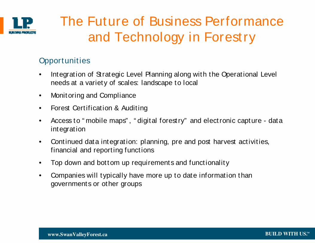
The Future of Business Performance and Technology in Forestry
Opportunities
• Integration of Strategic Level Planning along with the Operational Level needs at a variety of scales: landscape to local
• Monitoring and Compliance
• Forest Certification & Auditing
• Access to “mobile maps”, “digital forestry” and electronic capture - data integration
• Continued data integration: planning, pre and post harvest activities, financial and reporting functions
• Top down and bottom up requirements and functionality
• Companies will typically have more up to date information than governments or other groups
BUILD WITH US.™www.SwanValleyForest.ca
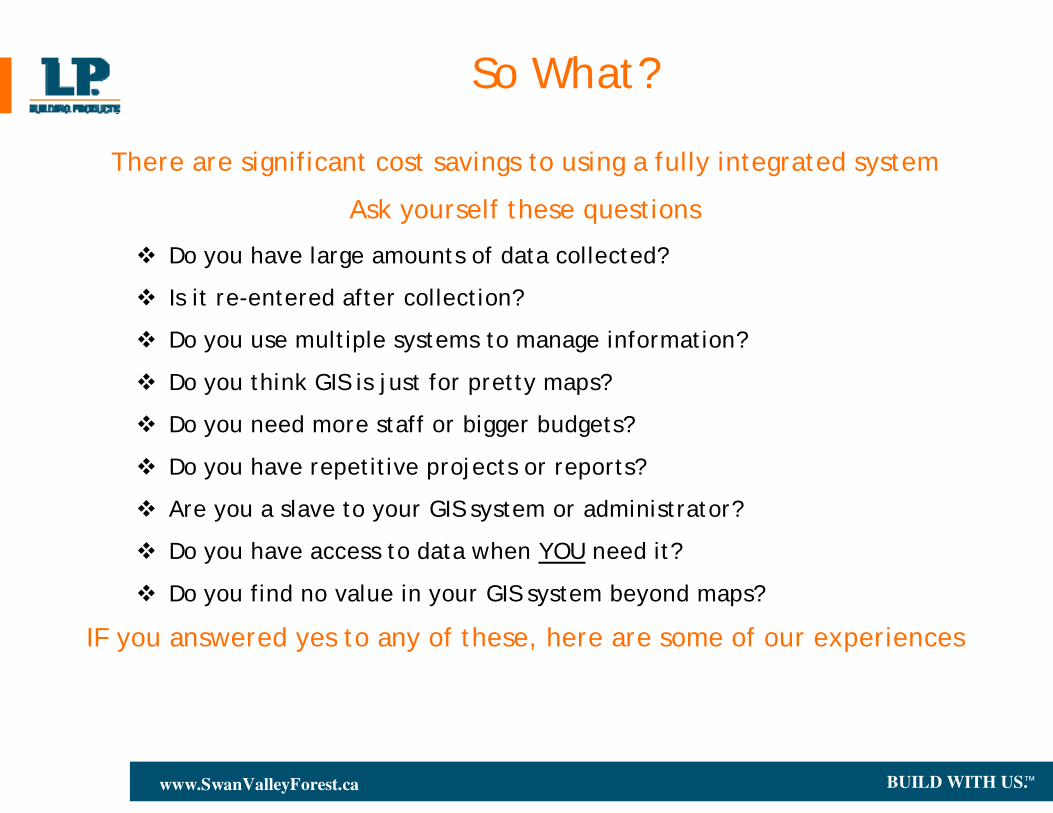
So What?
There are significant cost savings to using a fully integrated system
Ask yourself these questions
Do you have large amounts of data collected?
Is it re-entered after collection?
Do you use multiple systems to manage information?
Do you think GIS is just for pretty maps?
Do you need more staff or bigger budgets?
Do you have repetitive projects or reports?
Are you a slave to your GIS system or administrator?
Do you have access to data when YOU need it?
Do you find no value in your GIS system beyond maps?
IF you answered yes to any of these, here are some of our experiences
BUILD WITH US.™www.SwanValleyForest.ca
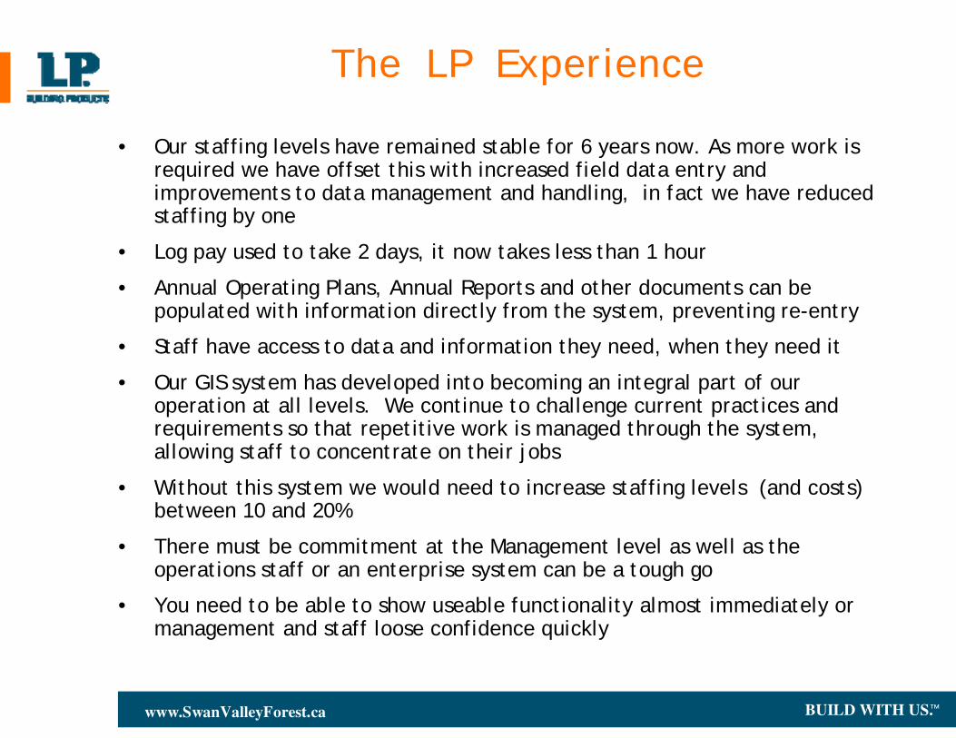
The LP Experience
• Our staffing levels have remained stable for 6 years now. As more work is required we have offset this with increased field data entry andimprovements to data management and handling, in fact we have reduced staffing by one
• Log pay used to take 2 days, it now takes less than 1 hour
• Annual Operating Plans, Annual Reports and other documents can be populated with information directly from the system, preventing re-entry
• Staff have access to data and information they need, when they need it
• Our GIS system has developed into becoming an integral part of our operation at all levels. We continue to challenge current practices and requirements so that repetitive work is managed through the system, allowing staff to concentrate on their jobs
• Without this system we would need to increase staffing levels (and costs) between 10 and 20%
• There must be commitment at the Management level as well as the operations staff or an enterprise system can be a tough go
• You need to be able to show useable functionality almost immediately or management and staff loose confidence quickly
BUILD WITH US.™www.SwanValleyForest.ca
Final Comment
Initially our focus was on getting maps.
As time has progressed our focus has migrated to using WTS in concert with all aspects of our business. While maps and other products are still important, they are now assumed to be there as opposed to being a desire.
Managers within our operations now use the system to not only put a plan in place, but to also check on progress regularly. The work done by our GIS Analyst is now designing data collection software, templates, customized reports, database admin. The willingness of all staff have allowed us to move much further than expected over the years, while maintaining control over our costs.
BUILD WITH US.™www.SwanValleyForest.ca
Questions