Embed Size (px)
Citation preview
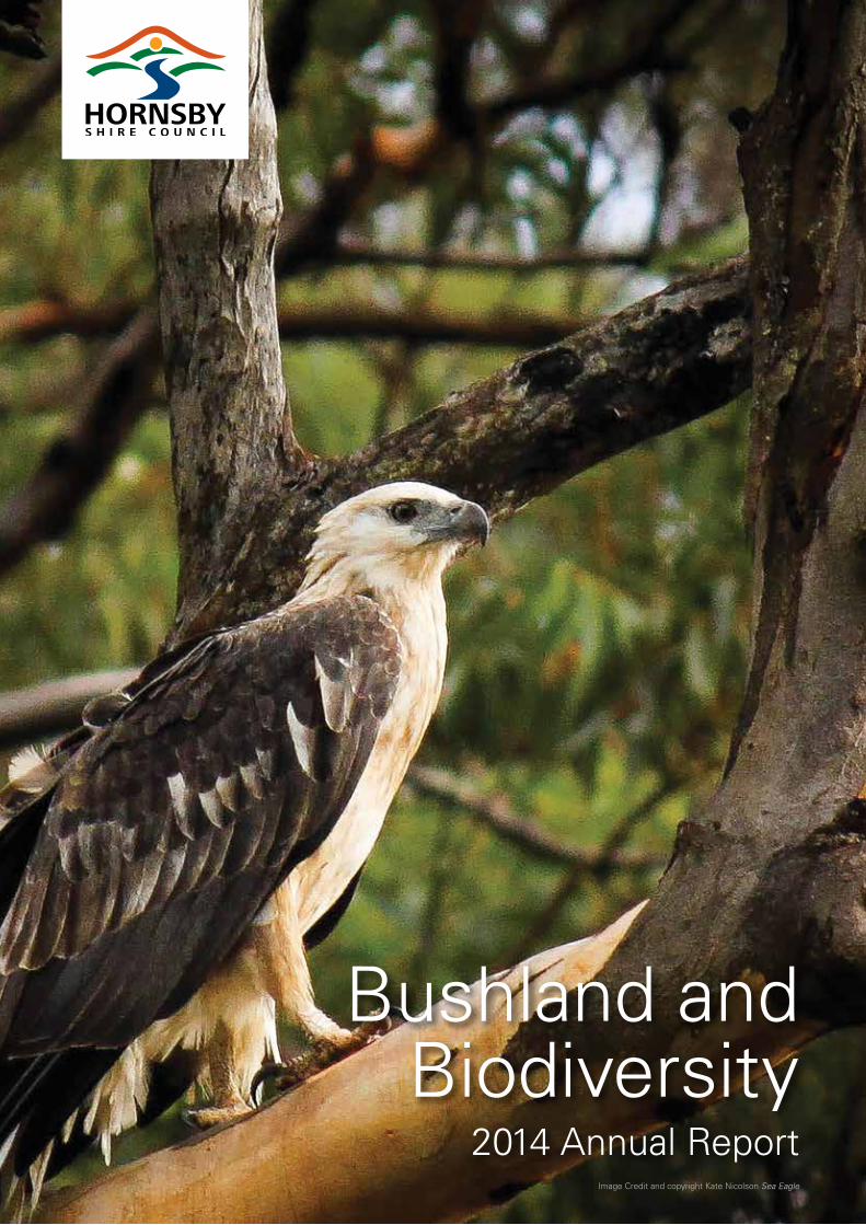
Bushland and Biodiversity
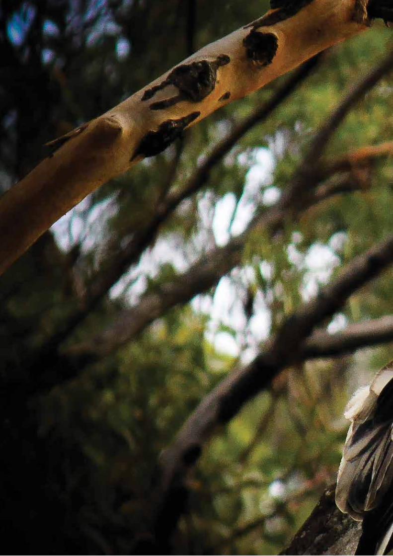
2014 Annual ReportImage Credit and copyright Kate Nicolson Sea Eagle
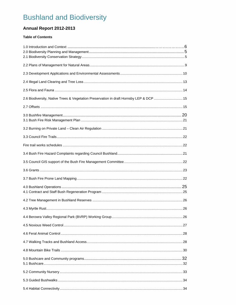
Bushland and Biodiversity Annual Report 2012-2013
Table of Contents
1.0 Introduction and Context ........................................................................ …………………6 2.0 Biodiversity Planning and Management ............................................................................... 5 2.1 Biodiversity Conservation Strategy ........................................................................................................... 5
2.2 Plans of Management for Natural Areas ................................................................................................... 9
2.3 Development Applications and Environmental Assessments ................................................................. 10
2.4 Illegal Land Clearing and Tree Loss ....................................................................................................... 13
2.5 Flora and Fauna ..................................................................................................................................... 14
2.6 Biodiversity, Native Trees & Vegetation Preservation in draft Hornsby LEP & DCP .............................. 15
2.7 Offsets .................................................................................................................................................... 15
3.0 Bushfire Management ................................................................................................... 20 3.1 Bush Fire Risk Management Plan .......................................................................................................... 21
3.2 Burning on Private Land – Clean Air Regulation .................................................................................... 21
3.3 Council Fire Trails ................................................................................................................................... 22
Fire trail works schedules ............................................................................................................................. 22
3.4 Bush Fire Hazard Complaints regarding Council Bushland .................................................................... 21
3.5 Council GIS support of the Bush Fire Management Committee ............................................................. 22
3.6 Grants ..................................................................................................................................................... 23
3.7 Bush Fire Prone Land Mapping .............................................................................................................. 22
4.0 Bushland Operations .................................................................................................... 25 4.1 Contract and Staff Bush Regeneration Program .................................................................................... 25
4.2 Tree Management in Bushland Reserves .............................................................................................. 26
4.3 Myrtle Rust .............................................................................................................................................. 26
4.4 Berowra Valley Regional Park (BVRP) Working Group .......................................................................... 26
4.5 Noxious Weed Control ............................................................................................................................ 27
4.6 Feral Animal Control ............................................................................................................................... 28
4.7 Walking Tracks and Bushland Access .................................................................................................... 28
4.8 Mountain Bike Trails ............................................................................................................................... 30
5.0 Bushcare and Community programs ................................................................................. 32 5.1 Bushcare ................................................................................................................................................. 32
5.2 Community Nursery ................................................................................................................................ 33
5.3 Guided Bushwalks .................................................................................................................................. 34
5.4 Habitat Connectivity ................................................................................................................................ 34

HORNSBY SHIRE COUNCIL 2013-2014 BUSHLAND AND BIODIVERSITY ANNUAL REPORT
Page 2
5.5 National Tree Day ................................................................................................................................... 34
6.0 Budget and Strategic Issues ........................................................................................... 36 6.1 Grants, Income and Expenditure ............................................................................................................ 36
6.2 Offset Income ......................................................................................................................................... 38
6.3 Broader Community Consultation ........................................................................................................... 38
7.0 References ................................................................................................................ 39 Appendix 1: Map of Hornsby Shire ........................................................................................ 40 Appendix 2 Nursery Report………………………………………………………………………………….34
1.0 Introduction and Context Hornsby Shire covers 50,874 hectares of which approximately 67% is bushland. Natural Resources Branch manages 278 natural areas (bushland and wetlands) that are owned by Council or are Crown land under Council control. Other functions include on ground bush restoration and regeneration; upgrade and maintenance of walking tracks, providing free guided bushwalks and the Hornsby Mountain Bike Trail; management of a large volunteer Bushcare Program; management of bushfire risk in its reserves and actively participating in bushfire risk management in the Shire; as well as providing assessment and advice on large areas of private bushland. These activities are guided by legislation, the adopted Biodiversity Conservation Strategy, Plans of Management and other strategies adopted by Council. The Branch undertakes specific management roles in Berowra Valley National Park. The more significant bushland reserves are:
Arcadia: Arcadia Park, Calabash Road Bushland, Calabash Point Bushland, Halls Creek Bushland
Asquith: Michigan Avenue Bushland, Mills Avenue Bushland
Beecroft: Beecroft Reserve, Byles Creek, Chilworth Reserve, Castle Howard Bushland, Edwards and Lamorna Bushland, Fearnley Park, Observatory Park
Berowra: Berowra Community Centre Bushland, Combora Circuit Bushland, Evanda Street Bushland
Berowra Creek: Bar Island, Neverfail Bay Bushland
Berowra Heights: Berowra Park, Cunio Point Bushland, Turner Road Bushland
Berowra Waters: Furber Park
Berrilee: Bay Road Bushland, The Woolwash
Brooklyn: Brooklyn Park, Brooklyn Railway Bushland, McKell Park, Seymours Creek Bushland
Canoelands: Pumpkin Point Creek Bushland
Carlingford: Ray Park
Castle Hill: Upper Pyes Creek Bushland
Cheltenham: Cheltenham Bushland
Cherrybrook: Kanangra Crescent Bushland, Lakes of Cherrybrook, Pyes Creek Bushland
Dangar Island: Kiparra Park
Dural: Muraban Road Bushland, Pyes Creek Bushland
Epping: Dence Park, Midson & Plympton Road Bushland, Terrys Creek Bushland, Vimiera Park
Fiddletown: Bloodwood Road Aboriginal Area, Calabash Point Bushland, Collingridge Bushland, Sunnyridge Road Bushland
Galston: Fagan Park (including Carrs Bush), Galston Park, Galston Recreation Reserve and Hayes Park, Knights Road Bushland
Glenorie: Campbell Crescent Bushland, Glenorie Park
Hornsby: Florence Cotton Reserve, Hornsby Park, Manor Road Bushland, Reddy Park, Rosemead Road Bushland, Waitara Creek Bushland
Hornsby Heights: Crosslands, Ginger Meggs Park, Rofe Park Bushland, Somerville Road Bushland
Laughtondale: One Tree Reach Wetland
Maroota: Molesworth Reserve, Wisemans Ferry Lookout Bushland, Wisemans Ferry Tip (decommissioned – bushland parcel)
Middle Dural: Forsters Reserve
Mount Colah: Berry Park Bushland, Bimbil Avenue, Excelsior Bushland, Judith Ave Bushland, Murralong Road Bushland, Oxley Drive Park, Sue Place
Mount Ku-ring-gai: Mount Ku-ring-gai Park
Pennant Hills: Azalea Grove Bushland, Britannia Street Bushland, Observatory Park, Tristania Way Bushland
Normanhurst: Begonia Road South Bushland, Kenley Park, Normanhurst Park, Pine Street Bushland, Waitara Creek Bushland
North Epping: North Epping Oval, Woods Street Oval
Thornleigh: Dog Pound Creek Bushland, Larool Crescent Childrens Centre (bushland parcel), Larool Creek Bushland
Westleigh: Dog Pound Creek Bushland, Quarter Sessions Road Bushland, Western Crescent Playground (bushland parcel)
West Pennant Hills: New Farm Road Bushland
Wisemans Ferry: Singleton Mill Road Bushland and Wisemans Ferry Cemetery (bushland parcel)
HORNSBY SHIRE COUNCIL 2013-2014 BUSHLAND AND BIODIVERSITY ANNUAL REPORT
Page 5
2.0 Biodiversity Planning and Management 2.1 Biodiversity Conservation Strategy The Hornsby Shire Biodiversity Conservation Strategy (2004, updated 2006) guides Council’s priorities for undertaking conservation actions. Its objectives are to:
Conserve species, populations and communities of native plants and animals, and allow for their continued evolution and survival in the Hornsby Shire in context of the region.
Achieve an improvement in the quality and extent of existing indigenous vegetation in Hornsby Shire.
Collect and update biodiversity conservation information.
Develop key community incentive and partnership programs to maintain biodiversity on private properties in the Hornsby Shire.
Ensure Council activities integrate with other agencies to achieve biodiversity conservation outcomes.
Ensure environmental planning instruments and processes provide a strategic approach to achieving biodiversity conservation outcomes.
Maintain and improve the management of biodiversity on publicly owned land in Hornsby.
Effectively mitigate threats to conserving biodiversity in Hornsby.
Conserve and recreate connectivity across fragmented landscapes.
Develop and implement effective systems to fund and manage biodiversity conservation actions.
Hornsby Shire has over 1,000 native plants and 388 terrestrial vertebrate animals. Of these, there are 26 threatened plants and 42 threatened fauna known or likely to occur.
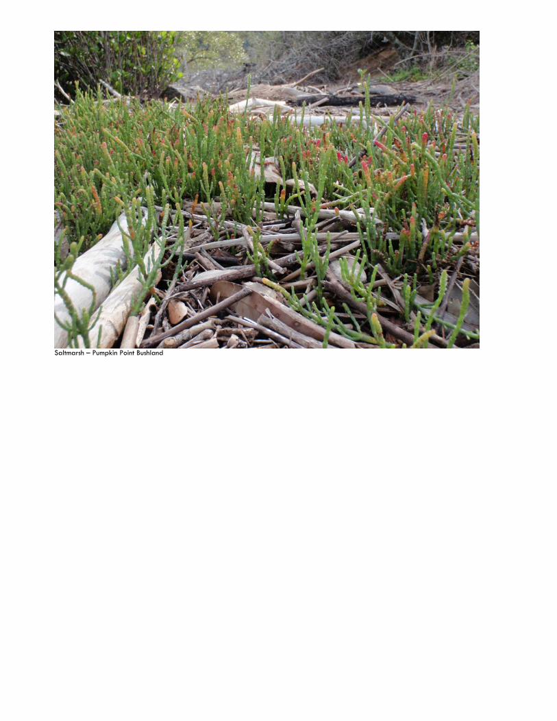
Saltmarsh – Pumpkin Point Bushland
HORNSBY SHIRE COUNCIL 2013-2014 BUSHLAND AND BIODIVERSITY ANNUAL REPORT
Page 7
Annually ten high priority actions are implemented from the Biodiversity Conservation Strategy
Major achievements and issues for 2013-14 included:
Bushland restoration – 204 ha or 14.4% of Council bushland, a 20% increase from last year-
Contract bush regeneration restored 127.5 ha in 56 Bushland Reserves through Council and grant funds, and
898 Bushcare volunteers restored 77 ha at 101 sites being a 12% increase.
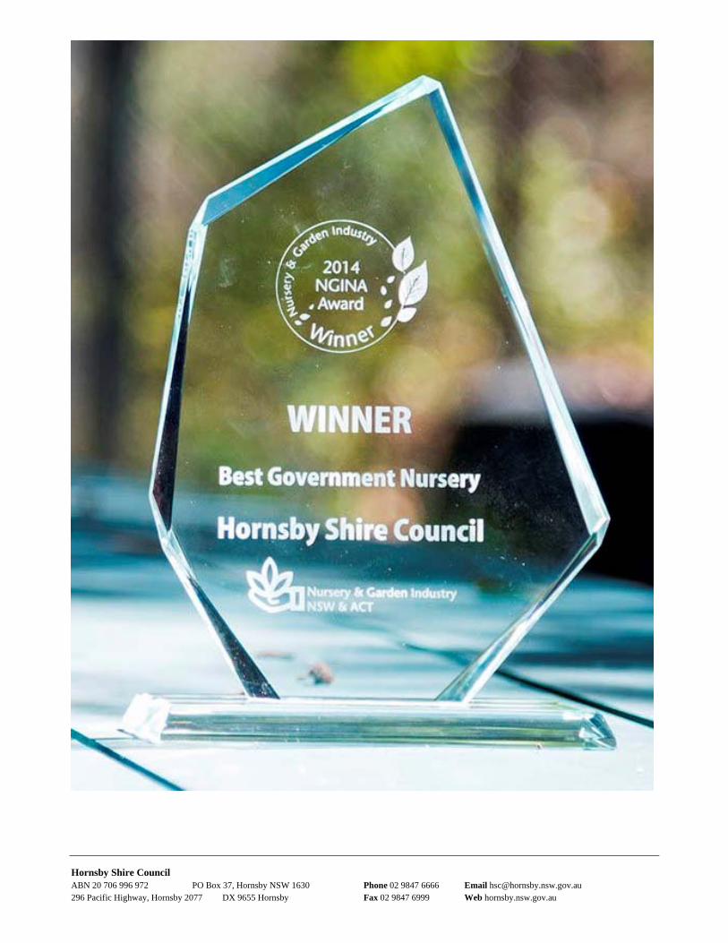
Community nursery propagated 43,532 tube stock plants for restoration. 6,645 free native plants were provided to 2,000 residents at 4 open days promoting biodiversity in local gardens, a 67% increase from last year. 40,217 plants were supplied for the Catchment Remediation Rate program, National Tree Day, Council bushland and Bushcare sites, advanced street trees, landscape projects and schools. The nursery was awarded ‘Best Government Nursery in NSW and ACT’ by the Nursery and Garden Industry Association
Knowledge - Eastern Pygmy Possum monitoring assisted in adapting to Climate Change.
Partnerships and integration with agencies -
Bushcare volunteers worked in Council bushland for 18,500 hours valued at $555,000.
40 Nursery volunteers did over 3,000 hours of plant production, an increase from last year valued at over $65,000.
Roadside vegetation: Council won an award for excellence for roadside vegetation program with Council works staff.
Habitat Connectivity and Rural Lands Incentives Programs– bushland was restored at Cherrybrook Technical High, Benedictine Monastery, Marymount Mercy Centre with Local Land Services (LLS).
Rural community and Still Creek Landcare Group workshops were delivered on sustainable environmental management of horse properties, native grasses and living with termites.
Floating Landcare 4 events were held at Bar Island with Bushcare volunteers and LLS.
Hornsby Mountain Bike Trailcare Program - 116 volunteers attended 9 work days and contributed 279 hours valued at $8,374; also Metropolitan Greenspace and Department of Sport and Recreation funded the track.
601 community members attended 19 seminars, tours, talks and training. This is a 58% increase in attendance despite reducing the number of events by 48%.
Berowra Valley Working Group - Council managed Bushcare and bush regeneration contracts in Berowra Valley National Park and worked with NPWS.
Minimised threats to native flora and fauna -
Development Applications - 224 DAs and Tree Applications were assessed and 78 compliance unauthorised clearing matters investigated.
Environmental impact assessments - 12 EIAs were prepared for Council projects and assessed 3 EIA for infrastructure projects.
Noxious Weeds -
691 property inspections (up 37%)
32 km of weed pathways inspected
180 noxious weed notices issued
3 Section 64 Certificates issued
Tussock Paspalum, Pampas Grass and Boneseed controlled on public land
Bushland recreation
380 residents attended 34 free guided bushwalks
Stage 2 of the 6km Hornsby Mountain Bike Trail was opened
12 tracks over 49 kms in length with interpretive signs were audited and maintained
Bushfire mitigation undertaken -
55 Asset Protection Zones and Works Access Lines maintained along 6.2 km
Bushfire Education –
o Education trailer at 4 events o 2 Bushfire street meetings held
in Hornsby Heights and Epping. o $74,349 grant for asset
protection
92 km of Council Fire Trails maintained
o 8 Fire Trails had vegetation and surface maintenance.
o 4 Fire Trails upgraded.
10 Burns prepared
HORNSBY SHIRE COUNCIL 2013-2014 BUSHLAND AND BIODIVERSITY ANNUAL REPORT
Page 8
10 Hazard Reduction burns completed
651 permits to burn issued for private land
10 breaches investigated
9 hazard complaints addressed
Bush Fire Prone Land Maps adopted.
Planning - Tree canopy loss following the amended Tree Preservation Order found significant losses of tree canopy, estimated at 11,000 trees per annum. Two offsets of $82,890 to restore Turpentine Ironbark Forest – 739 sq m lost.
First Biobank site negotiated at Upper Pyes Creek and New Farm Rd Bushland.
Funding - Achieving additional income and commitments of $4,285,766 to achieve bushland management, restoration and enhanced recreational experience of Hornsby Shire’s bushland.
Revegetated 4,370 sq m (3800 in 2012/13) compared to 10,868 sq m (3930 in 2012/13) lost to development being a net loss of 6,498 sqm – this excludes unauthorised clearing.
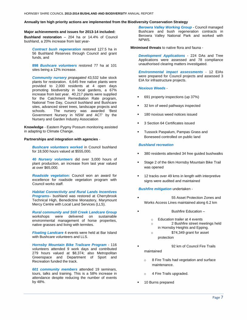
Survey of bushland reserve
HORNSBY SHIRE COUNCIL 2013-2014 BUSHLAND AND BIODIVERSITY ANNUAL REPORT
Page 9
2.2 Plans of Management for Natural Areas In the 2013-2014 year, actions identified in Plans of Management for natural areas covering 276 Bushland Reserves were implemented.
Wisemans Ferry Cemetery Bushland Key actions for the Plan of Management include bushfire mitigation, noxious weed control and heritage protection of cemetery monuments. Weed management and APZ maintenance has been undertaken. Restoration works on grave sites was completed, fire trail gate installed and the Hazard Reduction burn completed. The former dilapidated concrete cast fence at the front of the site has been replaced with a hardwood fence that complements the rural character of the area.
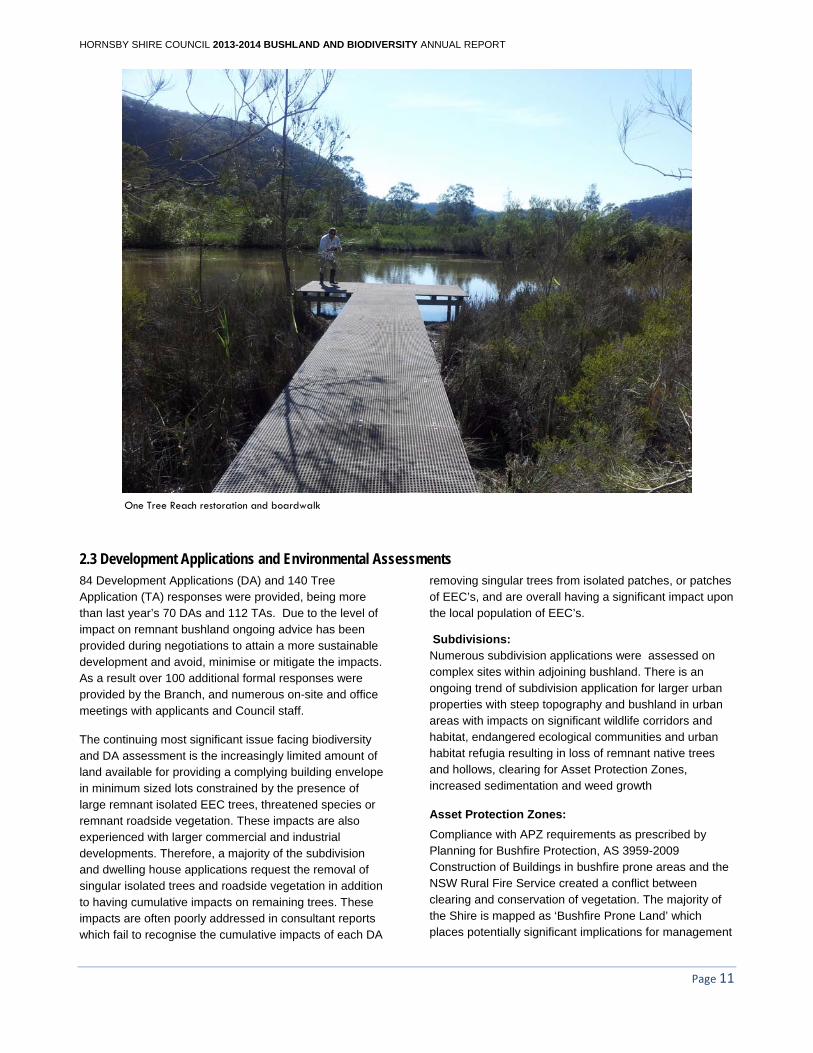
One Tree Reach Wetland
Council received ongoing financial support from Hawkesbury Nepean Catchment Management Authority and Council through the Rural Lands Incentive Program to undertake weed control, restoration works and develop management strategies. Restoration contributed to the increased presence of water birds and the regeneration of the Swamp Mahogany Forest. Threatened species of bird
including Osprey (Pandion haliaetus) have been recorded residing at the site. Weed control works including Lantana eradication have also occurred on adjoining private property.
An 80 metre long fibreglass board walk has been carefully installed through the wetland to a viewing platform overlooking the main water body to provide an enhanced educational experience for all future public users. It caters for disabled/ wheelchair access and will include an environmental educational interpretative signage. A complementary forest walk, education signage system and visitor car park area is currently under construction. These works were funded through a HNCMA grant and Council funding to provide public access to the wetland.
The works fulfil a major objective of the Plan of Management for the wetland and will be of great recreational benefit to rate payers that want to explore the northern extent of the Hornsby Shire.
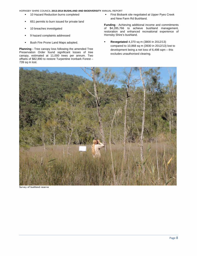
Wisemans Ferry Cemetery fence and asset protection works
HORNSBY SHIRE COUNCIL 2013-2014 BUSHLAND AND BIODIVERSITY ANNUAL REPORT
Page 11
One Tree Reach restoration and boardwalk
2.3 Development Applications and Environmental Assessments 84 Development Applications (DA) and 140 Tree Application (TA) responses were provided, being more than last year’s 70 DAs and 112 TAs. Due to the level of impact on remnant bushland ongoing advice has been provided during negotiations to attain a more sustainable development and avoid, minimise or mitigate the impacts. As a result over 100 additional formal responses were provided by the Branch, and numerous on-site and office meetings with applicants and Council staff.
The continuing most significant issue facing biodiversity and DA assessment is the increasingly limited amount of land available for providing a complying building envelope in minimum sized lots constrained by the presence of large remnant isolated EEC trees, threatened species or remnant roadside vegetation. These impacts are also experienced with larger commercial and industrial developments. Therefore, a majority of the subdivision and dwelling house applications request the removal of singular isolated trees and roadside vegetation in addition to having cumulative impacts on remaining trees. These impacts are often poorly addressed in consultant reports which fail to recognise the cumulative impacts of each DA
removing singular trees from isolated patches, or patches of EEC’s, and are overall having a significant impact upon the local population of EEC’s.
Subdivisions: Numerous subdivision applications were assessed on complex sites within adjoining bushland. There is an ongoing trend of subdivision application for larger urban properties with steep topography and bushland in urban areas with impacts on significant wildlife corridors and habitat, endangered ecological communities and urban habitat refugia resulting in loss of remnant native trees and hollows, clearing for Asset Protection Zones, increased sedimentation and weed growth
Asset Protection Zones:
Compliance with APZ requirements as prescribed by Planning for Bushfire Protection, AS 3959-2009 Construction of Buildings in bushfire prone areas and the NSW Rural Fire Service created a conflict between clearing and conservation of vegetation. The majority of the Shire is mapped as ‘Bushfire Prone Land’ which places potentially significant implications for management
HORNSBY SHIRE COUNCIL 2013-2014 BUSHLAND AND BIODIVERSITY ANNUAL REPORT
Page 12
of bushland including threatened species, populations, Endangered Ecological Communities and other native vegetation in the vegetated buffers between residential and other development and remnant bushland.
The Natural Resources Strategy Unit managed the APZ implementation and revegetation works for the Hornsby Aquatic Centre. This included installation of 250m of wallaby-proof fencing, 5,000 sqm of bank stabilisation and installation of over 12,000 tube stock plants from Council’s Community Nursery and weed control.
Conditions of development consent
DA conditions were used to achieve positive biodiversity outcomes on land zoned for development, especially for Turpentine Ironbark Forest, Blue Gum High Forest, Blackbutt Gully Forest, Leptospermum deanei, Persoonia mollis ssp. maxima and Darwinia biflora.
A condition of consent that was effective in conserving the genetic soil seed bank of a population of threatened plant was implemented for a dwelling house development in Mount Colah. Soil seedbank topsoil translocation was salvaged from the building footprint and relocated to suitable sandstone capped recipient site.
A large sandstone quarry at Maroota was approved providing that conditions of consent provided by the NR Strategy Unit are complied with. These include stormwater management, cultural heritage item protection, Eastern Pygmy Possum nestbox monitoring, 30 year fox control program, bush regeneration, revegetation and weed control.
Ensuring compliance with approved Vegetation Management Plans and bushland protected on private property with a covenant on the title of the property (s.88b of Conveyancing Act 1919) has been difficult.
Significant infrastructure and other projects Environmental assessments were reviewed for:
Boronia 1 Digital Train Radio System
North West Rail Link Interface Agreement
Epping to Thornleigh Third Rail Track urban Landscape Design
Involvement with these projects required review of the environmental assessment reports and consultation with state government authorities, utilities and contractors. Negotiations have sought to limit potential impacts upon local biodiversity on private and Council land.
Environmental assessments reviewed included Reviews of Environmental Factors, Environmental Impact Statements, Assessment of Significance and ecological reports.
Twelve (12) environmental impact assessment reports were prepared by the team for Council projects including Catchment Remediation Devices, Park Upgrade Works (lighting and cark parks), Rural Roads Restoration Program (Works Division) and Men’s Shed (Cowan and Mt Ku-ring-gai).
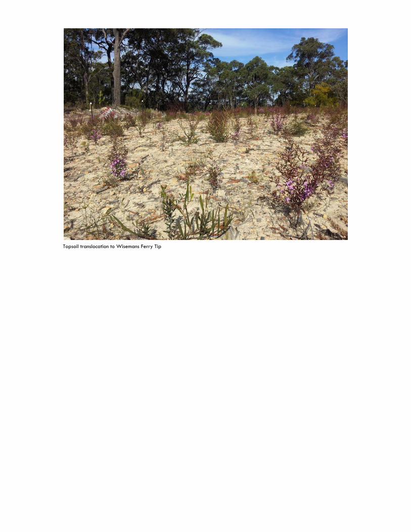
Topsoil translocation to Wisemans Ferry Tip
HORNSBY SHIRE COUNCIL 2013-2014 BUSHLAND AND BIODIVERSITY ANNUAL REPORT
Page 14
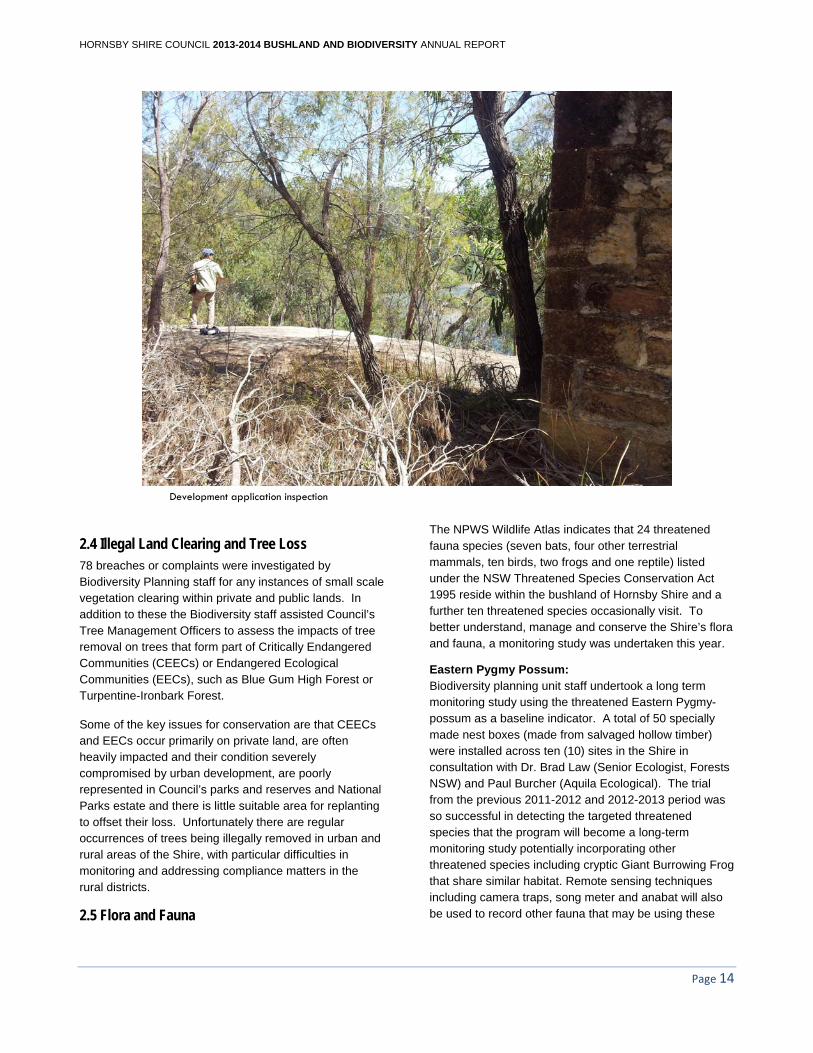
Development application inspection
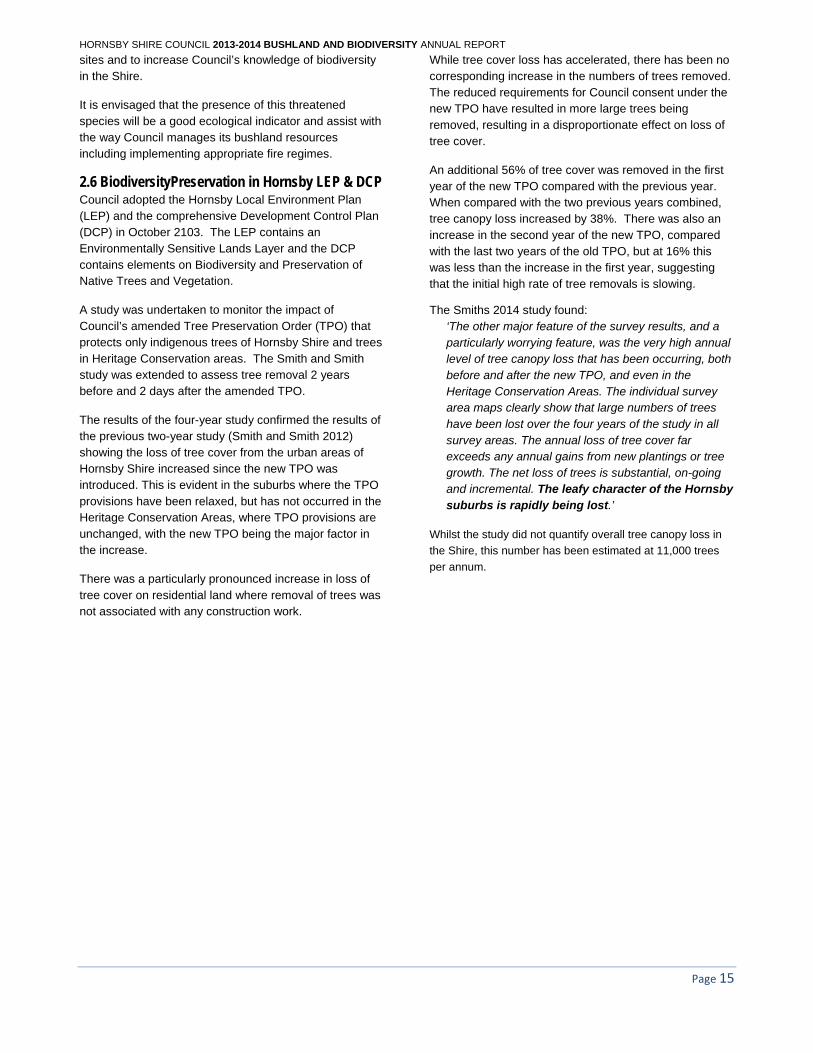
2.4 Illegal Land Clearing and Tree Loss 78 breaches or complaints were investigated by Biodiversity Planning staff for any instances of small scale vegetation clearing within private and public lands. In addition to these the Biodiversity staff assisted Council’s Tree Management Officers to assess the impacts of tree removal on trees that form part of Critically Endangered Communities (CEECs) or Endangered Ecological Communities (EECs), such as Blue Gum High Forest or Turpentine-Ironbark Forest.
Some of the key issues for conservation are that CEECs and EECs occur primarily on private land, are often heavily impacted and their condition severely compromised by urban development, are poorly represented in Council’s parks and reserves and National Parks estate and there is little suitable area for replanting to offset their loss. Unfortunately there are regular occurrences of trees being illegally removed in urban and rural areas of the Shire, with particular difficulties in monitoring and addressing compliance matters in the rural districts.
2.5 Flora and Fauna
The NPWS Wildlife Atlas indicates that 24 threatened fauna species (seven bats, four other terrestrial mammals, ten birds, two frogs and one reptile) listed under the NSW Threatened Species Conservation Act 1995 reside within the bushland of Hornsby Shire and a further ten threatened species occasionally visit. To better understand, manage and conserve the Shire’s flora and fauna, a monitoring study was undertaken this year.
Eastern Pygmy Possum: Biodiversity planning unit staff undertook a long term monitoring study using the threatened Eastern Pygmy-possum as a baseline indicator. A total of 50 specially made nest boxes (made from salvaged hollow timber) were installed across ten (10) sites in the Shire in consultation with Dr. Brad Law (Senior Ecologist, Forests NSW) and Paul Burcher (Aquila Ecological). The trial from the previous 2011-2012 and 2012-2013 period was so successful in detecting the targeted threatened species that the program will become a long-term monitoring study potentially incorporating other threatened species including cryptic Giant Burrowing Frog that share similar habitat. Remote sensing techniques including camera traps, song meter and anabat will also be used to record other fauna that may be using these
HORNSBY SHIRE COUNCIL 2013-2014 BUSHLAND AND BIODIVERSITY ANNUAL REPORT
Page 15
sites and to increase Council’s knowledge of biodiversity in the Shire.
It is envisaged that the presence of this threatened species will be a good ecological indicator and assist with the way Council manages its bushland resources including implementing appropriate fire regimes.
2.6 BiodiversityPreservation in Hornsby LEP & DCP Council adopted the Hornsby Local Environment Plan (LEP) and the comprehensive Development Control Plan (DCP) in October 2103. The LEP contains an Environmentally Sensitive Lands Layer and the DCP contains elements on Biodiversity and Preservation of Native Trees and Vegetation.
A study was undertaken to monitor the impact of Council’s amended Tree Preservation Order (TPO) that protects only indigenous trees of Hornsby Shire and trees in Heritage Conservation areas. The Smith and Smith study was extended to assess tree removal 2 years before and 2 days after the amended TPO.
The results of the four-year study confirmed the results of the previous two-year study (Smith and Smith 2012) showing the loss of tree cover from the urban areas of Hornsby Shire increased since the new TPO was introduced. This is evident in the suburbs where the TPO provisions have been relaxed, but has not occurred in the Heritage Conservation Areas, where TPO provisions are unchanged, with the new TPO being the major factor in the increase.
There was a particularly pronounced increase in loss of tree cover on residential land where removal of trees was not associated with any construction work.
While tree cover loss has accelerated, there has been no corresponding increase in the numbers of trees removed. The reduced requirements for Council consent under the new TPO have resulted in more large trees being removed, resulting in a disproportionate effect on loss of tree cover.
An additional 56% of tree cover was removed in the first year of the new TPO compared with the previous year. When compared with the two previous years combined, tree canopy loss increased by 38%. There was also an increase in the second year of the new TPO, compared with the last two years of the old TPO, but at 16% this was less than the increase in the first year, suggesting that the initial high rate of tree removals is slowing.
The Smiths 2014 study found: ‘The other major feature of the survey results, and a particularly worrying feature, was the very high annual level of tree canopy loss that has been occurring, both before and after the new TPO, and even in the Heritage Conservation Areas. The individual survey area maps clearly show that large numbers of trees have been lost over the four years of the study in all survey areas. The annual loss of tree cover far exceeds any annual gains from new plantings or tree growth. The net loss of trees is substantial, on-going and incremental. The leafy character of the Hornsby suburbs is rapidly being lost.’
Whilst the study did not quantify overall tree canopy loss in
the Shire, this number has been estimated at 11,000 trees
per annum.
Breach inspection
HORNSBY SHIRE COUNCIL 2013-2014 BUSHLAND AND BIODIVERSITY ANNUAL REPORT
Page 17
2.7 Offsets In the ‘Bushland Shire’ there are significant areas of bush on private land and it is inevitable that development will have cumulative losses of native vegetation. Council’s Green Offsets Code assists in providing an offset where there is no possibility of a development avoiding an impact on native vegetation. The policy has been regularly reviewed. The principles of this policy are to ‘Avoid, Minimise and Mitigate’ impacts of a development that must be fully exhausted before examining the option to seek an offset. Some development proposals submitted to Council suggest that this is often ignored, by seeking an offset without any discussion of avoidance or alternative options as required under this policy.
Throughout 2013-14 over 80 applications for development that impact on native vegetation were referred to the Natural Resources Branch. In the majority of cases vegetation impacts were minimal and offsetting could occur on site through appropriate landscaping. A minority of developments had a larger impact on native vegetation and these impacts were able to be mitigated on site through approved Vegetation and Restoration Management Plans. For these and more significant impacts Natural Resources have utilised the Code and other guidelines to avoid, minimise or mitigate development impacts.
One of the offsetting options within this policy is the use of Voluntary Planning Agreements (VPA). VPA’s enable the land owner to offset the loss by providing practical, managerial and financial offsets through a legally binding agreement. In accordance with the Code, if impacts cannot be offset on-site then offsets on other land or financial contributions for conservation require a legally binding agreement (ie: a Voluntary Planning Agreement).
Two offsets were negotiated during the year – one at Beecroft and the other Epping, both for the restoration of
Sydney Turpentine Ironbark Forest EEC. The total financial value of these offsets is $19,506 and $63,384 which is yet to be received by Council, however, the exhibition period for the VPAs and the consent for the development approval has been granted.
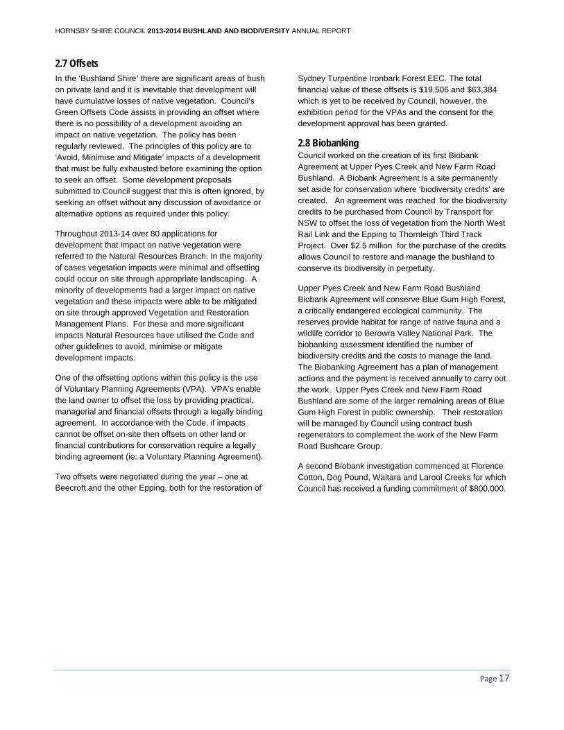
2.8 Biobanking Council worked on the creation of its first Biobank Agreement at Upper Pyes Creek and New Farm Road Bushland. A Biobank Agreement is a site permanently set aside for conservation where ‘biodiversity credits’ are created. An agreement was reached for the biodiversity credits to be purchased from Council by Transport for NSW to offset the loss of vegetation from the North West Rail Link and the Epping to Thornleigh Third Track Project. Over $2.5 million for the purchase of the credits allows Council to restore and manage the bushland to conserve its biodiversity in perpetuity.
Upper Pyes Creek and New Farm Road Bushland Biobank Agreement will conserve Blue Gum High Forest, a critically endangered ecological community. The reserves provide habitat for range of native fauna and a wildlife corridor to Berowra Valley National Park. The biobanking assessment identified the number of biodiversity credits and the costs to manage the land. The Biobanking Agreement has a plan of management actions and the payment is received annually to carry out the work. Upper Pyes Creek and New Farm Road Bushland are some of the larger remaining areas of Blue Gum High Forest in public ownership. Their restoration will be managed by Council using contract bush regenerators to complement the work of the New Farm Road Bushcare Group.
A second Biobank investigation commenced at Florence Cotton, Dog Pound, Waitara and Larool Creeks for which Council has received a funding commitment of $800,000.
Biobank site Upper Pyes Creek

HORNSBY SHIRE COUNCIL 2013-2014 BUSHLAND AND BIODIVERSITY ANNUAL REPORT
Page 19
HORNSBY SHIRE COUNCIL 2013-2014 BUSHLAND AND BIODIVERSITY ANNUAL REPORT
Page 20
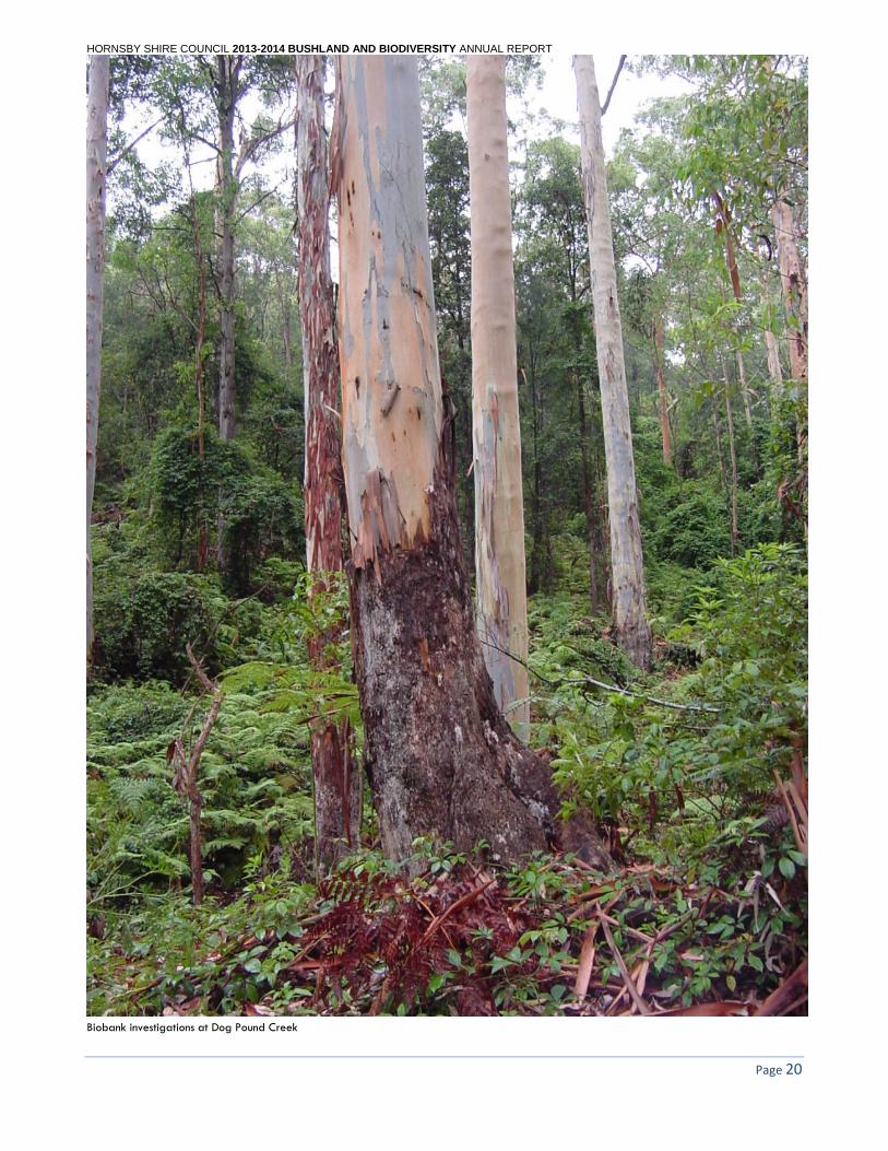
Biobank investigations at Dog Pound Creek
HORNSBY SHIRE COUNCIL 2013-2014 BUSHLAND AND BIODIVERSITY ANNUAL REPORT
Page 21
3.0 Bushfire Management The Natural Resources Branch has a significant responsibility for bush fire management in Hornsby Shire. An updated Bushfire Prone Mapping was completed in early 2014 and resulted with 20180 properties in the Shire being designated as bushfire prone.
A large proportion of Hornsby Shire has been rated as having extreme or very high bushfire risk and a 47 km interface occurs between public land and developed areas in the Hornsby LGA, with 27 km being Council managed bushland. Council is the local authority under the Rural Fires Act and is responsible for the prevention, mitigation and suppression of bush fires in the LGA, which is delegated to the RFS through a service agreement. Council is also a member of the Bush Fire Management Committee (BFMC) responsible for identification, planning and treatment of bush fire risk management through the Bush Fire Risk Management Plan and the Annual Fuel Management Program.
The Natural Resources Branch is responsible for addressing the bush fire risk on land owned or managed by Council and for controlling burning on private land through the issue of permits.
3.1 Bush Fire Risk Management Plan The Hornsby Ku-ring-gai Bush Fire Risk Management Plan was implemented through the H-K Bushfire Management Committee’s Annual Works Program for 2013-2014. Council implemented the plan and program on its land by preparing for hazard reduction burns, manual fuel reduction, education and fire trail works. The following activities undertaken in the Hornsby LGA during the year and were assisted by grant funding of $74,350.
A review is currently being undertaken in conjunction with all land mangers on the Risk Management plan which will detail Bushfire Management works (Manual Hazard Reduction, Fire Trail Maintenance and Community Education) for the next 5 years. This review is expected to be completed by mid-2015.
Manual hazard reduction
Works identified in the Hornsby Shire Council Bushfire Risk Mitigation Manual Works Program 2010-2015 were carried out by Council contractors. Manual works were scheduled and undertaken with assistance of grant funding from the Bushfire Mitigation Fund:
Treatment of 33 Asset Protection and 10 Works Access Lines were maintained, being an interface length of 6.2 km and affording protection to 220 properties immediately adjoining Council bushland.
Hazard reduction burns
During the year Council undertook environmental assessments of 10 sites and on-ground site preparation for identified burns.
Land Managers completed ten hazard reduction burns within Hornsby Shire:
Ashdale Creek East
Banksia Place
Dilkera Close
Glenorie Creek
Kiparra Park
Koloona
Kooringal
McCallums
Towner Street
Muogamarra Ridge
Community Education
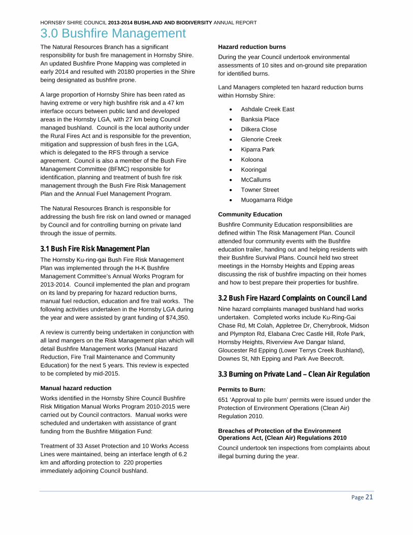
Bushfire Community Education responsibilities are defined within The Risk Management Plan. Council attended four community events with the Bushfire education trailer, handing out and helping residents with their Bushfire Survival Plans. Council held two street meetings in the Hornsby Heights and Epping areas discussing the risk of bushfire impacting on their homes and how to best prepare their properties for bushfire.
3.2 Bush Fire Hazard Complaints on Council Land Nine hazard complaints managed bushland had works undertaken. Completed works include Ku-Ring-Gai Chase Rd, Mt Colah, Appletree Dr, Cherrybrook, Midson and Plympton Rd, Elabana Crec Castle Hill, Rofe Park, Hornsby Heights, Riverview Ave Dangar Island, Gloucester Rd Epping (Lower Terrys Creek Bushland), Downes St, Nth Epping and Park Ave Beecroft.
3.3 Burning on Private Land – Clean Air Regulation
Permits to Burn:
651 ‘Approval to pile burn’ permits were issued under the Protection of Environment Operations (Clean Air) Regulation 2010.
Breaches of Protection of the Environment Operations Act, (Clean Air) Regulations 2010
Council undertook ten inspections from complaints about illegal burning during the year.
HORNSBY SHIRE COUNCIL 2013-2014 BUSHLAND AND BIODIVERSITY ANNUAL REPORT
Community Bushfire Education
3.4 Council Fire Trails
Fire trail works
There are over 92km of Fire trails that Hornsby Council managers and maintains which works are scheduled as part of the Bushfire Risk Management Plan. Vegetation and Surface Maintenance according to RMP Works Schedule occurred on Council land at
Apple Tree Fire Trail
Boundary Road Fire Trail
Dog Pound Creek Fire Trail
Kentia Fire Trail Keighran Fire Trail
Cumbora Fire Trail
Ginger Meggs Fire Trail
Gum Leaf Fire Trail
Installation of Sandstone boulders to prevent illegal access was established at Blackwattle Place Fire Trail and Roper Lane Fire Trail.
A Bollard was installed at Koala Place Fire Trail and subsequently replaced once following vandal behaviour.
Significant drainage works were required as remedial works at Clovelly Road Fire Trail.
3.5 Support of the Bush Fire Management Committee Council representative was involved with the GIS mapping of a complete review of the Fire Trail register for the Hornsby Ku-ring-gai district. This process took several months of meetings with other Land Managers and significant GIS analysis. The completed Fire trail register will become a significant inclusion in the upcoming Risk Management Plan and associated Works.
The Natural Resources Branch worked closely with the BFMC in particular the NSW Rural Fire Service (RFS) and Fire and Rescue NSW in all aspects of bushfire management to ensure optimum bushfire mitigation outcomes for the communities of the shire.
3.6 Bush Fire Prone Land Mapping Council has a requirement to review and update Bushfire Prone Land Mapping every 5 years.
An update to Bushfire Prone Land Mapping was completed and endorsed in early 2014. The latest mapping resulted in a total 20180 property in the shire classified as Bushfire Prone.
HORNSBY SHIRE COUNCIL 2013-2014 BUSHLAND AND BIODIVERSITY ANNUAL REPORT
Fire Unit Database
As part of a continuing project Council contributed to the development of a GIS management tool that will allow the efficient examination of relevant data to examining strategic locations and priorities for hazard reduction burning. The tool is being developed by NPWS as lead agency with major contributions from Council and other relevant land management agencies on the fuel management subcommittee.
3.6 Grants
Fire Mitigation Works:
Council obtained $74,350 to fund works associated with Hazard reduction burns and manual works associated with Asset Protection Zones.
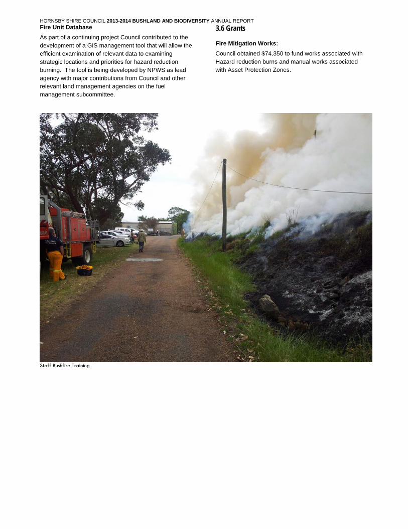
Staff Bushfire Training
HORNSBY SHIRE COUNCIL 2013-2014 BUSHLAND AND BIODIVERSITY ANNUAL REPORT
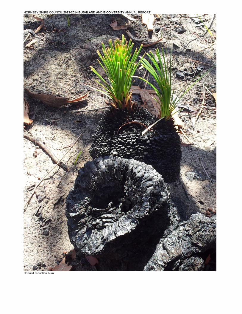
Hazard reduction burn
HORNSBY SHIRE COUNCIL 2013-2014 BUSHLAND AND BIODIVERSITY ANNUAL REPORT
4.0 Bushland Operations 4.1 Contract and Staff Bush Regeneration Program Council's bushland regeneration program treated 56 sites on Council owned land and Crown land where Council is trustee or where management devolved to Council. Some sites were on Office of Environment & Heritage land that is co-managed with Hornsby Shire Council in Berowra Valley National Park under an agreement. One grant funded bushland restoration site was on private* land in conjunction with an adjacent public bushland reserve. Approximately 90% of the sites were contracted to 13 bush regeneration companies under year 1 of a 3 year tender with contracts renewed in August 2013. Works covered approximately 127.5 ha restoring urban bushland remnants and mitigating weed sources that threatened larger and more pristine bushland reserves. This is a 7% increase in the area regenerated in 2012/13.
BUSHLAND REGENERATION SITES
1. Appletree Bushland, Cherrybrook 2. Arcadia Park, Arcadia 3. Arcadia Rd, Fagans Rd Arcadia - Roadside 4. Bar Island 5. Bayfield Rd, Galston - Roadside 6. Beecroft Reserve 7. Begonia Reserve, Normanhurst 8. Benedictine Monastery, Arcadia* 9. Berowra Park Bushland 10. Cheltenham Oval, Cheltenham 11. Cherrybrook Tech High School Bushland 12. Chilworth Recreation Reserve, Devlins Creek
Reserve and Beecroft Reserve 13. Dog Pound Creek Bushland and Ginger Meggs
Park - Bluegum Forest 14. Brickpit Park, Thornleigh 15. Byles Creek - Britannia St Bushland and Azalea
Grove Bushland 16. McKinley Place and Lambe Place - Callicoma
Walk, Cherrybrook 17. Murralong Rd - Calna Creek - Hornsby Heights 18. Carrs Bush, Arcadia – Fagan Park 19. Carrs Rd, Acadia – Roadside 20. Carters Rd, Dural – Roadside 21. The Lakes of Cherrybrook Bushland 22. Cherrybrook Road Bushland 23. Crosslands Reserve 24. Dog Pound Creek Bushland, Westleigh 25. Epping Road Bushland, Epping 26. Fearnley Reserve, Beecroft 27. Fishburn Road and unmade Bevans Rd
Bushland, Galston 28. Flame Tree Close Bushland, Cherrybrook 29. Florence Cotton Bushland Reserve, Hornsby
30. Galston Recreation Reserve, Galston 31. Greenway Park Bushland, Cherrybrook 32. Hornsby Park, Quarry Rd, Hornsby 33. Old Mans Valley and Rosemead Road Bushland 34. Kangaroo Point , Brooklyn 35. Kenley Park, Normanhurst 36. Kent Street Reserve, Epping 37. Kirkham Road, Beecroft Reserve 38. Malsbury Rd and Milsons Pde, Normanhurst –
Roadside 39. Marymount Mercy College, Castle Hill* 40. McKell Park, Brooklyn 41. Mills Park Bushland, Asquith 42. Mountside Reserve, Mount Colah 43. Mt Ku-ring-gai Hard Fill, Mt Ku-ring-gai 44. Netherby Street Bushland, Wahroonga 45. One Tree Reach Wetland, Laughtondale 46. Erlestoke Park, Upper Pyes Creek Bushland and
Pyes Creek Bushland, Dural 47. Ray Park & Plympton Road Bushland, Epping 48. Reddy Park, Hornsby 49. Rofe Park Bushland , Hornsby Heights 50. Arcadia Crescent , Berowra 51. Singleton Rd, Wisemans Ferry 52. Stewart Ave Hornsby 53. Sunnyridge Rd, Arcadia – Roadside 54. Tim Brownscombe Reserve 55. Upper Berowra Creek, Pennant Hills 56. Upper and Middle Terrys Creek Bushland, Dence
Park, Stanley Road Bushland, Epping 57. Vimiera Park, Epping 58. Waitara Creek Bushland and Normanhurst Park,
Normanhurst 59. Westleigh Drive Bushland and Duneba Drive
Bushland South, Westleigh 60. Wisemans Ferry Recreation Reserve- riparian
zone 61. Wongala Crescent, Pennant Hills 62. Zig Zag Creek, Pennant Hills
In addition to bushland regeneration works, maintenance of the native vegetation landscaped zones at 13 Catchment Remediation Rate (CRR) sites was carried out.
Funding included Section 94 contributions for capital upgrade of 10 sites at the cost of $74,952. Council funds of $50,000 were expended on ongoing bushland maintenance sites, grant and green offset funds totalling $387,268 (incl. $9000 for RLIP and $114,088 WASIP funds) and CRR funds of $51,012 for Catchment Remediation sites and of $65,000 for Catchment Remediation riparian sites.
HORNSBY SHIRE COUNCIL 2013-2014 BUSHLAND AND BIODIVERSITY ANNUAL REPORT
4.2 Tree Management in Bushland Reserves Council’s Bushland Operations Team responded to approximately 135 Customer Service Requests from residents for tree assessment in Bushland reserves across the Shire from Epping to Wisemans Ferry. Contract tree works were undertaken subject to assessment.
4.3 Myrtle Rust and Phytophthora Bushcare volunteers have continued to address the problematic weed, Tradescantia fluminensis in Tim Brownscombe Reserve. The presence of Myrtle Rust has not been as prevalent since treatment however the susceptible species Rhodamnia rubescens (Shrub Turpentine) has shown signs of defoliation and stress. As per LPI guidelines, no further treatment is recommended. Successful treatment of Myrtle Rust in Tim Brownscombe Reserve, Bushcare volunteers were allowed to re-enter the reserve under strict hygiene protocols. The Tim Brownscombe Bushcare group was joined by other volunteers under a Bushcare Trainer to address the Tradescantia fluminensis. Treatment of Nursery stock before and after open days continued and outbreaks at residents’ properties were recorded.
Mitigation of the positive Phytophthora results of 2012-13 was undertaken at Byles Creek Reserve, Pennant Hills.
A raised track platform of mini mesh grating was installed. This ensures track users do not pick up the contaminated soil and transfer it to other areas, thus spreading the pathogen. Council continues to adhere to hygiene protocols with staff and contractors.
4.4 Berowra Valley National Park Working Group The park is owned and primarily managed by the National Parks and Wildlife Service (NPWS) and Council undertakes specific roles. A working group of NPWS (now part of Office of Environment and Heritage) and Council’s Natural Resources Branch met regularly during the year to ensure the smooth running of the park by the two agencies for which Council prepared its annual service plan. Crosslands Reserve and its access road is managed by Council as the road and 50% of the reserve is under Council’s direct ownership. Council conducted Park interface activities where Council land adjoins BVNP, including maintenance of existing and installation of five new catchment remediation devices that treat stormwater draining into the Park, training and coordination of 32 Bushcare groups with sites covering 14 ha, management of two strategic walking tracks and 9 contract bush regeneration sites over 26 ha.
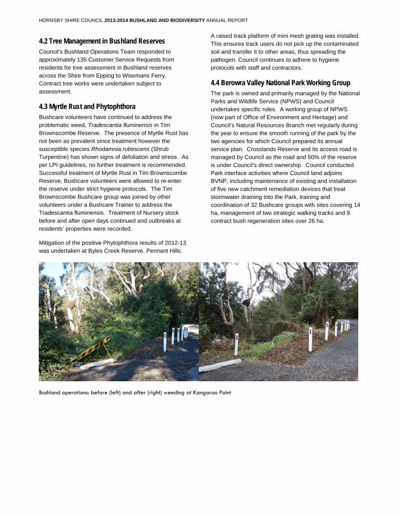
Bushland operations: before (left) and after (right) weeding at Kangaroo Point
HORNSBY SHIRE COUNCIL 2013-2014 BUSHLAND AND BIODIVERSITY ANNUAL REPORT
4.5 Noxious Weed Control Grant funding was received for year 4 of the Sydney Region Weed Action Project which enabled proactive noxious weed inspections and control. 691 inspections were made and 99 noxious weed notices issued.
Regional Noxious Weeds Program
Council inspects strategic areas for noxious weeds with funding assistance from the Sydney Weeds Action Program. Areas targeted for private property inspections this year were the extensive peninsulas of residential land in parts of Westleigh and Mount Colah surrounded by Berowra Valley National Park, as well as properties in George and Albion Streets Pennant Hills targeting an established infestation of Cat’s Claw Creeper.
In total 691 strategic inspections were completed. 105 Weed advice letters were sent to residents whose properties were found to contain noxious weed species.
Council inspected and treated priority noxious weeds along 32km of transport corridors:
Hornsby to Cowan for Tussock Paspalum, Boneseed, Pampas Grass and between Pennant Hills to Glenorie for Boneseed and Tussock Paspalum.
Responsive noxious weed visits and education
92 service requests were received for noxious weeds on private property. An additional 224 property inspections were also undertaken related to general enquiries, DAs and TAs. An additional 158 phone and email enquiries were received. 75 seek cooperation letters/noxious weeds notices were sent out. 3 Section 64 Certificates were issued.The majority of weeds on private property were Large-leaf and Small-leaf privet (Ligustrum lucidum and Ligustrum sinense), Morning glory (Ipomea indica), Lantana (Lantana camara) and Camphor laurel (Cinnamomum camphora). Noxious Weeds (Weed Control) Order 2014 (also known as Control Order 30) commenced in February 2014 and runs for 5 years. The Order modified noxious weeds listings throughout NSW, in Hornsby Shire an additional 32 species have been listed and notably Wandering Jew (Tradescantia fluminensis) has been removed from the listing.
Sydney Weeds Committee
Council participated in the Sydney Weeds Committee, the Sydney Weeds Professional Forum 2014 and the Sydney Region Weeds Action Project to keep aware of regional weed priorities and initiatives and receive grants to implement noxious weed control.
LISTED NOXIOUS WEEDS FOR HORNSBY SHIRE COUNCIL - February 2014
Name - Common Botanical Class
African boxthorn Lycium ferocissimum 4 African feathergrass Pennisetum macrourum 5 African olive Olea europaea ssp 4 cuspidata African turnip weed Sisymbrium thellungii and 5 Sisymbrium runcinatum Alligator weed Alternanthera hiloxeroides 3 Anchored water Eichhornia azurea 1 hyacinth Annual ragweed Ambrosia artemisiifolia 5 Arrowhead Sagittaria montevidensis 4 Artichoke thistle Cynara cardunculus 5 Asparagus Asparagus species 4 Asparagus fern Asparagus virgatus 4 Athel tree / pine Tamarix aphylla 5 Balloon vine Cardiospermum 4 grandiflorum Bear-skin fescue Festuca gautieri 5 Bitou bush Chrysanthemoides 3 monilifera ssp rotundata Black knapweed Centaurea xmoncktonil 1 Black willow Salix nigra 2 Blackberry Rubus fruticosus 4 aggregate species Boneseed Chrysanthemoides 2 monilifera ssp monilifera Bridal veil creeper Asparagus declinatus 4 Bridal veil creeper Asparagus declinatus 1 Broad-leaf pepper tree Schinus terebinthifolius 2 Broomrapes Orobanche spp 1
except native O.cernua, australiana & O.minor Burr ragweed Ambrosia confertiflora 5 Cabomba All Cabomba spp 5 except C.furcata Camphor laurel Cinnamomum camphora 4 Castor oil plant Ricinus communis 4 Cat’s claw creeper Dolichandra unguis-cati 4 Cayenne snakeweed Stachytarpheta 5 cayennensis Chilean needle grass Nassella neesiana 4 Chinese celtis Celtis sinensis 4 Chinese violet Asystasia gangetica 1 ssp micrantha Climbing Asparagus fern Asparagus plumosus 2 Climbing Asparagus fern Asparagus plumosus 4 Clockweed Gaura parviflora 5 Cockspur coral tree Erythrina crista-galli 4 Coolatai grass Hyparrhenia hirta 3 Corky passionfruit Passiflora superosa 4 Corn sowthistle Sonchus arvensis 5 Dodder All Cuscuta species 5 except native C.australia, C.tasmanica and C.victoriana Dolichos pea Dipogon lignosus 4 Espartillo Amelichloa brachychaeta / 5 caudata Eurasian water milfoil Myriophyllum spicatum 1 Fine-bristled burr grass Cenchrus brownii 5 Fireweed Senecio madagascariensis 4 Flax-leaf brom Genista linifolia 4 Fountain grass Pennisetum setaceum 5 Frogbit / Spongeplant Limnobium laevigatum 1 and L.spongia Gallon's curse Cenchrus biflorus 5 Gamba grass Andropogon gayanus 5
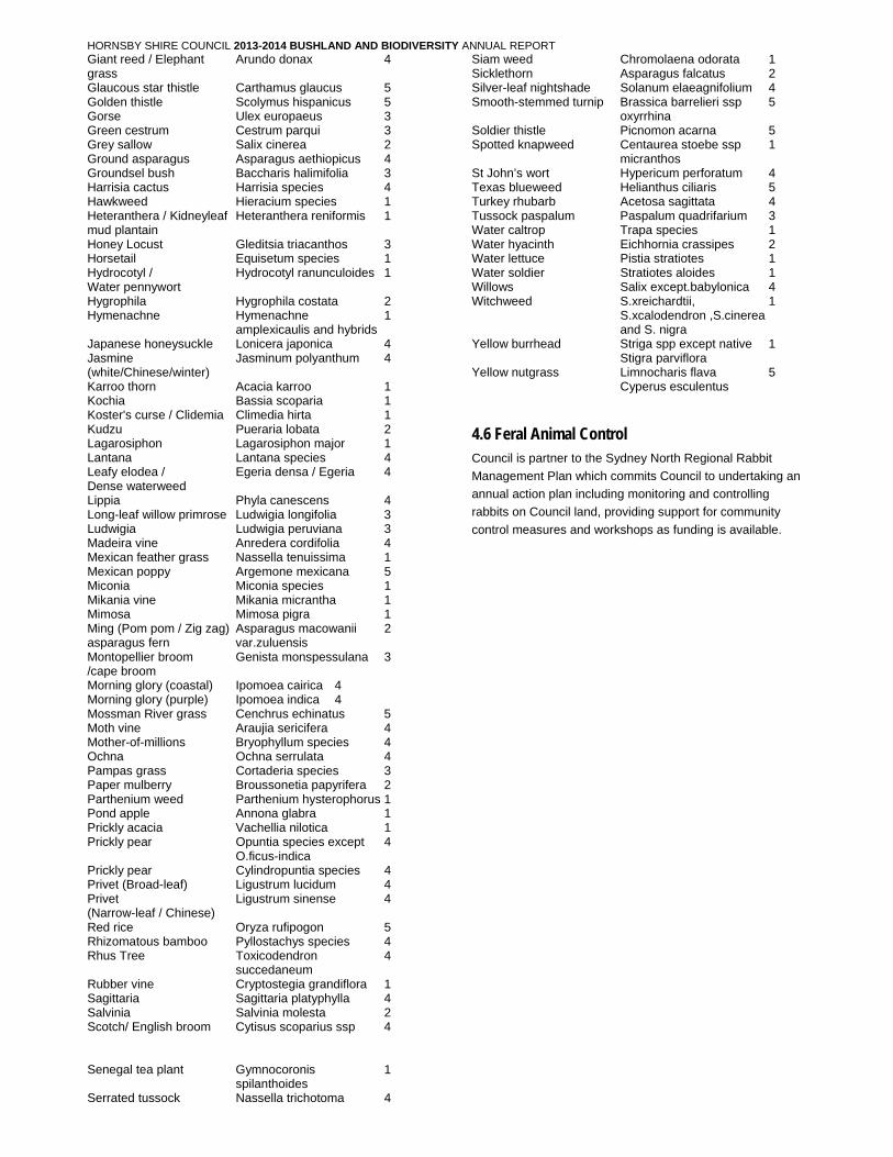
HORNSBY SHIRE COUNCIL 2013-2014 BUSHLAND AND BIODIVERSITY ANNUAL REPORT
Giant reed / Elephant Arundo donax 4 grass Glaucous star thistle Carthamus glaucus 5 Golden thistle Scolymus hispanicus 5 Gorse Ulex europaeus 3 Green cestrum Cestrum parqui 3 Grey sallow Salix cinerea 2 Ground asparagus Asparagus aethiopicus 4 Groundsel bush Baccharis halimifolia 3 Harrisia cactus Harrisia species 4 Hawkweed Hieracium species 1 Heteranthera / Kidneyleaf Heteranthera reniformis 1 mud plantain Honey Locust Gleditsia triacanthos 3 Horsetail Equisetum species 1 Hydrocotyl / Hydrocotyl ranunculoides 1 Water pennywort Hygrophila Hygrophila costata 2 Hymenachne Hymenachne 1 amplexicaulis and hybrids Japanese honeysuckle Lonicera japonica 4 Jasmine Jasminum polyanthum 4 (white/Chinese/winter) Karroo thorn Acacia karroo 1 Kochia Bassia scoparia 1 Koster's curse / Clidemia Climedia hirta 1 Kudzu Pueraria lobata 2 Lagarosiphon Lagarosiphon major 1 Lantana Lantana species 4 Leafy elodea / Egeria densa / Egeria 4 Dense waterweed Lippia Phyla canescens 4 Long-leaf willow primrose Ludwigia longifolia 3 Ludwigia Ludwigia peruviana 3 Madeira vine Anredera cordifolia 4 Mexican feather grass Nassella tenuissima 1 Mexican poppy Argemone mexicana 5 Miconia Miconia species 1 Mikania vine Mikania micrantha 1 Mimosa Mimosa pigra 1 Ming (Pom pom / Zig zag) Asparagus macowanii 2 asparagus fern var.zuluensis Montopellier broom Genista monspessulana 3 /cape broom Morning glory (coastal) Ipomoea cairica 4 Morning glory (purple) Ipomoea indica 4 Mossman River grass Cenchrus echinatus 5 Moth vine Araujia sericifera 4 Mother-of-millions Bryophyllum species 4 Ochna Ochna serrulata 4 Pampas grass Cortaderia species 3 Paper mulberry Broussonetia papyrifera 2 Parthenium weed Parthenium hysterophorus 1 Pond apple Annona glabra 1 Prickly acacia Vachellia nilotica 1 Prickly pear Opuntia species except 4 O.ficus-indica Prickly pear Cylindropuntia species 4 Privet (Broad-leaf) Ligustrum lucidum 4 Privet Ligustrum sinense 4 (Narrow-leaf / Chinese) Red rice Oryza rufipogon 5 Rhizomatous bamboo Pyllostachys species 4 Rhus Tree Toxicodendron 4 succedaneum Rubber vine Cryptostegia grandiflora 1 Sagittaria Sagittaria platyphylla 4 Salvinia Salvinia molesta 2 Scotch/ English broom Cytisus scoparius ssp 4 Senegal tea plant Gymnocoronis 1 spilanthoides Serrated tussock Nassella trichotoma 4
Siam weed Chromolaena odorata 1 Sicklethorn Asparagus falcatus 2 Silver-leaf nightshade Solanum elaeagnifolium 4 Smooth-stemmed turnip Brassica barrelieri ssp 5 oxyrrhina Soldier thistle Picnomon acarna 5 Spotted knapweed Centaurea stoebe ssp 1 micranthos St John’s wort Hypericum perforatum 4 Texas blueweed Helianthus ciliaris 5 Turkey rhubarb Acetosa sagittata 4 Tussock paspalum Paspalum quadrifarium 3 Water caltrop Trapa species 1 Water hyacinth Eichhornia crassipes 2 Water lettuce Pistia stratiotes 1 Water soldier Stratiotes aloides 1 Willows Salix except.babylonica 4 Witchweed S.xreichardtii, 1 S.xcalodendron ,S.cinerea and S. nigra Yellow burrhead Striga spp except native 1 Stigra parviflora Yellow nutgrass Limnocharis flava 5 Cyperus esculentus
4.6 Feral Animal Control Council is partner to the Sydney North Regional Rabbit
Management Plan which commits Council to undertaking an
annual action plan including monitoring and controlling
rabbits on Council land, providing support for community
control measures and workshops as funding is available.

HORNSBY SHIRE COUNCIL 2013-2014 BUSHLAND AND BIODIVERSITY ANNUAL REPORT
Hornsby Heritage Steps
Hornsby Shire Council ABN 20 706 996 972 PO Box 37, Hornsby NSW 1630 Phone 02 9847 6666 Email [email protected] 296 Pacific Highway, Hornsby 2077 DX 9655 Hornsby Fax 02 9847 6999 Web hornsby.nsw.gov.au
4.7 Walking Tracks and Bushland Access Council has over 49 km of formal and informal bushwalking
tracks. Formal tracks include:
Beecroft-Cheltenham Link Track,
Historic Pioneers' Track, Epping
Historic Hornsby Heritage Steps
Bluegum walk, Hornsby
Mangrove walk, Brooklyn
Callicoma walk, Cherrybrook
Carrs Bush walk, Galston
Crosslands salt marsh walk
Mambara walk, Pennant Hills
McKell Park walk, Brooklyn
Terrys Creek walk, Epping
Bar Island, Berowra Creek
Links to the Great North Walk
Audits: Annual track audits were undertaken on Councils formal tracks. Monthly audits were undertaken on the Hornsby Mountain Bike Trail for the first 12 months after construction to assess the environmental and social impacts as well as ensuring its durability.
McKell Park, Brooklyn Steps Upgrade: Following upgrade of the steps between lower McKell Park and William St June 2013, Stage 2 included weed and refuse management adjacent to steps and some landscape works. Due to the invasive weed species present on the site ongoing weed control occurred throughout 2013-14 with final landscape planting scheduled for 2015.
Pyes Creek A Hawkesbury Nepean Catchment Authority Grant provided funds for new areas along Pyes Creek to undergo bush regeneration activities which previously had not had funding. The areas bordered the Berowra Valley National Park. Isolated weed species within in areas of high resilience were targeted to reduce the potential of future infestations spreading downstream. Work was also run in conjunction with Council’s Fire Trail Maintenance Project to increase the presence of low growing native species along fire trails instead of a weedy alternative. The new Pyes Creek Bushcare site is also
within this area and as such, the Pyes Creek work has been a good example of how different stake holders can work together for a desired outcome.
Minor works
Maintenance and inspections occurred at:
Bar Island Track - weed control
Blue Gum Walk - cut all timber fallen across track, directional signage enhanced
Terrys Creek Track – replaced dislodge boardwalk between and a raised boardwalk from the steps below Dence Park carpark to Pembroke Street (external contract)
Waitara Creek - Bryan Ave Normanhurst - steps repair
Brooklyn Boardwalk- inspection and repair of vandalised seating area and rails
Mambara Track - clearing overgrowth, leaf litter and soil removed from surface
Beecroft-Cheltenham Link Track - vegetation along all tracks was cut back
Pioneers Track - vegetation along all tracks was cut back
Carrs Bush - all signs cleaned
Hornsby Mountain Bike Trail
4.8 Mountain Bike Trail Stage One of the trail was officially opened to the public in February 2013. Over 30,000 laps of the track had been ridden since the trail counter was installed. Stage Two trails were built during 2014. The cross-country bike trail network winds through 6 kilometres of the picturesque Hornsby Park Bushland Reserve and Old Mans Valley. .
Funding of $102,000 was received from Metropolitan Greenspace and $50,000 Department of Sport and Recreation for the project. .
The Hornsby Trailcare Program is a group of volunteers who continue to assist council with care and maintenance of the trail. Staff undertook a site monitoring program in accordance with the consent conditions for this facility. Council is responsible for general maintenance of the trail and the Hornsby Trailcare Volunteers Guidelines. .
4.9 Roadside Vegetation Implementation Project Council completed works in accordance with the grant funding from Local Shires Association ‘Restoration of Roadside Corridors and Vegetation Linkages in Hornsby Shire’ in June 2013. .
HORNSBY SHIRE COUNCIL 2013-2014 BUSHLAND AND BIODIVERSITY ANNUAL REPORT
The RVIP project aimed to conserve and recreate vegetation connectivity across fragmented rural and urban landscapes. The project had 3 components which included on-ground restoration works, installation of ‘Significant Roadside Vegetation’ signs and in-house training of Council Works and Parks field staff to highlight significant vegetation within the Hornsby LGA. .
In 2014 Council received a ‘Highly Commended’ Award for its Roadside Environment Management Project ‘Restoration of Roadside Corridors and Vegetation Linkages in Hornsby Shire’ from Local Government, NSW. .
In 2013-14 Council completed the upgrade to existing roadside signs with 75 new ‘Significant Roadside Environment Area’ signs installed within the rural lands area to raise community awareness to areas of significant roadside vegetation. .
On-ground bushland restoration works occurred at the following roadside areas in 2013-14: Laurie Rd, Dural, Jasmine Rd, Normanhurst; Arcadia Rd, Arcadia; Bayfield Rd, Arcadia, Singleton Rd, Singleton Mill; Fishburns Rd, Galston; Bevans Rd, Galston; Carrs Rd, Galston; Fagans Rd, Galston Wongala Cres, Pennant Hills; Dartford Rd, Malsbury Rd/Midson Pde Normanhurst. .
4.10 Estuary Bushland Reserves Assessment
In April/May 2014 Council inspected 13 boat access only reserves along the Hawkesbury River. Each reserve was mapped and assessed for bushland condition, weed density, erosion issues. Flora and fauna lists were updated. Following assessment restoration works have been prioritised. .
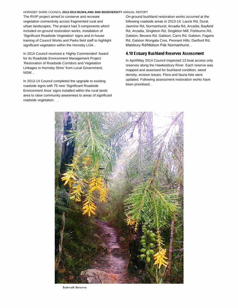
Bushwalk Berowra
Hornsby Shire Council ABN 20 706 996 972 PO Box 37, Hornsby NSW 1630 Phone 02 9847 6666 Email [email protected] 296 Pacific Highway, Hornsby 2077 DX 9655 Hornsby Fax 02 9847 6999 Web hornsby.nsw.gov.au
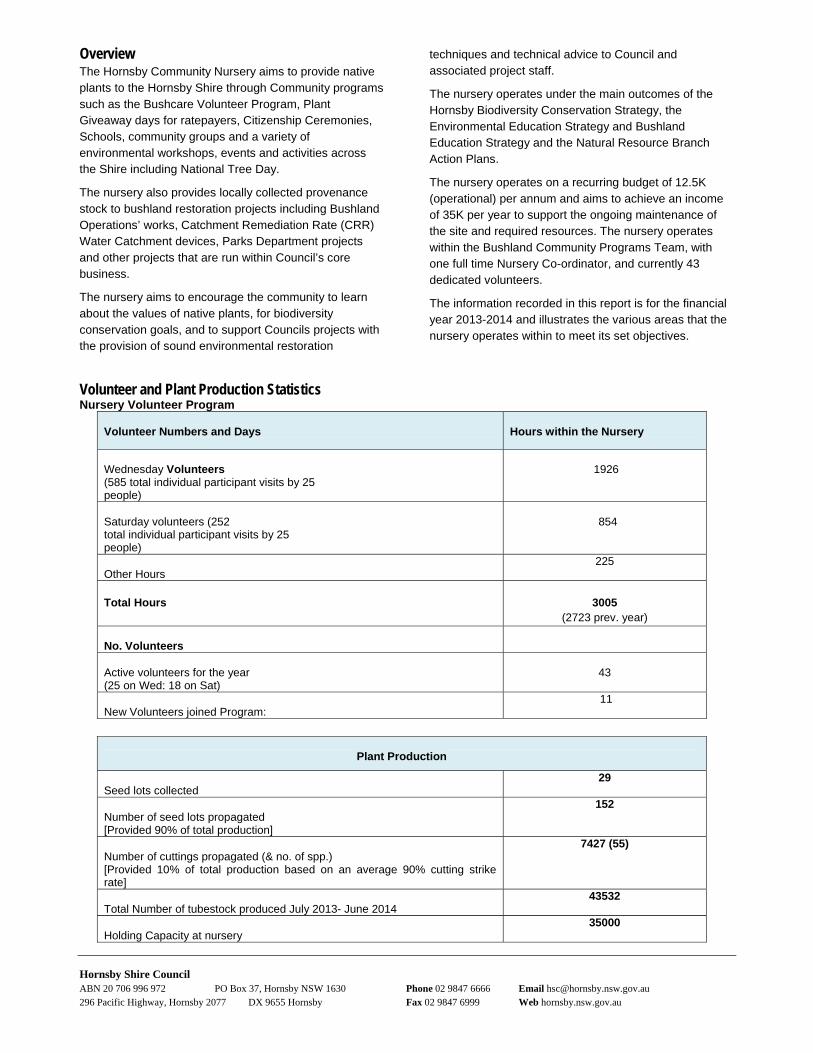
5.0 Bushcare and Community programs5.1 Bushcare Hornsby Shire Council Bushcare was established in 1989 and celebrated 25 years in 2014. The program is the largest volunteer program in the Shire and one of the largest Bushcare programs in the Sydney metropolitan area with 101 registered groups and 898 volunteers. With 104 new volunteers joining the program this year, it represents a 12% increase in membership.
During the year we introduced an online application, with clear easy steps to join where new applicants can trial the program before committing. Numbers have increased through campaigns celebrating 25 years, and updates to the website with personal stories of Bushcare and resources. Bushcare displays were held at a number of events and shopping centre.
Bushcare volunteers restored and enhanced 77 ha of native vegetation and habitat in Council’s bushland reserves across the Shire. Twenty three of our Bushcare groups are enhancing over 15.5 ha of five unique EEC’s including Blue Gum Shale and Diatreme Forest, Turpentine Ironbark Forest and Duffys Forest.
Bushcare volunteer hours are estimated at 18,500 during this period, which can be valued at $555,000. Two new trainers commenced in October, now providing 88% of groups with a regular trainer.
Three new groups commenced, two of which were at new sites, with St Edmonds School students at James Park, Hornsby and another at local resident group at Pyes Creek, Cherrybrook. Evans Road at Hornsby Heights re-activated with a new group of neighbours.
Over 70 volunteers, staff and associates attended the 25 years of Bushcare celebration morning tea in May hosted by Hornsby’s Mayor.
Bushcare celebrated 24s year in Hornsby Shire at the Annual Christmas Workshop in November 2013 with 100 volunteers attending a bush dance at Galston Community Centre. ‘The Golden Trowel’ perpetual award went to Carrs Bush Group for their dedication and long term commitment in conserving a significant bushland reserve of Turpentine Ironbark Forest. The Nursery Perpetual Award for exceptional interest and dedication was won by Jean Fairfax.
The Bushcare photo competition received over 49 general entries that were showcased at the celebrations along with ten Bushcare Stories of individual volunteers. This year the photo competition was displayed at four Hornsby Council libraries and Wallarobba featured best photos judged by the volunteers.
Celebrating 25 Years of Bushcare The Bushcare team provided a variety of seminars, talks, tours and training to Bushcare volunteers and some to the wider community. A total of 601 people participated in 19 events held, a 58% increase in participation from last year despite reducing the number of events by 48%. Additional workshops held by Ku-ring-gai Council were available to Hornsby volunteers. Bushcode training is compulsory for volunteers’ accreditation and must be refreshed every 5 years. Other training supports ongoing learning and is provided jointly by Hornsby and Ku-ring-gai Councils. Training included five Bushcode Workshops, three plant identification workshops, four seminars also open to general community, three walks and talks, two Group leader forums, two site tours and the Bushcare Annual Christmas Party. Community events included National Tree Day and a number of stalls at community events.
Hornsby Shire Council ABN 20 706 996 972 PO Box 37, Hornsby NSW 1630 Phone 02 9847 6666 Email [email protected] 296 Pacific Highway, Hornsby 2077 DX 9655 Hornsby Fax 02 9847 6999 Web hornsby.nsw.gov.au
Earthwise cottage activities and projects
The Earthwise cottage and Community Nursery is the office of the Bushland Community Programs team and is a venue for plant giveaways, staff meetings and workshops. The site has undergone significant refurbishment to enhance it as a sustainable demonstration house and improve it as a facility for volunteers and staff activities. This year the new instalments to demonstrate retrofitting sustainable features included installing flyscreens to allow windows to open in the 2 offices to encourage fresh air use over air conditioning and implementing first stage of garden upgrades to using community nursery stock to demonstrate water efficient plants and attracting native bees and wildlife to your garden.
This year the Earthwise Cottage and Nursery precinct was the venue for 28 meetings, 5 Bushcare training events, 3 external training workshops, three nursery open days.
5.2 Community Nursery The Community Nursery has over 40 active volunteers that contributed over 3000 hours this year over 3 half days a fortnight produced over 43,532 tubestock for the financial year. These plants are produced for public lands projects and educational provisions such as the Free Native Plant Giveaway, Council projects including CRR works, land rehabilitation projects and landscape works.
40,217 plants were dispatched providing an excellent turnaround of stock. All seed is locally collected to maintain genetic integrity and provide material for provenance planting. Volunteer work was valued at $65,000 over 72 days.
The annual four Free Native Plant Giveaways provided 6645 native tubestock to about 2,000 ratepayers from every suburb in the shire a 9% increase from last year. This promotes local native plants to home gardeners and the importance of protecting the bushland shire along with creating habitat for local wildlife.
The nursery showcased best practice through its water recycling capturing on-site runoff rainfall, solar power, minimal waste production, recycling of materials and a low chemical reliance.
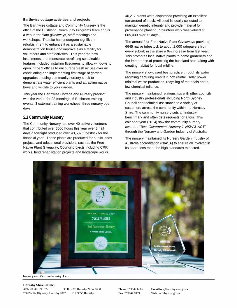
The nursery maintained relationships with other councils and industry professionals including North Sydney Council and technical assistance to a variety of customers across the community within the Hornsby Shire. The community nursery sets an industry benchmark and often gets requests for a tour. This calendar year (2014) saw the community nursery awarded “Best Government Nursery in NSW & ACT” through the Nursery and Garden Industry of Australia.
The nursery maintained its Nursery Garden Industry of Australia accreditation (NIASA) to ensure all involved in its operations meet the high standards expected.
Nursery and Garden Industry Award
Hornsby Shire Council ABN 20 706 996 972 PO Box 37, Hornsby NSW 1630 Phone 02 9847 6666 Email [email protected] 296 Pacific Highway, Hornsby 2077 DX 9655 Hornsby Fax 02 9847 6999 Web hornsby.nsw.gov.au
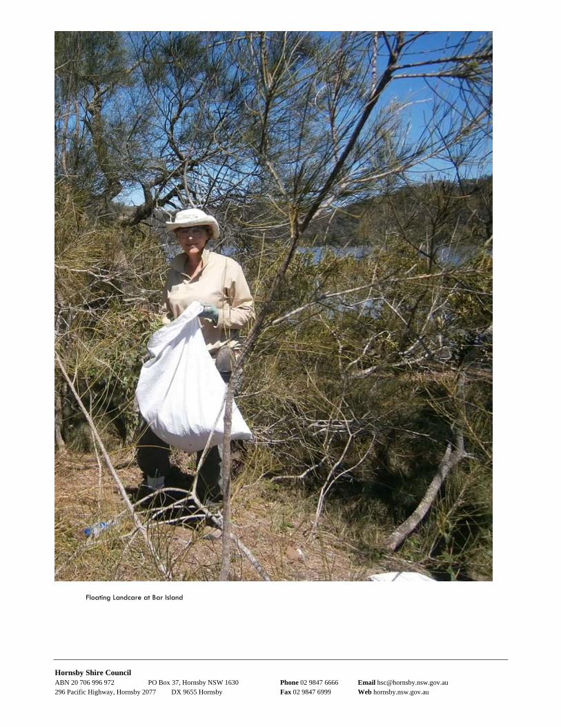
5.3 Guided Bushwalks Council's free Guided Bushwalks program took 34 walks with 346 residents this year, most being fully booked with a waiting list. The program repeated the popular ‘Nature Photography’ walk at the Kurrajong Track and the Blue Gum Walk circuit. A wide variety of bushwalks of varying lengths and grades of difficulty promoted enjoyment of the Bushland, education and hea. Three new walks were introduced including a circuit walk within Muogamarra Nature Reserve and a walk to Brooklyn Dam.
5.4 Habitat Connectivity Council’s Habitat Connectivity and Rural Lands Program continued in 2013-14 through various Environmental Trust and Catchment Management Authority grants. This program allowed Council to reinforce the partnerships made with rural landholders, monitor and consolidate previous works strengthening vegetation connectivity on private and public land.
In 2013-14 a total of 2 ha of bushland on private land was restored. All works occurred within endangered and critically endangered communities of Sydney Turpentine Ironbark Forest and Blue Gum High Forest. On-ground restoration on private property continued at Cherrybrook Technical High School, Cherrybrook, Benedictine Monastery at Arcadia and Marymount Mercy College, Castle Hill.
Three workshops were delivered:
February 2014 - Sustainable Horse Management, Dural with Local Land Services and The Hills Shire
April 2014 – Native Grasses Workshop, Arcadia, with Still Creek Landcare Group
May 2014 – ‘Living with Termites’ at Arcadia
Brooklyn School Environmental Awareness Day
National Tree Day
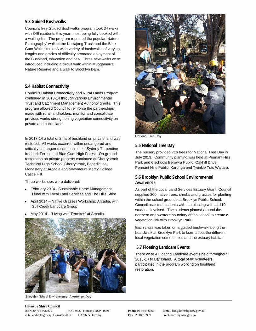
5.5 National Tree Day The nursery provided 716 trees for National Tree Day in July 2013. Community planting was held at Pennant Hills Park and 6 schools Berowra Public, Oakhill Drive, Pennant Hills Public, Karonga and Twinkle Tots Waitara.
5.6 Brooklyn Public School Environmental Awareness As part of the Local Land Services Estuary Grant, Council supplied 200 native trees, shrubs and grasses for planting within the school grounds at Brooklyn Public School. Council assisted students with the planting with all 110 students involved. The students planted around the northern and western boundary of the school to create a vegetation link with Brooklyn Park.
Each class was taken on a guided bushwalk along the boardwalk at Brooklyn Park to learn about the different local vegetation communities and the estuary habitat.
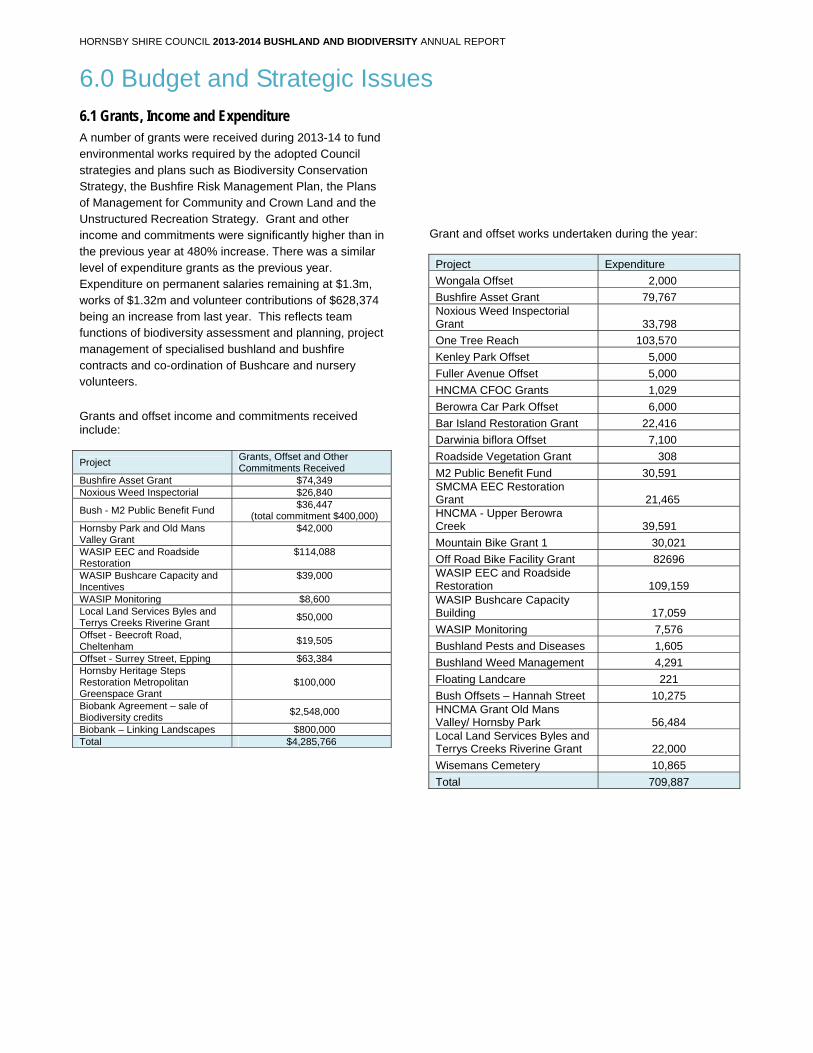
5.7 Floating Landcare Events There were 4 Floating Landcare events held throughout 2013-14 to Bar Island. A total of 80 volunteers participated in the program working on bushland restoration.
Sept 2009
Hornsby Shire Council ABN 20 706 996 972 PO Box 37, Hornsby NSW 1630 Phone 02 9847 6666 Email [email protected] 296 Pacific Highway, Hornsby 2077 DX 9655 Hornsby Fax 02 9847 6999 Web hornsby.nsw.gov.au
Floating Landcare at Bar Island
HORNSBY SHIRE COUNCIL 2013-2014 BUSHLAND AND BIODIVERSITY ANNUAL REPORT
6.0 Budget and Strategic Issues
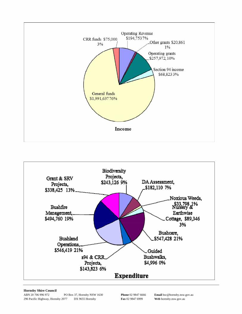
6.1 Grants, Income and Expenditure A number of grants were received during 2013-14 to fund environmental works required by the adopted Council strategies and plans such as Biodiversity Conservation Strategy, the Bushfire Risk Management Plan, the Plans of Management for Community and Crown Land and the Unstructured Recreation Strategy. Grant and other income and commitments were significantly higher than in the previous year at 480% increase. There was a similar level of expenditure grants as the previous year. Expenditure on permanent salaries remaining at $1.3m, works of $1.32m and volunteer contributions of $628,374 being an increase from last year. This reflects team functions of biodiversity assessment and planning, project management of specialised bushland and bushfire contracts and co-ordination of Bushcare and nursery volunteers.
Grants and offset income and commitments received include:
Project Grants, Offset and Other Commitments Received
Bushfire Asset Grant $74,349 Noxious Weed Inspectorial $26,840
Bush - M2 Public Benefit Fund $36,447
(total commitment $400,000) Hornsby Park and Old Mans Valley Grant
$42,000
WASIP EEC and Roadside Restoration
$114,088
WASIP Bushcare Capacity and Incentives
$39,000
WASIP Monitoring $8,600 Local Land Services Byles and Terrys Creeks Riverine Grant
$50,000
Offset - Beecroft Road, Cheltenham
$19,505
Offset - Surrey Street, Epping $63,384 Hornsby Heritage Steps Restoration Metropolitan Greenspace Grant
$100,000
Biobank Agreement – sale of Biodiversity credits
$2,548,000
Biobank – Linking Landscapes $800,000 Total $4,285,766
Grant and offset works undertaken during the year:
Project Expenditure
Wongala Offset 2,000
Bushfire Asset Grant 79,767 Noxious Weed Inspectorial Grant 33,798
One Tree Reach 103,570
Kenley Park Offset 5,000
Fuller Avenue Offset 5,000
HNCMA CFOC Grants 1,029
Berowra Car Park Offset 6,000
Bar Island Restoration Grant 22,416
Darwinia biflora Offset 7,100
Roadside Vegetation Grant 308
M2 Public Benefit Fund 30,591 SMCMA EEC Restoration Grant 21,465 HNCMA - Upper Berowra Creek 39,591
Mountain Bike Grant 1 30,021
Off Road Bike Facility Grant 82696 WASIP EEC and Roadside Restoration 109,159 WASIP Bushcare Capacity Building 17,059
WASIP Monitoring 7,576
Bushland Pests and Diseases 1,605
Bushland Weed Management 4,291
Floating Landcare 221
Bush Offsets – Hannah Street 10,275 HNCMA Grant Old Mans Valley/ Hornsby Park 56,484 Local Land Services Byles and Terrys Creeks Riverine Grant 22,000
Wisemans Cemetery 10,865
Total 709,887
Hornsby Shire Council ABN 20 706 996 972 PO Box 37, Hornsby NSW 1630 Phone 02 9847 6666 Email [email protected] 296 Pacific Highway, Hornsby 2077 DX 9655 Hornsby Fax 02 9847 6999 Web hornsby.nsw.gov.au
Hornsby Shire Council ABN 20 706 996 972 PO Box 37, Hornsby NSW 1630 Phone 02 9847 6666 Email [email protected] 296 Pacific Highway, Hornsby 2077 DX 9655 Hornsby Fax 02 9847 6999 Web hornsby.nsw.gov.au
6.2 Offset Income During the 2013-14 year offset funds were committed at two development sites of $82,890 compared with $10,000 in 2012-13, $20,000 in 2011-12 and $133,255 in 2010-11. An offset commitment of $2,548,000 was made with Transport for NSW for the sale of biodiversity credits to offset two railway infrastructure projects.
6.3 Broader Community Consultation
Bushland Management Advisory Committee
BMAC continued in its role to advise Council on strategic direction and projects. During the year four new
members joined the Committee and they commented on the review of the Biodiversity Action Plan 2013-14, commented on the commented on safety signage for Hornsby Mountain Bike Track, wrote to the Minister for Planning on North West Rail Link, prepared a position paper on bushland, suggested nomination of Coolatai Grass as a Noxious Weed, commenced work, made recommendations for additional funding to be voted following grant funded upgrades, attended Hornsby Active Living Workshop and voiced concerns about poor quality of M2 weed remediation work and held meeting with operators. BMAC undertook site inspections to advise on strategic projects including Wisemans Ferry Cemetery Restoration, Wisemans Ferry Tip Revegetation Project and One Tree Reach Wetland
.
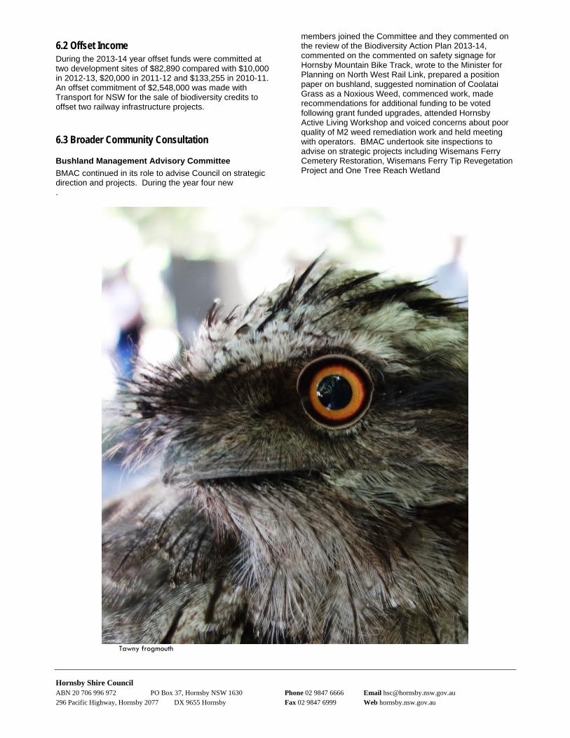
Tawny frogmouth

HORNSBY SHIRE COUNCIL 2013-2014 BUSHLAND AND BIODIVERSITY ANNUAL REPORT
7.0 References Hornsby Shire Council (2012). Green Offsets Code. Hornsby Shire Council, Hornsby – accessed at http://hsconline.hornsby.nsw.gov.au/appenquiry/user/policy/default.aspx?page=found&2=offset&4=33&4a=ALLPC&5=&6= NSW Office of Environment and Heritage - Bionet the website for the Atlas of NSW Wildlife – accessed at http://www.environment.nsw.gov.au/atlaspublicapp/UI_Modules/ATLAS_/AtlasSearch.aspx
HORNSBY SHIRE COUNCIL 2013-2014 BUSHLAND AND BIODIVERSITY ANNUAL REPORT
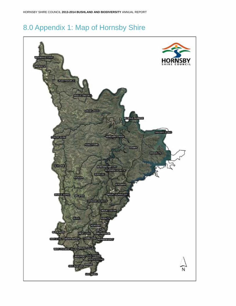
8.0 Appendix 1: Map of Hornsby Shire
HORNSBY SHIRE COUNCIL 2013-2014 BUSHLAND AND BIODIVERSITY ANNUAL REPORT
Appendix 2: Council Community Nursery Annual Report
Executive Summary Hornsby Shire Council’s Community Nursery is an integral part of the Hornsby Bushcare Program along with several other major council programs. It operates within the Natural Resources Branch in the Environment and Human Services Division.
The nursery achieved accreditation with the NIASA (Nursery Industry Accreditation Scheme Australia) complying with strict standards of environmental best practice nursery management. It has maintained accreditation since 2005, and aims to continue accreditation as a model of best practice to other community nurseries across NSW. The Hornsby Community Nursery was the first local government run nursery to achieve this accreditation and to date continues to be the only Council Accredited Nursery in NSW. Currently we are working with the Nursery Garden Industry of Australia (NGIA) to further achieve EcoHort certification. .
The nursery aims to showcase best practice operations across the wider community. This is achieved through many initiatives including full water recycling system capturing on site runoff rainfall, solar power, minimal waste production, recycling of materials and a low chemical reliance. .
This year (2014) we have been awarded the “Best Government Nursery in NSW & ACT” Award, through the NGIA excellence awards and a finalist for the National Awards. .
Volunteers are an integral part of the community nursery with respect to production, a knowledge base and fostering a valuable community asset through their
ongoing participation. This year the volunteers had educational tour to select sites across the Hornsby Shire to see where the plants they produce end up.
Large plant orders continue to be received for revegetation at the new Hornsby Aquatic Centre, along with ongoing supply of plants for the Catchments Remediation Rate associated works, Nursery Plant Giveaway Days for residents, local schools and bushland restoration areas. Other significant projects this past year have included the ongoing Habitat Havens community project at Beecroft which to date has utilised 3357 plants.
The nursery also continues to foster and maintain relationships with other councils and industry professionals including Willoughby Council and North Sydney Council. The nursery continues an ongoing educational partnership with Northern Sydney Institute of TAFE and technical assistance to a variety of customers across the Hornsby Shire. Local schools are a major component for environmental education and we work closely with them across the Shire through supply of plants, hands on planting assistance, restoration advise and knowledge transfer through education. .
This past financial year also saw the creation of the new Eco-Garden nursery volunteer program led by Tanya Mein from council’s Waste Services Branch facilitated at the community nursery. The new group sowed over 2000 seeds with a 79% success rate. These seedlings supply the Eco Garden within Fagan Park, Galston. The remainder were circulated through the wider community at nursery plant giveaway events and local schools. .
Hornsby Shire Council ABN 20 706 996 972 PO Box 37, Hornsby NSW 1630 Phone 02 9847 6666 Email [email protected] 296 Pacific Highway, Hornsby 2077 DX 9655 Hornsby Fax 02 9847 6999 Web hornsby.nsw.gov.au
Hornsby Shire Council ABN 20 706 996 972 PO Box 37, Hornsby NSW 1630 Phone 02 9847 6666 Email [email protected] 296 Pacific Highway, Hornsby 2077 DX 9655 Hornsby Fax 02 9847 6999 Web hornsby.nsw.gov.au
Overview The Hornsby Community Nursery aims to provide native plants to the Hornsby Shire through Community programs such as the Bushcare Volunteer Program, Plant Giveaway days for ratepayers, Citizenship Ceremonies, Schools, community groups and a variety of environmental workshops, events and activities across the Shire including National Tree Day.
The nursery also provides locally collected provenance stock to bushland restoration projects including Bushland Operations’ works, Catchment Remediation Rate (CRR) Water Catchment devices, Parks Department projects and other projects that are run within Council’s core business.
The nursery aims to encourage the community to learn about the values of native plants, for biodiversity conservation goals, and to support Councils projects with the provision of sound environmental restoration
techniques and technical advice to Council and associated project staff.
The nursery operates under the main outcomes of the Hornsby Biodiversity Conservation Strategy, the Environmental Education Strategy and Bushland Education Strategy and the Natural Resource Branch Action Plans.
The nursery operates on a recurring budget of 12.5K (operational) per annum and aims to achieve an income of 35K per year to support the ongoing maintenance of the site and required resources. The nursery operates within the Bushland Community Programs Team, with one full time Nursery Co-ordinator, and currently 43 dedicated volunteers.
The information recorded in this report is for the financial year 2013-2014 and illustrates the various areas that the nursery operates within to meet its set objectives.
Volunteer and Plant Production Statistics Nursery Volunteer Program
Volunteer Numbers and Days
Hours within the Nursery
Wednesday Volunteers (585 total individual participant visits by 25 people)
1926
Saturday volunteers (252 total individual participant visits by 25 people)
854
Other Hours
225
Total Hours
3005
(2723 prev. year) No. Volunteers
Active volunteers for the year (25 on Wed: 18 on Sat)
43
New Volunteers joined Program:
11
Plant Production
Seed lots collected
29
Number of seed lots propagated [Provided 90% of total production]
152
Number of cuttings propagated (& no. of spp.) [Provided 10% of total production based on an average 90% cutting strike rate]
7427 (55)
Total Number of tubestock produced July 2013- June 2014
43532
Holding Capacity at nursery
35000
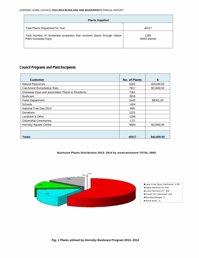
HORNSBY SHIRE COUNCIL 2013-2014 BUSHLAND AND BIODIVERSITY ANNUAL REPORT
Plants Supplied
Total Plants Dispatched for Year 40217
Total Number of residential properties that received plants through Native Plant Giveaway Days
1285
(6645 plants)
Council Programs and Plant Recipients
Customer No. of Plants $ Natural Resources 6391 $10189.50
Catchment Remediation Rate 7617 $11609.50
Giveaway Days and associated- Plants to Residents 7361
Bushcare 2855
Parks Department 2442 $8301.00
Schools 1404
National Tree Day 2013 965
Donations 1221
Landcare & Other 1288
Citizenship Ceremonies 173
Hornsby Aquatic Centre 8500 $11900.00
Totals 40217 $42,000.00
59%15%
12%
14%
0%0%
Bushcare Plants Distribution 2013- 2014 by area/catchment TOTAL 2855
Lane Cove River Catchment 1726
Upper Berowra Ck 440
Lower Berowra Ck 356
Cowan Ck Catchment 415
Brooklyn/Dangar 0
Rural areas 0
Fig. 1 Plants utilised by Hornsby Bushcare Program 2013- 2014
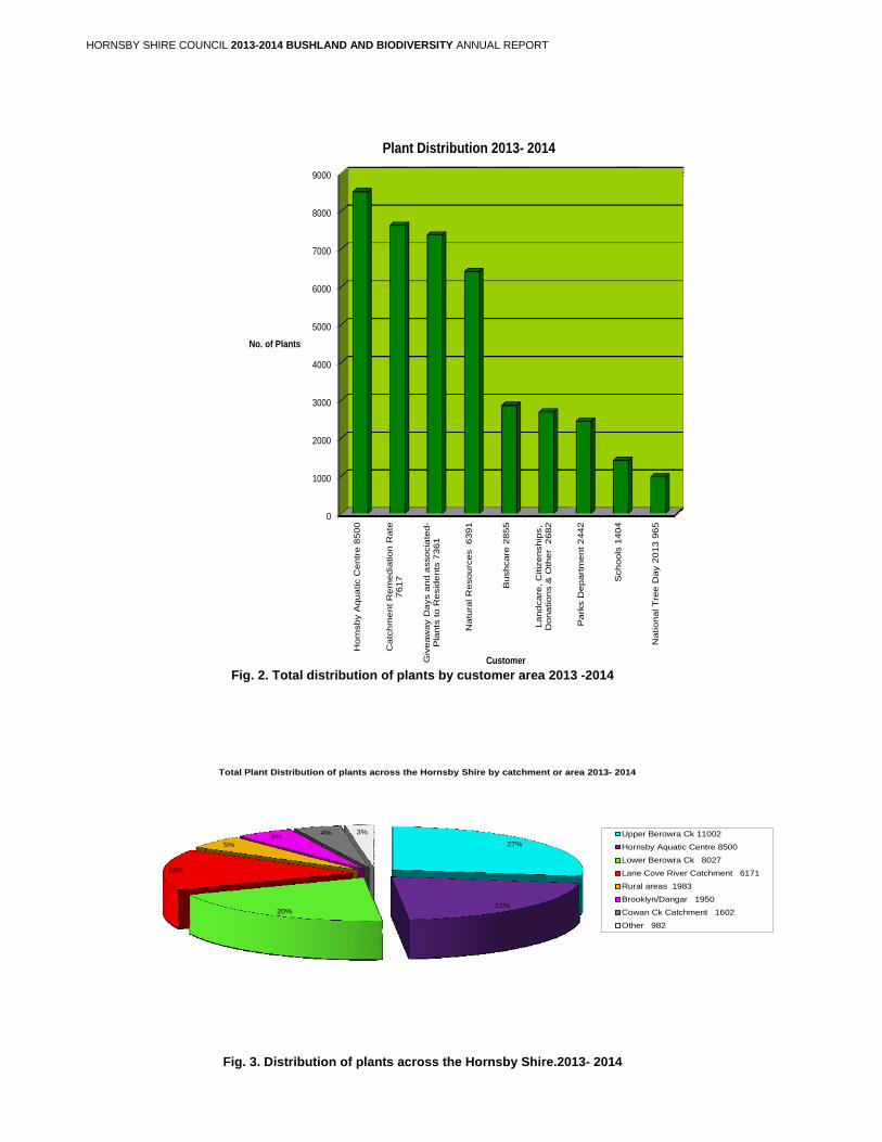
HORNSBY SHIRE COUNCIL 2013-2014 BUSHLAND AND BIODIVERSITY ANNUAL REPORT
0
1000
2000
3000
4000
5000
6000
7000
8000
9000
Horn
sby A
qua
tic C
entr
e 8
50
0
Catc
hm
ent R
em
edia
tion R
ate
7617
Giv
eaw
ay D
ays a
nd
asso
cia
ted-
Pla
nts
to R
esid
ents
7361
Natu
ral R
esourc
es 6391
Bu
shcare
2855
Land
ca
re, C
itiz
enship
s,
Donations &
Oth
er
2682
Pa
rks D
epart
ment
2442
Sch
ools
1404
National T
ree
Day 2
013 9
65
No. of Plants
Customer
Plant Distribution 2013- 2014
Fig. 2. Total distribution of plants by customer area 2013 -2014
27%
21%20%
15%
5%5%
4% 3%
Total Plant Distribution of plants across the Hornsby Shire by catchment or area 2013- 2014
Upper Berowra Ck 11002
Hornsby Aquatic Centre 8500
Lower Berowra Ck 8027
Lane Cove River Catchment 6171
Rural areas 1983
Brooklyn/Dangar 1950
Cowan Ck Catchment 1602
Other 982
Fig. 3. Distribution of plants across the Hornsby Shire.2013- 2014
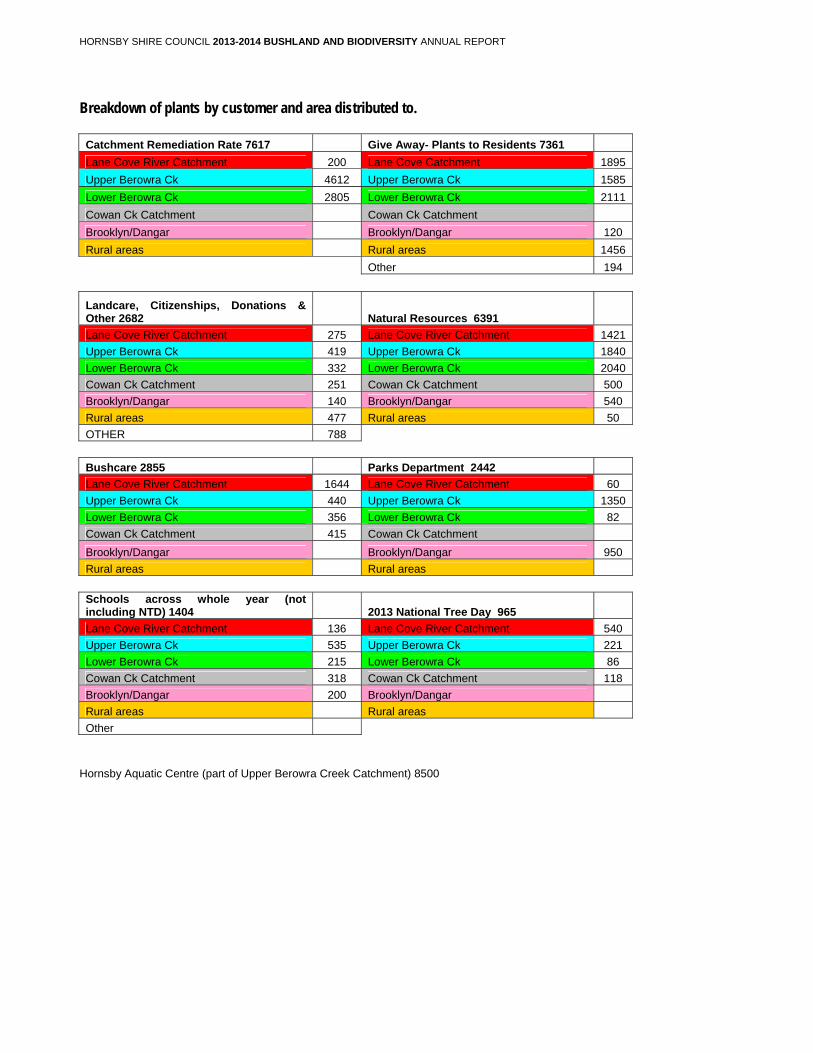
HORNSBY SHIRE COUNCIL 2013-2014 BUSHLAND AND BIODIVERSITY ANNUAL REPORT
Breakdown of plants by customer and area distributed to.
Catchment Remediation Rate 7617 Give Away- Plants to Residents 7361
Lane Cove River Catchment 200 Lane Cove Catchment 1895
Upper Berowra Ck 4612 Upper Berowra Ck 1585
Lower Berowra Ck 2805 Lower Berowra Ck 2111
Cowan Ck Catchment Cowan Ck Catchment
Brooklyn/Dangar Brooklyn/Dangar 120
Rural areas Rural areas 1456
Other 194
Landcare, Citizenships, Donations & Other 2682 Natural Resources 6391
Lane Cove River Catchment 275 Lane Cove River Catchment 1421
Upper Berowra Ck 419 Upper Berowra Ck 1840
Lower Berowra Ck 332 Lower Berowra Ck 2040
Cowan Ck Catchment 251 Cowan Ck Catchment 500
Brooklyn/Dangar 140 Brooklyn/Dangar 540
Rural areas 477 Rural areas 50
OTHER 788
Bushcare 2855 Parks Department 2442
Lane Cove River Catchment 1644 Lane Cove River Catchment 60
Upper Berowra Ck 440 Upper Berowra Ck 1350
Lower Berowra Ck 356 Lower Berowra Ck 82
Cowan Ck Catchment 415 Cowan Ck Catchment
Brooklyn/Dangar Brooklyn/Dangar 950
Rural areas Rural areas
Schools across whole year (not including NTD) 1404 2013 National Tree Day 965
Lane Cove River Catchment 136 Lane Cove River Catchment 540
Upper Berowra Ck 535 Upper Berowra Ck 221
Lower Berowra Ck 215 Lower Berowra Ck 86
Cowan Ck Catchment 318 Cowan Ck Catchment 118
Brooklyn/Dangar 200 Brooklyn/Dangar
Rural areas Rural areas
Other
Hornsby Aquatic Centre (part of Upper Berowra Creek Catchment) 8500
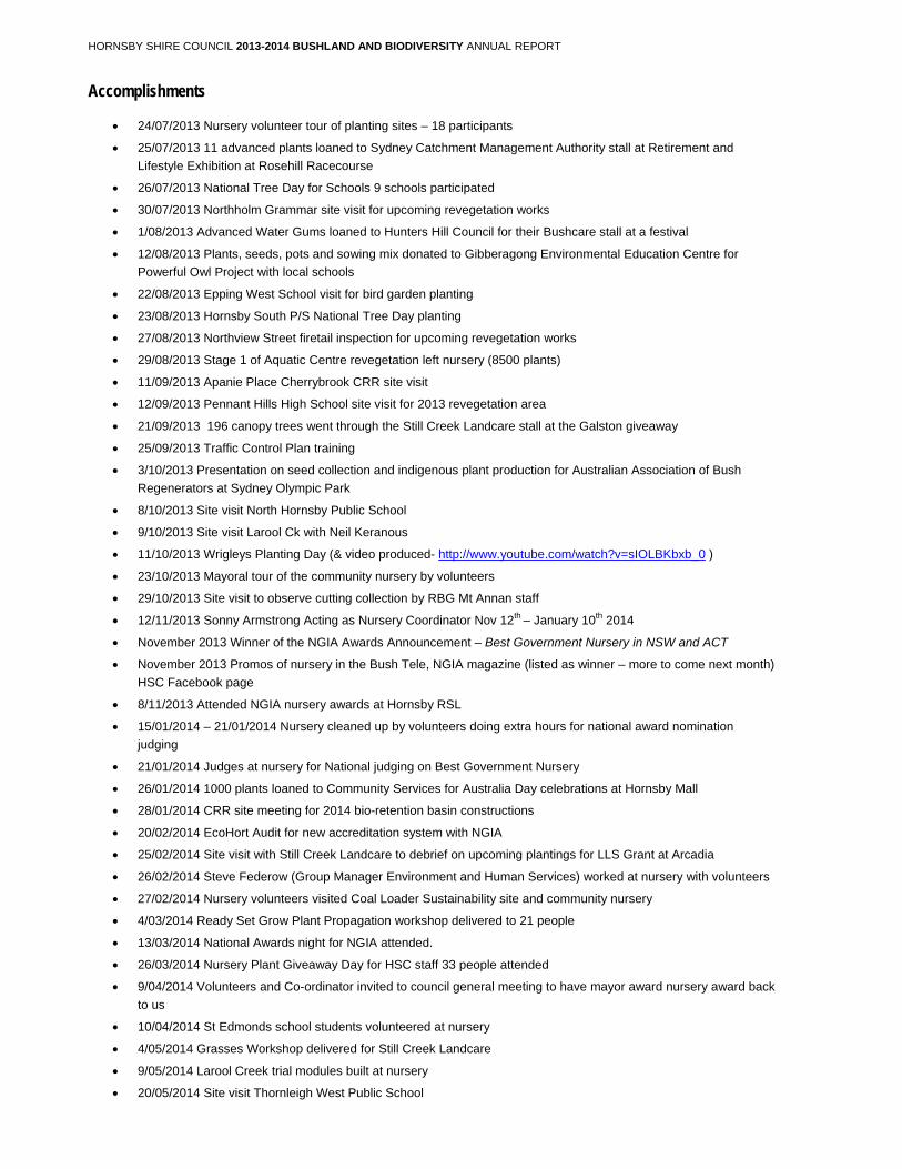
HORNSBY SHIRE COUNCIL 2013-2014 BUSHLAND AND BIODIVERSITY ANNUAL REPORT
Accomplishments
24/07/2013 Nursery volunteer tour of planting sites – 18 participants
25/07/2013 11 advanced plants loaned to Sydney Catchment Management Authority stall at Retirement and
Lifestyle Exhibition at Rosehill Racecourse
26/07/2013 National Tree Day for Schools 9 schools participated
30/07/2013 Northholm Grammar site visit for upcoming revegetation works
1/08/2013 Advanced Water Gums loaned to Hunters Hill Council for their Bushcare stall at a festival
12/08/2013 Plants, seeds, pots and sowing mix donated to Gibberagong Environmental Education Centre for
Powerful Owl Project with local schools
22/08/2013 Epping West School visit for bird garden planting
23/08/2013 Hornsby South P/S National Tree Day planting
27/08/2013 Northview Street firetail inspection for upcoming revegetation works
29/08/2013 Stage 1 of Aquatic Centre revegetation left nursery (8500 plants)
11/09/2013 Apanie Place Cherrybrook CRR site visit
12/09/2013 Pennant Hills High School site visit for 2013 revegetation area
21/09/2013 196 canopy trees went through the Still Creek Landcare stall at the Galston giveaway
25/09/2013 Traffic Control Plan training
3/10/2013 Presentation on seed collection and indigenous plant production for Australian Association of Bush
Regenerators at Sydney Olympic Park
8/10/2013 Site visit North Hornsby Public School
9/10/2013 Site visit Larool Ck with Neil Keranous
11/10/2013 Wrigleys Planting Day (& video produced- http://www.youtube.com/watch?v=sIOLBKbxb_0 )
23/10/2013 Mayoral tour of the community nursery by volunteers
29/10/2013 Site visit to observe cutting collection by RBG Mt Annan staff
12/11/2013 Sonny Armstrong Acting as Nursery Coordinator Nov 12th – January 10th 2014
November 2013 Winner of the NGIA Awards Announcement – Best Government Nursery in NSW and ACT
November 2013 Promos of nursery in the Bush Tele, NGIA magazine (listed as winner – more to come next month)
HSC Facebook page
8/11/2013 Attended NGIA nursery awards at Hornsby RSL
15/01/2014 – 21/01/2014 Nursery cleaned up by volunteers doing extra hours for national award nomination
judging
21/01/2014 Judges at nursery for National judging on Best Government Nursery
26/01/2014 1000 plants loaned to Community Services for Australia Day celebrations at Hornsby Mall
28/01/2014 CRR site meeting for 2014 bio-retention basin constructions
20/02/2014 EcoHort Audit for new accreditation system with NGIA
25/02/2014 Site visit with Still Creek Landcare to debrief on upcoming plantings for LLS Grant at Arcadia
26/02/2014 Steve Federow (Group Manager Environment and Human Services) worked at nursery with volunteers
27/02/2014 Nursery volunteers visited Coal Loader Sustainability site and community nursery
4/03/2014 Ready Set Grow Plant Propagation workshop delivered to 21 people
13/03/2014 National Awards night for NGIA attended.
26/03/2014 Nursery Plant Giveaway Day for HSC staff 33 people attended
9/04/2014 Volunteers and Co-ordinator invited to council general meeting to have mayor award nursery award back
to us
10/04/2014 St Edmonds school students volunteered at nursery
4/05/2014 Grasses Workshop delivered for Still Creek Landcare
9/05/2014 Larool Creek trial modules built at nursery
20/05/2014 Site visit Thornleigh West Public School
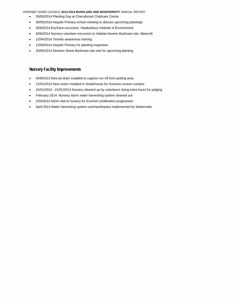
HORNSBY SHIRE COUNCIL 2013-2014 BUSHLAND AND BIODIVERSITY ANNUAL REPORT
29/05/2014 Planting Day at Cherrybrook Childcare Centre
30/05/2014 Asquith Primary school meeting to discuss upcoming plantings
3/06/2014 EucFace excursion- Hawkesbury Institute of Environment
4/06/2014 Nursery volunteer excursion to Habitat Havens Bushcare site- Beecroft
12/04/2014 Termite awareness training
13/06/2014 Asquith Primary for planting inspection
20/06/2014 Denison Street Bushcare site visit for upcoming planting
Nursery Facility Improvements
4/09/2013 New pit drain installed to capture run off from potting area
12/01/2014 New motor installed in shadehouse for Svensen screen curtains
15/01/2014 - 21/01/2014 Nursery cleaned up by volunteers doing extra hours for judging
February 2014 Nursery storm water harvesting system cleaned out
1/04/2014 NGIA visit to nursery for EcoHort certification progression
April 2014 Water harvesting system overhaul/repairs implemented by Watermatic