Embed Size (px)
DESCRIPTION
Description of the Burlington Bay Horse Ferry shipwreck
Citation preview

By Ghislaine

•Lone Rock Point is near Shelburne Bay
•The latitude/longitude of Lake Champlain is 44 degrees north and 73 degrees west
E
N
W
S
•The Horse Ferry wrecked at Lone Rock Point, Lake Champlain, Vt.
•It was discovered in the fall of 1983 by a side-scan sonar.
•Another name for the Horse Ferry is The “Eagle”
•The Horse Ferry was powered by 2 horses walking in place on a disk that spun and powered the boat

Lake Champlain
Google Earth satellite image

•The mast holds the sail and rigging but the horse ferry didn’t have a sail.
•The horse ferry does have rudders, however. Rudders help steer boats. The 2 horses would power the boat.
•The hull is the body of a boat.
Planking
Rudders
Deck
Beam
Keel
Bow
stern
Port (left side)
Starboard (right side)
The Depth was 50 ft.
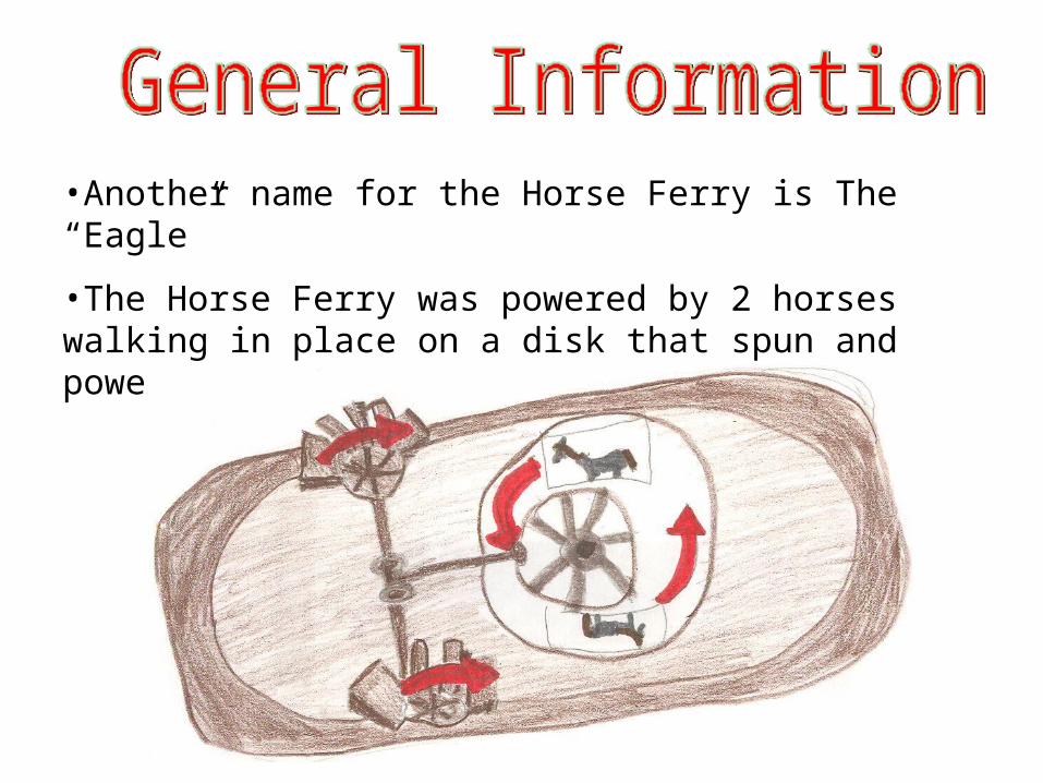
Ferries transported goods from one place to another. They also transported people who needed to travel across one part of the lake to another. The horse ferry cost $10,000.00 to own, including the 2 horses. They were introduced to North America in 1814. They were less expensive than other boats.
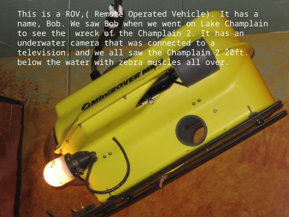
This is a ROV,( Remote Operated Vehicle). It has a name, Bob. We saw Bob when we went on Lake Champlain to see the wreck of the Champlain 2. It has an underwater camera that was connected to a television. and we all saw the Champlain 2 20ft. below the water with zebra muscles all over.

Some people believe that the Burlington Bay Horse Ferry sunk in a bad storm. Others believe that the ferry crashed into chunks of ice in the freezing waters of Lake Champlain.